Pace: Leisurely – 3 km/hr. or less Terrain: Moderate – Some hills and/or some poor footing Distance: 7.5
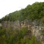
Description Griersville to Webwood Falls: Erratic boulders at Stop 4 (Page 109) Glacial erratics are rocks picked up by glaciers and transported great distances to be left behind as the glacier melts. These erratic boulders are 1 billion years older than the local sedimentary bedrock, and originally came from the Canadian Shield.
Hosting Club: Dufferin Hi-Land Category: General Hike Location (Google Maps): Prince of Wales Road and Sideroad 15 (west of Kilgorie). Please note the River Road bridge over the Pine River may still be closed. Please adjust your route accordingly. GPS coordinates below.
Pace: Medium Terrain: Dependent on Conditions, Moderate Distance: 3.5km and 7.5 km options
Description Please join us for a ribbon cutting ceremony to celebrate the opening of the Dufferin Hi-Land club’s new Pine River Nature Reserve parking lot then join us for a hike of two loops. The first loop is 3.5 kms. The second is 4.0 kms. Second loop is optional. Please bring 1.5L of water, a snack and smile. Hiking boots mandatory. Gonna be fun.
Description This hike is a there-and-back walk. We begin on the edge of the Beaver Valley and then head towards a beaver pond. A walk along the edge of fields takes us into a wood lot, then to the Young Wetland. Birds are often sighted on the water. From there, we stroll the rest of the BTC-managed Young property to Sideroad 19, seeing fields regenerating towards a natural state. We walk back to the parking area, where we can enjoy a panoramic view into the Beaver Valley.
Guidelines
Arrive 15 minutes before the start of the hike.
Wear sturdy footwear and appropriate attire for the weather and the terrain. Hiking poles are a good idea in any season, especially if the terrain is rocky or slippery. In winter, snowshoes or icers/crampons are needed when conditions dictate. Wearing appropriate clothing and footwear prevents injuries and shows consideration for a safe and positive group hiking experience.
Always carry I.D. and your health card.
Bring sufficient water and snacks (or lunch if indicated). A minimum of 1L of water is recommended on all hikes, and 3L is recommended for long, challenging hikes in the heat of the summer.
Bring sunscreen and insect repellent (for spring and summer hikes).
Pace: Medium – 3 to 4 km/hr Terrain: Strenuous – Hilly with steep climbs and some poor footing Distance: 7.5 km
Description We will walk, following city streets, to the Tews Falls Side trail. We will ascend the escarpment and onwards to view Tews Falls. We will then return with a stop at the Dundas Peak Viewpoint and retrace our steps back to the Dundas Driving Park. Bring water, sunscreen, bug repellant and a snack. Hiking poles recommended. Please arrive at the car park by 9:45 am in order to be walking by 10:00 am. I will send contact info a day or two before the hike with contact info should you need to cancel after 4:00 pm on Tuesday September 30. I will inform you if the hike is cancelled due to rain. Please check your email the evening before the hike.
Hosting Club: Sydenham Category: An evening walk. Location (Google Maps): Meet in the municipal parking lot by the river on the west side of 1st Ave E between 7th St E and 8th St E in Owen Sound
Pace: Brisk: 4 to 5 km/h Terrain: Moderate: Some hills and/or poor footing Distance: Approx 6 km
Description Join us for a brisk evening hike exploring Owen Sound paths and neighbourhoods, followed by an opportunity to socialize over refreshments. There is no need to show up 15 minutes early for this hike, but we will leave prmptly at 7:00 pm.
Description This will be our permanent Thursday Location until Bridge repairs complete. From Cave Spring Conservation Area explore the trail network on the escarpment towards Kinsman Park and Moyer Road.
You must register for each hike. Bring Poles, snack bug spray, sunscreen and a drink. Dress for the weather
Location (Google Maps): Parking lot is off Sycamore Drive East of Bayview , across Starbucks plaza Bus 91 from Finch east station stops at Sycamore station.
Pace: Moderate (3-4 km/hr) Terrain: Hilly, Level 2 (Intermediate – some hills and uneven surfaces, rocks and roots underfoot), Variable Distance: 7-8 km
Description We will explore Valleyview and Maple View parks, and walk along German Mill Creak, in return we stop in Huntington park and have snack under beautiful shed ,
Even it is considered Urban walk, it is urban hike as we have some up and down hills and tree roots, please bring your hiking poles, water and snacks,
Pace: Moderate (3-4 km/hr) Terrain: Hilly, Level 2 (Intermediate – some hills and uneven surfaces, rocks and roots underfoot), Rocky, Variable Distance: 13 -15km
Description I continue Greg Vincent’s legacy of weekends away. Please join me, Jeanette Vincent, as we explore the Tip o’ the Bruce, Tobermory in the Fall. The beauty of this area of the Bruce Peninsula every season is wonderful! We will take in a number of walks using side trails and the Bruce Trail. Approximately 13-15km/day. We stay and have our meals at a comfortable hotel overlooking Little Tub Harbour. This outing is restricted to those staying with us at the Princess Hotel in Tobermory for the weekend – the hotel fills quickly. You will need a car to access this outing. Please contact the Princess Hotel for a reservation.1-519-596-8282 or info@tobermoryprincesshotel.com and mention Vincent/Royle Fall weekend.
Before registering at the hotel please contact us for the price package for accommodations and more details.
Description Each Friday we will explore different neighbourhoods, trails and parkland throughout Historic Niagara-on-the-Lake.
Moderate pace with some weeks entirely on sidewalks and roads while others may include a mix of trails and paved pathways. Great way to build up endurance for longer more strenuous hikes.
Prepare for cooler windy conditions on open parkland and along Lake Ontario and Niagara River trails.
Plan to stay for conversation and a warm cup of coffee or tea at Sweets & Swirls, Community Centre, Niagara Stone Road, NOTL
Hosting Club: Sydenham Category: Health & Nature Hike Location (Google Maps): Harrison Park – NW of km 89.0. Beside the resturant but closer to the bridge
Pace: Medium: 3 to 4 km/h Terrain: Moderate: Some hills and/or poor footing Distance: Approx 10 km
Description We will meet at Harrison Park in Owen Sound and car shuttle to the the Visitor’s Information Centre at the harbor. We will leave the park at 9:15 so please arrive early.
The salmon’s journey – and ours – will start at the harbor then continue through the River District to the fish ladder where we will see the salmon leaping and thrashing there way to the top of the mill dam. We will follow the salmon to Harrison Park and then continue to the Grey Sauble Conservation where we will learn more about their migration and observe them in shallow spawning channels. We will continue to Inglis Falls where we will have a great look-out point to observe the fall colors and then head back to Harrison Park via the main trail and the Harrison Park Side Trail. Once back at the park, for those that are interested, we will stop for lunch at the Inn.
This route follows sidewalks, dirt walkways and paved trails on route to the Bruce Trail near Harrison Park. From there, we will take the Trail to the Grey Sauble Conservation, Inglis Falls and then back to Harrison Park.
Hosting Club: Iroquoia Category: General Hike Location (Google Maps): Meet in the main parking lot at Mount Nemo at 9:15 am. Reserve your time at conservationhalton.ca
Pace: Moderate (3-4 km/hr) Terrain: Challenging, Hilly, Level 2 (Intermediate – some hills and uneven surfaces, rocks and roots underfoot), Rocky Distance: Moderate group: about 12 km, Fast group: about 15 km
Description Join us for a fantastic fall hike on the Bruce Trail in the Owen Sound area. We will split into two groups; the moderate group will hike about 12 km (3 km/hr pace) , fast group will hike around 15 km (4 km/hr pace). Long time TBTC member and now Owen Sound resident Melanie Bissett will join us. Immerse yourself in Ontario’s fall colours, discover amazing geological formations, and enjoy views of beautiful Inglis Falls, the Sydenham River, and possibly Jones Falls. We will also pass lookouts overlooking Owen Sound and Georgian Bay. Both routes will include some hilly and challenging sections with rocks, roots and crevices underfoot. Refreshment stop in Owen Sound after the hike.
Departure 1: 7:30 AM, 10 York Mills Rd
Departure 2: 7:50 AM, GO bus stop at HWY 400 and Major Mackenzie Dr Park and Ride
If you would like to be picked up at HWY 400 and Major Mackenzie Dr, please select that option when you register. The bus will not stop there if no one requests that stop.
Pace: Brisk – 4 to 5 km/hr, Fast – 5+ km/hr Terrain: Strenuous – Hilly with steep climbs and some poor footing Distance: 23 km
Description The 9th annual Steeltown Stomp event is a challenging and rewarding self-guided hike and stair climb along the escarpment in Hamilton. You will hike approximately 23 kms, and climb more than 2,000 stairs along the Bruce Trail, the Escarpment Rail Trail, and the Chedoke Radial Trail. As you follow the specially blazed route you will encounter and climb the 7 sets of stairs along the Hamilton Escarpment. The route will be clearly marked with special yellow blazes, and staircases will have clear instruction signs posted. The route will be available on the AllTrails app, and printed maps are available at the starting point for those who would like one. You will find snacks and encouragement at the turnaround checkpoint at the Chedoke stairs, and then will return to the starting point to collect your coveted Steeltown Stomp badge, enjoy more snacks, and experience a great sense of accomplishment!
Please Note: This is an arduous hike and requires a high level of fitness due to the stair climbing required.
Fee: $35 fee includes checkpoint and finish zone snacks, your badge, and will support the Bruce Trail Conservancy in its mission to preserve a ribbon of wilderness, for everyone, forever.
Check in: At the registration booth set up at the north end of the parking lot of the Mohawk 4 Ice Centre. We have set up staggered start times. Please select 8:00, 8:15, 8:30, or 8:45 when you register and you will start the hike as you are checked in. This is not a race, and you will not be timed.
Checkpoints: Start and end at the Mohawk 4 Ice Centre. There is a turnaround checkpoint at the Chedoke Golf Course, and then you will hike directly back to the starting point. You are not expected to complete the stairs on the return trip.
Route: Follow the yellow blazes! Special yellow blazes will be set up to mark the route. In addition, the route has been set up on the AllTrails app. If you have this downloaded on your phone, you can follow the route using the app.
What to bring: Bring your own water. You will be able to refill your own water bottles at public water fountains along the route. Snacks will be provided, but you may wish to bring additional food for a lunch break. Wear comfortable, sturdy shoes (hiking boots are not necessary), and dress for the weather. Protect yourself from insects and sun.
Safety Precautions: Normal hiker etiquette and safety precautions apply…https://brucetrail.org/explore-the-trail/#Bruce-Trail-101
Donations: If you are interested in contributing further to the BTC, please click here.
FAQ’s:
What if it rains? This is a rain or shine event.
What if I need to drop out? As we are in an urban area, there are places to meet a taxi or a ride along the way. This must be arranged by you, the participant. If you have to drop out during the event, please let us know by calling or texting the contact number below.
How long will it take to finish? We estimate that the hike will take between 3 and 5 hours.
Are dogs allowed? No. The stairs will be too crowded during this event.
Contact: Leslie Ho at iroquoiasteeltownstomp@gmail.com. On event day, you can text event organizers 289-237-8059.
Hosting Club: Dufferin Hi-Land Category: General Hike Location (Google Maps): Meet at Map 20 KM18.7 at the dead end of Centre Road (just south of 5 Sideroad, Mulmur)
Pace: Medium Terrain: Dependent on Conditions, Moderate Distance: 7 kms
Description We will hike about 7 km on side trails in the Boyne Valley Provincial Park. Visiting Murphy’s Pinnacle gives us a viewpoint over the Boyne River Valley with the towers of Toronto visible on a clear day. The Pinnacle is a glacial age sand and gravel kame; we will learn what a kame is and how to make one! A professional geologist will explain how the rolling hills of Mulmur formed and what it means for forest growth. In October, we might be able to enjoy the artistry of fall colours.
Hosting Club: Sydenham Category: Geology Hike Location (Google Maps): Meet and park roadside where Cole’s Sideroad meets Taylor Sideroad, just north of Concession 20. Coles Sideroad is accessed via Concession 20, between Wolseley (Grey Road 17) and Kemble. We will carpool to trailhead. Linear Hike.
Pace: Leisurely: 3 km/h or less Terrain: Easy: Mostly flat and good footing., Moderate: Some hills and/or poor footing, Strenuous: Hilly with steep climbs and some poor footing. Distance: approx 6.3 km
Description On this linear hike you will enjoy the views from the heights of Kemble Mountain, starting at the trailhead parking near Edmonstone Side Trail and heading west on the main trail to Mystery Cabin Side Trail and Don Richards Side Trail back to the cars. We will be encountering deep crevices, springs, fossils and beautiful mature forests that may be showing colour at this time of year. Please bring water, snacks and poles as needed. The hike leader will have copies of Beth Gilhespy’s Sydenham geology book for sale (cash, cheque or e-transfer $37.00 BT members. “Walking Through Time Exploring Niagara Escarpment Geology.” Sydenham Bruce Trail Geology Badge has been developed. Details can be shared from hike leader during the hike.
Hosting Club: Toronto Category: Urban Walk Location (Google Maps): Meet the hike leaders in Tiffany Commons in front of the watershed wall at the Evergreen Brickworks (across from the cafe). To reach the Evergreen Brickworks you may take the free shuttle from outside Broadview Subway Station (departs every 30 minutes from 7:45 am until 9:45 (driver takes scheduled break at 10:15) or TTC Route #28 Bayview South from Davisville Subway Station (every 30 minutes)
Pace: Leisurely (2-3 km/hr) Terrain: Level 1 (Easy – mostly on flat, well maintained trails with hard-packed surface), Variable Distance: 5 km
Description The public is invited to join us for a short introductory hike from the Evergreen Brickworks as part of our Bruce Trail Day activities. The club will have a booth staffed with volunteers providing information about the Bruce Trail and the Toronto Bruce Trail Club. On Sunday there will be a Hiking 101 Workshop (see the seperate entry on the hike schedule). Our hike will explore the wetlands, woodlands, and natural meadows of the Evergreen Brickworks, ascend into the beautiful Moore Park Ravine and return to the Evergreen Brickworks via the scenic outlook overlooking the Evergreen Brickworks and adacent ravines. A wonderful opportunity to enjoy the fall colours, the Evergreen farmers market, and learn about the Toronto Bruce Trail Club’s year round hiking program and conservation work. Preregistration on the hike schedule is not required – just arrive 15 minutes prior to the hike to sign up with the hike leaders.
Hosting Club: Toronto Category: Urban Walk Location (Google Maps):
Meet the hike leaders in Tiffany Commons in front of the watershed wall at the Evergreen Brickworks (across from the cafe). To reach the Evergreen Brickworks you may take the free shuttle from outside Broadview Subway Station (departs every 30 minutes from 7:45 am until 9:45 (driver takes scheduled break at 10:15) or TTC Route #28 Bayview South from Davisville Subway Station (every 30 minutes)
Pace: Leisurely (2-3 km/hr) Terrain: Flat, Level 1 (Easy – mostly on flat, well maintained trails with hard-packed surface) Distance: 6 km
Description The public is invited to join us for a short introductory hike from the Evergreen Brickworks as part of our Bruce Trail Day activities. The club will have a booth staffed with volunteers providing information about the Bruce Trail and the Toronto Bruce Trail Club. On Sunday there will be a Hiking 101 Workshop (see the seperate entry on the hike schedule). Our hike will proceed from the Evergreen Brickworks southbound into the ravine trails and northwards past Milkman’s Lane into Park Drive Reservation. We will continue to Mount Pleasant Road and return to the Evergreen Brickworks with the option to turn back earlier at the Glen Road Bridge. This will be a wonderful opportunity to enjoy the fall colours, the Evergreen farmers market, and learn about the Toronto Bruce Trail Club’s year round hiking program and conservation work. Preregistration on the hike schedule is not required – just arrive 15 minutes prior to the hike to sign up with the hike leaders.
Hosting Club: Toronto Category: Car Hike Location (Google Maps): Bruce Trail parking lot at County Rd 19 (Prince of Wales Rd) 80 meters south of the southern end of the Prince of Wales Side Trail.
Pace: Moderate (3-4 km/hr) Terrain: Flat, Hilly, Level 2 (Intermediate – some hills and uneven surfaces, rocks and roots underfoot), Rocky, Variable Distance: 14-15 K
Description We’ll start on the Primrose Side Trail and enter the Boyne Valley to reach Murphy’s Pinnacle. From there, we’ll continue towards the Boyne Creek Side Trail and then loop back.
Pace: Leisurely (2.0 – 3.0 km/h): A relaxed pace with frequent breaks and a focus on enjoyment., Medium (3.0 – 4.5 km/h): A comfortable pace for most hikers with steady progress. Terrain: Difficult: Steep ascents/descents, rocky scrambling, and some rugged escarpment paths., Easy: Flat forested sections or lowland trails., Moderate: Rolling hills, mild slopes and rocky paths. Distance: 9.5 km
Description Everyone’s invited to join us in celebrating Bruce Trail Day with the Big Loop Bruce Trail Hike where we’ll hike the Boundary Bluff and Hart’s Tongue side trails as well as some of Sydney Bay’s main trail through Neyaashiinigmiing. We’ll meander through the rich green woods and along steep, rocky talus slope interspersed with extraordinary vistas overlooking Sydney Bay and scenic views of the Bluffs from below.
This hike is for those looking for a more challenging trek in duration, distance and difficulty. Bring lots of water and a snack or light lunch as we’ll be out for ~4 hours. Hiking boots and trekking poles are advised due to rocky, uneven, and sometimes-slippery terrain. This hike will run rain or shine.
Bruce Trail Day is an annual event celebrating Canada’s longest and oldest marked footpath. Join us to learn more about what we are doing to preserve this beautiful ribbon of wilderness in Southern Ontario. We’ll be gathering at the Pavilion at Cape Croker Park after the hike for an informal gathering to warm up by the fire, enjoy some light refreshments, children’s games, learn about the Bruce Trail and meet new and old friends.
Hosting Club: Niagara Category: Bus Location (Google Maps): Pick up location 1 – 8:45 am: Bridges Niagara, 85 Church Street, St. Catharines, Ontario, Canada, L2R 3C7 Pick up location 2 – 9:15 am: Victoria Avenue Library, 4848 Victoria Ave, Niagara Falls, L2E 4C5 Pick up location 3 – 9:30 am: MacBain Community Centre, 7150 Montrose Road, Niagara Falls, L2H 3N3
Description This Bruce Trail Day, we have limited spots available in a chartered bus for those unable to drive to Niagara College.
The bus has been generously supported by the GreenBelt Foundation in hope that we can make this wonderful event more accessible to community members.
The bus will make three stops, and if you register here you can board at any location. You must register in advance to ensure space on the bus – if you are bringing friends or family please register for each person.
Please note the following pick up times as the bus will adhere to the schedule on time as follows:
Pick up location 1 – 8:45 am: Bridges Niagara, 85 Church Street, St. Catharines, Ontario, Canada, L2R 3C7 Pick up location 2 – 9:15 am: Victoria Avenue Library, 4848 Victoria Ave, Niagara Falls, L2E 4C5 Pick up location 3 – 9:30 am: MacBain Community Centre, 7150 Montrose Road, Niagara Falls, L2H 3N3
The bus will take you to Niagara College and you can choose from any of the 10 am hikes on the schedule or just hang out at the information fair highlighting Niagara Bruce Trail activities and community partners including Bridges Niagara, PFLAG Niagara, the Peninsula Field Naturalists, Niagara Geopark, and NBTC volunteers sharing about how to get started hiking through our Hiking 101 as well as highlighting the amazing work done to maintain the trail in Niagara.
The bus will then go back to each location, departing Niagara College at 12:15, arriving back approximately as follows:
Hosting Club: Caledon Hills Category: Nature Walks Location (Google Maps): This loop hike departs from Riverside Woods, 713377 First Line, EHS, Mono. (BTC Ref Guide Map 18). From Highway 10, take Hockley Valley Rd. east. Turn right on to the 5 Side Road, go past the Fairground, and then left or north on the First Line to the parking lot. (Do NOT attempt to drive south on the First Line directly from the Hockley Valley Rd. – it is not safely passable.)
Pace: Leisurely – 3 km/hour or less Terrain: Moderate – some hills and/or some poor footing Distance: 4.2 km
Description This Forest Bathing hike is part of Bruce Trail Day activities, organized by the Caledon Hills Bruce Trail Club. We will be the first hike of the day, as we quietly head into the forest to absorb the sights & sounds of nature. Hike leader will share info on forest bathing and also some local history.
Pace: Leisurely: 3 km/h or less Terrain: Moderate: Some hills and/or poor footing Distance: 4km
Description Join us on this Discovery Hike from GSCA to Inglis Falls and back – we’ll take our time, and see what we can find. We’ll cross the Sydenham River, hike through forests, climb the Escarpment, check out geological potholes and take a peek at Inglis Falls, returning via mostly the same route. Free ‘Boots on the Trail’ badges are available to youth 18 and under. This is also a great route to choose for the By the Seasons badge.
As we’ll be taking our time, this hike is suitable for families, new hikers, and anyone wanting a more leisurely hike. All ages are welcome. We’ll likely take a couple of hours (possibly more), depending on the group and conditions – dress in layers, bring a snack, and wear good footwear. Given that October conditions can be variable, an email re: trail conditions to expect will be sent out prior to our hike together. The trail may be mucky in portions.
If you are unable to register, please contact the hike leader via the link above. Carpooling may be available upon request.
Pace: Fast – 5+ km/hr Terrain: Moderate – Some hills and/or some poor footing Distance: 10km with option to go further
Description Connect with us & like minded folks on Bruce Trail day for a fun and inclusive trail run to Smokey Hollow & back. This will be for all types and paces of trail runners, lead by Kristy & Phil. You will need running shoes, a handheld water bottle or running vest with whatever you need for a 1.5-2hr run. Dress in comfortable running clothes appropriate for the weather – we will go rain or shine : ) No one will get left behind, but the expectation is that you have run before, understand what you’re signing up for and be physically capable to complete the route. There are some uphill sections, and while a lot of this route is flat, there are rocks and roots to be watchful of. Arrive with time to join the group and get started by 9am. We’ll run at a group pace, meeting at the Cityview park south entrance parking lot – The run will begin on the Cityview Side Trail, continuing right onto the Main trail where we will follow the white blazes to the Smokey Hollow Side Trail to take a quick break for the group to gather and take in the rushing water & gorgeous views of Great Falls on the Grindstone creek. We’ll turn around and head back towards Cityview Park with a detour back through the King Side Trail to the main trail where you can head back to the Bruce Trail day info booths, or continue on for a little bit longer with a loop of the Ian Reid side trail or explore the Kerncliff Park Side Trail and boardwalk.
Pace: Medium Terrain: Some rocky footing, Some steep sections Length of Hike: 19.4 km, 21.3 km and 14.8 km
Description Stained Glass Badges over 3 years. 2025 hikes – series #2 – Dufferin section in 3 hikes.
These hikes will proceed at a moderate pace (4 km per hr not including a midday lunch stop of about 25 min). Short breaks will be taken throughout the hikes as appropriate. Except for shuttles, participants are expected to be self reliant. Please bring plenty of water, snacks, lunch, appropriate footwear and clothing, personal medical kit and anything else you might need.
All participants will be expected to do their share of shuttle driving. Shuttle drivers should not expect compensation for doing a shuttle. Shuttle drivers will be selected by the hike leader at the start of each hike. As parking is limited, participants should car pool to the meeting point if possible.
I’m just a volunteer at this and do not have a current first aid certification. There is no guarantee that there will be anyone with such credentials on the hikes. In addition to the waiver signed at registration, participants will be required to sign a waiver in favour of myself at the start of the hikes.
Hikes will proceed rain or shine. Hike plan attached. If there are any questions, please do not hesitate to contact me.
Niagara College Garden Nursery, Taylor Road, Niagara-on-the-lake (near the Outlet Collection at Niagara Mall and White Oaks Conference Resort and Spa, just off the QEW)
Description Join us on Bruce Trail Day for a longer hike in the beautiful natural environment of Niagara. The theme for Bruce Trail Day is MAKING CONNECTIONS ON THE BRUCE TRAIL This hike celebrates the unifying and connecting power of nature to bring us all together.
We will take trails around Woodend towards fireman’s Park and then enjoy light food and drinks as part of the Bruce Trail Day celebration.
This hike is suitable for experienced hikers, or anyone who wants to explore the trails at a faster pace. The terrain is a mix of relatively flat trail around the wetlands and some rocky path with some ups and downs on the Bruce Trail.
Advance registration is encouraged, but it is also possible to show up and register on-site. Please arrive 10 minutes before the scheduled hike time to check in with the hike leaders. We will meet by the Niagara college greenhouse, look for the poster that says LONGER HIKE.
Description Join us for the Fourth Annual Music Hike and Bruce Trail Day, a unique celebration where music meets nature. Musicians will be scattered throughout the scenic wilderness, serenading hikers as they explore breathtaking forest trails and lookouts.
Pace: Medium – 3 to 4 km/hr Terrain: Moderate – Some hills and/or some poor footing Distance: 8 kms
Description Starting at the top of the Caledon Hills section in the village of Mono Centre, we will hike the main trail and around the Turnbull, Springwater, Whitetail Refuge and new Third Outlier Side Trails and back along the main trail into Mono Cliffs to the Laidlaw Side Trail to the cars. Bring water and a snack as needed.
Join us on Bruce Trail Day for a Nature Hike to learn more about the nature along the Niagara Escarpment. We will be joined by Darren Platakis, from GeoParks. Helen and Darren will explore the Woodend Trails.
Hiking boots and poles are recommend as the terrain is rocky in sections.
Location (Google Maps): Meet in the Eugenia Falls Conservation Area parking lot in the centre of the village of Eugenia, turn west off County Rd. 13 onto Pellisier St. Follow the road down into the parking lot. 43.592859 -79.980456 Free parking for Bruce Trail Day.
Pace: Leisurely Terrain: Moderate, Some steep sections Length of Hike: Approx. 3 km total
Description “In Your Estimation” Hike. Hikers will be challenged to guess their completion time for an approximately 3 km hike. Exact hike route and distance will be revealed on Bruce Trail Day! The hiker with the closest guess will win a Beaver Valley Bruce Trail Prize. Hikers are asked to please refrain from checking time, pace or distance technology during the hike – all participating hikers will be timed by Club volunteers.
Pace: Medium – 3 to 4 km/hr Terrain: Moderate – Some hills and/or some poor footing Distance: 9-10 Km
Description Meet at City View Park South Lot at 09:45 am for 10:00 am start. Bring water, snacks, and sunscreen. Rain jacket in case of rain. Wear study hiking shoes/boots.
Admire the city view at the beginning. Walking/hiking through lovely wooded areas (mostly flat but some rocks and roots) following Bruce Trail’s main trail toward Waterdown. Spend a little time at the lookout over Great Falls. Turn around and walk/hike back to the parking lot. Hopefully, we can see some fall colours!
Pace: Leisurely – 3km/hr or less, Medium – 3 to 4 km/hr Terrain: Easy – Mostly flat and usually good footing, Moderate – Some hills and/or some poor footing
Description Bruce Trail Day with the Iroquoia Bruce Trail Club October 5, 2025, 10:00 am to 2:30 pm City View Park 2500 Kerns Rd, Burlington (South Entrance)
Join the Iroquoia Bruce Trail Club for a fun-filled, family-friendly event at City View Park. There will be guided hikes for adults and kids alike and lots of fun activities. The theme of this year’s event is “Connections on the Trail” and we wish to welcome anyone and everyone. Whether you’ve called the Bruce Trail ‘home’ for the last decades or are a newcomer, waiting to explore, you’re all invited! Come celebrate the Bruce Trail and learn about the beautiful surroundings we are lucky to have so close to home.
Activities include:
Guided hikes
Scavenger Hunt
Blaze Painting
Intro to Geocaching
Young hikers can earn their badge on a children’s hike
There will be some refreshments available as well. All free of charge! Attendees will also have a chance to win a copy of the latest Bruce Trail Reference Guide. Visit the Iroquoia Bruce Trail Club website at: https://www.iroquoia.on.ca/
Please register on-line and show up for the hike you’d like or register at the event. Hikers are requested to be at the event tent 15 minutes prior to the hike of their choice.
10:00 Intro to iNaturalist and Merlin with Anne A. and Kat F.: Curious about what you see and hear along the trail? This hike will offer an opportunity to learn all about the iNaturalist and Merlin apps. How to identify what you see and log your finds.
10:30 A bit about rocks – Geology Hike with Ann G.: The Niagara Escarpment is a true marvel that we are lucky to have right in our backyard. Join Ann on a hike to explore a bit of what makes up the escarpment in this area.
11:00 Family and Children’s hike with Cathie G.: Hit the trail with the littles in your family on this hike geared for the younger outdoor enthusiasts. Children can earn their Fall Junior Hiker badge while exploring this beautiful area.
11:30 Shagbark and Land Stewardship: Join Stuart, a volunteer land steward, and Land Stewardship Director Cynthia for an exploration of the newly acquired Shagbark property. This gentle hike will highlight the new property, land acquisition and donation program, land stewardship and conservation activities and volunteering.
12:00 Family and Children’s hike with Julia K.: Anyone is welcome on the family and children’s hike. Young hikers can earn their Fall Junior Hiker badge for free!
A trail run and pre-event hike will also be available but require separate registration. Please see visit the hike schedule for additional details
Join us on Bruce Trail Day for a Nature Hike to learn more about the biodiversity along the Niagara Escarpment. We will explore the trails throughout the Wetland Ridge and Woodend Trails
Hiking boots and poles are recommend as the terrain is rocky in sections.
Niagara College Garden Nursery, Taylor Road, Niagara-on-the-lake (near the Outlet Collection at Niagara Mall and White Oaks Conference Resort and Spa, just off the QEW)
Description Description: This hike is a welcoming space for 2S-LGBTQIA+ folks, friends, family and allies! Offered in collaboration with Bridges Niagara and PFLAG Niagara. Join us on Bruce Trail Day for a hike in the beautiful natural environment of Niagara. The theme for Bruce Trail Day is MAKING CONNECTIONS ON THE BRUCE TRAIL. This hike celebrates the unifying and connecting power of nature to bring us all together. We will take a hike together on trails around Niagara College/Woodend Conservation Area, and then enjoy light food and drinks and explore the information tables as part of the Bruce Trail Day celebration. The Niagara Falls bookmobile will also be on site! Hike details: This hike is suitable for anyone who wants to explore the trails at a moderate pace. The terrain is a mix of relatively flat trail around the wetlands and then we will ascend a rocky path with some ups and downs on the escarpment along the Bruce Trail. Note that it is not suitable terrain for anyone with significant mobility challenges due to rocky sections of the path and the elevation associated with crossing the escarpment – the Easy Does it Hike on the schedule for Bruce Trail Day would be a more suitable option. Children are welcome with a guardian. Important note: BTC Rainbow stickers will be available for all hikers and those hiking for the first time on the Bruce Trail can earn the special "My First Hike" badge by participating in this hike. In order to be comfortable on the hike, please: Wear comfortable, hiking shoes or boots (rocky terrain and some mud is possible) Comfortable clothing, be prepared for weather changes Carry water for drinking A hat and insect repellent Hiking poles are recommended for going up and down the escarpment on the trails Advance registration is encouraged, but it is also possible to show up and register on-site. Please arrive 10 minutes before the scheduled hike time to check in with the hike leaders. We will meet by the Niagara college greenhouse – look for the RAINBOW HIKE sign when you arrive.
Note: Free bus transportation may be available for those who need it with central pick up locations in St. Catharines or Niagara Falls. Please contact the hike leader for details if you want to take the chartered bus to and from Bruce Trail Day.
Description Time: 10am to 11:00 am. It’s approximately one hour, 3 km hike. Gentle hikers and school aged children accompanied with an adult are very welcome. Please, wear sturdy shoes for our walk around the Wetland path, time permitting, we’ll walk a little on the main path. Please stay after the hike and join us with a light refreshment. We will have a displays of things to know and do on the Niagara Bruce Trail.
Pace: Leisurely Terrain: Easy Distance: Up To 1.9 Km (plus return)
Description Come and meet members of the Dufferin Hi-Land Bruce Trail Club and learn about The Bruce Trail Conservancy and the Dufferin Hi-Land section of the trail. This is a Family oriented event with activities planned for preschoolers to retirees. As a special attraction, we have arranged musical performers to entertain you while on the trail! FREE Bruce Trail Guide Books to the first 40 visitors. Free parking available. Please visit www.dufferinbrucetrailclub.org for more information.
Pace: Moderate (3-4 km/hr) Terrain: Level 1 (Easy – mostly on flat, well maintained trails with hard-packed surface), Variable Distance: 8-10 km
Description Join us for a short hike through Mono Cliffs PP to observe the fall colours which should be in full bloom. We will be following part of the main trail and side trails for a loop hike with one significant hill. We will stop at several viewpoints along the way.
After the hike those interested may gather at a local establishment for refreshments.
Pace: Leisurely (2.0 – 3.0 km/h): A relaxed pace with frequent breaks and a focus on enjoyment. Terrain: Easy: Flat forested sections or lowland trails., Moderate: Rolling hills, mild slopes and rocky paths. Distance: 2 km
Description On this hike, we’ll be visiting McIver Pond and exploring the nearby trails. You won’t go far today, but you will go deep … into your mind and into nature. We’ll start off the hike with gentle stretching and breathing exercises to help calm your mind and open your senses to your surroundings. Throughout the hike, we’ll enjoy frequent quiet moments together as we bring our attention to the sights, sounds, and smells of the natural world. This hike is about connecting with nature, your own mind, and your fellow hikers. Whether you are new to mindfulness or a long-time practitioner, this hike will enhance your experience of Fall’s splendour and beauty.
This hike is part of Bruce Trail Day, which celebrates connections on the Trail. This year, we’re highlighting the connections we have with nature and one other – from the people we meet along the way to those indigenous populations who have been here since time immemorial and continue to act as stewards and connect us with the land. #BruceTrailforAll
We’ll be gathering at the Pavilion at Cape Croker Park after the hike for an informal gathering to warm up by the fire, enjoy some light refreshments, children’s games, learn about the Bruce Trail and meet new and old friends.
Hosting Club: Toronto Category: TBTC Special Events Location (Google Maps): BMO Atrium, Evergreen Brickworks – In Toronto’s Don Valley on Bayview Avenue
Description Are you new to hiking or interested in getting started? Join us at the Evergreen Brickworks for a one hour session where you will learn what you need to have in your backpack for a safe and enjoyable hike, how to continue enjoying Ontario’s trails in the Winter season, how our club works to preserve biodiversity on the Niagara Escarpment, and how you can join us year round for our program of urban walks, car hikes, bus hikes, and Winter ski/snowshoe coach trips. There will be an opportunity for questions and answers after the speakers. This workshop is part of our “Hiker Initiation Program” – join us for an introductory hike on the Bruce Trail on Sunday October 19th to the Limehouse Conservation area near Georgetown featuring the Limestone kilns, stone arch bridge, and the “Hole In The Wall” on the Bruce Trail, just under an hour from Toronto. Registration for the Bus Hike is seperate from this workshop. The date of this workshop is also “Bruce Trail Day” and the Toronto Bruce Trail Club will have a booth in Tiffany Commons in the Brickworks on the Saturday and Sunday featuring displays, activities, and an opportunity to join TBTC hike leaders on a free guided hike in the Evergreen Brickworks and adjoining ravine. Registration for these hikes will be at the club’s booth in Tiffany Commons. and the schedule of hikes will be posted here at later date.
Pace: Leisurely (2.0 – 3.0 km/h): A relaxed pace with frequent breaks and a focus on enjoyment. Terrain: Easy: Flat forested sections or lowland trails. Distance: ~2 km
Description Help us celebrate Bruce Trail Day!
Caley will introduce you to the natural and cultural wonders found along Ginebek Miikaans – the Snake Trail Boardwalk. This trail winds through mixed forest, to the edges of an active beaver dam and lodge, and along the shoreline of Sydney Bay. During this exploration you will learn about the traditional plants and wildlife that play a pivotal role in the traditional and contemporary lives of the Anishinaabek people. Spend some time at our two lookouts to take in the natural beauty of Wiikwedonse (Sydney Bay) and a beaver pond teeming with life.
Weather can be unpredictable at this time of year, dress according to the conditions. Meet at the Cape Croker Park Pavilion. This hike is about 2 hours in duration.
Join us for light refreshments at the Cape Croker Park Pavilion before the hike – anytime after 12 noon. Please help us reduce waste and bring your own reusable mug, bowl and utensils.
Thank you to Cape Croker Park for waiving the parking fee for Bruce Trail Day participants.
This hike is part of Bruce Trail Day, which celebrates connections on the Trail. This year, we’re highlighting the connections we have with nature and one other – from the people we meet along the way to those indigenous populations who have been here since time immemorial and continue to act as stewards and connect us with the land.
Location (Google Maps): Meet in the Eugenia Falls Conservation Area parking lot in the centre of the village of Eugenia, turn west off County Rd. 13 onto Pellisier St. Follow the road down into the parking lot. 43.592859 -79.980456 Free parking for Bruce Trail Day.
Pace: Medium Terrain: Moderate, Some steep sections, Some rocky footing Length of Hike: Approx. 3km total
Description Join us for a short hike in and around Eugenia Falls. Great views of the falls and Cuckoo Valley! Join us for a hike in and around Eugenia Falls where, along the way, we’ll find traces of hydro-electric power projects and learn about an 1852 “gold rush”. Bring water, wear sturdy shoes or hiking boots and dress prepared for the weather. Please note that pre-registration is recommended but not necessary.
Hosting Club: Sydenham Category: Geology Hike Location (Google Maps): Harrison Park at the Bruce Trail event tent along the loop. 137 2nd Avenue East, Owen Sound, ON N4K2E5
Pace: Leisurely: 3 km/h or less Terrain: Easy: Mostly flat and good footing., Moderate: Some hills and/or poor footing Distance: approx. 4-5 km.
Description Please join Carol on a leisurely afternoon geology hike from Harrison Park to Inglis Falls and back. We will explore crevices, glacial pot holes, layers of sedimentary rock and great views of Inglis Falls and the Sydenham River. Our return route can be linear or a loop, depending on the hiking group of the day. Hiking poles, water and sturdy hiking boots recommended.
Pace: Leisurely (2.0 – 3.0 km/h): A relaxed pace with frequent breaks and a focus on enjoyment., Medium (3.0 – 4.5 km/h): A comfortable pace for most hikers with steady progress. Terrain: Difficult: Steep ascents/descents, rocky scrambling, and some rugged escarpment paths., Easy: Flat forested sections or lowland trails., Moderate: Rolling hills, mild slopes and rocky paths.
Description Hike with us on annual Bruce Trail Day – a day to celebrate the Niagara Escarpment and Bruce Trail. Tainin will introduce you to the Waazh Miikaans (Cave Trail) and share their knowledge about the cultural and ecological significance of this special trail with you. Sturdy footwear and good balance are required. Meet at Cape Croker Park Pavilion. The parking fee is waived for Bruce Trail Day participants. Check in at the Park Registration office upon arrival for direction to the Pavilion.
Join us for light refreshments before the hike – anytime after 12 noon. Please help us reduce waste and bring your own reusable mug, bowl and utensils.
Thank you to Cape Croker Park for waiving the parking fee for Bruce Trail Day participants.
This hike is part of Bruce Trail Day, which celebrates connections on the Trail. This year, we’re highlighting the connections we have with nature and one other – from the people we meet along the way to those indigenous populations who have been here since time immemorial and continue to act as stewards and connect us with the land.
Description This challenging “hike” is intended for those wishing to train for future challenging hikes. Choose your own pace to go up and down the moderately steep hill over 60 minutes. The terrain is a hard packed gravel surface. Feel free to bring light weights to increase the intensity of your training. Bring water, hiking poles, snack and dress for the weather.
Pace: Leisurely – 3 km/hour or less, Medium – 3 to 4 km/hour Terrain: Moderate – some hills and/or some poor footing Distance: 6.9 km loop
Description This is the fifth hike in the fall Dufferin series and will take us along the Bibbulmun Friendship trail, with boardwalks and bridges and views of the Boyne Valley.
Hosting Club: Peninsula Category: Moonlit Hike Series Location (Google Maps): 388 Cape Chin North Rd – New parking area. Just past the Cape Chin Micro Farm.
Pace: Leisurely (2.0 – 3.0 km/h): A relaxed pace with frequent breaks and a focus on enjoyment. Terrain: Easy: Flat forested sections or lowland trails. Distance: 6km (in/out)
Description 🌕Full Moon Hike Series: Part 1 of 7 🌕 Cape Chin – Hike & History
Join us for a captivating evening hike through MapleCross Nature Reserve at Cape Chin!
We’ll traverse a scenic 3 km flat trail that meanders through beautiful forest and meadow areas, culminating at a stunning architecturally-designed home on the estate (Fox House). This is the perfect spot to take a break and soak in the breathtaking views of Georgian Bay—especially under the glow of the full moon! We will also be accompanied by Brenda Stewart, the PBTC’s archivist, will share the history of the area – early settlers, lumber industry, and the construction of the Fox House estate. Bring something to sit on, a snack, water or hot beverage.
Date: Monday, Oct 6th
Time: 6:00pm
Moonrise: 6:34 pm (it’s the first of three Supermoons)
Sunset: 7:00pm
Hike length: 6 km (in/out).
Duration: 2.5 hours
Location: Cape Chin Trailhead. Parking at new parking lot. Just past the Cape Chin Micro Farm
Badge Alert:
New this year – earn a Full Moon Hiking badge by joining 4 of the 7 hikes in this Full Moon Hiking Series.
What to bring:
Illuminate the path with a red light headlamp (or flashlight).
Sturdy boots
Appropriate clothing for the weather conditions (layers are great)
Hiking poles could be helpful (but not mandatory)
something to sit on, snack, water or hot beverage
Don’t miss this opportunity to connect with nature, enjoy the night sky, and learn about some local history ! We hope for clear skies to make the evening even more special …. it’s a supermoon!
Full Moon Hiking Series
Monday, October 6th – Cape Chin: Hike & History
Wednesday, November 5th – Cape Crocker (posted) Supermoon
Saturday, December 6th – Black Creek Provincial Park (posted shortly) Supermoon
Note: Jan – Apr hikes will start being posted in December
Location (Google Maps): Parking lot is off Sycamore Drive East of Bayview , across Starbucks plaza Bus 91 from Finch east station stops at Sycamore station.
Pace: Moderate (3-4 km/hr) Terrain: Hilly, Level 2 (Intermediate – some hills and uneven surfaces, rocks and roots underfoot), Variable Distance: 7-8 km
Description We will explore Valleyview and Maple View parks, and walk along German Mill Creak, in return we stop in Huntington park and have snack under beautiful shed ,
Even it is considered Urban walk, it is urban hike as we have some up and down hills and tree roots, please bring your hiking poles, water and snacks,
Hosting Club: Caledon Hills Category: Tuesday Hikers Location (Google Maps): Meet at roadside parking on Fourth Line Map 12, km 17.4. From Trafalgar Rd. near Stewarttown drive west on 15 Sideroad for 5 km then turn right on Fourth Line. Drive north 3 km to roadside parking where the Main Trail crosses the road.
Pace: Medium – 3 to 4 km/hour Terrain: Easy – mostly flat and usually good footing Distance: 11 km
Description We will do a short car shuttle to roadside parking on Fifth Line at the new Beeney Creek Side Trail then hike back on new Main and side trails north of Limehouse and then through Hole-in-the Wall back to Fourth Line.
(Google Maps): Beaver Valley Section Map 25. We will meet at the SuperBurger parking lot (north-west corner of Hwy 89/Hwy 10 intersection) for carpooling at 8:30 am. Otherwise meet at the parking area at km 27.9, 100 meters south of where the Main Trail crosses the 10th Line on the east side for a 9:30 start.
Pace: Leisurely Terrain: Dependent on Conditions, Moderate Distance: Long Hike 10 km Short Hike 5 km
Description We will hike through the Duncan Caves Provincial Nature Reserve and the Chuck Grant Side Trail/Main Trail Loop. The short hike will end at the parking area at km 33.3 and car shuttle back to Metcalfe Rock parking.
Bring lunch, water and snacks. Sunscreen, insect repellant and hiking poles are recommended.
Pace: Brisk Terrain: Some rocky footing, Some steep sections, Strenuous Length of Hike: between 14k-18k per hike, brisk 4-5km/hr
Description Welcome to Beaver Valley,
The goal of this hike is to earn the NEW BEAVER VALLEY APPLE TREE BADGE! If you would prefer to receive the Stained Glass Badge please let me know and bring an additional $20 with you so I can get it ordered for badge day.
The Tuesday Trekkers will achieve one of these badges by hiking all 8 Tuesdays in this series. As life sometimes can be interrupted and you need to bail on a hike please don’t stress. You can make up two hikes on your own and still qualify for the badge on the final day. Please keep a log of the missed hikes and get them to me by the last day.
The fee goes towards supporting the Beaver Valley Bruce Trail Club, which in turn supports the mission of the Bruce Trail Conservancy, which is: “Preserving a ribbon of wilderness, for everyone, forever.”
For the time being, registration for the Beaver Valley E2E in 8 will be limited to members of the Bruce Trail Conservancy. Hikers can belong to any section.
Please note there are no refunds!
This particular set of 8 hikes is intended to be BRISK (4K-5K PER HOUR) Please be honest about your degree of physical fitness prior to registration.
All hikes in this series will include a car shuttle and everyone will take a turn as a shuttle driver. Experience with hiking 16k/day at a brisk pace (4-5km/hr) is essential. Ideally we will hike from km0 to km119.9 over the series of 8 hikes but as conditions change and parking issues arise I will ask you to be flexible with the routes and trust my judgment. You will receive an e-mail outlining meeting location and start location for each hike as well as any other information needed closer to the start of the hike event.
We will have a clothing adjustment break, and 2 snack/lunch breaks of 10 min each. Please have your water accessible while hiking (water bladder recommended)
There will be plenty of opportunity for photos. I recommend having your camera/phone accessible to get all those great shots.
No dogs!
Other Guidelines
Arrive 15 minutes before the start of the hike.
Wear sturdy footwear and appropriate attire for the weather and the terrain. Hiking poles are a good idea in any season, especially if the terrain is rocky or slippery. In winter, snowshoes or icers/crampons are needed when conditions dictate. Wearing appropriate clothing and footwear prevents injuries and shows consideration for a safe and positive group hiking experience.
Always carry I.D. and your health card.
Bring sufficient water and snacks (or lunch if indicated). A minimum of 1L of water is recommended on all hikes, and 3L is recommended for long, challenging hikes in the heat of the summer.
Bring sunscreen and insect repellent (for spring and summer hikes).
Hosting Club: Sydenham Category: General Hike Location (Google Maps): Parking area at the end of Concession 3, Georgian Bluffs. From the corner of Concession 3 and Grey Road 5, near Creamery HIll, drive 1.7 km north along Concession 3 to roadside parking at the end of the road.
Pace: Medium: 3 to 4 km/h Terrain: Easy: Mostly flat and good footing. Distance: 4 km
Description The Walk In Nature Series (WINS) consists of short loop hikes in the Sydenham section of the Bruce Trail that combine nature appreciation with fitness in a safe and welcoming group environment led by an experienced hike leader. Consider these hikes to be 90 minute reset appointments with yourself in nature that promote health and fitness. Medium paced WINS hikes are open to all ages and levels of hiking experience whether members or non-members of the Bruce Trail Conservancy (BTC).
This hike, close to Owen Sound, loops through a network of forested trails. As a follow-up to last month’s hike from the same start point, this time we will hike the trails on the west or left side of the road allowance, The Derby Forest Tract, one of the Grey County Forests. This quite mature forest is an interesting mix of conifers and deciduous trees which will boast colours across the spectrum.
Our 4 km loop follows the red trail, then parallel to the main Bruce Trail, and finally along the path on the road allowance to parking.
Description Moonlight Night Hike – Take in the magic of the rising moon over Lake Ontario and the Niagara River. This hike includes a stop to connect with your senses – sights, sounds, smells and the rhythm of your breath. Counts towards your night hike badge (5 night hikes).
Pace: Medium – 3 to 4 km/hr Terrain: Moderate – Some hills and/or some poor footing Distance: 9.5 km
Description Enjoy spectacular fall colors from three scenic lookouts on the Pretty River Provincial Park upper level. We will begin at the 3 Stage parking lot towards the highpoints overlooking Clearview Township and the Pretty River Valley, taking in sweeping views of the autumn forest in full color. We will then go to the Fern Crevice property and see the many ferns including the Hart’s Tongue Fern – species of special concern, to complete the loop back to the parking lot.
Pace: Medium Terrain: Moderate Length of Hike: 8 kms
Description This hike is a little longer than other Wednesday Walker hikes but the terrain is quite flat. We’ll walk through strips of BTC protected land near fields with views across the Valley. From there, we use the Sligo Side Trail and then loop back on to the Main Trail. On this route, we’ll stop in a couple of places to talk about (historic) tree planting practices.
Guidelines
Arrive 15 minutes before the start of the hike.
Wear sturdy footwear and appropriate attire for the weather and the terrain. Hiking poles are a good idea in any season, especially if the terrain is rocky or slippery. In winter, snowshoes or icers/crampons are needed when conditions dictate. Wearing appropriate clothing and footwear prevents injuries and shows consideration for a safe and positive group hiking experience.
Always carry I.D. and your health card.
Bring sufficient water and snacks (or lunch if indicated). A minimum of 1L of water is recommended on all hikes, and 3L is recommended for long, challenging hikes in the heat of the summer.
Bring sunscreen and insect repellent (for spring and summer hikes).
Hosting Club: Iroquoia Category: Good Companions Location (Google Maps): Crawford Lake Conservation Area, 3115 Conservation Rd., east off of Guelph Line
Pace: Leisurely – 3km/hr or less Terrain: Moderate – Some hills and/or some poor footing Distance: Approx. 8 km.
Description Crawford Lake is a jewel of the Halton Conservation Authority properties. With its spectacular views across Nassagaweya Canyon, its Meromictic Lake, Indian Village and beautiful trails, it has something for everyone, including gorgeous Fall colours. Join in this hike using a combination of side and main Bruce trails as well as Conservation Area trails. Meet in the lower parking lot at 9:45 am. for 10:00 am. start. Bring water, a snack and sunscreen. If you use them, your hiking poles may be useful. Optional lunch stop afterwards. A Halton Parks reservation is needed, better done ahead of time. I will send out an email containing my contact information the day before the hike.
Description This will be our permanent Thursday Location until Bridge repairs complete. From Cave Spring Conservation Area explore the trail network on the escarpment towards Kinsman Park and Moyer Road.
You must register for each hike. Bring Poles, snack and a drink. Dress for the weather
Location (Google Maps): Parking lot is off Sycamore Drive East of Bayview , across Starbucks plaza Bus 91 from Finch east station stops at Sycamore station.
Pace: Moderate (3-4 km/hr) Terrain: Hilly, Level 2 (Intermediate – some hills and uneven surfaces, rocks and roots underfoot), Variable Distance: 7-8 km
Description We will explore Valleyview and Maple View parks, and walk along German Mill Creak, in return we stop in Huntington park and have snack under beautiful shed ,
Even it is considered Urban walk, it is urban hike as we have some up and down hills and tree roots, please bring your hiking poles, water and snacks,
Hosting Club: Caledon Hills Category: Introductory Location (Google Maps): Meet at BTC Parking Area northeast of km 8.9 off of 2nd Line EHS at the beginning of the Splitrock Trail. Map 19
Pace: Leisurely – 3 km/hour or less, Medium – 3 to 4 km/hour Terrain: Easy – mostly flat and usually good footing, Moderate – some hills and/or some poor footing Distance: 7.5 km loop
Description This is the sixth hike in the Dufferin fall series and will explore Splitrock Narrows crevice and McCarston’s Lake.
Hosting Club: Niagara Category: Urban Location (Google Maps): Park on King St near Centre St at the entrance to Veteran’s Memorial Park, Niagara-on-the-Lake
Pace: Leisurely – 3 km/hr. or less Terrain: Moderate – Some hills and/or some poor footing Distance: 7 km
Description The Glen Cross/Cam Snell side trails are easy to moderate loop trails. There are some short, steep climbs, but the trail footing is good. The trails are dry unless there has been a recent downpour. There are opportunities for great views of the Hockley Valley, some glades and wetlands, and some river views of the north and south branches of the Nottawasaga River. This will be a moderately paced hike so that the views can be enjoyed and photographed, and there’ll be a stop with enough time for a snack.
There is an option to stop at the Mono Centre Brewery on the way home to relax and slake your thirst. The brewery is located just under 2 km’s west of Airport Rd, on Dufferin Rd 8 (Mono Centre Rd). The trailhead for the Glen Cross side trail, which is the starting point, is on 3rd Line EHS, 1 km north of Hockley Rd. GPS coordinates are 43.9229 -80.04809 Car pooling is advised as parking at the trailhead is limited.
Hosting Club: Dufferin Hi-Land Category: General Hike Location (Google Maps): Intersection of 10 Side Road and Fourth Line just east of Guelph Line and north of the 401. See Google Maps function in this Hike Description for GPS.
Description Join us for a Fall colours hike at the top of the Sixteen Mile Creek watershed in the Halton Agreement Forest. Please bring 2L of water, a snack, a lunch, bug spray, and a smile. Hiking boots mandatory.
Hosting Club: Sydenham Category: General Hike Location (Google Maps): Utility tower lot on hwy 6 near Centennial Tower – please see parking details below.
Pace: Leisurely: 3 km/h or less Terrain: Strenuous: Hilly with steep climbs and some poor footing., There might be muddy sections., There might be sections with water on the trail. Distance: Approximately 12 km
Description This is an ambitious hike that will hit some key hotspots in the Sydenham section. We will descend from the tower lot parking past Centennial tower, hopeful we can get some colourful views of fall foliage over the town at higher elevation. We will head southward towards the Pallisades Loop and then take it to the Harrison Park side trail and then to Creamery Hill. We will get back onto the white trail and head towards Inglis Falls and then northward back to our cars. Hiking shoes/boots are a must. Poles are recommended. Bring a lunch and lots of water.
Hosting Club: Caledon Hills Category: End-to-End Location (Google Maps): On Saturday, meet at the Fung Loy Kok Taoist Tai Chi-International Centre 248305 Side Road 5, Mono, ON L9W 6C3, 43.975421, -79.989252. From Airport Road, turn east onto Side Road 5. Drive 270 metres to the entrance of the International Centre on the left. Enter the driveway and head straight for approximately 50 metres. Parking is in a field on the right. Note: The buildings and facilities of the International Centre are off-limits to participants during this Bruce Trail event.
Pace: Brisk – 4 to 5 km/hour Terrain: Strenuous – hilly with steep climbs and some poor footing Distance: 27.0 kilometres
Description Experience the spectacular fall colours while completing the 72.4 kilometres of the Caledon Hills section of Trail over the Thanksgiving long weekend. Bus shuttles for the three days and a beautiful finisher’s commemorative badge are included in the registration fee. Refreshments and beverages will be served at checkpoints every 7 – 11 kilometres. Participants are expected to hike at a minimum pace of 4 km/hr.
Description:
The buses leave at 8:00 a.m. sharp, each day. Please plan to arrive at least 20 – 30 minutes before the departure time.
On Saturday, meet at the Fung Loy Kok Taoist Tai Chi-International Centre, 248305 Side Road 5, Mono, ON L9W 6C3, 43.975421, -79.989252.
From Airport Road, turn east onto Side Road 5. Drive 270 metres to the entrance of the International Centre on the left. Enter the driveway and head straight for approximately 50 metres. Parking is in a field on the right.
The bus will take participants to the northern end of the Caledon Hills section, at County Rd. 8. The group will then hike southbound, back to the International Centre.
Checkpoints are located 11.3 km, 18.2 km (Cut-off Time: 1:30 pm), and 26.9 km into the hike.
On Sunday, meet at km 20.8, the north/east corner of Escarpment Side Road and Heart Lake Road. Park on the north side of Escarpment Side Road, well off of the road, 43.859911, -79.947606.
The bus will take hikers to km 0.0 on Creditview Road. Participants will then hike northbound back to the meeting place on Escarpment Side Road.
Checkpoints are located 9.5 km (Cut-off Time: 11:15 am) and 20.8 km into the hike.
On Monday, meet at the Fung Loy Kok Taoist Tai Chi-International Centre.
The bus will take participants to Escarpment Side Road and Heart Lake Road. Everyone will then hike northbound back to the International Centre.
Checkpoints are located 10.7 km, 18.4 km (Cut-off Time: 1:30 pm), and 25.1 km into the hike.
Hosting Club: Toronto Category: Bus Hike Location (Google Maps): Km 15.7 to 29.5 (Stoney Creek to East Hamilton) Bruce Trail Reference Guide 31st ed. Maps 6 and 7
Pace: Moderate (3-4 km/hr) Terrain: Hilly, Level 2 (Intermediate – some hills and uneven surfaces, rocks and roots underfoot), Rocky, Variable Distance: 16 km
Description Hike #2 of our Iroquia in 8 E2E series. We begin in Stoney Creek continuing along the escarpment. We will make a side trip to view the Devil’s Punchbowl. We continue past Felker’s Falls, and through Red Hill Valley finishing in east Hamilton. Time permitting there will be a refreshment stop in the Hamilton area.
** This hike is meant for hikers coming on the bus from Kipling Subway station only **
Description This urban hike will form a loop, from Jaycee Gardens, crossing over Martindale Pond, then winding through town to the Green Ribbon Trail and then back, close to Lake Ontario.
Pace: Medium – 3 to 4 km/hr Terrain: Easy – Mostly flat and usually good footing, Moderate – Some hills and/or some poor footing, Strenuous – Hilly with steep climbs and some poor footing Distance: 11-12 km (approx)
Description
UPDATE
Due to the forecasts of risk of thunderstorms, we’ll need to reschedule this Oct. 11 hike.
Join this 2SLGBTQIA+ friendly Rainbow hike smack dab in the middle of fall foliage season!
UPDATED ROUTE: Everyone will meet at the Red Hill South Parking Lot (at Mud & Pritchard) no later than 8:45 a.m. for a 9 a.m. departure (sharp). We’ll quickly divide ourselves into 4 or 5 vehicles for the 15-minute shuttle to Devil’s Punchbowl, where we’ll start the hike and end back at Mud & Pritchard. (We’ll be hiking westward from Devil’s Punchbowl instead of eastward as per earlier listing.)
Why this route: You get to explore Devil’s Punchbowl, a geological treasure formed in the last Ice Age, after which we’ll hike through significant stands of deciduous trees (lots of maple—which we hope will be at their peak of fall colours), and at least three waterfalls.
Terrain: Expect a few hills, some paved (unused) roadway, and dirt paths along the Bruce Trail (main trail) overlooking the east branch of Red Hill Creek.
“THE WONDERS OF DEVIL’S PUNCHBOWL IN 10” Upon arrival at Devil’s Punchbowl, fellow Hike Leader Ann Grindall will draw on her geology expertise to unravel some of the mysteries of this amazing 37-metre “ribbon waterfall” formation:
• Learn how this massive amphitheatre-shaped gorge was carved into the Niagara Escarpment, exposing over 40 million years of geological history • The visible rock strata: why it looks like a natural “layer cake” of shale, dolostone, sandstone, and limestone • How it’s two waterfalls, not one—both formed in the last Ice Age • Ann will be pleased to answer any questions!
Parking: Free at Red Hill South Parking Lot (at Mud & Pritchard); $8.50 per vehicle at Devil’s Punchbowl. Two of us will use our Hamilton Conservation Authority memberships to cover admission of two large vehicles. A few volunteers have offered to shuttle the rest of the group. Those few cars will need to pay the $8.50 admission at Devil’s Punchbowl: Passengers in those cars (not the driver) should chip in to pay the parking fee ($2 or $3 bucks each).
To reach Mud & Pritchard starting point by public transit: The 21 Heritage Greene Terminal bus stops right at Mud and Pritchard. Meet in the parking lot across the road.
The Scoop on Washroom Facilities: There will be opportunities for bio breaks in the woods. There are no washroom facilities at the starting point or along the hiking route. Recommendation: If you’re starting the day with a grande java, visit a Tim Horton’s or other public washroom before you arrive at Mud & Pritchard.
Bring at least 1 litre of water, a proper lunch, sunscreen, and insect repellent. Hiking boots or sturdy footwear are essential. To avoid ticks, wear long pants.
Complimentary Bruce Trail Rainbow badges and/or stickers to all participants! Optional: a post-hike LGBTQ-friendly cafe/bar/ice-cream venue for those interested.
PLEASE CANCEL your registration if you change your mind: This is especially important if the hike has a waitlist, since your cancellation opens a spot for someone else.
Online
1. Log in to the Bruce Trail hike site with the same account you used to register. 2, Go to “My Hikes” (under your profile menu). 3, You’ll see a list of the hikes you’re registered for. 4. Click “Cancel” beside the hike you want to withdraw from. 5. You should receive a confirmation email showing your spot has been released.
If you can’t log in simply use the (above) “Contact the hike leader” link. Similarly, use that link if you have any questions whatsoever about our Rainbow hikes.
Hosting Club: Iroquoia, Beaver Valley Category: City of Waterfalls – Special Event Fundraiser Location (Google Maps): We will meet in the parking lot of Beaver Valley Ski club and we will shuttle to the starting point at Hogg’s Falls, in both days. On one Saturday hiking on the East side of the Valley and next one hiking on the West side of the Valley.
Pace: Medium – 3 to 4 km/hr Terrain: Moderate – Some hills and/or some poor footing Distance: 31.52 over 2 days
Description Celebrate the vibrant fall colours of the Beaver Valley with a scenic 2-day hike, filled with waterfalls, camaraderie, and crisp autumn air. Open to all nature enthusiasts!
🕘 Start Time: Meet at 9:00 AM each day 🚗 Shuttle: Depart by 9:15 AM. Hikers will rotate driving duties to return cars post-hike. 🏞️ Hike Duration: 2 days of immersive trail exploration – rain or shine!
🎖️ Completion Badge : “Falling Water 2 days Hike”.
Members: $10
Non-members: $15
🥾 What to Bring:
Layered clothing
Hiking boots
Poles
Hat & rain gear
Sunscreen & bug spray
Plenty of water, snacks & lunch
Get ready for golden leaves, misty waterfalls, and the satisfaction of conquering the trail together!
Pace: Moderate (3-4 km/hr) Terrain: Level 2 (Intermediate – some hills and uneven surfaces, rocks and roots underfoot), Variable Distance: 12-14 km
Description 3 in one
We start to hike Health Valley trail off university Ave, toward St. Jacob Village after visiting this wonderful village we return to our cars and hikers have option to visit St. Jacob farmers market for eating and shopping or return home.
Carpool is highly recommended, try to carpool with your friends.
For the day of hike only my phone number is 289 588 6482.
Pace: Moderate (3-4 km/hr) Terrain: Level 1 (Easy – mostly on flat, well maintained trails with hard-packed surface), Variable Distance: 14 km
Description Join us this Thanksgiving weekend for a hike along the Humber River, down to Humber Bay, and up to High Park as we share our love for nature.
We’ll begin at the Old Mill Public Parking Lot and finish at High Park Station. If you plan to drive, please bring your Presto Card or Visa Card to take the subway from High Park Station back to Old Mill Station after the hike.
Along the way, we’ll visit the Wayne Crockett (TBTC Former Hike Leader) Tree and Bench to honor and appreciate his dedication to our community.
Please arrive at the meeting point 15 minutes early for check-in. Our route will take us through Étienne Brûlé Park, where we’ll keep an eye out for the salmon run.We’ll then continue towards Humber Bay for a lunch break, before heading to High Park where our hike will end.
The trail is a mixture of pavement and natural paths. As we’ll be sharing the trail with other users, we’ll be mindful and keep to the right at all times.
Don’t forget to bring enough water and snacks/lunch, and check the weather forecast to dress appropriately.
Looking forward to seeing you all on Saturday, October 11 at 9:45-10:00 AM.
Hosting Club: Toronto, Beaver Valley Category: Car Hike Location (Google Maps):
2499 Brock Rd, Uxbridge, ON L9P 1R4. We will meet at the East Duffins Headwaters parking lot at the WILDER FOREST trail head. As soon as you got off the Brock Road, passing the horse back riding facility, there is a free designated parking lot 70 meters down the lane to your right. It includes a sign board for East Duffins Headwaters with a map of the trails. Please do not park on the lane or in the horse back riding property.
Pace: Moderate (3-4 km/hr) Terrain: Flat, Hilly, Level 2 (Intermediate – some hills and uneven surfaces, rocks and roots underfoot), Variable Distance: Approx.15-16 Km
Description Join us for a delightful hike in Uxbridge, as we explore Wilder Forest, Walker Woods, and Glen Major Forest on a scenic loop starting from Brock Road. We’ll pass Concession Road 6, heading west and back, while also venturing onto several side trails for even more stunning views. Fall colors are on display at this time of the year.
What to Expect:
•Beautiful scenic views and lookouts facing south
•A mix of hilly and flat terrain
•Frequent 2-minute breaks for hydration and photos, with a 10-20 minute lunch/snack stop
•Stay on designated trails at all time
What to Bring and Wear:
•Hiking Boots and poles (recommended) and be prepared for the bugs
•At least 2 liters of water
•Your favorite snacks and lunch (pack your own refreshments for an outdoor meal)
•Dress according to variable weather conditions!
Important Details:
•Stay on the designated trails
•Be prepared for the elements and enjoy the adventure!
Looking forward to seeing you on the trail!
Don’t forget your camera and a smile as we explore the beauty of the Uxbridge trails!
This is a joint hike with the Oak Ridges Trail Association (ORTA).
Hosting Club: Toronto Category: Car Hike Location (Google Maps): Dundas Valley Conservation Parking lot on Artaban Rd
Hike Leader(s): Alina Lin
Pace: Brisk (4-5 km/hr) Terrain: Challenging, Flat, Hilly, Level 2 (Intermediate – some hills and uneven surfaces, rocks and roots underfoot), Rocky, Variable Distance: 21 km
Description It’s time for the fall colors—and no autumn feels complete without a hike on the Bruce Trail.
This is the 3rd hike of an End-to-End series covering the entire Iroquoia Bruce Trail section. The full section stretches over 120 kilometers from Grimsby to Milton. I am using Map Edition 29 to plan the hikes, and so please note that kilometer markings may not be fully up to date, and actual hiking distances may vary slightly.
Meeting Point: KM46.7. Dundas Valley Conservation Parking lot on Artaban Rd, 180 m north of Lion’s Club Rd. GPS: 43.240974, -79.975582. This is a paid parking lot for $11.5/car. We will chip in for the parking fees. Please arrive before 8:45am to allow time for car shuttle coordination.
We will car shuttle to KM66 – Roadside parking on the north end of Old Guelph Rd providing access to the Old Guelph Side Trail. GPS: 43.307417, -79.911580. The group will then hike from KM66 back to KM46.7.
All drivers are expected to participate in the car shuttle, either before or after the hike. All hikers are expected to chip in for parking fees, if applicable.
Important Notes:
Wear sturdy hiking footwear and dress appropriately for the weather
Description Join us on a four-hike end-to-end hike series covering the Toronto Section plus a few kilometres up to The Grange. Today’s hike is the second of that shuttle series. We will make our way on the Main Trail from Speyside to Scotsdale Farm. Please bring 2.5L of water, a snack, a lunch, and a smile. Please also bring footwear to change into after the hike and a garbage bag to put your boots in for the shuttle. Hiking boots mandatory. Poles very much recommended. It will be quite rocky in sections. Please arrive at 9 am and be ready to shuttle at 9:15 sharp.
Pace: Medium – 3 to 4 km/hr Terrain: Moderate – Some hills and/or some poor footing Distance: 9 kms
Description Meeting at 9:15 am in the Bruce Trail parking lot at the corner of 7th Line and Airport Road, we will carpool to Coolihans Side Road and hike back through Glen Haffy, along Hwy 7 and into the forest to the cars. There are some hills and tricky footing, so bring poles if you use them. Lots of variety along this trail. There is a 650 meter stretch of road walking just after leaving the Glen Haffy Conservation Area. Bring water and a snack, as needed.
Pace: Leisurely: 3 km/h or less Terrain: Moderate: Some hills and/or poor footing Distance: 5.4 km
Description We will carpool to do a loop hike of The Glen. This is hike 33 in the book Exploring Sydenham. There will be one secret to find. If you do not have a book and would like one ($30) let me know by using the “Contact hike leader” link.
Hosting Club: Toronto Category: Urban Walk Location (Google Maps):
Meet inside Jack Layton Ferry Terminal, foot of Bay Street. TTC – take any streetcar from Union Station one stop south the Ferry Docks stop and walk south.
Pace: Moderate (3-4 km/hr) Terrain: Flat, Level 1 (Easy – mostly on flat, well maintained trails with hard-packed surface) Distance: 12 km
Description Walk off Sunday’s dinner with an exploration of the Toronto Islands while enjoying the fall colours. We’ll hike from the Wards Island dock to Hanlan’s Point with side trips to Algonquin Island, Snake Island, Centre Island, and depending on the weather conditions Hanlan’s Point beach. With the crowds gone Centerville makes a lovely lunch stop. Arrive at the ferry docks by 9:15 to take the 9:30 ferry to Ward’s Island. We will take the 2:30 pm ferry from the Hanlan’s Point Dock back to the city. Dress appropiate to the weather and bring lunch, snacks, and water. Dropout by hiking back to Ward’s Island or to the Centre Island Ferry dock.
Hosting Club: Iroquoia, Beaver Valley Category: General Hike Location (Google Maps): We will meet at Sideroad 22B, south side west of Fairmount SIde trail and shuttle to our first trail head at Blantyre BTC Lot
Pace: Brisk – 4 to 5 km/hr Terrain: Strenuous – Hilly with steep climbs and some poor footing Distance: 21.7
Description Enjoy the fall colours of Beaver Valley section 117 kms over 6 days. We will meet each morning at 7:45 and be ready to shuttle at 8:00. Hikers will take turns shuttling and taking drivers to their cars each day.
Hikers should wear layered clothing, hiking boots, poles, hat, sunscreen, bug spray, rain gear and bring plenty of water, snacks and lunch. We will hike rain or shine.
Full itinerary will be emailed to hikers the week before the first hike.
Hosting Club: Sydenham Category: General Hike Location (Google Maps): Meet at the Silent Valley side trail parking area, at the north end of 2nd Concession South – see Map 30. From Grey Road 18, turn north at the intersection of Grey Road 29. Grey Road 29 is to the south and 2nd Concession South is to the north. Follow 2nd Concession South for 1.5 km to the parking area at the north end of the road. Please meet here at 8:30 – we will then do a short car shuttle to the Bognor Marsh parking area to start our hike by 9 am.
Pace: Medium: 3 to 4 km/h Terrain: Strenuous: Hilly with steep climbs and some poor footing. Distance: 10 km
Description We start by walking the boardwalk around Bognor Marsh, where we will hopefully see some interesting birds. After several km in the woods, we climb a short, steep, rocky slope to the top of the escarpment where we hike through open deciduous forest until our descent into Silent Valley.
Hosting Club: Dufferin Hi-Land Category: Tuesday Hike Location (Google Maps): Blue Mountains Section, Map 23. Meet at SuperBurger (north-west corner of Hwy 10/Hwy 89 intersection) at 8:30 for car pooling or at Petun Conservation Area parking area on the east side of 2nd Line, 320 metres north of 6th Sideroad (Km 55.7) at 9:30.
Pace: Leisurely Terrain: Moderate, Slippery Sections Likely Distance: 8.4 km. Short hike: 4.2 km
Description After car pooling to the start of the hike in Petun CA, we will take Black Ash Side Trail to the Main Trail, then hike east, south and west to the John Haigh Side Trail, which will take us back to parking. The short hike will turn back where the Main Trail turns onto 6th Sideroad road allowance. Bring water and snacks. Hiking poles recommended.
Location (Google Maps): Parking lot is off Sycamore Drive East of Bayview , across Starbucks plaza Bus 91 from Finch east station stops at Sycamore station.
Pace: Moderate (3-4 km/hr) Terrain: Hilly, Level 2 (Intermediate – some hills and uneven surfaces, rocks and roots underfoot), Variable Distance: 7-8 km
Description We will explore Valleyview and Maple View parks, and walk along German Mill Creak, in return we stop in Huntington park and have snack under beautiful shed ,
Even it is considered Urban walk, it is urban hike as we have some up and down hills and tree roots, please bring your hiking poles, water and snacks,
You are signing up for the following dates and times: 2025-10-14 at 09:00 2025-10-15 at 09:00 2025-10-16 at 09:00 2025-10-17 at 09:00 2025-10-21 at 09:00 2025-10-22 at 09:00 2025-10-23 at 09:00 2025-10-24 at 09:00
Hosting Club: Caledon Hills Category: End-to-End Location (Google Maps): For the first hike, meet at the Hockley Road Parking Area, east of km 61.1. Please aim to arrive for 9 am, so we can begin shuttling north to the Mono Community Centre parking lot at 9:15 am. Hikers will be notified by email about the remaining seven hikes.
Pace: Leisurely – 3 km/hour or less, Medium – 3 to 4 km/hour Terrain: Moderate – some hills and/or some poor footing Distance: Approximately 11.3 km
Description This series of hikes starts at the north end of the Caledon section and heads south. By dividing the section into eight hikes, the average hike is about 10 km, but of course the distance varies due to available parking. The intent of this offering is to provide an opportunity for hikers to attain the beautiful stained glass end-to-end badge and to enjoy their time out on the Trail at a more relaxed pace. An added bonus is that funds are raised to support the BTC!
By registering, you are signing up for eight hikes on the following dates: Oct 14, Oct 15, Oct 16, Oct 17, Oct 21, Oct 22, Oct 23, and Oct 24
To qualify for the badge, you need to complete all eight hikes with our group. If you miss a hike, you can make it up on your own by the end of Oct 2025 and still qualify. When making individual requests, keep in mind that everyone supporting you on your hiking journey is a volunteer.
Please be prepared to help with shuttling hikers at the beginning and at the end of each hike. Thanks in advance to Jennie for taking on the role of sweep for this series. Consider the following in your preparations: sunscreen, a hat, a jacket, insect repellent, hiking boots/shoes, poles, water, and a lunch/snack. No dogs please.
For the first hike, we will meet at the Hockley Road Parking Area, east of km 61.1. Then, we will shuttle north to the Mono Community Centre parking lot and hike south. Hikers will receive information about upcoming hikes through emails.
Description Hike the main and sidetrails in Shorthills Provincial Park. Please wear hiking boots, bring water and insect repellant. Check yourself for ticks following the hike.
Pace: Medium – 3 to 4 km/hr Terrain: Moderate – Some hills and/or some poor footing Distance: 10 kms
Description Mono Cliffs is a gem in the Autumn! Come prepared to take photos of the beautiful leaf colours. We will hike the main trail, down the loop to the South Outlier Trail and down the switchback to the Walter Tovell Side Trail and Lookout ST to the main trail. Bring a snack, as needed.
Pace: Medium – 3 to 4 km/hour Terrain: Moderate – some hills and/or some poor footing Distance: 12 km
Description The Beaver Valley Bruce Trail Club has completed a major reroute of the main Bruce Trail onto the newly secured Eagle’s Summit Nature Reserve and created a new East Mountain Side Trail to make a beautiful loop with the main Trail. They have also created a network of side trails on the property to showcase its many features and to provide direct access to the parking area. We will combine the main loop with another at Old Baldy. Most of the trail is along the top of the escarpment with great views. A leisurely hike to enjoy fantastic views of the fall colours at their peak. Bring your cameras, a mid-morning snack, a packed lunch and lots of water.
Pace: Medium Terrain: Some rocky footing, Some steep sections Length of Hike: 6 km
Description Reroutes, for the better, happened in the area of the Siegerman property! We’ll walk on a road allowance to the newly designed Siegerman Main Trail. Lovely views of a stream here. We’ll walk uphill and then walk a loop using the Allan Side Trail. Then we return on the Main Trail to our parked vehicles.
Guidelines
Arrive 15 minutes before the start of the hike.
Wear sturdy footwear and appropriate attire for the weather and the terrain. Hiking poles are a good idea in any season, especially if the terrain is rocky or slippery. In winter, snowshoes or icers/crampons are needed when conditions dictate. Wearing appropriate clothing and footwear prevents injuries and shows consideration for a safe and positive group hiking experience.
Always carry I.D. and your health card.
Bring sufficient water and snacks (or lunch if indicated). A minimum of 1L of water is recommended on all hikes, and 3L is recommended for long, challenging hikes in the heat of the summer.
Bring sunscreen and insect repellent (for spring and summer hikes).
Pace: Brisk – 4 to 5 km/hr Terrain: Strenuous – Hilly with steep climbs and some poor footing Distance: 8KM
Description Please join me in one of my favourite hikes in the park. We will start at the roadside parking lot at the bend on Veterans Way, and follow the crests of the sand dunes to the Nottawasaga River. We will follow the trails beside the river to the Oxbow and return to our cars via the snowmobile trails. This is a very scenic hike through oak and pine forests, and I hope the fall colours will make it even better. The first part of the hike has many hills, some of which are long and steep. These trails are mostly hard packed sand with no mud, roots or rocks. If the trail proves to be too difficult for some, there are plenty of cut-out points available.
Pace: Medium – 3 to 4 km/hr Terrain: Strenuous – Hilly with steep climbs and some poor footing Distance: 8 km
Description We will follow the Spring Valley Trail, Martins Road, Headwaters Trail etc. in the western part of the Dundas Valley . Bring sunscreen, bug repellant, water and a snack (poles would also be useful). If I cancel due to rain I will notify you by email no later than the night before, so please check your emails before you leave for the hike. Please arrive 10 minutes before the10:00 am time since I will be leaving promptly at 10:00.
I will send contact info the day before the hike for those who cancel after 4:00 pm the day before the hike.
Pace: Brisk – 4 to 5 km/hr, Medium – 3 to 4 km/hr Terrain: Dependent on Conditions, Moderate – Some hills and/or some poor footing Distance: 12-24km
Description This is a special, 4 day,3 night trip to Frontenac Provincial Park. This special hiking event is a series of 6 loop hikes called the Frontenac Trek held in Frontenac Provincial Park each year. Frontenac Provincial Park is about 3.5 hours from Toronto and an hour north of Kingston. The 6 loops are from 12-24km (depending if we’re hiking one loop or two) and does not necessarily include the trail to access the trail head. Purchase of the Frontenac map is strongly recommended so everyone can follow along and help with way finding. Each of the 6 loops has a special code word which you keep track of to submit for a badge. The cost for registering for the Trek in 2024 was $5. This includes a badge and certificate for your first trek. A self-addressed 9×12”stamped envelope must be left at the park office if you want a badge/certificate.
Accommodation is at Snug Harbour Resort, a short distance from the park. Three shareable cabins #2, #10 & # 12 have been blocked off for the Bruce Trail hikers. http://www.snugharbour.on.ca Please contact Rob at relax@snugharbour.on.ca. Choose one of the cabins or another one of your choosing if another is available. This trip is open to 12 people. http://snugharbour.on.ca/accommodations.htm. Check in is October 15, 2025 at 12pm and Check out is October 18, 2025 at 10am
Once you register, please let me know if you want your name shared with others to share your cabin. The rate of $110 is per cabin plus tax no matter if there is one or more sharing. This rate also includes access to boats (at your own risk), fire pits and GBBQs as needed.
Let Rob know you are with the Bruce Trail Group. Parking fees at the Frontenac Provincial Park also apply. Since we hike the first day, please check-in first and we’ll carpool from Snug Harbour over to the park to complete our first loop. Departure time on the first day is 12:30pm. Parking fees and reservations apply to all vehicles and everyone will need a reservation for the last day of hiking as most people drive straight home after our last hike. Borrowing a park pass from your local library, if available, or purchasing an annual pass, is encouraged. https://www.ontarioparks.com Please note: Paid parking is only required on our first day and our last day.
Fees from parking is a shared expense unless you have a pass.
Please note, this hike is for those who wish to complete the Frontenac Trek which is 6 loops. Do not register if you’re planning other activities in the area unless you plan them before or after the trip.
There is often wild life and the trees are usually in full autumn colour. On at least one evening, we’ll have a campfire and treats.
Please ensure you carry enough water and food each day as well as all the other things you require for day hikes. First aid kit, bug spray, rain gear etc. It is very important that hikers check everyday for ticks as the area is endemic. Schedule and other important details: Our schedule for the Frontenac Trek is as follows: October 15 – Depart at 12:30 pm from the cabins and proceed to the parking lot on Big Salmon Lake Rd – Hike Arkon Lake Loop 11km +access trail. October 16 – Depart at 7:30am from the cabins and park at the Kingsford Dam Rd parking lot (48 Kingsford Dam Rd) – Hike Gibson Lake 9km and Hemlock Lake 5km + access trail October 17 – Depart at 7:30am from the cabins and park at the Kingsford Dam Rd parking lot – Hike Tetsmine Lake Loop 10km and Little Clear Loop 7km + access trail October 18 – Depart at 7:30am from the cabins and park at the far parking lot on Big Salmon Lake Rd – Hike Little Salmon Lake Loop 10km + access trail. Note: A parking pass and a reservation was required last year. Everyone will proceed home after the hike. We should finish around noon or before. If you cannot make it, please remove yourself from registration by following these steps:
To cancel your registration, here is a step by step: – Sign into your account on the BTC website – Click on My Hikes under your account – This will take you to a list of hikes you have registered for – Scroll down to the appropriate hike and cursor over to the far right hand column under the Action column. – Click Cancel under the hike you wish to cancel
Location (Google Maps): Parking lot is off Sycamore Drive East of Bayview , across Starbucks plaza Bus 91 from Finch east station stops at Sycamore station.
Pace: Moderate (3-4 km/hr) Terrain: Hilly, Level 2 (Intermediate – some hills and uneven surfaces, rocks and roots underfoot), Variable Distance: 7-8 km
Description We will explore Valleyview and Maple View parks, and walk along German Mill Creak, in return we stop in Huntington park and have snack under beautiful shed ,
Even it is considered Urban walk, it is urban hike as we have some up and down hills and tree roots, please bring your hiking poles, water and snacks,
Description This will be our permanent Thursday Location until Bridge repairs complete. From Cave Spring Conservation Area explore the trail network on the escarpment towards Kinsman Park and Moyer Road.
You must register for each hike. Bring Poles, snack and a drink. Dress for the weather
Pace: Medium – 3 to 4 km/hr Terrain: Moderate – Some hills and/or some poor footing Distance: 8 kms
Description We will hike to the Falls and then across the creek to the bike trails and back along the Hilton Falls Side Trail. Bring sufficient water. Reserve your time at conservationhalton.ca
Hosting Club: Caledon Hills Category: Introductory Location (Google Maps): Meet at roadside parking, km 2.2 on 2nd Line EHS north of 20 Sideroad. Do Not Block Entrances. Map 19
Pace: Leisurely – 3 km/hour or less, Medium – 3 to 4 km/hour Terrain: Easy – mostly flat and usually good footing, Moderate – some hills and/or some poor footing Distance: 7.2 km loop
Description On our seventh hike in the fall Dufferin series we go back to Mono Cliffs Provincial Park and explore some side trails.
Hosting Club: Sydenham Category: Hike & Picnic Location (Google Maps): We have special permission to park near the barn foundation at 257 Bruce County Road 9 in Colpoy’s Bay, just North of km 6.6
Pace: Medium: 3 to 4 km/h Terrain: Moderate: Some hills and/or poor footing Distance: 8 km
Description Join members of the Sydenham Bruce Trail Club and the Peninsula Bruce Trail Club for the Fall Colours Hike on the Bruce Peninsula. We will hike on the main trail from km 6.6 in Colpoy’s Bay village to the “Corran”, where we will have our lunch (pack your own). There will be an opportunity to go down the spiral staircase to the shore of Colpoy’s Bay and back up before lunch. After lunch we will return to our cars the same way way came.
Pace: Brisk (4.5 – 5.5 km/h): A faster pace for those seeking a good workout or more distance. Terrain: Difficult: Steep ascents/descents, rocky scrambling, and some rugged escarpment paths.
Description Are you up for a challenge? Complete an End-to-End (E2E) of the 163km Peninsula section of the Bruce Trail in six (6) days this October – three (3) days over two (2) weekends. This E2E series will be difficult and is intended for experienced hikers only. Please carefully read the details below to understand the fitness required for this challenge, and be honest and aware of your ability before you register.
Fri. Oct.17, 2025, Wiarton to Jones Bluff; 25km
Sat. Oct.18, 2025, Jones Bluff to Rush Cove; 33km
Sun. Oct.19, 2025, Rush Cove to Richardson ST; 29km
Fri. Oct.24, 2025, Richardson ST to Dyers Bay; 26km
Sat. Oct.25, 2025, Dyers Bay to Halfway Log Dump ST; 27km
Sun. Oct.26, 2025, Halfway Log Dump ST to Tobermory Cairn; 24km
Hikes will average 4.5 km per hour including breaks, moving pace is 5 km per hour. Expect to be on the trail for 7–9 hours each day for three consecutive days, on back-to-back weekends.
When you register, you are registering for the whole series. Depending on access points, as shown above, daily distances will vary from 24-33km each day.
Meeting time is scheduled for 7:30am; please arrive no later than 15 minutes prior to the meeting time.
Hikers must carry sufficient hydration, accessible snacks, lunch, first-aid kit, rain gear, extra socks, and plan to be self-sufficient each day of hiking. This will require planning and food preparation in advance as stores and service hours of operation on the Peninsula may be limited.
Prepare for variable weather conditions. The hike will go ahead rain or shine, however, in extremely inclement weather a day may be bumped ahead. Please consider potential schedule adjustments this week if booking accommodations or time-off from work.
Hikers will be expected to participate in shuttling vehicles to the end point, and returning hikers to the meeting point each day. Responsibility will be shared equally.
Any applicable parking or park entrance fees will be shared within the group.
This E2E series is for Bruce Trail Conservancy members only. To become a member: https://brucetrail.org
The $25 fee will include a donation to the PBTC and the awesome badge you will earn! You will get to choose from the PBTC’s E2E badges: Turkey Vulture Stained Glass badge or the Flowerpot badge.
Description Each Friday we will explore different neighbourhoods, trails and parkland throughout Historic Niagara-on-the-Lake.
Moderate pace with some weeks entirely on sidewalks and roads while others may include a mix of trails and paved pathways. Great way to build up endurance for longer more strenuous hikes.
Prepare for cooler windy conditions on open parkland and along Lake Ontario and Niagara River trails.
Plan to stay for conversation and a warm cup of coffee or tea at Sweets & Swirls, Community Centre, Niagara Stone Road, NOTL
Hosting Club: Dufferin Hi-Land Category: General Hike Location (Google Maps): Duffy’s Lane roadside parking on Duffy’s Lane between north of Patterson Sideroad and just south of Finnerty Sideroad. Approach from Patterson Sideroad. Duffy’s Lane south from Hwy 9 may be closed. Duffy’s Lane is immediately west of the Palgrave Forest and Wildlife Area. See Google Map link in this hike description for approximate GPS. Look for red SUV.
Pace: Medium Terrain: Dependent on Conditions, Moderate, Slippery and Steep Sections Distance: 18-19 kms
Description Join us for a 18-19 km shuttle hike from Airport Road north of Mono Mills to just west of the Palgrave Forest and Wildlife Area on the Main Trail and the old Palgrave Side Trail. Please bring a change of footwear and a garbage bag for the shuttle, a warm drink, 2L of water, a snack, a lunch and a smile. Hiking boots mandatory. Be prepared to use your car as part of the shuttle. No dogs and no dropouts.
Pace: Moderate (3-4 km/hr) Terrain: Level 2 (Intermediate – some hills and uneven surfaces, rocks and roots underfoot), Rocky, Variable Distance: 10 km and 13 km
Description Join us for a relaxing hike in beautiful Hardy Lake Provincial Park! This park has everything- lush tree canopy, glacial rocks, interesting plants, settlor house remains (with a spooky wooden cabin) and a scenic lake. At this time we also hope to see some fall colours. We plan to run two groups on this hike, one at a more leisurely/moderate pace and the other faster that will cover slightly more distance. We do plan to stop occasionally for photos. While some of the trails are flat, there are still a few good hills, roots and uneven ground so hiking boots are a must. Hardy Lake PP is a non-operating park so there is no place to buy food or water, so please bring two litres of water, ample snacks, lunch and dress appropriately for a Fall hike. We also plan to stop in Orillia for refreshments. We ran this hike last year and it was lots of fun so please join us!
Hosting Club: Iroquoia, Caledon Hills Category: Stained Glass Badge End to End Fundraiser Hike Location (Google Maps): Various, going from south to north, to be shared either at earlier of hike being full, October 12, or upon request.
Pace: Brisk – 4 to 5 km/hr Terrain: Strenuous – Hilly with steep climbs and some poor footing Distance: 18-20 km per day
Description This is a special series of 4 hikes to complete the Caledon Hills section of the Bruce Trail over two weekends. There is an accomplishment badge included in the registration fee – which was designed by Joe Borges. It depicts the Cheltenham Badlands, which we will visit on the hike.
The fee goes towards supporting the Caledon Hills Bruce Trail Club, which in turn supports the mission of the Bruce Trail Conservancy, which is: “Preserving a ribbon of wilderness, for everyone, forever.”
For this E2E in 4, we will be following the main trail northbound starting near Cheltenham Badlands and finishing in Mono. Please note that you are signing up for the entire series of four hikes as a Group Hike. This series is geared to experienced hikers with the expectation of a 4.0 to 5.0 km/hr pace maintained over the hike distances below.
This hike is intended to be at a Brisk pace and through some hilly sections. Please be honest about your degree of physical fitness prior to registration. It is a group hike so it is important you are able to keep pace with the person in front of you.
Hikers will be expected to wear proper hiking footwear and layered clothing. Sufficient snacks, water, and hiking poles are recommended. There will be a brief lunch break each day.
This series will require car shuttling, so you must be willing to drive and be a passenger.
A maximum of 1 of the 4 hikes can be self-completed as a result of scheduling challenges. You must still complete the distance you have missed. If you miss more than one but still complete the distances on your own, you may apply for the Caledon Hills Club’s regular End to End badge.
Hosting Club: Toronto Category: Car Hike Location (Google Maps): Oak Ridges Corridor, Bethesda Trail Head Parking Lot, Bethesda Side Road, Richmond Hill, Ontario
Hosting Club: Dufferin Hi-Land Category: Special Events Location (Google Maps): BTC Map #20, 716599, 1st Line East Mulmur, Bruce Trail Mulmur Hills Parking Lot, East of Whitfield ON south off 10 Sideroad (County Road 17)44
Description Challenge yourself, your friends or co-workers to complete this “hilly hike” in the allotted time. You will have to average a minimum of 3.5 – 4 Km/Hr in order to earn the coveted “Dufferin Hi-Land BTC 25 Km Badge”
Hosting Club: Dufferin Hi-Land Category: General Hike Location (Google Maps): Caledon Section 5th Side Road Bruce Trail parking lot just east of Airport Rd
Pace: Medium Terrain: Slippery and Steep Sections, Strenuous Distance: approx 17Km
Description This is the first in a series of hikes designed to include many of the hills Caledon and Dufferin have to offer. The pace will be moderate but this hike is for experienced hikers only. Hiking shoes or boots are highly recommended as there will be muddy and steep sections. Hiking poles are recommended but not necessary. Bring snacks/lunch and water. Weather permitting we will have a break at the top of the ski hill just after 3rd line. Dress appropriately in layers as fall weather is unpredictable. Note this is a car pool hike and the leaders will have 2 dogs with them on this hike. This hike involves challenging climbs and is recommended for experienced hikers only.
Pace: Medium – 3 to 4 km/hr Terrain: Moderate – Some hills and/or some poor footing Distance: 7.0
Description We will meet at 9:15 a.m. for a 9:30 start. This is an out and back hike to Borer’s Falls starting with the Ray Lowes Side Trail, connecting to the Main Bruce Trail then joining the RBG Escarpment Trail to the Falls. There are some moderately steep hills, stairs, and a short roadside walk. We can view the Falls from different areas. Please wear proper footwear. Dress for the weather. Bring plenty of water, snacks and a first aid kit. If you use hiking poles bring them. Bring along a cheerful attitude and a smile as they weigh nothing, and do not need room in your backpack. “Nature reminds us to take a deep breath and slow down.” No dogs please.
Hosting Club: Toronto Category: Urban Walk Location (Google Maps):
Meet at the west end of the bus platform at Kipling Subway Station (Mississauga Transit). near the public washrooms. The group will leave at 10:00 to take bus number 109 N from platform 14 to the Etobicoke Creek Station to start our hike.
Pace: Leisurely: 3 km/h or less Terrain: Easy: Mostly flat and good footing., Moderate: Some hills and/or poor footing, There are crevices or holes which may be hidden by layers of snow. Hike with extreme caution. Distance: 6.2 km
Description We will be hiking the shorter version of this hike : Esther Bluff and President’s Path loop. Three stiles to climb over. On this hike you will be treated to high and wild views overlooking Georgian Bay and the geologically significant Slough of Despond. Please bring water, snacks and poles as needed. The hike leader will have copies of Beth Gilhespy’s Sydenham geology book for sale (cash, cheque or e-transfer $37.00 BT members. “Walking Through Time Exploring Niagara Escarpment Geology.” Sydenham Bruce Trail Geology Badge has been developed. Details can be shared from hike leader during the hike.
Hosting Club: Niagara Category: Event Hikes Location (Google Maps): St. Paul Nature Reserve – parking on road side on St.Paul Ave, Niagara Falls, just North of the rail road tracks.
Pace: Medium 3- 4 km/hr Terrain: Easy: mostly flat, good footing
Description This work party is to continue with our invasive buckthorn removal at St. Paul Nature Reserve. We are hoping to get lots of volunteers out and tackle this area in one work party per year. Volunteers make a difference – come out & join us!
Invasive buckthorn removal methods vary based on how big the buckthorn is – small plants can be pulled by hand and hung upside down so the roots dry out and die. Medium sized plants are removed with the help of extractigators – special shovel like tools that make pulling much easier. Large buckthorn “trees” must be cut with a chainsaw. We will be focusing on removing small and medium shrubs on this day, while certified sawyers will tackle the larger trees on a different date. Plan on arriving so we can all walk in together at 10am but it’s an easy walk out if anybody wants to leave after a shorter amount of time. Remember to wear long pants, long sleeves, work gloves, bring lots of water & bring a lunch if you are staying for the duration!
Students under 16 MUST be accompanied by a parent/guardian on this hike (please refer to the BTC link https://brucetrail.org/wp-content/uploads/2022/06/VOL.05.01_Minors_Volunteering_Policy_-_Approved_February_2016.pdf )
16 or more but under 18? Bring a waiver signed by a guardian.
students wishing to receive community service hours (4Hours max) must bring service forms from school.
Please wear clothes for work – long pants tucked into socks, appropriate footwear (no sandals), long sleeves and work gloves
Hosting Club: Toronto Category: Urban Walk Location (Google Maps): Inside front doors of glass building facing entrance to York University Glendon Campus at Bayview Ave & Lawrence Ave East Toronto. (Building has Welcome written on it in several languages.)
Pace: Moderate (3-4 km/hr) Terrain: Level 2 (Intermediate – some hills and uneven surfaces, rocks and roots underfoot), Variable Distance: 9 km to Lawrence subway station
Description TTC Sunnybrook bus #124 connects Lawrence subway station with Glendon Campus.
Parking is available for a fee at York University Glendon Campus.
A 15 minute picnic around noon, so bring a sandwich.
Bring water, sunglasses, sunscreen, hat.
Check your emails two hours before hike (i.e. at 8 AM) to confirm if bad weather has required a hike cancellation.
Pace: Leisurely – 3 km/hour or less Terrain: Moderate – some hills and/or some poor footing Distance: 4.0 kilometres
Description You are invited to gather in nature to honour the beautiful life of our friend Heather Murch, dedicated Caledon Hills Trail Maintenance Director, Trail Captain, Hike Leader, “Lover of Nature and All.”
Hosting Club: Peninsula Category: Rainbow Hike Location (Google Maps): Bruce Peninsula National Park Visitor’s Centre located at 120 Chi sin teb dek Road, Tobermory, ON
Pace: Brisk (4.5 – 5.5 km/h): A faster pace for those seeking a good workout or more distance., Leisurely (2.0 – 3.0 km/h): A relaxed pace with frequent breaks and a focus on enjoyment., Medium (3.0 – 4.5 km/h): A comfortable pace for most hikers with steady progress. Terrain: Difficult: Steep ascents/descents, rocky scrambling, and some rugged escarpment paths., Moderate: Rolling hills, mild slopes and rocky paths. Distance: 1 km -7 km
Description 2SLGBTQ+ folx and allies are invited to join this lovely family friendly Fall hike. We will experience the beauty of Fall as Nature prepares for winter’s rest. We’ll gather at the Bruce Peninsula National Park Visitor Centre and shuttle to Little Cove, where a Park Interpreter will share their knowledge about this unique ecosystem and amazing fossil finds along the rugged shoreline.
For those seeking a longer adventure, a PBTC Hike Leader will guide you on a 7 km hike back to the Visitor Centre. This will be a moderate to brisk hike and requires stamina and good balance. Along the hike, we will catch glimpses of beautiful Georgian Bay, Flower Pot Island and Bear’s Rump Island in the distance. After the hike, we’ll all come together for potluck snacks,social connections and still have time to explore the Visitor Centre.
This experience will last approximately 3 1/2 hours. No parking fee is required at Little Cove, but standard Bruce Peninsula National Park admission and parking fees apply.
Weather can be unpredictable at this time of year. Wear layers, hat, sturdy footwear with good tread and closed toes.
Bring a back pack for snacks and lunch, water bottle, blanket for sitting, hiking poles and binoculars (optional).
Porta-potties are available at Little Cove parking lot and flush toilets are available at the Bruce Peninsula National Park Visitor’s Centre.
You are signing up for the following dates and times: 2025-10-18 at 13:00 2025-10-19 at 07:00 2025-10-20 at 07:00 2025-10-21 at 07:00 2025-10-22 at 07:00 2025-10-23 at 07:00 2026-10-24 at 08:00
Pace: Brisk (4-5 km/hr) Terrain: Challenging, Level 3 (Advanced – steep hills and some scrambling over boulders) Distance: 20-25KM each day
Description Frontenac Park is located near Kingston about 3-4 hours from Toronto. According to Parks Ontario, the Frontenac Challenge is the ultimate hiking challenge in Ontario! To qualify for the ‘Frontenac Challenge’ badge you need to complete all of Frontenac’s 11 hiking loops, totaling around 160 km!
The Frontenac Challenge is managed jointly by Parks Ontario and the Friends of Frontenac. You can find details about the 2024 Frontenac challenge at –
BOARDING & LODGING: You are responsible for arranging your own food and accomodation. Most often participants find it convenient and cost-effective to stay at Snug Harbour Resort, a short distance from the park. Snug Harbour has put aside Cabins: #1, 5, 7, 10, 12 at the reduced rate of $120 per day. The accommodation is shared (about 4 – 6 persons) so if you intend to stay there, feel free to reach out to the trip leader and let him know whether your email can be shared with other participants. Often there are opportunities for joining others in renting a cabin and jointly preparing meals.
HIKING These hikes are for serious hikers only. You will be walking 140 KM in 7 days in rough terrain. You should be prepared for long hiking days. No drop-outs. You should bring your lunch and at least 1.5 – 2 litres of water. You should dress for the weather. Bring your rain gear, if needed.
Additional information will be provided to participants nearer to the event.
Pace: Moderate (3-4 km/hr) Terrain: Flat, Hilly, Level 2 (Intermediate – some hills and uneven surfaces, rocks and roots underfoot), Variable Distance: 13-14 km
Description Join us for a wonderful hike in Jefferson Forest and have a snack/lunch beside the Bond Lake. We will hike among tall trees and bushes of the Jefferson Forest and across the Bayview-Yonge corridor to reach to the Bond Lake. Boots mandatory, poles recommended, bring at least 2L of water, bug spray, sunscreen, snack/lunch and dress according to the weather conditions. Please avoid parking along the road. Difficulty Level: 2 (Moderate)
Please arrive @7:45 AM for start of 8:00AM.
This is a joint hike with the Oak Ridges Trail Association (ORTA).
Hosting Club: Caledon Hills Category: General Location (Google Maps): Boyne Valley Provincial Park, Map 20 of the BTC Trail Guide. County Rd. 19 (Prince of Wales Rd.) Parking Area – west of km 15.2 – approximately 80 metres south of the Prince of Wales Side Trail.
Pace: Brisk – 4 to 5 km/hour Terrain: Strenuous – hilly with steep climbs and some poor footing Distance: 15-17 km
Description Join us for an invigorating hike starting from the parking lot on Prince of Wales Rd. We’ll explore the Prince of Wales Side Trail, Primrose Loop Side Trail, main trail, and Boyne Valley Side Trail, looping back via the main trail and Prince of Wales Side Trail. Along the way, we’ll hike up the short side trail to Murphy’s Pinnacle, where you’ll be rewarded with a stunning view of the surrounding landscape – great for Instagram!
Bring lunch, plenty of water, and hiking poles if you use them, as the trail is hilly. Dress for the weather.
PACE IS BRISK
This hike is a 2SLGBTQIA+ friendly space. Everyone is welcome to join us for this adventure and enjoy the beauty of the trails together.
Hosting Club: Toronto Category: Car Hike Location (Google Maps): KM18.2 on Oakridge Dr.
Hike Leader(s): Alina Lin
Pace: Brisk (4-5 km/hr) Terrain: Flat, Level 2 (Intermediate – some hills and uneven surfaces, rocks and roots underfoot), Rocky, Variable Distance: 12 km
Description It’s time for the fall colors—and no autumn feels complete without a hike on the Bruce Trail.
This is the 4th hike of an End-to-End series covering the entire Iroquoia Bruce Trail section. The full section stretches over 120 kilometers from Grimsby to Milton. I am using Map Edition 29 to plan the hikes, and so please note that kilometer markings may not be fully up to date, and actual hiking distances may vary slightly.
Meeting Point: KM 18.2 on Oakridge Dr. off Green Rd, south of King St ( at the Oakridge Drive Access Trail). N 43.213943, W 79.742417). Please arrive before 8:45am to allow time for car shuttle coordination.
We will car shuttle to KM29.5, Roadside parking on Kimerly Dr. GPS: 43.227607, -79.813513. The group will then hike from KM29.5 back to KM18.2.
All drivers are expected to participate in the car shuttle, either before or after the hike. All hikers are expected to chip in for parking fees, if applicable.
After hike activity option: Hamilton 2025 Fall Garden Mum Show: https://www.hamilton.ca/things-do/festivals-events/fall-garden-mum-show .
Important Notes:
Wear sturdy hiking footwear and dress appropriately for the weather
Pace: Moderate (3-4 km/hr) Terrain: Level 1 (Easy – mostly on flat, well maintained trails with hard-packed surface), Variable Distance: 8 km
Description Join us for a free introductory bus hike in and around Limehouse Conservation Area on the Bruce Trail just under an hour from Toronto (see terms below). Included will be the portion of trail just opened this year by the club taking 900 metres of trail off of Fith Line, the seed orchard created by the Bruce Trail Conservancy and TBTC just north of Limehouse, the limestone kilns, the stone arched bridge, and the “Hole In The Wall” in Limehouse Conservation Area. There will be a stop for refreshment and fellowship with other hikers and your hike leaders before returning to Toronto. Current members are asked to allow priorty to our non/new members by waiting until the week before to register but are certainly welcome/encourged to bring a non-member friend.
As this hike is being offered in conjunction with our Bruce Trail Day and Hiking 101 Workshop events at Toronto’s Evergreen Brickworks on Oct 4th and 5th this bus hike will be offered free of charge to participants with the support of the Bruce Trail Conservancy and grant for a sponsor. The Bus Fare will be collected upon registration as a deposit. You will be refunded the bus fare as long as you show up on the date to claim your spot. No Shows will forfeit the bus fare and the money donated to the Bruce Trail Conservancy.
Hosting Club: Dufferin Hi-Land Category: Cancelled Location (Google Maps): Off road parking located on a very short dirt road off Winston Churchill Blvd just south of the Main Trail. North of entrance to Terra Cotta CA at top of hill. Busy Road and blind corner. Please be careful.
Pace: Medium Terrain: Dependent on Conditions, Moderate Distance: 14 kms
Description Join us on a four-hike end-to-end hike series covering the Toronto Section plus a few kilometres up to The Grange. Today’s hike is the third of that shuttle series. We will make our way on the Main Trail from Scotsdale Farm to Terra Cotta. Please bring 2.5L of water, a snack, a lunch, and a smile. Please also bring footwear to change into after the hike and a garbage bag to put your boots in for the shuttle. Hiking boots mandatory. Poles very much recommended. It will be quite rocky in sections. Please arrive at 9 am and be ready to shuttle at 9:15 sharp.
Pace: Medium: 3 to 4 km/h Terrain: Moderate: Some hills and/or poor footing Distance: 7 km
Description This hike has been cancelled due to high winds and the forecast of lightning.
The Walk In Nature Series (WINS) consists of short loop hikes in the Sydenham section of the Bruce Trail that combine nature appreciation with fitness in a safe and welcoming group environment led by an experienced hike leader. Consider these hikes to be 90 or 120 minute reset appointments with yourself in nature that promote health and fitness. Medium paced WINS hikes are open to all ages and levels of hiking experience whether members or non-members of the Bruce Trail Conservancy (BTC).
On this hike we will walk a 7.5 km loop with a medium pace on the beautiful trails of the Massie Management Area, a Grey Sauble Conservation Area property, including a part of the main Bruce Trail and the Spey River Forest Side Trail. There are some hills, possibly some mud. The property is varied with mature forests, wetlands and peaceful trails. Beautiful colours will be on full display.
Bruce Trail map 29 in Edition 31, the parking lot is at km 21.4
Come out and enjoy the beauty of nature as we approach the richness of the fall season.
You are signing up for the following dates and times: 2025-10-19 at 09:30 2025-10-20 at 09:00 2025-10-21 at 09:00 2025-10-22 at 09:00 2025-11-03 at 09:30 2025-11-04 at 09:00 2025-11-05 at 09:00 2025-11-06 at 09:00
Pace: Medium: 3 to 4 km/h Terrain: Strenuous: Hilly with steep climbs and some poor footing. Distance: Varies depending on day: 13-18 km
Description Hike the entire Beaver Valley section of the Bruce Trail in a 2 part, 8 day midweek series of end-to-end hikes. Successful completion of the entire section will earn the Stained Glass Badge through the Bruce Trail Conservancy. Distances and terrain will vary (range 13-18 km per day) and some sections will be strenuous and difficult with some steep hills and tricky footing. Some time will be spent exploring mushrooms seen along the way to earn the Beaver Valley mushroom badge.
Hosting Club: Niagara, Iroquoia, Toronto Category: Event Hikes Location (Google Maps): Start in the parking lot of the Vieni Estates winery. 4553 Fly Rd, Beamsville, Lincoln, Ontario L0R 1B2 Canada
Pace: Leisurely Terrain: Moderate Distance: Between 2-4km
Description Join Niagara’s Sam Rutherford and BTC’s Jackson Hudecki on a morning outing, beginning and ending at the Vieni Estates winery. Celebrating years of collaboration, we will enjoy a short hike of the Bruce Trail followed by sampling wine and food provided by the good people of Vieni estates. Extending a discount on all Bruce Trail wines on Sunday October 19th only.
Hosting Club: Toronto Category: Urban Walk Location (Google Maps): Meet me at Kipling Terminal, platform 3, at 9 am for a 9:15 departure on MiWay bus #35 Eglinton to Mavis Rd. where we will transfer to bus #61 Mavis Northbound. Coming by car drive to Mavis Rd and Courtneypark.Dr.and park north of the playing field on the south side of Courtneypark, east of Mavis. We will meet at the SW corner of Courtneypark and Spinnaker Cir for 10:30. Please arrive 10 minutes early.
Pace: Leisurely (2-3 km/hr), Moderate (3-4 km/hr) Terrain: Level 1 (Easy – mostly on flat, well maintained trails with hard-packed surface) Distance: 10 km
Description Join me and story teller, Terry Wilson, for another much beloved Meadowvale Village tour, including his own miniature shed-size pioneer village. Like in June we will all hike in along Fletcher’s Creek Trail and do a loop in the enchanting Meadowvale Station Woods before meeting Terry in front of the Old Meadowvale School house, near Old Derry Road and Second Line West, at approximately 11:45. (Anyone wanting to do the tour only can meet the group here for 11:45 but you are still required to register for the hike.) We will stop for lunch at Meadowvale Conservation Area before resuming the tour and visiting the little village and Rosemary’s Garden. I will once again be raffling several of Terry’s books of short stories. Raffle tickets are only $1. Keep in mind that this is a loop hike. We will return to our starting point by 3:30 pm. If anyone needs to shorten this event, they can drop out at anytime and I will provide easy directions to quickly reach the starting point or MiWay busses back to Toronto.
Washrooms available at the Shell station, NE corner of Mavis & Courtneypark, at Meadowvale Conservation Area (Lunch stop) and at the Courtneypark Public Library (open 1-5) back at our starting point.
Bring a hat, 1-2 L of water, a lunch. A slice of authentic pumpkin pie and hot chocolate will be offered once we reach Rosemary’s Garden.
Description Hiking 101 is an introductory course for novice hikers, members and non-members alike. If you want some guidance on where to begin, what to wear, and what to take along, this is the course for you. The course is 3 Sunday afternoon sessions with a combination of workshop/Q& A followed by short hikes along the trail. Dress in weather appropriate clothing and wear good walking shoes.
Time: 1:00 – 3:30 pm
Meeting locations: Sunday, October 19- Kinsmen Park, Kinsmen Rd & Frost Rd., Beamsville N 43.146108 W 79.475609
Sunday, October 26- Louth Conservation Area, parking lot off of Staff Avenue, Louth, 500 m north of Pelham Rd (Regional Road 69) N 43.121706 W 79.351235
Sunday, November 2 – Queenston Height Park, near the Bruce Trail Cairn N 43.157826 W 79.052045
Registration is Members $30Non Members $40 Upon completing the three sessions, you will receive a FREE tube scarf ($15 value)
Hosting Club: Iroquoia Category: General Hike Location (Google Maps): Meet in the first parking lot at Crawford Lake. You will need to reserve your time at conservationhalton.ca
Pace: Medium – 3 to 4 km/hr Terrain: Moderate – Some hills and/or some poor footing Distance: 9 kms
Description We will hike through the park and down into the canyon and back up into the park for a large loop. There are some rocks along the way and a couple of steep hills (going down into the canyon and then back up). Bring a snack, as needed.
Hosting Club: Caledon Hills Category: Introductory Location (Google Maps): Meet at km 17.6 roadside parking on Centre Road, south of 5 Sideroad. Map 20
Pace: Leisurely – 3 km/hour or less, Medium – 3 to 4 km/hour Terrain: Easy – mostly flat and usually good footing, Moderate – some hills and/or some poor footing Distance: 8.5 km loop
Description This is the ninth hike of our Dufferin fall series and is the longest one which has us hiking around Boyne Valley Provincial Park.
Hosting Club: Iroquoia Category: Special Event Location (Google Maps): City View Park – Please proceed to the second driveway on the left off of Kearns Rd in south lot near the side trail access.
Pace: Leisurely – 3km/hr or less, Medium – 3 to 4 km/hr Terrain: Easy – Mostly flat and usually good footing, Moderate – Some hills and/or some poor footing Distance: 8.5km
Description Please join us for our first Diwali Festival of Light, hike. Diwali is a festival celebrating light over darkness and good over evil. All participants will be provided with a light stick and afterwards we will enjoy samosas. Everyone is welcome. Please bring water, dress for the weather and wear comfortable footwear. This is an early evening hike. If you are more comfortable with a head lamp, please bring one.
Hosting Club: Niagara, Iroquoia Category: General Hike Location (Google Maps): Parking Lot in Woodend Conservation Area – enter from Taylor Road, 140 m north Warner Road. Park in the lot closest to where the main trip crosses – the furthest from the park entrance.
Pace: Medium – 3 to 4 km/hr Terrain: Moderate – Some hills and/or some poor footing Distance: 13.7 km
Description NOTE – This hike has been reschuduled to occur on Tuesday October 21 instead of Oct 20.
This is an End-to-End hike series to complete the Niagara section of the Bruce Trail in 6 hikes. Join for all or as many hikes as desired.
This first hike of the series will start at the stone cairn in Queenston, which is also the southern terminus of the entire Bruce Trail, and finish at Woodend Conservation Area.
Weather conditions in the fall can be changeable, so it’s best to dress in layers and come prepared for varying conditions throughout the day. Insects, particularly ticks, are still active in the fall months, so take appropriate precautions to avoid them including using repellant and wearing clothing that covers the legs and arms. Hiking boots are required and hiking poles are recommended.
Bring plenty of fluids, including electrolytes, and a snack.
Since this is a group hike, please consider your fitness level before registering. We will be walking at a pace of 3km – 4km per hour and everyone is expected to keep up with the person in front of them for the duration of the hike.
Plan to arrive at the meeting place by 8:15 a.m. as we will start the car shuffle to the hike starting point at 8:30 a.m. sharp. Further details will be provided to registered hikers a few days prior to the hike.
Location (Google Maps): Parking lot is off Sycamore Drive East of Bayview , across Starbucks plaza Bus 91 from Finch east station stops at Sycamore station.
Pace: Moderate (3-4 km/hr) Terrain: Hilly, Level 2 (Intermediate – some hills and uneven surfaces, rocks and roots underfoot), Variable Distance: 7-8 km
Description We will explore Valleyview and Maple View parks, and walk along German Mill Creak, in return we stop in Huntington park and have snack under beautiful shed ,
Even it is considered Urban walk, it is urban hike as we have some up and down hills and tree roots, please bring your hiking poles, water and snacks,
Description Hike the main and side trails in Short Hills Provincial Park. Bring hiking boots, water, sunscreen and bug spray. Please check yourself for ticks following the hike.
Hosting Club: Iroquoia Category: General Hike Location (Google Maps): Meet roadside on 4th Line at 9:15 am. Up Guelph Line from the 401, turn right on 10 Side Road and follow the curve as it becomes 4th Line.
Pace: Medium Terrain: Moderate Distance: 7 km; Short hike 3 km
Description Hike will begin at the BTC parking lot on the north side of 5 Sideroad. We will hike the Main Trail south to 7th Line (short hike will end here), continue south, then take the Glen Haffy Side Trail through the Humber Valley, ending at Mono-Adjala Townline. Cars will be shuttled to the end. Bring water, snack.
Pace: Medium – 3 to 4 km/hr Terrain: Moderate – Some hills and/or some poor footing Distance: 5 km
Description Enjoy a crisp fall morning along the Bruce Trail. There is lots to see on this hike – beautiful fall colors, scenic streams, and a spectacular view of Collingwood from the top of the 12th line! We will begin our shuttle hike where the Bruce Trail crosses Grey Rd 19 (WhatThreeWords – “hastened.mastery.balance”. From there, we will head North along the trail through the forest until we reach 12 line (Six Street extension). We will then walk along the road to the bottom of the 12th.
Pace: Medium Terrain: Moderate Length of Hike: 4.6 km
Description We gather in the somewhat new BTC parking lot on Grey Road 40. Our Trail takes us a short distance across a field and then into a forest. Then it’s a country walk beside farm fields towards Webwood Falls. We will view the Falls and poke around the old Harwood Farm to see features left behind from farmstead days. They we return back to our vehicles.
Guidelines
Arrive 15 minutes before the start of the hike.
Wear sturdy footwear and appropriate attire for the weather and the terrain. Hiking poles are a good idea in any season, especially if the terrain is rocky or slippery. In winter, snowshoes or icers/crampons are needed when conditions dictate. Wearing appropriate clothing and footwear prevents injuries and shows consideration for a safe and positive group hiking experience.
Always carry I.D. and your health card.
Bring sufficient water and snacks (or lunch if indicated). A minimum of 1L of water is recommended on all hikes, and 3L is recommended for long, challenging hikes in the heat of the summer.
Bring sunscreen and insect repellent (for spring and summer hikes).
Pace: Leisurely – 3km/hr or less Terrain: Moderate – Some hills and/or some poor footing Distance: 8.5 km
Description
Dundas Valley is always a lovely hiking destination with its easy to moderate terrain but enough hills to provide a good cardiac workout. Meet in the parking lot on Artisan Rd. off of Lion’sClub Rd. at 9:45 am for a 10:00 am. start. (Paid parking or a conservation Area pass. We will do a circuit stopping to see Sherman and Canterbury Falls stopping and then head over to Tiffany Falls and return to the parking lot. (Except some rocky trail on the way to Tiffany Falls) Bring water, a snack and sunscreen. I will send outan email with my contact information the day before.
Location (Google Maps): Parking lot is off Sycamore Drive East of Bayview , across Starbucks plaza Bus 91 from Finch east station stops at Sycamore station.
Pace: Moderate (3-4 km/hr) Terrain: Hilly, Level 2 (Intermediate – some hills and uneven surfaces, rocks and roots underfoot), Variable Distance: 7-8 km
Description We will explore Valleyview and Maple View parks, and walk along German Mill Creak, in return we stop in Huntington park and have snack under beautiful shed ,
Even it is considered Urban walk, it is urban hike as we have some up and down hills and tree roots, please bring your hiking poles, water and snacks,
Description This will be our permanent Thursday Location until Bridge repairs complete. From Cave Spring Conservation Area explore the trail network on the escarpment towards Kinsman Park and Moyer Road.
You must register for each hike. Bring Poles, snack and a drink. Dress for the weather
Location (Google Maps): Meet up location is at the Parking Area located at 44.873790, -81.075044 (Crooked Toe Road and Boundary Road). We will car shuttle from here to our hike start point. Hike start point at 44.877725,-81.071134 (Jones Bluff Side Trail)
Pace: Medium (3.0 – 4.5 km/h): A comfortable pace for most hikers with steady progress. Terrain: Difficult: Steep ascents/descents, rocky scrambling, and some rugged escarpment paths., Moderate: Rolling hills, mild slopes and rocky paths. Distance: ~7 km
Description Please join us for one of our favourite hikes – the Jones Bluff Loop. This hike has stunning views of Sydney and Georgian Bay, interesting topography, the feel, sights and smell of Autumn in the air. Looking forward to hiking through this beautiful forest with you! This time of year is approaching hunting season. Please wear something orange – a hat, vest or jacket.
Meet at the corner of Crooked Toe Road and Boundary Road (44.873790, -81.075044). Car pool to our meet up location, if possible. We will shuttle from the meeting point to our starting point.
Free coffee and muffin for hike participants arriving before 9:15 a.m.
Pace: Medium – 3 to 4 km/hr Terrain: Moderate – Some hills and/or some poor footing Distance: 8-10km
Description Beautiful views of farmland from escarpment. A lovely hike, quite rocky at times, some hills. Wear hiking boots or shoes with good tread. Dress in layers according to weather, including rain gear. Bring water and snack. Optional outing for beverage/food after.
Hosting Club: Caledon Hills Category: Introductory Location (Google Maps): Meet at BTC parking lot on CR 19 just 80 m south of Prince of Wales Side Trail, west of km 15.2. Map 20
Hosting Club: Niagara Category: Urban Location (Google Maps): Park in Centennial Sports Park, 1565 Four Mile Creek Rd, Virgil. (Behind Meridian Credit Union Arena)
Hosting Club: Dufferin Hi-Land Category: General Hike Location (Google Maps): Creditview Road and the Grange Sideroad. See Google Maps link in this hike description for GPS.
Pace: Medium Terrain: Moderate, Slippery and Steep Sections Distance: 18.3 kms
Description Join us on this 18.3 km loop hike up to the Cataract Waterfall and back up and through the Devil’s Pulpit. Please bring 1.5L of water, a warm drink, a snack, a lunch and a smile. Lots of slippery rocks and a very steep climb.
Pace: Medium – 3 to 4 km/hr Terrain: Moderate – Some hills and/or some poor footing Distance: 10 kms
Description Meeting at 9:15 am in the Pear Tree parking lot, we will hike the main trail into the St. Helena forest and along the trails, which are VERY rocky. This is a dense forest that takes us around a large marsh pond and back up the Al Shaw Side Trail. This hike is about 90% technical (on rocks), so be prepared for that. Not for first time hikers.
Pace: Moderate (3-4 km/hr) Terrain: Hilly, Level 2 (Intermediate – some hills and uneven surfaces, rocks and roots underfoot), Rocky, Variable Distance: 16 km
Description We will follow the Bruce Trail has it makes it’s way through Hamilton along “the mountain”, which is what the escarpment is referred to by the locals and then on to the Chedoke Rail Trail in West Hamilton and finishing near Tiffany Falls at Ancaster. There will be a refreshment stop in Dundas before heading back to Toronto.
These hikes are intended for hikers taking the bus from Toronto only.
Hosting Club: Dufferin Hi-Land Category: General Hike Location (Google Maps): New Parking lot on Side Road 15 just west of the intersection with Prince of Wales Road
Pace: Medium Terrain: Slippery and Steep Sections, Strenuous Distance: 18.5 approximately
Description Please note we are meeting and parking in the new Bruce Trail Parking lot on Side Road 15. This is the second in this series of hill hikes. This is an oddly configured hike with many loops due in part to the bridge repair/road closure on River Road. Expect hills and possibly muddy sections as we hike the main trail and side trails. We will finish the day with a hike up and down Kilgorie hill. Hiking shoes or boots are highly recommended, hiking poles are optional. Please bring water snacks/lunch. Ensure you dress for the unpredictable fall weather. Note the hike leaders will have 2 dogs with them on this hike. This hike involves challenging climbs and is recommended for experienced hikers only.
Hosting Club: Toronto Category: Car Hike Location (Google Maps): KM66 Roadside parking at Old Guelph Rd.
Hike Leader(s): Alina Lin
Pace: Brisk (4-5 km/hr) Terrain: Challenging, Flat, Hilly, Level 2 (Intermediate – some hills and uneven surfaces, rocks and roots underfoot), Rocky, Variable Distance: 18 km
Description
It’s time for the fall colors—and no autumn feels complete without a hike on the Bruce Trail.
This is the 5th hike of an End-to-End series covering the entire Iroquoia Bruce Trail section. The full section stretches over 120 kilometers from Grimsby to Milton. I am using Map Edition 29 to plan the hikes, and so please note that kilometer markings may not be fully up to date, and actual hiking distances may vary slightly.
Meeting Point: KM66. Roadside parking on the north end of Old Guelph Rd providing access to the Old Guelph Side Trail. GPS: 43.307417, -79.911580. Please arrive before 8:45am to allow time for car shuttle coordination.
We will car shuttle to KM83.5. Roadside parking on Guelph Line, south of No. 1 Sideroad. GPS: 43.388387, -79.854327. From there to hike back to KM66.
All drivers are expected to participate in the car shuttle, either before or after the hike. All hikers are expected to chip in for parking fees, if applicable.
Important Notes:
Wear sturdy hiking footwear and dress appropriately for the weather
Pace: Medium – 3 to 4 km/hr Terrain: Moderate – Some hills and/or some poor footing Distance: 4.3 km
Description We will begin our loop hike at the entrance of the Margaret Paull Side Trail (WhatThreeWords = “bathwater.pins.specified”). This scenic trail is known for its forested beauty, waterfalls, and flowerpot rock formation. We will then loop around back to our cars.
Pace: Leisurely: 3 km/h or less Terrain: Easy: Mostly flat and good footing., Moderate: Some hills and/or poor footing, Strenuous: Hilly with steep climbs and some poor footing., There are crevices or holes which may be hidden by layers of snow. Hike with extreme caution. Distance: 5.2 km total (2 loops)
Description We will be hiking 2 loops. Skinner’s Bluff loop and Bruce’s Caves loop (hotspot). The estimated time includes driving to the first trailhead and then moving to 2nd trailhead and driving back to our carpool site (Kemble Arena). There is limited parking at both so carpooling is necessary. The view from Skinner’s Bluffs is truly breathtaking. This rock overhang is a solid slab on the uppermost layer of the Amabel Dolostone formation and a popular photo location. Our second loop is Bruce’s Caves, a 15 minute drive north. These cliff caverns are fine examples of wave action erosion along the original high shoreline 10,000 years ago.
Please bring water, snacks and poles as needed. The hike leader will have copies of Beth Gilhespy’s Sydenham geology book for sale (cash or e-transfer )$37.00 BT members. “Walking Through Time Exploring Niagara Escarpment Geology in the Sydenham Section.” A Sydenham Bruce Trail geology badge has been developed. Details can be shared from hike leader during the hike.
Hosting Club: Caledon Hills Category: General Location (Google Maps): Meet at Parking Lot just behind Guelph Fire Station, at Riverside Park. 74 Speedvale Ave. E., Guelph, Ontario
Description We will hike into the accessible crevices to see fossils (no dinosaurs!) and the lush mix of species that are at home along the rocky shelves of the Niagara Escarpment. Roughly 14,000 years ago the entire area was covered by glaciers and we will chat with a professional geologist about how the melting water formed today’s landscape. There will be time to admire the views and trees. The white cedars, some more than 1,000 years old, clinging to weathered rock faces are impressive.
Description Common Buckthorn trees are an invasive species which can disrupt the balance of the ecosystem if left unchecked. This species outcompetes native plants, reduces biodiversity and degrades the quality of wildlife habitat.
Come out and help the Dufferin Hi-Land Biodiversity Committee and BTC staff members remove these invasive trees!
Equipment provided but please bring gloves and wear sturdy boots.
Pace: Moderate (3-4 km/hr) Terrain: Hilly, Level 2 (Intermediate – some hills and uneven surfaces, rocks and roots underfoot), Rocky, Variable Distance: 15km
Description Please join Karen Buschert and Jeanette Vincent on a new excursion; a Fern Hike in the Owen Sound area of the Bruce Trail and the repositioning of the Chi Cheemaun. This Fern Hike is in an exquisite area as the Bruce Trail forms a ribbon around the city along the escarpment connecting natural attractions; waterfalls, rivers, spectacular geology as it twists and weaves through crevices, hugs the cliff face and over large boulders.
We will meet in the Owen Sound area on Sunday, October 26 for a 10:00am hike. The meeting location will be determined once we find the ultimate fern route approximately 15 km.
Accommodation for this event – see details below.
Monday morning, October 27th we make our way to Owen Sound to park and they bus us to Tobermory for the repositioning of the Chi Cheemaun. Parking information will be sent to those registered. Ticket sales begin in September. You purchase your own ticket – $80.00 per person which includes your bus ride to Tobermory, ferry ride, buffet lunch and entertainment.y S
IMPORTANT NOTE: Please register for this event by Sept 9th because it is important to book immediately for the repositioning of the Chi- Cheemaun which is open on September 10th.More details for those who will participate please email vincentjeanette1604@gmail.com by Sept. 9th.
The Fall Repositioning Cruise will mark the end of the sailing season for the MS Chi-Cheemaun, as she journeys from Tobermory to Owen Sound Harbour for her winter berth.
It is very nice to see the Bruce Peninsula escarpment from the waters of Georgian Bay knowing we all or most of us have hiked the trails!
Where: BTC Map 32 approx.15 km – Owen Sound area – meeting place to be determined and GPS location given to those registered for the event. Length: About 15 km Category: Linear with car shuttle Pace: Moderate pace 3.50 km/hr, 5-5 1/2 hours includes lunch stop and short breaks. Add on the car shuttle. Level 2 (Intermediate – some hills and uneven surfaces, rocks and roots underfoot)
Reservation Details: Once you register on the hiking site please contact the hike leaders for more information about the hike and repositioning of the Chi Cheemaun.
Hike Leaders Contact: Jeanette Vincent vincentjeanette1604@gmail.com Karen Buschert karen.buschert@gmail.com
Accommodation Details: Sunday evening to Monday morning overnight accommodations are available at Silver Lake Mennonite Camp. This location is 1/2 hour from Owen Sound at 72 Pine Forest Dr. Sauble Beach, ON N0H 2G0. 44.616886, -81.256235 The one-night stay at camp on Sunday night, no food provided (other than coffee) for $75+ HST. Fridge and small kitchen, microwave (no stove) is available. A maximum of 20 people. For accommodation please contact Karen hr@slmc.ca using this email address.
Hosting Club: Iroquoia Category: Special Event Location (Google Maps): Iroquoia Bruce Trail Club is pleased to participate in a community clean up each year. Please park behind the shelter near the ball diamonds. After the clean-up, we will hike up and down the Adam Dopko Side Trail. This is quite a rugged trail and is optional.
Pace: Leisurely – 3km/hr or less Terrain: Moderate – Some hills and/or some poor footing Distance: 3-4km + the hike up/down Adam Dopko Side Trail
Description This is an Adopt-a-Road event. Safety vests, bags and gloves will be supplied. You will only need to bring water and snacks, if you need. It will involve cleaning up the trash from both sides of Regional Rd 81 in Grimsby from Casablanca to Oakes Rd. This event will involve a lot of bending and walking. All instructions and safety precautions will be provided to participants. Participants will each receive a Keep it Clean badge after we finish the clean up. This is a group activity and is intended to foster community involvement and awareness for the Iroquoia Bruce Trail Club.
In the event of inclement weather, this event will be moved to November 30.
Hosting Club: Caledon Hills Category: General Location (Google Maps): Scotsdale Farm, Map 13. Directions; from Highway 401, head north on Trafalgar Road past Georgetown. Trafalgar briefly merges with Highway 7 for about 3 km before separating to the right at the village of Silver Creek. At the stop light in Silver Creek, continue north on Trafalgar Road for about 1 km to the entrance of Scotsdale Farm on your right. Drive in about half a kilometre to reach the parking area.
Pace: Medium – 3 to 4 km/hour Terrain: Moderate – some hills and/or some poor footing Distance: 14 km
Description Join us for a loop hike along the main Bruce Trail and its scenic side trails, including the stunning Great Esker Side Trail.
Please dress appropriately for the weather, bring plenty of water, and pack some snacks. Note that parts of the trail are rocky, so poles are highly recommended.
We are committed to fostering an inclusive and welcoming environment. This hike is an LGBTQ+ safe space, and everyone is encouraged to join us!
Hosting Club: Dufferin Hi-Land Category: General Hike Location (Google Maps): Off road parking located on a very short dirt road off Winston Churchill Blvd just south of the Main Trail. North of entrance to Terra Cotta CA at top of hill. Busy Road and blind corner. Please be careful.
Pace: Medium Terrain: Slippery and Steep Sections, Moderate Distance: 14 kms
Description Join us on a four-hike end-to-end hike series covering the Toronto Section plus a few kilometres up to The Grange. Today’s hike is the fourth and final hike of that shuttle series. We will make our way on the Main Trail from Terra Cotta to The Grange. Please bring 2.5L of water, a snack, a lunch, and a smile. Please also bring footwear to change into after the hike and a garbage bag to put your boots in for the shuttle. Hiking boots mandatory. Poles very much recommended. It will be quite rocky in sections. Please arrive at 9 am and be ready to shuttle at 9:15 sharp.
Pace: Medium – 3 to 4 km/hr Terrain: Moderate – Some hills and/or some poor footing Distance: 12 kms
Description We will meet at Hilton Falls and carpool to Speyside on 15 Side Road. For those leaving their car at Hilton Falls, you will need to reserve your time at conservationhalton.ca
This is a challenging hike because there are several technical (rocky) spots. We hike on the main trail along the edge of the Escarpment and will stop for a break by the Quarry, finishing along the Philip Gosling Side Trail.
Description Enjoy a beautiful hike through the autumn woods and learn about local historical and mystical lore while searching for the Witch of Cave Spring.
Complete this guided hike and count it towards the Screaming Tunnel Badge, more info on the badge requirements is here: https://niagarabrucetrail.club/badges/
Wearing a witch hat, while not required, is highly recommended!
Details:
This hike loops from Quarry Rd in Beamsville (limited parking, carpool if possible) along the Bruce Trail to Cave Spring Conservation area and back.
Note: The path to Cave Spring runs along the escarpment edge and is quite rocky and has some hills. We can adjust the pace but be prepared for some rocky, uneven footing and clambering up and down. We recommend using hiking poles and wearing good hiking shoes is a must. Carry water and dress for changeable weather.
We will stop along the way at sites of interest and loop back to the car park on Quarry Rd. The loop is around 5 km. Please arrive by 9:50 to check in with the hike leader for departure at 10.
Pace: Leisurely: 3 km/h or less Terrain: Moderate: Some hills and/or poor footing Distance: 3.5 km
Description We will carpool to do a loop hike of The Gap. This is hike 34 in the book Exploring Sydenham. There will be one secret to find. If you do not have a book and would like one ($30) let me know by using the “Contact hike leader” link.
Hosting Club: Niagara, Iroquoia Category: General Hike Location (Google Maps): Parking Lot at Decew House Heritage Park. Enter from Decew Road, 500 m west of Merritville Highway.
Pace: Medium – 3 to 4 km/hr Terrain: Moderate – Some hills and/or some poor footing Distance: 16.3 km
Description This second hike of the series will start at Woodend Conservation Area and take us across the Welland Canal and through the City of St. Catharines. The hike will finish at Decew House Heritage Park.
Weather conditions in the fall can be changeable, so it’s best to dress in layers and come prepared for varying conditions throughout the day. Insects, particularly ticks, are still active in the fall months, so take appropriate precautions to avoid them including using repellant and wearing clothing that covers the legs and arms. Hiking boots are required and hiking poles are recommended.
Bring plenty of fluids, including electrolytes, and a snack.
Since this is a group hike, please consider your fitness level before registering. We will be walking at a pace of 3km – 4km per hour and everyone is expected to keep up with the person in front of them for the duration of the hike.
Plan to arrive at the meeting place by 8:15 a.m. as we will start the car shuffle to the hike starting point at 8:30 a.m. sharp. Further details will be provided to registered hikers a few days prior to the hike.
Hosting Club: Caledon Hills Category: General Location (Google Maps): Meet at the parking lot at Mono Community Centre. The centre is located at 754483 Mono Centre Rd. Please park in the gravel surface lot. Please aim to arrive at 9:15 am, so we can begin the hike at 9:30 am.
Pace: Leisurely – 3 km/hour or less, Medium – 3 to 4 km/hour Terrain: Moderate – some hills and/or some poor footing Distance: Approximately 9.5 km
Description Let’s rock it out and explore the geology of Mono Cliffs. We’ll hike mainly at a leisurely pace over the approximately 9.5 km route as we cover many of the highlights of Mono Cliffs Provincial Park. Dr. Kathy Wallace will provide an introductory-level look at the geology of the park that welcomes your curiosity. Plan on a lunch break at a spectacular look-out, a total time out around four or four and a half hours, and having your way of engaging with the trail expanded. This interactive hike was created for a small group. Things to consider as you prepare for the hike: sunscreen, a hat, insect repellent, hiking shoes/boots, poles, water, snack/lunch. No dogs please.
Hosting Club: Caledon Hills Category: Introductory Location (Google Maps): Meet at BTC parking area at km 53.1 on the south side of 30 Sideroad 100 m east of the Bruce Trail. Map 21
Pace: Leisurely – 3 km/hour or less, Medium – 3 to 4 km/hour Terrain: Easy – mostly flat and usually good footing, Moderate – some hills and/or some poor footing Distance: 6.4 km shuttle
Description A leisurely last hike to enjoy the fall colours and a snack after!
Hosting Club: Caledon Hills, Blue Mountains Category: End-to-End Location (Google Maps): Parking area – north of km 46.8 (Map 23), found 380 m north of the main trail crossing on Pretty River Rd. (Capacity 15 cars)
Pace: Brisk – 4 to 5 km/hour Terrain: Strenuous – hilly with steep climbs and some poor footing Distance: 25.4 km
Description This hike series covers the Blue Mountains section; 69 km over 3 days.
We will meet each morning at 7:45 and be ready to shuttle at 8:00. Hikers will take turns shuttling and taking drivers to their cars each day. Any parking costs will be shared among hikers.
Hikers should wear layered clothing, hiking boots, poles, hat, sunscreen, bug spray, rain gear and bring plenty of water, snacks and lunch. We will hike rain or shine.
Full itinerary will be emailed to hikers the week before the first hike.
Location (Google Maps): Parking lot is off Sycamore Drive East of Bayview , across Starbucks plaza Bus 91 from Finch east station stops at Sycamore station.
Pace: Moderate (3-4 km/hr) Terrain: Hilly, Level 2 (Intermediate – some hills and uneven surfaces, rocks and roots underfoot), Variable Distance: 7-8 km
Description We will explore Valleyview and Maple View parks, and walk along German Mill Creak, in return we stop in Huntington park and have snack under beautiful shed ,
Even it is considered Urban walk, it is urban hike as we have some up and down hills and tree roots, please bring your hiking poles, water and snacks,
Hosting Club: Caledon Hills Category: Tuesday Hikers Location (Google Maps): Parking at:10 Side Road and 4th Line Nassagaweya (trail entrance to Halton Regional Forest). From Highway 401 West, turn right (north) on Guelph Line, right on 10 Side Rd. The road bends northwards and becomes 4th Line Nassagaweya; roadside parking at the bend.
Pace: Medium – 3 to 4 km/hour Terrain: Moderate – some hills and/or some poor footing Distance: 12 km
Description Will hike trails in Halton Regional Forest and Hilton Falls Conservation Area; beautiful trails are relatively flat with some rocky parts. Snack break at Hilton Falls, possibly around fire pit. Bring water and snack. Poles are recommended. Hike leader cell phone: 416-566-0503 (note that reception in hiking area is usually poor, leave a message for a return call).
Hosting Club: Iroquoia Category: General Hike Location (Google Maps): We will meet/park at the back of Kilbride Public School (6611 Panton St.) at 9:30 SHARP and then shuttle to the upper parking lot of Mt Nemo CA (Guelph Line). I will need drivers with a Halton Conservation Pass to help shuttle hikers and would appreciate it if you would preregister a spot at the Mt Nemo parking lot. Thank you! PLEASE NOTE: The starting point of this hike has changed due to construction on Walkers Line which has the lower parking at Mt. Nemo temporarily closed
Pace: Medium – 3 to 4 km/hr Terrain: Strenuous – Hilly with steep climbs and some poor footing Distance: +/-12 km
Description We will be completing the North loop of the CA before leaving the park and walking along side various country properties before descending into the Cedar Springs Valley. From there we will cross Bronte Creek before climbing a series of strenuous hills out of the valley and into the village of Kilbride. Please remember to bring appropriate clothing layers, footwear, water, a snack and lunch. If time permits we will complete the River and Ruin side trail while in the Cedar Springs Valley.
Pace: Medium Terrain: Slippery and Steep Sections, Moderate Distance: 7 km; Short hike 3.5 km
Description From the 7th Line Parking lot we will hike south along the Main Trail to Hwy 9, and return on the same route. There are some hills and steep sections. Short hike will be to Km 41.6 and return, 3.5 km. Please bring water and snack.
Pace: Leisurely (2-3 km/hr) Terrain: Level 2 (Intermediate – some hills and uneven surfaces, rocks and roots underfoot), Variable Distance: 2 – 3 km
Description Join BTC ecologist (and moss enthusiast!) Mara McHaffie and members of the Toronto Bruce Trail Club’s Biodiversity Team on a hike to learn about mosses on the Bruce Trail. This will be a leisurely wander with lots of stops to look and learn about the mosses we find. This hike will be geared for beginners – no experience necessary! We will discuss the basics of moss ecology and ID, tips for finding different species, guides and resources, and some interesting species that are located in the area.
Besides water and snacks, bring a magnifying glass/hand lens/loupe if you have one, and please dress for the weather. Note that due to the slow pace and frequent stops, you may want to dress more warmly than you would for a faster-paced hike (think “layers”).
Notes: this will be a small group, limited to 10. Please consider carpooling.
Pace: Brisk – 4 to 5 km/hr Terrain: Moderate – Some hills and/or some poor footing Distance: 4-5kms.
Description Duncan Crevice Caves Provincial Nature Reserve. We will depart from Tim Horton’s downtown parking lot at 9 am. We will car pool to the trailhead at the small parking area on the 9th Sideroad ( west of 10th line). We will hike in to the Caves and then return to the parking area. About 2 hours
Pace: Medium Terrain: Moderate Length of Hike: 7.2
Description It’s time for a pleasant walk in the woods, a fairly easy walk. We begin at the parking lot on Grey Road 40, crossing the highway and walking into a BTC Nature Reserve. After reaching Grey Road 7, we return on the same route.
Guidelines
Arrive 15 minutes before the start of the hike.
Wear sturdy footwear and appropriate attire for the weather and the terrain. Hiking poles are a good idea in any season, especially if the terrain is rocky or slippery. In winter, snowshoes or icers/crampons are needed when conditions dictate. Wearing appropriate clothing and footwear prevents injuries and shows consideration for a safe and positive group hiking experience.
Always carry I.D. and your health card.
Bring sufficient water and snacks (or lunch if indicated). A minimum of 1L of water is recommended on all hikes, and 3L is recommended for long, challenging hikes in the heat of the summer.
Bring sunscreen and insect repellent (for spring and summer hikes).
Hosting Club: Iroquoia Category: Good Companions Location (Google Maps): Christie Lake. First parking lot on your right as you enter the Christie Lake Conservation area off Hwy 5, Dundas Road.
Pace: Medium – 3 to 4 km/hr Terrain: Moderate – Some hills and/or some poor footing Distance: 6 to 7 km
Description Meet at 9:45 for the 10 am start. We will hike around Christie Lake, a lovely area. The terrain varies from open fairly flat paths to some hills through the woods, meadows, with views of the lake. If you do not have a Hamilton Conservation pass there is an entry fee. Bring the usual, water, snack, hiking poles if using, hiking boots, bug repellant and sunscreen. If it is hot, we will slow the pace as appropriate.
Hosting Club: Toronto Category: Urban Walk Location (Google Maps): Parking lot is off Sycamore Drive East of Bayview , across Starbucks plaza Bus 91 from Finch east station stops at Sycamore station.
Pace: Moderate (3-4 km/hr) Terrain: Hilly, Level 2 (Intermediate – some hills and uneven surfaces, rocks and roots underfoot) Distance: 7-8 km
Description We will explore Valleyview and Maple View parks, and walk along German Mill Creak, in return we stop in Huntington park and have snack under beautiful shed ,
Even it is considered Urban walk, it is urban hike as we have some up and down hills and tree roots, please bring your hiking poles, water and snacks,
Description This will be our permanent Thursday Location until Bridge repairs complete. From Cave Spring Conservation Area explore the trail network on the escarpment towards Kinsman Park and Moyer Road.
You must register for each hike. Bring Poles, snack and a drink. Dress for the weather
Pace: Leisurely – 3km/hr or less Terrain: Moderate – Some hills and/or some poor footing Distance: Approx 8 km.
Description Limehouse was once a thriving area where limestone was removed from the escarpment, treated in the lime kilns, one of which is partially restored and the end product shipped out to Toronto and other areas for construction projects. Meet in the parking lot of the Limehouse Conservation Area at 12169 Fifth Line, Limehouse. Bring water, a snack, sunscreen and hiking poles if using. We will use a combination of main and blue side trails to explore the Conservation Area going along the Black Creek, past the lime kilns and further north along Main Bruce Trail to the Todd Bares Side Trail which contains a beautiful meadow where the Toronto Bruce Trail Club has established a Seed Orchard. We then retrace our route back to the Conservation Area and to our cars via the “Hole in the Wall”. Some rocky areas along with hills. I will send out an email with my contact information the day before.
Pace: Medium – 3 to 4 km/hr Terrain: Dependent on Conditions, Moderate – Some hills and/or some poor footing Distance: 16 km
Description This is an end-to-end hiking series to complete the Caledon section of the Bruce Trail in 5 hikes.
The hikes will be undertaken at a medium pace of approximately 4 km/hour for approximately 15 kms each hike. Please consider your fitness level before registering; this is a group hike, and everyone is expected to keep pace with the person in front of them for the duration of the hike.
The weather can be changeable at this time of year, so dress in layers for any possibility. There here are many steep and hilly segments in this section of the Bruce Trail so the hikes will require considerable stamina. Wear hiking boots and bring hiking poles. Bring a snack, plenty of water and other hydration as needed.
We will be travelling from south to north over the course of the End-to-End. The series will require car shuffles, and everyone will be expected to participate as drivers.
Today’s hike, the first of the series, is 16 km in length. Please plan to arrive at the meeting place by 8:15 am as we will start the car shuffle at 8:30 am sharp.
Further details will be provided to registered hikers a few days prior to the hike.
Description Each Friday we will explore different neighbourhoods, trails and parkland throughout Historic Niagara-on-the-Lake.
Moderate pace with some weeks entirely on sidewalks and roads while others may include a mix of trails and paved pathways. Great way to build up endurance for longer more strenuous hikes.
Prepare for cooler windy conditions on open parkland and along Lake Ontario and Niagara River trails.
Plan to stay for conversation and a warm cup of coffee or tea at Sweets & Swirls, Community Centre, Niagara Stone Road, NOTL
Pace: Medium – 3 to 4 km/hr Terrain: Moderate – Some hills and/or some poor footing Distance: 6-7k (approximate)
Description Loop hike in beautiful Niagara Glen, NOT using Whirlpool Trail. We meet in between Niagara Glen parking lot and building near lot. Pay parking or Niagara parks pass. Trail ranges from moderate to quite rocky, has hills and stairs. Watch footing. Lots of boulders and great views close to Niagara River. We descend steel stairs before and after hike. Wear hiking boots or shoes. Bring water, snack, appropriate layered clothing for the weather and rain gear. Optional beverage/food after. Niagara Glen is close to both Butterfly Conservatory and Floral Clock.