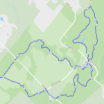
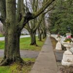
Location (Google Maps): Parking lot is off Sycamore Drive, East of Bayview , across Starbucks plaza Bus 91 from Finch East station stops at Sycamore station.
Pace: Moderate (3-4 km/hr) Terrain: Hilly, Level 2 (Intermediate – some hills and uneven surfaces, rocks and roots underfoot) Distance (km): 7-8 km
Description We will explore Valleyview and Maple View parks, and walk along German Mills Creek, in return we stop in Huntington park and have snack ,coffee,tea .
Although this is considered an “Urban Walk”, you can expect some hills up and down and uneven surfaces with tree roots. Please bring hiking poles, water and snacks.
Pace: Medium – 3 to 4 km/hr Terrain: Strenuous – Hilly with steep climbs and some poor footing Distance: 10 kms
Description Meeting roadside at 9:15 am on Twiss Road, we will hike to Crawford Lake and around the trails and back to Twiss Road. There are some rocky sections along the way. Please bring water and a snack.
Hosting Club: Caledon Hills Category: End-to-End Location (Google Maps): Meet at Limehouse across from the school. Map 12, north of km 21.6 on the south side of 22 Sideroad.
Pace: Medium – 3 to 4 km/hour Terrain: Easy – mostly flat and usually good footing, Moderate – some hills and/or some poor footing Distance: 13.6 km loop
Description This is the fifth hike of the series. We will visit the Toronto Club Seed Orchard, Todd Bardes, Meadowland, Beeney Creek, Ancient Maple, and Ridge Side Trails.
Pace: Fast (5.5 – 7.0 km/h+): A quick pace maintained by experienced hikers or trail runners., Leisurely (2.0 – 3.0 km/h): A relaxed pace with frequent breaks and a focus on enjoyment., Medium (3.0 – 4.5 km/h): A comfortable pace for most hikers with steady progress. Terrain: Difficult: Steep ascents/descents, rocky scrambling, and some rugged escarpment paths., Easy: Flat forested sections or lowland trails., Moderate: Rolling hills, mild slopes and rocky paths. Distance: various
Description Join us for the 2026 Peninsula Hiking Festival from October 2–4, 2026 on the beautiful Bruce Peninsula — a weekend celebration of hiking, nature, community, and connection along Canada’s iconic Bruce Trail.
With more than 20 guided hikes for a variety of skill levels and interests, the festival offers unforgettable experiences through forests, shoreline vistas, and escarpment landscapes. Enjoy a lively weekend featuring a welcome reception, inspiring keynote dinner with renowned outdoorsman Kevin Callan, local art, community events, and a silent auction — all centered around this year’s theme: “Common Ground: A Celebration of Trail, Place, and Belonging.”
Whether you’re a seasoned hiker or simply love the outdoors, the festival is a chance to explore the Peninsula, meet fellow trail enthusiasts, and celebrate the natural beauty and conservation spirit of the Bruce Trail community.
🎟️ Tickets & festival details: https://peninsula.brucetrail.org/2026-hiking-festival/
Come hike, connect, and celebrate the trail together.
Pace: Moderate (3-4 km/hr) Terrain: Level 2 (Intermediate – some hills and uneven surfaces, rocks and roots underfoot), Variable Distance (km): 13 -15km
Description Greg Vincent’s legacy of weekends away continue. Please join me, Jeanette Vincent as we explore the Tip o’ the Bruce, Tobermory in the Fall. The beauty of this area of the Bruce Peninsula every season is wonderful! We will take in a number of walks using side trails and the Bruce Trail. Approximately 13-15km/day. We stay and have our meals at a comfortable hotel overlooking Little Tub Harbour. This outing is restricted to those staying with us at the Princess Hotel in Tobermory for the weekend – the hotel fills quickly. You will need a car to access this outing. Please contact the Princess Hotel for a reservation.1-519-596-8282 or info@tobermoryprincesshotel.com and mention Vincent/Royle Fall weekend.
Before registering at the hotel please contact us for the price package for accommodations and more details.
Pace: Medium 3- 4 km/hr Terrain: Easy: mostly flat, good footing Distance: 6-7km
Description We will explore the Queenston area by walking down the escarpment into the village of Queenston. Of course, we will be hiking back up the escarpment to Queenston Heights Park and back to the cars.
Hosting Club: Dufferin Hi-Land Category: General Hike Location (Google Maps): End of 17 Sideroad, 730m east of Hwy 25. See Google Maps link for GPS. Be ready for construction where 17 SR meets Hwy 25.
Hike Leader(s): Stuart Law
Pace: Medium Terrain: Slippery Sections Likely, Moderate Distance: 14.54 kms
Description Join us to take in the Fall colours on a 14.54 km Friday Hike from Sideroad 17 to Limehouse and back on the main Bruce Trail. We will also take in part of the Vanderleck ST and the Black Creek ST. The trail will be wet and a touch muddy after the expected rain in the next two days. The rain should be over by the time we start our hike. Please bring 2L of water, a snack, a lunch and a first aid kit. Hiking boots mandatory. Poles recommended. Please arrive at 9:15 to be ready to hike at 9:30 sharp.
Hosting Club: Iroquoia, Beaver Valley Category: General Hike Location (Google Maps): Bruce Trail Parking Lot – Graham’s Hill Road 60 meters west of where the trail crosses the road.
Pace: Medium – 3 to 4 km/hr Terrain: Moderate – Some hills and/or some poor footing, Strenuous – Hilly with steep climbs and some poor footing Distance: 15.5 km
Description This is hike 5 of the End-to-End hike series to complete the Beaver Valley section of the Bruce Trail in 8 hikes. Join for all or as many hikes as desired – you will need to register for each hike in the series which will take place on the following dates: August 28, August 29, September 11, September 12, October 2, October 3, October 16 & October 17. Hikers completing the entire series will be eligible to obtain an end-to-end badge from the BTC Beaver Valley Club.
Since this is a group hike, please consider your fitness level before registering. This section of the trail has numerous hills and rough terrain in spots. We will be walking at a pace of 3km – 4km per hour and hikers will need to keep up with the person in front of them for the duration of the hike. The hike series will also involve car shuttles and every hiker is expected to participate as drivers.
Weather conditions in the late summer can still be quite warm, but the hike schedule will extend to mid-October so it’s best come prepared for varying weather conditions. Hiking boots are required and hiking poles are strongly recommended. Bring plenty of fluids and a snack. Insects and ticks will still be active at this time of year, long pants and long sleeves are recommended as is insect repellent.
Specific hike details will be provided to registered hikers a few days prior to each hike.
Hosting Club: Toronto, Sydenham Category: Car Hike Location (Google Maps): The parking lot is behind the Grey-Bruce Tourist Information Office. Enter from Highway 6, just north of the junction of Highway 6 and 21.
Pace: Brisk (4-5 km/hr), Moderate (3-4 km/hr) Terrain: Hilly, Level 2 (Intermediate – some hills and uneven surfaces, rocks and roots underfoot), Variable Distance (km): 21 km
Description We will hike south to Inglis Falls. After a snack break, we’ll return north and take the rocky side trail to explore Jones Falls. This hike includes crossing busy Hwy 6, the up and down rocky trail through Springmount Forest with some views of Georgian Bay, the less rocky West Rocks, and about 2 km of road before the woods near Inglis Falls.
Our pace will be Brisk through the open areas but Moderate through the many rocky and hill climbing sections.
Please bring enough water (at least 2 litres) and food to maintain your energy for a 6-hour hike.
Comfortable hiking shoes or boots are a must. A rain shell is recommended in case of a wet weather forecast, along with a hat, sunscreen, and bug repellent for sunny weather or buggy trail conditions.
Pace: Moderate (3-4 km/hr) Terrain: Hilly, Level 2 (Intermediate – some hills and uneven surfaces, rocks and roots underfoot), Variable Distance (km): 10.6
Description Join us for the kick-off hike of our Beaver Valley End-to-End series. The Beaver Valley section is known for its many hills, but all experienced, fit hikers are welcome to join us, including those who are not working towards an E2E badge. Our first hike will take us from the boundary with the Blue Mountains section at km 0.0, through the luscious Len Gertler Memorial Loree Forest and along the Escarpment edge, finishing at km 10.6 (Bruce Trail Reference Guide Edition 31, Map #24). We should catch some magnificent views of Georgian Bay.
The total hike distance is approximately 10.6 km. There will be a dropout point at approximately 8.3 km. Time permitting, we will have a refreshment stop in Primrose.
Hiking boots and poles are recommended.
The series will continue on:
Oct. 17
Nov. 14
Spring 2027 (dates TBD)
=>>> Please read the TBTC Paid Hikes Refund Policy before registering: https://torontobrucetrailclub.org/hikes/no-show-policy. There will be no refunds issued for this hike if the registrant cancels or misses the bus on the date of departure for any reason. Registration fees are not transferrable between different hikes, nor do unused fares qualify for a tax receipt.
Pace: Medium – 3 to 4 km/hr Terrain: Dependent on Conditions, Slippery and Steep Sections, Strenuous – Hilly with steep climbs and some poor footing Distance: 23 km
Description The 10th annual Steeltown Stomp event is a challenging and rewarding self-guided hike and stair climb along the escarpment in Hamilton. You will hike approximately 23 kms, and climb more than 2,000 stairs along the Bruce Trail, the Escarpment Rail Trail, and the Chedoke Radial Trail. As you follow the specially blazed route you will encounter and climb the 6 sets of stairs along the Hamilton Escarpment. (Please note we are not including the Uli Stairs in this year’s Steeltown Stomp.) The route will be clearly marked with special yellow blazes, and staircases will have clear instruction signs posted. The route will be available on the AllTrails app, and printed maps are available at the starting point for those who would like one. You will find snacks and encouragement at the turnaround checkpoint at the Chedoke stairs, and will then return to the starting point to collect your coveted Steeltown Stomp badge, enjoy more snacks, and experience a great sense of accomplishment! You are not expected to complete the stairs on the return trip.
Please Note: This is an arduous hike and requires a high level of fitness due to the stair climbing required.
Fee: $35 fee includes checkpoint and finish zone snacks and your badge, and you will be supporting the Bruce Trail Conservancy in its mission to preserve a ribbon of wilderness, for everyone, forever.
Check in: At the registration booth set up at the north end of the parking lot of the Mohawk 4 Ice Centre. In order to avoid congestion on the stairs we have set up staggered start times. Please select 8:00, 8:15, 8:30, or 8:45 when you register. You will be able to start the hike as soon as you are checked in. This is not a race, and you will not be timed.
Checkpoints: Start and end at the Mohawk 4 Ice Centre. There are washrooms and a water filling station available here. There is a turnaround checkpoint at the Chedoke Golf Course, and then you will hike directly back to the starting point. You are not expected to complete the stairs on the return trip.
Route: Follow the yellow blazes! Special yellow blazes will be set up to mark the route. In addition, the route has been set up on the AllTrails app. If you have this app downloaded on your phone, you can follow the route using the app. There are water filling stations available along the route. There are washrooms available at the start, at Corktown Park, and at the Chedoke turnaround.
What to bring: Bring your own water. You will be able to refill your own water bottles at public water fountains along the route. Snacks will be provided, but you may wish to bring additional food for a lunch break. Wear comfortable, sturdy shoes (hiking boots are not necessary), and dress for the weather. Protect yourself from insects and sun.
Safety Precautions: Normal hiker etiquette and safety precautions apply…https://brucetrail.org/explore-the-trail/#Bruce-Trail-101
Donations: If you are interested in contributing further to the BTC, please click here or go to the BTC website
FAQ’s:
What if it rains? This is a rain or shine event.
What if I need to drop out? As we are in an urban area, there are places to access public transit or contact a taxi or ride sharing service along the way. This must be arranged by you, the participant. If you have to drop out during the event, please let us know by calling or texting the contact number below so our dedicated volunteers are not waiting for you at the finish line.
How long will it take to finish? We estimate that the hike will take between 3 and 5 hours.
Are dogs allowed? No. The stairs will be too crowded during this event.
Contact: Leslie Ho at iroquoiasteeltownstomp@gmail.com. On event day, you can text event organizers 289-237-8059.
Pace: Brisk (4-5 km/hr), Moderate (3-4 km/hr) Terrain: Hilly, Level 2 (Intermediate – some hills and uneven surfaces, rocks and roots underfoot), Variable Distance (km): Fast group 16 to 18 km, Moderate group 13 km
Description Join us for a fantastic fall hike in the Dufferin Highlands (Map 20). Enjoy awesome views from Murphy’s Pinnacle and the Mulmur Lookout.
We will split into two groups. The fast group will do the Primrose Loop Side Trail and then follow the main trail north to km 29.6 (about a 16 km hike). If time permits the fast group will also do the Rock Hill Park Side Trail. The moderate group will head straight to Murphy’s Pinnacle and follow the main trail north to km 29.6 (about a 13 km hike).
Pack water, lunch, sun and rain protection.
Refreshment stop at Sonnen Hill Brewing (https://sonnenhill.com/). Sit back, relax, and socialize with your hiking friends while you sip a fresh, cold, local brew or non-alcoholic beverage in their beautiful beer garden. Or walk up to their lookout for more great views (a 20 minute loop).
Departure 1: 8:30 am from 10 York Mills Rd. Departure 2: 8:50 am from HWY 400 and HWY 9
Pace: Medium – 3 to 4 km/hr Terrain: Moderate – Some hills and/or some poor footing, Strenuous – Hilly with steep climbs and some poor footing Distance: 15.9 km
Description This is hike 6 of the End-to-End hike series to complete the Beaver Valley section of the Bruce Trail in 8 hikes. Join for all or as many hikes as desired – you will need to register for each hike in the series which will take place on the following dates: August 28, August 29, September 11, September 12, October 2, October 3, October 16 & October 17. Hikers completing the entire series will be eligible to obtain an end-to-end badge from the BTC Beaver Valley Club.
Since this is a group hike, please consider your fitness level before registering. This section of the trail has numerous hills and rough terrain in spots. We will be walking at a pace of 3km – 4km per hour and hikers will need to keep up with the person in front of them for the duration of the hike. The hike series will also involve car shuttles and every hiker is expected to participate as drivers.
Weather conditions in the late summer can still be quite warm, but the hike schedule will extend to mid-October so it’s best come prepared for varying weather conditions. Hiking boots are required and hiking poles are strongly recommended. Bring plenty of fluids and a snack. Insects and ticks will still be active at this time of year, long pants and long sleeves are recommended as is insect repellent.
Specific hike details will be provided to registered hikers a few days prior to each hike.
Hosting Club: Toronto Category: Car Hike Location (Google Maps): Oak Ridges Corridor, Bethesda Trail Head Parking Lot, Bethesda Side Road, Richmond Hill, ON
Pace: Medium – 3 to 4 km/hr Terrain: Moderate – Some hills and/or some poor footing Distance: 8.5 km
Description Fox Ridge and McClusky’s Rock: Badland at Stop 4 (Pages 72/73) Queenston Shale is the bottom-most layer of the Niagara Escarpment. Where vegetation is removed, the shale appears as a “badland”. The brick-red shale has long been excavated along the Niagara Escarpment to make bricks. See Hike #1 – August 26 for series description
Hosting Club: Dufferin Hi-Land Category: General Hike Location (Google Maps): Roadside parking at the south side of Dunby Road at the the trail entrance. See Google Maps link on this hike description for GPS.
Pace: Medium Terrain: Dependent on Conditions, Moderate Distance: 13.5 kms
Description Join us on a 13.5 km hike from the Third Outlier to the South Outlier at Mono Cliffs. Most people know that there are North and South Outliers at Mono Cliffs, but the Third Outlier is a bit of mystery surrounded by the beautiful BTC Whitetail Refuge Nature Reserve. The place is wonderfully quiet and peaceful. One of my favourite places to go. We will be climbing up and down the escarpment three times so be prepared for elevation. Be ready for jewel weed, fleabane, New England astors, moss covered rocks, cliffs and hidden streams. Please bring a lunch, a snack, 2L of water, and a first aid kit. Hiking boots mandatory. Poles recommended. Please arrive at 9:00 am to be ready to hike at 9:15.
Pace: Medium – 3 to 4 km/hr Terrain: Moderate – Some hills and/or some poor footing Distance: 8.5 kms
Description We will meet at Hilton Falls and carpool to St Helena Rd. For those leaving their car at Hilton Falls, you will need to reserve your time at conservationhalton.ca
Always a popular hike, this is a challenging hike because there are several technical (rocky) spots. We hike on the main trail along the edge of the Escarpment and will stop for a break by the Quarry, finishing along the Philip Gosling Side Trail.
Pace: Leisurely: 3 km/h or less Terrain: Easy: Mostly flat and good footing., Moderate: Some hills and/or poor footing, Strenuous: Hilly with steep climbs and some poor footing., There might be muddy sections. Distance: 2.3 km
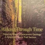
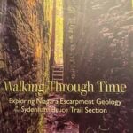
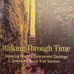
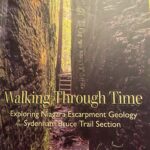
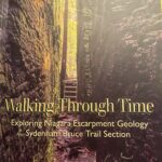
Description Please join Carol for a fossil-rich hike featuring this fascinating layer of Fossil Hill Dolostone, along with crevices, overhangs and a historic homestead. There are easy sections with some steeper slopes. Poles recommended. Water and proper footwear are always necessities. A copy of Beth Gilhespy’s book “Walking Through Time” in the Sydenham section will be available for purchase at the end of the hike. $37. cash (correct change please) or e-transfer.
Hosting Club: Toronto Category: TBTC Special Events Location (Google Maps): Evergreen Brick Works and Moore Park Ravine. Meet in Tiffany Commons by the Watershed Wall (between the farmer’s market and main building)
Pace: Moderate (3-4 km/hr) Terrain: Hilly, Level 2 (Intermediate – some hills and uneven surfaces, rocks and roots underfoot), Variable Distance (km): 5 km
Description Join Ray for a 5 km introductory circular urban walk exploring the wetlands, woodlands, and natural meadows of the Evergreen Brick Works, and then ascending into the beautiful Moore Park Ravine returning to the Evergreen Brick Works by the scenic outlook overlooking the Evergreen Brick Works site, Don Valley, and ravines. Expect some moderate hills and uneven terrain. Hiking boots or shoes designed for walking are essential. The hike will return to Evergreen Brick Works in time for the “Hiking 101” presentation in the BMO atrium at 12:30 pm.
This hike is part of our Bruce Trail Day celebrations. Saturday we will be at the farmer’s market in Evergreen Brick Works and on Sunday we will be at Limehouse on the trail. If you’re unavailable on Sunday please join us in Toronto on the Saturday to meet with us and learn about the Bruce Trail. On Sunday there will be a selection of hikes based from Limehouse plus a Bus Hike from York Mills Subway. Preregistration is not required to join us on the hikes from Evergreen Brick Works.
Pace: Medium Terrain: Moderate, Some rocky footing, Some steep sections Length of Hike: Approx. 5 km
Description Join us on Saturday, October 3rd in the beautiful Beaver Valley for an autumn hike in partnership with the Rainbow Club of South Georgian Bay. This hike is open to all, with an especial invitation to members of the queer, 2S-LGBTQIA+ community, their allies and supporters. Participants do not need to be Bruce Trail members to register.
We’ll be taking a walk through the Eagle’s Summit area at the top of the escarpment where the views across the valley are lovely. Photo ops abound! Enjoy the peace and beauty of the mixed forest and meadows, while chatting with fellow hikers along the way. We’ll be moving along at a manageable, moderate pace for about 1 ½ hours, be sure to wear sturdy footwear with a good tread, dress for the weather and bring along a water bottle. We’ll meet at the Beaver Valley Rest Area parking lot on the east side of Grey Road 13, just north of Kimberley. Coordinates, 44.363929,-80.531458. This is a dog friendly hike, dogs must be leashed.
Hosting Club: Toronto Category: TBTC Special Events Location (Google Maps): Evergreen Brick Works, Moore Park Ravine and Park Drive Reservation Meet in Tiffany Commons by the watershed wall (between the farmer’s market and the main building)
Pace: Moderate (3-4 km/hr) Terrain: Level 1 (Easy – mostly on flat, well maintained trails with hard-packed surface), Variable Distance (km): 4 km
Description Join Danny for a 4 km introductory “out and back” urban walk southbound into the ravine trails and northwards past Milkman’s Lane into Park Drive Reservation. We’ll continue to Mount Pleasant Road and return to the Evergreen Brick Works in time for the “Hiking 101” presentation in the BMO atrium at 12:30 pm. This hike will be on generally flatter terrain and on hard packed gravel paths. Hiking boots or shoes designed for walking are recommended.
This hike is part of our Bruce Trail Day celebrations. Saturday we will be at the farmer’s market in Evergreen Brick Works and on Sunday we will be at Limehouse on the trail. If you’re unavailable on Sunday please join us in Toronto on the Saturday to meet with us and learn about the Bruce Trail. On Sunday there will be a selection of hikes based from Limehouse plus a Bus Hike from York Mills Subway. Preregistration is not required to join us on the hikes from Evergreen Brick Works.
Pace: Moderate (3-4 km/hr) Terrain: Flat Distance (km): 11.9 km
Description Please meet me at Kennedy Station by 10:04 am. We will take the 38A East to Rouge Hill GO bus departing 10:20 am, arriving at Port Union Rd at 11:00 am.
We will hike south to Lake Ontario and along the Waterfront Trail through Port Union and Rouge Hill to Pickering GO. The estimated distance is 9.8 km. Here is an online map of our route – Port Union to Pickering.
Bring a snack, at least 2 liters of water, sun screen and bug spray.
Hosting Club: Toronto Category: TBTC Special Events Location (Google Maps):
Meet the hike leader in Tiffany Commons in front of the watershed wall at the Evergreen Brick Works (across from the cafe). Please contact ttc.ca to confirm transit information, as summer construction projects may be underway. Evergreen Brick Works free shuttle from outside Broadview Subway Station (departs every 30 minutes) or TTC Route #28 Bayview South from Davisville Subway Station (every 30 minutes)
Pace: Leisurely (2-3 km/hr) Terrain: Flat, Level 1 (Easy – mostly on flat, well maintained trails with hard-packed surface) Distance (km): 4 km
Description A there-and-back hike South from the Evergreen Brick Works to Beltline Trail which goes northwest to Mount Pleasant Road from where we shall return to the Evergreen Brick Works along the same route. Preregistration for hike is not required – just arrive 15 minutes prior to the hike to sign up with hike leader.
Pace: Moderate (3-4 km/hr) Terrain: Hilly, Level 2 (Intermediate – some hills and uneven surfaces, rocks and roots underfoot), Variable Distance (km): 10.6
Description Join us for the kick-off hike of our Beaver Valley End-to-End series. The Beaver Valley section is known for its many hills, but all experienced, fit hikers are welcome to join us, including those who are not working towards an E2E badge. Our first hike will take us from the boundary with the Blue Mountains section at km 0.0, through the luscious Len Gertler Memorial Loree Forest and along the Escarpment edge, finishing at km 10.6 (Bruce Trail Reference Guide Edition 31, Map #24). We should catch some magnificent views of Georgian Bay.
The total hike distance is approximately 10.6 km. There will be a dropout point at approximately 8.3 km. Time permitting, we will have a refreshment stop in Primrose.
Hiking boots and poles are recommended.
The series will continue on:
Oct. 17
Nov. 14
Spring 2027 (dates TBD)
=>>> Please read the TBTC Paid Hikes Refund Policy before registering: https://torontobrucetrailclub.org/hikes/no-show-policy. There will be no refunds issued for this hike if the registrant cancels or misses the bus on the date of departure for any reason. Registration fees are not transferrable between different hikes, nor do unused fares qualify for a tax receipt.
Pace: Medium – 3 to 4 km/hr Terrain: Dependent on Conditions, Slippery and Steep Sections, Strenuous – Hilly with steep climbs and some poor footing Distance: 23 km
Description The 10th annual Steeltown Stomp event is a challenging and rewarding self-guided hike and stair climb along the escarpment in Hamilton. You will hike approximately 23 kms, and climb more than 2,000 stairs along the Bruce Trail, the Escarpment Rail Trail, and the Chedoke Radial Trail. As you follow the specially blazed route you will encounter and climb the 6 sets of stairs along the Hamilton Escarpment. (Please note we are not including the Uli Stairs in this year’s Steeltown Stomp.) The route will be clearly marked with special yellow blazes, and staircases will have clear instruction signs posted. The route will be available on the AllTrails app, and printed maps are available at the starting point for those who would like one. You will find snacks and encouragement at the turnaround checkpoint at the Chedoke stairs, and will then return to the starting point to collect your coveted Steeltown Stomp badge, enjoy more snacks, and experience a great sense of accomplishment! You are not expected to complete the stairs on the return trip.
Please Note: This is an arduous hike and requires a high level of fitness due to the stair climbing required.
Fee: $35 fee includes checkpoint and finish zone snacks and your badge, and you will be supporting the Bruce Trail Conservancy in its mission to preserve a ribbon of wilderness, for everyone, forever.
Check in: At the registration booth set up at the north end of the parking lot of the Mohawk 4 Ice Centre. In order to avoid congestion on the stairs we have set up staggered start times. Please select 8:00, 8:15, 8:30, or 8:45 when you register. You will be able to start the hike as soon as you are checked in. This is not a race, and you will not be timed.
Checkpoints: Start and end at the Mohawk 4 Ice Centre. There are washrooms and a water filling station available here. There is a turnaround checkpoint at the Chedoke Golf Course, and then you will hike directly back to the starting point. You are not expected to complete the stairs on the return trip.
Route: Follow the yellow blazes! Special yellow blazes will be set up to mark the route. In addition, the route has been set up on the AllTrails app. If you have this app downloaded on your phone, you can follow the route using the app. There are water filling stations available along the route. There are washrooms available at the start, at Corktown Park, and at the Chedoke turnaround.
What to bring: Bring your own water. You will be able to refill your own water bottles at public water fountains along the route. Snacks will be provided, but you may wish to bring additional food for a lunch break. Wear comfortable, sturdy shoes (hiking boots are not necessary), and dress for the weather. Protect yourself from insects and sun.
Safety Precautions: Normal hiker etiquette and safety precautions apply…https://brucetrail.org/explore-the-trail/#Bruce-Trail-101
Donations: If you are interested in contributing further to the BTC, please click here or go to the BTC website
FAQ’s:
What if it rains? This is a rain or shine event.
What if I need to drop out? As we are in an urban area, there are places to access public transit or contact a taxi or ride sharing service along the way. This must be arranged by you, the participant. If you have to drop out during the event, please let us know by calling or texting the contact number below so our dedicated volunteers are not waiting for you at the finish line.
How long will it take to finish? We estimate that the hike will take between 3 and 5 hours.
Are dogs allowed? No. The stairs will be too crowded during this event.
Contact: Leslie Ho at iroquoiasteeltownstomp@gmail.com. On event day, you can text event organizers 289-237-8059.
Pace: Brisk (4-5 km/hr), Moderate (3-4 km/hr) Terrain: Hilly, Level 2 (Intermediate – some hills and uneven surfaces, rocks and roots underfoot), Variable Distance (km): Fast group 16 to 18 km, Moderate group 13 km
Description Join us for a fantastic fall hike in the Dufferin Highlands (Map 20). Enjoy awesome views from Murphy’s Pinnacle and the Mulmur Lookout.
We will split into two groups. The fast group will do the Primrose Loop Side Trail and then follow the main trail north to km 29.6 (about a 16 km hike). If time permits the fast group will also do the Rock Hill Park Side Trail. The moderate group will head straight to Murphy’s Pinnacle and follow the main trail north to km 29.6 (about a 13 km hike).
Pack water, lunch, sun and rain protection.
Refreshment stop at Sonnen Hill Brewing (https://sonnenhill.com/). Sit back, relax, and socialize with your hiking friends while you sip a fresh, cold, local brew or non-alcoholic beverage in their beautiful beer garden. Or walk up to their lookout for more great views (a 20 minute loop).
Departure 1: 8:30 am from 10 York Mills Rd. Departure 2: 8:50 am from HWY 400 and HWY 9
Pace: Medium – 3 to 4 km/hr Terrain: Moderate – Some hills and/or some poor footing, Strenuous – Hilly with steep climbs and some poor footing Distance: 15.9 km
Description This is hike 6 of the End-to-End hike series to complete the Beaver Valley section of the Bruce Trail in 8 hikes. Join for all or as many hikes as desired – you will need to register for each hike in the series which will take place on the following dates: August 28, August 29, September 11, September 12, October 2, October 3, October 16 & October 17. Hikers completing the entire series will be eligible to obtain an end-to-end badge from the BTC Beaver Valley Club.
Since this is a group hike, please consider your fitness level before registering. This section of the trail has numerous hills and rough terrain in spots. We will be walking at a pace of 3km – 4km per hour and hikers will need to keep up with the person in front of them for the duration of the hike. The hike series will also involve car shuttles and every hiker is expected to participate as drivers.
Weather conditions in the late summer can still be quite warm, but the hike schedule will extend to mid-October so it’s best come prepared for varying weather conditions. Hiking boots are required and hiking poles are strongly recommended. Bring plenty of fluids and a snack. Insects and ticks will still be active at this time of year, long pants and long sleeves are recommended as is insect repellent.
Specific hike details will be provided to registered hikers a few days prior to each hike.
Hosting Club: Toronto Category: Car Hike Location (Google Maps): Oak Ridges Corridor, Bethesda Trail Head Parking Lot, Bethesda Side Road, Richmond Hill, ON
Pace: Medium – 3 to 4 km/hr Terrain: Moderate – Some hills and/or some poor footing Distance: 8.5 km
Description Fox Ridge and McClusky’s Rock: Badland at Stop 4 (Pages 72/73) Queenston Shale is the bottom-most layer of the Niagara Escarpment. Where vegetation is removed, the shale appears as a “badland”. The brick-red shale has long been excavated along the Niagara Escarpment to make bricks. See Hike #1 – August 26 for series description
Hosting Club: Dufferin Hi-Land Category: General Hike Location (Google Maps): Roadside parking at the south side of Dunby Road at the the trail entrance. See Google Maps link on this hike description for GPS.
Pace: Medium Terrain: Dependent on Conditions, Moderate Distance: 13.5 kms
Description Join us on a 13.5 km hike from the Third Outlier to the South Outlier at Mono Cliffs. Most people know that there are North and South Outliers at Mono Cliffs, but the Third Outlier is a bit of mystery surrounded by the beautiful BTC Whitetail Refuge Nature Reserve. The place is wonderfully quiet and peaceful. One of my favourite places to go. We will be climbing up and down the escarpment three times so be prepared for elevation. Be ready for jewel weed, fleabane, New England astors, moss covered rocks, cliffs and hidden streams. Please bring a lunch, a snack, 2L of water, and a first aid kit. Hiking boots mandatory. Poles recommended. Please arrive at 9:00 am to be ready to hike at 9:15.
Pace: Medium – 3 to 4 km/hr Terrain: Moderate – Some hills and/or some poor footing Distance: 8.5 kms
Description We will meet at Hilton Falls and carpool to St Helena Rd. For those leaving their car at Hilton Falls, you will need to reserve your time at conservationhalton.ca
Always a popular hike, this is a challenging hike because there are several technical (rocky) spots. We hike on the main trail along the edge of the Escarpment and will stop for a break by the Quarry, finishing along the Philip Gosling Side Trail.
Pace: Leisurely: 3 km/h or less Terrain: Easy: Mostly flat and good footing., Moderate: Some hills and/or poor footing, Strenuous: Hilly with steep climbs and some poor footing., There might be muddy sections. Distance: 2.3 km
Description Please join Carol for a fossil-rich hike featuring this fascinating layer of Fossil Hill Dolostone, along with crevices, overhangs and a historic homestead. There are easy sections with some steeper slopes. Poles recommended. Water and proper footwear are always necessities. A copy of Beth Gilhespy’s book “Walking Through Time” in the Sydenham section will be available for purchase at the end of the hike. $37. cash (correct change please) or e-transfer.
Hosting Club: Toronto Category: TBTC Special Events Location (Google Maps): Evergreen Brick Works and Moore Park Ravine. Meet in Tiffany Commons by the Watershed Wall (between the farmer’s market and main building)
Pace: Moderate (3-4 km/hr) Terrain: Hilly, Level 2 (Intermediate – some hills and uneven surfaces, rocks and roots underfoot), Variable Distance (km): 5 km
Description Join Ray for a 5 km introductory circular urban walk exploring the wetlands, woodlands, and natural meadows of the Evergreen Brick Works, and then ascending into the beautiful Moore Park Ravine returning to the Evergreen Brick Works by the scenic outlook overlooking the Evergreen Brick Works site, Don Valley, and ravines. Expect some moderate hills and uneven terrain. Hiking boots or shoes designed for walking are essential. The hike will return to Evergreen Brick Works in time for the “Hiking 101” presentation in the BMO atrium at 12:30 pm.
This hike is part of our Bruce Trail Day celebrations. Saturday we will be at the farmer’s market in Evergreen Brick Works and on Sunday we will be at Limehouse on the trail. If you’re unavailable on Sunday please join us in Toronto on the Saturday to meet with us and learn about the Bruce Trail. On Sunday there will be a selection of hikes based from Limehouse plus a Bus Hike from York Mills Subway. Preregistration is not required to join us on the hikes from Evergreen Brick Works.
Pace: Medium Terrain: Moderate, Some rocky footing, Some steep sections Length of Hike: Approx. 5 km
Description Join us on Saturday, October 3rd in the beautiful Beaver Valley for an autumn hike in partnership with the Rainbow Club of South Georgian Bay. This hike is open to all, with an especial invitation to members of the queer, 2S-LGBTQIA+ community, their allies and supporters. Participants do not need to be Bruce Trail members to register.
We’ll be taking a walk through the Eagle’s Summit area at the top of the escarpment where the views across the valley are lovely. Photo ops abound! Enjoy the peace and beauty of the mixed forest and meadows, while chatting with fellow hikers along the way. We’ll be moving along at a manageable, moderate pace for about 1 ½ hours, be sure to wear sturdy footwear with a good tread, dress for the weather and bring along a water bottle. We’ll meet at the Beaver Valley Rest Area parking lot on the east side of Grey Road 13, just north of Kimberley. Coordinates, 44.363929,-80.531458. This is a dog friendly hike, dogs must be leashed.
Hosting Club: Toronto Category: TBTC Special Events Location (Google Maps): Evergreen Brick Works, Moore Park Ravine and Park Drive Reservation Meet in Tiffany Commons by the watershed wall (between the farmer’s market and the main building)
Pace: Moderate (3-4 km/hr) Terrain: Level 1 (Easy – mostly on flat, well maintained trails with hard-packed surface), Variable Distance (km): 4 km
Description Join Danny for a 4 km introductory “out and back” urban walk southbound into the ravine trails and northwards past Milkman’s Lane into Park Drive Reservation. We’ll continue to Mount Pleasant Road and return to the Evergreen Brick Works in time for the “Hiking 101” presentation in the BMO atrium at 12:30 pm. This hike will be on generally flatter terrain and on hard packed gravel paths. Hiking boots or shoes designed for walking are recommended.
This hike is part of our Bruce Trail Day celebrations. Saturday we will be at the farmer’s market in Evergreen Brick Works and on Sunday we will be at Limehouse on the trail. If you’re unavailable on Sunday please join us in Toronto on the Saturday to meet with us and learn about the Bruce Trail. On Sunday there will be a selection of hikes based from Limehouse plus a Bus Hike from York Mills Subway. Preregistration is not required to join us on the hikes from Evergreen Brick Works.
Pace: Moderate (3-4 km/hr) Terrain: Flat Distance (km): 11.9 km
Description Please meet me at Kennedy Station by 10:04 am. We will take the 38A East to Rouge Hill GO bus departing 10:20 am, arriving at Port Union Rd at 11:00 am.
We will hike south to Lake Ontario and along the Waterfront Trail through Port Union and Rouge Hill to Pickering GO. The estimated distance is 9.8 km. Here is an online map of our route – Port Union to Pickering.
Bring a snack, at least 2 liters of water, sun screen and bug spray.
Hosting Club: Toronto Category: TBTC Special Events Location (Google Maps):
Meet the hike leader in Tiffany Commons in front of the watershed wall at the Evergreen Brick Works (across from the cafe). Please contact ttc.ca to confirm transit information, as summer construction projects may be underway. Evergreen Brick Works free shuttle from outside Broadview Subway Station (departs every 30 minutes) or TTC Route #28 Bayview South from Davisville Subway Station (every 30 minutes)
Pace: Leisurely (2-3 km/hr) Terrain: Flat, Level 1 (Easy – mostly on flat, well maintained trails with hard-packed surface) Distance (km): 4 km
Description A there-and-back hike South from the Evergreen Brick Works to Beltline Trail which goes northwest to Mount Pleasant Road from where we shall return to the Evergreen Brick Works along the same route. Preregistration for hike is not required – just arrive 15 minutes prior to the hike to sign up with hike leader.
Pace: Medium: 3 to 4 km/h Terrain: Easy: Mostly flat and good footing., Moderate: Some hills and/or poor footing, There might be muddy sections., There might be sections with water on the trail. Distance: 23.2 km
Description A chance to celebrate Bruce Trail Day by joining the last day of the Sydenham Club’s 2026 End-to-End in 8 hikes. This hike may be an opportunity to start a self-directed End-to-End in Sydenham or to “fill in the pieces”. The hike distance of just over 23 km will be challenging and you should be in good shape to participate. You will be joining a group of approximately 40 hikers who have already experienced 7 days spread over 4 week-ends. The fee includes bus transportation from parking and the hike end location in Wiarton to the hike start where the bus will drop you off at Graham’s Hill Rd. Then you hike back to your vehicle. You will benefit from 2 checkpoints along the way with water and delicious snacks. The trail largely follows the escarpment edge and the scenery is spectacular: Big Bay Sideroad, Ancient Beach Nature Reserve, Skinner’s Bluff, Skinner’s Woods, Colpoy’s Bay islands, Bruce’s Caves Conservation Area, Wiarton Airport. You will hike without a leader at your own pace but we will provide a team of volunteers to assist hikers including a sweep to bring up the rear of the group. You must bring everything needed for the days hike such as at least a litre of water, lunch, your own first aid, etc. NO REFUNDS will be issued. For additional information email sydenhame2e@gmail.com.
Pace: Moderate (3-4 km/hr) Terrain: Flat, Hilly, Level 2 (Intermediate – some hills and uneven surfaces, rocks and roots underfoot), Variable Distance (km): 14-16Km
Description Let’s roll the hills of the Jefferson Forest and around the Bond Lake. Every week we hike in Jefferson Forest, located in the heart of Richmond Hill, it boasts numerous hiking trails. This 4 hour hike can range from 14 to 15 kilometres, depending on the weather conditions. Remember to bring water, snacks, hiking boots (mandatory), poles, and your camera. Not recommended for beginners. Park in the free Bethesda parking lot and avoid parking along the road. Dress appropriately for the weather. Difficulty Level: 2 (Moderate). Please arrive @7:45AM for start of 8:00AM.
This is a joint hike with the Oak Ridges Trail Association (ORTA).
Pace: Medium (3.0 – 4.5 km/h): A comfortable pace for most hikers with steady progress. Terrain: Moderate: Rolling hills, mild slopes and rocky paths. Distance: 7.0
Description *This is a bus hike; we will be meeting at the Ferndale Visitor’s Center and bussing to the McCurdy Drive Parkette (bus departing at 8:30 am)*
Celebrate Bruce Trail Day with us!
Join us for a memorable hike through Lion’s Head Provincial Park to the iconic Lion’s Head Lookout, one of the most spectacular viewpoints on the Saugeen (Bruce) Peninsula. This route follows forested trails and rugged sections of the Niagara Escarpment. We’ll take a moment to visit the Giant’s Cauldron Side Trail and Lion’s Head Pothole Side Trail along the way. Our destination, Lion’s Head Lookout, rewards hikers with panoramic views of the turquoise waters below, the surrounding cliffs, and the iconic Lion’s Head rock formation. Expect uneven, rocky terrain, exposed cliffside sections, and plenty of opportunities to pause for photos and take in one of the Bruce Peninsula’s most unforgettable landscapes. Sturdy hiking footwear, water, snacks, weather-appropriate layers, and a camera are strongly recommended.
Join us at the Ferndale Visitor’s Center for light refreshments after the hike.
This hike is part of Bruce Trail Day, which celebrates togetherness on the Trail and all the ways the Bruce Trail brings us together with one another and our beautiful surroundings! Join us for family friendly activities and light refreshments at the Ferndale Visitor’s Center after your hike.
Hosting Club: Caledon Hills Category: Introductory Location (Google Maps): Riverside Woods- see website link for directions and parking
Hike Leader(s): CHBTC
Pace: Leisurely – 3 km/hour or less, Medium – 3 to 4 km/hour Terrain: Easy – mostly flat and usually good footing, Moderate – some hills and/or some poor footing
Description Join us on Bruce Trail Day as we celebrate with hikes, crafts, Indigenous artist led interactive music and fun! See weblink for details: https://caledonbrucetrail.ca/events/bruce-trail-day/
Pace: Leisurely (2.0 – 3.0 km/h): A relaxed pace with frequent breaks and a focus on enjoyment. Terrain: Easy: Flat forested sections or lowland trails., Moderate: Rolling hills, mild slopes and rocky paths. Distance: 4.5
Description Celebrate Bruce Trail Day with us!
Join us and Bruce Trail Conservancy Staff Ecologist Brian Popelier for a guided hike exploring the incredible flora and fauna of the fall season. We’ll follow the Bruce Trail’s main trail along the Niagara Escarpment, taking in spectacular views over Barrow Bay before returning to the parking lot via the John Appleton Side Trail. Along the way, we’ll enjoy a relaxed “stop, look, and listen” pace, pausing frequently to observe wildflowers, fungi, birds, and other wildlife we encounter while learning about the unique ecology of the area.
This hike is part of Bruce Trail Day, which celebrates togetherness on the Trail and all the ways the Bruce Trail brings us together with one another and our beautiful surroundings! Join us for family friendly activities and light refreshments at the Ferndale Visitor’s Center after your hike.
Description Join the Niagara Bruce Trail Club in celebrating Bruce Trail Day. As part of our Bruce Trail Day celebration at Brock University (LOT 2) we will host a geology hike led by the Niagara Aspiring GeoPark. Come at 9am to check out our booths and displays, head out for a geology hike at 9:15, and come back to celebrate with us. Hike will be accessible for anyone, including new hikers.
Pace: Moderate (3-4 km/hr) Terrain: Level 2 (Intermediate – some hills and uneven surfaces, rocks and roots underfoot), Other (Refer to Description), Variable Distance (km): 9 km
Description ** This hike has been cancelled due to low registration
Join us to celebrate Bruce Trail Day on the trail around Limehouse. For the first 5 km we will hike south from the Sixth Line to Limehouse. The route incorporates the portion of trail removed from the Fifth Line thanks to those who support the Bruce Trail. We’ll also pass the seed orchard where native species are grown for the seeds to be replanted to re-naturalize other parts of the trail. Those who want a shorter hike may drop out at Limehouse where information and refreshments will be available at the Memorial Hall. The second part of the hike will be a loop through the Limehouse Conservation area featuring the limestone kilns, stone arched bridge, and a climb through the “hole in the wall”. Expect some slightly rocky terrain underfoot and a few moderate hills. Hiking boots or good shoes designed for walking are a must. Those completing the full 9 km will also have a chance to drop in at the Memorial Hall to learn more about the Bruce Trail and refreshments.
=>>> Please read the TBTC Paid Hikes Refund Policy before registering: https://torontobrucetrailclub.org/hikes/no-show-policy”. There will be no refunds for this hike if the registrant cancels or misses the coach on the date of departure for any reason. Registration fees are not transferable between different hikes nor can unused fares qualify for a tax receipt. All hike go rain or shine with the exception of an extreme weather event.
Hosting Club: Caledon Hills Category: General Location (Google Maps): Scotsdale Farm, Map 13. Directions; from Highway 401, head north on Trafalgar Road past Georgetown. Trafalgar briefly merges with Highway 7 for about 3 km before separating to the right at the village of Silver Creek. At the stop light in Silver Creek, continue north on Trafalgar Road for about 1 km to the entrance of Scotsdale Farm on your right. Drive in about half a kilometre to reach the parking area.
Pace: Medium – 3 to 4 km/hour Terrain: Moderate – some hills and/or some poor footing Distance: 13 km
Description 🌈 Join us for a queer/trans-led, 2SLGBTQIA+ inclusive loop hike along the main Bruce Trail and its scenic side trails, including the stunning Great Esker Side Trail.
This hike is welcoming to LGBTQ+ hikers, and anyone interested in connecting with community while enjoying a beautiful day on the trail.
We’ll be hiking approximately 13 km at a medium pace. Please dress appropriately for the weather, bring plenty of water, and pack snacks or a light lunch. Some sections of the trail are rocky, so hiking poles are highly recommended.
Pace: Leisurely: 3 km/h or less Terrain: Moderate: Some hills and/or poor footing Distance: 4 km
Description Celebrate Bruce Trail Day by joining us on this Discovery Hike from GSCA to Inglis Falls and back – we’ll take our time, and see what we can find. We’ll cross the Sydenham River, hike through forests, climb the Escarpment, check out geological potholes and take a peek at Inglis Falls, returning via mostly the same route. Free ‘Boots on the Trail’ badges are available to youth 18 and under. This is also a great route to choose for the By the Seasons badge. As we’ll be taking our time, this hike is suitable for families, new hikers, and anyone wanting a more leisurely hike. All ages are welcome. We’ll likely take a couple of hours (possibly more), depending on the group and conditions – dress in layers, bring a snack, and wear good footwear. Given that October conditions can be variable, an email re: trail conditions to expect will be sent out prior to our hike together. The trail may be mucky in portions.
If you are unable to register, please contact the hike leader via the link above. Carpooling may be available upon request.
Pace: Leisurely – 3 km/hr. or less Terrain: Moderate – Some hills and/or some poor footing
Description Join us for the Fifth Annual Music Hike and Bruce Trail Day, a unique celebration where music meets nature. Musicians will be scattered throughout the scenic wilderness, serenading hikers as they explore breathtaking forest trails and lookouts. A Passport To Nature Hike! Collect stickers! Win badges!
Hosting Club: Niagara Category: Rainbow 🌈 Location (Google Maps): Meet at Brock University, Lot 2, enter via Flora Egerter Way. Address: Lot 2, Flora Egerta Way,Thorold, On L2S 3A1 https://maps.app.goo.gl/GeFaYPsvpSeY8hvV7
Pace: Medium 3- 4 km/hr Terrain: Moderate: some hills and some poor footing Distance: approx 4 km
Description Join the Niagara Bruce Trail Club, Bridges Niagara Immigrant and Refugee Services and PFLAG Niagara for a Rainbow-Welcome Hike as part of Bruce Trail Day, starting on the campus of Brock University.
What is a Rainbow-Welcome Hike?
Rainbow-Welcome hikes aim to bring 2S-LGBTQIA+ newcomers together with other newcomers and community members, friends and allies to enjoy nature and connect to the land and enjoy nature in all seasons.
It is an intentionally affirming space for people of diverse backgrounds and identities with a focus on 2S-LGBTQIA+ inclusion. Everyone is welcome.
Hike description:
Explore the trails around Brock University. Expect some ups and downs and moving at a moderate pace. Stay afterwards to celebrate Bruce Trail Day with the NBTC.
Note: If you don’t have transportation to get to Brock, there may be space on a charter bus coming from Bridges Niagara Immigrant and Refugee Services. Please message us for info.
Pace: Moderate (3-4 km/hr) Terrain: Level 2 (Intermediate – some hills and uneven surfaces, rocks and roots underfoot), Variable Distance (km): 10-13 km
Description Come join me for hike through Scotsdale Farm and the Silver Creek Conservation Area to enjoy the fall colours.
We will complete a loop hike on the main and side trails. Shorter loops are available for those who do not want to complete the full length. After the hike all are invited to join me for refreshments at the Shepherd’s Crook in old Georgetown.
To get to the meeting point from Hwy 401 go north on Trafalgar Road past Georgetown to the juncture with Hwy 7. North on Hwy 7 to Silver Creek. Turn right and back onto Trafalgar Road. Go north about 1.5 km to the entrance of Scotsdale Farm on your right. The parking area is about 0.5 km from Trafalgar Road near the old homestead.
Hosting Club: Toronto Category: Car Hike Location (Google Maps): We will meet at the Limehouse parking lot on 22 Sideroad (coordinates are 43.638113, -79.979272).
Pace: Leisurely (2-3 km/hr) Terrain: Level 2 (Intermediate – some hills and uneven surfaces, rocks and roots underfoot) Distance (km): 4 km
Description Come and join me for a family-friendly hike in honour of Bruce Trail Day! We will trek a total of 4 km along the Todd Bardes Meadowland Side Trail, the Ridge Side Trail, and the main trail located northeast of Limehouse. There will be a scavenger hunt to complete while hiking, and individuals who would like to work on their Biodiversity Naturalist Badge (https://torontobrucetrailclub.org/the-trail/badges) are encouraged to do so during this hike — I love spotting interesting flora, fauna, and fungi whenever I’m on the Bruce Trail so I would be happy to help hikers in their quest for this badge.
Port-a-potties, refreshments, activities, and displays will be available at the Limehouse Public School parking lot across the street from our meeting location before and after the hike, and there will be Toronto Bruce Trail Club volunteers present to answer any questions you may have about our beloved Bruce Trail.
Children under 13 years of age are encouraged to join their parents/guardians on this hike so they can fulfill the requirements for the Toronto Bruce Trail Club’s Youth Badge (https://torontobrucetrailclub.org/the-trail/badges) — all family members who are planning on joining us should register for the hike, including children. You should bring enough water and food for a 2-hour hike, comfortable footwear with good traction, and appropriate clothing for the weather.
Please note that this hike is part of the Bruce Trail Conservancy’s “Passport to Nature” initiative so all hikers who participate in this hike will receive a sticker that can count towards earning a badge or prize from the Bruce Trail Conservancy! For more information about the “Passport to Nature” initiative, please click here: https://brucetrail.org/passport-to-nature/
Everyone is welcome to attend this hike — looking forward to celebrating Bruce Trail Day with you on October 4th!
Pace: Moderate (3-4 km/hr) Terrain: Challenging, Hilly, Level 3 (Advanced – steep hills and some scrambling over boulders) Distance (km): about 19.2 km
Description Please join me for a challenging hike on the Bruce Trail (main and side trails) in the Beaver Valley. We will be following the Beaver Valley Short loop of ca 19.2 km from the Hogg’s Falls Parking lot (170491-172753, Lower Valley Rd, Flesherton, ON N0C 1E0). From there, we will start hiking the main Bruce Trail toward Eugenia Falls and continue with the loop counter-clockwise. We will make short water and pit breaks and one long (at least 45 min) lunch break to eat, rest and enjoy, and we should finish the hike before 5 pm. After the hike, we will have a stop at a brewery or cidery (we will decide on the hike) before we head home.
For more information (including technical details) about this loop, please check “Beaver Valley Short Loop” on the Alltrails app on your phone or click on this link to the website: https://www.alltrails.com/trail/canada/ontario/beaver-valley-short-loop
Please note that this is a long hike and a relatively long day trip if you are coming from the GTA.
We will try to keep a moderate pace of about 3 km/h while slowing down uphill. The trail is challenging with a few uphill sections after which we will stop for short water breaks.
Please be dressed for the weather, wear hiking shoes/boots, bring extra layers and pack your rain gear (just in case), at least 2 L of water, light lunch and several snacks, your sunglasses and/or hut.
We will meet at the Hogg’s Falls Parking lot (170491-172753, Lower Valley Rd, Flesherton, ON N0C 1E0)
Please note that this hike is not suitable for a rainy/stormy day and will be cancelled in case of inclement weather.
Pace: Leisurely – 3km/hr or less Terrain: Moderate – Some hills and/or some poor footing Distance: 3.5 km
Description Bruce Trail Day is an annual celebration of the Bruce Trail and the wonders of the Niagara Escarpment, hosted by the Bruce Trail Conservancy at each of its Bruce Trail Clubs.
Join us for the FREE guided hikes to help you explore the Bruce Trail and discover the amazing variety of life along the Niagara Escarpment. We’ll also have a tent area where you can meet Board Members, other BTC members and hikers. Come and learn about our year-round hiking programs, volunteer opportunities, and what we are doing to preserve a ribbon of wilderness in southern Ontario from Niagara to Tobermory.
Everyone is welcome! We invite nature lovers, hikers of all levels, and anyone wanting to venture onto the Bruce Trail for the first time, or the hundredth time, to join us.
This is for beginner hikers or anyone wanting to enjoy a leisurely hike as part of your visit on Bruce Trail. We will hike on a variety of terrains, flat and hilly on both the main and side trails. Sturdy shoes/boots are recommended, dress for the weather. Water is always a good idea when hiking, sun screen/hat, and bug spray are also recommendations.
As this is a Passport to Nature event, you will receive a sticker for your Passport: Collect 4 stickers and get a badge, collect 9 different colour stickers and receive a BTC store gift card.
Pace: Leisurely <3 km/hr Terrain: Moderate: some hills and some poor footing Distance: ~5km
Description NBTC FALL NATURE HIKE
Hiking boots and poles are recommend as the terrain is rocky in sections.
Join us for the NBTC Nature Hike series to learn more about the biodiversity along the Niagara Escarpment. We will explore the trails throughout Louth Conservation area which offer beauty in all four seasons. Hikes will be held January, May, July & October – it will be amazing to see all the changes throughout the seasons. Your hike leaders, members of the NBTC Biodiversity Committee, will share their knowledge of the amazing flora & fauna along the trail as well as any biodiversity projects in the works for this year.
Parking is at the Louth Conservation Area Parking Lot on Staff Ave. Hiking boots and poles are recommend as the terrain is rocky in sections.
Note that he hike will be rescheduled in the event of heavy rains or heavy snow.
Pace: Medium Terrain: Moderate, Some steep sections, Some rocky footing Length of Hike: Approx. 5 km
Description Join us for a lovely fall hike as we loop around the main and side trails of Eagle’s Summit. There are some spectacular views across the valley as well as mixed forest, fall foliage and fungi. Bring water, wear sturdy shoes or hiking boots and dress prepared for the weather. Meet in the village of Kimberley (Grey Road 13) at the Town Hall, parking along the paved roadside, or in the town hall parking lot. We’ll have a short bus shuttle to the start of the hike. Please note that pre-registration is recommended but not necessary.
Pace: Leisurely – 3km/hr or less Terrain: Easy – Mostly flat and usually good footing Distance: Approx. 3 km.
Description Join in Bruce Trail Day festivities by joining this hike suitable for children and their families. While completing this hike you will be able to earn your Fall Junior Hiker badge as well as a First Hike with Bruce Trail badge. Learn a little about Bruce Trail, see some fantastic views towards the lake, walk on the edge of the escarpment and learn about nature. Have fun with your family and other children. We look forward to meeting you. (Children must be accompanied by an adult)
Bruce Trail Day is an annual celebration of the Bruce Trail and the wonders of the Niagara Escarpment, hosted by the Bruce Trail Conservancy at each of its Bruce Trail Clubs.
Join us for the FREE guided hikes to help you explore the Bruce Trail and discover the amazing variety of life along the Niagara Escarpment. We’ll also have a tent area where you can meet Board Members, other BTC members and hikers. Come and learn about our year-round hiking programs, volunteer opportunities, and what we are doing to preserve a ribbon of wilderness in southern Ontario from Niagara to Tobermory.
Everyone is welcome! We invite nature lovers, hikers of all levels, and anyone wanting to venture onto the Bruce Trail for the first time, or the hundredth time, to join us.
As this is a Passport to Nature event, you will receive a sticker for your Passport: Collect 4 stickers and get a badge, collect 9 different colour stickers and receive a BTC store gift card.
Pace: Medium – 3 to 4 km/hr Terrain: Moderate – Some hills and/or some poor footing Distance: 5.5 km
Description Bruce Trail Day is an annual celebration of the Bruce Trail and the wonders of the Niagara Escarpment, hosted by the Bruce Trail Conservancy at each of its Bruce Trail Clubs.
Join us for the FREE guided hikes to help you explore the Bruce Trail and discover the amazing variety of life along the Niagara Escarpment. We’ll also have a tent area where you can meet Board Members, other BTC members and hikers. Come and learn about our year-round hiking programs, volunteer opportunities, and what we are doing to preserve a ribbon of wilderness in southern Ontario from Niagara to Tobermory.
Everyone is welcome! We invite nature lovers, hikers of all levels, and anyone wanting to venture onto the Bruce Trail for the first time, or the hundredth time, to join us.
This hike with take us down into Kerncliffe Park to explore the old quarry + marsh, with a great view of the escarpment and some side trails within the forest. And then back up to the top for a great view of Burlington and the lake.
As this is a Passport to Nature event, you will receive a sticker for your Passport: Collect 4 stickers and get a badge, collect 9 different colour stickers and receive a BTC store gift card.
Pace: Medium – 3 to 4 km/hr Terrain: Moderate – Some hills and/or some poor footing Distance: 6 km
Description Bruce Trail Day is an annual celebration of the Bruce Trail and the wonders of the Niagara Escarpment, hosted by the Bruce Trail Conservancy at each of its Bruce Trail Clubs.
Join us for the FREE guided hikes to help you explore the Bruce Trail and discover the amazing variety of life along the Niagara Escarpment. We’ll also have a tent area where you can meet Board Members, other BTC members and hikers. Come and learn about our year-round hiking programs, volunteer opportunities, and what we are doing to preserve a ribbon of wilderness in southern Ontario from Niagara to Tobermory.
Everyone is welcome! We invite nature lovers, hikers of all levels, and anyone wanting to venture onto the Bruce Trail for the first time, or the hundredth time, to join us.
This hike with take us west to King Road, then onto King Side trail down into a little valley, back toward City View for a great view of Burlington and the lake, then down into Kerncliffe Park within the forest. And then back up to the top.
As this is a Passport to Nature event, you will receive a sticker for your Passport: Collect 4 stickers and get a badge, collect 9 different colour stickers and receive a BTC store gift card.
Pace: Leisurely (2.0 – 3.0 km/h): A relaxed pace with frequent breaks and a focus on enjoyment., Medium (3.0 – 4.5 km/h): A comfortable pace for most hikers with steady progress. Terrain: Easy: Flat forested sections or lowland trails., Moderate: Rolling hills, mild slopes and rocky paths. Distance: 8.0
Description *This is a bus hike; we will be meeting at the Ferndale Visitor’s Center (2928 Hwy 6, Lion’s Head, ON N0H 1W0) and bussing to the Jones Bluff Trailhead (bus departing at 12:30 pm)*
Celebrate Bruce Trail Day with us!
Join us for an immersive interpretive hike through the beautiful Jones Bluff in Neyaashiinigmiing. This walk invites participants to take a journey through time, exploring the land through the lenses of Anishinaabe knowledge-intertwining natural history, personal story, and community connection. Together, we’ll consider how we relate to land and how land relates to us. During this exploration you will learn about the traditional plants and wildlife that play a pivotal role in the traditional and contemporary lives of the Anishinaabek people. Expect pauses for discussion, questions, and quiet observation as we deepen our connection to this powerful and storied landscape.
Weather can be unpredictable at this time of year; dress according to the conditions. This hike is about 4 hours in duration.
This hike is part of Bruce Trail Day, which celebrates togetherness on the Trail and all the ways the Bruce Trail brings us together with one another and our beautiful surroundings! Join us for family friendly activities and light refreshments at the Ferndale Visitor’s Center before your hike.
Hosting Club: Sydenham Category: Bruce Trail Day Hike/Event Location (Google Maps): Harrison Park by the Bruce Trail Event tent near the bridge. 75 Second Avenue East, Owen Sound, ON
Pace: Leisurely: 3 km/h or less Terrain: Easy: Mostly flat and good footing., Moderate: Some hills and/or poor footing Distance: 3.5 km approx.
Description Please join Carol and Danuta on this relaxed public hike to celebrate Bruce Trail Day together around Harrison Park and the Arboretum. This nature walk is relatively flat with a couple of hills up and down and suitable for all ages. We will start at the Bruce Trail Event tent near the bridge and walk south up to the Arboretum and Conservation building. An easy loop to see the river, the Trees of the World area and our native tree planting section. Please bring poles as needed and water. We will return by 2:30 p.m.
Pace: Leisurely – 3km/hr or less Terrain: Moderate – Some hills and/or some poor footing Distance: Approximately 3.5 kms
Description Bring yourself and/or your family to a fun, free, Fall scavenger-hunt themed hike on Sunday to celebrate Bruce Trail days –leisurely pace starting from City View Park to King Rd and back
Approximately 1.5 hour guided hike – Map 9 in the Reference Guidebook
While completing this hike you will be able to earn your Fall Junior Hiker badge. Here is the link to order your badge. https://iroquoia.on.ca/hiking/badges/junior-hiker-program ($7 each)
As well we will have First Hike Bruce Trail badges available, which is complimentary.
Learn a little about Bruce Trail, see some fantastic views towards the lake, walk on the edge of the escarpment and learn about nature. Have fun with your family and other children. We look forward to meeting you. (Children must be accompanied by an adult)
Bruce Trail Day is an annual celebration of the Bruce Trail and the wonders of the Niagara Escarpment, hosted by the Bruce Trail Conservancy at each of its 9 Bruce Trail Clubs We’ll also have a tent area where you can meet other BTC members and hikers. Come and learn about our year-round hiking programs, volunteer opportunities, and what we are doing to preserve a ribbon of wilderness in southern Ontario from Niagara to Tobermory.
Everyone is welcome! We invite nature lovers, hikers of all levels, and anyone wanting to venture onto the Bruce Trail for the first time, or the hundredth time, to join us.
As this is a Passport to Nature event, you will receive a sticker for your Passport: Collect 4 stickers and get a badge, collect 9 different colour stickers and receive a BTC store gift card
Pace: Leisurely Terrain: Easy Length of Hike: 2-3 km
Description Join us for a leisurely fall hike as we catch the view at the John Muir/Epping Lookout, then cross the road to fields and forest, and if we’re lucky, see migrating birds at the beaver pond. Those of you who like to bird watch can bring your binoculars. Bring water, wear sturdy shoes or hiking boots and dress prepared for the weather. Meet in the village of Kimberley (Grey Road 13) at the Town Hall, parking along the paved roadside, or in the town hall parking lot. We’ll have a short bus shuttle to the start of the hike. Please note that pre-registration is recommended but not necessary.
Hosting Club: Toronto Category: Car Hike Location (Google Maps): Parking is available across from the Limehouse Public School. The Hike will start across the bridge – we will meet at the Limehouse Memorial Hall building.
Pace: Leisurely (2-3 km/hr) Terrain: Level 2 (Intermediate – some hills and uneven surfaces, rocks and roots underfoot), Variable Distance (km): 3 km
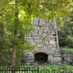
Description As part of Bruce Trail Day, the Toronto Club is organizing a historical hiking tour, on the property of the Limehouse Conservation Area, where the main Bruce Trail route is located. We are fortunate to have local historian, Mark Rowe, to be our tour guide. You will learn about the village’s rich history and importance as a vital stop on the Grand Trunk Railway and later as part of the Radial Suburban Railway. Mark will take us to some of the formidable landmarks on this 3k hike, such as the Powder House, Draw Kiln, Mill Run Ruins and Stone Arch Bridge. You will learn about the importance of the critical raw material lime, and see the various crevices and caves, including the famous Hole in the Wall. The walking tour is expected to take approximately 2 hours. The route is mostly flat with a ladder to access the Hole in the Wall and some uneven rock surfaces. Washroom facilities will be available at the start of the hike.
Bring appropriate outdoor clothing, including good hiking shoes or running shoes, water and a snack.
Hosting Club: Toronto Category: Car Hike Location (Google Maps): We will meet at the Limehouse parking lot on 22 Sideroad (coordinates are 43.638113, -79.979272).
Pace: Leisurely (2-3 km/hr) Terrain: Level 2 (Intermediate – some hills and uneven surfaces, rocks and roots underfoot) Distance (km): 4 km
Description Come and join me for a family-friendly hike in honour of Bruce Trail Day! We will trek a total of 4 km along the Todd Bardes Meadowland Side Trail, the Ridge Side Trail, and the main trail located northeast of Limehouse. There will be a scavenger hunt to complete while hiking, and individuals who would like to work on their Biodiversity Naturalist Badge (https://torontobrucetrailclub.org/the-trail/badges) are encouraged to do so during this hike — I love spotting interesting flora, fauna, and fungi whenever I’m on the Bruce Trail so I would be happy to help hikers in their quest for this badge.
Port-a-potties, refreshments, activities, and displays will be available at the Limehouse Public School parking lot across the street from our meeting location before and after the hike, and there will be Toronto Bruce Trail Club volunteers present to answer any questions you may have about our beloved Bruce Trail.
Children under 13 years of age are encouraged to join their parents/guardians on this hike so they can fulfill the requirements for the Toronto Bruce Trail Club’s Youth Badge (https://torontobrucetrailclub.org/the-trail/badges) — all family members who are planning on joining us should register for the hike, including children. You should bring enough water and food for a 2-hour hike, comfortable footwear with good traction, and appropriate clothing for the weather.
Please note that this hike is part of the Bruce Trail Conservancy’s “Passport to Nature” initiative so all hikers who participate in this hike will receive a sticker that can count towards earning a badge or prize from the Bruce Trail Conservancy! For more information about the “Passport to Nature” initiative, please click here: https://brucetrail.org/passport-to-nature/
Everyone is welcome to attend this hike — looking forward to celebrating Bruce Trail Day with you on October 4th!
Pace: Leisurely (2.0 – 3.0 km/h): A relaxed pace with frequent breaks and a focus on enjoyment. Terrain: Difficult: Steep ascents/descents, rocky scrambling, and some rugged escarpment paths., Easy: Flat forested sections or lowland trails., Moderate: Rolling hills, mild slopes and rocky paths. Distance: 6.0
Description Celebrate Bruce Trail Day with us!
Join us for an immersive interpretive hike through the beautiful Sydney Bay Bluff area in Neyaashiinigmiing. This walk, lead by Tainin Hopkinson, invites participants to explore the land through the lenses of Indigenous knowledge-intertwining natural history, personal story, and community connection. Together, we’ll explore the boundaries of both the Sydney Bay Bluff and the territory of the Chippewas of Nawash Unceded First Nation.
Located close to the iconic Cape Croker Park this hike traverses the sheltered fall canopies of the forests and the dramatic cliffs and stunning vistas of the Niagara Escarpment. The edges and boundaries offer us insights into many unique environments and the resilient adaptations that are needed to survive on the edge. As well, the man-made boundaries between the Chippewas of Nawash and the rest of Canada offer an important opportunity to reflect on the political histories between these two people and how it has shaped the land we get to explore today. It is only through understanding these boundaries and learning to work from both sides of it that we can continue to protect these beautiful places. Expect pauses for discussion, questions, and quiet observation as we deepen our connection to this powerful and storied landscape.
Sturdy footwear and good balance are required. Meet at the Sydney Bay Bluffs Trailhead at Cape Croker Park. The parking fee is waived for Bruce Trail Day participants. Check in at the Park Registration office upon arrival for direction to the parking area. Weather can be unpredictable at this time of year, dress according to the conditions.
This hike is part of Bruce Trail Day, which celebrates togetherness on the Trail and all the ways the Bruce Trail brings us together with one another and our beautiful surroundings! Join us for family friendly activities and light refreshments at the Ferndale Visitor’s Center before your hike.
Hosting Club: Sydenham Category: Sketch or Paint Hike Location (Google Maps): Meet at the Bruce Trail Day tent in Harrison Park in Owen Sound. The tent will be beside the parking lot for the Harrison Park Inn Restaurant.
Pace: Leisurely: 3 km/h or less Terrain: Easy: Mostly flat and good footing. Distance: We will be hiking short distances to find suitable spots to do our nature journalling. Maximum distance covered approximately 3 km.
Description
Nature journalling is a wonderful way to slow down and connect with the natural world around us. It is perfect for anyone who wants to sharpen their powers of observation and learn more about the plants, birds and animals that they see. This session is suitable for all skill levels. You do NOT need to be an artist to enjoy nature journalling. But you do need to be willing to sit quietly and carefully observe what you see. We will cover basic topics such as: what is a nature journal, equipment and supplies, how to get started, what to include in your journal. We will look at examples of various types of journals so you get an idea of how you might like to create your own. And then we will spend time in several different locations, creating our first journal entries. You will need to bring: a folding chair which is easy to carry, several sharp pencils (preferably 2B, but HB is okay), an eraser, and a sketchbook with a hard cover (so you can draw in your lap), or blank, loose paper attached to a clipboard. Optional items are: fine tip black ink markers or pens, pencil crayons, watercolour paints, watercolour pencils, or ink pencils.
Pace: Medium: 3 to 4 km/h Terrain: Easy: Mostly flat and good footing., Moderate: Some hills and/or poor footing, There might be muddy sections., There might be sections with water on the trail. Distance: 23.2 km
Description A chance to celebrate Bruce Trail Day by joining the last day of the Sydenham Club’s 2026 End-to-End in 8 hikes. This hike may be an opportunity to start a self-directed End-to-End in Sydenham or to “fill in the pieces”. The hike distance of just over 23 km will be challenging and you should be in good shape to participate. You will be joining a group of approximately 40 hikers who have already experienced 7 days spread over 4 week-ends. The fee includes bus transportation from parking and the hike end location in Wiarton to the hike start where the bus will drop you off at Graham’s Hill Rd. Then you hike back to your vehicle. You will benefit from 2 checkpoints along the way with water and delicious snacks. The trail largely follows the escarpment edge and the scenery is spectacular: Big Bay Sideroad, Ancient Beach Nature Reserve, Skinner’s Bluff, Skinner’s Woods, Colpoy’s Bay islands, Bruce’s Caves Conservation Area, Wiarton Airport. You will hike without a leader at your own pace but we will provide a team of volunteers to assist hikers including a sweep to bring up the rear of the group. You must bring everything needed for the days hike such as at least a litre of water, lunch, your own first aid, etc. NO REFUNDS will be issued. For additional information email sydenhame2e@gmail.com.
Pace: Moderate (3-4 km/hr) Terrain: Flat, Hilly, Level 2 (Intermediate – some hills and uneven surfaces, rocks and roots underfoot), Variable Distance (km): 14-16Km
Description Let’s roll the hills of the Jefferson Forest and around the Bond Lake. Every week we hike in Jefferson Forest, located in the heart of Richmond Hill, it boasts numerous hiking trails. This 4 hour hike can range from 14 to 15 kilometres, depending on the weather conditions. Remember to bring water, snacks, hiking boots (mandatory), poles, and your camera. Not recommended for beginners. Park in the free Bethesda parking lot and avoid parking along the road. Dress appropriately for the weather. Difficulty Level: 2 (Moderate). Please arrive @7:45AM for start of 8:00AM.
This is a joint hike with the Oak Ridges Trail Association (ORTA).
Pace: Medium (3.0 – 4.5 km/h): A comfortable pace for most hikers with steady progress. Terrain: Moderate: Rolling hills, mild slopes and rocky paths. Distance: 7.0
Description *This is a bus hike; we will be meeting at the Ferndale Visitor’s Center and bussing to the McCurdy Drive Parkette (bus departing at 8:30 am)*
Celebrate Bruce Trail Day with us!
Join us for a memorable hike through Lion’s Head Provincial Park to the iconic Lion’s Head Lookout, one of the most spectacular viewpoints on the Saugeen (Bruce) Peninsula. This route follows forested trails and rugged sections of the Niagara Escarpment. We’ll take a moment to visit the Giant’s Cauldron Side Trail and Lion’s Head Pothole Side Trail along the way. Our destination, Lion’s Head Lookout, rewards hikers with panoramic views of the turquoise waters below, the surrounding cliffs, and the iconic Lion’s Head rock formation. Expect uneven, rocky terrain, exposed cliffside sections, and plenty of opportunities to pause for photos and take in one of the Bruce Peninsula’s most unforgettable landscapes. Sturdy hiking footwear, water, snacks, weather-appropriate layers, and a camera are strongly recommended.
Join us at the Ferndale Visitor’s Center for light refreshments after the hike.
This hike is part of Bruce Trail Day, which celebrates togetherness on the Trail and all the ways the Bruce Trail brings us together with one another and our beautiful surroundings! Join us for family friendly activities and light refreshments at the Ferndale Visitor’s Center after your hike.
Hosting Club: Caledon Hills Category: Introductory Location (Google Maps): Riverside Woods- see website link for directions and parking
Hike Leader(s): CHBTC
Pace: Leisurely – 3 km/hour or less, Medium – 3 to 4 km/hour Terrain: Easy – mostly flat and usually good footing, Moderate – some hills and/or some poor footing
Description Join us on Bruce Trail Day as we celebrate with hikes, crafts, Indigenous artist led interactive music and fun! See weblink for details: https://caledonbrucetrail.ca/events/bruce-trail-day/
Pace: Leisurely (2.0 – 3.0 km/h): A relaxed pace with frequent breaks and a focus on enjoyment. Terrain: Easy: Flat forested sections or lowland trails., Moderate: Rolling hills, mild slopes and rocky paths. Distance: 4.5
Description Celebrate Bruce Trail Day with us!
Join us and Bruce Trail Conservancy Staff Ecologist Brian Popelier for a guided hike exploring the incredible flora and fauna of the fall season. We’ll follow the Bruce Trail’s main trail along the Niagara Escarpment, taking in spectacular views over Barrow Bay before returning to the parking lot via the John Appleton Side Trail. Along the way, we’ll enjoy a relaxed “stop, look, and listen” pace, pausing frequently to observe wildflowers, fungi, birds, and other wildlife we encounter while learning about the unique ecology of the area.
This hike is part of Bruce Trail Day, which celebrates togetherness on the Trail and all the ways the Bruce Trail brings us together with one another and our beautiful surroundings! Join us for family friendly activities and light refreshments at the Ferndale Visitor’s Center after your hike.
Description Join the Niagara Bruce Trail Club in celebrating Bruce Trail Day. As part of our Bruce Trail Day celebration at Brock University (LOT 2) we will host a geology hike led by the Niagara Aspiring GeoPark. Come at 9am to check out our booths and displays, head out for a geology hike at 9:15, and come back to celebrate with us. Hike will be accessible for anyone, including new hikers.
Pace: Moderate (3-4 km/hr) Terrain: Level 2 (Intermediate – some hills and uneven surfaces, rocks and roots underfoot), Other (Refer to Description), Variable Distance (km): 9 km
Description ** This hike has been cancelled due to low registration
Join us to celebrate Bruce Trail Day on the trail around Limehouse. For the first 5 km we will hike south from the Sixth Line to Limehouse. The route incorporates the portion of trail removed from the Fifth Line thanks to those who support the Bruce Trail. We’ll also pass the seed orchard where native species are grown for the seeds to be replanted to re-naturalize other parts of the trail. Those who want a shorter hike may drop out at Limehouse where information and refreshments will be available at the Memorial Hall. The second part of the hike will be a loop through the Limehouse Conservation area featuring the limestone kilns, stone arched bridge, and a climb through the “hole in the wall”. Expect some slightly rocky terrain underfoot and a few moderate hills. Hiking boots or good shoes designed for walking are a must. Those completing the full 9 km will also have a chance to drop in at the Memorial Hall to learn more about the Bruce Trail and refreshments.
=>>> Please read the TBTC Paid Hikes Refund Policy before registering: https://torontobrucetrailclub.org/hikes/no-show-policy”. There will be no refunds for this hike if the registrant cancels or misses the coach on the date of departure for any reason. Registration fees are not transferable between different hikes nor can unused fares qualify for a tax receipt. All hike go rain or shine with the exception of an extreme weather event.
Hosting Club: Caledon Hills Category: General Location (Google Maps): Scotsdale Farm, Map 13. Directions; from Highway 401, head north on Trafalgar Road past Georgetown. Trafalgar briefly merges with Highway 7 for about 3 km before separating to the right at the village of Silver Creek. At the stop light in Silver Creek, continue north on Trafalgar Road for about 1 km to the entrance of Scotsdale Farm on your right. Drive in about half a kilometre to reach the parking area.
Pace: Medium – 3 to 4 km/hour Terrain: Moderate – some hills and/or some poor footing Distance: 13 km
Description 🌈 Join us for a queer/trans-led, 2SLGBTQIA+ inclusive loop hike along the main Bruce Trail and its scenic side trails, including the stunning Great Esker Side Trail.
This hike is welcoming to LGBTQ+ hikers, and anyone interested in connecting with community while enjoying a beautiful day on the trail.
We’ll be hiking approximately 13 km at a medium pace. Please dress appropriately for the weather, bring plenty of water, and pack snacks or a light lunch. Some sections of the trail are rocky, so hiking poles are highly recommended.
Pace: Leisurely: 3 km/h or less Terrain: Moderate: Some hills and/or poor footing Distance: 4 km
Description Celebrate Bruce Trail Day by joining us on this Discovery Hike from GSCA to Inglis Falls and back – we’ll take our time, and see what we can find. We’ll cross the Sydenham River, hike through forests, climb the Escarpment, check out geological potholes and take a peek at Inglis Falls, returning via mostly the same route. Free ‘Boots on the Trail’ badges are available to youth 18 and under. This is also a great route to choose for the By the Seasons badge. As we’ll be taking our time, this hike is suitable for families, new hikers, and anyone wanting a more leisurely hike. All ages are welcome. We’ll likely take a couple of hours (possibly more), depending on the group and conditions – dress in layers, bring a snack, and wear good footwear. Given that October conditions can be variable, an email re: trail conditions to expect will be sent out prior to our hike together. The trail may be mucky in portions.
If you are unable to register, please contact the hike leader via the link above. Carpooling may be available upon request.
Pace: Leisurely – 3 km/hr. or less Terrain: Moderate – Some hills and/or some poor footing
Description Join us for the Fifth Annual Music Hike and Bruce Trail Day, a unique celebration where music meets nature. Musicians will be scattered throughout the scenic wilderness, serenading hikers as they explore breathtaking forest trails and lookouts. A Passport To Nature Hike! Collect stickers! Win badges!
Hosting Club: Niagara Category: Rainbow 🌈 Location (Google Maps): Meet at Brock University, Lot 2, enter via Flora Egerter Way. Address: Lot 2, Flora Egerta Way,Thorold, On L2S 3A1 https://maps.app.goo.gl/GeFaYPsvpSeY8hvV7
Pace: Medium 3- 4 km/hr Terrain: Moderate: some hills and some poor footing Distance: approx 4 km
Description Join the Niagara Bruce Trail Club, Bridges Niagara Immigrant and Refugee Services and PFLAG Niagara for a Rainbow-Welcome Hike as part of Bruce Trail Day, starting on the campus of Brock University.
What is a Rainbow-Welcome Hike?
Rainbow-Welcome hikes aim to bring 2S-LGBTQIA+ newcomers together with other newcomers and community members, friends and allies to enjoy nature and connect to the land and enjoy nature in all seasons.
It is an intentionally affirming space for people of diverse backgrounds and identities with a focus on 2S-LGBTQIA+ inclusion. Everyone is welcome.
Hike description:
Explore the trails around Brock University. Expect some ups and downs and moving at a moderate pace. Stay afterwards to celebrate Bruce Trail Day with the NBTC.
Note: If you don’t have transportation to get to Brock, there may be space on a charter bus coming from Bridges Niagara Immigrant and Refugee Services. Please message us for info.
Pace: Moderate (3-4 km/hr) Terrain: Level 2 (Intermediate – some hills and uneven surfaces, rocks and roots underfoot), Variable Distance (km): 10-13 km
Description Come join me for hike through Scotsdale Farm and the Silver Creek Conservation Area to enjoy the fall colours.
We will complete a loop hike on the main and side trails. Shorter loops are available for those who do not want to complete the full length. After the hike all are invited to join me for refreshments at the Shepherd’s Crook in old Georgetown.
To get to the meeting point from Hwy 401 go north on Trafalgar Road past Georgetown to the juncture with Hwy 7. North on Hwy 7 to Silver Creek. Turn right and back onto Trafalgar Road. Go north about 1.5 km to the entrance of Scotsdale Farm on your right. The parking area is about 0.5 km from Trafalgar Road near the old homestead.
Hosting Club: Toronto Category: Car Hike Location (Google Maps): We will meet at the Limehouse parking lot on 22 Sideroad (coordinates are 43.638113, -79.979272).
Pace: Leisurely (2-3 km/hr) Terrain: Level 2 (Intermediate – some hills and uneven surfaces, rocks and roots underfoot) Distance (km): 4 km
Description Come and join me for a family-friendly hike in honour of Bruce Trail Day! We will trek a total of 4 km along the Todd Bardes Meadowland Side Trail, the Ridge Side Trail, and the main trail located northeast of Limehouse. There will be a scavenger hunt to complete while hiking, and individuals who would like to work on their Biodiversity Naturalist Badge (https://torontobrucetrailclub.org/the-trail/badges) are encouraged to do so during this hike — I love spotting interesting flora, fauna, and fungi whenever I’m on the Bruce Trail so I would be happy to help hikers in their quest for this badge.
Port-a-potties, refreshments, activities, and displays will be available at the Limehouse Public School parking lot across the street from our meeting location before and after the hike, and there will be Toronto Bruce Trail Club volunteers present to answer any questions you may have about our beloved Bruce Trail.
Children under 13 years of age are encouraged to join their parents/guardians on this hike so they can fulfill the requirements for the Toronto Bruce Trail Club’s Youth Badge (https://torontobrucetrailclub.org/the-trail/badges) — all family members who are planning on joining us should register for the hike, including children. You should bring enough water and food for a 2-hour hike, comfortable footwear with good traction, and appropriate clothing for the weather.
Please note that this hike is part of the Bruce Trail Conservancy’s “Passport to Nature” initiative so all hikers who participate in this hike will receive a sticker that can count towards earning a badge or prize from the Bruce Trail Conservancy! For more information about the “Passport to Nature” initiative, please click here: https://brucetrail.org/passport-to-nature/
Everyone is welcome to attend this hike — looking forward to celebrating Bruce Trail Day with you on October 4th!
Pace: Moderate (3-4 km/hr) Terrain: Challenging, Hilly, Level 3 (Advanced – steep hills and some scrambling over boulders) Distance (km): about 19.2 km
Description Please join me for a challenging hike on the Bruce Trail (main and side trails) in the Beaver Valley. We will be following the Beaver Valley Short loop of ca 19.2 km from the Hogg’s Falls Parking lot (170491-172753, Lower Valley Rd, Flesherton, ON N0C 1E0). From there, we will start hiking the main Bruce Trail toward Eugenia Falls and continue with the loop counter-clockwise. We will make short water and pit breaks and one long (at least 45 min) lunch break to eat, rest and enjoy, and we should finish the hike before 5 pm. After the hike, we will have a stop at a brewery or cidery (we will decide on the hike) before we head home.
For more information (including technical details) about this loop, please check “Beaver Valley Short Loop” on the Alltrails app on your phone or click on this link to the website: https://www.alltrails.com/trail/canada/ontario/beaver-valley-short-loop
Please note that this is a long hike and a relatively long day trip if you are coming from the GTA.
We will try to keep a moderate pace of about 3 km/h while slowing down uphill. The trail is challenging with a few uphill sections after which we will stop for short water breaks.
Please be dressed for the weather, wear hiking shoes/boots, bring extra layers and pack your rain gear (just in case), at least 2 L of water, light lunch and several snacks, your sunglasses and/or hut.
We will meet at the Hogg’s Falls Parking lot (170491-172753, Lower Valley Rd, Flesherton, ON N0C 1E0)
Please note that this hike is not suitable for a rainy/stormy day and will be cancelled in case of inclement weather.
Pace: Leisurely – 3km/hr or less Terrain: Moderate – Some hills and/or some poor footing Distance: 3.5 km
Description Bruce Trail Day is an annual celebration of the Bruce Trail and the wonders of the Niagara Escarpment, hosted by the Bruce Trail Conservancy at each of its Bruce Trail Clubs.
Join us for the FREE guided hikes to help you explore the Bruce Trail and discover the amazing variety of life along the Niagara Escarpment. We’ll also have a tent area where you can meet Board Members, other BTC members and hikers. Come and learn about our year-round hiking programs, volunteer opportunities, and what we are doing to preserve a ribbon of wilderness in southern Ontario from Niagara to Tobermory.
Everyone is welcome! We invite nature lovers, hikers of all levels, and anyone wanting to venture onto the Bruce Trail for the first time, or the hundredth time, to join us.
This is for beginner hikers or anyone wanting to enjoy a leisurely hike as part of your visit on Bruce Trail. We will hike on a variety of terrains, flat and hilly on both the main and side trails. Sturdy shoes/boots are recommended, dress for the weather. Water is always a good idea when hiking, sun screen/hat, and bug spray are also recommendations.
As this is a Passport to Nature event, you will receive a sticker for your Passport: Collect 4 stickers and get a badge, collect 9 different colour stickers and receive a BTC store gift card.
Pace: Leisurely <3 km/hr Terrain: Moderate: some hills and some poor footing Distance: ~5km
Description NBTC FALL NATURE HIKE
Hiking boots and poles are recommend as the terrain is rocky in sections.
Join us for the NBTC Nature Hike series to learn more about the biodiversity along the Niagara Escarpment. We will explore the trails throughout Louth Conservation area which offer beauty in all four seasons. Hikes will be held January, May, July & October – it will be amazing to see all the changes throughout the seasons. Your hike leaders, members of the NBTC Biodiversity Committee, will share their knowledge of the amazing flora & fauna along the trail as well as any biodiversity projects in the works for this year.
Parking is at the Louth Conservation Area Parking Lot on Staff Ave. Hiking boots and poles are recommend as the terrain is rocky in sections.
Note that he hike will be rescheduled in the event of heavy rains or heavy snow.
Pace: Medium Terrain: Moderate, Some steep sections, Some rocky footing Length of Hike: Approx. 5 km
Description Join us for a lovely fall hike as we loop around the main and side trails of Eagle’s Summit. There are some spectacular views across the valley as well as mixed forest, fall foliage and fungi. Bring water, wear sturdy shoes or hiking boots and dress prepared for the weather. Meet in the village of Kimberley (Grey Road 13) at the Town Hall, parking along the paved roadside, or in the town hall parking lot. We’ll have a short bus shuttle to the start of the hike. Please note that pre-registration is recommended but not necessary.
Pace: Leisurely – 3km/hr or less Terrain: Easy – Mostly flat and usually good footing Distance: Approx. 3 km.
Description Join in Bruce Trail Day festivities by joining this hike suitable for children and their families. While completing this hike you will be able to earn your Fall Junior Hiker badge as well as a First Hike with Bruce Trail badge. Learn a little about Bruce Trail, see some fantastic views towards the lake, walk on the edge of the escarpment and learn about nature. Have fun with your family and other children. We look forward to meeting you. (Children must be accompanied by an adult)
Bruce Trail Day is an annual celebration of the Bruce Trail and the wonders of the Niagara Escarpment, hosted by the Bruce Trail Conservancy at each of its Bruce Trail Clubs.
Join us for the FREE guided hikes to help you explore the Bruce Trail and discover the amazing variety of life along the Niagara Escarpment. We’ll also have a tent area where you can meet Board Members, other BTC members and hikers. Come and learn about our year-round hiking programs, volunteer opportunities, and what we are doing to preserve a ribbon of wilderness in southern Ontario from Niagara to Tobermory.
Everyone is welcome! We invite nature lovers, hikers of all levels, and anyone wanting to venture onto the Bruce Trail for the first time, or the hundredth time, to join us.
As this is a Passport to Nature event, you will receive a sticker for your Passport: Collect 4 stickers and get a badge, collect 9 different colour stickers and receive a BTC store gift card.
Pace: Medium – 3 to 4 km/hr Terrain: Moderate – Some hills and/or some poor footing Distance: 5.5 km
Description Bruce Trail Day is an annual celebration of the Bruce Trail and the wonders of the Niagara Escarpment, hosted by the Bruce Trail Conservancy at each of its Bruce Trail Clubs.
Join us for the FREE guided hikes to help you explore the Bruce Trail and discover the amazing variety of life along the Niagara Escarpment. We’ll also have a tent area where you can meet Board Members, other BTC members and hikers. Come and learn about our year-round hiking programs, volunteer opportunities, and what we are doing to preserve a ribbon of wilderness in southern Ontario from Niagara to Tobermory.
Everyone is welcome! We invite nature lovers, hikers of all levels, and anyone wanting to venture onto the Bruce Trail for the first time, or the hundredth time, to join us.
This hike with take us down into Kerncliffe Park to explore the old quarry + marsh, with a great view of the escarpment and some side trails within the forest. And then back up to the top for a great view of Burlington and the lake.
As this is a Passport to Nature event, you will receive a sticker for your Passport: Collect 4 stickers and get a badge, collect 9 different colour stickers and receive a BTC store gift card.
Pace: Medium – 3 to 4 km/hr Terrain: Moderate – Some hills and/or some poor footing Distance: 6 km
Description Bruce Trail Day is an annual celebration of the Bruce Trail and the wonders of the Niagara Escarpment, hosted by the Bruce Trail Conservancy at each of its Bruce Trail Clubs.
Join us for the FREE guided hikes to help you explore the Bruce Trail and discover the amazing variety of life along the Niagara Escarpment. We’ll also have a tent area where you can meet Board Members, other BTC members and hikers. Come and learn about our year-round hiking programs, volunteer opportunities, and what we are doing to preserve a ribbon of wilderness in southern Ontario from Niagara to Tobermory.
Everyone is welcome! We invite nature lovers, hikers of all levels, and anyone wanting to venture onto the Bruce Trail for the first time, or the hundredth time, to join us.
This hike with take us west to King Road, then onto King Side trail down into a little valley, back toward City View for a great view of Burlington and the lake, then down into Kerncliffe Park within the forest. And then back up to the top.
As this is a Passport to Nature event, you will receive a sticker for your Passport: Collect 4 stickers and get a badge, collect 9 different colour stickers and receive a BTC store gift card.
Pace: Leisurely (2.0 – 3.0 km/h): A relaxed pace with frequent breaks and a focus on enjoyment., Medium (3.0 – 4.5 km/h): A comfortable pace for most hikers with steady progress. Terrain: Easy: Flat forested sections or lowland trails., Moderate: Rolling hills, mild slopes and rocky paths. Distance: 8.0
Description *This is a bus hike; we will be meeting at the Ferndale Visitor’s Center (2928 Hwy 6, Lion’s Head, ON N0H 1W0) and bussing to the Jones Bluff Trailhead (bus departing at 12:30 pm)*
Celebrate Bruce Trail Day with us!
Join us for an immersive interpretive hike through the beautiful Jones Bluff in Neyaashiinigmiing. This walk invites participants to take a journey through time, exploring the land through the lenses of Anishinaabe knowledge-intertwining natural history, personal story, and community connection. Together, we’ll consider how we relate to land and how land relates to us. During this exploration you will learn about the traditional plants and wildlife that play a pivotal role in the traditional and contemporary lives of the Anishinaabek people. Expect pauses for discussion, questions, and quiet observation as we deepen our connection to this powerful and storied landscape.
Weather can be unpredictable at this time of year; dress according to the conditions. This hike is about 4 hours in duration.
This hike is part of Bruce Trail Day, which celebrates togetherness on the Trail and all the ways the Bruce Trail brings us together with one another and our beautiful surroundings! Join us for family friendly activities and light refreshments at the Ferndale Visitor’s Center before your hike.
Hosting Club: Sydenham Category: Bruce Trail Day Hike/Event Location (Google Maps): Harrison Park by the Bruce Trail Event tent near the bridge. 75 Second Avenue East, Owen Sound, ON
Pace: Leisurely: 3 km/h or less Terrain: Easy: Mostly flat and good footing., Moderate: Some hills and/or poor footing Distance: 3.5 km approx.
Description Please join Carol and Danuta on this relaxed public hike to celebrate Bruce Trail Day together around Harrison Park and the Arboretum. This nature walk is relatively flat with a couple of hills up and down and suitable for all ages. We will start at the Bruce Trail Event tent near the bridge and walk south up to the Arboretum and Conservation building. An easy loop to see the river, the Trees of the World area and our native tree planting section. Please bring poles as needed and water. We will return by 2:30 p.m.
Pace: Leisurely – 3km/hr or less Terrain: Moderate – Some hills and/or some poor footing Distance: Approximately 3.5 kms
Description Bring yourself and/or your family to a fun, free, Fall scavenger-hunt themed hike on Sunday to celebrate Bruce Trail days –leisurely pace starting from City View Park to King Rd and back
Approximately 1.5 hour guided hike – Map 9 in the Reference Guidebook
While completing this hike you will be able to earn your Fall Junior Hiker badge. Here is the link to order your badge. https://iroquoia.on.ca/hiking/badges/junior-hiker-program ($7 each)
As well we will have First Hike Bruce Trail badges available, which is complimentary.
Learn a little about Bruce Trail, see some fantastic views towards the lake, walk on the edge of the escarpment and learn about nature. Have fun with your family and other children. We look forward to meeting you. (Children must be accompanied by an adult)
Bruce Trail Day is an annual celebration of the Bruce Trail and the wonders of the Niagara Escarpment, hosted by the Bruce Trail Conservancy at each of its 9 Bruce Trail Clubs We’ll also have a tent area where you can meet other BTC members and hikers. Come and learn about our year-round hiking programs, volunteer opportunities, and what we are doing to preserve a ribbon of wilderness in southern Ontario from Niagara to Tobermory.
Everyone is welcome! We invite nature lovers, hikers of all levels, and anyone wanting to venture onto the Bruce Trail for the first time, or the hundredth time, to join us.
As this is a Passport to Nature event, you will receive a sticker for your Passport: Collect 4 stickers and get a badge, collect 9 different colour stickers and receive a BTC store gift card
Pace: Leisurely Terrain: Easy Length of Hike: 2-3 km
Description Join us for a leisurely fall hike as we catch the view at the John Muir/Epping Lookout, then cross the road to fields and forest, and if we’re lucky, see migrating birds at the beaver pond. Those of you who like to bird watch can bring your binoculars. Bring water, wear sturdy shoes or hiking boots and dress prepared for the weather. Meet in the village of Kimberley (Grey Road 13) at the Town Hall, parking along the paved roadside, or in the town hall parking lot. We’ll have a short bus shuttle to the start of the hike. Please note that pre-registration is recommended but not necessary.
Hosting Club: Toronto Category: Car Hike Location (Google Maps): Parking is available across from the Limehouse Public School. The Hike will start across the bridge – we will meet at the Limehouse Memorial Hall building.
Pace: Leisurely (2-3 km/hr) Terrain: Level 2 (Intermediate – some hills and uneven surfaces, rocks and roots underfoot), Variable Distance (km): 3 km
Description As part of Bruce Trail Day, the Toronto Club is organizing a historical hiking tour, on the property of the Limehouse Conservation Area, where the main Bruce Trail route is located. We are fortunate to have local historian, Mark Rowe, to be our tour guide. You will learn about the village’s rich history and importance as a vital stop on the Grand Trunk Railway and later as part of the Radial Suburban Railway. Mark will take us to some of the formidable landmarks on this 3k hike, such as the Powder House, Draw Kiln, Mill Run Ruins and Stone Arch Bridge. You will learn about the importance of the critical raw material lime, and see the various crevices and caves, including the famous Hole in the Wall. The walking tour is expected to take approximately 2 hours. The route is mostly flat with a ladder to access the Hole in the Wall and some uneven rock surfaces. Washroom facilities will be available at the start of the hike.
Bring appropriate outdoor clothing, including good hiking shoes or running shoes, water and a snack.
Hosting Club: Toronto Category: Car Hike Location (Google Maps): We will meet at the Limehouse parking lot on 22 Sideroad (coordinates are 43.638113, -79.979272).
Pace: Leisurely (2-3 km/hr) Terrain: Level 2 (Intermediate – some hills and uneven surfaces, rocks and roots underfoot) Distance (km): 4 km
Description Come and join me for a family-friendly hike in honour of Bruce Trail Day! We will trek a total of 4 km along the Todd Bardes Meadowland Side Trail, the Ridge Side Trail, and the main trail located northeast of Limehouse. There will be a scavenger hunt to complete while hiking, and individuals who would like to work on their Biodiversity Naturalist Badge (https://torontobrucetrailclub.org/the-trail/badges) are encouraged to do so during this hike — I love spotting interesting flora, fauna, and fungi whenever I’m on the Bruce Trail so I would be happy to help hikers in their quest for this badge.
Port-a-potties, refreshments, activities, and displays will be available at the Limehouse Public School parking lot across the street from our meeting location before and after the hike, and there will be Toronto Bruce Trail Club volunteers present to answer any questions you may have about our beloved Bruce Trail.
Children under 13 years of age are encouraged to join their parents/guardians on this hike so they can fulfill the requirements for the Toronto Bruce Trail Club’s Youth Badge (https://torontobrucetrailclub.org/the-trail/badges) — all family members who are planning on joining us should register for the hike, including children. You should bring enough water and food for a 2-hour hike, comfortable footwear with good traction, and appropriate clothing for the weather.
Please note that this hike is part of the Bruce Trail Conservancy’s “Passport to Nature” initiative so all hikers who participate in this hike will receive a sticker that can count towards earning a badge or prize from the Bruce Trail Conservancy! For more information about the “Passport to Nature” initiative, please click here: https://brucetrail.org/passport-to-nature/
Everyone is welcome to attend this hike — looking forward to celebrating Bruce Trail Day with you on October 4th!
Pace: Leisurely (2.0 – 3.0 km/h): A relaxed pace with frequent breaks and a focus on enjoyment. Terrain: Difficult: Steep ascents/descents, rocky scrambling, and some rugged escarpment paths., Easy: Flat forested sections or lowland trails., Moderate: Rolling hills, mild slopes and rocky paths. Distance: 6.0
Description Celebrate Bruce Trail Day with us!
Join us for an immersive interpretive hike through the beautiful Sydney Bay Bluff area in Neyaashiinigmiing. This walk, lead by Tainin Hopkinson, invites participants to explore the land through the lenses of Indigenous knowledge-intertwining natural history, personal story, and community connection. Together, we’ll explore the boundaries of both the Sydney Bay Bluff and the territory of the Chippewas of Nawash Unceded First Nation.
Located close to the iconic Cape Croker Park this hike traverses the sheltered fall canopies of the forests and the dramatic cliffs and stunning vistas of the Niagara Escarpment. The edges and boundaries offer us insights into many unique environments and the resilient adaptations that are needed to survive on the edge. As well, the man-made boundaries between the Chippewas of Nawash and the rest of Canada offer an important opportunity to reflect on the political histories between these two people and how it has shaped the land we get to explore today. It is only through understanding these boundaries and learning to work from both sides of it that we can continue to protect these beautiful places. Expect pauses for discussion, questions, and quiet observation as we deepen our connection to this powerful and storied landscape.
Sturdy footwear and good balance are required. Meet at the Sydney Bay Bluffs Trailhead at Cape Croker Park. The parking fee is waived for Bruce Trail Day participants. Check in at the Park Registration office upon arrival for direction to the parking area. Weather can be unpredictable at this time of year, dress according to the conditions.
This hike is part of Bruce Trail Day, which celebrates togetherness on the Trail and all the ways the Bruce Trail brings us together with one another and our beautiful surroundings! Join us for family friendly activities and light refreshments at the Ferndale Visitor’s Center before your hike.
Hosting Club: Sydenham Category: Sketch or Paint Hike Location (Google Maps): Meet at the Bruce Trail Day tent in Harrison Park in Owen Sound. The tent will be beside the parking lot for the Harrison Park Inn Restaurant.
Pace: Leisurely: 3 km/h or less Terrain: Easy: Mostly flat and good footing. Distance: We will be hiking short distances to find suitable spots to do our nature journalling. Maximum distance covered approximately 3 km.
Description
Nature journalling is a wonderful way to slow down and connect with the natural world around us. It is perfect for anyone who wants to sharpen their powers of observation and learn more about the plants, birds and animals that they see. This session is suitable for all skill levels. You do NOT need to be an artist to enjoy nature journalling. But you do need to be willing to sit quietly and carefully observe what you see. We will cover basic topics such as: what is a nature journal, equipment and supplies, how to get started, what to include in your journal. We will look at examples of various types of journals so you get an idea of how you might like to create your own. And then we will spend time in several different locations, creating our first journal entries. You will need to bring: a folding chair which is easy to carry, several sharp pencils (preferably 2B, but HB is okay), an eraser, and a sketchbook with a hard cover (so you can draw in your lap), or blank, loose paper attached to a clipboard. Optional items are: fine tip black ink markers or pens, pencil crayons, watercolour paints, watercolour pencils, or ink pencils.
Pace: Medium – 3 to 4 km/hr Terrain: Moderate – Some hills and/or some poor footing, Strenuous – Hilly with steep climbs and some poor footing Distance: 15 KM
Description This is a series of five hikes in the Dufferin Hi-Land section of the Bruce Trail to complete all blue-blazed trails in the section. Hikers finishing all hikes in the series will be eligible to obtain the Dufferin Hi-Land Club’s Side Trails Badge. All hikes in the series will be loops including sections of the main trail and the entirety of several side trails.
This second hike of the series will include completing the following side trails: David Hahn, Rock Hill Park, Moss Haven, Oliver Creek, Mulmur Lookout, Boyne Creek, Enchanted Forest, 2nd Line ECL
The trail will include steep and rocky sections, please wear appropriate footwear for the terrain; hiking boots or shoes. Hiking poles are recommended. Insects are still active at this time of year, so come prepared by wearing long pants and long sleeves; bring insect repellent/bug nets as needed. Bring plenty to drink and a snack/lunch.
Please arrive at the meeting place by 8:15 am for an 8:30 am departure.
Hosting Club: Sydenham Category: Birding and Wildlife Hike Location (Google Maps): Bognor Marsh Conservation Area parking lot. Please note this is a paid parking lot using a smart phone. Map 29, Edition 31, 27.0 km.
Pace: Leisurely: 3 km/h or less Terrain: Easy: Mostly flat and good footing., There might be muddy sections., There might be sections with water on the trail. Distance: ~ 4 km
Description
This hike will ramble around the Bognor Marsh Management Area. This Management Area includes upland forests, three major marshes, natural regeneration areas, and several small springs feeding the marsh and stream system. It is home to a variety of waterfowl and other marsh-living animals, birds, and plants. Numerous interpretive signs along the boardwalk indicate the varied species of wildlife that call this marsh home. Hopefully, we will encounter some of this wildlife! We will slowly walk the extensive boardwalk scanning for anything that moves. We will have the opportunity to get a birds eye view of the marsh from a viewing tower. From the tower we will continue to follow the main trail into the forest to observe any wildlife that is about. From here we will re-trace our steps over the boardwalk and return to our vehicles.
This will be a great hike for anyone who wants to get out and get some fresh air in a natural environment. No previous hiking experience is necessary. Just bring your enthusiasm for the great outdoors!
A pair of binoculars and/or a scope will come in handy during this hike. You may also want to download the Seek app to help us identify plants and the Merlin Bird App to help us identify birds.
Meeting Time: 8:45 AM
Participant Requirements
Proper hiking boots / footwear
Appropriate clothing for the weather
Personal medications (ie: epi pen) and your health card
Hosting Club: Peninsula Category: Autumn Adventures Location (Google Maps): Meet at the Wiarton Propeller Club (WPC), 575 Edward Street, Wiarton. Will car pool/shuttle from WPC to Spirit Rock Conservation Area, 92 Hwy#6, Wiarton, ON.
Pace: Leisurely (2.0 – 3.0 km/h): A relaxed pace with frequent breaks and a focus on enjoyment. Terrain: Easy: Flat forested sections or lowland trails. Distance: 3.5 km
Description In partnership with the Wiarton Propeller Club, the Peninsula Bruce Trail Club (PBTC) is excited to offer a new series of hikes designed especially for first time senior hikers. Hikes will be short, with an easy pace and terrain. Hikers will learn the basics of hiking including proper use of hiking poles, following trail blazes, keeping safe on the trail, and suitable gear tips for water and snacks. Hikes will feature some of the beautiful sites near Wiarton and provide a fun, social outing with lots of time for conversation with fellow hikers.
This first hike in the series will explore the Spirit Rock Conservation Area, a small portion of the main Bruce Trail, some side trails, and an impressive view of Colpoy’s Bay. It will feature a glimpse into some of the history of Bruce County and its settlers with a visit to the ruins of the McNeil estate, a 19th century mansion. This will be a short hike of about 3.5 km on easy terrain. Duration of the hike will be about 2.5 hours.
The group will meet at the Wiarton Propeller Club, and carpool to Spirit Rock Conservation Area. If you have a vehicle, you are expected to participate in carpooling hikers to the start of the hike and back to the meeting point. Any applicable parking fees will the shared equally.
Dress and prepare for the weather conditions that day. Bring sufficient hydration, accessible snacks, hiking poles.
Pace: Brisk 4-5 km/hr Terrain: Moderate: some hills and some poor footing Distance: 10k+
Description Our regular Spot for the Tuesday Long Hike. Note the new location. We will hike the trails around Short Hills Dress for the weather and bring sunscreen bug spray, poles snack and drink
Pace: Brisk – 4 to 5 km/hr Terrain: Moderate – Some hills and/or some poor footing Distance: 10k+
Description We will hike the trails around the Dundas Valley Conservation Area. Dress for the weather wearing hiking boots. Please also bring sunscreen, bug spray, poles, water and a snack.
Pace: Medium 3- 4 km/hr Terrain: Moderate: some hills and some poor footing Distance: 6 kms
Description Hike the main and side trails in Short Hills Provincial Park. Please bring water, insect repellent, sunscreen and hiking poles. Check yourself thoroughly for ticks following the hike,
Hosting Club: Caledon Hills Category: End-to-End Location (Google Maps): This is a Dufferin Hi-Lands End to End from North to South. A hike plan with meeting spots for each of the 6 days will be shared with registered hikers by email
Pace: Leisurely – 3 km/hour or less, Medium – 3 to 4 km/hour Terrain: Moderate – some hills and/or some poor footing, Strenuous – hilly with steep climbs and some poor footing Distance: Hikes average 10 km, ranging from 9 to 11 km
Description This is a fundraising hike, all proceeds go to the Dufferin Hi-Lands Bruce Trail Club to maintain infrastructure along the trail. There are no refunds.
Hikes average 10 km per day, 2 concurrent days over 3 weeks in October.
Please do not register for this hike unless you can commit to all 6 days. If you need to miss one day, please make it up before the series finishes and notify the leader.
The hikes will be at a moderate 3 – 3.5 km per hour pace so there is time to enjoy the rolling hills and views, take in some fall colour, and enjoy the company of a small group. We will take a couple of shorter nutrition breaks. Be sure to have snacks and water and your favourite drink packed.
All hikes in this series will include a car shuttle and everyone will take a turn as a shuttle driver. Please have your vehicle passenger-ready with at least 3 to 4 available seat belts.
Hosting Club: Toronto Category: Urban Walk Location (Google Maps): Toronto Waterfront Trail, Tommy Thompson Park, Cherry Beach, and Biddaasige Park. Meet at the Wendy’s Tim Hortons on Leslie Street at Lakeshore Blvd. (Take Jones 83 Bus from Donlands Station on Line 1)
Pace: Moderate (3-4 km/hr) Terrain: Flat, Level 1 (Easy – mostly on flat, well maintained trails with hard-packed surface) Distance (km): 8 km
Description Please join me for a fall morning hike on Toronto’s Waterfront Trail. We will take in Leslie Lookout Point Park, the base of Tommy Thompson Park, Cherry (Clarke) Beach, and the eastern portion of Biddaasige Park. This is a Tuesday morning “shurb” (short urban walk) meant to finish by 12:00 to 12:30. There will be an option of a lunch/refreshment stop after the hike.
Location (Google Maps): Parking lot is off Sycamore Drive, East of Bayview , across Starbucks plaza Bus 91 from Finch East station stops at Sycamore station.
Pace: Moderate (3-4 km/hr) Terrain: Hilly, Level 2 (Intermediate – some hills and uneven surfaces, rocks and roots underfoot) Distance (km): 7-8 km
Description We will explore Valleyview and Maple View parks, and walk along German Mills Creek, in return we stop in Huntington park and have snack ,coffee,tea .
Although this is considered an “Urban Walk”, you can expect some hills up and down and uneven surfaces with tree roots. Please bring hiking poles, water and snacks.
Pace: Medium – 3 to 4 km/hr Terrain: Moderate – Some hills and/or some poor footing Distance: 7 kms
Description We will meet in the Hilton Falls Parking lot and carpool to 6th Line and hike back along the two Bent Rim trails and the Hilton Falls Side Trail back to the cars. The Bent Rim trails are actually bike trails and have some rather technical (rocky) sections to them, so be prepared for some challenges.
For those leaving their car at Hilton Falls, you will need to reserve your time at conservationhalton.ca
Pace: Leisurely Terrain: Moderate, Slippery and Steep Sections Distance: 5.6 Km, Short hike: 2.5 Km.
Description We will hike a loop consisting of Hockley Rd and Tom East Side Trails and Main Trail. Shorter hike will turn back where the Tom East trail turns sharply to the east. Bring water and snacks.
Pace: Leisurely – 3 km/hr. or less Terrain: Moderate – Some hills and/or some poor footing Distance: 7km
Description This hike is a bit further afield but is definitely worth the 1 hour drive to the trailhead. The Glen Cross and Cam Snell side trails are two loop trails located in the Hockley Valley Provincial Nature Reserve. The Reserve was established to protect one of the most unique geological areas along the entire Niagara Escarpment. Here the Escarpment and the western end of the Oak Ridges Moraine meet, creating one of Ontario’s most scenic and ecologically important landscapes. The Reserve is also in the Headwaters area where the two river branches that are the source of the Nottawasaga River join on their journey north. This area is unique in the way it combines glacial topography, mature forests, hydrology, and biodiversity. That combination makes it one of the Niagara Escarpment’s most ecologically valuable and rewarding places to explore.
This will be a leisurely paced 2.5 hour hike to enjoy everything the area has to offer. There are some steep but short climbs and descents but footing is generally good. Although there could be some slippery areas if it’s been raining in which case hiking poles would be advised. Please make certain to bring water and snacks. For those that wish, we can organize an optional stop on the drive home at the Mono Centre Brewing Co. to slake our thirst.
Location (Google Maps): Meet at the BTC parking on Hope Bay Rd near the campground. A parking lot and pit toilets are located south of Cedarholm Campground General Store km44.1, Map37, ED31 Shuttle to 24.4 on Crooked Toe Rd (44.873790,-81.075044)
Pace: Brisk Terrain: Some rocky footing, Some steep sections, Strenuous Length of Hike: 20 km (all distances are approximate)
Description The Tuesday Trekkers are taking a field trip to the Peninsula for the month of October. We will cover the entire section of 163.1 km’s over 7 hikes. As usual we will hike on Tuesdays with an added 3 night stay while hiking the northern half. (Hikers are responsible for their own accommodations)
Please join us to enjoy the beautiful fall colors and all the fabulous features the Peninsula has to offer.
Please sign up for each hike individually to secure your spot.
Please note earlier start time of 8am for hikes #4, 5, &6
If you complete all 7 hikes in this series, I will do my best to obtain the new Black Bear End to End badges and have them ready to distribute on our last hike. The cost of this badge is $30 and contributes to the fundraising for Peninsula Bruce Trail Club. If you just join us for a few hikes, you can submit your personal hiking log to the club upon completion to receive your badge.
Important details:
This hike series is intended for experienced distance hikers. Hikers must be able to sustain the distance and maintain a brisk pace. If a hiker is unable to keep pace with the group, or finds the distance too challenging, their future hike registrations may be canceled by the hike leader. Be sure of your ability to join this series.
Hikes will average 4 km per hour including breaks, moving pace is 4.5 km per hour, depending on the terrain and conditions of the trail on the day of the hike; expect to be on-trail for 6 – 8 hours.
Arrive no later than 15 minutes prior to the meeting time. We will organize shuttles and set off promptly at the meeting time.
Hikers must carry sufficient hydration, accessible snacks, lunch, first-aid kit, rain gear, extra socks, ID and Health card.
All registered hikers agree to participate in shuttling hikers and drivers between the meeting location and the start. The responsibility for shuttling along with any applicable parking fees will be shared within the group.
Itinerary is subject to change due to trail changes and possible closures in effect.
If you have concerns, or questions please use the Contact Hike Leader form to inquire in advance of registering.
Pace: Brisk 4-5 km/hr Terrain: Moderate: some hills and some poor footing Distance: 10k+
Description Our regular Spot for the Tuesday Long Hike. Note the new location. We will hike the trails around Short Hills Dress for the weather and bring sunscreen bug spray, poles snack and drink
Pace: Brisk – 4 to 5 km/hr Terrain: Moderate – Some hills and/or some poor footing Distance: 10k+
Description We will hike the trails around the Dundas Valley Conservation Area. Dress for the weather wearing hiking boots. Please also bring sunscreen, bug spray, poles, water and a snack.
Pace: Medium 3- 4 km/hr Terrain: Moderate: some hills and some poor footing Distance: 6 kms
Description Hike the main and side trails in Short Hills Provincial Park. Please bring water, insect repellent, sunscreen and hiking poles. Check yourself thoroughly for ticks following the hike,
Hosting Club: Caledon Hills Category: End-to-End Location (Google Maps): This is a Dufferin Hi-Lands End to End from North to South. A hike plan with meeting spots for each of the 6 days will be shared with registered hikers by email
Pace: Leisurely – 3 km/hour or less, Medium – 3 to 4 km/hour Terrain: Moderate – some hills and/or some poor footing, Strenuous – hilly with steep climbs and some poor footing Distance: Hikes average 10 km, ranging from 9 to 11 km
Description This is a fundraising hike, all proceeds go to the Dufferin Hi-Lands Bruce Trail Club to maintain infrastructure along the trail. There are no refunds.
Hikes average 10 km per day, 2 concurrent days over 3 weeks in October.
Please do not register for this hike unless you can commit to all 6 days. If you need to miss one day, please make it up before the series finishes and notify the leader.
The hikes will be at a moderate 3 – 3.5 km per hour pace so there is time to enjoy the rolling hills and views, take in some fall colour, and enjoy the company of a small group. We will take a couple of shorter nutrition breaks. Be sure to have snacks and water and your favourite drink packed.
All hikes in this series will include a car shuttle and everyone will take a turn as a shuttle driver. Please have your vehicle passenger-ready with at least 3 to 4 available seat belts.
Hosting Club: Toronto Category: Urban Walk Location (Google Maps): Toronto Waterfront Trail, Tommy Thompson Park, Cherry Beach, and Biddaasige Park. Meet at the Wendy’s Tim Hortons on Leslie Street at Lakeshore Blvd. (Take Jones 83 Bus from Donlands Station on Line 1)
Pace: Moderate (3-4 km/hr) Terrain: Flat, Level 1 (Easy – mostly on flat, well maintained trails with hard-packed surface) Distance (km): 8 km
Description Please join me for a fall morning hike on Toronto’s Waterfront Trail. We will take in Leslie Lookout Point Park, the base of Tommy Thompson Park, Cherry (Clarke) Beach, and the eastern portion of Biddaasige Park. This is a Tuesday morning “shurb” (short urban walk) meant to finish by 12:00 to 12:30. There will be an option of a lunch/refreshment stop after the hike.
Location (Google Maps): Parking lot is off Sycamore Drive, East of Bayview , across Starbucks plaza Bus 91 from Finch East station stops at Sycamore station.
Pace: Moderate (3-4 km/hr) Terrain: Hilly, Level 2 (Intermediate – some hills and uneven surfaces, rocks and roots underfoot) Distance (km): 7-8 km
Description We will explore Valleyview and Maple View parks, and walk along German Mills Creek, in return we stop in Huntington park and have snack ,coffee,tea .
Although this is considered an “Urban Walk”, you can expect some hills up and down and uneven surfaces with tree roots. Please bring hiking poles, water and snacks.
Pace: Medium – 3 to 4 km/hr Terrain: Moderate – Some hills and/or some poor footing Distance: 7 kms
Description We will meet in the Hilton Falls Parking lot and carpool to 6th Line and hike back along the two Bent Rim trails and the Hilton Falls Side Trail back to the cars. The Bent Rim trails are actually bike trails and have some rather technical (rocky) sections to them, so be prepared for some challenges.
For those leaving their car at Hilton Falls, you will need to reserve your time at conservationhalton.ca
Pace: Leisurely Terrain: Moderate, Slippery and Steep Sections Distance: 5.6 Km, Short hike: 2.5 Km.
Description We will hike a loop consisting of Hockley Rd and Tom East Side Trails and Main Trail. Shorter hike will turn back where the Tom East trail turns sharply to the east. Bring water and snacks.
Pace: Leisurely – 3 km/hr. or less Terrain: Moderate – Some hills and/or some poor footing Distance: 7km
Description This hike is a bit further afield but is definitely worth the 1 hour drive to the trailhead. The Glen Cross and Cam Snell side trails are two loop trails located in the Hockley Valley Provincial Nature Reserve. The Reserve was established to protect one of the most unique geological areas along the entire Niagara Escarpment. Here the Escarpment and the western end of the Oak Ridges Moraine meet, creating one of Ontario’s most scenic and ecologically important landscapes. The Reserve is also in the Headwaters area where the two river branches that are the source of the Nottawasaga River join on their journey north. This area is unique in the way it combines glacial topography, mature forests, hydrology, and biodiversity. That combination makes it one of the Niagara Escarpment’s most ecologically valuable and rewarding places to explore.
This will be a leisurely paced 2.5 hour hike to enjoy everything the area has to offer. There are some steep but short climbs and descents but footing is generally good. Although there could be some slippery areas if it’s been raining in which case hiking poles would be advised. Please make certain to bring water and snacks. For those that wish, we can organize an optional stop on the drive home at the Mono Centre Brewing Co. to slake our thirst.
Location (Google Maps): Meet at the BTC parking on Hope Bay Rd near the campground. A parking lot and pit toilets are located south of Cedarholm Campground General Store km44.1, Map37, ED31 Shuttle to 24.4 on Crooked Toe Rd (44.873790,-81.075044)
Pace: Brisk Terrain: Some rocky footing, Some steep sections, Strenuous Length of Hike: 20 km (all distances are approximate)
Description The Tuesday Trekkers are taking a field trip to the Peninsula for the month of October. We will cover the entire section of 163.1 km’s over 7 hikes. As usual we will hike on Tuesdays with an added 3 night stay while hiking the northern half. (Hikers are responsible for their own accommodations)
Please join us to enjoy the beautiful fall colors and all the fabulous features the Peninsula has to offer.
Please sign up for each hike individually to secure your spot.
Please note earlier start time of 8am for hikes #4, 5, &6
If you complete all 7 hikes in this series, I will do my best to obtain the new Black Bear End to End badges and have them ready to distribute on our last hike. The cost of this badge is $30 and contributes to the fundraising for Peninsula Bruce Trail Club. If you just join us for a few hikes, you can submit your personal hiking log to the club upon completion to receive your badge.
Important details:
This hike series is intended for experienced distance hikers. Hikers must be able to sustain the distance and maintain a brisk pace. If a hiker is unable to keep pace with the group, or finds the distance too challenging, their future hike registrations may be canceled by the hike leader. Be sure of your ability to join this series.
Hikes will average 4 km per hour including breaks, moving pace is 4.5 km per hour, depending on the terrain and conditions of the trail on the day of the hike; expect to be on-trail for 6 – 8 hours.
Arrive no later than 15 minutes prior to the meeting time. We will organize shuttles and set off promptly at the meeting time.
Hikers must carry sufficient hydration, accessible snacks, lunch, first-aid kit, rain gear, extra socks, ID and Health card.
All registered hikers agree to participate in shuttling hikers and drivers between the meeting location and the start. The responsibility for shuttling along with any applicable parking fees will be shared within the group.
Itinerary is subject to change due to trail changes and possible closures in effect.
If you have concerns, or questions please use the Contact Hike Leader form to inquire in advance of registering.
Pace: Medium – 3 to 4 km/hr Terrain: Easy – Mostly flat and usually good footing, Moderate – Some hills and/or some poor footing Distance: 5.3km
Description We will meet at 8:30am in the large parking lot behind Tim Hortons on First Street Collingwood. At 8:45am, we will carpool up Grey Road 119, turning right on 4th Line, and then left on 21st Sideroad. We will park in the paid parking spots at Loree Forest and complete the Len Gertler Memorial Forest Loop. This trail takes you through a gorgeous woodland to a scenic viewpoint of Georgian Bay. After the hike, we will make our way to one of the Farmer’s Markets in the area where we will have the opportunity to purchase apples, pies, and other baked goods.
Pace: Medium Terrain: Moderate, Some rocky footing, Some steep sections Length of Hike: 8 kms
Description This hike is a little longer than other Wednesday Walker hikes but the terrain is quite flat. We’ll walk through strips of BTC protected land near fields with views across the Valley. From there, we use the Sligo Side Trail and then loop back on to the Main Trail.
Guidelines
Arrive 15 minutes before the start of the hike.
Wear sturdy footwear and appropriate attire for the weather and the terrain. Hiking poles are a good idea in any season, especially if the terrain is rocky or slippery. In winter, snowshoes or icers/crampons are needed when conditions dictate. Wearing appropriate clothing and footwear prevents injuries and shows consideration for a safe and positive group hiking experience.
Always carry I.D. and your health card.
Bring sufficient water and snacks (or lunch if indicated). A minimum of 1L of water is recommended on all hikes, and 3L is recommended for long, challenging hikes in the heat of the summer.
Bring sunscreen and insect repellent (for spring and summer hikes).
Pace: Medium – 3 to 4 km/hr Terrain: Moderate – Some hills and/or some poor footing Distance: 8-10km
Description Beautiful views of farmland from escarpment. A lovely hike, quite rocky at times, some hills. Wear hiking boots or shoes with good tread. Dress in layers according to weather, including rain gear. Bring water and snack. Optional outing for beverage/food after.
Hosting Club: Sydenham Category: An evening walk. Location (Google Maps): Meet in the municipal parking lot by the river on the West side of First Ave East between 7th St East and 8th St East in Owen Sound.
Pace: Medium: 3 to 4 km/h Terrain: Moderate: Some hills and/or poor footing Distance: Approx 6 km
Description Join us for a moderately paced evening hike exploring the paths and neighbourhoods of Owen Sound. We will be visiting the Mill Dam to witness the salmon migrating up the fish ladder! Following the hike there is an opportunity to socialize over refreshments. There is no need to show up 15 minutes early for this hike, but we will leave promptly at 7:00 pm.
Hosting Club: Sydenham Category: Health & Nature Hike Location (Google Maps): Harrison Park – NW of km 89.0. Beside the resturant but closer to the bridge
Pace: Brisk: 4 to 5 km/h Terrain: Moderate: Some hills and/or poor footing Distance: Approx 10 km
Description We will meet at Harrison Park in Owen Sound and car shuttle to the the Visitor’s Information Centre at the harbour. We will leave the park at 9:15 so please arrive early.
The salmon’s journey – and ours – will start at the harbour then continue through the River District to the fish ladder where we will see the salmon leaping and thrashing their way to the top of the mill dam. We will follow the salmon to Harrison Park and then continue to the Grey Sauble Conservation where we will learn more about their migration and observe them in shallow spawning channels. We will continue to Inglis Falls where we will have a great look-out point to observe the fall colours and then head back to Harrison Park via the main trail and the Harrison Park Side Trail.
This route follows sidewalks, dirt walkways and paved trails on route to the Bruce Trail near Harrison Park. From there, we will take the Trail to the Grey Sauble Conservation, Inglis Falls and then back to Harrison Park. Once back at the park, for those who are interested, we will stop for lunch at the Inn.
Location (Google Maps): Parking lot is off Sycamore Drive, East of Bayview , across Starbucks plaza Bus 91 from Finch East station stops at Sycamore station.
Pace: Moderate (3-4 km/hr) Terrain: Hilly, Level 2 (Intermediate – some hills and uneven surfaces, rocks and roots underfoot) Distance (km): 7-8 km
Description We will explore Valleyview and Maple View parks, and walk along German Mills Creek, in return we stop in Huntington park and have snack ,coffee,tea .
Although this is considered an “Urban Walk”, you can expect some hills up and down and uneven surfaces with tree roots. Please bring hiking poles, water and snacks.
Hosting Club: Caledon Hills Category: End-to-End Location (Google Maps): Meet at Limehouse parking, across from the school. Map 12 north of km 21.6 on the south side of 22 Sideroad.
Pace: Medium – 3 to 4 km/hour Terrain: Easy – mostly flat and usually good footing, Moderate – some hills and/or some poor footing Distance: 13.2 km loop
Description This is the sixth hike of the series and takes us through Limehouse Conservation Area, the Hole in the Wall, Black Creek and Canada Goose Side Trails.
Hosting Club: Dufferin Hi-Land Category: General Hike Location (Google Maps): Scotsdale Farm. Enter from Trafalgar Road 1.7 km northwest of Hwy 7. See Google Maps link on this hike description for GPS.
Hike Leader(s): Stuart Law
Pace: Medium Terrain: Slippery Sections Likely, Moderate Distance: 16 kms
Description Start the Thanksgiving Weekend off with a shuttle hike from Limehouse to Scotsdale Farm. The Fall colours are wonderful. There’s a breeze in the trees. The sky is blue and the sun is shining. What more could we want? This hike takes in the BTC’s new Stillwater Nature Reserve and Silver Creek Expansion. The Main Trail has been re-routed off a lot of road which is something to be thankful for. Great work done by the Toronto Club to build new trail and re-route existing trail. We will meet at Scotsdale Farm at 9 am then car shuttle south to Limehouse to begin our hike there. Please bring clean footwear to change into after the hike and a garbage bag for your muddy boots. Please pack 2L of water, a snack, a lunch, a first aid kit including moleskin and, of course, a smile.
Description Each Friday we will explore different neighbourhoods, trails and parkland throughout Historic Niagara-on-the-Lake.
Moderate pace with some weeks entirely on sidewalks and roads while others may include a mix of trails and paved pathways. Great way to build up endurance for longer more strenuous hikes.
Prepare for cooler windy conditions on open parkland and along Lake Ontario and Niagara River trails.
Plan to stay for conversation and a warm cup of coffee or tea at Sweets & Swirls, Community Centre, Niagara Stone Road, NOTL
Pace: Moderate (3-4 km/hr) Terrain: Level 2 (Intermediate – some hills and uneven surfaces, rocks and roots underfoot), Variable Distance (km): 9.4k
Description Getting in the mood for Thanksgiving? Enjoy the fall colours, in a moderately-paced hike from Scotsdale Farm to Silver Creek Conservation Area, and back. We will leave time for taking photos and enjoying the views! The hike takes us through the beautiful properties of the Scotsdale estate, and into the Silver Creek park and watershed. There are some hills to climb, valleys to descend into and rocky footing underneath in some spots. Bring your poles (recommended), snacks/lunch, water. Dress appropriate for the weather. This is a loop hike, with lots of variety in history, terrain and viewing areas. There are no washrooms on site – we will stop for bio-breaks.
We will meet at the main parking lot in front of the farmhouse.
Hosting Club: Iroquoia Category: General Hike Location (Google Maps): Meet roadside on 4th Line at 9:15 am. Up Guelph Line from the 401, turn right on 10 Side Road and follow the curve as it becomes 4th Line.
Pace: Leisurely – 3 km/hour or less Terrain: Moderate – some hills and/or some poor footing Distance: 2 km
Description On Friday, October 9th ten (10) volunteers are needed to plant 50 shrubs. Volunteers will be provided with shovels – but will need to bring gloves, footwear suitable for digging, water and a snack. This planting is anticipated to take two hours. Bruce Trail Conservancy Staff Member Mara McHaffie will be leading this event. Parking will be at the entrance to Meltwater.
Hosting Club: Caledon Hills Category: End-to-End Location (Google Maps): On Saturday and Sunday, meet at Coolihans Side Road at km 35.0, east of where the Trail crosses the road. Google Maps GPS Coordinates: 43.937967, – 79.934650.
From Airport Rd, head east on Coolihans Side Road for 850 metres. Park well off the road on the north side.
Pace: Brisk – 4 to 5 km/hour Terrain: Strenuous – hilly with steep climbs and some poor footing Distance: 72 kilometres
Description NEW BADGE ALERT
Plan to enjoy spectacular fall colours as you hike the approximately 72 kilometres of main trail through the famous Caledon Hills on Saturday and Sunday of Thanksgiving weekend.
The registration fee covers the BTC Hike Schedule Processing Fee, daily bus transportation, and an end-to-end badge on completion.
Participants are shuttled by school bus from the meeting places to the start locations.
Hikers hike independently or with other participants. There is no leader, but there is a designated sweep.
Checkpoints are located every 7-11 km along the route. Volunteers provide light refreshments and beverages at the checkpoints.
Participants are expected to hike at a pace of approximately 4 km/hr or faster. There are cut-off times. The cut-off times are calculated using a 4 km/hr pace, a 15-minute late-start buffer, and an additional 15-minute rest time at each checkpoint.
Refunds are allowed up to 60 days before the event.
The event promises to be a FUN one!
2-Day Event Itinerary – Saturday, October 10, 2026 and Sunday, October 11, 2026
The bus leaves at 7:30 am sharp each day. Please plan to arrive at least 20-30 minutes before departure.
On Saturday and Sunday, meet at Coolihans Side Road at km 35.0, east of where the Trail crosses the road. Google Maps GPS Coordinates: 43.937967, – 79.934650. From Airport Rd, head east on Coolihans Side Road for 850 metres. Park well off the road on the north side.
On Saturday, the bus will drop participants off at the northern end of the Caledon Hills section, at County Rd 8. Hikers will then head south back to Coolihans Side Road. Checkpoints are located approximately 11 km, 18 km, 29 km (Cut-off Time: 4:00 pm), and 37 km into the hike.
On Sunday, the bus will drop the group off at Creditview Road, km 0.0. They will then hike north, back to Coolihans Side Road. Checkpoints are located approximately 9.5 km, 21 km, 27 km (Cut-off Time: 4:00 pm), and 34 km into the hike.
Hosting Club: Iroquoia, Toronto Category: General Hike Location (Google Maps): We will meet at km 12.1 on Map 12, on the southeast side of 15 Sideroad. See below for GPS coordinates. Click on the Google link for personalized driving directions.
Pace: Medium – 3 to 4 km/hr Terrain: Moderate – Some hills and/or some poor footing Distance: 12 km
Description This is a four-series hike for the complete Toronto section of the Bruce Trail. Hikes day are Saturdays – October 10, October 17, October 24 and October 31. For the potential of slippery mud, bring gaiters and poles. Also bring 1.5 – 2 litres of water, snacks, bug spray and sunscreen. Hiking boots/shoes are mandatory.
We will meet at km 12.1 and two cars will shuttle to Hilton Falls Conservation Area parking lot, which requires a parking reservation made in advance. Note that there is a fee for parking at Hilton Falls Conservation Area, unless the person is a passholder. If there are no passholders, hikers will share in the cost of parking fees.
Please arrive by 8:00 am so we can begin our shuttle at 8:15.
This is a series of 4 hikes to complete the Toronto section. You must sign up for all four hikes if you would like to get the Toronto E2E badge at a cost of $10 for Bruce Trail members/$15 for non-members plus $2 postage. Instructions to obtain the badge are on the Bruce Trail Toronto website.
Pace: Moderate (3-4 km/hr) Terrain: Hilly, Rocky, Variable, Level 2 (Intermediate – some hills and uneven surfaces, rocks and roots underfoot) Distance (km): 12 km
Description Join us to enjoy waterfalls, late fall colours, and the scenic Dundas Valley Conservation Area. The hike begins with three waterfalls in the first few km and continues to the rolling hills and vistas of the Conservation Area. Lunch will be by the Dundas Valley Trail Centre (bring lunch and snacks). Fit beginners and families welcome. Hiking boots are strongly recommended. After the hike we will stop in downtown Dundas where there will be a variety of refreshment options.
Hosting Club: Caledon Hills Category: End-to-End Location (Google Maps): On Saturday, meet at the Fung Loy Kok Taoist Tai Chi-International Centre 248305 Side Road 5, Mono, ON L9W 6C3. Google Maps GPS Coordinates: 43.975421, -79.989252.
From Airport Road, turn east onto Side Road 5. Drive 270 metres to the entrance of the International Centre on the left. Enter the driveway and head straight for approximately 50 metres. Parking is in a field on the right.
See meet up details in the description below for Sunday and Monday.
Pace: Brisk – 4 to 5 km/hour Terrain: Strenuous – hilly with steep climbs and some poor footing Distance: 72 kilometres
Description Plan to enjoy spectacular fall colours as you hike the approximately 72 kilometres of main trail through the famous Caledon Hills over the Thanksgiving long weekend.
The registration fee covers the BTC Hike Schedule Processing Fee, daily bus transportation, and an end-to-end badge on completion.
Participants are shuttled by school bus from the meeting places to the start locations.
Hikers hike independently or with other participants. There is no leader, but there is a designated sweep.
Checkpoints are located every 7-11 km along the route. Volunteers provide light refreshments and beverages at the checkpoints.
Participants are expected to hike at a pace of approximately 4 km/hr or faster. There are cut-off times. The cut-off times are calculated using a 4 km/hr pace, a 15-minute late-start buffer, and an additional 15-minute rest time at each checkpoint.
Refunds are allowed up to 60 days before the event.
The event promises to be a FUN one!
3-Day Event Itinerary – Saturday, October 10, 2026, Sunday, October 11, 2026, and Monday, October 12, 2026
The bus leaves at 8:30 a.m. sharp, each day. Please plan to arrive at least 20 – 30 minutes before the departure time.
On Saturday, meet at the Fung Loy Kok Taoist Tai Chi-International Centre, 248305 Side Road 5, Mono, ON L9W 6C3. Google Maps GPS Coordinates: 43.975421, -79.989252. From Airport Road, turn east onto Side Road 5. Drive 270 metres to the entrance of the International Centre on the left. Enter the driveway and head straight for approximately 50 metres. Parking is in a field on the right. The buildings and facilities of the International Centre are off limits to participants during this Bruce Trail event. The bus will take participants to the northern end of the Caledon Hills section, at County Rd 8. The group will then hike south, back to the International Centre.Checkpoints are located approximately 11 km, 18 km (Cut-off Time: 2:00 pm), and 27 km into the hike.
On Sunday, meet at km 20.8, the north/east corner of Escarpment Side Road and Heart Lake Road. Park on the north side of Escarpment Side Road, well off of the road, 43.859911, -79.947606. The bus will take hikers to km 0.0 on Creditview Road. Participants will then hike back to the meeting place on Escarpment Side Road. Checkpoints are located approximately 9.5 km (Cut-off Time: 11:45) and 21 km into the hike.
On Monday, meet at the Fung Loy Kok Taoist Tai Chi-International Centre. The bus will take participants to Escarpment Side Road and Heart Lake Road. Everyone will then hike back to the International Centre. Checkpoints are located approximately 10 km, 17.5 km (Cut-off Time: 2:00 pm), and 24 km into the hike.
Please note that on Saturday and Monday, the final checkpoint (the end of the hike) is slightly off the Bruce Trail. There will be signs in place to direct hikers. Also note that the meeting place on Sunday is different than the other two days.
Pace: Medium – 3 to 4 km/hr Terrain: Dependent on Conditions, Moderate – Some hills and/or some poor footing Distance: 8 km
Description Join us for a special Bruce Trail Sing-a-long Hike. A relaxed, sociable hike that brings together fresh air, woodland scenery, and singing together.
Starting at Kilbride Public School, we’ll head north along the trail toward Calcium Pits, turning back just beyond this distinctive landmark. The round-trip route is approximately 8 km and will be travelled at a comfortable, group-friendly pace, with a few pauses along the way to gather, take in the landscape, and raise our voices.
We’ll be joined by Conductor, Soprano Charlene Pauls www.charlenepauls.com who will lead us in 3–5 accessible songs selected especially for the hike. No choir experience is required, just a willingness to sing, hum along, and enjoy the music in good company. Song selections and lyrics will be shared with registered participants before the hike so everyone can come prepared.
Expect a memorable morning of trail time, community, and music among the escarpment landscape. Please wear sturdy hiking footwear, dress for the weather, and bring 1.5 L of water and any snacks you may need.
This hike is part of the Passport to Nature, you will receive a sticker for your Passport: Collect 4 stickers and get a badge, collect 9 different colour stickers and receive a BTC store gift card.
Pace: Brisk 4-5 km/hr Terrain: Moderate: some hills and some poor footing Distance: 8.5 km
Description This hike is part of the Passport to Nature Series.
It is one of a series of 4 hikes to learn about the 4 Welland Canals that the Niagara Section of the Bruce Trail passes by. This particular hike will take us past both the 3rd and the Present (4th) Canal. It also takes us to the St. Catharines Museum and Welland Canals Centre. There is a viewing platform to observe ships in the lock. Just past the Museum, there is also a memorial that commemorates the 138 workers who died building the 4th Canal.
Pace: Medium – 3 to 4 km/hr Terrain: Moderate – Some hills and/or some poor footing
Description Brilliant fall colours. A friendly LGBTQ welcome. And a post-hike pub stop. What’s not to love!
Come by car or public transit to enjoy this welcoming, 2SLGBTQIA+ friendly Rainbow Hike from Smokey Hollow Waterfall to Waterdown Woods and beyond. No carpool for this hike. The meet-up spot is easily accessible by public transit.
Today’s in-and-out hike (about 12–13 kilometres) follows the Bruce Trail Main Trail, with detours along King Side Trail, Ian Reid Side Trail and any other path that promises brilliant fall foliage. We’ll take it one leaf at a time. Yuckah! Yuckah!
Please arrive at the Smokey Hollow parking lot, 80 Mill St. South by 9:15 a.m. for a 9:30 a.m. start.
Rendezvous point: We’ll meet beside the parking lot for check-in.
By public transit: There are various HSR options that will take you to Smokey Hollow Waterfall. One popular route from Aldershot GO station is to hop on the local No. 18 Burlington bus and get off at “Mill at Mountain Brow,” a 5-minute walk to the Smokey Hollow parking lot. From downtown Hamilton: Take the No. 1 “East to Appleby GO” from King Street to Plains Road at Waterdown intersection, where you will transfer to the No. 18 (which stops at Aldershot and continues to the Smokey Hollow stop). PLEASE ensure you arrive at the Smokey Hollows parking lot by 9:15 a.m. ***Another parking consideration: There is parking at the Royal Coachman pub (1 Main Street North, Waterdown), which is an 8-minute walk to Smokey Hollows Parking Lot.
Coming by car: There is free parking at Smokey Hollow, which will fill up early. Lots of hikers will be out Thanksgiving weekend. If the lot is full: You can park closer to downtown Waterdown and walk to the meeting spot at Smokey Hollow Waterfall, 80 Mill St. PLEASE allow yourself enough time to sort out your parking so you can arrive at the Smokey Hollow parking lot by 9:15 a.m. at the latest.
Post-hike refreshments: The Royal Coachman in Waterdown is a favourite among Bruce Trail hikers. Local brews and non-alcoholic beverages are available.
No carpool is arranged for this hike, which is easily accessible by public transit.
What to bring: 1 litre (minimum) of water and lunch/energizing snacks. Hiking boots or sturdy footwear are recommended. Dress in layers. Always bring some kind of rain gear.
Get your complimentary Bruce Trail Rainbow badge and/or sticker at the end of the hike!
Feel free to reach out to the Hike Leader if you have any questions — “Click here to contact Hike Leader” on this form.
Meet and park at the gravel parking area at “Ben Allen” at the intersection of Grey Road 17 and Gordon Sutherland Parkway. We will carpool and drive a short distance north to the trailhead.
Pace: Leisurely: 3 km/h or less Terrain: Easy: Mostly flat and good footing., Moderate: Some hills and/or poor footing, Strenuous: Hilly with steep climbs and some poor footing., There might be muddy sections. Distance: 5.6 km
Description This is Geology Hike # 10 as described in Beth Gilhespy’s book, “Walking Through Time Exploring Niagara Escarpment Geology in the Sydenham Bruce Trail Section”. Please join Carol for this delightful loop hike through the forest featuring wetlands, “wells”, erratics, fossils and views across the Glen.
Please bring water, snacks and poles if needed. The hike leader will have signed copies of Beth’s book for sale, $37.00 cash (correct change please) or e-transfer.
Hosting Club: Toronto Category: Urban Walk Location (Google Maps): Inside front doors of glass Welcome Centre building facing entrance to York University Glendon Campus at Bayview Ave & Lawrence Ave East Toronto. (Building has Welcome written on it in several languages.)
Pace: Moderate (3-4 km/hr) Terrain: Level 2 (Intermediate – some hills and uneven surfaces, rocks and roots underfoot) Distance (km): 8 km
Description We shall walk through Glendon Forest and around the perimeter of Sunnybrook Park returning the same way to our start location.
TTC Sunnybrook bus #124 connects Lawrence subway station with Bayview&Lawrence. Parking is available for a fee. Picnic around noon, so bring a sandwich. Bring water, sunglasses, hat.
Check your emails two hours before hike (i.e. at 8 AM) to confirm if bad weather has required a hike cancellation.
Hosting Club: Toronto, Beaver Valley Category: Car Hike Location (Google Maps): Parking is roadside along the shoulder of Fox Ridge Road. Please do not block laneways or farm field entrances.
Hike Leader(s): Stewart Fleming
Pace: Mixed (See Hike Description) Terrain: Hilly, Level 2 (Intermediate – some hills and uneven surfaces, rocks and roots underfoot), Rocky Distance (km): 18.5 km
Description This hike will take us south on the Main Trail from Fox Ridge Road to Old Baldy. We will continue south to loop around the top of Eagle’s Summit before returning north.
We will cross the crevice at Old Baldy to enjoy the views and for Beaver Valley photos.
Our pace will be Brisk through the open areas but Leisurely through the many rocky and hill climbing sections. This will not be an easy 18 km.
Please bring enough water (at least 2 litres) and food to maintain your energy for a 5-hour hike. Comfortable hiking shoes or boots are a must. A rain shell is recommended in case of a wet weather forecast, along with a hat, sunscreen, and bug repellent for sunny weather or buggy trail conditions.
Hosting Club: Caledon Hills Category: End-to-End Location (Google Maps): On Saturday and Sunday, meet at Coolihans Side Road at km 35.0, east of where the Trail crosses the road. Google Maps GPS Coordinates: 43.937967, – 79.934650.
From Airport Rd, head east on Coolihans Side Road for 850 metres. Park well off the road on the north side.
Pace: Brisk – 4 to 5 km/hour Terrain: Strenuous – hilly with steep climbs and some poor footing Distance: 72 kilometres
Description NEW BADGE ALERT
Plan to enjoy spectacular fall colours as you hike the approximately 72 kilometres of main trail through the famous Caledon Hills on Saturday and Sunday of Thanksgiving weekend.
The registration fee covers the BTC Hike Schedule Processing Fee, daily bus transportation, and an end-to-end badge on completion.
Participants are shuttled by school bus from the meeting places to the start locations.
Hikers hike independently or with other participants. There is no leader, but there is a designated sweep.
Checkpoints are located every 7-11 km along the route. Volunteers provide light refreshments and beverages at the checkpoints.
Participants are expected to hike at a pace of approximately 4 km/hr or faster. There are cut-off times. The cut-off times are calculated using a 4 km/hr pace, a 15-minute late-start buffer, and an additional 15-minute rest time at each checkpoint.
Refunds are allowed up to 60 days before the event.
The event promises to be a FUN one!
2-Day Event Itinerary – Saturday, October 10, 2026 and Sunday, October 11, 2026
The bus leaves at 7:30 am sharp each day. Please plan to arrive at least 20-30 minutes before departure.
On Saturday and Sunday, meet at Coolihans Side Road at km 35.0, east of where the Trail crosses the road. Google Maps GPS Coordinates: 43.937967, – 79.934650. From Airport Rd, head east on Coolihans Side Road for 850 metres. Park well off the road on the north side.
On Saturday, the bus will drop participants off at the northern end of the Caledon Hills section, at County Rd 8. Hikers will then head south back to Coolihans Side Road. Checkpoints are located approximately 11 km, 18 km, 29 km (Cut-off Time: 4:00 pm), and 37 km into the hike.
On Sunday, the bus will drop the group off at Creditview Road, km 0.0. They will then hike north, back to Coolihans Side Road. Checkpoints are located approximately 9.5 km, 21 km, 27 km (Cut-off Time: 4:00 pm), and 34 km into the hike.
Hosting Club: Iroquoia, Toronto Category: General Hike Location (Google Maps): We will meet at km 12.1 on Map 12, on the southeast side of 15 Sideroad. See below for GPS coordinates. Click on the Google link for personalized driving directions.
Pace: Medium – 3 to 4 km/hr Terrain: Moderate – Some hills and/or some poor footing Distance: 12 km
Description This is a four-series hike for the complete Toronto section of the Bruce Trail. Hikes day are Saturdays – October 10, October 17, October 24 and October 31. For the potential of slippery mud, bring gaiters and poles. Also bring 1.5 – 2 litres of water, snacks, bug spray and sunscreen. Hiking boots/shoes are mandatory.
We will meet at km 12.1 and two cars will shuttle to Hilton Falls Conservation Area parking lot, which requires a parking reservation made in advance. Note that there is a fee for parking at Hilton Falls Conservation Area, unless the person is a passholder. If there are no passholders, hikers will share in the cost of parking fees.
Please arrive by 8:00 am so we can begin our shuttle at 8:15.
This is a series of 4 hikes to complete the Toronto section. You must sign up for all four hikes if you would like to get the Toronto E2E badge at a cost of $10 for Bruce Trail members/$15 for non-members plus $2 postage. Instructions to obtain the badge are on the Bruce Trail Toronto website.
Pace: Moderate (3-4 km/hr) Terrain: Hilly, Rocky, Variable, Level 2 (Intermediate – some hills and uneven surfaces, rocks and roots underfoot) Distance (km): 12 km
Description Join us to enjoy waterfalls, late fall colours, and the scenic Dundas Valley Conservation Area. The hike begins with three waterfalls in the first few km and continues to the rolling hills and vistas of the Conservation Area. Lunch will be by the Dundas Valley Trail Centre (bring lunch and snacks). Fit beginners and families welcome. Hiking boots are strongly recommended. After the hike we will stop in downtown Dundas where there will be a variety of refreshment options.
Hosting Club: Caledon Hills Category: End-to-End Location (Google Maps): On Saturday, meet at the Fung Loy Kok Taoist Tai Chi-International Centre 248305 Side Road 5, Mono, ON L9W 6C3. Google Maps GPS Coordinates: 43.975421, -79.989252.
From Airport Road, turn east onto Side Road 5. Drive 270 metres to the entrance of the International Centre on the left. Enter the driveway and head straight for approximately 50 metres. Parking is in a field on the right.
See meet up details in the description below for Sunday and Monday.
Pace: Brisk – 4 to 5 km/hour Terrain: Strenuous – hilly with steep climbs and some poor footing Distance: 72 kilometres
Description Plan to enjoy spectacular fall colours as you hike the approximately 72 kilometres of main trail through the famous Caledon Hills over the Thanksgiving long weekend.
The registration fee covers the BTC Hike Schedule Processing Fee, daily bus transportation, and an end-to-end badge on completion.
Participants are shuttled by school bus from the meeting places to the start locations.
Hikers hike independently or with other participants. There is no leader, but there is a designated sweep.
Checkpoints are located every 7-11 km along the route. Volunteers provide light refreshments and beverages at the checkpoints.
Participants are expected to hike at a pace of approximately 4 km/hr or faster. There are cut-off times. The cut-off times are calculated using a 4 km/hr pace, a 15-minute late-start buffer, and an additional 15-minute rest time at each checkpoint.
Refunds are allowed up to 60 days before the event.
The event promises to be a FUN one!
3-Day Event Itinerary – Saturday, October 10, 2026, Sunday, October 11, 2026, and Monday, October 12, 2026
The bus leaves at 8:30 a.m. sharp, each day. Please plan to arrive at least 20 – 30 minutes before the departure time.
On Saturday, meet at the Fung Loy Kok Taoist Tai Chi-International Centre, 248305 Side Road 5, Mono, ON L9W 6C3. Google Maps GPS Coordinates: 43.975421, -79.989252. From Airport Road, turn east onto Side Road 5. Drive 270 metres to the entrance of the International Centre on the left. Enter the driveway and head straight for approximately 50 metres. Parking is in a field on the right. The buildings and facilities of the International Centre are off limits to participants during this Bruce Trail event. The bus will take participants to the northern end of the Caledon Hills section, at County Rd 8. The group will then hike south, back to the International Centre.Checkpoints are located approximately 11 km, 18 km (Cut-off Time: 2:00 pm), and 27 km into the hike.
On Sunday, meet at km 20.8, the north/east corner of Escarpment Side Road and Heart Lake Road. Park on the north side of Escarpment Side Road, well off of the road, 43.859911, -79.947606. The bus will take hikers to km 0.0 on Creditview Road. Participants will then hike back to the meeting place on Escarpment Side Road. Checkpoints are located approximately 9.5 km (Cut-off Time: 11:45) and 21 km into the hike.
On Monday, meet at the Fung Loy Kok Taoist Tai Chi-International Centre. The bus will take participants to Escarpment Side Road and Heart Lake Road. Everyone will then hike back to the International Centre. Checkpoints are located approximately 10 km, 17.5 km (Cut-off Time: 2:00 pm), and 24 km into the hike.
Please note that on Saturday and Monday, the final checkpoint (the end of the hike) is slightly off the Bruce Trail. There will be signs in place to direct hikers. Also note that the meeting place on Sunday is different than the other two days.
Pace: Medium – 3 to 4 km/hr Terrain: Dependent on Conditions, Moderate – Some hills and/or some poor footing Distance: 8 km
Description Join us for a special Bruce Trail Sing-a-long Hike. A relaxed, sociable hike that brings together fresh air, woodland scenery, and singing together.
Starting at Kilbride Public School, we’ll head north along the trail toward Calcium Pits, turning back just beyond this distinctive landmark. The round-trip route is approximately 8 km and will be travelled at a comfortable, group-friendly pace, with a few pauses along the way to gather, take in the landscape, and raise our voices.
We’ll be joined by Conductor, Soprano Charlene Pauls www.charlenepauls.com who will lead us in 3–5 accessible songs selected especially for the hike. No choir experience is required, just a willingness to sing, hum along, and enjoy the music in good company. Song selections and lyrics will be shared with registered participants before the hike so everyone can come prepared.
Expect a memorable morning of trail time, community, and music among the escarpment landscape. Please wear sturdy hiking footwear, dress for the weather, and bring 1.5 L of water and any snacks you may need.
This hike is part of the Passport to Nature, you will receive a sticker for your Passport: Collect 4 stickers and get a badge, collect 9 different colour stickers and receive a BTC store gift card.
Pace: Brisk 4-5 km/hr Terrain: Moderate: some hills and some poor footing Distance: 8.5 km
Description This hike is part of the Passport to Nature Series.
It is one of a series of 4 hikes to learn about the 4 Welland Canals that the Niagara Section of the Bruce Trail passes by. This particular hike will take us past both the 3rd and the Present (4th) Canal. It also takes us to the St. Catharines Museum and Welland Canals Centre. There is a viewing platform to observe ships in the lock. Just past the Museum, there is also a memorial that commemorates the 138 workers who died building the 4th Canal.
Pace: Medium – 3 to 4 km/hr Terrain: Moderate – Some hills and/or some poor footing
Description Brilliant fall colours. A friendly LGBTQ welcome. And a post-hike pub stop. What’s not to love!
Come by car or public transit to enjoy this welcoming, 2SLGBTQIA+ friendly Rainbow Hike from Smokey Hollow Waterfall to Waterdown Woods and beyond. No carpool for this hike. The meet-up spot is easily accessible by public transit.
Today’s in-and-out hike (about 12–13 kilometres) follows the Bruce Trail Main Trail, with detours along King Side Trail, Ian Reid Side Trail and any other path that promises brilliant fall foliage. We’ll take it one leaf at a time. Yuckah! Yuckah!
Please arrive at the Smokey Hollow parking lot, 80 Mill St. South by 9:15 a.m. for a 9:30 a.m. start.
Rendezvous point: We’ll meet beside the parking lot for check-in.
By public transit: There are various HSR options that will take you to Smokey Hollow Waterfall. One popular route from Aldershot GO station is to hop on the local No. 18 Burlington bus and get off at “Mill at Mountain Brow,” a 5-minute walk to the Smokey Hollow parking lot. From downtown Hamilton: Take the No. 1 “East to Appleby GO” from King Street to Plains Road at Waterdown intersection, where you will transfer to the No. 18 (which stops at Aldershot and continues to the Smokey Hollow stop). PLEASE ensure you arrive at the Smokey Hollows parking lot by 9:15 a.m. ***Another parking consideration: There is parking at the Royal Coachman pub (1 Main Street North, Waterdown), which is an 8-minute walk to Smokey Hollows Parking Lot.
Coming by car: There is free parking at Smokey Hollow, which will fill up early. Lots of hikers will be out Thanksgiving weekend. If the lot is full: You can park closer to downtown Waterdown and walk to the meeting spot at Smokey Hollow Waterfall, 80 Mill St. PLEASE allow yourself enough time to sort out your parking so you can arrive at the Smokey Hollow parking lot by 9:15 a.m. at the latest.
Post-hike refreshments: The Royal Coachman in Waterdown is a favourite among Bruce Trail hikers. Local brews and non-alcoholic beverages are available.
No carpool is arranged for this hike, which is easily accessible by public transit.
What to bring: 1 litre (minimum) of water and lunch/energizing snacks. Hiking boots or sturdy footwear are recommended. Dress in layers. Always bring some kind of rain gear.
Get your complimentary Bruce Trail Rainbow badge and/or sticker at the end of the hike!
Feel free to reach out to the Hike Leader if you have any questions — “Click here to contact Hike Leader” on this form.
Meet and park at the gravel parking area at “Ben Allen” at the intersection of Grey Road 17 and Gordon Sutherland Parkway. We will carpool and drive a short distance north to the trailhead.
Pace: Leisurely: 3 km/h or less Terrain: Easy: Mostly flat and good footing., Moderate: Some hills and/or poor footing, Strenuous: Hilly with steep climbs and some poor footing., There might be muddy sections. Distance: 5.6 km
Description This is Geology Hike # 10 as described in Beth Gilhespy’s book, “Walking Through Time Exploring Niagara Escarpment Geology in the Sydenham Bruce Trail Section”. Please join Carol for this delightful loop hike through the forest featuring wetlands, “wells”, erratics, fossils and views across the Glen.
Please bring water, snacks and poles if needed. The hike leader will have signed copies of Beth’s book for sale, $37.00 cash (correct change please) or e-transfer.
Hosting Club: Toronto Category: Urban Walk Location (Google Maps): Inside front doors of glass Welcome Centre building facing entrance to York University Glendon Campus at Bayview Ave & Lawrence Ave East Toronto. (Building has Welcome written on it in several languages.)
Pace: Moderate (3-4 km/hr) Terrain: Level 2 (Intermediate – some hills and uneven surfaces, rocks and roots underfoot) Distance (km): 8 km
Description We shall walk through Glendon Forest and around the perimeter of Sunnybrook Park returning the same way to our start location.
TTC Sunnybrook bus #124 connects Lawrence subway station with Bayview&Lawrence. Parking is available for a fee. Picnic around noon, so bring a sandwich. Bring water, sunglasses, hat.
Check your emails two hours before hike (i.e. at 8 AM) to confirm if bad weather has required a hike cancellation.
Hosting Club: Toronto, Beaver Valley Category: Car Hike Location (Google Maps): Parking is roadside along the shoulder of Fox Ridge Road. Please do not block laneways or farm field entrances.
Hike Leader(s): Stewart Fleming
Pace: Mixed (See Hike Description) Terrain: Hilly, Level 2 (Intermediate – some hills and uneven surfaces, rocks and roots underfoot), Rocky Distance (km): 18.5 km
Description This hike will take us south on the Main Trail from Fox Ridge Road to Old Baldy. We will continue south to loop around the top of Eagle’s Summit before returning north.
We will cross the crevice at Old Baldy to enjoy the views and for Beaver Valley photos.
Our pace will be Brisk through the open areas but Leisurely through the many rocky and hill climbing sections. This will not be an easy 18 km.
Please bring enough water (at least 2 litres) and food to maintain your energy for a 5-hour hike. Comfortable hiking shoes or boots are a must. A rain shell is recommended in case of a wet weather forecast, along with a hat, sunscreen, and bug repellent for sunny weather or buggy trail conditions.
Pace: Medium (3.0 – 4.5 km/h): A comfortable pace for most hikers with steady progress. Terrain: Moderate: Rolling hills, mild slopes and rocky paths. Distance: 7 km
Description Peninsula BTC is offering a series of hikes covering all of the side trails on the Peninsula section of the Bruce Trail. These hikes are a great opportunity for those who want to do some hiking but don’t want to commit to a full end-to-end; for those who have completed an end-to-end and want to explore more of the beautiful trails on the Peninsula and for locals and visitors who want to get out on the trail on the weekend.
The series will include 27 hikes on Sundays (and maybe the odd Saturday) over 2026 and 2027, covering more than 150 km of side trails or 78 trails! We will be offering hikes on a roughly biweekly basis, with hikes posted approximately two months in advance. The hikes will generally be loop hikes, although car shuttling may be required for a few hikes. Register for each hike individually, no need to commit to all 27 hikes!
For those who would like to earn the Peninsula Side Trails Badge, these hikes provide a chance to join a group for some or all of the side trail hikes.
This hike is a beautiful loop featuring stunning views and autumn colours, We will hike the main trail around Jones Bluff and return to start via the Jones Bluff Side Trail
Hikers should be prepared for the weather, possible wet trails and insects. Bring a lunch, water and snacks. Hike leader will contact registered hikers one week before the hike.
Pace: Leisurely (2.0 – 3.0 km/h): A relaxed pace with frequent breaks and a focus on enjoyment. Terrain: Easy: Flat forested sections or lowland trails., Moderate: Rolling hills, mild slopes and rocky paths. Distance: ~2.5km
Description A wonderful opportunity to see two of Hamilton’s official waterfalls not normally accessible to the public while enjoying the flora and fauna of this private property.
Located in rural Hamilton, the 77-acre property boasts two lesser cascade type waterfalls fed by Fairchild Creek, a variety of interesting plants – wild and cultivated – intriguing indigenous and settler history, and in spring migration over 100 species of birds passing through or nesting. Autumn offers an opportunity to experience the roaring water of the falls as well as catch some late autumn bird migrants while exploring the trails. While this property is not part of the official Bruce Trail, it offers a unique experience for BTC members to visit the area just outside of the Dundas Valley section of the Iroquoia club trail.
This hike is a “walk, stop, listen/observe” type of hike where we’ll meander along the cut trails to the falls and see what birds might be lingering or stopping over on their migration journey. This hike will be about 2 hours in duration.
Weather can be variable at this time of year – dress according to the day’s condition. Binoculars would be helpful. Wear a hat, long-sleeved shirt/pants, and waterproof closed-toed shoes with socks. Bring a light backpack to carry water, snacks, and personal materials. Though this is a short hike, the terrain can be rocky and uneven in places and wet and muddy near the creek/falls.
Pace: Leisurely: 3 km/h or less Terrain: Moderate: Some hills and/or poor footing Distance: 2.4 km
Description We will carpool from Owen Sound to do a loop hike of the Walter’s Falls Side Trail – Map 29 km 10.5. This hike can be used to fulfill the requirements for the Scenic Sydenham Side Trail Badge. Any hikes not completed with the group can be made up on your own.
Pace: Moderate (3-4 km/hr) Terrain: Flat, Hilly, Level 2 (Intermediate – some hills and uneven surfaces, rocks and roots underfoot), Variable Distance (km): 14-16Km
Description Let’s roll the hills of the Jefferson Forest and around the Bond Lake. Every week we hike in Jefferson Forest, located in the heart of Richmond Hill, it boasts numerous hiking trails. This 4 hour hike can range from 14 to 15 kilometres, depending on the weather conditions. Remember to bring water, snacks, hiking boots (mandatory), poles, and your camera. Not recommended for beginners. Park in the free Bethesda parking lot and avoid parking along the road. Dress appropriately for the weather. Difficulty Level: 2 (Moderate). Please arrive @7:45AM for start of 8:00AM.
This is a joint hike with the Oak Ridges Trail Association (ORTA).
Hosting Club: Toronto Category: Urban Walk Location (Google Maps):
Meet inside Jack Layton Ferry Terminal, foot of Bay Street. TTC – take any streetcar from Union Station one stop south the Ferry Docks stop and walk south.
Pace: Moderate (3-4 km/hr) Terrain: Flat, Level 1 (Easy – mostly on flat, well maintained trails with hard-packed surface) Distance (km): 12 km
Description Walk off Sunday’s dinner with an exploration of the Toronto Islands while enjoying the fall colours. We’ll hike from the Wards Island dock to Hanlan’s Point with side trips to Algonquin Island, Snake Island, and Centre Island. Arrive at the ferry docks by 9:15 to take the 9:30 ferry to Ward’s Island. We will take the 2:30 pm ferry from the Hanlan’s Point Dock back to the city. Dress appropriate to the weather and bring lunch, snacks, and water. Dropout by hiking back to Ward’s Island or to the Centre Island Ferry dock.
Pace: Leisurely – 3km/hr or less Terrain: Easy – Mostly flat and usually good footing Distance: less than 3 km
Description We will meet at the Upper Parking lot at Crawford Lake Conservation Area at 10:00 a.m. and aim to leave by 10:15 a.m.
This hike is entirely stroller friendly, and geared towards getting the youngest hikers out on a leisurely explore. Yes, this means we will be stopping to look at bugs, cool rocks, or anything else that peaks your young hiker’s interest. Or yours for that matter. We will start by exploring the newly reopened board walk around beautiful Crawford Lake itself. And, if the littlest hikers are still interested, we will mosey over to explore the long house village. There’s lots of fun things to see there, too.
Please remember to bring water and snacks, and dress for the weather. There are washrooms, and an indoor area on the lower level of the visitor centre.
Reservations to Crawford Lake are not required, but will save you a little bit of money on gate fees and can be made online through https://www.conservationhalton.ca/parks/crawford-lake/
This hike is part of the Passport to Nature, you will receive a sticker for your Passport: Collect 4 stickers and get a badge, collect 9 different colour stickers and receive a BTC store gift card.
Feel free to ask any questions through “Click here to contact Hike Leader” on this form.
In the event you are no longer able to attend, please remove yourself from registration by following these steps:
– Sign into your account on the BTC website – Click on My Hikes under your account – This will take you to a list of hikes you have registered for – Scroll down to the appropriate hike and cursor over to the far right hand column under the Action column. – Click Cancel under the hike you wish to cancel
Hosting Club: Toronto, Caledon Hills Category: Car Hike Location (Google Maps): We will meet at the Hockley Road Parking Area (coordinates are 43.972857, -80.056330).
Pace: Leisurely (2-3 km/hr), Moderate (3-4 km/hr) Terrain: Hilly, Level 2 (Intermediate – some hills and uneven surfaces, rocks and roots underfoot), Level 3 (Advanced – steep hills and some scrambling over boulders) Distance (km): 10 km
Description This hike is part of our Rainbow Hike program🌈, which aims to foster connection, visibility, and community among 2SLGBTQIA+ hikers and allies. We’ll be joined by queer hiker Mais Lee who will be our sweep for the hike.
This Rainbow Hike was supposed to take place on Saturday, July 18th, but due to wildfire smoke and thunderstorm risk at that time we decided to postpone it — hopefully the weather cooperates on Monday, October 12th🤞 And what a great way to celebrate Thanksgiving! 🦃
After everyone checks in with me at the meeting location we’ll do a 10 km out-and-back hike of the main trail through beautiful Hockley Valley Provincial Nature Reserve. Our route will follow a very hilly part of the Bruce Trail, but don’t worry — we’ll summit the hills slowly and take lots of breaks along the way, so any fit Rainbow Hiker is welcome to join us.
Everyone who participates in this hike will receive a FREE Bruce Trail Pride Badge!
Please bring at least 2 litres of water, your lunch, and enough snacks for a 4-hour hike. You should wear comfortable hiking shoes and socks, a hat, a breathable shirt, and lightweight long pants (to minimize the risk of a tick bite). If rain is in the forecast then a rain jacket would also be a great idea. Sunblock and bug repellent are also useful if it’s a sunny and buggy day.
After the hike, anyone who is interested in joining me for a refreshing mocktail at nearby Hockley Valley Resort (https://hockley.com/eat/) is more than welcome to do so.
Looking forward to hiking with you on October 12th! And feel free to share this page/link with your 2SLGBTQIA+ friends and family.
For more information on Bruce Trail’s 2SLGBTQIA+ hikes, and to get information on upcoming Rainbow Hikes, please see the following webpage: https://brucetrail.org/pride-2026/
Pace: Brisk – 4 to 5 km/hr Terrain: Moderate – Some hills and/or some poor footing Distance: 10k+
Description We will hike the trails around the Dundas Valley Conservation Area. Dress for the weather wearing hiking boots. Please also bring sunscreen, bug spray, poles, water and a snack.
Pace: Brisk (4-5 km/hr) Terrain: Challenging, Hilly, Level 3 (Advanced – steep hills and some scrambling over boulders) Distance (km): 22 km
Description Welcome to Blue Mountains E2E, we will hike the section in 3 days. Please register to each hike individually. We will enjoy the beautiful section and go up and down the hills. Please bring 2 litres of water, bug protection, snacks and lunch. If you need to get in touch with me, email me on my email address smadarjunkin@hotmail.com Arrive 15 minutes early so we can shuttle by 8:30. Please note that we are shuttling to a paid parking at km 21.9. Everyone is expected to pay their share of the parking. This is a challenging section, before registering make sure that these distances and pace match your ability.
Pace: Brisk 4-5 km/hr Terrain: Moderate: some hills and some poor footing Distance: 10k+
Description Our regular Spot for the Tuesday Long Hike. Note the new location. We will hike the trails around Short Hills Dress for the weather and bring sunscreen bug spray, poles snack and drink
Pace: Medium 3- 4 km/hr Terrain: Moderate: some hills and some poor footing Distance: 6 km
Description Hike the main and side trails in Short Hills Provincial Park. Please bring water, insect repellent, sunscreen and hiking poles. Check yourself thoroughly for ticks following the hike,
Hosting Club: Caledon Hills Category: Tuesday Hikers Location (Google Maps): City View Park South Lot, Burlington. From Highway 403 going west, turn right on Brant Street, left on Dundas Street, left on Kerns Rd., take second turn left into City View Park to the parking lot.
Pace: Medium – 3 to 4 km/hour Terrain: Moderate – some hills and/or some poor footing Distance: 8 km
Description From City View Park will connect with main Bruce Trail, also hike King ST and trails in conservation area. After snack break will trace back our steps and return to parking. Bring water, snack for refreshment break. Dress for the weather, poles are recommended. Optional refreshment stop after hike at Kopper Kettle in Waterdown.
Pace: Moderate (3-4 km/hr) Terrain: Flat, Level 1 (Easy – mostly on flat, well maintained trails with hard-packed surface) Distance (km): 7km
Description Please join me on a journey through University of Toronto’s St George Campus. Starting at St. George Subway station, the walk will feature an exploration of a variety of iconic architecture and green spaces including Convocation Hall, Hart House Theatre, Robards Library, Queens Park and Philosophers Walk. The walk will then move into the Annex neighbourhood, the location of numerous 19th century homes and the setting for several Canadian novels including those by Margaret Atwood and Ann-Marie MacDonald. The hike will continue west and conclude at Spadina Subway Station.
Location (Google Maps): Parking lot is off Sycamore Drive, East of Bayview , across Starbucks plaza Bus 91 from Finch East station stops at Sycamore station.
Pace: Moderate (3-4 km/hr) Terrain: Hilly, Level 2 (Intermediate – some hills and uneven surfaces, rocks and roots underfoot) Distance (km): 7-8 km
Description We will explore Valleyview and Maple View parks, and walk along German Mills Creek, in return we stop in Huntington park and have snack ,coffee,tea .
Although this is considered an “Urban Walk”, you can expect some hills up and down and uneven surfaces with tree roots. Please bring hiking poles, water and snacks.
Pace: Medium – 3 to 4 km/hr Terrain: Moderate – Some hills and/or some poor footing Distance: 10 kms
Description Mono Cliffs is a gem in the Autumn! Come prepared to take photos of the beautiful leaf colours. We will hike the main trail, down the loop to the South Outlier Trail and down the switchback to the Walter Tovell Side Trail and Lookout ST to the main trail. Bring water and a snack, as needed.
Pace: Brisk Terrain: Some rocky footing, Some steep sections, Strenuous Length of Hike: 23km (all distances are aproximate)
Description The Tuesday Trekkers are taking a field trip to the Peninsula for the month of October. We will cover the entire section of 163.1k m’s over 7 hikes. As usual we will hike on Tuesdays with an added 3 night stay while hiking the northern half. (Hikers are responsible for their own accommodations)
Please join us to enjoy the beautiful fall colors and all the fabulous features the Peninsula has to offer.
Please sign up for each hike individually to secure your spot.
Please note earlier start time of 8 a.m. for hikes #4, 5, &6
If you complete all 7 hikes in this series, I will do my best to obtain the new Black Bear End to End badges and have them ready to distribute on our last hike. The cost of this badge is $30 and contributes to the fundraising for Peninsula Bruce Trail Club. If you just join us for a few hikes, you can submit your personal hiking log to the club upon completion to receive your badge.
Important details:
This hike series is intended for experienced distance hikers. Hikers must be able to sustain the distance and maintain a brisk pace. If a hiker is unable to keep pace with the group, or finds the distance too challenging, their future hike registrations may be canceled by the hike leader. Be sure of your ability to join this series.
Hikes will average 4km per hour including breaks, moving pace is 4.5 km per hour, depending on the terrain and conditions of the trail on the day of the hike; expect to be on-trail for 6 – 8 hours.
Arrive no later than 15 minutes prior to the meeting time. We will organize shuttles and set off promptly at the meeting time.
Hikers must carry sufficient hydration, accessible snacks, lunch, first-aid kit, rain gear, extra socks, ID and Health card.
All registered hikers agree to participate in shuttling hikers and drivers between the meeting location and the start. The responsibility for shuttling along with any applicable parking fees will be shared within the group.
Itinerary is subject to change due to trail changes and possible closures in effect.
If you have concerns, or questions please use the Contact Hike Leader form to inquire in advance of registering.
Hosting Club: Dufferin Hi-Land Category: Tuesday Hike Location (Google Maps): Beaver Valley Section, Map 26. Meet at the lower parking lot of the Beaver Valley Ski Club by 9:30. Those wishing to carpool, meet at Super Burger parking lot (north-west corner of Hwy 89/Hwy 10 intersection) at 8:30.
Pace: Leisurely Terrain: Moderate Distance: Long Hike 9 km, Short Hike 6 km
Description We will hike from the parking lot, past the ski club and ski hills, along the Kimberley Forest Side Trail to meet the Main Trail, continuing up to Talisman (83.1). We will stop here for a snack/lunch to take in the spectacular views, then return along the same trails. Those wishing a short hike can turn around where the Main Trail meets a lookout point at Bill’s Creek. Bring hiking poles, water and snack/lunch, as desired.
Hosting Club: Sydenham Category: Walk In Nature Series (WINS) Location (Google Maps):
Click the (Google Maps) link on the left to direct you to parking. GPS coordinates: 44.77675, -81.03972. Park at the curve on Gleason Lake Road, 2.0 km north of Concession Rd 24. Find these trails on the Bruce Trail app or in the Bruce Trail Reference guidebook Edition 31, Map 35.
Pace: Medium: 3 to 4 km/h Terrain: Moderate: Some hills and/or poor footing Distance: 6 km
Description This loop hike is mostly in the Skinner’s Woods (not Skinner’s Bluff loop) through stately mature forests, along its cedar-lined cliff and returning inland through mixed forest. Be ready for stunning views of fall colours across Colpoy’s Bay. We will hike Skinner’s Woods side trail, main trail and Len Holley side trail
Pace: Brisk – 4 to 5 km/hr Terrain: Moderate – Some hills and/or some poor footing Distance: 10k+
Description We will hike the trails around the Dundas Valley Conservation Area. Dress for the weather wearing hiking boots. Please also bring sunscreen, bug spray, poles, water and a snack.
Pace: Brisk (4-5 km/hr) Terrain: Challenging, Hilly, Level 3 (Advanced – steep hills and some scrambling over boulders) Distance (km): 22 km
Description Welcome to Blue Mountains E2E, we will hike the section in 3 days. Please register to each hike individually. We will enjoy the beautiful section and go up and down the hills. Please bring 2 litres of water, bug protection, snacks and lunch. If you need to get in touch with me, email me on my email address smadarjunkin@hotmail.com Arrive 15 minutes early so we can shuttle by 8:30. Please note that we are shuttling to a paid parking at km 21.9. Everyone is expected to pay their share of the parking. This is a challenging section, before registering make sure that these distances and pace match your ability.
Pace: Brisk 4-5 km/hr Terrain: Moderate: some hills and some poor footing Distance: 10k+
Description Our regular Spot for the Tuesday Long Hike. Note the new location. We will hike the trails around Short Hills Dress for the weather and bring sunscreen bug spray, poles snack and drink
Pace: Medium 3- 4 km/hr Terrain: Moderate: some hills and some poor footing Distance: 6 km
Description Hike the main and side trails in Short Hills Provincial Park. Please bring water, insect repellent, sunscreen and hiking poles. Check yourself thoroughly for ticks following the hike,
Hosting Club: Caledon Hills Category: Tuesday Hikers Location (Google Maps): City View Park South Lot, Burlington. From Highway 403 going west, turn right on Brant Street, left on Dundas Street, left on Kerns Rd., take second turn left into City View Park to the parking lot.
Pace: Medium – 3 to 4 km/hour Terrain: Moderate – some hills and/or some poor footing Distance: 8 km
Description From City View Park will connect with main Bruce Trail, also hike King ST and trails in conservation area. After snack break will trace back our steps and return to parking. Bring water, snack for refreshment break. Dress for the weather, poles are recommended. Optional refreshment stop after hike at Kopper Kettle in Waterdown.
Pace: Moderate (3-4 km/hr) Terrain: Flat, Level 1 (Easy – mostly on flat, well maintained trails with hard-packed surface) Distance (km): 7km
Description Please join me on a journey through University of Toronto’s St George Campus. Starting at St. George Subway station, the walk will feature an exploration of a variety of iconic architecture and green spaces including Convocation Hall, Hart House Theatre, Robards Library, Queens Park and Philosophers Walk. The walk will then move into the Annex neighbourhood, the location of numerous 19th century homes and the setting for several Canadian novels including those by Margaret Atwood and Ann-Marie MacDonald. The hike will continue west and conclude at Spadina Subway Station.
Location (Google Maps): Parking lot is off Sycamore Drive, East of Bayview , across Starbucks plaza Bus 91 from Finch East station stops at Sycamore station.
Pace: Moderate (3-4 km/hr) Terrain: Hilly, Level 2 (Intermediate – some hills and uneven surfaces, rocks and roots underfoot) Distance (km): 7-8 km
Description We will explore Valleyview and Maple View parks, and walk along German Mills Creek, in return we stop in Huntington park and have snack ,coffee,tea .
Although this is considered an “Urban Walk”, you can expect some hills up and down and uneven surfaces with tree roots. Please bring hiking poles, water and snacks.
Pace: Medium – 3 to 4 km/hr Terrain: Moderate – Some hills and/or some poor footing Distance: 10 kms
Description Mono Cliffs is a gem in the Autumn! Come prepared to take photos of the beautiful leaf colours. We will hike the main trail, down the loop to the South Outlier Trail and down the switchback to the Walter Tovell Side Trail and Lookout ST to the main trail. Bring water and a snack, as needed.
Pace: Brisk Terrain: Some rocky footing, Some steep sections, Strenuous Length of Hike: 23km (all distances are aproximate)
Description The Tuesday Trekkers are taking a field trip to the Peninsula for the month of October. We will cover the entire section of 163.1k m’s over 7 hikes. As usual we will hike on Tuesdays with an added 3 night stay while hiking the northern half. (Hikers are responsible for their own accommodations)
Please join us to enjoy the beautiful fall colors and all the fabulous features the Peninsula has to offer.
Please sign up for each hike individually to secure your spot.
Please note earlier start time of 8 a.m. for hikes #4, 5, &6
If you complete all 7 hikes in this series, I will do my best to obtain the new Black Bear End to End badges and have them ready to distribute on our last hike. The cost of this badge is $30 and contributes to the fundraising for Peninsula Bruce Trail Club. If you just join us for a few hikes, you can submit your personal hiking log to the club upon completion to receive your badge.
Important details:
This hike series is intended for experienced distance hikers. Hikers must be able to sustain the distance and maintain a brisk pace. If a hiker is unable to keep pace with the group, or finds the distance too challenging, their future hike registrations may be canceled by the hike leader. Be sure of your ability to join this series.
Hikes will average 4km per hour including breaks, moving pace is 4.5 km per hour, depending on the terrain and conditions of the trail on the day of the hike; expect to be on-trail for 6 – 8 hours.
Arrive no later than 15 minutes prior to the meeting time. We will organize shuttles and set off promptly at the meeting time.
Hikers must carry sufficient hydration, accessible snacks, lunch, first-aid kit, rain gear, extra socks, ID and Health card.
All registered hikers agree to participate in shuttling hikers and drivers between the meeting location and the start. The responsibility for shuttling along with any applicable parking fees will be shared within the group.
Itinerary is subject to change due to trail changes and possible closures in effect.
If you have concerns, or questions please use the Contact Hike Leader form to inquire in advance of registering.
Hosting Club: Dufferin Hi-Land Category: Tuesday Hike Location (Google Maps): Beaver Valley Section, Map 26. Meet at the lower parking lot of the Beaver Valley Ski Club by 9:30. Those wishing to carpool, meet at Super Burger parking lot (north-west corner of Hwy 89/Hwy 10 intersection) at 8:30.
Pace: Leisurely Terrain: Moderate Distance: Long Hike 9 km, Short Hike 6 km
Description We will hike from the parking lot, past the ski club and ski hills, along the Kimberley Forest Side Trail to meet the Main Trail, continuing up to Talisman (83.1). We will stop here for a snack/lunch to take in the spectacular views, then return along the same trails. Those wishing a short hike can turn around where the Main Trail meets a lookout point at Bill’s Creek. Bring hiking poles, water and snack/lunch, as desired.
Hosting Club: Sydenham Category: Walk In Nature Series (WINS) Location (Google Maps):
Click the (Google Maps) link on the left to direct you to parking. GPS coordinates: 44.77675, -81.03972. Park at the curve on Gleason Lake Road, 2.0 km north of Concession Rd 24. Find these trails on the Bruce Trail app or in the Bruce Trail Reference guidebook Edition 31, Map 35.
Pace: Medium: 3 to 4 km/h Terrain: Moderate: Some hills and/or poor footing Distance: 6 km
Description This loop hike is mostly in the Skinner’s Woods (not Skinner’s Bluff loop) through stately mature forests, along its cedar-lined cliff and returning inland through mixed forest. Be ready for stunning views of fall colours across Colpoy’s Bay. We will hike Skinner’s Woods side trail, main trail and Len Holley side trail
Pace: Brisk – 4 to 5 km/hr Terrain: Moderate – Some hills and/or some poor footing Distance: 22.9
Description Sydenham Hike 3 of 8: Woodford to Irish Block Rd. Distance: 22.9Km. Meet-Up point: Irish Block Rd 450m north of Hwy 26. GPS: 44.592378, -80.793566
This is an End-to-End of the Sydenham section of the Bruce Trail in 8 hikes. Hike distances vary between 17Km and 23.5Km. Register for each hike you plan to attend. The first hike starts at Blantyre and we proceed roughly northwest along the trail ending in Wiarton. The hikes are on consecutive days, mostly Mon/Tues.
This is a strenuous hike for experienced hikers. We will be walking at a pace of 4.5-5Km per hour and hikers will need to keep up. The terrain is typical Bruce Trail: hilly with uneven, rocky footing. Hiking boots are required and hiking poles are recommended. Bring plenty of fluids and a lunch.
This hike series will involve car shuttles and every hiker is expected to participate as drivers. Plan to arrive at the meeting place by 8:15am, as we will start the car shuttle to the hike starting point at 8:30am sharp. Further details will be provided to registered hikers a few days prior to the hike.
Pace: Brisk (4-5 km/hr) Terrain: Challenging, Hilly, Level 3 (Advanced – steep hills and some scrambling over boulders) Distance (km): 25 km
Description Second hike in the Blue Mountains E2E series. This is the longest hike of the series. Beautiful, hilly and challenging. Please bring 2litres of water. Arrive 15 minutes early. The meeting place parking is a paid parking, everyone is expected to pay their share of the parking fees. We will shuttle to km 46.8 and hike back.
if you need to get in touch with me, my personal email is smadarjunkin@hotmail.com
Pace: Leisurely – 3 km/hr. or less Terrain: Moderate – Some hills and/or some poor footing Distance: 3.2 km
Description Falling Waters: Waterfall on Stew Hilts Side Trail at Stop 3 (Page 86) At the lovely waterfall on the Stew Hilts Side Trail water trickles over the hard Manitoulin Dolostone layer and falls onto the soft Queenston Shale.
Hosting Club: Iroquoia Category: General Hike Location (Google Maps): We will meet/park at the back of Kilbride Public School (6611 Panton St.) at 9:30 SHARP and then shuttle to the lower parking lot of Mt Nemo CA (Walkers Line/No 2 Side Rd). I will need drivers with a Halton Conservation Pass to help shuttle hikers and would appreciate it if you would preregister a spot at the Mt Nemo parking lot. Thank you!
Pace: Medium – 3 to 4 km/hr Terrain: Dependent on Conditions, Strenuous – Hilly with steep climbs and some poor footing Distance: +/-12 km
Description We will be completing the North loop of the CA before leaving the park and walking along side various country properties before descending into the Cedar Springs Valley. From there we will cross Bronte Creek before climbing a series of strenuous hills out of the valley and into the village of Kilbride. Please remember to bring appropriate clothing layers, footwear, water, a snack and lunch. If time permits we will complete the River and Ruin side trail while in the Cedar Springs Valley.
Hosting Club: Iroquoia Category: Special Event Location (Google Maps): Frontenac Provincial Park – This park is about 3 hours from Toronto; about 45 minutes north of Kingston. Do not register unless you intend to participate in all 4 days of hiking. These are day hikes which are coordinated from the Snug Harbour Resort cabins each day. Registered participants will receive a WhatsApp invitation (optional) which can be used for photo share.
Pace: Brisk – 4 to 5 km/hr, Medium – 3 to 4 km/hr Terrain: Dependent on Conditions, Easy – Mostly flat and usually good footing, Moderate – Some hills and/or some poor footing, Strenuous – Hilly with steep climbs and some poor footing Distance: 11-24km Per day approximately
Description Everyone who is registered for this hike series will be invited to join an optional WhatsApp which can be used to share photos and other information.
This is a special 4 day, 3 night trip to Frontenac Provincial Park. This special hiking event is a series of 6 loop hikes called the Frontenac Trek held in Frontenac Provincial Park and organized by the Friends of Frontenac Provincial Park each year. Frontenac Provincial Park is about 3.5 hours from Toronto and an hour north of Kingston. The 6 loops are from 11-24km (depending if we’re hiking one loop or two) and does not necessarily include the trail to access the trail head. Purchase of the Frontenac map is strongly recommended so everyone can follow along and help with way-finding. Every year the Friends of Frontenac have a theme and each of the 6 loops have a theme word which you keep track of to submit for a badge and/or a certificate. The cost for registering for the Trek in 2025 was $5. If you are a member of the Friends of Frontenac, the fee is free. This includes a badge and certificate for your first trek. A self-addressed 9×12”stamped envelope must be left at the park office if you want a badge/certificate mailed back to you. If it is your 2nd, 3rd or 4th trek, you get a certificate. For your 5th trek, you get another badge and a certificate and so on.
Accommodation is at Snug Harbour Resort, a short distance from the park. Four, 3-bedroom shareable cabins #2, 9, 10 and 12 have been blocked off for the Bruce Trail hikers. http://www.snugharbour.on.ca Please contact Rob at relax@snugharbour.on.ca. Let Rob know you are with the Bruce Trail Group. Choose one of the cabins or another one of your choosing if another is available. One person will be appointed as the cabin-coordinator. The cabin coordinator’s name/email will be shared with everyone else who registers for the hike up to a limit of 16 people. http://snugharbour.on.ca/accommodations.htm. Please review the list of the items you must bring with you for your stay at the cabins and coordinate the list with the other people sharing your cabin.
Check in is October 14, 2025 at 12pm and Check out is October 17, 2026 by 10am. You may choose to stay more nights before or after at your own expense.
Once you book a cabin, please share your name and your cabin number with me so that I can share it with everyone else who registers for the Trek. It will be up to you, as the cabin coordinator to pay for the cost of the entire cabin and to collect from everyone else who is sharing that cabin. The rate is $120 per cabin plus tax, per day (paid by e-transfer). A $100 deposit is required at the time of booking which should be paid by the cabin coordinator. The cabin coordinator will collect from everyone else who is sharing the cabin. Unfortunately, we have had to implement this rule because of late cancellations which have left the cost of the cabin in the hands of the people who are left sharing the cabin which isn’t fair. Sometimes life throws us curve balls and we have to cancel late. If this happens, every effort will be made to find someone else but there are no guarantees. You may be left bearing the cost of your share of the cabin.
This rate also includes access to kayaks and canoes (at your own risk), fire pits/wood and GBBQs.
Parking fees at the Frontenac Provincial Park also apply. Since we hike the first day, please check-in first and we’ll carpool from Snug Harbour over to the park to complete our first loop. Departure time on the first day is 12:30pm. We will need a minimum of 4 drivers and the same people will travel in the same vehicles each day – 4 per vehicle. I do a head count on the first day only. The driver will have to make sure that they have everyone on board each morning. Please do not be late getting into your shuttle vehicle. Parking fees and reservations apply to all vehicles and everyone will need a reservation for the last day of hiking as most people drive straight home after our last hike. Borrowing a park pass from your local library, if available, or purchasing an annual pass, is encouraged. https://www.ontarioparks.com Please note: Paid parking is only required on our first day and our last day – October 14 and 17th. There are no additional fees for daily usage of the park.
Fees from the parking pass and a contribution for gas. is a shared expense for the people in the shuttle.
Please note, this hike is for those who wish to complete the Frontenac Trek which is 6 loops. Do not register if you’re planning other activities in the area unless you plan them before or after the 4 day hike event.
There is often wild life and the trees are usually in full autumn colour. On at least one or more evenings, we’ll have a campfire and treats. Maybe we will have a First Aid Kit presentation or Yoga Nidra guidance.
Please ensure you carry enough water and food each day as well as all the other things you require for day hikes. First aid kit, bug spray, rain gear etc. It is very important that hikers check everyday for ticks as the area is endemic. Schedule and other important details: Our schedule for the Frontenac Trek is as follows: October 14 – Depart at 12:30 pm from the cabins and proceed to the far parking lot on Big Salmon Lake Rd – Hike Little Salmon Lake Loop 10km +access ~ 11.5km trail. We will stop at the park office briefly before we proceed on the hike. It is well-worth a visit and you can pick up parking passes for the last day as well as buy park merch – badges, t-shirts, and maps. October 15 – Depart at 7:30am from the cabins and park at the Kingsford Dam Rd parking lot (48 Kingsford Dam Rd) – Hike Gibson Lake 9km and Hemlock Lake 5km + access trail (this is our long day about 23km) – Finish time should be around 2pm October 16 – Depart at 7:30am from the cabins and park at the Kingsford Dam Rd parking lot – Hike Tetsmine Lake Loop 10km and Little Clear Loop 7km + access trail – Finish time should be around 2pm October 17 – Depart at 7:30am from the cabins and park at the midway parking lot (Arab Lake Parking Lot0 on Big Salmon Lake Rd – Hike Arkon Lake Loop 11km Note: A parking pass and a reservation is required by everyone since most will proceed home after the hike. We should finish around 11am or before.
If this hike is full, please add your name to the waitlist. You can also book your own cabin if there is one available and organize it on your own.
Registration for this event will close one month before we start. If you cancel your registration, your refund will come from whomever is taking your place, if there is someone available. Your cabin coordinator will advise. If you cannot make it, please remove yourself from registration by following these steps – if someone else has registered for you, please ensure they remove your registration.
To cancel your registration, here is a step by step: – Sign into your account on the BTC website – Click on My Hikes under your account – This will take you to a list of hikes you have registered for – Scroll down to the appropriate hike and cursor over to the far right hand column under the Action column. – Click Cancel under the hike you wish to cancel
Hosting Club: Blue Mountains, Sydenham Category: End-to-End Location (Google Maps): Centennial Tower Parking Lot on west side Hwy 6/10 south of Superior St.
Pace: Brisk – 4 to 5 km/hr Terrain: Moderate – Some hills and/or some poor footing Distance: 18.9
Description Sydenham Hike 4 of 8: Irish Block Rd. To 9th Ave East/Centennial Tower. Distance: 18.9Km. Meet-Up point: Centennial Tower Parking Lot on west side Hwy 6/10 south of Superior St. GPS: 44.556780, -80.925504
This is an End-to-End of the Sydenham section of the Bruce Trail in 8 hikes. Hike distances vary between 17Km and 23.5Km. Register for each hike you plan to attend. The first hike starts at Blantyre and we proceed roughly northwest along the trail ending in Wiarton. The hikes are on consecutive days, mostly Mon/Tues.
This is a strenuous hike for experienced hikers. We will be walking at a pace of 4.5-5Km per hour and hikers will need to keep up. The terrain is typical Bruce Trail: hilly with uneven, rocky footing. Hiking boots are required and hiking poles are recommended. Bring plenty of fluids and a lunch.
This hike series will involve car shuttles and every hiker is expected to participate as drivers. Plan to arrive at the meeting place by 8:15am, as we will start the car shuttle to the hike starting point at 8:30am sharp. Further details will be provided to registered hikers a few days prior to the hike.
Pace: Brisk (4-5 km/hr) Terrain: Challenging, Hilly, Level 3 (Advanced – steep hills and some scrambling over boulders) Distance (km): 21
Description Hike #3 of 3. Badge day! Beautiful and hilly. This is a brisk pace hike. The pace is expected to be 4 to 4.5 km per hour. Bring 2 litres of water. Aim to get there 15 minutes early. We will shuttle to km 67.3 and walk back.
Location (Google Maps): Parking lot is off Sycamore Drive, East of Bayview , across Starbucks plaza Bus 91 from Finch East station stops at Sycamore station.
Pace: Moderate (3-4 km/hr) Terrain: Hilly, Level 2 (Intermediate – some hills and uneven surfaces, rocks and roots underfoot) Distance (km): 7-8 km
Description We will explore Valleyview and Maple View parks, and walk along German Mills Creek, in return we stop in Huntington park and have snack ,coffee,tea .
Although this is considered an “Urban Walk”, you can expect some hills up and down and uneven surfaces with tree roots. Please bring hiking poles, water and snacks.
Hosting Club: Iroquoia Category: General Hike Location (Google Maps): Meet at 9:15 roadside at the corner of 10 Side Rd and Fourth Line, north of Campbellville.
Pace: Medium – 3 to 4 km/hr Terrain: Moderate – Some hills and/or some poor footing Distance: 8 kms
Description Meeting at 9:15 am at the corner of 10 Side Road and Fourth Line, we will hike around the trails and look for mushrooms. We will stop and talk about them and take pictures. Bring water and snack, as needed.
Pace: Medium – 3 to 4 km/hour Terrain: Easy – mostly flat and usually good footing, Moderate – some hills and/or some poor footing Distance: 13.3 km loop
Description This is the seventh hike in the series and includes the Vanderleck, Al Shaw and Cliff Hatch Side Trails.
Bluewater Park, Wiarton, parking area opposite arena – First Hike only – Schedule with coordinates will be sent for remaining hikes to registered hikers
Pace: Brisk (4.5 – 5.5 km/h): A faster pace for those seeking a good workout or more distance. Terrain: Difficult: Steep ascents/descents, rocky scrambling, and some rugged escarpment paths.
Description This is a Challenger series of hikes; we will complete the entire 163.1 km of the Peninsula section in 6 hikes. It is a Paid hike; your registration fee includes a celebratory finish at the Cairn in Tobermory, courtesy of the Spirit Squad, the cost of the End to End badge (Black Bear or Flower Pot, your choice), and raises funds supporting the Hiking Programs of the Peninsula Bruce Trail Club.
Please review the dates carefully to ensure you are able to participate fully. Registration is limited to 7 persons. Refund requests will be considered by the Club when cancellations are made more than 30 days before the event start date/time.
Important details:
This hike series is intended for experienced distance hikers. Hikers must be able to sustain the distance and maintain a brisk pace. If a hiker is unable to keep pace with the group, or finds the distance too challenging, their future hike registrations may be canceled by the hike leader. Be sure of your ability to join this series.
Hikes will average 4.5 km per hour including breaks, moving pace is 5 km per hour, depending on the terrain and conditions of the trail on the day of the hike; expect to be on-trail for 6 – 8 hours.
Arrive no later than 15 minutes prior to the meeting time. We will organize shuttles and set off promptly at the meeting time.
Hikers must carry sufficient hydration, accessible snacks, lunch, first-aid kit, rain gear, extra socks, ID and Health card.
All registered hikers agree to participate in shuttling hikers and drivers between the meeting location and the start. The responsibility for shuttling along with any applicable parking fees will be shared within the group.
Summary of the itinerary (km based on Bruce Trail Reference – Edition 31):
Oct 16: Sydney Bay Rd to Wiarton Bluewater Park – 31.7 km
Oct 17: Sydney Bay Rd to Rush Cove – 26.4 km
Oct 18: Richardson Side Trail to Rush Cove – 28.6 km
Oct 23: Richardson Side Trail to Dyers Bay – 26 km
Oct 24: Dyers Bay to Halfway Dump – 27.5 km
Oct 25: Halfway Dump to Tobermory – 25.2 km
Itinerary is subject to change due to trail changes and possible closures in effect. A detailed schedule will be provided in advance of the series to registered hikers.
If you have concerns, or questions please use the Contact Hike Leader form to inquire in advance of registering.
Pace: Medium 3- 4 km/hr Terrain: Easy: mostly flat, good footing Distance: 6-7km
Description Each Friday we will explore different neighbourhoods, trails and parkland throughout Historic Niagara-on-the-Lake.
Moderate pace with some weeks entirely on sidewalks and roads while others may include a mix of trails and paved pathways. Great way to build up endurance for longer more strenuous hikes.
Prepare for cooler windy conditions on open parkland and along Lake Ontario and Niagara River trails.
Plan to stay for conversation and a warm cup of coffee or tea at Sweets & Swirls, Community Centre, Niagara Stone Road, NOTL
Hosting Club: Caledon Hills Category: Nature Walks Location (Google Maps): Meet at the 5 Sideroad parking lot adjacent to the Tai Chi Centre (43.974294, -79.984609). From here we’ll carpool to the 7th line parking lot on the corner of Airport Road and 7th Line EHS Mono and hike back to 5 Sideroad checking the boxes along our way.
Pace: Leisurely – 3 km/hour or less Terrain: Moderate – some hills and/or some poor footing
Description Learn all about our Nest Watch program, how to record data, how to recognize the species by the structure of its nest, how we label the boxes and mark their location. Some of the hike will be off trail to access the boxes.
Pace: Medium – 3 to 4 km/hr Terrain: Moderate – Some hills and/or some poor footing, Strenuous – Hilly with steep climbs and some poor footing Distance: 17.25 km
Description This is hike 7 of the End-to-End hike series to complete the Beaver Valley section of the Bruce Trail in 8 hikes. Join for all or as many hikes as desired – you will need to register for each hike in the series which will take place on the following dates: August 28, August 29, September 11, September 12, October 2, October 3, October 16 & October 17. Hikers completing the entire series will be eligible to obtain an end-to-end badge from the BTC Beaver Valley Club.
Since this is a group hike, please consider your fitness level before registering. This section of the trail has numerous hills and rough terrain in spots. We will be walking at a pace of 3km – 4km per hour and hikers will need to keep up with the person in front of them for the duration of the hike. The hike series will also involve car shuttles and every hiker is expected to participate as drivers.
Weather conditions in the late summer can still be quite warm, but the hike schedule will extend to mid-October so it’s best come prepared for varying weather conditions. Hiking boots are required and hiking poles are strongly recommended. Bring plenty of fluids and a snack. Insects and ticks will still be active at this time of year, long pants and long sleeves are recommended as is insect repellent.
Specific hike details will be provided to registered hikers a few days prior to each hike.
Hosting Club: Sydenham, Peninsula Category: Hike & Picnic Location (Google Maps): We have special permission to park near the barn foundation at 257 Bruce County Road 9 in Colpoy`s Bay just North of Km 6.6.
Pace: Medium: 3 to 4 km/h Terrain: Moderate: Some hills and/or poor footing Distance: 8 km
Description Join members of the Sydenham Bruce Trail Club and the Peninsula Bruce Trail Club for the Fall Colours Hike on the Bruce Peninsula. We will hike the main trail from Km 6.6 in Colpoy`s Bay village to the “Corran”, where we will have our lunch (pack your own). There will be an opportunity to go down the spiral staircas to the shore of Colpoy’s Bay and back up before lunch. After lunch we will return to our cars the same way we came.
You are signing up for the following dates and times: 2026-10-17 at 01:00 2026-10-18 at 08:00 2026-10-19 at 08:00 2026-10-20 at 08:00 2026-10-21 at 08:00 2026-10-22 at 08:00 2026-10-23 at 09:00
Pace: Brisk (4-5 km/hr) Terrain: Challenging, Level 3 (Advanced – steep hills and some scrambling over boulders) Distance (km): 140 KM
Description Frontenac Park is located near Kingston about 3-4 hours from Toronto. According to Parks Ontario, the Frontenac Challenge is the ultimate hiking challenge in Ontario! To qualify for the ‘Frontenac Challenge’ badge you need to complete all of Frontenac’s 11 hiking loops, totaling around 140 km!
The Frontenac Challenge is managed jointly by Parks Ontario and the Friends of Frontenac. You can find details about the Frontenac challenge at –
BOARDING & LODGING: You are responsible for arranging your own food and accomodation. Most often participants find it convenient and cost-effective to stay at Snug Harbour Resort, a short distance from the park. Snug Harbour has put aside some Cabins at the reduced rate of $120 per day. When you book let them know that you are a member of the Bruce Trail and hiking the Frontenac Challenge. The accommodation is shared (about 4 – 6 persons). You are responsible for arranging your accommodation. Often there are opportunities for joining others in renting a cabin and jointly preparing meals.
CARPOOL: You should arrange for carpool as the park charges for day use parking. Cars must be pre-registered for parking to save time. If you use carpool, you should expect to pay the drivers.
HIKING These hikes are for serious hikers only. You will be walking 140 KM in 7 days on rough terrain. You should be prepared for long hiking days. No drop-outs. You should bring your lunch and enough water. You should dress for the weather.
Additional information will be provided to participants nearer to the event.
Pace: Moderate (3-4 km/hr) Terrain: Hilly, Level 2 (Intermediate – some hills and uneven surfaces, rocks and roots underfoot), Variable Distance (km): 15.5
Description The second hike in the E2E series starts in the Kolapore Uplands (km 23.8, Bruce Trail Map #25) and passes through the Duncan Crevice Caves Provincial Nature Reserve. We will see the Pinnacle Rock, a large piece of rock that has separated from the Niagara Escarpment, and the spectacular Duncan Crevice Caves. We should also catch views of Beaver Valley and Georgian Bay. The hike will end at km 39.3 (Map #25).
All experienced, fit hikers are welcome to join us, including those who are not working towards an E2E badge.
The total hike distance is approximately 15.5 km, including approximately 3 km of road walking. There will be a dropout point at approximately 9.5 km. Time permitting, we will have a refreshment stop in Primrose.
Hiking boots and poles are recommended. Also bring a lunch and snacks, at least 2L of water, rain/sun protection as needed, and insect repellent.
The series will continue on:
Nov. 14
Spring 2027 (dates TBD)
=>>> Please read the TBTC Paid Hikes Refund Policy before registering: https://torontobrucetrailclub.org/hikes/no-show-policy. There will be no refunds issued for this hike if the registrant cancels or misses the bus on the date of departure for any reason. Registration fees are not transferrable between different hikes, nor do unused fares qualify for a tax receipt.
Hosting Club: Iroquoia, Toronto Category: General Hike Location (Google Maps): We will meet at km 26 on Map 12, on the east side of Sixth Line, opposite the point where the main trail meets the road. See below for GPS coordinates. Click on the Google link for personalized driving directions.
Pace: Medium – 3 to 4 km/hr Terrain: Moderate – Some hills and/or some poor footing Distance: 14.5 km
Description This is a four-series hike for the complete Toronto section of the Bruce Trail. Hikes day are Saturdays – October 10, October 17, October 24 and October 31. For the potential of slippery mud, bring gaiters and poles. Also bring 1.5 – 2 litres of water, snacks, bug spray and sunscreen. Hiking boots/shoes are mandatory.
We will meet at km 26 and two cars will shuttle to km 12.1 parking.
Please arrive by 8:00 am so we can begin our shuttle at 8:15.
This is a series of 4 hikes to complete the Toronto section. You must sign up for all four hikes if you would like to get the Toronto E2E badge at a cost of $10 for Bruce Trail members/$15 for non-members plus $2 postage. Instructions to obtain the badge are on the Bruce Trail Toronto website.
Pace: Medium – 3 to 4 km/hr Terrain: Moderate – Some hills and/or some poor footing Distance: 13.2
Description Please join us for the Six Pack Of Blue! This is an End-to-End of the Blue Mountains section of the Bruce Trail completed in 6 hikes – see below for dates. You can do as many of the six hikes as you wish. Hike distances in this six-hike series range from 8 km to 14.6 km. This is the final hike of the series Hike #6. The route is from Petun CA Parking Lot to Maple Lane in Swiss Meadows, covering approximately 13.2 km. The pace will be 3–4 km/hour, and all hikers must be able to maintain this speed. The terrain is hilly with uneven, rocky footing. Sturdy hiking footwear is required, and hiking poles are recommended. Please bring water and a snack. Due to limited parking at trailheads, this hike will involve a car shuttle. All hikers are expected to carpool and share the associated costs. Arrive at the meeting location by 8:15 a.m. The car shuttle will depart promptly at 8:30 a.m. Further details will be provided to registered hikers a few days before the hike.
Please refer to each individual hike date as outlined below for specific details of that hike. Register for each hike you plan to attend.
Hosting Club: Dufferin Hi-Land Category: Special Events Location (Google Maps): In Google Maps you can type: “Bruce Trail Mulmur Hills Parking Lot” 1st Line East #716553, Mulmur, ON
Pace: Brisk Terrain: Dependent on Conditions, Slippery and Steep Sections, Slippery Sections Likely, Strenuous Distance: 25km
Description Think you’ve got what it takes? We challenge you!
Rally your friends and family and get ready to hike, laugh, sweat, and conquer 25 km through the picturesque and peaceful Boyne Valley.
The goal? Complete the challenge. Earn the badge. Make some memories.
Your reward for taking on the Dufferin Hi-Land 25K? The coveted Dufferin Hi-Land 25K Challenge Badge! You’ll definitely want bragging rights after putting those kilometres on your boots!
There’s more to this adventure than just the challenge. This is a fundraising event supporting our club and helping us maintain and care for the Dufferin Hi-Land Trail. Every step you take helps keep this beautiful trail ready for the next adventure.
The terrain can be challenging so along the way, our checkpoints will be waiting with a little hospitality, including some homemade treats to keep you fuelled, refreshed, and smiling. Enjoy a BBQ and refreshments at the end of your successful challenge.
Lace up. Bring your crew. Bring your sense of adventure.
Hosting Club: Iroquoia, Beaver Valley Category: General Hike Location (Google Maps): BTC parking area east side of Grey Road 12 where the main trail crosses.
Pace: Medium – 3 to 4 km/hr Terrain: Moderate – Some hills and/or some poor footing, Strenuous – Hilly with steep climbs and some poor footing Distance: 11.5 km
Description This is the 8th and final hike of the End-to-End hike series to complete the Beaver Valley section of the Bruce Trail in 8 hikes. Hikers who compled the entire series will be eligible to obtain an end-to-end badge from the BTC Beaver Valley Club.
Since this is a group hike, please consider your fitness level before registering. This section of the trail has numerous hills and rough terrain in spots. We will be walking at a pace of 3km – 4km per hour and hikers will need to keep up with the person in front of them for the duration of the hike. The hike series will also involve car shuttles and every hiker is expected to participate as drivers.
Weather conditions in the late summer can still be quite warm, but the hike schedule will extend to mid-October so it’s best come prepared for varying weather conditions. Hiking boots are required and hiking poles are strongly recommended. Bring plenty of fluids and a snack. Insects and ticks will still be active at this time of year, long pants and long sleeves are recommended as is insect repellent.
Specific hike details will be provided to registered hikers a few days prior to each hike.
Pace: Medium 3- 4 km/hr Terrain: Moderate: some hills and some poor footing Distance: 10 kms
Description This hike will attempt to follow the footsteps of those who fought in the Battle of Queenston Heights, October 13, 1812. In particular, it will recognize the contribution of the Six Nations warriors. We will stop at several points of interest for information to be shared. Part of the hike is through an overgrown wooded area, not part of the Bruce Trail, where hikers will need to navigate over and/or around fallen trees. There is a steep climb up the escarpment. Footing may be poor in places, particularly if there has been rain. Long pants and hiking poles are recommended.
Right click on/Open the link below to view a short video on the subject.
Please Note: Hikes are offered by volunteers who have committed to their own learning, to be able to offer informative and contemplative hike experiences. These hikes are open to all and offered in a spirit of mutual learning and inclusion.
Hosting Club: Caledon Hills Category: Habitat Restoration Project Location (Google Maps): Whitetail Refuge Parking for 10 cars on site, overflow parking at Mono Community Centre, 700m north. 754483 Mono Centre Rd, Mono, ON L9W 5W9
Will meet at the entrance on Mono Centre Rd. and walk down to the project area.
Pace: Medium – 3 to 4 km/hour Terrain: Moderate – some hills and/or some poor footing Distance: 2 km
Description On Saturday, October 17th at 9:00am volunteers are needed to plant trees as part of a stream restoration project near the ponds at Whitetail Refuge. The event is being coordinated by the Nottawasaga Valley Conservation Authority (NVCA) and is funded by TD Tree Days. Registration and more details are available via the TD Tree Days website, please copy and paste the below link into your browser: https://www.tdtreedays.com/en-ca/mono-whitetail-refuge-nature-reserve-0
Pace: Leisurely (2-3 km/hr) Terrain: Flat, Level 1 (Easy – mostly on flat, well maintained trails with hard-packed surface) Distance (km): approx 3 km
Description This is a family-friendly event offering our members the chance to “give back”. NOTE: discounted bus fee ($20) and children accompanied by an adult ride the bus for free. Register the child by selecting “add additional hiker” and type their name. Children must be supervised by a guardian throughout the day.
The bus will deliver us to the trail head (Limehouse, near Georgetown), and on arrival, we will split into two groups. Group A will go off on a guided hike with members of the club’s Biodiversity Team, observing, identifying and perhaps even photographing the delightful flora and fauna we can discover. This will be a great way to gain points towards your Biodiversity Naturalist badge.
Meanwhile, Group B will learn to identify and pull out the invasive buckthorn that is proliferating there. We will have members of the Land Stewardship team and BTC Conservation Ambassadors guiding and supervising us, so no previous experience is necessary!
We’ll meet back at the trail head for lunch, after which the groups will switch roles.
So everyone will get a chance to explore the trails AND contribute to stewardship activities that support our ongoing efforts preserve and enhance the natural ecosystems along the trail. There’s even a badge for this!
Here is some detailed information about buckthorn:
Buckthorn (such as European or common buckthorn) is an aggressive invasive shrub that harms ecosystems by forming dense thickets that block sunlight and crowd out native wildflowers, shrubs, and tree seedlings. It spreads rapidly, reduces biodiversity, alters soil conditions, and prevents the natural regeneration of healthy forests. While birds do eat buckthorn berries, the fruit has very little nutritional value and acts as a laxative, causing seeds to spread widely and potentially weakening local wildlife by replacing more nutritious native food sources. For these reasons, buckthorn is often removed to restore native habitats, improve ecosystem health, and support wildlife.
What to bring (& wear):
Long pants and long-sleeved shirts/jackets strongly recommended
Sturdy shoes or boots
garden gloves or work gloves if you have them (although we will also have some on hand)
Pace: Medium – 3 to 4 km/hr Terrain: Moderate – Some hills and/or some poor footing Distance: 7 kms
Description Meeting roadside on Fallbrook Trail at Silver Creek Conservation Area, we will hike the Roberts Side Trail to the main trail to Tenth Line. Then to the Walking Fern Side Trail, which is very technical (rocky). Back along the main trail to the Irwin Quarry Side Trail and to the cars. This hike has some rocky spots and a few hilly bits. Come with sufficient water.
Pace: Leisurely: 3 km/h or less Terrain: Easy: Mostly flat and good footing., Moderate: Some hills and/or poor footing, Strenuous: Hilly with steep climbs and some poor footing., There might be muddy sections. Distance: 3.8 km
Description This hike is Geology Hike # 12 following Beth Gilhespy’s book, “Walking Through Time Exploring Niagara Escarpment Geology in the Sydenham Section”. During this hike you will observe three fascinating layers of the Niagara Escarpment along with prime examples of cambering, crevices and fossils. The open view over Bass Lake at the halfway point is the perfect stop for our snack.
Please bring water, snacks and poles as needed. The hike leader will have copies of Beth Gilhespy’s book for sale, $37.00 cash (exact change please) or e-transfer.
Pace: Moderate (3-4 km/hr) Terrain: Level 2 (Intermediate – some hills and uneven surfaces, rocks and roots underfoot), Variable Distance (km): 9-10 km
Description We will complete a loop hike through Mono Cliffs PP. We will stop at viewpoints and natural features along the way.
After the hike those interested may gather at a local establishment for refreshments.
To get to the meeting point take Hwy 10 north past Orangeville to County Rd 8 (Mono Centre Road). Proceed east about 6 km to Mono Centre. The parking area for the community centre is 200 meters south of the T-intersection if you go too far. The entrance to the parking area is on your right just before a tennis court.
Pace: Medium: 3 to 4 km/h Terrain: Moderate: Some hills and/or poor footing Distance: ~3km
Description
Join the Sydenham Bruce Trail Club Young Adults Hikes + Socials for a fall afternoon at Skinners Bluff on Saturday October 17th at 2pm! We’ll head out for a scenic hike through the fall colours (~3km, roughly 1.5-2 hours), stopping along the way to enjoy a warm seasonal drink together.
Bring your hiking shoes, layers, water and a mug for a hot drink provided by the hike leader.
This event is geared toward young adults roughly in their 20s and 30s who are looking to explore trails in Grey Bruce. New hikers and non-members welcome – bring a friend!
You are signing up for the following dates and times: 2026-10-17 at 01:00 2026-10-18 at 08:00 2026-10-19 at 08:00 2026-10-20 at 08:00 2026-10-21 at 08:00 2026-10-22 at 08:00 2026-10-23 at 09:00
Pace: Brisk (4-5 km/hr) Terrain: Challenging, Level 3 (Advanced – steep hills and some scrambling over boulders) Distance (km): 140 KM
Description Frontenac Park is located near Kingston about 3-4 hours from Toronto. According to Parks Ontario, the Frontenac Challenge is the ultimate hiking challenge in Ontario! To qualify for the ‘Frontenac Challenge’ badge you need to complete all of Frontenac’s 11 hiking loops, totaling around 140 km!
The Frontenac Challenge is managed jointly by Parks Ontario and the Friends of Frontenac. You can find details about the Frontenac challenge at –
BOARDING & LODGING: You are responsible for arranging your own food and accomodation. Most often participants find it convenient and cost-effective to stay at Snug Harbour Resort, a short distance from the park. Snug Harbour has put aside some Cabins at the reduced rate of $120 per day. When you book let them know that you are a member of the Bruce Trail and hiking the Frontenac Challenge. The accommodation is shared (about 4 – 6 persons). You are responsible for arranging your accommodation. Often there are opportunities for joining others in renting a cabin and jointly preparing meals.
CARPOOL: You should arrange for carpool as the park charges for day use parking. Cars must be pre-registered for parking to save time. If you use carpool, you should expect to pay the drivers.
HIKING These hikes are for serious hikers only. You will be walking 140 KM in 7 days on rough terrain. You should be prepared for long hiking days. No drop-outs. You should bring your lunch and enough water. You should dress for the weather.
Additional information will be provided to participants nearer to the event.
Pace: Moderate (3-4 km/hr) Terrain: Hilly, Level 2 (Intermediate – some hills and uneven surfaces, rocks and roots underfoot), Variable Distance (km): 15.5
Description The second hike in the E2E series starts in the Kolapore Uplands (km 23.8, Bruce Trail Map #25) and passes through the Duncan Crevice Caves Provincial Nature Reserve. We will see the Pinnacle Rock, a large piece of rock that has separated from the Niagara Escarpment, and the spectacular Duncan Crevice Caves. We should also catch views of Beaver Valley and Georgian Bay. The hike will end at km 39.3 (Map #25).
All experienced, fit hikers are welcome to join us, including those who are not working towards an E2E badge.
The total hike distance is approximately 15.5 km, including approximately 3 km of road walking. There will be a dropout point at approximately 9.5 km. Time permitting, we will have a refreshment stop in Primrose.
Hiking boots and poles are recommended. Also bring a lunch and snacks, at least 2L of water, rain/sun protection as needed, and insect repellent.
The series will continue on:
Nov. 14
Spring 2027 (dates TBD)
=>>> Please read the TBTC Paid Hikes Refund Policy before registering: https://torontobrucetrailclub.org/hikes/no-show-policy. There will be no refunds issued for this hike if the registrant cancels or misses the bus on the date of departure for any reason. Registration fees are not transferrable between different hikes, nor do unused fares qualify for a tax receipt.
Hosting Club: Iroquoia, Toronto Category: General Hike Location (Google Maps): We will meet at km 26 on Map 12, on the east side of Sixth Line, opposite the point where the main trail meets the road. See below for GPS coordinates. Click on the Google link for personalized driving directions.
Pace: Medium – 3 to 4 km/hr Terrain: Moderate – Some hills and/or some poor footing Distance: 14.5 km
Description This is a four-series hike for the complete Toronto section of the Bruce Trail. Hikes day are Saturdays – October 10, October 17, October 24 and October 31. For the potential of slippery mud, bring gaiters and poles. Also bring 1.5 – 2 litres of water, snacks, bug spray and sunscreen. Hiking boots/shoes are mandatory.
We will meet at km 26 and two cars will shuttle to km 12.1 parking.
Please arrive by 8:00 am so we can begin our shuttle at 8:15.
This is a series of 4 hikes to complete the Toronto section. You must sign up for all four hikes if you would like to get the Toronto E2E badge at a cost of $10 for Bruce Trail members/$15 for non-members plus $2 postage. Instructions to obtain the badge are on the Bruce Trail Toronto website.
Pace: Medium – 3 to 4 km/hr Terrain: Moderate – Some hills and/or some poor footing Distance: 13.2
Description Please join us for the Six Pack Of Blue! This is an End-to-End of the Blue Mountains section of the Bruce Trail completed in 6 hikes – see below for dates. You can do as many of the six hikes as you wish. Hike distances in this six-hike series range from 8 km to 14.6 km. This is the final hike of the series Hike #6. The route is from Petun CA Parking Lot to Maple Lane in Swiss Meadows, covering approximately 13.2 km. The pace will be 3–4 km/hour, and all hikers must be able to maintain this speed. The terrain is hilly with uneven, rocky footing. Sturdy hiking footwear is required, and hiking poles are recommended. Please bring water and a snack. Due to limited parking at trailheads, this hike will involve a car shuttle. All hikers are expected to carpool and share the associated costs. Arrive at the meeting location by 8:15 a.m. The car shuttle will depart promptly at 8:30 a.m. Further details will be provided to registered hikers a few days before the hike.
Please refer to each individual hike date as outlined below for specific details of that hike. Register for each hike you plan to attend.
Hosting Club: Dufferin Hi-Land Category: Special Events Location (Google Maps): In Google Maps you can type: “Bruce Trail Mulmur Hills Parking Lot” 1st Line East #716553, Mulmur, ON
Pace: Brisk Terrain: Dependent on Conditions, Slippery and Steep Sections, Slippery Sections Likely, Strenuous Distance: 25km
Description Think you’ve got what it takes? We challenge you!
Rally your friends and family and get ready to hike, laugh, sweat, and conquer 25 km through the picturesque and peaceful Boyne Valley.
The goal? Complete the challenge. Earn the badge. Make some memories.
Your reward for taking on the Dufferin Hi-Land 25K? The coveted Dufferin Hi-Land 25K Challenge Badge! You’ll definitely want bragging rights after putting those kilometres on your boots!
There’s more to this adventure than just the challenge. This is a fundraising event supporting our club and helping us maintain and care for the Dufferin Hi-Land Trail. Every step you take helps keep this beautiful trail ready for the next adventure.
The terrain can be challenging so along the way, our checkpoints will be waiting with a little hospitality, including some homemade treats to keep you fuelled, refreshed, and smiling. Enjoy a BBQ and refreshments at the end of your successful challenge.
Lace up. Bring your crew. Bring your sense of adventure.
Hosting Club: Iroquoia, Beaver Valley Category: General Hike Location (Google Maps): BTC parking area east side of Grey Road 12 where the main trail crosses.
Pace: Medium – 3 to 4 km/hr Terrain: Moderate – Some hills and/or some poor footing, Strenuous – Hilly with steep climbs and some poor footing Distance: 11.5 km
Description This is the 8th and final hike of the End-to-End hike series to complete the Beaver Valley section of the Bruce Trail in 8 hikes. Hikers who compled the entire series will be eligible to obtain an end-to-end badge from the BTC Beaver Valley Club.
Since this is a group hike, please consider your fitness level before registering. This section of the trail has numerous hills and rough terrain in spots. We will be walking at a pace of 3km – 4km per hour and hikers will need to keep up with the person in front of them for the duration of the hike. The hike series will also involve car shuttles and every hiker is expected to participate as drivers.
Weather conditions in the late summer can still be quite warm, but the hike schedule will extend to mid-October so it’s best come prepared for varying weather conditions. Hiking boots are required and hiking poles are strongly recommended. Bring plenty of fluids and a snack. Insects and ticks will still be active at this time of year, long pants and long sleeves are recommended as is insect repellent.
Specific hike details will be provided to registered hikers a few days prior to each hike.
Pace: Medium 3- 4 km/hr Terrain: Moderate: some hills and some poor footing Distance: 10 kms
Description This hike will attempt to follow the footsteps of those who fought in the Battle of Queenston Heights, October 13, 1812. In particular, it will recognize the contribution of the Six Nations warriors. We will stop at several points of interest for information to be shared. Part of the hike is through an overgrown wooded area, not part of the Bruce Trail, where hikers will need to navigate over and/or around fallen trees. There is a steep climb up the escarpment. Footing may be poor in places, particularly if there has been rain. Long pants and hiking poles are recommended.
Right click on/Open the link below to view a short video on the subject.
Please Note: Hikes are offered by volunteers who have committed to their own learning, to be able to offer informative and contemplative hike experiences. These hikes are open to all and offered in a spirit of mutual learning and inclusion.
Hosting Club: Caledon Hills Category: Habitat Restoration Project Location (Google Maps): Whitetail Refuge Parking for 10 cars on site, overflow parking at Mono Community Centre, 700m north. 754483 Mono Centre Rd, Mono, ON L9W 5W9
Will meet at the entrance on Mono Centre Rd. and walk down to the project area.
Pace: Medium – 3 to 4 km/hour Terrain: Moderate – some hills and/or some poor footing Distance: 2 km
Description On Saturday, October 17th at 9:00am volunteers are needed to plant trees as part of a stream restoration project near the ponds at Whitetail Refuge. The event is being coordinated by the Nottawasaga Valley Conservation Authority (NVCA) and is funded by TD Tree Days. Registration and more details are available via the TD Tree Days website, please copy and paste the below link into your browser: https://www.tdtreedays.com/en-ca/mono-whitetail-refuge-nature-reserve-0
Pace: Leisurely (2-3 km/hr) Terrain: Flat, Level 1 (Easy – mostly on flat, well maintained trails with hard-packed surface) Distance (km): approx 3 km
Description This is a family-friendly event offering our members the chance to “give back”. NOTE: discounted bus fee ($20) and children accompanied by an adult ride the bus for free. Register the child by selecting “add additional hiker” and type their name. Children must be supervised by a guardian throughout the day.
The bus will deliver us to the trail head (Limehouse, near Georgetown), and on arrival, we will split into two groups. Group A will go off on a guided hike with members of the club’s Biodiversity Team, observing, identifying and perhaps even photographing the delightful flora and fauna we can discover. This will be a great way to gain points towards your Biodiversity Naturalist badge.
Meanwhile, Group B will learn to identify and pull out the invasive buckthorn that is proliferating there. We will have members of the Land Stewardship team and BTC Conservation Ambassadors guiding and supervising us, so no previous experience is necessary!
We’ll meet back at the trail head for lunch, after which the groups will switch roles.
So everyone will get a chance to explore the trails AND contribute to stewardship activities that support our ongoing efforts preserve and enhance the natural ecosystems along the trail. There’s even a badge for this!
Here is some detailed information about buckthorn:
Buckthorn (such as European or common buckthorn) is an aggressive invasive shrub that harms ecosystems by forming dense thickets that block sunlight and crowd out native wildflowers, shrubs, and tree seedlings. It spreads rapidly, reduces biodiversity, alters soil conditions, and prevents the natural regeneration of healthy forests. While birds do eat buckthorn berries, the fruit has very little nutritional value and acts as a laxative, causing seeds to spread widely and potentially weakening local wildlife by replacing more nutritious native food sources. For these reasons, buckthorn is often removed to restore native habitats, improve ecosystem health, and support wildlife.
What to bring (& wear):
Long pants and long-sleeved shirts/jackets strongly recommended
Sturdy shoes or boots
garden gloves or work gloves if you have them (although we will also have some on hand)
Pace: Medium – 3 to 4 km/hr Terrain: Moderate – Some hills and/or some poor footing Distance: 7 kms
Description Meeting roadside on Fallbrook Trail at Silver Creek Conservation Area, we will hike the Roberts Side Trail to the main trail to Tenth Line. Then to the Walking Fern Side Trail, which is very technical (rocky). Back along the main trail to the Irwin Quarry Side Trail and to the cars. This hike has some rocky spots and a few hilly bits. Come with sufficient water.
Pace: Leisurely: 3 km/h or less Terrain: Easy: Mostly flat and good footing., Moderate: Some hills and/or poor footing, Strenuous: Hilly with steep climbs and some poor footing., There might be muddy sections. Distance: 3.8 km
Description This hike is Geology Hike # 12 following Beth Gilhespy’s book, “Walking Through Time Exploring Niagara Escarpment Geology in the Sydenham Section”. During this hike you will observe three fascinating layers of the Niagara Escarpment along with prime examples of cambering, crevices and fossils. The open view over Bass Lake at the halfway point is the perfect stop for our snack.
Please bring water, snacks and poles as needed. The hike leader will have copies of Beth Gilhespy’s book for sale, $37.00 cash (exact change please) or e-transfer.
Pace: Moderate (3-4 km/hr) Terrain: Level 2 (Intermediate – some hills and uneven surfaces, rocks and roots underfoot), Variable Distance (km): 9-10 km
Description We will complete a loop hike through Mono Cliffs PP. We will stop at viewpoints and natural features along the way.
After the hike those interested may gather at a local establishment for refreshments.
To get to the meeting point take Hwy 10 north past Orangeville to County Rd 8 (Mono Centre Road). Proceed east about 6 km to Mono Centre. The parking area for the community centre is 200 meters south of the T-intersection if you go too far. The entrance to the parking area is on your right just before a tennis court.
Pace: Medium: 3 to 4 km/h Terrain: Moderate: Some hills and/or poor footing Distance: ~3km
Description
Join the Sydenham Bruce Trail Club Young Adults Hikes + Socials for a fall afternoon at Skinners Bluff on Saturday October 17th at 2pm! We’ll head out for a scenic hike through the fall colours (~3km, roughly 1.5-2 hours), stopping along the way to enjoy a warm seasonal drink together.
Bring your hiking shoes, layers, water and a mug for a hot drink provided by the hike leader.
This event is geared toward young adults roughly in their 20s and 30s who are looking to explore trails in Grey Bruce. New hikers and non-members welcome – bring a friend!
Hosting Club: Iroquoia Category: Special Event Location (Google Maps): Shared accommodation will be in Perth if you are from out of town. Locals are welcome to register and join the hikes as well. Registered participants will receive a WhatsApp invitation (optional) which can be used for photo share.
Pace: Brisk – 4 to 5 km/hr, Medium – 3 to 4 km/hr Terrain: Dependent on Conditions, Moderate – Some hills and/or some poor footing, Strenuous – Hilly with steep climbs and some poor footing Distance: Varies – Week total is about 170km
Description Everyone who is registered for this hike series will be invited to join an optional WhatsApp which can be used to share photos and other information.
We will take a week to complete both the Rideau Trail Locks Endeavour Challenge as well as the 55th Anniversary Challenge to achieve both Rideau Hiking Trail badges. https://www.rideautrail.org/wp-content/uploads/2024/05/RTA-LOCKS-ENDEAVOUR-HIKE-N-S.docx.pdf
Shared accommodation if you are from out of town will be in Perth, central to the locks that stretch from Ottawa to Kingston. Additionally, we will hike 55km over two days for the anniversary badge. Location TBD. This multi-day hike will be for serious hikers and those who wish to attend each day. There are no make-up days planned. The hike is limited to a small group. Please bring everything you would need for a long day hike and please be prepared to share in the car shuttling. There may be shared parking fees for one Ottawa.
Hosting Club: Caledon Hills Category: End-to-End Location (Google Maps): Roadside Parking – km 35.0 on Coolihans Sideroad, east of where the trail crosses the road.
Pace: Fast – 5+ km/hour, Medium – 3 to 4 km/hour Terrain: Strenuous – hilly with steep climbs and some poor footing Distance: 19.1 km
Description Welcome to Caledon Hills In 4 Fall Edition Hike #3 Meet at Coolihans Side Road where the Bruce Trail crosses the road at 8:15 a.m. We will shuttle to Willoughby Rd. Parking at Escarpment Side Road to start the hike. This is an End-to-End series to complete the Caledon Hills section of the Bruce Trail in 4 hikes. We will be hiking from the north end to the south end. Join for as many hikes as desired – you will need to register for each hike in the series which will take place on the following dates: Sept. 27, Oct. 18 & 25. Since this is a group hike, please consider your fitness level before registering. We will be walking at a pace of 3 km – 4 km per hour and hikers will need to keep up with the person in front of them for the duration of the hike. The hike series will also involve car shuttles and every hiker is expected to participate as drivers. Weather conditions can be variable, dressing in layers is recommended. Hiking boots are required and hiking poles are strongly recommended. Bring plenty of fluids, electrolytes. lunch and snacks. This section is challenging with many hills.
Hosting Club: Peninsula Category: Peninsula Blue Series Location (Google Maps): Meet at Little Cove parking lot at the end of Little Cove Rd. Little Cove Rd is north of Cameron Lake Rd and just south of Tobermory.
Pace: Medium (3.0 – 4.5 km/h): A comfortable pace for most hikers with steady progress. Terrain: Difficult: Steep ascents/descents, rocky scrambling, and some rugged escarpment paths. Distance: ~8km
Description Peninsula BTC is offering a series of hikes covering all of the side trails on the Peninsula section of the Bruce Trail. These hikes are a great opportunity for those who want to do some hiking but don’t want to commit to a full end-to-end; for those who have completed an end-to-end and want to explore more of the beautiful trails on the Peninsula and for locals and visitors who want to get out on the trail on the weekend.
The series will include 27 hikes on Sundays (and maybe the odd Saturday) over 2026 and 2027, covering more than 150 km of side trails or 78 trails! We will be offering hikes on a roughly biweekly basis, with hikes posted approximately two months in advance. The hikes will generally be loop hikes, although car shuttling may be required for a few hikes. Register for each hike individually, no need to commit to all 27 hikes!
For those who would like to earn the Peninsula Side Trails Badge, these hikes provide a chance to join a group for some or all of the side trail hikes.
This hike is 8km loop consisting of the Fairway Meadows and Dolostone Arch Side Trails and some main trail. The Dolostone Arch ST features a natural stone arch and a small grotto. The meadows should still be showing some late autumn colours.
Hikers should be prepared for the weather, possible wet trails and insects. Bring a lunch, water and snacks. Hike leader will contact registered hikers one week before the hike.
If you would like to be notified when the side trail hikes are posted, go to the bottom of the Hikes page on the PBTC website to sign-up for hike notifications.
Hosting Club: Toronto Category: Car Hike Location (Google Maps): We will meet at the roadside parking on Hurontario Street just south of Dufferin Road 89. Please arrive by 8:30 a.m. We will organize vehicles and shuttle to Mono Centre Park leaving at 8:45.
Pace: Moderate (3-4 km/hr) Terrain: Level 2 (Intermediate – some hills and uneven surfaces, rocks and roots underfoot) Distance (km): 15km
Description Join us for the first of four hikes covering the complete Dufferin Hi-Land section of the Bruce Trail.
We begin at the southern end of the Dufferin Hi-Land section at Mono Centre and hike north for approximately 15 km to Hurontario Street.
Much of today’s hike passes through the beautiful Mono Cliffs area. We will experience mature hardwood forest, Escarpment terrain, rolling hills and several substantial climbs and descents. This is classic Bruce Trail country and a fine introduction to the varied terrain we will encounter as we work our way north toward Lavender.
This is a point-to-point hike requiring a car shuttle. Please arrive by 8:30 a.m. with your vehicle passenger-ready. We plan to begin the shuttle at approximately 8:45 and start hiking at approximately 9:00. Everyone is expected to participate in the car shuttle once or twice during the 4 days hike.
Expect rocky, root-covered and potentially muddy or slippery trail conditions. Hiking boots or sturdy hiking shoes are required and hiking poles are strongly recommended.
Bring approximately 2 litres of water, lunch and snacks and dress in layers appropriate for the weather.
This is Hike 1 of 4 in our Dufferin Hi-Land End-to-End series.
Pace: Moderate (3-4 km/hr) Terrain: Hilly, Level 2 (Intermediate – some hills and uneven surfaces, rocks and roots underfoot) Distance (km): 9.5k
Description Please join me for a hike through five picturesque ravine parks and two trendy mid-town neighbourhoods. We will begin by walking through the century homes and row houses of the Deer Park area then descend into the Don River Valley park system. We’ll explore David Balfour Park, Beaumont Park, The Brickworks, Moore Park Ravine and Mount Pleasant Cemetery. From there, we will continue north and explore the Al Green Sculpture Park. The hike will conclude at Davisville Subway Station. An optional apres hike gathering will be held at the The Bull: A Firkin Pub at 1835 Yonge Street.
Hosting Club: Caledon Hills Category: General Location (Google Maps): Meet at the Ann & Samuel Sterne Municipal Parking Lot in Bolton. This lot is at the intersection of Ann Street and Sterne Street, with the main entrance from Sterne (across from The Valley and beside Mr. Sub). There is no entrance from Ann Street. We’ll meet at the north end of the parking lot, close to the Humber River. Please aim to arrive around 9:50 am, so we can start plalking as close to 10:00 am as possible. Thanks!
Pace: Leisurely – 3 km/hour or less Terrain: Easy – mostly flat and usually good footing, Moderate – some hills and/or some poor footing Distance: 3 to 4 km
Description CHBTC and ecoCaledon invite you to come plalking! We’ll walk, chat, and pick up litter as we do a there-and-back route west along the Humber Valley Heritage Trail. Gloves, bags, and grabbers are provided for participants’ use. A hat, long sleeves and pants, and insect repellent are recommended. An optional stop at a local eatery will follow. Registrants can expect a reminder/update message one or two days before the event. This is a BTC Passport to Nature event.
Hosting Club: Niagara, Peninsula Category: Citizen Science Location (Google Maps): St Paul Nature Reserve – parking on road side on St Paul Ave, Niagara Falls, just north of the rail road tracks https://maps.app.goo.gl/HGNYkxMKNuiVoSKo7
Pace: Medium 3- 4 km/hr Terrain: Moderate: some hills and some poor footing
Description This work party is to continue with our invasive buckthorn removal at St. Paul Nature Reserve. We have done such a good job removing buckthorn in previous years that we may also have time to dig out some invasive Lily-of-the-valley plants. We are hoping to get lots of volunteers out and tackle this area in one work party per year. Volunteers make a difference – come out & join us! Invasive buckthorn removal methods vary based on how big the buckthorn is. Small plants can be pulled by hand and hung upside down so the roots dry out and die. Medium sized plants are removed with the help of extractigators – special lever-like tools that make pulling much easier (and fun!). Large buckthorn “trees” must be cut with a chainsaw. We will be focusing on removing small and medium shrubs on this day, as sawyers have already removed most of the large trees. Invasive Lily-of-the-valley can be hand-dug using a trowel or shovel, especially in the fall when the soil is soft. Plan on arriving so we can all walk in together at 10am but it’s an easy walk out if anybody wants to leave after a shorter amount of time. Remember to wear long pants, long sleeves, work gloves, sturdy closed-toed shoes and bring lots of water & snacks/lunch if you are staying for the duration! Notes for student volunteers:
Students under 16 MUST be accompanied by a parent/guardian on this hike (please refer to the BTC link https://brucetrail.org/wp-content/uploads/2022/06/VOL.05.01_Minors_Volunteering_Policy_-_Approved_February_2016.pdf )
16 or more but under 18? Bring a waiver signed by a guardian.
students wishing to receive community service hours (4Hours max) must bring service forms from school.
Please wear clothes for work – long pants tucked into socks, appropriate footwear (no sandals), long sleeves and work gloves
Pace: Moderate (3-4 km/hr) Terrain: Flat Distance (km): 11.9 km
Description This hike has changed! The trail through Rouge Park is completely closed forcing a major detour! The starting point of the hike is Sheppard East and Kingston Rd.
Those who sign up for the hike will receive an update email with transit details before the hike.
We will hike east to Pickering and south to Lake Ontario and along the Waterfront Trail to Pickering GO. The estimated distance is 9.9 km. Here is an online map of our route – https://onthegomap.com/s/2cojd567
Bring a snack, at least 2 liters of water, sunscreen and bug spray.
Hosting Club: Niagara Category: Loop Location (Google Maps): October 18, Queenston Heights Park, Niagara River Parkway, Paid Parking, park near the Bruce Trail Cairn. October 25, Woodend Conservation Area, Taylor Rd, Niagara-on-the-Lake November 1, Kinsmen Park, end of Frost Rd, Beamsville
Pace: Medium 3- 4 km/hr Terrain: Moderate: some hills and some poor footing Distance: 5km
Description Hiking 101 is an introductory course for novice hikers, members and non-members alike. If you want some guidance on where to begin, what to wear, and what to take along, this is the course for you. The course is 3 Sunday afternoon sessions with a combination of workshop/Q& A followed by short hikes along the trail. Dress in weather appropriate clothing and wear good walking shoes.
Time: 11:00 – 1:30 pm
Meeting locations: Sunday, October 18, Queenston Height Park, near the Bruce Trail Cairn, Niagara River Parkway N 43.157826 W 79.05204
Sunday, October 25- Woodend Conservation Area, Taylor Rd, Niagara-on-the-Lake, N 43.143619 W 79.166700
Sunday, November 1 – Kinsmen Park, Kinsmen Rd & Frost Rd., Beamsville N 43.146108 W 79.475609
Registration is Members $30Non Members $40 Upon completing the three sessions, you will receive a FREE cooling cloth($15 value)
Hosting Club: Sydenham Category: Community Event Location (Google Maps): The Rockview Bluffs property is accessed from the east side of West Street , north of Grey Road 17B and south of Vault Works Road. There is an unopened road allowance which we will use to access the planting area. This is located between 253 West St. and 259 West St. Please park on the west side of West St. The planting area is located 300 metres east along the road allowance. There will be Bruce Trail Volunteers at the site to help with parking and give directions.
Hike Leader(s): Fran Turner
Pace: Leisurely: 3 km/h or less Terrain: Easy: Mostly flat and good footing. Distance: 300 metres
Description The Sydenham Biodiversity Team is hosting a public tree planting at Rockview Bluffs, starting at 1 pm.
Join us as we transform an abandoned field into healthy habitat for birds, insects and animals, by planting native trees and shrubs in groupings throughout the property. Volunteers will be able to plant several trees of their choosing and there will be experienced tree planters on hand to help if you have never planted a tree before. The trees are all saplings, so no heavy lifting is required.
This event is suitable for families and children.
Please wear sturdy closed-toe footwear and clothing that you don’t mind getting dirty. Gardening gloves are helpful. If you have a garden spade, please bring it with you. We will have extra shovels on hand for people who don’t have one.
Be aware that this event takes place in a grassy field, so tick precautions are advised – eg tuck pants into socks and use tick repellent.
The planting field is located 300 metres down an unopened road allowance. Volunteers are required to walk in to the site. The terrain is flat but uneven and sturdy footwear is required.
Pace: Leisurely (2.0 – 3.0 km/h): A relaxed pace with frequent breaks and a focus on enjoyment., Medium (3.0 – 4.5 km/h): A comfortable pace for most hikers with steady progress. Terrain: Difficult: Steep ascents/descents, rocky scrambling, and some rugged escarpment paths., Easy: Flat forested sections or lowland trails., Moderate: Rolling hills, mild slopes and rocky paths. Distance: 8.0
Description Step into the serenity of the evening and experience the magic of sunset from the spectacular Jones Bluff in Neyaashiinigmiing.
Join the Peninsula Bruce Trail Club Sunshine Series on Sunday, October 18th for a peaceful evening hike along the Main Trail and Jones Bluff Side Trail, where we’ll take in the stunning views of Neyaashiinigmiing and watch the sun set behind Sydney Bay.
This hike is an opportunity to slow down, reconnect with nature, breathe in the fresh evening air, and experience the landscape in a completely different light. Whether you’re a dedicated sunset chaser, a photography enthusiast, or simply someone who loves a good adventure, this is a beautiful way to end the day.
The Sunshine Series offers opportunities to experience both the rising and setting sun from the Bruce Trail in a safe and welcoming environment. On this evening adventure, we’ll take our time to enjoy the changing light, take photographs, and simply savour the experience of being outdoors as the day transitions into night.
The Hike
We’ll hike approximately 8 km along the Main Trail and Jones Bluff Side Trail, taking in the sunset from a beautiful vantage point overlooking Sydney Bay.
Expect to be on the trail for approximately 3-4 hours. The pace will be leisurely to moderate, with ample time to enjoy the scenery, experience the sunset, take photographs, and nourish yourself through the experience.
As the sun disappears, we’ll make our way back along the trail in the dusky twilight. Please be prepared for changing light conditions. We’ll be hiking in darkness for a portion of the return journey.
How to Prepare
To make the most of your evening on the trail, please come prepared:
Bring plenty of water and a snack to keep yourself fueled throughout the hike.
Bring a headlamp or flashlight, preferably with a red-light setting. This is essential for the return portion of the hike as we’ll be finishing in twilight.
Dress appropriately for the weather and bring an extra warm layer. October evenings can become chilly once the sun goes down.
Wear sturdy, waterproof hiking boots. The Bruce Trail can be rocky, uneven, muddy, and wet, particularly in the fall.
Hiking poles are recommended, but not necessary.
Check the weather forecast before heading out and dress accordingly.
Most importantly, come prepared to slow down, be present, and enjoy the experience. There will be plenty of time to pause, take in the views, capture photographs, and appreciate the transition from daylight to dusk.
Hosting Club: Iroquoia Category: Special Event Location (Google Maps): Shared accommodation will be in Perth if you are from out of town. Locals are welcome to register and join the hikes as well. Registered participants will receive a WhatsApp invitation (optional) which can be used for photo share.
Pace: Brisk – 4 to 5 km/hr, Medium – 3 to 4 km/hr Terrain: Dependent on Conditions, Moderate – Some hills and/or some poor footing, Strenuous – Hilly with steep climbs and some poor footing Distance: Varies – Week total is about 170km
Description Everyone who is registered for this hike series will be invited to join an optional WhatsApp which can be used to share photos and other information.
We will take a week to complete both the Rideau Trail Locks Endeavour Challenge as well as the 55th Anniversary Challenge to achieve both Rideau Hiking Trail badges. https://www.rideautrail.org/wp-content/uploads/2024/05/RTA-LOCKS-ENDEAVOUR-HIKE-N-S.docx.pdf
Shared accommodation if you are from out of town will be in Perth, central to the locks that stretch from Ottawa to Kingston. Additionally, we will hike 55km over two days for the anniversary badge. Location TBD. This multi-day hike will be for serious hikers and those who wish to attend each day. There are no make-up days planned. The hike is limited to a small group. Please bring everything you would need for a long day hike and please be prepared to share in the car shuttling. There may be shared parking fees for one Ottawa.
Hosting Club: Caledon Hills Category: End-to-End Location (Google Maps): Roadside Parking – km 35.0 on Coolihans Sideroad, east of where the trail crosses the road.
Pace: Fast – 5+ km/hour, Medium – 3 to 4 km/hour Terrain: Strenuous – hilly with steep climbs and some poor footing Distance: 19.1 km
Description Welcome to Caledon Hills In 4 Fall Edition Hike #3 Meet at Coolihans Side Road where the Bruce Trail crosses the road at 8:15 a.m. We will shuttle to Willoughby Rd. Parking at Escarpment Side Road to start the hike. This is an End-to-End series to complete the Caledon Hills section of the Bruce Trail in 4 hikes. We will be hiking from the north end to the south end. Join for as many hikes as desired – you will need to register for each hike in the series which will take place on the following dates: Sept. 27, Oct. 18 & 25. Since this is a group hike, please consider your fitness level before registering. We will be walking at a pace of 3 km – 4 km per hour and hikers will need to keep up with the person in front of them for the duration of the hike. The hike series will also involve car shuttles and every hiker is expected to participate as drivers. Weather conditions can be variable, dressing in layers is recommended. Hiking boots are required and hiking poles are strongly recommended. Bring plenty of fluids, electrolytes. lunch and snacks. This section is challenging with many hills.
Hosting Club: Peninsula Category: Peninsula Blue Series Location (Google Maps): Meet at Little Cove parking lot at the end of Little Cove Rd. Little Cove Rd is north of Cameron Lake Rd and just south of Tobermory.
Pace: Medium (3.0 – 4.5 km/h): A comfortable pace for most hikers with steady progress. Terrain: Difficult: Steep ascents/descents, rocky scrambling, and some rugged escarpment paths. Distance: ~8km
Description Peninsula BTC is offering a series of hikes covering all of the side trails on the Peninsula section of the Bruce Trail. These hikes are a great opportunity for those who want to do some hiking but don’t want to commit to a full end-to-end; for those who have completed an end-to-end and want to explore more of the beautiful trails on the Peninsula and for locals and visitors who want to get out on the trail on the weekend.
The series will include 27 hikes on Sundays (and maybe the odd Saturday) over 2026 and 2027, covering more than 150 km of side trails or 78 trails! We will be offering hikes on a roughly biweekly basis, with hikes posted approximately two months in advance. The hikes will generally be loop hikes, although car shuttling may be required for a few hikes. Register for each hike individually, no need to commit to all 27 hikes!
For those who would like to earn the Peninsula Side Trails Badge, these hikes provide a chance to join a group for some or all of the side trail hikes.
This hike is 8km loop consisting of the Fairway Meadows and Dolostone Arch Side Trails and some main trail. The Dolostone Arch ST features a natural stone arch and a small grotto. The meadows should still be showing some late autumn colours.
Hikers should be prepared for the weather, possible wet trails and insects. Bring a lunch, water and snacks. Hike leader will contact registered hikers one week before the hike.
If you would like to be notified when the side trail hikes are posted, go to the bottom of the Hikes page on the PBTC website to sign-up for hike notifications.
Hosting Club: Toronto Category: Car Hike Location (Google Maps): We will meet at the roadside parking on Hurontario Street just south of Dufferin Road 89. Please arrive by 8:30 a.m. We will organize vehicles and shuttle to Mono Centre Park leaving at 8:45.
Pace: Moderate (3-4 km/hr) Terrain: Level 2 (Intermediate – some hills and uneven surfaces, rocks and roots underfoot) Distance (km): 15km
Description Join us for the first of four hikes covering the complete Dufferin Hi-Land section of the Bruce Trail.
We begin at the southern end of the Dufferin Hi-Land section at Mono Centre and hike north for approximately 15 km to Hurontario Street.
Much of today’s hike passes through the beautiful Mono Cliffs area. We will experience mature hardwood forest, Escarpment terrain, rolling hills and several substantial climbs and descents. This is classic Bruce Trail country and a fine introduction to the varied terrain we will encounter as we work our way north toward Lavender.
This is a point-to-point hike requiring a car shuttle. Please arrive by 8:30 a.m. with your vehicle passenger-ready. We plan to begin the shuttle at approximately 8:45 and start hiking at approximately 9:00. Everyone is expected to participate in the car shuttle once or twice during the 4 days hike.
Expect rocky, root-covered and potentially muddy or slippery trail conditions. Hiking boots or sturdy hiking shoes are required and hiking poles are strongly recommended.
Bring approximately 2 litres of water, lunch and snacks and dress in layers appropriate for the weather.
This is Hike 1 of 4 in our Dufferin Hi-Land End-to-End series.
Pace: Moderate (3-4 km/hr) Terrain: Hilly, Level 2 (Intermediate – some hills and uneven surfaces, rocks and roots underfoot) Distance (km): 9.5k
Description Please join me for a hike through five picturesque ravine parks and two trendy mid-town neighbourhoods. We will begin by walking through the century homes and row houses of the Deer Park area then descend into the Don River Valley park system. We’ll explore David Balfour Park, Beaumont Park, The Brickworks, Moore Park Ravine and Mount Pleasant Cemetery. From there, we will continue north and explore the Al Green Sculpture Park. The hike will conclude at Davisville Subway Station. An optional apres hike gathering will be held at the The Bull: A Firkin Pub at 1835 Yonge Street.
Hosting Club: Caledon Hills Category: General Location (Google Maps): Meet at the Ann & Samuel Sterne Municipal Parking Lot in Bolton. This lot is at the intersection of Ann Street and Sterne Street, with the main entrance from Sterne (across from The Valley and beside Mr. Sub). There is no entrance from Ann Street. We’ll meet at the north end of the parking lot, close to the Humber River. Please aim to arrive around 9:50 am, so we can start plalking as close to 10:00 am as possible. Thanks!
Pace: Leisurely – 3 km/hour or less Terrain: Easy – mostly flat and usually good footing, Moderate – some hills and/or some poor footing Distance: 3 to 4 km
Description CHBTC and ecoCaledon invite you to come plalking! We’ll walk, chat, and pick up litter as we do a there-and-back route west along the Humber Valley Heritage Trail. Gloves, bags, and grabbers are provided for participants’ use. A hat, long sleeves and pants, and insect repellent are recommended. An optional stop at a local eatery will follow. Registrants can expect a reminder/update message one or two days before the event. This is a BTC Passport to Nature event.
Hosting Club: Niagara, Peninsula Category: Citizen Science Location (Google Maps): St Paul Nature Reserve – parking on road side on St Paul Ave, Niagara Falls, just north of the rail road tracks https://maps.app.goo.gl/HGNYkxMKNuiVoSKo7
Pace: Medium 3- 4 km/hr Terrain: Moderate: some hills and some poor footing
Description This work party is to continue with our invasive buckthorn removal at St. Paul Nature Reserve. We have done such a good job removing buckthorn in previous years that we may also have time to dig out some invasive Lily-of-the-valley plants. We are hoping to get lots of volunteers out and tackle this area in one work party per year. Volunteers make a difference – come out & join us! Invasive buckthorn removal methods vary based on how big the buckthorn is. Small plants can be pulled by hand and hung upside down so the roots dry out and die. Medium sized plants are removed with the help of extractigators – special lever-like tools that make pulling much easier (and fun!). Large buckthorn “trees” must be cut with a chainsaw. We will be focusing on removing small and medium shrubs on this day, as sawyers have already removed most of the large trees. Invasive Lily-of-the-valley can be hand-dug using a trowel or shovel, especially in the fall when the soil is soft. Plan on arriving so we can all walk in together at 10am but it’s an easy walk out if anybody wants to leave after a shorter amount of time. Remember to wear long pants, long sleeves, work gloves, sturdy closed-toed shoes and bring lots of water & snacks/lunch if you are staying for the duration! Notes for student volunteers:
Students under 16 MUST be accompanied by a parent/guardian on this hike (please refer to the BTC link https://brucetrail.org/wp-content/uploads/2022/06/VOL.05.01_Minors_Volunteering_Policy_-_Approved_February_2016.pdf )
16 or more but under 18? Bring a waiver signed by a guardian.
students wishing to receive community service hours (4Hours max) must bring service forms from school.
Please wear clothes for work – long pants tucked into socks, appropriate footwear (no sandals), long sleeves and work gloves
Pace: Moderate (3-4 km/hr) Terrain: Flat Distance (km): 11.9 km
Description This hike has changed! The trail through Rouge Park is completely closed forcing a major detour! The starting point of the hike is Sheppard East and Kingston Rd.
Those who sign up for the hike will receive an update email with transit details before the hike.
We will hike east to Pickering and south to Lake Ontario and along the Waterfront Trail to Pickering GO. The estimated distance is 9.9 km. Here is an online map of our route – https://onthegomap.com/s/2cojd567
Bring a snack, at least 2 liters of water, sunscreen and bug spray.
Hosting Club: Niagara Category: Loop Location (Google Maps): October 18, Queenston Heights Park, Niagara River Parkway, Paid Parking, park near the Bruce Trail Cairn. October 25, Woodend Conservation Area, Taylor Rd, Niagara-on-the-Lake November 1, Kinsmen Park, end of Frost Rd, Beamsville
Pace: Medium 3- 4 km/hr Terrain: Moderate: some hills and some poor footing Distance: 5km
Description Hiking 101 is an introductory course for novice hikers, members and non-members alike. If you want some guidance on where to begin, what to wear, and what to take along, this is the course for you. The course is 3 Sunday afternoon sessions with a combination of workshop/Q& A followed by short hikes along the trail. Dress in weather appropriate clothing and wear good walking shoes.
Time: 11:00 – 1:30 pm
Meeting locations: Sunday, October 18, Queenston Height Park, near the Bruce Trail Cairn, Niagara River Parkway N 43.157826 W 79.05204
Sunday, October 25- Woodend Conservation Area, Taylor Rd, Niagara-on-the-Lake, N 43.143619 W 79.166700
Sunday, November 1 – Kinsmen Park, Kinsmen Rd & Frost Rd., Beamsville N 43.146108 W 79.475609
Registration is Members $30Non Members $40 Upon completing the three sessions, you will receive a FREE cooling cloth($15 value)
Hosting Club: Sydenham Category: Community Event Location (Google Maps): The Rockview Bluffs property is accessed from the east side of West Street , north of Grey Road 17B and south of Vault Works Road. There is an unopened road allowance which we will use to access the planting area. This is located between 253 West St. and 259 West St. Please park on the west side of West St. The planting area is located 300 metres east along the road allowance. There will be Bruce Trail Volunteers at the site to help with parking and give directions.
Hike Leader(s): Fran Turner
Pace: Leisurely: 3 km/h or less Terrain: Easy: Mostly flat and good footing. Distance: 300 metres
Description The Sydenham Biodiversity Team is hosting a public tree planting at Rockview Bluffs, starting at 1 pm.
Join us as we transform an abandoned field into healthy habitat for birds, insects and animals, by planting native trees and shrubs in groupings throughout the property. Volunteers will be able to plant several trees of their choosing and there will be experienced tree planters on hand to help if you have never planted a tree before. The trees are all saplings, so no heavy lifting is required.
This event is suitable for families and children.
Please wear sturdy closed-toe footwear and clothing that you don’t mind getting dirty. Gardening gloves are helpful. If you have a garden spade, please bring it with you. We will have extra shovels on hand for people who don’t have one.
Be aware that this event takes place in a grassy field, so tick precautions are advised – eg tuck pants into socks and use tick repellent.
The planting field is located 300 metres down an unopened road allowance. Volunteers are required to walk in to the site. The terrain is flat but uneven and sturdy footwear is required.
Pace: Leisurely (2.0 – 3.0 km/h): A relaxed pace with frequent breaks and a focus on enjoyment., Medium (3.0 – 4.5 km/h): A comfortable pace for most hikers with steady progress. Terrain: Difficult: Steep ascents/descents, rocky scrambling, and some rugged escarpment paths., Easy: Flat forested sections or lowland trails., Moderate: Rolling hills, mild slopes and rocky paths. Distance: 8.0
Description Step into the serenity of the evening and experience the magic of sunset from the spectacular Jones Bluff in Neyaashiinigmiing.
Join the Peninsula Bruce Trail Club Sunshine Series on Sunday, October 18th for a peaceful evening hike along the Main Trail and Jones Bluff Side Trail, where we’ll take in the stunning views of Neyaashiinigmiing and watch the sun set behind Sydney Bay.
This hike is an opportunity to slow down, reconnect with nature, breathe in the fresh evening air, and experience the landscape in a completely different light. Whether you’re a dedicated sunset chaser, a photography enthusiast, or simply someone who loves a good adventure, this is a beautiful way to end the day.
The Sunshine Series offers opportunities to experience both the rising and setting sun from the Bruce Trail in a safe and welcoming environment. On this evening adventure, we’ll take our time to enjoy the changing light, take photographs, and simply savour the experience of being outdoors as the day transitions into night.
The Hike
We’ll hike approximately 8 km along the Main Trail and Jones Bluff Side Trail, taking in the sunset from a beautiful vantage point overlooking Sydney Bay.
Expect to be on the trail for approximately 3-4 hours. The pace will be leisurely to moderate, with ample time to enjoy the scenery, experience the sunset, take photographs, and nourish yourself through the experience.
As the sun disappears, we’ll make our way back along the trail in the dusky twilight. Please be prepared for changing light conditions. We’ll be hiking in darkness for a portion of the return journey.
How to Prepare
To make the most of your evening on the trail, please come prepared:
Bring plenty of water and a snack to keep yourself fueled throughout the hike.
Bring a headlamp or flashlight, preferably with a red-light setting. This is essential for the return portion of the hike as we’ll be finishing in twilight.
Dress appropriately for the weather and bring an extra warm layer. October evenings can become chilly once the sun goes down.
Wear sturdy, waterproof hiking boots. The Bruce Trail can be rocky, uneven, muddy, and wet, particularly in the fall.
Hiking poles are recommended, but not necessary.
Check the weather forecast before heading out and dress accordingly.
Most importantly, come prepared to slow down, be present, and enjoy the experience. There will be plenty of time to pause, take in the views, capture photographs, and appreciate the transition from daylight to dusk.
Pace: Brisk – 4 to 5 km/hr Terrain: Moderate – Some hills and/or some poor footing Distance: 16.7
Description Sydenham Hike 5 of 8: 9th Ave East/Centennial Tower to Young’s Drive. Distance: 16.7Km. Meet-Up point: Roadside parking at end of Young’s Rd. GPS: 44.568125, -80.976715
This is an End-to-End of the Sydenham section of the Bruce Trail in 8 hikes. Hike distances vary between 17Km and 23.5Km. Register for each hike you plan to attend. The first hike starts at Blantyre and we proceed roughly northwest along the trail ending in Wiarton. The hikes are on consecutive days, mostly Mon/Tues.
This is a strenuous hike for experienced hikers. We will be walking at a pace of 4.5-5Km per hour and hikers will need to keep up. The terrain is typical Bruce Trail: hilly with uneven, rocky footing. Hiking boots are required and hiking poles are recommended. Bring plenty of fluids and a lunch.
This hike series will involve car shuttles and every hiker is expected to participate as drivers. Plan to arrive at the meeting place by 8:15am, as we will start the car shuttle to the hike starting point at 8:30am sharp. Further details will be provided to registered hikers a few days prior to the hike.
Hosting Club: Iroquoia, Dufferin Hi-Land Category: General Hike Location (Google Maps): Parking area, Centre Road south of the 5th Sideraod at the edge of the Forest
Pace: Medium – 3 to 4 km/hr Terrain: Moderate – Some hills and/or some poor footing, Strenuous – Hilly with steep climbs and some poor footing Distance: 12 KM
Description THERE HAS BEEN A MAJOR RECONFIGURATION AND TRAIL REROUTE IN THE BOYNE VALLEY – CHECK TRAIL CHANGES SECTION ON THE BTC WEB-SITE. PARKING AND THE INFORMATION BELOW HAS BEEN UPDATED ACCORDINGLY.
This is a series of five hikes in the Dufferin Hi-Land section of the Bruce Trail to complete all blue-blazed trails in the section. Hikers finishing all hikes in the series will be eligible to obtain the Dufferin Hi-Land Club’s Side Trails Badge. All hikes in the series will be loops including sections of the main trail and the entirety of several side trails.
This third hike of the series will include completing the following side trails: Prince of Wales, Primrose Loop, Murphy’s Pinnacle, Boyne Valley Valley Rim (NEW), Meadows (NEW), Centre Road (NEW)
The trail will include steep and rocky sections, please wear appropriate footwear for the terrain; hiking boots or shoes. Hiking poles are recommended. Insects are not as active at this time of year; even so, come prepared by wearing long pants and long sleeves; bring insect repellent/bug nets as needed. Weather conditions can also be changeable so dress in layers, as needed. Bring plenty to drink and a snack/lunch.
Please arrive at the meeting place by 8:15 am for an 8:30 am departure.
You are signing up for the following dates and times: 2026-10-19 at 08:45 2026-10-20 at 08:30 2026-10-21 at 08:30 2026-10-22 at 08:30 2026-10-26 at 08:30 2026-10-27 at 08:30 2026-10-28 at 08:30 2026-10-29 at 08:30
Hosting Club: Toronto, Peninsula Category: Car Hike Location (Google Maps): Tobermory km 163.1.coordinates N 45.254703,W 81.664653 There is free parking by the ship wreck restaurant. Map 42.
Pace: Brisk (4-5 km/hr) Terrain: Level 3 (Advanced – steep hills and some scrambling over boulders), Rocky, Variable Distance (km): 24 km
Description Important note about this hike. Although it is posted as an 8 days hike, it might be only 7 days because of the currant closure of 21 kms without a reroute. If the trail will still be closed at the hiking dates posted we will only need 7 days. Please be mindful of this when booking accommodations for this hike. on the first day we will shuttle to half way dump, it is a paid parking.we will walk back to tobermory. On day 2 we will meet at half way dump side trail, km 139.5 coordinates N45.227342,W 80.480393 map 41, and shuttle to Lindsay rd 40. 21 km. This is the section that might be closed. day 3 we will meet at km 108.7 Borchardt rd coordinates N 45. 133778,W 81.331824 map 40 we will shuttle to Lindsay rd 40. 9 kms
Day 4 we will meet at the same location as day 3 and shuttle to km 87.4 Richardson side trail. 21 kms
day 5 we will meet at km 67.9 Barrow Bay coordinates N 44.958825,W 81.226168 and shuttle to km 87.4 19.5 kms
i will give further instructions as we will move along the trail. Please dress according to the weather. Dress in layers, bring 2 litres of water, snacks and lunch.
everyone is expected to do as many car shuttles as needed.
Please come 15 minutes early. if you need to get in touch with me, use my personal email provided. smadar
day 6 we will meet at the same location and shuttle to km 44.1 hope bay. 23 kms
day 7 we will meet at km 44.1 coordinates N 44.902930,W 81.155706 map 37, hope bay and shuttle to km 24.4, distance 19.3 kms
day 8 we will meet at km 0.0 Blue Water park in Weirton, coordinates N 44.742514,W 81.135140 and we will shuttle to km 24.4
You are signing up for the following dates and times: 2026-10-19 at 09:00 2026-10-20 at 09:00 2026-10-21 at 09:00 2026-10-22 at 09:00 2026-10-26 at 09:00 2026-10-27 at 09:00 2026-10-28 at 09:00 2026-07-29 at 09:00
Hosting Club: Iroquoia, Beaver Valley Category: General Hike Location (Google Maps): We will meet at parking area on west side of 6th Line, north of Grey Road 119, and shuttle to trail head.
Pace: Medium – 3 to 4 km/hr Terrain: Strenuous – Hilly with steep climbs and some poor footing Distance: 13.7km
Description Welcome to Beaver Valley End 2 End, Fall 2026. We will be doing this series in 8 hikes, Monday – Thursday, October 19-22 and October 26-29. Our average distance is around 15kms (13.7 – 17.25). I have posted the hikes for 9:00 am each day – please arrive 15 mins early to get your gear on and into cars, so we can shuttle by 9am. We will take turns shuttling at beginning of the day and to take drivers back at the end of the hike. All hikers should be prepared to shuttle 3-4 other hikers. Any parking fees will be shared by all hikers (Eugenia Conservation Area). I will email a detailed itinerary to registered hikers the week before the hikes begin.
This is a wonderful time of year to hike and we should still see some fall colours over the valley during our hikes. For those that know me, these hikes are posted as MODERATE pace, as I’m coming off a knee injury.
Please bring a snack and lunch as we will be hiking 4+ hours, water, boots, gators, poles, layered clothing, rain gear, hat, sunscreen….
I look forward to seeing everyone on the trail. If you want to register but can’t make every hike, let me know any days you will miss. I will endeavor to obtain badges for our last day, Oct 29, for those interested.
Hosting Club: Peninsula Category: Autumn Adventures Location (Google Maps): Meet at the Wiarton Propeller Club (WPC), 575 Edward Street, Wiarton. Will car pool/shuttle from WPC to Bruce Trail Roadside Parking at Skinner’s Bluff Trailhead, Georgian Bluffs, ON.
Pace: Leisurely (2.0 – 3.0 km/h): A relaxed pace with frequent breaks and a focus on enjoyment. Terrain: Easy: Flat forested sections or lowland trails. Distance: ~3km
Description In partnership with the Wiarton Propeller Club, the Peninsula Bruce Trail Club (PBTC) is excited to offer a new series of hikes designed especially for first time senior hikers. Hikes will be short, with an easy pace and terrain. Hikers will learn the basics of hiking including proper use of hiking poles, following trail blazes, keeping safe on the trail, and suitable gear tips for water and snacks. Hikes will feature some of the beautiful sites near Wiarton and provide a fun, social outing with lots of time for conversation with fellow hikers.
Hike #2 in the series will loop around Skinner’s Bluff on the main Bruce Trail and the Chris Walker Side Trail for 3km, offering impressive views of Colpoy’s Bay and the islands at the mouth of the Bay. There is a mix of flat and rolling forested sections and some rockier paths. Duration of the hike will be about 2.5 hours.
The group will meet at the Wiarton Propeller Club, and carpool to the Bruce Trail roadside parking at the Skinner’s Bluff trail head. If you have a vehicle, you are expected to participate in carpooling hikers to the start of the hike and back to the meeting point. Any applicable parking fees will the shared equally.
Dress and prepare for the weather conditions that day. Bring sufficient hydration, accessible snacks, hiking poles.
Hosting Club: Iroquoia Category: General Hike Location (Google Maps): Meet in the small parking lot on Guelph Line, opposite the Mohawk racetrack at 9:15 am.
Pace: Medium – 3 to 4 km/hr Terrain: Moderate – Some hills and/or some poor footing Distance: 8 kms
Description Meeting in the small parking lot on Guelph Line, opposite the Mohawk racetrack, north of Campbellville. We will hike the bike trails around a big loop.
Location (Google Maps): Meet at BTC parking at the end of Richardson Access Trail with access from Forty Hills Rd. km 87.4, map 38, Ed 31 Shuttle to km 66.9 (44.950638,-81.222274)
Pace: Brisk Terrain: Some rocky footing, Some steep sections, Strenuous Length of Hike: 21 km (all distances are approximate)
Description The Tuesday Trekkers are taking a field trip to the Peninsula for the month of October. We will cover the entire section of 163.1 km’s over 7 hikes. As usual we will hike on Tuesdays with an added 3 night stay while hiking the northern half. (Hikers are responsible for their own accommodations)
Please join us to enjoy the beautiful fall colors and all the fabulous features the Peninsula has to offer.
Please sign up for each hike individually to secure your spot.
Please note earlier start time of 8am for hikes #4, 5, &6
If you complete all 7 hikes in this series, I will do my best to obtain the new Black Bear End to End badges and have them ready to distribute on our last hike. The cost of this badge is $30 and contributes to the fundraising for Peninsula Bruce Trail Club. If you just join us for a few hikes, you can submit your personal hiking log to the club upon completion to receive your badge.
Important details:
This hike series is intended for experienced distance hikers. Hikers must be able to sustain the distance and maintain a brisk pace. If a hiker is unable to keep pace with the group, or finds the distance too challenging, their future hike registrations may be canceled by the hike leader. Be sure of your ability to join this series.
Hikes will average 4 km per hour including breaks, moving pace is 4.5 km per hour, depending on the terrain and conditions of the trail on the day of the hike; expect to be on-trail for 6 – 8 hours.
Arrive no later than 15 minutes prior to the meeting time. We will organize shuttles and set off promptly at the meeting time.
Hikers must carry sufficient hydration, accessible snacks, lunch, first-aid kit, rain gear, extra socks, ID and Health card.
All registered hikers agree to participate in shuttling hikers and drivers between the meeting location and the start. The responsibility for shuttling along with any applicable parking fees will be shared within the group.
Itinerary is subject to change due to trail changes and possible closures in effect.
If you have concerns, or questions please use the Contact Hike Leader form to inquire in advance of registering.
Hosting Club: Sydenham Category: Passport to Nature Hike/Event Location (Google Maps): Bognor Marsh: Parking area off Country Rd. 18 (Derry Line). This is paid parking and we will be car shuttling to another location.
Pace: Medium: 3 to 4 km/h Terrain: Moderate: Some hills and/or poor footing, There are crevices or holes which may be hidden by layers of snow. Hike with extreme caution., There might be sections with water on the trail. Distance: Distances vary from 10 km to 14 km per day
Description Take in peak fall colour in the Sydenham section! Some of the best fall colours can be seen in parts of the trail that are not the usual top destinations. Hikes will include cliffside views, fun forest loops, scenic marsh and the occasional bit of rustic rural road with (hopefully) stunning fall colours. Hikes will range in distance from 10-14 km per day. Anyone interested in completing side trails for Sydenham will have the opportunity to hike at least 6 of them with potential for more after car shuttling at the end of the main hikes.
Day 1: Silent Valley to Bognor Marsh (9 km). There is a short car shuttle and paid parking at one end.
Day 2: Clearview Springs ST loop to Irish Block (10 km of main trail plus short side trail loops). Car shuttle.
Day 3: Slough of Despond loop (14 km)
This hike series is a Passport to Nature Event. One Sydenham sticker will be issued.
For accommodation suggestions, contact hike leader.
Pace: Brisk – 4 to 5 km/hr Terrain: Moderate – Some hills and/or some poor footing Distance: 16.7
Description Sydenham Hike 5 of 8: 9th Ave East/Centennial Tower to Young’s Drive. Distance: 16.7Km. Meet-Up point: Roadside parking at end of Young’s Rd. GPS: 44.568125, -80.976715
This is an End-to-End of the Sydenham section of the Bruce Trail in 8 hikes. Hike distances vary between 17Km and 23.5Km. Register for each hike you plan to attend. The first hike starts at Blantyre and we proceed roughly northwest along the trail ending in Wiarton. The hikes are on consecutive days, mostly Mon/Tues.
This is a strenuous hike for experienced hikers. We will be walking at a pace of 4.5-5Km per hour and hikers will need to keep up. The terrain is typical Bruce Trail: hilly with uneven, rocky footing. Hiking boots are required and hiking poles are recommended. Bring plenty of fluids and a lunch.
This hike series will involve car shuttles and every hiker is expected to participate as drivers. Plan to arrive at the meeting place by 8:15am, as we will start the car shuttle to the hike starting point at 8:30am sharp. Further details will be provided to registered hikers a few days prior to the hike.
Hosting Club: Iroquoia, Dufferin Hi-Land Category: General Hike Location (Google Maps): Parking area, Centre Road south of the 5th Sideraod at the edge of the Forest
Pace: Medium – 3 to 4 km/hr Terrain: Moderate – Some hills and/or some poor footing, Strenuous – Hilly with steep climbs and some poor footing Distance: 12 KM
Description THERE HAS BEEN A MAJOR RECONFIGURATION AND TRAIL REROUTE IN THE BOYNE VALLEY – CHECK TRAIL CHANGES SECTION ON THE BTC WEB-SITE. PARKING AND THE INFORMATION BELOW HAS BEEN UPDATED ACCORDINGLY.
This is a series of five hikes in the Dufferin Hi-Land section of the Bruce Trail to complete all blue-blazed trails in the section. Hikers finishing all hikes in the series will be eligible to obtain the Dufferin Hi-Land Club’s Side Trails Badge. All hikes in the series will be loops including sections of the main trail and the entirety of several side trails.
This third hike of the series will include completing the following side trails: Prince of Wales, Primrose Loop, Murphy’s Pinnacle, Boyne Valley Valley Rim (NEW), Meadows (NEW), Centre Road (NEW)
The trail will include steep and rocky sections, please wear appropriate footwear for the terrain; hiking boots or shoes. Hiking poles are recommended. Insects are not as active at this time of year; even so, come prepared by wearing long pants and long sleeves; bring insect repellent/bug nets as needed. Weather conditions can also be changeable so dress in layers, as needed. Bring plenty to drink and a snack/lunch.
Please arrive at the meeting place by 8:15 am for an 8:30 am departure.
You are signing up for the following dates and times: 2026-10-19 at 08:45 2026-10-20 at 08:30 2026-10-21 at 08:30 2026-10-22 at 08:30 2026-10-26 at 08:30 2026-10-27 at 08:30 2026-10-28 at 08:30 2026-10-29 at 08:30
Hosting Club: Toronto, Peninsula Category: Car Hike Location (Google Maps): Tobermory km 163.1.coordinates N 45.254703,W 81.664653 There is free parking by the ship wreck restaurant. Map 42.
Pace: Brisk (4-5 km/hr) Terrain: Level 3 (Advanced – steep hills and some scrambling over boulders), Rocky, Variable Distance (km): 24 km
Description Important note about this hike. Although it is posted as an 8 days hike, it might be only 7 days because of the currant closure of 21 kms without a reroute. If the trail will still be closed at the hiking dates posted we will only need 7 days. Please be mindful of this when booking accommodations for this hike. on the first day we will shuttle to half way dump, it is a paid parking.we will walk back to tobermory. On day 2 we will meet at half way dump side trail, km 139.5 coordinates N45.227342,W 80.480393 map 41, and shuttle to Lindsay rd 40. 21 km. This is the section that might be closed. day 3 we will meet at km 108.7 Borchardt rd coordinates N 45. 133778,W 81.331824 map 40 we will shuttle to Lindsay rd 40. 9 kms
Day 4 we will meet at the same location as day 3 and shuttle to km 87.4 Richardson side trail. 21 kms
day 5 we will meet at km 67.9 Barrow Bay coordinates N 44.958825,W 81.226168 and shuttle to km 87.4 19.5 kms
i will give further instructions as we will move along the trail. Please dress according to the weather. Dress in layers, bring 2 litres of water, snacks and lunch.
everyone is expected to do as many car shuttles as needed.
Please come 15 minutes early. if you need to get in touch with me, use my personal email provided. smadar
day 6 we will meet at the same location and shuttle to km 44.1 hope bay. 23 kms
day 7 we will meet at km 44.1 coordinates N 44.902930,W 81.155706 map 37, hope bay and shuttle to km 24.4, distance 19.3 kms
day 8 we will meet at km 0.0 Blue Water park in Weirton, coordinates N 44.742514,W 81.135140 and we will shuttle to km 24.4
You are signing up for the following dates and times: 2026-10-19 at 09:00 2026-10-20 at 09:00 2026-10-21 at 09:00 2026-10-22 at 09:00 2026-10-26 at 09:00 2026-10-27 at 09:00 2026-10-28 at 09:00 2026-07-29 at 09:00
Hosting Club: Iroquoia, Beaver Valley Category: General Hike Location (Google Maps): We will meet at parking area on west side of 6th Line, north of Grey Road 119, and shuttle to trail head.
Pace: Medium – 3 to 4 km/hr Terrain: Strenuous – Hilly with steep climbs and some poor footing Distance: 13.7km
Description Welcome to Beaver Valley End 2 End, Fall 2026. We will be doing this series in 8 hikes, Monday – Thursday, October 19-22 and October 26-29. Our average distance is around 15kms (13.7 – 17.25). I have posted the hikes for 9:00 am each day – please arrive 15 mins early to get your gear on and into cars, so we can shuttle by 9am. We will take turns shuttling at beginning of the day and to take drivers back at the end of the hike. All hikers should be prepared to shuttle 3-4 other hikers. Any parking fees will be shared by all hikers (Eugenia Conservation Area). I will email a detailed itinerary to registered hikers the week before the hikes begin.
This is a wonderful time of year to hike and we should still see some fall colours over the valley during our hikes. For those that know me, these hikes are posted as MODERATE pace, as I’m coming off a knee injury.
Please bring a snack and lunch as we will be hiking 4+ hours, water, boots, gators, poles, layered clothing, rain gear, hat, sunscreen….
I look forward to seeing everyone on the trail. If you want to register but can’t make every hike, let me know any days you will miss. I will endeavor to obtain badges for our last day, Oct 29, for those interested.
Hosting Club: Peninsula Category: Autumn Adventures Location (Google Maps): Meet at the Wiarton Propeller Club (WPC), 575 Edward Street, Wiarton. Will car pool/shuttle from WPC to Bruce Trail Roadside Parking at Skinner’s Bluff Trailhead, Georgian Bluffs, ON.
Pace: Leisurely (2.0 – 3.0 km/h): A relaxed pace with frequent breaks and a focus on enjoyment. Terrain: Easy: Flat forested sections or lowland trails. Distance: ~3km
Description In partnership with the Wiarton Propeller Club, the Peninsula Bruce Trail Club (PBTC) is excited to offer a new series of hikes designed especially for first time senior hikers. Hikes will be short, with an easy pace and terrain. Hikers will learn the basics of hiking including proper use of hiking poles, following trail blazes, keeping safe on the trail, and suitable gear tips for water and snacks. Hikes will feature some of the beautiful sites near Wiarton and provide a fun, social outing with lots of time for conversation with fellow hikers.
Hike #2 in the series will loop around Skinner’s Bluff on the main Bruce Trail and the Chris Walker Side Trail for 3km, offering impressive views of Colpoy’s Bay and the islands at the mouth of the Bay. There is a mix of flat and rolling forested sections and some rockier paths. Duration of the hike will be about 2.5 hours.
The group will meet at the Wiarton Propeller Club, and carpool to the Bruce Trail roadside parking at the Skinner’s Bluff trail head. If you have a vehicle, you are expected to participate in carpooling hikers to the start of the hike and back to the meeting point. Any applicable parking fees will the shared equally.
Dress and prepare for the weather conditions that day. Bring sufficient hydration, accessible snacks, hiking poles.
Hosting Club: Iroquoia Category: General Hike Location (Google Maps): Meet in the small parking lot on Guelph Line, opposite the Mohawk racetrack at 9:15 am.
Pace: Medium – 3 to 4 km/hr Terrain: Moderate – Some hills and/or some poor footing Distance: 8 kms
Description Meeting in the small parking lot on Guelph Line, opposite the Mohawk racetrack, north of Campbellville. We will hike the bike trails around a big loop.
Location (Google Maps): Meet at BTC parking at the end of Richardson Access Trail with access from Forty Hills Rd. km 87.4, map 38, Ed 31 Shuttle to km 66.9 (44.950638,-81.222274)
Pace: Brisk Terrain: Some rocky footing, Some steep sections, Strenuous Length of Hike: 21 km (all distances are approximate)
Description The Tuesday Trekkers are taking a field trip to the Peninsula for the month of October. We will cover the entire section of 163.1 km’s over 7 hikes. As usual we will hike on Tuesdays with an added 3 night stay while hiking the northern half. (Hikers are responsible for their own accommodations)
Please join us to enjoy the beautiful fall colors and all the fabulous features the Peninsula has to offer.
Please sign up for each hike individually to secure your spot.
Please note earlier start time of 8am for hikes #4, 5, &6
If you complete all 7 hikes in this series, I will do my best to obtain the new Black Bear End to End badges and have them ready to distribute on our last hike. The cost of this badge is $30 and contributes to the fundraising for Peninsula Bruce Trail Club. If you just join us for a few hikes, you can submit your personal hiking log to the club upon completion to receive your badge.
Important details:
This hike series is intended for experienced distance hikers. Hikers must be able to sustain the distance and maintain a brisk pace. If a hiker is unable to keep pace with the group, or finds the distance too challenging, their future hike registrations may be canceled by the hike leader. Be sure of your ability to join this series.
Hikes will average 4 km per hour including breaks, moving pace is 4.5 km per hour, depending on the terrain and conditions of the trail on the day of the hike; expect to be on-trail for 6 – 8 hours.
Arrive no later than 15 minutes prior to the meeting time. We will organize shuttles and set off promptly at the meeting time.
Hikers must carry sufficient hydration, accessible snacks, lunch, first-aid kit, rain gear, extra socks, ID and Health card.
All registered hikers agree to participate in shuttling hikers and drivers between the meeting location and the start. The responsibility for shuttling along with any applicable parking fees will be shared within the group.
Itinerary is subject to change due to trail changes and possible closures in effect.
If you have concerns, or questions please use the Contact Hike Leader form to inquire in advance of registering.
Hosting Club: Sydenham Category: Passport to Nature Hike/Event Location (Google Maps): Bognor Marsh: Parking area off Country Rd. 18 (Derry Line). This is paid parking and we will be car shuttling to another location.
Pace: Medium: 3 to 4 km/h Terrain: Moderate: Some hills and/or poor footing, There are crevices or holes which may be hidden by layers of snow. Hike with extreme caution., There might be sections with water on the trail. Distance: Distances vary from 10 km to 14 km per day
Description Take in peak fall colour in the Sydenham section! Some of the best fall colours can be seen in parts of the trail that are not the usual top destinations. Hikes will include cliffside views, fun forest loops, scenic marsh and the occasional bit of rustic rural road with (hopefully) stunning fall colours. Hikes will range in distance from 10-14 km per day. Anyone interested in completing side trails for Sydenham will have the opportunity to hike at least 6 of them with potential for more after car shuttling at the end of the main hikes.
Day 1: Silent Valley to Bognor Marsh (9 km). There is a short car shuttle and paid parking at one end.
Day 2: Clearview Springs ST loop to Irish Block (10 km of main trail plus short side trail loops). Car shuttle.
Day 3: Slough of Despond loop (14 km)
This hike series is a Passport to Nature Event. One Sydenham sticker will be issued.
For accommodation suggestions, contact hike leader.
Location (Google Maps): Meet at BTC parking at the end of Richardson Access Trail, with access from Forty Hills Rd. km 87.4, map 38, Ed 31 Shuttle to km 117.8 on Lindsay Rd 40. (45.192206,-81.343243)
Pace: Brisk Terrain: Some rocky footing, Some steep sections, Strenuous Length of Hike: 30.5 km (all distances are approximate)
Description The Tuesday Trekkers are taking a field trip to the Peninsula for the month of October. We will cover the entire section of 163.1 km’s over 7 hikes. As usual we will hike on Tuesdays with an added 3 night stay while hiking the northern half. (Hikers are responsible for their own accommodations)
Please join us to enjoy the beautiful fall colors and all the fabulous features the Peninsula has to offer.
Please sign up for each hike individually to secure your spot.
Please note earlier start time of 8am for hikes #4, 5, &6
If you complete all 7 hikes in this series, I will do my best to obtain the new Black Bear End to End badges and have them ready to distribute on our last hike. The cost of this badge is $30 and contributes to the fundraising for Peninsula Bruce Trail Club. If you just join us for a few hikes, you can submit your personal hiking log to the club upon completion to receive your badge.
Important details:
This hike series is intended for experienced distance hikers. Hikers must be able to sustain the distance and maintain a brisk pace. If a hiker is unable to keep pace with the group, or finds the distance too challenging, their future hike registrations may be canceled by the hike leader. Be sure of your ability to join this series.
Hikes will average 4km per hour including breaks, moving pace is 4.5 km per hour, depending on the terrain and conditions of the trail on the day of the hike; expect to be on-trail for 6 – 8 hours.
Arrive no later than 15 minutes prior to the meeting time. We will organize shuttles and set off promptly at the meeting time.
Hikers must carry sufficient hydration, accessible snacks, lunch, first-aid kit, rain gear, extra socks, ID and Health card.
All registered hikers agree to participate in shuttling hikers and drivers between the meeting location and the start. The responsibility for shuttling along with any applicable parking fees will be shared within the group.
Itinerary is subject to change due to trail changes and possible closures in effect.
If you have concerns, or questions please use the Contact Hike Leader form to inquire in advance of registering.
Pace: Brisk – 4 to 5 km/hr Terrain: Moderate – Some hills and/or some poor footing Distance: 22.4
Description Sydenham Hike 6 of 8: Young’s Drive, Owen Sound to Lindenwood Rd. Distance: 22.4Km. Meet-Up point: Bruce Trail parking lot on Lindenwood Rd. GPS: 44.685276, -80.995970
This is an End-to-End of the Sydenham section of the Bruce Trail in 8 hikes. Hike distances vary between 17Km and 23.5Km. Register for each hike you plan to attend. The first hike starts at Blantyre and we proceed roughly northwest along the trail ending in Wiarton. The hikes are on consecutive days, mostly Mon/Tues.
This is a strenuous hike for experienced hikers. We will be walking at a pace of 4.5-5Km per hour and hikers will need to keep up. The terrain is typical Bruce Trail: hilly with uneven, rocky footing. Hiking boots are required and hiking poles are recommended. Bring plenty of fluids and a lunch.
This hike series will involve car shuttles and every hiker is expected to participate as drivers. Plan to arrive at the meeting place by 8:15am, as we will start the car shuttle to the hike starting point at 8:30am sharp. Further details will be provided to registered hikers a few days prior to the hike.
Pace: Brisk 4-5 km/hr Terrain: Moderate: some hills and some poor footing : 10k+
Description Our regular Spot for the Tuesday Long Hike. Note the new location. We will hike the trails around Short Hills Dress for the weather and bring sunscreen bug spray, poles snack and drink
Hosting Club: Caledon Hills Category: Tuesday Hikers Location (Google Maps): Meet at the Bruce Trail parking lot on 1st Line East, just south of 10th Sideroad (#17).
Pace: Medium – 3 to 4 km/hour Terrain: Moderate – some hills and/or some poor footing Distance: Approximately 11 km
Description This Tuesday Hikers’ hike has two parts.
First, we will follow the ruggedly beautiful section of the main Bruce Trail adjacent to “Rock Hill Park”, where the wildly popular “Freak Out” concerts were held in the 1960s and 70s. We will hear the story of legendary local entrepreneur Elwood Hill, who brought in top music stars like Charley Pride, Shania Twain, and Stompin’ Tom to entertain crowds of over 10,000 people; the allegations of drugs, noise, and nudity at the concerts; and Elwood’s defiant clashes with the police and local authorities.
For part two of the hike, we will loop east along the Trail to the Enchanted Forest Side Trail, the lovely Oliver Creek Side Trail, and the environmentally sensitive Moss Haven Side Trail.
Pace: Medium 3- 4 km/hr Terrain: Moderate: some hills and some poor footing Distance: 6 kms
Description Hike the main and side trails in Short Hills Provincial Park. Please bring water, insect repellent, sunscreen and hiking poles. Check yourself thoroughly for ticks following the hike.
Pace: Moderate (3-4 km/hr) Terrain: Flat, Variable, Level 1 (Easy – mostly on flat, well maintained trails with hard-packed surface) Distance (km): 8 km
Description Join us to hike south on the Don Mills Recreational Trail (formerly Leaside Spur Rail Trail) from York Mills south to Eglinton. We’ll have a break at the Civic Garden Centre at Leslie and Lawrence. At Leslie and Eglinton we will make our way to the newly opened Big Bear Park, site of the giant bear statue. If we’re lucky we’ll find the six smaller life size seated bears expressing human qualities to symbolize inclusivity and unity. We’ll finish up passing through Agha Khan Park to the Agha Kahn Park & Museum Station on TTC Line 5. There will be an optional refreshment stop after the hike taking Line 5 two stations east.
Location (Google Maps): Parking lot is off Sycamore Drive, East of Bayview , across Starbucks plaza Bus 91 from Finch East station stops at Sycamore station.
Pace: Moderate (3-4 km/hr) Terrain: Hilly, Level 2 (Intermediate – some hills and uneven surfaces, rocks and roots underfoot) Distance (km): 7-8 km
Description We will explore Valleyview and Maple View parks, and walk along German Mills Creek, in return we stop in Huntington park and have snack ,coffee,tea .
Although this is considered an “Urban Walk”, you can expect some hills up and down and uneven surfaces with tree roots. Please bring hiking poles, water and snacks.
(Google Maps) Blue Mountain Section, Map 21. Meet at roadside parking at Km 54.9 on Mulmur-Nottawasaga Townline, 550 metres east of Lavender Hill Road at the cemetery at 9:30 am or at the SuperBurger parking lot (north-west corner of Hwy 89/Hwy 10 intersection) for car pooling at 9:00 am.
Pace: Leisurely Terrain: Dependent on Conditions, Moderate Distance: Long Hike 6.6 km Short hike 4 km
Description From the Lavender cemetery, we will shuttle to roadside parking on County Rd 9 at Km 61. We will then hike back through the scenic Noisy River Provincial Nature Reserve to the small but historic village of Lavender, where the Dufferin Hi-Land Section ends. The shorter hike will turn around and return to County Rd 9 parking after about 2 km. Bring water and snacks. Hiking poles are recommended.
Location (Google Maps): Meet at BTC parking at the end of Richardson Access Trail, with access from Forty Hills Rd. km 87.4, map 38, Ed 31 Shuttle to km 117.8 on Lindsay Rd 40. (45.192206,-81.343243)
Pace: Brisk Terrain: Some rocky footing, Some steep sections, Strenuous Length of Hike: 30.5 km (all distances are approximate)
Description The Tuesday Trekkers are taking a field trip to the Peninsula for the month of October. We will cover the entire section of 163.1 km’s over 7 hikes. As usual we will hike on Tuesdays with an added 3 night stay while hiking the northern half. (Hikers are responsible for their own accommodations)
Please join us to enjoy the beautiful fall colors and all the fabulous features the Peninsula has to offer.
Please sign up for each hike individually to secure your spot.
Please note earlier start time of 8am for hikes #4, 5, &6
If you complete all 7 hikes in this series, I will do my best to obtain the new Black Bear End to End badges and have them ready to distribute on our last hike. The cost of this badge is $30 and contributes to the fundraising for Peninsula Bruce Trail Club. If you just join us for a few hikes, you can submit your personal hiking log to the club upon completion to receive your badge.
Important details:
This hike series is intended for experienced distance hikers. Hikers must be able to sustain the distance and maintain a brisk pace. If a hiker is unable to keep pace with the group, or finds the distance too challenging, their future hike registrations may be canceled by the hike leader. Be sure of your ability to join this series.
Hikes will average 4km per hour including breaks, moving pace is 4.5 km per hour, depending on the terrain and conditions of the trail on the day of the hike; expect to be on-trail for 6 – 8 hours.
Arrive no later than 15 minutes prior to the meeting time. We will organize shuttles and set off promptly at the meeting time.
Hikers must carry sufficient hydration, accessible snacks, lunch, first-aid kit, rain gear, extra socks, ID and Health card.
All registered hikers agree to participate in shuttling hikers and drivers between the meeting location and the start. The responsibility for shuttling along with any applicable parking fees will be shared within the group.
Itinerary is subject to change due to trail changes and possible closures in effect.
If you have concerns, or questions please use the Contact Hike Leader form to inquire in advance of registering.
Pace: Brisk – 4 to 5 km/hr Terrain: Moderate – Some hills and/or some poor footing Distance: 22.4
Description Sydenham Hike 6 of 8: Young’s Drive, Owen Sound to Lindenwood Rd. Distance: 22.4Km. Meet-Up point: Bruce Trail parking lot on Lindenwood Rd. GPS: 44.685276, -80.995970
This is an End-to-End of the Sydenham section of the Bruce Trail in 8 hikes. Hike distances vary between 17Km and 23.5Km. Register for each hike you plan to attend. The first hike starts at Blantyre and we proceed roughly northwest along the trail ending in Wiarton. The hikes are on consecutive days, mostly Mon/Tues.
This is a strenuous hike for experienced hikers. We will be walking at a pace of 4.5-5Km per hour and hikers will need to keep up. The terrain is typical Bruce Trail: hilly with uneven, rocky footing. Hiking boots are required and hiking poles are recommended. Bring plenty of fluids and a lunch.
This hike series will involve car shuttles and every hiker is expected to participate as drivers. Plan to arrive at the meeting place by 8:15am, as we will start the car shuttle to the hike starting point at 8:30am sharp. Further details will be provided to registered hikers a few days prior to the hike.
Pace: Brisk 4-5 km/hr Terrain: Moderate: some hills and some poor footing : 10k+
Description Our regular Spot for the Tuesday Long Hike. Note the new location. We will hike the trails around Short Hills Dress for the weather and bring sunscreen bug spray, poles snack and drink
Hosting Club: Caledon Hills Category: Tuesday Hikers Location (Google Maps): Meet at the Bruce Trail parking lot on 1st Line East, just south of 10th Sideroad (#17).
Pace: Medium – 3 to 4 km/hour Terrain: Moderate – some hills and/or some poor footing Distance: Approximately 11 km
Description This Tuesday Hikers’ hike has two parts.
First, we will follow the ruggedly beautiful section of the main Bruce Trail adjacent to “Rock Hill Park”, where the wildly popular “Freak Out” concerts were held in the 1960s and 70s. We will hear the story of legendary local entrepreneur Elwood Hill, who brought in top music stars like Charley Pride, Shania Twain, and Stompin’ Tom to entertain crowds of over 10,000 people; the allegations of drugs, noise, and nudity at the concerts; and Elwood’s defiant clashes with the police and local authorities.
For part two of the hike, we will loop east along the Trail to the Enchanted Forest Side Trail, the lovely Oliver Creek Side Trail, and the environmentally sensitive Moss Haven Side Trail.
Pace: Medium 3- 4 km/hr Terrain: Moderate: some hills and some poor footing Distance: 6 kms
Description Hike the main and side trails in Short Hills Provincial Park. Please bring water, insect repellent, sunscreen and hiking poles. Check yourself thoroughly for ticks following the hike.
Pace: Moderate (3-4 km/hr) Terrain: Flat, Variable, Level 1 (Easy – mostly on flat, well maintained trails with hard-packed surface) Distance (km): 8 km
Description Join us to hike south on the Don Mills Recreational Trail (formerly Leaside Spur Rail Trail) from York Mills south to Eglinton. We’ll have a break at the Civic Garden Centre at Leslie and Lawrence. At Leslie and Eglinton we will make our way to the newly opened Big Bear Park, site of the giant bear statue. If we’re lucky we’ll find the six smaller life size seated bears expressing human qualities to symbolize inclusivity and unity. We’ll finish up passing through Agha Khan Park to the Agha Kahn Park & Museum Station on TTC Line 5. There will be an optional refreshment stop after the hike taking Line 5 two stations east.
Location (Google Maps): Parking lot is off Sycamore Drive, East of Bayview , across Starbucks plaza Bus 91 from Finch East station stops at Sycamore station.
Pace: Moderate (3-4 km/hr) Terrain: Hilly, Level 2 (Intermediate – some hills and uneven surfaces, rocks and roots underfoot) Distance (km): 7-8 km
Description We will explore Valleyview and Maple View parks, and walk along German Mills Creek, in return we stop in Huntington park and have snack ,coffee,tea .
Although this is considered an “Urban Walk”, you can expect some hills up and down and uneven surfaces with tree roots. Please bring hiking poles, water and snacks.
(Google Maps) Blue Mountain Section, Map 21. Meet at roadside parking at Km 54.9 on Mulmur-Nottawasaga Townline, 550 metres east of Lavender Hill Road at the cemetery at 9:30 am or at the SuperBurger parking lot (north-west corner of Hwy 89/Hwy 10 intersection) for car pooling at 9:00 am.
Pace: Leisurely Terrain: Dependent on Conditions, Moderate Distance: Long Hike 6.6 km Short hike 4 km
Description From the Lavender cemetery, we will shuttle to roadside parking on County Rd 9 at Km 61. We will then hike back through the scenic Noisy River Provincial Nature Reserve to the small but historic village of Lavender, where the Dufferin Hi-Land Section ends. The shorter hike will turn around and return to County Rd 9 parking after about 2 km. Bring water and snacks. Hiking poles are recommended.
Location (Google Maps): Meet at Halfway Log Dump accessible via HWY 6 and Emmett Lake Rd. km 139.5, Map 41, Ed 31 Shuttle to km117.8 (45.192206,-81.343243)
Pace: Brisk Terrain: Some rocky footing, Some steep sections, Strenuous Length of Hike: 22 km (all distances are approximate)
Description The Tuesday Trekkers are taking a field trip to the Peninsula for the month of October. We will cover the entire section of 163.1 km’s over 7 hikes. As usual we will hike on Tuesdays with an added 3 night stay while hiking the northern half. (Hikers are responsible for their own accommodations)
Please join us to enjoy the beautiful fall colors and all the fabulous features the Peninsula has to offer.
Please sign up for each hike individually to secure your spot.
Please note earlier start time of 8am for hikes #4, 5, &6
If you complete all 7 hikes in this series, I will do my best to obtain the new Black Bear End to End badges and have them ready to distribute on our last hike. The cost of this badge is $30 and contributes to the fundraising for Peninsula Bruce Trail Club. If you just join us for a few hikes, you can submit your personal hiking log to the club upon completion to receive your badge.
Important details:
This hike series is intended for experienced distance hikers. Hikers must be able to sustain the distance and maintain a brisk pace. If a hiker is unable to keep pace with the group, or finds the distance too challenging, their future hike registrations may be canceled by the hike leader. Be sure of your ability to join this series.
Hikes will average 4 km per hour including breaks, moving pace is 4.5 km per hour, depending on the terrain and conditions of the trail on the day of the hike; expect to be on-trail for 6 – 8 hours.
Arrive no later than 15 minutes prior to the meeting time. We will organize shuttles and set off promptly at the meeting time.
Hikers must carry sufficient hydration, accessible snacks, lunch, first-aid kit, rain gear, extra socks, ID and Health card.
All registered hikers agree to participate in shuttling hikers and drivers between the meeting location and the start. The responsibility for shuttling along with any applicable parking fees will be shared within the group.
Itinerary is subject to change due to trail changes and possible closures in effect.
If you have concerns, or questions please use the Contact Hike Leader form to inquire in advance of registering.
We will meet at locust Grove Picnic Area off Niagara Parkway.
The hike will be 2 hours, the first hour will be starting of the Niagara main trail for 1 hour. Then we will head back and have a picnic. Please feel free to contribute to the picnic and bring a chair.
Hosting Club: Sydenham Category: Fitness Hike Location (Google Maps): Meet in the Visitor’s parking lot behind the Grey Sauble Conservation Authority administration building at the Inglis Falls Arboretum, 237897 Inglis Falls Road. Meet at 8:50 am, so we can start promptly at 9.
Pace: Medium: 3 to 4 km/h Terrain: Easy: Mostly flat and good footing. Distance: 3 km
Description Enhance the fitness gains from hiking! This hike combines strength, balance and coordination training interspersed with easy walking. We will target specific muscle groups in order to gain fitness benefits required for healthy aging. Exercises will all be done standing, and hiking poles are advised for some exercises where we balance on one foot. Exercises vary from easy to challenging, so there is something here for all levels of fitness. Participants are invited to do the exercises at their own comfort and fitness level. We will work on the exercises we learned at the first fitness hike, and add in a few new ones to keep it interesting!
Hosting Club: Iroquoia Category: General Hike Location (Google Maps):
Meeting at the South parking lot of City View Park, Burlington (on Kerns Rd off of Hwy #5) where we will shuttle to Hidden Valley Park, Burlington (parking lot beside the HVP washrooms and just south of the Burlington Model Railway Club Inc) to begin our hike. Drivers for the shuttle will be needed as well as someone to return the drivers to retrieve their cars at the end of the hike. Parking is free. Thank you!
Pace: Medium – 3 to 4 km/hr Terrain: Dependent on Conditions, Strenuous – Hilly with steep climbs and some poor footing Distance: 10+km
Description We will begin our hike on Hidden Valley Rd which goes thru the quaint village of Lemonville. Following Grindstone Creek past the village and into the woods we will connect with the main Bruce Trail. We will make the steep climb out of Sleepy Hollow and continue east along the BT to our original meeting spot at City View Park.
Please remember to dress in appropriate layers and bring water and snacks.
Pace: Medium – 3 to 4 km/hr Terrain: Moderate – Some hills and/or some poor footing Distance: 8.8 km
Description Wodehouse Karst (Southern Route): Rock Outcrop in Bowles Gully at Stop 9 (Pages 98-100) At Bowles Gully two Escarpment rock layers – the Amabel Dolostone and the Manitoulin Dolostone – outcrop along the sides of the steep ski hill. See Hike #1 – August 26 for series description
Hosting Club: Iroquoia Category: General Hike Location (Google Maps): Meet at 9:15 am in the parking lot at Cityview Park, at the second entrance on Kerns Rd
Pace: Medium – 3 to 4 km/hr Terrain: Easy – Mostly flat and usually good footing Distance: 8 kms
Description Meeting in the parking lot at 9:15 am at the 2nd (southern) entrance to Cityview Park on Kerns Road, we will hike the main trail, bike trails and side trails for a large loop. Bring sufficient water.
Hosting Club: Iroquoia Category: Good Companions Location (Google Maps): Halton Agreement Forest (MohawkWoodbine Raceway and Casino parking lot 9430 Guelph Line, second entrance on the left)
Pace: Leisurely – 3km/hr or less Terrain: Moderate – Some hills and/or some poor footing Distance: Approx. 9 km.
Description Join in a hike to Hilton Falls and back through the lovely Halton Agreement Forest with its many hiking and biking trails.Hopefully the Fall colours will be good. Meet in the parking lot of Mohawk/Woodbine Raceway and parking lot on the west side of Guelph Line, second entrance. Bring water, a snack and sunscreen. Hiking poles will be useful as some of the bike trails are rocky. I will send out an message the day before with my contact details in the event you need to cancel the morning of the hike.
Location (Google Maps): Meet at the Northern Terminus on Bay St. (across from the Blue Bay Motel) km 163.1, Map 43, Ed 31 Shuttle to km139.5 Halfway Log Dump (45.227342,-81.480393)
Pace: Brisk Terrain: Some rocky footing, Some steep sections, Strenuous Length of Hike: 24 km (all distances are approximate)
Description The Tuesday Trekkers are taking a field trip to the Peninsula for the month of October. We will cover the entire section of 163.1 km’s over 7 hikes. As usual we will hike on Tuesdays with an added 3 night stay while hiking the northern half. (Hikers are responsible for their own accommodations)
Please join us to enjoy the beautiful fall colors and all the fabulous features the Peninsula has to offer.
Please sign up for each hike individually to secure your spot.
Please note earlier start time of 8am for hikes #4, 5, &6
If you complete all 7 hikes in this series, I will do my best to obtain the new Black Bear End to End badges and have them ready to distribute on our last hike. The cost of this badge is $30 and contributes to the fundraising for Peninsula Bruce Trail Club. If you just join us for a few hikes, you can submit your personal hiking log to the club upon completion to receive your badge.
Important details:
This hike series is intended for experienced distance hikers. Hikers must be able to sustain the distance and maintain a brisk pace. If a hiker is unable to keep pace with the group, or finds the distance too challenging, their future hike registrations may be canceled by the hike leader. Be sure of your ability to join this series.
Hikes will average 4 km per hour including breaks, moving pace is 4.5 km per hour, depending on the terrain and conditions of the trail on the day of the hike; expect to be on-trail for 6 – 8 hours.
Arrive no later than 15 minutes prior to the meeting time. We will organize shuttles and set off promptly at the meeting time.
Hikers must carry sufficient hydration, accessible snacks, lunch, first-aid kit, rain gear, extra socks, ID and Health card.
All registered hikers agree to participate in shuttling hikers and drivers between the meeting location and the start. The responsibility for shuttling along with any applicable parking fees will be shared within the group.
Itinerary is subject to change due to trail changes and possible closures in effect.
If you have concerns, or questions please use the Contact Hike Leader form to inquire in advance of registering.
Location (Google Maps): Parking lot is off Sycamore Drive, East of Bayview , across Starbucks plaza Bus 91 from Finch East station stops at Sycamore station.
Pace: Moderate (3-4 km/hr) Terrain: Hilly, Level 2 (Intermediate – some hills and uneven surfaces, rocks and roots underfoot) Distance (km): 7-8 km
Description We will explore Valleyview and Maple View parks, and walk along German Mills Creek, in return we stop in Huntington park and have snack ,coffee,tea .
Although this is considered an “Urban Walk”, you can expect some hills up and down and uneven surfaces with tree roots. Please bring hiking poles, water and snacks.
Hosting Club: Caledon Hills Category: End-to-End Location (Google Maps): Meet at Pear Tree Park, same as for hike 7. Maps 11, 12 km 11.4. Shuttle to Hilton Falls Conservation Area.
Pace: Medium – 3 to 4 km/hour Terrain: Moderate – some hills and/or some poor footing, Strenuous – hilly with steep climbs and some poor footing Distance: 13.2 km shuttle
Description This is the eighth hike of the series and will complete the End-to-End. No side trails today.
Pace: Leisurely <3 km/hr Terrain: Easy: mostly flat, good footing Distance: 6-7 km
Description Each Friday we will explore different neighbourhoods, trails and parkland throughout Historic Niagara-on-the-Lake.
Moderate pace with some weeks entirely on sidewalks and roads while others may include a mix of trails and paved pathways. Great way to build up endurance for longer more strenuous hikes.
Prepare for cooler windy conditions on open parkland and along Lake Ontario and Niagara River trails.
Plan to stay for conversation and a warm cup of coffee or tea at Sweets & Swirls, Community Centre, Niagara Stone Road, NOTL
Hosting Club: Sydenham Category: Sketch or Paint Hike Location (Google Maps): Meet at the Visitor’s parking lot at the Inglis Falls Arboretum, located behind the Grey Sauble Conservation Authority Administration building. This is located at 237897 Inglis Falls Road . Please arrive 10 minutes prior to starting time so we can begin promptly at 9:30a.
Hike Leader(s): Fran Turner
Pace: Leisurely: 3 km/h or less Terrain: Easy: Mostly flat and good footing. Distance: 2 km
Description We are excited to offer another Nature Journalling hike before the cold weather sets in. And we are fortunate to have talented artist and art educator Annette ten Cate join us again to contribute her knowledge to the group. This session we will look at adding Values (ie lights and darks) to our drawings as well as using text as part of the process.
You do not have to have attended the first session to come on this hike. You do not need to be an experienced artist.
This experience is intended for those who wish to increase their observational skills and appreciation of nature, as well as creating a visual record of what they see.
Bring a light folding chair, several pencils and a hard cover sketchbook or sheets of paper clipped to a hard board. Coloured pencils, watercolour paints, and fine tip black markers may be useful. But a pencil is all you really need.
Pace: Medium (3.0 – 4.5 km/h): A comfortable pace for most hikers with steady progress. Terrain: Difficult: Steep ascents/descents, rocky scrambling, and some rugged escarpment paths., Easy: Flat forested sections or lowland trails. Distance: ~ 6 km
Description Join us for a spectacular fall colours hike at Halfway Log Dump, where vibrant autumn foliage meets breathtaking views of the Niagara Escarpment and Georgian Bay.
Our hike will follow the Bruce Trail to Cave Point, with several stops at scenic lookouts to take in the panoramic views and capture the beauty of the season. After returning to the main trail, we’ll make our way to the rocky shoreline, where there will be time to relax and enjoy a snack by the water.
The hike is approximately 6 km and is expected to take 3–4 hours at a comfortable pace, allowing plenty of time for photography and breaks along the way.
What to bring: – Snacks / lunch and lots of water – Proper hiking shoes – Hiking poles recommended – Bug spray and sunscreen
Terrain: Level 2 (Intermediate – some hills and uneven surfaces, rocks and roots underfoot) Distance (km): 12 to 16 km
Description Join us for a fun fall hike in beautiful Limberlost Forest and Wildlife Reserve (https://limberlostforest.com/), a privately owned 10,000-acre reserve in the Township of Lake of Bays in the District Municipality of Muskoka.
We’ll split into two groups and explore various trails and lakes. Details to come.
Departure 1: 7:30 a.m. at 10 York Mills Rd
Departure 2: 7:55 a.m. at HWY 400 and HWY 9 park and ride
Hosting Club: Iroquoia, Toronto Category: General Hike Location (Google Maps): We will meet at km 38.8 on Map 13, on Tenth Line, 2.2 km southeast of 32 Sideroad. See below for GPS coordinates. Click on the Google link for personalized driving directions.
Pace: Medium – 3 to 4 km/hr Terrain: Moderate – Some hills and/or some poor footing Distance: 12 km
Description This is a four-series hike for the complete Toronto section of the Bruce Trail. Hikes day are Saturdays – October 10, October 17, October 24 and October 31. For the potential of slippery mud, bring gaiters and poles. Also bring 1.5 – 2 litres of water, snacks, bug spray and sunscreen. Hiking boots/shoes are mandatory.
We will meet at km 38.8 and two cars will shuttle to km 26.6 parking.
Please arrive by 8:00 am so we can begin our shuttle at 8:15.
This is a series of 4 hikes to complete the Toronto section. You must sign up for all four hikes if you would like to get the Toronto E2E badge at a cost of $10 for Bruce Trail members/$15 for non-members plus $2 postage. Instructions to obtain the badge are on the Bruce Trail Toronto website.
Pace: Brisk – 4 to 5 km/hr Terrain: Dependent on Conditions, Strenuous – Hilly with steep climbs and some poor footing Distance: 15 km
Description Camino on the Bruce: 15 km Social Hike
Join us for a 15 km Bruce Trail hike designed for hikers who are curious about the Camino and want to learn more from people with firsthand experience. We’ll keep a steady pace on trail, with a short break or two along the way, and aim to finish by early afternoon.
This is a great opportunity to ask questions, hear practical advice, and connect with experienced Camino hikers in a relaxed, conversational setting. After the formal hike ends, anyone who’d like to continue the conversation is welcome to join us for food and banter at a local pub or restaurant.
We meet up and park at City View Park in Burlington at 8:15 am. We will then shuttle to the RBG Rock Chapel parking lot. We should start our hike back to the cars by 9:00 am.
Be sure to dress for the weather, hike boots or hike shoes, personal first aid kit, bring a least 2 L of water, snacks, lunch, and poles if you use them.
Hosting Club: Iroquoia, Blue Mountains Category: Good Companions Location (Google Maps): Meeting point at Parking lot located 380 m north of the main trail crossing the Pretty River Rd. (capacity 40 ) no fees, Coordinates: 44.430927- 80.275390 Close to Intersection of Blue Mountains Clearview Townline with Pretty River Rd.
Pace: Medium – 3 to 4 km/hr Terrain: Strenuous – Hilly with steep climbs and some poor footing Distance: 16- 17Km
Description Hi everyone,
I’m excited to share the details for our late‑October hike — a perfect time to enjoy the fall colors. This will be a beautiful, energizing day in the Blue Mountains area, exploring both side trails and the main Bruce Trail.
This is approx. 16-17 km loop hike. We’ll pass through the Petun Conservation Area, continue toward Osler Bluffs, and then take on one of the most iconic routes in the region — the Three Stage Trail. This rolling path winds through ups and downs and leads us to the highest point on the entire Bruce Trail at 540 metres, a true highlight of the day, the Hike is a go, rain or shine.
This hike is designed for enjoyment: time to take photos, breathe in the forest energy, and appreciate the beauty of the place. The fall colors in this area are spectacular. A quick note on effort: from the parking lot to the top, the elevation gain is incremental but steady. It comes in stages, so while it requires some effort, it’s very manageable with a comfortable pace.
To help ensure a safe and enjoyable day for all, please bring:
Lunch and snacks – enough to keep you fueled throughout the day (2 L of water/ electrolytes)
Appropriate layers – we’ll be out for approximately 7 hours, so dress according with fall weather
Hiking poles – very helpful for stability in mud and on slick terrain
Sturdy hiking boots – waterproof if possible
Meeting point – Parking area located 380 m N of the Main trail crossing the Pretty River Rd.
Club: Blue Mountains; Coordinates: 44.430927, – 80.275390
I’m really looking forward to sharing this autumn adventure with you!
Please note: This is a 2-loop hike – a very streneous ascend with a difference in altitude of 400m and won’t be any drop-outs. If you are not able to keep the pace or complete it please cancel your registration.
Pace: Brisk 4-5 km/hr Terrain: Easy: mostly flat, good footing Distance: 18.9 km
Description This hike is part of the Welland Canals Series of 4 hikes to learn about the 4 Canals. It is the longest hike in the series but the terrain is mostly flat.
It would also be a good practice hike for the Merritthon in November.
Pace: Medium Terrain: Dependent on Conditions, Strenuous Distance: 5KM
Description Fall for Hockley Join me for a beautiful fall hike as we make our way through the rolling hills, scenic valleys and colourful forests of Hockley Valley. Along the way, we’ll take time to catch our breath, pause in the stillness of the forest and enjoy a period of quiet reflection, appreciating the beauty of nature that surrounds us.
This hike offers a combination of scenic trails, rewarding climbs and opportunities to connect with nature and fellow hikers as we experience the changing colours of the season. Come prepared for an enjoyable day of movement, fresh air and the natural beauty of Hockley Valley.
Terrain: Hilly, with uneven trails and some steep sections. What to bring: Proper hiking footwear, water, snacks, sunscreen, bug spray and weather-appropriate clothing. Hiking poles are recommended. Weather advisory: This hike may be cancelled depending on weather conditions.
Hosting Club: Toronto Category: Urban Walk Location (Google Maps): Meet at SIr Winston Churchilll Park, 301 St. Clair Avenue West. I will be at the edge of the park by the benches…..right at St. Clair.
Description Please join us for a lovely fall walk through Forest Hill Village and into the Cedarvale Ravine, through Cedarvale Park, onto the Beltline Trail, and finishing up through some of the beautiful streets of Forest Hill. We are hoping to still be able to take in some of the pretty fall colours!
Park roadside where Cole’s Sideroad meets Taylor Sideroad, just north of Concession 20. Coles Sideroad is accessed via Concession 20 between Wolseley (Grey Road #17) and Kemble. Map 34 (31st edition) near km. 136.9
Pace: Leisurely: 3 km/h or less Terrain: Easy: Mostly flat and good footing., Moderate: Some hills and/or poor footing, Strenuous: Hilly with steep climbs and some poor footing. Distance: 6 km
Description This large BTC nature reserve is geologically rich, with several layers of Escarpment rock, cliffs, fossils and glacial erratics, plus some interesting signs of pioneer settlement. Join Carol to explore this large intact and healthy ecosystem. Copies of Beth’s book “Walking Through Time Exploring in the Sydenham Bruce Trail Section” will be available to purchase at the end of the hike. Cash ($37.00 correct change please) or e-transfer.
Pace: Leisurely – 3 km/hr. or less Terrain: Easy – Mostly flat and usually good footing Distance: 4 KM
Description Please join me for a hike to Fort Willow. We will hike the North Simcoe Rail Trail to the fort. This fort has many displays of the early history of our area.
Because there is limited parking, we will meet at Tim’s and car pool to our trail head.
Pace: Moderate (3-4 km/hr) Terrain: Flat, Level 2 (Intermediate – some hills and uneven surfaces, rocks and roots underfoot) Distance (km): 11 km
Description Please join me under the clock in the Great Hall at Union Station by 9:05 am. We will take the eastbound Lakeshore Train departing Union Station GO at 9:20 am, arriving Ajax GO at 10:15 am. You may choose to join the group at Ajax GO Station.
We will hike south to Lake Ontario (washrooms in the park), west to Sandy Beach Rd, and north to Bayly St with a pub stop at Moxies Restaurant in Pickering City Center (north side of Hwy 401). Trains to Toronto depart at 27 minutes and 57 minutes after the hour.
Here is an online map of our route: Ajax to Pickering https://onthegomap.com/s/p8ng0n6v
Description Common Buckthorn trees are an invasive species which can disrupt the balance of the ecosystem if left unchecked. This species outcompetes native plants, reduces biodiversity and degrades the quality of wildlife habitat.
Come out and help the Dufferin Hi-Land Biodiversity Committee and BTC staff members remove these invasive trees!
Equipment provided, but please bring gloves and wear sturdy boots.
Terrain: Level 2 (Intermediate – some hills and uneven surfaces, rocks and roots underfoot) Distance (km): 12 to 16 km
Description Join us for a fun fall hike in beautiful Limberlost Forest and Wildlife Reserve (https://limberlostforest.com/), a privately owned 10,000-acre reserve in the Township of Lake of Bays in the District Municipality of Muskoka.
We’ll split into two groups and explore various trails and lakes. Details to come.
Departure 1: 7:30 a.m. at 10 York Mills Rd
Departure 2: 7:55 a.m. at HWY 400 and HWY 9 park and ride
Hosting Club: Iroquoia, Toronto Category: General Hike Location (Google Maps): We will meet at km 38.8 on Map 13, on Tenth Line, 2.2 km southeast of 32 Sideroad. See below for GPS coordinates. Click on the Google link for personalized driving directions.
Pace: Medium – 3 to 4 km/hr Terrain: Moderate – Some hills and/or some poor footing Distance: 12 km
Description This is a four-series hike for the complete Toronto section of the Bruce Trail. Hikes day are Saturdays – October 10, October 17, October 24 and October 31. For the potential of slippery mud, bring gaiters and poles. Also bring 1.5 – 2 litres of water, snacks, bug spray and sunscreen. Hiking boots/shoes are mandatory.
We will meet at km 38.8 and two cars will shuttle to km 26.6 parking.
Please arrive by 8:00 am so we can begin our shuttle at 8:15.
This is a series of 4 hikes to complete the Toronto section. You must sign up for all four hikes if you would like to get the Toronto E2E badge at a cost of $10 for Bruce Trail members/$15 for non-members plus $2 postage. Instructions to obtain the badge are on the Bruce Trail Toronto website.
Pace: Brisk – 4 to 5 km/hr Terrain: Dependent on Conditions, Strenuous – Hilly with steep climbs and some poor footing Distance: 15 km
Description Camino on the Bruce: 15 km Social Hike
Join us for a 15 km Bruce Trail hike designed for hikers who are curious about the Camino and want to learn more from people with firsthand experience. We’ll keep a steady pace on trail, with a short break or two along the way, and aim to finish by early afternoon.
This is a great opportunity to ask questions, hear practical advice, and connect with experienced Camino hikers in a relaxed, conversational setting. After the formal hike ends, anyone who’d like to continue the conversation is welcome to join us for food and banter at a local pub or restaurant.
We meet up and park at City View Park in Burlington at 8:15 am. We will then shuttle to the RBG Rock Chapel parking lot. We should start our hike back to the cars by 9:00 am.
Be sure to dress for the weather, hike boots or hike shoes, personal first aid kit, bring a least 2 L of water, snacks, lunch, and poles if you use them.
Hosting Club: Iroquoia, Blue Mountains Category: Good Companions Location (Google Maps): Meeting point at Parking lot located 380 m north of the main trail crossing the Pretty River Rd. (capacity 40 ) no fees, Coordinates: 44.430927- 80.275390 Close to Intersection of Blue Mountains Clearview Townline with Pretty River Rd.
Pace: Medium – 3 to 4 km/hr Terrain: Strenuous – Hilly with steep climbs and some poor footing Distance: 16- 17Km
Description Hi everyone,
I’m excited to share the details for our late‑October hike — a perfect time to enjoy the fall colors. This will be a beautiful, energizing day in the Blue Mountains area, exploring both side trails and the main Bruce Trail.
This is approx. 16-17 km loop hike. We’ll pass through the Petun Conservation Area, continue toward Osler Bluffs, and then take on one of the most iconic routes in the region — the Three Stage Trail. This rolling path winds through ups and downs and leads us to the highest point on the entire Bruce Trail at 540 metres, a true highlight of the day, the Hike is a go, rain or shine.
This hike is designed for enjoyment: time to take photos, breathe in the forest energy, and appreciate the beauty of the place. The fall colors in this area are spectacular. A quick note on effort: from the parking lot to the top, the elevation gain is incremental but steady. It comes in stages, so while it requires some effort, it’s very manageable with a comfortable pace.
To help ensure a safe and enjoyable day for all, please bring:
Lunch and snacks – enough to keep you fueled throughout the day (2 L of water/ electrolytes)
Appropriate layers – we’ll be out for approximately 7 hours, so dress according with fall weather
Hiking poles – very helpful for stability in mud and on slick terrain
Sturdy hiking boots – waterproof if possible
Meeting point – Parking area located 380 m N of the Main trail crossing the Pretty River Rd.
Club: Blue Mountains; Coordinates: 44.430927, – 80.275390
I’m really looking forward to sharing this autumn adventure with you!
Please note: This is a 2-loop hike – a very streneous ascend with a difference in altitude of 400m and won’t be any drop-outs. If you are not able to keep the pace or complete it please cancel your registration.
Pace: Brisk 4-5 km/hr Terrain: Easy: mostly flat, good footing Distance: 18.9 km
Description This hike is part of the Welland Canals Series of 4 hikes to learn about the 4 Canals. It is the longest hike in the series but the terrain is mostly flat.
It would also be a good practice hike for the Merritthon in November.
Pace: Medium Terrain: Dependent on Conditions, Strenuous Distance: 5KM
Description Fall for Hockley Join me for a beautiful fall hike as we make our way through the rolling hills, scenic valleys and colourful forests of Hockley Valley. Along the way, we’ll take time to catch our breath, pause in the stillness of the forest and enjoy a period of quiet reflection, appreciating the beauty of nature that surrounds us.
This hike offers a combination of scenic trails, rewarding climbs and opportunities to connect with nature and fellow hikers as we experience the changing colours of the season. Come prepared for an enjoyable day of movement, fresh air and the natural beauty of Hockley Valley.
Terrain: Hilly, with uneven trails and some steep sections. What to bring: Proper hiking footwear, water, snacks, sunscreen, bug spray and weather-appropriate clothing. Hiking poles are recommended. Weather advisory: This hike may be cancelled depending on weather conditions.
Hosting Club: Toronto Category: Urban Walk Location (Google Maps): Meet at SIr Winston Churchilll Park, 301 St. Clair Avenue West. I will be at the edge of the park by the benches…..right at St. Clair.
Description Please join us for a lovely fall walk through Forest Hill Village and into the Cedarvale Ravine, through Cedarvale Park, onto the Beltline Trail, and finishing up through some of the beautiful streets of Forest Hill. We are hoping to still be able to take in some of the pretty fall colours!
Park roadside where Cole’s Sideroad meets Taylor Sideroad, just north of Concession 20. Coles Sideroad is accessed via Concession 20 between Wolseley (Grey Road #17) and Kemble. Map 34 (31st edition) near km. 136.9
Pace: Leisurely: 3 km/h or less Terrain: Easy: Mostly flat and good footing., Moderate: Some hills and/or poor footing, Strenuous: Hilly with steep climbs and some poor footing. Distance: 6 km
Description This large BTC nature reserve is geologically rich, with several layers of Escarpment rock, cliffs, fossils and glacial erratics, plus some interesting signs of pioneer settlement. Join Carol to explore this large intact and healthy ecosystem. Copies of Beth’s book “Walking Through Time Exploring in the Sydenham Bruce Trail Section” will be available to purchase at the end of the hike. Cash ($37.00 correct change please) or e-transfer.
Pace: Leisurely – 3 km/hr. or less Terrain: Easy – Mostly flat and usually good footing Distance: 4 KM
Description Please join me for a hike to Fort Willow. We will hike the North Simcoe Rail Trail to the fort. This fort has many displays of the early history of our area.
Because there is limited parking, we will meet at Tim’s and car pool to our trail head.
Pace: Moderate (3-4 km/hr) Terrain: Flat, Level 2 (Intermediate – some hills and uneven surfaces, rocks and roots underfoot) Distance (km): 11 km
Description Please join me under the clock in the Great Hall at Union Station by 9:05 am. We will take the eastbound Lakeshore Train departing Union Station GO at 9:20 am, arriving Ajax GO at 10:15 am. You may choose to join the group at Ajax GO Station.
We will hike south to Lake Ontario (washrooms in the park), west to Sandy Beach Rd, and north to Bayly St with a pub stop at Moxies Restaurant in Pickering City Center (north side of Hwy 401). Trains to Toronto depart at 27 minutes and 57 minutes after the hour.
Here is an online map of our route: Ajax to Pickering https://onthegomap.com/s/p8ng0n6v
Description Common Buckthorn trees are an invasive species which can disrupt the balance of the ecosystem if left unchecked. This species outcompetes native plants, reduces biodiversity and degrades the quality of wildlife habitat.
Come out and help the Dufferin Hi-Land Biodiversity Committee and BTC staff members remove these invasive trees!
Equipment provided, but please bring gloves and wear sturdy boots.
Location (Google Maps): Meet in the Metcalfe Rock parking lot on 10 Line, just south of km 27.9, Map 25, Edition 31, check Google Maps in hike listing for coordinates
Pace: Medium Terrain: Moderate, Some rocky footing, Some steep sections, Strenuous Length of Hike: 9 km with possible add on of Metcalfe Crevice Side Trail.
Description This is a favourite loop hike in Beaver Valley. We will be hiking in the Duncan Crevice Caves Provincial Nature Reserve, with a visit to Pinnacle Rock. If we wish, we can finish the morning off the morning with a scramble through the short 190 metre Metcalfe Crevice Side Trail, an amazing spot. Please ensure you arrive at 8:15 a.m for an 8:30 a.m. start. Bring water and snacks. We’ll have a couple of short breaks and a mid hike break for snacks. Dress appropriately for the weather and trail conditions. You can use the “Click here to contact the hike leader” option in the hike listing if you have any questions.
Pace: Leisurely – 3km/hr or less Terrain: Dependent on Conditions, Moderate – Some hills and/or some poor footing, Slippery Sections Likely Distance: 6-7km
Description Please join us for our October Books and Boots hike! This month, we’ll be reading “Where The Crawdads Sing” by Delia Owens. This is a wonderful story about a young girl, Kya, and her survival growing up alone in the marsh. The imagery of the wilderness she lives in and learns about, is beautifully written. We’ll have lots to talk about as we learn about Kya’s decisions and the people she meets. Your local library should have the book, so make sure to reserve it soon. If not, ask your friends or family if they have a copy to borrow. We’ll meet at 8:45am at Guelph Line and hike toward Fisher’s Pond where we’ll walk toward the pond and circle around it and then pick up the main trail back to our cars. The numbers of hikers will be limited to keep the group small enough for discussion about the book. Although I’d love everyone to read the book, it isn’t necessary (but there will be spoilers).
Hosting Club: Toronto Category: Car Hike Location (Google Maps): We will meet Bruce Trail parking lot on 1st Line East, south of 10 Sideroad. Please arrive by 8:30 a.m. We will organize vehicles and shuttle south to Hurontario Street leaving at 8:45.
Pace: Moderate (3-4 km/hr) Terrain: Level 3 (Advanced – steep hills and some scrambling over boulders) Distance (km): 13-14 km
Description Join us for the second hike in our four-part Dufferin Hi-Land End-to-End.
Today we continue north from Hurontario Street through the Boyne Valley area, finishing at the Bruce Trail parking lot on 1st Line East.
This is one of the more varied and challenging portions of the Dufferin Hi-Land section. Expect forest and valley terrain, significant elevation changes, roots, rocks, wet areas and several steep climbs and descents.
The Boyne Valley has experienced recent trail changes. We will follow the current, officially blazed Bruce Trail route in effect on the day of the hike. For this reason, the final distance may vary slightly from the traditional 14.2 km distance for this section.
This is a point-to-point hike requiring a car shuttle. Please arrive by 8:30 a.m. with your vehicle passenger-ready. We plan to leave the parking area at approximately 8:45 and begin hiking at approximately 9:00. Everyone is expected to participate in the car shuttle once or twice during the 4 days hike.
Hiking boots or sturdy hiking shoes are required and hiking poles are strongly recommended.
Bring approximately 2 litres of water, lunch and snacks. Late October weather can change quickly, so dress in layers and be prepared for cool, wet or windy conditions.
Hosting Club: Caledon Hills Category: Trail Development Project Location (Google Maps): Meet at 9:30 at Hart House Farm, 15859 Creditview Road, Caledon. From there we will carpool to roadside parking at the dead end of Chinguacousy Road where parking is limited.
Pace: Leisurely – 3 km/hour or less Terrain: Moderate – some hills and/or some poor footing Distance: 3 km
Description On Sunday October 25, and Monday October 26, 20 to 30 volunteers will be needed each day to continue with Habitat Restoration (Buckthorn removal) at the Quarryside Nature Reserve This is a significant ongoing project that requires a large group of volunteers. The scope is to remove invasive trees and shrubs like buckthorn and Manitoba maple trees. Tools used will be chainsaws, hand saws, loppers. Trimmed branches will need to be moved off the trail as well. There will be “work” available for all skills levels. There will be a brief training on identification of the invasive species and BTC Staff will be on site to assist throughout the day.
Volunteers should wear a long sleeve shirt and pants, sturdy footwear and bring sturdy gloves if you have them as buckthorn can puncture regular garden gloves.
Pace: Medium – 3 to 4 km/hr Terrain: Moderate – Some hills and/or some poor footing Distance: 7 kms
Description We will hike 3 loops including the main and 3 side trails. There are lots of rocks on this trail and some possible wet areas. Bring sufficient water.
Hosting Club: Niagara, Iroquoia, Toronto Category: Event Hikes Location (Google Maps): Start in the parking lot of the Vieni Estates winery. 4553 Fly Rd, Beamsville, Lincoln, Ontario L0R 1B2 Canada
Pace: Medium 3- 4 km/hr Terrain: Moderate: some hills and some poor footing Distance: Between 2-4km
Description Join Niagara’s Sam Rutherford and BTC’s Jackson Hudecki on a morning outing, beginning and ending at the Vieni Estates winery. Celebrating years of collaboration, we will enjoy a short hike of the Bruce Trail followed by sampling wine and food provided by the good people of Vieni estates. Extending a discount on all Bruce Trail wines on Sunday October 25th only.
Pace: Medium 3- 4 km/hr Terrain: Moderate: some hills and some poor footing Distance: 5 km
Description Enjoy a beautiful hike through the autumn woods and learn about local historical and mystical lore while searching for the Witch of Cave Spring.
Complete this guided hike and count it towards the Screaming Tunnel Badge, more info on the badge requirements is below.
Wearing a witch hat, while not required, is highly recommended!
Details:
This hike loops from Quarry Rd in Beamsville (limited parking, carpool if possible) along the Bruce Trail to Cave Spring Conservation area and back.
Note: The path to Cave Spring runs along the escarpment edge and is quite rocky and has some hills. We can adjust the pace but be prepared for some rocky, uneven footing and clambering up and down. We recommend using hiking poles and wearing good hiking shoes is a must. Carry water and dress for changeable weather.
We will stop along the way at sites of interest and loop back to the car park on Quarry Rd. The loop is around 5 km. Please arrive by 9:50 to check in with the hike leader for departure at 10.
This hike counts towards the Screaming Tunnel Badge:
Just in time for Halloween! (hiking must be completed between October 1st and November 30th)
The Screaming Tunnel badge is awarded to hikers who complete three hikes:
Guided Witch of Cave Spring hike
Self-led hike should go through the Screaming Tunnel (map 2, about 11.6km – access Warner Rd, Niagara Falls). Halloween costume or hat must be worn. Please include a photo with your log.
A self led or NBTC led hike of at least 1.5hrs through other tunnels in the Niagara section which may include the Bert Lowe Trail Tunnel under the 406 highway.
Hosting Club: Caledon Hills Category: General Location (Google Maps): Meet at the Caledon East Community Complex parking lot. We’ll meet at the west end of the parking lot, close to the library branch within the complex. There are washrooms inside if needed before or after the event. Please aim to arrive around 9:50 am, so we can start plalking as close to 10:00 am as possible. Thanks!
Pace: Leisurely – 3 km/hour or less Terrain: Easy – mostly flat and usually good footing Distance: 3 to 4 km
Description CHBTC and ecoCaledon invite you to come plalking! We’ll walk, chat, and pick up litter as we do a there-and-back route east along the Caledon Trailway. Gloves, bags, and grabbers are provided for participants’ use. A hat, long sleeves and pants, and insect repellent are recommended. An optional stop at a local eatery will follow. Registrants can expect a reminder/update message one or two days before the event. This is a BTC Passport to Nature event.
Hosting Club: Toronto Category: Car Hike Location (Google Maps): Toronto Section Speyside to Limehouse Map 12 meeting at the Community Hall in Limehouse 5th line and 22nd Sideroad,
Pace: Leisurely (2-3 km/hr) Terrain: Flat, Level 2 (Intermediate – some hills and uneven surfaces, rocks and roots underfoot), Rocky Distance (km): 8.1km
Description Quarries and Kilns Length: 8.1 km; fairly easy with some rocky sections; will take up to 4 hours due to numerous interpretive stops
Join us for a fascinating hike through 420 million years of geology and nearly two centuries of quarrying history led by Beth Gilhespy – Escarpment Biosphere Conservancy and author of a series of books on the geology of the Bruce Trail. We will walk from Speyside to Limehouse. discovering ancient tropical reef deposits and crinoid fossils, explore a glacial spillway, and learn how the Escarpment’s different rock layers supported a thriving quarrying and lime industry. We’ll finish among the remarkable rock formations and historic lime kilns of Limehouse Conservation Area
The meeting location is the end of the hike in Limehouse, at the Limehouse Community Centre, the corner of 22nd Sideroad and 5th Line. There is lots of parking opposite the school on 22 sideroad. From there we will car shuffle back to the 3rd Line to begin our hike.
Hosting Club: Toronto Category: Urban Walk Location (Google Maps): Meet outside the Tim Horton’s Coffee Shop at 150 Wynford Drive. It is a about an 11 minute walk north from Wynford Station on Line 5 or take Bus #100 from Don Valley Station to 123 Wynford Drive (3rd stop) and walk east to the Plaza at Wynford Heights Drive
Pace: Moderate (3-4 km/hr) Terrain: Hilly, Level 2 (Intermediate – some hills and uneven surfaces, rocks and roots underfoot), Variable Distance (km): 12 km
Description We will hike the section of the East Don Trail from Bermondsey Road to the Forks Of The Don newly opened this past July. We’ll start by descending into the valley and then ascending the valley to Wigmore Park. After a stretch on residential streets we will descend to the new East Don Trail from Bermondsey Road past the Victoria Village Arena. The trail will take us to the Forks Of The Don where we will head north through ET Seton Park. Finally we ascend to Wicksteed Avenue in Leaside from the West Branch of the Don River. Be prepared for three uphill climbs. Optional apres hike refreshment stop after the hike in Leaside.
Pace: Medium (3.0 – 4.5 km/h): A comfortable pace for most hikers with steady progress. Terrain: Moderate: Rolling hills, mild slopes and rocky paths. Distance: 3.5 km
Description This hiking series will include short, relatively easy hikes for parents/ caregivers and their little ones (children 0-3 years old welcome). The goal is to encourage new parents to enjoy the outdoors with their little one(s), meet new friends and increase the cuteness level on the trail with our little bundles. Hike leader Beige McIntosh will be guiding you (with her 5 month old baby, Fen) and perhaps she’ll share a baby friendly song or 2.
These hikes will be a nursing friendly environment, with lots of time to adjust your setup and tend to your child.
Hike #3 will take place on a forested trail with rocky, uneven areas. We’ll mostly be on the side trail but take the Anne & Clayton Roberts side trail on the way back to the parking lot. The total distance will be 3.5km.
To bring:
-Water and snacks for you and your child
-Sturdy footwear
-A carrier for your baby (reach out if you want to borrow one)
Pace: Leisurely: 3 km/h or less Terrain: Easy: Mostly flat and good footing., Moderate: Some hills and/or poor footing, Strenuous: Hilly with steep climbs and some poor footing. Distance: 4 km approx
Description Please join Carol and Jeannine this fall for this informative hike featuring ferns, fungi and other interesting features along the trail. Leisurely hike from GSCA parking lot to Inglis Falls and back. Proper footwear and water needed and poles are suggested. Bring your camera/phone and your curiosity ! There is also a new viewing platform to check out at Inglis Falls.
Pace: Leisurely: 3 km/h or less Terrain: Moderate: Some hills and/or poor footing Distance: 3.6 km or 7.2 km in & out if we use 1 car
Description We will carpool from Owen Sound to do a hike of the Spey River Side Trail – Map 29 km 20.7. If we carpool with 1 car we have to walk in and out. This hike can be used to fulfill the requirements for the Scenic Sydenham Side Trail Badge. Any hikes not completed with the group can be made up on your own.
Pace: Leisurely (2.0 – 3.0 km/h): A relaxed pace with frequent breaks and a focus on enjoyment. Terrain: Easy: Flat forested sections or lowland trails. Distance: 3 km
Description We will take a 3km figure 8 journey along the main Bruce Trail with a fantastic view of Georgian Bay and the Cape Chin Side Trail amongst the trees. Under the full moon we will enjoy a hike through a lovely forest, stunning views of Georgian Bay, and a visit to the cobble beach!
Date:Sunday, October 25th
Time: 5:00pm
Moonrise: 5:13pm
Sunset: 5:18pm
Hike length: 3 km (in/out).
Duration: 2 hours
Location: Cape Chin South. Parking at the end of Carter Rd.
What to bring:
Illuminate the path with a red light headlamp (if you don’t have one that’s ok as others will). Only red lights please.
Sturdy boots
Appropriate clothing for the weather conditions (layers are great)
Hiking poles may be helpful (but not mandatory)
Don’t miss this opportunity to connect with nature and enjoy the night sky
Badge Alert: Earn a Full Moon Hiking badge by joining a total of 4 full moon hikes. Full Moon Hiking Badge Info: Step 1: Complete Badge Requirements -> Hikers must complete 4 full moon hikes (if a hike is cancelled registration counts). -> Note: If you hiked two previous full moon hikes and then hike two this year you have earned your badge. Step 2: Send an e-transfer To: treasurer@peninsula.brucetrail.org
-> e-Transfer $10 to cover cost of badges. -> Once the amount has been deposited, please screenshot the confirmation stating the e-Transfer was accepted, and include it together with the following information in an email to the address below.
Step 3: Email Your Proof of Payment to badges@peninsula.brucetrail.org -> Subject Line – Full Moon Badge
-> Please indicate the 4 hikes you participated in -> Confirm that you have sent the e-transfer. If you have a screenshot please attach. -> Include your full address
4. Obtaining Your Badge -> If you are attending your fourth hike the badge can be handed out (give Bill a heads up by email – barriebill@gmail.com). You can also bring cash that evening to receive your badge -> The badge can also be mailed (hence the need for your address)
2026-2027 FULL MOON HIKING SERIES Locations will be updated as they are confirmed
Monday, October 25th – Cape Chin
Tuesday, November 24th. Supermoon. Will be posted shortly
Wednesday, December 23rd: Black Creek Provincial Park (Sandy Beach). Cold Moon is a major astronomical highlight, serving as the closest and largest supermoon of the year. Should be posted shortly
Location (Google Maps): Meet in the Metcalfe Rock parking lot on 10 Line, just south of km 27.9, Map 25, Edition 31, check Google Maps in hike listing for coordinates
Pace: Medium Terrain: Moderate, Some rocky footing, Some steep sections, Strenuous Length of Hike: 9 km with possible add on of Metcalfe Crevice Side Trail.
Description This is a favourite loop hike in Beaver Valley. We will be hiking in the Duncan Crevice Caves Provincial Nature Reserve, with a visit to Pinnacle Rock. If we wish, we can finish the morning off the morning with a scramble through the short 190 metre Metcalfe Crevice Side Trail, an amazing spot. Please ensure you arrive at 8:15 a.m for an 8:30 a.m. start. Bring water and snacks. We’ll have a couple of short breaks and a mid hike break for snacks. Dress appropriately for the weather and trail conditions. You can use the “Click here to contact the hike leader” option in the hike listing if you have any questions.
Pace: Leisurely – 3km/hr or less Terrain: Dependent on Conditions, Moderate – Some hills and/or some poor footing, Slippery Sections Likely Distance: 6-7km
Description Please join us for our October Books and Boots hike! This month, we’ll be reading “Where The Crawdads Sing” by Delia Owens. This is a wonderful story about a young girl, Kya, and her survival growing up alone in the marsh. The imagery of the wilderness she lives in and learns about, is beautifully written. We’ll have lots to talk about as we learn about Kya’s decisions and the people she meets. Your local library should have the book, so make sure to reserve it soon. If not, ask your friends or family if they have a copy to borrow. We’ll meet at 8:45am at Guelph Line and hike toward Fisher’s Pond where we’ll walk toward the pond and circle around it and then pick up the main trail back to our cars. The numbers of hikers will be limited to keep the group small enough for discussion about the book. Although I’d love everyone to read the book, it isn’t necessary (but there will be spoilers).
Hosting Club: Toronto Category: Car Hike Location (Google Maps): We will meet Bruce Trail parking lot on 1st Line East, south of 10 Sideroad. Please arrive by 8:30 a.m. We will organize vehicles and shuttle south to Hurontario Street leaving at 8:45.
Pace: Moderate (3-4 km/hr) Terrain: Level 3 (Advanced – steep hills and some scrambling over boulders) Distance (km): 13-14 km
Description Join us for the second hike in our four-part Dufferin Hi-Land End-to-End.
Today we continue north from Hurontario Street through the Boyne Valley area, finishing at the Bruce Trail parking lot on 1st Line East.
This is one of the more varied and challenging portions of the Dufferin Hi-Land section. Expect forest and valley terrain, significant elevation changes, roots, rocks, wet areas and several steep climbs and descents.
The Boyne Valley has experienced recent trail changes. We will follow the current, officially blazed Bruce Trail route in effect on the day of the hike. For this reason, the final distance may vary slightly from the traditional 14.2 km distance for this section.
This is a point-to-point hike requiring a car shuttle. Please arrive by 8:30 a.m. with your vehicle passenger-ready. We plan to leave the parking area at approximately 8:45 and begin hiking at approximately 9:00. Everyone is expected to participate in the car shuttle once or twice during the 4 days hike.
Hiking boots or sturdy hiking shoes are required and hiking poles are strongly recommended.
Bring approximately 2 litres of water, lunch and snacks. Late October weather can change quickly, so dress in layers and be prepared for cool, wet or windy conditions.
Hosting Club: Caledon Hills Category: Trail Development Project Location (Google Maps): Meet at 9:30 at Hart House Farm, 15859 Creditview Road, Caledon. From there we will carpool to roadside parking at the dead end of Chinguacousy Road where parking is limited.
Pace: Leisurely – 3 km/hour or less Terrain: Moderate – some hills and/or some poor footing Distance: 3 km
Description On Sunday October 25, and Monday October 26, 20 to 30 volunteers will be needed each day to continue with Habitat Restoration (Buckthorn removal) at the Quarryside Nature Reserve This is a significant ongoing project that requires a large group of volunteers. The scope is to remove invasive trees and shrubs like buckthorn and Manitoba maple trees. Tools used will be chainsaws, hand saws, loppers. Trimmed branches will need to be moved off the trail as well. There will be “work” available for all skills levels. There will be a brief training on identification of the invasive species and BTC Staff will be on site to assist throughout the day.
Volunteers should wear a long sleeve shirt and pants, sturdy footwear and bring sturdy gloves if you have them as buckthorn can puncture regular garden gloves.
Pace: Medium – 3 to 4 km/hr Terrain: Moderate – Some hills and/or some poor footing Distance: 7 kms
Description We will hike 3 loops including the main and 3 side trails. There are lots of rocks on this trail and some possible wet areas. Bring sufficient water.
Hosting Club: Niagara, Iroquoia, Toronto Category: Event Hikes Location (Google Maps): Start in the parking lot of the Vieni Estates winery. 4553 Fly Rd, Beamsville, Lincoln, Ontario L0R 1B2 Canada
Pace: Medium 3- 4 km/hr Terrain: Moderate: some hills and some poor footing Distance: Between 2-4km
Description Join Niagara’s Sam Rutherford and BTC’s Jackson Hudecki on a morning outing, beginning and ending at the Vieni Estates winery. Celebrating years of collaboration, we will enjoy a short hike of the Bruce Trail followed by sampling wine and food provided by the good people of Vieni estates. Extending a discount on all Bruce Trail wines on Sunday October 25th only.
Pace: Medium 3- 4 km/hr Terrain: Moderate: some hills and some poor footing Distance: 5 km
Description Enjoy a beautiful hike through the autumn woods and learn about local historical and mystical lore while searching for the Witch of Cave Spring.
Complete this guided hike and count it towards the Screaming Tunnel Badge, more info on the badge requirements is below.
Wearing a witch hat, while not required, is highly recommended!
Details:
This hike loops from Quarry Rd in Beamsville (limited parking, carpool if possible) along the Bruce Trail to Cave Spring Conservation area and back.
Note: The path to Cave Spring runs along the escarpment edge and is quite rocky and has some hills. We can adjust the pace but be prepared for some rocky, uneven footing and clambering up and down. We recommend using hiking poles and wearing good hiking shoes is a must. Carry water and dress for changeable weather.
We will stop along the way at sites of interest and loop back to the car park on Quarry Rd. The loop is around 5 km. Please arrive by 9:50 to check in with the hike leader for departure at 10.
This hike counts towards the Screaming Tunnel Badge:
Just in time for Halloween! (hiking must be completed between October 1st and November 30th)
The Screaming Tunnel badge is awarded to hikers who complete three hikes:
Guided Witch of Cave Spring hike
Self-led hike should go through the Screaming Tunnel (map 2, about 11.6km – access Warner Rd, Niagara Falls). Halloween costume or hat must be worn. Please include a photo with your log.
A self led or NBTC led hike of at least 1.5hrs through other tunnels in the Niagara section which may include the Bert Lowe Trail Tunnel under the 406 highway.
Hosting Club: Caledon Hills Category: General Location (Google Maps): Meet at the Caledon East Community Complex parking lot. We’ll meet at the west end of the parking lot, close to the library branch within the complex. There are washrooms inside if needed before or after the event. Please aim to arrive around 9:50 am, so we can start plalking as close to 10:00 am as possible. Thanks!
Pace: Leisurely – 3 km/hour or less Terrain: Easy – mostly flat and usually good footing Distance: 3 to 4 km
Description CHBTC and ecoCaledon invite you to come plalking! We’ll walk, chat, and pick up litter as we do a there-and-back route east along the Caledon Trailway. Gloves, bags, and grabbers are provided for participants’ use. A hat, long sleeves and pants, and insect repellent are recommended. An optional stop at a local eatery will follow. Registrants can expect a reminder/update message one or two days before the event. This is a BTC Passport to Nature event.
Hosting Club: Toronto Category: Car Hike Location (Google Maps): Toronto Section Speyside to Limehouse Map 12 meeting at the Community Hall in Limehouse 5th line and 22nd Sideroad,
Pace: Leisurely (2-3 km/hr) Terrain: Flat, Level 2 (Intermediate – some hills and uneven surfaces, rocks and roots underfoot), Rocky Distance (km): 8.1km
Description Quarries and Kilns Length: 8.1 km; fairly easy with some rocky sections; will take up to 4 hours due to numerous interpretive stops
Join us for a fascinating hike through 420 million years of geology and nearly two centuries of quarrying history led by Beth Gilhespy – Escarpment Biosphere Conservancy and author of a series of books on the geology of the Bruce Trail. We will walk from Speyside to Limehouse. discovering ancient tropical reef deposits and crinoid fossils, explore a glacial spillway, and learn how the Escarpment’s different rock layers supported a thriving quarrying and lime industry. We’ll finish among the remarkable rock formations and historic lime kilns of Limehouse Conservation Area
The meeting location is the end of the hike in Limehouse, at the Limehouse Community Centre, the corner of 22nd Sideroad and 5th Line. There is lots of parking opposite the school on 22 sideroad. From there we will car shuffle back to the 3rd Line to begin our hike.
Hosting Club: Toronto Category: Urban Walk Location (Google Maps): Meet outside the Tim Horton’s Coffee Shop at 150 Wynford Drive. It is a about an 11 minute walk north from Wynford Station on Line 5 or take Bus #100 from Don Valley Station to 123 Wynford Drive (3rd stop) and walk east to the Plaza at Wynford Heights Drive
Pace: Moderate (3-4 km/hr) Terrain: Hilly, Level 2 (Intermediate – some hills and uneven surfaces, rocks and roots underfoot), Variable Distance (km): 12 km
Description We will hike the section of the East Don Trail from Bermondsey Road to the Forks Of The Don newly opened this past July. We’ll start by descending into the valley and then ascending the valley to Wigmore Park. After a stretch on residential streets we will descend to the new East Don Trail from Bermondsey Road past the Victoria Village Arena. The trail will take us to the Forks Of The Don where we will head north through ET Seton Park. Finally we ascend to Wicksteed Avenue in Leaside from the West Branch of the Don River. Be prepared for three uphill climbs. Optional apres hike refreshment stop after the hike in Leaside.
Pace: Medium (3.0 – 4.5 km/h): A comfortable pace for most hikers with steady progress. Terrain: Moderate: Rolling hills, mild slopes and rocky paths. Distance: 3.5 km
Description This hiking series will include short, relatively easy hikes for parents/ caregivers and their little ones (children 0-3 years old welcome). The goal is to encourage new parents to enjoy the outdoors with their little one(s), meet new friends and increase the cuteness level on the trail with our little bundles. Hike leader Beige McIntosh will be guiding you (with her 5 month old baby, Fen) and perhaps she’ll share a baby friendly song or 2.
These hikes will be a nursing friendly environment, with lots of time to adjust your setup and tend to your child.
Hike #3 will take place on a forested trail with rocky, uneven areas. We’ll mostly be on the side trail but take the Anne & Clayton Roberts side trail on the way back to the parking lot. The total distance will be 3.5km.
To bring:
-Water and snacks for you and your child
-Sturdy footwear
-A carrier for your baby (reach out if you want to borrow one)
Pace: Leisurely: 3 km/h or less Terrain: Easy: Mostly flat and good footing., Moderate: Some hills and/or poor footing, Strenuous: Hilly with steep climbs and some poor footing. Distance: 4 km approx
Description Please join Carol and Jeannine this fall for this informative hike featuring ferns, fungi and other interesting features along the trail. Leisurely hike from GSCA parking lot to Inglis Falls and back. Proper footwear and water needed and poles are suggested. Bring your camera/phone and your curiosity ! There is also a new viewing platform to check out at Inglis Falls.
Pace: Leisurely: 3 km/h or less Terrain: Moderate: Some hills and/or poor footing Distance: 3.6 km or 7.2 km in & out if we use 1 car
Description We will carpool from Owen Sound to do a hike of the Spey River Side Trail – Map 29 km 20.7. If we carpool with 1 car we have to walk in and out. This hike can be used to fulfill the requirements for the Scenic Sydenham Side Trail Badge. Any hikes not completed with the group can be made up on your own.
Pace: Leisurely (2.0 – 3.0 km/h): A relaxed pace with frequent breaks and a focus on enjoyment. Terrain: Easy: Flat forested sections or lowland trails. Distance: 3 km
Description We will take a 3km figure 8 journey along the main Bruce Trail with a fantastic view of Georgian Bay and the Cape Chin Side Trail amongst the trees. Under the full moon we will enjoy a hike through a lovely forest, stunning views of Georgian Bay, and a visit to the cobble beach!
Date:Sunday, October 25th
Time: 5:00pm
Moonrise: 5:13pm
Sunset: 5:18pm
Hike length: 3 km (in/out).
Duration: 2 hours
Location: Cape Chin South. Parking at the end of Carter Rd.
What to bring:
Illuminate the path with a red light headlamp (if you don’t have one that’s ok as others will). Only red lights please.
Sturdy boots
Appropriate clothing for the weather conditions (layers are great)
Hiking poles may be helpful (but not mandatory)
Don’t miss this opportunity to connect with nature and enjoy the night sky
Badge Alert: Earn a Full Moon Hiking badge by joining a total of 4 full moon hikes. Full Moon Hiking Badge Info: Step 1: Complete Badge Requirements -> Hikers must complete 4 full moon hikes (if a hike is cancelled registration counts). -> Note: If you hiked two previous full moon hikes and then hike two this year you have earned your badge. Step 2: Send an e-transfer To: treasurer@peninsula.brucetrail.org
-> e-Transfer $10 to cover cost of badges. -> Once the amount has been deposited, please screenshot the confirmation stating the e-Transfer was accepted, and include it together with the following information in an email to the address below.
Step 3: Email Your Proof of Payment to badges@peninsula.brucetrail.org -> Subject Line – Full Moon Badge
-> Please indicate the 4 hikes you participated in -> Confirm that you have sent the e-transfer. If you have a screenshot please attach. -> Include your full address
4. Obtaining Your Badge -> If you are attending your fourth hike the badge can be handed out (give Bill a heads up by email – barriebill@gmail.com). You can also bring cash that evening to receive your badge -> The badge can also be mailed (hence the need for your address)
2026-2027 FULL MOON HIKING SERIES Locations will be updated as they are confirmed
Monday, October 25th – Cape Chin
Tuesday, November 24th. Supermoon. Will be posted shortly
Wednesday, December 23rd: Black Creek Provincial Park (Sandy Beach). Cold Moon is a major astronomical highlight, serving as the closest and largest supermoon of the year. Should be posted shortly
Pace: Brisk – 4 to 5 km/hr Terrain: Moderate – Some hills and/or some poor footing Distance: 22.2
Description Sydenham Hike 7 of 8: Lindenwood Rd. To Graham’s Hill Rd. Distance: 22.2Km. Meet-Up point: Roadside on Graham’s Hill Rd. GPS: 44.765013, -80.944795
“Oh to hike on Kemble Mountain…with the badgers and the colored leaves….” Sorry Mr Young
This is an End-to-End of the Sydenham section of the Bruce Trail in 8 hikes. Hike distances vary between 17Km and 23.5Km. Register for each hike you plan to attend. The first hike starts at Blantyre and we proceed roughly northwest along the trail ending in Wiarton. The hikes are on consecutive days, mostly Mon/Tues.
This is a strenuous hike for experienced hikers. We will be walking at a pace of 4.5-5Km per hour and hikers will need to keep up. The terrain is typical Bruce Trail: hilly with uneven, rocky footing. Hiking boots are required and hiking poles are recommended. Bring plenty of fluids and a lunch.
This hike series will involve car shuttles and every hiker is expected to participate as drivers. Plan to arrive at the meeting place by 8:15am, as we will start the car shuttle to the hike starting point at 8:30am sharp. Further details will be provided to registered hikers a few days prior to the hike.
Hosting Club: Caledon Hills Category: Trail Development Project Location (Google Maps): Meet at 9:30 at Hart House Farm, 15859 Creditview Road, Caledon. From there we will carpool to roadside parking at the dead end of Chinguacousy Road where parking is limited.
Pace: Leisurely – 3 km/hour or less Terrain: Moderate – some hills and/or some poor footing Distance: 3 km
Description On Sunday October 25, and Monday October 26, 20 to 30 volunteers will be needed each day to continue with Habitat Restoration (Buckthorn removal) at the Quarryside Nature Reserve This is a significant ongoing project that requires a large group of volunteers. The scope is to remove invasive trees and shrubs like buckthorn and Manitoba maple trees. Tools used will be chainsaws, hand saws, loppers. Trimmed branches will need to be moved off the trail as well. There will be “work” available for all skills levels. There will be a brief training on identification of the invasive species and BTC Staff will be on site to assist throughout the day.
Volunteers should wear a long sleeve shirt and pants, sturdy footwear and bring sturdy gloves if you have them as buckthorn can puncture regular garden gloves.
Pace: Medium 3- 4 km/hr Terrain: Moderate: some hills and some poor footing Distance: 4-5km
Description Seeking balance, calm and strength without high impact exercise? Join us for a short hike. Tai Chi Master, Mike Van Natter will instruct us on the benefits of Tai Chi as well as lead us through several Tai Chi movements along the way.
Pace: Leisurely <3 km/hr Terrain: Easy: mostly flat, good footing Distance: 6-7 km
Description Moonlight Night Hike – Take in the magic of the rising moon over Lake Ontario and the Niagara River. This hike includes a mindfulness stop to connect with your senses – sights, sounds, smells and the rhythm of your breath. Counts towards your night hike badge (5 night hikes) and mindfulness badge (3 hikes that include either tai chi, yoga, or mindfulness).
Pace: Brisk – 4 to 5 km/hr Terrain: Moderate – Some hills and/or some poor footing Distance: 23.1
Description Sydenham Hike 8 of 8: Graham’s Hill Rd. To Wiarton Bluewater Park. Distance: 23.1Km. Meet-Up point: Wiarton Bluewater Parking area opposite arena. GPS: 44.742514, -81.135140
Woohoo! Last hike! Thank you Sydenham!
This is an End-to-End of the Sydenham section of the Bruce Trail in 8 hikes. Hike distances vary between 17Km and 23.5Km. Register for each hike you plan to attend. The first hike starts at Blantyre and we proceed roughly northwest along the trail ending in Wiarton. The hikes are on consecutive days, mostly Mon/Tues.
This is a strenuous hike for experienced hikers. We will be walking at a pace of 4.5-5Km per hour and hikers will need to keep up. The terrain is typical Bruce Trail: hilly with uneven, rocky footing. Hiking boots are required and hiking poles are recommended. Bring plenty of fluids and a lunch.
This hike series will involve car shuttles and every hiker is expected to participate as drivers. Plan to arrive at the meeting place by 8:15am, as we will start the car shuttle to the hike starting point at 8:30am sharp. Further details will be provided to registered hikers a few days prior to the hike.
Pace: Brisk 4-5 km/hr Terrain: Moderate: some hills and some poor footing : 10k+
Description Our regular Spot for the Tuesday Long Hike. Note the new location. We will hike the trails around Short Hills Dress for the weather and bring sunscreen bug spray, poles snack and drink
Pace: Medium – 3 to 4 km/hr Terrain: Moderate – Some hills and/or some poor footing Distance: 10 km
Description The BMBTC and Ganaraska Club will join together to bring this hike to both club members. David Little, who is a hike leader with both, will be leading. This is a looped hike with several short, steep climbs over the Wasaga dunes cross country ski trails. We will car pool from Tim Hortons back parking lot and then all park at 2300 Klondike Park Rd, Wasaga Beach.
Pace: Medium 3- 4 km/hr Terrain: Moderate: some hills and some poor footing Distance: 6 km
Description Hike the main and side trails in Short Hills Provincial Park. Please bring water, insect repellent, sunscreen and hiking poles. Check yourself thoroughly for ticks following the hike.
Hosting Club: Caledon Hills Category: Tuesday Hikers Location (Google Maps): Vic Johnston Community Centre – Church St., Streetsville (Park in the lower lot near ball diamond).
From Hwy 401 come south on Mississauga Rd. Pass Argentia Rd. and, at the next lights, turn left to stay on Mississauga Rd. Follow 3 km into Streetsville (where Miss. Rd. becomes Queen St) and turn left on Church St. OR,
From QEW or Hwy 403 come north on Erin Mills Pkwy, then – just south of Erin Mills Town Centre Mall – turn right on Eglinton, then left at lights on to Mississauga Rd. Follow for 2 km to right turn at Church St.
Pace: Moderate (3-4 km/hr) Terrain: Flat, Level 1 (Easy – mostly on flat, well maintained trails with hard-packed surface) Distance (km): 8 km
Description Join us in one of a series of Tuesday morning urban hikes in Toronto. Starting at Leslie Station (line 4) we will walk north and follow the trails adjacent to the Don River East Branch. The path will the turn west and follow Newtonbrook Creek. The hike will conclude at Finch Subway Station on the Yonge line.
Location (Google Maps): Parking lot is off Sycamore Drive, East of Bayview , across Starbucks plaza Bus 91 from Finch East station stops at Sycamore station.
Pace: Moderate (3-4 km/hr) Terrain: Hilly, Level 2 (Intermediate – some hills and uneven surfaces, rocks and roots underfoot) Distance (km): 7-8 km
Description We will explore Valleyview and Maple View parks, and walk along German Mills Creek, in return we stop in Huntington park and have snack ,coffee,tea .
Although this is considered an “Urban Walk”, you can expect some hills up and down and uneven surfaces with tree roots. Please bring hiking poles, water and snacks.
Pace: Brisk Terrain: Some rocky footing, Some steep sections, Strenuous Length of Hike: 25 km (all distances are approximate)
Description The Tuesday Trekkers are taking a field trip to the Peninsula for the month of October. We will cover the entire section of 163.1 km’s over 7 hikes. As usual we will hike on Tuesdays with an added 3 night stay while hiking the northern half. (Hikers are responsible for their own accommodations)
Please join us to enjoy the beautiful fall colors and all the fabulous features the Peninsula has to offer.
Please sign up for each hike individually to secure your spot.
Please note earlier start time of 8am for hikes #4, 5, &6
If you complete all 7 hikes in this series, I will do my best to obtain the new Black Bear End to End badges and have them ready to distribute on our last hike. The cost of this badge is $30 and contributes to the fundraising for Peninsula Bruce Trail Club. If you just join us for a few hikes, you can submit your personal hiking log to the club upon completion to receive your badge.
Important details:
This hike series is intended for experienced distance hikers. Hikers must be able to sustain the distance and maintain a brisk pace. If a hiker is unable to keep pace with the group, or finds the distance too challenging, their future hike registrations may be canceled by the hike leader. Be sure of your ability to join this series.
Hikes will average 4 km per hour including breaks, moving pace is 4.5 km per hour, depending on the terrain and conditions of the trail on the day of the hike; expect to be on-trail for 6 – 8 hours.
Arrive no later than 15 minutes prior to the meeting time. We will organize shuttles and set off promptly at the meeting time.
Hikers must carry sufficient hydration, accessible snacks, lunch, first-aid kit, rain gear, extra socks, ID and Health card.
All registered hikers agree to participate in shuttling hikers and drivers between the meeting location and the start. The responsibility for shuttling along with any applicable parking fees will be shared within the group.
Itinerary is subject to change due to trail changes and possible closures in effect.
If you have concerns, or questions please use the Contact Hike Leader form to inquire in advance of registering.
Hosting Club: Dufferin Hi-Land Category: Tuesday Hike Location (Google Maps): Toronto Section, Map 13, (Km 29.8). Meet at Scottsdale Farm Bruce Trail Parking Lot at 9:30. Anyone wishing to carpool, meet behind Party City, 55 Fourth Avenue, Orangeville at 8:45.
Pace: Leisurely Terrain: Moderate Distance: Long Hike 7.4 km, Short Hike: 4 km
Description From the Scottsdale Farm parking lot, we will hike southwest along the Main Trail, cross Hwy 7, and enter the Duff Pit Side Trail to the Reservoir Side Trail Loop. We will return along the same trail. The shorter hike will turn around at Hwy 7, or further, as desired. Bring water, snack and hiking poles, as needed.
Pace: Brisk – 4 to 5 km/hr Terrain: Moderate – Some hills and/or some poor footing Distance: 23.1
Description Sydenham Hike 8 of 8: Graham’s Hill Rd. To Wiarton Bluewater Park. Distance: 23.1Km. Meet-Up point: Wiarton Bluewater Parking area opposite arena. GPS: 44.742514, -81.135140
Woohoo! Last hike! Thank you Sydenham!
This is an End-to-End of the Sydenham section of the Bruce Trail in 8 hikes. Hike distances vary between 17Km and 23.5Km. Register for each hike you plan to attend. The first hike starts at Blantyre and we proceed roughly northwest along the trail ending in Wiarton. The hikes are on consecutive days, mostly Mon/Tues.
This is a strenuous hike for experienced hikers. We will be walking at a pace of 4.5-5Km per hour and hikers will need to keep up. The terrain is typical Bruce Trail: hilly with uneven, rocky footing. Hiking boots are required and hiking poles are recommended. Bring plenty of fluids and a lunch.
This hike series will involve car shuttles and every hiker is expected to participate as drivers. Plan to arrive at the meeting place by 8:15am, as we will start the car shuttle to the hike starting point at 8:30am sharp. Further details will be provided to registered hikers a few days prior to the hike.
Pace: Brisk 4-5 km/hr Terrain: Moderate: some hills and some poor footing : 10k+
Description Our regular Spot for the Tuesday Long Hike. Note the new location. We will hike the trails around Short Hills Dress for the weather and bring sunscreen bug spray, poles snack and drink
Pace: Medium – 3 to 4 km/hr Terrain: Moderate – Some hills and/or some poor footing Distance: 10 km
Description The BMBTC and Ganaraska Club will join together to bring this hike to both club members. David Little, who is a hike leader with both, will be leading. This is a looped hike with several short, steep climbs over the Wasaga dunes cross country ski trails. We will car pool from Tim Hortons back parking lot and then all park at 2300 Klondike Park Rd, Wasaga Beach.
Pace: Medium 3- 4 km/hr Terrain: Moderate: some hills and some poor footing Distance: 6 km
Description Hike the main and side trails in Short Hills Provincial Park. Please bring water, insect repellent, sunscreen and hiking poles. Check yourself thoroughly for ticks following the hike.
Hosting Club: Caledon Hills Category: Tuesday Hikers Location (Google Maps): Vic Johnston Community Centre – Church St., Streetsville (Park in the lower lot near ball diamond).
From Hwy 401 come south on Mississauga Rd. Pass Argentia Rd. and, at the next lights, turn left to stay on Mississauga Rd. Follow 3 km into Streetsville (where Miss. Rd. becomes Queen St) and turn left on Church St. OR,
From QEW or Hwy 403 come north on Erin Mills Pkwy, then – just south of Erin Mills Town Centre Mall – turn right on Eglinton, then left at lights on to Mississauga Rd. Follow for 2 km to right turn at Church St.
Pace: Moderate (3-4 km/hr) Terrain: Flat, Level 1 (Easy – mostly on flat, well maintained trails with hard-packed surface) Distance (km): 8 km
Description Join us in one of a series of Tuesday morning urban hikes in Toronto. Starting at Leslie Station (line 4) we will walk north and follow the trails adjacent to the Don River East Branch. The path will the turn west and follow Newtonbrook Creek. The hike will conclude at Finch Subway Station on the Yonge line.
Location (Google Maps): Parking lot is off Sycamore Drive, East of Bayview , across Starbucks plaza Bus 91 from Finch East station stops at Sycamore station.
Pace: Moderate (3-4 km/hr) Terrain: Hilly, Level 2 (Intermediate – some hills and uneven surfaces, rocks and roots underfoot) Distance (km): 7-8 km
Description We will explore Valleyview and Maple View parks, and walk along German Mills Creek, in return we stop in Huntington park and have snack ,coffee,tea .
Although this is considered an “Urban Walk”, you can expect some hills up and down and uneven surfaces with tree roots. Please bring hiking poles, water and snacks.
Pace: Brisk Terrain: Some rocky footing, Some steep sections, Strenuous Length of Hike: 25 km (all distances are approximate)
Description The Tuesday Trekkers are taking a field trip to the Peninsula for the month of October. We will cover the entire section of 163.1 km’s over 7 hikes. As usual we will hike on Tuesdays with an added 3 night stay while hiking the northern half. (Hikers are responsible for their own accommodations)
Please join us to enjoy the beautiful fall colors and all the fabulous features the Peninsula has to offer.
Please sign up for each hike individually to secure your spot.
Please note earlier start time of 8am for hikes #4, 5, &6
If you complete all 7 hikes in this series, I will do my best to obtain the new Black Bear End to End badges and have them ready to distribute on our last hike. The cost of this badge is $30 and contributes to the fundraising for Peninsula Bruce Trail Club. If you just join us for a few hikes, you can submit your personal hiking log to the club upon completion to receive your badge.
Important details:
This hike series is intended for experienced distance hikers. Hikers must be able to sustain the distance and maintain a brisk pace. If a hiker is unable to keep pace with the group, or finds the distance too challenging, their future hike registrations may be canceled by the hike leader. Be sure of your ability to join this series.
Hikes will average 4 km per hour including breaks, moving pace is 4.5 km per hour, depending on the terrain and conditions of the trail on the day of the hike; expect to be on-trail for 6 – 8 hours.
Arrive no later than 15 minutes prior to the meeting time. We will organize shuttles and set off promptly at the meeting time.
Hikers must carry sufficient hydration, accessible snacks, lunch, first-aid kit, rain gear, extra socks, ID and Health card.
All registered hikers agree to participate in shuttling hikers and drivers between the meeting location and the start. The responsibility for shuttling along with any applicable parking fees will be shared within the group.
Itinerary is subject to change due to trail changes and possible closures in effect.
If you have concerns, or questions please use the Contact Hike Leader form to inquire in advance of registering.
Hosting Club: Dufferin Hi-Land Category: Tuesday Hike Location (Google Maps): Toronto Section, Map 13, (Km 29.8). Meet at Scottsdale Farm Bruce Trail Parking Lot at 9:30. Anyone wishing to carpool, meet behind Party City, 55 Fourth Avenue, Orangeville at 8:45.
Pace: Leisurely Terrain: Moderate Distance: Long Hike 7.4 km, Short Hike: 4 km
Description From the Scottsdale Farm parking lot, we will hike southwest along the Main Trail, cross Hwy 7, and enter the Duff Pit Side Trail to the Reservoir Side Trail Loop. We will return along the same trail. The shorter hike will turn around at Hwy 7, or further, as desired. Bring water, snack and hiking poles, as needed.
Pace: Brisk – 4 to 5 km/hr Terrain: Moderate – Some hills and/or some poor footing Distance: 4-5kms.
Description Duncan Crevice Caves Provincial Nature Reserve. We will depart from Tim Horton’s downtown parking lot at 9 am. We will car pool to the trailhead at the small parking area on the 9th Sideroad ( west of 10th line). We will hike in to the Caves and then return to the parking area. About 2 hours
Hosting Club: Sydenham, Peninsula Category: Book Club Hike Location (Google Maps): We will meet at Bluewater Park in Wiarton, near the washrooms and the Wiarton Willy statue. From there we will carpool to the trailhead as the parking is limited.
Pace: Medium: 3 to 4 km/h Terrain: Moderate: Some hills and/or poor footing, There might be muddy sections. Distance: 7 km
Description Welcome to the 4th Sydenham Hiking Book Club event – Books & Blazes.
In the spirit of Halloween, this month’s book is a murder mystery – The Maid, by Nita Prose.
We will be hiking the Main Trail around Jones Bluff, in the Peninsula section, and then take the Jones Bluff Side Trail back to the roadside parking. Along the way we will enjoy the spectacular views and perhaps some Fall colours, if they are still hanging on.
Bring a snack and water. Always carry any personal medications and your health card while hiking. It is not necessary to bring the book.
We will chat about the book as we hike and during short stops along the way. You are welcome to join us even if you haven’t read the book.
Optional: Following the hike, join us for lunch at the Green Door Cafe in Wiarton.
Pace: Medium Terrain: Moderate, Some rocky footing Length of Hike: 6.5 kms
Description This hike takes us through a long stretch of forest protected by the Grey Sauble Conservation Authority and by the BTC. There are some crevices in rock to be seen here. A good walk in the woods. Once we reach the 7th Line, we return on the same route.
Guidelines
Arrive 15 minutes before the start of the hike.
Wear sturdy footwear and appropriate attire for the weather and the terrain. Hiking poles are a good idea in any season, especially if the terrain is rocky or slippery. In winter, snowshoes or icers/crampons are needed when conditions dictate. Wearing appropriate clothing and footwear prevents injuries and shows consideration for a safe and positive group hiking experience.
Always carry I.D. and your health card.
Bring sufficient water and snacks (or lunch if indicated). A minimum of 1L of water is recommended on all hikes, and 3L is recommended for long, challenging hikes in the heat of the summer.
Bring sunscreen and insect repellent (for spring and summer hikes).
Hosting Club: Iroquoia Category: General Hike Location (Google Maps): We will meet behind Kilbride Public School (6611 Panton St.) by the tennis courts. Ignore the one-way arrows.
Pace: Medium – 3 to 4 km/hr Terrain: Dependent on Conditions, Moderate – Some hills and/or some poor footing Distance: 16+/- km
Description We will leave the parking lot at 9:30 am SHARP via the “Kilbride Pass” and entering the woods of Yaremko Nature Reserve. We will continue on the BT past the calcium pits over to Guelph Line where we will enter Crawford CA. Taking the side trail, we will make our way toward the lake (and have a look-see at what they have completed so far). After lunch at the Information Centre we will hike the Crawford Lake Side Trail around to the lookout over the Nassagaweya Canyon. We will make our way back to Kilbride from here using alternate trails where possible.
Please remember to dress in layers and bring water, snacks and lunch.
Pace: Medium – 3 to 4 km/hr Terrain: Moderate – Some hills and/or some poor footing Distance: 8 kms
Description Meet at 9:15 in the Summit parking lot. We will explore the trails for a large loop. Bring water. Reserve your time at conservationhalton.ca for KELSO SUMMIT.
Pace: Medium – 3 to 4 km/hr Terrain: Moderate – Some hills and/or some poor footing Distance: 7k (approximate)
Description Loop hike in beautiful Niagara Glen, NOT using Whirlpool Trail. We meet in between Niagara Glen parking lot and building near lot. Pay parking or Niagara parks pass. Trail ranges from moderate to quite rocky, has hills and stairs. Watch footing. Lots of boulders and great views close to Niagara River. We descend steel stairs before and after hike. Wear hiking boots or shoes. Bring water, snack, appropriate layered clothing for the weather and rain gear. Optional beverage/food after. Niagara Glen is close to both Butterfly Conservatory and Floral Clock.
Location (Google Maps): Parking lot is off Sycamore Drive, East of Bayview , across Starbucks plaza Bus 91 from Finch East station stops at Sycamore station.
Pace: Moderate (3-4 km/hr) Terrain: Hilly, Level 2 (Intermediate – some hills and uneven surfaces, rocks and roots underfoot) Distance (km): 7-8 km
Description We will explore Valleyview and Maple View parks, and walk along German Mills Creek, in return we stop in Huntington park and have snack ,coffee,tea .
Although this is considered an “Urban Walk”, you can expect some hills up and down and uneven surfaces with tree roots. Please bring hiking poles, water and snacks.
Pace: Medium – 3 to 4 km/hour Terrain: Moderate – some hills and/or some poor footing, Strenuous – hilly with steep climbs and some poor footing Distance: 11 km
Description This last hike of the series will take us along the Hilton Falls Side Trail and complete the necessary kilometres for the Side Trails badge! Lunch at The Trail Eatery in Campbellville.
Pace: Leisurely – 3km/hr or less Terrain: Easy – Mostly flat and usually good footing, Moderate – Some hills and/or some poor footing Distance: Approx. 7 km.
Description Crawford Lake is a beautiful Meromictic Lake of scientific interest. It has a newly reconstructed boardwalk around it which should be open. We will use a combination of blue side trail, white main trail and Conservation trails to explore. We have the option of hiking main trail along the escarpment with great views across to Rattlesnake Point CA. Please meet in the upper parking lot at 9:45 for a 10:00 am. start. Bring water and a snack. Poles will be useful along the escarpment if we choose this route. Reservations with Halton Parks are necessary for parking. Best made ahead of time. I will send out a message the evening before with my contact information in the event that you need to cancel in the evening or in the morning.
Pace: Brisk – 4 to 5 km/hr, Medium – 3 to 4 km/hr Terrain: Dependent on Conditions, Moderate – Some hills and/or some poor footing Distance: 14kms+
Description This out-and-back hike requires no carpooling. We will head south from the Pear Tree Park Bruce Trail parking area off 15 Side Road near Speyside. Please note this is a relatively small parking lot, so if you are coming with a friend, car pooling is recommended. The footing is very rocky for much of this hike so boots with good treads highly recommended. Under wet conditions, rocks can become quite slippery. After passing through an forested section, the the trail follows the top of the escarpment and includes sections along a high cliff edge with scenic views. We will continue to the Dufferin Quarry Gap Bridge for a brief lunch break.
Rocky terrain, hiking poles strongly recommended. Please note we will be hiking very close to the high cliff edge for many kilometres, with rocky footing. Please bring along water, lunch and snacks. The leader will provide “treats” at the end of the hike. No “tricks” required!
Any questions may be directed through contact on this form. If you cannot make it, please remove yourself from registration by following these steps:
To cancel your registration, here is a step by step: – Sign into your account on the BTC website – Click on My Hikes under your account – This will take you to a list of hikes you have registered for – Scroll down to the appropriate hike and cursor over to the far right hand column under the Action column. – Click Cancel under the hike you wish to cancel
Pace: Brisk: 4 to 5 km/h Terrain: Moderate: Some hills and/or poor footing, Strenuous: Hilly with steep climbs and some poor footing., There might be muddy sections. Distance: 16 km
Description A fun autumn hike from Harrison Park to Inglis Falls via Creamery Hills and Smith’s Bush then to the Sydenham Nature Reserve loop. Next we follow the rail trail to the north and take the main trail to Centennial Tower, the Palisades and return to parking via the Harrison Park Side Trail. This is a repeat of our July hike but without the mosquitoes! Be prepared for a brisk pace and some rocky terrain although much of the walk has moderate terrain.
Pace: Medium 3- 4 km/hr Terrain: Easy: mostly flat, good footing Distance: 7 km
Description Each Friday we will explore different neighbourhoods, trails and parkland throughout Historic Niagara-on-the-Lake.
Moderate pace with some weeks entirely on sidewalks and roads while others may include a mix of trails and paved pathways. Great way to build up endurance for longer more strenuous hikes.
Prepare for cooler windy conditions on open parkland and along Lake Ontario and Niagara River trails.
Plan to stay for conversation and a warm cup of coffee or tea at Sweets & Swirls, Community Centre, Niagara Stone Road, NOTL
Hosting Club: Iroquoia, Toronto Category: General Hike Location (Google Maps): We will meet at km 48.4 on Map 14, at Boston Mills Road just west of the Mississauga Rd intersection. See below for GPS coordinates. Click on the Google link for personalized driving directions.
Pace: Medium – 3 to 4 km/hr Terrain: Moderate – Some hills and/or some poor footing Distance: 12 km
Description This is a four-series hike for the complete Toronto section of the Bruce Trail. Hikes day are Saturdays – October 10, October 17, October 24 and October 31. For the potential of slippery mud, bring gaiters and poles. Also bring 1.5 – 2 litres of water, snacks, bug spray and sunscreen. Hiking boots/shoes are mandatory.
We will meet at km 48.4 and two cars will shuttle to km 38.8 parking. After the hike we will celebrate our achievement at the Spirit Tree Estate Cidery (1137 Boston Mills Rd in Caledon).
Please arrive by 8:00 am so we can begin our shuttle at 8:15.
This is a series of 4 hikes to complete the Toronto section. You must sign up for all four hikes if you would like to get the Toronto E2E badge at a cost of $10 for Bruce Trail members/$15 for non-members plus $2 postage. Instructions to obtain the badge are on the Bruce Trail Toronto website.
Pace: Moderate (3-4 km/hr) Terrain: Hilly, Level 3 (Advanced – steep hills and some scrambling over boulders) Distance (km): 12
Description Please join us for a beautiful Fall Colours hike and for the last series to earn the Two-Day Falling Water badge. The Falling Water section includes some challenging parts, with plenty of ups and downs and several steep sections. Participants who joined us for the previous segments (Parts 1 & 2) and complete this last segment will receive the Two-Day Falling Water Triangle badge. The fee ($10.00 for members; $15.00 for non-members) will be collected on the bus at the start of the hike for those who opt to obtain the badge.
(BT Map #26) – Today, we’ll hike west on the Valley Crossover Side Trail, then head south to Hogg’s Falls, reaching kilometer 65.2. The total distance will be 12 km. Dropout point at 6 km.
A late return to Kipling Station is expected.
Reminders: 1. Wear sturdy footwear and appropriate attire for the weather and the terrain (snow might be present). 2. Hiking poles are a good idea in any season, especially when the terrain is rocky or slippery. 3. Always carry I.D. and your health card. 4. Bring lunch, sufficient water, and snacks. A minimum of 2L of water is recommended. 5. Bring your own first aid kit.
Pace: Brisk 4-5 km/hr Terrain: Easy: mostly flat, good footing Distance: 9 km and 6 km
Description We will be doing Hikes 3 and 4 of the Series today. We will first meet in the Sobey’s parking lot closest to the corner of Glendale Ave and Mountain St. We will do Hike 3 from there. Afterwards, we will reposition our cars to Port Dalhousie Public Parking lot and do the last hike from there.
Bring $10 for the badge if you have completed all 4 hikes and would like to add to your collection.
Hosting Club: Iroquoia Category: General Hike Location (Google Maps): Meet in the Bruce Trail parking lot on 1st Line at Riverside Woods, just north of Orangeville.
Pace: Medium – 3 to 4 km/hr Terrain: Moderate – Some hills and/or some poor footing Distance: 9 kms
Description Meeting at 9:15 in the Bruce Trail parking lot at the end of 1st Line, we will carpool to Fourth Line and hike back. The trail takes us through the forest and the grounds of the Hockley Valley Resort, across a golf course and bike trails on the new part of main trail. We will continue into Riverside Woods and hike to the parking lot, visiting the river along the way. Although the trail is fairly free of major rocks, there are lots of hills.
Bring sufficient water and a snack, as needed. Hiking poles would be an asset on the hills.
Meet and park roadside where Cole’s Sideroad meets Taylor Sideroad, just north of Concession 20. Coles Sideroad is accessed via Concession 20, between Wolseley (Grey Road 17) and Kemble. We will carpool to trailhead. Linear Hike.
Pace: Leisurely: 3 km/h or less Terrain: Easy: Mostly flat and good footing., Moderate: Some hills and/or poor footing, Strenuous: Hilly with steep climbs and some poor footing., There might be muddy sections. Distance: approx 6.3 km
Description On this linear hike you will enjoy the views from the heights of Kemble Mountain, starting at the trailhead parking near Edmonstone Side Trail and heading west on the main trail to Mystery Cabin Side Trail and Don Richards Side Trail back to the cars. We will be encountering deep crevices, springs, fossils and beautiful mature forests that may be showing colour at this time of year. Please bring water, snacks and poles as needed. The hike leader will have copies of Beth Gilhespy’s “Walking Through Time” Sydenham geology book for sale (cash ($37.00 exact change please) or e-transfer.
Pace: Leisurely – 3 km/hr. or less Terrain: Easy – Mostly flat and usually good footing Distance: 5km
Description This is a fun and easy (but very scary!) Halloween hike. Please come dressed as a zombie or some spooky soulless being.
We will meet behind the Collingwood Royal Canadian Legion Br 63. We will stumble through the streets and along the Train trail to the St Mary’s Cemetery, then return along the River trail to the legion. Along the way we will scare as many residents as possible and enjoy some spooky TRUE local tales (I swear they’re true!). After the hike some zombies may wish to enjoy a refreshment in the Legion.
Hosting Club: Dufferin Hi-Land Category: General Hike Location (Google Maps): Park at the Mono Community Centre. We will take several side trails through the Provincial Park and loop back to the parking lot at the end.
Pace: Leisurely Terrain: Dependent on Conditions, Easy, Moderate, Slippery Sections Likely Distance: Approximately 7kms
Description Ready for a little spooky walk in Mono Cliffs Provincial Park? Join us for a stroll through the woods with plenty of fall colours, fresh air, good company and just the right amount of Halloween fun!
We will meet at 10:15 a.m. in the Mono Community Centre Parking Lot and leave the parking lot at 10:30 a.m. We will take several side trails through the Provincial Park, stopping to snap some photos of the fall scenery and storytell some local legends. This hike is approximately 7kms.
Costumes welcome as long as they do not impede walking or hinder your vision. We ask that appropriate footwear and cozy layers are worn as the terrain can be wet, cold and slippery this time of year. Bring water and a small snack as needed.
Come for the hike & stay for the haunt! Pre-registration is required.
Pace: Leisurely – 3km/hr or less Terrain: Easy – Mostly flat and usually good footing Distance: under 3 km
Description Calling all ghouls and goblins for a little Halloween fun on the trail.
We will meet at 10:30 a.m. in the South Parking lot of City View Park and aim to leave the parking lot by 10:45 a.m.
This short hike is geared toward families with smaller kids, or really, anyone who is looking for an excuse to dress up for a short hike on the Bruce Trail. There will be nut-free treats and some healthier trail snacks for everyone. Please make sure that any costumes do not impede walking or hinder vision. Proper footwear is required as, although the terrain will be mostly flat, we could still encounter roots and rocks. Bring water and a small snack, as needed.
This hike is part of the Passport to Nature, you will receive a sticker for your Passport: Collect 4 stickers and get a badge, collect 9 different colour stickers and receive a BTC store gift card.
Any questions may be directed through “Click here to contact Hike Leader” on this form.
In the event you are no longer able to attend, please remove yourself from registration by following these steps:
– Sign into your account on the BTC website – Click on My Hikes under your account – This will take you to a list of hikes you have registered for – Scroll down to the appropriate hike and cursor over to the far right hand column under the Action column. – Click Cancel under the hike you wish to cancel
Hosting Club: Iroquoia, Toronto Category: General Hike Location (Google Maps): We will meet at km 48.4 on Map 14, at Boston Mills Road just west of the Mississauga Rd intersection. See below for GPS coordinates. Click on the Google link for personalized driving directions.
Pace: Medium – 3 to 4 km/hr Terrain: Moderate – Some hills and/or some poor footing Distance: 12 km
Description This is a four-series hike for the complete Toronto section of the Bruce Trail. Hikes day are Saturdays – October 10, October 17, October 24 and October 31. For the potential of slippery mud, bring gaiters and poles. Also bring 1.5 – 2 litres of water, snacks, bug spray and sunscreen. Hiking boots/shoes are mandatory.
We will meet at km 48.4 and two cars will shuttle to km 38.8 parking. After the hike we will celebrate our achievement at the Spirit Tree Estate Cidery (1137 Boston Mills Rd in Caledon).
Please arrive by 8:00 am so we can begin our shuttle at 8:15.
This is a series of 4 hikes to complete the Toronto section. You must sign up for all four hikes if you would like to get the Toronto E2E badge at a cost of $10 for Bruce Trail members/$15 for non-members plus $2 postage. Instructions to obtain the badge are on the Bruce Trail Toronto website.
Pace: Moderate (3-4 km/hr) Terrain: Hilly, Level 3 (Advanced – steep hills and some scrambling over boulders) Distance (km): 12
Description Please join us for a beautiful Fall Colours hike and for the last series to earn the Two-Day Falling Water badge. The Falling Water section includes some challenging parts, with plenty of ups and downs and several steep sections. Participants who joined us for the previous segments (Parts 1 & 2) and complete this last segment will receive the Two-Day Falling Water Triangle badge. The fee ($10.00 for members; $15.00 for non-members) will be collected on the bus at the start of the hike for those who opt to obtain the badge.
(BT Map #26) – Today, we’ll hike west on the Valley Crossover Side Trail, then head south to Hogg’s Falls, reaching kilometer 65.2. The total distance will be 12 km. Dropout point at 6 km.
A late return to Kipling Station is expected.
Reminders: 1. Wear sturdy footwear and appropriate attire for the weather and the terrain (snow might be present). 2. Hiking poles are a good idea in any season, especially when the terrain is rocky or slippery. 3. Always carry I.D. and your health card. 4. Bring lunch, sufficient water, and snacks. A minimum of 2L of water is recommended. 5. Bring your own first aid kit.
Pace: Brisk 4-5 km/hr Terrain: Easy: mostly flat, good footing Distance: 9 km and 6 km
Description We will be doing Hikes 3 and 4 of the Series today. We will first meet in the Sobey’s parking lot closest to the corner of Glendale Ave and Mountain St. We will do Hike 3 from there. Afterwards, we will reposition our cars to Port Dalhousie Public Parking lot and do the last hike from there.
Bring $10 for the badge if you have completed all 4 hikes and would like to add to your collection.
Hosting Club: Iroquoia Category: General Hike Location (Google Maps): Meet in the Bruce Trail parking lot on 1st Line at Riverside Woods, just north of Orangeville.
Pace: Medium – 3 to 4 km/hr Terrain: Moderate – Some hills and/or some poor footing Distance: 9 kms
Description Meeting at 9:15 in the Bruce Trail parking lot at the end of 1st Line, we will carpool to Fourth Line and hike back. The trail takes us through the forest and the grounds of the Hockley Valley Resort, across a golf course and bike trails on the new part of main trail. We will continue into Riverside Woods and hike to the parking lot, visiting the river along the way. Although the trail is fairly free of major rocks, there are lots of hills.
Bring sufficient water and a snack, as needed. Hiking poles would be an asset on the hills.
Meet and park roadside where Cole’s Sideroad meets Taylor Sideroad, just north of Concession 20. Coles Sideroad is accessed via Concession 20, between Wolseley (Grey Road 17) and Kemble. We will carpool to trailhead. Linear Hike.
Pace: Leisurely: 3 km/h or less Terrain: Easy: Mostly flat and good footing., Moderate: Some hills and/or poor footing, Strenuous: Hilly with steep climbs and some poor footing., There might be muddy sections. Distance: approx 6.3 km
Description On this linear hike you will enjoy the views from the heights of Kemble Mountain, starting at the trailhead parking near Edmonstone Side Trail and heading west on the main trail to Mystery Cabin Side Trail and Don Richards Side Trail back to the cars. We will be encountering deep crevices, springs, fossils and beautiful mature forests that may be showing colour at this time of year. Please bring water, snacks and poles as needed. The hike leader will have copies of Beth Gilhespy’s “Walking Through Time” Sydenham geology book for sale (cash ($37.00 exact change please) or e-transfer.
Pace: Leisurely – 3 km/hr. or less Terrain: Easy – Mostly flat and usually good footing Distance: 5km
Description This is a fun and easy (but very scary!) Halloween hike. Please come dressed as a zombie or some spooky soulless being.
We will meet behind the Collingwood Royal Canadian Legion Br 63. We will stumble through the streets and along the Train trail to the St Mary’s Cemetery, then return along the River trail to the legion. Along the way we will scare as many residents as possible and enjoy some spooky TRUE local tales (I swear they’re true!). After the hike some zombies may wish to enjoy a refreshment in the Legion.
Hosting Club: Dufferin Hi-Land Category: General Hike Location (Google Maps): Park at the Mono Community Centre. We will take several side trails through the Provincial Park and loop back to the parking lot at the end.
Pace: Leisurely Terrain: Dependent on Conditions, Easy, Moderate, Slippery Sections Likely Distance: Approximately 7kms
Description Ready for a little spooky walk in Mono Cliffs Provincial Park? Join us for a stroll through the woods with plenty of fall colours, fresh air, good company and just the right amount of Halloween fun!
We will meet at 10:15 a.m. in the Mono Community Centre Parking Lot and leave the parking lot at 10:30 a.m. We will take several side trails through the Provincial Park, stopping to snap some photos of the fall scenery and storytell some local legends. This hike is approximately 7kms.
Costumes welcome as long as they do not impede walking or hinder your vision. We ask that appropriate footwear and cozy layers are worn as the terrain can be wet, cold and slippery this time of year. Bring water and a small snack as needed.
Come for the hike & stay for the haunt! Pre-registration is required.
Pace: Leisurely – 3km/hr or less Terrain: Easy – Mostly flat and usually good footing Distance: under 3 km
Description Calling all ghouls and goblins for a little Halloween fun on the trail.
We will meet at 10:30 a.m. in the South Parking lot of City View Park and aim to leave the parking lot by 10:45 a.m.
This short hike is geared toward families with smaller kids, or really, anyone who is looking for an excuse to dress up for a short hike on the Bruce Trail. There will be nut-free treats and some healthier trail snacks for everyone. Please make sure that any costumes do not impede walking or hinder vision. Proper footwear is required as, although the terrain will be mostly flat, we could still encounter roots and rocks. Bring water and a small snack, as needed.
This hike is part of the Passport to Nature, you will receive a sticker for your Passport: Collect 4 stickers and get a badge, collect 9 different colour stickers and receive a BTC store gift card.
Any questions may be directed through “Click here to contact Hike Leader” on this form.
In the event you are no longer able to attend, please remove yourself from registration by following these steps:
– Sign into your account on the BTC website – Click on My Hikes under your account – This will take you to a list of hikes you have registered for – Scroll down to the appropriate hike and cursor over to the far right hand column under the Action column. – Click Cancel under the hike you wish to cancel