
The BTC office will be closed on Mon. Oct. 12 for the holiday. Thank you for your understanding.
Hike Schedule
Join us for a hike! Registration required.
All hikes available to BTC members. Some hikes are open to non-members.
See Refund Policy for Paid Hikes >
TIP: The calendar view displays up to 7 hikes on a day, but often there are more. Click “View more events” to see them all.
Niagara
Iroquoia
Toronto
Caledon Hills
Dufferin Hi-Land
Blue Mountains
Beaver Valley
Sydenham
Peninsula
All Clubs
Show Filters
Categories
Reset Filters
- 27September 27, 2026
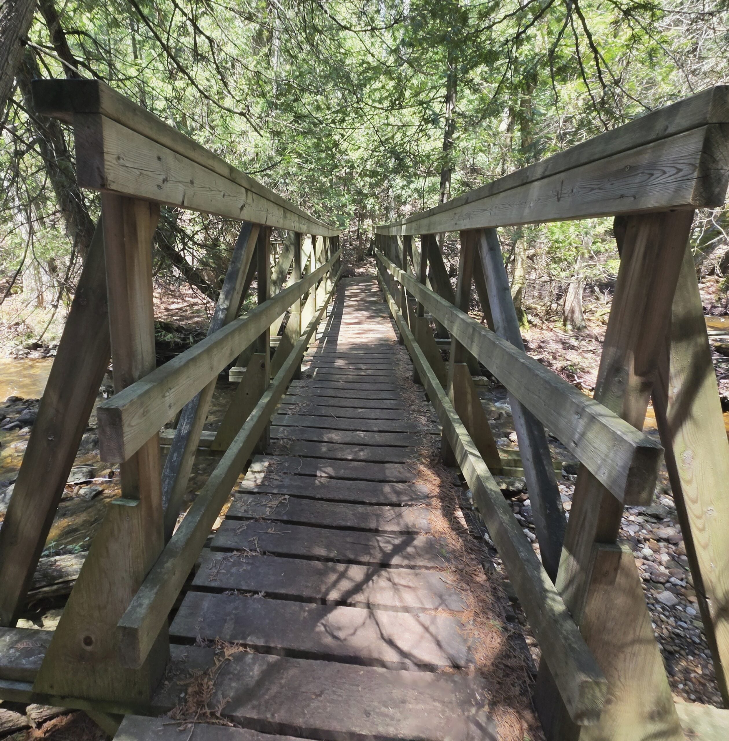
Caledon Hills E2E In 4 Hike #2
https://hikes.brucetrail.org/event/caledon-hills-e2e-in-4-hike-2-2/Sorry, the registration cut-off time for this hike has been reached.Not a member? Click here to join today!Hosting Club: Caledon Hills, Dufferin Hi-Land
Category: End-to-End
Location (Google Maps): Roadside Parking – km 35.0 on Coolihans Sideroad, east of where the trail crosses the road.Hike Leader(s): Dan Patterson Click here to contact Hike Leader(s)
Pace: Medium – 3 to 4 km/hour
Terrain: Strenuous – hilly with steep climbs and some poor footing
Distance: 16.7 kmDescription
Welcome to Caledon Hills In 4 Fall Edition. Meet at Coolihans Side Road where the Bruce Trail crosses the road at 8:15 a.m. We will shuttle to 5th Line EHS & Hockley Rd. Bruce Trail Parking to start the hike. This is an End-to-End series to complete the Caledon Hills section of the Bruce Trail in 4 hikes. We will be hiking from the north end to the south end. Join for as many hikes as desired – you will need to register for each hike in the series which will take place on the following dates: Sept. 20 & 27, Oct. 18 & 25. Since this is a group hike, please consider your fitness level before registering. We will be walking at a pace of 3 km – 4 km per hour and hikers will need to keep up with the person in front of them for the duration of the hike. The hike series will also involve car shuttles and every hiker is expected to participate as drivers. Weather conditions can be variable, dressing in layers is recommended. Hiking boots are required and hiking poles are strongly recommended. Bring plenty of fluids, electrolytes. lunch and snacks. This section is challenging with many hills.Sunny Sundays - Valley Crossover Side Trail Loop
https://hikes.brucetrail.org/event/sunny-sundays-valley-crossover-side-trail-loop-2/Sorry, the registration cut-off time for this hike has been reached.Not a member? Click here to join today!Hosting Club: Beaver Valley
Location (Google Maps): Meet in the south end of the lower parking lot, Beaver Valley Ski Club, Map 26, Edition 31, 44.357382,-80.543331
Hike Leader(s): Glenda Collings Click here to contact the hike leader.
Pace: Medium
Terrain: Strenuous, Some steep sections, Some rocky footing
Length of Hike: 12.9 kmDescription
It’s time for a workout. We’ll start in the BV ski club, then head south to Graham’s Hill Road, walk east down that country road, then partway up Campbell’s Hill Road and turn north to hike back to the ski club. Lots of ups and downs, some good views and lovely forested areas. Please arrive at 8:15 a.m. for an 8:30 a.m. start. As usual, bring sufficient water and snacks, we’ll take a break mid hike. Dress for the weather. So we know whether or not to expect you, if you need to cancel please do so on the online calendar or by contacting me, text – 519 694 7691. Looking forward to seeing you. Glenda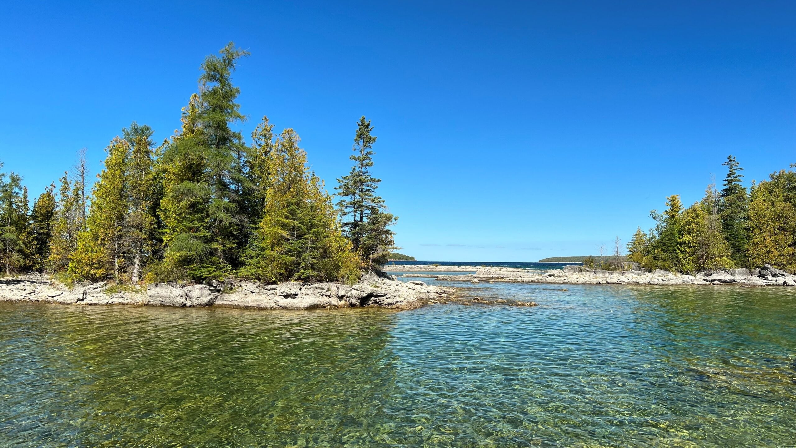
Sunday Side Trails: Burnt Point Loop
https://hikes.brucetrail.org/event/sunday-side-trails-burnt-point-loop/Sorry, the registration cut-off time for this hike has been reached.Not a member? Click here to join today!Hosting Club: Peninsula
Category: Peninsula Blue Series
Location (Google Maps): BPNP Visitor CentreHike Leader(s): Kamila Tomaszewska Click here to contact Hike Leader(s)
Pace: Leisurely (2.0 – 3.0 km/h): A relaxed pace with frequent breaks and a focus on enjoyment.
Terrain: Moderate: Rolling hills, mild slopes and rocky paths.
Distance: ~ 5.2 kmDescription
Peninsula BTC is offering a series of hikes covering all of the side trails on the Peninsula section of the Bruce Trail. These hikes are a great opportunity for those who want to do some hiking but don’t want to commit to a full end-to-end; for those who have completed an end-to-end and want to explore more of the beautiful trails on the Peninsula and for locals and visitors who want to get out on the trail on the weekend.The series will include 27 hikes on Sundays (and maybe the odd Saturday) over 2026 and 2027, covering more than 150 km of side trails or 78 trails! We will be offering hikes on a roughly biweekly basis, with hikes posted approximately two months in advance. The hikes will generally be loop hikes, although car shuttling may be required for a few hikes. Register for each hike individually, no need to commit to all 27 hikes!
For those who would like to earn the Peninsula Side Trails Badge, these hikes provide a chance to join a group for some or all of the side trail hikes.
This is a beautiful forest hike along Burnt Loop Side Trail (excluding Shortcut ST), with multiple views of Georgian Bay.
Hikers should be prepared for the weather, possible wet trails and insects. Bring a lunch, water and snacks. Hike leader will contact registered hikers one week before the hike.
If you would like to be notified when the side trail hikes are posted, go to the bottom of the Hikes page on the PBTC website to sign-up for hike notifications.
Heritage Rd to Silver Creek (linear hike)
https://hikes.brucetrail.org/event/heritage-rd-to-silver-creek-linear-hike-2/Sorry, the registration cut-off time for this hike has been reached.Not a member? Click here to join today!Hosting Club: Iroquoia
Category: General Hike
Location (Google Maps): Meet at Silver Creek Conservation Area on Fallbrook Trail Rd at 9:15 am.Hike Leader(s): Karen Bergmann Click here to contact Hike Leader(s)
Pace: Medium – 3 to 4 km/hr
Terrain: Moderate – Some hills and/or some poor footing
Distance: 8.5 kmsDescription
We will meet at Silver Creek Conservation Area and carpool to Heritage Road and hike back along the main trail. There are some very technical (rocky) parts to this hike. Bring sufficient water. Hopefully the mosquitoes will have disappeared by this time.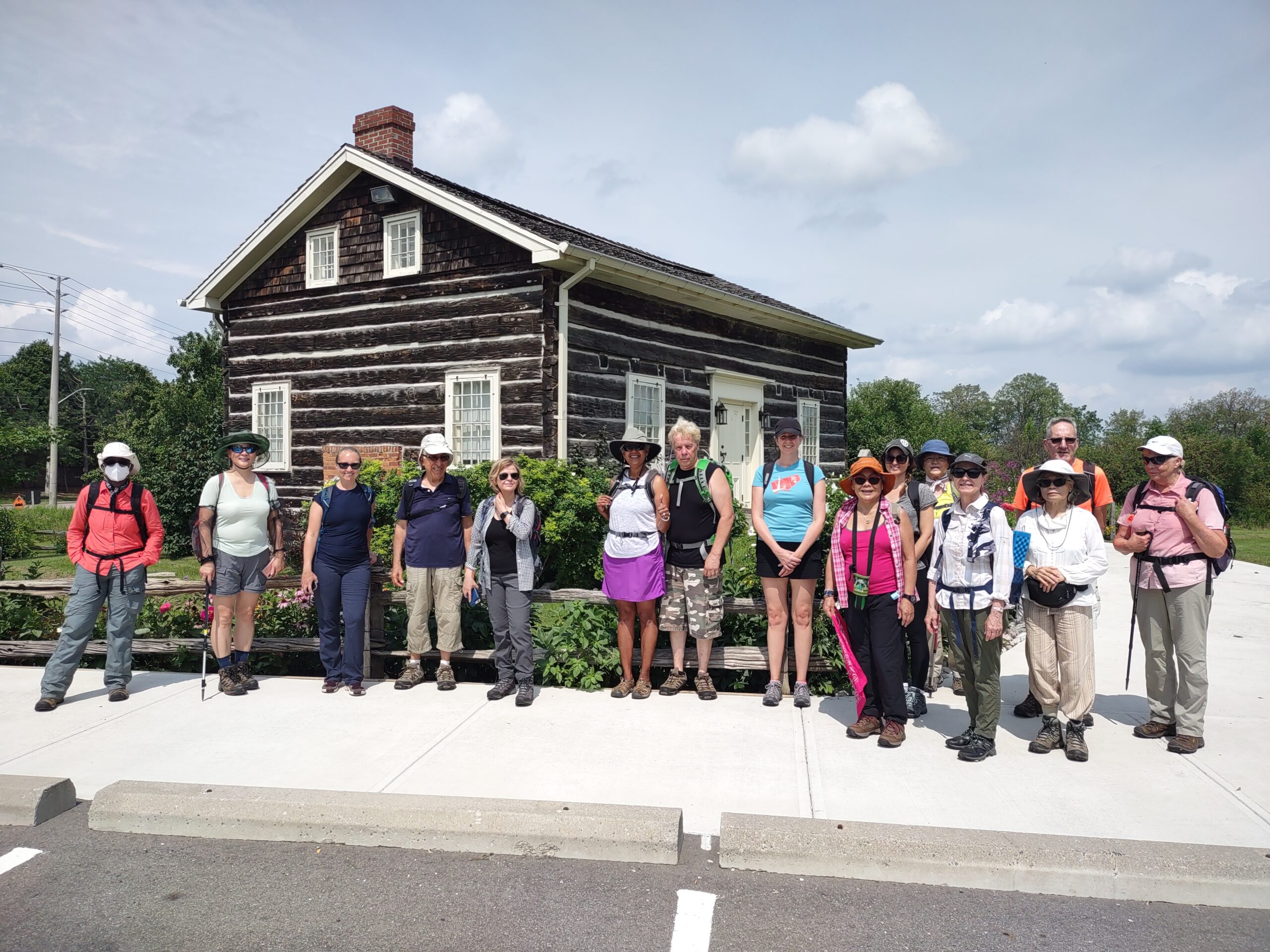
Riverwood Conservancy Part 2, Loop Hike via Leslie Log House
https://hikes.brucetrail.org/event/riverwood-conservancy-part-2-loop-hike-via-leslie-log-house/Sorry, the registration cut-off time for this hike has been reached.Not a member? Click here to join today!Hosting Club: Toronto
Category: Urban Walk
Location (Google Maps): Toronto transit users meet me outside Islington Subway Station at 9:40, take the tunnel under Islington Ave. to the East side. We will be catching MiWay Bus#26 at 9:46 for a 57 minute journey to our destination, disembarking Burnhamthorpe Road at the Credit Woodlands. Coming directly to the hike, from Burnhamthorpe Road turn onto Riverwood Park Lane and park in the first parking lot on your left. Walk through MacEwan Terrace Garden, turn right past the barn to the Visual Arts Mississauga Building. Wait outside for the Transit group to arrive. Please arrive by 10:30 am. Public washrooms located inside.Hike Leader(s): Andrew Proczek Click here to contact Hike Leader(s)
Pace: Leisurely (2-3 km/hr), Moderate (3-4 km/hr)
Terrain: Level 1 (Easy – mostly on flat, well maintained trails with hard-packed surface), Level 2 (Intermediate – some hills and uneven surfaces, rocks and roots underfoot), Variable
Distance (km): 10 kmDescription
Join me for Part 2 of my Riverwood Conservancy Hikes. In Part 1 we focused mainly on Riverwood Trails but this time we will expand the loop to visit Leslie Log House which is celebrating its 200th anniversary. It is possibly the best preserved early 19th Century Log House anywhere in Canada. We will have our lunch on the grounds and visit this historic building. Continuing the hike we will cross Mississauga Road and join Mullet Creek hiking south to Braeburn, formerly Ronnie Hawkins’ farm house from the late 1960’s. We will finish the Loop along Burnhamthorpe Road Bridge with spectacular views of the Credit River Valley before arriving at our starting point at Riverwood Conservancy.The Route: https://onthegomap.com/s/5r6hejkd
Please wear long plants and cover your arms for the return portion along Mullet Creek which is a Level 2 uneven trail with roots underfoot and grassy parts. Hiking shoes are required and polls are recommended.
Exploring Sydenham Hikes #49 and #50 Bruce's Caves and Colpoy's Cavern
https://hikes.brucetrail.org/event/exploring-sydenham-hikes-49-and-50-bruces-caves-and-colpoys-cavern/Sorry, the registration cut-off time for this hike has been reached.Not a member? Click here to join today!Hosting Club: Sydenham
Category: General Hike
Location (Google Maps):We will carpool from 2888 3rd Ave. W., Owen Sound
Hike Leader(s): Bill Snel Click here to contact Hike Leader(s)
Pace: Leisurely: 3 km/h or less
Terrain: Strenuous: Hilly with steep climbs and some poor footing.
Distance: 3 kmDescription
We will carpool from Owen Sound to do a loop hike of the Colpoy’s Cavern Side Trail – Map 35. This is hikes 49 and 50 in the book Exploring Sydenham. The section with the caves is very rocky and can be treacherous when wet and still difficult when dry. A good headlamp or flashlight will be needed to investigate Colpoy’s Cavern. There will be one secret to find on each hike. If you do not have a book and would like one ($30) let me know by using the “Contact hike leader” link. - 28September 28, 2026
EASY DOES IT HIKE, Centennial Park, Fenwick, On
https://hikes.brucetrail.org/event/easy-does-it-hike-centennial-park-fenwick-on/Sorry, the registration cut-off time for this hike has been reached.Not a member? Click here to join today!Hosting Club: Niagara
Category: Leisurely
Location (Google Maps): 999 Church St., Fenwick, OnHike Leader(s): Diane Marlatt Click here to contact Hike Leader(s)
Pace: Leisurely <3 km/hr
Terrain: Easy: mostly flat, good footing
Distance: 7KmDescription
- 29September 29, 2026
Long Hike Short Hills
https://hikes.brucetrail.org/event/long-hike-short-hills-13/Sorry, the registration cut-off time for this hike has been reached.Not a member? Click here to join today!Hosting Club: Niagara
Location (Google Maps):
Short Hills Wiley Road, Thorold
Hike Leader(s): Alan Laver Click here to contact Hike Leader(s)
Pace: Brisk 4-5 km/hr
Terrain: Moderate: some hills and some poor footing
Distance: 10k+Description
Our regular Spot for the Tuesday Long Hike. Note the new location. We will hike the trails around Short Hills Dress for the weather and bring sunscreen bug spray, poles snack and drink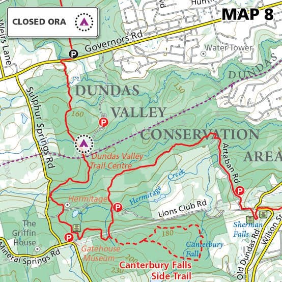
Tuesday's 10k
https://hikes.brucetrail.org/event/tuesdays-10k-4/Sorry, the registration cut-off time for this hike has been reached.Not a member? Click here to join today!Hosting Club: Iroquoia
Location (Google Maps): Ancaster Lions Outdoor Pool – 263 Jerseyville Rd W, Ancaster
Hike Leader(s): Jennifer DeBoer Click here to contact Hike Leader(s)
Pace: Brisk – 4 to 5 km/hr
Terrain: Moderate – Some hills and/or some poor footing
Distance: 10k+Description
We will hike the trails around the Dundas Valley Conservation Area. Dress for the weather wearing hiking boots. Please also bring sunscreen, bug spray, poles, water and a snack.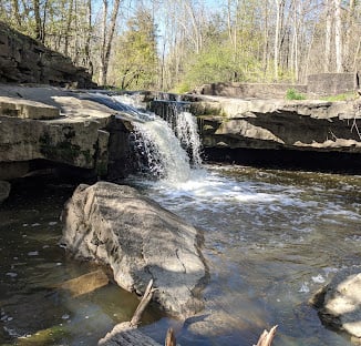
9:15 Short Hike, Rockway Conservation Area, 2021 Pelham Rd, Lincoln
https://hikes.brucetrail.org/event/915-short-hike-rockway-conservation-area-2021-pelham-rd-lincoln-3/Sorry, the registration cut-off time for this hike has been reached.Not a member? Click here to join today!Hike open to BTC Members only.
Hosting Club: Niagara
Category: Hike
Location (Google Maps): Rockway Conservation Area, 2021 Pelham Rd, Lincoln, ONHike Leader(s): Debbie Demizio Click here to contact Hike Leader(s)
Pace: Medium 3- 4 km/hr
Terrain: Moderate: some hills and some poor footing
Distance: 6 kmsDescription
Hike around 15 Mile Creek, featuring Upper and Lower Rockway Falls. Please bring water, insect repellent, sunscreen and hiking poles. Check yourself thoroughly for ticks following the hike.St. Helena Forest
https://hikes.brucetrail.org/event/st-helena-forest-3/Sorry, the registration cut-off time for this hike has been reached.Not a member? Click here to join today!Hosting Club: Iroquoia
Category: General Hike
Location (Google Maps): Meet in the Pear Tree parking lot at Speyside on 15 Side Road at 9:15 amHike Leader(s): Karen Bergmann Click here to contact Hike Leader(s)
Pace: Medium – 3 to 4 km/hr
Terrain: Moderate – Some hills and/or some poor footing
Distance: 9 kmsDescription
Meeting at 9:15 am in the Pear Tree parking lot, we will hike the main trail into the St. Helena forest and along the trails, which are VERY rocky. This is a dense forest that takes us around a large marsh pond and back up the Al Shaw Side Trail. This hike is about 90% technical (on rocks), so be prepared for that. Not for first time hikers.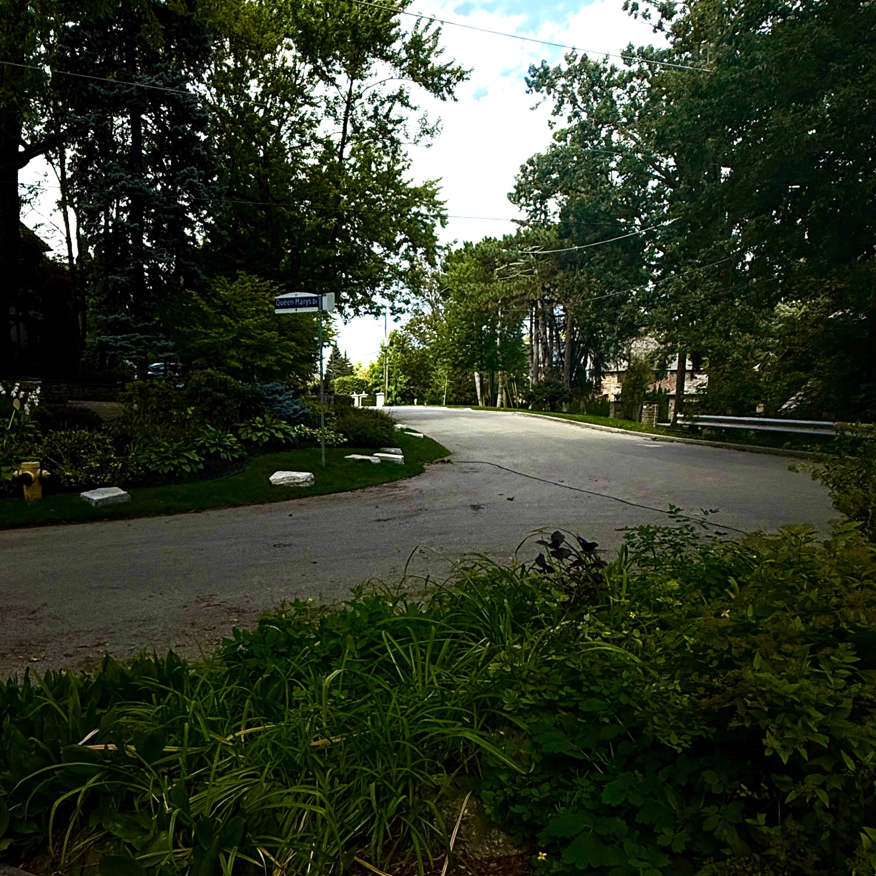
Urban Walk: Old Mill, The Kingsway and Home Smith Park
https://hikes.brucetrail.org/event/urban-walk-old-mill-the-kingsway-and-home-smith-park/Sorry, the registration cut-off time for this hike has been reached.Not a member? Click here to join today!Hosting Club: Toronto
Category: Urban Walk
Location (Google Maps): Jane Subway StationHike Leader(s): Ted Moriarty Click here to contact Hike Leader(s)
Pace: Moderate (3-4 km/hr)
Terrain: Flat
Distance (km): 7 kmDescription
Join me in one of a series of Tuesday morning urban hikes in Toronto. Starting at the Jane Subway Station, we will explore The Kingsway neighbourhood that features beautifully designed homes (dating back to the 1920’s) and 100 year old trees. After this we will descend in to the Humber River Valley and follow the river as it winds its way through Home Smith Park. The hike will conclude at the Old Mill subway station.Mushroom Hunters - A Passport to Nature hike
https://hikes.brucetrail.org/event/mushroom-hunters-a-passport-to-nature-hike/Sorry, the registration cut-off time for this hike has been reached.Not a member? Click here to join today!Hosting Club: Beaver Valley
Location (Google Maps): Meet in the parking area on Sideroad 7A, Map 26, Edition 31, 44.387268,-80.557836, top of BTC recently purchased old Talisman ski club.
Hike Leader(s): Glenda Collings Click here to contact the hike leader.
Pace: Leisurely
Terrain: Moderate, Some steep sections
Length of Hike: approx. 2 hoursDescription
We are pleased to have “Barefoot Brian” guide us on this mushroom hunting adventure. Brian is a naturalist and Beaver Valley resident who discovered his passion for foraging in 2013. Since 2015, he has been hosting hosting foraging and health-focused workshops, helping people reconnect with the land and the abundance around them. Brian believes that connecting people with the land through foraging and learning about native flora and fauna is one of the best ways to inspire conservation of the places we love. On this walk, we’ll explore the forest in search of mushrooms, learning how to identify and appreciate the fungi we encounter along the way. This will be a slow, casual and beginner-friendly walk, suitable for most people. No previous mushroom knowledge is required, just curiosity and a willingness to explore! Please arrive at 9:15 so we can gather and get started by 9:30 a.m. Bring water and a snack and dress prepared for the weather. Unless it’s heavy rain, we’ll proceed with the hike. You’ll be notified if we have to cancel. We will have a person photograph mushrooms along the way for those interested in collecting photos to earn the Beaver Valley “Mushroom Hunter” badge. Those photos can be emailed to folks. Let’s hope we find the magic number of 20 mushrooms. All particpants will receive the Passport to nature stickers. If you have any questions about this outing, please contact the hike leader, Glenda, using the “Contact the Hike Leader” option in the hike posting.Mono Centre: Turnbull, Springwater, Third Outlier and Whitetail Refuge Side Trails
https://hikes.brucetrail.org/event/mono-centre-turnbull-springwater-third-outlier-and-whitetail-refuge-side-trails-3/Sorry, the registration cut-off time for this hike has been reached.Not a member? Click here to join today!Hosting Club: Dufferin Hi-Land
Category: Tuesday Hike
Location (Google Maps):Caledon Hills Section, Map 19. Meet at Mono Community Centre hiker parking area (near Km 72.4).
Hike Leader(s): Les Babbage, Inge Eckerich, Julie Daley, Tony Evangelista Click here to contact Hike Leader(s)
Pace: Leisurely
Terrain: Slippery and Steep Sections, Moderate
Distance: 6.0 Km, Short hike 3.5 kmDescription
We will hike the Main Trail to Turnbull and Springwater Side Trails. The short hike will return to the parking lot by Main Trail. The longer hike will continue south on Main Trail to the Third Outlier Side Trail, connecting to the Whitetail Refuge Side Trail and returning to parking by way of the Laidlaw Side Trail. Bring water and snacks.Urban Walk: Valley View Park
https://hikes.brucetrail.org/event/urban-walk-valley-view-park-3/Sorry, the registration cut-off time for this hike has been reached.Not a member? Click here to join today!Hosting Club: Toronto
Location (Google Maps): Parking lot is off Sycamore Drive, East of Bayview , across Starbucks plaza
Bus 91 from Finch East station stops at Sycamore station.Hike Leader(s): MOHAMMAD AGHAMIRI Click here to contact Hike Leader(s)
Pace: Moderate (3-4 km/hr)
Terrain: Hilly, Level 2 (Intermediate – some hills and uneven surfaces, rocks and roots underfoot)
Distance (km): 7-8 kmDescription
We will explore Valleyview and Maple View parks, and walk along German Mills Creek, in return we stop in Huntington park and have snack ,coffee,tea .Although this is considered an “Urban Walk”, you can expect some hills up and down and uneven surfaces with tree roots. Please bring hiking poles, water and snacks.
phone number for the day of hike 289 588 6482
Walk In Nature Series (WINS) - Pines and Clearview loop trails
https://hikes.brucetrail.org/event/walk-in-nature-series-wins-pines-and-clearview-loop-trails-2/Sorry, the registration cut-off time for this hike has been reached.Not a member? Click here to join today!Hosting Club: Sydenham
Category: Walk In Nature Series (WINS)
Location (Google Maps):At the trailhead, 498699 8th Concession N; take Hwy 26 and drive 2.5 km east of Van Dolders, Owen Sound then turn north onto 8th Concession N
Hike Leader(s): Stewart Brown Click here to contact Hike Leader(s)
Pace: Medium: 3 to 4 km/h
Terrain: Moderate: Some hills and/or poor footing
Distance: 5 kmDescription
The Walk In Nature Series (WINS) consists of short loop hikes in the Sydenham section of the Bruce Trail that combine nature appreciation with fitness in a safe and welcoming group environment led by an experienced hike leader. Consider these hikes to be 90 or 120 minute reset appointments with yourself in nature that promote health and fitness. WINS hikes are open to all ages and levels of hiking experience whether members or non-members of the Bruce Trail Conservancy (BTC).This hiking gem is located near Owen Sound and consists of 2 loop Side Trails, Pines and Clearview, which lead us back to our vehicles. The forested Pines loop is level with a smooth path. Clearview Side Trail slopes down through a diverse forest to a pretty creek and climbs back to the main Bruce Trail where our hike follows along the foot of the escarpment affording close inspection of the interesting rock face. We will visit the Polish Soldier tree on a section of the Main Trail, a fascinating place of historical significance.
Bring water, snacks, personal medications and supplies. Hiking poles are not required by are always welcome.
There is a small parking lot for 3-4 vehicles. Other vehicles are to park on the west side of the road, facing back towards Highway 26.
Thanks and see you soon.
- 30September 30, 2026
Peninsula E2E in a Fall - 8 days hike through +1 mid rest day
https://hikes.brucetrail.org/event/peninsula-e2e-in-a-fall-8-days-hike-through-1-mid-rest-day/Sorry, the registration cut-off time for this hike has been reached.Not a member? Click here to join today!This is a Multi-Day Hike
You are signing up for the following dates and times:
2026-09-30 at 08:00
2026-10-01 at
2026-10-02 at
2026-10-03 at
2026-10-04 at
2026-10-05 at
2026-10-06 at
2026-10-07 at
2026-10-08 atHosting Club: Iroquoia, Peninsula
Category: Stained Glass Badge End to End Fundraiser Hike
Location (Google Maps): -Meeting point on Sept 30th – at Bluewater Park, Wiarton, parking area opposite arena – First Hike only – Schedule with coordinates will be sent for remaining hikes to registered hikers
First hike : meeting time is 8.00 am Wiarton to shuttle to our trail head where we will start the hike.Hike Leader(s): Corina Seceleanu Click here to contact Hike Leader(s)
Pace: Medium – 3 to 4 km/hr
Terrain: Strenuous – Hilly with steep climbs and some poor footing
Distance: 167.5 KmDescription
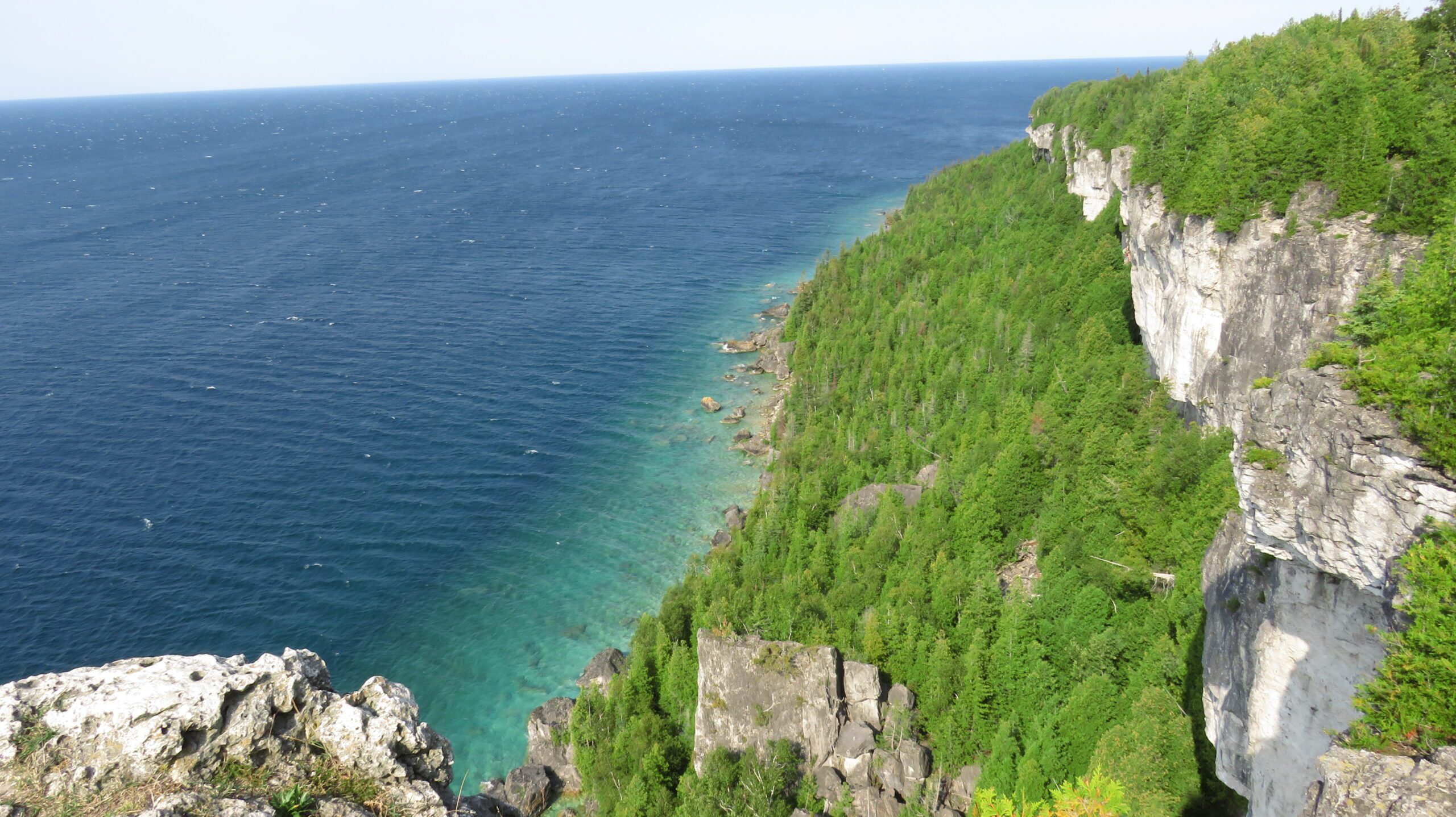
Category: Peninsula E2E– Sept 30th to Oct 8th 2026This is moderate hike that we will complete the entire 167.5 km of the Peninsula section in 8 hikes; the entire trip constitutes of 9 days with one rest day in between.
It is also a Paid hike; your registration fee includes a celebratory finish at the Cairn in Tobermory, the cost of the End-to-End badge, and contributes to fundraising for the Peninsula Bruce Trail Club hiking program activities.
Please review the dates carefully to ensure you are able to participate fully. Registration is limited to 10 persons.
- This hike series is intended for experienced distance hikers. Hikers must be able to sustain the distance and maintain the pace as advertised.
- Be very aware of your ability to join this series.
- Hikes will average 3.5 km per hour including breaks, moving pace is 3.5 to 4 km per hour;
- Expect to be on-trail for min 7.5 to 8h sometime longer depending on the distance, terrain, weather and group pace; The hike leader set the pace, aiming for the 3-4 Km/h and may adjust as needed for the group ability and trail conditions
- Meeting time: 7:45 am every day, (except first day) at designated location (to be provided basis on the schedule).
- Please arrive no later than 15 minutes prior to the meeting time;
- Hikers must carry sufficient hydration, accessible snacks, lunch, first-aid kit, rain gear, extra socks, and possibly protective boot covers (i.e. bags), also hiking poles recommended.
- Hikers will be expected to participate in shuttling hikers to the start and to drive shuttlers back to their car. Responsibility for shuttling along with any applicable parking fees will be shared within the group.
Summary of the itinerary (km based on Bruce Trail Reference – Edition 31):
1: Sep 30 (Wednesday): Rd Side parking on Coveney’s Rd to Wiarton Bluewater Park – 21.5 km
2: Oct 1 (Thursday): Rd. Side Parking at South End of Cathedral Dr. to Rd Side parking on Coveney’s Rd – 26.15 km
3: Oct 2 (Friday): Cemetery Rd Side trail parking to Rd Side parking at South End of Cathedral Dr. – 21.10 km
4: Oct 3 (Saturday): (2 parts to defer Isthmus Bay Rd. walking, which would be made on last day)
- Part 1 – Cemetery Rd. side trail parking to Lion’s Head lookout parking /or in the city) – 11.84 km
- Part 2 – Richardson Side Trail parking to Cape Chin South Rd – 11.34 km —— total 23.48 km
5: Oct 4 (Sunday): Rest Day – No hikes
6: Oct 5 (Monday): Cape Chin South Rd. parking at Carter Rd to Lindsay Rd . &Gilles Lake – 21.90 km
7: Oct 6 (Tuesday): Lindsay Rd. & Gilles Lake to Halfway Dump Side Trail (parking lot) – 22.83 km
8: Oct 7 (Wednesday): Little Cove Parking lot to Halfway Dump Side Trail (parking lot) – 17.73 km
9: Oct 8 (Thursday): 2 parts
- Morning/Lunch – Little Cove parking to Tobermory Cairn – 6.70 km — badge ceremony
- Lunch /Afternoon – before going home make up the Isthmus Bay Rd (from town of Lions Head /Lion’s Head lookout parking to Richardson Side Trail Parking lot – 6.25Km—total 12.95 Km
For safety, participants must remain between the hike leader and the hike sweep at all times.
Transportation & Accommodations:
- Car shuttle: Participants rotate as drivers; vehicles must be passenger-ready- in each day.
- Accommodations: Book early; options include motels, campgrounds, hostels, and B&Bs from Wiarton to Tobermory
Note: A detailed schedule will be provided in advance of the series to registered hikers.If you have concerns, or questions please use the Contact Hike Leader form to inquire in advance of registering.
Dogs are not permittedMore details will be provided at later date to those registered for the hike.
Books & Blazes - Sydenham's Hiking Book Club
https://hikes.brucetrail.org/event/books-blazes-sydenhams-hiking-book-club/Sorry, the registration cut-off time for this hike has been reached.Not a member? Click here to join today!Hosting Club: Sydenham
Category: Book Club Hike
Location (Google Maps): 155.2 km BTC Map #34, Edition 31
Roadside parking on Colpoy’s Range Road. DO NOT block farm gate or loading ramp. DO NOT approach from the East side of Colpoy’s Range Road via Coles Side road; not a thru access. Approach from the West side via Centre Road.Hike Leader(s): Tammy Green Click here to contact Hike Leader(s)
Pace: Medium: 3 to 4 km/h
Terrain: Moderate: Some hills and/or poor footing, There might be muddy sections., There might be sections with water on the trail.
Distance: 6.2 kmDescription
We will hike the Slough of Despond Side Trail and return via the President’s Path Side Trail.Welcome to the Sydenham Hiking Book Club – Books and Blazes. This month’s book is: any book by Adam Shoalts. He has written several books all with an outdoor theme. Pick your favourite then come and share it on our hike.
Bring a snack and water. Always carry and personal medications and your health card while hiking. It is not necessary to bring the book.
We will chat about the book while we hike and during short stops along the way. You are welcome to join us even if you haven’t read the book.
At the end of the hike, the group will choose the book for October’s hike. Bring some book ideas with you!
WEDNESDAY WALKERS - GR 40 to Griersville
https://hikes.brucetrail.org/event/wednesday-walkers-gr-40-to-griersville-2/Sorry, the registration cut-off time for this hike has been reached.Not a member? Click here to join today!Hosting Club: Beaver Valley
Location (Google Maps): Meet in the BTC parking lot on Grey Road 40, Km 105.7 Map 28 Edition 31
Hike Leader(s): Margaret Yaraskavitch Click here to contact the hike leader.
Pace: Medium
Terrain: Moderate
Length of Hike: 7.2Description
It’s time for a pleasant walk in the woods, a fairly easy walk. We begin at the parking lot on Grey Road 40, crossing the highway and walking into a BTC Nature Reserve. After reaching Grey Road 7, we return on the same route.Guidelines
- Arrive 15 minutes before the start of the hike.
- Wear sturdy footwear and appropriate attire for the weather and the terrain.
Hiking poles are a good idea in any season, especially if the terrain is rocky or slippery. In winter, snowshoes or icers/crampons are needed when conditions dictate.
Wearing appropriate clothing and footwear prevents injuries and shows consideration for a safe and positive group hiking experience. - Always carry I.D. and your health card.
- Bring sufficient water and snacks (or lunch if indicated). A minimum of 1L of water is recommended on all hikes, and 3L is recommended for long, challenging hikes in the heat of the summer.
- Bring sunscreen and insect repellent (for spring and summer hikes).
- Bring your own first aid kit.
- Please leave dogs at home.
National Day for Truth and Reconciliation and "Braiding Sweetgrass" Book Chat Hike- LOCATION Change
https://hikes.brucetrail.org/event/national-day-for-truth-and-reconciliation-and-braiding-sweatgrass-book-chat-hike/Sorry, the registration cut-off time for this hike has been reached.Not a member? Click here to join today!Hosting Club: Caledon Hills
Category: General
Location (Google Maps): Meet up in pavilion behind the Caledon East Community complex/library.Hike Leader(s): GG Click here to contact Hike Leader(s)
Pace: Medium – 3 to 4 km/hour
Terrain: Easy – mostly flat and usually good footing
Distance: 8kmDescription
LOCATION CHANGE to Caledon Trail.
September 30th is National Day for Truth and Reconciliation, also known as Orange Shirt Day, is a time for reflection, learning, and remembrance. It invites all Canadians to confront the legacy of residential schools and engage in meaningful conversations about reconciliation.
Let’s join together for a hike as we share and learn from each other about reconciliation and discuss the book ‘Braiding Sweatgrass’ by Robin Wall Kimmerer.
We will meet at 9:45 AM in pavilion behind the Caledon East Community Centre/library. There is plenty of parking and restrooms at the centre. Our hike will be northbound towards a common turtle nesting spot.
For those interested the Town of Caledon (city hall is beside the trail) is hosting events and a flag raising at 230pm: https://www.caledon.ca/en/living-here/resources/Documents/Indigenous-Engagement/National-Day-for-Truth-and-_Reconciliation-Poster.pdf
Wear your orange shirt if you have one, and if you don’t and wish to get one, I suggest: https://orangeshirtday.org/merchandise/
Good Companions - McCormack Loop - Dundas Valley
https://hikes.brucetrail.org/event/mccormack-loop-dundas-valley/Sorry, the registration cut-off time for this hike has been reached.Not a member? Click here to join today!Hike open to BTC Members only.
Hosting Club: Iroquoia
Category: Good Companions
Location (Google Maps): Parking Directions
Drive through the main entrance of the Dundas Valley Conservation Area to the largest parking lot at the very end of the road. Walk a few hundred meters to the Trail Centre It takes a few minutes to walk from the parking lot to the Trail Centre, so give yourself extra time. We will meet at the Trail Centre.
Entrance fee is free for HCA/Dundas Valley members; $11.50 per vehicle for non-members. Pay by credit card at kiosk at entranceHike Leader(s): Kathy Rymal Click here to contact Hike Leader(s)
Pace: Medium – 3 to 4 km/hr
Terrain: Moderate – Some hills and/or some poor footing
Distance: 7.5 kmDescription
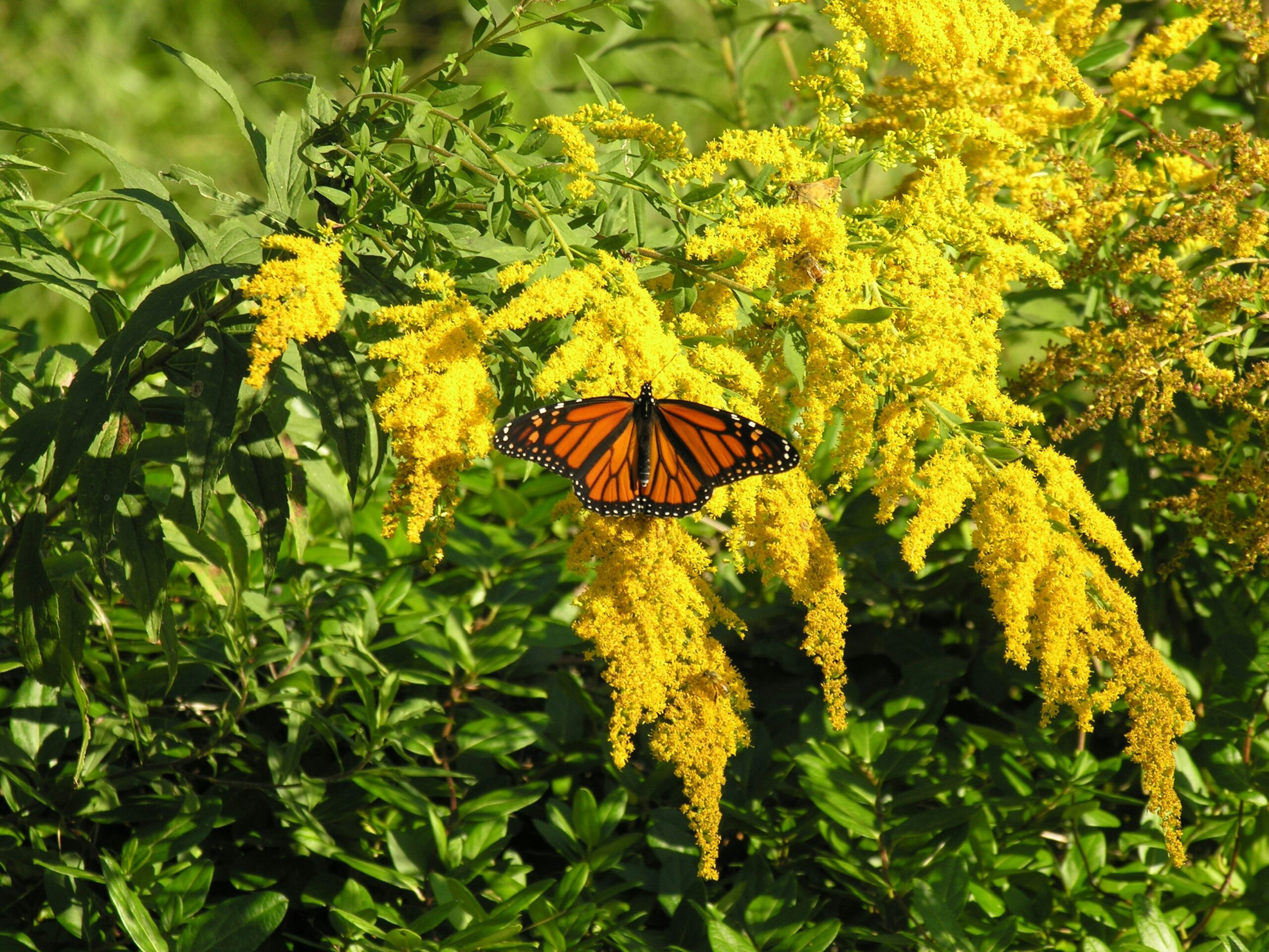
I loved this hike so much when we did it on July 22 that I thought we should do it again. Maybe the fields of goldenrod will be in full bloom.We will head out on the McCormack trail from the trail centre and cross over Governor’s Road to continue the trail past a horse farm to a beautiful lookout point with views of the escarpment, Dundas, Hamilton and Lake Ontario. We will return along the Bruce, McCormack and Sawmill trail ending up back in the parking lot.
As this is in the Dundas Valley some hills can be expected. 🙂
In case you are worried that the goldenrod will induce allergies I found this great article pointing out the differences between goldenrod and ragweed!
https://www.hamiltonpollinatorparadise.org/favourite-blog-posts/ragweed-versus-goldenrod
Steeltown Stomp Practice Session #8 of 8
https://hikes.brucetrail.org/event/steeltown-stomp-practice-session-8-of-8/Sorry, the registration cut-off time for this hike has been reached.Not a member? Click here to join today!Hosting Club: Iroquoia
Category: Steeltown Stomp Practice Session
Location (Google Maps): Chedoke Golf Club Parking Lot – Access from Beddoe Dr off Studholm Rd south of Aberdeen (Parking capacity 40)Hike Leader(s): Muskan Sidana Click here to contact Hike Leader(s)
Pace: Brisk – 4 to 5 km/hr, Medium – 3 to 4 km/hr
Terrain: Strenuous – Hilly with steep climbs and some poor footing
Distance: VariesDescription
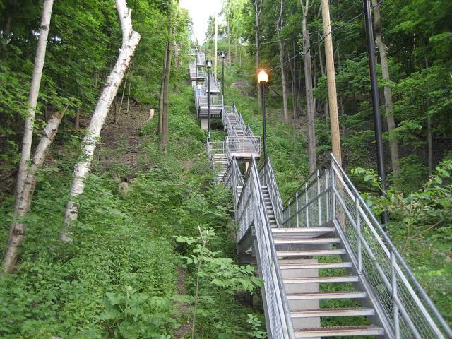
Is the Steeltown Stomp on your bucket list? This is your chance to crush it! Join us and prepare for this incredible challenge on October 3rd, 2026! Registration for the event is now open.If you’ve done stair climbs before, you know the deal—that brutal calf pain is real, especially when you’re just starting out. But training with us this summer? That’s how you show up on stomp day actually feeling strong instead of totally wrecked. Trust me.
We’ll start easy and build up as the summer goes on, hitting Chedoke and Dundurn Stairs with some scenic hikes mixed in. By the time October rolls around, you’ll have crushed at least 2,000 steps and you’ll actually know what you’re doing.
It’s a solid group vibe—moderate pace, warm-ups to get going, stretches to cool down. And honestly, it’s way more fun (and way less painful) doing this with people who get it.
Just grab your water bottle (there’s water at both staircases) and whatever snacks you want.
We’ve got 7 training dates lined up this summer—check the schedule and pick the ones that work for you. Do the work now, own it on stomp day. See you out there!
- 01October 1, 2026
8:00 am Long hike NEW Location. Bailey bridge Jordan
https://hikes.brucetrail.org/event/800-am-long-hike-new-location-bailey-bridge-jordan-14/Sorry, the registration cut-off time for this hike has been reached.Not a member? Click here to join today!Hike open to BTC Members only.
Hosting Club: Niagara
Category: In and Out
Location (Google Maps):Bailey bridge Jordan
Hike Leader(s): Alan Laver Click here to contact Hike Leader(s)
Pace: Brisk 4-5 km/hr
Distance: ~10k
Description
This will be our permanent location . Hike up from the Bailey bridge to Balls Falls and explore the trailsYou must register for each hike. Bring Poles, snack and a drink. Dress for the weather
Hiking around Jordan
https://hikes.brucetrail.org/event/hiking-around-jordan-74/Sorry, the registration cut-off time for this hike has been reached.Not a member? Click here to join today!Hosting Club: Niagara
Category: Loop
Location (Google Maps): Sho’arishon Park, JordanHike Leader(s): Bill Russell Click here to contact Hike Leader(s)
Pace: Medium 3- 4 km/hr
Terrain: Moderate: some hills and some poor footing
Distance: 6 kmsDescription
Hiking in and around Jordan, the Jim Rainforth Trail and Balls Falls, alternating every 3 weeks. Please bring hiking poles and water.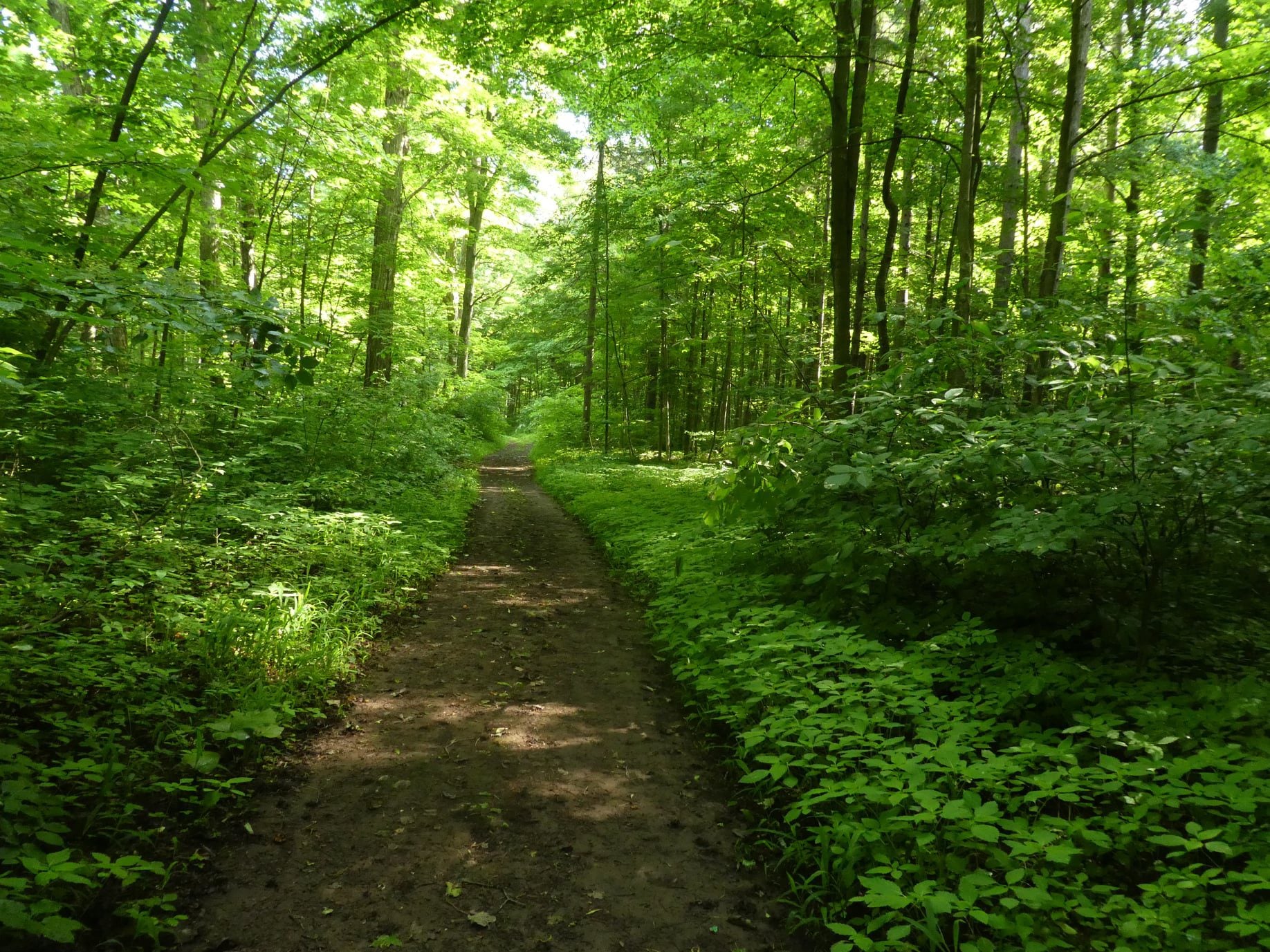
CANCELLED - Twiss Rd to Crawford Lake return
https://hikes.brucetrail.org/event/twiss-rd-to-crawford-lake-return-3/Sorry, the registration cut-off time for this hike has been reached.Not a member? Click here to join today!Hosting Club: Iroquoia
Category: General Hike
Location (Google Maps): Meet roadside on Twiss Road at 9:15 am.Hike Leader(s): Karen Bergmann Click here to contact Hike Leader(s)
Pace: Medium – 3 to 4 km/hr
Terrain: Strenuous – Hilly with steep climbs and some poor footing
Distance: 10 kmsDescription
Meeting roadside at 9:15 am on Twiss Road, we will hike to Crawford Lake and around the trails and back to Twiss Road. There are some rocky sections along the way. Please bring water and a snack.Toronto Fall Series Hike 5 of 9
https://hikes.brucetrail.org/event/toronto-fall-series-hike-5-of-9/Sorry, the registration cut-off time for this hike has been reached.Not a member? Click here to join today!Hosting Club: Caledon Hills
Category: End-to-End
Location (Google Maps): Meet at Limehouse across from the school. Map 12, north of km 21.6 on the south side of 22 Sideroad.Hike Leader(s): Nancy Mooney Click here to contact Hike Leader(s)
Pace: Medium – 3 to 4 km/hour
Terrain: Easy – mostly flat and usually good footing, Moderate – some hills and/or some poor footing
Distance: 13.6 km loopDescription
This is the fifth hike of the series. We will visit the Toronto Club Seed Orchard, Todd Bardes, Meadowland, Beeney Creek, Ancient Maple, and Ridge Side Trails.Urban Walk : Valley View Park
https://hikes.brucetrail.org/event/urban-walk-valley-view-park-4/Sorry, the registration cut-off time for this hike has been reached.Not a member? Click here to join today!Hosting Club: Toronto
Location (Google Maps): Parking lot is off Sycamore Drive, East of Bayview , across Starbucks plaza
Bus 91 from Finch East station stops at Sycamore station.Hike Leader(s): MOHAMMAD AGHAMIRI Click here to contact Hike Leader(s)
Pace: Moderate (3-4 km/hr)
Terrain: Hilly, Level 2 (Intermediate – some hills and uneven surfaces, rocks and roots underfoot)
Distance (km): 7-8 kmDescription
We will explore Valleyview and Maple View parks, and walk along German Mills Creek, in return we stop in Huntington park and have snack ,coffee,tea .Although this is considered an “Urban Walk”, you can expect some hills up and down and uneven surfaces with tree roots. Please bring hiking poles, water and snacks.
phone number for the day of hike 289 588 6482
- 02October 2, 2026
Tobermory Fall Weekend
https://hikes.brucetrail.org/event/car-hike-tobermory-fall-hiking-weekend-2or3-overnights/Sorry, the registration cut-off time for this hike has been reached.Not a member? Click here to join today!This is a Multi-Day Hike
You are signing up for the following dates and times:
2026-10-02 atHosting Club: Toronto, Peninsula
Category: Car Hike
Location (Google Maps):Princess Hotel
34 Bay St, Tobermory, ON N0H 2R0Hike Leader(s): Jeanette Vincent. Click here to contact Hike Leader(s)
Pace: Moderate (3-4 km/hr)
Terrain: Level 2 (Intermediate – some hills and uneven surfaces, rocks and roots underfoot), Variable
Distance (km): 13 -15kmDescription
Greg Vincent’s legacy of weekends away continue. Please join me, Jeanette Vincent as we explore the Tip o’ the Bruce, Tobermory in the Fall. The beauty of this area of the Bruce Peninsula every season is wonderful! We will take in a number of walks using side trails and the Bruce Trail. Approximately 13-15km/day. We stay and have our meals at a comfortable hotel overlooking Little Tub Harbour. This outing is restricted to those staying with us at the Princess Hotel in Tobermory for the weekend – the hotel fills quickly. You will need a car to access this outing. Please contact the Princess Hotel for a reservation.1-519-596-8282 or info@tobermoryprincesshotel.com and mention Vincent/Royle Fall weekend.Before registering at the hotel please contact us for the price package for accommodations and more details.

2026 Peninsula Hiking Festival
https://hikes.brucetrail.org/event/2026-peninsula-hiking-festival/Sorry, the registration cut-off time for this hike has been reached.Not a member? Click here to join today!This is a Multi-Day Hike
You are signing up for the following dates and times:
2026-10-02 at
2026-10-03 atHosting Club: Peninsula
Category: Peninsula E2E
Location (Google Maps):Hike Leader(s): Randy Vanderlaan Click here to contact Hike Leader(s)
Pace: Fast (5.5 – 7.0 km/h+): A quick pace maintained by experienced hikers or trail runners., Leisurely (2.0 – 3.0 km/h): A relaxed pace with frequent breaks and a focus on enjoyment., Medium (3.0 – 4.5 km/h): A comfortable pace for most hikers with steady progress.
Terrain: Difficult: Steep ascents/descents, rocky scrambling, and some rugged escarpment paths., Easy: Flat forested sections or lowland trails., Moderate: Rolling hills, mild slopes and rocky paths.
Distance: variousDescription
Join us for the 2026 Peninsula Hiking Festival from October 2–4, 2026 on the beautiful Bruce Peninsula — a weekend celebration of hiking, nature, community, and connection along Canada’s iconic Bruce Trail.With more than 20 guided hikes for a variety of skill levels and interests, the festival offers unforgettable experiences through forests, shoreline vistas, and escarpment landscapes. Enjoy a lively weekend featuring a welcome reception, inspiring keynote dinner with renowned outdoorsman Kevin Callan, local art, community events, and a silent auction — all centered around this year’s theme: “Common Ground: A Celebration of Trail, Place, and Belonging.”
Whether you’re a seasoned hiker or simply love the outdoors, the festival is a chance to explore the Peninsula, meet fellow trail enthusiasts, and celebrate the natural beauty and conservation spirit of the Bruce Trail community.
🎟️ Tickets & festival details: https://peninsula.brucetrail.org/2026-hiking-festival/
Come hike, connect, and celebrate the trail together.
Queenston Tour
https://hikes.brucetrail.org/event/queenston-tour-3/Sorry, the registration cut-off time for this hike has been reached.Not a member? Click here to join today!Hosting Club: Niagara
Category: Urban
Location (Google Maps): Park in Locust Grove Parking, Niagara River Parkway, Queenston.Hike Leader(s): Margaret Northfield Click here to contact Hike Leader(s)
Pace: Medium 3- 4 km/hr
Terrain: Easy: mostly flat, good footing
Distance: 6-7kmDescription
We will explore the Queenston area by walking down the escarpment into the village of Queenston. Of course, we will be hiking back up the escarpment to Queenston Heights Park and back to the cars.Beaver Valley E2E in 8 - Hike 5
https://hikes.brucetrail.org/event/beaver-valley-e2e-in-8-hike-5/Sorry, the registration cut-off time for this hike has been reached.Not a member? Click here to join today!Hike open to BTC Members only.
Hosting Club: Iroquoia, Beaver Valley
Category: General Hike
Location (Google Maps): Bruce Trail Parking Lot – Graham’s Hill Road 60 meters west of where the trail crosses the road.Hike Leader(s): Pati Greenwood, Jeff Dowsett Click here to contact Hike Leader(s)
Pace: Medium – 3 to 4 km/hr
Terrain: Moderate – Some hills and/or some poor footing, Strenuous – Hilly with steep climbs and some poor footing
Distance: 15.5 kmDescription
This is hike 5 of the End-to-End hike series to complete the Beaver Valley section of the Bruce Trail in 8 hikes. Join for all or as many hikes as desired – you will need to register for each hike in the series which will take place on the following dates: August 28, August 29, September 11, September 12, October 2, October 3, October 16 & October 17. Hikers completing the entire series will be eligible to obtain an end-to-end badge from the BTC Beaver Valley Club.Since this is a group hike, please consider your fitness level before registering. This section of the trail has numerous hills and rough terrain in spots. We will be walking at a pace of 3km – 4km per hour and hikers will need to keep up with the person in front of them for the duration of the hike. The hike series will also involve car shuttles and every hiker is expected to participate as drivers.
Weather conditions in the late summer can still be quite warm, but the hike schedule will extend to mid-October so it’s best come prepared for varying weather conditions. Hiking boots are required and hiking poles are strongly recommended. Bring plenty of fluids and a snack. Insects and ticks will still be active at this time of year, long pants and long sleeves are recommended as is insect repellent.
Specific hike details will be provided to registered hikers a few days prior to each hike.
Speyside to Limehouse and Back
https://hikes.brucetrail.org/event/speyside-to-limehouse-and-back/Sorry, the registration cut-off time for this hike has been reached.Not a member? Click here to join today!Hosting Club: Dufferin Hi-Land
Category: General Hike
Location (Google Maps): End of 17 Sideroad, 730m east of Hwy 25. See Google Maps link for GPS. Be ready for construction where 17 SR meets Hwy 25.Hike Leader(s): Stuart Law
Pace: Medium
Terrain: Slippery Sections Likely, Moderate
Distance: 14.54 kmsDescription
Join us to take in the Fall colours on a 14.54 km Friday Hike from Sideroad 17 to Limehouse and back on the main Bruce Trail. We will also take in part of the Vanderleck ST and the Black Creek ST. The trail will be wet and a touch muddy after the expected rain in the next two days. The rain should be over by the time we start our hike. Please bring 2L of water, a snack, a lunch and a first aid kit. Hiking boots mandatory. Poles recommended. Please arrive at 9:15 to be ready to hike at 9:30 sharp.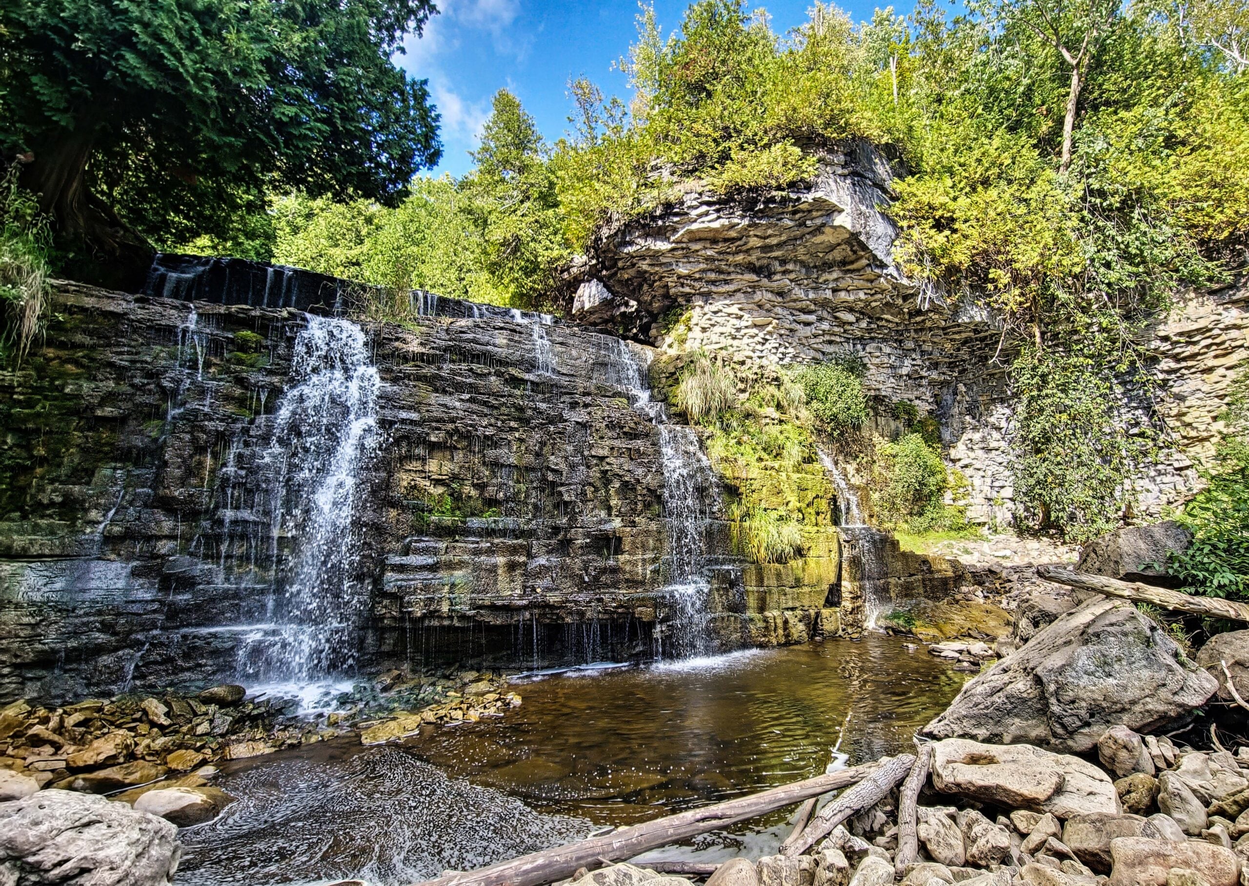
Jones Falls to Inglis Falls
https://hikes.brucetrail.org/event/jones-falls-to-inglis-falls/Sorry, the registration cut-off time for this hike has been reached.Not a member? Click here to join today!Hosting Club: Toronto, Sydenham
Category: Car Hike
Location (Google Maps): The parking lot is behind the Grey-Bruce Tourist Information Office. Enter from Highway 6, just north of the junction of Highway 6 and 21.Hike Leader(s): Stewart Fleming Click here to contact Hike Leader(s)
Pace: Brisk (4-5 km/hr), Moderate (3-4 km/hr)
Terrain: Hilly, Level 2 (Intermediate – some hills and uneven surfaces, rocks and roots underfoot), Variable
Distance (km): 21 kmDescription
We will hike south to Inglis Falls. After a snack break, we’ll return north and take the rocky side trail to explore Jones Falls. This hike includes crossing busy Hwy 6, the up and down rocky trail through Springmount Forest with some views of Georgian Bay, the less rocky West Rocks, and about 2 km of road before the woods near Inglis Falls.Our pace will be Brisk through the open areas but Moderate through the many rocky and hill climbing sections.
Please bring enough water (at least 2 litres) and food to maintain your energy for a 6-hour hike.
Comfortable hiking shoes or boots are a must. A rain shell is recommended in case of a wet weather forecast, along with a hat, sunscreen, and bug repellent for sunny weather or buggy trail conditions.
- 03October 3, 2026

Steeltown Stomp 2026
https://hikes.brucetrail.org/event/steeltown-stomp-2026/Sorry, the registration cut-off time for this hike has been reached.Not a member? Click here to join today!Hosting Club: Iroquoia
Category: Steeltown Stomp
Location (Google Maps): Mohawk 4 Ice Centre, 710 Mountain Brow Boulevard, Hamilton, L8T 5A9Event Coordinator(s): Leslie Ho & Family Click here to contact Event Coordinator(s)
Event Start Times: 8:00 AM, 8:15 AM, 8:30 AM, 8:45 AMPace: Medium – 3 to 4 km/hr
Terrain: Dependent on Conditions, Slippery and Steep Sections, Strenuous – Hilly with steep climbs and some poor footing
Distance: 23 kmDescription
The 10th annual Steeltown Stomp event is a challenging and rewarding self-guided hike and stair climb along the escarpment in Hamilton. You will hike approximately 23 kms, and climb more than 2,000 stairs along the Bruce Trail, the Escarpment Rail Trail, and the Chedoke Radial Trail. As you follow the specially blazed route you will encounter and climb the 6 sets of stairs along the Hamilton Escarpment. (Please note we are not including the Uli Stairs in this year’s Steeltown Stomp.) The route will be clearly marked with special yellow blazes, and staircases will have clear instruction signs posted. The route will be available on the AllTrails app, and printed maps are available at the starting point for those who would like one. You will find snacks and encouragement at the turnaround checkpoint at the Chedoke stairs, and will then return to the starting point to collect your coveted Steeltown Stomp badge, enjoy more snacks, and experience a great sense of accomplishment! You are not expected to complete the stairs on the return trip.Please Note: This is an arduous hike and requires a high level of fitness due to the stair climbing required.
Fee: $35 fee includes checkpoint and finish zone snacks and your badge, and you will be supporting the Bruce Trail Conservancy in its mission to preserve a ribbon of wilderness, for everyone, forever.
Check in: At the registration booth set up at the north end of the parking lot of the Mohawk 4 Ice Centre. In order to avoid congestion on the stairs we have set up staggered start times. Please select 8:00, 8:15, 8:30, or 8:45 when you register. You will be able to start the hike as soon as you are checked in. This is not a race, and you will not be timed.
Checkpoints: Start and end at the Mohawk 4 Ice Centre. There are washrooms and a water filling station available here. There is a turnaround checkpoint at the Chedoke Golf Course, and then you will hike directly back to the starting point. You are not expected to complete the stairs on the return trip.
Route: Follow the yellow blazes! Special yellow blazes will be set up to mark the route. In addition, the route has been set up on the AllTrails app. If you have this app downloaded on your phone, you can follow the route using the app. There are water filling stations available along the route. There are washrooms available at the start, at Corktown Park, and at the Chedoke turnaround.
Outbound route … https://www.alltrails.com/explore/map/steeltown-stomp-outbound-1-58c2ac6?u=m?u=m
Inbound route … https://www.alltrails.com/explore/map/steeltown-stomp-inbound-c89ca36?u=m
What to bring: Bring your own water. You will be able to refill your own water bottles at public water fountains along the route. Snacks will be provided, but you may wish to bring additional food for a lunch break. Wear comfortable, sturdy shoes (hiking boots are not necessary), and dress for the weather. Protect yourself from insects and sun.
Safety Precautions: Normal hiker etiquette and safety precautions apply…https://brucetrail.org/explore-the-trail/#Bruce-Trail-101
Donations: If you are interested in contributing further to the BTC, please click here or go to the BTC website
FAQ’s:
What if it rains? This is a rain or shine event.
What if I need to drop out? As we are in an urban area, there are places to access public transit or contact a taxi or ride sharing service along the way. This must be arranged by you, the participant. If you have to drop out during the event, please let us know by calling or texting the contact number below so our dedicated volunteers are not waiting for you at the finish line.
How long will it take to finish? We estimate that the hike will take between 3 and 5 hours.
Are dogs allowed? No. The stairs will be too crowded during this event.
Contact: Leslie Ho at iroquoiasteeltownstomp@gmail.com. On event day, you can text event organizers 289-237-8059.
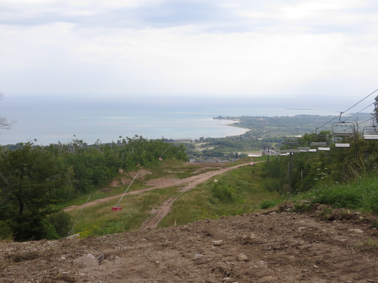
School Bus Hike: Beaver Valley E2E #1 (Loree Forest)
https://hikes.brucetrail.org/event/school-bus-hike-beaver-valley-e2e-1-loree-forest/Sorry, the registration cut-off time for this hike has been reached.Not a member? Click here to join today!Trip Information
Departure Time: 08:00
Return to City Time: 18:30
Departure Point: Kipling Departure PointOptional Items
Hiking ($.01)Hosting Club: Toronto
Category: Bus Hike
Location (Google Maps): Beaver Valley Section km 0.0 to 10.6Hike Leader(s): Felix Wan; Tim Wainwright Click here to contact Hike Leader(s)
Pace: Moderate (3-4 km/hr)
Terrain: Hilly, Level 2 (Intermediate – some hills and uneven surfaces, rocks and roots underfoot), Variable
Distance (km): 10.6Description
Join us for the kick-off hike of our Beaver Valley End-to-End series. The Beaver Valley section is known for its many hills, but all experienced, fit hikers are welcome to join us, including those who are not working towards an E2E badge. Our first hike will take us from the boundary with the Blue Mountains section at km 0.0, through the luscious Len Gertler Memorial Loree Forest and along the Escarpment edge, finishing at km 10.6 (Bruce Trail Reference Guide Edition 31, Map #24). We should catch some magnificent views of Georgian Bay.The total hike distance is approximately 10.6 km. There will be a dropout point at approximately 8.3 km. Time permitting, we will have a refreshment stop in Primrose.
Hiking boots and poles are recommended.
The series will continue on:
- Oct. 17
- Nov. 14
- Spring 2027 (dates TBD)
=>>> Please read the TBTC Paid Hikes Refund Policy before registering: https://torontobrucetrailclub.org/hikes/no-show-policy. There will be no refunds issued for this hike if the registrant cancels or misses the bus on the date of departure for any reason. Registration fees are not transferrable between different hikes, nor do unused fares qualify for a tax receipt.
School Bus Hike: Dufferin Highland, Murphy's Pinnacle
https://hikes.brucetrail.org/event/school-bus-hike-dufferin-highland-murphys-pinnacle-2/Sorry, the registration cut-off time for this hike has been reached.Not a member? Click here to join today!Trip Information
Departure Time: 08:30
Return to City Time: 18:30
Departure Point: York Mills Bus PickupOptional Items
Pick up at HWY 400 and HWY 9 ($0.01)Hosting Club: Toronto
Category: Bus Hike
Location (Google Maps): Dufferin Highland, Murphy’s PinnacleHike Leader(s): Martina Furrer, Janet McColeman, Leila Damband, and Brenda Dalglish Click here to contact Hike Leader(s)
Pace: Brisk (4-5 km/hr), Moderate (3-4 km/hr)
Terrain: Hilly, Level 2 (Intermediate – some hills and uneven surfaces, rocks and roots underfoot), Variable
Distance (km): Fast group 16 to 18 km, Moderate group 13 kmDescription
Join us for a fantastic fall hike in the Dufferin Highlands (Map 20). Enjoy awesome views from Murphy’s Pinnacle and the Mulmur Lookout.We will split into two groups. The fast group will do the Primrose Loop Side Trail and then follow the main trail north to km 29.6 (about a 16 km hike). If time permits the fast group will also do the Rock Hill Park Side Trail. The moderate group will head straight to Murphy’s Pinnacle and follow the main trail north to km 29.6 (about a 13 km hike).
Pack water, lunch, sun and rain protection.
Refreshment stop at Sonnen Hill Brewing (https://sonnenhill.com/). Sit back, relax, and socialize with your hiking friends while you sip a fresh, cold, local brew or non-alcoholic beverage in their beautiful beer garden. Or walk up to their lookout for more great views (a 20 minute loop).
Departure 1: 8:30 am from 10 York Mills Rd.
Departure 2: 8:50 am from HWY 400 and HWY 9Beaver Valley E2E in 8 - Hike 6
https://hikes.brucetrail.org/event/beaver-valley-e2e-in-8-hike-6/Sorry, the registration cut-off time for this hike has been reached.Not a member? Click here to join today!Hike open to BTC Members only.
Hosting Club: Iroquoia, Beaver Valley
Category: General Hike
Location (Google Maps): Parking Lot north of Sideroad 16C – accessible only from 7th LineHike Leader(s): Pati Greenwood, Jeff Dowsett Click here to contact Hike Leader(s)
Pace: Medium – 3 to 4 km/hr
Terrain: Moderate – Some hills and/or some poor footing, Strenuous – Hilly with steep climbs and some poor footing
Distance: 15.9 kmDescription
This is hike 6 of the End-to-End hike series to complete the Beaver Valley section of the Bruce Trail in 8 hikes. Join for all or as many hikes as desired – you will need to register for each hike in the series which will take place on the following dates: August 28, August 29, September 11, September 12, October 2, October 3, October 16 & October 17. Hikers completing the entire series will be eligible to obtain an end-to-end badge from the BTC Beaver Valley Club.Since this is a group hike, please consider your fitness level before registering. This section of the trail has numerous hills and rough terrain in spots. We will be walking at a pace of 3km – 4km per hour and hikers will need to keep up with the person in front of them for the duration of the hike. The hike series will also involve car shuttles and every hiker is expected to participate as drivers.
Weather conditions in the late summer can still be quite warm, but the hike schedule will extend to mid-October so it’s best come prepared for varying weather conditions. Hiking boots are required and hiking poles are strongly recommended. Bring plenty of fluids and a snack. Insects and ticks will still be active at this time of year, long pants and long sleeves are recommended as is insect repellent.
Specific hike details will be provided to registered hikers a few days prior to each hike.
Oak Ridges Corridor, Bethesda Trail
https://hikes.brucetrail.org/event/car-hike-erindale-park-mississauga-5/Sorry, the registration cut-off time for this hike has been reached.Not a member? Click here to join today!Hosting Club: Toronto
Category: Car Hike
Location (Google Maps): Oak Ridges Corridor, Bethesda Trail Head Parking Lot, Bethesda Side Road, Richmond Hill, ONHike Leader(s): MOHAMMAD AGHAMIRI Click here to contact Hike Leader(s)
Pace: Moderate (3-4 km/hr)
Terrain: Hilly, Level 2 (Intermediate – some hills and uneven surfaces, rocks and roots underfoot), Variable
Distance (km): 12-14 kmDescription
Carpool is highly recommended, try to carpool with your friends.For the day of hike only my phone number is 289 588 6482.
Beaver Valley Geology Hikes Badge Series 4/8 Fox Ridge - McCluskey's Rock
https://hikes.brucetrail.org/event/beaver-valley-geology-hikes-badge-series-4-8/Sorry, the registration cut-off time for this hike has been reached.Not a member? Click here to join today!Hosting Club: Blue Mountains
Category: Organized Hike
Location (Google Maps): Tim Horton’s, First Street, CollingwoodHike Leader(s): Annette Sandberg Click here to contact Hike Leader(s)
Pace: Medium – 3 to 4 km/hr
Terrain: Moderate – Some hills and/or some poor footing
Distance: 8.5 kmDescription
Fox Ridge and McClusky’s Rock: Badland at Stop 4 (Pages 72/73) Queenston Shale is the bottom-most layer of the Niagara Escarpment. Where vegetation is removed, the shale appears as a “badland”. The brick-red shale has long been excavated along the Niagara Escarpment to make bricks.
See Hike #1 – August 26 for series descriptionMono Cliffs Third Outlier - Please note parking change
https://hikes.brucetrail.org/event/mono-cliffs-third-outlier-2/Sorry, the registration cut-off time for this hike has been reached.Not a member? Click here to join today!Hosting Club: Dufferin Hi-Land
Category: General Hike
Location (Google Maps): Roadside parking at the south side of Dunby Road at the the trail entrance. See Google Maps link on this hike description for GPS.Hike Leader(s): Stuart Law Click here to contact Hike Leader(s)
Pace: Medium
Terrain: Dependent on Conditions, Moderate
Distance: 13.5 kmsDescription
Join us on a 13.5 km hike from the Third Outlier to the South Outlier at Mono Cliffs. Most people know that there are North and South Outliers at Mono Cliffs, but the Third Outlier is a bit of mystery surrounded by the beautiful BTC Whitetail Refuge Nature Reserve. The place is wonderfully quiet and peaceful. One of my favourite places to go. We will be climbing up and down the escarpment three times so be prepared for elevation. Be ready for jewel weed, fleabane, New England astors, moss covered rocks, cliffs and hidden streams. Please bring a lunch, a snack, 2L of water, and a first aid kit. Hiking boots mandatory. Poles recommended. Please arrive at 9:00 am to be ready to hike at 9:15.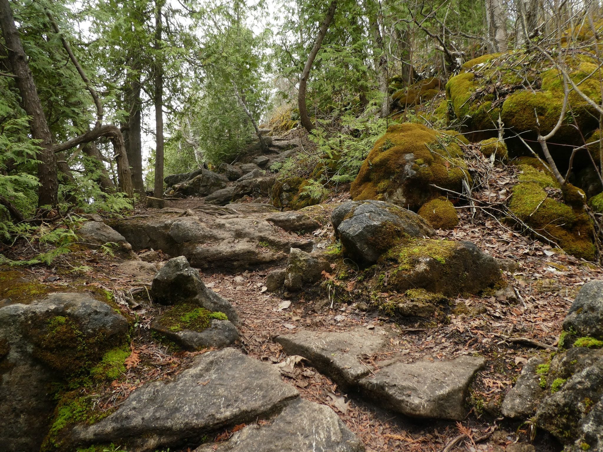
St Helena Rd to Hilton Falls (E2E)
https://hikes.brucetrail.org/event/st-helena-rd-to-hilton-falls-e2e/Sorry, the registration cut-off time for this hike has been reached.Not a member? Click here to join today!Hosting Club: Iroquoia
Category: General Hike
Location (Google Maps): Meet at 9:15 am in the Hilton Falls parking lotHike Leader(s): Karen Bergmann Click here to contact Hike Leader(s)
Pace: Medium – 3 to 4 km/hr
Terrain: Moderate – Some hills and/or some poor footing
Distance: 8.5 kmsDescription
We will meet at Hilton Falls and carpool to St Helena Rd. For those leaving their car at Hilton Falls, you will need to reserve your time at conservationhalton.caAlways a popular hike, this is a challenging hike because there are several technical (rocky) spots. We hike on the main trail along the edge of the Escarpment and will stop for a break by the Quarry, finishing along the Philip Gosling Side Trail.
Bring a snack/lunch and plenty of water.
Geology Hike # 9, Fossil Glen loop
https://hikes.brucetrail.org/event/geology-hike-9-fossil-glen-loop/Sorry, the registration cut-off time for this hike has been reached.Not a member? Click here to join today!Hosting Club: Sydenham
Category: Geology Hike
Location (Google Maps):Trailhead at corner of East Linton Sideroad W. and Sarawak/Keppel Townline (accessed from Grey County Rd 1). Park on north and west side of the bend.
Hike Leader(s): Carol Graham-Mullin Click here to contact Hike Leader(s)
Pace: Leisurely: 3 km/h or less
Terrain: Easy: Mostly flat and good footing., Moderate: Some hills and/or poor footing, Strenuous: Hilly with steep climbs and some poor footing., There might be muddy sections.
Distance: 2.3 kmDescription
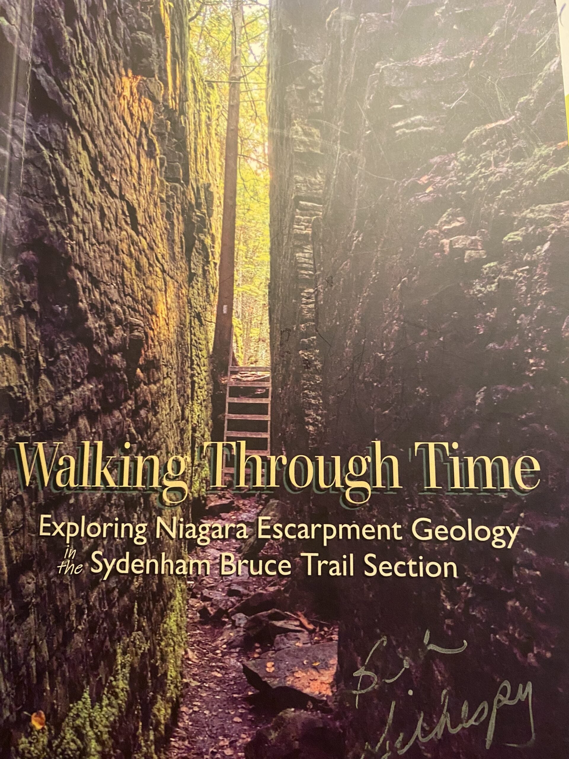
Please join Carol for a fossil-rich hike featuring this fascinating layer of Fossil Hill Dolostone, along with crevices, overhangs and a historic homestead. There are easy sections with some steeper slopes. Poles recommended. Water and proper footwear are always necessities. A copy of Beth Gilhespy’s book “Walking Through Time” in the Sydenham section will be available for purchase at the end of the hike. $37. cash (correct change please) or e-transfer.Fall Colours With Pride
https://hikes.brucetrail.org/event/fall-colours-with-pride/Sorry, the registration cut-off time for this hike has been reached.Not a member? Click here to join today!Hosting Club: Beaver Valley
Location (Google Maps): Meet in the rest area south of Kimberley on the west side of Grey Road 13.
Hike Leader(s): Glenda Collings Click here to contact the hike leader.
Pace: Medium
Terrain: Moderate, Some rocky footing, Some steep sections
Length of Hike: Approx. 5 kmDescription
Join us on Saturday, October 3rd in the beautiful Beaver Valley for an autumn hike in partnership with the Rainbow Club of South Georgian Bay. This hike is open to all, with an especial invitation to members of the queer, 2S-LGBTQIA+ community, their allies and supporters. Participants do not need to be Bruce Trail members to register.We’ll be taking a walk through the Eagle’s Summit area at the top of the escarpment where the views across the valley are lovely. Photo ops abound! Enjoy the peace and beauty of the mixed forest and meadows, while chatting with fellow hikers along the way. We’ll be moving along at a manageable, moderate pace for about 1 ½ hours, be sure to wear sturdy footwear with a good tread, dress for the weather and bring along a water bottle. We’ll meet at the Beaver Valley Rest Area parking lot on the east side of Grey Road 13, just north of Kimberley. Coordinates, 44.363929,-80.531458. This is a dog friendly hike, dogs must be leashed.
Urban Walk: Evergreen Brick Works and Moore Park Ravine
https://hikes.brucetrail.org/event/urban-walk-evergreen-brick-works-and-moore-park-ravine/Sorry, the registration cut-off time for this hike has been reached.Not a member? Click here to join today!Hosting Club: Toronto
Category: TBTC Special Events
Location (Google Maps): Evergreen Brick Works and Moore Park Ravine. Meet in Tiffany Commons by the Watershed Wall (between the farmer’s market and main building)Pace: Moderate (3-4 km/hr)
Terrain: Hilly, Level 2 (Intermediate – some hills and uneven surfaces, rocks and roots underfoot), Variable
Distance (km): 5 kmDescription
Join Ray for a 5 km introductory circular urban walk exploring the wetlands, woodlands, and natural meadows of the Evergreen Brick Works, and then ascending into the beautiful Moore Park Ravine returning to the Evergreen Brick Works by the scenic outlook overlooking the Evergreen Brick Works site, Don Valley, and ravines. Expect some moderate hills and uneven terrain. Hiking boots or shoes designed for walking are essential. The hike will return to Evergreen Brick Works in time for the “Hiking 101” presentation in the BMO atrium at 12:30 pm.This hike is part of our Bruce Trail Day celebrations. Saturday we will be at the farmer’s market in Evergreen Brick Works and on Sunday we will be at Limehouse on the trail. If you’re unavailable on Sunday please join us in Toronto on the Saturday to meet with us and learn about the Bruce Trail. On Sunday there will be a selection of hikes based from Limehouse plus a Bus Hike from York Mills Subway. Preregistration is not required to join us on the hikes from Evergreen Brick Works.
Urban Walk: Moore Park Ravine and Park Drive Reservation
https://hikes.brucetrail.org/event/urban-walk-moore-park-ravine-and-park-drive-reservation/Sorry, the registration cut-off time for this hike has been reached.Not a member? Click here to join today!Hosting Club: Toronto
Category: TBTC Special Events
Location (Google Maps): Evergreen Brick Works, Moore Park Ravine and Park Drive Reservation
Meet in Tiffany Commons by the watershed wall (between the farmer’s market and the main building)Pace: Moderate (3-4 km/hr)
Terrain: Level 1 (Easy – mostly on flat, well maintained trails with hard-packed surface), Variable
Distance (km): 4 kmDescription
Join Danny for a 4 km introductory “out and back” urban walk southbound into the ravine trails and northwards past Milkman’s Lane into Park Drive Reservation. We’ll continue to Mount Pleasant Road and return to the Evergreen Brick Works in time for the “Hiking 101” presentation in the BMO atrium at 12:30 pm. This hike will be on generally flatter terrain and on hard packed gravel paths. Hiking boots or shoes designed for walking are recommended.This hike is part of our Bruce Trail Day celebrations. Saturday we will be at the farmer’s market in Evergreen Brick Works and on Sunday we will be at Limehouse on the trail. If you’re unavailable on Sunday please join us in Toronto on the Saturday to meet with us and learn about the Bruce Trail. On Sunday there will be a selection of hikes based from Limehouse plus a Bus Hike from York Mills Subway. Preregistration is not required to join us on the hikes from Evergreen Brick Works.
Urban Walk: Waterfront Trail 8/11 – Beechgrove (Port Union) to Pickering
https://hikes.brucetrail.org/event/urban-walk-waterfront-trail-8-11-beechgrove-port-union-to-pickering/Sorry, the registration cut-off time for this hike has been reached.Not a member? Click here to join today!Hosting Club: Toronto
Category: Urban Walk
Location (Google Maps):Toronto, Ontario, Canada
Hike Leader(s): Brian Rideout Click here to contact Hike Leader(s)
Pace: Moderate (3-4 km/hr)
Terrain: Flat
Distance (km): 11.9 kmDescription
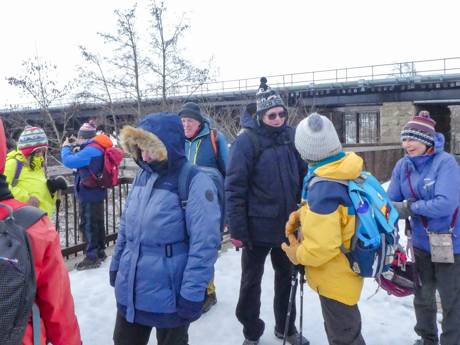
Please meet me at Kennedy Station by 10:04 am. We will take the 38A East to Rouge Hill GO bus departing 10:20 am, arriving at Port Union Rd at 11:00 am.We will hike south to Lake Ontario and along the Waterfront Trail through Port Union and Rouge Hill to Pickering GO. The estimated distance is 9.8 km. Here is an online map of our route – Port Union to Pickering.
Bring a snack, at least 2 liters of water, sun screen and bug spray.
Introductory Hike - Evergreen Brick Works
https://hikes.brucetrail.org/event/introductory-hike-evergreen-brickworks-4/Sorry, the registration cut-off time for this hike has been reached.Not a member? Click here to join today!Hosting Club: Toronto
Category: TBTC Special Events
Location (Google Maps):Meet the hike leader in Tiffany Commons in front of the watershed wall at the Evergreen Brick Works (across from the cafe). Please contact ttc.ca to confirm transit information, as summer construction projects may be underway. Evergreen Brick Works free shuttle from outside Broadview Subway Station (departs every 30 minutes) or TTC Route #28 Bayview South from Davisville Subway Station (every 30 minutes)
Hike Leader(s): Ray Berzins Click here to contact Hike Leader(s)
Pace: Leisurely (2-3 km/hr)
Terrain: Flat, Level 1 (Easy – mostly on flat, well maintained trails with hard-packed surface)
Distance (km): 4 kmDescription
A there-and-back hike South from the Evergreen Brick Works to Beltline Trail which goes northwest to Mount Pleasant Road from where we shall return to the Evergreen Brick Works along the same route. Preregistration for hike is not required – just arrive 15 minutes prior to the hike to sign up with hike leader.