
The BTC office will be closed on Mon. Oct. 12 for the holiday. Thank you for your understanding.
Hike Schedule
Join us for a hike! Registration required.
All hikes available to BTC members. Some hikes are open to non-members.
See Refund Policy for Paid Hikes >
TIP: The calendar view displays up to 7 hikes on a day, but often there are more. Click “View more events” to see them all.
Niagara
Iroquoia
Toronto
Caledon Hills
Dufferin Hi-Land
Blue Mountains
Beaver Valley
Sydenham
Peninsula
All Clubs
Show Filters
Categories
Reset Filters
- 20September 20, 2026
Exploring The Uxbridge Trails from Three Rocks
https://hikes.brucetrail.org/event/exploring-the-uxbridge-trails-from-three-rocks/Sorry, the registration cut-off time for this hike has been reached.Not a member? Click here to join today!Hosting Club: Toronto
Category: Car Hike
Location (Google Maps): Park at 1120 Concession Rd 7, Uxbridge, ON L9P 1R4. This is the East Duffins Headwaters conservation area parking lot. It’s a pay parking lot for non-residents of Uxbridge. You can purchase parking permits through a mobile app by scanning the barcode at the site upon arrival. Alternatively, you can pay in advance on the Township of Uxbridge website. The current daily permit cost is $6.00.Hike Leader(s): Amir Alemohammad Click here to contact Hike Leader(s)
Pace: Moderate (3-4 km/hr)
Terrain: Flat, Hilly, Level 2 (Intermediate – some hills and uneven surfaces, rocks and roots underfoot), Variable
Distance (km): 14-16Description
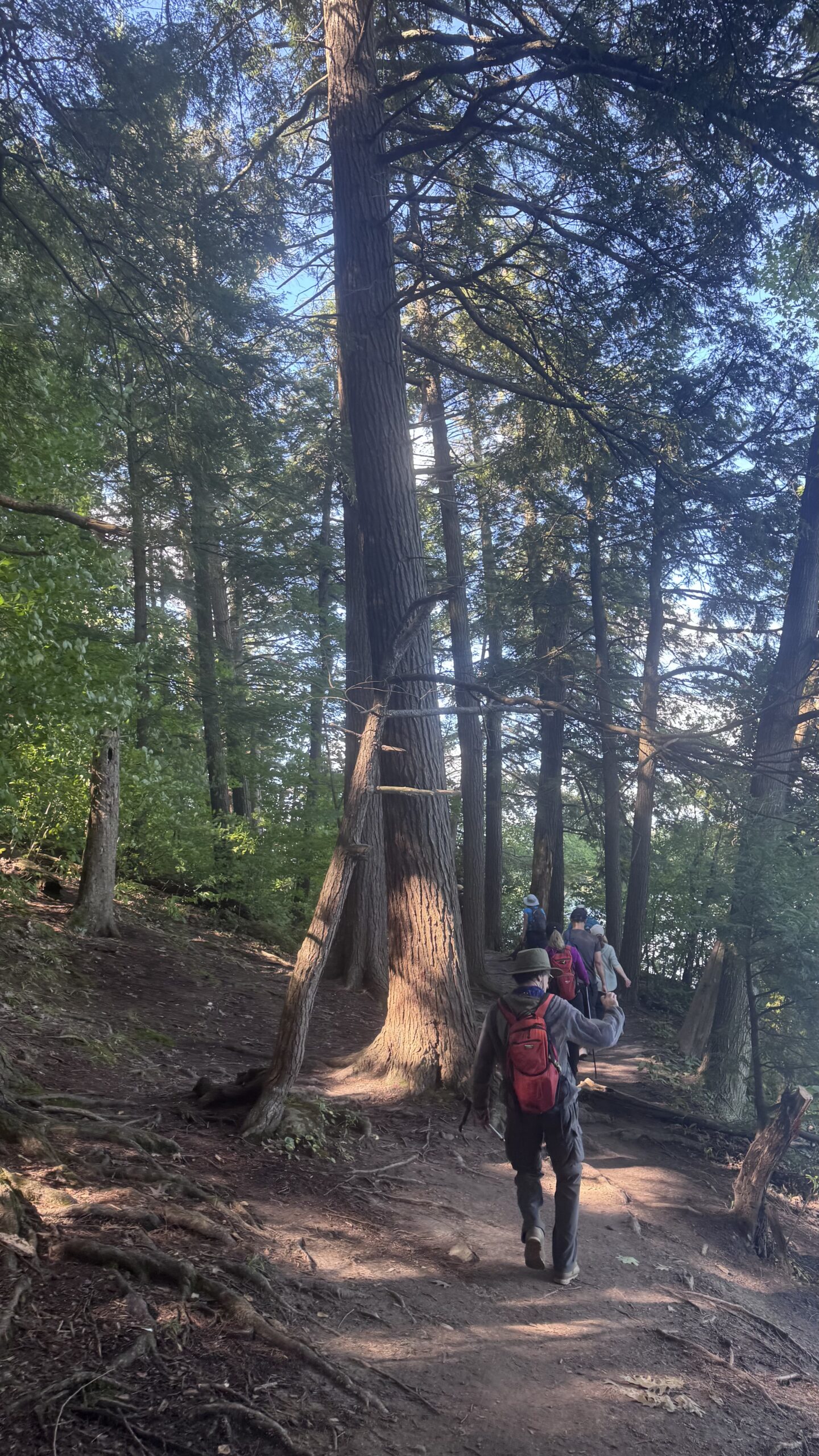
This loop hike takes us through Uxbridge trails, Canada’s capital trails. Beginning at the Three Rocks in Uxbridge, we’ll enjoy hiking several lookouts and exploring the Aggregate Pit. We’ll also stroll through the beautiful Uxbridge forests of Glen Major, Walker Woods, and The Wilder Forest.Boots are mandatory, and trekking poles are recommended. Don’t forget to bring at least two litres of water and some snacks. Please arrive at 7:45 for the 8:00 start.
Caledon Hills E2E In 4 Hike #1
https://hikes.brucetrail.org/event/caledon-hills-e2e-in-4-hike-1-2/Sorry, the registration cut-off time for this hike has been reached.Not a member? Click here to join today!Hosting Club:
Category: End-to-End
Location (Google Maps): Parking Area – north of km 51.8 on the east side of 5th Line EHS, just south of the Hockley Rd. on the BTC’s Hemlock Ridges Nature Reserve.Hike Leader(s): Daniel Patterson Click here to contact Hike Leader(s)
Pace: Medium – 3 to 4 km/hour
Terrain: Strenuous – hilly with steep climbs and some poor footing
Distance: 20.07 kmDescription
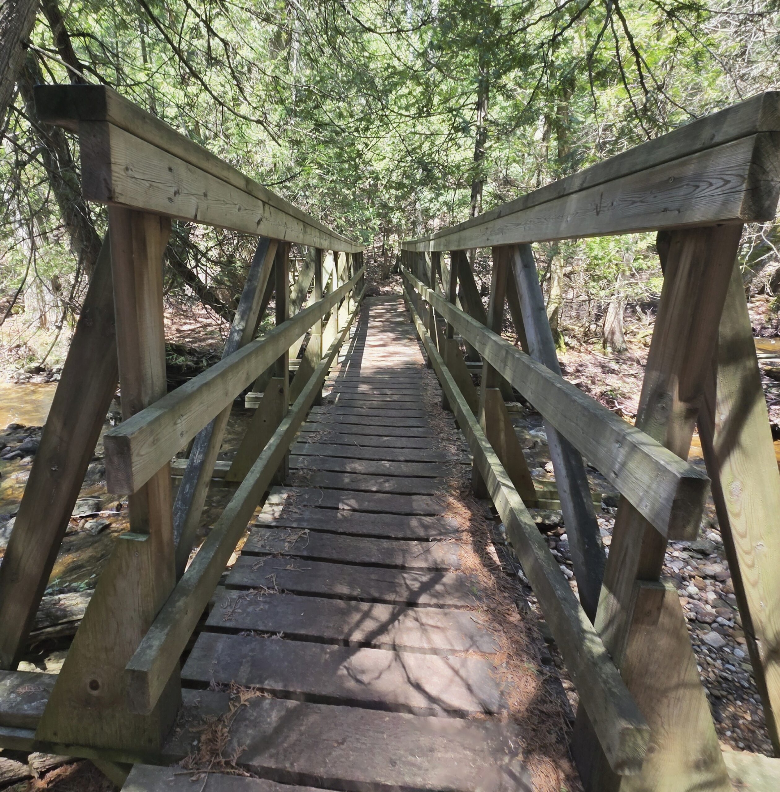
Welcome to Caledon Hills In 4 Fall Edition. Meet at 5th Line EHS & Hockley Rd. (7) Bruce Trail Parking at 8:15 a.m. We will shuttle to Mono Center to start the hike. This is an End-to-End series to complete the Caledon Hills section of the Bruce Trail in 4 hikes. We will be hiking from the north end to the south end. Join for as many hikes as desired – you will need to register for each hike in the series which will take place on the following dates: Sept. 27, Oct. 18 & 25. Since this is a group hike, please consider your fitness level before registering. We will be walking at a pace of 3 km – 4 km per hour and hikers will need to keep up with the person in front of them for the duration of the hike. The hike series will also involve car shuttles and every hiker is expected to participate as drivers. Weather conditions can be variable, dressing in layers is recommended. Hiking boots are required and hiking poles are strongly recommended. Bring plenty of fluids, electrolytes. lunch and snacks. This section is challenging with many hills.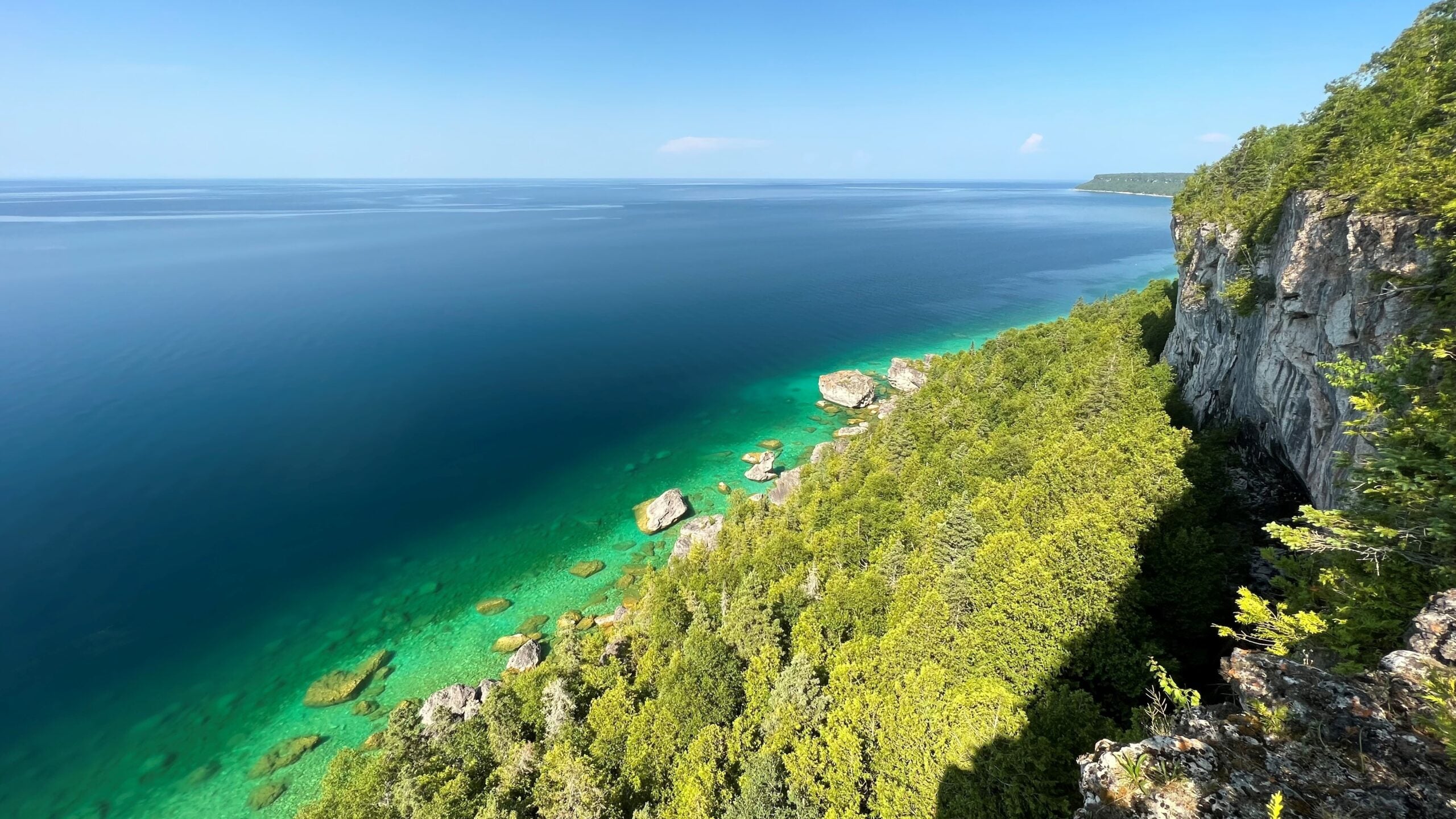
Cancelled - Sunday Side Trails: Halfway Log Dump
https://hikes.brucetrail.org/event/sunday-side-trails-halfway-log-dump/Sorry, the registration cut-off time for this hike has been reached.Not a member? Click here to join today!Hosting Club: Peninsula
Category: Peninsula Blue Series
Location (Google Maps): Halfway Log Dump Parking LotHike Leader(s): Jamie McDermid Click here to contact Hike Leader(s)
Pace: Medium (3.0 – 4.5 km/h): A comfortable pace for most hikers with steady progress.
Terrain: Difficult: Steep ascents/descents, rocky scrambling, and some rugged escarpment paths.
Distance: ~ 15.9 kmDescription
Peninsula BTC is offering a series of hikes covering all of the side trails on the Peninsula section of the Bruce Trail. These hikes are a great opportunity for those who want to do some hiking but don’t want to commit to a full end-to-end; for those who have completed an end-to-end and want to explore more of the beautiful trails on the Peninsula and for locals and visitors who want to get out on the trail on the weekend.The series will include 27 hikes on Sundays (and maybe the odd Saturday) over 2026 and 2027, covering more than 150 km of side trails or 78 trails! We will be offering hikes on a roughly biweekly basis, with hikes posted approximately two months in advance. The hikes will generally be loop hikes, although car shuttling may be required for a few hikes. Register for each hike individually, no need to commit to all 27 hikes!
For those who would like to earn the Peninsula Side Trails Badge, these hikes provide a chance to join a group for some or all of the side trail hikes.
This is an out and back hike to High Dump. We will hike on Halfway Dump Side Trail and High Dump Side Trail. The trek will take us along the escarpment edge to High Dump and the beautiful rocky beach.
Parking fees apply.
Hikers should be prepared for the weather, possible wet trails and insects. Bring lunch, water and snacks. Hike leader will contact registered hikers one week before the hike.
If you would like to be notified when the side trail hikes are posted, go to the bottom of the Hikes page on the PBTC website to sign-up for hike notifications.
Eugenia Falls to Grey Road 13 Rest Area
https://hikes.brucetrail.org/event/eugenia-falls-to-grey-road-13-rest-area/Sorry, the registration cut-off time for this hike has been reached.Not a member? Click here to join today!Hosting Club: Beaver Valley
Location (Google Maps): Meet at the rest area on Grey Road 13, Map 26, Edition 30, 44.363929,-80.531458 to shuttle to Eugenia Falls
Hike Leader(s): Mike Arkless Click here to contact the hike leader.
Pace: Medium
Terrain: Moderate, Some steep sections, Strenuous
Length of Hike: 10.6 kmDescription
We’ll be hiking along the east side of the valley, meeting at the rest area, then shuttling down to Eugenia Falls to begin our hike. There is paid parking at Eugenia Falls. Please arrive by 8:15 to car shuttle for an 8:30 a.m. start. Bring sufficient water and a snack and dress for the weather. We’ll start with a visit to the falls and see some hydro history, further on see large dolostone blocks, deep, vertical crevices and some great views across the valley. A walk past the iconic “Penstocks” is always a treat. If you need to cancel, please do so online or contact the hike leader through the “Contact Hike Leader” option, so we know whether or not to expect you. Looking forward to seeing you!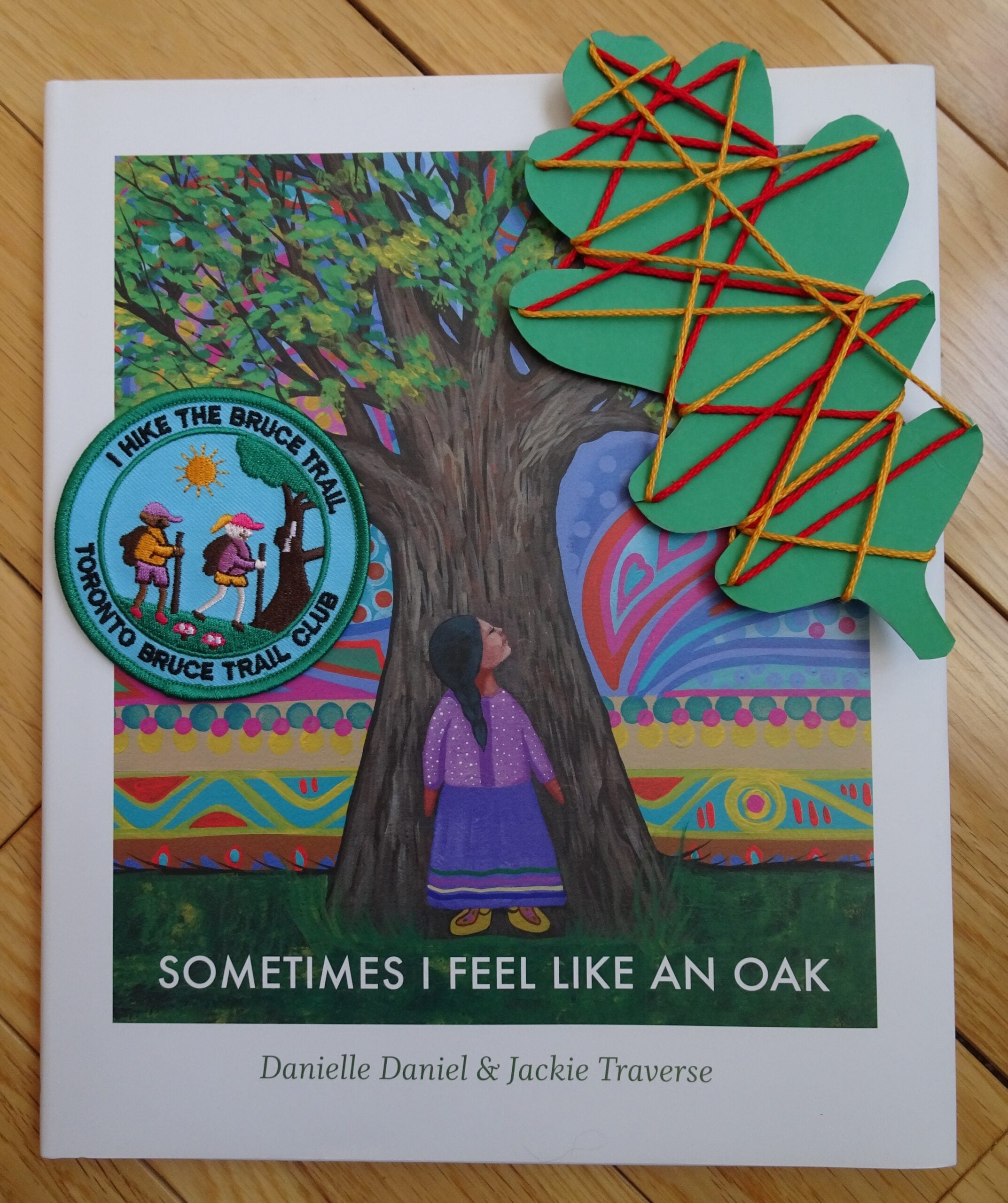
Passport to Nature: What tree are you? (Children’s Hike)
https://hikes.brucetrail.org/event/passport-to-nature-what-tree-are-you-childrens-hike/Sorry, the registration cut-off time for this hike has been reached.Not a member? Click here to join today!Hosting Club: Toronto
Category: Car Hike
Location (Google Maps): We will meet at the Silver Creek Outdoor Education parking lot (coordinates are 43.692615, -79.968433).Hike Leader(s): Monica Pasquali Click here to contact Hike Leader(s)
Pace: Leisurely (2-3 km/hr)
Terrain: Level 2 (Intermediate – some hills and uneven surfaces, rocks and roots underfoot)
Distance (km): 3 kmDescription
Celebrate the end of summer and the beginning of fall by participating in a family-friendly “Passport to Nature” event along the Bruce Trail!We will begin our adventure by reading the storybook “Sometimes I Feel Like an Oak” by Canadian Indigenous author Danielle Daniel. We will talk about the different trees mentioned in the book, including how they can be identified, so we can find some of them as we complete a 3 km loop hike of the main Bruce Trail and Roberts Side Trail. We will then finish our day together by enjoying our snacks and doing a tree-themed art activity outdoors before we all head home.
The hike leader will bring the storybook and art supplies as well as a first aid kit and FREE Toronto Bruce Trail Club Youth Badges for children aged 13 and under who participate in the day’s activities.
Participants should bring something to sit on (e.g., folding chair, picnic blanket, etc.) to be used before and after the hike which can be stored in the car during the hike. Participants should also bring their own water and nut-free snacks. Please note that children should be accompanied by an adult, and all participating children and adults should register for this hike.
The 3 km loop hike will be hiked at a leisurely pace so it will take us approximately 1.5 hours to complete. The trail is rocky and hilly in places and is therefore not stroller-friendly so all participants should be capable of walking on their own. Please wear clothing appropriate for the weather and comfortable shoes with good traction.

Boots and Books Hike - Braiding Sweetgrass by Robin Wall Kimmerer
https://hikes.brucetrail.org/event/boots-and-books-hike-braiding-sweetgrass-by-robin-wall-kimmerer/Sorry, the registration cut-off time for this hike has been reached.Not a member? Click here to join today!Hosting Club: Iroquoia
Category: Boots & Books – The Iroquoia Bruce Trail Book Club
Location (Google Maps): Dundas Valley Conservation AreaHike Leader(s): Kirsten McCarthy Click here to contact Hike Leader(s)
Pace: Leisurely – 3km/hr or less
Terrain: Easy – Mostly flat and usually good footing, Moderate – Some hills and/or some poor footing, Slippery Sections Likely
Distance: 5-6kmDescription
Come join us for the next Boots and Books Hike!This is also a Passport to Nature event where participants can collect a sticker for your Passport. Collect 4 stickers and get a badge, collect 9 different colour stickers and receive a BTC store gift card!
We’ll be reading “Braiding Sweetgrass” by Robin Wall Kimmerer and our hike will enhance the books teachings about the connection between plants, animals and humans as we stroll through The Dundas Valley Conservation Area’s new Basadinaa Experience. The Indigenous heritage of the Mississaugas of the Credit First Nation and Six Nations communities comes to life throughout the Basadinaa Experience throughout the main trail of the DVCA. The beautiful signage along the way provides opportunities for reflection, learning, and connection with the land through First Nations perspectives. Visitors are encouraged to take their time and approach the trail with openness and gratitude. We’ll meet in the main parking lot off Governor’s Road (Park fees apply – please register here for parking https://conservationhamilton.ca/admissions-fees/) and hike the main loop.
Scotsdale Farm
https://hikes.brucetrail.org/event/scotsdale-farm/Sorry, the registration cut-off time for this hike has been reached.Not a member? Click here to join today!Hosting Club: Iroquoia
Category: General Hike
Location (Google Maps): Meet at 9:15 am in the main parking lot at Scotsdale FarmHike Leader(s): Karen Bergmann Click here to contact Hike Leader(s)
Pace: Medium – 3 to 4 km/hr
Terrain: Moderate – Some hills and/or some poor footing
Distance: 9 kmsDescription
We will start at the main parking lot and hike around the Bennett Heritage side trail, along the main trail around the loop and back along the top of the Bennett Heritage side trail. Although a fairly easy hike, there are a few rocky sections and a few hills.Bring water and a snack, as needed.
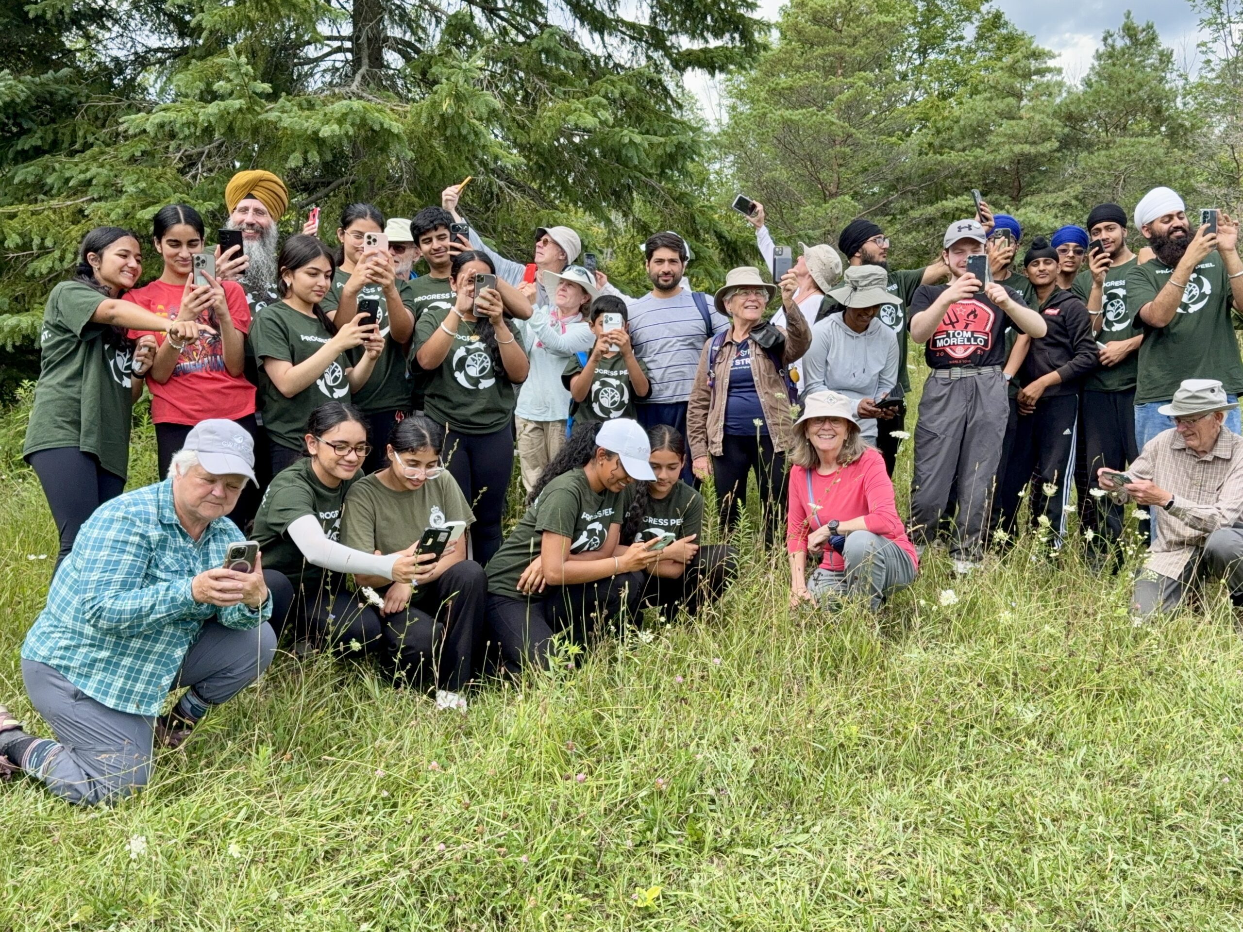
iNat Together: Find Your Nature Friends Bioblitz
https://hikes.brucetrail.org/event/inat-together-find-your-nature-friends-bioblitz/Sorry, the registration cut-off time for this hike has been reached.Not a member? Click here to join today!Hosting Club: Caledon Hills
Category: Nature Walks
Location (Google Maps): Bruce Trail parking Lot at Riverside Woods, 713377 1st Line EHS, Mono.
Driving directions:
From Hwy # 10 north of Orangeville, turn east on to Hockley Rd. Drive for 1.1 km. Continue straight onto Side Road 5 for 1.6 km. Turn left onto 1st Line EHS for 900 meters. Continue straight into the parking lot.
***DO NOT TAKE 1ST LINE EHS SOUTH FROM HOCKLEY ROAD. It is not maintained. Google maps may suggest this impassable route.Hike Leader(s): Leslie Bissegger Click here to contact Hike Leader(s)
Pace: Leisurely – 3 km/hour or less
Terrain: Moderate – some hills and/or some poor footing
Distance: 1-5 kmDescription
Join us for a Bioblitz at the Riverside Woods Property. A bioblitz is a communal effort to record as many species within a designated location and time period as possible using the iNaturalist community science app. iNaturalist data is used to collect biodiversity data that can be used by land stewards, trail captains, property owners and conservation staff at the Bruce Trail Conservancy. You will be out on this 1-5 km nature walk with others that are interested in slowing down and observing nature.If you have never used iNaturalist or if you are an experienced user, we will be making observations of rare, common and invasive species. You can use a cell phone or camera. We will offer an introduction session at the beginning for those that are new to iNaturalist. Experienced users will be able to hit the trail after a brief intro.
Optional: Bring a picnic lunch to enjoy with the group after the hike and have a chance to ask questions and compare notes.
When you register for the hike, we will email you instructions on how to download and set up your iNaturalist account to be ready the day of the hike .
Wear comfortable, sturdy shoes, dress for the weather, bring sunscreen, bug spray, water and a phone or camera. A battery charger for your phone may be useful.
Observations made this day can count towards achieving your Citizen Scientist Badge from the Caledon Hills Club. Details on the Citizen Scientist Badge can be found here https://caledonbrucetrail.ca/hiking/club-badges/citizen-scientist-badge/
No dogs please.
Looking forward to seeing you at Riverside Woods.
Car Hike: Hockley Valley, Map 18
https://hikes.brucetrail.org/event/car-hike-hockley-valley-map-18-6/Sorry, the registration cut-off time for this hike has been reached.Not a member? Click here to join today!Hosting Club: Toronto
Category: Cancelled
Location (Google Maps):Hockley Valley Provincial Nature Reserve
Hike Leader(s): Al Brown Click here to contact Hike Leader(s)
Pace: Moderate (3-4 km/hr)
Terrain: Challenging, Level 2 (Intermediate – some hills and uneven surfaces, rocks and roots underfoot)
Distance (km): 12 kmDescription
We will complete a loop hike through the nature preserve, along one of the hilliest sections of the Trail. This is a popular section because of the hills and because it is almost all forest cover.After the hike those interested are invited to meet for refreshments in the local area.
To get to the meeting point drive north on Hwy 10 past Orangeville to Hockley Road. Turn right and go about 6 km to the parking area. It is across the road from the Black Birch restaurant.
BAFFIN × BRUCE TRAIL CONSERVANCY × HAMILTON TIGER-CATS COMMUNITY HIKE
https://hikes.brucetrail.org/event/baffin-x-bruce-trail-conservancy-x-hamilton-tiger-cats-community-hike/Sorry, the registration cut-off time for this hike has been reached.Not a member? Click here to join today!Hosting Club: Iroquoia
Category: Special Event
Location (Google Maps): City View Park in BurlingtonHike Leader(s): BTC Staff Click here to contact Hike Leader(s)
Pace: Leisurely – 3km/hr or less
Terrain: Easy – Mostly flat and usually good footing, Moderate – Some hills and/or some poor footingDescription
IMPORTANT: SEE BAFFIN WEBSITE FOR REGISTRATION & MORE DETAILS – https://www.baffin.com/pages/baffin-bruce-trail-conservancy-hamilton-tiger-cats-community-hikeSpend the morning outdoors with members of the Baffin community, Bruce Trail Conservancy and Hamilton Tiger-Cats, with special appearances from Ticats players and cheerleaders.
Event Highlights:
- Guided Community Hike — Explore the trails surrounding City View Park alongside the Bruce Trail Conservancy and fellow members of the community.
- Hamilton Tiger-Cats Special Guests — Members of the Hamilton Tiger-Cats team and cheerleaders will join us for the morning.
- Baffin on the Trail — Connect with the Baffin team and experience a morning built around community, movement and time outdoors.
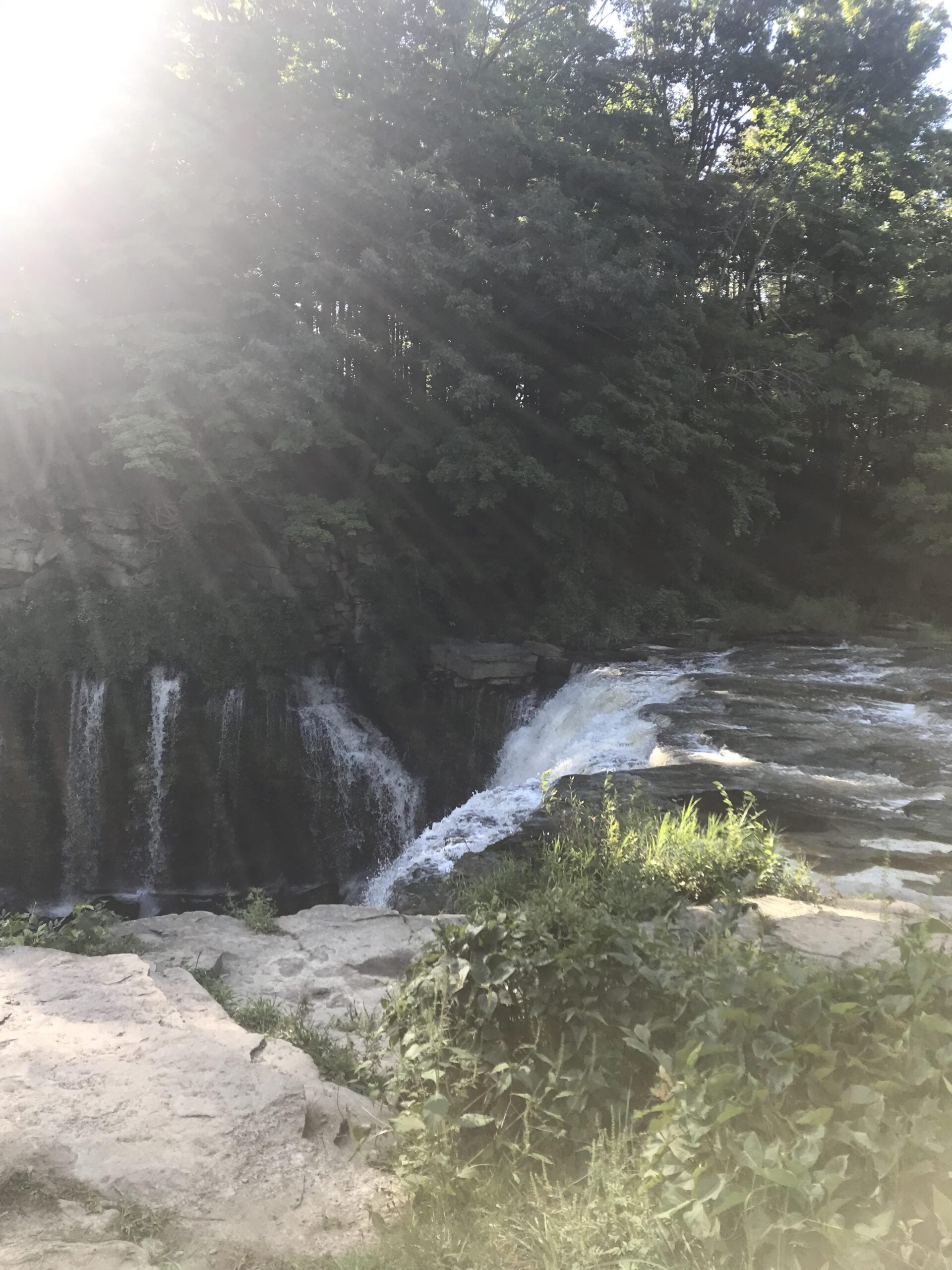
2:00 pm NBTC Landowner Appreciation Celebration 2026
https://hikes.brucetrail.org/event/200-pm-nbtc-landowner-appreciation-celebration-2026/Sorry, the registration cut-off time for this hike has been reached.Not a member? Click here to join today!Hike open to BTC Members only.
Hosting Club: Niagara
Category: Register
Location (Google Maps): Ball’s Falls Conservation Area – Centre for Conservation, Glen Elgin Room – 3292 Sixth Ave. Lincoln. Park in the main parking area it is free for the event.Hike Leader(s): Sam Rutherford Click here to contact Hike Leader(s)
Description
Hiking the Bruce Trail is a truly Canadian experience. Our landowners help make this happen. Let’s celebrate together!This year’s event will have a Canadiana theme and feature easy and easy-to-moderate biodiversity hikes which you can sign up for on the day along with information from the biodiversity committee and BTC land stewardship. NBTC merchandise will be available for purchase at the event. Food will be provided by our creative Social Convenor Joanne and friends. Cash bar. Prize draws. Come out and say thank you to our landowners for allowing us to hike across their private properties. It’s always a fun afternoon made even more special by your presence!
Attention all pastry chefs and fans of the Great Canadian and British Baking Shows! Why not use your culinary skills to impress our valued landowners? We are looking for hand held treats (ex. squares, tarts, cookies, shortbreads, brownies) for our annual Landowner Appreciation Celebration. We are asking members to bring along some homemade sweets for 6-8 people to enjoy. There will be a butter tart competition judged by our landowners with prizes for the winners. If you are unable to provide a dessert please consider a monetary donation. Thank you!
- 21September 21, 2026
Multi-day Trip to Manitoulin Island
https://hikes.brucetrail.org/event/multi-day-trip-to-manitoulin-island/Sorry, the registration cut-off time for this hike has been reached.Not a member? Click here to join today!Hike open to BTC Members only.
This is a Multi-Day Hike
You are signing up for the following dates and times:
2026-09-21 at
2026-09-22 at
2026-09-23 at
2026-09-24 at
2026-09-25 atHosting Club: Iroquoia, Peninsula
Category: Special Event
Location (Google Maps): Manitoulin Island
Registered participants will receive a WhatsApp invitation (optional) which can be used for photo share.Hike Leader(s): Ruth Moffatt Click here to contact Hike Leader(s)
Pace: Leisurely – 3km/hr or less, Medium – 3 to 4 km/hr
Terrain: Dependent on Conditions, Moderate – Some hills and/or some poor footing, Strenuous – Hilly with steep climbs and some poor footing
Distance: VariesDescription
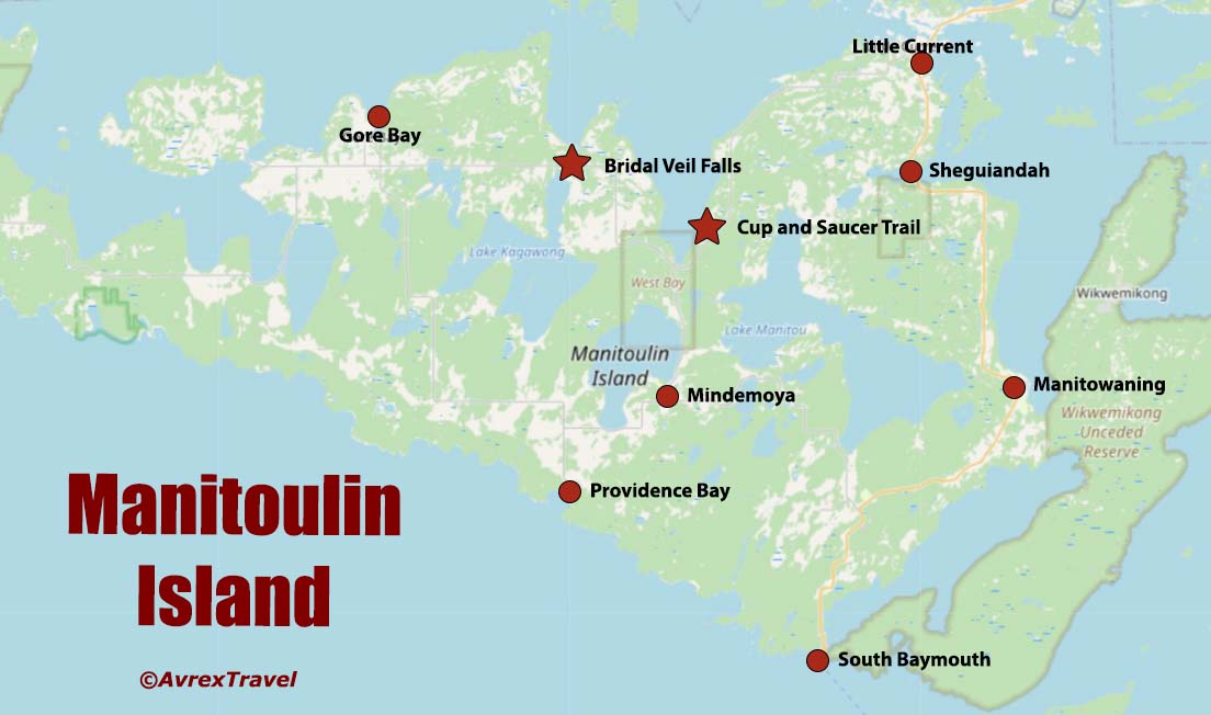
Everyone who is registered for this hike series will be invited to join an optional WhatsApp which can be used to share photos and other information.Please join Beth Gilhespy and Ruth Moffatt for a 5 day/4 night trip over to Manitoulin Island (Manidoo Minising) where we will hike and explore the Escarpment Biosphere Conservancy (EBC) trails. Manitoulin Island is the world’s largest freshwater island and is known for its stunning nature, Indigenous culture (home to six Anishinaabe First Nations), and outdoor activities. We will access it via MS Chi-Cheemaun ferry from Tobermory. Shared expenses for accommodation with whomever you are sharing your cabin with and travel (gas, ferry expenses). You may also choose to travel solo. Breakfast and lunch will be your own responsibility. One or two potluck dinners may be arrange depending on the weather and facilities.
Day1 – Mon, Sept 21, 2026 – 9am – meet in the BTC Parking Area on the east side of the road – 2461 Bruce County Rd 9, Barrow Bay. Depart at 9:15am. You can leave your car here if you are comfortable doing so or get dropped off.
On the way up to Tobermory to catch the MS Chi-Cheemaun ferry, we will stop at the EBC’s Alvar Bay Nature Preserve (close to Tobermory). We should be in position for the ferry at 11:30am so you will have time for your lunch in the Tobermory area. We will proceed to catch the 1:30pm ferry crossing. The ferry crossing takes about 1.75 – 2 hours. From the arrival in South Baymouth we will proceed to Mindemoya Court Cottages and Campground (about 35 min) https://mindemoya.ca/cottages. Please arrange your reservation with Kim at enquiries@mindemoya.ca Let her know that you are with the Bruce Trail group. You may book any cottage or trailer you like. Waterfront 15T and 16T are being held for us until February 15. Check in is September 21 (Check in time is 3pm)and check out is Sept 25 (check out time is 9am). There is tent camping as well, if you prefer.
This location is very close to the town of Mindemoya where there are amenities if needed.
Please make note of what you will need to bring to the cottages. The cottages are located on Mindemoya Lake so we should have some nice sunsets/stargazing opportunities.Tentative Schedule as follows: please be ready to depart the cabins each day by 9:00am.
Hiking schedule is subject to change.
Day 2 – Tues, Sept 22, 2026 – After breakfast we will hike EBC Cup and Saucer Nature Preserve 12 km
Day 3 – Wed, Sept 23, 2026 – After breakfast we will hike EBC Lake Wolsey Nature Preserve 7 to 14 km depending on route chosen
Day 4 – Thurs, Sept 24, 2026 – After breakfast we will hike EBC Barrie Island Nature Preserve 6.5 km; afterwards optional visits to EBC East Bluff Nature Preserve(short trail and great views) and Bridle Veil Falls (trail closed in 2026 but Falls are visible from the viewing platform)
Day 5 – Fri, Sept 25, 2026 – After breakfast and check out of cottages by 9 am we’ll hike EBC Dominion Bay Nature Preserve 2 km + shoreline exploration, and then EBC Fossil Hill Nature Preserve 6 km or less. Drive to South Baymouth to catch the 3:50 pm ferry, arriving Tobermory 5:50 pmBadges will be available for some of the trails we visit. Please visit https://escarpment.ca for information about the Escarpment Biosphere Conservancy and EBC Hiking Trails of Manitoulin Island (Manidoo Minising).
It may be helpful to book your accommodations first and then complete your registration. We’d like to keep the group to 25 people maximum.
Dufferin Hi-Land Blues #1
https://hikes.brucetrail.org/event/dufferin-highland-blues-1/Sorry, the registration cut-off time for this hike has been reached.Not a member? Click here to join today!Hosting Club: Iroquoia, Dufferin Hi-Land
Category: General Hike
Location (Google Maps): BT Parking Lot – 15th Sideroad, 50 located off 15th SideroadHike Leader(s): Pati Greenwood, Jeff Dowsett Click here to contact Hike Leader(s)
Pace: Medium – 3 to 4 km/hr
Terrain: Moderate – Some hills and/or some poor footing, Strenuous – Hilly with steep climbs and some poor footing
Distance: 13 KMDescription
This is a series of five hikes in the Dufferin Hi-Land section of the Bruce Trail to complete all blue-blazed trails in the section. Hikers finishing all hikes in the series will be eligible to obtain the Dufferin Hi-Land Club’s Side Trails Badge. All hikes in the series will be loops including sections of the main trail and the entirety of several side trails.This first hike will include completing the following side trails: Bell Lookout, Kilgore, Melodonna, Pine River Valley and Carl Alexander.
The trail will include steep and rocky sections, please wear appropriate footwear for the terrain; hiking boots or shoes. Hiking poles are recommended. Insects are still active at this time of year, so come prepared by wearing long pants and long sleeves; bring insect repellent/bug nets as needed. Bring plenty to drink and a snack/lunch.
Please arrive at the meeting place by 8:15 am for an 8:30 am departure.
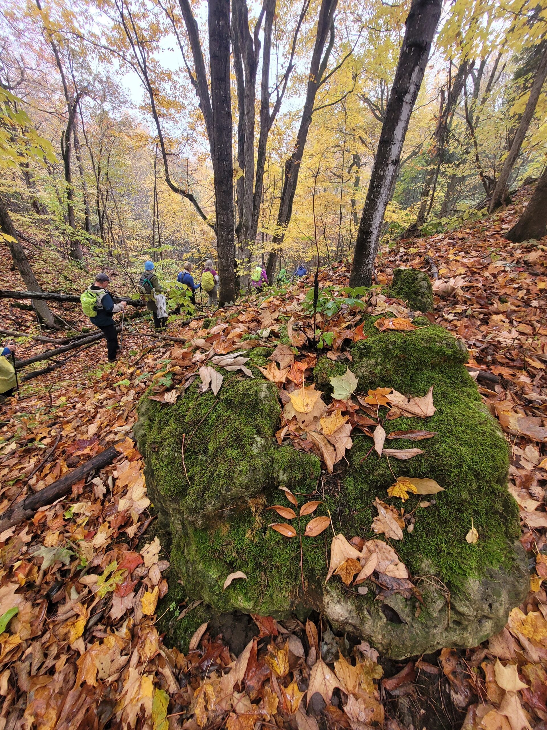
Sydenham E2E in 8 Hike #1
https://hikes.brucetrail.org/event/sydenham-e2e-in-8-hike-1/Sorry, the registration cut-off time for this hike has been reached.Not a member? Click here to join today!Hosting Club: Blue Mountains, Sydenham
Category: End-to-End
Location (Google Maps): Roadside parking on 4th Conc South, south of Sideroad 3Hike Leader(s): Rob Johnston Click here to contact Hike Leader(s)
Pace: Brisk – 4 to 5 km/hr
Terrain: Moderate – Some hills and/or some poor footing
Distance: 16.5Description
Sydenham Hike 1 of 8: Blantyre to 4th Conc S. Distance: 16.5Km. Meet-Up point: Roadside parking on 4th Conc South, south of Sideroad 3 GPS: 44.497700, -80.773355This is an End-to-End of the Sydenham section of the Bruce Trail in 8 hikes. Hike distances vary between 17Km and 23.5Km. Register for each hike you plan to attend. The first hike starts at Blantyre and we proceed roughly northwest along the trail ending in Wiarton. The hikes are on consecutive days, mostly Mon/Tues.
This is a strenuous hike for experienced hikers. We will be walking at a pace of 4.5-5Km per hour and hikers will need to keep up. The terrain is typical Bruce Trail: hilly with uneven, rocky footing. Hiking boots are required and hiking poles are recommended. Bring plenty of fluids and a lunch.
This hike series will involve car shuttles and every hiker is expected to participate as drivers. Plan to arrive at the meeting place by 8:15am, as we will start the car shuttle to the hike starting point at 8:30am sharp. Further details will be provided to registered hikers a few days prior to the hike.
Going to be fun!
Hike dates are:
Mon/Tues 21/22 Sept 2026
Wed/Thurs 14/15 Oct 2026
Mon/Tues 19/20 Oct 2026
Mon/Tues 26/27 Oct 2026
EASY DOES IT HIKE, Steve Bauer Trail
https://hikes.brucetrail.org/event/easy-does-it-hike-steve-bauer-trail/Sorry, the registration cut-off time for this hike has been reached.Not a member? Click here to join today!Hosting Club: Niagara
Category: Leisurely
Location (Google Maps): Dollarama, Northtown Plaza, 325 Thorold Rd., WellandHike Leader(s): Diane Marlatt Click here to contact Hike Leader(s)
Pace: Leisurely <3 km/hr
Terrain: Easy: mostly flat, good footing
Distance: 7 KmDescription
Dodd's Loop
https://hikes.brucetrail.org/event/dodds-loop/Sorry, the registration cut-off time for this hike has been reached.Not a member? Click here to join today!Hosting Club: Sydenham
Category: General Hike
Location (Google Maps): Map 34. Parking at North end of Kemble Rock Rd, (nth of Concession 24) space for 5 cars, additional parking on roadside.Hike Leader(s): Danuta Valleau Click here to contact Hike Leader(s)
Pace: Leisurely: 3 km/h or less
Terrain: Moderate: Some hills and/or poor footing
Distance: approx 4 kmDescription
Main trail is accessed from top of ‘W’ hill and follows escarpment east and then southerly past numerous crevasses. We will walk out via side trail to east end of Conc 24 and walk back to cars. It is possible we could do a car shuttle depending on the size of the group. Added option offered is a half hour field hike on the neighbouring property and bring your lunch. - 22September 22, 2026
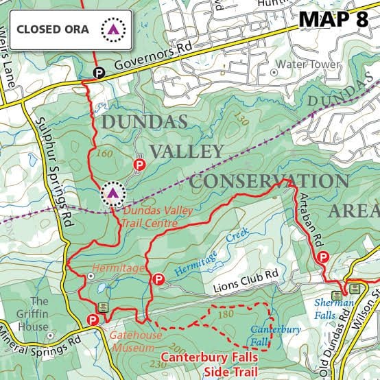
Tuesday's 10k
https://hikes.brucetrail.org/event/tuesdays-10k-3/Sorry, the registration cut-off time for this hike has been reached.Not a member? Click here to join today!Hosting Club: Iroquoia
Location (Google Maps): Ancaster Lions Outdoor Pool – 263 Jerseyville Rd W, Ancaster
Hike Leader(s): Jennifer DeBoer Click here to contact Hike Leader(s)
Pace: Brisk – 4 to 5 km/hr
Terrain: Moderate – Some hills and/or some poor footing
Distance: 10k+Description
We will hike the trails around the Dundas Valley Conservation Area. Dress for the weather wearing hiking boots. Please also bring sunscreen, bug spray, poles, water and a snack.Long Hike Short Hills
https://hikes.brucetrail.org/event/long-hike-short-hills-12/Sorry, the registration cut-off time for this hike has been reached.Not a member? Click here to join today!Hosting Club: Niagara
Location (Google Maps):
Short Hills Wiley Road, Thorold
Pace: Brisk 4-5 km/hr
Terrain: Moderate: some hills and some poor footing
: 10k+Description
Our regular Spot for the Tuesday Long Hike. Note the new location. We will hike the trails around Short Hills Dress for the weather and bring sunscreen bug spray, poles snack and drink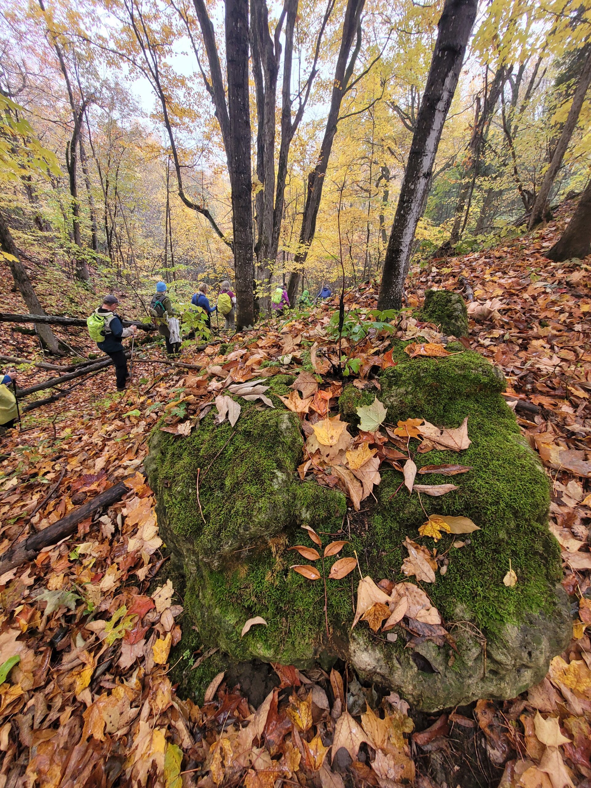
Sydenham E2E in 8 Hike #2
https://hikes.brucetrail.org/event/sydenham-e2e-in-8-hike-2/Sorry, the registration cut-off time for this hike has been reached.Not a member? Click here to join today!Hosting Club: Blue Mountains, Sydenham
Category: End-to-End
Location (Google Maps): Woodford Communty Centre parking lot on Woodford Cres by Hwy 26 and County Rd 18Hike Leader(s): Rob Johnston Click here to contact Hike Leader(s)
Pace: Brisk – 4 to 5 km/hr
Terrain: Moderate – Some hills and/or some poor footing
Distance: 23.3Description
Sydenham Hike 2 of 8: 4th Conc S. To Woodford. Distance: 23.3Km. Meet-Up point: Woodford Communty Centre parking lot on Woodford Cres by Hwy 26 and County Rd 18GPS: 44.593705, -80.744304
This is an End-to-End of the Sydenham section of the Bruce Trail in 8 hikes. Hike distances vary between 17Km and 23.5Km. Register for each hike you plan to attend. The first hike starts at Blantyre and we proceed roughly northwest along the trail ending in Wiarton. The hikes are on consecutive days, mostly Mon/Tues.
This is a strenuous hike for experienced hikers. We will be walking at a pace of 4.5-5Km per hour and hikers will need to keep up. The terrain is typical Bruce Trail: hilly with uneven, rocky footing. Hiking boots are required and hiking poles are recommended. Bring plenty of fluids and a lunch.
This hike series will involve car shuttles and every hiker is expected to participate as drivers. Plan to arrive at the meeting place by 8:15am, as we will start the car shuttle to the hike starting point at 8:30am sharp. Further details will be provided to registered hikers a few days prior to the hike.
Going to be fun!
Hike dates are:
Mon/Tues 21/22 Sept 2026
Wed/Thurs 14/15 Oct 2026
Mon/Tues 19/20 Oct 2026
Mon/Tues 26/27 Oct 2026
Whitetail Refuge and Nottawasaga Valley CA
https://hikes.brucetrail.org/event/whitetail-refuge-and-nottawasaga-valley-ca/Sorry, the registration cut-off time for this hike has been reached.Not a member? Click here to join today!Hosting Club: Caledon Hills
Category: Habitat Restoration Project
Location (Google Maps): 754415 Mono Centre Road, MonoHike Leader(s): Carol Dobson Click here to contact Hike Leader(s)
Pace: Leisurely – 3 km/hour or less
Terrain: Moderate – some hills and/or some poor footing
Distance: 1 kmDescription
On Tuesday, September 22nd volunteers are needed to plant wetland plants around the pond at Whitetail Refuge as part of a wetland restoration project. The event is being coordinated by Nottawasaga Valley Conservation Authority (NVCA). Registration is through eventbrite by cutting and copying the following into your browser:https://www.eventbrite.com/e/plant-a-wetland-tickets-2000281800712?aff=oddtdtcreator
Wetlands play a very important role in watershed health, help us plant wetland plants along the shore.
Parking for 10 cars on site, overflow parking at Mono Community Centre, 700m north. 754483 Mono Centre Rd, Mono, ON L9W 5W9
Will meet at the entrance on Mono Centre Rd. and walk down to the project area.
Come help us rehabilitate a wetland in Mono Centre. We will be planting the shoreline of a former pond that is being rehabilitated into a wetland. Join NVCA staff and our partners at North American Native Plant Association as we plant on this Bruce Trail Conservancy property. Planting along a pond can be muddy, so please come prepared with appropriate clothing. To get to the planting site we will need to walk along a steep trail for 700m. Snacks will be provided by the North American Native Plant Society, but please bring lunch and a refillable water bottle.
9:15 Short hike, Rockway Conservation Area, 2021 Pelham Road
https://hikes.brucetrail.org/event/915-short-hike-rockway-conservation-area-2021-pelham-road-2/Sorry, the registration cut-off time for this hike has been reached.Not a member? Click here to join today!Hike open to BTC Members only.
Hosting Club: Niagara
Category: In and Out
Location (Google Maps): Rockway Conservation Area, 2021 Pelham RoadHike Leader(s): janet davey Click here to contact Hike Leader(s)
Pace: Medium 3- 4 km/hr
Terrain: Moderate: some hills and some poor footing
Distance: 6 kmsDescription
Hike around 15 Mile Creek, featuring Upper and Lower Rockway Falls. Please bring water, insect repellent, sunscreen and hiking poles. Check yourself thoroughly for ticks following the hike.Hogg's Falls Loops
https://hikes.brucetrail.org/event/hoggs-falls-loops/Sorry, the registration cut-off time for this hike has been reached.Not a member? Click here to join today!Hosting Club: Dufferin Hi-Land
Category: Tuesday Hike
Location (Google Maps):Beaver Valley Section, Map 26. Meet at SuperBurger (Intersection of Hwy 10 and 89 in Primrose) at 9.00am or at Hogg’s Falls parking lot on Lower Valley Rd, east of Flesherton at 9:30 am.
Hike Leader(s): Inge Eckerich, Julie Daley,Tony Evangelista ,Les Babbage Click here to contact Hike Leader(s)
Pace: Leisurely
Terrain: Moderate
Distance: 7.2 or 2.6 kmsDescription
We will explore a loop created by construction of bridges across the Boyne River, joining Main Trail on the east and west banks. After returning to the parking lot, the longer hike will continue around the Uplands Meadow/Upper Beaver Valley Side Trails loop. Bring water, snacks.Urban Walk: Valley View Park
https://hikes.brucetrail.org/event/urban-walk-valley-view-park-2/Sorry, the registration cut-off time for this hike has been reached.Not a member? Click here to join today!Hosting Club: Toronto
Location (Google Maps): Parking lot is off Sycamore Drive, East of Bayview , across Starbucks plaza
Bus 91 from Finch East station stops at Sycamore station.Hike Leader(s): MOHAMMAD AGHAMIRI Click here to contact Hike Leader(s)
Pace: Moderate (3-4 km/hr)
Terrain: Hilly, Level 2 (Intermediate – some hills and uneven surfaces, rocks and roots underfoot)
Distance (km): 7-8 kmDescription
We will explore Valleyview and Maple View parks, and walk along German Mills Creek, in return we stop in Huntington park and have snack ,coffee,tea .Although this is considered an “Urban Walk”, you can expect some hills up and down and uneven surfaces with tree roots. Please bring hiking poles, water and snacks.
phone number for the day of hike 289 588 6482
Urban Walk: East Don Trail
https://hikes.brucetrail.org/event/urban-walk-east-don-trail-2/Sorry, the registration cut-off time for this hike has been reached.Not a member? Click here to join today!Hosting Club: Toronto
Category: Urban Walk
Location (Google Maps):Meet in front of the East York Memorial Arena (Cosburn Avenue & Cedarvale, one block east of Woodbine Avenue). From Woodbine Station take the #91 Woodbine or #93 Parkview Hills bus to Cosborn and walk one block east. Or from Brodview Station or Main Street Station take the Cosburn #87A or #87C Bus to Cedarvale Avenue. Main Street Station is closer. Pubic washrooms are available in the park.
Hike Leader(s): Tom Swales Click here to contact Hike Leader(s)
Pace: Moderate (3-4 km/hr)
Terrain: Flat, Level 2 (Intermediate – some hills and uneven surfaces, rocks and roots underfoot), Variable
Distance (km): 8 kmDescription
Join me in one of a series of weekday morning urban hikes in Toronto. We will hike part of Taylor Creek Park towards the Forks Of The Don and then explore the newly opened trail connection on the East Don taking us north to Eglinton (Sloane Station on Line 5) It is a paved path which opened July 13th. This is Phase 1 of the trail which will eventually connect the trail to the Gatineau Hydro Corridor (The MeadowWay), Wigmore Park, Moccasin Trail Park, and the East Don Trail to Lawrence. If you would like to join us for lunch (optional) the Best Hakka Chinese Restaurant (https://besthakka.ca/c/lunch-special/) is at the end of the route. This is a repeat of the July 21st hike for those that missed it because of the forecast of thunder storms.Trout Hollow ,Meaford
https://hikes.brucetrail.org/event/trout-hollow-meaford/Sorry, the registration cut-off time for this hike has been reached.Not a member? Click here to join today!Hosting Club: Dufferin Hi-Land
Category: Cancelled
Location (Google Maps): We will meet at Superburger, hwy 89 and hwy10 at 8:30, and car pool to Beautiful Joe park in Meaford or be at the park (162 Edwin St W) in Meaford by 9:45 am
HIKE CANCELLED DUE TO TRAIL CLOSURESHike Leader(s): Inge Eckerich,Les Babbage, Julie Daley, Tony Evangelista Click here to contact Hike Leader(s)
Pace: Leisurely
Terrain: Moderate
Distance: 14 km, short hike 3-5 kmDescription
We will hike the Trout Hollow Trail along the Big Head River, the short hike can turn back after 2-3 km, Bring lunchWalk In Nature Series (WINS) - West Rocks, Owen Sound, loop trails
https://hikes.brucetrail.org/event/walk-in-nature-series-wins-west-rocks-owen-sound-loop-trails-2/Sorry, the registration cut-off time for this hike has been reached.Not a member? Click here to join today!Hosting Club: Sydenham
Category: Walk In Nature Series (WINS)
Location (Google Maps):Parking area at the end of Concession 3, Georgian Bluffs. From the corner of Concession 3 and Grey Road 5, near Creamery HIll, drive 1.7 km north along Concession 3 to roadside parking at the end of the road.
Hike Leader(s): Stewart Brown Click here to contact Hike Leader(s)
Pace: Medium: 3 to 4 km/h
Terrain: Moderate: Some hills and/or poor footing
Distance: 4 kmDescription
The Walk In Nature Series (WINS) consists of short loop hikes in the Sydenham section of the Bruce Trail that combine nature appreciation with fitness in a safe and welcoming group environment led by an experienced hike leader. Hikes normally occur twice monthly on the second Tuesday evening and the fourth Sunday morning of each month. Consider these hikes to be 90- or 120-minute reset appointments with yourself in nature that promote health and fitness. Medium paced WINS hikes are open to all ages and levels of hiking experience whether members or non-members of the Bruce Trail Conservancy (BTC).This hike, at West Rocks Management Area, loops through a network of forested trails that bring us to a panoramic lookout over Owen Sound.
Our 4 km loop takes us along West Rocks trails to Chalmers Quarry at km 98.4 , to Derby Forest Side Trail and return to parking.
Bring water, snacks, personal medications and supplies. Hiking poles are not required by are always welcome.
Thanks, and see you soon.
- 23September 23, 2026
WEDNESDAY WALKERS - Webwood Falls
https://hikes.brucetrail.org/event/wednesday-walkers-webwood-falls-3/Sorry, the registration cut-off time for this hike has been reached.Not a member? Click here to join today!Hosting Club: Beaver Valley
Location (Google Maps): Meet in the BTC parking lot on Grey Road 40, Km 105.7 Map 28 Edition 31
Hike Leader(s): Margaret Yaraskavitch Click here to contact the hike leader.
Pace: Medium
Terrain: Moderate
Length of Hike: 4.6 kmDescription
We gather in the somewhat new BTC parking lot on Grey Road 40. Our Trail takes us a short distance across a field and then into a forest. Then it’s a country walk beside farm fields towards Webwood Falls. We will view the Falls and poke around the old Harwood Farm to see features left behind from farmstead days. They we return back to our vehicles.Guidelines
- Arrive 15 minutes before the start of the hike.
- Wear sturdy footwear and appropriate attire for the weather and the terrain.
Hiking poles are a good idea in any season, especially if the terrain is rocky or slippery. In winter, snowshoes or icers/crampons are needed when conditions dictate.
Wearing appropriate clothing and footwear prevents injuries and shows consideration for a safe and positive group hiking experience. - Always carry I.D. and your health card.
- Bring sufficient water and snacks (or lunch if indicated). A minimum of 1L of water is recommended on all hikes, and 3L is recommended for long, challenging hikes in the heat of the summer.
- Bring sunscreen and insect repellent (for spring and summer hikes).
- Bring your own first aid kit.
- Please leave dogs at home.
Speyside to Vanderleck ST return
https://hikes.brucetrail.org/event/speyside-to-vanderleck-st-return-4/Sorry, the registration cut-off time for this hike has been reached.Not a member? Click here to join today!Hosting Club: Iroquoia
Category: General Hike
Location (Google Maps): Meet at the Speyside Pear Tree parking lot on 15 Side Road at 9:15 am.Hike Leader(s): Karen Bergmann Click here to contact Hike Leader(s)
Pace: Medium – 3 to 4 km/hr
Terrain: Moderate – Some hills and/or some poor footing
Distance: 8 kmsDescription
We will hike the main trail from Speyside, to the Al Shaw ST, Hilton Falls ST and onto the Vanderleck ST up to 17 Side Road and then return the same way. There are some very technical (rocky) sections on this hike but no major hills. Bring bug spray/bug net and a snack, as needed.Good Companions - Two Loops from City View Park Burlington
https://hikes.brucetrail.org/event/good-companions-two-loops-from-city-view-park-burlington-4/Sorry, the registration cut-off time for this hike has been reached.Not a member? Click here to join today!Hike open to BTC Members only.
Hosting Club: Iroquoia
Category: Good Companions
Location (Google Maps):North Parking Lot off Kerns Road (Near Dundas Street)
City View Park
BurlingtonHike Leader(s): Ted Bossence Click here to contact Hike Leader(s)
Pace: Medium – 3 to 4 km/hr
Terrain: Strenuous – Hilly with steep climbs and some poor footing
Distance: 7.5 kmDescription
We will do a loop on the East side of Kerns Road including the Ian Reid Side Trail and then do a loop using the main Bruce Trail and King Road Side Trail on the West side of Kerns. A couple of the hills will be steep and may be slippery. We will stop for a snack between the two loops. Bring water, a snack, sunscreen. Hiking poles recommended. Please arrive at least 10 minutes prior to start time as I will be leaving on time. In case of rain, I will cancel the hike so please check your email the night before the hike. I will be providing contact information on the day before the hike in case you need to cancel after 4:00 pm on that day or the morning of the hike. PLEASE PARK IN THE NORTH PARKING LOT CLOSEST TO DUNDAS STREET. - 24September 24, 2026
8:00 am Long hike NEW Location. Bailey bridge Jordan
https://hikes.brucetrail.org/event/800-am-long-hike-new-location-bailey-bridge-jordan-13/Sorry, the registration cut-off time for this hike has been reached.Not a member? Click here to join today!Hosting Club: Niagara
Location (Google Maps):
Bailey bridge Jordan
Pace: Brisk 4-5 km/hr
Terrain: Strenuous: hilly, with steep climbs, poor footing
: ~10kDescription
This will be our permanent location . Hike up from the Bailey bridge to Balls Falls and explore the trailsYou must register for each hike. Bring Poles, snack and a drink. Dress for the weather
Geology Hike - Cyprus Lake to Halfway Dump
https://hikes.brucetrail.org/event/geology-hike-cyprus-lake-to-halfway-dump/Sorry, the registration cut-off time for this hike has been reached.Not a member? Click here to join today!Hike open to BTC Members only.
Hosting Club: Beaver Valley
Location (Google Maps): Halfway Dump parking area at the start of the Halfway Dump Side Trail near Main Trail km 139.5 at 8 am
Hike Leader(s): David Royston Click here to contact the hike leader.
Pace: Medium
Terrain: Some rocky footing
Length of Hike: 9.5 kmDescription
This hike is the North Saugeen (Bruce) Shoreline hike described in Beth Gilhespy’s book “Walking Through Time – Exploring the Geology of the Saugeen (Bruce) Peninsula”.After meeting at Halfway Dump parking area, we will car shuttle to a Cyprus Lake parking area. From there we will hike to the Main Trail near the Grotto (km 145.3) and then hike back to km 139.5 and the Halfway Dump parking area. Along the way, we will look for the points of interest described in the book.
Hiking around Jordan
https://hikes.brucetrail.org/event/hiking-around-jordan-73/Sorry, the registration cut-off time for this hike has been reached.Not a member? Click here to join today!Hosting Club: Niagara
Category: Loop
Location (Google Maps): Sho’arishon Park, JordanHike Leader(s): Bill Russell Click here to contact Hike Leader(s)
Pace: Medium 3- 4 km/hr
Terrain: Moderate: some hills and some poor footing
Distance: 6 kmsDescription
Hiking in and around Jordan, Rainforth Trail and Balls Falls, alternating every 3 weeks.Urban Walk: Valley View Park
https://hikes.brucetrail.org/event/urban-walk-valley-view-park-38/Sorry, the registration cut-off time for this hike has been reached.Not a member? Click here to join today!Hosting Club: Toronto
Location (Google Maps): Parking lot is off Sycamore Drive, East of Bayview , across Starbucks plaza
Bus 91 from Finch East station stops at Sycamore station.Hike Leader(s): MOHAMMAD AGHAMIRI Click here to contact Hike Leader(s)
Pace: Moderate (3-4 km/hr)
Terrain: Hilly, Level 2 (Intermediate – some hills and uneven surfaces, rocks and roots underfoot)
Distance (km): 7-8 kmDescription
We will explore Valleyview and Maple View parks, and walk along German Mills Creek, in return we stop in Huntington park and have snack ,coffee,tea .Although this is considered an “Urban Walk”, you can expect some hills up and down and uneven surfaces with tree roots. Please bring hiking poles, water and snacks.
phone number for the day of hike 289 588 6482
Toronto Fall Series Hike 4 of 9
https://hikes.brucetrail.org/event/toronto-fall-series-hike-4-of-9/Sorry, the registration cut-off time for this hike has been reached.Not a member? Click here to join today!Hosting Club: Caledon Hills
Category: End-to-End
Location (Google Maps): Meet at the roadside parking on Eighth Line, where the Eighth Line Side Trail is. Map 13 east of km 33.5.Hike Leader(s): Nancy Mooney Click here to contact Hike Leader(s)
Pace: Medium – 3 to 4 km/hour
Terrain: Moderate – some hills and/or some poor footing, Strenuous – hilly with steep climbs and some poor footing
Distance: 14 km loopDescription
This is the fourth hike in the series. We will continue around the Scotsdale Farm and Silvercreek area including Duff Pit, Trafalgar, Reservoir, Great Esker, and Eighth Line Side Trails.Copper Kettle post hike!
- 25September 25, 2026
Coach Trip: Saugeen Peninsula Hiking Weekend
https://hikes.brucetrail.org/event/coach-trip-sept-25-to-27-saugeen-peninsula-hiking-weekend/Sorry, the registration cut-off time for this hike has been reached.Not a member? Click here to join today!Trip Information
Departure Time: 07:00
Return to City Time: 20:00
Departure Point: York Mills Bus PickupTrip Activities
Moderate group ($0.01)
Fast group ($0.01)
Optional Items
Pickup at HWY 400 and HWY 9 ($0.01)Hosting Club: Toronto
Category: Coach Trips
Location (Google Maps): Evergreen Resort, Red BayHike Leader(s): Martina Furrer, Janet McColeman, Robin Crombie, Tim Wainwright Click here to contact Hike Leader(s)
Pace: Brisk (4-5 km/hr), Moderate (3-4 km/hr)
Terrain: Challenging, Hilly, Level 2 (Intermediate – some hills and uneven surfaces, rocks and roots underfoot), Rocky
Distance (km): Moderate 12km, Fast 15 to 18 kmDescription
Departure: Friday September 25- 7AM from 10 York Mills Rd
- 7:20 AM from HWY 400 and HWY 9 Park and Ride
Return: Sunday September 27 between 7 and 8 PM
Join us for three days of guided hiking on the beautiful Saugeen Peninsula. Spend your days on the Bruce Trail and your evenings at Evergreen Resort (https://evergreenresortredbay.com/index.html) overlooking Lake Huron.
We will explore the Skinner’s Bluff, Colpoy’s Bay, Cape Crocker, Hope Bay, Rush Cove, Barrow Bay, Lion’s Head, and/or Cape Chin areas, using both the main trail and some fun side trails. You will be treated to scenic lunch spots, cool dolostone cliffs, neat crevasses, beautiful shale beaches, and lots of awesome views of Georgian Bay. Come prepared for some strenuous climbs, some challenging footing over boulders and crevasses, and some exposed sections. There will be a moderate group (hiking about 12 km each day) and a fast group (hiking between 15 and 18 km each day). Both groups will do full day hikes with no dropouts.
Please note the Peninsula section is rugged. These hikes are not suitable for people who are afraid of heights. All fit, experienced hikers comfortable walking on this type or terrain are welcome. There won’t be a sightseeing group or other activities for non-hikers.
Accommodation is in one-, two-, and three-bedroom cottages (linens, bedding, and towels provided). Each cottage has a full bathroom, fridge, and heater. The resort has a hot tub and a private beach perfect for viewing sunsets. Cost is $370.75 per person (plus taxes and gratuity extra). This includes two nights’ accommodation, two dinners, two breakfasts, and two boxed lunches. Another group will be at Evergreen Resort the same weekend as us. To ensure there is space for all participants and we can run this trip, all cottages must be shared, all bedrooms in all cottages must be occupied, and some bedrooms will need to be shared. The one-bedroom water view cottages have a sitting area with a small table, two chairs, and a couch, a three piece bathroom, and a bedroom with two double beds. Each one-bedroom cottage needs to be occupied by two people. Similarly each garden view motel unit has two double beds and a sitting area. These units will also need to be shared. Finally each two-bedroom cottage will need to have three occupants. The only units suitable for single occupancy are garden view units 203 and 204 (they are small with no sitting area).
Coach fare is $195 for members, $215 for non-members, and $120 for children. All applicable fuel surcharges as of June have been included in the coach fare. In these volatile times the Toronto Bruce Trail Club reserves the right to charge for currently unanticipated increases in the cost of fuel.
Registration instructions:
Please find roommates / cottagemates before you register. To avoid problems, make sure you and your roommate(s) reserve your cottage and your seats on the coach at the same time. If you’re new to our coach trips or don’t have a friend who would like to join you, complete our roommate request form at: https://saugeen.s.gy/rooms and we will do our best to find you a match.
- Call Evergreen Resort at 519-534-1868 to book your cottage.
- To reserve your seat on the bus, register here starting on Friday June 12th at 8:00 PM.
Cancellation policy: While we are hoping for sunshine, the trip cannot be cancelled due to weather. Coach fare is non-refundable.
Brisk Fridays - Silent Valley - Bognor Marsh
https://hikes.brucetrail.org/event/brisk-fridays-silent-valley-bognor-marsh/Sorry, the registration cut-off time for this hike has been reached.Not a member? Click here to join today!Hosting Club: Sydenham
Category: Brisk Fridays
Location (Google Maps): BTC Map # 30, Edition 31 – Meet and park at the dead end of 2nd Conc S from Grey Rd 18 in the former Sydenham Township. Please do not block any driveways or access gates.Hike Leader(s): Tammy Green Click here to contact Hike Leader(s)
Pace: Brisk: 4 to 5 km/h
Terrain: Strenuous: Hilly with steep climbs and some poor footing., There might be muddy sections., There might be sections with water on the trail.
Distance: ~14 kmDescription
This is a brisk-paced, fun and energetic hike. We do take time to stop and appreciate points of interest. A varied, strenuous, brisk hike alongside boulders, escarpment vistas, forests and marshland. We will hike all the side trails and main trails of both Silent Valley Nature Reserve and the Bognor Marsh management Area and traverse the main trail in both directions between the two natural areas ending back at parking. Hike length is ~ 14 km.Meeting Time: 8:45 AM
Participant Requirements
- Intermediate/experienced hikers
- Proper hiking boots
- Appropriate clothing for the weather
- Hiking poles recommended
- Personal medications (ie: epi pen) and your health card
- Bring: Lunch, snacks, water, bug spray
Note: Dogs are not permitted.
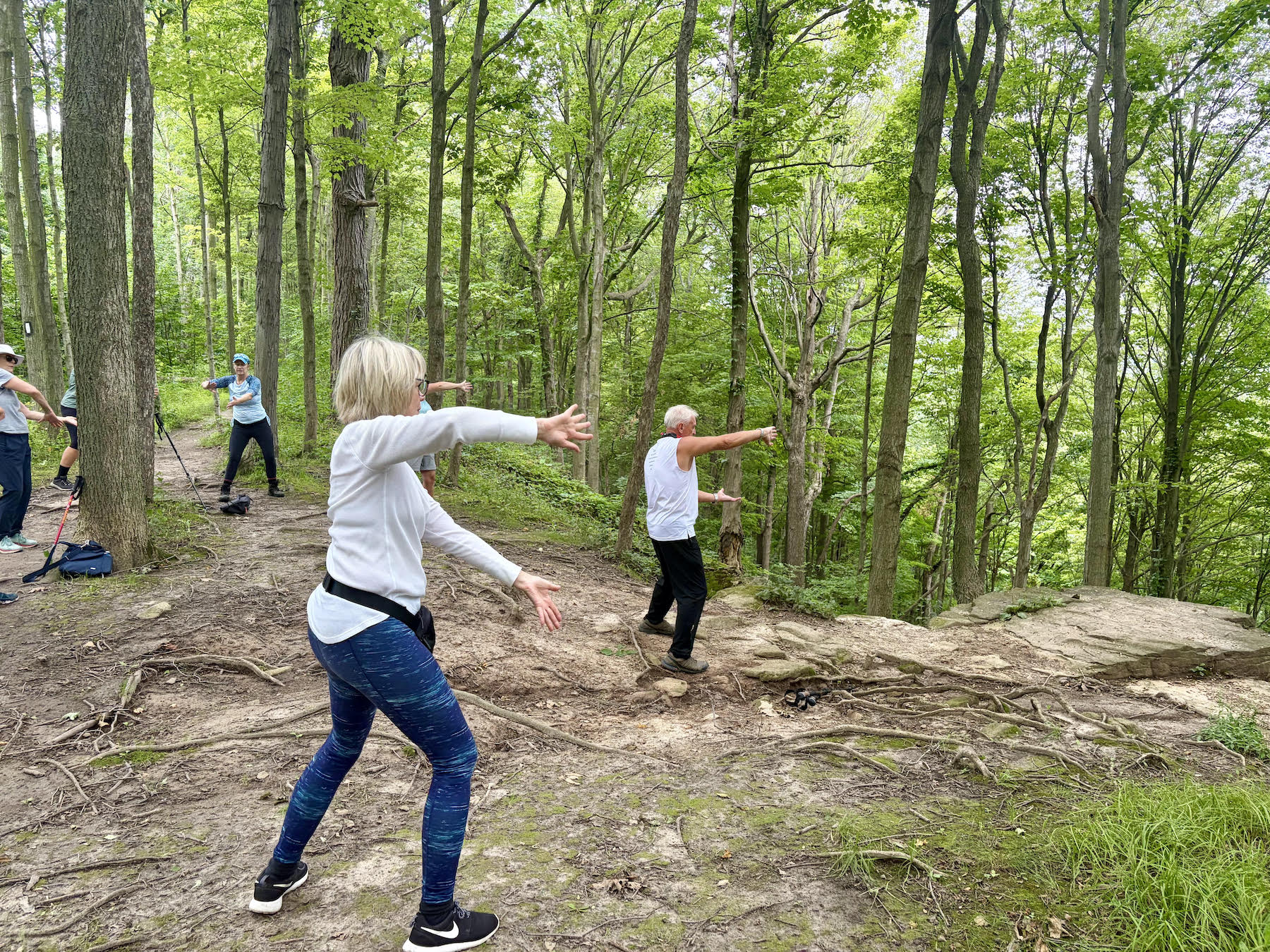
Niagara-on-the-Lake Tour with TAI CHI
https://hikes.brucetrail.org/event/niagara-on-the-lake-tour-64/Sorry, the registration cut-off time for this hike has been reached.Not a member? Click here to join today!Hosting Club: Niagara
Category: Mindfulness
Location (Google Maps): Park on King St near Centre St, just outside of Veteran’s Memorial Park, Niagara-on-the-LakeHike Leader(s): Margaret Northfield Click here to contact Hike Leader(s)
Pace: Medium 3- 4 km/hr
Terrain: Easy: mostly flat, good footing
Distance: 4-5kmDescription
We will hike around Niagara-on-the-Lake stopping along the way to experience some tai chi moves. Tai Chi master, Mike Van Natter will lead us for the tai chi portionSome weeks may be totally on sidewalks and roads while others may include a mix of trail and paved pathways.
Great way to build up endurance for longer more strenuous hikes.
Plan to stay for conversation and a coffee at Sweets & Swirls, Community Centre, Niagara Stone Rd., NOTL
Mono Cliffs Third Outlier
https://hikes.brucetrail.org/event/mono-cliffs-third-outlier/Sorry, the registration cut-off time for this hike has been reached.Not a member? Click here to join today!Hike open to BTC Members only.
Hosting Club: Dufferin Hi-Land
Category: General Hike
Location (Google Maps): Mono Community Centre, 200m south of Mono Centre (County Road 8). Park in gravel lot. See Google Maps link on this hike description for GPS.Hike Leader(s): Stuart Law Click here to contact Hike Leader(s)
Pace: Medium
Terrain: Dependent on Conditions, Moderate, Strenuous
Distance: 13.5 kmsDescription
Join us on a 13.5 km hike from the Third Outlier to the South Outlier at Mono Cliffs. Most people know that there are North and South Outliers at Mono Cliffs, but the Third Outlier is a bit of mystery surrounded by the beautiful BTC Whitetail Refuge Nature Reserve. The place is wonderfully quiet and peaceful. One of my favourite places to go. We will be climbing up and down the escarpment three times so be prepared for elevation. Be ready for jewel weed, fleabane, New England astors, moss covered rocks, cliffs and hidden streams. Please bring a lunch, a snack, 2L of water, and a first aid kit. Hiking boots mandatory. Poles recommended. Please arrive at 9:00 am to be ready to hike at 9:15.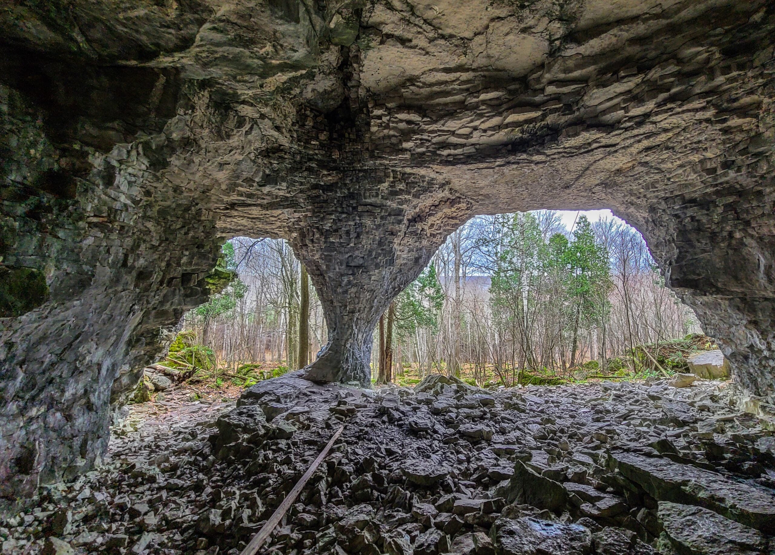
Wiarton to Bruce's Caves
https://hikes.brucetrail.org/event/wiarton-to-bruces-caves/Sorry, the registration cut-off time for this hike has been reached.Not a member? Click here to join today!Hosting Club: Toronto, Sydenham
Category: Car Hike
Location (Google Maps): Bluewater Park, Wiarton. The parking area is opposite the arena.Hike Leader(s): Stewart Fleming Click here to contact Hike Leader(s)
Pace: Brisk (4-5 km/hr), Mixed (See Hike Description)
Terrain: Flat, Level 2 (Intermediate – some hills and uneven surfaces, rocks and roots underfoot), Rocky
Distance (km): 17 kmDescription
We will follow the Main Trail out of Wiarton, beside the airport, along the road, and on the rocky trail in the Bruce’s Caves Conservation Area to Bruce’s Caves, and back.We will have time to explore and lunch at Bruce’s Caves, including the very rocky Colpoy’s Cavern Side Trail.
Our pace will be Brisk through the open areas but Leisurely through the rocky sections.
Please bring enough water (about 2 litres) and food to maintain your energy for a 5-hour hike.
Comfortable hiking shoes or boots are a must. A rain shell is recommended in case of a wet weather forecast, along with a hat, sunscreen, and bug repellent for sunny weather or buggy trail conditions.
Oak and Acorn Hike (Parent & Baby) #1
https://hikes.brucetrail.org/event/oak-and-acorn-hike-parent-baby-1/Sorry, the registration cut-off time for this hike has been reached.Not a member? Click here to join today!Hosting Club: Peninsula
Location (Google Maps): Devils Monument
Hike Leader(s): Beige McIntosh Click here to contact Hike Leader(s)
Pace: Leisurely (2.0 – 3.0 km/h): A relaxed pace with frequent breaks and a focus on enjoyment.
Terrain: Moderate: Rolling hills, mild slopes and rocky paths.
Distance: ~2Description
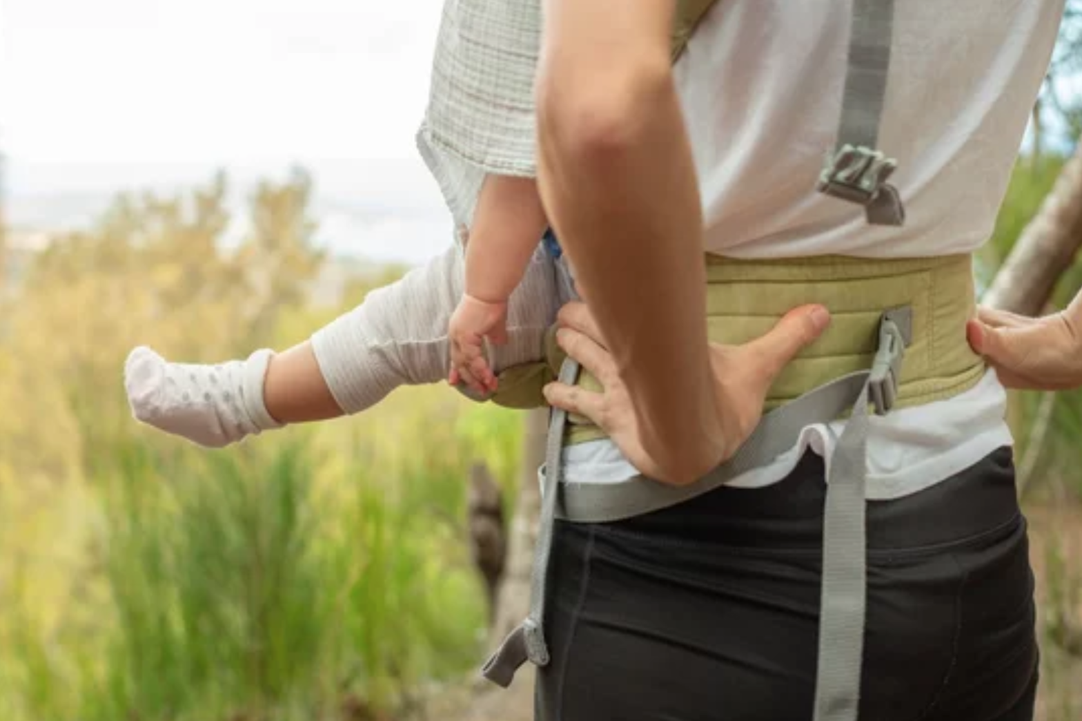
This hiking series will include short, relatively easy hikes for parents/ caregivers and their little ones (children 0-3 years old welcome). The goal is to encourage new parents to enjoy the outdoors with their little one(s), meet new friends and increase the cuteness level on the trail with our little bundles. Hike leader Beige McIntosh will be guiding you (with her 5 month old baby, Fen) and perhaps she’ll share a baby friendly song or 2.These hikes will be a nursing friendly environment, with lots of time to adjust your setup and tend to your child.
Hike #1 will take place on a forested trail with moderate elevation changes which leads to a stairway down the escarpment and eventually to Georgian Bay. We’ll complete a ~1.75km loop before returning to the parking lot.
To bring:
-Water and snacks for you and your child
-Sturdy footwear
-A carrier for your baby (reach out if you want to borrow one)
- 26September 26, 2026
Steeltown Stomp Practice Session #7 of 8
https://hikes.brucetrail.org/event/steeltown-stomp-practice-session-7-of-8/Sorry, the registration cut-off time for this hike has been reached.Not a member? Click here to join today!Hosting Club: Iroquoia
Category: Steeltown Stomp Practice Session
Location (Google Maps): Chedoke Golf Club Parking Lot – Access from Beddoe Dr off Studholm Rd south of Aberdeen (Parking capacity 40)Hike Leader(s): Muskan Sidana Click here to contact Hike Leader(s)
Pace: Brisk – 4 to 5 km/hr, Medium – 3 to 4 km/hr
Terrain: Strenuous – Hilly with steep climbs and some poor footing
Distance: VariesDescription
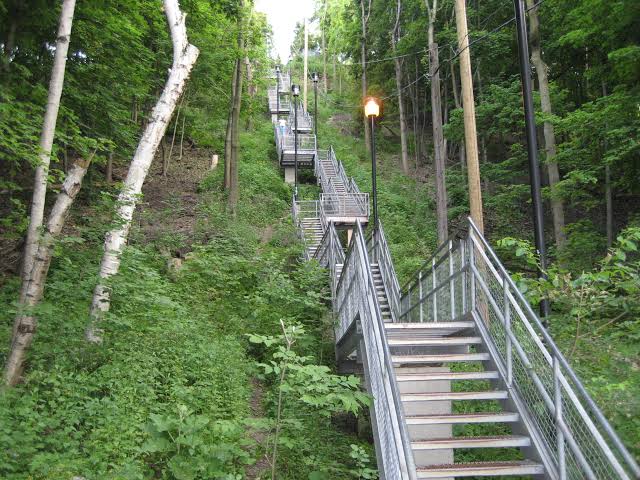
Is the Steeltown Stomp on your bucket list? This is your chance to crush it! Join us and prepare for this incredible challenge on October 3rd, 2026! Registration for the event is now open.If you’ve done stair climbs before, you know the deal—that brutal calf pain is real, especially when you’re just starting out. But training with us this summer? That’s how you show up on stomp day actually feeling strong instead of totally wrecked. Trust me.
We’ll start easy and build up as the summer goes on, hitting Chedoke and Dundurn Stairs with some scenic hikes mixed in. By the time October rolls around, you’ll have crushed at least 2,000 steps and you’ll actually know what you’re doing.
It’s a solid group vibe—moderate pace, warm-ups to get going, stretches to cool down. And honestly, it’s way more fun (and way less painful) doing this with people who get it.
Just grab your water bottle (there’s water at both staircases) and whatever snacks you want. And yeah, there’s optional coffee after if you want to hang out and celebrate.
We’ve got 7 training dates lined up this summer—check the schedule and pick the ones that work for you. Do the work now, own it on stomp day. See you out there!
Exploring The Uxbridge Trails from Three Rocks
https://hikes.brucetrail.org/event/exploring-the-uxbridge-trails-from-three-rocks-2/Sorry, the registration cut-off time for this hike has been reached.Not a member? Click here to join today!Hosting Club: Toronto
Category: Car Hike
Location (Google Maps):Park at 1120 Concession Rd 7, Uxbridge, ON L9P 1R4. This is the East Duffins Headwaters conservation area parking lot. It’s a pay parking lot for non-residents of Uxbridge. You can purchase parking permits through a mobile app by scanning the barcode at the site upon arrival. Alternatively, you can pay in advance on the Township of Uxbridge website. The current daily permit cost is $6.00.
Hike Leader(s): Amir Alemohammad Click here to contact Hike Leader(s)
Pace: Moderate (3-4 km/hr)
Terrain: Flat, Hilly, Level 2 (Intermediate – some hills and uneven surfaces, rocks and roots underfoot), Variable
Distance (km): 14-16Description
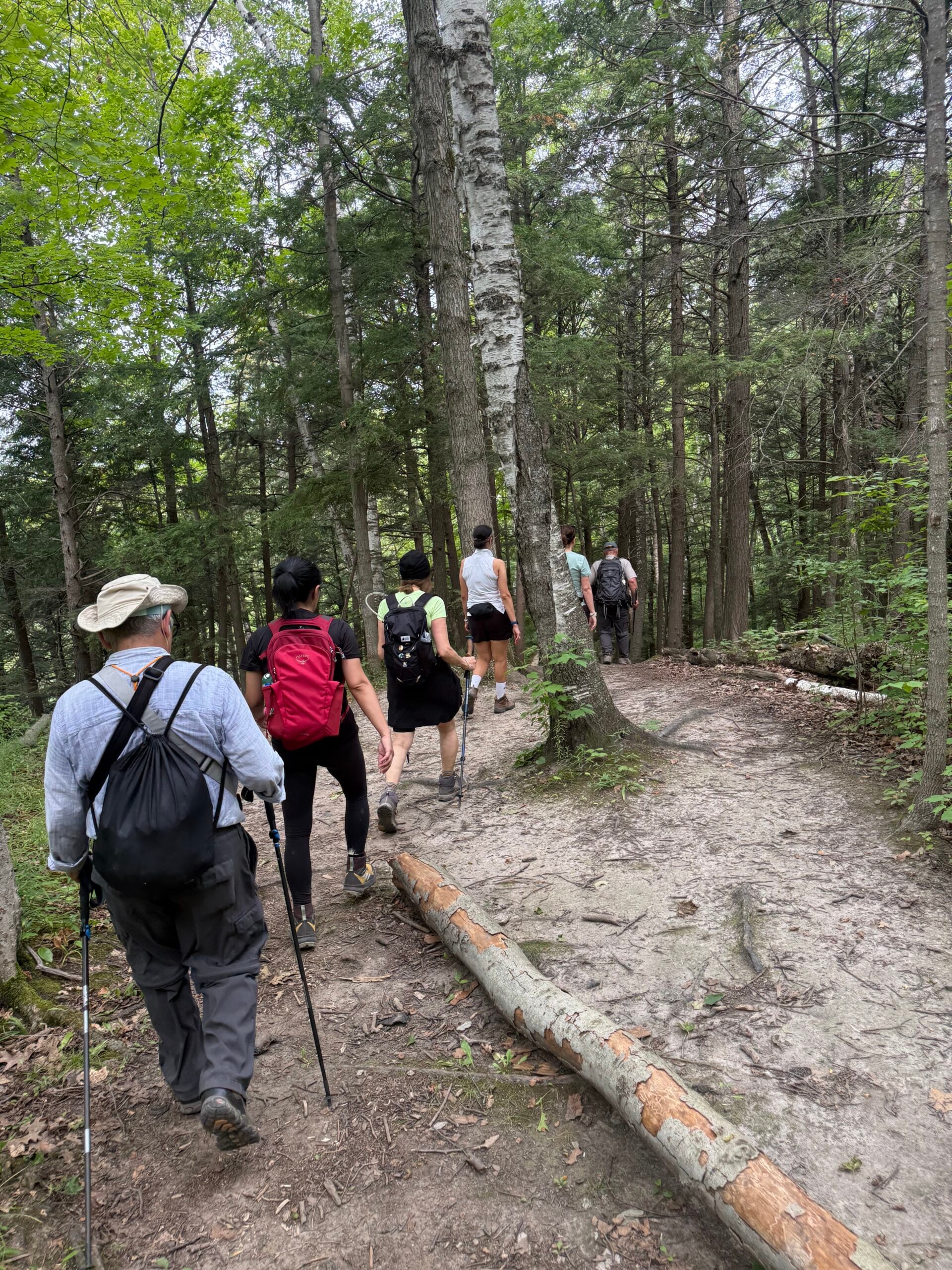
This loop hike takes us through Uxbridge trails, Canada’s capital trails. Beginning at the Three Rocks in Uxbridge, we’ll enjoy hiking several lookouts and exploring the Aggregate Pit. We’ll also stroll through the beautiful Uxbridge forests of Glen Major, Walker Woods, and The Wilder Forest.Boots are mandatory, trekking poles are recommended. Don’t forget to bring at least two litres of water and your snacks. Please arrive at 7:45 for the 8:00 start.
Six Pack at Blue #5
https://hikes.brucetrail.org/event/blue-mountains-six-pack/Sorry, the registration cut-off time for this hike has been reached.Not a member? Click here to join today!Hosting Club: Blue Mountains
Category: Organized Hike
Location (Google Maps): Tim Hortons, First Street, CollingwoodHike Leader(s): Richard Edwards Click here to contact Hike Leader(s)
Pace: Medium – 3 to 4 km/hr
Terrain: Moderate – Some hills and/or some poor footing
Distance: 13 kmDescription
Please join us for Hike 5 of the Six Pack Of Blue! Hike 5 is from Nottawasaga Lookout to Petun Conservation Area approx 13km.
The Six Pack Of Blue is an End-to-End of the Blue Mountains section of the Bruce Trail completed in 6 hikes. You can do as many of the six hikes as you wish. Register for each hike you plan to attend.Erindale park Mississauga
https://hikes.brucetrail.org/event/car-hike-rouge-national-park-scarborough-on-5/Sorry, the registration cut-off time for this hike has been reached.Not a member? Click here to join today!Hosting Club: Toronto
Location (Google Maps): Erindale park Mississauga
Hike Leader(s): MOHAMMAD AGHAMIRI Click here to contact Hike Leader(s)
Pace: Moderate (3-4 km/hr)
Terrain: Hilly, Level 2 (Intermediate – some hills and uneven surfaces, rocks and roots underfoot)
Distance (km): 12-14 kmDescription
We will hike Credit River North and will see nice views of Credit River and possibly some salmons heading upstreamFrom parking lot we hike north mostly along Credit River and return to parking around 13 to 13.30
• Please dress appropriately for the weather.
• We will have short water ,picture and a 15 minute snack break. Everyone is welcome!Please bring lots of water and snacks ,hiking poles are recommended
phone number for the day of hike 289 588 6482
GO Train Hike: Stratford (Repeat Date)
https://hikes.brucetrail.org/event/go-train-hike-stratford-2/Sorry, the registration cut-off time for this hike has been reached.Not a member? Click here to join today!Hosting Club: Toronto
Category: GO Train Hike
Location (Google Maps):Meet in the Great Hall of Toronto’s Union Station by the Traveller’s Aid Desk (with the clock over it) by 8:35 AM to take the Stratford bound train scheduled to depart at 8:49 AM. Alternatively you may take the 9:49 AM train from Mount Dennis to Bramalea GO Station and transfer to the Stratford bound Train (scheduled to depart at 9:20 AM, an approximately 10 minute wait between trains) and you may find us in the upper level of the accessibility coach.
Hike Leader(s): Tom Swales Click here to contact Hike Leader(s)
Pace: Moderate (3-4 km/hr)
Terrain: Flat, Level 2 (Intermediate – some hills and uneven surfaces, rocks and roots underfoot)
Distance (km): 12 kmDescription
Due to the overwhelming response for the September 5th hike, I will try to offer the trip again on Sep 26th (if there are no closures on the Kitchener GO Line on this date).Join us for a day trip to Stratford on the GO Train. If you buy the Weekend Day Pass the return fare is just $10.00! We will hike along trails on both sides of the Avon River in Stratford including the Shakespearean Gardens. We’ll have dinner in a local pub before departing Stratford on the 6:15 PM train. There will be the chance to enjoy the historic downtown as well as some relaxing time by the river as we’ll have the full afternoon. Before registering please note that is a 2,1/2 hour journey on the train each way and there are no alternative GO services from Stratford other than the 6:15 pm train arriving back at Union Station at 8:40 PM.
Please advise in the additional information section in the registration form of you prefer going to a pub or dinner at a restaurant after the hike. There will be two groups or you’re free to choose your own place.
International Friendship Trail - Cape Chin Meadows Sidetrail
https://hikes.brucetrail.org/event/international-friendship-trail-cape-chin-meadows-sidetrail/Sorry, the registration cut-off time for this hike has been reached.Not a member? Click here to join today!Hosting Club: Peninsula
Location (Google Maps): Maple Cross Nature Reserve at Cape Chin, 388 Cape Chin Road North, Lion’s Head
Hike Leader(s): Owen and Marg Glendon Click here to contact Hike Leader(s)
Pace: Medium (3.0 – 4.5 km/h): A comfortable pace for most hikers with steady progress.
Terrain: Moderate: Rolling hills, mild slopes and rocky paths.
Distance: 10.5 kmDescription
The Bruce Trail Conservancy is a founding member of the World Trails Network, working collaboratively to promote and support public footpaths through the creation of Friendship Trails.Much like twin cities, Friendship Trails connect trail organizations from different countries in a spirit of partnership, shared promotion, and international collaboration. These connections celebrate friendship, strengthen community, and bring people from all walks of life together both with nature and with one another.Bruce Trail Conservancy features 10 Friendship Trails at different BTC Club locations. PBTC has the privilege of hosting two Friendship Trails, The Cotswold Way and Southwest Coastal Path, in Great Britain. You can read more about BTC Friendship Trails here: https://brucetrail.org/International-friendship-trails/
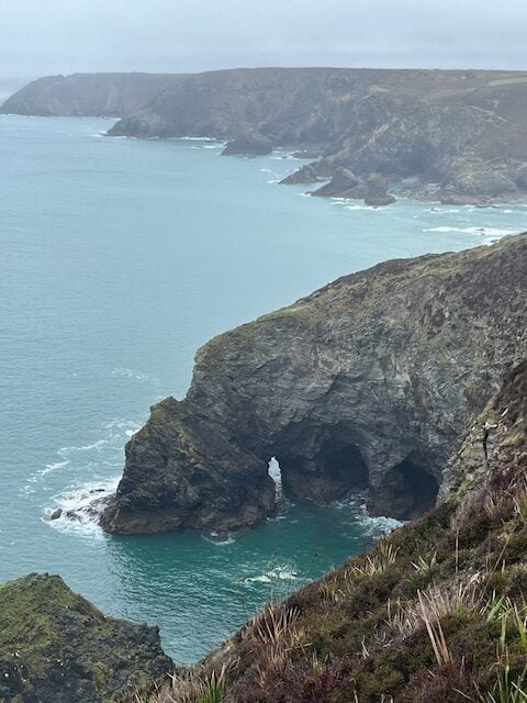
This is the last of the Friendship Hike mini-series. The South West Coast Path, the longest established National Trail in the UK. Known for its spectacular coastal views, rocky cliffs, and diverse flora, it pairs beautifully with the Cape Chin Meadows Side Trail, in the Peninsula section, which boasts similar features along Georgian Bay. Learn more about SWCP here: https://www.southwestcoastpath.org.uk/
Our 10 ½ km loop hike takes us along a wetland, through mixed forest over mostly flat but rocky terrain. This will be a medium paced hike with time for lunch at one of the most beautiful lookouts on the entire Bruce Trail. Plan for ~ 4 hour hike which includes a stop at noon.
Brad and Sara McMillan, PBTC Trail Captains and SWCP hikers, will join our hike today. Together, we will share some of our wonderful hiking experience on the Southwest Coastal Path.
Have you hiked the Southwest Coastal Path. Join the hike and share your story!
Let’s celebrate trails around the world and be inspired to travel to one of the International Friendship Trails.
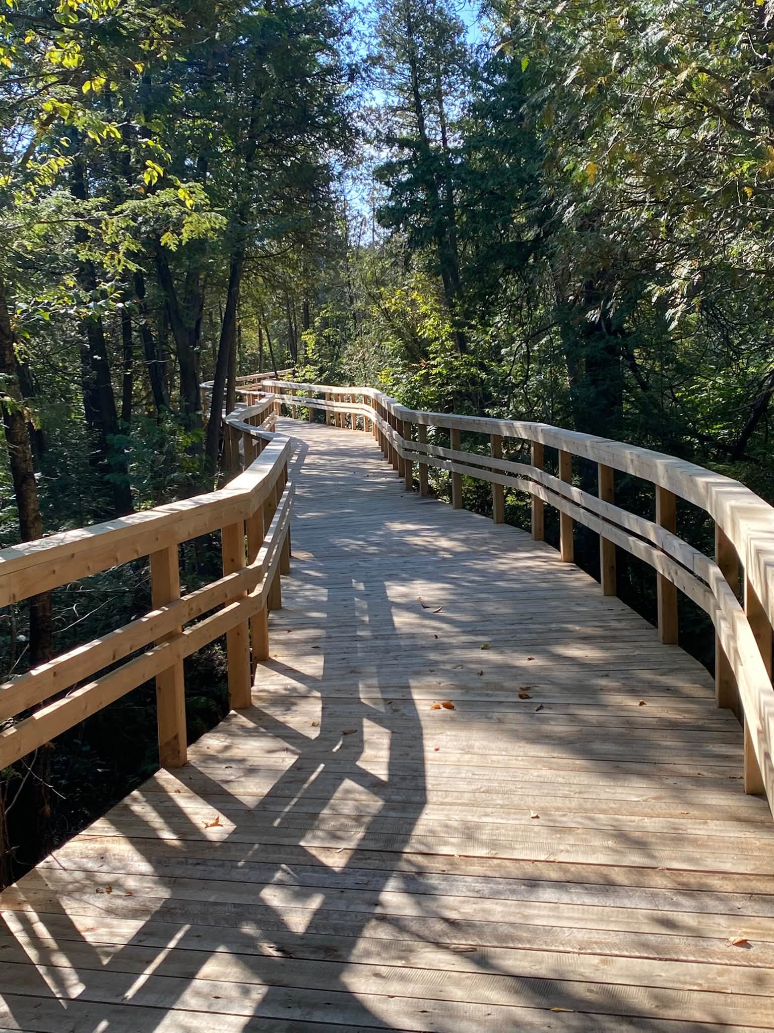
RAINBOW HIKE: Crawford Lake—Boardwalk, Geology & Indigenous History
https://hikes.brucetrail.org/event/rainbow-hike-crawford-lake-boardwalk-geology-indigenous-history/Sorry, the registration cut-off time for this hike has been reached.Not a member? Click here to join today!Hosting Club: Iroquoia
Category: Rainbow Hike
Location (Google Maps): Crawford Lake Conservation Area, 3115 Conservation Rd, MiltonHike Leader(s): Doug O’Neill Click here to contact Hike Leader(s)
Pace: Medium – 3 to 4 km/hr
Terrain: Easy – Mostly flat and usually good footing, Moderate – Some hills and/or some poor footing, Strenuous – Hilly with steep climbs and some poor footing
Distance: 12 km approxDescription
On this all-inclusive, queer-led 2SLGBTQIA+ Rainbow hike, we’ll explore one of the gems along the Bruce Trail: Crawford Lake, and potentially Rattlesnake Point.Note: This hike includes a carpool component.
Meet at Burlington GO parking lot (south side, enter off Fairview) by 9 a.m. for a 9:15 a.m. departure by carpool to Crawford Lake.
For those driving directly to Crawford Lake Conservation Area: Please arrive 9:30-9:45 a.m. latest.As soon as you register, please click “Contact the hike leader” on this page and let me know if you:
a) Have a vehicle and can offer a ride from Burlington GO Station to Crawford Lake, and how many passengers you can take. (Passengers share parking and entrance fees; drivers do not.) Passengers may also contribute to fuel costs.
OR
b) If you’re a passenger in need of a ride from Burlington GO Station to Crawford Lake. All non-drivers make their own way to Burlington GO by public transit, as it’s quick and easy to reach. (If you already have Doug’s email, you can email direct.)
Your registration isn’t considered final until you email your response to the above. (it really helps with planning).
Expect a day of Indigenous history, geology, stunning scenery—and the September reopening of the boardwalk around Crawford Lake.
The hike: We’ll follow a mix of the Nassagaweya Canyon Trail/Bruce Trail, as well as the Woodland, Escarpment and Pine Ridge trails. We’ll allow time to visit the reconstructed longhouses, representing a 15th-century Wendat/Iroquoian village, and any exhibits at the nature centre. Note. There are some rocky (uneven) sections on this hike.
Getting there: This hike involves a carpool from Burlington GO Station. If you don’t have access to a car—no worries. Take public transit to Burlington GO Station, and we’ll divide into as few cars as possible for the 25-minute drive to the Crawford Lake parking lot.
Meet-up: We’ll rendezvous at the Burlington GO parking lot at 9 a.m. for a 9:15 a.m. departure. Meet at the east door on the south side. If you’re coming by GO TRAIN, go to the south/Fairview exit. I’ll be at the east entrance.
Conservation Centre admission fee: $10.50 per person. I have a Halton Conservation Membership and can cover one vehicle with up to five passengers. Drivers should not pay; passengers can chip in a few dollars for the driver.
By Public Transit to Burlington GO Meet-Up: Take the eastbound GO Train from West Harbour GO (James Street North & Murray Street East—across from LIUNA Station) (NOT Hamilton GO Centre on Hunter Street). Exit at Burlington GO and head to the parking lot. Please arrive by 9 a.m.
Bring sufficient water (1 L minimum), lunch and energising snacks. Wear hiking boots or sturdy shoes. Avoid shorts during tick season. Bring a hat, sunblock and insect repellent.
Get your complimentary Bruce Trail Rainbow badge!
Feel free to reach out to the Hike Leader if you have any questions “Click here to contact Hike Leader” on this form.
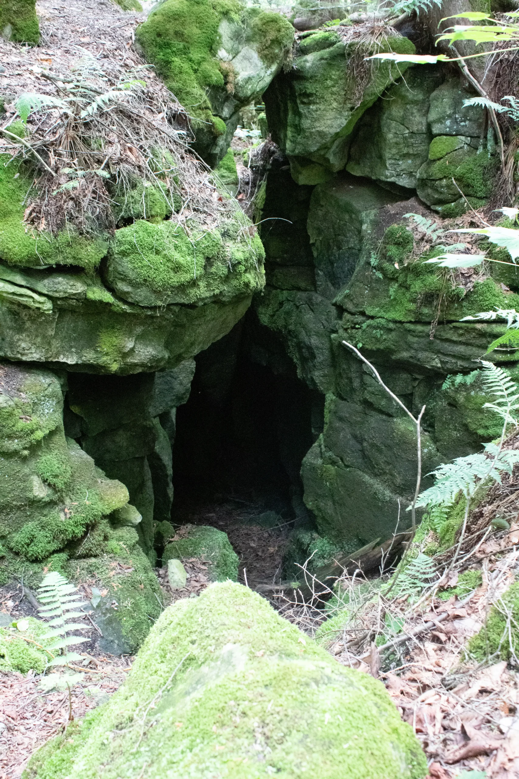
Geology Hike at Rock Hill Park
https://hikes.brucetrail.org/event/geology-hike-at-rock-hill-park/Sorry, the registration cut-off time for this hike has been reached.Not a member? Click here to join today!Hosting Club: Dufferin Hi-Land
Category: General Hike
Location (Google Maps): Rock Hill Park Side Trail parking lot (1st LIne N, Mulmur at km 30.5)Hike Leader(s): Lynda Bloom Click here to contact Hike Leader(s)
Pace: Leisurely
Terrain: Moderate
Distance: 7 kmDescription
Join geologist Lynda Bloom and hike leader Julie Daley for an unforgettable trek through Rock Hill Park. You’ll explore stunning limestone caverns carved by ancient glaciers, wander through cool rock crevices lined with ferns and mosses, and discover the area’s rich history—including the remains of old lime kilns once vital to local farming. Along the way, enjoy stories about the park’s surprising past, including the rock concerts that took place here in the 1960s.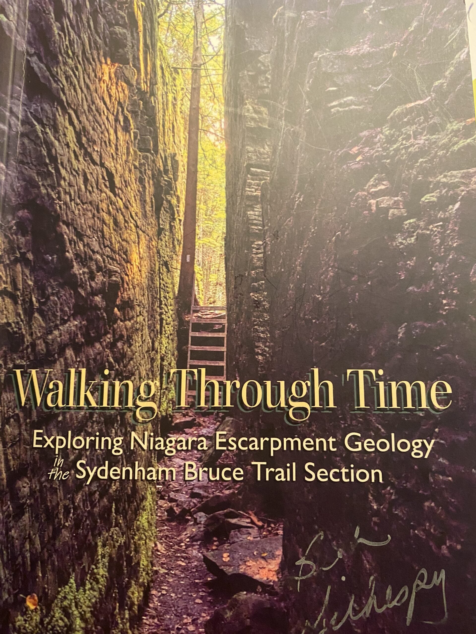
Geology Hike # 5 Boyd Crevice linear hike (extended)
https://hikes.brucetrail.org/event/geology-hike-5-boyd-crevice-linear-hike-extended-2/Sorry, the registration cut-off time for this hike has been reached.Not a member? Click here to join today!Hosting Club: Sydenham, Peninsula
Category: Geology Hike
Location (Google Maps):Dead end of Concession Road 11 south of Superior Street, Owen Sound. Roadside parking. Please park on the west side of the road. NOTE: ROAD CONSTRUCTION at Superior Street and 9th Avenue East (Hwy 6 & 10) . No access from west end of Superior Street. If you are coming from the south on Hwy 6 & 10, turn east (right) at Story Book Park Road. At Concession 10 turn left (north). At Superior Street turn left.(west) then turn left (south) on Concession Rd 11 to the trailhead. If coming from the north on 9th Avenue East, turn east at 8th Street East. Continue past the hospital to 28th Ave E/Concession Rd 10. turn right (south). At Superior Street turn west (right). At Concession Rd 11 turn left (south) to dead end parking.
Hike Leader(s): Carol Graham Mullin Click here to contact Hike Leader(s)
Pace: Leisurely: 3 km/h or less
Terrain: Easy: Mostly flat and good footing., Moderate: Some hills and/or poor footing, Strenuous: Hilly with steep climbs and some poor footing., There might be icy and slippery sections.
Distance: 5.5 km approx.Description
- This is an extended version of Geology Hike # 5, following Beth Gilhespy’s book “Walking Through Time” in the Sydenham Bruce Trail Section. Please note the starting point for this hike. It is not the same as the trailhead in Beth’s Geology Book. This is a linear hike, starting on a rail trail and then entering the main trail and hiking east to the amazing karst geology, towering cliffs and cambering features of this iconic crevice system. We will return the same way.
Copies of Beth’s book will be available for purchase. Special member’s only price of $37.00 . Cash or etransfer. If paying with cash, please bring exact change. Please bring water and a snack if you wish. Proper hiking footwear is necessary and hiking poles are recommended.
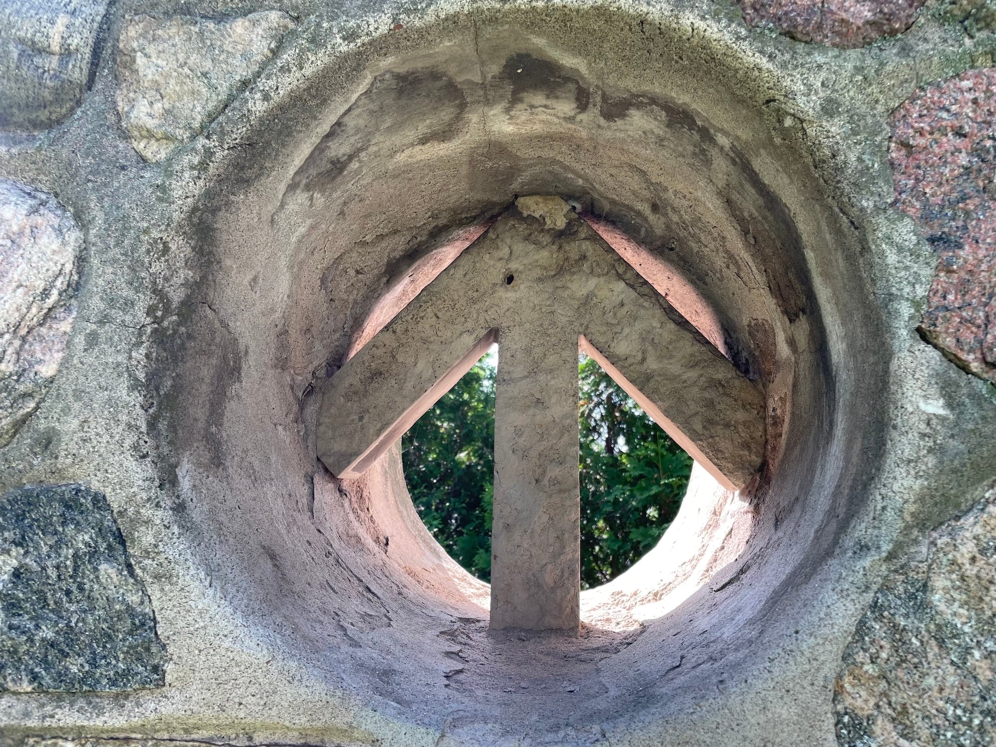
Invasive Plant 'Pull Party' - Brights Property
https://hikes.brucetrail.org/event/invasive-plant-pull-party-brights-property/Sorry, the registration cut-off time for this hike has been reached.Not a member? Click here to join today!Hosting Club: Niagara
Category: Citizen Science
Location (Google Maps): Brights property, next to Fireman’s Park – parking along the roadside at the north end of Dorchester Rd, https://maps.app.goo.gl/jpyUhSqVhzUJsaKk9Hike Leader(s): Margaret Northfield Click here to contact Hike Leader(s)
Pace: Medium 3- 4 km/hr
Terrain: Moderate: some hills and some poor footingDescription
Join this ‘pull party’ to help with our invasive buckthorn removal at the BTC’s Brights property. We are hoping to get lots of volunteers out to continue to tackle this area. Volunteers make a difference – come out and join us!Invasive buckthorn removal methods vary based on how big the buckthorn is. Small plants can be pulled by hand and hung upside down so the roots dry out and die. Medium sized plants are removed with the help of extractigators – special lever-like tools that make pulling much easier (and fun!). Large buckthorn “trees” must be cut with a chainsaw. We will be focusing on removing small and medium shrubs on this day, while certified sawyers will tackle the larger trees on a different date.
The terrain at our work location is fairly flat, but please note that the walk from the parking spot to the work location is approximately 1km through somewhat hilly terrain. Plan to arrive by 10am so we can all walk in together. Remember to wear long pants, long sleeves, work gloves, sturdy closed-toed shoes, and bring lots of water & snacks/lunch if you are staying for the entire event duration. If you need to leave early, you can walk out along the trail at any time.
Notes for student volunteers:
- Students under 16 MUST be accompanied by a parent/guardian on this hike (please refer to the BTC link https://brucetrail.org/wp-content/uploads/2022/06/VOL.05.01_Minors_Volunteering_Policy_-_Approved_February_2016.pdf )
- 16 or more but under 18? Bring a waiver signed by a guardian.
- students wishing to receive community service hours (4Hours max) must bring service forms from school.
- Please wear clothes for work – long pants tucked into socks, appropriate footwear (no sandals), long sleeves and work gloves
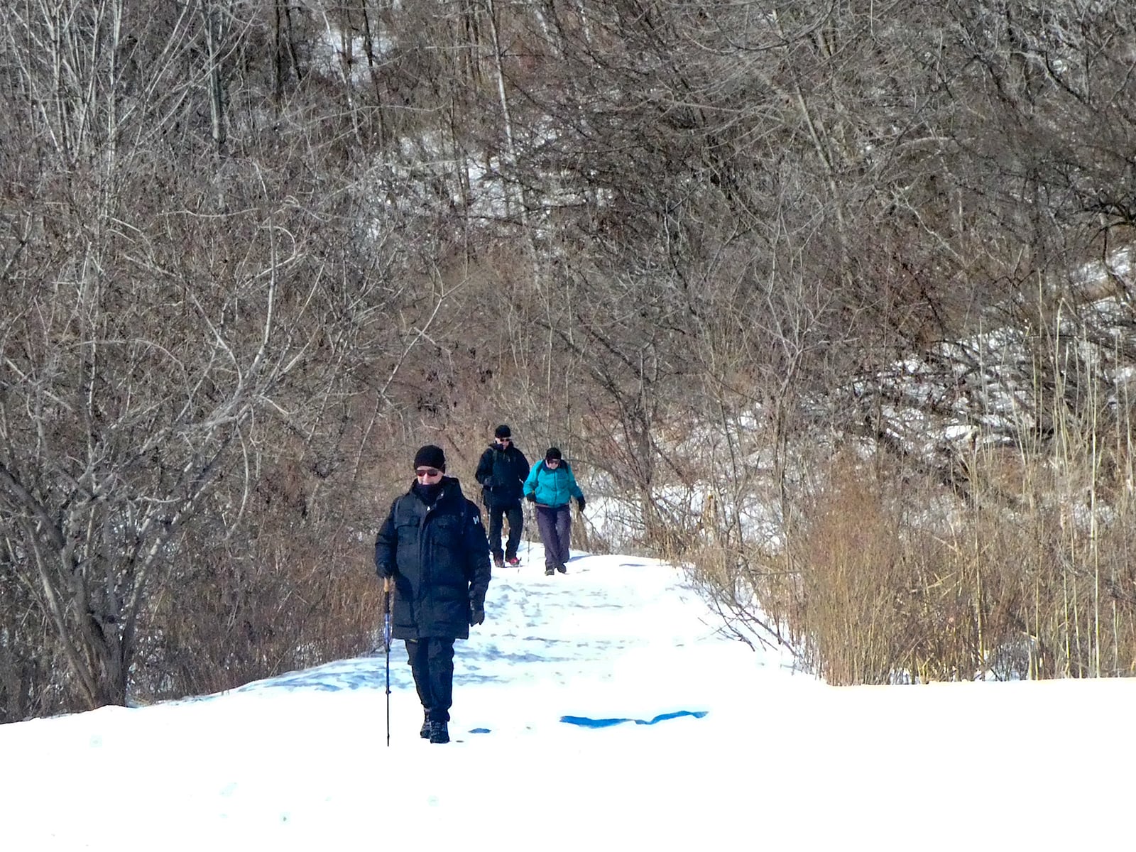
Urban Walk: Waterfront Trail 7/11 – Brimley
https://hikes.brucetrail.org/event/urban-walk-waterfront-trail-7-11-brimley-4/Sorry, the registration cut-off time for this hike has been reached.Not a member? Click here to join today!Hosting Club: Toronto
Category: Urban Walk
Location (Google Maps):Toronto, Ontario, Canada
Hike Leader(s): Brian Rideout Click here to contact Hike Leader(s)
Pace: Moderate (3-4 km/hr)
Terrain: Hilly
Distance (km): 11.4 kmDescription
Please join me at Kennedy Station by 10:15 am. We will take the 12 Kingston Rd bus departing 10:33 am, arriving 10:49 am.We will hike along Kingston Rd, down to and east olong the Lake on the Doris MacCarthy Trail to Guildwood and then to Beechgrove Dr. The estimated distance is 11.4 km. Here is an online map of our route – Brimley to Beechgrove
Bring a snack, at least 2 liters of water, and icers. Dress for cold weather.
Peninsula Harvest Full Moon Hike - Meet time is 6pm
https://hikes.brucetrail.org/event/peninsula-harvest-full-moon-hike-meet-time-is-6pm/Sorry, the registration cut-off time for this hike has been reached.Not a member? Click here to join today!Hosting Club: Iroquoia, Peninsula
Category: Moonlight Hikes
Location (Google Maps): Lion’s Head – Park near the Lion’s Head Municipal Campground entrance on Phillip Forbes StHike Leader(s): Ruth Moffatt Click here to contact Hike Leader(s)
Pace: Leisurely – 3km/hr or less, Medium – 3 to 4 km/hr
Terrain: Dependent on Conditions, Easy – Mostly flat and usually good footing, Moderate – Some hills and/or some poor footing
Distance: 8-10kmDescription
This full moon hike is in the Peninsula Section of trail and led by an Iroquoia Hike Leader.Welcome to the 4th Full Moon Hike Series led this summer. Details for collecting badges are at the bottom of the hike details.
We will meet under the tall pine trees just outside the entrance to Lion’s Head Municipal Campground. Our hike will take us out to Lion’s Head Point and return. Since some of our hike is on road, please wear a hi-vis vest if you have one. I will have a few to distribute as well.Sunset is at 7:16 – Harvest Moon
We are getting started early due to the distance and nature of the hike. Bring water and whatever snacks you need as well as a first aid kit, poles if you use them and most importantly, a head-lamp with a red light if you have one.The following is from the Bruce Trail Conservancy website regarding Hiking at Night.
While most hikers choose to explore the Bruce Trail by day to take in the colourful sights and vast vistas, venturing out after dark also has its benefits.
Hiking at night allows you to tap into other senses and explore nature in a whole new way. From stargazing to nocturnal animal sightings, there is a lot to see and hear when exploring the Bruce Trail after sunset. No matter your motivation for heading out for a nighttime hike, certain precautions should be taken to ensure that your time on the Trail is safe and enjoyable.Before you go
Plan your route and choose somewhere familiar. It’s easy to get turned around in the darkness. Planning your route and hiking it in daylight first will help you know what to expect. If you’ve never tried hiking at night, start with a shorter hike somewhere familiar to you. Always stay on the Trail to avoid getting lost.Bring a headlamp or flashlight and extra batteries. The Trail can be quite rugged with uneven surfaces, rocks, and roots. A headlamp or flashlight is essential for preventing trips and falls – and both are brighter and last longer than your phone’s built-in light. A light source with different settings, including a red light, is ideal as bright lights can be hard on your eyes over time.
Bring a fully charged cell phone. You should always bring your phone with you when hitting the trails in case you need to call for help. Most phones have a flashlight function that can act as a backup to your headlamp. You can also use your phone’s GPS with apps like the Bruce Trail App and what3words for navigational and safety purposes.
Wear reflective clothing and bring a whistle. A reflective piece of clothing can help other hikers or drivers see you in the darkness. A whistle can help others hear you in case of an emergency, even if they can’t see you.
Plan to do your first hike under a full moon and a clear sky.
A full moon can provide a surprising amount of light. Planning your first night hike during a full moon and clear sky can be a great way to acclimate yourself to hiking after dark.Don’t go solo and tell someone where you are going. Always share your route with someone before heading out in case of an emergency. Bring a friend to explore the Trail together, or join one of the moonlit hikes offered by some Bruce Trail Clubs.
Bring layers. The temperature can drop quickly in the woods at night. Bring layers to stay warm and comfortable.
While HikingSlow down and be aware of hazards. Don’t expect to hike at the same pace you would in daylight. Darkness can make the terrain more challenging. Slow down, pay attention to your surroundings, and stay away from cliff edges to prevent injuries.
Be prepared for wildlife. Many animals such as coyotes, owls, bats, salamanders, foxes, opossums, and skunks are active at night. Sightings can enhance your nighttime hiking experience but be careful not to get too close. Keep your ears open to the sounds around you to avoid unwanted interactions.
While more preparations may be needed for a hike after dusk, for many, once they find themselves in the cool of the night gazing up at the constellations or watching an owl swoop through the darkness, the effort is well worth it.
If you are collecting your badge tonight please bring exact cash $10 for members and $15 for non-members to cover the cost of the badge. You must’ve have completed at least 4 full moon hikes. If you wish to pay by e-transfer and have your badge mailed out to you, you may also choose to receive it that way. For simplicity sake, and because it will be dark out, it would be appreciated if you could please choose one method of receiving your badge or the other. Badges are on the honour system so if this is your 4th hike, please feel free to receive your badge.
Full Moon and ChococcinosTM
https://hikes.brucetrail.org/event/full-moon-and-chococcinostm/Sorry, the registration cut-off time for this hike has been reached.Not a member? Click here to join today!Hosting Club: Iroquoia
Category: Moonlight Hikes
Location (Google Maps): Spencer Smith Park – The Lady of the Lake water fountainHike Leader(s): Kathrin Koenig Click here to contact Hike Leader(s)
Pace: Medium – 3 to 4 km/hr
Terrain: Easy – Mostly flat and usually good footing
Distance: approx 6.5 kmDescription
We will meet at The Lady of the Lake water fountain at Spencer Smith Park at 7 p.m. with departure at 7:15 p.m. promptly.The water fountain is located next to the Spencer Smith parking lot at Lakeshore and Nelson street. This lot fills up very quickly but there are other public lots available at Brock and Lakeshore as well as Elgin and Burlington Avenue.
We will start by walking over to Brant Street Pier, then along the waterfront trail to the Burlington Canal Lift Bridge and back. Our moonlit adventure will end with an optional stop at Coffee Culture on Brant and Elgin for some chococcinos and pastries, for those who are interested.
This hike will qualify you for the new Iroquoia Full Moon badge! Complete three leader led-hikes in 2026, and you will qualify. Badges are $10 for BTC members/ $15 for non-members.
Any questions may be directed through “Click here to contact Hike Leader” on this form.
In the event you are no longer able to attend, please remove yourself from registration by following these steps:
– Sign into your account on the BTC website
– Click on My Hikes under your account
– This will take you to a list of hikes you have registered for
– Scroll down to the appropriate hike and cursor over to the far right hand column under the Action column.
– Click Cancel under the hike you wish to cancel - This is an extended version of Geology Hike # 5, following Beth Gilhespy’s book “Walking Through Time” in the Sydenham Bruce Trail Section. Please note the starting point for this hike. It is not the same as the trailhead in Beth’s Geology Book. This is a linear hike, starting on a rail trail and then entering the main trail and hiking east to the amazing karst geology, towering cliffs and cambering features of this iconic crevice system. We will return the same way.