
The BTC office will be closed on Mon. Oct. 12 for the holiday. Thank you for your understanding.
Hike Schedule
Join us for a hike! Registration required.
All hikes available to BTC members. Some hikes are open to non-members.
See Refund Policy for Paid Hikes >
TIP: The calendar view displays up to 7 hikes on a day, but often there are more. Click “View more events” to see them all.
Niagara
Iroquoia
Toronto
Caledon Hills
Dufferin Hi-Land
Blue Mountains
Beaver Valley
Sydenham
Peninsula
All Clubs
Show Filters
Categories
Reset Filters
- 13September 13, 2026
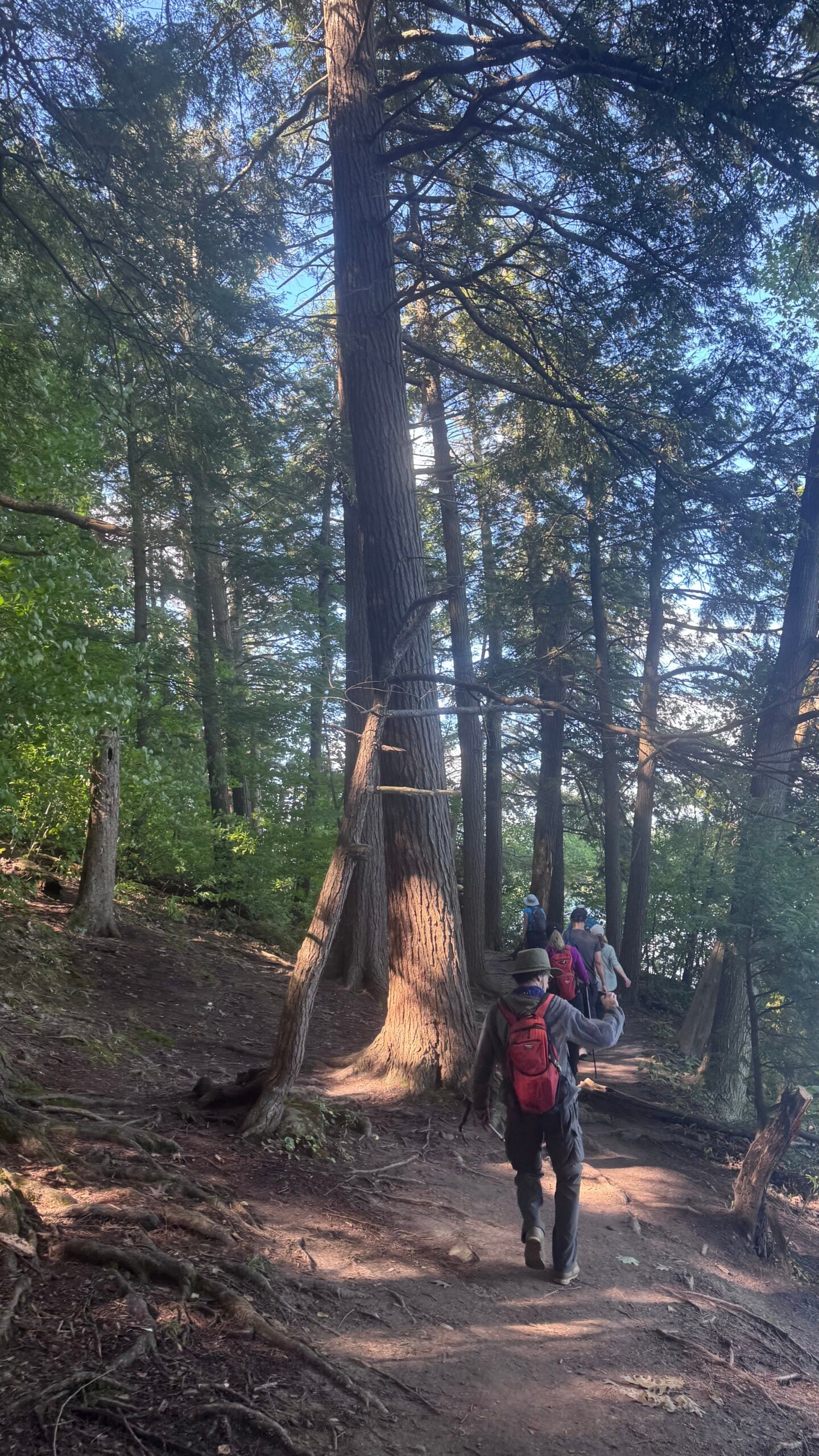
Car Hike: Uxbridge-Brock Track
https://hikes.brucetrail.org/event/car-hike-uxbridge-brock-track-10/Sorry, the registration cut-off time for this hike has been reached.Not a member? Click here to join today!Hosting Club: Toronto
Category: Car Hike
Location (Google Maps):Meet at the Brock Tract parking lot at 1401 Brock Road, Uxbridge, ON. On the east side of Durham 1/Brock Rd., approximately 5 km south of Coppin’s Corners, Uxbridge or 1 km north of Uxbridge Pickering Town Line look for the 1401 number sign.Enter the track and you will find parking entrance approximately 50m on the left side. This is a free parking lot.
Hike Leader(s): Amir Alemohammad Click here to contact Hike Leader(s)
Pace: Moderate (3-4 km/hr)
Terrain: Flat, Hilly, Level 2 (Intermediate – some hills and uneven surfaces, rocks and roots underfoot), Variable
Distance (km): 14-16 kmDescription
Join us for a wonderful hike in Uxbridge starting from Brock Track parking lot. We will hike the Brock Track, Glen Major and Wilder Forest among the amazing trails of Uxbridge.Boots mandatory, poles recommended, bring 2 litres of water and dress according to weather conditions.
Please arrive at 7:45 for a 8:00 start.
Beware, Iphone Maps may take you to the wrong location. Check the location with Google Maps the previous night.
This is a joint hike with Oak Ridges Trail Association (ORTA).
Limehouse to Scotsdale Farm
https://hikes.brucetrail.org/event/limehouse-side-trails-2/Sorry, the registration cut-off time for this hike has been reached.Not a member? Click here to join today!Hosting Club: Iroquoia
Category: General Hike
Location (Google Maps): Meet roadside at 9:15 am on 8 Line, just down the road from the corner of 8 and 27.Hike Leader(s): Karen Bergmann Click here to contact Hike Leader(s)
Pace: Medium – 3 to 4 km/hr
Terrain: Moderate – Some hills and/or some poor footing
Distance: 8 kmsDescription
Come explore the new main trail just north of Limehouse. We will meet roadside on 8 Line, just down the road from the corner of 8 and 27. Then we’ll carpool to 5th Line and begin our hike on the Ancient Maple Side Trail. Heading onto the main trail, we’ll check out the new main trail that leads into Scotsdale Farm and the rerouted main trail on what used to be called Great Esker ST. Bring sufficient water as well as bug spray/bug net.GO Train Hike:: Unionville - Markham, Rouge River Trail
https://hikes.brucetrail.org/event/go-train-hike-unionville-markham-rouge-river-trail-2/Sorry, the registration cut-off time for this hike has been reached.Not a member? Click here to join today!Hosting Club: Toronto
Category: GO Train Hike
Location (Google Maps):Markham Pan Am Centre, Kennedy Rd & YMCA Blvd. Meet inside main lobby by the coffee shop for 10:00 departure after those who travelled by GO Transit arrive.
For those travelling by GO Transit we will meet in the Great Hall of Union Station to depart by 8:35 to take the 8:58 #71 Bus from the Union Station GO Bus Terminal.
(updated transit directions have been emailed to those who have registered).Hike Leader(s): Tom Swales Click here to contact Hike Leader(s)
Pace: Moderate (3-4 km/hr)
Terrain: Level 2 (Intermediate – some hills and uneven surfaces, rocks and roots underfoot), Variable
Distance (km): 13 kmDescription
The villages of Unionville & Markham are connected by the Rouge Valley Trail System following the Rouge River and running behind the historic buildings on Main Street Unionville, by Walden Pond in Austin Drive Park, through Milne Dam Conservation Area, and ending with a 143 metre long suspension bridge over the dam. We will walk into the village of Markham and finish with a short boardwalk trail through Tannery Pond which is close to the Markham GO Station. We begin the hike at Unionville GO Station hiking north to the historic Main Street and picking up the Rouge Valley Trail at Carlton Road. Return to Toronto or the starting point by GO Train or York Region Transit bus. Optional stop at the Rouge River Craft Brewery after the hike.Terrain is easy, mostly paved path/boardwalk with some dirt trails.
On The Go Maps Link:
https://onthegomap.com/s/g5rhpj1s
Bring lunch, water, snacks, hat. and insect repellant.
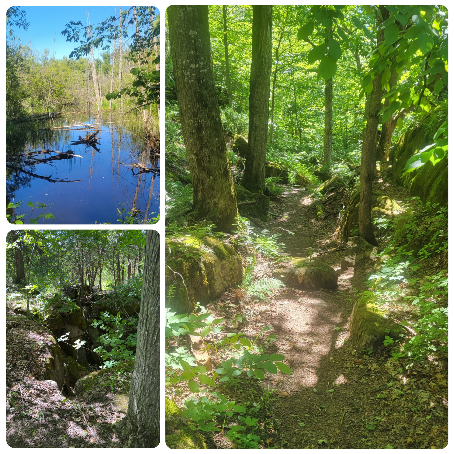
Passport to Nature: Grandparents Day Hike and Social
https://hikes.brucetrail.org/event/grandparents-day-hike-and-social/Sorry, the registration cut-off time for this hike has been reached.Not a member? Click here to join today!Hosting Club: Blue Mountains
Category: Organized Hike
Location (Google Maps): Petun Conservation Parking LotHike Leader(s): Claire Pearson Click here to contact Hike Leader(s)
Pace: Leisurely – 3 km/hr. or less
Terrain: Moderate – Some hills and/or some poor footing
Distance: 1.5 kmDescription
Calling all grandparents, parents, grandkids…Join us on Grandparents Day for a Passport to Nature Hike and Social. Park at the Petun Conservation Parking Lot (paid parking). We will begin at the Georgian Triangle Anglers Association (GTAA) Clubhouse and complete a short loop hike using the Black Ash Creek Side Trail and the Bruce Trail. Then we will return to the Clubhouse for some festivities. There is uneven ground so proper footwear is required. Download your Passport to Nature booklet from the website (brucetrail.org/passport-to-nature) to use for year-round events along the Bruce Trail that are perfect for families, first-time hikers, and nature enthusiasts of all ages. Collect stickers at each event and redeem them for a Passport to Nature badge and other prizes. Passport to Nature booklets will also be handed out on the day. - 14September 14, 2026
Early Morning Hike
https://hikes.brucetrail.org/event/early-morning-hike-2/Sorry, the registration cut-off time for this hike has been reached.Not a member? Click here to join today!Hosting Club: Iroquoia
Category: General Hike
Location (Google Maps):Kerncliff Park, Parking Lot (Parking capacity 30)
Access to the main trail is via Kerncliff Park Side Trail. (no access from Hwy 5)Hike Leader(s): Madeline Grady Click here to contact Hike Leader(s)
Pace: Medium – 3 to 4 km/hr
Terrain: Moderate – Some hills and/or some poor footing
Distance: 8 kmDescription
Come start your day with a walk in the woods and listen to birds chirping.The trail will start and end with hills. The middle will be mostly flat but some rocks and tree roots to content with.
Bonus: Getting natural light early in the morning helps reset your internal clock, anchors your circadian rhythm and gives us natural red light therapy from that early morning sun.
Easy Does It Hike, Allanburgh Bridge
https://hikes.brucetrail.org/event/easy-does-it-hike-allanburgh-bridge/Sorry, the registration cut-off time for this hike has been reached.Not a member? Click here to join today!Hosting Club: Niagara
Category: Leisurely
Location (Google Maps): 3330 Lundy’s Lane (Parking lot west of bridge) Hwy 20, Allanburgh, OnHike Leader(s): Diane Marlatt Click here to contact Hike Leader(s)
Pace: Leisurely <3 km/hr
Terrain: Easy: mostly flat, good footing
Distance: 6 KmDescription
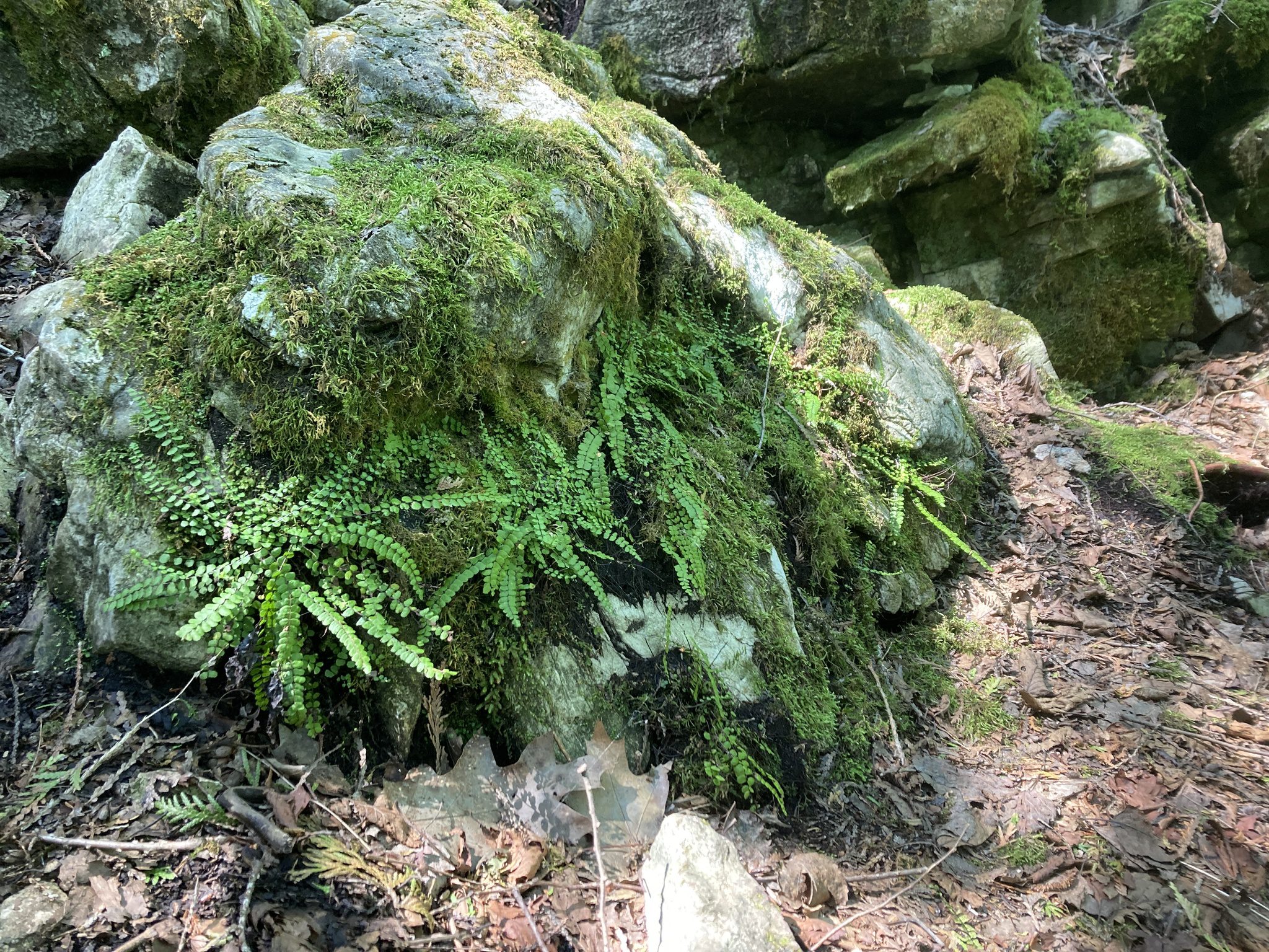
Car Hike: Fabulous Ferns
https://hikes.brucetrail.org/event/car-hike-fabulous-ferns/Sorry, the registration cut-off time for this hike has been reached.Not a member? Click here to join today!Hosting Club: Toronto
Category: Car Hike
Location (Google Maps): Map 13
Meet at the roadside parking on 10th line, 2.2 km southeast of 32 Sideroad (Halton Road 42)Hike Leader(s): Janet Patterson Click here to contact Hike Leader(s)
Pace: Leisurely (2-3 km/hr)
Terrain: Variable
Distance (km): 3-4 kmDescription
If you’ve hiked anywhere on the Bruce Trail, you’ve encountered ferns. Large bushy ones, tiny delicate ones, perhaps growing on vertical rock faces or down low, in the forest understory. Ontario boasts close to 170 different species! For this hike, we will be joined by BTC staff ecologist Mara McHaffie who will help us learn to identify the variety of fern species we will encounter on the Walking Fern side trail. This is a slow-paced outing, with lots of time to observe, discuss and photograph what we observe.The Walking Fern side trail itself is only 1.4k in total ((linear: there and back), so if time allows, we will explore a little more on the adjacent main trail.
This hike is brought to you by the TBTC Biodiversity Team. We endeavour to promote the critical role we can all play in protecting and conserving the Niagara Escarpment.
Limit: 10
Young Adult Hike + Social: Derby/West Rocks & Optional Tipsy Fox
https://hikes.brucetrail.org/event/young-adult-hike-social-derby-west-rocks-tipsy-fox/Sorry, the registration cut-off time for this hike has been reached.Not a member? Click here to join today!Hosting Club: Sydenham
Category: Young Adult Hike
Location (Google Maps): At the parking area at the north end of Concession Road 3 Derby: https://maps.app.goo.gl/DbKeAd6A6xJW8ku5AHike Leader(s): Natalie Mechalko Click here to contact Hike Leader(s)
Pace: Medium: 3 to 4 km/h
Terrain: Moderate: Some hills and/or poor footing
Distance: ~3kmDescription
Join the Sydenham Bruce Trail Club for the first Young Adult Hike + Social! We’ll head out for a short evening hike before making our way to the Tipsy Fox in Owen Sound for dinner (and trivia, if available!).This casual evening hike is geared toward young adults roughly in their 20s and 30s who are looking to explore trails in Grey Bruce, meet other outdoor enthusiasts, and fit a little time outside into the work week. New hikers and non-members are welcome!
We’ll meet at the north end of Concession Rd 3 Derby: https://maps.app.goo.gl/DbKeAd6A6xJW8ku5A at 6:00 p.m.
Need a ride or happy to offer one? Carpooling is encouraged! When you register, feel free to reach out to sydenhamyoungadults@gmail.com if you’re looking for a ride or have space to bring someone along.
- 15September 15, 2026
Long Hike Short Hills
https://hikes.brucetrail.org/event/long-hike-short-hills-11/Sorry, the registration cut-off time for this hike has been reached.Not a member? Click here to join today!Hosting Club: Niagara
Location (Google Maps):
Short Hills Wiley Road, Thorold
Pace: Brisk 4-5 km/hr
Terrain: Moderate: some hills and some poor footing
: 10k+Description
Our regular Spot for the Tuesday Long Hike. Note the new location. We will hike the trails around Short Hills Dress for the weather and bring sunscreen bug spray, poles snack and drink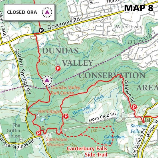
Tuesday's 10k
https://hikes.brucetrail.org/event/tuesdays-10k-2/Sorry, the registration cut-off time for this hike has been reached.Not a member? Click here to join today!Hosting Club: Iroquoia
Location (Google Maps): Ancaster Lions Outdoor Pool – 263 Jerseyville Rd W, Ancaster
Hike Leader(s): Jennifer DeBoer Click here to contact Hike Leader(s)
Pace: Brisk – 4 to 5 km/hr
Terrain: Moderate – Some hills and/or some poor footing
Distance: 10k+Description
We will hike the trails around the Dundas Valley Conservation Area. Dress for the weather wearing hiking boots. Please also bring sunscreen, bug spray, poles, water and a snack.
9:15 Short Hike, Rockway Conservation Area, 2021 Pelham Rd, Lincoln
https://hikes.brucetrail.org/event/915-short-hike-rockway-conservation-area-2021-pelham-rd-lincoln-2/Sorry, the registration cut-off time for this hike has been reached.Not a member? Click here to join today!Hike open to BTC Members only.
Hosting Club: Niagara
Category: Hike
Location (Google Maps): Rockway Conservation Area, 2021 Pelham Rd, Lincoln, ONHike Leader(s): Debbie Demizio Click here to contact Hike Leader(s)
Pace: Medium 3- 4 km/hr
Terrain: Moderate: some hills and some poor footing
Distance: 6 kmsDescription
Hike around 15 Mile Creek, featuring Upper and Lower Rockway Falls. Please bring water, insect repellent, sunscreen and hiking poles. Check yourself thoroughly for ticks following the hike.Meltwater Moraine and Songbird Side Trail
https://hikes.brucetrail.org/event/meltwater-moraine-and-songbird-side-trail/Sorry, the registration cut-off time for this hike has been reached.Not a member? Click here to join today!Hosting Club: Dufferin Hi-Land
Category: Tuesday Hike
Location (Google Maps): Caledon Hills Section, Map 16: Meet in the parking lot at the farm on the east side of Mountainview Rd (between Escarpment Sideroad and Charleston Sideroad).
Note: The trails we will be hiking are not shown in the BT Guide. You can preview maps on the Trail Changes and Notices section of the BTC website or on the BTC app.Hike Leader(s): Julie Daley, Les Babbage, Tony Evangelista, Inge Eckerich Click here to contact Hike Leader(s)
Pace: Leisurely
Terrain: Moderate
Distance: Long Hike 7 km, Short hike: 4.5 kmDescription
We will hike along the Main Trail in the Moraine, through forest and fields, to Airport Rd. Those wishing a short hike will return to the parking lot from here. The hike will continue with a short walk south on Airport Rd and on the Songbird Side Trail, then return to the parking lot on Mountainview Rd. Bring water and snacks, insect repellent and hiking poles, as needed.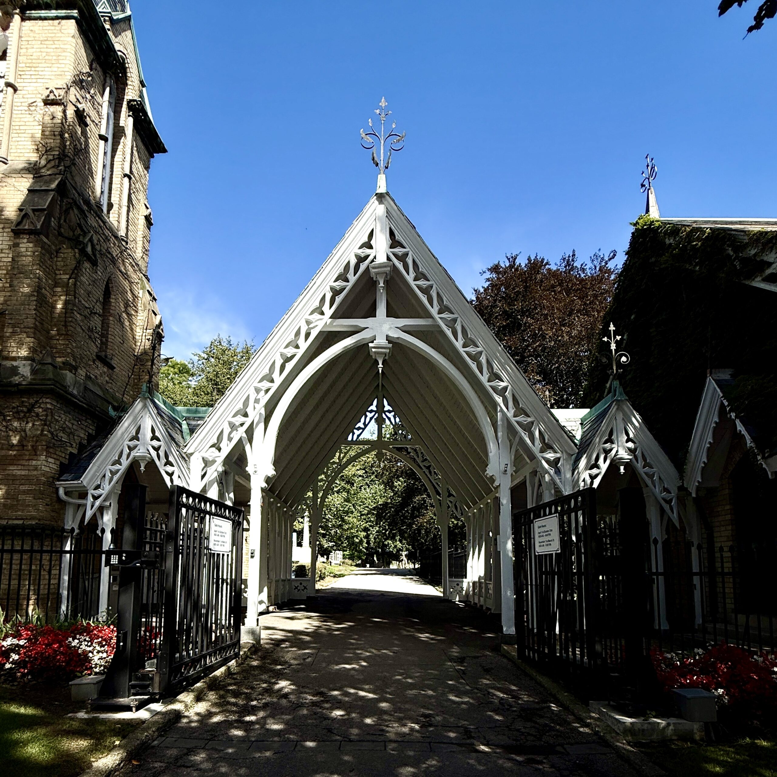
Urban Walk: Rosedale Valley, Toronto Necropolis Cemetery, Riverdale Park and the Danforth
https://hikes.brucetrail.org/event/rosedale-valley-toronto-necropolis-cemetery-riverdale-park-and-the-danforth/Sorry, the registration cut-off time for this hike has been reached.Not a member? Click here to join today!Hosting Club: Toronto
Category: Urban Walk
Location (Google Maps): Rosedale StationHike Leader(s): Ted Moriarty Click here to contact Hike Leader(s)
Terrain: Hilly, Level 2 (Intermediate – some hills and uneven surfaces, rocks and roots underfoot)
Distance (km): 7.5 kmDescription
Join me in one of a series of Tuesday morning urban hikes in Toronto. Starting at Rosedale Subway Station, we will explore four unique mid-Toronto green spaces including Rosedale Valley, Toronto Necropolis Cemetery and Riverdale Park. The hike will conclude at the Broadview Subway Station.Urban Walk: Valley View Park Thornhill
https://hikes.brucetrail.org/event/urban-walk-valley-view-park-thornhill-179/Sorry, the registration cut-off time for this hike has been reached.Not a member? Click here to join today!Hosting Club: Toronto
Location (Google Maps): Parking lot is off Sycamore Drive, East of Bayview , across Starbucks plaza
Bus 91 from Finch East station stops at Sycamore station.Hike Leader(s): MOHAMMAD AGHAMIRI Click here to contact Hike Leader(s)
Pace: Moderate (3-4 km/hr)
Terrain: Hilly, Level 2 (Intermediate – some hills and uneven surfaces, rocks and roots underfoot)
Distance (km): 7-8 kmDescription
We will explore Valleyview and Maple View parks, and walk along German Mills Creek, in return we stop in Huntington park and have snack ,coffee,tea .Although this is considered an “Urban Walk”, you can expect some hills up and down and uneven surfaces with tree roots. Please bring hiking poles, water and snacks.
phone number for the day of hike 289 588 6482
Hilton Falls on the Bike Trails
https://hikes.brucetrail.org/event/hilton-falls-on-the-bike-trails-5/Sorry, the registration cut-off time for this hike has been reached.Not a member? Click here to join today!Hosting Club: Iroquoia
Category: General Hike
Location (Google Maps): Meet in the parking lot at Hilton Falls Conservation Area at 9:15 amHike Leader(s): Karen Bergmann Click here to contact Hike Leader(s)
Pace: Medium – 3 to 4 km/hr
Terrain: Moderate – Some hills and/or some poor footing
Distance: 8 kmsDescription
Meeting in the parking lot at 9:15 am, we will hike to the Falls and then across the creek to the bike trails and back along the Hilton Falls Side Trail. Reserve your time at conservationhalton.ca Bring sufficient water as well as bug spray/bug net.Walk In Nature Series (WINS) - Bayview Escarpment Nature Reserve
https://hikes.brucetrail.org/event/walk-in-nature-series-wins-bayview-escarpment-nature-reserve-2/Sorry, the registration cut-off time for this hike has been reached.Not a member? Click here to join today!Hosting Club: Sydenham
Category: Walk In Nature Series (WINS)
Location (Google Maps):Click the (Google Maps) link on the left to direct you to parking.
GPS coordinates: 44.6375, -80.7334
Offroad parking at the curve in the road of the St. Vincent-Sydenham Townline, 5 km north of Hwy 26.
Or use the Bruce Trail app that links to Google Maps to drive there by clicking on P then Roadside Parking then Get Directions.
Or look in the Bruce Trail Reference guidebook Edition 31, Map 30 at km 52.7
Hike Leader(s): Stewart Brown Click here to contact Hike Leader(s)
Pace: Medium: 3 to 4 km/h
Terrain: Moderate: Some hills and/or poor footing
Distance: 4.8 kmDescription
The Walk In Nature Series (WINS) consists of 2 hour hikes in the Sydenham section of the Bruce Trail that combine nature appreciation with fitness in a safe and welcoming group environment led by an experienced hike leader. Consider these hikes to be appointments with yourself in nature that promote health and fitness.On this WINS hike, absorb the calm while walking through the mature forests of the Bayview Escarpment Provincial Nature Reserve. Includes a panoramic view from Legacy Ridge side trail over the Sydenham countryside.
Bring water, snacks, personal medications and supplies. Hiking poles are not required by are always welcome.
- 16September 16, 2026
Beaver Valley Geology Hikes Badge Series 3/8 Mill Creek Loop
https://hikes.brucetrail.org/event/beaver-valley-geology-hikes-badge-series-3-8-mill-creek-loop/Sorry, the registration cut-off time for this hike has been reached.Not a member? Click here to join today!Hosting Club: Blue Mountains
Category: Cancelled
Location (Google Maps): Tim Horton’s, First Street, CollingwoodHike Leader(s): Annette Sandberg Click here to contact Hike Leader(s)
Pace: Medium – 3 to 4 km/hr
Terrain: Moderate – Some hills and/or some poor footing
Distance: 10.4Description
The Mill Creek Valley: “Castle Ramparts” at Stop 8 (Pages 63/64) The Manitoulin Dolostone layer of the Niagara Escarpment forms a steep edge along the valley of Mill Creek. Over time the thinly bedded rock breaks away from the cliff face and lies scattered along the slope. Many shell and horn coral fossils can be found in these flat, shingle-like rocks. Note that when leaves are fully out in the summer months the “castle ramparts” may be hard to see.
See Hike #1 – August 26 for series descriptionSideways Badge Hike 1 of 5 - CANCELLED
https://hikes.brucetrail.org/event/sideways-badge-hike-1-of-5/Sorry, the registration cut-off time for this hike has been reached.Not a member? Click here to join today!Hike open to BTC Members only.
Hosting Club: Caledon Hills
Category: General
Location (Google Maps): Park at roadside parking on the east side of Creditview Road, immediately north of the Grange Sideroad intersection.Directions: From ON-10, head west on Old Base Line Road to Mississauga Road. Turn right and drive north to the Grange Sideroad. Turn right and proceed to Creditview Road.
Hike Leader(s): Mel Thornley Click here to contact Hike Leader(s)
Pace: Medium – 3 to 4 km/hour
Terrain: Moderate – some hills and/or some poor footing
Distance: 10 kmDescription
We’re going to be working on the Sideways Badge which is five prescribed loop/“in and out” hikes. The hikes include eighteen different side trails. (There are many other side trails that are not included in these five hikes.) Anyone interested in receiving the badge after completing all 5 hikes, please bring $10 at the last hike.Hike 1 (of 5)
Forks of the Credit Area (map 14)
The hike is approximately 10.0 km. The terrain is hilly with a few steep climbs.
We’ll be hiking the Trimble, Crows Nest, Devils Pulpit and Ring Kiln Side Trails.
9:30 am Hike & Picnic
https://hikes.brucetrail.org/event/930-am-hike-picnic-3/Sorry, the registration cut-off time for this hike has been reached.Not a member? Click here to join today!Hike open to BTC Members only.
Hosting Club: Niagara
Category: Loop
Location (Google Maps):Locust Grove Picnic Area
Hike Leader(s): Marion Hanover Click here to contact Hike Leader(s)
Pace: Medium 3- 4 km/hr
Terrain: Moderate: some hills and some poor footing
Distance: 7 kmDescription
Hike around Queenston area. Optional outdoor gathering in Locust Grove including pot luck picnic after the hike.WEDNESDAY WALKERS - Siegerman Area Trail
https://hikes.brucetrail.org/event/wednesday-walkers-siegerman-area-trail-2/Sorry, the registration cut-off time for this hike has been reached.Not a member? Click here to join today!Hosting Club: Beaver Valley
Location (Google Maps): Park on Sideroad 22C Km 99.9 Map 27 Edition 31
Hike Leader(s): Margaret Yaraskavitch Click here to contact the hike leader.
Pace: Medium
Terrain: Moderate, Some rocky footing, Some steep sections
Length of Hike: 6 kmDescription
Reroutes, for the better, happened in the area of the Siegerman property! We’ll walk on a road allowance to the relatively newly designed Siegerman Main Trail. Lovely views of a stream here. We’ll walk uphill and then walk a loop using the Allan Side Trail. Then we return on the Main Trail to our parked vehicles.Guidelines
- Arrive 15 minutes before the start of the hike.
- Wear sturdy footwear and appropriate attire for the weather and the terrain.
Hiking poles are a good idea in any season, especially if the terrain is rocky or slippery. In winter, snowshoes or icers/crampons are needed when conditions dictate.
Wearing appropriate clothing and footwear prevents injuries and shows consideration for a safe and positive group hiking experience. - Always carry I.D. and your health card.
- Bring sufficient water and snacks (or lunch if indicated). A minimum of 1L of water is recommended on all hikes, and 3L is recommended for long, challenging hikes in the heat of the summer.
- Bring sunscreen and insect repellent (for spring and summer hikes).
- Bring your own first aid kit.
- Please leave dogs at home.
Good Companions - Spring Valley - Ancaster
https://hikes.brucetrail.org/event/good-companions-spring-valley-ancaster-6/Sorry, the registration cut-off time for this hike has been reached.Not a member? Click here to join today!Hosting Club: Iroquoia
Category: Good Companions
Location (Google Maps):Ancaster Little League Ball Park – Jerseyville Rd (across from the Ancaster Lions Outdoor Pool) – See map below
Hike Leader(s): Ted Bossence Click here to contact Hike Leader(s)
Pace: Medium – 3 to 4 km/hr
Terrain: Strenuous – Hilly with steep climbs and some poor footing
Distance: 8 kmDescription
We will follow the Spring Valley Trail, Martins Road, Headwaters Trail etc. in the western part of the Dundas Valley . Bring sunscreen, bug repellant, water and a snack (poles would also be useful). If I cancel due to rain I will notify you by email no later than the night before, so please check your emails before you leave for the hike. Please arrive 10 minutes before the10:00 am time since I will be leaving promptly at 10:00.I will send contact info the day before the hike for those who cancel after 4:00 pm the day before the hike.
Steeltown Stomp Practice Session #5 of 8
https://hikes.brucetrail.org/event/steeltown-stomp-practice-session-5-of-8/Sorry, the registration cut-off time for this hike has been reached.Not a member? Click here to join today!Hosting Club: Iroquoia
Category: Steeltown Stomp Practice Session
Location (Google Maps): Chedoke Golf Club Parking Lot – Access from Beddoe Dr off Studholm Rd south of Aberdeen (Parking capacity 40)Hike Leader(s): Muskan Sidana Click here to contact Hike Leader(s)
Pace: Brisk – 4 to 5 km/hr, Medium – 3 to 4 km/hr
Terrain: Strenuous – Hilly with steep climbs and some poor footing
Distance: VariesDescription
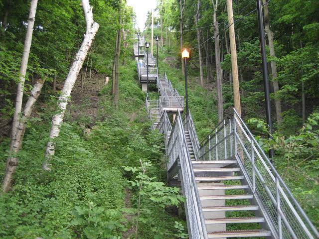
Is the Steeltown Stomp on your bucket list? This is your chance to crush it! Join us and prepare for this incredible challenge on October 3rd, 2026! Registration for the event is now open.If you’ve done stair climbs before, you know the deal—that brutal calf pain is real, especially when you’re just starting out. But training with us this summer? That’s how you show up on stomp day actually feeling strong instead of totally wrecked. Trust me.
We’ll start easy and build up as the summer goes on, hitting Chedoke and Dundurn Stairs with some scenic hikes mixed in. By the time October rolls around, you’ll have crushed at least 2,000 steps and you’ll actually know what you’re doing.
It’s a solid group vibe—moderate pace, warm-ups to get going, stretches to cool down. And honestly, it’s way more fun (and way less painful) doing this with people who get it.
Just grab your water bottle (there’s water at both staircases) and whatever snacks you want.
We’ve got 7 training dates lined up this summer—check the schedule and pick the ones that work for you. Do the work now, own it on stomp day. See you out there!
BTC x HCA Bird Walk: Fall Migration at Saltfleet
https://hikes.brucetrail.org/event/btc-x-hca-bird-walk-fall-migration-at-saltfleet/Sorry, the registration cut-off time for this hike has been reached.Not a member? Click here to join today!Hosting Club: Iroquoia
Category: Birding Hikes
Location (Google Maps): Saltfleet Conservation AreaHike Leader(s): Shayne Ward Click here to contact Hike Leader(s)
Pace: Leisurely – 3km/hr or less
Terrain: Easy – Mostly flat and usually good footingDescription
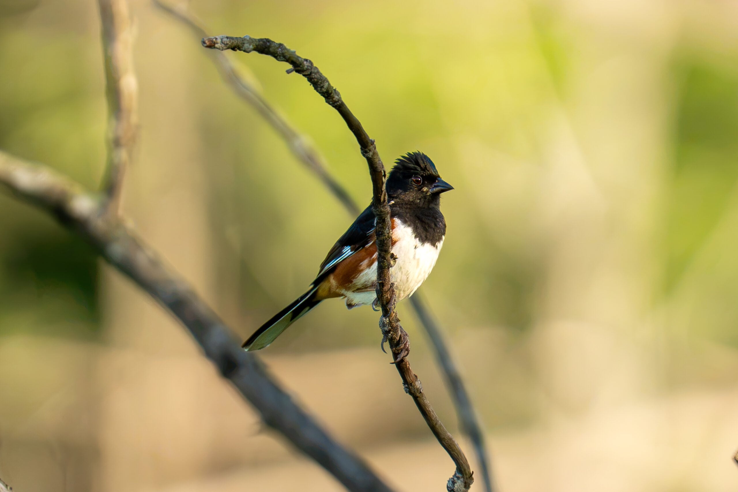
Join the Iroquoia Bruce Trail Club’s Shayne Ward and the Hamilton Conservation Authority’s Ben Laing for a special evening bird walk at Saltfleet Conservation Area in Stoney Creek! This collaborative event pairs BTC hike leadership with HCA’s on-the-ground expertise for a close look at fall migration in one of Hamilton’s birding hotspots!We’ll wander the trails around Saltfleet’s wetlands, keeping an eye out for lingering warblers, shorebirds, and early-arriving waterfowl as fall migration ramps up. HCA’s Ben Laing will bring a spotting scope to help us pick out any peeps and ducks tucked into the back of the ponds, and we’ll take some time to check out the site’s restoration work, including the wetland cells and a resident purple martin house.
This is a great outing for birders of all experience levels — bring your binoculars if you have them, or just come curious! No binoculars?! IBTC has loaners for this hike provided by NOCS Provisions!
🌈 This is a queer-led, 2SLGBTQIA+ inclusive Rainbow Hike, welcoming LGBTQ+ hikers, allies, birders, photographers, and anyone interested in connecting with nature and community. This is a short, relaxed hike (approx. 5 km or less) designed to get us moving and birding!
What to Bring
- Water and light snacks
- Weather-appropriate clothing and sturdy footwear
- Binoculars or camera if you have them (optional but fun! And a cell phone counts!)
🚗 🚌 This outing is accessible by car or public transit.
Planning to Drive?
Saltfleet is an HCA Conservation Area and parking is $8.50 per-vehicle entry fee at the gate. If this is a barrier for you, please reach out — Shayne is happy to help coordinate a shuttle or carpool from a nearby meeting point.Taking the Bus?
HSR #44 stops near the trailhead entrance at Upper Centennial and Green Mountain! Map of the bus and it’s schedule can be found here.
https://www.hamilton.ca/sites/default/files/2026-08/hsr-route-44-RYMAL-Fall-2026-Schedule.pdfNot a Bruce Trail member yet?! Sign up here: https://brucetrail.org/become-a-member/
Questions? Simply click “Contact Hike Leader” on the registration form.
- 17September 17, 2026
8:00 am Long hike NEW Location. Bailey bridge Jordan
https://hikes.brucetrail.org/event/800-am-long-hike-new-location-bailey-bridge-jordan-12/Sorry, the registration cut-off time for this hike has been reached.Not a member? Click here to join today!Hosting Club: Niagara
Location (Google Maps):
Bailey bridge Jordan
Pace: Brisk 4-5 km/hr
Terrain: Strenuous: hilly, with steep climbs, poor footing
: ~10kDescription
This will be our permanent location . Hike up from the Bailey bridge to Balls Falls and explore the trailsYou must register for each hike. Bring Poles, snack and a drink. Dress for the weather
Urban Walk : Valley View Park
https://hikes.brucetrail.org/event/urban-walk-valley-view-park/Sorry, the registration cut-off time for this hike has been reached.Not a member? Click here to join today!Hosting Club: Toronto
Location (Google Maps): Parking lot is off Sycamore Drive, East of Bayview , across Starbucks plaza
Bus 91 from Finch East station stops at Sycamore station.Hike Leader(s): MOHAMMAD AGHAMIRI Click here to contact Hike Leader(s)
Pace: Moderate (3-4 km/hr)
Terrain: Hilly, Level 2 (Intermediate – some hills and uneven surfaces, rocks and roots underfoot)
Distance (km): 7-8 kmDescription
We will explore Valleyview and Maple View parks, and walk along German Mills Creek, in return we stop in Huntington park and have snack ,coffee,tea .Although this is considered an “Urban Walk”, you can expect some hills up and down and uneven surfaces with tree roots. Please bring hiking poles, water and snacks.
phone number for the day of hike 289 588 6482
Graham's Hill to Hogg's Falls
https://hikes.brucetrail.org/event/grahams-hill-to-hoggs-falls/Sorry, the registration cut-off time for this hike has been reached.Not a member? Click here to join today!Hosting Club: Beaver Valley
Location (Google Maps): Meet in the Hogg’s Falls parking lot, Map 26, Edition 31, 44.285307,-80.543081
Hike Leader(s): Glenda Collings Click here to contact the hike leader.
Pace: Medium
Terrain: Moderate, Strenuous, Some steep sections, Some rocky footing
Length of Hike: 9.1 kmDescription
We’ll be hiking along the escarpment on the western side of the Beaver Valley, from Graham’s Hill south to Hogg’s Falls. Please arrive by 8:15 a.m. for a car shuttle. Bring water and a snack and dress for the weather. There are plenty of views to be had as we hike through mixed forest, take a breather at Cuckoo Valley Lookout and continue south to hike a length of the main trail, the Sendero Pacifico Bruce Trail Friendship Trail, then on to Hogg’s Falls.Hiking around Jordan
https://hikes.brucetrail.org/event/hiking-around-jordan-72/Sorry, the registration cut-off time for this hike has been reached.Not a member? Click here to join today!Hosting Club: Niagara
Category: Loop
Location (Google Maps): Sho’arishon Park, JordanHike Leader(s): Bill Russell Click here to contact Hike Leader(s)
Pace: Medium 3- 4 km/hr
Terrain: Moderate: some hills and some poor footing
Distance: 6 kmsDescription
Hiking in and around Jordan, Rainforth Trail and Balls Falls, alternating every 3 weeks.Toronto Fall Series Hike 3 of 9
https://hikes.brucetrail.org/event/toronto-fall-series-hike-3-of-9/Sorry, the registration cut-off time for this hike has been reached.Not a member? Click here to join today!Hosting Club: Caledon Hills
Category: End-to-End
Location (Google Maps): Meet at Scotsdale Farm Parking. Map 13 north of km 29.8.Hike Leader(s): Nancy Mooney Click here to contact Hike Leader(s)
Pace: Medium – 3 to 4 km/hour
Terrain: Moderate – some hills and/or some poor footing, Strenuous – hilly with steep climbs and some poor footing
Distance: 14.2 km loopDescription
This is the third hike of the series. We will loop around Scotsdale Farm and Silvercreek Conservation Area including Roberts, Irwin Quarry, and part of Bennett Heritage Side Trails.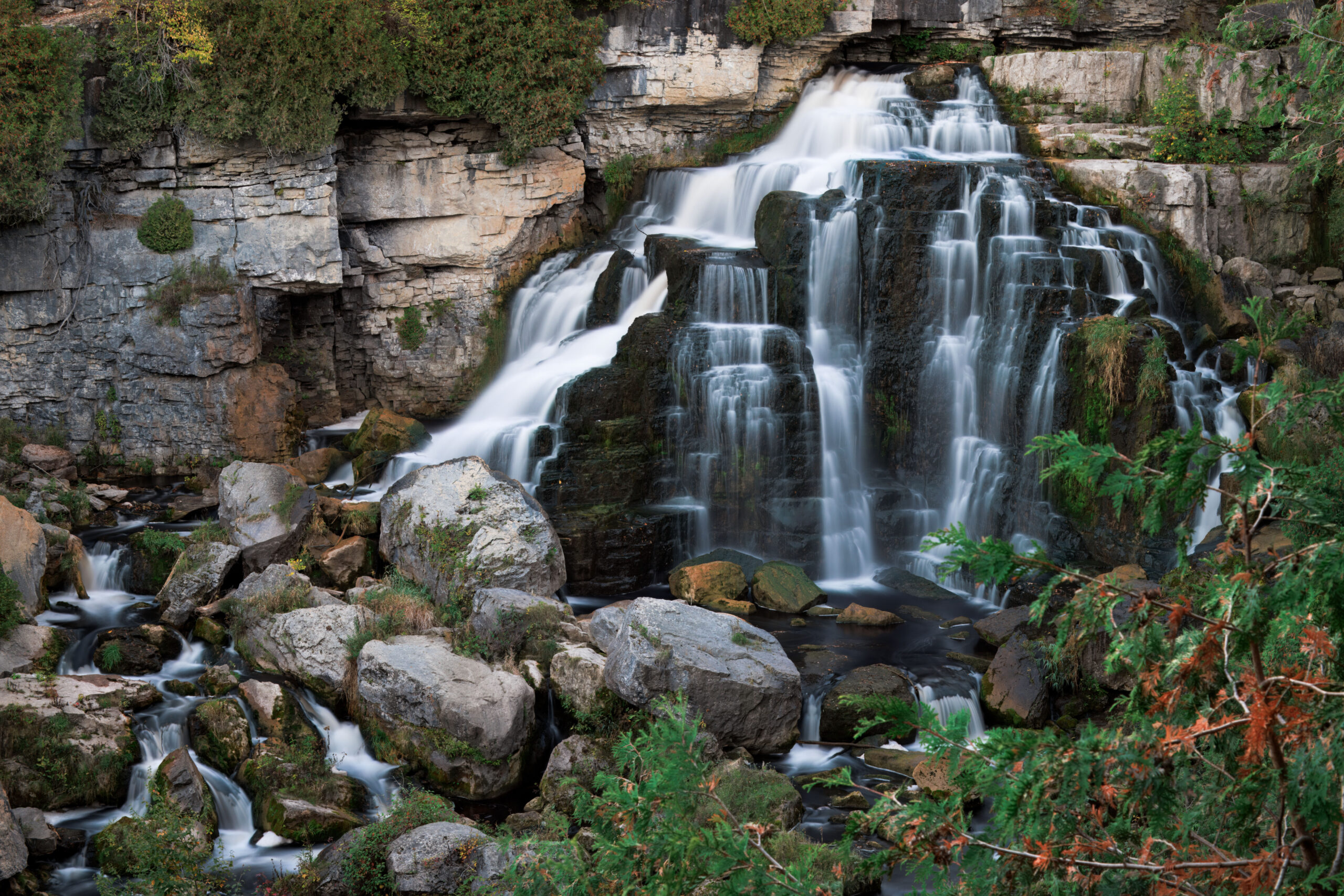
Car Hike: Inglis Falls
https://hikes.brucetrail.org/event/car-hike-inglis-falls/Sorry, the registration cut-off time for this hike has been reached.Not a member? Click here to join today!Hosting Club: Toronto, Sydenham
Category: Car Hike
Location (Google Maps): Centennial Tower Parking located on the west side of Highway 6 & 10 at the south end of Owen SoundHike Leader(s): Stewart Fleming Click here to contact Hike Leader(s)
Pace: Mixed (See Hike Description)
Terrain: Level 2 (Intermediate – some hills and uneven surfaces, rocks and roots underfoot), Rocky
Distance (km): 12 kmDescription
This hike takes us south on the Main Trail from Centennial Tower to Inglis Falls and back. We will stop to explore the Devil’s Playhouse through the narrow Escarpment entrance.Our pace will be Brisk through the open areas but Leisurely through the East Rocks section, one of my top five hardest rocky sections of the Bruce Trail.
Please bring enough water (about 2 litres) and food to maintain your energy for a 4-hour hike.
Comfortable hiking shoes or boots are a must. A rain shell is recommended in case of a wet weather forecast, along with a hat, sunscreen, and bug repellent for sunny weather or buggy trail conditions.
- 18September 18, 2026
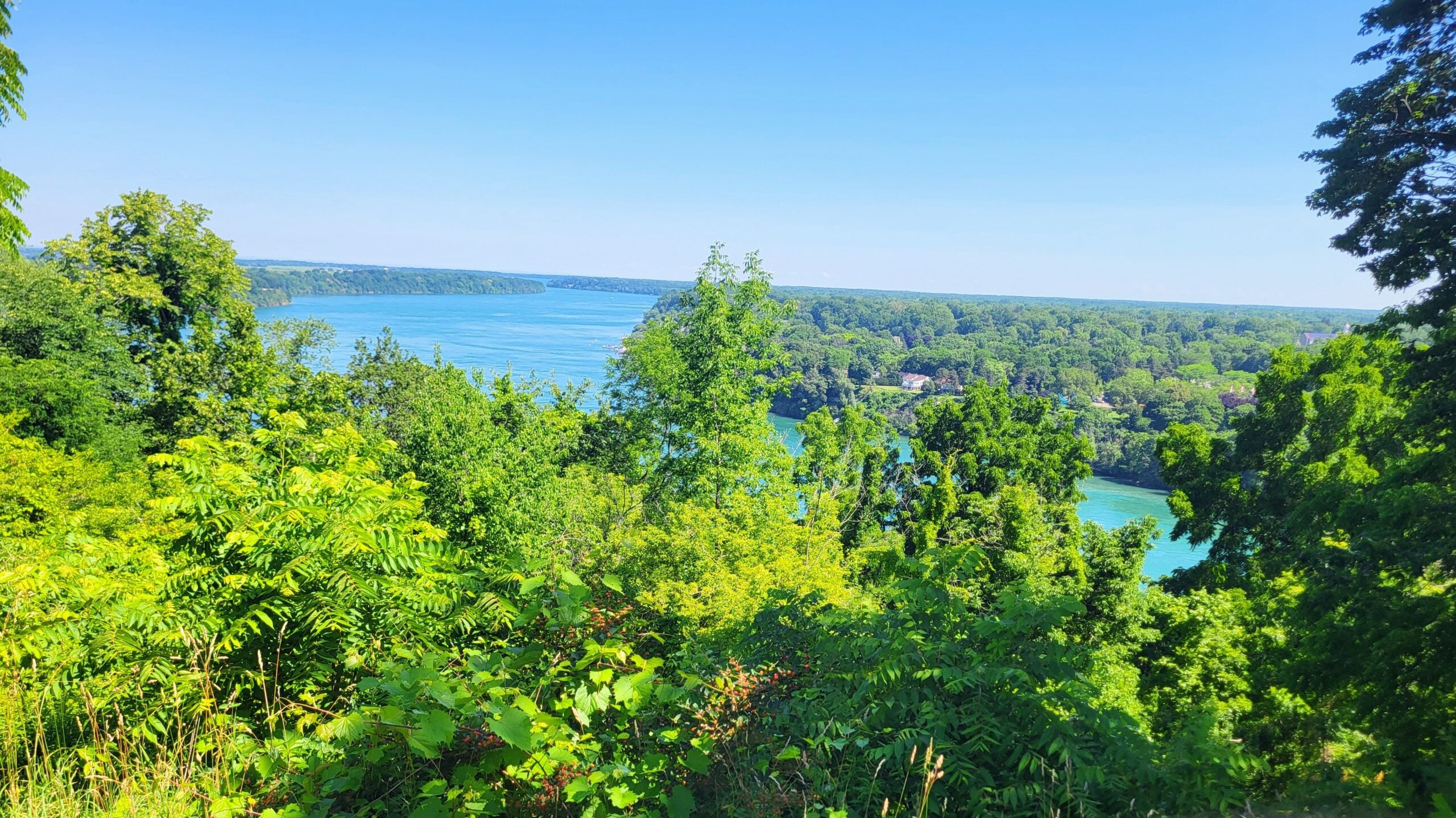
9am Niagara on the Lake Tour
https://hikes.brucetrail.org/event/9am-niagara-on-the-lake-tour-4/Sorry, the registration cut-off time for this hike has been reached.Not a member? Click here to join today!Hosting Club: Niagara
Category: Urban
Location (Google Maps): Veterans Memorial Park, park just outside the park on King StreetHike Leader(s): Diane Marlatt Click here to contact Hike Leader(s)
Pace: Leisurely <3 km/hr
Terrain: Easy: mostly flat, good footing
Distance: 5-7 KmDescription
Fitness Hike
https://hikes.brucetrail.org/event/fitness-hike/Sorry, the registration cut-off time for this hike has been reached.Not a member? Click here to join today!Hosting Club: Sydenham
Category: Fitness Hike
Location (Google Maps): Meet at the entrance to the Massie Hills Ski Trails on the West side of Concession Road 6 South at 08:45h. Hike will start promptly at 9.
To get to Massie Ski Trails, head south from Grey Road 18 on Concession 6 South. The trails are South of Sideroad 6 and North of Sideroad 3. Roadside parking is available.
See Map 29, Edition 31, and look for the black P on the west side of concession 6.Hike Leader(s): Fran Turner
Pace: Medium: 3 to 4 km/h
Terrain: Moderate: Some hills and/or poor footing
Distance: Approximately 4 kmDescription
Enhance your hiking fitness with this combination hike which incorporates strength and balance training into a moderate hike. We will stop three times throughout the hike to do exercises targeting major muscle groups (eg glutes, quads) as well as balance and flexibility. All exercises will be done standing, so bring hiking poles to help with balance as we will be standing on one leg at times. All exercises are suitable for beginners but can be made more difficult for those who want a fitness challenge. There will be a total of about 30 minutes of exercises within a 2 hour hike.Afternoon hike - Mount Nemo (reservation required)
https://hikes.brucetrail.org/event/afternoon-hike-mount-nemo-reservation-required-3/Sorry, the registration cut-off time for this hike has been reached.Not a member? Click here to join today!Hosting Club: Iroquoia
Category: Afternoon/Evening Hikes
Location (Google Maps): Meet at 4:15 pm in the main parking lot at Mount Nemo on Guelph Line.Hike Leader(s): Karen Bergmann Click here to contact Hike Leader(s)
Pace: Medium – 3 to 4 km/hr
Terrain: Moderate – Some hills and/or some poor footing
Distance: 7 kmsDescription
Meet in the main parking lot at 4:15 and we will hike around the main loop and into the forest for a bit. Reserve your time at conservationhalton.ca - 19September 19, 2026
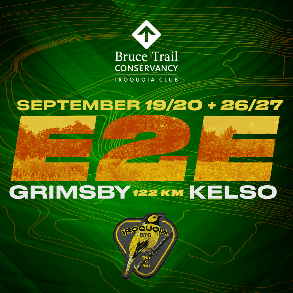
2026 Iroquoia E2E in Four (Two concurrent weekends)
https://hikes.brucetrail.org/event/2026-iroquoia-e2e-in-four-two-concurrent-weekends/Sorry, the registration cut-off time for this hike has been reached.Not a member? Click here to join today!This is a Multi-Day Hike
You are signing up for the following dates and times:
2026-09-19 at 07:00
2026-09-20 at 07:00
2026-09-26 at 07:00
2026-09-27 at 07:00Hosting Club: Iroquoia
Category: Special Event
Location (Google Maps): Two different parking locations (one for each wknd) will be provided to registered hikers only. The Bus will be there to take you to the hike start.
Any unregistered hikers who show up will not be permitted to board the buses.Hike Leader(s): Joe Borges Click here to contact Hike Leader(s)
Pace: Brisk – 4 to 5 km/hr
Terrain: Dependent on Conditions, Strenuous – Hilly with steep climbs and some poor footing
Distance: 122km (30-35 each day) // Self-paced with mandatory checkpoint deadlinesDescription
Please join us for the annual Iroquoia Bruce Trail Club self-paced End-to-End. You can enjoy and complete the entire club distance of 122 km over four days (approximately 30-35km each day).Please be honest about your physical abilities. These 4 days are not recommended for new hikers or anyone who hasn’t completed these distances recently.
The registration fee is non-refundable.The hikes will traverse the varied and often strenuous terrain from Grimbsy in the south, to the 401 in Milton. You will pass many waterfalls and beautiful vistas. Checkpoint stations will be approximately every 10 km offering snacks, water refill, and assistance. Please bring your own First Aid Kit.
The hike is $95 for members and $110 for non-members (if there are still available spots after the member pre-sale) and includes bus transportation from the meeting point to the hike starting point, refreshments, parking, permit costs, and the official E2E badge. The fee is non-refundable. After costs, the proceeds go to the Iroquoia Bruce Trail Club who support The Bruce Trail Conservancy mission of “Preserving a ribbon of wilderness, for everyone, forever.”
PLEASE NOTE: Registration opens at 8am on February 22, 2026 for Bruce Trail Conservancy members only.
You may be a member of any club. If any spots are still available after the first two weeks, registration will also be opened for non-members at a cost of $110.Details will be emailed to participants. As mentioned, these are longer hikes and are not suitable for beginning hikers. For both events, hikers are expected to maintain an average pace of 4 km/hr (or more). Hikers will be required to reach each checkpoint on each day by a prescribed time in order to continue, and ensure everyone is off the trail before dark. Please be aware that volunteers are running this event and will be waiting.
Space is limited, hikes go rain or shine, and no dogs are permitted on this event. For questions, please use the contact hike leader form available through the link on this page.
Coach Trip: Killbear Provincial Park
https://hikes.brucetrail.org/event/coach-trip-killbear-provincial-park/Sorry, the registration cut-off time for this hike has been reached.Not a member? Click here to join today!Trip Information
Departure Time: 07:30
Return to City Time: 19:30
Departure Point: York Mills Bus PickupTrip Activities
Hiking ($.01)
Independent Activities ($.01)
Optional ItemsHosting Club: Toronto
Category: Coach Trips
Location (Google Maps): Nobel, Ontario – https://www.ontarioparks.ca/park/killbearHike Leader(s): Lisa R. Lifshitz, Nijole Mockevicius, Marie-Josee Roy, Felix Wan;Tom Swales Click here to contact Hike Leader(s)
Pace: Moderate (3-4 km/hr)
Terrain: Level 2 (Intermediate – some hills and uneven surfaces, rocks and roots underfoot), Variable
Distance (km): 8-10 km (Time dependent)Description
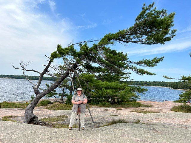
After years of requests, join us for our first-ever bus trip to beautiful Killbear Provincial Park! This stunning park, created in 1960, is known for its beautiful views of Georgian Bay, windswept pines on rocky islands, rugged shorelines and sandy beaches. Using our bus, we will cover the best trails in the park, including the Lookout Point Trail, the Lighthouse Point Trail and the Recreational Trail/Twin Point Trail, leaving time to scramble on the rocks to take iconic pictures of windswept trees and of course, visit the delightful Visitor’s Centre and Park Store. You also have the option to spend the day on your own. The club is pleased to be able to make this fun day trip available to our members at a very reasonable cost. Bus Fare includes admission to Killbear Provincial Park and a fuel surcharge rate of 7%.=>>> Please read our Paid Hikes Refund Policy before registering: https://torontobrucetrailclub.org/hikes/no-show-policy”. There will be no refunds for this hike if the registrant cancels or misses the coach on the date of departure for any reason. Registration fees are not transferrable between different hikes nor can unused fares qualify for a tax receipt.
Steeltown Stomp Practice Session #6 of 8
https://hikes.brucetrail.org/event/steeltown-stomp-practice-session-6-of-8/Sorry, the registration cut-off time for this hike has been reached.Not a member? Click here to join today!Hosting Club: Iroquoia
Category: Steeltown Stomp Practice Session
Location (Google Maps): Chedoke Golf Club Parking Lot – Access from Beddoe Dr off Studholm Rd south of Aberdeen (Parking capacity 40)Hike Leader(s): Muskan Sidana Click here to contact Hike Leader(s)
Pace: Brisk – 4 to 5 km/hr, Medium – 3 to 4 km/hr
Terrain: Strenuous – Hilly with steep climbs and some poor footing
Distance: VariesDescription
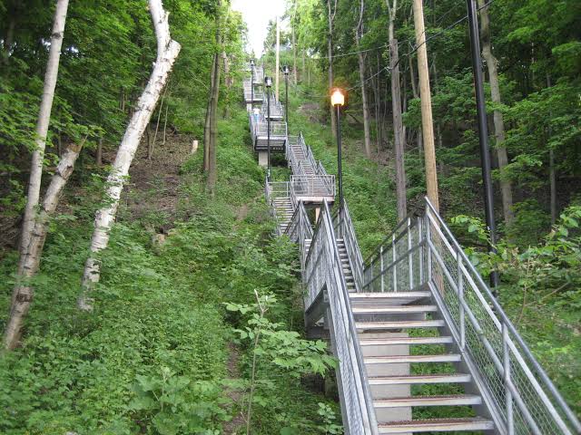
Is the Steeltown Stomp on your bucket list? This is your chance to crush it! Join us and prepare for this incredible challenge on October 3rd, 2026! Registration for the event is now open.If you’ve done stair climbs before, you know the deal—that brutal calf pain is real, especially when you’re just starting out. But training with us this summer? That’s how you show up on stomp day actually feeling strong instead of totally wrecked. Trust me.
We’ll start easy and build up as the summer goes on, hitting Chedoke and Dundurn Stairs with some scenic hikes mixed in. By the time October rolls around, you’ll have crushed at least 2,000 steps and you’ll actually know what you’re doing.
It’s a solid group vibe—moderate pace, warm-ups to get going, stretches to cool down. And honestly, it’s way more fun (and way less painful) doing this with people who get it.
Just grab your water bottle (there’s water at both staircases) and whatever snacks you want. And yeah, there’s optional coffee after if you want to hang out and celebrate.
We’ve got 7 training dates lined up this summer—check the schedule and pick the ones that work for you. Do the work now, own it on stomp day. See you out there!
Toronto E2E in 3 Hike #2
https://hikes.brucetrail.org/event/toronto-e2e-in-3-hike-2/Sorry, the registration cut-off time for this hike has been reached.Not a member? Click here to join today!Hosting Club: Caledon Hills
Category: End-to-End
Location (Google Maps): Silver Creek Education Centre – km 36.2Hike Leader(s): Daniel Patterson Click here to contact Hike Leader(s)
Pace: Medium – 3 to 4 km/hour
Terrain: Strenuous – hilly with steep climbs and some poor footing
Distance: 18.8 kmDescription
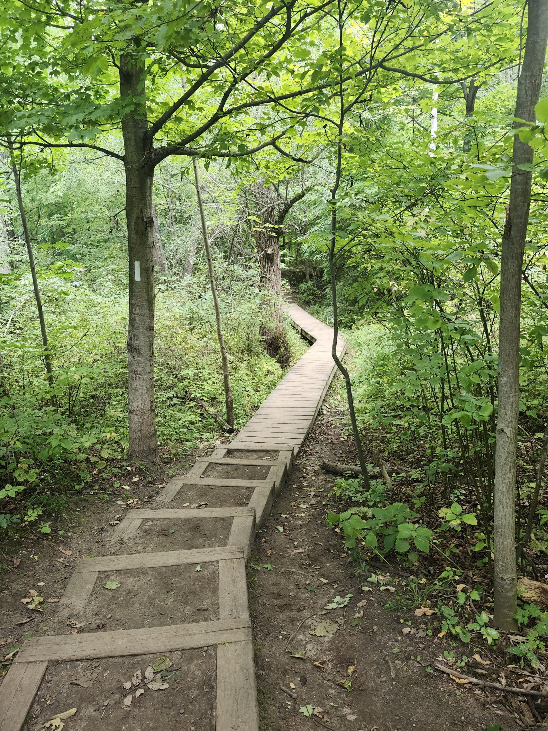
Welcome to hike #2 of Toronto E2E in 3 Hikes! We meet at km 36.2 Silver Creek Education Centre and shuttle to 4th Line North of 17th SR, roadside parking where the trail crosses 4th Line. Do not park in front of the junk yard. Hiking shoes or boots are required. Poles are helpful on uneven terrain. Bring at least 2L of water, a raincoat, sun hat, bug spray, sun block. Long sleeves and long pants are highly recommended due to poison ivy and ticks. Pack a lunch and a few snacks. Be prepared to assist with shuttling and returning shuttle drivers to their cars.Six Pack Of Blue – Hike 4 of 6
https://hikes.brucetrail.org/event/six-pack-of-blue-hike-4-of-6/Sorry, the registration cut-off time for this hike has been reached.Not a member? Click here to join today!Hosting Club: Blue Mountains
Category: End-to-End
Location (Google Maps): Large parking lot behind Tim Hortons First Street CollingwoodHike Leader(s): Claire Pearson Click here to contact Hike Leader(s)
Pace: Medium – 3 to 4 km/hr
Terrain: Easy – Mostly flat and usually good footing, Moderate – Some hills and/or some poor footing
Distance: 10.8kmDescription
Please join us for the Six Pack of Blue—an end-to-end series covering the Blue Mountains section of the Bruce Trail over six hikes. You may participate in as many hikes as you wish; please register for each hike individually. The hike schedule is outlined below.
This is Hike #4. The route is from Conc 10 Crossing to Nottawasaga Lookout (Eagle Cres), covering approximately 10.8 km. The hiking pace will be 3–4 km/hour, and all participants must be able to maintain this pace and keep up with the group. The terrain is hilly with uneven, rocky footing. Proper hiking footwear is required, and hiking poles are recommended. Please bring water and a snack.
This series requires car shuttles, and all hikers are expected to participate as drivers. Please arrive at the meeting location by 8:15 a.m. The car shuttle will begin promptly at 8:30 a.m.
Further details will be provided to registered hikers a few days prior to the hike.
Hike dates:20 June 2026
27 June 2026
12 Sept 2026
19 Sept 2026
26 Sept 2026
17 Oct 2026Hike distances range from 8 km to 14.6 km.
East Point Park Bird Sanctuary, Scarborough, ON
https://hikes.brucetrail.org/event/car-hike-glasgow-village-uxbridge-10/Sorry, the registration cut-off time for this hike has been reached.Not a member? Click here to join today!Hosting Club: Toronto
Location (Google Maps): Free parking lot at the statrt of the trail
Hike Leader(s): MOHAMMAD AGHAMIRI Click here to contact Hike Leader(s)
Pace: Moderate (3-4 km/hr)
Terrain: Hilly, Level 2 (Intermediate – some hills and uneven surfaces, rocks and roots underfoot), Variable
Distance (km): 14-15 kmDescription
We will hike along lake Ontario to Scarborough Bluffs.and return the same path weather and water level permitting,If not possible we hike 2 loops east and west side of parking
Please bring hiking poles, proper closing and shoes and lots of smile,
Bruce Beginnings and Birding - Otter Lake Nature Reservce
https://hikes.brucetrail.org/event/bruce-beginnings-and-birding-otter-lake-nature-reservce/Sorry, the registration cut-off time for this hike has been reached.Not a member? Click here to join today!Hosting Club: Peninsula
Category: Birding
Location (Google Maps): Otter Lake Nature Reserve, Near 388 Cape Chin Road NorthHike Leader(s): Melanie Scott Click here to contact Hike Leader(s)
Pace: Leisurely (2.0 – 3.0 km/h): A relaxed pace with frequent breaks and a focus on enjoyment.
Terrain: Moderate: Rolling hills, mild slopes and rocky paths.
Distance: ~3kmDescription
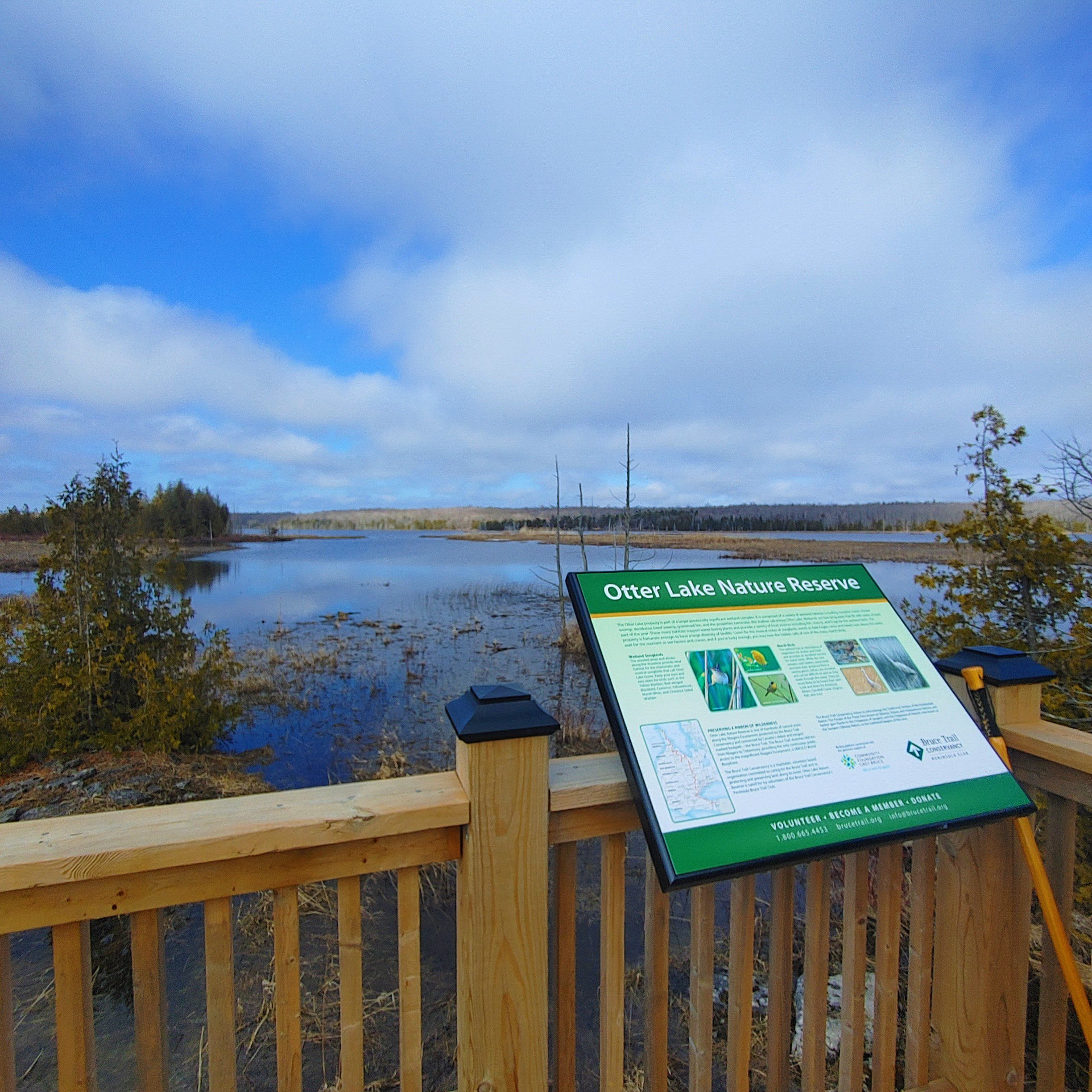
Are you new to group hiking, the Bruce Trail, or the Peninsula section of the Bruce Trail and want to begin your journey out on the trails? Do you want to reconnect with nature? Have you been wondering what “birding” is and want to learn more?Join us for an exploratory hike at Otter Lake Nature Reserve (km 106.0 in the 31st Ed. Ref. manual) on the Saugeen (Bruce) Peninsula where we’ll spend time getting to know the trail and its flora and fauna, discuss trail hiking and birding 101, and look and listen for migrating birds.
The Otter Lake property is part of a larger provincially significant wetland complex. It is comprised of a variety of wetland, forest, meadow, and alvar habitats including the property’s namesake, the shallow calcareous Otter Lake. The wetlands host a variety of breeding and migratory birds.
This hike is a “walk, stand, listen/observe” type of hike where we’ll hike to the birding platform and grassland field just beyond and then back out on the same trail back to our cars. This hike will be about 2 ½ hours in duration. Participants are welcome to linger longer after the group hike.
Weather can be variable at this time of year – dress according to the day’s conditions. Binoculars would be helpful. Wear a hat, long-sleeved shirt/pants, and waterproof closed-toed shoes with socks. A bug net shirt may be helpful. Bring a light backpack to carry water, snacks, bird ID guides, and personal materials. Though this is a short hike, the terrain can be rocky and uneven in places and muddy near the lake.
This is a perfect opportunity to work on your PBTC Birding Badge! https://peninsula.brucetrail.org/badges/
Consider extending your day on the Peninsula with a visit after the hike to the Bruce Peninsula Bird Observatory’s Open House to celebrate their 25th anniversary from 10am-4pm! https://www.facebook.com/www.bpbo.ca/
Skinner's Bluff and Bruce's Caves
https://hikes.brucetrail.org/event/skinners-bluff-and-bruces-caves/Sorry, the registration cut-off time for this hike has been reached.Not a member? Click here to join today!Hosting Club: Toronto, Sydenham
Category: Car Hike
Location (Google Maps): The roadside parking is on Colpoy’s Range Road. Do not park in front of the farm field gates. Drive to the parking from Centre Road on the west side, and not from the east side unless you’re arriving by ATV.Hike Leader(s): Stewart Fleming
Pace: Mixed (See Hike Description)
Terrain: Level 2 (Intermediate – some hills and uneven surfaces, rocks and roots underfoot), Rocky, Variable
Distance (km): 20.5 kmDescription
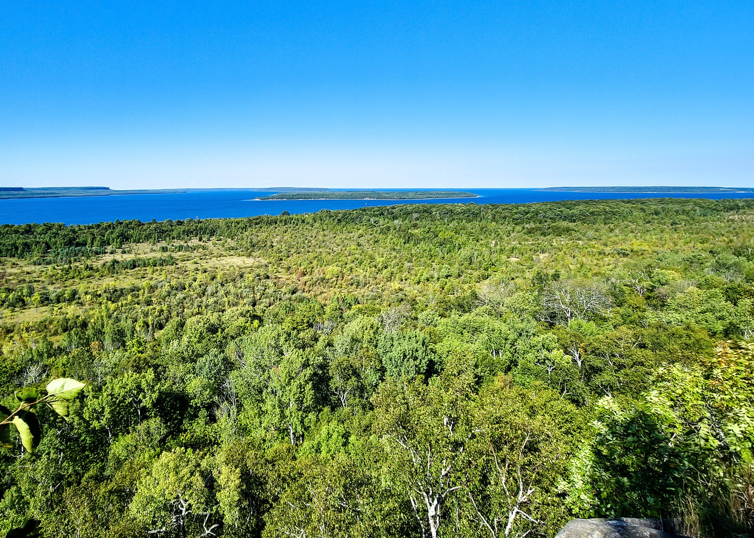
This is a scenic Georgian Bay hike, with the views being a highlight.
We will follow the Main Trail along Skinner’s Bluff, take the inland side trails and the very rocky Colpoy’s Cavern Side Trail.We will have time to explore and lunch at Bruce’s Caves.
Our pace will be Brisk through the open areas but Leisurely through the few rocky sections.
Please bring enough water (at least 2 litres) and food to maintain your energy for a 5-hour hike.
Comfortable hiking shoes or boots are a must. A rain shell is recommended in case of a wet weather forecast, along with a hat, sunscreen, and bug repellent for sunny weather or buggy trail conditions.

Fall Rainbow Hike at Cape Croker Park
https://hikes.brucetrail.org/event/fall-rainbow-hike-at-cape-croker-park/Sorry, the registration cut-off time for this hike has been reached.Not a member? Click here to join today!Hosting Club: Peninsula
Category: Rainbow Hike
Location (Google Maps): 112 Park Rd
Neyaashiinigmiing ON
N0H 2T0Hike Leader(s): Tainin Hopkinson Click here to contact Hike Leader(s)
Pace: Leisurely (2.0 – 3.0 km/h): A relaxed pace with frequent breaks and a focus on enjoyment., Medium (3.0 – 4.5 km/h): A comfortable pace for most hikers with steady progress.
Terrain: Easy: Flat forested sections or lowland trails.
Distance: ~3 to 4 kmDescription
Date: Saturday, September 19, 2026.Join us for our Fall Rainbow Hike and Social at Cape Croker Park at Neyaashiinigmiing. This all-inclusive and family-friendly 2SLGBTQIA+ hike provides a safe space and welcoming space for trans, gay, lesbian, bisexual, queer, 2Spirit, intersex, asexual , allies and friends.
Meet at the Cape Croker Visitor Centre for a brief introduction to the history and culture of the Saugeen Ojibway Nation at 11:00 a.m.
From there, we will enjoy an easy hike through the forest and along the Ginebek Mikaans Boardwalk Trail. This beautiful boardwalk winds through wetlands and beaver habitat within the traditional territory of the Chippewas of Nawash Unceded First Nation.
Our guide, Tainin , a Two-Spirit member of Nawash, will share their knowledge and deep connection to the land. Along the way, we will explore the rich ecology of the wetlands and reflect on themes of queer ecology, as well as the role of gender and sexuality within traditional Anishinaabe culture.
After the hike, we will relax and picnic at the beach. Bring your own lunch, at least 1 L of drinking water per person and snacks for the day. Our hike and picnic will wrap up at 2:30 p.m.
The Bruce Trail Pride Badge represents a celebration of 2SLGBTQIA+ inclusion on the Bruce Trail. All hike participants will receive a Bruce Trail Pride Badge. Toilets are available on site.
For participants who are wishing to spend the whole day at the Park – Park admission and parking fees apply, upon arrival.
For those attending the hike only, park admission and park fees will be waived. Parking is limited, please consider using rideshare.
If you would like to offer or receive a rideshare, please complete the following Google Form: https://forms.gle/AtAETCoHrWTXSoY89. Grey Bruce Pride will facilitate connecting community members amongst Grey Bruce. A consent waiver is included.
Urban Walk: Humber River/Swansea Theatre Hike
https://hikes.brucetrail.org/event/urban-walk-humber-river-swansea-theatre-hike-5/Sorry, the registration cut-off time for this hike has been reached.Not a member? Click here to join today!Hosting Club: Toronto
Category: Urban Walk
Location (Google Maps):Meet by the TTC Stop on the Southeast Corner of Scarlett Road and Eglinton Avenue West. Take the #79 Scarlett Road bus from Runnymede Station to Eglinton or the Eglinton West #32A from Mount Dennis Station to Scarlett Road.
Please note that we will leave the TTC bus stop at Scarlett Road and Eglinton PUNCTUALLY at 3:00 PM.
Hike Leader(s): Miriam Stevens Click here to contact Hike Leader(s)
Pace: Leisurely (2-3 km/hr)
Terrain: Level 1 (Easy – mostly on flat, well maintained trails with hard-packed surface), Variable
Distance (km): 10-12 kmDescription
Leisurely hike (3 kms/hour – No Racers Please) suitable for beginners and families.
Hike along the Humber River trail and into the Swansea village at Runnymede road and Bloor street west. The hike will end opposite Runnymede Subway near the Village Playhouse Theatre and local restaurants and pubs. Distance may vary according to the weather and trail conditions and how people feel. Early dropout is possible at Old Mill Subway Station.After the hike you are invited to join us for dinner at around 6 PM at Ali Baba Mediterranean restaurant.
We will attend the play “Lion In The Winter” (Dramatic Comedy) at 8 PM at The Bloor West Village Players theatre, 2190 Bloor Street West, Toronto.
Call the Theatre directly at (416) 767 7702 to reserve your ticket, cost $29- $32.00. Please do mention that you’re with the Bruce Trail Conservancy, Toronto Club so they know we are supporting them.Paid parking is available off Kennedy Avenue north of Bloor Street West (behind the Village Playhouse Theatre building). There is no parking available at the start of the hike.
Please feel free to join us just for the hike, the hike and dinner, or all three.