
The BTC office will be closed on Mon. Oct. 12 for the holiday. Thank you for your understanding.
Hike Schedule
Join us for a hike! Registration required.
All hikes available to BTC members. Some hikes are open to non-members.
See Refund Policy for Paid Hikes >
TIP: The calendar view displays up to 7 hikes on a day, but often there are more. Click “View more events” to see them all.
Niagara
Iroquoia
Toronto
Caledon Hills
Dufferin Hi-Land
Blue Mountains
Beaver Valley
Sydenham
Peninsula
All Clubs
Show Filters
Categories
Reset Filters
- 06September 6, 2026
Car Hike: Uxbridge-Brock Track
https://hikes.brucetrail.org/event/car-hike-uxbridge-brock-track-9/Sorry, the registration cut-off time for this hike has been reached.Not a member? Click here to join today!Hosting Club: Toronto
Category: Car Hike
Location (Google Maps):Meet at the Brock Tract parking lot on the east side of Durham 1/Brock Rd., approximately 5 km south of Coppin’s Corners, Uxbridge or 1 km north of Uxbridge Pickering Town Line. 1401 Brock Rd. (Free parking).
Hike Leader(s): Amir Alemohammad Click here to contact Hike Leader(s)
Pace: Moderate (3-4 km/hr)
Terrain: Flat, Hilly, Level 2 (Intermediate – some hills and uneven surfaces, rocks and roots underfoot), Variable
Distance (km): 14-16 kmDescription
Join us for a wonderful hike in Uxbridge starting from Brock Track parking lot. We will hike the Brock Track and Wilder Forest among the amazing trails of Uxbridge.Boots mandatory, poles recommended, bring 2 litres of water and dress according to weather conditions.
Please arrive at 7:45 for a 8:00 start.
Beware, Iphone Maps may take you to the wrong location. Check the location with Google Maps the previous night.
This is a joint hike with Oak Ridges Trail Association (ORTA).
Tobermory, 2 of 3, Map 42
https://hikes.brucetrail.org/event/tobermory-2-of-3-map-41-42/Sorry, the registration cut-off time for this hike has been reached.Not a member? Click here to join today!Hosting Club: Toronto, Peninsula
Category: Car Hike
Location (Google Maps): Bruce Peninsula National ParkHike Leader(s): Alex Brown Click here to contact Hike Leader(s)
Pace: Mixed (See Hike Description)
Terrain: Level 2 (Intermediate – some hills and uneven surfaces, rocks and roots underfoot), Rocky, Variable
Distance (km): 14-15 kmDescription
This is the second of three hikes in this series. We will hike from the Bruce Peninsula National Park along Georgian Bay, north to Little Cove . Excellent views of the Bay.The meeting point will be the Cairn in Tobermory marking the northern terminus of the Bruce Trail or as agreed the previous day. We will then drive to the parking area at Little Cove Road (km 156.4) or National Park to drop off cars and start the hike.
Parking fees will apply. More information to be provided closer to the date.
Trail conditions are rocky which will make progress slow at times.
For those coming long distance, local accommodation should be available in Tobermory. More information about the hike will be posted closer to the date.
The Train Wreck Hike
https://hikes.brucetrail.org/event/the-train-wreck-hike-2/Sorry, the registration cut-off time for this hike has been reached.Not a member? Click here to join today!Hosting Club: Caledon Hills
Category: General
Location (Google Maps): Meet at the roadside parking at the junction of Escarpment Side Road and Willoughby Road, km 15.9 (Map 15).
Car Pool to roadside parking at Mountain View Side Trail on Mountain View Road. Google Map Coordinates: 43.894254, -79.922522, north of km 26.8 (Map 15).Hike Leader(s): Dan Revington Click here to contact Hike Leader(s)
Pace: Medium – 3 to 4 km/hour
Terrain: Moderate – some hills and/or some poor footing
Distance: 10.2 kmDescription
In September 1907, a passenger train went off the tracks on the steep Horseshoe Valley Curve on the Niagara Escarpment. Seven people were killed and dozens were injured. The Bruce Trail passes close to the location of this disaster. Join us for a hike that includes a stop at the historic St. Andrew’s Stone Church Cemetery, panoramic views from Escarpment Road, and to learn about the tragic story and mystery of the famous Horseshoe Curve Rail Disaster.Bring your choice of hydration and snacks. We will be going through the forest, as well as walking on roads. There is one steep hill. Sturdy footwear is essential. Note: this is a car pool hike.
RAINBOW HIKE🌈: Trekking through Terra Cotta
https://hikes.brucetrail.org/event/rainbow-hike%f0%9f%8c%88-trekking-through-terra-cotta/Sorry, the registration cut-off time for this hike has been reached.Not a member? Click here to join today!Hosting Club: Toronto
Category: Car Hike
Location (Google Maps): We will meet at the roadside parking on Heritage Road (coordinates are 43.734079, -79.944033).Hike Leader(s): Monica Pasquali (she/her) Click here to contact Hike Leader(s)
Pace: Leisurely (2-3 km/hr), Moderate (3-4 km/hr)
Terrain: Level 1 (Easy – mostly on flat, well maintained trails with hard-packed surface), Level 2 (Intermediate – some hills and uneven surfaces, rocks and roots underfoot), Level 3 (Advanced – steep hills and some scrambling over boulders)
Distance (km): 10 kmDescription
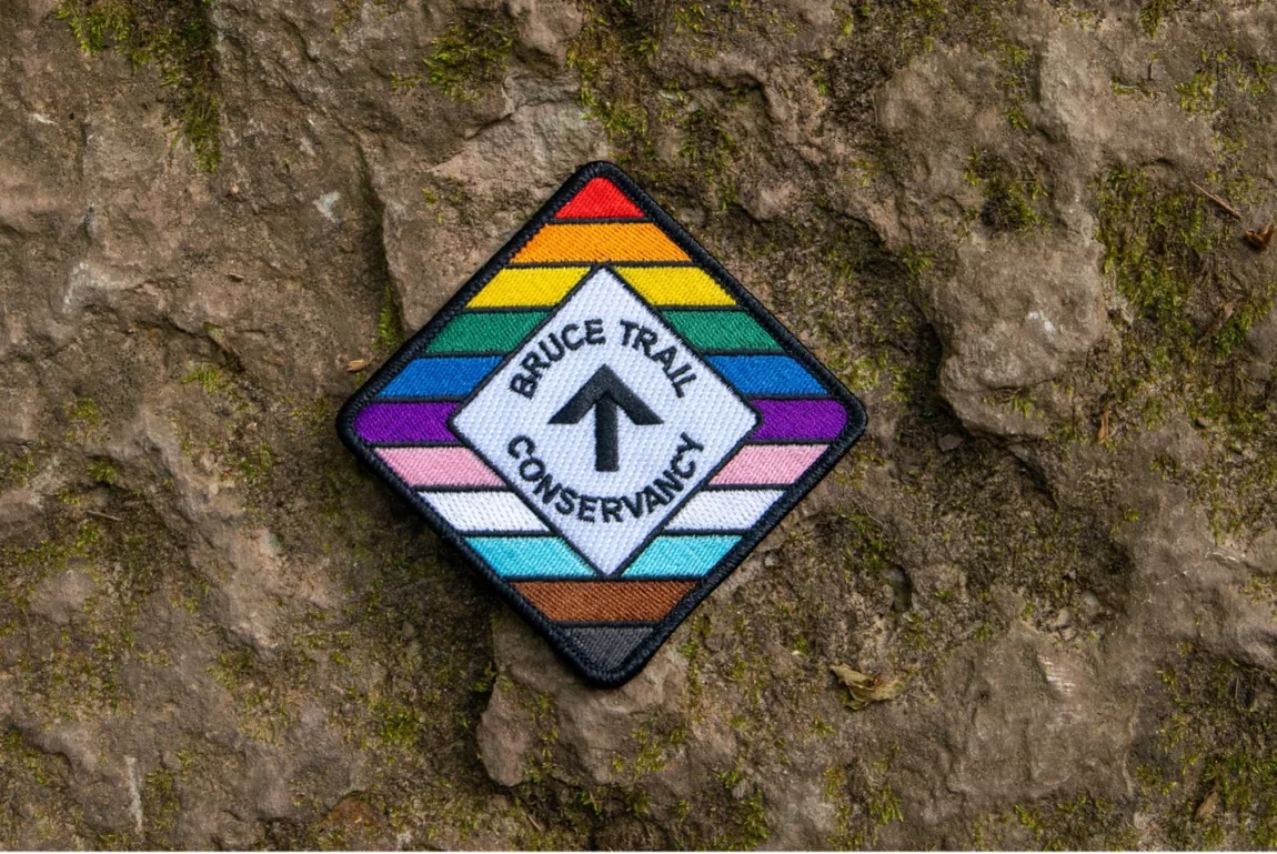
This hike is part of our Rainbow Hike program🌈, which aims to foster connection, visibility, and community among 2SLGBTQIA+ hikers and allies. We’ll be joined by Doug O’Neill, who leads Rainbow Hikes with the Iroquoia Bruce Trail Club, and Lana Hubbard, a transgender hike leader with the Caledon Bruce Trail Club.After everyone checks in with me at the meeting location we’ll do a 10 km loop hike using the main trail and the Terra Cotta Side Trail. Most of our route will be level 2/intermediate difficulty but there will be one large hill to conquer as we summit the escarpment on the main trail (level 3/advanced) as well as a fairly long flat section along the Terra Cotta Side Trail (level 1/easy) so this hike has a bit of everything! Any fit Rainbow Hiker is welcome to join us.
Everyone who participates in this hike will receive a FREE Bruce Trail Pride Badge!
Please bring at least 2 litres of water and enough food for a 4-hour hike. You should wear comfortable hiking shoes and socks, a hat, a breathable shirt, and lightweight long pants (to minimize the risk of a tick bite). If rain is in the forecast then a rain jacket would also be a great idea. Sunblock and bug repellent are also useful if it’s a sunny and buggy day.
After the hike, anyone who is interested in joining me for lunch and drinks (both alcoholic and non-alcoholic options will be available) at nearby Badlands Brewing Company (https://www.badlandsbrewing.ca/) is more than welcome to do so. And if you don’t want to purchase your lunch then no worries — we’ll be eating at picnic tables in their outdoor Beer Garden so you can bring your lunch and still enjoy the good company and great conversation.
Looking forward to hiking with you on September 6th! And feel free to share this page/link with your 2SLGBTQIA+ friends and family.
For more information on Bruce Trail’s 2SLGBTQIA+ hikes, and to get information on upcoming Rainbow Hikes, please see the following webpage: https://brucetrail.org/pride-2026/
Exploring Sydenham Hike #48 Skinner's Woods Loop
https://hikes.brucetrail.org/event/exploring-sydenham-hike-48-skinners-woods-loop/Sorry, the registration cut-off time for this hike has been reached.Not a member? Click here to join today!Hosting Club: Sydenham
Category: General Hike
Location (Google Maps):We will carpool from 2888 3rd Ave. W., Owen Sound
Hike Leader(s): Bill Snel Click here to contact Hike Leader(s)
Pace: Leisurely: 3 km/h or less
Terrain: Moderate: Some hills and/or poor footing
Distance: 5.8 kmDescription
We will carpool from Owen Sound to do a loop hike of Skinner’s Woods using a section of the main trail and the Len Holley Side Trail for access – Map 35 km 158.9 to 160.3. This is hike 48 in the book Exploring Sydenham. There will be one secret to find. If you do not have a book and would like one ($30) let me know by using the “Contact hike leader” link. - 07September 7, 2026
CANCELLED - Steeltown Stomp Practice Session #3 of 8
https://hikes.brucetrail.org/event/steeltown-stomp-practice-session-3-of-8/Sorry, the registration cut-off time for this hike has been reached.Not a member? Click here to join today!Hosting Club: Iroquoia
Category: Steeltown Stomp Practice Session
Location (Google Maps): Chedoke Golf Club Parking Lot – Access from Beddoe Dr off Studholm Rd south of Aberdeen (Parking capacity 40)Hike Leader(s): Muskan Sidana Click here to contact Hike Leader(s)
Pace: Brisk – 4 to 5 km/hr, Medium – 3 to 4 km/hr
Terrain: Strenuous – Hilly with steep climbs and some poor footing
Distance: VariesDescription
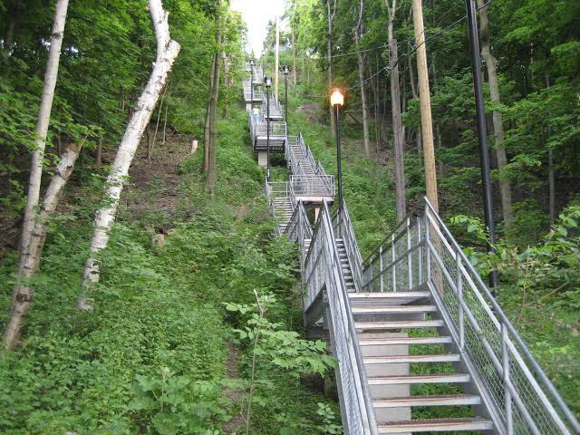
Is the Steeltown Stomp on your bucket list? This is your chance to crush it! Join us and prepare for this incredible challenge on October 3rd, 2026! Registration for the event is now open.If you’ve done stair climbs before, you know the deal—that brutal calf pain is real, especially when you’re just starting out. But training with us this summer? That’s how you show up on stomp day actually feeling strong instead of totally wrecked. Trust me.
We’ll start easy and build up as the summer goes on, hitting Chedoke and Dundurn Stairs with some scenic hikes mixed in. By the time October rolls around, you’ll have crushed at least 2,000 steps and you’ll actually know what you’re doing.
It’s a solid group vibe—moderate pace, warm-ups to get going, stretches to cool down. And honestly, it’s way more fun (and way less painful) doing this with people who get it.
Just grab your water bottle (there’s water at both staircases) and whatever snacks you want. And yeah, there’s optional coffee after if you want to hang out and celebrate.
We’ve got 7 training dates lined up this summer—check the schedule and pick the ones that work for you. Do the work now, own it on stomp day. See you out there!
Car Hike: Limehouse and Duff Pit
https://hikes.brucetrail.org/event/car-hike-limehouse-and-duff-pit/Sorry, the registration cut-off time for this hike has been reached.Not a member? Click here to join today!Hosting Club: Toronto
Category: Car Hike
Location (Google Maps): The Limehouse Community parking lot on the south side of 22 Sideroad, opposite Limehouse Public School.Hike Leader(s): Stewart Fleming Click here to contact Hike Leader(s)
Pace: Mixed (See Hike Description)
Terrain: Level 2 (Intermediate – some hills and uneven surfaces, rocks and roots underfoot), Variable
Distance (km): 15 kmDescription
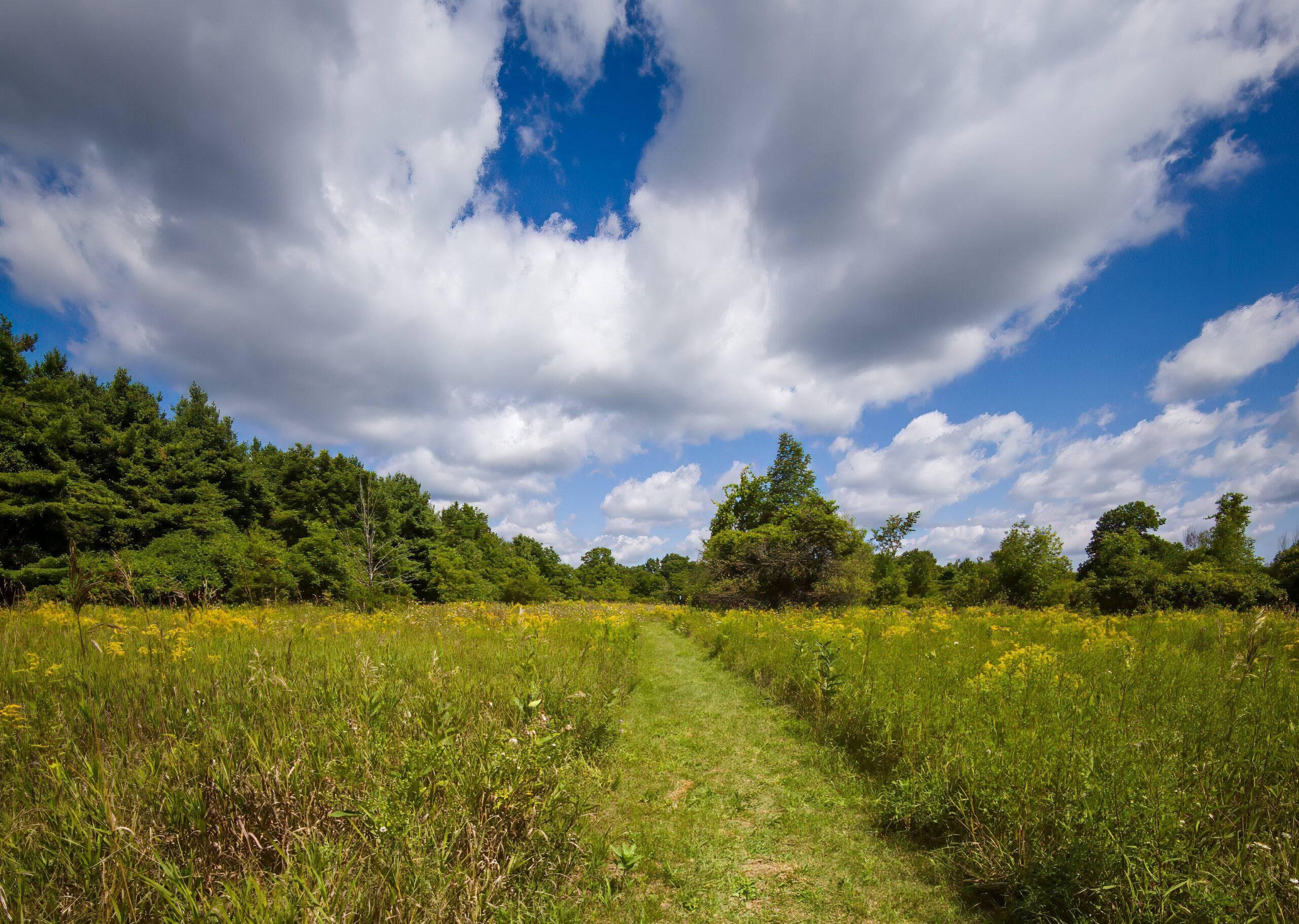
This hike takes us north from Limehouse along the Main Trail to Duff Pit and back. We will explore loops by taking the side trails, including the Todd Bardes Meadowland Side Trail past the Toronto Seed Orchard. Our hike follows the recently rerouted Main Trail, crossing new TBTC properties, bridges, and boardwalks.Our pace will be Brisk through the open areas and Moderate for the few hills, rocky spots, and for photo opportunities.
Please bring enough water (at least 2 litres) and food to maintain your energy for a 5-hour hike.
Comfortable hiking shoes or boots are a must. A rain shell is recommended in case of a wet weather forecast, along with a hat, sunscreen, and bug repellent for sunny weather or buggy trail conditions.
Tobermory, 3 of 3, Map 42
https://hikes.brucetrail.org/event/tobermory-3-of-3-map-42/Sorry, the registration cut-off time for this hike has been reached.Not a member? Click here to join today!Hosting Club: Toronto, Peninsula
Category: Car Hike
Location (Google Maps): Little Cove to TobermoryHike Leader(s): Alex Brown Click here to contact Hike Leader(s)
Pace: Mixed (See Hike Description)
Terrain: Rocky, Variable
Distance (km): 8-11 kmDescription
This is the third and last hike in this series, ending at the cairn in Tobermory. This hike will be shorter, allowing for an early departure for those wishing to head home. An optional hike on the Burnt Point Loop Side Trail is available for those interested.The meeting point will be the Cairn in Tobermory marking the northern terminus of the Bruce Trail. We will take two or three vehicles to the Little Cove parking area to start the hike. Parking fees will apply. More information to be provided closer to the date.
Trail conditions are in spots rocky which may slow us.
At the end of the hike those completing the Peninsula section and wanting to get their end to end badges will be presented them at the Cairn. Please contact the hike leader to order a badge for yourself. The cost will be confirmed when the order is place. Please allow two weeks for processing. After the hike those wishing to stop for refreshments are invited to meet at a nearby location. Otherwise, they can begin the drive home.
For those coming long distance, local accommodation should be available in Tobermory.
More information about the hike will be posted closer to the date.
Easy Does It Hike, St Catharines Museum & Welland Canals Centre Hike
https://hikes.brucetrail.org/event/easy-does-it-hike-st-catharines-museum-welland-canals-centre-hike-2/Sorry, the registration cut-off time for this hike has been reached.Not a member? Click here to join today!Hosting Club: Niagara
Category: Leisurely
Location (Google Maps): 1932 Welland Canals Parkway, Lock 3, St. Catharines, OnHike Leader(s): Diane Marlatt Click here to contact Hike Leader(s)
Pace: Leisurely <3 km/hr
Terrain: Easy: mostly flat, good footing
Distance: 7 KmDescription
Dog-Friendly Hike: Hockley Valley Side trail series
https://hikes.brucetrail.org/event/dog-friendly-hike-hockley-valley-side-trail-series/Sorry, the registration cut-off time for this hike has been reached.Not a member? Click here to join today!Hosting Club: Toronto
Category: Car Hike
Location (Google Maps): Hockley ValleyHike Leader(s): Lindita Kalo Click here to contact Hike Leader(s)
Pace: Mixed (See Hike Description), Moderate (3-4 km/hr)
Terrain: Level 2 (Intermediate – some hills and uneven surfaces, rocks and roots underfoot), Variable
Distance (km): 12 kmDescription
Join me on the series of dog friendly to complete Caledon side trail challenge. Hockley Valley main Bruce trail and side trail.
This hike has some hills. We will keep moderate speed. be true to your abilities of hiking.
I have a 3 year old Aussie very friendly with people and other dogs.Halton Forest to Speyside (E2E)
https://hikes.brucetrail.org/event/halton-forest-to-speyside-e2e-5/Sorry, the registration cut-off time for this hike has been reached.Not a member? Click here to join today!Hosting Club: Iroquoia
Category: General Hike
Location (Google Maps): Meet at the Pear Tree parking lot at Speyside on 15 Side Road at 9:15 am.Hike Leader(s): Karen Bergmann Click here to contact Hike Leader(s)
Pace: Medium – 3 to 4 km/hr
Terrain: Moderate – Some hills and/or some poor footing
Distance: 8 kmsDescription
We will meet at 9:15 in the Pear Tree parking lot on 15 Side Road and carpool to 6th Line at the Halton Agreement Forest and hike back along the Hilton Falls Side Trail, Al Shaw Side Trail and the main trail. This trail has some serious rocks and we cross a couple of creeks. Bring sufficient water and bug spray/bug net. - 08September 8, 2026
Long Hike Decew House
https://hikes.brucetrail.org/event/long-hike-short-hills-10/Sorry, the registration cut-off time for this hike has been reached.Not a member? Click here to join today!Hosting Club: Niagara
Location (Google Maps): Decew House Thorold
Hike Leader(s): Alan Laver Click here to contact Hike Leader(s)
Pace: Brisk 4-5 km/hr
Terrain: Moderate: some hills and some poor footing
Distance: 10k+Description
Our regular Spot for the Tuesday Long Hike. Note the new location. We will hike the trails around Short Hills Dress for the weather and bring sunscreen bug spray, poles snack and drink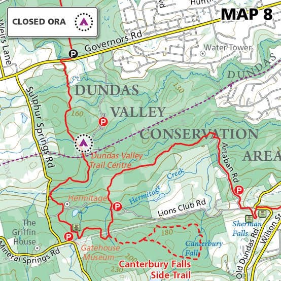
Tuesday's 10k
https://hikes.brucetrail.org/event/tuesdays-10k/Sorry, the registration cut-off time for this hike has been reached.Not a member? Click here to join today!Hosting Club: Iroquoia
Location (Google Maps): Ancaster Lions Outdoor Pool – 263 Jerseyville Rd W, Ancaster
Hike Leader(s): Jennifer DeBoer Click here to contact Hike Leader(s)
Pace: Brisk – 4 to 5 km/hr
Terrain: Moderate – Some hills and/or some poor footing
Distance: 10k+Description
We will hike the trails around the Dundas Valley Conservation Area. Dress for the weather wearing hiking boots. Please also bring sunscreen, bug spray, poles, water and a snack.9:15 Short hike, Rockway Conservation area, 2021 Pelham Road
https://hikes.brucetrail.org/event/915-short-hike-rockway-conservation-area-2021-pelham-road/Sorry, the registration cut-off time for this hike has been reached.Not a member? Click here to join today!Hosting Club: Niagara
Category: In and Out
Location (Google Maps): Rockway Conservation Area, 2021 Pelham Road, LincolnHike Leader(s): janet davey Click here to contact Hike Leader(s)
Pace: Medium 3- 4 km/hr
Terrain: Moderate: some hills and some poor footing
Distance: 6 kmsDescription
Hike around 15 Mile Creek, featuring Upper and Lower Rockway Falls. Please bring water, insect repellent, sunscreen and hiking poles. Check yourself thoroughly for ticks following the hike.Urban Walk: McCowan District Trail/Scarborough Bluffs
https://hikes.brucetrail.org/event/urban-walk-mccowan-district-trail-scarborough-bluffs/Sorry, the registration cut-off time for this hike has been reached.Not a member? Click here to join today!Hosting Club: Toronto
Category: Urban Walk
Location (Google Maps): Meet outside Eglinton GO Station on Eglinton Ave east at Bellamy Road. Take TTC Morningside 116 from Kennedy Station to Bellamy Road North / Eglinton Go Station Stop (11 minutes, frequency every 8 minutes)Hike Leader(s): Tom Swales Click here to contact Hike Leader(s)
Pace: Moderate (3-4 km/hr)
Terrain: Flat, Level 2 (Intermediate – some hills and uneven surfaces, rocks and roots underfoot), Variable
Distance (km): 8-9 kmDescription
We’ll follow the local McCowan District Recreational Trail in Scarborough and then eventually to Resthaven Memorial Gardens leading us to Brimley Road and Kingston Road. We’ll approach the Scarborough Bluffs via the Chine Drive Ravine. We’ll be viewing the bluffs from above (not descending) from Scarborough Bluffs Park. We’ll finish at Rosetta McClain Gardens, one of Toronto’s nicest public gardens (on Kingston Road east of Birchmount Road). Join us for lunch, if you wish, at Len Duckworth Fish & Chips on Kingston Road for their lunch special
Northern Bruce Trail Four Day Sampler- Beaver Valley, Sydenham and Peninsula, a Passport to Nature hike series
https://hikes.brucetrail.org/event/northern-bruce-trail-four-day-sampler-beaver-valley-sydenham-and-peninsula/Sorry, the registration cut-off time for this hike has been reached.Not a member? Click here to join today!This is a Multi-Day Hike
You are signing up for the following dates and times:
2026-09-08 at 09:30
2026-09-09 at 09:30
2026-09-10 at 09:30Hosting Club: Beaver Valley, Sydenham, Peninsula
Category: Passport to Nature Hike/Event
Location (Google Maps): Metcalfe Rock parking lot on east side of 10th Line, Ravenna.Hike Leader(s): Karen Buschert Click here to contact Hike Leader(s)
Pace: Medium: 3 to 4 km/h
Terrain: Moderate: Some hills and/or poor footing
Distance: Distances each day are 11-14 kmDescription
On this multi-day series of sampler hikes, discover some amazing loop trails in the northern three sections of the Bruce Trail. Hikes are moderate in length and difficulty and time will be taken to experience and observe the special features in each of these sections. This is a great introduction for those new to hiking the Bruce Trail and also for seasoned hikers that want to explore and/or revisit some great spots!Each hiker will be offered a Passport to Nature booklet on their first day and will earn a Club sticker for each of Days 1-3 to stamp their booklet.
Day 1 in Beaver Valley: Metcalfe Rock loop (9 km) and Old Baldy Lookout (2.5 km). These are two separate hikes and we will drive from one to the next.
Day 2 in Sydenham: Bayview Escarpment loop (14 km)- a mix of forested ridge and field and roadside to close the loop.
Day 3 in Peninsula : Sydney Bay Bluff loop (7 km) and Rush Cove loop (5 km) *these hikes have a major climb on a ladder and some difficult footing. But wow. Views….
Day 4 (if staying overnight): Choose your own adventure! I can make suggestions or you can hit your favourite destination or goal hike before heading for home!Accommodations: Please contact hike leader for options.
*No dogs*
Terra Cotta Conservation Area Loop Hike
https://hikes.brucetrail.org/event/terra-cotta-conservation-area-loop-hike/Sorry, the registration cut-off time for this hike has been reached.Not a member? Click here to join today!Hosting Club: Dufferin Hi-Land
Category: Tuesday Hike
Location (Google Maps):Caledon Hills Section, Map 14. To car pool, meet at Party City (4th Ave at Hwy 10 in Orangeville) at 9:00 am or meet at roadside parking on Heritage Rd, north of King Rd, west of Mississauga Rd, Terra Cotta (Km 44.9) at 9:30 am.
Hike Leader(s): Les Babbage, Julie Daley, Inge Eckerich, Tony Evangelista Click here to contact Hike Leader(s)
Pace: Leisurely
Terrain: Moderate
Distance: 10 km with a shorter option available.Description
From Heritage Rd we will hike west along the Main Trail, through Terra Cotta Conservation Area. We will return along the Terra Cotta Side Trail (Caledon Trailway) to Heritage Rd. Terrain is mostly flat, with some hills, and a steep section. This is a 10 km hike with an option to turn back for a 5 km hike. Bring lunch, snacks and water.Urban hike: Valley View Park Thornhill
https://hikes.brucetrail.org/event/urban-hike-valley-view-park-thornhill-14/Sorry, the registration cut-off time for this hike has been reached.Not a member? Click here to join today!Hosting Club: Toronto
Location (Google Maps): Parking lot is off Sycamore Drive, East of Bayview , across Starbucks plaza
Bus 91 from Finch East station stops at Sycamore station.Hike Leader(s): MOHAMMAD AGHAMIRI Click here to contact Hike Leader(s)
Pace: Moderate (3-4 km/hr)
Terrain: Hilly, Level 2 (Intermediate – some hills and uneven surfaces, rocks and roots underfoot)
Distance (km): 7-8 kmDescription
We will explore Valleyview and Maple View parks, and walk along German Mills Creek, in return we stop in Huntington park and have snack ,coffee,tea .Although this is considered an “Urban Walk”, you can expect some hills up and down and uneven surfaces with tree roots. Please bring hiking poles, water and snacks.
phone number for the day of hike 289 588 6482
Mono Cliffs, Map 19
https://hikes.brucetrail.org/event/mono-cliffs-map-19-5/Sorry, the registration cut-off time for this hike has been reached.Not a member? Click here to join today!Hosting Club: Caledon Hills
Category: Tuesday Hikers
Location (Google Maps): Mono Community Centre Parking, 200 m south of Mono Centre.
Driving direction: From Highway 410 go north, continue on Highway 10, pass through Orangeville, continue to Mono Centre Rd. (8), turn right, road will merge with 2nd Line EHS north, parking on the right just before Mono Centre.Hike Leader(s): Mohammad Shafiq Click here to contact Hike Leader(s)
Pace: Medium – 3 to 4 km/hour
Terrain: Moderate – some hills and/or some poor footing
Distance: 12 kmDescription
Will hike main Bruce Trail, Walter Tovell, McCarston’s Lake and Lookout Side Trails.
Bring water, snack, bug spray and sun protection. Poles recommended.
Hike leaders contact # 416-566-0503Walk In Nature Series (WINS) - Pottawatomi Conservation Area and Jones Falls
https://hikes.brucetrail.org/event/walk-in-nature-series-wins-pottawatomi-conservation-area-and-jones-falls-2/Sorry, the registration cut-off time for this hike has been reached.Not a member? Click here to join today!Hosting Club: Sydenham
Category: Walk In Nature Series (WINS)
Location (Google Maps):Click the (Google Maps) link on the left to direct you to parking.
GPS coordinates: 44.5608, -80.9907
Park in the Owen Sound Transportion lot located on Hwy 6 just 300 m north of the Springmout traffic lights
Or use the Bruce Trail app that links to Google Maps to drive there by clicking on P then Roadside Parking then Get Directions.
Or look in the Bruce Trail Reference guidebook Edition 31, Map 32 near km 101.8
Hike Leader(s): Stewart Brown Click here to contact Hike Leader(s)
Pace: Medium: 3 to 4 km/h
Terrain: Moderate: Some hills and/or poor footing
Distance: 4.8 kmDescription
As the sun set earlier, WINS hikes in the Fall and Winter will be during the day on Tuesdays.The Walk In Nature Series (WINS) consists of 2 hour hikes in the Sydenham section of the Bruce Trail that combine nature appreciation with fitness in a safe and welcoming group environment led by an experienced hike leader. Consider these hikes to be appointments with yourself in nature that promote health and fitness.
On this WINS early Fall hike, discover the unique features of nature in the Pottawatomi Conservation Area along the Merle Gunby side trail, the main trail and the Memorial Forest Side Trail that lead us to a wonderful view under Jones Falls.
Bring water, snack, personal medications and supplies. Hiking poles are not required by are always welcome.
- 09September 9, 2026

HIking for Butter Tarts - Old Guelph Road to Dyments and Back
https://hikes.brucetrail.org/event/hiking-for-butter-tarts-old-guelph-road-to-dyments-and-back/Sorry, the registration cut-off time for this hike has been reached.Not a member? Click here to join today!Hike open to BTC Members only.
Hosting Club: Iroquoia
Category: General Hike
Location (Google Maps): Old Guelph Road at Tunnel – BTC parking where Old Guelph Road ends west side of highway 6,south of ClappisonsHike Leader(s): Lois Corey Click here to contact Hike Leader(s)
Pace: Medium – 3 to 4 km/hr
Terrain: Moderate – Some hills and/or some poor footing
Distance: 16 kmsDescription
This is an out and back hike, no carpooling required. We will hike at a moderate-brisk pace from highway 6 West along Bruce Trail, deviating from the trail at the half way point, for a brief stop at Dyments Farm Market for butter tarts (or whatever catches your fancy), perhaps a little side trip to the Sydenham Lookout. Some climbing up and down escarpment between Old Guelph Road and Borers Falls, but lots of flat through Rock Chapel area to Dyments along the edge of the escarpment with some great views. Please dress appropriately for the weather and poles recommended. Please bring water and snacks/lunch.Any questions may be directed through contact on this form.
If you cannot make it, please remove yourself from registration by following these steps:To cancel your registration, here is a step by step:
– Sign into your account on the BTC website
– Click on My Hikes under your account
– This will take you to a list of hikes you have registered for
– Scroll down to the appropriate hike and cursor over to the far right hand column under the Action column.
– Click Cancel under the hike you wish to cancelWEDNESDAY WALKERS - Valley Crest and Sligo Side Trail - Cancelled
https://hikes.brucetrail.org/event/wednesday-walkers-valley-crest-and-sligo-side-trail-3/Sorry, the registration cut-off time for this hike has been reached.Not a member? Click here to join today!Hosting Club: Beaver Valley
Location (Google Maps): Meet on the south side shoulder of Sideroad 19 at Km 92.3 Map 27 Edition 31
Hike Leader(s): Margaret Yaraskavitch Click here to contact the hike leader.
Pace: Medium
Terrain: Moderate
Length of Hike: 8 kmsDescription
This hike is a little longer than other Wednesday Walker hikes but the terrain is quite flat. We’ll walk through strips of BTC protected land near fields with views across the Valley. From there, we use the Sligo Side Trail and then loop back on to the Main Trail. On this route, we’ll stop in a couple of places to talk about (historic) tree planting practices.Guidelines
- Arrive 15 minutes before the start of the hike.
- Wear sturdy footwear and appropriate attire for the weather and the terrain.
Hiking poles are a good idea in any season, especially if the terrain is rocky or slippery. In winter, snowshoes or icers/crampons are needed when conditions dictate.
Wearing appropriate clothing and footwear prevents injuries and shows consideration for a safe and positive group hiking experience. - Always carry I.D. and your health card.
- Bring sufficient water and snacks (or lunch if indicated). A minimum of 1L of water is recommended on all hikes, and 3L is recommended for long, challenging hikes in the heat of the summer.
- Bring sunscreen and insect repellent (for spring and summer hikes).
- Bring your own first aid kit.
- Please leave dogs at home.
- 10September 10, 2026
8:00 am Long hike NEW Location. Bailey bridge Jordan
https://hikes.brucetrail.org/event/800-am-long-hike-new-location-bailey-bridge-jordan-11/Sorry, the registration cut-off time for this hike has been reached.Not a member? Click here to join today!Hosting Club: Niagara
Location (Google Maps):
Bailey bridge Jordan
Hike Leader(s): Alan Laver Click here to contact Hike Leader(s)
Pace: Brisk 4-5 km/hr
Terrain: Strenuous: hilly, with steep climbs, poor footing
Distance: ~10kDescription
This will be our permanent location . Hike up from the Bailey bridge to Balls Falls and explore the trailsYou must register for each hike. Bring Poles, snack and a drink. Dress for the weather
Hiking around Jordan
https://hikes.brucetrail.org/event/hiking-around-jordan-71/Sorry, the registration cut-off time for this hike has been reached.Not a member? Click here to join today!Hosting Club: Niagara
Category: Loop
Location (Google Maps): Sho’arishon Park, JordanHike Leader(s): Bill Russell Click here to contact Hike Leader(s)
Pace: Medium 3- 4 km/hr
Terrain: Moderate: some hills and some poor footing
Distance: 6 kmsDescription
Hiking in and around Jordan, Rainforth Trail and Balls Falls, alternating every 3 weeks.Toronto Fall Series Hike 2 of 9
https://hikes.brucetrail.org/event/toronto-fall-series-hike-2-of-9/Sorry, the registration cut-off time for this hike has been reached.Not a member? Click here to join today!Hosting Club: Caledon Hills
Category: End-to-End
Location (Google Maps): Meet at Heritage Road Parking, Map 14, southeast of km 44.6 where the Main Trail meets Heritage Rd.Hike Leader(s): Nancy Mooney Click here to contact Hike Leader(s)
Pace: Medium – 3 to 4 km/hour
Terrain: Easy – mostly flat and usually good footing, Moderate – some hills and/or some poor footing
Distance: 14.5 km loopDescription
This is the second hike in the series and will take us around Terra Cotta Conservation Area. It will include the Walking Fern and Terra Cotta Side Trails.Urban Walk: Valley View Park Thornhill
https://hikes.brucetrail.org/event/urban-walk-valley-view-park-thornhill-178/Sorry, the registration cut-off time for this hike has been reached.Not a member? Click here to join today!Hosting Club: Toronto
Location (Google Maps): Parking lot is off Sycamore Drive, East of Bayview , across Starbucks plaza
Bus 91 from Finch East station stops at Sycamore station.Hike Leader(s): MOHAMMAD AGHAMIRI Click here to contact Hike Leader(s)
Pace: Moderate (3-4 km/hr)
Terrain: Hilly, Level 2 (Intermediate – some hills and uneven surfaces, rocks and roots underfoot)
Distance (km): 7-8 kmDescription
We will explore Valleyview and Maple View parks, and walk along German Mills Creek, in return we stop in Huntington park and have snack ,coffee,tea .Although this is considered an “Urban Walk”, you can expect some hills up and down and uneven surfaces with tree roots. Please bring hiking poles, water and snacks.
phone number for the day of hike 289 588 6482
Nassagaweya Canyon, from Crawford Lake (reservations required)
https://hikes.brucetrail.org/event/nassagaweya-canyon-from-crawford-lake-reservations-required-3/Sorry, the registration cut-off time for this hike has been reached.Not a member? Click here to join today!Hosting Club: Iroquoia
Category: General Hike
Location (Google Maps): Meet in the first parking lot at Crawford Lake. You will need to reserve your time at conservationhalton.caHike Leader(s): Karen Bergmann Click here to contact Hike Leader(s)
Pace: Medium – 3 to 4 km/hr
Terrain: Moderate – Some hills and/or some poor footing
Distance: 9 kmsDescription
Meeting at 9:15 am in the first parking lot, we will hike through the park and down into the canyon and back up into the park for a large loop. There are some rocks along the way and a couple of steep hills (going down into the canyon and then back up). Bring a snack, as needed, and bug spray/bug net.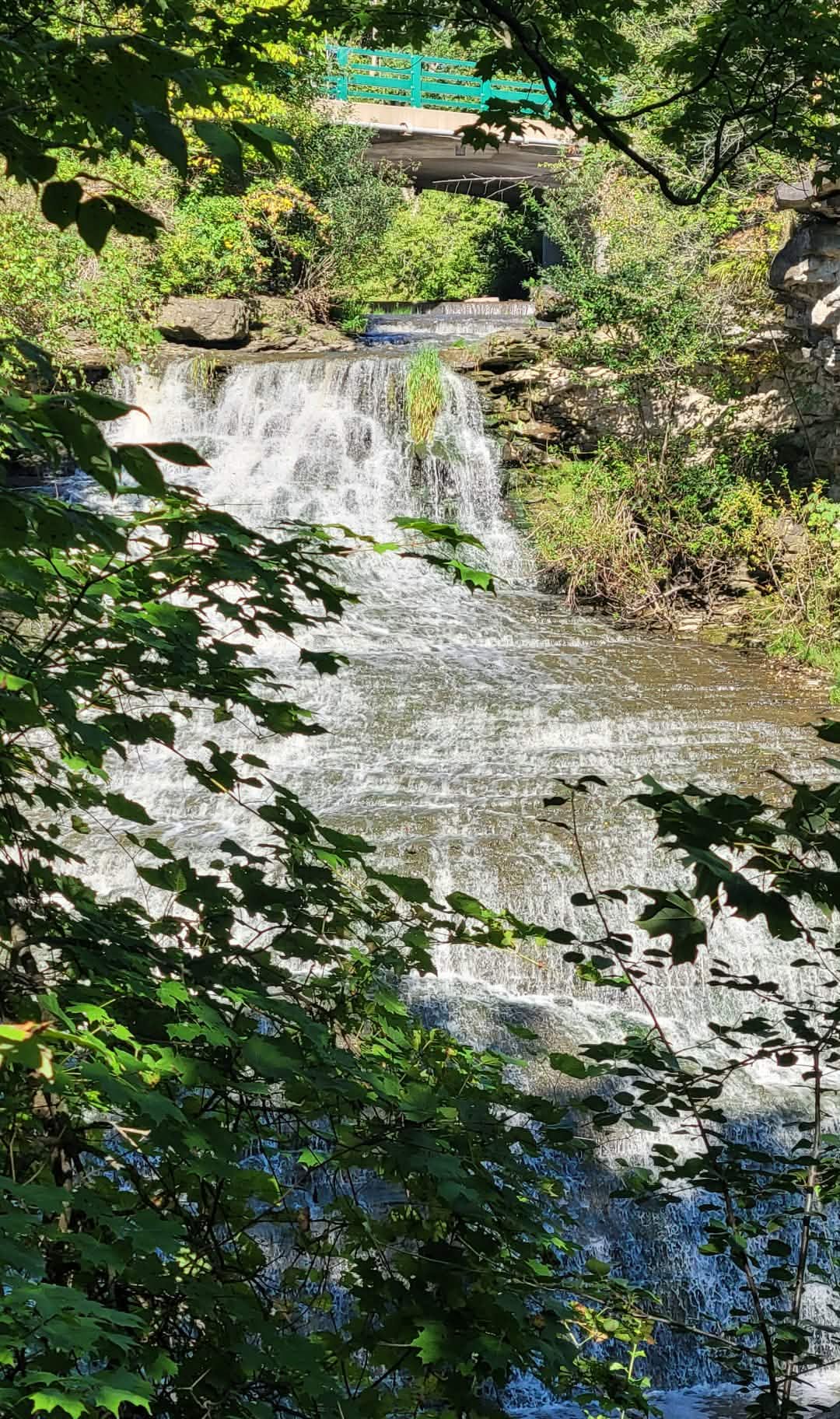
Chasing Waterfalls - Beamer Falls/Beamer Memorial Conservation Area
https://hikes.brucetrail.org/event/chasing-waterfalls-beamer-falls-beamer-memorial-conservation-area/Sorry, the registration cut-off time for this hike has been reached.Not a member? Click here to join today!Hosting Club: Niagara
Category: Loop
Location (Google Maps): Beamer Memorial Conservation AreaHike Leader(s): Dian Wright Click here to contact Hike Leader(s)
Pace: Medium 3- 4 km/hr
Terrain: Moderate: some hills and some poor footing
Distance: 3.5 kmDescription
- Join the Niagara Bruce Trail Club, at Beamer Memorial Conservation Area to see Beamer Falls!
Hike Details
Route: This hike starts at the parking lot at Beamer Memorial Conservation Area. We will hike along the Bruce Trail towards Beamer Falls and loop back to the parking lot. There is a small parking lot and road parking available if needed. Beamer Conservation also has a washroom!
Link on Google maps to the parking lot/meeting spot: https://maps.app.goo.gl/3RSvq2uCPHapH7m2A
Terrain: Beamer has a fairly even path in a mostly forested setting with some rocks and roots to navigate. The conservation area is on top of the escarpment and we will be walking the path near the edge with some gorgeous views!
We will loop around the conservation area and cross the bridge to see the falls closer up. We will adjust the pace to the group but be prepared for some rocky or uneven footing and possible mud. We recommend using hiking poles. Wearing good hiking shoes is a must. Carry water, wear a hat and insect repellent – mosquito season is underway. We will take a break at the falls – bring a snack or maybe some to share!
The hike goes ahead rain or shine unless there are dangerous weather conditions – the hike leader will contact you by email if anything changes.
***Please arrive by 5:45 to check in with the hike leaders for departure right at 6pm.
- 11September 11, 2026
Brisk Fridays - Lindenwood Road-Ross McLean loop
https://hikes.brucetrail.org/event/brisk-fridays-lindenwood-road-ross-mclean-loop/Sorry, the registration cut-off time for this hike has been reached.Not a member? Click here to join today!Hosting Club: Sydenham
Category: Brisk Fridays
Location (Google Maps): Bruce trail parking lot on the south side of Lindenwood Road located less than 1 km east of Grey Road 17. Coordinates: 44.68527, – 80.99597 Bruce Trail Reference Guide Edition 31, Map 33 km 125.7Hike Leader(s): Stewart Brown Click here to contact Hike Leader(s)
Pace: Brisk: 4 to 5 km/h
Terrain: Moderate: Some hills and/or poor footing, Strenuous: Hilly with steep climbs and some poor footing.
Distance: 15 kmDescription
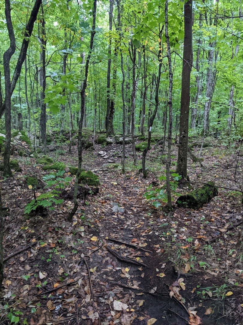
Ready for an energetic, briskly-paced hike completely through the mature forests of the Lindenwood Management Area? This 15 km loop hike follows the main trail along the escarpment edge north from the Lindenwood Road parking lot and loops around the ecologically-diverse Ross McLean side trail as it tracks the shore of Bass Lake. From there we retrace our steps along the main trail to parking at Lindenwood Road. Stops will include water breaks along the way and lunch at Bass Lake. Bring personal medications and supplies, snacks/lunch and up to 2 L of water especially if it is hot. Hiking poles are not required but are always welcome. See you there!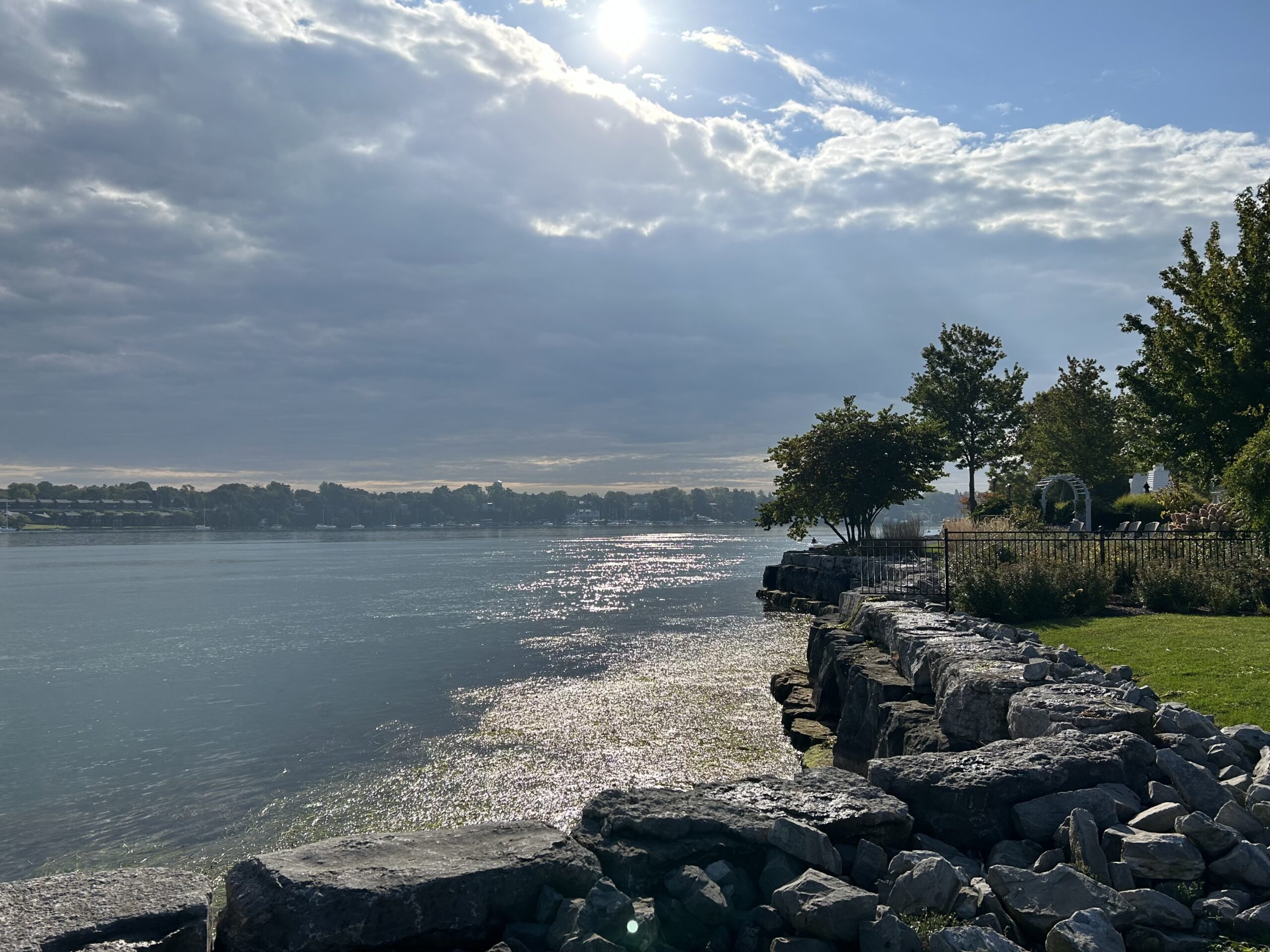
9:00 am Niagara-on-the-Lake Tour
https://hikes.brucetrail.org/event/900-am-niagara-on-the-lake-tour-63/Sorry, the registration cut-off time for this hike has been reached.Not a member? Click here to join today!Hike open to BTC Members only.
Hosting Club: Niagara
Category: Urban
Location (Google Maps):Veterans Memorial Park, park just outside the park on King Street
Hike Leader(s): Robin Garrett Click here to contact Hike Leader(s)
Pace: Leisurely <3 km/hr
Distance: 6-7 km
Description
Each Friday we will explore different neighbourhoods, trails and parkland throughout Historic Niagara-on-the-Lake.Moderate pace with some weeks entirely on sidewalks and roads while others may include a mix of trails and paved pathways. Great way to build up endurance for longer more strenuous hikes.
Prepare for cooler windy conditions on open parkland and along Lake Ontario and Niagara River trails.
Plan to stay for conversation and a warm cup of coffee or tea at Sweets & Swirls, Community Centre, Niagara Stone Road, NOTL
Beaver Valley E2E in 8 - Hike 3
https://hikes.brucetrail.org/event/beaver-valley-e2e-in-8-hike-3/Sorry, the registration cut-off time for this hike has been reached.Not a member? Click here to join today!Hike open to BTC Members only.
Hosting Club: Iroquoia
Category: General Hike
Location (Google Maps): Roadside Parking – north shoulder Sideroad 7BHike Leader(s): Pati Greenwood, Jeff Dowsett Click here to contact Hike Leader(s)
Pace: Medium – 3 to 4 km/hr
Terrain: Moderate – Some hills and/or some poor footing, Strenuous – Hilly with steep climbs and some poor footing
Distance: 15.8 kmDescription
This is hike 3 of the End-to-End hike series to complete the Beaver Valley section of the Bruce Trail in 8 hikes. Join for all or as many hikes as desired – you will need to register for each hike in the series which will take place on the following dates: August 28, August 29, September 11, September 12, October 2, October 3, October 16 & October 17. Hikers completing the entire series will be eligible to obtain an end-to-end badge from the BTC Beaver Valley Club.Since this is a group hike, please consider your fitness level before registering. This section of the trail has numerous hills and rough terrain in spots. We will be walking at a pace of 3km – 4km per hour and hikers will need to keep up with the person in front of them for the duration of the hike. The hike series will also involve car shuttles and every hiker is expected to participate as drivers.
Weather conditions in the late summer can still be quite warm, but the hike schedule will extend to mid-October so it’s best come prepared for varying weather conditions. Hiking boots are required and hiking poles are strongly recommended. Bring plenty of fluids and a snack. Insects and ticks will still be active at this time of year, long pants and long sleeves are recommended as is insect repellent.
Specific hike details will be provided to registered hikers a few days prior to each hike.
Afternoon Hike - Smokey Hollow Loop
https://hikes.brucetrail.org/event/smokey-hollow-loop/Sorry, the registration cut-off time for this hike has been reached.Not a member? Click here to join today!Hosting Club: Iroquoia
Category: Afternoon/Evening Hikes
Location (Google Maps): Meet in the parking lot in Waterdown at Smokey Hollow on Mill St.Hike Leader(s): Karen Bergmann Click here to contact Hike Leader(s)
Pace: Medium – 3 to 4 km/hr
Terrain: Moderate – Some hills and/or some poor footing
Distance: 5 kmsDescription
Starting from the Smokey Hollow parking lot, we will hike along the main trail beside Grindstone Creek to the Norman Pearson Side Trail to the McNally Side Trail to the main trail and the Eric Best Side Trail and back to the parking lot. - 12September 12, 2026

Peninsula Sunrise Series: Malcolm Bluff
https://hikes.brucetrail.org/event/peninsula-sunrise-series-malcolm-bluff-2/Sorry, the registration cut-off time for this hike has been reached.Not a member? Click here to join today!Hosting Club: Peninsula
Category: Sunrise Hike
Location (Google Maps): Purple Valley Access Trail ParkingHike Leader(s): Kathleen Stahlbaum Click here to contact Hike Leader(s)
Pace: Leisurely (2.0 – 3.0 km/h): A relaxed pace with frequent breaks and a focus on enjoyment., Medium (3.0 – 4.5 km/h): A comfortable pace for most hikers with steady progress.
Terrain: Difficult: Steep ascents/descents, rocky scrambling, and some rugged escarpment paths., Easy: Flat forested sections or lowland trails., Moderate: Rolling hills, mild slopes and rocky paths.
Distance: 6.5 kmDescription
Experience the magic of dawn on the Bruce Trail with the Sunrise Hike Series offered by the Peninsula Bruce Trail Club. These early morning hikes provide a perfect opportunity to awaken your senses, boost your energy, and immerse yourself in the tranquility of nature as the sun paints the sky with breathtaking hues. As we make our way through scenic forest trails, we’ll pause to witness the first light shimmering on the turquoise waters of Georgian Bay – a sight that will surely leave you in awe!Beyond the beauty, morning light helps regulate your circadian rhythm, elevating your mood, boosting energy levels and improving sleep quality. Whether you’re looking to start your day with a sense of calm, capture stunning sunrise photos, or simply reconnect with nature, these hikes offer a unique and inspiring way to greet the day.
On Saturday September 12th, join us in hiking along the Purple Valley Access Trail, Malcolm Bluff Side Trail, and stretch of Main Trail through the Malcolm Bluff Shores Nature Reserve to experience the sun rising over the Bay from the edge of the Escarpment. We’ll have the joy of taking in the stunning colours of the sky as the first light sparkles on the stunning turquoise waters. This peaceful sunrise hike is the perfect way to connect with nature, capture some incredible photos, and start the day with fresh air and inspiration. Whether you’re a morning person or just love a good adventure, come experience the magic of dawn from one of the best vantage points on the Bruce Peninsula!
Don’t forget to bring a headlamp or flashlight (preferably with a red light setting) as we begin our adventure in the pre-dawn quiet. Join us and discover how a sunrise hike can nourish your mind, body, and spirit—setting the tone for a brighter, more balanced day.
This hike is approximately 6.5 kms in length. Expect to be on the trail for 2-3 hours. Pace will be leisurely with ample time to enjoy the sunrise, take some photographs, and nourish yourself!
How to prepare:
- Get a good night’s sleep
- Bring lots of water and a snack (breakfast and/or coffee are recommended if that’s your thing!)
- Bring a headlamp or flashlight (preferably with a red light setting)
- Wear waterproof hiking boots
- Hiking poles are recommended but not necessary
- Bring insect repellant or wear protective clothing
- Bring sunscreen
In the event of cloudy/rainy weather, the hike will be held on Sunday, September 13th. Please watch your emails for a confirmation the week of the hike!

Two Day Toronto End-to-End Event (participants hike independently, no hike leader)
https://hikes.brucetrail.org/event/two-day-toronto-end-to-end-event-participants-hike-independently-no-hike-leader-2/Sorry, the registration cut-off time for this hike has been reached.Not a member? Click here to join today!This is a Multi-Day Hike
You are signing up for the following dates:
2026-09-12, 2026-09-13Hosting Club: Toronto
Category: Annual TBTC E2E
Location (Google Maps): The Toronto Bruce Trail section which runs from just south of Hilton Falls CA on Appleby Line to the south entrance of the Cheltenham Badlands on Creditview Rd. On both days, we will meet in the village of Limehouse. The exact parking location in Limehouse will be emailed closer to the event date.Hike Leader(s): Jacqueline Van Dyke Click here to contact Hike Leader(s)
Pace: Brisk (4-5 km/hr)
Terrain: Challenging, Level 2 (Intermediate – some hills and uneven surfaces, rocks and roots underfoot)
Distance (km): Saturday, Sept. 12 – 28km/Sunday, Sept. 13 – 22kmDescription
Hike the Toronto section of the Bruce Trail over two days. Hikers must maintain a minimum pace of 4km/hr and reach the checkpoints by the cutoff time in order to continue. On Saturday, the buses will bring hikers from Limehouse to the south entrance of the Cheltenham Badlands where the hike will begin. Hikers will hike south to their vehicles in Limehouse – a distance of approximately 28km. Hikers will reach checkpoint 1 at km 38.8 (after hiking 11.6km) by 11:00 am and checkpoint 2 at km 27.8 (after hiking 11km) by 1:45 pm in order to continue. On Sunday, the buses will bring hikers from Limehouse, to km 0.0 on Appleby Line where the hike will begin. Hiking north to Limehouse, hikers must reach checkpoint 1 at km 11.4 in the Pear Tree parking lot by 11:00 am to continue. There will be sweeps on both days to assist hikers when needed. Water refill and refreshments will be available at the checkpoints. Bring your fully charged cell phone, basic 1st aid supplies, and a water bottle.Those who complete the distances on both days within the prescribed time limits will receive the special NEW 2 Day Club E2E badge. The registration fee includes the online registration fee, bus shuttle, refreshments, and the official NEW E2E badge. If any spots are still available at 9:00 am on July 8, registration will also be opened to non-members (child and adult) at a cost of $65. These are strenuous hikes suitable for experienced, long distance, faster paced hikers over the age of 16. Space is limited, hikes go rain or shine, and no dogs are permitted on this event. Hikers must find their own way each morning to the meeting point in Limehouse. Buses will leave Limehouse promptly at 8:00 am. There will be no refunds or tax receipts issued for anyone who cancels their registration. For questions, please contact Jacquie Van Dyke at vdyke0946@gmail.com. Registration closes at midnight on September 6, 2026. On September 1 or before, an email will go out to all participants with the exact parking location in Limehouse.
Steeltown Stomp Practice Session #4 of 8
https://hikes.brucetrail.org/event/steeltown-stomp-practice-session-4-of-8/Sorry, the registration cut-off time for this hike has been reached.Not a member? Click here to join today!Hosting Club: Iroquoia
Category: Steeltown Stomp Practice Session
Location (Google Maps): Chedoke Golf Club Parking Lot – Access from Beddoe Dr off Studholm Rd south of Aberdeen (Parking capacity 40)Hike Leader(s): Muskan Sidana Click here to contact Hike Leader(s)
Pace: Brisk – 4 to 5 km/hr, Medium – 3 to 4 km/hr
Terrain: Strenuous – Hilly with steep climbs and some poor footing
Distance: VariesDescription
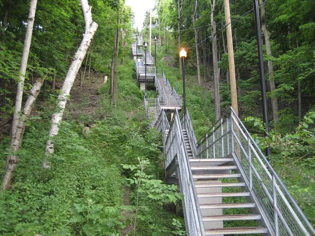
Is the Steeltown Stomp on your bucket list? This is your chance to crush it! Join us and prepare for this incredible challenge on October 3rd, 2026! Registration for the event is now open.If you’ve done stair climbs before, you know the deal—that brutal calf pain is real, especially when you’re just starting out. But training with us this summer? That’s how you show up on stomp day actually feeling strong instead of totally wrecked. Trust me.
We’ll start easy and build up as the summer goes on, hitting Chedoke and Dundurn Stairs with some scenic hikes mixed in. By the time October rolls around, you’ll have crushed at least 2,000 steps and you’ll actually know what you’re doing.
It’s a solid group vibe—moderate pace, warm-ups to get going, stretches to cool down. And honestly, it’s way more fun (and way less painful) doing this with people who get it.
Just grab your water bottle (there’s water at both staircases) and whatever snacks you want. And yeah, there’s optional coffee after if you want to hang out and celebrate.
We’ve got 7 training dates lined up this summer—check the schedule and pick the ones that work for you. Do the work now, own it on stomp day. See you out there!
Six Pack Of Blue – Hike 3 of 6
https://hikes.brucetrail.org/event/six-pack-of-blue-hike-3-of-6/Sorry, the registration cut-off time for this hike has been reached.Not a member? Click here to join today!Hosting Club: Blue Mountains
Category: End-to-End
Location (Google Maps): Nottawasaga Bluffs parking lot – parking feeHike Leader(s): Rob Johnston Click here to contact Hike Leader(s)
Pace: Medium – 3 to 4 km/hr
Terrain: Moderate – Some hills and/or some poor footing
Distance: 10.1Description
Please join us for the Six Pack Of Blue! This is an End-to-End of the Blue Mountains section of the Bruce Trail completed in 6 hikes – see below for dates. You can do as many of the six hikes as you wish. Hike distances in this six-hike series range from 8 km to 14.6 km. This is Hike #3. The route is from Nottawasaga Bluffs Parking Lot to Conc 10 road crossing, covering approximately 10.1 km. The pace will be 3–4 km/hour, and all hikers must be able to maintain this speed. The terrain is hilly with uneven, rocky footing. Sturdy hiking footwear is required, and hiking poles are recommended. Please bring water and a snack. Due to limited parking at trailheads, this hike will involve a car shuttle. All hikers are expected to carpool and share the associated costs. Arrive at the meeting location by 8:15 a.m. The car shuttle will depart promptly at 8:30 a.m. Further details will be provided to registered hikers a few days before the hike.Please refer to each individual hike date as outlined below for specific details of that hike. Register for each hike you plan to attend.
The hikes are on the following dates:
20 June 2026
27 June 2026
12 Sept 2026
19 Sept 2026
26 Sept 2026
17 Oct 2026
Boyd Conservation Park, Islington Avenue, Vaughan
https://hikes.brucetrail.org/event/car-hike-boyd-conservation-park-vaughan-17/Sorry, the registration cut-off time for this hike has been reached.Not a member? Click here to join today!Hosting Club: Toronto
Location (Google Maps): Free Parking lot before entrance of park on Islington Ave.
Hike Leader(s): Mohammad Aghamiri Click here to contact Hike Leader(s)
Pace: Moderate (3-4 km/hr)
Terrain: Hilly, Level 2 (Intermediate – some hills and uneven surfaces, rocks and roots underfoot), Variable
Distance (km): 12-14 kmDescription
Let’s hike Boyd conservation park trails through beautiful valleys.Please bring lots of water and snacks ,hiking poles are recommended
phone number for the day of hike 289 588 6482
Beaver Valley E2E in 8 - Hike 4
https://hikes.brucetrail.org/event/beaver-valley-e2e-in-8-hike-4/Sorry, the registration cut-off time for this hike has been reached.Not a member? Click here to join today!Hike open to BTC Members only.
Hosting Club: Iroquoia, Beaver Valley
Category: General Hike
Location (Google Maps): Eugenia Falls Conservation Area Parking Lot – Fee requiredHike Leader(s): Pati Greenwood, Jeff Dowsett Click here to contact Hike Leader(s)
Pace: Medium – 3 to 4 km/hr
Terrain: Moderate – Some hills and/or some poor footing, Strenuous – Hilly with steep climbs and some poor footing
Distance: 13.8 kmDescription
This is hike 4 of the End-to-End hike series to complete the Beaver Valley section of the Bruce Trail in 8 hikes. Join for all or as many hikes as desired – you will need to register for each hike in the series which will take place on the following dates: August 28, August 29, September 11, September 12, October 2, October 3, October 16 & October 17. Hikers completing the entire series will be eligible to obtain an end-to-end badge from the BTC Beaver Valley Club.Since this is a group hike, please consider your fitness level before registering. This section of the trail has numerous hills and rough terrain in spots. We will be walking at a pace of 3km – 4km per hour and hikers will need to keep up with the person in front of them for the duration of the hike. The hike series will also involve car shuttles and every hiker is expected to participate as drivers.
Weather conditions in the late summer can still be quite warm, but the hike schedule will extend to mid-October so it’s best come prepared for varying weather conditions. Hiking boots are required and hiking poles are strongly recommended. Bring plenty of fluids and a snack. Insects and ticks will still be active at this time of year, long pants and long sleeves are recommended as is insect repellent.
Specific hike details will be provided to registered hikers a few days prior to each hike.
Bus Hike: Terra Cotta (New Hikers & Families Welcome)
https://hikes.brucetrail.org/event/bus-hike-terra-cotta-new-hikers-families-welcome/Sorry, the registration cut-off time for this hike has been reached.Not a member? Click here to join today!Trip Information
Departure Time: 08:30
Return to City Time: 17:30
Departure Point: York Mills Bus PickupOptional Items
Hiking ($.01)Hosting Club: Toronto
Category: Bus Hike
Location (Google Maps): Main Bruce Trail Boston Mills Road, through Terra Cotta Conservation Area, to Tenth LineHike Leader(s): Tom Swales, Felix Wan Click here to contact Hike Leader(s)
Pace: Moderate (3-4 km/hr)
Terrain: Level 2 (Intermediate – some hills and uneven surfaces, rocks and roots underfoot), Variable
Distance (km): 10-11 kmDescription
New Hikers (but all are welcome) are invited to join me on a 10 km Introductory Level Bus Hike on the Toronto Section of the Bruce Trail around Terra Cotta less than an hour from Toronto. Expect some downhill/uphill and tree roots but nothing too rocky or challenging. We’ll be following behind the hikers completing the club’s annual two day E2E hike. There will be the option of a short out and back hike on the Walking Fern Side Trail at the end. After the hike we’ll drive to Spirit Tree Estates Cidery that offers pizza and baked goods and a country store. Hopefully the weather cooperates so we can sit on the picnic tables outside. Optional dropout at 5 km. Hiking boots are recommended. Beginners and families welcome.- =>>> Please read the TBTC Paid Hikes Refund Policy before registering: https://torontobrucetrailclub.org/hikes/no-show-policy”. There will be no refunds for this hike if the registrant cancels or misses the coach on the date of departure for any reason. Registration fees are not transferrable between different hikes nor can unused fares qualify for a tax receipt.
JEWELS OF GRAND VALLEY TRAIL - YORK TO CALEDONIA AND RUTHVEN PARK - 14 KM
https://hikes.brucetrail.org/event/jewels-of-grand-valley-trail-york-to-caledonia-and-ruthven-park-14-km/Sorry, the registration cut-off time for this hike has been reached.Not a member? Click here to join today!Hosting Club: Toronto
Category: Car Hike
Location (Google Maps): Parking and departure: Meet at 9:30am in Caledonia – Kinsmen Park trout park, Caledonia, at intersection of Caithness St. W (Rd 54) and Blair St. turn into the riverside parking lot.Hike Leader(s): Jeanette Vincent Click here to contact Hike Leader(s)
Pace: Moderate (3-4 km/hr)
Terrain: Flat, Level 1 (Easy – mostly on flat, well maintained trails with hard-packed surface), Variable
Distance (km): 14kmDescription
About this hike: This hike will be in Towpath section of GVTA: York to Caledonia and Ruthven Park, National Historic Site. This is a linear hike including areas of interest off the main trail. We will be walking on some of the streets in Caledonia and local trails along the river. Then we all drive to Ruthven Park where we will finish our hike on the Ruthven Park property trails.If you choose to, you will also have the opportunity to tour the Ruthven Greek Revival Mansion. There is a fee to tour inside the mansion: $12 adults, $10 senior 65+.About this series: Jewels of Grand Valley Trail is a series of hikes highlighting the beautiful parts of GVT in all 4 sections. Those hikes will range from about 6 km to 15 km. They will be led by Jeanette, Jane, Eva and Brandon through months of August to October. Come and enjoy the beauty of our trail!
Where: York, Caledonia, Ruthven Park
Length: 14 km
Category: Car shuttle
Pace and duration: Moderate, 3.5 km/hr. About 6.5 hours with lunch + car shuttle time.
Hike level: Moderate (2). Mainly flat, paved, maintained paths and trails.Parking and departure: Meet at 9:30 am in Caledonia – Kinsmen Park,trout park, Caledonia, Caledonia – riverside parking at intersection of Caithness St. W (Rd 54) and Blair St. 43.0744974 -79.9579234
From there we will carpool to York Park, York beside the Grand River across from the York General Store/gas station.(43.020717, -79.890382) and hike back to our cars.
After this portion of the hike we carpool to the cars at York Park, the start of our hike and all vehicles will drive to Ruthven Park (42.978026, -79.875623) where we will finish our hike on the Ruthven Park property trails. If you want a 2 or 3 km shorter hike you can opt out of joining us at Ruthven Park for the remainder of the hike.
Directions: Please use your favourite GPS app to obtain directions.
What to wear and bring: This is a September hike, please dress accordingly to the weather, bring a hat and sunscreen, sunglasses. If rain is forecasted, bring rain gear. Wear good hiking boots. Hiking poles are optional if you like using them. Bring water, snacks and pack a lunch – we will stop for lunch.Saturday Shorts: Griffith Ravine Side Trail Hike
https://hikes.brucetrail.org/event/saturday-shorts-griffith-ravine-side-trail-hike/Sorry, the registration cut-off time for this hike has been reached.Not a member? Click here to join today!Hosting Club: Caledon Hills
Category: General
Location (Google Maps): Meet at the roadside parking next to Peter Beecham Side Trail, km 54.6, Map 18. This is on 4th line EHS, north of #5 Sideroad and south of Hockley Road.
Please arrive by 9:15 a.m. so we can start the hike promptly at 9:30 a.m.Hike Leader(s): Dan Revington Click here to contact Hike Leader(s)
Pace: Leisurely – 3 km/hour or less
Terrain: Moderate – some hills and/or some poor footing
Distance: Approximately 5 kmDescription
On this Saturday Shorts hike, we will enjoy an invigorating hike along a beautiful trail on an iconic Canadian September morning, and discover why world famous artist Julius Griffith and his wife Lialia inspired the naming of the Griffith Ravine Side Trail.The distance is not long, and the pace will be leisurely, but the Trail goes down a steep slope to the valley and there is a steep climb back up. Sturdy footwear is required. Bring water. Hiking poles are recommended. No dogs please.
You can expect a reminder/update message one or two days before the hike.
Welcome Week Rainbow Hikes (2 options) at Niagara College/Woodend
https://hikes.brucetrail.org/event/welcome-week-rainbow-hikes-2-options-at-niagara-college-woodend/Sorry, the registration cut-off time for this hike has been reached.Not a member? Click here to join today!Hosting Club: Niagara
Category: Rainbow 🌈
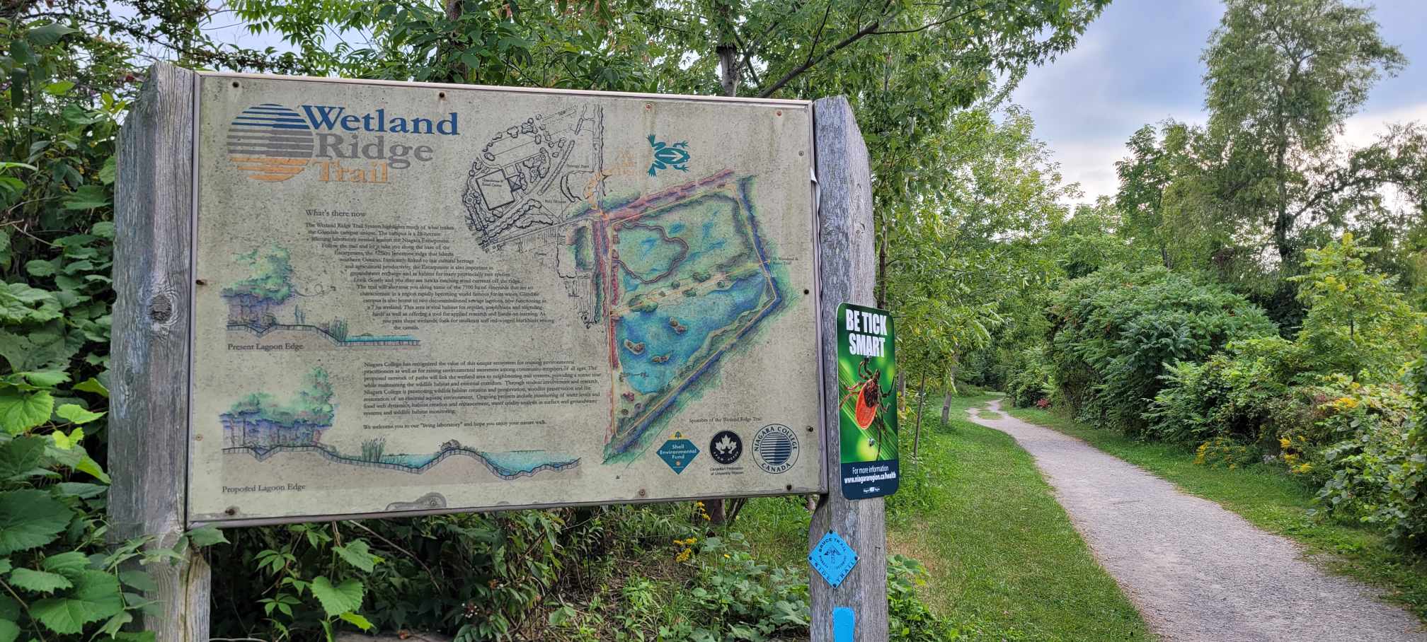
Location (Google Maps): Meet at Niagara College Wetland Trailhead – near the greenhouse on the Niagara-on-the-lake campus
Address: 135 Taylor Rd, Niagara-on-the-lake
Enter Niagara college from Taylor Rd. and park by the Wetland Trail. We will gather at 9:45/9:50 at the Wetland Trail entrance and head out at 10 am.
Map link: https://maps.app.goo.gl/UXJc7FCGPDpfzkwT6Hike Leader(s): Angela Lytle Click here to contact Hike Leader(s)
Pace: Leisurely <3 km/hr
Terrain: Moderate: some hills and some poor footing
Distance: 3-5 kmDescription
Join us for our Welcome Week Rainbow Hike offered in collaboration with Bridges Niagara Immigrant and Refugee Services, the Niagara Falls Library, PFLAG Niagara and the Niagara Local Immigration Partnership.Welcoming week is an annual campaign that brings together immigrants, newcomers and long-term residents. This hike highlights community connections with newcomers and is an intentionally 2SLGBQTIA+ inclusive space. Everyone is welcome.
Choose from one of two hike options at this community event. Both start at 10 am at the same location:
- Hike 1: Biodiversity hike
- Hike 2: Active hike
On the biodiversity hike, explore the natural environment and learn about the plants, trees and animals you meet along the way. This hike will go at a gentle pace and the hike leader, Mary-lyn, will be sharing information along the way. The terrain is a mix of flat earth and some rocky areas.
On the active hike, we will hike up and over the escarpment from Niagara College through Woodend Conservation area and back. The path is rocky and involves climbing up and down the escarpment. The pace will be moderate but the terrain has some challenging stretches. Shoes with a good tread are needed and hiking poles are recommended. We may have some poles you can borrow if needed.
Park at Niagara College and meet at the Wetland trail entrance by 9:50 to check in with the hike leaders.
Urban Walk: Waterfront Trail 7/11 – Brimley
https://hikes.brucetrail.org/event/urban-walk-waterfront-trail-7-11-brimley-3/Sorry, the registration cut-off time for this hike has been reached.Not a member? Click here to join today!Hosting Club: Toronto
Category: Urban Walk
Location (Google Maps):Toronto, Ontario, Canada
Hike Leader(s): Brian Rideout Click here to contact Hike Leader(s)
Pace: Moderate (3-4 km/hr)
Terrain: Hilly
Distance (km): 11.4 kmDescription
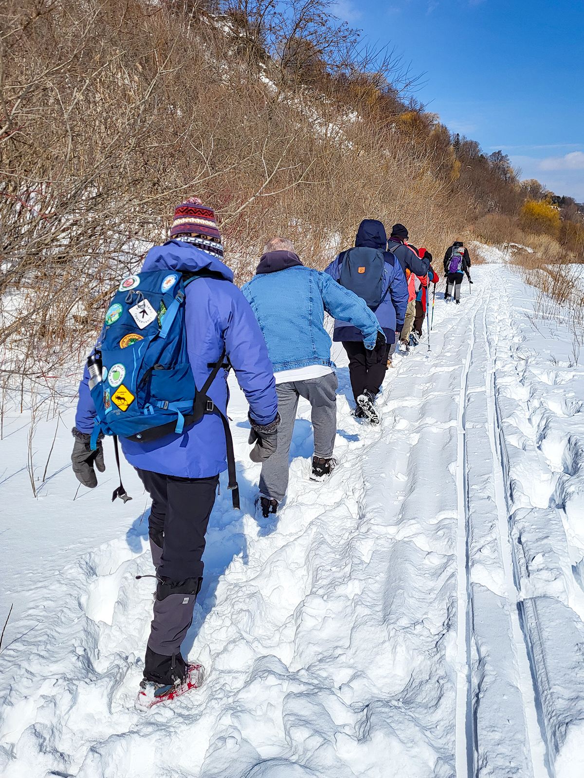
Please join me at Kennedy Station by 10:15 am. We will take the 12 Kingston Rd bus departing 10:42 am, arriving 10:58 am.We will hike along Kingston Rd, down to and east along the Lake on the Doris MacCarthy Trail to Guildwood and then to Beechgrove Dr. The estimated distance is 11.4 km. Here is an online map of our route – Brimley to Beechgrove
Bring a snack, at least 2 liters of water, and icers. Dress for cold weather.