
The BTC office will be closed on Mon. Oct. 12 for the holiday. Thank you for your understanding.
Hike Schedule
Join us for a hike! Registration required.
All hikes available to BTC members. Some hikes are open to non-members.
See Refund Policy for Paid Hikes >
TIP: The calendar view displays up to 7 hikes on a day, but often there are more. Click “View more events” to see them all.
Niagara
Iroquoia
Toronto
Caledon Hills
Dufferin Hi-Land
Blue Mountains
Beaver Valley
Sydenham
Peninsula
All Clubs
Show Filters
Categories
Reset Filters
- 28September 28, 2025

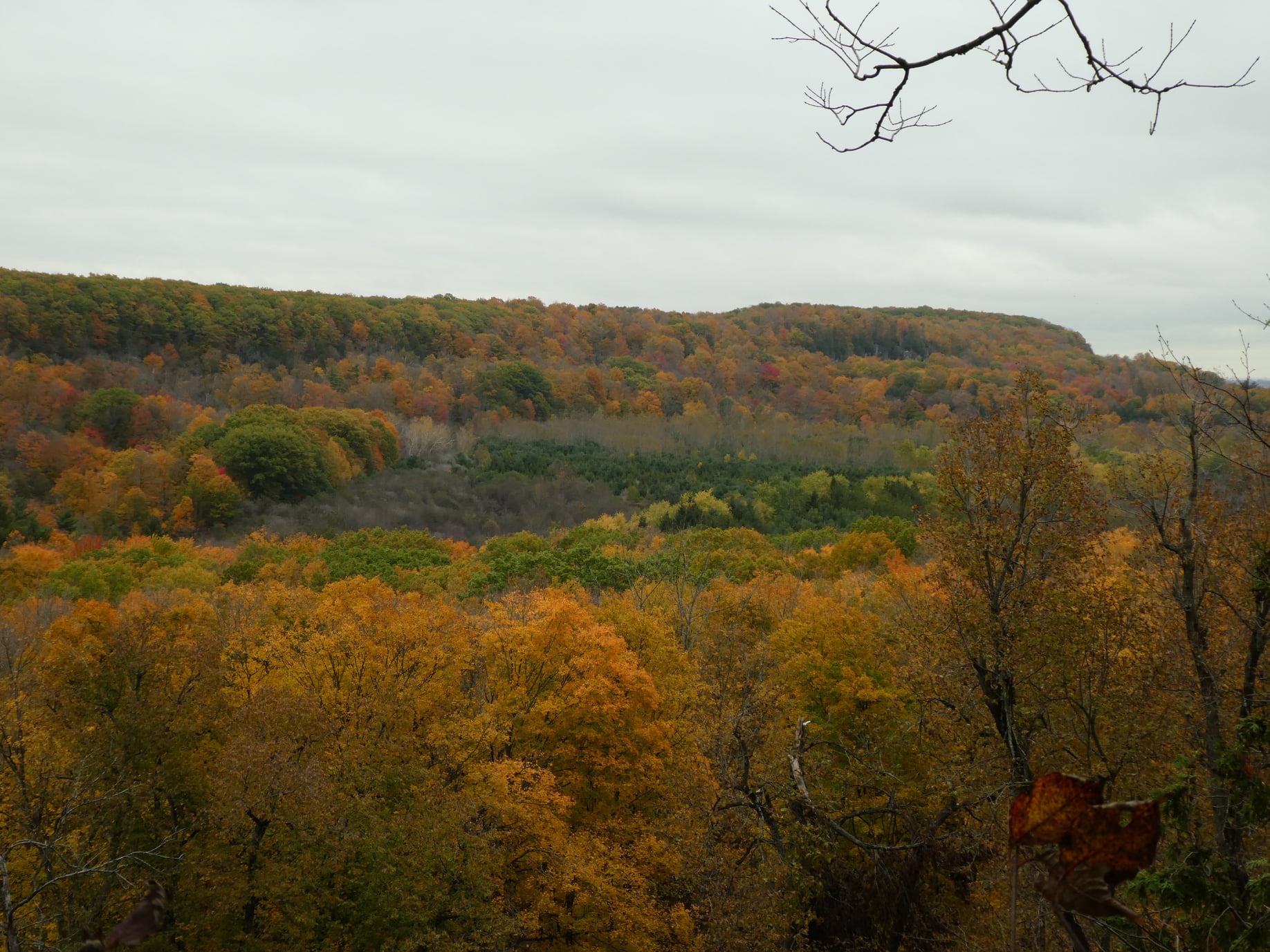
Car Hike: Exploring Uxbridge Trails (Wilder Forest, Walker Woods, and Glen Major Forest)
https://hikes.brucetrail.org/event/car-hike-exploring-uxbridge-trails-wilder-forest-walker-woods-and-glen-major-forest-17/Sorry, the registration cut-off time for this hike has been reached.Not a member? Click here to join today!Hosting Club: Toronto
Category: Car Hike
Location (Google Maps):2499 Brock Rd, Uxbridge, ON L9P 1R4. We will meet at the East Duffins Headwaters parking lot at the WILDER FOREST trail head. As soon as you got off the Brock Road, passing the horse back riding facility, there is a free designated parking lot 70 meters down the lane to your right. It includes a sign board for East Duffins Headwaters with a map of the trails. Please do not park on the lane or in the horse back riding property.
Hike Leader(s): Amir Alemohammad Click here to contact Hike Leader(s)
Pace: Moderate (3-4 km/hr)
Terrain: Flat, Hilly, Level 2 (Intermediate – some hills and uneven surfaces, rocks and roots underfoot), Variable
Distance: Approx.15-16 KmDescription
Join us for a delightful hike in Uxbridge, as we explore Wilder Forest, Walker Woods, and Glen Major Forest on a scenic loop starting from Brock Road. We’ll pass Concession Road 6, heading west and back, while also venturing onto several side trails for even more stunning views.What to Expect:
•Beautiful scenic views and lookouts facing south
•A mix of hilly and flat terrain
•Frequent 2-minute breaks for hydration and photos, with a 10-20 minute lunch/snack stop
•Stay on designated trails at all time
What to Bring and Wear:
•Hiking Boots and poles (recommended) and be prepared for the bugs
•At least 2 liters of water
•Your favorite snacks and lunch (pack your own refreshments for an outdoor meal)
•Dress according to variable weather conditions!
Important Details:
•Stay on the designated trails
•Be prepared for the elements and enjoy the adventure!
Looking forward to seeing you on the trail!
Don’t forget your camera and a smile as we explore the beauty of the Uxbridge trails!
This is a joint hike with the Oak Ridges Trail Association (ORTA).
Twiss Rd to Crawford Lake return
https://hikes.brucetrail.org/event/twiss-rd-to-crawford-lake-return/Sorry, the registration cut-off time for this hike has been reached.Not a member? Click here to join today!Hosting Club: Iroquoia
Category: General Hike
Location (Google Maps): Meet roadside on Twiss Road at 8:45 am.Hike Leader(s): Karen Bergmann Click here to contact Hike Leader(s)
Pace: Medium – 3 to 4 km/hr
Terrain: Strenuous – Hilly with steep climbs and some poor footing
Distance: 10 kmsDescription
We will hike to Crawford Lake and around the trails and back to Twiss Road. There are some rocky sections along the way. Please bring water and a snack.Toronto End-to-End in Four - Kelso to Speyside
https://hikes.brucetrail.org/event/toronto-end-to-end-in-four-kelso-to-speyside/Sorry, the registration cut-off time for this hike has been reached.Not a member? Click here to join today!Hike open to BTC Members only.
Hosting Club: Dufferin Hi-Land
Category: General Hike
Location (Google Maps): Roadside parking at the end of 17 Sideroad, 730m northeast of Halton Road 25 north of the 401.Hike Leader(s): Stuart Law; Kerry Seong Click here to contact Hike Leader(s)
Pace: Medium
Terrain: Dependent on Conditions, Strenuous
Distance: 16 kmsDescription
Join us on a four-hike end-to-end hike series covering the Toronto Section plus a few kilometres up to The Grange. Today’s hike is the first of that shuttle series. We will make our way on the Main Trail from Kelso to Speyside. Please bring 2.5L of water, a snack, a lunch, and a smile. Please also bring footwear to change into after the hike and a garbage bag to put your boots in for the shuttle. Hiking boots mandatory. Poles very much recommended. It will be very rocky in sections. Please arrive at 9 am and be ready to shuttle at 9:15 sharp. Entry fee payable at Kelso CA.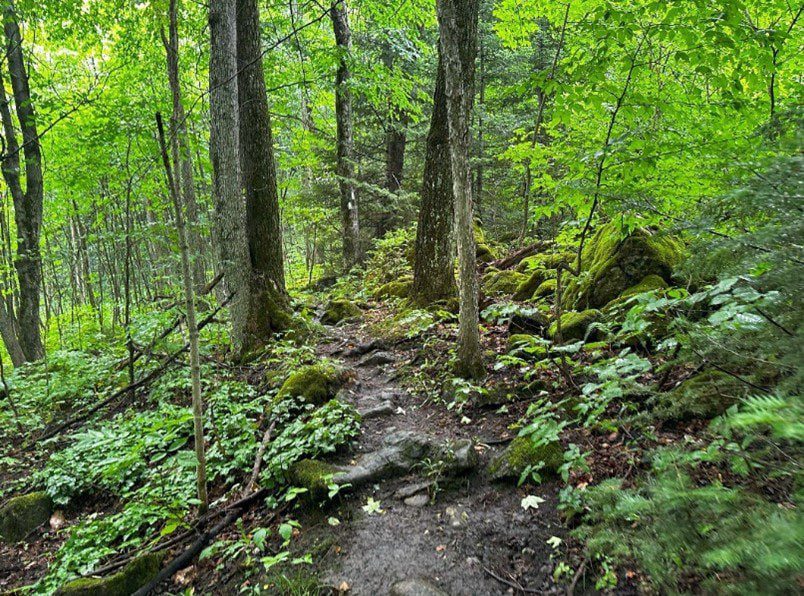
Walk In Nature Series (WINS) - Lindenwood Pond Nature Reserve loop trails
https://hikes.brucetrail.org/event/walk-in-nature-series-wins-lindenwood-pond-nature-reserve-loop-trails/Sorry, the registration cut-off time for this hike has been reached.Not a member? Click here to join today!Hosting Club: Sydenham
Category: General Hike
Location (Google Maps): Roadside parking at the end of Concession 14 in Georgian Bluffs. Drive 2 km north of Copperkettle on Grey Road 17 then 1.5 km east on Concession 14 to the dead end.Hike Leader(s): Stewart Brown Click here to contact Hike Leader(s)
Pace: Medium: 3 to 4 km/h
Terrain: Moderate: Some hills and/or poor footing
Distance: 4 kmDescription
The Walk In Nature Series (WINS) consists of short loop hikes in the Sydenham section of the Bruce Trail that combine nature appreciation with fitness in a safe and welcoming group environment led by an experienced hike leader. Hikes normally occur twice monthly on the second Tuesday early evening and the fourth Sunday morning of each month. Consider these hikes to be 90- or 120-minute reset appointments with yourself in nature that promote health and fitness. Medium paced WINS hikes are open to all ages and levels of hiking experience whether members or non-members of the Bruce Trail Conservancy (BTC).This hike at Lindenwood Pond Nature Reserve explores the comforting, richly forested side trails of a beautiful BTC property.
Our 4 km loop takes us along The Gap Side Trail to the Lindenwood Pond Side Trail, then follows the escarpment edge along the Main Trail from km 123.6 to km 122.1 before returning to parking along The Gap Side Trail.
Cover up for insects and vegetation, bring plenty of water and a snack, and hiking poles may be helpful.
Thanks, and see you soon.

10:00 Westcott Vineyards Hike and Wine Tasting Experience
https://hikes.brucetrail.org/event/1000-westcott-vineyards-hike-and-wine-tasting-experience/Sorry, the registration cut-off time for this hike has been reached.Not a member? Click here to join today!Hosting Club: Niagara
Category: Loop
Location (Google Maps): Start with hike at Louth Conservation Area 3193 Staff Avenue Jordan Station ON L0R 1S0 and then drive to Westcott VineyardsHike Leader(s): Sam Rutherford Click here to contact Hike Leader(s)
Pace: Medium
Terrain: Moderate
Distance: 5 kmsDescription
We will hike the main trail and side trails at Louth Conservation Area from 10:00 a.m. until 11:30 a.m then we will make the short 2 minute drive to Westcott Vineyards at 3180 17th Street Jordan ON L0R 1S0. At Westcott one of the friendly and knowledgeable staff will take us through a 3 flight wine tasting experience. The cost for the wine tasting is $20 per person tax included. Please bring your $20 with you as I will collect it prior to the hike to make the payment process easier for Westcott. Thank you. - 29September 29, 2025
Limehouse Loop Hike
https://hikes.brucetrail.org/event/limehouse-loop-hike-4/Sorry, the registration cut-off time for this hike has been reached.Not a member? Click here to join today!Hosting Club: Iroquoia, Toronto
Category: General Hike
Location (Google Maps): Limehouse Parking LotHike Leader(s): Pati Greenwood, Jeff Dowsett Click here to contact Hike Leader(s)
Pace: Medium – 3 to 4 km/hr
Terrain: Moderate – Some hills and/or some poor footing
Distance: 15 kmDescription
Starting at the Limehouse Parking Lot, the hike will follow the main trail, the Canada Goose Side Trail, the Ridge Side Trail and the Todd Bardes Meadowland Side Trail to form at 15 km loop. The route will include some rough, rocky areas which can be tricky to navigate. Wear hiking boots and bring poles to help navigate the terrain. There will be regular breaks, including a snack stop along the way. Bring snacks and plenty of water. While insects are not usually as active at the end of September, ticks will still be present so clothing covering the legs are arms is recommended as is insect repellent. Please arrive at 8:15 am as we will depart promptly at 8:30 am.
Welland Canals Badge Hike 3
https://hikes.brucetrail.org/event/welland-canals-badge-hike-3/Sorry, the registration cut-off time for this hike has been reached.Not a member? Click here to join today!Hosting Club: Niagara
Category: Loop
Location (Google Maps): Sobey’s Parking lot on Glendale closest to corner of Glendale and Mountain streetHike Leader(s): Erin Lyttle Click here to contact Hike Leader(s)
Pace: Brisk, Medium
Terrain: Easy
Distance: 9kDescription
Meet at the corner of Sobey’s parking lot on Glendale closest to the intersection of Glendale and Mountain road in St. Catharines. We will be doing the Welland Canals Hike #3 to Richard Pierpoint Park. Note the hike starts at 8:30am and is the 3rd in the Welland Canals badge series. If you are interested in receiving your badge after completing the 4th hike on Sept 29th, please let me know and pay in cash or via etransfer (I can give you directions on the hike) $10 for members (please provide BTC number) or $15 for non-members. Badge info: https://niagarabrucetrail.club/badges/Please wear good walking shoes (the path/trail is mostly flat), poles if you like and water/snacks.
Novice Hikers - Fall Series of 10 hikes in Dufferin, Hike 3
https://hikes.brucetrail.org/event/novice-hikers-fall-series-of-10-hikes-in-dufferin-hike-3/Sorry, the registration cut-off time for this hike has been reached.Not a member? Click here to join today!Hosting Club: Caledon Hills
Category: Introductory
Location (Google Maps): Meet at km 28.3, BTC parking area on 1st Line E. Map 20Hike Leader(s): Nancy Mooney Click here to contact Hike Leader(s)
Pace: Leisurely – 3 km/hour or less, Medium – 3 to 4 km/hour
Terrain: Easy – mostly flat and usually good footing, Moderate – some hills and/or some poor footing
Distance: 6.4 km shuttle hikeDescription
This is the third hike in the 10 hike series and takes us through a pine plantation, along the road to Whitfield and a lengthy descent to Kilgorie. - 30September 30, 2025
8:00 Long Hike Wiley Road Short Hills
https://hikes.brucetrail.org/event/800-long-hike-wiley-road-short-hills-15/Sorry, the registration cut-off time for this hike has been reached.Not a member? Click here to join today!Hosting Club: Niagara
Location (Google Maps):
Short Hills Wiley Road Entrance
Pace: Medium
Terrain: Moderate
: 10kmDescription
Explore Short Hills and the majestic side trails of Scarlett Tanager, Hemlock. Swayze Falls and Terrace. Register for each hikeBring Poles, Sun Screen Bug Spray, snack, and dress for the weather
Urban Walk: Valley View Park Thornhill
https://hikes.brucetrail.org/event/urban-walk-valley-view-park-thornhill-106/Sorry, the registration cut-off time for this hike has been reached.Not a member? Click here to join today!Hosting Club: Toronto
Location (Google Maps): Parking lot is off Sycamore Drive East of Bayview , across Starbucks plaza
Bus 91 from Finch east station stops at Sycamore station.Hike Leader(s): Mohammad Aghamiri Click here to contact Hike Leader(s)
Pace: Moderate (3-4 km/hr)
Terrain: Hilly, Level 2 (Intermediate – some hills and uneven surfaces, rocks and roots underfoot), Variable
Distance: 7-8 kmDescription
We will explore Valleyview and Maple View parks, and walk along German Mill Creak, in return we stop in Huntington park and have snack under beautiful shed ,Even it is considered Urban walk, it is urban hike as we have some up and down hills and tree roots, please bring your hiking poles, water and snacks,
phone number for the day of hike 289 588 6482
The National Day for Truth and Reconciliation, Orange Shirt Day
https://hikes.brucetrail.org/event/the-national-day-for-truth-and-reconciliation-orange-shirt-day/Sorry, the registration cut-off time for this hike has been reached.Not a member? Click here to join today!Hosting Club: Caledon Hills
Category: General
Location (Google Maps): Albion Hills Conservation Park. Meet up at Chalet parking lot, follow clear signage ~5minutes from gatehouse entry.Hike Leader(s): GG Click here to contact Hike Leader(s)
Pace: Medium – 3 to 4 km/hour
Terrain: Moderate – some hills and/or some poor footing
Distance: 8kmDescription
Orange Shirt Day is a time for reflection, learning, and remembrance. It invites Canadians to confront the legacy of residential schools and engage in meaningful conversations about reconciliation.Let’s join together for a hike as we share and learn from each other about reconciliation. I’ll share what I have learned on my journey of learning while we explore the medicine garden, community gardens and a depending on team interest a visit to a Caledon historical site. There will be a raffle of a book by one of my favourite Indigenous authors at the end of the formal hike 🙂
A park pass can be obtained on site or through https://trca.ca/parks/albion-hills-conservation-area/?utm_medium=organic&utm_source=GMBlisting&utm_campaign=AlbionHills#albfees
We will meet at 9AM at Chalet parking lot. Please be on time. There are restrooms at the chalet and throughout the park, and we will decide as a team our path to the medicine garden and back.
Please wear your orange shirt if you have one, and if you don’t and wish to get one: https://orangeshirtday.org/merchandise/ and/or local vendors including Mark’s warehouse/Cdn Tire.
9:15 Short Hike - Short Hills Park, Pelham Rd
https://hikes.brucetrail.org/event/915-short-hike-short-hills-park-pelham-rd-29/Sorry, the registration cut-off time for this hike has been reached.Not a member? Click here to join today!Hosting Club: Niagara
Category: Hike
Location (Google Maps): Pelham Rd entrance, Short Hills Provincial ParkHike Leader(s): Debbie Demizio Click here to contact Hike Leader(s)
Pace: Medium
Terrain: Moderate
Distance: ~ 6kmsDescription
Hike the main and side trails in Short Hills Provincial Park. Bring hiking boots, water, sunscreen and bug spray.Dufferin Hi-Land - 1st Line to 30 Sideroad
https://hikes.brucetrail.org/event/dufferin-hi-land-1st-line-to-30-sideroad/Sorry, the registration cut-off time for this hike has been reached.Not a member? Click here to join today!Hosting Club: Dufferin Hi-Land
Category: Tuesday Hike
Location (Google Maps):Dufferin Hi-Land Maps 19 and 20, Km 12.2. Meet at roadside parking on 30 Sideroad Mono about 0.8 km east of Hurontario St.
Hike Leader(s): ;Julie Daley;Inge Eckerich;Les Babbage;Tony Evangelista Click here to contact Hike Leader(s)
Pace: Leisurely
Terrain: Easy
Distance: 6.6 km; Short hike: 3.3 km.Description
We will hike the Main Trail from parking on 30 Sideroad through woods and open fields to Km 8.9 on 1st Line. The short hike will end at this point and return by shuttle to parking. The longer hike will return by way of the Main Trail. Bring water, snacks and sun screen.Dufferin Hi-Land Club Stained Glass Badge in series of 6 hikes
https://hikes.brucetrail.org/event/dufferin-hi-land-club-stained-glass-badge-in-series-of-5-hikes/Sorry, the registration cut-off time for this hike has been reached.Not a member? Click here to join today!Hike open to BTC Members only.
This is a Multi-Day Hike
You are signing up for the following dates:
2025-09-30, 2025-10-07, 2025-10-14, 2025-10-21, 2025-10-28, 2025-11-04Hosting Club: Toronto, Caledon Hills
Category: Car Hike
Location (Google Maps): First of this series will be starting at Lavender Cemetery parking area. Km 54.9 . 550m east of Lavender Hill Rd. Mulmur-Nottawasaga Town line. Parking on north side of the road.Hike Leader(s): Lynn McFerran Click here to contact Hike Leader(s)
Pace: Moderate (3-4 km/hr)
Terrain: Level 2 (Intermediate – some hills and uneven surfaces, rocks and roots underfoot), Variable
Distance: 8-11km each hikeDescription
The fall is a lovely time to hike this section. The trees will be turning colour and there will be fungi and mushrooms along the trail. The plan is to get this series of hikes completed before the snow flies. There will be 6 hikes all on consecutive Tuesdays starting September 30 , through October, finishing November 4th. All hikes are less than 10km.
This is a slow to moderate paced hike series. There is some challenging terrain and road work too. The hikes with be completed north to south where best suited for the hikers. There will be a car shuffle each week.
The location of the meeting place for the first hike is listed here. The following hike meeting points will be emailed to all registered hikers.
Please come prepared for any kind of weather. Bring water lunch and snacks. - 01October 1, 2025
Beaver Valley Geology Hike Hike #8/8 Griersville to Webwood Falls:
https://hikes.brucetrail.org/event/beaver-valley-geology-hike-hike-8-8-griersville-to-webwood-falls/Sorry, the registration cut-off time for this hike has been reached.Not a member? Click here to join today!Hosting Club: Blue Mountains
Category: Organized Hike
Location (Google Maps): Tim Horton’s, First Street, CollingwoodHike Leader(s): Annette Sandberg Click here to contact Hike Leader(s)
Pace: Leisurely – 3 km/hr. or less
Terrain: Moderate – Some hills and/or some poor footing
Distance: 7.5Description
Griersville to Webwood Falls: Erratic boulders at Stop 4 (Page 109) Glacial erratics are rocks picked up by glaciers and transported great distances to be left behind as the glacier melts. These erratic boulders are 1 billion years older than the local sedimentary bedrock, and originally came from the Canadian Shield.Pine River Nature Reserve Loops
https://hikes.brucetrail.org/event/pine-river-nature-reserve-loops/Sorry, the registration cut-off time for this hike has been reached.Not a member? Click here to join today!Hosting Club: Dufferin Hi-Land
Category: General Hike
Location (Google Maps): Prince of Wales Road and Sideroad 15 (west of Kilgorie). Please note the River Road bridge over the Pine River may still be closed. Please adjust your route accordingly. GPS coordinates below.Hike Leader(s): Stuart Law; Helen Bailey Click here to contact Hike Leader(s)
Pace: Medium
Terrain: Dependent on Conditions, Moderate
Distance: 3.5km and 7.5 km optionsDescription
Please join us for a ribbon cutting ceremony to celebrate the opening of the Dufferin Hi-Land club’s new Pine River Nature Reserve parking lot then join us for a hike of two loops. The first loop is 3.5 kms. The second is 4.0 kms. Second loop is optional. Please bring 1.5L of water, a snack and smile. Hiking boots mandatory. Gonna be fun.WEDNESDAY WALKERS - Young Wetland
https://hikes.brucetrail.org/event/wednesday-walkers-young-wetland-3/Sorry, the registration cut-off time for this hike has been reached.Not a member? Click here to join today!Hosting Club: Beaver Valley
Location (Google Maps): Park in the parking lot at the Epping John Muir Lookout near km 94.3, Map 27, Edition 31
Hike Leader(s): Margaret Yaraskavitch Click here to contact the hike leader.
Pace: Medium
Terrain: Easy
Length of Hike: 4 kmsDescription
This hike is a there-and-back walk. We begin on the edge of the Beaver Valley and then head towards a beaver pond. A walk along the edge of fields takes us into a wood lot, then to the Young Wetland. Birds are often sighted on the water. From there, we stroll the rest of the BTC-managed Young property to Sideroad 19, seeing fields regenerating towards a natural state. We walk back to the parking area, where we can enjoy a panoramic view into the Beaver Valley.Guidelines
- Arrive 15 minutes before the start of the hike.
- Wear sturdy footwear and appropriate attire for the weather and the terrain.
Hiking poles are a good idea in any season, especially if the terrain is rocky or slippery. In winter, snowshoes or icers/crampons are needed when conditions dictate.
Wearing appropriate clothing and footwear prevents injuries and shows consideration for a safe and positive group hiking experience. - Always carry I.D. and your health card.
- Bring sufficient water and snacks (or lunch if indicated). A minimum of 1L of water is recommended on all hikes, and 3L is recommended for long, challenging hikes in the heat of the summer.
- Bring sunscreen and insect repellent (for spring and summer hikes).
- Bring your own first aid kit.
- Please leave dogs at home.
Good Companions - Dundas Driving Park to Tews Falls and Return
https://hikes.brucetrail.org/event/good-companions-dundas-driving-park-to-tews-falls-and-return/Sorry, the registration cut-off time for this hike has been reached.Not a member? Click here to join today!Hike open to BTC Members only.
Hosting Club: Iroquoia
Category: Good Companions
Location (Google Maps):Dundas Driving Park – Main parking area – See map below
Hike Leader(s): Ted Bossence Click here to contact Hike Leader(s)
Pace: Medium – 3 to 4 km/hr
Terrain: Strenuous – Hilly with steep climbs and some poor footing
Distance: 7.5 kmDescription
We will walk, following city streets, to the Tews Falls Side trail. We will ascend the escarpment and onwards to view Tews Falls. We will then return with a stop at the Dundas Peak Viewpoint and retrace our steps back to the Dundas Driving Park. Bring water, sunscreen, bug repellant and a snack. Hiking poles recommended. Please arrive at the car park by 9:45 am in order to be walking by 10:00 am. I will send contact info a day or two before the hike with contact info should you need to cancel after 4:00 pm on Tuesday September 30. I will inform you if the hike is cancelled due to rain. Please check your email the evening before the hike.Evening Hike in Owen Sound followed by an Opportunity for Refreshments
https://hikes.brucetrail.org/event/evening-hike-in-owen-sound-followed-by-an-opportunity-for-refreshments-19/Sorry, the registration cut-off time for this hike has been reached.Not a member? Click here to join today!Hosting Club: Sydenham
Category: An evening walk.
Location (Google Maps): Meet in the municipal parking lot by the river on the west side of 1st Ave E between 7th St E and 8th St E in Owen SoundHike Leader(s): Harriet Nixon Click here to contact Hike Leader(s)
Pace: Brisk: 4 to 5 km/h
Terrain: Moderate: Some hills and/or poor footing
Distance: Approx 6 kmDescription
Join us for a brisk evening hike exploring Owen Sound paths and neighbourhoods, followed by an opportunity to socialize over refreshments. There is no need to show up 15 minutes early for this hike, but we will leave prmptly at 7:00 pm. - 02October 2, 2025
8:00 am Long Hike Cave Spring Conservation Area
https://hikes.brucetrail.org/event/800-am-long-hike-cave-spring-conservation-area-14/Sorry, the registration cut-off time for this hike has been reached.Not a member? Click here to join today!Hosting Club: Niagara
Category: In and Out
Location (Google Maps):Cave Spring Conservation Area
Hike Leader(s): Alan Laver Click here to contact Hike Leader(s)
Pace: Medium
Terrain: Moderate
Distance: 10kDescription
This will be our permanent Thursday Location until Bridge repairs complete. From Cave Spring Conservation Area explore the trail network on the escarpment towards Kinsman Park and Moyer Road.You must register for each hike. Bring Poles, snack bug spray, sunscreen and a drink. Dress for the weather
Urban Walk: Valley View Park Thornhill
https://hikes.brucetrail.org/event/urban-walk-valley-view-park-thornhill-107/Sorry, the registration cut-off time for this hike has been reached.Not a member? Click here to join today!Hosting Club: Toronto
Location (Google Maps): Parking lot is off Sycamore Drive East of Bayview , across Starbucks plaza
Bus 91 from Finch east station stops at Sycamore station.Hike Leader(s): Mohammad Aghamiri Click here to contact Hike Leader(s)
Pace: Moderate (3-4 km/hr)
Terrain: Hilly, Level 2 (Intermediate – some hills and uneven surfaces, rocks and roots underfoot), Variable
Distance: 7-8 kmDescription
We will explore Valleyview and Maple View parks, and walk along German Mill Creak, in return we stop in Huntington park and have snack under beautiful shed ,Even it is considered Urban walk, it is urban hike as we have some up and down hills and tree roots, please bring your hiking poles, water and snacks,
phone number for the day of hike 289 588 6482
Hiking in and around Jordan
https://hikes.brucetrail.org/event/hiking-in-and-around-jordan-10/Sorry, the registration cut-off time for this hike has been reached.Not a member? Click here to join today!Hosting Club: Niagara
Category: Hike
Location (Google Maps): 3649 Glen Road, Lincoln LOR 1SOHike Leader(s): Bill Russell Click here to contact Hike Leader(s)
Pace: Medium
Terrain: Moderate
Distance: 7 kmDescription
Hiking in and around Jordan hiking different trails each week – Jim Rainforth Trail, Bailey Bridge and Jordan Village and Balls Falls.Novice Hikers - Fall Series of 10 Hikes in Dufferin, Hike 4
https://hikes.brucetrail.org/event/novice-hikers-fall-series-of-10-hikes-in-dufferin-hike-4/Sorry, the registration cut-off time for this hike has been reached.Not a member? Click here to join today!Hosting Club: Caledon Hills
Category: Introductory
Location (Google Maps): Meet at Kilgorie, km 33.8, on Centre Road 30 m south of River Road. Map 20Hike Leader(s): Nancy Mooney Click here to contact Hike Leader(s)
Pace: Leisurely – 3 km/hour or less, Medium – 3 to 4 km/hour
Terrain: Moderate – some hills and/or some poor footing
Distance: 6.9 km loop.Description
This is the fourth hike in the 10 hike series. We will be up and down the hills of the Pine River Nature Reserve. - 03October 3, 2025

Car Hike: Tobermory Fall Hiking Weekend (2 overnights)
https://hikes.brucetrail.org/event/car-hike-tobermory-fall-hiking-weekend-2-overnights-2/Sorry, the registration cut-off time for this hike has been reached.Not a member? Click here to join today!This is a Multi-Day Hike
You are signing up for the following dates and times:
2025-10-03 at
2025-10-04 at
2025-10-05 atHosting Club: Toronto
Category: Car Hike
Location (Google Maps):Princess Hotel
34 Bay St, Tobermory, ON N0H 2R0Hike Leader(s): Jeanette Vincent. Click here to contact Hike Leader(s)
Pace: Moderate (3-4 km/hr)
Terrain: Hilly, Level 2 (Intermediate – some hills and uneven surfaces, rocks and roots underfoot), Rocky, Variable
Distance: 13 -15kmDescription
I continue Greg Vincent’s legacy of weekends away. Please join me, Jeanette Vincent, as we explore the Tip o’ the Bruce, Tobermory in the Fall. The beauty of this area of the Bruce Peninsula every season is wonderful! We will take in a number of walks using side trails and the Bruce Trail. Approximately 13-15km/day. We stay and have our meals at a comfortable hotel overlooking Little Tub Harbour. This outing is restricted to those staying with us at the Princess Hotel in Tobermory for the weekend – the hotel fills quickly. You will need a car to access this outing. Please contact the Princess Hotel for a reservation.1-519-596-8282 or info@tobermoryprincesshotel.com and mention Vincent/Royle Fall weekend.Before registering at the hotel please contact us for the price package for accommodations and more details.

9:00 am Niagara-on-the-Lake Tour
https://hikes.brucetrail.org/event/900-am-niagara-on-the-lake-tour-45/Sorry, the registration cut-off time for this hike has been reached.Not a member? Click here to join today!Hosting Club: Niagara
Category: Urban
Location (Google Maps):Veterans Memorial Park, park just outside the park on King Street
Hike Leader(s): Robin Garrett Click here to contact Hike Leader(s)
Pace: Medium
Terrain: Easy
Distance: 6-7 kmDescription
Each Friday we will explore different neighbourhoods, trails and parkland throughout Historic Niagara-on-the-Lake.Moderate pace with some weeks entirely on sidewalks and roads while others may include a mix of trails and paved pathways. Great way to build up endurance for longer more strenuous hikes.
Prepare for cooler windy conditions on open parkland and along Lake Ontario and Niagara River trails.
Plan to stay for conversation and a warm cup of coffee or tea at Sweets & Swirls, Community Centre, Niagara Stone Road, NOTL
Salmon Run Followed by an Opportunity for Lunch at the Inn
https://hikes.brucetrail.org/event/salmon-run-followed-by-lunch-at-the-inn/Sorry, the registration cut-off time for this hike has been reached.Not a member? Click here to join today!Hosting Club: Sydenham
Category: Health & Nature Hike
Location (Google Maps): Harrison Park – NW of km 89.0. Beside the resturant but closer to the bridgeHike Leader(s): Sheri Hatcher Click here to contact Hike Leader(s)
Pace: Medium: 3 to 4 km/h
Terrain: Moderate: Some hills and/or poor footing
Distance: Approx 10 kmDescription
We will meet at Harrison Park in Owen Sound and car shuttle to the the Visitor’s Information Centre at the harbor. We will leave the park at 9:15 so please arrive early.The salmon’s journey – and ours – will start at the harbor then continue through the River District to the fish ladder where we will see the salmon leaping and thrashing there way to the top of the mill dam. We will follow the salmon to Harrison Park and then continue to the Grey Sauble Conservation where we will learn more about their migration and observe them in shallow spawning channels. We will continue to Inglis Falls where we will have a great look-out point to observe the fall colors and then head back to Harrison Park via the main trail and the Harrison Park Side Trail. Once back at the park, for those that are interested, we will stop for lunch at the Inn.
This route follows sidewalks, dirt walkways and paved trails on route to the Bruce Trail near Harrison Park. From there, we will take the Trail to the Grey Sauble Conservation, Inglis Falls and then back to Harrison Park.
Mount Nemo (reservation required)
https://hikes.brucetrail.org/event/mount-nemo-reservation-required/Sorry, the registration cut-off time for this hike has been reached.Not a member? Click here to join today!Hosting Club: Iroquoia
Category: General Hike
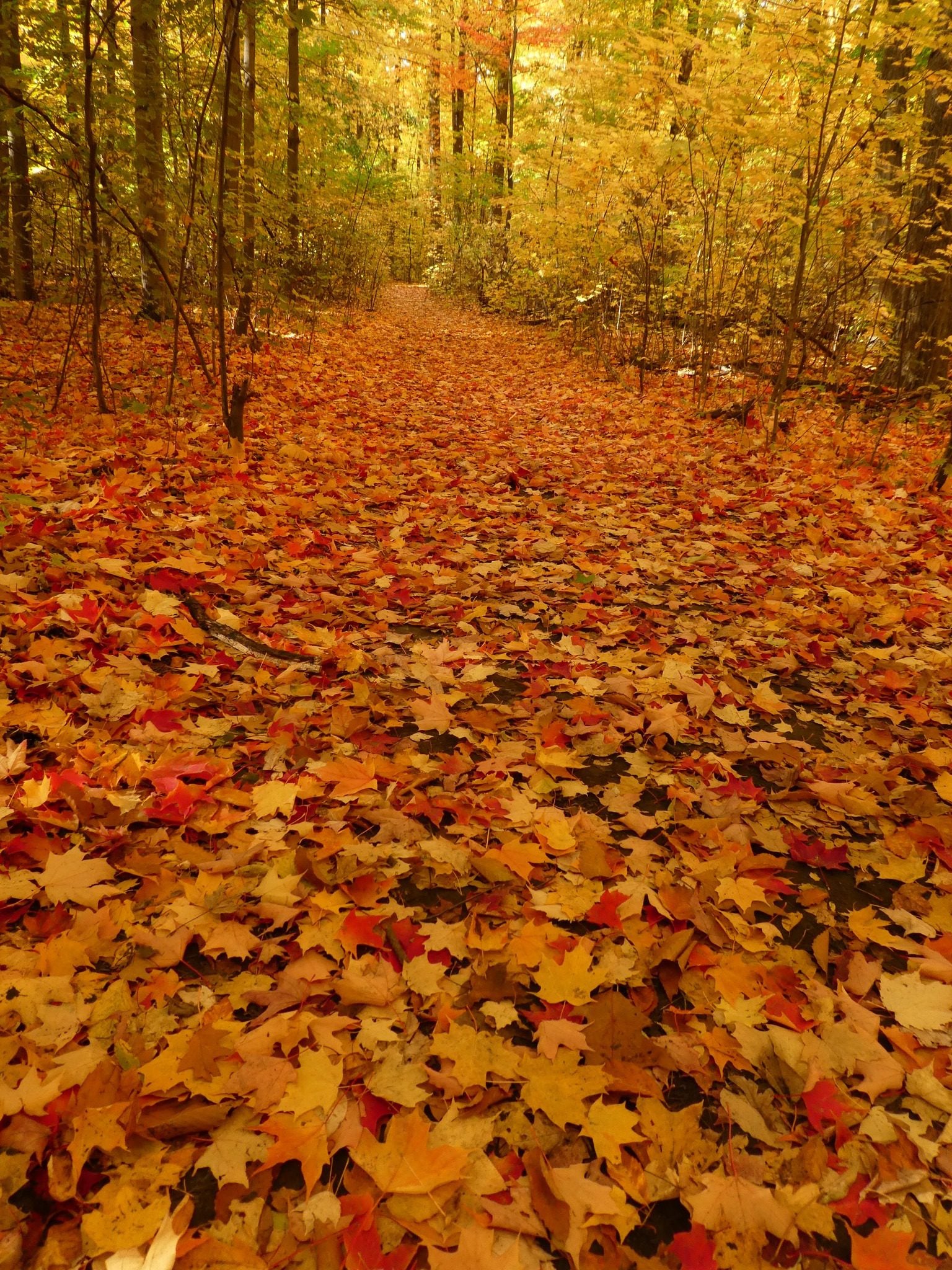
Location (Google Maps): Meet in the main parking lot at Mount Nemo at 9:15 am. Reserve your time at conservationhalton.caHike Leader(s): Karen Bergmann Click here to contact Hike Leader(s)
Pace: Medium – 3 to 4 km/hr
Terrain: Moderate – Some hills and/or some poor footing
Distance: 7 kmsDescription
We will hike the basic loop and on a side trail. - 04October 4, 2025
Coach Trip: Fall Colours in Owen Sound
https://hikes.brucetrail.org/event/coach-trip-fall-colours-in-owen-sound/Sorry, the registration cut-off time for this hike has been reached.Not a member? Click here to join today!Trip Information
Departure Time: 07:30
Return to City Time: 19:30
Departure Point: York Mills Bus PickupTrip Activities
Moderate hike ($0.01)
Fast hike ($0.01)
Optional Items
Pick up at HWY 400 & Major Mac ($0.01)Hosting Club: Toronto
Category: Coach Trips
Location (Google Maps): Inglis Falls Conservation AreaHike Leader(s): Martina Furrer, Felix Wan, Robin Crombie, Roland Mark Click here to contact Hike Leader(s)
Pace: Moderate (3-4 km/hr)
Terrain: Challenging, Hilly, Level 2 (Intermediate – some hills and uneven surfaces, rocks and roots underfoot), Rocky
Distance: Moderate group: about 12 km, Fast group: about 15 kmDescription
Join us for a fantastic fall hike on the Bruce Trail in the Owen Sound area. We will split into two groups; the moderate group will hike about 12 km (3 km/hr pace) , fast group will hike around 15 km (4 km/hr pace). Long time TBTC member and now Owen Sound resident Melanie Bissett will join us. Immerse yourself in Ontario’s fall colours, discover amazing geological formations, and enjoy views of beautiful Inglis Falls, the Sydenham River, and possibly Jones Falls. We will also pass lookouts overlooking Owen Sound and Georgian Bay. Both routes will include some hilly and challenging sections with rocks, roots and crevices underfoot. Refreshment stop in Owen Sound after the hike.Departure 1: 7:30 AM, 10 York Mills Rd
Departure 2: 7:50 AM, GO bus stop at HWY 400 and Major Mackenzie Dr Park and Ride
If you would like to be picked up at HWY 400 and Major Mackenzie Dr, please select that option when you register. The bus will not stop there if no one requests that stop.
We plan to be back in Toronto between 7 and 8 PM.

Steeltown Stomp 2025
https://hikes.brucetrail.org/event/steeltown-stomp-2025/Sorry, the registration cut-off time for this hike has been reached.Not a member? Click here to join today!Hosting Club: Iroquoia
Category: Steeltown Stomp
Location (Google Maps): Mohawk 4 Ice Centre
710 Mountain Brow Blvd
Hamilton, ON L8T 5A9Event Coordinator(s): Leslie Ho & Family Click here to contact Event Coordinator(s)
Event Start Times: 8:00 AM, 8:15 AM, 8:30 AM, 8:45 AMPace: Brisk – 4 to 5 km/hr, Fast – 5+ km/hr
Terrain: Strenuous – Hilly with steep climbs and some poor footing
Distance: 23 kmDescription
The 9th annual Steeltown Stomp event is a challenging and rewarding self-guided hike and stair climb along the escarpment in Hamilton. You will hike approximately 23 kms, and climb more than 2,000 stairs along the Bruce Trail, the Escarpment Rail Trail, and the Chedoke Radial Trail. As you follow the specially blazed route you will encounter and climb the 7 sets of stairs along the Hamilton Escarpment. The route will be clearly marked with special yellow blazes, and staircases will have clear instruction signs posted. The route will be available on the AllTrails app, and printed maps are available at the starting point for those who would like one. You will find snacks and encouragement at the turnaround checkpoint at the Chedoke stairs, and then will return to the starting point to collect your coveted Steeltown Stomp badge, enjoy more snacks, and experience a great sense of accomplishment!Please Note: This is an arduous hike and requires a high level of fitness due to the stair climbing required.
Fee: $35 fee includes checkpoint and finish zone snacks, your badge, and will support the Bruce Trail Conservancy in its mission to preserve a ribbon of wilderness, for everyone, forever.
Check in: At the registration booth set up at the north end of the parking lot of the Mohawk 4 Ice Centre. We have set up staggered start times. Please select 8:00, 8:15, 8:30, or 8:45 when you register and you will start the hike as you are checked in. This is not a race, and you will not be timed.
Checkpoints: Start and end at the Mohawk 4 Ice Centre. There is a turnaround checkpoint at the Chedoke Golf Course, and then you will hike directly back to the starting point. You are not expected to complete the stairs on the return trip.
Route: Follow the yellow blazes! Special yellow blazes will be set up to mark the route. In addition, the route has been set up on the AllTrails app. If you have this downloaded on your phone, you can follow the route using the app.
Outbound route … https://www.alltrails.com/explore/map/steeltown-stomp-outbound-1-58c2ac6?u=m?u=m
Inbound route … https://www.alltrails.com/explore/map/steeltown-stomp-inbound-c89ca36?u=m
What to bring: Bring your own water. You will be able to refill your own water bottles at public water fountains along the route. Snacks will be provided, but you may wish to bring additional food for a lunch break. Wear comfortable, sturdy shoes (hiking boots are not necessary), and dress for the weather. Protect yourself from insects and sun.
Safety Precautions: Normal hiker etiquette and safety precautions apply…https://brucetrail.org/explore-the-trail/#Bruce-Trail-101
Donations: If you are interested in contributing further to the BTC, please click here.
FAQ’s:
What if it rains? This is a rain or shine event.
What if I need to drop out? As we are in an urban area, there are places to meet a taxi or a ride along the way. This must be arranged by you, the participant. If you have to drop out during the event, please let us know by calling or texting the contact number below.
How long will it take to finish? We estimate that the hike will take between 3 and 5 hours.
Are dogs allowed? No. The stairs will be too crowded during this event.
Contact: Leslie Ho at iroquoiasteeltownstomp@gmail.com. On event day, you can text event organizers 289-237-8059.
Erindale park Mississauga
https://hikes.brucetrail.org/event/car-hike-bethesda-trail-richmond-hill-31/Sorry, the registration cut-off time for this hike has been reached.Not a member? Click here to join today!Hosting Club: Toronto
Location (Google Maps): parking lot Erindale Park, Dundas Street West, Mississauga, ON
Hike Leader(s): Mohammad Aghamiri Click here to contact Hike Leader(s)
Pace: Moderate (3-4 km/hr)
Terrain: Hilly, Level 2 (Intermediate – some hills and uneven surfaces, rocks and roots underfoot)
Distance: 14-15 kmDescription
We will hike Credit River North and will see nice views of Credit River and possibly some salmons heading upstreamFrom parking lot we hike north mostly along Credit River and return to parking around 13 to 13.30
For the day of hike only my phone number is 289 588 6482.

GeoHike #1: Murphy's Pinnacle
https://hikes.brucetrail.org/event/geohike-2-murphys-pinnacle/Sorry, the registration cut-off time for this hike has been reached.Not a member? Click here to join today!Hosting Club: Dufferin Hi-Land
Category: General Hike
Location (Google Maps): Meet at Map 20 KM18.7 at the dead end of Centre Road (just south of 5 Sideroad, Mulmur)Hike Leader(s): Lynda Bloom; Margery Cruise Click here to contact Hike Leader(s)
Pace: Medium
Terrain: Dependent on Conditions, Moderate
Distance: 7 kmsDescription
We will hike about 7 km on side trails in the Boyne Valley Provincial Park. Visiting Murphy’s Pinnacle gives us a viewpoint over the Boyne River Valley with the towers of Toronto visible on a clear day. The Pinnacle is a glacial age sand and gravel kame; we will learn what a kame is and how to make one! A professional geologist will explain how the rolling hills of Mulmur formed and what it means for forest growth. In October, we might be able to enjoy the artistry of fall colours.
Geology Hike #14 Kemble Mountain
https://hikes.brucetrail.org/event/geology-hike-14-kemble-mountain/Sorry, the registration cut-off time for this hike has been reached.Not a member? Click here to join today!Hosting Club: Sydenham
Category: Geology Hike
Location (Google Maps): Meet and park roadside where Cole’s Sideroad meets Taylor Sideroad, just north of Concession 20. Coles Sideroad is accessed via Concession 20, between Wolseley (Grey Road 17) and Kemble. We will carpool to trailhead. Linear Hike.Hike Leader(s): Carol Graham-Mullin Click here to contact Hike Leader(s)
Pace: Leisurely: 3 km/h or less
Terrain: Easy: Mostly flat and good footing., Moderate: Some hills and/or poor footing, Strenuous: Hilly with steep climbs and some poor footing.
Distance: approx 6.3 kmDescription
On this linear hike you will enjoy the views from the heights of Kemble Mountain, starting at the trailhead parking near Edmonstone Side Trail and heading west on the main trail to Mystery Cabin Side Trail and Don Richards Side Trail back to the cars. We will be encountering deep crevices, springs, fossils and beautiful mature forests that may be showing colour at this time of year. Please bring water, snacks and poles as needed. The hike leader will have copies of Beth Gilhespy’s Sydenham geology book for sale (cash, cheque or e-transfer $37.00 BT members. “Walking Through Time Exploring Niagara Escarpment Geology.” Sydenham Bruce Trail Geology Badge has been developed. Details can be shared from hike leader during the hike.
Introductory Hike - Evergreen Brickworks
https://hikes.brucetrail.org/event/introductory-hike-evergreen-brickworks/Sorry, the registration cut-off time for this hike has been reached.Not a member? Click here to join today!Hosting Club: Toronto
Category: Urban Walk
Location (Google Maps): Meet the hike leaders in Tiffany Commons in front of the watershed wall at the Evergreen Brickworks (across from the cafe). To reach the Evergreen Brickworks you may take the free shuttle from outside Broadview Subway Station (departs every 30 minutes from 7:45 am until 9:45 (driver takes scheduled break at 10:15) or TTC Route #28 Bayview South from Davisville Subway Station (every 30 minutes)Hike Leader(s): Tom Swales, David Royle Click here to contact Hike Leader(s)
Pace: Leisurely (2-3 km/hr)
Terrain: Level 1 (Easy – mostly on flat, well maintained trails with hard-packed surface), Variable
Distance: 5 kmDescription
The public is invited to join us for a short introductory hike from the Evergreen Brickworks as part of our Bruce Trail Day activities. The club will have a booth staffed with volunteers providing information about the Bruce Trail and the Toronto Bruce Trail Club. On Sunday there will be a Hiking 101 Workshop (see the seperate entry on the hike schedule). Our hike will explore the wetlands, woodlands, and natural meadows of the Evergreen Brickworks, ascend into the beautiful Moore Park Ravine and return to the Evergreen Brickworks via the scenic outlook overlooking the Evergreen Brickworks and adacent ravines. A wonderful opportunity to enjoy the fall colours, the Evergreen farmers market, and learn about the Toronto Bruce Trail Club’s year round hiking program and conservation work. Preregistration on the hike schedule is not required – just arrive 15 minutes prior to the hike to sign up with the hike leaders.Introductory Hike - Evergreen Brickworks
https://hikes.brucetrail.org/event/introductory-hike-evergreen-brickworks-2/Sorry, the registration cut-off time for this hike has been reached.Not a member? Click here to join today!Hosting Club: Toronto
Category: Urban Walk
Location (Google Maps):Meet the hike leaders in Tiffany Commons in front of the watershed wall at the Evergreen Brickworks (across from the cafe). To reach the Evergreen Brickworks you may take the free shuttle from outside Broadview Subway Station (departs every 30 minutes from 7:45 am until 9:45 (driver takes scheduled break at 10:15) or TTC Route #28 Bayview South from Davisville Subway Station (every 30 minutes)
Hike Leader(s): Danny Pivnick, Ray Berzins Click here to contact Hike Leader(s)
Pace: Leisurely (2-3 km/hr)
Terrain: Flat, Level 1 (Easy – mostly on flat, well maintained trails with hard-packed surface)
Distance: 6 kmDescription
The public is invited to join us for a short introductory hike from the Evergreen Brickworks as part of our Bruce Trail Day activities. The club will have a booth staffed with volunteers providing information about the Bruce Trail and the Toronto Bruce Trail Club. On Sunday there will be a Hiking 101 Workshop (see the seperate entry on the hike schedule). Our hike will proceed from the Evergreen Brickworks southbound into the ravine trails and northwards past Milkman’s Lane into Park Drive Reservation. We will continue to Mount Pleasant Road and return to the Evergreen Brickworks with the option to turn back earlier at the Glen Road Bridge. This will be a wonderful opportunity to enjoy the fall colours, the Evergreen farmers market, and learn about the Toronto Bruce Trail Club’s year round hiking program and conservation work. Preregistration on the hike schedule is not required – just arrive 15 minutes prior to the hike to sign up with the hike leaders.