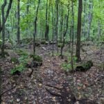
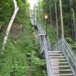
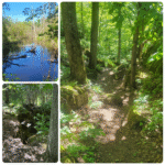
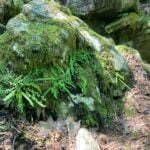
Pace: Brisk 4-5 km/hr Terrain: Moderate: some hills and some poor footing : 10k+
Description Our regular Spot for the Tuesday Long Hike. Note the new location. We will hike the trails around Short Hills Dress for the weather and bring sunscreen bug spray, poles snack and drink
Hosting Club: Toronto Category: Urban Walk Location (Google Maps): High Park North Gates (Bloor Street West at High Park Avenue). This is a 5 minute walk from High Park Subway Station.
Pace: Moderate (3-4 km/hr) Terrain: Level 1 (Easy – mostly on flat, well maintained trails with hard-packed surface) Distance (km): 8
Description Please join me as we explore three of west Toronto’s most scenic green spaces. We will begin by walking through High Park. While there we’ll visit the High Park Labyrinth and visit historic Colborne Lodge. From here we’ll make our way down to the Martin Goodman Trail and walk west along the boardwalk to Humber Bay Park. We’ll follow the Humber Bay park trails south to Lake Ontario and enjoy a view of the Toronto skyline and surrounding lakefront. The hike will conclude at Palace Pier Park – a 10 minute bus ride to Old Mill Subway Station.
Join us for Mono Cliffs: Trails & Tales, an approximately 9 km, 3-hour hike through the beautiful trails of Mono Cliffs Provincial Park.
We will meet at the Mono Community Centre parking lot, 754483 Mono Centre Road, Mono, ON, and hike into Mono Cliffs Provincial Park before returning to our starting point.
Distance: Approximately 9 km Duration: Approximately 3 hours Pace: Moderate Terrain: Moderate, with hills, some rocky sections and uneven footing
Along the way, we will travel through beautiful forested sections and the Niagara Escarpment landscape, stopping briefly at points of interest to enjoy the surroundings and share a few interesting facts and stories about the area.
Please ensure that you are comfortable hiking approximately 9 km over varied terrain before registering.
How to Prepare
• Get a good night’s sleep and come ready for approximately 3 hours of hiking.
• Bring plenty of water. 1–2 litres per person is recommended.
• Bring a snack or light food for the hike. Bring your medication if needed.
• Wear sturdy hiking shoes or hiking boots with good traction. Waterproof footwear is recommended if trail conditions are damp.
• Hiking poles are recommended but not required, particularly for hills and uneven sections.
• Bring insect repellent or wear protective clothing.
• Bring sunscreen and consider a hat for sun protection.
• Dress appropriately for the weather and consider bringing an extra layer.
• Please arrive 15 minutes before the scheduled start time to allow time for check-in. We will depart promptly.
Weather
The hike may be cancelled or rescheduled in the event of rain or other unsafe weather or trail conditions. Registered hikers will be notified of any changes.
LIMITED SPACE AVAILABLE!
Come ready to move, explore and enjoy an end-of-summer adventure as we discover the trails and tales of Mono Cliffs!
Pace: Medium – 3 to 4 km/hour Terrain: Moderate – some hills and/or some poor footing Distance: 10 km
Description From City View parking we will hike to Smokey Hollow and the Great Falls. We’ll break at the Falls for a rest and/or optional hike down Grindstone Creek.
Hosting Club: Dufferin Hi-Land Category: Tuesday Hike Location (Google Maps): Dufferin Hi-Land, Map 20. Meet at Rock Hill parking lot on 1st Line Mulmur, just south of 10 Sideroad (Km 29.4).
Pace: Leisurely Terrain: Moderate Distance: 7.0 km; Short Hike: 2.4 km
Description We will hike the Main Trail, returning by way of the Oliver Creek and Moss Haven Side Trails. The short hike will return to parking from just past the top of the Enchanted Forest Side Trail, before the Main Trail descends into the Boyne Valley. Bring water and snacks. Hiking poles are recommended.
Location (Google Maps): Parking lot is off Sycamore Drive, East of Bayview , across Starbucks plaza Bus 91 from Finch East station stops at Sycamore station.
Hike Leader(s): Mohammad Aghamiri
Pace: Moderate (3-4 km/hr) Terrain: Hilly, Level 2 (Intermediate – some hills and uneven surfaces, rocks and roots underfoot) Distance (km): 6-7 km
Description We will explore Valleyview and Maple View parks, and walk along German Mills Creek, in return we stop in Huntington park and have snack under beautiful shed.
Although this is considered an “Urban Walk”, you can expect some hills up and down and uneven surfaces with tree roots. Please bring hiking poles, water and snacks.
Pace: Medium: 3 to 4 km/h Terrain: Moderate: Some hills and/or poor footing Distance: 4 km
Description The Walk In Nature Series (WINS) consists of short loop hikes in the Sydenham section of the Bruce Trail that combine nature appreciation with fitness in a safe and welcoming group environment led by an experienced hike leader. Medium paced WINS hikes are open to all ages and levels of hiking experience whether members or non-members of the Bruce Trail Conservancy (BTC)
On this hike we will walk a 4 km loop with a medium pace on the interesting side trail, Sydenham Nature Reserve and the access along the rail trail, the Keeling side trail. It is quite level with some rocky sections.
Dress in layers, bring water, a snack, personal medication and supplies. Hiking poles are not required by are always welcome. Arrive 10 min before the hike start time.
This hike is the final evening WINS hike of the summer. This fall, WINS hikes will be during the day on Tuesdays.
Description This hike is a there-and-back walk. We begin on the edge of the Beaver Valley and then head towards a beaver pond. A walk along the edge of fields takes us into a wood lot, then to the Young Wetland. Birds are often sighted on the water. From there, we stroll the rest of the BTC-managed Young property to Sideroad 19, seeing fields regenerating towards a natural state. We walk back to the parking area, where we can enjoy a panoramic view into the Beaver Valley.
Guidelines
Arrive 15 minutes before the start of the hike.
Wear sturdy footwear and appropriate attire for the weather and the terrain. Hiking poles are a good idea in any season, especially if the terrain is rocky or slippery. In winter, snowshoes or icers/crampons are needed when conditions dictate. Wearing appropriate clothing and footwear prevents injuries and shows consideration for a safe and positive group hiking experience.
Always carry I.D. and your health card.
Bring sufficient water and snacks (or lunch if indicated). A minimum of 1L of water is recommended on all hikes, and 3L is recommended for long, challenging hikes in the heat of the summer.
Bring sunscreen and insect repellent (for spring and summer hikes).
Hosting Club: Sydenham Category: An evening walk. Location (Google Maps): Meet in the municipal parking lot by the river on the West side of first Ave East between 7th Ave East and 8th Ave East in Owen Sound.
Pace: Brisk: 4 to 5 km/h Terrain: Moderate: Some hills and/or poor footing Distance: Approx 5 km
Description Join us for a brisk evening hike exploring Owen Sound paths and neighbourhoods, followed by an opportunity for refreshments. There is no need to show up 15 minutes early for this hike, but we will leave promptly at 7:00 pm.
Hosting Club: Toronto Category: Urban Walk Location (Google Maps): Parking lot is off Sycamore Drive, East of Bayview , across Starbucks plaza Bus 91 from Finch East station stops at Sycamore station.
Pace: Moderate (3-4 km/hr) Terrain: Hilly, Level 2 (Intermediate – some hills and uneven surfaces, rocks and roots underfoot) Distance (km): 7-8 km
Description We will explore Valleyview and Maple View parks, and walk along German Mills Creek, in return we stop in Huntington park and have snack ,coffee,tea .
Although this is considered an “Urban Walk”, you can expect some hills up and down and uneven surfaces with tree roots. Please bring hiking poles, water and snacks.
Pace: Medium – 3 to 4 km/hour Terrain: Easy – mostly flat and usually good footing, Moderate – some hills and/or some poor footing Distance: 13.5 km loop
Description This is the first hike of a Toronto End-to-End Series that will also include side trails. Most of the hikes in the series will be loops.
This hike will take us along the main trail to the Rockside Side Trail then back to Boston Mills Road all the way to the Cheltenham Badlands before a post hike stop at the Spirit Tree Cidery.
Pace: Leisurely – 3km/hr or less Terrain: Easy – Mostly flat and usually good footing, Moderate – Some hills and/or some poor footing Distance: Approx. 8-9 km.
Description Join us to explore the many trails between Watertown and Kerns Rd. We will use a combination of Main Bruce Trail, Blue Side Trails and former Bruce Trail as well as trails of use. Meet in the SOUTH parking lot at 9:45 am. for a 10:00 am. start. Bring water, a snack and sunscreen. Expect some rocky areas. I will send out an email the day before with my contact details in the event you need to cancel in the morning.
Pace: Leisurely <3 km/hr Terrain: Moderate: some hills and some poor footing Distance: 4km
Description Hike series Thursday evenings throughout the summer, followed by optional Blues in the Park. Come prepared to hike 1.5 leisure hike. Various blues bands free of charge starting at 7pm in the park. Bring lawn chair, beverage and snack to share.
Description Enjoy the benefits of pausing for a yoga practice as we tour through the trails, parkland and Historic Niagara-on-the-Lake. No mat required. Movement will focus on a flow of standing poses designed especially for hikers. Plan to stay for conversation and a warm cup of coffee or tea at Sweets & Swirls, Community Centre, Niagara Stone Road, NOTL.
You are signing up for the following dates and times: 2026-09-05 at 07:00 2026-09-06 at 07:00 2026-09-12 at 07:00 2026-09-13 at 07:00 2026-09-19 at 07:00 2026-09-20 at 07:00 2026-10-17 at 07:00 2026-10-18 at 07:00
Pace: Medium (3.0 – 4.5 km/h): A comfortable pace for most hikers with steady progress. Terrain: Difficult: Steep ascents/descents, rocky scrambling, and some rugged escarpment paths., Moderate: Rolling hills, mild slopes and rocky paths. Distance: Approx. ~166km
Description Peninsula E2Ein8
Route: Wiarton to Tobermory (northbound)
Pace: Medium (target 3–4 km/h)
Terrain: Moderate to Difficult
Distance: ~166 km total
Daily Distances: 25.1 km ·19.2 km · 22.8 km · 21.5 km · 20 km · 11 km · 22.6 km · 23.6 km
Expectations: Expect 5–8 hours on the trail each day, depending on distance, terrain, weather, and group pace. The hike leader sets the pace, aiming for 3–4 km/h, and may adjust as needed for group ability and trail conditions. Breaks will be taken throughout the day.
For safety, participants must remain between the hike leader and the hike sweep at all times.
Meeting Time: 7:00 AM
Fees:
Registration fee does not include Bruce Peninsula National Park entry fees, Cape Croker Park or MNBP parking fees
Parking costs will be shared equally among participants.
Badge fee included, with your choice of either the flowerpot badge or the stained glass (Turkey Vulture or Black Bear) badge.
Fundraising: This hike is a fundraiser to support the Peninsula Bruce Trail Club’s volunteer-run hike program
Hosting Club: Iroquoia Category: Steeltown Stomp Practice Session Location (Google Maps): Chedoke Golf Club Parking Lot – Access from Beddoe Dr off Studholm Rd south of Aberdeen (Parking capacity 40)
Pace: Brisk – 4 to 5 km/hr, Medium – 3 to 4 km/hr Terrain: Strenuous – Hilly with steep climbs and some poor footing Distance: Varies
Description Is the Steeltown Stomp on your bucket list? This is your chance to crush it! Join us and prepare for this incredible challenge on October 3rd, 2026! Registration for the event is now open.
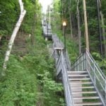
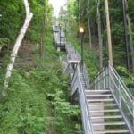
If you’ve done stair climbs before, you know the deal—that brutal calf pain is real, especially when you’re just starting out. But training with us this summer? That’s how you show up on stomp day actually feeling strong instead of totally wrecked. Trust me.
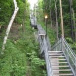
We’ll start easy and build up as the summer goes on, hitting Chedoke and Dundurn Stairs with some scenic hikes mixed in. By the time October rolls around, you’ll have crushed at least 2,000 steps and you’ll actually know what you’re doing.
It’s a solid group vibe—moderate pace, warm-ups to get going, stretches to cool down. And honestly, it’s way more fun (and way less painful) doing this with people who get it.
Just grab your water bottle (there’s water at both staircases) and whatever snacks you want. And yeah, there’s optional coffee after if you want to hang out and celebrate.
We’ve got 7 training dates lined up this summer—check the schedule and pick the ones that work for you. Do the work now, own it on stomp day. See you out there!
Pace: Leisurely – 3 km/hr. or less Terrain: Easy – Mostly flat and usually good footing Distance: 4.3 km
Description Flower ports are created by water that exploits cracks and eventually removes the material between the flowerpot and the main rock face. The water smooths and round the rock of the flowerpot. The flowerpots at Indian Brook were created several thousands of years ago when lake levels were significantly higher than they are today. Great Views of Georgian Bay and the Beaver Valley. See Hike #1 – August 26 for series description
Hosting Club: Toronto Category: GO Train Hike Location (Google Maps): Meet in the Great Hall of Toronto’s Union Station by the Traveller’s Aid Desk (with the clock over it) by 8:35 AM to take the Stratford bound train scheduled to depart at 8:49 AM. Alternatively you may take the 9:49 AM train from Mount Dennis to Bramalea GO Station and transfer to the Stratford bound Train (scheduled to depart at 9:20 AM, an approximately 10 minute wait between trains) and you may find us in the upper level of the accessibility coach.
Pace: Moderate (3-4 km/hr) Terrain: Flat, Level 2 (Intermediate – some hills and uneven surfaces, rocks and roots underfoot) Distance (km): 12 km
Description Join us for a day trip to Stratford on the GO Train. If you buy the Weekend Day Pass the return fare is just $10.00! We will hike along trails on both sides of the Avon River in Stratford including the Shakespearan Gardens. We’ll have dinner in a local pub before departing Stratford on the 6:15 PM train. There will be the chance to enjoy the historic downtown as well as some relaxing time by the river as we’ll have the full afternoon. Before registering please note that is a 2,1/2 hour journey on the train each way and there are no alternative GO services from Stratford other than the 6:15 pm train arriving back at Union Station at 8:40 PM. This trip will be contigent on there being no disruption to service on the Kitchener GO Line on the weekend (GO only announces those closures two weeks in advance).
Pace: Mixed (See Hike Description) Terrain: Level 2 (Intermediate – some hills and uneven surfaces, rocks and roots underfoot), Rocky, Variable Distance (km): 10 to 12 km
Description This hike is a continuation of the Lions Head series. We will complete three hikes over the weekend, ending at the cairn in Tobermory. Due to trail closures we will not hike the section between Crane Lake Road and Half Way Dump. As a substitute we will hike through side trails of the Bruce Peninsula National Park.
The meeting point on Saturday will be the Cairn in Tobermory marking the northern terminus of the Bruce Trail. We will then drive to the parking area at Halfway Dump Road. From here we will take two vehicles to the Bruce Peninsula National Park to start the hike.
Parking fees will apply. More information to be provided closer to the date.
Trail conditions are rocky which will make progress slow at times.
For those coming long distance, local accommodation should be available in Tobermory.
More information about the hike will be posted closer to the date.
Pace: Medium – 3 to 4 km/hr Terrain: Moderate – Some hills and/or some poor footing Distance: 9 kms
Description Meeting roadside at 9:15 on Second Line, we will carpool to Fourth Line and hike back. The trail takes us through the forest and the grounds of the Hockley Valley Resort, across a golf course and bike trails, down to Second Line. We will continue into Riverside Woods and hike a loop along the side trails there, back to the cars.
Bring sufficient water and a snack, as needed, as well as bug spray/bug net.
Pace: Moderate (3-4 km/hr) Terrain: Flat Distance (km): 10.9 km
Description Please join me at the Tim Horton’s at Lakeshore and Leslie no later than 9:50 am. We start hiking at 10:00 am.
We will hike east on Lakeshore, along the Beaches Boardwalk, and on Kingston Rd to Brimley Rd. The estimated distance is 10.9 km. Here is an online map of our route Lakeshore to Brimley Rd
Bring a snack, at least 2 liters of water, bug spray and sunscreen.
Note: This hike is being done out of sequence due to a scheduling conflict.
You are signing up for the following dates and times: 2026-09-05 at 07:00 2026-09-06 at 07:00 2026-09-12 at 07:00 2026-09-13 at 07:00 2026-09-19 at 07:00 2026-09-20 at 07:00 2026-10-17 at 07:00 2026-10-18 at 07:00
Pace: Medium (3.0 – 4.5 km/h): A comfortable pace for most hikers with steady progress. Terrain: Difficult: Steep ascents/descents, rocky scrambling, and some rugged escarpment paths., Moderate: Rolling hills, mild slopes and rocky paths. Distance: Approx. ~166km
Description Peninsula E2Ein8
Route: Wiarton to Tobermory (northbound)
Pace: Medium (target 3–4 km/h)
Terrain: Moderate to Difficult
Distance: ~166 km total
Daily Distances: 25.1 km ·19.2 km · 22.8 km · 21.5 km · 20 km · 11 km · 22.6 km · 23.6 km
Expectations: Expect 5–8 hours on the trail each day, depending on distance, terrain, weather, and group pace. The hike leader sets the pace, aiming for 3–4 km/h, and may adjust as needed for group ability and trail conditions. Breaks will be taken throughout the day.
For safety, participants must remain between the hike leader and the hike sweep at all times.
Meeting Time: 7:00 AM
Fees:
Registration fee does not include Bruce Peninsula National Park entry fees, Cape Croker Park or MNBP parking fees
Parking costs will be shared equally among participants.
Badge fee included, with your choice of either the flowerpot badge or the stained glass (Turkey Vulture or Black Bear) badge.
Fundraising: This hike is a fundraiser to support the Peninsula Bruce Trail Club’s volunteer-run hike program
Hosting Club: Iroquoia Category: Steeltown Stomp Practice Session Location (Google Maps): Chedoke Golf Club Parking Lot – Access from Beddoe Dr off Studholm Rd south of Aberdeen (Parking capacity 40)
Pace: Brisk – 4 to 5 km/hr, Medium – 3 to 4 km/hr Terrain: Strenuous – Hilly with steep climbs and some poor footing Distance: Varies
Description Is the Steeltown Stomp on your bucket list? This is your chance to crush it! Join us and prepare for this incredible challenge on October 3rd, 2026! Registration for the event is now open.
If you’ve done stair climbs before, you know the deal—that brutal calf pain is real, especially when you’re just starting out. But training with us this summer? That’s how you show up on stomp day actually feeling strong instead of totally wrecked. Trust me.
We’ll start easy and build up as the summer goes on, hitting Chedoke and Dundurn Stairs with some scenic hikes mixed in. By the time October rolls around, you’ll have crushed at least 2,000 steps and you’ll actually know what you’re doing.
It’s a solid group vibe—moderate pace, warm-ups to get going, stretches to cool down. And honestly, it’s way more fun (and way less painful) doing this with people who get it.
Just grab your water bottle (there’s water at both staircases) and whatever snacks you want. And yeah, there’s optional coffee after if you want to hang out and celebrate.
We’ve got 7 training dates lined up this summer—check the schedule and pick the ones that work for you. Do the work now, own it on stomp day. See you out there!
Pace: Leisurely – 3 km/hr. or less Terrain: Easy – Mostly flat and usually good footing Distance: 4.3 km
Description Flower ports are created by water that exploits cracks and eventually removes the material between the flowerpot and the main rock face. The water smooths and round the rock of the flowerpot. The flowerpots at Indian Brook were created several thousands of years ago when lake levels were significantly higher than they are today. Great Views of Georgian Bay and the Beaver Valley. See Hike #1 – August 26 for series description
Hosting Club: Toronto Category: GO Train Hike Location (Google Maps): Meet in the Great Hall of Toronto’s Union Station by the Traveller’s Aid Desk (with the clock over it) by 8:35 AM to take the Stratford bound train scheduled to depart at 8:49 AM. Alternatively you may take the 9:49 AM train from Mount Dennis to Bramalea GO Station and transfer to the Stratford bound Train (scheduled to depart at 9:20 AM, an approximately 10 minute wait between trains) and you may find us in the upper level of the accessibility coach.
Pace: Moderate (3-4 km/hr) Terrain: Flat, Level 2 (Intermediate – some hills and uneven surfaces, rocks and roots underfoot) Distance (km): 12 km
Description Join us for a day trip to Stratford on the GO Train. If you buy the Weekend Day Pass the return fare is just $10.00! We will hike along trails on both sides of the Avon River in Stratford including the Shakespearan Gardens. We’ll have dinner in a local pub before departing Stratford on the 6:15 PM train. There will be the chance to enjoy the historic downtown as well as some relaxing time by the river as we’ll have the full afternoon. Before registering please note that is a 2,1/2 hour journey on the train each way and there are no alternative GO services from Stratford other than the 6:15 pm train arriving back at Union Station at 8:40 PM. This trip will be contigent on there being no disruption to service on the Kitchener GO Line on the weekend (GO only announces those closures two weeks in advance).
Pace: Mixed (See Hike Description) Terrain: Level 2 (Intermediate – some hills and uneven surfaces, rocks and roots underfoot), Rocky, Variable Distance (km): 10 to 12 km
Description This hike is a continuation of the Lions Head series. We will complete three hikes over the weekend, ending at the cairn in Tobermory. Due to trail closures we will not hike the section between Crane Lake Road and Half Way Dump. As a substitute we will hike through side trails of the Bruce Peninsula National Park.
The meeting point on Saturday will be the Cairn in Tobermory marking the northern terminus of the Bruce Trail. We will then drive to the parking area at Halfway Dump Road. From here we will take two vehicles to the Bruce Peninsula National Park to start the hike.
Parking fees will apply. More information to be provided closer to the date.
Trail conditions are rocky which will make progress slow at times.
For those coming long distance, local accommodation should be available in Tobermory.
More information about the hike will be posted closer to the date.
Pace: Medium – 3 to 4 km/hr Terrain: Moderate – Some hills and/or some poor footing Distance: 9 kms
Description Meeting roadside at 9:15 on Second Line, we will carpool to Fourth Line and hike back. The trail takes us through the forest and the grounds of the Hockley Valley Resort, across a golf course and bike trails, down to Second Line. We will continue into Riverside Woods and hike a loop along the side trails there, back to the cars.
Bring sufficient water and a snack, as needed, as well as bug spray/bug net.
Pace: Moderate (3-4 km/hr) Terrain: Flat Distance (km): 10.9 km
Description Please join me at the Tim Horton’s at Lakeshore and Leslie no later than 9:50 am. We start hiking at 10:00 am.
We will hike east on Lakeshore, along the Beaches Boardwalk, and on Kingston Rd to Brimley Rd. The estimated distance is 10.9 km. Here is an online map of our route Lakeshore to Brimley Rd
Bring a snack, at least 2 liters of water, bug spray and sunscreen.
Note: This hike is being done out of sequence due to a scheduling conflict.
Pace: Mixed (See Hike Description) Terrain: Level 2 (Intermediate – some hills and uneven surfaces, rocks and roots underfoot), Rocky, Variable Distance (km): 12 km
Description This is the second of three hikes in this series. We will hike from the Bruce Peninsula National Park along Georgian Bay, north to Little Cove . Excellent views of the Bay.
The meeting point will be the Cairn in Tobermory marking the northern terminus of the Bruce Trail or as agreed the previous day. We will then drive to the parking area at Little Cove Road (km 156.4). From here we will take two vehicles to the Bruce Peninsula National Park to start the hike.
Parking fees will apply. More information to be provided closer to the date.
Trail conditions are rocky which will make progress slow at times.
For those coming long distance, local accommodation should be available in Tobermory. More information about the hike will be posted closer to the date.
Hosting Club: Caledon Hills Category: General Location (Google Maps): Meet at the roadside parking at the junction of Escarpment Side Road and Willoughby Road, km 15.9 (Map 15). Car Pool to roadside parking at Mountain View Side Trail on Mountain View Road. Google Map Coordinates: 43.894254, -79.922522, north of km 26.8 (Map 15).
Pace: Medium – 3 to 4 km/hour Terrain: Moderate – some hills and/or some poor footing Distance: 10.2 km
Description In September 1907, a passenger train went off the tracks on the steep Horseshoe Valley Curve on the Niagara Escarpment. Seven people were killed and dozens were injured. The Bruce Trail passes close to the location of this disaster. Join us for a hike that includes a stop at the historic St. Andrew’s Stone Church Cemetery, panoramic views from Escarpment Road, and to learn about the tragic story and mystery of the famous Horseshoe Curve Rail Disaster.
Bring your choice of hydration and snacks. We will be going through the forest, as well as walking on roads. There is one steep hill. Sturdy footwear is essential. Note: this is a car pool hike.
Hosting Club: Toronto Category: Car Hike Location (Google Maps): We will meet at the roadside parking on Heritage Road (coordinates are 43.734079, -79.944033).
Pace: Leisurely (2-3 km/hr), Moderate (3-4 km/hr) Terrain: Level 1 (Easy – mostly on flat, well maintained trails with hard-packed surface), Level 2 (Intermediate – some hills and uneven surfaces, rocks and roots underfoot), Level 3 (Advanced – steep hills and some scrambling over boulders) Distance (km): 10 km
Description This hike is part of our Rainbow Hike program🌈, which aims to foster connection, visibility, and community among 2SLGBTQIA+ hikers and allies. We’ll be joined by Doug O’Neill, who leads Rainbow Hikes with the Iroquoia Bruce Trail Club, and Lana Hubbard, a transgender hike leader with the Caledon Bruce Trail Club.
After everyone checks in with me at the meeting location we’ll do a 10 km loop hike using the main trail and the Terra Cotta Side Trail. Most of our route will be level 2/intermediate difficulty but there will be one large hill to conquer as we summit the escarpment on the main trail (level 3/advanced) as well as a fairly long flat section along the Terra Cotta Side Trail (level 1/easy) so this hike has a bit of everything! Any fit Rainbow Hiker is welcome to join us.
Everyone who participates in this hike will receive a FREE Bruce Trail Pride Badge!
Please bring at least 2 litres of water and enough food for a 4-hour hike. You should wear comfortable hiking shoes and socks, a hat, a breathable shirt, and lightweight long pants (to minimize the risk of a tick bite). If rain is in the forecast then a rain jacket would also be a great idea. Sunblock and bug repellent are also useful if it’s a sunny and buggy day.
After the hike, anyone who is interested in joining me for lunch and drinks (both alcoholic and non-alcoholic options will be available) at nearby Badlands Brewing Company (https://www.badlandsbrewing.ca/) is more than welcome to do so. And if you don’t want to purchase your lunch then no worries — we’ll be eating at picnic tables in their outdoor Beer Garden so you can bring your lunch and still enjoy the good company and great conversation.
Looking forward to hiking with you on September 6th! And feel free to share this page/link with your 2SLGBTQIA+ friends and family.
For more information on Bruce Trail’s 2SLGBTQIA+ hikes, and to get information on upcoming Rainbow Hikes, please see the following webpage: https://brucetrail.org/pride-2026/
Pace: Leisurely: 3 km/h or less Terrain: Moderate: Some hills and/or poor footing Distance: 5.8 km
Description We will carpool from Owen Sound to do a loop hike of Skinner’s Woods using a section of the main trail and the Len Holley Side Trail for access – Map 35 km 158.9 to 160.3. This is hike 48 in the book Exploring Sydenham. There will be one secret to find. If you do not have a book and would like one ($30) let me know by using the “Contact hike leader” link.
Hosting Club: Iroquoia Category: Steeltown Stomp Practice Session Location (Google Maps): Chedoke Golf Club Parking Lot – Access from Beddoe Dr off Studholm Rd south of Aberdeen (Parking capacity 40)
Pace: Brisk – 4 to 5 km/hr, Medium – 3 to 4 km/hr Terrain: Strenuous – Hilly with steep climbs and some poor footing Distance: Varies
Description Is the Steeltown Stomp on your bucket list? This is your chance to crush it! Join us and prepare for this incredible challenge on October 3rd, 2026! Registration for the event is now open.
If you’ve done stair climbs before, you know the deal—that brutal calf pain is real, especially when you’re just starting out. But training with us this summer? That’s how you show up on stomp day actually feeling strong instead of totally wrecked. Trust me.
We’ll start easy and build up as the summer goes on, hitting Chedoke and Dundurn Stairs with some scenic hikes mixed in. By the time October rolls around, you’ll have crushed at least 2,000 steps and you’ll actually know what you’re doing.
It’s a solid group vibe—moderate pace, warm-ups to get going, stretches to cool down. And honestly, it’s way more fun (and way less painful) doing this with people who get it.
Just grab your water bottle (there’s water at both staircases) and whatever snacks you want. And yeah, there’s optional coffee after if you want to hang out and celebrate.
We’ve got 7 training dates lined up this summer—check the schedule and pick the ones that work for you. Do the work now, own it on stomp day. See you out there!
Pace: Mixed (See Hike Description) Terrain: Rocky, Variable Distance (km): 8 km
Description This is the third and last hike in this series, ending at the cairn in Tobermory. This hike will be shorter, allowing for an early departure for those wishing to head home. An optional hike on the Burnt Point Loop Side Trail is available for those interested.
The meeting point will be the Cairn in Tobermory marking the northern terminus of the Bruce Trail. We will take two vehicles to the Little Cove parking area to start the hike. Parking fees will apply. More information to be provided closer to the date.
Trail conditions are in spots rocky which may slow us.
At the end of the hike those completing the Peninsula section and wanting to get their end to end badges will be presented them at the Cairn. Please contact the hike leader to order a badge for yourself. The cost will be confirmed when the order is place. Please allow two weeks for processing. After the hike those wishing to stop for refreshments are invited to meet at a nearby location. Otherwise, they can begin the drive home.
For those coming long distance, local accommodation should be available in Tobermory.
More information about the hike will be posted closer to the date.
Pace: Medium – 3 to 4 km/hr Terrain: Moderate – Some hills and/or some poor footing Distance: 8 kms
Description We will meet at 9:15 in the Pear Tree parking lot on 15 Side Road and carpool to 6th Line at the Halton Agreement Forest and hike back along the Hilton Falls Side Trail, Al Shaw Side Trail and the main trail. This trail has some serious rocks and we cross a couple of creeks. Bring sufficient water and bug spray/bug net.
Pace: Brisk – 4 to 5 km/hr Terrain: Moderate – Some hills and/or some poor footing Distance: 10k+
Description We will hike the trails around the Dundas Valley Conservation Area. Dress for the weather wearing hiking boots. Please also bring sunscreen, bug spray, poles, water and a snack.
Pace: Brisk 4-5 km/hr Terrain: Moderate: some hills and some poor footing : 10k+
Description Our regular Spot for the Tuesday Long Hike. Note the new location. We will hike the trails around Short Hills Dress for the weather and bring sunscreen bug spray, poles snack and drink
Location (Google Maps): Parking lot is off Sycamore Drive, East of Bayview , across Starbucks plaza Bus 91 from Finch East station stops at Sycamore station.
Pace: Moderate (3-4 km/hr) Terrain: Hilly, Level 2 (Intermediate – some hills and uneven surfaces, rocks and roots underfoot) Distance (km): 7-8 km
Description We will explore Valleyview and Maple View parks, and walk along German Mills Creek, in return we stop in Huntington park and have snack ,coffee,tea .
Although this is considered an “Urban Walk”, you can expect some hills up and down and uneven surfaces with tree roots. Please bring hiking poles, water and snacks.
Caledon Hills Section, Map 14. To car pool, meet at Party City (4th Ave at Hwy 10 in Orangeville) at 9:00 am or meet at roadside parking on Heritage Rd, north of King Rd, west of Mississauga Rd, Terra Cotta (Km 44.9) at 9:30 am.
Pace: Leisurely Terrain: Moderate Distance: 10 km with a shorter option available.
Description From Heritage Rd we will hike west along the Main Trail, through Terra Cotta Conservation Area. We will return along the Terra Cotta Side Trail (Caledon Trailway) to Heritage Rd. Terrain is mostly flat, with some hills, and a steep section. This is a 10 km hike with an option to turn back for a 5 km hike. Bring lunch, snacks and water.
Hosting Club: Beaver Valley, Sydenham, Peninsula Category: Passport to Nature Hike/Event Location (Google Maps): Metcalfe Rock parking lot on east side of 10th Line, Ravenna.
Pace: Medium: 3 to 4 km/h Terrain: Moderate: Some hills and/or poor footing Distance: Distances each day are 11-14 km
Description On this multi-day series of sampler hikes, discover some amazing loop trails in the northern three sections of the Bruce Trail. Hikes are moderate in length and difficulty and time will be taken to experience and observe the special features in each of these sections. This is a great introduction for those new to hiking the Bruce Trail and also for seasoned hikers that want to explore and/or revisit some great spots!
Each hiker will be offered a Passport to Nature booklet on their first day and will earn a Club sticker for each of Days 1-3 to stamp their booklet.
Day 1 in Beaver Valley: Metcalfe Rock loop (9 km) and Old Baldy Lookout (2.5 km). These are two separate hikes and we will drive from one to the next. Day 2 in Sydenham: Bayview Escarpment loop (14 km)- a mix of forested ridge and field and roadside to close the loop. Day 3 in Peninsula : Sydney Bay Bluff loop (7 km) and Rush Cove loop (5 km) *these hikes have a major climb on a ladder and some difficult footing. But wow. Views…. Day 4 (if staying overnight): Choose your own adventure! I can make suggestions or you can hit your favourite destination or goal hike before heading for home!
Accommodations: Please contact hike leader for options.
Pace: Medium: 3 to 4 km/h Terrain: Moderate: Some hills and/or poor footing Distance: 4.8 km
Description As the sun set earlier, WINS hikes in the Fall and Winter will be during the day on Tuesdays.
The Walk In Nature Series (WINS) consists of 2 hour hikes in the Sydenham section of the Bruce Trail that combine nature appreciation with fitness in a safe and welcoming group environment led by an experienced hike leader. Consider these hikes to be appointments with yourself in nature that promote health and fitness.
On this WINS early Fall hike, discover the unique features of nature in the Pottawatomi Conservation Area along the Merle Gunby side trail, the main trail and the Memorial Forest Side Trail that lead us to a wonderful view under Jones Falls.
Bring water, snack, personal medications and supplies. Hiking poles are not required by are always welcome.
Hosting Club: Iroquoia Category: General Hike Location (Google Maps): Old Guelph Road at Tunnel – BTC parking where Old Guelph Road ends west side of highway 6,south of Clappisons
Pace: Medium – 3 to 4 km/hr Terrain: Moderate – Some hills and/or some poor footing Distance: 16 kms
Description This is an out and back hike, no carpooling required. We will hike at a moderate-brisk pace from highway 6 West along Bruce Trail, deviating from the trail at the half way point, for a brief stop at Dyments Farm Market for butter tarts (or whatever catches your fancy), perhaps a little side trip to the Sydenham Lookout. Some climbing up and down escarpment between Old Guelph Road and Borers Falls, but lots of flat through Rock Chapel area to Dyments along the edge of the escarpment with some great views. Please dress appropriately for the weather and poles recommended. Please bring water and snacks/lunch.
Any questions may be directed through contact on this form.
If you cannot make it, please remove yourself from registration by following these steps:To cancel your registration, here is a step by step: – Sign into your account on the BTC website – Click on My Hikes under your account – This will take you to a list of hikes you have registered for – Scroll down to the appropriate hike and cursor over to the far right hand column under the Action column. – Click Cancel under the hike you wish to cancel
Pace: Medium Terrain: Moderate Length of Hike: 8 kms
Description This hike is a little longer than other Wednesday Walker hikes but the terrain is quite flat. We’ll walk through strips of BTC protected land near fields with views across the Valley. From there, we use the Sligo Side Trail and then loop back on to the Main Trail. On this route, we’ll stop in a couple of places to talk about (historic) tree planting practices.
Guidelines
Arrive 15 minutes before the start of the hike.
Wear sturdy footwear and appropriate attire for the weather and the terrain. Hiking poles are a good idea in any season, especially if the terrain is rocky or slippery. In winter, snowshoes or icers/crampons are needed when conditions dictate. Wearing appropriate clothing and footwear prevents injuries and shows consideration for a safe and positive group hiking experience.
Always carry I.D. and your health card.
Bring sufficient water and snacks (or lunch if indicated). A minimum of 1L of water is recommended on all hikes, and 3L is recommended for long, challenging hikes in the heat of the summer.
Bring sunscreen and insect repellent (for spring and summer hikes).
Hosting Club: Iroquoia Category: General Hike Location (Google Maps): Meet in the first parking lot at Crawford Lake. You will need to reserve your time at conservationhalton.ca
Pace: Medium – 3 to 4 km/hr Terrain: Moderate – Some hills and/or some poor footing Distance: 9 kms
Description Meeting at 9:15 am in the first parking lot, we will hike through the park and down into the canyon and back up into the park for a large loop. There are some rocks along the way and a couple of steep hills (going down into the canyon and then back up). Bring a snack, as needed, and bug spray/bug net.
Hosting Club: Caledon Hills Category: End-to-End Location (Google Maps): Meet at Heritage Road Parking, Map 14, southeast of km 44.6 where the Main Trail meets Heritage Rd.
Pace: Medium – 3 to 4 km/hour Terrain: Easy – mostly flat and usually good footing, Moderate – some hills and/or some poor footing Distance: 14.5 km loop
Description This is the second hike in the series and will take us around Terra Cotta Conservation Area. It will include the Walking Fern and Terra Cotta Side Trails.
Pace: Medium – 3 to 4 km/hr Terrain: Moderate – Some hills and/or some poor footing, Strenuous – Hilly with steep climbs and some poor footing Distance: 15.8 km
Description This is hike 3 of the End-to-End hike series to complete the Beaver Valley section of the Bruce Trail in 8 hikes. Join for all or as many hikes as desired – you will need to register for each hike in the series which will take place on the following dates: August 28, August 29, September 11, September 12, October 2, October 3, October 16 & October 17. Hikers completing the entire series will be eligible to obtain an end-to-end badge from the BTC Beaver Valley Club.
Since this is a group hike, please consider your fitness level before registering. This section of the trail has numerous hills and rough terrain in spots. We will be walking at a pace of 3km – 4km per hour and hikers will need to keep up with the person in front of them for the duration of the hike. The hike series will also involve car shuttles and every hiker is expected to participate as drivers.
Weather conditions in the late summer can still be quite warm, but the hike schedule will extend to mid-October so it’s best come prepared for varying weather conditions. Hiking boots are required and hiking poles are strongly recommended. Bring plenty of fluids and a snack. Insects and ticks will still be active at this time of year, long pants and long sleeves are recommended as is insect repellent.
Specific hike details will be provided to registered hikers a few days prior to each hike.
Hosting Club: Sydenham Category: Brisk Fridays Location (Google Maps): Bruce trail parking lot on the south side of Lindenwood Road located less than 1 km east of Grey Road 17. Coordinates: 44.68527, – 80.99597 Bruce Trail Reference Guide Edition 31, Map 33 km 125.7
Pace: Brisk: 4 to 5 km/h Terrain: Moderate: Some hills and/or poor footing, Strenuous: Hilly with steep climbs and some poor footing. Distance: 15 km
Description Ready for an energetic, briskly-paced hike completely through the mature forests of the Lindenwood Management Area? This 15 km loop hike follows the main trail along the escarpment edge north from the Lindenwood Road parking lot and loops around the ecologically-diverse Ross McLean side trail as it tracks the shore of Bass Lake. From there we retrace our steps along the main trail to parking at Lindenwood Road. Stops will include water breaks along the way and lunch at Bass Lake. Bring personal medications and supplies, snacks/lunch and up to 2 L of water especially if it is hot. Hiking poles are not required but are always welcome. See you there!
Description Each Friday we will explore different neighbourhoods, trails and parkland throughout Historic Niagara-on-the-Lake.
Moderate pace with some weeks entirely on sidewalks and roads while others may include a mix of trails and paved pathways. Great way to build up endurance for longer more strenuous hikes.
Prepare for cooler windy conditions on open parkland and along Lake Ontario and Niagara River trails.
Plan to stay for conversation and a warm cup of coffee or tea at Sweets & Swirls, Community Centre, Niagara Stone Road, NOTL
Pace: Medium – 3 to 4 km/hr Terrain: Moderate – Some hills and/or some poor footing Distance: 5 kms
Description Starting from the Smokey Hollow parking lot, we will hike along the main trail beside Grindstone Creek to the Norman Pearson Side Trail to the McNally Side Trail to the main trail and the Eric Best Side Trail and back to the parking lot.
Pace: Leisurely (2.0 – 3.0 km/h): A relaxed pace with frequent breaks and a focus on enjoyment., Medium (3.0 – 4.5 km/h): A comfortable pace for most hikers with steady progress. Terrain: Difficult: Steep ascents/descents, rocky scrambling, and some rugged escarpment paths., Easy: Flat forested sections or lowland trails., Moderate: Rolling hills, mild slopes and rocky paths. Distance: 6.5 km
Description Experience the magic of dawn on the Bruce Trail with the Sunrise Hike Series offered by the Peninsula Bruce Trail Club. These early morning hikes provide a perfect opportunity to awaken your senses, boost your energy, and immerse yourself in the tranquility of nature as the sun paints the sky with breathtaking hues. As we make our way through scenic forest trails, we’ll pause to witness the first light shimmering on the turquoise waters of Georgian Bay – a sight that will surely leave you in awe!
Beyond the beauty, morning light helps regulate your circadian rhythm, elevating your mood, boosting energy levels and improving sleep quality. Whether you’re looking to start your day with a sense of calm, capture stunning sunrise photos, or simply reconnect with nature, these hikes offer a unique and inspiring way to greet the day.
On Saturday September 12th, join us in hiking along the Purple Valley Access Trail, Malcolm Bluff Side Trail, and stretch of Main Trail through the Malcolm Bluff Shores Nature Reserve to experience the sun rising over the Bay from the edge of the Escarpment. We’ll have the joy of taking in the stunning colours of the sky as the first light sparkles on the stunning turquoise waters. This peaceful sunrise hike is the perfect way to connect with nature, capture some incredible photos, and start the day with fresh air and inspiration. Whether you’re a morning person or just love a good adventure, come experience the magic of dawn from one of the best vantage points on the Bruce Peninsula!
Don’t forget to bring a headlamp or flashlight (preferably with a red light setting) as we begin our adventure in the pre-dawn quiet. Join us and discover how a sunrise hike can nourish your mind, body, and spirit—setting the tone for a brighter, more balanced day.
This hike is approximately 6.5 kms in length. Expect to be on the trail for 2-3 hours. Pace will be leisurely with ample time to enjoy the sunrise, take some photographs, and nourish yourself!
How to prepare:
Get a good night’s sleep
Bring lots of water and a snack (breakfast and/or coffee are recommended if that’s your thing!)
Bring a headlamp or flashlight (preferably with a red light setting)
Wear waterproof hiking boots
Hiking poles are recommended but not necessary
Bring insect repellant or wear protective clothing
Bring sunscreen
In the event of cloudy/rainy weather, the hike will be held on Sunday, September 13th. Please watch your emails for a confirmation the week of the hike!
Hosting Club: Iroquoia Category: Steeltown Stomp Practice Session Location (Google Maps): Chedoke Golf Club Parking Lot – Access from Beddoe Dr off Studholm Rd south of Aberdeen (Parking capacity 40)
Pace: Brisk – 4 to 5 km/hr, Medium – 3 to 4 km/hr Terrain: Strenuous – Hilly with steep climbs and some poor footing Distance: Varies
Description Is the Steeltown Stomp on your bucket list? This is your chance to crush it! Join us and prepare for this incredible challenge on October 3rd, 2026! Registration for the event is now open.
If you’ve done stair climbs before, you know the deal—that brutal calf pain is real, especially when you’re just starting out. But training with us this summer? That’s how you show up on stomp day actually feeling strong instead of totally wrecked. Trust me.
We’ll start easy and build up as the summer goes on, hitting Chedoke and Dundurn Stairs with some scenic hikes mixed in. By the time October rolls around, you’ll have crushed at least 2,000 steps and you’ll actually know what you’re doing.
It’s a solid group vibe—moderate pace, warm-ups to get going, stretches to cool down. And honestly, it’s way more fun (and way less painful) doing this with people who get it.
Just grab your water bottle (there’s water at both staircases) and whatever snacks you want. And yeah, there’s optional coffee after if you want to hang out and celebrate.
We’ve got 7 training dates lined up this summer—check the schedule and pick the ones that work for you. Do the work now, own it on stomp day. See you out there!
Hosting Club: Toronto Category: Annual TBTC E2E Location (Google Maps): The Toronto Bruce Trail section which runs from just south of Hilton Falls CA on Appleby Line to the south entrance of the Cheltenham Badlands on Creditview Rd. On both days, we will meet in the village of Limehouse. The exact parking location in Limehouse will be emailed closer to the event date.
Pace: Brisk (4-5 km/hr) Terrain: Challenging, Level 2 (Intermediate – some hills and uneven surfaces, rocks and roots underfoot) Distance (km): Saturday, Sept. 12 – 28km/Sunday, Sept. 13 – 22km
Description Hike the Toronto section of the Bruce Trail over two days. Hikers must maintain a minimum pace of 4km/hr and reach the checkpoints by the cutoff time in order to continue. On Saturday, the buses will bring hikers from Limehouse to the south entrance of the Cheltenham Badlands where the hike will begin. Hikers will hike south to their vehicles in Limehouse – a distance of approximately 28km. Hikers will reach checkpoint 1 at km 38.8 (after hiking 11.6km) by 11:00 am and checkpoint 2 at km 27.8 (after hiking 11km) by 1:45 pm in order to continue. On Sunday, the buses will bring hikers from Limehouse, to km 0.0 on Appleby Line where the hike will begin. Hiking north to Limehouse, hikers must reach checkpoint 1 at km 11.4 in the Pear Tree parking lot by 11:00 am to continue. There will be sweeps on both days to assist hikers when needed. Water refill and refreshments will be available at the checkpoints. Bring your fully charged cell phone, basic 1st aid supplies, and a water bottle.
Those who complete the distances on both days within the prescribed time limits will receive the special NEW 2 Day Club E2E badge. The registration fee includes the online registration fee, bus shuttle, refreshments, and the official NEW E2E badge. If any spots are still available at 9:00 am on July 8, registration will also be opened to non-members (child and adult) at a cost of $65. These are strenuous hikes suitable for experienced, long distance, faster paced hikers over the age of 16. Space is limited, hikes go rain or shine, and no dogs are permitted on this event. Hikers must find their own way each morning to the meeting point in Limehouse. Buses will leave Limehouse promptly at 8:00 am. There will be no refunds or tax receipts issued for anyone who cancels their registration. For questions, please contact Jacquie Van Dyke at vdyke0946@gmail.com. Registration closes at midnight on September 6, 2026. On September 1 or before, an email will go out to all participants with the exact parking location in Limehouse.
Pace: Medium – 3 to 4 km/hr Terrain: Moderate – Some hills and/or some poor footing Distance: 10.1
Description Please join us for the Six Pack Of Blue! This is an End-to-End of the Blue Mountains section of the Bruce Trail completed in 6 hikes – see below for dates. You can do as many of the six hikes as you wish. Hike distances in this six-hike series range from 8 km to 14.6 km. This is Hike #3. The route is from Nottawasaga Bluffs Parking Lot to Conc 10 road crossing, covering approximately 10.1 km. The pace will be 3–4 km/hour, and all hikers must be able to maintain this speed. The terrain is hilly with uneven, rocky footing. Sturdy hiking footwear is required, and hiking poles are recommended. Please bring water and a snack. Due to limited parking at trailheads, this hike will involve a car shuttle. All hikers are expected to carpool and share the associated costs. Arrive at the meeting location by 8:15 a.m. The car shuttle will depart promptly at 8:30 a.m. Further details will be provided to registered hikers a few days before the hike.
Please refer to each individual hike date as outlined below for specific details of that hike. Register for each hike you plan to attend.
Hosting Club: Toronto Category: Bus Hike Location (Google Maps): Main Bruce Trail Boston Mills Road, through Terra Cotta Conservation Area, to Tenth Line
Pace: Moderate (3-4 km/hr) Terrain: Variable, Level 2 (Intermediate – some hills and uneven surfaces, rocks and roots underfoot) Distance (km): 10-11 km
Description New Hikers (but all are welcome) are invited to join me on a 10 km Introductory Level Bus Hike on the Toronto Section of the Bruce Trail around Terra Cotta less than an hour from Tornto. Expect some downhill/uphill and tree roots but nothing too rocky or challenging. We’ll be following behind the hikers completing the club’s annual two day E2E hike. There will be the option of a short out and back hike on the Walking Fern Side Trail at the end. After the hike we’ll drive to Spirit Tree Estates Cidery that offers pizza and baked goods and a country store. Hopefully the weather cooperates so we can sit on the picnic tables outside. Optional dropout ar 5 km. Hiking boots are recommended. Beginners and families welcome.
=>>> Please read the TBTC Paid Hikes Refund Policy before registering: https://torontobrucetrailclub.org/hikes/no-show-policy”. There will be no refunds for this hike if the registrant cancels or misses the coach on the date of departure for any reason. Registration fees are not transferrable between different hikes nor can unused fares qualify for a tax receipt.
Pace: Medium – 3 to 4 km/hr Terrain: Moderate – Some hills and/or some poor footing, Strenuous – Hilly with steep climbs and some poor footing Distance: 13.8 km
Description This is hike 4 of the End-to-End hike series to complete the Beaver Valley section of the Bruce Trail in 8 hikes. Join for all or as many hikes as desired – you will need to register for each hike in the series which will take place on the following dates: August 28, August 29, September 11, September 12, October 2, October 3, October 16 & October 17. Hikers completing the entire series will be eligible to obtain an end-to-end badge from the BTC Beaver Valley Club.
Since this is a group hike, please consider your fitness level before registering. This section of the trail has numerous hills and rough terrain in spots. We will be walking at a pace of 3km – 4km per hour and hikers will need to keep up with the person in front of them for the duration of the hike. The hike series will also involve car shuttles and every hiker is expected to participate as drivers.
Weather conditions in the late summer can still be quite warm, but the hike schedule will extend to mid-October so it’s best come prepared for varying weather conditions. Hiking boots are required and hiking poles are strongly recommended. Bring plenty of fluids and a snack. Insects and ticks will still be active at this time of year, long pants and long sleeves are recommended as is insect repellent.
Specific hike details will be provided to registered hikers a few days prior to each hike.
Hosting Club: Caledon Hills Category: General Location (Google Maps): Meet at the roadside parking next to Peter Beecham Side Trail, km 54.6, Map 18. This is on 4th line EHS, north of #5 Sideroad and south of Hockley Road. Please arrive by 9:15 a.m. so we can start the hike promptly at 9:30 a.m.
Pace: Leisurely – 3 km/hour or less Terrain: Moderate – some hills and/or some poor footing Distance: Approximately 5 km
Description On this Saturday Shorts hike, we will enjoy an invigorating hike along a beautiful trail on an iconic Canadian September morning, and discover why world famous artist Julius Griffith and his wife Lialia inspired the naming of the Griffith Ravine Side Trail.
The distance is not long, and the pace will be leisurely, but the Trail goes down a steep slope to the valley and there is a steep climb back up. Sturdy footwear is required. Bring water. Hiking poles are recommended. No dogs please.
You can expect a reminder/update message one or two days before the hike.
Pace: Leisurely (2.0 – 3.0 km/h): A relaxed pace with frequent breaks and a focus on enjoyment., Medium (3.0 – 4.5 km/h): A comfortable pace for most hikers with steady progress. Terrain: Difficult: Steep ascents/descents, rocky scrambling, and some rugged escarpment paths., Easy: Flat forested sections or lowland trails., Moderate: Rolling hills, mild slopes and rocky paths. Distance: 6.5 km
Description Experience the magic of dawn on the Bruce Trail with the Sunrise Hike Series offered by the Peninsula Bruce Trail Club. These early morning hikes provide a perfect opportunity to awaken your senses, boost your energy, and immerse yourself in the tranquility of nature as the sun paints the sky with breathtaking hues. As we make our way through scenic forest trails, we’ll pause to witness the first light shimmering on the turquoise waters of Georgian Bay – a sight that will surely leave you in awe!
Beyond the beauty, morning light helps regulate your circadian rhythm, elevating your mood, boosting energy levels and improving sleep quality. Whether you’re looking to start your day with a sense of calm, capture stunning sunrise photos, or simply reconnect with nature, these hikes offer a unique and inspiring way to greet the day.
On Saturday September 12th, join us in hiking along the Purple Valley Access Trail, Malcolm Bluff Side Trail, and stretch of Main Trail through the Malcolm Bluff Shores Nature Reserve to experience the sun rising over the Bay from the edge of the Escarpment. We’ll have the joy of taking in the stunning colours of the sky as the first light sparkles on the stunning turquoise waters. This peaceful sunrise hike is the perfect way to connect with nature, capture some incredible photos, and start the day with fresh air and inspiration. Whether you’re a morning person or just love a good adventure, come experience the magic of dawn from one of the best vantage points on the Bruce Peninsula!
Don’t forget to bring a headlamp or flashlight (preferably with a red light setting) as we begin our adventure in the pre-dawn quiet. Join us and discover how a sunrise hike can nourish your mind, body, and spirit—setting the tone for a brighter, more balanced day.
This hike is approximately 6.5 kms in length. Expect to be on the trail for 2-3 hours. Pace will be leisurely with ample time to enjoy the sunrise, take some photographs, and nourish yourself!
How to prepare:
Get a good night’s sleep
Bring lots of water and a snack (breakfast and/or coffee are recommended if that’s your thing!)
Bring a headlamp or flashlight (preferably with a red light setting)
Wear waterproof hiking boots
Hiking poles are recommended but not necessary
Bring insect repellant or wear protective clothing
Bring sunscreen
In the event of cloudy/rainy weather, the hike will be held on Sunday, September 13th. Please watch your emails for a confirmation the week of the hike!
Hosting Club: Iroquoia Category: Steeltown Stomp Practice Session Location (Google Maps): Chedoke Golf Club Parking Lot – Access from Beddoe Dr off Studholm Rd south of Aberdeen (Parking capacity 40)
Pace: Brisk – 4 to 5 km/hr, Medium – 3 to 4 km/hr Terrain: Strenuous – Hilly with steep climbs and some poor footing Distance: Varies
Description Is the Steeltown Stomp on your bucket list? This is your chance to crush it! Join us and prepare for this incredible challenge on October 3rd, 2026! Registration for the event is now open.
If you’ve done stair climbs before, you know the deal—that brutal calf pain is real, especially when you’re just starting out. But training with us this summer? That’s how you show up on stomp day actually feeling strong instead of totally wrecked. Trust me.
We’ll start easy and build up as the summer goes on, hitting Chedoke and Dundurn Stairs with some scenic hikes mixed in. By the time October rolls around, you’ll have crushed at least 2,000 steps and you’ll actually know what you’re doing.
It’s a solid group vibe—moderate pace, warm-ups to get going, stretches to cool down. And honestly, it’s way more fun (and way less painful) doing this with people who get it.
Just grab your water bottle (there’s water at both staircases) and whatever snacks you want. And yeah, there’s optional coffee after if you want to hang out and celebrate.
We’ve got 7 training dates lined up this summer—check the schedule and pick the ones that work for you. Do the work now, own it on stomp day. See you out there!
Hosting Club: Toronto Category: Annual TBTC E2E Location (Google Maps): The Toronto Bruce Trail section which runs from just south of Hilton Falls CA on Appleby Line to the south entrance of the Cheltenham Badlands on Creditview Rd. On both days, we will meet in the village of Limehouse. The exact parking location in Limehouse will be emailed closer to the event date.
Pace: Brisk (4-5 km/hr) Terrain: Challenging, Level 2 (Intermediate – some hills and uneven surfaces, rocks and roots underfoot) Distance (km): Saturday, Sept. 12 – 28km/Sunday, Sept. 13 – 22km
Description Hike the Toronto section of the Bruce Trail over two days. Hikers must maintain a minimum pace of 4km/hr and reach the checkpoints by the cutoff time in order to continue. On Saturday, the buses will bring hikers from Limehouse to the south entrance of the Cheltenham Badlands where the hike will begin. Hikers will hike south to their vehicles in Limehouse – a distance of approximately 28km. Hikers will reach checkpoint 1 at km 38.8 (after hiking 11.6km) by 11:00 am and checkpoint 2 at km 27.8 (after hiking 11km) by 1:45 pm in order to continue. On Sunday, the buses will bring hikers from Limehouse, to km 0.0 on Appleby Line where the hike will begin. Hiking north to Limehouse, hikers must reach checkpoint 1 at km 11.4 in the Pear Tree parking lot by 11:00 am to continue. There will be sweeps on both days to assist hikers when needed. Water refill and refreshments will be available at the checkpoints. Bring your fully charged cell phone, basic 1st aid supplies, and a water bottle.
Those who complete the distances on both days within the prescribed time limits will receive the special NEW 2 Day Club E2E badge. The registration fee includes the online registration fee, bus shuttle, refreshments, and the official NEW E2E badge. If any spots are still available at 9:00 am on July 8, registration will also be opened to non-members (child and adult) at a cost of $65. These are strenuous hikes suitable for experienced, long distance, faster paced hikers over the age of 16. Space is limited, hikes go rain or shine, and no dogs are permitted on this event. Hikers must find their own way each morning to the meeting point in Limehouse. Buses will leave Limehouse promptly at 8:00 am. There will be no refunds or tax receipts issued for anyone who cancels their registration. For questions, please contact Jacquie Van Dyke at vdyke0946@gmail.com. Registration closes at midnight on September 6, 2026. On September 1 or before, an email will go out to all participants with the exact parking location in Limehouse.
Pace: Medium – 3 to 4 km/hr Terrain: Moderate – Some hills and/or some poor footing Distance: 10.1
Description Please join us for the Six Pack Of Blue! This is an End-to-End of the Blue Mountains section of the Bruce Trail completed in 6 hikes – see below for dates. You can do as many of the six hikes as you wish. Hike distances in this six-hike series range from 8 km to 14.6 km. This is Hike #3. The route is from Nottawasaga Bluffs Parking Lot to Conc 10 road crossing, covering approximately 10.1 km. The pace will be 3–4 km/hour, and all hikers must be able to maintain this speed. The terrain is hilly with uneven, rocky footing. Sturdy hiking footwear is required, and hiking poles are recommended. Please bring water and a snack. Due to limited parking at trailheads, this hike will involve a car shuttle. All hikers are expected to carpool and share the associated costs. Arrive at the meeting location by 8:15 a.m. The car shuttle will depart promptly at 8:30 a.m. Further details will be provided to registered hikers a few days before the hike.
Please refer to each individual hike date as outlined below for specific details of that hike. Register for each hike you plan to attend.
Hosting Club: Toronto Category: Bus Hike Location (Google Maps): Main Bruce Trail Boston Mills Road, through Terra Cotta Conservation Area, to Tenth Line
Pace: Moderate (3-4 km/hr) Terrain: Variable, Level 2 (Intermediate – some hills and uneven surfaces, rocks and roots underfoot) Distance (km): 10-11 km
Description New Hikers (but all are welcome) are invited to join me on a 10 km Introductory Level Bus Hike on the Toronto Section of the Bruce Trail around Terra Cotta less than an hour from Tornto. Expect some downhill/uphill and tree roots but nothing too rocky or challenging. We’ll be following behind the hikers completing the club’s annual two day E2E hike. There will be the option of a short out and back hike on the Walking Fern Side Trail at the end. After the hike we’ll drive to Spirit Tree Estates Cidery that offers pizza and baked goods and a country store. Hopefully the weather cooperates so we can sit on the picnic tables outside. Optional dropout ar 5 km. Hiking boots are recommended. Beginners and families welcome.
=>>> Please read the TBTC Paid Hikes Refund Policy before registering: https://torontobrucetrailclub.org/hikes/no-show-policy”. There will be no refunds for this hike if the registrant cancels or misses the coach on the date of departure for any reason. Registration fees are not transferrable between different hikes nor can unused fares qualify for a tax receipt.
Pace: Medium – 3 to 4 km/hr Terrain: Moderate – Some hills and/or some poor footing, Strenuous – Hilly with steep climbs and some poor footing Distance: 13.8 km
Description This is hike 4 of the End-to-End hike series to complete the Beaver Valley section of the Bruce Trail in 8 hikes. Join for all or as many hikes as desired – you will need to register for each hike in the series which will take place on the following dates: August 28, August 29, September 11, September 12, October 2, October 3, October 16 & October 17. Hikers completing the entire series will be eligible to obtain an end-to-end badge from the BTC Beaver Valley Club.
Since this is a group hike, please consider your fitness level before registering. This section of the trail has numerous hills and rough terrain in spots. We will be walking at a pace of 3km – 4km per hour and hikers will need to keep up with the person in front of them for the duration of the hike. The hike series will also involve car shuttles and every hiker is expected to participate as drivers.
Weather conditions in the late summer can still be quite warm, but the hike schedule will extend to mid-October so it’s best come prepared for varying weather conditions. Hiking boots are required and hiking poles are strongly recommended. Bring plenty of fluids and a snack. Insects and ticks will still be active at this time of year, long pants and long sleeves are recommended as is insect repellent.
Specific hike details will be provided to registered hikers a few days prior to each hike.
Hosting Club: Caledon Hills Category: General Location (Google Maps): Meet at the roadside parking next to Peter Beecham Side Trail, km 54.6, Map 18. This is on 4th line EHS, north of #5 Sideroad and south of Hockley Road. Please arrive by 9:15 a.m. so we can start the hike promptly at 9:30 a.m.
Pace: Leisurely – 3 km/hour or less Terrain: Moderate – some hills and/or some poor footing Distance: Approximately 5 km
Description On this Saturday Shorts hike, we will enjoy an invigorating hike along a beautiful trail on an iconic Canadian September morning, and discover why world famous artist Julius Griffith and his wife Lialia inspired the naming of the Griffith Ravine Side Trail.
The distance is not long, and the pace will be leisurely, but the Trail goes down a steep slope to the valley and there is a steep climb back up. Sturdy footwear is required. Bring water. Hiking poles are recommended. No dogs please.
You can expect a reminder/update message one or two days before the hike.
Hosting Club: Iroquoia Category: General Hike Location (Google Maps): Meet roadside at 9:15 am on 8 Line, just down the road from the corner of 8 and 27.
Pace: Medium – 3 to 4 km/hr Terrain: Moderate – Some hills and/or some poor footing Distance: 8 kms
Description Come explore the new main trail just north of Limehouse. We will meet roadside on 8 Line, just down the road from the corner of 8 and 27. Then we’ll carpool to 5th Line and begin our hike on the Ancient Maple Side Trail. Heading onto the main trail, we’ll check out the new main trail that leads into Scotsdale Farm and the rerouted main trail on what used to be called Great Esker ST. Bring sufficient water as well as bug spray/bug net.
Pace: Leisurely – 3 km/hr. or less Terrain: Moderate – Some hills and/or some poor footing Distance: 1.5 km
Description Calling all grandparents, parents, grandkids…Join us on Grandparents Day for a Passport to Nature Hike and Social. Park at the Petun Conservation Parking Lot (paid parking). We will begin at the Georgian Triangle Anglers Association (GTAA) Clubhouse and complete a short loop hike using the Black Ash Creek Side Trail and the Bruce Trail. Then we will return to the Clubhouse for some festivities. There is uneven ground so proper footwear is required. Download your Passport to Nature booklet from the website (brucetrail.org/passport-to-nature) to use for year-round events along the Bruce Trail that are perfect for families, first-time hikers, and nature enthusiasts of all ages. Collect stickers at each event and redeem them for a Passport to Nature badge and other prizes. Passport to Nature booklets will also be handed out on the day.
Hosting Club: Toronto Category: Car Hike Location (Google Maps): Map 13 Meet at the roadside parking on 10th line, 2.2 km southeast of 32 Sideroad (Halton Road 42)
Pace: Leisurely (2-3 km/hr) Terrain: Variable Distance (km): 3-4 km
Description If you’ve hiked anywhere on the Bruce Trail, you’ve encountered ferns. Large bushy ones, tiny delicate ones, perhaps growing on vertical rock faces or down low, in the forest understory. Ontario boasts close to 170 different species! For this hike, we will be joined by BTC staff ecologist Mara McHaffie who will help us learn to identify the variety of fern species we will encounter on the Walking Fern side trail. This is a slow-paced outing, with lots of time to observe, discuss and photograph what we observe.
The Walking Fern side trail itself is only 1.4k in total ((linear: there and back), so if time allows, we will explore a little more on the adjacent main trail.
This hike is brought to you by the TBTC Biodiversity Team. We endeavour to promote the critical role we can all play in protecting and conserving the Niagara Escarpment.
Hosting Club: Sydenham Category: Young Adult Hike Location (Google Maps): At the parking area at the north end of Concession Road 3 Derby: https://maps.app.goo.gl/DbKeAd6A6xJW8ku5A
Pace: Medium: 3 to 4 km/h Terrain: Moderate: Some hills and/or poor footing Distance: ~3km
Description Join the Sydenham Bruce Trail Club for the first Young Adult Hike + Social! We’ll head out for a short evening hike before making our way to the Tipsy Fox in Owen Sound for dinner (and trivia, if available!).
This casual evening hike is geared toward young adults roughly in their 20s and 30s who are looking to explore trails in Grey Bruce, meet other outdoor enthusiasts, and fit a little time outside into the work week. New hikers and non-members are welcome!
We’ll meet at the north end of Concession Rd 3 Derby: https://maps.app.goo.gl/DbKeAd6A6xJW8ku5A at 6:00 p.m.
Need a ride or happy to offer one? Carpooling is encouraged! When you register, feel free to reach out to sydenhamyoungadults@gmail.com if you’re looking for a ride or have space to bring someone along.
Pace: Brisk – 4 to 5 km/hr Terrain: Moderate – Some hills and/or some poor footing Distance: 10k+
Description We will hike the trails around the Dundas Valley Conservation Area. Dress for the weather wearing hiking boots. Please also bring sunscreen, bug spray, poles, water and a snack.
Pace: Brisk 4-5 km/hr Terrain: Moderate: some hills and some poor footing : 10k+
Description Our regular Spot for the Tuesday Long Hike. Note the new location. We will hike the trails around Short Hills Dress for the weather and bring sunscreen bug spray, poles snack and drink
Pace: Medium – 3 to 4 km/hr Terrain: Moderate – Some hills and/or some poor footing Distance: 8 kms
Description Meeting in the parking lot at 9:15 am, we will hike to the Falls and then across the creek to the bike trails and back along the Hilton Falls Side Trail. Reserve your time at conservationhalton.ca Bring sufficient water as well as bug spray/bug net.
Hosting Club: Dufferin Hi-Land Category: Tuesday Hike Location (Google Maps): Caledon Hills Section, Map 16: Meet in the parking lot at the farm on the east side of Mountainview Rd (between Escarpment Sideroad and Charleston Sideroad). Note: The trails we will be hiking are not shown in the BT Guide. You can preview maps on the Trail Changes and Notices section of the BTC website or on the BTC app.
Pace: Leisurely Terrain: Moderate Distance: Long Hike 7 km, Short hike: 4.5 km
Description We will hike along the Main Trail in the Moraine, through forest and fields, to Airport Rd. Those wishing a short hike will return to the parking lot from here. The hike will continue with a short walk south on Airport Rd and on the Songbird Side Trail, then return to the parking lot on Mountainview Rd. Bring water and snacks, insect repellent and hiking poles, as needed.
Pace: Medium: 3 to 4 km/h Terrain: Moderate: Some hills and/or poor footing Distance: 4.8 km
Description The Walk In Nature Series (WINS) consists of 2 hour hikes in the Sydenham section of the Bruce Trail that combine nature appreciation with fitness in a safe and welcoming group environment led by an experienced hike leader. Consider these hikes to be appointments with yourself in nature that promote health and fitness.
On this WINS hike, absorb the calm while walking through the mature forests of the Bayview Escarpment Provincial Nature Reserve. Includes a panoramic view from Legacy Ridge side trail over the Sydenham countryside.
Bring water, snacks, personal medications and supplies. Hiking poles are not required by are always welcome.
Pace: Medium – 3 to 4 km/hr Terrain: Moderate – Some hills and/or some poor footing Distance: 10.4
Description The Mill Creek Valley: “Castle Ramparts” at Stop 8 (Pages 63/64) The Manitoulin Dolostone layer of the Niagara Escarpment forms a steep edge along the valley of Mill Creek. Over time the thinly bedded rock breaks away from the cliff face and lies scattered along the slope. Many shell and horn coral fossils can be found in these flat, shingle-like rocks. Note that when leaves are fully out in the summer months the “castle ramparts” may be hard to see. See Hike #1 – August 26 for series description
Pace: Medium Terrain: Moderate, Some rocky footing, Some steep sections Length of Hike: 6 km
Description Reroutes, for the better, happened in the area of the Siegerman property! We’ll walk on a road allowance to the relatively newly designed Siegerman Main Trail. Lovely views of a stream here. We’ll walk uphill and then walk a loop using the Allan Side Trail. Then we return on the Main Trail to our parked vehicles.
Guidelines
Arrive 15 minutes before the start of the hike.
Wear sturdy footwear and appropriate attire for the weather and the terrain. Hiking poles are a good idea in any season, especially if the terrain is rocky or slippery. In winter, snowshoes or icers/crampons are needed when conditions dictate. Wearing appropriate clothing and footwear prevents injuries and shows consideration for a safe and positive group hiking experience.
Always carry I.D. and your health card.
Bring sufficient water and snacks (or lunch if indicated). A minimum of 1L of water is recommended on all hikes, and 3L is recommended for long, challenging hikes in the heat of the summer.
Bring sunscreen and insect repellent (for spring and summer hikes).
Pace: Medium – 3 to 4 km/hr Terrain: Strenuous – Hilly with steep climbs and some poor footing Distance: 8 km
Description We will follow the Spring Valley Trail, Martins Road, Headwaters Trail etc. in the western part of the Dundas Valley . Bring sunscreen, bug repellant, water and a snack (poles would also be useful). If I cancel due to rain I will notify you by email no later than the night before, so please check your emails before you leave for the hike. Please arrive 10 minutes before the10:00 am time since I will be leaving promptly at 10:00.
I will send contact info the day before the hike for those who cancel after 4:00 pm the day before the hike.
Hosting Club: Iroquoia Category: Steeltown Stomp Practice Session Location (Google Maps): Chedoke Golf Club Parking Lot – Access from Beddoe Dr off Studholm Rd south of Aberdeen (Parking capacity 40)
Pace: Brisk – 4 to 5 km/hr, Medium – 3 to 4 km/hr Terrain: Strenuous – Hilly with steep climbs and some poor footing Distance: Varies
Description Is the Steeltown Stomp on your bucket list? This is your chance to crush it! Join us and prepare for this incredible challenge on October 3rd, 2026! Registration for the event is now open.
If you’ve done stair climbs before, you know the deal—that brutal calf pain is real, especially when you’re just starting out. But training with us this summer? That’s how you show up on stomp day actually feeling strong instead of totally wrecked. Trust me.
We’ll start easy and build up as the summer goes on, hitting Chedoke and Dundurn Stairs with some scenic hikes mixed in. By the time October rolls around, you’ll have crushed at least 2,000 steps and you’ll actually know what you’re doing.
It’s a solid group vibe—moderate pace, warm-ups to get going, stretches to cool down. And honestly, it’s way more fun (and way less painful) doing this with people who get it.
Just grab your water bottle (there’s water at both staircases) and whatever snacks you want.
We’ve got 7 training dates lined up this summer—check the schedule and pick the ones that work for you. Do the work now, own it on stomp day. See you out there!
Pace: Medium – 3 to 4 km/hour Terrain: Moderate – some hills and/or some poor footing, Strenuous – hilly with steep climbs and some poor footing Distance: 14.2 km loop
Description This is the third hike of the series. We will loop around Scotsdale Farm and Silvercreek Conservation Area including Roberts, Irwin Quarry, and part of Bennett Heritage Side Trails.
Hosting Club: Sydenham Category: Fitness Hike Location (Google Maps): Meet at the entrance to the Massie Hills Ski Trails on the West side of Concession Road 6 South at 08:45h. Hike will start promptly at 9. To get to Massie Ski Trails, head south from Grey Road 18 on Concession 6 South. The trails are South of Sideroad 6 and North of Sideroad 3. Roadside parking is available. See Map 29, Edition 31, and look for the black P on the west side of concession 6.
Hike Leader(s): Fran Turner
Pace: Medium: 3 to 4 km/h Terrain: Moderate: Some hills and/or poor footing Distance: Approximately 4 km
Description Enhance your hiking fitness with this combination hike which incorporates strength and balance training into a moderate hike. We will stop three times throughout the hike to do exercises targeting major muscle groups (eg glutes, quads) as well as balance and flexibility. All exercises will be done standing, so bring hiking poles to help with balance as we will be standing on one leg at times. All exercises are suitable for beginners but can be made more difficult for those who want a fitness challenge. There will be a total of about 30 minutes of exercises within a 2 hour hike.
Pace: Medium – 3 to 4 km/hr Terrain: Moderate – Some hills and/or some poor footing Distance: 7 kms
Description Meet in the main parking lot at 4:15 and we will hike around the main loop and into the forest for a bit. Reserve your time at conservationhalton.ca
Hosting Club: Iroquoia Category: Special Event Location (Google Maps): Two different parking locations (one for each wknd) will be provided to registered hikers only. The Bus will be there to take you to the hike start. Any unregistered hikers who show up will not be permitted to board the buses.
Pace: Brisk – 4 to 5 km/hr Terrain: Dependent on Conditions, Strenuous – Hilly with steep climbs and some poor footing Distance: 122km (30-35 each day) // Self-paced with mandatory checkpoint deadlines
Description Please join us for the annual Iroquoia Bruce Trail Club self-paced End-to-End. You can enjoy and complete the entire club distance of 122 km over four days (approximately 30-35km each day).
Please be honest about your physical abilities. These 4 days are not recommended for new hikers or anyone who hasn’t completed these distances recently. The registration fee is non-refundable.
The hikes will traverse the varied and often strenuous terrain from Grimbsy in the south, to the 401 in Milton. You will pass many waterfalls and beautiful vistas. Checkpoint stations will be approximately every 10 km offering snacks, water refill, and assistance. Please bring your own First Aid Kit.
The hike is $95 for members and $110 for non-members (if there are still available spots after the member pre-sale) and includes bus transportation from the meeting point to the hike starting point, refreshments, parking, permit costs, and the official E2E badge. The fee is non-refundable. After costs, the proceeds go to the Iroquoia Bruce Trail Club who support The Bruce Trail Conservancy mission of “Preserving a ribbon of wilderness, for everyone, forever.”
PLEASE NOTE: Registration opens at 8am on February 22, 2026 for Bruce Trail Conservancy members only. You may be a member of any club. If any spots are still available after the first two weeks, registration will also be opened for non-members at a cost of $110.
Details will be emailed to participants. As mentioned, these are longer hikes and are not suitable for beginning hikers. For both events, hikers are expected to maintain an average pace of 4 km/hr (or more). Hikers will be required to reach each checkpoint on each day by a prescribed time in order to continue, and ensure everyone is off the trail before dark. Please be aware that volunteers are running this event and will be waiting.
Space is limited, hikes go rain or shine, and no dogs are permitted on this event. For questions, please use the contact hike leader form available through the link on this page.
Hosting Club: Iroquoia Category: Steeltown Stomp Practice Session Location (Google Maps): Chedoke Golf Club Parking Lot – Access from Beddoe Dr off Studholm Rd south of Aberdeen (Parking capacity 40)
Pace: Brisk – 4 to 5 km/hr, Medium – 3 to 4 km/hr Terrain: Strenuous – Hilly with steep climbs and some poor footing Distance: Varies
Description Is the Steeltown Stomp on your bucket list? This is your chance to crush it! Join us and prepare for this incredible challenge on October 3rd, 2026! Registration for the event is now open.
If you’ve done stair climbs before, you know the deal—that brutal calf pain is real, especially when you’re just starting out. But training with us this summer? That’s how you show up on stomp day actually feeling strong instead of totally wrecked. Trust me.
We’ll start easy and build up as the summer goes on, hitting Chedoke and Dundurn Stairs with some scenic hikes mixed in. By the time October rolls around, you’ll have crushed at least 2,000 steps and you’ll actually know what you’re doing.
It’s a solid group vibe—moderate pace, warm-ups to get going, stretches to cool down. And honestly, it’s way more fun (and way less painful) doing this with people who get it.
Just grab your water bottle (there’s water at both staircases) and whatever snacks you want. And yeah, there’s optional coffee after if you want to hang out and celebrate.
We’ve got 7 training dates lined up this summer—check the schedule and pick the ones that work for you. Do the work now, own it on stomp day. See you out there!
Pace: Moderate (3-4 km/hr) Terrain: Level 2 (Intermediate – some hills and uneven surfaces, rocks and roots underfoot), Variable Distance (km): 8-10 km (Time dependent)
Description After years of requests, join us for our first-ever bus trip to beautiful Killbear Provincial Park! This stunning park, created in 1960, is known for its beautiful views of Georgian Bay, windswept pines on rocky islands, rugged shorelines and sandy beaches. Using our bus, we will cover the best trails in the park, including the Lookout Point Trail, the Lighthouse Point Trail and the Recreational Trail/Twin Point Trail, leaving time to scramble on the rocks to take iconic pictures of windswept trees and of course, visit the delightful Visitor’s Centre and Park Store. You also have the option to spend the day on your own. The club is pleased to be able to make this fun day trip available to our members at a very reasonable cost. Bus Fare includes admission to Killbear Provincial Park and a fuel surcharge rate of 7%.
=>>> Please read our Paid Hikes Refund Policy before registering: https://torontobrucetrailclub.org/hikes/no-show-policy”. There will be no refunds for this hike if the registrant cancels or misses the coach on the date of departure for any reason. Registration fees are not transferrable between different hikes nor can unused fares qualify for a tax receipt.
Pace: Medium – 3 to 4 km/hr Terrain: Easy – Mostly flat and usually good footing, Moderate – Some hills and/or some poor footing Distance: 10.8km
Description Please join us for the Six Pack of Blue—an end-to-end series covering the Blue Mountains section of the Bruce Trail over six hikes. You may participate in as many hikes as you wish; please register for each hike individually. The hike schedule is outlined below. This is Hike #4. The route is from Conc 10 Crossing to Nottawasaga Lookout (Eagle Cres), covering approximately 10.8 km. The hiking pace will be 3–4 km/hour, and all participants must be able to maintain this pace and keep up with the group. The terrain is hilly with uneven, rocky footing. Proper hiking footwear is required, and hiking poles are recommended. Please bring water and a snack. This series requires car shuttles, and all hikers are expected to participate as drivers. Please arrive at the meeting location by 8:15 a.m. The car shuttle will begin promptly at 8:30 a.m. Further details will be provided to registered hikers a few days prior to the hike. Hike dates:
20 June 2026 27 June 2026 12 Sept 2026 19 Sept 2026 26 Sept 2026 17 Oct 2026
Pace: Leisurely (2.0 – 3.0 km/h): A relaxed pace with frequent breaks and a focus on enjoyment. Terrain: Moderate: Rolling hills, mild slopes and rocky paths. Distance: ~3km
Description Are you new to group hiking, the Bruce Trail, or the Peninsula section of the Bruce Trail and want to begin your journey out on the trails? Do you want to reconnect with nature? Have you been wondering what “birding” is and want to learn more?
Join us for an exploratory hike at Otter Lake Nature Reserve (km 106.0 in the 31st Ed. Ref. manual) on the Saugeen (Bruce) Peninsula where we’ll spend time getting to know the trail and its flora and fauna, discuss trail hiking and birding 101, and look and listen for migrating birds.
The Otter Lake property is part of a larger provincially significant wetland complex. It is comprised of a variety of wetland, forest, meadow, and alvar habitats including the property’s namesake, the shallow calcareous Otter Lake. The wetlands host a variety of breeding and migratory birds.
This hike is a “walk, stand, listen/observe” type of hike where we’ll hike to the birding platform and grassland field just beyond and then back out on the same trail back to our cars. This hike will be about 2 ½ hours in duration. Participants are welcome to linger longer after the group hike.
Weather can be variable at this time of year – dress according to the day’s conditions. Binoculars would be helpful. Wear a hat, long-sleeved shirt/pants, and waterproof closed-toed shoes with socks. A bug net shirt may be helpful. Bring a light backpack to carry water, snacks, bird ID guides, and personal materials. Though this is a short hike, the terrain can be rocky and uneven in places and muddy near the lake.
This is a perfect opportunity to work on your PBTC Birding Badge! https://peninsula.brucetrail.org/badges/
Consider extending your day on the Peninsula with a visit after the hike to the Bruce Peninsula Bird Observatory’s Open House to celebrate their 25th anniversary from 10am-4pm! https://www.facebook.com/www.bpbo.ca/
Pace: Moderate (3-4 km/hr) Terrain: Challenging, Level 2 (Intermediate – some hills and uneven surfaces, rocks and roots underfoot) Distance (km): 14 km
Description We will complete a loop hike through the nature preserve, along one of the hilliest sections of the Trail. This is a popular section because of the hills and because it is almost all forest cover.
After the hike those interested are invited to meet for refreshments in the local area.
To get to the meeting point drive north on Hwy 10 past Orangeville to Hockley Road. Turn right and go about 6 km to the parking area. It is across the road from the Black Birch restaurant.
Pace: Leisurely (2.0 – 3.0 km/h): A relaxed pace with frequent breaks and a focus on enjoyment., Medium (3.0 – 4.5 km/h): A comfortable pace for most hikers with steady progress. Terrain: Easy: Flat forested sections or lowland trails. Distance: ~3 to 4 km
Description Date: Saturday, September 19, 2026.
Join us for our Fall Rainbow Hike and Social at Cape Croker Park at Neyaashiinigmiing. This all-inclusive and family-friendly 2SLGBTQIA+ hike provides a safe space and welcoming space for trans, gay, lesbian, bisexual, queer, 2Spirit, intersex, asexual , allies and friends.
Meet at the Cape Croker Visitor Centre for a brief introduction to the history and culture of the Saugeen Ojibway Nation at 11:00 a.m.
From there, we will enjoy an easy hike through the forest and along the Ginebek Mikaans Boardwalk Trail. This beautiful boardwalk winds through wetlands and beaver habitat within the traditional territory of the Chippewas of Nawash Unceded First Nation.
Our guide, Tainin , a Two-Spirit member of Nawash, will share their knowledge and deep connection to the land. Along the way, we will explore the rich ecology of the wetlands and reflect on themes of queer ecology, as well as the role of gender and sexuality within traditional Anishinaabe culture.
After the hike, we will relax and picnic at the beach. Bring your own lunch, at least 1 L of drinking water per person and snacks for the day. Our hike and picnic will wrap up at 2:30 p.m.
The Bruce Trail Pride Badge represents a celebration of 2SLGBTQIA+ inclusion on the Bruce Trail. All hike participants will receive a Bruce Trail Pride Badge. Toilets are available on site.
For participants who are wishing to spend the whole day at the Park – Park admission and parking fees apply, upon arrival.
For those attending the hike only, park admission and park fees will be waived. Parking is limited, please consider using rideshare.
If you would like to offer or receive a rideshare, please complete the following Google Form: https://forms.gle/AtAETCoHrWTXSoY89. Grey Bruce Pride will facilitate connecting community members amongst Grey Bruce. A consent waiver is included.
Hosting Club: Toronto Category: Urban Walk Location (Google Maps):
Meet by the TTC Stop on the Southeast Corner of Scarlett Road and Eglinton Avenue West. Take the #79 Scarlett Road bus from Runnymede Station to Eglinton or the Eglinton West #32A from Mount Dennis Station to Scarlett Road.
Please note that we will leave the TTC bus stop at Scarlett Road and Eglinton PUNCTUALLY at 3:00 PM.
Pace: Leisurely (2-3 km/hr) Terrain: Level 1 (Easy – mostly on flat, well maintained trails with hard-packed surface), Variable Distance (km): 10-12 km
Description Leisurely hike (3 kms/hour – No Racers Please) suitable for beginners and families. Hike along the Humber River trail and into the Swansea village at Runnymede road and Bloor street west. The hike will end opposite Runnymede Subway near the Village Playhouse Theatre and local restaurants and pubs. Distance may vary according to the weather and trail conditions and how people feel. Early dropout is possible at Old Mill Subway Station.
After the hike you are invited to join us for dinner at around 6 PM at Ali Baba Mediterranean restaurant. We will attend the play “Lion In The Winter” (Dramatic Comedy) at 8 PM at The Bloor West Village Players theatre, 2190 Bloor Street West, Toronto. Call the Theatre directly at (416) 767 7702 to reserve your ticket, cost $29- $32.00. Please do mention that you’re with the Bruce Trail Conservancy, Toronto Club so they know we are supporting them.
Paid parking is available off Kennedy Avenue north of Bloor Street West (behind the Village Playhouse Theatre building). There is no parking available at the start of the hike.
Please feel free to join us just for the hike, the hike and dinner, or all three.
Hosting Club: Iroquoia Category: Special Event Location (Google Maps): Two different parking locations (one for each wknd) will be provided to registered hikers only. The Bus will be there to take you to the hike start. Any unregistered hikers who show up will not be permitted to board the buses.
Pace: Brisk – 4 to 5 km/hr Terrain: Dependent on Conditions, Strenuous – Hilly with steep climbs and some poor footing Distance: 122km (30-35 each day) // Self-paced with mandatory checkpoint deadlines
Description Please join us for the annual Iroquoia Bruce Trail Club self-paced End-to-End. You can enjoy and complete the entire club distance of 122 km over four days (approximately 30-35km each day).
Please be honest about your physical abilities. These 4 days are not recommended for new hikers or anyone who hasn’t completed these distances recently. The registration fee is non-refundable.
The hikes will traverse the varied and often strenuous terrain from Grimbsy in the south, to the 401 in Milton. You will pass many waterfalls and beautiful vistas. Checkpoint stations will be approximately every 10 km offering snacks, water refill, and assistance. Please bring your own First Aid Kit.
The hike is $95 for members and $110 for non-members (if there are still available spots after the member pre-sale) and includes bus transportation from the meeting point to the hike starting point, refreshments, parking, permit costs, and the official E2E badge. The fee is non-refundable. After costs, the proceeds go to the Iroquoia Bruce Trail Club who support The Bruce Trail Conservancy mission of “Preserving a ribbon of wilderness, for everyone, forever.”
PLEASE NOTE: Registration opens at 8am on February 22, 2026 for Bruce Trail Conservancy members only. You may be a member of any club. If any spots are still available after the first two weeks, registration will also be opened for non-members at a cost of $110.
Details will be emailed to participants. As mentioned, these are longer hikes and are not suitable for beginning hikers. For both events, hikers are expected to maintain an average pace of 4 km/hr (or more). Hikers will be required to reach each checkpoint on each day by a prescribed time in order to continue, and ensure everyone is off the trail before dark. Please be aware that volunteers are running this event and will be waiting.
Space is limited, hikes go rain or shine, and no dogs are permitted on this event. For questions, please use the contact hike leader form available through the link on this page.
Hosting Club: Iroquoia Category: Steeltown Stomp Practice Session Location (Google Maps): Chedoke Golf Club Parking Lot – Access from Beddoe Dr off Studholm Rd south of Aberdeen (Parking capacity 40)
Pace: Brisk – 4 to 5 km/hr, Medium – 3 to 4 km/hr Terrain: Strenuous – Hilly with steep climbs and some poor footing Distance: Varies
Description Is the Steeltown Stomp on your bucket list? This is your chance to crush it! Join us and prepare for this incredible challenge on October 3rd, 2026! Registration for the event is now open.
If you’ve done stair climbs before, you know the deal—that brutal calf pain is real, especially when you’re just starting out. But training with us this summer? That’s how you show up on stomp day actually feeling strong instead of totally wrecked. Trust me.
We’ll start easy and build up as the summer goes on, hitting Chedoke and Dundurn Stairs with some scenic hikes mixed in. By the time October rolls around, you’ll have crushed at least 2,000 steps and you’ll actually know what you’re doing.
It’s a solid group vibe—moderate pace, warm-ups to get going, stretches to cool down. And honestly, it’s way more fun (and way less painful) doing this with people who get it.
Just grab your water bottle (there’s water at both staircases) and whatever snacks you want. And yeah, there’s optional coffee after if you want to hang out and celebrate.
We’ve got 7 training dates lined up this summer—check the schedule and pick the ones that work for you. Do the work now, own it on stomp day. See you out there!
Pace: Moderate (3-4 km/hr) Terrain: Level 2 (Intermediate – some hills and uneven surfaces, rocks and roots underfoot), Variable Distance (km): 8-10 km (Time dependent)
Description After years of requests, join us for our first-ever bus trip to beautiful Killbear Provincial Park! This stunning park, created in 1960, is known for its beautiful views of Georgian Bay, windswept pines on rocky islands, rugged shorelines and sandy beaches. Using our bus, we will cover the best trails in the park, including the Lookout Point Trail, the Lighthouse Point Trail and the Recreational Trail/Twin Point Trail, leaving time to scramble on the rocks to take iconic pictures of windswept trees and of course, visit the delightful Visitor’s Centre and Park Store. You also have the option to spend the day on your own. The club is pleased to be able to make this fun day trip available to our members at a very reasonable cost. Bus Fare includes admission to Killbear Provincial Park and a fuel surcharge rate of 7%.
=>>> Please read our Paid Hikes Refund Policy before registering: https://torontobrucetrailclub.org/hikes/no-show-policy”. There will be no refunds for this hike if the registrant cancels or misses the coach on the date of departure for any reason. Registration fees are not transferrable between different hikes nor can unused fares qualify for a tax receipt.
Pace: Medium – 3 to 4 km/hr Terrain: Easy – Mostly flat and usually good footing, Moderate – Some hills and/or some poor footing Distance: 10.8km
Description Please join us for the Six Pack of Blue—an end-to-end series covering the Blue Mountains section of the Bruce Trail over six hikes. You may participate in as many hikes as you wish; please register for each hike individually. The hike schedule is outlined below. This is Hike #4. The route is from Conc 10 Crossing to Nottawasaga Lookout (Eagle Cres), covering approximately 10.8 km. The hiking pace will be 3–4 km/hour, and all participants must be able to maintain this pace and keep up with the group. The terrain is hilly with uneven, rocky footing. Proper hiking footwear is required, and hiking poles are recommended. Please bring water and a snack. This series requires car shuttles, and all hikers are expected to participate as drivers. Please arrive at the meeting location by 8:15 a.m. The car shuttle will begin promptly at 8:30 a.m. Further details will be provided to registered hikers a few days prior to the hike. Hike dates:
20 June 2026 27 June 2026 12 Sept 2026 19 Sept 2026 26 Sept 2026 17 Oct 2026
Pace: Leisurely (2.0 – 3.0 km/h): A relaxed pace with frequent breaks and a focus on enjoyment. Terrain: Moderate: Rolling hills, mild slopes and rocky paths. Distance: ~3km
Description Are you new to group hiking, the Bruce Trail, or the Peninsula section of the Bruce Trail and want to begin your journey out on the trails? Do you want to reconnect with nature? Have you been wondering what “birding” is and want to learn more?
Join us for an exploratory hike at Otter Lake Nature Reserve (km 106.0 in the 31st Ed. Ref. manual) on the Saugeen (Bruce) Peninsula where we’ll spend time getting to know the trail and its flora and fauna, discuss trail hiking and birding 101, and look and listen for migrating birds.
The Otter Lake property is part of a larger provincially significant wetland complex. It is comprised of a variety of wetland, forest, meadow, and alvar habitats including the property’s namesake, the shallow calcareous Otter Lake. The wetlands host a variety of breeding and migratory birds.
This hike is a “walk, stand, listen/observe” type of hike where we’ll hike to the birding platform and grassland field just beyond and then back out on the same trail back to our cars. This hike will be about 2 ½ hours in duration. Participants are welcome to linger longer after the group hike.
Weather can be variable at this time of year – dress according to the day’s conditions. Binoculars would be helpful. Wear a hat, long-sleeved shirt/pants, and waterproof closed-toed shoes with socks. A bug net shirt may be helpful. Bring a light backpack to carry water, snacks, bird ID guides, and personal materials. Though this is a short hike, the terrain can be rocky and uneven in places and muddy near the lake.
This is a perfect opportunity to work on your PBTC Birding Badge! https://peninsula.brucetrail.org/badges/
Consider extending your day on the Peninsula with a visit after the hike to the Bruce Peninsula Bird Observatory’s Open House to celebrate their 25th anniversary from 10am-4pm! https://www.facebook.com/www.bpbo.ca/
Pace: Moderate (3-4 km/hr) Terrain: Challenging, Level 2 (Intermediate – some hills and uneven surfaces, rocks and roots underfoot) Distance (km): 14 km
Description We will complete a loop hike through the nature preserve, along one of the hilliest sections of the Trail. This is a popular section because of the hills and because it is almost all forest cover.
After the hike those interested are invited to meet for refreshments in the local area.
To get to the meeting point drive north on Hwy 10 past Orangeville to Hockley Road. Turn right and go about 6 km to the parking area. It is across the road from the Black Birch restaurant.
Pace: Leisurely (2.0 – 3.0 km/h): A relaxed pace with frequent breaks and a focus on enjoyment., Medium (3.0 – 4.5 km/h): A comfortable pace for most hikers with steady progress. Terrain: Easy: Flat forested sections or lowland trails. Distance: ~3 to 4 km
Description Date: Saturday, September 19, 2026.
Join us for our Fall Rainbow Hike and Social at Cape Croker Park at Neyaashiinigmiing. This all-inclusive and family-friendly 2SLGBTQIA+ hike provides a safe space and welcoming space for trans, gay, lesbian, bisexual, queer, 2Spirit, intersex, asexual , allies and friends.
Meet at the Cape Croker Visitor Centre for a brief introduction to the history and culture of the Saugeen Ojibway Nation at 11:00 a.m.
From there, we will enjoy an easy hike through the forest and along the Ginebek Mikaans Boardwalk Trail. This beautiful boardwalk winds through wetlands and beaver habitat within the traditional territory of the Chippewas of Nawash Unceded First Nation.
Our guide, Tainin , a Two-Spirit member of Nawash, will share their knowledge and deep connection to the land. Along the way, we will explore the rich ecology of the wetlands and reflect on themes of queer ecology, as well as the role of gender and sexuality within traditional Anishinaabe culture.
After the hike, we will relax and picnic at the beach. Bring your own lunch, at least 1 L of drinking water per person and snacks for the day. Our hike and picnic will wrap up at 2:30 p.m.
The Bruce Trail Pride Badge represents a celebration of 2SLGBTQIA+ inclusion on the Bruce Trail. All hike participants will receive a Bruce Trail Pride Badge. Toilets are available on site.
For participants who are wishing to spend the whole day at the Park – Park admission and parking fees apply, upon arrival.
For those attending the hike only, park admission and park fees will be waived. Parking is limited, please consider using rideshare.
If you would like to offer or receive a rideshare, please complete the following Google Form: https://forms.gle/AtAETCoHrWTXSoY89. Grey Bruce Pride will facilitate connecting community members amongst Grey Bruce. A consent waiver is included.
Hosting Club: Toronto Category: Urban Walk Location (Google Maps):
Meet by the TTC Stop on the Southeast Corner of Scarlett Road and Eglinton Avenue West. Take the #79 Scarlett Road bus from Runnymede Station to Eglinton or the Eglinton West #32A from Mount Dennis Station to Scarlett Road.
Please note that we will leave the TTC bus stop at Scarlett Road and Eglinton PUNCTUALLY at 3:00 PM.
Pace: Leisurely (2-3 km/hr) Terrain: Level 1 (Easy – mostly on flat, well maintained trails with hard-packed surface), Variable Distance (km): 10-12 km
Description Leisurely hike (3 kms/hour – No Racers Please) suitable for beginners and families. Hike along the Humber River trail and into the Swansea village at Runnymede road and Bloor street west. The hike will end opposite Runnymede Subway near the Village Playhouse Theatre and local restaurants and pubs. Distance may vary according to the weather and trail conditions and how people feel. Early dropout is possible at Old Mill Subway Station.
After the hike you are invited to join us for dinner at around 6 PM at Ali Baba Mediterranean restaurant. We will attend the play “Lion In The Winter” (Dramatic Comedy) at 8 PM at The Bloor West Village Players theatre, 2190 Bloor Street West, Toronto. Call the Theatre directly at (416) 767 7702 to reserve your ticket, cost $29- $32.00. Please do mention that you’re with the Bruce Trail Conservancy, Toronto Club so they know we are supporting them.
Paid parking is available off Kennedy Avenue north of Bloor Street West (behind the Village Playhouse Theatre building). There is no parking available at the start of the hike.
Please feel free to join us just for the hike, the hike and dinner, or all three.
Hosting Club: Category: End-to-End Location (Google Maps): Parking Area – north of km 51.8 on the east side of 5th Line EHS, just south of the Hockley Rd. on the BTC’s Hemlock Ridges Nature Reserve.
Pace: Medium – 3 to 4 km/hour Terrain: Strenuous – hilly with steep climbs and some poor footing Distance: 20.07 km
Description Welcome to Caledon Hills In 4 Fall Edition. Meet at 5th Line EHS & Hockley Rd. (7) Bruce Trail Parking at 8:15 a.m. We will shuttle to Mono Center to start the hike. This is an End-to-End series to complete the Caledon Hills section of the Bruce Trail in 4 hikes. We will be hiking from the north end to the south end. Join for as many hikes as desired – you will need to register for each hike in the series which will take place on the following dates: Sept. 27, Oct. 18 & 25. Since this is a group hike, please consider your fitness level before registering. We will be walking at a pace of 3 km – 4 km per hour and hikers will need to keep up with the person in front of them for the duration of the hike. The hike series will also involve car shuttles and every hiker is expected to participate as drivers. Weather conditions can be variable, dressing in layers is recommended. Hiking boots are required and hiking poles are strongly recommended. Bring plenty of fluids, electrolytes. lunch and snacks. This section is challenging with many hills.
Pace: Medium (3.0 – 4.5 km/h): A comfortable pace for most hikers with steady progress. Terrain: Difficult: Steep ascents/descents, rocky scrambling, and some rugged escarpment paths. Distance: ~ 15.9 km
Description Peninsula BTC is offering a series of hikes covering all of the side trails on the Peninsula section of the Bruce Trail. These hikes are a great opportunity for those who want to do some hiking but don’t want to commit to a full end-to-end; for those who have completed an end-to-end and want to explore more of the beautiful trails on the Peninsula and for locals and visitors who want to get out on the trail on the weekend.
The series will include 27 hikes on Sundays (and maybe the odd Saturday) over 2026 and 2027, covering more than 150 km of side trails or 78 trails! We will be offering hikes on a roughly biweekly basis, with hikes posted approximately two months in advance. The hikes will generally be loop hikes, although car shuttling may be required for a few hikes. Register for each hike individually, no need to commit to all 27 hikes!
For those who would like to earn the Peninsula Side Trails Badge, these hikes provide a chance to join a group for some or all of the side trail hikes.
This is an out and back hike to High Dump. We will hike on Halfway Dump Side Trail and High Dump Side Trail. The trek will take us along the escarpment edge to High Dump and the beautiful rocky beach.
Parking fees apply.
Hikers should be prepared for the weather, possible wet trails and insects. Bring lunch, water and snacks. Hike leader will contact registered hikers one week before the hike.
If you would like to be notified when the side trail hikes are posted, go to the bottom of the Hikes page on the PBTC website to sign-up for hike notifications.
Pace: Leisurely – 3km/hr or less Terrain: Easy – Mostly flat and usually good footing, Moderate – Some hills and/or some poor footing, Slippery Sections Likely Distance: 5-6km
Description Come join us for the next Boots and Books Hike! We’ll be reading “Braiding Sweetgrass” by Robin Wall Kimmerer and our hike will enhance the books teachings about the connection between plants, animals and humans as we stroll through The Dundas Valley Conservation Area’s new Basadinaa Experience. The Indigenous heritage of the Mississaugas of the Credit First Nation and Six Nations communities comes to life throughout the Basadinaa Experience throughout the main trail of the DVCA. The beautiful signage along the way provides opportunities for reflection, learning, and connection with the land through First Nations perspectives. Visitors are encouraged to take their time and approach the trail with openness and gratitude. We’ll meet in the main parking lot off Governor’s Road (Park fees apply – please register here for parking https://conservationhamilton.ca/admissions-fees/) and hike the main loop.
Hosting Club: Toronto Category: Car Hike Location (Google Maps): We will meet at the Silver Creek Outdoor Education parking lot (coordinates are 43.692615, -79.968433).
Pace: Leisurely (2-3 km/hr) Terrain: Level 2 (Intermediate – some hills and uneven surfaces, rocks and roots underfoot) Distance (km): 3 km
Description Celebrate the end of summer and the beginning of fall by participating in a family-friendly “Passport to Nature” event along the Bruce Trail!
We will begin our adventure by reading the storybook “Sometimes I Feel Like an Oak” by Canadian Indigenous author Danielle Daniel. We will talk about the different trees mentioned in the book, including how they can be identified, so we can find some of them as we complete a 3 km loop hike of the main Bruce Trail and Roberts Side Trail. We will then finish our day together by enjoying our snacks and doing a tree-themed art activity outdoors before we all head home.
The hike leader will bring the storybook and art supplies as well as a first aid kit and FREE Toronto Bruce Trail Club Youth Badges for children aged 13 and under who participate in the day’s activities.
Participants should bring something to sit on (e.g., folding chair, picnic blanket, etc.) to be used before and after the hike which can be stored in the car during the hike. Participants should also bring their own water and nut-free snacks. Please note that children should be accompanied by an adult, and all participating children and adults should register for this hike.
The 3 km loop hike will be hiked at a leisurely pace so it will take us approximately 1.5 hours to complete. The trail is rocky and hilly in places and is therefore not stroller-friendly so all participants should be capable of walking on their own. Please wear clothing appropriate for the weather and comfortable shoes with good traction.
Hosting Club: Caledon Hills Category: Nature Walks Location (Google Maps): Bruce Trail parking Lot at Riverside Woods, 713377 1st Line EHS, Mono. Driving directions: From Hwy # 10 north of Orangeville, turn east on to Hockley Rd. Drive for 1.1 km. Continue straight onto Side Road 5 for 1.6 km. Turn left onto 1st Line EHS for 900 meters. Continue straight into the parking lot. ***DO NOT TAKE 1ST LINE EHS SOUTH FROM HOCKLEY ROAD. It is not maintained. Google maps may suggest this impassable route.
Pace: Leisurely – 3 km/hour or less Terrain: Moderate – some hills and/or some poor footing Distance: 1-5 km
Description Join us for a Bioblitz at the Riverside Woods Property. A bioblitz is a communal effort to record as many species within a designated location and time period as possible using the iNaturalist community science app. iNaturalist data is used to collect biodiversity data that can be used by land stewards, trail captains, property owners and conservation staff at the Bruce Trail Conservancy. You will be out on this 1-5 km nature walk with others that are interested in slowing down and observing nature.
If you have never used iNaturalist or if you are an experienced user, we will be making observations of rare, common and invasive species. You can use a cell phone or camera. We will offer an introduction session at the beginning for those that are new to iNaturalist. Experienced users will be able to hit the trail after a brief intro.
Optional: Bring a picnic lunch to enjoy with the group after the hike and have a chance to ask questions and compare notes.
When you register for the hike, we will email you instructions on how to download and set up your iNaturalist account to be ready the day of the hike .
Wear comfortable, sturdy shoes, dress for the weather, bring sunscreen, bug spray, water and a phone or camera. A battery charger for your phone may be useful.
Observations made this day can count towards achieving your Citizen Scientist Badge from the Caledon Hills Club. Details on the Citizen Scientist Badge can be found here https://caledonbrucetrail.ca/hiking/club-badges/citizen-scientist-badge/
Pace: Medium – 3 to 4 km/hr Terrain: Moderate – Some hills and/or some poor footing Distance: 9 kms
Description We will start at the main parking lot and hike around the Bennett Heritage side trail, along the main trail around the loop and back along the top of the Bennett Heritage side trail. Although a fairly easy hike, there are a few rocky sections and a few hills.
Hosting Club: Niagara Category: Register Location (Google Maps): Ball’s Falls Conservation Area – Centre for Conservation, Glen Elgin Room – 3292 Sixth Ave. Lincoln. Park in the main parking area it is free for the event.
Hiking the Bruce Trail is a truly Canadian experience. Our landowners help make this happen. Let’s celebrate together!
This year’s event will have a Canadiana theme and feature easy and easy-to-moderate biodiversity hikes which you can sign up for on the day along with information from the biodiversity committee and BTC land stewardship. NBTC merchandise will be available for purchase at the event. Food will be provided by our creative Social Convenor Joanne and friends. Cash bar. Prize draws. Come out and say thank you to our landowners for allowing us to hike across their private properties. It’s always a fun afternoon made even more special by your presence!
Attention all pastry chefs and fans of the Great Canadian and British Baking Shows! Why not use your culinary skills to impress our valued landowners? We are looking for hand held treats (ex. squares, tarts, cookies, shortbreads, brownies) for our annual Landowner Appreciation Celebration. We are asking members to bring along some homemade sweets for 6-8 people to enjoy. There will be a butter tart competition judged by our landowners with prizes for the winners. If you are unable to provide a dessert please consider a monetary donation. Thank you!
Hosting Club: Iroquoia, Peninsula Category: Special Event Location (Google Maps): Manitoulin Island Registered participants will receive a WhatsApp invitation (optional) which can be used for photo share.
Pace: Leisurely – 3km/hr or less, Medium – 3 to 4 km/hr Terrain: Dependent on Conditions, Moderate – Some hills and/or some poor footing, Strenuous – Hilly with steep climbs and some poor footing Distance: Varies
Description Everyone who is registered for this hike series will be invited to join an optional WhatsApp which can be used to share photos and other information.
Please join Beth Gilhespy and Ruth Moffatt for a 5 day/4 night trip over to Manitoulin Island (Manidoo Minising) where we will hike and explore the Escarpment Biosphere Conservancy (EBC) trails. Manitoulin Island is the world’s largest freshwater island and is known for its stunning nature, Indigenous culture (home to six Anishinaabe First Nations), and outdoor activities. We will access it via MS Chi-Cheemaun ferry from Tobermory. Shared expenses for accommodation with whomever you are sharing your cabin with and travel (gas, ferry expenses). You may also choose to travel solo. Breakfast and lunch will be your own responsibility. One or two potluck dinners may be arrange depending on the weather and facilities. Day1 – Mon, Sept 21, 2026 – 9am – meet in the BTC Parking Area on the east side of the road – 2461 Bruce County Rd 9, Barrow Bay. Depart at 9:15am. You can leave your car here if you are comfortable doing so or get dropped off. On the way up to Tobermory to catch the MS Chi-Cheemaun ferry, we will stop at the EBC’s Alvar Bay Nature Preserve (close to Tobermory). We should be in position for the ferry at 11:30am so you will have time for your lunch in the Tobermory area. We will proceed to catch the 1:30pm ferry crossing. The ferry crossing takes about 1.75 – 2 hours. From the arrival in South Baymouth we will proceed to Mindemoya Court Cottages and Campground (about 35 min) https://mindemoya.ca/cottages. Please arrange your reservation with Kim at enquiries@mindemoya.ca Let her know that you are with the Bruce Trail group. You may book any cottage or trailer you like. Waterfront 15T and 16T are being held for us until February 15. Check in is September 21 (Check in time is 3pm)and check out is Sept 25 (check out time is 9am). There is tent camping as well, if you prefer. This location is very close to the town of Mindemoya where there are amenities if needed. Please make note of what you will need to bring to the cottages. The cottages are located on Mindemoya Lake so we should have some nice sunsets/stargazing opportunities.
Tentative Schedule as follows: please be ready to depart the cabins each day by 9:00am. Hiking schedule is subject to change. Day 2 – Tues, Sept 22, 2026 – After breakfast we will hike EBC Cup and Saucer Nature Preserve 12 km Day 3 – Wed, Sept 23, 2026 – After breakfast we will hike EBC Lake Wolsey Nature Preserve 7 to 14 km depending on route chosen Day 4 – Thurs, Sept 24, 2026 – After breakfast we will hike EBC Barrie Island Nature Preserve6.5 km; afterwards optional visits to EBC East Bluff Nature Preserve(short trail and great views) and Bridle Veil Falls (trail closed in 2026 but Falls are visible from the viewing platform) Day 5 – Fri, Sept 25, 2026 – After breakfast and check out of cottages by 9 am we’ll hike EBC Dominion Bay Nature Preserve 2 km + shoreline exploration, and then EBC Fossil Hill Nature Preserve 6 km or less. Drive to South Baymouth to catch the 3:50 pm ferry, arriving Tobermory 5:50 pm
Badges will be available for some of the trails we visit. Please visit https://escarpment.ca for information about the Escarpment Biosphere Conservancy and EBC Hiking Trails of Manitoulin Island (Manidoo Minising).
It may be helpful to book your accommodations first and then complete your registration. We’d like to keep the group to 25 people maximum.
Pace: Brisk – 4 to 5 km/hr Terrain: Moderate – Some hills and/or some poor footing Distance: 16.5
Description Sydenham Hike 1 of 8: Blantyre to 4th Conc S. Distance: 16.5Km. Meet-Up point: Roadside parking on 4th Conc South, south of Sideroad 3 GPS: 44.497700, -80.773355
This is an End-to-End of the Sydenham section of the Bruce Trail in 8 hikes. Hike distances vary between 17Km and 23.5Km. Register for each hike you plan to attend. The first hike starts at Blantyre and we proceed roughly northwest along the trail ending in Wiarton. The hikes are on consecutive days, mostly Mon/Tues.
This is a strenuous hike for experienced hikers. We will be walking at a pace of 4.5-5Km per hour and hikers will need to keep up. The terrain is typical Bruce Trail: hilly with uneven, rocky footing. Hiking boots are required and hiking poles are recommended. Bring plenty of fluids and a lunch.
This hike series will involve car shuttles and every hiker is expected to participate as drivers. Plan to arrive at the meeting place by 8:15am, as we will start the car shuttle to the hike starting point at 8:30am sharp. Further details will be provided to registered hikers a few days prior to the hike.
Pace: Medium – 3 to 4 km/hr Terrain: Moderate – Some hills and/or some poor footing, Strenuous – Hilly with steep climbs and some poor footing Distance: 13 KM
Description This is a series of five hikes in the Dufferin Hi-Land section of the Bruce Trail to complete all blue-blazed trails in the section. Hikers finishing all hikes in the series will be eligible to obtain the Dufferin Hi-Land Club’s Side Trails Badge. All hikes in the series will be loops including sections of the main trail and the entirety of several side trails.
This first hike will include completing the following side trails: Bell Lookout, Kilgore, Melodonna, Pine River Valley and Carl Alexander.
The trail will include steep and rocky sections, please wear appropriate footwear for the terrain; hiking boots or shoes. Hiking poles are recommended. Insects are still active at this time of year, so come prepared by wearing long pants and long sleeves; bring insect repellent/bug nets as needed. Bring plenty to drink and a snack/lunch.
Please arrive at the meeting place by 8:15 am for an 8:30 am departure.
Pace: Brisk – 4 to 5 km/hr Terrain: Moderate – Some hills and/or some poor footing Distance: 10k+
Description We will hike the trails around the Dundas Valley Conservation Area. Dress for the weather wearing hiking boots. Please also bring sunscreen, bug spray, poles, water and a snack.
Pace: Brisk 4-5 km/hr Terrain: Moderate: some hills and some poor footing : 10k+
Description Our regular Spot for the Tuesday Long Hike. Note the new location. We will hike the trails around Short Hills Dress for the weather and bring sunscreen bug spray, poles snack and drink
Hosting Club: Blue Mountains, Sydenham Category: End-to-End Location (Google Maps): Woodford Communty Centre parking lot on Woodford Cres by Hwy 26 and County Rd 18
Pace: Brisk – 4 to 5 km/hr Terrain: Moderate – Some hills and/or some poor footing Distance: 23.3
Description Sydenham Hike 2 of 8: 4th Conc S. To Woodford. Distance: 23.3Km. Meet-Up point: Woodford Communty Centre parking lot on Woodford Cres by Hwy 26 and County Rd 18
GPS: 44.593705, -80.744304
This is an End-to-End of the Sydenham section of the Bruce Trail in 8 hikes. Hike distances vary between 17Km and 23.5Km. Register for each hike you plan to attend. The first hike starts at Blantyre and we proceed roughly northwest along the trail ending in Wiarton. The hikes are on consecutive days, mostly Mon/Tues.
This is a strenuous hike for experienced hikers. We will be walking at a pace of 4.5-5Km per hour and hikers will need to keep up. The terrain is typical Bruce Trail: hilly with uneven, rocky footing. Hiking boots are required and hiking poles are recommended. Bring plenty of fluids and a lunch.
This hike series will involve car shuttles and every hiker is expected to participate as drivers. Plan to arrive at the meeting place by 8:15am, as we will start the car shuttle to the hike starting point at 8:30am sharp. Further details will be provided to registered hikers a few days prior to the hike.
Hosting Club: Dufferin Hi-Land Category: Tuesday Hike Location (Google Maps): We will meet at Superburger, hwy 89 and hwy10 at 8:30, and car pool to Beautiful Joe park in Meaford or be at the park (162 Edwin St W) in Meaford by 9:45 am
Hosting Club: Sydenham Category: Walk In Nature Series (WINS) Location (Google Maps):
Parking area at the end of Concession 3, Georgian Bluffs. From the corner of Concession 3 and Grey Road 5, near Creamery HIll, drive 1.7 km north along Concession 3 to roadside parking at the end of the road.
Pace: Medium: 3 to 4 km/h Terrain: Moderate: Some hills and/or poor footing Distance: 4 km
Description The Walk In Nature Series (WINS) consists of short loop hikes in the Sydenham section of the Bruce Trail that combine nature appreciation with fitness in a safe and welcoming group environment led by an experienced hike leader. Hikes normally occur twice monthly on the second Tuesday evening and the fourth Sunday morning of each month. Consider these hikes to be 90- or 120-minute reset appointments with yourself in nature that promote health and fitness. Medium paced WINS hikes are open to all ages and levels of hiking experience whether members or non-members of the Bruce Trail Conservancy (BTC).
This hike, at West Rocks Management Area, loops through a network of forested trails that bring us to a panoramic lookout over Owen Sound.
Our 4 km loop takes us along West Rocks trails to Chalmers Quarry at km 98.4 , to Derby Forest Side Trail and return to parking.
Bring water, snacks, personal medications and supplies. Hiking poles are not required by are always welcome.
Pace: Medium Terrain: Moderate Length of Hike: 4.6 km
Description We gather in the somewhat new BTC parking lot on Grey Road 40. Our Trail takes us a short distance across a field and then into a forest. Then it’s a country walk beside farm fields towards Webwood Falls. We will view the Falls and poke around the old Harwood Farm to see features left behind from farmstead days. They we return back to our vehicles.
Guidelines
Arrive 15 minutes before the start of the hike.
Wear sturdy footwear and appropriate attire for the weather and the terrain. Hiking poles are a good idea in any season, especially if the terrain is rocky or slippery. In winter, snowshoes or icers/crampons are needed when conditions dictate. Wearing appropriate clothing and footwear prevents injuries and shows consideration for a safe and positive group hiking experience.
Always carry I.D. and your health card.
Bring sufficient water and snacks (or lunch if indicated). A minimum of 1L of water is recommended on all hikes, and 3L is recommended for long, challenging hikes in the heat of the summer.
Bring sunscreen and insect repellent (for spring and summer hikes).
Pace: Medium – 3 to 4 km/hr Terrain: Moderate – Some hills and/or some poor footing Distance: 8 kms
Description We will hike the main trail from Speyside, to the Al Shaw ST, Hilton Falls ST and onto the Vanderleck ST up to 17 Side Road and then return the same way. There are some very technical (rocky) sections on this hike but no major hills. Bring bug spray/bug net and a snack, as needed.
Pace: Medium Terrain: Some rocky footing Length of Hike: 9.5 km
Description This hike is the North Saugeen (Bruce) Shoreline hike described in Beth Gilhespy’s book “Walking Through Time – Exploring the Geology of the Saugeen (Bruce) Peninsula”.
After meeting at Halfway Dump parking area, we will car shuttle to a Cyprus Lake parking area. From there we will hike to the Main Trail near the Grotto (km 145.3) and then hike back to km 139.5 and the Halfway Dump parking area. Along the way, we will look for the points of interest described in the book.
Hosting Club: Caledon Hills Category: End-to-End Location (Google Maps): Meet at the roadside parking on Eighth Line, where the Eighth Line Side Trail is. Map 13 east of km 33.5.
Pace: Medium – 3 to 4 km/hour Terrain: Moderate – some hills and/or some poor footing, Strenuous – hilly with steep climbs and some poor footing Distance: 14 km loop
Description This is the fourth hike in the series. We will continue around the Scotsdale Farm and Silvercreek area including Duff Pit, Trafalgar, Reservoir, Great Esker, and Eighth Line Side Trails.
Pace: Brisk (4-5 km/hr), Moderate (3-4 km/hr) Terrain: Challenging, Hilly, Level 2 (Intermediate – some hills and uneven surfaces, rocks and roots underfoot), Rocky Distance (km): Moderate 12km, Fast 15 to 18 km
Description Departure: Friday September 25
7AM from 10 York Mills Rd
7:20 AM from HWY 400 and Major Mackenzie Dr Park and Ride
Return: Sunday September 27 between 7 and 8 PM
Join us for three days of guided hiking on the beautiful Saugeen Peninsula. Spend your days on the Bruce Trail and your evenings at Evergreen Resort (https://evergreenresortredbay.com/index.html) overlooking Lake Huron.
We will explore the Skinner’s Bluff, Colpoy’s Bay, Cape Crocker, Hope Bay, Rush Cove, Barrow Bay, Lion’s Head, and/or Cape Chin areas, using both the main trail and some fun side trails. You will be treated to scenic lunch spots, cool dolostone cliffs, neat crevasses, beautiful shale beaches, and lots of awesome views of Georgian Bay. Come prepared for some strenuous climbs, some challenging footing over boulders and crevasses, and some exposed sections. There will be a moderate group (hiking about 12 km each day) and a fast group (hiking between 15 and 18 km each day). Both groups will do full day hikes with no dropouts.
Please note the Peninsula section is rugged. These hikes are not suitable for people who are afraid of heights. All fit, experienced hikers comfortable walking on this type or terrain are welcome. There won’t be a sightseeing group or other activities for non-hikers.
Accommodation is in one-, two-, and three-bedroom cottages (linens, bedding, and towels provided). Each cottage has a full bathroom, fridge, and heater. The resort has a hot tub and a private beach perfect for viewing sunsets. Cost is $370.75 per person (plus taxes and gratuity extra). This includes two nights’ accommodation, two dinners, two breakfasts, and two boxed lunches. Another group will be at Evergreen Resort the same weekend as us. To ensure there is space for all participants and we can run this trip, all cottages must be shared, all bedrooms in all cottages must be occupied, and some bedrooms will need to be shared. The one-bedroom water view cottages have a sitting area with a small table, two chairs, and a couch, a three piece bathroom, and a bedroom with two double beds. Each one-bedroom cottage needs to be occupied by two people. Similarly each garden view motel unit has two double beds and a sitting area. These units will also need to be shared. Finally each two-bedroom cottage will need to have three occupants. The only units suitable for single occupancy are garden view units 203 and 204 (they are small with no sitting area).
Coach fare is $195 for members, $215 for non-members, and $120 for children. All applicable fuel surcharges as of June have been included in the coach fare. In these volatile times the Toronto Bruce Trail Club reserves the right to charge for currently unanticipated increases in the cost of fuel.
Registration instructions:
Please find roommates / cottagemates before you register. To avoid problems, make sure you and your roommate(s) reserve your cottage and your seats on the coach at the same time. If you’re new to our coach trips or don’t have a friend who would like to join you, complete our roommate request form at: https://saugeen.s.gy/rooms and we will do our best to find you a match.
Call Evergreen Resort at 519-534-1868 to book your cottage.
To reserve your seat on the bus, register here starting on Friday June 12th at 8:00 PM.
Cancellation policy: While we are hoping for sunshine, the trip cannot be cancelled due to weather. Coach fare is non-refundable.
Hosting Club: Sydenham Category: Brisk Fridays Location (Google Maps): BTC Map # 30, Edition 31 – Meet and park at the dead end of 2nd Conc S from Grey Rd 18 in the former Sydenham Township. Please do not block any driveways or access gates.
Pace: Brisk: 4 to 5 km/h Terrain: Strenuous: Hilly with steep climbs and some poor footing., There might be muddy sections., There might be sections with water on the trail. Distance: ~14 km
Description This is a brisk-paced, fun and energetic hike. We do take time to stop and appreciate points of interest. A varied, strenuous, brisk hike alongside boulders, escarpment vistas, forests and marshland. We will hike all the side trails and main trails of both Silent Valley Nature Reserve and the Bognor Marsh management Area and traverse the main trail in both directions between the two natural areas ending back at parking. Hike length is ~ 14 km.
Meeting Time: 8:45 AM
Participant Requirements
Intermediate/experienced hikers
Proper hiking boots
Appropriate clothing for the weather
Hiking poles recommended
Personal medications (ie: epi pen) and your health card
Hosting Club: Niagara Category: Mindfulness Location (Google Maps): Park on King St near Centre St, just outside of Veteran’s Memorial Park, Niagara-on-the-Lake
Pace: Medium 3- 4 km/hr Terrain: Easy: mostly flat, good footing Distance: 4-5km
Description We will hike around Niagara-on-the-Lake stopping along the way to experience some tai chi moves. Tai Chi master, Mike Van Natter will lead us for the tai chi portion
Some weeks may be totally on sidewalks and roads while others may include a mix of trail and paved pathways.
Great way to build up endurance for longer more strenuous hikes.
Plan to stay for conversation and a coffee at Sweets & Swirls, Community Centre, Niagara Stone Rd., NOTL
Hosting Club: Iroquoia Category: Steeltown Stomp Practice Session Location (Google Maps): Chedoke Golf Club Parking Lot – Access from Beddoe Dr off Studholm Rd south of Aberdeen (Parking capacity 40)
Pace: Brisk – 4 to 5 km/hr, Medium – 3 to 4 km/hr Terrain: Strenuous – Hilly with steep climbs and some poor footing Distance: Varies
Description Is the Steeltown Stomp on your bucket list? This is your chance to crush it! Join us and prepare for this incredible challenge on October 3rd, 2026! Registration for the event is now open.
If you’ve done stair climbs before, you know the deal—that brutal calf pain is real, especially when you’re just starting out. But training with us this summer? That’s how you show up on stomp day actually feeling strong instead of totally wrecked. Trust me.
We’ll start easy and build up as the summer goes on, hitting Chedoke and Dundurn Stairs with some scenic hikes mixed in. By the time October rolls around, you’ll have crushed at least 2,000 steps and you’ll actually know what you’re doing.
It’s a solid group vibe—moderate pace, warm-ups to get going, stretches to cool down. And honestly, it’s way more fun (and way less painful) doing this with people who get it.
Just grab your water bottle (there’s water at both staircases) and whatever snacks you want. And yeah, there’s optional coffee after if you want to hang out and celebrate.
We’ve got 7 training dates lined up this summer—check the schedule and pick the ones that work for you. Do the work now, own it on stomp day. See you out there!
Pace: Medium – 3 to 4 km/hr Terrain: Moderate – Some hills and/or some poor footing Distance: 13 km
Description Please join us for Hike 5 of the Six Pack Of Blue! Hike 5 is from Nottawasaga Lookout to Petun Conservation Area approx 13km. The Six Pack Of Blue is an End-to-End of the Blue Mountains section of the Bruce Trail completed in 6 hikes. You can do as many of the six hikes as you wish. Register for each hike you plan to attend.
Pace: Moderate (3-4 km/hr) Terrain: Hilly, Level 2 (Intermediate – some hills and uneven surfaces, rocks and roots underfoot) Distance (km): 12-14 km
Description We will hike Vista trail and part of orchard trail, will enjoy look outs between Rouge river and Little Rouge creek • Please dress appropriately for the weather. • We will have short water ,picture and a 15 minute snack break. Everyone is welcome!
Please bring lots of water and snacks ,hiking poles are recommended
Pace: Leisurely – 3km/hr or less, Medium – 3 to 4 km/hr Terrain: Easy – Mostly flat and usually good footing, Moderate – Some hills and/or some poor footing Distance: 12 km approx
Description On this all-inclusive 2SLGBTQIA+ Rainbow hike, we’ll explore one of the gems along the Bruce Trail: Crawford Lake, and potentially Rattlesnake Point.
Note: This hike includes a carpool component.
As soon as you register, please click “Contact the hike leader” on this page and let me know if you:
a) Have a vehicle and can offer a ride from Burlington GO Station to Crawford Lake, and how many passengers you can take. (Passengers share parking and entrance fees; drivers do not.) Passengers may also contribute to fuel costs.
OR
b) If you’re a passenger in need of a ride from Burlington GO Station to Crawford Lake. All non-drivers make their own way to Burlington GO by public transit, as it’s quick and easy to reach. (If you already have Doug’s email, you can email direct.)
Your registration isn’t considered final until you email your response to the above. (it really helps with planning).
Expect a day of Indigenous history, geology, stunning scenery—and the September reopening of the boardwalk around Crawford Lake.
The hike: We’ll follow a mix of the Nassagaweya Canyon Trail/Bruce Trail, as well as the Woodland, Escarpment and Pine Ridge trails. We’ll allow time to visit the reconstructed longhouses, representing a 15th-century Wendat/Iroquoian village, and any exhibits at the nature centre. Note: If the reopening of the boardwalk is delayed, we’ll extend the hiking component.
Getting there: This hike involves a carpool from Burlington GO Station. If you don’t have access to a car—no worries. Take public transit to Burlington GO Station, and we’ll divide into as few cars as possible for the 25-minute drive to the Crawford Lake parking lot.
Meet-up: We’ll rendezvous at the Burlington GO parking lot at 9 a.m. for a 9:15 a.m. departure. Meet at the east door on the south side. If you’re coming by GO TRAIN, go to the south/Fairview exit. I’ll be at the east entrance.
Conservation Centre admission fee: $10.50 per person. I have a Halton Conservation Membership and can cover one vehicle with up to five passengers. Drivers should not pay; passengers can chip in a few dollars for the driver.
By Public Transit to Burlington GO Meet-Up: Take the eastbound GO Train from West Harbour GO (James Street North & Murray Street East—across from LIUNA Station) (NOT Hamilton GO Centre on Hunter Street). Exit at Burlington GO and head to the parking lot. Please arrive by 9 a.m.
Bring sufficient water (1 L minimum), lunch and energising snacks. Wear hiking boots or sturdy shoes. Avoid shorts during tick season. Bring a hat, sunblock and insect repellent.
Get your complimentary Bruce Trail Rainbow badge!
Feel free to reach out to the Hike Leader if you have any questions “Click here to contact Hike Leader” on this form.
Pace: Medium (3.0 – 4.5 km/h): A comfortable pace for most hikers with steady progress. Terrain: Moderate: Rolling hills, mild slopes and rocky paths. Distance: 10.5 km
Description The Bruce Trail Conservancy is a founding member of the World Trails Network, working collaboratively to promote and support public footpaths through the creation of Friendship Trails.Much like twin cities, Friendship Trails connect trail organizations from different countries in a spirit of partnership, shared promotion, and international collaboration. These connections celebrate friendship, strengthen community, and bring people from all walks of life together both with nature and with one another.
Bruce Trail Conservancy features 10 Friendship Trails at different BTC Club locations. PBTC has the privilege of hosting two Friendship Trails, The Cotswold Way and Southwest Coastal Path, in Great Britain. You can read more about BTC Friendship Trails here: https://brucetrail.org/International-friendship-trails/
This is the last of the Friendship Hike mini-series. The South West Coast Path, the longest established National Trail in the UK. Known for its spectacular coastal views, rocky cliffs, and diverse flora, it pairs beautifully with the Cape Chin Meadows Side Trail, in the Peninsula section, which boasts similar features along Georgian Bay. Learn more about SWCP here: https://www.southwestcoastpath.org.uk/
Our 10 ½ km loop hike takes us along a wetland, through mixed forest over mostly flat but rocky terrain. This will be a medium paced hike with time for lunch at one of the most beautiful lookouts on the entire Bruce Trail. Plan for ~ 4 hour hike which includes a stop at noon.
Brad and Sara McMillan, PBTC Trail Captains and SWCP hikers, will join our hike today. Together, we will share some of our wonderful hiking experience on the Southwest Coastal Path.
Have you hiked the Southwest Coastal Path. Join the hike and share your story!
Let’s celebrate trails around the world and be inspired to travel to one of the International Friendship Trails.
Description Join geologist Lynda Bloom and hike leader Julie Daley for an unforgettable trek through Rock Hill Park. You’ll explore stunning limestone caverns carved by ancient glaciers, wander through cool rock crevices lined with ferns and mosses, and discover the area’s rich history—including the remains of old lime kilns once vital to local farming. Along the way, enjoy stories about the park’s surprising past, including the rock concerts that took place here in the 1960s.
Dead end of Concession Road 11 south of Superior Street, Owen Sound. Roadside parking. Please park on the west side of the road. NOTE: ROAD CONSTRUCTION at Superior Street and 9th Avenue East (Hwy 6 & 10) . No access from west end of Superior Street. If you are coming from the south on Hwy 6 & 10, turn east (right) at Story Book Park Road. At Concession 10 turn left (north). At Superior Street turn left.(west) then turn left (south) on Concession Rd 11 to the trailhead. If coming from the north on 9th Avenue East, turn east at 8th Street East. Continue past the hospital to 28th Ave E/Concession Rd 10. turn right (south). At Superior Street turn west (right). At Concession Rd 11 turn left (south) to dead end parking.
Pace: Leisurely: 3 km/h or less Terrain: Easy: Mostly flat and good footing., Moderate: Some hills and/or poor footing, Strenuous: Hilly with steep climbs and some poor footing., There might be icy and slippery sections. Distance: 5.5 km approx.
Description
This is an extended version of Geology Hike # 5, following Beth Gilhespy’s book “Walking Through Time” in the Sydenham Bruce Trail Section. Please note the starting point for this hike. It is not the same as the trailhead in Beth’s Geology Book. This is a linear hike, starting on a rail trail and then entering the main trail and hiking east to the amazing karst geology, towering cliffs and cambering features of this iconic crevice system. We will return the same way. Copies of Beth’s book will be available for purchase. Special member’s only price of $37.00 . Cash or etransfer. If paying with cash, please bring exact change. Please bring water and a snack if you wish. Proper hiking footwear is necessary and hiking poles are recommended.
Hosting Club: Iroquoia, Peninsula Category: Moonlight Hikes Location (Google Maps): Lion’s Head – Park near the Lion’s Head Municipal Campground entrance on Phillip Forbes St
Pace: Leisurely – 3km/hr or less, Medium – 3 to 4 km/hr Terrain: Dependent on Conditions, Easy – Mostly flat and usually good footing, Moderate – Some hills and/or some poor footing Distance: 11km
Description This full moon hike is in the Peninsula Section of trail and led by an Iroquoia Hike Leader.
Welcome to the 4th Full Moon Hike Series led this summer. Details for collecting badges are at the bottom of the hike details. We will meet under the tall pine trees just outside the entrance to Lion’s Head Municipal Campground. Our hike will take us out to Lion’s Head Point and return. Since some of our hike is on road, please wear a hi-vis vest if you have one. I will have a few to distribute as well.
Sunset is at 7:16 – Harvest Moon We are getting started early due to the distance and nature of the hike. Bring water and whatever snacks you need as well as a first aid kit, poles if you use them and most importantly, a head-lamp with a red light if you have one.
The following is from the Bruce Trail Conservancy website regarding Hiking at Night. While most hikers choose to explore the Bruce Trail by day to take in the colourful sights and vast vistas, venturing out after dark also has its benefits. Hiking at night allows you to tap into other senses and explore nature in a whole new way. From stargazing to nocturnal animal sightings, there is a lot to see and hear when exploring the Bruce Trail after sunset. No matter your motivation for heading out for a nighttime hike, certain precautions should be taken to ensure that your time on the Trail is safe and enjoyable.
Before you go Plan your route and choose somewhere familiar. It’s easy to get turned around in the darkness. Planning your route and hiking it in daylight first will help you know what to expect. If you’ve never tried hiking at night, start with a shorter hike somewhere familiar to you. Always stay on the Trail to avoid getting lost.
Bring a headlamp or flashlight and extra batteries. The Trail can be quite rugged with uneven surfaces, rocks, and roots. A headlamp or flashlight is essential for preventing trips and falls – and both are brighter and last longer than your phone’s built-in light. A light source with different settings, including a red light, is ideal as bright lights can be hard on your eyes over time.
Bring a fully charged cell phone. You should always bring your phone with you when hitting the trails in case you need to call for help. Most phones have a flashlight function that can act as a backup to your headlamp. You can also use your phone’s GPS with apps like the Bruce Trail App and what3words for navigational and safety purposes.
Wear reflective clothing and bring a whistle. A reflective piece of clothing can help other hikers or drivers see you in the darkness. A whistle can help others hear you in case of an emergency, even if they can’t see you.
Plan to do your first hike under a full moon and a clear sky. A full moon can provide a surprising amount of light. Planning your first night hike during a full moon and clear sky can be a great way to acclimate yourself to hiking after dark.
Don’t go solo and tell someone where you are going. Always share your route with someone before heading out in case of an emergency. Bring a friend to explore the Trail together, or join one of the moonlit hikes offered by some Bruce Trail Clubs.
Bring layers. The temperature can drop quickly in the woods at night. Bring layers to stay warm and comfortable. While Hiking
Slow down and be aware of hazards. Don’t expect to hike at the same pace you would in daylight. Darkness can make the terrain more challenging. Slow down, pay attention to your surroundings, and stay away from cliff edges to prevent injuries.
Be prepared for wildlife. Many animals such as coyotes, owls, bats, salamanders, foxes, opossums, and skunks are active at night. Sightings can enhance your nighttime hiking experience but be careful not to get too close. Keep your ears open to the sounds around you to avoid unwanted interactions.
While more preparations may be needed for a hike after dusk, for many, once they find themselves in the cool of the night gazing up at the constellations or watching an owl swoop through the darkness, the effort is well worth it.
If you are collecting your badge tonight please bring exact cash $10 for members and $15 for non-members to cover the cost of the badge. You must’ve have completed at least 4 full moon hikes. If you wish to pay by e-transfer and have your badge mailed out to you, you may also choose to receive it that way. For simplicity sake, and because it will be dark out, it would be appreciated if you could please choose one method of receiving your badge or the other. Badges are on the honour system so if this is your 4th hike, please feel free to receive your badge.
Pace: Medium – 3 to 4 km/hr Terrain: Easy – Mostly flat and usually good footing Distance: approx 6.5 km
Description We will meet at The Lady of the Lake water fountain at Spencer Smith Park at 7 p.m. with departure at 7:15 p.m. promptly.
The water fountain is located next to the Spencer Smith parking lot at Lakeshore and Nelson street. This lot fills up very quickly but there are other public lots available at Brock and Lakeshore as well as Elgin and Burlington Avenue.
We will start by walking over to Brant Street Pier, then along the waterfront trail to the Burlington Canal Lift Bridge and back. Our moonlit adventure will end with an optional stop at Coffee Culture on Brant and Elgin for some chococcinos and pastries, for those who are interested.
This hike will qualify you for the new Iroquoia Full Moon badge! Complete three leader led-hikes in 2026, and you will qualify. Badges are $10 for BTC members/ $15 for non-members.
Any questions may be directed through “Click here to contact Hike Leader” on this form.
In the event you are no longer able to attend, please remove yourself from registration by following these steps:
– Sign into your account on the BTC website – Click on My Hikes under your account – This will take you to a list of hikes you have registered for – Scroll down to the appropriate hike and cursor over to the far right hand column under the Action column. – Click Cancel under the hike you wish to cancel
Hosting Club: Iroquoia Category: Steeltown Stomp Practice Session Location (Google Maps): Chedoke Golf Club Parking Lot – Access from Beddoe Dr off Studholm Rd south of Aberdeen (Parking capacity 40)
Pace: Brisk – 4 to 5 km/hr, Medium – 3 to 4 km/hr Terrain: Strenuous – Hilly with steep climbs and some poor footing Distance: Varies
Description Is the Steeltown Stomp on your bucket list? This is your chance to crush it! Join us and prepare for this incredible challenge on October 3rd, 2026! Registration for the event is now open.
If you’ve done stair climbs before, you know the deal—that brutal calf pain is real, especially when you’re just starting out. But training with us this summer? That’s how you show up on stomp day actually feeling strong instead of totally wrecked. Trust me.
We’ll start easy and build up as the summer goes on, hitting Chedoke and Dundurn Stairs with some scenic hikes mixed in. By the time October rolls around, you’ll have crushed at least 2,000 steps and you’ll actually know what you’re doing.
It’s a solid group vibe—moderate pace, warm-ups to get going, stretches to cool down. And honestly, it’s way more fun (and way less painful) doing this with people who get it.
Just grab your water bottle (there’s water at both staircases) and whatever snacks you want. And yeah, there’s optional coffee after if you want to hang out and celebrate.
We’ve got 7 training dates lined up this summer—check the schedule and pick the ones that work for you. Do the work now, own it on stomp day. See you out there!
Pace: Medium – 3 to 4 km/hr Terrain: Moderate – Some hills and/or some poor footing Distance: 13 km
Description Please join us for Hike 5 of the Six Pack Of Blue! Hike 5 is from Nottawasaga Lookout to Petun Conservation Area approx 13km. The Six Pack Of Blue is an End-to-End of the Blue Mountains section of the Bruce Trail completed in 6 hikes. You can do as many of the six hikes as you wish. Register for each hike you plan to attend.
Pace: Moderate (3-4 km/hr) Terrain: Hilly, Level 2 (Intermediate – some hills and uneven surfaces, rocks and roots underfoot) Distance (km): 12-14 km
Description We will hike Vista trail and part of orchard trail, will enjoy look outs between Rouge river and Little Rouge creek • Please dress appropriately for the weather. • We will have short water ,picture and a 15 minute snack break. Everyone is welcome!
Please bring lots of water and snacks ,hiking poles are recommended
Pace: Leisurely – 3km/hr or less, Medium – 3 to 4 km/hr Terrain: Easy – Mostly flat and usually good footing, Moderate – Some hills and/or some poor footing Distance: 12 km approx
Description On this all-inclusive 2SLGBTQIA+ Rainbow hike, we’ll explore one of the gems along the Bruce Trail: Crawford Lake, and potentially Rattlesnake Point.
Note: This hike includes a carpool component.
As soon as you register, please click “Contact the hike leader” on this page and let me know if you:
a) Have a vehicle and can offer a ride from Burlington GO Station to Crawford Lake, and how many passengers you can take. (Passengers share parking and entrance fees; drivers do not.) Passengers may also contribute to fuel costs.
OR
b) If you’re a passenger in need of a ride from Burlington GO Station to Crawford Lake. All non-drivers make their own way to Burlington GO by public transit, as it’s quick and easy to reach. (If you already have Doug’s email, you can email direct.)
Your registration isn’t considered final until you email your response to the above. (it really helps with planning).
Expect a day of Indigenous history, geology, stunning scenery—and the September reopening of the boardwalk around Crawford Lake.
The hike: We’ll follow a mix of the Nassagaweya Canyon Trail/Bruce Trail, as well as the Woodland, Escarpment and Pine Ridge trails. We’ll allow time to visit the reconstructed longhouses, representing a 15th-century Wendat/Iroquoian village, and any exhibits at the nature centre. Note: If the reopening of the boardwalk is delayed, we’ll extend the hiking component.
Getting there: This hike involves a carpool from Burlington GO Station. If you don’t have access to a car—no worries. Take public transit to Burlington GO Station, and we’ll divide into as few cars as possible for the 25-minute drive to the Crawford Lake parking lot.
Meet-up: We’ll rendezvous at the Burlington GO parking lot at 9 a.m. for a 9:15 a.m. departure. Meet at the east door on the south side. If you’re coming by GO TRAIN, go to the south/Fairview exit. I’ll be at the east entrance.
Conservation Centre admission fee: $10.50 per person. I have a Halton Conservation Membership and can cover one vehicle with up to five passengers. Drivers should not pay; passengers can chip in a few dollars for the driver.
By Public Transit to Burlington GO Meet-Up: Take the eastbound GO Train from West Harbour GO (James Street North & Murray Street East—across from LIUNA Station) (NOT Hamilton GO Centre on Hunter Street). Exit at Burlington GO and head to the parking lot. Please arrive by 9 a.m.
Bring sufficient water (1 L minimum), lunch and energising snacks. Wear hiking boots or sturdy shoes. Avoid shorts during tick season. Bring a hat, sunblock and insect repellent.
Get your complimentary Bruce Trail Rainbow badge!
Feel free to reach out to the Hike Leader if you have any questions “Click here to contact Hike Leader” on this form.
Pace: Medium (3.0 – 4.5 km/h): A comfortable pace for most hikers with steady progress. Terrain: Moderate: Rolling hills, mild slopes and rocky paths. Distance: 10.5 km
Description The Bruce Trail Conservancy is a founding member of the World Trails Network, working collaboratively to promote and support public footpaths through the creation of Friendship Trails.Much like twin cities, Friendship Trails connect trail organizations from different countries in a spirit of partnership, shared promotion, and international collaboration. These connections celebrate friendship, strengthen community, and bring people from all walks of life together both with nature and with one another.
Bruce Trail Conservancy features 10 Friendship Trails at different BTC Club locations. PBTC has the privilege of hosting two Friendship Trails, The Cotswold Way and Southwest Coastal Path, in Great Britain. You can read more about BTC Friendship Trails here: https://brucetrail.org/International-friendship-trails/
This is the last of the Friendship Hike mini-series. The South West Coast Path, the longest established National Trail in the UK. Known for its spectacular coastal views, rocky cliffs, and diverse flora, it pairs beautifully with the Cape Chin Meadows Side Trail, in the Peninsula section, which boasts similar features along Georgian Bay. Learn more about SWCP here: https://www.southwestcoastpath.org.uk/
Our 10 ½ km loop hike takes us along a wetland, through mixed forest over mostly flat but rocky terrain. This will be a medium paced hike with time for lunch at one of the most beautiful lookouts on the entire Bruce Trail. Plan for ~ 4 hour hike which includes a stop at noon.
Brad and Sara McMillan, PBTC Trail Captains and SWCP hikers, will join our hike today. Together, we will share some of our wonderful hiking experience on the Southwest Coastal Path.
Have you hiked the Southwest Coastal Path. Join the hike and share your story!
Let’s celebrate trails around the world and be inspired to travel to one of the International Friendship Trails.
Description Join geologist Lynda Bloom and hike leader Julie Daley for an unforgettable trek through Rock Hill Park. You’ll explore stunning limestone caverns carved by ancient glaciers, wander through cool rock crevices lined with ferns and mosses, and discover the area’s rich history—including the remains of old lime kilns once vital to local farming. Along the way, enjoy stories about the park’s surprising past, including the rock concerts that took place here in the 1960s.
Dead end of Concession Road 11 south of Superior Street, Owen Sound. Roadside parking. Please park on the west side of the road. NOTE: ROAD CONSTRUCTION at Superior Street and 9th Avenue East (Hwy 6 & 10) . No access from west end of Superior Street. If you are coming from the south on Hwy 6 & 10, turn east (right) at Story Book Park Road. At Concession 10 turn left (north). At Superior Street turn left.(west) then turn left (south) on Concession Rd 11 to the trailhead. If coming from the north on 9th Avenue East, turn east at 8th Street East. Continue past the hospital to 28th Ave E/Concession Rd 10. turn right (south). At Superior Street turn west (right). At Concession Rd 11 turn left (south) to dead end parking.
Pace: Leisurely: 3 km/h or less Terrain: Easy: Mostly flat and good footing., Moderate: Some hills and/or poor footing, Strenuous: Hilly with steep climbs and some poor footing., There might be icy and slippery sections. Distance: 5.5 km approx.
Description
This is an extended version of Geology Hike # 5, following Beth Gilhespy’s book “Walking Through Time” in the Sydenham Bruce Trail Section. Please note the starting point for this hike. It is not the same as the trailhead in Beth’s Geology Book. This is a linear hike, starting on a rail trail and then entering the main trail and hiking east to the amazing karst geology, towering cliffs and cambering features of this iconic crevice system. We will return the same way. Copies of Beth’s book will be available for purchase. Special member’s only price of $37.00 . Cash or etransfer. If paying with cash, please bring exact change. Please bring water and a snack if you wish. Proper hiking footwear is necessary and hiking poles are recommended.
Hosting Club: Iroquoia, Peninsula Category: Moonlight Hikes Location (Google Maps): Lion’s Head – Park near the Lion’s Head Municipal Campground entrance on Phillip Forbes St
Pace: Leisurely – 3km/hr or less, Medium – 3 to 4 km/hr Terrain: Dependent on Conditions, Easy – Mostly flat and usually good footing, Moderate – Some hills and/or some poor footing Distance: 11km
Description This full moon hike is in the Peninsula Section of trail and led by an Iroquoia Hike Leader.
Welcome to the 4th Full Moon Hike Series led this summer. Details for collecting badges are at the bottom of the hike details. We will meet under the tall pine trees just outside the entrance to Lion’s Head Municipal Campground. Our hike will take us out to Lion’s Head Point and return. Since some of our hike is on road, please wear a hi-vis vest if you have one. I will have a few to distribute as well.
Sunset is at 7:16 – Harvest Moon We are getting started early due to the distance and nature of the hike. Bring water and whatever snacks you need as well as a first aid kit, poles if you use them and most importantly, a head-lamp with a red light if you have one.
The following is from the Bruce Trail Conservancy website regarding Hiking at Night. While most hikers choose to explore the Bruce Trail by day to take in the colourful sights and vast vistas, venturing out after dark also has its benefits. Hiking at night allows you to tap into other senses and explore nature in a whole new way. From stargazing to nocturnal animal sightings, there is a lot to see and hear when exploring the Bruce Trail after sunset. No matter your motivation for heading out for a nighttime hike, certain precautions should be taken to ensure that your time on the Trail is safe and enjoyable.
Before you go Plan your route and choose somewhere familiar. It’s easy to get turned around in the darkness. Planning your route and hiking it in daylight first will help you know what to expect. If you’ve never tried hiking at night, start with a shorter hike somewhere familiar to you. Always stay on the Trail to avoid getting lost.
Bring a headlamp or flashlight and extra batteries. The Trail can be quite rugged with uneven surfaces, rocks, and roots. A headlamp or flashlight is essential for preventing trips and falls – and both are brighter and last longer than your phone’s built-in light. A light source with different settings, including a red light, is ideal as bright lights can be hard on your eyes over time.
Bring a fully charged cell phone. You should always bring your phone with you when hitting the trails in case you need to call for help. Most phones have a flashlight function that can act as a backup to your headlamp. You can also use your phone’s GPS with apps like the Bruce Trail App and what3words for navigational and safety purposes.
Wear reflective clothing and bring a whistle. A reflective piece of clothing can help other hikers or drivers see you in the darkness. A whistle can help others hear you in case of an emergency, even if they can’t see you.
Plan to do your first hike under a full moon and a clear sky. A full moon can provide a surprising amount of light. Planning your first night hike during a full moon and clear sky can be a great way to acclimate yourself to hiking after dark.
Don’t go solo and tell someone where you are going. Always share your route with someone before heading out in case of an emergency. Bring a friend to explore the Trail together, or join one of the moonlit hikes offered by some Bruce Trail Clubs.
Bring layers. The temperature can drop quickly in the woods at night. Bring layers to stay warm and comfortable. While Hiking
Slow down and be aware of hazards. Don’t expect to hike at the same pace you would in daylight. Darkness can make the terrain more challenging. Slow down, pay attention to your surroundings, and stay away from cliff edges to prevent injuries.
Be prepared for wildlife. Many animals such as coyotes, owls, bats, salamanders, foxes, opossums, and skunks are active at night. Sightings can enhance your nighttime hiking experience but be careful not to get too close. Keep your ears open to the sounds around you to avoid unwanted interactions.
While more preparations may be needed for a hike after dusk, for many, once they find themselves in the cool of the night gazing up at the constellations or watching an owl swoop through the darkness, the effort is well worth it.
If you are collecting your badge tonight please bring exact cash $10 for members and $15 for non-members to cover the cost of the badge. You must’ve have completed at least 4 full moon hikes. If you wish to pay by e-transfer and have your badge mailed out to you, you may also choose to receive it that way. For simplicity sake, and because it will be dark out, it would be appreciated if you could please choose one method of receiving your badge or the other. Badges are on the honour system so if this is your 4th hike, please feel free to receive your badge.
Pace: Medium – 3 to 4 km/hr Terrain: Easy – Mostly flat and usually good footing Distance: approx 6.5 km
Description We will meet at The Lady of the Lake water fountain at Spencer Smith Park at 7 p.m. with departure at 7:15 p.m. promptly.
The water fountain is located next to the Spencer Smith parking lot at Lakeshore and Nelson street. This lot fills up very quickly but there are other public lots available at Brock and Lakeshore as well as Elgin and Burlington Avenue.
We will start by walking over to Brant Street Pier, then along the waterfront trail to the Burlington Canal Lift Bridge and back. Our moonlit adventure will end with an optional stop at Coffee Culture on Brant and Elgin for some chococcinos and pastries, for those who are interested.
This hike will qualify you for the new Iroquoia Full Moon badge! Complete three leader led-hikes in 2026, and you will qualify. Badges are $10 for BTC members/ $15 for non-members.
Any questions may be directed through “Click here to contact Hike Leader” on this form.
In the event you are no longer able to attend, please remove yourself from registration by following these steps:
– Sign into your account on the BTC website – Click on My Hikes under your account – This will take you to a list of hikes you have registered for – Scroll down to the appropriate hike and cursor over to the far right hand column under the Action column. – Click Cancel under the hike you wish to cancel
Hosting Club: Caledon Hills Category: End-to-End Location (Google Maps): Roadside Parking – km 35.0 on Coolihans Sideroad, east of where the trail crosses the road.
Pace: Medium – 3 to 4 km/hour Terrain: Strenuous – hilly with steep climbs and some poor footing Distance: 16.7 km
Description Welcome to Caledon Hills In 4 Fall Edition. Meet at Coolihans Side Road where the Bruce Trail crosses the road at 8:15 a.m. We will shuttle to 5th Line EHS & Hockley Rd. Bruce Trail Parking to start the hike. This is an End-to-End series to complete the Caledon Hills section of the Bruce Trail in 4 hikes. We will be hiking from the north end to the south end. Join for as many hikes as desired – you will need to register for each hike in the series which will take place on the following dates: Sept. 20 & 27, Oct. 18 & 25. Since this is a group hike, please consider your fitness level before registering. We will be walking at a pace of 3 km – 4 km per hour and hikers will need to keep up with the person in front of them for the duration of the hike. The hike series will also involve car shuttles and every hiker is expected to participate as drivers. Weather conditions can be variable, dressing in layers is recommended. Hiking boots are required and hiking poles are strongly recommended. Bring plenty of fluids, electrolytes. lunch and snacks. This section is challenging with many hills.
Pace: Medium Terrain: Strenuous, Some steep sections, Some rocky footing Length of Hike: 12.9 km
Description It’s time for a workout. We’ll start in the BV ski club, then head south to Graham’s Hill Road, walk east down that country road, then partway up Campbell’s Hill Road and turn north to hike back to the ski club. Lots of ups and downs, some good views and lovely forested areas. Please arrive at 8:15 a.m. for an 8:30 a.m. start. As usual, bring sufficient water and snacks, we’ll take a break mid hike. Dress for the weather. So we know whether or not to expect you, if you need to cancel please do so on the online calendar or by contacting me, text – 519 694 7691. Looking forward to seeing you. Glenda
Pace: Leisurely (2.0 – 3.0 km/h): A relaxed pace with frequent breaks and a focus on enjoyment. Terrain: Moderate: Rolling hills, mild slopes and rocky paths. Distance: ~ 5.2 km
Description Peninsula BTC is offering a series of hikes covering all of the side trails on the Peninsula section of the Bruce Trail. These hikes are a great opportunity for those who want to do some hiking but don’t want to commit to a full end-to-end; for those who have completed an end-to-end and want to explore more of the beautiful trails on the Peninsula and for locals and visitors who want to get out on the trail on the weekend.
The series will include 27 hikes on Sundays (and maybe the odd Saturday) over 2026 and 2027, covering more than 150 km of side trails or 78 trails! We will be offering hikes on a roughly biweekly basis, with hikes posted approximately two months in advance. The hikes will generally be loop hikes, although car shuttling may be required for a few hikes. Register for each hike individually, no need to commit to all 27 hikes!
For those who would like to earn the Peninsula Side Trails Badge, these hikes provide a chance to join a group for some or all of the side trail hikes.
This is a beautiful forest hike along Burnt Loop Side Trail (excluding Shortcut ST), with multiple views of Georgian Bay.
Hikers should be prepared for the weather, possible wet trails and insects. Bring a lunch, water and snacks. Hike leader will contact registered hikers one week before the hike.
If you would like to be notified when the side trail hikes are posted, go to the bottom of the Hikes page on the PBTC website to sign-up for hike notifications.
Pace: Medium – 3 to 4 km/hr Terrain: Moderate – Some hills and/or some poor footing Distance: 8.5 kms
Description We will meet at Silver Creek Conservation Area and carpool to Heritage Road and hike back along the main trail. There are some very technical (rocky) parts to this hike. Bring sufficient water. Hopefully the mosquitoes will have disappeared by this time.
Pace: Leisurely: 3 km/h or less Terrain: Strenuous: Hilly with steep climbs and some poor footing. Distance: 3 km
Description We will carpool from Owen Sound to do a loop hike of the Colpoy’s Cavern Side Trail – Map 35. This is hikes 49 and 50 in the book Exploring Sydenham. The section with the caves is very rocky and can be treacherous when wet and still difficult when dry. A good headlamp or flashlight will be needed to investigate Colpoy’s Cavern. There will be one secret to find on each hike. If you do not have a book and would like one ($30) let me know by using the “Contact hike leader” link.
Pace: Brisk – 4 to 5 km/hr Terrain: Moderate – Some hills and/or some poor footing Distance: 10k+
Description We will hike the trails around the Dundas Valley Conservation Area. Dress for the weather wearing hiking boots. Please also bring sunscreen, bug spray, poles, water and a snack.
Pace: Medium – 3 to 4 km/hr Terrain: Moderate – Some hills and/or some poor footing Distance: 9 kms
Description Meeting at 9:15 am in the Pear Tree parking lot, we will hike the main trail into the St. Helena forest and along the trails, which are VERY rocky. This is a dense forest that takes us around a large marsh pond and back up the Al Shaw Side Trail. This hike is about 90% technical (on rocks), so be prepared for that. Not for first time hikers.
Pace: Leisurely Terrain: Slippery and Steep Sections, Moderate Distance: 6.0 Km, Short hike 3.5 km
Description We will hike the Main Trail to Turnbull and Springwater Side Trails. The short hike will return to the parking lot by Main Trail. The longer hike will continue south on Main Trail to the Third Outlier Side Trail, connecting to the Whitetail Refuge Side Trail and returning to parking by way of the Laidlaw Side Trail. Bring water and snacks.
Pace: Medium: 3 to 4 km/h Terrain: Moderate: Some hills and/or poor footing Distance: 5 km
Description The Walk In Nature Series (WINS) consists of short loop hikes in the Sydenham section of the Bruce Trail that combine nature appreciation with fitness in a safe and welcoming group environment led by an experienced hike leader. Consider these hikes to be 90 or 120 minute reset appointments with yourself in nature that promote health and fitness. WINS hikes are open to all ages and levels of hiking experience whether members or non-members of the Bruce Trail Conservancy (BTC).
This hiking gem is located near Owen Sound and consists of 2 loop Side Trails, Pines and Clearview, which lead us back to our vehicles. The forested Pines loop is level with a smooth path. Clearview Side Trail slopes down through a diverse forest to a pretty creek and climbs back to the main Bruce Trail where our hike follows along the foot of the escarpment affording close inspection of the interesting rock face. We will visit the Polish Soldier tree on a section of the Main Trail, a fascinating place of historical significance.
Bring water, snacks, personal medications and supplies. Hiking poles are not required by are always welcome.
There is a small parking lot for 3-4 vehicles. Other vehicles are to park on the west side of the road, facing back towards Highway 26.
You are signing up for the following dates and times: 2026-09-30 at 08:00 2026-10-01 at 2026-10-02 at 2026-10-03 at 2026-10-04 at 2026-10-05 at 2026-10-06 at 2026-10-07 at 2026-10-08 at
Hosting Club: Iroquoia, Peninsula Category: Stained Glass Badge End to End Fundraiser Hike Location (Google Maps): -Meeting point on Sept 30th – at Bluewater Park, Wiarton, parking area opposite arena – First Hike only – Schedule with coordinates will be sent for remaining hikes to registered hikers First hike : meeting time is 8.00 am Wiarton to shuttle to our trail head where we will start the hike.
Pace: Medium – 3 to 4 km/hr Terrain: Strenuous – Hilly with steep climbs and some poor footing Distance: 167.5 Km
Description Category:Peninsula E2E– Sept 30th to Oct 8th 2026
This is moderate hike that we will complete the entire 167.5 km of the Peninsula section in 8 hikes; the entire trip constitutes of 9 days with one rest day in between.
It is also a Paid hike; your registration fee includes a celebratory finish at the Cairn in Tobermory, the cost of the End-to-End badge, and contributes to fundraising for the Peninsula Bruce Trail Club hiking program activities.
Please review the dates carefully to ensure you are able to participate fully. Registration is limited to 10 persons.
This hike series is intended for experienced distance hikers. Hikers must be able to sustain the distance and maintain the pace as advertised.
Be very aware of your ability to join this series.
Hikes will average 3.5 km per hour including breaks, moving pace is 3.5 to 4 km per hour;
Expect to be on-trail for min 7.5 to 8h sometime longer depending on the distance, terrain, weather and group pace; The hike leader set the pace, aiming for the 3-4 Km/h and may adjust as needed for the group ability and trail conditions
Meeting time: 7:45 am every day, (except first day) at designated location (to be provided basis on the schedule).
Please arrive no later than 15 minutes prior to the meeting time;
Hikers must carry sufficient hydration, accessible snacks, lunch, first-aid kit, rain gear, extra socks, and possibly protective boot covers (i.e. bags), also hiking poles recommended.
Hikers will be expected to participate in shuttling hikers to the start and to drive shuttlers back to their car. Responsibility for shuttling along with any applicable parking fees will be shared within the group.
Summary of the itinerary (km based on Bruce Trail Reference – Edition 31):
1: Sep 30 (Wednesday): Rd Side parking on Coveney’s Rd to Wiarton Bluewater Park – 21.5 km
2: Oct 1 (Thursday): Rd. Side Parking at South End of Cathedral Dr. to Rd Side parking on Coveney’s Rd – 26.15 km
3: Oct 2 (Friday): Cemetery Rd Side trail parking to Rd Side parking at South End of Cathedral Dr. – 21.10 km
4: Oct 3 (Saturday): (2 parts to defer Isthmus Bay Rd. walking, which would be made on last day)
Part 1 – Cemetery Rd. side trail parking to Lion’s Head lookout parking /or in the city) – 11.84 km
Part 2 – Richardson Side Trail parking to Cape Chin South Rd – 11.34 km —— total 23.48 km
5: Oct 4 (Sunday): Rest Day – No hikes
6: Oct 5 (Monday): Cape Chin South Rd. parking at Carter Rd to Lindsay Rd . &Gilles Lake – 21.90 km
7: Oct 6 (Tuesday): Lindsay Rd. & Gilles Lake to Halfway Dump Side Trail (parking lot) – 22.83 km
8: Oct 7 (Wednesday): Little Cove Parking lot to Halfway Dump Side Trail (parking lot) – 17.73 km
9: Oct 8 (Thursday): 2 parts
Morning/Lunch – Little Cove parking to Tobermory Cairn – 6.70 km — badge ceremony
Lunch /Afternoon – before going home make up the Isthmus Bay Rd (from town of Lions Head /Lion’s Head lookout parking to Richardson Side Trail Parking lot – 6.25Km—total 12.95 Km
For safety, participants must remain between the hike leader and the hike sweep at all times.
Transportation & Accommodations:
Car shuttle: Participants rotate as drivers; vehicles must be passenger-ready- in each day.
Accommodations: Book early; options include motels, campgrounds, hostels, and B&Bs from Wiarton to Tobermory
Note: A detailed schedule will be provided in advance of the series to registered hikers.
If you have concerns, or questions please use the Contact Hike Leader form to inquire in advance of registering. Dogs are not permitted
More details will be provided at later date to those registered for the hike.
Hosting Club: Sydenham Category: Book Club Hike Location (Google Maps): 155.2 km BTC Map #34, Edition 31 Roadside parking on Colpoy’s Range Road. DO NOT block farm gate or loading ramp. DO NOT approach from the East side of Colpoy’s Range Road via Coles Side road; not a thru access. Approach from the West side via Centre Road.
Pace: Medium: 3 to 4 km/h Terrain: Moderate: Some hills and/or poor footing, There might be muddy sections., There might be sections with water on the trail. Distance: 6.2 km
Description We will hike the Slough of Despond Side Trail and return via the President’s Path Side Trail.
Welcome to the Sydenham Hiking Book Club – Books and Blazes. This month’s book is TBD at our August 19th Book Club hike.
Bring a snack and water. Always carry and personal medications and your health card while hiking. It is not necessary to bring the book.
We will chat about the book while we hike and during short stops along the way. You are welcome to join us even if you haven’t read the book.
At the end of the hike, the group will choose the book for October’s hike. Bring some book ideas with you!
Pace: Medium Terrain: Moderate Length of Hike: 7.2
Description It’s time for a pleasant walk in the woods, a fairly easy walk. We begin at the parking lot on Grey Road 40, crossing the highway and walking into a BTC Nature Reserve. After reaching Grey Road 7, we return on the same route.
Guidelines
Arrive 15 minutes before the start of the hike.
Wear sturdy footwear and appropriate attire for the weather and the terrain. Hiking poles are a good idea in any season, especially if the terrain is rocky or slippery. In winter, snowshoes or icers/crampons are needed when conditions dictate. Wearing appropriate clothing and footwear prevents injuries and shows consideration for a safe and positive group hiking experience.
Always carry I.D. and your health card.
Bring sufficient water and snacks (or lunch if indicated). A minimum of 1L of water is recommended on all hikes, and 3L is recommended for long, challenging hikes in the heat of the summer.
Bring sunscreen and insect repellent (for spring and summer hikes).
Hosting Club: Iroquoia Category: Good Companions Location (Google Maps): Parking Directions Drive through the main entrance of the Dundas Valley Conservation Area to the largest parking lot at the very end of the road. Walk a few hundred meters to the Trail Centre It takes a few minutes to walk from the parking lot to the Trail Centre, so give yourself extra time. We will meet at the Trail Centre. Entrance fee is free for HCA/Dundas Valley members; $11.50 per vehicle for non-members. Pay by credit card at kiosk at entrance
Pace: Medium – 3 to 4 km/hr Terrain: Moderate – Some hills and/or some poor footing, Strenuous – Hilly with steep climbs and some poor footing Distance: 7.5 km
Description I loved this hike so much when we did it on July 22 that I thought we should do it again. Maybe the fields of goldenrod will be in full bloom.
We will head out on the McCormack trail from the trail centre and cross over Governor’s Road to continue the trail past a horse farm to a beautiful lookout point with views of the escarpment, Dundas, Hamilton and Lake Ontario. We will return along the Bruce, McCormack and Sawmill trail ending up back in the parking lot.
In case you are worried that the goldenrod will induce allergies I found this great article pointing out the differences between goldenrod and ragweed!
Pace: Medium – 3 to 4 km/hour Terrain: Easy – mostly flat and usually good footing, Moderate – some hills and/or some poor footing Distance: 8km
Description September 30th is National Day for Truth and Reconciliation, also known as Orange Shirt Day, is a time for reflection, learning, and remembrance. It invites all Canadians to confront the legacy of residential schools and engage in meaningful conversations about reconciliation.
Let’s join together for a hike as we share and learn from each other about reconciliation and discuss the book ‘Braiding Sweatgrass’ by Robin Wall Kimmerer. Our hike will include the Carrying Place Trail where the Huron people had a village and include the Nenookaasi trail marker.
A park pass can be obtained on site or through https://kortright.org/plan-your-visit/
We will meet at 9:45 AM in the parking lot closest to the Visitor Centre building. Please be on time. There are restrooms and a cafe/gift shop in the visitor building.
Wear your orange shirt if you have one, and if you don’t and wish to get one: https://orangeshirtday.org/merchandise/
Hosting Club: Iroquoia Category: Steeltown Stomp Practice Session Location (Google Maps): Chedoke Golf Club Parking Lot – Access from Beddoe Dr off Studholm Rd south of Aberdeen (Parking capacity 40)
Pace: Brisk – 4 to 5 km/hr, Medium – 3 to 4 km/hr Terrain: Strenuous – Hilly with steep climbs and some poor footing Distance: Varies
Description Is the Steeltown Stomp on your bucket list? This is your chance to crush it! Join us and prepare for this incredible challenge on October 3rd, 2026! Registration for the event is now open.
If you’ve done stair climbs before, you know the deal—that brutal calf pain is real, especially when you’re just starting out. But training with us this summer? That’s how you show up on stomp day actually feeling strong instead of totally wrecked. Trust me.
We’ll start easy and build up as the summer goes on, hitting Chedoke and Dundurn Stairs with some scenic hikes mixed in. By the time October rolls around, you’ll have crushed at least 2,000 steps and you’ll actually know what you’re doing.
It’s a solid group vibe—moderate pace, warm-ups to get going, stretches to cool down. And honestly, it’s way more fun (and way less painful) doing this with people who get it.
Just grab your water bottle (there’s water at both staircases) and whatever snacks you want.
We’ve got 7 training dates lined up this summer—check the schedule and pick the ones that work for you. Do the work now, own it on stomp day. See you out there!