
Hike Schedule
Join us for a hike! Registration required.
All hikes available to BTC members. Some hikes are open to non-members.
See Refund Policy for Paid Hikes >
TIP: The calendar view displays up to 7 hikes on a day, but often there are more. Click “View more events” to see them all.
Categories
- 01September 1, 2026
Long Hike CHANGE LOCATION Decew House Thorold
https://hikes.brucetrail.org/event/long-hike-short-hills-9/Sorry, the registration cut-off time for this hike has been reached.Not a member? Click here to join today!Hosting Club: Niagara
Location (Google Maps): Decew House Thorold
Hike Leader(s): Alan Laver Click here to contact Hike Leader(s)
Pace: Brisk 4-5 km/hr
Terrain: Moderate: some hills and some poor footing
Distance: 10k+Description
Our regular Spot for the Tuesday Long Hike. Note the new location. We will hike the trails around Short Hills Dress for the weather and bring sunscreen bug spray, poles snack and drink - 01September 1, 2026
Long Hike Short Hills, Wiley Rd.
https://hikes.brucetrail.org/event/long-hike-short-hills-wiley-rd/Sorry, the registration cut-off time for this hike has been reached.Not a member? Click here to join today!Hosting Club: Niagara
Category: In and Out
Location (Google Maps): Short Hills, Wiley Rd.Hike Leader(s): Vince Zvonar Click here to contact Hike Leader(s)
Pace: Medium 3- 4 km/hr
Terrain: Moderate: some hills and some poor footing
Distance: 10Description
- 01September 1, 2026

Urban Walk: High Park to Humber Bay Park
https://hikes.brucetrail.org/event/urban-walk-high-park-to-humber-bay-park/Sorry, the registration cut-off time for this hike has been reached.Not a member? Click here to join today!Hosting Club: Toronto
Category: Urban Walk
Location (Google Maps): High Park North Gates (Bloor Street West at High Park Avenue). This is a 5 minute walk from High Park Subway Station.Hike Leader(s): Ted Moriarty Click here to contact Hike Leader(s)
Pace: Moderate (3-4 km/hr)
Terrain: Level 1 (Easy – mostly on flat, well maintained trails with hard-packed surface)
Distance (km): 8Description
Please join me as we explore three of west Toronto’s most scenic green spaces. We will begin by walking through High Park. While there we’ll visit the High Park Labyrinth and visit historic Colborne Lodge. From here we’ll make our way down to the Martin Goodman Trail and walk west along the boardwalk to Humber Bay Park. We’ll follow the Humber Bay park trails south to Lake Ontario and enjoy a view of the Toronto skyline and surrounding lakefront. The hike will conclude at Palace Pier Park – a 10 minute bus ride to Old Mill Subway Station.Route map:
https://onthegomap.com/?route=019f90fc-4fc0-74e2-9fc2-76444fe1e528&context=share
Please bring snacks and at least 2L of drinking water.
Washrooms:
There are no washrooms at High Park Station. During the 9k hike we will stop at three public washrooms located at kilometres 1, 3 and 5.
Après-hike:
There will be an optional après-hike stop at Firkin on the Bay (68 Marine Parade Drive).
- 01September 1, 2026
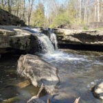
9:15 Short Hike, Rockway Conservation Area, 2021 Pelham Rd, Lincoln
https://hikes.brucetrail.org/event/915-short-hike-rockway-conservation-area-2021-pelham-rd-lincoln/Sorry, the registration cut-off time for this hike has been reached.Not a member? Click here to join today!Hosting Club: Niagara
Category: Hike
Location (Google Maps): Rockway Conservation Area, 2021 Pelham Rd, Lincoln, ONHike Leader(s): Debbie Demizio Click here to contact Hike Leader(s)
Pace: Medium 3- 4 km/hr
Terrain: Moderate: some hills and some poor footing
Distance: 6 kmsDescription
Hike around 15 Mile Creek, featuring Upper and Lower Rockway Falls. Please bring water, insect repellent, sunscreen and hiking poles. Check yourself thoroughly for ticks following the hike. - 01September 1, 2026
Valley View Park479
https://hikes.brucetrail.org/event/car-hike-valley-view-huntington-park/Sorry, the registration cut-off time for this hike has been reached.Not a member? Click here to join today!Hosting Club: Toronto
Location (Google Maps): Parking lot is off Sycamore Drive, East of Bayview , across Starbucks plaza
Bus 91 from Finch East station stops at Sycamore station.Hike Leader(s): Mohammad Aghamiri
Pace: Moderate (3-4 km/hr)
Terrain: Hilly, Level 2 (Intermediate – some hills and uneven surfaces, rocks and roots underfoot)
Distance (km): 6-7 kmDescription
We will explore Valleyview and Maple View parks, and walk along German Mills Creek, in return we stop in Huntington park and have snack under beautiful shed.Although this is considered an “Urban Walk”, you can expect some hills up and down and uneven surfaces with tree roots. Please bring hiking poles, water and snacks.
- 01September 1, 2026
Rock Hill/Oliver Creek Loop
https://hikes.brucetrail.org/event/rock-hill-oliver-creek-loop-2/Sorry, the registration cut-off time for this hike has been reached.Not a member? Click here to join today!Hosting Club: Dufferin Hi-Land
Category: Tuesday Hike
Location (Google Maps): Dufferin Hi-Land, Map 20. Meet at Rock Hill parking lot on 1st Line Mulmur, just south of 10 Sideroad (Km 29.4).Hike Leader(s): Tony Evangelista, Les Babbage, Inge Eckerich, Julie Daley Click here to contact Hike Leader(s)
Pace: Leisurely
Terrain: Moderate
Distance: 7.0 km; Short Hike: 2.4 kmDescription
We will hike the Main Trail, returning by way of the Oliver Creek and Moss Haven Side Trails. The short hike will return to parking from just past the top of the Enchanted Forest Side Trail, before the Main Trail descends into the Boyne Valley. Bring water and snacks. Hiking poles are recommended. - 01September 1, 2026
Waterdown, Smokey Hollow, Great Falls and Grindstone Creek
https://hikes.brucetrail.org/event/waterdown-smokey-hollow-great-falls-and-grindstone-creek/Sorry, the registration cut-off time for this hike has been reached.Not a member? Click here to join today!Hosting Club: Caledon Hills
Category: Tuesday Hikers
Location (Google Maps): Parking Lot at City View Park off of Kerns Rd.Hike Leader(s): Ralph Shapiro Click here to contact Hike Leader(s)
Pace: Medium – 3 to 4 km/hour
Terrain: Moderate – some hills and/or some poor footing
Distance: 10 kmDescription
From City View parking we will hike to Smokey Hollow and the Great Falls. We’ll break at the Falls for a rest and/or optional hike down Grindstone Creek. - 01September 1, 2026
Mono Cliffs: Trails & Tales
https://hikes.brucetrail.org/event/mono-cliffs-trails-tales/Sorry, the registration cut-off time for this hike has been reached.Not a member? Click here to join today!Hosting Club: Dufferin Hi-Land
Category: General Hike
Location (Google Maps): Mono Community Centre parking lot, 754483 Mono Centre Road, Mono, ONHike Leader(s): Suzette Daley Click here to contact Hike Leader(s)
Pace: Medium
Terrain: Moderate
Distance: 9kmDescription
Mono Cliffs: Trails & TalesJoin us for Mono Cliffs: Trails & Tales, an approximately 9 km, 3-hour hike through the beautiful trails of Mono Cliffs Provincial Park.
We will meet at the Mono Community Centre parking lot, 754483 Mono Centre Road, Mono, ON, and hike into Mono Cliffs Provincial Park before returning to our starting point.
Distance: Approximately 9 km
Duration: Approximately 3 hours
Pace: Moderate
Terrain: Moderate, with hills, some rocky sections and uneven footingAlong the way, we will travel through beautiful forested sections and the Niagara Escarpment landscape, stopping briefly at points of interest to enjoy the surroundings and share a few interesting facts and stories about the area.
Please ensure that you are comfortable hiking approximately 9 km over varied terrain before registering.
How to Prepare
• Get a good night’s sleep and come ready for approximately 3 hours of hiking.
• Bring plenty of water. 1–2 litres per person is recommended.
• Bring a snack or light food for the hike. Bring your medication if needed.
• Wear sturdy hiking shoes or hiking boots with good traction. Waterproof footwear is recommended if trail conditions are damp.
• Hiking poles are recommended but not required, particularly for hills and uneven sections.
• Bring insect repellent or wear protective clothing.
• Bring sunscreen and consider a hat for sun protection.
• Dress appropriately for the weather and consider bringing an extra layer.
• Please arrive 15 minutes before the scheduled start time to allow time for check-in. We will depart promptly.
Weather
The hike may be cancelled or rescheduled in the event of rain or other unsafe weather or trail conditions. Registered hikers will be notified of any changes.
LIMITED SPACE AVAILABLE!
Come ready to move, explore and enjoy an end-of-summer adventure as we discover the trails and tales of Mono Cliffs!
- 01September 1, 2026
Walk In Nature Series (WINS) - Sydenham Nature Reserve loop side trail trail
https://hikes.brucetrail.org/event/walk-in-nature-series-wins-sydenham-nature-reserve-loop-side-trail-trail-2/Sorry, the registration cut-off time for this hike has been reached.Not a member? Click here to join today!Hosting Club: Sydenham
Category: Walk In Nature Series (WINS)
Location (Google Maps):103038 Grey Rd 18, 400 metres east of Rockford in an off-road parking lot beside the rail trail
Hike Leader(s): Stewart Brown Click here to contact Hike Leader(s)
Pace: Medium: 3 to 4 km/h
Terrain: Moderate: Some hills and/or poor footing
Distance: 4 kmDescription
The Walk In Nature Series (WINS) consists of short loop hikes in the Sydenham section of the Bruce Trail that combine nature appreciation with fitness in a safe and welcoming group environment led by an experienced hike leader. Medium paced WINS hikes are open to all ages and levels of hiking experience whether members or non-members of the Bruce Trail Conservancy (BTC)On this hike we will walk a 4 km loop with a medium pace on the interesting side trail, Sydenham Nature Reserve and the access along the rail trail, the Keeling side trail. It is quite level with some rocky sections.
Dress in layers, bring water, a snack, personal medication and supplies. Hiking poles are not required by are always welcome. Arrive 10 min before the hike start time.
This hike is the final evening WINS hike of the summer. This fall, WINS hikes will be during the day on Tuesdays.
Thanks and see you soon.
- 02September 2, 2026
WEDNESDAY WALKERS - Young Wetland
https://hikes.brucetrail.org/event/wednesday-walkers-young-wetland-4/Sorry, the registration cut-off time for this hike has been reached.Not a member? Click here to join today!Hosting Club: Beaver Valley
Location (Google Maps): Park in the parking lot at the Epping John Muir Lookout near km 94.3, Map 27, Edition 31
Hike Leader(s): Margaret Yaraskavitch Click here to contact the hike leader.
Pace: Medium
Terrain: Easy
Length of Hike: 4 kmsDescription
This hike is a there-and-back walk. We begin on the edge of the Beaver Valley and then head towards a beaver pond. A walk along the edge of fields takes us into a wood lot, then to the Young Wetland. Birds are often sighted on the water. From there, we stroll the rest of the BTC-managed Young property to Sideroad 19, seeing fields regenerating towards a natural state. We walk back to the parking area, where we can enjoy a panoramic view into the Beaver Valley.Guidelines
- Arrive 15 minutes before the start of the hike.
- Wear sturdy footwear and appropriate attire for the weather and the terrain.
Hiking poles are a good idea in any season, especially if the terrain is rocky or slippery. In winter, snowshoes or icers/crampons are needed when conditions dictate.
Wearing appropriate clothing and footwear prevents injuries and shows consideration for a safe and positive group hiking experience. - Always carry I.D. and your health card.
- Bring sufficient water and snacks (or lunch if indicated). A minimum of 1L of water is recommended on all hikes, and 3L is recommended for long, challenging hikes in the heat of the summer.
- Bring sunscreen and insect repellent (for spring and summer hikes).
- Bring your own first aid kit.
- Please leave dogs at home.