
The BTC office will be closed on Mon. Oct. 12 for the holiday. Thank you for your understanding.
Hike Schedule
Join us for a hike! Registration required.
All hikes available to BTC members. Some hikes are open to non-members.
See Refund Policy for Paid Hikes >
TIP: The calendar view displays up to 7 hikes on a day, but often there are more. Click “View more events” to see them all.
Niagara
Iroquoia
Toronto
Caledon Hills
Dufferin Hi-Land
Blue Mountains
Beaver Valley
Sydenham
Peninsula
All Clubs
Show Filters
Categories
Reset Filters
- 09August 9, 2026
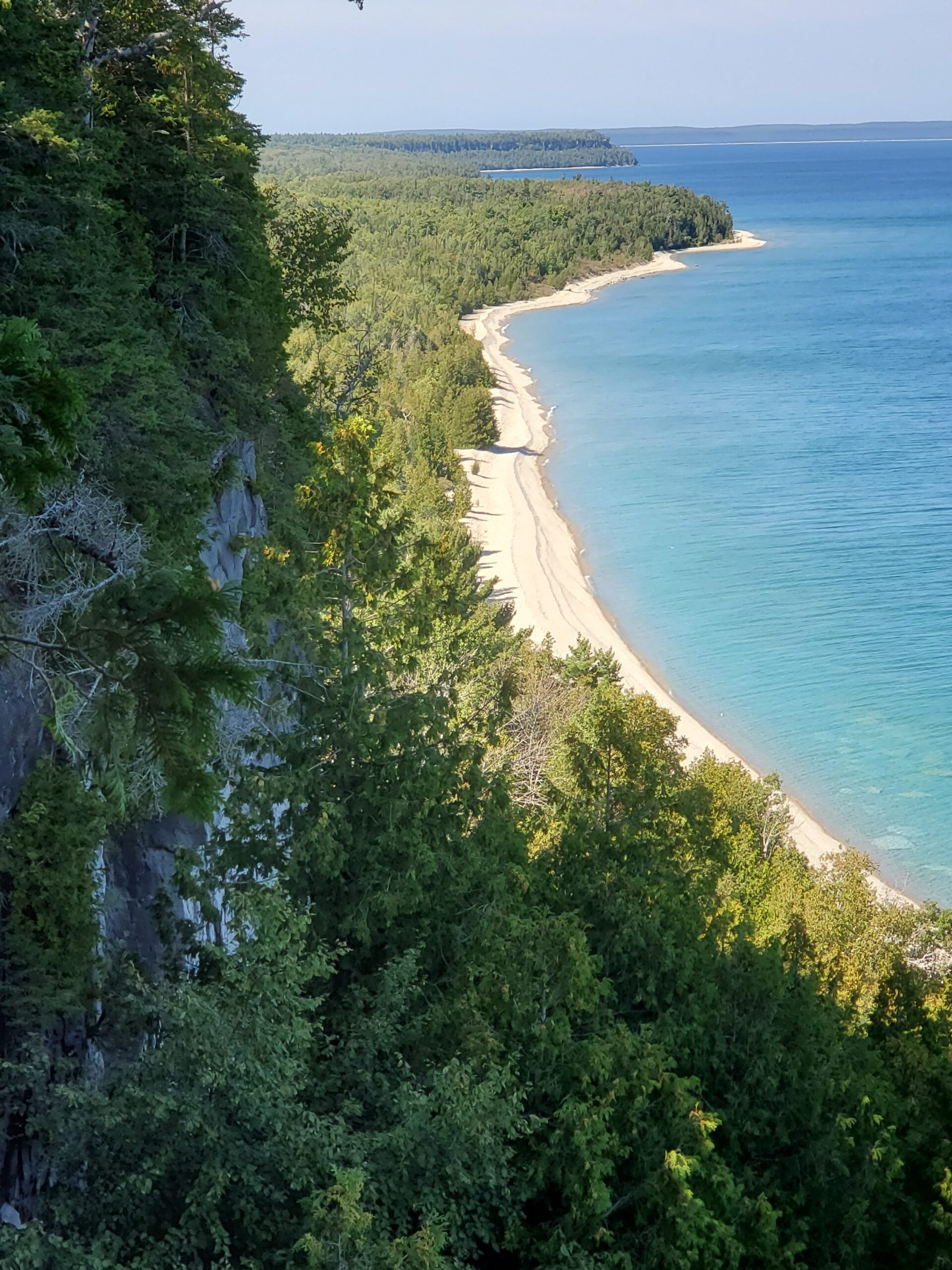
Sunday Side Trails; Cape Chin Side Trail (Smokey Head - White bluff)
https://hikes.brucetrail.org/event/sunday-side-trails-cape-chin-side-trail-smokey-head-white-bluff/Sorry, the registration cut-off time for this hike has been reached.Not a member? Click here to join today!Hosting Club: Peninsula
Category: Peninsula Blue Series
Location (Google Maps): Meet at the south end of Carter Road, south of Cape Chin SouthHike Leader(s): Barb Reuber Click here to contact Hike Leader(s)
Pace: Leisurely (2.0 – 3.0 km/h): A relaxed pace with frequent breaks and a focus on enjoyment.
Terrain: Moderate: Rolling hills, mild slopes and rocky paths.
Distance: 4.8 kmDescription
Peninsula BTC is offering a series of hikes covering all of the side trails on the Peninsula section of the Bruce Trail. These hikes are a great opportunity for those who want to do some hiking but don’t want to commit to a full end-to-end; for those who have completed an end-to-end and want to explore more of the beautiful trails on the Peninsula and for locals and visitors who want to get out on the trail on the weekend.The series will include 27 hikes on Sundays (and maybe the odd Saturday) over 2026 and 2027, covering more than 150 km of side trails or 78 trails! We will be offering hikes on a roughly biweekly basis, with hikes posted approximately two months in advance. The hikes will generally be loop hikes, although car shuttling may be required for a few hikes. Register for each hike individually, no need to commit to all 27 hikes!
For those who would like to earn the Peninsula Side Trails Badge, these hikes provide a chance to join a group for some or all of the side trail hikes.
This hike features the Cape Chin Side Trail, Fred Binding Lookout and return along the main trail. This hike has a great view from the lookout, lovely forest and a visit to a cobble beach.
Hikers should be prepared for the weather, possible wet trails and insects. Bring a lunch, water and snacks. Hike leader will contact registered hikers one week before the hike.
If you would like to be notified when the side trail hikes are posted, go to the bottom of the Hikes page on the PBTC website to sign-up for hike notifications.
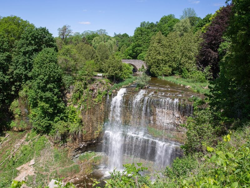
RAINBOW HIKE: Downtown Dundas to Dundas Peak (Tew's & Webster's Falls)
https://hikes.brucetrail.org/event/rainbow-hike-downtown-dundas-to-dundas-peak-tews-websters-falls/Sorry, the registration cut-off time for this hike has been reached.Not a member? Click here to join today!Hosting Club: Iroquoia
Category: Rainbow Hike
Location (Google Maps): Corner of Sydenham and King, downtown Dundas.Hike Leader(s): Doug O’Neill Click here to contact Hike Leader(s)
Pace: Medium – 3 to 4 km/hr
Terrain: Moderate – Some hills and/or some poor footing, Strenuous – Hilly with steep climbs and some poor footing
Distance: 10 kms (or 13 km option)Description
Come by car or HSR transit for this all-inclusive 2SLGBTQIA+-friendly hike from downtown Dundas to the top of Dundas Peak/Spencer Gorge with time to explore both Tew’s and Webster’s Falls.Terrain: We’ll get the uphill part of out the way first. Dundas Peak is an estimated 340 metres (1,100 feet) above sea level. Awesome views. Worth every bead of sweat!
Photo buffs will love the incredible views. We’ll follow the Lookout Trail all the way up to the top of the escarpment, with stops along the way at the Dundas Peak and Tew Falls lookouts, and ultimately to Webster’s waterfall, for those who wish. The return hike is easier—it’s mostly downhill. We’ll return to our starting point.Meet-up: We’ll rendezvous no later than 9 a.m. at the benches outside the TD Bank, corner of Sydenham and King Street. Adjacent (free!) parking at Ed & Shawn’s Brewery (65 Hatt St., off Sydenham.)
Tip: If you arrive early or need to use the loo before hiking, Starbucks (45 King St. W., downtown Dundas) is a 2-minute walk down the street from the parking lot.
Coming by public transit? There are two options: 05-HEAD STREET via DOWNTOWN DUNDAS or 5B -PIRIE AT GOVERNORS, depending where you are coming from. Ensure you arrive no later than 9:00 a.m. for a 9:15 a.m. departure.
Bus fares: $2.50-3.50.
You have two options of hike lengths: Upon reaching Tew’s Falls, you can enjoy an extended break or continue to Webster’s Falls (for an additional 3 km there and back).
Please bring at least 2 litres of water, energizing snacks and proper lunch. There is no option to refill water bottles. There are porta-potties (if you don’t mind the “aroma”) at Tew’s Falls. Don’t forget sunscreen and insect repellent. Hiking boots or sturdy footwear are recommended—as well a cap. Wear long pants (no shorts)—to avoid ticks.
Post-hike ice-cream or IPA in downtown Dundas. Everyone is welcome!
Complimentary Bruce Trail Rainbow badge and/or stickers to all participants! Email any questions to the Hike Leader – “Click here to contact Hike Leader” on this form.
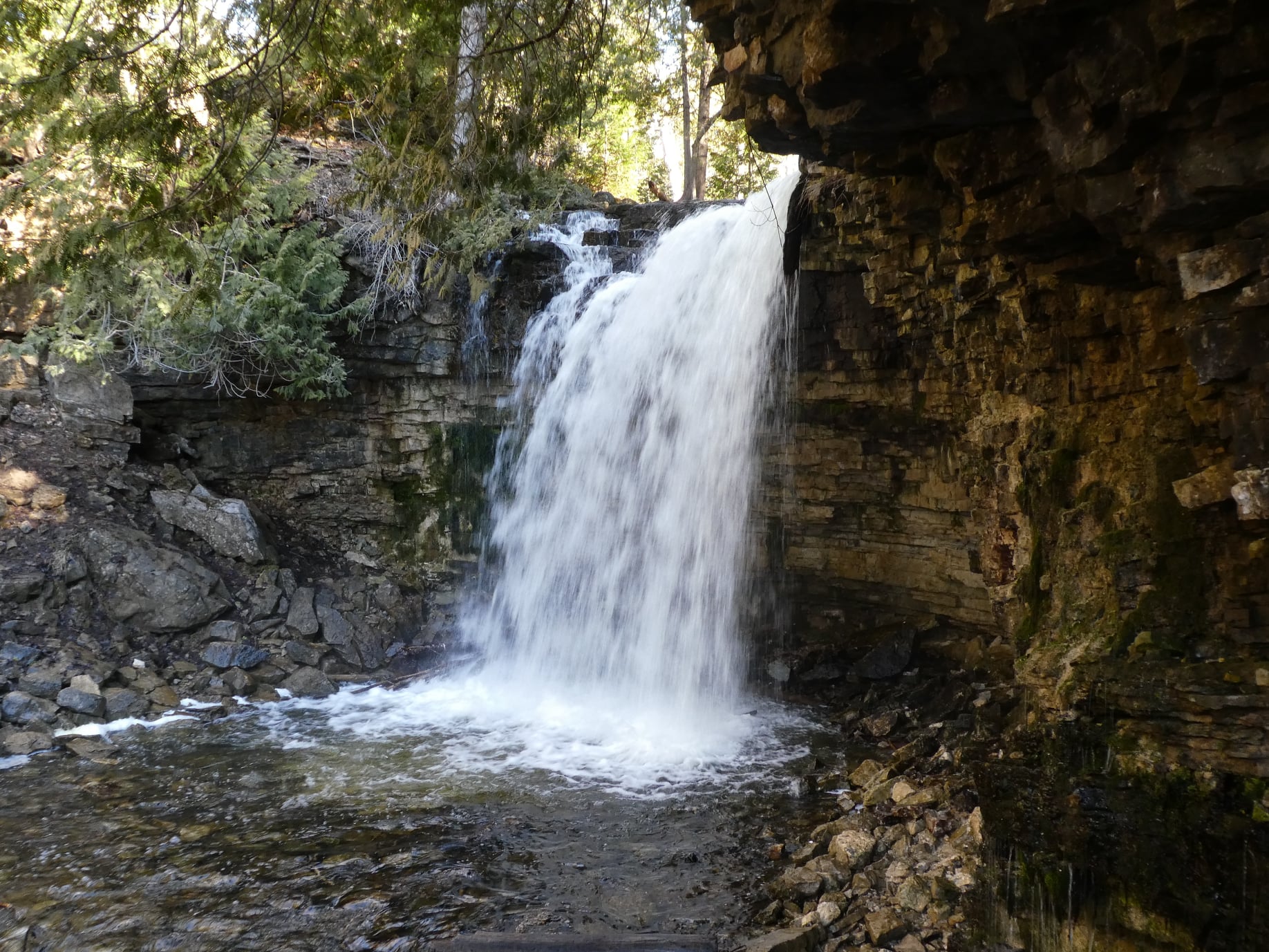
Hilton Falls (reservation required)
https://hikes.brucetrail.org/event/hilton-falls-reservation-required/Sorry, the registration cut-off time for this hike has been reached.Not a member? Click here to join today!Hosting Club: Iroquoia
Category: General Hike
Location (Google Maps): Meet in the parking lot at Hilton Falls Conservation Area at 9:15 am.Hike Leader(s): Karen Bergmann Click here to contact Hike Leader(s)
Pace: Medium – 3 to 4 km/hr
Terrain: Moderate – Some hills and/or some poor footing
Distance: 8 kmsDescription
Meeting at 9:15 am in the parking lot, we will hike to the Falls and then around to Bog’d Up and back along the the reservoir trail to the cars. Reserve your time at conservationhalton.caBring sufficient water and bug spray/bug net.
Youth Hike: Woodend Youth Hike
https://hikes.brucetrail.org/event/youth-hike-woodend-youth-hike/Sorry, the registration cut-off time for this hike has been reached.Not a member? Click here to join today!Hosting Club: Niagara
Category: Youth Hike
Location (Google Maps): Woodend Conservation area, Taylor RoadHike Leader(s): Erin Lyttle Click here to contact Hike Leader(s)
Pace: Leisurely <3 km/hr
Terrain: Moderate: some hills and some poor footing
Distance: 3.6kmDescription
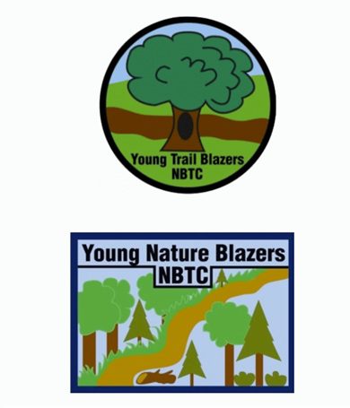
Earn a youth hiking badge by coming out to do the Woodend Youth Loop and/or Wetlands depending on our crowd. An adult must accompany youth, up to 4 youth per adult. This is a good opportunity to try out hiking. Youth can earn the BTC Trail Blazer badge (round-for completing over a 3km hike) or the Young Nature Blazers Badge (rectangle-over 90 minute hike and write/up talk with leader regarding the 5 senses used on the hike-what did you Hear? See? Feel? Taste? Smell?) Badges will be on hand to take home with you.Exploring Sydenham Hike #46 Slough of Despond
https://hikes.brucetrail.org/event/exploring-sydenham-hike-46-slough-of-despond/Sorry, the registration cut-off time for this hike has been reached.Not a member? Click here to join today!Hosting Club: Sydenham
Category: General Hike
Location (Google Maps):We will carpool from 2888 3rd Ave. W., Owen Sound
Hike Leader(s): Bill Snel Click here to contact Hike Leader(s)
Pace: Leisurely: 3 km/h or less
Terrain: Moderate: Some hills and/or poor footing
Distance: 5.4 kmDescription
We will carpool from Owen Sound to do a loop hike by the Slough of Despond using the President’s Path Side Trail – Map 34. This is hike 46 in the book Exploring Sydenham. There will be one secret to find. If you do not have a book and would like one ($30) let me know by using the “Contact hike leader” link. - 10August 10, 2026
EASY DOES IT HIKE, Allanburg Bridge Parking Lot (on west side of Canal)
https://hikes.brucetrail.org/event/easy-does-it-hike-allanburg-bridge-parking-lot-on-west-side-of-canal/Sorry, the registration cut-off time for this hike has been reached.Not a member? Click here to join today!Hosting Club: Niagara
Category: Leisurely
Location (Google Maps): 3330 Lundy’s Lane (Hwy 20)
Allanburgh, OnHike Leader(s): Diane Marlatt Click here to contact Hike Leader(s)
Pace: Leisurely <3 km/hr
Terrain: Easy: mostly flat, good footing
Distance: 7kmDescription
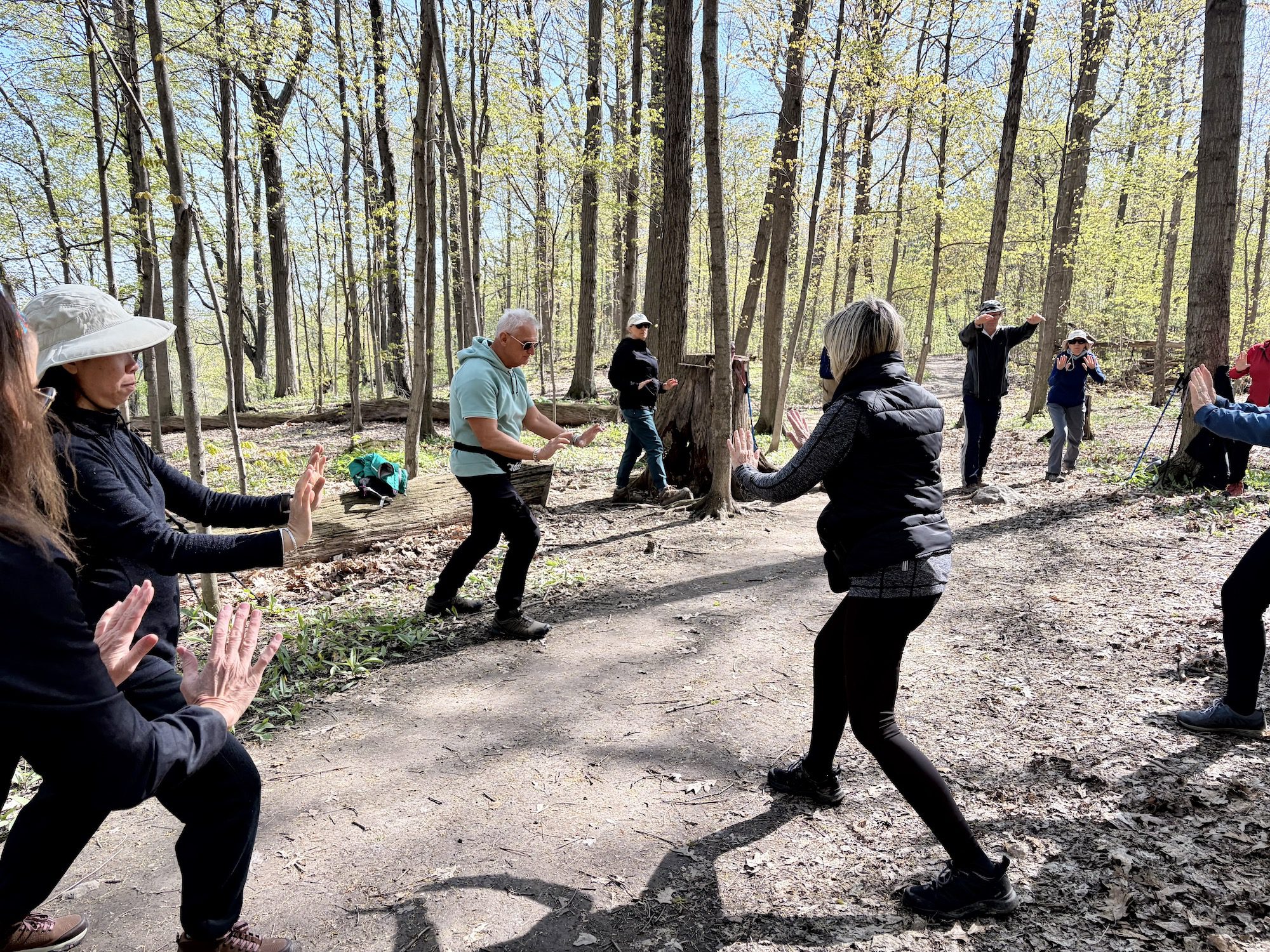
Tai Chi and Hiking
https://hikes.brucetrail.org/event/tai-chi-and-hiking/Sorry, the registration cut-off time for this hike has been reached.Not a member? Click here to join today!Hosting Club: Niagara
Category: Mindfulness
Location (Google Maps): Woodend Conservation Area, Taylor Rd, Niagara-on-the-LakeHike Leader(s): Margaret Northfield Click here to contact Hike Leader(s)
Pace: Medium 3- 4 km/hr
Terrain: Moderate: some hills and some poor footing
Distance: 5-6kmDescription
Seeking balance, calm and strength without high impact exercise? Join us for a short hike. Tai Chi Master, Mike Van Natter will instruct us on the benefits of Tai Chi as well as lead us through several Tai Chi moments along our way. - 11August 11, 2026
Long Hike NEW LOCATION Decew House
https://hikes.brucetrail.org/event/long-hike-short-hills-6/Sorry, the registration cut-off time for this hike has been reached.Not a member? Click here to join today!Hosting Club: Niagara
Location (Google Maps): Decew House Thorold
Hike Leader(s): Alan Laver Click here to contact Hike Leader(s)
Pace: Brisk 4-5 km/hr
Terrain: Moderate: some hills and some poor footing
Distance: 10k+Description
Due to Flooding note the new location. We will hike the trails around Brock and 12 mile creek. Dress for the weather and bring sunscreen bug spray, poles snack and drink9:15 Short hike - NEW LOCATION - Rotary Park
https://hikes.brucetrail.org/event/915-shert-hike-pelham-road-entrance-short-hills/Sorry, the registration cut-off time for this hike has been reached.Not a member? Click here to join today!Hosting Club: Niagara
Category: Loop
Location (Google Maps): Rotary Park, St. CatharinesHike Leader(s): janet davey Click here to contact Hike Leader(s)
Pace: Medium 3- 4 km/hr
Terrain: Moderate: some hills and some poor footing
Distance: 6 kmsDescription
Hike the trails around Rotary Park. Please bring water, bug spray and hiking poles. Ticks are active right now so be sure to check yourself after the hike.Urban Walk: Valley View/Huntington Park
https://hikes.brucetrail.org/event/urban-walk-valley-view-huntington-park-15/Sorry, the registration cut-off time for this hike has been reached.Not a member? Click here to join today!Hosting Club: Toronto
Location (Google Maps): Parking lot is off Sycamore Drive, East of Bayview , across Starbucks plaza
Bus 91 from Finch East station stops at Sycamore station.Hike Leader(s): Mohammad Aghamiri
Pace: Moderate (3-4 km/hr)
Terrain: Hilly, Level 2 (Intermediate – some hills and uneven surfaces, rocks and roots underfoot)
Distance (km): 6-7 kmDescription
We will explore Valleyview and Maple View parks, and walk along German Mill Creak, in return we stop in Huntington park and have snack under beautiful shed.Although this is considered an “Urban Walk”, you can expect some hills up and down and uneven surfaces with tree roots. Please bring hiking poles, water and snacks.
Halton Regional Forest
https://hikes.brucetrail.org/event/halton-regional-forest-10/Sorry, the registration cut-off time for this hike has been reached.Not a member? Click here to join today!Hosting Club: Caledon Hills
Category: Tuesday Hikers
Location (Google Maps): Parking at: 10 Side Road and 4th Line Nassagaweya (trail entrance to Halton Regional Forest).
From Highway 401 West, turn right (north) on Guelph Line, right on 10 Side Rd. The road bends northwards and becomes 4th Line Nassagaweya; roadside parking at the bend.Hike Leader(s): Mohammad Shafiq Click here to contact Hike Leader(s)
Pace: Medium – 3 to 4 km/hour
Terrain: Moderate – some hills and/or some poor footing
Distance: 10 – 12 kmDescription
Will hike trails in Halton Regional Forest and Hilton Falls Conservation Area; beautiful trails are relatively flat with some rocky parts. Snack break at Hilton Falls.
Bugs spray and sun lotion are helpful in this weather.
Bring water and snack. Poles are recommended.
Hike leader cell phone: 416-566-0503 (note that reception in hiking area is usually poor, leave a message for a return call).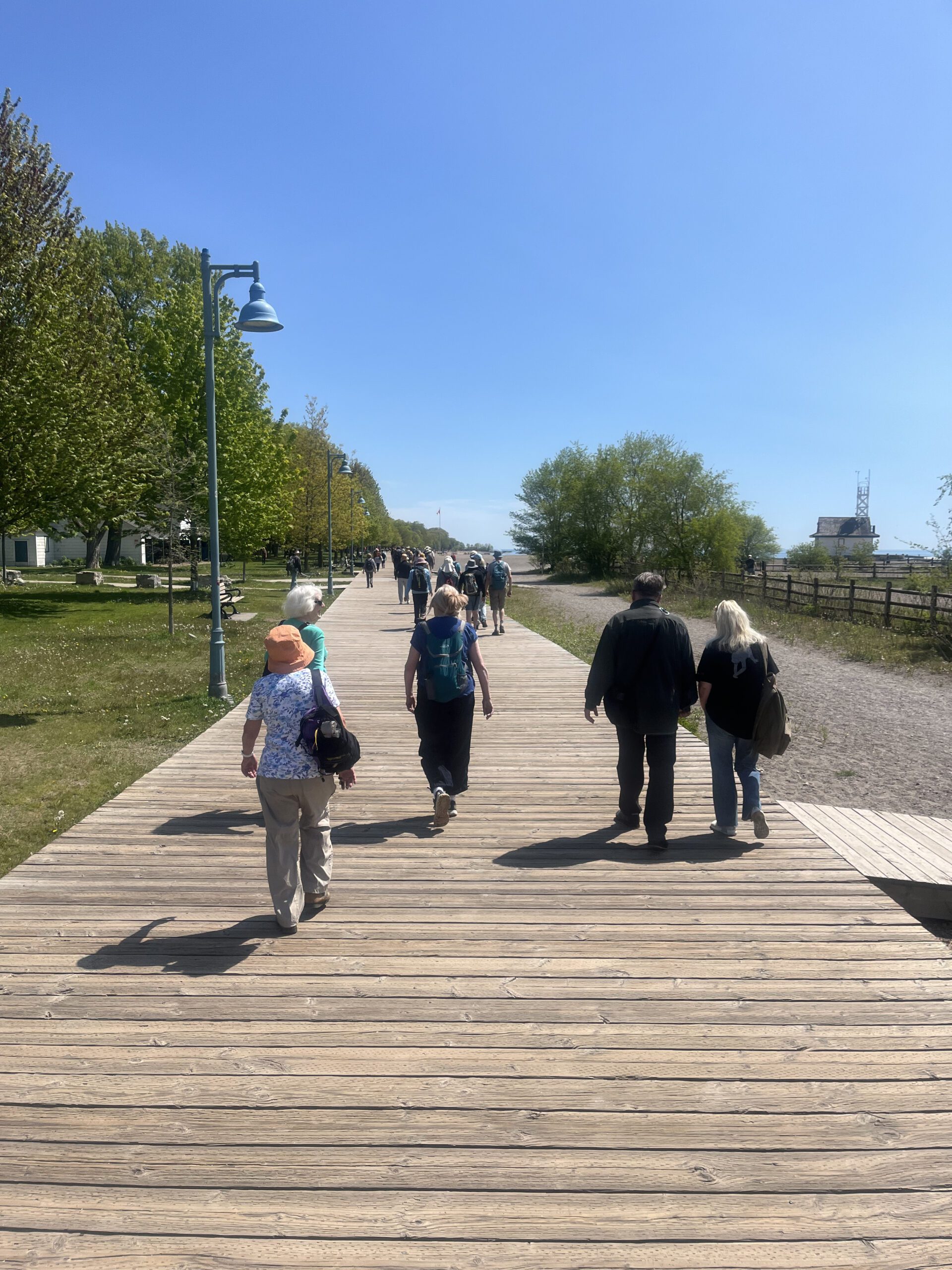
Urban Walk: Toronto Beaches and Glen Stewart Ravine
https://hikes.brucetrail.org/event/urban-walk-toronto-beaches-and-glen-stewart-ravine/Sorry, the registration cut-off time for this hike has been reached.Not a member? Click here to join today!Hosting Club: Toronto
Category: Urban Walk
Location (Google Maps): Toronto Beaches and Glen Stewart Ravine. Meet in front of the Boardwalk Cafe at Woodbine Beach Park. The bus loop for the TTC #92 Woodbine South from Woodbine Station on Line 2 is across the parking lot. The hike will end on Kingston Road where we exit the Glen Stewart Ravine.Hike Leader(s): Tom Swales Click here to contact Hike Leader(s)
Pace: Moderate (3-4 km/hr)
Terrain: Level 1 (Easy – mostly on flat, well maintained trails with hard-packed surface), Level 2 (Intermediate – some hills and uneven surfaces, rocks and roots underfoot), Variable
Distance (km): 8 kmDescription
Join us for this in a series of Tuesday morning walks to be known as “Shurbs”. Short morning urban walks (distance about 8 km) to be finished by lunch time. Have lunch at the end, go about your business for the afternoon, or join us for lunch at a local establishment. This hike will go around Ashbridges Bay, along the Eastern Beaches, and north up the lovely Glen Stewart Ravine Trail to Kingston Road. Expect an uphill climb at the exit of Glen Stewart Ravine. There are a few washrooms available along the Eastern Beaches Boardwalk. Optionally join us for lunch at Fearless Meat on Kingston Road featuring burgers, smoked meat from Lesters in Montreal, and poutine at fair prices. Vegan options also available. Another one of “Tom’s local picks”. - 12August 12, 2026
Mindfulness Hike - Nature Journaling/Sketching
https://hikes.brucetrail.org/event/mindfulness-hike-nature-journaling/Sorry, the registration cut-off time for this hike has been reached.Not a member? Click here to join today!Hosting Club: Niagara, Iroquoia
Category: Mindfulness Hike
Location (Google Maps): Louth Conservation Area – Staff Ave, 500 m north of Pelham RdHike Leader(s): Ruth Moffatt Click here to contact Hike Leader(s)
Pace: Leisurely – 3km/hr or less
Terrain: Dependent on Conditions, Moderate – Some hills and/or some poor footing, Strenuous – Hilly with steep climbs and some poor footing
Distance: Approximately 5kmDescription
This is one of 3 hikes you can join this month to earn the new Mindfulness badge from Niagara Club. The other two dates are August 19 and August 24th. Today we will hike, journal or sketch nature and hike some more. We will hike the main trail and the side trails of Louth Conservation area. Art supplies and some guidance will be provided. Please bring enough water and snacks for your needs, poles if you use them, bug spray and dress for the weather. We will try to find suitable spots to sit at the lower falls or you can bring your own collapsible chair if you like.If the weather is rainy, this will turn into a silent, meditative hike instead.
Please cancel your registration if you are not able to make it. This will allow someone from the waitlist to register.
To cancel your registration:
– Sign into your account on the BTC website
– Click on My Hikes under your account
– This will take you to a list of hikes you have registered for
– Scroll down to the appropriate hike and cursor over to the far right hand column under the Action column.
– Click Cancel under the hike you wish to cancelUnless it is very last minute, you do not have to let the hike leader know.
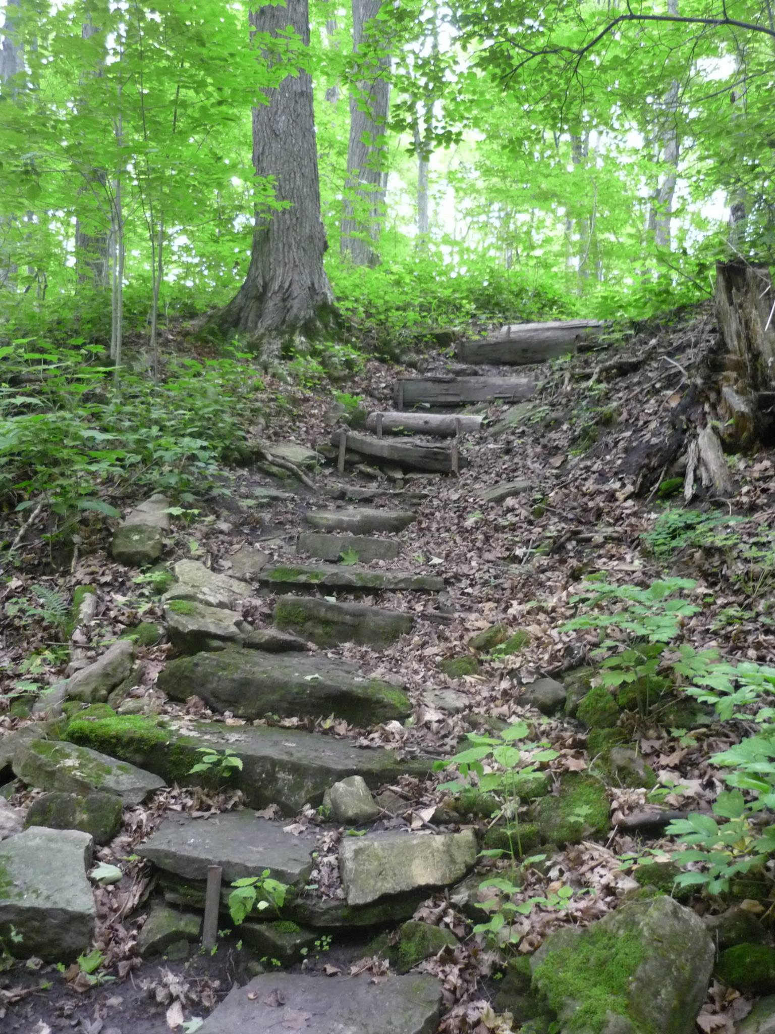
Macdui Drive to Felkers Falls
https://hikes.brucetrail.org/event/jones-rd-to-felkers-falls/Sorry, the registration cut-off time for this hike has been reached.Not a member? Click here to join today!Hosting Club: Iroquoia
Category: General Hike
Location (Google Maps): Meet at 9:15 in the Felkers Falls parking lot.Hike Leader(s): Karen Bergmann Click here to contact Hike Leader(s)
Pace: Medium – 3 to 4 km/hr
Terrain: Moderate – Some hills and/or some poor footing
Distance: 8 kmsDescription
Meeting at 9:15 am in the Felkers Falls parking lot (Stoney Creek), we will carpool to Jones Rd and hike back. There will be some hills and rocks (of course).Bring sufficient water, a snack and bug spray/bug net.
Good Companions Mtn Brow to Albion Falls
https://hikes.brucetrail.org/event/good-companions-mtn-brow-to-albion-falls/Sorry, the registration cut-off time for this hike has been reached.Not a member? Click here to join today!Hosting Club: Iroquoia
Category: Good Companions
Location (Google Maps): Park at the liuna 4 Ice Centre on Mountain Brow Blvd in Hamilton. Park toward the right hand side of the parking lot (north) from the entrance off Mountain Brow.Hike Leader(s): Janina Vanderpost Click here to contact Hike Leader(s)
Pace: Leisurely – 3km/hr or less
Terrain: Easy – Mostly flat and usually good footing
Distance: 8kmDescription
Meeting at 9:15 for a 9:30 am start. From the Liuna Ice Centre we will walk on Mountain Brow Blvd as far as the East Lookout Point in order to experience panoramic views of the City of Hamilton, the harbour and Lake Ontario. We will descend the Margate Stairs to the Escarpment rail trail and hike to Albion Falls. We will return to the Liuna Ice Centre through the woods past Albion Falls. An easy summer hike with great views (weather cooperating).WEDNESDAY WALKERS - Falling Water - Graham's Hill
https://hikes.brucetrail.org/event/wednesday-walkers-falling-water-grahams-hill-4/Sorry, the registration cut-off time for this hike has been reached.Not a member? Click here to join today!Hosting Club: Beaver Valley
Location (Google Maps): Park in the small BTC parking lot on the north side of Graham’s Hill Road, just west of where the Trail crosses Graham’s Hill Road at km 74.2, Map 26, Edition 31
Hike Leader(s): Glenda Collings Click here to contact the hike leader.
Pace: Medium
Terrain: Some rocky footing, Some steep sections
Length of Hike: 4.2 kmDescription
This is a there-and-back hike along a varied stretch of Valley edge. Karst topography, old growth forest and streams with waterfalls are on our route as well as meadow and wild fruit trees. There are long views across the Valley.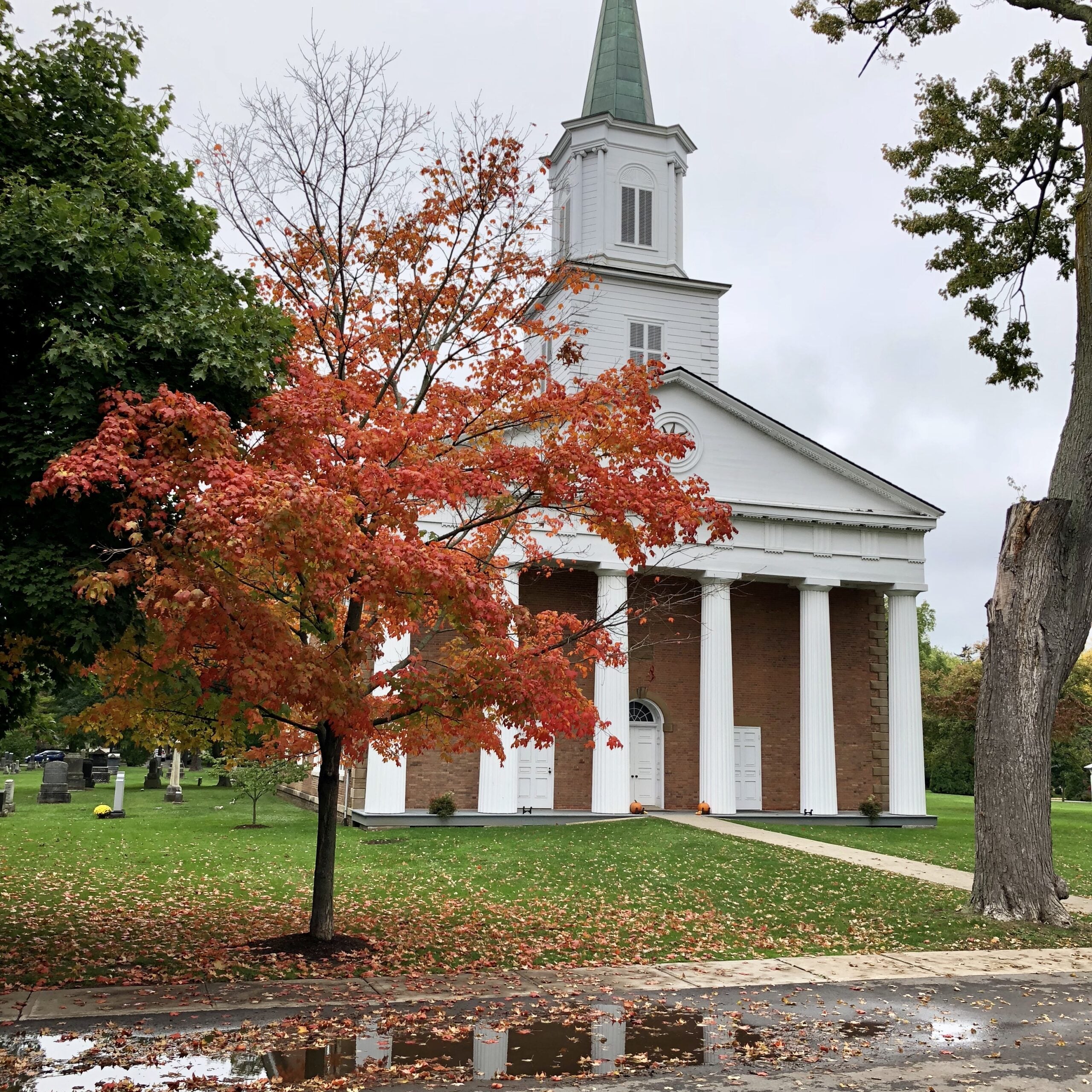
5:00 pm Hike & Picnic then “Gateau & Grace” ORGAN SOLO
https://hikes.brucetrail.org/event/500-pm-hike-picnic-then-gateau-grace-5/Sorry, the registration cut-off time for this hike has been reached.Not a member? Click here to join today!Hosting Club: Niagara
Category: Urban
Location (Google Maps):St Andrew’s Presbyterian Church in Niagara-on-the-Lake.
Hike Leader(s): Suzanne Gourluck Click here to contact Hike Leader(s)
Pace: Leisurely <3 km/hr
Terrain: Easy: mostly flat, good footing
Distance: 6 kmDescription
This is a series of hikes which will take place on 3 Wednesday evenings in July and August. We will hike around Niagara-on-the-Lake and surrounds (1.5 hrs) stopping for a shared picnic on the lawns of St Andrews. At 7 pm others will join us on the lawns and you will have your choice of some delicious cakes. Then we will go inside to enjoy a special musical performance and a short reflection on “Grace”. This is a free eventBring a folding chair and some savoury food to share (dessert is provided). Dress so you’ll be comfortable hiking and picnicking. A change of clothes is not required. Bathrooms will be available.
- 13August 13, 2026
8:00 am Long hike NEW Location. Glen Road Jordan
https://hikes.brucetrail.org/event/800-am-long-hike-new-location-bailey-bridge-jordan-7/Sorry, the registration cut-off time for this hike has been reached.Not a member? Click here to join today!Hosting Club: Niagara
Location (Google Maps): Glen Road Jordan
Hike Leader(s): Alan Laver Click here to contact Hike Leader(s)
Pace: Brisk 4-5 km/hr
Terrain: Strenuous: hilly, with steep climbs, poor footing
Distance: ~10kDescription
Change of location due to flooding . Hike up to Balls Falls and explore the trailsYou must register for each hike. Bring Poles, snack and a drink. Dress for the weather
Petun Conservation Area loop
https://hikes.brucetrail.org/event/petun-conservation-area-loop/Sorry, the registration cut-off time for this hike has been reached.Not a member? Click here to join today!Hosting Club: Blue Mountains, Beaver Valley
Location (Google Maps): Parking area is south side of Side Road 6 at 2nd line.
Hike Leader(s): Alan McPherson Click here to contact the hike leader.
Pace: Medium
Terrain: Moderate, Some rocky footing, Some steep sections
Length of Hike: 12.8 kmDescription
From parking area we will take John Haigh Side Trail north along 2nd Line to join the main trail and head east. We take the Petun Side Trail roughly 2 km before turning around and returning to main trail. We follow the main trail south and then south west along Osler Bluff with some great lookouts to Pretty River Valley and Nottawasaga Valley. We then take the John Haigh Side Trail back to our vehicles.Please arrive 10 minutes early for introductions so we can start at 9:00 am sharp. There are hilly sections which can be slick when wet. Most of our walk will be in the shade of the forest, but there are some open sections. Bring water and snacks as we will take regular breaks to enjoy views or other sights. Sunscreen and bug protection are always recommended. Pack extra water if it is a hot day.
Hiking around Jordan
https://hikes.brucetrail.org/event/hiking-around-jordan-67/Sorry, the registration cut-off time for this hike has been reached.Not a member? Click here to join today!Hosting Club: Niagara
Category: In and Out
Location (Google Maps): Sho’aríshon Park, Jordan StationHike Leader(s): Bill Russell Click here to contact Hike Leader(s)
Pace: Medium 3- 4 km/hr
Terrain: Moderate: some hills and some poor footing
Distance: 6 kmsDescription
Hiking in and around Jordan, Rainforth Trail and Balls Falls, alternating every 3 weeks.Beaver Bites - Hike 2 of 4
https://hikes.brucetrail.org/event/beaver-bites-hike-2-of-4/Sorry, the registration cut-off time for this hike has been reached.Not a member? Click here to join today!Hosting Club: Caledon Hills
Category: General
Location (Google Maps): Meet at Metcalfe Crevices parking area, km 27.9, where the main trail crosses 10th Line.Hike Leader(s): Nancy Mooney Click here to contact Hike Leader(s)
Pace: Medium – 3 to 4 km/hour
Terrain: Moderate – some hills and/or some poor footing, Strenuous – hilly with steep climbs and some poor footing
Distance: Hike one will be 10.4 km and the second hike will be 7 km.Description
This day will be challenging but rewarding when we loop through Duncan Crevice Caves Provincial Nature Reserve, (Map 25) and explore Metcalfe Crevice. After our lunch break we will head over to Loree Forest and hike another loop.Urban Walk: Valley View/Huntington Park
https://hikes.brucetrail.org/event/urban-walk-valley-view-huntington-park-16/Sorry, the registration cut-off time for this hike has been reached.Not a member? Click here to join today!Hosting Club: Toronto
Location (Google Maps): Parking lot is off Sycamore Drive, East of Bayview , across Starbucks plaza
Bus 91 from Finch East station stops at Sycamore station.Hike Leader(s): Mohammad Aghamiri
Pace: Moderate (3-4 km/hr)
Terrain: Hilly, Level 2 (Intermediate – some hills and uneven surfaces, rocks and roots underfoot)
Distance (km): 6-7 kmDescription
We will explore Valleyview and Maple View parks, and walk along German Mill Creak, in return we stop in Huntington park and have snack under beautiful shed.Although this is considered an “Urban Walk”, you can expect some hills up and down and uneven surfaces with tree roots. Please bring hiking poles, water and snacks.
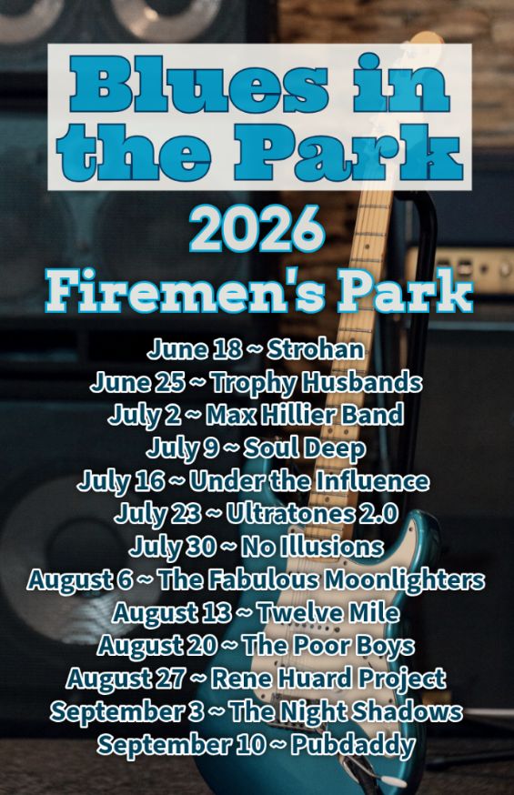
Hike, followed by Blues in the Park
https://hikes.brucetrail.org/event/hike-followed-by-blues-in-the-park-7/Sorry, the registration cut-off time for this hike has been reached.Not a member? Click here to join today!Hosting Club: Niagara
Category: Leisurely
Location (Google Maps):2275 Dorchester Rd, Niagara Falls, ON L2J 0H1
Hike Leader(s): Marion Hanover Click here to contact Hike Leader(s)
Pace: Leisurely <3 km/hr
Terrain: Moderate: some hills and some poor footing
Distance: 4kmDescription
Hike series Thursday evenings throughout the summer, followed by optional Blues in the Park. Come prepared to hike 1.5 leisure hike. Various blues bands free of charge starting at 7pm in the park. Bring lawn chair, beverage and snack to share. - 14August 14, 2026
Brisk Fridays - Bayview Escarpment Provincial Nature Reserve
https://hikes.brucetrail.org/event/brisk-fridays-bayview-escarpment-provincial-nature-reserve-3/Sorry, the registration cut-off time for this hike has been reached.Not a member? Click here to join today!Hosting Club: Sydenham
Category: Brisk Fridays
Location (Google Maps): Roadside parking on the shoulder curve on the St Vincent-Sydenham Townline, 5 km north of Hwy 26.Hike Leader(s): Karen Sooley Click here to contact Hike Leader(s)
Pace: Brisk: 4 to 5 km/h
Terrain: Moderate: Some hills and/or poor footing, Strenuous: Hilly with steep climbs and some poor footing.
Distance: 13 kmDescription
This brisk hike will energize you! Come enjoy the views along the escarpment as we hike through the Bayview Escarpment Nature Reserve. We will follow the main Bruce Trail and the River Kwai Side Trail, looping back to our vehicles. Snack and water breaks provided along the way.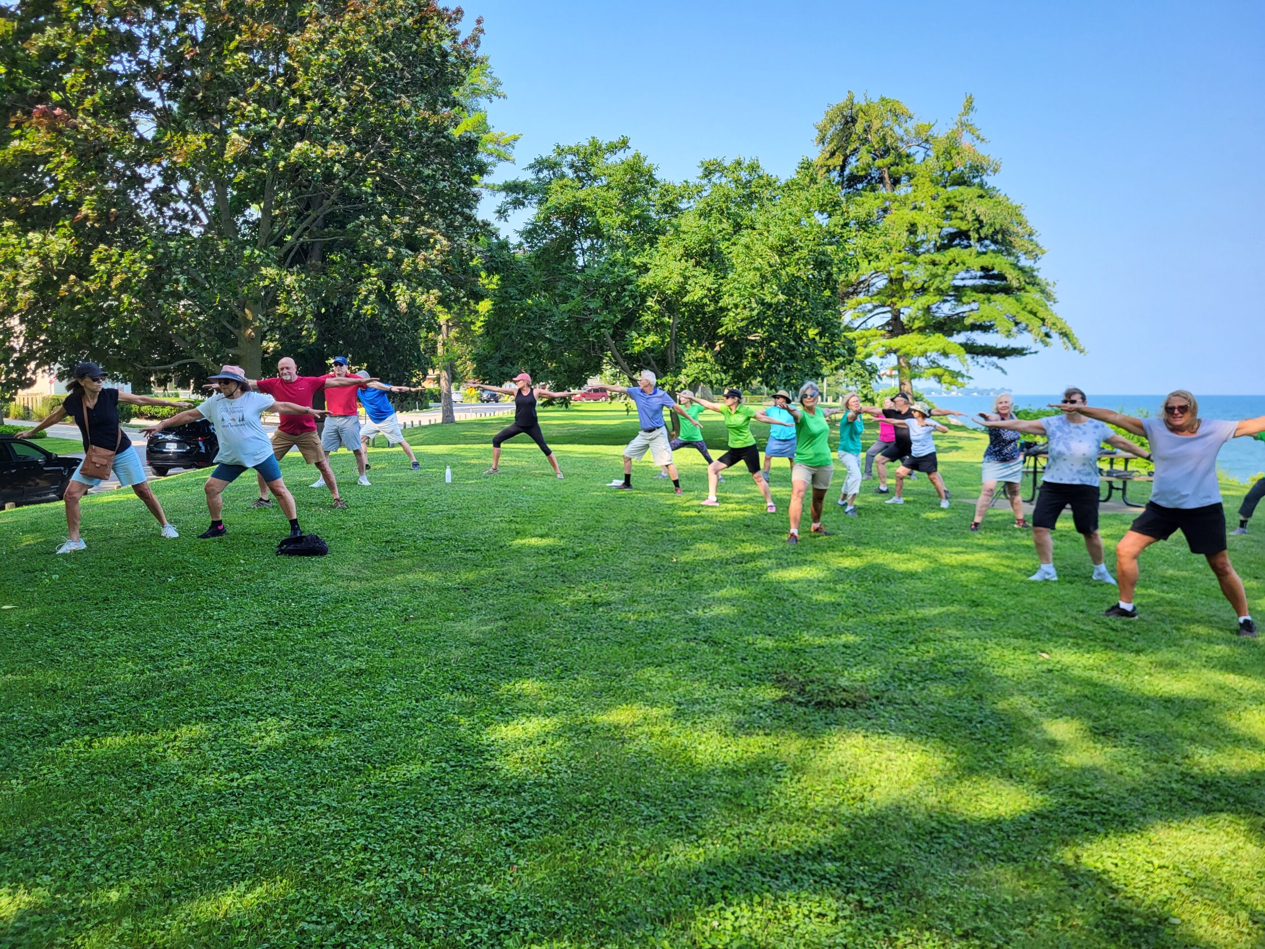
9:00 am Niagara on the Lake Tour & Some Yoga
https://hikes.brucetrail.org/event/900-am-niagara-on-the-lake-tour-some-yoga-28/Sorry, the registration cut-off time for this hike has been reached.Not a member? Click here to join today!Hike open to BTC Members only.
Hosting Club: Niagara, Caledon Hills
Category: Urban
Location (Google Maps):Veteran’s Memorial Park, park just outside the park on King St.
Hike Leader(s): Robin Garrett Click here to contact Hike Leader(s)
Pace: Leisurely <3 km/hr
Distance: 5 km
Description
Enjoy the benefits of pausing for a yoga practice as we tour through the trails, parkland and Historic Niagara-on-the-Lake. No mat required. Movement will focus on a flow of standing poses designed especially for hikers. Plan to stay for conversation and a warm cup of coffee or tea at Sweets & Swirls, Community Centre, Niagara Stone Road, NOTL.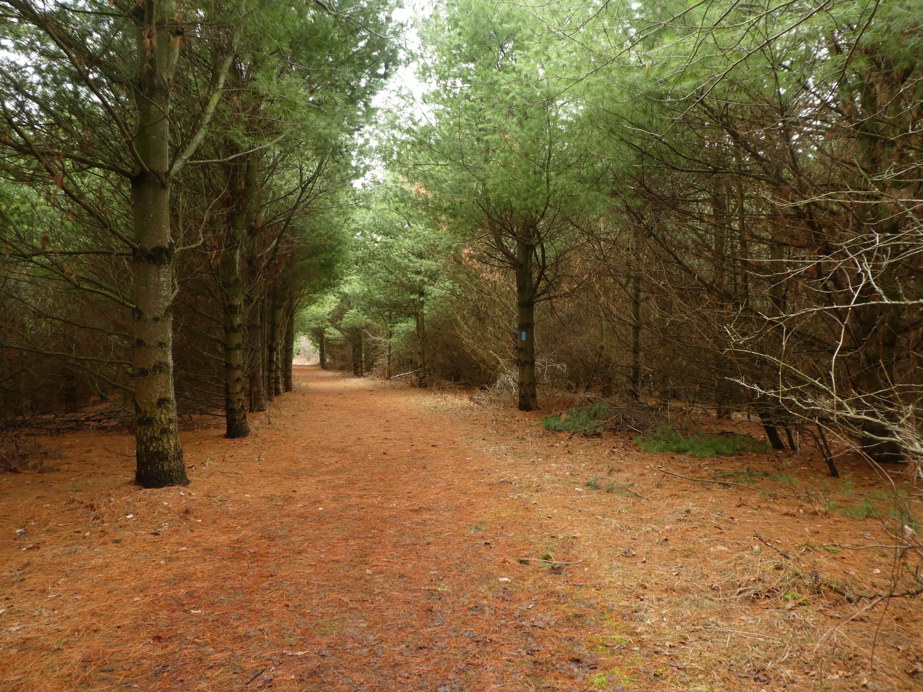
Hockleycrest to Glen Cross
https://hikes.brucetrail.org/event/hockleycrest-to-glen-cross/Sorry, the registration cut-off time for this hike has been reached.Not a member? Click here to join today!Hosting Club: Iroquoia
Category: General Hike
Location (Google Maps): Meet at 9:15 am in the Bruce Trail parking lot on 5th Line, just down from Hockley Rd.Hike Leader(s): Karen Bergmann Click here to contact Hike Leader(s)
Pace: Medium – 3 to 4 km/hr
Terrain: Moderate – Some hills and/or some poor footing
Distance: 7.5 kmsDescription
Meeting at 9:15 am in the Bruce Trail parking lot on 5th Line (just below Hockley Rd), we will carpool to Hockleycrest on Side Road 5 and hike back along the main trail and the Hemlock Ridge Side Trail. There are a few hills along the way. Bring sufficient water and bug spray/bug net. - 15August 15, 2026
Steeltown Stomp Practice Session #1 of 8
https://hikes.brucetrail.org/event/steeltown-stomp-practice-session-1-of-8/Sorry, the registration cut-off time for this hike has been reached.Not a member? Click here to join today!Hosting Club: Iroquoia
Category: Steeltown Stomp Practice Session
Location (Google Maps): Chedoke Golf Club Parking Lot – Access from Beddoe Dr off Studholm Rd south of Aberdeen (Parking capacity 40)Hike Leader(s): Muskan Sidana Click here to contact Hike Leader(s)
Pace: Brisk – 4 to 5 km/hr, Medium – 3 to 4 km/hr
Terrain: Strenuous – Hilly with steep climbs and some poor footing
Distance: VariesDescription
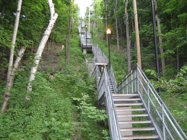
Is the Steeltown Stomp on your bucket list? This is your chance to crush it! Join us and prepare for this incredible challenge on October 3rd, 2026! Registration for the event is now open.If you’ve done stair climbs before, you know the deal—that brutal calf pain is real, especially when you’re just starting out. But training with us this summer? That’s how you show up on stomp day actually feeling strong instead of totally wrecked. Trust me.
We’ll start easy and build up as the summer goes on, hitting Chedoke and Dundurn Stairs with some scenic hikes mixed in. By the time October rolls around, you’ll have crushed at least 2,000 steps and you’ll actually know what you’re doing.
It’s a solid group vibe—moderate pace, warm-ups to get going, stretches to cool down. And honestly, it’s way more fun (and way less painful) doing this with people who get it.
Just grab your water bottle (there’s water at both staircases) and whatever snacks you want. And yeah, there’s optional coffee after if you want to hang out and celebrate.
We’ve got 7 training dates lined up this summer—check the schedule and pick the ones that work for you. Do the work now, own it on stomp day. See you out there!

Toronto Section E2E In 3 Hikes: Hike #1
https://hikes.brucetrail.org/event/toronto-section-e2e-in-3-hikes-hike-1/Sorry, the registration cut-off time for this hike has been reached.Not a member? Click here to join today!Hosting Club: Caledon Hills
Category: End-to-End
Location (Google Maps): Roadside parking – southwest of km 48.4 at Boston Mills Rd. just west of the Mississauga Rd. intersection.Hike Leader(s): Dan Patterson Click here to contact Hike Leader(s)
Pace: Medium – 3 to 4 km/hour
Terrain: Strenuous – hilly with steep climbs and some poor footing
Distance: 14 kmDescription
Welcome to the first of 3 Toronto section E2E hikes. We will meet at the trailhead on Boston Mills Rd. west of Mississauga Rd. and shuttle to km 36.2 Silver Creek Education Center where we will start our hike. Note we will have to walk back from the Caledon/Toronto border at Creditview Rd. at the end of the hike, but we may enjoy libations at Spirit Tree Estate Cidery along the way back to our cars. Bring lunch, snacks, bug spray, sun block, a wide brim hat, and plenty of water with electroytes. Poles may be helpful, but not necessary. Due to the tick population increase and poison ivy, long pants and shirts are recommended. We will need volunteers to shuttle and return shuttle drivers to their cars as well as a sweep.Bus Hike: Caledon Trailway (Caledon East-Palgrave) - Cancelled
https://hikes.brucetrail.org/event/bus-hike-caledon-trailway-caledon-east-palgrave/Sorry, the registration cut-off time for this hike has been reached.Not a member? Click here to join today!Hosting Club: Toronto, Caledon Hills
Category: Cancelled
Location (Google Maps): Caledon Trailway – From Caledon East to Highway 9 via PalgraveHike Leader(s): Tom Swales & Michael Humpage Click here to contact Hike Leader(s)
Pace: Moderate (3-4 km/hr)
Terrain: Flat, Level 1 (Easy – mostly on flat, well maintained trails with hard-packed surface)
Distance (km): 12-15 kmDescription
** This bus hike has been cancelled due to insufficient registration **Join us on a moderately paced hike on flat terrain on the Caledon Trailway from the village of Caledon East past Albion Hills, through the hamlet of Palgrave to the trail’s end at Highway 9. Suitable for families and beginners or anyone wanting to enjoy a day out in the countryside not far from Toronto on a not too challenging hike. Dropouts at 7 km, 10 km, and 12 km. We’ll have a refreshment stop in the downtown Bolton heritage conservation district where the town of Bolton Mills was formed and there’s a variety of options for hikers to enjoy before our ride back to York Mills. For those who joined us on the Winter Toronto E2E #6 and the “Pizza Hike” in March, this is a chance to hike to rest of the Caledon Trailway to it’s eastern terminus.
- =>>> Please read the TBTC Paid Hikes Refund Policy before registering: https://torontobrucetrailclub.org/hikes/no-show-policy”. There will be no refunds for this hike if the registrant cancels or misses the coach on the date of departure for any reason. Registration fees are not transferrable between different hikes nor can unused fares qualify for a tax receipt.
Toronto Islands downtown
https://hikes.brucetrail.org/event/car-hike-boyd-conservation-park-vaughan-16/Sorry, the registration cut-off time for this hike has been reached.Not a member? Click here to join today!Hosting Club: Toronto
Location (Google Maps): Toronto Islands
Meet at Jack Layton Ferry docks at
8:45 a.m. for9:00 departure to center Island) you can buy your tickets online in advance. https://secure.toronto.ca/FerryTicketOnline/tickets2/index.jspHike Leader(s): Mohammad Aghamiri Click here to contact Hike Leader(s)
Pace: Moderate (3-4 km/hr)
Terrain: Flat, Variable
Distance (km): 12-14 kmDescription
Lets hike Toronto islands and enjoy summer in islands,You have an option of swimming after hikePlease bring lots of water and snacks ,
phone number for the day of hike 289 588 6482
Pretty River Provincial Park
https://hikes.brucetrail.org/event/pretty-river-provincial-park/Sorry, the registration cut-off time for this hike has been reached.Not a member? Click here to join today!Hosting Club: Blue Mountains
Category: Organized Hike
Location (Google Maps): Tim Hortons, First Street, CollingwoodHike Leader(s): Mary Jane McIntyre Click here to contact Hike Leader(s)
Pace: Leisurely – 3 km/hr. or less
Terrain: Moderate – Some hills and/or some poor footing
Distance: 5 kmsDescription
We will car pool to Pretty River Provincial Park via Gibraltar and start on the John Haig side trail proceeding to the highest point on the Bruce Trail. We will join the main trail and Russ McConnell side trail to return to the cars. Pretty River Provincial Park – 6th Sideroad and 2nd Line.GO Train Hike: Lynde Shores C.A.
https://hikes.brucetrail.org/event/go-train-hike-lynde-shores-c-a/Sorry, the registration cut-off time for this hike has been reached.Not a member? Click here to join today!Hosting Club: Toronto
Category: GO Train Hike
Location (Google Maps): Lynde Shores Conservation Area – New Parking Lot on Halls Road
I will be taking the 9.02 GO Train from Danforth GO Station to Whitby GO Station. Upon arriving at Whitby we will take a short bus ride, and will be walking down Halls Rd. to the park’s western entrance.
If you wish to board the train at a different station you may find us in the upper level of the accessibility coach. If you use the GO Transit $10 Day Pass you will need to pay $3.84 Adult / $2.53 Senior for the DRT Bus from Whitby GO Station.If you pay by Presto the ride is free under the One Fare Program. It may be less to use Presto for the combined trip with TTC to the GO Station in Toronto.
If you wish to drive you may meet the group at the parking lot or park at the GO Station and ride the bus with the group. Note we will finish by walking to the GO Station.Hike Leader(s): Tom Swales, Janet McColeman Click here to contact Hike Leader(s)
Pace: Moderate (3-4 km/hr)
Terrain: Flat, Level 1 (Easy – mostly on flat, well maintained trails with hard-packed surface), Level 2 (Intermediate – some hills and uneven surfaces, rocks and roots underfoot)
Distance (km): 12 kmDescription
We will hike a couple of loops, including the Chickadee Bird Feeder Trail and the Lake Ontario Trail, around the lovely Lynde Shores Conservation Area, 1225 Victoria Street, Whitby. This is a great spot for birds and other wildlife. From the conservation area we will follow the Durham Waterfront Trail route back towards the GO Station. Optional refreshment stop after the hike.Terrain and Speed – Flat, 3.5k, with stops for photos, viewing wildlife, or appreciating the beauty (approximately 4 hours).
Here is a map of the route:
https://onthegomap.com/s/b0kodkn2
Saturday Shorts: Hockleycrest
https://hikes.brucetrail.org/event/saturday-shorts-hockleycrest-6/Sorry, the registration cut-off time for this hike has been reached.Not a member? Click here to join today!Hosting Club: Caledon Hills
Category: General
Location (Google Maps): Meet at the Mono 5 Sideroad parking area at km 45.4 on the north side of the road where the Trail crosses. This is east of Airport Road. It is best to aim for arriving around 9:20, so we can start hiking as close to 9:30 am as possible. Thanks! It is a popular meet-up spot for hikers. If the parking lot is full, you can park along Mono 5 Sideroad.Hike Leader(s): Elizabeth Ganong Click here to contact Hike Leader(s)
Pace: Leisurely – 3 km/hour or less
Terrain: Moderate – some hills and/or some poor footing
Distance: Approximately 5 kmDescription
Looking to get out on a Saturday but not give up your whole day? Following the main Bruce Trail and side trails, this Saturday’s hike takes us through Hockleycrest. We will cover our approximately 5 km route at a comfortable pace, which allows for enjoying our time out in nature. Consider bringing sunscreen, insect repellent, hiking shoes/boots, a hat, poles, water, and a snack. There will be a short break. No dogs please. Expect a reminder email one or two days before the hike.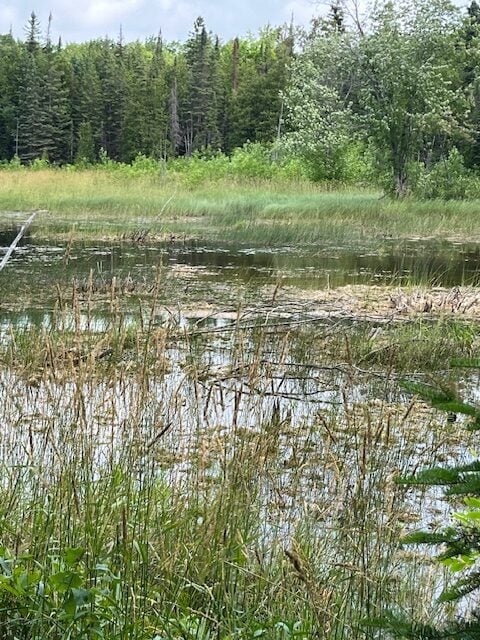
Braiding Friendship
https://hikes.brucetrail.org/event/braiding-friendship/Sorry, the registration cut-off time for this hike has been reached.Not a member? Click here to join today!Hike open to BTC Members only.
Hosting Club: Peninsula
Location (Google Maps): Rural Rootz Nature Reserve, 645 Northacres Road, South Bruce Peninsula. N0H 2T0
Hike Leader(s): Marg Glendon Click here to contact Hike Leader(s)
Pace: Leisurely (2.0 – 3.0 km/h): A relaxed pace with frequent breaks and a focus on enjoyment.
Terrain: Difficult: Steep ascents/descents, rocky scrambling, and some rugged escarpment paths., Easy: Flat forested sections or lowland trails., Moderate: Rolling hills, mild slopes and rocky paths.
Distance: ~4 kmDescription
The Bruce Trail Conservancy is a founding member of the World Trails Network, working collaboratively to sustainably promote and support public footpaths through the creation of Friendship Trails.Much like twin cities, Friendship Trails connect trail organizations from different countries in a spirit of partnership, shared promotion, and international collaboration.
These connections celebrate friendship, strengthen community, and bring people from all walks of life together—both with nature and with one another
Although this second hike in the Friendship Trail series is not a designated International Friendship Trail, it explores the idea of friendship through the lens of reciprocity, gratitude, and shared experience, inspired by the teachings of Robin Wall Kimmerer.
Join us for a unique combination of a workshop and hike focusing on connection—with each other and with the natural world.
We will begin with a hands-on workshop led by Natasha Akiwenzie of Bagida’waad Alliance, who will introduce participants to the concept of sustainable harvesting. You will have an opportunity to braid your own sweetgrass while reflecting on the importance of kindness, reciprocity and nurturing relationships. Sweetgrass is one of four sacred medicines in many First Nations cultures.
Following the workshop, we’ll enjoy a short hike at Rural Rootz Nature Reserve, where we’ll observe how these lessons are reflected in nature. Rural Roots Side Trail is the only Bruce Trail Conservancy side trail which is not physically connected to the Bruce Trail. It is a unique ecosystem which holds examples of karst topography, wetland, limestone caves and moss covered boulders.
This experience offers a thoughtful blend of learning, reflection, friendship and time outdoors.
Free-will cash donations to Rural Rootz Nature Reserve are appreciated. These donations go toward maintaining Rural Rootz Nature Reserve.
Thank you to Tom and Dee Ashman for generously welcoming us to Rural Rootz Nature Reserve.
Geology Hike and Badge Series - Dyer's Bay
https://hikes.brucetrail.org/event/geology-hike-and-badge-series-dyers-bay/Sorry, the registration cut-off time for this hike has been reached.Not a member? Click here to join today!Hosting Club: Peninsula
Category: Geology Hike
Location (Google Maps): Dyer’s BayHike Leader(s): Beth Gilhespy Click here to contact Hike Leader(s)
Pace: Leisurely (2.0 – 3.0 km/h): A relaxed pace with frequent breaks and a focus on enjoyment.
Terrain: Difficult: Steep ascents/descents, rocky scrambling, and some rugged escarpment paths., Moderate: Rolling hills, mild slopes and rocky paths.
Distance: 7.5Description
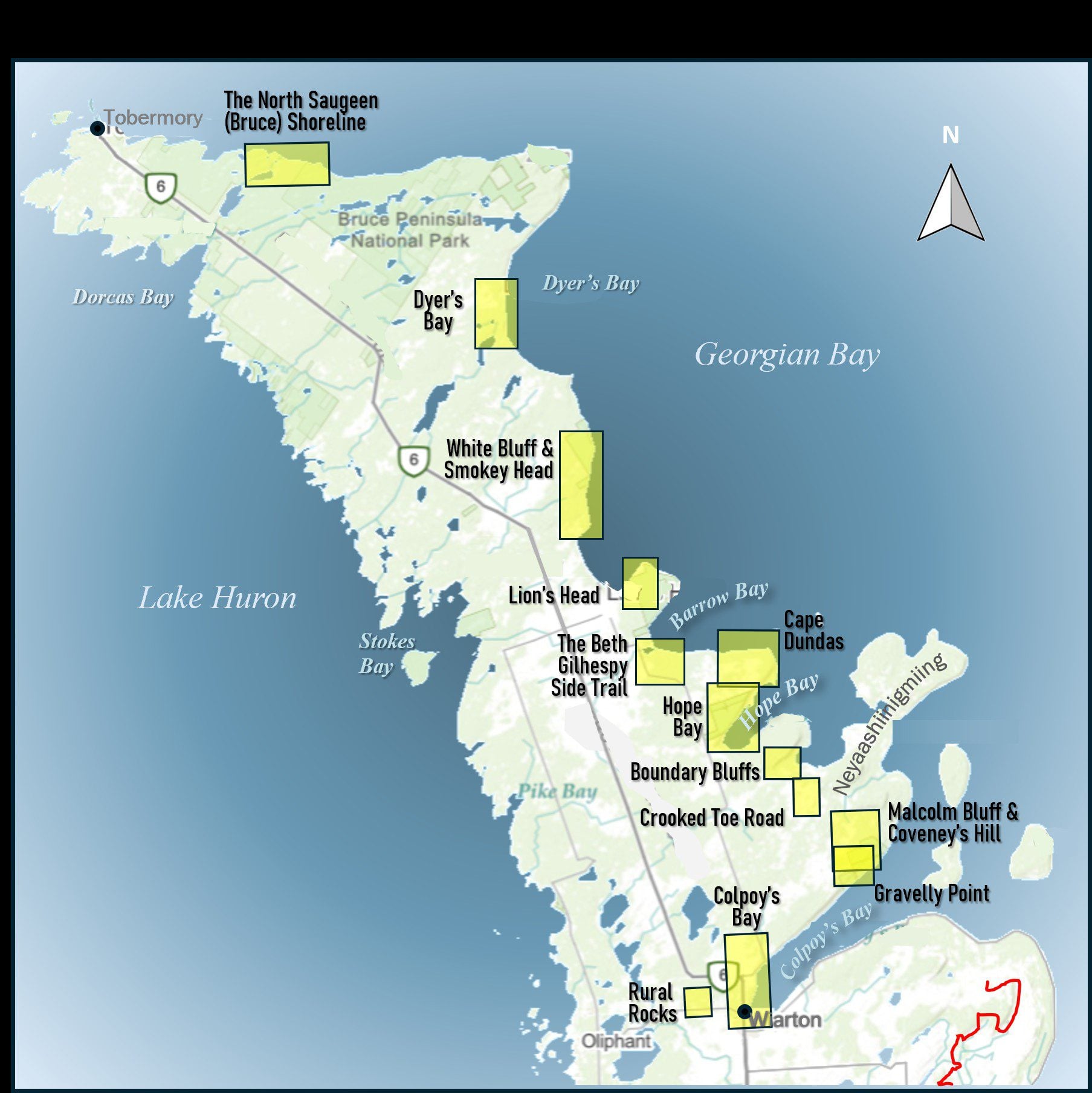
Join the adventure and earn the inaugural Peninsula Geology Badge! Over a stretch of 13 hikes and a couple of extra stops, we will explore the fascinating geology of the Peninsula to learn about the rocks, the shoreline features, glaciation, fossils and all things earthy. The 13 hikes are from the book “Walking Through Time – Exploring the Geology of the Saugeen (Bruce) Peninsula”. Having a copy will give you a lot of great information, but you do not have to purchase the book to attend and enjoy the hikes. Just bring your curiosity! We will make sure to hit all the locations that qualify for the beautiful new Walking Through Time – Saugeen (Bruce) Peninsula geology hike badge. If you would like to purchase a book I will have some available on the hikes, or you can pick one up from the BTC Head Office, at Ginger Press in Owen Sound, Suntrail Source for Adventure in Hepworth, the Shop at 84 Main in Lion’s Head and at Reader’s Haven in Tobermory.You are welcome to come on just a few of the hikes or on all of them, and the dates and hikes are as follows:
Date Geology Hike km
Saturday May 2, 2026 Colpoy’s Bay 9.0
Saturday May 9, 2026 Gravelly Point (am) and Rural Rocks (pm) 8.6
Saturday May 16, 2026 Malcolm Bluff 7.3
Sunday May 17, 2026 White Bluff/Smokey Head 11.8
Sunday May 24, 2026 Crooked Toe Road 5.5
Sunday May 31, 2026 Hope Bay 8.1
Sunday June 14, 2026 Boundary Bluffs 5.2
Saturday July 4, 2026 Cape Dundas 6.2
Saturday July 11, 2026 Beth Gilhespy Side Trail 7.6
Saturday August 8, 2026 Lion’s Head 11.0
Saturday August 15, 2026 Dyer’s Bay Loops 7.5
Saturday August 22, 2026 North Saugeen (Bruce) Shoreline 8.0
Meeting times will vary depending on the hike, but will generally be some time between 9 am and 10 am. Information on exact meeting times and locations will be sent out a few days prior to the hike.
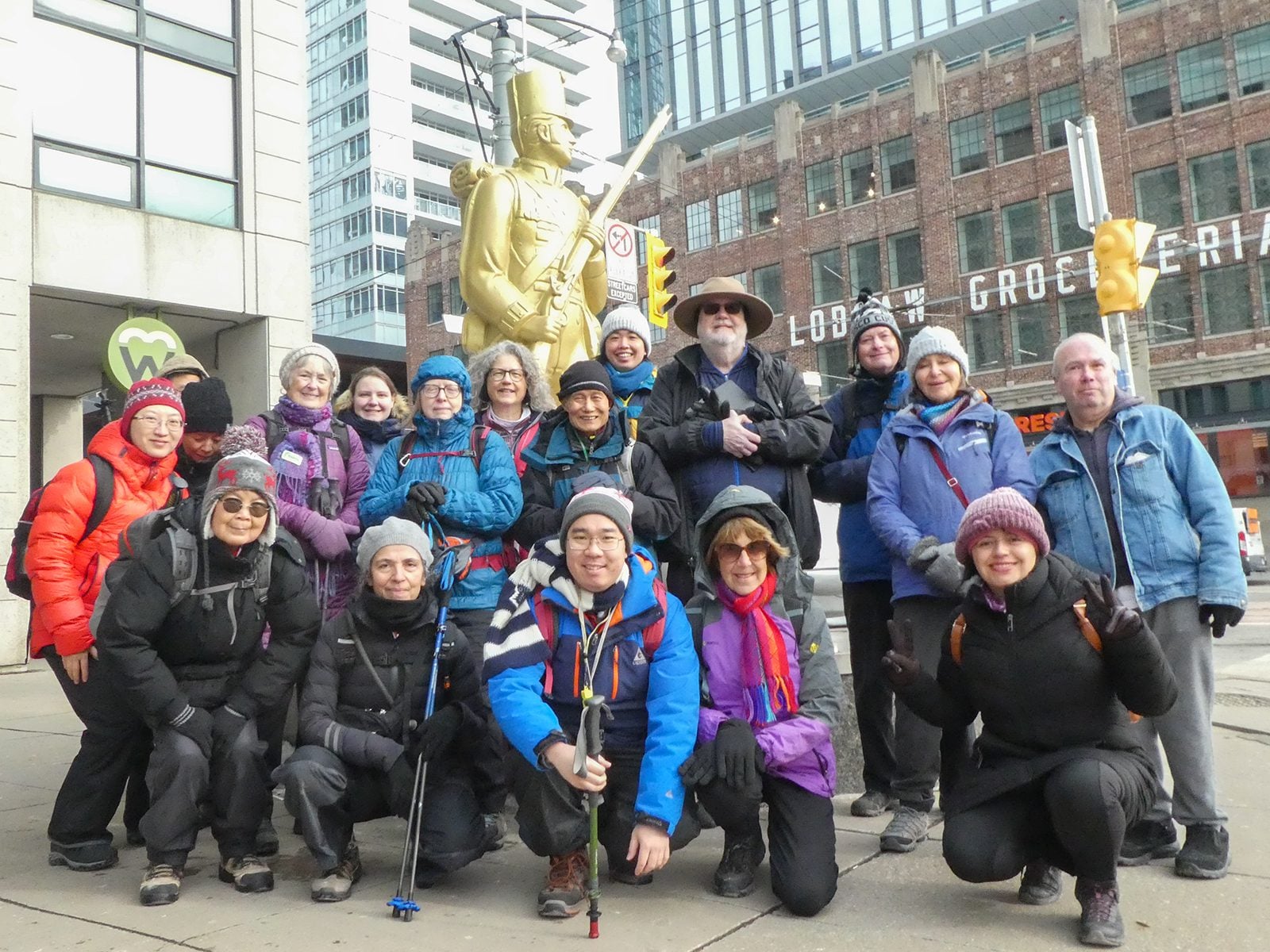
Urban Walk: Waterfront Trail 5/11 – Bathurst
https://hikes.brucetrail.org/event/urban-walk-waterfront-trail-5-11-bathurst-3/Sorry, the registration cut-off time for this hike has been reached.Not a member? Click here to join today!Hosting Club: Toronto
Category: Urban Walk
Location (Google Maps): Downtown Toronto Waterfront TrailHike Leader(s): Brian Rideout Click here to contact Hike Leader(s)
Pace: Moderate (3-4 km/hr)
Terrain: Flat
Distance (km): 9.4 kmDescription
Please join me at Bathurst Station no later than 9:25 am. We will take the streetcar southbound departing 9:40 am, arriving at Fleet St 10:00 am. If you want to meet us at Bathurst and Fleet, be there by 10:00 am. We start hiking at 10:00 am.We will hike to the lake and east to Leslie St. The estimated distance is 9.4 km. Here is an online map of our route Bathurst to Leslie
Bring a snack, at least 2 liters of water, sunscreen and bug spray.
Car Hike: Forks of the Credit
https://hikes.brucetrail.org/event/car-hike-forks-of-the-credit-8/Sorry, the registration cut-off time for this hike has been reached.Not a member? Click here to join today!Hosting Club: Toronto
Category: Car Hike
Location (Google Maps):Forks of the Credit Provincial Park, Map 15
Hike Leader(s): Al Brown Click here to contact Hike Leader(s)
Pace: Moderate (3-4 km/hr)
Terrain: Hilly, Level 2 (Intermediate – some hills and uneven surfaces, rocks and roots underfoot)
Distance (km): 12-13 kmDescription
We will complete a loop hike through the Park, crossing the Credit River above the Cataract Falls. Then we will follow the trail down into the valley to a viewpoint of the Falls itself. We will hike along the east bank of the Credit River then turn east to climb the valley and then north back through the main park past glacial features and old homesteads. Natural features include kettle lakes and milkweed fields if still in bloom where we might spot monarch butterflies.Refreshments in Belfountain or Erin after the hike.
The meeting point is the intersection of Mississauga Road and Cataract Road. Parking is located on both sides of the road. Park in marked areas only. To get to this point drive north on Mississauga Road from Brampton to about 3 km past Belfountain.
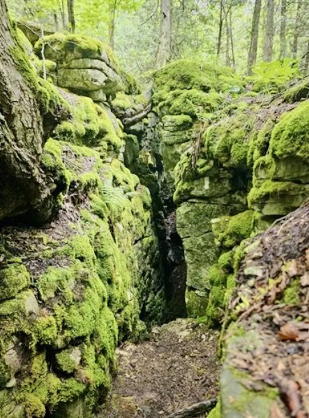
Woodford Escarpment side trail loop & Crevice Springs side trail
https://hikes.brucetrail.org/event/woodford-escarpment-side-trail-loop-crevice-springs-side-trail/Sorry, the registration cut-off time for this hike has been reached.Not a member? Click here to join today!Hosting Club: Sydenham
Category: General Hike
Location (Google Maps): Woodford Community Hall along Woodford Crescent off HWY 26Hike Leader(s): Ian Mills
Pace: Medium: 3 to 4 km/h
Terrain: Moderate: Some hills and/or poor footing, There might be muddy sections., There might be sections with water on the trail.
Distance: 5 kmDescription
Join us for a pleasant loop north of Woodford via Woodford Escapement side trail and the main trail. Interesting terrain surrounded by a beautiful forest. This will not be an overly challenging hike rather an opportunity to view the sights and take our time. For those that are interested we can do a second more challenging loop south of Woodford via Crevices Springs side trail. Please bring water, possibly a late snack and proper hiking footwear. BTC Map #30.