
The BTC office will be closed on Mon. Oct. 12 for the holiday. Thank you for your understanding.
Hike Schedule
Join us for a hike! Registration required.
All hikes available to BTC members. Some hikes are open to non-members.
See Refund Policy for Paid Hikes >
TIP: The calendar view displays up to 7 hikes on a day, but often there are more. Click “View more events” to see them all.
Niagara
Iroquoia
Toronto
Caledon Hills
Dufferin Hi-Land
Blue Mountains
Beaver Valley
Sydenham
Peninsula
All Clubs
Show Filters
Categories
Reset Filters
- 02August 2, 2026
Car Hike: Jefferson Forest/Bond Lake
https://hikes.brucetrail.org/event/car-hike-jefferson-forest-bond-lake-8/Sorry, the registration cut-off time for this hike has been reached.Not a member? Click here to join today!Hosting Club: Toronto
Category: Car Hike
Location (Google Maps):1245 Bethesda Side Rd, Richmond Hill, ON L4E 1A2 ( Bethesda Trail Head Parking lot)
Hike Leader(s): Amir Alemohammad Click here to contact Hike Leader(s)
Pace: Moderate (3-4 km/hr)
Terrain: Flat, Hilly, Level 2 (Intermediate – some hills and uneven surfaces, rocks and roots underfoot), Variable
Distance (km): 14-16KmDescription
Let’s roll the hills of the Jefferson Forest and around the Bond Lake. Every week we hike in Jefferson Forest, located in the heart of Richmond Hill, it boasts numerous hiking trails. This 4 hour hike can range from 14 to 15 kilometres, depending on the weather conditions. Remember to bring water, snacks, hiking boots (mandatory), poles, and your camera. Not recommended for beginners. Park in the free Bethesda parking lot and avoid parking along the road. Dress appropriately for the weather. Difficulty Level: 2 (Moderate).Please arrive @7:45AM for start of 8:00AM.
This is a joint hike with the Oak Ridges Trail Association (ORTA).
what3words:
https://w3w.co/twisting.mailer.awakes
Sunny Sundays-Blantyre into Sydenham
https://hikes.brucetrail.org/event/sunny-sundays-blantyre-into-sydenham/Sorry, the registration cut-off time for this hike has been reached.Not a member? Click here to join today!Hosting Club: Beaver Valley
Location (Google Maps): Meet in the Blantyre parking lot, km 117.3, Map 28, 44.500537,-80.632902
Hike Leader(s): Mike Arkless Click here to contact the hike leader.
Pace: Medium
Terrain: Moderate, Some rocky footing, Some steep sections
Length of Hike: 14.7 kmDescription
This is an out and back hike, on which we’ll hike west from the BTC parking lot at Blantyre to St. Vincent Sydenham Townline, then return to our cars. We’ll hike through Rocklyn Creek Management Area and see pretty Rocklyn Creek. Please arrive at 8:15 a.m. for an 8:30 a.m. start. As usual, bring sufficient water and snacks, we’ll take a break mid hike. Dress for the weather, there are still mosquitoes out there so bring insect repellent, or other covering. So we know whether or not to expect you, if you need to cancel please do so on the online calendar or by contacting the hike leader through this hike’s “click here to contact the hike leader” option in the hike schedule. Looking forward to seeing you. Mike.Lion's Head, 2 of 3
https://hikes.brucetrail.org/event/lions-head-2-of-3/Sorry, the registration cut-off time for this hike has been reached.Not a member? Click here to join today!Hosting Club: Toronto, Peninsula
Category: Car Hike
Location (Google Maps): Cape Chin/Dyers Bay, Maps 39 and 40Hike Leader(s): Alex Brown Click here to contact Hike Leader(s)
Pace: Moderate (3-4 km/hr)
Terrain: Level 2 (Intermediate – some hills and uneven surfaces, rocks and roots underfoot), Rocky, Variable
Distance (km): 12.4 kmDescription
This is the second hike of the Lion’s Head series. The hike will be from km 98.4 where the trail crosses Cape Chin South Road and finish at km 110.8. Car pooling and meeting arrangements will be confirmed the day before.The hike will mostly follow the forested escarpment edge, occasionally turning inland. Trail conditions are variable and rocky.
After the hike we will meet for refreshments and to plan out the activity for day 3.
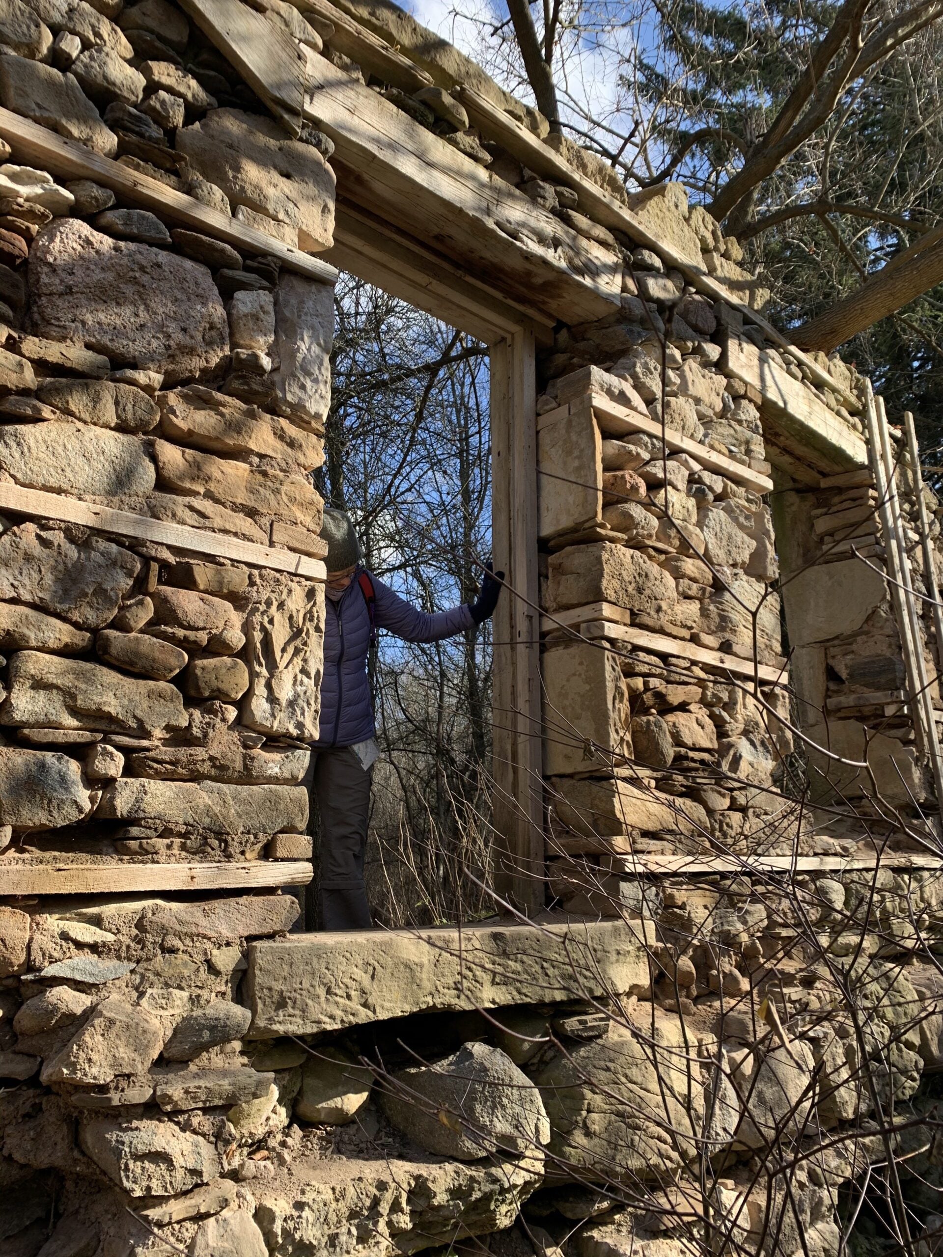
POSTPONED: Burlington Heritage Week / River & Ruin
https://hikes.brucetrail.org/event/burlington-heritage-week-river-ruin-historical-hike/Sorry, the registration cut-off time for this hike has been reached.Not a member? Click here to join today!Hosting Club: Iroquoia
Category: Historical Hike
Location (Google Maps): Kilbride Park Parking Lot Behind the Kilbride School, access to Main Trail and Kilbride PassHike Leader(s): Joe Borges Click here to contact Hike Leader(s)
Pace: Leisurely – 3km/hr or less
Terrain: Dependent on Conditions, Moderate – Some hills and/or some poor footing, Slippery and Steep Sections
Distance: 7.6 kmDescription
Burlington Heritage Week Hike: River & RuinJoin us for the special hike brought to you by Iroquoia Bruce Trail Club partnering with the City of Burlington for Heritage Week.
The theme this year is water, so we will hike through one of Burlington’s most historically rich landscapes. The River & Ruin trail winds through the beautiful Lowville Valley, where the natural drama of Twelve Mile Creek meets the traces of Burlington’s early settlement history. Along the way, we’ll explore the stories of Kilbride, Lowville, and the Cleaver family, whose mill, homestead, and ruins helped shape this valley nearly two hundred ago.
This hike offers more than beautiful views, it’s a walk through time. From the limestone ruins and historic mill site to the creek that powered early industry and settlement, the route reveals how farming, waterpower, and pioneering families transformed the area into one of Burlington’s most fascinating heritage corridors. If you enjoy trails with a strong sense of place, local history, and a great story under your boots, this is the hike for you.
Come discover the hidden history of Kilbride and the Lowville Valley, experience why this unique trail is one of Burlington’s most memorable heritage walks.
Note, no dogs are permitted on this hike.
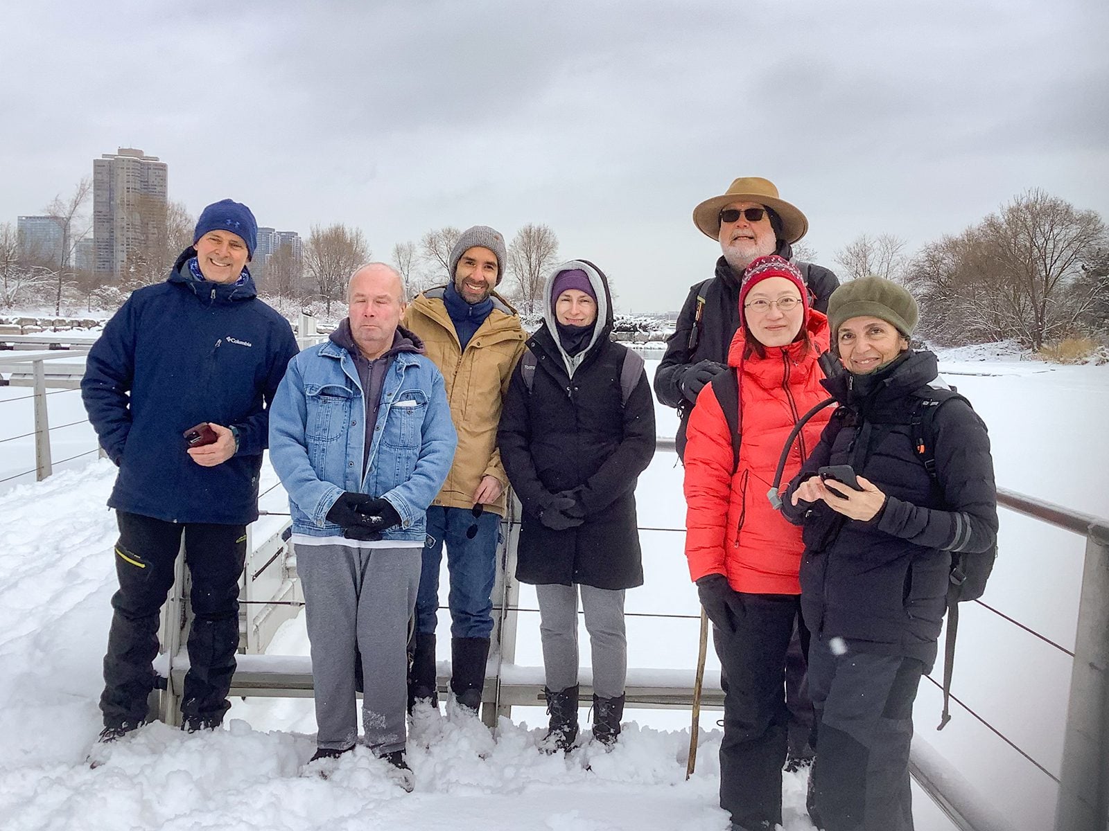
Urban Walk: Waterfront Trail 4/11 – Parklawn
https://hikes.brucetrail.org/event/urban-walk-waterfront-trail-4-11-parklawn-4/Sorry, the registration cut-off time for this hike has been reached.Not a member? Click here to join today!Hosting Club: Toronto
Category: Urban Walk
Location (Google Maps): Toronto Waterfront Trail WestHike Leader(s): Brian Rideout Click here to contact Hike Leader(s)
Pace: Moderate (3-4 km/hr)
Terrain: Flat
Distance (km): 9.1 kmDescription
Please join me at Old Mill Station no later than 9:12 am. We will take the 66 bus departing 9:27 am, arriving 9:40 am. If you want to meet us at Parklawn and Lakeshore, please be there by 9:40 am. We start hiking at 9:50 am.We will hike east along the lake to Spadina. The estimated distance is 9.1 km. Here is an online map of our route Parklawn to Spadina
Bring a snack, at least 2 liters of water, sunscreen and bug spray.
- 03August 3, 2026
Lion's Head, 3 of 3
https://hikes.brucetrail.org/event/lions-head-3-of-3/Sorry, the registration cut-off time for this hike has been reached.Not a member? Click here to join today!Hosting Club: Toronto, Peninsula
Category: Car Hike
Location (Google Maps): Dyers Bay, Map 40Hike Leader(s): Alex Brown Click here to contact Hike Leader(s)
Pace: Moderate (3-4 km/hr)
Terrain: Flat, Level 1 (Easy – mostly on flat, well maintained trails with hard-packed surface)
Distance (km): 7 kmDescription
We hike from km 110.8 and finish at Km 117.8. This section passes along the escarpment and then moves inland to Lindsay Rd 40.We will finish earlier than the previous days. After the hike those wishing to may meet for after hike refreshments in Lion’s Head before heading home.
Easy Does It Hike, St Catharines Museum & Welland Canals Centre Hike
https://hikes.brucetrail.org/event/easy-does-it-hike-st-catharines-museum-welland-canals-centre-hike/Sorry, the registration cut-off time for this hike has been reached.Not a member? Click here to join today!Hosting Club: Niagara
Category: Leisurely
Location (Google Maps): 1932 Welland Canals Parkway, Lock 3, St. Catharines, OnHike Leader(s): Diane Marlatt Click here to contact Hike Leader(s)
Pace: Leisurely <3 km/hr
Terrain: Easy: mostly flat, good footing
Distance: 7KmDescription
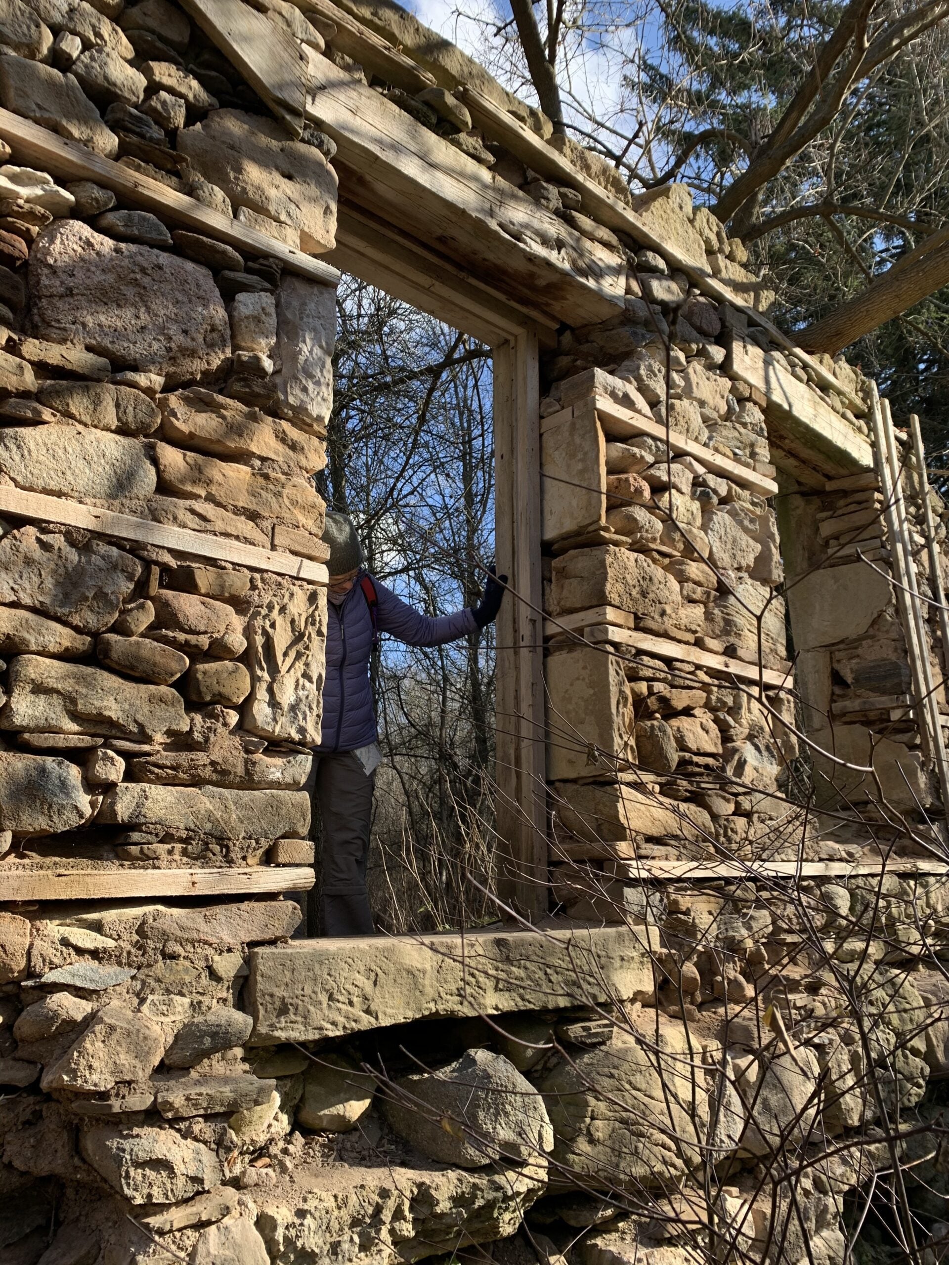
Rescheduled Hike 1: Burlington Heritage Week / River & Ruin
https://hikes.brucetrail.org/event/rescheduled-hike-1-burlington-heritage-week-river-ruin/Sorry, the registration cut-off time for this hike has been reached.Not a member? Click here to join today!Hosting Club: Iroquoia
Category: Historical Hike
Location (Google Maps):Kilbride Park Parking Lot Behind the Kilbride School, access to Main Trail and Kilbride Pass
Hike Leader(s): Joe Borges Click here to contact Hike Leader(s)
Pace: Leisurely – 3km/hr or less
Distance: 7.6 km
Description
RESCHEDULED: Burlington Heritage Week Hike: River & RuinJoin us for the special hike brought to you by Iroquoia Bruce Trail Club partnering with the City of Burlington for Heritage Week.
The theme this year is water, so we will hike through one of Burlington’s most historically rich landscapes. The River & Ruin trail winds through the beautiful Lowville Valley, where the natural drama of Twelve Mile Creek meets the traces of Burlington’s early settlement history. Along the way, we’ll explore the stories of Kilbride, Lowville, and the Cleaver family, whose mill, homestead, and ruins helped shape this valley nearly two hundred ago.
This hike offers more than beautiful views, it’s a walk through time. From the limestone ruins and historic mill site to the creek that powered early industry and settlement, the route reveals how farming, waterpower, and pioneering families transformed the area into one of Burlington’s most fascinating heritage corridors. If you enjoy trails with a strong sense of place, local history, and a great story under your boots, this is the hike for you.
Come discover the hidden history of Kilbride and the Lowville Valley, experience why this unique trail is one of Burlington’s most memorable heritage walks.
Note, no dogs are permitted on this hike.
- 04August 4, 2026
Long Hike Short Hills
https://hikes.brucetrail.org/event/long-hike-short-hills-5/Sorry, the registration cut-off time for this hike has been reached.Not a member? Click here to join today!Hosting Club: Niagara
Location (Google Maps):
Short Hills Wiley Road, Thorold
Pace: Brisk 4-5 km/hr
Terrain: Moderate: some hills and some poor footing
: 10k+Description
Our regular Spot for the Tuesday Long Hike. Note the new location. We will hike the trails around Short Hills Dress for the weather and bring sunscreen bug spray, poles snack and drink9:15 Short Hike, Short Hills Provincial Park, St. Catharines
https://hikes.brucetrail.org/event/915-short-hike-short-hills-provincial-park-st-catharines-5/Sorry, the registration cut-off time for this hike has been reached.Not a member? Click here to join today!Hosting Club: Niagara
Category: Hike
Location (Google Maps): Short Hills Provincial Park, Pelham Rd entranceHike Leader(s): Debbie Demizio Click here to contact Hike Leader(s)
Pace: Medium 3- 4 km/hr
Terrain: Moderate: some hills and some poor footing
Distance: 6 kmDescription
Hike the main and side trail of Short Hills Provincial Park. Please bring water, insect repellent, sunscreen and hiking poles. Check yourself thoroughly for ticks following the hike.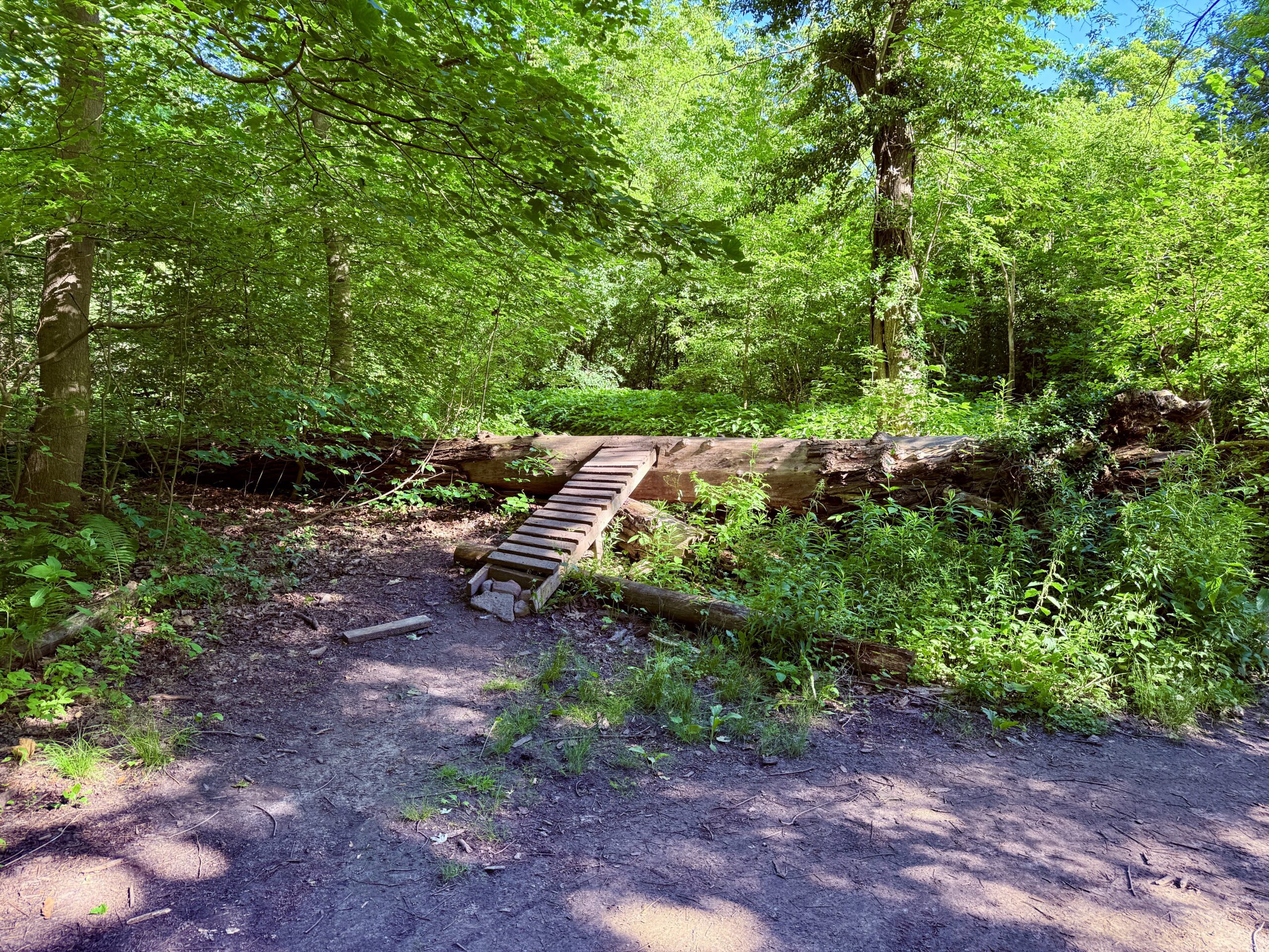
Urban Walk: Midtown Ravine Hike - ET Seton, Sunnybrook and Sherwood Parks
https://hikes.brucetrail.org/event/urban-walk-midtown-ravine-hike-et-seton-sunnybrook-and-sherwood-parks/Sorry, the registration cut-off time for this hike has been reached.Not a member? Click here to join today!Hosting Club: Toronto
Category: Urban Walk
Location (Google Maps): Sunnybrook Park Subway Station (Eglinton Crosstown at Leslie)Hike Leader(s): Ted Moriarty Click here to contact Hike Leader(s)
Pace: Moderate (3-4 km/hr)
Terrain: Hilly, Level 2 (Intermediate – some hills and uneven surfaces, rocks and roots underfoot)
Distance (km): 7 kilometresDescription
Please join me for a morning hike through three Toronto ravine parks and the streets of North Toronto. We will wind our way through ET Seton Park, Sunnybrook Park and Sherwood Park. From here we will explore the North Toronto neighbourhood between Mount Pleasant Road and Yonge Street. The hike will end on Yonge Street just north of Eglinton Subway Station.Route map:
https://onthegomap.com/s/k69os2b6
Travel to the trailhead:
Meet Ted at the Sunnybrook Park Station (Eglinton Crosstown) exit turnstiles. There is only one exit from this station.Washrooms:
There are no washrooms at Sunnybrook Park Subway Station. The closest subway washroom is at Eglinton Station (Eglinton and Yonge). During the 7 km hike, we will stop at three public washrooms located at kilometres 1, 2 and 5.Après-hike:
There will be an optional après-hike stop at Rose and Crown (2335 Yonge Street). Alternatively, hikers can explore the Yonge and Eglinton neighbourhood and visit one of the many restaurants or cafes in the area.
Hockley 2 loops
https://hikes.brucetrail.org/event/hockley-2-loops/Sorry, the registration cut-off time for this hike has been reached.Not a member? Click here to join today!Hosting Club: Iroquoia
Category: General Hike
Location (Google Maps): Meet at 9:15 roadside on Third Line EHSHike Leader(s): Karen Bergmann Click here to contact Hike Leader(s)
Pace: Medium – 3 to 4 km/hr
Terrain: Moderate – Some hills and/or some poor footing
Distance: 7 kmsDescription
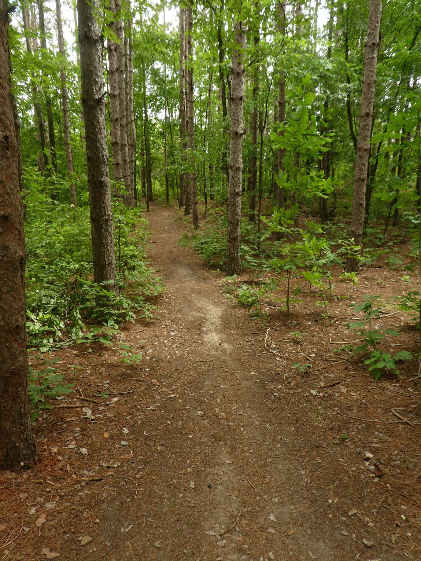
Meeting at 9:15 am on Third Line EHS by Hockley Valley Provincial Park, we will hike the Isabel East, Cam Snell and Glen Cross Side Trails, with some main trail connecting them all. There are some hills on this hike. Please bring sufficient water and bug spray/bug net.Urban Walk: Valley View/Huntington Park
https://hikes.brucetrail.org/event/urban-walk-valley-view-huntington-park-13/Sorry, the registration cut-off time for this hike has been reached.Not a member? Click here to join today!Hosting Club: Toronto
Location (Google Maps): Parking lot is off Sycamore Drive, East of Bayview , across Starbucks plaza
Bus 91 from Finch East station stops at Sycamore station.Hike Leader(s): Mohammad Aghamiri
Pace: Moderate (3-4 km/hr)
Terrain: Hilly, Level 2 (Intermediate – some hills and uneven surfaces, rocks and roots underfoot)
Distance (km): 6-7 kmDescription
We will explore Valleyview and Maple View parks, and walk along German Mill Creak, in return we stop in Huntington park and have snack under beautiful shed.Although this is considered an “Urban Walk”, you can expect some hills up and down and uneven surfaces with tree roots. Please bring hiking poles, water and snacks.
Looping Through Starkey Hills Conservation Area, Guelph
https://hikes.brucetrail.org/event/looping-through-starkey-hills-conservation-area-guelph/Sorry, the registration cut-off time for this hike has been reached.Not a member? Click here to join today!Hosting Club: Caledon Hills
Category: Tuesday Hikers
Location (Google Maps): 735 Arkell Rd., Puslinch, ON N1H 6H8, CanadaHike Leader(s): Doris Harper Click here to contact Hike Leader(s)
Pace: Medium – 3 to 4 km/hour
Terrain: Moderate – some hills and/or some poor footing
Distance: 8 kmDescription
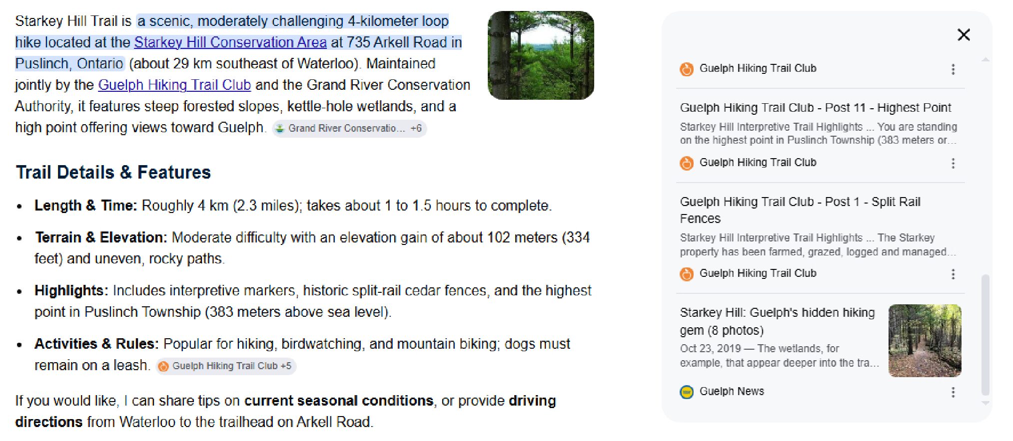
From the parking lot we will hike the trails through the conservation area. We can also access other trails in the immediate area. There are moderate hills.Bring water and snacks. Sunscreen and insect repellent and a hat recommended.
Chasing Waterfalls - Balls Falls
https://hikes.brucetrail.org/event/chasing-waterfalls-balls-falls/Sorry, the registration cut-off time for this hike has been reached.Not a member? Click here to join today!Hosting Club: Niagara
Category: In and Out
Location (Google Maps): Sho’arishon Park, parking lot in JordanHike Leader(s): Dian Wright Click here to contact Hike Leader(s)
Pace: Leisurely <3 km/hr
Terrain: Moderate: some hills and some poor footing
Distance: 5 -6Description
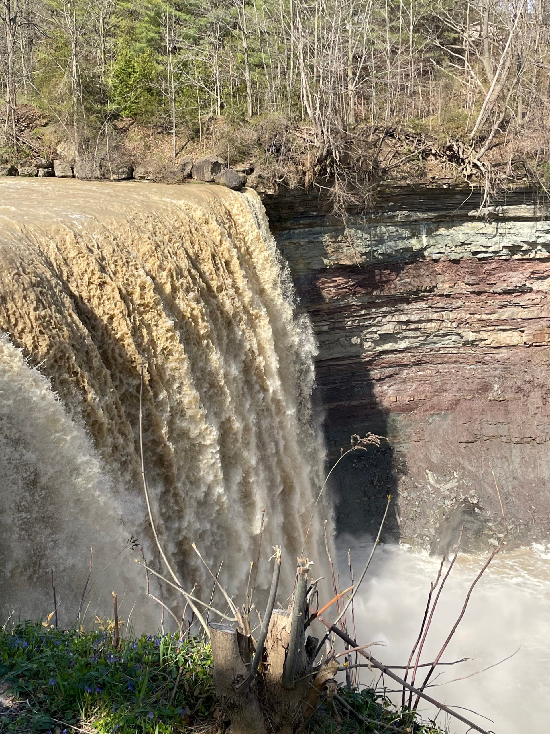
Let’s go chasing waterfalls! First stop Balls Falls upper and lower Falls.Bring your hiking poles, hiking boots and a sense of adventure. Let’s explore the beauty of Niagara in all it’s wonder and glory!
This approximately 5km hike will take us into the woods! There will be some hilly areas and beautiful old growth trees.
Join me for what will hopefully become one of many! See you on the trail!
- 05August 5, 2026
RIM 2 RIM Badge Hike #2 Mad River Rim (Second in a series of 3 for the Rim2Rim badge)
https://hikes.brucetrail.org/event/rim-2-rim-badge-hike-2-mad-river-rim-second-in-a-series-of-3-for-the-rim2rim-badge/Sorry, the registration cut-off time for this hike has been reached.Not a member? Click here to join today!Hosting Club: Blue Mountains
Category: Organized Hike
Location (Google Maps): Devil’s Glen Provincial Park, Simcoe County Rd 124, Glen Huron, ON L0M 1H0Hike Leader(s): Rob Johnston Click here to contact Hike Leader(s)
Pace: Medium – 3 to 4 km/hr
Terrain: Strenuous – Hilly with steep climbs and some poor footing
Distance: 10Description
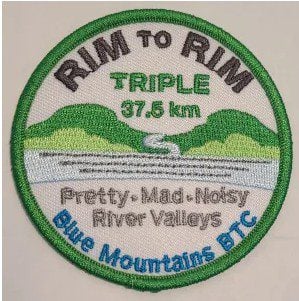
This is the second of three the Rim-To-Rim hikes required for the Blue Mountain Rim-To-Rim badge. This hikes starts at the top of a river valley, hikes down and up the other side, then back again. As such these are very hilly and strenuous.About 12 km with almost 800 m elevation gain.
Meet at Devil’s Glen PP parking lot. We will hike south along the white blazed main Bruce Trail down through the Devil’s Glen area, cross the Mad River, then go up the other side to where the trail meets the blue blazed Mad River Side Trail. We will hike down along the sidetrail until it rejoins the main trail, then return to our cars again following the main trail. Bring lots of snacks, lunch and water. Check the other two Rim-To-Rim hikes in the schedule on 8 July 2026 and 29 Aug 2026
WEDNESDAY WALKERS - Stew Hilt's Side Trail
https://hikes.brucetrail.org/event/wednesday-walkers-stew-hilts-side-trail-3/Sorry, the registration cut-off time for this hike has been reached.Not a member? Click here to join today!Hosting Club: Beaver Valley
Location (Google Maps): Meet in the parking lot at the end of Johnston’s Side Road off of Grey Road 32, km 74.3, Map 26, Edition 31
Hike Leader(s): Glenda Collings Click here to contact the hike leader.
Pace: Medium
Terrain: Some rocky footing, Some steep sections
Length of Hike: 5.9 kmDescription
This hike takes us through BTC protected land. We will walk through a mature deciduous forest on the Main Trail and then we’ll walk the Stew Hilt’s Side Trail. Crossing a stream, we reach a waterfall, usually trickling later in the year. Our route will have us return on the higher Main Trail which provides a beautiful view of the Cuckoo Valley.Car Hike: Toronto E2E (4 of 4)
https://hikes.brucetrail.org/event/car-hike-toronto-e2e-4-of-4-2/Sorry, the registration cut-off time for this hike has been reached.Not a member? Click here to join today!Hosting Club: Toronto
Category: Car Hike
Location (Google Maps): Chinguacousy Rd, north of Olde Baseline Rd. (Map 14, 2.8k marker, Edition 31)Hike Leader(s): David Rowney Click here to contact Hike Leader(s)
Pace: Moderate (3-4 km/hr)
Terrain: Variable
Distance (km): 14.3kDescription
This is a summer-time End-to-End hike to complete the Toronto section of the Bruce Trail in 4 hikes.This 4th hike of the series will take us from the the Walking Fern ST on 10th Line, to the end of the Toronto Section, continuing through the Badlands, to 2.8k into the Caledon section. As with previous hikes in this series, the terrain will vary, there will be some hilly sections and sections with uneven, rocky terrain, making footing tricky to navigate.
Early August weather can be hot, muggy and buggy! So, dress for the weather, keeping in mind that insects, including ticks, will be out in full force. Take appropriate precautions to avoid insect bites, including using repellant and clothing that covers the legs and arms. Hiking shoes/boots are required and hiking poles are recommended.
Bring plenty of fluids, including electrolytes, and a snack/lunch.
Since this is a group hike, please consider your fitness level before registering. We will be walking at a pace of 3.5km – 4km per hour and everyone is expected to keep up with the person in front of them for the duration of the hike.
Plan to arrive at the meeting place by 9:15 a.m. as we will start the car shuffle to the hike starting point at 9:30 a.m. sharp. Further details will be provided to registered hikers a few days prior to the hike.
Evening Hike in Owen Sound followed by Social Time at the Hike Leader`s home
https://hikes.brucetrail.org/event/evening-hike-in-owen-sound-followed-by-social-time-at-the-hike-leaders-home/Sorry, the registration cut-off time for this hike has been reached.Not a member? Click here to join today!Hosting Club: Sydenham
Category: Hike & Potluck
Location (Google Maps): Meet in the municipal parking lot by the river on the West side of 1st Ave East between 7th St East an 8th St East in Owen SoundHike Leader(s): Harriet Nixon Click here to contact Hike Leader(s)
Pace: Brisk: 4 to 5 km/h
Terrain: Moderate: Some hills and/or poor footing
Distance: Approx 5 kmDescription
Join us for a brisk summer evening hike exploring the Sydenham River valley within the Owen Sound City limits. Following the hike participants are invited to the Hike Leader`s home for refreshments. There is no need to show up 15 minutes early for this hike, but we will leave promptly at 7:00 pm. - 06August 6, 2026
8:00 am Long hike Glen Road NEW Location. Due to Flooding
https://hikes.brucetrail.org/event/800-am-long-hike-new-location-bailey-bridge-jordan-6/Sorry, the registration cut-off time for this hike has been reached.Not a member? Click here to join today!Hosting Club: Niagara
Location (Google Maps): Glen Road Jordan
Hike Leader(s): Alan Laver Click here to contact Hike Leader(s)
Pace: Brisk 4-5 km/hr
Terrain: Strenuous: hilly, with steep climbs, poor footing
Distance: ~10kDescription
CHANGE IN LOCATION THIS WEEK ONLY. This will be our permanent location . Hike up from the Bailey bridge to Balls Falls and explore the trailsYou must register for each hike. Bring Poles, snack and a drink. Dress for the weather
Hiking around Jordan
https://hikes.brucetrail.org/event/hiking-around-jordan-66/Sorry, the registration cut-off time for this hike has been reached.Not a member? Click here to join today!Hosting Club: Niagara
Category: In and Out
Location (Google Maps): Sho’aríshon Park, Jordan (formerly Jordan Hollow)Hike Leader(s): Bill Russell Click here to contact Hike Leader(s)
Pace: Medium 3- 4 km/hr
Terrain: Moderate: some hills and some poor footing
Distance: 6 kmsDescription
Hiking in and around Jordan, Rainforth Trail and Balls Falls, alternating every 3 weeks.Beaver Bites - Hike 1 of 4
https://hikes.brucetrail.org/event/beaver-bites-hike-1-of-4/Sorry, the registration cut-off time for this hike has been reached.Not a member? Click here to join today!Hosting Club: Caledon Hills
Category: General
Location (Google Maps): Meet at Epping Lookout, km 94.3, on Grey Road 7 north of 19 Sideroad.Hike Leader(s): Nancy Mooney Click here to contact Hike Leader(s)
Pace: Medium – 3 to 4 km/hour
Terrain: Moderate – some hills and/or some poor footing
Distance: There are 2 hikes on this day and each of the 4 days in this series. The first hike will be 9.8 km and the second hike will be 3.8 km.Description
This hike series involves long days but a great way to tackle 30 km of side trails in Beaver Valley to earn the Beaver Bites badge. We will loop around Fairmount with a break at Webwood Falls. (Map 28) We will then have a lunch break back at Epping Lookout, including the short Epping Side Trail before heading over to do a short loop at the Wodehouse Management area and the Sligo Side Trail. (Map 27)Urban Walk: Valley View/Huntington Park
https://hikes.brucetrail.org/event/urban-walk-valley-view-huntington-park-14/Sorry, the registration cut-off time for this hike has been reached.Not a member? Click here to join today!Hosting Club: Toronto
Location (Google Maps): Parking lot is off Sycamore Drive, East of Bayview , across Starbucks plaza
Bus 91 from Finch East station stops at Sycamore station.Hike Leader(s): Mohammad Aghamiri
Pace: Moderate (3-4 km/hr)
Terrain: Hilly, Level 2 (Intermediate – some hills and uneven surfaces, rocks and roots underfoot)
Distance (km): 6-7 kmDescription
We will explore Valleyview and Maple View parks, and walk along German Mill Creak, in return we stop in Huntington park and have snack under beautiful shed.Although this is considered an “Urban Walk”, you can expect some hills up and down and uneven surfaces with tree roots. Please bring hiking poles, water and snacks.
Scottsdale Farm the Easy Way
https://hikes.brucetrail.org/event/scottsdale-farm-the-easy-way/Sorry, the registration cut-off time for this hike has been reached.Not a member? Click here to join today!Hosting Club: Iroquoia, Toronto
Category: Easy Does It Hikes
Location (Google Maps): Scottsdale Farm 13807 Trafalgar Rd.Hike Leader(s): Anne Armstrong Click here to contact Hike Leader(s)
Pace: Leisurely – 3km/hr or less
Terrain: Easy – Mostly flat and usually good footing
Distance: 8 – 9 km.Description
Come join us for this easy hike exploring the side trails around Scottsdale Farm. Learn about the history of the farm and enjoy the beauty of the farm and surrounding area. Meet in the parking lot at the end of a long road into the farm at 9:15 for a 9:30 start. Bring a snack, water, sunscreen and insect repellent. I will send an email the day before with my contact ingormation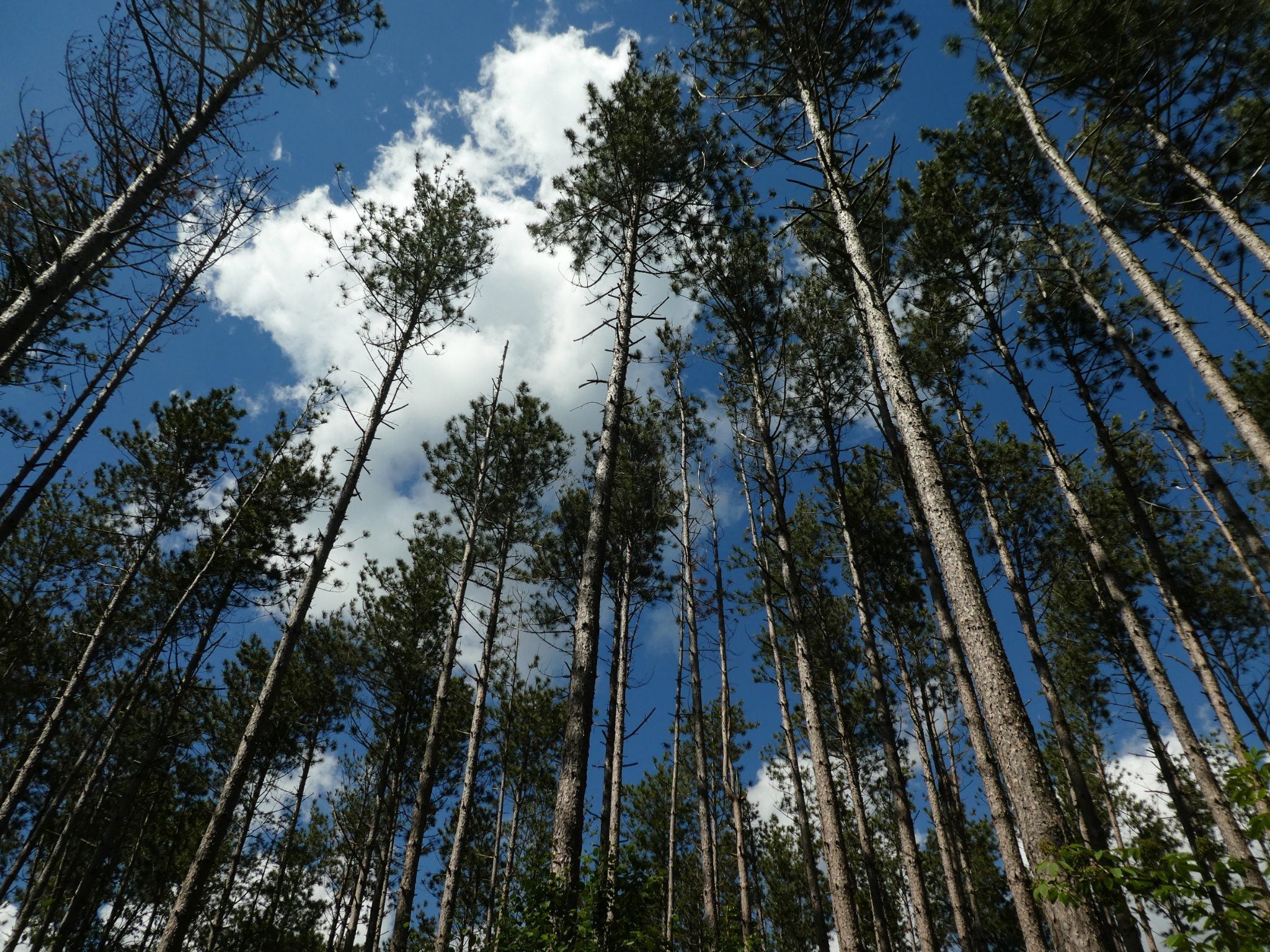
Halton Agreement Forest
https://hikes.brucetrail.org/event/halton-agreement-forest-4/Sorry, the registration cut-off time for this hike has been reached.Not a member? Click here to join today!Hosting Club: Iroquoia
Category: General Hike
Location (Google Maps): Meet roadside on 4th Line at 9:15 am. Up Guelph Line from the 401, turn right on 10 Side Road and follow the curve as it becomes 4th Line.Hike Leader(s): Karen Bergmann Click here to contact Hike Leader(s)
Pace: Medium – 3 to 4 km/hr
Terrain: Moderate – Some hills and/or some poor footing
Distance: 8 kmsDescription
Meeting at 9:15 am in the small parking lot and roadside on 4th Line, we will hike several of the bike trails, including The Den and The Pines.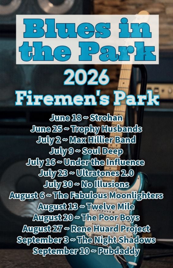
Hike, followed by Blues in the Park
https://hikes.brucetrail.org/event/hike-followed-by-blues-in-the-park-6/Sorry, the registration cut-off time for this hike has been reached.Not a member? Click here to join today!Hosting Club: Niagara
Category: Leisurely
Location (Google Maps):2275 Dorchester Rd, Niagara Falls, ON L2J 0H1
Hike Leader(s): Marion Hanover Click here to contact Hike Leader(s)
Pace: Leisurely <3 km/hr
Terrain: Moderate: some hills and some poor footing
Distance: 4kmDescription
Hike series Thursday evenings throughout the summer, followed by optional Blues in the Park. Come prepared to hike 1.5 leisure hike. Various blues bands free of charge starting at 7pm in the park. Bring lawn chair, beverage and snack to share. - 07August 7, 2026
Niagara-on-the-Lake Tour
https://hikes.brucetrail.org/event/niagara-on-the-lake-tour-63/Sorry, the registration cut-off time for this hike has been reached.Not a member? Click here to join today!Hosting Club: Niagara
Category: Urban
Location (Google Maps): Park on King St near Centre St, just outside of Veteran’s Memorial Park, Niagara-on-the-LakeHike Leader(s): Margaret Northfield Click here to contact Hike Leader(s)
Pace: Medium 3- 4 km/hr
Terrain: Easy: mostly flat, good footing
Distance: 6-7kmDescription
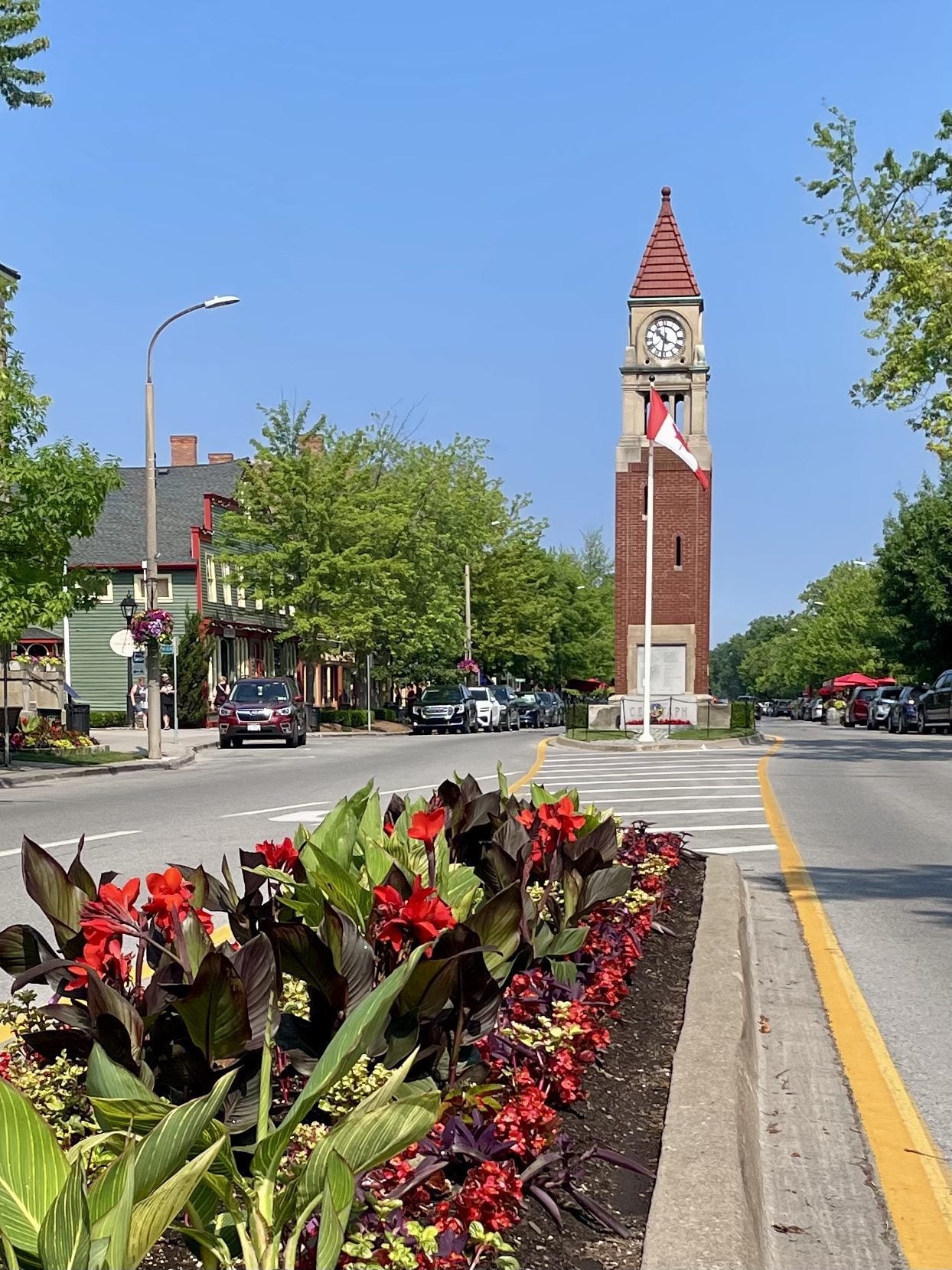
Each Friday we will explore Niagara-on-the-Lake while getting a moderate paced walk. Discover where the Niagara River meets Lake Ontario. Experience the Heritage District, woods and the Niagara Parkway.Some weeks may be totally on sidewalks and roads while others may include a mix of trail and paved pathways.
Great way to build up endurance for longer more strenuous hikes.
Plan to stay for conversation and a coffee at Sweets & Swirls, Community Centre, Niagara Stone Rd., NOTL
CANCELLED - Afternoon Hike -Terra Cotta to Walking Fern
https://hikes.brucetrail.org/event/afternoon-hike-terra-cotta-to-walking-fern-2/Sorry, the registration cut-off time for this hike has been reached.Not a member? Click here to join today!Hosting Club: Iroquoia
Category: Afternoon/Evening Hikes
Location (Google Maps): Meet at 4:15 pm on 10 Line, between Terra Cotta and Silver Creek Conservation Areas.Hike Leader(s): Karen Bergmann Click here to contact Hike Leader(s)
Pace: Medium – 3 to 4 km/hr
Terrain: Moderate – Some hills and/or some poor footing
Distance: 6 kmsDescription
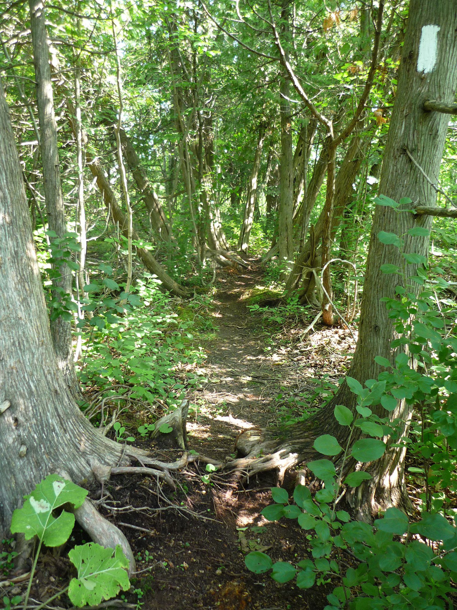
A short afternoon hike, we will carpool from 10 Line to Winston Churchill Blvd and hike back through Terra Cotta CA along the main trail and then on the Walking Fern Side Trail, which is very technical (rocky). Bring bug spray/bug net and sufficient water and sturdy hiking boots. - 08August 8, 2026

Peninsula Sunrise Series: The Grotto
https://hikes.brucetrail.org/event/peninsula-sunrise-series-the-grotto-2/Sorry, the registration cut-off time for this hike has been reached.Not a member? Click here to join today!Hosting Club: Peninsula
Category: Sunrise Hike
Location (Google Maps): Parking lot at Dyers Bay Rd & Hwy 6, Northern Bruce Peninsula, ON N0H 1Z0Hike Leader(s): Kathleen Stahlbaum Click here to contact Hike Leader(s)
Pace: Leisurely (2.0 – 3.0 km/h): A relaxed pace with frequent breaks and a focus on enjoyment., Medium (3.0 – 4.5 km/h): A comfortable pace for most hikers with steady progress.
Terrain: Difficult: Steep ascents/descents, rocky scrambling, and some rugged escarpment paths., Easy: Flat forested sections or lowland trails., Moderate: Rolling hills, mild slopes and rocky paths.
Distance: 7.5 kmDescription
Experience the magic of dawn on the Bruce Trail with the Sunrise Hike Series offered by the Peninsula Bruce Trail Club. These early morning hikes provide a perfect opportunity to awaken your senses, boost your energy, and immerse yourself in the tranquility of nature as the sun paints the sky with breathtaking hues. As we make our way through scenic forest trails, we’ll pause to witness the first light shimmering on the turquoise waters of Georgian Bay – a sight that will surely leave you in awe!Beyond the beauty, morning light helps regulate your circadian rhythm, elevating your mood, boosting energy levels and improving sleep quality. Whether you’re looking to start your day with a sense of calm, capture stunning sunrise photos, or simply reconnect with nature, these hikes offer a unique and inspiring way to greet the day.
On Saturday August 8th, join us in hiking the Cyprus Lake and Georgian Bay Trail to the Grotto at Indian Head Cove, where we’ll experience the sun rising over the Bay from the iconic shoreline before returning via the Marr Lake Trail. We’ll have the joy of taking in the stunning colours of the sky as the first light sparkles on the stunning turquoise waters. This peaceful sunrise hike is the perfect way to connect with nature, capture some incredible photos, and start the day with fresh air and inspiration. Whether you’re a morning person or just love a good adventure, come experience the magic of dawn from one of the best vantage points on the Bruce Peninsula!
Don’t forget to bring a headlamp or flashlight (preferably with a red light setting) as we begin our adventure in the pre-dawn quiet. Join us and discover how a sunrise hike can nourish your mind, body, and spirit – setting the tone for a brighter, more balanced day.
This hike is approximately 7.5 kms in length. Expect to be on the trail for ~3 hours. Pace will be leisurely with ample time to enjoy the sunrise, take some photographs, and nourish yourself!
How to prepare
- Get a good night’s sleep
- Bring lots of water and a snack (breakfast and/or coffee are recommended if that’s your thing!)
- Bring a headlamp or flashlight (preferably with a red light setting)
- Wear waterproof hiking boots
- Hiking poles are recommended but not necessary
- Bring insect repellant or wear protective clothing
- Bring sunscreen
LIMITED SPACE AVAILABLE! We will be meeting at the parking lot at the corner of Highway 6 & Dyer’s Bay road and carpooling in 2-3 vehicles to Bruce Peninsula National Park. If you have a Parks pass, please bring it with you!
In the event of cloudy/rainy weather, the hike will be held on Sunday, August 9th. Please watch your emails for a confirmation the week of the hike!
8:30am Sketching Hike
https://hikes.brucetrail.org/event/830am-sketching-hike/Sorry, the registration cut-off time for this hike has been reached.Not a member? Click here to join today!Hosting Club: Niagara, Iroquoia
Category: Mindfulness
Location (Google Maps):Hike Leader(s): Suzanne Gourluck Click here to contact Hike Leader(s)
Pace: Leisurely <3 km/hr
Terrain: Easy: mostly flat, good footing
Distance: 6 kmDescription
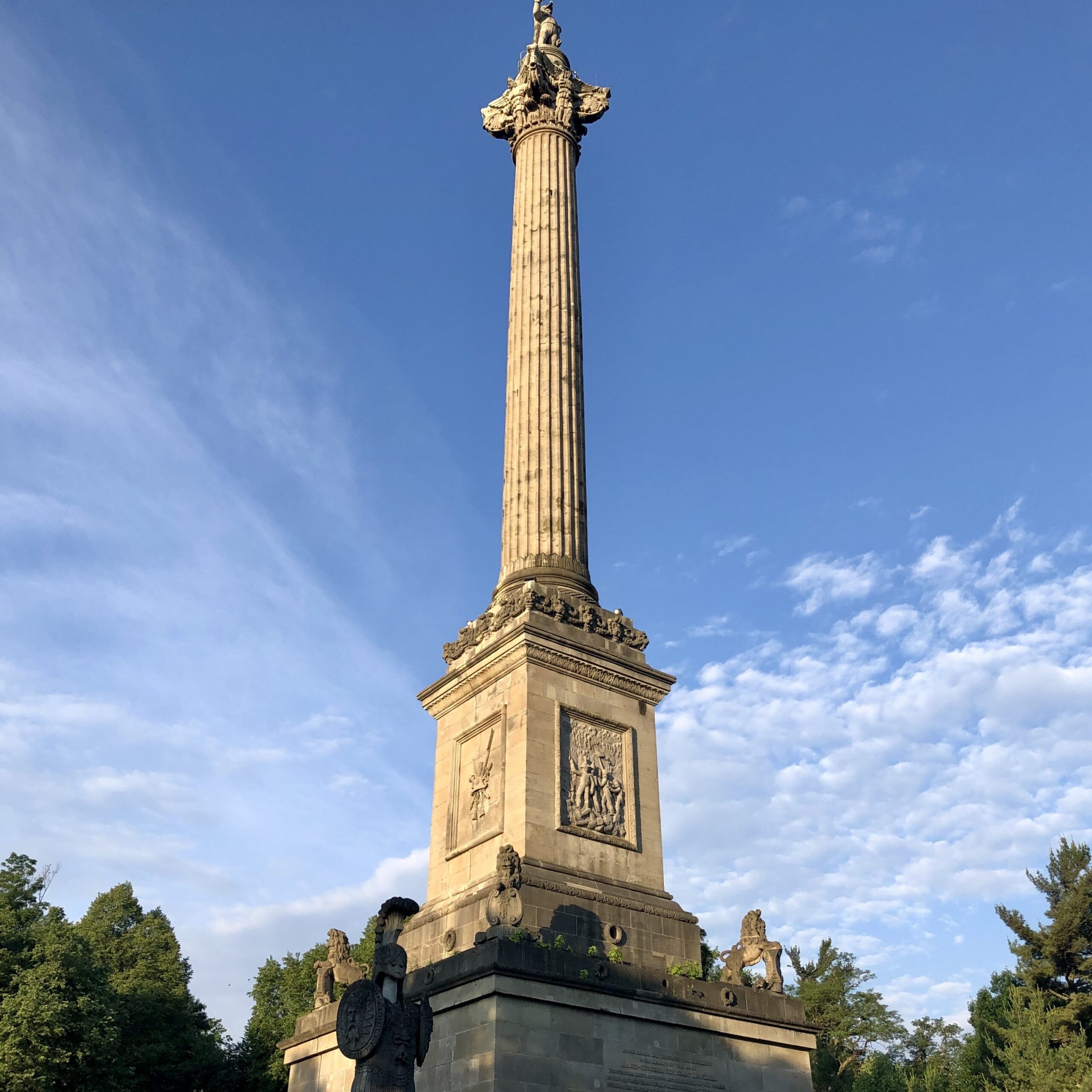
Join us for a relaxed hike around Queenston Heights, with a few stops along the way to sketch what catches your eye. These outings are about slowing down, observing the world more closely, and practising concentration, attention, and creativity.No artistic experience is needed. The focus isn’t on creating a perfect drawing or meeting any standard—it’s simply about noticing, exploring, and enjoying the process. Over the coming months, we’ll return to Queenston Heights on different hikes, gradually building a personal collection of small sketches inspired by the changing landscape.
Please bring:
A small blank notebook/sketchbook. It doesn’t need to be quality paper. A spiral binding makes it easier to open flat.
A small selection of any of these: coloured pencils, graphite pencils, markers or ink pens and an eraser.
Not necessary but nice- a small lightweight stool
Dress as you would for an easy hike. Bring snack, water, poles and bug spray.
Car Hike: Oak Ridges Corridor
https://hikes.brucetrail.org/event/car-hike-oak-ridges-corridor-2/Sorry, the registration cut-off time for this hike has been reached.Not a member? Click here to join today!Hosting Club: Toronto
Location (Google Maps): Oak Ridges Corridor, Bethesda Trail Head Parking Lot, Bethesda Side Road, Richmond Hill, Ontario
Hike Leader(s): MOHAMMAD AGHAMIRI Click here to contact Hike Leader(s)
Pace: Moderate (3-4 km/hr)
Terrain: Hilly, Level 2 (Intermediate – some hills and uneven surfaces, rocks and roots underfoot)
Distance (km): 14-15 kmDescription
Join us to explore the trails of York Regional Forest and the Oak Ridges Corridor at Jefferson Forest and Bond lake,From parking lot we hike thought Jefferson forest and continue to Bond Lake and have snack beside the lake and return to parking around 1:pm
Please bring lots of water and snacks ,hiking poles are recommended,it is Mosquto and Tick season ,be prepared .
phone number for the day of hike 289 588 6482
Area 8 Conservation Area Hike - Family Friendly
https://hikes.brucetrail.org/event/area-8-conservation-area-hike-family-friendly/Sorry, the registration cut-off time for this hike has been reached.Not a member? Click here to join today!Hosting Club: Toronto, Caledon Hills
Category: General
Location (Google Maps): Area 8 Conservation Area; Halton’s newest conservation area. Participants need to register online and pay a nominal fee to enter and support the park.Hike Leader(s): Lynn Dobson Click here to contact Hike Leader(s)
Pace: Leisurely – 3 km/hour or less
Terrain: Easy – mostly flat and usually good footing
Distance: approximately 7 kmDescription
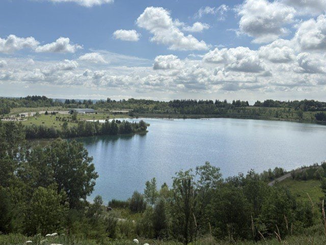
Come explore Area 8, the newest conservation area in Conservation Halton Parks. It was formerly a quarry and has undergone habitat restoration and provides links to Kelso Conservation Area. It is a beautiful setting. This is a family-friendly hike and is ideal for anyone wanting to make a day of it. We will start with a 2.2 km walk around the lake during which there will be a number of native species to watch and listen for. After our lakeside warm-up, we will hike up to the top of the escarpment with one large gradual hill to climb. We will stop at a viewpoint and then carry on to connect with the Bruce Trail in Kelso. The trail is very wide and is mostly hard-packed gravel/dirt for the entire hike. This additional 5.5. km route is a there-and-back. Following the hike, you may want to continue your day at Area 8. There are kayaks, canoes, and boats available to rent. There are children’s play areas. There are lots of picnic tables and some firepits so you can enjoy a nice picnic lunch or even a BBQ. While there is a swimming area, swimming is only permitted for those registered in an Area 8 swim program. There are washrooms onsite, and there is plenty of parking. To support the facilities, there is an entrance fee. When you pay in advance, you are given an entry code to use at the gate.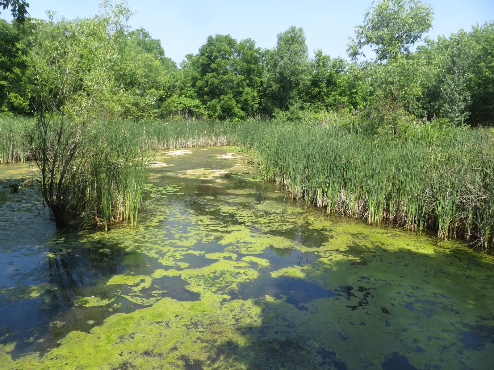
Urban Walk: Bartley Smith Greenway Trail
https://hikes.brucetrail.org/event/urban-walk-bartley-smith-greenway-trail/Sorry, the registration cut-off time for this hike has been reached.Not a member? Click here to join today!Hosting Club: Toronto
Category: Urban Walk
Location (Google Maps): Maple GO station, 30 Station Street, Vaughan ONHike Leader(s): Felix Wan; Talise Liang Click here to contact Hike Leader(s)
Pace: Moderate (3-4 km/hr)
Terrain: Level 2 (Intermediate – some hills and uneven surfaces, rocks and roots underfoot), Variable
Distance (km): 13.5 kmDescription
Join us on a walk along the southern portion of the Bartley Smith Greenway Trail. We’ll walk through a mixture of residential neighbourhoods, wooded areas, and trails along the West Don River. We hope to see many species of birds, insects, and flowers, and we will pass by a lookout at Keffer Marsh.Route map: https://onthegomap.com/s/vh797jei
The terrain is generally flat with a few gentle hills, and features a mixture of paved paths, road walking, and dirt/gravel trails. Depending on weather conditions, parts of the trail may be muddy or wet. Bring a good pair of hiking/walking shoes, as well as a lunch/snacks, at least 2L of drinking water, sun protection, and insect repellent.
Travel to the trailhead:
- By TTC/GO: Meet Felix at Downsview Park subway station by 9:00 a.m. We will make the short walk to the GO station platform to take the northbound train departing at 9:11 a.m., and arriving at Maple GO station at 9:25 a.m., where we will meet up with Talise and start the hike. The GO transfer costs an additional $0.40 (adult fare) if you tap with your PRESTO card. People coming from Union station may board the Barrie Line GO train departing at 8:52 a.m.
- By car: Free parking is available at Maple station. Note that you will need to find your way back to Maple station after the end of the hike, given that this is a linear hike.
Washrooms:
Unfortunately, the washrooms at Maple and Rutherford GO stations are closed on weekends. The nearest available washrooms are located at Finch West subway station, one stop north of Downsview Park station. The washrooms on the GO train can also be used. Soon after we start the hike, we will stop to use washrooms at Walmart (approximately km 0.6). There is also a porta-potty at km 7.6 in Langstaff Park, where we will aim to have our lunch break.
Après-hike:
There will be an optional après-hike stop at Montana’s (2011 Steeles Ave. W.), a short walk from the end point of the hike.
Passport To Nature -- Lime Kiln Bluffs Yoga Hike!
https://hikes.brucetrail.org/event/passport-to-nature-pretty-river-yoga-hike/Sorry, the registration cut-off time for this hike has been reached.Not a member? Click here to join today!Hosting Club: Blue Mountains
Category: Organized Hike
Location (Google Maps): Tim Horton’s, First Street, CollingwoodHike Leader(s): Rob Johnston Click here to contact Hike Leader(s)
Pace: Leisurely – 3 km/hr. or less
Terrain: Moderate – Some hills and/or some poor footing
Distance: 5kmDescription
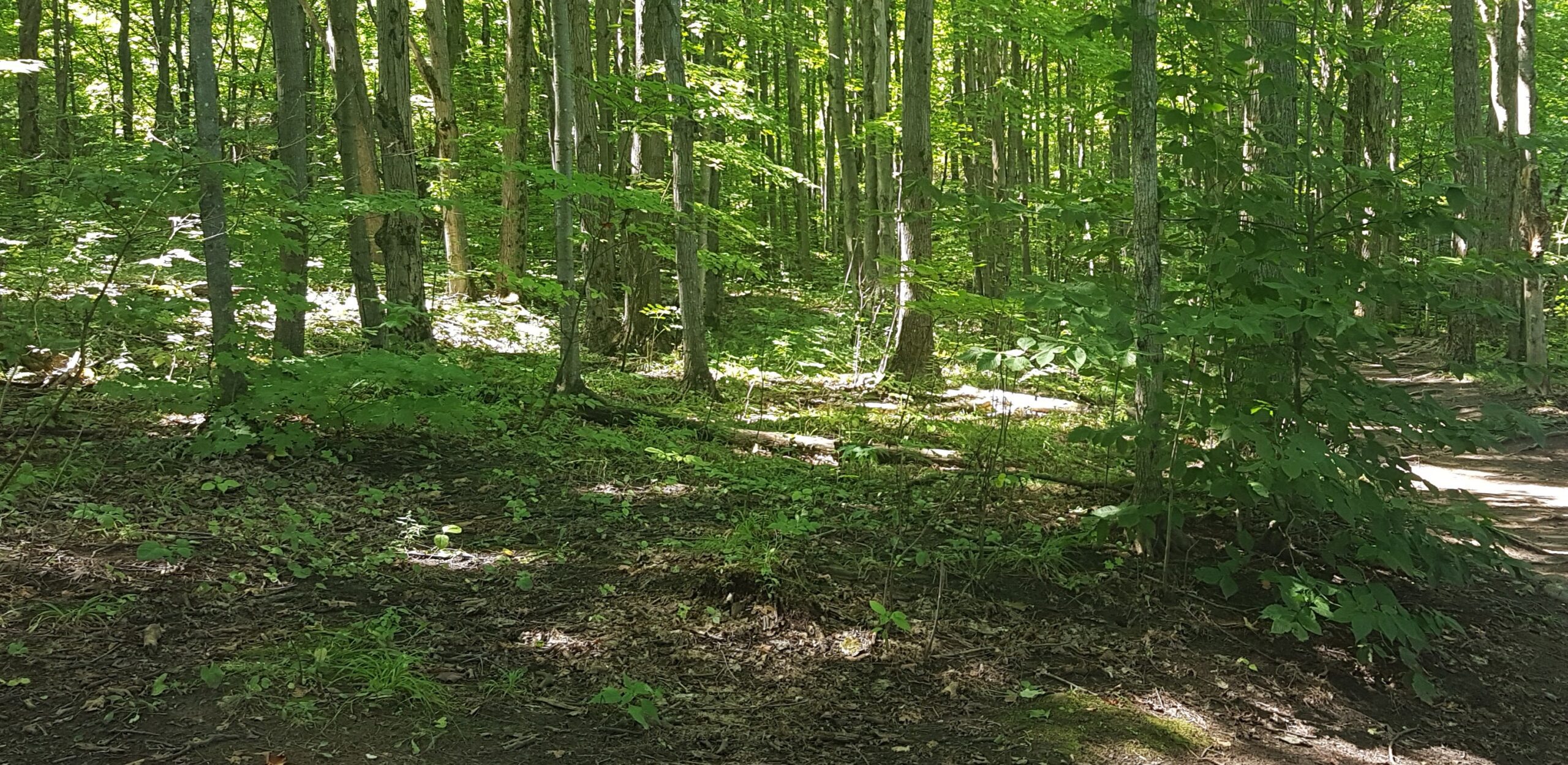
The first of our club’s Passport To Nature series. Rescheduled from 18 July. Namaste! We will meet behind Tim’s on 1st Street in Collingwood. Please be there beforehand so we can leave promptly at 9AM. We will carpool to the Lime Kiln parking lot on County Rd 91. We will hike a moderate trail of 3km through beautiful hardwood forest, accompanied by a qualified Yoga instructor leading us in Yoga stretches and movements. Great views over Georgian Bay! This hike is has some rocky footing, so hiking boots or trail runners are recommended. Bring your yoga mat or equivalent. Bring water.
Hike Ontario–Certified Hike Leader Course (9am-5pm)
https://hikes.brucetrail.org/event/hike-ontario-certified-hike-leader-course-9am-5pm/Sorry, the registration cut-off time for this hike has been reached.Not a member? Click here to join today!Hosting Club: Peninsula
Category: CHL Training
Location (Google Maps): The Meeting Place Tobermory
20 Centennial Dr, Tobermory, ON N0H 2R0Hike Leader(s): Ruth Moffatt, Saabir Sohrab Click here to contact Hike Leader(s)
Distance: N/A
Description
Certified Hike Leader CourseBefore registering, please ensure that you meet all prerequisites established by Hike Ontario.
For course requirements and eligibility, visit:
https://hikeontario.com/takeacourse/trainingcourses/certified-hike-leader/This one-day course certifies volunteers as Certified Hike Leaders, enabling them to lead hikes on the Peninsula Bruce Trail and other sections of the Bruce Trail. Participants must be referred by the Peninsula Hike Director or by an active hike leader within the Peninsula Bruce Trail Club.
All registered participants will receive an electronic copy of the Certified Hike Leader Manual in advance of the course. Attendance at the full-day, in-person training session is required. The course includes approximately one hour of outdoor activities, so please dress appropriately for the weather.
This training is intended for individuals who have already participated in a number of group hikes on the Bruce Trail and are ready to begin leading their own hikes.
The course includes:
- Certified Hike Leader Manual
- Certified Hike Leader badge
- Wallet card
- Instruction on posting and managing hikes through the Bruce Trail Conservancy online hike schedule
During the course, you will be guided through the process of posting your first hike to the schedule. Please come prepared with:
- A potential date that fits your schedule
- A proposed hike route (assistance is available if needed)
There are many types of hikes you can lead. Reviewing currently posted hikes can be a helpful source of ideas. You are welcome to use an existing hike as a model and offer the same route on a different date.
What to Bring
Please bring:
- Your lunch
- Any snacks you may need throughout the day
The course schedule includes:
- Morning break (approximately 10:00 a.m.)
- 30-minute lunch break
- Afternoon break
The course typically concludes by 5:00 p.m. or earlier.
Coffee and tea will be provided. A microwave is available on-site for participant use.
Important Information
- There are no make-up sessions for missed courses.
Rescheduled Hike 2: Burlington Heritage Week / River & Ruin
https://hikes.brucetrail.org/event/rescheduled-hike-2-burlington-heritage-week-river-ruin/Sorry, the registration cut-off time for this hike has been reached.Not a member? Click here to join today!Hosting Club: Iroquoia
Category: Historical Hike
Location (Google Maps):Kilbride Park Parking Lot Behind the Kilbride School, access to Main Trail and Kilbride Pass
Hike Leader(s): Joe Borges Click here to contact Hike Leader(s)
Pace: Leisurely – 3km/hr or less
Terrain: Dependent on Conditions, Slippery and Steep Sections, Strenuous – Hilly with steep climbs and some poor footing
Distance: 7.6 kmDescription
Burlington Heritage Week Hike: River & RuinJoin us for the special hike brought to you by Iroquoia Bruce Trail Club partnering with the City of Burlington for Heritage Week.
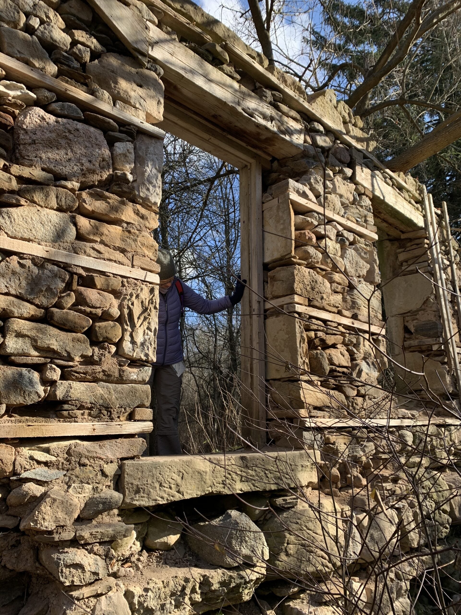
The theme this year is water, so we will hike through one of Burlington’s most historically rich landscapes. The River & Ruin trail winds through the beautiful Lowville Valley, where the natural drama of Twelve Mile Creek meets the traces of Burlington’s early settlement history. Along the way, we’ll explore the stories of Kilbride, Lowville, and the Cleaver family, whose mill, homestead, and ruins helped shape this valley nearly two hundred ago.
This hike offers more than beautiful views, it’s a walk through time. From the limestone ruins and historic mill site to the creek that powered early industry and settlement, the route reveals how farming, waterpower, and pioneering families transformed the area into one of Burlington’s most fascinating heritage corridors. If you enjoy trails with a strong sense of place, local history, and a great story under your boots, this is the hike for you.
Come discover the hidden history of Kilbride and the Lowville Valley, experience why this unique trail is one of Burlington’s most memorable heritage walks.
Note, no dogs are permitted on this hike.
Geology Hike and Badge Series - Lion's Head
https://hikes.brucetrail.org/event/geology-hike-and-badge-series-lions-head/Sorry, the registration cut-off time for this hike has been reached.Not a member? Click here to join today!Hosting Club: Peninsula
Category: Geology Hike
Location (Google Maps): Lion’s HeadHike Leader(s): Beth Gilhespy Click here to contact Hike Leader(s)
Pace: Leisurely (2.0 – 3.0 km/h): A relaxed pace with frequent breaks and a focus on enjoyment., Medium (3.0 – 4.5 km/h): A comfortable pace for most hikers with steady progress.
Terrain: Moderate: Rolling hills, mild slopes and rocky paths.
Distance: 11Description
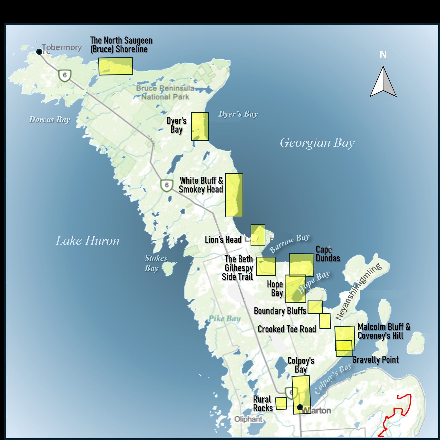
Join the adventure and earn the inaugural Peninsula Geology Badge! Over a stretch of 13 hikes and a couple of extra stops, we will explore the fascinating geology of the Peninsula to learn about the rocks, the shoreline features, glaciation, fossils and all things earthy. The 13 hikes are from the book “Walking Through Time – Exploring the Geology of the Saugeen (Bruce) Peninsula”. Having a copy will give you a lot of great information, but you do not have to purchase the book to attend and enjoy the hikes. Just bring your curiosity! We will make sure to hit all the locations that qualify for the beautiful new Walking Through Time – Saugeen (Bruce) Peninsula geology hike badge. If you would like to purchase a book I will have some available on the hikes, or you can pick one up from the BTC Head Office, at Ginger Press in Owen Sound, Suntrail Source for Adventure in Hepworth, the Shop at 84 Main in Lion’s Head and at Reader’s Haven in Tobermory.You are welcome to come on just a few of the hikes or on all of them, and the dates and hikes are as follows:
Date Geology Hike km
Saturday May 2, 2026 Colpoy’s Bay 9.0
Saturday May 9, 2026 Gravelly Point (am) and Rural Rocks (pm) 8.6
Saturday May 16, 2026 Malcolm Bluff 7.3
Sunday May 17, 2026 White Bluff/Smokey Head 11.8
Sunday May 24, 2026 Crooked Toe Road 5.5
Sunday May 31, 2026 Hope Bay 8.1
Sunday June 14, 2026 Boundary Bluffs 5.2
Saturday July 4, 2026 Cape Dundas 6.2
Saturday July 11, 2026 Beth Gilhespy Side Trail 7.6
Saturday August 8, 2026 Lion’s Head 11.0
Saturday August 15, 2026 Dyer’s Bay Loops 7.5
Saturday August 22, 2026 North Saugeen (Bruce) Shoreline 8.0
Meeting times will vary depending on the hike, but will generally be some time between 9 am and 10 am. Information on exact meeting times and locations will be sent out a few days prior to the hike.