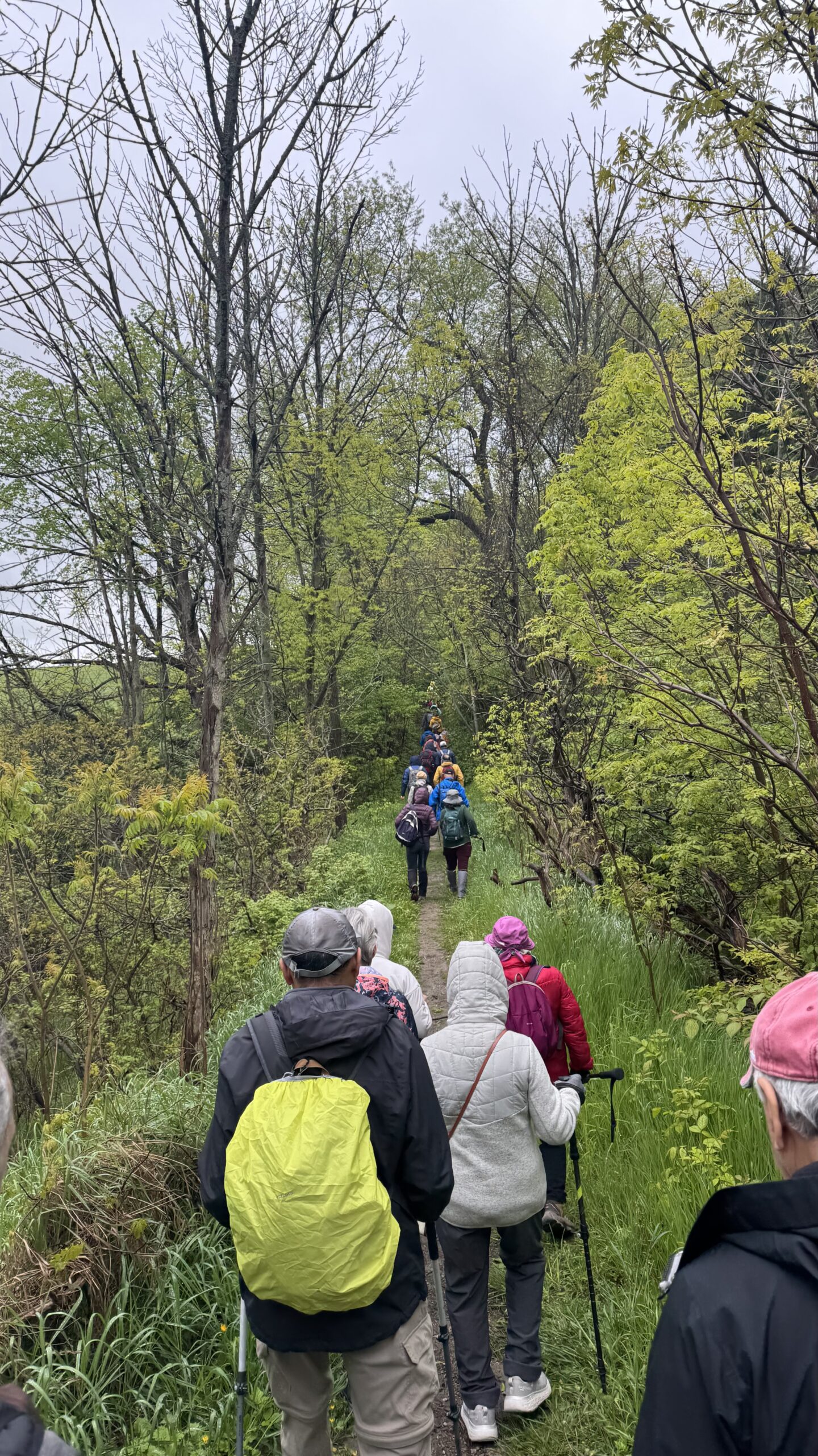
Hike Schedule
Join us for a hike! Registration required.
All hikes available to BTC members. Some hikes are open to non-members.
See Refund Policy for Paid Hikes >
TIP: The calendar view displays up to 7 hikes on a day, but often there are more. Click “View more events” to see them all.
Categories
- 27July 27, 2025

Steeltown Stomp Practice Session #3 of 10
https://hikes.brucetrail.org/event/steeltown-stomp-practise-session-1-of-10-3/Sorry, the registration cut-off time for this hike has been reached.Not a member? Click here to join today!Hosting Club: Iroquoia
Location (Google Maps): Meet at the Chedoke Golf Club parking lot
Hike Leader(s): Ruth Moffatt Click here to contact Hike Leader(s)
Pace: Brisk – 4 to 5 km/hr, Medium – 3 to 4 km/hr
Terrain: Strenuous – Hilly with steep climbs and some poor footing
Distance: VariesDescription
Is the Steeltown Stomp on your bucket list! Come join us! For anyone who has done stair climbing workouts, you will know what calf pain is like, especially when you first start. Want to get in shape of the Steeltown Stomp on October 4, 2025? Practise with us! We will start off easy and gradually build up our strength and stamina over the course of the summer. Climbing Chedoke staircase will be combined with a hike on most days. We will use both Chedoke and Dundurn Stairs as our practise stairs and buildup to at least 2,000 steps.Bring a reusable water bottle (there are fountains at the bottom of both Chedoke and Dundurn) and any snacks you may like. Pace will be moderate, but steady to begin. We will start with a warm up hike and finish with a cool down stretch. Post stomp coffee is optional .
It’ll be fun and will lessen the pain on the day of the event, promise!
Look for the other 9 dates on the schedule.
Car Hike: Jefferson Forest and Bond Lake (Richmond Hill)
https://hikes.brucetrail.org/event/car-hike-jefferson-forest-and-bond-lake-richmond-hill-2/Sorry, the registration cut-off time for this hike has been reached.Not a member? Click here to join today!Hosting Club: Toronto
Location (Google Maps):
1245 Bethesda Side Rd, Richmond Hill, ON L4E 1A2 ( Bethesda Trail Head Parking lot)
Hike Leader(s): Amir Alemohammad Click here to contact Hike Leader(s)
Pace: Moderate (3-4 km/hr)
Terrain: Flat, Hilly, Level 2 (Intermediate – some hills and uneven surfaces, rocks and roots underfoot), Variable
Distance: 13-14 kmDescription
Join us for a wonderful hike in Jefferson Forest and have a snack/lunch beside the Bond Lake. We will hike among tall trees and bushes of the Jefferson Forest and across the Bayview-Yonge corridor to reach to the Bond Lake. Boots mandatory, poles recommended, bring at least 2L of water, bug spray, sunscreen, snack/lunch and dress according to the weather conditions. Please avoid parking along the road. Difficulty Level: 2 (Moderate)Please arrive @7:50 AM for start of 8:00AM.
This is a joint hike with the Oak Ridges Trail Association (ORTA).
Car Hike: Falls to Falls
https://hikes.brucetrail.org/event/car-hike-falls-to-falls/Sorry, the registration cut-off time for this hike has been reached.Not a member? Click here to join today!Hosting Club: Iroquoia, Toronto
Category: Car Hike
Location (Google Maps): Meet up Location at Smokey Hollow Side Trail Parking lot. GPS Coordinates – N43.330803, W79.886980. at km71.2, Map 9, Edition 31.Hike Leader(s): Ross Estrella Click here to contact Hike Leader(s)
Pace: Brisk (4-5 km/hr), Moderate (3-4 km/hr)
Terrain: Hilly, Level 2 (Intermediate – some hills and uneven surfaces, rocks and roots underfoot), Rocky
Distance: 13 kmDescription
Hiking beauty is it’s simplicity. You set the destination and start the journey. Hiking is one simple way of refueling your body, mind and spirit while savoring the natural beauty of the landscape and highly spirited people around you. In your every steps, you feel the breathe of fresh air and the earth under your feet. Come and join us at a moderate to brisk pace hike from Sydenham Lookout passing Borer’s Falls to Great Smokey Hollow Falls via Grindstone Creek where it’s rhythmic rushing water is a calming sound to our senses.Please bring snack/lunch and sufficient liquid for hydration. At all times have sunscreen, bug repellent and hat for sun ray protection available. Comfortable hiking shoe/boot and poles recommended. Please make sure to have your personal medications (if any), health card, and basketful of enthusiasms. Pleas arrive fifteen minutes early for car shuttling.
- 28July 28, 2025
Decew House to Shorthills
https://hikes.brucetrail.org/event/decew-house-to-shorthills/Sorry, the registration cut-off time for this hike has been reached.Not a member? Click here to join today!Hosting Club: Niagara
Category: In and Out
Location (Google Maps): 2370 Decew Rd, Fonthill, ON L0S 1E6 Decew Heritage HouseHike Leader(s): Erin Lyttle Click here to contact Hike Leader(s)
Pace: Brisk
Terrain: Moderate
Distance: 12kmDescription
Meet at Decew House Heritage site. We will head west towards Shorthills and do an out and back to the Morningstar Mill waterfall then continue to the Very Berry Trail in shorthills and turn around when we get to the Black Walnut/Rim of Africa loop in shorthills. Note that there are steep and rocky inclines and proper footwear is REQUIRED, poles are RECOMMENDED. This hike has ups and downs and will be mostly in the shade. Bug spray highly recommended. Note the pace is BriskToronto End-to-End #2 of 4
https://hikes.brucetrail.org/event/toronto-end-to-end-2-of-4/Sorry, the registration cut-off time for this hike has been reached.Not a member? Click here to join today!Hosting Club: Iroquoia, Toronto
Category: General Hike
Location (Google Maps): Parking lot across from Limehouse Public School, on the south side of 22 Side RoadHike Leader(s): Pati Greenwood, Jeff Dowsett Click here to contact Hike Leader(s)
Pace: Medium – 3 to 4 km/hr
Terrain: Moderate – Some hills and/or some poor footing
Distance: 10.5 kmDescription
This is a summer-time End-to-End hike to complete the Toronto section of the Bruce Trail in 4 hikes. Join for all or as many hikes as desired.This second hike will take us from the Bruce Trail Pear Tree Park to Limehouse. Once again, the terrain is not too hilly, but the footing is tricky with uneven, rocky sections to navigate.
July weather can be hot, muggy and buggy! So, dress for the weather, keeping in mind that insects, including ticks, will be out in full force. Take appropriate precautions to avoid insect bites, including using repellant and clothing that covers the legs and arms. Hiking boots are required and hiking poles are recommended.
Bring plenty of fluids, including electrolytes, and a snack.
As this is a group hike, please consider your fitness level before registering. We will be walking at a pace of 3km – 4km per hour and everyone is expected to keep up with the person in front of them for the duration of the hike.
Plan to arrive at the meeting place by 8:15 a.m. as we will start the car shuffle to the hike starting point at 8:30 a.m. sharp. Further details will be provided to registered hikers a few days prior to the hike.
8:30 am Hydro Hill Training
https://hikes.brucetrail.org/event/830-am-hydro-hill-training-3/Sorry, the registration cut-off time for this hike has been reached.Not a member? Click here to join today!Hosting Club: Niagara
Category: In and Out
Location (Google Maps):Lockhart Drive, St Catharines, by the large yellow swing gate.
Hike Leader(s): Suzanne Gourluck Click here to contact Hike Leader(s)
Pace: Brisk
Terrain: Strenuous
Distance: 6 kmsDescription
This challenging “hike” is intended for those wishing to train for future challenging hikes. Choose your own pace to go up and down the moderately steep hill in 30 min with a brief flat walk partway through. The terrain is a hard packed gravel surface. Feel free to bring light weights to increase the intensity of your training. Bring water, hiking poles, snack and dress for the weather.Sydenham E2E 5/8
https://hikes.brucetrail.org/event/sydenham-e2e-5-8/Sorry, the registration cut-off time for this hike has been reached.Not a member? Click here to join today!Hike open to BTC Members only.
Hosting Club: Toronto
Category: Car Hike
Location (Google Maps): Km 108.0 range rd. Please note. It is not an official Bruce Trail parking, but parking is allowed. Map 33, addition 31.coordinates N 44.599838,W 80.956024Hike Leader(s): Smadar Junkin Click here to contact Hike Leader(s)
Pace: Brisk (4-5 km/hr)
Terrain: Rocky, Variable
Distance: 21.5 kmDescription
Fifth hike in the series. Please see hike #1 for instructions. We will shuttle to km 129.6 and hike back. - 29July 29, 2025
8:00 Long Hike Wiley Road Short Hills
https://hikes.brucetrail.org/event/800-long-hike-wiley-road-short-hills-6/Sorry, the registration cut-off time for this hike has been reached.Not a member? Click here to join today!Hosting Club: Niagara
Location (Google Maps):
Short Hills Wiley Road Entrance
Pace: Medium
Terrain: Moderate
: 10kmDescription
Explore Short Hills and the majestic side trails of Scarlett Tanager, Hemlock. Swayze Falls and Terrace. Register for each hikeBring Poles, Sun Screen Bug Spray, snack, and dress for the weather
Sydenham E2E, 6/8
https://hikes.brucetrail.org/event/sydenham-e2e-7-8/Sorry, the registration cut-off time for this hike has been reached.Not a member? Click here to join today!Hosting Club: Toronto
Category: Car Hike
Location (Google Maps): Km 148.5 Graham Hill rd. Coordinates N 44.764911,W 80.944925 map 34, edition 31.Hike Leader(s): Smadar Junkin Click here to contact Hike Leader(s)
Pace: Brisk (4-5 km/hr)
Terrain: Rocky, Variable
Distance: 20 Kms.Description
Seventh hike of the series. Please see instructions on hike #1. April 1. We will shuttle to km 129.6 and hike back.Urban Walk: Valley View Park Thornhill
https://hikes.brucetrail.org/event/urban-walk-valley-view-park-thornhill-80/Sorry, the registration cut-off time for this hike has been reached.Not a member? Click here to join today!Hosting Club: Toronto
Category: Urban Walk
Location (Google Maps): Parking lot is off Sycamore Drive East of Bayview , across Starbucks plaza
Bus 91 from Finch east station stops at Sycamore station.Hike Leader(s): Mohammad Aghamiri Click here to contact Hike Leader(s)
Pace: Moderate (3-4 km/hr)
Terrain: Hilly, Level 2 (Intermediate – some hills and uneven surfaces, rocks and roots underfoot), Variable
Distance: 6-7 kmDescription
We will explore Valleyview and Maple View parks, and walk along German Mill Creak, in return we stop in Huntington park and have snack under beautiful shed ,Even it is considered Urban walk, it is urban hike as we have some up and down hills and tree roots, please bring your hiking poles, water and snacks,
phone number for the day of hike 289 588 6482
9:15 Short Hike - Short Hills Park, Pelham Rd
https://hikes.brucetrail.org/event/915-short-hike-short-hills-park-pelham-rd-23/Sorry, the registration cut-off time for this hike has been reached.Not a member? Click here to join today!Hosting Club: Niagara
Category: Hike
Location (Google Maps): Shorthills Provincial Park, Pelham Rd, St CatharinesHike Leader(s): Debbie Demizio Click here to contact Hike Leader(s)
Pace: Medium
Terrain: ModerateDescription
Hike the main and sidetrails in Shorthills Provincial Park. Please wear hiking boots, bring water and insect repellant. Check yourself for ticks following the hike,.City View Park, Burlington, Map 9.
https://hikes.brucetrail.org/event/city-view-park-burlington-map-9-5/Sorry, the registration cut-off time for this hike has been reached.Not a member? Click here to join today!Hosting Club: Caledon Hills
Category: Tuesday Hikers
Location (Google Maps): City View Park, Burlington.
From Highway 403 going west, turn right on Brant Street, left on Dundas Street, left on Kerns Rd., take second turn left into City View Park to the parking lot.Hike Leader(s): Mohammad Shafiq Click here to contact Hike Leader(s)
Pace: Medium – 3 to 4 km/hour
Terrain: Moderate – some hills and/or some poor footing
Distance: 11 kmDescription
From City View Park will connect with main Bruce Trail and hike to Smokey Hollow waterfall, also hike Kings ST and Eric Best ST on the way. After snack break will trace back our steps and return to parking.
Bring water, snack for refreshment break at Smokey Hollow.
Dress for the weather, poles are recommended.
Optional refreshment stop after hike at a coffee or ice-cream place. - 30July 30, 2025
Sydenham E2E 7/8
https://hikes.brucetrail.org/event/sydenham-e2e-8-8/Sorry, the registration cut-off time for this hike has been reached.Not a member? Click here to join today!Hike open to BTC Members only.
Hosting Club: Toronto
Category: Car Hike
Location (Google Maps): Blue water Park, Wiarton. Parking opposite the arena. Coordinates N 44.742514,W 81.135140 map 35. Edition 31.Hike Leader(s): Smadar Junkin Click here to contact Hike Leader(s)
Pace: Brisk (4-5 km/hr)
Terrain: Rocky, Variable
Distance: 22.5 kmDescription
Please see instructions on day 1. April 1. We will shuttle to km 148.5 and walk back.
To the Lake and Back CANCELLED DUE TO HEAT.
https://hikes.brucetrail.org/event/to-the-lake-and-back-3/Sorry, the registration cut-off time for this hike has been reached.Not a member? Click here to join today!Hosting Club: Iroquoia
Category: Easy Does It Hikes
Location (Google Maps): Joshua Creek South, OakvilleHike Leader(s): Anne Armstrong Click here to contact Hike Leader(s)
Pace: Leisurely – 3km/hr or less
Terrain: Easy – Mostly flat and usually good footing
Distance: Approx 8 km.Description
A semi urban hike takes along easy trails beside Joshua Creek South to Lake Ontario and back. We will pass through lovely woods and quiet neighbourhoods. Meet in the parking lot of Maple Grove Shopping Centre on the southeast corner of Cornwall Rd. and Maple Grove Drive at 9:15 am. for a 19:30 am. start. Park next to the Recall Drug Store. Bring water, sunscreen, insect repellent and a snack. Optional lunch stop afterwards. An email will be sent out ahead of time with my contact information.Leader: Anne Armstrong
WEDNESDAY WALKERS - Eugenia to Hogg's Falls
https://hikes.brucetrail.org/event/wednesday-walkers-eugenia-to-hoggs-falls/Sorry, the registration cut-off time for this hike has been reached.Not a member? Click here to join today!Hosting Club: Beaver Valley
Location (Google Maps): We will meet in the parking lot of Hogg’s Falls, km 65.1 Map 26, Edition 31. From there we will take the number of vehicles necessary to go to the start of the hike – parking at Eugenia Falls (GSCA) is paid parking
Hike Leader(s): Mike Arkless Click here to contact the hike leader.
Pace: Medium
Terrain: Moderate
Length of Hike: 7kmDescription
This hike begins with some views of Eugenia Falls, at the crest and through the trees, From there it’s on to the Cuckoo Valley. Beautiful views at the outstanding Cuckoo Vally lookout area. Passing through mature forest and by an upland meadow, we arrive at Hogg’s Falls, an always picturesque scene on the Boyne River.
Afternoon Hike - Duff Pit
https://hikes.brucetrail.org/event/afternoon-hike-duff-pit-2/Sorry, the registration cut-off time for this hike has been reached.Not a member? Click here to join today!Hosting Club: Iroquoia
Category: Afternoon/Evening Hikes
Location (Google Maps): Meet roadside on Hwy 7, just after the curve in the road.Hike Leader(s): Karen Bergmann Click here to contact Hike Leader(s)
Pace: Medium – 3 to 4 km/hr
Terrain: Moderate – Some hills and/or some poor footing
Distance: 5 kmsDescription
Meet roadside at 4:15 pm on Hwy 7 north of Georgetown, as you round the curve in the road. We will hike the Side Trails of Duff Pit, Reservoir, Trafalgar Rd and North Rim (through the old open quarry land) back to Duff Pit. It’s a short hike with lots of variety.
5:00 pm Hike & Picnic then “Gateau & Grace” (classical guitarist)
https://hikes.brucetrail.org/event/500-pm-hike-picnic-then-gateau-grace/Sorry, the registration cut-off time for this hike has been reached.Not a member? Click here to join today!Hosting Club: Niagara
Category: In and Out
Location (Google Maps): St Andrew’s Presbyterian Church in Niagara-on-the-Lake.Hike Leader(s): Suzanne Gourluck Click here to contact Hike Leader(s)
Pace: Medium
Terrain: Easy
Distance: 8 kmDescription
This is a series of hikes which will take place on 3 Wednesday evenings in July and August. We will hike around Niagara-on-the-Lake and surrounds (1.5 hrs) stopping for a shared picnic on the lawns of St Andrews. At 7 pm others will join us on the lawns and you will have your choice of some delicious cakes. Then we will go inside to enjoy music from classical guitarist Adrian Popez and a short reflection on “Grace”.Bring a folding chair and some savoury food to share (dessert is provided). Dress so you’ll be comfortable hiking and picnicking. A change of clothes is not required. Bathrooms will be available.
- 31July 31, 2025
8:00 am Long Hike Cave Spring Conservation Area
https://hikes.brucetrail.org/event/800-am-long-hike-cave-spring-conservation-area-5/Sorry, the registration cut-off time for this hike has been reached.Not a member? Click here to join today!Hosting Club: Niagara
Location (Google Maps):
Cave Spring Conservation Area
Pace: Medium
Terrain: Moderate
: 10kDescription
This will be our permanent Thursday Location until Bridge repairs complete. From Cave Spring Conservation Area explore the trail network on the escarpment towards Kinsman Park and Moyer Road.You must register for each hike. Bring Poles, snack bug spray, sunscreen and a drink. Dress for the weather
Sydenham E2E 8/8
https://hikes.brucetrail.org/event/sydenham-e2e-3-8/Sorry, the registration cut-off time for this hike has been reached.Not a member? Click here to join today!Hike open to BTC Members only.
Hosting Club: Toronto
Category: Car Hike
Location (Google Maps): Km 62.4, Irish Block rd. coordinates N 44.592032,W 80.793507 map 31.Hike Leader(s): Smadar Junkin Click here to contact Hike Leader(s)
Pace: Brisk (4-5 km/hr)
Terrain: Challenging, Variable
Distance: 21 kmDescription
Final day, badge and treats day! Please see instructions on hike 1, April 1. We will shuttle to km 41.7 and hike back.Urban Walk: Valley View Park Thornhill
https://hikes.brucetrail.org/event/urban-walk-valley-view-park-thornhill-89/Sorry, the registration cut-off time for this hike has been reached.Not a member? Click here to join today!Hosting Club: Toronto
Location (Google Maps): Parking lot is off Sycamore Drive East of Bayview , across Starbucks plaza
Bus 91 from Finch east station stops at Sycamore station.Hike Leader(s): Mohammad Aghamiri Click here to contact Hike Leader(s)
Pace: Moderate (3-4 km/hr)
Terrain: Hilly, Level 2 (Intermediate – some hills and uneven surfaces, rocks and roots underfoot), Variable
Distance: 6-7 kmDescription
We will explore Valleyview and Maple View parks, and walk along German Mill Creak, in return we stop in Huntington park and have snack under beautiful shed ,Even it is considered Urban walk, it is urban hike as we have some up and down hills and tree roots, please bring your hiking poles, water and snacks,
phone number for the day of hike 289 588 6482
Hiking around Jordan and Balls Falls
https://hikes.brucetrail.org/event/hiking-around-jordan-and-balls-falls-4/Sorry, the registration cut-off time for this hike has been reached.Not a member? Click here to join today!Hosting Club: Niagara
Location (Google Maps): Glen Road, Jordan
Hike Leader(s): Bill Russell Click here to contact Hike Leader(s)
Pace: Medium
Terrain: Moderate
Distance: 6-7 kmDescription
Hiking from Glen Road and following Jim Rainforth Trail and trails to Balls Falls and Bailey BridgeCar Hike: Toronto Section E2E (3 of 4 )
https://hikes.brucetrail.org/event/car-hike-toronto-section-e2e-3-of-4/Sorry, the registration cut-off time for this hike has been reached.Not a member? Click here to join today!Hosting Club: Toronto
Category: Car Hike
Location (Google Maps): Walking Fern ST (38.8k marker, Edition 31) on 10th LineHike Leader(s): David Rowney Click here to contact Hike Leader(s)
Pace: Moderate (3-4 km/hr)
Terrain: Level 2 (Intermediate – some hills and uneven surfaces, rocks and roots underfoot), Variable
Distance: 12.2 kDescription
This is a summer-time End-to-End hike to complete the Toronto section of the Bruce Trail in 4 hikes. Join for as many hikes as desired.This third hike will take us from Sixth Line, north of Limehouse to the entrance of the Walking Fern ST (on the 10th Line). The terrain will vary, there will be some hilly sections and sections with uneven, rocky terrain, making footing tricky to navigate.
July weather can be hot, muggy and buggy! So, dress for the weather, keeping in mind that insects, including ticks, will be out in full force. Take appropriate precautions to avoid insect bites, including using repellant and clothing that covers the legs and arms. Hiking shoes/boots are required and hiking poles are recommended.
Bring plenty of fluids, including electrolytes, and a snack/lunch.
As this is a group hike, please consider your fitness level before registering. We will be walking at a pace of 3km – 4km per hour and everyone is expected to keep up with the person in front of them for the duration of the hike.
Plan to arrive at the meeting place by 9:15 a.m. as we will start the car shuffle to the hike starting point at 9:30 a.m. sharp. Further details will be provided to registered hikers a few days prior to the hike.

Outdoor Meditation and Yoga Fundraiser 2025
https://hikes.brucetrail.org/event/outdoor-meditation-and-yoga-fundraiser-2025/Sorry, the registration cut-off time for this hike has been reached.Not a member? Click here to join today!Hosting Club: Peninsula
Location (Google Maps): 388 Cape Chin Road North, Lion’s Head, ON
Hike Leader(s): Marg Glendon Click here to contact Hike Leader(s)
Description
Join Nina and Barbara from Loving Yoga at Maple Cross Nature Reserve at Cape Chin on July 31st @ 10 a.m. for the 4th annual fundraising event to help restore the natural beauty and habitat of BTC Nature Reserves on the Saugeen Bruce Peninsula. Previous fundraising supported tree planting and meadow restoration at Vanishing Streams Nature Reserve and Maple Cross Nature Reserve at Cape Chin.This is an outdoor yoga and meditation experience with one of the most magnificent views of Georgian Bay from the Bruce Trail. All levels, including beginners, welcome.Your teachers will guide you through mindful & gentle yoga and meditation practices at this stunning lookout point. Since it was so well received last year, Barbara will bring back the Yoga Tune Up therapy balls and you will have the opportunity to experience firsthand the benefits of self-massage through rolling.
Part of the experience will be guided in silence, heightening your awareness & senses and connecting to nature. We will wrap up the experience with some social time and a picnic under the trees overlooking Georgian Bay. There will be plenty of time for spectacular photographs and short, self-guided walks nearby.
BTC Land Stewardship Coordinator/Ecologist will join us for lunch to describe the process of meadow restoration and provide examples of PBTC restoration projects.
This is a wonderful opportunity for self care and to find a sense of well-being.
Cost: Free will donation. Please consider donating generously for this worthwhile fundraiser. Payment is accepted by cash at the event , or online to Bruce Trail Conservancy upon registration. No refunds. A tax deductible receipt is available for donations over $20.
Parking: Please arrive at 388 Cape Chin Road North, Lion’s Head about 1/2 hour prior to starting time. This will give you time to drive up the winding driveway (3 1/2 km) to the yoga location. Park directly behind the previous vehicle. If you need to leave before lunch, please let Marg know.
What to bring:
- Yoga mat or towel (large towel preferable on the grass)
- Tennis ball or yoga tune up ball
- Water bottle, bug spray, etc
- Bring lunch
Raindate: August 7th. Same time.
- 01August 1, 2025
Steeltown Stomp Practice Session #4 of 10
https://hikes.brucetrail.org/event/steeltown-stomp-practise-session-1-of-10-4/Sorry, the registration cut-off time for this hike has been reached.Not a member? Click here to join today!Hosting Club: Iroquoia
Location (Google Maps): Meet at the Chedoke Golf Club parking lot
Hike Leader(s): Ruth Moffatt Click here to contact Hike Leader(s)
Pace: Brisk – 4 to 5 km/hr, Medium – 3 to 4 km/hr
Terrain: Strenuous – Hilly with steep climbs and some poor footing
Distance: VariesDescription
Is the Steeltown Stomp on your bucket list! Come join us! For anyone who has done stair climbing workouts, you will know what calf pain is like, especially when you first start. Want to get in shape of the Steeltown Stomp on October 4, 2025? Practise with us! We will start off easy and gradually build up our strength and stamina over the course of the summer. Climbing Chedoke staircase will be combined with a hike on most days. We will use both Chedoke and Dundurn Stairs as our practise stairs and buildup to at least 2,000 steps.Bring a reusable water bottle (there are fountains at the bottom of both Chedoke and Dundurn) and any snacks you may like. Pace will be moderate, but steady to begin. We will start with a warm up hike and finish with a cool down stretch. Post stomp coffee is optional .
It’ll be fun and will lessen the pain on the day of the event, promise!
Look for the other 9 dates on the schedule.
Kinsman to Locust YOUTH 12+ WELCOME
https://hikes.brucetrail.org/event/kinsman-to-locust-youth-12-welcome/Sorry, the registration cut-off time for this hike has been reached.Not a member? Click here to join today!Hosting Club: Niagara
Category: Youth Hike
Location (Google Maps): Kinsman Park 3820 Frost Rd, Beamsville, ON L0R 1B7Hike Leader(s): Erin Lyttle Click here to contact Hike Leader(s)
Pace: Leisurely
Terrain: Moderate
Distance: 5 kmDescription
We will be starting at Kinsman park, hiking to Locust Lane and then back.This is an age 12+ hike. A responsible adult must accompany youth 12-18 in a max ratio of 2 youth per adult. This hike has little road and lots of shade! Waivers must be completed for everyone in attendance (adults and youth). Bug spray, sunscreen, water and a snack are encouraged. Must wear appropriate footwear. For hikers 15 and under interested in earning a youth badge, they will be available on the hike for $6 please bring cash.
The Young Trail Blazer Badge requires the completion of one hike (at least 3km in length) conducted on the Niagara Bruce Trail. Hikes can be completed with the club on an official scheduled hike or with family on their own.
To earn the Young Nature Blazers Badge you must complete a 90 minute hike on the Niagara Bruce Trail. Afterwards, chat with the hike leader describing how you used one or more of your five senses on the hike – what did you see, touch, taste, smell or hear during your hike?
Queenston Loop
https://hikes.brucetrail.org/event/queenston-loop-3/Sorry, the registration cut-off time for this hike has been reached.Not a member? Click here to join today!Hosting Club: Niagara
Category: Loop
Location (Google Maps): Meet in Locust Grove, across the roundabout from Queenston Heights ParkHike Leader(s): Margaret Northfield Click here to contact Hike Leader(s)
Pace: Medium
Terrain: Moderate
Distance: 6-7kmDescription
Hike around Queenston and see the majesty of the Niagara River. We will be hiking down the escarpment and back up.
Halton Agreement Forest
https://hikes.brucetrail.org/event/halton-agreement-forest-5/Sorry, the registration cut-off time for this hike has been reached.Not a member? Click here to join today!Hosting Club: Iroquoia
Category: General Hike
Location (Google Maps): Meet at the corner of 10 Side Road and 4th Line at 9:15 am.Hike Leader(s): Karen Bergmann Click here to contact Hike Leader(s)
Pace: Medium – 3 to 4 km/hr
Terrain: Moderate – Some hills and/or some poor footing
Distance: 8 kmsDescription
We will hike the bike trails around a big loop. Bring bug spray/bug net. - 02August 2, 2025
School Bus Hike: Northern Rouge National Urban Park - Central Trail (Markham)
https://hikes.brucetrail.org/event/school-bus-hike-northern-rouge-national-urban-park-central-trail-markham/Sorry, the registration cut-off time for this hike has been reached.Not a member? Click here to join today!Trip Information
Departure Time: 08:30
Return to City Time: 17:00
Departure Point: York Mills Bus PickupOptional Items
Unionville GO Station Pick-up ($0.01)Hosting Club: Toronto
Category: Bus Hike
Location (Google Maps):Northern Rouge National Urban Park
Hike Leader(s): Celia Ho, Tom Swales Click here to contact Hike Leader(s)
Pace: Moderate (3-4 km/hr)
Terrain: Flat
Distance: 9.1 or 13.7 kmDescription
We will explore the northern section of the Rouge National Urban Park, in the section of the park in Markham, starting at the Black Walnut Day Use Area. We will explore the Central Trail.The meeting point will be the York Mills Bus Pickup location. There is an additional pickup location at Unionville GO Station – select that option when registering if you would like to be picked up there.
The meeting time is 8:30 AM at the York Mills pickup location and 8:45 AM at the Unionville GO Station pickup location.
This will be a relatively easy and leisurely hike. The terrain is relatively flat. The surface condition consists of compacted granular trails. The pace will be a moderate pace of 3-4 km/hr.
Depending on time and weather conditions we will cover 9.1 km (drop-out point) or 13.7 km.
After the hike there will be a stop at the Sunflower Fields of Markham. You need to bring $7 cash for the ticket and the hike leaders will purchase the tickets for the group at the gate. This is a discounted price.
The trip ends with a refreshment stop at Historic Main Street Unionville.
Car Hike: East Point Park Bird Sanctuary, Scarborough, ON
https://hikes.brucetrail.org/event/car-hike-east-point-park-bird-sanctuary-scarborough-on-4/Sorry, the registration cut-off time for this hike has been reached.Not a member? Click here to join today!Hosting Club: Toronto
Location (Google Maps): East Point Park Bird Sanctuary, Scarborough, Ontario, free parking lot
Hike Leader(s): Mohammad Aghamiri Click here to contact Hike Leader(s)
Pace: Moderate (3-4 km/hr)
Terrain: Flat, Level 2 (Intermediate – some hills and uneven surfaces, rocks and roots underfoot), Variable
Distance: 14-15 kmDescription
We will hike along lake Ontario to Scarborough Bluffs.Please bring hiking poles, proper closing and shoes and lots of water and smile,
For the day of hike phone number 289 588 6482
Hike 5 Blue Mountain Series 6 Hikes
https://hikes.brucetrail.org/event/hike-5-blue-mountain-series-6-hikes/Sorry, the registration cut-off time for this hike has been reached.Not a member? Click here to join today!Hosting Club: Dufferin Hi-Land
Category: General Hike
Location (Google Maps): We will now meet at the parking lot at Pretty River Rd N 44.430927, W 80.275390 then car pool up to the start at the parking area on 2nd line at the Black Ash Creek Side Trail Map 23. N44.449741, W 80.307524Today we will be hiking from north to south the reverse of our original plan.
The change will reduce the overall distance of this hike by 2 km today. We will add that to the next hike.
Please note the parking lot on 2nd line is managed by the Petune Conservation area and there is a charge to park there. Information on the parking app and charges available at nvca.on.ca
Note we will only leave 2 cars in the 2nd line lot as we are car pooling up to this lot to start the hike.
Hike Leader(s): Patrcia Foley and Tristan Goguen Click here to contact Hike Leader(s)
Pace: Medium
Terrain: Moderate
Distance: 8.4 KmDescription
Hike 5: We will car pool back to the parking lot on 2nd line at the Black Ash Creek Side Trail. Today we will hike from North to South through the Petun Conservaton Area and the Pretty River Provincial Park . We will have the opportunity to catch some views of Georgian Bay and possibly Collingwood from the top of Osler Bluffs. Also we will pass the highest point on the Bruce Trail today.We may encounter some muddy sections and possibly some mountain cyclists who share some of the trails in the Park. Bug spray, sunblock and sturdy hiking shoes/boots are recommended. Bring sufficient water and lunch. Note this is a car pool hike, registration is limited and the hike leaders will have 2 dogs with them.
Louth Conservation Area
https://hikes.brucetrail.org/event/louth-conservation-area/Sorry, the registration cut-off time for this hike has been reached.Not a member? Click here to join today!Hosting Club: Niagara
Category: Loop
Location (Google Maps): Meet in Louth Conservation Area, Staff Rd, LouthHike Leader(s): Margaret Northfield Click here to contact Hike Leader(s)
Pace: Medium
Terrain: Moderate
Distance: 8-10kmDescription
Meet in Louth Conservation Area and tour around this beautiful park.Geology Hike Badge Hike #4/8 Fox Ridge and McClusky’s Rock:
https://hikes.brucetrail.org/event/geology-hike-badge-hike-4-8-fox-ridge-and-mccluskys-rock/Sorry, the registration cut-off time for this hike has been reached.Not a member? Click here to join today!Hosting Club: Blue Mountains
Category: Organized Hike
Location (Google Maps): Tim Horton’s, First Street, CollingwoodHike Leader(s): Annette Sandberg Click here to contact Hike Leader(s)
Pace: Medium – 3 to 4 km/hr
Terrain: Moderate – Some hills and/or some poor footing
Distance: 8.5Description
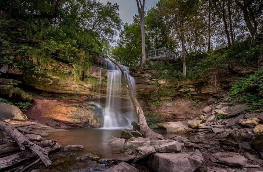
Fox Ridge and McClusky’s Rock: Badland at Stop 4 (Pages 72/73) Queenston Shale is the bottom-most layer of the Niagara Escarpment. Where vegetation is removed, the shale appears as a “badland”. The brick-red shale has long been excavated along the Niagara Escarpment to make bricks.