
Scheduled Outage: Our website will be down for planned system upgrades for an estimated duration of Mon. Aug. 24, 7:00 pm - Tues. Aug. 25, 6:00 am.
Hike Schedule
Join us for a hike! Registration required.
All hikes available to BTC members. Some hikes are open to non-members.
See Refund Policy for Paid Hikes >
TIP: The calendar view displays up to 7 hikes on a day, but often there are more. Click “View more events” to see them all.
Niagara
Iroquoia
Toronto
Caledon Hills
Dufferin Hi-Land
Blue Mountains
Beaver Valley
Sydenham
Peninsula
All Clubs
Show Filters
Categories
Reset Filters
- 26July 26, 2026
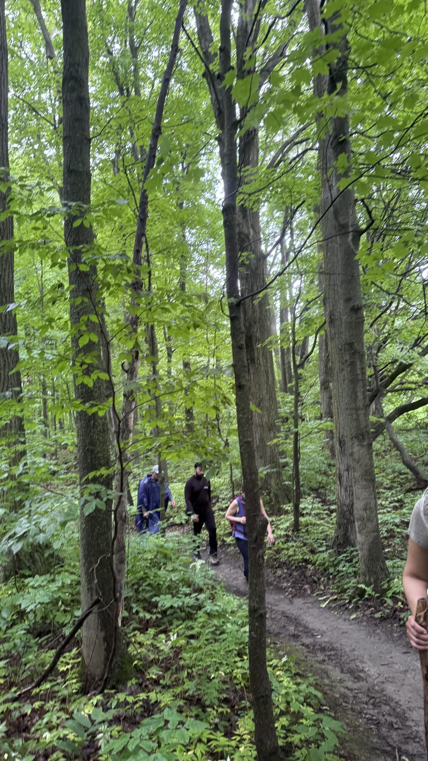
Car Hike: Jefferson Forest/Bond Lake
https://hikes.brucetrail.org/event/car-hike-jefferson-forest-bond-lake-7/Sorry, the registration cut-off time for this hike has been reached.Not a member? Click here to join today!Hosting Club: Toronto
Category: Car Hike
Location (Google Maps):1245 Bethesda Side Rd, Richmond Hill, ON L4E 1A2 ( Bethesda Trail Head Parking lot)
Hike Leader(s): Amir Alemohammad Click here to contact Hike Leader(s)
Pace: Moderate (3-4 km/hr)
Terrain: Flat, Hilly, Level 2 (Intermediate – some hills and uneven surfaces, rocks and roots underfoot), Variable
Distance (km): 14-16KmDescription
Let’s roll the hills of the Jefferson Forest and around the Bond Lake. Every week we hike in Jefferson Forest, located in the heart of Richmond Hill, it boasts numerous hiking trails. This 4 hour hike can range from 14 to 15 kilometres, depending on the weather conditions. Remember to bring water, snacks, hiking boots (mandatory), poles, and your camera. Not recommended for beginners. Park in the free Bethesda parking lot and avoid parking along the road. Dress appropriately for the weather. Difficulty Level: 2 (Moderate).Please arrive @7:45AM for start of 8:00AM.
This is a joint hike with the Oak Ridges Trail Association (ORTA).
what3words:
https://w3w.co/twisting.mailer.awakes
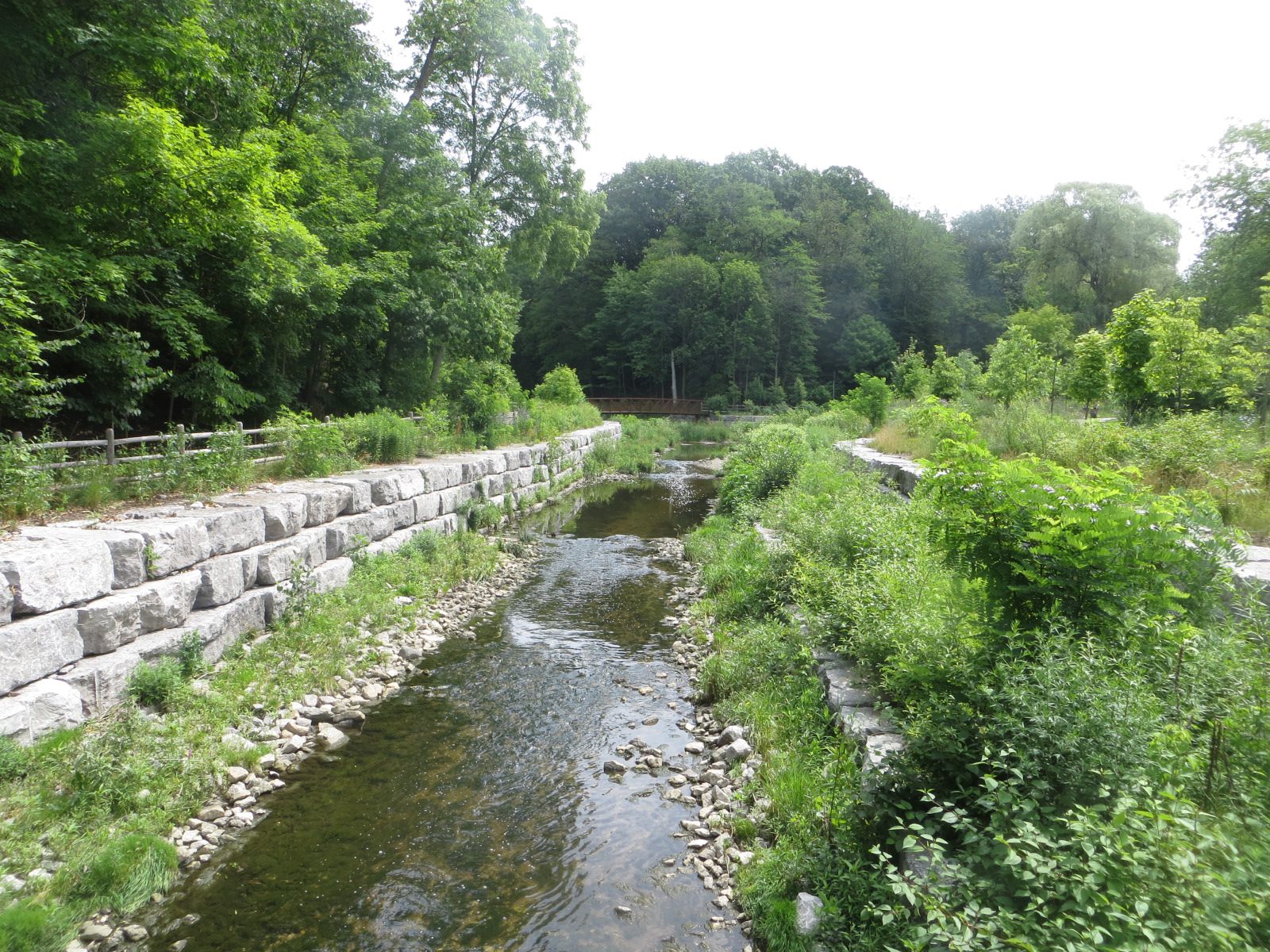
Urban Walk: Warden Woods--Taylor Creek--Don River
https://hikes.brucetrail.org/event/urban-walk-warden-woods-taylor-creek-don-river/Sorry, the registration cut-off time for this hike has been reached.Not a member? Click here to join today!Hosting Club: Toronto
Category: Urban Walk
Location (Google Maps): Kennedy Rd. and St. Clair Ave. E.Hike Leader(s): Felix Wan; Tom Swales Click here to contact Hike Leader(s)
Pace: Moderate (3-4 km/hr)
Terrain: Hilly, Level 2 (Intermediate – some hills and uneven surfaces, rocks and roots underfoot)
Distance (km): 12.5Description
Join us on a walk through scenic Warden Woods Park and Taylor Creek Park. We will never be far from water as we walk alongside Taylor-Massey Creek and the Don River. We will see wetlands, woodlands, and many species of plants and birds.Route map: https://onthegomap.com/s/lcjp9dir
The terrain features a mixture of paved paths, dirt trails, and road walking. There are a couple of descents, and a couple of uphill climbs. Depending on weather conditions, parts of the trail may be muddy or wet. Bring a good pair of hiking/walking shoes, as well as a lunch/snacks and at least 2L of drinking water.
Travel to the trailhead:
- By TTC: Meet Felix and Tom at Kennedy subway station by 9:25 a.m. to take the route 113 Danforth bus departing at 9:38 a.m., and arriving at Kennedy Rd. and St. Clair Ave. E. at 9:46 a.m.
- By GO: Take the Lakeshore East Line train departing Union station at 9:20 a.m. and arriving at Scarborough station at 9:38 a.m. Walk across St. Clair Ave. E. to the north side, to catch the route 102 Markham TTC bus departing Linden Ave. westbound at 9:44 a.m., arriving at Kennedy Rd. (two stops later) at 9:45 a.m. The TTC transfer will be free if you tap with your PRESTO card. Cross to the northwest corner of the intersection to meet the group.
- By car:
- Free parking is available at the Thomas Hauser Memorial Trailhead (the end point of the hike) at 35 Redway Rd. (https://maps.app.goo.gl/9QtAgAdmnXB8C8zw6). Note that you will still need to find your way to the trailhead to meet the group, given that this is a linear hike.
- Free parking is available at Scarborough GO station. To reach the trailhead, see “By GO” instructions above. Note that you will need to find your way back to Scarborough station at the end of the hike, given that this is a linear hike.
Washrooms:
Washrooms are available at Kennedy station (east end of the level above the Line 2 subway, as well as just across the west staircase from/to the Line 5 LRT boarding platform), or on the GO train/at Scarborough GO station, before the start of the hike. During the hike, we will stop at public washrooms at km 5.7. Washrooms are also available at the end of the hike at Loblaws.
Après-hike:
There will be an optional après-hike stop at Corks Beer & Wine Bar at Leaside Village (93 Laird Dr.), a 20-minute walk from the end point of the hike.
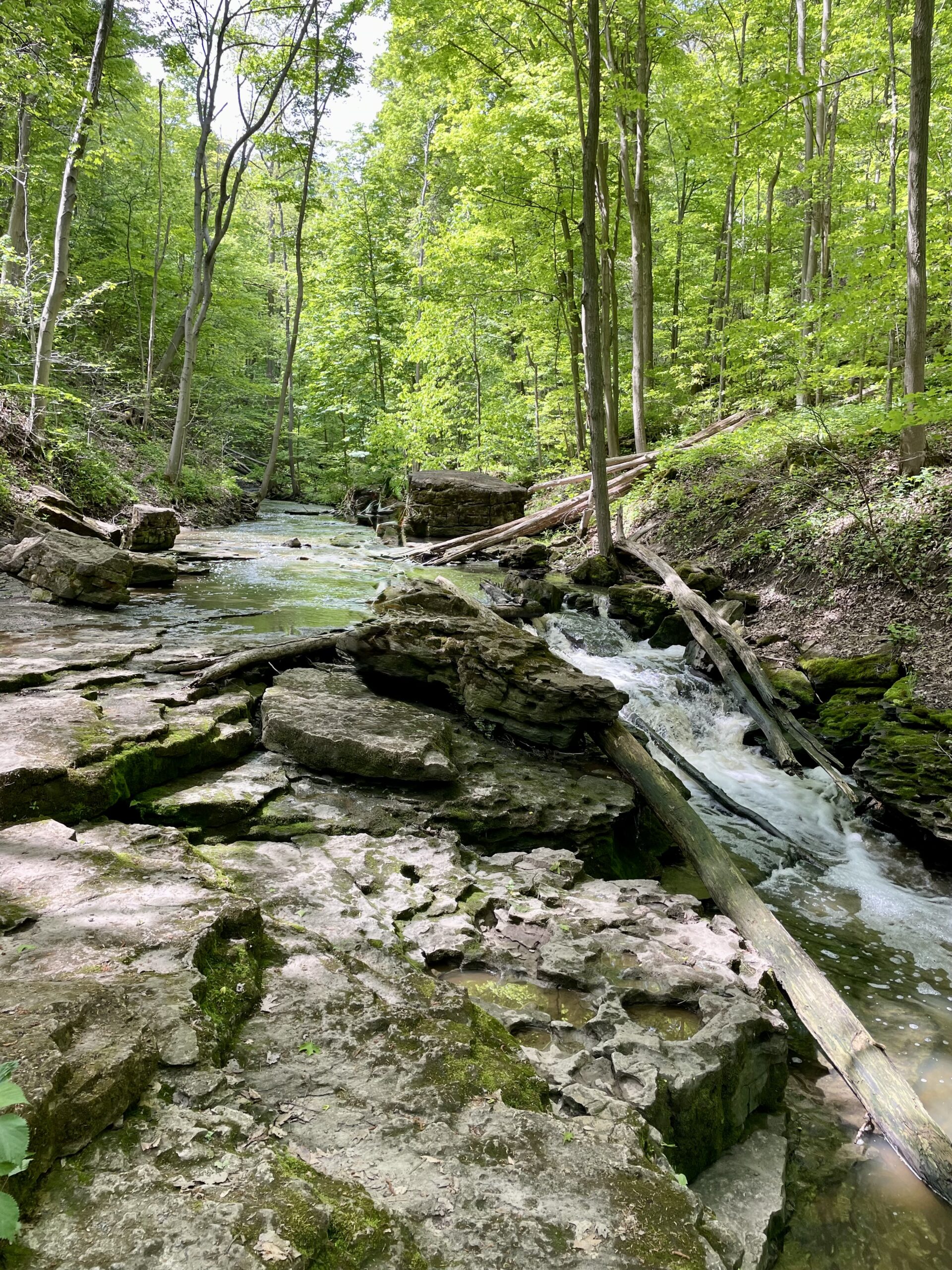
GeoHike - Louth Conservation Area
https://hikes.brucetrail.org/event/geohike-louth-conservation-area-2/Sorry, the registration cut-off time for this hike has been reached.Not a member? Click here to join today!Hosting Club: Niagara
Category: Geology
Location (Google Maps):Louth Conservation Area, 3155 Staff Avenue, St. Catharines
Hike Leader(s): Kristin Hanson Click here to contact Hike Leader(s)
Pace: Medium 3- 4 km/hr
Terrain: Moderate: some hills and some poor footing
Distance: 3.8Description
Discover the geology of the Vinemount Ridge wine sub-appellation, and the beauty of the waterfalls at Louth Conservation Area. We will see some interesting geologic features and evidence of glaciers. We will follow Sixteen Mile Creek and get a great view of both the upper falls and lower falls as Sixteen Mile Creek makes its way over the Niagara Escarpment. We will use a slow pace and stop and discuss geology along the way. It will take us 2-2.5 hours to cover the distance. There are three small hills we will climb, otherwise the terrain is generally flat. However, some of the footing is rocky and uneven with holes and gaps between the rocks we are walking on. It may be wet and muddy. Hiking poles may give more stability on uneven footing. After about 2.9km, we will arrive at Louth Falls where will stop to enjoy it. The falls are in a shady area with a nice breeze and a fantastic view. We will return to the parking lot via the main Bruce Trail and walk a short distance along Staff Road. Parking is free at Louth, but spots are limited. There are no washrooms or facilities. - 27July 27, 2026
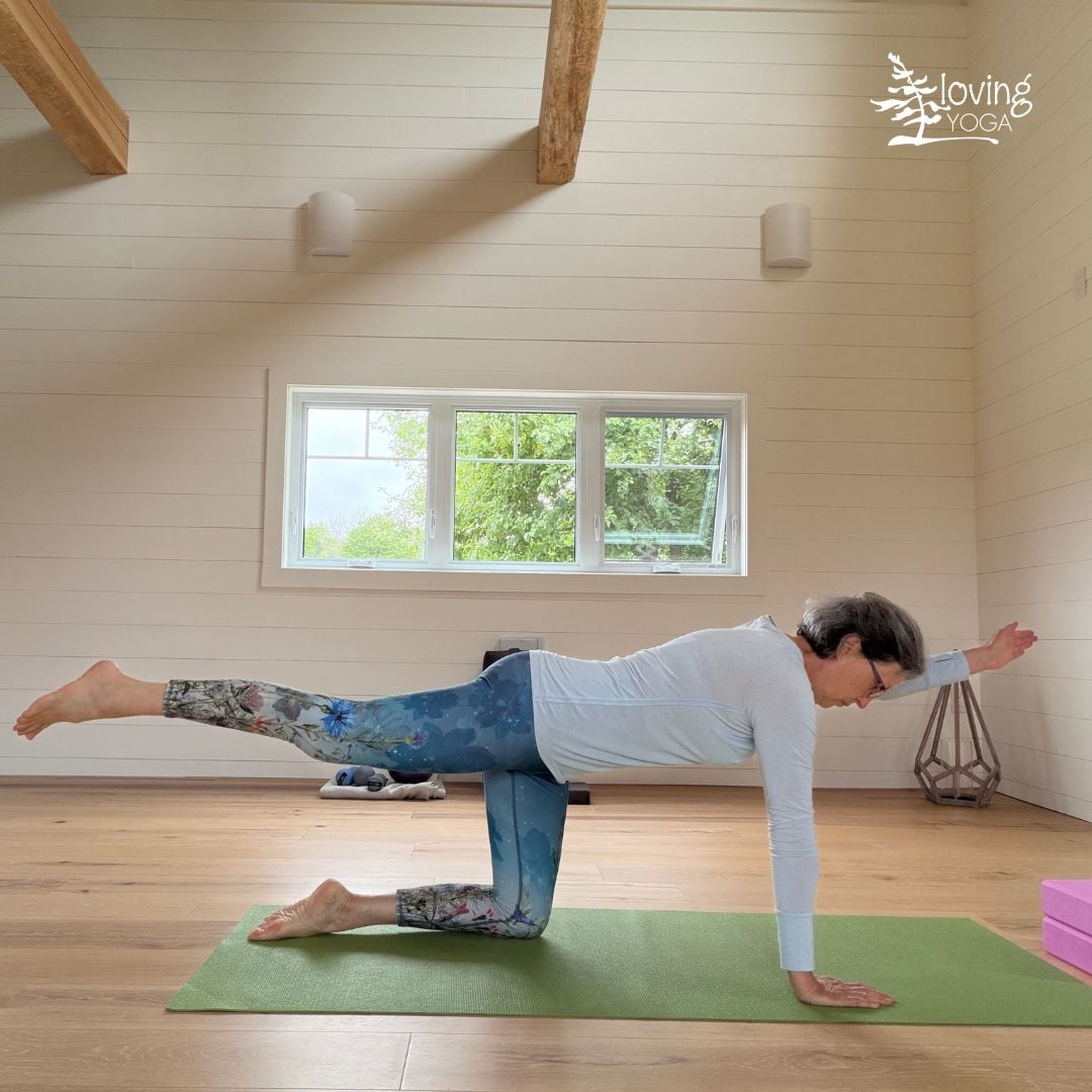
Trailside Yin & Yang Yoga: Release, Restore and Flow
https://hikes.brucetrail.org/event/trailside-yin-yang-yoga-release-restore-and-flow/Sorry, the registration cut-off time for this hike has been reached.Not a member? Click here to join today!This is a Multi-Day Hike
You are signing up for the following dates and times:
2026-07-27 at 08:00
2026-08-03 at
2026-08-10 at
2026-08-17 at
2026-08-24 atHosting Club: Peninsula
Category: Event
Location (Google Maps): 418 Cape Chin Road North, Lion’s Head, ONHike Leader(s): Barbara von der Heide and Marg Glendon Click here to contact Hike Leader(s)
Distance: 0
Description
Start your day feeling refreshed and energized with a balanced Yin & Yang yoga class.Whether you’ve spent the weekend hiking, biking, kayaking, or simply watching the clouds drift by, gentle movement and mindful stretching will help restore and rejuvenate your body.
This is a series of 5 Monday morning classes, and suitable for all bodies and experience levels—no previous yoga experience is required.
We use meditation and breathwork as our foundation to initiate our practice and follow with passive yin stretches. Yin yoga mainly targets the spine, hips and legs. It is a calm practice while being in a seated position on the mat or lying on the floor. Drawing on specialized training, Barbara also integrates the placement of Yoga Tune Up balls for myofascial release (MFR), helping to loosen tightness in your tissues and improve mobility, much like a massage!
Transitioning from passive yin to more dynamic yang we then balance the energy in our bodies with gentle flowing sequences.
Barbara emphasizes the functional approach to yoga, taking into consideration that every body is different. It is the unique individual build of each body that defines how a yoga pose is executed.
It is not about how one looks in a yoga pose and all about how one feels. Your body thinks in “feels”. Practicing yoga increases body awareness and enhances proprioception, which is your ability to sense how you move through space. This in return helps to reduce the risk of falls and injuries.
All props will be provided. It is recommended to bring your own mat and Yoga Tune Up balls if you have them.
A portion of every registration is donated to the Bruce Trail Conservancy. Registration is for the entire series. Fees are non-refundable.
Barbara von der Heide is certified with the Canadian Yoga Alliance (CYA-E-RYT 400) and Yoga Tune Up ( Roll Model Practitioner, Body by Breath Immersion, Anatomy Trains).
CANCELLED - Terra Cotta Loop
https://hikes.brucetrail.org/event/terra-cotta-loop-4/Sorry, the registration cut-off time for this hike has been reached.Not a member? Click here to join today!Hosting Club: Iroquoia, Toronto
Category: General Hike
Location (Google Maps):Boston Mills Road – Roadside Parking
Hike Leader(s): Pati Greenwood, Jeff Dowsett Click here to contact Hike Leader(s)
Pace: Medium – 3 to 4 km/hr
Terrain: Moderate – Some hills and/or some poor footing
Distance: 15 kmDescription
Starting from Boston Mills Road, we will take the main trail and side trails to form a large loop through the Terra Cotta Conservation Area. Our route will include some rocky and uneven terrain, which may be tricky to navigate. Wear hiking boots and bring poles.Ticks and other insects are active at this time of year, so wearing clothing covering the legs are arms is recommended as is insect repellent. Bring plenty to drink and a snack.
Please arrive at the meeting place by 8:15 am for an 8:30 am departure.
Centennial Park
https://hikes.brucetrail.org/event/centennial-park/Sorry, the registration cut-off time for this hike has been reached.Not a member? Click here to join today!Hosting Club: Niagara
Category: Leisurely
Location (Google Maps): 999 Church St., FenwickHike Leader(s): Diane Marlatt Click here to contact Hike Leader(s)
Pace: Leisurely <3 km/hr
Distance: 7 Km
Description

NEW Black Bear Badge Peninsula End2End - Hikes 6-8 of 8 hikes, July 27-29
https://hikes.brucetrail.org/event/new-black-bear-badge-peninsula-end2end-hikes-6-8-of-8-hikes-july-27-29/Sorry, the registration cut-off time for this hike has been reached.Not a member? Click here to join today!This is a Multi-Day Hike
You are signing up for the following dates and times:
2026-07-27 at 09:30
2026-07-28 at 07:30
2026-07-29 at 07:30Hosting Club: Iroquoia, Peninsula
Category: General Hike
Location (Google Maps): Rush Cove Nature Reserve Parking – at the end of Rush Cove RdHike Leader(s): Steven White Click here to contact Hike Leader(s)
Pace: Brisk – 4 to 5 km/hr
Terrain: Dependent on Conditions, Moderate – Some hills and/or some poor footing, Strenuous – Hilly with steep climbs and some poor footing
Distance: 22.4kmsDescription
Earn the NEW Peninsula Black Bear End to End Badge (Fundraising Badge is $30 for BTC members and $40 for non -members). Hike Peninsula in 8 hikes this summer!! June 1-5 and July 27-29, 2026. Separate registrations of June 1-5 and July 27-29. We will meet at 9:30am at Rush Cove Nature Reserve parking and shuttle to Lion’s Head, McCurdy Dr Municipal Parking Lot and hike south back to Rush Cove. For July 28&29, we will meet at 7:30am and shuttle to the trail head. Itinerary with GPS coordinates will be sent one week prior to the hikes. Each if these hikes is 22-24kms.Please arrive 15 minutes early each day to allow time to gear up and be ready to shuttle at posted times. Shuttling at the beginning of the day and one shuttle at end of each day to take morning drivers back to their cars, will be shared among all hikers. These start times allow hikers to travel the morning of the hike and finish mid-afternoon. Any parking fees will be shared equally by all hikers. For those booking accommodation, recommend staying near Wiarton.
I will do my best to obtain the new Black Bear End to End badges for those completing the Peninsula End2End and have ready to distribute on our last hike.
Hikers should bring layered clothing in case of cool, breezy or rainy days. Hikers should have hiking shoes/boots, poles, hat, raingear, sunblock, bug repellant, 2-3 litres of water and snacks/lunch. We will have 2 scheduled breaks each day. Anticipate 4 km/hr average pace including breaks, so please be honest with respect to your capability.
CANCELLED - Afternoon Hike - Crawford Lake (reservation required)
https://hikes.brucetrail.org/event/afternoon-hike-crawford-lake-reservation-required-2/Sorry, the registration cut-off time for this hike has been reached.Not a member? Click here to join today!Hosting Club: Iroquoia
Category: Afternoon/Evening Hikes
Location (Google Maps): Meet at 4:15 pm in the first parking lot at Crawford Lake.Hike Leader(s): Karen Bergmann Click here to contact Hike Leader(s)
Pace: Medium – 3 to 4 km/hr
Terrain: Moderate – Some hills and/or some poor footing
Distance: 5 kmsDescription
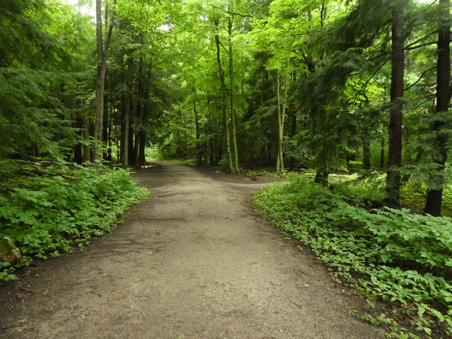
We will hike the loop around the park, which includes both side trails and main trail. Reserve your time at conservationhalton.caBring water and bug spray/bug net.
- 28July 28, 2026

Peninsula End to End Fundraiser
https://hikes.brucetrail.org/event/peninsula-end-to-end-fundraiser-2/Sorry, the registration cut-off time for this hike has been reached.Not a member? Click here to join today!Hike open to BTC Members only.
This is a Multi-Day Hike
You are signing up for the following dates and times:
2026-07-28 at 07:00
2026-07-29 at
2026-07-30 at
2026-07-31 at
2026-08-01 at
2026-08-02 at
2026-08-03 atHosting Club: Iroquoia, Peninsula
Category: Stained Glass Badge End to End Fundraiser Hike
Location (Google Maps): Peninsula End to End in 7 days
Note: A section of trail is currently closed between Halfway Dump Rd and Lindsay Rd 40. This means it will not be hiked unless the section of trail is reopened by the time we start this ETE. This section is a one day hike, about 22km.
If the section opens by July 28, we will tack one extra day onto this schedule. The schedule will be shared on the WhatsApp which will for set up for everyone who registers.
Our meet time everyday is 7:00am. Please be early to get ready for the car shuttle.
July 28 – Park in all-day parking in Tobermory. Meet at the northern cairn.
Car shuttle to Halfway Log Dump. Today is a long, day. There is much to see and the terrain is tough. Expect to finish quite late. Distance is approximately 25km
July 29 – Park at the south end of Carter Road. Access to the trail is via a short side trail past the gate. 45.092716, -81272189 Distance about 19km
Car shuttle to Lindsay Rd 40 45.192206, -81.343243
July 30 – Park at the south end of Carter Road as above.
Car shuttle to Lion’s Head Municipal Campground in private parking. Distance about 16km
July 31 – Roadside parking on end of Cemetery Road. Access from Hwy 9 via Evergreen Rd or Cemetery Rd. 44.967285, -81.230603
Car shuttle to Lion’s Head Municipal Campground as above. Distance about 14km
August 1 – Park in Hope Bay parking lot just south of Cedarholm Campground 44.902930, -81.155706
Car shuttle to the end of Cemetery Rd as above. Distance about 26km
August 2 – Park in Hope Bay as above.
Car shuttle to Roadside parking at the bend on the grassy shoulder of Coveney’s Rd. Do not block private laneways 44.862613, -81067963 Distance 22km
August 3 – Park across from the arena in Wiarton in Bluewater Park 44.742514, -81.135140
Car shuttle to Coveney’s Rd as above. Distance about 22km. At our finish we will have a little celebration at the Wiarton Willy statue where the badges will be presented as well.Hike Leader(s): Ruth Moffatt Click here to contact Hike Leader(s)
Pace: Brisk – 4 to 5 km/hr, Medium – 3 to 4 km/hr
Terrain: Dependent on Conditions, Moderate – Some hills and/or some poor footing, Strenuous – Hilly with steep climbs and some poor footing
Distance: 20-25km per day.Description
This end to end series is for Members only. Not a member? Please check out membership options at the link below and use Code 67abd1234c568 for free downloadable maps.https://brucetrail.org/product-category/memberships/
Registration opens June 28. There are no refunds for this hike.
Please read all details.
Do not overestimate your hiking ability for long, strenuous days and please do not register unless you can attend all 7(8) days. If your schedule conflicts with 1 day, you can make it up on one day on your own prior to the start of the hike.
A WhatsApp group will be set up for everyone. Please utilize this if you’re looking for roommates, carpooling, photo share, etc.
Please come prepared for potentially hot, humid weather. Bring a minimum 2l -3l of water, bug spray, sunscreen, hat, first aid kit, food, snacks, poles if you use them, rain gear and anything else you need for a long day.
Please be prepared to participate in the car shuttling by having a minimum of 4 available seatbelts. You can carpool with two people each day but if any more, please let the hike leader know. A car shuttling schedule will be set up on the WhatsApp.The stained glass bear badge is included in your fee.
we are hiking North to South and meeting everyday at 6:45am for a 7:am departure for the shuttle to the start.
This hike is limited to 8 hikers.
Since we are meeting at the northern cairn on the first day you will need to arrange all day parking which is $15 on Harpur Dr. and other streets in Tobermory. Check parking map at northbrucepeninsula.ca.For the first day, you can carpool to the parking location and split the cost amongst anyone in the car. I will drive everyone to our start, at Halfway Dump Rd on the first day.
From wherever you park, please walk to the northern cairn in Tobermory and allow 5-10min depending on where you park. I will pick everyone up at the cairn at 6:45am. We will depart as soon as everyone is ready to go but no later than 7am. We will shuttle to Halfway Dump Rd to begin our hike. The first day will be the toughest but also the most scenic and we will take our time to enjoy all there is to see.
Any other parking charges are split amongst everyone.Long Hike Short Hills
https://hikes.brucetrail.org/event/long-hike-short-hills-4/Sorry, the registration cut-off time for this hike has been reached.Not a member? Click here to join today!Hosting Club: Niagara
Location (Google Maps):
Short Hills Wiley Road, Thorold
Pace: Brisk 4-5 km/hr
Terrain: Moderate: some hills and some poor footing
: 10k+Description
Our regular Spot for the Tuesday Long Hike. Note the new location. We will hike the trails around Short Hills Dress for the weather and bring sunscreen bug spray, poles snack and drink9:15 Short hike, Pelham Road entrance, Short Hills
https://hikes.brucetrail.org/event/915-short-hike-pelham-road-entrance-short-hills-13/Sorry, the registration cut-off time for this hike has been reached.Not a member? Click here to join today!Hosting Club: Niagara
Category: Loop
Location (Google Maps): Short Hills Provincial Park, Pelham Road entranceHike Leader(s): janet davey Click here to contact Hike Leader(s)
Pace: Medium 3- 4 km/hr
Terrain: Moderate: some hills and some poor footing
Distance: 6 kmsDescription
Hike the main and side trails of Short Hills Provincial Park. Please bring water, bug spray and hiking poles. Ticks are active right now so be sure to check yourself after the hike.Looping Through Nottawasaga Bluffs Conservation Area
https://hikes.brucetrail.org/event/looping-through-nottawasaga-bluffs-conservation-area/Sorry, the registration cut-off time for this hike has been reached.Not a member? Click here to join today!Hosting Club: Caledon Hills
Category: Tuesday Hikers
Location (Google Maps): Nottawasaga Bluffs Conservation Area – Blue Mountains Club. Accessible only from Concession 10 South, this small parking area off 15/15 Sideroad is provided by the Nottawasaga Valley Conservation Authority.Hike Leader(s): Doris Harper Click here to contact Hike Leader(s)
Pace: Medium – 3 to 4 km/hour
Terrain: Moderate – some hills and/or some poor footing
Distance: 10 – 12 kmDescription
Meet at 9:30 AM in the Parking Lot on 15/16 Side Road Nottawasaga.Bring water and snacks. Sunscreen , bug spray and hat recommended.
We will hike the main trail , the Hamilton Brothers Side Trail, Betty Carter Side Trail and the Nottawasaga Bluffs Lookout Side Trail. About 10 km.
After the hike we can have lunch/snack at Mylar and Loretta’s Restaurant in Singhampton, if you like; address 794112 Grey County Rd.
Bring a friend if you like. If you need to cancel, please let me know so we don’t worry about you.
Urban Walk: Valley View/Huntington Park
https://hikes.brucetrail.org/event/urban-walk-valley-view-huntington-park-11/Sorry, the registration cut-off time for this hike has been reached.Not a member? Click here to join today!Hosting Club: Toronto
Location (Google Maps): Parking lot is off Sycamore Drive, East of Bayview , across Starbucks plaza
Bus 91 from Finch East station stops at Sycamore station.Hike Leader(s): Mohammad Aghamiri
Pace: Moderate (3-4 km/hr)
Terrain: Hilly, Level 2 (Intermediate – some hills and uneven surfaces, rocks and roots underfoot)
Distance (km): 6-7 kmDescription
We will explore Valleyview and Maple View parks, and walk along German Mill Creak, in return we stop in Huntington park and have snack under beautiful shed.Although this is considered an “Urban Walk”, you can expect some hills up and down and uneven surfaces with tree roots. Please bring hiking poles, water and snacks.
Walk In Nature Series (WINS) - Woodford
https://hikes.brucetrail.org/event/walk-in-nature-series-wins-woodford/Sorry, the registration cut-off time for this hike has been reached.Not a member? Click here to join today!Hosting Club: Sydenham
Category: Walk In Nature Series (WINS)
Location (Google Maps): Woodford Hall parking lot, 107 Woodford Crescent, Woodford. Edition 31, Map 30, km 30.5Hike Leader(s): Danuta Valleau Click here to contact Hike Leader(s)
Pace: Medium: 3 to 4 km/h
Terrain: Moderate: Some hills and/or poor footing, Strenuous: Hilly with steep climbs and some poor footing.
Distance: 5 kmDescription
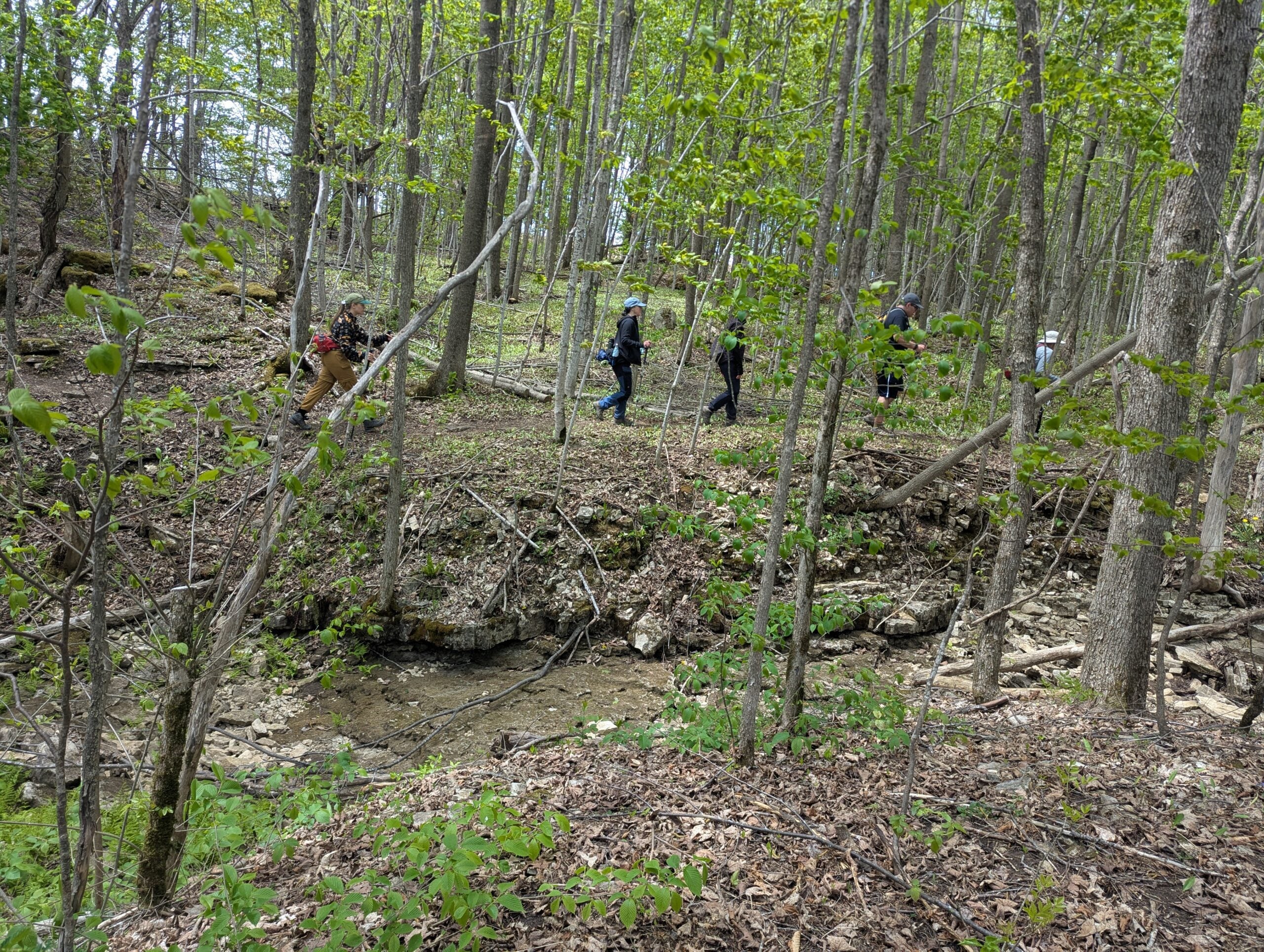
Explore interesting trails on both side of Highway 26 including the Crevice Springs Side Trail and the Woodford Escarpment Side Trail. A highlight of this rocky terrain is walking through narrow crevices and an historic homestead foundation and kiln. - 29July 29, 2026
Good Companions Dundas Escarpment Views
https://hikes.brucetrail.org/event/good-companions-dundas-escarpment-views/Sorry, the registration cut-off time for this hike has been reached.Not a member? Click here to join today!Hosting Club: Iroquoia
Category: Good Companions
Location (Google Maps): Rock Chapel Road Hamilton, RBG parking lot – paid parking or RBG members pass.Hike Leader(s): Janina Vanderpost Click here to contact Hike Leader(s)
Pace: Leisurely – 3km/hr or less
Terrain: Easy – Mostly flat and usually good footing
Distance: 8 kmDescription
Meet in the RBG parking lot on Rock Chapel Road at 9:15 for a 9:30am start. We will take a gentle walk under shady trees along the escarpment between Borer’s Falls and the subdivision at Romer Drive. We will take our time enjoying lovely views of Cootes Paradise and the Dundas Valley as this will be a hot day. Bring plenty of water, sunscreen, poles if using but the terrain is mostly easy and flat.
Optional refreshment stop in Waterdown after. I will send out a status update email on Tuesday evening.
Remamber, 9:30 am start.
Terra Cotta/Heritage Road loop
https://hikes.brucetrail.org/event/terra-cotta-heritage-road-loop-2/Sorry, the registration cut-off time for this hike has been reached.Not a member? Click here to join today!Hosting Club: Iroquoia
Category: General Hike
Location (Google Maps): Roadside on Winston Churchill Blvd, just north of Terra Cotta Conservation Area. Meet at 9:15 am, earlier if you can, as parking is limited.Hike Leader(s): Karen Bergmann Click here to contact Hike Leader(s)
Pace: Medium – 3 to 4 km/hr
Terrain: Moderate – Some hills and/or some poor footing
Distance: 8.5 kmsDescription
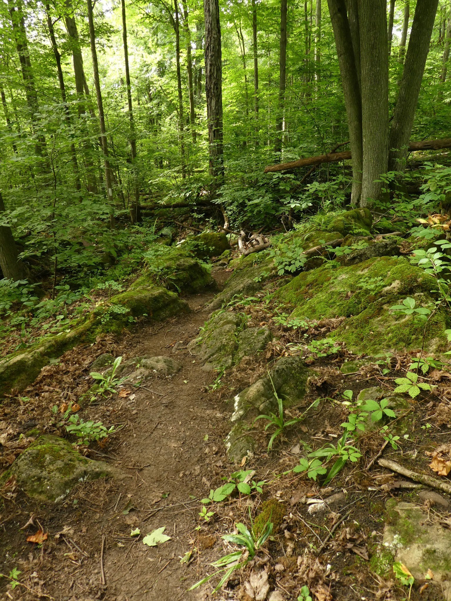
We will meet at 9:15 am roadside on Winston Churchill Blvd, just north of Terra Cotta. Parking is limited, so try to come closer to 9 am in case there are other cars.Hiking along the main trail, across Heritage Rd and around to the Rockside Side Trail and back on the main trail to the cars. This trail has some easy parts and some challenging rocky parts, so come prepared. There’s a bit of road walking. Bring sufficient water and bug spray/bug net.
WEDNESDAY WALKERS - Hogg's Falls Bridges and Walkways
https://hikes.brucetrail.org/event/wednesday-walkers-hoggs-falls-bridges-and-walkways-4/Sorry, the registration cut-off time for this hike has been reached.Not a member? Click here to join today!Hosting Club: Beaver Valley
Location (Google Maps): Meet in the parking lot of Hogg’s Falls, km 65.1, Map 26, Edition 31
Hike Leader(s): Glenda Collings Click here to contact the hike leader.
Pace: Medium
Terrain: Some rocky footing, Some steep sections
Length of Hike: 5 kmsDescription
Our hike takes us along a route that showcases much of the new(ish) construction that has recently been completed in the Hogg’s Falls area. Multiple bridges across the Boyne River allow for hiking loops. We will walk southward from the parking lot along the Main Trail and then we will cross the Boyne River. The Trail rises well above the Boyne River meaning there’s some steep inclines. Another bridge is crossed to return to the other side of the Boyne and then we include a loop into uplands. A visit to see the Falls is a special view.Books & Blazes - Sydenham Hiking Book Club
https://hikes.brucetrail.org/event/books-blazes-sydenham-hiking-book-club/Sorry, the registration cut-off time for this hike has been reached.Not a member? Click here to join today!Hosting Club: Sydenham
Category: Book Club Hike
Location (Google Maps): Harrison Park in the parking lot near the bridge. 137 2nd Ave E, Owen SoundHike Leader(s): Karen Sooley Click here to contact Hike Leader(s)
Pace: Medium: 3 to 4 km/h
Terrain: Moderate: Some hills and/or poor footing, There might be muddy sections.
Distance: 6.5 kmDescription
Welcome to the 1st Sydenham Hiking Book Club event – Books & Blazes.This month’s book is “Remarkably Bright Creatures: A Novel”, by Shelby Van Pelt.
Our hike will begin at Harrison Park. We will follow the Harrison Park Side Trail south and then continue towards Inglis Falls on the main trail. Using the Creamery Hill Side Trail we will loop back to the parking lot at Harrison Park. Bring a snack and water. Always carry any personal medications and your health card while hiking. It is not necessary to bring the book.
We will chat about the book as we hike and during short stops along the way. You are welcome to join the hike even if you haven’t read the book.
At the end of the hike, the group will choose the next book for our Books & Blazes hike in August.
Car Hike: Toronto Section E2E (3 of 4 )
https://hikes.brucetrail.org/event/car-hike-toronto-section-e2e-3-of-4-2/Sorry, the registration cut-off time for this hike has been reached.Not a member? Click here to join today!Hosting Club: Toronto
Category: Car Hike
Location (Google Maps): Walking Fern ST (38.8k marker, Edition 31) on 10th LineHike Leader(s): David Rowney Click here to contact Hike Leader(s)
Pace: Moderate (3-4 km/hr)
Terrain: Variable
Distance (km): 12.2 kDescription
This is a summer-time End-to-End hike to complete the Toronto section of the Bruce Trail in 4 hikes. Join for as many hikes as desired.This third hike will take us from Sixth Line, north of Limehouse to the entrance of the Walking Fern ST (on the 10th Line). The terrain will vary, there will be some hilly sections and sections with uneven, rocky terrain, making footing tricky to navigate.
July weather can be hot, muggy and buggy! So, dress for the weather, keeping in mind that insects, including ticks, will be out in full force. Take appropriate precautions to avoid insect bites, including using repellant and clothing that covers the legs and arms. Hiking shoes/boots are required and hiking poles are recommended.
Bring plenty of fluids, including electrolytes, and a snack/lunch.
As this is a group hike, please consider your fitness level before registering. We will be walking at a pace of 3km – 4km per hour and everyone is expected to keep up with the person in front of them for the duration of the hike.
Plan to arrive at the meeting place by 9:15 a.m. as we will start the car shuffle to the hike starting point at 9:30 a.m. sharp. Further details will be provided to registered hikers a few days prior to the hike.
5:00 pm Hike & Picnic then “Gateau & Grace” BARBERSHOP QUARTET
https://hikes.brucetrail.org/event/500-pm-hike-picnic-then-gateau-grace-4/Sorry, the registration cut-off time for this hike has been reached.Not a member? Click here to join today!Hosting Club: Niagara
Category: Urban
Location (Google Maps):St Andrew’s Presbyterian Church in Niagara-on-the-Lake.
Hike Leader(s): Suzanne Gourluck Click here to contact Hike Leader(s)
Pace: Leisurely <3 km/hr
Terrain: Easy: mostly flat, good footing
Distance: 6 kmDescription
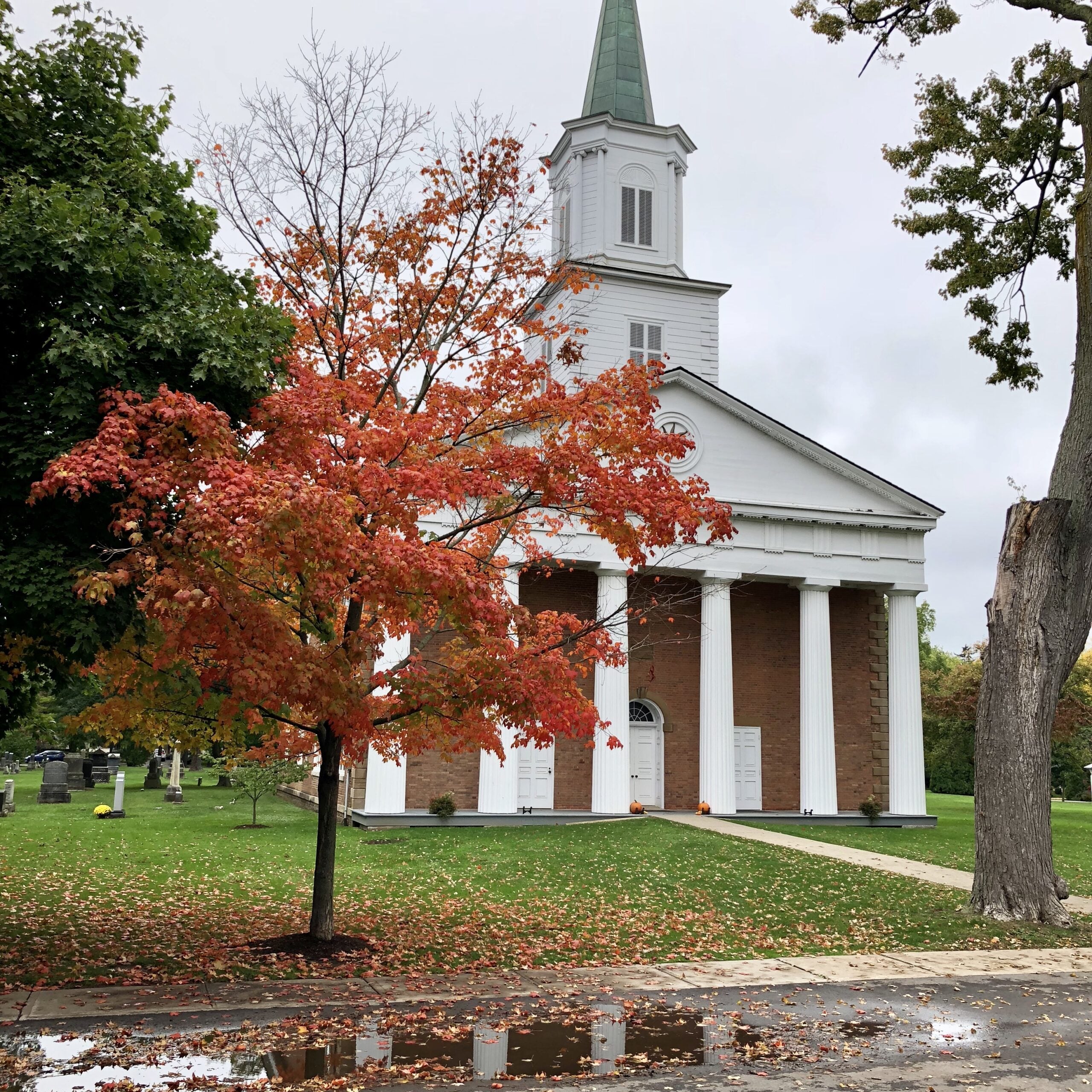
This is a series of hikes which will take place on 3 Wednesday evenings in July and August. We will hike around Niagara-on-the-Lake and surrounds (1.5 hrs) stopping for a shared picnic on the lawns of St Andrews. At 7 pm other Niagara-on-the-Lake residents will join us on the lawns and you will have your choice of some delicious cakes. Then we will go inside to enjoy a special performance of some music and a short reflection on “Grace”. This is a free event.Bring a folding chair and some savoury food to share (dessert is provided). Dress so you’ll be comfortable hiking and picnicking. A change of clothes is not required. Bathrooms will be available.

Peninsula Buck Full Moon Hike - Meet time 8:30pm
https://hikes.brucetrail.org/event/peninsula-buck-full-moon-hike-meet-time-830pm/Sorry, the registration cut-off time for this hike has been reached.Not a member? Click here to join today!Hosting Club: Iroquoia, Peninsula
Category: Moonlight Hikes
Location (Google Maps): The parking lot off of Forty Hills Rd.Hike Leader(s): Ruth Moffatt Click here to contact Hike Leader(s)
Pace: Leisurely – 3km/hr or less, Medium – 3 to 4 km/hr
Terrain: Dependent on Conditions, Easy – Mostly flat and usually good footing, Moderate – Some hills and/or some poor footing
Distance: 6kmDescription
This full moon hike is in the Peninsula Section of trail and led by an Iroquoia Hike Leader.Welcome to more Full Moon Hike Series – This is the 2/4 that will be led this summer. Details for collecting badges are at the bottom of the hike details.
We will meet in the parking lot off of Forty Hills Road and make our way out on Richardson Side Trail to the main trail, loop around to the Whippoorwill Side Trail at then make our way back to the parking lot via the main trail and Richardson Side Trail.Sunset is at 8:57pm
Bring water and whatever snacks you need as well as a first aid kit, poles if you use them and most importantly, a head-lamp with a red light if you have one.The next full moon hike is August 28 Sturgeon Moon – Meet time is 7:45pm and lastly September 26 Harvest Moon – Meet time is 6:00 pm
The following is from the Bruce Trail Conservancy website regarding Hiking at Night.
While most hikers choose to explore the Bruce Trail by day to take in the colourful sights and vast vistas, venturing out after dark also has its benefits.
Hiking at night allows you to tap into other senses and explore nature in a whole new way. From stargazing to nocturnal animal sightings, there is a lot to see and hear when exploring the Bruce Trail after sunset. No matter your motivation for heading out for a nighttime hike, certain precautions should be taken to ensure that your time on the Trail is safe and enjoyable.Before you go
Plan your route and choose somewhere familiar. It’s easy to get turned around in the darkness. Planning your route and hiking it in daylight first will help you know what to expect. If you’ve never tried hiking at night, start with a shorter hike somewhere familiar to you. Always stay on the Trail to avoid getting lost.Bring a headlamp or flashlight and extra batteries. The Trail can be quite rugged with uneven surfaces, rocks, and roots. A headlamp or flashlight is essential for preventing trips and falls – and both are brighter and last longer than your phone’s built-in light. A light source with different settings, including a red light, is ideal as bright lights can be hard on your eyes over time.
Bring a fully charged cell phone. You should always bring your phone with you when hitting the trails in case you need to call for help. Most phones have a flashlight function that can act as a backup to your headlamp. You can also use your phone’s GPS with apps like the Bruce Trail App and what3words for navigational and safety purposes.
Wear reflective clothing and bring a whistle. A reflective piece of clothing can help other hikers or drivers see you in the darkness. A whistle can help others hear you in case of an emergency, even if they can’t see you.
Plan to do your first hike under a full moon and a clear sky.
A full moon can provide a surprising amount of light. Planning your first night hike during a full moon and clear sky can be a great way to acclimate yourself to hiking after dark.Don’t go solo and tell someone where you are going. Always share your route with someone before heading out in case of an emergency. Bring a friend to explore the Trail together, or join one of the moonlit hikes offered by some Bruce Trail Clubs.
Bring layers. The temperature can drop quickly in the woods at night. Bring layers to stay warm and comfortable.
While HikingSlow down and be aware of hazards. Don’t expect to hike at the same pace you would in daylight. Darkness can make the terrain more challenging. Slow down, pay attention to your surroundings, and stay away from cliff edges to prevent injuries.
Be prepared for wildlife. Many animals such as coyotes, owls, bats, salamanders, foxes, opossums, and skunks are active at night. Sightings can enhance your nighttime hiking experience but be careful not to get too close. Keep your ears open to the sounds around you to avoid unwanted interactions.
While more preparations may be needed for a hike after dusk, for many, once they find themselves in the cool of the night gazing up at the constellations or watching an owl swoop through the darkness, the effort is well worth it.
If you are collecting your badge tonight or on any of the following full moon hikes: August 28 or September 26, please bring exact cash $10 for members and $15 for non-members to cover the cost of the badge. You must’ve have completed at least 4 full moon hikes. If you wish to pay by e-transfer and have your badge mailed out to you, you may also choose to receive it that way. For simplicity sake, and because it will be dark out, it would be appreciated if you could please choose one method of receiving your badge or the other. Badges are on the honour system so if this is your 4th hike, please feel free to receive your badge.
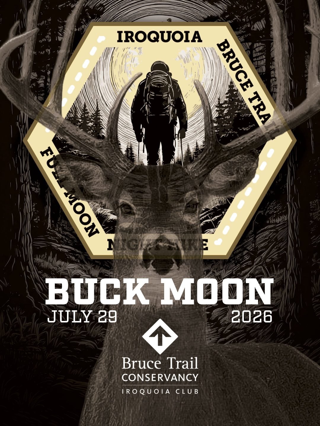
Full Moon Night Hike No.8 (Buck Moon)
https://hikes.brucetrail.org/event/full-moon-night-hike-no-8-buck-moon/Sorry, the registration cut-off time for this hike has been reached.Not a member? Click here to join today!Hosting Club: Iroquoia
Category: Moonlight Hikes
Location (Google Maps): We will meet at Oakville Parking Lot 11B at off Water Street. I will have my tailgate up on my white Nissan Qashqai.Hike Leader(s): Joe Borges Click here to contact Hike Leader(s)
Pace: Brisk – 4 to 5 km/hr
Terrain: Easy – Mostly flat and usually good footing, Moderate – Some hills and/or some poor footing
Distance: 8.5 kmDescription
The Buck Moon hike is the eighth full moon of 2026. This is the second urban Oakville hike and this time we’ll be walking through DT Oakville to the lake, across Sixteen Mile Creek, down toward Tannery Park, we’ll stop at the Tannery Hill Observation Deck and then down along the lake towards Waterworks Park and the Indigenous gathering circle. We’ll then head back along the lake, through the marina and back over the bridge to our cars.The views of the lake and Moon should be excellent if we et a clear night. We’ll also try to hit as many of the Oakville Stairs as we can, not quite the Hamilton Stomp:)
We’ll meet at Oakville Parking Lot 11B along the river. Please plan to arrive by 8:45 pm so we can get everyone registered and head out at 9:15 pm.
Be sure to dress for the weather, bring 1.5 L of water, bug spray and poles if you use them. Also headlamp or flashlight. You can leave them off and use them when needed.
To view our route on AllTrails, please visit:
https://www.alltrails.com/explore/custom-routes/custom-route-cec9bde?u=m&sh=4wexyxIf this is your third hike in the series you qualify for the Iroquoia Full Moon badge – new for 2026! Cost is $10 for BTC Members and $15 for non-members. Badges can be picked up at this hike if you pre-order and pay through Iroquoia Bruce Trail Club Badges – Iroquoia Bruce Trail Club
Members / Click to Purchase Your Badges
https://www.zeffy.com/en-CA/ticketing/1de4dba1-aca4-44e2-b0b0-d94f1c826c42Non-Members / Click to Purchase Your Badges
https://www.zeffy.com/en-CA/ticketing/93131d23-cc73-44fe-913d-e4938ee174c6 - 30July 30, 2026
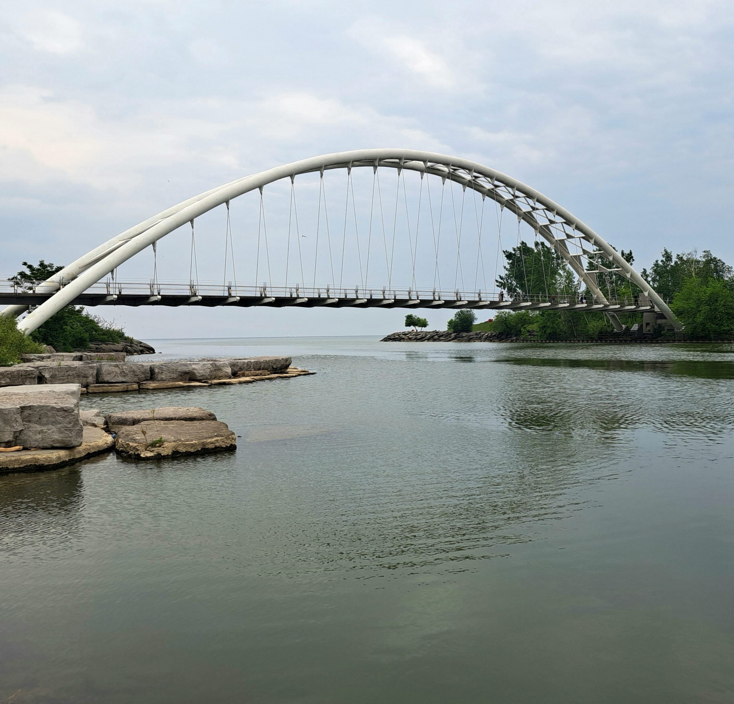
Toronto Waterfront Urban Hike: Port Credit Go Station to Union GO Train Station
https://hikes.brucetrail.org/event/toronto-waterfront-urban-hike-danforth-go-station-to-union-go-train-station/Sorry, the registration cut-off time for this hike has been reached.Not a member? Click here to join today!Hosting Club: Toronto, Caledon Hills
Category: General
Location (Google Maps): At 6:15 a.m. meet at Union Station Go Train Station platform #4 stairs in the concourse-not on the tracks!!!! We will be taking the 6:35 a.m. Lakeshore West train to Port Credit Go Station and walking back to Union.Hike Leader(s): Daniel Patterson, Tom Swales Click here to contact Hike Leader(s)
Pace: Medium – 3 to 4 km/hour
Terrain: Easy – mostly flat and usually good footing
Distance: 21 KmDescription
Enjoy the amazing Toronto waterfront from Port Credit to Union Station on this early morning urban hike. Bring snacks, water, sun screen and your natural curiousity! Should you decide to leave the hike early you MUST talk to the leaders. No dogs.8:00 am Long hike NEW Location. Bailey bridge Jordan
https://hikes.brucetrail.org/event/800-am-long-hike-new-location-bailey-bridge-jordan-5/Sorry, the registration cut-off time for this hike has been reached.Not a member? Click here to join today!Hosting Club: Niagara
Location (Google Maps):
Bailey bridge Jordan
Pace: Brisk 4-5 km/hr
Terrain: Strenuous: hilly, with steep climbs, poor footing
: ~10kDescription
This will be our permanent location . Hike up from the Bailey bridge to Balls Falls and explore the trailsYou must register for each hike. Bring Poles, snack and a drink. Dress for the weather
Hiking Around Jordan
https://hikes.brucetrail.org/event/hiking-around-jordan-65/Sorry, the registration cut-off time for this hike has been reached.Not a member? Click here to join today!Hosting Club: Niagara
Location (Google Maps): Sho’Arishon Park (Jordan Hollow)
Hike Leader(s): Bill Russell Click here to contact Hike Leader(s)
Pace: Medium 3- 4 km/hr
Terrain: Moderate: some hills and some poor footing
Distance: 7 kmDescription
Hiking in and around Jordan, Rainforth Trail and Balls Falls, alternating every 3 weeks.
Kelso Summit (reservation required)
https://hikes.brucetrail.org/event/kelso-summit-reservation-required-3/Sorry, the registration cut-off time for this hike has been reached.Not a member? Click here to join today!Hosting Club: Iroquoia
Category: General Hike
Location (Google Maps): Kelso Summit parking lot at 9:15 am (reservation required)Hike Leader(s): Karen Bergmann Click here to contact Hike Leader(s)
Pace: Medium – 3 to 4 km/hr
Terrain: Moderate – Some hills and/or some poor footing
Distance: 8 kmsDescription
Meet at 9:15 in the Summit parking lot. We will explore the trails for a large loop. Bring water and bug spray/bug net. Reserve your time at conservationhalton.ca for KELSO SUMMIT.Urban Walk: Valley View/Huntington Park
https://hikes.brucetrail.org/event/urban-walk-valley-view-huntington-park-12/Sorry, the registration cut-off time for this hike has been reached.Not a member? Click here to join today!Hosting Club: Toronto
Location (Google Maps): Parking lot is off Sycamore Drive, East of Bayview , across Starbucks plaza
Bus 91 from Finch East station stops at Sycamore station.Hike Leader(s): Mohammad Aghamiri
Pace: Moderate (3-4 km/hr)
Terrain: Hilly, Level 2 (Intermediate – some hills and uneven surfaces, rocks and roots underfoot)
Distance (km): 6-7 kmDescription
We will explore Valleyview and Maple View parks, and walk along German Mill Creak, in return we stop in Huntington park and have snack under beautiful shed.Although this is considered an “Urban Walk”, you can expect some hills up and down and uneven surfaces with tree roots. Please bring hiking poles, water and snacks.
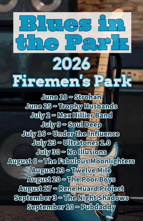
Hike, followed by Blues in the Park
https://hikes.brucetrail.org/event/hike-followed-by-blues-in-the-park-5/Sorry, the registration cut-off time for this hike has been reached.Not a member? Click here to join today!Hosting Club: Niagara
Category: Leisurely
Location (Google Maps):2275 Dorchester Rd, Niagara Falls, ON L2J 0H1
Hike Leader(s): Marion Hanover Click here to contact Hike Leader(s)
Pace: Leisurely <3 km/hr
Terrain: Moderate: some hills and some poor footing
Distance: 4kmDescription
Hike series Thursday evenings throughout the summer, followed by optional Blues in the Park. Come prepared to hike 1.5 leisure hike. Various blues bands free of charge starting at 7pm in the park. Bring lawn chair, beverage and snack to share. - 31July 31, 2026

Toronto Waterfront Danforth GO Station to Union GO Station
https://hikes.brucetrail.org/event/toronto-waterfront-davenport-go-station-to-union-station/Sorry, the registration cut-off time for this hike has been reached.Not a member? Click here to join today!Hosting Club: Toronto, Caledon Hills
Category: General
Location (Google Maps): Meet at Union Station Go Train Station Platform 4 (in the concourse not on the tracks!) by 6:15 a.m. We are taking the 6:35 a.m. Lakeshore East Go Train to Danforth Go Station to start the hike. The hike will end at Union Station. If you want to leave the hike before Union Station, it is necessary to inform the leaders!Hike Leader(s): Daniel Patterson, Tom Swales Click here to contact Hike Leader(s)
Pace: Medium – 3 to 4 km/hour
Terrain: Easy – mostly flat and usually good footing
Distance: 21 kmDescription
Join us for an urban hike on the Toronto East waterfront along the beaches, through Tommy Thompson Park, the Port Lands and Harbour Front. Bring snacks, sturdy shoes, sunblock and an adventerous attitude! And of course your Presto Card!Scotsdale Farm South
https://hikes.brucetrail.org/event/scotsdale-farm-south/Sorry, the registration cut-off time for this hike has been reached.Not a member? Click here to join today!Hosting Club: Iroquoia
Category: General Hike
Location (Google Maps): Roadside Parking on Eight Line – across from 8th line side trailHike Leader(s): Pati Greenwood, Jeff Dowsett Click here to contact Hike Leader(s)
Pace: Medium – 3 to 4 km/hr
Terrain: Moderate – Some hills and/or some poor footing
Distance: 12 kmDescription
Starting Eighth line, we will follow side trails and the main trail to form a large loop on the southern part of Scotsdale Farm and the Silver Creek area.The terrain in this area includes rocky sections which can be tricky to navigate. Wear hiking boots and bring poles. Ticks and other insects will be in full force, wearing long sleeves and pants is recommended, as is insect repellent. Bring plenty to drink and a snack.
Please arrive at the meeting place at 8:15 am for an 8:30 a.m departure.
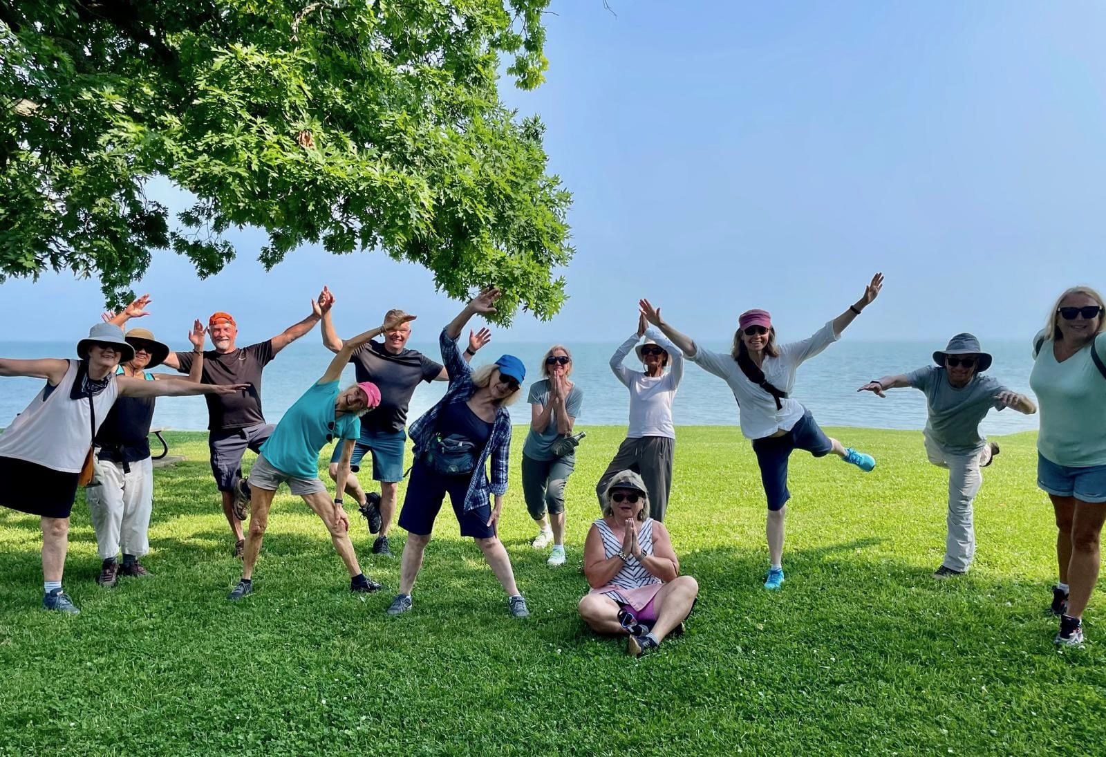
9:00 am Niagara on the Lake Tour & Some Yoga
https://hikes.brucetrail.org/event/900-am-niagara-on-the-lake-tour-some-yoga-27/Sorry, the registration cut-off time for this hike has been reached.Not a member? Click here to join today!Hosting Club: Niagara
Category: Urban
Location (Google Maps):Veteran’s Memorial Park, park just outside the park on King St.
Hike Leader(s): Robin Garrett Click here to contact Hike Leader(s)
Pace: Leisurely <3 km/hr
Distance: 5 km
Description
- Enjoy the benefits of pausing for a yoga practice as we tour through the trails, parkland and Historic Niagara-on-the-Lake. No mat required. Movement will focus on a flow of standing poses designed especially for hikers. Plan to stay for conversation and a warm cup of coffee or tea at Sweets & Swirls, Community Centre, Niagara Stone Road, NOTL.
- 01August 1, 2026
Hollad River Trail Aurora 250
https://hikes.brucetrail.org/event/car-hike-hollad-river-trail-2/Sorry, the registration cut-off time for this hike has been reached.Not a member? Click here to join today!Hosting Club: Toronto
Location (Google Maps): We start the hike from Evans park ,you may park along benville cres off Bayview
Hike Leader(s): MOHAMMAD AGHAMIRI Click here to contact Hike Leader(s)
Pace: Moderate (3-4 km/hr)
Terrain: Level 2 (Intermediate – some hills and uneven surfaces, rocks and roots underfoot), Variable
Distance (km): 14-15 kmDescription
We start the hike from Evans park ,walking north along Holland River , passingheppard’s Bush Conservation Area to Newmarket trails and return
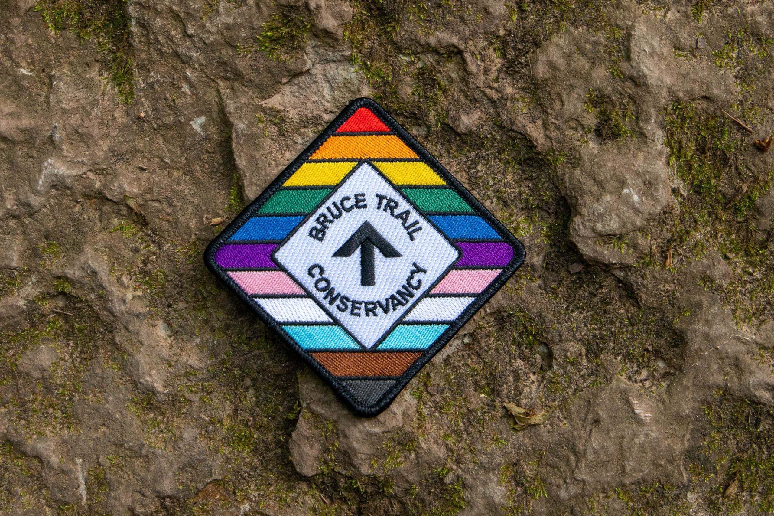
Rainbow/Welcome Hike: Rockway Conservation Area
https://hikes.brucetrail.org/event/rainbow-welcome-hike-rockway-conservation-area/Sorry, the registration cut-off time for this hike has been reached.Not a member? Click here to join today!Hosting Club: Niagara
Category: Rainbow 🌈
Location (Google Maps): Park at entrance to Rockway Conservation Area
https://maps.app.goo.gl/ruG1zRQzzJdtBp1y8Hike Leader(s): Angela Lytle Click here to contact Hike Leader(s)
Pace: Leisurely <3 km/hr
Terrain: Moderate: some hills and some poor footing
Distance: 5 kmDescription
Join the Niagara Bruce Trail Club, Bridges Niagara Immigrant and Refugee Services and PFLAG Niagara for a Rainbow-Welcome Hike at Rockway Conservation Area!What is a Rainbow-Welcome Hike?
These hikes aim to bring 2S-LGBTQIA+ newcomers together with other newcomers and community members, friends and allies to enjoy nature and connect to the land and enjoy nature in all seasons.
It is an intentionally affirming space for people of diverse backgrounds and identities with a focus on 2S-LGBTQIA+ inclusion. Everyone is welcome.
Hike Details
Route: This hike starts at the parking lot at Rockway Conservation Area. We will hike along the Bruce Trail towards Louth and then loop back to Rockway and take the waterfall side trail.
Terrain: Rockway has some hills, ups and downs in a mostly forested setting. We will adjust the pace to the group but be prepared for some rocky or uneven footing and climbing up and down. We recommend using hiking poles. Wearing good hiking shoes is a must. Carry water, wear a hat and insect repellent – mosquito season is underway. We will take a break at the lower falls – bring a snack or maybe some to share!
The hike goes ahead rain or shine unless there are dangerous weather conditions – the hike leader will contact you by email if anything changes.
***Please arrive by 9:50 to check in with the hike leaders for departure right at 10 am.
Lions Head, 1 of 3
https://hikes.brucetrail.org/event/lions-head-1-of-3/Sorry, the registration cut-off time for this hike has been reached.Not a member? Click here to join today!Hosting Club: Toronto, Peninsula
Category: Car Hike
Location (Google Maps): Lions Head, Map 39Hike Leader(s): Alex Brown Click here to contact Hike Leader(s)
Pace: Moderate (3-4 km/hr)
Terrain: Level 2 (Intermediate – some hills and uneven surfaces, rocks and roots underfoot), Variable
Distance (km): 12Description
This is the first of six hikes from Lions Head to Tobermory to be conducted over two weekends. The first series is named Lions Head. The second will be named Tobermory. The first hike in each series will be about 12 km. Follow on hikes will vary in length depending on group wishes.We will begin the series at km 87.2 at the parking area and car pool to km 98.4. This section of the trail follows the escarpment north over variable rocky sections. After the hike we will meet for refreshments and to confirm arrangements for the following day. Details TBA.
Given the distance it is anticipated that hikers coming from the Toronto area will find accommodation locally. I understand that options range from camping to hotels. More to follow on this subject as well. Those joining the hikes are asked to confirm their personal arrangements with me.
Accommodations may be found online. One such link is:
https://r.search.yahoo.com/_ylt=AwrEm6iP_i9qygIA1WXrFAx.;_ylu=Y29sbwNiZjEEcG9zAzEEdnRpZAMEc2VjA3Ny/RV=2/RE=1782739856/RO=10/RU=https%3a%2f%2fvisitbrucepeninsula.ca%2fwhere-to-stay%2f/RK=2/RS=4WcNI2n_eESb5ZTLRBvj7qtmFn4-
Al
Urban Walk: Windsfield Farm Park /Wilket Creek/ET Seton Park to Leaside
https://hikes.brucetrail.org/event/urban-walk-windsfield-farm-park-wilket-creek-et-seton-park-to-leaside/Sorry, the registration cut-off time for this hike has been reached.Not a member? Click here to join today!Hosting Club: Toronto
Category: Urban Walk
Location (Google Maps):Meet on the Southeast corner of Bayview and York Mills in front of the arena (a short ride on the York Mills 95 Bus from York Mills Station)
Hike Leader(s): Tom Swales Click here to contact Hike Leader(s)
Pace: Moderate (3-4 km/hr)
Terrain: Level 2 (Intermediate – some hills and uneven surfaces, rocks and roots underfoot), Variable
Distance (km): 12 kmDescription
We’ll hike south through Windsfield Farm Park, on Banbury Road, the Don Mills Trail, stop for lunch at Edwards Gardens, then south through Wilket Creek Park. Finishing through Serena Gundy Park the hike will end near Laird Station on Line 5.