Hike Schedule
Join us for a hike! Registration required:
All hikes available to BTC members. Some hikes are open to non-members.
TIP: The calendar view displays up to 7 hikes on a day, but often there are more. Click “More events” to see them all.
Categories
- 29June 29, 2025
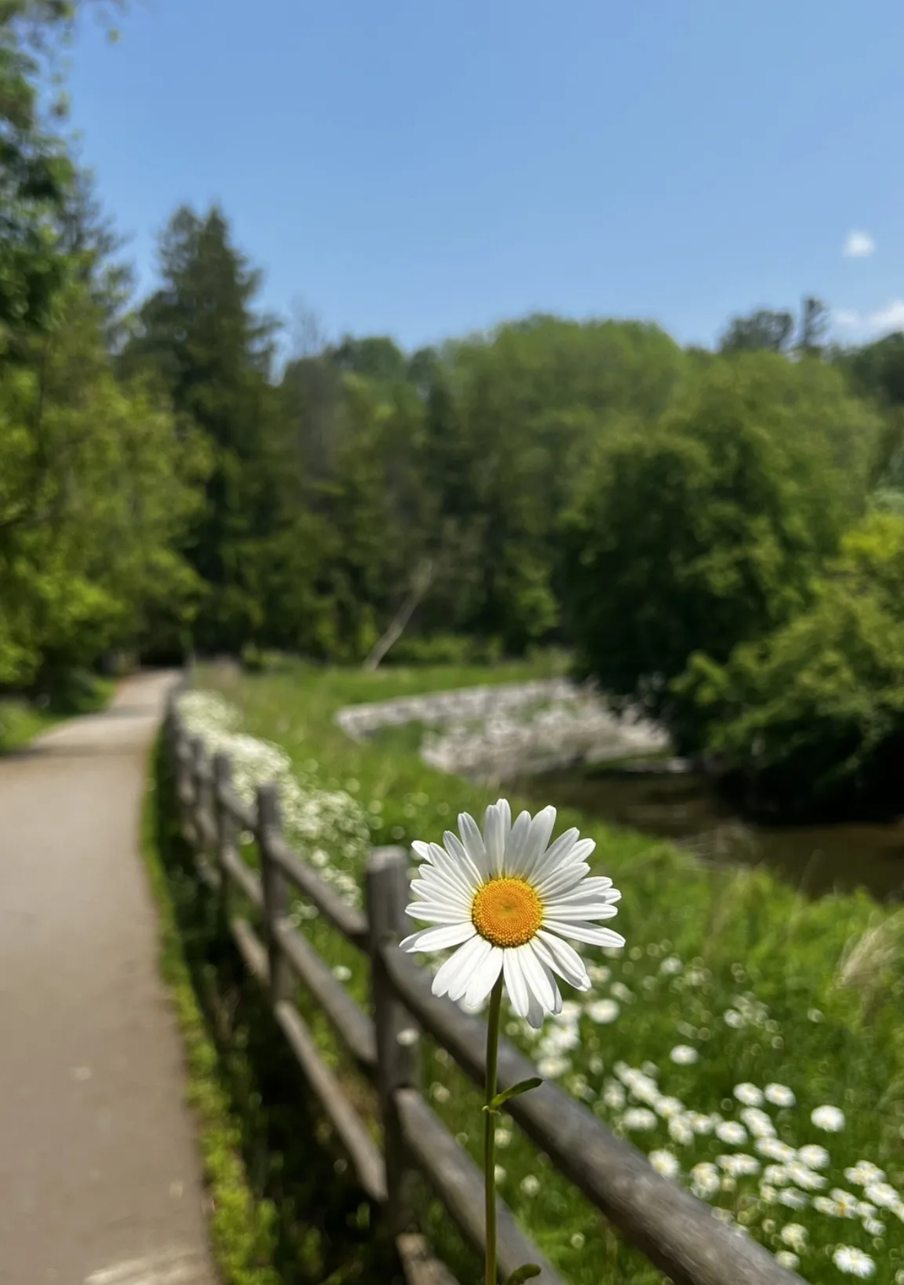
Walking Within: Nature’s Meditation Walk.
https://hikes.brucetrail.org/event/walking-within-natures-meditation-wal/Sorry, the registration cut-off time for this hike has been reached.Not a member? Click here to join today!Hosting Club: Niagara, Toronto
Category: Event Hikes
Location (Google Maps): 390 Morningside Ave, Scarborough, ON M1EHike Leader(s): Mehrnoush Ahmadi Click here to contact Hike Leader(s)
Pace: Leisurely
Terrain: Easy
Distance: ~7 kmDescription
Take a mindful break from daily life and immerse yourself in nature during this 3-hour guided meditation walk. Through gentle movement, breathwork, and stillness, we will reconnect with the present moment and the natural world around us.The experience includes a slow, intentional walk with guided breathing exercises, sensory awareness practices, and a 30-minute silent forest sitting meditation to ground and restore. Behrang, an experienced hiker and psychotherapist, will be accompanying us on this mindful journey.
No prior meditation experience is needed. Please wear comfortable shoes, dress for the weather, and bring water and a cushion or mat for sitting, if you wish.
Car Hike: Jefferson Forest and Bond Lake
https://hikes.brucetrail.org/event/car-hike-jefferson-forest-and-bond-lake-5/Sorry, the registration cut-off time for this hike has been reached.Not a member? Click here to join today!Hosting Club: Toronto
Category: Car Hike
Location (Google Maps):1245 Bethesda Side Rd, Richmond Hill, ON L4E 1A2 ( Bethesda Trail Head Parking lot)
Hike Leader(s): Amir Alemohammad Click here to contact Hike Leader(s)
Pace: Moderate (3-4 km/hr)
Terrain: Flat, Hilly, Level 2 (Intermediate – some hills and uneven surfaces, rocks and roots underfoot), Variable
Distance: 12-14 kmDescription
Join us for a wonderful hike in Jefferson Forest and have a snack/lunch beside the Bond Lake. We will hike among tall trees and bushes of the Jefferson Forest and across the Bayview-Yonge corridor to reach to the Bond Lake. Boots mandatory, poles recommended, bring at least 2L of water, bug spray, sunscreen, snack/lunch and dress according to the weather conditions. Please avoid parking along the road. Difficulty Level: 2 (Moderate)Please arrive @7:50 AM for start of 8:00AM.
This is a joint hike with the Oak Ridges Trail Association (ORTA).
PBTC Fen Hike: Wildflowers
https://hikes.brucetrail.org/event/pbtc-fen-hike-wildflowers/Sorry, the registration cut-off time for this hike has been reached.Not a member? Click here to join today!Hosting Club: Sydenham, Peninsula
Category: Botany Hike
Location (Google Maps): Oliphant Fen, north entrance to the Lorraine Brown Boardwalk.Hike Leader(s): Jeannine Kralt Click here to contact Hike Leader(s)
Pace: Leisurely: 3 km/h or less
Terrain: Easy: Mostly flat and good footing.Description
Come spend the morning with PBTC Hike Leader Jeannine on a leisurely outing exploring the botany and geology of the fens of the Lake Huron side of the Saugeen Bruce Peninsula. Participants will start at Oliphant and convoy to Petrel Point. A great opportunity to work on PBTC’s Orchid badge!
Duncan Escarpment Provincial Park
https://hikes.brucetrail.org/event/duncan-escarpment-provincial-park-2/Sorry, the registration cut-off time for this hike has been reached.Not a member? Click here to join today!Hosting Club: Iroquoia, Beaver Valley
Category: General Hike
Location (Google Maps): Duncan Escarpment Provincial Park – small parking lot on Side Road 9. If you would like to carpool from Mississauga, please contact the Hike Leader.Hike Leader(s): Karen Bergmann Click here to contact Hike Leader(s)
Pace: Medium – 3 to 4 km/hr
Terrain: Strenuous – Hilly with steep climbs and some poor footing
Distance: 11 kmsDescription
Time for an adventure in the Beaver Valley section! This loop hike is challenging and so rewarding! Takes about 2 hours drive from the GTA. We’ll hike on the main trail and a couple of side trails in a loop. There are hilly parts and plenty of rocks and roots. Bring water and a snack/lunch. If you would like to carpool from Mississauga, I am happy to have a few people ride with me. I will send an email a couple of days prior to the hike.
Urban Walk: Toronto Urban Badge Hike - 7 of 7
https://hikes.brucetrail.org/event/urban-walk-toronto-urban-badge-hike-7-of-7-2/Sorry, the registration cut-off time for this hike has been reached.Not a member? Click here to join today!Hosting Club: Toronto
Category: Urban Walk
Location (Google Maps): Don River/Bayview Extension TrailsHike Leader(s): Brian Rideout Click here to contact Hike Leader(s)
Pace: Moderate (3-4 km/hr)
Terrain: Flat
Distance: 9 kmDescription
Please join me at the south east corner of Overlea Blvd and Don Mills Rd by 10 AM. We will hike south on the Don Trail to the Distillery District (km 62.4 to km 71.4). Here is an online map with km markings of our route for all 7 hikes for the Toronto Urban Badge: https://onthegomap.com/s/c2c1hf3nPlease make sure you bring at least 2 liters of water, a lunch, bug spray and sunscreen.
Urban Walk: High Park and Toronto Waterfront Trail
https://hikes.brucetrail.org/event/urban-walk-high-park-and-toronto-waterfront-trail-5/Sorry, the registration cut-off time for this hike has been reached.Not a member? Click here to join today!Hosting Club: Toronto
Category: Urban Walk
Location (Google Maps):High Park Subway Station Street Level (East Exit – High Park Avenue (by the bus loop)
Hike Leader(s): Tom Swales Click here to contact Hike Leader(s)
Pace: Moderate (3-4 km/hr)
Terrain: Flat, Variable, Level 1 (Easy – mostly on flat, well maintained trails with hard-packed surface)
Distance: 10 KMDescription
Join us for a moderately paced hike through High Park and then east along Toronto’s Waterfront Trail to Harbourfront Centre passing though many small parks including the Music Garden. Optional pub stop near Union Station. Bring lunch and drinking water. Dropout any time.Exploring Sydenham Hike #25
https://hikes.brucetrail.org/event/exploring-sydenham-hike-25/Sorry, the registration cut-off time for this hike has been reached.Not a member? Click here to join today!Hosting Club: Sydenham
Category: General Hike
Location (Google Maps):Meet in the gravel parking lot to the north (left) just after crossing the Sydenham river bridge in Harrison Park near the inn.
Hike Leader(s): Bill Snel Click here to contact Hike Leader(s)
Pace: Leisurely: 3 km/h or less
Terrain: Moderate: Some hills and/or poor footing, Strenuous: Hilly with steep climbs and some poor footing.
Distance: 10 kmDescription
We will do a loop hike from Harrison Park not Inglis Falls as suggested in the book. This is hike 25 in the book Exploring Sydenham. There will be one secret to find. If you do not have a book and would like one ($30) let me know by using the “Contact hike leader” link. - 30June 30, 2025No events
- 01July 1, 2025
8:00 Long Hike Wiley Road Short Hills
https://hikes.brucetrail.org/event/800-long-hike-wiley-road-short-hills-2/Sorry, the registration cut-off time for this hike has been reached.Not a member? Click here to join today!Hosting Club: Niagara
Category: Loop
Location (Google Maps):Short Hills Wiley Road Entrance
Hike Leader(s): Alan Laver Click here to contact Hike Leader(s)
Pace: Medium
Terrain: Moderate
Distance: 10kmDescription
Explore Short Hills and the majestic side trails of Scarlett Tanager, Hemlock. Swayze Falls and Terrace. Register for each hikeBring Poles, Sun Screen Bug Spray, snack, and dress for the weather

9:15 Short Hike - Short Hills Park, Pelham Rd
https://hikes.brucetrail.org/event/915-short-hike-short-hills-park-pelham-rd-22/Sorry, the registration cut-off time for this hike has been reached.Not a member? Click here to join today!Hosting Club: Niagara
Category: Hike
Location (Google Maps): Short Hills Provincial Park, Pelham Rd lot, St. CatharinesHike Leader(s): Debbie Demizio Click here to contact Hike Leader(s)
Pace: Medium
Terrain: Moderate
Distance: ~ 6kmsDescription
Happy Canada Day! Wear red/white. Hike the main and side trails in Shorthills Provincial Park. Please wear hiking boots, bring water and insect repellant. Check yourself for ticks following the hike.
Car Hike: Rainbow Ramble at Silver Creek
https://hikes.brucetrail.org/event/car-hike-rainbow-ramble-at-silver-creek/Sorry, the registration cut-off time for this hike has been reached.Not a member? Click here to join today!Hosting Club: Toronto
Category: Car Hike
Location (Google Maps): We will meet at the parking lot of Silver Creek Outdoor Education Centre (13500 Fallbrook Trail, Georgetown; coordinates are 43.692615, -79.968433).Hike Leader(s): Monica Pasquali Click here to contact Hike Leader(s)
Pace: Leisurely (2-3 km/hr)
Terrain: Level 2 (Intermediate – some hills and uneven surfaces, rocks and roots underfoot)
Distance: 6 km, with the option to drop out at 3 kmDescription
This hike is a safe space for 2SLGBTQIA+ folx and allies – everyone is invited to join in on the fun!Celebrate Pride at the stunning Silver Creek Conservation Area!
We will begin by hiking a 3 km loop that includes the main trail and Roberts Side Trail: we will walk north along the main trail, climbing the escarpment and enjoying excellent views along the way, and then we will turn around and walk back south going downhill via the Roberts Side Trail where we will pause on the boardwalk by a shallow pond in order to (hopefully!) spot some interesting wildlife. For those who would like to extend their hike by an additional 3 km, they can join us as we head south along the main trail, descending and ascending some rocky hills, using bridges to cross over Owl Creek and Snow’s Creek, stopping to admire little Snow’s Creek Falls on Eighth Line, and then heading back to our parked cars by walking along quiet, rural 27 Sideroad.
For those hikers who also enjoy playing games, I will have a rainbow-themed scavenger hunt prepared, including a small prize for participants who are able to complete the scavenger hunt!
Everyone who participates in this hike will receive a FREE Pride Badge from the Bruce Trail Conservancy as well as a sweet rainbow treat from me!
You should bring enough water and food for a 3-hour hike that is hiked at a leisurely average pace of about 2 km/h, comfortable hiking shoes, sun and bug protection, and appropriate clothing for the weather.
Looking forward to hiking with you on July 1st – see you then!
Urban Walk: East York Canada Day celebration ( eycdc.ca )
https://hikes.brucetrail.org/event/urban-walk-east-york-canada-day-celebration-eycdc-ca/Sorry, the registration cut-off time for this hike has been reached.Not a member? Click here to join today!Hosting Club: Toronto
Category: Urban Walk
Location (Google Maps): Meet at Warden subway station ticket collector.
Hike endpoint is Stan Wadlow Park where East York will be celebrating Canada Day 2025 with fireworks at end of day.Hike Leader(s): Ray Berzins Click here to contact Hike Leader(s)
Pace: Moderate (3-4 km/hr)
Terrain: Flat, Level 1 (Easy – mostly on flat, well maintained trails with hard-packed surface)
Distance: 6 kmDescription
Live music, food and fireworks at end of hike to celebrate Canada Day 2025.(Unrelated to this hike is the East York Canada Day Parade at 10:30 AM from Dieppe Park in which everyone can participate and arrive by Noon.)
See eycdc.cak
- 02July 2, 2025
8:30 Queenston Heights
https://hikes.brucetrail.org/event/830-queenston-heights/Sorry, the registration cut-off time for this hike has been reached.Not a member? Click here to join today!Hosting Club: Niagara
Category: In and Out
Location (Google Maps):Locus Grove Picnic Area. Free parking.
Hike Leader(s): Suzanne Gourluck Click here to contact Hike Leader(s)
Pace: Medium
Terrain: Moderate
Distance: 10 kmDescription
Let’s hike the main trail and around some side trails from Locust Grove Picnic Area. This may involve ascending the escarpment depending on the route we take, but we will take it slowly. Dress for the weather and bring poles, water and a snack.Craigleith Community Centre
https://hikes.brucetrail.org/event/craigleith-community-centre-2/Sorry, the registration cut-off time for this hike has been reached.Not a member? Click here to join today!Hosting Club: Blue Mountains
Category: Organized Hike
Location (Google Maps): Tim Horton’s, First Street, CollingwoodHike Leader(s): David Little Click here to contact Hike Leader(s)
Pace: Leisurely – 3 km/hr. or less
Terrain: Easy – Mostly flat and usually good footing
Distance: 5kmDescription
We will follow the Georgian Trail past former Railway Station to the Nippising Ridge Trail and return. This is an easy hike with lots of opportunities to recall the history of Craigleith.WEDNESDAY WALKERS - Fox Ridge
https://hikes.brucetrail.org/event/wednesday-walkers-fox-ridge-3/Sorry, the registration cut-off time for this hike has been reached.Not a member? Click here to join today!Hosting Club: Beaver Valley
Location (Google Maps): Meet at the end of Fox Ridge Road where there is official parking, km 39.3 Map 25, Edition 31. We will take a couple vehicles to the start of our hike at Km 37.9 on Fox Ridge Road.
Hike Leader(s): Margaret Yaraskavitch Click here to contact the hike leader.
Pace: Medium
Terrain: Moderate
Length of Hike: 5 kmDescription
Our hike begins by walking through a hedgerow. Then we walk through a forested area and across some small streams. The Trail opens up to meadow with some views into the Valley. We’ll be experiencing land that was a fairly recent BTC land acquisition. On our return we will be walking along the pleasant Fox Ridge Road.- Arrive 15 minutes before the start of the hike.
- Wear sturdy footwear and appropriate attire for the weather and the terrain.
Hiking poles are a good idea in any season, especially if the terrain is rocky or slippery. In winter, snowshoes or icers/crampons are needed when conditions dictate.
Wearing appropriate clothing and footwear prevents injuries and shows consideration for a safe and positive group hiking experience. - Always carry I.D. and your health card.
- Bring sufficient water and snacks (or lunch if indicated). A minimum of 1L of water is recommended on all hikes, and 3L is recommended for long, challenging hikes in the heat of the summer.
- Bring sunscreen and insect repellent (for spring and summer hikes).
- Bring your own first aid kit.
- Please leave dogs at home.
Port Colborne urban hike
https://hikes.brucetrail.org/event/port-colborne-urban-hike/Sorry, the registration cut-off time for this hike has been reached.Not a member? Click here to join today!Hosting Club: Niagara
Category: Loop
Location (Google Maps): Port Colborne – Urban hikeHike Leader(s): Heather Howkins Click here to contact Hike Leader(s)
Pace: Leisurely
Terrain: Easy
Distance: 7kDescription
We will meet at the smokin Budda parking lot and hike along canal street as we explore Port Colborne. We will return via King Street and make a stop at the Museum to tour the historical buildings dated from mid 1800’s. This is a leisurely hike around town. Please bring Sun screen, bug spray and water.
At the end of the hike we will go to Smokin Budda for dinner for those that choose to join us.Evening Hike in Owen Sound followed by an Opportunity for Refreshments
https://hikes.brucetrail.org/event/evening-hike-in-owen-sound-followed-by-an-opportunity-for-refreshments-17/Sorry, the registration cut-off time for this hike has been reached.Not a member? Click here to join today!Hosting Club: Sydenham
Category: An evening walk.
Location (Google Maps): Meet in the municipal parking lot by the river on the west side of 1st Ave E between 7th St E and 8th St E in Owen SoundHike Leader(s): Harriet Nixon Click here to contact Hike Leader(s)
Terrain: Moderate: Some hills and/or poor footing
Distance: Approx 6 kmDescription
Join us for a brisk summer`s hike exploring Owen Sound trails and neighbourhoods, followed by an opportunity to socialize over refreshments. There is no need to show up 15 minutes early for this hike, but we will leave promptly at 7:00 pm. - 03July 3, 2025
8:00 am Long Hike Cave Spring Conservation Area
https://hikes.brucetrail.org/event/800-am-long-hike-cave-spring-conservation-area/Sorry, the registration cut-off time for this hike has been reached.Not a member? Click here to join today!Hosting Club: Niagara
Category: In and Out
Location (Google Maps):Cave Spring Conservation Area
Hike Leader(s): Alan Laver Click here to contact Hike Leader(s)
Pace: Medium
Terrain: Moderate
Distance: 10kDescription
This will be our permanent Thursday Location until Bridge repairs complete. From Cave Spring Conservation Area explore the trail network on the escarpment towards Kinsman Park and Moyer Road.You must register for each hike. Bring Poles, snack bug spray, sunscreen and a drink. Dress for the weather
Urban Walk: Valley View Park Thornhill 112
https://hikes.brucetrail.org/event/urban-walk-valley-view-park-thornhill-87/Sorry, the registration cut-off time for this hike has been reached.Not a member? Click here to join today!Hosting Club: Toronto
Location (Google Maps): Parking lot is inside Sycamore Drive East of Bayview , across Starbucks plaza
Hike Leader(s): Mohammad Aghamiri Click here to contact Hike Leader(s)
Pace: Moderate (3-4 km/hr)
Terrain: Hilly, Level 2 (Intermediate – some hills and uneven surfaces, rocks and roots underfoot)
Distance: 6-8 kmDescription
We will explore Valleyview and Maple View parks, and walk along German Mill Creak, in return we stop in Huntington park and have snack under beautiful shed ,Even it is considered Urban walk, it is urban hike as we have some up and down hills and tree roots, please bring your hiking poles, water and snacks,
phone number for the day of hike 289 588 6482
Jackson Cove Tree Hike
https://hikes.brucetrail.org/event/jackson-cove-tree-hike/Sorry, the registration cut-off time for this hike has been reached.Not a member? Click here to join today!Hosting Club: Sydenham, Peninsula
Category: Botany Hike
Location (Google Maps): Bruce Trail Parking Lot, Jackson CoveHike Leader(s): Jeannine Kralt Click here to contact Hike Leader(s)
Pace: Leisurely: 3 km/h or less
Terrain: Moderate: Some hills and/or poor footing
Distance: 4kmDescription
Join Jeannine on a walk through a fairly mature forest in Jackson Cove Nature Reserve and to lovely views of Georgian Bay. ID trees en route to work on your PBTC tree badge! Note that there is a moderate climb to a lookout and descent of the Escarpment en route.Hiking around Jordan and Balls Falls
https://hikes.brucetrail.org/event/hiking-around-jordan-and-balls-falls/Sorry, the registration cut-off time for this hike has been reached.Not a member? Click here to join today!Hosting Club: Niagara
Category: Hike
Location (Google Maps): Glen Road, JordanHike Leader(s): Bill Russell Click here to contact Hike Leader(s)
Pace: Medium
Terrain: Moderate
Distance: 6-7 kmDescription
Hiking from Glen Road and following Jim Rainforth Trail and trails to Balls Falls and Bailey Bridge - 04July 4, 2025
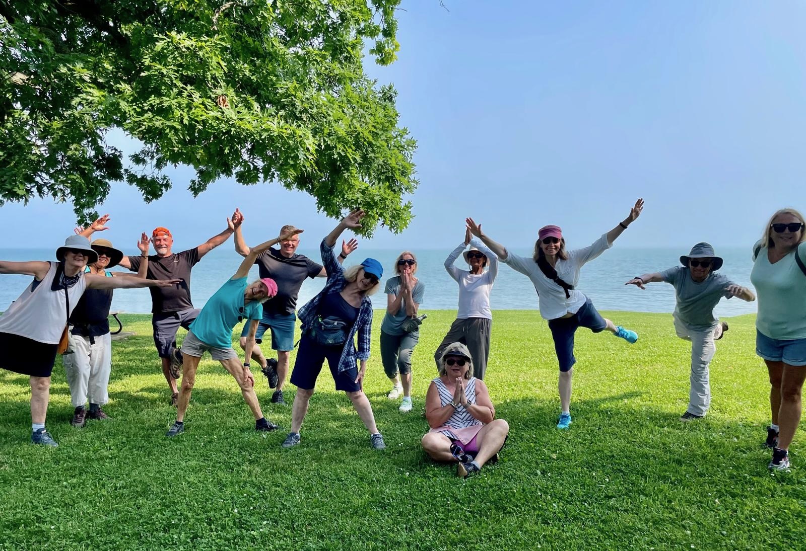
9:00 am Niagara on the Lake Tour & Some Yoga
https://hikes.brucetrail.org/event/900-am-niagara-on-the-lake-tour-some-yoga-2/Sorry, the registration cut-off time for this hike has been reached.Not a member? Click here to join today!Hosting Club: Niagara
Category: Urban
Location (Google Maps):Veteran’s Memorial Park, park just outside the park on King St.
Hike Leader(s): Robin Garrett Click here to contact Hike Leader(s)
Pace: Medium
Terrain: Easy
Distance: 6 kmDescription
Enjoy the benefits of pausing for a yoga practice as we tour through the trails, parkland and Historic Niagara-on-the-Lake. No mat required. Movement will focus on a flow of standing poses designed especially for hikers. Plan to stay for conversation and a warm cup of coffee or tea at Sweets & Swirls, Community Centre, Niagara Stone Road, NOTL.
Afternoon hike - Halton Agreement Forest - DATE CHANGE
https://hikes.brucetrail.org/event/afternoon-hike-halton-agreement-forest-7/Sorry, the registration cut-off time for this hike has been reached.Not a member? Click here to join today!Hosting Club: Iroquoia
Category: Afternoon/Evening Hikes
Location (Google Maps): Meet roadside at 4:15 pm on 10 Side Road, off Guelph Line, north of Campbelville.Hike Leader(s): Karen Bergmann Click here to contact Hike Leader(s)
Pace: Medium – 3 to 4 km/hr
Terrain: Moderate – Some hills and/or some poor footing
Distance: 6 kmsDescription
We will hike around the bike trails in this lovely Forest. Bring bug spray. - 05July 5, 2025
Car Hike: Bethesda Trail Richmond Hill
https://hikes.brucetrail.org/event/car-hike-bethesda-trail-richmond-hill-35/Sorry, the registration cut-off time for this hike has been reached.Not a member? Click here to join today!Hosting Club: Toronto
Category: Car Hike
Location (Google Maps): Meet at Bethesda Trail Head Parking on Bethesda Sideroad off Bayview Avenue, across from Lake Wilcox. This parking lot is free.Hike Leader(s): Mohammad Aghamiri Click here to contact Hike Leader(s)
Pace: Moderate (3-4 km/hr)
Terrain: Hilly, Level 2 (Intermediate – some hills and uneven surfaces, rocks and roots underfoot)
Distance: 14-15 kmDescription
Join us to explore the trails of York Regional Forest and the Oak Ridges Corridor at Jefferson Forest and Bond lake,From parking lot we hike thought Jefferson forest and continue to Bond Lake and have snack beside the lake and return to parking around 13 to 13.15
For the day of hike phone number 289 588 6482
Hike 1 Blue Mountain Series in 6 Hikes
https://hikes.brucetrail.org/event/hike-1-blue-mountain-series-in-6-hikes/Sorry, the registration cut-off time for this hike has been reached.Not a member? Click here to join today!Hosting Club: Dufferin Hi-Land
Category: General Hike
Location (Google Maps): Meet at Blue Mountain Km 14.1 Nottawasaga side Rd 9/10 road side parkingHike Leader(s): Patrcia Foley and Tristan Goguen Click here to contact Hike Leader(s)
Pace: Medium
Terrain: Moderate
Distance: 14.1 KmDescription
Hike 1: We will car pool back to the start of this hike from the cemetery parking in Lavender northbound to km 14.1 where the trail crosses Nottawasaga side road 9/10. Today’s hike will take us through the Noisy River Nature Reserve and up and along the Transcarioca Trail (Brazil)- Bruce Trail Friendship trail. We may encounter some muddy sections and will definitely be in open fields/roads for some time. Bug Spray, sunblock and sturdy hiking shoes/boots are recommended. Bring sufficient water and lunch. Note this is a car pool hike, registration is limited and the hike leaders will have 2 dogs with them.Beaver Valley Geology Hike Badge #2/8 Margaret Paull and Indian Brook
https://hikes.brucetrail.org/event/beaver-valley-geology-hike-badge-2-8-margaret-paull-and-indian-brook-2/Sorry, the registration cut-off time for this hike has been reached.Not a member? Click here to join today!Hosting Club: Blue Mountains
Category: Organized Hike
Location (Google Maps): Tim Horton’s, First Street, CollingwoodHike Leader(s): Annette Sandberg Click here to contact Hike Leader(s)
Pace: Leisurely – 3 km/hr. or less
Terrain: Easy – Mostly flat and usually good footing
Distance: 4.3 kmDescription
Flower ports are created by water that exploits cracks and eventually removes the material between the flowerpot and the main rock face. The water smooths and round the rock of the flowerpot. The flowerpots at Indian Brook were created several thousands of years ago when lake levels were significantly higher than they are today.
Queenston Loop
https://hikes.brucetrail.org/event/queenston-loop-2/Sorry, the registration cut-off time for this hike has been reached.Not a member? Click here to join today!Hosting Club: Niagara
Category: Loop
Location (Google Maps): Meet in Locust Grove Picnic area, across the roundabout from Queenston Heights ParkHike Leader(s): Margaret Northfield Click here to contact Hike Leader(s)
Pace: Medium
Terrain: Moderate
Distance: 9-10kmDescription
Hike the main trail of the Bruce Trail looping down the escarpment and up the switchback. We will be doing some sidetrails as well.Poles recommended.

Mono Cliffs Provincial Park Scenic Hike
https://hikes.brucetrail.org/event/mono-cliffs-provincial-park-scenic-hike/Sorry, the registration cut-off time for this hike has been reached.Not a member? Click here to join today!Hosting Club: Caledon Hills, Dufferin Hi-Land
Category: Nature Walks
Location (Google Maps): Mono Cliffs Provincial Park. Park in the gravel lot at the Mono Community Centre, 200 metres south of Mono Centre.Hike Leader(s): Priyantha (Pri) Amarasinghe Click here to contact Hike Leader(s)
Pace: Leisurely – 3 km/hour or less
Terrain: Moderate – some hills and/or some poor footing
Distance: 10.15 kmDescription
This loop hike is one of the more popular forest adventures in Mono Cliffs. Its trail system offers a great deal of diversity, featuring marshes, dry woods, ponds, and rolling hills that lead to several excellent viewpoints.Among the several trails within the park, we take on a combination of the most scenic sections, including the main Bruce Trail, the Clifftop Side Trail with stops at the wooden steps going down to the escarpment valley for pictures and walking back up, continue hiking further north to the Lookout deck for a good view of the plain below. Next stop is at Scenic Rock Cliffs/Jacobs Ladder (there are 45 steel steps to reach the bottom deck for beautiful rock cliff pictures, and go back up the same way). We then hike further north past McCarston’s Lake onto the Lookout Trail for a scenic view of the highest point in the park, at 507m/1607 ft, before joining the Walter Tovell Side Trail, from where we hike to the Carriage Side Trail towards the connector linking the South Outlier trail to bring us back to Mono Centre parking. Most of the path is a flat, grassy trail with a few rocky inclines.
Must haves: Good, well-broken hiking shoes, bug spray, a minimum of 2 liters of water, a lunch snack, personal hygiene stuff/garbage bag to carry any food waste/wrappings, and ideally a wide-brimmed sun hat or a cap to protect from the July heat. Trekking poles are recommended. Don’t forget the camera!
- Do not go to the Mono Cliff Provincial Park Parking lot on 3rd Line EHS, this is the wrong place
- Meet the hike leader at the Mono Centre parking lot, 15 minutes before start time.