Hike Schedule

Join us for a hike! Registration required:

All hikes available to BTC members. Some hikes are open to non-members.

Read hiker guidelines >

TIP: The calendar view displays up to 7 hikes on a day, but often there are more. Click “More events” to see them all.

Show Filters

Categories

Reset Filters
< 2024 >
May 26 - June 01
  • 26
    May 26, 2024

    Fundraiser Hike for the Stained Glass Badge

    9:00 AM-5:00 PM
    05/26/2024
    Sorry, the registration cut-off time for this hike has been reached.
    Not a member? Click here to join today!

    This is a Multi-Day Hike

    You are signing up for the following dates and times:

    2024-05-26 at 09:00
    2024-06-02 at 09:00
    2024-06-09 at 09:00

    Hosting Club: Iroquoia, Dufferin Hi-Land
    Category: General Hike
    Location (Google Maps): Mono Cliffs Provincial Park parking lot ( 3rd Line and regional Rd 8 to Boyne Valley Provincial Park parking lot ( Centre Rd and 5 Sideroad) – 19.3kms
    Boyne Valley Provincial Park parking lot ( Centre Rd and 5 Sideroad) to Kilgore Side Trail ( Prince of Wales Rd -Deadend) – 18.4kms
    Kilgore Side Trail ( Prince of Wales Rd -Deadend) to Mulmur-Nottawasaga Townline/Lavender Rd – 18.6kms

    Hike Leader(s): Anita Bergsma Click here to contact Hike Leader(s)

    Pace: Medium – 3 to 4 km/hr
    Terrain: Strenuous – Hilly with steep climbs and some poor footing
    Distance: 18ish per day

    Description

    Join us for this  3 day Dufferin-Hi End to End on May 26, June 2 and 9th 2024.  The hikes will be at a moderate pace 3-4km per hour. This is suitable for intermediate to advanced hikers.

    We will be using hiker’s vehicles to shuttle between to our start from our meeting point.

    Proper hiking boots is a must!  Bring hiking poles (if you use them), food, snacks, 2l of water, hat, sun screen, bug repellent, and rain gear. Please check the weather forecast each day before heading out.

    Arrive by 9:00 am to check in. Once everyone has arrived, we will proceed and drive to the starting point.

    Your fee includes the guidance and organization of a volunteer hike leader. I will try to make arrangements for everyone to receive their Yellow Lady Slipper End to End badge upon completion.

    If you must miss a day but can make it up before the last scheduled hike, you will still qualify for this special badge. This is a fundraising hike for the Bruce Trail Club. Proceeds go to the Dufferin-Hi Club to support the trail infrastructure and to the Bruce Trail Conservancy mission “Protecting this ribbon of wilderness, for every one, forever.”

    Please, no dogs or children.

    There are no refunds for this hike series. Please ensure you are physically capable of these distances before signing up for this hike.

    If you have any questions, please enquire to the hike leader through this form.

    10:00 Behind Brock

    10:00 AM-12:00 PM
    05/26/2024
    Sorry, the registration cut-off time for this hike has been reached.
    Not a member? Click here to join today!

    Hosting Club: Niagara
    Category: In and Out
    Location (Google Maps): Decew House on Decew Road

    Hike Leader(s): Sylvia Wheeler Click here to contact Hike Leader(s)

    Pace: Medium
    Terrain: Moderate
    Distance: 10 km

    Description

    Toronto Urban Badge Hike - 6 of 7

    10:00 AM-1:15 PM
    05/26/2024
    Sorry, the registration cut-off time for this hike has been reached.
    Not a member? Click here to join today!

    Hosting Club: Toronto
    Category: Urban Walk
    Location (Google Maps):

    Toronto, Ontario, Canada

    Hike Leader(s): Brian Rideout Click here to contact Hike Leader(s)

    Pace: Moderate
    Terrain: Flat
    Distance: 9 km

    Description

    Please join me at the south east corner of Sheppard Ave East and Leslie by 10 AM.  We will hike south through several parks to Don Mills (S of Overleigh) (km 51.7 to km 62.4).  Here is an online map with km markings of our route for all 7 hikes for the Toronto Urban Badge.

    Please make sure you bring at least 2 liters of water, a lunch, bug spray and sunscreen.

    Car Hike: Hike #5 to earn the Dufferin Hi-Land Youth and/or Side Trails Badge!

    10:00 AM-2:00 PM
    05/26/2024
    Sorry, the registration cut-off time for this hike has been reached.
    Not a member? Click here to join today!

    Hosting Club: Toronto, Caledon Hills, Dufferin Hi-Land
    Category: Car Hike
    Location (Google Maps): We will meet at roadside parking on 2nd Line EHS north of 20 Sideroad (Map 19 of the Bruce Trail Reference Guide, Edition 31).

    Hike Leader(s): Monica Pasquali Click here to contact Hike Leader(s)

    Pace: Leisurely
    Terrain: Variable
    Distance: 8.4 km

    Description

    Calling all families with children who love hiking and earning badges!!!

    This is the fifth in a series of ten hikes that will be offered throughout 2024 on a roughly monthly basis so that children who are 15 years of age and younger can earn the Dufferin Hi-Land Adventurer Youth Badge and their parents/guardians can earn the Dufferin Hi-Land Side Trails Badge at the same time!!!  Details regarding the requirements for each badge can be found here: https://dufferinbrucetrailclub.org/dufferin-bruce-trail-club-badges/  Each of the ten hikes will be a loop hike so no car shuttles will be needed, and each hike will cover a distance of approximately 6-9 km hiked at a leisurely pace (2-3 km/h) so children and adults alike can participate.

    This fifth hike will be a spring hike to explore some side trails within and south of Mono Cliffs Provincial Park, specifically the Carriage Side Trail, the Walter Tovell Side Trail, the Springwater Side Trail, the Turnbull Side Trail, and the Laidlaw Side Trail (these last three side trails are part of the Caledon Hills section of the Bruce Trail).  Please dress appropriately for a spring hike by dressing in layers (wear an inner layer that wicks sweat away from your skin, a middle layer that keeps you warm, and an outer layer that protects you from wind and rain), wearing a sunhat, and wearing comfortable footwear that has good traction.  Hiking poles or walking sticks are an asset since they will help keep you balanced if the ground is muddy/slippery.  As well, make sure you bring enough water and food for a 3-4 hour hike since we’ll be covering a total distance of approximately 8.4 km.

    Hopefully you’ll be able to join me on Sunday, May 26th!  Until then, happy hiking, everyone!

    Car Hike: Dufferin Hi-Lands 3 of 4

    10:00 AM-3:30 PM
    05/26/2024
    Sorry, the registration cut-off time for this hike has been reached.
    Not a member? Click here to join today!

    Hosting Club: Toronto, Dufferin Hi-Land
    Category: Car Hike
    Location (Google Maps): Dufferin Hi-Lands, Maps 20/21

    Hike Leader(s): Al Brown Click here to contact Hike Leader(s)

    Pace: Moderate
    Terrain: Variable
    Distance: 14 km

    Description

    We continue the end to end from Km 31.5 to 45.6. The trail passes through a mix of forest and farmland, crossing the Pine River at Kilgorie. This section has a few good hills.


    To get to the meeting point drive north on Hwy 10 to primrose. Continue north on County Road 19 (Prince of Wales Rd) to County Rd 17. Turn right and go about 1.5 km to the Whitfield cross road. There is a church and parking area at the north west corner of the intersection.

    12:00 International Hike

    12:00 PM-3:15 PM
    05/26/2024
    Sorry, the registration cut-off time for this hike has been reached.
    Not a member? Click here to join today!

    Hosting Club: Niagara
    Category: Loop
    Location (Google Maps): Meet at Floral Showhouse, Niagara Parkway

    Hike Leader(s): Margaret Northfield Click here to contact Hike Leader(s)

    Pace: Medium
    Terrain: Moderate
    Distance: 12 km

    Description

    Meet just north of the Falls on the Niagara Parkway in the Floral Showhouse parking lot.  (paid parking – look into Niagara Parks annual pass for a deal)

    Hike on both sides of the beautiful Niagara River.  Bring $1 cash to walk cross the Rainbow Bridge.   This hike usually takes 3 hours and has plenty of time for photos.  Allow for extra time due to bridge crossing and customs.  BRING A PASSPORT OF NEXUS CARD TO GO THROUGH CUSTOMS.

    Bring water and a snack.

    Exploring Sydenham hikes 4, 5 & 6

    1:30 PM-4:30 PM
    05/26/2024
    Sorry, the registration cut-off time for this hike has been reached.
    Not a member? Click here to join today!

    Hosting Club: Sydenham
    Category: General Hike
    Location (Google Maps):

    Meet in the north-east corner of the parking lot at Home Depot on Highway 26 on the east side of Owen Sound.

    Hike Leader(s): Bill Snel Click here to contact Hike Leader(s)

    Pace: Leisurely: 3 km/h or less
    Terrain: Moderate: Some hills and/or poor footing, Strenuous: Hilly with steep climbs and some poor footing.
    Distance: ~5 km

    Description

    We will carpool to do a loop hike of 3 of the Silent Valley trails. This will be hikes 4, 5 & 6 in the book Exploring Sydenham.

  • 27
    May 27, 2024
    No events
  • 28
    May 28, 2024

    NEW TIME 8:00 Long Hike Wiley Road Short Hills

    8:00 AM-10:30 AM
    05/28/2024
    Sorry, the registration cut-off time for this hike has been reached.
    Not a member? Click here to join today!

    Hosting Club: Niagara

    Location (Google Maps):

    Short Hills Wiley Road Entrance

    Hike Leader(s): Alan Laver

    Pace: Medium
    Terrain: Moderate
    10km

    Description

    Explore Short Hills and the majestic side trails of Scarlett Tanager, Hemlock. Swayze Falls and Terrace. Register for each hike

    Bring Poles bug spray water, snack, and dress for the weather

    Summer Fen Series: Oliphant Fen & Petrel Point

    9:00 AM-12:30 PM
    05/28/2024
    Sorry, the registration cut-off time for this hike has been reached.
    Not a member? Click here to join today!

    Hosting Club: Sydenham, Peninsula
    Category: Botany Hike
    Location (Google Maps): Oliphant Fen – North Entrance to Lorraine Brown Boardwalk

    Hike Leader(s): Jeannine Kralt Click here to contact Hike Leader(s)

    Pace: Leisurely: 3 km/h or less
    Terrain: Easy: Mostly flat and good footing.
    Distance: 3km

    Description

    Join the Sydenham and Peninsula Bruce Trail Clubs for a hike series focusing on fens. Fens are unique coastal wetlands occurring along the escarpment, meadow marshes that have conditions that are favourable for a variety of interesting species including orchids.

    This easy hiking series will begin at Oliphant Fen, with a participant carpool to Petrel Point, returning to Oliphant thereafter. Observations count towards the PBTC Orchid Badge.

    Come to one of the hikes or several to see how the fens change through the seasons. Carpooling encouraged – contact the hike leader if you are in need of a ride (no guarantees, but attempts will be made to help coordinate). Please plan to arrive 15 minutes in advance of the hike start time.

    Please contact Jeannine, the hike leader, if you have any questions or concerns (link on this page).

    9:15 Short Hike - Short Hills Park, Pelham Rd

    9:15 AM-10:45 AM
    05/28/2024
    Sorry, the registration cut-off time for this hike has been reached.
    Not a member? Click here to join today!

    Hosting Club: Niagara
    Category: Hike
    Location (Google Maps): Short Hills Provincial Park, Pelham Rd lot

    Hike Leader(s): Debbie Demizio Click here to contact Hike Leader(s)

    Pace: Medium
    Terrain: Moderate
    Distance: ~ 6kms

    Description

    Hike the main and side trails in Short Hills Provincial Park. Bring hiking boots, water, sunscreen and bug spray.

    Halton Regional Forest

    9:30 AM-2:30 PM
    05/28/2024
    Sorry, the registration cut-off time for this hike has been reached.
    Not a member? Click here to join today!

    Hosting Club: Caledon Hills
    Category: Tuesday Hikers
    Location (Google Maps): Parking at: 10 Side Road and 4th Line Nassagaweya (trail entrance to Halton Regional Forest).
    From Highway 401 West, turn right (north) on Guelph Line, right on 10 Side Rd. The road bends northwards and becomes 4th Line Nassagaweya; roadside parking at the bend.

    Hike Leader(s): Mohammad Shafiq Click here to contact Hike Leader(s)

    Pace: Medium – 3 to 4 km/hour
    Terrain: Moderate – some hills and/or some poor footing
    Distance: 12 km

    Description

    Will hike trails in Halton Regional Forest and Hilton Falls Conservation Area; beautiful and winding trails are relatively flat with some rocky parts. Snack break at Hilton Falls, possibly around fire pit.
    Bring water and snack of your choice.
    Dress according to weather, poles are recommended, bring sunscreen and bugs spray.
    Hike leader cell phone: 416-566-0503 (note that reception in hiking area is usually poor, leave a messages to callback).

    60 for the 60th Anniversary Badge Hike Series - #4 of 10

    10:00 AM-12:00 PM
    05/28/2024
    Sorry, the registration cut-off time for this hike has been reached.
    Not a member? Click here to join today!

    Hosting Club: Caledon Hills
    Category: General
    Location (Google Maps): Roadside parking on the south side of Dunby Rd. at the trail entrance; km 67.8, Map 18. On Hockley Rd. turn left (north) on the 3rd Line to Dunby Rd.

    Hike Leader(s): Louise Carberry 905-699-7523 Click here to contact Hike Leader(s)

    Pace: Leisurely – 3 km/hour or less
    Terrain: Moderate – some hills and/or some poor footing
    Distance: 6 km

    Description

    Join Louise, Marilyn and Joyce on this 2 hour, 6 km hike which is the 4th in the series of hikes for the new “60 for the 60th Anniversary” badge. We will hike south through the Hockley Valley Provincial Nature Reserve and back.  Hike one, a few, or all 10 hikes. Join any hike and make up the rest on your own as long as a record is kept of their hikes to submit on completion to obtain their badge. Participants who complete all 10 hikes will be eligible to purchase the “60 for the 60th” badge.
    Bring poles, and hydration.

  • 29
    May 29, 2024

    John Haigh Side Trail - Upper Pretty River

    9:00 AM
    05/29/2024
    Sorry, the registration cut-off time for this hike has been reached.
    Not a member? Click here to join today!

    Hosting Club: Blue Mountains
    Category: Register in person the morning of hike.
    Location (Google Maps): Hike meets in the parking lot behind Tim Hortons on First St. in Collingwood.

    Hike Leader(s): Flo Kusiak Click here to contact Hike Leader(s)

    Pace: Leisurely – 3 km/hr. or less, Medium – 3 to 4 km/hr
    Terrain: Moderate – Some hills and/or some poor footing
    Distance: 6 km

    Description

    We will drive to the junction of the 2nd Line and the 6th Sideroad, then commence a loop hike through the upper level of the Pretty River Provincial Park. Following the John Haigh Side Trail, we will hike south to join the white blazed trail, then head north to km 52.6. From here we will head west along the 6th Sideroad back to the cars. Bring a snack and water.

    WEDNESDAY WALKERS - East of Kolapore

    9:30 AM-11:30 AM
    05/29/2024
    Sorry, the registration cut-off time for this hike has been reached.
    Not a member? Click here to join today!

    Hosting Club: Beaver Valley

    Location (Google Maps): Park in the Kolapore parking lot, near Km 27.9, Map 25, Edition 31, for a car shuttle to the start of our hike.

    Hike Leader(s): Margaret Yaraskavitch Click here to contact the hike leader.

    Pace: Medium
    Terrain: Moderate
    Length of Hike: 4.7 kms + 650 m of road

    Description

    We will walk south from 12th Sideroad and as we walk through deciduous forest, we’ll cross a piece of history, remnants of The Old Mail Road.  We continue south, crossing Grey Road 19, through property that is managed by the BTC, until we return to our cars. Please bring water and a snack.

    COVID-19 Precautions Before, During and After your Hike

    1. Each hiker joining a Bruce Trail Club organized hike must perform a self-screening check before hiking.
      Find Ontario’s self-assessment tool here: https://covid-19.ontario.ca/self-assessment/
    2. If you are experiencing COVID-19 symptoms, stay home.

    Other Guidelines

    1. Arrive 15 minutes before the start of the hike.
    2. Wear sturdy footwear and appropriate attire for the weather and the terrain.
      Hiking poles are a good idea in any season, especially if the terrain is rocky or slippery. In winter, snowshoes or icers/crampons are needed when conditions dictate.
      Wearing appropriate clothing and footwear prevents injuries and shows consideration for a safe and positive group hiking experience.
    3. Always carry I.D. and your health card.
    4. Bring sufficient water and snacks (or lunch if indicated). A minimum of 1L of water is recommended on all hikes, and 3L is recommended for long, challenging hikes in the heat of the summer.
    5. Bring sunscreen and insect repellent (for spring and summer hikes).
    6. Bring your own first aid kit.
    7. Please leave dogs at home.

    Good Companions - Dundas Driving Park to Tews Falls and Return

    10:00 AM-12:30 PM
    05/29/2024
    Sorry, the registration cut-off time for this hike has been reached.
    Not a member? Click here to join today!

    Hosting Club: Iroquoia
    Category: Good Companions
    Location (Google Maps):

    Dundas Driving Park – Main parking area – See map below

    Hike Leader(s): Ted Bossence Click here to contact Hike Leader(s)

    Pace: Medium – 3 to 4 km/hr
    Terrain: Strenuous – Hilly with steep climbs and some poor footing
    Distance: 7.5 km

    Description

    We will walk, following city streets, to the Tews Falls Side trail.  We will ascend the escarpment and onwards to view Tews Falls.  We will then return with a stop at the Dundas Peak Viewpoint and retrace our steps back to the Dundas Driving Park.  Bring water, sunscreen, bug repellant and a snack.  Hiking poles recommended.  Please arrive at the car park by 9:45 am in order to be walking by 10:00 am.  I will send contact info a day or two before the hike with contact info should you need to cancel after 4:00 pm on Tuesday May 28.  I will inform you if the hike is cancelled due to rain.  Please check your email the evening before the hike.

  • 30
    May 30, 2024

    NEW TIME 8:00 am Long Hike Jordan to Moyer / Louth

    8:00 AM-10:30 AM
    05/30/2024
    Sorry, the registration cut-off time for this hike has been reached.
    Not a member? Click here to join today!

    Hosting Club: Niagara

    Location (Google Maps):

    Jordan Hollow Park 3039 King St Jordan

    Hike Leader(s): Alan Laver Click here to contact Hike Leader(s)

    Pace: Medium
    Terrain: Moderate
    Distance: 10k

    Description

    From Jordan Hollow Hike the main trail to Upper and Lower Balls Falls, Moyer Road or Louth and Return. You must register for each hike. Bring Poles, sunscreen, bug spray , snack and a drink and dress for the weather

    9:15 Short Hike, Jordan Hollow

    9:15 AM-10:45 AM
    05/30/2024
    Sorry, the registration cut-off time for this hike has been reached.
    Not a member? Click here to join today!

    Hosting Club: Niagara
    Category: Hike
    Location (Google Maps): Jordan Hollow Park, Jordan Station

    Hike Leader(s): Bill Russell Click here to contact Hike Leader(s)

    Pace: Medium
    Terrain: Strenuous
    Distance: 6k

    Description

    Hike the main and side trails around Jordan and Balls Falls. Bring hiking boots, water, sunscreen and bug spray.

    Beaver Valley End-to-End Hike 6 of 9

    9:15 AM-2:00 PM
    05/30/2024
    Sorry, the registration cut-off time for this hike has been reached.
    Not a member? Click here to join today!

    Hosting Club: Caledon Hills
    Category: End-to-End
    Location (Google Maps): Meet at 3rd Line off of Fox Ridge Rd. km 39.3, Map 27 (Ed. 31). Shuttle to start at Beaver Valley Lookout.

    Hike Leader(s): Nancy Mooney Click here to contact Hike Leader(s)

    Pace: Medium – 3 to 4 km/hour
    Terrain: Moderate – some hills and/or some poor footing, Strenuous – hilly with steep climbs and some poor footing
    Distance: 39.3 – 50.0 + 0.8 from parking = 11.5 km total

    Description

    This is the sixth hike in the series and includes Old Baldy Lookout and McCluskey’s Rock.

    Nature Seekers - Exploring the Hockleycrest Area

    9:30 AM-12:00 PM
    05/30/2024
    Sorry, the registration cut-off time for this hike has been reached.
    Not a member? Click here to join today!

    Hosting Club: Caledon Hills
    Category: Introductory
    Location (Google Maps): Meet at the Bruce Trail Parking Lot on Mono 5 Sideroad on the north side of the road where the Trail crosses. Google GPS Coordinates: 43.974055, -79.984988

    Directions: From Airport Road turn east onto 5 Sideroad and drive for 600 metres. The parking lot is on the left hand side.

    Hike Leader(s): Sandy Green Click here to contact Hike Leader(s)

    Pace: Leisurely – 3 km/hour or less
    Terrain: Moderate – some hills and/or some poor footing
    Distance: 5.5 kilometres

    Description

    Loop through the Hockleycrest area on main and side trails. Bring your choice of hydration and snacks. Sturdy footwear is highly recommended. This hike can be counted towards your 60 for the 60th Connecting People With Nature badge.

    Urban Walk: Toronto Islands Evening Walk - Cancelled

    6:00 PM-9:00 PM
    05/30/2024
    Sorry, the registration cut-off time for this hike has been reached.
    Not a member? Click here to join today!

    Hosting Club: Toronto

    Location (Google Maps): Jack Layton Ferry Terminal, near the gates to Wards Island Ferry. Arrive 20 minutes prior to departure to check in with hike leader.

    From Union Station take the LRT and get off at the stop Ferry Docks.Walk up to the Ferry Docks on Queens Quay West, street level. at the foot of Bay Street.

    Hike Leader(s): Miriam Stevens Click here to contact Hike Leader(s)

    Pace: Leisurely
    Terrain: Flat
    Distance: 6-9 km

    Description

    *** Cancelled – Toronto Island Evening Walks will resume Thursday June 6th.  **

    After a day’s work come and “cool off” on the Toronto Islands free of fumes and traffic. Enjoy the view of the city skyline and Toronto’s beautiful island parkland.
    Pack a dinner for a sit down picnic. Food is not available for purchase on the Islands early in the season. Also bring a warm jacket and flashlight.
    Return fare ticket for the ferry approx $10.00 less for seniors.
    Hikes will take place rain or shine.
    Toronto Island evening hikes will take place every THURSDAY in MAY and JUNE 2024.
    Same time and same meeting place. No preregistration is required – just show up at the ferry docks at 5:40 PM and sign with the hike leader.

    ** As of the publication of the hike entry the start date of the Spring schedule is not available – current departure time to Wards Island is 6:00 PM, check back closer to the date to confirm the time **

  • 31
    May 31, 2024

    Niagara-on-the-Lake Tour

    9:00 AM-10:30 AM
    05/31/2024
    Sorry, the registration cut-off time for this hike has been reached.
    Not a member? Click here to join today!

    Hosting Club: Niagara
    Category: Urban
    Location (Google Maps): Park on King St near Centre St, just outside of Veteran’s Memorial Park

    Hike Leader(s): Margaret Northfield Click here to contact Hike Leader(s)

    Pace: Medium
    Terrain: Easy
    Distance: 6-7km

    Description

    Each Friday we will explore different neighbourhoods, trails and parkland throughout Historic Niagara-on-the-Lake.

    Moderate pace with some weeks entirely on sidewalks and roads while others may include a mix of trails and paved pathways. Great way to build up endurance for longer more strenuous hikes.

    Prepare for cooler windy conditions on open parkland and along Lake Ontario and Niagara River trails.

    Plan to stay for conversation and a warm cup of coffee or tea at Sweets & Swirls, Community Centre, Niagara Stone Road, NOTL

    Robin Garrett & Margaret Northfield

    8:45am - An Orchid and Wildflower Hike - Peninsula Club with Brian Popelier and Ruth Moffatt

    9:00 AM-2:00 PM
    05/31/2024
    Sorry, the registration cut-off time for this hike has been reached.
    Not a member? Click here to join today!

    Hike open to BTC Members only.

    Hosting Club: Iroquoia, Peninsula
    Category: Special Event
    Location (Google Maps): Plan to arrive by 8:45am at the Bruce Peninsula National Park Visitor’s Centre 120 Chi sin tib dek Rd, Tobermory. Parking fees apply.
    We will then car shuttle to the Bruce Alvar, Singing Sands, Crane River and return to the Visitor’s Centre for a hike out to Burnt Point Loop and return. This hike will be open to 20 registrants.

    Hike Leader(s): Ruth Moffatt Click here to contact Hike Leader(s)

    Pace: Leisurely – 3km/hr or less, Medium – 3 to 4 km/hr
    Terrain: Easy – Mostly flat and usually good footing, Moderate – Some hills and/or some poor footing
    Distance: Less than 15km in total

    Description

    Please join Brian Popelier, Land Stewardship Coordinator and Ecologist,  Bruce Trail Conservancy Staff and Ruth Moffatt for a leisurely, but steady hike to 4 different spots on the Saugeen Bruce Peninsula in a search for unusual wildflowers and orchids. All orchids can count toward your Peninsula Club Orchid Badge.  After meeting at the Visitor’s Centre at 8:45am we will proceed to the Bruce Alvar at 9:00am where we will park alongside Hwy 6 – be very careful getting in and out of your vehicles here as it is a busy highway.

    From there we will proceed to Crane River Picnic Grounds 5739 Hwy 6 in search of the nodding trillium and other wildflowers.

    After this, we will visit Singing Sands 126 Dorcas Bay Rd, Tobermory to look for orchids that thrive in this sandy environment.

    Returning to the Visitor’s Centre for a hike out to Burnt Loop in search of a few more elusive orchids.

    Please bring lunch, snacks, plenty of water as well as sun screen, a brimmed hat and bug spray.  This hike will go rain or shine.

    Kindly let Ruth know if you can be a driver for the car shuttle. We will need at least 3-4 vehicles.

    Donations after the outing will be gratefully accepted for the Bruce Trail Conservancy. 


  • 01
    June 1, 2024

    Peninsula in 6 Challenger Series A Hike #5 Dyers Bay to Halfway Dump

    7:00 AM
    06/01/2024
    Sorry, the registration cut-off time for this hike has been reached.
    Not a member? Click here to join today!

    Hike open to BTC Members only.

    Hosting Club: Peninsula
    Category: General Hike
    Location (Google Maps):

    Halfway Dump Side Trail via Emmett Lake Road
    Fee by Park
    Capacity: 50
    Coordinates: 45.227342, -81.480393

    Hike Leader(s): Margaret O’Dell Click here to contact Hike Leader(s)

    Pace: Brisk: 4 to 5 km/h, Fast: more than 5 km/h
    Terrain: Strenuous: Hilly with steep climbs and some poor footing., There are crevices or holes which may be hidden by layers of snow. Hike with extreme caution.
    Distance: 27.4 Km

    Description

    Hike #5 of 6 Dyers Bay to Halfway Log Dump

    Peninsula in 6 Challenger Series
    Complete 162.4 km section from Wiarton to Tobermory in 6 hikes.

    • You must sign up for EACH hike individually. The series is spread-out over 2 weeks, and 3 weekends. You are not automatically accepted into either series as a whole.
    • This hike series is intended for experienced distance hikers only. Hikers must demonstrate recent experience completing hikes exceeding 25 km over difficult terrain and at a brisk pace;
    • If a hiker is unable to keep pace with the group, or finds the distance too challenging, their future hike registrations may be canceled by the hike leader.
    • Be very aware of your ability to join this series.
    • Hikes will average 4.5 km per hour including breaks, moving pace is 5 km per hour;
    • Expect to be on-trail for 7 – 9 hours;
    • Meeting time is scheduled for 7:00am; arrive no later than 15 minutes prior to the meeting time;
    • Hikers must carry sufficient hydration, accessible snacks, lunch, first-aid kit, rain gear, extra socks, and possibly protective boot covers (i.e. bags);
    • Hikers will be expected to participate in shuttling hikers to the start and to drive shuttlers back to their car. Responsibility will be shared equally;
    • Any applicable parking fees will be shared within the group.

    Falling Water Trail Badge Event - (participants hike independently, no hike leader)

    7:30 AM
    06/01/2024
    Sorry, the registration cut-off time for this hike has been reached.
    Not a member? Click here to join today!

    Hosting Club: Beaver Valley

    Location (Google Maps): Meet in the Beaver Valley Ski Club Lower parking lot at the far south end of the lot, past the tennis courts (do not park by the private picnic area near the river and bridge).

    Hike Leader(s): Glenda Collings Click here to contact the hike leader.

    Pace: Medium
    Terrain: Moderate, Strenuous, Some steep sections, Some rocky footing
    Length of Hike: 30.1km You set your own pace, however a medium pace will get the job done in a timely fashion.

    Description

    Come and test your mettle! This is a 30.1 km loop hike that traverses the beautiful, rugged upper Beaver Valley. It’s a challenging hike during which you’ll experience all that spring has to offer, including cascading creeks and waterfalls.  Registrants should have experience with hiking long distances over strenuous terrain.

    Registration will be through the Bruce Trail Conservancy Online Calendar and will open at 8:30 a.m. on March 1, 2022. The $30.00 registration fee covers the cost of the online registration fee, check point refreshments and the badge.

    Further details of the event will be emailed to participants once registration is received. For more information contact beavervalleytrailactivities@gmail.com


    7:45 Meet - Iroquoia ETE in 6 Days Fundraiser Event for the Jefferson Salamander Badge

    7:45 AM-3:00 AM
    06/01/2024
    Sorry, the registration cut-off time for this hike has been reached.
    Not a member? Click here to join today!

    This is a Multi-Day Hike

    You are signing up for the following dates and times:

    2024-06-01 at 07:45
    2024-06-02 at 07:45
    2024-06-08 at 07:45
    2024-06-09 at 07:45
    2024-06-15 at 07:45
    2024-06-16 at 07:45

    Hosting Club: Iroquoia
    Category: Iroquoia E2E-in-Six
    Location (Google Maps): Parking capacity is indicated in brackets.
    June 1 – Meet at Calcium Pits (6) and car shuttle to Hilton Conservation (100) 43.505705, -79.961589 – 19.5km
    June 2 – Meet at roadside parking on Guelph Line, south of No1 Sideroad – park between the signs and do not block farm gate (10) 43.388366, -79.854231 20km Car shuttle to Calcium Pits as above 20km
    June 8 – Meet at roadside parking on the north end of Old Guelph Rd providing access to the Old Guelph Side Trail (8) 43.307417, -79.911580 20km Car shuttle to Guelph Line as above
    June 9 – Meet at roadside parking on the north end of Old Guelph Rd as above. Car shuttle to the end of Filman Rd – Enter where Main St West and Wilson St East intersect. (5) 43.243910, -79.946338 21km
    June 15 – Meet at roadside parking on Glover Mountain Rd (10) 43.209155, -79.773801 Car shuttle to the end of Filman Rd as above. 23km
    June 16 – Meet at the Lion’s Club Pool parking lot at 1 Elm St Grimsby (30) 43.193201, -79.565301. Car shuttle to Glover Mountain Rd as above. (22km)

    Hike Leader(s): Asia Shin Click here to contact Hike Leader(s)

    Pace: Medium – 3 to 4 km/hr
    Terrain: Dependent on Conditions, Moderate – Some hills and/or some poor footing, Strenuous – Hilly with steep climbs and some poor footing
    Distance: Varies 20-23km per day

    Description

    Hike Description 

    This is a group hike – please ensure it is suitable for you. There may be times when you have to be patient and or help out. It is aimed toward individuals who can hike and work well together for a common goal under the guidance of a hike leader.

    We meet at 7:45am each day for an 8:00am maximum departure. We will leave once everyone has arrived so if everyone has arrived by 7:50am, we will leave early. Please ensure you know where you are meeting. It is a good idea to set your GPS the night before. Please ensure it matches up with the schedule as noted above.

    Your fee is non-refundable and non- transferable and goes toward supporting the Iroquoia Bruce Trail Club to provide infrastructure along the trail and in supporting the Bruce Trail Conservancy mission of “Preserving a ribbon of wilderness, for everyone, forever.” Your fee also includes the efforts, expertise and guidance of a volunteer Hike Leader.

    Part of your responsibility for this series is to be early/on-time for each hike, participate in the car shuttles and keep pace, while hiking, to the person in front of you. Please ensure your vehicle is car shuttle ready and has a minimum of 4 available seatbelts. Car pooling to the hike meeting place is generally ok for up to two people but if you plan to carpool to each day’s hike with more than two people, please ensure you let the hike leader know. Car shuttling to where we start the hike and driving the driver’s back at the end of the day is meant to be shared equally amongst all participants.

    Please make sure you are able to attend each day before signing up for this hike series. If you would like to participate in only some of it, please get the OK from the Hike Leader. The fee is the same regardless.

    This is a special series of 6 hikes to complete the entire Iroquoia section of the Bruce Trail – the Jefferson Salamander badge is included in your fee. You are allowed to miss and make up one day of the 6 days, on your own.

    For this E2E in 6, we will be following the main trail southbound eventually finishing in Grimsby. Please note that you are signing up for the entire series of six hikes as a Group Hike. The Iroquoia in 6 series is geared to experienced long distance hikers with the expectation of a 3  to 4.0 km/ hr. pace maintained over an 20 to 23 km day.  No dropout points have been established and therefore hikers who must drop out, will be responsible for their own transportation. Please be honest about your hiking abilities.

    Hikers will be expected to be wearing proper hiking boots and layered clothing with the expectation of cool, warm, possibly wet weather. Please check the weather forecast before the start of each day. Sufficient food and water for a full day of hiking is required and hiking poles (if you use them) and wet weather gear is recommended. A 10-15 minute on-trail lunch break will be scheduled. The time will be dependent on weather conditions.

    Please note there are no refunds!

    This particular set of 6 hikes is intended to be Medium Pace 3-4km per hour.   Please be honest about your degree of physical fitness prior to registration.

    The fee for this E2E-in-Six does not cover any parking/entry fees for hikers who are not members of the Halton CA and/or Hamilton CA.  If the group has enough hikers who are members of  the CA, those will be the cars chosen to park in those areas so as to minimize costs but since conservation passes are not free, please consider nominal compensation to the pass holder.  At least one hike starts at one CA, so parking fees are unavoidable for non-CA members. If no one has a pass, the costs will be shared equally.

    Please remember, like all hikes, this is a Leave No Trace hike. Pack out whatever you pack in. Do not throw anything onto or into any sections of the trail.

    Remember, you can only miss one hike to qualify for this special Jefferson Salamander badge. You must still complete the one day distance you have missed.  If you miss more than one but still complete the distances on your own, you may apply for the regular club End to End badge. The hiking schedule is outlined above and is subject to change.

    If you have any questions about the hike please send your enquiry through this form.


    Peninsula ETE Fundraiser Hike - June 1 - June 10, 2024 - Please read all details before registering for this hike.

    8:00 AM-3:00 PM
    06/01/2024
    Sorry, the registration cut-off time for this hike has been reached.
    Not a member? Click here to join today!

    This is a Multi-Day Hike

    You are signing up for the following dates:

    2024-06-01, 2024-06-02, 2024-06-03, 2024-06-04, 2024-06-05, 2024-06-06, 2024-06-07, 2024-06-08, 2024-06-09, 2024-06-10

    Hosting Club: Iroquoia, Peninsula
    Category: Special Event
    Location (Google Maps): Bluewater Park – across from the arena in Wiarton

    Hike Leader(s): Ruth Moffatt Click here to contact Hike Leader(s)

    Pace: Brisk – 4 to 5 km/hr, Medium – 3 to 4 km/hr
    Terrain: Dependent on Conditions, Moderate – Some hills and/or some poor footing, Strenuous – Hilly with steep climbs and some poor footing
    Distance: 165km over 10 days ~ Usually less than 20km per day.

    Description

    Overview

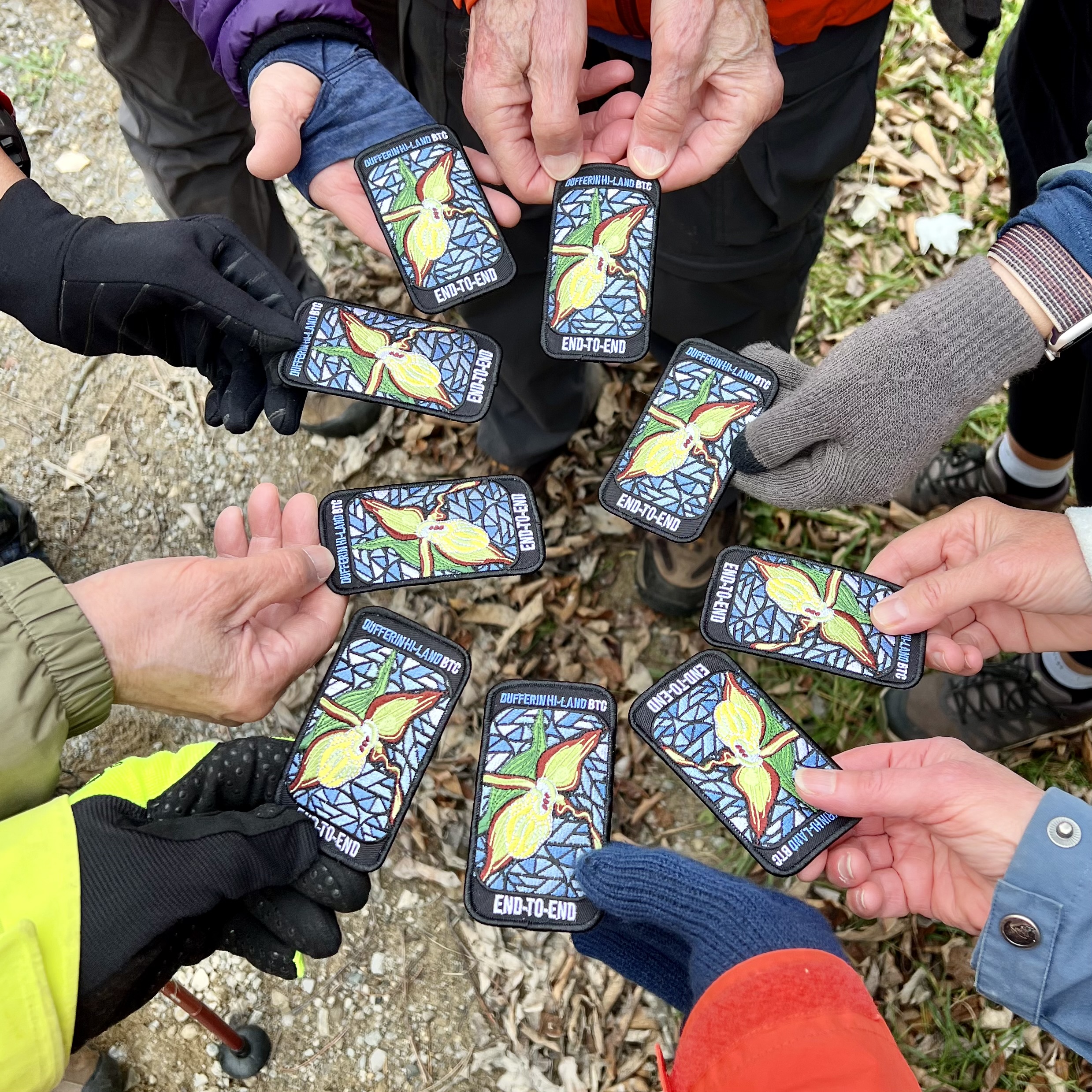
    This is a special series of 10  hikes to complete the Peninsula section of the Bruce Trail.  The organization, guidance, logistics and the Turkey Vulture stained glass badge is included in your fee which is non-refundable. Proceeds support the Peninsula Bruce Trail Club which in turn supports the Bruce Trail Conservancy mission to “Preserving a ribbon of wilderness, for everyone, forever.”  In addition to hiking the main trail, we will be collecting bird songs via the Merlin app for the Peninsula Birder Badge as well as the Fern Badge, Orchid Badge and the new Tree Badge as we see/hear them.  If you choose, many other side trails can be done after we finish each day’s hike. This is an option for participants.

    For this E2E in 10, we will be following the main trail northbound eventually finishing in Tobermory. Please note that you are signing up for the entire series of 10 hikes as a Group Hike. The Peninsula in 10 series is geared to experienced long distance hikers with the expectation of a 3  to 5.0 km/ hr. pace maintained over a 15km plus day.  The section is approximately 165km so daily distances will be based on available parking. No dropout points have been established and therefore hikers who must drop out, will be responsible for their own transportation back to their vehicle. Please note that transportation back to your vehicle is very limited in this section.  Please be honest about your hiking abilities. We will hike at a steady pace but there will be plenty of time to take pictures and to enjoy the flora and fauna of this beautiful but challenging section.  This particular set of 10 hikes is intended to be Moderate/BriskPlease be honest about your degree of physical fitness prior to registration. It is a group hike so it is important you are able to keep pace with the person in front of you.

    Attire and Daily Hikes. 

    Hikers will be expected to be wearing proper hiking boots and layered clothing with the expectation of cool and possible wet weather.  Sufficient food and water for a full day of hiking is required as well as hiking poles (if you use them), and wet weather gear is strongly recommended. Bug spray is also suggested. Clothing adjustments, bio-breaks are as needed. Please let the sweep person know and they will wait for you. A morning break around 10am and a 10-15 minute on-trail lunch break will be scheduled. An afternoon break will be based on our expected finish time. Depending on weather conditions, these times may vary. Everyone must carry a First Aid kit.

    Missing Hikes/Making-up Hikes

    maximum of 3 (of the 10) hikes can be self-completed as a result of scheduling challenges, but it is intended that this badge be earned while hiking as part of a group led by a certified hike leader to qualify for the Turkey Vulture badge. Since this is a car shuttle hike, please ensure your vehicle is car shuttle ready. All participants will be expected to take turns either driving to the start or driving the drivers back at the end of the day. Carpooling to our meeting spot with 2 people in the car is generally ok but we would like to minimize and equalize the driving/shuttling as much as possible so it is fair for all participants. Hikes that are completed on this series may go toward completion of an independent ETE for the regular Peninsula ETE flowerpot badge.

    Parking Fees

    Some parking locations require paid parking, and hikes that enter Bruce Peninsula National Park.  The fee for this E2E-in-10 does not include any parking/entry fees for hikers. These costs, where applicable, will be shared amongst all participants unless you have a parking or park pass.

    Leave No Trace

    Please remember, like all hikes, this is a Leave No Trace hike. Pack out whatever you pack in. Do not toss anything onto or into any sections of the trail. We will also try to leave the trail better than we found it so we will be collecting collectable garbage we might see along the way. Daily volunteers to collect trail trash will be supplied with a bag. Dogs will not be welcome on this hike.

    Accommodations

    It is strongly recommended you make reservations for accommodations as soon as you register for the hike. Accommodations can be made anywhere in the Peninsula but I recommend staying in Lion’s Head which is about mid-way of the section. There is a motel, a campground, a hostel, and several B&B’s. Moving from accommodation to accommodation, while in the Peninsula, is doable but generally not recommended. If  you would like a roommate, I can share your email with any other registered participants who are also looking for shared accommodations. Please let me know.

    Daily

    We meet for each hike by at least 7:45am each day. A schedule for meeting and start locations will be sent to each participant in May. We will hike northerly each day. The schedule is subject to change.


    Car Hike: Rouge National Park Scarborough

    8:15 AM-1:30 PM
    06/01/2024
    Sorry, the registration cut-off time for this hike has been reached.
    Not a member? Click here to join today!

    Hosting Club: Toronto

    Location (Google Maps): Rouge Park, Zoo Road Parking Lot, off Meadowvale Road north of Sheppard Ave

    Hike Leader(s): Mohammad Aghamiri Click here to contact Hike Leader(s)

    Pace: Moderate
    Terrain: Hilly, Variable
    Distance: 14-17 km

    Description

    Will explore Toronto part of Rouge park along Rouge river and Little Rouge Creek,

    Some safety procedures during the hike:

    1-Hikers must stay between the leader and the sweep.

    2-Hikers must advise the leader or the sweep if they wish to leave the group.

    3- Hikers must follow the whistle instructions: 1 blast- stay where you are; 2 blasts come to the leader; 3 blasts – come to the leader quickly.

    4-Hike leader may request volunteers to stop at trail intersections, they need to help hikers to the direction the group walk and wait till they see the sweep .

    5-Hikers have to make sure they can  see the persons behind and in front of them.

    Bus Hike: Caledon E2E - Hike #2 of 5

    8:30 AM-5:00 PM
    06/01/2024
    Sorry, the registration cut-off time for this hike has been reached.
    Not a member? Click here to join today!

    Trip Information
    Departure Time: 08:30
    Return to City Time: 17:00
    Departure Point: Kipling Departure Point

    Optional Items

    Hosting Club: Toronto, Caledon Hills
    Category: Bus Hike
    Location (Google Maps): Willoughby Rd and McLaren Sideroad

    Hike Leader(s): Sajedeh Zahraei; Celia Ho Click here to contact Hike Leader(s)

    Pace: Moderate
    Terrain: Variable
    Distance: 15.6 Km

    Description

    Maps 15-16, km 16.0 – km 31.6 (15.6 km)
    Starting Point: Roadside Parking – km 16.0 (along the southwest shoulder of the Willoughby Rd and Escarpment Sideroad intersection) (43.831244°N 79.980588°W)
    Drop-out Point: Roadside Parking – km 26.1 (along Escarpment Sideroad on the north side where the Trail crosses the road) (43.884912°N 79.920313°W)
    End Point: Roadside Parking – km 31.6 (on Innis Lake Rd, north of Finnerty Sideroad) (43.918917°N 79.909387°W)

    Collingwood Muesum Hike

    9:00 AM
    06/01/2024
    Sorry, the registration cut-off time for this hike has been reached.
    Not a member? Click here to join today!

    Hosting Club: Blue Mountains
    Category: Register in person the morning of hike.
    Location (Google Maps): Hike meets in the parking lot behind Tim Hortons on First St. in Collingwood.

    Hike Leader(s): David Little Click here to contact Hike Leader(s)

    Pace: Leisurely – 3 km/hr. or less
    Terrain: Easy – Mostly flat and usually good footing
    Distance: 5 km

    Description

    We will start at the Collingwood Museum and then walk south on the rail trail. We will then follow the Pretty River on the dog walkers paths and town trails back to the Museum.

    9:00 Kinsmen Park, Beamsville

    9:00 AM-12:00 PM
    06/01/2024
    Sorry, the registration cut-off time for this hike has been reached.
    Not a member? Click here to join today!

    Hike open to BTC Members only.

    Hosting Club: Niagara
    Category: In and Out
    Location (Google Maps): Meet at Kinsmen parking lot at the end of Frost Rd. hike in and back. (east or west)

    Hike Leader(s): Vince Zvonar Click here to contact Hike Leader(s)

    Pace: Brisk
    Terrain: Moderate
    Distance: 9k

    Description

    9:00am Niagara Shores Park Beachcoming Hike

    9:00 AM-10:30 AM
    06/01/2024
    Sorry, the registration cut-off time for this hike has been reached.
    Not a member? Click here to join today!

    Hike open to BTC Members only.

    Hosting Club: Niagara
    Category: Loop
    Location (Google Maps): Corner of Niven Road and Lakeshore Road in Niagara-on-the-Lake. Park along Old Lakeshore Road.

    Hike Leader(s): Suzanne Gourluck Click here to contact Hike Leader(s)

    Pace: Leisurely
    Terrain: Moderate
    Distance: 5-6km

    Description

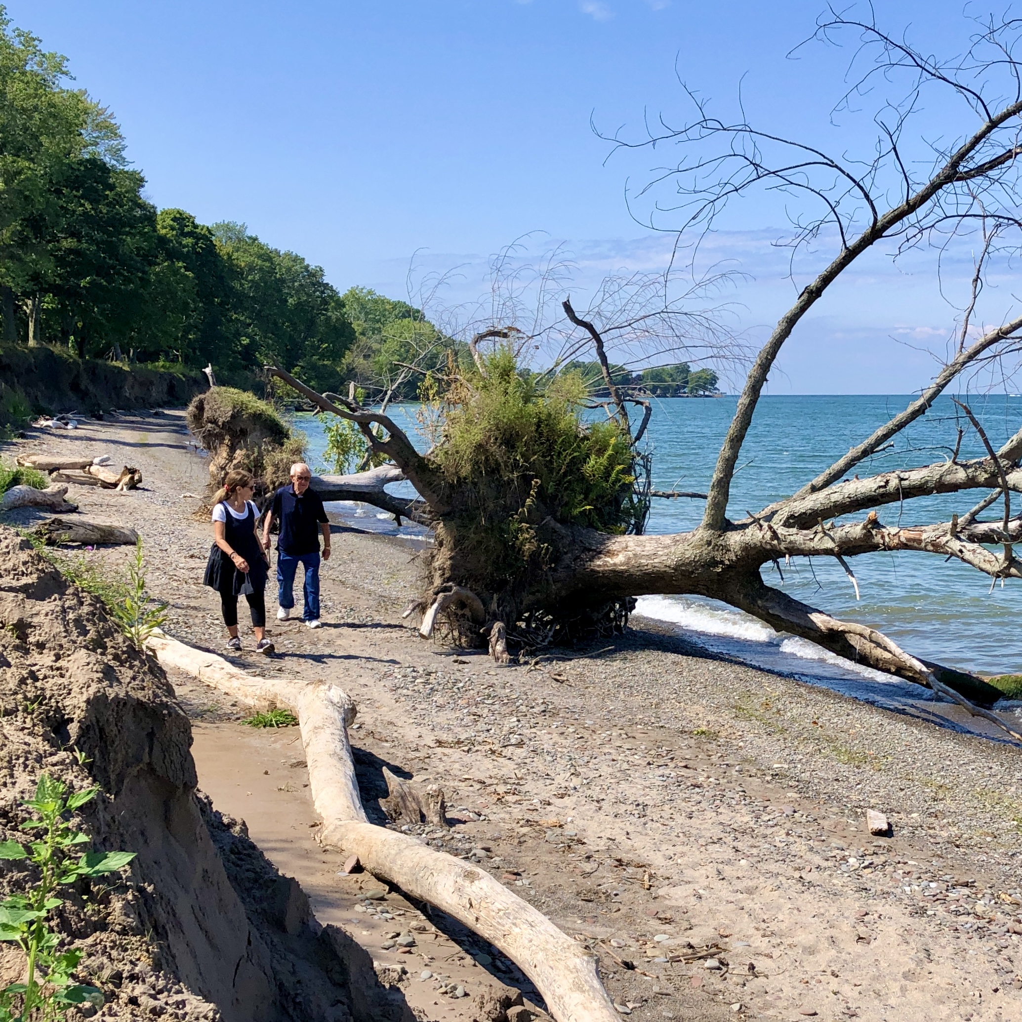
    Explore a lakeshore park, shoreline and cliff top trail in Niagara-on-the-Lake. This beachcombing hike involves uneven ground, clambouring over fallen trees, a pebbly beach, sandy and wet areas. Dress for possible cold wind off the lake and bring poles if needed for stability.

    Car Hike: Rouge Valley Cedar Trail - 16km

    9:30 AM-2:30 PM
    06/01/2024
    Sorry, the registration cut-off time for this hike has been reached.
    Not a member? Click here to join today!

    Hosting Club: Toronto
    Category: Car Hike
    Location (Google Maps):

    Rouge Valley Conservation Centre parking lot.

    Hike Leader(s): Alina Lin

    Pace: Moderate
    Terrain: Flat, Hilly, Variable
    Distance: 13 km -16km

    Description

    Meet at the main parking lot next to the Rouge Valley Conservation Centre, GPS (43.81780727235202, -79.17176449225887).

    We will hike along the main trail Cedar Trail and Little Rouge Creek Woodland Trail.  The route includes a mix of flat and hilly terrains.

    Be prepared for some muddy sections. Bring at least 1.5 liter of water. Wear sunscreen and a hat. Bug spray may also be needed.

    No kids under 13 years old.

    No dog.

    This hike will take place rain or shine.

    Len Holley/Skinners Bluff Loop

    10:00 AM-12:00 PM
    06/01/2024
    Sorry, the registration cut-off time for this hike has been reached.
    Not a member? Click here to join today!

    Hosting Club: Sydenham
    Category: General Hike
    Location (Google Maps): Georgian Bluffs

    Hike Leader(s): Danuta Valleau Click here to contact Hike Leader(s)

    Pace: Leisurely: 3 km/h or less
    Terrain: Moderate: Some hills and/or poor footing
    Distance: approx 4 km

    Description

    We will walk  from the roadside to the escarpment edge through mixed forest and tall trees. Then  follow the Main Trail  south with views over Colpoys Bay, before turning back into the woods again.

    I recommend good fitting shoes or hiking boot, bug repellent, sunscreen, sufficient water, and walking poles or walking sticks.

Please click here to add yourself to this hike? (Note there is a limit of x people allowed for this hike)