
The BTC office will be closed on the morning of Wed. Sept. 30 for National Day for Truth & Reconciliation from 9:00 am - 12:00 pm. Thank you for your understanding.
Hike Schedule
Join us for a hike! Registration required.
All hikes available to BTC members. Some hikes are open to non-members.
See Refund Policy for Paid Hikes >
TIP: The calendar view displays up to 7 hikes on a day, but often there are more. Click “View more events” to see them all.
Niagara
Iroquoia
Toronto
Caledon Hills
Dufferin Hi-Land
Blue Mountains
Beaver Valley
Sydenham
Peninsula
All Clubs
Show Filters
Categories
Reset Filters
- 01August 1, 2026
Hollad River Trail Aurora 250
https://hikes.brucetrail.org/event/car-hike-hollad-river-trail-2/Sorry, the registration cut-off time for this hike has been reached.Not a member? Click here to join today!Hosting Club: Toronto
Location (Google Maps): We start the hike from Evans park ,you may park along benville cres off Bayview
Hike Leader(s): MOHAMMAD AGHAMIRI Click here to contact Hike Leader(s)
Pace: Moderate (3-4 km/hr)
Terrain: Level 2 (Intermediate – some hills and uneven surfaces, rocks and roots underfoot), Variable
Distance (km): 14-15 kmDescription
We start the hike from Evans park ,walking north along Holland River , passingheppard’s Bush Conservation Area to Newmarket trails and return
- 01August 1, 2026
Lions Head, 1 of 3
https://hikes.brucetrail.org/event/lions-head-1-of-3/Sorry, the registration cut-off time for this hike has been reached.Not a member? Click here to join today!Hosting Club: Toronto, Peninsula
Category: Car Hike
Location (Google Maps): Lions Head, Map 39Hike Leader(s): Alex Brown Click here to contact Hike Leader(s)
Pace: Moderate (3-4 km/hr)
Terrain: Level 2 (Intermediate – some hills and uneven surfaces, rocks and roots underfoot), Variable
Distance (km): 12Description
This is the first of six hikes from Lions Head to Tobermory to be conducted over two weekends. The first series is named Lions Head. The second will be named Tobermory. The first hike in each series will be about 12 km. Follow on hikes will vary in length depending on group wishes.We will begin the series at km 87.2 at the parking area and car pool to km 98.4. This section of the trail follows the escarpment north over variable rocky sections. After the hike we will meet for refreshments and to confirm arrangements for the following day. Details TBA.
Given the distance it is anticipated that hikers coming from the Toronto area will find accommodation locally. I understand that options range from camping to hotels. More to follow on this subject as well. Those joining the hikes are asked to confirm their personal arrangements with me.
Accommodations may be found online. One such link is:
https://r.search.yahoo.com/_ylt=AwrEm6iP_i9qygIA1WXrFAx.;_ylu=Y29sbwNiZjEEcG9zAzEEdnRpZAMEc2VjA3Ny/RV=2/RE=1782739856/RO=10/RU=https%3a%2f%2fvisitbrucepeninsula.ca%2fwhere-to-stay%2f/RK=2/RS=4WcNI2n_eESb5ZTLRBvj7qtmFn4-
Al
- 01August 1, 2026
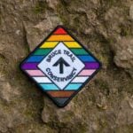
Rainbow/Welcome Hike: Rockway Conservation Area
https://hikes.brucetrail.org/event/rainbow-welcome-hike-rockway-conservation-area/Sorry, the registration cut-off time for this hike has been reached.Not a member? Click here to join today!Hosting Club: Niagara
Category: Rainbow 🌈
Location (Google Maps): Park at entrance to Rockway Conservation Area
https://maps.app.goo.gl/ruG1zRQzzJdtBp1y8Hike Leader(s): Angela Lytle Click here to contact Hike Leader(s)
Pace: Leisurely <3 km/hr
Terrain: Moderate: some hills and some poor footing
Distance: 5 kmDescription
Join the Niagara Bruce Trail Club, Bridges Niagara Immigrant and Refugee Services and PFLAG Niagara for a Rainbow-Welcome Hike at Rockway Conservation Area!What is a Rainbow-Welcome Hike?
These hikes aim to bring 2S-LGBTQIA+ newcomers together with other newcomers and community members, friends and allies to enjoy nature and connect to the land and enjoy nature in all seasons.
It is an intentionally affirming space for people of diverse backgrounds and identities with a focus on 2S-LGBTQIA+ inclusion. Everyone is welcome.
Hike Details
Route: This hike starts at the parking lot at Rockway Conservation Area. We will hike along the Bruce Trail towards Louth and then loop back to Rockway and take the waterfall side trail.
Terrain: Rockway has some hills, ups and downs in a mostly forested setting. We will adjust the pace to the group but be prepared for some rocky or uneven footing and climbing up and down. We recommend using hiking poles. Wearing good hiking shoes is a must. Carry water, wear a hat and insect repellent – mosquito season is underway. We will take a break at the lower falls – bring a snack or maybe some to share!
The hike goes ahead rain or shine unless there are dangerous weather conditions – the hike leader will contact you by email if anything changes.
***Please arrive by 9:50 to check in with the hike leaders for departure right at 10 am.
- 01August 1, 2026
Urban Walk: Windsfield Farm Park /Wilket Creek/ET Seton Park to Leaside
https://hikes.brucetrail.org/event/urban-walk-windsfield-farm-park-wilket-creek-et-seton-park-to-leaside/Sorry, the registration cut-off time for this hike has been reached.Not a member? Click here to join today!Hosting Club: Toronto
Category: Urban Walk
Location (Google Maps):Meet on the Southeast corner of Bayview and York Mills in front of the arena (a short ride on the York Mills 95 Bus from York Mills Station)
Hike Leader(s): Tom Swales Click here to contact Hike Leader(s)
Pace: Moderate (3-4 km/hr)
Terrain: Level 2 (Intermediate – some hills and uneven surfaces, rocks and roots underfoot), Variable
Distance (km): 12 kmDescription
We’ll hike south through Windsfield Farm Park, on Banbury Road, the Don Mills Trail, stop for lunch at Edwards Gardens, then south through Wilket Creek Park. Finishing through Serena Gundy Park the hike will end near Laird Station on Line 5. - 02August 2, 2026
Car Hike: Jefferson Forest/Bond Lake
https://hikes.brucetrail.org/event/car-hike-jefferson-forest-bond-lake-8/Sorry, the registration cut-off time for this hike has been reached.Not a member? Click here to join today!Hosting Club: Toronto
Category: Car Hike
Location (Google Maps):1245 Bethesda Side Rd, Richmond Hill, ON L4E 1A2 ( Bethesda Trail Head Parking lot)
Hike Leader(s): Amir Alemohammad Click here to contact Hike Leader(s)
Pace: Moderate (3-4 km/hr)
Terrain: Flat, Hilly, Level 2 (Intermediate – some hills and uneven surfaces, rocks and roots underfoot), Variable
Distance (km): 14-16KmDescription
Let’s roll the hills of the Jefferson Forest and around the Bond Lake. Every week we hike in Jefferson Forest, located in the heart of Richmond Hill, it boasts numerous hiking trails. This 4 hour hike can range from 14 to 15 kilometres, depending on the weather conditions. Remember to bring water, snacks, hiking boots (mandatory), poles, and your camera. Not recommended for beginners. Park in the free Bethesda parking lot and avoid parking along the road. Dress appropriately for the weather. Difficulty Level: 2 (Moderate).Please arrive @7:45AM for start of 8:00AM.
This is a joint hike with the Oak Ridges Trail Association (ORTA).
what3words:
https://w3w.co/twisting.mailer.awakes
- 02August 2, 2026
Sunny Sundays-Blantyre into Sydenham
https://hikes.brucetrail.org/event/sunny-sundays-blantyre-into-sydenham/Sorry, the registration cut-off time for this hike has been reached.Not a member? Click here to join today!Hosting Club: Beaver Valley
Location (Google Maps): Meet in the Blantyre parking lot, km 117.3, Map 28, 44.500537,-80.632902
Hike Leader(s): Mike Arkless Click here to contact the hike leader.
Pace: Medium
Terrain: Moderate, Some rocky footing, Some steep sections
Length of Hike: 14.7 kmDescription
This is an out and back hike, on which we’ll hike west from the BTC parking lot at Blantyre to St. Vincent Sydenham Townline, then return to our cars. We’ll hike through Rocklyn Creek Management Area and see pretty Rocklyn Creek. Please arrive at 8:15 a.m. for an 8:30 a.m. start. As usual, bring sufficient water and snacks, we’ll take a break mid hike. Dress for the weather, there are still mosquitoes out there so bring insect repellent, or other covering. So we know whether or not to expect you, if you need to cancel please do so on the online calendar or by contacting the hike leader through this hike’s “click here to contact the hike leader” option in the hike schedule. Looking forward to seeing you. Mike. - 02August 2, 2026
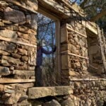
POSTPONED: Burlington Heritage Week / River & Ruin
https://hikes.brucetrail.org/event/burlington-heritage-week-river-ruin-historical-hike/Sorry, the registration cut-off time for this hike has been reached.Not a member? Click here to join today!Hosting Club: Iroquoia
Category: Historical Hike
Location (Google Maps): Kilbride Park Parking Lot Behind the Kilbride School, access to Main Trail and Kilbride PassHike Leader(s): Joe Borges Click here to contact Hike Leader(s)
Pace: Leisurely – 3km/hr or less
Terrain: Dependent on Conditions, Moderate – Some hills and/or some poor footing, Slippery and Steep Sections
Distance: 7.6 kmDescription
Burlington Heritage Week Hike: River & RuinJoin us for the special hike brought to you by Iroquoia Bruce Trail Club partnering with the City of Burlington for Heritage Week.
The theme this year is water, so we will hike through one of Burlington’s most historically rich landscapes. The River & Ruin trail winds through the beautiful Lowville Valley, where the natural drama of Twelve Mile Creek meets the traces of Burlington’s early settlement history. Along the way, we’ll explore the stories of Kilbride, Lowville, and the Cleaver family, whose mill, homestead, and ruins helped shape this valley nearly two hundred ago.
This hike offers more than beautiful views, it’s a walk through time. From the limestone ruins and historic mill site to the creek that powered early industry and settlement, the route reveals how farming, waterpower, and pioneering families transformed the area into one of Burlington’s most fascinating heritage corridors. If you enjoy trails with a strong sense of place, local history, and a great story under your boots, this is the hike for you.
Come discover the hidden history of Kilbride and the Lowville Valley, experience why this unique trail is one of Burlington’s most memorable heritage walks.
Note, no dogs are permitted on this hike.
- 02August 2, 2026
Lion's Head, 2 of 3
https://hikes.brucetrail.org/event/lions-head-2-of-3/Sorry, the registration cut-off time for this hike has been reached.Not a member? Click here to join today!Hosting Club: Toronto, Peninsula
Category: Car Hike
Location (Google Maps): Cape Chin/Dyers Bay, Maps 39 and 40Hike Leader(s): Alex Brown Click here to contact Hike Leader(s)
Pace: Moderate (3-4 km/hr)
Terrain: Level 2 (Intermediate – some hills and uneven surfaces, rocks and roots underfoot), Rocky, Variable
Distance (km): 12.4 kmDescription
This is the second hike of the Lion’s Head series. The hike will be from km 98.4 where the trail crosses Cape Chin South Road and finish at km 110.8. Car pooling and meeting arrangements will be confirmed the day before.The hike will mostly follow the forested escarpment edge, occasionally turning inland. Trail conditions are variable and rocky.
After the hike we will meet for refreshments and to plan out the activity for day 3.
- 02August 2, 2026
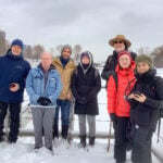
Urban Walk: Waterfront Trail 4/11 – Parklawn
https://hikes.brucetrail.org/event/urban-walk-waterfront-trail-4-11-parklawn-4/Sorry, the registration cut-off time for this hike has been reached.Not a member? Click here to join today!Hosting Club: Toronto
Category: Urban Walk
Location (Google Maps): Toronto Waterfront Trail WestHike Leader(s): Brian Rideout Click here to contact Hike Leader(s)
Pace: Moderate (3-4 km/hr)
Terrain: Flat
Distance (km): 9.1 kmDescription
Please join me at Old Mill Station no later than 9:12 am. We will take the 66 bus departing 9:27 am, arriving 9:40 am. If you want to meet us at Parklawn and Lakeshore, please be there by 9:40 am. We start hiking at 9:50 am.We will hike east along the lake to Spadina. The estimated distance is 9.1 km. Here is an online map of our route Parklawn to Spadina
Bring a snack, at least 2 liters of water, sunscreen and bug spray.
- 03August 3, 2026
Lion's Head, 3 of 3
https://hikes.brucetrail.org/event/lions-head-3-of-3/Sorry, the registration cut-off time for this hike has been reached.Not a member? Click here to join today!Hosting Club: Toronto, Peninsula
Category: Car Hike
Location (Google Maps): Dyers Bay, Map 40Hike Leader(s): Alex Brown Click here to contact Hike Leader(s)
Pace: Moderate (3-4 km/hr)
Terrain: Flat, Level 1 (Easy – mostly on flat, well maintained trails with hard-packed surface)
Distance (km): 7 kmDescription
We hike from km 110.8 and finish at Km 117.8. This section passes along the escarpment and then moves inland to Lindsay Rd 40.We will finish earlier than the previous days. After the hike those wishing to may meet for after hike refreshments in Lion’s Head before heading home.