
The BTC office will be closed on Mon. Oct. 12 for the holiday. Thank you for your understanding.
Hike Schedule
Join us for a hike! Registration required.
All hikes available to BTC members. Some hikes are open to non-members.
See Refund Policy for Paid Hikes >
TIP: The calendar view displays up to 7 hikes on a day, but often there are more. Click “View more events” to see them all.
Niagara
Iroquoia
Toronto
Caledon Hills
Dufferin Hi-Land
Blue Mountains
Beaver Valley
Sydenham
Peninsula
All Clubs
Show Filters
Categories
Reset Filters
- 16August 16, 2026
Car Hike: Jefferson Forest/Bond Lake
https://hikes.brucetrail.org/event/car-hike-jefferson-forest-bond-lake-9/Sorry, the registration cut-off time for this hike has been reached.Not a member? Click here to join today!Hosting Club: Toronto
Category: Car Hike
Location (Google Maps):1245 Bethesda Side Rd, Richmond Hill, ON L4E 1A2 ( Bethesda Trail Head Parking lot)
Hike Leader(s): Amir Alemohammad Click here to contact Hike Leader(s)
Pace: Moderate (3-4 km/hr)
Terrain: Flat, Hilly, Level 2 (Intermediate – some hills and uneven surfaces, rocks and roots underfoot), Variable
Distance (km): 14-16KmDescription
Let’s roll the hills of the Jefferson Forest and around the Bond Lake. Every week we hike in Jefferson Forest, located in the heart of Richmond Hill, it boasts numerous hiking trails. This 4 hour hike can range from 14 to 15 kilometres, depending on the weather conditions. Remember to bring water, snacks, hiking boots (mandatory), poles, and your camera. Not recommended for beginners. Park in the free Bethesda parking lot and avoid parking along the road. Dress appropriately for the weather. Difficulty Level: 2 (Moderate).Please arrive @7:45AM for start of 8:00AM.
This is a joint hike with the Oak Ridges Trail Association (ORTA).
what3words:
https://w3w.co/twisting.mailer.awakes
Sunday Side Trails; Forty Hills and White Bluff
https://hikes.brucetrail.org/event/sunday-side-trails-forty-hills-and-white-bluff/Sorry, the registration cut-off time for this hike has been reached.Not a member? Click here to join today!Hosting Club: Peninsula
Category: Peninsula Blue Series
Location (Google Maps): Richardson ST Parking, Forty Hills RoadHike Leader(s): Kamila Tomaszewska Click here to contact Hike Leader(s)
Pace: Medium (3.0 – 4.5 km/h): A comfortable pace for most hikers with steady progress.
Terrain: Moderate: Rolling hills, mild slopes and rocky paths.
Distance: 9.7 kmDescription
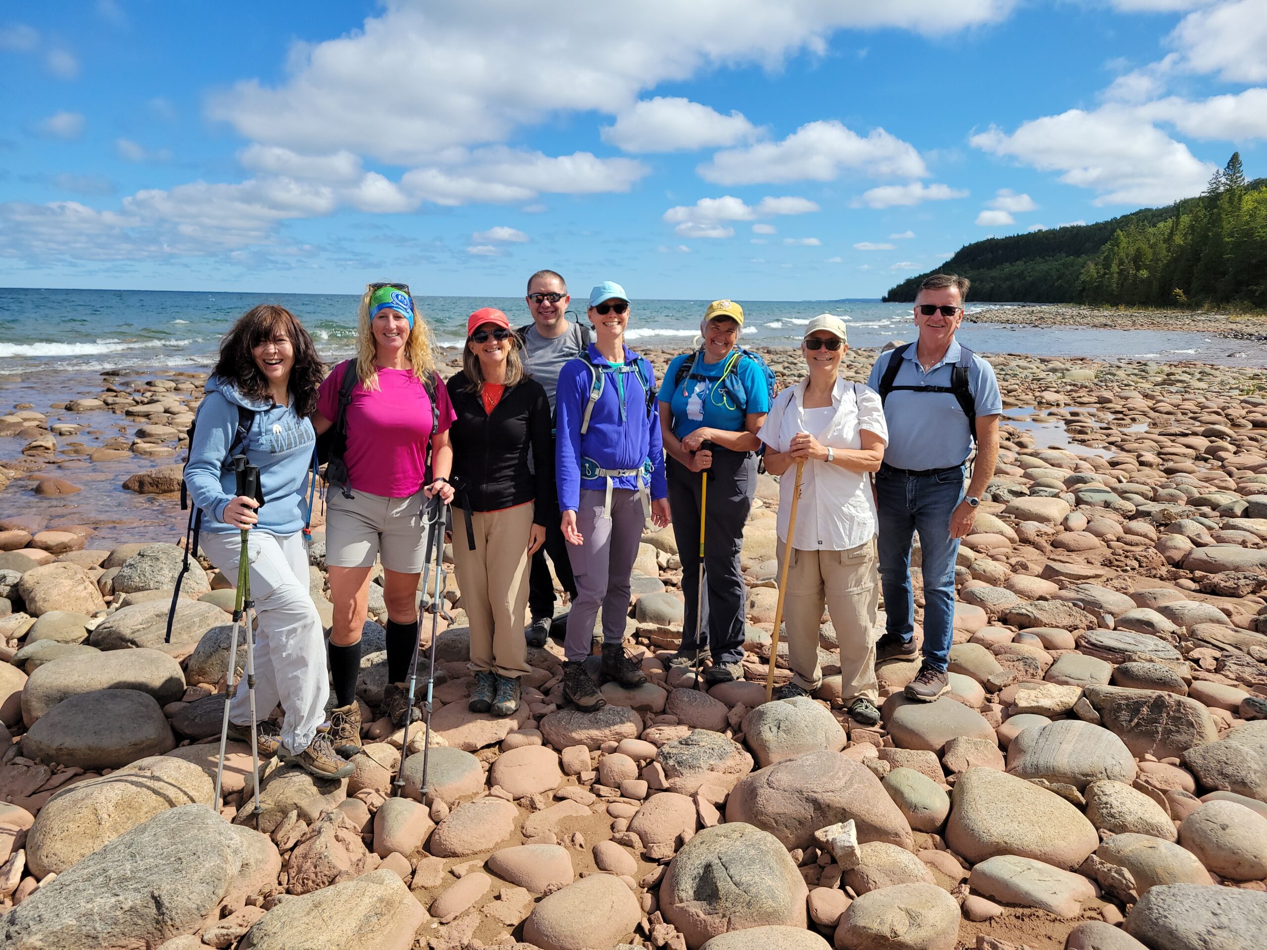
Peninsula BTC is offering a series of hikes covering all of the side trails on the Peninsula section of the Bruce Trail. These hikes are a great opportunity for those who want to do some hiking but don’t want to commit to a full end-to-end; for those who have completed an end-to-end and want to explore more of the beautiful trails on the Peninsula and for locals and visitors who want to get out on the trail on the weekend.The series will include 27 hikes on Sundays (and maybe the odd Saturday) over 2026 and 2027, covering more than 150 km of side trails or 78 trails! We will be offering hikes on a roughly biweekly basis, with hikes posted approximately two months in advance. The hikes will generally be loop hikes, although car shuttling may be required for a few hikes. Register for each hike individually, no need to commit to all 27 hikes!
For those who would like to earn the Peninsula Side Trails Badge, these hikes provide a chance to join a group for some or all of the side trail hikes.
This hike explores the Forty Hills/White Bluff Nature Reserve and features meadows, some cliff edges and a beach. We will walk six side trails: Richardson, Whippoorwill, Walter Brewer, David Blasing, Reeds Dump, Alan Fowler and White Bluffs Side Trails.
Hikers should be prepared for the weather, possible wet trails and insects. Bring a lunch, water and snacks. Hike leader will contact registered hikers one week before the hike.
If you would like to be notified when the side trail hikes are posted, go to the bottom of the Hikes page on the PBTC website to sign-up for hike notifications.
Sunny Sundays - Valley Crossover Side Trail Loop CANCELLED
https://hikes.brucetrail.org/event/sunny-sundays-valley-crossover-side-trail-loop/Sorry, the registration cut-off time for this hike has been reached.Not a member? Click here to join today!Hosting Club: Beaver Valley
Location (Google Maps): Meet in the south end of the lower parking lot, Beaver Valley Ski Club, Map 26, Edition 31, 44.357382,-80.543331
Hike Leader(s): Glenda Collings Click here to contact the hike leader.
Pace: Medium
Terrain: Moderate, Some rocky footing, Some steep sections, Strenuous
Length of Hike: 12.9 kmDescription
It’s time for a workout. We’ll start in the BV ski club, then head south to Graham’s Hill Road, walk east down that country road, then partway up Campbell’s Hill Road and turn north to hike back to the ski club. Lots of ups and downs, some good views and lovely forested areas. Please arrive at 8:15 a.m. for an 8:30 a.m. start. As usual, bring sufficient water and snacks, we’ll take a break mid hike. Dress for the weather, there are still mosquitoes out there so bring insect repellent, or other covering. So we know whether or not to expect you, if you need to cancel please do so on the online calendar or by contacting me, text – 519 694 7691. Looking forward to seeing you. Glenda
Boots and Book Hike - A Woman Watching
https://hikes.brucetrail.org/event/boots-and-book-hike-a-woman-watching/Sorry, the registration cut-off time for this hike has been reached.Not a member? Click here to join today!Hosting Club:
Category: Boots and Books – The Iroquoia Bruce Trail Book Club
Location (Google Maps): Snake Road Roadside ParkingHike Leader(s): Kirsten McCarthy Click here to contact Hike Leader(s)
Pace: Leisurely – 3km/hr or less
Terrain: Dependent on Conditions, Moderate – Some hills and/or some poor footing, Slippery Sections Likely
Distance: 6-7kmDescription
Welcome to the 5th Iroquoia Club Bruce Trail Book Club. – “Boots and Books”.Our book this month is “Woman, Watching” by Merilyn Simonds. Please check your local library for available copies of the book.
In this out and back hike, we’ll start at Snake Road (free roadside parking – 10 vehicles) and follow the main trail to Smokey Hollow waterfall where we can stop at the falls and have a snack then we’ll turn around and follow the main trail back to Snake Road. It should take us about 2.5 hours. Please wear suitable footwear, dress for the weather and bring poles as there are some steep sections. Please bring enough snacks and water suitable for the length/duration of the hike. It is not necessary to bring the book, but you are more than welcome if you’d like to. The hike is open to everyone whether you have read the book or not, but there may be spoilers. Registration will be open to 8 people to keep it more intimate for discussing the book.
If your plans change, please cancel your registration, so that people who are on the waitlist may join. To cancel your registration, please follow these steps:
- Sign into your account on the Bruce Trail website.
- Go to the Hike Schedule
- Click on “My Hikes” tab which should be at the top of the schedule
- Scroll to the appropriate hike you wish to cancel
- Cursor to the far right of the hike to the Action column
- Click cancel
Urban Walk: Waterfront Trail 5/11 – Bathurst
https://hikes.brucetrail.org/event/urban-walk-waterfront-trail-5-11-bathurst-4/Sorry, the registration cut-off time for this hike has been reached.Not a member? Click here to join today!Hosting Club: Toronto
Category: Urban Walk
Location (Google Maps): Downtown Toronto Waterfront TrailHike Leader(s): Brian Rideout Click here to contact Hike Leader(s)
Pace: Moderate (3-4 km/hr)
Terrain: Flat
Distance (km): 9.4 kmDescription
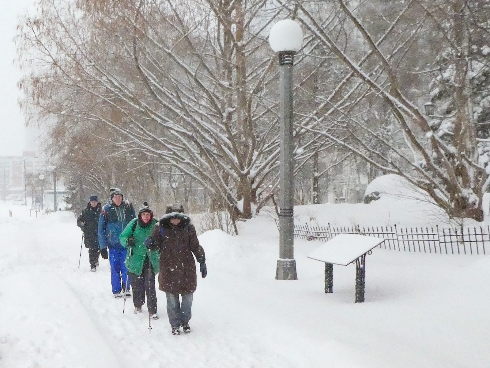
Please join me at Bathurst Station no later than 9:00 am. We will take the streetcar southbound departing 9:30 am, arriving at Fleet St 9:49 am. If you want to meet us at Bathurst and Fleet, be there by 9:49 am. We start hiking at 10:00 am.We will hike to the lake and east to Leslie St. The estimated distance is 9.4 km. Here is an online map of our route Bathurst to Leslie
Bring a snack, at least 2 liters of water, sunscreen and bug spray.
- 17August 17, 2026
EASY DOES IT Steve Bauer Trail (South)
https://hikes.brucetrail.org/event/easy-does-it-steve-bauer-trail-south/Sorry, the registration cut-off time for this hike has been reached.Not a member? Click here to join today!Hosting Club: Niagara
Category: Leisurely
Location (Google Maps): Dollarama, Northtown Plza, 325 Thorold Rd., WellandHike Leader(s): Diane Marlatt Click here to contact Hike Leader(s)
Pace: Leisurely <3 km/hr
Terrain: Easy: mostly flat, good footing
Distance: 7KmDescription

Scotsdale Farm Great Esker
https://hikes.brucetrail.org/event/scotsdale-farm-great-esker-4/Sorry, the registration cut-off time for this hike has been reached.Not a member? Click here to join today!Hosting Club: Iroquoia
Category: General Hike
Location (Google Maps): Scotsdale Farm main parking lotHike Leader(s): Karen Bergmann Click here to contact Hike Leader(s)
Pace: Medium – 3 to 4 km/hr
Terrain: Moderate – Some hills and/or some poor footing
Distance: 11 kmsDescription
Meet in the main parking lot at Scotsdale Farm at 9:15 am. We’ll hike the Bennet Heritage Side Trail to the main trail and around the Great Esker Side Trail, back to the main trail and the Maureen Smith Side Trail for a total of about 11 kms. There are some hills. Bring water, a snack and bug spray/bug net.Urban Walk: Valley View/Huntington Park
https://hikes.brucetrail.org/event/urban-walk-valley-view-huntington-park-17/Sorry, the registration cut-off time for this hike has been reached.Not a member? Click here to join today!Hosting Club: Toronto
Location (Google Maps): Parking lot is off Sycamore Drive, East of Bayview , across Starbucks plaza
Bus 91 from Finch East station stops at Sycamore station.Hike Leader(s): Mohammad Aghamiri
Pace: Moderate (3-4 km/hr)
Terrain: Hilly, Level 2 (Intermediate – some hills and uneven surfaces, rocks and roots underfoot)
Distance (km): 6-7 kmDescription
We will explore Valleyview and Maple View parks, and walk along German Mill Creak, in return we stop in Huntington park and have snack under beautiful shed.Although this is considered an “Urban Walk”, you can expect some hills up and down and uneven surfaces with tree roots. Please bring hiking poles, water and snacks.
- 18August 18, 2026
Caledon Hills E2E Make Up Hike
https://hikes.brucetrail.org/event/caledon-hills-e2e-make-up-hike/Sorry, the registration cut-off time for this hike has been reached.Not a member? Click here to join today!Hosting Club: Caledon Hills
Category: End-to-End
Location (Google Maps): Parking area north of km 51.8, on the east side of 5th Line EHS, just south of the Hockley Rd.Hike Leader(s): Dan Patterson Click here to contact Hike Leader(s)
Pace: Medium – 3 to 4 km/hour
Terrain: Strenuous – hilly with steep climbs and some poor footing
Distance: 20.76 kmDescription
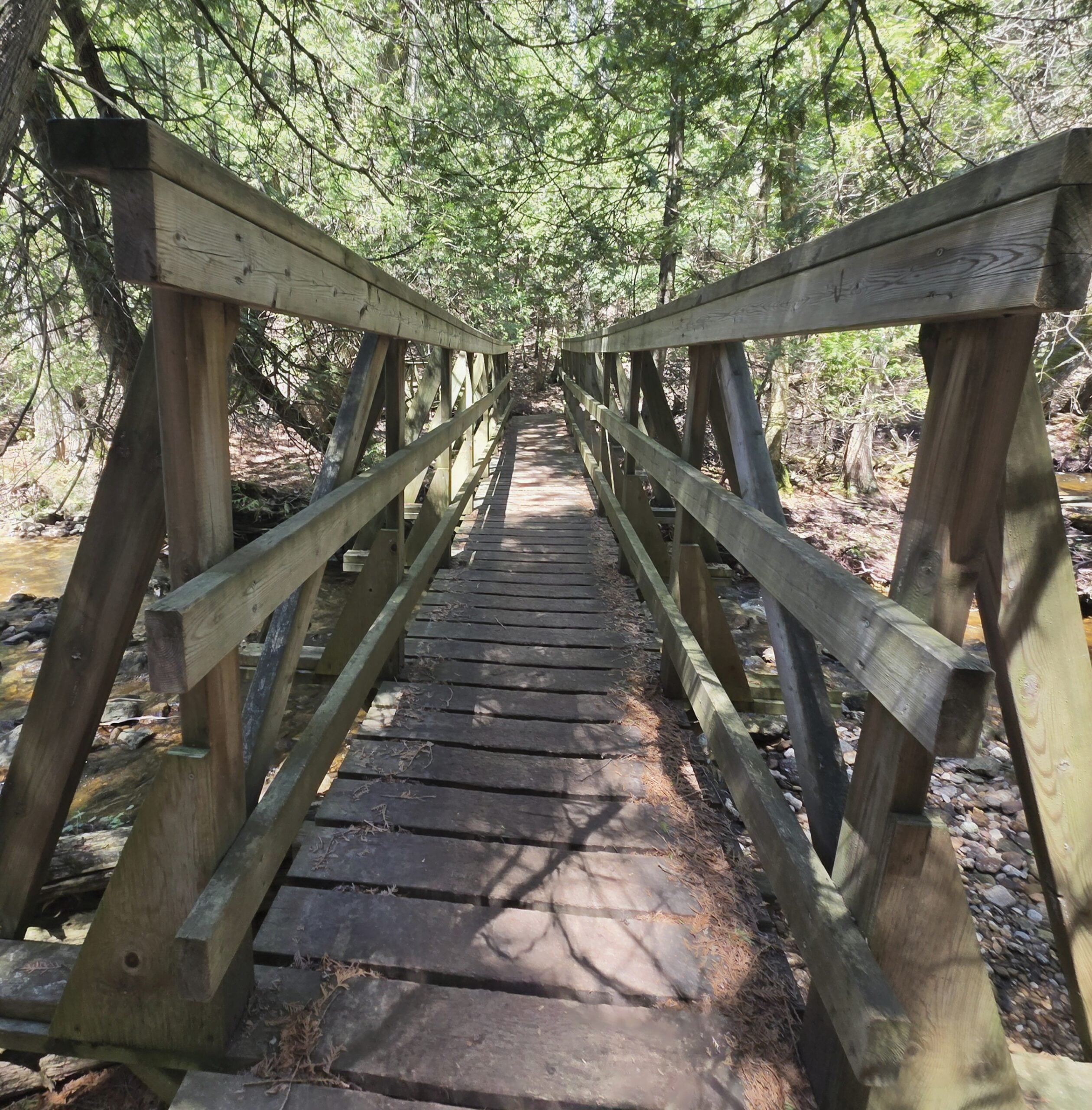
Welcome to the demanding Caledon Hills section! This northern hike is extremely hilly and challenging. We will meet at the Bruce Trail Parking lot at 5th Line Line EHS and will shuttle to Mono Center Community Centre to begin our hike. Please bring at least 3 liters of water with electrolytes, snacks, lunch, bug spray, sun glasses, and a very positive attitude! Due to the presence of ticks, long sleeves and long pants are recommended. Poles can be helpful in this area. I will be looking for volunteers to shuttle, pick up shuttle drivers and sweep.Long Hike Decew House
https://hikes.brucetrail.org/event/long-hike-short-hills-8/Sorry, the registration cut-off time for this hike has been reached.Not a member? Click here to join today!Hosting Club: Niagara
Location (Google Maps): Decew House Thorold
Hike Leader(s): Alan Laver Click here to contact Hike Leader(s)
Pace: Brisk 4-5 km/hr
Terrain: Moderate: some hills and some poor footing
Distance: 10k+Description
Due to Flooding, Note the new location. We will hike the trails around 12 mile creek and Brock Dress for the weather and bring sunscreen bug spray, poles snack and drink9:15 Short Hike, NEW LOCATION: Rockway Conservation Area, 2021 Pelham Rd, Lincoln, ON
https://hikes.brucetrail.org/event/915-short-hike-short-hills-provincial-park-st-catharines-6/Sorry, the registration cut-off time for this hike has been reached.Not a member? Click here to join today!Hike open to BTC Members only.
Hosting Club: Niagara
Category: Hike
Location (Google Maps): 2021 Pelham Rd, Lincoln, ONHike Leader(s): Debbie Demizio Click here to contact Hike Leader(s)
Pace: Medium 3- 4 km/hr
Terrain: Moderate: some hills and some poor footing
Distance: 5 kmDescription
Hike around 15 Mile Creek, featuring Upper and Lower Rockway Falls. Please bring water, insect repellent, sunscreen and hiking poles. Check yourself thoroughly for ticks following the hike.Terra Cotta
https://hikes.brucetrail.org/event/terra-cotta-5/Sorry, the registration cut-off time for this hike has been reached.Not a member? Click here to join today!Hosting Club: Caledon Hills
Category: Tuesday Hikers
Location (Google Maps): Meet at Winston Churchill Blvd. intersection with Caledon Trailway.
Driving direction: North on Highway 410, continue north on Highway 10, left on King Street, right on Winston Churchill Blvd.; drive 1 kilometre to roadside parking at Caledon Trailway crossing.Hike Leader(s): Mohammad Shafiq Click here to contact Hike Leader(s)
Pace: Medium – 3 to 4 km/hour
Terrain: Moderate – some hills and/or some poor footing
Distance: 10 kmDescription
Will hike Terra Cotta Side Trail, main Bruce Trail and parts of Terra Cotta Conservation Area trails.
Bring water, snack, poles, dress according to weather in layers.
Bug spray and sun lotion are recommended.
Arrive 10 minutes early to complete preliminaries and car parking, carpool if possible as there are limited spots.
Hike Leaders phone contact for the day of hike: 416-566-0503.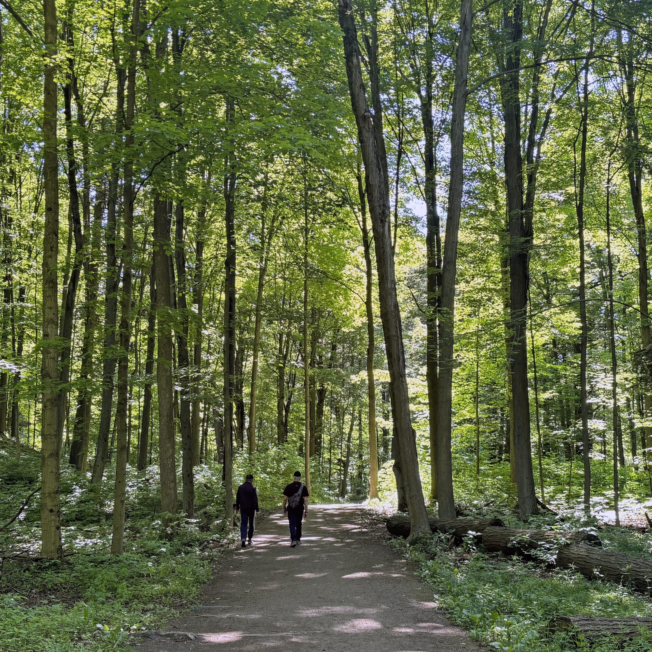
Urban Walk: Cedarvale Park to Rosedale
https://hikes.brucetrail.org/event/urban-walk-cedarvale-park-to-rosedale/Sorry, the registration cut-off time for this hike has been reached.Not a member? Click here to join today!Hosting Club: Toronto
Category: Urban Walk
Location (Google Maps): Cedarvale Station, Everden Road Exit. Street level.Hike Leader(s): Ted Moriarty Click here to contact Hike Leader(s)
Pace: Moderate (3-4 km/hr)
Terrain: Level 2 (Intermediate – some hills and uneven surfaces, rocks and roots underfoot)
Distance (km): 6 kmDescription
Please join me for a morning hike through Cedarvale Park, the Rathnelly neighbourhood and the parks of west Rosedale. We will wind our way through Cedarvale Park, Sir Winston Churchill Park and Ramsden Park. Along the way we will explore Davenport Road, Dupont Street and surrounding areas. The hike will end on Yonge Street at Rosedale Station.Route map:
https://onthegomap.com/?route=019efe97-04ff-7350-b2fb-6b228a90d302&context=share
Travel to the trailhead:
Meet Ted at Cedarvale Station (Eglinton Crosstown). Everden Road exit turnstiles at 9:30 AM.Washrooms:
There are washrooms located at Cedarvale Subway Station. During the 6 km hike we will stop at two public washrooms located at kilometres 3 and 5.Après-hike:
There will be an optional après-hike stop at The Pilot (22 Cumberland Street). Alternatively, hikers can explore the Yorkville neighbourhood and visit one of the many restaurants or cafes in the area.
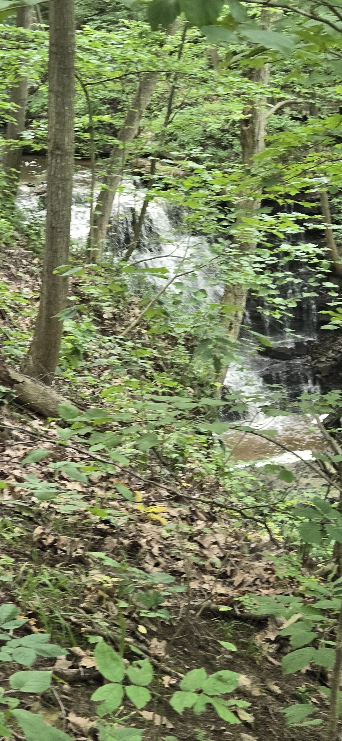
Chasing Waterfalls - Louth Conservation
https://hikes.brucetrail.org/event/chasing-waterfalls-louth-conservation/Sorry, the registration cut-off time for this hike has been reached.Not a member? Click here to join today!Hosting Club: Niagara
Category: Loop
Location (Google Maps): Louth Conservation AreaHike Leader(s): Dian Wright Click here to contact Hike Leader(s)
Pace: Medium 3- 4 km/hr
Terrain: Moderate: some hills and some poor footing
Distance: 4-5 kmDescription
Join the Niagara Bruce Trail Club, at Louth Conservation Area!
Hike Details
Route: This hike starts at the parking lot at Louth Conservation Area. We will hike along the Bruce Trail towards Louth and then loop back to the parking lot.
Terrain: Louth has some hills, ups and downs in a mostly forested setting. We will adjust the pace to the group but be prepared for some rocky or uneven footing and climbing up and down. We recommend using hiking poles. Wearing good hiking shoes is a must. Carry water, wear a hat and insect repellent – mosquito season is underway. We will take a break at the lower falls – bring a snack or maybe some to share!
The hike goes ahead rain or shine unless there are dangerous weather conditions – the hike leader will contact you by email if anything changes.
***Please arrive by 5:45 to check in with the hike leaders for departure right at 6pm.
- 19August 19, 2026
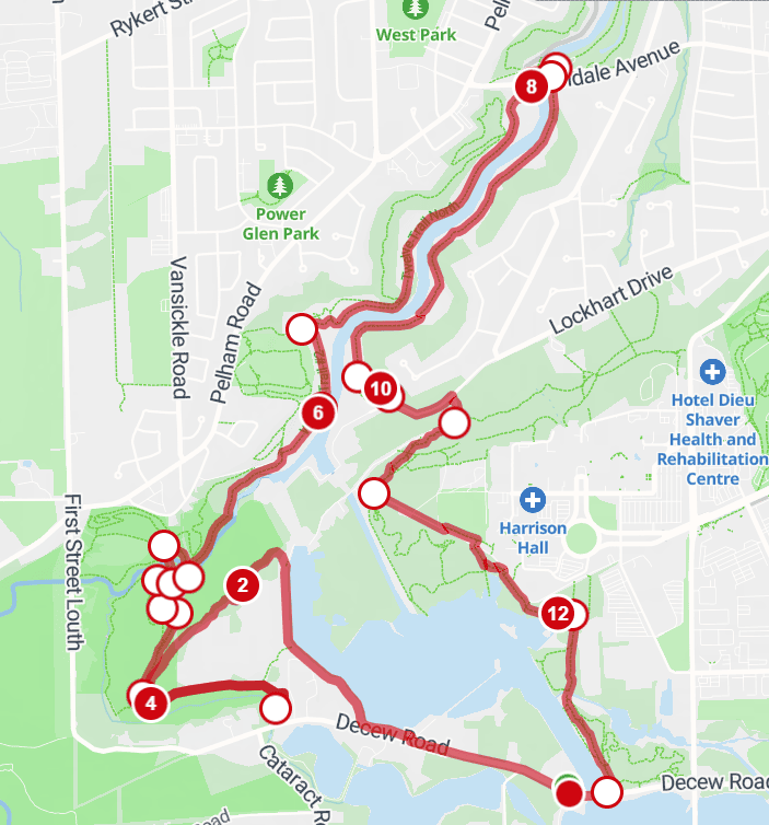
Morningstar loop
https://hikes.brucetrail.org/event/morningstar-loop/Sorry, the registration cut-off time for this hike has been reached.Not a member? Click here to join today!Hosting Club: Niagara
Category: Loop
Location (Google Maps): Decew Ruins parking lot.Hike Leader(s): Erin Lyttle Click here to contact Hike Leader(s)
Pace: Brisk 4-5 km/hr
Terrain: Strenuous: hilly, with steep climbs, poor footing
Distance: 13kmDescription
We are going to hike a loop from Decew Ruins that will take us along Lake Moodie and over to Morningstar Mill which has now reopened. After having a look, we will retrace our steps and follow the Laura Secord down to 12 mile creek and over the Glendale Dip bridge, to go back up the other side of 12 mile creek and go around Brock University back to our vehicles at Decew.This hike is for experienced hikers and will be done at a quick pace, there are long descents and long inclines and especially if there’s been rain, poles are encouraged to negotiate muddy areas. Proper footwear is required. Water is required. Please be sure to bring enough water and snacks to be out for at least 3 hours, esp if it is hot.
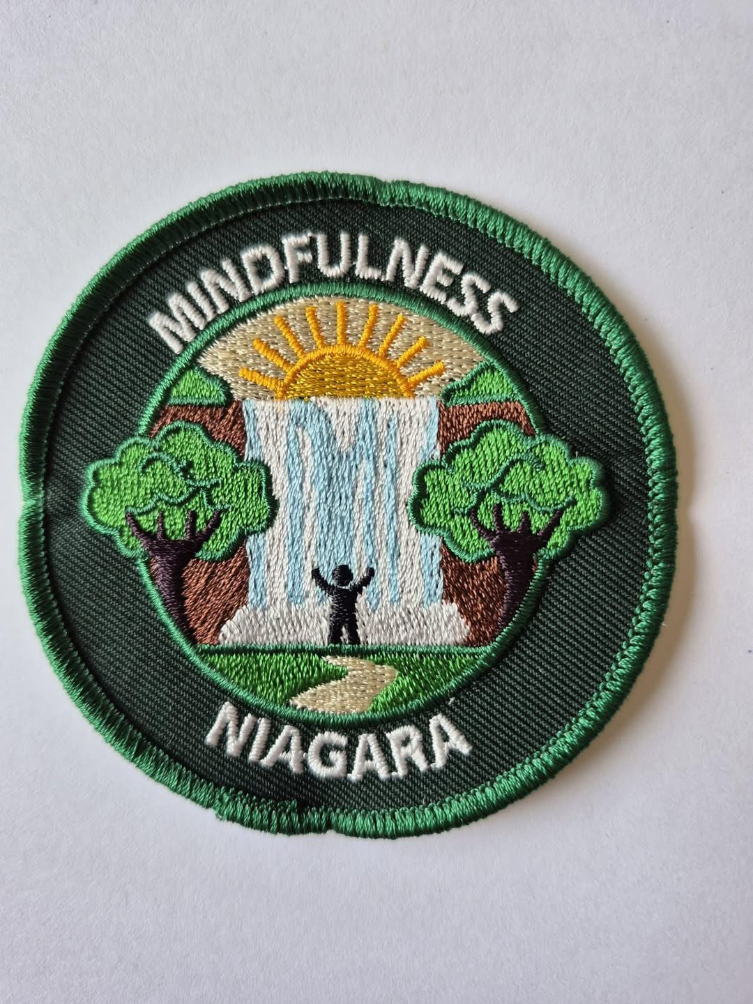
Mindfulness Hike and Yoga/Stretching
https://hikes.brucetrail.org/event/mindfulness-hike-nature-journaling-3/Sorry, the registration cut-off time for this hike has been reached.Not a member? Click here to join today!Hosting Club: Niagara, Iroquoia
Location (Google Maps): Kinsmen Park – Enter from Hixon St at the intersection of Kinsmen and Frost Rd
Hike Leader(s): Ruth Moffatt Click here to contact Hike Leader(s)
Pace: Leisurely – 3km/hr or less
Terrain: Dependent on Conditions, Moderate – Some hills and/or some poor footing, Strenuous – Hilly with steep climbs and some poor footing
Distance: Approximately 5kmDescription
This is a Mindfulness hike you can join to earn the new Mindfulness badge from Niagara Club. Today, will start with Angela leading us through some yoga and gentle stretching then we’ll silent hike over to Quarry Rd and return and return followed by a little more stretching. Please be sure to bring enough water and snacks, bug spray, poles if you use them and dress for the weather and your yoga mat. The parking area is close-by so we can store our mats in our cars while we hike.Please cancel your registration if you are not able to make it. This will allow someone from the waitlist to register.
To cancel your registration:
– Sign into your account on the BTC website
– Click on My Hikes under your account
– This will take you to a list of hikes you have registered for
– Scroll down to the appropriate hike and cursor over to the far right hand column under the Action column.
– Click Cancel under the hike you wish to cancelUnless it is very last minute, you do not have to let the hike leader know.
Books & Blazes – Sydenham Hiking Book Club
https://hikes.brucetrail.org/event/books-blazes-sydenham-hiking-book-club-2/Sorry, the registration cut-off time for this hike has been reached.Not a member? Click here to join today!Hosting Club: Sydenham
Category: Book Club Hike
Location (Google Maps): Roadside parking on Grey County Rd 17 at The Glen Side Trail.Hike Leader(s): Karen Sooley Click here to contact Hike Leader(s)
Pace: Medium: 3 to 4 km/h
Terrain: Moderate: Some hills and/or poor footing
Distance: 9.5 kmDescription
Welcome to the 2nd Sydenham Hiking Book Club event – Books & Blazes.This month’s book is The Serviceberry by Robin Wall Kimmerer.
Our hike will begin at The Glen Side Trail. We will enjoy the forests, a pond and crevices as we hike the Main Trail, Ron Savage Side Trail and the Frank Holley Side Trail. Bring a snack and water. Always carry any personal medications and your health card while hiking. It is not necessary to bring the book.
We will chat about the book as we hike and during short stops along the way. You are welcome to join the hike even if you haven’t read the book.
At the end of the hike, the group will choose the next book for our Books & Blazes hike in September.
Please contact the hike leader if you are interested in carpooling from Springmount.
WEDNESDAY WALKERS - Kimberley Forest
https://hikes.brucetrail.org/event/wednesday-walkers-kimberley-forest-4/Sorry, the registration cut-off time for this hike has been reached.Not a member? Click here to join today!Hosting Club: Beaver Valley
Location (Google Maps): Park in the lower parking lot of the Beaver Valley Ski Club, near the Valley Crossover Side Trail. From there, a few vehicles will be needed to shuttle to our starting point on Sideroad 7A.
Hike Leader(s): Margaret Yaraskavitch Click here to contact the hike leader.
Pace: Medium
Terrain: Some rocky footing, Some steep sections
Length of Hike: 5 kmDescription
After shuttling to Sideroad 7A, our hike begins as we walk through the BTC’s Kimberley Springs Nature Reserve, which includes beautiful Bill’s Creek. We also see the Stone Foundation Side Trail. After returning to the Main Trail, we then take the Kimberley Forest Side Trail. The Kimberley Forest is a beautiful multi-use and multi-trail area. Much of the walk is downhill as it finishes at the base of Beaver Valley Ski Club. - 20August 20, 2026
8:00 am Long hike Change Location Glen Road Jordan
https://hikes.brucetrail.org/event/800-am-long-hike-new-location-bailey-bridge-jordan-8/Sorry, the registration cut-off time for this hike has been reached.Not a member? Click here to join today!Hosting Club: Niagara
Location (Google Maps): Glen Road Jordan
Hike Leader(s): Alan Laver Click here to contact Hike Leader(s)
Pace: Brisk 4-5 km/hr
Terrain: Strenuous: hilly, with steep climbs, poor footing
Distance: ~10kDescription
Chang in location due to Landslide. This week onlyThis will be our permanent location . Hike up from the Bailey bridge to Balls Falls and explore the trailsYou must register for each hike. Bring Poles, snack and a drink. Dress for the weather
Devils Glen Loop
https://hikes.brucetrail.org/event/devils-glen-loop/Sorry, the registration cut-off time for this hike has been reached.Not a member? Click here to join today!Hosting Club: Blue Mountains, Beaver Valley
Location (Google Maps): Meet in town of Glen Huron and park along Station St. close to Concession 8 Nottawasaga Rd.
Hike Leader(s): Alan McPherson Click here to contact the hike leader.
Pace: Medium
Terrain: Moderate, Some rocky footing, Some steep sections
Length of Hike: 6.6 kmDescription
Alan McPherson is hike leader. We will start by taking the Mad River Side Trail behind Hamilton Brothers and follow the Mad River up the valley. We pass through Devils Glen Ski Area where we join the main trail and continue up the valley. We then climb the escarpment and follow the trail along the top of the escarpment until we find Mad River Side Trail again which takes us back to Glen Huron. Part of this last bit is on the road.Please arrive 10 minutes early for introductions so we can start at 9:00 am sharp. There are several hilly sections which can be slick when wet. Most of our walk will be in the shade of the forest, but there are some open sections. Bring water and snacks as we will take regular breaks to enjoy views or other sights. Sunscreen and bug protection are always recommended. Bring extra water if it is a hot day.
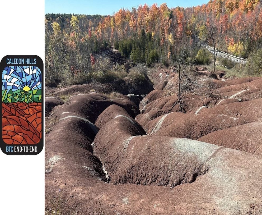
Caledon Hills - Stained Glass Badge Fundraiser – August 20 & 21 and September 3 & 4, 2026
https://hikes.brucetrail.org/event/caledon-hills-stained-glass-badge-fundraiser-august-20-21-and-september-3-4-2026/Sorry, the registration cut-off time for this hike has been reached.Not a member? Click here to join today!This is a Multi-Day Hike
You are signing up for the following dates:
2026-08-20, 2026-08-21, 2026-09-03, 2026-09-04Hosting Club: Caledon Hills
Category: Cheltenham Badlands Stained Glass E2E Badge
Location (Google Maps): Registered participants will receive more details by email.
August 20 – Meet at the Roadside parking on 4th Line EHS at the entrance to the Pete Beecham Side Trail. 43.976327, -80.026621 (10; no fee). Shuttle to Mono Community Centre, 200 m south of Mono Centre (County Road 8). Park in gravel lot 44.026195, -80.071516 (40; no fee) 18 km
August 21 – Meet at Roadside parking on Coolihans Sideroad east of where the Trail crosses the road. 43.937967, -79.934650 (10; no fee) 20km
September 3 – Meet at Roadside parking along the southwest shoulder of the Willoughby Rd. and Escarpment Sideroad intersection 44.831244, -79.980588 (5; no fee) 18 km
September 4 – Meet at Roadside parking at Boston Mills Rd. just west of the Mississauga Rd. intersection (do not park on driveway – it is private property) 44.750866, -79.951452 (5) 18 kmHike Leader(s): Joanna Mazur; Karen Buschert Click here to contact Hike Leader(s)
Pace: Brisk – 4 to 5 km/hour, Medium – 3 to 4 km/hour
Terrain: Strenuous – hilly with steep climbs and some poor footing
Distance: 17 to 20 km per dayDescription
Caledon Hills Stained Glass Badge Fundraiser End 2 EndIn this series of 4 hikes you will get a chance to finish the Caledon Hills section and you will be rewarded with the breathtaking views, good company and of course the Cheltenham Badlands Stained Glass E2E Badge: An Iconic Caledon Hills Geological Heritage Landmark. This is a monetized hike – proceeds go to the Caledon Hills Bruce Trail Club to continue to maintain infrastructure along the trail. There are no refunds.
This E2E is intended for strong hikers. We will be hiking at a steady pace with few short breaks and lunch break. Due to the distances involved be sure of your physical ability before signing up for this series. It is expected that everyone keep pace with the person in front of them. Bio breaks are as you need; please let the sweep know and they will wait for you.
Please do not register for this hike unless you can commit to all 4 days. If you need to miss one day, please make it up before this series begins and notify the hike leader as well.
All hikes in this series will include a car shuttle and everyone will take a turn as a shuttle driver. Please have your vehicle passenger-ready with at least 3 to 4 available seat belts. If you have any questions please email Joanna or Karen.
Please bring all snacks/lunch and at least 2l of water as well as all the other things you require for a long day hike including a first aid kit, bug spray, sunscreen and poles, if you use them.
No dogs. Do not show up unregistered.
Any questions may be directed through contact on this form.
If you cannot make it, please remove yourself from registration.To cancel your registration, here is a step by step:
– Sign into your account on the BTC website
– Click on My Hikes under your account
– This will take you to a list of hikes you have registered for
– Scroll down to the appropriate hike and cursor over to the far right hand column under the Action column.
– Click Cancel under the hike you wish to cancelThere are no drop outs. If for some reason you are unable to complete the days’ hike, you will be responsible for finding your way back to your vehicle. Badges will be presented on the last day for all registered for the series. If not, a list of finishers will be sent to the club for mailing out.
Refunds: https://brucetrail.org/paid-hike-refund-policy/
Beaver Bites - Hike 3 of 4
https://hikes.brucetrail.org/event/beaver-bites-hike-3-of-4/Sorry, the registration cut-off time for this hike has been reached.Not a member? Click here to join today!Hosting Club: Caledon Hills
Category: General
Location (Google Maps): Meet at parking on 7th Line and Sideroad 4A.Hike Leader(s): Nancy Mooney Click here to contact Hike Leader(s)
Pace: Medium – 3 to 4 km/hour
Terrain: Moderate – some hills and/or some poor footing, Strenuous – hilly with steep climbs and some poor footing
Distance: The first hike will be 12 km and the second will be 3.5 km.Description
This third challenging day will take us down Beaver Valley ski hill and back up through Kimberley Forest and right to the Stone Foundation Side Trail. (Map 26) The second hike, after a hilltop lunch break, will take us to the Stew Hilts Side Trail and a waterfall.Hiking around Jordan
https://hikes.brucetrail.org/event/hiking-around-jordan-68/Sorry, the registration cut-off time for this hike has been reached.Not a member? Click here to join today!Hosting Club: Niagara
Category: In and Out
Location (Google Maps): Sho’aríshon Park, Jordan StationHike Leader(s): Bill Russell Click here to contact Hike Leader(s)
Pace: Medium 3- 4 km/hr
Terrain: Moderate: some hills and some poor footing
Distance: 6 kmsDescription
Hiking in and around Jordan, Rainforth Trail and Balls Falls, alternating every 3 weeks.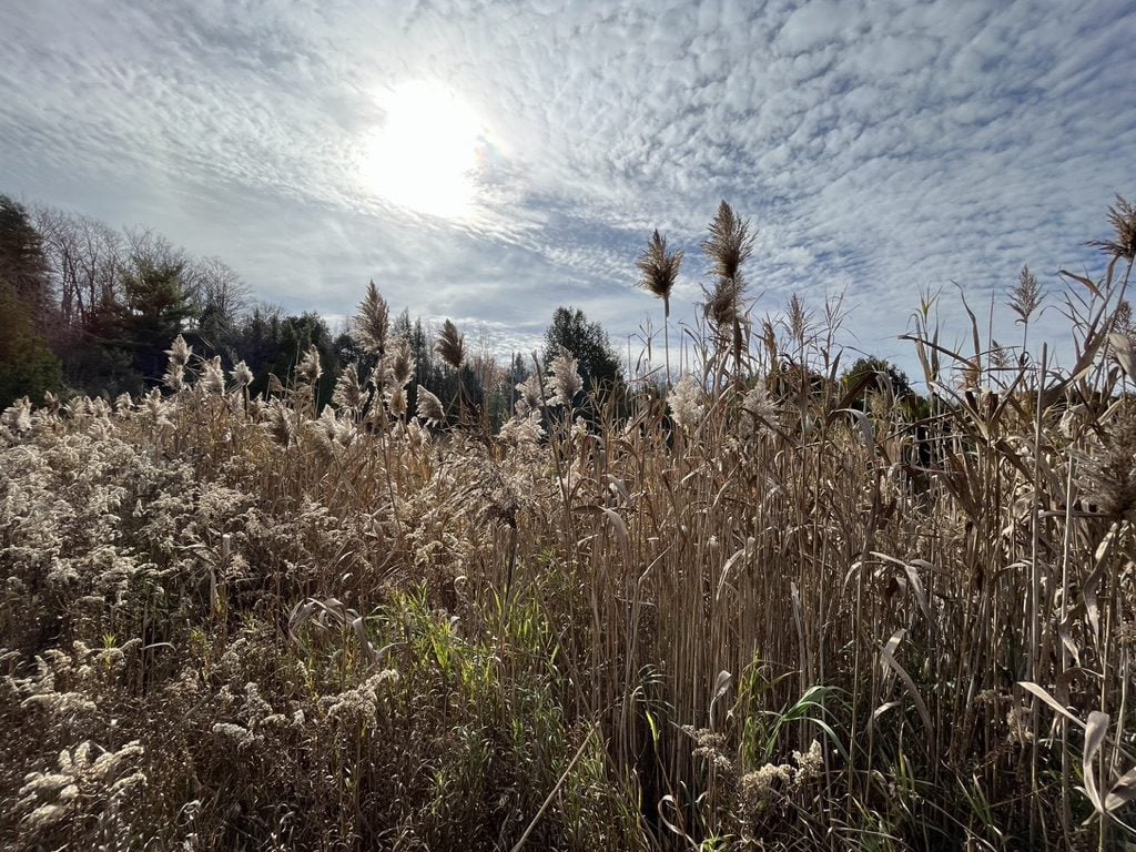
Hockley Valley Provincial Nature Reserve, Glen Cross/Cam Snell Loop Trails
https://hikes.brucetrail.org/event/hockley-valley-provincial-nature-reserve-glen-cross-cam-snell-loop-trails/Sorry, the registration cut-off time for this hike has been reached.Not a member? Click here to join today!Hosting Club: Blue Mountains
Category: Organized Hike
Location (Google Maps): The Glen Cross Side Trail parking lot on 3rd Line EHS, 1.1 km’s north of Hockley Rd.Hike Leader(s): Gordon Sheppard Click here to contact Hike Leader(s)
Pace: Leisurely – 3 km/hr. or less
Terrain: Moderate – Some hills and/or some poor footing
Distance: 7kmDescription
This hike is a bit further afield but is definitely worth the 1 hour drive to the trailhead. The Glen Cross and Cam Snell side trails are two loop trails located in the Hockley Valley Provincial Nature Reserve. The Reserve was established to protect one of the most unique geological areas along the entire Niagara Escarpment. Here the Escarpment and the western end of the Oak Ridges Moraine meet, creating one of Ontario’s most scenic and ecologically important landscapes. The Reserve is also in the Headwaters area where the two river branches that are the source of the Nottawasaga River join on their journey north. This area is unique in the way it combines glacial topography, mature forests, hydrology, and biodiversity. That combination makes it one of the Niagara Escarpment’s most ecologically valuable and rewarding places to explore.This will be a leisurely paced 2.5 hour hike to enjoy everything the area has to offer. There are some steep but short climbs and descents but footing is generally good. Although there could be some slippery areas if it’s been raining in which case hiking poles would be advised. Please make certain to bring water and snacks. For those that wish, we can organize an optional stop on the drive home at the Mono Centre Brewing Co. to slake our thirst.
Urban Walk: Valley View/Huntington Park
https://hikes.brucetrail.org/event/urban-walk-valley-view-huntington-park-18/Sorry, the registration cut-off time for this hike has been reached.Not a member? Click here to join today!Hosting Club: Toronto
Location (Google Maps): Parking lot is off Sycamore Drive, East of Bayview , across Starbucks plaza
Bus 91 from Finch East station stops at Sycamore station.Hike Leader(s): Mohammad Aghamiri
Pace: Moderate (3-4 km/hr)
Terrain: Hilly, Level 2 (Intermediate – some hills and uneven surfaces, rocks and roots underfoot)
Distance (km): 6-7 kmDescription
We will explore Valleyview and Maple View parks, and walk along German Mill Creak, in return we stop in Huntington park and have snack under beautiful shed.Although this is considered an “Urban Walk”, you can expect some hills up and down and uneven surfaces with tree roots. Please bring hiking poles, water and snacks.
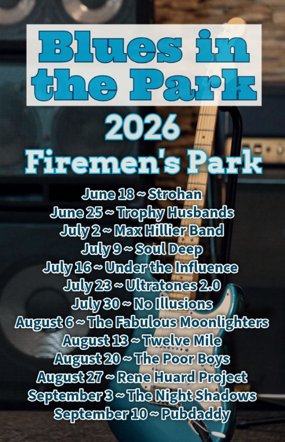
Hike, followed by Blues in the Park
https://hikes.brucetrail.org/event/hike-followed-by-blues-in-the-park-8/Sorry, the registration cut-off time for this hike has been reached.Not a member? Click here to join today!Hosting Club: Niagara
Category: Leisurely
Location (Google Maps):2275 Dorchester Rd, Niagara Falls, ON L2J 0H1
Hike Leader(s): Marion Hanover Click here to contact Hike Leader(s)
Pace: Leisurely <3 km/hr
Terrain: Moderate: some hills and some poor footing
Distance: 4kmDescription
Hike series Thursday evenings throughout the summer, followed by optional Blues in the Park. Come prepared to hike 1.5 leisure hike. Various blues bands free of charge starting at 7pm in the park. Bring lawn chair, beverage and snack to share. - 21August 21, 2026
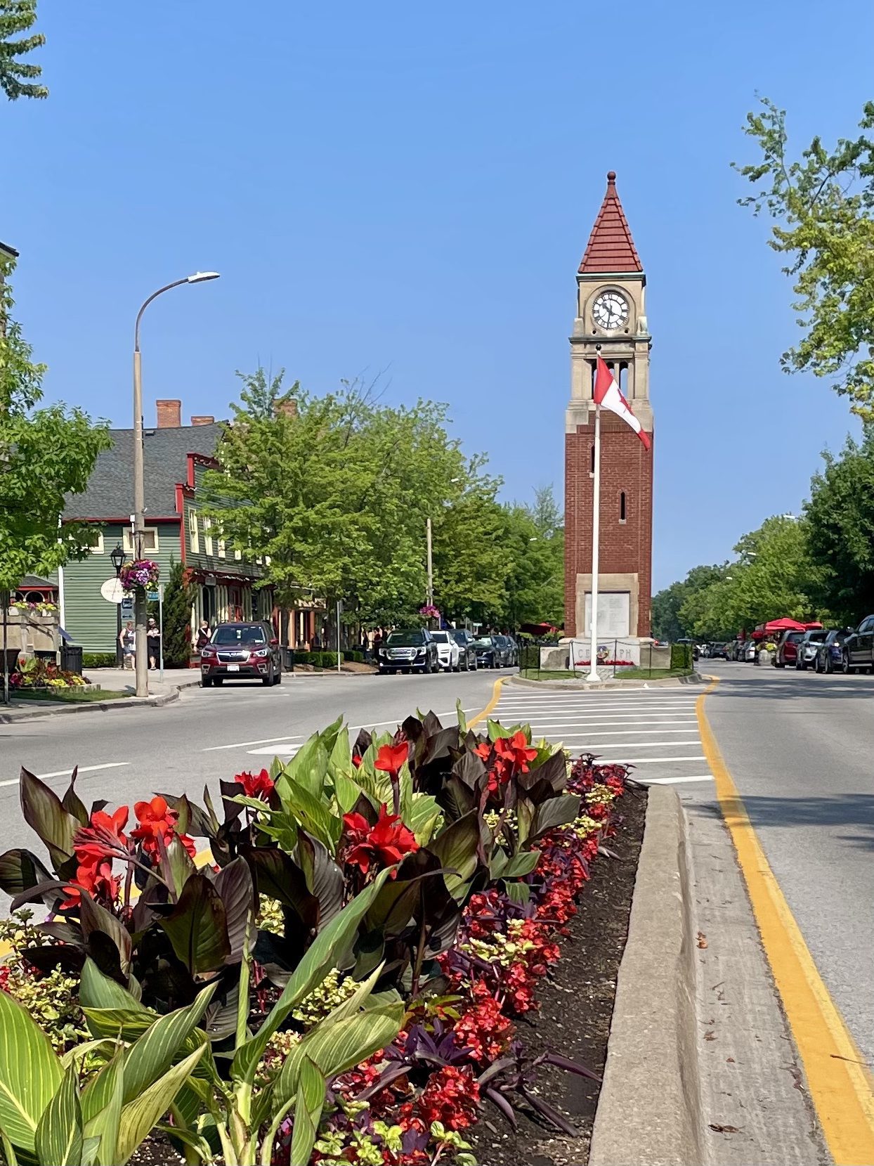
Niagara-on-the-Lake Tour
https://hikes.brucetrail.org/event/niagara-on-the-lake-tour-33/Sorry, the registration cut-off time for this hike has been reached.Not a member? Click here to join today!Hosting Club: Niagara
Category: Urban
Location (Google Maps): Park on King St near Centre St, just outside of Veteran’s Memorial Park, Niagara-on-the-LakeHike Leader(s): Margaret Northfield Click here to contact Hike Leader(s)
Pace: Medium 3- 4 km/hr
Terrain: Easy: mostly flat, good footing
Distance: 6-7kmDescription
Each Friday we will explore Niagara-on-the-Lake while getting a moderate paced walk. Discover where the Niagara River meets Lake Ontario. Experience the Heritage District, woods and the Niagara Parkway.Some weeks may be totally on sidewalks and roads while others may include a mix of trail and paved pathways.
Great way to build up endurance for longer more strenuous hikes.
Plan to stay for conversation and a coffee at Sweets & Swirls, Community Centre, Niagara Stone Rd., NOTL
Urban Walk: CNE Opening Day
https://hikes.brucetrail.org/event/urban-walk-cne-opening-day/Sorry, the registration cut-off time for this hike has been reached.Not a member? Click here to join today!Hosting Club: Toronto
Category: Urban Walk
Location (Google Maps): Toronto Central Waterfront. Meet us by the Jack Layton statue (of him on a bicycle) outside the Jack Layton Ferry Terminal,Hike Leader(s): Tom Swales Click here to contact Hike Leader(s)
Pace: Moderate (3-4 km/hr)
Terrain: Flat, Level 1 (Easy – mostly on flat, well maintained trails with hard-packed surface)
Distance (km): 3.5 kmDescription
Join me to short hike along the Harbourfront to the Princes” gates of the CNE opening day. The opening day deal of $15.00 (50% off full regular admission) will be available at the gates. Feel free to join just for the walk or to explore the fare with the group or do your own thing.Urban Walk: Highland Creek Loop Dog Friendly
https://hikes.brucetrail.org/event/urban-walk-highland-creek-loop-dog-friendly/Sorry, the registration cut-off time for this hike has been reached.Not a member? Click here to join today!Hosting Club: Toronto
Category: Urban Walk
Location (Google Maps):Morningside Park
Hike Leader(s): Lindita Kalo Click here to contact Hike Leader(s)
Pace: Moderate (3-4 km/hr)
Terrain: Flat, Level 1 (Easy – mostly on flat, well maintained trails with hard-packed surface)
Distance (km): 10kmDescription
Dog friendly hike.This lovely paved section includes the Highland Creek trail through forest, This will be an out and back hike.!I have an Aussie. - 22August 22, 2026
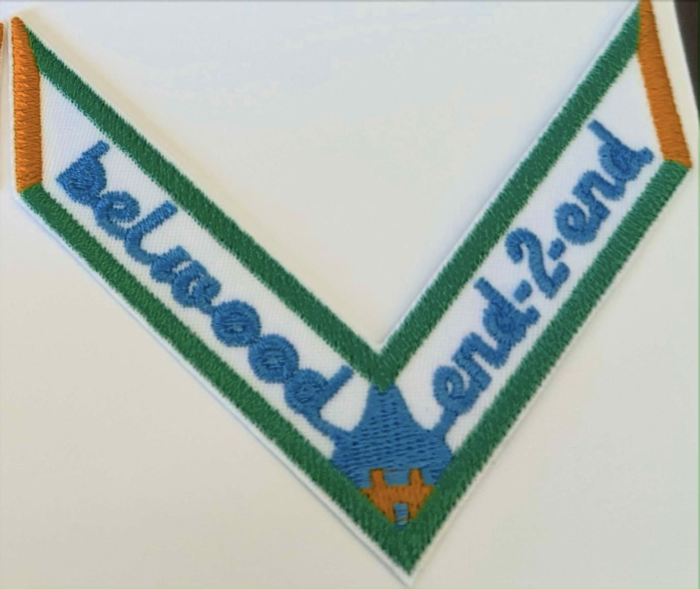
*Belwood Grand Valley Trail One Day End to End
https://hikes.brucetrail.org/event/belwood-grand-valley-trail-one-day-end-to-end/Sorry, the registration cut-off time for this hike has been reached.Not a member? Click here to join today!Hosting Club: Iroquoia
Category: Special Event
Location (Google Maps): Meet at the Belwood Community Hall/Belwood & District Lions ClubHike Leader(s): Ruth Moffatt Click here to contact Hike Leader(s)
Pace: Brisk – 4 to 5 km/hr
Terrain: Dependent on Conditions, Easy – Mostly flat and usually good footing, Moderate – Some hills and/or some poor footing
Distance: 30.8kmDescription
This one day hike is approximately 31km. Please do not register unless you know for certain that you can hike this far at a pace of at least 4km per hour. If first some reason you have to drop out, you will be responsible for finding your own way back to your vehicle.
The Grand Valley Trail stretches from. Port Maitland on Lake Erie in the south to Belwood in the north.This hike is an end to end of the Belwood Section of the Grand Valley Trail – We will meet at the Belwood Community Hall and car shuttle to the start at 43.630704, -80.477034 Township Rd 60 east of Middlebrook Rd at the Grand River and the Middlebrook Bridge. This is a one-day 31km hike suitable for endurance hikers. Please know your physical limit before signing up for this hike. The trail is a combination of road and trail, picturesque towns and topped off with a stop at Belwood Country Market just after we finish.
Please bring at least 2l -3l of water and enough snacks & lunch to get you through the day as well as bug spray, sun screen, a first aid kit and poles if you use them. There are no drop outs. If you cannot finish the hike you will be responsible for getting back to your vehicle.
The Belwood GVT chevron badge will be available either at the end of the hike or by application through the GVT website after we finish. The price is likely to be between $10 and $15. Since badges help to raise funds for the GVT, this hike is intended to raise funds. If you do not collect badges, please consider a donation to the club.
No dogs.
There may be an added fee to hike through the Elora Gorge TBA.
Any questions may be directed through contact on this form.
If you cannot make it, please remove yourself from registration so that a spot can be opened for someone else.To cancel your registration, here is a step by step:
– Sign into your account on the BTC website
– Click on My Hikes under your account
– This will take you to a list of hikes you have registered for
– Scroll down to the appropriate hike and cursor over to the far right hand column under the Action column.
– Click Cancel under the hike you wish to cancel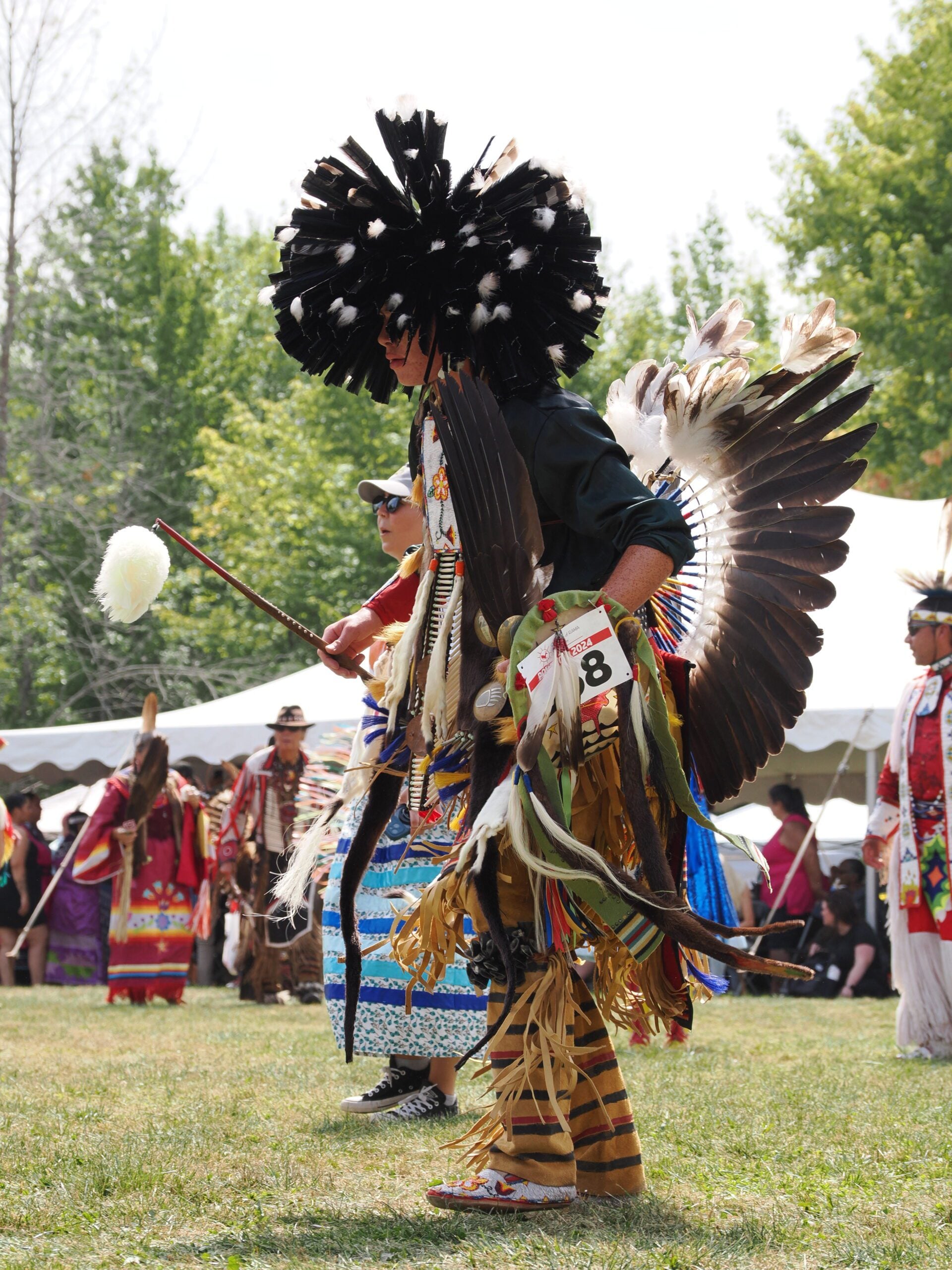
Bus Hike: Rama Pow Wow & Ganaraska Trail Hike
https://hikes.brucetrail.org/event/bus-hike-rama-pow-wow-hike/Sorry, the registration cut-off time for this hike has been reached.Not a member? Click here to join today!Trip Information
Departure Time: 08:00
Return to City Time: 18:30
Departure Point: York Mills Bus PickupOptional Items
Hiking ($.01)Hosting Club: Toronto
Category: Bus Hike
Location (Google Maps): Orillia, ONHike Leader(s): Nijole Mockevicius, Lisa Lifshitz Click here to contact Hike Leader(s)
Pace: Leisurely (2-3 km/hr), Moderate (3-4 km/hr)
Terrain: Level 1 (Easy – mostly on flat, well maintained trails with hard-packed surface), VariableDescription
The Rama Pow Wow is one of the biggest and best in Ontario. We have planned this hike to attend the Grand Entry at 1 pm when all the contestants will be dressed and dancing in their finest. Our morning hike takes place in Scout Valley along the Ganaraska Trail. We will provide a shorter hike of 3 km for naturalists and photographers to observe the flora and fauna in its woodlands of pine and hardwood with scattered wetlands. There is an option as well for a longer hike of 5.5 km. After a short noon-hour bus ride to the nearby Rama reserve, we will have a couple of hours to watch the festivities and shop in the market stalls. We will then return to Orillia to begin a short 3 km hike along the Ganaraska Trail through the Gordon Lightfoot sculpture park, with a stop for ice cream before we head back to Toronto.The bus departs from 10 York Mills Rd. at 8:00 am and Major Mackenzie Dr. and HWY 400 Park and Ride at 8:20 am. If you wish to be picked up at the Major Mackenzie Dr. and HWY 400 Park and Ride, please type ‘yes’ in the additional information field. Please arrive 15 minutes before departure. The bus waits for no one.
Admission to the pow wow is $10 per person, but it is free for those who are 60 of older and for those who are veterans. Payment will be collected on the bus (exact change please).
=>>> Please read the TBTC Paid Hikes Refund Policy before registering: https://torontobrucetrailclub.org/hikes/no-show-policy”. There will be no refunds for this hike if the registrant cancels or misses the coach on the date of departure for any reason. Registration fees are not transferrable between different hikes nor can unused fares qualify for a tax receipt.
Oak Ridges Corridor, Bethesda Trail
https://hikes.brucetrail.org/event/car-hike-rouge-national-park-scarborough-on-4/Sorry, the registration cut-off time for this hike has been reached.Not a member? Click here to join today!Hosting Club: Toronto
Location (Google Maps): Oak Ridges Corridor, Bethesda Trail Head Parking Lot, Bethesda Side Road, Richmond Hill, Ontario
Hike Leader(s): MOHAMMAD AGHAMIRI Click here to contact Hike Leader(s)
Pace: Moderate (3-4 km/hr)
Terrain: Hilly, Level 2 (Intermediate – some hills and uneven surfaces, rocks and roots underfoot)
Distance (km): 12-14 kmDescription
Join us to explore the trails of York Regional Forest and the Oak Ridges Corridor at Jefferson Forest and Bond lake,From parking lot we hike thought Jefferson forest and continue to Bond Lake and have snack beside the lake and return to parking around 1:pm
Please bring lots of water and snacks ,hiking poles are recommended,it is Mosquto and Tick season ,be prepared .
phone number for the day of hike 289 588 6482
Inglis Falls and Moreston Heritage Village - cancelled due to the weather
https://hikes.brucetrail.org/event/inglis-falls-and-moreston-heritage-village/Sorry, the registration cut-off time for this hike has been reached.Not a member? Click here to join today!Hosting Club: Blue Mountains
Category: Cancelled
Location (Google Maps): Tim Horton’s, First Street CollingwoodHike Leader(s): Claire Pearson Click here to contact Hike Leader(s)
Pace: Leisurely – 3 km/hr. or less
Terrain: Moderate – Some hills and/or some poor footing
Distance: ~4.5kmDescription
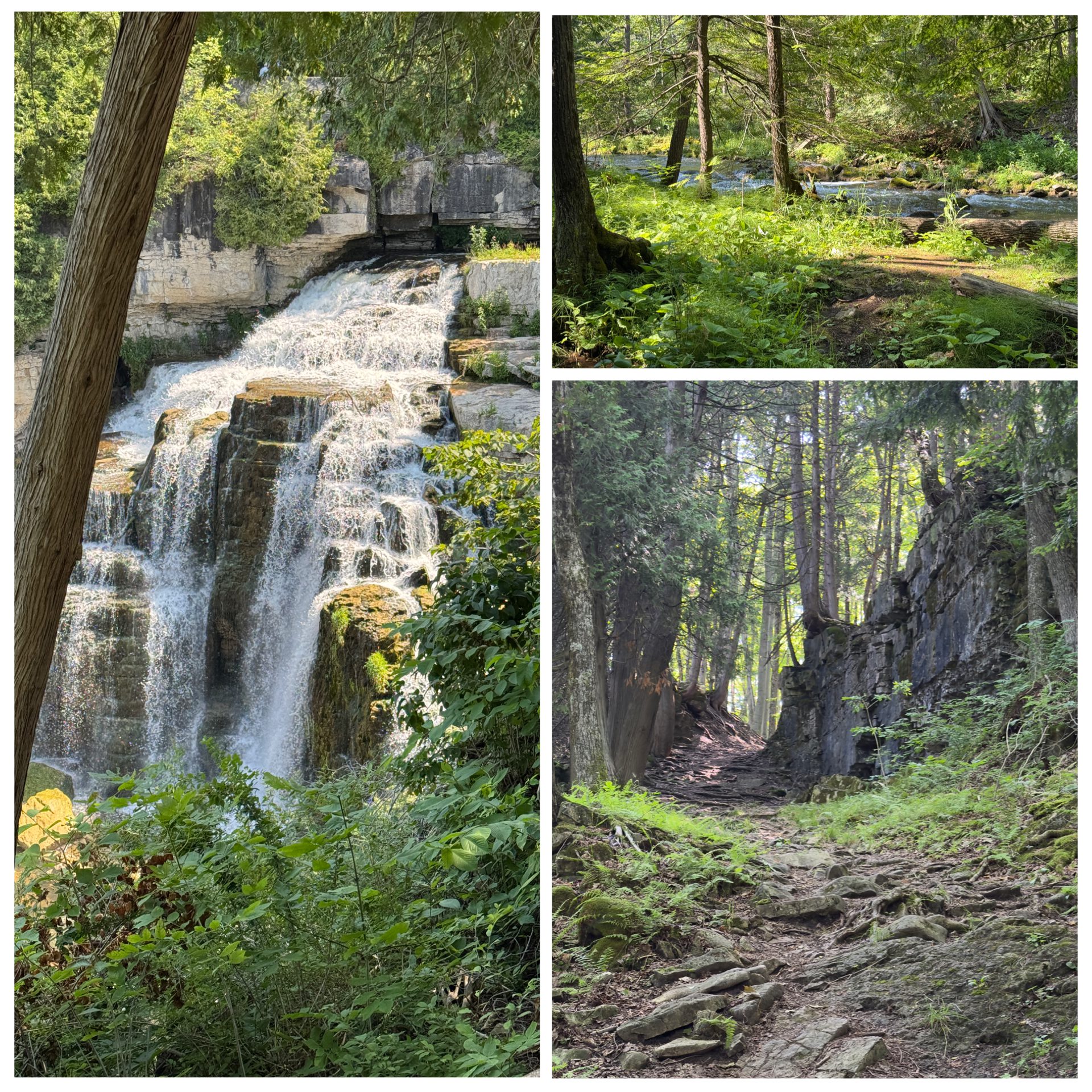
We will meet in the parking lot behind Tim Horton’s. From there we will carpool to Inglis Falls (just outside Owen Sound). It is paid parking ($10 + tax).We will hike a 4 km loop using the Bruce Trail, the Hub Trail, and Pine Loop Trail, taking a few sidetrail extensions to see the Sydenham River at various points and to check out some glacial potholes. When we have completed the loop, we will take in the majestic beauty of Inglis Falls (with lots of photo opportunities), eat the snack/lunch we have brought, and drive to Moreston Heritage Village.
From their website (Moreston Heritage Village), it states, “Moreston is a beautiful 10-acre living history site, home to more than a dozen historic buildings. Costumed interpreters and thousands of artefacts from our collection bring the Village to life, offering visitors a glimpse into Grey County life as it was. From the sight of a 19th century settler tending the garden beside her log cabin home, to the sound of a blacksmith hard at work in the forge – visitors to Moreston are immediately immersed in history.” We will spend ~1.5 hours here walking the grounds, seeing the demonstrations, and visiting the museum. The entry fee to the village for an adult is $12.50 + tax. (Bring your money on the day of the hike.)
Geology Hike and Badge Series - North Saugeen (Bruce) Shoreline
https://hikes.brucetrail.org/event/geology-hike-and-badge-series-north-saugeen-bruce-shoreline/Sorry, the registration cut-off time for this hike has been reached.Not a member? Click here to join today!Hosting Club: Peninsula
Category: Geology Hike
Location (Google Maps): Cyprus Lake/Halfway Log DumpHike Leader(s): Beth Gilhespy Click here to contact Hike Leader(s)
Pace: Leisurely (2.0 – 3.0 km/h): A relaxed pace with frequent breaks and a focus on enjoyment.
Terrain: Difficult: Steep ascents/descents, rocky scrambling, and some rugged escarpment paths., Moderate: Rolling hills, mild slopes and rocky paths.
Distance: 8.0Description
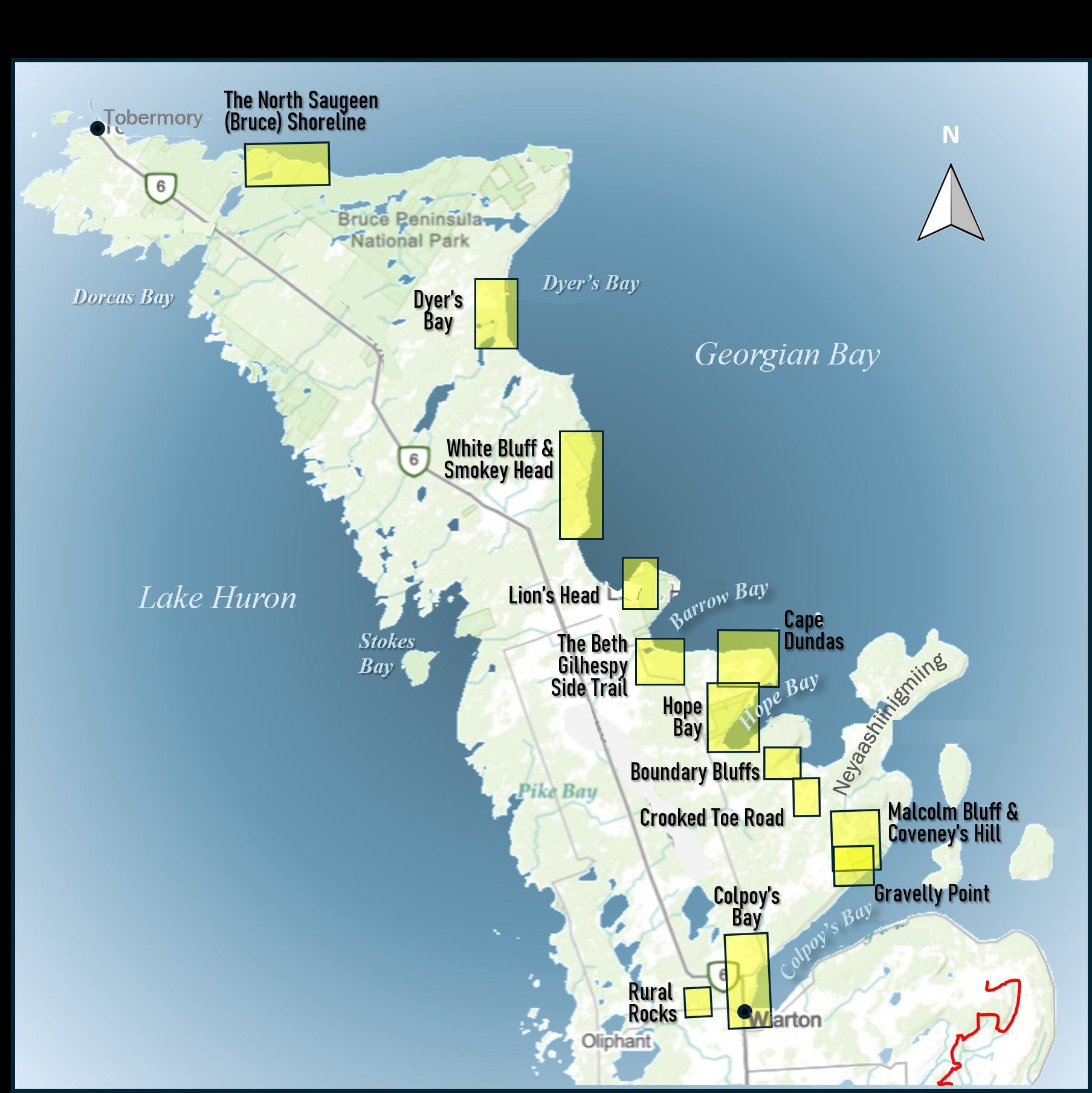
Join the adventure and earn the inaugural Peninsula Geology Badge! Over a stretch of 13 hikes and a couple of extra stops, we will explore the fascinating geology of the Peninsula to learn about the rocks, the shoreline features, glaciation, fossils and all things earthy. The 13 hikes are from the book “Walking Through Time – Exploring the Geology of the Saugeen (Bruce) Peninsula”. Having a copy will give you a lot of great information, but you do not have to purchase the book to attend and enjoy the hikes. Just bring your curiosity! We will make sure to hit all the locations that qualify for the beautiful new Walking Through Time – Saugeen (Bruce) Peninsula geology hike badge. If you would like to purchase a book I will have some available on the hikes, or you can pick one up from the BTC Head Office, at Ginger Press in Owen Sound, Suntrail Source for Adventure in Hepworth, the Shop at 84 Main in Lion’s Head and at Reader’s Haven in Tobermory.You are welcome to come on just a few of the hikes or on all of them, and the dates and hikes are as follows:
Date Geology Hike km
Saturday May 2, 2026 Colpoy’s Bay 9.0
Saturday May 9, 2026 Gravelly Point (am) and Rural Rocks (pm) 8.6
Saturday May 16, 2026 Malcolm Bluff 7.3
Sunday May 17, 2026 White Bluff/Smokey Head 11.8
Sunday May 24, 2026 Crooked Toe Road 5.5
Sunday May 31, 2026 Hope Bay 8.1
Sunday June 14, 2026 Boundary Bluffs 5.2
Saturday July 4, 2026 Cape Dundas 6.2
Saturday July 11, 2026 Beth Gilhespy Side Trail 7.6
Saturday August 8, 2026 Lion’s Head 11.0
Saturday August 15, 2026 Dyer’s Bay Loops 7.5
Saturday August 22, 2026 North Saugeen (Bruce) Shoreline 8.0
Meeting times will vary depending on the hike, but will generally be some time between 9 am and 10 am. Information on exact meeting times and locations will be sent out a few days prior to the hike.

CANCELLED - RAINBOW HIKE: Morning Birding with Pride 🦅🌈 - due to weather
https://hikes.brucetrail.org/event/rainbow-hike-morning-birding-with-pride-feat-lgtb-lets-go-birding-together-%f0%9f%a6%85%f0%9f%8c%88/Sorry, the registration cut-off time for this hike has been reached.Not a member? Click here to join today!Hosting Club: Iroquoia
Category: Rainbow Hike
Location (Google Maps): Bayfront Park at the Hamilton Harbour Waterfront TrailHike Leader(s): Shayne Ward Click here to contact Hike Leader(s)
Pace: Leisurely – 3km/hr or less
Terrain: Easy – Mostly flat and usually good footing
Distance: 5KMDescription
Join us as we kick off Hamilton Pride with LGBT (Let’s Go Birding Together) and a colourful morning of birding! 🦅🦉🦆🌈For this edition, it’s encouraged to come dressed in the colours of your favourite bird! 🌈
This gentle early-morning outing will explore the trails around the Hamilton Harbour and Princess Point, one of our region’s important migration areas. We will start at the trailhead parking lot of the Hamilton Habour Waterfront Trail at Bayfront Park.
Plan to arrive for 845AM and we’ll have a small crash course on downloading and using two popular birding apps, Merlin Bird ID and eBird recording our sightings! We’ll depart by 9-910AM. Hoping to catch some Blue Herons, Swans, Cormorants, and if we’re lucky, a sighting of the RBG resident Bald Eagles! We will end around 11AM when the Hamilton Pride festivities kick off at Pier 4!
🌈 This is a queer-led, 2SLGBTQIA+ inclusive Rainbow Hike, welcoming LGBTQ+ hikers, allies, birders, photographers, and anyone interested in connecting with nature and community. This is a short, relaxed hike (approx. 5 km or less) designed to get us moving and birding!
What to Bring
• Water and light snacks
• Weather-appropriate clothing and sturdy footwear
• Binoculars or camera if you have them (optional but fun! And a cell phone counts!)Not a Bruce Trail member yet?! Sign up here!
https://brucetrail.org/become-a-member/Come enjoy a spring morning on the trail, celebrate migratory birds, and connect with your Bruce Trail community!
🐾 Please leave pets at home for this hike unless required for accessibility support! We are passing through an important bird migration and nesting area, so we want to keep disturbance to our feathered friends to a minimum! 🐦
🚗 🚌 This outing is accessible by car or public transit.
Planning to drive?
Parking is free but limited at Bayfront Park.Taking the Bus?
HSR #99 stops near the trailhead entrance! Map of the bus and it’s schedule can be found here.
https://www.hamilton.ca/sites/default/files/2024-06/hsr-route-99-waterfront-shuttle-jun24_0.pdfFree Bruce Trail Rainbow badges and stickers for all participants!
Questions? Simply click “Contact Hike Leader” on the registration form.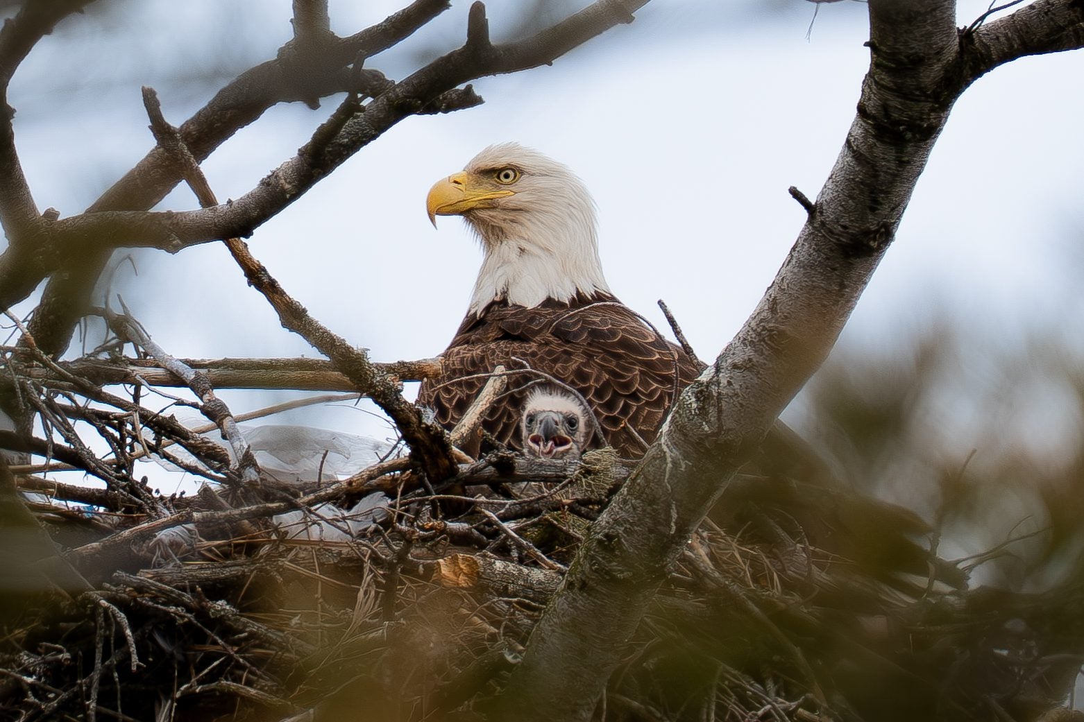
RAINBOW HIKE: Evening Birding with Pride 🦅🌈
https://hikes.brucetrail.org/event/rainbow-hike-evening-birding-with-pride-feat-lgtb-lets-go-birding-together-%f0%9f%a6%85%f0%9f%8c%88/Sorry, the registration cut-off time for this hike has been reached.Not a member? Click here to join today!Hosting Club: Iroquoia
Category: Rainbow Hike
Location (Google Maps): Bayfront Park at the Hamilton Harbour Waterfront TrailHike Leader(s): Shayne Ward Click here to contact Hike Leader(s)
Pace: Leisurely – 3km/hr or less
Terrain: Easy – Mostly flat and usually good footingDescription
Join us as we kick off Hamilton Pride with LGBT (Let’s Go Birding Together) and a colourful evening of birding! 🦅🦉🦆🌈For this edition, it’s encouraged to come dressed in the colours of your favourite bird! 🌈
This gentle late-afternoon outing will explore the trails around the Hamilton Harbour and Princess Point, one of our region’s important migration areas. We will start at the trailhead parking lot of the Hamilton Habour Waterfront Trail at Bayfront Park.
Plan to arrive for 615PM and we’ll have a small crash course on downloading and using two popular birding apps, Merlin Bird ID and eBird recording our sightings! We’ll depart by 630-640PM. Hoping to catch some Blue Herons, Swans, Cormorants, and if we’re lucky, a sighting of the RBG resident Bald Eagles! We will end around 830PM when the evening Hamilton Pride festivities kick off at Pier 4!
🌈 This is a queer-led, 2SLGBTQIA+ inclusive Rainbow Hike, welcoming LGBTQ+ hikers, allies, birders, photographers, and anyone interested in connecting with nature and community. This is a short, relaxed hike (approx. 5 km or less) designed to get us moving and birding!
What to Bring
• Water and light snacks
• Weather-appropriate clothing and sturdy footwear
• Binoculars or camera if you have them (optional but fun! And a cell phone counts!)Not a Bruce Trail member yet?! Sign up here!
https://brucetrail.org/become-a-member/Come enjoy a spring morning on the trail, celebrate migratory birds, and connect with your Bruce Trail community!
🐾 Please leave pets at home for this hike unless required for accessibility support! We are passing through an important bird migration and nesting area, so we want to keep disturbance to our feathered friends to a minimum! 🐦
🚗 🚌 This outing is accessible by car or public transit.
Planning to drive?
Parking is free but limited at Bayfront Park.Taking the Bus?
HSR #99 stops near the trailhead entrance! Map of the bus and it’s schedule can be found here.
https://www.hamilton.ca/sites/default/files/2024-06/hsr-route-99-waterfront-shuttle-jun24_0.pdfFree Bruce Trail Rainbow badges and stickers for all participants!
Questions? Simply click “Contact Hike Leader” on the registration form.