
Scheduled Outage: Our website will be down for planned system upgrades for an estimated duration of Mon. Aug. 24, 7:00 pm - Tues. Aug. 25, 6:00 am.
Hike Schedule
Join us for a hike! Registration required.
All hikes available to BTC members. Some hikes are open to non-members.
See Refund Policy for Paid Hikes >
TIP: The calendar view displays up to 7 hikes on a day, but often there are more. Click “View more events” to see them all.
Niagara
Iroquoia
Toronto
Caledon Hills
Dufferin Hi-Land
Blue Mountains
Beaver Valley
Sydenham
Peninsula
All Clubs
Show Filters
Categories
Reset Filters
- 26October 26, 2025
October 26-27, 2025 - Reg. by Sept 9 - Owen Sound Fern Hike & repositioning of the Chi Cheemaun (1 night)
https://hikes.brucetrail.org/event/october-26-27-2025-owen-sound-fern-hike-repositioning-of-the-chi-cheemaun-1-night/Sorry, the registration cut-off time for this hike has been reached.Not a member? Click here to join today!This is a Multi-Day Hike
You are signing up for the following dates:
2025-10-26, 2025-10-27Hosting Club: Toronto
Category: Car Hike
Location (Google Maps): Owen Sound area of the Bruce Trail – meeting location TBD.Hike Leader(s): Jeanette Vincent and Karen Buschert Click here to contact Hike Leader(s)
Pace: Moderate (3-4 km/hr)
Terrain: Hilly, Level 2 (Intermediate – some hills and uneven surfaces, rocks and roots underfoot), Rocky, Variable
Distance: 15kmDescription
Please join Karen Buschert and Jeanette Vincent on a new excursion; a Fern Hike in the Owen Sound area of the Bruce Trail and the repositioning of the Chi Cheemaun. This Fern Hike is in an exquisite area as the Bruce Trail forms a ribbon around the city along the escarpment connecting natural attractions; waterfalls, rivers, spectacular geology as it twists and weaves through crevices, hugs the cliff face and over large boulders.We will meet in the Owen Sound area on Sunday, October 26 for a 10:00am hike. The meeting location will be determined once we find the ultimate fern route approximately 15 km.
Accommodation for this event – see details below.
Monday morning, October 27th we make our way to Owen Sound to park and they bus us to Tobermory for the repositioning of the Chi Cheemaun. Parking information will be sent to those registered.
Ticket sales begin in September. You purchase your own ticket – $80.00 per person which includes your bus ride to Tobermory, ferry ride, buffet lunch and entertainment.y SIMPORTANT NOTE: Please register for this event by Sept 9th because it is important to book immediately for the repositioning of the Chi- Cheemaun which is open on September 10th. More details for those who will participate please email vincentjeanette1604@gmail.com by Sept. 9th.
The Fall Repositioning Cruise will mark the end of the sailing season for the MS Chi-Cheemaun, as she journeys from Tobermory to Owen Sound Harbour for her winter berth.
It is very nice to see the Bruce Peninsula escarpment from the waters of Georgian Bay knowing we all or most of us have hiked the trails!
Where: BTC Map 32 approx.15 km – Owen Sound area – meeting place to be determined and GPS location given to those registered for the event.
Length: About 15 km
Category: Linear with car shuttle
Pace: Moderate pace 3.50 km/hr, 5-5 1/2 hours includes lunch stop and short breaks. Add on the car shuttle.
Level 2 (Intermediate – some hills and uneven surfaces, rocks and roots underfoot)Reservation Details:
Once you register on the hiking site please contact the hike leaders for more information about the hike and repositioning of the Chi Cheemaun.Hike Leaders Contact:
Jeanette Vincent vincentjeanette1604@gmail.com
Karen Buschert karen.buschert@gmail.comAccommodation Details:
Sunday evening to Monday morning overnight accommodations are available at Silver Lake Mennonite Camp. This location is 1/2 hour from Owen Sound at 72 Pine Forest Dr. Sauble Beach, ON N0H 2G0. 44.616886, -81.256235
The one-night stay at camp on Sunday night, no food provided (other than coffee) for $75+ HST. Fridge and small kitchen, microwave (no stove) is available. A maximum of 20 people.
For accommodation please contact Karen hr@slmc.ca using this email address.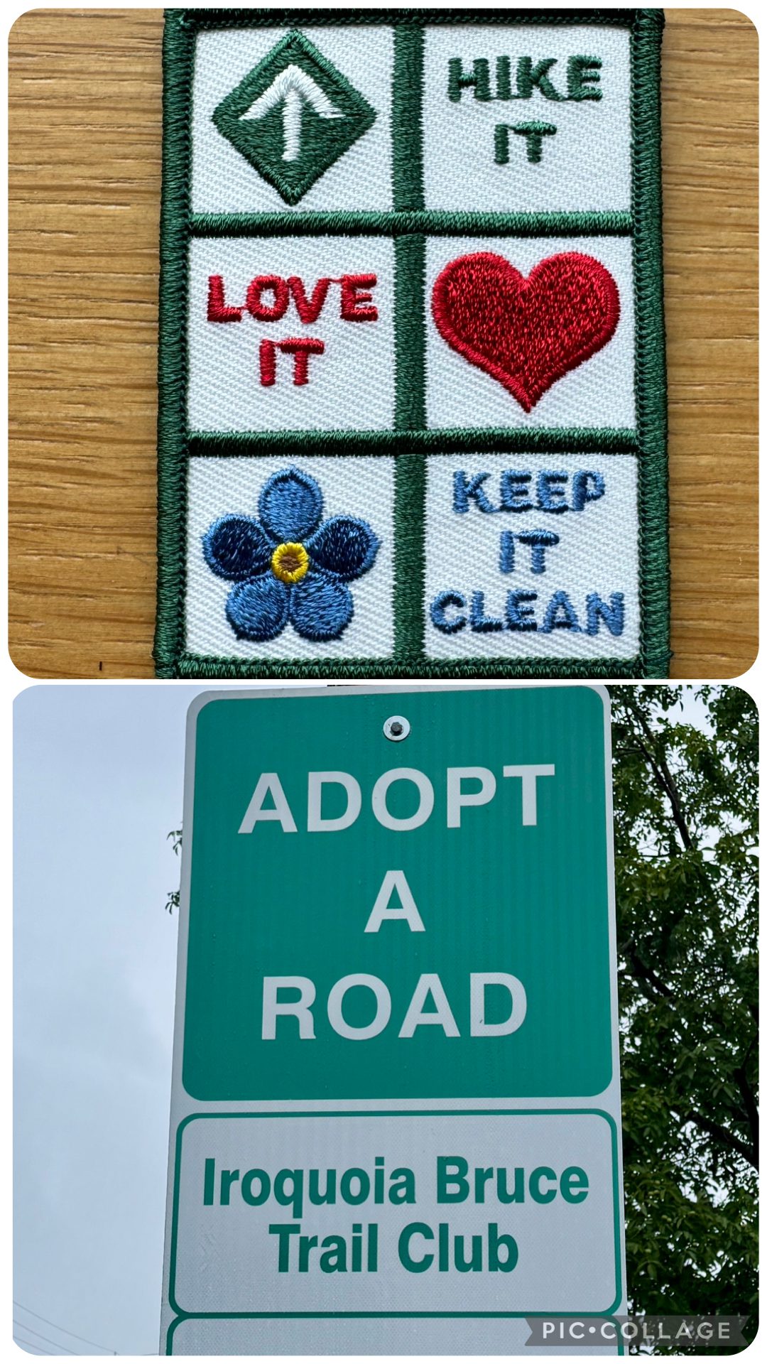
Adopt-a-Road Clean-up
https://hikes.brucetrail.org/event/adopt-a-road-clean-up-2/Sorry, the registration cut-off time for this hike has been reached.Not a member? Click here to join today!Hosting Club: Iroquoia
Category: Special Event
Location (Google Maps): Iroquoia Bruce Trail Club is pleased to participate in a community clean up each year.
Please park behind the shelter near the ball diamonds. After the clean-up, we will hike up and down the Adam Dopko Side Trail. This is quite a rugged trail and is optional.Hike Leader(s): Ruth Moffatt Click here to contact Hike Leader(s)
Pace: Leisurely – 3km/hr or less
Terrain: Moderate – Some hills and/or some poor footing
Distance: 3-4km + the hike up/down Adam Dopko Side TrailDescription
This is an Adopt-a-Road event. Safety vests, bags and gloves will be supplied. You will only need to bring water and snacks, if you need. It will involve cleaning up the trash from both sides of Regional Rd 81 in Grimsby from Casablanca to Oakes Rd. This event will involve a lot of bending and walking. All instructions and safety precautions will be provided to participants.
Participants will each receive a Keep it Clean badge after we finish the clean up. This is a group activity and is intended to foster community involvement and awareness for the Iroquoia Bruce Trail Club.In the event of inclement weather, this event will be moved to November 30.
Limited to 8 participants.
Car Hike: Scotsdale Farm
https://hikes.brucetrail.org/event/car-hike-scotsdale-farm-16/Sorry, the registration cut-off time for this hike has been reached.Not a member? Click here to join today!Hosting Club: Caledon Hills
Category: General
Location (Google Maps): Scotsdale Farm, Map 13. Directions; from Highway 401, head north on Trafalgar Road past Georgetown. Trafalgar briefly merges with Highway 7 for about 3 km before separating to the right at the village of Silver Creek. At the stop light in Silver Creek, continue north on Trafalgar Road for about 1 km to the entrance of Scotsdale Farm on your right. Drive in about half a kilometre to reach the parking area.Hike Leader(s): Dylan “Lana” Hubbard Click here to contact Hike Leader(s)
Pace: Medium – 3 to 4 km/hour
Terrain: Moderate – some hills and/or some poor footing
Distance: 14 kmDescription
Join us for a loop hike along the main Bruce Trail and its scenic side trails, including the stunning Great Esker Side Trail.Please dress appropriately for the weather, bring plenty of water, and pack some snacks. Note that parts of the trail are rocky, so poles are highly recommended.
We are committed to fostering an inclusive and welcoming environment. This hike is an LGBTQ+ safe space, and everyone is encouraged to join us!
Toronto End-to-End in Four - Terra Cotta to The Grange
https://hikes.brucetrail.org/event/toronto-end-to-end-in-four-terra-cotta-to-the-grange/Sorry, the registration cut-off time for this hike has been reached.Not a member? Click here to join today!Hike open to BTC Members only.
Hosting Club: Dufferin Hi-Land
Category: General Hike
Location (Google Maps): Off road parking located on a very short dirt road off Winston Churchill Blvd just south of the Main Trail. North of entrance to Terra Cotta CA at top of hill. Busy Road and blind corner. Please be careful.Hike Leader(s): Stuart Law; Kerry Seong Click here to contact Hike Leader(s)
Pace: Medium
Terrain: Slippery and Steep Sections, Moderate
Distance: 14 kmsDescription
Join us on a four-hike end-to-end hike series covering the Toronto Section plus a few kilometres up to The Grange. Today’s hike is the fourth and final hike of that shuttle series. We will make our way on the Main Trail from Terra Cotta to The Grange. Please bring 2.5L of water, a snack, a lunch, and a smile. Please also bring footwear to change into after the hike and a garbage bag to put your boots in for the shuttle. Hiking boots mandatory. Poles very much recommended. It will be quite rocky in sections. Please arrive at 9 am and be ready to shuttle at 9:15 sharp.
Speyside to Hilton Falls (E2E)
https://hikes.brucetrail.org/event/speyside-to-hilton-falls-e2e-2/Sorry, the registration cut-off time for this hike has been reached.Not a member? Click here to join today!Hosting Club: Iroquoia
Location (Google Maps): Meet at 9:15 am in the Hilton Falls parking lot
Hike Leader(s): Karen Bergmann Click here to contact Hike Leader(s)
Pace: Medium – 3 to 4 km/hr
Terrain: Moderate – Some hills and/or some poor footing
Distance: 12 kmsDescription
We will meet at Hilton Falls and carpool to Speyside on 15 Side Road. For those leaving their car at Hilton Falls, you will need to reserve your time at conservationhalton.caThis is a challenging hike because there are several technical (rocky) spots. We hike on the main trail along the edge of the Escarpment and will stop for a break by the Quarry, finishing along the Philip Gosling Side Trail.
Bring a snack/lunch and plenty of water.
10:00 Witch of Cave Spring Hike
https://hikes.brucetrail.org/event/1000-witch-of-cave-spring-hike/Sorry, the registration cut-off time for this hike has been reached.Not a member? Click here to join today!Hosting Club: Niagara, Caledon Hills
Category: In and Out
Location (Google Maps):Parking lot Quarry Road Beamsville
Hike Leader(s): Angela Lytle Click here to contact Hike Leader(s)
Pace: Medium
Terrain: Moderate
Distance: 5 kmDescription
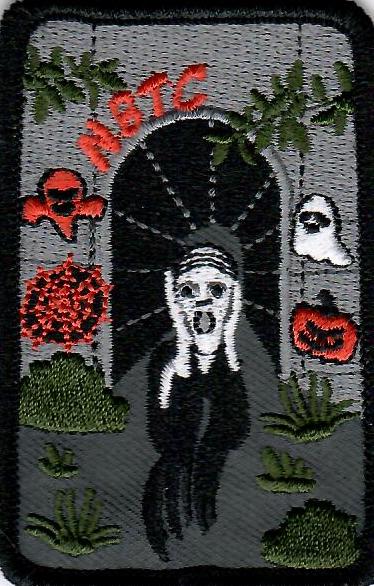
Enjoy a beautiful hike through the autumn woods and learn about local historical and mystical lore while searching for the Witch of Cave Spring.Complete this guided hike and count it towards the Screaming Tunnel Badge, more info on the badge requirements is here: https://niagarabrucetrail.club/badges/
Wearing a witch hat, while not required, is highly recommended!
Details:
This hike loops from Quarry Rd in Beamsville (limited parking, carpool if possible) along the Bruce Trail to Cave Spring Conservation area and back.
Note: The path to Cave Spring runs along the escarpment edge and is quite rocky and has some hills. We can adjust the pace but be prepared for some rocky, uneven footing and clambering up and down. We recommend using hiking poles and wearing good hiking shoes is a must. Carry water and dress for changeable weather.
We will stop along the way at sites of interest and loop back to the car park on Quarry Rd. The loop is around 5 km. Please arrive by 9:50 to check in with the hike leader for departure at 10.
Exploring Sydenham Hike #34 The Gap
https://hikes.brucetrail.org/event/exploring-sydenham-hike-34-the-gap/Sorry, the registration cut-off time for this hike has been reached.Not a member? Click here to join today!Hosting Club: Sydenham
Category: General Hike
Location (Google Maps):The Owen Sound Galaxy Cinema parking lot. Meet at the tall “Galaxy Centre” sign next to the traffic lights.
Hike Leader(s): Bill Snel Click here to contact Hike Leader(s)
Pace: Leisurely: 3 km/h or less
Terrain: Moderate: Some hills and/or poor footing
Distance: 3.5 kmDescription
We will carpool to do a loop hike of The Gap. This is hike 34 in the book Exploring Sydenham. There will be one secret to find. If you do not have a book and would like one ($30) let me know by using the “Contact hike leader” link. - 27October 27, 2025
Niagara End-to-End #2 of 6
https://hikes.brucetrail.org/event/niagara-end-to-end-2-of-6/Sorry, the registration cut-off time for this hike has been reached.Not a member? Click here to join today!Hosting Club: Niagara, Iroquoia
Category: General Hike
Location (Google Maps): Parking Lot at Decew House Heritage Park. Enter from Decew Road, 500 m west of Merritville Highway.Hike Leader(s): Pati Greenwood, Jeff Dowsett Click here to contact Hike Leader(s)
Pace: Medium – 3 to 4 km/hr
Terrain: Moderate – Some hills and/or some poor footing
Distance: 16.3 kmDescription
This second hike of the series will start at Woodend Conservation Area and take us across the Welland Canal and through the City of St. Catharines. The hike will finish at Decew House Heritage Park.Weather conditions in the fall can be changeable, so it’s best to dress in layers and come prepared for varying conditions throughout the day. Insects, particularly ticks, are still active in the fall months, so take appropriate precautions to avoid them including using repellant and wearing clothing that covers the legs and arms. Hiking boots are required and hiking poles are recommended.
Bring plenty of fluids, including electrolytes, and a snack.
Since this is a group hike, please consider your fitness level before registering. We will be walking at a pace of 3km – 4km per hour and everyone is expected to keep up with the person in front of them for the duration of the hike.
Plan to arrive at the meeting place by 8:15 a.m. as we will start the car shuffle to the hike starting point at 8:30 a.m. sharp. Further details will be provided to registered hikers a few days prior to the hike.
Walk and Talk Rocks: Mono Cliffs
https://hikes.brucetrail.org/event/walk-and-talk-rocks-mono-cliffs-3/Sorry, the registration cut-off time for this hike has been reached.Not a member? Click here to join today!Hosting Club: Caledon Hills
Category: General
Location (Google Maps): Meet at the parking lot at Mono Community Centre. The centre is located at 754483 Mono Centre Rd. Please park in the gravel surface lot. Please aim to arrive at 9:15 am, so we can begin the hike at 9:30 am.Hike Leader(s): Elizabeth Ganong Click here to contact Hike Leader(s)
Pace: Leisurely – 3 km/hour or less, Medium – 3 to 4 km/hour
Terrain: Moderate – some hills and/or some poor footing
Distance: Approximately 9.5 kmDescription
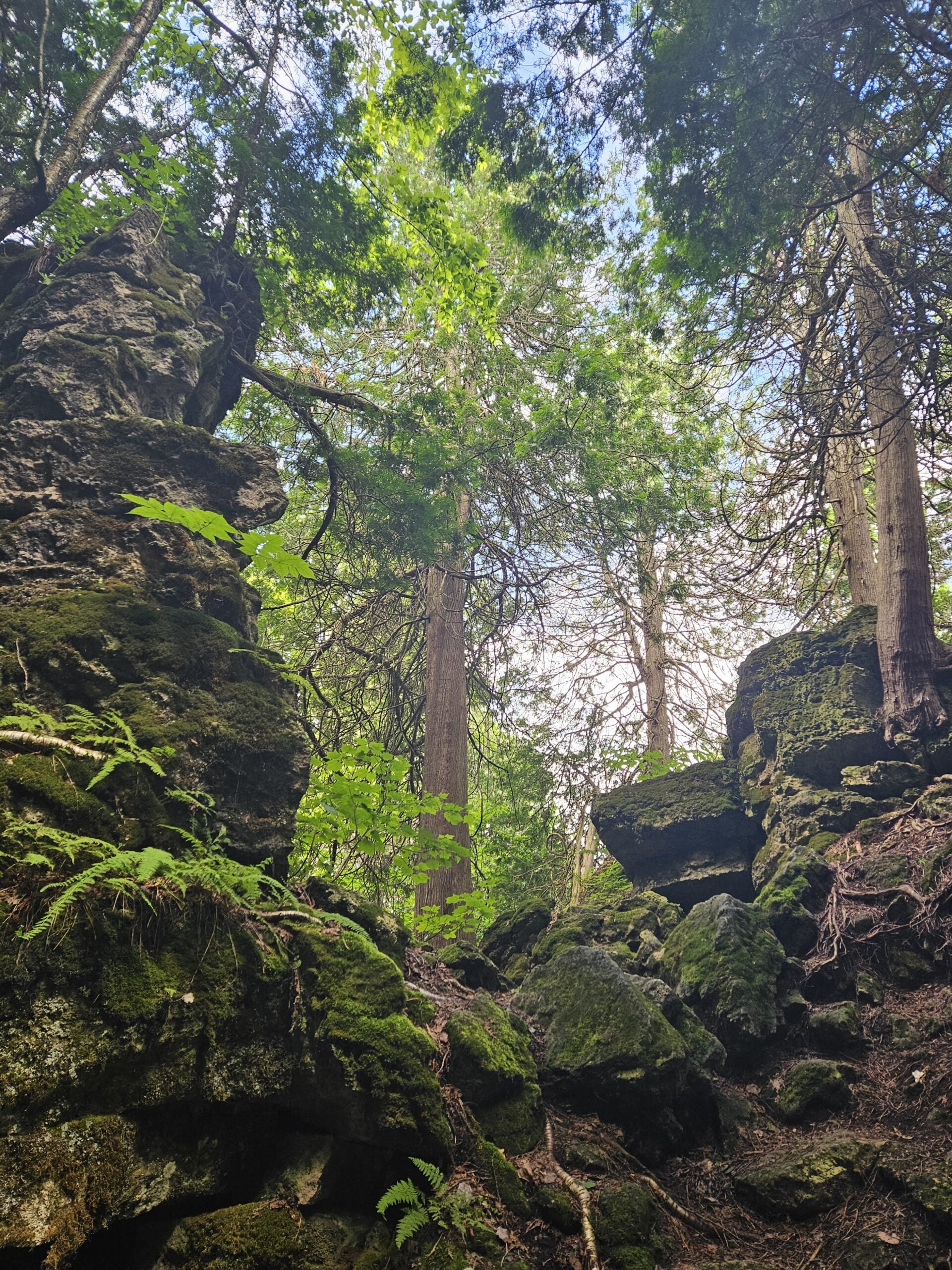
Let’s rock it out and explore the geology of Mono Cliffs. We’ll hike mainly at a leisurely pace over the approximately 9.5 km route as we cover many of the highlights of Mono Cliffs Provincial Park. Dr. Kathy Wallace will provide an introductory-level look at the geology of the park that welcomes your curiosity. Plan on a lunch break at a spectacular look-out, a total time out around four or four and a half hours, and having your way of engaging with the trail expanded. This interactive hike was created for a small group. Things to consider as you prepare for the hike: sunscreen, a hat, insect repellent, hiking shoes/boots, poles, water, snack/lunch. No dogs please.Novice Hikers - Fall Series of 10 Hikes in Dufferin, Hike 10
https://hikes.brucetrail.org/event/novice-hikers-fall-series-of-10-hikes-in-dufferin-hike-10/Sorry, the registration cut-off time for this hike has been reached.Not a member? Click here to join today!Hosting Club: Caledon Hills
Category: Introductory
Location (Google Maps): Meet at BTC parking area at km 53.1 on the south side of 30 Sideroad 100 m east of the Bruce Trail. Map 21Hike Leader(s): Nancy Mooney Click here to contact Hike Leader(s)
Pace: Leisurely – 3 km/hour or less, Medium – 3 to 4 km/hour
Terrain: Easy – mostly flat and usually good footing, Moderate – some hills and/or some poor footing
Distance: 6.4 km shuttleDescription
A leisurely last hike to enjoy the fall colours and a snack after! - 28October 28, 2025

Heather & Steve's 3rd Annual Fall Cairn to Cairn - Blue Mountains section
https://hikes.brucetrail.org/event/heather-steves-3rd-annual-fall-cairn-to-cairn-blue-mountains-section/Sorry, the registration cut-off time for this hike has been reached.Not a member? Click here to join today!Hike open to BTC Members only.
This is a Multi-Day Hike
You are signing up for the following dates and times:
2025-10-28 at 07:45
2025-10-29 at
2025-10-30 atHosting Club: Caledon Hills, Blue Mountains
Category: End-to-End
Location (Google Maps): Parking area – north of km 46.8 (Map 23), found 380 m north of the main trail crossing on Pretty River Rd. (Capacity 15 cars)Hike Leader(s): Heather Murch Click here to contact Hike Leader(s)
Pace: Brisk – 4 to 5 km/hour
Terrain: Strenuous – hilly with steep climbs and some poor footing
Distance: 25.4 kmDescription
This hike series covers the Blue Mountains section; 69 km over 3 days.We will meet each morning at 7:45 and be ready to shuttle at 8:00. Hikers will take turns shuttling and taking drivers to their cars each day. Any parking costs will be shared among hikers.
Hikers should wear layered clothing, hiking boots, poles, hat, sunscreen, bug spray, rain gear and bring plenty of water, snacks and lunch. We will hike rain or shine.
Full itinerary will be emailed to hikers the week before the first hike.
Urban Walk: Valley View Park Thornhill 139
https://hikes.brucetrail.org/event/urban-walk-valley-view-park-thornhill-114/Sorry, the registration cut-off time for this hike has been reached.Not a member? Click here to join today!Hosting Club: Toronto
Location (Google Maps): Parking lot is off Sycamore Drive East of Bayview , across Starbucks plaza
Bus 91 from Finch east station stops at Sycamore station.Hike Leader(s): Mohammad Aghamiri Click here to contact Hike Leader(s)
Pace: Moderate (3-4 km/hr)
Terrain: Hilly, Level 2 (Intermediate – some hills and uneven surfaces, rocks and roots underfoot), Variable
Distance: 7-8 kmDescription
We will explore Valleyview and Maple View parks, and walk along German Mill Creak, in return we stop in Huntington park and have snack under beautiful shed ,Even it is considered Urban walk, it is urban hike as we have some up and down hills and tree roots, please bring your hiking poles, water and snacks,
phone number for the day of hike 289 588 6482
9:00 Long Hike Wiley Road Short Hills NEW TIME
https://hikes.brucetrail.org/event/900-long-hike-wiley-road-short-hills-new-time-3/Sorry, the registration cut-off time for this hike has been reached.Not a member? Click here to join today!Hosting Club: Niagara
Location (Google Maps):
Short Hills Wiley Road Entrance
Pace: Medium
Terrain: Moderate
: 10kmDescription
Explore Short Hills and the majestic side trails of Scarlett Tanager, Hemlock. Swayze Falls and Terrace. Register for each hikeBring Poles, , snack, and dress for the weather
9:15 Short hike, Pelham Road entrance, Short Hills
https://hikes.brucetrail.org/event/915-short-hike-pelham-road-entrance-short-hills-2/Sorry, the registration cut-off time for this hike has been reached.Not a member? Click here to join today!Hosting Club: Niagara
Category: Loop
Location (Google Maps): Short Hills Provincial Park, Pelham Road entranceHike Leader(s): janet davey Click here to contact Hike Leader(s)
Pace: Medium
Terrain: Moderate
Distance: 6 kmsDescription
Hike the main and side trails in Short Hills Provincial Park. Please wear hiking boots and bring water.Hockley/Humber Valley
https://hikes.brucetrail.org/event/hockley-humber-valley-2/Sorry, the registration cut-off time for this hike has been reached.Not a member? Click here to join today!Hosting Club: Dufferin Hi-Land
Category: Tuesday Hike
Location (Google Maps):Map 17, near Km 43.3
7th Line Parking Lot, at Airport RdHike Leader(s): Julie Daley, Les Babbage, Inge Eckerich, Tony Evangelista Click here to contact Hike Leader(s)
Pace: Medium
Terrain: Slippery and Steep Sections, Moderate
Distance: 7 km; Short hike 3.5 kmDescription
From the 7th Line Parking lot we will hike south along the Main Trail to Hwy 9, and return on the same route. There are some hills and steep sections. Short hike will be to Km 41.6 and return, 3.5 km. Please bring water and snack.Halton Regional Forest
https://hikes.brucetrail.org/event/halton-regional-forest-2/Sorry, the registration cut-off time for this hike has been reached.Not a member? Click here to join today!Hosting Club: Caledon Hills
Category: Tuesday Hikers
Location (Google Maps): Parking at:10 Side Road and 4th Line Nassagaweya (trail entrance to Halton Regional Forest).
From Highway 401 West, turn right (north) on Guelph Line, right on 10 Side Rd. The road bends northwards and becomes 4th Line Nassagaweya; roadside parking at the bend.Hike Leader(s): Mohammad Shafiq Click here to contact Hike Leader(s)
Pace: Medium – 3 to 4 km/hour
Terrain: Moderate – some hills and/or some poor footing
Distance: 12 kmDescription
Will hike trails in Halton Regional Forest and Hilton Falls Conservation Area; beautiful trails are relatively flat with some rocky parts. Snack break at Hilton Falls, possibly around fire pit.
Bring water and snack. Poles are recommended.
Hike leader cell phone: 416-566-0503 (note that reception in hiking area is usually poor, leave a message for a return call).Mt Nemo to Kilbride
https://hikes.brucetrail.org/event/mt-nemo-to-kilbride-3/Sorry, the registration cut-off time for this hike has been reached.Not a member? Click here to join today!Hosting Club: Iroquoia
Category: General Hike
Location (Google Maps): We will meet/park at the back of Kilbride Public School (6611 Panton St.) at 9:30 SHARP and then shuttle to the upper parking lot of Mt Nemo CA (Guelph Line). I will need drivers with a Halton Conservation Pass to help shuttle hikers and would appreciate it if you would preregister a spot at the Mt Nemo parking lot. Thank you!
PLEASE NOTE: The starting point of this hike has changed due to construction on Walkers Line which has the lower parking at Mt. Nemo temporarily closedHike Leader(s): Karen Capindale-Smith Click here to contact Hike Leader(s)
Pace: Medium – 3 to 4 km/hr
Terrain: Strenuous – Hilly with steep climbs and some poor footing
Distance: +/-12 kmDescription
We will be completing the North loop of the CA before leaving the park and walking along side various country properties before descending into the Cedar Springs Valley. From there we will cross Bronte Creek before climbing a series of strenuous hills out of the valley and into the village of Kilbride. Please remember to bring appropriate clothing layers, footwear, water, a snack and lunch. If time permits we will complete the River and Ruin side trail while in the Cedar Springs Valley.Baked goods can be expected 🙂
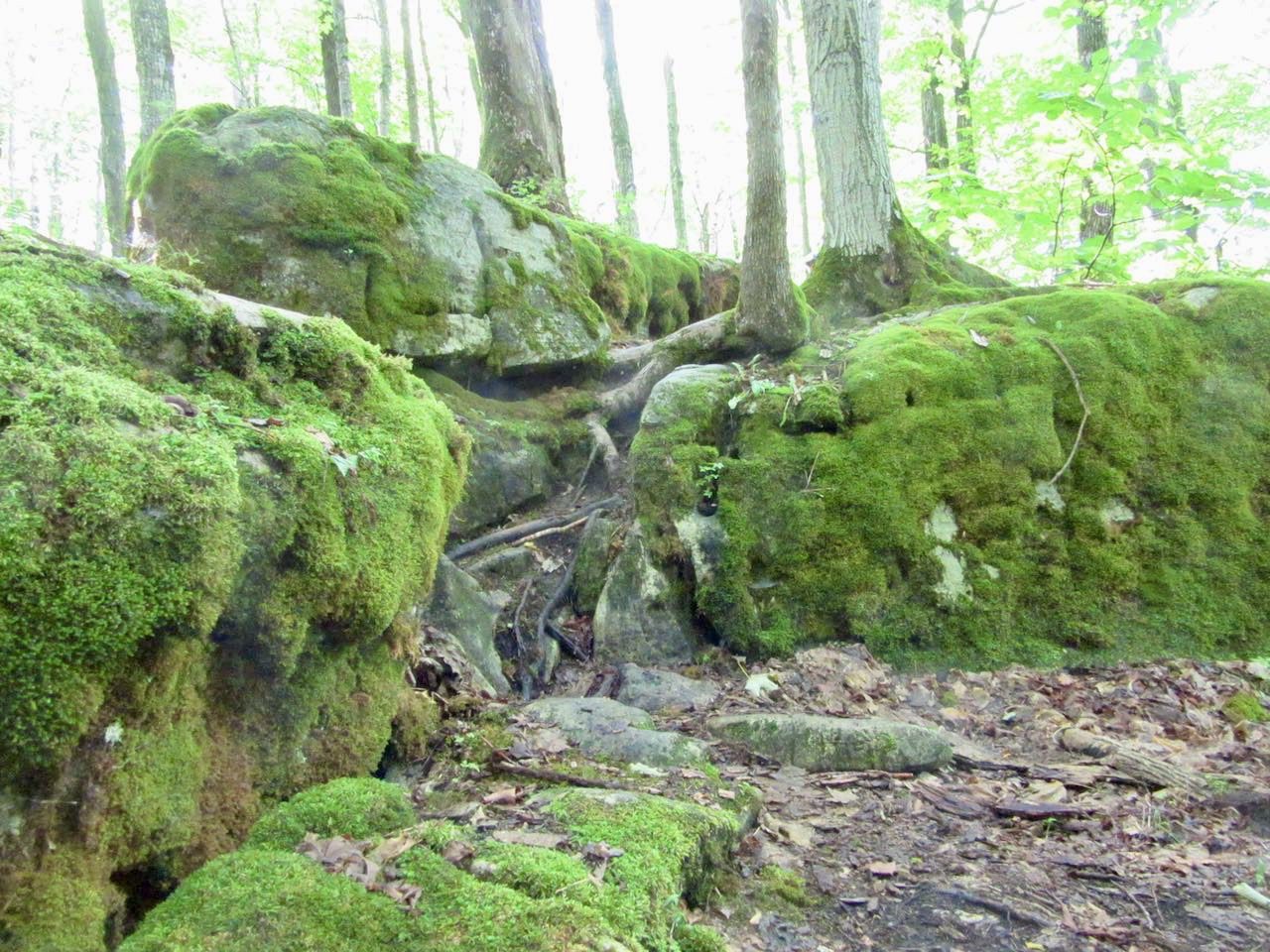
Car Hike: Marvelous Mosses
https://hikes.brucetrail.org/event/car-hike-marvelous-mosses/Sorry, the registration cut-off time for this hike has been reached.Not a member? Click here to join today!Hosting Club: Toronto
Category: Car Hike
Location (Google Maps): Fifth Line, north of Limehouse. See GPS coordinates for location of roadside parking.Hike Leader(s): Janet Patterson Click here to contact Hike Leader(s)
Pace: Leisurely (2-3 km/hr)
Terrain: Level 2 (Intermediate – some hills and uneven surfaces, rocks and roots underfoot), Variable
Distance: 2 – 3 kmDescription
Join BTC ecologist (and moss enthusiast!) Mara McHaffie and members of the Toronto Bruce Trail Club’s Biodiversity Team on a hike to learn about mosses on the Bruce Trail. This will be a leisurely wander with lots of stops to look and learn about the mosses we find. This hike will be geared for beginners – no experience necessary! We will discuss the basics of moss ecology and ID, tips for finding different species, guides and resources, and some interesting species that are located in the area.Besides water and snacks, bring a magnifying glass/hand lens/loupe if you have one, and please dress for the weather. Note that due to the slow pace and frequent stops, you may want to dress more warmly than you would for a faster-paced hike (think “layers”).
Notes: this will be a small group, limited to 10. Please consider carpooling.
- 29October 29, 2025
Duncan Crevice Caves
https://hikes.brucetrail.org/event/duncan-crevice-caves/Sorry, the registration cut-off time for this hike has been reached.Not a member? Click here to join today!Hosting Club: Blue Mountains
Category: Organized Hike
Location (Google Maps): Tim Horton’s, First Street, CollingwoodHike Leader(s): Frank Huggins Click here to contact Hike Leader(s)
Pace: Brisk – 4 to 5 km/hr
Terrain: Moderate – Some hills and/or some poor footing
Distance: 4-5kms.Description
Duncan Crevice Caves Provincial Nature Reserve. We will depart from Tim Horton’s downtown parking lot at 9 am. We will car pool to the trailhead at the small parking area on the 9th Sideroad ( west of 10th line). We will hike in to the Caves and then return to the parking area. About 2 hoursEASY DOES IT HIKE, Rotary Park, St. Catharines,On
https://hikes.brucetrail.org/event/easy-does-it-hike-rotary-park-st-catharineson/Sorry, the registration cut-off time for this hike has been reached.Not a member? Click here to join today!Hosting Club: Niagara
Category: Leisurely
Location (Google Maps): 376 Regional Rd 69, (Pelham Rd.) St. Catharines, ON L2S 0A2Hike Leader(s): Diane Marlatt Click here to contact Hike Leader(s)
Pace: Leisurely
Terrain: Easy
Distance: 3 kmDescription
WEDNESDAY WALKERS - GR 40 to Griersville
https://hikes.brucetrail.org/event/wednesday-walkers-gr-40-to-griersville/Sorry, the registration cut-off time for this hike has been reached.Not a member? Click here to join today!Hosting Club: Beaver Valley
Location (Google Maps): Meet in the BTC parking lot on Grey Road 40, Km 105.7 Map 28 Edition 31
Hike Leader(s): Margaret Yaraskavitch Click here to contact the hike leader.
Pace: Medium
Terrain: Moderate
Length of Hike: 7.2Description
It’s time for a pleasant walk in the woods, a fairly easy walk. We begin at the parking lot on Grey Road 40, crossing the highway and walking into a BTC Nature Reserve. After reaching Grey Road 7, we return on the same route.Guidelines
- Arrive 15 minutes before the start of the hike.
- Wear sturdy footwear and appropriate attire for the weather and the terrain.
Hiking poles are a good idea in any season, especially if the terrain is rocky or slippery. In winter, snowshoes or icers/crampons are needed when conditions dictate.
Wearing appropriate clothing and footwear prevents injuries and shows consideration for a safe and positive group hiking experience. - Always carry I.D. and your health card.
- Bring sufficient water and snacks (or lunch if indicated). A minimum of 1L of water is recommended on all hikes, and 3L is recommended for long, challenging hikes in the heat of the summer.
- Bring sunscreen and insect repellent (for spring and summer hikes).
- Bring your own first aid kit.
- Please leave dogs at home.
Good Companions at Christie Lake
https://hikes.brucetrail.org/event/good-companions-at-christie-lake/Sorry, the registration cut-off time for this hike has been reached.Not a member? Click here to join today!Hosting Club: Iroquoia
Category: Good Companions
Location (Google Maps): Christie Lake. First parking lot on your right as you enter the Christie Lake Conservation area off Hwy 5, Dundas Road.Hike Leader(s): Janina Vanderpost Click here to contact Hike Leader(s)
Pace: Medium – 3 to 4 km/hr
Terrain: Moderate – Some hills and/or some poor footing
Distance: 6 to 7 kmDescription
Meet at 9:45 for the 10 am start. We will hike around Christie Lake, a lovely area. The terrain varies from open fairly flat paths to some hills through the woods, meadows, with views of the lake. If you do not have a Hamilton Conservation pass there is an entry fee. Bring the usual, water, snack, hiking poles if using, hiking boots, bug repellant and sunscreen. If it is hot, we will slow the pace as appropriate. - 30October 30, 2025
Uraban Walk: Valley View Park Thornhill 140
https://hikes.brucetrail.org/event/uran-valley-view-park-thornhill/Sorry, the registration cut-off time for this hike has been reached.Not a member? Click here to join today!Hosting Club: Toronto
Category: Urban Walk
Location (Google Maps): Parking lot is off Sycamore Drive East of Bayview , across Starbucks plaza
Bus 91 from Finch east station stops at Sycamore station.Hike Leader(s): Mohammad Aghamiri Click here to contact Hike Leader(s)
Pace: Moderate (3-4 km/hr)
Terrain: Hilly, Level 2 (Intermediate – some hills and uneven surfaces, rocks and roots underfoot)
Distance: 7-8 kmDescription
We will explore Valleyview and Maple View parks, and walk along German Mill Creak, in return we stop in Huntington park and have snack under beautiful shed ,Even it is considered Urban walk, it is urban hike as we have some up and down hills and tree roots, please bring your hiking poles, water and snacks,
phone number for the day of hike 289 588 6482
9:00 am Long Hike Cave Spring Conservation Area NEW TIME
https://hikes.brucetrail.org/event/900-am-long-hike-cave-spring-conservation-area-new-time-3/Sorry, the registration cut-off time for this hike has been reached.Not a member? Click here to join today!Hosting Club: Niagara
Location (Google Maps):
Cave Spring Conservation Area
Pace: Medium
Terrain: Moderate
: 10kDescription
This will be our permanent Thursday Location until Bridge repairs complete. From Cave Spring Conservation Area explore the trail network on the escarpment towards Kinsman Park and Moyer Road.You must register for each hike. Bring Poles, snack and a drink. Dress for the weather
Hiking in and around Jordan
https://hikes.brucetrail.org/event/hiking-in-and-around-jordan-13/Sorry, the registration cut-off time for this hike has been reached.Not a member? Click here to join today!Hosting Club: Niagara
Location (Google Maps): 3640 Glen Road, Lincoln LOR 1SO
Hike Leader(s): Bill Russell Click here to contact Hike Leader(s)
Pace: Medium
Terrain: Moderate
Distance: 7 kmDescription
Hiking in and around Jordan hiking different trails each week – Jim Rainforth Trail, Bailey Bridge and Jordan Village and Balls Falls.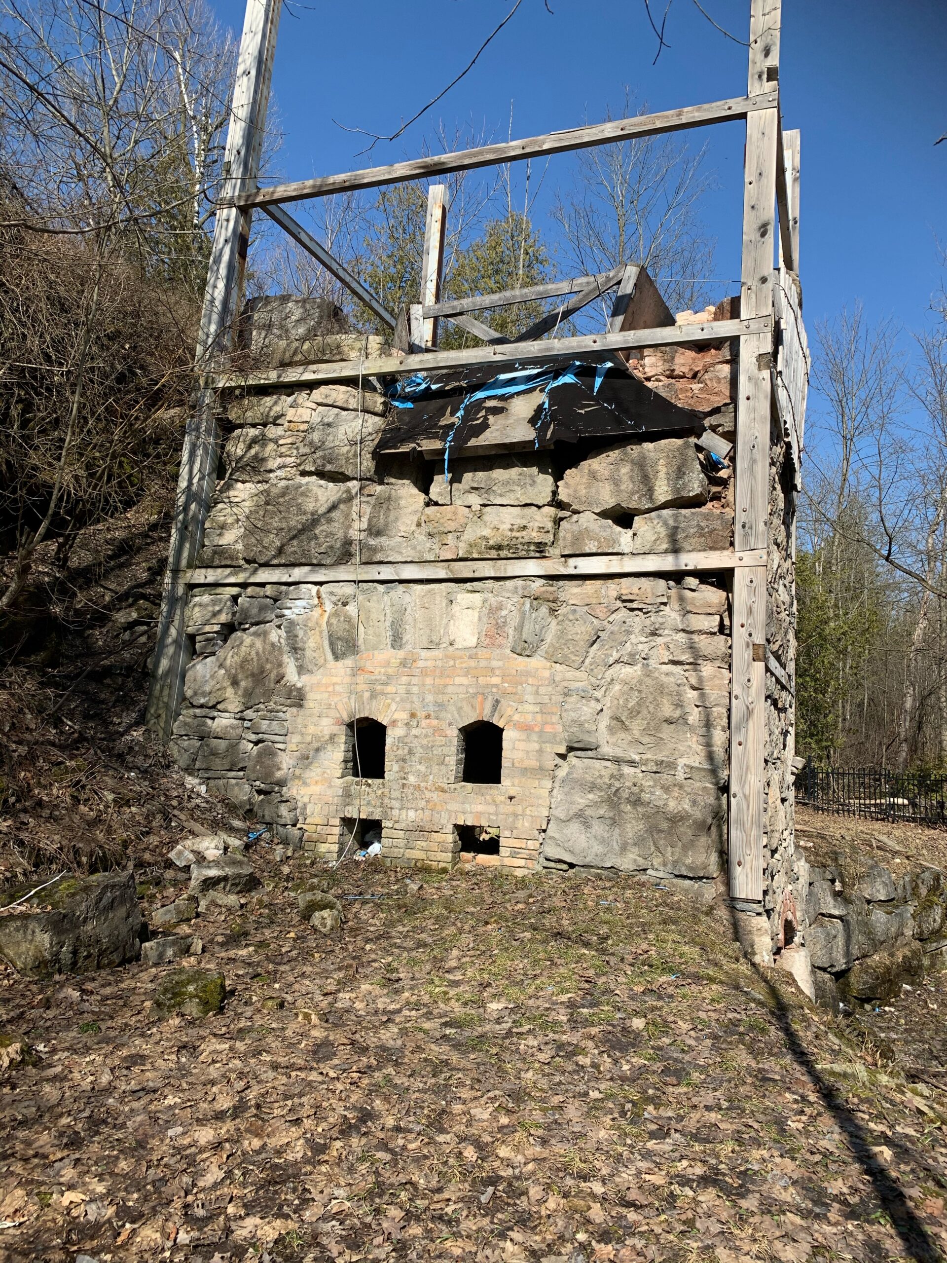
Limehouse Plus Circuit
https://hikes.brucetrail.org/event/limehouse-plus-circuit/Sorry, the registration cut-off time for this hike has been reached.Not a member? Click here to join today!Hosting Club: Iroquoia
Category: Thursday Group
Location (Google Maps): Limehouse:Conservation Area, 12169 Fifth Line, LimehouseHike Leader(s): Anne Armstrong Click here to contact Hike Leader(s)
Pace: Leisurely – 3km/hr or less
Terrain: Moderate – Some hills and/or some poor footing
Distance: Approx 8 km.Description
Limehouse was once a thriving area where limestone was removed from the escarpment, treated in the lime kilns, one of which is partially restored and the end product shipped out to Toronto and other areas for construction projects. Meet in the parking lot of the Limehouse Conservation Area at 12169 Fifth Line, Limehouse. Bring water, a snack, sunscreen and hiking poles if using. We will use a combination of main and blue side trails to explore the Conservation Area going along the Black Creek, past the lime kilns and further north along Main Bruce Trail to the Todd Bares Side Trail which contains a beautiful meadow where the Toronto Bruce Trail Club has established a Seed Orchard. We then retrace our route back to the Conservation Area and to our cars via the “Hole in the Wall”. Some rocky areas along with hills. I will send out an email with my contact information the day before. - 31October 31, 2025
Caledon in 5 End-to-End Hike Series - Hike #1
https://hikes.brucetrail.org/event/caledon-in-5-end-to-end-hike-series-hike-1/Sorry, the registration cut-off time for this hike has been reached.Not a member? Click here to join today!Hosting Club: Iroquoia, Caledon Hills
Category: General Hike
Location (Google Maps): Meeting Place: Roadside Parking – shoulder of Willoughby Road and Escarpment SideroadHike Leader(s): Pati Greenwood, Jeff Dowsett Click here to contact Hike Leader(s)
Pace: Medium – 3 to 4 km/hr
Terrain: Dependent on Conditions, Moderate – Some hills and/or some poor footing
Distance: 16 kmDescription
This is an end-to-end hiking series to complete the Caledon section of the Bruce Trail in 5 hikes.The hikes will be undertaken at a medium pace of approximately 4 km/hour for approximately 15 kms each hike. Please consider your fitness level before registering; this is a group hike, and everyone is expected to keep pace with the person in front of them for the duration of the hike.
The weather can be changeable at this time of year, so dress in layers for any possibility. There here are many steep and hilly segments in this section of the Bruce Trail so the hikes will require considerable stamina. Wear hiking boots and bring hiking poles. Bring a snack, plenty of water and other hydration as needed.
We will be travelling from south to north over the course of the End-to-End. The series will require car shuffles, and everyone will be expected to participate as drivers.
Today’s hike, the first of the series, is 16 km in length. Please plan to arrive at the meeting place by 8:15 am as we will start the car shuffle at 8:30 am sharp.
Further details will be provided to registered hikers a few days prior to the hike.
9:00 am Niagara-on-the-Lake Tour
https://hikes.brucetrail.org/event/900-am-niagara-on-the-lake-tour-47/Sorry, the registration cut-off time for this hike has been reached.Not a member? Click here to join today!Hosting Club: Niagara
Category: Urban
Location (Google Maps):Veterans Memorial Park, park just outside the park on King Street
Hike Leader(s): Robin Garrett Click here to contact Hike Leader(s)
Pace: Medium
Terrain: Easy
Distance: 6-7 kmDescription
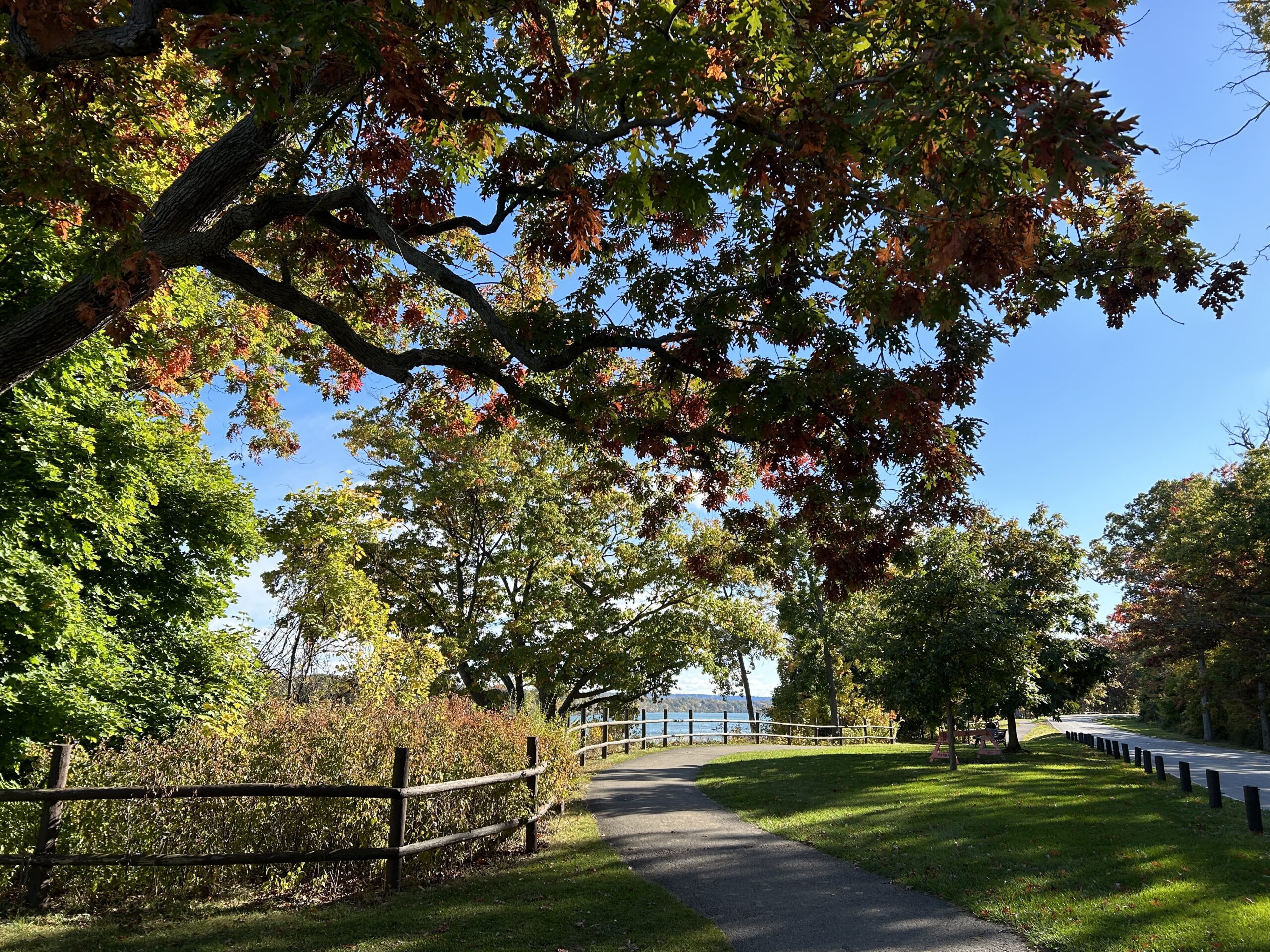
Each Friday we will explore different neighbourhoods, trails and parkland throughout Historic Niagara-on-the-Lake.Moderate pace with some weeks entirely on sidewalks and roads while others may include a mix of trails and paved pathways. Great way to build up endurance for longer more strenuous hikes.
Prepare for cooler windy conditions on open parkland and along Lake Ontario and Niagara River trails.
Plan to stay for conversation and a warm cup of coffee or tea at Sweets & Swirls, Community Centre, Niagara Stone Road, NOTL
Niagara Glen Short and Sassy
https://hikes.brucetrail.org/event/niagara-glen-short-and-sassy-7/Sorry, the registration cut-off time for this hike has been reached.Not a member? Click here to join today!Hosting Club: Iroquoia
Category: General Hike
Location (Google Maps):Niagara Glen, 3050 Niagara Parkway, Niagara-on-the-Lake, ON
Hike Leader(s): Craig Sim Click here to contact Hike Leader(s)
Pace: Medium – 3 to 4 km/hr
Terrain: Moderate – Some hills and/or some poor footing
Distance: 6-7k (approximate)Description
Loop hike in beautiful Niagara Glen, NOT using Whirlpool Trail. We meet in between Niagara Glen parking lot and building near lot. Pay parking or Niagara parks pass. Trail ranges from moderate to quite rocky, has hills and stairs. Watch footing. Lots of boulders and great views close to Niagara River. We descend steel stairs before and after hike. Wear hiking boots or shoes. Bring water, snack, appropriate layered clothing for the weather and rain gear. Optional beverage/food after. Niagara Glen is close to both Butterfly Conservatory and Floral Clock. - 01November 1, 2025
Car Hike: Seaton Trail
https://hikes.brucetrail.org/event/car-hike-seaton-trail/Sorry, the registration cut-off time for this hike has been reached.Not a member? Click here to join today!Hosting Club: Toronto
Category: Car Hike
Location (Google Maps): Seaton Trail Parking Lot, PickeringHike Leader(s): Mohammad Aghamiri Click here to contact Hike Leader(s)
Pace: Moderate (3-4 km/hr)
Terrain: Hilly, Level 2 (Intermediate – some hills and uneven surfaces, rocks and roots underfoot)
Distance: 12-14 kmDescription
We will hike along Seaton trail and enjoy the lovely scenery of forest and river.School Bus Hike: Dufferin Highland, Murphy's Pinnacle
https://hikes.brucetrail.org/event/school-bus-hike-dufferin-highland-murphys-pinnacle/Sorry, the registration cut-off time for this hike has been reached.Not a member? Click here to join today!Trip Information
Departure Time: 08:30
Return to City Time: 18:30
Departure Point: York Mills Bus PickupOptional Items
Pick up at HWY 400 and Major Mac ($0.01)Hosting Club: Toronto
Category: Bus Hike
Location (Google Maps): Dufferin Highland, Murphy’s PinnacleHike Leader(s): Martina Furrer, Janet McColeman, Robin Crombie, Duro Vukman Click here to contact Hike Leader(s)
Pace: Brisk (4-5 km/hr), Moderate (3-4 km/hr)
Terrain: Hilly, Level 2 (Intermediate – some hills and uneven surfaces, rocks and roots underfoot), Variable
Distance: Fast group 16 to 18 km, Moderate group 13 kmDescription
Join us for a fantastic fall hike in the Dufferin Highlands (Map 20). Enjoy awesome views from Murphy’s Pinnacle and the Mulmur Lookout.We will split into two groups. The fast group will do the Primrose Loop Side Trail and then follow the main trail north to km 29.6 (about a 16 km hike). If time permits the fast group will also do the Rock Hill Park Side Trail. The moderate group will head straight to Murphy’s Pinnacle and follow the main trail north to km 29.6 (about a 13 km hike).
Pack water, lunch, sun and rain protection.
Refreshment stop in Primrose if time allows.
Bus departs at 8:30 am from 10 York Mills Rd. We hope to be back in the city by 6 pm.
F&G Hills 3
https://hikes.brucetrail.org/event/fg-hills-3/Sorry, the registration cut-off time for this hike has been reached.Not a member? Click here to join today!Hosting Club: Dufferin Hi-Land
Category: General Hike
Location (Google Maps): Meet at 1st Line Bruce Trail Mulmur Hills Parking lot.Hike Leader(s): Tristan Goguen Click here to contact Hike Leader(s)
Pace: Medium
Terrain: Slippery and Steep Sections, Strenuous
Distance: 15 Km approximatelyDescription
Hike 3 of this hills series. We will meet at the 1st Line parking lot then car pool back to Centre road. From there we will hike on the main trail down to the Boyne Valley Side Trail. We will return to the main trail and enjoy all the hills and valleys the Boyne area offers. Once we return to the 1st Line parking lot we have the option to explore the Rock Hill side trail before returning to the cars. Please wear hiking shoes or boots, bring snacks/lunch and water. Dress for the weather. Note the hike leaders will have 2 dogs on this hike. This hike involves challenging climbs and is recommended for experienced hikers only.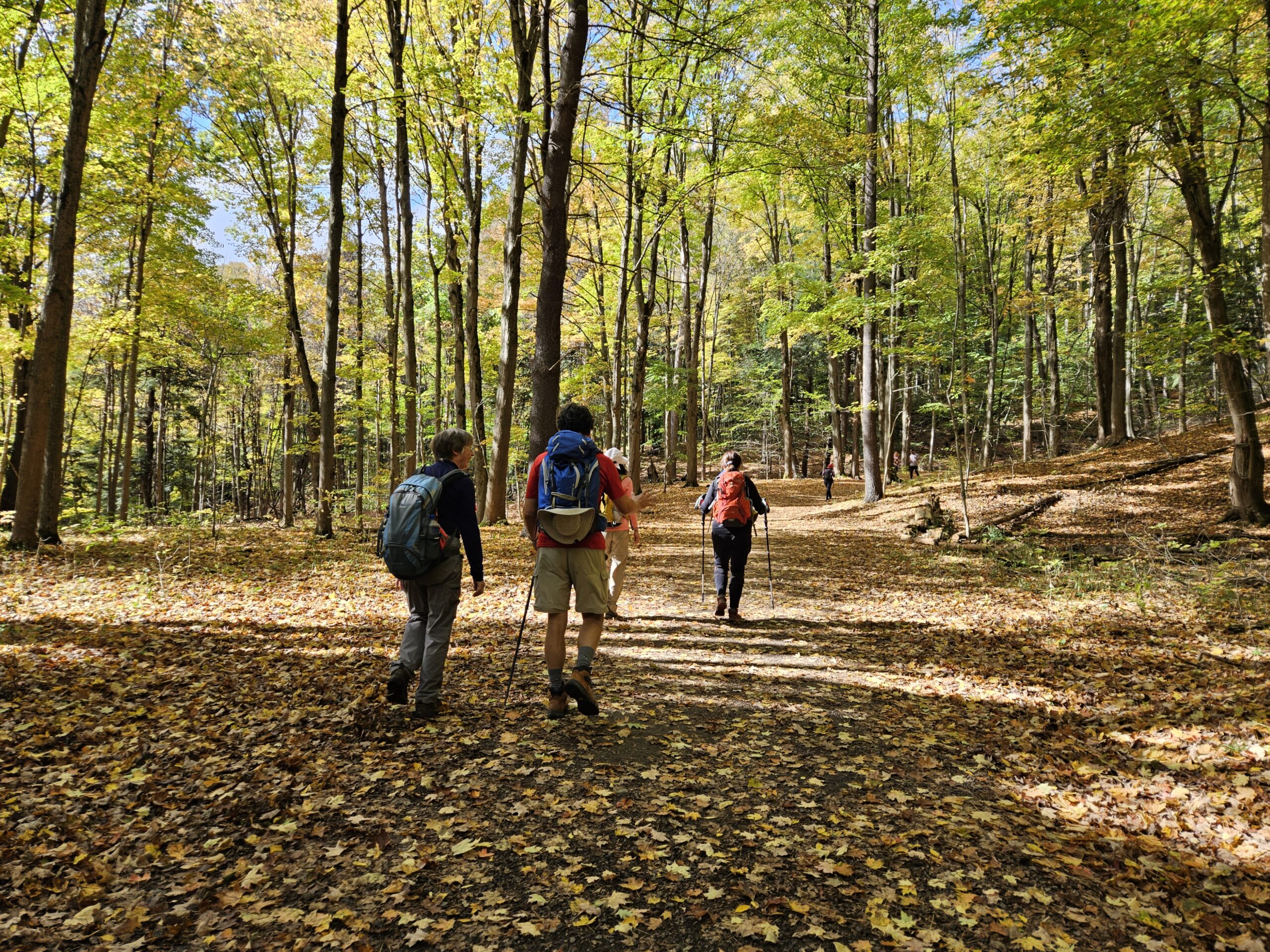
Car Hike: #6/7 Iroquoia Bruce Trail End-to-End -21 KM
https://hikes.brucetrail.org/event/car-hike-6-7-iroquoia-bruce-trail-end-to-end-21-km/Sorry, the registration cut-off time for this hike has been reached.Not a member? Click here to join today!Hosting Club: Toronto
Category: Car Hike
Location (Google Maps): KM83.5. Roadside parking on Guelph LineHike Leader(s): Alina Lin
Pace: Brisk (4-5 km/hr)
Terrain: Level 2 (Intermediate – some hills and uneven surfaces, rocks and roots underfoot)
Distance: 21 kmDescription
Let’s make this hike extra fun with a Halloween theme! You’re encouraged to dress up as whoever you want to be and enjoy a festive walk in the forest. Just remember — no matter what your costume is, sturdy hiking footwear is a must!This is the 6th hike of an End-to-End series covering the entire Iroquoia Bruce Trail section. The full section stretches over 120 kilometers from Grimsby to Milton. I am using Map Edition 29 to plan the hikes, and so please note that kilometer markings may not be fully up to date, and actual hiking distances may vary slightly.
Meeting Point:
KM83.5. Roadside parking on Guelph Line, south of No. 1 Sideroad. GPS: 43.388387, -79.854327. Please arrive before 8:45am to allow time for car shuttle coordination.We will car shuttle to 103.8KM Roadside Parking on Twiss Rd North of Derry Rd. GPS: 43.447743, -79.953436. From there to hike back to KM83.5.
All drivers are expected to participate in the car shuttle, either before or after the hike. All hikers are expected to chip in for parking fees, if applicable.
Important Notes:
- Wear sturdy hiking footwear and dress appropriately for the weather
- Bring snacks, and at least 1.5L of water
- No dropouts available.
- No pets.
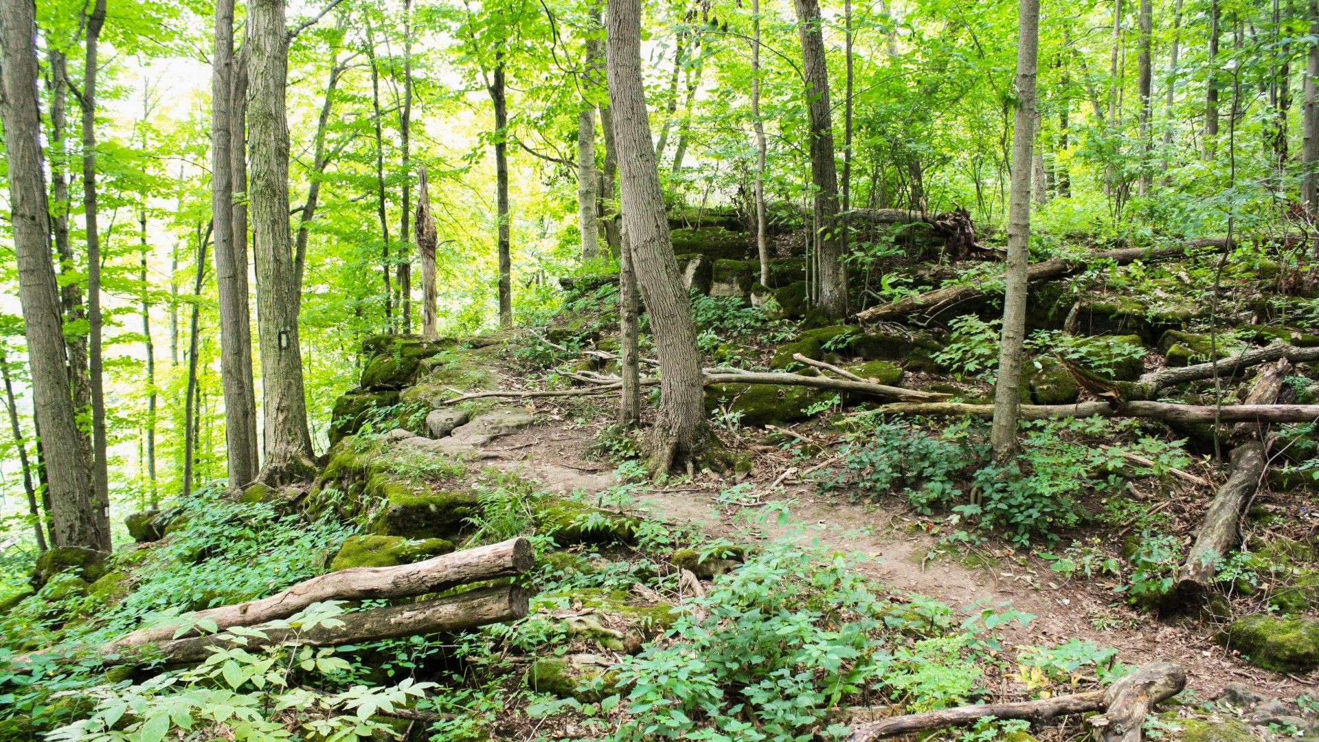
9:00 From Mountainview CA to Beamer Memorial CA and Back
https://hikes.brucetrail.org/event/900-from-mountainview-ca-and-beamer-memorial-ca-and-back/Sorry, the registration cut-off time for this hike has been reached.Not a member? Click here to join today!Hike open to BTC Members only.
Hosting Club: Niagara
Category: In and Out
Location (Google Maps): Mountainview Conservation AreaHike Leader(s): Karen Couch Click here to contact Hike Leader(s)
Pace: Brisk
Terrain: Strenuous
Distance: 20-22 kmDescription
Meet in the Mountainview Conservation Area (CA) parking lot and hike to Grimsby Point Bluff (Beamer Memorial CA). After a short break, we will retrace our path.This section of the trail has some steep, technical ascents and descents. We will be rewarded with some beautiful lookout points.
Consider your fitness level before registering. Everyone is expected to keep up with the person in front of them for the duration of the hike.
Dress for varying weather conditions. Hiking poles and boots are highly recommended. Bring fluids and a snack.
Plan to arrive at the start point by 8:45 as we will leave at 9:00 sharp.
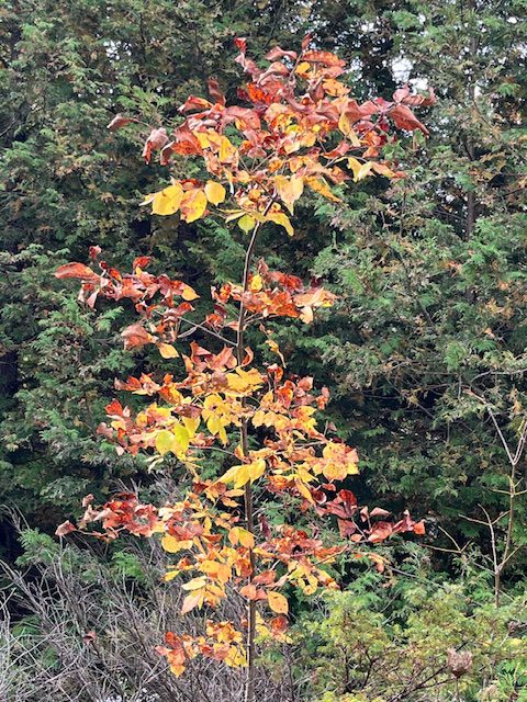
Forty Hills Sidewinder
https://hikes.brucetrail.org/event/forty-hills-sidewinder/Sorry, the registration cut-off time for this hike has been reached.Not a member? Click here to join today!Hosting Club: Peninsula
Location (Google Maps): Bruce Trail Parking Area at Forty Hills (GPS: 45.020460, -81.283790).
Hike Leader(s): Marg and Owen Glendon Click here to contact Hike Leader(s)
Pace: Medium (3.0 – 4.5 km/h): A comfortable pace for most hikers with steady progress.
Terrain: Difficult: Steep ascents/descents, rocky scrambling, and some rugged escarpment paths., Moderate: Rolling hills, mild slopes and rocky paths.
Distance: ~11 kmDescription
We invite you to join us for this fun “figure 8” hike which includes five side trails! We will hike on the sidetrails of White Bluff Provincial Nature Reserve and along the beautiful escarpment overlooking Georgian Bay and Lion’s Head Harbour. This hike twists and turns like a sidewinder through quiet meadow, mixed forest and rocky ups-and-downs!Bring your lunch or snack for a brief stop at Reed’s Dump. Duration of the hike will be ~ 3 1/2 hr. Portapottie available at the Forty Hills parking lot and basic outdoor toilet available at Reed’s Dump.
Sturdy footwear with good grip is recommended. Good balance and endurance are required.
Free coffee and muffin for hike participants arriving by 9:15 a.m.
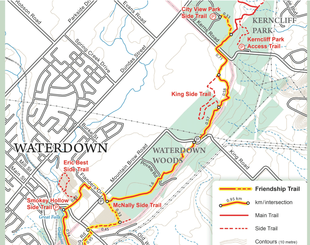
RAINBOW HIKE: Smokey Hollow Waterfall to Waterdown Woods to Kerncliff Park & Beyond
https://hikes.brucetrail.org/event/rainbow-hike-smokey-hollows-waterfalls-to-fishers-pond-and-back/Sorry, the registration cut-off time for this hike has been reached.Not a member? Click here to join today!Hosting Club: Iroquoia
Category: Rainbow Hike
Location (Google Maps): Smokey Hollow Waterfall to Waterdown Woods & BeyondHike Leader(s): Doug O’Neill Click here to contact Hike Leader(s)
Pace: Medium – 3 to 4 km/hr
Terrain: Moderate – Some hills and/or some poor footing
Distance: 14 kmDescription
Come by car or transit for this all-inclusive 2SLGBTQI+ friendly Rainbow hike from Smokey Hollow Waterfall, Waterdown to Waterdown Woods and beyond.Please arrive at the Smokey Hollow parking lot, 80 Mill St. South, by 9:15 a.m. for a 9:30 a.m. start.
This is the same starting point as our October 13th hike—but we’ll be exploring in the opposite direction. (Ideal for anyone planning to complete their E2E).
Today’s 14 km in-and-out hike follows the Bruce Trail Main Trail with detours alongKing Side Trail, Ian Reid Side Trail, and if time allows we’ll aim for one of the International Friendship Trails.
By transit to the starting point. The easiest route is to take HSR transit or GO Bus (depending where you live) to Aldershot GO station, then hop on the 18 Leavitt Loop bus and get off at “Mill St. at Mountain Brow,” a 3-minute walk to the Smokey Hollows parking lot. The bus drivers on this route are accustomed to hikers.
By car: There is unpaid parking at Smokey Hollow, which can fill up early. If lot is full: There’s street parking on Flanders Drive, about a 15-minute walk to Smokey Hollows. PLEASE allow yourself enough time to sort out your parking so you can arrive at Smokey Hollows parking lot by 9:15 a.m latest.
Post-hike refreshments: The Royal Coachman in Waterdown has long been hiker-friendly.
Bring 1 litre of water and lunch. (Since it’s November, a thermos of something hot wouldn’t go amiss. Hiking boots or sturdy footwear are recommended. Dress in layers. Always bring some kind of rain gear. Yup, it’s that time of year 🙂
Get your complimentary Bruce Trail Rainbow badge and/or sticker at the end of the hike!
Feel free to reach out to the Hike Leader if you have any questions – “Click here to contact Hike Leader” on this form.
Urban Walk; Victoria Park subway station to Sunnybrook Park
https://hikes.brucetrail.org/event/urban-walk-victoria-park-subway-station-to-sunnybrook-park-2/Sorry, the registration cut-off time for this hike has been reached.Not a member? Click here to join today!Hosting Club: Toronto
Category: Urban Walk
Location (Google Maps):Start at Victoria Park subway station ticket collector. Several dropouts along the way. Final destination is Sunnybrook Health Centre on Bayview Ave
Hike Leader(s): Ray Berzins Click here to contact Hike Leader(s)
Pace: Moderate (3-4 km/hr)
Terrain: Level 1 (Easy – mostly on flat, well maintained trails with hard-packed surface)
Distance: 8.5 kmDescription
From Victoria Park subway we shall walk northeast along the Taylor Creek to the Don River, follow the West Don River to Sunnybrook Park. At Sunnybrook Health Centre on Bayview Ave is TTC #11 bus that connects with Davisville subway station and TTC #124 bus that connects with Lawrence subway.We shall have a picnic halfway so bring a sandwich and a thermos.
Check your email at 8AM on day of hike to verify hike status.
Saturday Shorts: Cold Creek
https://hikes.brucetrail.org/event/saturday-shorts-cold-creek-3/Sorry, the registration cut-off time for this hike has been reached.Not a member? Click here to join today!Hosting Club: Caledon Hills
Category: General
Location (Google Maps): Meet at the main gate entrance. Park roadside near the gate. Please do not drive into the park past the main gate, as we are starting out on the loop from this point. The park address is 14125 11th Concession, King (near Nobleton). The GPS coordinates will lead you into the park past the main gate. Please aim to arrive at 10:15 am for a 10:30 am start. Thanks!
Note: Because of construction on 11th Concession, take 11th Concession going south to reach the conservation area. You cannot go north on 11th Concession from King Road.Hike Leader(s): Elizabeth Ganong Click here to contact Hike Leader(s)
Pace: Leisurely – 3 km/hour or less, Medium – 3 to 4 km/hour
Terrain: Easy – mostly flat and usually good footing, Moderate – some hills and/or some poor footing
Distance: Approximately 6 kmDescription
Looking to get out on a Saturday but not give up your whole day? Saturday Shorts, a hiking series, will get you out in a small group on a short hike. This Saturday’s hike is an enjoyable one in any season. We’ll hike the outer loop, making about a 6 km route, at Cold Creek Conservation Area. Things to consider in your hike preparations: warm gear/dressing in layers, hiking shoes/boots, poles, water, a snack. There will be a short break. No dogs please. Registrants can expect a reminder/update message one or two days before the hike.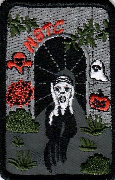
Car Hike: A hike to celebrate Halloween!
https://hikes.brucetrail.org/event/car-hike-a-hike-to-celebrate-halloween/Sorry, the registration cut-off time for this hike has been reached.Not a member? Click here to join today!Hosting Club: Toronto
Category: Car Hike
Location (Google Maps): We will meet at the larger parking lot in Woodend Conservation Area, 1 Taylor Rd, Niagara-on-the-Lake, ON L0S 1J0 (coordinates: 43.150276, -79.155092).Hike Leader(s): Monica Pasquali Click here to contact Hike Leader(s)
Pace: Leisurely (2-3 km/hr)
Terrain: Level 1 (Easy – mostly on flat, well maintained trails with hard-packed surface), Level 2 (Intermediate – some hills and uneven surfaces, rocks and roots underfoot)
Distance: 8 km total, divided into two hikes of 4 km eachDescription
Calling all hikers who love Halloween and working on badge requirements!Today we will complete two of the three required hikes for the Niagara Bruce Trail Club’s Screaming Tunnel Badge. First, we’ll complete a 4 km out-and-back hike along the main Bruce Trail from Woodend Conservation Area to the “Screaming Tunnel” – please wear/bring your Halloween costume/hat for a photo op which is one of the requirements for the badge. Then we’ll all hop into our cars and drive about 11 km west to DeCew House Heritage Park, stopping for lunch along the way. After parking at DeCew House Heritage Park (address: 2370 DeCew Rd, Fonthill, ON L0S 1E6; coordinates: 43.107568, -79.249598) we’ll complete another 4 km out-and-back hike, but this time along the Bert Lowe Side Trail in order to visit another tunnel which is another requirement for the badge.
Youth who are 15 years of age and under are encouraged to join their parents/guardians on this hike so they can also fulfill the requirements for the Niagara Bruce Trail Club’s Youth Hiking Badges. The Young Trail Blazer Badge simply requires the completion of one hike on the Niagara Bruce Trail, which our young participants will earn by completing today’s hikes. The Young Nature Blazer’s Badge requires our young participants to pay attention to what they see and hear during today’s hikes and then complete a write-up describing what they observed. Please note that all family members who are planning on joining us should register for the hike, including children.
All hikers who register for today’s outing should bring water and snacks, comfortable hiking shoes, appropriate clothing for the weather, and payment for lunch if you intend to join us for lunch at a restaurant (e.g., Harvey’s).
Information about all Niagara Bruce Trail Club badges can be found here: https://niagarabrucetrail.club/badges/ Please note that you will have to complete the third hike required for the Screaming Tunnel Badge by joining a “Witch of Cave Springs Hike” organized by the Niagara Bruce Trail Club in October/November, so keep an eye on the BTC hike schedule so you don’t miss your opportunity to do this: https://hikes.brucetrail.org/
Urban Walk: Historical Hike - Old Georgetown and Glen Williams
https://hikes.brucetrail.org/event/urban-walk-historical-hike-old-georgetown-and-glen-williams-2/Sorry, the registration cut-off time for this hike has been reached.Not a member? Click here to join today!Hosting Club: Toronto
Category: GO Train Hike
Location (Google Maps):Georgetown Go Station
Hike Leader(s): Tom Swales, Ted Moriarty Click here to contact Hike Leader(s)
Pace: Leisurely (2-3 km/hr)
Terrain: Level 1 (Easy – mostly on flat, well maintained trails with hard-packed surface), Variable
Distance: 10KDescription
Come join me for a 10K urban hike starting in Georgetown and learn about the area’s unique history in Glen Williams. Those leaving from Toronto can hop on the “Kitchener Line” Go Train at Union Station (at 9:48 am) or Bloor Go Station (at 9:58 a.m.). or Weston Go Station (10:07 a.m.) to arrive in Georgetown Go Train Station at 11:08 am (you’ll transfer to bus at Mt Pleasant Station in Brampton – a 20 minute stopover – for the rest of your journey). The return bus/train from Georgetown leaves at 3:07 p.m. There is a 15-minute stopover at Mount Pleasant Station on the return trip. You’ll be back at Union Station at 4:35 p.m.If you wish, you can also drive to the Georgetown Go Station (north parking lot) for the hike. GPS: 43.656030, -79.919159.
The 2.5 hour hike will take us to the ruins of the historic Barber Mill (first site of hydro power in Ontario), then we will follow along the Credit Valley Footpath to the quaint town of Glen Wiliams (established 1825), with a chance to see artisan workshops and purchase sweets at Kits Kitchen or tea at the Main Street Market. After viewing some historic homes in the village, we will make our way back to Georgetown, following an abandoned rail line that takes us to the Georgetown Train Station, built in 1885. We’ll wander past more historic homes and finish (depending on timing) with a stop at Furnace Room craft brewery (across from the Station),
This is a Level 1 (easy) hike with a easy/moderate pace, suitable for “fit” beginners. There are some hills and depending on the weather, there could be wet areas along the Credit River footpath. Dress for the time of year, bring hiking boots, poles if you wish, water, sunscreen and lunch/snacks. Go Transit weekend day passes are available online for $10. Limit: 14 Hikers