
Hike Schedule
Join us for a hike! Registration required.
All hikes available to BTC members. Some hikes are open to non-members.
See Refund Policy for Paid Hikes >
TIP: The calendar view displays up to 7 hikes on a day, but often there are more. Click “View more events” to see them all.
Categories
- 19October 19, 2025
Car Hike: Jefferson Forest and Bond Lake (Richmond Hill)
https://hikes.brucetrail.org/event/car-hike-jefferson-forest-and-bond-lake-richmond-hill-6/Sorry, the registration cut-off time for this hike has been reached.Not a member? Click here to join today!Hosting Club: Toronto
Category: Car Hike
Location (Google Maps):1245 Bethesda Side Rd, Richmond Hill, ON L4E 1A2 ( Bethesda Trail Head Parking lot)
Hike Leader(s): Amir Alemohammad Click here to contact Hike Leader(s)
Pace: Moderate (3-4 km/hr)
Terrain: Flat, Hilly, Level 2 (Intermediate – some hills and uneven surfaces, rocks and roots underfoot), Variable
Distance: 13-14 kmDescription
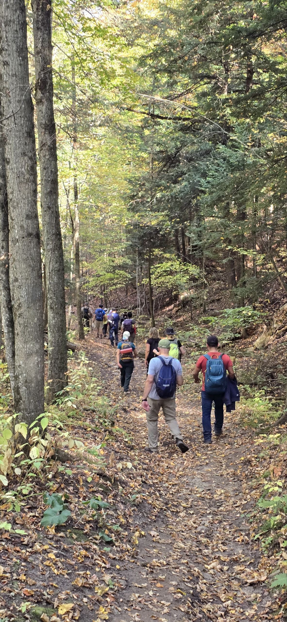
Join us for a wonderful hike in Jefferson Forest and have a snack/lunch beside the Bond Lake. We will hike among tall trees and bushes of the Jefferson Forest and across the Bayview-Yonge corridor to reach to the Bond Lake. Boots mandatory, poles recommended, bring at least 2L of water, bug spray, sunscreen, snack/lunch and dress according to the weather conditions. Please avoid parking along the road. Difficulty Level: 2 (Moderate)Please arrive @7:45 AM for start of 8:00AM.
This is a joint hike with the Oak Ridges Trail Association (ORTA).
Car Hike: Boyne Valley Provincial Park!
https://hikes.brucetrail.org/event/car-hike-boyne-valley-provincial-park-5/Sorry, the registration cut-off time for this hike has been reached.Not a member? Click here to join today!Hosting Club: Caledon Hills
Category: General
Location (Google Maps): Boyne Valley Provincial Park, Map 20 of the BTC Trail Guide. County Rd. 19 (Prince of Wales Rd.) Parking Area – west of km 15.2 – approximately 80 metres south of the Prince of Wales Side Trail.Hike Leader(s): Dylan “Lana” Hubbard Click here to contact Hike Leader(s)
Pace: Brisk – 4 to 5 km/hour
Terrain: Strenuous – hilly with steep climbs and some poor footing
Distance: 15-17 kmDescription
Join us for an invigorating hike starting from the parking lot on Prince of Wales Rd. We’ll explore the Prince of Wales Side Trail, Primrose Loop Side Trail, main trail, and Boyne Valley Side Trail, looping back via the main trail and Prince of Wales Side Trail. Along the way, we’ll hike up the short side trail to Murphy’s Pinnacle, where you’ll be rewarded with a stunning view of the surrounding landscape – great for Instagram!Bring lunch, plenty of water, and hiking poles if you use them, as the trail is hilly. Dress for the weather.
PACE IS BRISK
This hike is a 2SLGBTQIA+ friendly space. Everyone is welcome to join us for this adventure and enjoy the beauty of the trails together.
Bus Hike: Free Introductory Hike At Limehouse Conservation Area
https://hikes.brucetrail.org/event/bus-hike-introductory-hike-at-limehouse-conservation-area/Sorry, the registration cut-off time for this hike has been reached.Not a member? Click here to join today!Trip Information
Departure Time: 09:00
Return to City Time: 17:00
Departure Point: Yonge/Bloor – (south side of Toronto Reference Library on Asquith Avenue)Optional Items
Hosting Club: Toronto
Category: Bus Hike
Location (Google Maps): Limehouse Conservation AreaHike Leader(s): Tom Swales, David Royle Click here to contact Hike Leader(s)
Pace: Moderate (3-4 km/hr)
Terrain: Level 1 (Easy – mostly on flat, well maintained trails with hard-packed surface), Variable
Distance: 8 kmDescription
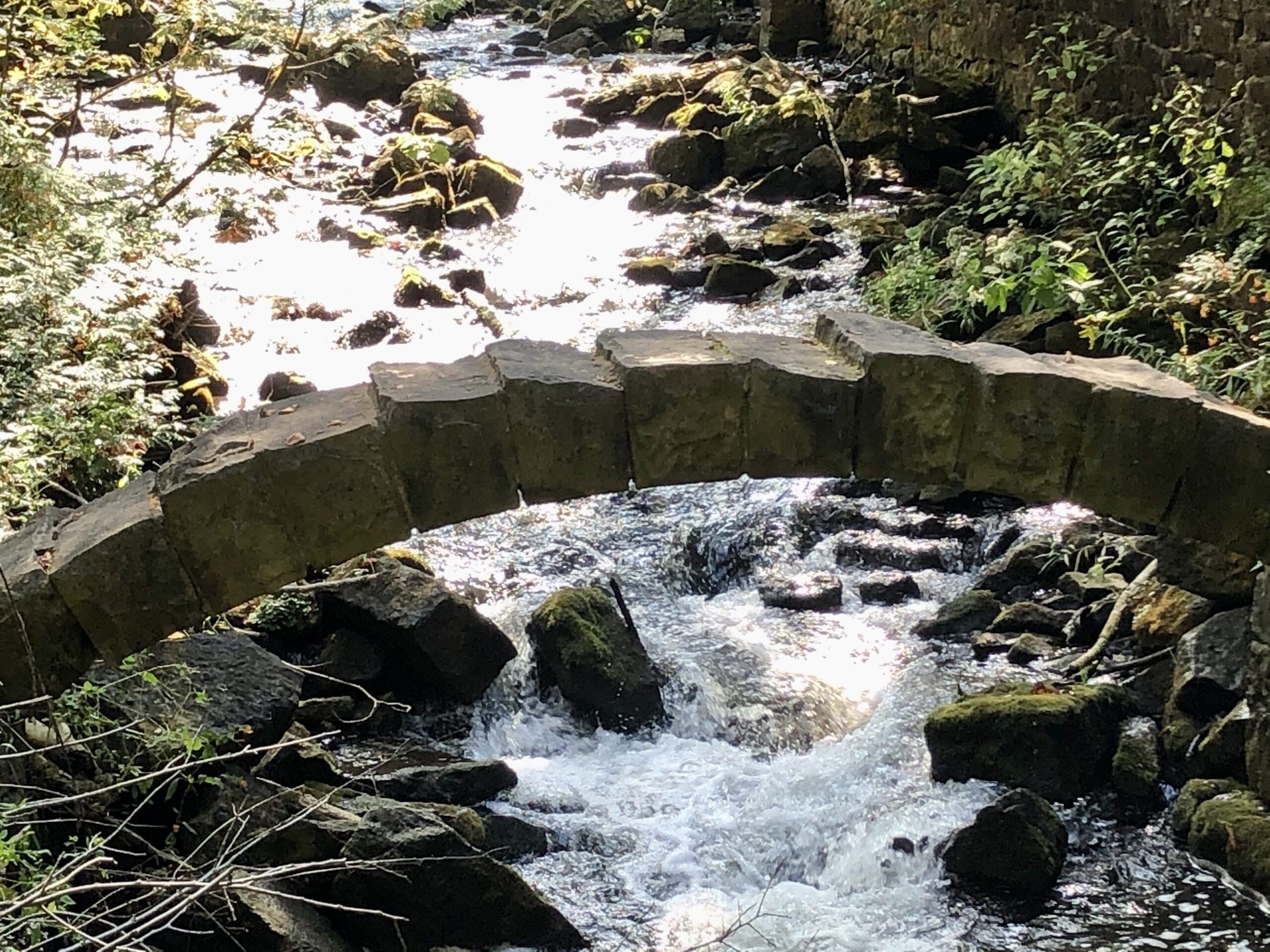
Join us for a free introductory bus hike in and around Limehouse Conservation Area on the Bruce Trail just under an hour from Toronto (see terms below). Included will be the portion of trail just opened this year by the club taking 900 metres of trail off of Fith Line, the seed orchard created by the Bruce Trail Conservancy and TBTC just north of Limehouse, the limestone kilns, the stone arched bridge, and the “Hole In The Wall” in Limehouse Conservation Area. There will be a stop for refreshment and fellowship with other hikers and your hike leaders before returning to Toronto. Current members are asked to allow priorty to our non/new members by waiting until the week before to register but are certainly welcome/encourged to bring a non-member friend.As this hike is being offered in conjunction with our Bruce Trail Day and Hiking 101 Workshop events at Toronto’s Evergreen Brickworks on Oct 4th and 5th this bus hike will be offered free of charge to participants with the support of the Bruce Trail Conservancy and grant for a sponsor. The Bus Fare will be collected upon registration as a deposit. You will be refunded the bus fare as long as you show up on the date to claim your spot. No Shows will forfeit the bus fare and the money donated to the Bruce Trail Conservancy.
Car Hike: #4/7 Iroquoia Bruce Trail End-to-End -12 KM
https://hikes.brucetrail.org/event/car-hike-4-7-iroquoia-bruce-trail-end-to-end-12-km/Sorry, the registration cut-off time for this hike has been reached.Not a member? Click here to join today!Hosting Club: Toronto
Category: Car Hike
Location (Google Maps): KM18.2 on Oakridge Dr.Hike Leader(s): Alina Lin
Pace: Brisk (4-5 km/hr)
Terrain: Flat, Level 2 (Intermediate – some hills and uneven surfaces, rocks and roots underfoot), Rocky, Variable
Distance: 12 kmDescription
It’s time for the fall colors—and no autumn feels complete without a hike on the Bruce Trail.This is the 4th hike of an End-to-End series covering the entire Iroquoia Bruce Trail section. The full section stretches over 120 kilometers from Grimsby to Milton. I am using Map Edition 29 to plan the hikes, and so please note that kilometer markings may not be fully up to date, and actual hiking distances may vary slightly.
Meeting Point:
KM 18.2 on Oakridge Dr. off Green Rd, south of King St ( at the Oakridge Drive Access Trail). N 43.213943, W 79.742417). Please arrive before 8:45am to allow time for car shuttle coordination.We will car shuttle to KM29.5, Roadside parking on Kimerly Dr. GPS: 43.227607, -79.813513. The group will then hike from KM29.5 back to KM18.2.
All drivers are expected to participate in the car shuttle, either before or after the hike. All hikers are expected to chip in for parking fees, if applicable.
After hike activity option: Hamilton 2025 Fall Garden Mum Show: https://www.hamilton.ca/things-do/festivals-events/fall-garden-mum-show .
Important Notes:
- Wear sturdy hiking footwear and dress appropriately for the weather
- Bring snacks, and at least 0.8L of water
- No dropouts available.
- No pets.
Cancelled - Toronto End-to-End in Four - Scotsdale Farm to Terra Cotta
https://hikes.brucetrail.org/event/toronto-end-to-end-in-four-scotsdale-farm-to-terra-cotta/Sorry, the registration cut-off time for this hike has been reached.Not a member? Click here to join today!Hike open to BTC Members only.
Hosting Club: Dufferin Hi-Land
Category: Cancelled
Location (Google Maps): Off road parking located on a very short dirt road off Winston Churchill Blvd just south of the Main Trail. North of entrance to Terra Cotta CA at top of hill. Busy Road and blind corner. Please be careful.Hike Leader(s): Stuart Law; Kerry Seong Click here to contact Hike Leader(s)
Pace: Medium
Terrain: Dependent on Conditions, Moderate
Distance: 14 kmsDescription
Join us on a four-hike end-to-end hike series covering the Toronto Section plus a few kilometres up to The Grange. Today’s hike is the third of that shuttle series. We will make our way on the Main Trail from Scotsdale Farm to Terra Cotta. Please bring 2.5L of water, a snack, a lunch, and a smile. Please also bring footwear to change into after the hike and a garbage bag to put your boots in for the shuttle. Hiking boots mandatory. Poles very much recommended. It will be quite rocky in sections. Please arrive at 9 am and be ready to shuttle at 9:15 sharp.Cancelled, see below Walk In Nature Series (WINS) - Massie Management Area, loop trails
https://hikes.brucetrail.org/event/walk-in-nature-series-wins-massie-management-area-loop-trails/Sorry, the registration cut-off time for this hike has been reached.Not a member? Click here to join today!Hosting Club: Sydenham
Category: General Hike
Location (Google Maps): 497274 CONC 6 S, Meaford Township, off-road Bruce Trail parking lotHike Leader(s): Stewart Brown Click here to contact Hike Leader(s)
Pace: Medium: 3 to 4 km/h
Terrain: Moderate: Some hills and/or poor footing
Distance: 7 kmDescription
This hike has been cancelled due to high winds and the forecast of lightning.The Walk In Nature Series (WINS) consists of short loop hikes in the Sydenham section of the Bruce Trail that combine nature appreciation with fitness in a safe and welcoming group environment led by an experienced hike leader. Consider these hikes to be 90 or 120 minute reset appointments with yourself in nature that promote health and fitness. Medium paced WINS hikes are open to all ages and levels of hiking experience whether members or non-members of the Bruce Trail Conservancy (BTC).
On this hike we will walk a 7.5 km loop with a medium pace on the beautiful trails of the Massie Management Area, a Grey Sauble Conservation Area property, including a part of the main Bruce Trail and the Spey River Forest Side Trail. There are some hills, possibly some mud. The property is varied with mature forests, wetlands and peaceful trails. Beautiful colours will be on full display.
Bruce Trail map 29 in Edition 31, the parking lot is at km 21.4
Come out and enjoy the beauty of nature as we approach the richness of the fall season.
Thanks, and see you soon.

Beaver Valley E2E in 8: Stained Glass Fundraiser
https://hikes.brucetrail.org/event/beaver-valley-e2e-in-8-stained-glass-fundraiser/Sorry, the registration cut-off time for this hike has been reached.Not a member? Click here to join today!Hike open to BTC Members only.
This is a Multi-Day Hike
You are signing up for the following dates and times:
2025-10-19 at 09:30
2025-10-20 at 09:00
2025-10-21 at 09:00
2025-10-22 at 09:00
2025-11-03 at 09:30
2025-11-04 at 09:00
2025-11-05 at 09:00
2025-11-06 at 09:00Hosting Club: Beaver Valley, Sydenham
Category: Fundraiser
Location (Google Maps): Corner of Sideroad 22C and 3rd Line CHike Leader(s): Karen Buschert Click here to contact Hike Leader(s)
Pace: Medium: 3 to 4 km/h
Terrain: Strenuous: Hilly with steep climbs and some poor footing.
Distance: Varies depending on day: 13-18 kmDescription
Hike the entire Beaver Valley section of the Bruce Trail in a 2 part, 8 day midweek series of end-to-end hikes. Successful completion of the entire section will earn the Stained Glass Badge through the Bruce Trail Conservancy. Distances and terrain will vary (range 13-18 km per day) and some sections will be strenuous and difficult with some steep hills and tricky footing. Some time will be spent exploring mushrooms seen along the way to earn the Beaver Valley mushroom badge.Behind Brock
https://hikes.brucetrail.org/event/behind-brock-4/Sorry, the registration cut-off time for this hike has been reached.Not a member? Click here to join today!Hosting Club: Niagara
Category: In and Out
Location (Google Maps): Decew house on North side of Decew Road. Just west of Merritville highway.Hike Leader(s): Sylvia Wheeler Click here to contact Hike Leader(s)
Pace: Medium
Terrain: Moderate
Distance: 10 kmDescription
Hike to hydro hill and down and back up.Vieni Estates Bruce Trail Hike and Sampling
https://hikes.brucetrail.org/event/vieni-estates-bruce-trail-hike-and-sampling/Sorry, the registration cut-off time for this hike has been reached.Not a member? Click here to join today!Hike open to BTC Members only.
Hosting Club: Niagara, Iroquoia, Toronto
Category: Event Hikes
Location (Google Maps): Start in the parking lot of the Vieni Estates winery.
4553 Fly Rd, Beamsville, Lincoln, Ontario L0R 1B2 CanadaHike Leader(s): Jackson Hudecki, Sam Rutherford Click here to contact Hike Leader(s)
Pace: Leisurely
Terrain: Moderate
Distance: Between 2-4kmDescription
Join Niagara’s Sam Rutherford and BTC’s Jackson Hudecki on a morning outing, beginning and ending at the Vieni Estates winery. Celebrating years of collaboration, we will enjoy a short hike of the Bruce Trail followed by sampling wine and food provided by the good people of Vieni estates. Extending a discount on all Bruce Trail wines on Sunday October 19th only.Registration required
Sunday, October 19th
10:00am-11:30am hike
11:30am-1:00pm sampling

Urban Walk: Meadowvale Village Pumpkin Pie Hike/Tour with Storyteller, Terry Wilson
https://hikes.brucetrail.org/event/urban-walk-meadowvale-village-pumpkin-pie-hike-tour-with-storyteller-terry-wilson/Sorry, the registration cut-off time for this hike has been reached.Not a member? Click here to join today!Hosting Club: Toronto
Category: Urban Walk
Location (Google Maps): Meet me at Kipling Terminal, platform 3, at 9 am for a 9:15 departure on MiWay bus #35 Eglinton to Mavis Rd. where we will transfer to bus #61 Mavis Northbound. Coming by car drive to Mavis Rd and Courtneypark.Dr.and park north of the playing field on the south side of Courtneypark, east of Mavis. We will meet at the SW corner of Courtneypark and Spinnaker Cir for 10:30. Please arrive 10 minutes early.Hike Leader(s): Andrew Proczek Click here to contact Hike Leader(s)
Pace: Leisurely (2-3 km/hr), Moderate (3-4 km/hr)
Terrain: Level 1 (Easy – mostly on flat, well maintained trails with hard-packed surface)
Distance: 10 kmDescription
Join me and story teller, Terry Wilson, for another much beloved Meadowvale Village tour, including his own miniature shed-size pioneer village. Like in June we will all hike in along Fletcher’s Creek Trail and do a loop in the enchanting Meadowvale Station Woods before meeting Terry in front of the Old Meadowvale School house, near Old Derry Road and Second Line West, at approximately 11:45. (Anyone wanting to do the tour only can meet the group here for 11:45 but you are still required to register for the hike.) We will stop for lunch at Meadowvale Conservation Area before resuming the tour and visiting the little village and Rosemary’s Garden. I will once again be raffling several of Terry’s books of short stories. Raffle tickets are only $1. Keep in mind that this is a loop hike. We will return to our starting point by 3:30 pm. If anyone needs to shorten this event, they can drop out at anytime and I will provide easy directions to quickly reach the starting point or MiWay busses back to Toronto.Washrooms available at the Shell station, NE corner of Mavis & Courtneypark, at Meadowvale Conservation Area (Lunch stop) and at the Courtneypark Public Library (open 1-5) back at our starting point.
Bring a hat, 1-2 L of water, a lunch. A slice of authentic pumpkin pie and hot chocolate will be offered once we reach Rosemary’s Garden.
The route:https://onthegomap.com/s/jrhua0pc
Hiking 101 October 19, 26, November 2, 2025
https://hikes.brucetrail.org/event/hiking-101-october-19-26-november-2025/Sorry, the registration cut-off time for this hike has been reached.Not a member? Click here to join today!This is a Multi-Day Hike
You are signing up for the following dates and times:
2025-10-19 at 13:00
2025-10-19 at 13:00
2025-11-02 at 13:00Hosting Club: Niagara
Category: Loop
Location (Google Maps):October 19: Kinsmen Park, Frost Rd, Beamsville
October 26: Louth Conservation Area
November 2: Queenston HeightsHike Leader(s): Lauren Doig Click here to contact Hike Leader(s)
Pace: Leisurely
Terrain: Moderate
Distance: 5 kmDescription
Hiking 101 is an introductory course for novice hikers, members and non-members alike. If you want some guidance on where to begin, what to wear, and what to take along, this is the course for you. The course is 3 Sunday afternoon sessions with a combination of workshop/Q& A followed by short hikes along the trail. Dress in weather appropriate clothing and wear good walking shoes.Time: 1:00 – 3:30 pm
Meeting locations: Sunday, October 19- Kinsmen Park, Kinsmen Rd & Frost Rd., Beamsville N 43.146108 W 79.475609
Sunday, October 26- Louth Conservation Area, parking lot off of Staff Avenue, Louth, 500 m north of Pelham Rd (Regional Road 69) N 43.121706 W 79.351235
Sunday, November 2 – Queenston Height Park, near the Bruce Trail Cairn N 43.157826 W 79.052045
Registration is Members $30 Non Members $40 Upon completing the three sessions, you will receive a FREE tube scarf ($15 value)
- 20October 20, 2025

CANCELLED - Nassagaweya Canyon, from Crawford Lake (reservations required)
https://hikes.brucetrail.org/event/nassagaweya-canyon-from-crawford-lake-reservations-required-4/Sorry, the registration cut-off time for this hike has been reached.Not a member? Click here to join today!Hosting Club: Iroquoia
Category: General Hike
Location (Google Maps): Meet in the first parking lot at Crawford Lake. You will need to reserve your time at conservationhalton.caHike Leader(s): Karen Bergmann Click here to contact Hike Leader(s)
Pace: Medium – 3 to 4 km/hr
Terrain: Moderate – Some hills and/or some poor footing
Distance: 9 kmsDescription
We will hike through the park and down into the canyon and back up into the park for a large loop. There are some rocks along the way and a couple of steep hills (going down into the canyon and then back up). Bring a snack, as needed.Novice Hikers - Fall Series of 10 Hikes in Dufferin, Hike 8
https://hikes.brucetrail.org/event/novice-hikers-fall-series-of-10-hikes-in-dufferin-hike-9/Sorry, the registration cut-off time for this hike has been reached.Not a member? Click here to join today!Hosting Club: Caledon Hills
Category: Introductory
Location (Google Maps): Meet at km 17.6 roadside parking on Centre Road, south of 5 Sideroad. Map 20Hike Leader(s): Nancy Mooney Click here to contact Hike Leader(s)
Pace: Leisurely – 3 km/hour or less, Medium – 3 to 4 km/hour
Terrain: Easy – mostly flat and usually good footing, Moderate – some hills and/or some poor footing
Distance: 8.5 km loopDescription
This is the ninth hike of our Dufferin fall series and is the longest one which has us hiking around Boyne Valley Provincial Park.
Diwali Festival of Light
https://hikes.brucetrail.org/event/diwali-festival-of-light/Sorry, the registration cut-off time for this hike has been reached.Not a member? Click here to join today!Hosting Club: Iroquoia
Category: Special Event
Location (Google Maps): City View Park – Please proceed to the second driveway on the left off of Kearns Rd in south lot near the side trail access.Hike Leader(s): Ruth Moffatt Click here to contact Hike Leader(s)
Pace: Leisurely – 3km/hr or less, Medium – 3 to 4 km/hr
Terrain: Easy – Mostly flat and usually good footing, Moderate – Some hills and/or some poor footing
Distance: 8.5kmDescription
Please join us for our first Diwali Festival of Light, hike. Diwali is a festival celebrating light over darkness and good over evil. All participants will be provided with a light stick and afterwards we will enjoy samosas. Everyone is welcome. Please bring water, dress for the weather and wear comfortable footwear.
This is an early evening hike. If you are more comfortable with a head lamp, please bring one. - 21October 21, 2025
Niagara End-to-End #1 of 6 - NEW DATE
https://hikes.brucetrail.org/event/niagara-end-to-end-1-of-6/Sorry, the registration cut-off time for this hike has been reached.Not a member? Click here to join today!Hosting Club: Niagara, Iroquoia
Category: General Hike
Location (Google Maps): Parking Lot in Woodend Conservation Area – enter from Taylor Road, 140 m north Warner Road. Park in the lot closest to where the main trip crosses – the furthest from the park entrance.Hike Leader(s): Pati Greenwood, Jeff Dowsett Click here to contact Hike Leader(s)
Pace: Medium – 3 to 4 km/hr
Terrain: Moderate – Some hills and/or some poor footing
Distance: 13.7 kmDescription
NOTE – This hike has been reschuduled to occur on Tuesday October 21 instead of Oct 20.This is an End-to-End hike series to complete the Niagara section of the Bruce Trail in 6 hikes. Join for all or as many hikes as desired.
This first hike of the series will start at the stone cairn in Queenston, which is also the southern terminus of the entire Bruce Trail, and finish at Woodend Conservation Area.
Weather conditions in the fall can be changeable, so it’s best to dress in layers and come prepared for varying conditions throughout the day. Insects, particularly ticks, are still active in the fall months, so take appropriate precautions to avoid them including using repellant and wearing clothing that covers the legs and arms. Hiking boots are required and hiking poles are recommended.
Bring plenty of fluids, including electrolytes, and a snack.
Since this is a group hike, please consider your fitness level before registering. We will be walking at a pace of 3km – 4km per hour and everyone is expected to keep up with the person in front of them for the duration of the hike.
Plan to arrive at the meeting place by 8:15 a.m. as we will start the car shuffle to the hike starting point at 8:30 a.m. sharp. Further details will be provided to registered hikers a few days prior to the hike.
Urban Walk: Valley View Park Thornhill
https://hikes.brucetrail.org/event/urban-walk-valley-view-park-thornhill-112/Sorry, the registration cut-off time for this hike has been reached.Not a member? Click here to join today!Hosting Club: Toronto
Location (Google Maps): Parking lot is off Sycamore Drive East of Bayview , across Starbucks plaza
Bus 91 from Finch east station stops at Sycamore station.Hike Leader(s): Mohammad Aghamiri Click here to contact Hike Leader(s)
Pace: Moderate (3-4 km/hr)
Terrain: Hilly, Level 2 (Intermediate – some hills and uneven surfaces, rocks and roots underfoot), Variable
Distance: 7-8 kmDescription
We will explore Valleyview and Maple View parks, and walk along German Mill Creak, in return we stop in Huntington park and have snack under beautiful shed ,Even it is considered Urban walk, it is urban hike as we have some up and down hills and tree roots, please bring your hiking poles, water and snacks,
phone number for the day of hike 289 588 6482
9:00 Long Hike Wiley Road Short Hills NEW TIME
https://hikes.brucetrail.org/event/900-long-hike-wiley-road-short-hills-new-time-2/Sorry, the registration cut-off time for this hike has been reached.Not a member? Click here to join today!Hosting Club: Niagara
Location (Google Maps):
Short Hills Wiley Road Entrance
Pace: Medium
Terrain: Moderate
: 10kmDescription
Explore Short Hills and the majestic side trails of Scarlett Tanager, Hemlock. Swayze Falls and Terrace. Register for each hikeBring Poles, , snack, and dress for the weather
9:15 Short Hike - Short Hills Park, Pelham Rd
https://hikes.brucetrail.org/event/915-short-hike-short-hills-park-pelham-rd-31/Sorry, the registration cut-off time for this hike has been reached.Not a member? Click here to join today!Hosting Club: Niagara
Category: Hike
Location (Google Maps): Short Hills Provincial Park, Pelham Rd entranceHike Leader(s): Debbie Demizio Click here to contact Hike Leader(s)
Pace: Medium
Terrain: Moderate
Distance: ~ 6kmsDescription
Hike the main and side trails in Short Hills Provincial Park. Bring hiking boots, water, sunscreen and bug spray. Please check yourself for ticks following the hike.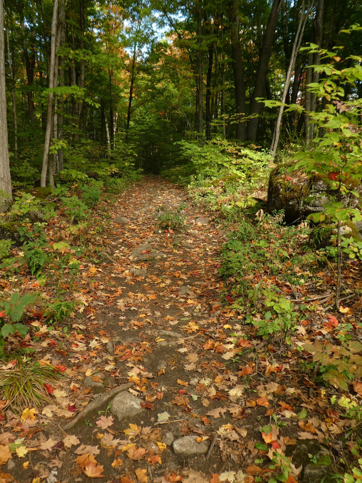
Mushroom Hike - Halton Agreement Forest
https://hikes.brucetrail.org/event/halton-agreement-forest-7/Sorry, the registration cut-off time for this hike has been reached.Not a member? Click here to join today!Hosting Club: Iroquoia
Category: General Hike
Location (Google Maps): Meet roadside on 4th Line at 9:15 am. Up Guelph Line from the 401, turn right on 10 Side Road and follow the curve as it becomes 4th Line.Hike Leader(s): Karen Bergmann Click here to contact Hike Leader(s)
Pace: Medium – 3 to 4 km/hr
Terrain: Moderate – Some hills and/or some poor footing
Distance: 8 kmsDescription
We will take time to look at mushrooms on this hike around the bike trails in this lovely Forest, including The Den and The Pines.Humber Valley – 5 Sideroad to Glen Haffy Side Trail
https://hikes.brucetrail.org/event/humber-valley-5-sideroad-to-glen-haffy-side-trail-3/Sorry, the registration cut-off time for this hike has been reached.Not a member? Click here to join today!Hosting Club: Dufferin Hi-Land
Category: Tuesday Hike
Location (Google Maps):Caledon Hills Section, Map 18, Km 45.4
Meet at parking lot on 5 Sideroad, east of Airport Rd, north of Hwy 9Hike Leader(s): Julie Daley, Les Babbage, Inge Eckerich, Tony Evangelista Click here to contact Hike Leader(s)
Pace: Medium
Terrain: Moderate
Distance: 7 km; Short hike 3 kmDescription
Hike will begin at the BTC parking lot on the north side of 5 Sideroad. We will hike the Main Trail south to 7th Line (short hike will end here), continue south, then take the Glen Haffy Side Trail through the Humber Valley, ending at Mono-Adjala Townline. Cars will be shuttled to the end. Bring water, snack. - 22October 22, 2025
Silver Creek North to 12th sideroad views
https://hikes.brucetrail.org/event/silver-creek-north-to-12th-sideroad-views/Sorry, the registration cut-off time for this hike has been reached.Not a member? Click here to join today!Hosting Club: Blue Mountains
Category: Organized Hike
Location (Google Maps): Tim Horton’s, First Street, CollingwoodHike Leader(s): Claire Pearson Click here to contact Hike Leader(s)
Pace: Medium – 3 to 4 km/hr
Terrain: Moderate – Some hills and/or some poor footing
Distance: 5 kmDescription
Enjoy a crisp fall morning along the Bruce Trail. There is lots to see on this hike – beautiful fall colors, scenic streams, and a spectacular view of Collingwood from the top of the 12th line! We will begin our shuttle hike where the Bruce Trail crosses Grey Rd 19 (WhatThreeWords – “hastened.mastery.balance”. From there, we will head North along the trail through the forest until we reach 12 line (Six Street extension). We will then walk along the road to the bottom of the 12th.EASY DOES IT HIKE,Allanburg Bridge
https://hikes.brucetrail.org/event/easy-does-it-hikeallanburg-bridge/Sorry, the registration cut-off time for this hike has been reached.Not a member? Click here to join today!Hosting Club: Niagara
Category: In and Out
Location (Google Maps): Allanburg Bridge parking lot.Hike Leader(s): Diane Marlatt Click here to contact Hike Leader(s)
Pace: Leisurely
Terrain: Easy
Distance: 5 kmDescription
This will be a leisurely walk heading north along the Welland Canals Trail from Allanburgh Bridge.WEDNESDAY WALKERS - Webwood Falls
https://hikes.brucetrail.org/event/wednesday-walkers-webwood-falls-2/Sorry, the registration cut-off time for this hike has been reached.Not a member? Click here to join today!Hosting Club: Beaver Valley
Location (Google Maps): Meet in the BTC parking lot on Grey Road 40, Km 105.7 Map 28 Edition 31
Hike Leader(s): Margaret Yaraskavitch Click here to contact the hike leader.
Pace: Medium
Terrain: Moderate
Length of Hike: 4.6 kmDescription
We gather in the somewhat new BTC parking lot on Grey Road 40. Our Trail takes us a short distance across a field and then into a forest. Then it’s a country walk beside farm fields towards Webwood Falls. We will view the Falls and poke around the old Harwood Farm to see features left behind from farmstead days. They we return back to our vehicles.Guidelines
- Arrive 15 minutes before the start of the hike.
- Wear sturdy footwear and appropriate attire for the weather and the terrain.
Hiking poles are a good idea in any season, especially if the terrain is rocky or slippery. In winter, snowshoes or icers/crampons are needed when conditions dictate.
Wearing appropriate clothing and footwear prevents injuries and shows consideration for a safe and positive group hiking experience. - Always carry I.D. and your health card.
- Bring sufficient water and snacks (or lunch if indicated). A minimum of 1L of water is recommended on all hikes, and 3L is recommended for long, challenging hikes in the heat of the summer.
- Bring sunscreen and insect repellent (for spring and summer hikes).
- Bring your own first aid kit.
- Please leave dogs at home.
Speyside Loops
https://hikes.brucetrail.org/event/speyside-loops-2/Sorry, the registration cut-off time for this hike has been reached.Not a member? Click here to join today!Hosting Club: Iroquoia
Category: General Hike
Location (Google Maps): Meet at the end of 17 Sideroad, off Hwy 25, just north of MiltonHike Leader(s): Karen Bergmann Click here to contact Hike Leader(s)
Pace: Medium – 3 to 4 km/hr
Terrain: Moderate – Some hills and/or some poor footing
Distance: 7 kmsDescription
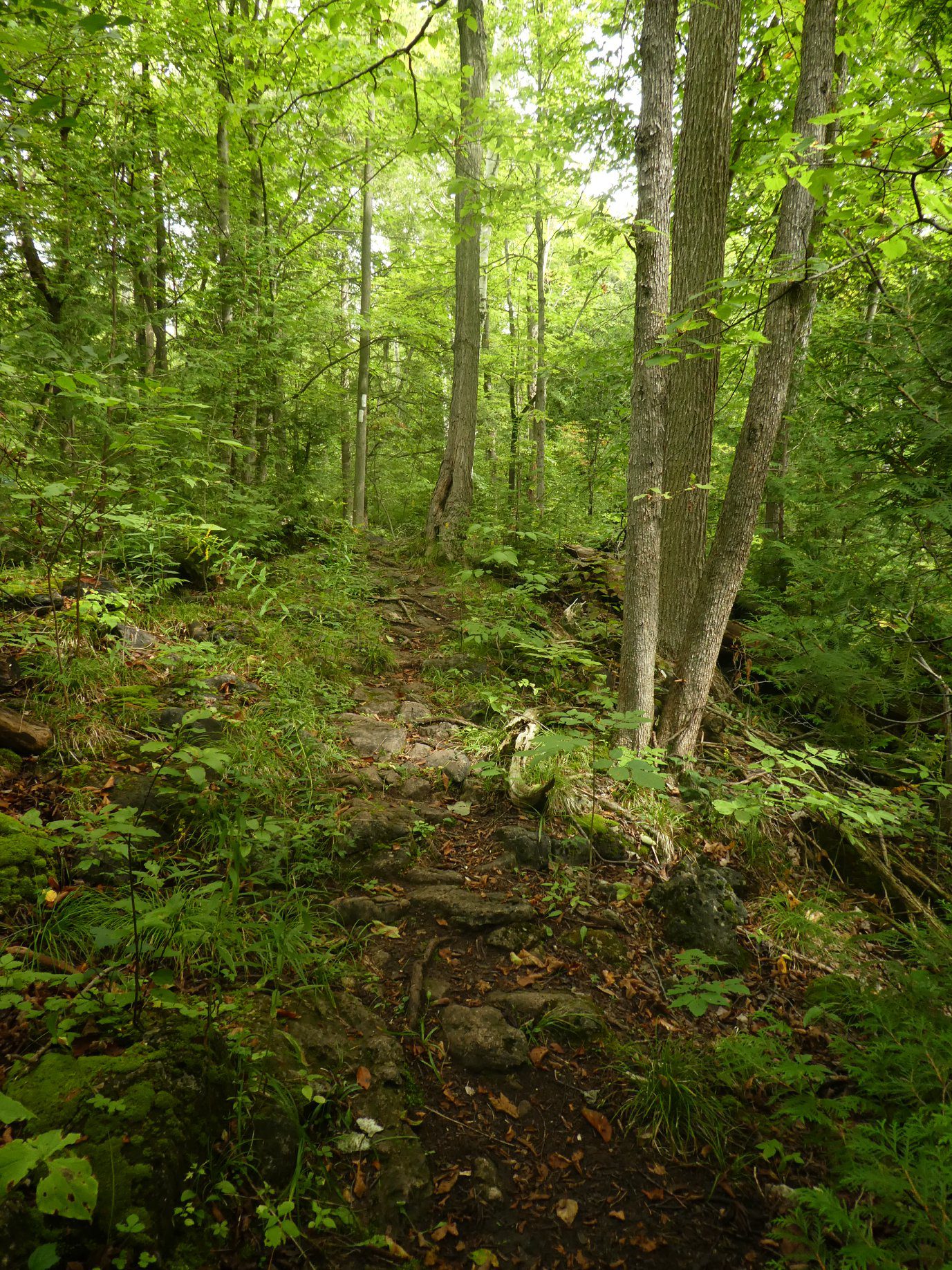
We will hike 3 loops including the main and 3 side trails. There are lots of rocks on this trail and some possible wet areas.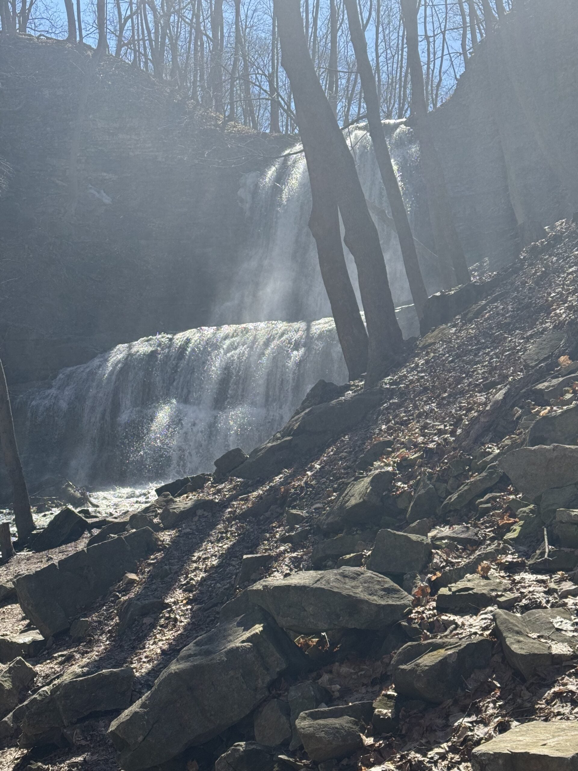
Waterfall Circuit
https://hikes.brucetrail.org/event/waterfall-circuit-2/Sorry, the registration cut-off time for this hike has been reached.Not a member? Click here to join today!Hosting Club: Iroquoia
Category: Good Companions
Location (Google Maps): Dundas Valley Conservation Area/Artaban Rd.Hike Leader(s): Anne Armstrong Click here to contact Hike Leader(s)
Pace: Leisurely – 3km/hr or less
Terrain: Moderate – Some hills and/or some poor footing
Distance: 8.5 kmDescription
- Dundas Valley is always a lovely hiking destination with its easy to moderate terrain but enough hills to provide a good cardiac workout. Meet in the parking lot on Artisan Rd. off of Lion’sClub Rd. at 9:45 am for a 10:00 am. start. (Paid parking or a conservation Area pass. We will do a circuit stopping to see Sherman and Canterbury Falls stopping and then head over to Tiffany Falls and return to the parking lot. (Except some rocky trail on the way to Tiffany Falls) Bring water, a snack and sunscreen. I will send outan email with my contact information the day before.
- 23October 23, 2025
Urban Walk: Valley View Park Thornhill
https://hikes.brucetrail.org/event/urban-walk-valley-view-park-thornhill-113/Sorry, the registration cut-off time for this hike has been reached.Not a member? Click here to join today!Hosting Club: Toronto
Location (Google Maps): Parking lot is off Sycamore Drive East of Bayview , across Starbucks plaza
Bus 91 from Finch east station stops at Sycamore station.Hike Leader(s): Mohammad Aghamiri Click here to contact Hike Leader(s)
Pace: Moderate (3-4 km/hr)
Terrain: Hilly, Level 2 (Intermediate – some hills and uneven surfaces, rocks and roots underfoot), Variable
Distance: 7-8 kmDescription
We will explore Valleyview and Maple View parks, and walk along German Mill Creak, in return we stop in Huntington park and have snack under beautiful shed ,Even it is considered Urban walk, it is urban hike as we have some up and down hills and tree roots, please bring your hiking poles, water and snacks,
phone number for the day of hike 289 588 6482
9:00 am Long Hike Cave Spring Conservation Area NEW TIME
https://hikes.brucetrail.org/event/900-am-long-hike-cave-spring-conservation-area-new-time-2/Sorry, the registration cut-off time for this hike has been reached.Not a member? Click here to join today!Hosting Club: Niagara
Location (Google Maps):
Cave Spring Conservation Area
Pace: Medium
Terrain: Moderate
: 10kDescription
This will be our permanent Thursday Location until Bridge repairs complete. From Cave Spring Conservation Area explore the trail network on the escarpment towards Kinsman Park and Moyer Road.You must register for each hike. Bring Poles, snack and a drink. Dress for the weather
Hiking in and around Jordan
https://hikes.brucetrail.org/event/hiking-in-and-around-jordan-12/Sorry, the registration cut-off time for this hike has been reached.Not a member? Click here to join today!Hosting Club: Niagara
Location (Google Maps): 3640 Glen Road, Lincoln LOR 1SO
Hike Leader(s): Bill Russell Click here to contact Hike Leader(s)
Pace: Medium
Terrain: Moderate
Distance: 7 kmDescription
Hiking in and around Jordan hiking different trails each week – Jim Rainforth Trail, Bailey Bridge and Jordan Village and Balls Falls.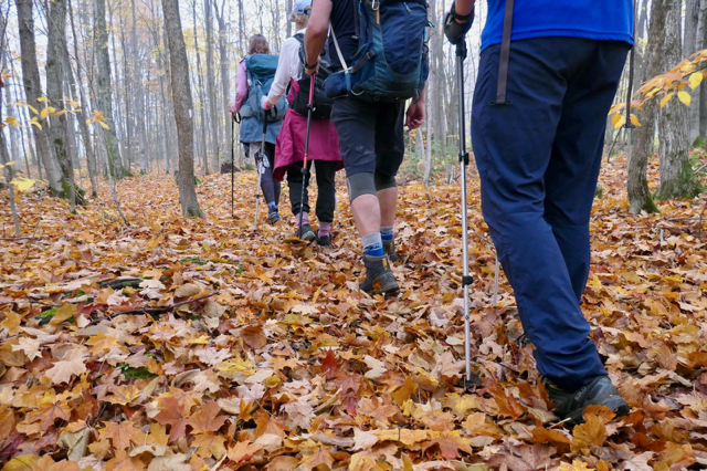
Jones Bluff Beauty
https://hikes.brucetrail.org/event/jones-bluff-beauty/Sorry, the registration cut-off time for this hike has been reached.Not a member? Click here to join today!Hosting Club: Peninsula
Location (Google Maps): Meet up location is at the Parking Area located at 44.873790, -81.075044 (Crooked Toe Road and Boundary Road). We will car shuttle from here to our hike start point. Hike start point at 44.877725,-81.071134 (Jones Bluff Side Trail)
Hike Leader(s): Owen and Marg Glendon Click here to contact Hike Leader(s)
Pace: Medium (3.0 – 4.5 km/h): A comfortable pace for most hikers with steady progress.
Terrain: Difficult: Steep ascents/descents, rocky scrambling, and some rugged escarpment paths., Moderate: Rolling hills, mild slopes and rocky paths.
Distance: ~7 kmDescription
Please join us for one of our favourite hikes – the Jones Bluff Loop. This hike has stunning views of Sydney and Georgian Bay, interesting topography, the feel, sights and smell of Autumn in the air. Looking forward to hiking through this beautiful forest with you! This time of year is approaching hunting season. Please wear something orange – a hat, vest or jacket.Meet at the corner of Crooked Toe Road and Boundary Road (44.873790, -81.075044). Car pool to our meet up location, if possible. We will shuttle from the meeting point to our starting point.
Free coffee and muffin for hike participants arriving before 9:15 a.m.
Novice Hikers - Fall Series of 10 Hikes in Dufferin, Hike 9
https://hikes.brucetrail.org/event/novice-hikers-fall-series-of-10-hikes-in-dufferin-hike-8/Sorry, the registration cut-off time for this hike has been reached.Not a member? Click here to join today!Hosting Club: Caledon Hills
Category: Introductory
Location (Google Maps): Meet at BTC parking lot on CR 19 just 80 m south of Prince of Wales Side Trail, west of km 15.2. Map 20Hike Leader(s): Nancy Mooney Click here to contact Hike Leader(s)
Pace: Leisurely – 3 km/hour or less, Medium – 3 to 4 km/hour
Distance: 6.7 km loop
Description
This is the eighth hike of the fall Dufferin series and includes the Primrose Loop and Price of Wales Side Trails.Lincoln Views-Frost Rd
https://hikes.brucetrail.org/event/lincoln-views-frost-rd-3/Sorry, the registration cut-off time for this hike has been reached.Not a member? Click here to join today!Hosting Club: Iroquoia
Category: Thursday Group
Location (Google Maps):Kinsmen Park, parking lot end of Frost Rd, 3820 Frost Rd, near Kinsmen Rd and Frost Rd, Beamsville/Lincoln
Hike Leader(s): Craig Sim Click here to contact Hike Leader(s)
Pace: Medium – 3 to 4 km/hr
Terrain: Moderate – Some hills and/or some poor footing
Distance: 8-10kmDescription
Beautiful views of farmland from escarpment. A lovely hike, quite rocky at times, some hills. Wear hiking boots or shoes with good tread. Dress in layers according to weather, including rain gear. Bring water and snack. Optional outing for beverage/food after. - 24October 24, 2025
Virgil & Mennonite History
https://hikes.brucetrail.org/event/virgil-mennonite-history/Sorry, the registration cut-off time for this hike has been reached.Not a member? Click here to join today!Hosting Club: Niagara
Category: Urban
Location (Google Maps): Park in Centennial Sports Park, 1565 Four Mile Creek Rd, Virgil. (Behind Meridian Credit Union Arena)Hike Leader(s): Margaret Northfield Click here to contact Hike Leader(s)
Pace: Medium
Terrain: Easy
Distance: 5-6kmDescription
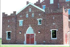
We explore Virgil while learning about the Mennonite history of the area.Plan to go to Sweets & Swirls afterward to have coffee or treat. 14 Anderson Lane, NOTL
Forks of the Credit
https://hikes.brucetrail.org/event/forks-of-the-credit-5/Sorry, the registration cut-off time for this hike has been reached.Not a member? Click here to join today!Hosting Club: Dufferin Hi-Land
Category: General Hike
Location (Google Maps): Creditview Road and the Grange Sideroad. See Google Maps link in this hike description for GPS.Hike Leader(s): Stuart Law Click here to contact Hike Leader(s)
Pace: Medium
Terrain: Moderate, Slippery and Steep Sections
Distance: 18.3 kmsDescription
Join us on this 18.3 km loop hike up to the Cataract Waterfall and back up and through the Devil’s Pulpit. Please bring 1.5L of water, a warm drink, a snack, a lunch and a smile. Lots of slippery rocks and a very steep climb.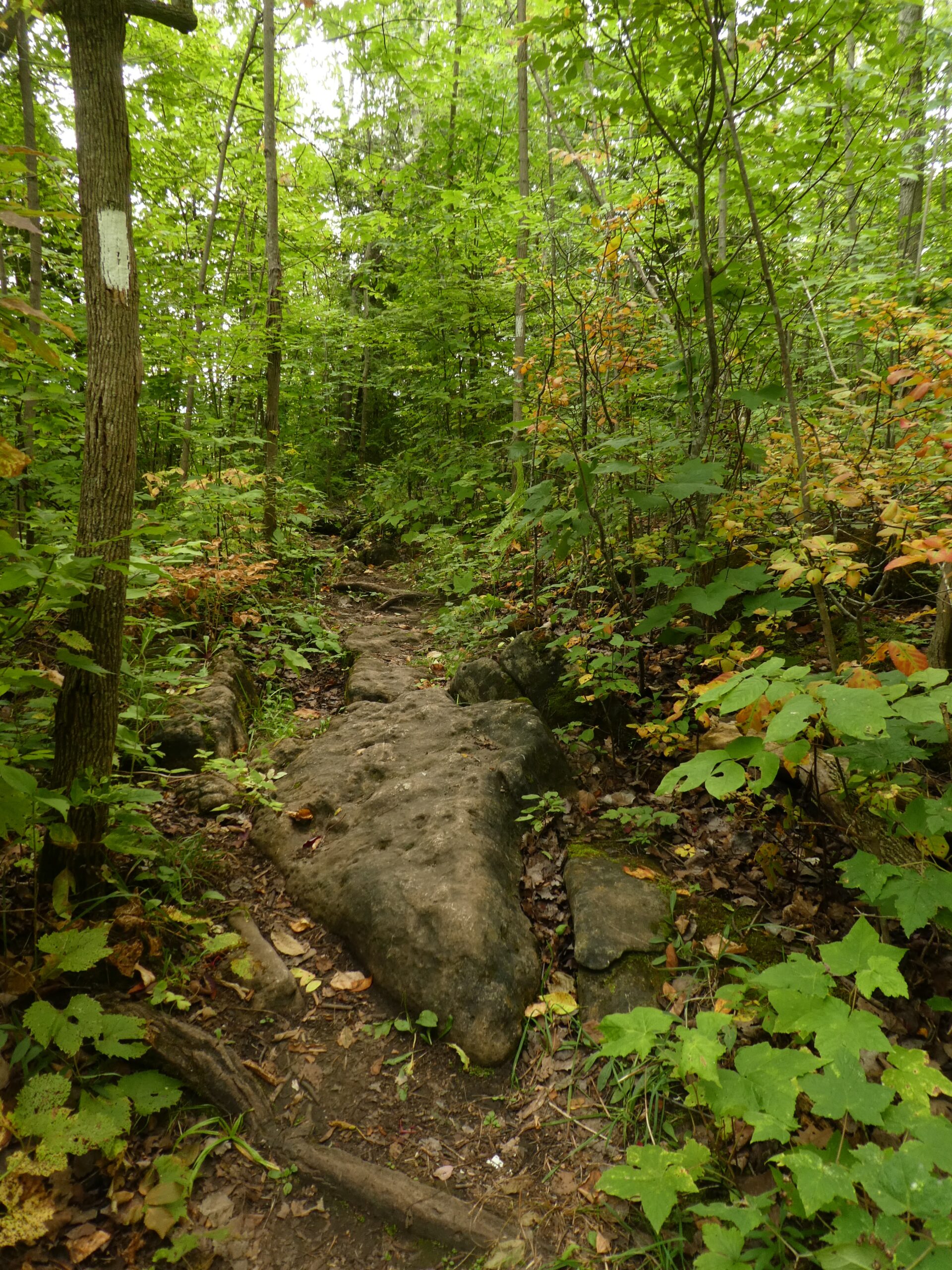
St. Helena Forest
https://hikes.brucetrail.org/event/st-helena-forest/Sorry, the registration cut-off time for this hike has been reached.Not a member? Click here to join today!Hosting Club: Iroquoia
Category: General Hike
Location (Google Maps): Meet in the Pear Tree parking lot at Speyside on 15 Side Road at 9:15 amHike Leader(s): Karen Bergmann Click here to contact Hike Leader(s)
Pace: Medium – 3 to 4 km/hr
Terrain: Moderate – Some hills and/or some poor footing
Distance: 10 kmsDescription
Meeting at 9:15 am in the Pear Tree parking lot, we will hike the main trail into the St. Helena forest and along the trails, which are VERY rocky. This is a dense forest that takes us around a large marsh pond and back up the Al Shaw Side Trail. This hike is about 90% technical (on rocks), so be prepared for that. Not for first time hikers. - 25October 25, 2025
Car Hike: Cherry Beach Down town
https://hikes.brucetrail.org/event/car-hike-cherry-beach-down-town-3/Sorry, the registration cut-off time for this hike has been reached.Not a member? Click here to join today!Hosting Club: Toronto
Location (Google Maps): Free parking at the end of Cherry Street ,Toronto
Hike Leader(s): Mohammad Aghamiri Click here to contact Hike Leader(s)
Pace: Moderate (3-4 km/hr)
Terrain: Flat, Level 1 (Easy – mostly on flat, well maintained trails with hard-packed surface), Variable
Distance: 12-14 kmDescription
Park in Cherry Beach parking lotWe will explore Tommy Thompson park along Lake Ontario and listen to the birds and visit light house at the end of park.
School Bus Hike: Iroquoia E2E (3/8)
https://hikes.brucetrail.org/event/school-bus-hike-iroquoia-e2e-3-8/Sorry, the registration cut-off time for this hike has been reached.Not a member? Click here to join today!Trip Information
Departure Time: 08:30
Return to City Time: 18:00
Departure Point: Kipling Departure PointOptional Items
Hosting Club: Toronto
Category: Bus Hike
Location (Google Maps): Hamilton (Map 7/8 – km 29.5 to km 45.2)Hike Leader(s): Tom Swales, Robin Crombie, Marina Wray Click here to contact Hike Leader(s)
Pace: Moderate (3-4 km/hr)
Terrain: Hilly, Level 2 (Intermediate – some hills and uneven surfaces, rocks and roots underfoot), Rocky, Variable
Distance: 16 kmDescription
We will follow the Bruce Trail has it makes it’s way through Hamilton along “the mountain”, which is what the escarpment is referred to by the locals and then on to the Chedoke Rail Trail in West Hamilton and finishing near Tiffany Falls at Ancaster. There will be a refreshment stop in Dundas before heading back to Toronto.These hikes are intended for hikers taking the bus from Toronto only.
F&G Hills 2
https://hikes.brucetrail.org/event/fg-hills-2/Sorry, the registration cut-off time for this hike has been reached.Not a member? Click here to join today!Hosting Club: Dufferin Hi-Land
Category: General Hike
Location (Google Maps): New Parking lot on Side Road 15 just west of the intersection with Prince of Wales RoadHike Leader(s): Tristan Goguen Click here to contact Hike Leader(s)
Pace: Medium
Terrain: Slippery and Steep Sections, Strenuous
Distance: 18.5 approximatelyDescription
Please note we are meeting and parking in the new Bruce Trail Parking lot on Side Road 15. This is the second in this series of hill hikes. This is an oddly configured hike with many loops due in part to the bridge repair/road closure on River Road. Expect hills and possibly muddy sections as we hike the main trail and side trails. We will finish the day with a hike up and down Kilgorie hill. Hiking shoes or boots are highly recommended, hiking poles are optional. Please bring water snacks/lunch. Ensure you dress for the unpredictable fall weather. Note the hike leaders will have 2 dogs with them on this hike. This hike involves challenging climbs and is recommended for experienced hikers only.Decew/ Twelve Mile Creek Loop
https://hikes.brucetrail.org/event/decew-twelve-mile-creek-loop/Sorry, the registration cut-off time for this hike has been reached.Not a member? Click here to join today!Hosting Club: Niagara
Category: Loop
Location (Google Maps): Decew HouseHike Leader(s): Lauren Doig Click here to contact Hike Leader(s)
Pace: Brisk
Terrain: Moderate
Distance: 18 kmDescription
Meet at Decew House and hike down to Twelve Mile Creek Side Trail. Return on path on the other side of the creek.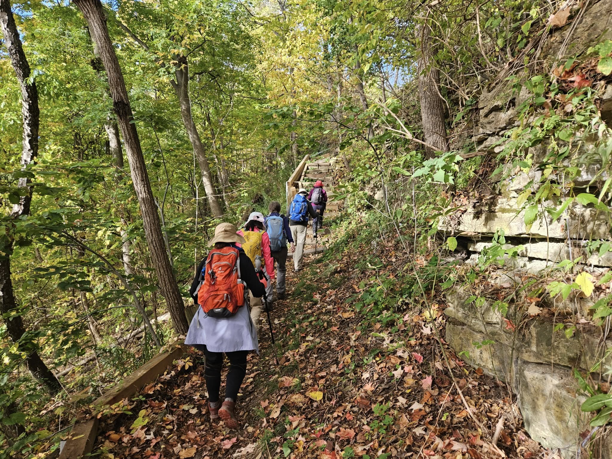
Car Hike: #5/7 Iroquoia Bruce Trail End-to-End -18 KM
https://hikes.brucetrail.org/event/car-hike-5-7-iroquoia-bruce-trail-end-to-end-18-km/Sorry, the registration cut-off time for this hike has been reached.Not a member? Click here to join today!Hosting Club: Toronto
Category: Car Hike
Location (Google Maps): KM66 Roadside parking at Old Guelph Rd.Hike Leader(s): Alina Lin
Pace: Brisk (4-5 km/hr)
Terrain: Challenging, Flat, Hilly, Level 2 (Intermediate – some hills and uneven surfaces, rocks and roots underfoot), Rocky, Variable
Distance: 18 kmDescription
- It’s time for the fall colors—and no autumn feels complete without a hike on the Bruce Trail.
This is the 5th hike of an End-to-End series covering the entire Iroquoia Bruce Trail section. The full section stretches over 120 kilometers from Grimsby to Milton. I am using Map Edition 29 to plan the hikes, and so please note that kilometer markings may not be fully up to date, and actual hiking distances may vary slightly.
Meeting Point:
KM66. Roadside parking on the north end of Old Guelph Rd providing access to the Old Guelph Side Trail. GPS: 43.307417, -79.911580. Please arrive before 8:45am to allow time for car shuttle coordination.We will car shuttle to KM83.5. Roadside parking on Guelph Line, south of No. 1 Sideroad. GPS: 43.388387, -79.854327. From there to hike back to KM66.
All drivers are expected to participate in the car shuttle, either before or after the hike. All hikers are expected to chip in for parking fees, if applicable.
Important Notes:
- Wear sturdy hiking footwear and dress appropriately for the weather
- Bring snacks, and at least 1.5L of water
- No dropouts available.
- No pets.
Margaret Paull Side Trail Loop
https://hikes.brucetrail.org/event/margaret-paull-side-trail-loop-5/Sorry, the registration cut-off time for this hike has been reached.Not a member? Click here to join today!Hosting Club: Blue Mountains
Category: Organized Hike
Location (Google Maps): Tim Horton’s, First Street, CollingwoodHike Leader(s): Claire Pearson Click here to contact Hike Leader(s)
Pace: Medium – 3 to 4 km/hr
Terrain: Moderate – Some hills and/or some poor footing
Distance: 4.3 kmDescription
We will begin our loop hike at the entrance of the Margaret Paull Side Trail (WhatThreeWords = “bathwater.pins.specified”). This scenic trail is known for its forested beauty, waterfalls, and flowerpot rock formation. We will then loop around back to our cars.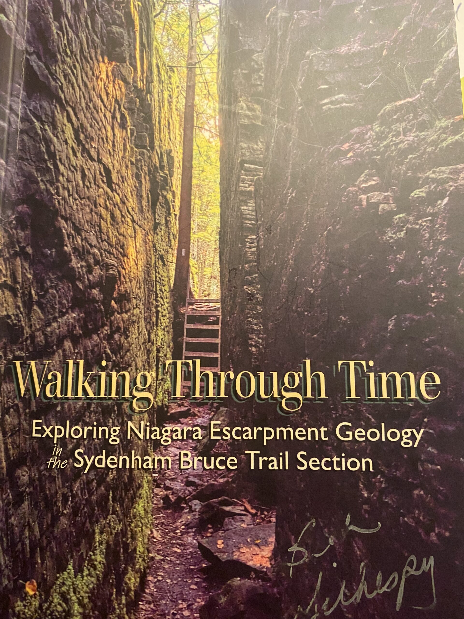
Geology Hike #16 Combo Skinner's Bluff and Bruce's Caves
https://hikes.brucetrail.org/event/geology-hike-16-combo-skinners-bluff-and-bruces-caves/Sorry, the registration cut-off time for this hike has been reached.Not a member? Click here to join today!Hosting Club: Sydenham
Category: Geology Hike
Location (Google Maps):Carpool from Kemble Arena. 319897 Kemble Road Road, Kemble, ON NOH1S0 . We will drive to trailhead (limited parking ) approx. 15 minutes drive north.
Hike Leader(s): Carol Graham-Mullin Click here to contact Hike Leader(s)
Pace: Leisurely: 3 km/h or less
Terrain: Easy: Mostly flat and good footing., Moderate: Some hills and/or poor footing, Strenuous: Hilly with steep climbs and some poor footing., There are crevices or holes which may be hidden by layers of snow. Hike with extreme caution.
Distance: 5.2 km total (2 loops)Description
We will be hiking 2 loops. Skinner’s Bluff loop and Bruce’s Caves loop (hotspot). The estimated time includes driving to the first trailhead and then moving to 2nd trailhead and driving back to our carpool site (Kemble Arena). There is limited parking at both so carpooling is necessary. The view from Skinner’s Bluffs is truly breathtaking. This rock overhang is a solid slab on the uppermost layer of the Amabel Dolostone formation and a popular photo location. Our second loop is Bruce’s Caves, a 15 minute drive north. These cliff caverns are fine examples of wave action erosion along the original high shoreline 10,000 years ago.Please bring water, snacks and poles as needed. The hike leader will have copies of Beth Gilhespy’s Sydenham geology book for sale (cash or e-transfer )$37.00 BT members. “Walking Through Time Exploring Niagara Escarpment Geology in the Sydenham Section.” A Sydenham Bruce Trail geology badge has been developed. Details can be shared from hike leader during the hike.
Film Fundraiser Fun Hike
https://hikes.brucetrail.org/event/film-fundraiser-fun-hike/Sorry, the registration cut-off time for this hike has been reached.Not a member? Click here to join today!Hosting Club: Caledon Hills
Category: General
Location (Google Maps): Meet at Parking Lot just behind Guelph Fire Station, at Riverside Park.
74 Speedvale Ave. E.,
Guelph, OntarioHike Leader(s): Ralph Shapiro Click here to contact Hike Leader(s)
Pace: Medium – 3 to 4 km/hour
Terrain: Easy – mostly flat and usually good footing
Distance: 5-6 kilometersDescription
Picturesque hike along the Speed River through Riverside Park toward Guelph Lake and back.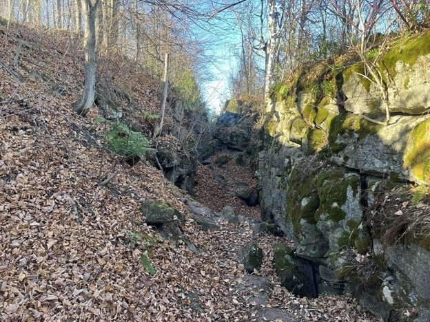
GeoHike Series #2: Splitrock Narrows Nature Reserve
https://hikes.brucetrail.org/event/geohike-series-1-splitrock-narrows-nature-reserve/Sorry, the registration cut-off time for this hike has been reached.Not a member? Click here to join today!Hosting Club: Dufferin Hi-Land
Category: General Hike
Location (Google Maps): Meet at Splitrock Narrows parking to hike the Split Rock Side Trail.Hike Leader(s): Lynda Bloom; Margery Cruise Click here to contact Hike Leader(s)
Pace: Leisurely
Terrain: Easy
Distance: 5 kmDescription
We will hike into the accessible crevices to see fossils (no dinosaurs!) and the lush mix of species that are at home along the rocky shelves of the Niagara Escarpment. Roughly 14,000 years ago the entire area was covered by glaciers and we will chat with a professional geologist about how the melting water formed today’s landscape. There will be time to admire the views and trees. The white cedars, some more than 1,000 years old, clinging to weathered rock faces are impressive.Common Buckthorn (invasive) Removal
https://hikes.brucetrail.org/event/common-buckthorn-invasive-removal/Sorry, the registration cut-off time for this hike has been reached.Not a member? Click here to join today!Hosting Club: Dufferin Hi-Land
Category: Special Events
Location (Google Maps): Split Rock Narrows Nature ReserveHike Leader(s): Cathy Hughes Click here to contact Hike Leader(s)
Pace: Leisurely
Terrain: Moderate
Distance: 3 kmDescription
Common Buckthorn trees are an invasive species which can disrupt the balance of the ecosystem if left unchecked. This species outcompetes native plants, reduces biodiversity and degrades the quality of wildlife habitat.Come out and help the Dufferin Hi-Land Biodiversity Committee and BTC staff members remove these invasive trees!
Equipment provided but please bring gloves and wear sturdy boots.