|
Sun | Mon | Tue | Wed | Thu | Fri | Sat |
|---|
September | September | September | September | 1  Urban Walk : Valley View Park Urban Walk : Valley View Park 9:30 AM-11:45 AM 10/01/2026 https://hikes.brucetrail.org/event/urban-walk-valley-view-park-4/2026-10-01/ Click here for more information or to register Hosting Club: Toronto Location (Google Maps): Parking lot is off Sycamore Drive, East of Bayview , across Starbucks plaza
Bus 91 from Finch East station stops at Sycamore station. Hike Leader(s): MOHAMMAD AGHAMIRI Click here to contact Hike Leader(s) Pace: Moderate (3-4 km/hr)
Terrain: Hilly, Level 2 (Intermediate – some hills and uneven surfaces, rocks and roots underfoot)
Distance (km): 7-8 km Description
We will explore Valleyview and Maple View parks, and walk along German Mills Creek, in return we stop in Huntington park and have snack ,coffee,tea . Although this is considered an “Urban Walk”, you can expect some hills up and down and uneven surfaces with tree roots. Please bring hiking poles, water and snacks. phone number for the day of hike 289 588 6482
| 2  Tobermory Fall Weekend Tobermory Fall Weekend 12:00 AM 10/02/2026 https://hikes.brucetrail.org/event/car-hike-tobermory-fall-hiking-weekend-2or3-overnights/2026-10-02/ This is a Multi-Day HikeYou are signing up for the following dates and times:
2026-10-02 at Click here for more information or to register Hosting Club: Toronto, Peninsula
Category: Car Hike
Location (Google Maps): Princess Hotel
34 Bay St, Tobermory, ON N0H 2R0 Hike Leader(s): Jeanette Vincent. Click here to contact Hike Leader(s) Pace: Moderate (3-4 km/hr)
Terrain: Level 2 (Intermediate – some hills and uneven surfaces, rocks and roots underfoot), Variable
Distance (km): 13 -15km Description
Greg Vincent’s legacy of weekends away continue. Please join me, Jeanette Vincent as we explore the Tip o’ the Bruce, Tobermory in the Fall. The beauty of this area of the Bruce Peninsula every season is wonderful! We will take in a number of walks using side trails and the Bruce Trail. Approximately 13-15km/day. We stay and have our meals at a comfortable hotel overlooking Little Tub Harbour. This outing is restricted to those staying with us at the Princess Hotel in Tobermory for the weekend – the hotel fills quickly. You will need a car to access this outing. Please contact the Princess Hotel for a reservation.1-519-596-8282 or info@tobermoryprincesshotel.com and mention Vincent/Royle Fall weekend. Before registering at the hotel please contact us for the price package for accommodations and more details.
| 3   School Bus Hike: Beaver Valley E2E #1 (Loree Forest) School Bus Hike: Beaver Valley E2E #1 (Loree Forest) 8:00 AM-6:30 PM 10/03/2026 https://hikes.brucetrail.org/event/school-bus-hike-beaver-valley-e2e-1-loree-forest/2026-10-03/ 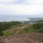 Trip Information
Departure Time: 08:00
Return to City Time: 18:30
Departure Point: Kipling Departure Point Click here for more information or to register Optional Items
Hiking ($.01)
Hosting Club: Toronto
Category: Bus Hike
Location (Google Maps): Beaver Valley Section km 0.0 to 10.6 Hike Leader(s): Felix Wan; Tim Wainwright Click here to contact Hike Leader(s) Pace: Moderate (3-4 km/hr)
Terrain: Hilly, Level 2 (Intermediate – some hills and uneven surfaces, rocks and roots underfoot), Variable
Distance (km): 10.6 Description
Join us for the kick-off hike of our Beaver Valley End-to-End series. The Beaver Valley section is known for its many hills, but all experienced, fit hikers are welcome to join us, including those who are not working towards an E2E badge. Our first hike will take us from the boundary with the Blue Mountains section at km 0.0, through the luscious Len Gertler Memorial Loree Forest and along the Escarpment edge, finishing at km 10.6 (Bruce Trail Reference Guide Edition 31, Map #24). We should catch some magnificent views of Georgian Bay. The total hike distance is approximately 10.6 km. There will be a dropout point at approximately 8.3 km. Time permitting, we will have a refreshment stop in Primrose. Hiking boots and poles are recommended. - =>>> Please read the TBTC Paid Hikes Refund Policy before registering: https://torontobrucetrailclub.org/hikes/no-show-policy. There will be no refunds issued for this hike if the registrant cancels or misses the bus on the date of departure for any reason. Registration fees are not transferrable between different hikes, nor do unused fares qualify for a tax receipt.
- Car Hike: Erindale park Mississauga
8:30 AM-1:15 PM 10/03/2026 https://hikes.brucetrail.org/event/car-hike-erindale-park-mississauga-5/2026-10-03/ Click here for more information or to register Hosting Club: Toronto
Category: Car Hike
Location (Google Maps): Erindale park parking lot Hike Leader(s): MOHAMMAD AGHAMIRI Click here to contact Hike Leader(s) Pace: Moderate (3-4 km/hr)
Terrain: Hilly, Level 2 (Intermediate – some hills and uneven surfaces, rocks and roots underfoot), Variable
Distance (km): 14-15 km Description
We will hike Credit River North and will see nice views of Credit River and possibly some salmons heading upstream From parking lot we hike north mostly along Credit River and return to parking around 13 to 13.30 For the day of hike only my phone number is 289 588 6482.
- School Bus Hike: Dufferin Highland, Murphy’s Pinnacle
8:30 AM-6:30 PM 10/03/2026 https://hikes.brucetrail.org/event/school-bus-hike-dufferin-highland-murphys-pinnacle-2/2026-10-03/ Trip Information
Departure Time: 08:30
Return to City Time: 18:30
Departure Point: York Mills Bus Pickup Click here for more information or to register Optional Items
Pick up at HWY 400 and HWY 9 ($0.01)
Hosting Club: Toronto
Category: Bus Hike
Location (Google Maps): Dufferin Highland, Murphy’s Pinnacle Hike Leader(s): Martina Furrer, Janet McColeman, Leila Damband, and Leonora Rochwerger Click here to contact Hike Leader(s) Pace: Brisk (4-5 km/hr), Moderate (3-4 km/hr)
Terrain: Hilly, Level 2 (Intermediate – some hills and uneven surfaces, rocks and roots underfoot), Variable
Distance (km): Fast group 16 to 18 km, Moderate group 13 km Description
Join us for a fantastic fall hike in the Dufferin Highlands (Map 20). Enjoy awesome views from Murphy’s Pinnacle and the Mulmur Lookout. We will split into two groups. The fast group will do the Primrose Loop Side Trail and then follow the main trail north to km 29.6 (about a 16 km hike). If time permits the fast group will also do the Rock Hill Park Side Trail. The moderate group will head straight to Murphy’s Pinnacle and follow the main trail north to km 29.6 (about a 13 km hike). Pack water, lunch, sun and rain protection. Refreshment stop at Sonnen Hill Brewing (https://sonnenhill.com/). Sit back, relax, and socialize with your hiking friends while you sip a fresh, cold, local brew or non-alcoholic beverage in their beautiful beer garden. Or walk up to their lookout for more great views (a 20 minute loop). Departure 1: 8:30 am from 10 York Mills Rd.
Departure 2: 8:50 am from HWY 400 and Major Mac
- Urban Walk: Evergreen Brick Works and Moore Park Ravine
10:00 AM-11:30 AM 10/03/2026 https://hikes.brucetrail.org/event/urban-walk-evergreen-brick-works-and-moore-park-ravine/2026-10-03/ Click here for more information or to register Hosting Club: Toronto
Category: TBTC Special Events
Location (Google Maps): Evergreen Brick Works and Moore Park Ravine. Meet in Tiffany Commons by the Watershed Wall (between the farmer’s market and main building) Pace: Moderate (3-4 km/hr)
Terrain: Hilly, Level 2 (Intermediate – some hills and uneven surfaces, rocks and roots underfoot), Variable
Distance (km): 5 km Description
Join Ray for a 5 km introductory circular urban walk exploring the wetlands, woodlands, and natural meadows of the Evergreen Brick Works, and then ascending into the beautiful Moore Park Ravine returning to the Evergreen Brick Works by the scenic outlook overlooking the Evergreen Brick Works site, Don Valley, and ravines. Expect some moderate hills and uneven terrain. Hiking boots or shoes designed for walking are essential. The hike will return to Evergreen Brick Works in time for the “Hiking 101” presentation in the BMO atrium at 12:30 pm. This hike is part of our Bruce Trail Day celebrations. Saturday we will be at the farmer’s market in Evergreen Brick Works and on Sunday we will be at Limehouse on the trail. If you’re unavailable on Sunday please join us in Toronto on the Saturday to meet with us and learn about the Bruce Trail. On Sunday there will be a selection of hikes based from Limehouse plus a Bus Hike from York Mills Subway. Preregistration is not required to join us on the hikes from Evergreen Brick Works.
- Urban Walk: Moore Park Ravine and Park Drive Reservation
10:30 AM-11:45 AM 10/03/2026 https://hikes.brucetrail.org/event/urban-walk-moore-park-ravine-and-park-drive-reservation/2026-10-03/ Click here for more information or to register Hosting Club: Toronto
Category: TBTC Special Events
Location (Google Maps): Evergreen Brick Works, Moore Park Ravine and Park Drive Reservation
Meet in Tiffany Commons by the watershed wall (between the farmer’s market and the main building) Pace: Moderate (3-4 km/hr)
Terrain: Level 1 (Easy – mostly on flat, well maintained trails with hard-packed surface), Variable
Distance (km): 4 km Description
Join Danny for a 4 km introductory “out and back” urban walk southbound into the ravine trails and northwards past Milkman’s Lane into Park Drive Reservation. We’ll continue to Mount Pleasant Road and return to the Evergreen Brick Works in time for the “Hiking 101” presentation in the BMO atrium at 12:30 pm. This hike will be on generally flatter terrain and on hard packed gravel paths. Hiking boots or shoes designed for walking are recommended. This hike is part of our Bruce Trail Day celebrations. Saturday we will be at the farmer’s market in Evergreen Brick Works and on Sunday we will be at Limehouse on the trail. If you’re unavailable on Sunday please join us in Toronto on the Saturday to meet with us and learn about the Bruce Trail. On Sunday there will be a selection of hikes based from Limehouse plus a Bus Hike from York Mills Subway. Preregistration is not required to join us on the hikes from Evergreen Brick Works.
- Urban Walk: Waterfront Trail 8/11 – Beechgrove (Port Union) to Pickering
10:45 AM-2:15 PM 10/03/2026 https://hikes.brucetrail.org/event/urban-walk-waterfront-trail-8-11-beechgrove-port-union-to-pickering/2026-10-03/  Click here for more information or to register Hosting Club: Toronto
Category: Urban Walk
Location (Google Maps): Toronto, Ontario, Canada Hike Leader(s): Brian Rideout Click here to contact Hike Leader(s) Pace: Moderate (3-4 km/hr)
Terrain: Flat
Distance (km): 11.9 km Description
Please meet me at Kennedy Station by 10:04 am. We will take the 38A East to Rouge Hill GO bus departing 10:20 am, arriving at Port Union Rd at 11:00 am. We will hike south to Lake Ontario and along the Waterfront Trail through Port Union and Rouge Hill to Pickering GO. The estimated distance is 9.8 km. Here is an online map of our route – Port Union to Pickering. Bring a snack, at least 2 liters of water, sun screen and bug spray.
- Introductory Hike – Evergreen Brick Works
11:00 AM-12:00 PM 10/03/2026 https://hikes.brucetrail.org/event/introductory-hike-evergreen-brickworks-4/2026-10-03/ Click here for more information or to register Hosting Club: Toronto
Category: TBTC Special Events
Location (Google Maps): Meet the hike leader in Tiffany Commons in front of the watershed wall at the Evergreen Brick Works (across from the cafe). Please contact ttc.ca to confirm transit information, as summer construction projects may be underway. Evergreen Brick Works free shuttle from outside Broadview Subway Station (departs every 30 minutes) or TTC Route #28 Bayview South from Davisville Subway Station (every 30 minutes) Hike Leader(s): Ray Berzins Click here to contact Hike Leader(s) Pace: Leisurely (2-3 km/hr)
Terrain: Flat, Level 1 (Easy – mostly on flat, well maintained trails with hard-packed surface)
Distance (km): 4 km Description
A there-and-back hike South from the Evergreen Brick Works to Beltline Trail which goes northwest to Mount Pleasant Road from where we shall return to the Evergreen Brick Works along the same route. Preregistration for hike is not required – just arrive 15 minutes prior to the hike to sign up with hike leader.
|
4 - Bus Hike: Bruce Trail Day @ Limehouse
9:15 AM-4:00 PM 10/04/2026 https://hikes.brucetrail.org/event/bus-hike-bruce-trail-day-limehouse/2026-10-04/ Trip Information
Departure Time: 09:15
Return to City Time: 16:00
Departure Point: York Mills Bus Pickup Click here for more information or to register Optional Items
Hosting Club: Toronto
Category: Bus Hike
Location (Google Maps): Bruce Trail north of Limehouse and Limehouse Conservation Area Hike Leader(s): Tom Swales, Janet McColeman Click here to contact Hike Leader(s) Pace: Moderate (3-4 km/hr)
Terrain: Level 2 (Intermediate – some hills and uneven surfaces, rocks and roots underfoot), Other (Refer to Description), Variable
Distance (km): 9 km Description
Join us to celebrate Bruce Trail Day on the trail around Limehouse. For the first 5 km we will hike south from the Sixth Line to Limehouse. The route incorporates the portion of trail removed from the Fifth Line thanks to those who support the Bruce Trail. We’ll also pass the seed orchard where native species are grown for the seeds to be replanted to re-naturalize other parts of the trail. Those who want a shorter hike may drop out at Limehouse where information and refreshments will be available at the Memorial Hall. The second part of the hike will be a loop through the Limehouse Conservation area featuring the limestone kilns, stone arched bridge, and a climb through the “hole in the wall”. Expect some slightly rocky terrain underfoot and a few moderate hills. Hiking boots or good shoes designed for walking are a must. Those completing the full 9 km will also have a chance to drop in at the Memorial Hall to learn more about the Bruce Trail and refreshments. - =>>> Please read the TBTC Paid Hikes Refund Policy before registering: https://torontobrucetrailclub.org/hikes/no-show-policy”. There will be no refunds for this hike if the registrant cancels or misses the coach on the date of departure for any reason. Registration fees are not transferable between different hikes nor can unused fares qualify for a tax receipt. All hike go rain or shine with the exception of an extreme weather event.
- Fitness hike in the Beaver Valley
10:00 AM-5:00 PM 10/04/2026 https://hikes.brucetrail.org/event/fitness-hike-in-the-beaver-valley-beaver-valley-short-loop-19-2-km/2026-10-04/ Click here for more information or to register Hosting Club: Toronto, Beaver Valley
Category: Car Hike
Location (Google Maps): Beaver Valley Short Loop, 19.2 km Hike Leader(s): Natalia Svechnikova Click here to contact Hike Leader(s) Pace: Moderate (3-4 km/hr)
Terrain: Challenging, Hilly, Level 3 (Advanced – steep hills and some scrambling over boulders)
Distance (km): about 19.2 km Description
Please join me for a challenging hike on the Bruce Trail (main and side trails) in the Beaver Valley. We will be following the Beaver Valley Short loop of ca 19.2 km from the Hogg’s Falls Parking lot (170491-172753, Lower Valley Rd, Flesherton, ON N0C 1E0). From there, we will start hiking the main Bruce Trail toward Eugenia Falls and continue with the loop counter-clockwise. We will make short water and pit breaks and one long (at least 45 min) lunch break to eat, rest and enjoy, and we should finish the hike before 5 pm. After the hike, we will have a stop at a brewery or cidery (we will decide on the hike) before we head home. For more information (including technical details) about this loop, please check “Beaver Valley Short Loop” on the Alltrails app on your phone or click on this link to the website: https://www.alltrails.com/trail/canada/ontario/beaver-valley-short-loop Please note that this is a long hike and a relatively long day trip if you are coming from the GTA. We will try to keep a moderate pace of about 3 km/h while slowing down uphill. The trail is challenging with a few uphill sections after which we will stop for short water breaks. Please be dressed for the weather, wear hiking shoes/boots, bring extra layers and pack your rain gear (just in case), at least 2 L of water, light lunch and several snacks, your sunglasses and/or hut. We will meet at the Hogg’s Falls Parking lot (170491-172753, Lower Valley Rd, Flesherton, ON N0C 1E0) Please note that this hike is not suitable for a rainy/stormy day and will be cancelled in case of inclement weather.
- Car Hike: Scotsdale Farm,Map 13
10:00 AM-2:30 PM 10/04/2026 https://hikes.brucetrail.org/event/car-hike-scotsdale-farmmap-13/2026-10-04/ Click here for more information or to register Hosting Club: Toronto
Category: Car Hike
Location (Google Maps): Scotsdale Farm, Map 13 Hike Leader(s): Al Brown Click here to contact Hike Leader(s) Pace: Moderate (3-4 km/hr)
Terrain: Level 2 (Intermediate – some hills and uneven surfaces, rocks and roots underfoot), Variable
Distance (km): 10-13 km Description
Come join me for hike through Scotsdale Farm and the Silver Creek Conservation Area to enjoy the fall colours. We will complete a loop hike on the main and side trails. Shorter loops are available for those who do not want to complete the full length. After the hike all are invited to join me for refreshments at the Shepherd’s Crook in old Georgetown. To get to the meeting point from Hwy 401 go north on Trafalgar Road past Georgetown to the juncture with Hwy 7. North on Hwy 7 to Silver Creek. Turn right and back onto Trafalgar Road. Go north about 1.5 km to the entrance of Scotsdale Farm on your right. The parking area is about 0.5 km from Trafalgar Road near the old homestead.
- Passport to Nature: Family Fun for Bruce Trail Day (morning hike)
10:00 AM-12:00 PM 10/04/2026 https://hikes.brucetrail.org/event/passport-to-nature-family-fun-for-bruce-trail-day-morning-hike/2026-10-04/  Click here for more information or to register Hosting Club: Toronto
Category: Car Hike
Location (Google Maps): We will meet at the Limehouse parking lot on 22 Sideroad (coordinates are 43.638113, -79.979272). Hike Leader(s): Monica Pasquali Click here to contact Hike Leader(s) Pace: Leisurely (2-3 km/hr)
Terrain: Level 2 (Intermediate – some hills and uneven surfaces, rocks and roots underfoot)
Distance (km): 4 km Description
Come and join me for a family-friendly hike in honour of Bruce Trail Day! We will trek a total of 4 km along the Todd Bardes Meadowland Side Trail, the Ridge Side Trail, and the main trail located northeast of Limehouse. There will be a scavenger hunt to complete while hiking, and individuals who would like to work on their Biodiversity Naturalist Badge (https://torontobrucetrailclub.org/the-trail/badges) are encouraged to do so during this hike — I love spotting interesting flora, fauna, and fungi whenever I’m on the Bruce Trail so I would be happy to help hikers in their quest for this badge. Port-a-potties, refreshments, activities, and displays will be available at the Limehouse Public School parking lot across the street from our meeting location before and after the hike, and there will be Toronto Bruce Trail Club volunteers present to answer any questions you may have about our beloved Bruce Trail. Children under 13 years of age are encouraged to join their parents/guardians on this hike so they can fulfill the requirements for the Toronto Bruce Trail Club’s Youth Badge (https://torontobrucetrailclub.org/the-trail/badges) — all family members who are planning on joining us should register for the hike, including children. You should bring enough water and food for a 2-hour hike, comfortable footwear with good traction, and appropriate clothing for the weather. Please note that this hike is part of the Bruce Trail Conservancy’s “Passport to Nature” initiative so all hikers who participate in this hike will receive a sticker that can count towards earning a badge or prize from the Bruce Trail Conservancy! For more information about the “Passport to Nature” initiative, please click here: https://brucetrail.org/passport-to-nature/ Everyone is welcome to attend this hike — looking forward to celebrating Bruce Trail Day with you on October 4th!
- Passport to Nature: Family Fun for Bruce Trail Day (afternoon hike)
1:00 PM-3:00 PM 10/04/2026 https://hikes.brucetrail.org/event/passport-to-nature-family-fun-for-bruce-trail-day-afternoon-hike/2026-10-04/  Click here for more information or to register Hosting Club: Toronto
Category: Car Hike
Location (Google Maps): We will meet at the Limehouse parking lot on 22 Sideroad (coordinates are 43.638113, -79.979272). Hike Leader(s): Monica Pasquali Click here to contact Hike Leader(s) Pace: Leisurely (2-3 km/hr)
Terrain: Level 2 (Intermediate – some hills and uneven surfaces, rocks and roots underfoot)
Distance (km): 4 km Description
Come and join me for a family-friendly hike in honour of Bruce Trail Day! We will trek a total of 4 km along the Todd Bardes Meadowland Side Trail, the Ridge Side Trail, and the main trail located northeast of Limehouse. There will be a scavenger hunt to complete while hiking, and individuals who would like to work on their Biodiversity Naturalist Badge (https://torontobrucetrailclub.org/the-trail/badges) are encouraged to do so during this hike — I love spotting interesting flora, fauna, and fungi whenever I’m on the Bruce Trail so I would be happy to help hikers in their quest for this badge. Port-a-potties, refreshments, activities, and displays will be available at the Limehouse Public School parking lot across the street from our meeting location before and after the hike, and there will be Toronto Bruce Trail Club volunteers present to answer any questions you may have about our beloved Bruce Trail. Children under 13 years of age are encouraged to join their parents/guardians on this hike so they can fulfill the requirements for the Toronto Bruce Trail Club’s Youth Badge (https://torontobrucetrailclub.org/the-trail/badges) — all family members who are planning on joining us should register for the hike, including children. You should bring enough water and food for a 2-hour hike, comfortable footwear with good traction, and appropriate clothing for the weather. Please note that this hike is part of the Bruce Trail Conservancy’s “Passport to Nature” initiative so all hikers who participate in this hike will receive a sticker that can count towards earning a badge or prize from the Bruce Trail Conservancy! For more information about the “Passport to Nature” initiative, please click here: https://brucetrail.org/passport-to-nature/ Everyone is welcome to attend this hike — looking forward to celebrating Bruce Trail Day with you on October 4th!
- Car Hike: Limehouse History Hike for Bruce Trail Day
1:00 PM-3:00 PM 10/04/2026 https://hikes.brucetrail.org/event/car-hike-limehouse-history-hike/2026-10-04/ 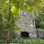 Click here for more information or to register Hosting Club: Toronto
Category: Car Hike
Location (Google Maps): Parking is available across from the Limehouse Public School. The Hike will start across the bridge – we will meet at the Limehouse Memorial Hall building. Hike Leader(s): David Rowney Click here to contact Hike Leader(s) Pace: Leisurely (2-3 km/hr)
Terrain: Level 2 (Intermediate – some hills and uneven surfaces, rocks and roots underfoot), Variable
Distance (km): 3 km Description
As part of Bruce Trail Day, the Toronto Club is organizing a historical hiking tour, on the property of the Limehouse Conservation Area, where the main Bruce Trail route is located. We are fortunate to have local historian, Mark Rowe, to be our tour guide. You will learn about the village’s rich history and importance as a vital stop on the Grand Trunk Railway and later as part of the Radial Suburban Railway. Mark will take us to some of the formidable landmarks on this 3k hike, such as the Powder House, Draw Kiln, Mill Run Ruins and Stone Arch Bridge. You will learn about the importance of the critical raw material lime, and see the various crevices and caves, including the famous Hole in the Wall. The walking tour is expected to take approximately 2 hours. The route is mostly flat with a ladder to access the Hole in the Wall and some uneven rock surfaces. Washroom facilities will be available at the start of the hike. Bring appropriate outdoor clothing, including good hiking shoes or running shoes, water and a snack.
| 5 | 6 - Urban Walk: Waterfront Trail via Ookwemin Minising
9:30 AM-12:30 PM 10/06/2026 https://hikes.brucetrail.org/event/urban-walk-waterfront-trail-via-ookwemin-minising/2026-10-06/ 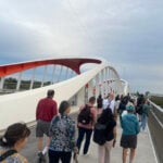 Click here for more information or to register Hosting Club: Toronto
Category: Urban Walk
Location (Google Maps): Toronto Waterfront Trail, Tommy Thompson Park, Cherry Beach, and Biddaasige Park.
Meet at the Wendy’s Tim Hortons on Leslie Street at Lakeshore Blvd. (Take Jones 83 Bus from Donlands Station on Line 1) Hike Leader(s): Tom Swales Click here to contact Hike Leader(s) Pace: Moderate (3-4 km/hr)
Terrain: Flat, Level 1 (Easy – mostly on flat, well maintained trails with hard-packed surface)
Distance (km): 8 km Description
Please join me for a fall morning hike on Toronto’s Waterfront Trail. We will take in Leslie Lookout Point Park, the base of Tommy Thompson Park, Cherry (Clarke) Beach, and the eastern portion of Biddaasige Park. This is a Tuesday morning “shurb” (short urban walk) meant to finish by 12:00 to 12:30. There will be an option of a lunch/refreshment stop after the hike.
- Urban Walk: Valley View Park
9:30 AM-11:45 AM 10/06/2026 https://hikes.brucetrail.org/event/urban-walk-valley-view-park-5/2026-10-06/ Click here for more information or to register Hosting Club: Toronto Location (Google Maps): Parking lot is off Sycamore Drive, East of Bayview , across Starbucks plaza
Bus 91 from Finch East station stops at Sycamore station. Hike Leader(s): MOHAMMAD AGHAMIRI Click here to contact Hike Leader(s) Pace: Moderate (3-4 km/hr)
Terrain: Hilly, Level 2 (Intermediate – some hills and uneven surfaces, rocks and roots underfoot)
Distance (km): 7-8 km Description
We will explore Valleyview and Maple View parks, and walk along German Mills Creek, in return we stop in Huntington park and have snack ,coffee,tea . Although this is considered an “Urban Walk”, you can expect some hills up and down and uneven surfaces with tree roots. Please bring hiking poles, water and snacks. phone number for the day of hike 289 588 6482
| 7 | 8 - Urban Walk: Valley View Park
9:30 AM-11:45 AM 10/08/2026 https://hikes.brucetrail.org/event/urban-walk-valley-view-park-6/2026-10-08/ Click here for more information or to register Hosting Club: Toronto Location (Google Maps): Parking lot is off Sycamore Drive, East of Bayview , across Starbucks plaza
Bus 91 from Finch East station stops at Sycamore station. Hike Leader(s): MOHAMMAD AGHAMIRI Click here to contact Hike Leader(s) Pace: Moderate (3-4 km/hr)
Terrain: Hilly, Level 2 (Intermediate – some hills and uneven surfaces, rocks and roots underfoot)
Distance (km): 7-8 km Description
We will explore Valleyview and Maple View parks, and walk along German Mills Creek, in return we stop in Huntington park and have snack ,coffee,tea . Although this is considered an “Urban Walk”, you can expect some hills up and down and uneven surfaces with tree roots. Please bring hiking poles, water and snacks. phone number for the day of hike 289 588 6482
| 9 | 10 - Bus Hike: Dundas Valley, Map 8 (Iroquoia)
8:30 AM-5:00 PM 10/10/2026 https://hikes.brucetrail.org/event/bus-hike-dundas-valley-map-8-iroquoia/2026-10-10/ 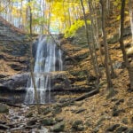 Trip Information
Departure Time: 08:30
Return to City Time: 17:00
Departure Point: Kipling Departure Point Click here for more information or to register Optional Items
Hiking ($.01)
Hosting Club: Toronto
Category: Bus Hike
Location (Google Maps): Dundas Valley Conservation Area Hike Leader(s): Tom Swales, Janet McColeman Click here to contact Hike Leader(s) Pace: Moderate (3-4 km/hr)
Terrain: Hilly, Rocky, Variable, Level 2 (Intermediate – some hills and uneven surfaces, rocks and roots underfoot)
Distance (km): 12 km Description
Join us to enjoy waterfalls, late fall colours, and the scenic Dundas Valley Conservation Area. The hike begins with three waterfalls in the first few km and continues to the rolling hills and vistas of the Conservation Area. Lunch will be by the Dundas Valley Trail Centre (bring lunch and snacks). Fit beginners and families welcome. Hiking boots are strongly recommended. After the hike we will stop in downtown Dundas where there will be a variety of refreshment options.
- Car Hike: Oak Ridges Corridor
8:30 AM-1:00 PM 10/10/2026 https://hikes.brucetrail.org/event/car-hike-oak-ridges-corridor-4/2026-10-10/ Click here for more information or to register Hosting Club: Toronto Location (Google Maps): Oak Ridges Corridor, Bethesda Trail Head Parking Lot, Bethesda Side Road, Richmond Hill, Ontario Hike Leader(s): MOHAMMAD AGHAMIRI Click here to contact Hike Leader(s) Pace: Moderate (3-4 km/hr)
Terrain: Hilly, Level 2 (Intermediate – some hills and uneven surfaces, rocks and roots underfoot)
Distance (km): 14-15 km Description
Join us to explore the trails of York Regional Forest and the Oak Ridges Corridor at Jefferson Forest and Bond lake, From parking lot we hike thought Jefferson forest and continue to Bond Lake and have snack beside the lake and return to parking around 1:pm Please bring lots of water and snacks ,hiking poles are recommended,it is Mosquto and Tick season ,be prepared . phone number for the day of hike 289 588 6482
- Old Baldy and Eagle’s Summit
10:00 AM-3:00 PM 10/10/2026 https://hikes.brucetrail.org/event/car-hike-old-baldy-and-eagles-summit/2026-10-10/ 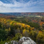 Click here for more information or to register Hosting Club: Toronto, Beaver Valley
Category: Car Hike
Location (Google Maps): Parking is roadside along the shoulder of Fox Ridge Road. Please do not block laneways or farm field entrances. Hike Leader(s): Stewart Fleming Pace: Mixed (See Hike Description)
Terrain: Hilly, Level 2 (Intermediate – some hills and uneven surfaces, rocks and roots underfoot), Rocky
Distance (km): 18.5 km Description
This hike will take us south on the Main Trail from Fox Ridge Road to Old Baldy. We will continue south to loop around the top of Eagle’s Summit before returning north. We will cross the crevice at Old Baldy to enjoy the views and for Beaver Valley photos. Our pace will be Brisk through the open areas but Leisurely through the many rocky and hill climbing sections. This will not be an easy 18 km. Please bring enough water (at least 2 litres) and food to maintain your energy for a 5-hour hike.
Comfortable hiking shoes or boots are a must. A rain shell is recommended in case of a wet weather forecast, along with a hat, sunscreen, and bug repellent for sunny weather or buggy trail conditions.
|
11 | 12 - Urban Walk: Toronto Islands Thanksgiving Monday Hike
9:30 AM-2:45 PM 10/12/2026 https://hikes.brucetrail.org/event/urban-walk-toronto-islands-thanksgiving-monday-hike-2/2026-10-12/ Click here for more information or to register Hosting Club: Toronto
Category: Urban Walk
Location (Google Maps): Meet inside Jack Layton Ferry Terminal, foot of Bay Street. TTC – take any streetcar from Union Station one stop south the Ferry Docks stop and walk south. Hike Leader(s): Tom Swales Click here to contact Hike Leader(s) Pace: Moderate (3-4 km/hr)
Terrain: Flat, Level 1 (Easy – mostly on flat, well maintained trails with hard-packed surface)
Distance (km): 12 km Description
Walk off Sunday’s dinner with an exploration of the Toronto Islands while enjoying the fall colours. We’ll hike from the Wards Island dock to Hanlan’s Point with side trips to Algonquin Island, Snake Island, and Centre Island. Arrive at the ferry docks by 9:15 to take the 9:30 ferry to Ward’s Island. We will take the 2:30 pm ferry from the Hanlan’s Point Dock back to the city. Dress appropriate to the weather and bring lunch, snacks, and water. Dropout by hiking back to Ward’s Island or to the Centre Island Ferry dock.
- RAINBOW HIKE🌈: Hilly Hike in Caledon Hills
10:00 AM-2:00 PM 10/12/2026 https://hikes.brucetrail.org/event/rainbow-hike%f0%9f%8c%88-hilly-hike-in-caledon-hills-2/2026-10-12/  Click here for more information or to register Hosting Club: Toronto, Caledon Hills
Category: Car Hike
Location (Google Maps): We will meet at the Hockley Road Parking Area (coordinates are 43.972857, -80.056330). Hike Leader(s): Monica Pasquali Click here to contact Hike Leader(s) Pace: Leisurely (2-3 km/hr), Moderate (3-4 km/hr)
Terrain: Hilly, Level 2 (Intermediate – some hills and uneven surfaces, rocks and roots underfoot), Level 3 (Advanced – steep hills and some scrambling over boulders)
Distance (km): 10 km Description
This hike is part of our Rainbow Hike program🌈, which aims to foster connection, visibility, and community among 2SLGBTQIA+ hikers and allies. We’ll be joined by queer hiker Mais Lee who will be our sweep for the hike. This Rainbow Hike was supposed to take place on Saturday, July 18th, but due to wildfire smoke and thunderstorm risk at that time we decided to postpone it — hopefully the weather cooperates on Monday, October 12th🤞 And what a great way to celebrate Thanksgiving! 🦃 After everyone checks in with me at the meeting location we’ll do a 10 km out-and-back hike of the main trail through beautiful Hockley Valley Provincial Nature Reserve. Our route will follow a very hilly part of the Bruce Trail, but don’t worry — we’ll summit the hills slowly and take lots of breaks along the way, so any fit Rainbow Hiker is welcome to join us. Everyone who participates in this hike will receive a FREE Bruce Trail Pride Badge! Please bring at least 2 litres of water, your lunch, and enough snacks for a 4-hour hike. You should wear comfortable hiking shoes and socks, a hat, a breathable shirt, and lightweight long pants (to minimize the risk of a tick bite). If rain is in the forecast then a rain jacket would also be a great idea. Sunblock and bug repellent are also useful if it’s a sunny and buggy day. After the hike, anyone who is interested in joining me for a refreshing mocktail at nearby Hockley Valley Resort (https://hockley.com/eat/) is more than welcome to do so. Looking forward to hiking with you on October 12th! And feel free to share this page/link with your 2SLGBTQIA+ friends and family. For more information on Bruce Trail’s 2SLGBTQIA+ hikes, and to get information on upcoming Rainbow Hikes, please see the following webpage: https://brucetrail.org/pride-2026/
| 13 - Car Hike: Blue Mountains E2E, hike #1 of 3
8:30 AM-3:00 PM 10/13/2026 https://hikes.brucetrail.org/event/car-hike-blue-mountains-e2e-hike-1-of-3-3/2026-10-13/ Hike open to BTC Members only. Click here for more information or to register Hosting Club: Toronto
Category: Car Hike
Location (Google Maps): Road side parking, Mulmur Nottawasaga Townline, at the cemetery. Coordinates N 44.268777,W 80.156810 map 21 edition 31 Hike Leader(s): Smadar junkin Click here to contact Hike Leader(s) Pace: Brisk (4-5 km/hr)
Terrain: Challenging, Hilly, Level 3 (Advanced – steep hills and some scrambling over boulders)
Distance (km): 22 km Description
Welcome to Blue Mountains E2E, we will hike the section in 3 days. Please register to each hike individually. We will enjoy the beautiful section and go up and down the hills. Please bring 2 litres of water, bug protection, snacks and lunch. If you need to get in touch with me, email me on my email address smadarjunkin@hotmail.com Arrive 15 minutes early so we can shuttle by 8:30. Please note that we are shuttling to a paid parking at km 21.9. Everyone is expected to pay their share of the parking. This is a challenging section, before registering make sure that these distances and pace match your ability.
- Urban Walk: Valley View Park
9:30 AM-11:45 AM 10/13/2026 https://hikes.brucetrail.org/event/urban-walk-valley-view-park-7/2026-10-13/ Click here for more information or to register Hosting Club: Toronto Location (Google Maps): Parking lot is off Sycamore Drive, East of Bayview , across Starbucks plaza
Bus 91 from Finch East station stops at Sycamore station. Hike Leader(s): MOHAMMAD AGHAMIRI Click here to contact Hike Leader(s) Pace: Moderate (3-4 km/hr)
Terrain: Hilly, Level 2 (Intermediate – some hills and uneven surfaces, rocks and roots underfoot)
Distance (km): 7-8 km Description
We will explore Valleyview and Maple View parks, and walk along German Mills Creek, in return we stop in Huntington park and have snack ,coffee,tea . Although this is considered an “Urban Walk”, you can expect some hills up and down and uneven surfaces with tree roots. Please bring hiking poles, water and snacks. phone number for the day of hike 289 588 6482
- Urban Walk: University of Toronto (St. George Campus) and the Annex
9:30 AM-12:30 PM 10/13/2026 https://hikes.brucetrail.org/event/urban-walk-university-of-toronto-st-george-campus-and-the-annex/2026-10-13/ 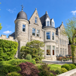 Click here for more information or to register Hosting Club: Toronto
Category: Urban Walk
Location (Google Maps): St George Subway Station Hike Leader(s): Ted Moriarty Click here to contact Hike Leader(s) Pace: Moderate (3-4 km/hr)
Terrain: Level 1 (Easy – mostly on flat, well maintained trails with hard-packed surface)
Distance (km): 7km Description
Please join me on a journey through University of Toronto’s St George Campus. Starting at St. George Subway station, the walk will feature an exploration of a variety of iconic architecture and green spaces including Convocation Hall, Hart House Theatre, Robards Library, Queens Park and Philosophers Walk. The walk will then move into the Annex neighbourhood, the setting for numerous Canadian novels including those by Margaret Atwood and Ann-Marie MacDonald.
| 14 - Car Hike: Blue Mountains E2E 2/3
8:30 AM-3:00 PM 10/14/2026 https://hikes.brucetrail.org/event/car-hike-blue-mountains-e2e-2-3-3/2026-10-14/ Hike open to BTC Members only. Click here for more information or to register Hosting Club: Toronto
Category: Car Hike
Location (Google Maps): Map 22- Km 21.9, Nattawasaga Bluffs Conservation Area. Coordinates N 44.342784,W 80.210628 Hike Leader(s): Smadar Junkin Click here to contact Hike Leader(s) Pace: Brisk (4-5 km/hr)
Terrain: Challenging, Hilly, Level 3 (Advanced – steep hills and some scrambling over boulders)
Distance (km): 25 km Description
Second hike in the Blue Mountains E2E series. This is the longest hike of the series. Beautiful, hilly and challenging. Please bring 2litres of water. Arrive 15 minutes early. The meeting place parking is a paid parking, everyone is expected to pay their share of the parking fees. We will shuttle to km 46.8 and hike back. if you need to get in touch with me, my personal email is smadarjunkin@hotmail.com
| 15 - Car Hike: Blue Mountain E2E 3/3
8:30 AM-3:00 PM 10/15/2026 https://hikes.brucetrail.org/event/car-hike-blue-mountain-e2e-3-3-4/2026-10-15/ Hike open to BTC Members only. Click here for more information or to register Hosting Club: Toronto
Category: Car Hike
Location (Google Maps): Map # 23- North of km 46.8, 380 meters north of the main trail crossing on Pretty River Rd. Coordinated N 44.430927,W 80.275390 Hike Leader(s): Smadar Junkin Click here to contact Hike Leader(s) Pace: Brisk (4-5 km/hr)
Terrain: Challenging, Hilly, Level 3 (Advanced – steep hills and some scrambling over boulders)
Distance (km): 21 Description
Hike #3 of 3. Badge day! Beautiful and hilly. This is a brisk pace hike. The pace is expected to be 4 to 4.5 km per hour. Bring 2 litres of water. Aim to get there 15 minutes early. We will shuttle to km 67.3 and walk back.
- Urban Walk: Valley View Park
9:30 AM-11:45 AM 10/15/2026 https://hikes.brucetrail.org/event/urban-walk-valley-view-park-8/2026-10-15/ Click here for more information or to register Hosting Club: Toronto Location (Google Maps): Parking lot is off Sycamore Drive, East of Bayview , across Starbucks plaza
Bus 91 from Finch East station stops at Sycamore station. Hike Leader(s): MOHAMMAD AGHAMIRI Click here to contact Hike Leader(s) Pace: Moderate (3-4 km/hr)
Terrain: Hilly, Level 2 (Intermediate – some hills and uneven surfaces, rocks and roots underfoot)
Distance (km): 7-8 km Description
We will explore Valleyview and Maple View parks, and walk along German Mills Creek, in return we stop in Huntington park and have snack ,coffee,tea . Although this is considered an “Urban Walk”, you can expect some hills up and down and uneven surfaces with tree roots. Please bring hiking poles, water and snacks. phone number for the day of hike 289 588 6482
| 16 | 17 - The Frontenac Challenge
1:00 AM-5:00 AM 10/17/2026 https://hikes.brucetrail.org/event/the-frontenac-challenge-multi-day-hike-2/2026-10-17/  This is a Multi-Day HikeYou are signing up for the following dates and times:
2026-10-17 at 01:00
2026-10-18 at 08:00
2026-10-19 at 08:00
2026-10-20 at 08:00
2026-10-21 at 08:00
2026-10-22 at 08:00
2026-10-23 at 09:00 Click here for more information or to register Hosting Club: Toronto
Category: Car Hike
Location (Google Maps): We meet at Snug Harbour Resort We drive to the parking area for hiking. Hike Leader(s): Fayyaz Mahmood Click here to contact Hike Leader(s) Pace: Brisk (4-5 km/hr)
Terrain: Challenging, Level 3 (Advanced – steep hills and some scrambling over boulders)
Distance (km): 140 KM Description
Frontenac Park is located near Kingston about 3-4 hours from Toronto. According to Parks Ontario, the Frontenac Challenge is the ultimate hiking challenge in Ontario! To qualify for the ‘Frontenac Challenge’ badge you need to complete all of Frontenac’s 11 hiking loops, totaling around 140 km! The Frontenac Challenge is managed jointly by Parks Ontario and the Friends of Frontenac. You can find details about the Frontenac challenge at – https://www.ontarioparks.com/parksblog/frontenac-challenge/ https://www.friendsoffrontenac.com/challenge-registration BOARDING & LODGING:
You are responsible for arranging your own food and accomodation. Most often participants find it convenient and cost-effective to stay at Snug Harbour Resort, a short distance from the park. Snug Harbour has put aside some Cabins at the reduced rate of $120 per day. When you book let them know that you are a member of the Bruce Trail and hiking the Frontenac Challenge. The accommodation is shared (about 4 – 6 persons). You are responsible for arranging your accommodation. Often there are opportunities for joining others in renting a cabin and jointly preparing meals. CARPOOL:
You should arrange for carpool as the park charges for day use parking. Cars must be pre-registered for parking to save time. If you use carpool, you should expect to pay the drivers. HIKING
These hikes are for serious hikers only. You will be walking 140 KM in 7 days on rough terrain.
You should be prepared for long hiking days. No drop-outs. You should bring your lunch and enough water. You should dress for the weather. Additional information will be provided to participants nearer to the event. Only a limited number of spaces are available.
- Car Hike: Happy Valley
8:30 AM-1:00 PM 10/17/2026 https://hikes.brucetrail.org/event/car-hike-happy-valley-5/2026-10-17/ Click here for more information or to register Hosting Club: Toronto Location (Google Maps): Happy Valley, Oak Ridges Trail 16th Sideroad & Weston Road Please park along 16th Side road Hike Leader(s): Mohammad Aghamiri Click here to contact Hike Leader(s) Pace: Moderate (3-4 km/hr)
Terrain: Hilly, Level 2 (Intermediate – some hills and uneven surfaces, rocks and roots underfoot), Variable
Distance (km): 14-15 km Description
Come and join us to view nice scenery and look outs of Happy valley
- Double Day: Hike and Work Party
9:30 AM-5:00 PM 10/17/2026 https://hikes.brucetrail.org/event/double-day-hike-and-work-party-2/2026-10-17/ 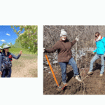 Trip Information
Departure Time: 09:30
Return to City Time: 17:00
Departure Point: York Mills Bus Pickup Click here for more information or to register Optional Items
Hosting Club: Toronto
Category: Bus Hike
Location (Google Maps): Springle property and Todd Bardes ST Hike Leader(s): Janet Patterson Click here to contact Hike Leader(s) Pace: Leisurely (2-3 km/hr)
Terrain: Flat, Level 1 (Easy – mostly on flat, well maintained trails with hard-packed surface)
Distance (km): approx 3 km Description
This is a family-friendly event offering our members the chance to “give back”. NOTE: discounted bus fee ($20) and children accompanied by an adult ride the bus for free. Register the child by selecting “add additional hiker” and type their name. Children must be supervised by a guardian throughout the day. The bus will deliver us to the trail head (Limehouse, near Georgetown), and on arrival, we will split into two groups. Group A will go off on a guided hike with members of the club’s Biodiversity Team, observing, identifying and perhaps even photographing the delightful flora and fauna we can discover. This will be a great way to gain points towards your Biodiversity Naturalist badge. Meanwhile, Group B will learn to identify and pull out the invasive buckthorn that is proliferating there. We will have members of the Land Stewardship team and BTC Conservation Ambassadors guiding and supervising us, so no previous experience is necessary! We’ll meet back at the trail head for lunch, after which the groups will switch roles. So everyone will get a chance to explore the trails AND contribute to stewardship activities that support our ongoing efforts preserve and enhance the natural ecosystems along the trail. There’s even a badge for this! Here is some detailed information about buckthorn: Buckthorn (such as European or common buckthorn) is an aggressive invasive shrub that harms ecosystems by forming dense thickets that block sunlight and crowd out native wildflowers, shrubs, and tree seedlings. It spreads rapidly, reduces biodiversity, alters soil conditions, and prevents the natural regeneration of healthy forests. While birds do eat buckthorn berries, the fruit has very little nutritional value and acts as a laxative, causing seeds to spread widely and potentially weakening local wildlife by replacing more nutritious native food sources. For these reasons, buckthorn is often removed to restore native habitats, improve ecosystem health, and support wildlife. What to bring (& wear): - Long pants and long-sleeved shirts/jackets strongly recommended
- Sturdy shoes or boots
- garden gloves or work gloves if you have them (although we will also have some on hand)
- Plenty of water (1L minimum)
- Lunch, snacks
- Sunscreen, insect repellent, wide-brimmed hat
- A few reusable shopping bags if you have some
|
18 - Urban Walk: Don River valley through through five parks
10:00 AM-2:00 PM 10/18/2026 https://hikes.brucetrail.org/event/urban-walk-don-river-valley-through-through-five-parks/2026-10-18/ 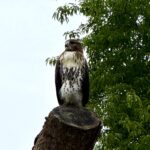 Click here for more information or to register Hosting Club: Toronto
Category: Urban Walk
Location (Google Maps): St. Clair Subway Hike Leader(s): Ted Moriarty Click here to contact Hike Leader(s) Pace: Moderate (3-4 km/hr)
Terrain: Hilly, Level 2 (Intermediate – some hills and uneven surfaces, rocks and roots underfoot)
Distance (km): 9.5k Description
Please join me for a hike through five picturesque ravine parks and two trendy mid-town neighbourhoods. We will begin by walking through the century homes and row houses of the Deer Park area then descend into the Don River Valley park system. We’ll explore David Balfour Park, Beaumont Park, The Brickworks, Moore Park Ravine and Mount Pleasant Cemetery. From there, we will continue north and explore the Al Green Sculpture Park. The hike will conclude at Davisville Subway Station. An optional apres hike gathering will be held at the The Bull: A Firkin Pub at 1835 Yonge Street.
- Urban Walk: Waterfront Trail 8/11 – Beechgrove (Port Union) to Pickering
10:45 AM-2:15 PM 10/18/2026 https://hikes.brucetrail.org/event/urban-walk-waterfront-trail-8-11-beechgrove-port-union-to-pickering-2/2026-10-18/ 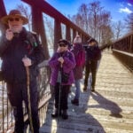 Click here for more information or to register Hosting Club: Toronto
Category: Urban Walk
Location (Google Maps): Toronto, Ontario, Canada Hike Leader(s): Brian Rideout Click here to contact Hike Leader(s) Pace: Moderate (3-4 km/hr)
Terrain: Flat
Distance (km): 11.9 km Description
Please meet me at Kennedy Station by 10:04 am. We will take the 38A East to Rouge Hill GO bus departing 10:04 am arriving at Port Union Rd at 10:43 am. We will hike south to Lake Ontario and along the Waterfront Trail through Port Union and Rouge Hill to Pickering GO. The estimated distance is 9.8 km. Here is an online map of our route – Port Union to Pickering. Bring a snack, at least 2 liters of water, sunscreen and bug spray.
| 19 - Peninsula E2E in 8 days
8:45 AM-3:00 PM 10/19/2026 https://hikes.brucetrail.org/event/peninsula-e2e-in-8-days/2026-10-19/ Hike open to BTC Members only. This is a Multi-Day HikeYou are signing up for the following dates and times:
2026-10-19 at 08:45
2026-10-20 at 08:30
2026-10-21 at 08:30
2026-10-22 at 08:30
2026-10-26 at 08:30
2026-10-27 at 08:30
2026-10-28 at 08:30
2026-10-29 at 08:30 Click here for more information or to register Hosting Club: Toronto, Peninsula
Category: Car Hike
Location (Google Maps): Tobermory km 163.1.coordinates N 45.254703,W 81.664653 There is free parking by the ship wreck restaurant. Map 42. Hike Leader(s): Smadar junkin Click here to contact Hike Leader(s) Pace: Brisk (4-5 km/hr)
Terrain: Level 3 (Advanced – steep hills and some scrambling over boulders), Rocky, Variable
Distance (km): 24 km Description
Important note about this hike. Although it is posted as an 8 days hike, it might be only 7 days because of the currant closure of 21 kms without a reroute. If the trail will still be closed at the hiking dates posted we will only need 7 days. Please be mindful of this when booking accommodations for this hike.
on the first day we will shuttle to half way dump, it is a paid parking.we will walk back to tobermory. On day 2 we will meet at half way dump side trail, km 139.5 coordinates N45.227342,W 80.480393 map 41, and shuttle to Lindsay rd 40. 21 km. This is the section that might be closed.
day 3 we will meet at km 108.7 Borchardt rd coordinates N 45. 133778,W 81.331824 map 40 we will shuttle to Lindsay rd 40. 9 kms Day 4 we will meet at the same location as day 3 and shuttle to km 87.4 Richardson side trail. 21 kms day 5 we will meet at km 67.9 Barrow Bay coordinates N 44.958825,W 81.226168 and shuttle to km 87.4 19.5 kms i will give further instructions as we will move along the trail. Please dress according to the weather. Dress in layers, bring 2 litres of water, snacks and lunch. everyone is expected to do as many car shuttles as needed. Please come 15 minutes early.
if you need to get in touch with me, use my personal email provided.
smadar day 6 we will meet at the same location and shuttle to km 44.1 hope bay. 23 kms day 7 we will meet at km 44.1 coordinates N 44.902930,W 81.155706 map 37, hope bay and shuttle to km 24.4, distance 19.3 kms day 8 we will meet at km 0.0 Blue Water park in Weirton, coordinates N 44.742514,W 81.135140 and we will shuttle to km 24.4
| 20 - Urban Walk: In Search Of The Big Bear (Don Mills Trail)
9:30 AM-12:30 PM 10/20/2026 https://hikes.brucetrail.org/event/urban-walk-in-search-of-the-big-bear-don-mills-trail/2026-10-20/  Click here for more information or to register Hosting Club: Toronto
Category: Urban Walk
Location (Google Maps): Meet outside the McDonalds at Leslie Street and York Mills Road Hike Leader(s): Tom Swales Click here to contact Hike Leader(s) Pace: Moderate (3-4 km/hr)
Terrain: Flat, Variable, Level 1 (Easy – mostly on flat, well maintained trails with hard-packed surface)
Distance (km): 8 km Description
Join us to hike south on the Don Mills Recreational Trail (formerly Leaside Spur Rail Trail) from York Mills south to Eglinton. We’ll have a break at the Civic Garden Centre at Leslie and Lawrence. At Leslie and Eglinton we will make our way to the newly opened Big Bear Park, site of the giant bear statue. If we’re lucky we’ll find the six smaller life size seated bears expressing human qualities to symbolize inclusivity and unity. We’ll finish up passing through Agha Khan Park to the Agha Kahn Park & Museum Station on TTC Line 5. There will be an optional refreshment stop after the hike taking Line 5 two stations east.
- Urban Walk: Valley View Park
9:30 AM-11:45 AM 10/20/2026 https://hikes.brucetrail.org/event/urban-walk-valley-view-park-9/2026-10-20/ Click here for more information or to register Hosting Club: Toronto Location (Google Maps): Parking lot is off Sycamore Drive, East of Bayview , across Starbucks plaza
Bus 91 from Finch East station stops at Sycamore station. Hike Leader(s): MOHAMMAD AGHAMIRI Click here to contact Hike Leader(s) Pace: Moderate (3-4 km/hr)
Terrain: Hilly, Level 2 (Intermediate – some hills and uneven surfaces, rocks and roots underfoot)
Distance (km): 7-8 km Description
We will explore Valleyview and Maple View parks, and walk along German Mills Creek, in return we stop in Huntington park and have snack ,coffee,tea . Although this is considered an “Urban Walk”, you can expect some hills up and down and uneven surfaces with tree roots. Please bring hiking poles, water and snacks. phone number for the day of hike 289 588 6482
| 21 | 22 - Urban Walk: Valley View Park
9:30 AM-11:45 AM 10/22/2026 https://hikes.brucetrail.org/event/urban-walk-valley-view-park-10/2026-10-22/ Click here for more information or to register Hosting Club: Toronto Location (Google Maps): Parking lot is off Sycamore Drive, East of Bayview , across Starbucks plaza
Bus 91 from Finch East station stops at Sycamore station. Hike Leader(s): MOHAMMAD AGHAMIRI Click here to contact Hike Leader(s) Pace: Moderate (3-4 km/hr)
Terrain: Hilly, Level 2 (Intermediate – some hills and uneven surfaces, rocks and roots underfoot)
Distance (km): 7-8 km Description
We will explore Valleyview and Maple View parks, and walk along German Mills Creek, in return we stop in Huntington park and have snack ,coffee,tea . Although this is considered an “Urban Walk”, you can expect some hills up and down and uneven surfaces with tree roots. Please bring hiking poles, water and snacks. phone number for the day of hike 289 588 6482
| 23 | 24 -
 Coach trip: Limberlost Forest Coach trip: Limberlost Forest 7:30 AM-8:00 PM 10/24/2026 https://hikes.brucetrail.org/event/coach-trip-lumberlost-forest/2026-10-24/ Trip Information
Departure Time: 07:30
Return to City Time: 20:00
Departure Point: York Mills Bus Pickup Click here for more information or to register Trip Activities
Pick-up at 10 York Mills ($0.01)
Pick up at HWY 400&9 ($0.01)
Optional Items
Hosting Club: Toronto
Category: Coach Trips
Location (Google Maps): Limberlost Forest Hike Leader(s): Martina Furrer, Felix Wan, Marie-Josée Roy, and Tim Wainwright Click here to contact Hike Leader(s) Terrain: Level 2 (Intermediate – some hills and uneven surfaces, rocks and roots underfoot)
Distance (km): 12 to 16 km Description
Join us for a fun fall hike in beautiful Limberlost Forest and Wildlife Reserve (https://limberlostforest.com/), a privately owned 10,000-acre reserve in the Township of Lake of Bays in the District Municipality of Muskoka. We’ll split into two groups and explore various trails and lakes. Details to come. Departure 1: 7:30 a.m. at 10 York Mills Rd Departure 2: 7:55 a.m. at HWY 400 and HWY 9 park and ride
- Car Hike:Glasgow Village
8:30 AM-1:15 PM 10/24/2026 https://hikes.brucetrail.org/event/car-hike-glasgow-village-uxbridge-11/2026-10-24/ Click here for more information or to register Hosting Club: Toronto Location (Google Maps): Glasgow Trail, Concession Road 2 Park in parking lot at the head of trail Hike Leader(s): MOHAMMAD AGHAMIRI Click here to contact Hike Leader(s) Pace: Moderate (3-4 km/hr)
Terrain: Hilly, Level 2 (Intermediate – some hills and uneven surfaces, rocks and roots underfoot), Variable
Distance (km): 14-15 km Description
Lets explore Goodwood conservation area and visit Secord forest and pond
|
25 - Car Hike: Geology Hike Quarries to Kilns
10:00 AM-3:00 AM 10/25/2026 https://hikes.brucetrail.org/event/car-hike-geology-hike-quarries-to-kilns/2026-10-25/ 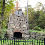 Hike open to BTC Members only. Click here for more information or to register Hosting Club: Toronto
Category: Car Hike
Location (Google Maps): Toronto Section Speyside to Limehouse Map 12 meeting at the Community Hall in Limehouse 5th line and 22nd Sideroad, Hike Leader(s): Lynn McFerran Click here to contact Hike Leader(s) Pace: Leisurely (2-3 km/hr)
Terrain: Flat, Level 2 (Intermediate – some hills and uneven surfaces, rocks and roots underfoot), Rocky
Distance (km): 8.1km Description
Quarries and Kilns
Length: 8.1 km; fairly easy with some rocky sections; will take up to 4 hours due to numerous interpretive stops Join us for a fascinating hike through 420 million years of geology and nearly two centuries of quarrying history led by Beth Gilhespy – Escarpment Biosphere Conservancy and author of a series of books on the geology of the Bruce Trail. We will walk from Speyside to Limehouse. discovering ancient tropical reef deposits and crinoid fossils, explore a glacial spillway, and learn how the Escarpment’s different rock layers supported a thriving quarrying and lime industry. We’ll finish among the remarkable rock formations and historic lime kilns of Limehouse Conservation Area The meeting location is the end of the hike in Limehouse, at the Limehouse Community Centre, the corner of 22nd Sideroad and 5th Line. There is lots of parking opposite the school on 22 sideroad. From there we will car shuffle back to the 3rd Line to begin our hike.
| 26 | 27 - Urban Walk: Valley View Park
9:30 AM-11:45 AM 10/27/2026 https://hikes.brucetrail.org/event/urban-walk-valley-view-park-11/2026-10-27/ Click here for more information or to register Hosting Club: Toronto Location (Google Maps): Parking lot is off Sycamore Drive, East of Bayview , across Starbucks plaza
Bus 91 from Finch East station stops at Sycamore station. Hike Leader(s): MOHAMMAD AGHAMIRI Click here to contact Hike Leader(s) Pace: Moderate (3-4 km/hr)
Terrain: Hilly, Level 2 (Intermediate – some hills and uneven surfaces, rocks and roots underfoot)
Distance (km): 7-8 km Description
We will explore Valleyview and Maple View parks, and walk along German Mills Creek, in return we stop in Huntington park and have snack ,coffee,tea . Although this is considered an “Urban Walk”, you can expect some hills up and down and uneven surfaces with tree roots. Please bring hiking poles, water and snacks. phone number for the day of hike 289 588 6482
| 28 | 29 - Urban Walk: Valley View Park
9:30 AM-11:45 AM 10/29/2026 https://hikes.brucetrail.org/event/urban-walk-valley-view-park-12/2026-10-29/ Click here for more information or to register Hosting Club: Toronto Location (Google Maps): Parking lot is off Sycamore Drive, East of Bayview , across Starbucks plaza
Bus 91 from Finch East station stops at Sycamore station. Hike Leader(s): MOHAMMAD AGHAMIRI Click here to contact Hike Leader(s) Pace: Moderate (3-4 km/hr)
Terrain: Hilly, Level 2 (Intermediate – some hills and uneven surfaces, rocks and roots underfoot)
Distance (km): 7-8 km Description
We will explore Valleyview and Maple View parks, and walk along German Mills Creek, in return we stop in Huntington park and have snack ,coffee,tea . Although this is considered an “Urban Walk”, you can expect some hills up and down and uneven surfaces with tree roots. Please bring hiking poles, water and snacks. phone number for the day of hike 289 588 6482
| 30 | 31 - School Bus Hike – Beautiful Fall Colours Hike and Falling Water Badge (final hike of the series for those who joined us for the previous segments 1 & 2)
8:00 AM-6:30 PM 10/31/2026 https://hikes.brucetrail.org/event/school-bus-hike-beautiful-fall-colours-hike-and-falling-water-badge-final-hike-of-the-series-for-those-who-joined-us-for-the-previous-segments-1-2/2026-10-31/ 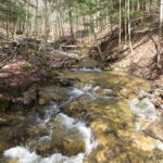 Trip Information
Departure Time: 08:00
Return to City Time: 18:30
Departure Point: Kipling Departure Point Click here for more information or to register Optional Items
Hosting Club: Toronto
Category: Bus Hike
Location (Google Maps): Beaver Valley Ski Club Hike Leader(s): Marijo Roy; Felix Wan Click here to contact Hike Leader(s) Pace: Moderate (3-4 km/hr)
Terrain: Hilly, Level 3 (Advanced – steep hills and some scrambling over boulders)
Distance (km): 12 Description
Please join us for a beautiful Fall Colours hike and for the last series to earn the Two-Day Falling Water badge. The Falling Water section includes some challenging parts, with plenty of ups and downs and several steep sections. Participants who joined us for the previous segments (Parts 1 & 2) and complete this last segment will receive the Two-Day Falling Water Triangle badge. The fee ($10.00 for members; $15.00 for non-members) will be collected on the bus at the start of the hike for those who opt to obtain the badge. (BT Map #26) – Today, we’ll hike west on the Valley Crossover Side Trail, then head south to Hogg’s Falls, reaching kilometer 65.2. The total distance will be 12 km. Dropout point at 6 km. A late return to Kipling Station is expected. Reminders:
1. Wear sturdy footwear and appropriate attire for the weather and the terrain (snow might be present).
2. Hiking poles are a good idea in any season, especially when the terrain is rocky or slippery.
3. Always carry I.D. and your health card.
4. Bring lunch, sufficient water, and snacks. A minimum of 2L of water is recommended.
5. Bring your own first aid kit. Looking forward to hiking with you, Marijo and Felix
- Car Hike: Boyd C.A.
8:30 AM-1:15 PM 10/31/2026 https://hikes.brucetrail.org/event/car-hike-boyd-conservation-park-vaughan-18/2026-10-31/ Click here for more information or to register Hosting Club: Toronto Location (Google Maps): Free Parking lot before entrance of park on Islington Ave. Hike Leader(s): Mohammad Aghamiri Click here to contact Hike Leader(s) Pace: Moderate (3-4 km/hr)
Terrain: Hilly, Level 2 (Intermediate – some hills and uneven surfaces, rocks and roots underfoot), Variable
Distance (km): 12-14 km Description
Let’s hike Boyd conservation park trails through beautiful valleys. Please bring lots of water and snacks ,hiking poles are recommended phone number for the day of hike 289 588 6482
|
