|
Sun | Mon | Tue | Wed | Thu | Fri | Sat |
|---|
August | August | 1  Urban Walk: High Park to Humber Bay Park Urban Walk: High Park to Humber Bay Park 9:00 AM-12:30 PM 09/01/2026 https://hikes.brucetrail.org/event/urban-walk-high-park-to-humber-bay-park/2026-09-01/  Click here for more information or to register Hosting Club: Toronto
Category: Urban Walk
Location (Google Maps): High Park North Gates (Bloor Street West at High Park Avenue). This is a 5 minute walk from High Park Subway Station. Hike Leader(s): Ted Moriarty Click here to contact Hike Leader(s) Pace: Moderate (3-4 km/hr)
Terrain: Level 1 (Easy – mostly on flat, well maintained trails with hard-packed surface)
Distance (km): 8 Description
Please join me as we explore three of west Toronto’s most scenic green spaces. We will begin by walking through High Park. While there we’ll visit the High Park Labyrinth and visit historic Colborne Lodge. From here we’ll make our way down to the Martin Goodman Trail and walk west along the boardwalk to Humber Bay Park. We’ll follow the Humber Bay park trails south to Lake Ontario and enjoy a view of the Toronto skyline and surrounding lakefront. The hike will conclude at Palace Pier Park – a 10 minute bus ride to Old Mill Subway Station. Route map: https://onthegomap.com/?route=019f90fc-4fc0-74e2-9fc2-76444fe1e528&context=share Please bring snacks and at least 2L of drinking water. Washrooms: There are no washrooms at High Park Station. During the 9k hike we will stop at three public washrooms located at kilometres 1, 3 and 5. Après-hike: There will be an optional après-hike stop at Firkin on the Bay (68 Marine Parade Drive).
- Valley View Park479
9:30 AM-11:45 AM 09/01/2026 https://hikes.brucetrail.org/event/car-hike-valley-view-huntington-park/2026-09-01/ Click here for more information or to register Hosting Club: Toronto Location (Google Maps): Parking lot is off Sycamore Drive, East of Bayview , across Starbucks plaza
Bus 91 from Finch East station stops at Sycamore station. Hike Leader(s): Mohammad Aghamiri Pace: Moderate (3-4 km/hr)
Terrain: Hilly, Level 2 (Intermediate – some hills and uneven surfaces, rocks and roots underfoot)
Distance (km): 6-7 km Description
We will explore Valleyview and Maple View parks, and walk along German Mills Creek, in return we stop in Huntington park and have snack under beautiful shed. Although this is considered an “Urban Walk”, you can expect some hills up and down and uneven surfaces with tree roots. Please bring hiking poles, water and snacks.
| 2 | 3 - Urban hike: Valley View Park Thornhill
9:30 AM-11:45 AM 09/03/2026 https://hikes.brucetrail.org/event/urban-hike-valley-view-park-thornhill-15/2026-09-03/ Click here for more information or to register Hosting Club: Toronto
Category: Urban Walk
Location (Google Maps): Parking lot is off Sycamore Drive, East of Bayview , across Starbucks plaza
Bus 91 from Finch East station stops at Sycamore station. Hike Leader(s): MOHAMMAD AGHAMIRI Click here to contact Hike Leader(s) Pace: Moderate (3-4 km/hr)
Terrain: Hilly, Level 2 (Intermediate – some hills and uneven surfaces, rocks and roots underfoot)
Distance (km): 7-8 km Description
We will explore Valleyview and Maple View parks, and walk along German Mills Creek, in return we stop in Huntington park and have snack ,coffee,tea . Although this is considered an “Urban Walk”, you can expect some hills up and down and uneven surfaces with tree roots. Please bring hiking poles, water and snacks. phone number for the day of hike 289 588 6482
| 4 | 5  Oak Ridges Corridor, Bethesda Trail Oak Ridges Corridor, Bethesda Trail 8:30 AM-1:00 PM 09/05/2026 https://hikes.brucetrail.org/event/car-hike-oak-ridges-corridor-3/2026-09-05/ Click here for more information or to register Hosting Club: Toronto Location (Google Maps): Oak Ridges Corridor, Bethesda Trail Head Parking Lot, Bethesda Side Road, Richmond Hill, Ontario Hike Leader(s): MOHAMMAD AGHAMIRI Click here to contact Hike Leader(s) Pace: Moderate (3-4 km/hr)
Terrain: Hilly, Level 2 (Intermediate – some hills and uneven surfaces, rocks and roots underfoot)
Distance (km): 14-15 km Description
Join us to explore the trails of York Regional Forest and the Oak Ridges Corridor at Jefferson Forest and Bond lake, From parking lot we hike thought Jefferson forest and continue to Bond Lake and have snack beside the lake and return to parking around 1:pm Please bring lots of water and snacks ,hiking poles are recommended,it is Mosquto and Tick season ,be prepared . phone number for the day of hike 289 588 6482
- Tobermory, 1 of 3, Map 41
9:00 AM-3:00 PM 09/05/2026 https://hikes.brucetrail.org/event/tobermory-1-of-3-map-41/2026-09-05/ Click here for more information or to register Hosting Club: Toronto, Peninsula
Category: Car Hike
Location (Google Maps): Bruce Peninsula National Park Hike Leader(s): Alex Brown Click here to contact Hike Leader(s) Pace: Mixed (See Hike Description)
Terrain: Level 2 (Intermediate – some hills and uneven surfaces, rocks and roots underfoot), Rocky, Variable
Distance (km): 10 to 12 km Description
This hike is a continuation of the Lions Head series. We will complete three hikes over the weekend, ending at the cairn in Tobermory. Due to trail closures we will not hike the section between Crane Lake Road and Half Way Dump. As a substitute we will hike through side trails of the Bruce Peninsula National Park. The meeting point on Saturday will be the Cairn in Tobermory marking the northern terminus of the Bruce Trail. We will then drive to the parking area at Halfway Dump Road. From here we will take two vehicles to the Bruce Peninsula National Park to start the hike. Parking fees will apply. More information to be provided closer to the date. Trail conditions are rocky which will make progress slow at times. For those coming long distance, local accommodation should be available in Tobermory. More information about the hike will be posted closer to the date.
 GO Train Hike: Stratford GO Train Hike: Stratford 9:00 AM-8:30 PM 09/05/2026 https://hikes.brucetrail.org/event/go-train-hike-stratford/2026-09-05/ Click here for more information or to register Hosting Club: Toronto
Category: GO Train Hike
Location (Google Maps): Meet in the Great Hall of Toronto’s Union Station by the Traveller’s Aid Desk (with the clock over it) by 8:35 AM to take the Stratford bound train scheduled to depart at 8:49 AM. Alternatively you may take the 9:49 AM train from Mount Dennis to Bramalea GO Station and transfer to the Stratford bound Train (scheduled to depart at 9:20 AM, an approximately 10 minute wait between trains) and you may find us in the upper level of the accessibility coach. Hike Leader(s): Tom Swales Click here to contact Hike Leader(s) Pace: Moderate (3-4 km/hr)
Terrain: Flat, Level 2 (Intermediate – some hills and uneven surfaces, rocks and roots underfoot)
Distance (km): 12 km Description
Join us for a day trip to Stratford on the GO Train. If you buy the Weekend Day Pass the return fare is just $10.00! We will hike along trails on both sides of the Avon River in Stratford including the Shakespearean Gardens. We’ll have dinner in a local pub before departing Stratford on the 6:15 PM train. There will be the chance to enjoy the historic downtown as well as some relaxing time by the river as we’ll have the full afternoon. Before registering please note that is a 2,1/2 hour journey on the train each way and there are no alternative GO services from Stratford other than the 6:15 pm train arriving back at Union Station at 8:40 PM. Please advise in the additional information section in the registration form of you prefer going to a pub or dinner at a restaurant after the hike. There will be two groups or you’re free to choose your own place.
- Urban Walk: Waterfront Trail 6/11 – Lakeshore East
10:00 AM-1:30 PM 09/05/2026 https://hikes.brucetrail.org/event/urban-walk-waterfront-trail-6-11-lakeshore-east-3/2026-09-05/ 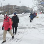 Click here for more information or to register Hosting Club: Toronto
Category: Urban Walk
Location (Google Maps): Toronto, Ontario, Canada Hike Leader(s): Brian Rideout Click here to contact Hike Leader(s) Pace: Moderate (3-4 km/hr)
Terrain: Flat
Distance (km): 10.9 km Description
Please join me at the Tim Horton’s at Lakeshore and Leslie no later than 9:50 am. We start hiking at 10:00 am. We will hike east on Lakeshore, along the Beaches Boardwalk, and on Kingston Rd to Brimley Rd. The estimated distance is 10.9 km. Here is an online map of our route Lakeshore to Brimley Rd Bring a snack, at least 2 liters of water, bug spray and sunscreen. Note: This hike is being done out of sequence due to a scheduling conflict.
 Hike with kids Hilton Falls Conservation Halton Hike with kids Hilton Falls Conservation Halton 10:00 AM-2:00 PM 09/05/2026 https://hikes.brucetrail.org/event/hike-with-kids-hilton-falls-conservation-halton/2026-09-05/  Click here for more information or to register Hosting Club: Iroquoia, Toronto
Category: Junior Hiker
Location (Google Maps): Meet at Hilton Falls Conservation Park Main Parking lot. Hike Leader(s): IgorT Click here to contact Hike Leader(s) Pace: Leisurely – 3km/hr or less
Terrain: Easy – Mostly flat and usually good footing
Distance: 3km Description
Join me to hike with kids at Hilton Falls. We’ll hike from parking lot to the falls and back, about 3km total. (Stroller accessible) At the falls we’ll make a fire, please bring hot dogs, marshmallows etc. for kids and adults to enjoy. Park entrance fee 10.50 plus tax per car, reservation required unless you have a pass. https://www.conservationhalton.ca/parks/hilton-falls/ “Preserving a ribbon of wilderness, for everyone, forever”
|
6 - Car Hike: Uxbridge-Brock Track
8:00 AM-12:00 PM 09/06/2026 https://hikes.brucetrail.org/event/car-hike-uxbridge-brock-track-9/2026-09-06/ Click here for more information or to register Hosting Club: Toronto
Category: Car Hike
Location (Google Maps): Meet at the Brock Tract parking lot on the east side of Durham 1/Brock Rd., approximately 5 km south of Coppin’s Corners, Uxbridge or 1 km north of Uxbridge Pickering Town Line. 1401 Brock Rd. (Free parking). Hike Leader(s): Amir Alemohammad Click here to contact Hike Leader(s) Pace: Moderate (3-4 km/hr)
Terrain: Flat, Hilly, Level 2 (Intermediate – some hills and uneven surfaces, rocks and roots underfoot), Variable
Distance (km): 14-16 km Description
Join us for a wonderful hike in Uxbridge starting from Brock Track parking lot. We will hike the Brock Track and Wilder Forest among the amazing trails of Uxbridge. Boots mandatory, poles recommended, bring 2 litres of water and dress according to weather conditions. Please arrive at 7:45 for a 8:00 start. Beware, Iphone Maps may take you to the wrong location. Check the location with Google Maps the previous night. This is a joint hike with Oak Ridges Trail Association (ORTA).
- Tobermory, 2 of 3, Map 42
9:00 AM-4:00 PM 09/06/2026 https://hikes.brucetrail.org/event/tobermory-2-of-3-map-41-42/2026-09-06/ Click here for more information or to register Hosting Club: Toronto, Peninsula
Category: Car Hike
Location (Google Maps): Bruce Peninsula National Park Hike Leader(s): Alex Brown Click here to contact Hike Leader(s) Pace: Mixed (See Hike Description)
Terrain: Level 2 (Intermediate – some hills and uneven surfaces, rocks and roots underfoot), Rocky, Variable
Distance (km): 14-15 km Description
This is the second of three hikes in this series. We will hike from the Bruce Peninsula National Park along Georgian Bay, north to Little Cove . Excellent views of the Bay. The meeting point will be the Cairn in Tobermory marking the northern terminus of the Bruce Trail or as agreed the previous day. We will then drive to the parking area at Little Cove Road (km 156.4) or National Park to drop off cars and start the hike. Parking fees will apply. More information to be provided closer to the date. Trail conditions are rocky which will make progress slow at times. For those coming long distance, local accommodation should be available in Tobermory. More information about the hike will be posted closer to the date.
- RAINBOW HIKE🌈: Trekking through Terra Cotta
10:00 AM-2:00 PM 09/06/2026 https://hikes.brucetrail.org/event/rainbow-hike%f0%9f%8c%88-trekking-through-terra-cotta/2026-09-06/  Click here for more information or to register Hosting Club: Toronto
Category: Car Hike
Location (Google Maps): We will meet at the roadside parking on Heritage Road (coordinates are 43.734079, -79.944033). Hike Leader(s): Monica Pasquali (she/her) Click here to contact Hike Leader(s) Pace: Leisurely (2-3 km/hr), Moderate (3-4 km/hr)
Terrain: Level 1 (Easy – mostly on flat, well maintained trails with hard-packed surface), Level 2 (Intermediate – some hills and uneven surfaces, rocks and roots underfoot), Level 3 (Advanced – steep hills and some scrambling over boulders)
Distance (km): 10 km Description
This hike is part of our Rainbow Hike program🌈, which aims to foster connection, visibility, and community among 2SLGBTQIA+ hikers and allies. We’ll be joined by Doug O’Neill, who leads Rainbow Hikes with the Iroquoia Bruce Trail Club, and Lana Hubbard, a transgender hike leader with the Caledon Bruce Trail Club. After everyone checks in with me at the meeting location we’ll do a 10 km loop hike using the main trail and the Terra Cotta Side Trail. Most of our route will be level 2/intermediate difficulty but there will be one large hill to conquer as we summit the escarpment on the main trail (level 3/advanced) as well as a fairly long flat section along the Terra Cotta Side Trail (level 1/easy) so this hike has a bit of everything! Any fit Rainbow Hiker is welcome to join us. Everyone who participates in this hike will receive a FREE Bruce Trail Pride Badge! Please bring at least 2 litres of water and enough food for a 4-hour hike. You should wear comfortable hiking shoes and socks, a hat, a breathable shirt, and lightweight long pants (to minimize the risk of a tick bite). If rain is in the forecast then a rain jacket would also be a great idea. Sunblock and bug repellent are also useful if it’s a sunny and buggy day. After the hike, anyone who is interested in joining me for lunch and drinks (both alcoholic and non-alcoholic options will be available) at nearby Badlands Brewing Company (https://www.badlandsbrewing.ca/) is more than welcome to do so. And if you don’t want to purchase your lunch then no worries — we’ll be eating at picnic tables in their outdoor Beer Garden so you can bring your lunch and still enjoy the good company and great conversation. Looking forward to hiking with you on September 6th! And feel free to share this page/link with your 2SLGBTQIA+ friends and family. For more information on Bruce Trail’s 2SLGBTQIA+ hikes, and to get information on upcoming Rainbow Hikes, please see the following webpage: https://brucetrail.org/pride-2026/
| 7 - Car Hike: Limehouse and Duff Pit
8:30 AM-1:30 PM 09/07/2026 https://hikes.brucetrail.org/event/car-hike-limehouse-and-duff-pit/2026-09-07/ 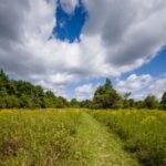 Click here for more information or to register Hosting Club: Toronto
Category: Car Hike
Location (Google Maps): The Limehouse Community parking lot on the south side of 22 Sideroad, opposite Limehouse Public School. Hike Leader(s): Stewart Fleming Click here to contact Hike Leader(s) Pace: Mixed (See Hike Description)
Terrain: Level 2 (Intermediate – some hills and uneven surfaces, rocks and roots underfoot), Variable
Distance (km): 15 km Description
This hike takes us north from Limehouse along the Main Trail to Duff Pit and back. We will explore loops by taking the side trails, including the Todd Bardes Meadowland Side Trail past the Toronto Seed Orchard. Our hike follows the recently rerouted Main Trail, crossing new TBTC properties, bridges, and boardwalks. Our pace will be Brisk through the open areas and Moderate for the few hills, rocky spots, and for photo opportunities. Please bring enough water (at least 2 litres) and food to maintain your energy for a 5-hour hike. Comfortable hiking shoes or boots are a must. A rain shell is recommended in case of a wet weather forecast, along with a hat, sunscreen, and bug repellent for sunny weather or buggy trail conditions.
- Tobermory, 3 of 3, Map 42
9:00 AM-2:00 PM 09/07/2026 https://hikes.brucetrail.org/event/tobermory-3-of-3-map-42/2026-09-07/ Click here for more information or to register Hosting Club: Toronto, Peninsula
Category: Car Hike
Location (Google Maps): Little Cove to Tobermory Hike Leader(s): Alex Brown Click here to contact Hike Leader(s) Pace: Mixed (See Hike Description)
Terrain: Rocky, Variable
Distance (km): 8-11 km Description
This is the third and last hike in this series, ending at the cairn in Tobermory. This hike will be shorter, allowing for an early departure for those wishing to head home. An optional hike on the Burnt Point Loop Side Trail is available for those interested. The meeting point will be the Cairn in Tobermory marking the northern terminus of the Bruce Trail. We will take two or three vehicles to the Little Cove parking area to start the hike. Parking fees will apply. More information to be provided closer to the date. Trail conditions are in spots rocky which may slow us. At the end of the hike those completing the Peninsula section and wanting to get their end to end badges will be presented them at the Cairn. Please contact the hike leader to order a badge for yourself. The cost will be confirmed when the order is place. Please allow two weeks for processing. After the hike those wishing to stop for refreshments are invited to meet at a nearby location. Otherwise, they can begin the drive home. For those coming long distance, local accommodation should be available in Tobermory. More information about the hike will be posted closer to the date.
- Dog-Friendly Hike: Hockley Valley Side trail series
9:00 AM-3:00 PM 09/07/2026 https://hikes.brucetrail.org/event/dog-friendly-hike-hockley-valley-side-trail-series/2026-09-07/ Click here for more information or to register Hosting Club: Toronto
Category: Car Hike
Location (Google Maps): Hockley Valley Hike Leader(s): Lindita Kalo Click here to contact Hike Leader(s) Pace: Mixed (See Hike Description), Moderate (3-4 km/hr)
Terrain: Level 2 (Intermediate – some hills and uneven surfaces, rocks and roots underfoot), Variable
Distance (km): 12 km Description
Join me on the series of dog friendly to complete Caledon side trail challenge. Hockley Valley main Bruce trail and side trail.
This hike has some hills. We will keep moderate speed. be true to your abilities of hiking.
I have a 3 year old Aussie very friendly with people and other dogs.
| 8 - Urban Walk: McCowan District Trail/Scarborough Bluffs
9:30 AM-12:30 PM 09/08/2026 https://hikes.brucetrail.org/event/urban-walk-mccowan-district-trail-scarborough-bluffs/2026-09-08/ Click here for more information or to register Hosting Club: Toronto
Category: Urban Walk
Location (Google Maps): Meet outside Eglinton GO Station on Eglinton Ave east at Bellamy Road. Take TTC Morningside 116 from Kennedy Station to Bellamy Road North / Eglinton Go Station Stop (11 minutes, frequency every 8 minutes) Hike Leader(s): Tom Swales Click here to contact Hike Leader(s) Pace: Moderate (3-4 km/hr)
Terrain: Flat, Level 2 (Intermediate – some hills and uneven surfaces, rocks and roots underfoot), Variable
Distance (km): 8-9 km Description
We’ll follow the local McCowan District Recreational Trail in Scarborough and then eventually to Resthaven Memorial Gardens leading us to Brimley Road and Kingston Road. We’ll approach the Scarborough Bluffs via the Chine Drive Ravine. We’ll be viewing the bluffs from above (not descending) from Scarborough Bluffs Park. We’ll finish at Rosetta McClain Gardens, one of Toronto’s nicest public gardens (on Kingston Road east of Birchmount Road). Join us for lunch, if you wish, at Len Duckworth Fish & Chips on Kingston Road for their lunch special
- Urban hike: Valley View Park Thornhill
9:30 AM-11:45 AM 09/08/2026 https://hikes.brucetrail.org/event/urban-hike-valley-view-park-thornhill-14/2026-09-08/ Click here for more information or to register Hosting Club: Toronto Location (Google Maps): Parking lot is off Sycamore Drive, East of Bayview , across Starbucks plaza
Bus 91 from Finch East station stops at Sycamore station. Hike Leader(s): MOHAMMAD AGHAMIRI Click here to contact Hike Leader(s) Pace: Moderate (3-4 km/hr)
Terrain: Hilly, Level 2 (Intermediate – some hills and uneven surfaces, rocks and roots underfoot)
Distance (km): 7-8 km Description
We will explore Valleyview and Maple View parks, and walk along German Mills Creek, in return we stop in Huntington park and have snack ,coffee,tea . Although this is considered an “Urban Walk”, you can expect some hills up and down and uneven surfaces with tree roots. Please bring hiking poles, water and snacks. phone number for the day of hike 289 588 6482
| 9 | 10 - Urban Walk: Valley View Park Thornhill
9:30 AM-11:45 AM 09/10/2026 https://hikes.brucetrail.org/event/urban-walk-valley-view-park-thornhill-178/2026-09-10/ Click here for more information or to register Hosting Club: Toronto Location (Google Maps): Parking lot is off Sycamore Drive, East of Bayview , across Starbucks plaza
Bus 91 from Finch East station stops at Sycamore station. Hike Leader(s): MOHAMMAD AGHAMIRI Click here to contact Hike Leader(s) Pace: Moderate (3-4 km/hr)
Terrain: Hilly, Level 2 (Intermediate – some hills and uneven surfaces, rocks and roots underfoot)
Distance (km): 7-8 km Description
We will explore Valleyview and Maple View parks, and walk along German Mills Creek, in return we stop in Huntington park and have snack ,coffee,tea . Although this is considered an “Urban Walk”, you can expect some hills up and down and uneven surfaces with tree roots. Please bring hiking poles, water and snacks. phone number for the day of hike 289 588 6482
| 11 | 12   Two Day Toronto End-to-End Event (participants hike independently, no hike leader) Two Day Toronto End-to-End Event (participants hike independently, no hike leader) 7:30 AM-4:00 PM 09/12/2026 https://hikes.brucetrail.org/event/two-day-toronto-end-to-end-event-participants-hike-independently-no-hike-leader-2/2026-09-12/  This is a Multi-Day HikeYou are signing up for the following dates:
2026-09-12, 2026-09-13 Click here for more information or to register Hosting Club: Toronto
Category: Annual TBTC E2E
Location (Google Maps): The Toronto Bruce Trail section which runs from just south of Hilton Falls CA on Appleby Line to the south entrance of the Cheltenham Badlands on Creditview Rd. On both days, we will meet in the village of Limehouse. The exact parking location in Limehouse will be emailed closer to the event date. Hike Leader(s): Jacqueline Van Dyke Click here to contact Hike Leader(s) Pace: Brisk (4-5 km/hr)
Terrain: Challenging, Level 2 (Intermediate – some hills and uneven surfaces, rocks and roots underfoot)
Distance (km): Saturday, Sept. 12 – 28km/Sunday, Sept. 13 – 22km Description
Hike the Toronto section of the Bruce Trail over two days. Hikers must maintain a minimum pace of 4km/hr and reach the checkpoints by the cutoff time in order to continue. On Saturday, the buses will bring hikers from Limehouse to the south entrance of the Cheltenham Badlands where the hike will begin. Hikers will hike south to their vehicles in Limehouse – a distance of approximately 28km. Hikers will reach checkpoint 1 at km 38.8 (after hiking 11.6km) by 11:00 am and checkpoint 2 at km 27.8 (after hiking 11km) by 1:45 pm in order to continue. On Sunday, the buses will bring hikers from Limehouse, to km 0.0 on Appleby Line where the hike will begin. Hiking north to Limehouse, hikers must reach checkpoint 1 at km 11.4 in the Pear Tree parking lot by 11:00 am to continue. There will be sweeps on both days to assist hikers when needed. Water refill and refreshments will be available at the checkpoints. Bring your fully charged cell phone, basic 1st aid supplies, and a water bottle. Those who complete the distances on both days within the prescribed time limits will receive the special NEW 2 Day Club E2E badge. The registration fee includes the online registration fee, bus shuttle, refreshments, and the official NEW E2E badge. If any spots are still available at 9:00 am on July 8, registration will also be opened to non-members (child and adult) at a cost of $65. These are strenuous hikes suitable for experienced, long distance, faster paced hikers over the age of 16. Space is limited, hikes go rain or shine, and no dogs are permitted on this event. Hikers must find their own way each morning to the meeting point in Limehouse. Buses will leave Limehouse promptly at 8:00 am. There will be no refunds or tax receipts issued for anyone who cancels their registration. For questions, please contact Jacquie Van Dyke at vdyke0946@gmail.com. Registration closes at midnight on September 6, 2026. On September 1 or before, an email will go out to all participants with the exact parking location in Limehouse.
- Boyd Conservation Park, Islington Avenue, Vaughan
8:30 AM-1:15 PM 09/12/2026 https://hikes.brucetrail.org/event/car-hike-boyd-conservation-park-vaughan-17/2026-09-12/ Click here for more information or to register Hosting Club: Toronto Location (Google Maps): Free Parking lot before entrance of park on Islington Ave. Hike Leader(s): Mohammad Aghamiri Click here to contact Hike Leader(s) Pace: Moderate (3-4 km/hr)
Terrain: Hilly, Level 2 (Intermediate – some hills and uneven surfaces, rocks and roots underfoot), Variable
Distance (km): 12-14 km Description
Let’s hike Boyd conservation park trails through beautiful valleys. Please bring lots of water and snacks ,hiking poles are recommended phone number for the day of hike 289 588 6482
-
 Bus Hike: Terra Cotta (New Hikers & Families Welcome) Bus Hike: Terra Cotta (New Hikers & Families Welcome) 8:30 AM-5:30 PM 09/12/2026 https://hikes.brucetrail.org/event/bus-hike-terra-cotta-new-hikers-families-welcome/2026-09-12/ Trip Information
Departure Time: 08:30
Return to City Time: 17:30
Departure Point: York Mills Bus Pickup Click here for more information or to register Optional Items
Hiking ($.01)
Hosting Club: Toronto
Category: Bus Hike
Location (Google Maps): Main Bruce Trail Boston Mills Road, through Terra Cotta Conservation Area, to Tenth Line Hike Leader(s): Tom Swales, Felix Wan Click here to contact Hike Leader(s) Pace: Moderate (3-4 km/hr)
Terrain: Level 2 (Intermediate – some hills and uneven surfaces, rocks and roots underfoot), Variable
Distance (km): 10-11 km Description
New Hikers (but all are welcome) are invited to join me on a 10 km Introductory Level Bus Hike on the Toronto Section of the Bruce Trail around Terra Cotta less than an hour from Toronto. Expect some downhill/uphill and tree roots but nothing too rocky or challenging. We’ll be following behind the hikers completing the club’s annual two day E2E hike. There will be the option of a short out and back hike on the Walking Fern Side Trail at the end. After the hike we’ll drive to Spirit Tree Estates Cidery that offers pizza and baked goods and a country store. Hopefully the weather cooperates so we can sit on the picnic tables outside. Optional dropout at 5 km. Hiking boots are recommended. Beginners and families welcome. - =>>> Please read the TBTC Paid Hikes Refund Policy before registering: https://torontobrucetrailclub.org/hikes/no-show-policy”. There will be no refunds for this hike if the registrant cancels or misses the coach on the date of departure for any reason. Registration fees are not transferrable between different hikes nor can unused fares qualify for a tax receipt.
- JEWELS OF GRAND VALLEY TRAIL – YORK TO CALEDONIA AND RUTHVEN PARK – 14 KM
9:30 AM-4:30 PM 09/12/2026 https://hikes.brucetrail.org/event/jewels-of-grand-valley-trail-york-to-caledonia-and-ruthven-park-14-km/2026-09-12/ Click here for more information or to register Hosting Club: Toronto
Category: Car Hike
Location (Google Maps): Parking and departure: Meet at 9:30am in Caledonia – Kinsmen Park trout park, Caledonia, at intersection of Caithness St. W (Rd 54) and Blair St. turn into the riverside parking lot. Hike Leader(s): Jeanette Vincent Click here to contact Hike Leader(s) Pace: Moderate (3-4 km/hr)
Terrain: Flat, Level 1 (Easy – mostly on flat, well maintained trails with hard-packed surface), Variable
Distance (km): 14km Description
About this hike: This hike will be in Towpath section of GVTA: York to Caledonia and Ruthven Park, National Historic Site. This is a linear hike including areas of interest off the main trail. We will be walking on some of the streets in Caledonia and local trails along the river. Then we all drive to Ruthven Park where we will finish our hike on the Ruthven Park property trails. If you choose to, you will also have the opportunity to tour the Ruthven Greek Revival Mansion. There is a fee to tour inside the mansion: $12 adults, $10 senior 65+.About this series: Jewels of Grand Valley Trail is a series of hikes highlighting the beautiful parts of GVT in all 4 sections. Those hikes will range from about 6 km to 15 km. They will be led by Jeanette, Jane, Eva and Brandon through months of August to October. Come and enjoy the beauty of our trail! Where: York, Caledonia, Ruthven Park
Length: 14 km
Category: Car shuttle
Pace and duration: Moderate, 3.5 km/hr. About 6.5 hours with lunch + car shuttle time.
Hike level: Moderate (2). Mainly flat, paved, maintained paths and trails. Parking and departure: Meet at 9:30 am in Caledonia – Kinsmen Park,trout park, Caledonia, Caledonia – riverside parking at intersection of Caithness St. W (Rd 54) and Blair St. 43.0744974 -79.9579234 From there we will carpool to York Park, York beside the Grand River across from the York General Store/gas station.(43.020717, -79.890382) and hike back to our cars. After this portion of the hike we carpool to the cars at York Park, the start of our hike and all vehicles will drive to Ruthven Park (42.978026, -79.875623) where we will finish our hike on the Ruthven Park property trails. If you want a 2 or 3 km shorter hike you can opt out of joining us at Ruthven Park for the remainder of the hike. Directions: Please use your favourite GPS app to obtain directions.
What to wear and bring: This is a September hike, please dress accordingly to the weather, bring a hat and sunscreen, sunglasses. If rain is forecasted, bring rain gear. Wear good hiking boots. Hiking poles are optional if you like using them. Bring water, snacks and pack a lunch – we will stop for lunch.
- Urban Walk: Waterfront Trail 7/11 – Brimley
10:00 AM-2:30 PM 09/12/2026 https://hikes.brucetrail.org/event/urban-walk-waterfront-trail-7-11-brimley-3/2026-09-12/  Click here for more information or to register Hosting Club: Toronto
Category: Urban Walk
Location (Google Maps): Toronto, Ontario, Canada Hike Leader(s): Brian Rideout Click here to contact Hike Leader(s) Pace: Moderate (3-4 km/hr)
Terrain: Hilly
Distance (km): 11.4 km Description
Please join me at Kennedy Station by 10:15 am. We will take the 12 Kingston Rd bus departing 10:42 am, arriving 10:58 am. We will hike along Kingston Rd, down to and east along the Lake on the Doris MacCarthy Trail to Guildwood and then to Beechgrove Dr. The estimated distance is 11.4 km. Here is an online map of our route – Brimley to Beechgrove Bring a snack, at least 2 liters of water, and icers. Dress for cold weather.
|
13 - Car Hike: Uxbridge-Brock Track
8:00 AM-12:00 PM 09/13/2026 https://hikes.brucetrail.org/event/car-hike-uxbridge-brock-track-10/2026-09-13/  Click here for more information or to register Hosting Club: Toronto
Category: Car Hike
Location (Google Maps): Meet at the Brock Tract parking lot at 1401 Brock Road, Uxbridge, ON. On the east side of Durham 1/Brock Rd., approximately 5 km south of Coppin’s Corners, Uxbridge or 1 km north of Uxbridge Pickering Town Line look for the 1401 number sign.Enter the track and you will find parking entrance approximately 50m on the left side. This is a free parking lot. Hike Leader(s): Amir Alemohammad Click here to contact Hike Leader(s) Pace: Moderate (3-4 km/hr)
Terrain: Flat, Hilly, Level 2 (Intermediate – some hills and uneven surfaces, rocks and roots underfoot), Variable
Distance (km): 14-16 km Description
Join us for a wonderful hike in Uxbridge starting from Brock Track parking lot. We will hike the Brock Track, Glen Major and Wilder Forest among the amazing trails of Uxbridge. Boots mandatory, poles recommended, bring 2 litres of water and dress according to weather conditions. Please arrive at 7:45 for a 8:00 start. Beware, Iphone Maps may take you to the wrong location. Check the location with Google Maps the previous night. This is a joint hike with Oak Ridges Trail Association (ORTA).
- GO Train Hike:: Unionville – Markham, Rouge River Trail
10:00 AM-2:30 PM 09/13/2026 https://hikes.brucetrail.org/event/go-train-hike-unionville-markham-rouge-river-trail-2/2026-09-13/ Click here for more information or to register Hosting Club: Toronto
Category: GO Train Hike
Location (Google Maps): Markham Pan Am Centre, Kennedy Rd & YMCA Blvd. Meet inside main lobby by the coffee shop for 10:00 departure after those who travelled by GO Transit arrive. For those travelling by GO Transit we will meet in the Great Hall of Union Station to depart by 8:35 to take the 8:58 #71 Bus from the Union Station GO Bus Terminal.
(updated transit directions have been emailed to those who have registered). Hike Leader(s): Tom Swales Click here to contact Hike Leader(s) Pace: Moderate (3-4 km/hr)
Terrain: Level 2 (Intermediate – some hills and uneven surfaces, rocks and roots underfoot), Variable
Distance (km): 13 km Description
The villages of Unionville & Markham are connected by the Rouge Valley Trail System following the Rouge River and running behind the historic buildings on Main Street Unionville, by Walden Pond in Austin Drive Park, through Milne Dam Conservation Area, and ending with a 143 metre long suspension bridge over the dam. We will walk into the village of Markham and finish with a short boardwalk trail through Tannery Pond which is close to the Markham GO Station. We begin the hike at Unionville GO Station hiking north to the historic Main Street and picking up the Rouge Valley Trail at Carlton Road. Return to Toronto or the starting point by GO Train or York Region Transit bus. Optional stop at the Rouge River Craft Brewery after the hike. Terrain is easy, mostly paved path/boardwalk with some dirt trails. On The Go Maps Link: https://onthegomap.com/s/g5rhpj1s Bring lunch, water, snacks, hat. and insect repellant.
| 14 - Car Hike: Fabulous Ferns
10:30 AM-1:30 PM 09/14/2026 https://hikes.brucetrail.org/event/car-hike-fabulous-ferns/2026-09-14/ 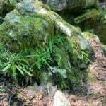 Click here for more information or to register Hosting Club: Toronto
Category: Car Hike
Location (Google Maps): Map 13
Meet at the roadside parking on 10th line, 2.2 km southeast of 32 Sideroad (Halton Road 42) Hike Leader(s): Janet Patterson Click here to contact Hike Leader(s) Pace: Leisurely (2-3 km/hr)
Terrain: Variable
Distance (km): 3-4 km Description
If you’ve hiked anywhere on the Bruce Trail, you’ve encountered ferns. Large bushy ones, tiny delicate ones, perhaps growing on vertical rock faces or down low, in the forest understory. Ontario boasts close to 170 different species! For this hike, we will be joined by BTC staff ecologist Mara McHaffie who will help us learn to identify the variety of fern species we will encounter on the Walking Fern side trail. This is a slow-paced outing, with lots of time to observe, discuss and photograph what we observe. The Walking Fern side trail itself is only 1.4k in total ((linear: there and back), so if time allows, we will explore a little more on the adjacent main trail. This hike is brought to you by the TBTC Biodiversity Team. We endeavour to promote the critical role we can all play in protecting and conserving the Niagara Escarpment. Limit: 10
| 15 - Urban Walk: Rosedale Valley, Toronto Necropolis Cemetery, Riverdale Park and the Danforth
9:30 AM-12:00 PM 09/15/2026 https://hikes.brucetrail.org/event/rosedale-valley-toronto-necropolis-cemetery-riverdale-park-and-the-danforth/2026-09-15/ 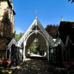 Click here for more information or to register Hosting Club: Toronto
Category: Urban Walk
Location (Google Maps): Rosedale Station Hike Leader(s): Ted Moriarty Click here to contact Hike Leader(s) Terrain: Hilly, Level 2 (Intermediate – some hills and uneven surfaces, rocks and roots underfoot)
Distance (km): 7.5 km Description
Join me in one of a series of Tuesday morning urban hikes in Toronto. Starting at Rosedale Subway Station, we will explore four unique mid-Toronto green spaces including Rosedale Valley, Toronto Necropolis Cemetery and Riverdale Park. The hike will conclude at the Broadview Subway Station.
- Urban Walk: Valley View Park Thornhill
9:30 AM-11:45 AM 09/15/2026 https://hikes.brucetrail.org/event/urban-walk-valley-view-park-thornhill-179/2026-09-15/ Click here for more information or to register Hosting Club: Toronto Location (Google Maps): Parking lot is off Sycamore Drive, East of Bayview , across Starbucks plaza
Bus 91 from Finch East station stops at Sycamore station. Hike Leader(s): MOHAMMAD AGHAMIRI Click here to contact Hike Leader(s) Pace: Moderate (3-4 km/hr)
Terrain: Hilly, Level 2 (Intermediate – some hills and uneven surfaces, rocks and roots underfoot)
Distance (km): 7-8 km Description
We will explore Valleyview and Maple View parks, and walk along German Mills Creek, in return we stop in Huntington park and have snack ,coffee,tea . Although this is considered an “Urban Walk”, you can expect some hills up and down and uneven surfaces with tree roots. Please bring hiking poles, water and snacks. phone number for the day of hike 289 588 6482
| 16 | 17 - Urban Walk : Valley View Park
8:30 AM-10:30 AM 09/17/2026 https://hikes.brucetrail.org/event/urban-walk-valley-view-park/2026-09-17/ Click here for more information or to register Hosting Club: Toronto Location (Google Maps): Parking lot is off Sycamore Drive, East of Bayview , across Starbucks plaza
Bus 91 from Finch East station stops at Sycamore station. Hike Leader(s): MOHAMMAD AGHAMIRI Click here to contact Hike Leader(s) Pace: Moderate (3-4 km/hr)
Terrain: Hilly, Level 2 (Intermediate – some hills and uneven surfaces, rocks and roots underfoot)
Distance (km): 7-8 km Description
We will explore Valleyview and Maple View parks, and walk along German Mills Creek, in return we stop in Huntington park and have snack ,coffee,tea . Although this is considered an “Urban Walk”, you can expect some hills up and down and uneven surfaces with tree roots. Please bring hiking poles, water and snacks. phone number for the day of hike 289 588 6482
- Car Hike: Inglis Falls
10:00 AM-2:00 PM 09/17/2026 https://hikes.brucetrail.org/event/car-hike-inglis-falls/2026-09-17/ 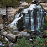 Click here for more information or to register Hosting Club: Toronto, Sydenham
Category: Car Hike
Location (Google Maps): Centennial Tower Parking located on the west side of Highway 6 & 10 at the south end of Owen Sound Hike Leader(s): Stewart Fleming Click here to contact Hike Leader(s) Pace: Mixed (See Hike Description)
Terrain: Level 2 (Intermediate – some hills and uneven surfaces, rocks and roots underfoot), Rocky
Distance (km): 12 km Description
This hike takes us south on the Main Trail from Centennial Tower to Inglis Falls and back. We will stop to explore the Devil’s Playhouse through the narrow Escarpment entrance. Our pace will be Brisk through the open areas but Leisurely through the East Rocks section, one of my top five hardest rocky sections of the Bruce Trail. Please bring enough water (about 2 litres) and food to maintain your energy for a 4-hour hike. Comfortable hiking shoes or boots are a must. A rain shell is recommended in case of a wet weather forecast, along with a hat, sunscreen, and bug repellent for sunny weather or buggy trail conditions.
| 18 | 19 -
 Coach Trip: Killbear Provincial Park Coach Trip: Killbear Provincial Park 7:30 AM-7:30 PM 09/19/2026 https://hikes.brucetrail.org/event/coach-trip-killbear-provincial-park/2026-09-19/ 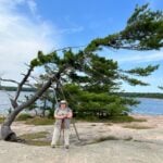 Trip Information
Departure Time: 07:30
Return to City Time: 19:30
Departure Point: York Mills Bus Pickup Click here for more information or to register Trip Activities
Hiking ($.01)
Independent Activities ($.01)
Optional Items
Hosting Club: Toronto
Category: Coach Trips
Location (Google Maps): Nobel, Ontario – https://www.ontarioparks.ca/park/killbear Hike Leader(s): Lisa R. Lifshitz, Nijole Mockevicius, Marie-Josee Roy, Felix Wan;Tom Swales Click here to contact Hike Leader(s) Pace: Moderate (3-4 km/hr)
Terrain: Level 2 (Intermediate – some hills and uneven surfaces, rocks and roots underfoot), Variable
Distance (km): 8-10 km (Time dependent) Description
After years of requests, join us for our first-ever bus trip to beautiful Killbear Provincial Park! This stunning park, created in 1960, is known for its beautiful views of Georgian Bay, windswept pines on rocky islands, rugged shorelines and sandy beaches. Using our bus, we will cover the best trails in the park, including the Lookout Point Trail, the Lighthouse Point Trail and the Recreational Trail/Twin Point Trail, leaving time to scramble on the rocks to take iconic pictures of windswept trees and of course, visit the delightful Visitor’s Centre and Park Store. You also have the option to spend the day on your own. The club is pleased to be able to make this fun day trip available to our members at a very reasonable cost. Bus Fare includes admission to Killbear Provincial Park and a fuel surcharge rate of 7%. =>>> Please read our Paid Hikes Refund Policy before registering: https://torontobrucetrailclub.org/hikes/no-show-policy”. There will be no refunds for this hike if the registrant cancels or misses the coach on the date of departure for any reason. Registration fees are not transferrable between different hikes nor can unused fares qualify for a tax receipt.
- East Point Park Bird Sanctuary, Scarborough, ON
8:30 AM-1:00 PM 09/19/2026 https://hikes.brucetrail.org/event/car-hike-glasgow-village-uxbridge-10/2026-09-19/ Click here for more information or to register Hosting Club: Toronto Location (Google Maps): Free parking lot at the statrt of the trail Hike Leader(s): MOHAMMAD AGHAMIRI Click here to contact Hike Leader(s) Pace: Moderate (3-4 km/hr)
Terrain: Hilly, Level 2 (Intermediate – some hills and uneven surfaces, rocks and roots underfoot), Variable
Distance (km): 14-15 km Description
We will hike along lake Ontario to Scarborough Bluffs.and return the same path weather and water level permitting, If not possible we hike 2 loops east and west side of parking Please bring hiking poles, proper closing and shoes and lots of smile,
- Skinner’s Bluff and Bruce’s Caves
10:00 AM-3:30 PM 09/19/2026 https://hikes.brucetrail.org/event/skinners-bluff-and-bruces-caves/2026-09-19/ 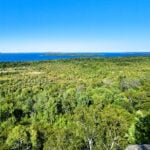 Click here for more information or to register Hosting Club: Toronto, Sydenham
Category: Car Hike
Location (Google Maps): The roadside parking is on Colpoy’s Range Road. Do not park in front of the farm field gates. Drive to the parking from Centre Road on the west side, and not from the east side unless you’re arriving by ATV. Hike Leader(s): Stewart Fleming Pace: Mixed (See Hike Description)
Terrain: Level 2 (Intermediate – some hills and uneven surfaces, rocks and roots underfoot), Rocky, Variable
Distance (km): 20.5 km Description
This is a scenic Georgian Bay hike, with the views being a highlight.
We will follow the Main Trail along Skinner’s Bluff, take the inland side trails and the very rocky Colpoy’s Cavern Side Trail. We will have time to explore and lunch at Bruce’s Caves. Our pace will be Brisk through the open areas but Leisurely through the few rocky sections. Please bring enough water (at least 2 litres) and food to maintain your energy for a 5-hour hike. Comfortable hiking shoes or boots are a must. A rain shell is recommended in case of a wet weather forecast, along with a hat, sunscreen, and bug repellent for sunny weather or buggy trail conditions.
- Urban Walk: Humber River/Swansea Theatre Hike
3:00 PM-6:00 PM 09/19/2026 https://hikes.brucetrail.org/event/urban-walk-humber-river-swansea-theatre-hike-5/2026-09-19/ 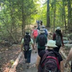 Click here for more information or to register Hosting Club: Toronto
Category: Urban Walk
Location (Google Maps): Meet by the TTC Stop on the Southeast Corner of Scarlett Road and Eglinton Avenue West. Take the #79 Scarlett Road bus from Runnymede Station to Eglinton or the Eglinton West #32A from Mount Dennis Station to Scarlett Road. Please note that we will leave the TTC bus stop at Scarlett Road and Eglinton PUNCTUALLY at 3:00 PM. Hike Leader(s): Miriam Stevens Click here to contact Hike Leader(s) Pace: Leisurely (2-3 km/hr)
Terrain: Level 1 (Easy – mostly on flat, well maintained trails with hard-packed surface), Variable
Distance (km): 10-12 km Description
Leisurely hike (3 kms/hour – No Racers Please) suitable for beginners and families.
Hike along the Humber River trail and into the Swansea village at Runnymede road and Bloor street west. The hike will end opposite Runnymede Subway near the Village Playhouse Theatre and local restaurants and pubs. Distance may vary according to the weather and trail conditions and how people feel. Early dropout is possible at Old Mill Subway Station. After the hike you are invited to join us for dinner at around 6 PM at Ali Baba Mediterranean restaurant.
We will attend the play “Lion In The Winter” (Dramatic Comedy) at 8 PM at The Bloor West Village Players theatre, 2190 Bloor Street West, Toronto.
Call the Theatre directly at (416) 767 7702 to reserve your ticket, cost $29- $32.00. Please do mention that you’re with the Bruce Trail Conservancy, Toronto Club so they know we are supporting them. Paid parking is available off Kennedy Avenue north of Bloor Street West (behind the Village Playhouse Theatre building). There is no parking available at the start of the hike. Please feel free to join us just for the hike, the hike and dinner, or all three.
|
20 - Exploring The Uxbridge Trails from Three Rocks
8:00 AM-12:00 PM 09/20/2026 https://hikes.brucetrail.org/event/exploring-the-uxbridge-trails-from-three-rocks/2026-09-20/ 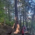 Click here for more information or to register Hosting Club: Toronto
Category: Car Hike
Location (Google Maps): Park at 1120 Concession Rd 7, Uxbridge, ON L9P 1R4. This is the East Duffins Headwaters conservation area parking lot. It’s a pay parking lot for non-residents of Uxbridge. You can purchase parking permits through a mobile app by scanning the barcode at the site upon arrival. Alternatively, you can pay in advance on the Township of Uxbridge website. The current daily permit cost is $6.00. Hike Leader(s): Amir Alemohammad Click here to contact Hike Leader(s) Pace: Moderate (3-4 km/hr)
Terrain: Flat, Hilly, Level 2 (Intermediate – some hills and uneven surfaces, rocks and roots underfoot), Variable
Distance (km): 14-16 Description
This loop hike takes us through Uxbridge trails, Canada’s capital trails. Beginning at the Three Rocks in Uxbridge, we’ll enjoy hiking several lookouts and exploring the Aggregate Pit. We’ll also stroll through the beautiful Uxbridge forests of Glen Major, Walker Woods, and The Wilder Forest. Boots are mandatory, and trekking poles are recommended. Don’t forget to bring at least two litres of water and some snacks. Please arrive at 7:45 for the 8:00 start.
- Passport to Nature: What tree are you? (Children’s Hike)
9:00 AM-12:00 PM 09/20/2026 https://hikes.brucetrail.org/event/passport-to-nature-what-tree-are-you-childrens-hike/2026-09-20/ 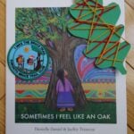 Click here for more information or to register Hosting Club: Toronto
Category: Car Hike
Location (Google Maps): We will meet at the Silver Creek Outdoor Education parking lot (coordinates are 43.692615, -79.968433). Hike Leader(s): Monica Pasquali Click here to contact Hike Leader(s) Pace: Leisurely (2-3 km/hr)
Terrain: Level 2 (Intermediate – some hills and uneven surfaces, rocks and roots underfoot)
Distance (km): 3 km Description
Celebrate the end of summer and the beginning of fall by participating in a family-friendly “Passport to Nature” event along the Bruce Trail! We will begin our adventure by reading the storybook “Sometimes I Feel Like an Oak” by Canadian Indigenous author Danielle Daniel. We will talk about the different trees mentioned in the book, including how they can be identified, so we can find some of them as we complete a 3 km loop hike of the main Bruce Trail and Roberts Side Trail. We will then finish our day together by enjoying our snacks and doing a tree-themed art activity outdoors before we all head home. The hike leader will bring the storybook and art supplies as well as a first aid kit and FREE Toronto Bruce Trail Club Youth Badges for children aged 13 and under who participate in the day’s activities. Participants should bring something to sit on (e.g., folding chair, picnic blanket, etc.) to be used before and after the hike which can be stored in the car during the hike. Participants should also bring their own water and nut-free snacks. Please note that children should be accompanied by an adult, and all participating children and adults should register for this hike. The 3 km loop hike will be hiked at a leisurely pace so it will take us approximately 1.5 hours to complete. The trail is rocky and hilly in places and is therefore not stroller-friendly so all participants should be capable of walking on their own. Please wear clothing appropriate for the weather and comfortable shoes with good traction.
- Car Hike: Hockley Valley, Map 18
10:00 AM-3:30 PM 09/20/2026 https://hikes.brucetrail.org/event/car-hike-hockley-valley-map-18-6/2026-09-20/ Click here for more information or to register Hosting Club: Toronto
Category: Cancelled
Location (Google Maps): Hockley Valley Provincial Nature Reserve Hike Leader(s): Al Brown Click here to contact Hike Leader(s) Pace: Moderate (3-4 km/hr)
Terrain: Challenging, Level 2 (Intermediate – some hills and uneven surfaces, rocks and roots underfoot)
Distance (km): 12 km Description
We will complete a loop hike through the nature preserve, along one of the hilliest sections of the Trail. This is a popular section because of the hills and because it is almost all forest cover. After the hike those interested are invited to meet for refreshments in the local area. To get to the meeting point drive north on Hwy 10 past Orangeville to Hockley Road. Turn right and go about 6 km to the parking area. It is across the road from the Black Birch restaurant.
| 21 | 22 - Urban Walk: Valley View Park
9:30 AM-11:45 AM 09/22/2026 https://hikes.brucetrail.org/event/urban-walk-valley-view-park-2/2026-09-22/ Click here for more information or to register Hosting Club: Toronto Location (Google Maps): Parking lot is off Sycamore Drive, East of Bayview , across Starbucks plaza
Bus 91 from Finch East station stops at Sycamore station. Hike Leader(s): MOHAMMAD AGHAMIRI Click here to contact Hike Leader(s) Pace: Moderate (3-4 km/hr)
Terrain: Hilly, Level 2 (Intermediate – some hills and uneven surfaces, rocks and roots underfoot)
Distance (km): 7-8 km Description
We will explore Valleyview and Maple View parks, and walk along German Mills Creek, in return we stop in Huntington park and have snack ,coffee,tea . Although this is considered an “Urban Walk”, you can expect some hills up and down and uneven surfaces with tree roots. Please bring hiking poles, water and snacks. phone number for the day of hike 289 588 6482
- Urban Walk: East Don Trail
9:30 AM-12:30 PM 09/22/2026 https://hikes.brucetrail.org/event/urban-walk-east-don-trail-2/2026-09-22/ Click here for more information or to register Hosting Club: Toronto
Category: Urban Walk
Location (Google Maps): Meet in front of the East York Memorial Arena (Cosburn Avenue & Cedarvale, one block east of Woodbine Avenue). From Woodbine Station take the #91 Woodbine or #93 Parkview Hills bus to Cosborn and walk one block east. Or from Brodview Station or Main Street Station take the Cosburn #87A or #87C Bus to Cedarvale Avenue. Main Street Station is closer. Pubic washrooms are available in the park. Hike Leader(s): Tom Swales Click here to contact Hike Leader(s) Pace: Moderate (3-4 km/hr)
Terrain: Flat, Level 2 (Intermediate – some hills and uneven surfaces, rocks and roots underfoot), Variable
Distance (km): 8 km Description
Join me in one of a series of weekday morning urban hikes in Toronto. We will hike part of Taylor Creek Park towards the Forks Of The Don and then explore the newly opened trail connection on the East Don taking us north to Eglinton (Sloane Station on Line 5) It is a paved path which opened July 13th. This is Phase 1 of the trail which will eventually connect the trail to the Gatineau Hydro Corridor (The MeadowWay), Wigmore Park, Moccasin Trail Park, and the East Don Trail to Lawrence. If you would like to join us for lunch (optional) the Best Hakka Chinese Restaurant (https://besthakka.ca/c/lunch-special/) is at the end of the route. This is a repeat of the July 21st hike for those that missed it because of the forecast of thunder storms.
| 23 | 24 - Urban Walk: Valley View Park
9:30 AM-11:45 AM 09/24/2026 https://hikes.brucetrail.org/event/urban-walk-valley-view-park-38/2026-09-24/ Click here for more information or to register Hosting Club: Toronto Location (Google Maps): Parking lot is off Sycamore Drive, East of Bayview , across Starbucks plaza
Bus 91 from Finch East station stops at Sycamore station. Hike Leader(s): MOHAMMAD AGHAMIRI Click here to contact Hike Leader(s) Pace: Moderate (3-4 km/hr)
Terrain: Hilly, Level 2 (Intermediate – some hills and uneven surfaces, rocks and roots underfoot)
Distance (km): 7-8 km Description
We will explore Valleyview and Maple View parks, and walk along German Mills Creek, in return we stop in Huntington park and have snack ,coffee,tea . Although this is considered an “Urban Walk”, you can expect some hills up and down and uneven surfaces with tree roots. Please bring hiking poles, water and snacks. phone number for the day of hike 289 588 6482
| 25 - Coach Trip: Saugeen Peninsula Hiking Weekend
7:00 AM-8:00 PM 09/25/2026 https://hikes.brucetrail.org/event/coach-trip-sept-25-to-27-saugeen-peninsula-hiking-weekend/2026-09-25/ Trip Information
Departure Time: 07:00
Return to City Time: 20:00
Departure Point: York Mills Bus Pickup Click here for more information or to register Trip Activities
Moderate group ($0.01)
Fast group ($0.01)
Optional Items
Pickup at HWY 400 and HWY 9 ($0.01)
Hosting Club: Toronto
Category: Coach Trips
Location (Google Maps): Evergreen Resort, Red Bay Hike Leader(s): Martina Furrer, Janet McColeman, Robin Crombie, Tim Wainwright Click here to contact Hike Leader(s) Pace: Brisk (4-5 km/hr), Moderate (3-4 km/hr)
Terrain: Challenging, Hilly, Level 2 (Intermediate – some hills and uneven surfaces, rocks and roots underfoot), Rocky
Distance (km): Moderate 12km, Fast 15 to 18 km Description
Departure: Friday September 25 - 7AM from 10 York Mills Rd
- 7:20 AM from HWY 400 and HWY 9 Park and Ride
Return: Sunday September 27 between 7 and 8 PM Join us for three days of guided hiking on the beautiful Saugeen Peninsula. Spend your days on the Bruce Trail and your evenings at Evergreen Resort (https://evergreenresortredbay.com/index.html) overlooking Lake Huron. We will explore the Skinner’s Bluff, Colpoy’s Bay, Cape Crocker, Hope Bay, Rush Cove, Barrow Bay, Lion’s Head, and/or Cape Chin areas, using both the main trail and some fun side trails. You will be treated to scenic lunch spots, cool dolostone cliffs, neat crevasses, beautiful shale beaches, and lots of awesome views of Georgian Bay. Come prepared for some strenuous climbs, some challenging footing over boulders and crevasses, and some exposed sections. There will be a moderate group (hiking about 12 km each day) and a fast group (hiking between 15 and 18 km each day). Both groups will do full day hikes with no dropouts. Please note the Peninsula section is rugged. These hikes are not suitable for people who are afraid of heights. All fit, experienced hikers comfortable walking on this type or terrain are welcome. There won’t be a sightseeing group or other activities for non-hikers. Accommodation is in one-, two-, and three-bedroom cottages (linens, bedding, and towels provided). Each cottage has a full bathroom, fridge, and heater. The resort has a hot tub and a private beach perfect for viewing sunsets. Cost is $370.75 per person (plus taxes and gratuity extra). This includes two nights’ accommodation, two dinners, two breakfasts, and two boxed lunches. Another group will be at Evergreen Resort the same weekend as us. To ensure there is space for all participants and we can run this trip, all cottages must be shared, all bedrooms in all cottages must be occupied, and some bedrooms will need to be shared. The one-bedroom water view cottages have a sitting area with a small table, two chairs, and a couch, a three piece bathroom, and a bedroom with two double beds. Each one-bedroom cottage needs to be occupied by two people. Similarly each garden view motel unit has two double beds and a sitting area. These units will also need to be shared. Finally each two-bedroom cottage will need to have three occupants. The only units suitable for single occupancy are garden view units 203 and 204 (they are small with no sitting area). Coach fare is $195 for members, $215 for non-members, and $120 for children. All applicable fuel surcharges as of June have been included in the coach fare. In these volatile times the Toronto Bruce Trail Club reserves the right to charge for currently unanticipated increases in the cost of fuel. Registration instructions: Please find roommates / cottagemates before you register. To avoid problems, make sure you and your roommate(s) reserve your cottage and your seats on the coach at the same time. If you’re new to our coach trips or don’t have a friend who would like to join you, complete our roommate request form at: https://saugeen.s.gy/rooms and we will do our best to find you a match. - Call Evergreen Resort at 519-534-1868 to book your cottage.
- To reserve your seat on the bus, register here starting on Friday June 12th at 8:00 PM.
Cancellation policy: While we are hoping for sunshine, the trip cannot be cancelled due to weather. Coach fare is non-refundable.
| 26 - Erindale park Mississauga
8:30 AM-1:15 PM 09/26/2026 https://hikes.brucetrail.org/event/car-hike-rouge-national-park-scarborough-on-5/2026-09-26/ Click here for more information or to register Hosting Club: Toronto Location (Google Maps): Erindale park Mississauga Hike Leader(s): MOHAMMAD AGHAMIRI Click here to contact Hike Leader(s) Pace: Moderate (3-4 km/hr)
Terrain: Hilly, Level 2 (Intermediate – some hills and uneven surfaces, rocks and roots underfoot)
Distance (km): 12-14 km Description
We will hike Credit River North and will see nice views of Credit River and possibly some salmons heading upstream From parking lot we hike north mostly along Credit River and return to parking around 13 to 13.30 • Please dress appropriately for the weather.
• We will have short water ,picture and a 15 minute snack break. Everyone is welcome! Please bring lots of water and snacks ,hiking poles are recommended phone number for the day of hike 289 588 6482
- GO Train Hike: Stratford (Repeat Date)
9:00 AM-8:30 PM 09/26/2026 https://hikes.brucetrail.org/event/go-train-hike-stratford-2/2026-09-26/ Click here for more information or to register Hosting Club: Toronto
Category: GO Train Hike
Location (Google Maps): Meet in the Great Hall of Toronto’s Union Station by the Traveller’s Aid Desk (with the clock over it) by 8:35 AM to take the Stratford bound train scheduled to depart at 8:49 AM. Alternatively you may take the 9:49 AM train from Mount Dennis to Bramalea GO Station and transfer to the Stratford bound Train (scheduled to depart at 9:20 AM, an approximately 10 minute wait between trains) and you may find us in the upper level of the accessibility coach. Hike Leader(s): Tom Swales Click here to contact Hike Leader(s) Pace: Moderate (3-4 km/hr)
Terrain: Flat, Level 2 (Intermediate – some hills and uneven surfaces, rocks and roots underfoot)
Distance (km): 12 km Description
Due to the overwhelming response for the September 5th hike, I will try to offer the trip again on Sep 26th (if there are no closures on the Kitchener GO Line on this date). Join us for a day trip to Stratford on the GO Train. If you buy the Weekend Day Pass the return fare is just $10.00! We will hike along trails on both sides of the Avon River in Stratford including the Shakespearean Gardens. We’ll have dinner in a local pub before departing Stratford on the 6:15 PM train. There will be the chance to enjoy the historic downtown as well as some relaxing time by the river as we’ll have the full afternoon. Before registering please note that is a 2,1/2 hour journey on the train each way and there are no alternative GO services from Stratford other than the 6:15 pm train arriving back at Union Station at 8:40 PM. Please advise in the additional information section in the registration form of you prefer going to a pub or dinner at a restaurant after the hike. There will be two groups or you’re free to choose your own place.
|
27 - Urban Walk: Waterfront Trail 7/11 – Brimley
10:00 AM-2:30 PM 09/27/2026 https://hikes.brucetrail.org/event/urban-walk-waterfront-trail-7-11-brimley-4/2026-09-27/ 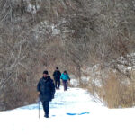 Click here for more information or to register Hosting Club: Toronto
Category: Urban Walk
Location (Google Maps): Toronto, Ontario, Canada Hike Leader(s): Brian Rideout Click here to contact Hike Leader(s) Pace: Moderate (3-4 km/hr)
Terrain: Hilly
Distance (km): 11.4 km Description
Please join me at Kennedy Station by 10:15 am. We will take the 12 Kingston Rd bus departing 10:33 am, arriving 10:49 am. We will hike along Kingston Rd, down to and east olong the Lake on the Doris MacCarthy Trail to Guildwood and then to Beechgrove Dr. The estimated distance is 11.4 km. Here is an online map of our route – Brimley to Beechgrove Bring a snack, at least 2 liters of water, and icers. Dress for cold weather.
- Riverwood Conservancy Part 2, Loop Hike via Leslie Log House
10:45 AM-3:15 PM 09/27/2026 https://hikes.brucetrail.org/event/riverwood-conservancy-part-2-loop-hike-via-leslie-log-house/2026-09-27/ 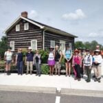 Click here for more information or to register Hosting Club: Toronto
Category: Urban Walk
Location (Google Maps): Toronto transit users meet me outside Islington Subway Station at 9:40, take the tunnel under Islington Ave. to the East side. We will be catching MiWay Bus#26 at 9:46 for a 57 minute journey to our destination, disembarking Burnhamthorpe Road at the Credit Woodlands. Coming directly to the hike, from Burnhamthorpe Road turn onto Riverwood Park Lane and park in the first parking lot on your left. Walk through MacEwan Terrace Garden, turn right past the barn to the Visual Arts Mississauga Building. Wait outside for the Transit group to arrive. Please arrive by 10:30 am. Public washrooms located inside. Hike Leader(s): Andrew Proczek Click here to contact Hike Leader(s) Pace: Leisurely (2-3 km/hr), Moderate (3-4 km/hr)
Terrain: Level 1 (Easy – mostly on flat, well maintained trails with hard-packed surface), Level 2 (Intermediate – some hills and uneven surfaces, rocks and roots underfoot), Variable
Distance (km): 10 km Description
Join me for Part 2 of my Riverwood Conservancy Hikes. In Part 1 we focused mainly on Riverwood Trails but this time we will expand the loop to visit Leslie Log House which is celebrating its 200th anniversary. It is possibly the best preserved early 19th Century Log House anywhere in Canada. We will have our lunch on the grounds and visit this historic building. Continuing the hike we will cross Mississauga Road and join Mullet Creek hiking south to Briarhurst, formerly Ronnie Hawkins’ farm house from the late 1960’s. We will finish the Loop along Burnhamthorpe Road Bridge with spectacular views of the Credit River Valley before arriving at our starting point at Riverwood Conservancy. The Route: https://onthegomap.com/s/5r6hejkd Please wear long plants and cover your arms for the return portion along Mullet Creek which is a Level 2 uneven trail with roots underfoot and grassy parts. Hiking shoes are required and polls are recommended.
| 28 | 29 - Urban Walk: Old Mill, The Kingsway and Home Smith Park
9:30 AM-12:00 PM 09/29/2026 https://hikes.brucetrail.org/event/urban-walk-old-mill-the-kingsway-and-home-smith-park/2026-09-29/  Click here for more information or to register Hosting Club: Toronto
Category: Urban Walk
Location (Google Maps): Jane Subway Station Hike Leader(s): Ted Moriarty Click here to contact Hike Leader(s) Pace: Moderate (3-4 km/hr)
Terrain: Hilly
Distance (km): 7 km Description
Join me in one of a series of Tuesday morning urban hikes in Toronto. Starting at the Jane Subway Station, we will explore The Kingsway neighbourhood that features beautifully designed homes (dating back to the 1920’s) and 100 year old trees. After this we will descend in to the Humber River Valley and follow the river as it winds its way through Home Smith Park. The hike will conclude at the Old Mill subway station.
- Urban Walk: Valley View Park
9:30 AM-11:45 AM 09/29/2026 https://hikes.brucetrail.org/event/urban-walk-valley-view-park-3/2026-09-29/ Click here for more information or to register Hosting Club: Toronto Location (Google Maps): Parking lot is off Sycamore Drive, East of Bayview , across Starbucks plaza
Bus 91 from Finch East station stops at Sycamore station. Hike Leader(s): MOHAMMAD AGHAMIRI Click here to contact Hike Leader(s) Pace: Moderate (3-4 km/hr)
Terrain: Hilly, Level 2 (Intermediate – some hills and uneven surfaces, rocks and roots underfoot)
Distance (km): 7-8 km Description
We will explore Valleyview and Maple View parks, and walk along German Mills Creek, in return we stop in Huntington park and have snack ,coffee,tea . Although this is considered an “Urban Walk”, you can expect some hills up and down and uneven surfaces with tree roots. Please bring hiking poles, water and snacks. phone number for the day of hike 289 588 6482
| 30 | October | October | October |
