Hosting Club: Iroquoia Category: First Day Hike – January 1 Location (Google Maps): Dundas Valley Trail Centre: Enter from Governor’s Rd., 3.5km west of Main St. W in Dundas Parking fee required – see hike description
Pace: Medium – 3 to 4 km/hr Terrain: Moderate – Some hills and/or some poor footing Distance: 7-8km
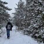
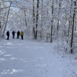
Description Welcome to our annual First Day Hike Event! We welcome all volunteers, members and anyone who wants to start the new year off right – with a hike! Meet at the Dundas Valley Conservation Area (DVCA) at the Trail Centre by 9:30 am for a 9
9:45 am departure. The Iroquoia Bruce Trail Club Event will be taking place in the Trail Centre (big red building) at 11:30 am. All are welcome to join in the refreshments as we toast our incredible volunteers. There will be badges and other Iroquoia Bruce Trail merchandise available for purchase. We will have door prizes as well.
Complimentary Junior Winter Hiker badges will be available for children under the age of 13. [Children’s Hike only]
Please dress for a winter hike. Wear layers and its advisable to bring your icers just in case.
Poles may be helpful. Pay parking is in effect $11 per vehicle and driver unless you have a HCA Pass. In the event of dangerous driving or trail conditions, this event will be postponed to January 3/26. It is important that everyone register so that this can be communicated in the event of postponement.
Hosting Club: Iroquoia Category: First Day Hike – January 1 Location (Google Maps): Dundas Valley Conseration Area (DVCA) at Trail Centre at 650 Governors Rd. Dundas. The Trail Centre is the big RED building which was the former train station located about 200 m from the parking lot.
Pace: Brisk – 4 to 5 km/hr Terrain: Moderate – Some hills and/or some poor footing Distance: 7-8 km
Description Welcome to our Annual Volunteer Appreciation Event! We welcome all volunteers, members and anyone who needs to start then NEW YEAR 2026 of right foot- with a glamours hike ahead!
Meet at the Dundas Valley COnservation Area (DVCA) at the trail Centre by 9.20am for a departure at 9.30 am
The Iroquoia Bruce Trail Club Volunteer Appreciation Event will be taking place in the Trail Centre ( big red building) at 11.30 am. All of you are welcome to join in the refreshments as we toast our incredible volunteers.
There will be badges and other Iroqouia Bruce Trail Merchandise available for purchase. We will have door prizes as well.
Keep in mind that is a pay parking in effect of $ 11.00 /vehicle and driver unless you have a HCA pass.
Please dress for the weather forecast and bring your icers just in case.
** NOTE: In the event of dangerous driving or trail conditions, this event will be postponed to January 3rd 2026. It is important that everyone register so that this can be communicagted in the event of postponement.
Hike route would be communicate at later date.
I want to thank each of you joining the adventure. Your energy, camaraderie, and enthusiasm will make a special day. Whether would be the crisp winter views, the laughter along the trail, or the shared stories at rest stops, we will create memories that set a positive tone for the new year ahead.
Hosting Club: Dufferin Hi-Land Category: General Hike Location (Google Maps): Mono Community Centre gravel parking lot. 200m south of Mono Centre (County Road 8). See this hike description Google Maps link for GPS.
Pace: Medium Terrain: Dependent on Conditions, Slippery Sections Likely, Moderate Distance: 17 kms
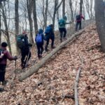
Description Please join us for a Dufferin Hi-Land annual tradition – a New Year’s Day hike at Mono Cliffs Provincial Park and its environs. What better way to start the New Year? We have three hikes planned – long, medium and short. This hike is the long one at 17 kms. The short and medium hikes run by longstanding club members Bryan and Carol Foley and Les Babbage will be posted separately for separate sign-up. All three hikes will end back at Mono Centre at 3:30 pm or so for seasonal refreshments and good cheer. Please bring along any seasonal leftovers you may have to share. Hot chocolate for all! We really hope you can make it. Please dress in warm layers for the weather. Icers and hiking boots are a must. Poles recommended. Please also bring a smile as always, a warm drink, some water, a snack and a lunch. Please arrive at 9:15 am to be ready to hike at 9:30 am.
Pace: Leisurely – 3km/hr or less Terrain: Easy – Mostly flat and usually good footing Distance: Approximately 5 kms Main Trail
Description Welcome to our annual Volunteer Appreciation Event! We welcome all volunteers, members and anyone who wants to start the new year off right – with a hike! Meet at the Dundas Valley Conservation Area (DVCA) at the Trail Centre by 9:45 am am for a 10 am departure. The Iroquoia Bruce Trail Club Volunteer Appreciation Event will be taking place in the Trail Centre (big red building) at 11:30 am. All are welcome to join in the refreshments as we toast our incredible volunteers. There will be badges and other Iroquoia Bruce Trail merchandise available for purchase. We will have door prizes, as well. Complimentary Junior Winter Hiker badges will be available for children under the age of 13. [Children’s Hike only] Pay parking is in effect $11 per vehicle and driver unless you have a HCA Pass. Please dress for the weather forecast and bring your icers just in case. Water, walking sticks also recommended In the event of dangerous driving or trail conditions, this event will be postponed to January 3/26. It is important that everyone register so that this can be communicated in the event of postponement.
One parent or guardian may register on behalf of everyone in your party. All children are expected to be accompanied by at least one parent or guardian. [Children’s Hike only]
Hosting Club: Iroquoia Category: First Day Hike – January 1 Location (Google Maps): Dundas Valley Trail Centre, 650 Governor’s Rd. 3.5 km. west of Main St. West, Dundas
Pace: Leisurely – 3km/hr or less Terrain: Moderate – Some hills and/or some poor footing Distance: Approx. 6.5 km.
Description Welcome to our annual VolunteerAppreciation Event. We welcome all volunteers andanyone who wants to start the year off right – with a hike! Meet at theDundas Valley Conservation Area (DVCA) at the Trail Centre at 9:45 am. for a 10: 10 am. departure. After the hike the Iroquoia Bruce Trail Club Volunteer Appreciation Event will be taking place in the Trail Centre aka Railway Station, at 11:30 am. All are welcome to join in the refreshments as we toast our incredible volunteers. There will be badges and other Iroquoia Bruce Trail Club merchandise available for purchase. We will have door prizes as well.
Complimentary Junior Winter Hike badge for children under the age of 13 (children’s hike only).
Pay parking of $13 per vehicle is in effect except for those with a HCA pass. Please dress for the weather and bring your icers just in case. Poles may be useful.
In the event of dangerous driving or trail conditions, this event will be postponed to January 3/26. It is important that everyone register so that this can be communicated in the event of postponement.
One parent or guardian may register on behalf of everyone in your party. All children are expected to be accompanied by at least one parent or guardian. (Children’s hike only.)
Hosting Club: Caledon Hills Category: General Location (Google Maps): Bruce Trail Parking Lot at Riverside Woods Nature Reserve 713377 1st Line EHS, Mono Google GPS Coordinates: 43.959916, -80.070494
Driving Directions: From Hwy #10 north of Orangeville turn east on Hockley Road. Drive for 1.1 km. Continue straight onto Side Road 5 for 1.6 km. Turn left onto 1st Line EHS for 900 metres. Continue straight into the parking lot.
FYI There is an outhouse at the parking lot.
***DO NOT take 1st Line EHS south from Hockley Road. It is NOT maintained. Google Maps may suggest this impassable route.
Pace: Leisurely – 3 km/hour or less Terrain: Moderate – some hills and/or some poor footing Distance: 1.5 km and 5.0 km
Description There is no better way to start the year than to spend time in nature with family and friends. Join Club President Sandy Green and co-hike leaders for a leisurely hike. There is a distance for everyone’s enjoyment: 1.5 km or 5 km. Dress for a wintery adventure. Light refreshments will be served at the end.
Hosting Club: Toronto Category: Urban Walk Location (Google Maps): Toronto Islands Meet at Jack Layton Ferry docks at 10:15 a.m. for 10:30 departure to Ward Island) you can buy your tickets online in advance. https://secure.toronto.ca/FerryTicketOnline/tickets2/index.jsp
Description Join us for our annual New Year’s Day President’s Hike Celebration!
This is the longer of two hikes available to register for – we will hike a loop around Fireman’s Park ~ 2.5 hours- 10:30am start. Pot luck New Years Celebration to follow under the gazebo @ 1:00pm- bring your favorite pot luck item to share!
Members who don’t want to hike can meet at 1:00pm at the gazebo for the Happy New Year celebration.
Hosting Club: Niagara Category: Loop Location (Google Maps): Meet in the upper parking lot of Fireman’s Park, 2275 Dorchester Rd, Niagara Falls (corner of Dorchester and Mountain Reds.
Join us for the first hike of the year with NBTC President, Ellen Savoie. Meet at the upper parking lot of Fireman’s park. Wear weather appropriate clothes. Poles and icers may be needed depending upon the weather.
Bring potluck to share with your fellow hikers. Outdoor picnic – dress accordingly.
Hosting Club: Toronto Category: Urban Walk Location (Google Maps): Tommy Thompson Park parking lot at the intersection of Leslie St and Unwin Ave (by park pavillion).
Pace: Leisurely (2-3 km/hr) Terrain: Level 1 (Easy – mostly on flat, well maintained trails with hard-packed surface) Distance (km): 10 -12 kms
Description Tommy Thompson Park ( Leslie Spit) is located at the intersection of Leslie St and Unwin Ave in Toronto. It is winter and the start of the new year so please dress accordingly. As we will be hiking near the lake it might be a little colder so dress for it. ICERS are advisable. The trail might be covered in a sheet of ICE, ( if you have them bring them with you ). Bring a snack, a hot drink, Water and any other essentials you will need for this outing.
We will walk up to the light house and back. We meet in the sheltered area by the washrooms in the parking lot. Parking is FREE. Please arrive by about 15 minutes prior to the departure time of 11:00 AM as we will be leaving on time.
Location (Google Maps): Meet at the unopened road allowance on Side Road 21, Town of the Blue Mountains, about 1/2 km east of km 8.4, Map 24, Edition 30. We may make arrangements for people to travel to the starting point together from another parking area as the Town of the Blue Mountains initiated paid parking for non-residents.
Pace: Medium Terrain: Easy, Some rocky footing, Some steep sections Length of Hike: 6.5 kms
Description A great way to start 2026! The Trail at Loree travels through a mature forest and to the edge of the Escarpment with views, through the trees, of Nottawasaga Bay. May be snowy conditions, well suited for snowshoes. Otherwise regular boots and/or crampons.
Guidelines
Arrive 15 minutes before the start of the hike.
Wear sturdy footwear and appropriate attire for the weather and the terrain. Hiking poles are a good idea in any season, especially if the terrain is rocky or slippery. In winter, snowshoes or icers/crampons are needed when conditions dictate. Wearing appropriate clothing and footwear prevents injuries and shows consideration for a safe and positive group hiking experience.
Always carry I.D. and your health card.
Bring sufficient water and snacks (or lunch if indicated). A minimum of 1L of water is recommended on all hikes, and 3L is recommended for long, challenging hikes in the heat of the summer.
Bring sunscreen and insect repellent (for spring and summer hikes).
Hosting Club: Dufferin Hi-Land Category: Special Events Location (Google Maps): Mono Centre Community Centre Parking Lot Mono Centre Ont. Please see Google Maps link for GPS.
Pace: Medium Terrain: Moderate, Slippery Sections Likely Distance: 8.5 km
Description Celebrate the New Year by joining the Dufferin HI-Lands Annual New Years Medium Hike. Hot Chocolate, Goodies following the hike. Bring water, appropriate footwear , dress for the weather. Icers and/or snowshoes may be required.
Hosting Club: Dufferin Hi-Land Category: Special Events Location (Google Maps): Dufferin Hi-Land Section, Map 19. Meet at Mono Community Centre hiker parking area off of 2nd Line Mono at south end of Mono Centre village. Please see Google Maps link for GPS.
Pace: Leisurely Terrain: Dependent on Conditions, Moderate, Slippery Sections Likely Distance: 5.6 km
Description Please join us for a Dufferin Hi-Land annual tradition – a New Year’s Day hike at Mono Cliffs Provincial Park and its environs. What better way to start the New Year? We have three hikes planned – long, medium and short. This hike is the short one at 5.6 kms. The medium and long hikes run by Bryan and Carol Foley and Stuart Law are posted separately for separate sign-up. All three hikes will end back at Mono Centre at 3:30 pm or so for seasonal refreshments and good cheer. Please bring along any seasonal leftovers you may have to share. Hot chocolate for all! We really hope you can make it. Please dress in warm layers for the weather. Icers and hiking boots are a must. Poles recommended. Please also bring a smile as always, a warm drink, some water and a snack. Please arrive at 1:15 pm to be ready to hike at 1:30 pm
Hosting Club: Iroquoia Category: First Day Hike – January 1 Location (Google Maps): Dundas Valley Trail Centre: Enter from Governor’s Rd., 3.5km west of Main St. W in Dundas Parking fee required – see hike description
Pace: Medium – 3 to 4 km/hr Terrain: Moderate – Some hills and/or some poor footing Distance: 7-8km
Description Welcome to our annual First Day Hike Event! We welcome all volunteers, members and anyone who wants to start the new year off right – with a hike! Meet at the Dundas Valley Conservation Area (DVCA) at the Trail Centre by 9:30 am for a 9
9:45 am departure. The Iroquoia Bruce Trail Club Event will be taking place in the Trail Centre (big red building) at 11:30 am. All are welcome to join in the refreshments as we toast our incredible volunteers. There will be badges and other Iroquoia Bruce Trail merchandise available for purchase. We will have door prizes as well.
Complimentary Junior Winter Hiker badges will be available for children under the age of 13. [Children’s Hike only]
Please dress for a winter hike. Wear layers and its advisable to bring your icers just in case.
Poles may be helpful. Pay parking is in effect $11 per vehicle and driver unless you have a HCA Pass. In the event of dangerous driving or trail conditions, this event will be postponed to January 3/26. It is important that everyone register so that this can be communicated in the event of postponement.
Hosting Club: Iroquoia Category: First Day Hike – January 1 Location (Google Maps): Dundas Valley Conseration Area (DVCA) at Trail Centre at 650 Governors Rd. Dundas. The Trail Centre is the big RED building which was the former train station located about 200 m from the parking lot.
Pace: Brisk – 4 to 5 km/hr Terrain: Moderate – Some hills and/or some poor footing Distance: 7-8 km
Description Welcome to our Annual Volunteer Appreciation Event! We welcome all volunteers, members and anyone who needs to start then NEW YEAR 2026 of right foot- with a glamours hike ahead!
Meet at the Dundas Valley COnservation Area (DVCA) at the trail Centre by 9.20am for a departure at 9.30 am
The Iroquoia Bruce Trail Club Volunteer Appreciation Event will be taking place in the Trail Centre ( big red building) at 11.30 am. All of you are welcome to join in the refreshments as we toast our incredible volunteers.
There will be badges and other Iroqouia Bruce Trail Merchandise available for purchase. We will have door prizes as well.
Keep in mind that is a pay parking in effect of $ 11.00 /vehicle and driver unless you have a HCA pass.
Please dress for the weather forecast and bring your icers just in case.
** NOTE: In the event of dangerous driving or trail conditions, this event will be postponed to January 3rd 2026. It is important that everyone register so that this can be communicagted in the event of postponement.
Hike route would be communicate at later date.
I want to thank each of you joining the adventure. Your energy, camaraderie, and enthusiasm will make a special day. Whether would be the crisp winter views, the laughter along the trail, or the shared stories at rest stops, we will create memories that set a positive tone for the new year ahead.
Hosting Club: Dufferin Hi-Land Category: General Hike Location (Google Maps): Mono Community Centre gravel parking lot. 200m south of Mono Centre (County Road 8). See this hike description Google Maps link for GPS.
Pace: Medium Terrain: Dependent on Conditions, Slippery Sections Likely, Moderate Distance: 17 kms
Description Please join us for a Dufferin Hi-Land annual tradition – a New Year’s Day hike at Mono Cliffs Provincial Park and its environs. What better way to start the New Year? We have three hikes planned – long, medium and short. This hike is the long one at 17 kms. The short and medium hikes run by longstanding club members Bryan and Carol Foley and Les Babbage will be posted separately for separate sign-up. All three hikes will end back at Mono Centre at 3:30 pm or so for seasonal refreshments and good cheer. Please bring along any seasonal leftovers you may have to share. Hot chocolate for all! We really hope you can make it. Please dress in warm layers for the weather. Icers and hiking boots are a must. Poles recommended. Please also bring a smile as always, a warm drink, some water, a snack and a lunch. Please arrive at 9:15 am to be ready to hike at 9:30 am.
Pace: Leisurely – 3km/hr or less Terrain: Easy – Mostly flat and usually good footing Distance: Approximately 5 kms Main Trail
Description Welcome to our annual Volunteer Appreciation Event! We welcome all volunteers, members and anyone who wants to start the new year off right – with a hike! Meet at the Dundas Valley Conservation Area (DVCA) at the Trail Centre by 9:45 am am for a 10 am departure. The Iroquoia Bruce Trail Club Volunteer Appreciation Event will be taking place in the Trail Centre (big red building) at 11:30 am. All are welcome to join in the refreshments as we toast our incredible volunteers. There will be badges and other Iroquoia Bruce Trail merchandise available for purchase. We will have door prizes, as well. Complimentary Junior Winter Hiker badges will be available for children under the age of 13. [Children’s Hike only] Pay parking is in effect $11 per vehicle and driver unless you have a HCA Pass. Please dress for the weather forecast and bring your icers just in case. Water, walking sticks also recommended In the event of dangerous driving or trail conditions, this event will be postponed to January 3/26. It is important that everyone register so that this can be communicated in the event of postponement.
One parent or guardian may register on behalf of everyone in your party. All children are expected to be accompanied by at least one parent or guardian. [Children’s Hike only]
Hosting Club: Iroquoia Category: First Day Hike – January 1 Location (Google Maps): Dundas Valley Trail Centre, 650 Governor’s Rd. 3.5 km. west of Main St. West, Dundas
Pace: Leisurely – 3km/hr or less Terrain: Moderate – Some hills and/or some poor footing Distance: Approx. 6.5 km.
Description Welcome to our annual VolunteerAppreciation Event. We welcome all volunteers andanyone who wants to start the year off right – with a hike! Meet at theDundas Valley Conservation Area (DVCA) at the Trail Centre at 9:45 am. for a 10: 10 am. departure. After the hike the Iroquoia Bruce Trail Club Volunteer Appreciation Event will be taking place in the Trail Centre aka Railway Station, at 11:30 am. All are welcome to join in the refreshments as we toast our incredible volunteers. There will be badges and other Iroquoia Bruce Trail Club merchandise available for purchase. We will have door prizes as well.
Complimentary Junior Winter Hike badge for children under the age of 13 (children’s hike only).
Pay parking of $13 per vehicle is in effect except for those with a HCA pass. Please dress for the weather and bring your icers just in case. Poles may be useful.
In the event of dangerous driving or trail conditions, this event will be postponed to January 3/26. It is important that everyone register so that this can be communicated in the event of postponement.
One parent or guardian may register on behalf of everyone in your party. All children are expected to be accompanied by at least one parent or guardian. (Children’s hike only.)
Hosting Club: Caledon Hills Category: General Location (Google Maps): Bruce Trail Parking Lot at Riverside Woods Nature Reserve 713377 1st Line EHS, Mono Google GPS Coordinates: 43.959916, -80.070494
Driving Directions: From Hwy #10 north of Orangeville turn east on Hockley Road. Drive for 1.1 km. Continue straight onto Side Road 5 for 1.6 km. Turn left onto 1st Line EHS for 900 metres. Continue straight into the parking lot.
FYI There is an outhouse at the parking lot.
***DO NOT take 1st Line EHS south from Hockley Road. It is NOT maintained. Google Maps may suggest this impassable route.
Pace: Leisurely – 3 km/hour or less Terrain: Moderate – some hills and/or some poor footing Distance: 1.5 km and 5.0 km
Description There is no better way to start the year than to spend time in nature with family and friends. Join Club President Sandy Green and co-hike leaders for a leisurely hike. There is a distance for everyone’s enjoyment: 1.5 km or 5 km. Dress for a wintery adventure. Light refreshments will be served at the end.
Hosting Club: Toronto Category: Urban Walk Location (Google Maps): Toronto Islands Meet at Jack Layton Ferry docks at 10:15 a.m. for 10:30 departure to Ward Island) you can buy your tickets online in advance. https://secure.toronto.ca/FerryTicketOnline/tickets2/index.jsp
Description Join us for our annual New Year’s Day President’s Hike Celebration!
This is the longer of two hikes available to register for – we will hike a loop around Fireman’s Park ~ 2.5 hours- 10:30am start. Pot luck New Years Celebration to follow under the gazebo @ 1:00pm- bring your favorite pot luck item to share!
Members who don’t want to hike can meet at 1:00pm at the gazebo for the Happy New Year celebration.
Hosting Club: Niagara Category: Loop Location (Google Maps): Meet in the upper parking lot of Fireman’s Park, 2275 Dorchester Rd, Niagara Falls (corner of Dorchester and Mountain Reds.
Join us for the first hike of the year with NBTC President, Ellen Savoie. Meet at the upper parking lot of Fireman’s park. Wear weather appropriate clothes. Poles and icers may be needed depending upon the weather.
Bring potluck to share with your fellow hikers. Outdoor picnic – dress accordingly.
Hosting Club: Toronto Category: Urban Walk Location (Google Maps): Tommy Thompson Park parking lot at the intersection of Leslie St and Unwin Ave (by park pavillion).
Pace: Leisurely (2-3 km/hr) Terrain: Level 1 (Easy – mostly on flat, well maintained trails with hard-packed surface) Distance (km): 10 -12 kms
Description Tommy Thompson Park ( Leslie Spit) is located at the intersection of Leslie St and Unwin Ave in Toronto. It is winter and the start of the new year so please dress accordingly. As we will be hiking near the lake it might be a little colder so dress for it. ICERS are advisable. The trail might be covered in a sheet of ICE, ( if you have them bring them with you ). Bring a snack, a hot drink, Water and any other essentials you will need for this outing.
We will walk up to the light house and back. We meet in the sheltered area by the washrooms in the parking lot. Parking is FREE. Please arrive by about 15 minutes prior to the departure time of 11:00 AM as we will be leaving on time.
Location (Google Maps): Meet at the unopened road allowance on Side Road 21, Town of the Blue Mountains, about 1/2 km east of km 8.4, Map 24, Edition 30. We may make arrangements for people to travel to the starting point together from another parking area as the Town of the Blue Mountains initiated paid parking for non-residents.
Pace: Medium Terrain: Easy, Some rocky footing, Some steep sections Length of Hike: 6.5 kms
Description A great way to start 2026! The Trail at Loree travels through a mature forest and to the edge of the Escarpment with views, through the trees, of Nottawasaga Bay. May be snowy conditions, well suited for snowshoes. Otherwise regular boots and/or crampons.
Guidelines
Arrive 15 minutes before the start of the hike.
Wear sturdy footwear and appropriate attire for the weather and the terrain. Hiking poles are a good idea in any season, especially if the terrain is rocky or slippery. In winter, snowshoes or icers/crampons are needed when conditions dictate. Wearing appropriate clothing and footwear prevents injuries and shows consideration for a safe and positive group hiking experience.
Always carry I.D. and your health card.
Bring sufficient water and snacks (or lunch if indicated). A minimum of 1L of water is recommended on all hikes, and 3L is recommended for long, challenging hikes in the heat of the summer.
Bring sunscreen and insect repellent (for spring and summer hikes).
Hosting Club: Dufferin Hi-Land Category: Special Events Location (Google Maps): Mono Centre Community Centre Parking Lot Mono Centre Ont. Please see Google Maps link for GPS.
Pace: Medium Terrain: Moderate, Slippery Sections Likely Distance: 8.5 km
Description Celebrate the New Year by joining the Dufferin HI-Lands Annual New Years Medium Hike. Hot Chocolate, Goodies following the hike. Bring water, appropriate footwear , dress for the weather. Icers and/or snowshoes may be required.
Hosting Club: Dufferin Hi-Land Category: Special Events Location (Google Maps): Dufferin Hi-Land Section, Map 19. Meet at Mono Community Centre hiker parking area off of 2nd Line Mono at south end of Mono Centre village. Please see Google Maps link for GPS.
Pace: Leisurely Terrain: Dependent on Conditions, Moderate, Slippery Sections Likely Distance: 5.6 km
Description Please join us for a Dufferin Hi-Land annual tradition – a New Year’s Day hike at Mono Cliffs Provincial Park and its environs. What better way to start the New Year? We have three hikes planned – long, medium and short. This hike is the short one at 5.6 kms. The medium and long hikes run by Bryan and Carol Foley and Stuart Law are posted separately for separate sign-up. All three hikes will end back at Mono Centre at 3:30 pm or so for seasonal refreshments and good cheer. Please bring along any seasonal leftovers you may have to share. Hot chocolate for all! We really hope you can make it. Please dress in warm layers for the weather. Icers and hiking boots are a must. Poles recommended. Please also bring a smile as always, a warm drink, some water and a snack. Please arrive at 1:15 pm to be ready to hike at 1:30 pm
Description Each Friday we will explore different neighbourhoods, trails and parkland throughout Historic Niagara-on-the-Lake.
Moderate pace with some weeks entirely on sidewalks and roads while others may include a mix of trails and paved pathways. Great way to build up endurance for longer more strenuous hikes.
Prepare for cooler windy conditions on open parkland and along Lake Ontario and Niagara River trails.
Plan to stay for conversation and a warm cup of coffee or tea at Sweets & Swirls, Community Centre, Niagara Stone Road, NOTL
Hosting Club: Sydenham Category: Snowshoe Hike Location (Google Maps): Roadside parking on Lindenwood Road, just east of Grey Rd 17. The off-road parking lot may be plowed? This location is found at km 125.7 on Map 33 of Edition 31 of the Bruce Trail Reference. For directions using GPS Coordinates, use a map on your device to direct you to the meet location by clicking the link “(Google Maps)” which is found right after the title Location in this description or copy the coordinates from here: 44.685558, -80.995885
Pace: Medium: 3 to 4 km/h Terrain: Moderate: Some hills and/or poor footing Distance: 8 km
Description The hike title says it all! A Friday morning hike at a brisk pace for 3-4 hours on the Bruce Trail, even if the weather is, um, brisk. Brisk Fridays are right for you if you are looking for a faster hiking experience which energizes and enlivens. Given that snowshoeing is more strenuous and slower than hiking, this snowshoe hike will seem to be brisk but our pace will cover only 8 km in 3 h. A good workout none the less! We’ll loop back to parking on the main trail after traversing 3 side trails, Lindenwood, Gap, and Lindenwood Pond. Please arrive at 9:15 p.m. with your snowshoes for sure and poles if you have them. A great way to kick start a New Year’s resolution!
Pace: Leisurely (2.0 – 3.0 km/h): A relaxed pace with frequent breaks and a focus on enjoyment. Terrain: Moderate: Rolling hills, mild slopes and rocky paths. Distance: ~5 km
Description Celebrate Winter Hikes Series – Burnt Loop Sidetrail
Step into winter with the Celebrate Winter on the Trail Series—an invitation to enjoy the season’s beauty on the trail. These small-group adventures offer shorter distances (~5 km) hikes, a slower but steady pace, with a duration of ~ 3hours. Gear requirements will vary with the weather, and may include snowshoes, winter hiking boots, or hiking poles. Join one or all five!
Kick off 2026 with a refreshing winter hike on Friday, January 2nd along the Burnt Loop Side Trail in Tobermory, located within Bruce Peninsula National Park (BPNP). This beautiful route begins and ends at the Park’s Visitor Centre on the main trail, leading us through serene forest paths with stunning winter views of Georgian Bay. The hiking trail terrain is variable, including rocky, rooty sections, as well as an easy and flat start and finish trail section. Total distance is ~ 5 km. Winter weather conditions will influence our pace. We aim to finish by ~12:30 pm. Come see how winter has transformed the landscape!
After the hike, warm up by the fire at the Visitor Centre and enjoy your packed lunch. If you’d like to extend your visit, explore the impressive displays, chat with a BPNP Interpreter, or stick around for a full-length feature film.
Plan ahead if you don’t have your own snowshoes. Snowshoes and poles kits are available from Bruce County Libraries, free. The BPNP Visitor Centre also has snowshoes available for borrowing. Please let me know if you need adult or children’s snowshoes in advance.
Thanks to the Canada Strong Pass, Bruce Peninsula National Park admission is free from December 15th- January 15th. Parking fees are still required.
Hosting Club: Niagara, Iroquoia Category: Stained Glass Badge End to End Fundraiser Hike Location (Google Maps): All locations are in the details below. No other communication will be shared unless we have weather issues. Please show up for all hikes by 7:45am to allow enough time to get ready for the hike and to share any information.
Pace: Brisk – 4 to 5 km/hr, Medium – 3 to 4 km/hr Terrain: Dependent on Conditions, Moderate – Some hills and/or some poor footing, Slippery and Steep Sections, Strenuous – Hilly with steep climbs and some poor footing Distance: Between 17.50 and 25km
Description This is a monetized hike with the proceeds going towards the Niagara Bruce Trail Club – “Preserving a ribbon of wilderness for everyone, forever.” Your badge depicting the white-tailed deer, the hike logistics, shared shuttle driving and hike guidance are all included in your fee. Since it is the intention to run a similar hike in all sections this year, why not join the Bruce Trail Conservancy if you are not already a member? Please use my code 67abd1234c568 until the end of 2025 to receive free digital maps as well as all the other great benefits included with membership. https://brucetrail.org/product-category/memberships/
Please read all details for this hike to ensure it is suitable for you. The pace and terrain are particularly important details.
This is a multi-day hike – Jan 3/4, 2026 and Jan 10/11, 2026. Please save Jan 18th for a makeup date in case of inclement weather on the first two weekends.
Day 1 – January 3/26
Meet – Off road parking: North side of Glendale Ave 50m east of Welland Canal https://maps.app.goo.gl/mgcgkMGKBBef7ytr6
Car shuttle to Southern Cairn at Queenston https://maps.app.goo.gl/DaiZMqTTp9YgFLA37 Distance ~ 18.5km
Day 2 – January 4/26
Meet in the parking lot off of Roland Rd – https://maps.app.goo.gl/Sds7249R4B6SsNpL6
Car shuttle to Off road parking: North side of Glendale Ave 50m east of Welland Canal. https://maps.app.goo.gl/mgcgkMGKBBef7ytr6 ~ 25 km
Day 3 – January 10/26
Meet at Cave Springs: Parking area off of Cave Springs Road https://maps.app.goo.gl/MNvdUCC49G4yXGKo8 Car shuttle to the parking lot off of Roland Rd https://maps.app.goo.gl/Sds7249R4B6SsNpL6 ~ 23km
Day 4 – January 11/26
Meet in Grimsby Lions Club Pool Parking lot at 1 Elm St https://maps.app.goo.gl/cfr3dRrcrQhFPGJm9
Car shuttle to parking area off of Cave Springs Road https://maps.app.goo.gl/MNvdUCC49G4yXGKo8 ~ 17.50km
Please ensure your car is car shuttle-ready with at least 4 available seatbelts including the driver’s. We will take turns either being the shuttle driver or driving the drivers back to their cars after the hike is over.
Please pack whatever food you will require for a long day hike including lunch and snacks; 2l of water minimum; first aid kit; poles if you use them; and icers. You may also wish to pack extra socks and rain gear. Remember to dress in layers. Gloves/mitts, scarf / neck gator, a toque and a puffy jacket. Consider lined pants as well.
We will break for a morning clothing adjustment, a 10min break around 10am, 15 min lunch and an afternoon break if we are finishing after 2pm. Bio-breaks are as you need them – please let the sweep know who will wait for you. This is a 4 day group hike so it is important you keep pace with the person in front of you. We will help each other and wait for one another but please consider your physical ability before signing up for this hike. There are no drop outs – if you are not able to finish the hike you will need to arrange for transportation back to your car via taxi or Uber at your cost.
The Niagara stained-glass badge will be presented on the last day. If you have to miss one of these hiking days, you may make it up on your own before the last day of the series. Since it is a group hike, it is intended that everyone who registers be present on all days.
Any questions may be directed through contact on this form. If you cannot make it, please remove yourself from registration by following these steps:
To cancel your registration, here is a step by step: – Sign into your account on the BTC website – Click on My Hikes under your account – This will take you to a list of hikes you have registered for – Scroll down to the appropriate hike and cursor over to the far right hand column under the Action column. – Click Cancel under the hike you wish to cancel
Pace: Brisk (4-5 km/hr) Terrain: Challenging, Hilly, Level 2 (Intermediate – some hills and uneven surfaces, rocks and roots underfoot), Variable Distance (km): 12km
Description This is an End2End hiking series covering the Caledon Hills section of the Bruce Trail in 6 hikes. As it is time of year with unsettled weather we will undertake this event at approximately 4 km/hour for an average of 13 kms per segment. Caledon Hills have numerous steep hills and deep valleys so the hikes require consistent stamina. Please consider your hiking fitness level prior to registering as this is a group hike and everyone is expected to keep pace. We will be travelling south to north and will require car shuttling. Please make sure yourself and car shuttle ready, where everyone is expected to participate. Please arrive fifteen minutes early for shuttling schedule. Things to bring: lunch/snacks, liquid hydration, sunscreen, layered clothing, personal medication (if any) health card. Hiking boots, icers, gaiters and hiking poles are highly recommended. This series hikes must be completed to receive the CHBTC E2E and Winter E2E. Don’t forget to bring your happy face and enthusiasm.
NOTE: Cost of Badge is 10 dollars for BTC members and 15 dollars for Non BTC members. If you want to receive two CHBTC E2E badges, the Club E2E and Winter E2E badge there’s an additional 10 dollars for BTC members and 15 dollars for Non BTC members.
Description Meet at the parking lot for Decew House. Hike past Brock then down to 12 Mile Creek to the 406 . Return via route up Hydro hill. Dress for the weather. Bring icers, poles, water and a snack.
Pace: Medium – 3 to 4 km/hr Terrain: Moderate – Some hills and/or some poor footing Distance: 7 kms
Description We will meet in the Hilton Falls Parking lot and carpool to 6th Line and hike back along the two Bent Rim trails and the Hilton Falls Side Trail back to the cars. The Bent Rim trails are actually bike trails and have some rather technical (rocky) sections to them, so be prepared for some challenges. Bring icers for your boots.
For those leaving their car at Hilton Falls, you will need to reserve your time at conservationhalton.ca
Hosting Club: Toronto Category: GO Train Hike Location (Google Maps): Meet in Toronto’s Union Station in the “Great Hall” by the information desk with the clock over it to depart by 10:45 AM
Pace: Moderate (3-4 km/hr) Terrain: Flat, Level 1 (Easy – mostly on flat, well maintained trails with hard-packed surface), Variable Distance (km): 9-11 KM (Approximate) from Niagara Falls Train Station to Dufferin Islands Park and back.
Description Join us for a trip to Niagara Falls, Ontario on the GO Train from Union Station and a hike to view the annual Festival Of Lights in Victoria and Dufferin Islands Parks. We’ll hike from the train station to the tourist area via the 1.44 km Olympic Tourch Run Legacy Trail, view the American, Bridal Veil, and Horseshoe Falls from the Canadian side, and hike on past the Horticultural Showcase to view the light displays in Dufferin Islands Park. On the return towars the train station we will view the light displays along the Niagara Parkway and in Queen Victoria Park. We begin the day taking the 11:09 train from Union Station arriving at the Niagara Falls GO Station at 1:35 pm. We’ll take a break at Table Rock House to allow to get a little darkness. The return options will be (1) 6:47 PM – Express GO Bus to Burlington, connecting with the GO train or (2) Direct train at 7:58 PM semi express to Union Station. Maximum Registration will be 23 Hikers. Be sure to dress warmly for the weather.
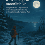
Pace: Leisurely (2.0 – 3.0 km/h): A relaxed pace with frequent breaks and a focus on enjoyment. Terrain: Easy: Flat forested sections or lowland trails. Distance: ~4km
Description Start the New Year with a magical moonlit hike along the Burnt Loop side trail, overlooking Little Dunks Bay in Bruce Peninsula National Park.
Your guide, Tainin Hopkinson, an interpreter at the park and member of the Chippewas of Nawash Unceded First Nation, will share their knowledge and personal connection with this winter wonderland. The trail winds through forest and alvar landscapes before reaching the rocky shores of Little Dunks Bay. Moonlight reflecting off the water creates stunning views of Fathoms Five islands, and from the far lookout, you may glimpse the Cove Island Lighthouse and the silhouette of Flowerpot Island.
Tainin will also share insights on winter wildlife and plant activity, pointing out the subtle clues left behind by nature. Activity sheets are available at the Visitor Center to help you continue exploring at home.
Arrive early to chat and warm up by the fire with Tainin and Park staff—an hour before the hike at the Visitor Center.
Something to sit on, snacks, water, or a hot beverage
Hiking poles
Badge Alert:
New this year: earn a Full Moon Hiking Badge by joining 4 of the 7 hikes in this series.
Don’t miss this chance to connect with nature under the full moon! Clear skies will make the evening even more special.
Full Moon Hiking Badge Info:
1.Hikers must complete 4 out of 7 hikes (if a hike is canceled, registration counts). 2. Email the treasurer $10.00 to cover the badge cost at treasurer@peninsula.brucetrail.org
In the message section, indicate Full Moon Badge.
If possible, attach a screenshot of your payment.
3. Email badges@peninsula.brucetrail.org with the subject line: Full Moon Hiking Badge. Include:
Months attended (e.g., Oct, Dec, Jan, Mar)
Confirmation of payment (attach screenshot if available)
Full mailing address
4.Badge collection:
Attend the April 1 hike to receive your badge (if all steps completed)
Alternatively, bring $10 in cash that evening
Badge can also be mailed if you are unable to attend (address required)
Location (Google Maps): Meet in the Hogg’s Falls parking lot (only if it’s been plowed to accommodate cars) otherwise park on the shoulder of the Lower Valley Road, on the west side. Km 65.1, Map 26, Edition 31
Pace: Medium Terrain: Moderate, Some steep sections Length of Hike: Aprox. 5.1 km
Description Hike #1 Moonlight Hike: We will hike on main trail and side trails in the Hogg’s Falls area. On winter hikes we may encounter bare ground, light snow, deep snow, or ice. Please bring snowshoes and icers. Participants should have some experience with snowshoeing. Wear appropriate clothing for the weather plus water and a snack. Headlamps may be worn, however, if it’s a bright full moon, it is magical to hike without a light. If the weather and road conditions preclude driving, the hike will be cancelled and hikers will be notified either the night before or early that morning.
COVID-19 Precautions Before, During and After your Hike
Each hiker joining a Bruce Trail Club organized hike must perform a self-screening check before hiking. Find Ontario’s self-assessment tool here: https://covid-19.ontario.ca/self-assessment/
If you are experiencing COVID-19 symptoms, stay home.
Other Guidelines
Arrive 15 minutes before the start of the hike.
Wear sturdy footwear and appropriate attire for the weather and the terrain. Hiking poles are a good idea in any season, especially if the terrain is rocky or slippery. In winter, snowshoes or icers/crampons are needed when conditions dictate. Wearing appropriate clothing and footwear prevents injuries and shows consideration for a safe and positive group hiking experience.
Always carry I.D. and your health card.
Bring sufficient water and snacks (or lunch if indicated). A minimum of 1L of water is recommended on all hikes, and 3L is recommended for long, challenging hikes in the heat of the summer.
Bring sunscreen and insect repellent (for spring and summer hikes).
Pace: Leisurely – 3 km/hr. or less Terrain: Easy – Mostly flat and usually good footing Distance: 3 km
Description We will drive to a suitable start point for a hike through the many loop trails off the Eleventh Line, just west of Collingwood. The trails are mostly in the trees and well-sheltered. The hike will be about two hours. Bring a snack and water. January’s full moon is commonly known as the Wolf Moon in Native American cultures. These ancient tribes named this moon when wolves howled in hunger outside the Villages. It is also known as the Old Moon. Moonlight Badge available for $10.
Hosting Club: Dufferin Hi-Land Category: General Hike Location (Google Maps): Dufferin Hi-Lands Map 20 Km 12.2. 30 Sideroad East of Hurontario St. Google Maps link on this Hike Description.
Pace: Leisurely Terrain: Dependent on Conditions, Moderate, Slippery Sections Likely Distance: 6.5 km
Description Meet Map 20 Km. 12.2 ( 30th Sideroad ) We will hike in and back Roadside parking MIND THE DITCHES Bring water, headlamp, icers, snowshoes. Dress for the weather.
Hosting Club: Iroquoia Category: Moonlight Hikes Location (Google Maps): Kerncliff Park, Burlington (Parking + Meet Up Spot is the Kerncliff Parking Lot, not Cityview Park)
Pace: Medium – 3 to 4 km/hr Terrain: Moderate – Some hills and/or some poor footing Distance: 5 km
Description Super Wolf Moon & Quadrantid Meteors
Step into the magic of the night and join us for our first Full Moon Night Hike of 2026 under the Super Wolf Moon. This month’s full moon will shine brighter and closer than usual, lighting our path as the Quadrantid Meteor Shower reaches its peak. A truly spectacular way to start the hiking year!
This hike also launches our new Full Moon Night Hike Badge Series. Complete 3 Full Moon Night Hikes led by an Iroquoia Club Leader in 2026 to qualify and purchase the new badge. With 13 full moons in 2026, there will be plenty of chances to earn your badge and enjoy the trail by moonlight.
Important Guidelines
Hike Start Time: 7:00 pm Arrive: at the Parking Lot at least 15 minutes before the hike start time. Lighting: A headlamp (recommended) or flashlight (bring two) with fresh batteries or a full charge. Poles & Traction: Hiking poles are helpful, especially for winter hikes. Please bring icers or crampons for icy sections. Clothing: Dress appropriately for cold weather and varied terrain to ensure a safe and enjoyable experience. Essentials: Carry I.D. and your health card at all times. Hydration & Snacks: Bring at least 1L of water and sufficient snacks. Safety: Pack your own small first aid kit. Pets: Please note, no dogs on this hike. Parking: We are meeting and parking in lot for Kerncliff Park (below in the old quarry) not Cityview parking up top. Parking closes at 11 pm, but we will be off the trail by 9:00 pm.
Come share the glow of the full moon, connect with fellow hikers, and begin your journey toward earning the new Full Moon Night Hike Badge. The trails (and the stars) are waiting!
Description Moonlight Night Hike – Take in the magic of the rising moon over Lake Ontario and the Niagara River. This hike includes a stop to connect with your senses – sights, sounds, smells and the rhythm of your breath. Counts towards your night hike badge (5 night hikes).
Hosting Club: Niagara, Iroquoia Category: Stained Glass Badge End to End Fundraiser Hike Location (Google Maps): All locations are in the details below. No other communication will be shared unless we have weather issues. Please show up for all hikes by 7:45am to allow enough time to get ready for the hike and to share any information.
Pace: Brisk – 4 to 5 km/hr, Medium – 3 to 4 km/hr Terrain: Dependent on Conditions, Moderate – Some hills and/or some poor footing, Slippery and Steep Sections, Strenuous – Hilly with steep climbs and some poor footing Distance: Between 17.50 and 25km
Description This is a monetized hike with the proceeds going towards the Niagara Bruce Trail Club – “Preserving a ribbon of wilderness for everyone, forever.” Your badge depicting the white-tailed deer, the hike logistics, shared shuttle driving and hike guidance are all included in your fee. Since it is the intention to run a similar hike in all sections this year, why not join the Bruce Trail Conservancy if you are not already a member? Please use my code 67abd1234c568 until the end of 2025 to receive free digital maps as well as all the other great benefits included with membership. https://brucetrail.org/product-category/memberships/
Please read all details for this hike to ensure it is suitable for you. The pace and terrain are particularly important details.
This is a multi-day hike – Jan 3/4, 2026 and Jan 10/11, 2026. Please save Jan 18th for a makeup date in case of inclement weather on the first two weekends.
Day 1 – January 3/26
Meet – Off road parking: North side of Glendale Ave 50m east of Welland Canal https://maps.app.goo.gl/mgcgkMGKBBef7ytr6
Car shuttle to Southern Cairn at Queenston https://maps.app.goo.gl/DaiZMqTTp9YgFLA37 Distance ~ 18.5km
Day 2 – January 4/26
Meet in the parking lot off of Roland Rd – https://maps.app.goo.gl/Sds7249R4B6SsNpL6
Car shuttle to Off road parking: North side of Glendale Ave 50m east of Welland Canal. https://maps.app.goo.gl/mgcgkMGKBBef7ytr6 ~ 25 km
Day 3 – January 10/26
Meet at Cave Springs: Parking area off of Cave Springs Road https://maps.app.goo.gl/MNvdUCC49G4yXGKo8 Car shuttle to the parking lot off of Roland Rd https://maps.app.goo.gl/Sds7249R4B6SsNpL6 ~ 23km
Day 4 – January 11/26
Meet in Grimsby Lions Club Pool Parking lot at 1 Elm St https://maps.app.goo.gl/cfr3dRrcrQhFPGJm9
Car shuttle to parking area off of Cave Springs Road https://maps.app.goo.gl/MNvdUCC49G4yXGKo8 ~ 17.50km
Please ensure your car is car shuttle-ready with at least 4 available seatbelts including the driver’s. We will take turns either being the shuttle driver or driving the drivers back to their cars after the hike is over.
Please pack whatever food you will require for a long day hike including lunch and snacks; 2l of water minimum; first aid kit; poles if you use them; and icers. You may also wish to pack extra socks and rain gear. Remember to dress in layers. Gloves/mitts, scarf / neck gator, a toque and a puffy jacket. Consider lined pants as well.
We will break for a morning clothing adjustment, a 10min break around 10am, 15 min lunch and an afternoon break if we are finishing after 2pm. Bio-breaks are as you need them – please let the sweep know who will wait for you. This is a 4 day group hike so it is important you keep pace with the person in front of you. We will help each other and wait for one another but please consider your physical ability before signing up for this hike. There are no drop outs – if you are not able to finish the hike you will need to arrange for transportation back to your car via taxi or Uber at your cost.
The Niagara stained-glass badge will be presented on the last day. If you have to miss one of these hiking days, you may make it up on your own before the last day of the series. Since it is a group hike, it is intended that everyone who registers be present on all days.
Any questions may be directed through contact on this form. If you cannot make it, please remove yourself from registration by following these steps:
To cancel your registration, here is a step by step: – Sign into your account on the BTC website – Click on My Hikes under your account – This will take you to a list of hikes you have registered for – Scroll down to the appropriate hike and cursor over to the far right hand column under the Action column. – Click Cancel under the hike you wish to cancel
Pace: Brisk (4-5 km/hr) Terrain: Challenging, Hilly, Level 2 (Intermediate – some hills and uneven surfaces, rocks and roots underfoot), Variable Distance (km): 12km
Description This is an End2End hiking series covering the Caledon Hills section of the Bruce Trail in 6 hikes. As it is time of year with unsettled weather we will undertake this event at approximately 4 km/hour for an average of 13 kms per segment. Caledon Hills have numerous steep hills and deep valleys so the hikes require consistent stamina. Please consider your hiking fitness level prior to registering as this is a group hike and everyone is expected to keep pace. We will be travelling south to north and will require car shuttling. Please make sure yourself and car shuttle ready, where everyone is expected to participate. Please arrive fifteen minutes early for shuttling schedule. Things to bring: lunch/snacks, liquid hydration, sunscreen, layered clothing, personal medication (if any) health card. Hiking boots, icers, gaiters and hiking poles are highly recommended. This series hikes must be completed to receive the CHBTC E2E and Winter E2E. Don’t forget to bring your happy face and enthusiasm.
NOTE: Cost of Badge is 10 dollars for BTC members and 15 dollars for Non BTC members. If you want to receive two CHBTC E2E badges, the Club E2E and Winter E2E badge there’s an additional 10 dollars for BTC members and 15 dollars for Non BTC members.
Description Meet at the parking lot for Decew House. Hike past Brock then down to 12 Mile Creek to the 406 . Return via route up Hydro hill. Dress for the weather. Bring icers, poles, water and a snack.
Pace: Medium – 3 to 4 km/hr Terrain: Moderate – Some hills and/or some poor footing Distance: 7 kms
Description We will meet in the Hilton Falls Parking lot and carpool to 6th Line and hike back along the two Bent Rim trails and the Hilton Falls Side Trail back to the cars. The Bent Rim trails are actually bike trails and have some rather technical (rocky) sections to them, so be prepared for some challenges. Bring icers for your boots.
For those leaving their car at Hilton Falls, you will need to reserve your time at conservationhalton.ca
Hosting Club: Toronto Category: GO Train Hike Location (Google Maps): Meet in Toronto’s Union Station in the “Great Hall” by the information desk with the clock over it to depart by 10:45 AM
Pace: Moderate (3-4 km/hr) Terrain: Flat, Level 1 (Easy – mostly on flat, well maintained trails with hard-packed surface), Variable Distance (km): 9-11 KM (Approximate) from Niagara Falls Train Station to Dufferin Islands Park and back.
Description Join us for a trip to Niagara Falls, Ontario on the GO Train from Union Station and a hike to view the annual Festival Of Lights in Victoria and Dufferin Islands Parks. We’ll hike from the train station to the tourist area via the 1.44 km Olympic Tourch Run Legacy Trail, view the American, Bridal Veil, and Horseshoe Falls from the Canadian side, and hike on past the Horticultural Showcase to view the light displays in Dufferin Islands Park. On the return towars the train station we will view the light displays along the Niagara Parkway and in Queen Victoria Park. We begin the day taking the 11:09 train from Union Station arriving at the Niagara Falls GO Station at 1:35 pm. We’ll take a break at Table Rock House to allow to get a little darkness. The return options will be (1) 6:47 PM – Express GO Bus to Burlington, connecting with the GO train or (2) Direct train at 7:58 PM semi express to Union Station. Maximum Registration will be 23 Hikers. Be sure to dress warmly for the weather.
Pace: Leisurely (2.0 – 3.0 km/h): A relaxed pace with frequent breaks and a focus on enjoyment. Terrain: Easy: Flat forested sections or lowland trails. Distance: ~4km
Description Start the New Year with a magical moonlit hike along the Burnt Loop side trail, overlooking Little Dunks Bay in Bruce Peninsula National Park.
Your guide, Tainin Hopkinson, an interpreter at the park and member of the Chippewas of Nawash Unceded First Nation, will share their knowledge and personal connection with this winter wonderland. The trail winds through forest and alvar landscapes before reaching the rocky shores of Little Dunks Bay. Moonlight reflecting off the water creates stunning views of Fathoms Five islands, and from the far lookout, you may glimpse the Cove Island Lighthouse and the silhouette of Flowerpot Island.
Tainin will also share insights on winter wildlife and plant activity, pointing out the subtle clues left behind by nature. Activity sheets are available at the Visitor Center to help you continue exploring at home.
Arrive early to chat and warm up by the fire with Tainin and Park staff—an hour before the hike at the Visitor Center.
Something to sit on, snacks, water, or a hot beverage
Hiking poles
Badge Alert:
New this year: earn a Full Moon Hiking Badge by joining 4 of the 7 hikes in this series.
Don’t miss this chance to connect with nature under the full moon! Clear skies will make the evening even more special.
Full Moon Hiking Badge Info:
1.Hikers must complete 4 out of 7 hikes (if a hike is canceled, registration counts). 2. Email the treasurer $10.00 to cover the badge cost at treasurer@peninsula.brucetrail.org
In the message section, indicate Full Moon Badge.
If possible, attach a screenshot of your payment.
3. Email badges@peninsula.brucetrail.org with the subject line: Full Moon Hiking Badge. Include:
Months attended (e.g., Oct, Dec, Jan, Mar)
Confirmation of payment (attach screenshot if available)
Full mailing address
4.Badge collection:
Attend the April 1 hike to receive your badge (if all steps completed)
Alternatively, bring $10 in cash that evening
Badge can also be mailed if you are unable to attend (address required)
Location (Google Maps): Meet in the Hogg’s Falls parking lot (only if it’s been plowed to accommodate cars) otherwise park on the shoulder of the Lower Valley Road, on the west side. Km 65.1, Map 26, Edition 31
Pace: Medium Terrain: Moderate, Some steep sections Length of Hike: Aprox. 5.1 km
Description Hike #1 Moonlight Hike: We will hike on main trail and side trails in the Hogg’s Falls area. On winter hikes we may encounter bare ground, light snow, deep snow, or ice. Please bring snowshoes and icers. Participants should have some experience with snowshoeing. Wear appropriate clothing for the weather plus water and a snack. Headlamps may be worn, however, if it’s a bright full moon, it is magical to hike without a light. If the weather and road conditions preclude driving, the hike will be cancelled and hikers will be notified either the night before or early that morning.
COVID-19 Precautions Before, During and After your Hike
Each hiker joining a Bruce Trail Club organized hike must perform a self-screening check before hiking. Find Ontario’s self-assessment tool here: https://covid-19.ontario.ca/self-assessment/
If you are experiencing COVID-19 symptoms, stay home.
Other Guidelines
Arrive 15 minutes before the start of the hike.
Wear sturdy footwear and appropriate attire for the weather and the terrain. Hiking poles are a good idea in any season, especially if the terrain is rocky or slippery. In winter, snowshoes or icers/crampons are needed when conditions dictate. Wearing appropriate clothing and footwear prevents injuries and shows consideration for a safe and positive group hiking experience.
Always carry I.D. and your health card.
Bring sufficient water and snacks (or lunch if indicated). A minimum of 1L of water is recommended on all hikes, and 3L is recommended for long, challenging hikes in the heat of the summer.
Bring sunscreen and insect repellent (for spring and summer hikes).
Pace: Leisurely – 3 km/hr. or less Terrain: Easy – Mostly flat and usually good footing Distance: 3 km
Description We will drive to a suitable start point for a hike through the many loop trails off the Eleventh Line, just west of Collingwood. The trails are mostly in the trees and well-sheltered. The hike will be about two hours. Bring a snack and water. January’s full moon is commonly known as the Wolf Moon in Native American cultures. These ancient tribes named this moon when wolves howled in hunger outside the Villages. It is also known as the Old Moon. Moonlight Badge available for $10.
Hosting Club: Dufferin Hi-Land Category: General Hike Location (Google Maps): Dufferin Hi-Lands Map 20 Km 12.2. 30 Sideroad East of Hurontario St. Google Maps link on this Hike Description.
Pace: Leisurely Terrain: Dependent on Conditions, Moderate, Slippery Sections Likely Distance: 6.5 km
Description Meet Map 20 Km. 12.2 ( 30th Sideroad ) We will hike in and back Roadside parking MIND THE DITCHES Bring water, headlamp, icers, snowshoes. Dress for the weather.
Hosting Club: Iroquoia Category: Moonlight Hikes Location (Google Maps): Kerncliff Park, Burlington (Parking + Meet Up Spot is the Kerncliff Parking Lot, not Cityview Park)
Pace: Medium – 3 to 4 km/hr Terrain: Moderate – Some hills and/or some poor footing Distance: 5 km
Description Super Wolf Moon & Quadrantid Meteors
Step into the magic of the night and join us for our first Full Moon Night Hike of 2026 under the Super Wolf Moon. This month’s full moon will shine brighter and closer than usual, lighting our path as the Quadrantid Meteor Shower reaches its peak. A truly spectacular way to start the hiking year!
This hike also launches our new Full Moon Night Hike Badge Series. Complete 3 Full Moon Night Hikes led by an Iroquoia Club Leader in 2026 to qualify and purchase the new badge. With 13 full moons in 2026, there will be plenty of chances to earn your badge and enjoy the trail by moonlight.
Important Guidelines
Hike Start Time: 7:00 pm Arrive: at the Parking Lot at least 15 minutes before the hike start time. Lighting: A headlamp (recommended) or flashlight (bring two) with fresh batteries or a full charge. Poles & Traction: Hiking poles are helpful, especially for winter hikes. Please bring icers or crampons for icy sections. Clothing: Dress appropriately for cold weather and varied terrain to ensure a safe and enjoyable experience. Essentials: Carry I.D. and your health card at all times. Hydration & Snacks: Bring at least 1L of water and sufficient snacks. Safety: Pack your own small first aid kit. Pets: Please note, no dogs on this hike. Parking: We are meeting and parking in lot for Kerncliff Park (below in the old quarry) not Cityview parking up top. Parking closes at 11 pm, but we will be off the trail by 9:00 pm.
Come share the glow of the full moon, connect with fellow hikers, and begin your journey toward earning the new Full Moon Night Hike Badge. The trails (and the stars) are waiting!
Description Moonlight Night Hike – Take in the magic of the rising moon over Lake Ontario and the Niagara River. This hike includes a stop to connect with your senses – sights, sounds, smells and the rhythm of your breath. Counts towards your night hike badge (5 night hikes).
Hosting Club: Iroquoia, Toronto Category: General Hike Location (Google Maps): Main Trail to Canada Goose Side Trail through to the Limehouse Conservation.
Pace: Medium – 3 to 4 km/hr Terrain: Moderate – Some hills and/or some poor footing Distance: 10.3
Description Join us for a beautiful hike of the Main Trail to the Canada goose Side Trail through to the Limehouse Conservation, looping back to the start point on January 4, 2026. It will be a 10.3km at a medium pace with moderate terrain, paths and roads. Meet at 9:45 am Sharp to get ready and hike in at 10:00 am. Duration: 2.5 hours There is plenty of parking on the shoulder of 4th Line. Please do not park in the garage parking lot.
The community of Limehouse was first settled in 1820. By the 1840’s limestone quarrying and “burning” of limestone in kilns to make lime had begun. The Grand Trunk Railway built its line through Limehouse in 1856, which required 200 workers and their families to settle in the area. Discover the geological heart of the area known as the “Hole in the Wall,” where a ladder leads to cracks in the escarpment rock. Experience the past as you walk by remnants of the lime industry. Stand before huge lime kilns and the old powder-house. Also, a great hike for those who would like to start hiking and are looking for an introduction to hiking.
Please wear winter attire, hiking boots, gloves, a toque, and a backpack with hot tea/coffee, water and snacks. Hiking poles are great for balance, but optional.
Hosting Club: Toronto Category: Car Hike Location (Google Maps): Parking lot is off Sycamore Drive, East of Bayview , across Starbucks plaza Bus #91 from Finch Regional Bus Terminal stops at Sycamore Drive.
Pace: Moderate (3-4 km/hr) Terrain: Hilly, Level 2 (Intermediate – some hills and uneven surfaces, rocks and roots underfoot), Variable Distance (km): 6-7 km
Description We will explore Valleyview and Maple View parks, and walk along German Mill Creak, in return we stop in Huntington park and have snack under beautiful shed.
Although this is considered an “Urban Walk”, you can expect some hills up and down and uneven surfaces with tree roots. Please bring hiking poles, Ice cleats water and snacks.
Description On this 90 minute hike, we’ll explore the aptly named Short Hills provincial park. The route varies, but may follow the Bruce Trail main or sidetrails, or the park trails. We may see water falls, creeks and deer. Please come dressed appropriately for the weather. Please bring water, sunscreen and icers.
Hosting Club: Caledon Hills Category: Tuesday Hikers Location (Google Maps): Meet at Winston Churchill Blvd. intersection with Caledon Trailway. Driving direction: North on Highway 410, continue north on Highway 10, left on King Street, right on Winston Churchill Blvd.; drive 1 kilometre to roadside parking at Caledon Trailway crossing.
Pace: Medium – 3 to 4 km/hour Terrain: Moderate – some hills and/or some poor footing Distance: 8 km
Description Will hike Terra Cotta Side Trail, main Bruce Trail and parts of Terra Cotta Conservation Area trails. Bring water, snack, poles, dress according to weather in layers. Hike Leaders phone contact for the day of hike: 416-566-0503. There is optional refreshment stop after hike at a nearby place.
Go to the village of Alton, at the corner of Station Street and Main Street (Rd 136 ), turn down Station Street (public school at corner), cross railway tracks, road curves , parking lot is on right
Pace: Leisurely Terrain: Dependent on Conditions, Moderate Distance: 4 km
Description Alton Grange is a 350-acre tract located where Shaw’s Creek and the Credit Credit River flow south and converge. It contains fragile wetlands, areas of natural hardwood and mixed forest, meadows and open flood plain. Snow shoes or icers may be required.
Hosting Club: Iroquoia Category: General Hike Location (Google Maps): Meet roadside on 4th Line at 9:15 am. Up Guelph Line from the 401, turn right on 10 Side Road and follow the curve as it becomes 4th Line.
Pace: Medium – 3 to 4 km/hr Terrain: Moderate – Some hills and/or some poor footing Distance: 8 kms
Description Meeting in the small parking lot and roadside on 4th Line, we will hike several of the bike trails, including The Den and The Pines. Bring icers for your boots.
Hosting Club: Niagara Category: Car Pool Location (Google Maps): Meet at Kinsmen Park Frost Rd Beamsville. Carpool to Lions Pool Grimsby 43.193201 79.565301
Description We will be car pooling. Bring icers and poles. Dress for the weather, bring water and snacks. No dogs. To earn your Niagara Winter End to End badge, it must be completed between December 21, 2025 to March 21, 2026. Because of the potential for bad winter trail conditions we have broken this E2E into 6 hikes rather than 5.
Pace: Medium – 3 to 4 km/hour Terrain: Moderate – some hills and/or some poor footing Distance: 9.5 km
Description Start the New Year off with the Humpday Hikers. A new bi-monthly series with hikes from 8 – 11 km in length. Option to join the group post hike at a local spot for refreshments and some comraderie.
This hike will be a 9.5 km Scotsdale loop using the Bennett Heritage and Main Bruce Trail. On the Scotsdale Property we will be on the farm lane which passes the heritage buildings and barn. The parking lot and farm lane can be icy in the winter so be sure to have your icers handy. The majority of the hike will be in the forest, at times following the edge of the escarpment with a few ups and downs and rocky sections.
To avoid getting chilled there will be quick stops for water and a shorter nutrition break along the way – bring your favorite hiking drink and snacks.
Dress in layers according to the weather. Hiking boots, and icers / crampons required, poles recommended.
If you can plan to come for a some social time on Georgetown’s Main Street, location to be firmed up closer to our hike date.
Participants will be notified the night before if a hike must be cancelled due to inclement weather.
Location (Google Maps): Meet on 6th Line, north of Grey Road 119 (also called Sideroad 15), km 13.7, Map 24, Edition 31. Do not block driveway, gate or farm entrance.
Description This will be a fairly short, but lovely loop, as we hike into the woods, past a flowerpot created by the waves of an ancient glacial lake, along Indian Creek and through fields with views. On winter hikes we may encounter bare ground, light snow, deep snow, or ice. Please bring snowshoes and icers to our Winter Wednesday Walkers outings. Wear appropriate clothing for the weather plus water and a snack.
COVID-19 Precautions Before, During and After your Hike
Each hiker joining a Bruce Trail Club organized hike must perform a self-screening check before hiking. Find Ontario’s self-assessment tool here: https://covid-19.ontario.ca/self-assessment/
If you are experiencing COVID-19 symptoms, stay home.
Other Guidelines
Arrive 15 minutes before the start of the hike.
Wear sturdy footwear and appropriate attire for the weather and the terrain. Hiking poles are a good idea in any season, especially if the terrain is rocky or slippery. In winter, snowshoes or icers/crampons are needed when conditions dictate. Wearing appropriate clothing and footwear prevents injuries and shows consideration for a safe and positive group hiking experience.
Always carry I.D. and your health card.
Bring sufficient water and snacks (or lunch if indicated). A minimum of 1L of water is recommended on all hikes, and 3L is recommended for long, challenging hikes in the heat of the summer.
Bring sunscreen and insect repellent (for spring and summer hikes).
Hosting Club: Iroquoia Category: Good Companions Location (Google Maps): Meet in the parking lot of the Valley Park Community Centre, Hamilton ( Stoney Creek) at 9:45 am for a 10 am start. Park to the left, farthest away from the community Centre.
Pace: Medium – 3 to 4 km/hr Terrain: Easy – Mostly flat and usually good footing Distance: 8 km
Description We will hike some urban valley before entering the Eramosa Karst area for a loop hike. There are no hills. Terrain will be some meadow, some woods and a bit of paved walking/bike path. This is just an introduction to this area – at a later date you may wish to explore the karst features in more depth on your own.
Hiking boots, winter clothing, poles only if you regularly use them, water, snack. If there is snow/ice, bring icers!
Hosting Club: Sydenham Category: An evening walk. Location (Google Maps): Meet in the municipal parking lot by the river on the West side of 1st Ave East between 7th St east and 8th St East in Owen Sound
Pace: Medium: 3 to 4 km/h Terrain: Easy: Mostly flat and good footing., There might be icy and slippery sections. Distance: Approx 5 km
Description In case you missed the hike through the Festival of Northern Lights last month, here is another chance! We will take in the display in the River District and then explore the display in Harrison Park. Dress warm and please bring icers, in case there are icy conditions. There is no need to show up 15 minutes early for this hike, but we will leave promptly at 7:00 pm. Following the hike there is an opportunity to socialize over refreshments.
Hosting Club: Caledon Hills Category: General Location (Google Maps): Meet at parking lot on east side of 3rd Line EHS provides access to Glen Cross Side Trail, 43.992646, -80.047917.
Directions: From ON-10 head east on Hockley Rd./Dufferin County Rd. 7 for 6.5 km. Turn left onto 3rd Line EHS and drive for 1.0 km. Parking is on the right.
Pace: Medium – 3 to 4 km/hour Terrain: Strenuous – hilly with steep climbs and some poor footing Distance: 12 km
Description Beat the winter blues! Register individually for one, a few, or all of the Frosty Five Blues hikes. Participants who complete all five hikes are eligible to receive a CHBTC Winter badge and a Sideways badge on the final hike. Hike one explores trails in the Hockley Valley Provincial Nature Reserve. Bring your choice of hydration and snacks. Hiking boots and icers/crampons are required. See Thursdays, January 15, 22, 29, & February 5, for details about the other hikes in the series. (Note: If you wish to purchase badges, the cost of each badge is $10.00 for BTC members and $15.00 for non-members.) Everyone is welcome to join!
Location (Google Maps): Parking lot is off Sycamore Drive, East of Bayview , across Starbucks plaza Bus #91 from Finch Regional Bus Terminal stops at Sycamore Drive
Pace: Moderate (3-4 km/hr) Terrain: Hilly, Level 2 (Intermediate – some hills and uneven surfaces, rocks and roots underfoot), Variable Distance (km): 6-7 km
Description We will explore Valleyview and Maple View parks, and walk along German Mill Creak, in return we stop in Huntington park and have snack under beautiful shed.
Although this is considered an “Urban Walk”, you can expect some hills up and down and uneven surfaces with tree roots. Please bring hiking poles, Ice cleats water and snacks.
Hosting Club: Niagara Category: Urban Location (Google Maps): Park on King St near Centre St at the entrance to Veteran’s Memorial Park, Niagara-on-the-Lake
Description Each Friday we will explore some history of Niagara-on-the-Lake while getting a moderate paced walk. Discover where the Niagara River meets Lake Ontario. Experience the Heritage District, woods and the Niagara Parkway.
Some weeks may be totally on sidewalks and roads while others may include a mix of trail and paved pathways.
Great way to build up endurance for longer more strenuous hikes.
Plan to stay for conversation and a coffee at Sweets & Swirls, Community Centre, Niagara Stone Rd., NOTL
Pace: Leisurely: 3 km/h or less Terrain: Moderate: Some hills and/or poor footing, Strenuous: Hilly with steep climbs and some poor footing., There might be icy and slippery sections. Distance: 4.5
Description This is expected to be a snowshoe hike, with views of a pond and the streams that flow into Telfer Creek. We also will be walking just below the escarpment along the dolostone and shale bedrock cliffs and observing the Polish Tree carving from 1942 by a soldier serving in the Polish Regiment training group during World War 2.
From Highway 26 east from Owen Sound, turn north on Concession 8 North, at the top of the hill. This is the next road after Clearview Crescent subdivision. About 1 km after the turn there is a small parking lot on the left, but unmaintained in winter. Please park on the roadside on the west side of the road before the bend.
Poles, snacks and water recommended. If we don’t have enough snow for snowshoeing, boot icers are recommended.
Pace: Brisk (4-5 km/hr), Moderate (3-4 km/hr) Terrain: Challenging, Hilly, Level 2 (Intermediate – some hills and uneven surfaces, rocks and roots underfoot), Variable Distance (km): 9.5km
Description This is an E2E hiking series covering Caledon Hills of the Bruce Trail in 6 hikes. As it is the time of the year with unsettled weather we will undertake this event at a pace of 4km/hour. Caledon Hills as the most hilly section of the Bruce Trail require consistent stamina so please consider your hiking fitness level prior to registering. Group hike require everyone to keep pace. Please make sure you and your car is shuttle ready as everyone is expected to participate. Things to bring: lunch/snacks, liquid hydration, sunscreen, layered clothing, personal medication (if any) and health card. This series must be completed to receive the CHBTC E2E regular badge and CHBTC E2E Winter badge if desired. Don’t forget to bring your happy face and enthusiasm.
Please arrive 15 minutes early.
Cost of badge $10 for BTC members and $15 for non BTC members.
Pace: Moderate (3-4 km/hr) Terrain: Flat, Level 2 (Intermediate – some hills and uneven surfaces, rocks and roots underfoot) Distance (km): 12-14 km
Description We will walk along lake Ontario, visiting ponds ,swans and the light house • Please dress appropriately for the weather. • We will have short water, picture, Bio and a 15 minute snack breaks. Everyone is welcome!
Please bring lots of water and snacks ,hiking poles are recommended
Pace: Leisurely (2-3 km/hr) Terrain: Challenging, Level 2 (Intermediate – some hills and uneven surfaces, rocks and roots underfoot), Variable Distance (km): 9.6 km
Description We will be hiking in winter conditions of ice and snow so these will be slower and shorter hikes than in other seasons. Icers or snowshoes are mandatory, and gaiters and poles recommended. The terrain is not too hilly, but the footing is treacherous in winter with many uneven, rocky sections to navigate. The leaders will let registrants know in advance if snowshoes are feasible for the day. Please bring at least 2L of water, snacks, and your lunch. Any hikers are welcome to join the hikes regardless of whether a person is working towards a badge. Those who complete all 6 hikes will qualify for the Toronto club’s Winter E2E badge. The fee is $10 per badge ($15 for non-members) and will be collected by the hike leader on trip #4. Or you may choose to purchase the special stained glass Fundraising End to End badge for $30.
This first hike in our Toronto E2E series will not take us past the falls at Hilton Falls Conservation Area (we take only the main Bruce Trail) but we will hike through the Conservation area on the main trail, up to the top of the escarpment, and over the quarry bridge and on to the Scotch Block Parking Lot. There will be a refreshment/social stop in Milton after the hike before returning to the York Mills Station departure point by 6:00 PM.
Hosting Club: Niagara Category: Car Pool Location (Google Maps):
Meet at the entrance to Woodend Conservation Area, Taylor Rd, Niagara-on-the-Lake. Please be at the start 15 minutes before 9:00 (8:45) so that we can arrange the carpooling. We will carpool to the start which is the Laura Secord Homestead in NOTL.
Description This scenic hike takes us along the route that Laura Secord followed. There are some hills to climb and descend and there is the potential for muddy/slippery terrain so hiking poles and icers are recommended. Please bring your lunch, we’ll stop near Firemen’s Park for it. This is a rain or shine hike so dress appropriately.
Pace: Medium – 3 to 4 km/hr Terrain: Dependent on Conditions, Easy – Mostly flat and usually good footing Distance: 10 KM approximately
Description ****UPDATE:****
The mild weather—and especially the rain—have nixed snowshoeing. We will be hiking with icers. I hope to post a snowshoe outing for February.
MEETING TIME HAS CHANGED TO 9:45 A.M. FOR A 10 A.M. departure from downtown Dundas.
Since we no longer need to factor in time to pick up snowshoe rentals, we will meet up earlier for the car shuttle to Christie Lake Conservation Area.
Re: our meeting spot, just look for the large Christmas tree beside the TD Bank at the corner of Sydenham and King Street. Further details below.
We will organize ourselves into as few vehicles as possible for the short shuttle to Christie Lake. PLEASE let me know if you can volunteer to drive a few participants from downtown Dundas to the conservation centre. It’s about a 7-minute drive. If you’re getting a ride in a fellow hiker’s car: please bring a reusable bag (or something like that) to protect the floor of their vehicle. This is especially respectful in the event sections of the trail are muddy. (Reusable shower caps from the Dollar Store work wonders!) Drivers: upon arrival at Christie Lake, go to the parking lot beside the Marina Pavilion. Map link for reference:
A reminder: there is a conservation admission fee. Drivers should not have to pay the entire vehicle entrance. If you’re getting a ride with someone, please contribute to the $16.50 vehicle admission.
I have a Hamilton Conservation Area pass, as well a complimentary pass, which should cover two vehicles, one for Ann G. as she’s driving her mega van. (Thanks again, Ann!)
Per vehicle and driver: $16.50 Per passenger over 5 years of age: $5.50
This queer-led, all-inclusive 2SLGBTQIA+ hike is designed to provide a safe, welcoming space for 2SGBTQIA+ hikers—including trans, gay, lesbian, bisexual, queer, Two-Spirit, intersex, asexual, allies and friends. Show up, be your authentic self—and have fun in the snow. 🙂
This outing is accessible by Public Transit or car. As mentioned, there will be a short car shuttle from downtown Dundas to Christie Lake Conservation Area
Must have icers. Please email hike leader if you need to borrow a pair of icers, It’s equally important that you dress for all kinds of weather. Dress in layers for the cold; and please make sure you pack a waterproof in the event of rain. January has brought us all kinds of weather.
Washroom facilities (our favourite topic:): Marina washrooms at Christie Lake will be open during winter. No other facilities.
Meeting Place: We’ll rendezvous at 9:45 a.m. for a 10 a.m. departure) beside Ed & Shawn’s Brewery parking lot (65 Hatt St., Dundas, off Sydenham), next to the TD Bank. We’ll organize ourselves into a handful of cars for the short drive to Christie Lakes Conservation Area. If you arrive and it’s too cold to wait outside: Starbucks (46 King West) is a 2-minute walk from the meeting point,
Getting to Dundas by Transit HSR bus routes: 05–Head Street (via Downtown Dundas) or 5B–Pirie at Governors, depending on your origin. (Allow extra time if you need to pick up snowshoe rentals at Adventure Attic.)
What to Bring: • Water (It’s very easy to get dehydrated in winter), snacks, and lunch, perhaps a hot beverage. • Sunscreen (glare off snow will give you a winter tan), sunglasses, hiking boots, icers (a must) and, optionally, snow shoes. • Dress in layers. You’ll warm up quickly when snowshoeing or hiking in snow.
Free Bruce Trail Rainbow badges and stickers for all participants! And likely a post-snowshoe beverage in downtown Dundas. Questions? Simply click “Contact Hike Leader” on the registration form.
Pace: Leisurely (2.0 – 3.0 km/h): A relaxed pace with frequent breaks and a focus on enjoyment. Terrain: Moderate: Rolling hills, mild slopes and rocky paths. Distance: ~5-7 km
Description Celebrate Winter Hikes Series – Cyprus Lake – Build Connections with the Park Community
Step into winter with the Celebrate Winter on the Trail Series—an invitation to enjoy the season’s beauty on the trail. These small-group adventures offer shorter distances (~5 km) hikes, slower but steady pace, with a duration of ~ 3hours. Gear requirements will vary with the weather, and may include snowshoes, winter hiking boots, or hiking poles. Join one or all five!
It’s a classic Canadian experience – snowshoeing in a snow-laden forest and gathering around a warm outdoor campfire!
Join us for a beautiful snowshoe trek around Cyprus Lake in Bruce Peninsula National Park. This enchanting winter trail winds through snow-covered trees and along the lake’s shoreline. Pace will depend on weather conditions, and we expect to wrap up around 1:00 pm. Depending on weather and terrain conditions, for those wishing a slightly longer hike, we can take interested hikers to view the Grotto area. Distance for the Cyprus Lake hike is ~ 5km with an optional 1 ½ km trail hike to/from the Grotto. Our hike begins and concludes at the Head of Trails. Come witness how winter has transformed the landscape!
After the hike, cozy up by the fire at Head of the Trails. Bring your thermos of hot chocolate, your lunch, and a chair. Enjoy the Community Campfire Social—our thanks to Bruce Peninsula National Park for providing this wonderful campfire opportunity!
Plan ahead if you don’t have your own snowshoes. Snowshoes and poles kits are available from Bruce County Libraries, free. We also have a few adult pairs of snowshoes. Please let me know if you need snowshoes in advance.
Thanks to the Canada Strong Pass, Bruce Peninsula National Park admission is free from December 15th- January 15th. Parking fees are still required, but parking registration is not required.
Hosting Club: Caledon Hills Category: General Location (Google Maps): Meet at parking lot on east side of 3rd Line EHS provides access to Glen Cross Side Trail, 43.992646, -80.047917. Directions: From ON-10 head east on Hockley Rd./Dufferin County Rd. 7 for 6.5 km. Turn left onto 3rd Line EHS and drive for 1.0 km. Parking is on the right.
Pace: Medium – 3 to 4 km/hour Terrain: Strenuous – hilly with steep climbs and some poor footing Distance: 12 km
Description Beat the winter blues! Register individually for one, a few, or all of the Frosty Five Blues hikes. Participants who complete all five hikes are eligible to receive a CHBTC Winter badge and a Sideways badge on the final hike. Hike One explores trails in the Hockley Valley Provincial Nature Reserve. Bring your choice of hydration and snacks. Hiking boots and icers/crampons are required. See Sundays, January 18, 25, February 1 and 8 for details about the other hikes in the series. (Note: If you wish to purchase badges, the cost of each badge is $10.00 for BTC members and $15.00 for non-members.) Everyone is welcome to join!
Hosting Club: Niagara Category: Car Pool Location (Google Maps):
Meet at DeCew House Heritage Park. Carpool to Woodend Conservation Area and hike back to DeCew House. Please be at the start 15 minutes before 9:00 (8:45) so that we can arrange the carpooling. Upon completion, badges can be purchased. $10 for members, $15 for non-members.
Description This hike includes some road walking along Glendale Ave in St Catharines. We’ll walk along the old Welland Canal before walking over the bridge over the current Welland Canal. This is a winter hike so be prepared with icers and poles. We’ll stop for a quick lunch around noon. If you can only hike one of the 2 day hikes check the calendar for Feb. The hikes will be repeated but in reverse start order.
Pace: Medium – 3 to 4 km/hr Terrain: Moderate – Some hills and/or some poor footing Distance: 9 kms
Description There are so many trails here that it’s hard to choose where to go. But this hike will take us down the main trail to the Side Trails of Duff Pit, Reservoir, Trafalgar Rd and Great Esker to the main trail and Maureen Bennett Side Trail and finishing on the Bennett Heritage Trail. Bring icers for your boots.
Hosting Club: Toronto Category: Urban Walk Location (Google Maps): Meet me at Kipling Terminal, Platform 16 by 9:25 for a 9:32 am departure on MiWay Bus #1. Going directly to the start of hike, arrive at Erindale Park by 10:35. We will be meeting in front of the washrooms.
Pace: Mixed (See Hike Description) Terrain: Level 1 (Easy – mostly on flat, well maintained trails with hard-packed surface), Level 2 (Intermediate – some hills and uneven surfaces, rocks and roots underfoot) Distance (km): 9.5 km
Description
Join me as we visit the final resting place and site of the former Winding Lane Bird Sanctuary started in the late 1920s by world renowned ornithologist, Roy Ivor and carried on after his death by his assistant, Bernice Inman-Emery.
We will be hiking a clockwise loop on Sawmill Valley Trail, Folkway Park trail, Mullet Creek trail and UTM trails south along the Credit River to our starting point at Erindale Park.
I have made a slight adjustment to our route due to snow accumulation and icy conditions. We will not cross the Burnhamthorpe Bridge to access the Culham Trail but instead shorten the route to access the pristine UTM Woods and trails giving us beautiful views of the Credit River from the top of the valley.
We will be walking on varied surfaces and trails, some maintained and others not, also our speed and progress will vary depending on the degree of difficulty of sections of trail.
Please pack a lunch and your favorite hot beverage. Icers will likely be required. Pack them just in case.
Pace: Medium – 3 to 4 km/hr Terrain: Dependent on Conditions, Moderate – Some hills and/or some poor footing Distance: 12 km
Description This is a series of 6 hikes to explore various side trails in the Toronto Section of the Bruce Trail. Hikers completing all six hikes will be eligible to obtain the Toronto Side Trail Badge. Each hike requires a separate registration. The hikes in this series will take place on January 12, 26, February 2, 9, 23, and March 2. Hikes will be dependent on weather / travel conditions. All hikes will be undertaken at a medium pace.
This hike will take us through Hilton Falls Conservation Area; we will hike a section of the south end of the Hilton Falls Side Trail and the Philip Gosling Side Trail.
Dress in layers for the weather, wear appropriate hiking footwear, bring icers and hiking poles. Bring plenty of water or other hydration and a snack.
Please arrive at the meeting place in the main parking lot at Hilton Falls Conservation Area by 8:15 am. We will depart promptly at 8:30 am. A parking reservation will be required – go to https://www.conservationhalton.ca/ to make an-on-line reservation.
If your plans change and you are unable to join the hike, please cancel your reservation in the My Hikes Section of the BTC website.
Hosting Club: Niagara Category: Car Pool Location (Google Maps): Meet at Woodend Conservation Area, Taylor Rd, NOTL. Carpool to Laura Second Homestead, Queenston
Description Earn the Laura Second badge by completing 2 hikes. Bring water and a snack. Poles, icers and gaiters recommended. Wear weather appropriate layers of clothes.
Location (Google Maps): Parking lot is off Sycamore Drive, East of Bayview , across Starbucks plaza Bus #91 from Finch Regional Bus Terminal stops at Sycamore station.
Pace: Moderate (3-4 km/hr) Terrain: Hilly, Level 2 (Intermediate – some hills and uneven surfaces, rocks and roots underfoot), Variable Distance (km): 6-7 km
Description We will explore Valleyview and Maple View parks, and walk along German Mill Creak, in return we stop in Huntington park and have snack under beautiful shed.
Although this is considered an “Urban Walk”, you can expect some hills up and down and uneven surfaces with tree roots. Please bring hiking poles, Ice cleats water and snacks.
Description Hike the main and side trails of Short Hills Provincial Park. Please note that there are some steep hills and rocky sections so you should have some hiking experience before joining this hike. Please bring water, hiking poles and icers, as the trails can be icy at times.
Hosting Club: Caledon Hills Category: Tuesday Hikers Location (Google Maps): Dufferin Hi-Land – Boyne Valley Provincial Park – Map 20 of the Bruce Trail Reference Guide. County Road 19 ( Prince of Wales Road) Parking Area – west of km 15.2 – This parking area is found 80 m south of the of the Prince of Wales Side Trail (10 cars)
Pace: Medium – 3 to 4 km/hour Terrain: Moderate – some hills and/or some poor footing Distance: 10 km
Description Meet for a 9:30 AM start. We will hike the Primrose Loop Side Trail and then cross the road and ‘loop hike the Boyne Valley Side Trail and the main trail 0f the Boyne Valley Provincial Park. There are some hilly areas , so icers are recommended depending on trail conditions. Snow shoes are optional. Poles recommended
Bring water and snacks. The length of hike 2 – 3 hours
Pace: Leisurely Terrain: Slippery and Steep Sections Distance: 4.4 km; Short hike 3.0 km
Description We will hike down Black Bank hill and continue on the Main Trail to Dufferin Rd 21 and back. Black Bank hill usually has a very large snow drift at the top of the hill at this time of year. Snowshoes may be essential. Icers could be required depending on conditions. Bring water and snacks.
Hosting Club: Sydenham Category: Snowshoe Hike Location (Google Maps): Snowplow turnaround on Colpoy’s Range Rd. Colpoy’s Range Rd (heading towards Skinner’s Bluff) is not cleared beyond this point.
Pace: Leisurely: 3 km/h or less Terrain: Moderate: Some hills and/or poor footing Distance: approximately 4 km
Description We will snow shoe in from the road on a snowmobile trail until we join the BT Main Trail at the escarpment edge. Following the Main Trail east we arrive at the Skinner’s Bluff lookout. There will be occasional views over Colpoy’s Bay. Turing inland, the Chris Walker Side Trail will loop us back, now heading west, to the junction with the snowmobile trail. Here we exit out to the vehicles.
Description We will be car pooling, Bring Icers and poles. No dogs. To earn your Niagara Winter End to End badge, it must be completed between December 21, 2025 to March 21, 2026. Because of the potential for bad winter trail conditions we have broken this e2e into 6 hikes rather than 5
Pace: Medium – 3 to 4 km/hr Terrain: Moderate – Some hills and/or some poor footing Distance: 7 kms
Description Meeting roadside on Fallbrook Trail at Silver Creek Conservation Area, we will hike the Roberts Side Trail to the main trail almost to Tenth Line. Turning back along the main trail to the cars. This hike has some rocky spots and a few hilly bits. Come with icers for your boots. Hike is dependent on weather conditions.
Pace: Medium Terrain: Moderate Length of Hike: Approx. 6km return
Description This will be an in and out hike from the Kolapore parking lot. We pass along a field, through cedar and beautiful hardwood forest, encountering signs of old stone borders. On winter hikes we may encounter bare ground, light snow, deep snow, or ice. Please bring snowshoes and icers to our Winter Wednesday Walkers outings. Wear appropriate clothing for the weather plus water and a snack.
COVID-19 Precautions Before, During and After your Hike
Each hiker joining a Bruce Trail Club organized hike must perform a self-screening check before hiking. Find Ontario’s self-assessment tool here: https://covid-19.ontario.ca/self-assessment/
If you are experiencing COVID-19 symptoms, stay home.
Other Guidelines
Arrive 15 minutes before the start of the hike.
Wear sturdy footwear and appropriate attire for the weather and the terrain. Hiking poles are a good idea in any season, especially if the terrain is rocky or slippery. In winter, snowshoes or icers/crampons are needed when conditions dictate. Wearing appropriate clothing and footwear prevents injuries and shows consideration for a safe and positive group hiking experience.
Always carry I.D. and your health card.
Bring sufficient water and snacks (or lunch if indicated). A minimum of 1L of water is recommended on all hikes, and 3L is recommended for long, challenging hikes in the heat of the summer.
Bring sunscreen and insect repellent (for spring and summer hikes).
Pace: Leisurely – 3km/hr or less Terrain: Easy – Mostly flat and usually good footing, Moderate – Some hills and/or some poor footing Distance: Approx. 8.5 km.
Description Join in this lovely hike through the western end of Dundas Valley using the Spring Valley Trail. Headwaters Trail and Martin Road plus a few others. Mostly flat, easy terrain with a few moderate hills. We will pass a delightful series of cascades along some of the waterways. Meet in the parking lot of the Little League Baseball fields, across from the swimming pool. Bring water, a snack, sunscreen and icers. Poles may be useful. I will send out an email the day before with my cell phone number in the event that you need to cancel the night before or in the morning.
Hosting Club: Caledon Hills Category: General Location (Google Maps): Meet at the BTC parking lot on the east side of 5th Line EHS, just south of Hockley Road. 43.993572, -80.014057.
Directions: From ON-10 turn east onto Hockley Rd./Dufferin County Rd. 7. Drive for 9.4 kilometres. Turn south/right onto 5th Line E. Drive for 100 metres.
Pace: Medium – 3 to 4 km/hour Terrain: Strenuous – hilly with steep climbs and some poor footing Distance: 9.5 km
Description CANCELLED DUE TO INCLEMENT WEATHER
Beat the winter blues! Register individually for one, a few, or all of the Frosty Five Blues hikes. Participants who complete all five hikes are eligible to receive a CHBTC Winter badge and a Sideways badge on the final hike. Hike Two explores parts of the main Trail and Hemlock Ridge, Griffith Ravine and Glacier Valley Side Trails in the Hockley Valley south area.
Bring your choice of hydration and snacks. Hiking boots and icers/crampons are required. See Thursdays, 22, 29, & February 5 for details about the other hikes in the series. (Note: If you wish to purchase badges, the cost of each badge is $10.00 for BTC members and $15.00 for non-members.) Everyone is welcome to join!
Location (Google Maps): Parking lot is off Sycamore Drive, East of Bayview , across Starbucks plaza Bus 91 from Finch Regional Bus Terminal stops at Sycamore Drive.
Pace: Moderate (3-4 km/hr) Terrain: Hilly, Level 2 (Intermediate – some hills and uneven surfaces, rocks and roots underfoot), Variable Distance (km): 6-7 km
Description We will explore Valleyview and Maple View parks, and walk along German Mill Creak, in return we stop in Huntington park and have snack under beautiful shed.
Although this is considered an “Urban Walk”, you can expect some hills up and down and uneven surfaces with tree roots. Please bring hiking poles, Ice cleats water and snacks.
Pace: Medium – 3 to 4 km/hr Terrain: Dependent on Conditions, Moderate – Some hills and/or some poor footing, Slippery Sections Likely Distance: 10 km
Description This hike will take us through the Dundas Valley Conservation Area on the main Bruce Trail, Conservation trails and BT side trails. Bring water and snacks. Wear layers for winter weather, bring icers and hiking poles.
Park in the main Parking lot located at 650 Governor’s Road. Parking fees will be required. See the Hamilton Conservation Authority for more information: https://conservationhamilton.ca/admissions-fees/
Please arrive at 8:15 am as we will leave promptly at 8:30 am.
Description Each Friday we will explore different neighbourhoods, trails and parkland throughout Historic Niagara-on-the-Lake.
Moderate pace with some weeks entirely on sidewalks and roads while others may include a mix of trails and paved pathways. Great way to build up endurance for longer more strenuous hikes.
Prepare for cooler windy conditions on open parkland and along Lake Ontario and Niagara River trails.
Plan to stay for conversation and a warm cup of coffee or tea at Sweets & Swirls, Community Centre, Niagara Stone Road, NOTL
Pace: Leisurely (2.0 – 3.0 km/h): A relaxed pace with frequent breaks and a focus on enjoyment. Terrain: Easy: Flat forested sections or lowland trails. Distance: ~5 km
Description Meet-up at Lindsay Tract Parking Lot. Strap on your snowshoes and get ready to explore a winter wonderland! We’ll hike about 5 km through the beautiful Lindsay Tract—Bruce County’s largest forest – over 8,000 acres. Our route will follow the Lindsay Tract Trail system, and we may even have the fun challenge of breaking trail through fresh snow. We’ll stop at the warming hut for a break, so bring your thermos with a hot drink, water and snack. Hiking poles and gaiters can make the trek easier, but they’re completely optional. Good balance and endurance are required. We have a special treat – Chris Sanderson, Bruce County Environmental Services Supervisor, will join us at lunch to tell us more about the Lindsay Tract Forest and its trail system. Plan on 3 hours (including stop at warming hut).
No snowshoes? You can borrow a pair from your local Bruce County Library, or let us know—we may have a pair available for you.
There is much to explore at Lindsay Tract. If you wish to extend your day, bring your lunch and explore the other forest trails here, after our hike.
Pace: Leisurely (2.0 – 3.0 km/h): A relaxed pace with frequent breaks and a focus on enjoyment. Terrain: Easy: Flat forested sections or lowland trails., Moderate: Rolling hills, mild slopes and rocky paths. Distance: 1 1/2 – 3 km
Description Meet-up at Lindsay Tract Parking Lot. This hiking pace will be slow but steady – keeping us warm, and also providing an opportunity to notice the forest beauty and socialize with one another. Our forest walk will take us through the beautiful Lindsay Tract—Bruce County’s largest forest. Our route will follow the Lindsay Tract Trail system. The distance of the hike will be determined by the weather conditions, snow depth and stamina of the hike participants. Duration of the hike will be about 1 – 1 1/2 hours. If icy trail conditions exist, the hike will be rescheduled and registrants notified in the morning. Hiking poles are required. Bring a light day pack to carry water and snacks. Snowshoes may be required.
No snowshoes? You can borrow a pair from your local Bruce County Library, or let us know—we may have a pair available for you.
Pace: Brisk (4-5 km/hr), Moderate (3-4 km/hr) Terrain: Challenging, Hilly, Level 2 (Intermediate – some hills and uneven surfaces, rocks and roots underfoot), Variable Distance (km): 10km
Description This is an End2End hiking series to cover the Caledon Hills section of the Bruce Trail in 6 hikes. As it is time of year with unsettled weather we will undertake this event at approximately 4 km/hour. Caledon Hills have numerous steep hills and deep valleys so the hikes require consistent stamina. Please consider your hiking fitness level prior to registering as this is a group hike and everyone is expected to keep pace. We will be travelling south to north and will require car shuttling. Please make sure yourself and car shuttle ready, where everyone is expected to participate. Please arrive fifteen minutes early for shuttling schedule. Things to bring: lunch/snacks, liquid hydration, sunscreen, layered clothing, personal medication (if any) health card. Hiking boots, icers, gaiters and hiking poles are highly recommended. This series hikes must be completed to receive the CHBTC E2E and Winter E2E. Don’t forget to bring your happy face and enthusiasm.
NOTE: Cost of Badge is 10 dollars for BTC members and 15 dollars for Non BTC members. If you want to receive two CHBTC E2E badges, the Club E2E and Winter E2E badge there’s an additional 10 dollars for BTC members and 15 dollars for Non BTC members.
Pace: Leisurely (2-3 km/hr) Terrain: Challenging, Level 2 (Intermediate – some hills and uneven surfaces, rocks and roots underfoot), Variable Distance (km): 8.3 km
Description We will be hiking in winter conditions of ice and snow so these will be slower and shorter hikes than in other seasons. Icers or snowshoes are mandatory, and gaiters and poles recommended. The terrain is not too hilly, but the footing is treacherous in winter with many uneven, rocky sections to navigate. The leaders will let registrants know in advance if snowshoes are feasible for the day. Please bring at least 2L of water, snacks, and your lunch. Any hikers are welcome to join the hikes regardless of whether a person is working towards a badge. Those who complete all 6 hikes will qualify for the Toronto club’s Winter E2E badge. The fee is $10 per badge ($15 for non-members) and will be collected by the hike leader on trip #4. Or you may choose to purchase the special stained glass Fundraising End to End badge for $30.
The second hike of our E2E series goes from Scotch Block though the Speyside Resource Management Area to the Fourth Line Parking Lot There will be a refreshment/social stop in Milton after the hike before returning to the York Mills Station departure point by 6:00 PM.
Description Meet at Cave Springs Conservation Area parking lot. We will hike to Ball’s Falls and back to Cave Springs, taking mostly the main trail. Dress for the weather and conditions: icers, poles, layers. Bring water and snacks.
Hosting Club: Iroquoia Category: Special Event Location (Google Maps): Entrance to the BTC parking lot, located at 55 Head St in Dundas, is off of Mill St. Park behind the building.
Description Before signing up, please ensure you have all prerequisites as per Hike Ontario. https://hikeontario.com/takeacourse/trainingcourses/certified-hike-leader/ This one day course is to certify volunteers as Certified Hike Leaders for leading hikes on the Iroquoia Bruce Trail or any other part of the trail. You must be referred by the Iroquoia Hike Director or another volunteer of the Iroquoia Bruce Trail Club who is actively leading hikes. Since I’ve already been presented with a list, I will only confirm with those who are not already on it. A Certified Hike Leader manual will be sent electronically ahead of time to all registered applicants. You will be required to participate in an all day course delivered in person. There will be about an hour outside. Typically you will have already participated in many group hikes on the Bruce Trail and are ready to lead your own hikes. The fee of $85 is payable on registration but is refundable on completion of leading at least 4 hikes by the end of 2026 within the Iroquoia Club or at least tagging Iroquoia Club on your hike set up.
This course is intended for individuals who wish to volunteer their time leading hikes and will include a manual, a badge, a wallet card and guidance on how to complete a hike on-line for the BTC hike schedule.
Please be prepared to put your first hike on the schedule under the instructor’s guidance during the course. There are many different types of hikes that you can lead – just bring a date that is suitable for your schedule, a route that is good for you (we can help with that) and you’ll be ready to go. Have a look at some of the hikes that are already posted to get some ideas. And yes, it’s ok to copy and run a hike that is already on the schedule. Just choose a different day. Please bring your lunch and any snacks you will need. We will take a break around 10am, 30 min lunch, and an afternoon break and finish around 5 or before. Coffee and tea is complementary. There is a refrigerator/microwave on premises.
There are no make-up dates. Please ensure you can attend on the 17th. Snow date is January 18th. If you have any questions, please reach out through this form .
The fee can be refunded through completion of 4 hikes by the end of 2026 in which the Iroquoia Bruce Trail Club is tagged. Application for refund is through the Iroquoia BTC even if you’re attached to another club.
Pace: Medium Terrain: Moderate, Slippery and Steep Sections Distance: 8 or 9.5 km
Description We will hike the Main Trail to the Oliver Creek Loop, returning by way of Moss Haven Side Trail and Main Trail. Option to continue across 1st Line to Rock Hill loop. Lots of hills, streams and crevices. Dress for winter conditions. Snowshoes and/or icers required. Hike leaders will contact registered hikers a day or two before the hike to advise on trail conditions and any weather alerts. Bring water, snacks and lunch.
Pace: Leisurely <3 km/hr Terrain: Moderate: some hills and some poor footing Distance: 5-6 km
Description Join the Niagara Bruce Trail Club, Bridges Niagara Immigrant and Refugee Services and PFLAG Niagara for a Rainbow-Welcome Hike at Cave Spring Conservation Area in Lincoln!
What is a Rainbow-Welcome Hike?
These hikes aim to bring 2S-LGBTQIA+ newcomers together with other newcomers and community members, friends and allies to enjoy nature and connect to the land and enjoy nature in all seasons.
It is an intentionally affirming space for people of diverse backgrounds and identities with a focus on 2S-LGBTQIA+ inclusion. Everyone is welcome.
We will have Bruce Trail PRIDE stickers for all hikers, and a limited number of PRIDE badges if you don’t yet have one!
Hike Details
Route: This hike loops from Quarry Rd in Beamsville along the Bruce Trail to Cave Spring Conservation area and back.
Terrain: The path to Cave Spring runs along the escarpment edge and is quite rocky and has some hills. We will adjust the pace to the group but be prepared for some rocky, uneven footing and clambering up and down. We recommend using hiking poles. Wearing good hiking shoes is a must and icy winter conditions on the trail require icers or micro-spikes. Carry water and dress in layers for changeable weather. The hike goes ahead rain, snow or shine unless there are dangerous weather conditions – the hike leader will contact you if anything changes.
Note: There are no toilets on this route.
***Please arrive by 9:50 to check in with the hike leader for departure at 10.
Meet at the parking lot on Quarry Road in Beamsville: https://maps.app.goo.gl/XZGtvFN5kkjU8Py29
Note parking is limited so please carpool with others if possible. When the small lot is full, there is roadside parking along Quarry Rd.
Pace: Moderate (3-4 km/hr) Terrain: Flat, Level 2 (Intermediate – some hills and uneven surfaces, rocks and roots underfoot) Distance (km): 11 km
Description Please join me at the south west corner of Finch and Weston by 10 AM. We will hike south on the Humber Recreational Trail to Scarlet and Eglinton (km 30.2 to km 19.2). Here is an online map with km markings of our route for all 7 hikes for the Toronto Urban Badge: https://onthegomap.com/s/c2c1hf3n
Please make sure you bring at least 2 liters of water, a lunch, and icers.
Pace: Moderate (3-4 km/hr) Terrain: Flat, Level 1 (Easy – mostly on flat, well maintained trails with hard-packed surface) Distance: 8 km
Description A short Saturday morning hike from St. Clair West subway station to St. Clair subway station on Yonge Street. We shall meet one floor above the Starbucks inside Loblaws, 396 St. Clair West, Toronto. The Loblaws store is immediately above St. Clair West subway station. Use the Loblaws store entance at the traffic light on St. Clair Avenue. Just inside store entrance on left is elevator to second floor where we shall meet. We shall walk North through Cedarvale Park to Kay Gardner Beltline Trail, then East to Yonge Street, then South through Mount Pleasant Cemetery to St. Clair subway station.
Difficulty Level: 1 (Easy)
Bring something along to drink. Lunch available in one of the shops at Yonge & St. Clair.
On day of hike check your emails at 8 AM to verify hike status.
Pace: Medium Terrain: Moderate, Some steep sections Length of Hike: Approx. 5 km, shorter if we encounter very deep snow.
Description If you have participated in both Snowshoe Adventure hikes please bring, on this hike, $10 (members) $15 (non-members) for the badge. This will be an out and back hike from North St. On winter hikes we may encounter bare ground, light snow, deep snow, or ice. Please bring snowshoes and icers and be prepared to take a turn at breaking trail if necessary. Wear appropriate clothing for the weather plus water and a snack. Participants should have some experience with snowshoeing.
COVID-19 Precautions Before, During and After your Hike
Each hiker joining a Bruce Trail Club organized hike must perform a self-screening check before hiking. Find Ontario’s self-assessment tool here: https://covid-19.ontario.ca/self-assessment/
If you are experiencing COVID-19 symptoms, stay home.
Other Guidelines
Arrive 15 minutes before the start of the hike.
Wear sturdy footwear and appropriate attire for the weather and the terrain. Hiking poles are a good idea in any season, especially if the terrain is rocky or slippery. In winter, snowshoes or icers/crampons are needed when conditions dictate. Wearing appropriate clothing and footwear prevents injuries and shows consideration for a safe and positive group hiking experience.
Always carry I.D. and your health card.
Bring sufficient water and snacks (or lunch if indicated). A minimum of 1L of water is recommended on all hikes, and 3L is recommended for long, challenging hikes in the heat of the summer.
Bring sunscreen and insect repellent (for spring and summer hikes).
Pace: Medium – 3 to 4 km/hr Terrain: Moderate – Some hills and/or some poor footing Distance: 10km
Description We will hike thru the forest and stop by waterfalls.
Meet at 8:15am to start hike at 8:30am.
Please pack whatever food you will require for a hike including snacks; 1l of water minimum; first aid kit; poles if you use them; and icers; I.D. and your health card. You may also wish to pack extra socks and rain gear. Remember to dress in layers. Gloves/mitts, scarf / neck gator, a toque and a puffy jacket.
Please leave dogs at home.
We will break for a 15 min break.
Bio-breaks are as you need them – please let the sweep know who will wait for you.
We will help each other and wait for one another but please consider your physical ability before signing up for this hike. There are no drop outs.
Please note, the hike might be canceled due to extreme weather, if so you will get email notification.
Any questions may be directed through contact on this form. If you cannot make it, please remove yourself from registration by following these steps:
To cancel your registration, here is a step by step: – Sign into your account on the BTC website – Click on My Hikes under your account – This will take you to a list of hikes you have registered for – Scroll down to the appropriate hike and cursor over to the far right hand column under the Action column. – Click Cancel under the hike you wish to cancel
Hosting Club: Caledon Hills Category: General Location (Google Maps): Meet at the BTC parking lot on the east side of 5th Line EHS, just south of Hockley Road. 43.993572, -80.014057.
Directions: From ON-10 turn east onto Hockley Rd./Dufferin County Rd. 7. Drive for 9.4 kilometres. Turn south/right onto 5th Line E. Drive for 100 metres.
Pace: Medium – 3 to 4 km/hour Terrain: Strenuous – hilly with steep climbs and some poor footing Distance: 9.5 km
Description Beat the winter blues! Register individually for one, a few, or all of the Frosty Five Blues hikes. Participants who complete all five hikes are eligible to receive a CHBTC Winter badge and a Sideways badge on the final hike. Hike Two explores parts of the main Trail and Hemlock Ridge, Griffith Ravine and Glacier Valley Side Trails in the Hockley Valley south area. Bring your choice of hydration and snacks. Hiking boots and icers/crampons are required. See Sundays 25, February 1 and 8 for details about the other hikes in the series. (Note: If you wish to purchase badges, the cost of each badge is $10.00 for BTC members and $15.00 for non-members.) Everyone is welcome to join!
Hosting Club: Toronto Category: Car Hike Location (Google Maps): We will meet at the Trafalgar & 401 Commuter Lot (43.571569, -79.831797) and then carpool to the start of each hike.
Pace: Leisurely (2-3 km/hr), Moderate (3-4 km/hr) Terrain: Level 2 (Intermediate – some hills and uneven surfaces, rocks and roots underfoot) Distance (km): 9.14 km
Description This is the second in a series of five hikes that will be offered approximately one Sunday per month so that participants can earn the Toronto Side Trails Badge during the winter and early spring. Each out-and-back hike will cover a distance of 8-11 km and be hiked at a leisurely to moderate pace (approximately 3 km/h). Please note that the hikes will be posted separately on the BTC calendar – you will have to register for each hike that you’re interested in joining.
For this second hike we will explore three side trails in the Toronto section of the Bruce Trail: Eighth Line Side Trail, Great Esker Side Trail, and part of the Trafalgar Side Trail.
Please dress appropriately for a winter hike by dressing in layers (wear an inner layer that wicks sweat away from your skin, a middle layer that keeps you warm, and an outer layer that protects you from wind and snow), wearing gloves/mittens and a toque, and wearing warm and comfortable footwear that has good traction in snow/ice (icers placed over your boots work great!). Hiking poles or walking sticks are an asset since they will help keep you balanced if the ground is slippery. As well, make sure you bring enough water and food for a 3-4 hour hike since we’ll be covering a total distance of 9.14 km over terrain that has some hills and exposed rocks.
Since parking might be limited at the places we’ll be hiking in this hike series, we will meet at the Trafalgar & 401 Commuter Lot (43.571569, -79.831797) and then carpool to the start of each hike. Please be prepared to participate in each carpool by ensuring you have space in your car if you are not already carpooling with others to the Commuter Lot meeting point.
After the hike, interested participants can join me at the Tim Horton’s on Trafalgar Road just a bit south of Highway 401 for some post-hike refreshment.
Looking forward to exploring some of Toronto’s side trails with you!
Pace: Medium – 3 to 4 km/hr Terrain: Moderate – Some hills and/or some poor footing Distance: About 7 kms
Description Meeting at 9:15 to start hiking at 9:30, we will hike around the main and side trails. There are a few hills but not a lot of rocks. Bring icers for your boots.
Hosting Club: Sydenham Category: Snowshoe Hike Location (Google Maps): Roadside parking on the St. Vincent-Sydenham Townline, near Walter’s Falls. Click on the P at this location on the Bruce Trail app. This meet location is found near km 7.0 on Map 29 of Edition 31 of the Bruce Trail Reference. If you don’t have the Bruce Trail app, you can use Google Maps on your device to direct you to the meet location’s GPS coordinates by clicking the link “(Google Maps)” which is found right after the title Location in this description. Alternatively, copy the coordinates from here: 44.506378, -80.705344.
Pace: Medium: 3 to 4 km/h Terrain: Moderate: Some hills and/or poor footing Distance: 4.3 km
Description The Walk In Nature Series (WINS) consists of 2 hour hikes in the Sydenham section of the Bruce Trail that combine nature appreciation with fitness in a safe and welcoming group environment led by an experienced hike leader. Consider these hikes to be appointments with yourself in nature that promote health and fitness.
On this snowshoe hike, explore the understated, remote beauty of the Rocklyn Creek Management Area. After meeting at parking, we will shuttle to Deviation Road to the hike start and snowshoe to our vehicles. The good news is that we will follow the Rocklyn Creek, downstream!
Arrive 15 min early, dress in layers with good footwear. Bring your snowshoes for sure and hiking poles may be helpful. Bring water and a snack. See you there!
Description Earn the Laura Secord badge by completing two hikes. Bring water and snack. Poles, icers and gaiters recommended. Wear weather appropriate layers.
Badge can be purchased at the end of this hike. $10 for members, $15 for non-members.
Location (Google Maps): Parking lot is off Sycamore Drive, East of Bayview , across Starbucks plaza Bus 91 from Finch Regional Bus Terminal stops at Sycamore Drive.
Pace: Moderate (3-4 km/hr) Terrain: Hilly, Level 2 (Intermediate – some hills and uneven surfaces, rocks and roots underfoot), Variable Distance (km): 6-7 km
Description We will explore Valleyview and Maple View parks, and walk along German Mill Creak, in return we stop in Huntington park and have snack under beautiful shed.
Although this is considered an “Urban Walk”, you can expect some hills up and down and uneven surfaces with tree roots. Please bring hiking poles, Ice cleats water and snacks.
Description Hike the main and side trails of Short Hills Provincial Park. Please note that there are some steep hills and rocky sections, so you should have some hiking experience before joining this hike. Please bring water, hiking poles and icers, as the trails can be icy at times.
Hosting Club: Caledon Hills Category: Tuesday Hikers Location (Google Maps): Meet at Winston Churchill Blvd. intersection with Caledon Trailway. Driving direction: North on Highway 410, continue north on Highway 10, left on King Street, right on Winston Churchill Blvd.; drive 1 kilometre to roadside parking at Caledon Trailway crossing.
Pace: Medium – 3 to 4 km/hour Terrain: Moderate – some hills and/or some poor footing Distance: 8 km
Description (This is rescheduled hike from previous Tuesday hike that was canceled due to weather conditions). Will hike Terra Cotta Side Trail, main Bruce Trail and parts of Terra Cotta Conservation Area trails. Bring water, snack, poles, dress according to weather in layers. Arrive 10 minutes early to complete preliminaries and car parking, carpool if possible as there are limited spots. Hike Leaders phone contact for the day of hike: 416-566-0503.
Pace: Leisurely Terrain: Moderate, Slippery Sections Likely Distance: Long Hike 8 km, Short hike: 4.6 km
Description From the Scottsdale Farm parking lot, we will hike southwest along the mail trail, cross Hwy 7, and enter the Duff Pit Side Trail to the Reservoir Side Trail Loop. We will return along the same trail. The shorter hike will turn around at Hwy 7. Bring snack. Poles and icers recommended, snowshoes may be needed.
Car Pool Option: Meet at Party City in Orangeville at 8:45
Description We will be car pooling, Bring Icers and poles. No dogs. To earn your Niagara Winter End to End badge, it must be completed between December 21, 2025 to March 21, 2026. Because of the potential for bad winter trail conditions we have broken this e2e into 6 hikes rather than 5
Hosting Club: Caledon Hills Category: General Location (Google Maps): Hockley Road Parking Lot located on the north side of Hockley Road at the Hockley Road Side Trail.
Pace: Medium – 3 to 4 km/hour Terrain: Strenuous – hilly with steep climbs and some poor footing Distance: 10 – 11 km
Description This is the third hike in some new bi-monthly hikes – the Humpday Hikers. The hikes will be from 8 – 11 km in length with a short snack break. Option to join the group post hike at a local spot for refreshments and some comraderie.
This is a loop hike in the Hockley Valley south area. This hike has some big hills and can be strenuous. The plan is to hike the Tom East Side Trail, Isabel East Side Trail and Glen Cross Side Trail, starting at Hockley Road Side Trail. We may shorten if needed due to conditions.
Bring your choice of hydration and snack. Hiking boots, poles and carry your icers/crampons as there is snow this time of year.
If you can plan to come for a warm drink and treat, we’re meeting at Hockley General Store after the hike.
Participants will be notified the night before if a hike must be cancelled due to inclement weather.
Pace: Medium – 3 to 4 km/hr Terrain: Moderate – Some hills and/or some poor footing Distance: 8 kms
Description We will meet at 9:15 am at the corner of 10 SR and 4th Line, just north of Campbellville, off Guelph Line and hike the bike trails around a big loop.
Bring icers for your boots. Hike is dependent on weather conditions.
Location (Google Maps): Meet on the shoulder of Sideroad 7B on the curve where the trail enters the forest, km 43.5, Map 25, Edition 31. Do not attempt to drive up 7B from Grey Road 13, there is no winter maintenance. Instead access 7B from south of Kimberley – Grey Road 13 to Artemesia-Euphrasia Townline to 3rd Line A, then 7B.
Pace: Medium Terrain: Some rocky footing, Some steep sections Length of Hike: approx. 4 km
Description Margaret Yaraskavitch will be leading this hike. We will hike north along the top of the escarpment on the main trail to McCluskey’s Rock and then back, taking in the Ken Young Side Trail. Views to be had. On winter hikes we may encounter bare ground, light snow, deep snow, or ice. Please bring snowshoes and icers to our Winter Wednesday Walkers outings. Wear appropriate clothing for the weather plus water and a snack.
COVID-19 Precautions Before, During and After your Hike
Each hiker joining a Bruce Trail Club organized hike must perform a self-screening check before hiking. Find Ontario’s self-assessment tool here: https://covid-19.ontario.ca/self-assessment/
If you are experiencing COVID-19 symptoms, stay home.
Other Guidelines
Arrive 15 minutes before the start of the hike.
Wear sturdy footwear and appropriate attire for the weather and the terrain. Hiking poles are a good idea in any season, especially if the terrain is rocky or slippery. In winter, snowshoes or icers/crampons are needed when conditions dictate. Wearing appropriate clothing and footwear prevents injuries and shows consideration for a safe and positive group hiking experience.
Always carry I.D. and your health card.
Bring sufficient water and snacks (or lunch if indicated). A minimum of 1L of water is recommended on all hikes, and 3L is recommended for long, challenging hikes in the heat of the summer.
Bring sunscreen and insect repellent (for spring and summer hikes).
Hosting Club: Sydenham Category: Snowshoe Hike Location (Google Maps): Visitor Center in MacGregor Point Provincial Park, 1593 Bruce Road 33, south of Port Elgin. Day use fee applies
Pace: Leisurely: 3 km/h or less Terrain: Easy: Mostly flat and good footing. Distance: approx 4 km
Description This is an annual guided hike along the lakeshore and through the woods. We hope for enough snow to snow shoe but come prepared for anything. Poles are a good idea. A day fee per car is payable at the Park Office where maps of the Park are available. We will leave from the Visitors Centre. Dress for the weather and bring water, snacks, and a lunch if you would like to join us around a fire after the hike. There are usually groomed ski trails and if cold enough, ice skating on a loop through the woods.
Hosting Club: Caledon Hills Category: General Location (Google Maps): Meet at roadside parking on Coolihans Sideroad, east of where the Trail crosses the road. 43.937967, -79.934650.
Directions: From ON-10 head east for 8.0 km. Turn left onto Airport Rd./Peel Regional Rd. 7 and drive for 2.0 km. Turn right onto Coolihans Side Rd. Parking is in 1.5 km.
Pace: Medium – 3 to 4 km/hour Terrain: Strenuous – hilly with steep climbs and some poor footing Distance: 12 km
Description Beat the winter blues! Register individually for one, a few, or all of the Frosty Five Blues hikes. Participants who complete all five hikes are eligible to receive a CHBTC Winter badge and a Sideways badge on the final hike. Hike Three explores main Trail and the Glen Haffy Side Trail. Bring your choice of hydration and snacks. Hiking boots and icers/crampons are required. See Thursday, January 29, & February 5 for details about the other hikes in the series. (Note: If you wish to purchase badges, the cost of each badge is $10.00 for BTC members and $15.00 for non-members.) Everyone is welcome to join!
Pace: Moderate (3-4 km/hr) Terrain: Hilly, Level 2 (Intermediate – some hills and uneven surfaces, rocks and roots underfoot), Variable Distance (km): 6-7 km
Description Although this is considered an “Urban Walk”, you can expect some hills up and down and uneven surfaces with tree roots. Please bring hiking poles, Ice cleats water and snacks.
Pace: Medium – 3 to 4 km/hr Terrain: Dependent on Conditions, Moderate – Some hills and/or some poor footing, Slippery Sections Likely Distance: 11 km
Description This hike will follow the main trail and explore the Eric Best, King, and City View Park Side Trails in an 11 km loop.
Bring a snack and plenty of water, and other hydration as needed. Wear clothing appropriate for winter wether conditions, wear hiking boots and bring hiking poles. Icers may also be required.
Please arrive at the meeting place by 8:15 am as we will leave promptly at 8:30 am.
Hosting Club: Niagara Category: Urban Location (Google Maps): Park on King St near Centre St at the entrance to Veteran’s Memorial Park, Niagara-on-the-Lake
Description Each Friday we will explore some history of Niagara-on-the-Lake while getting a moderate paced walk. Discover where the Niagara River meets Lake Ontario. Experience the Heritage District, woods and the Niagara Parkway.
Some weeks may be totally on sidewalks and roads while others may include a mix of trail and paved pathways.
Great way to build up endurance for longer more strenuous hikes.
Plan to stay for conversation and a coffee at Sweets & Swirls, Community Centre, Niagara Stone Rd., NOTL
Hosting Club: Iroquoia Category: Stained Glass Badge End to End Fundraiser Hike Location (Google Maps): Please arrive by 7:45 to ready yourself for the hike and attend any announcements. This hike is limited to 8 participants.
Pace: Brisk – 4 to 5 km/hr, Medium – 3 to 4 km/hr Terrain: Dependent on Conditions, Moderate – Some hills and/or some poor footing, Slippery and Steep Sections, Strenuous – Hilly with steep climbs and some poor footing Distance: 14.5km shortest day – 25km longest day
Description This is a monetized hike with the proceeds going towards the Iroquoia Bruce Trail Club – “Preserving a ribbon of wilderness for everyone, forever.” Your badge depicting species at risk, either the Jefferson Salamander or the Butternut Tree, the hike logistics, shared shuttle driving and hike guidance are all included in your fee. Since it is the intention to run a similar hike in all sections this year, why not join or renew your membership with the Bruce Trail Conservancy if you are not already a member? Please use my code 67abd1234c568 until the end of 2025 to receive free digital maps as well as all the other great benefits included with membership.
Please read all details for this hike to ensure it is suitable for you. The pace and terrain are particularly important details. Registered participants will receive a WhatsApp invitation (optional) which can be used for photo share.
This is a multi 6 day hike – Jan 24, 25, 31, Feb 1, 7, 8, 2026. Please save February 14 and 15th for potential make up days in case of inclement weather on the first three weekends.
You must be registered to participate in this group hike. You cannot just show up as there are often people on the waitlist.
Day 1 – Jan 24/26 ~ 23km
Meet in the parking lot at Kilbride School at the north end of Panton St. https://maps.app.goo.gl/fgTy9dLa8tA7moT97
Car shuttle to Hilton Falls entrance off of Campbellville Rd (paid parking unless you have a pass-we will take just two vehicles, drivers do not pay)
https://maps.app.goo.gl/dejn4JafcHXYeaaq9
Day 2 – January 25/26 ~ 25km
Meet in the parking lot at Kilbride School at the north end of Panton St. https://maps.app.goo.gl/fgTy9dLa8tA7moT97
Car shuttle to City View Park off of Kerns Rd https://maps.app.goo.gl/NUn9AiCc9wdWfnwG6
Day 3 – January 31 /26 ~ 22.5km
Meet at roadside parking on Davidson Blvd. https://maps.app.goo.gl/B6vQJxntq1f247Us6
Car shuttle to City View Park off of Kerns Rd https://maps.app.goo.gl/NUn9AiCc9wdWfnwG6
Day 4 – Feb 1 /26 ~ 17km
Meet at roadside parking at east end of Hillcrest Ave https://maps.app.goo.gl/dEojFPccyxGMb4DHA
Car shuttle to Davidson Blvd. https://maps.app.goo.gl/B6vQJxntq1f247Us6
Day 5 – Feb 7 / 26 ~ 23.5km
Meet at roadside parking at east end of Hillcrest Ave https://maps.app.goo.gl/dEojFPccyxGMb4DHA
Car shuttle to roadside parking at south end of Jones Rd https://maps.app.goo.gl/zPGoY95m5UdjDCrw8
Day 6 – Feb 8/26 ~ 14.5km
Meet in Grimsby Lions Club Pool Parking lot at 1 Elm St https://maps.app.goo.gl/cfr3dRrcrQhFPGJm9
Car shuttle to roadside parking at south end of Jones Rd https://maps.app.goo.gl/zPGoY95m5UdjDCrw8
Please ensure your car is car shuttle-ready with at least 4 available seatbelts including the driver’s. We will take turns either being the shuttle driver or driving the drivers back to their cars after the hike is over.
Please pack whatever food you will require for a long day hike including lunch and snacks; 2l of water minimum; first aid kit; poles if you use them; and icers. You may also wish to pack extra socks and rain gear. Remember to dress in layers. Gloves/mitts, scarf / neck gator, a toque and a puffy jacket. Consider lined pants as well.
We will break for a morning clothing adjustment, a 10min break around 10am, 15 min lunch and an afternoon break if we are finishing after 2pm. Bio-breaks are as you need them – please let the sweep know who will wait for you. This is a 6 day group hike so it is important you keep pace with the person in front of you. We will help each other and wait for one another but please consider your physical ability before signing up for this hike. There are no drop outs – if you are not able to finish the hike you will need to arrange for transportation back to your car via taxi or Uber at your cost.
One of the Iroquoia stained-glass badges will be presented on the last day. If you have to miss one of these hiking days, you may make it up on your own before the last day of the series. Since it is a group hike, it is intended that everyone who registers be present on all days.
Any questions may be directed through contact on this form. If you cannot make it, please remove yourself from registration (or have the person who registered you remove your registration) by following these steps:
To cancel your registration, here is a step by step: – Sign into your account on the BTC website – Click on My Hikes under your account – This will take you to a list of hikes you have registered for – Scroll down to the appropriate hike and cursor over to the far right hand column under the Action column. – Click Cancel under the hike you wish to cancel
Pace: Brisk (4-5 km/hr) Terrain: Challenging, Hilly, Level 2 (Intermediate – some hills and uneven surfaces, rocks and roots underfoot), Variable Distance (km): 10km
Description This is an End2End hiking series to cover the Caledon Hills section of the Bruce Trail in 6 hikes. As it is time of year with unsettled weather we will undertake this event at approximately 4 km/hour. Caledon Hills have numerous steep hills and deep valleys so the hikes require consistent stamina. Please consider your hiking fitness level prior to registering as this is a group hike and everyone is expected to keep pace. We will be travelling south to north and will require car shuttling. Please make sure yourself and car shuttle ready, where everyone is expected to participate. Please arrive fifteen minutes early for shuttling schedule. Things to bring: lunch/snacks, liquid hydration, sunscreen, layered clothing, personal medication (if any) health card. Hiking boots, icers, gaiters and hiking poles are highly recommended. This series hikes must be completed to receive the CHBTC E2E and Winter E2E. Don’t forget to bring your happy face and enthusiasm.
NOTE: Cost of Badge is 10 dollars for BTC members and 15 dollars for Non BTC members. If you want to receive two CHBTC E2E badges, the Club E2E and Winter E2E badge there’s an additional 10 dollars for BTC members and 15 dollars for Non BTC members.
Hosting Club: Toronto Category: Car Hike Location (Google Maps): Oak Ridges Corridor, Bethesda Trail Head Parking Lot, Bethesda Side Road, Richmond Hill, Ontario
Pace: Moderate (3-4 km/hr) Terrain: Level 2 (Intermediate – some hills and uneven surfaces, rocks and roots underfoot), Rocky, Variable
Description Join us for an awesome day of winter fun in Duntroon.
Cross-country skiers: Glide through forests and fields on 25 km of trails groomed for classic and skate skiing. Enjoy amazing views (you can see Georgian Bay) and warm up with a hot drink and fresh baked treat in Highlands’ cozy chalet. Classic ($30) and skate ski ($55) rentals available. All cross-country skiing is self-guided. Ski passes are $33 per person.
Winter hikers, Option 1: Join Michael Humpage, David Royle and Brenda Menezes for a fun guided hike on the Bruce Trail with great views and good company. The group will be out all day and eat lunch on the trail. Depending on conditions you may need snowshoes, microspikes, or just boots. Option 2: Join Tim Wainwright and Ted Moriarty for a guided snowshoe hike on Highlands’ trails. Those staying on resort will need to purchase trail passes ($14); snowshoe rentals ($18) are available for those who stay on resort.
Trail fees will be collected in cash on the bus. We will leave the resort at 4 PM.
Departure 1: 8:30 AM, 10 York Mills Rd
Departure 2: 8:50 AM, HWY 400 and Major Mackenzie Dr Park and Ride
Please arrive at the pick-up location 15 minutes before departure. The bus waits for no one.
Policy for running this trip: To run this trip we need 40 registrants 8 days in advance. We may cancel the trip on short notice if there is substantial risk of trail or resort closure due to major weather warnings. If there is enough snow to ski and conditions are marginal or better, we will go. Marginal conditions mean not ideal skiing conditions. For example, wet snow, a thin bumpy base, or some icy patches. If TBTC cancels the trip, we will refund your coach fare. No refund if you cancel.
Hosting Club: Dufferin Hi-Land Category: Cancelled Location (Google Maps): Please note the meeting point location- it’s at the Dundas Valley Conservation parking lot at the end of Lions Club Rd. Follow this road to the end, then enter the gates leading to the parking lot. Paid entrance by credit card at the gate. Please note that the Bruce Trail app if used will take you to a different Dundas Valley parking lot. Use Google to find Lions Club Road and proceed as instructed above. (and not Lower Lions Club Road)
Pace: Medium Terrain: Slippery and Steep Sections Distance: 8.5 to 15 depending on conditions. Drop out options available at about 9 km mark
Description Circular hike within the Dundas Valley Conservation area taking in Canterbury, Sherman, and Tiffany Falls. Icers are required/ snowshoes (to be advised depending on conditions ). Optional pub stop afterwards.
Pace: Medium Terrain: Moderate Length of Hike: Approx. 5 km
Description SOUP’S ON! Join us for a lovely snowshoe through woods and fields on the property of Bob Hann & Joan Nuffield, followed by a warming lunch in their home. They will provide the soup, plus coffee & tea and you’ll bring a sandwich, or your choice of accompaniment to go with it. If you’d like to bring goodies to share for dessert, feel free! Folks are welcome to show up just for the lunch, or conversely, just for the hike, or both. If you are there just for lunch, please arrive between 12:00 and 12:30 p.m. Depending on the conditions, we may use snowshoes, icers or just boots, so please come prepared. If you have any questions please contact beavervalleytrailactivities@gmail.com. The hike leader will inform the group in the morning on Jan. 24 if weather conditions preclude the hike. Hope to see you there! Please car pool if possible.
Hosting Club: Caledon Hills Category: General Location (Google Maps): Meet at roadside parking on Coolihans Sideroad, east of where the Trail crosses the road. 43.937967, -79.934650.
Directions: From ON-10 head east for 8.0 km. Turn left onto Airport Rd/Peel Regional Rd 7 and drive for 2.0 km. Turn right onto Coolihans Side Rd. Parking is in 1.5 km.
Pace: Medium – 3 to 4 km/hour Terrain: Strenuous – hilly with steep climbs and some poor footing Distance: 12 km
Description HIKE POSTPONED TO FEBRUARY 15 DUE TO INCLEMENT WEATHER
Beat the winter blues! Register individually for one, a few, or all of the Frosty Five Blues hikes. Participants who complete all five hikes are eligible to receive a CHBTC Winter badge and a Sideways badge on the final hike. Hike Three explores Main Trail and the Glen Haffy Side Trail. Bring your choice of hydration and snacks. Hiking boots and icers/crampons are required. See Sunday February 1 and 8 for details about the other hikes in the series. (Note: If you wish to purchase badges, the cost of each badge is $10.00 for BTC members and $15.00 for non-members.) Everyone is welcome to join!
Pace: Moderate (3-4 km/hr) Terrain: Flat, Hilly, Level 2 (Intermediate – some hills and uneven surfaces, rocks and roots underfoot), Variable Distance (km): 10-11 km
Description Join us for a wonderful winter hike in Jefferson Forest. Hiking boots, icers mandatory, poles recommended, bring at least two litters of water and snacks, dress according to the winter weather conditions. Parking is free and please avoid parking along the road. Difficulty Level: 2 (Moderate).
Please arrive @8:45AM for start of 9:00AM.
This is a joint hike with the Oak Ridges Trail Association (ORTA).
Pace: Medium – 3 to 4 km/hr Terrain: Moderate – Some hills and/or some poor footing Distance: 7 kms
Description We will hike 3 loops including the main and 3 side trails. There are lots of rocks on this trail and some possible wet areas. Bring icers for your boots.
Pace: Moderate (3-4 km/hr) Terrain: Flat, Level 2 (Intermediate – some hills and uneven surfaces, rocks and roots underfoot) Distance (km): 11 km
Description Please join me at the south west corner of Finch and Weston by 10 AM. We will hike south on the Humber Recreational Trail to Scarlet and Eglinton (km 30.2 to km 19.2). Here is an online map with km markings of our route for all 7 hikes for the Toronto Urban Badge: https://onthegomap.com/s/c2c1hf3n
Please make sure you bring at least 2 liters of water, a lunch, and icers.
Hosting Club: Toronto Category: Cancelled Location (Google Maps): Meet at Todmorden Mills Historical Site in front of the gallery building. Take bus #100, #25, #87, #62, or #8 from Broadview Station to Pottery Road and walk down the hill. Note that it is a fairly steep hill and can pose varying levels of difficulty for individuals. Free public parking is available.
Pace: Moderate (3-4 km/hr) Terrain: Level 2 (Intermediate – some hills and uneven surfaces, rocks and roots underfoot), Variable Distance (km): 6-7 km
Description CANCELLED due to extreme cold
(To be rescheduled)
New Members Hike:
Anyone is welcome to join this hike but we are especially inviting our new members (and prospective members) to learn about our hiking program and how our guided hikes are classified and described in the hike schedule and what you should bring with you on hike. We will explore Crothers Woods in the Don Valley, nature in the heart of the city, which will present some moderate challanges with it’s ups and downs giving it’s Level 2 classification. The actual route will depend on conditions of the day to keep it a moderate level hike. Please bring ice traction cleats (mandatory) for a safe hike. We’ll have a brief outdoor snack/lunch stop along the route. We will return to Todmorden Mills at the end of the hike. Note transit users will need to ascend the fairly steep hill on Pottery Road at the conclusion of the hike. Washrooms are available at the Todmorden Mills Site.
On this introductory hike we will:
Discuss how a hike is classified (Level 1,2,3, Moderate/Fast, etc)
Discuss the variables that affect the difficulty any particular hike
Discuss why different people have different perspectives on the difficulty level of the same hike
Demonstrate some terrain that would raise the difficulty level of hike hiking
Help you know you have the information required to choose the hikes right for you
Hosting Club: Toronto Category: Urban Walk Location (Google Maps): Bloor Islington Place across from Islington Subway Station (east side) Note the west side entrance to Islington Avenue is closed. You must use the east side entrance that will take you to Islington Place
Pace: Moderate (3-4 km/hr) Terrain: Level 1 (Easy – mostly on flat, well maintained trails with hard-packed surface) Distance (km): 7 km
Description Join me for a short hike on familiar trails. Due to cold conditions this is an abbreviated hike. Our destination will be historic Lambton House for a 2:00 Lecture by Tim Morawetz titled, “Highlights of Canada’s Art Deco Architecture”.
Description Hike the main and side trails of Short Hills Provincial Park. Please note that there are some steep hills and rocky sections, so you should have some hiking experience before joining this hike. Please bring water, hiking poles and icers, as the trail can be icy at times.
Hosting Club: Caledon Hills Category: Tuesday Hikers Location (Google Maps): Meet at Vicki Barron Lakeside Trail Parking. After driving through Orangeville traffic lights on Highway 10, turn right on Hockley Rd., keep straight onto Sideroad 5, turn right on Hurontario Street to the car parking close to the lake.
Pace: Medium – 3 to 4 km/hour Terrain: Easy – mostly flat and usually good footing Distance: 10 km
Description Will hike around Island Lake, may take diversion into the side trail for a total of 10 km completing a loop around the lake. For dressing take into account weather conditions, bring icers there may be snow on the trails. Bring a warm drink and snack. Check your email 7:00 am as the hike may be cancelled if driving conditions are hazardous. There is optional refreshment stop after hike at Orangeville, will decide during hike.
Location (Google Maps): Parking lot is off Sycamore Drive, East of Bayview , across Starbucks plaza Bus 91 from Finch East station stops at Sycamore station.
Pace: Moderate (3-4 km/hr) Terrain: Hilly, Level 2 (Intermediate – some hills and uneven surfaces, rocks and roots underfoot), Variable Distance (km): 6-7 km
Description We will explore Valleyview and Maple View parks, and walk along German Mill Creak, in return we stop in Huntington park and have snack under beautiful shed.
Although this is considered an “Urban Walk”, you can expect some hills up and down and uneven surfaces with tree roots. Please bring hiking poles, Ice cleats water and snacks.
Hosting Club: Dufferin Hi-Land Category: Tuesday Hike Location (Google Maps): Dufferin Hi-Land, Map 20. Meet on east side of 2nd Line, 300m north of the bend from 8 Sideroad onto 2nd Line, where the Main Trail turns off of the road, heading east (Km 22.3)
Pace: Leisurely Terrain: Slippery and Steep Sections Distance: 5.2 or 3.7 km
Description We will hike the Main Trail to the second intersection with Oliver Creek Side Trail, then loop back on this trail to the Main Trail. The short hike will cut off on the 2nd Line Side Trail and walk south of 2nd Line to the cars. Snowshoes or ices will likely be required. Bring water snacks and dress warmly for the weather.
Hosting Club: Sydenham Category: Snowshoe Hike Location (Google Maps): Roadside parking on the Irish Block Road, just north of Highway 26. Click on the P at this location on the Bruce Trail app. This meet location is found near km 62.4 on Map 31 of Edition 31 of the Bruce Trail Reference. If you don’t have the Bruce Trail app, you can use Google Maps on your device to direct you to the meet location’s GPS coordinates by clicking the link “(Google Maps)” which is found right after the title Location in this description. Alternatively, copy the coordinates from here: 44.592032, -80.793507
Pace: Medium: 3 to 4 km/h Terrain: Moderate: Some hills and/or poor footing Distance: 3.6 km
Description The Walk In Nature Series (WINS) consists of 2 hour hikes in the Sydenham section of the Bruce Trail that combine nature appreciation with fitness in a safe and welcoming group environment led by an experienced hike leader. Consider these hikes to be appointments with yourself in nature that promote health and fitness.
On this snowshoe hike, explore the winter magic of BTC’s Beaver Springs Wetland as the trail winds through cedars and maples.
Arrive 15 min early, dress in layers with good footwear. Bring your snowshoes for sure and hiking poles may be helpful. Bring water and a snack. See you there!
Hosting Club: Niagara, Iroquoia Category: General Hike Location (Google Maps): Roadside parking on Taylor Rd, across from the entrance to Woodend Conservation Area (I think we can park at the entrance to Woodend off the road) and we will shuttle to Locust Grove Picnic Area on Niagara River Parkway near Brock’s Monument 43.143241,-79.167617
Pace: Brisk – 4 to 5 km/hr, Medium – 3 to 4 km/hr Terrain: Moderate – Some hills and/or some poor footing, Slippery and Steep Sections Distance: 15.5 km
Description The Niagara E2E Winter in 5 will be Wednesdays Jan 28, Feb 4, 11, 18, 25. Hikers must register for individual hikes. Hikes are 14-18 kms and expect an average pace of 4 km/hr with snack/lunch breaks.
Hikers should be prepared for the season – layered clothing, hiking boots, icers, snowshoes (if we get fresh snowfall), poles, water, snacks/lunch, first aid kit.
Hikers should be prepared to share their cars for shuttling – to be shared evenly.
If we encounter unsafe hiking or driving conditions, I will cancel/re-schedule the hike the day before. If you are unable to join us on the day of the hike, please text me at 289-242-9415
Hosting Club: Niagara Category: Car Pool Location (Google Maps): Meet at Decew House Heritage Park and Car Pool to Short Hills Parking Lot at Roland Road.
Description We will be car pooling, Bring Icers and poles. No dogs. To earn your Niagara Winter End to End badge, it must be completed between December 21, 2025 to March 21, 2026. Because of the potential for bad winter trail conditions we have broken this e2e into 6 hikes rather than 5
Pace: Medium – 3 to 4 km/hr Terrain: Easy – Mostly flat and usually good footing Distance: 7 kms
Description The main trail was taken off the road north of Limehouse and put through a lovely forest from 6th Line. A fairly easy hike, with rocks and roots but no major hills. We will meet in the parking lot at Limehouse at 9:15 am and carpool to 6th Line, hiking back along the main Bruce Trail into the Conservation Area and passing the iconic stone arch, turning onto the Black Creek Side Trail to the main trail. This is a great hike for beginners and those who are exploring the dynamic of a group hike.
Location (Google Maps): Meet in the Hogg’s Falls parking lot, km 65.2, Map 26, Edition 31. If the parking lot is not plowed we will park on the shoulder of the road, west side, just south of the parking lot entrance.
Pace: Medium Terrain: Some steep sections Length of Hike: Approx. 6 km
Description We will hike both the Uplands Meadow and Upper Beaver Valley Side Trails plus sections of the main trail and view Hogg’s Falls in its winter glory. On winter hikes we may encounter bare ground, light snow, deep snow, or ice. Please bring snowshoes and icers to our Winter Wednesday Walkers outings. Wear appropriate clothing for the weather plus water and a snack.
COVID-19 Precautions Before, During and After your Hike
Each hiker joining a Bruce Trail Club organized hike must perform a self-screening check before hiking. Find Ontario’s self-assessment tool here: https://covid-19.ontario.ca/self-assessment/
If you are experiencing COVID-19 symptoms, stay home.
Other Guidelines
Arrive 15 minutes before the start of the hike.
Wear sturdy footwear and appropriate attire for the weather and the terrain. Hiking poles are a good idea in any season, especially if the terrain is rocky or slippery. In winter, snowshoes or icers/crampons are needed when conditions dictate. Wearing appropriate clothing and footwear prevents injuries and shows consideration for a safe and positive group hiking experience.
Always carry I.D. and your health card.
Bring sufficient water and snacks (or lunch if indicated). A minimum of 1L of water is recommended on all hikes, and 3L is recommended for long, challenging hikes in the heat of the summer.
Bring sunscreen and insect repellent (for spring and summer hikes).
Pace: Leisurely – 3km/hr or less Terrain: Easy – Mostly flat and usually good footing, Moderate – Some hills and/or some poor footing Distance: Approx. 8 km.
Description Come explore the many trails of this extensive forest. We will use a combination of hiking and biking trails. Our route will be mostly flat with one rocky section. This is basically and “in and our” with a loop at the top, hence the name “lollipop”. If Mother Nature is kind we should have wonderful winter views. Bring water, a snack and icers. I recommend poles for the rocky section. I will send out an email the day before to give you my cell phone number in the event that you need to cancel the night before or morning of. Just text me.
Hosting Club: Caledon Hills Category: General Location (Google Maps): Meet at roadside parking on Escarpment Road, between St. Andrew’s and Mountainview Roads, 43.884912, -79.920313.
Directions: From Hwy #10 turn east onto Olde Baseline Road for 5.5 km. Turn north/left on St. Andrew’s Road for 6.3 km. Turn right on Escarpment Sideroad for 800 metres.
Pace: Medium – 3 to 4 km/hour Terrain: Moderate – some hills and/or some poor footing Distance: 12 km
Description Beat the winter blues! Register individually for one, a few, or all of the Frosty Five Blues hikes. Participants who complete all five hikes are eligible to receive a CHBTC Winter badge and a Sideways badge on the final hike. Hike Four explores parts of the main Trail, Paris Moraine ST, and Meltwater ST. Bring your choice of hydration and snacks. Hiking boots and icers/crampons are required. See Thursday, February 5 for details about the final hike in the series. (Note: If you wish to purchase badges, the cost of each badge is $10.00 for BTC members and $15.00 for non-members.) Everyone is welcome!
Location (Google Maps): Parking lot is off Sycamore Drive, East of Bayview , across Starbucks plaza Bus #91 from Finch Regional Bus Terminal stops at Sycamore Drive.
Pace: Moderate (3-4 km/hr) Terrain: Hilly, Level 2 (Intermediate – some hills and uneven surfaces, rocks and roots underfoot), Variable Distance (km): 6-7 km
Description We will explore Valleyview and Maple View parks, and walk along German Mill Creak, in return we stop in Huntington park and have snack under beautiful shed.
Although this is considered an “Urban Walk”, you can expect some hills up and down and uneven surfaces with tree roots. Please bring hiking poles, Ice cleats water and snacks.
Hosting Club: Sydenham Category: Snowshoe Hike Location (Google Maps): For directions to parking, click on the link after the title Location of this description. Or use the GPS coordinates: 44.49646, -80.72154. Roadside parking on the Holland-Sydenham Townline just 200 metres west of Grey Road 29. Found in the Bruce Trail Reference Edition 31 on Map 29
Pace: Brisk: 4 to 5 km/h Terrain: Strenuous: Hilly with steep climbs and some poor footing., There are crevices or holes which may be hidden by layers of snow. Hike with extreme caution., There might be icy and slippery sections. Distance: 10 km
Description This strenuous snowshoe hike is mostly in the Rocklyn Creek Management Area, through its pristine snow-laden forests, atop its rocky crags and alongside its spring-fed creek. Our actual pace will be between 2.5 and 3.0 km/h which requires an effort that matches what would be required on a summer hike of a brisk pace of 4-5 km/h. After meeting, we will shuttle to Blantyre and hike back to our vehicles. Be prepared for a good workout as we traverse steep climps and slippery slopes with both exposed and hidden rocks. Registrants will receive an email the day before the hike with an update of trail conditions and what to bring. Snowshoeing 10 km in deep snow is no easy feat, but if you’re up to the challenge, you are most welcome!
Description Each Friday we will explore different neighbourhoods, trails and parkland throughout Historic Niagara-on-the-Lake.
Moderate pace with some weeks entirely on sidewalks and roads while others may include a mix of trails and paved pathways. Great way to build up endurance for longer more strenuous hikes.
Prepare for cooler windy conditions on open parkland and along Lake Ontario and Niagara River trails.
Plan to stay for conversation and a warm cup of coffee or tea at Sweets & Swirls, Community Centre, Niagara Stone Road, NOTL
Pace: Moderate (3-4 km/hr) Terrain: Level 2 (Intermediate – some hills and uneven surfaces, rocks and roots underfoot), Rocky
Description No trail fees at Arrowhead. Registration cost includes park admission.
Bus departs 10 York Mills Rd at 8 AM and HWY 400 and Major Mackenzie Dr Park and Ride at 8:20 AM. If you wish to be picked up at HWY 400 and Major Mac, select that option when you register. Please arrive 15 minutes before departure.
Join us for an awesome day of winter fun in Arrowhead Provincial Park. For information about trail conditions visit: https://www.ontarioparks.com/snowreport/detail/arrowhead. For information about the park visit: https://www.ontarioparks.com/park/arrowhead.
Join Janet and Leonora for a fun guided hike, break a new trail with Tim and Robin, or enjoy self-guided skiing on trails groomed for classic and skate skiing. After skiing or snowshoeing spend some time ice skating (if open) in the forest.
Ski, skate and snowshoe rentals available.
There are no food services in the park. Pack water/tea and lunch.
We will leave the park at 4 PM. Bring a snack (finger food) to share on the bus ride home.
Policy for running this trip: To run this trip we need 40 registrants 8 days in advance. We may cancel the trip on short notice if there is substantial risk of trail or resort closure due to major weather warnings. If there is enough snow to ski and conditions are marginal or better, we will go. Marginal conditions mean not ideal skiing conditions. For example, wet snow, a thin bumpy base, or some icy patches. If TBTC cancels the trip, we will refund your coach fare. No refund if you cancel.
Hosting Club: Toronto Category: Car Hike Location (Google Maps): Oak Ridges Corridor, Bethesda Trail Head Parking Lot, Bethesda Side Road, Richmond Hill, Ontario
Pace: Medium Terrain: Strenuous Distance: 15- 18 km
Description Meet at Mountainview Conservation Area Parking lot and head towards Grimsby. We’ll see how far we can get depending on the conditions. Dress for the weather. Bring poles, icers, water and a snack.
Maybe a stop at Fielding’s after the hike to check out the spheres and a snack?
Pace: Moderate (3-4 km/hr) Terrain: Flat, Hilly, Level 2 (Intermediate – some hills and uneven surfaces, rocks and roots underfoot), Variable Distance (km): 10-11 km
Description Join us for a wonderful winter hike in Jefferson Forest. Hiking boots, icers mandatory, poles recommended, bring at least two litters of water and snacks, dress according to the winter weather conditions. Parking is free and please avoid parking along the road. Difficulty Level: 2 (Moderate).
Please arrive @8:45AM for start of 9:00AM.
This is a joint hike with the Oak Ridges Trail Association (ORTA).
Pace: Medium – 3 to 4 km/hr Terrain: Moderate – Some hills and/or some poor footing Distance: 8 kms
Description Meet in the parking lot at Hilton Falls at 9:15 am. We will hike to the Falls and around a few of the hiking trails. Reserve your time at conservationhalton.ca.
Pace: Leisurely – 3 km/hr. or less Terrain: Moderate – Some hills and/or some poor footing Distance: 4 km
Description ***This hike is postponed due to cold temperatures. A new date is still to be determined.***
Enjoy a winter morning of snowshoeing through the forest and taking in amazing views overlooking the Georgian Bay area. We will begin our extended loop hike of the Bruce Trail through the Nottawasaga Lookout Provincial Nature Reserve at km 42.4 (map 23). We will walk the northern part of the loop and continue on until we reach the opening overlooking a pond (point 44.407, -80.249 on the Bruce Trail App). We will turn around and head back, taking the southern part of the loop and returning to our cars. The total walking distance will be ~4km.
Description Dufferin Hi-Land, Map 19. Mono Cliffs Provincial Park. Meet at south end of 1st Line EHS, Mono (Km 7.9), south of 25 Sideroad. Directions ; Coming north on Hwy 10 turn right on 25 Sideroad ( approx. 14 km north of Orangeville ) then right on 1st Line EHS follow to end. NOTE Parking is very limited if you can car pool with someone that would be a great help BE CAREFUL OF THE DITCHES! Bring water, Headlamp, Icers, Snowshoes, Dress for the conditions