Hosting Club: Caledon Hills Category: General Location (Google Maps): Meet at roadside parking on Escarpment Road, between St. Andrew’s and Mountainview Roads, 43.884912, -79.920313. Directions: From Hwy #10 turn east onto Olde Baseline Road for 5.5 km. Turn north/left on St. Andrew’s Road for 6.3 km. Turn right on Escarpment Sideroad for 800 metres.
Pace: Medium – 3 to 4 km/hour Terrain: Moderate – some hills and/or some poor footing Distance: 12 km
Description Beat the winter blues! Register individually for one, a few, or all of the Frosty Five Blues hikes. Participants who complete all five hikes are eligible to receive a CHBTC Winter badge and a Sideways badge on the final hike. Hike Four explores parts of the main Trail, Paris Moraine ST, and Meltwater ST. Bring your choice of hydration and snacks. Hiking boots and icers/crampons are required. See Sunday, February 8 for details about the final hike in the series. (Note: If you wish to purchase badges, the cost of each badge is $10.00 for BTC members and $15.00 for non-members.) Everyone is welcome!
Pace: Moderate (3-4 km/hr) Terrain: Flat, Hilly, Level 2 (Intermediate – some hills and uneven surfaces, rocks and roots underfoot), Variable Distance (km): 10-12 km
Description Let’s roll the hills of the Jefferson Forest this winter! Every weekend, we’ll explore the winter wonderland at this beautiful park. Located in the heart of Richmond Hill, it boasts numerous hiking trails. This 3-hour hike can range from 10 to 12 kilometres, depending on the weather conditions. Remember to bring water, snacks, hiking boots, icers, poles, and your camera. Not recommended for beginners. Park in the free Bethesda parking lot and avoid parking along the road. Dress appropriately for the weather. Difficulty Level: 2 (Moderate).
Please arrive @8:45AM for start of 9:00AM.
This is a joint hike with the Oak Ridges Trail Association (ORTA).
Pace: Medium – 3 to 4 km/hr Terrain: Moderate – Some hills and/or some poor footing Distance: 7 kms
Description Meeting in Kilbride at 9:15 am, Because of the deep snow and frigid temperatures, we will hike from Kilbride to Twiss Rd and return to Kilbride. Please bring icers for your boots. Hike is dependent on weather.
Pace: Leisurely (2.0 – 3.0 km/h): A relaxed pace with frequent breaks and a focus on enjoyment. Terrain: Difficult: Steep ascents/descents, rocky scrambling, and some rugged escarpment paths., Easy: Flat forested sections or lowland trails., Moderate: Rolling hills, mild slopes and rocky paths. Distance: ~3 km
Description Step into winter with the Celebrate Winter on the Trail Series—an invitation to enjoy the season’s beauty on the trail. These small-group adventures offer shorter distance (~5 km) hikes, slower but steady pace, with a duration of ~ 3hours. Gear requirements will vary with the weather, and may include snowshoes, winter hiking boots, icers, or hiking poles. Join one or all five!
Embrace the magic of winter with a snowshoe hike at Bruce Peninsula National Park! We’ll begin our day at the Head of Trails Community Campfire, where you can warm up and choose from two unique learning experiences that bookend our adventure.
Before we set out, join an optional short Winter Bird Hike led by park staff at 11:30 a.m. Discover how to use the Merlin app and learn which hardy species stay through the winter and how they survive the cold season.
Following lunch, we’ll strap on our snowshoes and head into the quiet beauty of the forest, wandering through snow-laden trees and along peaceful winter pathways. The pace will be steady but relaxed, giving us time to soak in the landscape and enjoy the stillness of the season, returning by 2:45 pm.
After the snowshoe hike, you’re invited back to Head of the Trails for an optional cultural learning opportunity with an Anishinaabe guide, who will share teachings about deer hide tanning—a traditional practice deeply connected to skill, patience, and respect for the land.
Don’t have snowshoes? Check out your local library for snowshoe and birding kits. Borrow them like a book -it’s free! Did you know that you can borrow birding kits from Bruce Peninsula National Park – ask at the Cyprus Lake registration office. We have a few extra pairs of adult snowshoes, if you would like to borrow from us.
Remember to bring your camp chair, lunch and thermos.
.Join us for a winter day filled with movement, learning, and community.
Park admission and parking fees apply. Parking admission is free for Military and Saugeen Ojibway Nation members. Parking fees still apply. If you have a Discovery Pass – admission and parking is included. Fee descriptions are listed here: Fees – Bruce Peninsula National Park
Hosting Club: Caledon Hills Category: Nature Walks Location (Google Maps): Meet at the Mono Community Centre, 200 m south of Mono Centre (County Road 8). 44.026195, -80.071516
Directions: From ON-10 head east onto Dufferin Rd. 8/Mono Centre Rd. for 6.0 km. The Community Centre is on the right.
Pace: Leisurely – 3 km/hour or less Terrain: Moderate – some hills and/or some poor footing Distance: 3.5 km
Description Explore the Conservancy’s Whitetail Refuge Nature Reserve under a starry sky and full Snow Moon with BTC Land Stewards, Dave and Sandy. Bring a headlamp or flashlight. Icers and hiking poles are highly recommended. After the walk, you are welcome to stay for a hot beverage and snacks.
Pace: Leisurely (2.0 – 3.0 km/h): A relaxed pace with frequent breaks and a focus on enjoyment. Terrain: Moderate: Rolling hills, mild slopes and rocky paths. Distance: ~3-5 km
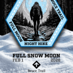
Description Join us for a fun winter evening of snowshoeing at the Bruce Ski Club’s Sawmill Nordic Centre in Hepworth! Time: 6:00–8:30 p.m. Moonrise: 5:22 p.m. Sunset: 5:30 p.m. HikeLength: 3–5 km on snowshoe trails (trail options may vary depending on weather and group interest) Duration: Approximately 2-2.5 hours
Note: Walking is not permitted on ski or snowshoe trails
Join us on Sunday,February 1 at 6:00p.m. to celebrate the Snow Moon with an evening snowshoe on the trails at the Bruce Ski Club (BSC) Sawmill Nordic Centre: 719533 Hwy 6, Wiarton, ON N0H 2T0 https://maps.app.goo.gl/XDfFzxovRDXC5QPp8 Need to rent snowshoes?
Bruce County Public Library: https://brucecounty.bibliocommons.com/v2/search?query=sports%20kit%20snowshoes&searchType=smart
Suntrail Source for Adventure at 100 Spencer Street, Hepworth (check hours and pricing): https://suntrail.ca/pages/services
Reserve ahead! Not a BSC member?
Purchase a $5 day pass at the Sawmill trailhead (cash or eTransfer to etransfer@bruceskiclub.ca)
Day passes are also sold at Suntrail Source for Adventure
A BSC waiver must be signed as well
More info: https://bruceskiclub.ca/day-pass-rates/
Thanks to the BSC volunteers, Gerry’s Place, the heated ski hut, will be open for us. It includes small change rooms if needed. Hot chocolate will be available after the hike, feel free to bring shareable snacks. A portable toilet is located in the parking lot. ImportantNotes Trail and weather conditions will be updated closer to the date (likely the Monday or Tuesday before)
What to Bring
Headlamp
Snowshoes
Weather-appropriate clothing (layers recommended)
BSC pass (annual or day pass) and signed waiver
Don’t miss this chance to enjoy a winter evening under February’s full Snow Moon! Full MoonHiking Badge Info 1. Hikers must complete 4 out of 7 hikes (if a hike is cancelled registration counts)
2. Hikers will email the treasurer $10.00 to cover the cost of the badge. Email is treasurer@peninsula.brucetrail.org
In the message section please indicate Full Moon Badge
If you can, take a screenshot of your payment
3. Email badges@peninsula.brucetrail.org with Subject Line – Full Moon Hiking Badge
In the message section indicate:
The months you attended the full moon hikes (e.g., Oct, Dec, Jan, March)
Confirm that you have sent the e-transfer (if you have a screenshot please attach)
Include your full mailing address
4. Successful in earning your badge
If you attend the Apr 1st hike (and the above are completed) the badge will be handed out
You can also bring $10 in cash that evening to receive your badge
The badge can also be mailed if you are not attending the April hike (if you provided your mailing address)
Description Moonlight Night Hike – Take in the magic of the rising moon over Lake Ontario and the Niagara River. This hike includes a stop to connect with your senses – sights, sounds, smells and the rhythm of your breath. Counts towards your night hike badge (5 night hikes).
Hosting Club: Iroquoia Category: Moonlight Hikes Location (Google Maps): City View Park, Burlington (South Lot entrance, turn at the second road south of Dundas)
Pace: Medium – 3 to 4 km/hr Terrain: Dependent on Conditions, Moderate – Some hills and/or some poor footing, Slippery and Steep Sections Distance: 5.8 km
Description Snow Moon Full Moon Hike No. 2 Illuminate the Winter Trail. Experience the stillness and sparkle of winter under the glow of the Snow Moon — our second Full Moon Night Hike of 2026. February’s full moon has long been known as the Snow Moon, lighting up frosted landscapes and serene trails with a soft, silvery hue. It’s a perfect time to enjoy the quiet beauty of the season and share the trail with fellow night hikers.
Continue your Full Moon Night Hike Badge Series journey!
Join any 3 Full Moon Night Hikes led by an Iroquoia Club Leader in 2026 to qualify and purchase the new badge. With 12 full moons left this year, there are many chances to walk by moonlight and collect your steps toward it. Important Guidelines Hike Start Time: 7:00 pm Arrive: Please arrive 15 minutes early at the City View Park South Lot (top lot, second entrance south of Dundas). Lighting: Headlamp (recommended) or flashlight with fresh batteries or a full charge. Poles & Traction: Hiking poles are helpful, especially for winter hikes. Bring icers or crampons for icy conditions. Clothing: Dress warmly and in layers (so you can delayer) suitable for cold weather and variable terrain. Essentials: Bring I.D. and your health card. Hydration & Snacks: Carry at least 1 L of water and a snack. Safety: Bring a small first aid kit. Pets: No dogs permitted on this hike. Parking: City View Park South Lot closes at 11 pm; we’ll finish around 9 pm. See the route on All Trails If you would like to see the custom route on All Trails https://www.alltrails.com/explore/custom-routes/custom-route-b586f71?u=m&sh=4wexyx
Join us as we walk beneath the glowing Snow Moon, take in the crisp night air, and continue this season’s moonlit adventure. The winter trails await your footprints and your sense of wonder.
Hosting Club: Caledon Hills Category: General Location (Google Maps): Meet at roadside parking on Escarpment Road, between St. Andrew’s and Mountainview Roads, 43.884912, -79.920313. Directions: From Hwy #10 turn east onto Olde Baseline Road for 5.5 km. Turn north/left on St. Andrew’s Road for 6.3 km. Turn right on Escarpment Sideroad for 800 metres.
Pace: Medium – 3 to 4 km/hour Terrain: Moderate – some hills and/or some poor footing Distance: 12 km
Description Beat the winter blues! Register individually for one, a few, or all of the Frosty Five Blues hikes. Participants who complete all five hikes are eligible to receive a CHBTC Winter badge and a Sideways badge on the final hike. Hike Four explores parts of the main Trail, Paris Moraine ST, and Meltwater ST. Bring your choice of hydration and snacks. Hiking boots and icers/crampons are required. See Sunday, February 8 for details about the final hike in the series. (Note: If you wish to purchase badges, the cost of each badge is $10.00 for BTC members and $15.00 for non-members.) Everyone is welcome!
Pace: Moderate (3-4 km/hr) Terrain: Flat, Hilly, Level 2 (Intermediate – some hills and uneven surfaces, rocks and roots underfoot), Variable Distance (km): 10-12 km
Description Let’s roll the hills of the Jefferson Forest this winter! Every weekend, we’ll explore the winter wonderland at this beautiful park. Located in the heart of Richmond Hill, it boasts numerous hiking trails. This 3-hour hike can range from 10 to 12 kilometres, depending on the weather conditions. Remember to bring water, snacks, hiking boots, icers, poles, and your camera. Not recommended for beginners. Park in the free Bethesda parking lot and avoid parking along the road. Dress appropriately for the weather. Difficulty Level: 2 (Moderate).
Please arrive @8:45AM for start of 9:00AM.
This is a joint hike with the Oak Ridges Trail Association (ORTA).
Pace: Medium – 3 to 4 km/hr Terrain: Moderate – Some hills and/or some poor footing Distance: 7 kms
Description Meeting in Kilbride at 9:15 am, Because of the deep snow and frigid temperatures, we will hike from Kilbride to Twiss Rd and return to Kilbride. Please bring icers for your boots. Hike is dependent on weather.
Pace: Leisurely (2.0 – 3.0 km/h): A relaxed pace with frequent breaks and a focus on enjoyment. Terrain: Difficult: Steep ascents/descents, rocky scrambling, and some rugged escarpment paths., Easy: Flat forested sections or lowland trails., Moderate: Rolling hills, mild slopes and rocky paths. Distance: ~3 km
Description Step into winter with the Celebrate Winter on the Trail Series—an invitation to enjoy the season’s beauty on the trail. These small-group adventures offer shorter distance (~5 km) hikes, slower but steady pace, with a duration of ~ 3hours. Gear requirements will vary with the weather, and may include snowshoes, winter hiking boots, icers, or hiking poles. Join one or all five!
Embrace the magic of winter with a snowshoe hike at Bruce Peninsula National Park! We’ll begin our day at the Head of Trails Community Campfire, where you can warm up and choose from two unique learning experiences that bookend our adventure.
Before we set out, join an optional short Winter Bird Hike led by park staff at 11:30 a.m. Discover how to use the Merlin app and learn which hardy species stay through the winter and how they survive the cold season.
Following lunch, we’ll strap on our snowshoes and head into the quiet beauty of the forest, wandering through snow-laden trees and along peaceful winter pathways. The pace will be steady but relaxed, giving us time to soak in the landscape and enjoy the stillness of the season, returning by 2:45 pm.
After the snowshoe hike, you’re invited back to Head of the Trails for an optional cultural learning opportunity with an Anishinaabe guide, who will share teachings about deer hide tanning—a traditional practice deeply connected to skill, patience, and respect for the land.
Don’t have snowshoes? Check out your local library for snowshoe and birding kits. Borrow them like a book -it’s free! Did you know that you can borrow birding kits from Bruce Peninsula National Park – ask at the Cyprus Lake registration office. We have a few extra pairs of adult snowshoes, if you would like to borrow from us.
Remember to bring your camp chair, lunch and thermos.
.Join us for a winter day filled with movement, learning, and community.
Park admission and parking fees apply. Parking admission is free for Military and Saugeen Ojibway Nation members. Parking fees still apply. If you have a Discovery Pass – admission and parking is included. Fee descriptions are listed here: Fees – Bruce Peninsula National Park
Hosting Club: Caledon Hills Category: Nature Walks Location (Google Maps): Meet at the Mono Community Centre, 200 m south of Mono Centre (County Road 8). 44.026195, -80.071516
Directions: From ON-10 head east onto Dufferin Rd. 8/Mono Centre Rd. for 6.0 km. The Community Centre is on the right.
Pace: Leisurely – 3 km/hour or less Terrain: Moderate – some hills and/or some poor footing Distance: 3.5 km
Description Explore the Conservancy’s Whitetail Refuge Nature Reserve under a starry sky and full Snow Moon with BTC Land Stewards, Dave and Sandy. Bring a headlamp or flashlight. Icers and hiking poles are highly recommended. After the walk, you are welcome to stay for a hot beverage and snacks.
Pace: Leisurely (2.0 – 3.0 km/h): A relaxed pace with frequent breaks and a focus on enjoyment. Terrain: Moderate: Rolling hills, mild slopes and rocky paths. Distance: ~3-5 km
Description Join us for a fun winter evening of snowshoeing at the Bruce Ski Club’s Sawmill Nordic Centre in Hepworth! Time: 6:00–8:30 p.m. Moonrise: 5:22 p.m. Sunset: 5:30 p.m. HikeLength: 3–5 km on snowshoe trails (trail options may vary depending on weather and group interest) Duration: Approximately 2-2.5 hours
Note: Walking is not permitted on ski or snowshoe trails
Join us on Sunday,February 1 at 6:00p.m. to celebrate the Snow Moon with an evening snowshoe on the trails at the Bruce Ski Club (BSC) Sawmill Nordic Centre: 719533 Hwy 6, Wiarton, ON N0H 2T0 https://maps.app.goo.gl/XDfFzxovRDXC5QPp8 Need to rent snowshoes?
Bruce County Public Library: https://brucecounty.bibliocommons.com/v2/search?query=sports%20kit%20snowshoes&searchType=smart
Suntrail Source for Adventure at 100 Spencer Street, Hepworth (check hours and pricing): https://suntrail.ca/pages/services
Reserve ahead! Not a BSC member?
Purchase a $5 day pass at the Sawmill trailhead (cash or eTransfer to etransfer@bruceskiclub.ca)
Day passes are also sold at Suntrail Source for Adventure
A BSC waiver must be signed as well
More info: https://bruceskiclub.ca/day-pass-rates/
Thanks to the BSC volunteers, Gerry’s Place, the heated ski hut, will be open for us. It includes small change rooms if needed. Hot chocolate will be available after the hike, feel free to bring shareable snacks. A portable toilet is located in the parking lot. ImportantNotes Trail and weather conditions will be updated closer to the date (likely the Monday or Tuesday before)
What to Bring
Headlamp
Snowshoes
Weather-appropriate clothing (layers recommended)
BSC pass (annual or day pass) and signed waiver
Don’t miss this chance to enjoy a winter evening under February’s full Snow Moon! Full MoonHiking Badge Info 1. Hikers must complete 4 out of 7 hikes (if a hike is cancelled registration counts)
2. Hikers will email the treasurer $10.00 to cover the cost of the badge. Email is treasurer@peninsula.brucetrail.org
In the message section please indicate Full Moon Badge
If you can, take a screenshot of your payment
3. Email badges@peninsula.brucetrail.org with Subject Line – Full Moon Hiking Badge
In the message section indicate:
The months you attended the full moon hikes (e.g., Oct, Dec, Jan, March)
Confirm that you have sent the e-transfer (if you have a screenshot please attach)
Include your full mailing address
4. Successful in earning your badge
If you attend the Apr 1st hike (and the above are completed) the badge will be handed out
You can also bring $10 in cash that evening to receive your badge
The badge can also be mailed if you are not attending the April hike (if you provided your mailing address)
Description Moonlight Night Hike – Take in the magic of the rising moon over Lake Ontario and the Niagara River. This hike includes a stop to connect with your senses – sights, sounds, smells and the rhythm of your breath. Counts towards your night hike badge (5 night hikes).
Hosting Club: Iroquoia Category: Moonlight Hikes Location (Google Maps): City View Park, Burlington (South Lot entrance, turn at the second road south of Dundas)
Pace: Medium – 3 to 4 km/hr Terrain: Dependent on Conditions, Moderate – Some hills and/or some poor footing, Slippery and Steep Sections Distance: 5.8 km
Description Snow Moon Full Moon Hike No. 2 Illuminate the Winter Trail. Experience the stillness and sparkle of winter under the glow of the Snow Moon — our second Full Moon Night Hike of 2026. February’s full moon has long been known as the Snow Moon, lighting up frosted landscapes and serene trails with a soft, silvery hue. It’s a perfect time to enjoy the quiet beauty of the season and share the trail with fellow night hikers.
Continue your Full Moon Night Hike Badge Series journey!
Join any 3 Full Moon Night Hikes led by an Iroquoia Club Leader in 2026 to qualify and purchase the new badge. With 12 full moons left this year, there are many chances to walk by moonlight and collect your steps toward it. Important Guidelines Hike Start Time: 7:00 pm Arrive: Please arrive 15 minutes early at the City View Park South Lot (top lot, second entrance south of Dundas). Lighting: Headlamp (recommended) or flashlight with fresh batteries or a full charge. Poles & Traction: Hiking poles are helpful, especially for winter hikes. Bring icers or crampons for icy conditions. Clothing: Dress warmly and in layers (so you can delayer) suitable for cold weather and variable terrain. Essentials: Bring I.D. and your health card. Hydration & Snacks: Carry at least 1 L of water and a snack. Safety: Bring a small first aid kit. Pets: No dogs permitted on this hike. Parking: City View Park South Lot closes at 11 pm; we’ll finish around 9 pm. See the route on All Trails If you would like to see the custom route on All Trails https://www.alltrails.com/explore/custom-routes/custom-route-b586f71?u=m&sh=4wexyx
Join us as we walk beneath the glowing Snow Moon, take in the crisp night air, and continue this season’s moonlit adventure. The winter trails await your footprints and your sense of wonder.
Pace: Medium – 3 to 4 km/hr Terrain: Dependent on Conditions, Moderate – Some hills and/or some poor footing Distance: 11 km
Description This is a series of 6 hikes to explore various side trails in the Toronto Section of the Bruce Trail. Hikers completing all six hikes will be eligible to obtain the Toronto Side Trail Badge. Each hike requires a separate registration. The hikes in this series will take place on January 12, 26, February 2, 9, 23, and March 2. Hikes will be dependent on weather / travel conditions. All hikes will be undertaken at a medium pace.
This hike will explore several side trails including: Black Creek Side Trail, Todd Bardes Side Trail, Ridge Side Trail and the Limehouse Side Trail
Dress in layers for the weather, wear appropriate hiking footwear, bring icers and hiking poles. Bring plenty of water or other hydration and a snack.
Please arrive at the meeting place by 8:15 am. We will depart promptly at 8:30 am.
If your plans change and you are unable to join the hike, please cancel your reservation in the My Hikes Section of the BTC website.
Description Each year, February, Black History Month honours the experiences, achievements and enduring contributions of Black communities in Canada, while deepening our collective understanding of their history and impact on Canadian society. This year’s theme: “30 Years of Black History Month: Honouring Black Brilliance Across Generations — From Nation Builders to Tomorrow’s Visionaries.” This theme celebrates three decades of Black History Month in Canada and recognizes the enduring legacy of Black Canadians, whose leadership, creativity, innovation and resilience have shaped our past, continue to influence our present, and will inspire future generations. During all the hikes in this series, you will learn about Niagara-on-the-Lake’s Black history.
The link below will take you to a brief overview on this topic, by the Niagara-on-the-Lake’s Museum.
**Bring hydration and a snack. We will be stopping several times. Hiking poles and icers are recommended as sidewalk and streets may be icy.
This hike counts as 1 of 3 required hikes towards the Black History badge. Check the Hike Schedule for additional hikes this month. There will be a short break between the hikes offered today.
Please Note: Hikes are offered by volunteers who have committed to their own learning, to be able to offer informative and contemplative hike experiences. These hikes are opened to all and offered in a spirit of mutual learning and inclusion.
Description Since 1995, the government in Canada officially recognized February as Black History Month. Each year, Black History Month honours the experiences, achievements and enduring contributions of Black communities in Canada, while deepening our collective understanding of their history and impact on Canadian society.
During all the hikes in this series, you will learn about Niagara-on-the-Lake’s Black history. You will find out about some of those who fought enslavement, and how they were pivotal in shaping our society to be as diverse as it is today.
Wear extra warm clothing as we will be stopping several times. While the terrain is easy, bring your walking sticks and/or footwear with micro spikes. Sidewalks and streets may be icy.
Today’s hike is 1 of 3 required for the Black History badge. 1 additional hike is earlier on today’s hike schedule. There will be a short break between hikes. 2 more hikes are offered Feb. 9
Consider a visit to the NOTL Museum after the hike to see exhibit on this topic. There you will see numerous artifacts on this subject.
PLEASE NOTE: Hikes are offered by volunteers who have committed to their own learning to be able to offer informative and contemplative hike experiences. These hikes are open to all and offered in a spirit of mutual leaning and inclusion.
Description Hike the main and side trails of Short Hills Provincial Park. Please note that there are some steep hills and rocky sections so you should have some hiking experience before joining this hike. Please bring water, hiking poles and icers, as the trails can be icy at times.
Hosting Club: Caledon Hills Category: Tuesday Hikers Location (Google Maps): Parking at Boston Mills Rd., west of its intersection with Mississauga Rd, Map 14. Driving directions: From Highway 410 north, continue on Highway 10, left on King Street, right on Mississauga Rd., left on Boston Mills Rd. to the parking at dead end. Carpool if possible.
Pace: Medium – 3 to 4 km/hour Terrain: Moderate – some hills and/or some poor footing Distance: 8-10 kilometres
Description Main Bruce Trail and Rockside Trail; will hike about 5 km reaching towards Terra Cotta and return after snack break. Bring sufficient hydration drink, snack; poles are recommended. Icers are required due to snow on the ground. After hike there is optional refreshment stop at Coy Wolf with possible local music entertainment.
Location (Google Maps): Parking lot is off Sycamore Drive, East of Bayview , across Starbucks plaza Bus 91 from Finch East station stops at Sycamore station.
Pace: Moderate (3-4 km/hr) Terrain: Hilly, Level 2 (Intermediate – some hills and uneven surfaces, rocks and roots underfoot), Variable Distance (km): 6-7 km
Description We will explore Valleyview and Maple View parks, and walk along German Mill Creak, in return we stop in Huntington park and have snack under beautiful shed.
Although this is considered an “Urban Walk”, you can expect some hills up and down and uneven surfaces with tree roots. Please bring hiking poles, Ice cleats water and snacks.
Pace: Leisurely Terrain: Dependent on Conditions, Moderate Distance: Long Hike 6.8 Km, Shorter Hike turn back at hiker’s discretion
Description Caledon Section, Map 17. Meet at roadside parking on Coolihans Sideroad where the Main Trail crosses (Km 35.0). We will hike north along the main trail, passing through Glen Haffy Conservaton Area, up to Hwy #9. We will stop for a break/snack here, then head back to Coolihans Sideroad. Bring snack. Poles and icers are recommended, snowshoes may be needed.
Hosting Club: Niagara, Iroquoia Category: General Hike Location (Google Maps): Decew House Heritage Park, enter from Decew Rd (10), 43.107568,-79.249598, we will shuttle to Roadside parking on Taylor Rd, across from the entrance to Woodend Conservation Area (I think we can park at the entrance to Woodend off the road), 43.143241,-79.167617
Pace: Brisk – 4 to 5 km/hr, Medium – 3 to 4 km/hr Terrain: Moderate – Some hills and/or some poor footing, Slippery and Steep Sections Distance: 14.4 km
Description The Niagara E2E Winter in 5 will be Wednesdays Jan 28, Feb 4, 11, 18, 25. Hikers must register for individual hikes. Hikes are 14-18 kms and expect an average pace of 4 km/hr with snack/lunch breaks.
Hikers should be prepared for the season – layered clothing, hiking boots, icers, snowshoes (if we get fresh snowfall), poles, water, snacks/lunch, first aid kit.
Hikers should be prepared to share their cars for shuttling – to be shared evenly.
If we encounter unsafe hiking or driving conditions, I will cancel/re-schedule the hike the day before. If you are unable to join us on the day of the hike, please text me at 289-242-9415
Description We will be car pooling, Bring Icers and poles. No dogs. To earn your Niagara Winter End to End badge, it must be completed between December 21, 2025 to March 21, 2026. Because of the potential for bad winter trail conditions we have broken this e2e into 6 hikes rather than 5
Hosting Club: Caledon Hills Category: General Location (Google Maps): Southwest shoulder of Willoughby Rd. and Escarpment Sideroad. From ON-10 head west on Escarpment Sideroad until you meet Willoughby Road. Also possible to take Willoughby Road south from 124 just west of Highway 10.
Pace: Medium – 3 to 4 km/hour Terrain: Strenuous – hilly with steep climbs and some poor footing Distance: 9 km
Description This hike loops through the Forks of the Credit Provincial Park with a stop at the Credit River. The combination of winter conditions and some big hills can be strenuous.
To avoid getting chilled there will be quick stops for water and a shorter nutrition break along the way – bring your favorite hiking drink and snacks.
Dress in layers according to the weather. Hiking boots, and icers / crampons required, poles recommended.
If you can plan to come for a warm drink and treat at Coy Wolf Coffee in Inglewood after the hike.
Participants will be notified the night before if a hike must be cancelled due to inclement weather.
Pace: Leisurely – 3 km/hr. or less Terrain: Easy – Mostly flat and usually good footing Distance: 4 km
Description We will hike north on the new Field & Forest Side Trail and complete a 2 km loop back to rd 91 via a very scenic section of main trail . We will then cross 91 and do a southern 2 km loop past interesting crevices & forest back to our cars via Walker Aggregates side trail .
Location (Google Maps): Meet on the north shoulder of the road on 21st Sideroad at the parking area. Map 24, east of km 8.3, BTC Edition 31. Town of Blue Mountain residents park free, non residents – paid parking. Please try to car pool if possible, as there is only so much space along the shoulder.
Pace: Medium Terrain: Some steep sections Length of Hike: Approx. 1 – 1 1/2 hours
Description This is a hike through 29 acres adjacent to Loree Forest, generously donated by John and Liz McCullam, long time members and continuing volunteers, of the Beaver Valley Club. This will be a treat as John and Liz take us on a tour of the property they have lovingly managed for years. We will also be hiking through parts of Loree Forest itself.
On winter hikes we may encounter bare ground, light snow, deep snow, or ice. Please bring snowshoes and icers and wear appropriate clothing for the weather plus water and a snack.
Guidelines
Arrive 15 minutes before the start of the hike.
Wear sturdy footwear and appropriate attire for the weather and the terrain. Hiking poles are a good idea in any season, especially if the terrain is rocky or slippery. In winter, snowshoes or icers/crampons are needed when conditions dictate. Wearing appropriate clothing and footwear prevents injuries and shows consideration for a safe and positive group hiking experience.
Always carry I.D. and your health card.
Bring sufficient water and snacks (or lunch if indicated). A minimum of 1L of water is recommended on all hikes, and 3L is recommended for long, challenging hikes in the heat of the summer.
Bring sunscreen and insect repellent (for spring and summer hikes).
Pace: Medium – 3 to 4 km/hr Terrain: Easy – Mostly flat and usually good footing Distance: 6k (approximate)
Description Gage Park parking lot off of Lawrence Rd, meet at the edge of lot closest to the tropical greenhouse. An easy urban walk in Gage Park to and from an old boulevard, admire older homes, after the hike enjoying the tropical greenhouse which is typically free (they charge for special events, would not expect any at this time.) I suspect my distance estimate is generous, the time estimate likely gets us into the greenhouse. Dress for the weather. After our cool walk we will be warm in the greenhouse.
Hosting Club: Sydenham Category: An evening walk. Location (Google Maps): Municipal Parking Lot by the river on the West side of First Ave East between 7th St East and 8th St East in Owen Sound
Pace: Brisk: 4 to 5 km/h Terrain: There might be icy and slippery sections. Distance: Approx 5 km
Description Join us for a brisk winter evening hike exploring paths and neighbourhoods of Owen Sound for about 1 hour and 45 minutes. Please bring icers in case we come across icy conditions. Following the hike there will be an opportunity to socialize over refreshments.
Hosting Club: Caledon Hills Category: General Location (Google Maps): Meet north of the intersection of Cataract Road and Mississauga Road at the Elora Cataract Trailway Trail Head. Google Coordinates: 43.813120, -80.028656.
Directions: From ON-10 head west on Charleston Sideroad/Peel Regional Rd. 24 for 5.5 km. Turn left onto Mississauga Rd. and drive for 1.0 km. Park on west shoulder.
Pace: Medium – 3 to 4 km/hour Terrain: Moderate – some hills and/or some poor footing Distance: 11 km
Description Beat the winter blues! Register individually for one, a few, or all of the Frosty Five Blues hikes. Participants who complete all five hikes are eligible to receive a CHBTC Winter badge and a Sideways badge on the final hike. Hike Five explores the trails within the Forks of the Credit Provincial Park. Bring your choice of hydration and snacks. Hiking boots and icers/crampons are required. (Note: If you wish to purchase badges, the cost of each badge is $10.00 for BTC members and $15.00 for non-members.) Everyone is welcome to join!
Location (Google Maps): Parking lot is off Sycamore Drive, East of Bayview , across Starbucks plaza Bus 91 from Finch East station stops at Sycamore station.
Pace: Moderate (3-4 km/hr) Terrain: Hilly, Level 2 (Intermediate – some hills and uneven surfaces, rocks and roots underfoot), Variable Distance (km): 6-7 km
Description We will explore Valleyview and Maple View parks, and walk along German Mill Creak, in return we stop in Huntington park and have snack under beautiful shed.
Although this is considered an “Urban Walk”, you can expect some hills up and down and uneven surfaces with tree roots. Please bring hiking poles, Ice cleats water and snacks.
Hosting Club: Iroquoia Category: General Hike Location (Google Maps): Meet at 9:15 am in the parking lot at Cityview Park, at the second entrance on Kerns Rd
Pace: Medium – 3 to 4 km/hr Terrain: Easy – Mostly flat and usually good footing Distance: 8 kms
Description Meeting in the parking lot at 9:15 am at the 2nd (southern) entrance to Cityview Park on Kerns Road, we will hike the main trail, bike trails and side trails for a large loop.
Bring icers for your boots. Hike is dependent on weather.
Pace: Leisurely (2.0 – 3.0 km/h): A relaxed pace with frequent breaks and a focus on enjoyment. Terrain: Moderate: Rolling hills, mild slopes and rocky paths. Distance: 3 1/2 or 5 km
Description Celebrate Winter Hikes Series – Cape Chin South
Step into winter with the Celebrate Winter on the Trail Series—an invitation to enjoy the season’s beauty on the trail. These small-group adventures offer shorter distances (~5 km) hikes, slower but steady pace, with a duration of ~ 3hours. Gear requirements will vary with the weather, and may include snowshoes, winter hiking boots, icers, or hiking poles. Join one or all five!
Join us for a magical 3.5 km loop hike which winds through the shelter of a cedar forest, follows the Georgian Bay shoreline, and meanders along a peaceful forest corridor. You may even feel as though you’ve stepped into the enchanted Land of Narnia!
If conditions allow, a hike leader will take those wishing to venture a little deeper into the woods for an optional, energetic 1.5 km out-and-back hike. The terrain is relatively flat. The out-and-back hike segment has one steep incline.
Plan ahead if you don’t have your own snowshoes. Snowshoes and poles kits are available from Bruce County Libraries, free. We also have a few adult pairs of snowshoes. Please let me know if you need snowshoes in advance.
Winter hiking requires extra thought and preparation. Please prepare by wearing layered clothing, warm winter hiking boots, hat, face covering (if windy), and mittens. Bring a light backpack for snacks and warm drink. Hiking poles and gators are strongly recommended.
After the hike, we’ll gather for lunch at Tru Foods, if you wish.
Pace: Medium – 3 to 4 km/hr Terrain: Dependent on Conditions, Moderate – Some hills and/or some poor footing Distance: 12 km
Description This hike will explore Hilton Falls Conservation Area on the main trail, side trail and conservation area trails Bring water and snacks. Wear layers for winter conditions, bring icers and hiking poles.
Park in Hilton Falls Conservation Area parking lot, accessible from Campbellville Road. Reservations are required. For further information see Conservation Halton web site: https://www.conservationhalton.ca/parks/hilton-falls/
Please arrive by 8:15 am as we will depart promptly at 8:30 am.
Description Each Friday we will explore different neighbourhoods, trails and parkland throughout Historic Niagara-on-the-Lake.
Moderate pace with some weeks entirely on sidewalks and roads while others may include a mix of trails and paved pathways. Great way to build up endurance for longer more strenuous hikes.
Prepare for cooler windy conditions on open parkland and along Lake Ontario and Niagara River trails.
Plan to stay for conversation and a warm cup of coffee or tea at Sweets & Swirls, Community Centre, Niagara Stone Road, NOTL
Pace: Moderate (3-4 km/hr) Terrain: Flat, Level 2 (Intermediate – some hills and uneven surfaces, rocks and roots underfoot) Distance (km): 12-14 km
Description We will hike along Seaton trail and enjoy the lovely scenery of forest and river. • Please dress appropriately for the weather. • We will have short water, picture, Bio and a 15 minute snack breaks. Everyone is welcome!
Please bring lots of water and snacks ,hiking poles are recommended
Pace: Medium – 3 to 4 km/hr Terrain: Dependent on Conditions, Moderate – Some hills and/or some poor footing, Slippery Sections Likely Distance: 12 km
Description This is a series of 6 hikes to explore various side trails in the Toronto Section of the Bruce Trail. Hikers completing all six hikes will be eligible to obtain the Toronto Side Trail Badge. Each hike requires a separate registration. The hikes in this series will take place on January 12, 26, February 2, 9, 23, and March 2. Hikes will be dependent on weather / travel conditions. All hikes will be undertaken at a medium pace.
This hike will explore the Al Shaw Side Trail and the northern part of the Hilton Falls Side Trail.
Dress in layers for the weather, wear appropriate hiking footwear, bring icers and hiking poles. Bring plenty of water or other hydration and a snack.
Please arrive at the meeting place by 8:15 am. We will depart promptly at 8:30 am.
If your plans change and you are unable to join the hike, please cancel your reservation in the My Hikes Section of the BTC website.
Pace: Moderate (3-4 km/hr) Terrain: Hilly, Level 2 (Intermediate – some hills and uneven surfaces, rocks and roots underfoot), Variable
Description Join us for an awesome day of winter fun at Horseshoe Resort and in the beautiful McCrae Lake Conservation Reserve.
Cross-country skiers: Glide through forests and fields on 30 km of trails groomed for classic and skate skiing. Classic ($49) and skate ski ($59) rentals available. All cross-country skiing is self-guided. Ski passes are $35 per person.
Winter hikers: Join Roland and George for a fun guided hike in beautiful McCrae Lake Conservation Reserve. The group will be out all day and eat lunch on the trail. Depending on conditions you may need snowshoes, microspikes, or just boots. Option 2: Snowshoe with Tim and Robin on Horseshoe’s trails. Those staying on resort will need to purchase trail passes ($15); snowshoe rentals ($20) are available for those who stay on resort.
Reserve your rental equipment ahead of time at https://horseshoeresort.com/nordic-centre/cross-country-ski/
Trail fees will be collected in cash on the bus. We will leave the resort at 4 PM.
Departure 1: 9 AM, 10 York Mills Rd
Departure 2: 9:20 AM, HWY 400 and Major Mackenzie Dr Park and Ride
Please arrive at the pick-up location 15 minutes before departure. The bus waits for no one.
Policy for running this trip: To run this trip we need 40 registrants 8 days in advance. We may cancel the trip on short notice if there is substantial risk of trail or resort closure due to major weather warnings. If there is enough snow to ski and conditions are marginal or better, we will go. Marginal conditions mean not ideal skiing conditions. For example, wet snow, a thin bumpy base, or some icy patches. If TBTC cancels the trip, we will refund your coach fare. No refund if you cancel.
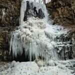
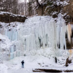
Hosting Club: Niagara Category: Urban Location (Google Maps): Floral Showhouse parking. A parking fee applies. Niagara Parks annual parking pass is the best deal around.
Description Witness the rare frozen falls phenomenon along with frozen mist and ice formations. Wear warmer layers than you would normally so you can stop and enjoy the sights. Icers and hiking poles are also recommended.
Hosting Club: Caledon Hills Category: General Location (Google Maps): This is a loop hike in Cheltenham. Starting from the Cheltenham Brickyards Trans Canada Trail parking lot on Mississauga Road, along the Trans Canada Trail, through Cheltenham and back to the Brickyards. A stop at the Cheltenham General Store will be included for a hot beverage.
Pace: Leisurely – 3 km/hour or less Terrain: Easy – mostly flat and usually good footing Distance: 4.5 km
Description This is a flat loop along the Trans Canada Trail and a stretch of the Credit River before coming into the village of Cheltenham. We will stop for a look see at the General Store – hot beverages available. Walking along a quiet residential street, we will return to our vehicles on Mississauga Road. One slight hill along the road.
Pace: Moderate (3-4 km/hr) Terrain: Flat Distance (km): 10.9 km
Description Please join me at the south east corner of Eglinton and Scarlett by 10 AM. We will hike south on the Humber Recreational Trail to Lakeshore Blvd and Ellis (km 19.2 to km 8.3). Here is an online map with km markings of our route for all 7 hikes for the Toronto Urban Badge: https://onthegomap.com/s/c2c1hf3n
Please make sure you bring at least 2 liters of water, a lunch, and icers.
Hosting Club: Dufferin Hi-Land Category: General Hike Location (Google Maps): Second Line and 15 Sideroad in Mulmur Ontario. From Orangeville, head north on hwy #10 to hwy #89. Turn left and head west to county road #124. Turn right and head north to 15 Sideroad. Turn right and follow to 2nd line. Parking is on the east side of 2nd Line, just north of 15 Sideroad. Do not try and come across 15 sideroad from east to west. It is a snowmobile trail at this time of the year.
Pace: Medium Terrain: Dependent on Conditions, Moderate Distance: 6 km
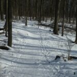
Description We will be exploring the winter wonders that the Pine River Nature Reserve offers during the winter.
This is a snowshoe hike so please be sure to bring your snowshoes. Should the weather not behave and snow is not in abundance, we will still do the hike but icers will be required as there are icy patches within the reserve.
Bring snowshoes, icers, mitts, hats, food, and dress according to the weather.
Pace: Medium Terrain: Moderate, Some steep sections Length of Hike: Approx. 5 km
Description SOUP’S ON! Join us for a lovely snowshoe on the Bruce Trail, east side of the valley, followed by a warming lunch in Ed and Dale Stedman’s home. They will provide the soup, plus coffee & tea and you’ll bring a sandwich, or your choice of accompaniment to go with it. If you’d like to bring goodies to share for dessert, feel free! Folks are welcome to show up just for the lunch, or conversely, just for the hike, or both. If you are there just for lunch, please arrive between 12:00 and 12:30 p.m. Depending on the conditions, we may use snowshoes, icers or just boots, so please come prepared. If you have any questions please contact beavervalleytrailactivities@gmail.com. The hike leader will inform the group in the morning on Feb. 7 if weather conditions preclude the hike. Hope to see you there! Please car pool if possible.
Pace: Leisurely (2.0 – 3.0 km/h): A relaxed pace with frequent breaks and a focus on enjoyment., Medium (3.0 – 4.5 km/h): A comfortable pace for most hikers with steady progress. Terrain: Difficult: Steep ascents/descents, rocky scrambling, and some rugged escarpment paths., Moderate: Rolling hills, mild slopes and rocky paths. Distance: 7.0 km
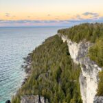
Description On Saturday February 7th*, join us in hiking through Lion’s Head Provincial Park to the iconic Lion’s Head Lookout, where we’ll witness the sun as it sets across the bay behind White Bluff. This peaceful sunset hike is the perfect way to connect with nature, capture some incredible photos, and wind down as the day comes to a close. Whether you’re sunset obsessed or just love a good adventure, come experience the magic of golden hour from one of the best vantage points on the Saugeen (Bruce) Peninsula.
Join us and discover how a sunset hike can nourish your mind, body, and spirit – offering a peaceful close to the day
This hike is approximately 7 kms in length. Expect to be on the trail for ~3 hours. Pace will be leisurely with ample time to enjoy the sunset, take some photographs, and nourish yourself!
Don’t forget to bring a headlamp or flashlight (preferably with a red light setting) as we’ll be finishing our adventure in the dark of night.
Experienced hikers only; this trail is rated difficult and presents additional challenges on a snowy winter’s eve. Some undulating terrain, lots of rocks and roots.
How to prepare:
Bring snowshoes/crampons
Wear weather appropriate clothing (lots of layers! It gets cold at night)
Wear warm, supportive footwear
Bring lots of water and a snack
Bring a headlamp or flashlight (preferably with a red light setting)
Trekking poles are recommended to navigate uneven terrain in the dark
*In the event of exceptionally cloudy weather or snowstorm, the hike will be rescheduled to the following date: Sunday, February 8th. Watch for emails in the days leading up to the hike!
Pace: Moderate (3-4 km/hr) Terrain: Flat, Level 2 (Intermediate – some hills and uneven surfaces, rocks and roots underfoot) Distance (km): 12-14 km
Description We will hike along Seaton trail and enjoy the lovely scenery of forest and river. • Please dress appropriately for the weather. • We will have short water, picture, Bio and a 15 minute snack breaks. Everyone is welcome!
Please bring lots of water and snacks ,hiking poles are recommended
Pace: Medium – 3 to 4 km/hr Terrain: Dependent on Conditions, Moderate – Some hills and/or some poor footing, Slippery Sections Likely Distance: 12 km
Description This is a series of 6 hikes to explore various side trails in the Toronto Section of the Bruce Trail. Hikers completing all six hikes will be eligible to obtain the Toronto Side Trail Badge. Each hike requires a separate registration. The hikes in this series will take place on January 12, 26, February 2, 9, 23, and March 2. Hikes will be dependent on weather / travel conditions. All hikes will be undertaken at a medium pace.
This hike will explore the Al Shaw Side Trail and the northern part of the Hilton Falls Side Trail.
Dress in layers for the weather, wear appropriate hiking footwear, bring icers and hiking poles. Bring plenty of water or other hydration and a snack.
Please arrive at the meeting place by 8:15 am. We will depart promptly at 8:30 am.
If your plans change and you are unable to join the hike, please cancel your reservation in the My Hikes Section of the BTC website.
Pace: Moderate (3-4 km/hr) Terrain: Hilly, Level 2 (Intermediate – some hills and uneven surfaces, rocks and roots underfoot), Variable
Description Join us for an awesome day of winter fun at Horseshoe Resort and in the beautiful McCrae Lake Conservation Reserve.
Cross-country skiers: Glide through forests and fields on 30 km of trails groomed for classic and skate skiing. Classic ($49) and skate ski ($59) rentals available. All cross-country skiing is self-guided. Ski passes are $35 per person.
Winter hikers: Join Roland and George for a fun guided hike in beautiful McCrae Lake Conservation Reserve. The group will be out all day and eat lunch on the trail. Depending on conditions you may need snowshoes, microspikes, or just boots. Option 2: Snowshoe with Tim and Robin on Horseshoe’s trails. Those staying on resort will need to purchase trail passes ($15); snowshoe rentals ($20) are available for those who stay on resort.
Reserve your rental equipment ahead of time at https://horseshoeresort.com/nordic-centre/cross-country-ski/
Trail fees will be collected in cash on the bus. We will leave the resort at 4 PM.
Departure 1: 9 AM, 10 York Mills Rd
Departure 2: 9:20 AM, HWY 400 and Major Mackenzie Dr Park and Ride
Please arrive at the pick-up location 15 minutes before departure. The bus waits for no one.
Policy for running this trip: To run this trip we need 40 registrants 8 days in advance. We may cancel the trip on short notice if there is substantial risk of trail or resort closure due to major weather warnings. If there is enough snow to ski and conditions are marginal or better, we will go. Marginal conditions mean not ideal skiing conditions. For example, wet snow, a thin bumpy base, or some icy patches. If TBTC cancels the trip, we will refund your coach fare. No refund if you cancel.
Hosting Club: Niagara Category: Urban Location (Google Maps): Floral Showhouse parking. A parking fee applies. Niagara Parks annual parking pass is the best deal around.
Description Witness the rare frozen falls phenomenon along with frozen mist and ice formations. Wear warmer layers than you would normally so you can stop and enjoy the sights. Icers and hiking poles are also recommended.
Hosting Club: Caledon Hills Category: General Location (Google Maps): This is a loop hike in Cheltenham. Starting from the Cheltenham Brickyards Trans Canada Trail parking lot on Mississauga Road, along the Trans Canada Trail, through Cheltenham and back to the Brickyards. A stop at the Cheltenham General Store will be included for a hot beverage.
Pace: Leisurely – 3 km/hour or less Terrain: Easy – mostly flat and usually good footing Distance: 4.5 km
Description This is a flat loop along the Trans Canada Trail and a stretch of the Credit River before coming into the village of Cheltenham. We will stop for a look see at the General Store – hot beverages available. Walking along a quiet residential street, we will return to our vehicles on Mississauga Road. One slight hill along the road.
Pace: Moderate (3-4 km/hr) Terrain: Flat Distance (km): 10.9 km
Description Please join me at the south east corner of Eglinton and Scarlett by 10 AM. We will hike south on the Humber Recreational Trail to Lakeshore Blvd and Ellis (km 19.2 to km 8.3). Here is an online map with km markings of our route for all 7 hikes for the Toronto Urban Badge: https://onthegomap.com/s/c2c1hf3n
Please make sure you bring at least 2 liters of water, a lunch, and icers.
Hosting Club: Dufferin Hi-Land Category: General Hike Location (Google Maps): Second Line and 15 Sideroad in Mulmur Ontario. From Orangeville, head north on hwy #10 to hwy #89. Turn left and head west to county road #124. Turn right and head north to 15 Sideroad. Turn right and follow to 2nd line. Parking is on the east side of 2nd Line, just north of 15 Sideroad. Do not try and come across 15 sideroad from east to west. It is a snowmobile trail at this time of the year.
Pace: Medium Terrain: Dependent on Conditions, Moderate Distance: 6 km
Description We will be exploring the winter wonders that the Pine River Nature Reserve offers during the winter.
This is a snowshoe hike so please be sure to bring your snowshoes. Should the weather not behave and snow is not in abundance, we will still do the hike but icers will be required as there are icy patches within the reserve.
Bring snowshoes, icers, mitts, hats, food, and dress according to the weather.
Pace: Medium Terrain: Moderate, Some steep sections Length of Hike: Approx. 5 km
Description SOUP’S ON! Join us for a lovely snowshoe on the Bruce Trail, east side of the valley, followed by a warming lunch in Ed and Dale Stedman’s home. They will provide the soup, plus coffee & tea and you’ll bring a sandwich, or your choice of accompaniment to go with it. If you’d like to bring goodies to share for dessert, feel free! Folks are welcome to show up just for the lunch, or conversely, just for the hike, or both. If you are there just for lunch, please arrive between 12:00 and 12:30 p.m. Depending on the conditions, we may use snowshoes, icers or just boots, so please come prepared. If you have any questions please contact beavervalleytrailactivities@gmail.com. The hike leader will inform the group in the morning on Feb. 7 if weather conditions preclude the hike. Hope to see you there! Please car pool if possible.
Pace: Leisurely (2.0 – 3.0 km/h): A relaxed pace with frequent breaks and a focus on enjoyment., Medium (3.0 – 4.5 km/h): A comfortable pace for most hikers with steady progress. Terrain: Difficult: Steep ascents/descents, rocky scrambling, and some rugged escarpment paths., Moderate: Rolling hills, mild slopes and rocky paths. Distance: 7.0 km
Description On Saturday February 7th*, join us in hiking through Lion’s Head Provincial Park to the iconic Lion’s Head Lookout, where we’ll witness the sun as it sets across the bay behind White Bluff. This peaceful sunset hike is the perfect way to connect with nature, capture some incredible photos, and wind down as the day comes to a close. Whether you’re sunset obsessed or just love a good adventure, come experience the magic of golden hour from one of the best vantage points on the Saugeen (Bruce) Peninsula.
Join us and discover how a sunset hike can nourish your mind, body, and spirit – offering a peaceful close to the day
This hike is approximately 7 kms in length. Expect to be on the trail for ~3 hours. Pace will be leisurely with ample time to enjoy the sunset, take some photographs, and nourish yourself!
Don’t forget to bring a headlamp or flashlight (preferably with a red light setting) as we’ll be finishing our adventure in the dark of night.
Experienced hikers only; this trail is rated difficult and presents additional challenges on a snowy winter’s eve. Some undulating terrain, lots of rocks and roots.
How to prepare:
Bring snowshoes/crampons
Wear weather appropriate clothing (lots of layers! It gets cold at night)
Wear warm, supportive footwear
Bring lots of water and a snack
Bring a headlamp or flashlight (preferably with a red light setting)
Trekking poles are recommended to navigate uneven terrain in the dark
*In the event of exceptionally cloudy weather or snowstorm, the hike will be rescheduled to the following date: Sunday, February 8th. Watch for emails in the days leading up to the hike!
Pace: Medium – 3 to 4 km/hr Terrain: Dependent on Conditions, Moderate – Some hills and/or some poor footing, Slippery and Steep Sections Distance: Approx 7 km
Description Please be at parking by 8:15 am as the hike will leave promptly at 8:30 am.
Please bring your poles and icers; dress in layers to keep warm. Bring enough water and snacks to suit your needs.
We will start by following the outer road at Woodland Cemetery and pick up Grindstone Marsh Trail at Sunfish Pond. Following Grindstone Marsh Trail into Hendrie Valley, we will loop our way along the North and South Bridle Trail to Cherry Hill Gate and back to the cars. There is a set of stairs, one steep downhill section, and a couple of smaller hills. Be prepared for some potentially icy conditions. Please bring your icers/crampons just in case.
Please leave dogs at home.
Easterbrook’s Hot Dog Stand is open all winter for anyone wishing to stop in for a bite to eat.
Please note, the hike might be canceled due to extreme weather, or unsafe trail conditions. A cancellation email will be sent to all registered hikers.
Any questions may be directed through contact on this form.
In the event you are no longer able to attend, please remove yourself from registration by following these steps:
– Sign into your account on the BTC website – Click on My Hikes under your account – This will take you to a list of hikes you have registered for – Scroll down to the appropriate hike and cursor over to the far right hand column under the Action column. – Click Cancel under the hike you wish to cancel
Hosting Club: Caledon Hills Category: General Location (Google Maps): Meet north of the intersection of Cataract Road and Mississauga Road at the Elora Cataract Trailway Trail Head. Google Coordinates: 43.813120, -80.028656.
Directions: From ON-10 head west on Charleston Sideroad/Peel Regional Rd. 24 for 5.5 km. Turn left onto Mississauga Rd. and drive for 1.0 km. Park on west shoulder.
Pace: Medium – 3 to 4 km/hour Terrain: Moderate – some hills and/or some poor footing Distance: 11 km
Description Beat the winter blues! Register individually for one, a few, or all of the Frosty Five Blues hikes. Participants who complete all five hikes are eligible to receive a CHBTC Winter badge and a Sideways badge on the final hike. Hike Five explores the trails within the Forks of the Credit Provincial Park. Bring your choice of hydration and snacks. Hiking boots and icers/crampons are required. (Note: If you wish to purchase badges, the cost of each badge is $10.00 for BTC members and $15.00 for non-members.) Everyone is welcome to join!
Pace: Moderate (3-4 km/hr) Terrain: Flat, Hilly, Level 2 (Intermediate – some hills and uneven surfaces, rocks and roots underfoot), Variable Distance (km): 10-12 km
Description Let’s roll the hills of the Jefferson Forest this winter! Every weekend, we’ll explore the winter wonderland at this beautiful park. Located in the heart of Richmond Hill, it boasts numerous hiking trails. This 3-hour hike can range from 10 to 12 kilometres, depending on the weather conditions. Remember to bring water, snacks, hiking boots, icers, poles, and your camera. Not recommended for beginners. Park in the free Bethesda parking lot and avoid parking along the road. Dress appropriately for the weather. Difficulty Level: 2 (Moderate).
Please arrive @8:45AM for start of 9:00AM.
This is a joint hike with the Oak Ridges Trail Association (ORTA).
Hosting Club: Toronto Category: Car Hike Location (Google Maps): We will meet at the Trafalgar & 401 Commuter Lot (43.571569, -79.831797) and then carpool to the start of each hike.
Pace: Leisurely (2-3 km/hr), Moderate (3-4 km/hr) Terrain: Level 2 (Intermediate – some hills and uneven surfaces, rocks and roots underfoot) Distance (km): 9.24 km
Description This is the third in a series of five hikes that will be offered approximately one Sunday per month so that participants can earn the Toronto Side Trails Badge during the winter and early spring. Each out-and-back hike will cover a distance of 8-11 km and be hiked at a leisurely to moderate pace (approximately 3 km/h). Please note that the hikes will be posted separately on the BTC calendar – you will have to register for each hike that you’re interested in joining.
For this second hike we will explore two side trails in the Toronto section of the Bruce Trail: the Bennett Heritage Trail and the Maureen Smith Side Trail.
Please dress appropriately for a winter hike by dressing in layers (wear an inner layer that wicks sweat away from your skin, a middle layer that keeps you warm, and an outer layer that protects you from wind and snow), wearing gloves/mittens and a toque, and wearing warm and comfortable footwear that has good traction in snow/ice (icers placed over your boots work great!). Hiking poles or walking sticks are an asset since they will help keep you balanced if the ground is slippery. As well, make sure you bring enough water and food for a 3-4 hour hike since we’ll be covering a total distance of 9.24 km over terrain that has some hills and exposed rocks.
Since parking might be limited at the places we’ll be hiking in this hike series, we will meet at the Trafalgar & 401 Commuter Lot (43.571569, -79.831797) and then carpool to the start of each hike. Please be prepared to participate in each carpool by ensuring you have space in your car if you are not already carpooling with others to the Commuter Lot meeting point.
After the hike, interested participants can join me at the Tim Horton’s on Trafalgar Road just a bit south of Highway 401 for some post-hike refreshment.
Looking forward to exploring some of Toronto’s side trails with you!
Pace: Medium – 3 to 4 km/hr Terrain: Moderate – Some hills and/or some poor footing Distance: 8 kms
Description Meeting at 9:15 am in the parking lot of Mono Centre Community Centre, we will hike the main trail and around the Turnbull, Springwater, Whitetail Refuge and Third Outlier Side Trails and back along the main trail into Mono Cliffs to the Laidlaw Side Trail to the cars. Bring icers for your boots. Hike is dependent on weather.
Pace: Moderate (3-4 km/hr) Terrain: Level 1 (Easy – mostly on flat, well maintained trails with hard-packed surface), Level 2 (Intermediate – some hills and uneven surfaces, rocks and roots underfoot), Variable Distance (km): 10 km
Description Join us for a morning circular walk through David Balfour Park, Park Drive Reservation, the Evergreen Brickworks, Moore Park Ravine and Mount Pleasant Cemetery. On this walk we find nature close to the heart of the city.
Hosting Club: Peninsula Category: Winter Hikes Location (Google Maps): **Snow Shoe Hike** Meet at Borchardt Parking Lot by Devil’s Monument on Cape Chin N.
Pace: Leisurely (2.0 – 3.0 km/h): A relaxed pace with frequent breaks and a focus on enjoyment. Terrain: Difficult: Steep ascents/descents, rocky scrambling, and some rugged escarpment paths. Distance: 4 km
Description Proceed South on the Main Trail off the parking lot until we reach the unmarked Land Steward access Trail which goes to the back of the Bruce Trail’s 100 acre Cape Chin Woods. Show shoers will proceed through towering beech, popular, maple and cedar forests to Porcupine Hill that marks the back of the property. In and out is approximately 4 km. Bring your own snow shoes and poles or contact Sun Trails in Hepworth for rentals (at your expense). Note: this is not an official Bruce Trail and only accessible in winter. This is an unmarked Trail which will be lead by the Land Steward of Cape Chin Woods, Tim Wilson. The Parking will be free at this time of year. This may be strenuous depending on the amount of snow. There is no option for hiking – this will be a snow shoe. Approximately 2 hours, Bring your lunch and warm up with a hot beverage together afterwards.
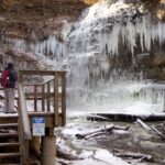
Hosting Club: Sydenham Category: Snowshoe Hike Location (Google Maps): km 115.6 on Map 33 of Edition 31 The Bruce Trail Reference. Roadside parking on East Linton Side Rd. W at base of hill where road turns to the right. For a map that opens on your device, click the (Google Maps) link in this Location description. If needed the copy-ready GPS coordinates of the Meet and Park Location are: 44.64257, -80.964331
Pace: Leisurely: 3 km/h or less Terrain: Moderate: Some hills and/or poor footing Distance: 2 km
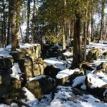
Description This short loop hike will take us along the base of the escarpment through several rock crevices and returns along the top of the escarpment to the parking area. Features include huge blocks of dolostone on the talus slope, rich in fossils, as well as evidence of early settlers. Bring poles or walking sticks if you have them, snowshoes if there’s enough snow, and/or icers.
Pace: Medium – 3 to 4 km/hr Terrain: Dependent on Conditions, Moderate – Some hills and/or some poor footing, Slippery and Steep Sections Distance: Approx 7 km
Description Please be at parking by 8:15 am as the hike will leave promptly at 8:30 am.
Please bring your poles and icers; dress in layers to keep warm. Bring enough water and snacks to suit your needs.
We will start by following the outer road at Woodland Cemetery and pick up Grindstone Marsh Trail at Sunfish Pond. Following Grindstone Marsh Trail into Hendrie Valley, we will loop our way along the North and South Bridle Trail to Cherry Hill Gate and back to the cars. There is a set of stairs, one steep downhill section, and a couple of smaller hills. Be prepared for some potentially icy conditions. Please bring your icers/crampons just in case.
Please leave dogs at home.
Easterbrook’s Hot Dog Stand is open all winter for anyone wishing to stop in for a bite to eat.
Please note, the hike might be canceled due to extreme weather, or unsafe trail conditions. A cancellation email will be sent to all registered hikers.
Any questions may be directed through contact on this form.
In the event you are no longer able to attend, please remove yourself from registration by following these steps:
– Sign into your account on the BTC website – Click on My Hikes under your account – This will take you to a list of hikes you have registered for – Scroll down to the appropriate hike and cursor over to the far right hand column under the Action column. – Click Cancel under the hike you wish to cancel
Hosting Club: Caledon Hills Category: General Location (Google Maps): Meet north of the intersection of Cataract Road and Mississauga Road at the Elora Cataract Trailway Trail Head. Google Coordinates: 43.813120, -80.028656.
Directions: From ON-10 head west on Charleston Sideroad/Peel Regional Rd. 24 for 5.5 km. Turn left onto Mississauga Rd. and drive for 1.0 km. Park on west shoulder.
Pace: Medium – 3 to 4 km/hour Terrain: Moderate – some hills and/or some poor footing Distance: 11 km
Description Beat the winter blues! Register individually for one, a few, or all of the Frosty Five Blues hikes. Participants who complete all five hikes are eligible to receive a CHBTC Winter badge and a Sideways badge on the final hike. Hike Five explores the trails within the Forks of the Credit Provincial Park. Bring your choice of hydration and snacks. Hiking boots and icers/crampons are required. (Note: If you wish to purchase badges, the cost of each badge is $10.00 for BTC members and $15.00 for non-members.) Everyone is welcome to join!
Pace: Moderate (3-4 km/hr) Terrain: Flat, Hilly, Level 2 (Intermediate – some hills and uneven surfaces, rocks and roots underfoot), Variable Distance (km): 10-12 km
Description Let’s roll the hills of the Jefferson Forest this winter! Every weekend, we’ll explore the winter wonderland at this beautiful park. Located in the heart of Richmond Hill, it boasts numerous hiking trails. This 3-hour hike can range from 10 to 12 kilometres, depending on the weather conditions. Remember to bring water, snacks, hiking boots, icers, poles, and your camera. Not recommended for beginners. Park in the free Bethesda parking lot and avoid parking along the road. Dress appropriately for the weather. Difficulty Level: 2 (Moderate).
Please arrive @8:45AM for start of 9:00AM.
This is a joint hike with the Oak Ridges Trail Association (ORTA).
Hosting Club: Toronto Category: Car Hike Location (Google Maps): We will meet at the Trafalgar & 401 Commuter Lot (43.571569, -79.831797) and then carpool to the start of each hike.
Pace: Leisurely (2-3 km/hr), Moderate (3-4 km/hr) Terrain: Level 2 (Intermediate – some hills and uneven surfaces, rocks and roots underfoot) Distance (km): 9.24 km
Description This is the third in a series of five hikes that will be offered approximately one Sunday per month so that participants can earn the Toronto Side Trails Badge during the winter and early spring. Each out-and-back hike will cover a distance of 8-11 km and be hiked at a leisurely to moderate pace (approximately 3 km/h). Please note that the hikes will be posted separately on the BTC calendar – you will have to register for each hike that you’re interested in joining.
For this second hike we will explore two side trails in the Toronto section of the Bruce Trail: the Bennett Heritage Trail and the Maureen Smith Side Trail.
Please dress appropriately for a winter hike by dressing in layers (wear an inner layer that wicks sweat away from your skin, a middle layer that keeps you warm, and an outer layer that protects you from wind and snow), wearing gloves/mittens and a toque, and wearing warm and comfortable footwear that has good traction in snow/ice (icers placed over your boots work great!). Hiking poles or walking sticks are an asset since they will help keep you balanced if the ground is slippery. As well, make sure you bring enough water and food for a 3-4 hour hike since we’ll be covering a total distance of 9.24 km over terrain that has some hills and exposed rocks.
Since parking might be limited at the places we’ll be hiking in this hike series, we will meet at the Trafalgar & 401 Commuter Lot (43.571569, -79.831797) and then carpool to the start of each hike. Please be prepared to participate in each carpool by ensuring you have space in your car if you are not already carpooling with others to the Commuter Lot meeting point.
After the hike, interested participants can join me at the Tim Horton’s on Trafalgar Road just a bit south of Highway 401 for some post-hike refreshment.
Looking forward to exploring some of Toronto’s side trails with you!
Pace: Medium – 3 to 4 km/hr Terrain: Moderate – Some hills and/or some poor footing Distance: 8 kms
Description Meeting at 9:15 am in the parking lot of Mono Centre Community Centre, we will hike the main trail and around the Turnbull, Springwater, Whitetail Refuge and Third Outlier Side Trails and back along the main trail into Mono Cliffs to the Laidlaw Side Trail to the cars. Bring icers for your boots. Hike is dependent on weather.
Pace: Moderate (3-4 km/hr) Terrain: Level 1 (Easy – mostly on flat, well maintained trails with hard-packed surface), Level 2 (Intermediate – some hills and uneven surfaces, rocks and roots underfoot), Variable Distance (km): 10 km
Description Join us for a morning circular walk through David Balfour Park, Park Drive Reservation, the Evergreen Brickworks, Moore Park Ravine and Mount Pleasant Cemetery. On this walk we find nature close to the heart of the city.
Hosting Club: Peninsula Category: Winter Hikes Location (Google Maps): **Snow Shoe Hike** Meet at Borchardt Parking Lot by Devil’s Monument on Cape Chin N.
Pace: Leisurely (2.0 – 3.0 km/h): A relaxed pace with frequent breaks and a focus on enjoyment. Terrain: Difficult: Steep ascents/descents, rocky scrambling, and some rugged escarpment paths. Distance: 4 km
Description Proceed South on the Main Trail off the parking lot until we reach the unmarked Land Steward access Trail which goes to the back of the Bruce Trail’s 100 acre Cape Chin Woods. Show shoers will proceed through towering beech, popular, maple and cedar forests to Porcupine Hill that marks the back of the property. In and out is approximately 4 km. Bring your own snow shoes and poles or contact Sun Trails in Hepworth for rentals (at your expense). Note: this is not an official Bruce Trail and only accessible in winter. This is an unmarked Trail which will be lead by the Land Steward of Cape Chin Woods, Tim Wilson. The Parking will be free at this time of year. This may be strenuous depending on the amount of snow. There is no option for hiking – this will be a snow shoe. Approximately 2 hours, Bring your lunch and warm up with a hot beverage together afterwards.
Hosting Club: Sydenham Category: Snowshoe Hike Location (Google Maps): km 115.6 on Map 33 of Edition 31 The Bruce Trail Reference. Roadside parking on East Linton Side Rd. W at base of hill where road turns to the right. For a map that opens on your device, click the (Google Maps) link in this Location description. If needed the copy-ready GPS coordinates of the Meet and Park Location are: 44.64257, -80.964331
Pace: Leisurely: 3 km/h or less Terrain: Moderate: Some hills and/or poor footing Distance: 2 km
Description This short loop hike will take us along the base of the escarpment through several rock crevices and returns along the top of the escarpment to the parking area. Features include huge blocks of dolostone on the talus slope, rich in fossils, as well as evidence of early settlers. Bring poles or walking sticks if you have them, snowshoes if there’s enough snow, and/or icers.
Pace: Medium – 3 to 4 km/hr Terrain: Dependent on Conditions, Moderate – Some hills and/or some poor footing, Slippery Sections Likely Distance: 14 km
Description This is a series of 6 hikes to explore various side trails in the Toronto Section of the Bruce Trail. Hikers completing all six hikes will be eligible to obtain the Toronto Side Trail Badge. Each hike requires a separate registration. The hikes in this series will take place on January 12, 26, February 2, 9, 23, and March 2. Hikes will be dependent on weather / travel conditions. All hikes will be undertaken at a medium pace.
This hike will explore several side trails in the Scotsdale/Silver Creek area including: South Bennett Heritage ST, Great Esker ST, Trafalgar ST, Reservoir ST, Duff Pitt ST & North Rim ST.
Dress in layers for the weather, wear appropriate hiking footwear, bring icers and hiking poles. Bring plenty of water or other hydration and a snack.
Please arrive at the meeting place by 8:15 am. We will depart promptly at 8:30 am.
If your plans change and you are unable to join the hike, please cancel your reservation in the My Hikes Section of the BTC website.
Description Since 1995, the government in has Canada officially recognized February as Black History Month. Each year, Black History Month honours the experiences, achievements and enduring contributions of Black communities in Canada, while deepening our collective understanding of their history and impact on Canadian society. This year’s theme: “30 Years of Black History Month: Honouring Black Brilliance Across Generations — From Nation Builders to Tomorrow’s Visionaries.” This theme celebrates three decades of Black History Month in Canada and recognizes the enduring legacy of Black Canadians, whose leadership, creativity, innovation and resilience have shaped our past, continue to influence our present, and will inspire future generations.
During the hikes in this series, you will learn about Niagara-on-the-Lake’s Black history. You will find out about some of those who fought enslavement, and how they were pivotal in shaping our society to be as diverse as it is today. Richard Pierpoint is one such Canadian, who lived in the Niagara area. Watch a short video by Historica Canada about his life by opening the link below.
https://youtu.be/UQyPXOHvwEc?si=2ZPGIHDrybxv11f
*Hikers should be prepared for the season: layered clothing, boots, hydration, a snack, hiking poles and icers. We will stop several times along the way. There is a washroom available at the end of the hike.
This counts as 1 of 3 required for the Black History badge. Check the Hike Schedule on Feb 2nd & 9th for additional hikes. There will be a short break between hikes on the same day.
PLEASE NOTE: Hikes are offered by volunteers who have committed to their own learning to be able to offer informative and contemplative hike experiences. These hikes are opened to all and offered in a spirit of mutual learning and inclusion.
Description Since 1995, the government in Canada officially recognized February as Black History Month.
This hike will give us an opportunity to celebrate the strength and perseverance of the early Black community here in Upper Canada.
The Town of Niagara-on-the-Lake (NOTL) has a significant and nation-shifting Black history. Voices from the past will tell stories, enriching hikers’ understanding of how they shaped this town and nation.
See link below for a brief overview of NOTL’s Black History.
*Prepare for this urban adventure with hydration, snack, hiking poles, icers etc. The sidewalks and roads can be icy.
**This hike counts as 1 of the 3 required hikes towards the Black History badge. Check the February hike schedule for additional hikes. You can bring the $10 or make an e-transfer to receive your badge at the end of the hike.
Consider a visit the NOTL Museum after the hike; it opens at 1:00 pm. There you will see numerous artifacts on this subject.
PLEASE NOTE: Hikes are offered by volunteers who have committed to their own learning to be able to offer informative and contemplative hike experiences. These hikes are open to all and offered in a spirit of mutual leaning and inclusion.
Description Hike the main and side trails of Short Hills Provincial Park. Please note that there are some steep hills and rocky sections, so you should have some hiking experience before joining this hike. Please bring water, hiking poles and icers, as the trails can be icy at times.
Location (Google Maps): Parking lot is off Sycamore Drive, East of Bayview , across Starbucks plaza Bus 91 from Finch East station stops at Sycamore station.
Pace: Moderate (3-4 km/hr) Terrain: Hilly, Level 2 (Intermediate – some hills and uneven surfaces, rocks and roots underfoot), Variable Distance (km): 6-7 km
Description We will explore Valleyview and Maple View parks, and walk along German Mill Creak, in return we stop in Huntington park and have snack under beautiful shed.
Although this is considered an “Urban Walk”, you can expect some hills up and down and uneven surfaces with tree roots. Please bring hiking poles, Ice cleats water and snacks.
Pace: Leisurely Terrain: Moderate, Slippery and Steep Sections Distance: 5.6 Km, Short hike: 2.5 Km.
Description We will hike a loop consisting of Hockley Rd and Tom East Side Trails and Main Trail. Shorter hike will turn back where the Tom East trail turns sharply to the east. Bring water and snacks. Icers or snowshoes may be required. Hiking poles are recommended.
Hosting Club: Caledon Hills Category: Tuesday Hikers Location (Google Maps): Meet at Vicki Barron Lakeside Trail Parking. After driving through Orangeville traffic lights on Highway 10, turn right on Hockley Rd., keep straight onto Sideroad 5, turn right on Hurontario Street to the car parking close to the lake.
Pace: Medium – 3 to 4 km/hour Terrain: Easy – mostly flat and usually good footing Distance: 9 – 10 km
Description Will hike around Island Lake, may take diversion into the side trail for a total of 9-10 km completing a loop around the lake. For dressing take into account weather conditions, bring icers there may be snow on the trails. Bring a warm drink and snack. Check your email 7:00 am as the hike may be cancelled if driving conditions are hazardous. (Note: This is repeat of Jan 27 hike that was canceled due to freezing weather)
Hosting Club: Sydenham Category: Snowshoe Hike Location (Google Maps): Click the (Google Maps) link on the left to direct you to parking. GPS coordinates:44.55150, -80.95865. Park at the end of Concession 3, located 1.7 km north of Grey Rd 5. Look on the Bruce Trail app or in the Bruce Trail Reference guidebook Edition 31, Map 32 just north of km 96.1
Pace: Medium: 3 to 4 km/h Terrain: Moderate: Some hills and/or poor footing, There might be icy and slippery sections. Distance: 5 km
Description The Walk In Nature Series (WINS) consists of 2 hour hikes in the Sydenham section of the Bruce Trail that combine nature appreciation with fitness in a safe and welcoming group environment led by an experienced hike leader. Consider these hikes to be appointments with yourself in nature that promote health and fitness.
On this WINS snowshoe hike, explore the trails of West Rocks Management Area in their winter coat. The pace will be 2-3 km/h which on snowshoes is the effort of a medium paced hike in summer. We will loop around the red trail, avoiding other trails with crevices. Registrants will be sent an email the day before the hike with an update of trail conditions and what to bring.
Hosting Club: Niagara, Iroquoia Category: General Hike Location (Google Maps): Rockway Community Centre, enter off Pelham Rd just east of Wessel Dr (15), 43.111255,-79.321901. We will shuttle to Decew House Heritage Park, enter from Decew Rd (10), 43.107568,-79.249598
Pace: Brisk – 4 to 5 km/hr, Medium – 3 to 4 km/hr Terrain: Moderate – Some hills and/or some poor footing, Slippery and Steep Sections Distance: 16.8 km
Description The Niagara E2E Winter in 5 will be Wednesdays Jan 28, Feb 4, 11, 18, 25. Hikers must register for individual hikes. Hikes are 14-18 kms and expect an average pace of 4 km/hr with snack/lunch breaks.
Hikers should be prepared for the season – layered clothing, hiking boots, icers, snowshoes (if we get fresh snowfall), poles, water, snacks/lunch, first aid kit.
Hikers should be prepared to share their cars for shuttling – to be shared evenly.
If we encounter unsafe hiking or driving conditions, I will cancel/re-schedule the hike the day before. If you are unable to join us on the day of the hike, please text me at 289-242-9415
Hosting Club: Niagara Category: Car Pool Location (Google Maps): Meet at Queenston Heights Park (washroom building street parking) and Car Pool to Woodend
We will be car pooling, Bring Icers and poles. No dogs. To earn your Niagara Winter End to End badge, it must be completed between December 21, 2025 to March 21, 2026. Because of the potential for bad winter trail conditions we have broken this e2e into 6 hikes rather than 5. Main parking lot will be closed for winter so park near the washroom building. Parking fees may be required.
If you have completed all 6 hikes bring $10 for the coveted Winter End to End Badge
Pace: Medium – 3 to 4 km/hr Terrain: Moderate – Some hills and/or some poor footing Distance: 8 kms
Description Meeting in the parking lot at 9:15 am, we will hike to the Falls and then across the creek to the bike trails and back along the Hilton Falls Side Trail. Bring icers for your boots. Reserve your time at conservationhalton.ca
Location (Google Maps): Park in the parking lot (accessible only from 7th Line) on Sideroad 16C, 450 metres east of 7th Line. East of km 89.3, Map 27, Edition 31
Pace: Medium Terrain: Moderate Length of Hike: Approx. 4 km
Description We will hike Sligo Side Trail, which is a very nice walk through a variety of forest types and some views across the escarpment to the east. On winter hikes we may encounter bare ground, light snow, deep snow, or ice. Please bring snowshoes and icers to our Winter Wednesday Walkers outings. Wear appropriate clothing for the weather plus water and a snack.
Pace: Medium – 3 to 4 km/hr Terrain: Dependent on Conditions, Easy – Mostly flat and usually good footing Distance: 7.5 km
Description We will hike through Shell Park and trails in Bronte to Bronte Creek and Bronte Harbour, returning via the lake and pioneer cemetery. Bring icers, water and a snack. Please arrive at least 10 minutes before the start time, I will be leaving on time. If you are unable to come and cancel after 4:00 pm on the day before the hike I will provide an email with contact information on the tuesday.
In case of rain or blizzard conditions I will cancel, so please check your email the evening before the hike.
Location (Google Maps): Parking lot is off Sycamore Drive, East of Bayview , across Starbucks plaza Bus 91 from Finch East station stops at Sycamore station.
Pace: Moderate (3-4 km/hr) Terrain: Hilly, Level 2 (Intermediate – some hills and uneven surfaces, rocks and roots underfoot), Variable Distance (km): 6-7 km
Description We will explore Valleyview and Maple View parks, and walk along German Mill Creak, in return we stop in Huntington park and have snack under beautiful shed.
Although this is considered an “Urban Walk”, you can expect some hills up and down and uneven surfaces with tree roots. Please bring hiking poles, Ice cleats water and snacks.
Pace: Moderate (3-4 km/hr) Terrain: Level 2 (Intermediate – some hills and uneven surfaces, rocks and roots underfoot), Variable Distance (km): 8 -12km
Description Jeanette Vincent, Brenda Menezes and David Royle will continue Greg Vincent’s Legacy – Family Day Snowshoe Weekend in Tobermory. Celebrate with a weekend trip snowshoeing the trails of the National Park at the “Tip o’ the Bruce” Tobermory.
We arrive Friday, February 13th at our comfortable hotel overlooking Little Tub Harbour where we stay and have our meals for three nights at the Princess Hotel in Tobermory.
This outing is restricted to those staying and having their meals with us at the Princess Hotel in Tobermory for the weekend. Space is limited make your reservation soon. Please email Jeanette for the prices for the weekend at the Princess Hotel package and additional information. Once you receive the package, if you plan to join us call the Princess a reservation 1-519-596-8282 or sent an email to info@tobermoryprincesshotel.com and mention Vincent/Royle Winter Snowshoe weekend when booking. Once you have made your reservation, be sure to register for this event on the Toronto Bruce Trail Club. please send an email to Jeanette once you have done both, registered on the TBTC site and made your reservation at the Princess Hotel.
Hosting Club: Sydenham Category: Snowshoe Hike Location (Google Maps): Click the (Google Maps) link on the left to direct you to parking. GPS coordinates: 44.77675, -81.03972. Park at the curve on Gleason Lake Road, 2.0 km north of Concession Rd 24. Hike route from parking follows Curly Harnden Side Trail, then Main Trail southboud, and return to parking by Skinner’s Woods Side Trail and Len Holley Side Trail. Find these trails on the Bruce Trail app or in the Bruce Trail Reference guidebook Edition 31, Map 35.
Pace: Brisk: 4 to 5 km/h Terrain: Moderate: Some hills and/or poor footing, There are crevices or holes which may be hidden by layers of snow. Hike with extreme caution., There might be icy and slippery sections. Distance: 9 km
Description This strenuous snowshoe hike is mostly in the Skinner’s Bluff Management Area, through stately mature forests, along its cedar-lined cliff and returning inland through mixed forest. Our actual pace will be between 2.5 and 3.0 km/h which requires an effort that matches what would be required on a summer hike of a brisk pace of 4-5 km/h. Be prepared for a good workout in the snow despite a flat terrain. Registrants will receive an email the day before the hike with an update of trail conditions and what to bring. Snowshoeing 9 km is no easy feat, but if you’re up to the challenge, you are most welcome!
Each Friday we will explore different neighbourhoods, trails and parkland throughout Historic Niagara-on-the-Lake.
Moderate pace with some weeks entirely on sidewalks and roads while others may include a mix of trails and paved pathways. Great way to build up endurance for longer more strenuous hikes.
Prepare for cooler windy conditions on open parkland and along Lake Ontario and Niagara River trails.
Plan to stay for conversation and a warm cup of coffee or tea at Sweets & Swirls, Community Centre, Niagara Stone Road, NOTL
Hosting Club: Iroquoia Category: City of Waterfalls – Special Event Fundraiser Location (Google Maps): DAY 1: FEB 14 – Parking lot at City View Park off of Kerns Rd. Enter from Dundas St. (capacity 50) 43.351747, -79.862195 DAY 2: FEB 15 – Parking Lot off of Mud St providing access to the Mud Street Side Trail (capacity 30)
Pace: Brisk – 4 to 5 km/hr, Medium – 3 to 4 km/hr Terrain: Dependent on Conditions, Moderate – Some hills and/or some poor footing, Slippery and Steep Sections Distance: Approximately 22-25km / per day
Description Welcome to Iroquoia, City of Waterfalls Challenge! This is a fundraiser challenge event. All funds raised go towards the Iroquoia Bruce Trail Club to maintain the infrastructure of this beautiful section of trail and to “Preserve this ribbon of wilderness, for everyone, forever!”
DAY 1: FEB 14 – We will meet at Cityview Park and car shuttle to Spencer Gorge Parking Lot (Conservation Hamilton) and hike back. The cost at this parking lot is $16.50 per vehicle and driver plus $5.50 for each passenger. Day 1 Distance 21km
DAY 2: FEB 15 – We will meet in the parking area off of Mud St and car shuttle to Artaban Rd Parking Lot (Conservation Hamilton) and hike back. The cost for this parking lot is $11.00 per vehicle. Day 2 Distance 24 km
Please ensure your vehicle is car shuttle ready by having a minimum of 4 seatbelts available – drivers do not pay for the parking. Please volunteer for this important component of this challenge. While we encourage carpooling to the start of the hike, please let the hike leader know if you’re planning to arrive with more than two people in your vehicle. This hike will be limited to 10 people including the hike leader so we will need at least 3 vehicles and one vehicle with 4 seatbelts to drive the drivers back at the end of the day. We will try to take as few vehicles as possible. On the second day, those who did not drive on the first day will be asked to drive.
There will be short breaks along the way to admire the waterfalls on route and a short lunch.
Please bring all the hiking items you require for a long day hike including 2l of water, snacks, lunch, first aid kit, rain gear if rain is forecast, plastic shower caps for your boots if muddy, bug spray, sunscreen, rimmed hat, poles (if you use them) and your camera for all the photo ops. Please ensure you are physically able to complete two long day hikes over two days – if you must drop out, you will have to arrange your own transportation back to your vehicle. There is public transportation, Uber, and taxi’s in the area. If you are concerned about whether you will be able to manage the distance over the two day period, it’s possible that you may need to wait until a 4 day version of this event is posted.
The badge will be presented to all participants who have completed the challenge at the end of the second day.
Any questions may be directed through contact on this form.
Hosting Club: Niagara Category: Car Pool Location (Google Maps): Meet at the parking area circle near the washrooms and the restaurant at Queenston Heights. Carpool to Woodend. Help Sharon complete one section of Niagara’s Winter E2E.
Pace: Leisurely (2-3 km/hr) Terrain: Challenging, Level 2 (Intermediate – some hills and uneven surfaces, rocks and roots underfoot), Variable Distance (km): 8.41 km
Description We will be hiking in winter conditions of ice and snow so these will be slower and shorter hikes than in other seasons. Icers or snowshoes are mandatory, and gaiters and poles recommended. The terrain is not too hilly, but the footing is treacherous in winter with many uneven, rocky sections to navigate. The leaders will let registrants know in advance if snowshoes are feasible for the day. Please bring at least 2L of water, snacks, and your lunch. Any hikers are welcome to join the hikes regardless of whether a person is working towards a badge. Those who complete all 6 hikes will qualify for the Toronto club’s Winter E2E badge. The fee is $10 per badge ($15 for non-members) and will be collected by the hike leader on trip #4. Or you may choose to purchase the special stained glass Fundraising End to End badge for $30.
This hike goes through the Limehouse Conservation Area trail to the Sixth Line Parking lot from the Fourth Line Parking Lot. (8.41 km). This includes the portion of the trail taken off Fifth Line in 2025. There will be a refreshment/social stop in Georgetown after the hike before returning to the York Mills Station departure point by 6:00 PM.
Pace: Leisurely – 3 km/hr. or less Terrain: Moderate – Some hills and/or some poor footing Distance: 3 kms loop
Description We will meet at Tim Hortons on First Street for carpooling. Then take a 35-minute drive over to Old Baldy in Kimberley. From the upper parking lot, we will take a 15-minute hike through forests to the edge of the Niagara Escarpment, where we begin to experience the incredible views overlooking Beaver Valley and the Village of Kimberley. Then, we will continue up the short incline to the peak of Old Baldy 200 meters above the hamlet of Kimberley for the unforgettable panoramic view! Icers, or snowshoes, and poles are recommended. Bring water and dress appropriately for the weather.
Hosting Club: Iroquoia Category: Special Event Location (Google Maps): Dundas Valley Conservation Area – Meet in the big parking lot at 8:45am
Pace: Medium – 3 to 4 km/hr Terrain: Dependent on Conditions, Moderate – Some hills and/or some poor footing, Strenuous – Hilly with steep climbs and some poor footing Distance: Approx 10km
Description Please wear red, if you like. Dress in layers for the weather, bring your icers just in case and poles if you use them. We will hike in the DVCA and show our ❤️ for the trail. Afterwards, we will have a treat or two and refreshments at the Trail Centre.
Pace: Medium – 3 to 4 km/hr Terrain: Moderate – Some hills and/or some poor footing Distance: 8 kms
Description Meeting at 9:15 am in the Bruce Trail parking lot on 22 Side Rd, just off Fourth Line, we will carpool to 15 Side Road and hike back along the main trail and Canada Goose Side Trail. There are some rocky parts to this hike, so be prepared. Bring icers for your boots. Hike is dependent on weather.
Pace: Medium – 3 to 4 km/hr Terrain: Moderate – Some hills and/or some poor footing, Slippery and Steep Sections, Strenuous – Hilly with steep climbs and some poor footing Distance: Approx. 12 km
Description We’re not saying this Rainbow winter hike ends at a pub featured in Episode 3 of the sensational Heated Rivalry gay-hockey TV series…but we are saying the post-hike warm-up will not—to quote Ilya—“be boring.” 🏒🌈 IYKYK
Layer up, lace up, and join your chosen hiking family for a Rainbow hike, followed by a well-earned stop at the Winchester Arms in downtown Dundas. (For a sneak peek, rewatch Episode 3 🙂🌈)
This queer-led, all-inclusive 2SLGBTQIA+ hike is designed to provide a safe, welcoming space for 2SGBTQIA+ hikers—including trans, gay, lesbian, bisexual, queer, Two-Spirit, intersex, asexual, allies and friends. Show up, be your authentic self—and have fun in the snow.
This hike is accessible by Public Transit or car. No car shuttles are required. We’ll begin hiking from our rendezvous spot in downtown Dundas, and follow the trail back to the starting point. (Everyone is invited to join us for a post-hike coffee/sugar hit in Dundas.)
Today’s heart-healthy route: Get your blood pumping as we head up the main trail to Sydenham Lookout at the top of Dundas Peak. The first 45 minutes are the most challenging. The route includes Borer’s Falls and Rock Chapel. We’ll hike as far as the “no dogs allowed private property” stretch and retrace our route with optional detours to explore. Expect great views and relaxed camaraderie. SPECIAL TO THIS HIKE: Back in the summer, an unnamed hike leader failed to deliver on the promised visit to the fabled Skate Park (where you’d least expect it on Dundas Peak). It’s on today’s itinerary.
Icers are required for this hike. Please contact Hike Leader now (right after you register if you need to borrow a pair. Limited supply. Just click on the “contact hike leader” button above.
Meeting Place: We’ll rendezvous at 9:45 a.m. for a 10 a.m. departure beside Ed & Shawn’s Brewery parking lot (65 Hatt St., Dundas, off Sydenham), next to the TD Bank. Parking is free on Saturdays. The parking lot is accessible from Sydenham.
Getting to Dundas by Transit Choice of two HSR bus routes: The 05–Head Street (via Downtown Dundas) will let you off at King & Sydenham (across the street from where we meet); the 5B–Pirie at Governors will drop you off at Governors Road and Ogilvie (then it’s a 7-minute walk to King & Sydenham.
What to Bring: • Water (It’s very easy to get dehydrated in winter), snacks, and lunch, perhaps a hot beverage. • Sunscreen (glare off snow will give you a winter tan), sunglasses, hiking boots, icers (a must) . • Dress in layers.
Today’s hike is dog-friendly. Note: dogs must be leashed the entire time, and owners must pack out their dog’s waste. Visit “Dogs on the Bruce Trail” for further information. https://brucetrail.org/dogs-on-the-trail/
No washroom facilities on this route. Arrive early and use the loo at Starbucks, just a 2-minute walk down King Street from our meet-up spot at King & Sydenham.
Free Bruce Trail Rainbow badges for first-time Rainbow hikers! Questions? Simply click “Contact Hike Leader” on the registration form.
PLEASE DON’T BE A NO-SHOW 🙂 Plans change. C’est la vie. But you don’t want your hiking group waiting around for you if you’re not coming. Very simple solution: Cancel your Bruce Trail hike registration by logging into the BTC website, go to your “My Hikes” section, find the hike, and click “cancel”; if it’s last minute (under 24 hours), you can also email the Hike Leader directly as a courtesy to the volunteers.
Description Join the Niagara Bruce Trail Club, Bridges Niagara Immigrant and Refugee Services and PFLAG Niagara for a Rainbow-Welcome Hike at Louth Conservation Area!
Enjoy the sights and sounds of this beautiful conservation area, which has two waterfalls! What better way to spend Valentine’s Day than embracing love and nature in good company!
What is a Rainbow-Welcome Hike?
These hikes aim to bring 2S-LGBTQIA+ newcomers together with other newcomers and community members, friends and allies to enjoy nature and connect to the land. It is an intentionally affirming space for people of diverse backgrounds and identities.
Hike Details
Route: This hike loops around Louth Conservation area side trails and the Bruce Trail for about 5 km, visiting both the main waterfall and the lower falls.
Terrain: The terrain has some ups and downs along the escarpment edge and into and out of the valley. At this time of year, it can be muddy, icy or both. We will adjust the pace to the group but be prepared for some rocky or icy, uneven footing and ups and downs. We recommend using hiking poles and wearing good hiking shoes is a must. If the weather conditions are snowy or icy, icers/microspikes will be needed. Carry water and dress for changeable weather.
Map: https://maps.app.goo.gl/LWWRPcRWMHEJwNbi8
Note: There are no toilets on this route.
***Please arrive by 9:50 to check in with the hike leader for departure at 10.
There is a small parking lot at the entrance to the conservation area and additional parking along Sue Ann Staff Avenue. We will meet at 9:50 at the parking lot to check in before heading out at 10.
Pace: Leisurely (2.0 – 3.0 km/h): A relaxed pace with frequent breaks and a focus on enjoyment. Terrain: Easy: Flat forested sections or lowland trails. Distance: ~ 6 1/2 km
Description Beat the winter blahs! February is a time to gather, connect, and enjoy the outdoors together.
Join us for a social winter snowshoe hike through the quiet beauty of Fairway Meadows and Little Cove.
This 6.5 km route winds through mixed woodland, open meadow, and a stand of pine plantation, offering ever-changing winter scenery along mostly flat terrain. Our pace will be steady and comfortable for those familiar with this distance in the snow.
To wrap up our outing, be our valentine and join us for a short, optional “winter picnic” at scenic Little Cove. Valentine snacks provided, just bring your thermos with a hot beverage.
Plan for approximately 3 hours of hiking, plus a little additional time at Little Cove’s shoreline.
Pace: Medium – 3 to 4 km/hr Terrain: Dependent on Conditions, Moderate – Some hills and/or some poor footing, Slippery Sections Likely Distance: Approx 6 km
Description Please be at parking by 8:15 am as the hike will leave promptly at 8:30 am.
Please bring your poles and icers; dress in layers to keep warm. Bring enough water and snacks to suit your needs.
We will start by following the outer road at Woodland Cemetery and pick up Grindstone Marsh Trail at Sunfish Pond. Following Grindstone Marsh Trail into Hendrie Valley, we will loop our way along the North and South Bridle Trail to Cherry Hill Gate and back to the cars. There is a set of stairs, one steep-ish downhill section, and a couple of smaller hills. Be prepared for some potentially icy conditions. Please bring your icers/crampons just in case.
Please leave dogs at home.
Easterbrook’s Hot Dog Stand is open all winter for anyone wishing to stop in for a bite to eat.
Please note, the hike might be canceled due to extreme weather, or unsafe trail conditions. A cancellation email will be sent to all registered hikers.
Any questions may be directed through Contact Hike Leader on this form.
In the event you are no longer able to attend, please remove yourself from registration by following these steps:
– Sign into your account on the BTC website – Click on My Hikes under your account – This will take you to a list of hikes you have registered for – Scroll down to the appropriate hike and cursor over to the far right hand column under the Action column. – Click Cancel under the hike you wish to cancel
Hosting Club: Toronto Category: Car Hike Location (Google Maps): Upon arrival, drive down the center of the driveway. At the fork, keep to your right. Drive through the open door of the first building on your right (the arena) and park inside.
Pace: Leisurely (2-3 km/hr), Moderate (3-4 km/hr) Terrain: Flat Distance (km): About 5km with a drop out point at the middle
Description If you received snowshoes for Christmas and don’t know how to put them on, then this is event is for you!
After we gear up, we will be frolicking around the pastures and pond to allow everyone to acclimate to their snowshoes and poles. After that we will head down the driveway across the front of property and into the marked (yellow ribbons) trail for a little easy bushwhacking. At the end of the trail we will go through the pasture used by our two stallions. Hopefully they will come out and put a show on for us as they are handsome devils! From there we will head back to the arena for a water and snack break. At the end of the break, those with energy left in their tank, will had out and do the course backward mostly. The full out and back takes abut two hours or so..
If you’d like to have a tailgate lunch (indoors, but unheated) after snowshoeing, please bring your lunch. There is power in the arena.
The fine print:
We will be parking our vehicles and donning our gear inside the unheated horse arena on the ranch.
If you need help putting your snowshoes on, come closer to he 9:30 am start time and I will help you put them on.
We will be departing the arena at 10am sharp.
There are five horses in stalls in the arena; they enjoy treats like apples and carrots. If you choose to feed them, please be cautious, as they cannot distinguish between fingers and carrots.
Hikers (the snow is too deep) and dogs are not permitted.
Meet: 9:30 a.m. in the arena (departure at 10:00 a.m.) at 111494 11th line, East:
Pace: Moderate (3-4 km/hr) Terrain: Flat Distance (km): 10.9 km
Description Please join me at the south east corner of Eglinton and Scarlett by 10 AM. We will hike south on the Humber Recreational Trail to Lakeshore Blvd and Ellis (km 19.2 to km 8.3). Here is an online map with km markings of our route for all 7 hikes for the Toronto Urban Badge: https://onthegomap.com/s/c2c1hf3n
Please make sure you bring at least 2 liters of water, a lunch, and icers.
Description Since 1995, the government of Canada officially recognized February as Black History Month. Each year, Black History Month honours the experiences, achievements and enduring contributions of Black communities in Canada, while deepening our collective understanding of their history and impact on Canadian society. This year’s theme: “30 Years of Black History Month: Honouring Black Brilliance Across Generations — From Nation Builders to Tomorrow’s Visionaries.” This theme celebrates three decades of Black History Month in Canada and recognizes the enduring legacy of Black Canadians, whose leadership, creativity, innovation and resilience have shaped our past, continue to influence our present, and will inspire future generations. During all the hikes in this series, you will learn about Niagara-on-the-Lake’s Black history.
The link below will take you to a brief overview on this topic, by the Niagara-on-the-Lake’s Museum.
**Bring hydration and a snack. We will be stopping several times. While the terrain is generally flat, hiking poles and icers are recommended as sidewalk and streets may be icy.
This hike counts as 1 of 3 required hikes towards the Black History badge. Two additional hikes are offered on today’s hike schedule. There will be a short break between hikes.
Please Note: Hikes are offered by volunteers who have committed to their own learning, to be able to offer informative and contemplative hike experiences. These hikes are opened to all and offered in a spirit of mutual learning and inclusion.
Hosting Club: Toronto Category: Urban Walk Location (Google Maps):
Meet inside the waiting area of Jack Layton Ferry Terminal at the foot of Bay Street at 10:15AM to take the 10:30 AM Ferry to Ward’s Island. Ferry tickets can be purchased when you arrive or online. Ferry return fares: $10 adult, $6 student/senior
Pace: Moderate (3-4 km/hr) Terrain: Flat, Level 1 (Easy – mostly on flat, well maintained trails with hard-packed surface), Level 2 (Intermediate – some hills and uneven surfaces, rocks and roots underfoot) Distance (km): 12 km
Description The Toronto Islands are very peaceful in the Winter Season. We will catch the 3:45 pm ferry to be back in the city by 4 pm. Bring a lunch, snacks, water, a hot beverage, and icers if available. Dress in warm layers appropriate to the weather. Heated washrooms available. Dropout anytime by walking back to the Ward’s Island Ferry Dock. We will hike to Hanlan’s Point and return to Ward’s Island (only destination served in the Winter) – approximately 6 km each way.
Description Since 1995, the government in Canada officially recognized February as Black History Month. Each year, Black History Month honours the experiences, achievements and enduring contributions of Black communities in Canada, while deepening our collective understanding of their history and impact on Canadian society. During all the hikes in this series, you will learn about Niagara-on-the-Lake’s Black history.
You will find out about some of those who fought enslavement, and how they were pivotal in shaping our society to be as diverse as it is today.
Wear extra warm clothing as we will be stopping several times. While the terrain is easy, bring your walking sticks and/or footwear with micro spikes. Sidewalks and streets may be icy.
Today’s hike is 1 of 3 required for the Black History badge. 2 additional hikes are on today’s hike schedule. There will be a short break between hikes.
Description Since 1995, the government in Canada officially recognized February as Black History Month; a time when Canadians are invited to reflect, educate and engage in the ongoing fight against anti-Black racism and discrimination. This hike will give us an opportunity to celebrate the strength and perseverance of the early Black community here in Upper Canada.
The Town of Niagara-on-the-Lake (NOTL) has a significant and nation-shifting Black history. Voices from the past will tell stories, enriching hikers’ understanding of how they shaped this town and nation.
*This hike has the same content as the hike offered Feb 9 at 11:00 AM (#4 of 4).
See link below for a brief overview of NOTL’s Black History.
*Prepare for this urban adventure with hydration, snack, hiking poles, icers etc.
**This hike counts as 1 of the 3 required hikes towards the Black History badge, all offered on today’s Hike Schedule. You can bring the $10 or make an e-transfer to receive your badge at the end of the hike.
Plan to visit the NOTL Museum after the hikes; it opens at 1 pm. There you will see numerous artifacts on this subject.
PLEASE NOTE: Hikes are offered by volunteers who have committed to their own learning to be able to offer informative and contemplative hike experiences. These hikes are open to all and offered in a spirit of mutual leaning and inclusion.
Pace: Medium – 3 to 4 km/hr Terrain: Dependent on Conditions, Moderate – Some hills and/or some poor footing, Slippery Sections Likely Distance: Approx 8.5km
Description Year of the Horse, specifically the Fire Horse – symbolizing energy, passion and transformation.
Tuesday, Feb 17, 2026 marks the beginning of the new lunar year. This year will be the Year of the Horse.
Please join us for a hike along the Mountains to Sea Greenway Trail which is an International Friendship Trail in Taiwan. https://brucetrail.org/international-friendship-trails/ This hike requires participants are able to hike approx 8.5km at a steady pace. Please bring enough snacks, lunch and water needed for an approx 3 hour hike. You must bring a pair of icers and wear proper hiking boots. Please dress for the weather. At the end of the hike, lucky red packets will be given, with our wishes for a very Happy Lunar New Year.
After the hike, we are going for lunch at the Mandarin Restaurant 1881 Fairview St Burlington $30-$40 per person. If you wish to go for this post hike lunch, please let me know through contact on this form.
Photo: Coco, taken by Irene at 2025 Lunar New Year Hike.
Description Hike the main and side trails of Short Hills Provincial Park. Please note that there are some steep hills and rocky sections so you should have some hiking experience before joining this hike. Please bring water, hiking poles and icers, as the trails can be icy at times.
Hosting Club: Caledon Hills Category: Tuesday Hikers Location (Google Maps): City View Park South Lot, Burlington. From Highway 403 going west, turn right on Brant Street, left on Dundas Street, left on Kerns Rd., take second turn left into City View Park to the parking lot.
Pace: Medium – 3 to 4 km/hour Terrain: Moderate – some hills and/or some poor footing Distance: 11 km
Description From City View Park will connect with main Bruce Trail and hike to Smokey Hollow waterfall, also hike Kings ST and/or Eric Best ST on the way. After snack break will trace back our steps and return to parking. Bring water, snack for refreshment break at Smokey Hollow. Dress for the weather, poles are recommended. Icers are required for snow/slippery conditions. Optional refreshment stop after hike at Kopper Kettle in Waterdown.
Hosting Club: Iroquoia Category: General Hike Location (Google Maps): Meet in the main parking lot at Mount Nemo at 9:15 am. Reserve your time at conservationhalton.ca
Pace: Medium – 3 to 4 km/hr Terrain: Moderate – Some hills and/or some poor footing Distance: 7 kms
Description Meeting at 9:15 am in the parking lot (parking registration required) , we will hike the basic loop and a side trail. Bring icers for your boots.
Location (Google Maps): Parking lot is off Sycamore Drive, East of Bayview , across Starbucks plaza Bus 91 from Finch East station stops at Sycamore station.
Pace: Moderate (3-4 km/hr) Terrain: Hilly, Level 2 (Intermediate – some hills and uneven surfaces, rocks and roots underfoot), Variable Distance (km): 6-7 km
Description We will explore Valleyview and Maple View parks, and walk along German Mill Creak, in return we stop in Huntington park and have snack under beautiful shed.
Although this is considered an “Urban Walk”, you can expect some hills up and down and uneven surfaces with tree roots. Please bring hiking poles, Ice cleats water and snacks.
Terrain: Dependent on Conditions, Moderate Distance: Long hike: 5.0 km
Description Hike will take Laidlaw Side Trail East to the Main Trail on to the South Outlier Side Trial, we will do the South Outlier loop, returning by way of the Main Trail and Laidlaw Side Trail East. Snowshoes or icers may be required. Bring water and snacks
Hosting Club: Caledon Hills Category: General Location (Google Maps): P5 – Island Lake Conservation Area – 673173 Hurontario Street, Mono.
From Hwy 10/24 turn east on Hockley Rd., keep to the right on Side Rd. 5, turn right on Hurontario and follow it to the end. Parking lot will be on the left.
Pace: Medium – 3 to 4 km/hour Terrain: Moderate – some hills and/or some poor footing Distance: 9.5 km
Description This hike explores the trails at Island Lake Conservation Area near Orangeville. Sights include Island Lake, tap lines, a sugar shack, the Stone Wall tree and the Memorial Leaf Wall.
To avoid getting chilled there will be quick stops for water and a shorter nutrition break along the way – bring your favorite hiking drink and snacks.
Dress in layers according to the weather. Hiking boots, and icers / crampons required, poles recommended.
If you can plan to come for a some social time in Orangeville, location to be firmed up closer to our hike date.
Participants will be notified the night before if a hike must be cancelled due to inclement weather.
Location (Google Maps): Meet in the Grey Sauble CA parking lot, km 43.9, Map 26, Edition 31, at the end of the small section of road off Sideroad 7B. Do not attempt to drive up 7B from Grey Road 13, there is no winter maintenance. Instead access 7B from south of Kimberley – Grey Road 13 to Artemesia-Euphrasia Townline to 3rd Line A, then 7B.
Pace: Medium Terrain: Some steep sections Length of Hike: Approx. 5 km
Description Mike Arkless will be leading this hike. This is a in and out hike with tremendous views from the heights of Old Baldy. On winter hikes we may encounter bare ground, light snow, deep snow, or ice. Please bring snowshoes and icers to our Winter Wednesday Walkers outings. Wear appropriate clothing for the weather plus water and a snack.
COVID-19 Precautions Before, During and After your Hike
Each hiker joining a Bruce Trail Club organized hike must perform a self-screening check before hiking. Find Ontario’s self-assessment tool here: https://covid-19.ontario.ca/self-assessment/
If you are experiencing COVID-19 symptoms, stay home.
Other Guidelines
Arrive 15 minutes before the start of the hike.
Wear sturdy footwear and appropriate attire for the weather and the terrain. Hiking poles are a good idea in any season, especially if the terrain is rocky or slippery. In winter, snowshoes or icers/crampons are needed when conditions dictate. Wearing appropriate clothing and footwear prevents injuries and shows consideration for a safe and positive group hiking experience.
Always carry I.D. and your health card.
Bring sufficient water and snacks (or lunch if indicated). A minimum of 1L of water is recommended on all hikes, and 3L is recommended for long, challenging hikes in the heat of the summer.
Bring sunscreen and insect repellent (for spring and summer hikes).
Pace: Leisurely – 3km/hr or less Terrain: Moderate – Some hills and/or some poor footing Distance: Approx. 9 – 10 km.
Description Note: this a previously published hike which was cancelled. The Sixteen Mile Creek is rich in history and was once the home to a number of mills in the early years of settlement in this area. We will learn some of this as we hike up and down this beautiful valley. New meeting point. Meet in the parking lot on the southeast corner of River Glen and Neyagawa Blvd., next to the baseball playing fields at 9;45 am. for a 10:00 am. start. Bring a snack, water, sunscreen and icers. You may want to bring poles as we will be going up and down some long hills. Optional refreshment stop afterwards. I will send out an email the day before the hike with any last minute changes and my cell phone number in the event that you need to cancel the night before or the morning of. Just text me.
Location (Google Maps): Parking lot is off Sycamore Drive, East of Bayview , across Starbucks plaza Bus 91 from Finch East station stops at Sycamore station.
Pace: Moderate (3-4 km/hr) Terrain: Hilly, Level 2 (Intermediate – some hills and uneven surfaces, rocks and roots underfoot), Variable Distance (km): 6-7 km
Description We will explore Valleyview and Maple View parks, and walk along German Mill Creak, in return we stop in Huntington park and have snack under beautiful shed.
Although this is considered an “Urban Walk”, you can expect some hills up and down and uneven surfaces with tree roots. Please bring hiking poles, Ice cleats water and snacks.
Pace: Leisurely (2.0 – 3.0 km/h): A relaxed pace with frequent breaks and a focus on enjoyment. Terrain: Easy: Flat forested sections or lowland trails., Moderate: Rolling hills, mild slopes and rocky paths. Distance: ~4 km
Description Beat the winter blahs! February is the month of friendship, love and connection.
Bring your friends, or make new ones on this lovely winter snowshoe hike.
Our hike meanders through a mixed forest on a trail which includes some short and gentle inclines. Beech marcescence, snow cloaked conifers, and a myriad of snow gnomes will be on display for your enjoyment! Plan on 1 1/2 – 2 hours for hiking.
Following our hike, join us at Rachel’s Restaurant for a beverage, finger foods and camaraderie.
Pace: Brisk – 4 to 5 km/hr, Medium – 3 to 4 km/hr Terrain: Dependent on Conditions, Moderate – Some hills and/or some poor footing, Slippery Sections Likely Distance: 10 km
Description On this hike, we will follow the main trail down into the valley and explore the River & Ruin and other side trails, before making our way back to our meeting place.
Wear layers appropriate to winter weather conditions, wear hiking boots and bring icers and hiking poles. Bring water and a snack.
Please arrive at the meeting spot by 8:15 a.m. for an 8:30 a.m. departure.
Description Each Friday we will explore different neighbourhoods, trails and parkland throughout Historic Niagara-on-the-Lake.
Moderate pace with some weeks entirely on sidewalks and roads while others may include a mix of trails and paved pathways. Great way to build up endurance for longer more strenuous hikes.
Prepare for cooler windy conditions on open parkland and along Lake Ontario and Niagara River trails.
Plan to stay for conversation and a warm cup of coffee or tea at Sweets & Swirls, Community Centre, Niagara Stone Road, NOTL
Hosting Club: Iroquoia Category: General Hike Location (Google Maps): Meet roadside on 4th Line at 9:15 am. Up Guelph Line from the 401, turn right on 10 Side Road and follow the curve as it becomes 4th Line.
Pace: Medium – 3 to 4 km/hr Terrain: Moderate – Some hills and/or some poor footing Distance: 8 kms
Description Meeting at 9:15 am in the small parking lot and roadside on 4th Line, we will hike several of the bike trails, including The Den and The Pines. Bring icers for your boots.
Hosting Club: Sydenham Category: Snowshoe Hike Location (Google Maps): Roadside parking at dead end of Concession 14, north of Copper Kettle. accessed turning east from Grey County Rd 17. Park along south side. Car Shuttle to Lindenwood Road.
Pace: Leisurely: 3 km/h or less Terrain: Easy: Mostly flat and good footing., Moderate: Some hills and/or poor footing, There might be icy and slippery sections. Distance: 3.2 km
Description Enjoy a snowshoe hike with Carol linking the best of the Lindenwood properties. This relatively flat section features a significant erratic boulder, a pond, and a peaceful cedar forest . Bring water, snacks and your winter equipment. Fun in the snow !
Hosting Club: Iroquoia, Toronto Category: Stained Glass Badge End to End Fundraiser Hike Location (Google Maps): This is a great beginner hike for those who want to learn to hike and collect the Stained-Glass Badge **Meet on 3rd line (Charles Hildebrandt Side Trail)
Pace: Leisurely – 3km/hr or less Terrain: Moderate – Some hills and/or some poor footing Distance: Varies
Description Join us for this special 3-day Toronto End to End this spring on Feb 21, Feb 28, and March 7th. The hikes will be at a leisurely pace, 3 + km per hour. Roughly 15 km for each hike. This is suitable for beginner to intermediate hikers.
We will be using hikers’ vehicles to shuttle between our start point and our meeting point. As well, there will be entry costs at Hilton Falls. (If you are a member of Halton Conservation, please bring your pass.) Costs will be shared amongst the hikers unless you have a pass.
Proper hiking boots are a must! Bring hiking poles (if you use them), icers, food, snacks, 2L of water, a hat, and rain gear. It may be cool, wet or warm. Please check the weather forecast each day before heading out.
Arrive by 8:00 am to check in. Once everyone has arrived, we will proceed and drive to the starting point.
Your fee includes the guidance and organization of a volunteer hike leader. Everyone will receive their Stained-glass End to End badge upon completion, which depicts the historic Limehouse Arch. If you must miss a day but can make it up before the last scheduled hike, you will still qualify for this special badge. This is a fundraising hike for the Bruce Trail Club. Proceeds go to the Toronto Club to support the trail infrastructure and to the Bruce Trail Conservancy’s mission “Protecting this ribbon of wilderness, for everyone, forever.”
Please, no dogs or children.
There are no refunds for this hike series. Please ensure you are physically capable of these distances before signing up for this hike.
If you have any questions, please enquire with the hike leader through this form.
Pace: Moderate (3-4 km/hr) Terrain: Level 2 (Intermediate – some hills and uneven surfaces, rocks and roots underfoot), Variable
Description Bus departs 10 York Mills Rd at 8:00 AM and Major Mackenzie Dr and HWY 400 Park and Ride at 8:20 AM. If you wish to be picked up at the Major Mackenzie Dr and HWY 400 Park and Ride, select that option when you register. Please arrive 15 minutes before departure. The bus waits for no one.
Join us for a super fun winter day in beautiful Awenda Provincial Park. Be prepared to pick your activity according to the conditions. If snowshoeing is good – great! If winter hiking is better – enjoy! If skiing is possible – bonus! The trip will run no matter what.
Driving time to Awenda is 1.75 hours. It’s so worth it to spend the day on the shore of Georgian Bay.
Winter hikers: Explore the trails on your own or join Nijole and Lisa for a guided hikes on Awenda’s beautiful winter trails. The hikes will traverse parts of the Bluff, Wendat, and Connector trails, and will also circle around Kettle’s Lake. Mostly flat with a few short hills. Pace will be approximately 3 km/hr. Plenty of time to take pictures and enjoy the scenery. Skiers: If conditions allow, enjoy self-guided tours of Awenda’s beautiful ski trails with majestic views of Georgian Bay. No rentals. No food or drink.
For information about trail conditions visit: https://www.ontarioparks.com/skireport.
Hikers: It may not be clear ahead of time whether snowshoes, icers, or just boots will be the most appropriate footwear. Come prepared for anything. If the Club cancels this trip, your coach fare will be refunded.
Hosting Club: Iroquoia, Toronto Category: Stained Glass Badge End to End Fundraiser Hike Location (Google Maps): Day 1 February 21/ 26~22km – Meet in Limehouse across from the school on the south side of 22 Sideroad. https://maps.app.goo.gl/CPanxLLqpDLuv3aW8 Car shuttle to Hilton Falls Conservation Area (Conservation Halton) https://maps.app.goo.gl/SDmBuYe3vYbKYpem7 22km (Paid parking at Hilton Falls unless we have a pass. Drivers do not pay for parking but rather it is split amongst those without a pass) Day 2 February 22/ 26 ~16.50km – Meet in Limehouse across from the school on the south side of 22 Sideroad. https://maps.app.goo.gl/CPanxLLqpDLuv3aW8 Car shuttle to Roadside parking on Tenth Line 2.2km southeast of 32 Sideroad https://maps.app.goo.gl/bZuaXMvTXEFJpCoP8 Day 3 February 28/26 ~ 12km – Meet at roadside parking on Boston Mills Rd just west of Mississauga Rd intersection. Note: the driveway is private property. https://maps.app.goo.gl/xjwrG9QQ8irmoqdLA Car shuttle to Roadside parking on Tenth Line 2.2km southeast of 32 Sideroad https://maps.app.goo.gl/bZuaXMvTXEFJpCoP8 For those who are signed up for the next section, you will not have to complete the last 2.50km until we hike Caledon section. For those wishing to complete Toronto section in its entirety, you will be driven to the border at the end of today’s hike. You will walk to your car at Boston Mills. We will make sure that the car shuttle will work so that you will not have to worry about getting back to Tenth line where we started.
Please save March 1 as a make up day for inclement weather.
Pace: Brisk – 4 to 5 km/hr, Medium – 3 to 4 km/hr Terrain: Dependent on Conditions, Moderate – Some hills and/or some poor footing, Slippery and Steep Sections, Strenuous – Hilly with steep climbs and some poor footing Distance: 12 – 22km
Description This is a monetized hike with the proceeds going towards the Toronto Bruce Trail Club – “Preserving a ribbon of wilderness for everyone, forever.” Your badge, depicting the arch over Black Creek, the hike logistics, shared shuttle driving and hike guidance are all included in your fee. Since it is the intention to run a similar hike in all sections this year, why not join or renew your membership with the Bruce Trail Conservancy if you are not already a member? Please use my code 67abd1234c568 until the end of 2025 to receive free digital maps as well as all the other great benefits included with membership.
Please read all details for this hike to ensure it is suitable for you. The pace and terrain are particularly important details. Registered participants will receive a WhatsApp invitation (optional) which can be used for photo share and other items of interest.
You must be registered to participate in this group hike. You cannot just show up as there are often people on the waitlist. This is a multi 3 day hike – Feb 21,22,28, 2026. Please save March 1 for potential make up days in case of inclement weather.
Please ensure your car is car shuttle-ready with at least 4 available seatbelts including the driver’s. We will take turns either being the shuttle driver or driving the drivers back to their cars after the hike is over.
Please pack whatever food you will require for a long day hike including lunch and snacks; 2l of water minimum; first aid kit; poles if you use them; and icers. You may also wish to pack extra socks and rain gear. Remember to dress in layers. Gloves/mitts, scarf / neck gator, a toque and a puffy jacket. Consider lined pants as well.
We will break for a morning clothing adjustment, a 10min break around 10am, 15 min lunch and an afternoon break if we are finishing after 2pm. Bio-breaks are as you need them – please let the sweep know who will wait for you. This is a 3 day group hike so it is important you keep pace with the person in front of you. We will help each other and wait for one another but please consider your physical ability before signing up for this hike. There are no drop outs – if you are not able to finish the hike you will need to arrange for transportation back to your car via taxi or Uber at your cost.
The Toronto stained-glass badges will be presented on the last day. If you have to miss one of these hiking days, you may make it up on your own before the last day of the series. Since it is a group hike, it is intended that everyone who registers be present on all days.
Any questions may be directed through contact on this form. If you cannot make it, please remove yourself from registration (or have the person who registered you remove your registration) by following these steps:
To cancel your registration, here is a step by step: – Sign into your account on the BTC website – Click on My Hikes under your account – This will take you to a list of hikes you have registered for – Scroll down to the appropriate hike and cursor over to the far right hand column under the Action column. – Click Cancel under the hike you wish to cancel
Hosting Club: Niagara, Iroquoia Category: General Hike Location (Google Maps): Parking area off of Cave Springs Rd, access main trail via Margaret Reed Side Trail (16), 43.150026,-79.446539. We will shuttle to Rockway Community Centre, enter off Pelham Rd just east of Wessel Dr (15), 43.111255,-79.321901
Pace: Brisk – 4 to 5 km/hr, Medium – 3 to 4 km/hr Terrain: Moderate – Some hills and/or some poor footing, Slippery and Steep Sections Distance: 18.2 km
Description The Niagara E2E Winter in 5 will be Wednesdays Jan 28, Feb 4, 11, 18, 25. Hikers must register for individual hikes. Hikes are 14-18 kms and expect an average pace of 4 km/hr with snack/lunch breaks.
Hikers should be prepared for the season – layered clothing, hiking boots, icers, snowshoes (if we get fresh snowfall), poles, water, snacks/lunch, first aid kit.
Hikers should be prepared to share their cars for shuttling – to be shared evenly.
If we encounter unsafe hiking or driving conditions, I will cancel/re-schedule the hike the day before. If you are unable to join us on the day of the hike, please text me at 289-242-9415
You are signing up for the following dates and times: 2026-02-21 at 08:30 2026-02-22 at 08:30 2026-02-28 at 08:30 2026-03-01 at 08:30 2026-03-07 at 08:30 2026-03-08 at 08:30
Hosting Club: Niagara Category: Car Pool Location (Google Maps): Sat Feb 21: Meet at Grimsby Pool 43.193201, -79.565301 Carpool to Kinsman Park 43.146108, -79.475609 Sun Feb 22: Meet at Glen Road 43°08’21.0″N 79°22’26.0″W Carpool to Kinsman Park 43.139159, -79.373912 Sat Feb 28: Meet at Roland Rd Parking 43.090250,-79.305000 Carpool to Glen Road: 43.139159, -79.373912 Sun Mar 1: Meet at Decew House: 43°06’28.1″N 79°14’59.4″W Carpool to Roland Rd: 43.090250, -79.305000 Sat Mar 7: Meet at Woodend 43.143300, -79.167259 Carpool to Decew House: 43.143300, -79.167259 Sun Mar 8: Meet at Queenston Washroom Buildng: 43°09’31.6″N 79°03’05.6″W Carpool to Woodend: 43.143300, -79.167259
Description The E2E is designed to provide a challenging hike for a range of ability levels, while supporting the Bruce Trail Conservancy and our shared goal of connecting people with nature. Over the winter, the hike will be completed in six sections at a moderate pace, with optional hill training available.
We will be carpooling. Please bring icers, poles, water, electrolytes, snacks, and smiles.
Meeting time is 8:15 a.m., so we can leave for our starting destination at 8:30
Pace: Medium – 3 to 4 km/hr Terrain: Dependent on Conditions, Strenuous – Hilly with steep climbs and some poor footing Distance: Varies by day – see description
Description The Iroquoia Bruce Trail Club, City of Waterfalls challenge is a fundraiser event. This hike will be split into four days to make it more accessible to hikers preferring a moderate pace and “shorter” distances. All funds raised go towards the Iroquoia Bruce Trail Club to maintain the infrastructure of this beautiful section of trail and to “Preserve this ribbon of wilderness, for everyone, forever!”
Day 1 – We will meet at City View Park (43.351747, -79.862195) and car shuttle to Old Guelph Rd. (43.307417, -79.911580). Approx. 11 km.
Day 2 – We will meet Spencer Gorge parking lot (fee) (43.281642, -79.979742) and car shuttle to Old Guelph Rd. Approx. 10.4 km.
Day 3 – We will meet at the Artaban Rd parking lot (43.240974, -79.975582) in the Dundas Valley Conservation Area and shuttle to Hillcrest Ave. street parking (43.246437, -79.892130). Approx 10.8 km
Day 4 – We will meet at the Mud St. parking lot (43.200682, -79815214) and shuttle to Hillcrest Ave. street parking. Approx 14.7 km
There will be short breaks to describe the waterfalls along the way, and a short lunch on Day 4.
Please bring all items you will need – water, icers, layered clothing and snacks. Poles are recommended.
The new badge will be presented to all participants who have completed the challenge at the end of the fourth day.
We encourage participants to consider a membership with Conservation Hamilton https://conservationhamilton.ca/hca-membership-pass/
Any questions may be directed through contact on this form.
Hosting Club: Niagara Category: Car Pool Location (Google Maps): Meet at Woodend Conservation Area and carpool to DeCew House Heritage Park where we will begin the hike. Yes, we are hiking this in the reverse order 🙂
Description Please note: We are hiking the Laura Secord Trail in the reverse order! Meet at Woodend Conservation Area and carpool to DeCew House Heritage Park where we will begin the hike. Please be at the start 15 minutes before 8:45 (8:30) so that we can arrange the carpooling. Earn the Laura Secord badge by completing two hikes, they can be independent or guided hikes. Upon completion, badges can be purchased. $10 for members, $15 for non-members.
Hosting Club: Dufferin Hi-Land Category: Special Events Location (Google Maps):
Dufferin Hi-Land, Map 21. Meet at roadside parking on Prince of Wales Rd, about 1 km south of County Rd 21, where the Main Trail turns east from the road (Km 45.3).
Pace: Medium Terrain: Slippery and Steep Sections, Moderate Distance: 7.2 km
Description We will hike the Main Trail to Km 48.8 and back. The route features a large snowdrift at the top of Black Bank hill. Snowshoes will be required. Depending on conditions, icers may be required. Dress for winter conditions. Bring water, snacks and lunch. Hike leaders will contact all registered hikers a day or two before the hike to advise of trail conditions and any weather alerts.
Pace: Leisurely – 3 km/hr. or less Terrain: Moderate – Some hills and/or some poor footing Distance: 4km
Description Enjoy a winter morning of snowshoeing through the forest and taking in amazing views overlooking the Georgian Bay area. We will begin our extended loop hike of the Bruce Trail through the Nottawasaga Lookout Provincial Nature Reserve at km 42.4 (map 23). We will walk the northern part of the loop and continue on until we reach the opening overlooking a pond (point 44.407, -80.249 on the Bruce Trail App). We will turn around and head back, taking the southern part of the loop and returning to our cars. The total walking distance will be ~4km.
Hosting Club: Caledon Hills Category: Introductory Location (Google Maps): Meet at roadside parking on Innis Lake Road, north of Finnerty Sideroad, 43.918917, -79.909387.
Directions: From Airport Road turn east onto Finnerty Sideroad for approximately 1.5 km. Turn left onto Innis Lake Road.
Pace: Leisurely – 3 km/hour or less Terrain: Moderate – some hills and/or some poor footing Distance: 5 km
Description Looking to get out on a Saturday without giving up your whole day? This Saturday Short hike will get you out in a small group on a short forest adventure. Dress for chilly temperatures, and depending on the snow and ice conditions, pack icers/crampons. Bring a beverage and snack to keep you fuelled during the hike. The hike promises to be a fun one. Everyone is welcome!
Hosting Club: Niagara Category: Car Pool Location (Google Maps): We will meet at the Laura Secord Homestead, Queenston Street, Queenston, ON and carpool back to Woodend Conservation Area. The 2 hikes in this series are in reverse order. This is done so that anyone who could only hike on one day of the weekend had a chance to complete the hike.
Description Meet at the parking lot for the Laura Secord Homestead. Please be at the start 15 minutes before 8:45 (8:30) so that we can arrange the carpooling. We will carpool to the start which is at Woodend Conservation
Pace: Moderate (3-4 km/hr) Terrain: Flat, Level 2 (Intermediate – some hills and uneven surfaces, rocks and roots underfoot), Variable Distance (km): 10-12
Description Let’s roll the hills of the Jefferson Forest this winter! Every weekend, we’ll explore the winter wonderland at this beautiful park. Located in the heart of Richmond Hill, it boasts numerous hiking trails. This 3-hour hike can range from 10 to 12 kilometres, depending on the weather conditions. Remember to bring water, snacks, hiking boots, icers, poles, and your camera. Not recommended for beginners. Park in the free Bethesda parking lot and avoid parking along the road. Dress appropriately for the weather. Difficulty Level: 2 (Moderate).
Please arrive @8:45AM for start of 9:00AM.
This is a joint hike with the Oak Ridges Trail Association (ORTA).
Pace: Moderate (3-4 km/hr) Terrain: Level 2 (Intermediate – some hills and uneven surfaces, rocks and roots underfoot) Distance (km): 10-12 km
Description Let’s roll the hills of the Jefferson Forest this winter! Every weekend, we’ll explore the winter wonderland at this beautiful park. Located in the heart of Richmond Hill, it boasts numerous hiking trails. This 3-hour hike can range from 10 to 12 kilometres, depending on the weather conditions. Remember to bring water, snacks, hiking boots, icers, poles, and your camera. Not recommended for beginners. Park in the free Bethesda parking lot and avoid parking along the road. Dress appropriately for the weather. Difficulty Level: 2 (Moderate).
Please arrive @8:45AM for start of 9:00AM.
This is a joint hike with the Oak Ridges Trail Association (ORTA).
Hosting Club: Iroquoia Category: General Hike Location (Google Maps): Meet at the Crawford Lake Parking Lot at 9:00am. Registration required for parking. Visit Halton Conservation website for more info.
Pace: Medium – 3 to 4 km/hr Terrain: Dependent on Conditions, Moderate – Some hills and/or some poor footing, Slippery and Steep Sections, Slippery Sections Likely Distance: Approx. 10km
Description We’ll meet in the Crawford Lake parking lot at 9:00am (parking fees required – please click on the link to book a reservation for parking online – https://admin.parkpassproject.com/book/?inventoryGroup=1554186518&inventory=1508029477) and hike approx. 10kms through some beautiful winter scenery. Please dress in layers for the winter weather and wear snowshoes or icers as there could be ice under the snow. Bring enough water (2L min.) and snacks as we’ll take a couple short breaks.
Pace: Medium – 3 to 4 km/hr Terrain: Moderate – Some hills and/or some poor footing Distance: 9 kms
Description Meeting at 9:15 am in the Bruce Trail parking lot, we will hike around the main trail, Oliver Creek Side Trail, Moss Haven Side Trail and across the road to the Rockhill Park Side Trail. Bring icers for your boots. Hike is dependent on weather.
There are some hills to contend with on this hike.
Hosting Club: Toronto Category: Urban Walk Location (Google Maps):
Meet at Todmorden Mills Historical Site in front of the gallery building. Take bus #100, #25, #87, #62, or #8 from Broadview Station to Pottery Road and walk down the hill. Note that it is a fairly steep hill and can pose varying levels of difficulty for individuals. Free public parking is available.
Pace: Moderate (3-4 km/hr) Terrain: Level 1 (Easy – mostly on flat, well maintained trails with hard-packed surface), Level 2 (Intermediate – some hills and uneven surfaces, rocks and roots underfoot) Distance (km): 6-7 km
Description New Members/Introductory Hike:
Anyone is welcome to join this hike but we are especially inviting our new members (and prospective members) to learn about our hiking program and how our guided hikes are classified and described in the hike schedule and what you should bring with you on hike. We will explore Crothers Woods in the Don Valley, nature in the heart of the city, which will present some moderate challanges with it’s ups and downs giving it’s Level 2 classification. The actual route will depend on conditions of the day to keep it a moderate level hike. Please bring ice traction cleats (mandatory) for a safe hike. We’ll have a brief outdoor snack/lunch stop along the route. We will return to Todmorden Mills at the end of the hike. Note transit users will need to ascend the fairly steep hill on Pottery Road at the conclusion of the hike. Washrooms are available at the Todmorden Mills Site.
On this introductory hike we will:
Discuss how a hike is classified (Level 1,2,3, Moderate/Fast, etc)
Discuss the variables that affect the difficulty any particular hike
Discuss why different people have different perspectives on the difficulty level of the same hike
Demonstrate some terrain that would raise the difficulty level of hike hiking
Help you know you have the information required to choose the hikes right for you
Description From the parking lot, we will hike along the Ice Cave Trail, the Margaret Reed Side Trail and the main Bruce Trail, stopping to explore and discuss the geology of the Niagara Escarpment, the Beamsville Bench wine region and the physiographic and geologic conditions that make it special. After a short in-and-out hike on the Ice Cave Trail, we will slowly begin an incline up the Margaret Reed side trail as we scale the Niagara Escarpment. We will consider the 450+million years of history we are hiking through as we make our way slowly to the top. We will stop along the way to discuss and rest. Once at the top, the terrain on the Bruce Trail is generally flat but footing may be uneven. It may be icy or wet and slippery. Hiking poles will make the ascent easier and give more stability on uneven footing. We will hike to the site of the very first blaze on the Bruce Trail and admire the views of Lake Ontario and the vineyards of Cave Spring and Malivoire wineries. Winter offers the most unobstructed views of this beautiful area. We will return the way we came.
Hikers that are not registered cannot be accommodated on this hike. This hike is for members only.
Hosting Club: Sydenham Category: Snowshoe Hike Location (Google Maps): Click the (Google Maps) link on the left to direct you to parking. GPS coordinates: 44.72039, -80.97299. Roadside parking on Lundy Rd., located 0.5 km south of Concession 20. Look on the Bruce Trail app or in the Bruce Trail Reference guidebook Edition 31, Map 34 just north of km 132.5
Pace: Medium: 3 to 4 km/h Terrain: Moderate: Some hills and/or poor footing, There might be icy and slippery sections. Distance: 4 km
Description The Walk In Nature Series (WINS) consists of 2 hour hikes in the Sydenham section of the Bruce Trail that combine nature appreciation with fitness in a safe and welcoming group environment led by an experienced hike leader. Consider these hikes to be appointments with yourself in nature that promote health and fitness.
On this WINS snowshoe hike, discover the winter magic of the Ross McLean side trail along the frozen waters of Bass Lake. We will hike a loop circling from the side trail then back along the main trail trail. Registrants will be sent an email the day before the hike with an update of trail conditions and what to bring.
Pace: Medium – 3 to 4 km/hr Terrain: Dependent on Conditions, Moderate – Some hills and/or some poor footing Distance: 10 km
Description This is a series of 6 hikes to explore various side trails in the Toronto Section of the Bruce Trail. Hikers completing all six hikes will be eligible to obtain the Toronto Side Trail Badge. Each hike requires a separate registration. The hikes in this series will take place on January 12, 26, February 2, 9, 23, and March 2. Hikes will be dependent on weather / travel conditions. All hikes will be undertaken at a medium pace.
This hike will explore additional side trails in the Scotsdale Farm area including the north Bennett Heritage Side Trail and the Roberts Side Trail
Dress in layers for the weather, wear appropriate hiking footwear, bring icers and hiking poles. Bring plenty of water or other hydration and a snack.
Please arrive at the meeting place by 8:15 am. We will depart promptly at 8:30 am.
If your plans change and you are unable to join the hike, please cancel your reservation in the My Hikes Section of the BTC website.
Location (Google Maps): Parking lot is off Sycamore Drive, East of Bayview , across Starbucks plaza Bus 91 from Finch East station stops at Sycamore station.
Pace: Moderate (3-4 km/hr) Terrain: Hilly, Level 2 (Intermediate – some hills and uneven surfaces, rocks and roots underfoot), Variable Distance (km): 6-7 km
Description We will explore Valleyview and Maple View parks, and walk along German Mill Creak, in return we stop in Huntington park and have snack under beautiful shed.
Although this is considered an “Urban Walk”, you can expect some hills up and down and uneven surfaces with tree roots. Please bring hiking poles, Ice cleats water and snacks.
Description Hike the main and side trails of Short Hills Provincial Park. Please note that there are some steep hills and rocky sections, so you should have some hiking experience before joining this hike. Please bring water, hiking poles and icers, as the trails can be icy at times.
Hosting Club: Caledon Hills Category: Tuesday Hikers Location (Google Maps): Meet in the parking lot of the Ancaster outdoor pool, 263 Jerseyville Rd West. – car pooling recommended.
Pace: Medium – 3 to 4 km/hour Terrain: Moderate – some hills and/or some poor footing Distance: approximately 10 km
Description From the parking area – 263 Jerseyville Rd. West – we will access the Spring Valley Trail and connect to the Dundas Valley hiking trails. We will visit the historic cabin, built by the first black settlers and to the Hermitage ruins. We will continue on the trails and then return to the parking area at the pool parking lot.
Dress warmly for the weather, bring snacks, beverage of choice, consider thermos with warm drink.
Hosting Club: Dufferin Hi-Land Category: Tuesday Hike Location (Google Maps): Caledon Hills, Map 17. Meet on Coolihans Sideroad, just southwest of Glen Haffy Rd (usually closed in winter), where the Main Trail crosses the road.
Pace: Leisurely Terrain: Dependent on Conditions, Slippery Sections Likely Distance: 5.2 km; Short hike: 3-4 km
Description We will hike south on the Main Trail through Glen Haffy Conservation Area, then follow the Oak Ridges Trail east to Centreville Creek Road, returning by the same route. Snowshoes or ices may be required. Poles recommended. Bring water and a snack and dress for the weather.
Pace: Leisurely – 3km/hr or less Terrain: Easy – Mostly flat and usually good footing Distance: 6
Description
Please meet at 9:45 for a 10am start.
We wiil walk the Bayfront path to the canal and continue to the Cathedral. We will then walk side streets to the Hamilton Convention Centre.
Hamilton Soupfest supports the Living Rock Youth Centre. You receive 4 soup samples. You can pay at the door $25 or online $20 at www.livingrock.ca/soupfest.
After soup and voting we can walk back to the cars along Bay St as a group or on your own.
Pace: Brisk – 4 to 5 km/hr, Medium – 3 to 4 km/hr Terrain: Moderate – Some hills and/or some poor footing, Slippery and Steep Sections Distance: 16.8 km
Description The Niagara E2E Winter in 5 will be Wednesdays Jan 28, Feb 4, 11, 18, 25. Hikers must register for individual hikes. Hikes are 14-18 kms and expect an average pace of 4 km/hr with snack/lunch breaks.
Hikers should be prepared for the season – layered clothing, hiking boots, icers, snowshoes (if we get fresh snowfall), poles, water, snacks/lunch, first aid kit.
Hikers should be prepared to share their cars for shuttling – to be shared evenly.
If we encounter unsafe hiking or driving conditions, I will cancel/re-schedule the hike the day before. If you are unable to join us on the day of the hike, please text me at 289-242-9415
Pace: Medium – 3 to 4 km/hr Terrain: Moderate – Some hills and/or some poor footing Distance: 9 kms
Description A new way to hike the Speyside trails, we’ll meet roadside on Fourth Line at 9:15 am and hike the main trail to the Canada Goose ST and onto the Charles Hildebrandt ST to the “unassumed road” and into Speyside from that end. Hiking around the Cliff Hatch ST and main trail back to Fourth Line. There are some very rocky sections along these trails. Bring icers for your boots. Hike is dependent on weather conditions.
Pace: Medium – 3 to 4 km/hr Terrain: Dependent on Conditions, Slippery Sections Likely, Strenuous – Hilly with steep climbs and some poor footing Distance: 8 km
Description From Sanctuary Park we will hike the Spring Creek trail and parts of the Sawmill trail to the Trail Centre. After a break, (washrooms “should” be available at the trail centre) we will walk to the south side of the rail trail and take the Main Loop, Sulphur Creek, local access trails and rail trail (or just the rail trail from the trail centre, dependent on conditions).
Please arrive 15 minutes before the start time. I will be leaving at 10:00 am sharp. Bring water, icers, a first aid kit and a snack. Poles are highly recommended due to the number of hills and some hills may be icy/slippery, particularly the first long hill from the park. I will cancel the hike in case of inclement weather. Please check your email the evening before the hike in case of a cancellation. If you must cancel after the 4:00 pm Tuesday cut-off time I will be sending contact info on the Tuesday.
Pace: Medium Terrain: Some steep sections Length of Hike: Approx. 6 km
Description This is an out and back hike which takes us through the former Siegerman Side Trail which is now main trail and the BTC acquired Allan property, see a pretty creek, hardwood and evergreen forests and AVC trails snow covered in winter. On winter hikes we may encounter bare ground, light snow, deep snow, or ice. Please bring snowshoes and icers to our Winter Wednesday Walkers outings. Wear appropriate clothing for the weather plus water and a snack.
COVID-19 Precautions Before, During and After your Hike
Each hiker joining a Bruce Trail Club organized hike must perform a self-screening check before hiking. Find Ontario’s self-assessment tool here: https://covid-19.ontario.ca/self-assessment/
If you are experiencing COVID-19 symptoms, stay home.
Other Guidelines
Arrive 15 minutes before the start of the hike.
Wear sturdy footwear and appropriate attire for the weather and the terrain. Hiking poles are a good idea in any season, especially if the terrain is rocky or slippery. In winter, snowshoes or icers/crampons are needed when conditions dictate. Wearing appropriate clothing and footwear prevents injuries and shows consideration for a safe and positive group hiking experience.
Always carry I.D. and your health card.
Bring sufficient water and snacks (or lunch if indicated). A minimum of 1L of water is recommended on all hikes, and 3L is recommended for long, challenging hikes in the heat of the summer.
Bring sunscreen and insect repellent (for spring and summer hikes).
Location (Google Maps): Parking lot is off Sycamore Drive, East of Bayview , across Starbucks plaza Bus 91 from Finch East station stops at Sycamore station.
Pace: Moderate (3-4 km/hr) Terrain: Hilly, Level 2 (Intermediate – some hills and uneven surfaces, rocks and roots underfoot), Variable Distance (km): 6-7 km
Description We will explore Valleyview and Maple View parks, and walk along German Mill Creak, in return we stop in Huntington park and have snack under beautiful shed.
Although this is considered an “Urban Walk”, you can expect some hills up and down and uneven surfaces with tree roots. Please bring hiking poles, Ice cleats water and snacks.
Hosting Club: Toronto Category: Car Hike Location (Google Maps): Meet at the entrance to Woodend Conservation Area, km 15.5, GPS co-ordinates 43.143241,-79.167617, just off Taylor Rd and we’ll shuttle to Locust Grove Picnic Area on Niagara River Parkway near Brock’s Monument.
Description Come and join in on one or more hikes of this series. The other hikes will be Feb. 27, 28, Mar. 4, 5, 6. Hikers must register for individual hikes. Hikes are 14-18 kms and expect an average pace of 4 km/hr with snack/lunch breaks. Please arrive 15 minutes early so you’re ready for the shuttle to begin promptly at 8:30.
Hikers should be prepared for the season – layered clothing, hiking boots, snowshoes (if we get fresh snowfall), poles, water, snacks/lunch, first aid kit, and icers.
Hikers should be prepared to share their cars for shuttling – to be shared evenly.
If we encounter unsafe hiking or driving conditions, I will cancel/re-schedule the hike the day before. If you are unable to join us on the day of the hike, please text me at 647-231-0946.
Pace: Medium – 3 to 4 km/hr Terrain: Dependent on Conditions, Moderate – Some hills and/or some poor footing, Slippery Sections Likely Distance: 10.5 km
Description NOTE: THIS HIKE WAS ORIGINALLY SCHEDULED FOR JANUARY 9 AND IS RESCHEDULED TO FEBRUARY 27
This will be a loop hike starting and ending on the Rattlesnake Point Side Trail. We will hike along the main trail as well as the BT side trails to take us to Crawford Lake and back. Bring snacks and plenty of water. Wear layered clothing for winter conditions, bring icers and hiking poles.
Parking reservations must be obtained from Conservation Halton (https://www.conservationhalton.ca/) . Please arrive at 8:15 am as we will leave promptly at 8:30 am.
Hosting Club: Sydenham Category: Snowshoe Hike Location (Google Maps): Click the (Google Maps) link on the left to direct you to parking. GPS coordinates: 44.63754, -80.73341. Park at the curve on the St. Vincent-Sydenham Townline, 4.8 km north of Highway 26. Found in the Bruce Trail Reference guidebook Edition 31, Map 30 at km 52.7.
Pace: Brisk: 4 to 5 km/h Terrain: Strenuous: Hilly with steep climbs and some poor footing., There might be icy and slippery sections. Distance: 10.5 km
Description This strenuous snowshoe hike in the Bayview Escarpment Provincial Nature Reserve passes through various forest ecosytems and offers stunning views to the east stretching to Georgian Bay on a clear day. Our actual pace will be between 2.5 and 3.0 km/h which requires an effort that matches what would be required on a summer hike of a brisk pace of 4-5 km/h. Be prepared for a good workout in the snow despite a flat terrain. Registrants will receive an email the day before the hike with an update of trail conditions and what to bring. Snowshoeing 10.5 km is no easy feat, but if you’re up to the challenge, you are most welcome!
Description Each Friday we will explore different neighbourhoods, trails and parkland throughout Historic Niagara-on-the-Lake.
Moderate pace with some weeks entirely on sidewalks and roads while others may include a mix of trails and paved pathways. Great way to build up endurance for longer more strenuous hikes.
Prepare for cooler windy conditions on open parkland and along Lake Ontario and Niagara River trails.
Plan to stay for conversation and a warm cup of coffee or tea at Sweets & Swirls, Community Centre, Niagara Stone Road, NOTL
Hosting Club: Toronto Category: Car Hike Location (Google Maps): Meet at Decew House Heritage Park, enter from Decew Rd, km 29.9, GPS 43.107568,-79.249598. We will shuttle to the parking at the entrance to Woodend Conservation Area, km 15.5, GPS 43.143241,-79.167617 to begin our hike.
Description Come and join in on one or more of this winter series. Hikers must register for individual hikes. Hikes are 14-18 kms and expect an average pace of 4 km/hr with snack/lunch breaks.
Hikers should be prepared for the season – layered clothing, hiking boots, icers, snowshoes (if we get fresh snowfall), poles, water, snacks/lunch, first aid kit, and icers. Please arrive in time to be ready for our 8:30 departure.
Hikers should be prepared to share their cars for shuttling – to be shared evenly.
If we encounter unsafe hiking or driving conditions, I will cancel/re-schedule the hike the day before. If you are unable to join us on the day of the hike, please text me at 647-231-0946.
Hosting Club: Toronto, Dufferin Hi-Land Category: Car Hike Location (Google Maps): Roadside Parking – on Mulmur-Nottawasaga Townline, 550 meters east of Lavender Hill Rd at the cemetery. (Don’t block the cemetery gate). Km 54.9 Map 21, Edition 31. GPS N44.268777, W80.156810
Pace: Moderate (3-4 km/hr) Terrain: Challenging, Hilly, Level 2 (Intermediate – some hills and uneven surfaces, rocks and roots underfoot), Rocky Distance (km): 14
Description This is DHBTC E2E in 4. E2E hikers are rewarded the club coveted E2E badge upon completion. However, joiners must complete the four series hikes to earn their badge. Missed segment/s must be made up prior to the completion of the last leg to receive their badge. Hiking is not just being the fastest or finishing first, more stories are created along the journey on seeing and feeling the landscape and making friends with other member of the group. Day hikes essentials to bring, lunch/snacks, sufficient preferred liquid hydration, sun screen, bug spray, head covering for sun protection, appropriate clothing for the weather, personal medication/s (if any), health card, happy face and your enthusiasm. Hiking shoes and poles are highly recommended. Please note that “Icers” are now mandatory to carry on all hikes from the on set of Winter to mid-April. Showing up at meet up location for non-compliance will result to be refuse joining the group. Make sure you and your car are shuttle ready as everybody are expected to participate. Cost of badge is 10 dollars for BTC member and 15 dollars for non-member. Please arrive fifteen minutes early for car shuttling.
This is a H4H-H4F !!!.hike. If this schedule suits you, you’re welcome to join.
Note: to reach the specific parking lot location, use GPS Coordinates specified at the meet-up location above.
Pace: Moderate (3-4 km/hr) Terrain: Level 2 (Intermediate – some hills and uneven surfaces, rocks and roots underfoot), Variable Distance (km): 14-15 km
Description Some safety procedures during the hike:
1-Hikers must stay between the leader and the sweep.
2-Hikers must advise the leader or the sweep if they wish to leave the group.
3- Hikers must follow the whistle instructions: 1 blast- stay where you are; 2 blasts come to the leader; 3 blasts – come to the leader quickly.
4-Hike leader may request volunteers to stop at trail intersections, they need to help hikers to the direction the group walk and wait till they see the sweep .
5-Hikers have to make sure they can see the persons behind and in front of them.
Please bring lots of water and snacks ,Ice cleats and hiking poles are recommended
Pace: Leisurely (2-3 km/hr) Terrain: Challenging, Level 2 (Intermediate – some hills and uneven surfaces, rocks and roots underfoot), Variable Distance (km): 8.2 km
Description We will be hiking in winter conditions of ice and snow so these will be slower and shorter hikes than in other seasons. Icers or snowshoes are mandatory, and gaiters and poles recommended. The terrain is not too hilly, but the footing is treacherous in winter with many uneven, rocky sections to navigate. The leaders will let registrants know in advance if snowshoes are feasible for the day. Please bring at least 2L of water, snacks, and your lunch. Any hikers are welcome to join the hikes regardless of whether a person is working towards a badge. Those who complete all 6 hikes will qualify for the Toronto club’s Winter E2E badge. The fee is $10 per badge ($15 for non-members) and will be collected by the hike leader on this trip, #4. Or you may choose to purchase the special stained glass Fundraising End to End badge for $30.
This hike will take us from the Duff Pit Side Trail to the Eighth Line Side Trail Parking Lot. There will be a refreshment/social stop in Georgetown after the hike before returning to the York Mills Station departure point by 6:00 PM.
Hosting Club: Niagara Category: Loop Location (Google Maps): 1830 Dorchester Rd. This is the parking area at the very bottom of Dorchester Rd in Fireman’s Park
Hosting Club: Caledon Hills Category: General Location (Google Maps): Scotsdale Farm, Map 13. Directions; from Highway 401, head north on Trafalgar Road past Georgetown. Trafalgar briefly merges with Highway 7 for about 3 km before separating to the right at the village of Silver Creek. At the stop light in Silver Creek, continue north on Trafalgar Road for about 1 km to the entrance of Scotsdale Farm on your right. Drive in about half a kilometre to reach the parking area.
Pace: Medium – 3 to 4 km/hour Terrain: Moderate – some hills and/or some poor footing Distance: 12 km
Description Join us for a loop hike along the main Bruce Trail and its scenic side trails, including the stunning Great Esker Side Trail.
Please dress appropriately for the weather, bring plenty of water, and pack some snacks. Note that parts of the trail are rocky, so poles AND ICERS are highly recommended.
We are committed to fostering an inclusive and welcoming environment. This hike is an LGBTQ+ safe space, and everyone is encouraged to join us!
Pace: Leisurely – 3 km/hr. or less Terrain: Easy – Mostly flat and usually good footing Distance: 5 km
Description We meet at the Museum parking lot for a 9am start. The hike follows the Train Trail south until we reach the Hamilton Drain Trail. We then follow the Pretty River along dog walker paths and town trails to the Sunset Point Park before making it back to the museum. The hikers have an option to visit the museum and learn of Collingwood’s past.
Pace: Medium – 3 to 4 km/hr Terrain: Moderate – Some hills and/or some poor footing Distance: 8 Kms
Description Hillcrest Loop to Tiffany Falls (8 kms): We’ll follow the Chedokee Rail Trail (Bruce Trail Main Trail) then cross over the pedestrian bridge above HWY 403. Expect at least one steep, rocky climb as we make our way to Tiffany Falls. To return to the city at the end of the hike, or where you parked your car: A 5-minute walk along Wilson Street will take you to the bus stop where you’ll take the (05) 5-A Greenhill /McMaster bus to the Main @ Dundurn, then a relatively short walk to your car. Bus fare: $2.85 if using your Presto Card; $3.75 if paying by cash. Have appropriate change.
Please pack whatever food you will require for a hike including snacks; 1l of water minimum; first aid kit; poles if you use them; and icers; I.D. and your health card. You may also wish to pack extra socks and rain gear. Remember to dress in layers. Gloves/mitts, scarf / neck gator, a toque and a puffy jacket.
Email any questions to the Hike Leader – “Click here to contact Hike Leader” on this form.
If you cannot make it, please remove yourself from registration by following these steps:
To cancel your registration, here is a step by step: – Sign into your account on the BTC website – Click on My Hikes under your account – This will take you to a list of hikes you have registered for – Scroll down to the appropriate hike and cursor over to the far right hand column under the Action column. – Click Cancel under the hike you wish to cancel
Pace: Leisurely – 3km/hr or less, Medium – 3 to 4 km/hr Terrain: Easy – Mostly flat and usually good footing, Moderate – Some hills and/or some poor footing Distance: 7.0km – 7.5km
Description There is something magical hiking a trail in each of the four seasons. The scenery changes month to month, highlighting its beauty in many ways. Christie Lake is a great example of this. Join me in experiencing winter hiking at Christie Lake. Throughout the year, I will schedule the same hike for spring, summer, and fall. We will hike around the lake and enjoy Christie Lake in winter. Swimming will not be permitted on this hike. Don’t despair because we will have the opportunity to enjoy the beach area after the hike this summer. Please wear proper footwear and dress for the weather. Bring icers, and if you use hiking poles bring them. It is as important to stay hydrated during winter hiking as it is in the summer. Have water, a snack and a first aid kit. Bring along a cheerful attitude and a smile as they weigh nothing, and do not need room in your backpack. No dogs please.
We will meet in the ‘bike track’ parking lot at 9:15 a.m. for a 9:30 start. Free entry if you have a Hamilton Conservation pass, otherwise entry fee required. You can purchase a ticket in advance. Carpooling is encouraged. I will provide my contact information to registrants.
Hosting Club: Dufferin Hi-Land Category: General Hike Location (Google Maps): Please note the meeting point location- it’s at the Dundas Valley Conservation parking lot at the end of Lions Club Rd. Follow this road to the end, then enter the gates leading to the parking lot. Paid entrance by credit card at the gate. Please note that the Bruce Trail app if used will take you to a different Dundas Valley parking lot. Use Google to find Lions Club Road and proceed as instructed above. (and not Lower Lions Club Road).
Pace: Medium Terrain: Slippery and Steep Sections Distance: 8.5 to 15 depending on conditions. Drop out options available at about 9 km mark
Description Circular hike within the Dundas Valley Conservation area taking in Canterbury, Sherman, and Tiffany Falls. Icers are required/ snowshoes (to be advised depending on conditions ). Optional pub stop afterwards.
Hosting Club: Iroquoia, Dufferin Hi-Land Category: Good Companions Location (Google Maps): Mono Centre at Mono Cliff Provincial Park – Parking at Community Centre (free)
Pace: Medium – 3 to 4 km/hr Terrain: Moderate – Some hills and/or some poor footing Distance: 13-15 km
Description Hello Everyone – this is a Winter hike throughout the beautiful Mono Cliffs Provincial Park, starting from Mono Cliff Community Centre. Hike will be on main BTC trail and side trails, following white and blue blazes and park trails. We hike in loops starting on South of the Souther Outlier Loop Trail, intersecting and following Main Trail, Walter Tovell, Look Out, McCarston’s Lake and Laidlaw and back to the parking lot. Moreover, we will pay a visit the famous sheer cliff of the “Mono” to admire its beauty formation and vista and will continue on the Cliff Top Trail afterwards. This is a Moderate hike – with hilly sections, rocky in some parts and steep climbing sometimes, in winter covered by snow. Icers recommended. Please be prepared and bring with you the basics: Hiking boots, poles, a lunch / snacks and a minimum 2L of liquid (water and eventually tea), and dress in layers and definitely your enthusiasm The hike is around 5 hours with short breaks and a lunch. We will hike at pace 3-3.5 km/h. Hike would be cancelled and postpone if inclement weather on the day of hike. If any questions or concerns, please contact the Hike leader through this form. Happy Trails, everyone!
Pace: Moderate (3-4 km/hr) Terrain: Flat Distance (km): 10.4 km
Description Please join me at the south west corner of Lakeshore Blvd West and Ellis by 10 AM. We will hike east along the Waterfront Trail to the Distillery District (km 8.3 to km 71.4). Here is an online map with km markings of our route for all 7 hikes for the Toronto Urban Badge. https://onthegomap.com/s/c2c1hf3n
Please make sure you bring at least 2 liters of water, a lunch, and icers.
Hosting Club: Caledon Hills Category: General Location (Google Maps): At 9:45 am meet at the roadside parking on Winston Churchill Blvd., where the Terra Cotta Side Trail and Caledon Trailway crosses the road. We will start the hike at 10:00 am.
Pace: Leisurely – 3 km/hour or less Terrain: Moderate – some hills and/or some poor footing Distance: 5 km
Description Looking to get out on a Saturday but not give up a whole day? Saturday Shorts, a hiking series will get you out in a small group on a short hike.
This Saturday’s hike is at Terra Cotta Conservation Area. We will hike the Terra Cotta Side Trail and conservation area trail to make a lollipop route that is close to 5 km.
Hiking boots, icers and poles are highly recommended for this winter hike. Also water and a snack are recommended. There will be a short break.
No dogs please. Registrants can expect a reminder/update message one or two days before the hike.