Hike Schedule
Join us for a hike! Registration required:
All hikes available to BTC members. Some hikes are open to non-members.
TIP: The calendar view displays up to 7 hikes on a day, but often there are more. Click “More events” to see them all.
Categories
- 01February 1, 2026

Frosty Five Weekend - Hike Four
https://hikes.brucetrail.org/event/frosty-five-weekend-hike-four/Sorry, the registration cut-off time for this hike has been reached.Not a member? Click here to join today!Hosting Club: Caledon Hills
Category: General
Location (Google Maps): Meet at roadside parking on Escarpment Road, between St. Andrew’s and Mountainview Roads, 43.884912, -79.920313.
Directions: From Hwy #10 turn east onto Olde Baseline Road for 5.5 km. Turn north/left on St. Andrew’s Road for 6.3 km. Turn right on Escarpment Sideroad for 800 metres.Hike Leader(s): Sandy Green Click here to contact Hike Leader(s)
Pace: Medium – 3 to 4 km/hour
Terrain: Moderate – some hills and/or some poor footing
Distance: 12 kmDescription
Beat the winter blues! Register individually for one, a few, or all of the Frosty Five Blues hikes. Participants who complete all five hikes are eligible to receive a CHBTC Winter badge and a Sideways badge on the final hike. Hike Four explores parts of the main Trail, Paris Moraine ST, and Meltwater ST. Bring your choice of hydration and snacks. Hiking boots and icers/crampons are required. See Sunday, February 8 for details about the final hike in the series. (Note: If you wish to purchase badges, the cost of each badge is $10.00 for BTC members and $15.00 for non-members.) Everyone is welcome!
Car Hike: Jefferson Forest (Richmond Hill)
https://hikes.brucetrail.org/event/car-hike-jefferson-forest-richmond-hill-3/Sorry, the registration cut-off time for this hike has been reached.Not a member? Click here to join today!Hosting Club: Toronto
Category: Car Hike
Location (Google Maps):1245 Bethesda Side Rd, Richmond Hill, ON L4E 1A2 ( Bethesda Trail Head Parking lot)
Hike Leader(s): Amir Alemohammad Click here to contact Hike Leader(s)
Pace: Moderate (3-4 km/hr)
Terrain: Flat, Hilly, Level 2 (Intermediate – some hills and uneven surfaces, rocks and roots underfoot), Variable
Distance (km): 10-12 kmDescription
Let’s roll the hills of the Jefferson Forest this winter! Every weekend, we’ll explore the winter wonderland at this beautiful park. Located in the heart of Richmond Hill, it boasts numerous hiking trails. This 3-hour hike can range from 10 to 12 kilometres, depending on the weather conditions. Remember to bring water, snacks, hiking boots, icers, poles, and your camera. Not recommended for beginners. Park in the free Bethesda parking lot and avoid parking along the road. Dress appropriately for the weather. Difficulty Level: 2 (Moderate).Please arrive @8:45AM for start of 9:00AM.
This is a joint hike with the Oak Ridges Trail Association (ORTA).
Kilbride to Twiss Rd return
https://hikes.brucetrail.org/event/crawford-lake-to-kilbride-e2e-linear-hike/Sorry, the registration cut-off time for this hike has been reached.Not a member? Click here to join today!Hosting Club: Iroquoia
Category: General Hike
Location (Google Maps): Meet at 9:15 am in the Kilbride Park parking lot, behind the schoolHike Leader(s): Karen Bergmann Click here to contact Hike Leader(s)
Pace: Medium – 3 to 4 km/hr
Terrain: Moderate – Some hills and/or some poor footing
Distance: 7 kmsDescription
Meeting in Kilbride at 9:15 am, Because of the deep snow and frigid temperatures, we will hike from Kilbride to Twiss Rd and return to Kilbride. Please bring icers for your boots. Hike is dependent on weather.
Celebrate Winter Series - Head of Trails, Cyprus Lake, Bruce Peninsula National Park
https://hikes.brucetrail.org/event/celebrate-winter-series-head-of-trails-cyprus-lake-bruce-peninsula-national-park/Sorry, the registration cut-off time for this hike has been reached.Not a member? Click here to join today!Hosting Club: Peninsula
Category: Winter Hikes
Location (Google Maps): Head of Trails, Cyprus Lake, Bruce Peninsula National ParkHike Leader(s): Marg and Owen Glendon Click here to contact Hike Leader(s)
Pace: Leisurely (2.0 – 3.0 km/h): A relaxed pace with frequent breaks and a focus on enjoyment.
Terrain: Difficult: Steep ascents/descents, rocky scrambling, and some rugged escarpment paths., Easy: Flat forested sections or lowland trails., Moderate: Rolling hills, mild slopes and rocky paths.
Distance: ~3 kmDescription
Step into winter with the Celebrate Winter on the Trail Series—an invitation to enjoy the season’s beauty on the trail. These small-group adventures offer shorter distance (~5 km) hikes, slower but steady pace, with a duration of ~ 3hours. Gear requirements will vary with the weather, and may include snowshoes, winter hiking boots, icers, or hiking poles. Join one or all five!Embrace the magic of winter with a snowshoe hike at Bruce Peninsula National Park! We’ll begin our day at the Head of Trails Community Campfire, where you can warm up and choose from two unique learning experiences that bookend our adventure.
Before we set out, join an optional short Winter Bird Hike led by park staff at 11:30 a.m. Discover how to use the Merlin app and learn which hardy species stay through the winter and how they survive the cold season.
Following lunch, we’ll strap on our snowshoes and head into the quiet beauty of the forest, wandering through snow-laden trees and along peaceful winter pathways. The pace will be steady but relaxed, giving us time to soak in the landscape and enjoy the stillness of the season, returning by 2:45 pm.
After the snowshoe hike, you’re invited back to Head of the Trails for an optional cultural learning opportunity with an Anishinaabe guide, who will share teachings about deer hide tanning—a traditional practice deeply connected to skill, patience, and respect for the land.
Don’t have snowshoes? Check out your local library for snowshoe and birding kits. Borrow them like a book -it’s free! Did you know that you can borrow birding kits from Bruce Peninsula National Park – ask at the Cyprus Lake registration office. We have a few extra pairs of adult snowshoes, if you would like to borrow from us.
Remember to bring your camp chair, lunch and thermos.
.Join us for a winter day filled with movement, learning, and community.
Park admission and parking fees apply. Parking admission is free for Military and Saugeen Ojibway Nation members. Parking fees still apply. If you have a Discovery Pass – admission and parking is included. Fee descriptions are listed here: Fees – Bruce Peninsula National Park

Snow Moon Walk
https://hikes.brucetrail.org/event/snow-moon-walk/Sorry, the registration cut-off time for this hike has been reached.Not a member? Click here to join today!Hosting Club: Caledon Hills
Category: Nature Walks
Location (Google Maps): Meet at the Mono Community Centre, 200 m south of Mono Centre (County Road 8). 44.026195, -80.071516Directions: From ON-10 head east onto Dufferin Rd. 8/Mono Centre Rd. for 6.0 km. The Community Centre is on the right.
Hike Leader(s): Sandy Green Click here to contact Hike Leader(s)
Pace: Leisurely – 3 km/hour or less
Terrain: Moderate – some hills and/or some poor footing
Distance: 3.5 kmDescription
Explore the Conservancy’s Whitetail Refuge Nature Reserve under a starry sky and full Snow Moon with BTC Land Stewards, Dave and Sandy. Bring a headlamp or flashlight. Icers and hiking poles are highly recommended. After the walk, you are welcome to stay for a hot beverage and snacks.
🌕 Full Moon Hike Series: Part 5 of 7 🌕 Snow Moon Snowshoe Hike
https://hikes.brucetrail.org/event/%f0%9f%8c%95-full-moon-hike-series-part-5-of-7-%f0%9f%8c%95-snow-moon-snowshoe-hike/Sorry, the registration cut-off time for this hike has been reached.Not a member? Click here to join today!Hosting Club: Peninsula
Category: Moonlit Hike Series
Location (Google Maps): Sawmill Ski Club, Hepworth
https://maps.app.goo.gl/gPbDPFFMVjo9JAKj6?g_st=ipcHike Leader(s): Natalie Mechalko & Dianne Garceau Click here to contact Hike Leader(s)
Pace: Leisurely (2.0 – 3.0 km/h): A relaxed pace with frequent breaks and a focus on enjoyment.
Terrain: Moderate: Rolling hills, mild slopes and rocky paths.
Distance: ~3-5 kmDescription
Join us for a fun winter evening of snowshoeing at the Bruce Ski Club’s Sawmill Nordic Centre in Hepworth!
Time: 6:00–8:30 p.m.
Moonrise: 5:22 p.m.
Sunset: 5:30 p.m.
Hike Length: 3–5 km on snowshoe trails (trail options may vary depending on weather and group interest)
Duration: Approximately 2-2.5 hoursNote: Walking is not permitted on ski or snowshoe trails
Join us on Sunday, February 1 at 6:00 p.m. to celebrate the Snow Moon with an evening snowshoe on the trails at the Bruce Ski Club (BSC) Sawmill Nordic Centre: 719533 Hwy 6, Wiarton, ON N0H 2T0 https://maps.app.goo.gl/XDfFzxovRDXC5QPp8
Need to rent snowshoes?- Bruce County Public Library: https://brucecounty.bibliocommons.com/v2/search?query=sports%20kit%20snowshoes&searchType=smart
- Suntrail Source for Adventure at 100 Spencer Street, Hepworth (check hours and pricing): https://suntrail.ca/pages/services
Reserve ahead!
Not a BSC member?- Purchase a $5 day pass at the Sawmill trailhead (cash or eTransfer to etransfer@bruceskiclub.ca)
- Day passes are also sold at Suntrail Source for Adventure
- A BSC waiver must be signed as well
More info: https://bruceskiclub.ca/day-pass-rates/
Thanks to the BSC volunteers, Gerry’s Place, the heated ski hut, will be open for us. It includes small change rooms if needed. Hot chocolate will be available after the hike, feel free to bring shareable snacks. A portable toilet is located in the parking lot.
Important Notes
Trail and weather conditions will be updated closer to the date (likely the Monday or Tuesday before)What to Bring
- Headlamp
- Snowshoes
- Weather-appropriate clothing (layers recommended)
- BSC pass (annual or day pass) and signed waiver
Don’t miss this chance to enjoy a winter evening under February’s full Snow Moon!
Full Moon Hiking Badge Info
1. Hikers must complete 4 out of 7 hikes (if a hike is cancelled registration counts)2. Hikers will email the treasurer $10.00 to cover the cost of the badge. Email is treasurer@peninsula.brucetrail.org
- In the message section please indicate Full Moon Badge
- If you can, take a screenshot of your payment
3. Email badges@peninsula.brucetrail.org with Subject Line – Full Moon Hiking Badge
In the message section indicate:
- The months you attended the full moon hikes (e.g., Oct, Dec, Jan, March)
- Confirm that you have sent the e-transfer (if you have a screenshot please attach)
- Include your full mailing address
4. Successful in earning your badge
- If you attend the Apr 1st hike (and the above are completed) the badge will be handed out
- You can also bring $10 in cash that evening to receive your badge
- The badge can also be mailed if you are not attending the April hike (if you provided your mailing address)
Full Moon Night Hike No.2 (Snow Moon)
https://hikes.brucetrail.org/event/full-moon-night-hike-no-2-snow-moon/Sorry, the registration cut-off time for this hike has been reached.Not a member? Click here to join today!Hosting Club: Iroquoia
Category: Moonlight Hikes
Location (Google Maps): City View Park, Burlington (South Lot entrance, turn at the second road south of Dundas)Hike Leader(s): Joe Borges Click here to contact Hike Leader(s)
Pace: Medium – 3 to 4 km/hr
Terrain: Dependent on Conditions, Moderate – Some hills and/or some poor footing, Slippery and Steep Sections
Distance: 5.8 kmDescription
Snow Moon Full Moon Hike No. 2
Illuminate the Winter Trail. Experience the stillness and sparkle of winter under the glow of the Snow Moon — our second Full Moon Night Hike of 2026. February’s full moon has long been known as the Snow Moon, lighting up frosted landscapes and serene trails with a soft, silvery hue. It’s a perfect time to enjoy the quiet beauty of the season and share the trail with fellow night hikers.Continue your Full Moon Night Hike Badge Series journey!
Join any 3 Full Moon Night Hikes led by an Iroquoia Club Leader in 2026 to qualify and purchase the new badge. With 12 full moons left this year, there are many chances to walk by moonlight and collect your steps toward it.
Important Guidelines
Hike Start Time: 7:00 pm
Arrive: Please arrive 15 minutes early at the City View Park South Lot (top lot, second entrance south of Dundas).
Lighting: Headlamp (recommended) or flashlight with fresh batteries or a full charge.
Poles & Traction: Hiking poles are helpful, especially for winter hikes. Bring icers or crampons for icy conditions.
Clothing: Dress warmly and in layers (so you can delayer) suitable for cold weather and variable terrain.
Essentials: Bring I.D. and your health card.
Hydration & Snacks: Carry at least 1 L of water and a snack.
Safety: Bring a small first aid kit.
Pets: No dogs permitted on this hike.
Parking: City View Park South Lot closes at 11 pm; we’ll finish around 9 pm.
See the route on All Trails
If you would like to see the custom route on All Trails
https://www.alltrails.com/explore/custom-routes/custom-route-b586f71?u=m&sh=4wexyxJoin us as we walk beneath the glowing Snow Moon, take in the crisp night air, and continue this season’s moonlit adventure. The winter trails await your footprints and your sense of wonder.
7:00 pm Moonlight Night Hike in Niagara-on-the-Lake
https://hikes.brucetrail.org/event/700-pm-moonlight-night-hike-in-niagara-on-the-lake-13/Sorry, the registration cut-off time for this hike has been reached.Not a member? Click here to join today!Hosting Club: Niagara
Category: Night
Location (Google Maps):Veteran’s Memorial Park, park just outside the park on King St.
Hike Leader(s): Robin Garrett Click here to contact Hike Leader(s)
Pace: Medium
Terrain: Easy
Distance: 6-7 kmDescription
Moonlight Night Hike – Take in the magic of the rising moon over Lake Ontario and the Niagara River. This hike includes a stop to connect with your senses – sights, sounds, smells and the rhythm of your breath. Counts towards your night hike badge (5 night hikes). - 02February 2, 2026
Toronto Winter Blues - Hike 3
https://hikes.brucetrail.org/event/toronto-winter-blues-hike-3/Sorry, the registration cut-off time for this hike has been reached.Not a member? Click here to join today!Hike open to BTC Members only.
Hosting Club: Iroquoia, Toronto
Category: General Hike
Location (Google Maps): Limehouse Parking LotHike Leader(s): Pati Greenwood, Jeff Dowsett Click here to contact Hike Leader(s)
Pace: Medium – 3 to 4 km/hr
Terrain: Dependent on Conditions, Moderate – Some hills and/or some poor footing
Distance: 11 kmDescription
This is a series of 6 hikes to explore various side trails in the Toronto Section of the Bruce Trail. Hikers completing all six hikes will be eligible to obtain the Toronto Side Trail Badge. Each hike requires a separate registration. The hikes in this series will take place on January 12, 26, February 2, 9, 23, and March 2. Hikes will be dependent on weather / travel conditions. All hikes will be undertaken at a medium pace.This hike will explore several side trails including: Black Creek Side Trail, Todd Bardes Side Trail, Ridge Side Trail and the Limehouse Side Trail
Dress in layers for the weather, wear appropriate hiking footwear, bring icers and hiking poles. Bring plenty of water or other hydration and a snack.
Please arrive at the meeting place by 8:15 am. We will depart promptly at 8:30 am.
If your plans change and you are unable to join the hike, please cancel your reservation in the My Hikes Section of the BTC website.
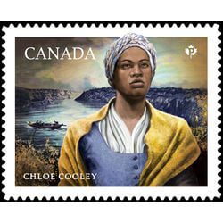
9:00 NOTL BLACK HISTORY SERIES - #1 of 4: Chloe Cooley and the Beginning of the End Black Enslavement in Upper Canada
https://hikes.brucetrail.org/event/900-notl-black-history-series-1-of-4-chloe-cooley-and-the-beginning-of-the-end-black-enslavement-in-upper-canada/Sorry, the registration cut-off time for this hike has been reached.Not a member? Click here to join today!Hosting Club: Niagara
Category: Loop
Location (Google Maps):Veteran’s Memorial Park. Park on King St. at Centre St
Hike Leader(s): Karen Couch Click here to contact Hike Leader(s)
Pace: Medium
Terrain: Easy
Distance: 5-6 kmsDescription
Each year, February, Black History Month honours the experiences, achievements and enduring contributions of Black communities in Canada, while deepening our collective understanding of their history and impact on Canadian society. This year’s theme: “30 Years of Black History Month: Honouring Black Brilliance Across Generations — From Nation Builders to Tomorrow’s Visionaries.” This theme celebrates three decades of Black History Month in Canada and recognizes the enduring legacy of Black Canadians, whose leadership, creativity, innovation and resilience have shaped our past, continue to influence our present, and will inspire future generations. During all the hikes in this series, you will learn about Niagara-on-the-Lake’s Black history.The link below will take you to a brief overview on this topic, by the Niagara-on-the-Lake’s Museum.
https://artsandculture.google.com/story/niagara-on-the-lake-s-black-history-niagara-historical-society-museum/-QXR3nRTdnmqJw?hl=en
**Bring hydration and a snack. We will be stopping several times. Hiking poles and icers are recommended as sidewalk and streets may be icy.
This hike counts as 1 of 3 required hikes towards the Black History badge. Check the Hike Schedule for additional hikes this month. There will be a short break between the hikes offered today.
Please Note: Hikes are offered by volunteers who have committed to their own learning, to be able to offer informative and contemplative hike experiences. These hikes are opened to all and offered in a spirit of mutual learning and inclusion.

11:00 NOTL Black History SERIES - #2 of 4: The Long Road to Freedom: the Robert Moseby Affair
https://hikes.brucetrail.org/event/1100-notl-black-history-series-2-of-4-the-long-road-to-freedom-the-robert-moseby-affair/Sorry, the registration cut-off time for this hike has been reached.Not a member? Click here to join today!Hosting Club: Niagara
Category: Urban
Location (Google Maps):Veteran’s Memorial Park. Park on King St. at Centre.
Hike Leader(s): Karen Couch Click here to contact Hike Leader(s)
Pace: Medium
Terrain: Easy
Distance: 5-6 kmsDescription
Since 1995, the government in Canada officially recognized February as Black History Month. Each year, Black History Month honours the experiences, achievements and enduring contributions of Black communities in Canada, while deepening our collective understanding of their history and impact on Canadian society.During all the hikes in this series, you will learn about Niagara-on-the-Lake’s Black history. You will find out about some of those who fought enslavement, and how they were pivotal in shaping our society to be as diverse as it is today.
Wear extra warm clothing as we will be stopping several times. While the terrain is easy, bring your walking sticks and/or footwear with micro spikes. Sidewalks and streets may be icy.
Today’s hike is 1 of 3 required for the Black History badge. 1 additional hike is earlier on today’s hike schedule. There will be a short break between hikes. 2 more hikes are offered Feb. 9
Consider a visit to the NOTL Museum after the hike to see exhibit on this topic. There you will see numerous artifacts on this subject.
PLEASE NOTE: Hikes are offered by volunteers who have committed to their own learning to be able to offer informative and contemplative hike experiences. These hikes are open to all and offered in a spirit of mutual leaning and inclusion.
- 03February 3, 2026
9:00 Long Hike Wiley Road, Short Hills
https://hikes.brucetrail.org/event/900-long-hike-wiley-road-short-hills-52/Sorry, the registration cut-off time for this hike has been reached.Not a member? Click here to join today!Hike open to BTC Members only.
Hosting Club: Niagara
Category: Loop
Location (Google Maps): Short Hills parking lot C, Wiley RoadHike Leader(s): Jacques Boilard Click here to contact Hike Leader(s)
Pace: Brisk
Terrain: Moderate
Distance: 10kmDescription
Explore Short Hills and majestic side trail of Scarlett Tanager, Hemlock, Swayze Falls and Terrace. Register for each hike.Bring poles, icers, snack and dress according to the weather
9:15 Short hike, Pelham Road entrance, Short Hills
https://hikes.brucetrail.org/event/915-short-hike-pelham-road-entrance-short-hills-8/Sorry, the registration cut-off time for this hike has been reached.Not a member? Click here to join today!Hosting Club: Niagara
Category: Loop
Location (Google Maps): Pelham Road entrance Short Hills Provincial ParkHike Leader(s): janet davey Click here to contact Hike Leader(s)
Pace: Medium
Terrain: Moderate
Distance: 6 kmsDescription
Hike the main and side trails of Short Hills Provincial Park. Please note that there are some steep hills and rocky sections so you should have some hiking experience before joining this hike. Please bring water, hiking poles and icers, as the trails can be icy at times.Urban Walk: Valley View Park Thornhill
https://hikes.brucetrail.org/event/urban-walk-valley-view-park-thornhill-139/Sorry, the registration cut-off time for this hike has been reached.Not a member? Click here to join today!Hosting Club: Toronto
Location (Google Maps): Parking lot is off Sycamore Drive, East of Bayview , across Starbucks plaza
Bus 91 from Finch East station stops at Sycamore station.Hike Leader(s): Mohammad Aghamiri Click here to contact Hike Leader(s)
Pace: Moderate (3-4 km/hr)
Terrain: Hilly, Level 2 (Intermediate – some hills and uneven surfaces, rocks and roots underfoot), Variable
Distance (km): 6-7 kmDescription
We will explore Valleyview and Maple View parks, and walk along German Mill Creak, in return we stop in Huntington park and have snack under beautiful shed.Although this is considered an “Urban Walk”, you can expect some hills up and down and uneven surfaces with tree roots. Please bring hiking poles, Ice cleats water and snacks.
phone number for the day of hike 289 588 6482
Boston Mills / Terra Cotta
https://hikes.brucetrail.org/event/boston-mills-terra-cotta-3/Sorry, the registration cut-off time for this hike has been reached.Not a member? Click here to join today!Hosting Club: Caledon Hills
Category: Tuesday Hikers
Location (Google Maps): Parking at Boston Mills Rd., west of its intersection with Mississauga Rd, Map 14.
Driving directions: From Highway 410 north, continue on Highway 10, left on King Street, right on Mississauga Rd., left on Boston Mills Rd. to the parking at dead end.
Carpool if possible.Hike Leader(s): Mohammad Shafiq Click here to contact Hike Leader(s)
Pace: Medium – 3 to 4 km/hour
Terrain: Moderate – some hills and/or some poor footing
Distance: 8-10 kilometresDescription
Main Bruce Trail and Rockside Trail; will hike about 5 km reaching towards Terra Cotta and return after snack break.
Bring sufficient hydration drink, snack; poles are recommended.
Icers are required due to snow on the ground.
After hike there is optional refreshment stop at Coy Wolf with possible local music entertainment.Glen Haffy - Coolihans Sideroad to Hwy 9
https://hikes.brucetrail.org/event/glen-haffy-coolihans-sideroad-to-hwy-9/Sorry, the registration cut-off time for this hike has been reached.Not a member? Click here to join today!Hosting Club: Dufferin Hi-Land
Category: Tuesday Hike
Location (Google Maps): Coolihans Sideroad to Hwy 9
Caledon Section, Map 17. Meet at roadside parking on Coolihans Sideroad where the Main Trail crosses (Km 35.0)Hike Leader(s): Julie Daley, Les Babbage, Tony Evangelista, Inge Eckerich Click here to contact Hike Leader(s)
Pace: Leisurely
Terrain: Dependent on Conditions, Moderate
Distance: Long Hike 6.8 Km, Shorter Hike turn back at hiker’s discretionDescription
Caledon Section, Map 17. Meet at roadside parking on Coolihans Sideroad where the Main Trail crosses (Km 35.0). We will hike north along the main trail, passing through Glen Haffy Conservaton Area, up to Hwy #9. We will stop for a break/snack here, then head back to Coolihans Sideroad. Bring snack. Poles and icers are recommended, snowshoes may be needed. - 04February 4, 2026
Niagara E2E Winter - 2 of 5 (Wednesdays)
https://hikes.brucetrail.org/event/niagara-e2e-winter-2-of-5-wednesdays/Sorry, the registration cut-off time for this hike has been reached.Not a member? Click here to join today!Hosting Club: Niagara, Iroquoia
Category: General Hike
Location (Google Maps): Decew House Heritage Park, enter from Decew Rd (10), 43.107568,-79.249598, we will shuttle to Roadside parking on Taylor Rd, across from the entrance to Woodend Conservation Area (I think we can park at the entrance to Woodend off the road), 43.143241,-79.167617Hike Leader(s): Steven White Click here to contact Hike Leader(s)
Pace: Brisk – 4 to 5 km/hr, Medium – 3 to 4 km/hr
Terrain: Moderate – Some hills and/or some poor footing, Slippery and Steep Sections
Distance: 14.4 kmDescription
The Niagara E2E Winter in 5 will be Wednesdays Jan 28, Feb 4, 11, 18, 25. Hikers must register for individual hikes. Hikes are 14-18 kms and expect an average pace of 4 km/hr with snack/lunch breaks.Hikers should be prepared for the season – layered clothing, hiking boots, icers, snowshoes (if we get fresh snowfall), poles, water, snacks/lunch, first aid kit.
Hikers should be prepared to share their cars for shuttling – to be shared evenly.
If we encounter unsafe hiking or driving conditions, I will cancel/re-schedule the hike the day before. If you are unable to join us on the day of the hike, please text me at 289-242-9415

8:30 Niagara Winter End to End #5 Decew House to Woodend Conservation Area
https://hikes.brucetrail.org/event/830-niagara-winter-end-to-end-5-decew-house-to-woodend-conservation-area-3/Sorry, the registration cut-off time for this hike has been reached.Not a member? Click here to join today!Hosting Club: Niagara
Category: Car Pool
Location (Google Maps): Meet at Woodend Conservation Area and Carpool to Decew Heritage HouseHike Leader(s): Sam Rutherford Click here to contact Hike Leader(s)
Pace: Medium
Terrain: Moderate
Distance: 14.5 kmsDescription
We will be car pooling, Bring Icers and poles. No dogs. To earn your Niagara Winter End to End badge, it must be completed between December 21, 2025 to March 21, 2026.
Because of the potential for bad winter trail conditions we have broken this e2e into 6 hikes rather than 5Duntroon View - Easy pace, snowshoe hike
https://hikes.brucetrail.org/event/duntroon-view-easy-pace-snowshoe-hike/Sorry, the registration cut-off time for this hike has been reached.Not a member? Click here to join today!Hosting Club: Blue Mountains
Category: Organized Hike
Location (Google Maps): Tim Horton’s, First Street, CollingwoodHike Leader(s): Richard Edwards Click here to contact Hike Leader(s)
Pace: Leisurely – 3 km/hr. or less
Terrain: Easy – Mostly flat and usually good footing
Distance: 4 kmDescription
We will hike north on the new Field & Forest Side Trail and complete a 2 km loop back to rd 91 via a very scenic section of main trail . We will then cross 91 and do a southern 2 km loop past interesting crevices & forest back to our cars via Walker Aggregates side trail .Humpday Hikers - Forks of the Credit
https://hikes.brucetrail.org/event/humpday-hikers-forks-of-the-credit-2/Sorry, the registration cut-off time for this hike has been reached.Not a member? Click here to join today!Hosting Club: Caledon Hills
Category: General
Location (Google Maps): Southwest shoulder of Willoughby Rd. and Escarpment Sideroad.
From ON-10 head west on Escarpment Sideroad until you meet Willoughby Road.
Also possible to take Willoughby Road south from 124 just west of Highway 10.Hike Leader(s): Jennie Greenfield; Mel Thornley Click here to contact Hike Leader(s)
Pace: Medium – 3 to 4 km/hour
Terrain: Strenuous – hilly with steep climbs and some poor footing
Distance: 9 kmDescription
This hike loops through the Forks of the Credit Provincial Park with a stop at the Credit River. The combination of winter conditions and some big hills can be strenuous.To avoid getting chilled there will be quick stops for water and a shorter nutrition break along the way – bring your favorite hiking drink and snacks.
Dress in layers according to the weather. Hiking boots, and icers / crampons required, poles recommended.
If you can plan to come for a warm drink and treat at Coy Wolf Coffee in Inglewood after the hike.
Participants will be notified the night before if a hike must be cancelled due to inclement weather.
Gage Park and Greenhouse
https://hikes.brucetrail.org/event/gage-park-and-greenhouse/Sorry, the registration cut-off time for this hike has been reached.Not a member? Click here to join today!Hosting Club: Iroquoia
Category: Good Companions
Location (Google Maps): Gage Park, Hamilton, OntarioHike Leader(s): Craig Sim Click here to contact Hike Leader(s)
Pace: Medium – 3 to 4 km/hr
Terrain: Easy – Mostly flat and usually good footing
Distance: 6k (approximate)Description
Gage Park parking lot off of Lawrence Rd, meet at the edge of lot closest to the tropical greenhouse. An easy urban walk in Gage Park to and from an old boulevard, admire older homes, after the hike enjoying the tropical greenhouse which is typically free (they charge for special events, would not expect any at this time.) I suspect my distance estimate is generous, the time estimate likely gets us into the greenhouse. Dress for the weather. After our cool walk we will be warm in the greenhouse.Celebratory Hike on Newly Donated Land adjacent to Loree Forest
https://hikes.brucetrail.org/event/winter-wednesday-walkers-hilts-falls-3/Sorry, the registration cut-off time for this hike has been reached.Not a member? Click here to join today!Hosting Club: Beaver Valley
Location (Google Maps): Meet on the north shoulder of the road on 21st Sideroad at the parking area. Map 24, east of km 8.3, BTC Edition 31. Town of Blue Mountain residents park free, non residents – paid parking. Please try to car pool if possible, as there is only so much space along the shoulder.
Hike Leader(s): Glenda Collings Click here to contact the hike leader.
Pace: Medium
Terrain: Some steep sections
Length of Hike: Approx. 1 – 1 1/2 hoursDescription
This is a hike through 29 acres adjacent to Loree Forest, generously donated by John and Liz McCullam, long time members and continuing volunteers, of the Beaver Valley Club. This will be a treat as John and Liz take us on a tour of the property they have lovingly managed for years. We will also be hiking through parts of Loree Forest itself.On winter hikes we may encounter bare ground, light snow, deep snow, or ice. Please bring snowshoes and icers and wear appropriate clothing for the weather plus water and a snack.
Guidelines
- Arrive 15 minutes before the start of the hike.
- Wear sturdy footwear and appropriate attire for the weather and the terrain.
Hiking poles are a good idea in any season, especially if the terrain is rocky or slippery. In winter, snowshoes or icers/crampons are needed when conditions dictate.
Wearing appropriate clothing and footwear prevents injuries and shows consideration for a safe and positive group hiking experience. - Always carry I.D. and your health card.
- Bring sufficient water and snacks (or lunch if indicated). A minimum of 1L of water is recommended on all hikes, and 3L is recommended for long, challenging hikes in the heat of the summer.
- Bring sunscreen and insect repellent (for spring and summer hikes).
- Bring your own first aid kit.
- Please leave dogs at home.
Evening Hike in Owen Sound followed by an Opportunity for Refreshments
https://hikes.brucetrail.org/event/evening-hike-in-owen-sound-followed-by-an-opportunity-for-refreshments-20/Sorry, the registration cut-off time for this hike has been reached.Not a member? Click here to join today!Hosting Club: Sydenham
Category: An evening walk.
Location (Google Maps): Municipal Parking Lot by the river on the West side of First Ave East between 7th St East and 8th St East in Owen SoundHike Leader(s): Harriet Nixon Click here to contact Hike Leader(s)
Pace: Brisk: 4 to 5 km/h
Terrain: There might be icy and slippery sections.
Distance: Approx 5 kmDescription
Join us for a brisk winter evening hike exploring paths and neighbourhoods of Owen Sound for about 1 hour and 45 minutes. Please bring icers in case we come across icy conditions. Following the hike there will be an opportunity to socialize over refreshments. - 05February 5, 2026
Frosty Five Weekday - Hike Five
https://hikes.brucetrail.org/event/frosty-five-weekday-hike-five/Sorry, the registration cut-off time for this hike has been reached.Not a member? Click here to join today!Hosting Club: Caledon Hills
Category: General
Location (Google Maps): Meet north of the intersection of Cataract Road and Mississauga Road at the Elora Cataract Trailway Trail Head. Google Coordinates: 43.813120, -80.028656.Directions: From ON-10 head west on Charleston Sideroad/Peel Regional Rd. 24 for 5.5 km. Turn left onto Mississauga Rd. and drive for 1.0 km. Park on west shoulder.
Hike Leader(s): Sandy Green Click here to contact Hike Leader(s)
Pace: Medium – 3 to 4 km/hour
Terrain: Moderate – some hills and/or some poor footing
Distance: 11 kmDescription
Beat the winter blues! Register individually for one, a few, or all of the Frosty Five Blues hikes. Participants who complete all five hikes are eligible to receive a CHBTC Winter badge and a Sideways badge on the final hike. Hike Five explores the trails within the Forks of the Credit Provincial Park. Bring your choice of hydration and snacks. Hiking boots and icers/crampons are required. (Note: If you wish to purchase badges, the cost of each badge is $10.00 for BTC members and $15.00 for non-members.) Everyone is welcome to join!9:00 am Long hike NEW Location. Bailey bridge Jordan
https://hikes.brucetrail.org/event/900-am-long-hike-new-location-bailey-bridge-jordan-7/Sorry, the registration cut-off time for this hike has been reached.Not a member? Click here to join today!Hosting Club: Niagara
Location (Google Maps):
Bailey bridge Jordan
Pace: Brisk
Terrain: Strenuous
: 10kDescription
This will be our permanent location . Hike up from the Bailey bridge to Balls Falls and explore the trailsYou must register for each hike. Bring Poles, snack and a drink. Dress for the weather
Urban Walk: Valley View Park Thornhill
https://hikes.brucetrail.org/event/urban-walk-valley-view-park-thornhill-140/Sorry, the registration cut-off time for this hike has been reached.Not a member? Click here to join today!Hosting Club: Toronto
Location (Google Maps): Parking lot is off Sycamore Drive, East of Bayview , across Starbucks plaza
Bus 91 from Finch East station stops at Sycamore station.Hike Leader(s): Mohammad Aghamiri Click here to contact Hike Leader(s)
Pace: Moderate (3-4 km/hr)
Terrain: Hilly, Level 2 (Intermediate – some hills and uneven surfaces, rocks and roots underfoot), Variable
Distance (km): 6-7 kmDescription
We will explore Valleyview and Maple View parks, and walk along German Mill Creak, in return we stop in Huntington park and have snack under beautiful shed.Although this is considered an “Urban Walk”, you can expect some hills up and down and uneven surfaces with tree roots. Please bring hiking poles, Ice cleats water and snacks.
phone number for the day of hike 289 588 6482
Hiking around Jordan
https://hikes.brucetrail.org/event/hiking-around-jordan-45/Sorry, the registration cut-off time for this hike has been reached.Not a member? Click here to join today!Hosting Club: Niagara
Location (Google Maps): Glen Road Parking Lot
3640 Glen Road, Jordan LOR 1SOHike Leader(s): Bill Russell Click here to contact Hike Leader(s)
Pace: Medium
Terrain: Moderate
Distance: 7 kmDescription
Hiking in and around Jordan including Jim Rainforth Trail, Bailey Bridge and Balls Falls (alternating every 3 weeks).
Cityview Park
https://hikes.brucetrail.org/event/cityview-park/Sorry, the registration cut-off time for this hike has been reached.Not a member? Click here to join today!Hosting Club: Iroquoia
Category: General Hike
Location (Google Maps): Meet at 9:15 am in the parking lot at Cityview Park, at the second entrance on Kerns RdHike Leader(s): Karen Bergmann Click here to contact Hike Leader(s)
Pace: Medium – 3 to 4 km/hr
Terrain: Easy – Mostly flat and usually good footing
Distance: 8 kmsDescription
Meeting in the parking lot at 9:15 am at the 2nd (southern) entrance to Cityview Park on Kerns Road, we will hike the main trail, bike trails and side trails for a large loop.Bring icers for your boots. Hike is dependent on weather.
Celebrate Winter Series - Cape Chin South
https://hikes.brucetrail.org/event/celebrate-winter-series-cape-chin-south/Sorry, the registration cut-off time for this hike has been reached.Not a member? Click here to join today!Hosting Club: Peninsula
Category: Winter Hikes
Location (Google Maps): Cape Chin South, South end of Carter RoadHike Leader(s): Owen and Marg Glendon Click here to contact Hike Leader(s)
Pace: Leisurely (2.0 – 3.0 km/h): A relaxed pace with frequent breaks and a focus on enjoyment.
Terrain: Moderate: Rolling hills, mild slopes and rocky paths.
Distance: 3 1/2 or 5 kmDescription
Celebrate Winter Hikes Series – Cape Chin SouthStep into winter with the Celebrate Winter on the Trail Series—an invitation to enjoy the season’s beauty on the trail. These small-group adventures offer shorter distances (~5 km) hikes, slower but steady pace, with a duration of ~ 3hours. Gear requirements will vary with the weather, and may include snowshoes, winter hiking boots, icers, or hiking poles. Join one or all five!
Join us for a magical 3.5 km loop hike which winds through the shelter of a cedar forest, follows the Georgian Bay shoreline, and meanders along a peaceful forest corridor. You may even feel as though you’ve stepped into the enchanted Land of Narnia!
If conditions allow, a hike leader will take those wishing to venture a little deeper into the woods for an optional, energetic 1.5 km out-and-back hike. The terrain is relatively flat. The out-and-back hike segment has one steep incline.
Plan ahead if you don’t have your own snowshoes. Snowshoes and poles kits are available from Bruce County Libraries, free. We also have a few adult pairs of snowshoes. Please let me know if you need snowshoes in advance.
Winter hiking requires extra thought and preparation. Please prepare by wearing layered clothing, warm winter hiking boots, hat, face covering (if windy), and mittens. Bring a light backpack for snacks and warm drink. Hiking poles and gators are strongly recommended.
After the hike, we’ll gather for lunch at Tru Foods, if you wish.
- 06February 6, 2026
Hilton Falls Loop
https://hikes.brucetrail.org/event/hilton-falls-loop/Sorry, the registration cut-off time for this hike has been reached.Not a member? Click here to join today!Hosting Club: Iroquoia
Category: General Hike
Location (Google Maps): Hilton Falls Conservation Area – Main Parking Lot. Reservation RequiredHike Leader(s): Pati Greenwood, Jeff Dowsett Click here to contact Hike Leader(s)
Pace: Medium – 3 to 4 km/hr
Terrain: Dependent on Conditions, Moderate – Some hills and/or some poor footing
Distance: 12 kmDescription
This hike will explore Hilton Falls Conservation Area on the main trail, side trail and conservation area trails Bring water and snacks. Wear layers for winter conditions, bring icers and hiking poles.Park in Hilton Falls Conservation Area parking lot, accessible from Campbellville Road. Reservations are required. For further information see Conservation Halton web site: https://www.conservationhalton.ca/parks/hilton-falls/
Please arrive by 8:15 am as we will depart promptly at 8:30 am.
9:00 am Niagara-on-the-Lake Tour
https://hikes.brucetrail.org/event/900-am-niagara-on-the-lake-tour-55/Sorry, the registration cut-off time for this hike has been reached.Not a member? Click here to join today!Hosting Club: Niagara
Category: Urban
Location (Google Maps):Veterans Memorial Park, park just outside the park on King Street
Hike Leader(s): Robin Garrett Click here to contact Hike Leader(s)
Pace: Medium
Terrain: Easy
Distance: 6-7 kmDescription
Each Friday we will explore different neighbourhoods, trails and parkland throughout Historic Niagara-on-the-Lake.Moderate pace with some weeks entirely on sidewalks and roads while others may include a mix of trails and paved pathways. Great way to build up endurance for longer more strenuous hikes.
Prepare for cooler windy conditions on open parkland and along Lake Ontario and Niagara River trails.
Plan to stay for conversation and a warm cup of coffee or tea at Sweets & Swirls, Community Centre, Niagara Stone Road, NOTL
- 07February 7, 2026
Toronto Winter Blues - Hike 2 RESCHEDULED from January 26
https://hikes.brucetrail.org/event/toronto-winter-blues-hike-2/Sorry, the registration cut-off time for this hike has been reached.Not a member? Click here to join today!Hosting Club: Iroquoia, Toronto
Category: General Hike
Location (Google Maps): Bruce Trail Pear Tree Parking LotHike Leader(s): Pati Greenwood, Jeff Dowsett Click here to contact Hike Leader(s)
Pace: Medium – 3 to 4 km/hr
Terrain: Dependent on Conditions, Moderate – Some hills and/or some poor footing, Slippery Sections Likely
Distance: 12 kmDescription
This is a series of 6 hikes to explore various side trails in the Toronto Section of the Bruce Trail. Hikers completing all six hikes will be eligible to obtain the Toronto Side Trail Badge. Each hike requires a separate registration. The hikes in this series will take place on January 12, 26, February 2, 9, 23, and March 2. Hikes will be dependent on weather / travel conditions. All hikes will be undertaken at a medium pace.This hike will explore the Al Shaw Side Trail and the northern part of the Hilton Falls Side Trail.
Dress in layers for the weather, wear appropriate hiking footwear, bring icers and hiking poles. Bring plenty of water or other hydration and a snack.
Please arrive at the meeting place by 8:15 am. We will depart promptly at 8:30 am.
If your plans change and you are unable to join the hike, please cancel your reservation in the My Hikes Section of the BTC website.
Seaton Trail Pickering
https://hikes.brucetrail.org/event/car-hike-cherry-beach-downtown-3/Sorry, the registration cut-off time for this hike has been reached.Not a member? Click here to join today!Hosting Club: Toronto
Location (Google Maps): Seaton Trail Parking Lot, Pickering
Hike Leader(s): Mohammad Aghamiri Click here to contact Hike Leader(s)
Pace: Moderate (3-4 km/hr)
Terrain: Flat, Level 2 (Intermediate – some hills and uneven surfaces, rocks and roots underfoot)
Distance (km): 12-14 kmDescription
We will hike along Seaton trail and enjoy the lovely scenery of forest and river.
• Please dress appropriately for the weather.
• We will have short water, picture, Bio and a 15 minute snack breaks. Everyone is welcome!Please bring lots of water and snacks ,hiking poles are recommended
phone number for the day of hike 289 588 6482
Coach Trip: Skiers Horseshoe, Hikers McCrae Lake
https://hikes.brucetrail.org/event/coach-trip-skiers-horseshoe-hikers-mccrae-lake/Sorry, the registration cut-off time for this hike has been reached.Not a member? Click here to join today!Trip Information
Departure Time: 09:00
Return to City Time: 18:00
Departure Point: York Mills Bus PickupTrip Activities
X-Country Ski ($0.01)
Snowshoe - McRae Lake ($0.01)
Snowshoe - Resort ($.01)
Optional Items
P/U at Hwy 400 & Major Mac ($.01)Hosting Club: Toronto
Category: Coach Trips
Location (Google Maps): Horseshoe ResortHike Leader(s): Tim Wainwright, Roland Mark; George Lennon; Robin Crombie Click here to contact Hike Leader(s)
Pace: Moderate (3-4 km/hr)
Terrain: Hilly, Level 2 (Intermediate – some hills and uneven surfaces, rocks and roots underfoot), VariableDescription
Join us for an awesome day of winter fun at Horseshoe Resort and in the beautiful McCrae Lake Conservation Reserve.Cross-country skiers: Glide through forests and fields on 30 km of trails groomed for classic and skate skiing. Classic ($49) and skate ski ($59) rentals available. All cross-country skiing is self-guided. Ski passes are $35 per person.
Winter hikers: Join Roland and George for a fun guided hike in beautiful McCrae Lake Conservation Reserve. The group will be out all day and eat lunch on the trail. Depending on conditions you may need snowshoes, microspikes, or just boots. Option 2: Snowshoe with Tim and Robin on Horseshoe’s trails. Those staying on resort will need to purchase trail passes ($15); snowshoe rentals ($20) are available for those who stay on resort.
Reserve your rental equipment ahead of time at https://horseshoeresort.com/nordic-centre/cross-country-ski/
Trail fees will be collected in cash on the bus. We will leave the resort at 4 PM.
Departure 1: 9 AM, 10 York Mills Rd
Departure 2: 9:20 AM, HWY 400 and Major Mackenzie Dr Park and Ride
Please arrive at the pick-up location 15 minutes before departure. The bus waits for no one.
Policy for running this trip: To run this trip we need 40 registrants 8 days in advance. We may cancel the trip on short notice if there is substantial risk of trail or resort closure due to major weather warnings. If there is enough snow to ski and conditions are marginal or better, we will go. Marginal conditions mean not ideal skiing conditions. For example, wet snow, a thin bumpy base, or some icy patches. If TBTC cancels the trip, we will refund your coach fare. No refund if you cancel.
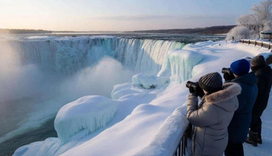
9:30 Winter Wonderland at Niagara Falls
https://hikes.brucetrail.org/event/930-winter-wonderland-at-niagara-falls/Sorry, the registration cut-off time for this hike has been reached.Not a member? Click here to join today!Hike open to BTC Members only.
Hosting Club: Niagara
Category: Urban
Location (Google Maps): Floral Showhouse parking. A parking fee applies. Niagara Parks annual parking pass is the best deal around.Hike Leader(s): Karen Couch Click here to contact Hike Leader(s)
Pace: Medium
Terrain: Easy
Distance: 5-6 kmDescription
Witness the rare frozen falls phenomenon along with frozen mist and ice formations. Wear warmer layers than you would normally so you can stop and enjoy the sights. Icers and hiking poles are also recommended.Saturday Shorts: Cheltenham CANCELLED
https://hikes.brucetrail.org/event/saturday-shorts-cheltenham/Sorry, the registration cut-off time for this hike has been reached.Not a member? Click here to join today!Hosting Club: Caledon Hills
Category: General
Location (Google Maps): This is a loop hike in Cheltenham. Starting from the Cheltenham Brickyards Trans Canada Trail parking lot on Mississauga Road, along the Trans Canada Trail, through Cheltenham and back to the Brickyards. A stop at the Cheltenham General Store will be included for a hot beverage.Hike Leader(s): Lynn Dobson Click here to contact Hike Leader(s)
Pace: Leisurely – 3 km/hour or less
Terrain: Easy – mostly flat and usually good footing
Distance: 4.5 kmDescription
This is a flat loop along the Trans Canada Trail and a stretch of the Credit River before coming into the village of Cheltenham. We will stop for a look see at the General Store – hot beverages available. Walking along a quiet residential street, we will return to our vehicles on Mississauga Road. One slight hill along the road.
Urban Walk – Toronto Urban Badge Hike – 2 of 7
https://hikes.brucetrail.org/event/urban-walk-toronto-urban-badge-hike-2-of-7-3/Sorry, the registration cut-off time for this hike has been reached.Not a member? Click here to join today!Hosting Club: Toronto
Category: Urban Walk
Location (Google Maps): South Humber Recreational Trail/Toronto Waterfront TrailHike Leader(s): Brian Rideout Click here to contact Hike Leader(s)
Pace: Moderate (3-4 km/hr)
Terrain: Flat
Distance (km): 10.9 kmDescription
Please join me at the south east corner of Eglinton and Scarlett by 10 AM. We will hike south on the Humber Recreational Trail to Lakeshore Blvd and Ellis (km 19.2 to km 8.3). Here is an online map with km markings of our route for all 7 hikes for the Toronto Urban Badge: https://onthegomap.com/s/c2c1hf3nPlease make sure you bring at least 2 liters of water, a lunch, and icers.
Soup's On Hike - BV East Valley
https://hikes.brucetrail.org/event/soups-on-hike-bv-east-valley-2/Sorry, the registration cut-off time for this hike has been reached.Not a member? Click here to join today!Hosting Club: Beaver Valley
Location (Google Maps): 194700 Grey County Rd 13, Kimberley, ON N0C 1E0. Look for 3 white chairs on the front lawn.
Hike Leader(s): Glenda Collings Click here to contact the hike leader.
Pace: Medium
Terrain: Moderate, Some steep sections
Length of Hike: Approx. 5 kmDescription
SOUP’S ON! Join us for a lovely snowshoe on the Bruce Trail, east side of the valley, followed by a warming lunch in Ed and Dale Stedman’s home. They will provide the soup, plus coffee & tea and you’ll bring a sandwich, or your choice of accompaniment to go with it. If you’d like to bring goodies to share for dessert, feel free! Folks are welcome to show up just for the lunch, or conversely, just for the hike, or both. If you are there just for lunch, please arrive between 12:00 and 12:30 p.m. Depending on the conditions, we may use snowshoes, icers or just boots, so please come prepared. If you have any questions please contact beavervalleytrailactivities@gmail.com. The hike leader will inform the group in the morning on Feb. 7 if weather conditions preclude the hike. Hope to see you there! Please car pool if possible.Pine River Discovery Hike
https://hikes.brucetrail.org/event/pine-river-discovery-hike-4/Sorry, the registration cut-off time for this hike has been reached.Not a member? Click here to join today!Hosting Club: Dufferin Hi-Land
Category: General Hike
Location (Google Maps): Second Line and 15 Sideroad in Mulmur Ontario. From Orangeville, head north on hwy #10 to hwy #89. Turn left and head west to county road #124. Turn right and head north to 15 Sideroad. Turn right and follow to 2nd line. Parking is on the east side of 2nd Line, just north of 15 Sideroad. Do not try and come across 15 sideroad from east to west. It is a snowmobile trail at this time of the year.Hike Leader(s): Tom Thayer Click here to contact Hike Leader(s)
Pace: Medium
Terrain: Dependent on Conditions, Moderate
Distance: 6 kmDescription
We will be exploring the winter wonders that the Pine River Nature Reserve offers during the winter.This is a snowshoe hike so please be sure to bring your snowshoes. Should the weather not behave and snow is not in abundance, we will still do the hike but icers will be required as there are icy patches within the reserve.
Bring snowshoes, icers, mitts, hats, food, and dress according to the weather.
Peninsula Sunshine Series: Lion's Head Lookout Sunset
https://hikes.brucetrail.org/event/peninsula-sunshine-series-lions-head-lookout-sunset/Sorry, the registration cut-off time for this hike has been reached.Not a member? Click here to join today!Hosting Club: Peninsula
Category: Sunrise Hike
Location (Google Maps): Lion’s Head Lookout Trail ParkingHike Leader(s): Kathleen Stahlbaum, Madie Barker Click here to contact Hike Leader(s)
Pace: Leisurely (2.0 – 3.0 km/h): A relaxed pace with frequent breaks and a focus on enjoyment., Medium (3.0 – 4.5 km/h): A comfortable pace for most hikers with steady progress.
Terrain: Difficult: Steep ascents/descents, rocky scrambling, and some rugged escarpment paths., Moderate: Rolling hills, mild slopes and rocky paths.
Distance: 7.0 kmDescription
On Saturday February 7th*, join us in hiking through Lion’s Head Provincial Park to the iconic Lion’s Head Lookout, where we’ll witness the sun as it sets across the bay behind White Bluff. This peaceful sunset hike is the perfect way to connect with nature, capture some incredible photos, and wind down as the day comes to a close. Whether you’re sunset obsessed or just love a good adventure, come experience the magic of golden hour from one of the best vantage points on the Saugeen (Bruce) Peninsula.Join us and discover how a sunset hike can nourish your mind, body, and spirit – offering a peaceful close to the day
This hike is approximately 7 kms in length. Expect to be on the trail for ~3 hours. Pace will be leisurely with ample time to enjoy the sunset, take some photographs, and nourish yourself!
Don’t forget to bring a headlamp or flashlight (preferably with a red light setting) as we’ll be finishing our adventure in the dark of night.
Experienced hikers only; this trail is rated difficult and presents additional challenges on a snowy winter’s eve. Some undulating terrain, lots of rocks and roots.
How to prepare:
- Bring snowshoes/crampons
- Wear weather appropriate clothing (lots of layers! It gets cold at night)
- Wear warm, supportive footwear
- Bring lots of water and a snack
- Bring a headlamp or flashlight (preferably with a red light setting)
- Trekking poles are recommended to navigate uneven terrain in the dark
*In the event of exceptionally cloudy weather or snowstorm, the hike will be rescheduled to the following date: Sunday, February 8th. Watch for emails in the days leading up to the hike!