Hike Schedule
Join us for a hike! Registration required.
All hikes available to BTC members. Some hikes are open to non-members.
See Refund Policy for Paid Hikes >
TIP: The calendar view displays up to 7 hikes on a day, but often there are more. Click “View more events” to see them all.
Categories
- 26January 26, 2025
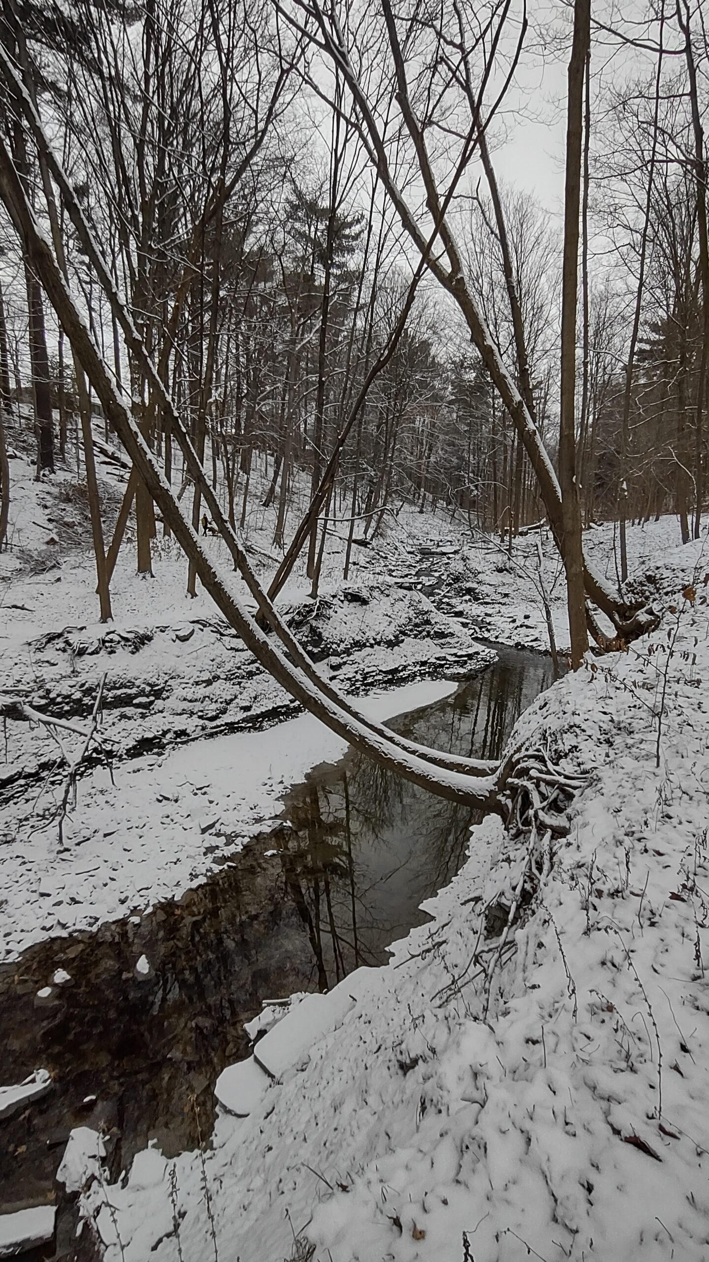
Humber Creek - Islington Ave. & Dixon Road to Historic Lambton House on the Humber
https://hikes.brucetrail.org/event/humber-creek-islington-ave-dixon-road-to-historic-lambton-house-on-the-humber/Sorry, the registration cut-off time for this hike has been reached.Not a member? Click here to join today!Hosting Club: Toronto
Category: Urban Walk
Location (Google Maps): Meet me at the Tim Hortons inside the No Frills Plaza SE corner of Islington and Dixon Rd at 9:40 am to use the washrooms and to stay warm. We will leave the Tim Hortons by 10 am to cross over to the ravine on the west side of Islington where we will begin the hike.. If driving to the hike, park on Northcrest Road, on the south side of Wincott Park and follow the path around the pond to the entrance of the park at Dixon Road and proceed east to meet the group at the intersection for 10. Transit users can come either via Islington Bus 37 from Islington Subway running every 11 minutes or via Lawrence West Bus 52 to Pearson Airport running every 12 minutes.Hike Leader(s): Andrew Proczek Click here to contact Hike Leader(s)
Pace: Moderate (3-4 km/hr)
Terrain: Flat, Level 2 (Intermediate – some hills and uneven surfaces, rocks and roots underfoot), Variable
Distance: 9.5 to 10 kmDescription
Join me for a pleasant winter hike along the little known Humber Creek tail running eastward to the Humber River. Once we reach the river we will follow the Humber River trail south to just past Dundas St and our destination, the historic Lambton House where at 2 pm you will be treated to a lecture on the indigenous peoples and the Humber by Darin Wybenga, Heritage Interpreter for the Mississaugas of the Credit First Nation. Those of you not wanting to attend the lecture can drop out there or continue to Old Mill Subway for an additional 3 km.Public Washrooms and warm-up facilities available at Tim Hortons at 0 km; Valleyfield Rink (The West Way) at 2.5 km; James Gardens (7 km); and Lampton House (9.5 km)
Please bring your icers as the trails may be icy and dress appropriately for the winter conditions. Pack snacks or a lunch and sufficient water or a Thermos of your favorite hot drink.
Poles will be of help to you on a wilderness section of trail east of Royal York Road where if conditions permit we may attempt a creek crossing.
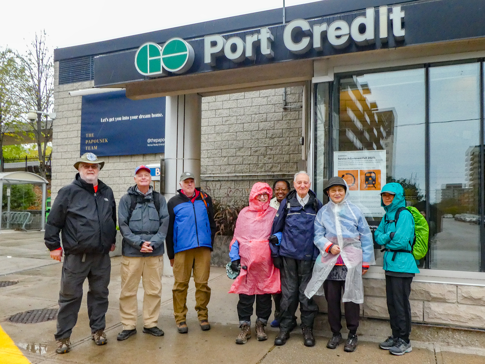
Urban Walk; Waterfront Trail 2/11 - Mississauga Waterfront
https://hikes.brucetrail.org/event/urban-walk-waterfront-trail-2-11-mississauga-waterfront/Sorry, the registration cut-off time for this hike has been reached.Not a member? Click here to join today!Hosting Club: Toronto
Category: Urban Walk
Location (Google Maps): Mississauga Waterfront TrailHike Leader(s): Brian Rideout Click here to contact Hike Leader(s)
Pace: Moderate (3-4 km/hr)
Terrain: Flat
Distance: 8.9 kmDescription
Please join me at Union Station under the clock inside the Great Hall no later than 9:00 am. We will take the Lakeshore West train departing 9:14 am, arriving 9:42 am (subject to GO Transit schedule changes). If you want to meet us in Port Credit, please be there by 9:42 am. We start hiking no later than 10:00 am. Consider purchasing the $10 day pass for the GO train for use with your smart phone. Some of you may find the regular senior rate is cheaper. Purchase your ticket / pass in advance.We will hike from Port Credit to Long Branch along the shoreline. The estimated distance is 8.9 km. Here is an online map of our route – Port Credit to Long Branch
Bring a snack, at least 2 liters of water, and icers. Dress for cold weather.

Hamilton Waterfront Urban Hike
https://hikes.brucetrail.org/event/hamilton-waterfront-urban-hike-2/Sorry, the registration cut-off time for this hike has been reached.Not a member? Click here to join today!Hosting Club: Iroquoia
Category: General Hike
Location (Google Maps):Meet DUNDURN CASTLE 610 York St Hamilton Parking Lot
Hike Leader(s): Cathie Green Click here to contact Hike Leader(s)
Pace: Medium – 3 to 4 km/hr
Terrain: Easy – Mostly flat and usually good footing
Distance: Approximately 8 kmsDescription
Meet at 10 am at Dundurn Castle Parking Lot(no fees) off York St Hamilton-easy access from 403We will hike along the ridge(flat) to the stairs leading us down to Hamilton Bay Waterfront and walk the paved path to Bayfront Park and hike along some of their
bayfront trails-all paved paths over to the foot of James street to view the new Indigenous Art Installation -there will be a bathroom on the way
We will return along city side streets -Please wear suitable clothing and footwear for the weather/poles/ water, snack/Icers
OPTIONAL Social afterwards to have lunch at the Admiral Inn across the street from parking lot-

Sunday Ramble - Crawford Lake
https://hikes.brucetrail.org/event/sunday-ramble-crawford-lake/Sorry, the registration cut-off time for this hike has been reached.Not a member? Click here to join today!Hosting Club: Iroquoia
Category: General Hike
Location (Google Maps): Crawford Lake Conservation AreaHike Leader(s): Carol Swanson Click here to contact Hike Leader(s)
Pace: Medium – 3 to 4 km/hr
Terrain: Easy – Mostly flat and usually good footing, Moderate – Some hills and/or some poor footing
Distance: approx 6.5kmDescription
Please register for parking before the hike with conservation halton. Meet in first parking lot near gatehouse.Bring water, snack and icers.
Urban Walk: Scarborough History Hike, Birkdale Ravine/Thomson Memorial Park
https://hikes.brucetrail.org/event/urban-walk-scarborough-history-hike-birkdale-ravine-thomson-memorial-park-3/Sorry, the registration cut-off time for this hike has been reached.Not a member? Click here to join today!Hosting Club: Toronto
Category: Urban Walk
Location (Google Maps):Kennedy Subway Station – Meet by the station attendant’s booth to depart at 10:10. Express buses towards Scarborough Centre depart from platform “B” which is separate from the regular bus platform.
If driving, you may park at the Birkdale Community Centre 1299 Ellesmere Road (south side of Ellesmere west of Brimley) and we will meet you at the doors at about 10:40 AM.Hike Leader(s): Tom Swales Click here to contact Hike Leader(s)
Pace: Moderate (3-4 km/hr)
Terrain: Flat, Level 2 (Intermediate – some hills and uneven surfaces, rocks and roots underfoot)
Distance: 12 kmDescription
Join us for a hike through serene Birkdale Ravine after which we will walk on St. Andrews Road, a street that time left behind, with historical buildings including an 1849 church, the sexton’s house, and Scarborough’s first public library. We’ll hike some more, distance depending on the conditions of the day, and return by way of the Scarborough Museum comprised of four heritage buildings moved to Thomson Memorial Park. The fire in the old hearth and is welcoming at the end of a Winter’s Day hike on the park trails and adjacent heritage neighborhood. Admission to the museum is freeSnowshoe Exploring Sydenham Hike 28
https://hikes.brucetrail.org/event/snowshoe-exploring-sydenham-hike-28/Sorry, the registration cut-off time for this hike has been reached.Not a member? Click here to join today!Hosting Club: Sydenham
Category: Snowshoe Hike
Location (Google Maps): The Owen Sound Galaxy Cinema parking lot. Meet at the tall “Galaxy Centre” sign next to the traffic lights.Hike Leader(s): Bill Snel Click here to contact Hike Leader(s)
Pace: Leisurely: 3 km/h or less
Terrain: Moderate: Some hills and/or poor footing
Distance: 2.3 kmDescription
We will carpool to do a snowshoe hike of the Merle Gunby Loop. This is hike 28 in the book, Exploring Sydenham. There is one secret to locate. If you do not have a book and would like one ($30) let me know by using the “Contact hike leader” link. - 27January 27, 2025
Beamsville Hike
https://hikes.brucetrail.org/event/32283/Sorry, the registration cut-off time for this hike has been reached.Not a member? Click here to join today!Hosting Club: Niagara
Location (Google Maps): Meet in parking lot at Kinsmen Park, Beamsville
Hike Leader(s): Kathleen Manson Click here to contact Hike Leader(s)
Pace: Fast
Terrain: Moderate
Distance: 8kmDescription
You must register for this hike.We will head east and visit Cave Springs CA and return.
It is mostly level with some hills and a lot of tricky footing.
Hiking poles are highly recommended. Wear supportive hiking boots with good tread. There are a lot of rocks and crevices. Icers will be required if it is icy, they are not very helpful in just snow.
Please arrive 15 minutes early.
If your plans change, please self-cancel as soon as possible so that other members may take your spot.
Hike Leader reserves the right to modify the hike.
Hike 3 of 5 - Toronto Winter E2E
https://hikes.brucetrail.org/event/hike-3-of-5-toronto-winter-e2e/Sorry, the registration cut-off time for this hike has been reached.Not a member? Click here to join today!Hike open to BTC Members only.
Hosting Club: Caledon Hills
Category: End-to-End
Location (Google Maps): Meet at 9:15 at parking lot Limehouse Conservation Area (off 5th Line) at the baseball diamonds.Shuttle to Pear Tree Parking Lot
Hike Leader(s): Jennie Greenfield Click here to contact Hike Leader(s)
Pace: Medium – 3 to 4 km/hour
Terrain: Moderate – some hills and/or some poor footing, Strenuous – hilly with steep climbs and some poor footing
Distance: 9.13 kmDescription
Hike 3 of 5 we are heading north again.Main trail north from Pear Tree along 15 Sideroad then into the Speyside Forest, through open woodland, rocky ridges and mature forest to 4th Line. Following next to fields before crossing 5th line and entering Limehouse Conservation Area. Limehouse Side Trail to the parking lot.
Rough Footing
11.4 to 20.3 + .23 = 9.13
- 28January 28, 2025

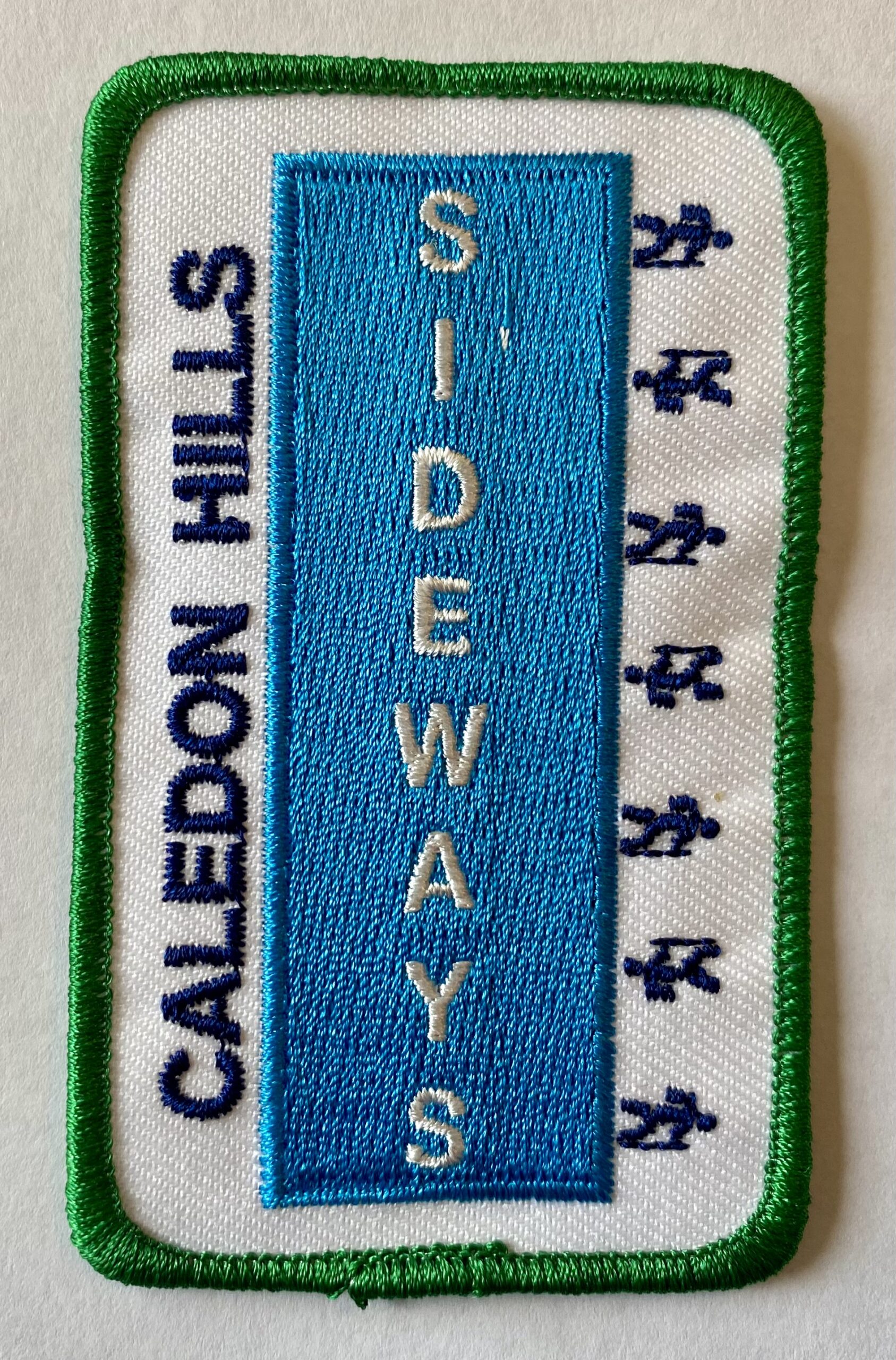
Caledon Winter Fandango - 10 hikes, 4 badges (Jan28,30,Feb3,6,10,11,14,19,20,27)
https://hikes.brucetrail.org/event/caledon-winter-fandango-10-hikes-4-badges-jan2830feb36101114192027/Sorry, the registration cut-off time for this hike has been reached.Not a member? Click here to join today!This is a Multi-Day Hike
You are signing up for the following dates and times:
2025-01-28 at 08:00
2025-01-30 at 08:00
2025-02-03 at
2025-02-06 at
2025-02-10 at
2025-02-11 at
2025-02-14 at
2025-02-19 at
2025-02-20 at
2025-02-27 atHosting Club: Iroquoia, Caledon Hills
Category: Stained Glass Badge End to End Fundraiser Hike
Location (Google Maps): Roadside parking at km2.8, north end of Chinguacousy Rd – do not block drivewayHike Leader(s): Steven White Click here to contact Hike Leader(s)
Pace: Brisk – 4 to 5 km/hr
Terrain: Slippery and Steep Sections, Strenuous – Hilly with steep climbs and some poor footing
Distance: 15-21 kmsDescription
This series of 10 hikes will earn the hiker 4 coveted badges, including:Stained Glass Fundraiser E2E (new)$30/$40, Redside Dace E2E (new)$10/$15
Sideways (new side trails badge)$10/$15
and Winter badge $10/$15
Hikes range from 15 to 21 KMs and are posted as in&out hikes so hikers can make up their own hike if they are not able to attend all 10. Hikers should be prepared for winter hike conditions, including layered clothing, boots, poles, icers and snowshoes. Bring water, drinks, snack and lunch. Carpool if you can to save parking spots. Hikers should plan to arrive 15 mins early to get geared up for the hike – hikes to start at 8AM. Contact hike leader through contact info on this form with any questions or if you will miss a hike. Full itinerary will be forwarded to registered hikers the week of Jan 20. Badges will be presented at our last hike.
9:00 Long Hike Wiley Road Short Hills
https://hikes.brucetrail.org/event/900-long-hike-wiley-road-short-hills-42/Sorry, the registration cut-off time for this hike has been reached.Not a member? Click here to join today!Hosting Club: Niagara
Location (Google Maps):
Short Hills Wiley Road Entrance
Pace: Medium
Terrain: Moderate
: 10kmDescription
Explore Short Hills and the majestic side trails of Scarlett Tanager, Hemlock. Swayze Falls and Terrace. Register for each hikeBring Poles, Icers, snack, and dress for the weather
Urban Walk: Valley View Park Thornhill
https://hikes.brucetrail.org/event/urban-walk-valley-view-park-thornhill-50/Sorry, the registration cut-off time for this hike has been reached.Not a member? Click here to join today!Hosting Club: Toronto
Location (Google Maps): Parking lot is inside Sycamore Drive East of Bayview , north of Bayview Reservoir Park Playground
Hike Leader(s): Mohammad Aghamiri Click here to contact Hike Leader(s)
Pace: Moderate (3-4 km/hr)
Terrain: Level 2 (Intermediate – some hills and uneven surfaces, rocks and roots underfoot)
Distance: 7-8 kmDescription
We will explore Valleyview and Maple View parks, and walk along German Mill Creak,In return we stop in Huntington park and have snack under beautiful shed ,Even it is considered Urban walk, but it is urban hike as we have some up and down hills and tree roots, please bring your Ice cleats and hiking poles
9:15 Short Hike - Short Hills Park, Pelham Rd
https://hikes.brucetrail.org/event/915-short-hike-short-hills-park-pelham-rd-17/Sorry, the registration cut-off time for this hike has been reached.Not a member? Click here to join today!Hosting Club: Niagara
Category: Hike
Location (Google Maps): Short Hills Provincial Park, Pelham Rd entranceHike Leader(s): Debbie Demizio Click here to contact Hike Leader(s)
Pace: Medium
Terrain: Moderate
Distance: ~ 6kmsDescription
Hike the main and side trails in Short Hills Provincial Park. Bring hiking boots and water. If trail conditions are icy, icers are highly recommended.Riverside Woods Nature Reserve
https://hikes.brucetrail.org/event/riverside-woods-nature-reserve/Sorry, the registration cut-off time for this hike has been reached.Not a member? Click here to join today!Hosting Club: Dufferin Hi-Land
Category: Tuesday Hike
Location (Google Maps):Caledon Hills Section, Map 18 (Edition 31)
Meet at the BTC parking lot at the bend in 1st Line EHS, north of 5 Sideroad. MonoHike Leader(s): Les Babbage, Inge Eckerich, Julie Daley, Tony Evangelista Click here to contact Hike Leader(s)
Pace: Leisurely, Medium
Terrain: Moderate, Slippery and Steep Sections
Distance: 4.5 km; Short Hike: 2.2 kmDescription
We will hike a loop consisting of the Goodyear Memorial and Upland Side Trails, with a short side trip on the Rushing River Side Trail. The shorter hike will turn back at the Rushing River Side Trail. Please bring icers, poles, snowshoes (weather depending), water and a snack. - 29January 29, 2025

8:30 Niagara Winter End to End #3 Glen Road to Roland Road - Rescheduled from last week
https://hikes.brucetrail.org/event/830-niagara-winter-end-to-end-3-glen-road-to-roland-road-2/Sorry, the registration cut-off time for this hike has been reached.Not a member? Click here to join today!Hosting Club: Niagara
Category: Car Pool
Location (Google Maps): Short Hills Parking Lot at Roland Road. Car Pool to Glen RoadHike Leader(s): Sam Rutherford Click here to contact Hike Leader(s)
Pace: Medium
Terrain: Moderate
Distance: 13 kmsDescription
We will be car pooling, Bring Icers and poles. No dogs. To earn your Niagara Winter End to End badge, it must be completed between December 21, 2024 to March 21, 2025.
Because of the potential for bad winter trail conditions we have broken this e2e into 6 hikes rather than 5
Winter Badge Wednesdays: Mono Centre
https://hikes.brucetrail.org/event/winter-badge-wednesdays-mono-centre/Sorry, the registration cut-off time for this hike has been reached.Not a member? Click here to join today!Hike open to BTC Members only.
Hosting Club: Caledon Hills
Category: General
Location (Google Maps): Meet at 10 am at the parking lot at Mono Community Centre. The centre is located at 754483 Mono Centre Rd. Please park in the gravel surface lot. It is best to aim for arriving around 9:45, so we can start hiking as close to 10 am as possible. Thanks!Hike Leader(s): Dave Dawe; Elizabeth Ganong Click here to contact Hike Leader(s)
Pace: Medium – 3 to 4 km/hour
Terrain: Moderate – some hills and/or some poor footing
Distance: Between 4 and 5 kmDescription
Looking to get outside and enjoy nature in another season? You may wish to join in on one Wednesday hike in this winter series or all five! Complete all five as part of the series or do a combination of hikes within the series and your own winter hikes, and you will be eligible to receive the Caledon Winter Hiking Badge (further details below and on the CHBTC website under Club Badges).This Wednesday’s hike takes us to the north end of the Caledon Hills section as we use side trails and the main trail to make a 4 to 5 km route in the Whitetail Refuge Nature Reserve. Be prepared for winter conditions by bringing warm gear, poles, and icers. You are encouraged to bring water and a snack. No dogs please.
The hike leader for this hike is Dave Dawe. Registrants can expect a reminder/update message from Dave one or two days before the hike.
If desired, this hike may be used towards the Caledon Winter Hiking Badge (5 winter hikes in the Caledon section that are 1 ½ hours or longer in length). Please keep a log of your hikes and follow the directions on the CHBTC website under Club Badges to receive your badge.
Winter Wednesday Walkers - Kolapore West
https://hikes.brucetrail.org/event/winter-wednesday-walkers-kolapore-west-2/Sorry, the registration cut-off time for this hike has been reached.Not a member? Click here to join today!Hosting Club: Beaver Valley
Location (Google Maps): Meet in the Kolapore parking lot on Grey Road 2, about 650 m south of where the trail crosses at km 23.8, Map 25, Edition 31
Hike Leader(s): Glenda Collings Click here to contact the hike leader.
Pace: Medium
Terrain: Moderate
Length of Hike: Approx. 6km returnDescription
This will be an in and out hike from the Kolapore parking lot. We pass along a field, through cedar and beautiful hardwood forest, encountering signs of old stone borders. On winter hikes we may encounter bare ground, light snow, deep snow, or ice. Please bring snowshoes and icers to our Winter Wednesday Walkers outings. Wear appropriate clothing for the weather plus water and a snack.COVID-19 Precautions Before, During and After your Hike
- Each hiker joining a Bruce Trail Club organized hike must perform a self-screening check before hiking.
Find Ontario’s self-assessment tool here: https://covid-19.ontario.ca/self-assessment/ - If you are experiencing COVID-19 symptoms, stay home.
Other Guidelines
- Arrive 15 minutes before the start of the hike.
- Wear sturdy footwear and appropriate attire for the weather and the terrain.
Hiking poles are a good idea in any season, especially if the terrain is rocky or slippery. In winter, snowshoes or icers/crampons are needed when conditions dictate.
Wearing appropriate clothing and footwear prevents injuries and shows consideration for a safe and positive group hiking experience. - Always carry I.D. and your health card.
- Bring sufficient water and snacks (or lunch if indicated). A minimum of 1L of water is recommended on all hikes, and 3L is recommended for long, challenging hikes in the heat of the summer.
- Bring sunscreen and insect repellent (for spring and summer hikes).
- Bring your own first aid kit.
- Please leave dogs at home.
- Each hiker joining a Bruce Trail Club organized hike must perform a self-screening check before hiking.
- 30January 30, 2025
Frosty Five Blues Series 3/5
https://hikes.brucetrail.org/event/frosty-five-blues-series-3-5/Sorry, the registration cut-off time for this hike has been reached.Not a member? Click here to join today!Hosting Club: Caledon Hills
Category: General
Location (Google Maps): Meet at the BTC parking lot on the east side of 5th Line EHS, just south of Hockley Road. 43.993572, -80.014057 (Map 18, Edition 31)Directions: From ON-10 turn east onto Hockley Rd/Dufferin County Rd 7. Drive for 9.4 kilometres. Turn south/right onto 5 Line E. Drive for 100 metres.
Hike Leader(s): Sandy Green and Janice McClelland Click here to contact Hike Leader(s)
Pace: Medium – 3 to 4 km/hour
Terrain: Strenuous – hilly with steep climbs and some poor footing
Distance: 9.5 kmDescription
Beat the winter blues! Register individually for one, a few, or all of the Frosty Five Blues hikes. Participants who complete all five hikes are eligible to receive a CHBTC Winter badge and new Sideways badge on the final hike. Hike 3 explores parts of the main Trail and Hemlock Ridge, Griffith Ravine, and Glacier Valley Side Trails in the Hockley Valley south area. Bring your choice of hydration and snacks. Hiking boots and icers/crampons are required. See Jan. 9, 23, & Feb. 6 & 13 for details pertaining to the other hikes in the series. (Note: If you wish to purchase badges, the cost of each badge is $10.00 for BTC members and $15.00 for non-members.)Urban Walk: Valley View Park Thornhill 72
https://hikes.brucetrail.org/event/urban-walk-valley-view-park-thornhill-51/Sorry, the registration cut-off time for this hike has been reached.Not a member? Click here to join today!Hosting Club: Toronto
Location (Google Maps): Parking lot is inside Sycamore Drive East of Bayview , north of Bayview Reservoir Park Playground
Hike Leader(s): Mohammad Aghamiri Click here to contact Hike Leader(s)
Pace: Moderate (3-4 km/hr)
Terrain: Level 2 (Intermediate – some hills and uneven surfaces, rocks and roots underfoot)
Distance: 7-8 kmDescription
We will explore Valleyview and Maple View parks, and walk along German Mill Creak,In return we stop in Huntington park and have snack under beautiful shed ,Even it is considered Urban walk, but it is urban hike as we have some up and down hills and tree roots, please bring your Ice cleats and hiking poles
9:00 am Long Hike Cave Spring NEW LOCATION
https://hikes.brucetrail.org/event/900-am-long-hike-cave-spring-new-location-9/Sorry, the registration cut-off time for this hike has been reached.Not a member? Click here to join today!Hosting Club: Niagara
Location (Google Maps):
Cave Spring Conservation Area
Pace: Medium
Terrain: Moderate
: 10kDescription
From Cave Spring Conservation Area explore the trail network on the escarpment You must register for each hike. Bring Poles, snack and a drink and dress for the weatherHiking Around Jordan
https://hikes.brucetrail.org/event/hiking-around-jordan-20/Sorry, the registration cut-off time for this hike has been reached.Not a member? Click here to join today!Hosting Club: Niagara
Location (Google Maps): Shoarishon Park (formerly known as Jordan Hollow)
Hike Leader(s): Bill Russell Click here to contact Hike Leader(s)
Pace: Medium
Terrain: Moderate
Distance: 7 kmDescription
Hike various trails in Jordan (Balls Falls, Jim Rainforth Trail and Bailey Bridge through the village of Jordan) - 31January 31, 2025
Niagara-on-the-Lake Tour
https://hikes.brucetrail.org/event/niagara-on-the-lake-tour-3/Sorry, the registration cut-off time for this hike has been reached.Not a member? Click here to join today!Hosting Club: Niagara
Location (Google Maps): Park on King St near Centre St, just outside of Veteran’s Memorial Park
Hike Leader(s): Margaret Northfield Click here to contact Hike Leader(s)
Pace: Medium
Terrain: Easy
Distance: 6-7kmDescription
Each Friday we will explore different neighbourhoods, trails and parkland throughout Historic Niagara-on-the-Lake.Moderate pace with some weeks entirely on sidewalks and roads while others may include a mix of trails and paved pathways. Great way to build up endurance for longer more strenuous hikes.
Prepare for cooler windy conditions on open parkland and along Lake Ontario and Niagara River trails.
Plan to stay for conversation and a warm cup of coffee or tea at Sweets & Swirls, Community Centre, Niagara Stone Road, NOTL
Margaret Northfield & Robin Garrett

Fun Friday Hike - Cape Chin South
https://hikes.brucetrail.org/event/fun-friday-hike-cape-chin-south/Sorry, the registration cut-off time for this hike has been reached.Not a member? Click here to join today!Hosting Club: Peninsula
Category: Winter Hikes
Location (Google Maps): South End of Carter Road at entrance to Smokey Head Nature ReserveHike Leader(s): Marg and Owen Glendon Click here to contact Hike Leader(s)
Pace: Leisurely (2.0 – 3.0 km/h): A relaxed pace with frequent breaks and a focus on enjoyment.
Terrain: Difficult: Steep ascents/descents, rocky scrambling, and some rugged escarpment paths., Easy: Flat forested sections or lowland trails., Moderate: Rolling hills, mild slopes and rocky paths.
Distance: 3 1/2 – 5 kmDescription
Join us for our final Fun Friday hike at Cape Chin South. Meet at the south end of Carter Road a few minutes before we begin the hike.We will head south along the Georgian Bay shoreline on the Main Trail to the intersection of the Cape Chin Side Trail. Depending on depth of snow, trail and weather conditions, the group will decide if we venture up to the Fred Binding Side Trail and Lookout and back to the sheltered Cape Chin Side Trail, or simply complete the Cape Chin Side Trail Loop. The shorter option is ~ 3 ½ km and will take a little less than 2 hours. Option 2 is ~5 km and includes a short, steady ascent to the Lookout, taking a little less than 3 hours. Winter hiking requires extra thought and preparation. Please prepare by wearing layered clothing, warm winter hiking boots, hat, face covering (if windy), and mittens. Bring a light backpack for snacks and warm drink. Hiking poles and gators are strongly recommended. Snowshoes and icers may be useful depending on trail conditions.
Following the hike, you are welcome to join us for a coffee and camaraderie at Tru Foods located at the corner of Highway 6 and Clarkes Road (3766 Hwy.6 Lion’s Head, Ontario).
- 01February 1, 2025
Car Hike: Bethesda Trail Richmond Hill 172
https://hikes.brucetrail.org/event/car-hike-bethesda-trail-richmond-hill/Sorry, the registration cut-off time for this hike has been reached.Not a member? Click here to join today!Hosting Club: Toronto
Category: Car Hike
Location (Google Maps): Meet at Bethesda Trail Head Parking on Bethesda Sideroad off Bayview Avenue, across from Lake Wilcox. This parking lot is free.Hike Leader(s): Mohammad Aghamiri
Pace: Moderate (3-4 km/hr)
Terrain: Hilly, Level 2 (Intermediate – some hills and uneven surfaces, rocks and roots underfoot)
Distance: 12-14 kmDescription
Join us to explore the trails of York Regional Forest and the Oak Ridges Corridor at Jefferson Forest and Bond lake,From parking lot we hike thought Jefferson forest and continue to Bond Lake and have snack beside the lake and return to parking around 13 to 13.30
Coach Trip: Skiers Highlands Nordic, Snowshoers Bruce Trail
https://hikes.brucetrail.org/event/coach-trip-skiers-highlands-nordic-snowshoers-bruce-trail/Sorry, the registration cut-off time for this hike has been reached.Not a member? Click here to join today!Trip Information
Departure Time: 08:30
Return to City Time: 18:00
Departure Point: York Mills Bus PickupTrip Activities
Ski pass ($30)
Snowshoe pass ($20)
Guided hike Bruce Trail ($0.01)
Optional Items
Pick up at HWY 400 & Major Mac ($0.01)
Ski rental ($28)
Snowshoe rental ($18)Hosting Club: Toronto
Category: Coach Trips
Location (Google Maps): Highlands Nordic, DuntroonHike Leader(s): Brenda Menezes, David Royle, Martina Furrer
Pace: Moderate (3-4 km/hr)
Terrain: Hilly, Level 2 (Intermediate – some hills and uneven surfaces, rocks and roots underfoot), VariableDescription
Join us for an awesome day of winter fun in Duntroon.Cross-country skiers: Glide through forests and fields on 25 km of trails groomed for classic and skate skiing. Enjoy amazing views (you can see Georgian Bay) and warm up with a hot drink and fresh baked treat in Highlands’ cozy chalet. Classic ($28) and skate ski ($45) rentals available. All cross-country skiing is self-guided. Ski passes are $30 per person.
Winter hikers: Join Brenda and David for a fun guided hike on the Bruce Trail with great views and good company. The group will be out all day and eat lunch on the trail. Depending on conditions you may need snowshoes, microspikes, or just boots. Option 2: Snowshoe on your own (preferably in your own small group) on the Highlands’ trails. Those staying on resort will need to purchase trail passes ($20); snowshoe rentals ($18) are available for those who stay on resort.
Trail fees will be collected in cash on the bus. We will leave the resort at 4 PM.
Departure 1: 8:30 AM, 10 York Mills Rd
Departure 2: 8:50 AM, HWY 400 and Major Mackenzie Dr Park and Ride
Please arrive at the pick-up location 15 minutes before departure. The bus waits for no one.
Policy for running this trip: To run this trip we need 40 registrants 8 days in advance. We may cancel the trip on short notice if there is substantial risk of trail or resort closure due to major weather warnings. If there is enough snow to ski and conditions are marginal or better, we will go. Marginal conditions mean not ideal skiing conditions. For example, wet snow, a thin bumpy base, or some icy patches. If TBTC cancels the trip, we will refund your coach fare. No refund if you cancel.

9:00 NOTL BLACK HISTORY SERIES - #1 of 4: Chloe Cooley and the Beginning of the End of Black Enslavement in Upper Canada
https://hikes.brucetrail.org/event/900-notl-black-history-series-1-of-4-chloe-cooley-and-the-beginning-of-the-end-of-black-enslavement-in-upper-canada/Sorry, the registration cut-off time for this hike has been reached.Not a member? Click here to join today!Hosting Club: Niagara
Category: Loop
Location (Google Maps):Veteran’s Memorial Park. Park on Veteran’s Lane, past tennis courts
Hike Leader(s): Suzanne Gourluck, Karen Couch Click here to contact Hike Leader(s)
Pace: Medium
Terrain: Easy
Distance: 6 kmDescription
Since 1995, the government of Canada has officially recognized February as Black History Month; a time when Canadians are invited to reflect, educate and engage in the ongoing fight against anti-Black racism and discrimination. During all the hikes in this series, you will learn about Niagara-on-the-Lake’s Black history. Complete 3 of 4 hikes for the Black History badge.
The link below will take you to a brief overview on this topic, by the Niagara-on-the-Lake’s Museum.https://artsandculture.google.com/story/niagara-on-the-lake-s-black-history-niagara-historical-society-museum/-QXR3nRTdnmqJw?hl=en
**Dress for the weather and for stopping several times. Paths may be icy; hiking poles and icers are recommended.
Please Note: Hikes are offered by volunteers who have committed to their own learning, to be able to offer informative and contemplative hike experiences. These hikes are opened to all and offered in a spirit of mutual learning and inclusion.

Lunar New Year Hike - 8:45am
https://hikes.brucetrail.org/event/chinese-new-year-hike-845am/Sorry, the registration cut-off time for this hike has been reached.Not a member? Click here to join today!Hosting Club: Iroquoia
Category: Special Event
Location (Google Maps): City View Park – Burlington – Proceed to the big parking lot off of Kerns Rd.Hike Leader(s): Ruth Moffatt Click here to contact Hike Leader(s)
Pace: Medium – 3 to 4 km/hr
Terrain: Dependent on Conditions, Strenuous – Hilly with steep climbs and some poor footing
Distance: Approx 12kmDescription
Year of the SnakeWednesday, 29th January 2025 marks the beginning of the new lunar year. This year will be the Year of the Snake, the sixth of all zodiac animals. This period stands out for its wisdom, mystery, and transformation, emphasizing introspection, strategic planning, and personal growth.
Please join us for a hike along the Mountains to Sea Greenway Trail which is an International Friendship Trail in Taiwan. https://brucetrail.org/international-friendship-trails/
This hike requires that all participants are able to hike approx 12km at a steady pace. Please bring enough snacks, lunch and water needed for an approx 4 hour hike. We will have a morning break and a lunch break. You must bring a pair of icers and wear proper hiking boots. Please dress for the weather.
At the end of the hike, lucky red packets will be given, with our wishes for a very Happy Lunar New Year.
Toronto Winter E2E in 3 Hikes
https://hikes.brucetrail.org/event/toronto-winter-e2e-in-3-hikes/Sorry, the registration cut-off time for this hike has been reached.Not a member? Click here to join today!Hike open to BTC Members only.
This is a Multi-Day Hike
You are signing up for the following dates and times:
2025-02-01 at 09:00
2025-02-08 at 09:00
2025-02-15 at 09:00Hosting Club: Caledon Hills
Category: End-to-End
Location (Google Maps): Roadside parking; km 17.4 Map 12, on the east side of the road where the trail crosses the Fourth Line. Don’t park in front of the junkyard.Hike Leader(s): Roopa Dindigal Click here to contact Hike Leader(s)
Pace: Medium – 3 to 4 km/hour
Terrain: Moderate – some hills and/or some poor footing
Distance: 17.4 kmDescription
Do you have plans to complete the Toronto section this winter? Join us for a winter wonderland adventure as we hike the Toronto section in three exciting hikes!
We will hike North to Southbound, on Hike #1 – Feb 1st we will meet on the east side of the road where the trail crosses the fourth line, do not park in front of the junkyard (43.615163, -79.975157) and we will shuttle to start at Hilton Falls (parking fee at Hilton Falls)
A detailed schedule for the full series, with dates and meeting locations, will be provided when you register.
This hike series is meant for experienced distance hikers, please keep in mind your ability to join this series.
Pack sufficient water and snacks to boost your energy. Wear appropriate attire for the weather conditions and come prepared with icers and snowshoes. Hikers will be contacted the night before if a hike must be canceled due to inclement weather. If you have further questions or concerns email Roopa at chbtcpublicrelations@gmail.com
Dufferin Hi-Land Winter Badge Hike #3 of 4
https://hikes.brucetrail.org/event/dufferin-hi-land-winter-badge-hike-3-of-4-4/Sorry, the registration cut-off time for this hike has been reached.Not a member? Click here to join today!Hosting Club: Dufferin Hi-Land
Category: Special Events
Location (Google Maps): Dufferin Hi-Land, Map 21. Meet at roadside parking on Prince of Wales Rd, about 1 km south of County Rd 21, where the Main Trail turns east from the road (Km 45.3).Hike Leader(s): Les Babbage;Helen Bailey Click here to contact Hike Leader(s)
Pace: Medium
Terrain: Moderate, Slippery Sections Likely
Distance: 7.2 kmDescription
We will hike the Main Trail to Km 48.8 and back. The route features a large snowdrift at the top of Black Bank hill. Snowshoes will be required. Depending on conditions, icers may be required. Dress for winter conditions. Bring water, snacks and lunch. Hike leaders will contact all registered hikers a day or two before the hike to advise of trail conditions and any weather alerts.Urban Walk: Etobicoke Creek
https://hikes.brucetrail.org/event/urban-walk-etobicoke-creek/Sorry, the registration cut-off time for this hike has been reached.Not a member? Click here to join today!Hosting Club: Toronto
Category: Urban Walk
Location (Google Maps): Meet at the west end of the bus platform at Kipling Subway Station (near the public washrooms).
The group will leave at 10:00 to take bus number 109 N from platform 14 to the Etobicoke Creek Station to start our hike.Hike Leader(s): Makhan Dhesi Click here to contact Hike Leader(s)
Pace: Leisurely (2-3 km/hr)
Terrain: Flat, Level 2 (Intermediate – some hills and uneven surfaces, rocks and roots underfoot)
Distance: 12 kmDescription
We will do a loop walk along the Etobicoke Creek and also visit Centenial Park and the Conservatory
Cancelled: Saturday Shorts: Riverside Woods Nature Reserve
https://hikes.brucetrail.org/event/saturday-shorts-riverside-woods-nature-reserve/Sorry, the registration cut-off time for this hike has been reached.Not a member? Click here to join today!Hike open to BTC Members only.
Hosting Club: Caledon Hills
Category: General
Location (Google Maps): Meet at 10 am at the BTC parking lot, 713377 1st Line EHS, Mono. Go north on 1st Line from Side Road 5. Access is closed going south on 1st Line from Hockley Road during the winter. It is best to aim for arriving around 9:45, so we can start hiking as close to 10 am as possible. Thanks!Hike Leader(s): Elizabeth Ganong Click here to contact Hike Leader(s)
Pace: Medium – 3 to 4 km/hour
Terrain: Easy – mostly flat and usually good footing, Moderate – some hills and/or some poor footing
Distance: Between 4 and 5 kmDescription
Due to the forecasted extreme cold with the wind chill, this hike has been cancelled.Looking to get out on a Saturday but not give up your whole day? Saturday Shorts, a hiking series, will get you out in a small group on a short hike. This Saturday’s hike explores Riverside Woods on side trails and gentler nature reserve trails on a 4 or 5 km route. Be prepared for winter conditions by bringing warm gear, poles, and icers. You are encouraged to bring water and a snack. No dogs please.
Registrants can expect a reminder/update message one or two days before the hike.
If desired, this hike may be used towards the Caledon Winter Hiking Badge (5 winter hikes in the Caledon section that are 1 ½ hours or longer in length). Please keep a log of your hikes and follow the directions on the CHBTC website under Club Badges to receive your badge.

Urban Walk: Waterfront Trail 4/11 – Parklawn
https://hikes.brucetrail.org/event/urban-walk-waterfront-trail-4-11-parklawn-2/Sorry, the registration cut-off time for this hike has been reached.Not a member? Click here to join today!Hosting Club: Toronto
Category: Urban Walk
Location (Google Maps): CanadaHike Leader(s): Brian Rideout Click here to contact Hike Leader(s)
Pace: Moderate (3-4 km/hr)
Terrain: Flat
Distance: 9.1 kmDescription
Please join me at Old Mill Station no later than 9:12 am. We will take the 66 bus departing 9:27 am, arriving 9:40 am. If you want to meet us at Parklawn and Lakeshore, please be there by 9:40 am. We start hiking at 9:50 am.We will hike east along the lake to Spadina. The estimated distance is 9.1 km. Here is an online map of our route Parklawn to Spadina
Bring a snack, at least 2 liters of water, and icers. Dress for cold weather.

Daytime, Snowshoe Adventure Badge #2 - Old Baldy
https://hikes.brucetrail.org/event/daytime-snowshoe-adventure-badge-2-old-baldy/Sorry, the registration cut-off time for this hike has been reached.Not a member? Click here to join today!Hosting Club: Beaver Valley
Location (Google Maps): Meet in the Old Baldy CA parking area, just south off Sideroad 7B on a short connector road, south of km 43.5, Map 25, N 44.392191, W 80.518595
Hike Leader(s): Glenda Collings Click here to contact the hike leader.
Pace: Medium
Terrain: Moderate, Some rocky footing, Some steep sections, Strenuous
Length of Hike: Approx. 4.5 kmDescription
If you have participated in both Snowshoe Adventure hikes please bring, on this hike, $10 (members) $12 (non-members) for the badge. This will be an in and out hike from the Old Baldy parking lot to views over the valley and back, returning on the Mac Kirk Side Trail. On winter hikes we may encounter bare ground, light snow, deep snow, or ice. Please bring snowshoes and icers. Wear appropriate clothing for the weather plus water and a snack. Participants should have some experience with snowshoeing.COVID-19 Precautions Before, During and After your Hike
- Each hiker joining a Bruce Trail Club organized hike must perform a self-screening check before hiking.
Find Ontario’s self-assessment tool here: https://covid-19.ontario.ca/self-assessment/ - If you are experiencing COVID-19 symptoms, stay home.
Other Guidelines
- Arrive 15 minutes before the start of the hike.
- Wear sturdy footwear and appropriate attire for the weather and the terrain.
Hiking poles are a good idea in any season, especially if the terrain is rocky or slippery. In winter, snowshoes or icers/crampons are needed when conditions dictate.
Wearing appropriate clothing and footwear prevents injuries and shows consideration for a safe and positive group hiking experience. - Always carry I.D. and your health card.
- Bring sufficient water and snacks (or lunch if indicated). A minimum of 1L of water is recommended on all hikes, and 3L is recommended for long, challenging hikes in the heat of the summer.
- Bring sunscreen and insect repellent (for spring and summer hikes).
- Bring your own first aid kit.
- Please leave dogs at home.
- Each hiker joining a Bruce Trail Club organized hike must perform a self-screening check before hiking.