Hike Schedule
Join us for a hike! Registration required:
All hikes available to BTC members. Some hikes are open to non-members.
TIP: The calendar view displays up to 7 hikes on a day, but often there are more. Click “More events” to see them all.
Categories
- 08February 8, 2026
Sunday at the Marsh - Hendrie Valley and Woodland Cemetery
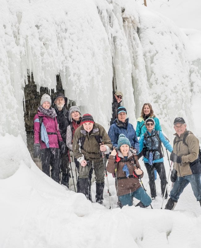
https://hikes.brucetrail.org/event/sunday-at-the-marsh-hendrie-valley-and-woodland-cemetery/Sorry, the registration cut-off time for this hike has been reached.Not a member? Click here to join today!Hosting Club: Iroquoia
Category: General Hike
Location (Google Maps): RBG Centre Parking – across from Easterbrook’s 694 Spring Gardens RoadHike Leader(s): Kathrin Koenig Click here to contact Hike Leader(s)
Pace: Medium – 3 to 4 km/hr
Terrain: Dependent on Conditions, Moderate – Some hills and/or some poor footing, Slippery and Steep Sections
Distance: Approx 7 kmDescription
Please be at parking by 8:15 am as the hike will leave promptly at 8:30 am.Please bring your poles and icers; dress in layers to keep warm. Bring enough water and snacks to suit your needs.
We will start by following the outer road at Woodland Cemetery and pick up Grindstone Marsh Trail at Sunfish Pond. Following Grindstone Marsh Trail into Hendrie Valley, we will loop our way along the North and South Bridle Trail to Cherry Hill Gate and back to the cars. There is a set of stairs, one steep downhill section, and a couple of smaller hills. Be prepared for some potentially icy conditions. Please bring your icers/crampons just in case.
Please leave dogs at home.
Easterbrook’s Hot Dog Stand is open all winter for anyone wishing to stop in for a bite to eat.
Please note, the hike might be canceled due to extreme weather, or unsafe trail conditions. A cancellation email will be sent to all registered hikers.
Any questions may be directed through contact on this form.
In the event you are no longer able to attend, please remove yourself from registration by following these steps:
– Sign into your account on the BTC website
– Click on My Hikes under your account
– This will take you to a list of hikes you have registered for
– Scroll down to the appropriate hike and cursor over to the far right hand column under the Action column.
– Click Cancel under the hike you wish to cancel
Frosty Five Weekend - Hike Five
https://hikes.brucetrail.org/event/frosty-five-weekend-hike-five/Sorry, the registration cut-off time for this hike has been reached.Not a member? Click here to join today!Hosting Club: Caledon Hills
Category: General
Location (Google Maps): Meet north of the intersection of Cataract Road and Mississauga Road at the Elora Cataract Trailway Trail Head. Google Coordinates: 43.813120, -80.028656.Directions: From ON-10 head west on Charleston Sideroad/Peel Regional Rd. 24 for 5.5 km. Turn left onto Mississauga Rd. and drive for 1.0 km. Park on west shoulder.
Hike Leader(s): Sandy Green Click here to contact Hike Leader(s)
Pace: Medium – 3 to 4 km/hour
Terrain: Moderate – some hills and/or some poor footing
Distance: 11 kmDescription
Beat the winter blues! Register individually for one, a few, or all of the Frosty Five Blues hikes. Participants who complete all five hikes are eligible to receive a CHBTC Winter badge and a Sideways badge on the final hike. Hike Five explores the trails within the Forks of the Credit Provincial Park. Bring your choice of hydration and snacks. Hiking boots and icers/crampons are required. (Note: If you wish to purchase badges, the cost of each badge is $10.00 for BTC members and $15.00 for non-members.) Everyone is welcome to join!
Car Hike: Jefferson Forest (Richmond Hill)
https://hikes.brucetrail.org/event/car-hike-jefferson-forest-richmond-hill-4/Sorry, the registration cut-off time for this hike has been reached.Not a member? Click here to join today!Hosting Club: Toronto
Location (Google Maps):
1245 Bethesda Side Rd, Richmond Hill, ON L4E 1A2 ( Bethesda Trail Head Parking lot)
Hike Leader(s): Amir Alemohammad Click here to contact Hike Leader(s)
Pace: Moderate (3-4 km/hr)
Terrain: Flat, Hilly, Level 2 (Intermediate – some hills and uneven surfaces, rocks and roots underfoot), Variable
Distance (km): 10-12 kmDescription
Let’s roll the hills of the Jefferson Forest this winter! Every weekend, we’ll explore the winter wonderland at this beautiful park. Located in the heart of Richmond Hill, it boasts numerous hiking trails. This 3-hour hike can range from 10 to 12 kilometres, depending on the weather conditions. Remember to bring water, snacks, hiking boots, icers, poles, and your camera. Not recommended for beginners. Park in the free Bethesda parking lot and avoid parking along the road. Dress appropriately for the weather. Difficulty Level: 2 (Moderate).Please arrive @8:45AM for start of 9:00AM.
This is a joint hike with the Oak Ridges Trail Association (ORTA).
CANCELLED - Caledon North
https://hikes.brucetrail.org/event/caledon-north/Sorry, the registration cut-off time for this hike has been reached.Not a member? Click here to join today!Hosting Club: Iroquoia
Category: General Hike
Location (Google Maps): Meet in the parking lot at the Mono Centre Park at 9:15 amHike Leader(s): Karen Bergmann Click here to contact Hike Leader(s)
Pace: Medium – 3 to 4 km/hr
Terrain: Moderate – Some hills and/or some poor footing
Distance: 8 kmsDescription
Meeting at 9:15 am in the parking lot of Mono Centre Community Centre, we will hike the main trail and around the Turnbull, Springwater, Whitetail Refuge and Third Outlier Side Trails and back along the main trail into Mono Cliffs to the Laidlaw Side Trail to the cars. Bring icers for your boots. Hike is dependent on weather.
Car Hike: Hike #3 of 5 to earn the Toronto Side Trails Badge!
https://hikes.brucetrail.org/event/car-hike-hike-3-of-5-to-earn-the-toronto-side-trails-badge/Sorry, the registration cut-off time for this hike has been reached.Not a member? Click here to join today!Hosting Club: Toronto
Category: Car Hike
Location (Google Maps): We will meet at the Trafalgar & 401 Commuter Lot (43.571569, -79.831797) and then carpool to the start of each hike.Hike Leader(s): Monica Pasquali; Marina Wray Click here to contact Hike Leader(s)
Pace: Leisurely (2-3 km/hr), Moderate (3-4 km/hr)
Terrain: Level 2 (Intermediate – some hills and uneven surfaces, rocks and roots underfoot)
Distance (km): 9.24 kmDescription
This is the third in a series of five hikes that will be offered approximately one Sunday per month so that participants can earn the Toronto Side Trails Badge during the winter and early spring. Each out-and-back hike will cover a distance of 8-11 km and be hiked at a leisurely to moderate pace (approximately 3 km/h). Please note that the hikes will be posted separately on the BTC calendar – you will have to register for each hike that you’re interested in joining.For this second hike we will explore two side trails in the Toronto section of the Bruce Trail: the Bennett Heritage Trail and the Maureen Smith Side Trail.
Please dress appropriately for a winter hike by dressing in layers (wear an inner layer that wicks sweat away from your skin, a middle layer that keeps you warm, and an outer layer that protects you from wind and snow), wearing gloves/mittens and a toque, and wearing warm and comfortable footwear that has good traction in snow/ice (icers placed over your boots work great!). Hiking poles or walking sticks are an asset since they will help keep you balanced if the ground is slippery. As well, make sure you bring enough water and food for a 3-4 hour hike since we’ll be covering a total distance of 9.24 km over terrain that has some hills and exposed rocks.
Since parking might be limited at the places we’ll be hiking in this hike series, we will meet at the Trafalgar & 401 Commuter Lot (43.571569, -79.831797) and then carpool to the start of each hike. Please be prepared to participate in each carpool by ensuring you have space in your car if you are not already carpooling with others to the Commuter Lot meeting point.
After the hike, interested participants can join me at the Tim Horton’s on Trafalgar Road just a bit south of Highway 401 for some post-hike refreshment.
Looking forward to exploring some of Toronto’s side trails with you!
Porcupine Hill Land Steward Snow Shoe
https://hikes.brucetrail.org/event/porcupine-hill-land-steward-snow-shoe/Sorry, the registration cut-off time for this hike has been reached.Not a member? Click here to join today!Hosting Club: Peninsula
Category: Winter Hikes
Location (Google Maps): **Snow Shoe Hike** Meet at Borchardt Parking Lot by Devil’s Monument on Cape Chin N.Hike Leader(s): Tamara Wilson Click here to contact Hike Leader(s)
Pace: Leisurely (2.0 – 3.0 km/h): A relaxed pace with frequent breaks and a focus on enjoyment.
Terrain: Difficult: Steep ascents/descents, rocky scrambling, and some rugged escarpment paths.
Distance: 4 kmDescription
Proceed South on the Main Trail off the parking lot until we reach the unmarked Land Steward access Trail which goes to the back of the Bruce Trail’s 100 acre Cape Chin Woods. Show shoers will proceed through towering beech, popular, maple and cedar forests to Porcupine Hill that marks the back of the property. In and out is approximately 4 km. Bring your own snow shoes and poles or contact Sun Trails in Hepworth for rentals (at your expense). Note: this is not an official Bruce Trail and only accessible in winter. This is an unmarked Trail which will be lead by the Land Steward of Cape Chin Woods, Tim Wilson. The Parking will be free at this time of year. This may be strenuous depending on the amount of snow. There is no option for hiking – this will be a snow shoe. Approximately 2 hours, Bring your lunch and warm up with a hot beverage together afterwards.
Urban Walk: Rosedale Ravines
https://hikes.brucetrail.org/event/urban-walk-rosedale-ravines-4/Sorry, the registration cut-off time for this hike has been reached.Not a member? Click here to join today!Hosting Club: Toronto
Category: Urban Walk
Location (Google Maps):Meet Pleasant Blvd Exit, St Clair Subway Station
Hike Leader(s): Tom Swales Click here to contact Hike Leader(s)
Pace: Moderate (3-4 km/hr)
Terrain: Level 1 (Easy – mostly on flat, well maintained trails with hard-packed surface), Level 2 (Intermediate – some hills and uneven surfaces, rocks and roots underfoot), Variable
Distance (km): 10 kmDescription
Join us for a morning circular walk through David Balfour Park, Park Drive Reservation, the Evergreen Brickworks, Moore Park Ravine and Mount Pleasant Cemetery. On this walk we find nature close to the heart of the city.Frank Holley Loop
https://hikes.brucetrail.org/event/frank-holley-loop/Sorry, the registration cut-off time for this hike has been reached.Not a member? Click here to join today!Hosting Club: Sydenham
Category: Snowshoe Hike
Location (Google Maps): km 115.6 on Map 33 of Edition 31 The Bruce Trail Reference. Roadside parking on East Linton Side Rd. W at base of hill where road turns to the right.
For a map that opens on your device, click the (Google Maps) link in this Location description. If needed the copy-ready GPS coordinates of the Meet and Park Location are:
44.64257, -80.964331Hike Leader(s): Danuta Valleau Click here to contact Hike Leader(s)
Pace: Leisurely: 3 km/h or less
Terrain: Moderate: Some hills and/or poor footing
Distance: 2 kmDescription
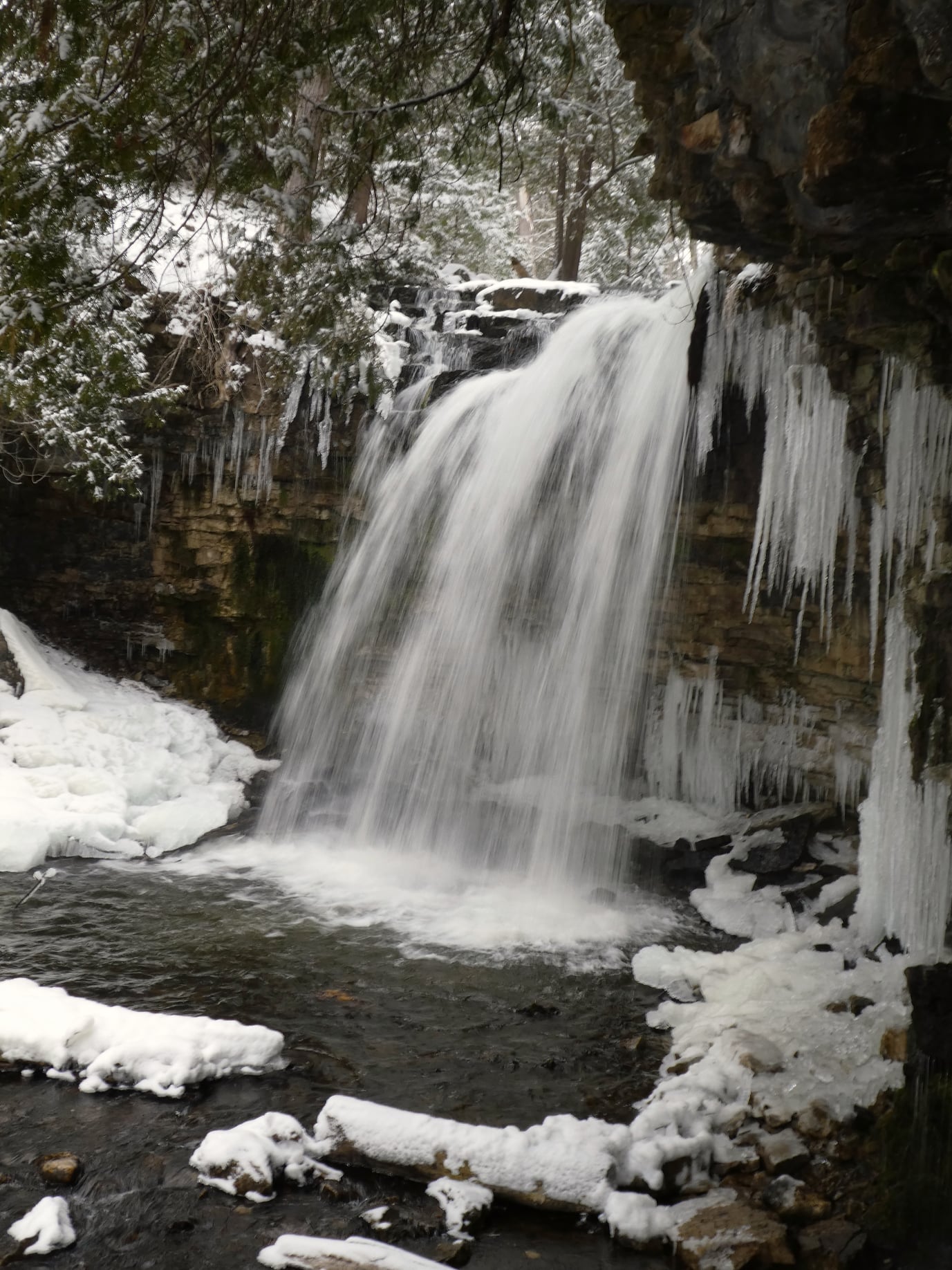
This short loop hike will take us along the base of the escarpment through several rock crevices and returns along the top of the escarpment to the parking area. Features include huge blocks of dolostone on the talus slope, rich in fossils, as well as evidence of early settlers. Bring poles or walking sticks if you have them, snowshoes if there’s enough snow, and/or icers. - 09February 9, 2026
Toronto Winter Blues - Hike 4 (UPDATED NEW MEETING SPOT)
https://hikes.brucetrail.org/event/toronto-winter-blues-hike-4/Sorry, the registration cut-off time for this hike has been reached.Not a member? Click here to join today!Hike open to BTC Members only.
Hosting Club: Iroquoia, Toronto
Category: General Hike
Location (Google Maps): Scotsdale Farm – Main Parking AreaHike Leader(s): Pati Greenwood, Jeff Dowsett Click here to contact Hike Leader(s)
Pace: Medium – 3 to 4 km/hr
Terrain: Dependent on Conditions, Moderate – Some hills and/or some poor footing, Slippery Sections Likely
Distance: 14 kmDescription
This is a series of 6 hikes to explore various side trails in the Toronto Section of the Bruce Trail. Hikers completing all six hikes will be eligible to obtain the Toronto Side Trail Badge. Each hike requires a separate registration. The hikes in this series will take place on January 12, 26, February 2, 9, 23, and March 2. Hikes will be dependent on weather / travel conditions. All hikes will be undertaken at a medium pace.This hike will explore several side trails in the Scotsdale/Silver Creek area including: South Bennett Heritage ST, Great Esker ST, Trafalgar ST, Reservoir ST, Duff Pitt ST & North Rim ST.
Dress in layers for the weather, wear appropriate hiking footwear, bring icers and hiking poles. Bring plenty of water or other hydration and a snack.
Please arrive at the meeting place by 8:15 am. We will depart promptly at 8:30 am.
If your plans change and you are unable to join the hike, please cancel your reservation in the My Hikes Section of the BTC website.
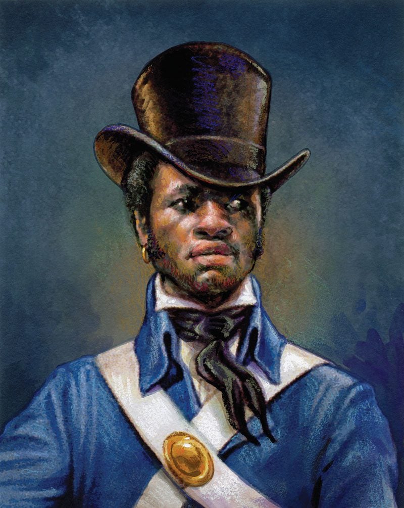
9:00 NOTL BLACK HISTORY SERIES - #3 of 4: Richard Pierpoint and The Coloured Corps
https://hikes.brucetrail.org/event/900-notl-black-history-series-3-of-4-richard-pierpoint-and-the-coloured-corps/Sorry, the registration cut-off time for this hike has been reached.Not a member? Click here to join today!Hosting Club: Niagara
Category: Urban
Location (Google Maps):Veteran’s Memorial Park. Park on King St. at Centre
Hike Leader(s): Karen Couch Click here to contact Hike Leader(s)
Pace: Medium
Terrain: Easy
Distance: 6 kmDescription
Since 1995, the government in has Canada officially recognized February as Black History Month. Each year, Black History Month honours the experiences, achievements and enduring contributions of Black communities in Canada, while deepening our collective understanding of their history and impact on Canadian society. This year’s theme: “30 Years of Black History Month: Honouring Black Brilliance Across Generations — From Nation Builders to Tomorrow’s Visionaries.” This theme celebrates three decades of Black History Month in Canada and recognizes the enduring legacy of Black Canadians, whose leadership, creativity, innovation and resilience have shaped our past, continue to influence our present, and will inspire future generations.During the hikes in this series, you will learn about Niagara-on-the-Lake’s Black history. You will find out about some of those who fought enslavement, and how they were pivotal in shaping our society to be as diverse as it is today. Richard Pierpoint is one such Canadian, who lived in the Niagara area. Watch a short video by Historica Canada about his life by opening the link below.
https://youtu.be/UQyPXOHvwEc?si=2ZPGIHDrybxv11f
*Hikers should be prepared for the season: layered clothing, boots, hydration, a snack, hiking poles and icers. We will stop several times along the way. There is a washroom available at the end of the hike.
This counts as 1 of 3 required for the Black History badge. Check the Hike Schedule on Feb 2nd & 9th for additional hikes. There will be a short break between hikes on the same day.
PLEASE NOTE: Hikes are offered by volunteers who have committed to their own learning to be able to offer informative and contemplative hike experiences. These hikes are opened to all and offered in a spirit of mutual learning and inclusion.
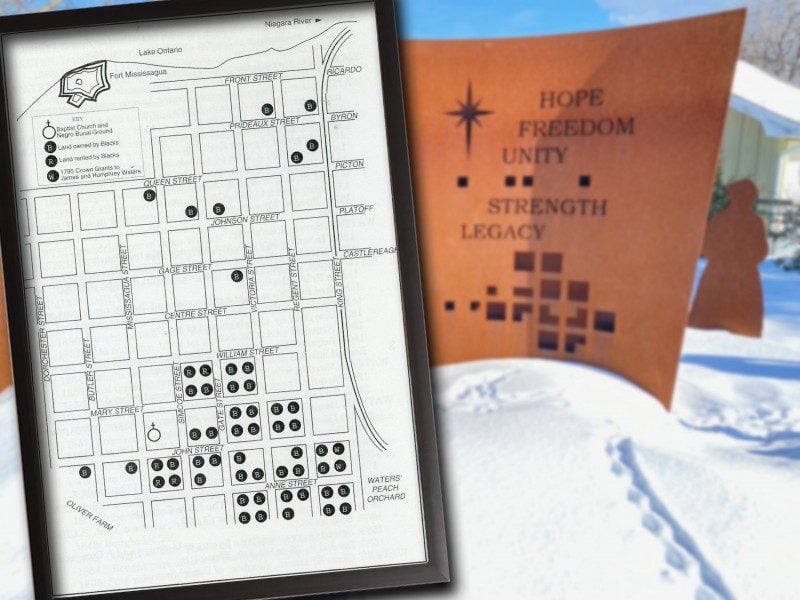
11:00 NOTL BLACK HISTORY SERIES - #4 of 4: The Early Niagara Community
https://hikes.brucetrail.org/event/1100-notl-black-history-series-4-of-4-the-early-niagara-community/Sorry, the registration cut-off time for this hike has been reached.Not a member? Click here to join today!Hosting Club: Niagara
Category: Urban
Location (Google Maps):Veteran’s Memorial Park. Park on King St. at Centre
Hike Leader(s): Karen Couch Click here to contact Hike Leader(s)
Pace: Medium
Terrain: Easy
Distance: 5-6 kmDescription
Since 1995, the government in Canada officially recognized February as Black History Month.This hike will give us an opportunity to celebrate the strength and perseverance of the early Black community here in Upper Canada.
The Town of Niagara-on-the-Lake (NOTL) has a significant and nation-shifting Black history. Voices from the past will tell stories, enriching hikers’ understanding of how they shaped this town and nation.
See link below for a brief overview of NOTL’s Black History.
https://artsandculture.google.com/story/niagara-on-the-lake-s-black-history-niagara-historical-society-museum/-QXR3nRTdnmqJw?hl=en
*Prepare for this urban adventure with hydration, snack, hiking poles, icers etc. The sidewalks and roads can be icy.
**This hike counts as 1 of the 3 required hikes towards the Black History badge. Check the February hike schedule for additional hikes. You can bring the $10 or make an e-transfer to receive your badge at the end of the hike.
Consider a visit the NOTL Museum after the hike; it opens at 1:00 pm. There you will see numerous artifacts on this subject.
PLEASE NOTE: Hikes are offered by volunteers who have committed to their own learning to be able to offer informative and contemplative hike experiences. These hikes are open to all and offered in a spirit of mutual leaning and inclusion.
- 10February 10, 2026
9:00 Long Hike Wiley Road, Short Hills
https://hikes.brucetrail.org/event/900-long-hike-wiley-road-short-hills-53/Sorry, the registration cut-off time for this hike has been reached.Not a member? Click here to join today!Hosting Club: Niagara
Category: Loop
Location (Google Maps):Short Hills parking lot C, Wiley Road
Hike Leader(s): Jacques Boilard Click here to contact Hike Leader(s)
Pace: Brisk
Terrain: Moderate
Distance: 10kmDescription
Explore Short Hills and majestic side trail of Scarlett Tanager, Hemlock, Swayze Falls and Terrace. Register for each hike.Bring poles, icers, snack and dress according to the weather
9:15 Short Hike - Short Hills Park, Pelham Rd
https://hikes.brucetrail.org/event/915-short-hike-short-hills-park-pelham-rd-39/Sorry, the registration cut-off time for this hike has been reached.Not a member? Click here to join today!Hike open to BTC Members only.
Hosting Club: Niagara
Category: Loop
Location (Google Maps): Short Hills Provincial Park, Pelham Rd entranceHike Leader(s): Debbie Demizio Click here to contact Hike Leader(s)
Pace: Medium
Terrain: Moderate
Distance: ~ 6kmsDescription
Hike the main and side trails of Short Hills Provincial Park. Please note that there are some steep hills and rocky sections, so you should have some hiking experience before joining this hike. Please bring water, hiking poles and icers, as the trails can be icy at times.Hockley Valley-Tom East Loop
https://hikes.brucetrail.org/event/hockley-valley-tom-east-loop-5/Sorry, the registration cut-off time for this hike has been reached.Not a member? Click here to join today!Hosting Club: Dufferin Hi-Land
Category: Tuesday Hike
Location (Google Maps):Caledon Hills Section, Map 18, Meet at Hockley Rd parking lot on the north side of Hockley Rd, 250 meters east of 2nd line (near Km 61.3)
Hike Leader(s): Tony Evangelista, Inge Eckerich, Les Babbage , Julie Daley Click here to contact Hike Leader(s)
Pace: Leisurely
Terrain: Moderate, Slippery and Steep Sections
Distance: 5.6 Km, Short hike: 2.5 Km.Description
We will hike a loop consisting of Hockley Rd and Tom East Side Trails and Main Trail. Shorter hike will turn back where the Tom East trail turns sharply to the east. Bring water and snacks. Icers or snowshoes may be required. Hiking poles are recommended.Urban Walk: Valley View Park Thornhill
https://hikes.brucetrail.org/event/urban-walk-valley-view-park-thornhill-141/Sorry, the registration cut-off time for this hike has been reached.Not a member? Click here to join today!Hosting Club: Toronto
Location (Google Maps): Parking lot is off Sycamore Drive, East of Bayview , across Starbucks plaza
Bus 91 from Finch East station stops at Sycamore station.Hike Leader(s): Mohammad Aghamiri Click here to contact Hike Leader(s)
Pace: Moderate (3-4 km/hr)
Terrain: Hilly, Level 2 (Intermediate – some hills and uneven surfaces, rocks and roots underfoot), Variable
Distance (km): 6-7 kmDescription
We will explore Valleyview and Maple View parks, and walk along German Mill Creak, in return we stop in Huntington park and have snack under beautiful shed.Although this is considered an “Urban Walk”, you can expect some hills up and down and uneven surfaces with tree roots. Please bring hiking poles, Ice cleats water and snacks.
phone number for the day of hike 289 588 6482
Island Lake - Orangeville
https://hikes.brucetrail.org/event/island-lake-orangeville-5/Sorry, the registration cut-off time for this hike has been reached.Not a member? Click here to join today!Hosting Club: Caledon Hills
Category: Tuesday Hikers
Location (Google Maps): Meet at Vicki Barron Lakeside Trail Parking.
After driving through Orangeville traffic lights on Highway 10, turn right on Hockley Rd., keep straight onto Sideroad 5, turn right on Hurontario Street to the car parking close to the lake.Hike Leader(s): Mohammad Shafiq Click here to contact Hike Leader(s)
Pace: Medium – 3 to 4 km/hour
Terrain: Easy – mostly flat and usually good footing
Distance: 9 – 10 kmDescription
Will hike around Island Lake, may take diversion into the side trail for a total of 9-10 km completing a loop around the lake.
For dressing take into account weather conditions, bring icers there may be snow on the trails.
Bring a warm drink and snack.
Check your email 7:00 am as the hike may be cancelled if driving conditions are hazardous.
(Note: This is repeat of Jan 27 hike that was canceled due to freezing weather)
WINS hike - West Rocks
https://hikes.brucetrail.org/event/wins-hike-west-rocks/Sorry, the registration cut-off time for this hike has been reached.Not a member? Click here to join today!Hosting Club: Sydenham
Category: Snowshoe Hike
Location (Google Maps): Click the (Google Maps) link on the left to direct you to parking. GPS coordinates:44.55150, -80.95865. Park at the end of Concession 3, located 1.7 km north of Grey Rd 5. Look on the Bruce Trail app or in the Bruce Trail Reference guidebook Edition 31, Map 32 just north of km 96.1Hike Leader(s): Stewart Brown;Laureen Linseman Click here to contact Hike Leader(s)
Pace: Medium: 3 to 4 km/h
Terrain: Moderate: Some hills and/or poor footing, There might be icy and slippery sections.
Distance: 5 kmDescription
The Walk In Nature Series (WINS) consists of 2 hour hikes in the Sydenham section of the Bruce Trail that combine nature appreciation with fitness in a safe and welcoming group environment led by an experienced hike leader. Consider these hikes to be appointments with yourself in nature that promote health and fitness.On this WINS snowshoe hike, explore the trails of West Rocks Management Area in their winter coat. The pace will be 2-3 km/h which on snowshoes is the effort of a medium paced hike in summer. We will loop around the red trail, avoiding other trails with crevices. Registrants will be sent an email the day before the hike with an update of trail conditions and what to bring.
See you soon!
- 11February 11, 2026

8:30 Niagara Winter End to End #6 Woodend Conservation Area to Queenston Southern BTC Terminus
https://hikes.brucetrail.org/event/830-niagara-winter-end-to-end-6-woodend-conservation-area-to-queenston-southern-btc-terminus-3/Sorry, the registration cut-off time for this hike has been reached.Not a member? Click here to join today!Hosting Club: Niagara
Category: Car Pool
Location (Google Maps): Meet at Queenston Heights Park (washroom building street parking) and Car Pool to WoodendHike Leader(s): Sam Rutherford Click here to contact Hike Leader(s)
Pace: Medium
Terrain: Moderate
Distance: 14.5 kmsDescription
We will be car pooling, Bring Icers and poles. No dogs. To earn your Niagara Winter End to End badge, it must be completed between December 21, 2025 to March 21, 2026.
Because of the potential for bad winter trail conditions we have broken this e2e into 6 hikes rather than 5. Main parking lot will be closed for winter so park near the washroom building. Parking fees may be required.If you have completed all 6 hikes bring $10 for the coveted Winter End to End Badge

Niagara E2E Winter - 3 of 5 (Wednesdays)
https://hikes.brucetrail.org/event/niagara-e2e-winter-3-of-5-wednesdays/Sorry, the registration cut-off time for this hike has been reached.Not a member? Click here to join today!Hosting Club: Niagara, Iroquoia
Category: General Hike
Location (Google Maps): Rockway Community Centre, enter off Pelham Rd just east of Wessel Dr (15), 43.111255,-79.321901. We will shuttle to Decew House Heritage Park, enter from Decew Rd (10), 43.107568,-79.249598Hike Leader(s): Steven White Click here to contact Hike Leader(s)
Pace: Brisk – 4 to 5 km/hr, Medium – 3 to 4 km/hr
Terrain: Moderate – Some hills and/or some poor footing, Slippery and Steep Sections
Distance: 16.8 kmDescription
The Niagara E2E Winter in 5 will be Wednesdays Jan 28, Feb 4, 11, 18, 25. Hikers must register for individual hikes. Hikes are 14-18 kms and expect an average pace of 4 km/hr with snack/lunch breaks.Hikers should be prepared for the season – layered clothing, hiking boots, icers, snowshoes (if we get fresh snowfall), poles, water, snacks/lunch, first aid kit.
Hikers should be prepared to share their cars for shuttling – to be shared evenly.
If we encounter unsafe hiking or driving conditions, I will cancel/re-schedule the hike the day before. If you are unable to join us on the day of the hike, please text me at 289-242-9415
CANCELLED - Hilton Falls on the Bike Trails
https://hikes.brucetrail.org/event/hilton-falls-on-the-bike-trails/Sorry, the registration cut-off time for this hike has been reached.Not a member? Click here to join today!Hosting Club: Iroquoia
Category: General Hike
Location (Google Maps): Meet in the parking lot at Hilton Falls Conservation Area at 9:15 am.Hike Leader(s): Karen Bergmann Click here to contact Hike Leader(s)
Pace: Medium – 3 to 4 km/hr
Terrain: Moderate – Some hills and/or some poor footing
Distance: 8 kmsDescription
Meeting in the parking lot at 9:15 am, we will hike to the Falls and then across the creek to the bike trails and back along the Hilton Falls Side Trail. Bring icers for your boots. Reserve your time at conservationhalton.caGood Companions - Shell Park and Bronte Trails
https://hikes.brucetrail.org/event/good-companions-shell-park-and-bronte-trails-5/Sorry, the registration cut-off time for this hike has been reached.Not a member? Click here to join today!Hike open to BTC Members only.
Hosting Club: Iroquoia
Category: Good Companions
Location (Google Maps):Shell Park, Lakeshore Road, Bronte (parking lot closest to Lakeshore Road) See map below
Hike Leader(s): Ted Bossence Click here to contact Hike Leader(s)
Pace: Medium – 3 to 4 km/hr
Terrain: Dependent on Conditions, Easy – Mostly flat and usually good footing
Distance: 7.5 kmDescription
We will hike through Shell Park and trails in Bronte to Bronte Creek and Bronte Harbour, returning via the lake and pioneer cemetery. Bring icers, water and a snack. Please arrive at least 10 minutes before the start time, I will be leaving on time. If you are unable to come and cancel after 4:00 pm on the day before the hike I will provide an email with contact information on the tuesday.In case of rain or blizzard conditions I will cancel, so please check your email the evening before the hike.
Winter Wednesday Walkers Sligo Side Trail Loop
https://hikes.brucetrail.org/event/sligo-side-trail-loop/Sorry, the registration cut-off time for this hike has been reached.Not a member? Click here to join today!Hosting Club: Beaver Valley
Location (Google Maps): Park in the parking lot (accessible only from 7th Line) on Sideroad 16C, 450 metres east of 7th Line. East of km 89.3, Map 27, Edition 31
Hike Leader(s): Glenda Collings Click here to contact the hike leader.
Pace: Medium
Terrain: Moderate
Length of Hike: Approx. 4 kmDescription
We will hike Sligo Side Trail, which is a very nice walk through a variety of forest types and some views across the escarpment to the east. On winter hikes we may encounter bare ground, light snow, deep snow, or ice. Please bring snowshoes and icers to our Winter Wednesday Walkers outings. Wear appropriate clothing for the weather plus water and a snack. - 12February 12, 2026
9:00 am Long hike NEW Location. Bailey bridge Jordan
https://hikes.brucetrail.org/event/900-am-long-hike-new-location-bailey-bridge-jordan-8/Sorry, the registration cut-off time for this hike has been reached.Not a member? Click here to join today!Hosting Club: Niagara
Location (Google Maps):
Bailey bridge Jordan
Pace: Brisk
Terrain: Strenuous
: 10kDescription
This will be our permanent location . Hike up from the Bailey bridge to Balls Falls and explore the trailsYou must register for each hike. Bring Poles, snack and a drink. Dress for the weather
9:00 Long Hike Bailey Bridge parking lot Jordan
https://hikes.brucetrail.org/event/900-long-hike-bailey-bridge-parking-lot-jordan-2/Sorry, the registration cut-off time for this hike has been reached.Not a member? Click here to join today!Hosting Club: Niagara
Category: Loop
Location (Google Maps): Parking lot near the Bailey bridge, on 21st St, JordanHike Leader(s): Alan Laver Click here to contact Hike Leader(s)
Pace: Brisk
Terrain: StrenuousDescription
Hike in and around Ball’s Falls and Jordan.Dress for the weather: icers, poles, layers
Hiking around Jordan
https://hikes.brucetrail.org/event/hiking-around-jordan-46/Sorry, the registration cut-off time for this hike has been reached.Not a member? Click here to join today!Hosting Club: Niagara
Location (Google Maps): Glen Road Parking Lot
3640 Glen Road, Jordan LOR 1SOHike Leader(s): Bill Russell Click here to contact Hike Leader(s)
Pace: Medium
Terrain: Moderate
Distance: 7 kmDescription
Hiking in and around Jordan including Jim Rainforth Trail, Bailey Bridge and Balls Falls (alternating every 3 weeks).Urban Walk: Valley View Park Thornhill
https://hikes.brucetrail.org/event/urban-walk-valley-view-park-thornhill-142/Sorry, the registration cut-off time for this hike has been reached.Not a member? Click here to join today!Hosting Club: Toronto
Location (Google Maps): Parking lot is off Sycamore Drive, East of Bayview , across Starbucks plaza
Bus 91 from Finch East station stops at Sycamore station.Hike Leader(s): Mohammad Aghamiri Click here to contact Hike Leader(s)
Pace: Moderate (3-4 km/hr)
Terrain: Hilly, Level 2 (Intermediate – some hills and uneven surfaces, rocks and roots underfoot), Variable
Distance (km): 6-7 kmDescription
We will explore Valleyview and Maple View parks, and walk along German Mill Creak, in return we stop in Huntington park and have snack under beautiful shed.Although this is considered an “Urban Walk”, you can expect some hills up and down and uneven surfaces with tree roots. Please bring hiking poles, Ice cleats water and snacks.
phone number for the day of hike 289 588 6482
- 13February 13, 2026
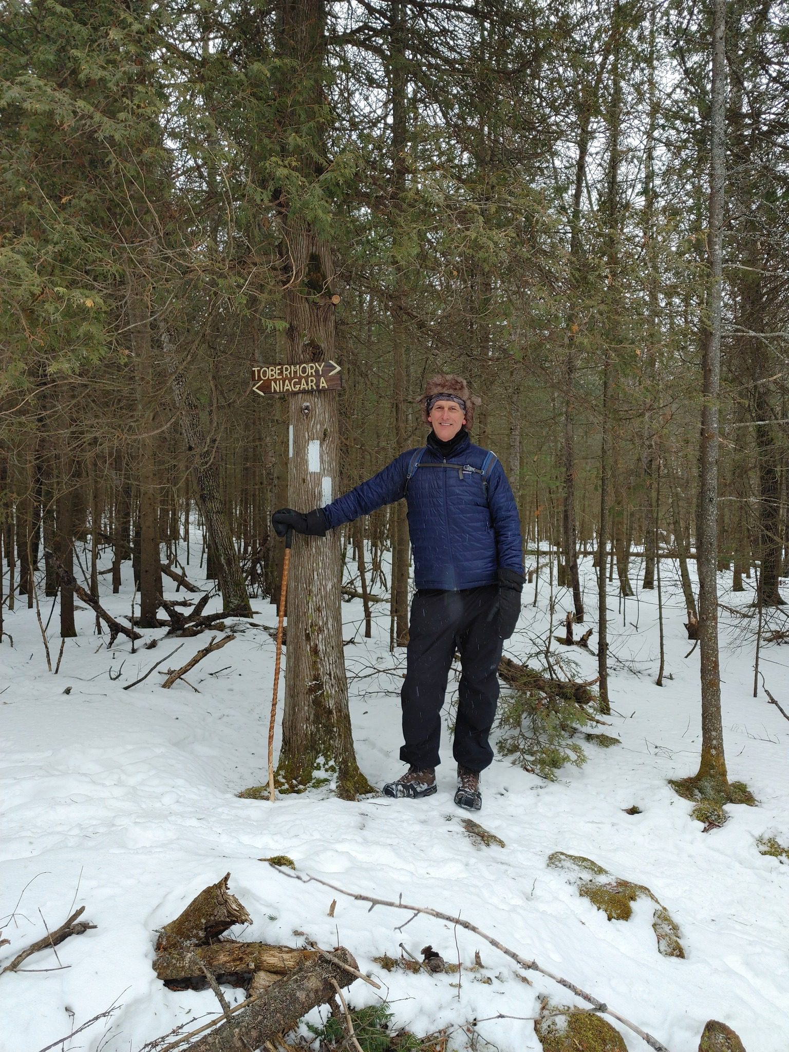
Feb. 13-16, 2026 - Family Day Snowshoe Weekend in Tobermory (3 nights)
https://hikes.brucetrail.org/event/feb-13-16-2026-family-day-snowshoe-weekend-in-tobermory-3-nights/Sorry, the registration cut-off time for this hike has been reached.Not a member? Click here to join today!This is a Multi-Day Hike
You are signing up for the following dates and times:
2026-02-13 at
2026-02-14 at
2026-02-15 at
2026-02-16 atHosting Club: Toronto, Peninsula
Category: Car Hike
Location (Google Maps):Princess Hotel
34 BAY STREET SOUTH TOBERMORY, ONTARIO N0H 2R0, CANADAHike Leader(s): Jeanette Vincent Click here to contact Hike Leader(s)
Pace: Moderate (3-4 km/hr)
Terrain: Level 2 (Intermediate – some hills and uneven surfaces, rocks and roots underfoot), Variable
Distance (km): 8 -12kmDescription
Jeanette Vincent, Brenda Menezes and David Royle will continue Greg Vincent’s Legacy – Family Day Snowshoe Weekend in Tobermory. Celebrate with a weekend trip snowshoeing the trails of the National Park at the “Tip o’ the Bruce” Tobermory.We arrive Friday, February 13th at our comfortable hotel overlooking Little Tub Harbour where we stay and have our meals for three nights at the Princess Hotel in Tobermory.
This outing is restricted to those staying and having their meals with us at the Princess Hotel in Tobermory for the weekend. Space is limited make your reservation soon. Please email Jeanette for the prices for the weekend at the Princess Hotel package and additional information. Once you receive the package, if you plan to join us call the Princess a reservation 1-519-596-8282 or sent an email to info@tobermoryprincesshotel.com and mention Vincent/Royle Winter Snowshoe weekend when booking. Once you have made your reservation, be sure to register for this event on the Toronto Bruce Trail Club. please send an email to Jeanette once you have done both, registered on the TBTC site and made your reservation at the Princess Hotel.
Brisk Fridays - Skinner's Woods
https://hikes.brucetrail.org/event/brisk-fridays-skinners-woods/Sorry, the registration cut-off time for this hike has been reached.Not a member? Click here to join today!Hosting Club: Sydenham
Category: Snowshoe Hike
Location (Google Maps): Click the (Google Maps) link on the left to direct you to parking. GPS coordinates: 44.77675, -81.03972. Park at the curve on Gleason Lake Road, 2.0 km north of Concession Rd 24. Hike route from parking follows Curly Harnden Side Trail, then Main Trail southboud, and return to parking by Skinner’s Woods Side Trail and Len Holley Side Trail. Find these trails on the Bruce Trail app or in the Bruce Trail Reference guidebook Edition 31, Map 35.Hike Leader(s): Stewart Brown Click here to contact Hike Leader(s)
Pace: Brisk: 4 to 5 km/h
Terrain: Moderate: Some hills and/or poor footing, There are crevices or holes which may be hidden by layers of snow. Hike with extreme caution., There might be icy and slippery sections.
Distance: 9 kmDescription
This strenuous snowshoe hike is mostly in the Skinner’s Bluff Management Area, through stately mature forests, along its cedar-lined cliff and returning inland through mixed forest. Our actual pace will be between 2.5 and 3.0 km/h which requires an effort that matches what would be required on a summer hike of a brisk pace of 4-5 km/h. Be prepared for a good workout in the snow despite a flat terrain. Registrants will receive an email the day before the hike with an update of trail conditions and what to bring. Snowshoeing 9 km is no easy feat, but if you’re up to the challenge, you are most welcome!
9am Niagara-on-the-Lake Tour
https://hikes.brucetrail.org/event/9am-niagara-on-the-lake-tour/Sorry, the registration cut-off time for this hike has been reached.Not a member? Click here to join today!Hosting Club: Niagara
Category: Urban
Location (Google Maps): Park on King St near Centre St, NOTLHike Leader(s): Margaret Northfield Click here to contact Hike Leader(s)
Pace: Medium
Terrain: Easy
Distance: 6-7kmDescription
Each Friday we will explore different neighbourhoods, trails and parkland throughout Historic Niagara-on-the-Lake.
Moderate pace with some weeks entirely on sidewalks and roads while others may include a mix of trails and paved pathways. Great way to build up endurance for longer more strenuous hikes.
Prepare for cooler windy conditions on open parkland and along Lake Ontario and Niagara River trails.
Plan to stay for conversation and a warm cup of coffee or tea at Sweets & Swirls, Community Centre, Niagara Stone Road, NOTL
- 14February 14, 2026
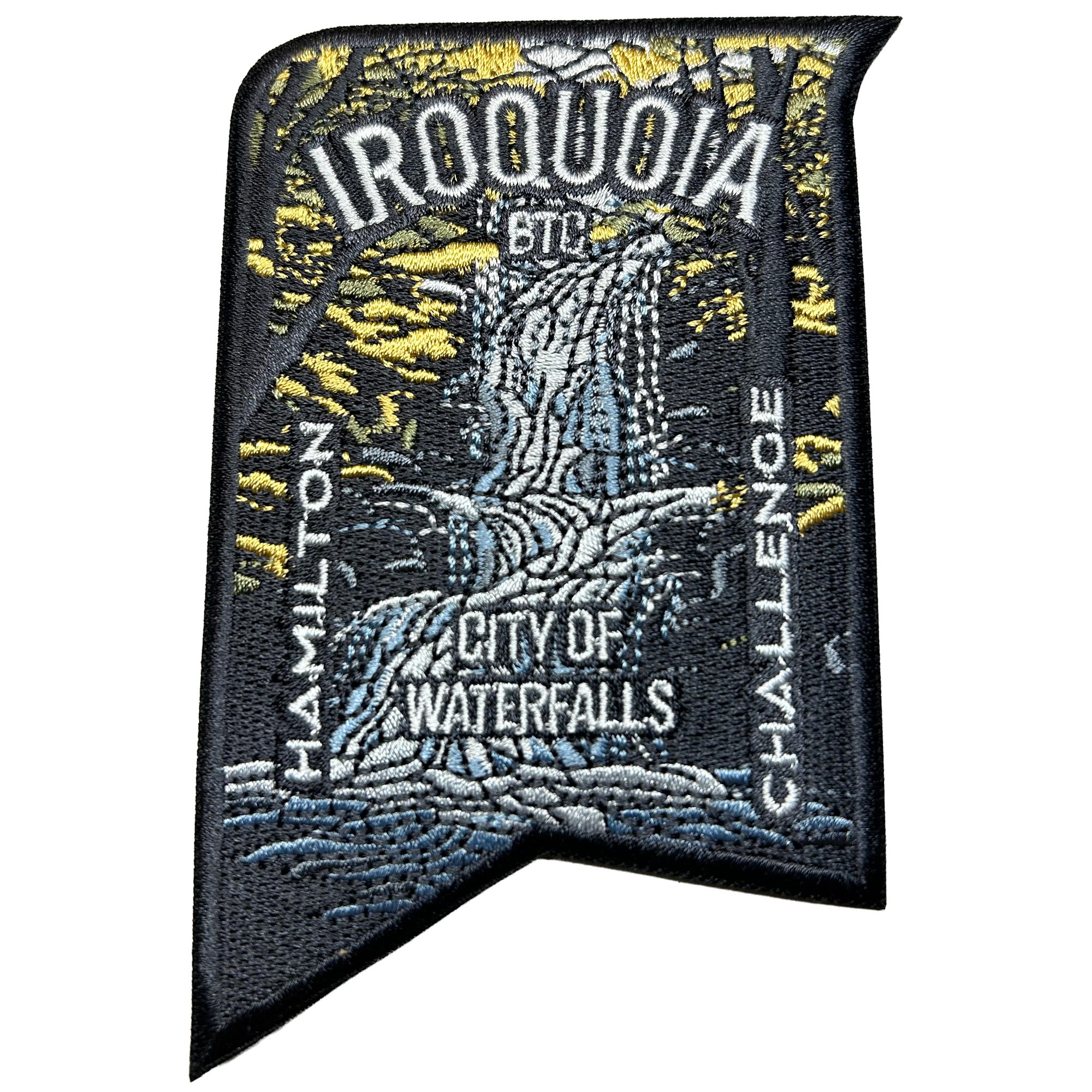
City of Waterfalls – Special Event Fundraiser
https://hikes.brucetrail.org/event/city-of-waterfalls-special-event-fundraiser-5/Sorry, the registration cut-off time for this hike has been reached.Not a member? Click here to join today!This is a Multi-Day Hike
You are signing up for the following dates:
2026-02-14, 2026-02-15Hosting Club: Iroquoia
Category: City of Waterfalls – Special Event Fundraiser
Location (Google Maps): DAY 1: FEB 14 – Parking lot at City View Park off of Kerns Rd. Enter from Dundas St. (capacity 50) 43.351747, -79.862195
DAY 2: FEB 15 – Parking Lot off of Mud St providing access to the Mud Street Side Trail (capacity 30)Hike Leader(s): IgorT Click here to contact Hike Leader(s)
Pace: Brisk – 4 to 5 km/hr, Medium – 3 to 4 km/hr
Terrain: Dependent on Conditions, Moderate – Some hills and/or some poor footing, Slippery and Steep Sections
Distance: Approximately 22-25km / per dayDescription
Welcome to Iroquoia, City of Waterfalls Challenge! This is a fundraiser challenge event. All funds raised go towards the Iroquoia Bruce Trail Club to maintain the infrastructure of this beautiful section of trail and to “Preserve this ribbon of wilderness, for everyone, forever!”DAY 1: FEB 14 – We will meet at Cityview Park and car shuttle to Spencer Gorge Parking Lot (Conservation Hamilton) and hike back. The cost at this parking lot is $16.50 per vehicle and driver plus $5.50 for each passenger.
Day 1 Distance 21kmDAY 2: FEB 15 – We will meet in the parking area off of Mud St and car shuttle to Artaban Rd Parking Lot (Conservation Hamilton) and hike back. The cost for this parking lot is $11.00 per vehicle.
Day 2 Distance 24 kmPlease ensure your vehicle is car shuttle ready by having a minimum of 4 seatbelts available – drivers do not pay for the parking. Please volunteer for this important component of this challenge. While we encourage carpooling to the start of the hike, please let the hike leader know if you’re planning to arrive with more than two people in your vehicle. This hike will be limited to 10 people including the hike leader so we will need at least 3 vehicles and one vehicle with 4 seatbelts to drive the drivers back at the end of the day. We will try to take as few vehicles as possible. On the second day, those who did not drive on the first day will be asked to drive.
There will be short breaks along the way to admire the waterfalls on route and a short lunch.
Please bring all the hiking items you require for a long day hike including 2l of water, snacks, lunch, first aid kit, rain gear if rain is forecast, plastic shower caps for your boots if muddy, bug spray, sunscreen, rimmed hat, poles (if you use them) and your camera for all the photo ops. Please ensure you are physically able to complete two long day hikes over two days – if you must drop out, you will have to arrange your own transportation back to your vehicle. There is public transportation, Uber, and taxi’s in the area. If you are concerned about whether you will be able to manage the distance over the two day period, it’s possible that you may need to wait until a 4 day version of this event is posted.
The badge will be presented to all participants who have completed the challenge at the end of the second day.
Any questions may be directed through contact on this form.
The fee is non-refundable.
School Bus Hike Toronto Section Winter Badge End to End #3 of 6
https://hikes.brucetrail.org/event/school-bus-hike-toronto-section-winter-badge-end-to-end-3-of-6/Sorry, the registration cut-off time for this hike has been reached.Not a member? Click here to join today!Trip Information
Departure Time: 08:30
Return to City Time: 18:00
Departure Point: York Mills Bus PickupOptional Items
Hosting Club: Iroquoia, Toronto
Category: Bus Hike
Location (Google Maps): Toronto Section, LimehouseHike Leader(s): Tim Wainwright, Fayaz Mahmood Click here to contact Hike Leader(s)
Pace: Leisurely (2-3 km/hr)
Terrain: Challenging, Level 2 (Intermediate – some hills and uneven surfaces, rocks and roots underfoot), Variable
Distance (km): 8.41 kmDescription
We will be hiking in winter conditions of ice and snow so these will be slower and shorter hikes than in other seasons. Icers or snowshoes are mandatory, and gaiters and poles recommended. The terrain is not too hilly, but the footing is treacherous in winter with many uneven, rocky sections to navigate. The leaders will let registrants know in advance if snowshoes are feasible for the day. Please bring at least 2L of water, snacks, and your lunch. Any hikers are welcome to join the hikes regardless of whether a person is working towards a badge. Those who complete all 6 hikes will qualify for the Toronto club’s Winter E2E badge. The fee is $10 per badge ($15 for non-members) and will be collected by the hike leader on trip #4. Or you may choose to purchase the special stained glass Fundraising End to End badge for $30.This hike goes through the Limehouse Conservation Area trail to the Sixth Line Parking lot from the Fourth Line Parking Lot. (8.41 km). This includes the portion of the trail taken off Fifth Line in 2025. There will be a refreshment/social stop in Georgetown after the hike before returning to the York Mills Station departure point by 6:00 PM.
Car Hike: Happy Valley King City
https://hikes.brucetrail.org/event/car-hike-happy-valley-king-city-9/Sorry, the registration cut-off time for this hike has been reached.Not a member? Click here to join today!Hosting Club: Toronto
Location (Google Maps): Happy Valley, Oak Ridges Trail 16th Sideroad & Weston Road
Please park along 16th Side road
Hike Leader(s): Mohammad Aghamiri Click here to contact Hike Leader(s)
Pace: Moderate (3-4 km/hr)
Terrain: Hilly, Level 2 (Intermediate – some hills and uneven surfaces, rocks and roots underfoot)
Distance (km): 12-14 kmDescription
Come and join us to view nice scenery and look out of Happy valleyWoodend to Cairn
https://hikes.brucetrail.org/event/woodend-to-cairn/Sorry, the registration cut-off time for this hike has been reached.Not a member? Click here to join today!Hike open to BTC Members only.
Hosting Club: Niagara
Category: Car Pool
Location (Google Maps): Meet at the parking area circle near the washrooms and the restaurant at Queenston Heights. Carpool to Woodend. Help Sharon complete one section of Niagara’s Winter E2E.Hike Leader(s): Lauren Doig Click here to contact Hike Leader(s)
Pace: Brisk, Medium
Terrain: Moderate
Distance: 15.5 kmDescription
Old Baldy
https://hikes.brucetrail.org/event/old-baldy-2/Sorry, the registration cut-off time for this hike has been reached.Not a member? Click here to join today!Hosting Club: Blue Mountains
Category: Organized Hike
Location (Google Maps): Tim Horton’s, First Street, CollingwoodHike Leader(s): Annette Sandberg Click here to contact Hike Leader(s)
Pace: Leisurely – 3 km/hr. or less
Terrain: Moderate – Some hills and/or some poor footing
Distance: 3 kms loopDescription
We will meet at Tim Hortons on First Street for carpooling. Then take a 35-minute drive over to Old Baldy in Kimberley. From the upper parking lot, we will take a 15-minute hike through forests to the edge of the Niagara Escarpment, where we begin to experience the incredible views overlooking Beaver Valley and the Village of Kimberley. Then, we will continue up the short incline to the peak of Old Baldy 200 meters above the hamlet of Kimberley for the unforgettable panoramic view! Icers, or snowshoes, and poles are recommended. Bring water and dress appropriately for the weather.
Happy St. Valentine’s Day Hike - Meet time 8:45 for 9am start
https://hikes.brucetrail.org/event/happy-st-valentines-day-hike-meet-time-845-for-9am-start/Sorry, the registration cut-off time for this hike has been reached.Not a member? Click here to join today!Hosting Club: Iroquoia
Category: Special Event
Location (Google Maps): Dundas Valley Conservation Area – Meet in the big parking lot at 8:45amPace: Medium – 3 to 4 km/hr
Terrain: Dependent on Conditions, Moderate – Some hills and/or some poor footing, Strenuous – Hilly with steep climbs and some poor footing
Distance: Approx 10kmDescription
Please wear red, if you like. Dress in layers for the weather, bring your icers just in case and poles if you use them. We will hike in the DVCA and show our ❤️ for the trail. Afterwards, we will have a treat or two and refreshments at the Trail Centre.
Canada Goose to Speyside (E2E)
https://hikes.brucetrail.org/event/canada-goose-to-speyside-e2e-3/Sorry, the registration cut-off time for this hike has been reached.Not a member? Click here to join today!Hosting Club: Iroquoia
Category: General Hike
Location (Google Maps): Meet at 9:15 in the parking lot on 22 Side Rd, just off Fourth Line.Hike Leader(s): Karen Bergmann Click here to contact Hike Leader(s)
Pace: Medium – 3 to 4 km/hr
Terrain: Moderate – Some hills and/or some poor footing
Distance: 8 kmsDescription
Meeting at 9:15 am in the Bruce Trail parking lot on 22 Side Rd, just off Fourth Line, we will carpool to 15 Side Road and hike back along the main trail and Canada Goose Side Trail. There are some rocky parts to this hike, so be prepared. Bring icers for your boots. Hike is dependent on weather.
RAINBOW HIKE: Downtown Dundas to Rock Chapel & Beyond
https://hikes.brucetrail.org/event/rainbow-hike-downtown-dundas-to-rock-chapel-beyond/Sorry, the registration cut-off time for this hike has been reached.Not a member? Click here to join today!Hosting Club: Iroquoia
Category: Rainbow Hike
Location (Google Maps): Meet downtown Dundas, corner of Sydenham and KingHike Leader(s): Doug O’Neill Click here to contact Hike Leader(s)
Pace: Medium – 3 to 4 km/hr
Terrain: Moderate – Some hills and/or some poor footing, Slippery and Steep Sections, Strenuous – Hilly with steep climbs and some poor footing
Distance: Approx. 12 kmDescription
We’re not saying this Rainbow winter hike ends at a pub featured in Episode 3 of the sensational Heated Rivalry gay-hockey TV series…but we are saying the post-hike warm-up will not—to quote Ilya—“be boring.” 🏒🌈 IYKYKLayer up, lace up, and join your chosen hiking family for a Rainbow hike, followed by a well-earned stop at the Winchester Arms in downtown Dundas. (For a sneak peek, rewatch Episode 3 🙂🌈)
This queer-led, all-inclusive 2SLGBTQIA+ hike is designed to provide a safe, welcoming space for 2SGBTQIA+ hikers—including trans, gay, lesbian, bisexual, queer, Two-Spirit, intersex, asexual, allies and friends. Show up, be your authentic self—and have fun in the snow.
This hike is accessible by Public Transit or car. No car shuttles are required. We’ll begin hiking from our rendezvous spot in downtown Dundas, and follow the trail back to the starting point. (Everyone is invited to join us for a post-hike coffee/sugar hit in Dundas.)
Today’s heart-healthy route: Get your blood pumping as we head up the main trail to Sydenham Lookout at the top of Dundas Peak. The first 45 minutes are the most challenging. The route includes Borer’s Falls and Rock Chapel. We’ll hike as far as the “no dogs allowed private property” stretch and retrace our route with optional detours to explore. Expect great views and relaxed camaraderie. SPECIAL TO THIS HIKE: Back in the summer, an unnamed hike leader failed to deliver on the promised visit to the fabled Skate Park (where you’d least expect it on Dundas Peak). It’s on today’s itinerary.
Icers are required for this hike. Please contact Hike Leader now (right after you register if you need to borrow a pair. Limited supply. Just click on the “contact hike leader” button above.
Meeting Place: We’ll rendezvous at 9:45 a.m. for a 10 a.m. departure beside Ed & Shawn’s Brewery parking lot (65 Hatt St., Dundas, off Sydenham), next to the TD Bank. Parking is free on Saturdays. The parking lot is accessible from Sydenham.
Getting to Dundas by Transit
Choice of two HSR bus routes: The 05–Head Street (via Downtown Dundas) will let you off at King & Sydenham (across the street from where we meet); the 5B–Pirie at Governors will drop you off at Governors Road and Ogilvie (then it’s a 7-minute walk to King & Sydenham.What to Bring:
• Water (It’s very easy to get dehydrated in winter), snacks, and lunch, perhaps a hot beverage.
• Sunscreen (glare off snow will give you a winter tan), sunglasses, hiking boots, icers (a must) .
• Dress in layers.Today’s hike is dog-friendly. Note: dogs must be leashed the entire time, and owners must pack out their dog’s waste. Visit “Dogs on the Bruce Trail” for further information. https://brucetrail.org/dogs-on-the-trail/
No washroom facilities on this route. Arrive early and use the loo at Starbucks, just a 2-minute walk down King Street from our meet-up spot at King & Sydenham.
Free Bruce Trail Rainbow badges for first-time Rainbow hikers!
Questions? Simply click “Contact Hike Leader” on the registration form.PLEASE DON’T BE A NO-SHOW 🙂 Plans change. C’est la vie. But you don’t want your hiking group waiting around for you if you’re not coming. Very simple solution: Cancel your Bruce Trail hike registration by logging into the BTC website, go to your “My Hikes” section, find the hike, and click “cancel”; if it’s last minute (under 24 hours), you can also email the Hike Leader directly as a courtesy to the volunteers.
Vday Rainbow/Welcome Hike: Louth Conservation Area
https://hikes.brucetrail.org/event/vday-rainbow-welcome-hike-louth-conservation-area/Sorry, the registration cut-off time for this hike has been reached.Not a member? Click here to join today!Hosting Club: Niagara
Category: Loop
Location (Google Maps):Louth Conservation Area: https://maps.app.goo.gl/LWWRPcRWMHEJwNbi8
Hike Leader(s): Angela Lytle Click here to contact Hike Leader(s)
Pace: Medium
Terrain: Moderate
Distance: 5 kmDescription
Join the Niagara Bruce Trail Club, Bridges Niagara Immigrant and Refugee Services and PFLAG Niagara for a Rainbow-Welcome Hike at Louth Conservation Area!Enjoy the sights and sounds of this beautiful conservation area, which has two waterfalls! What better way to spend Valentine’s Day than embracing love and nature in good company!
What is a Rainbow-Welcome Hike?
These hikes aim to bring 2S-LGBTQIA+ newcomers together with other newcomers and community members, friends and allies to enjoy nature and connect to the land. It is an intentionally affirming space for people of diverse backgrounds and identities.
Hike Details
Route: This hike loops around Louth Conservation area side trails and the Bruce Trail for about 5 km, visiting both the main waterfall and the lower falls.
Terrain: The terrain has some ups and downs along the escarpment edge and into and out of the valley. At this time of year, it can be muddy, icy or both. We will adjust the pace to the group but be prepared for some rocky or icy, uneven footing and ups and downs. We recommend using hiking poles and wearing good hiking shoes is a must. If the weather conditions are snowy or icy, icers/microspikes will be needed. Carry water and dress for changeable weather.
Map: https://maps.app.goo.gl/LWWRPcRWMHEJwNbi8
Note: There are no toilets on this route.
***Please arrive by 9:50 to check in with the hike leader for departure at 10.
There is a small parking lot at the entrance to the conservation area and additional parking along Sue Ann Staff Avenue. We will meet at 9:50 at the parking lot to check in before heading out at 10.
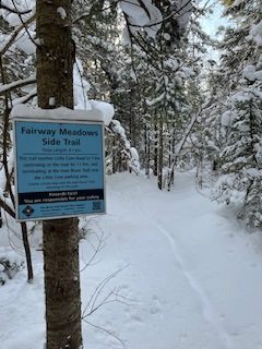
Celebrate Winter Series - Fairway Meadows and Little Cove
https://hikes.brucetrail.org/event/celebrate-winter-series-fairway-meadows-and-little-cove/Sorry, the registration cut-off time for this hike has been reached.Not a member? Click here to join today!Hosting Club: Peninsula
Category: Winter Hikes
Location (Google Maps): Little Cove, TobermoryHike Leader(s): Owen and Marg Glendon Click here to contact Hike Leader(s)
Pace: Leisurely (2.0 – 3.0 km/h): A relaxed pace with frequent breaks and a focus on enjoyment.
Terrain: Easy: Flat forested sections or lowland trails.
Distance: ~ 6 1/2 kmDescription
Beat the winter blahs! February is a time to gather, connect, and enjoy the outdoors together.Join us for a social winter snowshoe hike through the quiet beauty of Fairway Meadows and Little Cove.
This 6.5 km route winds through mixed woodland, open meadow, and a stand of pine plantation, offering ever-changing winter scenery along mostly flat terrain. Our pace will be steady and comfortable for those familiar with this distance in the snow.
To wrap up our outing, be our valentine and join us for a short, optional “winter picnic” at scenic Little Cove. Valentine snacks provided, just bring your thermos with a hot beverage.
Plan for approximately 3 hours of hiking, plus a little additional time at Little Cove’s shoreline.