Hike Schedule
Join us for a hike! Registration required:
All hikes available to BTC members. Some hikes are open to non-members.
TIP: The calendar view displays up to 7 hikes on a day, but often there are more. Click “More events” to see them all.
Categories
- 15February 15, 2026
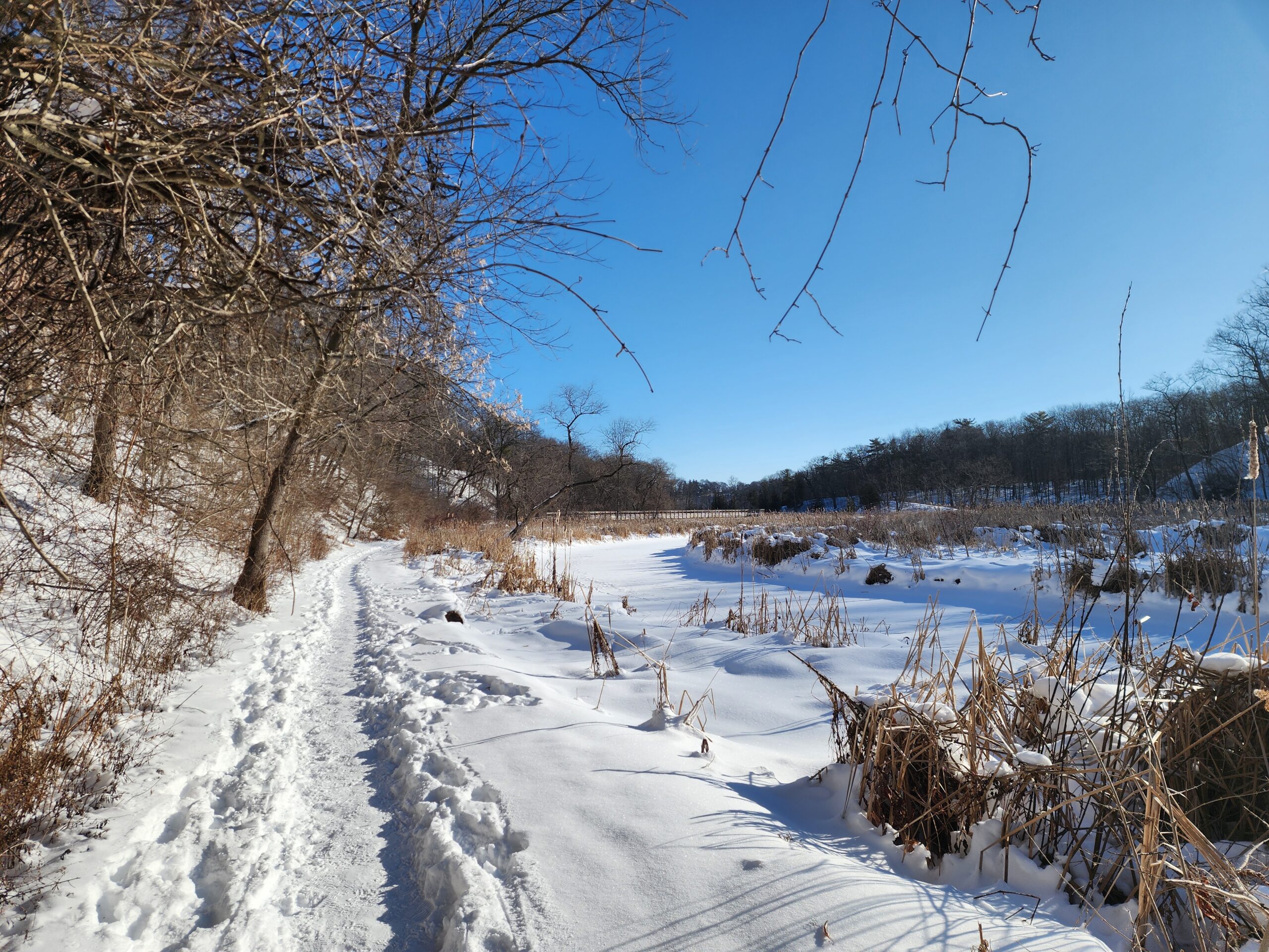
A warmer Sunday at the Marsh - Hendrie Valley and Woodland Cemetery
https://hikes.brucetrail.org/event/a-warmer-sunday-at-the-marsh-hendrie-valley-and-woodland-cemetery/Sorry, the registration cut-off time for this hike has been reached.Not a member? Click here to join today!Hosting Club: Iroquoia
Category: General Hike
Location (Google Maps): RBG Centre Parking – across from Easterbrook’s 694 Spring Garden RoadHike Leader(s): Kathrin Koenig Click here to contact Hike Leader(s)
Pace: Medium – 3 to 4 km/hr
Terrain: Dependent on Conditions, Moderate – Some hills and/or some poor footing, Slippery Sections Likely
Distance: Approx 6 kmDescription
Please be at parking by 8:15 am as the hike will leave promptly at 8:30 am.Please bring your poles and icers; dress in layers to keep warm. Bring enough water and snacks to suit your needs.
We will start by following the outer road at Woodland Cemetery and pick up Grindstone Marsh Trail at Sunfish Pond. Following Grindstone Marsh Trail into Hendrie Valley, we will loop our way along the North and South Bridle Trail to Cherry Hill Gate and back to the cars. There is a set of stairs, one steep-ish downhill section, and a couple of smaller hills. Be prepared for some potentially icy conditions. Please bring your icers/crampons just in case.
Please leave dogs at home.
Easterbrook’s Hot Dog Stand is open all winter for anyone wishing to stop in for a bite to eat.
Please note, the hike might be canceled due to extreme weather, or unsafe trail conditions. A cancellation email will be sent to all registered hikers.
Any questions may be directed through Contact Hike Leader on this form.
In the event you are no longer able to attend, please remove yourself from registration by following these steps:
– Sign into your account on the BTC website
– Click on My Hikes under your account
– This will take you to a list of hikes you have registered for
– Scroll down to the appropriate hike and cursor over to the far right hand column under the Action column.
– Click Cancel under the hike you wish to cancel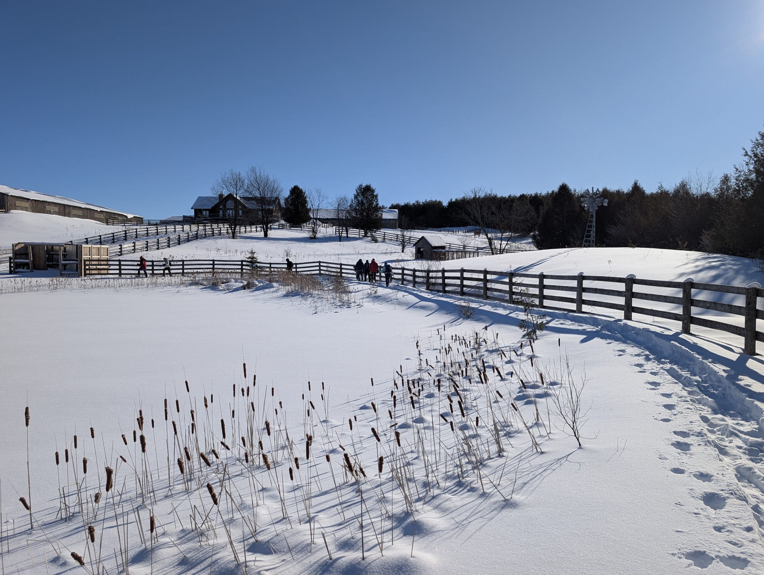
Beginner Snowshoeing at the 100K Ranch
https://hikes.brucetrail.org/event/beginner-snowshoeing-at-the-100k-ranch/Sorry, the registration cut-off time for this hike has been reached.Not a member? Click here to join today!Hosting Club: Toronto
Category: Car Hike
Location (Google Maps): Upon arrival, drive down the center of the driveway. At the fork, keep to your right. Drive through the open door of the first building on your right (the arena) and park inside.Hike Leader(s): Rob Schieck Click here to contact Hike Leader(s)
Pace: Leisurely (2-3 km/hr), Moderate (3-4 km/hr)
Terrain: Flat
Distance (km): About 5km with a drop out point at the middleDescription
If you received snowshoes for Christmas and don’t know how to put them on, then this is event is for you!After we gear up, we will be frolicking around the pastures and pond to allow everyone to acclimate to their snowshoes and poles. After that we will head down the driveway across the front of property and into the marked (yellow ribbons) trail for a little easy bushwhacking. At the end of the trail we will go through the pasture used by our two stallions. Hopefully they will come out and put a show on for us as they are handsome devils! From there we will head back to the arena for a water and snack break. At the end of the break, those with energy left in their tank, will had out and do the course backward mostly. The full out and back takes abut two hours or so..
If you’d like to have a tailgate lunch (indoors, but unheated) after snowshoeing, please bring your lunch. There is power in the arena.
The fine print:
We will be parking our vehicles and donning our gear inside the unheated horse arena on the ranch.
If you need help putting your snowshoes on, come closer to he 9:30 am start time and I will help you put them on.
We will be departing the arena at 10am sharp.
There are five horses in stalls in the arena; they enjoy treats like apples and carrots. If you choose to feed them, please be cautious, as they cannot distinguish between fingers and carrots.
Hikers (the snow is too deep) and dogs are not permitted.
Meet: 9:30 a.m. in the arena (departure at 10:00 a.m.) at 111494 11th line, East:
Urban Walk – Toronto Urban Badge Hike – 2 of 7
https://hikes.brucetrail.org/event/urban-walk-toronto-urban-badge-hike-2-of-7-4/Sorry, the registration cut-off time for this hike has been reached.Not a member? Click here to join today!Hosting Club: Toronto
Category: Urban Walk
Location (Google Maps): South Humber Recreational Trail/Toronto Waterfront TrailHike Leader(s): Brian Rideout Click here to contact Hike Leader(s)
Pace: Moderate (3-4 km/hr)
Terrain: Flat
Distance (km): 10.9 kmDescription
Please join me at the south east corner of Eglinton and Scarlett by 10 AM. We will hike south on the Humber Recreational Trail to Lakeshore Blvd and Ellis (km 19.2 to km 8.3). Here is an online map with km markings of our route for all 7 hikes for the Toronto Urban Badge: https://onthegomap.com/s/c2c1hf3nPlease make sure you bring at least 2 liters of water, a lunch, and icers.
- 16February 16, 2026

9:00 NOTL BLACK HISTORY SERIES - #1 of 3: Chloe Cooley and the Beginning of the End Black Enslavement in Upper Canada
https://hikes.brucetrail.org/event/900-notl-black-history-series-1-of-3-chloe-cooley-and-the-beginning-of-the-end-black-enslavement-in-upper-canada/Sorry, the registration cut-off time for this hike has been reached.Not a member? Click here to join today!Hike open to BTC Members only.
Hosting Club: Niagara
Category: Loop
Location (Google Maps):Veteran’s Memorial Park. Park on King at Centre St
Hike Leader(s): Karen Couch Click here to contact Hike Leader(s)
Pace: Medium
Terrain: Easy
Distance: 5-6 kmsDescription
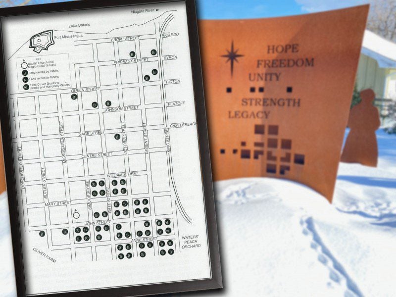
Since 1995, the government of Canada officially recognized February as Black History Month. Each year, Black History Month honours the experiences, achievements and enduring contributions of Black communities in Canada, while deepening our collective understanding of their history and impact on Canadian society. This year’s theme: “30 Years of Black History Month: Honouring Black Brilliance Across Generations — From Nation Builders to Tomorrow’s Visionaries.” This theme celebrates three decades of Black History Month in Canada and recognizes the enduring legacy of Black Canadians, whose leadership, creativity, innovation and resilience have shaped our past, continue to influence our present, and will inspire future generations. During all the hikes in this series, you will learn about Niagara-on-the-Lake’s Black history.The link below will take you to a brief overview on this topic, by the Niagara-on-the-Lake’s Museum.
https://artsandculture.google.com/story/niagara-on-the-lake-s-black-history-niagara-historical-society-museum/-QXR3nRTdnmqJw?hl=en
**Bring hydration and a snack. We will be stopping several times. While the terrain is generally flat, hiking poles and icers are recommended as sidewalk and streets may be icy.
This hike counts as 1 of 3 required hikes towards the Black History badge. Two additional hikes are offered on today’s hike schedule. There will be a short break between hikes.
Please Note: Hikes are offered by volunteers who have committed to their own learning, to be able to offer informative and contemplative hike experiences. These hikes are opened to all and offered in a spirit of mutual learning and inclusion.
Car Hike: Greenwood Conservation Area
https://hikes.brucetrail.org/event/car-hike-greenwood-conservation-area-3/Sorry, the registration cut-off time for this hike has been reached.Not a member? Click here to join today!Hosting Club: Toronto
Category: Car Hike
Location (Google Maps):Greenwood Conservation Area
Hike Leader(s): Glynn Richardson Click here to contact Hike Leader(s)
Pace: Moderate (3-4 km/hr)
Terrain: Flat, Hilly, Level 2 (Intermediate – some hills and uneven surfaces, rocks and roots underfoot), Variable
Distance (km): 10-14 kmDescription
We’ll spend sometime exploring Greenwood Conservation Area trails including parts of the Trans Canada Trail.Bring snacks, lunch, water.
Hiking footwear and icers are MANDATORY. Hiking poles and gaitors are highly recommended.
Check the weather in advance and dress accordingly in layers.
There will be no dropouts and no dogs allowed.
Registered participants are to arrive 15 minutes prior to the hike for briefing.
Space is limited.
Urban Walk: Toronto Islands Family Day Hike
https://hikes.brucetrail.org/event/urban-walk-toronto-islands-family-day-hike-3/Sorry, the registration cut-off time for this hike has been reached.Not a member? Click here to join today!Hosting Club: Toronto
Category: Urban Walk
Location (Google Maps):Meet inside the waiting area of Jack Layton Ferry Terminal at the foot of Bay Street at 10:15AM to take the 10:30 AM Ferry to Ward’s Island. Ferry tickets can be purchased when you arrive or online. Ferry return fares: $10 adult, $6 student/senior
Hike Leader(s): Ray Berzins Click here to contact Hike Leader(s)
Pace: Moderate (3-4 km/hr)
Terrain: Flat, Level 1 (Easy – mostly on flat, well maintained trails with hard-packed surface), Level 2 (Intermediate – some hills and uneven surfaces, rocks and roots underfoot)
Distance (km): 12 kmDescription
The Toronto Islands are very peaceful in the Winter Season. We will catch the 3:45 pm ferry to be back in the city by 4 pm. Bring a lunch, snacks, water, a hot beverage, and icers if available. Dress in warm layers appropriate to the weather. Heated washrooms available. Dropout anytime by walking back to the Ward’s Island Ferry Dock. We will hike to Hanlan’s Point and return to Ward’s Island (only destination served in the Winter) – approximately 6 km each way.
11:00 NOTL Black History SERIES - #2 of 3: The Long Road to Freedom: the Robert Moseby Affair
https://hikes.brucetrail.org/event/1100-notl-black-history-series-2-of-3-the-long-road-to-freedom-the-robert-moseby-affair/Sorry, the registration cut-off time for this hike has been reached.Not a member? Click here to join today!Hike open to BTC Members only.
Hosting Club: Niagara
Category: Urban
Location (Google Maps):Veteran’s Memorial Park. Park on King St. at Centre.
Hike Leader(s): Karen Couch Click here to contact Hike Leader(s)
Pace: Leisurely
Terrain: Easy
Distance: 5-6 kmsDescription
Since 1995, the government in Canada officially recognized February as Black History Month. Each year, Black History Month honours the experiences, achievements and enduring contributions of Black communities in Canada, while deepening our collective understanding of their history and impact on Canadian society. During all the hikes in this series, you will learn about Niagara-on-the-Lake’s Black history.You will find out about some of those who fought enslavement, and how they were pivotal in shaping our society to be as diverse as it is today.
Wear extra warm clothing as we will be stopping several times. While the terrain is easy, bring your walking sticks and/or footwear with micro spikes. Sidewalks and streets may be icy.
Today’s hike is 1 of 3 required for the Black History badge. 2 additional hikes are on today’s hike schedule. There will be a short break between hikes.
1:00 PM NOTL BLACK HISTORY SERIES - #3 of 3: The Early Niagara Community
https://hikes.brucetrail.org/event/100-pm-notl-black-history-series-3-of-3-the-early-niagara-community/Sorry, the registration cut-off time for this hike has been reached.Not a member? Click here to join today!Hike open to BTC Members only.
Hosting Club: Niagara
Category: Urban
Location (Google Maps):Veteran’s Memorial Park. Park on King St. at Centre
Hike Leader(s): Karen Couch Click here to contact Hike Leader(s)
Pace: Medium
Terrain: Easy
Distance: 5-6 kmDescription
Since 1995, the government in Canada officially recognized February as Black History Month; a time when Canadians are invited to reflect, educate and engage in the ongoing fight against anti-Black racism and discrimination. This hike will give us an opportunity to celebrate the strength and perseverance of the early Black community here in Upper Canada.The Town of Niagara-on-the-Lake (NOTL) has a significant and nation-shifting Black history. Voices from the past will tell stories, enriching hikers’ understanding of how they shaped this town and nation.
*This hike has the same content as the hike offered Feb 9 at 11:00 AM (#4 of 4).
See link below for a brief overview of NOTL’s Black History.
https://artsandculture.google.com/story/niagara-on-the-lake-s-black-history-niagara-historical-society-museum/-QXR3nRTdnmqJw?hl=en
*Prepare for this urban adventure with hydration, snack, hiking poles, icers etc.
**This hike counts as 1 of the 3 required hikes towards the Black History badge, all offered on today’s Hike Schedule. You can bring the $10 or make an e-transfer to receive your badge at the end of the hike.
Plan to visit the NOTL Museum after the hikes; it opens at 1 pm. There you will see numerous artifacts on this subject.
PLEASE NOTE: Hikes are offered by volunteers who have committed to their own learning to be able to offer informative and contemplative hike experiences. These hikes are open to all and offered in a spirit of mutual leaning and inclusion.
- 17February 17, 2026
Lunar New Year Hike - Meet time - 8:45am - City View Park, Burlington
https://hikes.brucetrail.org/event/lunar-new-year-hike-845am-city-view-park-burlington/Sorry, the registration cut-off time for this hike has been reached.Not a member? Click here to join today!Hosting Club: Iroquoia
Category: Special Event
Location (Google Maps):City View Park – Burlington – Proceed to the big parking lot off of Kerns Rd.
Hike Leader(s): Ruth Moffatt Click here to contact Hike Leader(s)
Pace: Medium – 3 to 4 km/hr
Terrain: Dependent on Conditions, Moderate – Some hills and/or some poor footing, Slippery Sections Likely
Distance: Approx 8.5kmDescription
Year of the Horse, specifically the Fire Horse – symbolizing energy, passion and transformation.Tuesday, Feb 17, 2026 marks the beginning of the new lunar year. This year will be the Year of the Horse.
Please join us for a hike along the Mountains to Sea Greenway Trail which is an International Friendship Trail in Taiwan. https://brucetrail.org/international-friendship-trails/
This hike requires participants are able to hike approx 8.5km at a steady pace. Please bring enough snacks, lunch and water needed for an approx 3 hour hike. You must bring a pair of icers and wear proper hiking boots. Please dress for the weather.
At the end of the hike, lucky red packets will be given, with our wishes for a very Happy Lunar New Year.After the hike, we are going for lunch at the Mandarin Restaurant 1881 Fairview St Burlington $30-$40 per person. If you wish to go for this post hike lunch, please let me know through contact on this form.
Photo: Coco, taken by Irene at 2025 Lunar New Year Hike.
9:00 Long Hike Wiley Road Short Hills NEW TIME
https://hikes.brucetrail.org/event/900-long-hike-wiley-road-short-hills-new-time-19/Sorry, the registration cut-off time for this hike has been reached.Not a member? Click here to join today!Hosting Club: Niagara
Category: Loop
Location (Google Maps):Short Hills Wiley Road Entrance
Hike Leader(s): Lynskie Click here to contact Hike Leader(s)
Pace: Brisk
Distance: 10km
Description
Explore Short Hills and the majestic side trails of Scarlett Tanager, Hemlock. Swayze Falls and Terrace. Register for each hikeBring Poles, snack, and dress for the weather
9:15 Short hike, Pelham Road entrance, Short Hills
https://hikes.brucetrail.org/event/915-short-hike-pelham-road-entrance-short-hills-9/Sorry, the registration cut-off time for this hike has been reached.Not a member? Click here to join today!Hike open to BTC Members only.
Hosting Club: Niagara
Category: Loop
Location (Google Maps): Pelham Road entrance, Short Hills Provincial ParkHike Leader(s): janet davey Click here to contact Hike Leader(s)
Pace: Medium
Terrain: Moderate
Distance: 6 kmsDescription
Hike the main and side trails of Short Hills Provincial Park. Please note that there are some steep hills and rocky sections so you should have some hiking experience before joining this hike. Please bring water, hiking poles and icers, as the trails can be icy at times.
Mount Nemo (reservation required)
https://hikes.brucetrail.org/event/mount-nemo-reservation-required-3/Sorry, the registration cut-off time for this hike has been reached.Not a member? Click here to join today!Hosting Club: Iroquoia
Category: General Hike
Location (Google Maps): Meet in the main parking lot at Mount Nemo at 9:15 am. Reserve your time at conservationhalton.caHike Leader(s): Karen Bergmann Click here to contact Hike Leader(s)
Pace: Medium – 3 to 4 km/hr
Terrain: Moderate – Some hills and/or some poor footing
Distance: 7 kmsDescription
Meeting at 9:15 am in the parking lot (parking registration required) , we will hike the basic loop and a side trail. Bring icers for your boots.Urban Walk;: Valley View Park Thornhill
https://hikes.brucetrail.org/event/urban-walk-valley-view-park-thornhill-143/Sorry, the registration cut-off time for this hike has been reached.Not a member? Click here to join today!Hosting Club: Toronto
Location (Google Maps): Parking lot is off Sycamore Drive, East of Bayview , across Starbucks plaza
Bus 91 from Finch East station stops at Sycamore station.Hike Leader(s): Mohammad Aghamiri Click here to contact Hike Leader(s)
Pace: Moderate (3-4 km/hr)
Terrain: Hilly, Level 2 (Intermediate – some hills and uneven surfaces, rocks and roots underfoot), Variable
Distance (km): 6-7 kmDescription
We will explore Valleyview and Maple View parks, and walk along German Mill Creak, in return we stop in Huntington park and have snack under beautiful shed.Although this is considered an “Urban Walk”, you can expect some hills up and down and uneven surfaces with tree roots. Please bring hiking poles, Ice cleats water and snacks.
phone number for the day of hike 289 588 6482
Mono Cliffs/Laidlaw and South Outlier Side Trails
https://hikes.brucetrail.org/event/mono-cliffs-laidlaw-and-south-outlier-side-trails-3/Sorry, the registration cut-off time for this hike has been reached.Not a member? Click here to join today!Hosting Club: Dufferin Hi-Land
Category: Tuesday Hike
Location (Google Maps):Dufferin Hi-Land Section, Map 19. Meet at Mono Community Centre hiker parking area off of 2nd Line Mono at south end of Mono Centre village.
Hike Leader(s): Inge Eckerich, Julie Daley, Tony Evangelista Les Babbage Click here to contact Hike Leader(s)
Terrain: Dependent on Conditions, Moderate
Distance: Long hike: 5.0 kmDescription
Hike will take Laidlaw Side Trail East to the Main Trail on to the South Outlier Side Trial, we will do the South Outlier loop, returning by way of the Main Trail and Laidlaw Side Trail East. Snowshoes or icers may be required. Bring water and snacksCity View Park, Burlington, Map 9.
https://hikes.brucetrail.org/event/city-view-park-burlington-map-9-7/Sorry, the registration cut-off time for this hike has been reached.Not a member? Click here to join today!Hosting Club: Caledon Hills
Category: Tuesday Hikers
Location (Google Maps): City View Park South Lot, Burlington.
From Highway 403 going west, turn right on Brant Street, left on Dundas Street, left on Kerns Rd., take second turn left into City View Park to the parking lot.Hike Leader(s): Mohammad Shafiq Click here to contact Hike Leader(s)
Pace: Medium – 3 to 4 km/hour
Terrain: Moderate – some hills and/or some poor footing
Distance: 11 kmDescription
From City View Park will connect with main Bruce Trail and hike to Smokey Hollow waterfall, also hike Kings ST and/or Eric Best ST on the way. After snack break will trace back our steps and return to parking.
Bring water, snack for refreshment break at Smokey Hollow.
Dress for the weather, poles are recommended.
Icers are required for snow/slippery conditions.
Optional refreshment stop after hike at Kopper Kettle in Waterdown. - 18February 18, 2026
Humpday Hikers - Island Lake - CANCELED
https://hikes.brucetrail.org/event/humpday-hikers-island-lake/Sorry, the registration cut-off time for this hike has been reached.Not a member? Click here to join today!Hike open to BTC Members only.
Hosting Club: Caledon Hills
Category: General
Location (Google Maps): P5 – Island Lake Conservation Area – 673173 Hurontario Street, Mono.From Hwy 10/24 turn east on Hockley Rd., keep to the right on Side Rd. 5, turn right on Hurontario and follow it to the end. Parking lot will be on the left.
Hike Leader(s): Jennie Greenfield; Mel Thornley Click here to contact Hike Leader(s)
Pace: Medium – 3 to 4 km/hour
Terrain: Moderate – some hills and/or some poor footing
Distance: 9.5 kmDescription
This hike explores the trails at Island Lake Conservation Area near Orangeville. Sights include Island Lake, tap lines, a sugar shack, the Stone Wall tree and the Memorial Leaf Wall.To avoid getting chilled there will be quick stops for water and a shorter nutrition break along the way – bring your favorite hiking drink and snacks.
Dress in layers according to the weather. Hiking boots, and icers / crampons required, poles recommended.
If you can plan to come for a some social time in Orangeville, location to be firmed up closer to our hike date.
Participants will be notified the night before if a hike must be cancelled due to inclement weather.
Winter Wednesday Walkers - Old Baldy
https://hikes.brucetrail.org/event/winter-wednesday-walkers-old-baldy-3/Sorry, the registration cut-off time for this hike has been reached.Not a member? Click here to join today!Hosting Club: Beaver Valley
Location (Google Maps): Meet in the Grey Sauble CA parking lot, km 43.9, Map 26, Edition 31, at the end of the small section of road off Sideroad 7B. Do not attempt to drive up 7B from Grey Road 13, there is no winter maintenance. Instead access 7B from south of Kimberley – Grey Road 13 to Artemesia-Euphrasia Townline to 3rd Line A, then 7B.
Hike Leader(s): Glenda Collings Click here to contact the hike leader.
Pace: Medium
Terrain: Some steep sections
Length of Hike: Approx. 5 kmDescription
Mike Arkless will be leading this hike. This is a in and out hike with tremendous views from the heights of Old Baldy. On winter hikes we may encounter bare ground, light snow, deep snow, or ice. Please bring snowshoes and icers to our Winter Wednesday Walkers outings. Wear appropriate clothing for the weather plus water and a snack.COVID-19 Precautions Before, During and After your Hike
- Each hiker joining a Bruce Trail Club organized hike must perform a self-screening check before hiking.
Find Ontario’s self-assessment tool here: https://covid-19.ontario.ca/self-assessment/ - If you are experiencing COVID-19 symptoms, stay home.
Other Guidelines
- Arrive 15 minutes before the start of the hike.
- Wear sturdy footwear and appropriate attire for the weather and the terrain.
Hiking poles are a good idea in any season, especially if the terrain is rocky or slippery. In winter, snowshoes or icers/crampons are needed when conditions dictate.
Wearing appropriate clothing and footwear prevents injuries and shows consideration for a safe and positive group hiking experience. - Always carry I.D. and your health card.
- Bring sufficient water and snacks (or lunch if indicated). A minimum of 1L of water is recommended on all hikes, and 3L is recommended for long, challenging hikes in the heat of the summer.
- Bring sunscreen and insect repellent (for spring and summer hikes).
- Bring your own first aid kit.
- Please leave dogs at home.
Valley of Mills CANCELLED
https://hikes.brucetrail.org/event/valley-of-mills/Sorry, the registration cut-off time for this hike has been reached.Not a member? Click here to join today!Hosting Club: Iroquoia
Category: Good Companions
Location (Google Maps): OakvilleHike Leader(s): Anne Armstrong Click here to contact Hike Leader(s)
Pace: Leisurely – 3km/hr or less
Terrain: Moderate – Some hills and/or some poor footing
Distance: Approx. 9 – 10 km.Description
Note: this a previously published hike which was cancelled. The Sixteen Mile Creek is rich in history and was once the home to a number of mills in the early years of settlement in this area. We will learn some of this as we hike up and down this beautiful valley. New meeting point. Meet in the parking lot on the southeast corner of River Glen and Neyagawa Blvd., next to the baseball playing fields at 9;45 am. for a 10:00 am. start. Bring a snack, water, sunscreen and icers. You may want to bring poles as we will be going up and down some long hills. Optional refreshment stop afterwards. I will send out an email the day before the hike with any last minute changes and my cell phone number in the event that you need to cancel the night before or the morning of. Just text me. - Each hiker joining a Bruce Trail Club organized hike must perform a self-screening check before hiking.
- 19February 19, 2026
9:00 am Long hike NEW Location. Bailey bridge Jordan
https://hikes.brucetrail.org/event/900-am-long-hike-new-location-bailey-bridge-jordan-9/Sorry, the registration cut-off time for this hike has been reached.Not a member? Click here to join today!Hosting Club: Niagara
Location (Google Maps):
Bailey bridge Jordan
Pace: Brisk
Terrain: Strenuous
: 10kDescription
This will be our permanent location . Hike up from the Bailey bridge to Balls Falls and explore the trailsYou must register for each hike. Bring Poles, snack and a drink. Dress for the weather
9:00 Long Hike. Bailey Bridge parking lot , Jordan
https://hikes.brucetrail.org/event/900-long-hike-bailey-bridge-parking-lot-jordan-3/Sorry, the registration cut-off time for this hike has been reached.Not a member? Click here to join today!Hosting Club: Niagara
Category: Loop
Location (Google Maps): Parking lot located on 21st Street, in Jordan, near the Bailey BridgeHike Leader(s): Alan Laver Click here to contact Hike Leader(s)
Pace: Brisk
Terrain: Strenuous
Distance: 10 kmDescription
Hike in and around Ball’s Falls and Jordan.Dress for the weather. Bring icers, poles, dress in layers
Hiking around Jordan
https://hikes.brucetrail.org/event/hiking-around-jordan-47/Sorry, the registration cut-off time for this hike has been reached.Not a member? Click here to join today!Hosting Club: Niagara
Location (Google Maps): NEW LOCATION
Shoarishon Park
3039 King Street, Jordan LOR 1SOHike Leader(s): Bill Russell Click here to contact Hike Leader(s)
Pace: Medium
Terrain: Moderate
Distance: 7 kmDescription
Hiking in and around Jordan including Jim Rainforth Trail, Bailey Bridge and Balls Falls (alternating every 3 weeks).Urban Walk: Valley View Park Thornhill
https://hikes.brucetrail.org/event/urban-walk-valley-view-park-thornhill-144/Sorry, the registration cut-off time for this hike has been reached.Not a member? Click here to join today!Hosting Club: Toronto
Location (Google Maps): Parking lot is off Sycamore Drive, East of Bayview , across Starbucks plaza
Bus 91 from Finch East station stops at Sycamore station.Hike Leader(s): Mohammad Aghamiri Click here to contact Hike Leader(s)
Pace: Moderate (3-4 km/hr)
Terrain: Hilly, Level 2 (Intermediate – some hills and uneven surfaces, rocks and roots underfoot), Variable
Distance (km): 6-7 kmDescription
We will explore Valleyview and Maple View parks, and walk along German Mill Creak, in return we stop in Huntington park and have snack under beautiful shed.Although this is considered an “Urban Walk”, you can expect some hills up and down and uneven surfaces with tree roots. Please bring hiking poles, Ice cleats water and snacks.
phone number for the day of hike 289 588 6482
Celebrate Winter Series - Warder Side Trail, Lion's Head
https://hikes.brucetrail.org/event/celebrate-winter-series-warder-side-trail-lions-head/Sorry, the registration cut-off time for this hike has been reached.Not a member? Click here to join today!Hosting Club: Peninsula
Category: Winter Hikes
Location (Google Maps): Lion’s Head Nature Reserve, Warder’s SidetrailHike Leader(s): Marg and Owen Glendon Click here to contact Hike Leader(s)
Pace: Leisurely (2.0 – 3.0 km/h): A relaxed pace with frequent breaks and a focus on enjoyment.
Terrain: Easy: Flat forested sections or lowland trails., Moderate: Rolling hills, mild slopes and rocky paths.
Distance: ~4 kmDescription
Beat the winter blahs! February is the month of friendship, love and connection.Bring your friends, or make new ones on this lovely winter snowshoe hike.
Our hike meanders through a mixed forest on a trail which includes some short and gentle inclines. Beech marcescence, snow cloaked conifers, and a myriad of snow gnomes will be on display for your enjoyment! Plan on 1 1/2 – 2 hours for hiking.
Following our hike, join us at Rachel’s Restaurant for a beverage, finger foods and camaraderie.
- 20February 20, 2026
Kilbride to River and Ruin and Back - CANCELLED
https://hikes.brucetrail.org/event/kilbride-to-river-and-ruin-and-back/Sorry, the registration cut-off time for this hike has been reached.Not a member? Click here to join today!Hosting Club: Iroquoia
Category: General Hike
Location (Google Maps): Kilbride parking lot behind Kilbride SchoolHike Leader(s): Pati Greenwood, Jeff Dowsett Click here to contact Hike Leader(s)
Pace: Brisk – 4 to 5 km/hr, Medium – 3 to 4 km/hr
Terrain: Dependent on Conditions, Moderate – Some hills and/or some poor footing, Slippery Sections Likely
Distance: 10 kmDescription
On this hike, we will follow the main trail down into the valley and explore the River & Ruin and other side trails, before making our way back to our meeting place.Wear layers appropriate to winter weather conditions, wear hiking boots and bring icers and hiking poles. Bring water and a snack.
Please arrive at the meeting spot by 8:15 a.m. for an 8:30 a.m. departure.
9:00 am Niagara-on-the-Lake Tour
https://hikes.brucetrail.org/event/900-am-niagara-on-the-lake-tour-56/Sorry, the registration cut-off time for this hike has been reached.Not a member? Click here to join today!Hosting Club: Niagara
Category: Urban
Location (Google Maps):Veterans Memorial Park, park just outside the park on King Street
Hike Leader(s): Robin Garrett Click here to contact Hike Leader(s)
Pace: Medium
Terrain: Easy
Distance: 6-7 kmDescription
Each Friday we will explore different neighbourhoods, trails and parkland throughout Historic Niagara-on-the-Lake.Moderate pace with some weeks entirely on sidewalks and roads while others may include a mix of trails and paved pathways. Great way to build up endurance for longer more strenuous hikes.
Prepare for cooler windy conditions on open parkland and along Lake Ontario and Niagara River trails.
Plan to stay for conversation and a warm cup of coffee or tea at Sweets & Swirls, Community Centre, Niagara Stone Road, NOTL
CANCELLED - Halton Agreement Forest
https://hikes.brucetrail.org/event/halton-agreement-forest-15/Sorry, the registration cut-off time for this hike has been reached.Not a member? Click here to join today!Hosting Club: Iroquoia
Category: General Hike
Location (Google Maps): Meet roadside on 4th Line at 9:15 am. Up Guelph Line from the 401, turn right on 10 Side Road and follow the curve as it becomes 4th Line.Hike Leader(s): Karen Bergmann Click here to contact Hike Leader(s)
Pace: Medium – 3 to 4 km/hr
Terrain: Moderate – Some hills and/or some poor footing
Distance: 8 kmsDescription
Meeting at 9:15 am in the small parking lot and roadside on 4th Line, we will hike several of the bike trails, including The Den and The Pines. Bring icers for your boots.Hike is dependent on weather conditions.
CANCELLED Lindenwood to Lindenwood Pond ( Linear)
https://hikes.brucetrail.org/event/lindenwood-to-lindenwood-pond-linear/Sorry, the registration cut-off time for this hike has been reached.Not a member? Click here to join today!Hosting Club: Sydenham
Category: Snowshoe Hike
Location (Google Maps): Roadside parking at dead end of Concession 14, north of Copper Kettle. accessed turning east from Grey County Rd 17. Park along south side. Car Shuttle to Lindenwood Road.Hike Leader(s): Carol Graham-Mullin Click here to contact Hike Leader(s)
Pace: Leisurely: 3 km/h or less
Terrain: Easy: Mostly flat and good footing., Moderate: Some hills and/or poor footing, There might be icy and slippery sections.
Distance: 3.2 kmDescription
Enjoy a snowshoe hike with Carol linking the best of the Lindenwood properties. This relatively flat section features a significant erratic boulder, a pond, and a peaceful cedar forest . Bring water, snacks and your winter equipment. Fun in the snow ! - 21February 21, 2026
Winter Coach Trip: Awenda Provincial Park
https://hikes.brucetrail.org/event/winter-coach-trip-awenda-provincial-park-3/Sorry, the registration cut-off time for this hike has been reached.Not a member? Click here to join today!Trip Information
Departure Time: 08:00
Return to City Time: 18:00
Departure Point: York Mills Bus PickupTrip Activities
Snowshoe Hiking ($.01)
C-Country Skiing ($.01)
Optional Items
P/U at Hwy 400 & Major Mac ($0.01)Hosting Club: Toronto
Category: Coach Trips
Location (Google Maps): Awenda Provincial ParkHike Leader(s): Lisa Lifshitz, Nijole Mockevicius; Ted Moriarty; Janet McColeman; Tim Wainwright Click here to contact Hike Leader(s)
Pace: Moderate (3-4 km/hr)
Terrain: Level 2 (Intermediate – some hills and uneven surfaces, rocks and roots underfoot), VariableDescription
Bus departs 10 York Mills Rd at 8:00 AM and Major Mackenzie Dr and HWY 400 Park and Ride at 8:20 AM. If you wish to be picked up at the Major Mackenzie Dr and HWY 400 Park and Ride, select that option when you register. Please arrive 15 minutes before departure. The bus waits for no one.Join us for a super fun winter day in beautiful Awenda Provincial Park. Be prepared to pick your activity according to the conditions. If snowshoeing is good – great! If winter hiking is better – enjoy! If skiing is possible – bonus! The trip will run no matter what.
Driving time to Awenda is 1.75 hours. It’s so worth it to spend the day on the shore of Georgian Bay.
Winter hikers: Explore the trails on your own or join Nijole and Lisa for a guided hikes on Awenda’s beautiful winter trails. The hikes will traverse parts of the Bluff, Wendat, and Connector trails, and will also circle around Kettle’s Lake. Mostly flat with a few short hills. Pace will be approximately 3 km/hr. Plenty of time to take pictures and enjoy the scenery. Skiers: If conditions allow, enjoy self-guided tours of Awenda’s beautiful ski trails with majestic views of Georgian Bay. No rentals. No food or drink.
For information about trail conditions visit: https://www.ontarioparks.com/skireport.
Hikers: It may not be clear ahead of time whether snowshoes, icers, or just boots will be the most appropriate footwear. Come prepared for anything. If the Club cancels this trip, your coach fare will be refunded.
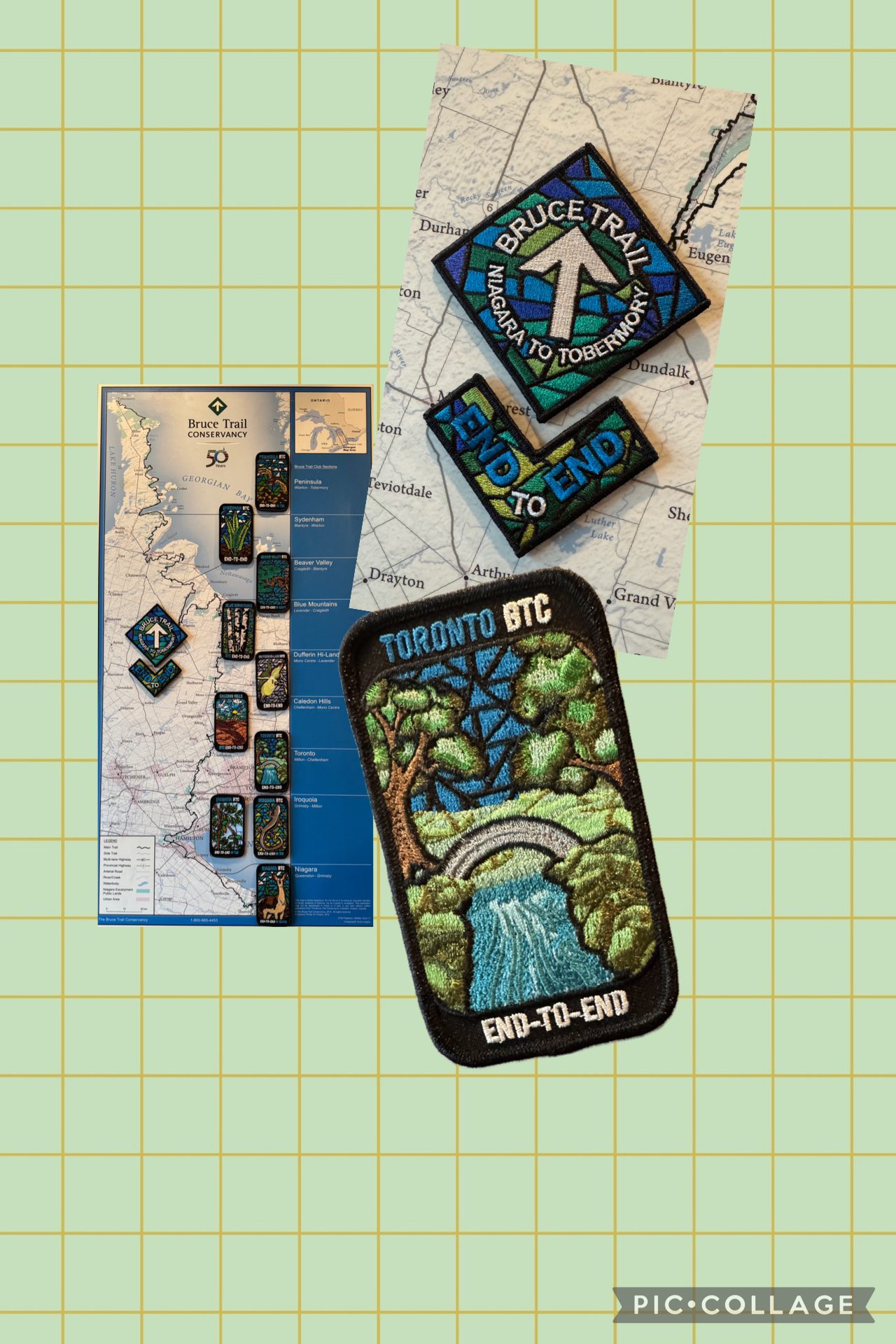
Toronto End to End for the Stained Glass Badge – Fundraiser Multi-day Hike Series – Feb 21, 22, and 28th 2026 – Meet time is 7:45am
https://hikes.brucetrail.org/event/toronto-end-to-end-for-the-stained-glass-badge-fundraiser-multi-day-hike-series-feb-21-2026-meet-time-is-745am/Sorry, the registration cut-off time for this hike has been reached.Not a member? Click here to join today!This is a Multi-Day Hike
You are signing up for the following dates and times:
2026-02-21 at 08:00
2026-02-22 at
2026-02-28 atHosting Club: Iroquoia, Toronto
Category: Stained Glass Badge End to End Fundraiser Hike
Location (Google Maps): Day 1 February 21/ 26~22km – Meet in Limehouse across from the school on the south side of 22 Sideroad. https://maps.app.goo.gl/CPanxLLqpDLuv3aW8
Car shuttle to Hilton Falls Conservation Area (Conservation Halton) https://maps.app.goo.gl/SDmBuYe3vYbKYpem7 22km (Paid parking at Hilton Falls unless we have a pass. Drivers do not pay for parking but rather it is split amongst those without a pass)
Day 2 February 22/ 26 ~16.50km – Meet in Limehouse across from the school on the south side of 22 Sideroad. https://maps.app.goo.gl/CPanxLLqpDLuv3aW8
Car shuttle to Roadside parking on Tenth Line 2.2km southeast of 32 Sideroad https://maps.app.goo.gl/bZuaXMvTXEFJpCoP8
Day 3 February 28/26 ~ 12km – Meet at roadside parking on Boston Mills Rd just west of Mississauga Rd intersection. Note: the driveway is private property. https://maps.app.goo.gl/xjwrG9QQ8irmoqdLA
Car shuttle to Roadside parking on Tenth Line 2.2km southeast of 32 Sideroad https://maps.app.goo.gl/bZuaXMvTXEFJpCoP8
For those who are signed up for the next section, you will not have to complete the last 2.50km until we hike Caledon section. For those wishing to complete Toronto section in its entirety, you will be driven to the border at the end of today’s hike. You will walk to your car at Boston Mills. We will make sure that the car shuttle will work so that you will not have to worry about getting back to Tenth line where we started.Please save March 1 as a make up day for inclement weather.
Hike Leader(s): Ruth Moffatt Click here to contact Hike Leader(s)
Pace: Brisk – 4 to 5 km/hr, Medium – 3 to 4 km/hr
Terrain: Dependent on Conditions, Moderate – Some hills and/or some poor footing, Slippery and Steep Sections, Strenuous – Hilly with steep climbs and some poor footing
Distance: 12 – 22kmDescription
This is a monetized hike with the proceeds going towards the Toronto Bruce Trail Club – “Preserving a ribbon of wilderness for everyone, forever.” Your badge, depicting the arch over Black Creek, the hike logistics, shared shuttle driving and hike guidance are all included in your fee. Since it is the intention to run a similar hike in all sections this year, why not join or renew your membership with the Bruce Trail Conservancy if you are not already a member? Please use my code 67abd1234c568 until the end of 2025 to receive free digital maps as well as all the other great benefits included with membership.Membership details here: https://brucetrail.org/product-category/memberships/
Please read all details for this hike to ensure it is suitable for you. The pace and terrain are particularly important details.
Registered participants will receive a WhatsApp invitation (optional) which can be used for photo share and other items of interest.You must be registered to participate in this group hike. You cannot just show up as there are often people on the waitlist.
This is a multi 3 day hike – Feb 21,22,28, 2026. Please save March 1 for potential make up days in case of inclement weather.Please ensure your car is car shuttle-ready with at least 4 available seatbelts including the driver’s. We will take turns either being the shuttle driver or driving the drivers back to their cars after the hike is over.
Please pack whatever food you will require for a long day hike including lunch and snacks; 2l of water minimum; first aid kit; poles if you use them; and icers. You may also wish to pack extra socks and rain gear. Remember to dress in layers. Gloves/mitts, scarf / neck gator, a toque and a puffy jacket. Consider lined pants as well.
We will break for a morning clothing adjustment, a 10min break around 10am, 15 min lunch and an afternoon break if we are finishing after 2pm. Bio-breaks are as you need them – please let the sweep know who will wait for you. This is a 3 day group hike so it is important you keep pace with the person in front of you. We will help each other and wait for one another but please consider your physical ability before signing up for this hike. There are no drop outs – if you are not able to finish the hike you will need to arrange for transportation back to your car via taxi or Uber at your cost.
The Toronto stained-glass badges will be presented on the last day. If you have to miss one of these hiking days, you may make it up on your own before the last day of the series. Since it is a group hike, it is intended that everyone who registers be present on all days.
Any questions may be directed through contact on this form.
If you cannot make it, please remove yourself from registration (or have the person who registered you remove your registration) by following these steps:To cancel your registration, here is a step by step:
– Sign into your account on the BTC website
– Click on My Hikes under your account
– This will take you to a list of hikes you have registered for
– Scroll down to the appropriate hike and cursor over to the far right hand column under the Action column.
– Click Cancel under the hike you wish to cancelToronto End to End - Limehouse Arch Stain-Glass Badge
https://hikes.brucetrail.org/event/toronto-end-to-end-limehouse-arch-stain-glass-badge/Sorry, the registration cut-off time for this hike has been reached.Not a member? Click here to join today!This is a Multi-Day Hike
You are signing up for the following dates and times:
2026-02-21 at 08:00
2026-02-28 at 08:00
2026-03-07 at 08:00Hosting Club: Iroquoia, Toronto
Category: Stained Glass Badge End to End Fundraiser Hike
Location (Google Maps): This is a great beginner hike for those who want to learn to hike and collect the Stained-Glass Badge
**Meet on 3rd line (Charles Hildebrandt Side Trail)Hike Leader(s): Anita Bergsma Click here to contact Hike Leader(s)
Pace: Leisurely – 3km/hr or less
Terrain: Moderate – Some hills and/or some poor footing
Distance: VariesDescription
Join us for this special 3-day Toronto End to End this spring on Feb 21, Feb 28, and March 7th. The hikes will be at a leisurely pace, 3 + km per hour. Roughly 15 km for each hike. This is suitable for beginner to intermediate hikers.We will be using hikers’ vehicles to shuttle between our start point and our meeting point. As well, there will be entry costs at Hilton Falls. (If you are a member of Halton Conservation, please bring your pass.) Costs will be shared amongst the hikers unless you have a pass.
Proper hiking boots are a must! Bring hiking poles (if you use them), icers, food, snacks, 2L of water, a hat, and rain gear. It may be cool, wet or warm. Please check the weather forecast each day before heading out.
Arrive by 8:00 am to check in. Once everyone has arrived, we will proceed and drive to the starting point.
Your fee includes the guidance and organization of a volunteer hike leader. Everyone will receive their Stained-glass End to End badge upon completion, which depicts the historic Limehouse Arch.
If you must miss a day but can make it up before the last scheduled hike, you will still qualify for this special badge. This is a fundraising hike for the Bruce Trail Club. Proceeds go to the Toronto Club to support the trail infrastructure and to the Bruce Trail Conservancy’s mission “Protecting this ribbon of wilderness, for everyone, forever.”Please, no dogs or children.
There are no refunds for this hike series. Please ensure you are physically capable of these distances before signing up for this hike.
If you have any questions, please enquire with the hike leader through this form.

RE-SCHEDULED Niagara E2E Winter - 4 of 5 (Wednesdays)
https://hikes.brucetrail.org/event/niagara-e2e-winter-4-of-5-wednesdays/Sorry, the registration cut-off time for this hike has been reached.Not a member? Click here to join today!Hosting Club: Niagara, Iroquoia
Category: General Hike
Location (Google Maps): Parking area off of Cave Springs Rd, access main trail via Margaret Reed Side Trail (16), 43.150026,-79.446539. We will shuttle to Rockway Community Centre, enter off Pelham Rd just east of Wessel Dr (15), 43.111255,-79.321901Hike Leader(s): Steven White Click here to contact Hike Leader(s)
Pace: Brisk – 4 to 5 km/hr, Medium – 3 to 4 km/hr
Terrain: Moderate – Some hills and/or some poor footing, Slippery and Steep Sections
Distance: 18.2 kmDescription
The Niagara E2E Winter in 5 will be Wednesdays Jan 28, Feb 4, 11, 18, 25. Hikers must register for individual hikes. Hikes are 14-18 kms and expect an average pace of 4 km/hr with snack/lunch breaks.Hikers should be prepared for the season – layered clothing, hiking boots, icers, snowshoes (if we get fresh snowfall), poles, water, snacks/lunch, first aid kit.
Hikers should be prepared to share their cars for shuttling – to be shared evenly.
If we encounter unsafe hiking or driving conditions, I will cancel/re-schedule the hike the day before. If you are unable to join us on the day of the hike, please text me at 289-242-9415
Car Hike: Boyd Conservation Park Vaughan
https://hikes.brucetrail.org/event/car-hike-boyd-conservation-park-vaughan-12/Sorry, the registration cut-off time for this hike has been reached.Not a member? Click here to join today!Hosting Club: Toronto
Location (Google Maps): Parking lot before entrance of park on Islington Ave.
Hike Leader(s): Mohammad Aghamiri Click here to contact Hike Leader(s)
Pace: Moderate (3-4 km/hr)
Terrain: Hilly, Level 2 (Intermediate – some hills and uneven surfaces, rocks and roots underfoot), Variable
Distance (km): 14-15 kmDescription
Let’s hike Boyd conservation park trails through beautiful valleys.Please bring lots of water and snacks ,hiking poles are recommended
Please bring lots of water and snacks ,hiking poles are recommended
phone number for the day of hike 289 588 6482
Stained Glass Fundraiser: Niagara End to End in 6
https://hikes.brucetrail.org/event/end-2-end-1-6/Sorry, the registration cut-off time for this hike has been reached.Not a member? Click here to join today!This is a Multi-Day Hike
You are signing up for the following dates and times:
2026-02-21 at 08:30
2026-02-22 at 08:30
2026-02-28 at 08:30
2026-03-01 at 08:30
2026-03-07 at 08:30
2026-03-08 at 08:30Hosting Club: Niagara
Category: Car Pool
Location (Google Maps): Sat Feb 21: Meet at Grimsby Pool 43.193201, -79.565301 Carpool to Kinsman Park 43.146108, -79.475609
Sun Feb 22: Meet at Glen Road 43°08’21.0″N 79°22’26.0″W Carpool to Kinsman Park 43.139159, -79.373912
Sat Feb 28: Meet at Roland Rd Parking 43.090250,-79.305000 Carpool to Glen Road: 43.139159, -79.373912
Sun Mar 1: Meet at Decew House: 43°06’28.1″N 79°14’59.4″W Carpool to Roland Rd: 43.090250, -79.305000
Sat Mar 7: Meet at Woodend 43.143300, -79.167259 Carpool to Decew House: 43.143300, -79.167259
Sun Mar 8: Meet at Queenston Washroom Buildng: 43°09’31.6″N 79°03’05.6″W Carpool to Woodend: 43.143300, -79.167259Hike Leader(s): Faye Perkins Click here to contact Hike Leader(s)
Pace: Medium
Terrain: Moderate
Distance: 13.5 kmDescription
The E2E is designed to provide a challenging hike for a range of ability levels, while supporting the Bruce Trail Conservancy and our shared goal of connecting people with nature. Over the winter, the hike will be completed in six sections at a moderate pace, with optional hill training available.We will be carpooling. Please bring icers, poles, water, electrolytes, snacks, and smiles.
Meeting time is 8:15 a.m., so we can leave for our starting destination at 8:30
Frozen City of Waterfalls Fundraising Hike (2 weekends)
https://hikes.brucetrail.org/event/frozen-city-of-waterfalls-fundraising-hike-2-weekends/Sorry, the registration cut-off time for this hike has been reached.Not a member? Click here to join today!This is a Multi-Day Hike
You are signing up for the following dates and times:
2026-02-21 at 08:30
2026-02-22 at 08:30
2026-02-28 at 08:30
2026-03-01 at 08:30Hosting Club: Iroquoia
Category: City of Waterfalls – Special Event Fundraiser
Location (Google Maps): Varies – see descriptionHike Leader(s): Freddy Wang Click here to contact Hike Leader(s)
Pace: Medium – 3 to 4 km/hr
Terrain: Dependent on Conditions, Strenuous – Hilly with steep climbs and some poor footing
Distance: Varies by day – see descriptionDescription
The Iroquoia Bruce Trail Club, City of Waterfalls challenge is a fundraiser event. This hike will be split into four days to make it more accessible to hikers preferring a moderate pace and “shorter” distances. All funds raised go towards the Iroquoia Bruce Trail Club to maintain the infrastructure of this beautiful section of trail and to “Preserve this ribbon of wilderness, for everyone, forever!”Day 1 – We will meet at City View Park (43.351747, -79.862195) and car shuttle to Old Guelph Rd. (43.307417, -79.911580). Approx. 11 km.
Day 2 – We will meet Spencer Gorge parking lot (fee) (43.281642, -79.979742) and car shuttle to Old Guelph Rd. Approx. 10.4 km.
Day 3 – We will meet at the Artaban Rd parking lot (43.240974, -79.975582) in the Dundas Valley Conservation Area and shuttle to Hillcrest Ave. street parking (43.246437, -79.892130). Approx 10.8 km
Day 4 – We will meet at the Mud St. parking lot (43.200682, -79815214) and shuttle to Hillcrest Ave. street parking. Approx 14.7 km
There will be short breaks to describe the waterfalls along the way, and a short lunch on Day 4.
Please bring all items you will need – water, icers, layered clothing and snacks. Poles are recommended.
The new badge will be presented to all participants who have completed the challenge at the end of the fourth day.
We encourage participants to consider a membership with Conservation Hamilton https://conservationhamilton.ca/hca-membership-pass/
Any questions may be directed through contact on this form.
Laura Secord 1 of 2
https://hikes.brucetrail.org/event/laura-secord-1-of-2-3/Sorry, the registration cut-off time for this hike has been reached.Not a member? Click here to join today!Hosting Club: Niagara
Category: Car Pool
Location (Google Maps): Meet at Woodend Conservation Area and carpool to DeCew House Heritage Park where we will begin the hike. Yes, we are hiking this in the reverse order 🙂Hike Leader(s): Lynskie Click here to contact Hike Leader(s)
Pace: Fast
Terrain: Moderate
Distance: 15kmsDescription
Please note: We are hiking the Laura Secord Trail in the reverse order! Meet at Woodend Conservation Area and carpool to DeCew House Heritage Park where we will begin the hike. Please be at the start 15 minutes before 8:45 (8:30) so that we can arrange the carpooling. Earn the Laura Secord badge by completing two hikes, they can be independent or guided hikes.
Upon completion, badges can be purchased. $10 for members, $15 for non-members.Dufferin Hi-Land Winter Badge Hike #4 of 4
https://hikes.brucetrail.org/event/dufferin-hi-land-winter-badge-hike-4-of-4/Sorry, the registration cut-off time for this hike has been reached.Not a member? Click here to join today!Hosting Club: Dufferin Hi-Land
Category: Special Events
Location (Google Maps):Dufferin Hi-Land, Map 21. Meet at roadside parking on Prince of Wales Rd, about 1 km south of County Rd 21, where the Main Trail turns east from the road (Km 45.3).
Hike Leader(s): Les Babbage;Helen Bailey Click here to contact Hike Leader(s)
Pace: Medium
Terrain: Slippery and Steep Sections, Moderate
Distance: 7.2 kmDescription
We will hike the Main Trail to Km 48.8 and back. The route features a large snowdrift at the top of Black Bank hill. Snowshoes will be required. Depending on conditions, icers may be required. Dress for winter conditions. Bring water, snacks and lunch. Hike leaders will contact all registered hikers a day or two before the hike to advise of trail conditions and any weather alerts.
Saturday Shorts - Meltwater Moraine BTC Protected Area
https://hikes.brucetrail.org/event/saturday-shorts-meltwater-moraine-btc-protected-area/Sorry, the registration cut-off time for this hike has been reached.Not a member? Click here to join today!Hosting Club: Caledon Hills
Category: Introductory
Location (Google Maps): Meet at roadside parking on Innis Lake Road, north of Finnerty Sideroad, 43.918917, -79.909387.Directions:
From Airport Road turn east onto Finnerty Sideroad for approximately 1.5 km. Turn left onto Innis Lake Road.Hike Leader(s): Sandy Green Click here to contact Hike Leader(s)
Pace: Leisurely – 3 km/hour or less
Terrain: Moderate – some hills and/or some poor footing
Distance: 5 kmDescription
Looking to get out on a Saturday without giving up your whole day? This Saturday Short hike will get you out in a small group on a short forest adventure. Dress for chilly temperatures, and depending on the snow and ice conditions, pack icers/crampons. Bring a beverage and snack to keep you fuelled during the hike. The hike promises to be a fun one. Everyone is welcome!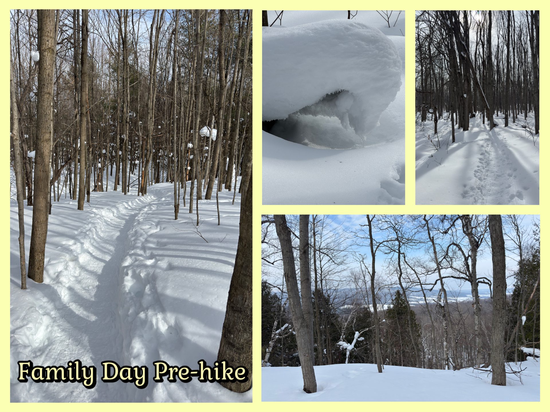
**New date** Nottawasaga Lookout Extended Loop
https://hikes.brucetrail.org/event/nottawasaga-lookout-extended-loop-2/Sorry, the registration cut-off time for this hike has been reached.Not a member? Click here to join today!Hosting Club: Blue Mountains
Category: Organized Hike
Location (Google Maps): Tim Horton’s, First Street CollingwoodHike Leader(s): Claire Pearson Click here to contact Hike Leader(s)
Pace: Leisurely – 3 km/hr. or less
Terrain: Moderate – Some hills and/or some poor footing
Distance: 4kmDescription
Enjoy a winter morning of snowshoeing through the forest and taking in amazing views overlooking the Georgian Bay area. We will begin our extended loop hike of the Bruce Trail through the Nottawasaga Lookout Provincial Nature Reserve at km 42.4 (map 23). We will walk the northern part of the loop and continue on until we reach the opening overlooking a pond (point 44.407, -80.249 on the Bruce Trail App). We will turn around and head back, taking the southern part of the loop and returning to our cars. The total walking distance will be ~4km.