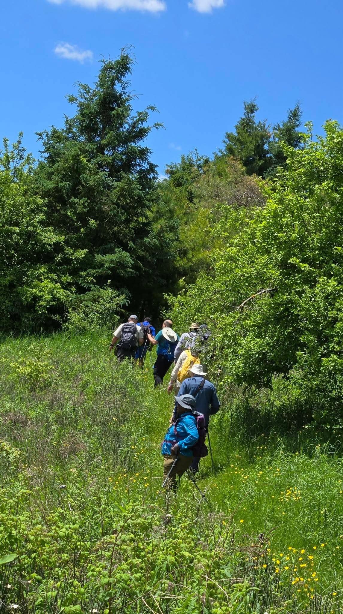
Join us for a hike! Registration required:
All hikes available to BTC members. Some hikes are open to non-members.
TIP: The calendar view displays up to 7 hikes on a day, but often there are more. Click “More events” to see them all.
Toronto Hike Schedule
Toronto Bruce Trail Club Registration Live Dates
Day Winter Coach Program
Registration begins two weeks in advance of the event departure (at 8:00 PM)
Day Bus Hikes
Registration begins two weeks in advance of the event departure (at 8:00 PM) with some exceptions of special event hikes
Day Coach Hikes
Registration begins 7 weeks in advance of the event departure
Day Car Hikes and Urban Hikes
Registration begins two weeks in advance of the event departure
Overnight and Weekend Trips
Registration begins 12 weeks in advance of the event departure
To view all Bruce Trail Conservancy Hikes click here
- 28June 28, 2026
Car Hike: Uxbridge-Brock Track
https://hikes.brucetrail.org/event/car-hike-uxbridge-brock-track-6/
Registration Required:
Click here to register for this hike (12 spots remaining)Hosting Club: Toronto
Category: Car Hike
Location (Google Maps):Meet at the Brock Tract parking lot on the east side of Durham 1/Brock Rd., approximately 5 km south of Coppin’s Corners, Uxbridge or 1 km north of Uxbridge Pickering Town Line. 1401 Brock Rd. (Free parking).
Hike Leader(s): Amir Alemohammad Click here to contact Hike Leader(s)
Pace: Moderate (3-4 km/hr)
Terrain: Flat, Hilly, Level 2 (Intermediate – some hills and uneven surfaces, rocks and roots underfoot), Variable
Distance (km): 10-12 kmDescription
Join us for a wonderful hike in Uxbridge starting from Brock Track parking lot. We will hike the Brock Track and Wilder Forest among the amazing trails of Uxbridge.Boots and icers mandatory, poles recommended, bring 2 litres of water and dress according to weather conditions. Be prepared for icy/snowy conditions.
Please arrive at 7:45 for a 8:00 start.
Beware, Iphone Maps may take you to the wrong location. Check the location with Google Maps the previous night.
This is a joint hike with Oak Ridges Trail Association (ORTA).
GO Train Hike: Nokiidaa Trail
https://hikes.brucetrail.org/event/go-train-hike-nokiidaa-trail/
Registration Required:
Click here to register for this hike (1 spots remaining)Hosting Club: Toronto
Category: GO Train Hike
Location (Google Maps):East Gwillimbury GO Station (outside station building)
Hike Leader(s): Tom Swales, Talise Liang Click here to contact Hike Leader(s)
Pace: Moderate (3-4 km/hr)
Terrain: Flat, Level 1 (Easy – mostly on flat, well maintained trails with hard-packed surface)
Distance (km): 9 kmDescription
We will hike south from East Gwillimbury GO Station to Fairy Lake and historic Main Street in Newmarket. We will pass the remains of a swing railway bridge, the remains of an abandoned canal, and a diverse landscape. The walking is easy south on this Level 1 Hike to Fairy Lake where we loop around the lake with a scenic boardwalk trail on the east side and paved path leading into the historic downtown of Newmarket. We’ll stop in the historic downtown for refreshments at the Old Flame Brewery or alternative establishments and walk up Main Street to get the 2:48 pm train back towards Toronto’s Union Station or Downsview Park Station.Drivers may meet at East Gwillimbury GO Station and take the train, GO Bus, or local transit to return to the meeting point.
Take advantage of the GO Transit $10 Day Weekend Pass available only on smartphones. Those wishing to travel together will meet at Union Station in the Great Hall by the information desk (with the clock over it) by 8:40 to take the GO Train towards Barrie departing at 8:52 AM. There is also a stop in Toronto at Downsview Park Station (9:11 AM).
ROUTE MAP: https://onthegomap.com/s/507cjskh
- 29June 29, 2026No events
- 30June 30, 2026
Urban Walk: Valley View/Huntington Park
https://hikes.brucetrail.org/event/urban-walk-valley-view-huntington-park-4/
Registration Required:
Click here to register for this hike (11 spots remaining)Hosting Club: Toronto
Location (Google Maps): Parking lot is off Sycamore Drive, East of Bayview , across Starbucks plaza
Bus 91 from Finch East station stops at Sycamore station.Hike Leader(s): Mohammad Aghamiri
Pace: Moderate (3-4 km/hr)
Terrain: Hilly, Level 2 (Intermediate – some hills and uneven surfaces, rocks and roots underfoot)
Distance (km): 6-7 kmDescription
We will explore Valleyview and Maple View parks, and walk along German Mill Creak, in return we stop in Huntington park and have snack under beautiful shed.Although this is considered an “Urban Walk”, you can expect some hills up and down and uneven surfaces with tree roots. Please bring hiking poles, water and snacks.
- 01July 1, 2026
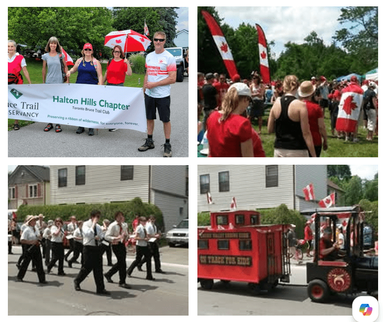
Canada Day Parade & Hike (Glen Williams)
https://hikes.brucetrail.org/event/canada-day-parade-and-hike-in-glen-williams/
Registration Required:
Click here to register for this hike (15 spots remaining)Hosting Club: Toronto
Category: Car Hike
Location (Google Maps): Ainley Trail, Glen WilliamsHike Leader(s): David Rowney Click here to contact Hike Leader(s)
Pace: Leisurely (2-3 km/hr)
Terrain: Level 2 (Intermediate – some hills and uneven surfaces, rocks and roots underfoot), Variable
Distance (km): 7 kmDescription
Looking for something fun to do on Canada Day? We’re offering you a chance to go on a hike along the Credit River footpath, then march with the Halton Hills Chapter of the Toronto Club at the Glen Williams Canada Day parade! This tiny hamlet known as the Glen, puts on a fantastic, small-town patriotic parade, just like in the movies. Afterwards, you can attend the celebration in the park, grab some food and picnic, listen to music, and tour various booths at the market. To sign up for this hike, you must also commit to participate in the parade (and bring a flag if you have one, and wear red colours!).The hike will be approximately 5k in length with an additional 2k related to the parade. Bring snacks (and a lunch if you don’t want to buy it at the park). There are washrooms at the park and we will stop for a bio break on the trail. The terrain is relatively flat with some uneven ground and a few modest hills. Wear sunscreen, hat, bring bug spray and lots of water. Dress appropriately for the weather. The pace will be moderate and relaxed.
Your itinerary for the day:
9:00 a.m. – 10 a.m.
Hike out from Glen Williams, along the Credit Valley footpath10:00 a.m. – 11:00 a.m.
Head back (there and back hike) to Glen Williams11:00 a.m. -11:30 a.m.
Walk over to the parade start on Beaver St.12:00 noon – 12:45 p.m.
March in the Canada Day parade1:00 p.m. – 3 p.m.
Enjoy the Canada Day celebrations in the parkContact David Rowney for more information 289-924-0713; david.rowney@gmail.com
(If you would like to only participate in the parade, contact Angelika Sommer: ASommer46@outlook.com)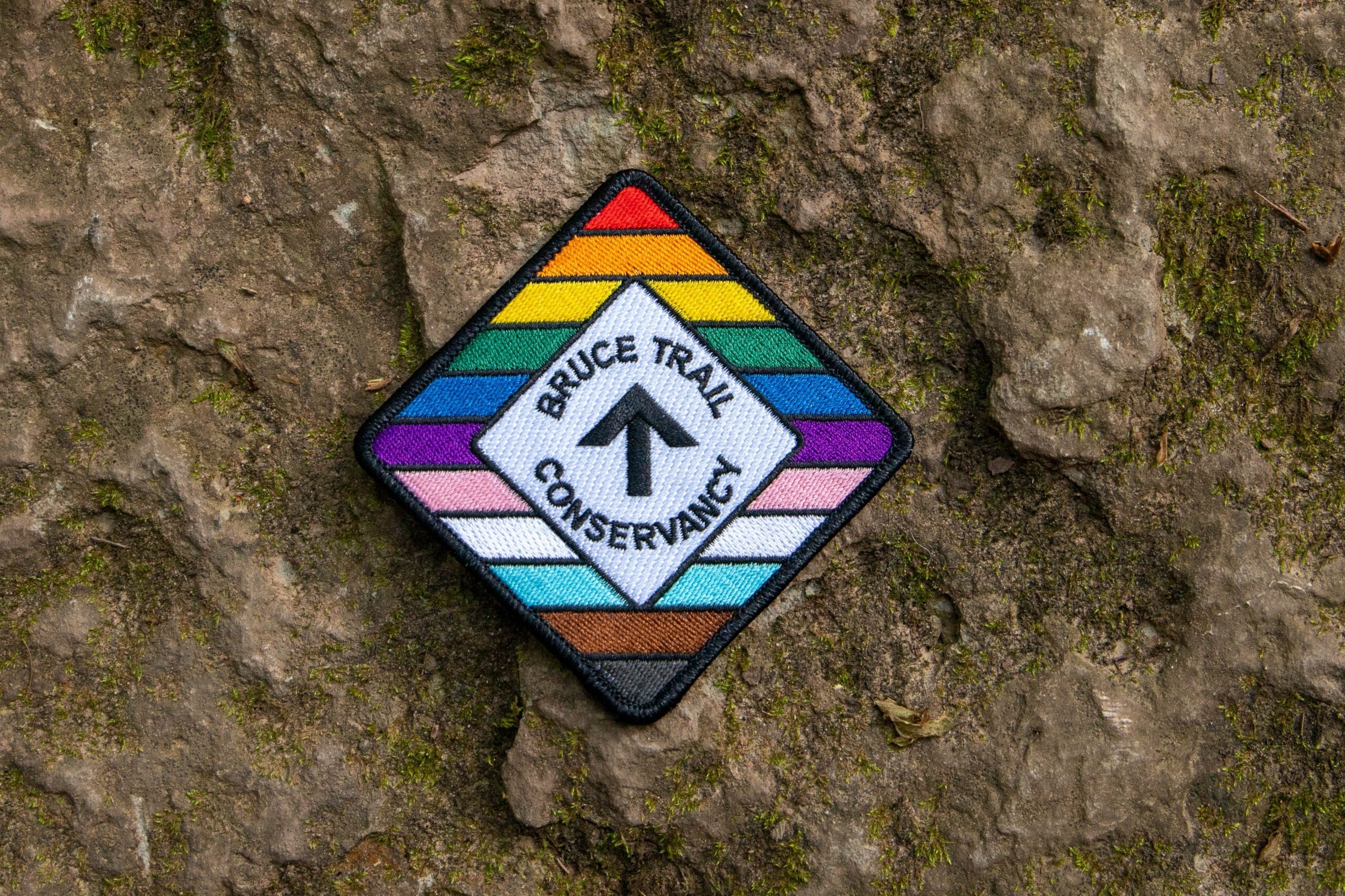
RAINBOW HIKE🌈: Lollipop Loop to Limehouse🍭
https://hikes.brucetrail.org/event/rainbow-hike%f0%9f%8c%88-lollipop-loop-to-limehouse%f0%9f%8d%ad/
REGISTRATION FULL: This hike has reached the maximum number of hikers.
Click here to be added to the Wait List.Hosting Club: Toronto
Category: Car Hike
Location (Google Maps): We will meet at roadside parking on the east side of Fourth Line where the main trail crosses the road (coordinates are 43.615163, -79.975157).Hike Leader(s): Monica Pasquali (she/her); Talise Liang (she/her) Click here to contact Hike Leader(s)
Pace: Leisurely (2-3 km/hr)
Terrain: Level 2 (Intermediate – some hills and uneven surfaces, rocks and roots underfoot)
Distance (km): 8 kmDescription
This hike is part of our Rainbow Hike program🌈, which aims to foster connection, visibility, and community among 2SLGBTQIA+ hikers and allies. We’ll be joined by Doug O’Neill, who leads Rainbow Hikes with the Iroquoia Bruce Trail Club, and Lana Hubbard, a transgender hike leader with the Caledon Bruce Trail Club.After everyone checks in with me at the meeting location, we will hike the main Bruce Trail towards Limehouse Conservation Area. We will then use the Black Creek Side Trail and the main trail to create a loop to visit the oldest draw kiln in Ontario, the infamous stone arch, and the “Hole-in-the-Wall” through escarpment rock. After our exploration of Limehouse Conservation Area we will retrace our steps back along the main trail to return to our parked cars. The complete 8 km route will resemble the shape of a lollipop, hence the name of this hike.🍭
Everyone who participates in this hike will receive a FREE Bruce Trail Pride Badge as well as a sweet rainbow treat from me!
You should bring 2 litres of water and enough food for a 3-hour hike, comfortable hiking shoes and socks, a hat, a breathable shirt, and lightweight long pants (to minimize the risk of a tick bite). If rain is in the forecast then a rain jacket would also be a great idea. Sunblock and bug repellent are also useful if it’s a sunny and buggy day.
After the hike, anyone who is interested in joining me for some après-hike refreshments at nearby Spirit Tree Estate Cidery (https://spirittreecider.com) is more than welcome to do so. And if you don’t want to purchase your lunch at Spirit Tree then no worries — we’ll be eating at picnic tables in their outdoor Cider Gardens so you can bring your lunch and still enjoy some great post-hike vibes.
Looking forward to hiking with you on July 1st! And feel free to share this page/link with your 2SLGBTQIA+ friends and family.
For more information on Bruce Trail’s 2SLGBTQIA+ hikes, and to get information on upcoming Rainbow Hikes, please see the following webpage: https://brucetrail.org/pride-2026/
Car Hike: Forks of the Credit
https://hikes.brucetrail.org/event/car-hike-forks-of-the-credit-7/
Registration Required:
Click here to register for this hike (10 spots remaining)Hosting Club: Toronto, Caledon Hills
Category: Car Hike
Location (Google Maps): Forks of the Credit Provincial Park, Map 15Hike Leader(s): Al Brown Click here to contact Hike Leader(s)
Pace: Moderate (3-4 km/hr)
Terrain: Hilly, Level 2 (Intermediate – some hills and uneven surfaces, rocks and roots underfoot)
Distance (km): 14-15 kmDescription
We will complete a loop hike through the Park, crossing the Credit River above the Cataract Falls. Then we will follow the trail down into the valley to a viewpoint of the Falls itself. The hike will take us by the east bank of the Credit River south then turning east and then north through the main park past glacial features and old homesteads. Natural features include kettle lakes and milkweed fields where we might spot monarch butterflies.Refreshments in Belfountain or Erin after the hike.
The meeting point is the intersection of Mississauga Road and Cataract Road. Parking is located on both sides of the road. Park in marked areas only. To get to this point drive north on Mississauga Road about 3 km past Belfountain.
- 02July 2, 2026
Urban Walk: Valley View/Huntington Park
https://hikes.brucetrail.org/event/urban-walk-valley-view-huntington-park-5/
Registration Required:
Click here to register for this hike (11 spots remaining)Hosting Club: Toronto
Location (Google Maps): Parking lot is off Sycamore Drive, East of Bayview , across Starbucks plaza
Bus 91 from Finch East station stops at Sycamore station.Hike Leader(s): Mohammad Aghamiri
Pace: Moderate (3-4 km/hr)
Terrain: Hilly, Level 2 (Intermediate – some hills and uneven surfaces, rocks and roots underfoot)
Distance (km): 6-7 kmDescription
We will explore Valleyview and Maple View parks, and walk along German Mill Creak, in return we stop in Huntington park and have snack under beautiful shed.Although this is considered an “Urban Walk”, you can expect some hills up and down and uneven surfaces with tree roots. Please bring hiking poles, water and snacks.
- 03July 3, 2026No events
- 04July 4, 2026
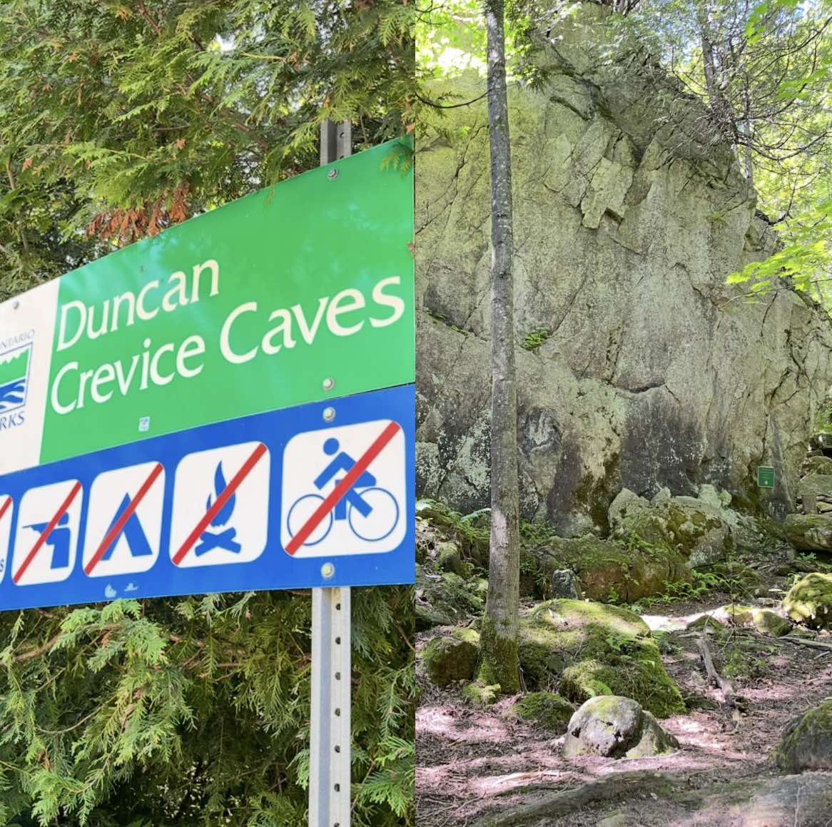
Car Hike: Duncan Crevice Caves , Pinnacle and Metcalf Rocks
https://hikes.brucetrail.org/event/car-hike-duncan-crevice-caves-pinnacle-and-metcalf-rocks/
Registration Required:
Click here to register for this hike (8 spots remaining)Hosting Club: Toronto, Beaver Valley
Category: Car Hike
Location (Google Maps): Duncan Crevice Caves Provincial Nature Reserve parking lot on the edge of 9th Sideroad east of Blue Mountain-Euphrasia Townline. GPS N44.423216, W80.469565. Km33.3, map25, edition31.Hike Leader(s): Ross Estrella Click here to contact Hike Leader(s)
Pace: Brisk (4-5 km/hr), Moderate (3-4 km/hr)
Terrain: Challenging, Level 2 (Intermediate – some hills and uneven surfaces, rocks and roots underfoot), Rocky, Variable
Distance (km): 12.5 kmDescription
At a moderate to brisk pace we’ll hike Duncan Crevice Caves Provincial Nature Reserve and explore Pinnacle Rock and Metcalfe Rock stunning formation. We’ll have plenty of time for picture taking of the amazing landscape. Please equip yourself with durable hiking shoe and bring poles if you’re using. Carry sufficient hydration fluid, snacks and lunch. Bring sunscreen and head covering for sun protection and bug repellent in the event our friendly mosquitos welcome us. Carry your personal medication (if any) first aid kit and health card. Don’t forget your enthusiasm. Please arrive fifteen minutes early.Car Hike: Hollad River Trail
https://hikes.brucetrail.org/event/car-hike-hollad-river-trail/
Registration Required:
Click here to register for this hike (24 spots remaining)Hosting Club: Toronto
Category: Car Hike
Location (Google Maps): We start the hike from Evans park ,you may park along benville cres off BayviewHike Leader(s): MOHAMMAD AGHAMIRI Click here to contact Hike Leader(s)
Pace: Moderate (3-4 km/hr)
Terrain: Level 2 (Intermediate – some hills and uneven surfaces, rocks and roots underfoot), Variable
Distance (km): 14-15 kmDescription
We start the hike from Evans park ,walking north along Holland River , passingSheppard’s Bush Conservation Area to Newmarket trails and return
School Bus Hike: Long Sault C.A.
https://hikes.brucetrail.org/event/school-bus-hike/Trip Information
Departure Time: 08:30
Return to City Time: 18:00
Departure Point: York Mills Bus Pickup
Registration Required:
Registration Costs
Members - $25.00
Child Members - $10.00
Non-Members - $32.00
Child Non-Members - $14.00
Click here to register for this hike (7 spots remaining)Optional Items
Hosting Club: Toronto
Category: Bus Hike
Location (Google Maps): Long Sault Conservation AreaHike Leader(s): Tom Swales, Celia Ho Click here to contact Hike Leader(s)
Pace: Moderate (3-4 km/hr)
Terrain: Level 2 (Intermediate – some hills and uneven surfaces, rocks and roots underfoot), Variable
Distance (km): 11-12 kmDescription
Join us for an 11 km hike in Long Sault Conservation Area on the Barred Owl, Eastern Bluebird, Wild Turkey, and Oak Ridges Moraine Trails. Once part of the Agreement Forest program operated by the Ontario Ministry of Natural Resources, the Conservation area includes close to 400 hectares of matures forest, plantation, wetland, and Meadow. The trails range from gently sloping and straight to technical rolling and quickly turning. After our hike we will drive to Port Perry on Lake Scugog for free time to enjoy the park, the historic main street, cafes, or the Old Flame craft brewery. Don’t miss Hank’s Pastries, a bakery with a 100+ year tradition known for their specialty donuts and “big as your face” apple fritters (online ordering is available).