
Join us for a hike! Registration required:
All hikes available to BTC members. Some hikes are open to non-members.
TIP: The calendar view displays up to 7 hikes on a day, but often there are more. Click “More events” to see them all.
Toronto Hike Schedule
Toronto Bruce Trail Club Registration Live Dates
Day Winter Coach Program
Registration begins two weeks in advance of the event departure (at 8:00 PM)
Day Bus Hikes
Registration begins two weeks in advance of the event departure (at 8:00 PM) with some exceptions of special event hikes
Day Coach Hikes
Registration begins 7 weeks in advance of the event departure
Day Car Hikes and Urban Hikes
Registration begins two weeks in advance of the event departure
Overnight and Weekend Trips
Registration begins 12 weeks in advance of the event departure
To view all Bruce Trail Conservancy Hikes click here
- 01June 1, 2025
Car Hike: Jefferson Forest and Bond Lake
https://hikes.brucetrail.org/event/car-hike-jefferson-forest-and-bond-lake-4/Sorry, the registration cut-off time for this hike has been reached.Not a member? Click here to join today!Hosting Club: Toronto
Category: Car Hike
Location (Google Maps):1235-1245 Bethesda Side Rd, Richmond Hill, ON L4E 1A2 ( Bethesda Trail Head Parking lot)
Hike Leader(s): Amir Alemohammad Click here to contact Hike Leader(s)
Pace: Moderate (3-4 km/hr)
Terrain: Flat, Hilly, Level 2 (Intermediate – some hills and uneven surfaces, rocks and roots underfoot), Variable
Distance: 12-14 kmDescription
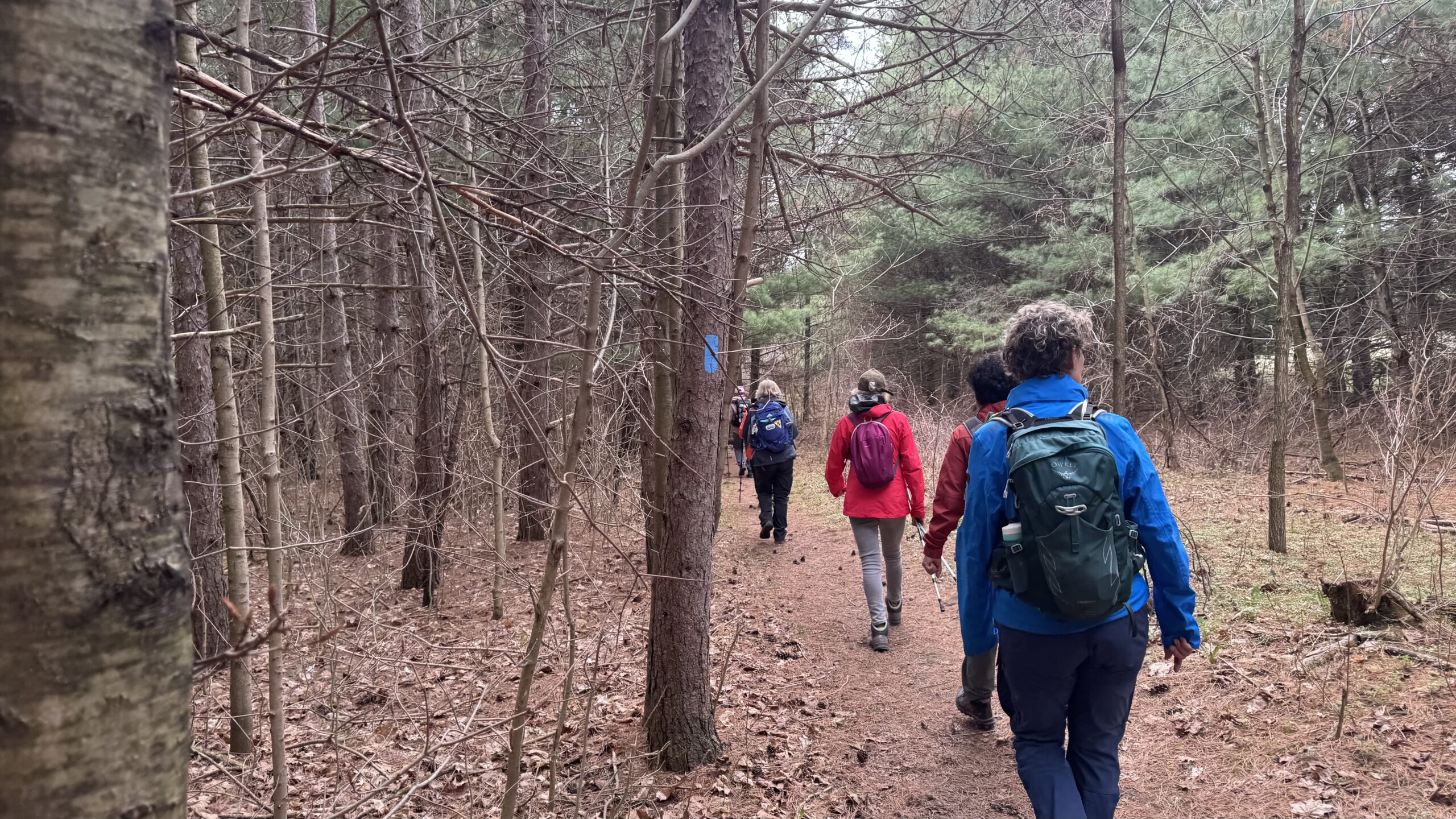
Join us for a wonderful hike in Jefferson Forest and have a snack/lunch beside the Bond Lake. We will hike among tall trees and bushes of the Jefferson Forest and across the Bayview-Yonge corridor to reach to the Bond Lake. Boots mandatory, poles recommended, bring at least 2L of water, bug spray, sunscreen, snack/lunch and dress according to the weather conditions. Please avoid parking along the road. Difficulty Level: 2 (Moderate)Please arrive @8:15 AM for start 8:30AM.

Urban Walk: Toronto Urban Badge Hike - 4 of 7
https://hikes.brucetrail.org/event/urban-walk-toronto-urban-badge-hike-4-of-7/Sorry, the registration cut-off time for this hike has been reached.Not a member? Click here to join today!Hosting Club: Toronto
Category: Urban Walk
Location (Google Maps): Finch Hydro Corridor Trail WestHike Leader(s): Brian Rideout Click here to contact Hike Leader(s)
Pace: Moderate (3-4 km/hr)
Terrain: Flat
Distance: 11.4 kmDescription
Please join me at the north west corner of Finch and Weston by 10 AM. We will hike east along the Finch Hydro Corridor Trail to Bathurst St (N of Finch) (km 30.2 to km 41.6). Here is an online map with km markings of our route for all 7 hikes for the Toronto Urban Badge: https://onthegomap.com/s/c2c1hf3nPlease make sure you bring at least 2 liters of water, a lunch, bug spray and sunscreen.
Urban Walk: Bluffers Park
https://hikes.brucetrail.org/event/urban-walk-bluffers-park/Sorry, the registration cut-off time for this hike has been reached.Not a member? Click here to join today!Hosting Club: Toronto
Category: Urban Walk
Location (Google Maps): Bluffer’s Park, ScarboroughHike Leader(s): Tom Swales Click here to contact Hike Leader(s)
Pace: Moderate (3-4 km/hr)
Terrain: Flat, Level 1 (Easy – mostly on flat, well maintained trails with hard-packed surface)
Distance: 7 kmDescription
Enjoy the scenic views of the cliffs at Scarborough’s Bluffers Park and hike along the beach to the east. Meet at Kennedy Station on the bus platform for Route #201 Bluffers Park at 10:00 to take the bus scheduled to depart at 10:20 AM to arrive at the park approximately 20 minutes later. Taking transit is strongly recommended as the park gets very busy on the weekends. (free parking is available at Kennedy Station). - 02June 2, 2025No events
- 03June 3, 2025
Urban Walk: Valley View Park Thornhill 105
https://hikes.brucetrail.org/event/urban-walk-valley-view-park-thornhill-83/Sorry, the registration cut-off time for this hike has been reached.Not a member? Click here to join today!Hosting Club: Toronto
Location (Google Maps): Parking lot is inside Sycamore Drive East of Bayview , across Starbucks plaza
Hike Leader(s): Mohammad Aghamiri Click here to contact Hike Leader(s)
Pace: Moderate (3-4 km/hr)
Terrain: Hilly, Level 2 (Intermediate – some hills and uneven surfaces, rocks and roots underfoot)
Distance: 7-8 kmDescription
We will explore Valleyview and Maple View parks, and walk along German Mill Creak, in return we stop in Huntington park and have snack under beautiful shed ,Even it is considered Urban walk, it is urban hike as we have some up and down hills and tree roots, please bring your hiking poles, water and snacks,

Urban Walk: High Park and Toronto Waterfront Trail
https://hikes.brucetrail.org/event/urban-walk-high-park-and-toronto-waterfront-trail-2/Sorry, the registration cut-off time for this hike has been reached.Not a member? Click here to join today!Hosting Club: Toronto
Location (Google Maps):
High Park Subway Station Street Level (East Exit – High Park Avenue (by the bus loop)
Hike Leader(s): Miriam Stevens Click here to contact Hike Leader(s)
Pace: Leisurely (2-3 km/hr)
Terrain: Flat, Level 1 (Easy – mostly on flat, well maintained trails with hard-packed surface)
Distance: 10 KMDescription
Join us for a leisurely hike through High Park and then east along Toronto’s Waterfront Trail to Harbourfront Centre passing though many small parks including the Music Garden. Refreshments at a coffee shop on Queens Quay at Harbourfront. Bring lunch and drinking water. Dropout any time. We’ll arrive at Harbourfront Centre around 2:00 PM. This will be repeated Tuesday May 13th, Tuesday May 27th, Tuesday June 3rd, and Tuesday June 24th. No pre registration is required. Just show up 15-20 minutes before to departure time to sign in with the hike leader. - 04June 4, 2025
Power walk along the Humber River Trail (ca 10 km) and optional visit of the McMichael Canadian Art Collection, Kleinburg
https://hikes.brucetrail.org/event/power-walk-along-the-humber-river-trail-ca-10-km-and-optional-visit-of-the-mcmichael-canadian-art-collection-kleinburg/Sorry, the registration cut-off time for this hike has been reached.Not a member? Click here to join today!Hosting Club: Toronto
Category: Car Hike
Location (Google Maps):Hike Leader(s): Natalia Svechnikova Click here to contact Hike Leader(s)
Pace: Brisk (4-5 km/hr)
Terrain: Flat, Level 1 (Easy – mostly on flat, well maintained trails with hard-packed surface), Variable
Distance: 10-11 kmDescription
Please join me for a brisk walk on the Humber River trail strting near the McMichael Canadian Art Collection (main building).The trail has some hills but it is even and easy to walk on. we will walk for about 5 – 5.5 km and return back the same way. It should take us about 2.5 – 3 hours. After we finish, you can spend some time in the gallery and see their newest exhibition”Morrice in Venice” (please check out their website for ore info https://mcmichael.com/upcoming-exhibitions/)
We meet around 10 am near the entrance to the gallery and start hiking at 10:15 am (the trail head is only 50 m away). If you have the McMichael Art Collection membership, you can park free of charge on the gallery’s parking lot. Non-members parking fee is about $7. You can park somewhere in Kleinburg free of charge and walk to the gallery to meet me.
Please be dressed for the weather and wear comfortable shoes. Please bring 2 L of water, rain jacket or umbella and your sun hat, sun galsses. There is no shade on the trail.
You are welcome to reach out if you have any questions.
Please note that the hike will be cancelled if there is a forecast for a heavy rain or storm.
- 05June 5, 2025
Urban Walk: Valley View Park Thornhill
https://hikes.brucetrail.org/event/urban-walk-valley-view-park-thornhill-82/Sorry, the registration cut-off time for this hike has been reached.Not a member? Click here to join today!Hosting Club: Toronto
Location (Google Maps): Parking lot is inside Sycamore Drive East of Bayview , across Starbucks plaza
Hike Leader(s): Mohammad Aghamiri Click here to contact Hike Leader(s)
Pace: Moderate (3-4 km/hr)
Terrain: Hilly, Level 2 (Intermediate – some hills and uneven surfaces, rocks and roots underfoot)Description
We will explore Valleyview and Maple View parks, and walk along German Mill Creak, in return we stop in Huntington park and have snack under beautiful shed ,Even it is considered Urban walk, it is urban hike as we have some up and down hills and tree roots, please bring your hiking poles, water and snacks,

Urban Walk: Toronto Islands Evening Walk
https://hikes.brucetrail.org/event/urban-walk-toronto-islands-evening-walk-15/Sorry, the registration cut-off time for this hike has been reached.Not a member? Click here to join today!Hosting Club: Toronto
Location (Google Maps):
Jack Layton Ferry Terminal, near the gates to Wards Island Ferry. Arrive 20 minutes prior to departure to check in with hike leader.
From Union Station take the LRT and get off at the stop Ferry Docks.Walk up to the Ferry Docks on Queens Quay West, street level. at the foot of Bay Street.
Hike Leader(s): Tom Swales Click here to contact Hike Leader(s)
Pace: Leisurely (2-3 km/hr)
Terrain: Flat
Distance: 6-9 kmDescription
After a day’s work come and “cool off” on the Toronto Islands free of fumes and traffic. Enjoy the view of the city skyline and Toronto’s beautiful island parkland.
Pack a dinner for a sit down picnic. Also bring a warm jacket and flashlight.
Return fare ticket for the ferry is $9.11 for adults, $5.86 for seniors
Hikes will take place rain or shine. If the weather is particularly inclement the day of the hike please check the hike schedule by 10:00 AM for an update.
Toronto Island evening hikes will take place every Thursday in May and June 2025.
Same time and same meeting place. No preregistration is required – just show up at the ferry docks at 5:40 PM and sign in with the hike leader.Tom Swales will lead the hike this evening.
- 06June 6, 2025

Car Hike: 22th Annual Excellent Orchid Adventure Weekend (2 overnights)
https://hikes.brucetrail.org/event/car-hike-22th-annual-excellent-orchid-adventure-weekend-2-overnights/Sorry, the registration cut-off time for this hike has been reached.Not a member? Click here to join today!This is a Multi-Day Hike
You are signing up for the following dates and times:
2025-06-06 at
2025-06-07 at
2025-06-08 atHosting Club: Toronto
Category: Car Hike
Location (Google Maps):Princess Hotel
34 Bay St, Tobermory, ON N0H 2R0Hike Leader(s): Jeanette Vincent. Brenda Menezes. David Royle. Click here to contact Hike Leader(s)
Pace: Leisurely (2-3 km/hr)
Terrain: Level 2 (Intermediate – some hills and uneven surfaces, rocks and roots underfoot), Rocky, Variable
Distance (km): 10 – 12 KmDescription
We continue Greg Vincent’s legacy of weekends away. Please join Jeanette Vincent, Brenda and David Royle as we explore the Tip o’ the Bruce, Tobermory in search of orchids and other flowers. Our search will extend to Flowerpot Island (cost approx. $65.00 for the glass bottom ferry and Parks Canada fee). The wildflowers in the Tobermory area at this time of year are wonderful and our slow paced walks will focus on these and other flowers and the area’s great views. We stay and have our meals at a comfortable hotel overlooking Little Tub Harbour. Approximately 10/12km/day.Before registering at the hotel please contact us for the price package of the hotel for the weekend.
This outing is restricted to those staying with us at the Princess Hotel in Tobermory for the weekend – the hotel fills quickly. You will need a car to access this outing. Please contact the Princess Hotel for a reservation.1-519-592-8282 or info@tobermoryprincesshotel.com and mention Vincent/Royle Excellent Orchid weekend.
Toronto BTC End to End Stained Glass Fundraiser
https://hikes.brucetrail.org/event/toronto-btc-end-to-end-stained-glass-fundraiser/Sorry, the registration cut-off time for this hike has been reached.Not a member? Click here to join today!This is a Multi-Day Hike
You are signing up for the following dates:
2025-06-06, 2025-06-07, 2025-06-08Hosting Club: Toronto, Beaver Valley
Location (Google Maps): Meet on the east side of the road where the trail crosses 4th Line. Do not park in front of the junk yard. km 17.4, Map 12 Bruce Trail Guide,, N 43.625638, W 79.990703
Hike Leader(s): Glenda Collings Click here to contact the hike leader.
Pace: Medium
Terrain: Moderate, Some rocky footing, Some steep sections
Length of Hike: Between approx. 17 & 18 kmDescription
Join us for a a 3 day hike to earn the Stained Glass fundraiser badge. The medium hike pace will range between 3 to 4 km per hour, sometimes a bit more than 4 km per hour on easy flat terrain, with a snack and lunch break. Hikers may request a personal bio break, clothing adjustment, drink stop, etc. at any time during the hike by notifying the leader or sweep. The hikes range from approx. 17 to 18 km. Please self evaluate your ability to manage the pace and length of these hikes. Life does happen, so hikers will be able to miss one hike and make it up on their own before the end of June. A full hike schedule, with meet locations, will be sent to hikers after registration. If you have any questions please use the “Contact hike leader” option on the online schedule. - 07June 7, 2025
School Bus Hike: Loree Forest and Swiss Meadows
https://hikes.brucetrail.org/event/school-bus-hike-loree-forest-and-swiss-meadows/Sorry, the registration cut-off time for this hike has been reached.Not a member? Click here to join today!Trip Information
Departure Time: 08:00
Return to City Time: 19:00
Departure Point: York Mills Bus PickupOptional Items
Pick up at 10 York Mills Rd ($0.01)
Pick up at HWY 400 and Major Mac ($0.01)Hosting Club: Toronto
Category: Bus Hike
Location (Google Maps): Loree Forest and Swiss MeadowsHike Leader(s): Martina Furrer, Roland Mark, Celia Ho, and Duro Vukman Click here to contact Hike Leader(s)
Pace: Moderate (3-4 km/hr)
Terrain: Hilly, Variable
Distance: Moderate group: 14.5 km, fast group: about 16.5 kmDescription
Join us for a great hike in the Beaver Valley. We will split into two groups, a moderate group (led by Celia and Duro) and a faster group (led by Martina and Roland). The moderate group will hike 14.5 km at a 3.5 km/hr pace, the faster group will hike about 16.5 km at 4 km/hr +. We will all stop to enjoy the awesome views of Georgian Bay from various spots along the top of the escarpment. A few fun hills, hopefully some spring wildflowers, and forest cover for shade. Refreshment stop in the Village at Blue Mountain. This area has lots of poison ivy so wear long pants for protection. Also pack a lunch and two litres of water.Departure 1: 8 AM 10 York Mills Rd
Departure 2: 8:20 AM HWY 400 and Major Mac Park and Ride (infront of the GO bus stop)
Car Hike: Glasgow village Uxbridge 190
https://hikes.brucetrail.org/event/car-hike-glasgow-village-uxbridge-3/Sorry, the registration cut-off time for this hike has been reached.Not a member? Click here to join today!Hosting Club: Toronto
Category: Car Hike
Location (Google Maps): Glasgow Trail, Concession Road 2 Park in parking lot at the trail head.From Highway 404 turn right to Stouffville Rd, till to the end of road and turn left on York Durham line in About 1km turn right to Webb Rd. and turn right to Concession Road 2 ,you will see parking lot in 500 meters
Hike Leader(s): Mohammad Aghamiri Click here to contact Hike Leader(s)
Pace: Moderate (3-4 km/hr)
Terrain: Hilly, Level 2 (Intermediate – some hills and uneven surfaces, rocks and roots underfoot), Variable
Distance: 14-15 kmDescription
Lets explore Goodwood conservation area and visit Secord forest and pondApproximately 5-hour hike, bring lots of water

School Bus Hike: Niagara E2E #6 of 6
https://hikes.brucetrail.org/event/bus-hike-niagara-e2e-6-of-6/Sorry, the registration cut-off time for this hike has been reached.Not a member? Click here to join today!Trip Information
Departure Time: 08:30
Return to City Time: 18:00
Departure Point: Kipling Departure PointOptional Items
Hosting Club: Toronto
Category: Bus Hike
Location (Google Maps): Niagara Section Kms 72.3 to 81.7, plus Beamers Falls Side TrailHike Leader(s): Felix Wan, Tim Wainwright Click here to contact Hike Leader(s)
Pace: Moderate (3-4 km/hr)
Terrain: Variable
Distance: 13.0 kmDescription
Join us for our final walk in the Niagara E2E bus hike series. On today’s hike we’ll start at Mountainview Conservation Area, and cross over Thirty Mile Creek and a small waterfall on our way to Beamer Memorial Conservation Area outside of Grimsby. This marks the end of the Niagara Section of the Bruce Trail, but those who wish to can continue on a loop trail around the conservation area with a side trip to Beamers Falls.There will be a refreshment stop on the way back to Toronto.
Dropout point at 9.4 km.
Bring a packed lunch, two litres of water, and sun/rain/bug protection as needed.
Map 5 in the Bruce Trail Guide
Car Hike: Humber Valley Heritage Trail - 17KM
https://hikes.brucetrail.org/event/car-hike-humber-valley-heritage-trail-17km/Sorry, the registration cut-off time for this hike has been reached.Not a member? Click here to join today!Hosting Club: Toronto
Category: Car Hike
Location (Google Maps): Dicks Dam Park, BoltonHike Leader(s): Alina Lin
Pace: Brisk (4-5 km/hr)
Terrain: Challenging, Hilly, Level 2 (Intermediate – some hills and uneven surfaces, rocks and roots underfoot), Variable
Distance: 17 KMDescription
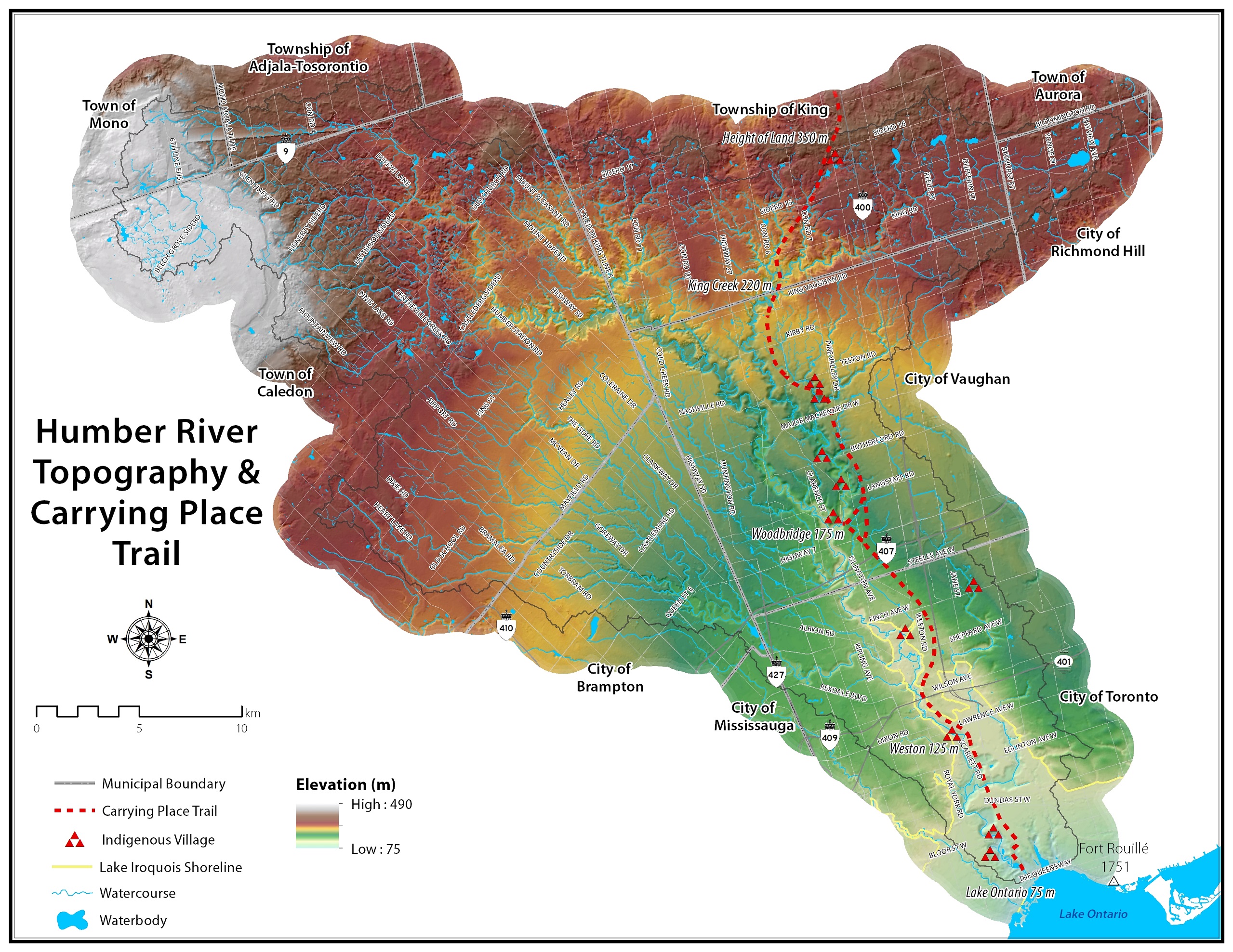
Humber Valley Heritage Trail near Bolton is a scenic and historically rich trail that follows the Humber River Valley, offering a variety of hiking experiences for nature enthusiasts. The trail traverses diverse landscapes, offering not only a mix of terrains, including forests, meadows, and riverbanks, but also historic plaques and landmarks, such as various parks that highlight the area’s rich history. And if you were wondering, yes it is the same Humber River as the Humber River runs through Toronto to lake Ontario!This will be a go and back hike on the Humber Valley Heritage Trail along the Humber River. Here is the map for your reference: https://onthegomap.com/s/qppe2v4a. A few notes for your attention and preparation:
- Meet at the parking lot of the Dicks Dam Park at GPS (43.879318, -79.747802).
- Arrive before 8:45am. The group will depart at 9:00am.
- Dress for weather and wear sturdy hiking shoes or boots.
- Bring snack or light lunch and at least 1L of water. We will have a short break for lunch after reaching turning point.
- No pets

Urban Walk: Toronto Urban Badge Hike - 6 of 7
https://hikes.brucetrail.org/event/urban-walk-toronto-urban-badge-hike-6-of-7/Sorry, the registration cut-off time for this hike has been reached.Not a member? Click here to join today!Hosting Club: Toronto
Category: Urban Walk
Location (Google Maps): East Don River TrailHike Leader(s): Brian Rideout Click here to contact Hike Leader(s)
Pace: Moderate (3-4 km/hr)
Terrain: Flat
Distance: 9 kmDescription
Please join me at the south east corner of Sheppard Ave East and Leslie by 10 AM. We will hike south through several parks to Don Mills (S of Overlea) (km 51.7 to km 62.4). Here is an online map with km markings of our route for all 7 hikes for the Toronto Urban Badge: https://onthegomap.com/s/c2c1hf3nPlease make sure you bring at least 2 liters of water, a lunch, bug spray and sunscreen.