Join us for a hike! Registration required:
All hikes available to BTC members. Some hikes are open to non-members.
TIP: The calendar view displays up to 7 hikes on a day, but often there are more. Click “More events” to see them all.
Toronto Hike Schedule
Toronto Bruce Trail Club Registration Live Dates
Day Winter Coach Program
Registration begins two weeks in advance of the event departure (at 8:00 PM)
Day Bus Hikes
Registration begins two weeks in advance of the event departure (at 8:00 PM) with some exceptions of special event hikes
Day Coach Hikes
Registration begins 7 weeks in advance of the event departure
Day Car Hikes and Urban Hikes
Registration begins two weeks in advance of the event departure
Overnight and Weekend Trips
Registration begins 12 weeks in advance of the event departure
To view all Bruce Trail Conservancy Hikes click here
- 26May 26, 2024
Car Hike: Dufferin Hi-Lands 3 of 4
https://hikes.brucetrail.org/event/car-hike-dufferin-hi-lands-3-of-4/Sorry, the registration cut-off time for this hike has been reached.Not a member? Click here to join today!Hosting Club: Toronto, Dufferin Hi-Land
Category: Car Hike
Location (Google Maps): Dufferin Hi-Lands, Maps 20/21Hike Leader(s): Al Brown Click here to contact Hike Leader(s)
Pace: Moderate
Terrain: Variable
Distance: 14 kmDescription
We continue the end to end from Km 31.5 to 45.6. The trail passes through a mix of forest and farmland, crossing the Pine River at Kilgorie. This section has a few good hills.To get to the meeting point drive north on Hwy 10 to primrose. Continue north on County Road 19 (Prince of Wales Rd) to County Rd 17. Turn right and go about 1.5 km to the Whitfield cross road. There is a church and parking area at the north west corner of the intersection.

Toronto Urban Badge Hike - 6 of 7
https://hikes.brucetrail.org/event/toronto-urban-badge-hike-6-of-7-3/Sorry, the registration cut-off time for this hike has been reached.Not a member? Click here to join today!Hosting Club: Toronto
Category: Urban Walk
Location (Google Maps):Toronto, Ontario, Canada
Hike Leader(s): Brian Rideout Click here to contact Hike Leader(s)
Pace: Moderate
Terrain: Flat
Distance: 9 kmDescription
Please join me at the south east corner of Sheppard Ave East and Leslie by 10 AM. We will hike south through several parks to Don Mills (S of Overleigh) (km 51.7 to km 62.4). Here is an online map with km markings of our route for all 7 hikes for the Toronto Urban Badge.Please make sure you bring at least 2 liters of water, a lunch, bug spray and sunscreen.
Car Hike: Hike #5 to earn the Dufferin Hi-Land Youth and/or Side Trails Badge!
https://hikes.brucetrail.org/event/car-hike-hike-5-to-earn-the-dufferin-hi-land-youth-and-or-side-trails-badge/Sorry, the registration cut-off time for this hike has been reached.Not a member? Click here to join today!Hosting Club: Toronto, Caledon Hills, Dufferin Hi-Land
Category: Car Hike
Location (Google Maps): We will meet at roadside parking on 2nd Line EHS north of 20 Sideroad (Map 19 of the Bruce Trail Reference Guide, Edition 31).Hike Leader(s): Monica Pasquali Click here to contact Hike Leader(s)
Pace: Leisurely
Terrain: Variable
Distance: 8.4 kmDescription
Calling all families with children who love hiking and earning badges!!!This is the fifth in a series of ten hikes that will be offered throughout 2024 on a roughly monthly basis so that children who are 15 years of age and younger can earn the Dufferin Hi-Land Adventurer Youth Badge and their parents/guardians can earn the Dufferin Hi-Land Side Trails Badge at the same time!!! Details regarding the requirements for each badge can be found here: https://dufferinbrucetrailclub.org/dufferin-bruce-trail-club-badges/ Each of the ten hikes will be a loop hike so no car shuttles will be needed, and each hike will cover a distance of approximately 6-9 km hiked at a leisurely pace (2-3 km/h) so children and adults alike can participate.
This fifth hike will be a spring hike to explore some side trails within and south of Mono Cliffs Provincial Park, specifically the Carriage Side Trail, the Walter Tovell Side Trail, the Springwater Side Trail, the Turnbull Side Trail, and the Laidlaw Side Trail (these last three side trails are part of the Caledon Hills section of the Bruce Trail). Please dress appropriately for a spring hike by dressing in layers (wear an inner layer that wicks sweat away from your skin, a middle layer that keeps you warm, and an outer layer that protects you from wind and rain), wearing a sunhat, and wearing comfortable footwear that has good traction. Hiking poles or walking sticks are an asset since they will help keep you balanced if the ground is muddy/slippery. As well, make sure you bring enough water and food for a 3-4 hour hike since we’ll be covering a total distance of approximately 8.4 km.
Hopefully you’ll be able to join me on Sunday, May 26th! Until then, happy hiking, everyone!
- 27May 27, 2024No events
- 28May 28, 2024No events
- 29May 29, 2024No events
- 30May 30, 2024

Urban Walk: Toronto Islands Evening Walk - Cancelled
https://hikes.brucetrail.org/event/urban-walk-toronto-islands-evening-walk-5/Sorry, the registration cut-off time for this hike has been reached.Not a member? Click here to join today!Hosting Club: Toronto
Location (Google Maps): Jack Layton Ferry Terminal, near the gates to Wards Island Ferry. Arrive 20 minutes prior to departure to check in with hike leader.
From Union Station take the LRT and get off at the stop Ferry Docks.Walk up to the Ferry Docks on Queens Quay West, street level. at the foot of Bay Street.
Hike Leader(s): Miriam Stevens Click here to contact Hike Leader(s)
Pace: Leisurely
Terrain: Flat
Distance: 6-9 kmDescription
*** Cancelled – Toronto Island Evening Walks will resume Thursday June 6th. **After a day’s work come and “cool off” on the Toronto Islands free of fumes and traffic. Enjoy the view of the city skyline and Toronto’s beautiful island parkland.
Pack a dinner for a sit down picnic. Food is not available for purchase on the Islands early in the season. Also bring a warm jacket and flashlight.
Return fare ticket for the ferry approx $10.00 less for seniors.
Hikes will take place rain or shine.
Toronto Island evening hikes will take place every THURSDAY in MAY and JUNE 2024.
Same time and same meeting place. No preregistration is required – just show up at the ferry docks at 5:40 PM and sign with the hike leader.** As of the publication of the hike entry the start date of the Spring schedule is not available – current departure time to Wards Island is 6:00 PM, check back closer to the date to confirm the time **
- 31May 31, 2024No events
- 01June 1, 2024
Car Hike: Rouge National Park Scarborough
https://hikes.brucetrail.org/event/car-hike-rouge-national-park-scarborough-2/Sorry, the registration cut-off time for this hike has been reached.Not a member? Click here to join today!Hosting Club: Toronto
Location (Google Maps): Rouge Park, Zoo Road Parking Lot, off Meadowvale Road north of Sheppard Ave
Hike Leader(s): Mohammad Aghamiri Click here to contact Hike Leader(s)
Pace: Moderate
Terrain: Hilly, Variable
Distance: 14-17 kmDescription
Will explore Toronto part of Rouge park along Rouge river and Little Rouge Creek,Some safety procedures during the hike:
1-Hikers must stay between the leader and the sweep.
2-Hikers must advise the leader or the sweep if they wish to leave the group.
3- Hikers must follow the whistle instructions: 1 blast- stay where you are; 2 blasts come to the leader; 3 blasts – come to the leader quickly.
4-Hike leader may request volunteers to stop at trail intersections, they need to help hikers to the direction the group walk and wait till they see the sweep .
5-Hikers have to make sure they can see the persons behind and in front of them.
Bus Hike: Caledon E2E - Hike #2 of 5
https://hikes.brucetrail.org/event/bus-hike-caledon-e2e-hike-2-of-5/Sorry, the registration cut-off time for this hike has been reached.Not a member? Click here to join today!Trip Information
Departure Time: 08:30
Return to City Time: 17:00
Departure Point: Kipling Departure PointOptional Items
Hosting Club: Toronto, Caledon Hills
Category: Bus Hike
Location (Google Maps): Willoughby Rd and McLaren SideroadHike Leader(s): Sajedeh Zahraei; Celia Ho Click here to contact Hike Leader(s)
Pace: Moderate
Terrain: Variable
Distance: 15.6 KmDescription
Maps 15-16, km 16.0 – km 31.6 (15.6 km)
Starting Point: Roadside Parking – km 16.0 (along the southwest shoulder of the Willoughby Rd and Escarpment Sideroad intersection) (43.831244°N 79.980588°W)
Drop-out Point: Roadside Parking – km 26.1 (along Escarpment Sideroad on the north side where the Trail crosses the road) (43.884912°N 79.920313°W)
End Point: Roadside Parking – km 31.6 (on Innis Lake Rd, north of Finnerty Sideroad) (43.918917°N 79.909387°W)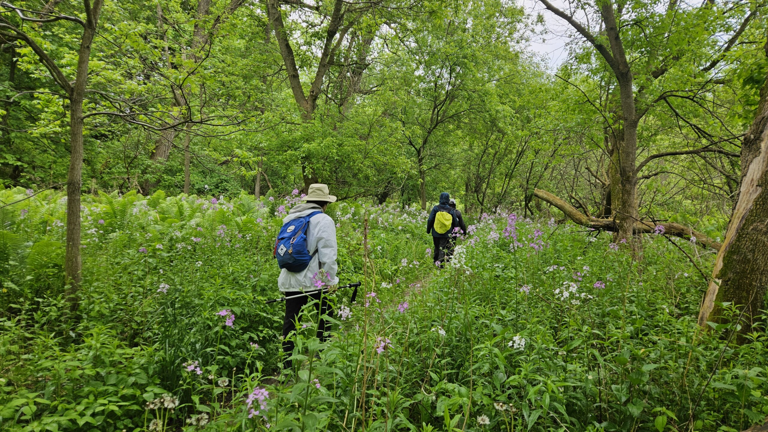
Car Hike: Rouge Valley Cedar Trail - 16km
https://hikes.brucetrail.org/event/car-hike-rouge-valley-cedar-trail-16km/Sorry, the registration cut-off time for this hike has been reached.Not a member? Click here to join today!Hosting Club: Toronto
Category: Car Hike
Location (Google Maps):Rouge Valley Conservation Centre parking lot.
Hike Leader(s): Alina Lin
Pace: Moderate
Terrain: Flat, Hilly, Variable
Distance: 13 km -16kmDescription
Meet at the main parking lot next to the Rouge Valley Conservation Centre, GPS (43.81780727235202, -79.17176449225887).We will hike along the main trail Cedar Trail and Little Rouge Creek Woodland Trail. The route includes a mix of flat and hilly terrains.
Be prepared for some muddy sections. Bring at least 1.5 liter of water. Wear sunscreen and a hat. Bug spray may also be needed.
No kids under 13 years old.
No dog.
This hike will take place rain or shine.