Join us for a hike! Registration required:
All hikes available to BTC members. Some hikes are open to non-members.
TIP: The calendar view displays up to 7 hikes on a day, but often there are more. Click “More events” to see them all.
Toronto Hike Schedule
Toronto Bruce Trail Club Registration Live Dates
Day Winter Coach Program
Registration begins two weeks in advance of the event departure (at 8:00 PM)
Day Bus Hikes
Registration begins two weeks in advance of the event departure (at 8:00 PM) with some exceptions of special event hikes
Day Coach Hikes
Registration begins 7 weeks in advance of the event departure
Day Car Hikes and Urban Hikes
Registration begins two weeks in advance of the event departure
Overnight and Weekend Trips
Registration begins 12 weeks in advance of the event departure
To view all Bruce Trail Conservancy Hikes click here
- 19May 19, 2024
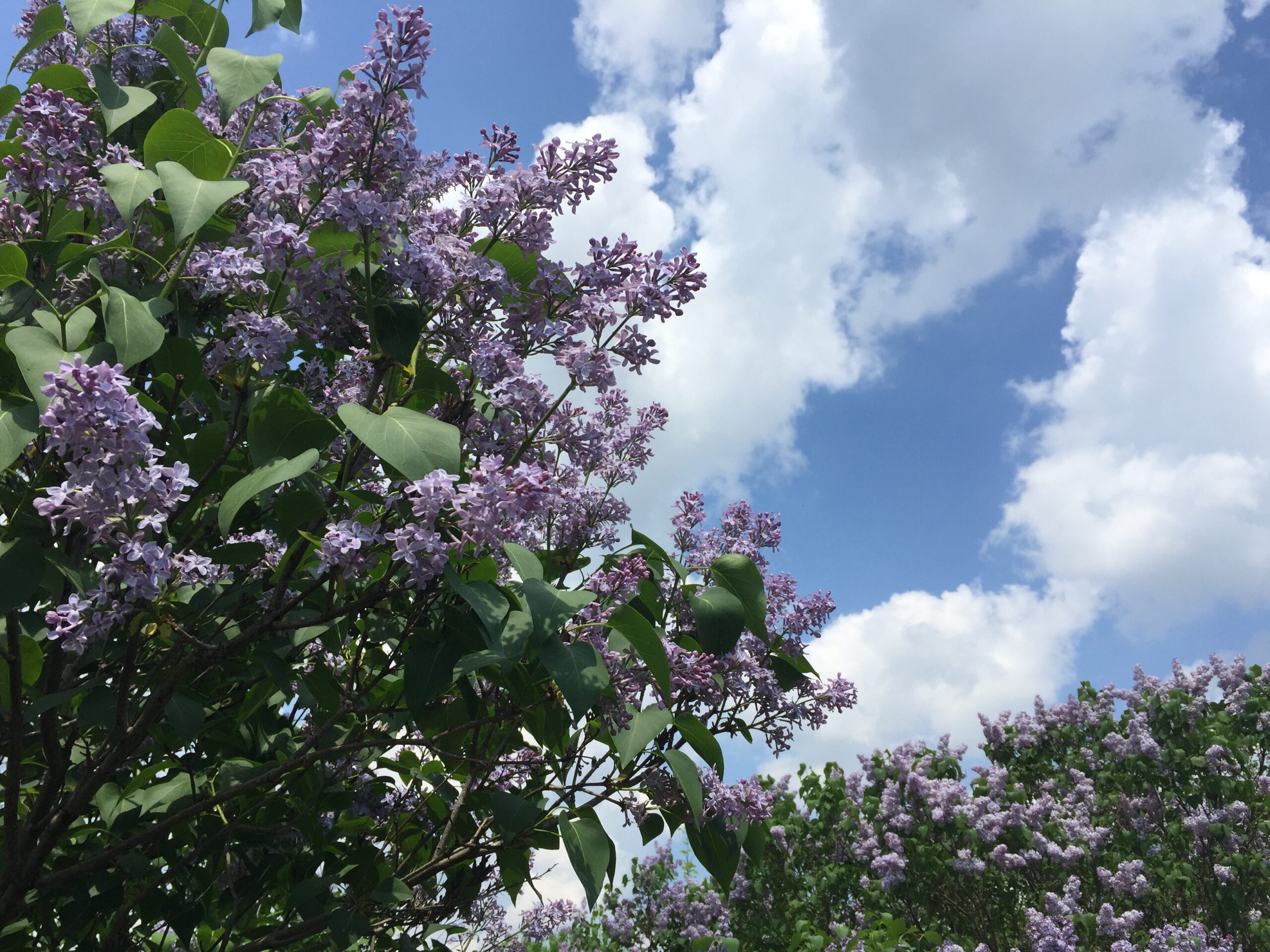
Bus Hike: Forks of the Credit to explore the seasonal Lilacs blooming!!
https://hikes.brucetrail.org/event/bus-hike-forks-of-the-credit-to-explore-the-seasonal-lilacs-bloomings/Sorry, the registration cut-off time for this hike has been reached.Not a member? Click here to join today!Trip Information
Departure Time: 08:30
Return to City Time: 18:00
Departure Point: York Mills Bus PickupOptional Items
Hwy 400 & Hwy 7 MTO Car Pool Lot Pickup ($.01)Hosting Club: Toronto, Caledon Hills
Category: Bus Hike
Location (Google Maps): Forks of the Credit Provincial ParkHike Leader(s): Amir Alemohammad, Mohammed Aghamiri, Mehrnoush Ahmadi Click here to contact Hike Leader(s)
Pace: Moderate
Terrain: Hilly, Variable
Distance: 12-14 KmDescription
Bus departs 10 York Mills Rd at 830 AM and HWY 7 and HWY 400 MTO Car Pool Lot at 8:50 AM. If you wish to be picked up at the HWY 7 and HWY MTO Car Pool Lot, select this option when registering. Please arrive 15 minutes before departure. The bus waits for no one.Join us for a wonderful hike in the Forks of the Credit Provincial Park when the lilac blossoms are blooming everywhere. We will hike main and sidetrails to explore the Credit river and it’s beautiful surroundings. Bring your snack/lunch for a wonderful by the river stop. Dress according to the weather conditions and bring at least 2L of water. Refreshments/ice cream after the hike in the village of Belfountain if there is enough time.
Bus departs 10 York Mills Rd at 8:3o AM, and should be back in the city by 6 PM.
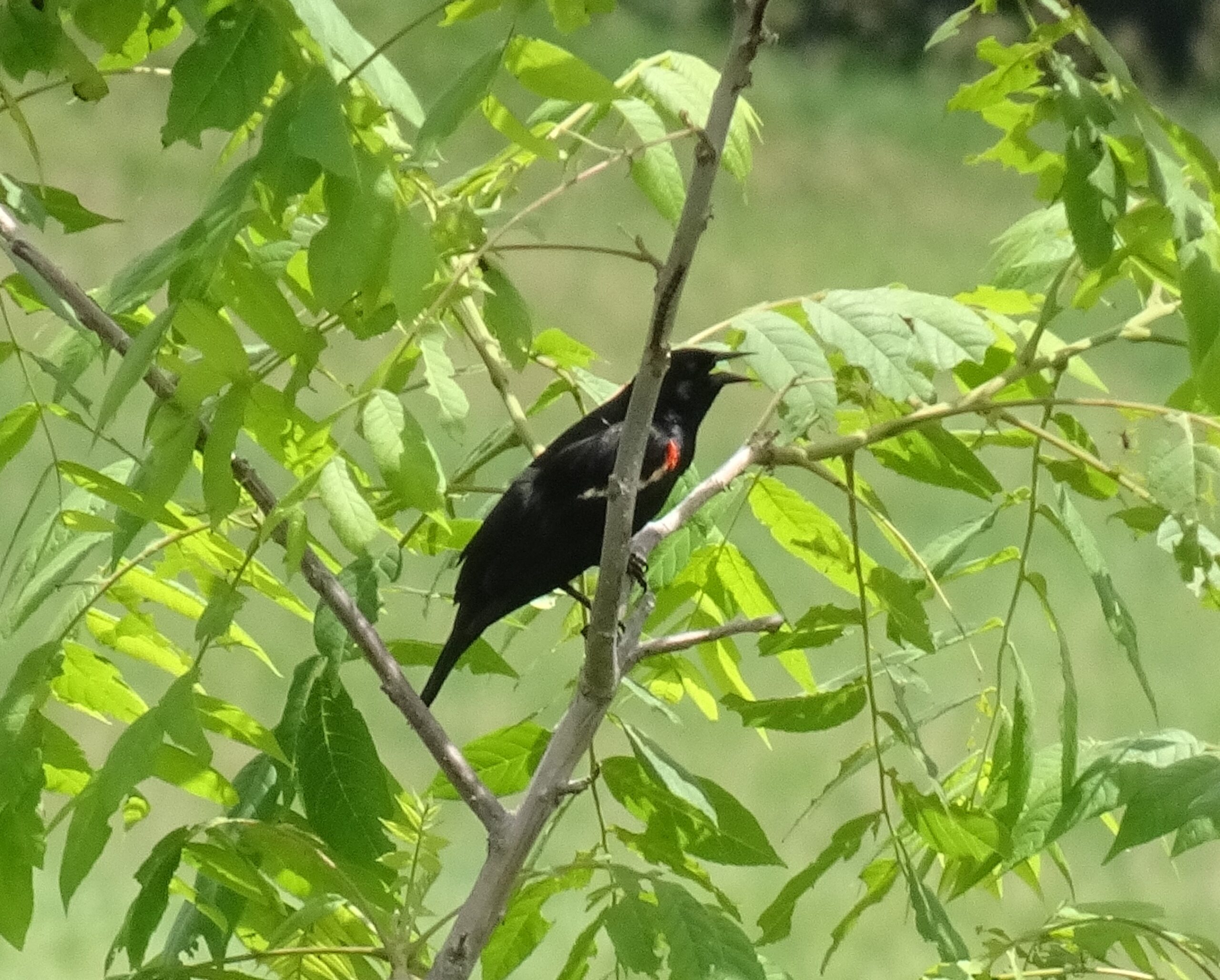
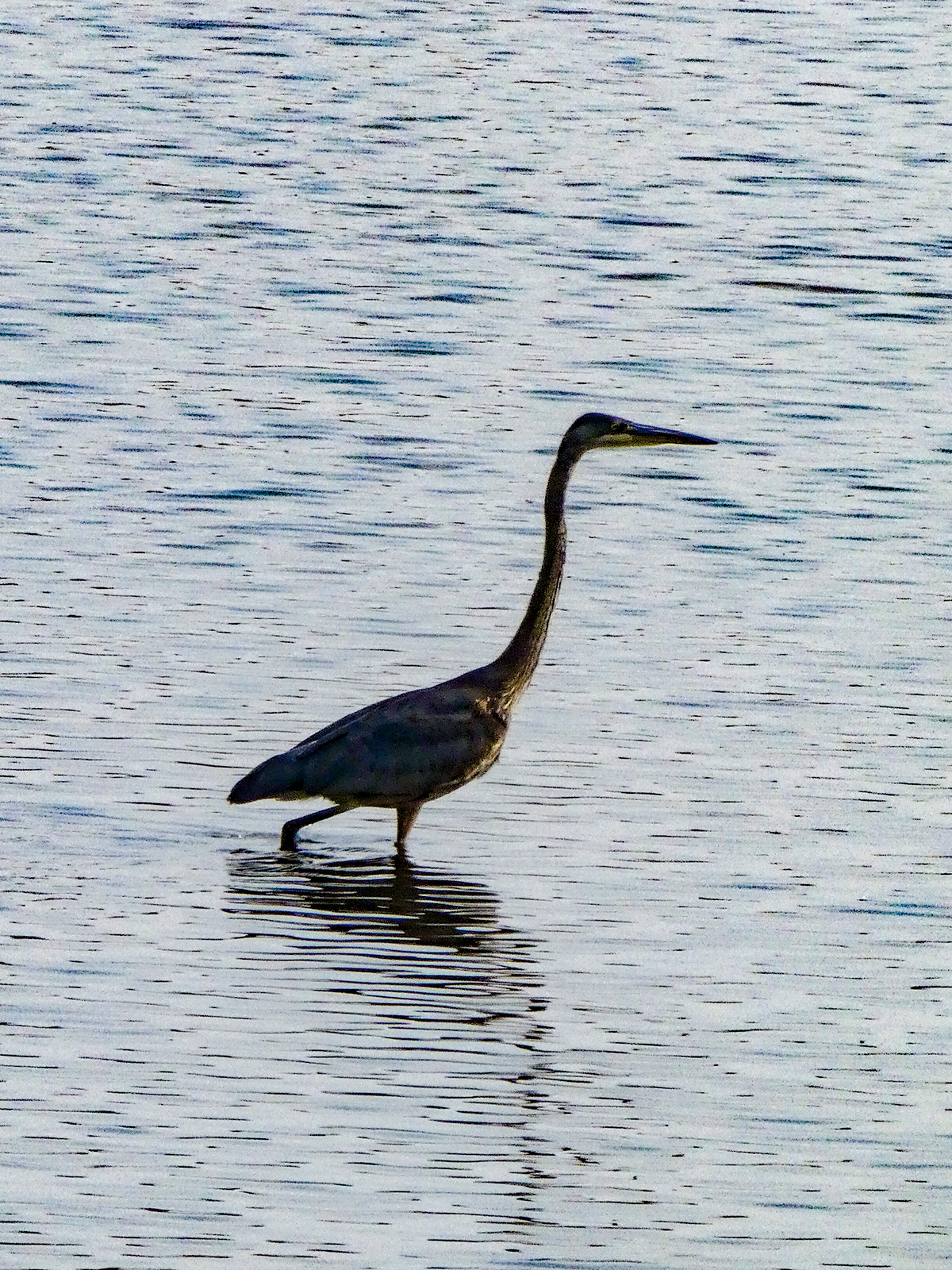
Birding Hike: Colonel Sam Smith Park to the Arsenal Lands
https://hikes.brucetrail.org/event/birding-hike-colonel-sam-smith-park-to-the-arsenal-lands/Sorry, the registration cut-off time for this hike has been reached.Not a member? Click here to join today!Hosting Club: Toronto
Category: Urban Walk
Location (Google Maps): Power House Recreation Centre, Colonel Samuel Smith Park Dr. Coming by transit you can take TTC bus# 44 from Kipling Station at 9:21 (scheduled every 9 minutes) to the end. Look for the tall Powerhouse Smokestack. It is about 50 metres from the stop. Coming by car follow Kipling Avenue to Lake Shore Blvd and keep straight. Kipling Avenue becomes Colonel Samuel Smith Park Drive. Follow to the end parking lot which has free parking. On the way you will pass the Powerhouse smokestack on the left. After parking your car walk back to the Powerhouse meetup spot. Please arrive 15 minutes early.Hike Leader(s): Andrew Proczek Click here to contact Hike Leader(s)
Pace: Leisurely, Moderate
Terrain: Flat
Distance: 9-10 KmsDescription
Please join me and foremost local birder, Peter Sproule, for an enjoyable walk through Colonel Sam Smith Park and westward to Marie Curtis Park and the former Arsenal Lands. Peter won’t know exactly what birds are arriving or migrating through until the day before, but we can expect Warblers, Swallows and a variety of shore birds. Peter will be photographing them and so you will be able to see them up close on his camera. You can see the birds with the naked eye but a pair of binoculars will certainly enhance your experience.Invited to the hike are the former TBTC Bus Hike team of Monica Feran and Tessa Shelvey. If you ever joined their hikes in the years prior to Covid please attend this event for a meet and greet opportunity. They will be happy to see you.
In case you cannot do a lot of walking and you will have your car, you can chose to return to your car when we will be leaving Colonel Sam Smith Park with the option of meeting the group at Marie Curtis Park. There is one small park in between but most of the birding will take place at Sam Smith and Marie Curtis Parks including the former Arsenal Lands. Driver’s instructions will be given.
Public washrooms: Ken Cox Community Centre (open from 9 am) opposite the #44 Bus Loop stop; The Powerhouse Recreation Centre will likely be open and there is also a Porta Potty in front; Marie Curtis Park by the boardwalk.
Car Hike: A trek, a token, and a treat for youth in the Toronto section!
https://hikes.brucetrail.org/event/car-hike-a-trek-a-token-and-a-treat-for-youth-in-the-toronto-section/Sorry, the registration cut-off time for this hike has been reached.Not a member? Click here to join today!Hosting Club: Toronto
Category: Car Hike
Location (Google Maps): We will meet at the parking lot of the Silver Creek Outdoor Education Centre located at 13500 Fallbrook Trail, Georgetown. (Map 13 of the Bruce Trail Reference Guide, Edition 31)Hike Leader(s): Monica Pasquali Click here to contact Hike Leader(s)
Pace: Leisurely, Moderate
Terrain: Rocky, Variable
Distance: 6.5 kmDescription
Calling all youth who are 25 years old and younger! Celebrate the May long weekend with a trek, a token, and a treat in the Toronto section of the Bruce Trail!First, we’ll do an out-and-back trek (approximately 6.5 km total) to explore Silver Creek Conservation Area, including the Irwin Quarry and Roberts side trails as well as the main trail atop the escarpment.
While on our hike, I will provide assistance to participants who are 25 years old and younger who are interested in earning a token: the BTC Youth Council Scavenger Hunt Badge (https://brucetrail.org/2024-youth-council-scavenger-hunt/)! Together we will strive to find and photograph at least 10 out of the 16 required plants, animals, and fungi. After the hike, participants will need to share their photographs with the Bruce Trail Conservancy’s iNaturalist project and then they’ll be eligible for a FREE badge!!!
Afterwards, we’ll make the short 10-minute drive to Whimsy Street Treats (90 Main Street South, Georgetown) in order to treat ourselves to some delicious soft serve ice cream or donuts (or both!) before we head home.
You should bring enough water and food for a 2-hour hike, comfortable hiking shoes, sun and bug protection, appropriate clothing for the weather, a camera or smartphone if you are a youth who wants to work on the BTC Youth Council Scavenger Hunt Badge, and money if you intend to join us at Whimsy Street Treats after the hike.
Urban Walk: Whitby Shores and Lynde Shores
https://hikes.brucetrail.org/event/urban-walk-whitby-shores-and-lynde-shores/Sorry, the registration cut-off time for this hike has been reached.Not a member? Click here to join today!Hosting Club: Toronto
Category: Urban Walk
Location (Google Maps): Whitby, OntarioHike Leader(s): Brian Rideout Click here to contact Hike Leader(s)
Pace: Moderate
Terrain: Flat
Distance: 12.5 KMDescription
Please read carefully. Some details have changed since the original posting.On Sunday May 19, 2024, please join me by 9:05 am under the clock in the Great Hall of Union Station. We will take the 9:20 am eastbound train to Whitby. We will hike a loop that will take us south to Lake Ontario, west and north to Victoria St, west to Lynde Shores Conversation where we will do a loop down to Lake Ontario and back, and then to the pub stop before returning to Whitby GO and back for a distance of (new) 12.5 km. There are washrooms at Union Station, Whitby GO and on the train. Bring at least two liters of water and a light snack. Our pub stop will be The Royal Oak – Whitby Shores at km 11.7.
Here is an online map (new) of our route: Whitby Shores and Lynde Shores
You can buy a GO Transit day pass for $10 here https://tickets.gotransit.com/en-us/?&ticket_adult=1&start_address=UN&end_address=WH

H. I. P. - Hiking Tips and Basic Survival Skills Workshop, and Urban Hike in High Park
https://hikes.brucetrail.org/event/h-i-p-hiking-tips-and-basic-survival-skills-workshop-and-urban-hike-in-high-park/Sorry, the registration cut-off time for this hike has been reached.Not a member? Click here to join today!Hosting Club: Toronto
Category: TBTC Special Events
Location (Google Maps): High Park Nature Centre, just North of the Tennis CourtsHike Leader(s): Marijo Roy Click here to contact Hike Leader(s)
Pace: Leisurely
Terrain: Variable
Distance: n/aDescription
Let’s get started on the right (hiking) foot!Please join us for a workshop on hiking tips and basic survival skills. Topics covered include proper gear/clothing/footwear, essentials to carry in your backpack, priority survival skills (water, fire, shelter), First Aid, communication, navigation, and more. Please note that this is a hands-on workshop. Children 9 and over are welcome. A one-hour hike will follow the workshop in beautiful High Park.
- 20May 20, 2024No events
- 21May 21, 2024

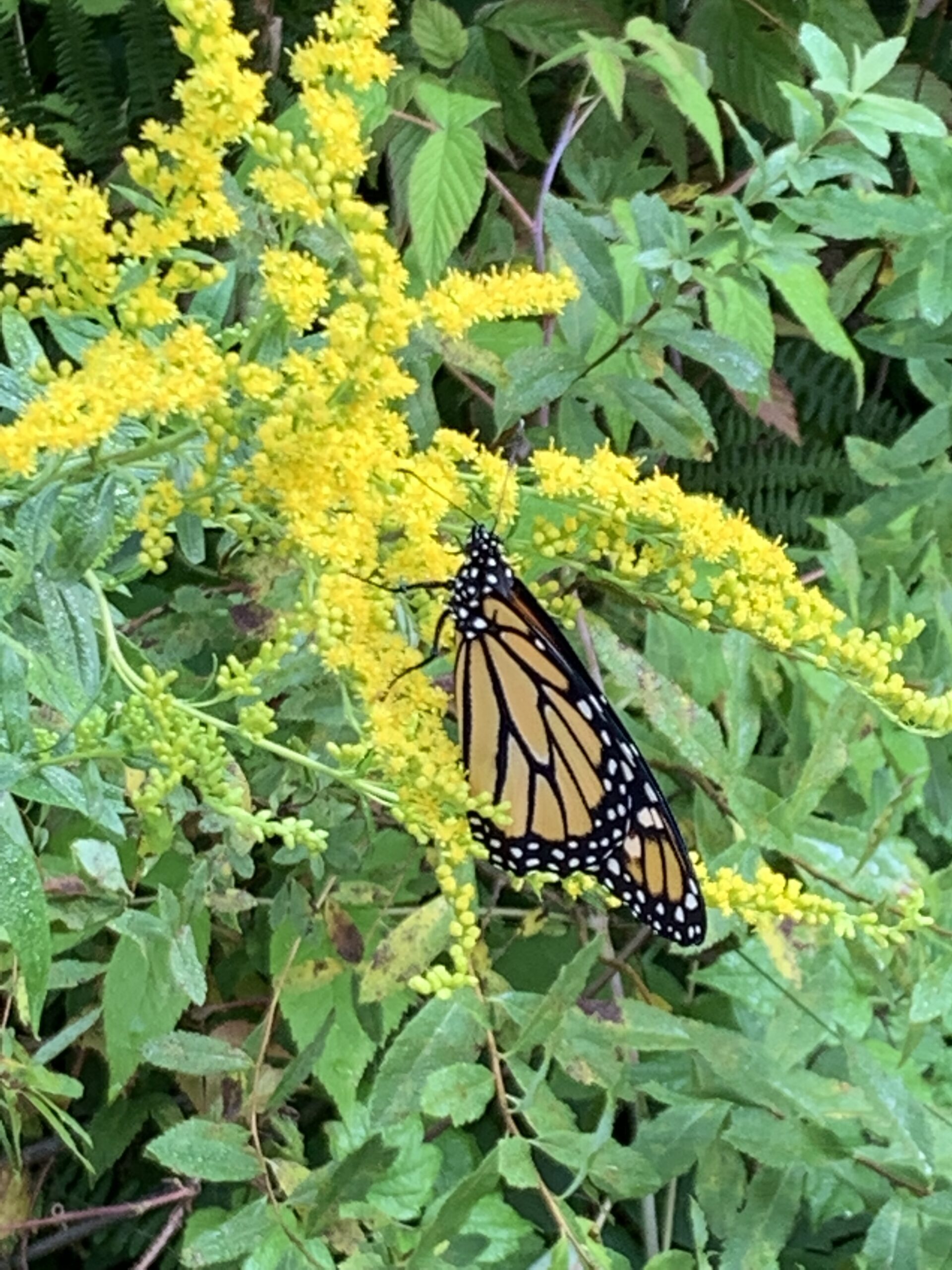
Afternoon Hike - Hilton Falls (reservation required)
https://hikes.brucetrail.org/event/afternoon-hike-hilton-falls-reservation-required/Sorry, the registration cut-off time for this hike has been reached.Not a member? Click here to join today!Hosting Club: Iroquoia, Toronto
Category: Afternoon/Evening Hikes
Location (Google Maps): Parking lot at Hilton Falls Conservation AreaHike Leader(s): Karen Bergmann Click here to contact Hike Leader(s)
Pace: Medium – 3 to 4 km/hr
Terrain: Moderate – Some hills and/or some poor footing
Distance: 7 kmsDescription
We will hike around the main and side trails and see the Falls. Reserve your time at conservationhalton.ca Bring your camera as I expect we’ll see some spring wildflowers. And bring bug spray. - 22May 22, 2024No events
- 23May 23, 2024
Urban Walk; Valley View and Maple view Parks Thornhill
https://hikes.brucetrail.org/event/urban-walk-valley-view-and-maple-view-parks-thornhill-5/Sorry, the registration cut-off time for this hike has been reached.Not a member? Click here to join today!Hosting Club: Toronto
Location (Google Maps): Parking lot at the corner of Bayview Ave, and Sycamore Dr. South of Highway 7
Sycamore Dr. is 2 blocks south of highway 7,parking lot is across plaza of Dollarama and Star boxHike Leader(s): Mohammad Aghamiri Click here to contact Hike Leader(s)
Pace: Moderate
Terrain: Variable
Distance: 7-8 kmDescription
We will explore Valleyview and Maple view parks, and walk along German Mill Creek,
Urban Walk: Toronto Islands Evening Walk
https://hikes.brucetrail.org/event/urban-walk-toronto-islands-evening-walk-4/Sorry, the registration cut-off time for this hike has been reached.Not a member? Click here to join today!Hosting Club: Toronto
Location (Google Maps): Jack Layton Ferry Terminal, near the gates to Wards Island Ferry. Arrive 20 minutes prior to departure to check in with hike leader.
From Union Station take the LRT and get off at the stop Ferry Docks.Walk up to the Ferry Docks on Queens Quay West, street level. at the foot of Bay Street.
Hike Leader(s): Miriam Stevens Click here to contact Hike Leader(s)
Pace: Leisurely
Terrain: Flat
Distance: 6-9 kmDescription
After a day’s work come and “cool off” on the Toronto Islands free of fumes and traffic. Enjoy the view of the city skyline and Toronto’s beautiful island parkland.
Pack a dinner for a sit down picnic. Food is not available for purchase on the Islands early in the season. Also bring a warm jacket and flashlight.
Return fare ticket for the ferry approx $10.00 less for seniors.
Hikes will take place rain or shine.
Toronto Island evening hikes will take place every THURSDAY in MAY and JUNE 2024.
Same time and same meeting place. No preregistration is required – just show up at the ferry docks at 5:40 PM and sign with the hike leader.
Full Moon Walk @ Edward Gardens - 7km
https://hikes.brucetrail.org/event/full-moon-walk-edward-gardens-7km/Sorry, the registration cut-off time for this hike has been reached.Not a member? Click here to join today!Hosting Club: Toronto
Category: Urban Walk
Location (Google Maps): Parking Lot #2 Wilket Creek Park,Hike Leader(s): Alina Lin
Pace: Moderate
Terrain: Flat, Variable
Distance: 6 km -8kmDescription
🌕✨ Join Us for a Magical Full Moon Hike at Edward Gardens! ✨🌕Meet at the Parking Lot #2 Wilket Creek Park, nearby the intersection of Leslie St & Eglinton Ave, GPS ( 43.716342, -79.350592)
Embark on an enchanting journey under the glow of the Flower Moon. Known also as the Planting Moon, Milk Moon, and Hare Moon, this May full moon has been celebrated across cultures for its beauty and significance.
As we wander through the lush landscapes of Edward Gardens, bathed in moonlight, we’ll connect with nature and each other, embracing the tranquility and wonder of the night. The Flower Moon symbolizes growth and new beginnings, making it the perfect time to plant the seeds of new friendships and nurture our connection to the natural world.
Whether you are an avid hiker, a nature lover, or simply looking for a unique way to spend your evening, this hike promises to be an unforgettable experience. Together, we’ll witness the moon’s radiant beauty, share stories, and maybe even spot some nocturnal wildlife.
🌕 What to Bring:
- Comfortable walking shoes
- mosquitos proof cloth
- Bug spray in case the mosquitos are heavy
- A flashlight or headlamp
- Water and snacks
- A sense of adventure and wonder
Let the magic of the Flower Moon guide our steps and inspire our hearts. We look forward to sharing this special night with you.
RSVP now and join us for a night of lunar enchantment! 🌕🌸
- 24May 24, 2024
Car Hike: Toronto E2E in 4 sections - 4 of 4
https://hikes.brucetrail.org/event/car-hike-toronto-e2e-in-4-sections-4-of-4/Sorry, the registration cut-off time for this hike has been reached.Not a member? Click here to join today!Hosting Club: Iroquoia, Toronto
Category: General Hike
Location (Google Maps): Meet at 866 Boston Mills Rd, Terra Cotta, southwest of km 48.3 at Boston Mills Rd just west of the Mississauga Rd intersection. Coordinates N43.75089458147345, W-79.9514382908325. Click on the Google link for personalized driving instructions.Hike Leader(s): Susan Glofcheskie Click here to contact Hike Leader(s)
Pace: Medium – 3 to 4 km/hr
Terrain: Moderate – Some hills and/or some poor footing
Distance: 12 kmDescription
This is the fourth of a four-series hike of the complete Toronto Club section of the Bruce Trail.Please bring gaiters and poles for the slippery mud. Bring 1.5 to 2 litres of water, bug spray, sunscreen and a snack. Hiking boots/shoes are mandatory. For further details, refer to hike 1 of 4 on May 3.
Please arrive by 8 am at km 48.3, so we can leave at 8:15 am to shuttle to our starting point (km 38.7).
This is a series of 4 hikes to complete the Toronto section. You must sign up for all 4 hikes if you wish an ETE badge at a cost of $5 members/$15 non-members.
Car Hike: CHBTC 60th Anniversary E2E Badge Combo 5/5
https://hikes.brucetrail.org/event/car-hike-chbtc-60th-anniversary-e2e-badge-combo-5-5/Sorry, the registration cut-off time for this hike has been reached.Not a member? Click here to join today!Hike open to BTC Members only.
Hosting Club: Toronto, Caledon Hills
Category: Car Hike
Location (Google Maps): Hike #5 – Badge Day!! We’ll meet 200m south of the Mono Centre, west of km 72.2. Please park in the gravel surface lot GPS N44.026195, W80.071516Hike Leader(s): Jacquie Van Dyke Click here to contact Hike Leader(s)
Pace: Moderate
Terrain: Variable
Distance: 12km plus a short side trailDescription
Come to one, a few, or all of these hikes to celebrate Caledon’s 60th anniversary! It’s badge day for those completing all 5 of these hikes who have had a good chance to qualify for BOTH of Caledon’s NEW badges. Today, on the last of these five hikes, we’ll meet 200m south of Mono Centre in the unpaved portion of the parking lot. There usually is a port-a-potty there.We’ll stop for a short snack break and perhaps a lunch break (depending on speed of hikers), so please bring enough food to last the hike, 2L of water, bug repellent, sunblock, and proper hiking attire. Hiking boots/shoes are mandatory. It may be rainy so ensure you have rain gear with you.
- 25May 25, 2024
Car Hike: Happy Valley 136
https://hikes.brucetrail.org/event/car-hike-happy-valley-2/Sorry, the registration cut-off time for this hike has been reached.Not a member? Click here to join today!Hosting Club: Toronto
Location (Google Maps): Happy Valley, Oak Ridges Trail 16th Sideroad & Weston Road
Hike Leader(s): Mohammad Aghamiri Click here to contact Hike Leader(s)
Pace: Moderate
Terrain: Rocky, Variable
Distance: 14-17 kmDescription
Come and join the group to view nice scenery and look out of Happy valleySome safety procedures during the hike:
1-Hikers must stay between the leader and the sweep.
2-Hikers must advise the leader or the sweep if they wish to leave the group.
3- Hikers must follow the whistle instructions: 1 blast- stay where you are; 2 blasts come to the leader; 3 blasts – come to the leader quickly.
4-Hike leader may request volunteers to stop at trail intersections, they need to help hikers to the direction the group walk and wait till they see the sweep .
5-Hikers have to make sure they can see the persons behind and in front of them.
Bus Hike: Caledon E2E - Hike #1 of 5
https://hikes.brucetrail.org/event/bus-hike-caledon-e2e-hike-1-of-5/Sorry, the registration cut-off time for this hike has been reached.Not a member? Click here to join today!Trip Information
Departure Time: 08:30
Return to City Time: 17:00
Departure Point: Kipling Departure PointOptional Items
Hosting Club: Toronto, Caledon Hills
Category: Bus Hike
Location (Google Maps): Cheltenham BadlandsHike Leader(s): Sajedeh Zahraei; Celia Ho Click here to contact Hike Leader(s)
Pace: Moderate
Terrain: Flat, Variable
Distance: 16 KmDescription
Maps 14-15, km 0.0 – km 16.0 (16.0 km)Starting Point: Bruce Trail Entrance – km 0.0 (on Creditview Rd) (43.768001°N 79.943125°W)
Drop-out Point: – km 8.4 (McLaren Road and Puckering Lane)
End Point: Roadside Parking – km 16.0 (along the southwest shoulder of the Willoughby Rd and Escarpment Sideroad intersection) (43.831244°N 79.980588°W)
Car Hike: Rouge Valley Vista Trail & Mast Trail Hike - 14km
https://hikes.brucetrail.org/event/car-hike-rouge-valley-vista-trail-mast-trail-hike-14km/Sorry, the registration cut-off time for this hike has been reached.Not a member? Click here to join today!Hosting Club: Toronto
Category: Car Hike
Location (Google Maps): Rouge Valley Conservation Centre parking lot.Hike Leader(s): Alina Lin
Pace: Moderate
Terrain: Challenging, Hilly, Variable
Distance: 12km -15kmDescription
Meet at the main parking lot next to the Rouge Valley Conservation Centre, GPS (43.81780727235202, -79.17176449225887).We will hike along the two main trails: Vista Trail and Mast Trail. The route includes a mix of flat and hilly terrains.
Be prepared for some muddy sections. Bring at least 1 liter of water. Wear sunscreen and a hat. Bug spray may also be needed.
This hike will take place rain or shine.

Toronto Urban Badge Hike - 5 of 7
https://hikes.brucetrail.org/event/toronto-urban-badge-hike-5-of-7-4/Sorry, the registration cut-off time for this hike has been reached.Not a member? Click here to join today!Hosting Club: Toronto
Location (Google Maps):
Toronto, Ontario, Canada
Hike Leader(s): Brian Rideout Click here to contact Hike Leader(s)
Pace: Moderate
Terrain: Flat
Distance: 9.6 kmDescription
Please join me at the north east corner of Bathurst and Finch by 10 AM. We will hike east on the Finch Hydro Corridor Trail and south along East Don Parklands to Sheppard and Leslie (km 41.6 to km 51.2). Here is an online map with km markings of our route for all 7 hikes for the Toronto Urban Badge.Please make sure you bring at least 2 liters of water, a lunch, bug spray and sunscreen.