Join us for a hike! Registration required:
All hikes available to BTC members. Some hikes are open to non-members.
TIP: The calendar view displays up to 7 hikes on a day, but often there are more. Click “More events” to see them all.
Toronto Hike Schedule
Toronto Bruce Trail Club Registration Live Dates
Day Winter Coach Program
Registration begins two weeks in advance of the event departure (at 8:00 PM)
Day Bus Hikes
Registration begins two weeks in advance of the event departure (at 8:00 PM) with some exceptions of special event hikes
Day Coach Hikes
Registration begins 7 weeks in advance of the event departure
Day Car Hikes and Urban Hikes
Registration begins two weeks in advance of the event departure
Overnight and Weekend Trips
Registration begins 12 weeks in advance of the event departure
To view all Bruce Trail Conservancy Hikes click here
- 12May 12, 2024No events
- 13May 13, 2024No events
- 14May 14, 2024No events
- 15May 15, 2024
Car Hike: Blue Mountain E2E 2/3
https://hikes.brucetrail.org/event/car-hike-blue-mountain-e2e-2-3/Sorry, the registration cut-off time for this hike has been reached.Not a member? Click here to join today!Hike open to BTC Members only.
This is a Multi-Day Hike
You are signing up for the following dates and times:
2024-05-15 at 08:30Hosting Club: Toronto, Blue Mountains
Category: Car Hike
Location (Google Maps): Map 22- Km 21.9, Nattawasaga Bluffs Conservation Area. Coordinates N 44.342784,W 80.210628Hike Leader(s): Smadar Junkin Click here to contact Hike Leader(s)
Pace: Brisk
Terrain: Challenging, Hilly
Distance: 25 kmDescription
Second hike in the Blue Mountain E2E series. This is the longest hike of the series. Beautiful, hilly and challenging. Please bring 2litres of water. Follow the Covid 19 protocols. Arrive 15 minutes early. The meeting place parking is a paid parking, everyone is expected to pay thief share of the parking fees. We will shuttle to km 46.8 and hike back. - 16May 16, 2024
Car Hike: Blue Mountain E2E 3/3
https://hikes.brucetrail.org/event/car-hike-blue-mountain-e2e-3-3/Sorry, the registration cut-off time for this hike has been reached.Not a member? Click here to join today!Hike open to BTC Members only.
This is a Multi-Day Hike
You are signing up for the following dates and times:
2024-05-16 at 08:30Hosting Club: Toronto, Blue Mountains
Category: Car Hike
Location (Google Maps): Map # 23- North of km 46.8, 380 meters north of the main trail crossing on Pretty River Rd. Coordinated N 44.430927,W 80.275390Hike Leader(s): Smadar Junkin Click here to contact Hike Leader(s)
Pace: Brisk
Terrain: Challenging, Hilly
Distance: 23 kmDescription
Hike #3 of 3. Badge day! Beautiful and hilly. This is a brisk pace hike. The pace is expected to be 4 to 4.5 km per hour. Hikers are expected to follow the Covid 19 protocols. Bring 2 litres of water. Aim to get there 15 minutes early. We will shuttle to km 67.3 and walk back.
Urban Walk: Toronto Islands Evening Walk
https://hikes.brucetrail.org/event/urban-walk-toronto-islands-evening-walk-3/Sorry, the registration cut-off time for this hike has been reached.Not a member? Click here to join today!Hosting Club: Toronto
Location (Google Maps): Jack Layton Ferry Terminal, near the gates to Wards Island Ferry. Arrive 20 minutes prior to departure to check in with hike leader.
From Union Station take the LRT and get off at the stop Ferry Docks.Walk up to the Ferry Docks on Queens Quay West, street level. at the foot of Bay Street.
Hike Leader(s): Miriam Stevens Click here to contact Hike Leader(s)
Pace: Leisurely
Terrain: Flat
Distance: 6-9 kmDescription
After a day’s work come and “cool off” on the Toronto Islands free of fumes and traffic. Enjoy the view of the city skyline and Toronto’s beautiful island parkland.
Pack a dinner for a sit down picnic. Food is not available for purchase on the Islands early in the season. Also bring a warm jacket and flashlight.
Return fare ticket for the ferry approx $10.00 less for seniors.
Hikes will take place rain or shine.
Toronto Island evening hikes will take place every THURSDAY in MAY and JUNE 2024.
Same time and same meeting place. No preregistration is required – just show up at the ferry docks at 5:40 PM and sign with the hike leader. - 17May 17, 2024
Car Hike: Victoria Day Weekend in the Lower Bruce Peninsula (3 nights)
https://hikes.brucetrail.org/event/car-hike-victoria-day-weekend-in-the-lower-bruce-peninsula-3-nights/Sorry, the registration cut-off time for this hike has been reached.Not a member? Click here to join today!This is a Multi-Day Hike
You are signing up for the following dates:
2024-05-17, 2024-05-18, 2024-05-19, 2024-05-20Hosting Club: Toronto, Peninsula
Category: Car Hike
Location (Google Maps): Evergreen Resort (Red Bay)
139 Resort Rd.
Wiarton, ON H0H 2T0Hike Leader(s): Jeanette Vincent, Brenda Menezes, David Royle Click here to contact Hike Leader(s)
Pace: Leisurely, Moderate
Terrain: Hilly, Rocky, Variable
Distance: approx. 13-15 kmDescription
We continue Greg Vincent’s legacy of weekends away. Please join Jeanette Vincent, Brenda Menezes and David Royle as we explore the Lower Bruce Peninsula. The spring flowers will welcome us to the trails. We stay and have our meals at a comfortable resort at Red Bay. Each day we will hike the Bruce Trail and its side trails to form loops with great views of Georgian Bay and its islands. The carpet of trilliums is the best along the length of the Bruce Trail along with other spring ephemerals. Approximately 15km/day.This outing is restricted to those staying with us at Evergreen Resort for the weekend. You will need a car to access this outing. Please contact Evergreen for a reservation 1-519-534-1868 or frontdesk.evergreenresort@gmail.com and mention Vincent Victoria Day weekend.
Before registering at Evergreen Contact: please contact Jeanette vincentjeanette1604@gmail.com | 519-588-5916 For prices and more details.

Car Hike: Toronto E2E in 4 sections - 3 of 4
https://hikes.brucetrail.org/event/car-hike-toronto-e2e-in-4-sections-3-of-4/Sorry, the registration cut-off time for this hike has been reached.Not a member? Click here to join today!Hosting Club: Iroquoia, Toronto
Category: General Hike
Location (Google Maps): Meet at km 26.5 (Map 13), on the Sixth Line, north of 22nd Sideroad, where the main trail exits the forest on the west side of Sixth Line. Coordinates N43.658244480690115, W-79.98546157653041. Click on the Google link for personalized driving instructions.Hike Leader(s): Susan Glofcheskie Click here to contact Hike Leader(s)
Pace: Medium – 3 to 4 km/hr
Terrain: Moderate – Some hills and/or some poor footing
Distance: 12kDescription
This is the third of a four-series hike of the complete Toronto Club section of the Bruce Trail.Please bring gaiters and poles for the slippery mud. Bring 1.5 to 2 litres of water, bug spray, sunscreen and a snack. Hiking boots/shoes are mandatory. For further details, refer to hike 1 of 4 on May 3.
Please arrive by 8 am at km 26.5, so we can leave at 8:15 am to shuttle to our starting point (km 38.7).
This is a series of 4 hikes to complete the Toronto section. You must sign up for all 4 hikes if you wish an ETE badge at a cost of $5 members/$15 non-members.
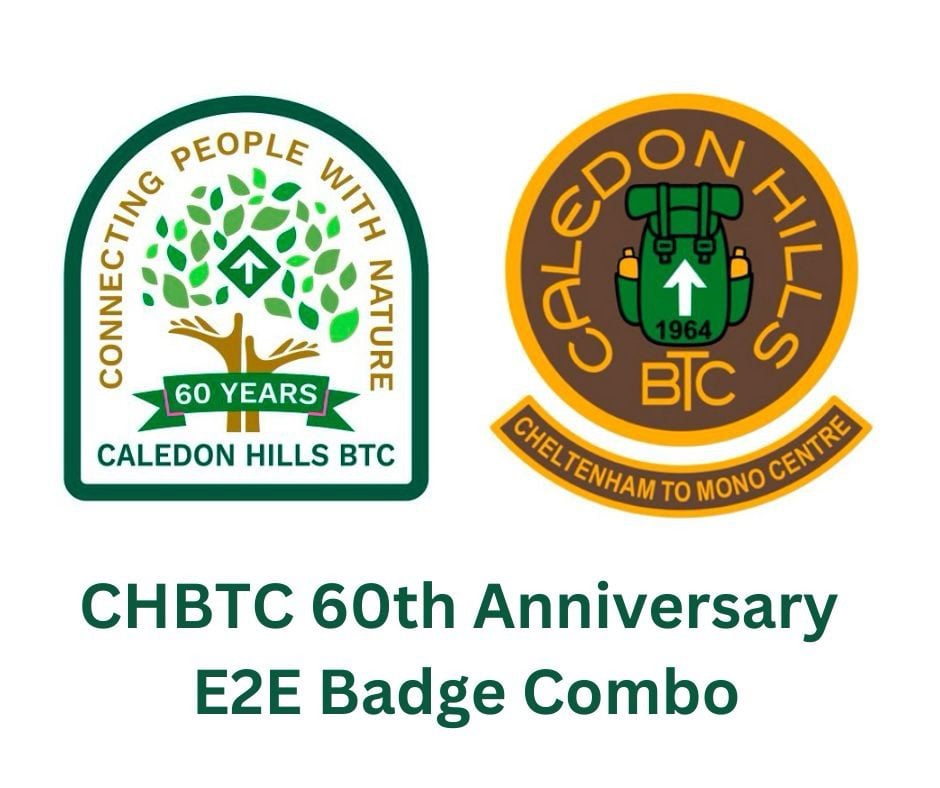
Car Hike: CHBTC 60th Anniversary E2E Badge Combo 4/5
https://hikes.brucetrail.org/event/car-hike-chbtc-60th-anniversary-e2e-badge-combo-4-5/Sorry, the registration cut-off time for this hike has been reached.Not a member? Click here to join today!Hike open to BTC Members only.
Hosting Club: Toronto, Caledon Hills
Category: Car Hike
Location (Google Maps): Hike #4 – We’ll meet at km 45.4 on the north side of Mono 5 Sideroad where the trail crosses. GPS N43.974055, W79.984988Hike Leader(s): Jacquie Van Dyke Click here to contact Hike Leader(s)
Pace: Moderate
Terrain: Hilly, Variable
Distance: 16kmDescription
Come to one, a few, or all of these hikes to celebrate Caledon’s 60th anniversary! By completing all 5 of these hikes, you’ll qualify for BOTH of Caledon’s NEW badges. On this fourth of five hikes, we’ll meet in the parking lot on Mono 5 Sideroad and shuttle to our starting point. There will be a great deal of up and down hills today so please be prepared!We’ll stop for a short snack break and also a lunch break, so please bring enough food to last the hike, 2L of water, bug repellent, and proper hiking attire. Hiking boots/shoes are mandatory. It may be rainy so ensure you have rain gear with you.
- 18May 18, 2024
Car Hike: Section of Hockley Valley thru Glen Haffy Conservation Area with brief stop at the Century Old Dingle Schoolhouse.
https://hikes.brucetrail.org/event/car-hike-section-of-hockley-valley-thru-glen-haffy-conservation-area-with-brief-stop-at-the-century-old-dingle-schoolhouse/Sorry, the registration cut-off time for this hike has been reached.Not a member? Click here to join today!Hosting Club: Toronto, Caledon Hills
Category: Car Hike
Location (Google Maps): Meet at roadside parking on Innis Lake Rd. North of Finnerty SideRoad.
GPS N43.918917, W-79.909387Hike Leader(s): Ross Estrella Click here to contact Hike Leader(s)
Pace: Brisk, Moderate
Terrain: Challenging, Hilly, Variable
Distance: 21 kmsDescription
We’ll hike section of Hockley Valley thru Glen Haffy Conservation Area with brief stop at The Dingle Schoolhouse and learn more of it’s century old history. Please equip yourself with proper hike clothing appropriate for the weather. Hockley Valley is one the most hilly section of the Bruce Trail so comfortable and sturdy hiking shoe is suggested. Hiking poles and gaiters is highly recommended. Bring enough water for hydration, lunch and trail foods for energy. Avail yourself with sunscreen, bug spray ,sun head protection and emergency medical kit and personal medication including your Ohip information.Please arrive 15 minutes early for car shuttling.
Car Hike: Tommy Thomson park ,down town
https://hikes.brucetrail.org/event/car-hike-cherry-beach/Sorry, the registration cut-off time for this hike has been reached.Not a member? Click here to join today!Hosting Club: Toronto
Category: Car Hike
Location (Google Maps): 1 Leslie street Toronto (Free Parking)Hike Leader(s): Mohammad Aghamiri, Click here to contact Hike Leader(s)
Pace: Moderate
Terrain: Flat
Distance: 10-12kmDescription
We will hike along the waterfront trail, watch birds singing and more1-Hikers must stay between the leader and the sweep.
2-Hikers must advise the leader or the sweep if they wish to leave the group.
3- Hikers must follow the whistle instructions: 1 blast- stay where you are; 2 blasts come to the leader; 3 blasts – come to the leader quickly.
4-Hike leader may request volunteers to stop at trail intersections, they need to help hikers to the direction the group walk and wait till they see the sweep .
5-Hikers have to make sure they can see the persons behind and in front of them.
Car Hike: Dufferin Hi-Lands 2 of 4
https://hikes.brucetrail.org/event/car-hike-dufferin-hi-lands-2-of-4/Sorry, the registration cut-off time for this hike has been reached.Not a member? Click here to join today!Hosting Club: Toronto, Dufferin Hi-Land
Category: Car Hike
Location (Google Maps): Dufferin Hi-Lands, Map 20Hike Leader(s): Al Brown Click here to contact Hike Leader(s)
Pace: Moderate
Terrain: Hilly
Distance: 15.3 kmDescription
This will be the second hike in this end to end series. Starting at km 15.1 we will car pool to km 31.7 and hike back. The route follows the Boyne River and its tributary. We will climb Murphy’s Pinnacle for great views of the surrounding countryside.To get to the meeting point drive north on Hwy 10 past Orangeville to Primrose. Turn right and go about 1.5 km to Hurontario Street.

Toronto Urban Badge Hike - 4 of 7
https://hikes.brucetrail.org/event/toronto-urban-badge-hike-4-of-7-4/Sorry, the registration cut-off time for this hike has been reached.Not a member? Click here to join today!Hosting Club: Toronto
Location (Google Maps):
Toronto, Ontario, Canada
Hike Leader(s): Brian Rideout Click here to contact Hike Leader(s)
Pace: Moderate
Terrain: Flat
Distance: 11.4 kmDescription
Please join me at the north west corner of Finch and Weston by 10 AM. We will hike east along the Finch Hydro Corridor Trail to Bathurst St (N of Finch) (km 30.2 to km 41.6). Here is an online map with km markings of our route for all 7 hikes for the Toronto Urban Badge.Please make sure you bring at least 2 liters of water, a lunch, bug spray and sunscreen.