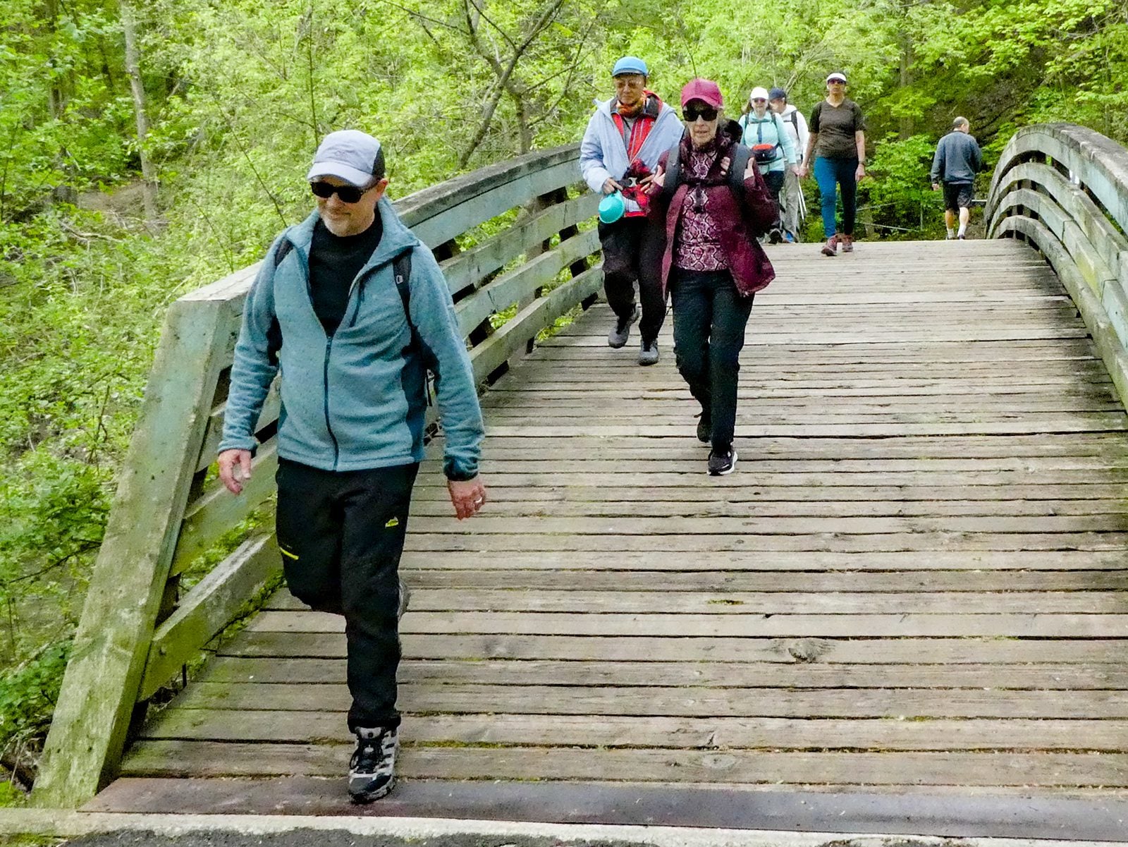
Join us for a hike! Registration required:
All hikes available to BTC members. Some hikes are open to non-members.
TIP: The calendar view displays up to 7 hikes on a day, but often there are more. Click “More events” to see them all.
Toronto Hike Schedule
Toronto Bruce Trail Club Registration Live Dates
Day Winter Coach Program
Registration begins two weeks in advance of the event departure (at 8:00 PM)
Day Bus Hikes
Registration begins two weeks in advance of the event departure (at 8:00 PM) with some exceptions of special event hikes
Day Coach Hikes
Registration begins 7 weeks in advance of the event departure
Day Car Hikes and Urban Hikes
Registration begins two weeks in advance of the event departure
Overnight and Weekend Trips
Registration begins 12 weeks in advance of the event departure
To view all Bruce Trail Conservancy Hikes click here
- 31May 31, 2026
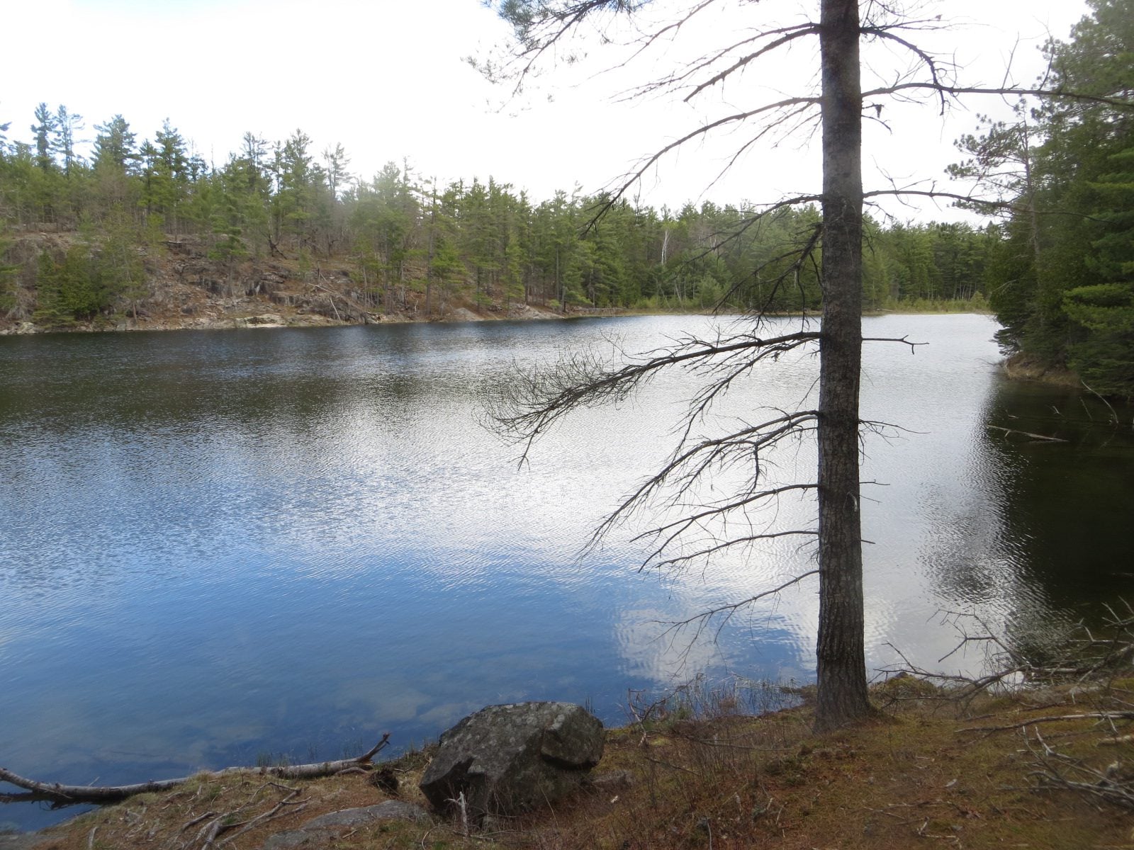
Car Hike: Jefferson Forest and Bond Lake
https://hikes.brucetrail.org/event/car-hike-jefferson-forest-and-bond-lake-richmond-hill-13/Sorry, the registration cut-off time for this hike has been reached.Not a member? Click here to join today!Hosting Club: Toronto
Category: Car Hike
Location (Google Maps):1245 Bethesda Side Rd, Richmond Hill, ON L4E 1A2 ( Bethesda Trail Head Parking lot)
Hike Leader(s): Amir Alemohammad Click here to contact Hike Leader(s)
Pace: Moderate (3-4 km/hr)
Terrain: Flat, Hilly, Level 2 (Intermediate – some hills and uneven surfaces, rocks and roots underfoot), Variable
Distance (km): 15-16 kmDescription
Let’s roll the hills of the Jefferson Forest and around the Bond Lake. Every week we hike in Jefferson Forest, located in the heart of Richmond Hill, it boasts numerous hiking trails. This 3.5 hour hike can range from 14 to 15 kilometres, depending on the weather conditions. Remember to bring water, snacks, hiking boots, poles, and your camera. Not recommended for beginners. Park in the free Bethesda parking lot and avoid parking along the road. Dress appropriately for the weather. Difficulty Level: 2 (Moderate).Please arrive @7:45AM for start of 8:00AM.
This is a joint hike with the Oak Ridges Trail Association (ORTA).
what3words:
https://w3w.co/twisting.mailer.awakes
School Bus Hike: Hockley Valley
https://hikes.brucetrail.org/event/school-bus-hike-hockley-valley/Sorry, the registration cut-off time for this hike has been reached.Not a member? Click here to join today!Trip Information
Departure Time: 08:30
Return to City Time: 18:30
Departure Point: York Mills Bus PickupOptional Items
Pick up at HWY 400 & Major Mac ($0.01)Hosting Club: Toronto
Category: Bus Hike
Location (Google Maps): Hockley ValleyHike Leader(s): Martina Furrer, Celia Ho, Leila Damband, Roland Mark Click here to contact Hike Leader(s)
Pace: Brisk (4-5 km/hr), Moderate (3-4 km/hr)
Terrain: Hilly, Level 2 (Intermediate – some hills and uneven surfaces, rocks and roots underfoot), Variable
Distance (km): Fast (18 km), moderate (13 km)Description
Join us for an awesome hike with great views and fun hills. We will split into two groups and hike north from Hockley Valley Rd to Mono Centre. The moderate group will hike about 13 km and the fast about 18 km.Refreshments at Sonnen Hill (www.sonnenhill.com). Sit back, relax, and socialize with your hiking friends while you sip a fresh, cold, local brew (or non-alcoholic beverage) in their beautiful beer garden. Or walk up to their lookout for more great views (a 20 minute loop).
Departure 1: 10 York Mills Rd at 8:30 AM
Departure 2: HWY 400 & Major Mac Park and Ride at 8:50 AM
We hope to be back in the city by 6:30 PM.

Urban Walk: Humber River & High Park
https://hikes.brucetrail.org/event/urban-walk-humber-river-valley-and-high-park-hike/Sorry, the registration cut-off time for this hike has been reached.Not a member? Click here to join today!Hosting Club: Toronto
Category: Urban Walk
Location (Google Maps): Royal York Subway Station, Grenview Blvd. exitHike Leader(s): Ted Moriarty, Felix Wan Click here to contact Hike Leader(s)
Pace: Moderate (3-4 km/hr)
Terrain: Level 2 (Intermediate – some hills and uneven surfaces, rocks and roots underfoot)
Distance (km): 11 kmDescription
Please join Ted on his ‘graduation hike’ to become a certified Toronto Bruce Trail Club Hike Leader. We’ll hike through some of west Toronto’s most scenic green spaces. We will begin by walking through Park Lawn Cemetery and at the Old Mill descend into the Humber River Valley. We’ll follow the valley trail south to the lakefront, walk along the Martin Goodman Trail boardwalk and explore High Park and surrounding neighbourhoods. The hike will conclude at Runnymede Station.Route map:
https://onthegomap.com/?route=019c9129-e175-7169-8ed0-a3ad904bebfd&context=share
The terrain is mostly flat but please note that we will be walking in to and out of two river valleys so there will be two hills to climb. Please bring a lunch or snacks and at least 2L of drinking water.
Travel to the trailhead:
- By TTC: Meet Ted and Felix at Royal York Station, Grenview Blvd. exit turnstiles.
- By car: Paid parking is available at two Green P lots:
- 11 Grenview Blvd. N across from the Grenview Blvd. exit.
- 7 Jackson Ave. – one block west of Grenview Blvd. running north off Bloor St.
Washrooms:
There are no washrooms at Royal York Station. The closest subway washroom is at Kipling Station (two stops west of Royal York). During the 11k hike we will stop at three public washrooms located at kilometres 2, 6 and 8.
Après-hike:
There will be an optional après-hike stop at The Swan & Firkin (2205 Bloor St. West). Alternatively, hikers can explore the Bloor and Runnymede neighbourhood and visit one of the many pubs or cafes in the area.
- 01June 1, 2026No events
- 02June 2, 2026
Urban Walk: Valley View Park
https://hikes.brucetrail.org/event/urban-walk-valley-view-park-thornhill-173/Sorry, the registration cut-off time for this hike has been reached.Not a member? Click here to join today!Hosting Club: Toronto
Location (Google Maps): Parking lot is off Sycamore Drive, East of Bayview , across Starbucks plaza
Bus 91 from Finch East station stops at Sycamore station.Hike Leader(s): MOHAMMAD AGHAMIRI Click here to contact Hike Leader(s)
Pace: Moderate (3-4 km/hr)
Terrain: Hilly, Level 2 (Intermediate – some hills and uneven surfaces, rocks and roots underfoot)
Distance (km): 6-7 kmDescription
We will explore Valleyview and Maple View parks, and walk along German Mill Creak, in return we stop in Huntington park and have snack under beautiful shed.Although this is considered an “Urban Walk”, you can expect some hills up and down and uneven surfaces with tree roots. Please bring hiking poles, Ice cleats water and snacks.
- 03June 3, 2026
Power walk along the Humber River Trail & and optional visit to the McMichael Canadian Art Collection
https://hikes.brucetrail.org/event/power-walk-along-the-humber-river-trail-ca-10-km-and-optional-visit-of-the-mcmichael-canadian-art-collection-kleinburg-2/Sorry, the registration cut-off time for this hike has been reached.Not a member? Click here to join today!Hosting Club: Toronto
Category: Car Hike
Location (Google Maps): McMichael Canadian Art Collection, Humber TrailHike Leader(s): Natalia Svechnikova Click here to contact Hike Leader(s)
Pace: Brisk (4-5 km/hr)
Distance (km): 10-11 km
Description
Please join me for a brisk walk on the Humber River trail strting near the McMichael Canadian Art Collection (main building).The trail has some hills but it is even and easy to walk on. we will walk for about 5 – 5.5 km and return back the same way. It should take us about 2.5 – 3 hours. After we finish, you can spend some time in the gallery and see their newest exhibition”Morrice in Venice” (please check out their website for ore info https://mcmichael.com/upcoming-exhibitions/)
We meet around 10 am near the entrance to the gallery and start hiking at 10:15 am (the trail head is only 50 m away). If you have the McMichael Art Collection membership, you can park free of charge on the gallery’s parking lot. Non-members parking fee is about $7. You can park somewhere in Kleinburg free of charge and walk to the gallery to meet me.
Please be dressed for the weather and wear comfortable shoes. Please bring 2 L of water, rain jacket or umbella and your sun hat, sun galsses. There is no shade on the trail.
You are welcome to reach out if you have any questions.
Please note that the hike will be cancelled if there is a forecast for a heavy rain or storm.
- 04June 4, 2026
Urban Walk: Valley View Park
https://hikes.brucetrail.org/event/urban-walk-valley-view-park-thornhill-174/Sorry, the registration cut-off time for this hike has been reached.Not a member? Click here to join today!Hosting Club: Toronto
Location (Google Maps): Parking lot is off Sycamore Drive, East of Bayview , across Starbucks plaza
Bus 91 from Finch East station stops at Sycamore station.Hike Leader(s): MOHAMMAD AGHAMIRI Click here to contact Hike Leader(s)
Pace: Moderate (3-4 km/hr)
Terrain: Hilly, Level 2 (Intermediate – some hills and uneven surfaces, rocks and roots underfoot)
Distance (km): 6-7 kmDescription
We will explore Valleyview and Maple View parks, and walk along German Mill Creak, in return we stop in Huntington park and have snack under beautiful shed.Although this is considered an “Urban Walk”, you can expect some hills up and down and uneven surfaces with tree roots. Please bring hiking poles, Ice cleats water and snacks.

Cancelled: Toronto Islands Walk
https://hikes.brucetrail.org/event/urban-walk-toronto-islands-evening-walk-23/Sorry, the registration cut-off time for this hike has been reached.Not a member? Click here to join today!Hosting Club: Toronto
Location (Google Maps):
Jack Layton Ferry Terminal, by the gate to the Wards Island Ferry. Please arrive 20 minutes prior to departure to check in with hike leader.
From Union Station take the LRT and get off at the stop Ferry Docks.Walk up to the Ferry Docks on Queens Quay West, street level. at the foot of Bay Street.
Hike Leader(s): Tom Swales Click here to contact Hike Leader(s)
Pace: Leisurely (2-3 km/hr)
Terrain: Flat, Level 1 (Easy – mostly on flat, well maintained trails with hard-packed surface)
Distance (km): 6-9 kmDescription
*** The Thursday June 4th Toronto Island evening hike has been cancelled. There will be evening hikes on May 21st and May 28th, no hike on June 4th, and then resuming the rest of the Thursday evenings in June. from June 11th – June 25th **After a day’s work come and “cool off” on the Toronto Islands free of fumes and traffic. Enjoy the view of the city skyline and Toronto’s beautiful island parkland.
Pack a dinner for a sit down picnic. Also bring a warm jacket and flashlight.
Return fare ticket for the ferry is $9.57 for adults, $6.15 for seniors
Please check the hike schedule for weather related cancellations (hike will be updated by 11:00 AM day of the hike if any changes)
Toronto Island evening hikes will take place every Thursday in May and June 2026.
Same time and same meeting place. No preregistration is required – just show up at the ferry docks at 5:40 PM and sign in with the hike leader. - 05June 5, 2026No events
- 06June 6, 2026
CANCELLED: Petroglyphs Provincial Park
https://hikes.brucetrail.org/event/coach-trip-petroglyphs-provincial-park/Sorry, the registration cut-off time for this hike has been reached.Not a member? Click here to join today!Hosting Club: Toronto
Category: Cancelled
Location (Google Maps): Petroglyphs Provincial ParkHike Leader(s): Robin Crombie and Felix Wan Click here to contact Hike Leader(s)
Pace: Moderate (3-4 km/hr)
Terrain: Hilly, Level 2 (Intermediate – some hills and uneven surfaces, rocks and roots underfoot), Rocky, Variable
Distance (km): 8Description
This trip has been cancelled and will be rescheduled to a future date – June 6th is a holiday for Nishnaabeg and access to the site will be limitedIn recognition of June being National Indigenous History Month in Canada, join us for a visit to Petroglyphs Provincial Park.
The day will be divided into two portions. We’ll begin by touring the exhibits and watching a 20-minute video at the Learning Place Visitor Centre to discover the traditions of the Ojibway (Nishnaabe) people, which will be followed by a 45-minute guided tour of the Kinoomaage Waapkong (aka The Teaching Rocks or the Peterborough Petroglyphs), the largest known concentration of Indigenous rock carvings (petroglyphs) in Canada. Afterwards, we will hike along the Nanabush Trail, stopping near Minnow Lake for a lunch break, then continue our hike along the Marsh and West Day Use Trails.
Although the total hiking distance is short (approximately 8 km), the trails are in the heart of the Canadian Shield and are rugged. There are rocks and roots, and some hilly stretches. Bring hiking boots and poles if you have them. Also bring a lunch and snacks, at least 2L of drinking water, rain/sun protection, and insect repellent.
If time permits, we will have a refreshment stop in the town of Lakefield.
Expect a late return to Toronto (approximately 7:00 p.m., traffic conditions permitting).
Car Hike: Glasgow Village
https://hikes.brucetrail.org/event/car-hike-glasgow-village-uxbridge-7/Sorry, the registration cut-off time for this hike has been reached.Not a member? Click here to join today!Hosting Club: Toronto
Location (Google Maps): Glasgow Trail, Concession Road 2
Park in parking lot at the head of trail
Hike Leader(s): MOHAMMAD AGHAMIRI Click here to contact Hike Leader(s)
Pace: Moderate (3-4 km/hr)
Terrain: Hilly, Level 2 (Intermediate – some hills and uneven surfaces, rocks and roots underfoot), Variable
Distance (km): 14-15 kmDescription
Lets explore Goodwood conservation area and visit Secord forest and pondCar Hike: Scotsdale Farm,Map 13
https://hikes.brucetrail.org/event/car-hike-scotsdale-farm-map-13/Sorry, the registration cut-off time for this hike has been reached.Not a member? Click here to join today!Hosting Club: Toronto
Category: Car Hike
Location (Google Maps):Scotsdale Farm, Map 13
Hike Leader(s): Al Brown Click here to contact Hike Leader(s)
Pace: Moderate (3-4 km/hr)
Terrain: Level 2 (Intermediate – some hills and uneven surfaces, rocks and roots underfoot), Variable
Distance (km): 13 kmDescription
Come join me for hike through Scotsdale Farm and the Silver Creek Conservation Area.We will complete a loop hike on the main and side trails. Shorter loops are available for those who do not want to complete the full length. After the hike all are invited to join me for refreshments at the Shepherd’s Crook in old Georgetown.
To get to the meeting point from Hwy 401 go north on Trafalgar Road past Georgetown to the juncture with Hwy 7. North on Hwy 7 to Silver Creek. Turn right and back onto Trafalgar Road. Go north about 1.5 km to the entrance of Scotsdale Farm on your right. The parking area is about 0.5 km from Trafalgar Road near the old homestead.
Urban Walk - Don Valley to The Distillery District (29 KM)
https://hikes.brucetrail.org/event/urban-walk-don-valley-to-the-distillery-district-29-km/Sorry, the registration cut-off time for this hike has been reached.Not a member? Click here to join today!Hosting Club: Toronto
Category: Urban Walk
Location (Google Maps): East Don/Don RiverHike Leader(s): Brian Rideout Click here to contact Hike Leader(s)
Pace: Moderate (3-4 km/hr)
Terrain: Flat
Distance (km): 27.5 kmDescription
This hike follows the Don River south from Steeles Ave East at Leslie St through Toronto to the Distillery District, through a series of ravines and several parks. We will detour to street level when we cross the 401 (trail closed due to construction) and again south of Pottery Rd where we take the Bayview Ave Extension (trail closed due to construction). Those who register will receive an itinerary.Please bring a lunch and at least two liters of water. Be prepared for cool / wet weather. Pub stop after at The Spaghetti Factory, adds an extra 1.5 KM
Here is an online map of our route: Don Valley to The Distillery https://onthegomap.com/s/7og8khua
Here is the itinerary for the day.
10:00 AM
0
Steeles and Leslie11:45 AM
6
Sheppard and Leslie – east end of subway station at street level12:48 PM
9.6
Lesmill & York Mills Tim Horton’s)1:40 PM
12.6
Edwards Gardens (Lawrence and Leslie) – 15 minute lunch break max2:48 PM
15.6
Underpass of Eglinton, west of Leslie – in the parking lot east end near the bins3:06 PM
16.6
behind the Ontario Science Centre – we will not be leaving the path4:40 PM
22
Pottery Rd – at cross walk5:33 PM
25
Riverdale Park Crossing6:15 PM
27.5
Distillery District – TTC terminus6:45 PM
29
The Old Spaghetti Factory