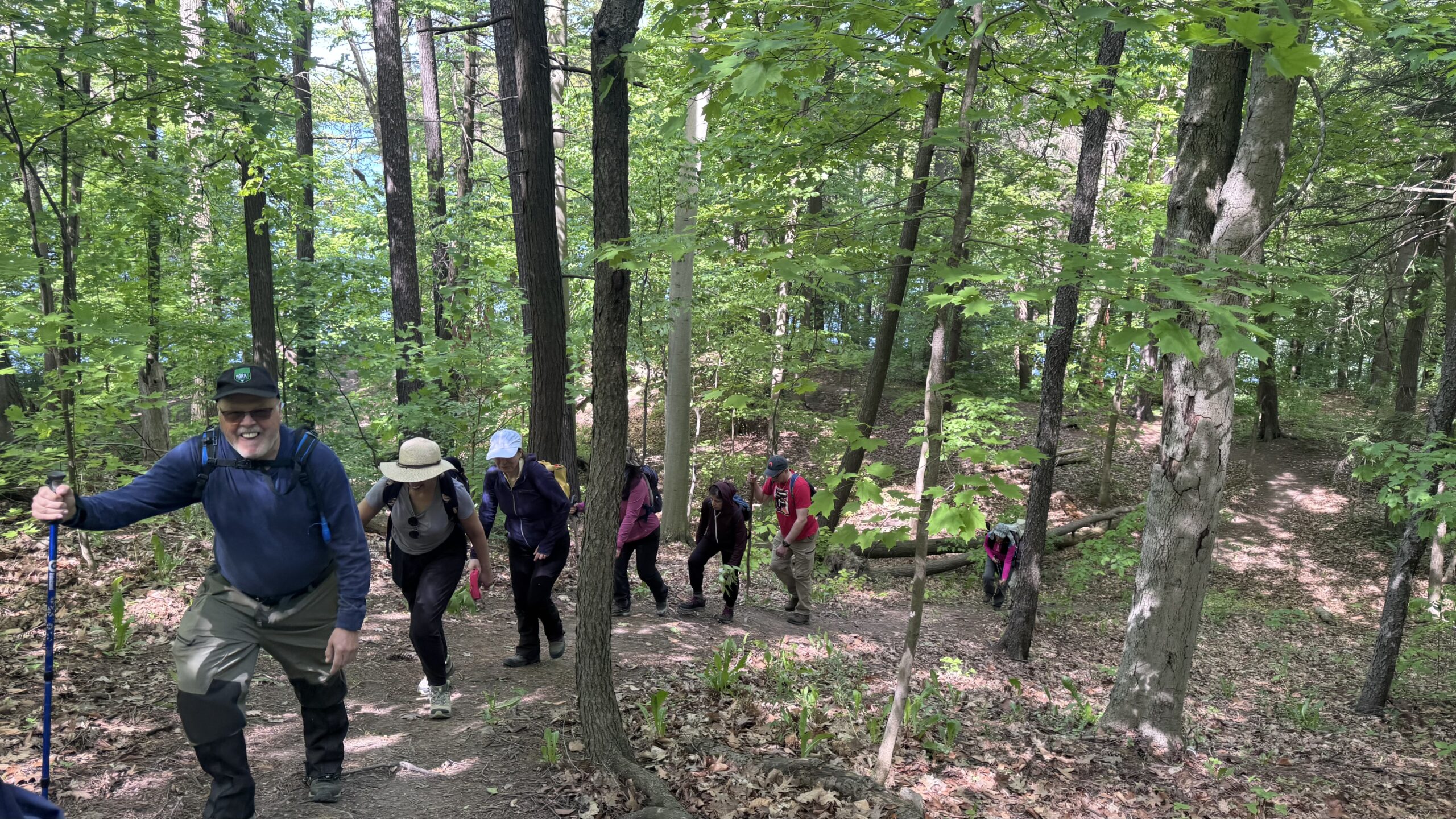
Join us for a hike! Registration required:
All hikes available to BTC members. Some hikes are open to non-members.
TIP: The calendar view displays up to 7 hikes on a day, but often there are more. Click “More events” to see them all.
Toronto Hike Schedule
Toronto Bruce Trail Club Registration Live Dates
Day Winter Coach Program
Registration begins two weeks in advance of the event departure (at 8:00 PM)
Day Bus Hikes
Registration begins two weeks in advance of the event departure (at 8:00 PM) with some exceptions of special event hikes
Day Coach Hikes
Registration begins 7 weeks in advance of the event departure
Day Car Hikes and Urban Hikes
Registration begins two weeks in advance of the event departure
Overnight and Weekend Trips
Registration begins 12 weeks in advance of the event departure
To view all Bruce Trail Conservancy Hikes click here
- 07June 7, 2026
Car Hike: Uxbridge-Brock Track
https://hikes.brucetrail.org/event/car-hike-uxbridge-brock-track-5/Sorry, the registration cut-off time for this hike has been reached.Not a member? Click here to join today!Hosting Club: Toronto
Category: Car Hike
Location (Google Maps):Meet at the Brock Tract parking lot on the east side of Durham 1/Brock Rd., approximately 5 km south of Coppin’s Corners, Uxbridge or 1 km north of Uxbridge Pickering Town Line. 1401 Brock Rd. (Free parking).
Hike Leader(s): Amir Alemohammad Click here to contact Hike Leader(s)
Pace: Moderate (3-4 km/hr)
Terrain: Flat, Hilly, Level 2 (Intermediate – some hills and uneven surfaces, rocks and roots underfoot), Variable
Distance (km): 15-16 kmDescription
Join us for a wonderful hike in Uxbridge the capital trail of Canada, in starting from Brock Track parking lot. We will hike the Brock Track and Wilder Forest among the amazing trails of Uxbridge.Boots mandatory, poles recommended, bring two litres of water and dress according to weather conditions.
Please arrive at 7:45 for a 8:00 start.
Beware, Iphone Maps may take you to the wrong location. Check the location with Google Maps the previous night.
This is a joint hike with Oak Ridges Trail Association (ORTA).
Go Train Hike: Battle Of Stoney Creek Re-enactment
https://hikes.brucetrail.org/event/go-train-hike-battle-of-stoney-creek-re-enactment/Sorry, the registration cut-off time for this hike has been reached.Not a member? Click here to join today!Hosting Club: Toronto
Category: GO Train Hike
Location (Google Maps): Meet in the Great Hall of Toronto’s Union Station to take Niagara bound train to Stoney Creek. The train will also stop at Exhibition and Port Credit GO StationsHike Leader(s): Tom Swales Click here to contact Hike Leader(s)
Pace: Moderate (3-4 km/hr)
Terrain: Level 2 (Intermediate – some hills and uneven surfaces, rocks and roots underfoot)
Distance (km): 10 kmDescription
We will hike from Confederation GO Station in Stoney Creek toward the Devil’s Punchbowl Side Trail and then into Battlefield Park. The battle re-enactment will take place at 2:00 PM. We will return to the GO station by bus. Steep ascent to the view from the Devil’s Punchbowl. Details will be updated closer to the event date. - 08June 8, 2026
Car Hike: Dufferin E2E 1/4
https://hikes.brucetrail.org/event/car-hike-dufferin-e2e-1-4-2/Sorry, the registration cut-off time for this hike has been reached.Not a member? Click here to join today!Hike open to BTC Members only.
Hosting Club: Toronto, Dufferin Hi-Land
Category: Car Hike
Location (Google Maps):Km 0.0 Mono Centre. Coordinates N 44.026195,W 80.071516 map 19
Hike Leader(s): Smadar Junkin Click here to contact Hike Leader(s)
Pace: Brisk (4-5 km/hr)
Terrain: Challenging, Level 3 (Advanced – steep hills and some scrambling over boulders), Variable
Distance (km): 14.1 kmDescription
First hike of 4 to complete the Dufferin section. We will shuttle to km 14.1 and hike back. Hikers are expected to in the parking area and ready to shuttle by 8:15. Everyone needs to take part in the car shuttle. Bring 2 litres of water, snacks and lunch, bug repellent , sun screen. Hiking boots. - 09June 9, 2026
Car Hike: Dufferin E2E 2/4
https://hikes.brucetrail.org/event/car-hike-dufferin-e2e-2-4-2/Sorry, the registration cut-off time for this hike has been reached.Not a member? Click here to join today!Hike open to BTC Members only.
Hosting Club: Toronto, Dufferin Hi-Land
Category: Car Hike
Location (Google Maps):Km 28.3, 1st Line E coordinates N 44.148246,W 80.118529 map 20
Hike Leader(s): Smadar Junkin Click here to contact Hike Leader(s)
Pace: Brisk (4-5 km/hr)
Terrain: Level 3 (Advanced – steep hills and some scrambling over boulders)
Distance (km): 14.2 km.Description
Second hike of the series to complete the Dufferin section. Please be in the parking area at 8;15 and be ready to shuttle by 8:30. Bring 2 litres of water, food, bug repellent, sun screen. Hiking boots. We will shuttle to km 14.1 and walk back. Everyone is expected to participate in the car shuttle during the 4 days hike.Urban Walk: Valley View Park
https://hikes.brucetrail.org/event/urban-walk-valley-view-park-thornhill-175/Sorry, the registration cut-off time for this hike has been reached.Not a member? Click here to join today!Hosting Club: Toronto
Location (Google Maps): Parking lot is off Sycamore Drive, East of Bayview , across Starbucks plaza
Bus 91 from Finch East station stops at Sycamore station.Hike Leader(s): MOHAMMAD AGHAMIRI Click here to contact Hike Leader(s)
Pace: Moderate (3-4 km/hr)
Terrain: Hilly, Level 2 (Intermediate – some hills and uneven surfaces, rocks and roots underfoot)
Distance (km): 6-7 kmDescription
We will explore Valleyview and Maple View parks, and walk along German Mill Creak, in return we stop in Huntington park and have snack under beautiful shed.Although this is considered an “Urban Walk”, you can expect some hills up and down and uneven surfaces with tree roots. Please bring hiking poles, Ice cleats water and snacks.
- 10June 10, 2026No events
- 11June 11, 2026
Car Hike: Dufferin E2E 3/4
https://hikes.brucetrail.org/event/car-hike-dufferin-e2e-3-4-2/Sorry, the registration cut-off time for this hike has been reached.Not a member? Click here to join today!Hosting Club: Toronto, Dufferin Hi-Land
Category: Car Hike
Location (Google Maps):Km 28.3 1st Line E coordinates N 44.148246,W 80.118529 map 20
Hike Leader(s): Smadar Junkin Click here to contact Hike Leader(s)
Pace: Brisk (4-5 km/hr)
Terrain: Challenging, Level 3 (Advanced – steep hills and some scrambling over boulders), Variable
Distance (km): 12.4 kmDescription
3ed hike towards the completion of the Dufferin E2E. Hikers are expected to arrive 15 minutes early and be ready to shuttle. We will shuttle to km 40.7 and hike back. Bring food, 2 litres of water, bug repellent, sun screen. Hiking boots. Everyone is expected to participate in the car shuttle during the 4 days hike.Urban Walk: Valley View Park
https://hikes.brucetrail.org/event/urban-walk-valley-view-park-thornhill-176/Sorry, the registration cut-off time for this hike has been reached.Not a member? Click here to join today!Hosting Club: Toronto
Location (Google Maps): Parking lot is off Sycamore Drive, East of Bayview , across Starbucks plaza
Bus 91 from Finch East station stops at Sycamore station.Hike Leader(s): MOHAMMAD AGHAMIRI Click here to contact Hike Leader(s)
Pace: Moderate (3-4 km/hr)
Terrain: Hilly, Level 2 (Intermediate – some hills and uneven surfaces, rocks and roots underfoot)
Distance (km): 6-7 kmDescription
We will explore Valleyview and Maple View parks, and walk along German Mill Creak, in return we stop in Huntington park and have snack under beautiful shed.Although this is considered an “Urban Walk”, you can expect some hills up and down and uneven surfaces with tree roots. Please bring hiking poles, Ice cleats water and snacks.

Toronto Islands Evening Walk
https://hikes.brucetrail.org/event/urban-walk-toronto-islands-evening-walk-24/Sorry, the registration cut-off time for this hike has been reached.Not a member? Click here to join today!Hosting Club: Toronto
Location (Google Maps):
Jack Layton Ferry Terminal, by the gate to the Wards Island Ferry. Please arrive 20 minutes prior to departure to check in with hike leader.
From Union Station take the LRT and get off at the stop Ferry Docks.Walk up to the Ferry Docks on Queens Quay West, street level. at the foot of Bay Street.
Hike Leader(s): Miriam Stevens Click here to contact Hike Leader(s)
Pace: Leisurely (2-3 km/hr)
Terrain: Flat, Level 1 (Easy – mostly on flat, well maintained trails with hard-packed surface)
Distance (km): 6-9 kmDescription
After a day’s work come and “cool off” on the Toronto Islands free of fumes and traffic. Enjoy the view of the city skyline and Toronto’s beautiful island parkland.
Pack a dinner for a sit down picnic. Also bring a warm jacket and flashlight.
Return fare ticket for the ferry is $9.57 for adults, $6.15 for seniors
Please check the hike schedule for weather related cancellations (hike will be updated by 11:00 AM day of the hike if any changes)
Toronto Island evening hikes will take place every Thursday in May and June 2026.
Same time and same meeting place. No preregistration is required – just show up at the ferry docks at 5:40 PM and sign in with the hike leader. - 12June 12, 2026
23rd Annual Excellent Orchid Adventure Weekend (2 overnights)
https://hikes.brucetrail.org/event/car-hike-23th-annual-excellent-orchid-adventure-weekend-2-overnights/Sorry, the registration cut-off time for this hike has been reached.Not a member? Click here to join today!This is a Multi-Day Hike
You are signing up for the following dates and times:
2026-06-12 at
2026-06-13 at
2026-06-14 atHosting Club: Toronto
Category: Car Hike
Location (Google Maps):Princess Hotel
34 Bay St, Tobermory, ON N0H 2R0Hike Leader(s): Jeanette Vincent. Brenda Menezes. David Royle. Click here to contact Hike Leader(s)
Pace: Leisurely (2-3 km/hr)
Terrain: Level 2 (Intermediate – some hills and uneven surfaces, rocks and roots underfoot)
Distance (km): 10 – 12 KmDescription
We continue Greg Vincent’s legacy of weekends away. Please join Jeanette Vincent, Brenda Menezes and David Royle as we explore the Tip o’ the Bruce, Tobermory in search of orchids and other flowers. Our search will extend to Flowerpot Island (cost approx. $65.00 for the glass bottom ferry and Parks Canada fee). The wildflowers in the Tobermory area at this time of year are wonderful and our slow paced walks will focus on these and other flowers and the area’s great views. We stay and have our meals at a comfortable hotel overlooking Little Tub Harbour. Approximately 10/12km/day.Before registering at the hotel please contact us for the price package of the hotel for the weekend.
This outing is restricted to those staying with us at the Princess Hotel in Tobermory for the weekend – the hotel fills quickly. You will need a car to access this outing. Please contact the Princess Hotel for a reservation.1-519-592-8282 or info@tobermoryprincesshotel.com and mention Vincent/Royle Excellent Orchid weekend.
Car Hike: Dufferin E2E 4/4
https://hikes.brucetrail.org/event/car-hike-dufferin-e2e-4-4-2/Sorry, the registration cut-off time for this hike has been reached.Not a member? Click here to join today!Hike open to BTC Members only.
Hosting Club: Toronto, Dufferin Hi-Land
Category: Car Hike
Location (Google Maps):Km 40.7 Prince of Wales Rd, coordinated N 44.200231,W 80.164257
Hike Leader(s): Smadar Junkin Click here to contact Hike Leader(s)
Pace: Brisk (4-5 km/hr)
Terrain: Challenging, Level 3 (Advanced – steep hills and some scrambling over boulders), Variable
Distance (km): 14.8 kmsDescription
Last to to complete the Dufferin E2E section. Bring food, water, bug repellent, sun screen. We will shuttle to km 55.5 and walk back. Everyone is expected to participate in the car shuttle during the 4 days hike. Badge day, treats day. - 13June 13, 2026
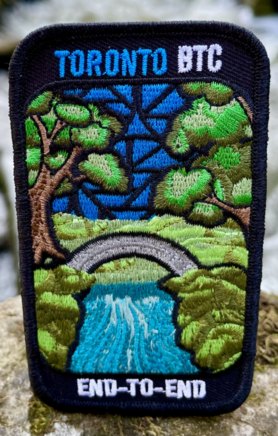
TBTC Stained Glass Fundraiser Badge Two Day Hike
https://hikes.brucetrail.org/event/car-hike-tbtc-stained-glass-badge-fundraiser-two-day-hike-june13-and-june14-2026/Sorry, the registration cut-off time for this hike has been reached.Not a member? Click here to join today!This is a Multi-Day Hike
You are signing up for the following dates and times:
2026-06-13 at 08:00
2026-06-14 at 08:00Hosting Club: Toronto
Category: Car Hike
Location (Google Maps): Limehouse parking lot north of km21.6 map12, edition31 across from the school on the south side of 22 Sideroad. GPS N43.638113, W79.979272Hike Leader(s): Ross Estrella Click here to contact Hike Leader(s)
Pace: Brisk (4-5 km/hr), Moderate (3-4 km/hr)
Terrain: Hilly, Level 2 (Intermediate – some hills and uneven surfaces, rocks and roots underfoot), Rocky, Variable
Distance (km): 28Description
Join us on this two day monetized fundraiser event with the proceeds going towards the Toronto Bruce Trail Club dedicated on “Preserving a Ribbon of Wilderness for Everyone Forever”. Your eagerness joining in the conservation and preservation effort will be rewarded with coveted Stained Glass E2E Badge. Prior to signing please qualify your physical capacity as there’s no opportunity for dropping out and trail will be under mixed condition and of varying pace. Ensure you bring sufficient snacks/lunch, preferred hydration liquid, sunscreen and sun head protection. Bug spray in the event our friendly mosquitoes welcome us. Comfortable hiking shoe, poles are highly recommended. Make sure you have your personal medication/first aid kit (if any) and health card at all times.This a multi day hike June 13 and June 14 and joiners must register for both days. We’ll cover 28kms on Day One and 22kms on Day Two. There’s no perfect way to predict the weather so please dress accordingly as weather forecast. Please make sure your car is shuttle ready. Please have your enthusiasm at all times. Arrive fifteens minutes early for shuttling schedule. Registration fee is not refundable if dropping out less than a week prior to start of hike.
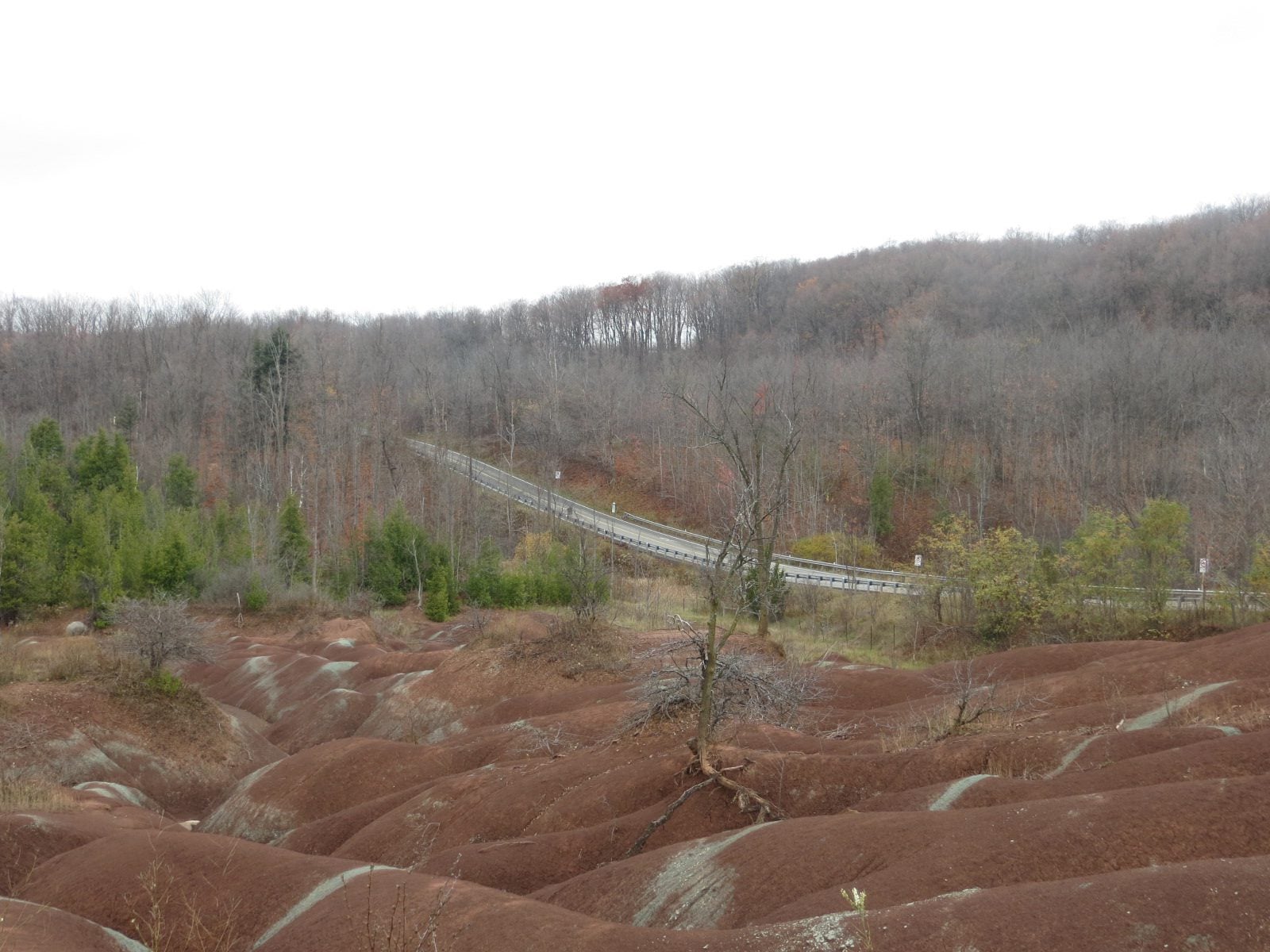
School Bus Hike: Forks of the Credit and Cheltenham Badlands
https://hikes.brucetrail.org/event/school-bus-hike-forks-of-the-credit-and-cheltenham-badlands/Sorry, the registration cut-off time for this hike has been reached.Not a member? Click here to join today!Trip Information
Departure Time: 08:30
Return to City Time: 18:00
Departure Point: Kipling Departure PointOptional Items
Hosting Club: Toronto
Category: Bus Hike
Location (Google Maps): Forks of the Credit Provincial ParkHike Leader(s): Felix Wan; Tim Wainwright Click here to contact Hike Leader(s)
Pace: Moderate (3-4 km/hr)
Terrain: Hilly, Level 2 (Intermediate – some hills and uneven surfaces, rocks and roots underfoot), Rocky, Variable
Distance (km): 14Description
Join us as we explore the varied landscapes of the trails in Forks of the Credit Provincial Park. We’ll follow a mixture of local park trails, side trails, and the main Bruce Trail, visiting Cataract Falls along the way. Outside the park, we’ll board the bus to skip some road walking, and then hike an in-and-out to the iconic Cheltenham Badlands. Our route spans across Bruce Trail Maps #14 and 15.There are a few hills to navigate, a climb up a 166-step staircase at the end of Mill Pond Side Trail, and approximately 2.5 km of road walking.
The total hike distance is approximately 14 km, and there will be a dropout point after approximately 11 km. Time permitting, we will have a refreshment stop at Spirit Tree Estate Cidery (https://spirittreecider.com/), which offers non-alcoholic options and various food/gift items for purchase.
Wet and muddy trail conditions are possible. Hiking boots, poles, and gaiters are recommended.
Car Hike: Rouge Park
https://hikes.brucetrail.org/event/car-hike-rouge-national-park-scarborough-on-2/Sorry, the registration cut-off time for this hike has been reached.Not a member? Click here to join today!Hosting Club: Toronto
Location (Google Maps): Free parking in Mast Trail parking Lot off Kingston Road
Hike Leader(s): MOHAMMAD AGHAMIRI Click here to contact Hike Leader(s)
Pace: Moderate (3-4 km/hr)
Terrain: Hilly, Level 2 (Intermediate – some hills and uneven surfaces, rocks and roots underfoot)
Distance (km): 14-15 kmDescription
We will hike Vista trail and part of orchard trail, will enjoy look outs between Rouge river and Little Rouge creek
• Please dress appropriately for the weather.
• We will have short water ,picture and a 15 minute snack break. Everyone is welcome!Please bring lots of water and snacks ,hiking poles are recommended
phone number for the day of hike 289 588 6482
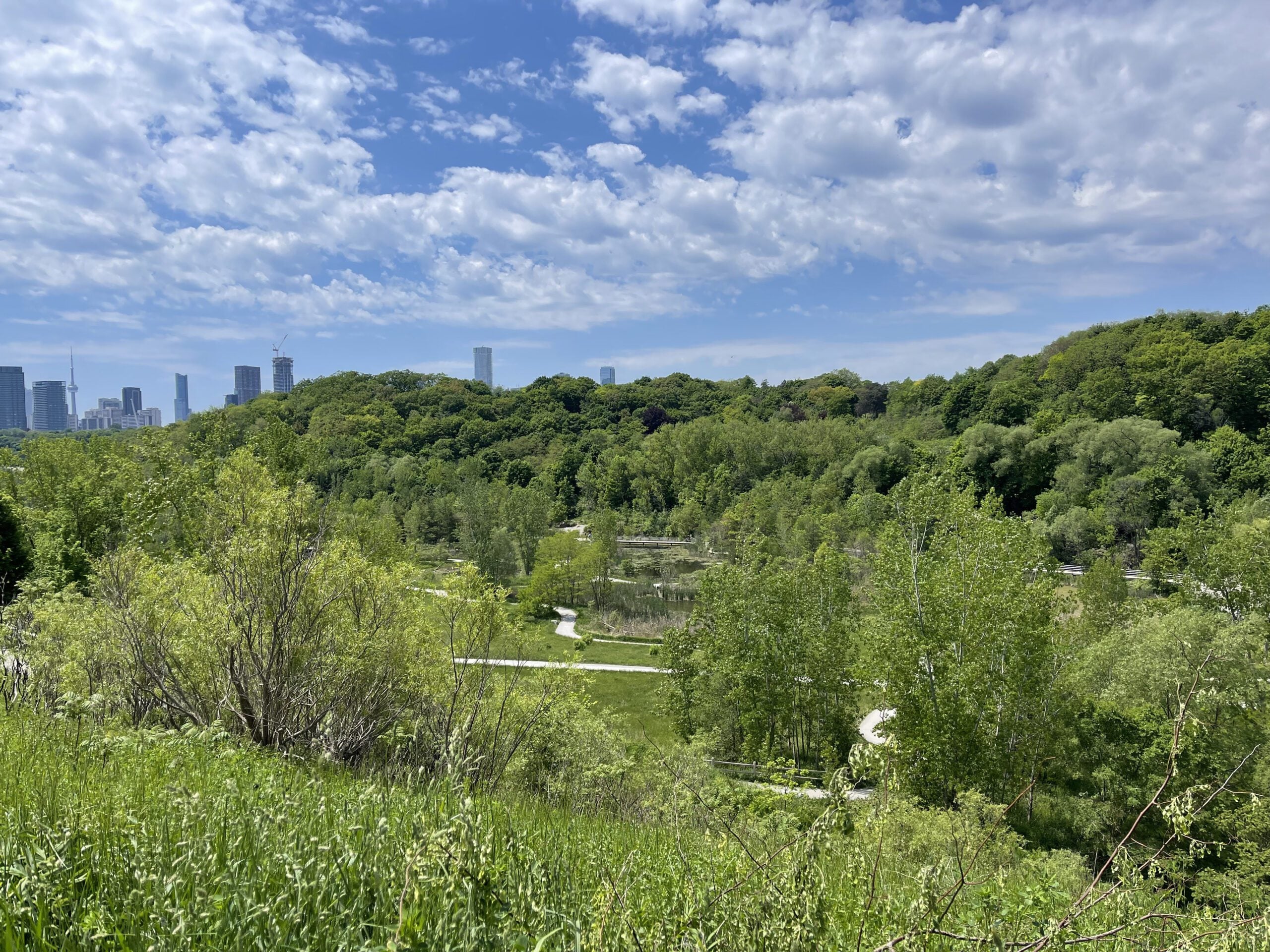
Introductory Hike - Evergreen Brick Works
https://hikes.brucetrail.org/event/introductory-hike-evergreen-brickworks-3/Sorry, the registration cut-off time for this hike has been reached.Not a member? Click here to join today!Hosting Club: Toronto
Category: TBTC Special Events
Location (Google Maps):Meet the hike leader in Tiffany Commons in front of the watershed wall at the Evergreen Brick Works (across from the cafe). To reach the Evergreen Brick Works you may take the free shuttle from outside Broadview Subway Station (departs every 30 minutes from 7:45 am until 9:45 (driver takes scheduled break at 10:15) or TTC Route #28 Bayview South from Davisville Subway Station (every 30 minutes)
Hike Leader(s): Tom Swales, Click here to contact Hike Leader(s)
Pace: Leisurely (2-3 km/hr)
Terrain: Level 1 (Easy – mostly on flat, well maintained trails with hard-packed surface), Variable
Distance (km): 4 kmDescription
The public is invited to join us for a short introductory hike from the Evergreen Brick Works as part of our Toronto Bruce Trail Day activities at the Evergreen Brick Works in Toronto. The club will have a booth staffed with volunteers providing information about the Bruce Trail and the Toronto Bruce Trail Club. Our hike will explore the wetlands, woodlands, and natural meadows of the Evergreen Brick Works, ascend into the beautiful Moore Park Ravine and return to the Evergreen Brick Works via the scenic outlook overlooking the Evergreen Brick Works and adacent ravines. A wonderful opportunity to enjoy the beautiful Evergreen Brick Works site, the Evergreen farmers market, and learn about the Toronto Bruce Trail Club’s year round hiking program and conservation work. Preregistration on the hike schedule is not required – just arrive 15 minutes prior to the hike to sign up with the hike leaders.
Urban Walk: Waterfront Trail 1/11 - Rattray Marsh
https://hikes.brucetrail.org/event/urban-walk-waterfront-trail-1-11-rattray-marsh-3/Sorry, the registration cut-off time for this hike has been reached.Not a member? Click here to join today!Hosting Club: Toronto
Category: Car Hike
Location (Google Maps):Mississauga Waterfront Trail
Hike Leader(s): Brian Rideout Click here to contact Hike Leader(s)
Pace: Moderate (3-4 km/hr)
Terrain: Flat
Distance (km): 9.3 kmDescription
Please join me at Union Station under the clock inside the Great Hall no later than 9:00 am. We will take the 9:14 train to Clarkson, arriving 9 :51 am. If you want to meet us in Clarkson be there at that time. We start hiking at 10:00 am. Consider purchasing the $10 day pass for the GO train for use with your smart phone. Some of you may find the regular senior rate is cheaper.We will hike from Clarkson to Port Credit through Rattray Marsh and along the shoreline. The estimated distance is 9.9 km. Here is an online map of our route Rattray Marsh to Port Credit https://onthegomap.com/s/m4m7g3sj
Bring a snack, at least 2 liters of water, sun screen and bug spray.
Introductory Hike - Evergreen Brick Works
https://hikes.brucetrail.org/event/introductory-hike-evergreen-brickworks-4/Sorry, the registration cut-off time for this hike has been reached.Not a member? Click here to join today!Hosting Club: Toronto
Category: TBTC Special Events
Location (Google Maps):Meet the hike leader in Tiffany Commons in front of the watershed wall at the Evergreen Brick Works (across from the cafe). Please contact ttc.ca to confirm transit information, as summer construction projects may be underway. Previously, to reach the Evergreen Brick Works took the free shuttle from outside Broadview Subway Station (departs every 30 minutes from 7:45 am until 9:45 (driver takes scheduled break at 10:15) or TTC Route #28 Bayview South from Davisville Subway Station (every 30 minutes)
Hike Leader(s): Ray Berzins Click here to contact Hike Leader(s)
Pace: Leisurely (2-3 km/hr)
Terrain: Flat, Level 1 (Easy – mostly on flat, well maintained trails with hard-packed surface)
Distance (km): 6 kmDescription
An introductory hike from the Evergreen Brick Works proceeding southbound to a ravine trail and then northwest past Milkman’s Lane into Park Drive Reservation. We will continue northwest to Mount Pleasant Road and return to the Evergreen Brick Works. There is an option to turn back earlier at the Glen Road Bridge. Preregistration on the hike schedule is not required – just arrive 15 minutes prior to the hike to sign up with the hike leaders.
Hiking 101 Workshop At Evergreen Brick Works
https://hikes.brucetrail.org/event/hiking-101-workshop-at-evergreen-brickworks-2/Sorry, the registration cut-off time for this hike has been reached.Not a member? Click here to join today!Hosting Club: Toronto
Category: TBTC Special Events
Location (Google Maps):BMO Atrium, Evergreen Brick Works – In Toronto’s Don Valley on Bayview Avenue
Click here to contact Hike Leader(s)
Distance (km): N/A
Description
Are you new to hiking or interested in getting started? Join us at the Evergreen Brick Works for a one hour session where you will learn about what to have in your backpack for your hike, a young person’s perspective of how they got into hiking, hiking with your family and children, and the Toronto Bruce Trail Club’s organized hiking program including bus hikes, coach trips, car hikes, urban walks, and GO Train hikes. Toronto Bruce Trail Club volunteers will also be on hand at the TBTC booth through the duration of the farmer’s market (until 1:00 PM) available to answer your questions about our club and the Bruce Trail Conservancy.