Join us for a hike! Registration required:
All hikes available to BTC members. Some hikes are open to non-members.
TIP: The calendar view displays up to 7 hikes on a day, but often there are more. Click “More events” to see them all.
Toronto Hike Schedule
Toronto Bruce Trail Club Registration Live Dates
Day Winter Coach Program
Registration begins two weeks in advance of the event departure (at 8:00 PM)
Day Bus Hikes
Registration begins two weeks in advance of the event departure (at 8:00 PM) with some exceptions of special event hikes
Day Coach Hikes
Registration begins 7 weeks in advance of the event departure
Day Car Hikes and Urban Hikes
Registration begins two weeks in advance of the event departure
Overnight and Weekend Trips
Registration begins 12 weeks in advance of the event departure
To view all Bruce Trail Conservancy Hikes click here
- 21June 21, 2026
Car Hike: Jefferson Forest/Bond Lake
https://hikes.brucetrail.org/event/car-hike-jefferson-forest-bond-lake-2/Sorry, the registration cut-off time for this hike has been reached.Not a member? Click here to join today!Hosting Club: Toronto
Category: Car Hike
Location (Google Maps):1245 Bethesda Side Rd, Richmond Hill, ON L4E 1A2 ( Bethesda Trail Head Parking lot)
Hike Leader(s): Amir Alemohammad Click here to contact Hike Leader(s)
Pace: Moderate (3-4 km/hr)
Terrain: Flat, Hilly, Level 2 (Intermediate – some hills and uneven surfaces, rocks and roots underfoot)
Distance (km): 15KmDescription
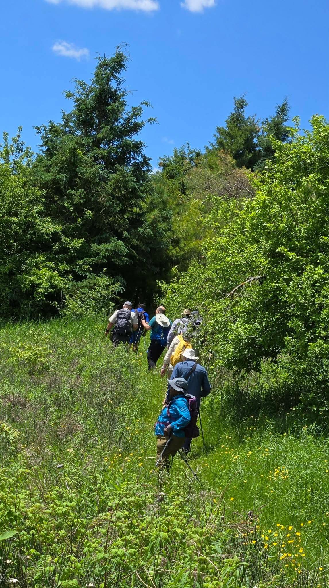
Let’s roll the hills of the Jefferson Forest and around the Bond Lake. Every week we hike in Jefferson Forest, located in the heart of Richmond Hill, it boasts numerous hiking trails. This 3.5 hour hike can range from 14 to 15 kilometres, depending on the weather conditions. Remember to bring water, snacks, hiking boots, poles, and your camera. Not recommended for beginners. Park in the free Bethesda parking lot and avoid parking along the road. Dress appropriately for the weather. Difficulty Level: 2 (Moderate).Please arrive @7:45AM for start of 8:00AM.
This is a joint hike with the Oak Ridges Trail Association (ORTA).
what3words:
https://w3w.co/twisting.mailer.awakes

Waterfront Trail 1/11 - Rattray Marsh
https://hikes.brucetrail.org/event/waterfront-trail-1-11-rattray-marsh/Sorry, the registration cut-off time for this hike has been reached.Not a member? Click here to join today!Hosting Club: Toronto
Category: Urban Walk
Location (Google Maps):Mississauga Waterfront Trail
Hike Leader(s): Brian Rideout Click here to contact Hike Leader(s)
Pace: Moderate (3-4 km/hr)
Terrain: Flat
Distance (km): 9.3 kmDescription
Please join me at Union Station under the clock inside the Great Hall no later than 9:00 am. We will take the 9:14 train to Clarkson, arriving 9 :51 am. If you want to meet us in Clarkson be there at that time. We start hiking at 10:00 am. Consider purchasing the $10 day pass for the GO train for use with your smart phone. Some of you may find the regular senior rate is cheaper.We will hike from Clarkson to Port Credit through Rattray Marsh and along the shoreline. The estimated distance is 9.9 km. Here is an online map of our route Rattray Marsh to Port Credit https://onthegomap.com/s/m4m7g3sj
Bring a snack, at least 2 liters of water, sun screen and bug spray.
Urban Walk: Unionville/Toogood Pond
https://hikes.brucetrail.org/event/urban-walk-unionville-toogood-pond-2/Sorry, the registration cut-off time for this hike has been reached.Not a member? Click here to join today!Hosting Club: Toronto
Category: Urban Walk
Location (Google Maps):Meet outside south exit of Markham Pan Am Centre by the flag poles. If commuting by GO Train from Toronto meet at Kennedy GO Station (next to Kennedy Subway) to take the 10:20 AM Stouffville Line Train to Unionville GO Station where we will walk to the Pan Am Centre to meet those who are driving to the hike.
Hike Leader(s): Tom Swales Click here to contact Hike Leader(s)
Pace: Moderate (3-4 km/hr)
Terrain: Flat, Level 1 (Easy – mostly on flat, well maintained trails with hard-packed surface)
Distance (km): 10-12 KMDescription
Join us for a hike to Toogood Pond and a loop through the trails north of the pond to 16th Avenue returning to Main Street Unionville where the annual Unionville Festival will be taking place.https://unionville.ca/unionville-festival/
GO Trains return hourly at 40 minutes past the hour. Remember your TTC fare is deducted/free with a Presto Card.
- 22June 22, 2026No events
- 23June 23, 2026
Urban Walk: Valley View/Huntington Park
https://hikes.brucetrail.org/event/urban-walk-valley-view-huntington-park-2/Sorry, the registration cut-off time for this hike has been reached.Not a member? Click here to join today!Hosting Club: Toronto
Location (Google Maps): Parking lot is off Sycamore Drive, East of Bayview , across Starbucks plaza
Bus 91 from Finch East station stops at Sycamore station.Hike Leader(s): Mohammad Aghamiri
Pace: Moderate (3-4 km/hr)
Terrain: Hilly, Level 2 (Intermediate – some hills and uneven surfaces, rocks and roots underfoot)
Distance (km): 6-7 kmDescription
We will explore Valleyview and Maple View parks, and walk along German Mill Creak, in return we stop in Huntington park and have snack under beautiful shed.Although this is considered an “Urban Walk”, you can expect some hills up and down and uneven surfaces with tree roots. Please bring hiking poles, water and snacks.
- 24June 24, 2026
Urban Walk: Don River Valley through Four Parks
https://hikes.brucetrail.org/event/urban-walk-don-river-valley-through-four-parks/Sorry, the registration cut-off time for this hike has been reached.Not a member? Click here to join today!Hosting Club: Toronto
Category: Urban Walk
Location (Google Maps): Summerhill Subway StationHike Leader(s): Ted Moriarty Click here to contact Hike Leader(s)
Pace: Moderate (3-4 km/hr)
Terrain: Hilly, Level 2 (Intermediate – some hills and uneven surfaces, rocks and roots underfoot)
Distance (km): 8Description
Please join me for a morning hike through two historic neighbourhoods and four beloved city parks. We will begin by walking through the century homes and row houses of the Summerhill area, then descend into the Don River Valley park system. We’ll explore David Balfour Park, Mount Pleasant Cemetery, Moore Park Ravine, and the Brickworks. From there, we will continue south and hike up out of the valley into Toronto’s storied Rosedale neighbourhood. The hike will conclude at Castle Frank Station.Route map:
https://onthegomap.com/?route=019eae15-c935-7912-9192-174734407143&context=shareThe hike features several hills, but for the most part it is downhill until the Brickworks. To complete the hike, we will climb a long, steep path to reach the Rosedale area. To avoid this final ascent, hikers can take the complimentary shuttle bus from the Brickworks, which drops passengers off by Broadview Station.
Please bring snacks and at least 2 L of drinking water.
Travel to the trailhead:
Meet Ted at the Summerhill Subway Station exit turnstiles. There is only one exit from this station.Washrooms:
There are no washrooms at Summerhill Station. The closest subway washroom is at Bloor–Yonge Station (two stops south). During the 8 km hike, we will stop at three public washrooms located at approximately kilometres 1, 3, and 5. - 25June 25, 2026
Urban Walk: Valley View /Huntington Park
https://hikes.brucetrail.org/event/urban-walk-valley-view-huntington-park-3/Sorry, the registration cut-off time for this hike has been reached.Not a member? Click here to join today!Hosting Club: Toronto
Location (Google Maps): Parking lot is off Sycamore Drive, East of Bayview , across Starbucks plaza
Bus 91 from Finch East station stops at Sycamore station.Hike Leader(s): Mohammad Aghamiri
Pace: Moderate (3-4 km/hr)
Terrain: Hilly, Level 2 (Intermediate – some hills and uneven surfaces, rocks and roots underfoot)
Distance (km): 6-7 kmDescription
We will explore Valleyview and Maple View parks, and walk along German Mill Creak, in return we stop in Huntington park and have snack under beautiful shed.Although this is considered an “Urban Walk”, you can expect some hills up and down and uneven surfaces with tree roots. Please bring hiking poles, water and snacks.

Toronto Island Evening Walk
https://hikes.brucetrail.org/event/urban-walk-toronto-islands-evening-walk-26/Sorry, the registration cut-off time for this hike has been reached.Not a member? Click here to join today!Hosting Club: Toronto
Location (Google Maps):
Jack Layton Ferry Terminal, by the gate to the Wards Island Ferry. Please arrive 20 minutes prior to departure to check in with hike leader.
From Union Station take the LRT and get off at the stop Ferry Docks.Walk up to the Ferry Docks on Queens Quay West, street level. at the foot of Bay Street.
Hike Leader(s): Miriam Stevens Click here to contact Hike Leader(s)
Pace: Leisurely (2-3 km/hr)
Terrain: Flat, Level 1 (Easy – mostly on flat, well maintained trails with hard-packed surface)
Distance (km): 6-9 kmDescription
After a day’s work come and “cool off” on the Toronto Islands free of fumes and traffic. Enjoy the view of the city skyline and Toronto’s beautiful island parkland.
Pack a dinner for a sit down picnic. Also bring a warm jacket and flashlight.
Return fare ticket for the ferry is $9.57 for adults, $6.15 for seniors
Please check the hike schedule for weather related cancellations (hike will be updated by 11:00 AM day of the hike if any changes)
Toronto Island evening hikes will take place every Thursday in May and June 2026.
Same time and same meeting place. No preregistration is required – just show up at the ferry docks at 5:40 PM and sign in with the hike leader. - 26June 26, 2026No events
- 27June 27, 2026
School Bus Trip: Hike in Pretty River, Swim in Thornbury
https://hikes.brucetrail.org/event/school-bus-trip-hike-in-pretty-river-swim-in-thornbury/Trip Information
Departure Time: 08:00
Return to City Time: 19:30
Departure Point: York Mills Bus Pickup
Registration Required:
Registration Costs
Members - $30.00
Child Members - $15.00
Non-Members - $37.00
Child Non-Members - $19.00
Long Distance Fees apply
A late return is anticipated
REGISTRATION FULL: This hike has reached the maximum number of hikers.
Click here to be added to the Wait List.Optional Items
Pick up at HWY 400 & Major Mac ($0.01)Hosting Club: Toronto
Category: Bus Hike
Location (Google Maps): Pretty River Valley Provincial ParkHike Leader(s): Martina Furrer, Celia Ho, Leila Damband, and Leonora Rochwerger Click here to contact Hike Leader(s)
Pace: Moderate (3-4 km/hr)
Terrain: Hilly, Level 2 (Intermediate – some hills and uneven surfaces, rocks and roots underfoot)
Distance (km): Fast (16 to 18 km), moderate (13 km)Description
Join us for a fun and challenging hike through Nottawasaga Lookout Provincial Nature Reserve and Pretty River Valley Provincial Park. Our efforts will be rewarded with great views and hopefully the forest floor will be dotted with wildflowers. From Osler Bluff and the Petun Side Trail we should have amazing views of Georgian Bay. Afterwards cool off with a swim, an ice cream, or a cold beer in Little River Beach Park in downtown Thornbury.We will split into two groups. The moderate group will do about 13 km at a pace of approximately 3 km/hr. The fast group will hike 16 to 18 km at a 4 km/hr pace (including on hills).
Pack lunch, water (about 2 litres), sun -, rain -, and bug protection, and your swimming gear.
Departure 1: 10 York Mills Rd at 8 AM.
Departure 2: HWY 400 and Major Mac Park and Ride at 8:20 AM
We hope to be back in the city around 7:30 PM.
Car Hike: Hockley Crest, Airport Rd to Hockley Rd
https://hikes.brucetrail.org/event/car-hike-hockley-crest-airport-rd-to-hockley-rd-3/
Registration Required:
Click here to register for this hike (13 spots remaining)Hosting Club: Toronto, Caledon Hills
Category: Car Hike
Location (Google Maps):Meet at the Bruce Trail Parking Lot on Mono 5 Sideroad on the north side of the 5th Sideroad.
Hike Leader(s): Amir Alemohammad Click here to contact Hike Leader(s)
Pace: Moderate (3-4 km/hr)
Terrain: Flat, Hilly, Level 2 (Intermediate – some hills and uneven surfaces, rocks and roots underfoot), Variable
Distance (km): 12-14 kmDescription
Join us for a out and back hike in Hockley Crest. The route explores a diverse landscape of dense sugar maple and beech hardwood forests, open grassy meadows, active pine plantations, and steep ravines. We will explore the main and side trails of the Bruce Trail. Bring at least two liters of water and your favorite snacks. Boots mandatory, poles recommended. Be prepared for the ticks and bugs. This is a joint hike with the ORTA.Car Hike: Oak Ridges Corridor
https://hikes.brucetrail.org/event/car-hike-oak-ridges-corridor/
Registration Required:
Click here to register for this hike (24 spots remaining)Hosting Club: Toronto
Category: Car Hike
Location (Google Maps): Oak Ridges Corridor, Bethesda Trail Head Parking Lot, Bethesda Side Road, Richmond Hill, OntarioHike Leader(s): MOHAMMAD AGHAMIRI Click here to contact Hike Leader(s)
Pace: Moderate (3-4 km/hr)
Terrain: Hilly, Level 2 (Intermediate – some hills and uneven surfaces, rocks and roots underfoot)
Distance (km): 14-15 kmDescription
Join us to explore the trails of York Regional Forest and the Oak Ridges Corridor at Jefferson Forest and Bond lake,From parking lot we hike thought Jefferson forest and continue to Bond Lake and have snack beside the lake and return to parking around 1:pm
Please bring lots of water and snacks ,hiking poles are recommended,it is Mosquto and Tick season ,be prepared .
phone number for the day of hike 289 588 6482
Waterfront Trail 2/11 - Mississauga WF Trail
https://hikes.brucetrail.org/event/waterfront-trail-2-11-mississauga-wf-trail/
Registration Required:
Click here to register for this hike (8 spots remaining)Hosting Club: Toronto
Category: Urban Walk
Location (Google Maps):Mississauga Waterfront Trail
Hike Leader(s): Brian Rideout Click here to contact Hike Leader(s)
Pace: Moderate (3-4 km/hr)
Terrain: Flat
Distance (km): 8.9 kmDescription
Please join me at Union Station under the clock inside the Great Hall no later than 9:00 am. We will take the Lakeshore West train departing 9:14 am, arriving 9:42 am (subject to GO Transit schedule changes). If you want to meet us in Port Credit, please be there by 9:42 am. We start hiking no later than 10:00 am. Consider purchasing the $10 day pass for the GO train for use with your smart phone. Some of you may find the regular senior rate is cheaper. Purchase your ticket / pass in advance.We will hike from Port Credit to Long Branch along the shoreline. The estimated distance is 8.9 km. Here is an online map of our route – Port Credit to Long Branch https://onthegomap.com/s/8dml9cim
Bring a snack, at least 2 liters of water, sun screen and bug spray.