Categories
- 08June 8, 2025

Car Hike: Exploring Uxbridge Trails (Wilder Forest, Walker Woods, and Glen Major Forest)
https://hikes.brucetrail.org/event/car-hike-exploring-uxbridge-trails-wilder-forest-walker-woods-and-glen-major-forest-10/Sorry, the registration cut-off time for this hike has been reached.Not a member? Click here to join today!Hosting Club: Toronto
Category: Car Hike
Location (Google Maps):2499 Brock Rd, Uxbridge, ON L9P 1R4. We will meet at the East Duffins Headwaters parking lot at the WILDER FOREST trail head. As soon as you got off the Brock Road, passing the horse back riding facility, there is a free designated parking lot 70 meters down the lane to your right. It includes a sign board for East Duffins Headwaters with a map of the trails. Please do not park on the lane or in the horse back riding property.
Hike Leader(s): Amir Alemohammad Click here to contact Hike Leader(s)
Pace: Moderate (3-4 km/hr)
Terrain: Flat, Hilly, Variable
Distance: Approx.14-15 KmDescription
Join us for a delightful spring hike in Uxbridge, as we explore Wilder Forest, Walker Woods, and Glen Major Forest on a scenic loop starting from Brock Road. We’ll pass Concession Road 6, heading west and back, while also venturing onto several side trails for even more stunning views.What to Expect:
•Beautiful scenic views and lookouts facing south
•A mix of hilly and flat terrain
•Frequent 2-minute breaks for hydration and photos, with a 10-20 minute lunch/snack stop
•Stay on designated trails at all time
What to Bring and Wear:
•Hiking Boots and poles (recommended) and be prepared for the bugs
•At least 2 liters of water
•Your favorite snacks and lunch (pack your own refreshments for an outdoor meal)
•Dress accordingly variable weather; chilly morning with midday higher temperatures expected
Important Details:
•Stay on the designated trails
•Be prepared for the elements and enjoy the adventure!
Looking forward to seeing you on the trail!
Don’t forget your camera and a smile as we explore the beauty of the Uxbridge trails!
This is a joint hike with the Oak Ridges Trail Association (ORTA).

Camino Hike
https://hikes.brucetrail.org/event/camino-hike-2/Sorry, the registration cut-off time for this hike has been reached.Not a member? Click here to join today!Hosting Club: Iroquoia
Category: Camino Hikes
Location (Google Maps): City View Park – Please enter via Dundas St onto Kerns Rd, second left to the parking area.Hike Leader(s): Ruth Moffatt Click here to contact Hike Leader(s)
Pace: Medium – 3 to 4 km/hr
Terrain: Moderate – Some hills and/or some poor footing, Strenuous – Hilly with steep climbs and some poor footing, Dependent on Conditions
Distance: 8ishDescription
Please join us for a Camino Hike. If you are curious about hiking a camino or would like to share information about hiking a camino, please join us for this hike. Everyone is welcome.Please bring enough water and snacks. We will hike about 8km return. Check for the weather and dress appropriately – wide brimmed hat and sunscreen is recommended as well as sturdy hiking shoes/boots and poles, if you use them.

Yoga + Hike Fundraiser
https://hikes.brucetrail.org/event/yoga-hike-fundraiser/Sorry, the registration cut-off time for this hike has been reached.Not a member? Click here to join today!Hosting Club: Caledon Hills
Category: General
Location (Google Maps): Meet at the BTC parking lot, 713377 1st Line EHS, Mono. It is easier to go north on 1st Line from Side Road 5 than it is to go south on 1st Line from Hockley Road. 1st Line is not maintained between the parking lot and Hockley Road. It is best to aim for arriving around 9:15 am, so we can start our yoga session as close to 9:30 as possible. Thanks!Hike Leader(s): Elizabeth Ganong and Sandy Green Click here to contact Hike Leader(s)
Pace: Medium – 3 to 4 km/hour
Terrain: Moderate – some hills and/or some poor footing
Distance: Approximately 6.5 kmDescription
Join us for the CHBTC’s first Yoga + Hike Fundraiser happening at Riverside Woods. Led by Elaine Vallevand, we start with an outdoor yoga session at 9:30 am. Bring your mat! The yoga session will focus on standing poses. Light refreshments will be provided following our yoga session. During this break, you will have time to put your mat in your vehicle and get ready to hike. By 11 am, we should be on the trails. The approximately 6.5 km hike will allow us to continue our time together in nature. Plan to be finished before 1 pm.100% of the proceeds will support maintaining and preserving the Bruce Trail. Our kind and giving yoga instructor is donating her time, the refreshments are donated by our generous members, and of course, our hike leaders are donating their time. Thank you for your generosity in making this inaugural CHBTC event a success!
Registration closes on Saturday, June 7th at 9:30 am! While there are no refunds for this event, you may name a person who will take your spot. Please message the hike leaders to name the person attending in your place. Thanks!
Things to consider bringing: a water bottle, a mat, a blanket (if you want a larger area on the grass covered), insect repellent, sunscreen, a hat, hiking shoes/boots, poles, a snack/lunch

Dufferin Hi-Land 60th Anniversary Badge End-to-End Hike #2
https://hikes.brucetrail.org/event/dufferin-hi-land-60th-anniversary-badge-end-to-end-hike-2/Sorry, the registration cut-off time for this hike has been reached.Not a member? Click here to join today!Hosting Club: Dufferin Hi-Land
Category: Special Events
Location (Google Maps): Roadside parking on west side of 2nd Line E. just south 2nd Line ECL Side Trail. BTC Map 20 about .5 km south of km 25.7.Hike Leader(s): Stuart Law Click here to contact Hike Leader(s)
Pace: Medium
Terrain: Slippery and Steep Sections, Strenuous
Distance: 15.6 kmsDescription
Join us on the second of four hikes to cover the necessary 60 kms of the Dufferin Section in 2025 to earn the coveted Dufferin Hi-Land 60th Anniversary Badge. This is a shuttle hike from 20 Sideroad to 2nd Line just south of the Oliver Creek Side Trail. We will climb the famous Kilgorie Hill – one of the most challenging climbs on the entire Bruce Trail. Please be prepared to use your vehicle to transport hikers and please bring a garbage bag for your dirty boots and clean footwear to change into for the ride back to the start. We will leave those things in the cars at the start so you don’t have to carry them on the hike. Please make sure you are wearing comfortable boots and layers for the weather. Please pack your icers just in case as well as bug spray and sunblock. Please bring two litres of water, a snack, a lunch and a smile. Please arrive at 9:30 to be ready to shuttle at 9:45 sharp.Merrit island loop
https://hikes.brucetrail.org/event/merrit-island-loop-2/Sorry, the registration cut-off time for this hike has been reached.Not a member? Click here to join today!Hosting Club: Niagara
Category: Loop
Location (Google Maps): Merritt IslandHike Leader(s): Sylvia Wheeler Click here to contact Hike Leader(s)
Pace: Medium
Terrain: Easy
Distance: 10 kmDescription

Urban Walk: Toronto Urban Badge Hike - 5 of 7
https://hikes.brucetrail.org/event/urban-walk-toronto-urban-badge-hike-5-of-7-2/Sorry, the registration cut-off time for this hike has been reached.Not a member? Click here to join today!Hosting Club: Toronto
Category: Urban Walk
Location (Google Maps): Finch Hydro Corridor West/EastHike Leader(s): Brian Rideout Click here to contact Hike Leader(s)
Pace: Moderate (3-4 km/hr)
Terrain: Flat
Distance: 9.6 kmDescription
Please join me at the north east corner of Bathurst and Finch by 10 AM. We will hike east on the Finch Hydro Corridor Trail and south along East Don Parklands to Sheppard and Leslie (km 41.6 to km 51.2). Here is an online map with km markings of our route for all 7 hikes for the Toronto Urban Badge: https://onthegomap.com/s/c2c1hf3nPlease make sure you bring at least 2 liters of water, a lunch, bug spray and sunscreen.

Mississauga: Fletcher's Creek, South Meadowvale Woods, and Old Meadowvale Village
https://hikes.brucetrail.org/event/mississauga-fletchers-creek-south-meadowvale-woods-and-old-meadowvale-village/Sorry, the registration cut-off time for this hike has been reached.Not a member? Click here to join today!Hosting Club: Toronto
Category: Urban Walk
Location (Google Maps): Meet me at Kipling Terminal, platform 3, at 9 am for a 9:11 departure on MiWay bus #35 Eglinton to Mavis Rd. where we will transfer to bus #61 Mavis Northbound departing at 9:51. Coming by car drive to Mavis Rd and Courtneypark.Dr.and park north of the playing field on the south side of Courtneypark, east of Mavis. We will meet at the SW corner of Courtneypark and Spinnaker Cir for 10:15. Please arrive 10 minutes early.Hike Leader(s): Andrew Proczek Click here to contact Hike Leader(s)
Pace: Leisurely (2-3 km/hr), Moderate (3-4 km/hr)
Terrain: Flat, Variable
Distance: 10 kmDescription
Join me and story teller, Terry Wilson, for another much beloved Meadowvale Village tour, including his own miniature shed-size pioneer village. This time we will all hike in along Fletcher’s Creek Trail and do a loop in the enchanting South Meadowvale woods before meeting Terry in front of the Old Meadowvale School house, near Old Derry Road and Second Line West, at approximately 11:30. We will stop for lunch at Meadowvale Conservation Area before resuming the tour and visiting the little village and Rosemary’s Garden. I will once again be raffling several of Terry’s books of short stories. Raffle tickets are only $1. Keep in mind that this is a loop hike. We will return to our starting point by 3 pm. If anyone needs to shorten this event, they can drop out at anytime and I will provide easy directions to quickly reach the starting point or MiWay busses back to Toronto.Washrooms available at the Shell station, NE corner of Mavis & Courtneypark, at Meadowvale Conservation Area (Lunch stop) and at the Public Library (open 1-5) back at our starting point.
Bring a hat, 1-2 L of water, a lunch, sun screen and bug spray.
The route:https://onthegomap.com/s/jrhua0pc
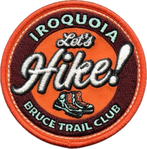
Let's Hike!
https://hikes.brucetrail.org/event/lets-hike-3/Sorry, the registration cut-off time for this hike has been reached.Not a member? Click here to join today!Hosting Club: Iroquoia
Category: Special Event
Location (Google Maps):Grimsby Public Library
18 Carnegie Lane Grimsby OntarioHike Leader(s): Ruth Moffatt Click here to contact Hike Leader(s)
Pace: Leisurely – 3km/hr or less
Terrain: Easy – Mostly flat and usually good footing
Distance: There won’t be any hiking, just info on how to get started.Description
Are you new to hiking? Would you like a little more guidance to get started?In this workshop we will show you everything you need to get started hiking. It will be led by volunteers from Iroquoia Bruce Trail Club and will include a guidebook to take home as well as a new retro-looking Let’s Hike! badge. One guidebook and badge per person. You must register either through this form or in person.
From the trail up, we will discuss footwear, socks, clothing, layering, what to carry in your backpack, hydration, food, hiking hacks, pole and trail etiquette and so much more. Are you ready to get started?
The workshop is 2:00pm – 3:30pm in the lounge of the Grimsby Public Library.
Please join us!
If you have any questions, please reach out through contact on this form.
This presentation is brought to you through a Community of Grimsby Municipal Grant.
- 09June 9, 2025
Niagara Glen Short and Sassy
https://hikes.brucetrail.org/event/niagara-glen-short-and-sassy-5/Sorry, the registration cut-off time for this hike has been reached.Not a member? Click here to join today!Hosting Club: Iroquoia
Category: Good Companions
Location (Google Maps):Niagara Glen, 3050 Niagara Parkway, Niagara-on-the-Lake, ON
Hike Leader(s): Craig Sim Click here to contact Hike Leader(s)
Pace: Medium – 3 to 4 km/hr
Terrain: Moderate – Some hills and/or some poor footing
Distance: 6-7k (approximate)Description
Loop hike in beautiful Niagara Glen, NOT using Whirlpool Trail. We meet in between Niagara Glen parking lot and building near lot. Pay parking or Niagara parks pass. Trail ranges from moderate to quite rocky, has hills and stairs. Watch footing. Lots of boulders and great views close to Niagara River. We descend steel stairs before and after hike. Wear hiking boots or shoes. Bring water, snack, appropriate layered clothing for the weather and rain gear. Optional beverage/food after. Niagara Glen is close to both Butterfly Conservatory and Floral Clock. - 10June 10, 2025
8:00 Long Hike Wiley Road Short Hills (NEW TIME)
https://hikes.brucetrail.org/event/800-long-hike-wiley-road-short-hills-new-time-6/Sorry, the registration cut-off time for this hike has been reached.Not a member? Click here to join today!Hosting Club: Niagara
Location (Google Maps):
Short Hills Wiley Road Entrance
Pace: Medium
Terrain: Moderate
: 10kmDescription
Explore Short Hills and the majestic side trails of Scarlett Tanager, Hemlock. Swayze Falls and Terrace. Register for each hikeBring Poles, Sun Screen Bug Spray, snack, and dress for the weather
Urban Walk: Valley View Park Thornhill
https://hikes.brucetrail.org/event/urban-walk-valley-view-park-thornhill-81/Sorry, the registration cut-off time for this hike has been reached.Not a member? Click here to join today!Hosting Club: Toronto
Location (Google Maps): Parking lot is inside Sycamore Drive East of Bayview , across Starbucks plaza
Hike Leader(s): Mohammad Aghamiri Click here to contact Hike Leader(s)
Pace: Moderate (3-4 km/hr)
Terrain: Hilly, Level 2 (Intermediate – some hills and uneven surfaces, rocks and roots underfoot)Description
We will explore Valleyview and Maple View parks, and walk along German Mill Creak, in return we stop in Huntington park and have snack under beautiful shed ,Even it is considered Urban walk, it is urban hike as we have some up and down hills and tree roots, please bring your hiking poles, water and snacks,
Dufferin Hi-Land 60th Anniversary Highlight Hikes, Hike #8: Honeywood Ridge
https://hikes.brucetrail.org/event/dufferin-hi-land-60th-anniversary-highlight-hikes-hike-8-honeywood-ridge/Sorry, the registration cut-off time for this hike has been reached.Not a member? Click here to join today!Hosting Club: Dufferin Hi-Land
Category: Tuesday Hike
Location (Google Maps): Dufferin Hi-Land, Map 21. Meet at roadside parking on the northeast corner 20 Sideroad and Prince of Wales Rd. (km 40.7, Edition 31). Please note, this is a shuttle hike.Hike Leader(s): Julie Daley, Les Babbage, Inge Eckerich, Tony Evangelista Click here to contact Hike Leader(s)
Pace: Leisurely
Terrain: Moderate, Slippery and Steep Sections
Distance: 5 kmDescription
After meeting on the 20 Sideroad, we will shuttle to our starting point on Centre Rd (km 46.7). We will hike west along the main trail, crossing Prince of Wales to Honeywood Ridge, have a snack on the edge of the forest, and continue south to our cars. Poles are suggested.9:15 Short hike, Short Hills, Pelham Road entrance
https://hikes.brucetrail.org/event/915-short-hike-short-hills-pelham-road-entrance/Sorry, the registration cut-off time for this hike has been reached.Not a member? Click here to join today!Hosting Club: Niagara
Category: Loop
Location (Google Maps): Short Hills Provincial Park, Pelham Road entranceHike Leader(s): janet davey Click here to contact Hike Leader(s)
Pace: Medium
Terrain: Moderate
Distance: 6 kmsDescription
Hike the main and side trails in Short Hills Provincial Park. Bring hiking boots, water and sunscreen. Check yourself for ticks when you get back to parking lot.Blue Mountains E2E in 4 (#2)
https://hikes.brucetrail.org/event/blue-mountains-e2e-in-4-2/Sorry, the registration cut-off time for this hike has been reached.Not a member? Click here to join today!Hosting Club: Beaver Valley
Location (Google Maps): Devil’s Glen Provincial Park. Enter from County Rd 124
Map 22, ED 31Hike Leader(s): Kristina Rettie Click here to contact the hike leader.
Pace: Brisk
Terrain: Moderate, Some rocky footing, Some steep sections, Strenuous
Length of Hike: 15.4kmDescription
Welcome to Blue Mountains E2E in 4! Please register for each hike individually. Together we will wind our way through the varied terrain, rugged escarpment and beautiful vistas. If you choose to participate in all 4 hikes you will cover the 67km distance of this section which runs from Lavender to Swiss Meadows. If you are interested in an E2E badge please keep record of your hikes and submit to the Blue Mountains club upon completion.Each week the hikes will increase in distance starting at 14km. At week 4 we will hike over 20km. This is a great way to build your endurance.
These are shuttle hikes so please have your car passenger ready. Hike #2- meet @ 29.5, shuttle to 14.1 (hike north)
Please bring water and snacks. We will do a clothing adjustment break and a short snack break along the way.
Bug spray and sunscreen are recommended, please do not apply before the shuttle.
No dogs!
If you need to get in touch please text @ 519-410-9077
Halton Regional Forest
https://hikes.brucetrail.org/event/halton-regional-forest/Sorry, the registration cut-off time for this hike has been reached.Not a member? Click here to join today!Hosting Club: Caledon Hills
Category: Tuesday Hikers
Location (Google Maps): Parking at: 10 Side Road and 4th Line Nassagaweya (trail entrance to Halton Regional Forest).
From Highway 401 West, turn right (north) on Guelph Line, right on 10 Side Rd. The road bends northwards and becomes 4th Line Nassagaweya; roadside parking at the bend.Hike Leader(s): Mohammad Shafiq Click here to contact Hike Leader(s)
Pace: Medium – 3 to 4 km/hour
Terrain: Moderate – some hills and/or some poor footing
Distance: 12 kmDescription
Will hike trails in Halton Regional Forest and Hilton Falls Conservation Area; beautiful trails are relatively flat with some rocky parts. Snack break at Hilton Falls, possibly around fire pit.
Bring water and snack. Poles are recommended.
Hike leader cell phone: 416-566-0503 (note that reception in hiking area is usually poor, leave a message for a return call).
Afternoon hike - Limehouse Conservation Area
https://hikes.brucetrail.org/event/afternoon-hike-limehouse-conservation-area/Sorry, the registration cut-off time for this hike has been reached.Not a member? Click here to join today!Hosting Club: Iroquoia
Category: Afternoon/Evening Hikes
Location (Google Maps): Meet at 4:15 pm in the parking lot at Limehouse Conservation Area.Hike Leader(s): Karen Bergmann Click here to contact Hike Leader(s)
Pace: Medium – 3 to 4 km/hr
Terrain: Moderate – Some hills and/or some poor footing
Distance: 7 kmsDescription
The trees will be leafing out so we will be surrounded by green. We will hike around the park and then briefly out along the main trail to the Todd Bardes Meadowland Side Trail and back. Bring bug spray in case they have awakened.
8:00 pm Sunset & Moonlight Night Hike in Niagara-on-the-Lake
https://hikes.brucetrail.org/event/800-pm-sunset-moonlight-night-hike-in-niagara-on-the-lake-2/Sorry, the registration cut-off time for this hike has been reached.Not a member? Click here to join today!Hosting Club: Niagara
Category: Night
Location (Google Maps):Veteran’s Memorial Park, park just outside the park on King St.
Hike Leader(s): Robin Garrett Click here to contact Hike Leader(s)
Pace: Medium
Terrain: Easy
Distance: 6-7 kmDescription
Moonlight Night Hike – Take in the magic of the rising moon over Lake Ontario and the Niagara River. This hike includes a stop to connect with your senses – sights, sounds, smells and the rhythm of your breath. Counts towards your night hike badge (5 night hikes). - 11June 11, 2025
Benchlands 2-Jordan Historical
https://hikes.brucetrail.org/event/benchlands-2-jordan-historical/Sorry, the registration cut-off time for this hike has been reached.Not a member? Click here to join today!Hosting Club: Niagara
Category: Urban
Location (Google Maps): Lincoln Museum 3800 Main Street, Jordan Station, OntarioHike Leader(s): Erin Lyttle Click here to contact Hike Leader(s)
Pace: Leisurely
Terrain: Easy
Distance: 3Description
This is the 2nd hike required to earn the Benchlands Badge-Jordon Historical. We will meet at the entrance of the Lincoln Museum and explore the buildings. It is an easy, flat, paved suburban walk. We plan to be finished with our walk by 10 am when the museum opens so if you wish to explore the museum as well, please note that there is a suggested donation of $5. Please note if you are hoping to earn the badge that there are some questions that must be answered, so bring a way to take some notes! It’s highly suggested that you download and save to your smartphone or possibly print out this brochure: PDF Page Jordan is a lovely village with a few coffee shops around, so feel free to linger afterwards!Bluebirds, Meadowlarks and More
https://hikes.brucetrail.org/event/bluebirds-meadowlarks-and-more/Sorry, the registration cut-off time for this hike has been reached.Not a member? Click here to join today!Hosting Club: Caledon Hills
Category: Nature Walks
Location (Google Maps): Meet at parking lot on Mono 5 Sideroad at km 45.4 where the trail crosses. Take Airport Road north on Mono Mills to 5 Sideroad. Turn east on 5 Sideroad to the parking lot on north side of road.Hike Leader(s): Gary Hall Click here to contact Hike Leader(s)
Pace: Leisurely – 3 km/hour or less
Terrain: Moderate – some hills and/or some poor footing
Distance: 3 – 4 kmDescription
This will be a car hike. From our meeting place, we’ll make a short car pool to the Bruce Trail Parking lot on the 7th Line Mono (corner of 7th Line and Airport Road) . We’ll begin by exploring the Humber Heights property and listen and watch for Bluebirds, Meadowlarks, Indigo Buntings, Field Sparrows as well as other grassland species. We’ll then retrace our steps on Humber Heights and follow the main trail through Twin Waters (a new BTC property), Mathilde’s Way and The Gosling Forest and Nature Reserve and finish at the car park on 5 Sideroad. With the exception of a 600 metre walk along the 7th Line, the hike will be entirely on BTC properties – four in all. Bring binoculars, camera, and cell phone. The Merlin App will help identify bird songs.Balsam wetlands to Glen Huron
https://hikes.brucetrail.org/event/balsam-wetlands-to-glen-huron-5/Sorry, the registration cut-off time for this hike has been reached.Not a member? Click here to join today!Hosting Club: Blue Mountains
Category: Organized Hike
Location (Google Maps): Tim Horton’s, First Street, CollingwoodHike Leader(s): David Little Click here to contact Hike Leader(s)
Pace: Medium – 3 to 4 km/hr
Terrain: Moderate – Some hills and/or some poor footing
Distance: 12 kmDescription
This is a car shuttle hike. We will drive to and leave the cars on Station Street in Glen Huron and drive to km 37.4 (BTC parking lot off Cty.Rd. 91) to begin the hike. The trail winds its way through privately owned forest and farmland eventually coming to a viewing platform south of Cty. Rd. 124. The hike continues down into the valley and at km 30.6 we meet up with the Mad River Side Trail. Following the side trail parallel to the Mad River we continue on to the cars. Bring a snack or lunch and water.WEDNESDAY WALKERS - East of Kolapore
https://hikes.brucetrail.org/event/wednesday-walkers-east-of-kolapore-3/Sorry, the registration cut-off time for this hike has been reached.Not a member? Click here to join today!Hosting Club: Beaver Valley
Location (Google Maps): Park in the Kolapore parking lot, near Km 23.5, Map 25, Edition 31, for a car shuttle to the start of our hike.
Hike Leader(s): Margaret Yaraskavitch Click here to contact the hike leader.
Pace: Medium
Terrain: Moderate
Length of Hike: 4.7 kms + 650 m of roadDescription
We will walk south from 12th Sideroad and as we walk through deciduous forest, we’ll cross a piece of history, remnants of The Old Mail Road. We continue south, crossing Grey Road 19, through property that is managed by the BTC, until we return to our cars. Please bring water and a snack.
Culham Trail/Credit River
https://hikes.brucetrail.org/event/culham-trail-credit-river/Sorry, the registration cut-off time for this hike has been reached.Not a member? Click here to join today!Hosting Club: Iroquoia
Category: Good Companions
Location (Google Maps): Erindale Park, Dundas St.W., just East of Mississauga Rd.Hike Leader(s): Anne Armstrong Click here to contact Hike Leader(s)
Pace: Leisurely – 3km/hr or less
Terrain: Easy – Mostly flat and usually good footing
Distance: 6-8kmDescription
Come and enjoy an easy, leisurely hike up the Credit River, going through part of Erindale Park. There is one rocky but flat section as well as one hill. We will likely encounter some areas which have washout damage from flooding. We should also see some Spring Ephemerals. Bring water, a snack, sunscreen and insect repellent. Poles not necessary unless you like using them for upper body exercise and balance. This hike has been rescheduled due to a conflict of dates on the part of the leader.
WEEKNIGHT RAINBOW HIKE: Escarpment Rail Trail plus Stairs
https://hikes.brucetrail.org/event/weeknight-rainbow-hike-escarpment-rail-trail-plus-stairs/Sorry, the registration cut-off time for this hike has been reached.Not a member? Click here to join today!Hosting Club: Iroquoia
Category: Afternoon/Evening Hikes
Location (Google Maps): We’ll meet at the bottom of the Wentworth Stairs (below Charlton St.) and follow Escarpment Rail TrailHike Leader(s): Doug O’Neill Click here to contact Hike Leader(s)
Pace: Medium – 3 to 4 km/hr
Terrain: Easy – Mostly flat and usually good footing
Distance: 8 kmDescription
This all-inclusive LGBTQ-friendly hike is indeed “mostly flat.” This weeknight fitness walk actually includes two Escarpment Stairs. The good news: You’ll climb only one and dance down the other.From the bottom of Wentworth Stairs, we’ll follow the flat Escarpment Rail Trail all the way to the historic Uli Stairs, which we’ll climb up to Mountain Brow. Upon reaching the top, we’ll take a break, stretch, have a snack and gulp some water before we saunter along the Mountain Brow path to Margate Stairs. There, we’ll descend to the Rail Trail, and head back to the starting point at Wentworth.
Bring water and energizing snacks—especially if you’ve come directly from work. Insect repellent is a good idea, too.
Consider this 8-km weeknight hike good training for longer weekend hikes.
- 12June 12, 2025
8:00 am Long Hike Cave Spring Conservation Area
https://hikes.brucetrail.org/event/800-am-long-hike-glen-road-jordan-new-time-7/Sorry, the registration cut-off time for this hike has been reached.Not a member? Click here to join today!Hosting Club: Niagara
Location (Google Maps): Cave Spring Conservation Area
Hike Leader(s): Alan Laver Click here to contact Hike Leader(s)
Pace: Medium
Terrain: Moderate
Distance: 10kDescription
This will be our permanent Thursday Location until Bridge repairs complete. From Cave Springs explore the trail network on the escarpment towards Kinsman Park and Moyer Road.You must register for each hike. Bring Poles, snack bug spray, sunscreen and a drink. Dress for the weather
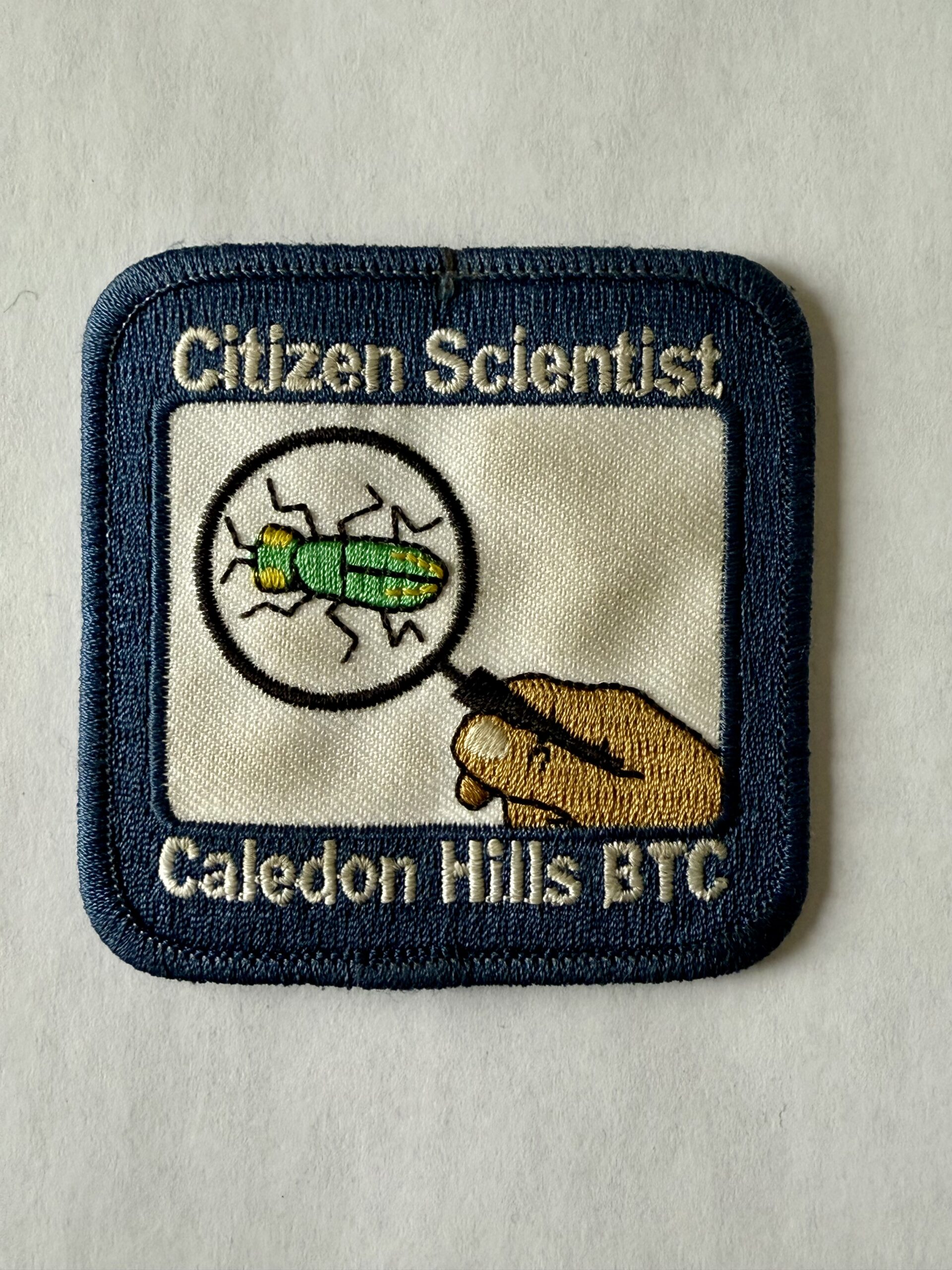
Hockleycrest Citizen Scientist Nature Walk
https://hikes.brucetrail.org/event/hockleycrest-citizen-scientist-nature-walk/Sorry, the registration cut-off time for this hike has been reached.Not a member? Click here to join today!Hosting Club: Caledon Hills
Category: Nature Walks
Location (Google Maps): Meet at the Bruce Trail Parking Lot on Mono 5 Sideroad. Google GPS Coordinates: 43.974055, -79.984988Directions: From Airport Road, turn east onto 5 Sideroad and drive for 600 metres. The parking lot is on the left-hand side.
Hike Leader(s): Sandy Green Click here to contact Hike Leader(s)
Pace: Leisurely – 3 km/hour or less
Terrain: Moderate – some hills and/or some poor footing
Distance: 5.5 kmDescription
Pique your curiosity about the awakening forest in the Hockleycrest area. Learn to use nature identification apps Merlin, Seek and iNaturalist to collect biodiversity data along the Bruce Trail for the BTC’s iNaturalist Project. Badge seekers can work towards earning the CHBTC Citizen Scientist badge.Hiking in and around Jordan and Balls Falls
https://hikes.brucetrail.org/event/hiking-in-and-around-jordan-and-balls-falls-2/Sorry, the registration cut-off time for this hike has been reached.Not a member? Click here to join today!Hosting Club: Niagara
Category: Hike
Location (Google Maps):New Location – Parking Lot on Glen Road, Jordan
Hike Leader(s): Bill Russell Click here to contact Hike Leader(s)
Pace: Medium
Terrain: Moderate
Distance: 6-7 kmDescription
Hiking from Glen Road and following Jim Rainforth Trail and trails to Balls Falls and Bailey Bridge.
Urban Walk: Toronto Islands Evening Walk
https://hikes.brucetrail.org/event/urban-walk-toronto-islands-evening-walk-16/Sorry, the registration cut-off time for this hike has been reached.Not a member? Click here to join today!Hosting Club: Toronto
Location (Google Maps):
Jack Layton Ferry Terminal, near the gates to Wards Island Ferry. Arrive 20 minutes prior to departure to check in with hike leader.
From Union Station take the LRT and get off at the stop Ferry Docks.Walk up to the Ferry Docks on Queens Quay West, street level. at the foot of Bay Street.
Hike Leader(s): Miriam Stevens Click here to contact Hike Leader(s)
Pace: Leisurely (2-3 km/hr)
Terrain: Flat
Distance: 6-9 kmDescription
After a day’s work come and “cool off” on the Toronto Islands free of fumes and traffic. Enjoy the view of the city skyline and Toronto’s beautiful island parkland.
Pack a dinner for a sit down picnic. Also bring a warm jacket and flashlight.
Return fare ticket for the ferry is $9.11 for adults, $5.86 for seniors
Hikes will take place rain or shine. If the weather is particularly inclement the day of the hike please check the hike schedule by 10:00 AM for an update.
Toronto Island evening hikes will take place every Thursday in May and June 2025.
Same time and same meeting place. No preregistration is required – just show up at the ferry docks at 5:40 PM and sign in with the hike leader. - 13June 13, 2025
9:00 am Niagara-on-the-Lake Tour
https://hikes.brucetrail.org/event/900-am-niagara-on-the-lake-tour-42/Sorry, the registration cut-off time for this hike has been reached.Not a member? Click here to join today!Hosting Club: Niagara
Category: Urban
Location (Google Maps):Veterans Memorial Park, park just outside the park on King Street
Hike Leader(s): Robin Garrett Click here to contact Hike Leader(s)
Pace: Medium
Terrain: Easy
Distance: 6-7 kmDescription
Each Friday we will explore different neighbourhoods, trails and parkland throughout Historic Niagara-on-the-Lake.Moderate pace with some weeks entirely on sidewalks and roads while others may include a mix of trails and paved pathways. Great way to build up endurance for longer more strenuous hikes.
Prepare for cooler windy conditions on open parkland and along Lake Ontario and Niagara River trails.
Plan to stay for conversation and a warm cup of coffee or tea at Sweets & Swirls, Community Centre, Niagara Stone Road, NOTL
Dundas Town and Lake JoJo
https://hikes.brucetrail.org/event/dundas-town-and-lake-jojo/Sorry, the registration cut-off time for this hike has been reached.Not a member? Click here to join today!Hosting Club: Iroquoia
Category: Easy Does It Hikes
Location (Google Maps): Meet at Dundas Driving Park Road.Hike Leader(s): Phillip Armstrong Click here to contact Hike Leader(s)
Pace: Leisurely – 3km/hr or less
Terrain: Moderate – Some hills and/or some poor footing
Distance: 8.2kmDescription
A loop in the town of Dundas. We start in the lovely Driving Park and work our way through suburbs and the heritage district to the Spencer Creek Trail. Our route follows as much of the trail as possible down to the Desjardins Canal . The curiously named and seldom seen Lake JoJo is next followed by tiny Delsey Pond. We loop through Grove Cemetery before dropping down Helen St. back to the Driving Park.Bring lawn chairs and a lunch and some refreshments for a picnic social when we finish.
- 14June 14, 2025
Jeju Ole International Friendship Hike
https://hikes.brucetrail.org/event/jeju-ole-international-friendship-hike/Sorry, the registration cut-off time for this hike has been reached.Not a member? Click here to join today!Hosting Club: Caledon Hills
Category: General
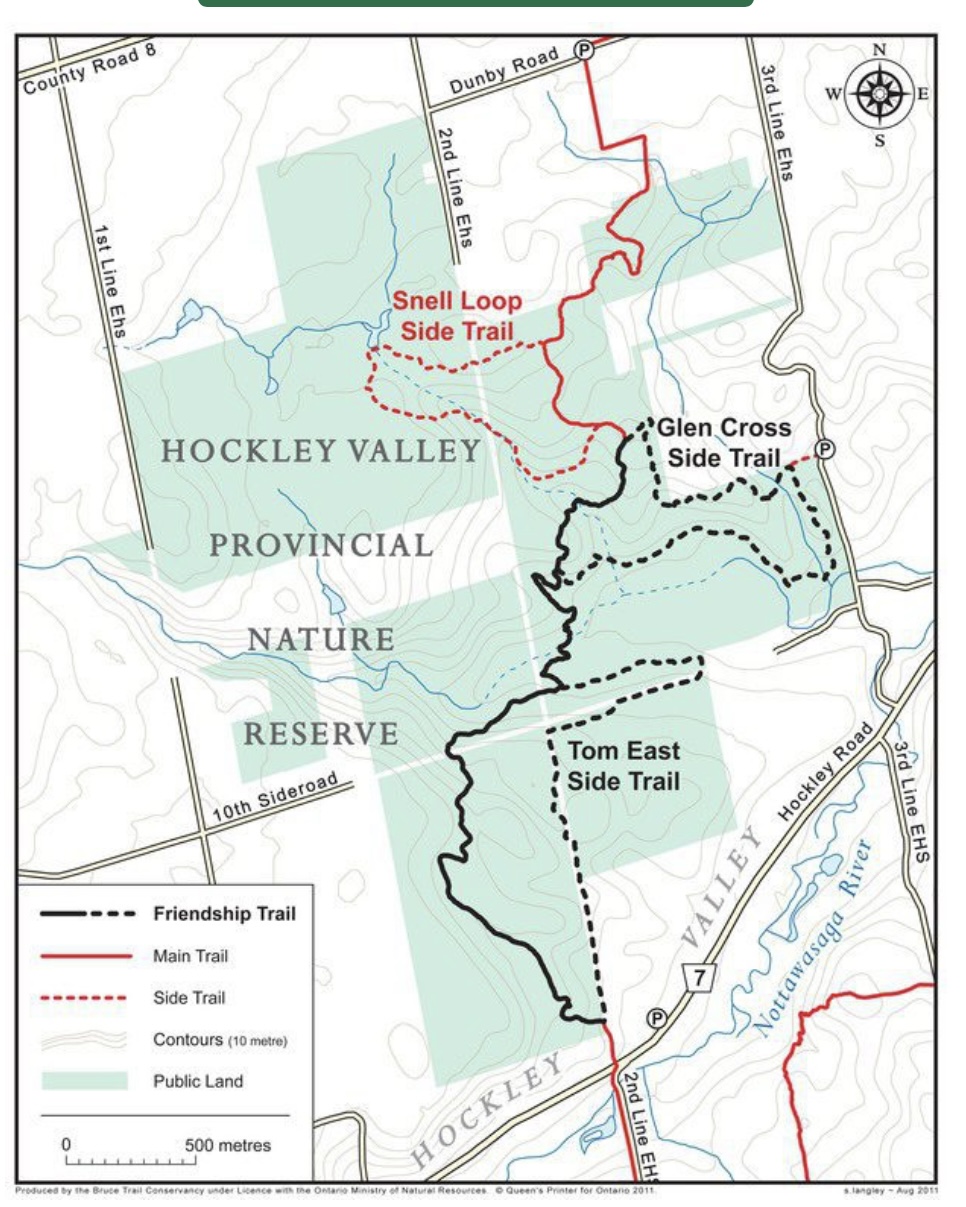
Location (Google Maps): Meet at Hockley Road Parking Lot
43.972857, -80.056330Directions: From ON-10 head east on Hockley Road/Dufferin County Road 7 for 5 kilometres
Hike Leader(s): Sandy Green Click here to contact Hike Leader(s)
Pace: Medium – 3 to 4 km/hour
Terrain: Moderate – some hills and/or some poor footing
Distance: 6.0 kilometres or 11.5 kilometresDescription
All are welcome to join members and friends of the Caledon Hills Club and Sansamo Korean Hiking Club to explore the Jeju Olle Friendship Trail located in the Hockley Valley Provincial Nature Reserve. This Bruce Trail Conservancy International Friendship Trail is twinned with the Jeju Olle walking trail located on the island of Jeju, South Korea. Bring water and a snack. Sturdy shoes are recommended. We are offering two distances for everyone’s enjoyment.Car Hike: Oak Ridges Trail King City
https://hikes.brucetrail.org/event/car-hike-oak-ridges-trail-king-city/Sorry, the registration cut-off time for this hike has been reached.Not a member? Click here to join today!Hosting Club: Toronto
Category: Car Hike
Location (Google Maps): Around 14020 Keele Street KingPark along Road gathering beside trail head
Hike Leader(s): Mohammad Aghamiri Click here to contact Hike Leader(s)
Pace: Moderate (3-4 km/hr)
Terrain: Hilly, Level 2 (Intermediate – some hills and uneven surfaces, rocks and roots underfoot)
Distance: 12-14 kmDescription
We will hike 2 loops ,first on east side towards Sceneca Lake ,then on the west to Mary Lake
School Bus Hike - A Day at the Beach!
https://hikes.brucetrail.org/event/school-bus-hike-a-day-at-the-beach/Sorry, the registration cut-off time for this hike has been reached.Not a member? Click here to join today!Trip Information
Departure Time: 09:00
Return to City Time: 18:00
Departure Point: Kipling Departure PointOptional Items
Hosting Club: Toronto
Category: Bus Hike
Location (Google Maps): Wasaga Beach – Beach Area 6Hike Leader(s): Marijo Roy Click here to contact Hike Leader(s)
Pace: Moderate (3-4 km/hr)
Terrain: Flat, Level 1 (Easy – mostly on flat, well maintained trails with hard-packed surface)
Distance: 8 kmDescription
Please join us for a day at Wasaga Beach. We will walk along the longest freshwater beach in the world, from Beach Area 6 to Beach Area 1.We will follow part of the Waterfront Trail, encompassing some flat paved and sandy roads. There are several public washrooms along the way. After the hike, you can enjoy swimming, visit the Nancy Island Historic Site to learn more about the War of 1812, or sightsee the area.
There will be no drop-off. Please ensure you are comfortable walking 8 km at a moderate pace.
Please bring your lunch, snacks, at least 2L of water, sun protection, hat, swimming suit and towel (if applicable), medications, and a First Aid kit.
Back in Toronto, Kipling subway station at 6:00 p.m., traffic dependent.
Nancy Island Historic Site
https://wasagabeachpark.com/nancy-island-historic-site/Beaver Valley Geology Hikes Badge Hike total 8
https://hikes.brucetrail.org/event/beaver-valley-geology-hikes-badge-hike-1-8-2/Sorry, the registration cut-off time for this hike has been reached.Not a member? Click here to join today!This is a Multi-Day Hike
You are signing up for the following dates and times:
2025-06-14 at 09:00
2025-07-05 at
2025-07-23 at
2025-08-02 at
2025-08-20 at
2025-09-03 at
2025-09-20 at
2025-10-01 atHosting Club: Blue Mountains
Category: Organized Hike
Location (Google Maps): Tim Hortons on First St. in Collingwood.Hike Leader(s): Annette Sandberg Click here to contact Hike Leader(s)
Pace: Medium – 3 to 4 km/hr
Terrain: Moderate – Some hills and/or some poor footing
Distance: 7.1Description
This badge is earned by hiking each of 8 hikes outlined in Beth Gilhespy’s first Bruce Trail Geology book, Walking Through Time, and then submitting a log which includes the required
photo taken during each of the hikes. This is a great opportunity to boost your knowledge of the geology of the Niagara Escarpment. Gather some hiking buddies and become rock
hounds!Visit and take a photograph of 8 features profiled in Walking Through Time:
1. June 14 – Len Gertler Memorial Loree Forest: Natural Arch at Stop 4 (Pages 47/48)
Natural arches are created when water pounding against a cliff face exploits cracks and crevices, gradually
wearing the rock away. Natural arches can become flowerpots if erosion continues. Thousands of years ago
the level of the Great Lakes was significant higher and lapped up against the promontory of Loree Forest.
2. July 5 – Margaret Paull and Indian Brook: Flowerpot at Stop 2 (Page 52)
Flowerpots are created by water that exploits cracks and eventually removes the material between the flowerpot and the main rock face. The water smooths and rounds the rock of the flowerpot. The flowerpots at Indian Brook were created several thousands of years ago when lake levels were significantly higher than they are today.
3. July 23 – The Mill Creek Valley: “Castle Ramparts” at Stop 8 (Pages 63/64)
The Manitoulin Dolostone layer of the Niagara Escarpment forms a steep edge along the valley of Mill Creek.Over time the thinly bedded rock breaks away from the cliff face and lies scattered along the slope. Many shell and horn coral fossils can be found in these flat, shingle-like rocks. Note that when leaves are fully out
in the summer months the “castle ramparts” may be hard to see. A photograph of the talus rock below the cliff will be sufficient for this badge location.
4. August 2 – Fox Ridge and McClusky’s Rock: Badland at Stop 4 (Pages 72/73)
Queenston Shale is the bottom-most layer of the Niagara Escarpment. Where vegetation is removed, the shale appears as a “badland”. The brick-red shale has long been excavated along the Niagara Escarpment to make bricks.
5. August 20 – Falling Waters: Waterfall on Stew Hilts Side Trail at Stop 3 (Page 86)
At the lovely waterfall on the Stew Hilts Side Trail water trickles over the hard Manitoulin Dolostone layer and falls onto the soft Queenston Shale.
6. September 3 – Wodehouse Karst (Southern Route): Rock Outcrop in Bowles Gully at Stop 9 (Pages 98-100)
At Bowles Gully two Escarpment rock layers – the Amabel Dolostone and the Manitoulin Dolostone – outcrop along the sides of the steep ski hill.
7. September 20 – Wodehouse Karst (Northern Route): Fossil in the Barn Foundation on Stone Foundation Side Trail at Stop 6 (Pages 95-97)
Barn Foundations are wonderful places to see many different rock types, including the Escarpment’s Fossil Hill Dolostone layer, which is full of coral and other fossils.
8. October 1 – Griersville to Webwood Falls: Erratic boulders at Stop 4 (Page 109)
Glacial erratics are rocks picked up by glaciers and transported great distances to be left behind as the glacier melts. These erratic boulders are 1 billion years older than the local sedimentary bedrock, and originally came from the Canadian Shield.
Geology Hike #10 Savage Wells
https://hikes.brucetrail.org/event/geology-hike-10-savage-wells/Sorry, the registration cut-off time for this hike has been reached.Not a member? Click here to join today!Hosting Club: Sydenham
Category: Geology Hike
Location (Google Maps): Meet and park at the gravel parking area at “Ben Allen” at the intersection of Grey Road 17 and Gordon Sutherland Parkway. We will carpool and drive a short distance north to the trailhead.Hike Leader(s): Carol Graham-Mullin Click here to contact Hike Leader(s)
Pace: Leisurely: 3 km/h or less
Terrain: Easy: Mostly flat and good footing., Moderate: Some hills and/or poor footing, Strenuous: Hilly with steep climbs and some poor footing.
Distance: 5.6 kmDescription
This is Geology Hike # 10 as described in Beth Gilhespy’s book, “Walking Through Time Exploring Niagara Escarpment Geology in the Sydenham Bruce Trail Section”. This is a delightful loop hike through the forest featuring wetlands, “wells”, erratics, fossils and views across the Glen.Please bring water, snacks and poles if needed. The hike leader will have signed copies of Beth’s book for sale (cash, cheque or e-transfer). A Sydenham Bruce Trail Geology Badge has been developed. Details can be shared from hike leader during hike.
Dundas Valley Loop
https://hikes.brucetrail.org/event/dundas-valley-loop-4/Sorry, the registration cut-off time for this hike has been reached.Not a member? Click here to join today!Hosting Club: Iroquoia
Category: General Hike
Location (Google Maps): Dundas Valley Conservation Area, DundasHike Leader(s): Anne Armstrong Click here to contact Hike Leader(s)
Pace: Leisurely – 3km/hr or less
Terrain: Dependent on Conditions, Moderate – Some hills and/or some poor footing
Distance: Approx. 10 km.Description
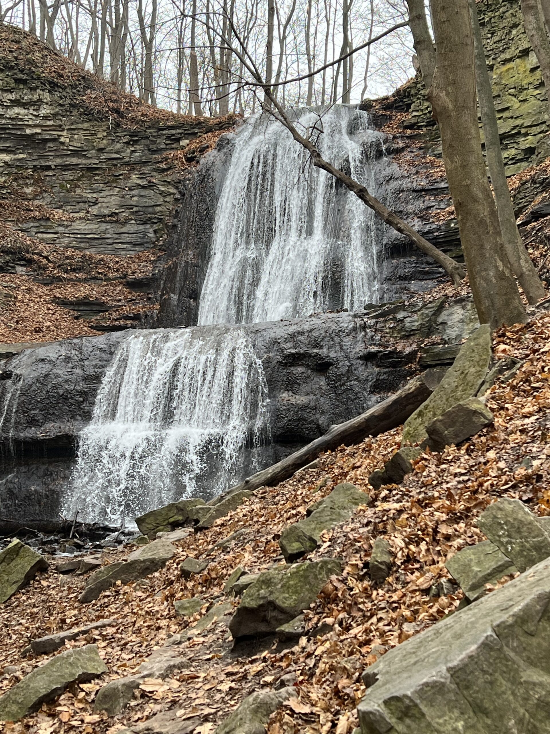
Join in this loop hike which visits several waterfalls including the beautiful Sherman Falls which is spectacular if there is a lot of water. Meet in the last parking lot of the Dundas Valley Conservation Area on Governors Rd. west of Dundas at 9:45 am. for a 10:00 am. start. Bring water, a snack, sunscreen and insect repellent. Hiking poles might be useful for the hills we will encounter. Parking fee in effect or a Conservation Area pass.
Car Hike: Uxbridge Countryside Preserve and A Stroll to Little Thief Bakery
https://hikes.brucetrail.org/event/car-hike-uxbridge-countryside-preserve-and-a-stroll-to-little-thief-bakery/Sorry, the registration cut-off time for this hike has been reached.Not a member? Click here to join today!Hosting Club: Toronto
Category: Car Hike
Location (Google Maps): We will start in the Countryside Preserve Trailhead ParkingHike Leader(s): KJ Chong Click here to contact Hike Leader(s)
Pace: Moderate (3-4 km/hr)
Terrain: Flat, Level 2 (Intermediate – some hills and uneven surfaces, rocks and roots underfoot), Variable
Distance: 10.5 kmDescription
Join us for a delightful stroll through forests and grassy meadows. The hike will feature a look out park in the meadows. Then we will continue on to walk into the old downtown area of Uxbridge to Little Thief Bakery for some delightful treats. While we love furry friends, but please leave your dogs at home.Car Hike: Scotsdale Farm
https://hikes.brucetrail.org/event/car-hike-scotsdale-farm-11/Sorry, the registration cut-off time for this hike has been reached.Not a member? Click here to join today!Hosting Club: Toronto
Category: Car Hike
Location (Google Maps): Scotsdale Farm, Map 13Hike Leader(s): Al Brown Click here to contact Hike Leader(s)
Pace: Moderate (3-4 km/hr)
Terrain: VariableDescription
We will complete a loop hike along the main and side trails in Scotsdale Farm and Silver Creek Conservation Area. The trail passes through varied terrain consisting of farm lanes/fields, glacial formations, etc. Most of the trail is under the forest canopy.To get to the meeting point drive north on Trafalgar Road past Georgetown. Trafalgar Road merges with Hwy 7 for 4 km. At Silver Creek turn right at the stop lights and proceed north on Trafalgar about 1.5 km to the entrance. The parking area and meeting point is about 0.5 km from the road.
After the hike there will be a refreshment stop in old Georgetown.

Chi-Cheemaun Festival - Burnt Point Loop Side Trail Hike
https://hikes.brucetrail.org/event/chi-cheemaun-festival-burnt-point-loop-side-trail-hike/Sorry, the registration cut-off time for this hike has been reached.Not a member? Click here to join today!Hosting Club: Peninsula
Category: Peninsula Blue Series
Location (Google Maps): Bruce Trail Cairn, Bay Street, TobermoryHike Leader(s): Shawn Radcliffe Click here to contact Hike Leader(s)
Pace: Leisurely (2.0 – 3.0 km/h): A relaxed pace with frequent breaks and a focus on enjoyment.
Terrain: Easy: Flat forested sections or lowland trails., Moderate: Rolling hills, mild slopes and rocky paths.
Distance: 5.0 kmDescription
Chi-Cheemaun Festival – Bruce Trail Hike. We will hike the Main Bruce Trail from the cairn in Tobermory to the Burnt Loop Side Trail.This is a lovely hike through an enchanting forest with pretty views of Georgian Bay, Flower Pot, and Bear’s Rump Islands taking approximately 3 hours. We will hike at steady pace with brief stops for drinks/snacks and water views.
The terrain on the first part of this trail is level, however the Burnt Loop Side Trail is a meandering, rocky trail with some short ups and downs and includes a short rocky beach section.
We will end at the Visitor’s Centre in the Bruce Peninsula National Park.
Make sure to wear appropriate clothing, and hiking boots or sturdy walking/running shoes. Bring a light backpack for water and snacks.

Urban Walk: Toronto Urban Badge Hike - 7 of 7
https://hikes.brucetrail.org/event/urban-walk-toronto-urban-badge-hike-7-of-7/Sorry, the registration cut-off time for this hike has been reached.Not a member? Click here to join today!Hosting Club: Toronto
Category: Urban Walk
Location (Google Maps): Don River/Bayview Extension TrailsHike Leader(s): Brian Rideout Click here to contact Hike Leader(s)
Pace: Moderate (3-4 km/hr)
Terrain: Flat
Distance: 9 kmDescription
Please join me at the south east corner of Overlea Blvd and Don Mills Rd by 10 AM. We will hike south on the Don Trail to the Distillery District (km 62.4 to km 71.4). Here is an online map with km markings of our route for all 7 hikes for the Toronto Urban Badge: https://onthegomap.com/s/c2c1hf3nPlease make sure you bring at least 2 liters of water, a lunch, bug spray and sunscreen.

10:00 Malivoire Wine Co Hike and Wine Tasting Experience
https://hikes.brucetrail.org/event/1000-malivoire-wine-co-hike-and-wine-tasting-experience-2/Sorry, the registration cut-off time for this hike has been reached.Not a member? Click here to join today!Hike open to BTC Members only.
Hosting Club: Niagara
Category: Loop
Location (Google Maps): Park at Malivoire Wine Co 4260 King St, Lincoln ONHike Leader(s): Sam Rutherford Click here to contact Hike Leader(s)
Pace: Medium
Terrain: Moderate
Distance: 5 kmsDescription
We will hike a loop on the main trail from Malivoire Wine Co to the Margaret Reed Side Trail at Cave Springs Conservation Area and back to Malivoire Wine Co by 11:30. Upon return we will enjoy a private structured wine tasting led by one of the knowledgeable and friendly winery staff from 11:30 to 12:00 noon. The cost for the tasting experience is $12.00 per person. Please bring your $12.00 with you as I will collect it prior to the tasting to simplify the payment to Malivoire Wine Co. Thank you.Forest Bathing - Leading to Summer Solstice
https://hikes.brucetrail.org/event/forest-bathing-leading-to-summer-solstice/Sorry, the registration cut-off time for this hike has been reached.Not a member? Click here to join today!Hosting Club: Dufferin Hi-Land
Category: Nature Walks
Location (Google Maps): Dufferin Hi-Land section, BTC Reference Guide, Map 20. Meet at the parking area on the 30th Side Road, 1.75 km east of Hurontario St., at km 12.2. For the second part of the walk, we will meet at the Bruce Trail parking lot on the 1st Line East, at km 28.3, (emergency road address # 716599).Hike Leader(s): Janice McClelland Click here to contact Hike Leader(s)
Pace: Leisurely – 3 km/hour or less
Terrain: Moderate – some hills and/or some poor footing
Distance: 6.1 kmDescription
As we lead into the Dufferin Hi-Land summer solstice events, an invitation for experienced Forest Bathers to drink in the long, pastoral views of high fields (5 km) and then the cozy trail through forest with its interesting biological and geological features, including a natural stone bridge (a 1.1 km loop). We will observe quiet during the walk itself so that all can benefit from the unique experiences on both parts of this Forest Bathing walk. Note: we will meet on the 30th Side Road and walk south on the main trail and return to our cars on this out & back part of the day. We will then drive 7 km north from the first part of our hike to the Bruce Trail parking lot on the 1st Line East, departing from there for our second walk of the day – a loop of 1.1 km. Please bring water & lunch.