Categories
- 08June 8, 2025

Car Hike: Exploring Uxbridge Trails (Wilder Forest, Walker Woods, and Glen Major Forest)
https://hikes.brucetrail.org/event/car-hike-exploring-uxbridge-trails-wilder-forest-walker-woods-and-glen-major-forest-10/Sorry, the registration cut-off time for this hike has been reached.Not a member? Click here to join today!Hosting Club: Toronto
Category: Car Hike
Location (Google Maps):2499 Brock Rd, Uxbridge, ON L9P 1R4. We will meet at the East Duffins Headwaters parking lot at the WILDER FOREST trail head. As soon as you got off the Brock Road, passing the horse back riding facility, there is a free designated parking lot 70 meters down the lane to your right. It includes a sign board for East Duffins Headwaters with a map of the trails. Please do not park on the lane or in the horse back riding property.
Hike Leader(s): Amir Alemohammad Click here to contact Hike Leader(s)
Pace: Moderate (3-4 km/hr)
Terrain: Flat, Hilly, Variable
Distance: Approx.14-15 KmDescription
Join us for a delightful spring hike in Uxbridge, as we explore Wilder Forest, Walker Woods, and Glen Major Forest on a scenic loop starting from Brock Road. We’ll pass Concession Road 6, heading west and back, while also venturing onto several side trails for even more stunning views.What to Expect:
•Beautiful scenic views and lookouts facing south
•A mix of hilly and flat terrain
•Frequent 2-minute breaks for hydration and photos, with a 10-20 minute lunch/snack stop
•Stay on designated trails at all time
What to Bring and Wear:
•Hiking Boots and poles (recommended) and be prepared for the bugs
•At least 2 liters of water
•Your favorite snacks and lunch (pack your own refreshments for an outdoor meal)
•Dress accordingly variable weather; chilly morning with midday higher temperatures expected
Important Details:
•Stay on the designated trails
•Be prepared for the elements and enjoy the adventure!
Looking forward to seeing you on the trail!
Don’t forget your camera and a smile as we explore the beauty of the Uxbridge trails!
This is a joint hike with the Oak Ridges Trail Association (ORTA).

Camino Hike
https://hikes.brucetrail.org/event/camino-hike-2/Sorry, the registration cut-off time for this hike has been reached.Not a member? Click here to join today!Hosting Club: Iroquoia
Category: Camino Hikes
Location (Google Maps): City View Park – Please enter via Dundas St onto Kerns Rd, second left to the parking area.Hike Leader(s): Ruth Moffatt Click here to contact Hike Leader(s)
Pace: Medium – 3 to 4 km/hr
Terrain: Moderate – Some hills and/or some poor footing, Strenuous – Hilly with steep climbs and some poor footing, Dependent on Conditions
Distance: 8ishDescription
Please join us for a Camino Hike. If you are curious about hiking a camino or would like to share information about hiking a camino, please join us for this hike. Everyone is welcome.Please bring enough water and snacks. We will hike about 8km return. Check for the weather and dress appropriately – wide brimmed hat and sunscreen is recommended as well as sturdy hiking shoes/boots and poles, if you use them.

Yoga + Hike Fundraiser
https://hikes.brucetrail.org/event/yoga-hike-fundraiser/Sorry, the registration cut-off time for this hike has been reached.Not a member? Click here to join today!Hosting Club: Caledon Hills
Category: General
Location (Google Maps): Meet at the BTC parking lot, 713377 1st Line EHS, Mono. It is easier to go north on 1st Line from Side Road 5 than it is to go south on 1st Line from Hockley Road. 1st Line is not maintained between the parking lot and Hockley Road. It is best to aim for arriving around 9:15 am, so we can start our yoga session as close to 9:30 as possible. Thanks!Hike Leader(s): Elizabeth Ganong and Sandy Green Click here to contact Hike Leader(s)
Pace: Medium – 3 to 4 km/hour
Terrain: Moderate – some hills and/or some poor footing
Distance: Approximately 6.5 kmDescription
Join us for the CHBTC’s first Yoga + Hike Fundraiser happening at Riverside Woods. Led by Elaine Vallevand, we start with an outdoor yoga session at 9:30 am. Bring your mat! The yoga session will focus on standing poses. Light refreshments will be provided following our yoga session. During this break, you will have time to put your mat in your vehicle and get ready to hike. By 11 am, we should be on the trails. The approximately 6.5 km hike will allow us to continue our time together in nature. Plan to be finished before 1 pm.100% of the proceeds will support maintaining and preserving the Bruce Trail. Our kind and giving yoga instructor is donating her time, the refreshments are donated by our generous members, and of course, our hike leaders are donating their time. Thank you for your generosity in making this inaugural CHBTC event a success!
Registration closes on Saturday, June 7th at 9:30 am! While there are no refunds for this event, you may name a person who will take your spot. Please message the hike leaders to name the person attending in your place. Thanks!
Things to consider bringing: a water bottle, a mat, a blanket (if you want a larger area on the grass covered), insect repellent, sunscreen, a hat, hiking shoes/boots, poles, a snack/lunch

Dufferin Hi-Land 60th Anniversary Badge End-to-End Hike #2
https://hikes.brucetrail.org/event/dufferin-hi-land-60th-anniversary-badge-end-to-end-hike-2/Sorry, the registration cut-off time for this hike has been reached.Not a member? Click here to join today!Hosting Club: Dufferin Hi-Land
Category: Special Events
Location (Google Maps): Roadside parking on west side of 2nd Line E. just south 2nd Line ECL Side Trail. BTC Map 20 about .5 km south of km 25.7.Hike Leader(s): Stuart Law Click here to contact Hike Leader(s)
Pace: Medium
Terrain: Slippery and Steep Sections, Strenuous
Distance: 15.6 kmsDescription
Join us on the second of four hikes to cover the necessary 60 kms of the Dufferin Section in 2025 to earn the coveted Dufferin Hi-Land 60th Anniversary Badge. This is a shuttle hike from 20 Sideroad to 2nd Line just south of the Oliver Creek Side Trail. We will climb the famous Kilgorie Hill – one of the most challenging climbs on the entire Bruce Trail. Please be prepared to use your vehicle to transport hikers and please bring a garbage bag for your dirty boots and clean footwear to change into for the ride back to the start. We will leave those things in the cars at the start so you don’t have to carry them on the hike. Please make sure you are wearing comfortable boots and layers for the weather. Please pack your icers just in case as well as bug spray and sunblock. Please bring two litres of water, a snack, a lunch and a smile. Please arrive at 9:30 to be ready to shuttle at 9:45 sharp.Merrit island loop
https://hikes.brucetrail.org/event/merrit-island-loop-2/Sorry, the registration cut-off time for this hike has been reached.Not a member? Click here to join today!Hosting Club: Niagara
Category: Loop
Location (Google Maps): Merritt IslandHike Leader(s): Sylvia Wheeler Click here to contact Hike Leader(s)
Pace: Medium
Terrain: Easy
Distance: 10 kmDescription

Urban Walk: Toronto Urban Badge Hike - 5 of 7
https://hikes.brucetrail.org/event/urban-walk-toronto-urban-badge-hike-5-of-7-2/Sorry, the registration cut-off time for this hike has been reached.Not a member? Click here to join today!Hosting Club: Toronto
Category: Urban Walk
Location (Google Maps): Finch Hydro Corridor West/EastHike Leader(s): Brian Rideout Click here to contact Hike Leader(s)
Pace: Moderate (3-4 km/hr)
Terrain: Flat
Distance: 9.6 kmDescription
Please join me at the north east corner of Bathurst and Finch by 10 AM. We will hike east on the Finch Hydro Corridor Trail and south along East Don Parklands to Sheppard and Leslie (km 41.6 to km 51.2). Here is an online map with km markings of our route for all 7 hikes for the Toronto Urban Badge: https://onthegomap.com/s/c2c1hf3nPlease make sure you bring at least 2 liters of water, a lunch, bug spray and sunscreen.

Mississauga: Fletcher's Creek, South Meadowvale Woods, and Old Meadowvale Village
https://hikes.brucetrail.org/event/mississauga-fletchers-creek-south-meadowvale-woods-and-old-meadowvale-village/Sorry, the registration cut-off time for this hike has been reached.Not a member? Click here to join today!Hosting Club: Toronto
Category: Urban Walk
Location (Google Maps): Meet me at Kipling Terminal, platform 3, at 9 am for a 9:11 departure on MiWay bus #35 Eglinton to Mavis Rd. where we will transfer to bus #61 Mavis Northbound departing at 9:51. Coming by car drive to Mavis Rd and Courtneypark.Dr.and park north of the playing field on the south side of Courtneypark, east of Mavis. We will meet at the SW corner of Courtneypark and Spinnaker Cir for 10:15. Please arrive 10 minutes early.Hike Leader(s): Andrew Proczek Click here to contact Hike Leader(s)
Pace: Leisurely (2-3 km/hr), Moderate (3-4 km/hr)
Terrain: Flat, Variable
Distance: 10 kmDescription
Join me and story teller, Terry Wilson, for another much beloved Meadowvale Village tour, including his own miniature shed-size pioneer village. This time we will all hike in along Fletcher’s Creek Trail and do a loop in the enchanting South Meadowvale woods before meeting Terry in front of the Old Meadowvale School house, near Old Derry Road and Second Line West, at approximately 11:30. We will stop for lunch at Meadowvale Conservation Area before resuming the tour and visiting the little village and Rosemary’s Garden. I will once again be raffling several of Terry’s books of short stories. Raffle tickets are only $1. Keep in mind that this is a loop hike. We will return to our starting point by 3 pm. If anyone needs to shorten this event, they can drop out at anytime and I will provide easy directions to quickly reach the starting point or MiWay busses back to Toronto.Washrooms available at the Shell station, NE corner of Mavis & Courtneypark, at Meadowvale Conservation Area (Lunch stop) and at the Public Library (open 1-5) back at our starting point.
Bring a hat, 1-2 L of water, a lunch, sun screen and bug spray.
The route:https://onthegomap.com/s/jrhua0pc
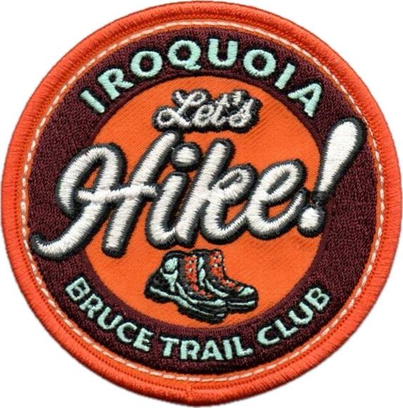
Let's Hike!
https://hikes.brucetrail.org/event/lets-hike-3/Sorry, the registration cut-off time for this hike has been reached.Not a member? Click here to join today!Hosting Club: Iroquoia
Category: Special Event
Location (Google Maps):Grimsby Public Library
18 Carnegie Lane Grimsby OntarioHike Leader(s): Ruth Moffatt Click here to contact Hike Leader(s)
Pace: Leisurely – 3km/hr or less
Terrain: Easy – Mostly flat and usually good footing
Distance: There won’t be any hiking, just info on how to get started.Description
Are you new to hiking? Would you like a little more guidance to get started?In this workshop we will show you everything you need to get started hiking. It will be led by volunteers from Iroquoia Bruce Trail Club and will include a guidebook to take home as well as a new retro-looking Let’s Hike! badge. One guidebook and badge per person. You must register either through this form or in person.
From the trail up, we will discuss footwear, socks, clothing, layering, what to carry in your backpack, hydration, food, hiking hacks, pole and trail etiquette and so much more. Are you ready to get started?
The workshop is 2:00pm – 3:30pm in the lounge of the Grimsby Public Library.
Please join us!
If you have any questions, please reach out through contact on this form.
This presentation is brought to you through a Community of Grimsby Municipal Grant.