|
Sun | Mon | Tue | Wed | Thu | Fri | Sat |
|---|
August | August | 1 | 2 | 3  Halton Agreement Forest Halton Agreement Forest 9:30 AM-12:00 PM 09/03/2026 https://hikes.brucetrail.org/event/halton-agreement-forest-10/2026-09-03/ - Mystery Trails
10:00 AM-12:30 PM 09/03/2026 https://hikes.brucetrail.org/event/mystery-trails/2026-09-03/  Click here for more information or to register Hosting Club: Iroquoia
Category: General Hike
Location (Google Maps): City View Park, 2500 Kerns Rd. SOUTH Parking Lot Hike Leader(s): Anne Armstrong Click here to contact Hike Leader(s) Pace: Leisurely – 3km/hr or less
Terrain: Easy – Mostly flat and usually good footing, Moderate – Some hills and/or some poor footing
Distance: Approx. 8-9 km. Description
Join us to explore the many trails between Watertown and Kerns Rd. We will use a combination of Main Bruce Trail, Blue Side Trails and former Bruce Trail as well as trails of use. Meet in the SOUTH parking lot at 9:45 am. for a 10:00 am. start. Bring water, a snack and sunscreen. Expect some rocky areas. I will send out an email the day before with my contact details in the event you need to cancel in the morning.
| 4 | 5  Steeltown Stomp Practice Session #2 of 8 Steeltown Stomp Practice Session #2 of 8 7:30 AM-9:30 AM 09/05/2026 https://hikes.brucetrail.org/event/steeltown-stomp-practice-session-2-of-8/2026-09-05/ 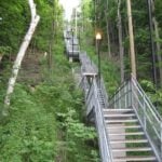 Click here for more information or to register Hosting Club: Iroquoia
Category: Steeltown Stomp Practice Session
Location (Google Maps): Chedoke Golf Club Parking Lot – Access from Beddoe Dr off Studholm Rd south of Aberdeen (Parking capacity 40) Hike Leader(s): Muskan Sidana Click here to contact Hike Leader(s) Pace: Brisk – 4 to 5 km/hr, Medium – 3 to 4 km/hr
Terrain: Strenuous – Hilly with steep climbs and some poor footing
Distance: Varies Description
Is the Steeltown Stomp on your bucket list? This is your chance to crush it! Join us and prepare for this incredible challenge on October 3rd, 2026! Registration for the event is now open. If you’ve done stair climbs before, you know the deal—that brutal calf pain is real, especially when you’re just starting out. But training with us this summer? That’s how you show up on stomp day actually feeling strong instead of totally wrecked. Trust me. We’ll start easy and build up as the summer goes on, hitting Chedoke and Dundurn Stairs with some scenic hikes mixed in. By the time October rolls around, you’ll have crushed at least 2,000 steps and you’ll actually know what you’re doing. It’s a solid group vibe—moderate pace, warm-ups to get going, stretches to cool down. And honestly, it’s way more fun (and way less painful) doing this with people who get it. Just grab your water bottle (there’s water at both staircases) and whatever snacks you want. And yeah, there’s optional coffee after if you want to hang out and celebrate. We’ve got 7 training dates lined up this summer—check the schedule and pick the ones that work for you. Do the work now, own it on stomp day. See you out there!
- Glen Cross to Riverside Woods
9:30 AM-12:30 PM 09/05/2026 https://hikes.brucetrail.org/event/glen-cross-to-riverside-woods-2/2026-09-05/ Click here for more information or to register Hosting Club: Iroquoia
Category: General Hike
Location (Google Maps): Meet in the Bruce Trail parking lot on 1st Line at Riverside Woods, just north of Orangeville. Hike Leader(s): Karen Bergmann Click here to contact Hike Leader(s) Pace: Medium – 3 to 4 km/hr
Terrain: Moderate – Some hills and/or some poor footing
Distance: 8 kms Description
Meeting at 9:15 in the Bruce Trail parking lot, we will carpool to Fourth Line and hike back. The trail takes us through the forest and the grounds of the Hockley Valley Resort, across a golf course and bike trails, down to Second Line. We will continue into Riverside Woods and hike to the parking lot. Bring sufficient water and a snack, as needed, as well as bug spray/bug net.
 Hike with kids Hilton Falls Conservation Halton Hike with kids Hilton Falls Conservation Halton 10:00 AM-2:00 PM 09/05/2026 https://hikes.brucetrail.org/event/hike-with-kids-hilton-falls-conservation-halton/2026-09-05/  Click here for more information or to register Hosting Club: Iroquoia, Toronto
Category: Junior Hiker
Location (Google Maps): Meet at Hilton Falls Conservation Park Main Parking lot. Hike Leader(s): IgorT Click here to contact Hike Leader(s) Pace: Leisurely – 3km/hr or less
Terrain: Easy – Mostly flat and usually good footing
Distance: 3km Description
Join me to hike with kids at Hilton Falls. We’ll hike from parking lot to the falls and back, about 3km total. (Stroller accessible) At the falls we’ll make a fire, please bring hot dogs, marshmallows etc. for kids and adults to enjoy. Park entrance fee 10.50 plus tax per car, reservation required unless you have a pass. https://www.conservationhalton.ca/parks/hilton-falls/ “Preserving a ribbon of wilderness, for everyone, forever”
|
6 | 7 - CANCELLED – Steeltown Stomp Practice Session #3 of 8
7:30 AM-9:30 AM 09/07/2026 https://hikes.brucetrail.org/event/steeltown-stomp-practice-session-3-of-8/2026-09-07/ 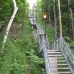 Click here for more information or to register Hosting Club: Iroquoia
Category: Steeltown Stomp Practice Session
Location (Google Maps): Chedoke Golf Club Parking Lot – Access from Beddoe Dr off Studholm Rd south of Aberdeen (Parking capacity 40) Hike Leader(s): Muskan Sidana Click here to contact Hike Leader(s) Pace: Brisk – 4 to 5 km/hr, Medium – 3 to 4 km/hr
Terrain: Strenuous – Hilly with steep climbs and some poor footing
Distance: Varies Description
Is the Steeltown Stomp on your bucket list? This is your chance to crush it! Join us and prepare for this incredible challenge on October 3rd, 2026! Registration for the event is now open. If you’ve done stair climbs before, you know the deal—that brutal calf pain is real, especially when you’re just starting out. But training with us this summer? That’s how you show up on stomp day actually feeling strong instead of totally wrecked. Trust me. We’ll start easy and build up as the summer goes on, hitting Chedoke and Dundurn Stairs with some scenic hikes mixed in. By the time October rolls around, you’ll have crushed at least 2,000 steps and you’ll actually know what you’re doing. It’s a solid group vibe—moderate pace, warm-ups to get going, stretches to cool down. And honestly, it’s way more fun (and way less painful) doing this with people who get it. Just grab your water bottle (there’s water at both staircases) and whatever snacks you want. And yeah, there’s optional coffee after if you want to hang out and celebrate. We’ve got 7 training dates lined up this summer—check the schedule and pick the ones that work for you. Do the work now, own it on stomp day. See you out there!
- Halton Forest to Speyside (E2E)
9:30 AM-12:00 PM 09/07/2026 https://hikes.brucetrail.org/event/halton-forest-to-speyside-e2e-5/2026-09-07/ Click here for more information or to register Hosting Club: Iroquoia
Category: General Hike
Location (Google Maps): Meet at the Pear Tree parking lot at Speyside on 15 Side Road at 9:15 am. Hike Leader(s): Karen Bergmann Click here to contact Hike Leader(s) Pace: Medium – 3 to 4 km/hr
Terrain: Moderate – Some hills and/or some poor footing
Distance: 8 kms Description
We will meet at 9:15 in the Pear Tree parking lot on 15 Side Road and carpool to 6th Line at the Halton Agreement Forest and hike back along the Hilton Falls Side Trail, Al Shaw Side Trail and the main trail. This trail has some serious rocks and we cross a couple of creeks. Bring sufficient water and bug spray/bug net.
| 8 - Tuesday’s 10k
8:00 AM-10:30 AM 09/08/2026 https://hikes.brucetrail.org/event/tuesdays-10k/2026-09-08/ 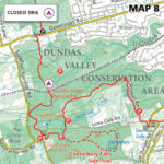 Click here for more information or to register Hosting Club: Iroquoia Location (Google Maps): Ancaster Lions Outdoor Pool – 263 Jerseyville Rd W, Ancaster Hike Leader(s): Jennifer DeBoer Click here to contact Hike Leader(s) Pace: Brisk – 4 to 5 km/hr
Terrain: Moderate – Some hills and/or some poor footing
Distance: 10k+ Description
We will hike the trails around the Dundas Valley Conservation Area. Dress for the weather wearing hiking boots. Please also bring sunscreen, bug spray, poles, water and a snack.
| 9 - HIking for Butter Tarts – Old Guelph Road to Dyments and Back
9:00 AM-2:00 AM 09/09/2026 https://hikes.brucetrail.org/event/hiking-for-butter-tarts-old-guelph-road-to-dyments-and-back/2026-09-09/  Hike open to BTC Members only. Click here for more information or to register Hosting Club: Iroquoia
Category: General Hike
Location (Google Maps): Old Guelph Road at Tunnel – BTC parking where Old Guelph Road ends west side of highway 6,south of Clappisons Hike Leader(s): Lois Corey Click here to contact Hike Leader(s) Pace: Medium – 3 to 4 km/hr
Terrain: Moderate – Some hills and/or some poor footing
Distance: 16 kms Description
This is an out and back hike, no carpooling required. We will hike at a moderate-brisk pace from highway 6 West along Bruce Trail, deviating from the trail at the half way point, for a brief stop at Dyments Farm Market for butter tarts (or whatever catches your fancy), perhaps a little side trip to the Sydenham Lookout. Some climbing up and down escarpment between Old Guelph Road and Borers Falls, but lots of flat through Rock Chapel area to Dyments along the edge of the escarpment with some great views. Please dress appropriately for the weather and poles recommended. Please bring water and snacks/lunch. Any questions may be directed through contact on this form. If you cannot make it, please remove yourself from registration by following these steps:To cancel your registration, here is a step by step:
– Sign into your account on the BTC website
– Click on My Hikes under your account
– This will take you to a list of hikes you have registered for
– Scroll down to the appropriate hike and cursor over to the far right hand column under the Action column.
– Click Cancel under the hike you wish to cancel
| 10 - Nassagaweya Canyon, from Crawford Lake (reservations required)
9:30 AM-12:30 PM 09/10/2026 https://hikes.brucetrail.org/event/nassagaweya-canyon-from-crawford-lake-reservations-required-3/2026-09-10/ Click here for more information or to register Hosting Club: Iroquoia
Category: General Hike
Location (Google Maps): Meet in the first parking lot at Crawford Lake. You will need to reserve your time at conservationhalton.ca Hike Leader(s): Karen Bergmann Click here to contact Hike Leader(s) Pace: Medium – 3 to 4 km/hr
Terrain: Moderate – Some hills and/or some poor footing
Distance: 9 kms Description
Meeting at 9:15 am in the first parking lot, we will hike through the park and down into the canyon and back up into the park for a large loop. There are some rocks along the way and a couple of steep hills (going down into the canyon and then back up). Bring a snack, as needed, and bug spray/bug net.
| 11 - Beaver Valley E2E in 8 – Hike 3
9:30 AM-2:30 PM 09/11/2026 https://hikes.brucetrail.org/event/beaver-valley-e2e-in-8-hike-3/2026-09-11/ Hike open to BTC Members only. Click here for more information or to register Hosting Club: Iroquoia
Category: General Hike
Location (Google Maps): Roadside Parking – north shoulder Sideroad 7B Hike Leader(s): Pati Greenwood, Jeff Dowsett Click here to contact Hike Leader(s) Pace: Medium – 3 to 4 km/hr
Terrain: Moderate – Some hills and/or some poor footing, Strenuous – Hilly with steep climbs and some poor footing
Distance: 15.8 km Description
This is hike 3 of the End-to-End hike series to complete the Beaver Valley section of the Bruce Trail in 8 hikes. Join for all or as many hikes as desired – you will need to register for each hike in the series which will take place on the following dates: August 28, August 29, September 11, September 12, October 2, October 3, October 16 & October 17. Hikers completing the entire series will be eligible to obtain an end-to-end badge from the BTC Beaver Valley Club. Since this is a group hike, please consider your fitness level before registering. This section of the trail has numerous hills and rough terrain in spots. We will be walking at a pace of 3km – 4km per hour and hikers will need to keep up with the person in front of them for the duration of the hike. The hike series will also involve car shuttles and every hiker is expected to participate as drivers. Weather conditions in the late summer can still be quite warm, but the hike schedule will extend to mid-October so it’s best come prepared for varying weather conditions. Hiking boots are required and hiking poles are strongly recommended. Bring plenty of fluids and a snack. Insects and ticks will still be active at this time of year, long pants and long sleeves are recommended as is insect repellent. Specific hike details will be provided to registered hikers a few days prior to each hike.
 Afternoon Hike – Smokey Hollow Loop Afternoon Hike – Smokey Hollow Loop 4:30 PM-6:00 PM 09/11/2026 https://hikes.brucetrail.org/event/smokey-hollow-loop/2026-09-11/ Click here for more information or to register Hosting Club: Iroquoia
Category: Afternoon/Evening Hikes
Location (Google Maps): Meet in the parking lot in Waterdown at Smokey Hollow on Mill St. Hike Leader(s): Karen Bergmann Click here to contact Hike Leader(s) Pace: Medium – 3 to 4 km/hr
Terrain: Moderate – Some hills and/or some poor footing
Distance: 5 kms Description
Starting from the Smokey Hollow parking lot, we will hike along the main trail beside Grindstone Creek to the Norman Pearson Side Trail to the McNally Side Trail to the main trail and the Eric Best Side Trail and back to the parking lot.
| 12 - Steeltown Stomp Practice Session #4 of 8
7:30 AM-9:30 AM 09/12/2026 https://hikes.brucetrail.org/event/steeltown-stomp-practice-session-4-of-8/2026-09-12/ 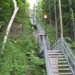 Click here for more information or to register Hosting Club: Iroquoia
Category: Steeltown Stomp Practice Session
Location (Google Maps): Chedoke Golf Club Parking Lot – Access from Beddoe Dr off Studholm Rd south of Aberdeen (Parking capacity 40) Hike Leader(s): Muskan Sidana Click here to contact Hike Leader(s) Pace: Brisk – 4 to 5 km/hr, Medium – 3 to 4 km/hr
Terrain: Strenuous – Hilly with steep climbs and some poor footing
Distance: Varies Description
Is the Steeltown Stomp on your bucket list? This is your chance to crush it! Join us and prepare for this incredible challenge on October 3rd, 2026! Registration for the event is now open. If you’ve done stair climbs before, you know the deal—that brutal calf pain is real, especially when you’re just starting out. But training with us this summer? That’s how you show up on stomp day actually feeling strong instead of totally wrecked. Trust me. We’ll start easy and build up as the summer goes on, hitting Chedoke and Dundurn Stairs with some scenic hikes mixed in. By the time October rolls around, you’ll have crushed at least 2,000 steps and you’ll actually know what you’re doing. It’s a solid group vibe—moderate pace, warm-ups to get going, stretches to cool down. And honestly, it’s way more fun (and way less painful) doing this with people who get it. Just grab your water bottle (there’s water at both staircases) and whatever snacks you want. And yeah, there’s optional coffee after if you want to hang out and celebrate. We’ve got 7 training dates lined up this summer—check the schedule and pick the ones that work for you. Do the work now, own it on stomp day. See you out there!
- Beaver Valley E2E in 8 – Hike 4
8:30 AM-2:30 PM 09/12/2026 https://hikes.brucetrail.org/event/beaver-valley-e2e-in-8-hike-4/2026-09-12/ Hike open to BTC Members only. Click here for more information or to register Hosting Club: Iroquoia, Beaver Valley
Category: General Hike
Location (Google Maps): Eugenia Falls Conservation Area Parking Lot – Fee required Hike Leader(s): Pati Greenwood, Jeff Dowsett Click here to contact Hike Leader(s) Pace: Medium – 3 to 4 km/hr
Terrain: Moderate – Some hills and/or some poor footing, Strenuous – Hilly with steep climbs and some poor footing
Distance: 13.8 km Description
This is hike 4 of the End-to-End hike series to complete the Beaver Valley section of the Bruce Trail in 8 hikes. Join for all or as many hikes as desired – you will need to register for each hike in the series which will take place on the following dates: August 28, August 29, September 11, September 12, October 2, October 3, October 16 & October 17. Hikers completing the entire series will be eligible to obtain an end-to-end badge from the BTC Beaver Valley Club. Since this is a group hike, please consider your fitness level before registering. This section of the trail has numerous hills and rough terrain in spots. We will be walking at a pace of 3km – 4km per hour and hikers will need to keep up with the person in front of them for the duration of the hike. The hike series will also involve car shuttles and every hiker is expected to participate as drivers. Weather conditions in the late summer can still be quite warm, but the hike schedule will extend to mid-October so it’s best come prepared for varying weather conditions. Hiking boots are required and hiking poles are strongly recommended. Bring plenty of fluids and a snack. Insects and ticks will still be active at this time of year, long pants and long sleeves are recommended as is insect repellent. Specific hike details will be provided to registered hikers a few days prior to each hike.
|
13 - Limehouse to Scotsdale Farm
9:30 AM-12:30 PM 09/13/2026 https://hikes.brucetrail.org/event/limehouse-side-trails-2/2026-09-13/ Click here for more information or to register Hosting Club: Iroquoia
Category: General Hike
Location (Google Maps): Meet roadside at 9:15 am on 8 Line, just down the road from the corner of 8 and 27. Hike Leader(s): Karen Bergmann Click here to contact Hike Leader(s) Pace: Medium – 3 to 4 km/hr
Terrain: Moderate – Some hills and/or some poor footing
Distance: 8 kms Description
Come explore the new main trail just north of Limehouse. We will meet roadside on 8 Line, just down the road from the corner of 8 and 27. Then we’ll carpool to 5th Line and begin our hike on the Ancient Maple Side Trail. Heading onto the main trail, we’ll check out the new main trail that leads into Scotsdale Farm and the rerouted main trail on what used to be called Great Esker ST. Bring sufficient water as well as bug spray/bug net.
| 14 - Early Morning Hike
7:45 AM-9:45 AM 09/14/2026 https://hikes.brucetrail.org/event/early-morning-hike-2/2026-09-14/ Click here for more information or to register Hosting Club: Iroquoia
Category: General Hike
Location (Google Maps): Kerncliff Park, Parking Lot (Parking capacity 30)
Access to the main trail is via Kerncliff Park Side Trail. (no access from Hwy 5) Hike Leader(s): Madeline Grady Click here to contact Hike Leader(s) Pace: Medium – 3 to 4 km/hr
Terrain: Moderate – Some hills and/or some poor footing
Distance: 8 km Description
Come start your day with a walk in the woods and listen to birds chirping. The trail will start and end with hills. The middle will be mostly flat but some rocks and tree roots to content with. Bonus: Getting natural light early in the morning helps reset your internal clock, anchors your circadian rhythm and gives us natural red light therapy from that early morning sun.
| 15 - Tuesday’s 10k
8:00 AM-10:30 AM 09/15/2026 https://hikes.brucetrail.org/event/tuesdays-10k-2/2026-09-15/ Click here for more information or to register Hosting Club: Iroquoia Location (Google Maps): Ancaster Lions Outdoor Pool – 263 Jerseyville Rd W, Ancaster Hike Leader(s): Jennifer DeBoer Click here to contact Hike Leader(s) Pace: Brisk – 4 to 5 km/hr
Terrain: Moderate – Some hills and/or some poor footing
Distance: 10k+ Description
We will hike the trails around the Dundas Valley Conservation Area. Dress for the weather wearing hiking boots. Please also bring sunscreen, bug spray, poles, water and a snack.
- Hilton Falls on the Bike Trails
9:30 AM-12:00 PM 09/15/2026 https://hikes.brucetrail.org/event/hilton-falls-on-the-bike-trails-5/2026-09-15/ Click here for more information or to register Hosting Club: Iroquoia
Category: General Hike
Location (Google Maps): Meet in the parking lot at Hilton Falls Conservation Area at 9:15 am Hike Leader(s): Karen Bergmann Click here to contact Hike Leader(s) Pace: Medium – 3 to 4 km/hr
Terrain: Moderate – Some hills and/or some poor footing
Distance: 8 kms Description
Meeting in the parking lot at 9:15 am, we will hike to the Falls and then across the creek to the bike trails and back along the Hilton Falls Side Trail. Reserve your time at conservationhalton.ca Bring sufficient water as well as bug spray/bug net.
| 16 - Good Companions – Spring Valley – Ancaster
10:00 AM-12:30 PM 09/16/2026 https://hikes.brucetrail.org/event/good-companions-spring-valley-ancaster-6/2026-09-16/ Click here for more information or to register Hosting Club: Iroquoia
Category: Good Companions
Location (Google Maps): Ancaster Little League Ball Park – Jerseyville Rd (across from the Ancaster Lions Outdoor Pool) – See map below Hike Leader(s): Ted Bossence Click here to contact Hike Leader(s) Pace: Medium – 3 to 4 km/hr
Terrain: Strenuous – Hilly with steep climbs and some poor footing
Distance: 8 km Description
We will follow the Spring Valley Trail, Martins Road, Headwaters Trail etc. in the western part of the Dundas Valley . Bring sunscreen, bug repellant, water and a snack (poles would also be useful). If I cancel due to rain I will notify you by email no later than the night before, so please check your emails before you leave for the hike. Please arrive 10 minutes before the10:00 am time since I will be leaving promptly at 10:00. I will send contact info the day before the hike for those who cancel after 4:00 pm the day before the hike.
- Steeltown Stomp Practice Session #5 of 8
5:30 PM-7:30 PM 09/16/2026 https://hikes.brucetrail.org/event/steeltown-stomp-practice-session-5-of-8/2026-09-16/ 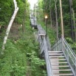 Click here for more information or to register Hosting Club: Iroquoia
Category: Steeltown Stomp Practice Session
Location (Google Maps): Chedoke Golf Club Parking Lot – Access from Beddoe Dr off Studholm Rd south of Aberdeen (Parking capacity 40) Hike Leader(s): Muskan Sidana Click here to contact Hike Leader(s) Pace: Brisk – 4 to 5 km/hr, Medium – 3 to 4 km/hr
Terrain: Strenuous – Hilly with steep climbs and some poor footing
Distance: Varies Description
Is the Steeltown Stomp on your bucket list? This is your chance to crush it! Join us and prepare for this incredible challenge on October 3rd, 2026! Registration for the event is now open. If you’ve done stair climbs before, you know the deal—that brutal calf pain is real, especially when you’re just starting out. But training with us this summer? That’s how you show up on stomp day actually feeling strong instead of totally wrecked. Trust me. We’ll start easy and build up as the summer goes on, hitting Chedoke and Dundurn Stairs with some scenic hikes mixed in. By the time October rolls around, you’ll have crushed at least 2,000 steps and you’ll actually know what you’re doing. It’s a solid group vibe—moderate pace, warm-ups to get going, stretches to cool down. And honestly, it’s way more fun (and way less painful) doing this with people who get it. Just grab your water bottle (there’s water at both staircases) and whatever snacks you want. We’ve got 7 training dates lined up this summer—check the schedule and pick the ones that work for you. Do the work now, own it on stomp day. See you out there!
- BTC x HCA Bird Walk: Fall Migration at Saltfleet
6:00 PM-7:30 PM 09/16/2026 https://hikes.brucetrail.org/event/btc-x-hca-bird-walk-fall-migration-at-saltfleet/2026-09-16/  Click here for more information or to register Hosting Club: Iroquoia
Category: Birding Hikes
Location (Google Maps): Saltfleet Conservation Area Hike Leader(s): Shayne Ward Click here to contact Hike Leader(s) Pace: Leisurely – 3km/hr or less
Terrain: Easy – Mostly flat and usually good footing Description
Join the Iroquoia Bruce Trail Club’s Shayne Ward and the Hamilton Conservation Authority’s Ben Laing for a special evening bird walk at Saltfleet Conservation Area in Stoney Creek! This collaborative event pairs BTC hike leadership with HCA’s on-the-ground expertise for a close look at fall migration in one of Hamilton’s birding hotspots! We’ll wander the trails around Saltfleet’s wetlands, keeping an eye out for lingering warblers, shorebirds, and early-arriving waterfowl as fall migration ramps up. HCA’s Ben Laing will bring a spotting scope to help us pick out any peeps and ducks tucked into the back of the ponds, and we’ll take some time to check out the site’s restoration work, including the wetland cells and a resident purple martin house. This is a great outing for birders of all experience levels — bring your binoculars if you have them, or just come curious! No binoculars?! IBTC has loaners for this hike provided by NOCS Provisions! 🌈 This is a queer-led, 2SLGBTQIA+ inclusive Rainbow Hike, welcoming LGBTQ+ hikers, allies, birders, photographers, and anyone interested in connecting with nature and community. This is a short, relaxed hike (approx. 5 km or less) designed to get us moving and birding! What to Bring - Water and light snacks
- Weather-appropriate clothing and sturdy footwear
- Binoculars or camera if you have them (optional but fun! And a cell phone counts!)
🚗 🚌 This outing is accessible by car or public transit. Planning to Drive?
Saltfleet is an HCA Conservation Area and parking is $8.50 per-vehicle entry fee at the gate. If this is a barrier for you, please reach out — Shayne is happy to help coordinate a shuttle or carpool from a nearby meeting point. Taking the Bus?
HSR #44 stops near the trailhead entrance at Upper Centennial and Green Mountain! Map of the bus and it’s schedule can be found here.
https://www.hamilton.ca/sites/default/files/2026-08/hsr-route-44-RYMAL-Fall-2026-Schedule.pdf Not a Bruce Trail member yet?! Sign up here: https://brucetrail.org/become-a-member/ Questions? Simply click “Contact Hike Leader” on the registration form.
| 17 | 18 | 19  2026 Iroquoia E2E in Four (Two concurrent weekends) 2026 Iroquoia E2E in Four (Two concurrent weekends) 7:00 AM-5:00 AM 09/19/2026 https://hikes.brucetrail.org/event/2026-iroquoia-e2e-in-four-two-concurrent-weekends/2026-09-19/  This is a Multi-Day HikeYou are signing up for the following dates and times:
2026-09-19 at 07:00
2026-09-20 at 07:00
2026-09-26 at 07:00
2026-09-27 at 07:00 Click here for more information or to register Hosting Club: Iroquoia
Category: Special Event
Location (Google Maps): Two different parking locations (one for each wknd) will be provided to registered hikers only. The Bus will be there to take you to the hike start.
Any unregistered hikers who show up will not be permitted to board the buses. Hike Leader(s): Joe Borges Click here to contact Hike Leader(s) Pace: Brisk – 4 to 5 km/hr
Terrain: Dependent on Conditions, Strenuous – Hilly with steep climbs and some poor footing
Distance: 122km (30-35 each day) // Self-paced with mandatory checkpoint deadlines Description
Please join us for the annual Iroquoia Bruce Trail Club self-paced End-to-End. You can enjoy and complete the entire club distance of 122 km over four days (approximately 30-35km each day). Please be honest about your physical abilities. These 4 days are not recommended for new hikers or anyone who hasn’t completed these distances recently.
The registration fee is non-refundable. The hikes will traverse the varied and often strenuous terrain from Grimbsy in the south, to the 401 in Milton. You will pass many waterfalls and beautiful vistas. Checkpoint stations will be approximately every 10 km offering snacks, water refill, and assistance. Please bring your own First Aid Kit. The hike is $95 for members and $110 for non-members (if there are still available spots after the member pre-sale) and includes bus transportation from the meeting point to the hike starting point, refreshments, parking, permit costs, and the official E2E badge. The fee is non-refundable. After costs, the proceeds go to the Iroquoia Bruce Trail Club who support The Bruce Trail Conservancy mission of “Preserving a ribbon of wilderness, for everyone, forever.” PLEASE NOTE: Registration opens at 8am on February 22, 2026 for Bruce Trail Conservancy members only.
You may be a member of any club. If any spots are still available after the first two weeks, registration will also be opened for non-members at a cost of $110. Details will be emailed to participants. As mentioned, these are longer hikes and are not suitable for beginning hikers. For both events, hikers are expected to maintain an average pace of 4 km/hr (or more). Hikers will be required to reach each checkpoint on each day by a prescribed time in order to continue, and ensure everyone is off the trail before dark. Please be aware that volunteers are running this event and will be waiting. Space is limited, hikes go rain or shine, and no dogs are permitted on this event. For questions, please use the contact hike leader form available through the link on this page.
- Steeltown Stomp Practice Session #6 of 8
7:30 AM-9:30 AM 09/19/2026 https://hikes.brucetrail.org/event/steeltown-stomp-practice-session-6-of-8/2026-09-19/ 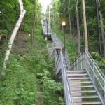 Click here for more information or to register Hosting Club: Iroquoia
Category: Steeltown Stomp Practice Session
Location (Google Maps): Chedoke Golf Club Parking Lot – Access from Beddoe Dr off Studholm Rd south of Aberdeen (Parking capacity 40) Hike Leader(s): Muskan Sidana Click here to contact Hike Leader(s) Pace: Brisk – 4 to 5 km/hr, Medium – 3 to 4 km/hr
Terrain: Strenuous – Hilly with steep climbs and some poor footing
Distance: Varies Description
Is the Steeltown Stomp on your bucket list? This is your chance to crush it! Join us and prepare for this incredible challenge on October 3rd, 2026! Registration for the event is now open. If you’ve done stair climbs before, you know the deal—that brutal calf pain is real, especially when you’re just starting out. But training with us this summer? That’s how you show up on stomp day actually feeling strong instead of totally wrecked. Trust me. We’ll start easy and build up as the summer goes on, hitting Chedoke and Dundurn Stairs with some scenic hikes mixed in. By the time October rolls around, you’ll have crushed at least 2,000 steps and you’ll actually know what you’re doing. It’s a solid group vibe—moderate pace, warm-ups to get going, stretches to cool down. And honestly, it’s way more fun (and way less painful) doing this with people who get it. Just grab your water bottle (there’s water at both staircases) and whatever snacks you want. And yeah, there’s optional coffee after if you want to hang out and celebrate. We’ve got 7 training dates lined up this summer—check the schedule and pick the ones that work for you. Do the work now, own it on stomp day. See you out there!
|
20  Boots and Books Hike – Braiding Sweetgrass by Robin Wall Kimmerer Boots and Books Hike – Braiding Sweetgrass by Robin Wall Kimmerer 9:00 AM-11:00 AM 09/20/2026 https://hikes.brucetrail.org/event/boots-and-books-hike-braiding-sweetgrass-by-robin-wall-kimmerer/2026-09-20/ 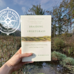 Click here for more information or to register Hosting Club: Iroquoia
Category: Boots & Books – The Iroquoia Bruce Trail Book Club
Location (Google Maps): Dundas Valley Conservation Area Hike Leader(s): Kirsten McCarthy Click here to contact Hike Leader(s) Pace: Leisurely – 3km/hr or less
Terrain: Easy – Mostly flat and usually good footing, Moderate – Some hills and/or some poor footing, Slippery Sections Likely
Distance: 5-6km Description
Come join us for the next Boots and Books Hike! This is also a Passport to Nature event where participants can collect a sticker for your Passport. Collect 4 stickers and get a badge, collect 9 different colour stickers and receive a BTC store gift card! We’ll be reading “Braiding Sweetgrass” by Robin Wall Kimmerer and our hike will enhance the books teachings about the connection between plants, animals and humans as we stroll through The Dundas Valley Conservation Area’s new Basadinaa Experience. The Indigenous heritage of the Mississaugas of the Credit First Nation and Six Nations communities comes to life throughout the Basadinaa Experience throughout the main trail of the DVCA. The beautiful signage along the way provides opportunities for reflection, learning, and connection with the land through First Nations perspectives. Visitors are encouraged to take their time and approach the trail with openness and gratitude. We’ll meet in the main parking lot off Governor’s Road (Park fees apply – please register here for parking https://conservationhamilton.ca/admissions-fees/) and hike the main loop.
- Scotsdale Farm
9:30 AM-12:00 PM 09/20/2026 https://hikes.brucetrail.org/event/scotsdale-farm/2026-09-20/ Click here for more information or to register Hosting Club: Iroquoia
Category: General Hike
Location (Google Maps): Meet at 9:15 am in the main parking lot at Scotsdale Farm Hike Leader(s): Karen Bergmann Click here to contact Hike Leader(s) Pace: Medium – 3 to 4 km/hr
Terrain: Moderate – Some hills and/or some poor footing
Distance: 9 kms Description
We will start at the main parking lot and hike around the Bennett Heritage side trail, along the main trail around the loop and back along the top of the Bennett Heritage side trail. Although a fairly easy hike, there are a few rocky sections and a few hills. Bring water and a snack, as needed.
- BAFFIN × BRUCE TRAIL CONSERVANCY × HAMILTON TIGER-CATS COMMUNITY HIKE
11:00 AM-2:00 PM 09/20/2026 https://hikes.brucetrail.org/event/baffin-x-bruce-trail-conservancy-x-hamilton-tiger-cats-community-hike/2026-09-20/ Click here for more information or to register Hosting Club: Iroquoia
Category: Special Event
Location (Google Maps): City View Park in Burlington Hike Leader(s): BTC Staff Click here to contact Hike Leader(s) Pace: Leisurely – 3km/hr or less
Terrain: Easy – Mostly flat and usually good footing, Moderate – Some hills and/or some poor footing Description
IMPORTANT: SEE BAFFIN WEBSITE FOR REGISTRATION & MORE DETAILS – https://www.baffin.com/pages/baffin-bruce-trail-conservancy-hamilton-tiger-cats-community-hike Spend the morning outdoors with members of the Baffin community, Bruce Trail Conservancy and Hamilton Tiger-Cats, with special appearances from Ticats players and cheerleaders. Event Highlights: - Guided Community Hike — Explore the trails surrounding City View Park alongside the Bruce Trail Conservancy and fellow members of the community.
- Hamilton Tiger-Cats Special Guests — Members of the Hamilton Tiger-Cats team and cheerleaders will join us for the morning.
- Baffin on the Trail — Connect with the Baffin team and experience a morning built around community, movement and time outdoors.
| 21 - Multi-day Trip to Manitoulin Island
12:00 AM 09/21/2026 https://hikes.brucetrail.org/event/multi-day-trip-to-manitoulin-island/2026-09-21/ 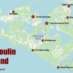 Hike open to BTC Members only. This is a Multi-Day HikeYou are signing up for the following dates and times:
2026-09-21 at
2026-09-22 at
2026-09-23 at
2026-09-24 at
2026-09-25 at Click here for more information or to register Hosting Club: Iroquoia, Peninsula
Category: Special Event
Location (Google Maps): Manitoulin Island
Registered participants will receive a WhatsApp invitation (optional) which can be used for photo share. Hike Leader(s): Ruth Moffatt Click here to contact Hike Leader(s) Pace: Leisurely – 3km/hr or less, Medium – 3 to 4 km/hr
Terrain: Dependent on Conditions, Moderate – Some hills and/or some poor footing, Strenuous – Hilly with steep climbs and some poor footing
Distance: Varies Description
Everyone who is registered for this hike series will be invited to join an optional WhatsApp which can be used to share photos and other information. Please join Beth Gilhespy and Ruth Moffatt for a 5 day/4 night trip over to Manitoulin Island (Manidoo Minising) where we will hike and explore the Escarpment Biosphere Conservancy (EBC) trails. Manitoulin Island is the world’s largest freshwater island and is known for its stunning nature, Indigenous culture (home to six Anishinaabe First Nations), and outdoor activities. We will access it via MS Chi-Cheemaun ferry from Tobermory. Shared expenses for accommodation with whomever you are sharing your cabin with and travel (gas, ferry expenses). You may also choose to travel solo. Breakfast and lunch will be your own responsibility. One or two potluck dinners may be arrange depending on the weather and facilities.
Day1 – Mon, Sept 21, 2026 – 9am – meet in the BTC Parking Area on the east side of the road – 2461 Bruce County Rd 9, Barrow Bay. Depart at 9:15am. You can leave your car here if you are comfortable doing so or get dropped off.
On the way up to Tobermory to catch the MS Chi-Cheemaun ferry, we will stop at the EBC’s Alvar Bay Nature Preserve (close to Tobermory). We should be in position for the ferry at 11:30am so you will have time for your lunch in the Tobermory area. We will proceed to catch the 1:30pm ferry crossing. The ferry crossing takes about 1.75 – 2 hours. From the arrival in South Baymouth we will proceed to Mindemoya Court Cottages and Campground (about 35 min) https://mindemoya.ca/cottages. Please arrange your reservation with Kim at enquiries@mindemoya.ca Let her know that you are with the Bruce Trail group. You may book any cottage or trailer you like. Waterfront 15T and 16T are being held for us until February 15. Check in is September 21 (Check in time is 3pm)and check out is Sept 25 (check out time is 9am). There is tent camping as well, if you prefer.
This location is very close to the town of Mindemoya where there are amenities if needed.
Please make note of what you will need to bring to the cottages. The cottages are located on Mindemoya Lake so we should have some nice sunsets/stargazing opportunities. Tentative Schedule as follows: please be ready to depart the cabins each day by 9:00am.
Hiking schedule is subject to change.
Day 2 – Tues, Sept 22, 2026 – After breakfast we will hike EBC Cup and Saucer Nature Preserve 12 km
Day 3 – Wed, Sept 23, 2026 – After breakfast we will hike EBC Lake Wolsey Nature Preserve 7 to 14 km depending on route chosen
Day 4 – Thurs, Sept 24, 2026 – After breakfast we will hike EBC Barrie Island Nature Preserve 6.5 km; afterwards optional visits to EBC East Bluff Nature Preserve(short trail and great views) and Bridle Veil Falls (trail closed in 2026 but Falls are visible from the viewing platform)
Day 5 – Fri, Sept 25, 2026 – After breakfast and check out of cottages by 9 am we’ll hike EBC Dominion Bay Nature Preserve 2 km + shoreline exploration, and then EBC Fossil Hill Nature Preserve 6 km or less. Drive to South Baymouth to catch the 3:50 pm ferry, arriving Tobermory 5:50 pm Badges will be available for some of the trails we visit. Please visit https://escarpment.ca for information about the Escarpment Biosphere Conservancy and EBC Hiking Trails of Manitoulin Island (Manidoo Minising). It may be helpful to book your accommodations first and then complete your registration. We’d like to keep the group to 25 people maximum.
- Dufferin Hi-Land Blues #1
8:30 AM-1:30 PM 09/21/2026 https://hikes.brucetrail.org/event/dufferin-highland-blues-1/2026-09-21/ Click here for more information or to register Hosting Club: Iroquoia, Dufferin Hi-Land
Category: General Hike
Location (Google Maps): BT Parking Lot – 15th Sideroad, 50 located off 15th Sideroad Hike Leader(s): Pati Greenwood, Jeff Dowsett Click here to contact Hike Leader(s) Pace: Medium – 3 to 4 km/hr
Terrain: Moderate – Some hills and/or some poor footing, Strenuous – Hilly with steep climbs and some poor footing
Distance: 13 KM Description
This is a series of five hikes in the Dufferin Hi-Land section of the Bruce Trail to complete all blue-blazed trails in the section. Hikers finishing all hikes in the series will be eligible to obtain the Dufferin Hi-Land Club’s Side Trails Badge. All hikes in the series will be loops including sections of the main trail and the entirety of several side trails. This first hike will include completing the following side trails: Bell Lookout, Kilgore, Melodonna, Pine River Valley and Carl Alexander. The trail will include steep and rocky sections, please wear appropriate footwear for the terrain; hiking boots or shoes. Hiking poles are recommended. Insects are still active at this time of year, so come prepared by wearing long pants and long sleeves; bring insect repellent/bug nets as needed. Bring plenty to drink and a snack/lunch. Please arrive at the meeting place by 8:15 am for an 8:30 am departure.
| 22 - Tuesday’s 10k
8:00 AM-10:30 AM 09/22/2026 https://hikes.brucetrail.org/event/tuesdays-10k-3/2026-09-22/ Click here for more information or to register Hosting Club: Iroquoia Location (Google Maps): Ancaster Lions Outdoor Pool – 263 Jerseyville Rd W, Ancaster Hike Leader(s): Jennifer DeBoer Click here to contact Hike Leader(s) Pace: Brisk – 4 to 5 km/hr
Terrain: Moderate – Some hills and/or some poor footing
Distance: 10k+ Description
We will hike the trails around the Dundas Valley Conservation Area. Dress for the weather wearing hiking boots. Please also bring sunscreen, bug spray, poles, water and a snack.
| 23 - Speyside to Vanderleck ST return
9:30 AM-11:30 AM 09/23/2026 https://hikes.brucetrail.org/event/speyside-to-vanderleck-st-return-4/2026-09-23/ Click here for more information or to register Hosting Club: Iroquoia
Category: General Hike
Location (Google Maps): Meet at the Speyside Pear Tree parking lot on 15 Side Road at 9:15 am. Hike Leader(s): Karen Bergmann Click here to contact Hike Leader(s) Pace: Medium – 3 to 4 km/hr
Terrain: Moderate – Some hills and/or some poor footing
Distance: 8 kms Description
We will hike the main trail from Speyside, to the Al Shaw ST, Hilton Falls ST and onto the Vanderleck ST up to 17 Side Road and then return the same way. There are some very technical (rocky) sections on this hike but no major hills. Bring bug spray/bug net and a snack, as needed.
- Good Companions – Two Loops from City View Park Burlington
10:00 AM-12:30 PM 09/23/2026 https://hikes.brucetrail.org/event/good-companions-two-loops-from-city-view-park-burlington-4/2026-09-23/ Hike open to BTC Members only. Click here for more information or to register Hosting Club: Iroquoia
Category: Good Companions
Location (Google Maps): North Parking Lot off Kerns Road (Near Dundas Street)
City View Park
Burlington Hike Leader(s): Ted Bossence Click here to contact Hike Leader(s) Pace: Medium – 3 to 4 km/hr
Terrain: Strenuous – Hilly with steep climbs and some poor footing
Distance: 7.5 km Description
We will do a loop on the East side of Kerns Road including the Ian Reid Side Trail and then do a loop using the main Bruce Trail and King Road Side Trail on the West side of Kerns. A couple of the hills will be steep and may be slippery. We will stop for a snack between the two loops. Bring water, a snack, sunscreen. Hiking poles recommended. Please arrive at least 10 minutes prior to start time as I will be leaving on time. In case of rain, I will cancel the hike so please check your email the night before the hike. I will be providing contact information on the day before the hike in case you need to cancel after 4:00 pm on that day or the morning of the hike. PLEASE PARK IN THE NORTH PARKING LOT CLOSEST TO DUNDAS STREET.
| 24 | 25 | 26 - Steeltown Stomp Practice Session #7 of 8
7:30 AM-9:30 AM 09/26/2026 https://hikes.brucetrail.org/event/steeltown-stomp-practice-session-7-of-8/2026-09-26/ 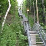 Click here for more information or to register Hosting Club: Iroquoia
Category: Steeltown Stomp Practice Session
Location (Google Maps): Chedoke Golf Club Parking Lot – Access from Beddoe Dr off Studholm Rd south of Aberdeen (Parking capacity 40) Hike Leader(s): Muskan Sidana Click here to contact Hike Leader(s) Pace: Brisk – 4 to 5 km/hr, Medium – 3 to 4 km/hr
Terrain: Strenuous – Hilly with steep climbs and some poor footing
Distance: Varies Description
Is the Steeltown Stomp on your bucket list? This is your chance to crush it! Join us and prepare for this incredible challenge on October 3rd, 2026! Registration for the event is now open. If you’ve done stair climbs before, you know the deal—that brutal calf pain is real, especially when you’re just starting out. But training with us this summer? That’s how you show up on stomp day actually feeling strong instead of totally wrecked. Trust me. We’ll start easy and build up as the summer goes on, hitting Chedoke and Dundurn Stairs with some scenic hikes mixed in. By the time October rolls around, you’ll have crushed at least 2,000 steps and you’ll actually know what you’re doing. It’s a solid group vibe—moderate pace, warm-ups to get going, stretches to cool down. And honestly, it’s way more fun (and way less painful) doing this with people who get it. Just grab your water bottle (there’s water at both staircases) and whatever snacks you want. And yeah, there’s optional coffee after if you want to hang out and celebrate. We’ve got 7 training dates lined up this summer—check the schedule and pick the ones that work for you. Do the work now, own it on stomp day. See you out there!
 RAINBOW HIKE: Crawford Lake—Boardwalk, Geology & Indigenous History RAINBOW HIKE: Crawford Lake—Boardwalk, Geology & Indigenous History 9:30 AM-2:00 PM 09/26/2026 https://hikes.brucetrail.org/event/rainbow-hike-crawford-lake-boardwalk-geology-indigenous-history/2026-09-26/ 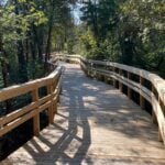 Click here for more information or to register Hosting Club: Iroquoia
Category: Rainbow Hike
Location (Google Maps): Crawford Lake Conservation Area, 3115 Conservation Rd, Milton Hike Leader(s): Doug O’Neill Click here to contact Hike Leader(s) Pace: Medium – 3 to 4 km/hr
Terrain: Easy – Mostly flat and usually good footing, Moderate – Some hills and/or some poor footing, Strenuous – Hilly with steep climbs and some poor footing
Distance: 12 km approx Description
On this all-inclusive, queer-led 2SLGBTQIA+ Rainbow hike, we’ll explore one of the gems along the Bruce Trail: Crawford Lake, and potentially Rattlesnake Point. Note: This hike includes a carpool component. Meet at Burlington GO parking lot (south side, enter off Fairview) by 9 a.m. for a 9:15 a.m. departure by carpool to Crawford Lake.
For those driving directly to Crawford Lake Conservation Area: Please arrive 9:30-9:45 a.m. latest. As soon as you register, please click “Contact the hike leader” on this page and let me know if you: a) Have a vehicle and can offer a ride from Burlington GO Station to Crawford Lake, and how many passengers you can take. (Passengers share parking and entrance fees; drivers do not.) Passengers may also contribute to fuel costs. OR b) If you’re a passenger in need of a ride from Burlington GO Station to Crawford Lake. All non-drivers make their own way to Burlington GO by public transit, as it’s quick and easy to reach. (If you already have Doug’s email, you can email direct.) Your registration isn’t considered final until you email your response to the above. (it really helps with planning). Expect a day of Indigenous history, geology, stunning scenery—and the September reopening of the boardwalk around Crawford Lake. The hike: We’ll follow a mix of the Nassagaweya Canyon Trail/Bruce Trail, as well as the Woodland, Escarpment and Pine Ridge trails. We’ll allow time to visit the reconstructed longhouses, representing a 15th-century Wendat/Iroquoian village, and any exhibits at the nature centre. Note. There are some rocky (uneven) sections on this hike. Getting there: This hike involves a carpool from Burlington GO Station. If you don’t have access to a car—no worries. Take public transit to Burlington GO Station, and we’ll divide into as few cars as possible for the 25-minute drive to the Crawford Lake parking lot. Meet-up: We’ll rendezvous at the Burlington GO parking lot at 9 a.m. for a 9:15 a.m. departure. Meet at the east door on the south side. If you’re coming by GO TRAIN, go to the south/Fairview exit. I’ll be at the east entrance. Conservation Centre admission fee: $10.50 per person. I have a Halton Conservation Membership and can cover one vehicle with up to five passengers. Drivers should not pay; passengers can chip in a few dollars for the driver. By Public Transit to Burlington GO Meet-Up: Take the eastbound GO Train from West Harbour GO (James Street North & Murray Street East—across from LIUNA Station) (NOT Hamilton GO Centre on Hunter Street). Exit at Burlington GO and head to the parking lot. Please arrive by 9 a.m. Bring sufficient water (1 L minimum), lunch and energising snacks. Wear hiking boots or sturdy shoes. Avoid shorts during tick season. Bring a hat, sunblock and insect repellent. Get your complimentary Bruce Trail Rainbow badge! Feel free to reach out to the Hike Leader if you have any questions “Click here to contact Hike Leader” on this form.
 Peninsula Harvest Full Moon Hike – Meet time is 6pm Peninsula Harvest Full Moon Hike – Meet time is 6pm 6:15 PM-8:45 PM 09/26/2026 https://hikes.brucetrail.org/event/peninsula-harvest-full-moon-hike-meet-time-is-6pm/2026-09-26/  Click here for more information or to register Hosting Club: Iroquoia, Peninsula
Category: Moonlight Hikes
Location (Google Maps): Lion’s Head – Park near the Lion’s Head Municipal Campground entrance on Phillip Forbes St Hike Leader(s): Ruth Moffatt Click here to contact Hike Leader(s) Pace: Leisurely – 3km/hr or less, Medium – 3 to 4 km/hr
Terrain: Dependent on Conditions, Easy – Mostly flat and usually good footing, Moderate – Some hills and/or some poor footing
Distance: 8-10km Description
This full moon hike is in the Peninsula Section of trail and led by an Iroquoia Hike Leader. Welcome to the 4th Full Moon Hike Series led this summer. Details for collecting badges are at the bottom of the hike details.
We will meet under the tall pine trees just outside the entrance to Lion’s Head Municipal Campground. Our hike will take us out to Lion’s Head Point and return. Since some of our hike is on road, please wear a hi-vis vest if you have one. I will have a few to distribute as well. Sunset is at 7:16 – Harvest Moon
We are getting started early due to the distance and nature of the hike. Bring water and whatever snacks you need as well as a first aid kit, poles if you use them and most importantly, a head-lamp with a red light if you have one. The following is from the Bruce Trail Conservancy website regarding Hiking at Night.
While most hikers choose to explore the Bruce Trail by day to take in the colourful sights and vast vistas, venturing out after dark also has its benefits.
Hiking at night allows you to tap into other senses and explore nature in a whole new way. From stargazing to nocturnal animal sightings, there is a lot to see and hear when exploring the Bruce Trail after sunset. No matter your motivation for heading out for a nighttime hike, certain precautions should be taken to ensure that your time on the Trail is safe and enjoyable. Before you go
Plan your route and choose somewhere familiar. It’s easy to get turned around in the darkness. Planning your route and hiking it in daylight first will help you know what to expect. If you’ve never tried hiking at night, start with a shorter hike somewhere familiar to you. Always stay on the Trail to avoid getting lost. Bring a headlamp or flashlight and extra batteries. The Trail can be quite rugged with uneven surfaces, rocks, and roots. A headlamp or flashlight is essential for preventing trips and falls – and both are brighter and last longer than your phone’s built-in light. A light source with different settings, including a red light, is ideal as bright lights can be hard on your eyes over time. Bring a fully charged cell phone. You should always bring your phone with you when hitting the trails in case you need to call for help. Most phones have a flashlight function that can act as a backup to your headlamp. You can also use your phone’s GPS with apps like the Bruce Trail App and what3words for navigational and safety purposes. Wear reflective clothing and bring a whistle. A reflective piece of clothing can help other hikers or drivers see you in the darkness. A whistle can help others hear you in case of an emergency, even if they can’t see you. Plan to do your first hike under a full moon and a clear sky.
A full moon can provide a surprising amount of light. Planning your first night hike during a full moon and clear sky can be a great way to acclimate yourself to hiking after dark. Don’t go solo and tell someone where you are going. Always share your route with someone before heading out in case of an emergency. Bring a friend to explore the Trail together, or join one of the moonlit hikes offered by some Bruce Trail Clubs. Bring layers. The temperature can drop quickly in the woods at night. Bring layers to stay warm and comfortable.
While Hiking Slow down and be aware of hazards. Don’t expect to hike at the same pace you would in daylight. Darkness can make the terrain more challenging. Slow down, pay attention to your surroundings, and stay away from cliff edges to prevent injuries. Be prepared for wildlife. Many animals such as coyotes, owls, bats, salamanders, foxes, opossums, and skunks are active at night. Sightings can enhance your nighttime hiking experience but be careful not to get too close. Keep your ears open to the sounds around you to avoid unwanted interactions. While more preparations may be needed for a hike after dusk, for many, once they find themselves in the cool of the night gazing up at the constellations or watching an owl swoop through the darkness, the effort is well worth it. If you are collecting your badge tonight please bring exact cash $10 for members and $15 for non-members to cover the cost of the badge. You must’ve have completed at least 4 full moon hikes. If you wish to pay by e-transfer and have your badge mailed out to you, you may also choose to receive it that way. For simplicity sake, and because it will be dark out, it would be appreciated if you could please choose one method of receiving your badge or the other. Badges are on the honour system so if this is your 4th hike, please feel free to receive your badge.
- Full Moon and ChococcinosTM
7:15 PM-10:00 PM 09/26/2026 https://hikes.brucetrail.org/event/full-moon-and-chococcinostm/2026-09-26/ 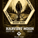 Click here for more information or to register Hosting Club: Iroquoia
Category: Moonlight Hikes
Location (Google Maps): Spencer Smith Park – The Lady of the Lake water fountain Hike Leader(s): Kathrin Koenig Click here to contact Hike Leader(s) Pace: Medium – 3 to 4 km/hr
Terrain: Easy – Mostly flat and usually good footing
Distance: approx 6.5 km Description
We will meet at The Lady of the Lake water fountain at Spencer Smith Park at 7 p.m. with departure at 7:15 p.m. promptly. The water fountain is located next to the Spencer Smith parking lot at Lakeshore and Nelson street. This lot fills up very quickly but there are other public lots available at Brock and Lakeshore as well as Elgin and Burlington Avenue. We will start by walking over to Brant Street Pier, then along the waterfront trail to the Burlington Canal Lift Bridge and back. Our moonlit adventure will end with an optional stop at Coffee Culture on Brant and Elgin for some chococcinos and pastries, for those who are interested. This hike will qualify you for the new Iroquoia Full Moon badge! Complete three leader led-hikes in 2026, and you will qualify. Badges are $10 for BTC members/ $15 for non-members. Any questions may be directed through “Click here to contact Hike Leader” on this form. In the event you are no longer able to attend, please remove yourself from registration by following these steps: – Sign into your account on the BTC website
– Click on My Hikes under your account
– This will take you to a list of hikes you have registered for
– Scroll down to the appropriate hike and cursor over to the far right hand column under the Action column.
– Click Cancel under the hike you wish to cancel
|
27 - Heritage Rd to Silver Creek (linear hike)
9:30 AM-12:00 PM 09/27/2026 https://hikes.brucetrail.org/event/heritage-rd-to-silver-creek-linear-hike-2/2026-09-27/ Click here for more information or to register Hosting Club: Iroquoia
Category: General Hike
Location (Google Maps): Meet at Silver Creek Conservation Area on Fallbrook Trail Rd at 9:15 am. Hike Leader(s): Karen Bergmann Click here to contact Hike Leader(s) Pace: Medium – 3 to 4 km/hr
Terrain: Moderate – Some hills and/or some poor footing
Distance: 8.5 kms Description
We will meet at Silver Creek Conservation Area and carpool to Heritage Road and hike back along the main trail. There are some very technical (rocky) parts to this hike. Bring sufficient water. Hopefully the mosquitoes will have disappeared by this time.
| 28 | 29 - Tuesday’s 10k
8:00 AM-10:30 AM 09/29/2026 https://hikes.brucetrail.org/event/tuesdays-10k-4/2026-09-29/ Click here for more information or to register Hosting Club: Iroquoia Location (Google Maps): Ancaster Lions Outdoor Pool – 263 Jerseyville Rd W, Ancaster Hike Leader(s): Jennifer DeBoer Click here to contact Hike Leader(s) Pace: Brisk – 4 to 5 km/hr
Terrain: Moderate – Some hills and/or some poor footing
Distance: 10k+ Description
We will hike the trails around the Dundas Valley Conservation Area. Dress for the weather wearing hiking boots. Please also bring sunscreen, bug spray, poles, water and a snack.
- St. Helena Forest
9:30 AM-12:00 PM 09/29/2026 https://hikes.brucetrail.org/event/st-helena-forest-3/2026-09-29/ Click here for more information or to register Hosting Club: Iroquoia
Category: General Hike
Location (Google Maps): Meet in the Pear Tree parking lot at Speyside on 15 Side Road at 9:15 am Hike Leader(s): Karen Bergmann Click here to contact Hike Leader(s) Pace: Medium – 3 to 4 km/hr
Terrain: Moderate – Some hills and/or some poor footing
Distance: 9 kms Description
Meeting at 9:15 am in the Pear Tree parking lot, we will hike the main trail into the St. Helena forest and along the trails, which are VERY rocky. This is a dense forest that takes us around a large marsh pond and back up the Al Shaw Side Trail. This hike is about 90% technical (on rocks), so be prepared for that. Not for first time hikers.
| 30 -
 Peninsula E2E in a Fall – 8 days hike through +1 mid rest day Peninsula E2E in a Fall – 8 days hike through +1 mid rest day 8:00 AM-4:00 PM 09/30/2026 https://hikes.brucetrail.org/event/peninsula-e2e-in-a-fall-8-days-hike-through-1-mid-rest-day/2026-09-30/ 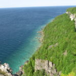 This is a Multi-Day HikeYou are signing up for the following dates and times:
2026-09-30 at 08:00
2026-10-01 at
2026-10-02 at
2026-10-03 at
2026-10-04 at
2026-10-05 at
2026-10-06 at
2026-10-07 at
2026-10-08 at Click here for more information or to register Hosting Club: Iroquoia, Peninsula
Category: Stained Glass Badge End to End Fundraiser Hike
Location (Google Maps): -Meeting point on Sept 30th – at Bluewater Park, Wiarton, parking area opposite arena – First Hike only – Schedule with coordinates will be sent for remaining hikes to registered hikers
First hike : meeting time is 8.00 am Wiarton to shuttle to our trail head where we will start the hike. Hike Leader(s): Corina Seceleanu Click here to contact Hike Leader(s) Pace: Medium – 3 to 4 km/hr
Terrain: Strenuous – Hilly with steep climbs and some poor footing
Distance: 167.5 Km Description
Category: Peninsula E2E– Sept 30th to Oct 8th 2026 This is moderate hike that we will complete the entire 167.5 km of the Peninsula section in 8 hikes; the entire trip constitutes of 9 days with one rest day in between. It is also a Paid hike; your registration fee includes a celebratory finish at the Cairn in Tobermory, the cost of the End-to-End badge, and contributes to fundraising for the Peninsula Bruce Trail Club hiking program activities. Please review the dates carefully to ensure you are able to participate fully. Registration is limited to 10 persons. - This hike series is intended for experienced distance hikers. Hikers must be able to sustain the distance and maintain the pace as advertised.
- Be very aware of your ability to join this series.
- Hikes will average 3.5 km per hour including breaks, moving pace is 3.5 to 4 km per hour;
- Expect to be on-trail for min 7.5 to 8h sometime longer depending on the distance, terrain, weather and group pace; The hike leader set the pace, aiming for the 3-4 Km/h and may adjust as needed for the group ability and trail conditions
- Meeting time: 7:45 am every day, (except first day) at designated location (to be provided basis on the schedule).
- Please arrive no later than 15 minutes prior to the meeting time;
- Hikers must carry sufficient hydration, accessible snacks, lunch, first-aid kit, rain gear, extra socks, and possibly protective boot covers (i.e. bags), also hiking poles recommended.
- Hikers will be expected to participate in shuttling hikers to the start and to drive shuttlers back to their car. Responsibility for shuttling along with any applicable parking fees will be shared within the group.
Summary of the itinerary (km based on Bruce Trail Reference – Edition 31): 1: Sep 30 (Wednesday): Rd Side parking on Coveney’s Rd to Wiarton Bluewater Park – 21.5 km 2: Oct 1 (Thursday): Rd. Side Parking at South End of Cathedral Dr. to Rd Side parking on Coveney’s Rd – 26.15 km 3: Oct 2 (Friday): Cemetery Rd Side trail parking to Rd Side parking at South End of Cathedral Dr. – 21.10 km 4: Oct 3 (Saturday): (2 parts to defer Isthmus Bay Rd. walking, which would be made on last day) - Part 1 – Cemetery Rd. side trail parking to Lion’s Head lookout parking /or in the city) – 11.84 km
- Part 2 – Richardson Side Trail parking to Cape Chin South Rd – 11.34 km —— total 23.48 km
5: Oct 4 (Sunday): Rest Day – No hikes 6: Oct 5 (Monday): Cape Chin South Rd. parking at Carter Rd to Lindsay Rd . &Gilles Lake – 21.90 km 7: Oct 6 (Tuesday): Lindsay Rd. & Gilles Lake to Halfway Dump Side Trail (parking lot) – 22.83 km 8: Oct 7 (Wednesday): Little Cove Parking lot to Halfway Dump Side Trail (parking lot) – 17.73 km 9: Oct 8 (Thursday): 2 parts - Morning/Lunch – Little Cove parking to Tobermory Cairn – 6.70 km — badge ceremony
- Lunch /Afternoon – before going home make up the Isthmus Bay Rd (from town of Lions Head /Lion’s Head lookout parking to Richardson Side Trail Parking lot – 6.25Km—total 12.95 Km
For safety, participants must remain between the hike leader and the hike sweep at all times. Transportation & Accommodations: - Car shuttle: Participants rotate as drivers; vehicles must be passenger-ready- in each day.
- Accommodations: Book early; options include motels, campgrounds, hostels, and B&Bs from Wiarton to Tobermory
Note: A detailed schedule will be provided in advance of the series to registered hikers.
If you have concerns, or questions please use the Contact Hike Leader form to inquire in advance of registering.
Dogs are not permitted More details will be provided at later date to those registered for the hike.
- Good Companions – McCormack Loop – Dundas Valley
10:00 AM-12:30 PM 09/30/2026 https://hikes.brucetrail.org/event/mccormack-loop-dundas-valley/2026-09-30/  Hike open to BTC Members only. Click here for more information or to register Hosting Club: Iroquoia
Category: Good Companions
Location (Google Maps): Parking Directions
Drive through the main entrance of the Dundas Valley Conservation Area to the largest parking lot at the very end of the road. Walk a few hundred meters to the Trail Centre It takes a few minutes to walk from the parking lot to the Trail Centre, so give yourself extra time. We will meet at the Trail Centre.
Entrance fee is free for HCA/Dundas Valley members; $11.50 per vehicle for non-members. Pay by credit card at kiosk at entrance Hike Leader(s): Kathy Rymal Click here to contact Hike Leader(s) Pace: Medium – 3 to 4 km/hr
Terrain: Moderate – Some hills and/or some poor footing
Distance: 7.5 km Description
I loved this hike so much when we did it on July 22 that I thought we should do it again. Maybe the fields of goldenrod will be in full bloom. We will head out on the McCormack trail from the trail centre and cross over Governor’s Road to continue the trail past a horse farm to a beautiful lookout point with views of the escarpment, Dundas, Hamilton and Lake Ontario. We will return along the Bruce, McCormack and Sawmill trail ending up back in the parking lot. As this is in the Dundas Valley some hills can be expected. 🙂 In case you are worried that the goldenrod will induce allergies I found this great article pointing out the differences between goldenrod and ragweed! https://www.hamiltonpollinatorparadise.org/favourite-blog-posts/ragweed-versus-goldenrod
- Steeltown Stomp Practice Session #8 of 8
5:30 PM-7:30 PM 09/30/2026 https://hikes.brucetrail.org/event/steeltown-stomp-practice-session-8-of-8/2026-09-30/ 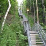 Click here for more information or to register Hosting Club: Iroquoia
Category: Steeltown Stomp Practice Session
Location (Google Maps): Chedoke Golf Club Parking Lot – Access from Beddoe Dr off Studholm Rd south of Aberdeen (Parking capacity 40) Hike Leader(s): Muskan Sidana Click here to contact Hike Leader(s) Pace: Brisk – 4 to 5 km/hr, Medium – 3 to 4 km/hr
Terrain: Strenuous – Hilly with steep climbs and some poor footing
Distance: Varies Description
Is the Steeltown Stomp on your bucket list? This is your chance to crush it! Join us and prepare for this incredible challenge on October 3rd, 2026! Registration for the event is now open. If you’ve done stair climbs before, you know the deal—that brutal calf pain is real, especially when you’re just starting out. But training with us this summer? That’s how you show up on stomp day actually feeling strong instead of totally wrecked. Trust me. We’ll start easy and build up as the summer goes on, hitting Chedoke and Dundurn Stairs with some scenic hikes mixed in. By the time October rolls around, you’ll have crushed at least 2,000 steps and you’ll actually know what you’re doing. It’s a solid group vibe—moderate pace, warm-ups to get going, stretches to cool down. And honestly, it’s way more fun (and way less painful) doing this with people who get it. Just grab your water bottle (there’s water at both staircases) and whatever snacks you want. We’ve got 7 training dates lined up this summer—check the schedule and pick the ones that work for you. Do the work now, own it on stomp day. See you out there!
| October | October | October |