|
Sun | Mon | Tue | Wed | Thu | Fri | Sat |
|---|
November | November | 1  Highway 6 Tunnel to Wind Phone and Back Highway 6 Tunnel to Wind Phone and Back 9:00 AM-2:00 AM 12/01/2026 https://hikes.brucetrail.org/event/highway-6-tunnel-to-wind-phone-and-back/2026-12-01/ Hike open to BTC Members only. Click here for more information or to register Hosting Club: Iroquoia
Category: General Hike
Location (Google Maps): Old Guelph Road Road Side Parking (enter from Old Guelph Road, continue to road dead end, west side of Highway 6, south of Clappisons Corner Hike Leader(s): Lois Corey Click here to contact Hike Leader(s) Pace: Medium – 3 to 4 km/hr
Terrain: Slippery and Steep Sections, Strenuous – Hilly with steep climbs and some poor footing
Distance: 17 kms Description
This is an out and back hike near Waterdown, no carpooling required. We will hike east from Old Guelph Road parking, through tunnel under Highway 6, proceeding along a very hilly challenging section of Bruce Trail to Smokey Hollow Great Falls. We will continue a short distance along the Bruce Trail to check out the wind telephone near McNally property where we will turn around retracing our steps along the Bruce Trail, incorporating a loop along Eric Best side trail if time and conditions allow. Please bring your own water (2-3 litres recommended), lunch and snacks. Very hilly terrain, slippery when wet, hiking poles recommended, along with icers in the case of an early snow fall. Any questions may be directed through contact on this form.
If you cannot make it, please remove yourself from registration by following these steps: To cancel your registration, here is a step by step:
– Sign into your account on the BTC website
– Click on My Hikes under your account
– This will take you to a list of hikes you have registered for
– Scroll down to the appropriate hike and cursor over to the far right hand column under the Action column.
– Click Cancel under the hike you wish to cancel
 Urban Walk: Valley View Park Urban Walk: Valley View Park 9:30 AM-11:45 AM 12/01/2026 https://hikes.brucetrail.org/event/urban-walk-valley-view-park-21/2026-12-01/ Click here for more information or to register Hosting Club: Toronto Location (Google Maps): Parking lot is off Sycamore Drive, East of Bayview , across Starbucks plaza
Bus 91 from Finch East station stops at Sycamore station. Hike Leader(s): MOHAMMAD AGHAMIRI Click here to contact Hike Leader(s) Pace: Moderate (3-4 km/hr)
Terrain: Hilly, Level 2 (Intermediate – some hills and uneven surfaces, rocks and roots underfoot)
Distance (km): 7-8 km Description
We will explore Valleyview and Maple View parks, and walk along German Mills Creek, in return we stop in Huntington park and have snack ,coffee,tea . Although this is considered an “Urban Walk”, you can expect some hills up and down and uneven surfaces with tree roots. Please bring hiking poles, water and snacks. phone number for the day of hike 289 588 6482
 Pine River Nature Reserve Loop Pine River Nature Reserve Loop 9:30 AM-12:00 PM 12/01/2026 https://hikes.brucetrail.org/event/pine-river-nature-reserve-loop/2026-12-01/ Click here for more information or to register Hosting Club: Dufferin Hi-Land
Category: Tuesday Hike
Location (Google Maps): (Google Maps) Dufferin Highland Section, Map 20. Meet at the new BTC parking lot on 15 Sideroad just west of Prince of Wales Rd Hike Leader(s): Les Babbage, Inge Eckerich, Julie Daley, Tony Evangelista Click here to contact Hike Leader(s) Pace: Leisurely
Terrain: Slippery and Steep Sections, Moderate
Distance: Long hike: 5.7 Km Short hike 4 Km Description
We will hike east on the Kilgore Side Trail to the Main Trail at River Rd, then along the riverbank past the ruins of a hydro generating station and the Provincial Fishing Reserve. Next a side trip to the Bell Lookout for a panoramic view of the Pine River Valley, then on to the Pine River Valley Side Trail, following this loop (with option to add on the Carl Alexander Side Trail if conditions are favourable), to the Main Trail , which will take us back to the parking lot. The short hike will skip the Pine River Valley Side Trail, returning to the parking lot by way of the Main Trail.
| 2  8:30 Niagara E2E – Hike #5 8:30 Niagara E2E – Hike #5 8:30 AM-12:30 PM 12/02/2026 https://hikes.brucetrail.org/event/830-niagara-e2e-hike-5/2026-12-02/  Click here for more information or to register Hosting Club: Niagara
Category: Car Pool
Location (Google Maps): Meet at Queenston Heights Park and carpool to Woodend Conservation Area Hike Leader(s): Sam Rutherford Click here to contact Hike Leader(s) Pace: Medium 3- 4 km/hr
Terrain: Moderate: some hills and some poor footing
Distance: 15.4 kms Description
Niagara E2E in 5 hikes. Hike #5 completes the series. A parking fee is charged at Queenston Heights. Please bring snacks and water. Be prepared for weather. Poles are recommended. Please bring $10 for badge once you have completed all 5 hikes.
- Hike the Festival of Northern Lights trail!
7:00 PM-8:45 PM 12/02/2026 https://hikes.brucetrail.org/event/hike-the-festival-of-northern-lights-trail-2/2026-12-02/ Click here for more information or to register Hosting Club: Sydenham
Category: An evening walk.
Location (Google Maps): Meet in the municipal parking lot by the river on the West side of 1st Ave East between 7th St East and 8th St East in Owen Sound. Hike Leader(s): Harriet Nixon Click here to contact Hike Leader(s) Pace: Medium: 3 to 4 km/h
Terrain: Easy: Mostly flat and good footing., There might be icy and slippery sections.
Distance: Approx 6 km Description
Join us for a hike viewing the Festival of Northern Lights displays in the River District and in Harrison Park. If conditions are snowy or icy, please wear icers/crampons. Following the hike there will be an opportunity for socializing over refreshments. There is no need to show up 15 minutes early for this hike, but we will leave promptly at 7:00 pm.
| 3 - Urban Walk: Valley View Park
9:30 AM-11:45 AM 12/03/2026 https://hikes.brucetrail.org/event/urban-walk-valley-view-park-22/2026-12-03/ Click here for more information or to register Hosting Club: Toronto Location (Google Maps): Parking lot is off Sycamore Drive, East of Bayview , across Starbucks plaza
Bus 91 from Finch East station stops at Sycamore station. Hike Leader(s): MOHAMMAD AGHAMIRI Click here to contact Hike Leader(s) Pace: Moderate (3-4 km/hr)
Terrain: Hilly, Level 2 (Intermediate – some hills and uneven surfaces, rocks and roots underfoot)
Distance (km): 7-8 km Description
We will explore Valleyview and Maple View parks, and walk along German Mills Creek, in return we stop in Huntington park and have snack ,coffee,tea . Although this is considered an “Urban Walk”, you can expect some hills up and down and uneven surfaces with tree roots. Please bring hiking poles, water and snacks. phone number for the day of hike 289 588 6482
| 4 | 5  Car Hike: Boyd C.A. Car Hike: Boyd C.A. 8:30 AM-1:15 PM 12/05/2026 https://hikes.brucetrail.org/event/car-hike-boyd-conservation-park-vaughan-19/2026-12-05/ Click here for more information or to register Hosting Club: Toronto Location (Google Maps): Free Parking lot before entrance of park on Islington Ave. Hike Leader(s): Mohammad Aghamiri Click here to contact Hike Leader(s) Pace: Moderate (3-4 km/hr)
Terrain: Hilly, Level 2 (Intermediate – some hills and uneven surfaces, rocks and roots underfoot), Variable
Distance (km): 12-14 km Description
Let’s hike Boyd conservation park trails through beautiful valleys. Please bring lots of water and snacks ,hiking poles are recommended phone number for the day of hike 289 588 6482
- Feversham Gorge
9:00 AM 12/05/2026 https://hikes.brucetrail.org/event/feversham-gorge-3/2026-12-05/ Click here for more information or to register Hosting Club: Blue Mountains
Category: Organized Hike
Location (Google Maps): Tim Horton’s, First Street back parking lot, Collingwood, ON Hike Leader(s): David Little Click here to contact Hike Leader(s) Pace: Leisurely – 3 km/hr. or less, Brisk – 4 to 5 km/hr
Terrain: Easy – Mostly flat and usually good footing
Distance: 4km Description
We will drive to the Feversham Gorge parking lot south of the bridge on County Road 2. We will hike on the trail under the bridge and through the village of Feversham, cross the bridge then proceed on the Gorge trail. Great views of the Beaver River. The trail continues back to the top of the gorge, returning to the cars. The hike will include historical information. Bring a snack and water.
|
6 | 7 | 8 - Urban hike: Valley View Park Thornhill
9:30 AM-11:45 AM 12/08/2026 https://hikes.brucetrail.org/event/urban-hike-valley-view-park-thornhill-16/2026-12-08/ Click here for more information or to register Hosting Club: Toronto Location (Google Maps): Parking lot is off Sycamore Drive, East of Bayview , across Starbucks plaza
Bus 91 from Finch East station stops at Sycamore station. Hike Leader(s): MOHAMMAD AGHAMIRI Click here to contact Hike Leader(s) Pace: Moderate (3-4 km/hr)
Terrain: Hilly, Level 2 (Intermediate – some hills and uneven surfaces, rocks and roots underfoot)
Distance (km): 7-8 km Description
We will explore Valleyview and Maple View parks, and walk along German Mills Creek, in return we stop in Huntington park and have snack ,coffee,tea . Although this is considered an “Urban Walk”, you can expect some hills up and down and uneven surfaces with tree roots. Please bring hiking poles, water and snacks. phone number for the day of hike 289 588 6482
- Silver Creek- Great Esker Side Trail
9:30 AM-12:30 PM 12/08/2026 https://hikes.brucetrail.org/event/silver-creek-great-esker-side-trail-6/2026-12-08/ Click here for more information or to register Hosting Club: Dufferin Hi-Land
Category: Tuesday Hike
Location (Google Maps): Toronto Section, Map 13, Meet at intersection of 8th Line and 27th Sideroad, just north of Km 32.2 at 9.30 am Hike Leader(s): Inge Eckerich, Les Babbage, Julie Daley, Tony Evangelista Click here to contact Hike Leader(s) Pace: Leisurely
Terrain: Moderate
Distance: 6.0 km Description
We will hike a loop on the Main trail and Great Esker side trail. Short hike can return at any time.
| 9 - River and Ruin and loop
9:30 AM-12:00 PM 12/09/2026 https://hikes.brucetrail.org/event/river-and-ruin-and-loop-6/2026-12-09/ Click here for more information or to register Hosting Club: Iroquoia
Category: Good Companions
Location (Google Maps): Kilbride Park. Please park behind public school Hike Leader(s): Jill Parratt Click here to contact Hike Leader(s) Pace: Medium – 3 to 4 km/hr
Terrain: Moderate – Some hills and/or some poor footing
Distance: 7.5 Description
Meet at 9:15 for a 9:30am start. We will hike Kilbride side trail, part of River & Ruin and the loop. Some good hills so poles are recommended. If it is too muddy we will change the route. Lunch afterwards. Jill Parratt
| 10 - Urban Walk: Valley View Park
9:30 AM-11:45 AM 12/10/2026 https://hikes.brucetrail.org/event/urban-walk-valley-view-park-23/2026-12-10/ Click here for more information or to register Hosting Club: Toronto Location (Google Maps): Parking lot is off Sycamore Drive, East of Bayview , across Starbucks plaza
Bus 91 from Finch East station stops at Sycamore station. Hike Leader(s): MOHAMMAD AGHAMIRI Click here to contact Hike Leader(s) Pace: Moderate (3-4 km/hr)
Terrain: Hilly, Level 2 (Intermediate – some hills and uneven surfaces, rocks and roots underfoot)
Distance (km): 7-8 km Description
We will explore Valleyview and Maple View parks, and walk along German Mills Creek, in return we stop in Huntington park and have snack ,coffee,tea . Although this is considered an “Urban Walk”, you can expect some hills up and down and uneven surfaces with tree roots. Please bring hiking poles, water and snacks. phone number for the day of hike 289 588 6482
| 11 | 12 - Car Hike: Happy Valley
8:30 AM-1:00 PM 12/12/2026 https://hikes.brucetrail.org/event/car-hike-happy-valley-6/2026-12-12/ Click here for more information or to register Hosting Club: Toronto Location (Google Maps): Happy Valley, Oak Ridges Trail 16th Sideroad & Weston Road Please park along 16th Side road Hike Leader(s): Mohammad Aghamiri Click here to contact Hike Leader(s) Pace: Moderate (3-4 km/hr)
Terrain: Hilly, Level 2 (Intermediate – some hills and uneven surfaces, rocks and roots underfoot), Variable
Distance (km): 14-15 km Description
Come and join us to view nice scenery and look outs of Happy valley
 RAINBOW HIKE: Ancaster, Three Waterfalls + a Hiker Cafe RAINBOW HIKE: Ancaster, Three Waterfalls + a Hiker Cafe 9:30 AM-1:30 PM 12/12/2026 https://hikes.brucetrail.org/event/rainbow-hike-ancaster-three-waterfalls-a-hiker-cafe/2026-12-12/ 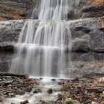 Click here for more information or to register Hosting Club: Iroquoia
Category: Rainbow Hike
Location (Google Maps): Parking lot at corner of Wilson & Academy, downtown Ancaster Hike Leader(s): Doug O’Neill Click here to contact Hike Leader(s) Pace: Medium – 3 to 4 km/hr
Terrain: Moderate – Some hills and/or some poor footing
Distance: 12 km Description
This queer-led, all-inclusive 2SLGBTQIA+ hike starts in downtown Ancaster, connects with the Bruce Trail—stopping at three waterfalls—then follows a mishmash of sidetrails with lunch at the Trail Centre/Historic Train Station (indoor washroom facilities, warming station). Arrive by 9:30 a.m. for a 9:45 a.m. start. Fully accessible by Hamilton Public Transit or car. We’ll start and end in the same spot, no shuttle or carpooling required. What’s a Rainbow Hike: The aim of the Bruce Trail’s Rainbow Hikes is to create a safe, welcoming space for 2SGBTQIA+ hikers—including trans, gay, lesbian, bisexual, queer, Two-Spirit, intersex, asexual, and straight friends—to show up and be themselves in a safe and friendly outdoor setting. Our hiking group typically includes 20 to 25 people representing a full spectrum of sexual orientations, gender identities, and expressions. Diversity Rules 🙂 Highlights for this hike: three waterfalls (Tiffany, Sherman and Canterbury), Hermitage ruins, Dundas Valley Conservation nature interpretation centre, replica Victorian-style train station, two train cabooses from the 1920s—with an optional post-hike visit to the gay-owned and operated Trails Cafe in downtown Ancaster.
Where to meet: We’ll rendezvous at the small parking lot right the corner of Wilson Street East and Academy in Ancaster (put 392 Wilson Street East into your GPS). Coming by Hamilton Transit: Take the 5A MEADOWLANDS via McMASTER bus from King and Bay, get off at Rousseaux at Wilson (in Ancaster), and walk 5 minutes (max) up Wilson street to our meeting spot. Parking at corner of Wilson Street East and Academy. Just look for the unpaved parking lot right at the corner. Free. If full, there’s also parking across the street. If you arrive early and you need to visit the loo or wait in a warm place, there’s a Tim Horton’s (370 Wilson). You need to ask for the washroom key and they may prioritize people who are buying something. Try your luck! Bring sufficient water and proper lunch. Hiking boots are recommended, icers too. Dress in layers. Gaiters, to protect pants from mud, are a good idea. Get your complimentary Bruce Trail Rainbow badge! Feel free to reach out to the Hike Leader Doug if you have any questions at all- “Click here to contact Hike Leader” on this form.
|
13 | 14 | 15 - Urban Walk: Valley View Park
9:30 AM-11:45 AM 12/15/2026 https://hikes.brucetrail.org/event/urban-walk-valley-view-park-24/2026-12-15/ Click here for more information or to register Hosting Club: Toronto Location (Google Maps): Parking lot is off Sycamore Drive, East of Bayview , across Starbucks plaza
Bus 91 from Finch East station stops at Sycamore station. Hike Leader(s): MOHAMMAD AGHAMIRI Click here to contact Hike Leader(s) Pace: Moderate (3-4 km/hr)
Terrain: Hilly, Level 2 (Intermediate – some hills and uneven surfaces, rocks and roots underfoot)
Distance (km): 7-8 km Description
We will explore Valleyview and Maple View parks, and walk along German Mills Creek, in return we stop in Huntington park and have snack ,coffee,tea . Although this is considered an “Urban Walk”, you can expect some hills up and down and uneven surfaces with tree roots. Please bring hiking poles, water and snacks. phone number for the day of hike 289 588 6482
- Glen Haffy – Coolihans Sideroad to Hwy 9
9:30 AM-12:30 PM 12/15/2026 https://hikes.brucetrail.org/event/glen-haffy-coolihans-sideroad-to-hwy-9-2/2026-12-15/ Click here for more information or to register Hosting Club: Dufferin Hi-Land
Category: Tuesday Hike
Location (Google Maps): Coolihans Sideroad to Hwy 9
Caledon Section, Map 17. Meet at roadside parking on Coolihans Sideroad where the Main Trail crosses (Km 35.0) Hike Leader(s): Tony Evangelista, Julie Daley, Les Babbage, Inge Eckerich Click here to contact Hike Leader(s) Pace: Leisurely
Terrain: Moderate, Slippery Sections Likely
Distance: Long Hike 6.8 Km, Shorter Hike turn back at hiker’s discretion Description
Caledon Section, Map 17. Meet at roadside parking on Coolihans Sideroad where the Main Trail crosses (Km 35.0). We will hike north along the main trail, passing through Glen Haffy Conservaton Area, up to Hwy #9. We will stop for a break/snack here, then head back to Coolihans Sideroad. Bring snack. Poles and icers are recommended, snowshoes may be needed.
| 16 | 17 - Urban Walk: Valley View Park
9:30 AM-11:45 AM 12/17/2026 https://hikes.brucetrail.org/event/urban-walk-valley-view-park-25/2026-12-17/ Click here for more information or to register Hosting Club: Toronto Location (Google Maps): Parking lot is off Sycamore Drive, East of Bayview , across Starbucks plaza
Bus 91 from Finch East station stops at Sycamore station. Hike Leader(s): MOHAMMAD AGHAMIRI Click here to contact Hike Leader(s) Pace: Moderate (3-4 km/hr)
Terrain: Hilly, Level 2 (Intermediate – some hills and uneven surfaces, rocks and roots underfoot)
Distance (km): 7-8 km Description
We will explore Valleyview and Maple View parks, and walk along German Mills Creek, in return we stop in Huntington park and have snack ,coffee,tea . Although this is considered an “Urban Walk”, you can expect some hills up and down and uneven surfaces with tree roots. Please bring hiking poles, water and snacks. phone number for the day of hike 289 588 6482
| 18 | 19 - Silent Valley Loop Hike
9:30 AM-12:30 PM 12/19/2026 https://hikes.brucetrail.org/event/silent-valley-loop-hike-2/2026-12-19/ Click here for more information or to register Hosting Club: Blue Mountains, Sydenham
Category: Organized Hike
Location (Google Maps): Silent Valley Nature Reserve parking at north end of 2nd Concession Rd S, Bognor, ON N0H 1E0 Hike Leader(s): Robert Johnston Click here to contact Hike Leader(s) Pace: Medium – 3 to 4 km/hr
Terrain: Moderate – Some hills and/or some poor footing
Distance: 5km Description
Meet at 9:30am at Silent Valley parking at end of 2nd Concession S. Hike along Silent Valley Side Trail, Avalanche Pass Side Trail, and Main Trail looping back to the parking area. We will see the unique sights found here and the dramatic lookouts. Some steep grades and rocky footing. Dress for the weather. Bring water and a snack.
|
20 | 21 - Winter Solstice and Long Night Supermoon – A Passport to Nature Hike and Event
7:00 PM-9:00 PM 12/21/2026 https://hikes.brucetrail.org/event/winter-solstice-and-long-night-supermoon-a-passport-to-nature-hike-and-event/2026-12-21/ Click here for more information or to register Hosting Club: Sydenham
Category: Passport to Nature Hike/Event
Location (Google Maps): Click on the (Google Maps) link to take you there. Meet at the Pavilion beside the Grey Sauble Administration Centre at the Inglis Falls Arboretum at 237897 Inglis Falls Road which is 1.2 km north (towards Owen Sound) from Inglis Falls. Or use these GPS coordinates to the Pavilion: 44.535678, -80.93602 Hike Leader(s): Stewart Brown Click here to contact Hike Leader(s) Pace: Leisurely: 3 km/h or less
Terrain: Easy: Mostly flat and good footing.
Distance: 2-3 km Description
Sydenham Bruce Trail Club (SBTC) is excited to celebrate the Winter Solstice and Long Night Supermoon on the Bruce Trail and the trails at the Inglis Falls Arboretum! The Event will be based at the Pavilion at the Grey Sauble Conservation Administration Centre. This is a Passport to Nature event (https://brucetrail.org/passport-to-nature/) and each participant will receive a Passport to Nature booklet and a Sydenham Bruce Trail Club sticker stamp in your Passport booklet. If you have already received a Passport to Nature booklet at a previous event, you can bring it along or simply take the sticker home with you to stamp your Passport booklet. There are no parking fees at the Administration Centre of Grey Sauble Conservation and the lot should be clear with ample places to park. We’ll begin with introductions at the Pavilion at 7 p.m., where special guest astronomer John Hlynialuk will present his telescope and other astronomical gadgets. We are hoping for clear skies, but if not, John still has plenty to share with us from his lifetime of expertise in astronomy. If sky conditions are favourable, or even with a few clear patches or light clouds, everyone will have a chance to view the supermoon through the telescope. It is so incredible to see its features close up and to know that humans have walked on its surface. Families and children are welcome! An easy 2 km hike or a bit longer will be taken around the dark trails in the Arboretum. There are shortcuts if that is too much with young children. If you bring a headlamp, make sure it has a red light as this event and hike will not use white light so that our eyes remain accustomed to the dark. Plus the spooky atmosphere of darkness is fun. Maybe we’ll see Santa Claus taking a test flight before Christmas. An email will be sent to all registered hikers a day or so before the event with further instructions about trail conditions and what you need for the hike. Depending on the weather, it could be a snowshoe hike or if there is not much snow it will be a hiking boot hike. If it is a snowshoe hike, not everyone necessarily needs them as the hikers in boots at the end of the line usually benefit from a nice tramped-down track! Dress warmly especially to stay cozy for the time we may spend around the telescope and pavilion. Bring water and a snack if you like. Hot chocolate will be served in the pavilion to celebrate the shortest day of the year and the supermoon. If you don’t know what a supermoon is, you have homework to do!
| 22 - Tuesday Trekkers -BV Winter E2E 1of10
9:30 AM 12/22/2026 https://hikes.brucetrail.org/event/tuesday-trekkers-bv-winter-e2e-1of10/2026-12-22/  Hike open to BTC Members only. Click here for more information or to register Hosting Club: Beaver Valley Location (Google Maps): Meet at the end of 6th Line, north of Grey Road 119. Do not block driveways, farm entrances or gates, km 13.7, Map 24 N44.484137, W80.386155. All coordinates taken from the BTC App. Hike Leader(s): Kristina Rettie Click here to contact the hike leader. Pace: Brisk
Terrain: Moderate, Some rocky footing, Some steep sections, Strenuous
Length of Hike: 13.7 km Description
Beaver Valley Winter End 2 End! The first hike will meet at the end of 6th Line, north of Grey Road 119. Do not block driveways, farm entrances or gates, km 13.7, Map 24 N44.484137, W80.386155. All coordinates taken from the BTC App. We will shuttle to Maple Lane, km 00.0,Map 24, N44.504973, W80.331780. This is a series of 10 hikes in which hikers may choose to participate in as many or as few as they wish. Any hiker who completes all 10 hikes will earn the Beaver Valley Winter End to End badge. These hikes will be a challenge to your strength, endurance and perseverance! You will be rewarded with breathtaking views of winter in the valley and good company. These hikes are intended only for strong hikers who are experienced with snowshoes. It will be tough hiking so be sure of your physical ability before signing up for this hike. To keep warm and to ensure the safety of participants, we will be hiking at a steady brisk pace with few short breaks along the way. Please bring plenty of water and snacks/lunch and make sure to dress according to the weather conditions presented on hike day. As we need to be prepared for variable weather and trail conditions, you will be required to carry icers and snowshoes with you on each hike. You may need to wear either of these items for portions of the hike and carry them when not needed, so please ensure you have a system to put your snowshoes on or in your pack. When the snow is deep, each hiker should be prepared to take a turn blazing trail. This will be a team effort from start to finish! Who wants to join the team? As we all know Mother Nature can throw us curve balls at times. I will ask each hiker to please respect the decisions of the leader in case of inclement weather/road & parking conditions. We may need to adjust our meeting location and possibly postpone and reschedule the hike. Hikers will be advised either the night before or in the early morning of cancellations. March 9&16 are set aside for possible rescheduled hikes. All hikes in this series will include a car shuttle and everyone will take a turn as a shuttle driver. Please have your vehicle ready to transport hikers. The Beaver Valley Winter E2E is a club lead series that can only be completed with a club leader. No dogs please. COVID-19 Precautions Before, During and After your Hike - Each hiker joining a Bruce Trail Club organized hike must perform a self-screening check before hiking.
Find Ontario’s self-assessment tool here: https://covid-19.ontario.ca/self-assessment/ - If you are experiencing COVID-19 symptoms, stay home.
Transportation It is the Bruce Trail Conservancy’s current policy that car shuttles are allowed. It is at the discrepancy of individual hike leaders to make that decision. Other Guidelines - Arrive 15 minutes before the start of the hike.
- Wear sturdy footwear and appropriate attire for the weather and the terrain.
Hiking poles are a good idea in any season, especially if the terrain is rocky or slippery. In winter, snowshoes or icers/crampons are needed when conditions dictate.
Wearing appropriate clothing and footwear prevents injuries and shows consideration for a safe and positive group hiking experience. - Always carry I.D. and your health card.
- Bring sufficient water and snacks (or lunch if indicated). A minimum of 1L of water is recommended on all hikes, and 3L is recommended for long, challenging hikes in the heat of the summer.
- Bring sunscreen and insect repellent (for spring and summer hikes).
- Bring your own first aid kit.
- Please leave dogs at home.
- Dufferin Hi-Land – 1st Line EHS to 30th Sideroad
9:30 AM-11:30 AM 12/22/2026 https://hikes.brucetrail.org/event/dufferin-hi-land-1st-line-ehs-to-30th-sideroad/2026-12-22/ Click here for more information or to register Hosting Club: Dufferin Hi-Land
Category: Tuesday Hike
Location (Google Maps): Dufferin Hi-Land Section, Maps 19 and 20. Meet at roadside parking on 1st Line EHS, north of the 25th Sideroad, where the Trail leaves the road. Hike Leader(s): Julie Daley, Les Babbage, Tony Evangelista, Inge Eckerich Click here to contact Hike Leader(s) Pace: Leisurely
Terrain: Moderate
Distance: 6.6 Km Description
We will hike the Main Trail from the roadside parking on 1st Line EHS, through open fields and woods to 30th Sideroad, and return. Those wishing a shorter hike can return at their leisure. Please bring water, snack and hiking poles, as desired. Snowshoes and icers may be helpful, depending on conditions.
- Urban Walk: Valley View Park
9:30 AM-11:45 AM 12/22/2026 https://hikes.brucetrail.org/event/urban-walk-valley-view-park-26/2026-12-22/ Click here for more information or to register Hosting Club: Toronto Location (Google Maps): Parking lot is off Sycamore Drive, East of Bayview , across Starbucks plaza
Bus 91 from Finch East station stops at Sycamore station. Hike Leader(s): MOHAMMAD AGHAMIRI Click here to contact Hike Leader(s) Pace: Moderate (3-4 km/hr)
Terrain: Hilly, Level 2 (Intermediate – some hills and uneven surfaces, rocks and roots underfoot)
Distance (km): 7-8 km Description
We will explore Valleyview and Maple View parks, and walk along German Mills Creek, in return we stop in Huntington park and have snack ,coffee,tea . Although this is considered an “Urban Walk”, you can expect some hills up and down and uneven surfaces with tree roots. Please bring hiking poles, water and snacks. phone number for the day of hike 289 588 6482
| 23  Full Moon Hike — Cold Moon Supermoon Full Moon Hike — Cold Moon Supermoon 4:00 PM 12/23/2026 https://hikes.brucetrail.org/event/full-moon-hike-cold-moon-supermoon/2026-12-23/  Click here for more information or to register Hosting Club: Peninsula
Category: Moonlit Hike Series
Location (Google Maps): Parking lot at Black Creek Provincial Park Hike Leader(s): Kamila Tomaszewska and Bill Floyd Click here to contact Hike Leader(s) Pace: Leisurely (2.0 – 3.0 km/h): A relaxed pace with frequent breaks and a focus on enjoyment.
Terrain: Easy: Flat forested sections or lowland trails.
Distance: 2.5 km Description
Step into the winter night as the Cold Moon rises — the closest and largest supermoon of the year, and one of December’s most stunning astronomical highlights. We’ll wander through Black Creek’s quiet forests and frozen shorelines, guided by moonlight and the crunch of snow (maybe) under our boots. The Cold Moon will climb huge and bright above the treetops, lighting our path in a way only a true supermoon can. A serene winter hike, a sky‑show you won’t forget, and a perfect way to welcome the holiday season outdoors. Bundle up. Bring a red light flashlight. Come chase the moon with us! This hike is weather‑dependent and may be cancelled in the event of a snowstorm. ———— Badge Alert: Complete 4 full moon hikes to earn your Full Moon Hiking Badge. Complete 4 full moon hikes - Any four full moon hikes count, including past or cancelled ones. If a hike is cancelled, your registration still counts. Past hikes count too — e.g., 2 last year + 2 this year = badge earned.
Send your badge payment - E‑transfer $10 (BTC members) or $15 (non-members) to: treasurer@peninsula.brucetrail.org to cover badge cost.
Email your proof of payment - Send a screenshot and list your four hikes, plus your full address, to: badges@peninsula.brucetrail.org.
Receive your badge - Pick it up at your fourth hike (email Bill in advance at barriebill@gmail.com) or have it mailed to you.
| 24 - Urban Walk: Valley View Park
9:30 AM-11:45 AM 12/24/2026 https://hikes.brucetrail.org/event/urban-walk-valley-view-park-27/2026-12-24/ Click here for more information or to register Hosting Club: Toronto Location (Google Maps): Parking lot is off Sycamore Drive, East of Bayview , across Starbucks plaza
Bus 91 from Finch East station stops at Sycamore station. Hike Leader(s): MOHAMMAD AGHAMIRI Click here to contact Hike Leader(s) Pace: Moderate (3-4 km/hr)
Terrain: Hilly, Level 2 (Intermediate – some hills and uneven surfaces, rocks and roots underfoot)
Distance (km): 7-8 km Description
We will explore Valleyview and Maple View parks, and walk along German Mills Creek, in return we stop in Huntington park and have snack ,coffee,tea . Although this is considered an “Urban Walk”, you can expect some hills up and down and uneven surfaces with tree roots. Please bring hiking poles, water and snacks. phone number for the day of hike 289 588 6482
| 25 | 26 - Urban Walk: Annual TBTC Boxing Day Hike
9:30 AM-2:45 PM 12/26/2026 https://hikes.brucetrail.org/event/urban-walk-annual-tbtc-boxing-day-hike-5/2026-12-26/ Click here for more information or to register Hosting Club: Toronto
Category: Urban Walk
Location (Google Maps): Meet inside Jack Layton Ferry Terminal, foot of Bay Street. TTC – take any streetcar from Union Station one stop south the Ferry Docks stop and walk south. Hike Leader(s): Tom Swales Click here to contact Hike Leader(s) Pace: Moderate (3-4 km/hr)
Terrain: Flat, Level 1 (Easy – mostly on flat, well maintained trails with hard-packed surface)
Distance (km): 12 Description
Avoid the Boxing Day shopping crowds and come hike with TBTC ‘s Hiking Director and club President instead. The Toronto Islands are very peaceful in the Winter Season. We will catch the 2:15 or 2:45 pm ferry to be back in the city by 3:00 pm. Bring a lunch, snacks, water, a hot beverage, and icers if the first snow has fallen. Dress in warm layers appropriate to the weather. Heated washrooms available. Dropout anytime by walking back to the Ward’s Island Ferry Dock. We will hike towards Hanlan’s Point and return to Ward’s Island (the only ferry destination served in the Winter) – approximately 5-6 km each way. (Ferry schedules to be confirmed)
|
27 | 28 | 29 - Oliver Creek Loop from 2nd Line
9:30 AM-11:30 AM 12/29/2026 https://hikes.brucetrail.org/event/oliver-creek-loop-from-2nd-line-2/2026-12-29/ Click here for more information or to register Hosting Club: Dufferin Hi-Land
Category: Tuesday Hike
Location (Google Maps): Dufferin Hi-Land, Map 20. Meet on east side of 2nd Line, 300m north of the bend from 8 Sideroad onto 2nd Line, where the Main Trail turns off of the road, heading east (Km 22.3) Hike Leader(s): Les Babbage;Inge Eckerich;Julie Daley;Tony Evangelista Click here to contact Hike Leader(s) Pace: Leisurely
Terrain: Slippery and Steep Sections
Distance: 5.2 or 3.7 km Description
We will hike the Main Trail to the second intersection with Oliver Creek Side Trail, then loop back on this trail to the Main Trail. The short hike will cut off on the 2nd Line Side Trail and walk south on 2nd Line to the cars. Snowshoes or icers may be required. Bring water snacks and dress warmly for the weather.
- Urban Walk: Valley View Park
9:30 AM-11:45 AM 12/29/2026 https://hikes.brucetrail.org/event/urban-walk-valley-view-park-28/2026-12-29/ Click here for more information or to register Hosting Club: Toronto Location (Google Maps): Parking lot is off Sycamore Drive, East of Bayview , across Starbucks plaza
Bus 91 from Finch East station stops at Sycamore station. Hike Leader(s): MOHAMMAD AGHAMIRI Click here to contact Hike Leader(s) Pace: Moderate (3-4 km/hr)
Terrain: Hilly, Level 2 (Intermediate – some hills and uneven surfaces, rocks and roots underfoot)
Distance (km): 7-8 km Description
We will explore Valleyview and Maple View parks, and walk along German Mills Creek, in return we stop in Huntington park and have snack ,coffee,tea . Although this is considered an “Urban Walk”, you can expect some hills up and down and uneven surfaces with tree roots. Please bring hiking poles, water and snacks. phone number for the day of hike 289 588 6482
- Tuesday Trekkers -BV Winter E2E 2of10
9:30 AM 12/29/2026 https://hikes.brucetrail.org/event/tuesday-trekkers-bv-winter-e2e-2of10/2026-12-29/  Hike open to BTC Members only. Click here for more information or to register Hosting Club: Beaver Valley Location (Google Maps): Meet at Metcalfe Rock parking lot, 10th Line, south of km 27.9, Map 25, N44.416209, W80.443558. Hike Leader(s): Kristina Rettie Click here to contact the hike leader. Pace: Brisk
Terrain: Moderate, Some rocky footing, Some steep sections, Strenuous
Length of Hike: 14.2 km Description
Beaver Valley Winter End 2 End km13.7-km27.9 This is a series of 10 hikes in which hikers may choose to participate in as many or as few as they wish. Any hiker who completes all 10 hikes will earn the Beaver Valley Winter End to End badge. These hikes will be a challenge to your strength, endurance and perseverance! You will be rewarded with breathtaking views of winter in the valley and good company. These hikes are intended only for strong hikers who are experienced with snowshoes. It will be tough hiking so be sure of your physical ability before signing up for this hike. To keep warm and to ensure the safety of participants, we will be hiking at a steady brisk pace with few short breaks along the way. Please bring plenty of water and snacks/lunch and make sure to dress according to the weather conditions presented on hike day. As we need to be prepared for variable weather and trail conditions, you will be required to carry icers and snowshoes with you on each hike. You may need to wear either of these items for portions of the hike and carry them when not needed, so please ensure you have a system to put your snowshoes on or in your pack. When the snow is deep, each hiker should be prepared to take a turn blazing trail. This will be a team effort from start to finish! Who wants to join the team? As we all know Mother Nature can throw us curve balls at times. I will ask each hiker to please respect the decisions of the leader in case of inclement weather/road & parking conditions. We may need to adjust our meeting location and possibly postpone and reschedule the hike. Hikers will be advised either the night before or in the early morning of cancellations. March 9&16 are set aside for possible rescheduled hikes. All hikes in this series will include a car shuttle and everyone will take a turn as a shuttle driver. Please have your vehicle ready to transport hikers. The Beaver Valley Winter E2E is a club lead series that can only be completed with a club leader. No dogs please. COVID-19 Precautions Before, During and After your Hike - Each hiker joining a Bruce Trail Club organized hike must perform a self-screening check before hiking.
Find Ontario’s self-assessment tool here: https://covid-19.ontario.ca/self-assessment/ - If you are experiencing COVID-19 symptoms, stay home.
Transportation It is the Bruce Trail Conservancy’s current policy that car shuttles are allowed. It is at the discrepancy of individual hike leaders to make that decision. Other Guidelines - Arrive 15 minutes before the start of the hike.
- Wear sturdy footwear and appropriate attire for the weather and the terrain.
Hiking poles are a good idea in any season, especially if the terrain is rocky or slippery. In winter, snowshoes or icers/crampons are needed when conditions dictate.
Wearing appropriate clothing and footwear prevents injuries and shows consideration for a safe and positive group hiking experience. - Always carry I.D. and your health card.
- Bring sufficient water and snacks (or lunch if indicated). A minimum of 1L of water is recommended on all hikes, and 3L is recommended for long, challenging hikes in the heat of the summer.
- Bring sunscreen and insect repellent (for spring and summer hikes).
- Bring your own first aid kit.
- Please leave dogs at home.
| 30 - Nottawasaga Look0ut Provincial Nature Reserve
9:00 AM-11:00 AM 12/30/2026 https://hikes.brucetrail.org/event/nottawasaga-look0ut-provincial-nature-reserve/2026-12-30/ Click here for more information or to register Hosting Club: Blue Mountains
Category: Organized Hike
Location (Google Maps): Option 1 meet at Tim Hortons -First Street for 9:00 a.m.
Option 2 meet at the Trailhead – park at the end of end of Osprey Clearview Townline and Eagle Cresent for 9:30 a.m. Hike Leader(s): Murray Morrison Click here to contact Hike Leader(s) Pace: Leisurely – 3 km/hr. or less
Terrain: Strenuous – Hilly with steep climbs and some poor footing
Distance: 2.5 Kilometers Description
The hike will be proceeding from the parking area through the forest (Singhampton Sidetrail) on level even footing and then a steep decent and loop through the crevices. Footing maybe treacherous through the crevices. Crampons are highly recommended. The hike returns to the parking lot past the Standing Rock.
| 31 - Urban Walk: Valley View Park
9:30 AM-11:45 AM 12/31/2026 https://hikes.brucetrail.org/event/urban-walk-valley-view-park-29/2026-12-31/ Click here for more information or to register Hosting Club: Toronto Location (Google Maps): Parking lot is off Sycamore Drive, East of Bayview , across Starbucks plaza
Bus 91 from Finch East station stops at Sycamore station. Hike Leader(s): MOHAMMAD AGHAMIRI Click here to contact Hike Leader(s) Pace: Moderate (3-4 km/hr)
Terrain: Hilly, Level 2 (Intermediate – some hills and uneven surfaces, rocks and roots underfoot)
Distance (km): 7-8 km Description
We will explore Valleyview and Maple View parks, and walk along German Mills Creek, in return we stop in Huntington park and have snack ,coffee,tea . Although this is considered an “Urban Walk”, you can expect some hills up and down and uneven surfaces with tree roots. Please bring hiking poles, water and snacks. phone number for the day of hike 289 588 6482
| January | January |
