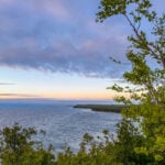
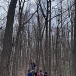
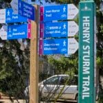
Hosting Club: Peninsula Category: Peninsula E2E Location (Google Maps): Bluewater Park, Wiarton, parking area opposite arena – First Hike only – Schedule with coordinates will be sent for remaining hikes to registered hikers
Pace: Brisk (4.5 – 5.5 km/h): A faster pace for those seeking a good workout or more distance. Terrain: Difficult: Steep ascents/descents, rocky scrambling, and some rugged escarpment paths.
Description This is a Challenger series of hikes; we will complete the entire 163.1 km of the Peninsula section in 6 hikes. It is also a Paid hike; your registration fee includes a celebratory finish at the Cairn in Tobermory, the cost of the End to End badge, and contributes to fundraising for the Peninsula Bruce Trail Club hiking program activities. Please review the dates carefully to ensure you are able to participate fully. Registration is limited to 6 persons. Fees are refundable up to 30 days prior to the date of the first hike.
This hike series is intended for experienced distance hikers. Hikers must be able to sustain the distance and maintain a fast pace.
If a hiker is unable to keep pace with the group, or finds the distance too challenging, their future hike registrations may be canceled by the hike leader.
Be very aware of your ability to join this series.
Hikes will average 4.5 km per hour including breaks, moving pace is 5 km per hour;
Expect to be on-trail for 6 – 8 hours;
Please arrive no later than 15 minutes prior to the meeting time;
Hikers must carry sufficient hydration, accessible snacks, lunch, first-aid kit, rain gear, extra socks, and possibly protective boot covers (i.e. bags);
Hikers will be expected to participate in shuttling hikers to the start and to drive shuttlers back to their car. Responsibility for shuttling along with any applicable parking fees will be shared within the group.
Summary of the itinerary (km based on Bruce Trail Reference – Edition 31):
May 1: Sydney Bay Rd to Wiarton Bluewater Park – 31.7 km
May 2: Sydney Bay Rd to Rush Cove – 26.4 km
May 3: Richardson Side Trail to Rush Cove – 28.6 km
May8: Richardson Side Trail to Dyers Bay – 26 km
May 9: Dyers Bay to Halfway Dump – 27.5 km
May 10: Halfway Dump to Tobermory – 25.2 km
A detailed schedule will be provided in advance of the series to registered hikers.
If you have concerns, or questions please use the Contact Hike Leader form to inquire in advance of registering.
You are signing up for the following dates and times: 2026-05-01 at 07:15 2026-05-02 at 07:15 2026-05-03 at 07:15 2026-05-22 at 07:15 2026-05-23 at 07:15 2026-05-24 at 07:15 2026-05-30 at 07:15 2026-05-31 at 07:15 2026-06-06 at 07:15 2026-06-07 at 07:15
Pace: Medium (3.0 – 4.5 km/h): A comfortable pace for most hikers with steady progress. Terrain: Difficult: Steep ascents/descents, rocky scrambling, and some rugged escarpment paths., Moderate: Rolling hills, mild slopes and rocky paths. Distance: Approx. ~166km
Description Peninsula E2Ein10
Route: Wiarton to Tobermory (northbound)
Pace: Medium (target 3–4 km/h)
Terrain: Moderate to Difficult
Distance: ~166 km total
Daily Distances: 15.7 km · 17.8 km · 18.6 km · 15.1 km · 14.7 km · 17.8 km · 19.4 km · 22.6 km · 17.8 km · 6.7 km
Expectations: Expect 5–8 hours on the trail each day, depending on distance, terrain, weather, and group pace. The hike leader sets the pace, aiming for 3–4 km/h, and may adjust as needed for group ability and trail conditions. Breaks will be taken throughout the day.
For safety, participants must remain between the hike leader and the hike sweep at all times.
Meeting Time: 7:15 AM
Fees:
Registration fee does not include Bruce Peninsula National Park entry fees, Cape Croker Park or MNBP parking fees
Parking costs will be shared equally among participants.
Badge fee included, with your choice of either the flowerpot badge or the stained glass (Turkey Vulture) badge.
Fundraising: This hike is a fundraiser to support the Peninsula Bruce Trail Club’s volunteer-run hike program
Pace: Mixed (See Hike Description) Terrain: Challenging, Hilly, Level 2 (Intermediate – some hills and uneven surfaces, rocks and roots underfoot), Rocky, Variable Distance (km): 12-18 km
Description Join us for three days of hiking on what many consider the most rugged section of the Bruce Trail. Overnight group will be lodging at the Best Western Inn On The Bay in Owen Sound.
This will be a challenging three days of hiking with some strenuous climbs and sometimes difficult footing over tree roots, rocks and crevasses. All fit, experienced hikers comfortable walking on this type or terrain are welcome. For your safety and enjoyment as well as the group’s, before registering we strongly encourage you to join some of our day hikes on the Bruce Trail. This will give you a chance to get to know us and assess your abilities.
We will split the group and offer two levels of hikes each day. The moderate group will hike about 12 km each day. and the fast group 15 km or more. The specific trails will be determined closer to the date.
Accommodation at the hotel is no longer available at the discounted group rate. Rooms at the Best Western will be at their regular rate given on the hotel’s website and/or registration desk.
Coach fare is $170 for members; $190.00 for non-members; $100 for children.
Registration instructions:
If you wish to share accommodation, please find a roommate, then book your hotel room, and then book your seats on the coach. To avoid problems make sure you and your roommate reserve your seats at the same time.
Book your room online using the Best Western Inn on the Bay’s website (https://bwowensound.com/) or through their reservation desk (519) 371-9200. Make arrangements with your roommate to split the cost.
To reserve your seat on the bus, register here starting on Thursday January 15 at 8 PM.
Cancellation policy: While we are hoping for sunshine, the trip cannot be cancelled due to weather. Coach fare is non-refundable if cancellation is made less than 30 days in advance of the departure date.
Our coach will depart at 7:30 AM on Friday May 1. We plan to be back in Toronto between 7 and 8 PM on Sunday May 3. Departure locations: 10 York Mills Rd and HWY 400 and Major Mackenzie Park and Ride.
Pace: Medium – 3 to 4 km/hr Terrain: Strenuous – Hilly with steep climbs and some poor footing Distance: 18 km
Description This hike will follow the main trail to Dunby Road and take in four side trails on the return route – Cam Snell, Glen Cross, Isabell East and Tom East – to form an 18 km loop back to the parking lot on Hockley Road.
Wear hiking boots, bring poles. Dress for the weather conditions, bring plenty to drink and a snack.
Please arrive at the meeting place by 8:15 am for an 8:30 am departure.
Pace: Medium 3- 4 km/hr Terrain: Moderate: some hills and some poor footing Distance: 6-7km
Description NOTL hike moves to Queenston for just this Friday. Meet at Locust Grove, Niagara River Parkway. We will hike down the escarpment to the village of Queenston. We will explore the village and the waterfront before hiking back up the escarpment to our parking. Mostly paved roads with some trail walking.
Plan to stay for coffee at Commisso’s on Thorold Stone Rd, Niagara Falls.
Hosting Club: Dufferin Hi-Land Category: General Hike Location (Google Maps): 650 Governor’s Road, Dundas, L9H 5E3. Iroquoia Section, BTC Map 8. Dundas Valley Conservation Area Parking Lot P3 just south of the main entrance. Take DVCA Trail Centre Entrance off Governors Road, near km 51.8. Click Google Map link for GPS.
Pace: Medium Terrain: Slippery and Steep Sections, Moderate Distance: 16-17 kms
Description Join us on hike in the Dundas Valley. We will take in part of the Bruce Trail and several DVCA trails. Lots of ups and downs and waterfalls. Please bring a warm drink, water, a snack for “elevensies”, lunch, hiking boots, poles and lots of smiles. Entrance fee to DVCA in effect at gate. Please arrive at 9:00 to be ready to hike at 9:15. We will hike two loops to allow folks to drop out after the first 10 kms if they would like.
Pace: Medium – 3 to 4 km/hr Terrain: Moderate – Some hills and/or some poor footing Distance: 9 kms
Description A new way to hike the Speyside trails, we’ll meet roadside on Fourth Line at 9:15 am and hike the main trail to the Canada Goose ST and onto the Charles Hildebrandt ST to the “unassumed road” and into Speyside from that end. Hiking around the Cliff Hatch ST and main trail back to Fourth Line. There are some very rocky sections along these trails.
Hosting Club: Beaver Valley Category: Car Pool Location (Google Maps): Meeting at end of Maple Lane. Do not park where there are no parking signed and be sure not to block driveways. We will be shuttling to Margaret Paull Side Trail parking on 6th Line and then hike back to our vehicles.
Description This hike is for those working on their Beaver Valley section end to end. We will meet at the border of Beaver Valley/Blue Mountain at the end of Maple Lane (104 Maple Ln, Ravenna, ON will get you close on GPS) and carpool to the parking on 6th Line approx 13.7km away by the trail (input 569465 6th Line, Ravenna, ON in GPS then drive on 6th line until you find the Margaret Paull Side Trail parking area. We will then hike back to our cars at Maple.
This hike is for experienced hikers and while we may finish earlier, 4 hours has been allotted for this hike. We will be hiking in spring conditions (mud, ice, snow) so be prepared for it all. Please have your icers and poles at the ready and dress in layers including a waterproof outer layer. Hiking boots/shoes are mandatory. Please bring water/electrolytes and snacks, though we do not plan a meal break as this hike is scheduled between lunch and dinner time.
We will be shuttling to our starting point so please be prepared to participate in the shuttle.
Pace: Brisk – 4 to 5 km/hr, Medium – 3 to 4 km/hr Terrain: Dependent on Conditions, Strenuous – Hilly with steep climbs and some poor footing Distance: 5-6km
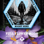
Description Earn your Iroquoia Moonlight badge by hiking 3 Moonlight Hikes with a leader. Tonight’s sunset is at 8:20pm. We will hike up the escarpment and over to the Hawkwatch area and out to Beamer’s Falls and return around 9:30pm. If you’ve never hiked at night we are sure you will love the way it heightens all of your senses promising a great sleep afterwards. Everyone must have a headlamp or a flashlight 🔦. Most phones have torches which could also be used as supplemental light. Please ensure your light device is fully charged/batteries to last about 1.5hours. Dress for the weather and bring enough water to suit your needs as well as all the other things you need for a hike – first aid kit, snack, poles (recommended). This is an arduous climb up the escarpment so be sure to know your physical limit. This is the second of 3 full moon hikes to be held in Grimsby. After you complete three leader-led hikes, you will qualify for a badge. $10/$15
The third moonlight hike is May 31.
Any questions may be directed through contact on this form. If you cannot make it, please remove yourself from registration by following these steps:
To cancel your registration, here is a step by step: – Sign into your account on the BTC website – Click on My Hikes under your account – This will take you to a list of hikes you have registered for – Scroll down to the appropriate hike and cursor over to the far right hand column under the Action column. – Click Cancel under the hike you wish to cancel
Hosting Club: Peninsula Category: Peninsula E2E Location (Google Maps): Bluewater Park, Wiarton, parking area opposite arena – First Hike only – Schedule with coordinates will be sent for remaining hikes to registered hikers
Pace: Brisk (4.5 – 5.5 km/h): A faster pace for those seeking a good workout or more distance. Terrain: Difficult: Steep ascents/descents, rocky scrambling, and some rugged escarpment paths.
Description This is a Challenger series of hikes; we will complete the entire 163.1 km of the Peninsula section in 6 hikes. It is also a Paid hike; your registration fee includes a celebratory finish at the Cairn in Tobermory, the cost of the End to End badge, and contributes to fundraising for the Peninsula Bruce Trail Club hiking program activities. Please review the dates carefully to ensure you are able to participate fully. Registration is limited to 6 persons. Fees are refundable up to 30 days prior to the date of the first hike.
This hike series is intended for experienced distance hikers. Hikers must be able to sustain the distance and maintain a fast pace.
If a hiker is unable to keep pace with the group, or finds the distance too challenging, their future hike registrations may be canceled by the hike leader.
Be very aware of your ability to join this series.
Hikes will average 4.5 km per hour including breaks, moving pace is 5 km per hour;
Expect to be on-trail for 6 – 8 hours;
Please arrive no later than 15 minutes prior to the meeting time;
Hikers must carry sufficient hydration, accessible snacks, lunch, first-aid kit, rain gear, extra socks, and possibly protective boot covers (i.e. bags);
Hikers will be expected to participate in shuttling hikers to the start and to drive shuttlers back to their car. Responsibility for shuttling along with any applicable parking fees will be shared within the group.
Summary of the itinerary (km based on Bruce Trail Reference – Edition 31):
May 1: Sydney Bay Rd to Wiarton Bluewater Park – 31.7 km
May 2: Sydney Bay Rd to Rush Cove – 26.4 km
May 3: Richardson Side Trail to Rush Cove – 28.6 km
May8: Richardson Side Trail to Dyers Bay – 26 km
May 9: Dyers Bay to Halfway Dump – 27.5 km
May 10: Halfway Dump to Tobermory – 25.2 km
A detailed schedule will be provided in advance of the series to registered hikers.
If you have concerns, or questions please use the Contact Hike Leader form to inquire in advance of registering.
You are signing up for the following dates and times: 2026-05-01 at 07:15 2026-05-02 at 07:15 2026-05-03 at 07:15 2026-05-22 at 07:15 2026-05-23 at 07:15 2026-05-24 at 07:15 2026-05-30 at 07:15 2026-05-31 at 07:15 2026-06-06 at 07:15 2026-06-07 at 07:15
Pace: Medium (3.0 – 4.5 km/h): A comfortable pace for most hikers with steady progress. Terrain: Difficult: Steep ascents/descents, rocky scrambling, and some rugged escarpment paths., Moderate: Rolling hills, mild slopes and rocky paths. Distance: Approx. ~166km
Description Peninsula E2Ein10
Route: Wiarton to Tobermory (northbound)
Pace: Medium (target 3–4 km/h)
Terrain: Moderate to Difficult
Distance: ~166 km total
Daily Distances: 15.7 km · 17.8 km · 18.6 km · 15.1 km · 14.7 km · 17.8 km · 19.4 km · 22.6 km · 17.8 km · 6.7 km
Expectations: Expect 5–8 hours on the trail each day, depending on distance, terrain, weather, and group pace. The hike leader sets the pace, aiming for 3–4 km/h, and may adjust as needed for group ability and trail conditions. Breaks will be taken throughout the day.
For safety, participants must remain between the hike leader and the hike sweep at all times.
Meeting Time: 7:15 AM
Fees:
Registration fee does not include Bruce Peninsula National Park entry fees, Cape Croker Park or MNBP parking fees
Parking costs will be shared equally among participants.
Badge fee included, with your choice of either the flowerpot badge or the stained glass (Turkey Vulture) badge.
Fundraising: This hike is a fundraiser to support the Peninsula Bruce Trail Club’s volunteer-run hike program
Pace: Mixed (See Hike Description) Terrain: Challenging, Hilly, Level 2 (Intermediate – some hills and uneven surfaces, rocks and roots underfoot), Rocky, Variable Distance (km): 12-18 km
Description Join us for three days of hiking on what many consider the most rugged section of the Bruce Trail. Overnight group will be lodging at the Best Western Inn On The Bay in Owen Sound.
This will be a challenging three days of hiking with some strenuous climbs and sometimes difficult footing over tree roots, rocks and crevasses. All fit, experienced hikers comfortable walking on this type or terrain are welcome. For your safety and enjoyment as well as the group’s, before registering we strongly encourage you to join some of our day hikes on the Bruce Trail. This will give you a chance to get to know us and assess your abilities.
We will split the group and offer two levels of hikes each day. The moderate group will hike about 12 km each day. and the fast group 15 km or more. The specific trails will be determined closer to the date.
Accommodation at the hotel is no longer available at the discounted group rate. Rooms at the Best Western will be at their regular rate given on the hotel’s website and/or registration desk.
Coach fare is $170 for members; $190.00 for non-members; $100 for children.
Registration instructions:
If you wish to share accommodation, please find a roommate, then book your hotel room, and then book your seats on the coach. To avoid problems make sure you and your roommate reserve your seats at the same time.
Book your room online using the Best Western Inn on the Bay’s website (https://bwowensound.com/) or through their reservation desk (519) 371-9200. Make arrangements with your roommate to split the cost.
To reserve your seat on the bus, register here starting on Thursday January 15 at 8 PM.
Cancellation policy: While we are hoping for sunshine, the trip cannot be cancelled due to weather. Coach fare is non-refundable if cancellation is made less than 30 days in advance of the departure date.
Our coach will depart at 7:30 AM on Friday May 1. We plan to be back in Toronto between 7 and 8 PM on Sunday May 3. Departure locations: 10 York Mills Rd and HWY 400 and Major Mackenzie Park and Ride.
Pace: Medium – 3 to 4 km/hr Terrain: Strenuous – Hilly with steep climbs and some poor footing Distance: 18 km
Description This hike will follow the main trail to Dunby Road and take in four side trails on the return route – Cam Snell, Glen Cross, Isabell East and Tom East – to form an 18 km loop back to the parking lot on Hockley Road.
Wear hiking boots, bring poles. Dress for the weather conditions, bring plenty to drink and a snack.
Please arrive at the meeting place by 8:15 am for an 8:30 am departure.
Pace: Medium 3- 4 km/hr Terrain: Moderate: some hills and some poor footing Distance: 6-7km
Description NOTL hike moves to Queenston for just this Friday. Meet at Locust Grove, Niagara River Parkway. We will hike down the escarpment to the village of Queenston. We will explore the village and the waterfront before hiking back up the escarpment to our parking. Mostly paved roads with some trail walking.
Plan to stay for coffee at Commisso’s on Thorold Stone Rd, Niagara Falls.
Hosting Club: Dufferin Hi-Land Category: General Hike Location (Google Maps): 650 Governor’s Road, Dundas, L9H 5E3. Iroquoia Section, BTC Map 8. Dundas Valley Conservation Area Parking Lot P3 just south of the main entrance. Take DVCA Trail Centre Entrance off Governors Road, near km 51.8. Click Google Map link for GPS.
Pace: Medium Terrain: Slippery and Steep Sections, Moderate Distance: 16-17 kms
Description Join us on hike in the Dundas Valley. We will take in part of the Bruce Trail and several DVCA trails. Lots of ups and downs and waterfalls. Please bring a warm drink, water, a snack for “elevensies”, lunch, hiking boots, poles and lots of smiles. Entrance fee to DVCA in effect at gate. Please arrive at 9:00 to be ready to hike at 9:15. We will hike two loops to allow folks to drop out after the first 10 kms if they would like.
Pace: Medium – 3 to 4 km/hr Terrain: Moderate – Some hills and/or some poor footing Distance: 9 kms
Description A new way to hike the Speyside trails, we’ll meet roadside on Fourth Line at 9:15 am and hike the main trail to the Canada Goose ST and onto the Charles Hildebrandt ST to the “unassumed road” and into Speyside from that end. Hiking around the Cliff Hatch ST and main trail back to Fourth Line. There are some very rocky sections along these trails.
Hosting Club: Beaver Valley Category: Car Pool Location (Google Maps): Meeting at end of Maple Lane. Do not park where there are no parking signed and be sure not to block driveways. We will be shuttling to Margaret Paull Side Trail parking on 6th Line and then hike back to our vehicles.
Description This hike is for those working on their Beaver Valley section end to end. We will meet at the border of Beaver Valley/Blue Mountain at the end of Maple Lane (104 Maple Ln, Ravenna, ON will get you close on GPS) and carpool to the parking on 6th Line approx 13.7km away by the trail (input 569465 6th Line, Ravenna, ON in GPS then drive on 6th line until you find the Margaret Paull Side Trail parking area. We will then hike back to our cars at Maple.
This hike is for experienced hikers and while we may finish earlier, 4 hours has been allotted for this hike. We will be hiking in spring conditions (mud, ice, snow) so be prepared for it all. Please have your icers and poles at the ready and dress in layers including a waterproof outer layer. Hiking boots/shoes are mandatory. Please bring water/electrolytes and snacks, though we do not plan a meal break as this hike is scheduled between lunch and dinner time.
We will be shuttling to our starting point so please be prepared to participate in the shuttle.
Pace: Brisk – 4 to 5 km/hr, Medium – 3 to 4 km/hr Terrain: Dependent on Conditions, Strenuous – Hilly with steep climbs and some poor footing Distance: 5-6km
Description Earn your Iroquoia Moonlight badge by hiking 3 Moonlight Hikes with a leader. Tonight’s sunset is at 8:20pm. We will hike up the escarpment and over to the Hawkwatch area and out to Beamer’s Falls and return around 9:30pm. If you’ve never hiked at night we are sure you will love the way it heightens all of your senses promising a great sleep afterwards. Everyone must have a headlamp or a flashlight 🔦. Most phones have torches which could also be used as supplemental light. Please ensure your light device is fully charged/batteries to last about 1.5hours. Dress for the weather and bring enough water to suit your needs as well as all the other things you need for a hike – first aid kit, snack, poles (recommended). This is an arduous climb up the escarpment so be sure to know your physical limit. This is the second of 3 full moon hikes to be held in Grimsby. After you complete three leader-led hikes, you will qualify for a badge. $10/$15
The third moonlight hike is May 31.
Any questions may be directed through contact on this form. If you cannot make it, please remove yourself from registration by following these steps:
To cancel your registration, here is a step by step: – Sign into your account on the BTC website – Click on My Hikes under your account – This will take you to a list of hikes you have registered for – Scroll down to the appropriate hike and cursor over to the far right hand column under the Action column. – Click Cancel under the hike you wish to cancel
Hosting Club: Iroquoia Category: City of Waterfalls – Special Event Fundraiser Location (Google Maps): DAY 1: MAY 2 – Parking lot at City View Park off of Kerns Rd. Enter from Dundas St. (capacity 50) 43.351747, -79.862195 DAY 2: MAY 3 – Parking Lot off of Mud St providing access to the Mud Street Side Trail (capacity 30)
Pace: Medium – 3 to 4 km/hr Terrain: Dependent on Conditions, Moderate – Some hills and/or some poor footing, Slippery and Steep Sections Distance: Approximately 22-25km / per day
Description Welcome to Iroquoia, City of Waterfalls Challenge! This is a fundraiser challenge event. All funds raised go towards the Iroquoia Bruce Trail Club to maintain the infrastructure of this beautiful section of trail and to “Preserve this ribbon of wilderness, for everyone, forever!”
We also encourage participants to consider a membership with Conservation Hamilton https://conservationhamilton.ca/hca-membership-pass/
And/or Conservation Halton (50%discount with BTC membership) https://www.conservationhalton.ca/park-fees-membership-rates/
DAY 1: MAY 2 – We will meet at Cityview Park and car shuttle to Spencer Gorge Parking Lot (Conservation Hamilton) and hike back. The cost at this parking lot is $16.50 per vehicle and driver plus $5.50 for each passenger. Day 1 Distance 21km
DAY 2: MAY 3 – We will meet in the parking area off of Mud St and car shuttle to Artaban Rd Parking Lot (Conservation Hamilton) and hike back. The cost for this parking lot is $11.00 per vehicle. Day 2 Distance 24 km
Please ensure your vehicle is car shuttle ready by having a minimum of 4 seatbelts available – drivers do not pay for the parking. Please volunteer for this important component of this challenge or we can throw all the names into a hat. While we encourage carpooling to the start of the hike, please let the hike leader know if you’re planning to arrive with more than two people in your vehicle. This hike will be limited to 20 people including the hike leader so we will need at least 4 vehicles and one vehicle with 5 seatbelts to drive the drivers back at the end of the day. We will try to take as few vehicles as possible. On the second day, those who did not drive on the first day will be asked to drive.
There will be short breaks along the way to admire the waterfalls on route and a short lunch.
Please bring all the hiking items you require for a long day hike including 2l of water, snacks, lunch, first aid kit, rain gear if rain is forecast, plastic shower caps for your boots if muddy, bug spray, sunscreen, rimmed hat, poles (if you use them) and your camera for all the photo ops. Please ensure you are physically able to complete two long day hikes over two days – if you must drop out, you will have to arrange your own transportation back to your vehicle. There is public transportation, Uber, and taxi’s in the area. If you are concerned about whether you will be able to manage the distance over the two day period, it’s possible that you may need to wait until a 4 day version of this event is posted.
The badge will be presented to all participants who have completed the challenge at the end of the second day.
Any questions may be directed through contact on this form.
Hosting Club: Sydenham, Peninsula Category: Sydenham E2E Trail Run Location (Google Maps): Day 1 of the E2E Trail Run of the Sydenham Bruce Trail section. Meeting at BTC parking on Graham’s Hill Rd.
Pace: Fast (5.5 – 7.0 km/h+): A quick pace maintained by experienced hikers or trail runners. Terrain: Difficult: Steep ascents/descents, rocky scrambling, and some rugged escarpment paths. Distance: About 23km
Description This is a single-day registration – Day 1 of 8.
The Sydenham Bruce Trail Club (SBTC), in partnership with the Peninsula Bruce Trail Club (PBTC), is excited to offer its first-ever trail running Sydenham End-to-End series in 2026. Join the fun for one of the eight days in this trail running series! The trail running Sydenham E2E series will take place over 4 weekends and 8 days, starting at 7:30am. Below is the start and end location and estimated distance for this day (subject to change slightly). The group will meet at the end location, and carpool to the start of each day’s route. You are expected to participate in shuttling vehicles.
Please carefully read the details below to understand the logistics, costs, important notes, and fitness required for this challenge.
Saturday, May 2, 2026: Wiarton Bluewater Park to Graham’s Hill Rd BTC Parking; ~23km.
When you register here, you are registering for only one day in the series. (You also have the option of registering for the whole series for $60 even if you aren’t able to make all eight days).
These are group trail runs. It is not a race. It is not a hike. There may be a couple different pace groups that naturally form, but you will be expected to stay with a group and wait to regroup at key locations. Runners are expected to remain between the lead runner and the sweep at all times. Anticipate each day to be running for about 3+/- hours, at a pace ranging from 7-9 min./km.
Participants are expected to have some experience trail running as this is difficult terrain. There are also some roads, and some active farm fields. In some locations throughout Sydenham, trail running will not be permitted near livestock. On roads, runners are expected to follow standard Highway Traffic Act regulations, crossing safely and running on the shoulder, in single file, facing oncoming traffic.
Mandatory gear includes a whistle and minimum 250ml of water carrying capacity. Trail runners will need to carry their own water and fuel.
At approximate mid-way points each day, there will be volunteer support arranged so you can fill up water bottles. Some snacks (e.g. oranges, bananas, pretzels, cookies, water) will be provided but please plan to be self-sufficient.
Exercise care and caution and common sense on trails, especially when passing other trail users. Let others know you are coming and that you intend to pass. Headphones/earbuds are not permitted while participating in this group run.
Participants must be age 16 years or older.
Dogs are not permitted.
This trail run is for BTC members only. To become a member, click here: https://brucetrail.org/.
The designated meeting points will not incur any personal parking fees but parking space is limited. Participants are encouraged to car pool whenever possible.
The single day fee is $20. This fee covers snacks, vehicle shuttle, volunteer support, and a donation to the PBTC hike program. There is also an option to register for the whole series ($60).
As per BTC policy, no refunds will be considered 30 days before the series starts (not after April 1, 2026).
The trail run will go ahead rain or shine, however, in extremely inclement weather, a date may be cancelled and rescheduled, ideally prior to the May 31st finish date.
You are signing up for the following dates and times: 2026-05-02 at 07:30 2026-05-03 at 07:30 2026-05-09 at 07:30 2026-05-10 at 07:30 2026-05-23 at 07:30 2026-05-24 at 07:30 2026-05-30 at 07:30 2026-05-31 at 07:30
Hosting Club: Sydenham, Peninsula Category: Sydenham E2E Trail Run Location (Google Maps): E2E Trail Run of the Sydenham Bruce Trail section. Starting in Wiarton Bluewater Park.
Pace: Fast (5.5 – 7.0 km/h+): A quick pace maintained by experienced hikers or trail runners. Terrain: Difficult: Steep ascents/descents, rocky scrambling, and some rugged escarpment paths., Moderate: Rolling hills, mild slopes and rocky paths. Distance: Average of 21km each day
Description Note: updates to the original description are underlined. (Updates as of March 13, 2026).
The Sydenham Bruce Trail Club (SBTC), in partnership with the Peninsula Bruce Trail Club (PBTC), is excited to offer its first-ever trail running Sydenham End-to-End series in 2026. Join the fun and earn a specially-designed trail running SBTC E2E badge! The trail running Sydenham E2E series will take place over 4 weekends and 8 days, starting at 7:30am. Below are the start-end locations and estimated distance each day (subject to change slightly). The group will meet at the end location, and carpool to the start of each day’s route. You are expected to participate in shuttling vehicles.
Please carefully read the details below to understand the logistics, costs, important notes, and fitness required for this challenge.
Saturday, May 2, 2026: Wiarton Bluewater Park to Graham’s Hill Rd BTC Parking; ~23km;
Sunday, May 3, 2026: Graham’s Hill Rd BTC Parking to Lindenwood Rd BTC Parking; ~22km;
Saturday May 9, 2026: Lindenwood Rd BTC Parking to 19th Street W & Somers St., Owen Sound; ~20km;
Sunday, May 10, 2026: 19th Street W & Somers St., Owen Sound to Centennial Tower Parking Lot; ~19km;
Saturday, May 23, 2026: Centennial Tower Parking Lot to Irish Block Rd BTC Parking; ~19km;
Sunday, May 24, 2026: Irish Block Rd BTC Parking to Woodford Community Centre; ~23km;
Saturday, May 30, 2026: Woodford Community Centre to Massie Hills Parking off 6th Concession S; ~19km; and
Sunday, May 31, 2026: Massie Hills Parking off 6th Concession S to Blantyre BTC Parking Lot; ~21km.
When you register, you are registering for the whole series. You are welcome to join for as many dates as you able. There is also an option to register for a single day ($20).
Those that complete the whole Sydenham section will earn the new SBTC trail running E2E badge. You can also complete the route(s) on your own, at any time, to earn the SBTC trail running E2E badge.
These are group trail runs. It is not a race. It is not a hike. There may be a couple different pace groups that naturally form, but you will be expected to stay with a group and wait to regroup at key locations. Runners are expected to remain between the lead runner and the sweep at all times. Anticipate each day to be running for about 3+/- hours, at a pace ranging from 7-9 min./km.
Participants are expected to have some experience trail running as this is difficult terrain. There are also some roads, and some active farm fields. In some locations throughout Sydenham, trail running will not be permitted near livestock. On roads, runners are expected to follow standard Highway Traffic Act regulations, crossing safely and running on the shoulder, in single file, facing oncoming traffic.
Mandatory gear includes a whistle and minimum 250ml of water carrying capacity. Trail runners will need to carry their own water and fuel.
At approximate mid-way points each day, there will be volunteer support arranged so you can fill up water bottles. Some snacks (e.g. oranges, bananas, pretzels, cookies, water) will be provided but please plan to be self-sufficient.
Exercise care and caution and common sense on trails, especially when passing other trail users. Let others know you are coming and that you intend to pass. Headphones/earbuds are not permitted while participating in this group run.
Participants must be age 16 years or older.
Dogs are not permitted.
This E2E series is for BTC members only. To become a member, click here: https://brucetrail.org/.
The designated meeting points will not incur any personal parking fees but parking space is limited. Participants are encouraged to car pool whenever possible.
The fee is $60. This fee covers snacks, the new SBTC E2E badge, and a donation to the PBTC hike program.
As per BTC policy, no refunds will be considered 30 days before the series starts (not after April 1, 2026).
The trail run will go ahead rain or shine, however, in extremely inclement weather, a date may be cancelled and rescheduled, ideally prior to the May 31st finish date.
Pace: Medium: 3 to 4 km/h Terrain: Easy: Mostly flat and good footing., Moderate: Some hills and/or poor footing, Strenuous: Hilly with steep climbs and some poor footing., There might be muddy sections., There might be sections with water on the trail. Distance: The 8 hikes vary from 18.6 to 23.2 km
Description The official Sydenham End to End Event consists of 8 hikes over 4 weekends in May, June, September and October. Participation is limited to 48 (one bus). The fee includes bus transportation each morning from the hike end location to the hike start and 1 or 2 checkpoints with water and snacks. You will hike without a leader but we will provide a sweep. On successful completion of all 8 hikes, you will get the exclusive Official Sydenham End to End badge. Plan on registering early as in 2025 the event sold out in less than 10 minutes. Within the first week after registering you will be emailed all the hike details. NO REFUNDS will be issued. For additional information email sydenhame2e@gmail.com.
Hosting Club: Toronto Category: Car Hike Location (Google Maps): Meet in the parking lot east side of Concession 2, (Whitchurch-Stouffville), 200m south of Webb Rd. This is a free Parking lot.
Pace: Moderate (3-4 km/hr) Terrain: Flat, Hilly, Level 2 (Intermediate – some hills and uneven surfaces, rocks and roots underfoot), Variable Distance (km): 14-16 Km
Description Join us to explore the nature of Goodwood Conservation Area and Secord Forest. The trail is fairly level lowland wetlands with many boardwalks making an otherwise inaccessible terrain traversable. There are a few meadows and upland woods thrown in there though. Although mostly a flat trail, expect some hills and sharp steep trails in between. In this season a mix of birds sounds and spring flowers adds to the beauty of the scene. Secord Forest, Pond and dog cemetery will be on our way to the hike. Bring at least two litters of water and your favorite snacks. Boots mandatory, poles highly recommended. Dress according to the spring humid. Be prepared for the rise of the bugs and ticks and make your spray ready on hand.
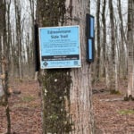
Location (Google Maps): First hike will meet on Maple Lane, km 00.0, Map 24, Edition 31 44.504973,-80.331780. Please arrive by 8:15 a.m. ready to car shuttle for an 8:30 hike start.
Pace: Medium Terrain: Moderate, Some rocky footing, Some steep sections, Strenuous Length of Hike: Hikes will range between approx. 17 & 21 km
Description Come hike our beautiful Beaver Valley over 6 Saturdays this spring/summer! This series of hikes offers hikers the choice of one of two badges! Choose from the apple badge ($10 member/$15non members) or the fundraiser stained glass badge ($30). Payment for badges will be required on the day of the final hike. The medium hike pace will range between 3 to 4 km per hour, sometimes a bit more than 4 km per hour on easy flat terrain, with a snack and lunch break. Hikers may request a personal bio break, clothing adjustment, drink stop, etc. at any time during the hike by notifying the leader or sweep. The hikes range from approx. 17 to 21 km. Please self evaluate your ability to manage the pace and length of these hikes. Life does happen, so hikers will be able to miss 2 hikes and make them up on their own before July 24. A full hike schedule, with meet locations, will be sent to hikers after registration. If you have any questions please use the “Contact hike leader” option on the online schedule.
Other Guidelines
Arrive 15 minutes before the start of the hike.
Wear sturdy footwear and appropriate attire for the weather and the terrain. Hiking poles are a good idea in any season, especially if the terrain is rocky or slippery. In winter, snowshoes or icers/crampons are needed when conditions dictate. Wearing appropriate clothing and footwear prevents injuries and shows consideration for a safe and positive group hiking experience.
Always carry I.D. and your health card.
Bring sufficient water and snacks (or lunch if indicated). A minimum of 1L of water is recommended on all hikes, and 3L is recommended for long, challenging hikes in the heat of the summer.
Bring sunscreen and insect repellent (for spring and summer hikes).
Description Join us for this essential two-day First Aid + CPR certification weekend for Volunteers. Tailored for active Bruce Trail Iroquoia Club Hike Leaders and volunteers of the Trail Maintenance Crew.
Class run form 9:00am – 5:00pm.
Gain confidence to respond effectively on the trail—empowering you to keep our adventures safe. The course is instructed again by Scott Fraichine. Bruce Trail Conservancy covers all costs.
Who Should Attend Only active hike leaders and trail maintenance volunteers. Please confirm your eligibility with the Iroquoia Hike Director or the Trail Development and Maintenance Director before registering. Please note: while the cost of this course is covered by the BTC, if you cancel within two weeks, the cost will be passed on to you if a replacement registration cannot be found. This allows our instructor enough time to rent equipment and prepare for the course.
Pace: Moderate (3-4 km/hr) Terrain: Flat, Level 1 (Easy – mostly on flat, well maintained trails with hard-packed surface) Distance (km): 12 Km
Description Hi my dear hikers,
I’m inviting you to join us on the first Saturday of the beautiful month of May for an enjoyable walk at Tommy Thompson Park, Toronto’s urban wilderness. It’s a unique spot near downtown Toronto to experience nature and one of the best places for birdwatching—so bring your binoculars if you have them.
Notes:
It’s May, and showers can be expected at any time, so come prepared.
Bring 2L of drinking water and a lunch/snack.
Feel free to invite your family members and friends to join.
Please be on time. If you need to cancel, kindly do so via the website to give an opportunity to waitlisted hikers.
TTC users can take Bus #83 from Donlands Subway Station (check https://www.ttc.ca/ for any updates or closures). Free public parking is available at the trailhead on a first-come, first-served basis. Washrooms are located at the trailhead, with some additional vault toilets available on the trails. You will receive an update email on Thursday, April 30.
Fingers crossed for a nice sunny day—see you all soon!
Pace: Leisurely (2.0 – 3.0 km/h): A relaxed pace with frequent breaks and a focus on enjoyment. Terrain: Moderate: Rolling hills, mild slopes and rocky paths. Distance: 9.0
Description Join the adventure and earn the inaugural Peninsula Geology Badge! Over a stretch of 13 hikes and a couple of extra stops, we will explore the fascinating geology of the Peninsula to learn about the rocks, the shoreline features, glaciation, fossils and all things earthy. The 13 hikes are from the book “Walking Through Time – Exploring the Geology of the Saugeen (Bruce) Peninsula”. Having a copy will give you a lot of great information, but you do not have to purchase the book to attend and enjoy the hikes. Just bring your curiosity! We will make sure to hit all the locations that qualify for the beautiful new Walking Through Time – Saugeen (Bruce) Peninsula geology hike badge. If you would like to purchase a book I will have some available on the hikes, or you can pick one up from the BTC Head Office, at Ginger Press in Owen Sound, Suntrail Source for Adventure in Hepworth, the Shop at 84 Main in Lion’s Head and at Reader’s Haven in Tobermory.
You are welcome to come on just a few of the hikes or on all of them, and the dates and hikes are as follows:
Date Geology Hike km
Saturday May 2, 2026 Colpoy’s Bay 9.0
Saturday May 9, 2026 Gravelly Point (am) and Rural Rocks (pm) 8.6
Saturday May 16, 2026 Malcolm Bluff 7.3
Sunday May 17, 2026 White Bluff/Smokey Head 11.8
Sunday May 24, 2026 Crooked Toe Road 5.5
Sunday May 31, 2026 Hope Bay 8.1
Sunday June 14, 2026 Boundary Bluffs 5.2
Saturday July 4, 2026 Cape Dundas 6.2
Saturday July 11, 2026 Beth Gilhespy Side Trail 7.6
Saturday August 8, 2026 Lion’s Head 11.0
Saturday August 15, 2026 Dyer’s Bay Loops 7.5
Saturday August 22, 2026 North Saugeen (Bruce) Shoreline 8.0
Meeting times will vary depending on the hike, but will generally be some time between 9 am and 10 am. Information on exact meeting times and locations will be sent out a few days prior to the hike.
CAR SHUTTLE linear hike. Meet at BT roadside parking along St Vincent-Sydenham Townline north of Walters Falls between Sideroad 3 and Holland-Sydenham Townline. We will be taking some cars to start point at Blantyre parking lot and then hike west.
Pace: Leisurely: 3 km/h or less Terrain: Moderate: Some hills and/or poor footing, There might be muddy sections., There might be sections with water on the trail. Distance: 7.4 km
Description Join Carol Graham-Mullin on an educational geology hike exploring the delightful Rocklyn Creek section, with its many dolostone and shale layers, deep forests, historic foundations and rocky outcrops. This is Hike #1 in the Geology Series (1 of 16 hikes). Copies of Beth’s book, “Walking through Time” will be available for purchase at the end of the hike. A special member’s only price of $37.00 , cash or e-transfer. This hike will be a credit towards the Sydenham Geology Badge. Estimated time of hike includes car shuttling.
Pace: Leisurely – 3 km/hour or less Terrain: Moderate – some hills and/or some poor footing Distance: 5.8 km
Description This hike begins on the Bennett Heritage Trail at Scotsdale Farm. We cross Snows Creek pond and subsequently Owl Creek, close to the site of an Indigenous (Attiwonderonk) village from 1550-1580. We will share information about the village and then quietly follow the west side of Owl Creek to a scenic spot for a short break before we return to our departure point. Please bring water & a snack and inquisitiveness re the wildflowers that will be emerging!
Pace: Moderate (3-4 km/hr) Terrain: Flat Distance (km): 9 km
Description Please join me at the south east corner of Sheppard Ave East and Leslie by 10 AM. We will hike south through several parks to Don Mills (S of Overlea) (km 51.7 to km 62.4). Here is an online map with km markings of our route for all 7 hikes for the Toronto Urban Badge: https://onthegomap.com/s/c2c1hf3n
Please make sure you bring at least 2 liters of water, a lunch, bug spray and sunscreen.
Hosting Club: Niagara Category: No Leader Location (Google Maps): Hoxie Hall at Cave Springs Camp. 4410 Cave Spring Rd, Beamsville. Hoxie Hall is the brown building with the concrete patio and wheelchair ramp with metal railings. Accessible venue. Free parking.
Description Niagara Bruce Trail Club members – come get your maple on! Join our NBTC social Pancake Breakfast and stay for the Annual General Meeting. We will have Michael McDonald, CEO of the Bruce Trail Conservancy, as special guest.
10:00am: Doors to Hoxie Hall open
10:00 to 11:00: Pancake Breakfast. Serving pancakes, maple syrup, sausages, coffee/tea, juice. If you are attending and would like to contribute to the breakfast, fruit/fruit salads or breakfast bake treats (such as your family’s favourite muffin recipe) would be most welcome.
11:00 to 12:00: Annual General Meeting, led by Club President, Ellen Savoia, with remarks by Michael McDonald
Hosting Club: Iroquoia Category: City of Waterfalls – Special Event Fundraiser Location (Google Maps): DAY 1: MAY 2 – Parking lot at City View Park off of Kerns Rd. Enter from Dundas St. (capacity 50) 43.351747, -79.862195 DAY 2: MAY 3 – Parking Lot off of Mud St providing access to the Mud Street Side Trail (capacity 30)
Pace: Medium – 3 to 4 km/hr Terrain: Dependent on Conditions, Moderate – Some hills and/or some poor footing, Slippery and Steep Sections Distance: Approximately 22-25km / per day
Description Welcome to Iroquoia, City of Waterfalls Challenge! This is a fundraiser challenge event. All funds raised go towards the Iroquoia Bruce Trail Club to maintain the infrastructure of this beautiful section of trail and to “Preserve this ribbon of wilderness, for everyone, forever!”
We also encourage participants to consider a membership with Conservation Hamilton https://conservationhamilton.ca/hca-membership-pass/
And/or Conservation Halton (50%discount with BTC membership) https://www.conservationhalton.ca/park-fees-membership-rates/
DAY 1: MAY 2 – We will meet at Cityview Park and car shuttle to Spencer Gorge Parking Lot (Conservation Hamilton) and hike back. The cost at this parking lot is $16.50 per vehicle and driver plus $5.50 for each passenger. Day 1 Distance 21km
DAY 2: MAY 3 – We will meet in the parking area off of Mud St and car shuttle to Artaban Rd Parking Lot (Conservation Hamilton) and hike back. The cost for this parking lot is $11.00 per vehicle. Day 2 Distance 24 km
Please ensure your vehicle is car shuttle ready by having a minimum of 4 seatbelts available – drivers do not pay for the parking. Please volunteer for this important component of this challenge or we can throw all the names into a hat. While we encourage carpooling to the start of the hike, please let the hike leader know if you’re planning to arrive with more than two people in your vehicle. This hike will be limited to 20 people including the hike leader so we will need at least 4 vehicles and one vehicle with 5 seatbelts to drive the drivers back at the end of the day. We will try to take as few vehicles as possible. On the second day, those who did not drive on the first day will be asked to drive.
There will be short breaks along the way to admire the waterfalls on route and a short lunch.
Please bring all the hiking items you require for a long day hike including 2l of water, snacks, lunch, first aid kit, rain gear if rain is forecast, plastic shower caps for your boots if muddy, bug spray, sunscreen, rimmed hat, poles (if you use them) and your camera for all the photo ops. Please ensure you are physically able to complete two long day hikes over two days – if you must drop out, you will have to arrange your own transportation back to your vehicle. There is public transportation, Uber, and taxi’s in the area. If you are concerned about whether you will be able to manage the distance over the two day period, it’s possible that you may need to wait until a 4 day version of this event is posted.
The badge will be presented to all participants who have completed the challenge at the end of the second day.
Any questions may be directed through contact on this form.
Hosting Club: Sydenham, Peninsula Category: Sydenham E2E Trail Run Location (Google Maps): Day 1 of the E2E Trail Run of the Sydenham Bruce Trail section. Meeting at BTC parking on Graham’s Hill Rd.
Pace: Fast (5.5 – 7.0 km/h+): A quick pace maintained by experienced hikers or trail runners. Terrain: Difficult: Steep ascents/descents, rocky scrambling, and some rugged escarpment paths. Distance: About 23km
Description This is a single-day registration – Day 1 of 8.
The Sydenham Bruce Trail Club (SBTC), in partnership with the Peninsula Bruce Trail Club (PBTC), is excited to offer its first-ever trail running Sydenham End-to-End series in 2026. Join the fun for one of the eight days in this trail running series! The trail running Sydenham E2E series will take place over 4 weekends and 8 days, starting at 7:30am. Below is the start and end location and estimated distance for this day (subject to change slightly). The group will meet at the end location, and carpool to the start of each day’s route. You are expected to participate in shuttling vehicles.
Please carefully read the details below to understand the logistics, costs, important notes, and fitness required for this challenge.
Saturday, May 2, 2026: Wiarton Bluewater Park to Graham’s Hill Rd BTC Parking; ~23km.
When you register here, you are registering for only one day in the series. (You also have the option of registering for the whole series for $60 even if you aren’t able to make all eight days).
These are group trail runs. It is not a race. It is not a hike. There may be a couple different pace groups that naturally form, but you will be expected to stay with a group and wait to regroup at key locations. Runners are expected to remain between the lead runner and the sweep at all times. Anticipate each day to be running for about 3+/- hours, at a pace ranging from 7-9 min./km.
Participants are expected to have some experience trail running as this is difficult terrain. There are also some roads, and some active farm fields. In some locations throughout Sydenham, trail running will not be permitted near livestock. On roads, runners are expected to follow standard Highway Traffic Act regulations, crossing safely and running on the shoulder, in single file, facing oncoming traffic.
Mandatory gear includes a whistle and minimum 250ml of water carrying capacity. Trail runners will need to carry their own water and fuel.
At approximate mid-way points each day, there will be volunteer support arranged so you can fill up water bottles. Some snacks (e.g. oranges, bananas, pretzels, cookies, water) will be provided but please plan to be self-sufficient.
Exercise care and caution and common sense on trails, especially when passing other trail users. Let others know you are coming and that you intend to pass. Headphones/earbuds are not permitted while participating in this group run.
Participants must be age 16 years or older.
Dogs are not permitted.
This trail run is for BTC members only. To become a member, click here: https://brucetrail.org/.
The designated meeting points will not incur any personal parking fees but parking space is limited. Participants are encouraged to car pool whenever possible.
The single day fee is $20. This fee covers snacks, vehicle shuttle, volunteer support, and a donation to the PBTC hike program. There is also an option to register for the whole series ($60).
As per BTC policy, no refunds will be considered 30 days before the series starts (not after April 1, 2026).
The trail run will go ahead rain or shine, however, in extremely inclement weather, a date may be cancelled and rescheduled, ideally prior to the May 31st finish date.
You are signing up for the following dates and times: 2026-05-02 at 07:30 2026-05-03 at 07:30 2026-05-09 at 07:30 2026-05-10 at 07:30 2026-05-23 at 07:30 2026-05-24 at 07:30 2026-05-30 at 07:30 2026-05-31 at 07:30
Hosting Club: Sydenham, Peninsula Category: Sydenham E2E Trail Run Location (Google Maps): E2E Trail Run of the Sydenham Bruce Trail section. Starting in Wiarton Bluewater Park.
Pace: Fast (5.5 – 7.0 km/h+): A quick pace maintained by experienced hikers or trail runners. Terrain: Difficult: Steep ascents/descents, rocky scrambling, and some rugged escarpment paths., Moderate: Rolling hills, mild slopes and rocky paths. Distance: Average of 21km each day
Description Note: updates to the original description are underlined. (Updates as of March 13, 2026).
The Sydenham Bruce Trail Club (SBTC), in partnership with the Peninsula Bruce Trail Club (PBTC), is excited to offer its first-ever trail running Sydenham End-to-End series in 2026. Join the fun and earn a specially-designed trail running SBTC E2E badge! The trail running Sydenham E2E series will take place over 4 weekends and 8 days, starting at 7:30am. Below are the start-end locations and estimated distance each day (subject to change slightly). The group will meet at the end location, and carpool to the start of each day’s route. You are expected to participate in shuttling vehicles.
Please carefully read the details below to understand the logistics, costs, important notes, and fitness required for this challenge.
Saturday, May 2, 2026: Wiarton Bluewater Park to Graham’s Hill Rd BTC Parking; ~23km;
Sunday, May 3, 2026: Graham’s Hill Rd BTC Parking to Lindenwood Rd BTC Parking; ~22km;
Saturday May 9, 2026: Lindenwood Rd BTC Parking to 19th Street W & Somers St., Owen Sound; ~20km;
Sunday, May 10, 2026: 19th Street W & Somers St., Owen Sound to Centennial Tower Parking Lot; ~19km;
Saturday, May 23, 2026: Centennial Tower Parking Lot to Irish Block Rd BTC Parking; ~19km;
Sunday, May 24, 2026: Irish Block Rd BTC Parking to Woodford Community Centre; ~23km;
Saturday, May 30, 2026: Woodford Community Centre to Massie Hills Parking off 6th Concession S; ~19km; and
Sunday, May 31, 2026: Massie Hills Parking off 6th Concession S to Blantyre BTC Parking Lot; ~21km.
When you register, you are registering for the whole series. You are welcome to join for as many dates as you able. There is also an option to register for a single day ($20).
Those that complete the whole Sydenham section will earn the new SBTC trail running E2E badge. You can also complete the route(s) on your own, at any time, to earn the SBTC trail running E2E badge.
These are group trail runs. It is not a race. It is not a hike. There may be a couple different pace groups that naturally form, but you will be expected to stay with a group and wait to regroup at key locations. Runners are expected to remain between the lead runner and the sweep at all times. Anticipate each day to be running for about 3+/- hours, at a pace ranging from 7-9 min./km.
Participants are expected to have some experience trail running as this is difficult terrain. There are also some roads, and some active farm fields. In some locations throughout Sydenham, trail running will not be permitted near livestock. On roads, runners are expected to follow standard Highway Traffic Act regulations, crossing safely and running on the shoulder, in single file, facing oncoming traffic.
Mandatory gear includes a whistle and minimum 250ml of water carrying capacity. Trail runners will need to carry their own water and fuel.
At approximate mid-way points each day, there will be volunteer support arranged so you can fill up water bottles. Some snacks (e.g. oranges, bananas, pretzels, cookies, water) will be provided but please plan to be self-sufficient.
Exercise care and caution and common sense on trails, especially when passing other trail users. Let others know you are coming and that you intend to pass. Headphones/earbuds are not permitted while participating in this group run.
Participants must be age 16 years or older.
Dogs are not permitted.
This E2E series is for BTC members only. To become a member, click here: https://brucetrail.org/.
The designated meeting points will not incur any personal parking fees but parking space is limited. Participants are encouraged to car pool whenever possible.
The fee is $60. This fee covers snacks, the new SBTC E2E badge, and a donation to the PBTC hike program.
As per BTC policy, no refunds will be considered 30 days before the series starts (not after April 1, 2026).
The trail run will go ahead rain or shine, however, in extremely inclement weather, a date may be cancelled and rescheduled, ideally prior to the May 31st finish date.
Pace: Medium: 3 to 4 km/h Terrain: Easy: Mostly flat and good footing., Moderate: Some hills and/or poor footing, Strenuous: Hilly with steep climbs and some poor footing., There might be muddy sections., There might be sections with water on the trail. Distance: The 8 hikes vary from 18.6 to 23.2 km
Description The official Sydenham End to End Event consists of 8 hikes over 4 weekends in May, June, September and October. Participation is limited to 48 (one bus). The fee includes bus transportation each morning from the hike end location to the hike start and 1 or 2 checkpoints with water and snacks. You will hike without a leader but we will provide a sweep. On successful completion of all 8 hikes, you will get the exclusive Official Sydenham End to End badge. Plan on registering early as in 2025 the event sold out in less than 10 minutes. Within the first week after registering you will be emailed all the hike details. NO REFUNDS will be issued. For additional information email sydenhame2e@gmail.com.
Hosting Club: Toronto Category: Car Hike Location (Google Maps): Meet in the parking lot east side of Concession 2, (Whitchurch-Stouffville), 200m south of Webb Rd. This is a free Parking lot.
Pace: Moderate (3-4 km/hr) Terrain: Flat, Hilly, Level 2 (Intermediate – some hills and uneven surfaces, rocks and roots underfoot), Variable Distance (km): 14-16 Km
Description Join us to explore the nature of Goodwood Conservation Area and Secord Forest. The trail is fairly level lowland wetlands with many boardwalks making an otherwise inaccessible terrain traversable. There are a few meadows and upland woods thrown in there though. Although mostly a flat trail, expect some hills and sharp steep trails in between. In this season a mix of birds sounds and spring flowers adds to the beauty of the scene. Secord Forest, Pond and dog cemetery will be on our way to the hike. Bring at least two litters of water and your favorite snacks. Boots mandatory, poles highly recommended. Dress according to the spring humid. Be prepared for the rise of the bugs and ticks and make your spray ready on hand.
Location (Google Maps): First hike will meet on Maple Lane, km 00.0, Map 24, Edition 31 44.504973,-80.331780. Please arrive by 8:15 a.m. ready to car shuttle for an 8:30 hike start.
Pace: Medium Terrain: Moderate, Some rocky footing, Some steep sections, Strenuous Length of Hike: Hikes will range between approx. 17 & 21 km
Description Come hike our beautiful Beaver Valley over 6 Saturdays this spring/summer! This series of hikes offers hikers the choice of one of two badges! Choose from the apple badge ($10 member/$15non members) or the fundraiser stained glass badge ($30). Payment for badges will be required on the day of the final hike. The medium hike pace will range between 3 to 4 km per hour, sometimes a bit more than 4 km per hour on easy flat terrain, with a snack and lunch break. Hikers may request a personal bio break, clothing adjustment, drink stop, etc. at any time during the hike by notifying the leader or sweep. The hikes range from approx. 17 to 21 km. Please self evaluate your ability to manage the pace and length of these hikes. Life does happen, so hikers will be able to miss 2 hikes and make them up on their own before July 24. A full hike schedule, with meet locations, will be sent to hikers after registration. If you have any questions please use the “Contact hike leader” option on the online schedule.
Other Guidelines
Arrive 15 minutes before the start of the hike.
Wear sturdy footwear and appropriate attire for the weather and the terrain. Hiking poles are a good idea in any season, especially if the terrain is rocky or slippery. In winter, snowshoes or icers/crampons are needed when conditions dictate. Wearing appropriate clothing and footwear prevents injuries and shows consideration for a safe and positive group hiking experience.
Always carry I.D. and your health card.
Bring sufficient water and snacks (or lunch if indicated). A minimum of 1L of water is recommended on all hikes, and 3L is recommended for long, challenging hikes in the heat of the summer.
Bring sunscreen and insect repellent (for spring and summer hikes).
Description Join us for this essential two-day First Aid + CPR certification weekend for Volunteers. Tailored for active Bruce Trail Iroquoia Club Hike Leaders and volunteers of the Trail Maintenance Crew.
Class run form 9:00am – 5:00pm.
Gain confidence to respond effectively on the trail—empowering you to keep our adventures safe. The course is instructed again by Scott Fraichine. Bruce Trail Conservancy covers all costs.
Who Should Attend Only active hike leaders and trail maintenance volunteers. Please confirm your eligibility with the Iroquoia Hike Director or the Trail Development and Maintenance Director before registering. Please note: while the cost of this course is covered by the BTC, if you cancel within two weeks, the cost will be passed on to you if a replacement registration cannot be found. This allows our instructor enough time to rent equipment and prepare for the course.
Pace: Moderate (3-4 km/hr) Terrain: Flat, Level 1 (Easy – mostly on flat, well maintained trails with hard-packed surface) Distance (km): 12 Km
Description Hi my dear hikers,
I’m inviting you to join us on the first Saturday of the beautiful month of May for an enjoyable walk at Tommy Thompson Park, Toronto’s urban wilderness. It’s a unique spot near downtown Toronto to experience nature and one of the best places for birdwatching—so bring your binoculars if you have them.
Notes:
It’s May, and showers can be expected at any time, so come prepared.
Bring 2L of drinking water and a lunch/snack.
Feel free to invite your family members and friends to join.
Please be on time. If you need to cancel, kindly do so via the website to give an opportunity to waitlisted hikers.
TTC users can take Bus #83 from Donlands Subway Station (check https://www.ttc.ca/ for any updates or closures). Free public parking is available at the trailhead on a first-come, first-served basis. Washrooms are located at the trailhead, with some additional vault toilets available on the trails. You will receive an update email on Thursday, April 30.
Fingers crossed for a nice sunny day—see you all soon!
Pace: Leisurely (2.0 – 3.0 km/h): A relaxed pace with frequent breaks and a focus on enjoyment. Terrain: Moderate: Rolling hills, mild slopes and rocky paths. Distance: 9.0
Description Join the adventure and earn the inaugural Peninsula Geology Badge! Over a stretch of 13 hikes and a couple of extra stops, we will explore the fascinating geology of the Peninsula to learn about the rocks, the shoreline features, glaciation, fossils and all things earthy. The 13 hikes are from the book “Walking Through Time – Exploring the Geology of the Saugeen (Bruce) Peninsula”. Having a copy will give you a lot of great information, but you do not have to purchase the book to attend and enjoy the hikes. Just bring your curiosity! We will make sure to hit all the locations that qualify for the beautiful new Walking Through Time – Saugeen (Bruce) Peninsula geology hike badge. If you would like to purchase a book I will have some available on the hikes, or you can pick one up from the BTC Head Office, at Ginger Press in Owen Sound, Suntrail Source for Adventure in Hepworth, the Shop at 84 Main in Lion’s Head and at Reader’s Haven in Tobermory.
You are welcome to come on just a few of the hikes or on all of them, and the dates and hikes are as follows:
Date Geology Hike km
Saturday May 2, 2026 Colpoy’s Bay 9.0
Saturday May 9, 2026 Gravelly Point (am) and Rural Rocks (pm) 8.6
Saturday May 16, 2026 Malcolm Bluff 7.3
Sunday May 17, 2026 White Bluff/Smokey Head 11.8
Sunday May 24, 2026 Crooked Toe Road 5.5
Sunday May 31, 2026 Hope Bay 8.1
Sunday June 14, 2026 Boundary Bluffs 5.2
Saturday July 4, 2026 Cape Dundas 6.2
Saturday July 11, 2026 Beth Gilhespy Side Trail 7.6
Saturday August 8, 2026 Lion’s Head 11.0
Saturday August 15, 2026 Dyer’s Bay Loops 7.5
Saturday August 22, 2026 North Saugeen (Bruce) Shoreline 8.0
Meeting times will vary depending on the hike, but will generally be some time between 9 am and 10 am. Information on exact meeting times and locations will be sent out a few days prior to the hike.
CAR SHUTTLE linear hike. Meet at BT roadside parking along St Vincent-Sydenham Townline north of Walters Falls between Sideroad 3 and Holland-Sydenham Townline. We will be taking some cars to start point at Blantyre parking lot and then hike west.
Pace: Leisurely: 3 km/h or less Terrain: Moderate: Some hills and/or poor footing, There might be muddy sections., There might be sections with water on the trail. Distance: 7.4 km
Description Join Carol Graham-Mullin on an educational geology hike exploring the delightful Rocklyn Creek section, with its many dolostone and shale layers, deep forests, historic foundations and rocky outcrops. This is Hike #1 in the Geology Series (1 of 16 hikes). Copies of Beth’s book, “Walking through Time” will be available for purchase at the end of the hike. A special member’s only price of $37.00 , cash or e-transfer. This hike will be a credit towards the Sydenham Geology Badge. Estimated time of hike includes car shuttling.
Pace: Leisurely – 3 km/hour or less Terrain: Moderate – some hills and/or some poor footing Distance: 5.8 km
Description This hike begins on the Bennett Heritage Trail at Scotsdale Farm. We cross Snows Creek pond and subsequently Owl Creek, close to the site of an Indigenous (Attiwonderonk) village from 1550-1580. We will share information about the village and then quietly follow the west side of Owl Creek to a scenic spot for a short break before we return to our departure point. Please bring water & a snack and inquisitiveness re the wildflowers that will be emerging!
Pace: Moderate (3-4 km/hr) Terrain: Flat Distance (km): 9 km
Description Please join me at the south east corner of Sheppard Ave East and Leslie by 10 AM. We will hike south through several parks to Don Mills (S of Overlea) (km 51.7 to km 62.4). Here is an online map with km markings of our route for all 7 hikes for the Toronto Urban Badge: https://onthegomap.com/s/c2c1hf3n
Please make sure you bring at least 2 liters of water, a lunch, bug spray and sunscreen.
Hosting Club: Niagara Category: No Leader Location (Google Maps): Hoxie Hall at Cave Springs Camp. 4410 Cave Spring Rd, Beamsville. Hoxie Hall is the brown building with the concrete patio and wheelchair ramp with metal railings. Accessible venue. Free parking.
Description Niagara Bruce Trail Club members – come get your maple on! Join our NBTC social Pancake Breakfast and stay for the Annual General Meeting. We will have Michael McDonald, CEO of the Bruce Trail Conservancy, as special guest.
10:00am: Doors to Hoxie Hall open
10:00 to 11:00: Pancake Breakfast. Serving pancakes, maple syrup, sausages, coffee/tea, juice. If you are attending and would like to contribute to the breakfast, fruit/fruit salads or breakfast bake treats (such as your family’s favourite muffin recipe) would be most welcome.
11:00 to 12:00: Annual General Meeting, led by Club President, Ellen Savoia, with remarks by Michael McDonald
Hosting Club: Sydenham, Peninsula Category: Sydenham E2E Trail Run Location (Google Maps): Day 2 of the E2E Trail Run of the Sydenham Bruce Trail section. Meeting at Lindenwood Rd. BTC Parking Lot
Pace: Fast (5.5 – 7.0 km/h+): A quick pace maintained by experienced hikers or trail runners. Terrain: Difficult: Steep ascents/descents, rocky scrambling, and some rugged escarpment paths. Distance: About 22km
Description This is a single-day registration – Day 2 of 8.
The Sydenham Bruce Trail Club (SBTC), in partnership with the Peninsula Bruce Trail Club (PBTC), is excited to offer its first-ever trail running Sydenham End-to-End series in 2026. Join the fun for one of the eight days in this trail running series! The trail running Sydenham E2E series will take place over 4 weekends and 8 days, starting at 7:30am. Below is the start and end location and estimated distance for this day (subject to change slightly). The group will meet at the end location, and carpool to the start of each day’s route. You are expected to participate in shuttling vehicles.
Please carefully read the details below to understand the logistics, costs, important notes, and fitness required for this challenge.
Sunday, May 3, 2026: Graham’s Hill Rd BTC Parking to Lindenwood Rd BTC Parking; ~22km.
When you register here, you are registering for only one day in the series. (You also have the option of registering for the whole series for $60 even if you aren’t able to make all eight days).
These are group trail runs. It is not a race. It is not a hike. There may be a couple different pace groups that naturally form, but you will be expected to stay with a group and wait to regroup at key locations. Runners are expected to remain between the lead runner and the sweep at all times. Anticipate each day to be running for about 3+/- hours, at a pace ranging from 7-9 min./km.
Participants are expected to have some experience trail running as this is difficult terrain. There are also some roads, and some active farm fields. In some locations throughout Sydenham, trail running will not be permitted near livestock. On roads, runners are expected to follow standard Highway Traffic Act regulations, crossing safely and running on the shoulder, in single file, facing oncoming traffic.
Mandatory gear includes a whistle and minimum 250ml of water carrying capacity. Trail runners will need to carry their own water and fuel.
At approximate mid-way points each day, there will be volunteer support arranged so you can fill up water bottles. Some snacks (e.g. oranges, bananas, pretzels, cookies, water) will be provided but please plan to be self-sufficient.
Exercise care and caution and common sense on trails, especially when passing other trail users. Let others know you are coming and that you intend to pass. Headphones/earbuds are not permitted while participating in this group run.
Participants must be age 16 years or older.
Dogs are not permitted.
This trail run is for BTC members only. To become a member, click here: https://brucetrail.org/.
The designated meeting points will not incur any personal parking fees but parking space is limited. Participants are encouraged to car pool whenever possible.
The single day fee is $20. This fee covers snacks, vehicle shuttle, volunteer support, and a donation to the PBTC hike program. There is also an option to register for the whole series ($60).
As per BTC policy, no refunds will be considered 30 days before the series starts (not after April 1, 2026).
The trail run will go ahead rain or shine, however, in extremely inclement weather, a date may be cancelled and rescheduled, ideally prior to the May 31st finish date.
Pace: Leisurely – 3km/hr or less, Medium – 3 to 4 km/hr Terrain: Easy – Mostly flat and usually good footing Distance: 10 Kms
Description Bruce Trail Rainbow Hike
Celebrate the beauty of the Bruce Trail and the spirit of community on our Rainbow Hike! 🌈🥾 Join us for a welcoming group hike along one of Ontario’s most scenic sections of the Bruce Trail. Whether you’re a seasoned hiker or just getting started, this event is all about enjoying nature, meeting new people, and sharing a positive outdoor experience together.
What to Expect
A guided group hike along a picturesque section of the Bruce Trail
Beautiful forest paths, escarpment views, and fresh spring air
A friendly, inclusive atmosphere where everyone is welcome
Opportunities to connect with fellow hikers and outdoor enthusiasts
Hike Details
Distance: Approximately 10 km
Pace: Easy to moderate, with plenty of breaks
Terrain: Mixed forest trails with some gentle elevation changes
Duration: About 2–3 hours
What to Bring
Comfortable and appropriate hiking shoes or boots
Water and light snacks
Weather-appropriate clothing
Your positive energy and rainbow spirit! 🌈
Whether you come solo or with friends, the Rainbow Hike is a chance to explore nature, celebrate diversity, and build community on the trail.
The rainbow badge will be provided at the end of our hike.
Pace: Moderate (3-4 km/hr) Terrain: Flat, Hilly, Level 2 (Intermediate – some hills and uneven surfaces, rocks and roots underfoot) Distance (km): 14-15 km
Description Let’s roll the hills of the Jefferson Forest and around the Bond Lake. Every week we hike in Jefferson Forest, located in the heart of Richmond Hill, it boasts numerous hiking trails. This 3.5 hour hike can range from 14 to 15 kilometres, depending on the weather conditions. Remember to bring water, snacks, hiking boots, poles, and your camera. Not recommended for beginners. Park in the free Bethesda parking lot and avoid parking along the road. Dress appropriately for the weather. Difficulty Level: 2 (Moderate).
Please arrive @8:15AM for start of 8:30AM.
This is a joint hike with the Oak Ridges Trail Association (ORTA).
Hosting Club: Peninsula Category: Peninsula Blue Series Location (Google Maps): Bluewater Park, Wiarton. Meet at main parking lot where washrooms are located.
Pace: Medium (3.0 – 4.5 km/h): A comfortable pace for most hikers with steady progress. Terrain: Easy: Flat forested sections or lowland trails. Distance: 13 km
Description Sunday Side Trails
Peninsula BTC is offering a series of hikes covering all of the side trails on the Peninsula section of the Bruce Trail. These hikes are a great opportunity for those who want to do some hiking but don’t want to commit to a full end-to-end; for those who have completed an end-to-end and want to explore more of the beautiful trails on the Peninsula and for locals and visitors who want to get out on the trail on the weekend.
The series will include 27 hikes on Sundays (and maybe the odd Saturday) over 2026 and 2027, covering more than 150 km of side trails or 78 trails! We will be offering hikes on a roughly biweekly basis, with hikes posted approximately two months in advance. The hikes will generally be loop hikes, although car shuttling may be required for a few hikes. Register for each hike individually, no need to commit to all 27 hikes!
For those who would like to earn the Peninsula Side Trails badge, these hikes provide a chance to join a group for some or all of the side trail hikes.
This hike includes 5 side trails featuring the Wicher and Colpoys Bluff Side Trails and three small connecter trails; Crawford Drive, Gatis and Mallory Beach Side Trails. Much of the hike will follow an old logging road through forest and meadows, past the disappearing stream and occasionally out to the main trail where we will have some views of Colpoys Bay.
Hikers should be prepared for cool weather and possible wet trails. Bring a lunch, water and snacks. Hike leader will contact registered hikers one week before the hike.
If you would like to be notified when the side trail hikes are posted, go to the bottom of the Hikes page on the PBTC website to sign-up for hike notifications.
Pace: Medium – 3 to 4 km/hr Terrain: Moderate – Some hills and/or some poor footing Distance: 11 kms
Description Meet in the main parking lot at Scotsdale Farm at 9:15 am. We’ll hike the Bennet Heritage Side Trail to the main trail and around the Great Esker Side Trail, back to the main trail and the Maureen Smith Side Trail for a total of about 11 kms. There are some hills. Bring water and a snack.
Pace: Fast 5+ km/hr Terrain: Moderate: some hills and some poor footing Distance: 7 km
Description Take the Side Trail Challenge and hike all 24 of Niagara’s side trails in 9 hikes to earn the Side Trail Badge.
Meet at Woodend Conservation Area. Hike to the Wetland Ridge side trail, in and out along the Niagara College side trail; back along the Wetland Ridge side trail until it meets the main trail; Margaret Kalogeropoulos side trail and back to the main trail. Required photos include: outdoor classroom, First Nations, Métis & Inuit garden, constant gardener bench, wood duck nesting box, lime kiln ruins, and Margaret Kalogeropoulos side trail sign.
Bring poles, dress according to the weather, and bring water and a snack.
Pace: Moderate (3-4 km/hr) Terrain: Hilly, Level 2 (Intermediate – some hills and uneven surfaces, rocks and roots underfoot), Variable Distance (km): 12 KM
Description Join us for a hike through scenic ravines from Yonge & Lawrence to Sunnybrook & Serena Gundy parks to end at Laird Station of TTC Line 5. Hopefully there will be the chance to enjoy spring wildflowers in the woods of Sunnybrook Park.
Pace: Leisurely <3 km/hr Terrain: Moderate: some hills and some poor footing Distance: 3-4 km
Description Join us for a leisurely, family-friendly Trillium Hunt hike along the Niagara Bruce Trail!
We will meet at the main parking lot inside Kinsmen Park in Beamsville and head towards Quarry Rd along the Bruce Trail to search for trillium and other short-lived spring ephemeral woodland flowers blooming right now such as trout lilies, bloodroot, jack-in-the-pulpit, dutchman’s breeches and more.
This is a leisurely-paced hike that is family-friendly. We will take our time looking for and at flowers. The trail is rocky and has some ups and downs along the escarpment that may pose challenges for anyone with mobility limitations. Good hiking shoes are a must and hiking poles help navigate the ups and downs.
Children are welcome accompanied by a responsible adult. Please arrive at 12:50 to check in with the hike leader so we can set out at 1 sharp. There is a parking lot inside Kinsmen Park with free parking but please note there are no bathrooms along this trail.
Hosting Club: Iroquoia Category: Special Event Location (Google Maps): Accommodation is at Snug Harbour Resort. Hiking is in Frontenac Provincial Park, a short distance away from the cabins.
Pace: Brisk – 4 to 5 km/hr, Medium – 3 to 4 km/hr Terrain: Dependent on Conditions, Moderate – Some hills and/or some poor footing, Strenuous – Hilly with steep climbs and some poor footing Distance: 12.5-23.6km daily
Description This is a special 4 day, 3 night trip to Frontenac Provincial Park. During this hiking event, we will be hiking the perimeter of Frontenac Provincial Park in three sections and it is called the Frontenac Perimeter Challenge. It is organised by the Friends of Frontenac Provincial Park each year. The Park is about 3.5 hours east of Toronto and an hour north of Kingston. The 3 sections are from 12.5-23.6km in length. If you have access to the Frontenac map, you will find it helpful so that everyone can follow along and help with way-finding. The cost for registering for the Challenge in 2025 was $10. If you are a member of the Friends of Frontenac, the fee is free. This includes a badge for your first challenge. Registration for the Challenge starts on April 1 and the hikes must take place during the month of May. Proof of the hikes is to be submitted in the form of a GPS track and submitted no later than May 31. If you would like the badge mailed to you, a self-addressed stamped envelope must be left at the park office. If they have them available, they may give them to us on our last day.
Accommodation is at Snug Harbour Resort, a short distance from the park. There are several two and three bedroom cabins available for May 3-6. http://www.snugharbour.on.ca. We will arrive on Sunday, May 3 after 12pm but won’t hike until Monday morning. The cabins are located on a lake and there is access to canoes and kayaks. Check out will be on Wednesday, May 6 by 10am. You are welcome to come earlier or stay later at your own expense. Please contact Rob at relax@snugharbour.on.ca. Let Rob know you are with the Bruce Trail Perimeter Challenge Group. Please review the list of the items you must bring with you for your stay at the cabins and coordinate the list with the other people sharing your cabin.
Once you book a cabin, please share your name and your cabin number with me so that I can share it with everyone else who registers for the Challenge. It will be up to you, as the cabin coordinator, to pay for the cost of the entire cabin and to collect from everyone else who is sharing the cabin. The rate is $120 per cabin plus tax, per day (paid by e-transfer). A $180 deposit is required at the time of booking which should be paid by the cabin coordinator. The cabin coordinator will collect from everyone else who is sharing the cabin. Unfortunately, we have had to implement this rule because of late cancellations which can leave the cost of the cabin in the hands of the people who are left sharing the cabin. If you need to cancel after registering, we will attempt to fill your spot and cost of the cabin with another person but there are no guarantees.
Parking fees at the Frontenac Provincial Park also apply. For our hikes, we will be carpooling from Snug Harbour over to the park and then shuttling to the trailhead. We will have the same driver and carpooling groups for the first two days. Since we will be leaving from the park on Day 3, everyone will have to drive. We will need a Day Use reservation for the first day and all vehicles will need a reservation for the last day of hiking as most people drive straight home after our last hike. Borrowing a park pass from your local library, if available, or purchasing an annual pass, is encouraged. Please Note: Paid parking is only required on our first day and our last day of hiking – May 4th and 6th. There are no additional fees for daily usage of the park.
Fees for the parking reservation and a contribution for gas is a shared expense for the people in the shuttle.
More information will be provided closer to the date to those who register.
Hosting Club: Niagara Category: Leisurely Location (Google Maps): Meet at Sobeys Hwy #20 Fonthill, 9am. We will carpool to Centennial Park, 998 Robinson Rd., Dunnville, Ont. We’ll hike the Thompson Creek Eco Centre loop. Option: have lunch at Passmores Diner (a quaint 40’s style diner),174 Queen St. Dunnville.
Hosting Club: Caledon Hills Category: General Location (Google Maps): Nottawasaga River, Caledon Hills Section. Meet at Hockley Road parking, east of km 61.1
Pace: Medium – 3 to 4 km/hour Terrain: Moderate – some hills and/or some poor footing, Strenuous – hilly with steep climbs and some poor footing Distance: 13 km
Description This is the first hike in the series and will loop through Hockley Valley Provincial Nature Reserve, following the Jeju Olle Friendship trail and three side trails.
Pace: Leisurely: 3 km/h or less Terrain: Easy: Mostly flat and good footing., There might be muddy sections., There might be sections with water on the trail. Distance: 3 km
Description Have you ever wondered what makes a species “invasive” ? And why this is a concern for the Bruce Trail ? Join Fran and Carol on this “Share and Learn” educational hike as we learn to identify commonly found invasive species along the Sydenham Bruce Trail. This is a leisurely loop hike with lots of opportunity to discover, photograph and learn together. We will concentrate on identifying common offenders such as : European buckthorn, Garlic mustard, Wild chervil and also “garden escapees”such as Periwinkle, English Ivy and Goutweed. And we will discuss why it is important to prevent, control and remove these plants from our trail environment. Please bring water, poles if necessary, and proper footwear. There may be muddy sections.
Hosting Club: Niagara Category: Loop Location (Google Maps): Queenston Heights Parking Lot near the Bruce Trail Cairn. Paid parking. Best to look at the annual parking pass for Niagara Parks.
Description Seeking balance, calm and strength without high impact exercise? Join us for a short hike around Queenston Heights Park. Tai Chi Master, Mike Van Natter will instruct us on the benefits of Tai Chi as well as lead us through several Tai Chi movements along our way.
Hosting Club: Iroquoia Category: General Hike Location (Google Maps): Mt Nemo (main parking lot) off of Guelph Line just South of Lowville. Conservation Pass required or fee to park. Online reservation necessary for entry to the parking lot
Pace: Medium – 3 to 4 km/hr Terrain: Moderate – Some hills and/or some poor footing Distance: 6km +
Description We will be completing the North and South Loop trails of Mt Nemo with great views along the way from the Escarpment. Please dress in appropriate layers and bring water and a snack.
Pace: Fast 5+ km/hr Terrain: Moderate: some hills and some poor footing Distance: 10k+
Description This is our regular Tuesday Long Hike. Note the new location which will continue until May due to the muddy conditions in Shorthills. We will hike along the trails which may include Brock, 12 mile creek. Morningstar mill and/or Bert Lowe side trail. Dress for the weather and bring poles snack and drink
Hosting Club: Toronto Category: Car Hike Location (Google Maps): Limehouse – Meet at the parking lot opposite Limehouse Public School, on the south side of 22 Sideroad, just north of Fifth Line.
Description Join BTC ecologist Mara McHaffie and members of the TBTC Biodiversity Team on a leisurely walk along the main trail and some side trails, listening and watching for birds returning from their southern wintering grounds. You need not be a bird expert – we welcome beginning birders! This area features a mix of open areas, thickets, and forest, so we anticipate encountering a good variety of species. The BTC’s protected natural areas, such as the one we will visit, aim to preserve the Escarpment’s unique biodiversity and provide nature-based solutions to addressing climate change.
During the hike, we will discuss how you can use apps like iNaturalist, Merlin Bird ID and eBird to enhance your birding experience. If you haven’t done so already, please download these apps ahead of time, as cell service can be spotty at this location.
You may also want to record what you see as you earn points towards the TBTC Naturalist badge.
Along with your curiosity, please bring water and snacks/lunch. End time and distance we will travel are estimates, depending on weather, trail conditions and what we observe!Note that due to the slow pace and frequent stops, you may want to dress more warmly than you would for a faster-paced hike.
This hike is brought to you by the TBTC’s Biodiversity Team. We endeavour to promote the critical role we can all play in protecting and conserving the Niagara Escarpment.
Description Hike the trails in and around Rotary Park. Please bring hiking poles, water and appropriate footwear. Trails may be muddy at this time of year.
Location (Google Maps): Parking lot is off Sycamore Drive, East of Bayview , across Starbucks plaza Bus 91 from Finch East station stops at Sycamore station.
Pace: Moderate (3-4 km/hr) Terrain: Hilly, Level 2 (Intermediate – some hills and uneven surfaces, rocks and roots underfoot) Distance (km): 6-7 km
Description We will explore Valleyview and Maple View parks, and walk along German Mill Creak, in return we stop in Huntington park and have snack under beautiful shed.
Although this is considered an “Urban Walk”, you can expect some hills up and down and uneven surfaces with tree roots. Please bring hiking poles, Ice cleats water and snacks.
Pace: Brisk, Medium Terrain: Moderate, Some rocky footing, Some steep sections, Strenuous Length of Hike: 10.5km
Description This is a loop hike that will follow the white blazed trail past Pinnacle Rock to the Metcalfe Crevice where you will have the choice of exploring the rocky gorge or taking a short rest. Once we are all back together we will continue on to the Chuck Grant side trail. This trail will loop us back to our cars.
This time of year we can expect all types of trail conditions. Please be prepared with rain gear, icers and poles for those steep ascents and descents.
Bring water and a snack
Please no dogs
Text Kristina @ 519-410-9077 for morning of cancellations
Hosting Club: Dufferin Hi-Land Category: Tuesday Hike Location (Google Maps): Meet at roadside parking on Centre Rd between 20 Sideroad and County Rd 21 (Dufferin Hi-Land Map 21, 46.7 – Edition 31) by 9:30. We will then shuttle north to Lavender Cemetery (54.9) to begin our hike. Carpool option: Meet at Super Burger, corner of Hwy 10 and Prince of Wales Rd, at 8:45.
Pace: Medium Terrain: Dependent on Conditions, Moderate Distance: Long Hike 8.2 km, Short Hike 6.7 km
Description On this springtime hike, we will traverse along roads, road allowances, open fields, forests, a ravine and a couple of rushing rivers, situated at the north section of Dufferin Hi-Land trails. Please come prepared for the weather and bring lunch/snacks.
Hosting Club: Caledon Hills Category: Tuesday Hikers Location (Google Maps): Parking Area – north of km 46.8, found 380 m north of the Main Trail crossing on Pretty River Road.
Pace: Medium – 3 to 4 km/hour Terrain: Moderate – some hills and/or some poor footing Distance: 12 km
Description From the parking lot on Pretty River Rd., we will hike the trail into Pretty River Valley. There is a climb up the valley and from there we will hike the Pretty River Side Trail, Main Trail and other side trails. We will hike to the highest point of the Bruce Trail where we will stop for a snack and then return to the cars.
Bring water and snacks, and a ‘sit-upon’. The trails may be muddy in spots, poles, and First Aid Kit recommended .
Pace: Leisurely (2.0 – 3.0 km/h): A relaxed pace with frequent breaks and a focus on enjoyment. Terrain: Moderate: Rolling hills, mild slopes and rocky paths. Distance: ~3 km
Description Brian Popelier, BTC Ecologist, will lead us on a birding adventure at the Glassford Wetland to observe the spring arrival of some of our feathered friends. This is a leisurely paced walk- stop-watch-listen hike. The distance will be determined by our bird observation opportunities. This property consists of a variety of habitats including forested areas, open meadows, hay fields and wetlands. A large pond is surrounded by well-developed open aquatic, marsh and willow- dogwood thickets which provide a diverse array of migratory and breeding birds, including waterfowl and marsh birds. At least 94 bird species have been recorded on the property. Notable species observed include Sandhill Crane, Sora, Osprey, Bobolink and Virginia Rail. At least 13 warbler species have been observed during spring and fall migration. This is a family friendly hike – all birding experience levels welcome. It is a perfect hike to get started on one of the PBTC Birder Badges: https://pbtc.ca/badges/
Please carpool if possible as parking is limited.
Bring a light backpack to carry your water bottle, snacks, camera and binoculars. Weather at this time of year can still be unpredictable – dress according to the weather conditions. Sturdy hiking shoes/boots, gators and long sleeved protective clothing are recommended No rain date.
Pace: Medium – 3 to 4 km/hour Terrain: Easy – mostly flat and usually good footing Distance: 10 km
Description Interested in hiking the Bruce Trail? Looking for a place to start? How about checking out Wednesday Waterloo Wayfarers? We will explore the urban, suburban and rural trails in the Waterloo Region including parts of the Avon, Guelph to Goderich, and Grand River trails. Speed: 3-3.5 km/hr. Distance 8-12 km. Most will be fairly flat, but some will involve hills. Bring at least 1 liter of water, sturdy hiking boots, snacks and a positive attitude! And hiking poles if you like.
Pace: Leisurely – 3 km/hr. or less Terrain: Moderate – Some hills and/or some poor footing Distance: ~4km
Description **Update: As of May 4th, there are still icy sections in the keyhole area. Grippers are highly recommended. Hiking poles are helpful but not required. It is paid parking in the lots, so please bring $4 to help compensate the driver.
Enjoy a crisp morning exploring for “Signs of Spring” along the trail. We meet at 8:45am in the large parking lot behind Tim Horton’s on First Street. At 9am, we will carpool to the parking lot on 15/16 Sideroad in Singhampton where we will begin our loop hike of the Nottawasaga Bluffs. We will take in the sites at the Lookout and navigate the crevices to get to the Keyhole.
Pace: Medium Terrain: Moderate Length of Hike: 5.0 km
Description This hike will be a there-and-back walk. Views from the edge of the Escarpment will show Collingwood and Nottawasaga Bay. We’ll pass Craigleith Ski Club and head towards a deep valley but then it is time to return. Often, views look different when walking in the opposite direction, promising another chance to experience wide open views of the shores of Nottawasaga Bay. Please bring water.
Pace: Leisurely – 3km/hr or less Terrain: Moderate – Some hills and/or some poor footing Distance: Approx. 7 km.
Description Please join in this favourite hiking area with its spectacular views across Nassagaweya Canyon towards Rattlesnake Canyon, its Meromictic and at this time of year its wildflower treasures which grown among the rocky parts of the escarpment. Expect one section of rocky terrain with tricky footing. Hopefully the boardwalk around the lake will have reopened. Please bring water, a snack, sunscreen and insect repellent. A reservation is necessary to park here through Halton Parks Reservation System. I will email the day before with my contact information should you need to cancel the morning of the hike.
Pace: Medium – 3 to 4 km/hr Terrain: Moderate – Some hills and/or some poor footing Distance: 5 kms
Description Meet roadside at 4:15 pm on Hwy 7 north of Georgetown, as you round the curve in the road. We will hike the Side Trails of Duff Pit, Reservoir, Trafalgar Rd and North Rim (through the old open quarry land) back to Duff Pit. It’s a short hike with lots of variety.
Hosting Club: Sydenham Category: An evening walk. Location (Google Maps): Meet in the parking lot by the river on the West side of 1st Ave east between 7th St East and 8th St East in Owen Sound
Pace: Brisk: 4 to 5 km/h Terrain: Moderate: Some hills and/or poor footing Distance: Approx 5 km
Description Join us for a spring evening hike exploring the Owen Sound paths and neighbourhoods, followed by an opportunity for refreshments. There is no need to show up 15 minutes early for this hike, but we will leave promptly at 7:00 pm.
Pace: Medium Terrain: Moderate, Some rocky footing, Some steep sections, Strenuous Length of Hike: Varies
Description All 9 Stained Glass Badges over 3 years – Hike series #6 – Beaver Valley
We will be completing an end to end of the Beaver Valley section in 6 hikes. The hikes average about 20 km per hike and are as follows: (1) Windy Lane to Fairmont ST (2) Fairmont ST to Blantyre (3) Windy Lane to Eugenia Falls (4) Eugenia Falls to Fox Ridge Road (5) Fox Ridge Road to km 20 (approx) and (6) Maple Lane to km 20. The full hike schedule will be distributed to participants upon registration.
Hikes will proceed rain or shine. Pace will be moderate (approx 4 km per hour not including a lunch stop). Breaks will be taken throughout the hikes as appropriate. Except for shuttles, hikers are expected to be self sufficient. Please bring everything that you might require to enjoy the hikes including water, snacks, lunch, appropriate footwear and clothing, personal medical kit and anything else that you might require.
Parking availability varies throughout the hikes. Parking locations may change depending on the number of participants. We may also use Eugenia Falls Conservation Area parking which is $10 per vehicle. The exact details of each hike will be discussed with the group at the beginning of the first hike.
Participants will be allowed to miss one of the scheduled hikes provided that they complete a make-up hike on their own or with a group before the last scheduled hike. Badges will be distributed at the end of the last hike.
At the first hike, participants will be required to sign a waiver in favour of the hike leader similar to the one they sign in favour of the BTC on registration.
You are signing up for the following dates: 2026-05-07, 2026-05-08, 2026-05-21, 2026-05-22, 2026-06-04, 2026-06-05, 2026-06-18, 2026-06-19, 2026-09-10, 2026-09-11, 2026-09-24, 2026-09-25, 2026-10-08, 2026-10-09, 2026-10-22, 2026-10-23
Pace: Leisurely: 3 km/h or less Terrain: Moderate: Some hills and/or poor footing, Strenuous: Hilly with steep climbs and some poor footing., There might be muddy sections., There might be sections with water on the trail. Distance: 169 km
Description Sydenham End to End in 16 hikes
Open to Bruce Trail Conservancy (BTC) Members Only. Non-members can join by signing up for a one-year BTC membership ($75) before registering at Bruce Trail Conservancy Memberships.
Participant Limit: Maximum of 15 participants, including the hike leader and sweep(s).
Registration Fee: BTC Members: $ 65 – includes Sydenham Stained Glass Fundraiser Badge. Surplus supports Sydenham Bruce Trail Club’s hike program. Registration opens Monday, March 2 at 7:00 am.
Note: No hiker substitutions or guest hikers.
Refund Policy: Refunds may be requested if hike is cancelled more than 30 days before the start of the hike series and are subject to an administration fee and will be issued only if there is a waitlist.
Hike Leadership:
All hikes will have a SBTC leader and sweep.
Average Hike Distance: Approximately 9 – 13 km each day.
Hike Overview:
Complete the Sydenham section of the Bruce Trail over 16 hikes.
Direction: Northbound from Blantyre to Wiarton (direction varies on one hike)
Group Hike Format: Participants must be committed to the entire series.
Series is designed for intermediate hikers comfortable with moderate challenges, including longer distances and elevation gains.
Expected Pace: Up to 3 km/hr over 9 – 12 km. Average pace may be slower than 3 km/hr, depending upon the experience of the hikers.
Total Distance: Approximately 169 km with no dropout points.
Time allocated for photography and appreciation of local flora and fauna.
Participant Requirements:
Ensure you are physically fit to participate in this series.
Attire: Proper hiking boots, layered clothing for varying weather and wet weather gear. Hiking poles are recommended.
Essentials: Sufficient food (lunch), snacks and water for a full day; bug spray
Breaks: Morning, 15-30 minute on-trail lunch and afternoon breaks, weather-dependent.
Participant is required to sign a BTC Waiver of Liability
Transportation:
Car shuttles will be used to transport hikers from meeting point (end point of hike) to start point of hike.
All hikers will be expected to participate with transportation and should have a vehicle capable of carrying 5 passengers with seatbelts.
There are parking fees in at least one location and nominal cost to be shared among passengers.
Environmental Responsibility:
Adherence to Leave No Trace principles.
Collective effort in trail cleanliness.
Note: Dogs are not permitted on this hike.
Accommodation Options:
Early reservations are recommended centrally in Owen Sound.
Options include motels, campgrounds, hostels and B&Bs.
Schedule and Communication:
Detailed itinerary will be sent to participants prior to each two-day hike segment.
Schedule subject to change.
Join us for this memorable hiking adventure and be part of a community dedicated to preserving and enjoying the natural beauty of the Bruce Trail.
Hosting Club: Caledon Hills Category: General Location (Google Maps): Boyne River – Dufferin Hi-Land Section. Meet at the parking lot south of 5 Sideroad, at the end of Centre Road. (km 17.6)
Pace: Medium – 3 to 4 km/hour Terrain: Moderate – some hills and/or some poor footing, Strenuous – hilly with steep climbs and some poor footing Distance: 13.3 km
Description This is the second hike of the series and will take us through Boyne Valley Provincial Park including Mulmur Lookout and Murphy’s Pinnacle.
Location (Google Maps): Parking lot is off Sycamore Drive, East of Bayview , across Starbucks plaza Bus 91 from Finch East station stops at Sycamore station.
Pace: Moderate (3-4 km/hr) Terrain: Hilly, Level 2 (Intermediate – some hills and uneven surfaces, rocks and roots underfoot) Distance (km): 6-7 km
Description We will explore Valleyview and Maple View parks, and walk along German Mill Creak, in return we stop in Huntington park and have snack under beautiful shed.
Although this is considered an “Urban Walk”, you can expect some hills up and down and uneven surfaces with tree roots. Please bring hiking poles, Ice cleats water and snacks.
Hosting Club: Toronto Category: Urban Walk Location (Google Maps):
Jack Layton Ferry Terminal, by the gate to the Wards Island Ferry. Please arrive 20 minutes prior to departure to check in with hike leader.
From Union Station take the LRT and get off at the stop Ferry Docks.Walk up to the Ferry Docks on Queens Quay West, street level. at the foot of Bay Street.
Pace: Leisurely (2-3 km/hr) Terrain: Flat, Level 1 (Easy – mostly on flat, well maintained trails with hard-packed surface) Distance (km): 6-9 km
Description After a day’s work come and “cool off” on the Toronto Islands free of fumes and traffic. Enjoy the view of the city skyline and Toronto’s beautiful island parkland. Pack a dinner for a sit down picnic. Also bring a warm jacket and flashlight. Return fare ticket for the ferry is $9.57 for adults, $6.15 for seniors Please check the hike schedule for weather related cancellations (hike will be updated by 11:00 AM day of the hike if any changes) Toronto Island evening hikes will take place every Thursday in May and June 2026. Same time and same meeting place. No preregistration is required – just show up at the ferry docks at 5:40 PM and sign in with the hike leader.
Hosting Club: Niagara Category: Urban Location (Google Maps): Park on King St near Centre St – at the entrance to Veteran’s Memorial Park, Niagara-on-the-Lake
Pace: Medium 3- 4 km/hr Terrain: Easy: mostly flat, good footing Distance: 6-7km
Description Each Friday we will explore historical Niagara-on-the-Lake while getting a moderate paced walk. Discover where the Niagara River meets Lake Ontario. Experience the Heritage District, woods and the Niagara Parkway.
Some weeks may be totally on sidewalks and roads while others may include a mix of trail and paved pathways.
Great way to build up endurance for longer more strenuous hikes.
Plan to stay for conversation and a coffee at Sweets & Swirls, Community Centre, Niagara Stone Rd., NOTL
Hosting Club: Dufferin Hi-Land Category: General Hike Location (Google Maps): Crawford Lake Conservation Area. Enter from Conservation Road just east of Guelph Line. Second parking lot near Indigenous Village. See Google Maps link for GPS. Online reservation at Conservation Halton required.
Pace: Medium Terrain: Slippery and Steep Sections, Moderate Distance: 14 kms
Description Join us for quiet stroll in the woods of Crawford Lake and Rattlesnake Point. We will be regaled with Spring wildflowers, budding leaves, streams and cliff-top views. Lots of ups and downs with some mud. Online reservation at Conservation Halton required. Please bring a snack, water, lunch, and a smile. Please meet at 9:00 am for a 9:15 hike start.
Description This hike is for those working on their Beaver Valley section end to end. We will meet at the Metcalfe Crevice Side Trail parking (use 415477 10 Line, Ravenna, ON for GPS) and carpool to the parking on Fox Ridge Road where it meets the 3rd line road allowance (enter 597000 Fox Ridge Rd, Clarksburg, ON to get close). We will then hike back to our cars at Metcalfe.
This hike is for experienced hikers. We will be hiking in spring conditions (mud, ice, snow) so be prepared for it all. Please have your icers and poles at the ready and dress in layers including a waterproof outer layer. Hiking boots/shoes are mandatory. Please bring water/electrolytes and snacks, though we do not plan a meal break as this hike is scheduled between lunch and dinner time.
We will be shuttling to our starting point so please be prepared to participate in the shuttle.
Pace: Leisurely (2.0 – 3.0 km/h): A relaxed pace with frequent breaks and a focus on enjoyment. Terrain: Easy: Flat forested sections or lowland trails. Distance: ~6 km
Description Experience the magic of dawn on the Bruce Trail with the Sunrise Hike Series offered by the Peninsula Bruce Trail Club. These early morning hikes provide a perfect opportunity to awaken your senses, boost your energy, and immerse yourself in the tranquility of nature as the sun paints the sky with breathtaking hues. As we make our way through scenic forest trails, we’ll pause to witness the first light shimmering on the turquoise waters of Georgian Bay – a sight that will surely leave you in awe!
Beyond the beauty, morning light helps regulate your circadian rhythm, elevating your mood, boosting energy levels and improving sleep quality. Whether you’re looking to start your day with a sense of calm, capture stunning sunrise photos, or simply reconnect with nature, these hikes offer a unique and inspiring way to greet the day.
On Saturday May 9th, join us in hiking the Cape Chin Maple Cross property to the edge of the Niagara Escarpment, where we’ll experience the sun rising over the Bay from the iconic Cape Chin lookout. We’ll have the joy of taking in the stunning colours of the sky as the first light sparkles on the stunning turquoise waters. This peaceful sunrise hike is the perfect way to connect with nature, capture some incredible photos, and start the day with fresh air and inspiration. Whether you’re a morning person or just love a good adventure, come experience the magic of dawn from one of the best vantage points on the Bruce Peninsula!
Don’t forget to bring a headlamp or flashlight (preferably with a red light setting) as we begin our adventure in the pre-dawn quiet. Join us and discover how a sunrise hike can nourish your mind, body, and spirit – setting the tone for a brighter, more balanced day.
We will be hiking up the dirt/gravel road to the iconic Cape Chin lookout. This hike is approximately 6 kms in length. Expect to be out for ~2 hours. Pace will be leisurely with ample time to enjoy the sunrise, take some photographs, and nourish yourself!
How to prepare
Get a good night’s sleep
Bring lots of water and a snack (breakfast and/or coffee are recommended if that’s your thing!)
Bring a headlamp or flashlight (preferably with a red light setting)
Wear waterproof hiking boots (There will be mud!)
Hiking poles are recommended but not necessary
Bring insect repellant or wear protective clothing
In the event of cloudy/rainy weather, the hike will be held on Sunday, May 11th. Please watch your emails for a confirmation the week of the hike!
Hosting Club: Dufferin Hi-Land Category: Special Events Location (Google Maps): Marshalling and Parking at 586387 10 Sideroad, Mulmur; ON; buses leave from the parking area
Pace: Fast Terrain: Slippery and Steep Sections, Strenuous Distance: Saturday +/- 30 Km; Sunday +/- 23 Km
Description This is our annual “fundraiser” 2 Day End-to-End “Red Trillium” Badge hike. Check points along the route will refresh and supply you while experienced “Sweeps” will encourage you! Come and enjoy Springtime in Dufferin and experience the majestic views afforded from the “High Lands”. Not open to children under 13 years of age.
Hosting Club: Sydenham, Peninsula Category: Sydenham E2E Trail Run Location (Google Maps): Day 3 of the E2E Trail Run of the Sydenham Bruce Trail section. Meeting at 19th Street W & Somers Street, Owen Sound
Pace: Fast (5.5 – 7.0 km/h+): A quick pace maintained by experienced hikers or trail runners. Terrain: Difficult: Steep ascents/descents, rocky scrambling, and some rugged escarpment paths. Distance: About 20km
Description This is a single-day registration – Day 3 of 8.
The Sydenham Bruce Trail Club (SBTC), in partnership with the Peninsula Bruce Trail Club (PBTC), is excited to offer its first-ever trail running Sydenham End-to-End series in 2026. Join the fun for one of the eight days in this trail running series! The trail running Sydenham E2E series will take place over 4 weekends and 8 days, starting at 7:30am. Below is the start and end location and estimated distance for this day (subject to change slightly). The group will meet at the end location, and carpool to the start of each day’s route. You are expected to participate in shuttling vehicles.
Please carefully read the details below to understand the logistics, costs, important notes, and fitness required for this challenge.
Saturday May 9, 2026: Lindenwood Rd BTC Parking to 19th Street W & Somers St., Owen Sound; ~20km.
When you register here, you are registering for only one day in the series. (You also have the option of registering for the whole series for $60 even if you aren’t able to make all eight days).
These are group trail runs. It is not a race. It is not a hike. There may be a couple different pace groups that naturally form, but you will be expected to stay with a group and wait to regroup at key locations. Runners are expected to remain between the lead runner and the sweep at all times. Anticipate each day to be running for about 3+/- hours, at a pace ranging from 7-9 min./km.
Participants are expected to have some experience trail running as this is difficult terrain. There are also some roads, and some active farm fields. In some locations throughout Sydenham, trail running will not be permitted near livestock. On roads, runners are expected to follow standard Highway Traffic Act regulations, crossing safely and running on the shoulder, in single file, facing oncoming traffic.
Mandatory gear includes a whistle and minimum 250ml of water carrying capacity. Trail runners will need to carry their own water and fuel.
At approximate mid-way points each day, there will be volunteer support arranged so you can fill up water bottles. Some snacks (e.g. oranges, bananas, pretzels, cookies, water) will be provided but please plan to be self-sufficient.
Exercise care and caution and common sense on trails, especially when passing other trail users. Let others know you are coming and that you intend to pass. Headphones/earbuds are not permitted while participating in this group run.
Participants must be age 16 years or older.
Dogs are not permitted.
This trail run is for BTC members only. To become a member, click here: https://brucetrail.org/.
The designated meeting points will not incur any personal parking fees but parking space is limited. Participants are encouraged to car pool whenever possible.
The single day fee is $20. This fee covers snacks, vehicle shuttle, volunteer support, and a donation to the PBTC hike program. There is also an option to register for the whole series ($60).
As per BTC policy, no refunds will be considered 30 days before the series starts (not after April 1, 2026).
The trail run will go ahead rain or shine, however, in extremely inclement weather, a date may be cancelled and rescheduled, ideally prior to the May 31st finish date.
Pace: Leisurely – 3km/hr or less Terrain: Easy – Mostly flat and usually good footing, Moderate – Some hills and/or some poor footing Distance: 5KM
Description Join us on World Migratory Bird Day for a pre-AGM Rainbow Hike! 🦅 🦉 🦆
This gentle early-morning outing will explore the trails around Spencer Creek and Cootes Paradise, one of the region’s most important bird migration areas. We will start at the trailhead parking lot on the southeast corner of Dundas Street and Cootes Drive (HWY 8) and hike along the creek, under the HWY 8 (under the bridge does involve some moderate stepping and slight ‘duck’ing for us tall folks).
Plan to arrive for 745AM and we’ll have a small crash course on downloading and using two popular birding apps, Merlin Bird ID and eBird recording our sightings as part of World Migratory Bird Day! We’ll depart by 8-810AM. Hoping to catch some Blue Herons, Black-crowned Night Herons, and if we’re lucky, a sighting of the RBG resident Bald Eagles!
🌈 This is a queer-led, 2SLGBTQIA+ inclusive Rainbow Hike, welcoming LGBTQ+ hikers, allies, birders, photographers, and anyone interested in connecting with nature and community before the AGM. This is a short, relaxed hike (approx. 5 km) designed to get everyone back in time for the AGM Meet-and-Greet at 10:30 AM at the Westdale Theatre.
What to Bring • Water and light snacks • Weather-appropriate clothing and sturdy footwear • Binoculars or camera if you have them (optional but fun! And a cell phone counts!)
After the hike, we encourage participants to join fellow members at the Iroquoia Bruce Trail Club AGM just a short walk away at the Westdale Theatre. Not a Bruce Trail member yet?! Sign up here! https://brucetrail.org/become-a-member/
Come enjoy a spring morning on the trail, celebrate migratory birds, and connect with your Bruce Trail community!
🐾 Please leave pets at home for this hike! It’s peak migration season and we’ll be passing through an important bird migration and nesting area, so we want to keep disturbance to our feathered friends to a minimum! 🐦
🚗 🚌 This outing is accessible by car or public transit.
Planning to drive? Parking is free but limited at the trailhead. We also ask for some assistance with shuttling folks back to the Westdale Theatre afterward for the Iroquoia Bruce Trail AGM.
Taking the Bus? HSR #5 (Delaware) stops near the trailhead entrance! Map of the bus and it’s schedule can be found here. https://www.hamilton.ca/sites/default/files/2024-04/5-Delaware-apr24.pdf
Free Bruce Trail Rainbow badges and stickers for all participants! Questions? Simply click “Contact Hike Leader” on the registration form.
Terrain: Dependent on Conditions, Moderate – Some hills and/or some poor footing Distance: 4.7 km
Description Join us for a pre-AGM hike. If you’d like to view the hike route, please click the All Trails link below. It’s approx. 5 km so we should be back in plenty time for the Meet-and-Greet at 10:30, before the AGM. https://www.alltrails.com/explore/custom-routes/custom-route-be20ded?u=m&sh=4wexyx
The hike route will start from the Hamilton Parking Lot #1002 heading to Princess Point, and loop back to the parking lot. From the lot it’s a short walk to the Westdale Theatre, if you are attending the AGM afterwards. Parking is $3 per hour, or all day for $15.
Please bring enough water and snacks for your hike. Trails may be muddy at this time of year, so gaiters would be useful.
We encourage Hikers to register and stay for the AGM after our Hike. Connect with other members, help commemorate a wonderful year for the Club and to celebrate all our amazing volunteers.
Full AGM Details and Agenda below.
AGM LOCATION: The Westdale Theatre, 1014 King St W, Hamilton, ON L8S 1L4 10:30 – 11:00 AM MEET-AND-GREET Connect with your Trail Community 11:00 – 11:45 AM IBTC AGM & VOLUNTEER AWARDS Celebrate the Heart of our Club 11:45 – 12:30 PM HOT LUNCH Enjoy a delicious meal locally catered.
SPECIAL EVENT // BRUCE TRAIL TALKS / SESSION 1: Indigenous Trails FREE for all IBTC Members attending the AGM 1:05 pm
Welcome & Introduction by BTC CEO Michael McDonald
1:10 pm
First Nations Trail Systems
A historical & archaeological perspective with Martin S. Cooper, Snr Archaeologist, ASI Toronto
1:30 pm
First Nations Priorities
For engagement, education, and reconciliation, a current perspective with Tim Johnson and Rick Hill
2:00 pm
Panel Discussion
with Tim, Rick, Martin and moderated by Michael McDonald Key takeaways, challenges, & priorities for action, including audience Q&A
Hosting Club: Toronto, Caledon Hills Category: Car Hike Location (Google Maps): Bruce Trail parking lot on the east side of 5th Line EHS, just south of Hockley Rd. (873603 5 EHS LINE, Mono, ON L9W 6N3)
Hike Leader(s): Amir Alemohammad
Pace: Moderate (3-4 km/hr) Terrain: Hilly, Level 2 (Intermediate – some hills and uneven surfaces, rocks and roots underfoot), Variable Distance (km): 12-14
Description Join us for a loop hike along the trails of the Hockley Rd region, one of the most beautiful hiking areas in Caledon. Known for its rolling hills, forested trails, and ever-changing seasonal scenery, this hike takes you through a mixed hardwood forest, providing ample shade—perfect for this time of year. You’ll also encounter moderate elevation changes, with some sections following ridge lines and valleys that offer occasional breathtaking scenic viewpoints. We will hike main and side trails between 5th and 3rd Line EHS. Boots mandatory, poles recommended, bring two litres of water, your snack and dress according to weather conditions.
Pace: Moderate (3-4 km/hr) Terrain: Hilly, Level 2 (Intermediate – some hills and uneven surfaces, rocks and roots underfoot), Rocky, Variable Distance (km): 17 km
Description The seventh hike in our Iroquia E2E will take us through Mount Nemo Conservation Area (scenic view on top of the escarpment), Maple Cross Nature Reserve and Kilbride Pass to Crawford Lake Conservation Area. We begin with a steep climb up the escarment to Mount Nemo Conservation area but it will level out for the rest of the hike. There will be a stop for refreshments and socializing in Milton before returning to Kipling Station. Dropouts at 10 km and 15 km. Anyone is welcome regardless if doing the E2E or not.
Hosting Club: Toronto Category: Car Hike Location (Google Maps): Oak Ridges Corridor, Bethesda Trail Head Parking Lot, Bethesda Side Road, Richmond Hill, Ontario
Pace: Moderate (3-4 km/hr) Terrain: Hilly, Level 2 (Intermediate – some hills and uneven surfaces, rocks and roots underfoot), Variable Distance (km): 12-14 km
Description Join us to explore the trails of York Regional Forest and the Oak Ridges Corridor at Jefferson Forest and Bond lake,
Now is the trillium time come and view thousands of this beautiful flower.
The White Trillium became Ontario’s official flower in 1937. The Trillium blooms in early spring throughout the province, with its white blossom associated with peace and hope.
From parking lot we hike thought Jefferson forest and continue to Bond Lake and have snack beside the lake and return to parking around 13 to 13.30
Please bring lots of water and snacks ,hiking poles are recommended
Pace: Leisurely – 3 km/hr. or less Terrain: Easy – Mostly flat and usually good footing Distance: 5 km
Description We will follow the Georgian Trail past former Railway Station to the Nippising Ridge Trail and return. This is an easy hike with lots of opportunities to recall the history of Craigleith.
Pace: Leisurely (2.0 – 3.0 km/h): A relaxed pace with frequent breaks and a focus on enjoyment. Terrain: Moderate: Rolling hills, mild slopes and rocky paths. Distance: 8.6
Description Join the adventure and earn the inaugural Peninsula Geology Badge! Over a stretch of 13 hikes and a couple of extra stops, we will explore the fascinating geology of the Peninsula to learn about the rocks, the shoreline features, glaciation, fossils and all things earthy. The 13 hikes are from the book “Walking Through Time – Exploring the Geology of the Saugeen (Bruce) Peninsula”. Having a copy will give you a lot of great information, but you do not have to purchase the book to attend and enjoy the hikes. Just bring your curiosity! We will make sure to hit all the locations that qualify for the beautiful new Walking Through Time – Saugeen (Bruce) Peninsula geology hike badge. If you would like to purchase a book I will have some available on the hikes, or you can pick one up from the BTC Head Office, at Ginger Press in Owen Sound, Suntrail Source for Adventure in Hepworth, the Shop at 84 Main in Lion’s Head and at Reader’s Haven in Tobermory.
You are welcome to come on just a few of the hikes or on all of them, and the dates and hikes are as follows:
Date Geology Hike km
Saturday May 2, 2026 Colpoy’s Bay 9.0
Saturday May 9, 2026 Gravelly Point (am) and Rural Rocks (pm) 8.6
Saturday May 16, 2026 Malcolm Bluff 7.3
Sunday May 17, 2026 White Bluff/Smokey Head 11.8
Sunday May 24, 2026 Crooked Toe Road 5.5
Sunday May 31, 2026 Hope Bay 8.1
Sunday June 14, 2026 Boundary Bluffs 5.2
Saturday July 4, 2026 Cape Dundas 6.2
Saturday July 11, 2026 Beth Gilhespy Side Trail 7.6
Saturday August 8, 2026 Lion’s Head 11.0
Saturday August 15, 2026 Dyer’s Bay Loops 7.5
Saturday August 22, 2026 North Saugeen (Bruce) Shoreline 8.0
Meeting times will vary depending on the hike, but will generally be some time between 9 am and 10 am. Information on exact meeting times and locations will be sent out a few days prior to the hike.
BT roadside parking at dead end of 2nd Concession South, north of Grey Road 18. Map 30, ed. 31, near km 34.5, southern end of Silent Valley Sidetrail. You have an option to meet at the north-east corner of the parking lot at Home Depot on Highway 26 on the east side of Owen Sound and carpool from there. Carol will meet you there at 9:00 am.
Pace: Leisurely: 3 km/h or less Terrain: Moderate: Some hills and/or poor footing, Strenuous: Hilly with steep climbs and some poor footing., There might be muddy sections., There might be sections with water on the trail. Distance: 6.5 km
Description Loop hike of Silent Valley. Geology Hike # 2 in series of 16 hikes from Beth’s newest book “Walking Through Time”. Join Carol Graham-Mullin for this exploration of Silent Valley. Fascinating escarpment geology along with ancient cedars, rare ferns, fossils and more ! The final route to be hiked may be slightly altered due to closure of upper main trail flooding. Don’t worry, we will visit all the exciting geological features !
Copies of Beth’s book, “Walking through Time” will be available for purchase at the end of the hike. A special member’s only price of $37.00 , cash or etransfer. This hike can be credited towards the Sydenham Geology Badge.
Hiking boots and poles are recommend as the terrain is rocky in sections.
Join us for the NBTC Nature Hike series to learn more about the biodiversity along the Niagara Escarpment. We will explore the trails throughout Louth Conservation area which offer beauty in all four seasons. Hikes will be held January, May, August & October – it will be amazing to see all the changes throughout the seasons. Your hike leaders, members of the NBTC Biodiversity Committee, will share their knowledge of the amazing flora & fauna along the trail as well as any biodiversity projects in the works for this year.
Parking is at the Louth Conservation Area Parking Lot on Staff Ave. Hiking boots and poles are recommend as the terrain is rocky in sections.
Note that he hike will be rescheduled in the event of heavy rains or heavy snow.
Pace: Moderate (3-4 km/hr) Terrain: Level 2 (Intermediate – some hills and uneven surfaces, rocks and roots underfoot), Variable Distance (km): 10-13 km
Description Come join me for on the Bruce Trail to see the spring flowers and the first buds of the forest canopy.
We will complete a loop hike on the main and side trails through Scotsdale Farm. The trails offer shorter routes for those who do not want to complete the full length. After the hike all are invited to join me for refreshments at the Shepherd’s Crook in old Georgetown.
To get to the meeting point from Hwy 401 go north on Trafalgar Road past Georgetown to the juncture with Hwy 7. North on Hwy 7 to Silver Creek. Turn right and back onto Trafalgar Road. Go north about 1.5 km to the entrance of Scotsdale Farm on your right. The parking area is about 0.5 km from Trafalgar Road near the old homestead.
Hosting Club: Toronto Category: Urban Walk Location (Google Maps):
Meet by the TTC Stop on the Southeast Corner of Scarlett Road and Eglinton Avenue West. Take the #79 Scarlett Road bus from Runnymede Station to Eglinton or the Eglinton West #32A from Eglinton West Station to Scarlett Road.
Pace: Leisurely (2-3 km/hr) Terrain: Level 1 (Easy – mostly on flat, well maintained trails with hard-packed surface), Variable Distance: 10-12 km
Description Leisurely hike (3 kms/hour – No Racers Please) suitable for beginners and families. Hike along the Humber River trail and into the Swansea village at Runnymede road and Bloor street west. The hike will end opposite Runnymede Subway near the Village Playhouse Theatre and local restaurants and pubs. Distance may vary according to the weather and trail conditions and how people feel. Early dropout is possible at Old Mill Subway Station.
After the hike you are invited to join us for dinner at around 6 PM at Ali Baba Mediterranean restaurant. We will attend the play “The Cottage” at 8 PM at The Bloor West Village Players theatre, 2190 Bloor Street West, Toronto. Call the Theatre directly at (416) 767 7702 to reserve your ticket, cost $26- $29.00. Please do mention that you’re with the Bruce Trail Conservancy, Toronto Club so they know we are supporting them.
Paid parking is available off Kennedy Avenue north of Bloor Street West (behind the Village Playhouse Theatre building). There is no parking available at the start of the hike.
Hosting Club: Sydenham, Peninsula Category: Sydenham E2E Trail Run Location (Google Maps): Day 4 of the E2E Trail Run of the Sydenham Bruce Trail section. Meeting at Centennial Tower Parking Lot, Owen Sound.
Pace: Fast (5.5 – 7.0 km/h+): A quick pace maintained by experienced hikers or trail runners. Terrain: Difficult: Steep ascents/descents, rocky scrambling, and some rugged escarpment paths. Distance: About 19 km
Description This is a single-day registration – Day 4 of 8.
The Sydenham Bruce Trail Club (SBTC), in partnership with the Peninsula Bruce Trail Club (PBTC), is excited to offer its first-ever trail running Sydenham End-to-End series in 2026. Join the fun for one of the eight days in this trail running series! The trail running Sydenham E2E series will take place over 4 weekends and 8 days, starting at 7:30am. Below is the start and end location and estimated distance for this day (subject to change slightly). The group will meet at the end location, and carpool to the start of each day’s route. You are expected to participate in shuttling vehicles.
Please carefully read the details below to understand the logistics, costs, important notes, and fitness required for this challenge.
Sunday, May 10, 2026: 19th Street W & Somers St., Owen Sound to Centennial Tower Parking Lot; ~19km.
When you register here, you are registering for only one day in the series. (You also have the option of registering for the whole series for $60 even if you aren’t able to make all eight days).
These are group trail runs. It is not a race. It is not a hike. There may be a couple different pace groups that naturally form, but you will be expected to stay with a group and wait to regroup at key locations. Runners are expected to remain between the lead runner and the sweep at all times. Anticipate each day to be running for about 3+/- hours, at a pace ranging from 7-9 min./km.
Participants are expected to have some experience trail running as this is difficult terrain. There are also some roads, and some active farm fields. In some locations throughout Sydenham, trail running will not be permitted near livestock. On roads, runners are expected to follow standard Highway Traffic Act regulations, crossing safely and running on the shoulder, in single file, facing oncoming traffic.
Mandatory gear includes a whistle and minimum 250ml of water carrying capacity. Trail runners will need to carry their own water and fuel.
At approximate mid-way points each day, there will be volunteer support arranged so you can fill up water bottles. Some snacks (e.g. oranges, bananas, pretzels, cookies, water) will be provided but please plan to be self-sufficient.
Exercise care and caution and common sense on trails, especially when passing other trail users. Let others know you are coming and that you intend to pass. Headphones/earbuds are not permitted while participating in this group run.
Participants must be age 16 years or older.
Dogs are not permitted.
This trail run is for BTC members only. To become a member, click here: https://brucetrail.org/.
The designated meeting points will not incur any personal parking fees but parking space is limited. Participants are encouraged to car pool whenever possible.
The single day fee is $20. This fee covers snacks, vehicle shuttle, volunteer support, and a donation to the PBTC hike program. There is also an option to register for the whole series ($60).
As per BTC policy, no refunds will be considered 30 days before the series starts (not after April 1, 2026).
The trail run will go ahead rain or shine, however, in extremely inclement weather, a date may be cancelled and rescheduled, ideally prior to the May 31st finish date.
Pace: Moderate (3-4 km/hr) Terrain: Flat, Hilly, Level 2 (Intermediate – some hills and uneven surfaces, rocks and roots underfoot) Distance (km): 15-16 km
Description Let’s roll the hills of the Jefferson Forest and around the Bond Lake. Every week we hike in Jefferson Forest, located in the heart of Richmond Hill, it boasts numerous hiking trails. This 3.5 hour hike can range from 14 to 15 kilometres, depending on the weather conditions. Remember to bring water, snacks, hiking boots, poles, and your camera. Not recommended for beginners. Park in the free Bethesda parking lot and avoid parking along the road. Dress appropriately for the weather. Difficulty Level: 2 (Moderate).
Please arrive @8:15AM for start of 8:30AM.
This is a joint hike with the Oak Ridges Trail Association (ORTA).
Hosting Club: Toronto Category: Cancelled Location (Google Maps):
Meet at the Brock Tract parking lot on the east side of Durham 1/Brock Rd., approximately 5 km south of Coppin’s Corners, Uxbridge or 1 km north of Uxbridge Pickering Town Line. 1401 Brock Rd. (Free parking).
Pace: Moderate (3-4 km/hr) Terrain: Flat, Hilly, Level 2 (Intermediate – some hills and uneven surfaces, rocks and roots underfoot) Distance (km): 14-15
Description This hike canceled.
Join us for a wonderful hike in Uxbridge the capital trail of Canada, in starting from Brock Track parking lot. We will hike the Brock Track and Wilder Forest among the amazing trails of Uxbridge.
Boots mandatory, poles recommended, bring 2 litres of water and dress according to weather conditions.
Please arrive at 8:15 for a 8:30 start.
Beware, Iphone Maps may take you to the wrong location. Check the location with Google Maps the previous night.
This is a joint hike with Oak Ridges Trail Association (ORTA).
Hosting Club: Caledon Hills, Blue Mountains Category: General Location (Google Maps): Meet at Irish Block Line parking north of HWY 26. We will shuttle to Pioneer Tower, HWY 6 at Owen Sound and hike back.
Pace: Medium – 3 to 4 km/hour Terrain: Moderate – some hills and/or some poor footing Distance: 18.9 km
Description Sydenham has many hidden gems. This section features amazing crevices. Come prepared for an adventure! Bring sufficient water, lunch, snacks, bug repellent and a smile! We will meet at Irish Block Line and shuttle to Pioneer Tower on HWY 6 at Owen Sound. This is the first of 3 Sydenham Section hikes I am leading. If you are working on the Sydenham section these hikes may help you. I can also provide a plan for the rest of the section. The other hikes are Saturday June 13 and Saturdy June 27. These cover the last 2 stages into Wiarton.
Location (Google Maps): Meet in the Beaver Valley Rest Area on the west side of Grey Rd. 13, across from the Bruce Trail, Map 26, Edition 31, 44.363929,-80.531458. We will car shuttle to Fox Ridge Road.
Pace: Medium Terrain: Moderate, Some rocky footing, Some steep sections Length of Hike: 10 km
Description We will be hiking both below and along the top of the escarpment with many views across the valley. Please ensure you arrive ready for the car shuttle at 8:15 a.m for an 8:30 a.m. start. Bring water and snacks. We’ll have a couple of short breaks and a mid hike break for snacks. Dress appropriately for the weather and trail conditions. Bring sunscreen and insect repellent or protective covering like a bug hat and long sleeves. You can use the “Click here to contact the hike leader” option in the hike listing if you have any questions.
Pace: Medium – 3 to 4 km/hr Terrain: Moderate – Some hills and/or some poor footing Distance: 10 kms
Description Meeting at 9:15 am in the Pear Tree parking lot, we will hike the main trail into the St. Helena forest and along the trails, which are VERY rocky. This is a dense forest that takes us around a large marsh pond and back up the Al Shaw Side Trail. This hike is about 90% technical (on rocks), so be prepared for that. Not for first time hikers.
Pace: Moderate (3-4 km/hr) Terrain: Flat Distance (km): 9 km
Description Please join me at the south east corner of Sheppard Ave East and Leslie by 10 AM. We will hike south through several parks to Don Mills (S of Overleigh) (km 51.7 to km 62.4). Here is an online map with km markings of our route for all 7 hikes for the Toronto Urban Badge: https://onthegomap.com/s/c2c1hf3n
Please make sure you bring at least 2 liters of water, a lunch, bug spray and sunscreen.
Hosting Club: Sydenham Category: Hike & Potluck Location (Google Maps): Kemble United Church Hall, Kemble. The church is at the main intersection in Kemble. From the church, hike leaders will organize carpooling to the hike start.
Pace: Leisurely: 3 km/h or less Terrain: Easy: Mostly flat and good footing., Moderate: Some hills and/or poor footing, There might be muddy sections., There might be sections with water on the trail. Distance: 5 km
Description Exploring Sydenham hikes 38 & 39 enjoying the Kemble Wetlands and Cedar Point side trails with Hike Leader Bill Snel. Both of these side trails have a clue to be found. This is number 3 of 3 hikes to be offered at SBTC’s Spring Social. After the hike, at 4:30, there is a social time, snacks and a potluck meal in the church hall. All are welcome. For sharing bring a dish of 6 small servings per person attending. Also bring your own plate, cutlery and beverage. There will be some Exploring Sydenham books available for sale ($30).
Hosting Club: Sydenham Category: Hike & Potluck Location (Google Maps): Kemble United Church Hall, Kemble. The church is at the main intersection in Kemble. Street parking. From the church, hike leaders will organize carpooling to the hike start.
Pace: Medium: 3 to 4 km/h Terrain: Moderate: Some hills and/or poor footing, There might be muddy sections. Distance: 5 km
Description Follow the Don Richards’ trail and then the main trail to the campsite. North to the east-west road allowance and then east to the main trail. Then 0.5 km along the main trail on the Maple Cross Ridge Nature Reserve. Returning to the Mystery Cabin trails and back to the starting point. We will stop at some notable places and present some interesting information .
This is hike 2 of 3 being offered at SBTC’s Spring Social. After the hike, at 4:30, there is a social time, snacks and a potluck meal in the church hall. All are welcome. Bring a dish of 6 small servings per person attending . Also bring your own plate, cutlery and beverage.
Hosting Club: Sydenham Category: Hike & Potluck Location (Google Maps): Kemble United Church Hall, Kemble. The church is at the main intersection in Kemble. Street parking. From the church, hike leaders will organize carpooling to the hike start.
Pace: Leisurely: 3 km/h or less Terrain: Easy: Mostly flat and good footing. Distance: 2 km
Description A quiet walk at an easy pace with Hike Leaders Marie Knapp and Danuta Valleau along the Edmonstone Loop and Main trail. We will have some guidance to appreciate nature around us. We will look above and along the earth surface.
This is 1 of 3 hikes to be offered at SBTC’s Spring Social. After the hike, at 4:30, there is a social time, snacks and a potluck meal in the church hall. All are welcome. Bring a dish of 6 small servings per person attending. Also bring your own plate, cutlery and beverage.
Pace: Medium – 3 to 4 km/hr Terrain: Dependent on Conditions, Moderate – Some hills and/or some poor footing, Strenuous – Hilly with steep climbs and some poor footing Distance: 20 km
Description On this series of three hiking days, we will complete the five loop hikes that are required to earn the Caledon Hills Sideways Badge. If you are not interested in earning the badge, please join us for some great hiking. Hikers can sign up for individual hikes as you do not need to complete all three to participate. The dates of the three hiking days will be April 13, April 27 and May 11. We will meet at the starting point at 9am each week. Our finishing time is an approximation. On each of the first two hiking days, we will be completing two of the loops. On May 11, there will be one loop hike and if there is interest, we will hike another loop in Mono Cliffs Provincial Park. Each loop is approximately 10 km in length. For more information about the hikes, please see the link below:
Sideways Badge Loop .PDF Download
Our schedule will be as follows:
April 13 – Hike One and Hike Five
April 27 – Hike Two and Hike Three
May 11 – Hike Four and a hike in Mono Cliffs Provincial Park
Carpooling is encouraged. Since these are loop hikes, we will not need to shuttle. On the first day, a Provincial Park Daily Vehicle Permit Reservation will be required. We will be parking and hiking in the Forks of the Credit Provincial Park on Day 1. Passes that can be used when making the reservation can be purchased through the Ontario Provincial Park website or borrowed from your local library. If a car does not have a pass, the cost of the Daily Vehicle Permit reservation will be split between those people in that car.
More information, including specific details about the meeting points, will be provided to those who sign up for the hikes.
If there are any questions, please don’t hesitate to ask.
Pace: Brisk (4-5 km/hr) Terrain: Challenging, Level 3 (Advanced – steep hills and some scrambling over boulders), Variable Distance (km): 27 km
Description This E2E in 7 features long hikes, hikers need to move at a pace of 4-4.5 km per hour. Please register to each hike individually. We will shuttle to km 0.0 and hike back. Hikers are expected to arrive 15 minutes early. Each hiker is expected to participate in car shuttles as needed throughout the 7 days. Bring 2 litres of water, snacks, lunch. If you need to get in touch with me use the “Contact Hike Leader” Dialogue Box to send a message.
Hosting Club: Caledon Hills Category: General Location (Google Maps): Pine River – Dufferin Hi-Land Section. Meet at Whitfield Church parking, km 30.4 located 40 metres north of 10 Sideroad, at Centre Road and 10 Sideroad. (County Road 17)
Pace: Medium – 3 to 4 km/hour Terrain: Moderate – some hills and/or some poor footing, Strenuous – hilly with steep climbs and some poor footing Distance: 13 km
Description This is the third hike in the series and will explore the trails around the Pine River including the Bell Lookout and the Pine River Side Trail.
Pace: Leisurely: 3 km/h or less Terrain: Moderate: Some hills and/or poor footing, Strenuous: Hilly with steep climbs and some poor footing. Distance: 2.3 km
Description Join Jeannine and Carol on this leisurely hike with a focus on spring wildflowers. In this “share and learn” series participants will be encouraged to ask questions ; we will stop briefly to identify and share together the spring ephemerals found in this richly diverse section of the Bruce Trail. Possibilities are : native dicentra species, spring beauties, trout lilies, trilliums, wild ginger, and others. Photographers welcome.
Poles, sturdy hiking boots and water/snacks are recommended. Muddy sections are a possibility.
Pace: Brisk (4-5 km/hr) Terrain: Challenging, Level 3 (Advanced – steep hills and some scrambling over boulders), Rocky, Variable Distance (km): 26 km
Description Second hike in the series. Please register to each hike individually. We will hike about 26 kms. Bring 2 litres of water, food. We will shuttle to km 27, (paid parking) and walk back. If you need to get in touch with me, send a message through the “Contact Hike Leader” Dialogue Box.
Pace: Fast 5+ km/hr Terrain: Moderate: some hills and some poor footing : 10k+
Description This is our regular Tuesday Long Hike. Note the new location which will continue until May due to the muddy conditions in Shorthills. We will hike along the trails which may include Brock, 12 mile creek. Morningstar mill and/or Bert Lowe side trail. Dress for the weather and bring poles snack and drink
Description Hike the trails in and around Rotary Park. Please bring hiking poles, water and appropriate footwear. Trails may be muddy at this time of year.
Location (Google Maps): Parking lot is off Sycamore Drive, East of Bayview , across Starbucks plaza Bus 91 from Finch East station stops at Sycamore station.
Pace: Moderate (3-4 km/hr) Terrain: Hilly, Level 2 (Intermediate – some hills and uneven surfaces, rocks and roots underfoot) Distance (km): 6-7 km
Description We will explore Valleyview and Maple View parks, and walk along German Mill Creak, in return we stop in Huntington park and have snack under beautiful shed.
Although this is considered an “Urban Walk”, you can expect some hills up and down and uneven surfaces with tree roots. Please bring hiking poles, Ice cleats water and snacks.
Pace: Medium – 3 to 4 km/hr Terrain: Moderate – Some hills and/or some poor footing Distance: 10 kms
Description Meeting at 9:15 on 2nd Line, we will hike the main trail, down the loop to the South Outlier Trail and down the switchback to the Walter Tovell Side Trail and Lookout ST to the main trail. Bring water and a snack, as needed.
Location (Google Maps): Please meet at the Old Baldy Side Trail parking (blue gate) Hwy 13 in Kimberley. Roadside parking on east side shoulder. Map 26 E 31
Pace: Brisk, Medium Terrain: Moderate, Some rocky footing, Some steep sections, Strenuous Length of Hike: 8.5km
Description This hike will start with a climb up Old Baldy side trail. We will then loop around Mac Kirk Side Trail and head southbound across the top of the escarpment before retracing our steps back down Old Baldy.
This time of year we can expect all types of trail conditions. Please be prepared with rain gear, icers and poles for those steep ascents and descents.
Pace: Leisurely Terrain: Easy Distance: 4 km; Short hike: 2.3 km
Description Brenda Carling will lead us as we explore and identify the trees and blooming wildflowers along the Splitrock and Ralph Tremills Side Trails. Bring a camera, snacks and water.
Hosting Club: Caledon Hills Category: Tuesday Hikers Location (Google Maps): Dufferin Hi-Land Section Lavender. Park in the Bruce Trail Parking lot, corner of 1st Line EHS and 30 Sideroad.
Pace: Medium – 3 to 4 km/hour Terrain: Moderate – some hills and/or some poor footing Distance: approximately 10 km
Description Meet 9:45 AM in the Bruce Trail Parking lot on 1st Line EHS and 30 Sideroad. From the parking lot we will shuttle to Prince of Wales Rd., km 44.7, and hike back to our cars.
About 10 km.The trail crosses creeks and there are some steep climbs but great scenery at the top.
Bring water, snacks, dress for the weather. First Aid kit and poles recommended.
Please reply all only if you plan to hike. Invite a friend if you like.
Pace: Brisk (4-5 km/hr) Terrain: Challenging, Level 3 (Advanced – steep hills and some scrambling over boulders), Variable Distance (km): 24 km Approx.
Description We will shuttle to km 81.3 and walk back, about 24 km. Sign to each hike individually, if you need to get in touch with me, use the “Contact Hike Leader” Dialogue box to send a message. Bring 2 litres of water, food.
Location (Google Maps): Meet at the corner of Sideroad 21 and the 4th Line. By the entrance of the Intercept Side Trail, km 2.3 The Bruce Trail Reference, Map 24, Edition 31
Pace: Medium Terrain: Moderate, Some steep sections Length of Hike: 7 km
Description This hike is in the Loree area. We’ll walk a steep creekside section to reach the lookout over Nottawasaga Bay. From there, we’ll head out of Sideroad 21 to an area with a beautiful flowing stream. After crossing Sideroad 21 again, we’ll enter the Len Gentler Memorial Forest but we’ll only use the Len Gentler Side Trail to make our way back to our trailhead. A little bit of road walking finishes our hike.
Pace: Medium – 3 to 4 km/hr Terrain: Moderate – Some hills and/or some poor footing Distance: 8 km
Description Please join me for a leisure hike through Wasaga Beach Provincial Park. We will meet at the roadside parking on Veterans Way, about 1.4 km south of River Road West. By this time, we will have plenty of leaves and flowers. We will stay on the flat areas as much as possible. This can be modified, depending on the crew. There will be no mud.
Hosting Club: Niagara Category: Hike Location (Google Maps): St. Paul Reserve St. Paul Ave., north of Mountain Rd (Niagara Fall) Parking and trail entrance on west side
Pace: Medium 3- 4 km/hr Terrain: Easy: mostly flat, good footing
Description Bring gloves and a trowel if possible. For the first hour we will remove invasives including garlic mustard and English ivy. The hike at 11:30 will include looking for spring ephemerals. Bring a snack and water.
Hosting Club: Sydenham, Peninsula Category: General Hike Location (Google Maps): The Owen Sound Galaxy Cinema parking lot. Meet at the tall “Galaxy Centre” sign next to the traffic lights.
Hike Leader(s): Ian Mills
Pace: Medium: 3 to 4 km/h Terrain: Strenuous: Hilly with steep climbs and some poor footing., There might be muddy sections., There might be sections with water on the trail. Distance: 12+ km
Description Starting at the end of Pitt Road (Map 36 – south of 38.5km) on the Boundary Bluffs Side Trail north to the Main Trail overlooking Sydney Bay (Map 37) until Hart’s Tongue Side Trail then following the Boundary bluffs Side Trail south to our starting area. This is usually a 4 hour hike excluding stops – we will be taking a lunch break half way. While pace is medium expect a challenging hike with lots of ups and downs. Good hiking footwear is mandatory (boots preferred due to potential water at the end of our hike) and a walking stick can be helpful. Hopefully we will get the opportunity to see a field of daffodils blooming and enjoy some beautiful views.
Hosting Club: Iroquoia Category: Good Companions Location (Google Maps): Artaban Road parking lot. Please note paid parking unless you have a Hamilton Conservation pass.
Pace: Medium – 3 to 4 km/hr Terrain: Moderate – Some hills and/or some poor footing, Strenuous – Hilly with steep climbs and some poor footing Distance: 7.5 km
Description We will be heading along Artaban Road to the Monarch Trail leading to the Main Loop.
Nice meanders and hilly climbs along the loop to the Heritage Trail where we will view a few waterfalls on our way back to the parking lot.
Hike will be cancelled in case of rain. I will inform you by email the evening before the hike if this is the case.
Bring water, a snack, sunscreen, insect repellant and your own first aid kit.
Pace: Brisk (4-5 km/hr) Terrain: Challenging, Level 3 (Advanced – steep hills and some scrambling over boulders), Variable Distance (km): 22 km.
Description We will shuttle to km 81.3 and walk back. Parts of this day’s hike are very challenging. If you need to get in touch with me, use the “Contact Hike Leader” Dialogue Box to send a message. Bring 2 litres of water, food.
Hosting Club: Caledon Hills Category: General Location (Google Maps): Noisy River – Blue Mountains Section. Meet at roadside parking south side of County Road 9 at km 6.1
Location (Google Maps): Parking lot is off Sycamore Drive, East of Bayview , across Starbucks plaza Bus 91 from Finch East station stops at Sycamore station.
Pace: Moderate (3-4 km/hr) Terrain: Hilly, Level 2 (Intermediate – some hills and uneven surfaces, rocks and roots underfoot) Distance (km): 6-7 km
Description We will explore Valleyview and Maple View parks, and walk along German Mill Creak, in return we stop in Huntington park and have snack under beautiful shed.
Although this is considered an “Urban Walk”, you can expect some hills up and down and uneven surfaces with tree roots. Please bring hiking poles, Ice cleats water and snacks.
Hosting Club: Dufferin Hi-Land Category: Special Events Location (Google Maps): Bruce Trail Parking Lot: Off 15th Sideroad, 50 meters west of the stop sign at the intersection of Prince of Wales and 15th Sideroad
Description Join members of the DHBTC Biodiversity Committee and Bruce Trail Conservancy Ecologists to help plant trees at the recently established Pine River Parking Lot. The area surrounding the parking lot requires some natural restoration. We will be pulling burdock plants and replacing them with a variety of native tree species.
If time permits, a short hike of the area will occur after planting.
Please bring water, sturdy boots or shoes and gloves if you have them. Shovels will be provided.
Hosting Club: Niagara Category: Loop Location (Google Maps): Merritt Island Park, Welland Canal Trail, Welland, ON – parking lot 8 Merritt Island Building
Description This pack walk is a structured group walk where dogs and their handlers walk together on-lead in a natural environment. It promotes exercise, calm socialization and exposure to other dogs and people in a safe, controlled setting. We will meet at the Merritt Island Building and follow the Welland Canal Trail out to Woodlawn Road and loop back. Dogs must be kept on-lead and under control at all times. Please bring water and treats for you and your dog.
Jack Layton Ferry Terminal, by the gate to the Wards Island Ferry. Please arrive 20 minutes prior to departure to check in with hike leader.
From Union Station take the LRT and get off at the stop Ferry Docks.Walk up to the Ferry Docks on Queens Quay West, street level. at the foot of Bay Street.
Pace: Leisurely (2-3 km/hr) Terrain: Flat, Level 1 (Easy – mostly on flat, well maintained trails with hard-packed surface) Distance (km): 6-9 km
Description After a day’s work come and “cool off” on the Toronto Islands free of fumes and traffic. Enjoy the view of the city skyline and Toronto’s beautiful island parkland. Pack a dinner for a sit down picnic. Also bring a warm jacket and flashlight. Return fare ticket for the ferry is $9.57 for adults, $6.15 for seniors Please check the hike schedule for weather related cancellations (hike will be updated by 11:00 AM day of the hike if any changes) Toronto Island evening hikes will take place every Thursday in May and June 2026. Same time and same meeting place. No preregistration is required – just show up at the ferry docks at 5:40 PM and sign in with the hike leader.
Hosting Club: Blue Mountains Category: Work Party Location (Google Maps): Do not go to Tim Horton’s — go directly to the Timpson property as noted below.
Description This is a work party to pull and collect the invasive weed, Garlic Mustard. Please bring gloves and mosquito/black fly protection is advised.
Pace: Moderate (3-4 km/hr) Terrain: Level 2 (Intermediate – some hills and uneven surfaces, rocks and roots underfoot) Distance (km): approx. 13-15 km
Description We continue Greg Vincent’s legacy of weekends away. Please join Jeanette Vincent, Brenda Menezes and David Royle as we explore the Lower Bruce Peninsula. The spring flowers will welcome us to the trails. We stay and have our meals at Evergreen a comfortable resort at Red Bay. Each day we will hike the Bruce Trail and its side trails to form loops with great views of Georgian Bay and its islands. The carpet of trilliums is the best along the length of the Bruce Trail along with other spring ephemerals. Approximately 15km/day.
This outing is restricted to those staying with us at Evergreen Resort for the weekend. You will need a car to access this outing.
Before registering at Evergreen Resort, please contact us for the price package for your accommodation and more details.
Then please contact Evergreen Resort for a reservations 1-519-534-1868 or frontdesk.evergreenresort@gmail.com and mention Vincent Wild Flower Victoria Day weekend. Once you are registered at Evergreen Resort then add your name to the TBTC registration online form for this outing. Space is limited.
Pace: Brisk (4-5 km/hr) Terrain: Challenging, Level 3 (Advanced – steep hills and some scrambling over boulders), Variable Distance (km): 22.4 km
Description Day 5, we will shuttle to km 103.3 and hike back. Bring food and 2litres of water. If you need to get in touch with me, use the “Contact Hike Leader” Dialogue box to send a message.
Hosting Club: Sydenham Category: General Hike Location (Google Maps): Bruce’s Caves Conservation Area, 5.5 km east of Wiarton on Grey Rd 1. GPS 44.7687, -81.0846 Map 35 km 163.7
Pace: Brisk: 4 to 5 km/h Terrain: Moderate: Some hills and/or poor footing, Strenuous: Hilly with steep climbs and some poor footing. Distance: 14 km
Description Brisk Fridays hikes are, um, brisk-paced, fun and energetic. We do take time to stop and appreciate points of interest. From parking at Bruce’s Caves we will carpool to the hike start at spectacular Skinner’s Bluff. There are awesome views over Georgian Bay to enjoy as we follow the escarpment main trail and some forested side trails beofre reaching the amazing finale of exploring Bruce’s Caves, a very cool geological formation.
Description Each Friday we will explore different neighbourhoods, trails and parkland throughout Historic Niagara-on-the-Lake.
Moderate pace with some weeks entirely on sidewalks and roads while others may include a mix of trails and paved pathways. Great way to build up endurance for longer more strenuous hikes.
Prepare for cooler windy conditions on open parkland and along Lake Ontario and Niagara River trails.
Plan to stay for conversation and a warm cup of coffee or tea at Sweets & Swirls, Community Centre, Niagara Stone Road, NOTL
Hosting Club: Dufferin Hi-Land Category: General Hike Location (Google Maps): Hilton Falls Conservation Area parking lot in front of second gate. We will organize shuttle from there. See Google Map link for GPS. Halton Conservation online parking reservation required. Please arrive at 9:00 am ready to shuttle for 9:15.
Pace: Medium Terrain: Dependent on Conditions, Slippery Sections Likely, Moderate Distance: 18,2 kms
Description Join us on a quiet woodland hike on the Hilton Falls Side Trail from Speyside to Hilton Falls. This is a shuttle hike so please bring a change of footwear and two garbage bags. Hiking boots mandatory. Poles recommended. Please bring a snack, warm drink, water, lunch and a smile. Please arrive at 9:00 am ready to shuttle for 9:15. Halton Conservation online parking reservation required.
Description Please join me for an enjoyable spring flowers hike on the Bruce Trail (main and side trails). We will be following a loop of ca 14 km and try to keep a moderate pace of about 3 km/h. The trail is a bit hilly with a few uphill sections after which we will stop for short water breaks. There will be a lunch break for about 20 min. We should be back to the parking lot around 3:30 pm.
Please be dressed for the weather, wear hiking shoes/boots and pack your rain gear (just in case), at least 2 L of water, light lunch and snacks, your sunglasses and/or hut.
We will meet on the dedicated Hockley Valley PNR / Bruce Trail parking lot on the Hockley Road (opposit side of the Hockley Valley Resort and the Black Birch Restaurant (exact map location
43.9728974807774, -80.05570691699788) just before 10:30 am and start hiking at 10:30 am.
Please note that this hike will be cancelled in case of inclement weather.
Pace: Medium – 3 to 4 km/hr Terrain: Moderate – Some hills and/or some poor footing Distance: 7 kms
Description The trees will be leafing out so we will be surrounded by green. We will hike around the park and then briefly out along the main trail to the Todd Bardes Meadowland Side Trail and back. Bring bug spray in case they have awakened.
Hosting Club: Niagara Category: Event Hikes Location (Google Maps): Saturday May 16: Lions Swimming Pool Elm St. Grimsby 43.193664,-79.564864 * Notification will be sent if additional parking required. Sunday May 17 : Brock University, 1812 Issac Brock Way. *Lot # and Coordinates TBA at later date and notification forthcoming. Monday May 18 : Queenston Heights Park, 14184 Niagara River Parkway, Niagara-on the-Lake 43.159314,-79.055405 * Parking passes will be provided prior to boarding the bus.
Pace: Leisurely <3 km/hr Terrain: Moderate: some hills and some poor footing Distance: 83.3km. Day 1: 25km; Day 2: 27km. Day 3: 28km
Description Thank you for register for Niagara’s annual self-guided End-2-End in three days. You will enjoy an unforgettable trek along the adventurous Niagara Escarpment.
Your journey will begin in Grimsby, at the western end of the Niagara Bruce Trail and finish at the Queenston Cairn, the southernmost point of the Bruce Trail. Along the way, you will experience spectacular escarpment views while hiking through scenic wineries, cascading waterfalls and vibrant orchards and Niagara’s most beautiful and ionic landscapes.
To keep you energized and supported, Niagara’s amazing volunteers will greet you at designated checkpoints on all three days of the hike. Checkpoints will be located every 10 kms and will offer nutritious snacks, water refills, a place to rest and plenty of encouragement to keep you moving forward. In addition Niagara volunteer Trail Angels will be available throughout the hike to provide assistance whenever required. Checkpoint coordinate and Trail Angel information will be issued well in advance.
Please arrive by 6.30am each day of your hike. The bus will depart promptly at 7am.
Pack for the weather and terrain, cell phone is important, appropriate footwear, poles, Bruce Trail trail map or Bruce trail App.
Hikers are responsible for informing Organizing personnel of their intentions to drop out during the hike.
Attention Trail Runners: Please contact the Hike Leader with your approximate pace so our checkpoint volunteers can be prepared when you arrive. Thank you
Brock University Accommodations: available on their website
Niagara College ( Niagara Site) Accommodations: available on their website
We can’t wait to cheer you on and be part of your E-2-E journey.
Proceeds support Niagara Bruce Club which in turns supports The Bruce Trail Conservancy’s mission to “Preserving a ribbon of wilderness, for everyone, forever”.
Hosting Club: Niagara Category: Event Hikes Location (Google Maps): Saturday May 16: Lions Swimming Pool Elm St. Grimsby 43.193664,-79.564864. *Notification will be sent if additional parking is required.
Pace: Leisurely <3 km/hr Terrain: Moderate: some hills and some poor footing Distance: 27 km
Description This is the NBTC Annual End 2 End Event 1 day hike from Balls Falls to Grimsby. This a self guided hike. The hike is conjunction with Niagara’s End to End in Three.
Distance 25 km.
Please arrive by 6.30 am to check in. Buses will depart promptly at 7am . Participants will be transported by bus from check in to the start ( Balls Falls) and will hike at their own pace to final checkpoint ( Grimsby).
Niagara’s amazing volunteers will greet you at approximately every 10km be to replenish water, and nutritious snacks, a place to rest and plenty of encouragement to keep you moving forward. In addition Trial Angles, will also be available throughout the day to provide to assistance whenever needed.
Checkpoint coordinates and trail Angel contact information will be shared to you well in advance.
Attention Trail Runners: Please contact the Hike Leader with your approximate pace so our checkpoint volunteers can be ready for you when you arrive
Pack for weather and terrain, cell phone is important to bring, appropriate footwear, poles if you prefer, basic first aid supplies and trail map or app. Hikers are responsible for informing Organizing personnel of their intention to drop out during the hike.
Fee includes, bus and checkpoints.
Proceeds support Niagara Bruce Club which in turn supports The Bruce Trail Conservancy mission to “Preserving a ribbon of wilderness for everyone forever”.
You are signing up for the following dates and times: 2026-05-16 at 08:00 2026-05-17 at 08:00 2026-05-18 at 08:00 2026-05-23 at 08:00 2026-05-24 at 08:00
Hosting Club: Iroquoia Category: General Hike Location (Google Maps): Day 1 – May 16,2026 – 26.8km meet at Oxford Line 33 shoulders. Coordinates: 43.2526, -80.9853 shuttle to Water St N beside tennis courts. Coordinates: 43.2491, -81.1498
Day 2 – May 17,2026 – 24.8km Meet at Perth Road 111. Coordinates: 43.3764, -80.9377 shuttle to Oxford Line 33 shoulders. Coordinates: 43.2526, -80.9853
Day 3 – May 18,2026 – 20.9 Meet at Peth Rd. 104. 8 spots north of trail head at Lisbon Cemetery; do not block entrance to cemetery. Coordinates: 43.4362, -80.7882 shuttle to Perth Road 111. Coordinates: 43.3764, -80.9377
Day 4 – May 23, 2026 – 29km Meet at Wideman Rd, shoulder. Coordinates: 43.4714, -80.6159 Shuttle to Peth Rd. 104. 8 spots north of trail head at Lisbon Cemetery; do not block entrance to cemetery. Coordinates: 43.4362, -80.7882
Day 5 – May 24, 2026 – 27km Meet at Golf Course Rd / Priddle Park, parking sth side for several cars, or at display board at bend in road. Coordinates: 43.5418, -80.494 Shuttle to Wideman Rd, shoulder. Coordinates: 43.4714, -80.6159
Pace: Brisk – 4 to 5 km/hr, Medium – 3 to 4 km/hr Terrain: Dependent on Conditions, Moderate – Some hills and/or some poor footing Distance: 25-30
Description Please join me to explore Avon trail E2E in 5 days.
We going to hike 20 – 30 km a day.
This is a Challenger series of hikes; we will complete the entire 128 km of the Avon trail in 5 hikes.
You are welcome to come on just a few of the hikes or on all of them, but you will have to complete the missing areas of the trail on your own and submit the log for the E2E badge.
You can join WhatApp group if you wish to share photos and conversation about the hike.
By the end of the hike, you can apply for badge thru https://avontrail.ca/ or badge can be provide to you at last day. There 3 different options of you choose.
We meet at meeting point at 8am every day. Please arrive 10min before.
Please know your physical limit before signing up for this hike. The trail is a combination of road and trails.
Hikers will be expected to participate in shuttling to and from the hike. Responsibility will be shared equally.
Please bring at least 2l of water and enough snacks & lunch to get you through the day as well as bug spray, sunscreen, a first aid kit and poles if you use them. There are no dropouts. If you cannot finish the hike, you will be responsible for getting back to your vehicle.
No dogs.
Any questions may be directed through contact on this form. If you cannot make it, please remove yourself from registration so that a spot can be opened for someone else.
Hosting Club: Toronto, Blue Mountains Category: Car Hike Location (Google Maps): Meet up roadside parking on Mulmur-Nottawasaga Townline, 550 meters east of Lavender Hill Rd in front of the cemetery. GPS N44.268777, W80.156810.
Pace: Brisk (4-5 km/hr), Moderate (3-4 km/hr) Terrain: Challenging, Hilly, Level 2 (Intermediate – some hills and uneven surfaces, rocks and roots underfoot), Rocky Distance (km): 22km
Description Day 1/4 of BMBTC E2E. Hikers must complete the entire Blue Mountain section to earn and receive their badge upon completion. Missed segment/s must be made up prior to the completion of the last segment to receive your badge. Hikers who are completing their missed section of BMBTC are welcome to join. This segment will pass thru the Noisy River Provincial Nature Reserve and Nottawasaga Bluffs Conservation Area. Expect some challenging rolling hills, rocks and underfoot trail but you’ll be rewarded with stunning beauty of the surrounding landscape. We’ll be on a moderate to brisk pace. Day hike essentials to bring; lunch/snacks, sufficient liquid hydration of your choice, sun screen, bug spray, head covering for sun protection and dress appropriately for the forecasted weather. As we are in the middle of spring season some section could be muddy/slippery therefore, hiking poles, waterproof hiking shoe and gaiter are strongly recommended. Fifteen minutes early arrival is expected and please make sure your car ready for shuttling.
We’ll shuttle to small parking area off 15/16 Sideroad accessible only from Con 10 South. GPS N44.342784, W80.210628
Cost of badge is ten dollars for BTC members and fifteen dollars for non members.
Hosting Club: Caledon Hills Category: General Location (Google Maps): We will meet at Blantyre, and then shuttle to Side Road 22 C & 3rd Line C, 99.9 km point on BT Reference Guide Edition 31, and hike to the end of the Beaver Valley section.
Pace: Moderate (3-4 km/hr) Terrain: Hilly, Level 2 (Intermediate – some hills and uneven surfaces, rocks and roots underfoot), Rocky, Variable Distance (km): 11
Description Join us for a hike and enjoy beautiful waterfalls in the Niagara region. We’ll start at Louth Conservation Area, looping around side trails and a falls along Sixteen Mile Creek. Next, we’ll pass by Louth Falls before we continue along the main Bruce Trail to Ball’s Falls. There, we’ll take in the spectacular sights of the lower falls (11 metres high) and upper falls (27 metres high). Our route is covered on Bruce Trail Maps #3 and 4.
There are a few uphill climbs, including one up a 121-step staircase to reach Ball’s Falls. A 1.8-km stretch of road walking is also involved.
The total hike distance is approximately 11 km, and there will be a dropout point after approximately 8 km. Time permitting, we will have a refreshment stop in Grimsby.
It is springtime, so wet and muddy trail conditions are possible. Hiking boots, poles, and gaiters are recommended.
Pace: Brisk (4-5 km/hr) Terrain: Challenging, Level 3 (Advanced – steep hills and some scrambling over boulders), Variable Distance (km): 23 km
Description We will shuttle to km 148.5 and walk back. We will walk about 22 kms. If you need to get in touch with me, use the “Contact Hike Leader” Dialogue Box to send a message. Bring 2 litres of water, food. Be in the meeting place 15 minutes early.
Pace: Moderate (3-4 km/hr) Terrain: Hilly, Level 2 (Intermediate – some hills and uneven surfaces, rocks and roots underfoot), Variable Distance (km): 14-15 km
Description Join us to explore the trails of York Regional Forest and the Oak Ridges Corridor at Jefferson Forest and Bond lake,
Now is the trillium time come and view thousands of this beautiful flower.
The White Trillium became Ontario’s official flower in 1937. The Trillium blooms in early spring throughout the province, with its white blossom associated with peace and hope.
From parking lot we hike thought Jefferson forest and continue to Bond Lake and have snack beside the lake and return to parking around 13 to 13.30
Please bring lots of water and snacks ,hiking poles are recommended
Hosting Club: Caledon Hills Category: General Location (Google Maps): Scotsdale Farm, Map 13. Directions; from Highway 401, head north on Trafalgar Road past Georgetown. Trafalgar briefly merges with Highway 7 for about 3 km before separating to the right at the village of Silver Creek. At the stop light in Silver Creek, continue north on Trafalgar Road for about 1 km to the entrance of Scotsdale Farm on your right. Drive in about half a kilometre to reach the parking area.
Pace: Medium – 3 to 4 km/hour Terrain: Moderate – some hills and/or some poor footing Distance: 12 km
Description Join us for a loop hike along the main Bruce Trail and its scenic side trails, including the stunning Great Esker Side Trail.
Please dress appropriately for the weather, bring plenty of water, and pack some snacks. Note that parts of the trail are rocky, so poles are highly recommended.
We are committed to fostering an inclusive and welcoming environment. This hike is an LGBTQ+ safe space, and everyone is encouraged to join us!
Hosting Club: Blue Mountains Category: Organized Hike Location (Google Maps): We will meet at Tim’s and carpool to parking on 9/10 Sideroad Nottawasaga south of Nottawasaga Bluffs CA.
Pace: Leisurely – 3 km/hr. or less Terrain: Moderate – Some hills and/or some poor footing Distance: 5km
Description Please join us for this birding hike, led by birding enthusiasts Dick Edwards and Jim Lewis. We will meet at Tim’s on 1st Street in Collingwood and carpool to Conc 10 Nottawasaga and follow the trail east past a beautiful meadow where Bobolinks nest. We will look for singing males defending their territories. There is a mix of hardwoods, cedars, and a sparkling stream that should provide more birds and spring wildflowers. We will loop back to our cars having completed about a 5 km hike. Bring your binoculars! Spaces will be limited to 15 hikers, so please register in advance.
Pace: Leisurely (2.0 – 3.0 km/h): A relaxed pace with frequent breaks and a focus on enjoyment. Terrain: Moderate: Rolling hills, mild slopes and rocky paths. Distance: 7.3
Description Join the adventure and earn the inaugural Peninsula Geology Badge! Over a stretch of 13 hikes and a couple of extra stops, we will explore the fascinating geology of the Peninsula to learn about the rocks, the shoreline features, glaciation, fossils and all things earthy. The 13 hikes are from the book “Walking Through Time – Exploring the Geology of the Saugeen (Bruce) Peninsula”. Having a copy will give you a lot of great information, but you do not have to purchase the book to attend and enjoy the hikes. Just bring your curiosity! We will make sure to hit all the locations that qualify for the beautiful new Walking Through Time – Saugeen (Bruce) Peninsula geology hike badge. If you would like to purchase a book I will have some available on the hikes, or you can pick one up from the BTC Head Office, at Ginger Press in Owen Sound, Suntrail Source for Adventure in Hepworth, the Shop at 84 Main in Lion’s Head and at Reader’s Haven in Tobermory.
You are welcome to come on just a few of the hikes or on all of them, and the dates and hikes are as follows:
Date Geology Hike km
Saturday May 2, 2026 Colpoy’s Bay 9.0
Saturday May 9, 2026 Gravelly Point (am) and Rural Rocks (pm) 8.6
Saturday May 16, 2026 Malcolm Bluff 7.3
Sunday May 17, 2026 White Bluff/Smokey Head 11.8
Sunday May 24, 2026 Crooked Toe Road 5.5
Sunday May 31, 2026 Hope Bay 8.1
Sunday June 14, 2026 Boundary Bluffs 5.2
Saturday July 4, 2026 Cape Dundas 6.2
Saturday July 11, 2026 Beth Gilhespy Side Trail 7.6
Saturday August 8, 2026 Lion’s Head 11.0
Saturday August 15, 2026 Dyer’s Bay Loops 7.5
Saturday August 22, 2026 North Saugeen (Bruce) Shoreline 8.0
Meeting times will vary depending on the hike, but will generally be some time between 9 am and 10 am. Information on exact meeting times and locations will be sent out a few days prior to the hike.
Pace: Leisurely: 3 km/h or less Terrain: Moderate: Some hills and/or poor footing, Strenuous: Hilly with steep climbs and some poor footing., There might be muddy sections., There might be sections with water on the trail. Distance: 4.5 km.
Description This is Geology Series # 4 following Beth Gilhespy’s book “Walking Through Time” in the Sydenham Bruce Trail Section. We will be exploring an industrial oddity, a disappearing waterfall, fossils, deep crevices and a rich forest of towering trees. We will also add on a 1 km hike at the end to the lime kiln re: stop 6 from former Geo Hike #Copies of Beth’s book will be available for purchase. Special member’s only price of $37.00 . Cash or etransfer. If paying with cash, please bring exact change. A special guest may join us ! Please bring water and a snack if you wish. Proper hiking footwear and hiking poles are recommended.
Pace: Leisurely – 3km/hr or less, Medium – 3 to 4 km/hr Terrain: Easy – Mostly flat and usually good footing, Moderate – Some hills and/or some poor footing Distance: 12 km (with dropout opportunities)
Description Come by car or HSR transit to this all-inclusive, 2SLGBTQIA+ friendly quest to spot trilliums and other spring flowers.
This queer-led, all-inclusive hike is designed to provide a safe, welcoming space for 2SLGBTQIA+ hikers—including Two-Spirit, trans, gay, lesbian, bisexual, queer, intersex, and asexual folks, as well as allies and friends. Show up, be your authentic self, and have fun.
We’ll meet in the main parking lot of the Dundas Valley Conservation Area (the one closest to the Trail Centre) at 650 Governors Rd., at 10 a.m. for a 10:15 start.
If arriving by car: Conservation parking at 650 Governor’s Road is $11.50 per vehicle. Anyone with a HCA pass gets free parking.
Coming by public transit: Take the “5B PIRIE AT GOVERNORS” bus and get off at the very last stop (at Pirie). It’s a 6-minute walk west along Governors Road to the entrance of the Conservation Centre, and then another 5 minutes up the laneway to the last parking lot. (There’s no admission fee if you arrive on foot.) Continue past the Stacey Meadows lot (the first parking lot you’ll come to) until you reach the main parking lot. We’ll rendezvous at the big sign at the far end of the lot. Look for the guy with Bruce Trail cap 🙂
Our route: After a washroom stop at the Trail Centre, we’ll follow the Bruce Trail main trail (a.k.a. McCormick Trail) all the way to Dundas (Woolley Lane) where trilliums have been known to flourish. We’ll loop back and then follow a mix of main and side trails, stopping for lunch. We’ll aim for 12 kilometres but there will be opportunities to drop out earlier.
Washrooms: there are indoor washrooms and a water fountain at the Trail Centre.
Complimentary Bruce Trail Rainbow badges ]to all participants.
Bring 1 or 2 litres of water, energizing snacks and lunch. Don’t forget sunscreen and insect repellent. Hiking boots or sturdy footwear are recommended—as well a cap. Because we’ll be in long grassy areas, long pants are recommended as it’s tick season. (Always avoid wearing shorts in long grass.)
Email any questions to the Hike Leader – “Click here to contact Hike Leader” on this form.
Pace: Leisurely – 3km/hr or less Terrain: Moderate – Some hills and/or some poor footing Distance: Approximately 8 kms
Description Suitable hike for beginners and family – Some hills, but leisurely pace
We will meet at park behind Kilbride Public School and hike along Kilbride Street to Twiss Road and onto the main trail at 8th Line – this will meet up with the River and Ruins side trail which we will take along Bronte Creek and then follow the upper side trail to main trail and follow blue trail- side streets back to our vehicles
Must bring Water and wear suitable clothing for weather- Snack/poles/hat/bug spray/sunscreen –
Any concerns or questions, please text or email me through this form.
Hosting Club: Caledon Hills Category: Nature Walks Location (Google Maps): BTC Reference Guide, Map 12. Meet at parking lot on the south side of 22nd Sideroad, across from the school, and north of km 21.6.
Pace: Leisurely – 3 km/hour or less Terrain: Moderate – some hills and/or some poor footing Distance: 5.8 km
Description We will hike north on the main Bruce Trail, quietly follow the Ridge Side Trail, include the Ancient Maple Side Trail, returning via main Trail, pausing south of the village of LImehouse on the bridge to take in the tumbling waters of Black Creek and the stones that speak of Limehouse’s industrial history. Then return to our departure spot. Please bring water, a snack and inquisitiveness re the emerging wildflowers & life-renewing trees!
Pace: Leisurely (2-3 km/hr) Terrain: Flat Distance (km): 7 km
Description Expect an email by 8AM on Day of Hike to check if hike is Cancelled due to bad weather.
For first 3.5 km we will try to observe as much as possible along natural footpaths, so wear long pants, long stockings and whatever else will protect you from ticks. Bring binoculars. After lunch the nature walk will end and hikers can use the Multi-use Trail to continue walking to the end of the spit or return back to the park entrance by 2PM. It will be cooler and more windy than inland so bring warm clothing and a warm beverage with your lunch.
Hosting Club: Niagara Category: Hike Location (Google Maps): Sunday May 18: Brock University 1812 Sir Issac Brock Way, St Catharines *Coordinates TBA. Hikers will receive notification well in advance of the hike.
Pace: Leisurely <3 km/hr Terrain: Moderate: some hills and some poor footing
Description This is the NBTC Annual End to End 1 day hike from Balls Falls to Brock University. This is a self guided hike. The hike is also in conjunction with Niagara’s End 2 End in Three.
Distance 27 km
Please arrive by 6.30am to check in. Buses will depart promptly at 7am. Hikers will be transported by bus to Balls Falls where they will hike at their own pace to final checkpoint at Brock University.
Niagara’s amazing volunteers will greet you approximately every 10km to replenish water, provide nutritious snacks, a place to rest and plenty of encouragement to keep you moving forward.
Trail Angels will also be available throughout the hike to provide assistance whenever needed.
Checkpoint coordinates and Trail Angel contact information will be shared with you well in advance.
Attention Trail Runners: Please contact the Hike Leader with your approximate pace so our checkpoint vollunteers can be ready for you. Thank you.
Pack for weather and terrain, cell phone is important to bring, appropriate footwear, poles if preferred, basic first aid and trail map or BT App. Hikers are responsible for informing the organizing personnel of their intention to drop out during the hike.
Fee includes bus and checkpoints.
Proceeds support Niagara Bruce Club which in turn supports The Bruce Trail Conservancy mission to “Preserving a ribbon of wilderness for everyone forever”
Pace: Brisk (4-5 km/hr), Moderate (3-4 km/hr) Terrain: Challenging, Hilly, Level 2 (Intermediate – some hills and uneven surfaces, rocks and roots underfoot), Rocky Distance (km): 15.5km
Description Day 2/4 of BMBTC E2E. Hikers must complete the entire Blue Mountain section to earn and receive their badge upon completion. Missed segment/s must be made up prior to the completion of the last segment to receive your badge. Hikers who are completing their missed section of BMBTC are welcome to join. This segment will pass thru Devil’s Glen Provincial Park. Expect some challenging rolling hills, rocks and underfoot trail but you’ll be rewarded with stunning beauty of the surrounding landscape. We’ll be on a moderate to brisk pace. Day hike essentials to bring; lunch/snacks, sufficient liquid hydration of your choice, sun screen, bug spray, head covering for sun protection and dress appropriately for the forecasted weather. As we are in the middle of spring season some section could be muddy/slippery therefore, hiking poles, waterproof hiking shoe and gaiter are strongly recommended. Fifteen minutes early arrival is expected and please make sure your car ready for shuttling. We’ll shuttle to parking area on the North side of County Rd 91, 850 meters west of Concession 10. GPS N44.388871, W80.236727
Cost of badge is Ten dollars for BTC members and Fifteen dollars for non members.
Pace: Leisurely (2.0 – 3.0 km/h): A relaxed pace with frequent breaks and a focus on enjoyment. Terrain: Easy: Flat forested sections or lowland trails., Moderate: Rolling hills, mild slopes and rocky paths. Distance: ~3 to 4 km
Description New to birding, curious about birds, or simply enjoy watching them? This short, easy hike is a great introduction to the basics of bird identification using the “5 S’s”: sound, shape, surroundings (habitat), size, and shade (colour).
Bird enthusiasts, Pat and Rod Sein, will help us with bird identification, as we practice our birding ID skills along the way. This is a slow paced, stop and listen hike. Be sure to bring binoculars and your favourite bird ID guide. Birding kits – complete with binoculars and resources can also be borrowed from your local Bruce County library (advance booking recommended).
For those interested in earning one of the Peninsula Bruce Trail Club Birding Badges, confirmed bird sightings on this outing may be added to your list. Learn more about the Peninsula Bruce Trail Birding Badges here: https://peninsula.brucetrail.org/badges/
Along the hike, Pat and Rod will also share information about the Bruce Peninsula Biosphere Association, their efforts to protect and steward the environment, and learn more about our shared goals.
Children, 10 years and older, are welcome to join the hike with a supervising adult. Plan on a 1 1/2 – 2 hour “walk, stop, listen” hike experience.
Be prepared for wet, bumpy trail conditions that may be slippery. Weather can be variable at this time of year – dress according to the day’s condition. Bring a light backpack to carry water and personal items.
Hosting Club: Toronto Category: Car Hike Location (Google Maps):
Meet at the Brock Tract parking lot on the east side of Durham 1/Brock Rd., approximately 5 km south of Coppin’s Corners, Uxbridge or 1 km north of Uxbridge Pickering Town Line. 1401 Brock Rd. (Free parking).
Pace: Moderate (3-4 km/hr) Terrain: Flat, Hilly, Level 2 (Intermediate – some hills and uneven surfaces, rocks and roots underfoot), Variable Distance (km): 14-15
Description Join us for a wonderful hike in Uxbridge the capital trail of Canada, in starting from Brock Track parking lot. We will hike the Brock Track and Wilder Forest among the amazing trails of Uxbridge.
Boots mandatory, poles recommended, bring 2 litres of water and dress according to weather conditions.
Please arrive at 8:15 for a 8:30 start.
Beware, Iphone Maps may take you to the wrong location. Check the location with Google Maps the previous night.
This is a joint hike with Oak Ridges Trail Association (ORTA).
Pace: Brisk (4-5 km/hr) Terrain: Challenging, Level 3 (Advanced – steep hills and some scrambling over boulders), Variable Distance (km): 23.25 km
Description Badge day, treats or ice cream day. Another E2E will be done! Be there 15 minutes early, bring 2litres of water and food. If you need to get in touch with me use the “Contact Hike Leader” Dialogue box to send a message. We will be shuttling to km 148.5 and walking back. 😊
Hosting Club: Caledon Hills Category: End-to-End Location (Google Maps): Meet at Mono Community Centre, 754463 Mono Centre Rd., Mono, ON L9W 5W9, Canada
Pace: Medium – 3 to 4 km/hour Terrain: Strenuous – hilly with steep climbs and some poor footing Distance: 20.94 km
Description Meet at Mono Community Center at 8:45 a.m. Look for tennis courts and park in the gravel parking lot. We will shuttle to 5th Line/Hockley Road parking lot at 9:00 a.m. This is an End-to-End hike series to complete the Caledon section of the Bruce Trail in 4 hikes. We will be hiking from the north end to the south end. Join for all or as many hikes as desired – you will need to register for each hike in the series which will take place on the following dates: May 17, 24, June 7, 21. Since this is a group hike, please consider your fitness level before registering. We will be walking at a pace of 3 km – 4 km per hour and hikers will need to keep up with the person in front of them for the duration of the hike. The hike series will also involve car shuttles and every hiker is expected to participate as drivers.
Weather conditions can be variable, dressing in layers is recommended. Hiking boots are required and hiking poles are strongly recommended. Bring plenty of fluids, electrolytes and a snack. This section is challenging with many hills.
Hosting Club: Toronto Category: GO Train Hike Location (Google Maps):
Meet in the Great Hall of Union Station by the information desk with the clock with by 8:45 AM to take the Lakeshore West Express train towards Aldershot departing at 9:04 AM
. You may alternatively board the train departing Mimico GO Station at 9:03 AM that arrives 6 minutes before the 9:04 AM train from Union.
Pace: Moderate (3-4 km/hr) Terrain: Level 2 (Intermediate – some hills and uneven surfaces, rocks and roots underfoot), Variable Distance (km): 10 km
Description On this trip we will visit the Katie Osborne Lilac collection, one of the world’s largest and diverse collections. Located primarily in the aboretum, peak blossom typically occurs in mid-to-late May, featuring hundreds of cultivars, including fragrant french hybrids. After the lilacs we will hike the trails of the north shore of Cootes Paradise (hilly).
Please note the following before registering:
(1) You will need to book a shuttle bus ticket from the RBG Centre to the Aboretum for the 10:30 – 11:00 window (non-refundable) at https://secure.rbg.ca/overview/10577 ($10.00 + $3.30 booking fee and HST). This fare applies to adults and seniors. There is no extra charge to visit the lilacs and trails at the aboretum but it does not include exhibits in the RBG Centre or other gardens.
(2) We will disembark the GO Train at Burlington Station and take Hamilton Street Railroad Route #1 for 14 minutes to the RBG Centre. There is no extra cost for those using a Presto Card for the GO Train trip. The full fare return GO fare with Presto from Union Station is $20.70 (Seniors are half price). Using a Presto Card may be less than the GO $10 Day Pass as under the One Fare program your TTC and HSR fares are included.
Registration will be limited due to the connecting transit bus and shuttle to the Aboretum.
Pace: Medium – 3 to 4 km/hr Terrain: Moderate – Some hills and/or some poor footing Distance: 8 kms
Description We will hike the main trail from Speyside, to the Al Shaw ST, Hilton Falls ST and onto the Vanderleck ST up to 17 Side Road and then return the same way. There are some very technical (rocky) sections on this hike but no major hills. Bring bug spray/bug net and a snack, as needed.
Pace: Leisurely (2.0 – 3.0 km/h): A relaxed pace with frequent breaks and a focus on enjoyment., Medium (3.0 – 4.5 km/h): A comfortable pace for most hikers with steady progress. Terrain: Moderate: Rolling hills, mild slopes and rocky paths. Distance: 11.8
Description Join the adventure and earn the inaugural Peninsula Geology Badge! Over a stretch of 13 hikes and a couple of extra stops, we will explore the fascinating geology of the Peninsula to learn about the rocks, the shoreline features, glaciation, fossils and all things earthy. The 13 hikes are from the book “Walking Through Time – Exploring the Geology of the Saugeen (Bruce) Peninsula”. Having a copy will give you a lot of great information, but you do not have to purchase the book to attend and enjoy the hikes. Just bring your curiosity! We will make sure to hit all the locations that qualify for the beautiful new Walking Through Time – Saugeen (Bruce) Peninsula geology hike badge. If you would like to purchase a book I will have some available on the hikes, or you can pick one up from the BTC Head Office, at Ginger Press in Owen Sound, Suntrail Source for Adventure in Hepworth, the Shop at 84 Main in Lion’s Head and at Reader’s Haven in Tobermory.
You are welcome to come on just a few of the hikes or on all of them, and the dates and hikes are as follows:
Date Geology Hike km
Saturday May 2, 2026 Colpoy’s Bay 9.0
Saturday May 9, 2026 Gravelly Point (am) and Rural Rocks (pm) 8.6
Saturday May 16, 2026 Malcolm Bluff 7.3
Sunday May 17, 2026 White Bluff/Smokey Head 11.8
Sunday May 24, 2026 Crooked Toe Road 5.5
Sunday May 31, 2026 Hope Bay 8.1
Sunday June 14, 2026 Boundary Bluffs 5.2
Saturday July 4, 2026 Cape Dundas 6.2
Saturday July 11, 2026 Beth Gilhespy Side Trail 7.6
Saturday August 8, 2026 Lion’s Head 11.0
Saturday August 15, 2026 Dyer’s Bay Loops 7.5
Saturday August 22, 2026 North Saugeen (Bruce) Shoreline 8.0
Meeting times will vary depending on the hike, but will generally be some time between 9 am and 10 am. Information on exact meeting times and locations will be sent out a few days prior to the hike.
Hosting Club: Niagara Category: Car Pool Location (Google Maps): Park at Sobey’s, Glendale Ave and carpool to Decew House Heritage Park km 31.2 Main Trail
Pace: Brisk 4-5 km/hr Terrain: Easy: mostly flat, good footing Distance: 15.5 km
Description Park at Sobey’s, Glendale Ave and carpool to Decew House Heritage Park km 31.2 Main Trail (N 43.107568º, W 79.249598º) Cross the road and follow Bert Lowe ST until it reaches Main Trail at km 20.8 Take the Main Trail back to Sobey’s at km 21.9Photos: Murals painted on the back walls of buildings going uphill by flight locks, City of Thorold Water Tower, Hiking Tunnel under 406Participate in all 9 scheduled hikes in the NBTC Side Trail Challenge or hike the side trails on your own. Submit your photos to collect the NBTC Side Trail badge.
Pace: Moderate (3-4 km/hr) Terrain: Level 3 (Advanced – steep hills and some scrambling over boulders) Distance (km): about 17 km
Description Please join me for an enjoyable spring flowers hike on the Bruce Trail (main and side trails) in the Pretty River River Provincial Park and the Petun Conservation Area. We will be following a relatevily challenging loop of ca 17 km from the south of the park (the Pretty River Road) moving up north to the north-west following the Bruce Trail main and side trails into the Petun Conservation area and down south passing many gorgeaus lookouts.
Please note that this is a long hike and a relatively long day trip if you are coming from the GTA.
We will try to keep a moderate pace of about 3 km/h while slowing down uphill. The trail is challenging with a few uphill sections after which we will stop for short water breaks. There will be a lunch break for about 20 min. We should be back to the parking lot around 4:30 pm.
Please be dressed for the weather, wear hiking shoes/boots, bring extra layers and pack your rain gear (just in case), at least 2 L of water, light lunch and snacks, your sunglasses and/or hut.
We will meet on the dedicated Pretty River PP parking lot on the Pretty River Road (exact map location 44.43147754685496, -80.27512513140113) around 10:30 am and start hiking at 10:40 am.
Please note that this hike is not suitable for a rainy/stormy day and will be cancelled in case of inclement weather.
Pace: Leisurely: 3 km/h or less Terrain: Easy: Mostly flat and good footing., Moderate: Some hills and/or poor footing Distance: 3 km
Description We will carpool from Owen Sound to do a loop hike of the Mystery Cabin side trail. This is hike 37 in the book Exploring Sydenham. There will be one secret to find. If you do not have a book and would like one ($30) let me know by using the “Contact hike leader” link.
Hosting Club: Niagara Category: Hike Location (Google Maps): Monday May 19: Queenston Heights Park, Niagara Parkway, Niagara on the Lake 43’159314-79.055405 ( south east parking. lot) * Parking pass will be handed out prior to boarding the bus.
Pace: Leisurely <3 km/hr Terrain: Moderate: some hills and some poor footing Distance: 27 km
Description This is the NBTC Annual End to End Event in 1 day hike from Brock University to Queenston Cairn. This is a self guide hike. The hike is in conjunction with Niagara’s End to End in Three.
Distance 27 km.
Please arrive by 6.30am to check in. Buses will depart promptly at 7am. Hikers will be transported by bus to Brock University, where they will hike at their own pace to final checkpoint at the Queenston Cairn.
Niagara’s amazing volunteers will greet you at approximately every 10km offering nutritious snacks, replenish water, a place to rest and provide plenty of encouragement to keep you moving forward.
Trial Angels will also be available throughout day to provide assistance whenever needed.
*Checkpoint coordinates and Trail Angel contact information will be shared with you well in advance.
Attention Trail Runners: Please contact the Hike Leader with your approximate pace so our checkpoint volunteers can be ready when you arrive. Thank you
Pack for weather and terrain, a cell phone is important to bring, appropriate footwear, poles if you prefer, basic first aid and trail map or BT App.
Hikers are responsible for informing the organizing personnel of their intention to drop out of the hike
Fee includes bus, checkpoint and parking in Queenston. * Parking passing will provided prior to boarding the bus.
Proceeds support the Niagara Bruce Club with in turn supports The Bruce Tail Conservancy mission to ” Preserving a ribbon of wilderness for everyone forever”.
Hosting Club: Toronto, Blue Mountains Category: Car Hike Location (Google Maps):
Meet up location. roadside parking along the north side of Maple Lane. Parking is prohibited on the south side of the road. Do not block driveways. GPS N44.504973, W80.331780
Pace: Brisk (4-5 km/hr), Moderate (3-4 km/hr) Terrain: Challenging, Hilly, Level 2 (Intermediate – some hills and uneven surfaces, rocks and roots underfoot), Rocky Distance (km): 12.0km
Description Day 3/4 of BMBTC E2E. Hikers must complete the entire Blue Mountain section to earn and receive their badge upon completion. Missed segment/s must be made up prior to the completion of the last segment to receive your badge. Hikers who are completing their missed section of BMBTC are welcome to join. This segment will pass thru Petun Conservation Area and Blue Mountain corridor. Expect some challenging rolling hills, rocks and underfoot trail but you’ll be rewarded with stunning beauty of the surrounding landscape. We’ll be on a moderate to brisk pace. Day hike essentials to bring; lunch/snacks, sufficient liquid hydration of your choice, sun screen, bug spray, head covering for sun protection and dress appropriately for the forecasted weather. As we are in the middle of spring season some section could be muddy/slippery therefore, hiking poles, waterproof hiking shoe and gaiter are strongly recommended. Fifteen minutes early arrival is expected and please make sure your car ready for shuttling.
We’ll shuttle to parking area on the east side of 2nd Line, 320 meters north of km 55.7. GPS N44.449741, W80.307524
Cost of badge is Ten dollars for BTC members and Fifteen dollars for non members.
Pace: Mixed (See Hike Description), Moderate (3-4 km/hr) Terrain: Challenging, Level 3 (Advanced – steep hills and some scrambling over boulders), Variable Distance (km): 20km, Optional dropout at 10km
Description Join me on the series of dog friendly to complete Caledon side trail challenge. You have the option to hike 10km, or 20km. Both hikes Hockley Valley main Bruce trail and side trail. Those hikes have some hills. We will keep moderate speed. For those joining both hikes be true to your abilities of hiking long distance.
Hosting Club: Dufferin Hi-Land Category: Cancelled Location (Google Maps): Bruce Trail parking lot located off of 15 Sideroad 50 metres west of Prince of Wales (west of Kilgorie). See Google Maps link for GPS coordinates.
Pace: Medium Terrain: Strenuous Distance: 12.5 kms
Description Please join us for the first of a series of hikes to cover all the Side Trails in the beautiful Dufferin Hi-Land section. This hike is strenuous but rewarding given the many hills. Hiking boots mandatory. Please bring bug spray and wear long sleeves and pants. Please also bring 2L of water, a lunch and a smile. Special guest Dufferin Hi-Land club president, hike leader and BTC webmaster, Tom Thayer.
Pace: Fast 5+ km/hr Terrain: Moderate: some hills and some poor footing Distance: 10k+
Description Back to our regular Spot for the Tuesday Long Hike. Note the new location. We will hike the trails around Short Hills Dress for the weather and bring sunscreen bug spray, poles snack and drink
Pace: Leisurely (2.0 – 3.0 km/h): A relaxed pace with frequent breaks and a focus on enjoyment. Terrain: Easy: Flat forested sections or lowland trails. Distance: ~3km
Description Join local birding enthusiast and retired outdoor educator, Peter Rasberry, for some Spring birding at the Isaac Lake Management Area Tuesday, May 19. Raindate Wednesday, May 20.
225 species have been recorded here on eBird. This hike date should put us smack in the middle of spring migration which bodes well for both warblers and waterfowl, and a host of other songbirds.
All levels of birding welcome! This hike is a family friendly hike – is a “walk, sit/stand, listen/observe” type of hike.
Binoculars would be helpful. Wear a hat, longsleeved shirt/pants. A bug net may be helpful. Bring a light backpack to carry water, snacks, bird ID guides, insect repellent and personal materials. A portable sit-stool/lawn chair is optional.
Binoculars and bird ID guides are available to borrow from your local Bruce County library – book ahead. This bird hike will be about 2 hours in duration. Participants are welcome to linger longer after the group hike.
Pace: Brisk: 4 to 5 km/h Terrain: Moderate: Some hills and/or poor footing Distance: 15 km
Description From Harrison Park, we will carpool to the Grey Bruce Tourist Information Centre (west of km 101.8 Ed 31), where our hike begins. We’ll follow the main trail from Springmount to Inglis Falls Conservation Area, then continue along the Harrison Park Side Trail to the Harrison Park Inn. Along the way, we’ll visit Jones Falls, Inglis Falls, and Weavers Creek Falls, taking short breaks to enjoy the beauty of the cascading water. We’ll finish at the Inn, where anyone who wishes can stay for a well‑deserved lunch.
Location (Google Maps): Parking lot is off Sycamore Drive, East of Bayview , across Starbucks plaza Bus 91 from Finch East station stops at Sycamore station.
Pace: Moderate (3-4 km/hr) Terrain: Hilly, Level 2 (Intermediate – some hills and uneven surfaces, rocks and roots underfoot) Distance (km): 6-7 km
Description We will explore Valleyview and Maple View parks, and walk along German Mill Creak, in return we stop in Huntington park and have snack under beautiful shed.
Although this is considered an “Urban Walk”, you can expect some hills up and down and uneven surfaces with tree roots. Please bring hiking poles, Ice cleats water and snacks.
Pace: Brisk, Medium Terrain: Moderate, Some rocky footing, Some steep sections, Strenuous Length of Hike: 11km
Description This loop hike will take us from km82.4 southbound through Kimberley Forest side Trail. Once we reach the end of Kimberley Forest we will continue on the Valley Crossover Side Trail and go up Beaver Valley ski hill. (yup, you read that right). We will then follow the escarpment north back to our cars.
This time of year we can expect all types of trail conditions. Please be prepared for day of conditions.
Bring water and a snack
Please no dogs
Text Kristina @ 519-410-9077 for morning of cancellations
Hosting Club: Iroquoia Category: General Hike Location (Google Maps): We will meet behind Kilbride Public School (6611 Panton St.) by the tennis courts. Ignore the one-way arrows
Pace: Medium – 3 to 4 km/hr Terrain: Moderate – Some hills and/or some poor footing Distance: 16+/- km
Description We will leave the parking lot at 9:30 am SHARP via the “Kilbride Pass” and entering the woods of Yaremko Nature Reserve. We will continue on the BT past the calcium pits over to Guelph Line where we will enter Crawford CA. Taking the side trail, we will make our way toward the lake (and hopefully around it if construction is completed). After lunch at the Information Centre we will hike the Crawford Lake Side Trail around to the lookout over the Nassagaweya Canyon. We will make our way back to Kilbride from here using alternate trails where possible.
Please remember to dress in layers and bring water, snacks and lunch.
Dufferin Hi-land. Map 20. Meet at roadside parking on Prince of Wales Rd. (County Rd. 19) where the Primrose Loop Side Trail crosses Prince of Wales Rd. From Primrose (intersection of Hwy 10 and 89) drive north for about 1.5 km. Parking is about 0.7 km north of the bridge on the east side of the road.
Pace: Leisurely Terrain: Slippery and Steep Sections, Moderate Distance: Long hike 7 km Short hike 3km
Description We will hike the Primrose Loop Side Trail on the west side of Prince of Wales Rd. Then, after crossing the road and returning to the cars, we will head toward the Main Trail where we will turn left towards Murphy’s Pinnacle, climb to the top and take in the view. We will then return to Prince of Wales Rd. The short hike will end after completing the Primrose Loop Side Trail. Bring water and snacks.
Pace: Brisk 4-5 km/hr Terrain: Strenuous: hilly, with steep climbs, poor footing Distance: 8 km
Description Do you need to do some training for an upcoming holiday or some Bruce Trail End to Ends? Then come and join us on this challenging loop in Queenston Heights.
We will start at Locust Grove and go up the main flight of stairs to the monument. Then descend another flight of stairs down into Queenston where we will take the hill down to the dock before returning to the start to make it a loop. We will repeat this together a few times!
Be warned, the long flights of stairs and hills will make this a challenging hike so please consider this before signing up. Please dress appropriately and bring water and poles.
Hosting Club: Caledon Hills Category: General Location (Google Maps): Meet at The Beer Store, 875 Highland Rd. W., (Highland Rd. and Fischer-Hallman Rd.)
Pace: Medium – 3 to 4 km/hour Terrain: Easy – mostly flat and usually good footing Distance: 10 km
Description Meet at 8:45 a.m. and walk on the Henry Strum Trail connecting with the Hearth Green Trail to Lakeshore Park, then take the Conestoga Parkway overpass to Strasburg & Ottawa Streets for coffee. We will return on the same route back to the cars. Study boots, sufficient water, snacks and a good attitude are required. Poles are optional. This is a very flat trail.
Hosting Club: Blue Mountains Category: Organized Hike Location (Google Maps): We will meet at Tim’s and carpool to parking on 9/10 Sideroad Nottawasaga south of Nottawasaga Bluffs CA.
Pace: Leisurely – 3 km/hr. or less Terrain: Moderate – Some hills and/or some poor footing Distance: 5km
Description Please join us for this birding hike, led by birding expert David Turner. David started birding as a youth in his home town in England, where he was born. He has been actively studying the birds in the Beaver Valley for over 15 years and has spotted over 230 species of the known 240 species. David started the Beaver Valley Birding Club, to bring together birding enthusiasts. It has over 770 members and is still growing. It will be a treat and very educational to spend some time with David as he shares his expertise.
We will meet at Tim’s on 1st Street in Collingwood and carpool to Conc 10 Nottawasaga and follow the trail east past a beautiful meadow where Bobolinks nest. We will look for singing males defending their territories. There is a mix of hardwoods, cedars, and a sparkling stream that should provide more birds and spring wildflowers. We will loop back to our cars having completed about a 5 km hike. Bring your binoculars! Spaces will be limited to 15 hikers, so please register in advance.
Pace: Medium – 3 to 4 km/hr Terrain: Moderate – Some hills and/or some poor footing Distance: 8 kms
Description On the lookout for Trillium and other wildflowers. We will hike the bike trails around a big loop. Bring bug spray/bug net and plenty of water.
Location (Google Maps): Paid parking on the shoulder of the 21st Side Road. Map 24, Edition 31 (Arrangements can be made in advance to shuttle to the trailhead.)
Pace: Medium Terrain: Easy Length of Hike: 6.5 kms
Description We will take the access road into Loree Forest where we will then walk a loop. Most of the Trail is flat. There will be views of Nottawasaga Bay and a walk through a mature deciduous forest. Then we take the access road back to our parking area. A popular well-enjoyed route. Please bring water.
Pace: Leisurely – 3km/hr or less Terrain: Moderate – Some hills and/or some poor footing Distance: Approx. 9 km. – 10 km.
Description Please join in this hike to savour the many wildflowers which grow in the Sixteen Mile Creek Valley, especially the Virginia Bluebells. Depending on the season’s progress they should be at their best. Please meet in the parking lot at the end of Old Upper Middle Rd., located south of the current Upper Middle Rd. and west of Oxford St. We will hike north into the valley and complete a loop, bringing us back to the start. Bring water, a snack, sunscreen and insect repellent. Poles may be useful for the hills. I will send out a message the day before with my contact information in the event that you need to cancel the morning of the hike.
Pace: Leisurely (2-3 km/hr) Terrain: Level 1 (Easy – mostly on flat, well maintained trails with hard-packed surface), Variable Distance (km): Approx 5 – 6 k
Description Join us for a leisurely walk through a variety of forested areas and wetlands, on the main trail and the Charles Hildebrandt Side Trail. Together with our plant experts Angelika, Gen and Rose Mary, we will search for native wildflower species that thrive before the trees fully “leaf out”, and discuss their role in the forest ecosystem.
This will be an ideal opportunity to document your sightings for the club’s Biodiversity Naturalist badge.
What to bring:
water (1 litre minimum), lunch, snacks
Sun screen, hat
Insect repellent
Smart phone, if you plan to use iNaturalist
This hike is brought to you by the TBTC Biodiversity Team. We endeavour to promote the critical role we can all play in protecting and conserving the Niagara Escarpment.
Pace: Brisk – 4 to 5 km/hr, Leisurely – 3km/hr or less Terrain: Easy – Mostly flat and usually good footing
Description Everyone is welcome on this uber-friendly, all-inclusive 2SLGBTQAI+ Rainbow Hike.
Japanese Interval Walking was a hit last summer and fall so we’ll try it again this season!
Tonight’s hike, along the Chedokee Trail and Robert MacLaren Sidetrail, features an opportunity to try Japanese interval walking (Nihon-shiki)—for at least two 30-minute segments. You’re welcome to hike at your own pace for part of the evening. We’ll stay on flat, rock-free sections of the trail. Suitable for first-timers.
How Japanese Interval Walking works: • Alternate 3 minutes of brisk walking (enough to raise your heart rate and make talking difficult) with 3 minutes of slower, recovery walking • Each cycle = 6 minutes; we’ll repeat it five times for a total of 30 minutes • If everyone agrees, we’ll try another 30-minute interval toward the end of our hike. • No one gets left behind (and if they did, well, we’ve not heard from them since) The surprising part: last season’s participants actually found they had to force themselves to walk slowly for the slow segment. It’s a lot of fun!
Everyone gets a Bruce Trail Rainbow Badge. Again, this is NOT a high-intensity hike.
Bring water, perhaps a snack if you’ve skipped dinner, and sturdy shoes (runners will work for this hike). Or lightweight hiking boots.
Coming by transit?: the No 7 Hillcrest Loop bus will drop you off right where we’ll begin the hike. Driving: there’s parking on various side streets off Dundurn.
Meeting spot: look for the benches at foot of Dundurn Stairs, next to bus loop.
Questions? Simply click “Contact Hike Leader” on the registration form.
Hosting Club: Caledon Hills Category: General Location (Google Maps): Mad River – Blue Mountains Section. Meet at Devil’s Glen parking lot off County Road 124, km 29.5.
Pace: Medium – 3 to 4 km/hour Terrain: Moderate – some hills and/or some poor footing, Strenuous – hilly with steep climbs and some poor footing Distance: 11 km
Description This is the fifth hike of the series and will take us along the Mad River including the Devil’s Glen viewing platform.
Location (Google Maps): Parking lot is off Sycamore Drive, East of Bayview , across Starbucks plaza Bus 91 from Finch East station stops at Sycamore station.
Pace: Moderate (3-4 km/hr) Terrain: Hilly, Level 2 (Intermediate – some hills and uneven surfaces, rocks and roots underfoot) Distance (km): 6-7 km
Description We will explore Valleyview and Maple View parks, and walk along German Mill Creak, in return we stop in Huntington park and have snack under beautiful shed.
Although this is considered an “Urban Walk”, you can expect some hills up and down and uneven surfaces with tree roots. Please bring hiking poles, Ice cleats water and snacks.
Whistling Gardens: 3 km (leisurely) Waterford Ponds & Heritage Trail: 9 km (3 1/2 to 4 km/hr)
Whistling Gardens is one of Ontario’s premier horticultural gardens. Since 2012, they have garnered regional, provincial, national and international awards and are home to North America’s largest peony collection, North America’s largest conifer collection and one of Canada’s largest computer run fountain shows. Stroll and explore over 20 acres of gardens displaying over 4,500 different plants including the rarest tree in the world; the Baishan Fir.
Whistling Gardens admission adults -$16.80 (Thursday is senior day $2.00 off) Includes a Musical Fountain show. A greenhouse for visitors to purchase a variety of plants.
After lunch we are off to Waterford Ponds & Heritage Trail – 9km from the gardens we will drive a 10/15 minute drive to the Waterford trail. Meeting place TBD. Areas of interest on this hike. Black Bridge looks out onto panoramic views of the Waterford Ponds to the west, and the small, picturesque downtown area to the east ponds. The trail is a mixed paved and gravel route, relatively flat, with pedestrian bridges, exposed route through fields, urban passage with waterside sections.
Bring a lunch and snacks. Where clothing suitable for the weather that day. Hiking shoes or boots, sunhat and sunscreen.
Jack Layton Ferry Terminal, by the gate to the Wards Island Ferry. Please arrive 20 minutes prior to departure to check in with hike leader.
From Union Station take the LRT and get off at the stop Ferry Docks.Walk up to the Ferry Docks on Queens Quay West, street level. at the foot of Bay Street.
Pace: Leisurely (2-3 km/hr) Terrain: Flat, Level 1 (Easy – mostly on flat, well maintained trails with hard-packed surface) Distance (km): 6-9 km
Description After a day’s work come and “cool off” on the Toronto Islands free of fumes and traffic. Enjoy the view of the city skyline and Toronto’s beautiful island parkland. Pack a dinner for a sit down picnic. Also bring a warm jacket and flashlight. Return fare ticket for the ferry is $9.57 for adults, $6.15 for seniors Please check the hike schedule for weather related cancellations (hike will be updated by 11:00 AM day of the hike if any changes) Toronto Island evening hikes will take place every Thursday in May and June 2026. Same time and same meeting place. No preregistration is required – just show up at the ferry docks at 5:40 PM and sign in with the hike leader.
Pace: Leisurely (2.0 – 3.0 km/h): A relaxed pace with frequent breaks and a focus on enjoyment. Terrain: Easy: Flat forested sections or lowland trails. Distance: ~3.5 km
Description This is a “tandem” birding hike – Otter Lake Nature Reserve and nearby Maple Cross Nature Reserve at Cape Chin. Brian Popelier, BTC Ecologist, will introduce us to the wonders of Otter Lake’s Spring birding season, then at MCNRCC for more birding and to learn about habitat restoration here.
The Otter Lake property is part of a larger provincially significant wetland complex. It is comprised of a variety of wetland habitats including meadow marsh, thicket swamp, deciduous treed swamp, Graminoid fen and the properties namesake, the shallow calcareous Otter Lake. The wetlands support water loving plants and host a variety of wetland and marsh birds, fish, amphibians and reptiles. introduce you to the wonders of Otter Lake’s spring birding season.
With 523 acres of iconic Saugeen (Bruce) Peninsula landscape, a breathtaking 270-degree view of Georgian Bay, and 1.8 kilometers of the Bruce Trail’s Optimum Route, the Maple Cross Nature Reserve at Cape Chin is a natural masterpiece and a true conservation gem.
Consider extending your day to enjoy more birding and hiking along the Bruce Trail.
In total, this hike will take about 2 1/2 – 3 hours. Bring binoculars, insect repellent, lunch, water and snacks. Wear sunscreen, hat, and sun protective clothing. We may encounter some wet spots, so wear water proof hiking boots and gators.
This is a perfect opportunity to work on your PBTC Birding Badge: https://peninsula.brucetrail.org/badges/
Description Each Friday we will explore different neighbourhoods, trails and parkland throughout Historic Niagara-on-the-Lake.
Moderate pace with some weeks entirely on sidewalks and roads while others may include a mix of trails and paved pathways. Great way to build up endurance for longer more strenuous hikes.
Prepare for cooler windy conditions on open parkland and along Lake Ontario and Niagara River trails.
Plan to stay for conversation and a warm cup of coffee or tea at Sweets & Swirls, Community Centre, Niagara Stone Road, NOTL
Hosting Club: Dufferin Hi-Land Category: General Hike Location (Google Maps): Grimsby Lions Community Pool. Enter at 1 Elm Street at south end of Coronation Park. Just north of km 83.3 BTC Map 5. See Google Maps link for GPS.
Pace: Medium Terrain: Slippery and Steep Sections, Moderate Distance: 16 kms
Description Join us on this shuttle hike to begin our Friday treks across the beautiful Niagara Section. Mud, rocks and slippery slopes guaranteed. Please bring a garbage bag and an extra pair of footwear for the drive back. Boots mandatory. Hiking poles recommended. Please wear a hat, long sleeves and long pants and bring a head net for the bugs (just in case), 2.5L of water, a snack, a lunch, bug spray and sunscreen.
Description This hike is for those working on their Beaver Valley section end to end. We will meet at the parking on Fox Ridge Road where it meets the 3rd line road allowance (enter 597000 Fox Ridge Rd, Clarksburg, ON to get close) and carpool to the Beaver Valley Lookout parking (use 235082 Grey County Rd 13, Flesherton, ON N0C 1E0 in GPS). We will then hike back to our cars at Fox Ridge Road.
This hike is for experienced hikers. We will be hiking in spring conditions (mud, ice, snow) so be prepared for it all. Please have your icers and poles at the ready and dress in layers including a waterproof outer layer. Hiking boots/shoes are mandatory. Please bring water/electrolytes and snacks, though we do not plan a meal break as this hike is scheduled between lunch and dinner time.
We will be shuttling to our starting point so please be prepared to participate in the shuttle.
Pace: Medium – 3 to 4 km/hr Terrain: Moderate – Some hills and/or some poor footing Distance: 7 kms
Description Meet in the main parking lot at 4:15 and we will hike around the main loop and into the forest for a bit. Reserve your time at conservationhalton.ca
Pace: Medium – 3 to 4 km/hr Terrain: Easy – Mostly flat and usually good footing Distance: Approx 6km
Description We will be meeting in the front parking lot of the Burlington Central Library. Bring a flashlight or headlamp. We will be hiking along the bike path to Spencer Smith Park to view the sculptures in the park. Starting at dusk, the major installations will be brought to life with theatrical lighting and music. Don’t forget your camera 📸
Pace: Brisk – 4 to 5 km/hr, Medium – 3 to 4 km/hr Terrain: Moderate – Some hills and/or some poor footing Distance: 69 km -Day 1: 37km Day 2: 32km
Description Join us this spring for the Blue Mountains Bruce Trail Club annual End-to-End hike event. This 2 Day Hike is for those hikers keen on a great big challenge You will wind your way through the beautiful and varied terrain of the Blue Mountains Club trails. Enjoy the early signs of nature awakening at this time of the year, the beautiful vistas and the rugged escarpment. You will cover the 69 km distance of our section which runs from Lavender to Swiss Meadows. Checkpoint stations will be offered approximately every 10 kms offering snacks, water refill and assistance along the way. A BBQ at Highlands Nordic is included at the end of Saturday Hike commencing at 1:00 pm. Hike details will be emailed to participants shortly after registration is received. Note, this event consists of longer distances and is generally not suitable for beginning hikers. REGISTRATION FOR NON-MEMBERS WILL OPEN 10 MARCH 2026
Hosting Club: Blue Mountains Category: End-to-End Location (Google Maps):
Day 1 Parking/Meeting location is at Nottawasaga Bluffs Conservation Area. Day 2 & 3 parking will be near Pretty River Valley Provincial Park. Details will follow after registration
Pace: Brisk – 4 to 5 km/hr Terrain: Moderate – Some hills and/or some poor footing Distance: 67 km
Description Join us this spring for the Blue Mountains Bruce Trail Club THREE DAY End-to-End hike event. This 3 Day hike is for those hikers wanting to complete our section over three days. Approximate Daily Hike Lengths: Day 1–22Km, Day 2–20Km, Day 3–25Km. You will wind your way through the beautiful and varied terrain of the Blue Mountains Club trails. Enjoy the early signs of nature awakening at this time of the year, the beautiful vistas and the rugged escarpment. You will cover the 67 km distance of our section which runs from Lavender to Swiss Meadows. Checkpoint stations will be offered approximately every 10 kms with snacks, water refill and assistance. A BBQ is included on the Saturday at the end of the hike day, at Highlands Nordic, and will commence at 1:00 pm. Details will be emailed to participants shortly after registration is received. Note, this event consists of longer distances and is generally not suitable for beginning hikers. REGISTRATION FOR NON-MEMBERS WILL OPEN 10 MARCH 2026
Hosting Club: Sydenham, Peninsula Category: Sydenham E2E Trail Run Location (Google Maps): Day 5 of the E2E Trail Run of the Sydenham Bruce Trail section. Meeting at Irish Block Road BTC parking.
Pace: Fast (5.5 – 7.0 km/h+): A quick pace maintained by experienced hikers or trail runners. Terrain: Difficult: Steep ascents/descents, rocky scrambling, and some rugged escarpment paths. Distance: About 19km
Description This is a single-day registration – Day 5 of 8.
The Sydenham Bruce Trail Club (SBTC), in partnership with the Peninsula Bruce Trail Club (PBTC), is excited to offer its first-ever trail running Sydenham End-to-End series in 2026. Join the fun for one of the eight days in this trail running series! The trail running Sydenham E2E series will take place over 4 weekends and 8 days, starting at 7:30am. Below is the start and end location and estimated distance for this day (subject to change slightly). The group will meet at the end location, and carpool to the start of each day’s route. You are expected to participate in shuttling vehicles.
Please carefully read the details below to understand the logistics, costs, important notes, and fitness required for this challenge.
Saturday, May 23, 2026: Centennial Tower Parking Lot to Irish Block Rd BTC Parking; ~19km.
When you register here, you are registering for only one day in the series. (You also have the option of registering for the whole series for $60 even if you aren’t able to make all eight days).
These are group trail runs. It is not a race. It is not a hike. There may be a couple different pace groups that naturally form, but you will be expected to stay with a group and wait to regroup at key locations. Runners are expected to remain between the lead runner and the sweep at all times. Anticipate each day to be running for about 3+/- hours, at a pace ranging from 7-9 min./km.
Participants are expected to have some experience trail running as this is difficult terrain. There are also some roads, and some active farm fields. In some locations throughout Sydenham, trail running will not be permitted near livestock. On roads, runners are expected to follow standard Highway Traffic Act regulations, crossing safely and running on the shoulder, in single file, facing oncoming traffic.
Mandatory gear includes a whistle and minimum 250ml of water carrying capacity. Trail runners will need to carry their own water and fuel.
At approximate mid-way points each day, there will be volunteer support arranged so you can fill up water bottles. Some snacks (e.g. oranges, bananas, pretzels, cookies, water) will be provided but please plan to be self-sufficient.
Exercise care and caution and common sense on trails, especially when passing other trail users. Let others know you are coming and that you intend to pass. Headphones/earbuds are not permitted while participating in this group run.
Participants must be age 16 years or older.
Dogs are not permitted.
This trail run is for BTC members only. To become a member, click here: https://brucetrail.org/.
The designated meeting points will not incur any personal parking fees but parking space is limited. Participants are encouraged to car pool whenever possible.
The single day fee is $20. This fee covers snacks, vehicle shuttle, volunteer support, and a donation to the PBTC hike program. There is also an option to register for the whole series ($60).
As per BTC policy, no refunds will be considered 30 days before the series starts (not after April 1, 2026).
The trail run will go ahead rain or shine, however, in extremely inclement weather, a date may be cancelled and rescheduled, ideally prior to the May 31st finish date.
Location (Google Maps): We will meet at the Beaver Valley Ski Club lower parking lot, arrive by 7:45 a.m. for an 8:00 a.m. hike start. The ski club address is 100 Pioneer Drive, Markdale (off Grey Road 30). Coordinates are 44.357382, -80.543331 . Follow the driveway past the front entrance, and park at the far end of the parking lot, past the tennis courts. From this parking lot we will use our hikers’ cars to shuttle to the Hogg’s Falls Parking lot to begin our hike.
Terrain: Some rocky footing, Some steep sections, Strenuous Length of Hike: 16 KM + 14 KM (2 hikes)
Description We expect carpets of Trillium, Trout Lily and other spring ephemerals on the forest floors of Beaver Valley for this 2-day spring hike. The Falling Waters hike is known for its waterfalls and streams. This is a challenging hike with lots of elevation up and down the valley slopes, passing Hogg’s Fall and Eugenia Falls. We will break the loop into two days’ hikes, doing approximately 16 km on Saturday, and 14 on Sunday. Participants should self evaluate their ability t0 maintain a pace of 4km/hr on this hike. We expect to hike about 5-6 hours per day, including a short lunch break. A badge awaits you after completing both hikes, as well as bragging rights to having completed approximately 1,500 metres of elevation over the total 30-kilometer hike. Hikers should carry ample water, snacks and lunch. Hiking poles are recommended. May’s weather is variable, so hikers should dress accordingly and bring sunscreen and insect repellent.
Hosting Club: Toronto, Caledon Hills Category: Cancelled Location (Google Maps): Meet at the Bruce Trail Parking Lot on Mono 5 Sideroad on the north side of the 5th Sideroad.
Pace: Moderate (3-4 km/hr) Terrain: Flat, Hilly, Level 2 (Intermediate – some hills and uneven surfaces, rocks and roots underfoot), Variable Distance (km): 12-14 km
Description Join us for a out and back hike in Hockley Crest. The route explores a diverse landscape of dense sugar maple and beech hardwood forests, open grassy meadows, active pine plantations, and steep ravines. We will explore the main and side trails of the Bruce Trail. Bring at least two liters of water and your favorite snacks. Boots mandatory, poles recommended. Be prepared for the ticks and bugs. This is a joint hike with the ORTA.
Pace: Medium (3.0 – 4.5 km/h): A comfortable pace for most hikers with steady progress. Terrain: Moderate: Rolling hills, mild slopes and rocky paths. Distance: 8 km
Description Peninsula BTC is offering a series of hikes covering all of the side trails on the Peninsula section of the Bruce Trail. These hikes are a great opportunity for those who want to do some hiking but don’t want to commit to a full end-to-end; for those who have completed an end-to-end and want to explore more of the beautiful trails on the Peninsula and for locals and visitors who want to get out on the trail on the weekend.
The series will include 27 hikes on Sundays (and maybe the odd Saturday) over 2026 and 2027, covering more than 150 km of side trails or 78 trails! We will be offering hikes on a roughly biweekly basis, with hikes posted approximately two months in advance. The hikes will generally be loop hikes, although car shuttling may be required for a few hikes. Register for each hike individually, no need to commit to all 27 hikes!
For those who would like to earn the Peninsula Side Trails badge, these hikes provide a chance to join a group for some or all of the side trail hikes.
This hike uses the Hart’s Tongue Side Trail to make an 8km loop around Sydney Bay Bluff. The hike features views of Sydney Bay, some interesting rock features and lots of ferns and other plants in the lush, late spring forest.
Hikers should be prepared for cool weather and possible wet trails. Bring a lunch, water and snacks. Hike leader will contact registered hikers one week before the hike.
If you would like to be notified when the side trail hikes are posted, go to the bottom of the Hikes page on the PBTC website to sign-up for hike notifications.
Pace: Moderate (3-4 km/hr) Terrain: Hilly, Level 2 (Intermediate – some hills and uneven surfaces, rocks and roots underfoot), Variable Distance (km): 14 km/17 km
Description The final stage of our Iroquoia E2E will take us through Crawford Lake and Kelso Conservation Areas to the border between the Iroquoia and Toronto sections. For those not doing the E2E and prefer a shorter distance there will be an option to reduce the total distance by 3 km. Expect a later return (approx. 6:30 PM). We will have a stop in Milton before returning to Kipling for refreshments, socializing, and celebrating the accomplishment of finishing the Iroquoia section over the eight hikes this Spring and last Fall. Anyone is welcome regardless of doing the E2E.
Pace: Leisurely <3 km/hr Terrain: Easy: mostly flat, good footing Distance: 9 km
Description *This hike is one of our new MINDFULNESS series
Join me on this 5 4 3 2 1 grounding hike and learn a simple strategy for managing anxious racing thoughts. We will hike through Malcomson Eco Park along Sunshine beach, up Walker Creek and back, stopping a couple of times along the way to ground ourselves using the 5 4 3 2 1 technique. *If the parking lot at the canal is full please park in Malcolmson Eco Park (accessed at the Niagara/Lakeshore intersection) and walk up to the canal.
Hosting Club: Toronto Category: Car Hike Location (Google Maps): Parking and departure: Meet at 9:30 am, parking at Niagara College – Daniel J. Patterson Campus, 135 Taylor road, Niagara-on-the-Lake, L0S 1J0. Parking is paid, day parking fee is $6.35. Parking Lot 1A coordinates 43.152026, -79.166394. We will car shuttle from there to the start of the hike.
Pace: Moderate (3-4 km/hr) Terrain: Flat, Level 2 (Intermediate – some hills and uneven surfaces, rocks and roots underfoot) Distance (km): 15km
Description About the historic hike (part 1): This hike is part 1 of the series of 2 hikes. We will hike Laura Secord Legacy Trail, a modern day approximation of Laura’s actual route from her homestead in Queenston to DeCew House in Thorold where she delivered her fateful message to Lt. Fitzgibbon on June 22, 1813. Divided into five distinct stages and starts at the historic Laura Secord Homestead in picturesque Queenston, and travels along secluded Dee Road, across the Niagara Parkway, and through tranquil vineyards featuring wonderful views of the Escarpment and Brock’s Monument. Encompassing everything from ancient forested trails, open spaces of Firemen’s Park, Niagara Falls, to the edge of the Escarpment, a foot bridge, and the trail passes through the famed Screaming Tunnel, featured in Halloween ghost stories and at least one David Cronenberg horror film, to modern city sidewalks and urban parks.The 32km trail route was developed based on historical authenticity, safety, and natural ambiance.
After the hike you may want to visit: Laura Secord Homestead: 29 Queenston St. Queenston, ON. Hours 10-5pm. Admission: Adult -13+ $10.50, Children 3-7 $7.00
“Laura Secord – Walk Into History” – background on Laura to outline Laura’s remarkable effort to warn a British officer about an impending attack by the invading American forces. – the impact that this one person had on the War of 1812. – the effort to commemorate Laura’s 32 km “walk” 200 years later (2013) and Bob Rennie’s involvement in the Secord Walk commemoration and unveiling of the related First Nations memorial near the DeCew house.
Bob will deliver the talk in a War of 1812 uniform similar to that of Lt James Ftitzgibbon (the officer Laura went to warn).
About the guest: Bob Rennie UE is an amateur historian and historical living history reenactor. Bob has given many presentations on various aspects of Canada’s early history and spends much of his time at War of 1812 enactments and commemorations. He is a quest speaker at the GVTA (Grand Valley Trails Association) AGM, Tuesday May, 12, 6:30 to 8:30 pm at the Forest Heights branch of the Kitchener Public Library. Bob will speak from 7:30 to 8:30pm.
Dead end of Concession Road 11 south of Superior Street, Owen Sound. Roadside parking. Please park on the east side of the road. NOTE: ROAD CONSTRUCTION at Superior Street and 9th Avenue East (Hwy 6 & 10) . No access from west end of Superior Street. If you are coming from the south on Hwy 6 & 10, turn east (right) at Story brook Park Road. At Concession 10 turn left (north). At Superior Street turn left.(west) then turn left (south) on Concession Rd 11 to the trailhead. If coming from the north on 9th Avenue East, turn east at 8th Street East. Continue past the hospital to 28th Ave E/Concession Rd 10. turn right (south). At Superior Street turn west (right). At Concession Rd 11 turn left (south) to dead end parking. See map photo attached below.
Pace: Leisurely: 3 km/h or less Terrain: Easy: Mostly flat and good footing., Moderate: Some hills and/or poor footing, Strenuous: Hilly with steep climbs and some poor footing., There might be muddy sections., There might be sections with water on the trail. Distance: 5.5 km approx.
Description This is an extended version of Geology Hike # 5, following Beth Gilhespy’s book “Walking Through Time” in the Sydenham Bruce Trail Section. Please note the starting point for this hike. It is not the same as the trailhead in Beth’s Geology Book. This is a linear hike, starting on a rail trail and then entering the main trail and hiking east to the amazing karst geology, towering cliffs and cambering features of this iconic crevice system. We will return the same way. Copies of Beth’s book will be available for purchase. Special member’s only price of $37.00 . Cash or etransfer. If paying with cash, please bring exact change. I am expecting a SPECIAL GUEST to join us ! Please bring water and a snack if you wish. Proper hiking footwear and hiking poles are recommended.
Pace: Leisurely <3 km/hr Terrain: Strenuous: hilly, with steep climbs, poor footing Distance: 4-5 km
Description Join the Niagara Bruce Trail Club, Bridges Niagara Immigrant and Refugee Services and PFLAG Niagara for a Rainbow Hike from Sho’aríshon Park to Ball’s Falls.
What is a Rainbow Hike?
These hikes aim to bring 2S-LGBTQIA+ folks and newcomers together with other newcomers and community members, friends and allies to enjoy nature and connect to the land and enjoy nature in all seasons. It is an intentionally affirming space for people of diverse backgrounds and identities with a focus on 2S-LGBTQIA+ inclusion. Everyone is welcome. Pride badges and stickers are free for all hikers!
Hike Details
Route: This hike loops from the parking lot at Sho’aríshon Park (Neutral Nation Legacy Cultural Park) along the Bruce Trail into Ball’s Falls Conservation Area and back.
Read more about the park and Indigenous history of this area here: https://www.lincoln.ca/council-and-administration/news-updates/media-release-town-lincoln-celebrates-opening-shoarishon
Terrain: The path goes along the creek and then up a tall, steep set of stairs to get to the conservation area at the top of the escarpment. Once up top the path is fairly even, looping around the conservation area. We will visit the main waterfall and take a break – feel free to bring snacks to share! We will then descend the steps and steep pathway back down.
We will adjust the pace to the group but be prepared for some rocky or uneven footing and climbing up and down. The terrain is not suitable for folks with mobility challenges.
We strongly recommend using hiking poles. Wearing good hiking shoes is a must. Carry water and dress in layers for changeable weather and carry insect repellent.
The hike goes ahead rain or shine unless there are dangerous weather conditions – the hike leader will contact you if anything changes.
***Please arrive by 9:50 to check in with the hike leaders for departure at 10.
Google map link to the parking lot location: https://maps.app.goo.gl/2s9CMz32y5gqt2A86
Pace: Moderate (3-4 km/hr) Terrain: Level 2 (Intermediate – some hills and uneven surfaces, rocks and roots underfoot), Variable Distance (km): 14 km
Description We will complete a loop hike through Mono Cliffs PP and the North Outlier. The trail is mostly flat and under forest cover. We will stop at several viewpoints and natural features along the way.
After the hike those interested may gather at a local establishment for refreshments.
To get to the meeting point go north on Hwy 10 past Orangeville to County Rd 8 (Mono Centre Road). Proceed east about 6 km to Mono Centre. The parking area for the community centre is 200 meters south of the T-intersection if you go too far. The entrance to the parking area is on your right just before a tennis court.
Pace: Moderate (3-4 km/hr) Terrain: Flat Distance (km): 9 km
Description Please join me at the south east corner of Overlea Blvd and Don Mills Rd by 10 AM. We will hike south on the Don Trail to the Distillery District (km 62.4 to km 71.4). Here is an online map with km markings of our route for all 7 hikes for the Toronto Urban Badge: https://onthegomap.com/s/c2c1hf3n
Please make sure you bring at least 2 liters of water, a lunch, bug spray and sunscreen.
Pace: Leisurely – 3 km/hour or less Terrain: Easy – mostly flat and usually good footing Distance: Less than 1 km
Description This is a family friendly event. Volunteers will help restore the habitat for the Red Headed Woodpecker! Come join the CHBTC Biodiversity Team as we add to the biodiversity of our Riverside Woods property. We will be installing a variety of trees and shrubs in an area that was previously infested with Japanese Knotweed.
The event will begin at 10:30 a.m. out of the main parking lot at Riverside Woods. We will hike down to the planting location and discuss the work that has been undertaken by BTC Staff and CHBTC Volunteers to remove invasive species along the way. Participants are asked to wear pants and sturdy footwear. Please bring water for drinking, as well as gardening or work gloves. Shovels and extra gloves will be provided.
Pace: Leisurely – 3 km/hr. or less Terrain: Easy – Mostly flat and usually good footing Distance: 0
Description We’re firing up the Grill with hot dogs and hamburgers! Blue Mountain Club Members and friends are invited to join in at the E2E BBQ. Come on out to socialize and welcome our hikers in after their first day.
Please note if you are registered for either the 2 Day or 3 Day E2E your BBQ is included. No need to register and pay for this.
If you are a Volunteer for this event your BBQ cost FREE. No need to register and pay for this.
There is no badge for this event other than the coveted mustard and ketchup stain!
Registration will be open until Friday, May 22. BBQ will be held Saturday 24 May 1 pm to 5 pm at Highlands Nordic
Hosting Club: Sydenham, Peninsula Category: Sydenham E2E Trail Run Location (Google Maps): Day 6 of the E2E Trail Run of the Sydenham Bruce Trail section. Meeting at Woodford Community Centre.
Pace: Fast (5.5 – 7.0 km/h+): A quick pace maintained by experienced hikers or trail runners. Terrain: Difficult: Steep ascents/descents, rocky scrambling, and some rugged escarpment paths. Distance: About 23km
Description This is a single-day registration – Day 6 of 8.
The Sydenham Bruce Trail Club (SBTC), in partnership with the Peninsula Bruce Trail Club (PBTC), is excited to offer its first-ever trail running Sydenham End-to-End series in 2026. Join the fun for one of the eight days in this trail running series! The trail running Sydenham E2E series will take place over 4 weekends and 8 days, starting at 7:30am. Below is the start and end location and estimated distance for this day (subject to change slightly). The group will meet at the end location, and carpool to the start of each day’s route. You are expected to participate in shuttling vehicles.
Please carefully read the details below to understand the logistics, costs, important notes, and fitness required for this challenge.
Sunday, May 24, 2026: Irish Block Rd BTC Parking to Woodford Community Centre; ~23km.
When you register here, you are registering for only one day in the series. (You also have the option of registering for the whole series for $60 even if you aren’t able to make all eight days).
These are group trail runs. It is not a race. It is not a hike. There may be a couple different pace groups that naturally form, but you will be expected to stay with a group and wait to regroup at key locations. Runners are expected to remain between the lead runner and the sweep at all times. Anticipate each day to be running for about 3+/- hours, at a pace ranging from 7-9 min./km.
Participants are expected to have some experience trail running as this is difficult terrain. There are also some roads, and some active farm fields. In some locations throughout Sydenham, trail running will not be permitted near livestock. On roads, runners are expected to follow standard Highway Traffic Act regulations, crossing safely and running on the shoulder, in single file, facing oncoming traffic.
Mandatory gear includes a whistle and minimum 250ml of water carrying capacity. Trail runners will need to carry their own water and fuel.
At approximate mid-way points each day, there will be volunteer support arranged so you can fill up water bottles. Some snacks (e.g. oranges, bananas, pretzels, cookies, water) will be provided but please plan to be self-sufficient.
Exercise care and caution and common sense on trails, especially when passing other trail users. Let others know you are coming and that you intend to pass. Headphones/earbuds are not permitted while participating in this group run.
Participants must be age 16 years or older.
Dogs are not permitted.
This trail run is for BTC members only. To become a member, click here: https://brucetrail.org/.
The designated meeting points will not incur any personal parking fees but parking space is limited. Participants are encouraged to car pool whenever possible.
The single day fee is $20. This fee covers snacks, vehicle shuttle, volunteer support, and a donation to the PBTC hike program. There is also an option to register for the whole series ($60).
As per BTC policy, no refunds will be considered 30 days before the series starts (not after April 1, 2026).
The trail run will go ahead rain or shine, however, in extremely inclement weather, a date may be cancelled and rescheduled, ideally prior to the May 31st finish date.
Pace: Moderate (3-4 km/hr) Terrain: Flat, Hilly, Level 2 (Intermediate – some hills and uneven surfaces, rocks and roots underfoot) Distance (km): 15-16 km
Description Let’s roll the hills of the Jefferson Forest and around the Bond Lake. Every week we hike in Jefferson Forest, located in the heart of Richmond Hill, it boasts numerous hiking trails. This 3.5 hour hike can range from 14 to 15 kilometres, depending on the weather conditions. Remember to bring water, snacks, hiking boots, poles, and your camera. Not recommended for beginners. Park in the free Bethesda parking lot and avoid parking along the road. Dress appropriately for the weather. Difficulty Level: 2 (Moderate).
Please arrive @7:45AM for start of 8:00AM.
This is a joint hike with the Oak Ridges Trail Association (ORTA).
Hosting Club: Caledon Hills Category: End-to-End Location (Google Maps): Roadside parking on Coolihans Sideroad, east of where the trail crosses the road – km 35.0 6485 Coolihans Side Rd, Caledon, ON L7K 0P8, Canada
Pace: Medium – 3 to 4 km/hour Terrain: Moderate – some hills and/or some poor footing Distance: 16.3 km
Description We will meet at Coolihans Side Road at 8:30 a.m. and shuttle to 5th Line EHS parking at Hockley Road at 9:00 sharp.
This is an End-to-End hike series to complete the Caledon section of the Bruce Trail in 4 hikes. We will be hiking from the north end to the south end. Join for all or as many hikes as desired – you will need to register for each hike in the series which will take place on the following dates: May 17, 24, June 7, 21 Since this is a group hike, please consider your fitness level before registering. We will be walking at a pace of 3 km – 4 km per hour and hikers will need to keep up with the person in front of them for the duration of the hike. The hike series will also involve car shuttles and every hiker is expected to participate as drivers.
Weather conditions can be variable, dressing in layers is recommended. Hiking boots are required and hiking poles are strongly recommended. Bring plenty of fluids, electrolytes and a snack. This section is challenging with many hills.
Location (Google Maps): Meet in the Metcalfe Rock parking lot on 10 Line, just south of km 27.9, Map 25, Edition 31, check Google Maps in hike listing for coordinates
Pace: Medium Terrain: Moderate, Some rocky footing, Some steep sections Length of Hike: 9 km with possible add on of Metcalfe Crevice Side Trail.
Description This is a favourite loop hike in Beaver Valley. We will be hiking in the Duncan Crevice Caves Provincial Nature Reserve, with a visit to Pinnacle Rock. If we wish, we can finish the morning off the morning with a scramble through the short 190 metre Metcalfe Crevice Side Trail, an amazing spot. Please ensure you arrive at 8:15 a.m for an 8:30 a.m. start. Bring water and snacks. We’ll have a couple of short breaks and a mid hike break for snacks. Dress appropriately for the weather and trail conditions. Bring sunscreen and insect repellent or protective covering like a bug hat and long sleeves. You can use the “Click here to contact the hike leader” option in the hike listing if you have any questions.
Pace: Medium – 3 to 4 km/hr Terrain: Moderate – Some hills and/or some poor footing, Slippery and Steep Sections Distance: 6-7km
Description Are you new to hiking? Interested in learning more about the Bruce Trail? Join me for a lovely morning in nature as we hike from our cars to Smokey Hollow Waterfall and back completing this Lollipop hike. Along the way, I’ll provide some safety tips for successful and enjoyable hiking. Hikers who are new to hiking The Bruce Trail will receive a “My First Hike” badge. Please bring enough water (Min. 2L), proper hiking boots, snacks and hiking poles as there are some steep sections. We’ll stop at the waterfall for pictures and snacks, about halfway through the hike.
Hosting Club: Sydenham Category: General Hike Location (Google Maps): Click the Google Maps link to take you to there. Meet and park 250 m west of Grey Rd 29 on Holland-Sydenham Townline, near Walter’s Falls. In the Bruce Trail Reference, Edition 31, meet at km 10.5 on Map 29.
Pace: Medium: 3 to 4 km/h Terrain: Moderate: Some hills and/or poor footing Distance: 5 km
Description A diverse and rich natural area awaits you on the main trail and side trail along Walter’s Creek to Walter’s Falls and as we return on the other side of the creek. We will stop at several points of interest including a great views of the Falls from in front of the Inn.
Hosting Club: Toronto Category: Car Hike Location (Google Maps): Meet at 9:30 am, Decew House Heritage Park, 2370 Decew Rd, Thorold, ON L0S 1E6, coordinates coordinates 43.107612, -79.249647. We will car shuttle from there to the start of the hike.
Pace: Moderate (3-4 km/hr) Terrain: Level 2 (Intermediate – some hills and uneven surfaces, rocks and roots underfoot) Distance (km): 17km
Description NIAGARA COLLEGE TO DECEW HOUSE HERITAGE PARK, THOROLD – 17 KM
About the historic hike (part 2): This hike is part 2 of the series of 2 hikes. We will hike Laura Secord Legacy Trail, a modern day approximation of Laura’s actual route from her homestead in Queenston to DeCew House in Thorold where she delivered her fateful message to Lt. Fitzgibbon on June 22, 1813. Divided into five distinct stages and encompassing everything from ancient forested trails, a college, universities to modern city sidewalks and urban parks, to meadows, climbing the escarpment, valley descents, crossing bridges and finishing on the Bruce Trail to Laura’s final destination Decew House Heritage Park. The 32km trail route was developed based on historical authenticity, safety, and natural ambiance. We will end Laura’s journey exploring the Thorold’s Indigenous Unity Garden which includes the First Nations Peace Monument celebrating our relationship to the Indigenous community in the Niagara Region. Congratulations on your successful completion of the Laura Secord Legacy Trail!
“Laura Secord – Walk Into History” – background on Laura to outline Laura’s remarkable effort to warn a British officer about an impending attack by the invading American forces. – the impact that this one person had on the War of 1812. – the effort to commemorate Laura’s 32 km “walk” 200 years later (2013) and Bob Rennie’s involvement in the Secord Walk commemoration and unveiling of the related First Nations memorial near the DeCew house. Bob will deliver the talk in a War of 1812 uniform similar to that of Lt James Ftitzgibbon (the officer Laura went to warn).
About the guest: Bob Rennie UE is an amateur historian and historical living history reenactor. Bob has given many presentations on various aspects of Canada’s early history and spends much of his time at War of 1812 enactments and commemorations. He is a quest speaker at the GVTA (Grand Valley Trails Association) AGM, Tuesday May, 12, 6:30 to 8:30 pm at the Forest Heights branch of the Kitchener Public Library. Bob will speak from 7:30 to 8:30pm.
Pace: Medium – 3 to 4 km/hr Terrain: Moderate – Some hills and/or some poor footing Distance: 8 kms
Description Meeting at 9:15 am in the Bruce Trail parking lot on 22 Side Rd, just off Fourth Line, we will carpool to 15 Side Road and hike back along the main trail and Canada Goose Side Trail. There are some rocky parts to this hike, so be prepared. Bring water and snack, as needed.
Pace: Leisurely (2.0 – 3.0 km/h): A relaxed pace with frequent breaks and a focus on enjoyment. Terrain: Easy: Flat forested sections or lowland trails. Distance: 5.5
Description Join the adventure and earn the inaugural Peninsula Geology Badge! Over a stretch of 13 hikes and a couple of extra stops, we will explore the fascinating geology of the Peninsula to learn about the rocks, the shoreline features, glaciation, fossils and all things earthy. The 13 hikes are from the book “Walking Through Time – Exploring the Geology of the Saugeen (Bruce) Peninsula”. Having a copy will give you a lot of great information, but you do not have to purchase the book to attend and enjoy the hikes. Just bring your curiosity! We will make sure to hit all the locations that qualify for the beautiful new Walking Through Time – Saugeen (Bruce) Peninsula geology hike badge. If you would like to purchase a book I will have some available on the hikes, or you can pick one up from the BTC Head Office, at Ginger Press in Owen Sound, Suntrail Source for Adventure in Hepworth, the Shop at 84 Main in Lion’s Head and at Reader’s Haven in Tobermory.
You are welcome to come on just a few of the hikes or on all of them, and the dates and hikes are as follows:
Date Geology Hike km
Saturday May 2, 2026 Colpoy’s Bay 9.0
Saturday May 9, 2026 Gravelly Point (am) and Rural Rocks (pm) 8.6
Saturday May 16, 2026 Malcolm Bluff 7.3
Sunday May 17, 2026 White Bluff/Smokey Head 11.8
Sunday May 24, 2026 Crooked Toe Road 5.5
Sunday May 31, 2026 Hope Bay 8.1
Sunday June 14, 2026 Boundary Bluffs 5.2
Saturday July 4, 2026 Cape Dundas 6.2
Saturday July 11, 2026 Beth Gilhespy Side Trail 7.6
Saturday August 8, 2026 Lion’s Head 11.0
Saturday August 15, 2026 Dyer’s Bay Loops 7.5
Saturday August 22, 2026 North Saugeen (Bruce) Shoreline 8.0
Meeting times will vary depending on the hike, but will generally be some time between 9 am and 10 am. Information on exact meeting times and locations will be sent out a few days prior to the hike.
Pace: Leisurely <3 km/hr Terrain: Moderate: some hills and some poor footing Distance: 4km
Description Join us to HELP FILL THE CRIB!!
We will gather on Park Road, hike in from Ridge Road pulling invasive plants such as garlic mustard and greater celandine along the way (reusable grocery bags or garbage bags work well). Once at the crib location, we will dump our bags, continue pulling in that area for a while, dump again, then hike back out. Plenty of native spring plants to admire along the way – reducing invasive plants will give these species a chance to thrive!
you must register and submit a completed waiver for this hike
Students under 16 MUST be accompanied by a parent/guardian on this hike (please refer to the BTC link https://brucetrail.org/wp-content/uploads/2022/06/VOL.05.01_Minors_Volunteering_Policy_-_Approved_February_2016.pdf )
16 or more but under 18? Bring a waiver signed by a guardian.
students wishing to receive community service hours (4Hours) MUST bring service forms from school.
Please wear clothes for work – long pants tucked into socks, appropriate footwear (no sandals), long sleeves and work gloves
Pace: Brisk 4-5 km/hr Terrain: Moderate: some hills and some poor footing Distance: 11kms
Description This is a loop hike. Park at Ellis Property on Twenty First, we will start our hike on the Twenty Mile Creek Side Trail. We will then hike Jordan Hollow Side Trail until it reaches main trail. Go left on the Main Trail and continue to km 56.0 where the trail crosses 19th Street. Shortly after, take the Jim Rainforth ST until it reconnects with the Main Trail. Turn right on Main Trail and follow it back to where it meets Jordan Hollow Side Trail. Take the Side trail back to the parking lot. We will then drive to Mountainview Conservation Area parking Lot (km 73.5) N 43.157888º, W 79.497415º and follow the main trail until it meets Mountainview ST. Take Mountainview ST until it ends at main trail. Turn right onto Main Trail until it meets Beamsville Bench ST. Take Beamsville Bench ST until it meets Angel ST. Take Angel ST out and back. Turn left back onto Beamsville Bench ST and follow it until it meets the main trail. Go left on main trail and follow it back to parking lot.
Participate in all 9 scheduled hikes in the NBTC Side Trail Challenge or hike the side trails on your own. Submit your photos to collect the NBTC Side Trail badge. Badges will be awarded at the end of all 9 hikes. $10 for members and $15 for non members
Hosting Club: Iroquoia Category: Geo Hike Location (Google Maps): [Chedoke Golf Club Parking Lot] Meet at the western end of the parking lot at the foot of the Chedoke Stairs. Please DO NOT park too close to the Golf Club house.
Pace: Leisurely – 3km/hr or less Terrain: Moderate – Some hills and/or some poor footing Distance: 4 km
Description An introduction to the geology of the Niagara Escarpment in the Hamilton Region.
Explore the ancient story etched into the Niagara Escarpment on this guided hike through the Hamilton region. Together, we’ll uncover how layers of rock were formed hundreds of millions of years ago, when this landscape lay beneath a shallow sea. As we follow the escarpment’s edge, we’ll trace its transformation over time. From the initial deposition of limestone, shale, and dolostone to the powerful forces of erosion that sculpted its dramatic cliffs, valleys, and waterfalls. Along the way, we’ll look at how the escarpment continues to evolve today, shaped by wind, water, and time.
Please meet up at 1:30 pm (1/2 hour before Hike Start) to give us time for check-in and pre-hike info.
Please bring: 🥾 Dress for the weather and bring layers, sturdy footwear (hike boots or hike shoes recommended), Hiking poles (optional). 💧 1 L water, snacks, ID/health card, small first aid kit.
Hosting Club: Sydenham, Peninsula Category: Health & Nature Hike Location (Google Maps): We shall meet in Bluewater Park in Wiarton near the washrooms and the Wiarton Willy statue. From there we will carpool to the trailhead as the parking is limited there.
Pace: Leisurely: 3 km/h or less Terrain: Moderate: Some hills and/or poor footing, There might be muddy sections., There might be sections with water on the trail. Distance: Approx. 11 km
Description From Bluewater park we will carpool to the trailhead which is west of km 21.5 on map 36 at the bend on the grassy shoulder of Coveny’s road. We head north on Coveny’s side trail to the main white blazed trail. We hike on the main trail along Jones Bluff in a counter clockwise direction for about 8 km. Then return via Jones Bluff side trail and Knapp’s side trails. The views and the wildflowers will be beautiful. Please be prepared for insects with spray, long sleeves and long pants.
Hosting Club: Caledon Hills Category: General Location (Google Maps): Pretty River – Blue Mountains Section. Meet at the parking lot on Pretty River Road north of km 46.8.
Pace: Medium – 3 to 4 km/hour Terrain: Moderate – some hills and/or some poor footing, Strenuous – hilly with steep climbs and some poor footing Distance: 12 km
Description This is the sixth hike in the series and goes through Pretty River Valley Provincial Park including the Highest Point on the Bruce Trail.
Location (Google Maps): Short Hills Wiley Road, Thorold
Hike Leader(s): Alan Laver
Pace: Fast 5+ km/hr Terrain: Moderate: some hills and some poor footing : 10k+
Description Back to our regular Spot for the Tuesday Long Hike. Note the new location. We will hike the trails around Short Hills Dress for the weather and bring sunscreen bug spray, poles snack and drink
Hosting Club: Caledon Hills Category: Habitat Restoration Project Location (Google Maps): Meet at the parking lot on the east side of 3rd Line EHS, 43.992646, -80.047917.
Directions: From ON-10 head east on Hockley Rd./Dufferin County Rd. 7 for 6.5 km. Turn left onto 3rd Line EHS and drive for 1.0 km. Parking is on the right.
Pace: Leisurely – 3 km/hour or less Terrain: Moderate – some hills and/or some poor footing Distance: 2 kilometres
Description Volunteers are needed to help control the spread of garlic mustard at the Hockley Valley Provincial Nature Reserve. Join Ron and Sandy to pull the invasive species by hand or if you prefer, bring a small trowel or dandelion weeder. Wear long sleeves and long pants. Pack gloves, sunscreen, insect repellent, a beverage, and a snack. The work is satisfying, and the camaraderie is always fun. All are welcome to help enhance biodiversity.
Location (Google Maps): Parking lot is off Sycamore Drive, East of Bayview , across Starbucks plaza Bus 91 from Finch East station stops at Sycamore station.
Pace: Moderate (3-4 km/hr) Terrain: Hilly, Level 2 (Intermediate – some hills and uneven surfaces, rocks and roots underfoot) Distance (km): 6-7 km
Description We will explore Valleyview and Maple View parks, and walk along German Mill Creak, in return we stop in Huntington park and have snack under beautiful shed.
Although this is considered an “Urban Walk”, you can expect some hills up and down and uneven surfaces with tree roots. Please bring hiking poles, Ice cleats water and snacks.
Pace: Medium – 3 to 4 km/hr Terrain: Moderate – Some hills and/or some poor footing Distance: 8 kms
Description Meet at 9:15 in the Summit parking lot. We will explore the trails for a large loop and enjoy spring wildflowers along the way. Reserve your time at conservationhalton.ca for KELSO SUMMIT.
Pace: Leisurely Terrain: Moderate Distance: 9 Km. Short hike 5 km
Description We will hike along the Main Trail to the end of Puckering Lane and continue into Forks of the Credit Provincial Park and loopback. Short hike will turn back at Puckering Lane
Hosting Club: Iroquoia Category: General Hike Location (Google Maps): Hilton Falls Conservation Area parking lot, Campbellville Rd/Side Rd 5 East of Guelph Line Rd. Reservation required along with Conservation pass or fee for parking.
Pace: Brisk – 4 to 5 km/hr Terrain: Easy – Mostly flat and usually good footing Distance: 13km
Description We will hike the Beaver Dam loop and part of the Hilton Falls and Red Oak Trails at a brisk speed. There will an opportunity to visit the falls and stop for other sights along the way but please know that we will be moving at a clip. Please bring water, a snack and appropriate layers for the weather. Note: the finish time has been extended by 45 min to ensure the completion of the full 13km while still having an opportunity to enjoy the scenery/take breaks.
Location (Google Maps): Meet at Mono Cliffs Community Centre. 200m south of Mono Centre (County rd 8) Park in gravel lot We will shuttle to roadside parking on 1st line (km19.4) Map19 Ed 31
Pace: Brisk, Medium Terrain: Moderate, Some rocky footing, Some steep sections, Strenuous Length of Hike: 20 km
Description This Dufferin E2E will take place over 3 Tuesdays. Come out for all of them and earn you Dufferin E2E badge (you can apply for this independenly) or just come to the ones that interest you. We will start at km 0 and make our way north to km 55.5 covering the entire Dufferin section.
This will be a car shuttle hike so please come with your car passenger ready. We will all take turns being the shuttle driver.
This time of year we can expect all types of trail conditions. Please be prepared with for the condition of the day.
Hosting Club: Sydenham Category: General Hike Location (Google Maps): Click the Google Maps link to take you there. Meet and park at the dead end of Concession 3, north of Grey Rd 5 near Creamery Hill/Waverley Heights in the former Derby Township. In the Bruce Trail Reference, Edition 31, meet just past km 96.1 on Map 32.
Pace: Medium: 3 to 4 km/h Terrain: Easy: Mostly flat and good footing. Distance: 5 km
Description Tuesday evening WINS hikes begin at 6:30 p.m. as a way to enjoy the daylight and nice weather of summer evenings. Enjoy a loop in the West Rocks area on the forested trails with scenic lookouts over Owen Sound.
Pace: Medium Terrain: Moderate Length of Hike: 3.9 km
Description An enjoyable walk with lots of opportunities for stops and photos. We’ll walk by a creek, view a flowerpot and a waterfall, and see the E.C. Carr Observatory buildings along our route. Country laneways with farm views, as well. Please bring water.
Pace: Leisurely – 3km/hr or less Terrain: Moderate – Some hills and/or some poor footing Distance: Approx. 8 km.
Description Come explore the lovely trails of Princess Point on the south shores of Cootes Paradise. We will hike Princess Point Trail, Ginger Valley, Sassafras Point, Caleb’s Walk, Ravine Rd. and Churchill Park ending up back an our cars. Please meet in the parking lot of Princess Point at 9:45 for a 10:00 am. start. Paid parking or RBG Pass. Bring water, a snack, insect repellent and sunscreen. I will send out a message the day before the hike with my contact information in the event that you need to cancel the evening before or in the morning.
Pace: Medium – 3 to 4 km/hr Terrain: Moderate – Some hills and/or some poor footing Distance: 7k (approximate)
Description Loop hike in beautiful Niagara Glen, NOT using Whirlpool Trail. We meet in between Niagara Glen parking lot and building near lot. Pay parking or Niagara parks pass. Trail ranges from moderate to quite rocky, has hills and stairs. Watch footing. Lots of boulders and great views close to Niagara River. We descend steel stairs before and after hike. Wear hiking boots or shoes. Bring water, snack, appropriate layered clothing for the weather and rain gear. Optional beverage/food after. Niagara Glen is close to both Butterfly Conservatory and Floral Clock.
Pace: Leisurely – 3 km/hour or less Terrain: Moderate – some hills and/or some poor footing Distance: 2 kilometres
Description Volunteers are needed to help control the spread of garlic mustard at the Hockley Valley Provincial Nature Reserve. Join Ron and Sandy to pull the invasive species by hand or if you prefer, bring a small trowel or dandelion weeder. Wear long sleeves and long pants. Pack gloves, sunscreen, insect repellent, a beverage, and a snack. The work is satisfying, and the camaraderie is always fun. All are welcome to help enhance biodiversity.
Pace: Medium – 3 to 4 km/hour Terrain: Moderate – some hills and/or some poor footing, Strenuous – hilly with steep climbs and some poor footing Distance: 12 km
Description This is the last hike in the series and takes us through the Humber Valley. Yay, another badge earned!
Location (Google Maps): Parking lot is off Sycamore Drive, East of Bayview , across Starbucks plaza Bus 91 from Finch East station stops at Sycamore station.
Pace: Moderate (3-4 km/hr) Terrain: Hilly, Level 2 (Intermediate – some hills and uneven surfaces, rocks and roots underfoot) Distance (km): 6-7 km
Description We will explore Valleyview and Maple View parks, and walk along German Mill Creak, in return we stop in Huntington park and have snack under beautiful shed.
Although this is considered an “Urban Walk”, you can expect some hills up and down and uneven surfaces with tree roots. Please bring hiking poles, Ice cleats water and snacks.
Jack Layton Ferry Terminal, by the gate to the Wards Island Ferry. Please arrive 20 minutes prior to departure to check in with hike leader.
From Union Station take the LRT and get off at the stop Ferry Docks.Walk up to the Ferry Docks on Queens Quay West, street level. at the foot of Bay Street.
Pace: Leisurely (2-3 km/hr) Terrain: Flat, Level 1 (Easy – mostly on flat, well maintained trails with hard-packed surface) Distance (km): 6-9 km
Description After a day’s work come and “cool off” on the Toronto Islands free of fumes and traffic. Enjoy the view of the city skyline and Toronto’s beautiful island parkland. Pack a dinner for a sit down picnic. Also bring a warm jacket and flashlight. Return fare ticket for the ferry is $9.57 for adults, $6.15 for seniors Please check the hike schedule for weather related cancellations (hike will be updated by 11:00 AM day of the hike if any changes) Toronto Island evening hikes will take place every Thursday in May and June 2026. Same time and same meeting place. No preregistration is required – just show up at the ferry docks at 5:40 PM and sign in with the hike leader.
Hosting Club: Niagara Category: Urban Location (Google Maps): Park on King St near Centre St – at entrance to Veteran’s Memorial Park, Niagara-on-the-Lake
Pace: Medium 3- 4 km/hr Terrain: Easy: mostly flat, good footing Distance: 6-7km
Description Each Friday we will explore historical Niagara-on-the-Lake while getting a moderate paced walk. Discover where the Niagara River meets Lake Ontario. Experience the Heritage District, woods and the Niagara Parkway.
Some weeks may be totally on sidewalks and roads while others may include a mix of trail and paved pathways.
Great way to build up endurance for longer more strenuous hikes.
Plan to stay for conversation and a coffee at Sweets & Swirls, Community Centre, Niagara Stone Rd., NOTL
Hosting Club: Dufferin Hi-Land Category: General Hike Location (Google Maps): Where the Bruce Trail crosses Quarry Road at km 67.9 BTC Map 4. Just north of Quarry Road and Fly Road (County Road 73). See Google Maps link for GPS.
Pace: Medium Terrain: Slippery and Steep Sections, Moderate Distance: 16 kms
Description Join us on a shuttle hike on the main trail taking in Balls Falls in the Jordan Valley and Cave Springs. Slippery muddy sections and rocks guaranteed. Please bring a garbage bag and an extra set of footwear for the ride back. Please also bring 2.5L of water, a snack, a lunch, bug spray, bug head net and sunscreen. Wear long sleeves and pants.
Hosting Club: Sydenham Category: General Hike Location (Google Maps): The Owen Sound Galaxy Cinema parking lot. Meet at the tall “Galaxy Centre” sign next to the traffic lights.
Hike Leader(s): Ian Mills
Pace: Medium: 3 to 4 km/h Terrain: Strenuous: Hilly with steep climbs and some poor footing., There might be muddy sections., There might be sections with water on the trail. Distance: 9 km
Description This Hike is a great opportunity for fresh air and exercise. Plan for 3+ hours on the trail. We will amend our route accordingly if necessary. please pack a snack or lunch as we will be taking a break at the halfway point. We will start @ 142.6 km BTC Map 34 taking the Main Trail south looping with the following Side Trails (Mystery Cabin, Don Richards, Coles, Maple Cross Ridge & Nels Maher). Proper hiking footwear is required , a walking stick could be helpful, pack lots of water and insect repellent.
Pace: Moderate (3-4 km/hr) Terrain: Level 2 (Intermediate – some hills and uneven surfaces, rocks and roots underfoot) Distance (km): 10 km
Description Please join me for an enjoyable fitness hike on a hilly part of the park and, hopefully with views of apple tress blossom. We will hike a 10 km loop with one section going up hill. The trail has mostly treed sections as well as a few open areas. There will be a lunch stop near the Credit River. Be prepared wearing comfortable cloths, hiking shoes/boots. Please bring at least 2 L of water, a light lunch/snacks, sun screen and bug spray optional. We will on the parking lot at the trail head and map poster to the right of the washroom facilities. You have to drive to the main entrance on the McLaren Road and pay for the parking.
This car hike will be cancelled if the there is a heavy rain, storm etc in the forecast.
Description This hike is for experienced hikers working on their Beaver Valley section end to end. We will meet at the BTC parking on Hwy 40 between Grey Road 7 and 3rd Line D (Google Maps: GC5V+93, Grey Highlands, ON N4L 1W7) and carpool to roadside parking at Epping Sideroad 19 Parking near Eric Winkler Parkway/Grey Road 7. (Slightly west of 686271 19 Siderd, Meaford, ON N4L 1W7)
We will be hiking in spring conditions (mud, bugs, possible rain) so be prepared for it all. Please have your and poles at the ready and dress in layers including a waterproof outer layer. Hiking boots/shoes are mandatory. Please bring water/electrolytes and snacks, though we do not plan a meal break as this hike is scheduled between lunch and dinner time.
We will be shuttling to our starting point so please be prepared to participate in the shuttle.
Hosting Club: Iroquoia Category: Afternoon/Evening Hikes Location (Google Maps): Parking lot on 6th Line, about 3 kms up from Campbellville Rd. Small parking lot so plan to arrive between 4 and 4:15 pm.
Hosting Club: Toronto Category: Urban Walk Location (Google Maps): Marie Curtis Park by the washrooms. If coming by TTC, take bus 337 from Bloor St W at Islington Ave West side at 4:39 to Lake Shore Blvd. Change to any Westbound Streetcar to Long Branch Loop. Walk 10 minutes to our meeting spot.
Pace: Leisurely (2-3 km/hr) Terrain: Flat, Level 1 (Easy – mostly on flat, well maintained trails with hard-packed surface) Distance (km): 5-6 km
Description Please join me for the opening of the long awaited Jim Tovey Lakeview Conservation Area (10 years in the making). This will be an indigenous led ceremony to honour Grandfather Sun and open the conversation area by the Eagle Spirits of the Great Waters, starting at 6 am. The ceremony will be held in the Indigenous Teaching Amphitheater.
Ceremony Schedule
5:30-6:00 am – Guests arrive and light refreshments (coffee/tea/pastries). 6:00-6:15 am – Raiden Levesque of Credit Valley Conservation will open the ceremony in a good way and conduct a pipe ceremony. 6:15-6:45 am – Eagle Spirits of the Great Waters Drummers. 6:45-7:00 am – Story telling and closing out ceremony.
The Jim Tovey Lakeview Conservation Area is a newly built 26-hectare greenspace that transforms a degraded section of eastern Mississauga’s Lake Ontario shoreline. Located west of Marie Curtis Park, the site restores natural functions while reconnecting people and wildlife back to nature. This new greenspace will allow lakefront access unimpeded from Marie Curtis Park in Etobicoke all the way to Lakefront Promenade Park in Mississauga.
We will be joined by expert birder, Peter Sproule, who has guided us in back to back years at Colonel Samuel Smith Park to the Arsenal lands. Starting at 7 am we will bird and hike on the new Jim Tovey Lakeview Trails as well as on the Arsenal Lands, Marie Curtis and Etobicoke Creek trails.
Free parking available at Marie Curtis Park, however, the washrooms will not open until 9 am. We will make a nature stop in the woods before arriving at the Opening Ceremony.
For the future, Jim Tovey Lakeview Conservation Area has no road access or parking lot. The closest parking area is the large west parking lot at Marie Curtis Park. For our hike on Saturday, we are meeting on the east side of Etobicoke Creek by the washrooms.
Hosting Club: Sydenham, Peninsula Category: Sydenham E2E Trail Run Location (Google Maps): Day 7 of the E2E Trail Run of the Sydenham Bruce Trail section. Meeting at Massie Hills Parking on 6th Concession S.
Pace: Fast (5.5 – 7.0 km/h+): A quick pace maintained by experienced hikers or trail runners. Terrain: Difficult: Steep ascents/descents, rocky scrambling, and some rugged escarpment paths. Distance: About 19km
Description This is a single-day registration – Day 7 of 8.
The Sydenham Bruce Trail Club (SBTC), in partnership with the Peninsula Bruce Trail Club (PBTC), is excited to offer its first-ever trail running Sydenham End-to-End series in 2026. Join the fun for one of the eight days in this trail running series! The trail running Sydenham E2E series will take place over 4 weekends and 8 days, starting at 7:30am. Below is the start and end location and estimated distance for this day (subject to change slightly). The group will meet at the end location, and carpool to the start of each day’s route. You are expected to participate in shuttling vehicles.
Please carefully read the details below to understand the logistics, costs, important notes, and fitness required for this challenge.
Saturday, May 30, 2026: Woodford Community Centre to Massie Hills Parking off 6th Concession S; ~19km.
When you register here, you are registering for only one day in the series. (You also have the option of registering for the whole series for $60 even if you aren’t able to make all eight days).
These are group trail runs. It is not a race. It is not a hike. There may be a couple different pace groups that naturally form, but you will be expected to stay with a group and wait to regroup at key locations. Runners are expected to remain between the lead runner and the sweep at all times. Anticipate each day to be running for about 3+/- hours, at a pace ranging from 7-9 min./km.
Participants are expected to have some experience trail running as this is difficult terrain. There are also some roads, and some active farm fields. In some locations throughout Sydenham, trail running will not be permitted near livestock. On roads, runners are expected to follow standard Highway Traffic Act regulations, crossing safely and running on the shoulder, in single file, facing oncoming traffic.
Mandatory gear includes a whistle and minimum 250ml of water carrying capacity. Trail runners will need to carry their own water and fuel.
At approximate mid-way points each day, there will be volunteer support arranged so you can fill up water bottles. Some snacks (e.g. oranges, bananas, pretzels, cookies, water) will be provided but please plan to be self-sufficient.
Exercise care and caution and common sense on trails, especially when passing other trail users. Let others know you are coming and that you intend to pass. Headphones/earbuds are not permitted while participating in this group run.
Participants must be age 16 years or older.
Dogs are not permitted.
This trail run is for BTC members only. To become a member, click here: https://brucetrail.org/.
The designated meeting points will not incur any personal parking fees but parking space is limited. Participants are encouraged to car pool whenever possible.
The single day fee is $20. This fee covers snacks, vehicle shuttle, volunteer support, and a donation to the PBTC hike program. There is also an option to register for the whole series ($60).
As per BTC policy, no refunds will be considered 30 days before the series starts (not after April 1, 2026).
The trail run will go ahead rain or shine, however, in extremely inclement weather, a date may be cancelled and rescheduled, ideally prior to the May 31st finish date.
Location (Google Maps): Meet in the Beaver Valley Ski Club Lower parking lot at the far south end of the lot, past the tennis courts (do not park by the private picnic area near the river and bridge). Map 26, Edition 31 N44.357382, W80.543331
Pace: Medium Terrain: Some rocky footing, Some steep sections, Strenuous Length of Hike: 30.1km You set your own pace, however a medium pace will get the job done in a timely fashion.
Description Come and test your mettle! This is a 30.1 km loop hike that traverses the beautiful, rugged upper Beaver Valley. It’s a challenging hike during which you’ll experience all that spring has to offer, including cascading creeks, waterfalls and possibly muddy conditions. Registrants should have experience with hiking long distances over strenuous terrain.
Registration will be through the Bruce Trail Conservancy Online Calendar and will open at 8:30 a.m. on March 2, 2026. The $40.00 registration fee covers the cost of the online registration fee, check point refreshments and the badge.
Further details of the event will be emailed to participants once registration is received. For more information contact beavervalleytrailactivities@gmail.com
Pace: Brisk (4-5 km/hr), Moderate (3-4 km/hr) Terrain: Challenging, Hilly, Level 2 (Intermediate – some hills and uneven surfaces, rocks and roots underfoot), Level 3 (Advanced – steep hills and some scrambling over boulders), Rocky Distance (km): 18.5km
Description Day 3/4 of BMBTC E2E. Hikers must complete the entire Blue Mountain section to earn and receive their badge upon completion. Missed segment/s must be made up prior to the completion of the last segment to receive your badge. Hikers who are completing their missed section of BMBTC are welcome to join. This segment will pass thru Pretty River Valley Provincial Park and we’ll take the side trail to the Bruce Trail Highest Point. Expect some challenging rolling hills, rocks and underfoot trail but you’ll be rewarded with stunning beauty of the surrounding landscape. We’ll be on a moderate to brisk pace. Day hike essentials to bring; lunch/snacks, sufficient liquid hydration of your choice, sun screen, bug spray, head covering for sun protection and dress appropriately for the forecasted weather. As we are in the middle of spring season some section could be muddy/slippery therefore, hiking poles, waterproof hiking shoe and gaiter are strongly recommended. Fifteen minutes early arrival is expected and please make sure your car ready for shuttling. We’ll shuttle to parking area on the north side of County Rd 91, 850 meters west of Concession 10. GPS N44.388871, W80.236727.
Cost of badge is Ten dollars for BTC members and Fifteen dollars for non members.
Pace: Moderate (3-4 km/hr) Terrain: Flat, Hilly, Level 2 (Intermediate – some hills and uneven surfaces, rocks and roots underfoot), Variable Distance (km): 12-14 km
Description Join us for a out and back hike in Hockley Crest. The route explores a diverse landscape of dense sugar maple and beech hardwood forests, open grassy meadows, active pine plantations, and steep ravines. We will explore the main and side trails of the Bruce Trail. Bring at least two liters of water and your favorite snacks. Boots mandatory, poles recommended. Be prepared for the ticks and bugs. This is a joint hike with the ORTA.
Pace: Moderate (3-4 km/hr) Terrain: Hilly, Level 2 (Intermediate – some hills and uneven surfaces, rocks and roots underfoot), Variable Distance (km): 14-15 km
Description We will hike along Seaton trail and enjoy the lovely scenery of forest and river. • Please dress appropriately for the weather. • We will have short water, picture, Bio and a 15 minute snack breaks. Everyone is welcome!
Please bring lots of water and snacks ,hiking poles are recommended
Hosting Club: Dufferin Hi-Land Category: General Hike Location (Google Maps): Pretty River Blue Montains Section Map 23 Parking: “Snowdrifters Parking Area” or snowmobile parking lot at 549949 Pretty River Rd, Nottawa which is just west of Clearview Collingwood Townline and North of Duntroon.
Description Today we will walk north bound on the main trail starting at Pretty River Rd. Where the trail crosses 6th side rd we will head west for 500 meters to pick up the Russ McConnell Side Trail south bound. We will re- join the main trail where these trails again intersect. A short while later we will then follow the Pretty River Side Trail to where it again intersects with the main trail. We will then follow the main trail back to Pretty River Road where we will head east back to the parking lot.
Please be prepared for the weather, we will hike rain or shine. Ensure you have enough water, lunch and snacks, sunscreen and bug repellent. Hats and sunglasses are recommended as are poles and sturdy shoes.
For those wishing to earn their 7 Rivers – complete all 7 hikes, badges will be available on the last day from the hike leaders at a cost of $10 for members and $15 for non members.
Anyone completing make-up hikes may log their hikes and apply directly to the Dufferin Highlands BT Club for the badge.
Hosting Club: Caledon Hills Category: Trail Development Project Location (Google Maps): Just west of Highway 10 at the corner of Escarpment Side road and Willoughby Road
Terrain: Strenuous – hilly with steep climbs and some poor footing
Description The work to be done will be moving materials to a variety of work sites to build boardwalks and bridges. There will also be some benching along a steep slope to make an easier hiking trail. If all goes well the team can also blaze the new trail on the same day.
Pace: Medium 3- 4 km/hr Terrain: Moderate: some hills and some poor footing Distance: 12km
Description We will hike from DeCew towards Brock University. We will go down Hydro Hill to 12 Mile Creek. We will follow the creek north to Glendale Ave, cross over the creek and loop back through Short Hills Provincial Park, crossing the Laura Secord bridge to DeCew.
Hosting Club: Blue Mountains Category: Organized Hike Location (Google Maps): We will meet at Tim’s and carpool to parking on 9/10 Sideroad Nottawasaga south of Nottawasaga Bluffs CA.
Pace: Leisurely – 3 km/hr. or less Terrain: Moderate – Some hills and/or some poor footing Distance: 5km
Description Please join us for this birding hike, led by birding enthusiast Kate Jaczko. We will meet at Tim’s on 1st Street in Collingwood and carpool to Conc 10 Nottawasaga and follow the trail east past a beautiful meadow where Bobolinks nest. We will look for singing males defending their territories. There is a mix of hardwoods, cedars, and a sparkling stream that should provide more birds and spring wildflowers. We will loop back to our cars having completed about a 5 km hike. Bring Your binoculars! Spaces will be limited to 15 hikers, so please register in advance.
Pace: Leisurely (2-3 km/hr) Terrain: Level 1 (Easy – mostly on flat, well maintained trails with hard-packed surface), Variable Distance (km): approx 3 km
Description This outing is an experiment. It is a family-friendly event offering our members the chance to “give back”. NOTE: discounted bus fee ($20) and children accompanied by an adult ride the bus for free. Register your child/childern by selecting “add additional hiker” and adding their information (select “child” and no fare will be charged).
The bus will deliver us to the trail head (Duff Pit), and on arrival, we will split into two groups. Group A will go off on a guided hike with members of the club’s Biodiversity Team, observing, identifying and perhaps even photographing the delightful flora and fauna we can discover. This will be a great way to gain points towards your Biodiversity Naturalist badge.
Meanwhile, Group B will learn to identify and pull out the invasive garlic mustard that is proliferating there. We will have members of the Land Stewardship team and BTC Conservation Ambassadors guiding and supervising us, so no previous experience is necessary!
We’ll meet back at the trail head for lunch, after which the groups will switch roles.
So everyone will get a chance to explore the trails AND contribute to stewardship activities that support our ongoing efforts preserve and enhance the natural ecosystems along the trail. There’s even a badge for this!
We hope you will support this new initiative.
What to bring (& wear):
garden gloves if you have them
Plenty of water (1L minimum)
Lunch, snacks
Sunscreen, insect repellent, wide-brimmed hat, long sleeves and long pants
Description We will hike into the accessible crevices to see fossils (no dinosaurs!) and the lush mix of species that are at home along the rocky shelves of the Niagara Escarpment. Roughly 14,000 years ago the entire area was covered by glaciers and we will chat with a professional geologist about how the melting water formed today’s landscape. There will be time to admire the views and trees. The white cedars, some more than 1,000 years old, clinging to weathered rock faces are impressive. No dogs, please.
Pace: Leisurely: 3 km/h or less Terrain: Moderate: Some hills and/or poor footing, Strenuous: Hilly with steep climbs and some poor footing., There might be muddy sections., There might be sections with water on the trail. Distance: 6 km. approx
Description This is part A of Geology Hike #6 (Palisades section) following Beth Gilhespy’s book “Walking Through Time” in the Sydenham Bruce Trail Section. You will be immersed in a wilderness of towering rock, talus boulders and thick tree cover. Scenic viewpoint from Raven’s Nest Sidetrail. This is a balloon hike, starting from the parking lot at Harrison Park Inn, hiking north along the Harrison Park sidetrail up to 7th Avenue East access to the main trail and returning back on the Palisades side trail and back to our starting point.
Please bring water and a snack if you wish. Proper hiking footwear and hiking poles are recommended.
Pace: Medium 3- 4 km/hr Terrain: Moderate: some hills and some poor footing Distance: 5 kms
Description We will hike a loop on the main trail from Malivoire Wine Co to the Margaret Reed Side Trail at Cave Springs Conservation Area and back to Malivoire Wine Co by 11:30. Upon return we will enjoy a private structured wine tasting led by one of the knowledgeable and friendly winery staff from 11:30 to 12:00 noon. The cost for the tasting experience is $15.00 per person (tax and tip included). Please bring your $15.00 with you as I will collect it prior to the tasting to simplify the payment to Malivoire Wine Co. Thank you.
The Cheesy Guys are at Malivoire on the weekends so if you choose to enjoy some nibbles please check out the poster for some interesting selections and prices. Food is extra. You can find them on INSTAGRAM – https://www.instagram.com/thecheesyguysinc/
Pace: Leisurely – 3km/hr or less Terrain: Moderate – Some hills and/or some poor footing Distance: Approx. 9 – 10 km.
Description Hilton Falls is a beautiful conservation area not only for its waterfalls but also the profusion of Spring Ephemerals which grow along its many trails. We’ll be on the hunt for late blooming Spring wildflowers. Please meet in the main parking lot of Hilton Falls Conservation Area located on Campbellville Rd. between Guelph Line and Highway 25 by 9:45 am. for a 10:00 am. start. Bring water, a snack, sunscreen and insect repellent. Hiking poles may be useful. A reservation is necessary to enter the area. Make it through Halton Parks. I will send out an email the day before the hike with my contact information in the event you need to cancel the morning of the hike.
Pace: Leisurely – 3 km/hour or less Terrain: Easy – mostly flat and usually good footing Distance: 2 kilometres
Description Volunteers are needed to help control the spread of garlic mustard on two BTC Protected Natural Areas in the Hockley Valley East area. Join Land Stewards Bill and Sandy to pull the invasive species by hand or if you prefer bring a small trowel or dandelion weeder. Wear long sleeves and long pants. Pack gloves, sunscreen, insect repellent, a beverage, and a snack. The work is satisfying, and the camaraderie is always fun. All are welcome to help enhance biodiversity.
Hosting Club: Sydenham, Peninsula Category: Sydenham E2E Trail Run Location (Google Maps): Day 8 of the E2E Trail Run of the Sydenham Bruce Trail section. Meeting at Blantyre BTC Parking Lot.
Pace: Fast (5.5 – 7.0 km/h+): A quick pace maintained by experienced hikers or trail runners. Terrain: Difficult: Steep ascents/descents, rocky scrambling, and some rugged escarpment paths. Distance: About 21 km
Description This is a single-day registration – Day 8 of 8.
The Sydenham Bruce Trail Club (SBTC), in partnership with the Peninsula Bruce Trail Club (PBTC), is excited to offer its first-ever trail running Sydenham End-to-End series in 2026. Join the fun for one of the eight days in this trail running series! The trail running Sydenham E2E series will take place over 4 weekends and 8 days, starting at 7:30am. Below is the start and end location and estimated distance for this day (subject to change slightly). The group will meet at the end location, and carpool to the start of each day’s route. You are expected to participate in shuttling vehicles.
Please carefully read the details below to understand the logistics, costs, important notes, and fitness required for this challenge.
Sunday, May 31, 2026: Massie Hills Parking off 6th Concession S to Blantyre BTC Parking Lot; ~21km.
When you register here, you are registering for only one day in the series. (You also have the option of registering for the whole series for $60 even if you aren’t able to make all eight days).
These are group trail runs. It is not a race. It is not a hike. There may be a couple different pace groups that naturally form, but you will be expected to stay with a group and wait to regroup at key locations. Runners are expected to remain between the lead runner and the sweep at all times. Anticipate each day to be running for about 3+/- hours, at a pace ranging from 7-9 min./km.
Participants are expected to have some experience trail running as this is difficult terrain. There are also some roads, and some active farm fields. In some locations throughout Sydenham, trail running will not be permitted near livestock. On roads, runners are expected to follow standard Highway Traffic Act regulations, crossing safely and running on the shoulder, in single file, facing oncoming traffic.
Mandatory gear includes a whistle and minimum 250ml of water carrying capacity. Trail runners will need to carry their own water and fuel.
At approximate mid-way points each day, there will be volunteer support arranged so you can fill up water bottles. Some snacks (e.g. oranges, bananas, pretzels, cookies, water) will be provided but please plan to be self-sufficient.
Exercise care and caution and common sense on trails, especially when passing other trail users. Let others know you are coming and that you intend to pass. Headphones/earbuds are not permitted while participating in this group run.
Participants must be age 16 years or older.
Dogs are not permitted.
This trail run is for BTC members only. To become a member, click here: https://brucetrail.org/.
The designated meeting points will not incur any personal parking fees but parking space is limited. Participants are encouraged to car pool whenever possible.
The single day fee is $20. This fee covers snacks, vehicle shuttle, volunteer support, and a donation to the PBTC hike program. There is also an option to register for the whole series ($60).
As per BTC policy, no refunds will be considered 30 days before the series starts (not after April 1, 2026).
The trail run will go ahead rain or shine, however, in extremely inclement weather, a date may be cancelled and rescheduled, ideally prior to the May 31st finish date.
Hosting Club: Iroquoia Category: Iroquoia BTC Naturalist Hike Series : Discovering Nature, One Hike at a Time. Location (Google Maps): Ancaster Little League parking area at 268 Jerseyville Rd West, Ancaster.
Pace: Leisurely – 3km/hr or less, Medium – 3 to 4 km/hr Terrain: Dependent on Conditions, Easy – Mostly flat and usually good footing, Moderate – Some hills and/or some poor footing Distance: 8-10km
Description Please join us for an introduction to Forest Bathing as part of our Naturalist Hike Series.
Forest bathing shinrinyoku, is a Japanese practise of spending calm intentional time in nature to improve health, well-being and relaxation. We will use all 5 senses to engage with our surroundings at the Dundas Valley Conservation area. Our movement will be leisurely and slow paced and in peace. We may sit down, we may close our eyes and we will listen without speaking. The benefits of Forest Bathing have been found to reduce blood pressure and boost immune function. Recommended reading is Forest Bathing by Dr. Qing Li.
Please bring snacks and water and mute your phones.
If your plans change, please cancel your registration so that someone from the waitlist can potentially join the hike.
To cancel your registration, here is a step by step: – Sign into your account on the BTC website – Click on My Hikes under your account – This will take you to a list of hikes you have registered for – Scroll down to the appropriate hike and cursor over to the far right hand column under the Action column. – Click Cancel under the hike you wish to cancel
Any questions may be directed through the link on this form.
Pace: Moderate (3-4 km/hr) Terrain: Flat, Hilly, Level 2 (Intermediate – some hills and uneven surfaces, rocks and roots underfoot), Variable Distance (km): 15-16 km
Description Let’s roll the hills of the Jefferson Forest and around the Bond Lake. Every week we hike in Jefferson Forest, located in the heart of Richmond Hill, it boasts numerous hiking trails. This 3.5 hour hike can range from 14 to 15 kilometres, depending on the weather conditions. Remember to bring water, snacks, hiking boots, poles, and your camera. Not recommended for beginners. Park in the free Bethesda parking lot and avoid parking along the road. Dress appropriately for the weather. Difficulty Level: 2 (Moderate).
Please arrive @7:45AM for start of 8:00AM.
This is a joint hike with the Oak Ridges Trail Association (ORTA).
Pace: Brisk (4-5 km/hr), Moderate (3-4 km/hr) Terrain: Hilly, Level 2 (Intermediate – some hills and uneven surfaces, rocks and roots underfoot), Variable Distance (km): Fast (18 km), moderate (13 km)
Description Join us for an awesome hike with great views and fun hills. We will split into two groups and hike north from Hockley Valley Rd to Mono Centre. The moderate group will hike about 13 km and the fast about 18 km.
Refreshments at Sonnen Hill (www.sonnenhill.com). Sit back, relax, and socialize with your hiking friends while you sip a fresh, cold, local brew (or non-alcoholic beverage) in their beautiful beer garden. Or walk up to their lookout for more great views (a 20 minute loop).
Departure 1: 10 York Mills Rd at 8:30 AM
Departure 2: HWY 400 & Major Mac Park and Ride at 8:50 AM
Pace: Leisurely (2.0 – 3.0 km/h): A relaxed pace with frequent breaks and a focus on enjoyment., Medium (3.0 – 4.5 km/h): A comfortable pace for most hikers with steady progress. Terrain: Moderate: Rolling hills, mild slopes and rocky paths. Distance: 8.1
Description Join the adventure and earn the inaugural Peninsula Geology Badge! Over a stretch of 13 hikes and a couple of extra stops, we will explore the fascinating geology of the Peninsula to learn about the rocks, the shoreline features, glaciation, fossils and all things earthy. The 13 hikes are from the book “Walking Through Time – Exploring the Geology of the Saugeen (Bruce) Peninsula”. Having a copy will give you a lot of great information, but you do not have to purchase the book to attend and enjoy the hikes. Just bring your curiosity! We will make sure to hit all the locations that qualify for the beautiful new Walking Through Time – Saugeen (Bruce) Peninsula geology hike badge. If you would like to purchase a book I will have some available on the hikes, or you can pick one up from the BTC Head Office, at Ginger Press in Owen Sound, Suntrail Source for Adventure in Hepworth, the Shop at 84 Main in Lion’s Head and at Reader’s Haven in Tobermory.
You are welcome to come on just a few of the hikes or on all of them, and the dates and hikes are as follows:
Date Geology Hike km
Saturday May 2, 2026 Colpoy’s Bay 9.0
Saturday May 9, 2026 Gravelly Point (am) and Rural Rocks (pm) 8.6
Saturday May 16, 2026 Malcolm Bluff 7.3
Sunday May 17, 2026 White Bluff/Smokey Head 11.8
Sunday May 24, 2026 Crooked Toe Road 5.5
Sunday May 31, 2026 Hope Bay 8.1
Sunday June 14, 2026 Boundary Bluffs 5.2
Saturday July 4, 2026 Cape Dundas 6.2
Saturday July 11, 2026 Beth Gilhespy Side Trail 7.6
Saturday August 8, 2026 Lion’s Head 11.0
Saturday August 15, 2026 Dyer’s Bay Loops 7.5
Saturday August 22, 2026 North Saugeen (Bruce) Shoreline 8.0
Meeting times will vary depending on the hike, but will generally be some time between 9 am and 10 am. Information on exact meeting times and locations will be sent out a few days prior to the hike.
Pace: Medium – 3 to 4 km/hr Terrain: Moderate – Some hills and/or some poor footing Distance: 8.5 kms
Description We will meet at Hilton Falls and carpool to St Helena Rd. For those leaving their car at Hilton Falls, you will need to reserve your time at conservationhalton.ca
Always a popular hike, this is a challenging hike because there are several technical (rocky) spots. We hike on the main trail along the edge of the Escarpment and will stop for a break by the Quarry, finishing along the Philip Gosling Side Trail.
Hosting Club: Caledon Hills Category: General Location (Google Maps): Meet at the BTC parking lot, 713377 1st Line EHS, Mono. It is easier to go north on 1st Line from Side Road 5 than it is to go south on 1st Line from Hockley Road. 1st Line is not maintained between the parking lot and Hockley Road. It is best to aim for arriving around 9:15 am, so we can start our yoga session as close to 9:30 as possible. Thanks!
Pace: Leisurely – 3 km/hour or less Terrain: Easy – mostly flat and usually good footing, Moderate – some hills and/or some poor footing Distance: Approximately 4 km
Description Join us for the CHBTC’s Yoga + Hike Fundraiser happening at Riverside Woods. Led by Elaine Vallevand, we’ll start with an outdoor yoga session at 9:30 am. Bring your mat! Light refreshments will be provided following our yoga session. During this break, you will have time to put your mat in your vehicle and get ready to hike. By 11 am, we should be on the trails. The large group will be divided into two smaller groups to enable hikers to better enjoy our forest bathing inspired hike, approximately 4 km. The Marsh Marigolds are in bloom! Plan to be finished just after 12:30 pm.
100% of the proceeds will support maintaining and preserving the Bruce Trail. Our kind and giving yoga instructor is donating her time, the refreshments are donated by our generous organizing team, and of course, our hike leaders are donating their time. Thank you for your generosity in being part of this event!
There is no separate program for participating children, but all those who aspire to connect with nature in a meaningful way are welcome.
While there are no refunds for this fundraiser, you may name a person who will take your spot. Please message the hike leaders to name the person attending in your place. Thanks!
Things to consider bringing: a water bottle, a mat, a blanket (if you want a larger area on the grass covered), insect repellent, sunscreen, a hat, hiking shoes/boots, poles, a snack/lunch.
Pace: Brisk 4-5 km/hr Terrain: Moderate: some hills and some poor footing Distance: 10.1kms
Description Park at Mountainview CA and then carpool to Margaret Reed ST. Take the main trail from Margaret Reed ST to Mountainview ST Follow the main trail until it meets Mountainview ST. Take Mountainview ST until it ends at main trail. Turn right onto Main Trail until it meets Beamsville Bench ST. Take Beamsville Bench ST until it meets Angel ST. Take Angel ST out and back. Turn left back onto Beamsville Bench ST and follow it until it meets the main trail. Go left on main trail and follow it back to parking lot.
Photos: Mountainview ST sign with arrows going in both directions, Beamsville Bench ST sign, LC Jordanne Winery,
Pace: Moderate (3-4 km/hr) Terrain: Level 2 (Intermediate – some hills and uneven surfaces, rocks and roots underfoot) Distance (km): 11 km
Description Please join Ted on his ‘graduation hike’ to become a certified Toronto Bruce Trail Club Hike Leader. We’ll hike through some of west Toronto’s most scenic green spaces. We will begin by walking through Park Lawn Cemetery and at the Old Mill descend into the Humber River Valley. We’ll follow the valley trail south to the lakefront, walk along the Martin Goodman Trail boardwalk and explore High Park and surrounding neighbourhoods. The hike will conclude at Runnymede Station.
The terrain is mostly flat but please note that we will be walking in to and out of two river valleys so there will be two hills to climb. Please bring a lunch or snacks and at least 2L of drinking water.
Travel to the trailhead:
By TTC: Meet Ted and Felix at Royal York Station, Grenview Blvd. exit turnstiles.
By car: Paid parking is available at two Green P lots:
11 Grenview Blvd. N across from the Grenview Blvd. exit.
7 Jackson Ave. – one block west of Grenview Blvd. running north off Bloor St.
Washrooms:
There are no washrooms at Royal York Station. The closest subway washroom is at Kipling Station (two stops west of Royal York). During the 11k hike we will stop at three public washrooms located at kilometres 2, 6 and 8.
Après-hike:
There will be an optional après-hike stop at The Swan & Firkin (2205 Bloor St. West). Alternatively, hikers can explore the Bloor and Runnymede neighbourhood and visit one of the many pubs or cafes in the area.
Pace: Leisurely: 3 km/h or less Terrain: Moderate: Some hills and/or poor footing Distance: 3 km
Description We will carpool from Owen Sound to do a loop hike of the Nels Maher side trail. This is hike 40 in the book Exploring Sydenham. There will be one secret to find. If you do not have a book and would like one ($30) let me know by using the “Contact hike leader” link.
Pace: Medium – 3 to 4 km/hr Terrain: Moderate – Some hills and/or some poor footing Distance: Approx 6 km
Description Please be at parking by 8:00 pm as the hike will leave promptly at 8:15 pm.
The Full Blue Moon is the sixth full moon of 2026. Please dress appropriately for the weather. Bring enough water and snacks to suit your needs, and a headlamp or flashlight. Headlamps with a red or green light setting are the most wildlife friendly, and best for preserving your night vision. Please ensure your device is fully charged/fresh batteries to last the duration of the hike.
We will start by following the outer road at Woodland Cemetery and pick up Grindstone Marsh Trail at Sunfish Pond. Following Grindstone Marsh Trail into Hendrie Valley, we will loop our way along the North and South Bridle Trail to Cherry Hill Gate and back to the cars. There is a set of stairs, one steep-ish downhill section, and a couple of smaller hills.
Please leave dogs at home.
This hike will qualify you for the new Iroquoia Full Moon badge! Complete three leader led-hikes in 2026, and you will qualify. Badges are $10 for BTC members/ $15 for non-members.
Any questions may be directed through “Click here to contact Hike Leader” on this form.
In the event you are no longer able to attend, please remove yourself from registration by following these steps:
– Sign into your account on the BTC website – Click on My Hikes under your account – This will take you to a list of hikes you have registered for – Scroll down to the appropriate hike and cursor over to the far right hand column under the Action column. – Click Cancel under the hike you wish to cancel
Hosting Club: Iroquoia Category: Moonlight Hikes Location (Google Maps): Parking lot off of Ridge Rd located east of the southernmost portion of Beamer’s Side Trail which is now main trail. Please park close together. If this lot is full, there are a few more spots a little further west on Ridge Rd. Roadside parking may also be possible.
Pace: Medium – 3 to 4 km/hr Terrain: Dependent on Conditions, Moderate – Some hills and/or some poor footing, Strenuous – Hilly with steep climbs and some poor footing Distance: 4km
Description Earn your Iroquoia Moonlight badge by hiking 3 Moonlight Hikes with a leader. Tonight’s sunset is at 8:50pm. We will follow the main trail past Beamer’s Falls around to the Hawkwatch area then the Grimsby Point Side Trail to form a loop back to the parking area onRidge Rd If you’ve never hiked at night we are sure you will love the way it heightens all of your senses promising a great sleep afterwards. Everyone must have a headlamp or a flashlight 🔦. Most phones have torches which could also be used as supplemental light. Please ensure your light device is fully charged/batteries to last about 1.5hours. Dress for the weather and bring enough water to suit your needs as well as all the other things you need for a hike – first aid kit, snack, poles (recommended). This is the third of 3 full moon hikes to be held in Grimsby. After you complete three leader-led hikes, you will qualify for a badge. $10members/$15nin-members. Badges will be on hand – please bring cash.
Any questions may be directed through contact on this form. If you cannot make it, please remove yourself from registration by following these steps:
To cancel your registration, here is a step by step: – Sign into your account on the BTC website – Click on My Hikes under your account – This will take you to a list of hikes you have registered for – Scroll down to the appropriate hike and cursor over to the far right hand column under the Action column. – Click Cancel under the hike you wish to cancel