Hike Schedule
Join us for a hike! Registration required.
All hikes available to BTC members. Some hikes are open to non-members.
See Refund Policy for Paid Hikes >
TIP: The calendar view displays up to 7 hikes on a day, but often there are more. Click “View more events” to see them all.
Categories
- 26April 26, 2026
Car Hike: Exploring Uxbridge Trails (Wilder Forest, Walker Woods, and Glen Major Forest)
https://hikes.brucetrail.org/event/car-hike-exploring-uxbridge-trails-wilder-forest-walker-woods-and-glen-major-forest-19/Sorry, the registration cut-off time for this hike has been reached.Not a member? Click here to join today!Hosting Club: Toronto
Category: Car Hike
Location (Google Maps):2499 Brock Rd, Uxbridge, ON L9P 1R4. We will meet at the East Duffins Headwaters parking lot at the WILDER FOREST trail head. As soon as you got off the Brock Road, passing the horse back riding facility, there is a free designated parking lot 70 meters down the lane to your right. It includes a sign board for East Duffins Headwaters with a map of the trails. Please do not park on the lane or in the horse back riding property.
Hike Leader(s): Amir Alemohammad Click here to contact Hike Leader(s)
Pace: Moderate (3-4 km/hr)
Terrain: Hilly, Level 2 (Intermediate – some hills and uneven surfaces, rocks and roots underfoot)
Distance (km): Approx.15-16 KmDescription
Join us for a delightful hike in Uxbridge, as we explore Wilder Forest, Walker Woods, and Glen Major Forest on a scenic loop starting from Brock Road. We’ll pass Concession Road 6, heading east and back, while also venturing onto several side trails for even more stunning views.What to Expect:
•Beautiful scenic views and lookouts facing south
•A mix of hilly and flat terrain
•Frequent 2-minute breaks for hydration and photos, with a 10-15 minute snack stop
•Stay on designated trails at all time
What to Bring and Wear:
•Hiking Boots and poles (recommended) and be prepared for the ice on the trail, keep your icers handy.
•At least 2 liters of water
•Your favorite snacks and lunch (pack your own refreshments for an outdoor meal)
•Dress according to variable weather conditions!
Important Details:
•Stay on the designated trails
•Be prepared for the elements and enjoy the adventure!
Looking forward to seeing you on the trail!
Don’t forget your camera and a smile as we explore the beauty of the Uxbridge trails!
This is a joint hike with the Oak Ridges Trail Association (ORTA).
Urban Walk: Hendrie Valley Sanctuary to West Harbour GO Station, Hamilton
https://hikes.brucetrail.org/event/urban-walk-hendrie-valley-sanctuary-to-west-harbour-go-station-hamilton-3/Sorry, the registration cut-off time for this hike has been reached.Not a member? Click here to join today!Hosting Club: Toronto
Category: GO Train Hike
Location (Google Maps):Meet in the Great Hall of Union Station by the information desk with the clock with by 8:45 AM to take the Lakeshore West Express train towards Aldershot departing at 9:05 AM
Hike Leader(s): Tom Swales Click here to contact Hike Leader(s)
Pace: Moderate (3-4 km/hr)
Terrain: Hilly, Level 2 (Intermediate – some hills and uneven surfaces, rocks and roots underfoot), Variable
Distance (km): 12 kmDescription
From Aldershot GO Station we will hike to scenic Hidden Valley Park and the Hendrie Valley Sanctuary, a popular spot for birdlife. Then on to Burlington Heights and the Hamilton Waterfront Trail to catch the train back to Toronto from the West Harbour GO Station. Optional drop out at Burlington Heights by taking the local bus to Burlington GO Station. Optional pub stop at Fisher’s Pier 4 pub north of West Harbour GO Station.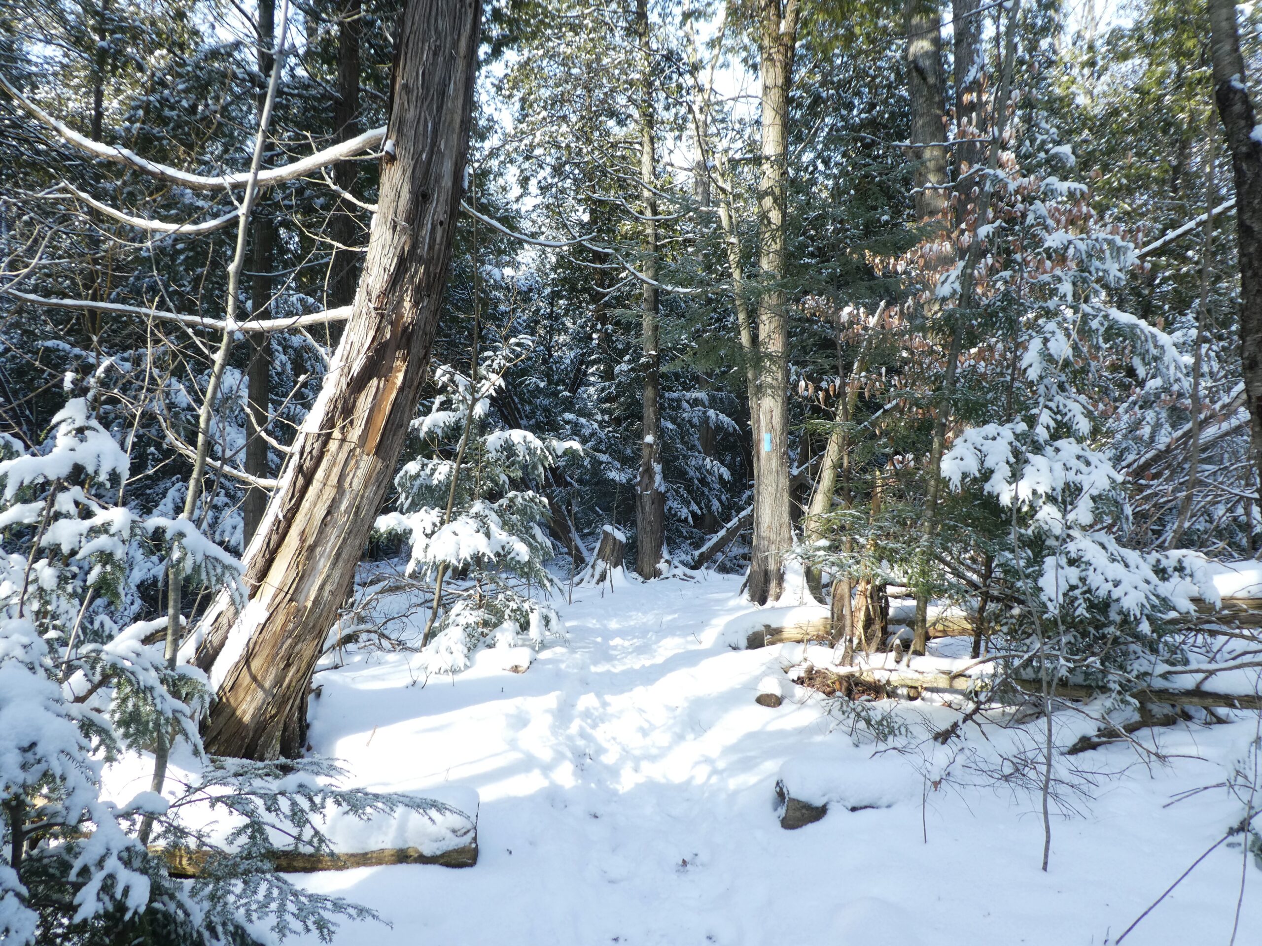
Speyside Loops
https://hikes.brucetrail.org/event/speyside-loops-4/Sorry, the registration cut-off time for this hike has been reached.Not a member? Click here to join today!Hosting Club: Iroquoia
Category: General Hike
Location (Google Maps): Meet at 9:15 at the end of 17 Sideroad, off Hwy 25, just north of MiltonHike Leader(s): Karen Bergmann Click here to contact Hike Leader(s)
Pace: Medium – 3 to 4 km/hr
Terrain: Moderate – Some hills and/or some poor footing
Distance: 7 kmsDescription
We will hike 3 loops including the main and 3 side trails. There are lots of rocks on this trail and some possible wet areas. Bring icers for your boots.Hike is dependent on weather conditions.

Boots and Books - The Iroquoia Bruce Trail Book Club
https://hikes.brucetrail.org/event/boots-and-books-the-iroquoia-bruce-trail-book-club-2/Sorry, the registration cut-off time for this hike has been reached.Not a member? Click here to join today!Hosting Club: Iroquoia
Category: Boots and Books – The Iroquoia Bruce Trail Book Club
Location (Google Maps): City View ParkHike Leader(s): Ruth Moffatt Click here to contact Hike Leader(s)
Pace: Leisurely – 3km/hr or less, Medium – 3 to 4 km/hr
Terrain: Dependent on Conditions, Easy – Mostly flat and usually good footing, Moderate – Some hills and/or some poor footing
Distance: Approx 8kmDescription
Welcome to the 2nd Iroquoia Bruce Trail Book Club – “Boots and Books”Book – The Bookwoman of Troublesome Creek by Kim Michele Richardson. Please check your local library for available copies of this book.
We will hike from the parking lot at City View along the City View ST to the main trail and follow it westerly to the Iroquoia Wind Phone and return; about 8km which will take about 2-2.5 hours approximately. Please wear suitable foot wear, dress for the weather and bring poles if you use them and gaiters as the trail may be muddy depending on how spring arrives. Please bring enough snacks and water suitable for the length of the hike and duration and all the other items you require in your back pack. It is not necessary to bring the book.
The next book will be Theo of Golden by Allen Levi. It may be a good idea to reserve this one now.
The hike is open to everyone whether you have read the book or not but there will be spoilers. It will be open to 10 people to keep it more intimate for discussing the book.
If your plans change, please cancel your registration so that people who are waitlisted may join.
To cancel your registration, here is a step by step:
– Sign into your account on the Bruce Trail website.
– Go to the Hike Schedule
– Click on My Hikes tab which you should find at the top of the schedule
– Scroll to the appropriate hike you wish to cancel
– Cursor to the far right of the hike to the Action column
– Click cancel under the hike you wish to cancel.
10:00 am Side Trail Challenge #2 – Alfred’s Trot, Upper Canada Trail (at York Road), Major Teyoninhokarawen/John Norton
https://hikes.brucetrail.org/event/1000-am-side-trail-challenge-2-alfreds-trot-upper-canada-trail-at-york-road-major-teyoninhokarawen-john-norton/Sorry, the registration cut-off time for this hike has been reached.Not a member? Click here to join today!Hike open to BTC Members only.
Hosting Club: Niagara
Category: Loop
Location (Google Maps): Park at Queenston Heights lot near the cairn.Hike Leader(s): Robin Garrett Click here to contact Hike Leader(s)
Pace: Fast 5+ km/hr
Terrain: Moderate: some hills and some poor footing
Distance: 9kmDescription
Take the Side Trail Challenge and hike all 24 of Niagara’s side trails in 9 hikes and earn the Side Trail Badge.Side Trail Challenge #2 – Take the main trail until it meets Major Teyoninhokarawen/John Norton ST. Take the side trail until it meets Upper Canada ST. Take it until it meets the main trail. Go left on the main trail, up the switchback and along Main Trail until it meets Alfred’s Trot ST. Take the side trail until it, once again meets the Main trail. Take the Main trail back to the cairn. Photos: Major T Side Trail sign, rock wall and kiln on Upper Canada ST, Alfred’s Trot ST sign.
Dress according to the weather and bring water and a snack.
Car Hike: Spring Flowers in Hockley Valley, Map 18
https://hikes.brucetrail.org/event/car-hike-spring-flowers-in-hockley-valley-map-18/Sorry, the registration cut-off time for this hike has been reached.Not a member? Click here to join today!Hosting Club: Toronto, Caledon Hills
Category: Car Hike
Location (Google Maps): Hockley Valley Provincial Nature ReserveHike Leader(s): Al Brown Click here to contact Hike Leader(s)
Pace: Moderate (3-4 km/hr)
Terrain: Challenging, Hilly, Level 2 (Intermediate – some hills and uneven surfaces, rocks and roots underfoot)
Distance (km): 14 kmDescription
We will complete a loop hike through the nature reserve along one of the hilliest sections of the Trail. Spring flowers should be in bloom adding colour.After the hike those interested can meet for refreshments in the local area.
To get to the meeting point drive north on Hwy 10 past Orangeville to Hockley Road. Turn right and go about 6 km to the parking area. It is across the road from the Black Birch restaurant.
Hiking 101 April 26, May 3, May 24, 2026
https://hikes.brucetrail.org/event/hiking-101-april-26-may-3-may10-2026/Sorry, the registration cut-off time for this hike has been reached.Not a member? Click here to join today!Hosting Club: Niagara
Category: Loop
Location (Google Maps): <April 26: Kinsmen Park, Frost Rd, Beamsville
May 4: Louth Conservation Area
May 24: Queenston HeightsHike Leader(s): Lauren Doig Click here to contact Hike Leader(s)
Pace: Medium 3- 4 km/hr
Terrain: Moderate: some hills and some poor footing
Distance: 5 kmDescription
Hiking 101 is an introductory course for novice hikers, members and non-members alike. If you want some guidance on where to begin, what to wear, and what to take along, this is the course for you. The course is 3 Sunday afternoon sessions with a combination of workshop/Q& A followed by short hikes along the trail. Dress in weather appropriate clothing and wear good walking shoes.Time: 1:00 – 3:30 pm
Meeting locations: Sunday, April 26, Kinsmen Park, Kinsmen Rd & Frost Rd., Beamsville N 43.146108 W 79.475609
Sunday, May 3- Louth Conservation Area, parking lot off of Staff Avenue, Louth, 500 m north of Pelham Rd (Regional Road 69) N 43.121706 W 79.351235
Sunday, May 24 – Queenston Height Park, near the Bruce Trail Cairn N 43.157826 W 79.052045
Registration is Members $30 Non Members $40 Upon completing the three sessions, you will receive a FREE cooling cloth($15 value)

Walk In Nature Series (WINS) - Slough of Despond
https://hikes.brucetrail.org/event/walk-in-nature-series-wins-slough-of-despond/Sorry, the registration cut-off time for this hike has been reached.Not a member? Click here to join today!Hosting Club: Sydenham
Category: General Hike
Location (Google Maps): Click the (Google Maps) link on the left to direct you to parking. Or use GPS coordinates: 44.78879, -80.99663. Roadside parking near the escarpment edge on Colpoy’s Range Rd, 1.6 km east of Centre Rd. Note, do not drive here from Cole Sideroad since Colpoy’s Range Rd below the escarpment is impassable. On Edition 31, Map 34 of the Bruce Trail Reference, park at km 155.2. Or on the Bruce Trail app, click on the P at the at the Skinner’s Bluff Lookout.Hike Leader(s): Stewart Brown Click here to contact Hike Leader(s)
Pace: Medium: 3 to 4 km/h
Terrain: Moderate: Some hills and/or poor footing
Distance: 6 kmDescription
If you dare, grab this chance to view a Slough from a protected safe space atop the rock-solid escarpment. Luckily for intrepid Bruce Trail hikers, the Slough’s despondency can never reach our vantage point on high since the drifting, dispirited demons dissipate horizontally from their downcast depths and are greedily and completely consumed by the Slough’s resident, ravenous Sylvan beings. - 27April 27, 2026
8:30 am Hydro Hill Training
https://hikes.brucetrail.org/event/830-am-hydro-hill-training-11/Sorry, the registration cut-off time for this hike has been reached.Not a member? Click here to join today!Hosting Club: Niagara
Category: In and Out
Location (Google Maps):Lockhart Drive, St Catharines, by the large yellow swing gate.
Hike Leader(s): Suzanne Gourluck Click here to contact Hike Leader(s)
Pace: Brisk 4-5 km/hr
Distance: 6 kms
Description
This challenging “hike” is intended for those wishing to train for future challenging hikes. Choose your own pace to go up and down the moderately steep hill over 60 minutes. The terrain is a hard packed gravel surface. Feel free to bring light weights to increase the intensity of your training. Bring water, hiking poles, snack and dress for the weather.EASY DOES IT HIKEt, St Catharines Museum & Welland Canals Centre
https://hikes.brucetrail.org/event/st-catharines-museum-welland-canals-centre/Sorry, the registration cut-off time for this hike has been reached.Not a member? Click here to join today!Hosting Club: Niagara
Category: Leisurely
Location (Google Maps): 1932 Welland Canals Pkwy, Lock 3, St. Catharines L2P0A2Hike Leader(s): Diane Marlatt Click here to contact Hike Leader(s)
Pace: Medium 3- 4 km/hr
Terrain: Easy: mostly flat, good footing
Distance: 6 KmDescription
*Caledon Hills Sideways Badge - Hike #2
https://hikes.brucetrail.org/event/caledon-hills-sideways-badge-hike-2/Sorry, the registration cut-off time for this hike has been reached.Not a member? Click here to join today!Hosting Club: Iroquoia, Caledon Hills
Category: Special Event
Location (Google Maps):Caledon Hills – Location will be advised
Hike Leader(s): Heather Zrini Click here to contact Hike Leader(s)
Pace: Medium – 3 to 4 km/hr
Terrain: Strenuous – Hilly with steep climbs and some poor footing
Distance: 20 kmDescription
On this series of three hiking days, we will complete the five loop hikes that are required to earn the Caledon Hills Sideways Badge. If you are not interested in earning the badge, please join us for some great hiking. Hikers can sign up for individual hikes as you do not need to complete all three to participate. The dates of the three hiking days will be April 13, April 27 and May 11. We will meet at the starting point at 9am each week. Our finishing time is an approximation. On each of the first two hiking days, we will be completing two of the loops. On May 11, there will be one loop hike and if there is interest, we will hike another loop in Mono Cliffs Provincial Park. Each loop is approximately 10 km in length. For more information about the hikes, please see the link below:Sideways Badge Loop .PDF Download
Our schedule will be as follows:
April 13 – Hike One and Hike Five
April 27 – Hike Two and Hike Three
May 11 – Hike Four and a hike in Mono Cliffs Provincial Park
Carpooling is encouraged. Since these are loop hikes, we will not need to shuttle. On the first day, a Provincial Park Daily Vehicle Permit Reservation will be required. We will be parking and hiking in the Forks of the Credit Provincial Park on Day 1. Passes that can be used when making the reservation can be purchased through the Ontario Provincial Park website or borrowed from your local library. If a car does not have a pass, the cost of the Daily Vehicle Permit reservation will be split between those people in that car.
More information, including specific details about the meeting points, will be provided to those who sign up for the hikes.
If there are any questions, please don’t hesitate to ask.
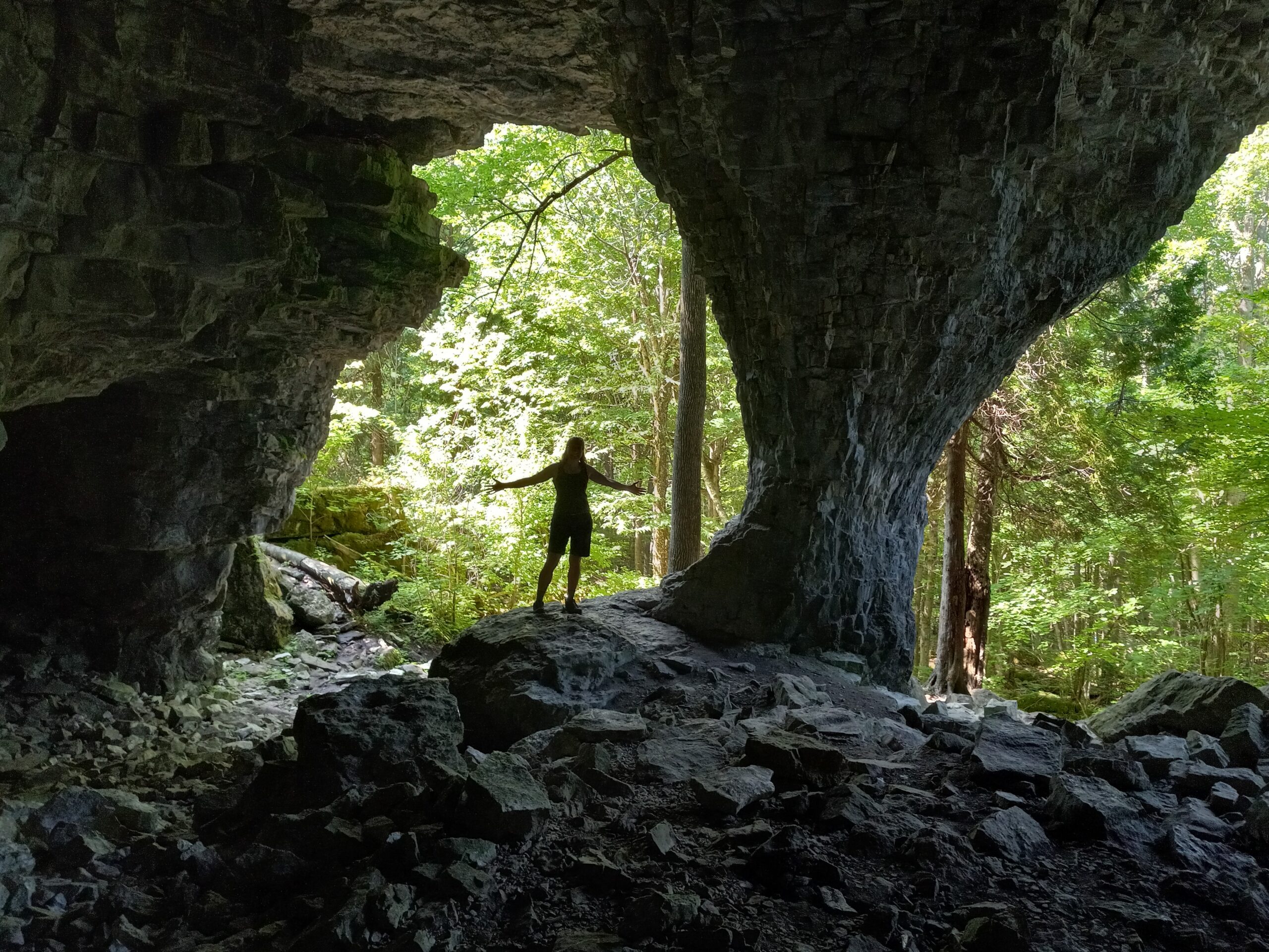
Cliffs, Caves and Crevices
https://hikes.brucetrail.org/event/cliffs-caves-and-crevices/Sorry, the registration cut-off time for this hike has been reached.Not a member? Click here to join today!This is a Multi-Day Hike
You are signing up for the following dates and times:
2026-04-27 at 09:30
2026-04-28 at 09:30
2026-04-29 at 09:30Hosting Club: Sydenham
Category: Geology Hike
Location (Google Maps): Woodford Community Centre, Woodford.Hike Leader(s): Karen Buschert Click here to contact Hike Leader(s)
Pace: Leisurely: 3 km/h or less
Terrain: Moderate: Some hills and/or poor footing
Distance: Varies, approximately 10-15 km each dayDescription
Spend 3 days walking through crevices, exploring caves and gazing over scenic cliffs near Owen Sound. We will learn about the geology of this fascinating area using Beth Gilhespy’s book Walking Through Time and each of the hikes will count toward the Geology badge offered through the Sydenham Bruce Trail Club. Distances will be between 9 and 12 km each day with 2-3 loop hikes in different locations.Accommodation suggestion: After a day on the trail, stay at Silver Lake Mennonite Camp near Sauble Beach and enjoy homecooked meals, a hot sauna and fun camaraderie in their Meadows Retreat Centre. $270 + HST per person. Includes 2 nights shared accommodation, 2 suppers, 2 lunches and 2 breakfasts.
- 28April 28, 2026
Long Haulers Hike New Location
https://hikes.brucetrail.org/event/long-haulers-hike-new-location-7/Sorry, the registration cut-off time for this hike has been reached.Not a member? Click here to join today!Hosting Club: Niagara
Location (Google Maps): Decew House Thororold
Pace: Brisk
Terrain: Moderate
: 10k+Description
This is our regular Tuesday Long Hike. Note the new location which will continue until May due to the muddy conditions in Shorthills. We will hike along the trails which may include Brock, 12 mile creek. Morningstar mill and/or Bert Lowe side trail. Dress for the weather and bring poles snack and drink9:15 Short hike, Rotary Park, St. Catharines
https://hikes.brucetrail.org/event/915-short-hike-rotary-park-st-catharines-19/Sorry, the registration cut-off time for this hike has been reached.Not a member? Click here to join today!Hike open to BTC Members only.
Hosting Club: Niagara
Category: In and Out
Location (Google Maps): Rotary Park, St. CatharinesHike Leader(s): janet davey Click here to contact Hike Leader(s)
Pace: Medium
Terrain: Moderate
Distance: 6 kmsDescription
Hike the trails in and around Rotary Park, Please bring hiking poles, water and appropriate footwear.Terra Cotta Conservation Area
https://hikes.brucetrail.org/event/terra-cotta-conservation-area/Sorry, the registration cut-off time for this hike has been reached.Not a member? Click here to join today!Hosting Club: Dufferin Hi-Land
Category: Tuesday Hike
Location (Google Maps):Caledon Hills Section, Map 14. To car pool, meet at Party City (4th Ave at Hwy 10 in Orangeville) or meet at roadside parking on Heritage Rd, north of King Rd, west of Mississauga Rd, Terra Cotta (Km 44.9).
Hike Leader(s): Inge Eckerich, Julie Daley, Les Babbage, Tony Evangelista Click here to contact Hike Leader(s)
Pace: Leisurely, Medium
Terrain: Moderate
Distance: 6.1 kmDescription
We will meet at roadside parking on Heritage Rd and hike west along the main trail to the 10th line. We will leave some cars here to return hikers to the start. Terrain is mostly flat with some hills and a steep section.Urban Walk: Valley View Park Thornhill
https://hikes.brucetrail.org/event/urban-walk-valley-view-park-thornhill-163/Sorry, the registration cut-off time for this hike has been reached.Not a member? Click here to join today!Hosting Club: Toronto
Location (Google Maps): Parking lot is off Sycamore Drive, East of Bayview , across Starbucks plaza
Bus 91 from Finch East station stops at Sycamore station.Hike Leader(s): MOHAMMAD AGHAMIRI Click here to contact Hike Leader(s)
Pace: Moderate (3-4 km/hr)
Terrain: Hilly, Level 2 (Intermediate – some hills and uneven surfaces, rocks and roots underfoot)
Distance (km): 6-7 kmDescription
We will explore Valleyview and Maple View parks, and walk along German Mill Creak, in return we stop in Huntington park and have snack under beautiful shed.Although this is considered an “Urban Walk”, you can expect some hills up and down and uneven surfaces with tree roots. Please bring hiking poles, Ice cleats water and snacks.
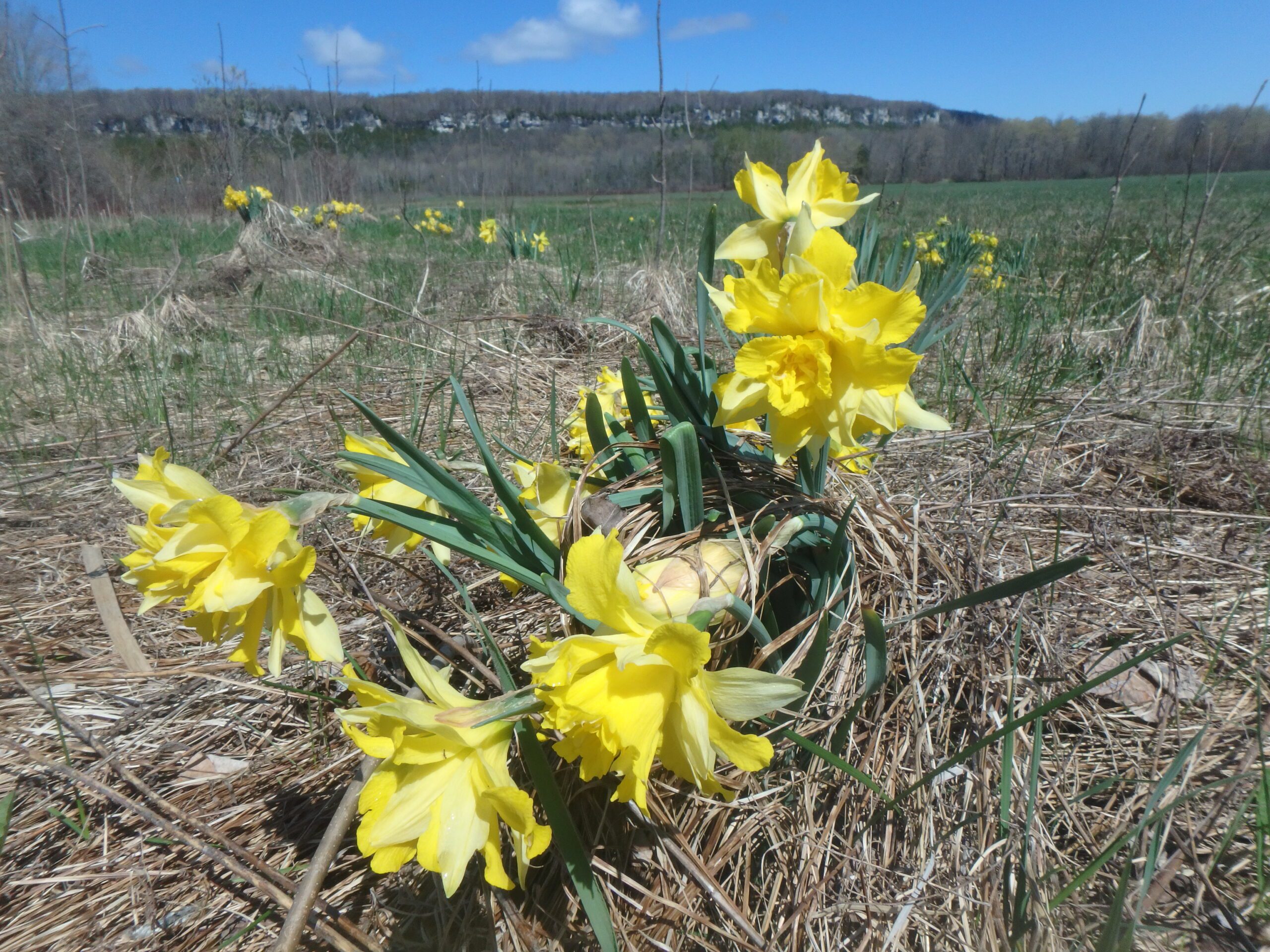
Boundary Bluff Loop (Peninsula section) while the daffodils are in bloom
https://hikes.brucetrail.org/event/boundary-bluff-loop-peninsula-section-while-the-daffodils-are-in-bloom/Sorry, the registration cut-off time for this hike has been reached.Not a member? Click here to join today!Hosting Club: Sydenham
Category: General Hike
Location (Google Maps): Due to rutted lane and tight parking at start point we will meet and carpool from the Colpoy’s Bay dock at 9:30 am.Hike Leader(s): Susan Allen Click here to contact Hike Leader(s)
Pace: Leisurely: 3 km/h or less
Terrain: Strenuous: Hilly with steep climbs and some poor footing., There might be muddy sections., There might be sections with water on the trail.
Distance: 5.3 kmDescription
Starting on the Boundary Bluffs Side Trail, from the end of Pitt Road, we will traverse a low scarp before descending into the (potentially wet) field. We then skirt the edge of the field and hike through a woods before emerging at the bottom of the escarpment. An extremely challenging and steep climb to the top results in a view to Sydney Bay. More views are enjoyed while we follow the main trail along the escarpment edge and rejoin the Boundary Bluffs Side Trail. Descending the escarpment we pass a pond before reentering the field. Crossing the field will bring us to the blanket of blooming daffodils.
Tuesday Trekkers- McCluskey's Rock (later start than usual)
https://hikes.brucetrail.org/event/mccluskeys-rock/Sorry, the registration cut-off time for this hike has been reached.Not a member? Click here to join today!Hosting Club: Beaver Valley
Location (Google Maps): Park @ km 39.3 Fox Ridge Road, Beaver Valley section (do not block laneways). Map 25 Edition 31
Hike Leader(s): Kristina Rettie Click here to contact the hike leader.
Pace: Brisk, Medium
Terrain: Moderate, Some rocky footing, Some steep sections, Strenuous
Length of Hike: 8.5kmDescription
We will follow the road allowance south before turning in and ascending the Escarpment. Proceeding through a level section of forest and descending across a scree slope, the trail continues across the base of the Escarpment before ascending to the top. Along the top it skirts McCluskey’s Rock and descends a wide valley to reach the Ken Young Side Trail. We will take this side trail to 7B then follow the road back onto the main trail and re-trace our steps back the same way.This time of year we can expect all types of trail conditions. Please be prepared with rain gear, icers and poles for those steep ascents and descents.
Bring water and a snack
Please no dogs
Text Kristina @ 519-410-9077 for morning of cancellations
CANCELLED - Afternoon Hike - Silver Creek
https://hikes.brucetrail.org/event/afternoon-hike-silver-creek/Sorry, the registration cut-off time for this hike has been reached.Not a member? Click here to join today!Hosting Club: Iroquoia
Category: Afternoon/Evening Hikes
Location (Google Maps): Meet at 4:15 roadside on Fallbrook Trail at Silver Creek Conservation Area.Hike Leader(s): Karen Bergmann Click here to contact Hike Leader(s)
Pace: Medium – 3 to 4 km/hr
Terrain: Moderate – Some hills and/or some poor footing
Distance: 7 kmsDescription
We will hike around the Roberts ST and Irwin Quarry ST and then cross the road to the main trail and around a couple of side trails that you may not have known were there.Fireman's Park
https://hikes.brucetrail.org/event/firemans-park-4/Sorry, the registration cut-off time for this hike has been reached.Not a member? Click here to join today!Hosting Club: Niagara
Location (Google Maps): Fireman’s Park 2275 Dorchester Rd, Niagara Falls, ON L2J 4L6
Hike Leader(s): Marion Hanover Click here to contact Hike Leader(s)
Pace: Leisurely
Terrain: Moderate
Distance: 6 kmDescription
This is an easy evening hike. Great for newcomers. Meet at the upper parking lot at 5:15pm to be ready for hiking at 5:30pm. - 29April 29, 2026
“ Greater Griersville “ In and Out
https://hikes.brucetrail.org/event/greater-griersville-in-and-out/Sorry, the registration cut-off time for this hike has been reached.Not a member? Click here to join today!Hosting Club: Blue Mountains
Category: Organized Hike
Location (Google Maps): Tim Horton’s, First Street, CollingwoodHike Leader(s): Frank Huggins Click here to contact Hike Leader(s)
Pace: Brisk – 4 to 5 km/hr
Terrain: Easy – Mostly flat and usually good footing, Moderate – Some hills and/or some poor footing
Distance: Tbd. It’s an hour in and an hour out.Description
We’ll hike an hour in through cultivated fields and hardwood bush enjoying views to the North. Then we’ll return to the cars. Bring a snack/ water. We will car pool from Tim’s to the trailhead. The trailhead is west of Grey Road 7 on the Euphrasia— St. Vincent Townline in the Beaver Valley Section.Dundas Driving Park to Dundas Peak and Tew's Falls return
https://hikes.brucetrail.org/event/dundas-driving-park-to-dundas-peak-and-tews-falls-return-4/Sorry, the registration cut-off time for this hike has been reached.Not a member? Click here to join today!Hosting Club: Iroquoia
Category: Good Companions
Location (Google Maps):Dundas Driving Park
Hike Leader(s): Craig Sim Click here to contact Hike Leader(s)
Pace: Medium – 3 to 4 km/hr
Terrain: Moderate – Some hills and/or some poor footing, Strenuous – Hilly with steep climbs and some poor footing
Distance: 8k (approximate)Description
A moderate to strenuous, hilly, up and down hike with great views. We park and meet in Dundas Driving Park not far from the washrooms, and follow city streets to trail leading to Dundas Peak and Tew’s Falls. Wear sturdy hiking shoes or hiking boots, bring icers, layers of clothing appropriate to weather, bring water and snack. Optional outing for beverage/food after.Wednesday Walkers - Kolapore West to Metcalfe Rock
https://hikes.brucetrail.org/event/wednesday-walkers-kolapore-west-to-metcalfe-rock/Sorry, the registration cut-off time for this hike has been reached.Not a member? Click here to join today!Hosting Club: Beaver Valley
Location (Google Maps): Meet in the Kolapore parking lot on Grey Road 2, about 650 m south of where the trail crosses at km 23.8, Map 25, Edition 31, N44.422919, W80.405597
Hike Leader(s): Glenda Collings Click here to contact the hike leader.
Pace: Medium
Terrain: Moderate, Some steep sections
Length of Hike: Approx. 6kmDescription
This is a hike with a car shuttle from the Kolapore parking lot to Metcalfe Rock. We pass along a field, through cedar and beautiful hardwood forest until we reach the “Rock” Wear appropriate clothing for the weather plus water and a snack.Please arrive by 9:45 a.m for a 10:00 a.m. start. If you need to cancel please do so online or contact me so we know whether or not to expect you. My cell 519 694 7691.
- 30April 30, 2026
9:00 Long Hike, Glen Road Jordan
https://hikes.brucetrail.org/event/900-long-hike-glen-road-jordan-5/Sorry, the registration cut-off time for this hike has been reached.Not a member? Click here to join today!Hosting Club: Niagara
Location (Google Maps):
3640 Glen Road Jordan
Pace: Brisk
Terrain: Strenuous
: 10 kmDescription
Hike in and around Ball’s Falls and Jordan. Dress for the weather: bring icers, poles, dress in layersHiking in and around Jordan
https://hikes.brucetrail.org/event/hiking-in-and-around-jordan-18/Sorry, the registration cut-off time for this hike has been reached.Not a member? Click here to join today!Hosting Club: Niagara
Location (Google Maps): Sho’arishon Park (Jordan Hollow)
Hike Leader(s): Bill Russell Click here to contact Hike Leader(s)
Pace: Medium
Terrain: Moderate
Distance: 7 kmDescription
- Hiking in and around Jordan, Jim Rainforth Trail and Balls Falls rotating every 3 weeks.
Urban Walk: Valley View Park Thornhill
https://hikes.brucetrail.org/event/urban-walk-valley-view-park-thornhill-164/Sorry, the registration cut-off time for this hike has been reached.Not a member? Click here to join today!Hosting Club: Toronto
Location (Google Maps): Parking lot is off Sycamore Drive, East of Bayview , across Starbucks plaza
Bus 91 from Finch East station stops at Sycamore station.Hike Leader(s): MOHAMMAD AGHAMIRI Click here to contact Hike Leader(s)
Pace: Moderate (3-4 km/hr)
Terrain: Hilly, Level 2 (Intermediate – some hills and uneven surfaces, rocks and roots underfoot)
Distance (km): 6-7 kmDescription
We will explore Valleyview and Maple View parks, and walk along German Mill Creak, in return we stop in Huntington park and have snack under beautiful shed.Although this is considered an “Urban Walk”, you can expect some hills up and down and uneven surfaces with tree roots. Please bring hiking poles, Ice cleats water and snacks.
Peninsula End-to-End-in-18
https://hikes.brucetrail.org/event/peninsula-end-to-end-in-18/Sorry, the registration cut-off time for this hike has been reached.Not a member? Click here to join today!Hike open to BTC Members only.
This is a Multi-Day Hike
You are signing up for the following dates:
2026-04-30, 2026-05-01, 2026-05-14, 2026-05-15, 2026-05-28, 2026-05-29, 2026-06-11, 2026-06-12, 2026-06-25, 2026-06-26, 2026-09-03, 2026-09-04, 2026-09-17, 2026-09-18, 2026-10-08, 2026-10-09, 2026-10-15, 2026-10-16Hosting Club: Peninsula
Category: Peninsula E2E
Location (Google Maps): Wiarton to TobermoryHike Leader(s): Jamie McDermid, Randy Vanderlaan Click here to contact Hike Leader(s)
Pace: Leisurely (2.0 – 3.0 km/h): A relaxed pace with frequent breaks and a focus on enjoyment.
Terrain: Difficult: Steep ascents/descents, rocky scrambling, and some rugged escarpment paths.
Distance: 6.2 to 18.3Description
Join us for this memorable hiking adventure and be part of a community dedicated to preserving and enjoying the natural beauty of the Bruce Trail. During this series, we will complete the Peninsula section of the Bruce Trail over 18 hikes. The series will begin in Wiarton and finish in Tobermory. The majority of the hikes will be completed south to north.This hike is open only to Bruce Trail Conservancy members. Non-members can join by signing up for a one-year membership at https://brucetrail.org/product-category/memberships/
The registration fee includes bus shuttle, Bruce Peninsula National Park (BPNP) fees, and end-to-end badge fee. Surplus funds, if any, support PBTC’s hike program.
This series is designed for intermediate hikers comfortable with moderate challenges, including longer distances and elevation gains. The average pace will be around 2 km/hour, although we may hike up to 3 km/hour at times. The total distance is approximately 172 km with no dropout points. Most hikes range between 8 and 12 km, although the longest hike is 18 km. During this series, we will stop frequently to take snack/lunch/water breaks, enjoy the many scenic views, and check out the flora and fauna.
Transportation will be by bus to and from the start and end points. Hikes start around 9-10 am, with start and return times varying based on daily hiking distance and bus schedule. A detailed itinerary will be sent to participants before the first hike. This schedule is subject to change.
This is a group hike. Participants must be committed to completing the entire series, and are expected to stay with the group the entire time. If you prefer to hike at a faster pace, Peninsula BTC offers other end-to-end hikes that may be more suitable for you. We also offer other types of hikes that will help you get in shape for the end-to-end.
Please bring proper hiking boots, layered clothing for varying weather, hat with a visor, and wet weather gear. Hiking poles are recommended. Also, pack sufficient food, snacks and water for a full day, sunscreen, and insect spray.
We adhere to Leave No Trace principles, aka “Take only pictures, leave only footprints.”
Dogs are not permitted on this hike.
Accommodation options near the meeting locations include motels, campgrounds, hostels, and B&Bs. Early reservations are recommended.
1:30 p.m. Pack Walk
https://hikes.brucetrail.org/event/130-p-m-pack-walk-2/Sorry, the registration cut-off time for this hike has been reached.Not a member? Click here to join today!Hosting Club: Niagara
Category: In and Out
Location (Google Maps): George Nicholson Memorial Trail ; park at Jones Beach 142 Broadway Ave. St. CatharinesHike Leader(s): Sam Rutherford Click here to contact Hike Leader(s)
Pace: Leisurely <3 km/hr
Terrain: Easy: mostly flat, good footing
Distance: 5 kmsDescription
This pack walk is a structured group walk where dogs and their handlers walk together on-lead in a natural environment. It promotes exercise, calm socialization and exposure to other dogs and people in a safe, controlled setting. We will meet at Jones Beach and follow the George Nicholson Memorial Trail out to the Port Weller lighthouse and back. Dogs must be kept on-lead and under control at all times. Please bring water and treats for you and your dog.
Iroquoia BTC Naturalist Hike Series- Discovering Nature One Hike at a Time – Grimsby Wetlands – Meet in the parking lot at 6:45pm
https://hikes.brucetrail.org/event/iroquoia-naturalist-hike-series-discovering-nature-one-hike-at-a-time-grimsby-wetlands-meet-in-the-parking-lot-at-645pm/Sorry, the registration cut-off time for this hike has been reached.Not a member? Click here to join today!Hosting Club: Iroquoia
Category: Iroquoia BTC Naturalist Hike Series : Discovering Nature, One Hike at a Time.
Location (Google Maps): Oakes Road Dog Park – From here we will walk over to the Grimsby Wetlands.Hike Leader(s): Ruth Moffatt Click here to contact Hike Leader(s)
Pace: Leisurely – 3km/hr or less
Terrain: Easy – Mostly flat and usually good footing
Distance: 2-3kmDescription
Please join well-known Hamilton Naturalists’ Club, Bruce McKenzie, for a tour of the award-winning Grimsby Wetlands. Bruce will describe the history of this 25 year old wetland from its beginnings as a wastewater treatment area to its notoriety for birding, now. A cinnamon teal duck was spotted here a couple of years ago and birders from all over descended into the area. Bruce was quoted as saying, “I can’t go into the property and not find someone enjoying the solitude or the nature.” Indeed, it is a peaceful oasis.Please bring water and snacks. It is recommended that everyone wear long pants that are tucked into socks, long sleeves as well as a wide brimmed hats. Sunscreen and bug spray.
This is a leisurely walk and will be filled with highlights of this important wetland. Everyone must be registered to participate. Members and non-members are welcome.

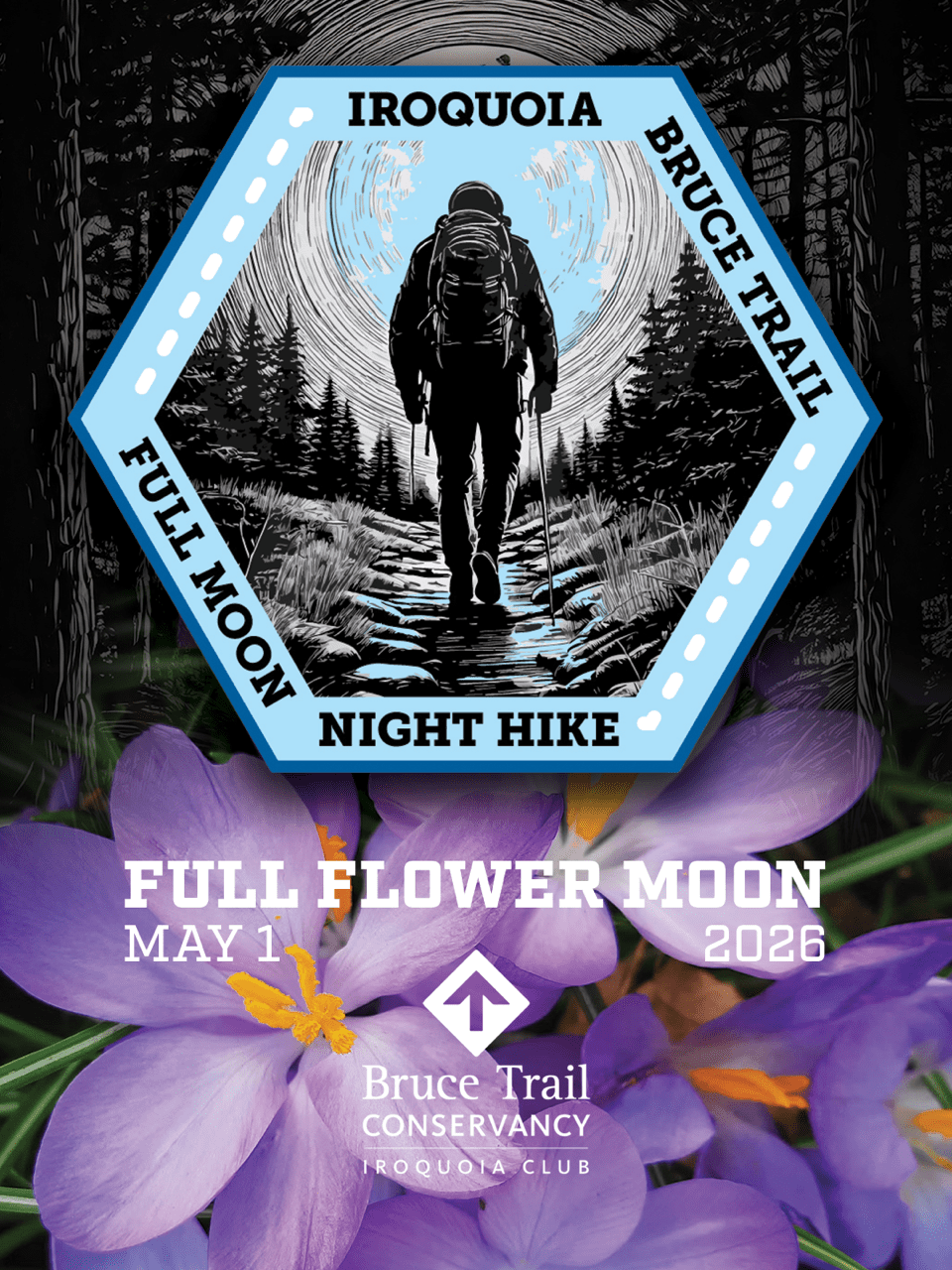
8:00 pm Moonlight Night Hike at the Botanical Gardens
https://hikes.brucetrail.org/event/800-pm-moonlight-night-hike-at-the-botanical-gardens/Sorry, the registration cut-off time for this hike has been reached.Not a member? Click here to join today!Hike open to BTC Members only.
Hosting Club: Niagara
Category: Night
Location (Google Maps):Floral Clock Parking Lot (no charge)
Hike Leader(s): Robin Garrett Click here to contact Hike Leader(s)
Pace: Medium
Terrain: Easy
Distance: 6 kmDescription
Enjoy the sights and smells of spring in the moonlight. We will begin our hike at the Floral Clock, walk among the daffodils along the Niagara River Parkway trail, and loop through the Botanical Garden to revel in the magnificence of spring flowering plants and trees. - 01May 1, 2026
Peninsula in 6 Challenger Series
https://hikes.brucetrail.org/event/peninsula-in-6-challenger-series-2/Sorry, the registration cut-off time for this hike has been reached.Not a member? Click here to join today!Hike open to BTC Members only.
This is a Multi-Day Hike
You are signing up for the following dates:
2026-05-01, 2026-05-02, 2026-05-03, 2026-05-08, 2026-05-09, 2026-05-10Hosting Club: Peninsula
Category: Peninsula E2E
Location (Google Maps): Bluewater Park, Wiarton, parking area opposite arena – First Hike only – Schedule with coordinates will be sent for remaining hikes to registered hikersHike Leader(s): Margaret O’Dell Click here to contact Hike Leader(s)
Pace: Brisk (4.5 – 5.5 km/h): A faster pace for those seeking a good workout or more distance.
Terrain: Difficult: Steep ascents/descents, rocky scrambling, and some rugged escarpment paths.Description
This is a Challenger series of hikes; we will complete the entire 163.1 km of the Peninsula section in 6 hikes. It is also a Paid hike; your registration fee includes a celebratory finish at the Cairn in Tobermory, the cost of the End to End badge, and contributes to fundraising for the Peninsula Bruce Trail Club hiking program activities. Please review the dates carefully to ensure you are able to participate fully. Registration is limited to 6 persons. Fees are refundable up to 30 days prior to the date of the first hike.- This hike series is intended for experienced distance hikers. Hikers must be able to sustain the distance and maintain a fast pace.
- If a hiker is unable to keep pace with the group, or finds the distance too challenging, their future hike registrations may be canceled by the hike leader.
- Be very aware of your ability to join this series.
- Hikes will average 4.5 km per hour including breaks, moving pace is 5 km per hour;
- Expect to be on-trail for 6 – 8 hours;
- Please arrive no later than 15 minutes prior to the meeting time;
- Hikers must carry sufficient hydration, accessible snacks, lunch, first-aid kit, rain gear, extra socks, and possibly protective boot covers (i.e. bags);
- Hikers will be expected to participate in shuttling hikers to the start and to drive shuttlers back to their car. Responsibility for shuttling along with any applicable parking fees will be shared within the group.
Summary of the itinerary (km based on Bruce Trail Reference – Edition 31):
- May 1: Sydney Bay Rd to Wiarton Bluewater Park – 31.7 km
- May 2: Sydney Bay Rd to Rush Cove – 26.4 km
- May 3: Richardson Side Trail to Rush Cove – 28.6 km
- May8: Richardson Side Trail to Dyers Bay – 26 km
- May 9: Dyers Bay to Halfway Dump – 27.5 km
- May 10: Halfway Dump to Tobermory – 25.2 km
A detailed schedule will be provided in advance of the series to registered hikers.
If you have concerns, or questions please use the Contact Hike Leader form to inquire in advance of registering.

Peninsula End2End in 10 Series
https://hikes.brucetrail.org/event/peninsula-end2end-in-10-series/Sorry, the registration cut-off time for this hike has been reached.Not a member? Click here to join today!Hike open to BTC Members only.
This is a Multi-Day Hike
You are signing up for the following dates and times:
2026-05-01 at 07:15
2026-05-02 at 07:15
2026-05-03 at 07:15
2026-05-22 at 07:15
2026-05-23 at 07:15
2026-05-24 at 07:15
2026-05-30 at 07:15
2026-05-31 at 07:15
2026-06-06 at 07:15
2026-06-07 at 07:15Hosting Club: Peninsula
Category: Peninsula E2E
Location (Google Maps):Hike Leader(s): Saabir Sohrab Click here to contact Hike Leader(s)
Pace: Medium (3.0 – 4.5 km/h): A comfortable pace for most hikers with steady progress.
Terrain: Difficult: Steep ascents/descents, rocky scrambling, and some rugged escarpment paths., Moderate: Rolling hills, mild slopes and rocky paths.
Distance: Approx. ~166kmDescription
Peninsula E2Ein10Route: Wiarton to Tobermory (northbound)
Pace: Medium (target 3–4 km/h)
Terrain: Moderate to Difficult
Distance: ~166 km total
Daily Distances: 15.7 km · 17.8 km · 18.6 km · 15.1 km · 14.7 km · 17.8 km · 19.4 km · 22.6 km · 17.8 km · 6.7 km
Expectations: Expect 5–8 hours on the trail each day, depending on distance, terrain, weather, and group pace. The hike leader sets the pace, aiming for 3–4 km/h, and may adjust as needed for group ability and trail conditions. Breaks will be taken throughout the day.
For safety, participants must remain between the hike leader and the hike sweep at all times.
Meeting Time: 7:15 AM
Fees:
- Registration fee does not include Bruce Peninsula National Park entry fees, Cape Croker Park or MNBP parking fees
- Parking costs will be shared equally among participants.
- Badge fee included, with your choice of either the flowerpot badge or the stained glass (Turkey Vulture) badge.
- Fundraising: This hike is a fundraiser to support the Peninsula Bruce Trail Club’s volunteer-run hike program
Participant Requirements
- Intermediate/experienced hikers with good fitness
- Proper hiking boots, layered clothing, wet weather gear
- Hiking poles recommended
- Bring: Lunch, snacks, water, bug spray
Transportation & Accommodations
- Car shuttle: Participants rotate as drivers; vehicles must be passenger-ready
- Accommodations: Book early; options include motels, campgrounds, hostels, and B&Bs
Note: Dogs are not permitted.
Sydenham Weekend in Owen Sound, May 1 to 3
https://hikes.brucetrail.org/event/sydenham-weekend-in-owen-sound-may-1-to-3/Sorry, the registration cut-off time for this hike has been reached.Not a member? Click here to join today!Trip Information
Departure Time: 07:30
Return to City Time: 20:00
Departure Point: York Mills Bus PickupTrip Activities
Hiking ($.01)
Optional ItemsHosting Club: Toronto
Category: Coach Trips
Location (Google Maps): Owen SoundHike Leader(s): George Lennon, Martina Furrer, Roland Mark, Robin Crombie Click here to contact Hike Leader(s)
Pace: Mixed (See Hike Description)
Terrain: Challenging, Hilly, Level 2 (Intermediate – some hills and uneven surfaces, rocks and roots underfoot), Rocky, Variable
Distance (km): 12-18 kmDescription
Join us for three days of hiking on what many consider the most rugged section of the Bruce Trail. Overnight group will be lodging at the Best Western Inn On The Bay in Owen Sound.This will be a challenging three days of hiking with some strenuous climbs and sometimes difficult footing over tree roots, rocks and crevasses. All fit, experienced hikers comfortable walking on this type or terrain are welcome. For your safety and enjoyment as well as the group’s, before registering we strongly encourage you to join some of our day hikes on the Bruce Trail. This will give you a chance to get to know us and assess your abilities.
We will split the group and offer two levels of hikes each day. The moderate group will hike about 12 km each day. and the fast group 15 km or more. The specific trails will be determined closer to the date.
Accommodation at the hotel is no longer available at the discounted group rate. Rooms at the Best Western will be at their regular rate given on the hotel’s website and/or registration desk.
Coach fare is $170 for members; $190.00 for non-members; $100 for children.
Registration instructions:
If you wish to share accommodation, please find a roommate, then book your hotel room, and then book your seats on the coach. To avoid problems make sure you and your roommate reserve your seats at the same time.
- Book your room online using the Best Western Inn on the Bay’s website (https://bwowensound.com/) or through their reservation desk (519) 371-9200. Make arrangements with your roommate to split the cost.
- To reserve your seat on the bus, register here starting on Thursday January 15 at 8 PM.
Cancellation policy: While we are hoping for sunshine, the trip cannot be cancelled due to weather. Coach fare is non-refundable if cancellation is made less than 30 days in advance of the departure date.
Our coach will depart at 7:30 AM on Friday May 1. We plan to be back in Toronto between 7 and 8 PM on Sunday May 3. Departure locations: 10 York Mills Rd and HWY 400 and Major Mackenzie Park and Ride.
Hockley Valley Loops
https://hikes.brucetrail.org/event/hockley-valley-loops-2/Sorry, the registration cut-off time for this hike has been reached.Not a member? Click here to join today!Hosting Club: Iroquoia
Category: General Hike
Location (Google Maps): Hockley Valley Road – Bruce Trail ParkingHike Leader(s): Pati Greenwood, Jeff Dowsett Click here to contact Hike Leader(s)
Pace: Medium – 3 to 4 km/hr
Terrain: Strenuous – Hilly with steep climbs and some poor footing
Distance: 18 kmDescription
This hike will follow the main trail to Dunby Road and take in four side trails on the return route – Cam Snell, Glen Cross, Isabell East and Tom East – to form an 18 km loop back to the parking lot on Hockley Road.Wear hiking boots, bring poles. Dress for the weather conditions, bring plenty to drink and a snack.
Please arrive at the meeting place by 8:15 am for an 8:30 am departure.
Queenston Tour
https://hikes.brucetrail.org/event/queenston-tour-2/Sorry, the registration cut-off time for this hike has been reached.Not a member? Click here to join today!Hosting Club: Niagara
Category: Urban
Location (Google Maps): Park at Locust Grove, Niagara River Parkway. kitty corner to the Bruce Trail Cairn.Hike Leader(s): Niagara BTC Hike Moderator, Margaret Northfield Click here to contact Hike Leader(s)
Pace: Medium 3- 4 km/hr
Terrain: Moderate: some hills and some poor footing
Distance: 6-7kmDescription
NOTL hike moves to Queenston for just this Friday. Meet at Locust Grove, Niagara River Parkway. We will hike down the escarpment to the village of Queenston. We will explore the village and the waterfront before hiking back up the escarpment to our parking. Mostly paved roads with some trail walking.Plan to stay for coffee at Commisso’s on Thorold Stone Rd, Niagara Falls.
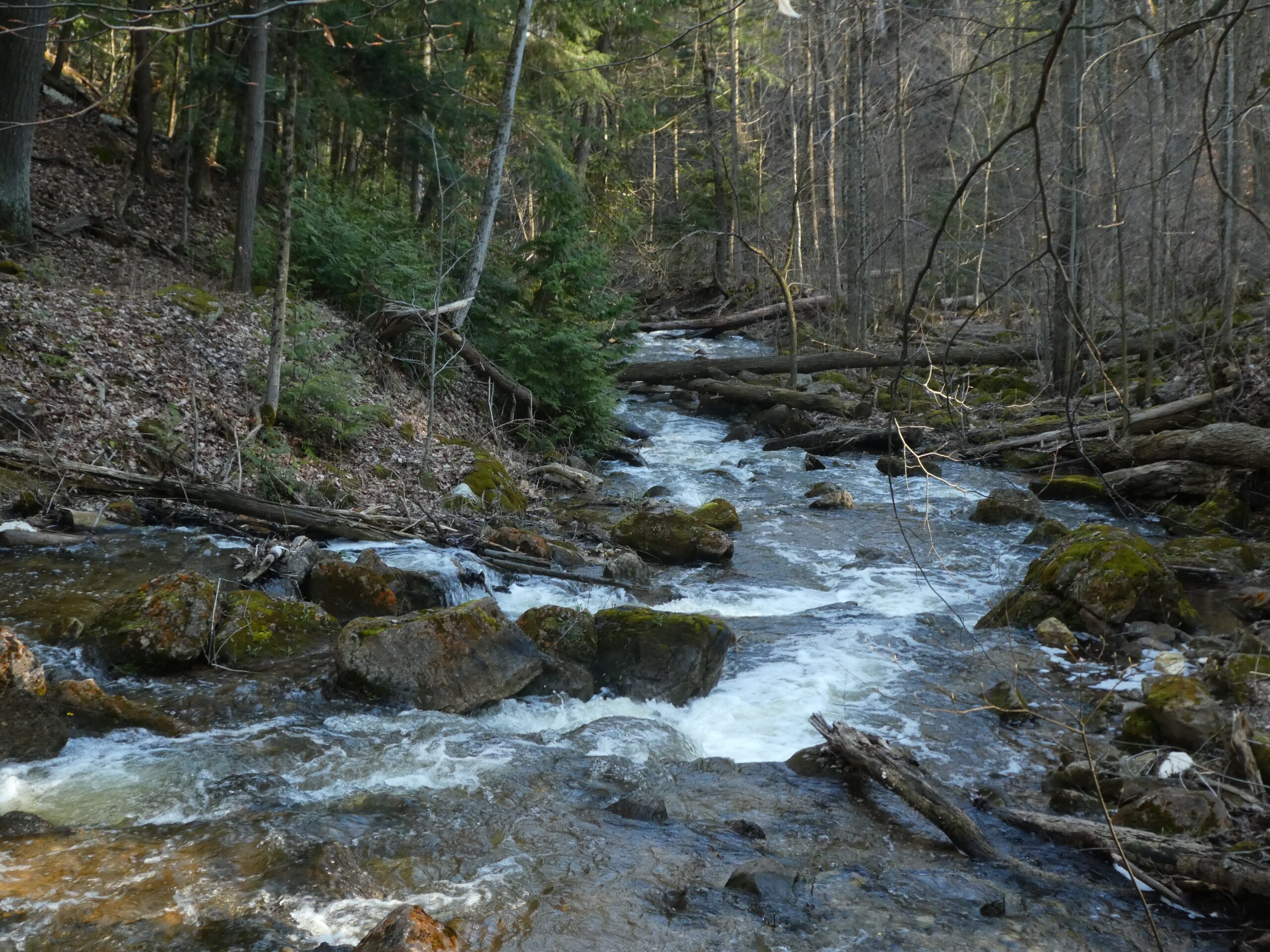
Dundas Valley
https://hikes.brucetrail.org/event/dundas-valley-2/Sorry, the registration cut-off time for this hike has been reached.Not a member? Click here to join today!Hike open to BTC Members only.
Hosting Club: Dufferin Hi-Land
Category: General Hike
Location (Google Maps): 650 Governor’s Road, Dundas, L9H 5E3. Iroquoia Section, BTC Map 8. Dundas Valley Conservation Area Parking Lot P3 just south of the main entrance. Take DVCA Trail Centre Entrance off Governors Road, near km 51.8. Click Google Map link for GPS.Hike Leader(s): Stuart Law Click here to contact Hike Leader(s)
Pace: Medium
Terrain: Slippery and Steep Sections, Moderate
Distance: 16-17 kmsDescription
Join us on hike in the Dundas Valley. We will take in part of the Bruce Trail and several DVCA trails. Lots of ups and downs and waterfalls. Please bring a warm drink, water, a snack for “elevensies”, lunch, hiking boots, poles and lots of smiles. Entrance fee to DVCA in effect at gate. Please arrive at 9:00 to be ready to hike at 9:15. We will hike two loops to allow folks to drop out after the first 10 kms if they would like.Speyside from 4th Line
https://hikes.brucetrail.org/event/speyside-from-4th-line-3/Sorry, the registration cut-off time for this hike has been reached.Not a member? Click here to join today!Hosting Club: Iroquoia
Category: General Hike
Location (Google Maps): Meet at 9:15 roadside on 4th Line where the main trail crosses the roadHike Leader(s): Karen Bergmann Click here to contact Hike Leader(s)
Pace: Medium – 3 to 4 km/hr
Terrain: Moderate – Some hills and/or some poor footing
Distance: 9 kmsDescription
A new way to hike the Speyside trails, we’ll meet roadside on Fourth Line at 9:15 am and hike the main trail to the Canada Goose ST and onto the Charles Hildebrandt ST to the “unassumed road” and into Speyside from that end. Hiking around the Cliff Hatch ST and main trail back to Fourth Line. There are some very rocky sections along these trails.Beaver Valley km 0-13.7
https://hikes.brucetrail.org/event/beaver-valley-km-0-13-7/Sorry, the registration cut-off time for this hike has been reached.Not a member? Click here to join today!Hosting Club: Beaver Valley
Category: Car Pool
Location (Google Maps): Meeting at end of Maple Lane. Do not park where there are no parking signed and be sure not to block driveways. We will be shuttling to Margaret Paull Side Trail parking on 6th Line and then hike back to our vehicles.Hike Leader(s): Erin Lyttle Click here to contact Hike Leader(s)
Pace: Medium
Terrain: Strenuous
Distance: 13.7Description
This hike is for those working on their Beaver Valley section end to end. We will meet at the border of Beaver Valley/Blue Mountain at the end of Maple Lane (104 Maple Ln, Ravenna, ON will get you close on GPS) and carpool to the parking on 6th Line approx 13.7km away by the trail (input 569465 6th Line, Ravenna, ON in GPS then drive on 6th line until you find the Margaret Paull Side Trail parking area. We will then hike back to our cars at Maple.This hike is for experienced hikers and while we may finish earlier, 4 hours has been allotted for this hike. We will be hiking in spring conditions (mud, ice, snow) so be prepared for it all. Please have your icers and poles at the ready and dress in layers including a waterproof outer layer. Hiking boots/shoes are mandatory. Please bring water/electrolytes and snacks, though we do not plan a meal break as this hike is scheduled between lunch and dinner time.
We will be shuttling to our starting point so please be prepared to participate in the shuttle.
Moonlight Hike
https://hikes.brucetrail.org/event/moonlight-hike/Sorry, the registration cut-off time for this hike has been reached.Not a member? Click here to join today!Hosting Club: Iroquoia
Category: Moonlight Hikes
Location (Google Maps): Grimsby Lion’s Club Pool 1 Elm St GrimsbyHike Leader(s): Ruth Moffatt Click here to contact Hike Leader(s)
Pace: Brisk – 4 to 5 km/hr, Medium – 3 to 4 km/hr
Terrain: Dependent on Conditions, Strenuous – Hilly with steep climbs and some poor footing
Distance: 5-6kmDescription
Earn your Iroquoia Moonlight badge by hiking 3 Moonlight Hikes with a leader.
Tonight’s sunset is at 8:20pm. We will hike up the escarpment and over to the Hawkwatch area and out to Beamer’s Falls and return around 9:30pm.
If you’ve never hiked at night we are sure you will love the way it heightens all of your senses promising a great sleep afterwards.
Everyone must have a headlamp or a flashlight 🔦. Most phones have torches which could also be used as supplemental light. Please ensure your light device is fully charged/batteries to last about 1.5hours. Dress for the weather and bring enough water to suit your needs as well as all the other things you need for a hike – first aid kit, snack, poles (recommended). This is an arduous climb up the escarpment so be sure to know your physical limit.
This is the second of 3 full moon hikes to be held in Grimsby. After you complete three leader-led hikes, you will qualify for a badge. $10/$15The third moonlight hike is May 31.
Any questions may be directed through contact on this form.
If you cannot make it, please remove yourself from registration by following these steps:To cancel your registration, here is a step by step:
– Sign into your account on the BTC website
– Click on My Hikes under your account
– This will take you to a list of hikes you have registered for
– Scroll down to the appropriate hike and cursor over to the far right hand column under the Action column.
– Click Cancel under the hike you wish to cancel - 02May 2, 2026

City of Waterfalls – Special Event Fundraiser
https://hikes.brucetrail.org/event/city-of-waterfalls-special-event-fundraiser-4/Sorry, the registration cut-off time for this hike has been reached.Not a member? Click here to join today!This is a Multi-Day Hike
You are signing up for the following dates and times:
2026-05-02 at 06:45
2026-05-03 at 06:45Hosting Club: Iroquoia
Category: City of Waterfalls – Special Event Fundraiser
Location (Google Maps): DAY 1: MAY 2 – Parking lot at City View Park off of Kerns Rd. Enter from Dundas St. (capacity 50) 43.351747, -79.862195
DAY 2: MAY 3 – Parking Lot off of Mud St providing access to the Mud Street Side Trail (capacity 30)Hike Leader(s): Joe Borges Click here to contact Hike Leader(s)
Pace: Medium – 3 to 4 km/hr
Terrain: Dependent on Conditions, Moderate – Some hills and/or some poor footing, Slippery and Steep Sections
Distance: Approximately 22-25km / per dayDescription
Welcome to Iroquoia, City of Waterfalls Challenge! This is a fundraiser challenge event. All funds raised go towards the Iroquoia Bruce Trail Club to maintain the infrastructure of this beautiful section of trail and to “Preserve this ribbon of wilderness, for everyone, forever!”We also encourage participants to consider a membership with Conservation Hamilton
https://conservationhamilton.ca/hca-membership-pass/And/or Conservation Halton (50%discount with BTC membership)
https://www.conservationhalton.ca/park-fees-membership-rates/DAY 1: MAY 2 – We will meet at Cityview Park and car shuttle to Spencer Gorge Parking Lot (Conservation Hamilton) and hike back. The cost at this parking lot is $16.50 per vehicle and driver plus $5.50 for each passenger.
Day 1 Distance 21kmDAY 2: MAY 3 – We will meet in the parking area off of Mud St and car shuttle to Artaban Rd Parking Lot (Conservation Hamilton) and hike back. The cost for this parking lot is $11.00 per vehicle.
Day 2 Distance 24 kmPlease ensure your vehicle is car shuttle ready by having a minimum of 4 seatbelts available – drivers do not pay for the parking. Please volunteer for this important component of this challenge or we can throw all the names into a hat. While we encourage carpooling to the start of the hike, please let the hike leader know if you’re planning to arrive with more than two people in your vehicle. This hike will be limited to 20 people including the hike leader so we will need at least 4 vehicles and one vehicle with 5 seatbelts to drive the drivers back at the end of the day. We will try to take as few vehicles as possible. On the second day, those who did not drive on the first day will be asked to drive.
There will be short breaks along the way to admire the waterfalls on route and a short lunch.
Please bring all the hiking items you require for a long day hike including 2l of water, snacks, lunch, first aid kit, rain gear if rain is forecast, plastic shower caps for your boots if muddy, bug spray, sunscreen, rimmed hat, poles (if you use them) and your camera for all the photo ops. Please ensure you are physically able to complete two long day hikes over two days – if you must drop out, you will have to arrange your own transportation back to your vehicle. There is public transportation, Uber, and taxi’s in the area. If you are concerned about whether you will be able to manage the distance over the two day period, it’s possible that you may need to wait until a 4 day version of this event is posted.
The badge will be presented to all participants who have completed the challenge at the end of the second day.
Any questions may be directed through contact on this form.
Sydenham Bruce Trail E2E Run - Day 1 of 8 Only
https://hikes.brucetrail.org/event/sydenham-bruce-trail-e2e-run-day-1-of-8-only/Sorry, the registration cut-off time for this hike has been reached.Not a member? Click here to join today!Hike open to BTC Members only.
Hosting Club: Sydenham, Peninsula
Category: Sydenham E2E Trail Run
Location (Google Maps): Day 1 of the E2E Trail Run of the Sydenham Bruce Trail section. Meeting at BTC parking on Graham’s Hill Rd.Hike Leader(s): Margie Gloade; Natalie Mechalko; Shawn Radcliffe Click here to contact Hike Leader(s)
Pace: Fast (5.5 – 7.0 km/h+): A quick pace maintained by experienced hikers or trail runners.
Terrain: Difficult: Steep ascents/descents, rocky scrambling, and some rugged escarpment paths.
Distance: About 23kmDescription
This is a single-day registration – Day 1 of 8.The Sydenham Bruce Trail Club (SBTC), in partnership with the Peninsula Bruce Trail Club (PBTC), is excited to offer its first-ever trail running Sydenham End-to-End series in 2026. Join the fun for one of the eight days in this trail running series! The trail running Sydenham E2E series will take place over 4 weekends and 8 days, starting at 7:30am. Below is the start and end location and estimated distance for this day (subject to change slightly). The group will meet at the end location, and carpool to the start of each day’s route. You are expected to participate in shuttling vehicles.
Please carefully read the details below to understand the logistics, costs, important notes, and fitness required for this challenge.
Saturday, May 2, 2026: Wiarton Bluewater Park to Graham’s Hill Rd BTC Parking; ~23km.
- When you register here, you are registering for only one day in the series. (You also have the option of registering for the whole series for $60 even if you aren’t able to make all eight days).
- These are group trail runs. It is not a race. It is not a hike. There may be a couple different pace groups that naturally form, but you will be expected to stay with a group and wait to regroup at key locations. Runners are expected to remain between the lead runner and the sweep at all times. Anticipate each day to be running for about 3+/- hours, at a pace ranging from 7-9 min./km.
- Participants are expected to have some experience trail running as this is difficult terrain. There are also some roads, and some active farm fields. In some locations throughout Sydenham, trail running will not be permitted near livestock. On roads, runners are expected to follow standard Highway Traffic Act regulations, crossing safely and running on the shoulder, in single file, facing oncoming traffic.
- Mandatory gear includes a whistle and minimum 250ml of water carrying capacity. Trail runners will need to carry their own water and fuel.
- At approximate mid-way points each day, there will be volunteer support arranged so you can fill up water bottles. Some snacks (e.g. oranges, bananas, pretzels, cookies, water) will be provided but please plan to be self-sufficient.
- Exercise care and caution and common sense on trails, especially when passing other trail users. Let others know you are coming and that you intend to pass. Headphones/earbuds are not permitted while participating in this group run.
- Participants must be age 16 years or older.
- Dogs are not permitted.
- This trail run is for BTC members only. To become a member, click here: https://brucetrail.org/.
- The designated meeting points will not incur any personal parking fees but parking space is limited. Participants are encouraged to car pool whenever possible.
The single day fee is $20. This fee covers snacks, vehicle shuttle, volunteer support, and a donation to the PBTC hike program. There is also an option to register for the whole series ($60).
As per BTC policy, no refunds will be considered 30 days before the series starts (not after April 1, 2026).
The trail run will go ahead rain or shine, however, in extremely inclement weather, a date may be cancelled and rescheduled, ideally prior to the May 31st finish date.

Sydenham Bruce Trail End-to-End Trail Run Series - UPDATED
https://hikes.brucetrail.org/event/sydenham-bruce-trail-club-end-to-end-trail-run/Sorry, the registration cut-off time for this hike has been reached.Not a member? Click here to join today!Hike open to BTC Members only.
This is a Multi-Day Hike
You are signing up for the following dates and times:
2026-05-02 at 07:30
2026-05-03 at 07:30
2026-05-09 at 07:30
2026-05-10 at 07:30
2026-05-23 at 07:30
2026-05-24 at 07:30
2026-05-30 at 07:30
2026-05-31 at 07:30Hosting Club: Sydenham, Peninsula
Category: Sydenham E2E Trail Run
Location (Google Maps): E2E Trail Run of the Sydenham Bruce Trail section. Starting in Wiarton Bluewater Park.Hike Leader(s): Margie Gloade; Natalie Mechalko; Shawn Radcliffe Click here to contact Hike Leader(s)
Pace: Fast (5.5 – 7.0 km/h+): A quick pace maintained by experienced hikers or trail runners.
Terrain: Difficult: Steep ascents/descents, rocky scrambling, and some rugged escarpment paths., Moderate: Rolling hills, mild slopes and rocky paths.
Distance: Average of 21km each dayDescription
Note: updates to the original description are underlined. (Updates as of March 13, 2026).The Sydenham Bruce Trail Club (SBTC), in partnership with the Peninsula Bruce Trail Club (PBTC), is excited to offer its first-ever trail running Sydenham End-to-End series in 2026. Join the fun and earn a specially-designed trail running SBTC E2E badge! The trail running Sydenham E2E series will take place over 4 weekends and 8 days, starting at 7:30am. Below are the start-end locations and estimated distance each day (subject to change slightly). The group will meet at the end location, and carpool to the start of each day’s route. You are expected to participate in shuttling vehicles.
Please carefully read the details below to understand the logistics, costs, important notes, and fitness required for this challenge.
- Saturday, May 2, 2026: Wiarton Bluewater Park to Graham’s Hill Rd BTC Parking; ~23km;
- Sunday, May 3, 2026: Graham’s Hill Rd BTC Parking to Lindenwood Rd BTC Parking; ~22km;
- Saturday May 9, 2026: Lindenwood Rd BTC Parking to 19th Street W & Somers St., Owen Sound; ~20km;
- Sunday, May 10, 2026: 19th Street W & Somers St., Owen Sound to Centennial Tower Parking Lot; ~19km;
- Saturday, May 23, 2026: Centennial Tower Parking Lot to Irish Block Rd BTC Parking; ~19km;
- Sunday, May 24, 2026: Irish Block Rd BTC Parking to Woodford Community Centre; ~23km;
- Saturday, May 30, 2026: Woodford Community Centre to Massie Hills Parking off 6th Concession S; ~19km; and
- Sunday, May 31, 2026: Massie Hills Parking off 6th Concession S to Blantyre BTC Parking Lot; ~21km.
- When you register, you are registering for the whole series. You are welcome to join for as many dates as you able. There is also an option to register for a single day ($20).
- Those that complete the whole Sydenham section will earn the new SBTC trail running E2E badge. You can also complete the route(s) on your own, at any time, to earn the SBTC trail running E2E badge.
- These are group trail runs. It is not a race. It is not a hike. There may be a couple different pace groups that naturally form, but you will be expected to stay with a group and wait to regroup at key locations. Runners are expected to remain between the lead runner and the sweep at all times. Anticipate each day to be running for about 3+/- hours, at a pace ranging from 7-9 min./km.
- Participants are expected to have some experience trail running as this is difficult terrain. There are also some roads, and some active farm fields. In some locations throughout Sydenham, trail running will not be permitted near livestock. On roads, runners are expected to follow standard Highway Traffic Act regulations, crossing safely and running on the shoulder, in single file, facing oncoming traffic.
- Mandatory gear includes a whistle and minimum 250ml of water carrying capacity. Trail runners will need to carry their own water and fuel.
- At approximate mid-way points each day, there will be volunteer support arranged so you can fill up water bottles. Some snacks (e.g. oranges, bananas, pretzels, cookies, water) will be provided but please plan to be self-sufficient.
- Exercise care and caution and common sense on trails, especially when passing other trail users. Let others know you are coming and that you intend to pass. Headphones/earbuds are not permitted while participating in this group run.
- Participants must be age 16 years or older.
- Dogs are not permitted.
- This E2E series is for BTC members only. To become a member, click here: https://brucetrail.org/.
- The designated meeting points will not incur any personal parking fees but parking space is limited. Participants are encouraged to car pool whenever possible.
The fee is $60. This fee covers snacks, the new SBTC E2E badge, and a donation to the PBTC hike program.
As per BTC policy, no refunds will be considered 30 days before the series starts (not after April 1, 2026).
The trail run will go ahead rain or shine, however, in extremely inclement weather, a date may be cancelled and rescheduled, ideally prior to the May 31st finish date.
Pre AGM Hike
https://hikes.brucetrail.org/event/pre-agm-hike-2/Sorry, the registration cut-off time for this hike has been reached.Not a member? Click here to join today!Hosting Club: Niagara
Category: Hike
Location (Google Maps): Cave Springs CampPace: Medium
Terrain: Easy
Distance: 6kDescription
Join us for a pre AGM ramble along the trails around Cave SpringsThis will be an easy hike along flat terrain. Bring Bug Spray and sunscreen. Note that hike will finish before AGM Breakfast and meeting
Sydenham Bruce Trail Club End to End Event
https://hikes.brucetrail.org/event/sydenham-bruce-trail-club-end-to-end-event-2/Sorry, the registration cut-off time for this hike has been reached.Not a member? Click here to join today!Hike open to BTC Members only.
This is a Multi-Day Hike
You are signing up for the following dates:
2026-05-02, 2026-05-03, 2026-06-06, 2026-06-07, 2026-09-12, 2026-09-13, 2026-10-03, 2026-10-04Hosting Club: Sydenham
Category: General Hike
Location (Google Maps): Sydenham section – Details will be emailed to you within a week of registrationHike Leader(s): Bill Snel Click here to contact Hike Leader(s)
Pace: Medium: 3 to 4 km/h
Terrain: Easy: Mostly flat and good footing., Moderate: Some hills and/or poor footing, Strenuous: Hilly with steep climbs and some poor footing., There might be muddy sections., There might be sections with water on the trail.
Distance: The 8 hikes vary from 18.6 to 23.2 kmDescription
The official Sydenham End to End Event consists of 8 hikes over 4 weekends in May, June, September and October. Participation is limited to 48 (one bus). The fee includes bus transportation each morning from the hike end location to the hike start and 1 or 2 checkpoints with water and snacks. You will hike without a leader but we will provide a sweep. On successful completion of all 8 hikes, you will get the exclusive Official Sydenham End to End badge. Plan on registering early as in 2025 the event sold out in less than 10 minutes. Within the first week after registering you will be emailed all the hike details. NO REFUNDS will be issued. For additional information email sydenhame2e@gmail.com.Saturday Seekers BV E2E - Choice of Badge!
https://hikes.brucetrail.org/event/saturday-seekers-bv-e2e-choice-of-badge-2/Sorry, the registration cut-off time for this hike has been reached.Not a member? Click here to join today!This is a Multi-Day Hike
You are signing up for the following dates:
2026-05-02, 2026-05-09, 2026-06-20, 2026-06-27, 2026-07-11, 2026-07-18Hosting Club: Beaver Valley
Location (Google Maps): First hike will meet on Maple Lane, km 00.0, Map 24, Edition 31 44.504973,-80.331780. Please arrive by 8:15 a.m. ready to car shuttle for an 8:30 hike start.
Hike Leader(s): Glenda Collings Click here to contact the hike leader.
Pace: Medium
Terrain: Moderate, Some rocky footing, Some steep sections, Strenuous
Length of Hike: Hikes will range between approx. 17 & 21 kmDescription
Come hike our beautiful Beaver Valley over 6 Saturdays this spring/summer! This series of hikes offers hikers the choice of one of two badges! Choose from the apple badge ($10 member/$15non members) or the fundraiser stained glass badge ($30). Payment for badges will be required on the day of the final hike. The medium hike pace will range between 3 to 4 km per hour, sometimes a bit more than 4 km per hour on easy flat terrain, with a snack and lunch break. Hikers may request a personal bio break, clothing adjustment, drink stop, etc. at any time during the hike by notifying the leader or sweep. The hikes range from approx. 17 to 21 km. Please self evaluate your ability to manage the pace and length of these hikes. Life does happen, so hikers will be able to miss 2 hikes and make them up on their own before July 24. A full hike schedule, with meet locations, will be sent to hikers after registration. If you have any questions please use the “Contact hike leader” option on the online schedule.Other Guidelines
- Arrive 15 minutes before the start of the hike.
- Wear sturdy footwear and appropriate attire for the weather and the terrain.
Hiking poles are a good idea in any season, especially if the terrain is rocky or slippery. In winter, snowshoes or icers/crampons are needed when conditions dictate.
Wearing appropriate clothing and footwear prevents injuries and shows consideration for a safe and positive group hiking experience. - Always carry I.D. and your health card.
- Bring sufficient water and snacks (or lunch if indicated). A minimum of 1L of water is recommended on all hikes, and 3L is recommended for long, challenging hikes in the heat of the summer.
- Bring sunscreen and insect repellent (for spring and summer hikes).
- Bring your own first aid kit.
- Please leave dogs at home.
Loop hike exploring Glasgow, Goodwood, Secord Forest Trails at Durham Region
https://hikes.brucetrail.org/event/loop-hike-exploring-glasgow-goodwood-secord-forest-trails-at-durham-region/Sorry, the registration cut-off time for this hike has been reached.Not a member? Click here to join today!Hosting Club: Toronto
Category: Car Hike
Location (Google Maps): Meet in the parking lot east side of Concession 2, (Whitchurch-Stouffville), 200m south of Webb Rd. This is a free Parking lot.Hike Leader(s): Amir Alemohammad Click here to contact Hike Leader(s)
Pace: Moderate (3-4 km/hr)
Terrain: Flat, Hilly, Level 2 (Intermediate – some hills and uneven surfaces, rocks and roots underfoot), Variable
Distance (km): 14-16 KmDescription
Join us to explore the nature of Goodwood Conservation Area and Secord Forest. The trail is fairly level lowland wetlands with many boardwalks making an otherwise inaccessible terrain traversable. There are a few meadows and upland woods thrown in there though. Although mostly a flat trail, expect some hills and sharp steep trails in between. In this season a mix of birds sounds and spring flowers adds to the beauty of the scene. Secord Forest, Pond and dog cemetery will be on our way to the hike. Bring at least two litters of water and your favorite snacks. Boots mandatory, poles highly recommended. Dress according to the spring humid. Be prepared for the rise of the bugs and ticks and make your spray ready on hand.Boyd Conservation Park ,Vaughan
https://hikes.brucetrail.org/event/car-hike-boyd-conservation-park-vaughan-13/Sorry, the registration cut-off time for this hike has been reached.Not a member? Click here to join today!Hosting Club: Toronto
Category: Car Hike
Location (Google Maps): Free Parking lot before entrance of park on Islington Ave.Hike Leader(s): Mohammad Aghamiri Click here to contact Hike Leader(s)
Pace: Moderate (3-4 km/hr)
Terrain: Hilly, Level 2 (Intermediate – some hills and uneven surfaces, rocks and roots underfoot), Variable
Distance (km): 12-14 kmDescription
Let’s hike Boyd conservation park trails through beautiful valleys.Please bring lots of water and snacks ,hiking poles are recommended
phone number for the day of hike 289 588 6482
Wandering amongst the Wildflowers
https://hikes.brucetrail.org/event/wandering-amongst-the-wildflowers/Sorry, the registration cut-off time for this hike has been reached.Not a member? Click here to join today!Hosting Club: Blue Mountains
Category: Organized Hike
Location (Google Maps): Tim Horton’s, First Street, CollingwoodHike Leader(s): Myra Campbell Click here to contact Hike Leader(s)
Pace: Leisurely – 3 km/hr. or less
Terrain: Easy – Mostly flat and usually good footing
Distance: Approximately 4 kmDescription
We will meet at Tim Hortons on 1st St. in Collingwood & car pool to Nottawasaga Lookout Nature Reserve.We will have a leisurely hike to observe & identify spring ephemerals which are the first spring flowers to emerge.
I am not a botanist or expert just a lover of nature & wildflowers. Come along & let’s see what we can find.
Due to the nature of the hike this is best with a small group so registration is limited to 12.
*First Aid/CPR Course for active Iroquoia Bruce Trail Club Hike Leaders & Trail Maintenance Volunteers.
https://hikes.brucetrail.org/event/first-aid-cpr-course-for-active-iroquoia-bruce-trail-club-hike-leaders-trail-maintenance-volunteers/Sorry, the registration cut-off time for this hike has been reached.Not a member? Click here to join today!This is a Multi-Day Hike
You are signing up for the following dates and times:
2026-05-02 at 09:00
2026-05-03 at 09:00Hosting Club: Iroquoia
Category: Special Event
Location (Google Maps): Training held at the Bruce Trail Conservancy OfficesHike Leader(s): Joe Borges Click here to contact Hike Leader(s)
Description
Join us for this essential two-day First Aid + CPR certification weekend for Volunteers.
Tailored for active Bruce Trail Iroquoia Club Hike Leaders and volunteers of the Trail Maintenance Crew.Class run form 9:00am – 5:00pm.
Gain confidence to respond effectively on the trail—empowering you to keep our adventures safe.
The course is instructed again by Scott Fraichine. Bruce Trail Conservancy covers all costs.Who Should Attend
Only active hike leaders and trail maintenance volunteers. Please confirm your eligibility with the Iroquoia Hike Director or the Trail Development and Maintenance Director before registering.
Please note: while the cost of this course is covered by the BTC, if you cancel within two weeks, the cost will be passed on to you if a replacement registration cannot be found. This allows our instructor enough time to rent equipment and prepare for the course.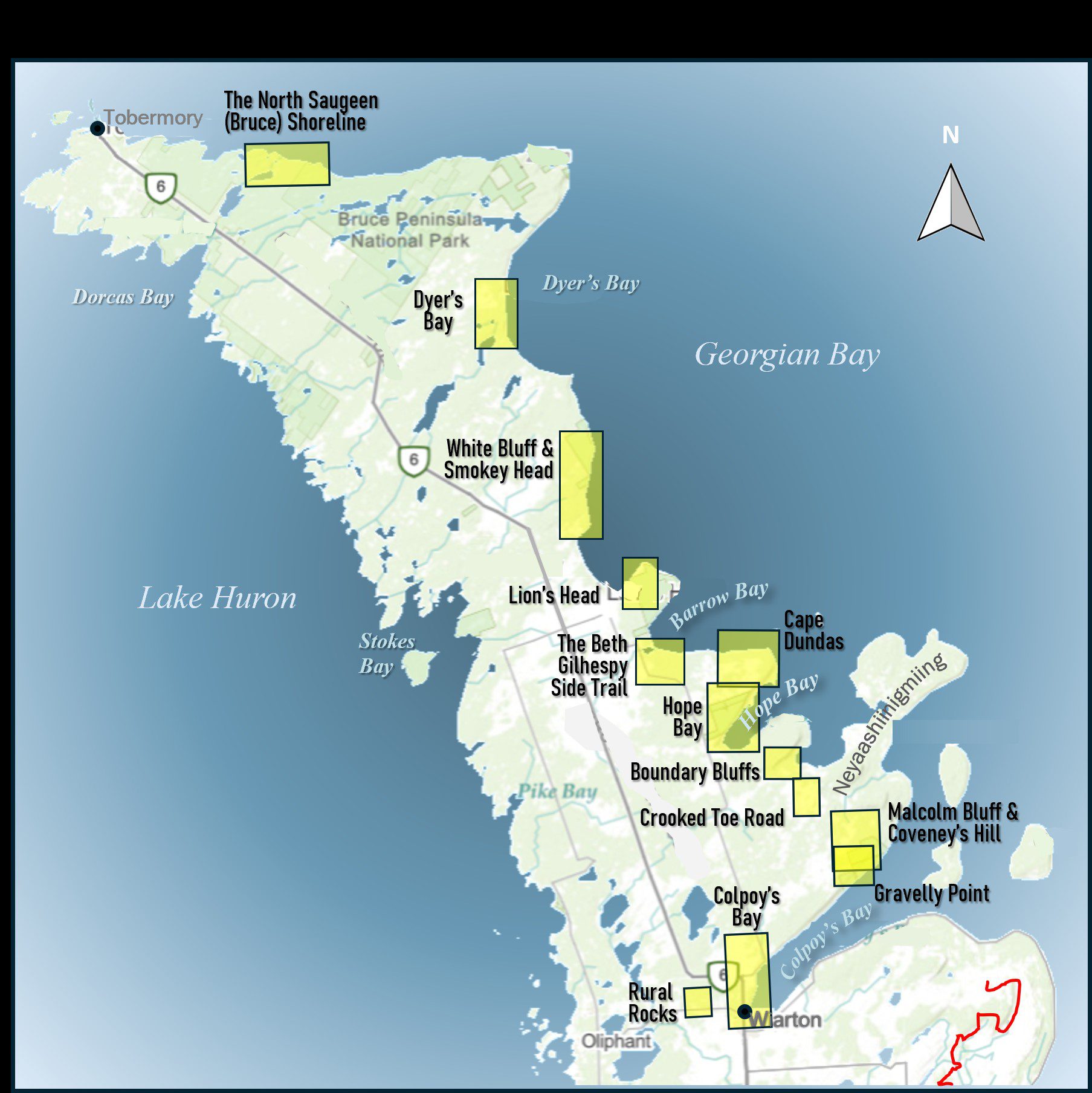
Geology Hike and Badge Series - Colpoy's Bay
https://hikes.brucetrail.org/event/geology-hike-and-badge-series-colpoys-bay/Sorry, the registration cut-off time for this hike has been reached.Not a member? Click here to join today!Hosting Club: Peninsula
Category: Geology Hike
Location (Google Maps): Colpoy’s BayHike Leader(s): Beth Gilhespy Click here to contact Hike Leader(s)
Pace: Leisurely (2.0 – 3.0 km/h): A relaxed pace with frequent breaks and a focus on enjoyment.
Terrain: Moderate: Rolling hills, mild slopes and rocky paths.
Distance: 9.0Description
Join the adventure and earn the inaugural Peninsula Geology Badge! Over a stretch of 13 hikes and a couple of extra stops, we will explore the fascinating geology of the Peninsula to learn about the rocks, the shoreline features, glaciation, fossils and all things earthy. The 13 hikes are from the book “Walking Through Time – Exploring the Geology of the Saugeen (Bruce) Peninsula”. Having a copy will give you a lot of great information, but you do not have to purchase the book to attend and enjoy the hikes. Just bring your curiosity! We will make sure to hit all the locations that qualify for the beautiful new Walking Through Time – Saugeen (Bruce) Peninsula geology hike badge. If you would like to purchase a book I will have some available on the hikes, or you can pick one up from the BTC Head Office, at Ginger Press in Owen Sound, Suntrail Source for Adventure in Hepworth, the Shop at 84 Main in Lion’s Head and at Reader’s Haven in Tobermory.You are welcome to come on just a few of the hikes or on all of them, and the dates and hikes are as follows:
Date Geology Hike km
Saturday May 2, 2026 Colpoy’s Bay 9.0
Saturday May 9, 2026 Gravelly Point (am) and Rural Rocks (pm) 8.6
Saturday May 16, 2026 Malcolm Bluff 7.3
Sunday May 17, 2026 White Bluff/Smokey Head 11.8
Sunday May 24, 2026 Crooked Toe Road 5.5
Sunday May 31, 2026 Hope Bay 8.1
Sunday June 14, 2026 Boundary Bluffs 5.2
Saturday July 4, 2026 Cape Dundas 6.2
Saturday July 11, 2026 Beth Gilhespy Side Trail 7.6
Saturday August 8, 2026 Lion’s Head 11.0
Saturday August 15, 2026 Dyer’s Bay Loops 7.5
Saturday August 22, 2026 North Saugeen (Bruce) Shoreline 8.0
Meeting times will vary depending on the hike, but will generally be some time between 9 am and 10 am. Information on exact meeting times and locations will be sent out a few days prior to the hike.

Urban Walk; Tommy Thompson Park
https://hikes.brucetrail.org/event/urban-walk-tommy-thompson-park/Sorry, the registration cut-off time for this hike has been reached.Not a member? Click here to join today!Hosting Club: Toronto
Category: Urban Walk
Location (Google Maps): Tommy Thompson ParkHike Leader(s): Leila Damband Click here to contact Hike Leader(s)
Pace: Moderate (3-4 km/hr)
Terrain: Flat, Level 1 (Easy – mostly on flat, well maintained trails with hard-packed surface)
Distance (km): 12 KmDescription
Hi my dear hikers,I’m inviting you to join us on the first Saturday of the beautiful month of May for an enjoyable walk at Tommy Thompson Park, Toronto’s urban wilderness. It’s a unique spot near downtown Toronto to experience nature and one of the best places for birdwatching—so bring your binoculars if you have them.
Notes:
- It’s May, and showers can be expected at any time, so come prepared.
- Bring 2L of drinking water and a lunch/snack.
- Feel free to invite your family members and friends to join.
- Please be on time. If you need to cancel, kindly do so via the website to give an opportunity to waitlisted hikers.
- TTC users can take Bus #83 from Donlands Subway Station (check https://www.ttc.ca/ for any updates or closures). Free public parking is available at the trailhead on a first-come, first-served basis. Washrooms are located at the trailhead, with some additional vault toilets available on the trails. You will receive an update email on Thursday, April 30.
Fingers crossed for a nice sunny day—see you all soon!
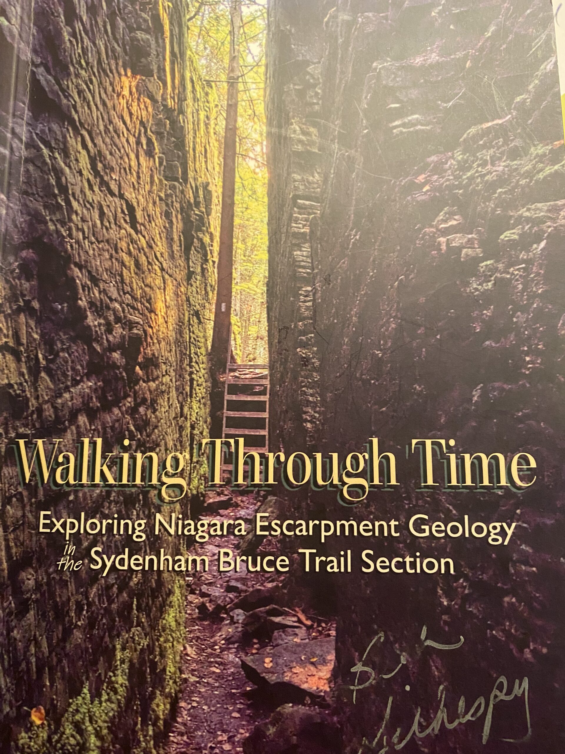
Geology Hike #1 - Rocklyn Creek
https://hikes.brucetrail.org/event/geology-hike-1-rocklyn-creek-2/Sorry, the registration cut-off time for this hike has been reached.Not a member? Click here to join today!Hosting Club: Sydenham
Category: Geology Hike
Location (Google Maps):CAR SHUTTLE linear hike. Meet at BT roadside parking along St Vincent-Sydenham Townline north of Walters Falls between Sideroad 3 and Holland-Sydenham Townline. We will be taking some cars to start point at Blantyre parking lot and then hike west.
Hike Leader(s): Carol Graham-Mullin Click here to contact Hike Leader(s)
Pace: Leisurely: 3 km/h or less
Terrain: Moderate: Some hills and/or poor footing, There might be muddy sections., There might be sections with water on the trail.
Distance: 7.4 kmDescription
Join Carol Graham-Mullin on an educational geology hike exploring the delightful Rocklyn Creek section, with its many dolostone and shale layers, deep forests, historic foundations and rocky outcrops. This is Hike #1 in the Geology Series (1 of 16 hikes). Copies of Beth’s book, “Walking through Time” will be available for purchase at the end of the hike. A special member’s only price of $37.00 , cash or e-transfer. This hike will be a credit towards the Sydenham Geology Badge. Estimated time of hike includes car shuttling.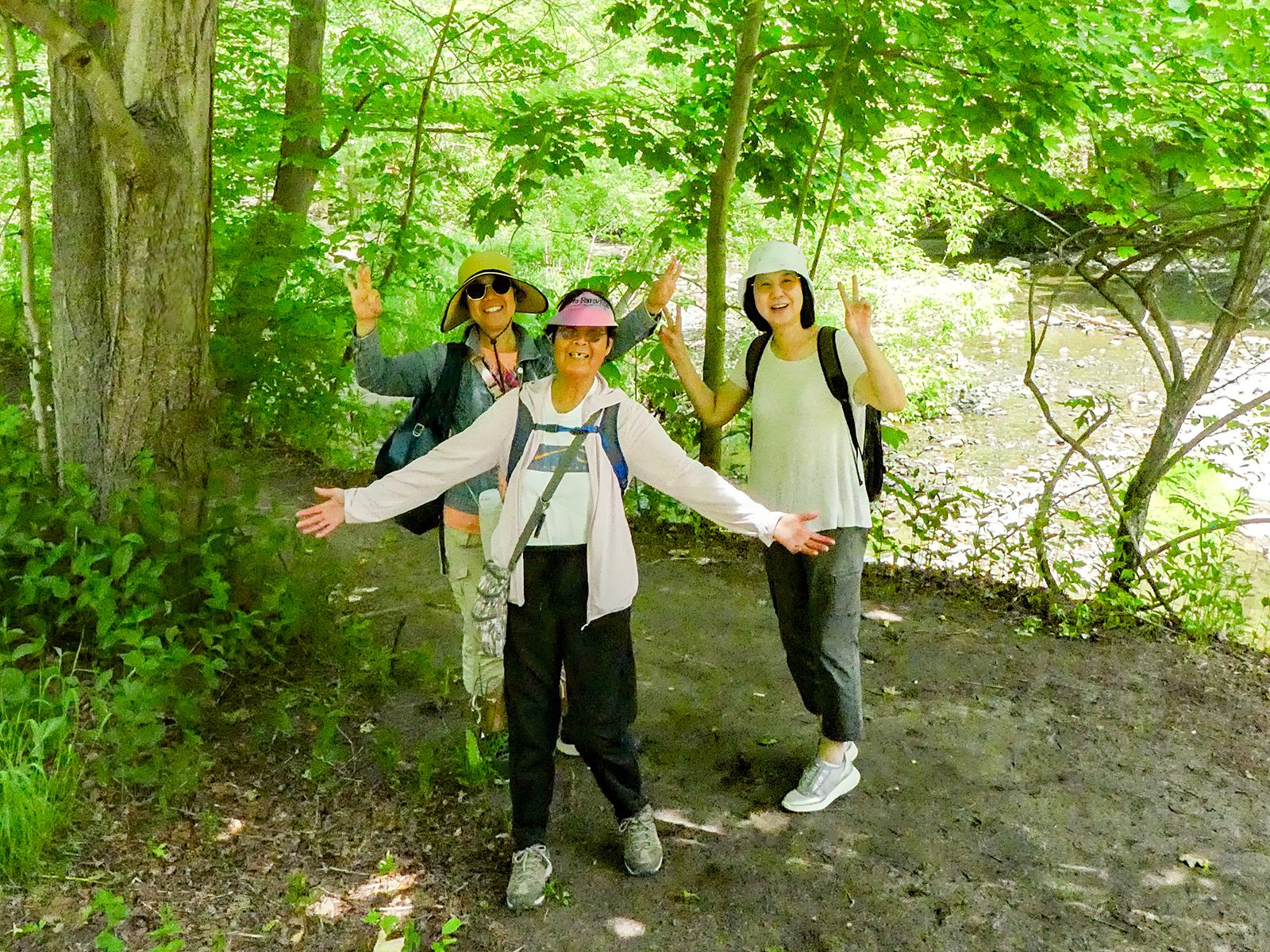
Urban Walk: Toronto Urban Badge Hike - 6 of 7
https://hikes.brucetrail.org/event/urban-walk-toronto-urban-badge-hike-6-of-7-3/Sorry, the registration cut-off time for this hike has been reached.Not a member? Click here to join today!Hosting Club: Toronto
Category: Urban Walk
Location (Google Maps): Toronto, Ontario, CanadaHike Leader(s): Brian Rideout Click here to contact Hike Leader(s)
Pace: Moderate (3-4 km/hr)
Terrain: Flat
Distance (km): 9 kmDescription
Please join me at the south east corner of Sheppard Ave East and Leslie by 10 AM. We will hike south through several parks to Don Mills (S of Overlea) (km 51.7 to km 62.4). Here is an online map with km markings of our route for all 7 hikes for the Toronto Urban Badge: https://onthegomap.com/s/c2c1hf3nPlease make sure you bring at least 2 liters of water, a lunch, bug spray and sunscreen.
Saturday Shorts
https://hikes.brucetrail.org/event/saturday-shorts-3/Sorry, the registration cut-off time for this hike has been reached.Not a member? Click here to join today!Hosting Club: Caledon Hills
Category: Nature Walks
Location (Google Maps): BTC Reference Guide Map 13, parking lot at Scotsdale Farm. Enter Scotsdale Farm from Trafalgar Rd., 1.7 km northwest of Highway 7.Hike Leader(s): Janice McClelland Click here to contact Hike Leader(s)
Pace: Leisurely – 3 km/hour or less
Terrain: Moderate – some hills and/or some poor footing
Distance: 5.8 kmDescription
This hike begins on the Bennett Heritage Trail at Scotsdale Farm. We cross Snows Creek pond and subsequently Owl Creek, close to the site of an Indigenous (Attiwonderonk) village from 1550-1580. We will share information about the village and then quietly follow the west side of Owl Creek to a scenic spot for a short break before we return to our departure point. Please bring water & a snack and inquisitiveness re the wildflowers that will be emerging!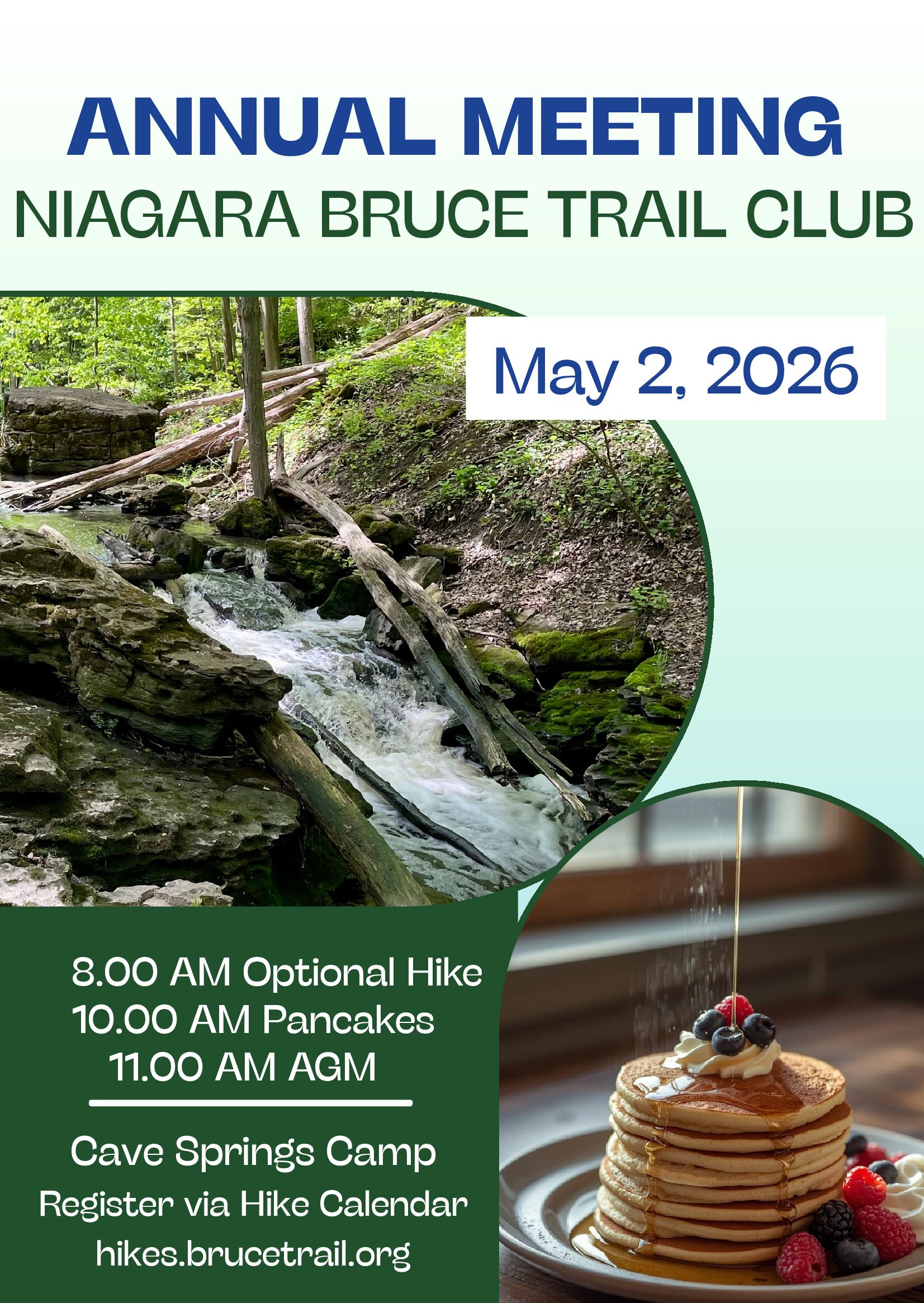
Niagara BTC Pancake Breakfast & AGM
https://hikes.brucetrail.org/event/niagara-btc-pancake-breakfast-agm/Sorry, the registration cut-off time for this hike has been reached.Not a member? Click here to join today!Hike open to BTC Members only.
Hosting Club: Niagara
Category: No Leader
Location (Google Maps): Hoxie Hall at Cave Springs Camp. 4410 Cave Spring Rd, Beamsville. Hoxie Hall is the brown building with the concrete patio and wheelchair ramp with metal railings. Accessible venue. Free parking.Hike Leader(s): Kristin Hanson Click here to contact Hike Leader(s)
Distance: 0
Description
Niagara Bruce Trail Club members – come get your maple on! Join our NBTC social Pancake Breakfast and stay for the Annual General Meeting. We will have Michael McDonald, CEO of the Bruce Trail Conservancy, as special guest.10:00am: Doors to Hoxie Hall open
10:00 to 11:00: Pancake Breakfast. Serving pancakes, maple syrup, sausages, coffee/tea, juice. If you are attending and would like to contribute to the breakfast, fruit/fruit salads or breakfast bake treats (such as your family’s favourite muffin recipe) would be most welcome.
11:00 to 12:00: Annual General Meeting, led by Club President, Ellen Savoia, with remarks by Michael McDonald
12:00: Prizes!
12:30: Hoxie Hall doors close