Hike Schedule
Join us for a hike! Registration required:
All hikes available to BTC members. Some hikes are open to non-members.
TIP: The calendar view displays up to 7 hikes on a day, but often there are more. Click “More events” to see them all.
Categories
- 19April 19, 2026

Fort to Fort SECOND DAY ONLY April 19, 2026
https://hikes.brucetrail.org/event/fort-to-fort-second-day-only-april-19-2026/Sorry, the registration cut-off time for this hike has been reached.Not a member? Click here to join today!Hosting Club: Niagara
Category: Event Hikes
Location (Google Maps):Kingsbridge Park, Chippawa, Ontario
Hike Leader(s): Lauren Doig Click here to contact Hike Leader(s)
Pace: Medium
Terrain: Easy
Distance: 27kmDescription
Meet at Kingsbridge Park at 6:45. You will be bussed to Old Fort Erie. Hike back to Kingsbridge Park from Old Fort Erie. Terrain is flat with mostly paved paths. There are 2 checkpoints along the way. This registration is for those hikers who are only doing the second day of the Fort to Fort.
This is a self-led hike.
Registration is $60. (members) , $70 (non-members) for 1 day. Fee includes bus, parking pass, and checkpoints .
Event Coordinator: Lauren Doig, ldoig52@gmail.com
CANCELD - Peninsula BT Makeup Hike (km 139.5 – km 156.4)
https://hikes.brucetrail.org/event/peninsula-bt-makeup-hike-km-139-5-km-156-4/Sorry, the registration cut-off time for this hike has been reached.Not a member? Click here to join today!Hosting Club: Peninsula
Category: Peninsula BT Makeup Hike
Location (Google Maps):Hike Leader(s): Kathleen Stahlbaum & Saabir Sohrab Click here to contact Hike Leader(s)
Pace: Medium (3.0 – 4.5 km/h): A comfortable pace for most hikers with steady progress.
Terrain: Difficult: Steep ascents/descents, rocky scrambling, and some rugged escarpment paths., Moderate: Rolling hills, mild slopes and rocky paths.
Distance: ~17.8Description
Halfway Log dump to Little Cove parking lotThis hike is part of the Peninsula BT Makeup Hikes, intended for hikers completing missed sections of the Peninsula Bruce Trail. Each hike requires individual registration.
To hike the entire Peninsula Section, please register for the Full Peninsula End-to-End Series (single registration for all 10 hikes): https://hikes.brucetrail.org/event/peninsula-end2end-in-10-series/2026-05-01/
Hikers may register for all 10 Makeup Hikes if they wish.
Expectations: Expect ~6 hours on the trail, depending on the terrain, weather, and group pace. The hike leader sets the pace, aiming for 3–4 km/h, and may adjust as needed for group ability and trail conditions. Breaks will be taken throughout the day.
For safety, participants must remain between the hike leader and the hike sweep at all times.
Fees:
- Registration fee does not include Bruce Peninsula National Park entry fees and parking fees
- Parking costs will be shared equally among participants.
- Fundraising: This hike is a fundraiser to support the Peninsula Bruce Trail Club’s volunteer-run hike program.
Participant Requirements
- Intermediate/experienced hikers with good fitness
- Proper hiking boots, layered clothing, wet weather gear
- Hiking poles recommended
- Bring: Lunch, snacks, water, bug spray
Transportation & Accommodations
- Car shuttle: Participants rotate as drivers; vehicles must be passenger-ready
- Accommodations: Book early; options include motels, campgrounds, hostels, and B&Bs
Note: Dogs are not permitted.
Car Hike: Forks Of The Credit - Dog-Friendly hike
https://hikes.brucetrail.org/event/car-hike-forks-of-the-credit-dog-friendly-hike/Sorry, the registration cut-off time for this hike has been reached.Not a member? Click here to join today!Hosting Club: Toronto, Caledon Hills
Category: Car Hike
Location (Google Maps): Forks of the Credit Provincial ParkHike Leader(s): Lindita Kalo Click here to contact Hike Leader(s)
Pace: Moderate (3-4 km/hr)
Terrain: Hilly, Level 2 (Intermediate – some hills and uneven surfaces, rocks and roots underfoot), Variable
Distance (km): 12kmDescription
Hello, I am exited to organize the first Dog-Friendly hike – a pilot program for the TBTC. My dog is an 2 years old Australian Sheppard, she is friendly with humans and other dogs. Dogs must be on leash. If you will be bringing your dog please read the Bruce Trail dog policy – https://brucetrail.org/dogs-on-the-trail/
This hike is a loop hike, we will return to parking lot. Reserve and pay for a daily Vehicle pass online at https://reservations.ontarioparks.com. If you are a badge hunter this hike is 1/4 of Caledon side trail badge. Future hikes TBA. Participants who register can expect at least one dog present on the hike.
Please don’t hesitate to contact me if any questions.
Best Regards,
Lindita
Nassagaweya Canyon, from Rattlesnake Point (reservations required)
https://hikes.brucetrail.org/event/nassagaweya-canyon-from-rattlesnake-point-reservations-required/Sorry, the registration cut-off time for this hike has been reached.Not a member? Click here to join today!Hosting Club: Iroquoia
Category: General Hike
Location (Google Maps): Meet in the upper parking lot at Rattlesnake Point. You will need to reserve your time at conservationhalton.caHike Leader(s): Karen Bergmann Click here to contact Hike Leader(s)
Pace: Medium – 3 to 4 km/hr
Terrain: Moderate – Some hills and/or some poor footing
Distance: 9 kmsDescription
Meeting at 9:15 am in the upper parking lot at Rattlesnake Point, we will hike through the park and down into the canyon and back up into the park for a large loop. There are some rocks along the way and a couple of steep hills (going down into the canyon and then back up). Bring icers for your boots. Reserve your time at conservationhalton.ca
Urban Walk: Toronto Urban Badge Hike - 5 of 7
https://hikes.brucetrail.org/event/urban-walk-toronto-urban-badge-hike-5-of-7-4/Sorry, the registration cut-off time for this hike has been reached.Not a member? Click here to join today!Hosting Club: Toronto
Category: Urban Walk
Location (Google Maps): Toronto, Ontario, CanadaHike Leader(s): Tom Swales Click here to contact Hike Leader(s)
Pace: Moderate (3-4 km/hr)
Terrain: Flat
Distance (km): 9.6 kmDescription
Please join me at the north east corner of Bathurst and Finch by 10 AM. We will hike east on the Finch Hydro Corridor Trail and south along East Don Parklands to Sheppard and Leslie (km 41.6 to km 51.2). Here is an online map with km markings of our route for all 7 hikes for the Toronto Urban Badge: https://onthegomap.com/s/c2c1hf3nPlease make sure you bring at least 2 liters of water, a lunch, bug spray and sunscreen.
Spring & Migration Monitor Hike
https://hikes.brucetrail.org/event/spring-migration-monitor-hike-8/Sorry, the registration cut-off time for this hike has been reached.Not a member? Click here to join today!Hosting Club: Peninsula
Category: Spring Birds and Blooms
Location (Google Maps): Cottrill Lake Hike – park at km 180.7 Borchardt Parking Lot. From her early years in the Bavarian Alps, Special Guest, Barbara Von Der Heide of Loving Yoga, has formed a deep appreciation for the sensory journey as we enter the cathedral of nature. Barbara encourages us to use our senses to absorb our surroundings as we embrace the colour, textures and sounds of spring. This hike will be be a quiet, immersive experience with check ins along the route as we take in the arrival of spring.Hike Leader(s): Tamara Wilson Click here to contact Hike Leader(s)
Pace: Leisurely (2.0 – 3.0 km/h): A relaxed pace with frequent breaks and a focus on enjoyment.
Terrain: Difficult: Steep ascents/descents, rocky scrambling, and some rugged escarpment paths.
Distance: 6kmDescription
Starting on the Borchardt Rd parking lot (km 108.7), we will follow the Minhinnik ST to the Lillie Family parking area on Britain Lk Rd at the Cotrill Lake ST (110.8 km) we will loop around the Cotrill Lk ST spending time on the shores looking for the arrival of water fowl. On the return trip to the cars, we will follow the Main Trail South, looking for grebes, loons and other shoreline birds that frequent Dyers Bay. We will visit the Devil’s Monument viewing platform, and check out the waterfall before heading back to the parking lot along Devil’s Monument ST and the Minhinnik to Borchardt Rd. Throughout our hike, we will keep an eye out for the arrival of spring flowers and other harbingers of spring. This route is quite rocky in places with stairs. The Trail may be wet and muddy around Cotrill Lake. We will be taking stairs down to the viewing platform and the waterfall. Total distance is around 8 km. This hike may take 3 hours to complete. Pack snacks and drinks accordingly. From her early years in the Bavarian Alps, Special Guest, Barbara Von Der Heide of Loving Yoga, has formed a deep appreciation for the sensory journey as we enter the cathedral of nature. Barbara encourages us to use our senses to absorb our surroundings as we embrace the colour, textures and sounds of spring. This hike will be be a quiet, immersive experience with check ins along the route as we take in the arrival of spring.
Urban Walk: Bloodroot Spring Flowers Hike: Meadowvale-Churchville Loop
https://hikes.brucetrail.org/event/urban-walk-bloodroot-spring-flowers-hike-meadowvale-churchville-loop/Sorry, the registration cut-off time for this hike has been reached.Not a member? Click here to join today!Hosting Club: Toronto
Category: Urban Walk
Location (Google Maps): Meet me at Kipling Terminal by 9:15 for a 9:25 departure on MiWay bus #11. We will change to bus #42, leaving Goreway Dr North of Derry Rd at 10:01. Coming directly to the hike, park at Credit Valley Conservation Authority Parking, 1255 Old Derry Road, Mississauga. Please arrive by 10:50.Hike Leader(s): Andrew Proczek Click here to contact Hike Leader(s)
Pace: Moderate (3-4 km/hr)
Terrain: Flat, Level 1 (Easy – mostly on flat, well maintained trails with hard-packed surface)
Distance (km): 10-11 kmDescription
Join me for a pleasant Spring Flowers Hike taking in the Bloodroot, and other Spring ephemerals. Bloodroot (Sanguinaria canadensis) grows in moist to dry woods and thickets, often on floodplains and near shores or streams. It is one of the earliest spring flowers and the white blooms last barely a week. The red juice from the underground stem was used by Native Americans as a dye for baskets, clothing, and war paint, as well as for insect repellent. The generic name, from the Latin sanguinarius, means “bleeding”.We will visit Terry Wilson and “Rosemary’s Garden” but this event will not include a Meadowvale Village Tour. The focus will be on hiking and spotting ephemerals. The hike will take us to Churchville in Brampton and we will return to Meadowvale by way of Levi Creek Valley, a tributary of the Credit River.
GeoHike - Louth Conservation Area
https://hikes.brucetrail.org/event/geohike-louth-conservation-area/Sorry, the registration cut-off time for this hike has been reached.Not a member? Click here to join today!Hike open to BTC Members only.
Hosting Club: Niagara
Category: Geology
Location (Google Maps): Louth Conservation Area, 3155 Staff Avenue, St. CatharinesHike Leader(s): Kristin Hanson Click here to contact Hike Leader(s)
Pace: Medium 3- 4 km/hr
Terrain: Moderate: some hills and some poor footing
Distance: 3.8Description
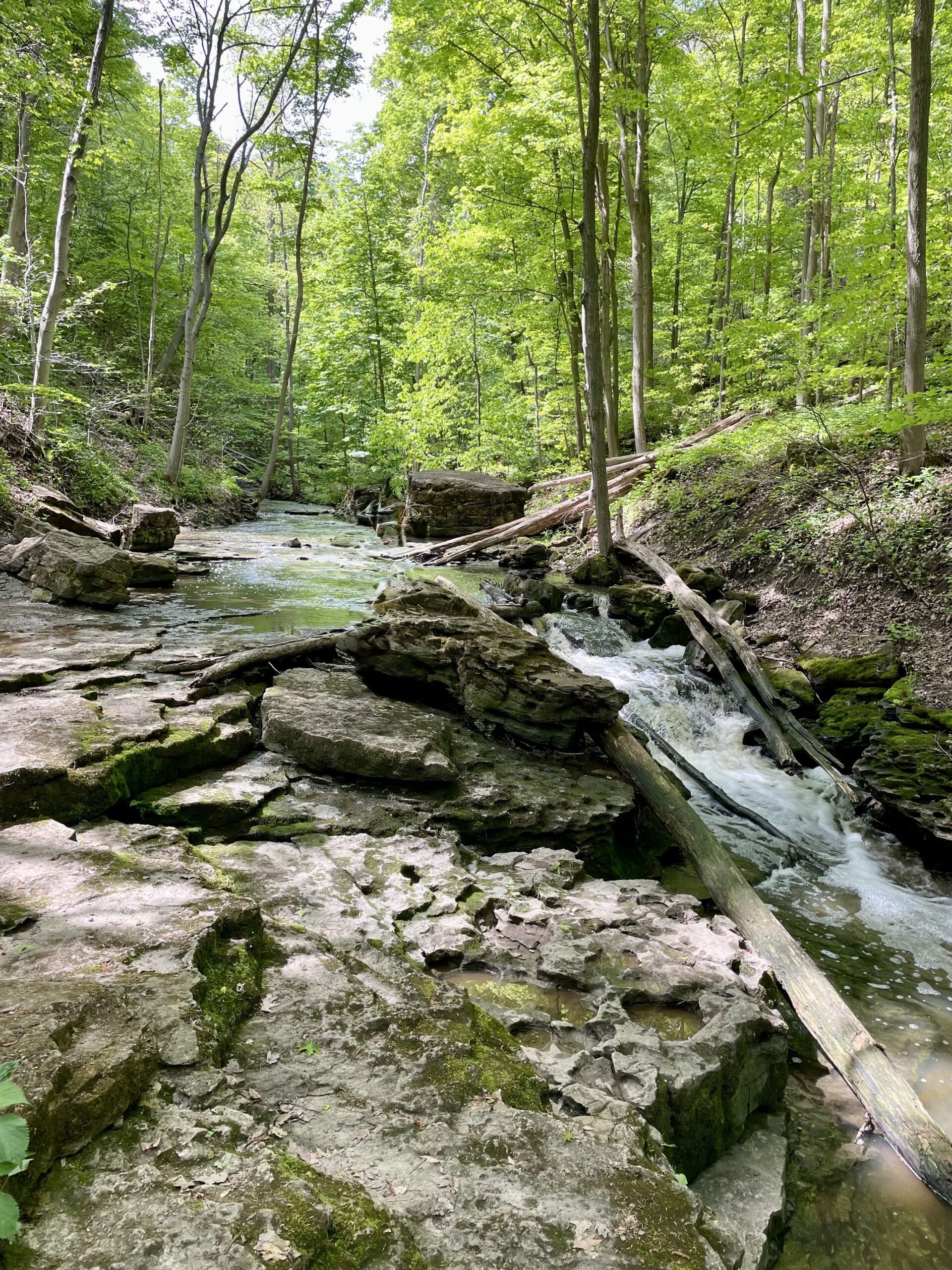
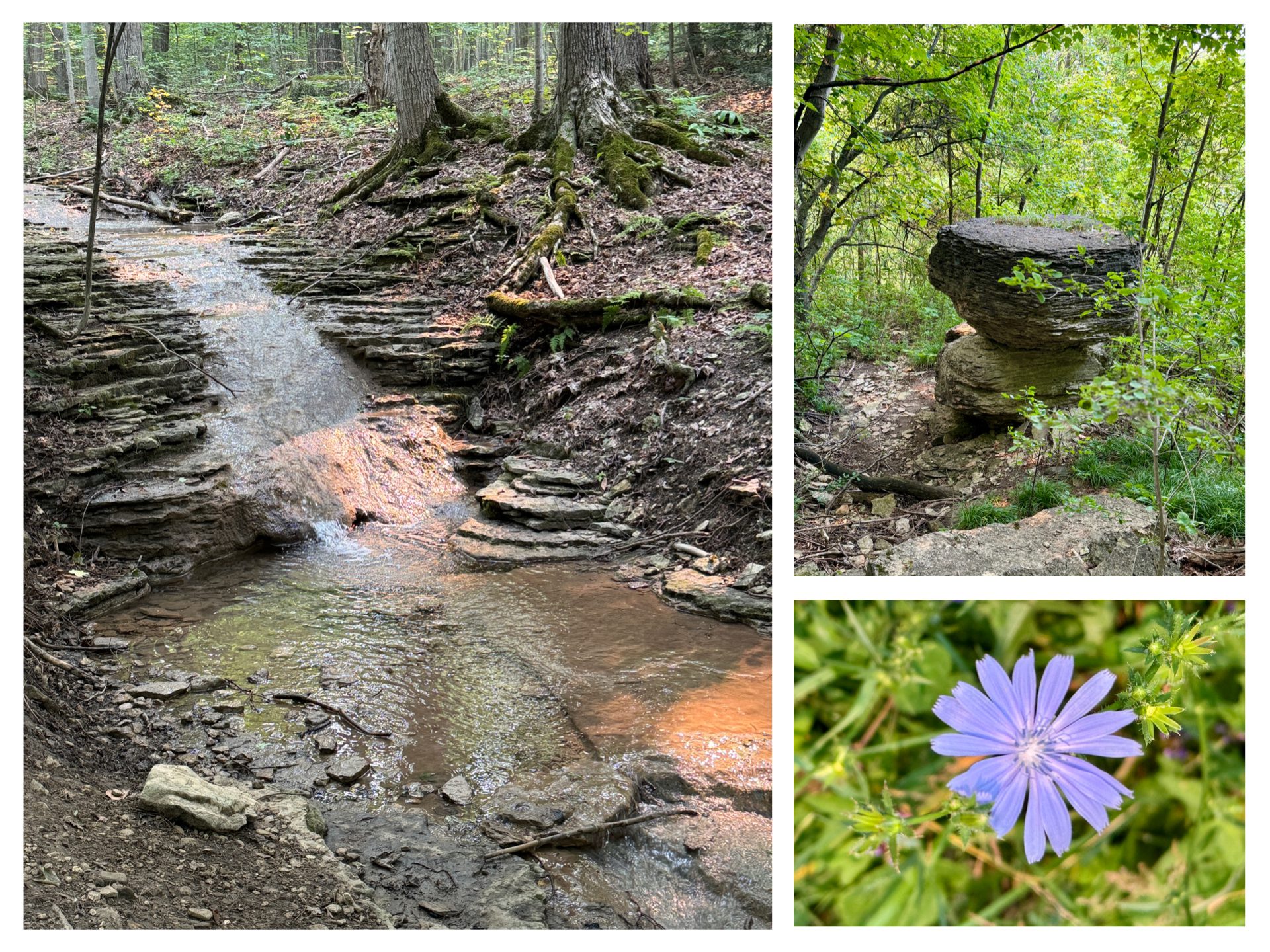
Discover the geology of the Vinemount Ridge wine sub-appellation, and the beauty of the waterfalls at Louth Conservation Area. We will see some interesting geologic features and evidence of glaciers. We will follow Sixteen Mile Creek and get a great view of both the upper falls and lower falls as Sixteen Mile Creek makes its way over the Niagara Escarpment. We will use a slow pace and stop and discuss geology along the way. It will take us 2-2.5 hours to cover the distance. There are three small hills we will climb, otherwise the terrain is generally flat. However, some of the footing is rocky and uneven with holes and gaps between the rocks we are walking on. It may be wet and muddy. Hiking poles may give more stability on uneven footing. After about 2.9km, we will arrive at Louth Falls where will stop to enjoy it. Early spring melting should offer us a fantastic view. We will return to the parking lot via the main Bruce Trail and walk a short distance along Staff Road. Parking is free at Louth, but spots are limited. There are no washrooms or facilities. - 20April 20, 2026
Scenic Sydenham Side Trails - An End-to-End Series
https://hikes.brucetrail.org/event/scenic-sydenham-side-trails-an-end-to-end-series/Sorry, the registration cut-off time for this hike has been reached.Not a member? Click here to join today!Hike open to BTC Members only.
This is a Multi-Day Hike
You are signing up for the following dates and times:
2026-04-20 at 08:45
2026-04-21 at 08:45
2026-05-11 at 08:45
2026-05-12 at 08:45
2026-06-01 at 08:45
2026-06-02 at 08:45
2026-09-14 at 08:45
2026-09-15 at 08:45
2026-10-05 at 08:45Hosting Club: Sydenham
Category: Fundraiser
Location (Google Maps): Information will be sent directly to registered participants regarding details of each hike, including locations and meeting spots.Hike Leader(s): Fran Turner Click here to contact Hike Leader(s)
Pace: Brisk: 4 to 5 km/h
Terrain: Strenuous: Hilly with steep climbs and some poor footing.
Distance: Daily distance varies from 9.5 km to 15.5 km depending on side trails featured on that day. Total distance covered over 9 hikes is 117 km.Description
This hike series features 46 of the most scenic side trails within the Sydenham section. We will be hiking multiple side trails per day, varying from three to eight. We will cover a variety of terrain including forests, marshes, rocky outcrops and scenic lookouts. Hikers must be physically fit and prepared for mud, rough footing and strenuous ascents and descents. In order to achieve our daily goals, we will be hiking at a brisk pace. You need to be comfortable with a steady, brisk pace over challenging terrain, for hours at a stretch.Hikers must have heavy duty waterproof hiking boots, wet weather gear, layered clothing, and sun /bug protection. Plenty of water is essential and a lunch will be needed each day.
Car shuttles will be used to move hikers between the side trails, and hikers must be prepared to use their vehicle to transport passengers.
This hike series is limited to 10 hikers, plus leader and sweep.
Upon finishing the series, hikers will receive a brand new Scenic Sydenham Side Trails badge and a great sense of accomplishment.
EASY DOES IT HIKE, Allanburg Bridge
https://hikes.brucetrail.org/event/allanburg-bridge/Sorry, the registration cut-off time for this hike has been reached.Not a member? Click here to join today!Hosting Club: Niagara
Category: Leisurely
Location (Google Maps): Allanbridge Parking lot, west Side of Welland CanalHike Leader(s): Diane Marlatt Click here to contact Hike Leader(s)
Pace: Leisurely
Terrain: Easy
Distance: 6 KmDescription
Peninsula Side Trail Loops
https://hikes.brucetrail.org/event/peninsula-side-trail-loops/Sorry, the registration cut-off time for this hike has been reached.Not a member? Click here to join today!This is a Multi-Day Hike
You are signing up for the following dates and times:
2026-04-20 at 09:30
2026-04-21 at 09:30
2026-04-22 at 09:30
2026-04-23 at 09:30Hosting Club: Blue Mountains, Sydenham, Peninsula
Category: General Hike
Location (Google Maps): Roadside Parking at south end of Cathedral Drive near Hopeness.Hike Leader(s): Karen Buschert Click here to contact Hike Leader(s)
Pace: Brisk: 4 to 5 km/h, Medium: 3 to 4 km/h
Terrain: Moderate: Some hills and/or poor footing, Strenuous: Hilly with steep climbs and some poor footing.
Distance: Varies, approximately 10-18 km each dayDescription
Explore the Bruce/Saugeen Peninsula through a series of loop hikes involving side trails at Lion’s Head, Devil’s Monument, Hope Bay and the Obese Side Trail at Rural Roots. These four days of hikes will take in magnificent views and fascinating geology and some challenging terrain. Our longest hike at Lion’s Head will be 18 km (about 6 hours) and the other days will involve multiple loops with the options to go longer or shorter if desired. A detailed itinerary will be sent out upon registration. All hikes can count towards the Peninsula Side Trails badge and we will also take some time to identify trees, ferns and birds for anyone interested in those badges too!Accommodation suggestion: Silver Lake Mennonite Camp near Sauble Beach. Shared accommodations with food provided. Carpooling from camp will be arranged for those who will be staying there. Cost is $400 + HST per person and includes 3 nights, 3 suppers, 3 lunches and 3 breakfasts. Option to stay Sunday night is an extra $60+ HST (food not included). For further details contact hike leader and/or visit Silver Lake’s website: slmc.ca/retreats/
*No dogs*

Fletcher Creek Preserve, Puslinch, HCA Property
https://hikes.brucetrail.org/event/fletcher-creek-preserve-puslinch-hca-property-2/Sorry, the registration cut-off time for this hike has been reached.Not a member? Click here to join today!Hosting Club: Iroquoia
Category: General Hike
Location (Google Maps):Park at Fletcher Creek Ecological Preserve on Concession 7 just north of Gore Rd , Puslinch
HCA passes can be used or $8.50 per vehicleHike Leader(s): Cathie Green Click here to contact Hike Leader(s)
Pace: Medium – 3 to 4 km/hr
Terrain: Easy – Mostly flat and usually good footing
Distance: Approx. 10 kmsDescription
Easy, Moderate hike – Fletcher’s Creek Preserve is an abandoned quarry site that has been rehabilitated and is located at the headwaters of the Spencer Creek watershedWe will loop hike through the preserve as well as an adjacent trail that also was part of the quarry back in the day-lots of local history- it was the area swimming hole and some still use it.
Wear appropriate clothing and footwear for the weather-could be wet. Bring water, snack, hiking poles, cell
- 21April 21, 2026
Long Haulers Hike New Location
https://hikes.brucetrail.org/event/long-haulers-hike-new-location-8/Sorry, the registration cut-off time for this hike has been reached.Not a member? Click here to join today!Hosting Club: Niagara
Location (Google Maps): Decew House Thororold
Pace: Brisk
Terrain: Moderate
: 10k+Description
This is our regular Tuesday Long Hike. Note the new location which will continue until May due to the muddy conditions in Shorthills. We will hike along the trails which may include Brock, 12 mile creek. Morningstar mill and/or Bert Lowe side trail. Dress for the weather and bring poles snack and drink9:15 Short Hike - Rotary Park
https://hikes.brucetrail.org/event/915-short-hike-rotary-park-6/Sorry, the registration cut-off time for this hike has been reached.Not a member? Click here to join today!Hike open to BTC Members only.
Hosting Club: Niagara
Category: Hike
Location (Google Maps): Rotary Park, 376 Regional Rd 69, St. CatharinesHike Leader(s): Debbie Demizio Click here to contact Hike Leader(s)
Pace: Medium
Terrain: Moderate
Distance: ~ 6kmsDescription
Hike the trails around Rotary Park, St. Catharines. Please bring water, hiking poles and appropriate footwear.
Halton Agreement Forest
https://hikes.brucetrail.org/event/halton-agreement-forest-17/Sorry, the registration cut-off time for this hike has been reached.Not a member? Click here to join today!Hosting Club: Iroquoia
Category: General Hike
Location (Google Maps): Meet roadside on 4th Line at 9:15 am. Up Guelph Line from the 401, turn right on 10 Side Road and follow the curve as it becomes 4th Line.Hike Leader(s): Karen Bergmann Click here to contact Hike Leader(s)
Pace: Medium – 3 to 4 km/hr
Terrain: Moderate – Some hills and/or some poor footing
Distance: 8 kmsDescription
Meeting at 9:15 am in the small parking lot and roadside on 4th Line, we will hike several of the bike trails, including The Den and The Pines.Rattle Snake Pt Conservation Area to Kilbride Park
https://hikes.brucetrail.org/event/rattle-snake-pt-conservation-area-to-kilbride-park-3/Sorry, the registration cut-off time for this hike has been reached.Not a member? Click here to join today!Hosting Club: Iroquoia
Category: General Hike
Location (Google Maps):9:30am SHARP meet at Kilbride parking lot behind Kilbride Public School (6611 Panton St.) by tennis courts (ignore oneway arrows) and shuttle to Rattlesnake Pt. Conservation Area. Drivers with Halton Conservation Passes will be needed to help with the shuttle and should preregister at Rattlesnake CA. Thank you!
Hike Leader(s): Karen Capindale-Smith Click here to contact Hike Leader(s)
Pace: Medium – 3 to 4 km/hr
Terrain: Strenuous – Hilly with steep climbs and some poor footing
Distance: +/- 16kmDescription
From Rattlesnake Pt. CA we will follow conservation side trails and main BT along the escarpment and descend/ascend Nassagaweya Canyon into Crawford Lake CA for lunch. From there we will wind our way through the CA and on to the calcium pits/caves at Twiss Rd. The last leg of our hike will follow the main BT thru a nature reserve to the “Kilbride Pass” and parking lot.Please wear appropriate layers and bring water, a snack and lunch. Icers may be necessary!
Baked goods should be expected:)
Tuesday Trekkers- Loree Forest
https://hikes.brucetrail.org/event/loree-forest/Sorry, the registration cut-off time for this hike has been reached.Not a member? Click here to join today!Hosting Club: Beaver Valley
Location (Google Maps): Park at km 2.3 (on the shoulder of 21st Sideroad and the 4th line). Map 24, edition 31
Hike Leader(s): Kristina Rettie Click here to contact the hike leader.
Pace: Brisk, Medium
Terrain: Moderate, Some rocky footing, Some steep sections, Strenuous
Length of Hike: 9kmDescription
This hike will take us in and around Loree Forest using the Intercept side trail and the Loree side trail to loop us back to our cars.This time of year we can expect all types of trail conditions. Please be prepared with rain gear, icers and poles for those steep ascents and descents.
Bring water and a snack
Please no dogs
Duncan Caves/Metcalf Rock Loop
https://hikes.brucetrail.org/event/duncan-caves-metcalf-rock-loop-4/Sorry, the registration cut-off time for this hike has been reached.Not a member? Click here to join today!Hosting Club: Dufferin Hi-Land
Category: Tuesday Hike
Location (Google Maps):(Google Maps): Beaver Valley Section Map 25. We will meet at the SuperBurger parking lot (north-west corner of Hwy 89/Hwy 10 intersection) for carpooling at 8:30 am. Otherwise meet at the parking area at km 27.9, 100 meters south of where the Main Trail crosses the 10th Line on the east side for a 9:30 start.
Hike Leader(s): Tony Evangelista, Inge Eckerich, Julie Daley, Les Babbage Click here to contact Hike Leader(s)
Pace: Leisurely
Terrain: Moderate, Slippery Sections Likely
Distance: Long Hike 10 km Short Hike 5 kmDescription
We will hike through the Duncan Caves Provincial Nature Reserve and the Chuck Grant Side Trail/Main Trail Loop. The short hike will end at the parking area at km 33.3 and car shuttle back to Metcalfe Rock parking.Bring lunch, water and snacks. Sunscreen and hiking poles are recommended.
Split Rock Narrows - Map 19
https://hikes.brucetrail.org/event/split-rock-narrows-map-19/Sorry, the registration cut-off time for this hike has been reached.Not a member? Click here to join today!Hosting Club: Caledon Hills
Category: Tuesday Hikers
Location (Google Maps): Split Rock Side Trail parking lot, 2nd Line EHS.
Take Highway 410 north, continue on Highway 10, pass through Orangeville, turn right on 25 Sideroad, left on 2nd Line EHS, drive about 1.5 km to the BTC parking lot on the right.Hike Leader(s): Mohammad Shafiq Click here to contact Hike Leader(s)
Pace: Medium – 3 to 4 km/hour
Terrain: Moderate – some hills and/or some poor footing
Distance: 12 kmDescription
Will hike a combination of main and side trails; Split Rock, Narrows, Ralph Tremills, Walter Tovell, and Lookout Side Trail. Will have snack break at Lookout.
Dress according to weather, poles are recommended.
Bring hydration drink and snack.Badlands Restoration Event - Buckthorn
https://hikes.brucetrail.org/event/badlands-restoration-event-buckthorn/Sorry, the registration cut-off time for this hike has been reached.Not a member? Click here to join today!Hosting Club: Caledon Hills
Category: General
Location (Google Maps): Cheltenham Badlands- 1739 Olde Base Line Road, Caledon L7C 0K6Hike Leader(s): Richard Smythe Click here to contact Hike Leader(s)
Terrain: Moderate – some hills and/or some poor footing
Description
On Tuesday, April 21st volunteers are needed to continue with Habitat Restoration at the Badlands. This is a significant project that requires a large group of volunteers. This spring, the focus will be on treating the standing Buckthorn with a basal bark herbicide. There is an opportunity for volunteers that are not licensed pesticide applicators to be trained and supervised by licensed staff. You will be trained before the work starts, becoming ‘Assistant Trainees’, and perform the same tasks as the two licensed pesticide applicators.We also need sawyers, spotters, loppers, extractigators, and brush clearers. There is something for everyone! In addition to buckthorn treatment, the group will be cutting down some of the larger Buckthorn and treating the stumps with herbicide.
Volunteers who are able to be herbicide application trainees need to arrive for 10:00 a.m. Training will be provided by BTC Staff. We need 6 Herbicide applicators who will be supervised by a licensed exterminator – note these volunteers start at 10:00 a.m. for training/instruction. There will be 3 Assistant Trainees per licensed exterminator. These volunteers will be provided with Personal protective equipment; need to wear rugged outdoor work clothes.
We are looking for 8 plus sawyers, spotters, loppers, pruners and brush clearers, extractigator users and these volunteers start at 10:30 a.m. We will pair at least one sawyer/lopper volunteer with a herbicide applicator. Volunteers who are sawyers, spotters, loppers and brush clearers, extractigator users arrive at 10:30 a.m.
Registration to participate will be through the BTC Hike Schedule.When you register, please indicate whether you are interested in becoming:
a) one of the 6 Assistant Trainee Pesticide Applicators
OR
b) you are a trained a sawyer and will do that
OR
c) you want to be a spotter, using loppers and doing brush clearing, and an extractigatorAll volunteers will need gloves and a water bottle. Water and snacks will be provided along with a sense of accomplishment and pride that we are continuing the project to restore the Badlands.
RAIN DATE for this event will be Friday, April 24th, 2026Urban Walk: Valley View Park Thornhill
https://hikes.brucetrail.org/event/urban-walk-valley-view-park-thornhill-161/Sorry, the registration cut-off time for this hike has been reached.Not a member? Click here to join today!Hosting Club: Toronto
Location (Google Maps): Parking lot is off Sycamore Drive, East of Bayview , across Starbucks plaza
Bus 91 from Finch East station stops at Sycamore station.Hike Leader(s): MOHAMMAD AGHAMIRI Click here to contact Hike Leader(s)
Pace: Moderate (3-4 km/hr)
Terrain: Hilly, Level 2 (Intermediate – some hills and uneven surfaces, rocks and roots underfoot)
Distance (km): 6-7 kmDescription
We will explore Valleyview and Maple View parks, and walk along German Mill Creak, in return we stop in Huntington park and have snack under beautiful shed.Although this is considered an “Urban Walk”, you can expect some hills up and down and uneven surfaces with tree roots. Please bring hiking poles, Ice cleats water and snacks.
Walk In Nature Series (WINS) - Massie Hills
https://hikes.brucetrail.org/event/walk-in-nature-series-wins-massie-hills/Sorry, the registration cut-off time for this hike has been reached.Not a member? Click here to join today!Hosting Club: Sydenham
Category: General Hike
Location (Google Maps): Click the (Google Maps) link on the left to direct you to parking. Or use GPS coordinates: 44.5091, -80.8104 Off-road parking on Concession 6 Rd. S, 3.0 km south of Grey Rd 18. On Edition 31, Map 29 of the Bruce Trail Reference. Or on the Bruce Trail app, click on the red-coloured P at Massie Hills Management Area, then click on Get DirectionsHike Leader(s): Stewart Brown Click here to contact Hike Leader(s)
Pace: Medium: 3 to 4 km/h
Terrain: Moderate: Some hills and/or poor footing
Distance: 6 kmDescription
A loop hike through forested trails of the Massie Hills Conservation Area. Breathe in the fresh scents of spring.Fireman's Park
https://hikes.brucetrail.org/event/firemans-park-2/Sorry, the registration cut-off time for this hike has been reached.Not a member? Click here to join today!Hosting Club: Niagara
Category: Loop
Location (Google Maps): Fireman’s Park 2275 Dorchester Rd, Niagara Falls, ON L2J 4L6Hike Leader(s): Marion Hanover Click here to contact Hike Leader(s)
Pace: Medium
Terrain: Moderate
Distance: 6 kmDescription
This is an easy evening hike. Great for newcomers. Meet at the upper lot at 5:15pm, ready to hike at 5:30pm. - 22April 22, 2026
8:30 am Hydro Hill Training
https://hikes.brucetrail.org/event/830-am-hydro-hill-training-10/Sorry, the registration cut-off time for this hike has been reached.Not a member? Click here to join today!Hosting Club: Niagara
Category: In and Out
Location (Google Maps):Lockhart Drive, St Catharines, by the large yellow swing gate.
Hike Leader(s): Suzanne Gourluck Click here to contact Hike Leader(s)
Pace: Brisk 4-5 km/hr
Terrain: Strenuous: hilly, with steep climbs, poor footing
Distance: 6 kmsDescription
This challenging “hike” is intended for those wishing to train for future challenging hikes. Choose your own pace to go up and down the moderately steep hill over 60 minutes. The terrain is a hard packed gravel surface. Feel free to bring light weights to increase the intensity of your training. Bring water, hiking poles, snack and dress for the weather.
Louth Conservation - Citizen Science
https://hikes.brucetrail.org/event/louth-conservation-citizen-science/Sorry, the registration cut-off time for this hike has been reached.Not a member? Click here to join today!Hosting Club: Niagara
Category: Citizen Science
Location (Google Maps): Meet at Louth Conservation Area, 3193 Staff Rd, LincolnHike Leader(s): Margaret Northfield Click here to contact Hike Leader(s)
Pace: Leisurely <3 km/hr
Terrain: Moderate: some hills and some poor footing
Distance: 4-5kmDescription
On this Earth Day, we will look at how anyone can participate in natural science. Which app to use – Seek or inaturalist? Learn how to use your photos to identify plants as well as how you can help scientists with various climate related projects. Be a part of the Bruce Trail Citizen Scientist program.If you want to just hike – that’s fine too but this will be a slower hike due to the focus of plant identification.
Earth Day Hike - Margaret Paull Sidetrail
https://hikes.brucetrail.org/event/earth-day-hike-margaret-paull-sidetrail/Sorry, the registration cut-off time for this hike has been reached.Not a member? Click here to join today!Hosting Club: Blue Mountains
Category: Organized Hike
Location (Google Maps): Tim Horton’s, First Street CollingwoodHike Leader(s): Claire Pearson Click here to contact Hike Leader(s)
Pace: Medium – 3 to 4 km/hr
Terrain: Moderate – Some hills and/or some poor footing
Distance: ~5kmDescription
**Update: The trail is wet and muddy in certain areas, so be sure to wear proper footwear (and bring an extra pair of clean shoes for after the hike as we are car-pooling). Hiking poles are always optional, but I found them very helpful this week (especially with all the rain we’ve had).We will meet in the parking lot behind Tim Horton’s. From there we will carpool up Grey Road 119 to 6th line where we will begin our loop hike at the entrance of the Margaret Paull Side Trail. This scenic trail is known for its forested beauty, waterfalls, and flowerpot rock formation. Hiking this is a perfect way to celebrate Earth Day!

Spring Nature Walk: 4th Annual Pools, Ponds & Peepers
https://hikes.brucetrail.org/event/spring-nature-walk-4th-annual-pools-ponds-peepers/Sorry, the registration cut-off time for this hike has been reached.Not a member? Click here to join today!Hosting Club: Caledon Hills
Category: Nature Walks
Location (Google Maps): Location: Meet at roadside parking at the dead end of Boston Mills Rd., about 400 m west of Mississauga Rd. Directions: From Hwy 10 take Boston Mills Rd. 6 km west to the dead end just west of Mississauga Rd. An alternative is to take Mississauga Rd. north from King St. about 3 kms, turn left on Boston Mills Rd. for about 400 mHike Leader(s): Richard Smythe Click here to contact Hike Leader(s)
Pace: Leisurely – 3 km/hour or less
Terrain: Moderate – some hills and/or some poor footing
Distance: 3.8 kmDescription
There and back on both the Main Trail and the Rockside Side Trail, about 3.8 km, with some hills and rugged sections. Hiking poles can be a great help. The pace will be slow at times with numerous stops to observe the spring ephemerals, listen to bird song and take photos. Bring your binoculars, camera and cellphone. Apps like Merlin, Seek, and iNaturalist will help identify flora and fauna along the route.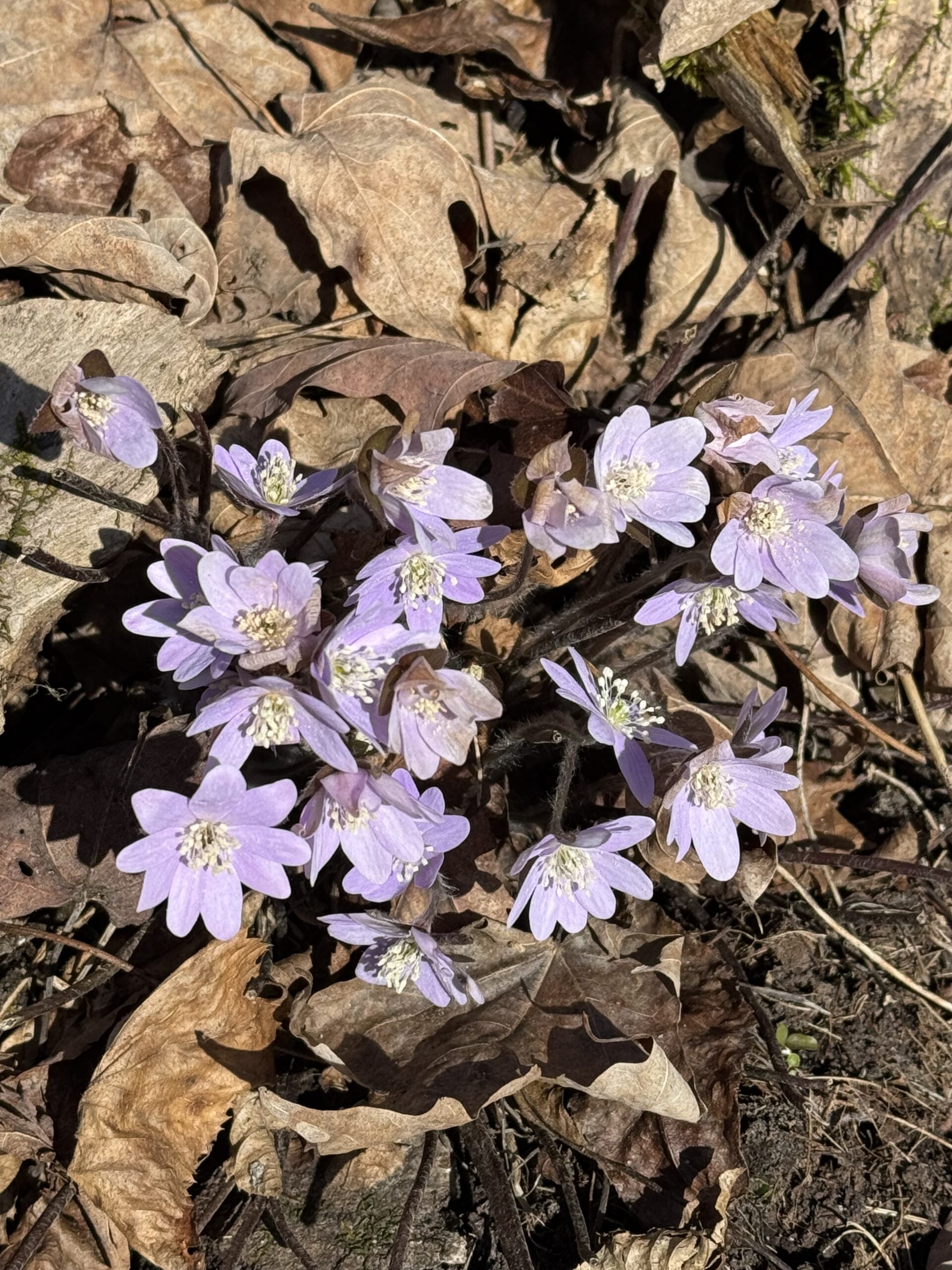
Seeking Out Spring Ephemerals
https://hikes.brucetrail.org/event/seeking-out-spring-ephemerals/Sorry, the registration cut-off time for this hike has been reached.Not a member? Click here to join today!Hosting Club: Iroquoia
Category: Wildflowers and Spring Ephemerals
Location (Google Maps): Halton Agreement ForestHike Leader(s): Anne Armstrong Click here to contact Hike Leader(s)
Pace: Leisurely – 3km/hr or less
Terrain: Easy – Mostly flat and usually good footing
Distance: Approx 8.5 Km.Description
Please join in this first Spring Ephemeral hike as we search for the first wildflower arrivals of Spring. Depending on when Spring arrives this year we will see some early Spring wildflowers. We will do a “lollipop” hike in the beautiful Halton Agreement Forest with its many hiking and biking trails. Meet at 9:45 am. for a 10:00 am. start in the northeast corner of the Woodbine/Mohawk Casino/Raceway parking lot on the west side of Guelph Line, north of Highway 401. Bring water, sunscreen and a snack. Although generally flat and wide there is one rocky section. I will send out an email the day before the hike with my contact information in the event you cancel the night before or the morning of the hike. Remember to cancel via your BTC account as well.Wednesday Walkers Eagle's Summit Loops
https://hikes.brucetrail.org/event/eagles-summit-loops/Sorry, the registration cut-off time for this hike has been reached.Not a member? Click here to join today!Hosting Club: Beaver Valley
Location (Google Maps): Meet in the Beaver Valley Rest Area on Grey Road 13, north of km 50, N.363929, W80.531458. Map 26, Edition 31
Hike Leader(s): Glenda Collings Click here to contact the hike leader.
Pace: Medium
Terrain: Moderate, Some steep sections
Length of Hike: Approx. 6 kmDescription
We will be hiking a series of loops on the recently completed Eagle’s Summit trails, with great views of Beaver Valley and a walk below an amazing rock wall. Bring water and a snack.Please arrive by 9:45 a.m for a 10:00 a.m. start. If you need to cancel please do so online or contact me so we know whether or not to expect you. My cell 519 694 7691.
Car Hike: Midweek Fitness Walk Around Island Lake (8.5 km)
https://hikes.brucetrail.org/event/car-hike-midweek-fitness-walk-around-island-lake-8-5-km-4/Sorry, the registration cut-off time for this hike has been reached.Not a member? Click here to join today!Hosting Club: Toronto
Category: Car Hike
Location (Google Maps):Island Lake Conservation Area (Hwy 10 and 4th Ave intersection)
Hike Leader(s): Natalia Svechnikova Click here to contact Hike Leader(s)
Pace: Moderate (3-4 km/hr)
Terrain: Flat
Distance (km): 9 kmDescription
Please join me for an enjoyable fitness walk (which is my first of the season) on a relatively flat and easy trail around the lake in the Island Lake Conservation area. The trail has treed sections as well as boardwalks near the water, meadows and more. I hope that we will see some nice spring flowers along the way. We will keep some steady but still comfortable pace of approximately 3-3.5 km/h. We will have a short break on the picnic area after about 6 km. Please dress for the weather and bring 2 L of water and some snacks/light lunch. We will meet at the start of the trail (near the large trail map) at 4th Ave and Hwy 10 intersection. You can park anywhere at the Zehrs Orangeville, Winners or Mark’s parking lot which is just across Hwy 10.Update from April 20, 3 pm: There is a construction affecting a section of the loop hike we are planning to hike. This section (and a boradwalk are closed). The entrance to the trail from the 4th Ave and Hwy 10 is accessible for hikers. We can park as I suggested near Zehrs and meet as planned at the start of the trail near the map; however, we cannot hike in a loop but would have to retrace our route back.Please see the notice for your info: https://cvc.ca/park-advisories/?filter_park=island-lake
- 23April 23, 2026
9:00 Long Hike, Glen Road Jordan
https://hikes.brucetrail.org/event/900-long-hike-glen-road-jordan-4/Sorry, the registration cut-off time for this hike has been reached.Not a member? Click here to join today!Hosting Club: Niagara
Location (Google Maps):
3640 Glen Road Jordan
Pace: Brisk
Terrain: Strenuous
: 10 kmDescription
Hike in and around Ball’s Falls and Jordan. Dress for the weather: bring icers, poles, dress in layersFundraising Hike - Stained Glass Badge - Toronto Section in 2 and a half
https://hikes.brucetrail.org/event/fundraising-hike-stained-glass-badge-toronto-section-in-2-and-a-half/Sorry, the registration cut-off time for this hike has been reached.Not a member? Click here to join today!This is a Multi-Day Hike
You are signing up for the following dates:
2026-04-23, 2026-04-30, 2026-05-01Hosting Club: Toronto, Beaver Valley
Location (Google Maps): On Thursday April 23rd – Toronto Section KM 48.0 on Boston Mills Road west of Mississauga Road at 9 am
Details for April 30 & May 1 to be distributed after registration.Hike Leader(s): David Royston Click here to contact the hike leader.
Pace: Medium
Terrain: Moderate, Some rocky footing, Some steep sections
Length of Hike: VariesDescription
All 9 Stained Glass Badges over 3 years – Hike Series 4 – Toronto Section. We will complete an end to end of the Toronto Section (50 km) in 2 and a half days. The hikes will be (1) Cheltenham Badlands to Scotsdale Farm (2) Scotsdale Farm to Speyside, and (3) Speyside to km 0.0 just south of Hilton Falls Conservation Area. The detailed hike plan will be distributed to participants after they register. Parking options near km 0.0 are very limited and there will likely be an additional fee for parking at Hilton Falls Conservation Area. Final arrangements for that parking will be determined prior to the third hike.All hikes will proceed at a moderate pace (approx 4 km per hour not including a lunch stop). Breaks will be taken throughout each hike as appropriate. Hikes will proceed rain or shine.
Except for shuttles, hikers are expected to be self reliant. Please bring everything you may need such as water, lunch, snacks, personal medical kit and appropriate footwear and clothing.
At the start of the first hike participants will be expected to sign a waiver in favour of the hike leader similar to the one in favour of the BTC they sign on registration.
Hiking in and around Jordan
https://hikes.brucetrail.org/event/hiking-in-and-around-jordan-17/Sorry, the registration cut-off time for this hike has been reached.Not a member? Click here to join today!Hosting Club: Niagara
Location (Google Maps): Sho’arishon Park (Jordan Hollow)
Hike Leader(s): Bill Russell Click here to contact Hike Leader(s)
Pace: Medium
Terrain: Moderate
Distance: 7 kmDescription
Hiking in and around Jordan, Jim Rainforth Trail and Balls Falls rotating every 3 weeks.Urban Walk: Valley View Park Thornhill
https://hikes.brucetrail.org/event/urban-walk-valley-view-park-thornhill-162/Sorry, the registration cut-off time for this hike has been reached.Not a member? Click here to join today!Hosting Club: Toronto
Location (Google Maps): Parking lot is off Sycamore Drive, East of Bayview , across Starbucks plaza
Bus 91 from Finch East station stops at Sycamore station.Hike Leader(s): MOHAMMAD AGHAMIRI Click here to contact Hike Leader(s)
Pace: Moderate (3-4 km/hr)
Terrain: Hilly, Level 2 (Intermediate – some hills and uneven surfaces, rocks and roots underfoot)
Distance (km): 6-7 kmDescription
We will explore Valleyview and Maple View parks, and walk along German Mill Creak, in return we stop in Huntington park and have snack under beautiful shed.Although this is considered an “Urban Walk”, you can expect some hills up and down and uneven surfaces with tree roots. Please bring hiking poles, Ice cleats water and snacks.
- 24April 24, 2026
Niagara-on-the-Lake Tour
https://hikes.brucetrail.org/event/niagara-on-the-lake-tour-26/Sorry, the registration cut-off time for this hike has been reached.Not a member? Click here to join today!Hosting Club: Niagara
Category: Urban
Location (Google Maps): Park on King St near Center St, Niagara-on-the-LakeHike Leader(s): Margaret Northfield Click here to contact Hike Leader(s)
Pace: Leisurely <3 km/hr
Terrain: Easy: mostly flat, good footing
Distance: 5-6 kmDescription
Each Friday we will explore some history of Niagara-on-the-Lake while getting a moderate paced walk. Discover where the Niagara River meets Lake Ontario. Experience the Heritage District, woods and the Niagara Parkway.Some weeks may be totally on sidewalks and roads while others may include a mix of trail and paved pathways.
Great way to build up endurance for longer more strenuous hikes.
Plan to stay for conversation and a coffee at Sweets & Swirls, Community Centre, Niagara Stone Rd., NOTL
Brisk Fridays - Bayview Escarpment Provincial Nature Reserve
https://hikes.brucetrail.org/event/brisk-fridays-bayview-escarpment-provincial-nature-reserve-2/Sorry, the registration cut-off time for this hike has been reached.Not a member? Click here to join today!Hosting Club: Sydenham
Category: General Hike
Location (Google Maps): Click the (Google Maps) link on the left to direct you to parking. Or use GPS coordinates: 44.63759, -80.7334. Roadside parking on the shoulder curve on the St Vincent-Sydenham Townline, 5 km north of Hwy 26. On Edition 31, Map 30 of the Bruce Trail Reference, park at km 52.7. Or on the Bruce Trail app, click on the P at the curve in the St Vincent-Sydenham Townline, then click on Get DirectionsHike Leader(s): Stewart Brown
Pace: Medium: 3 to 4 km/h
Terrain: Moderate: Some hills and/or poor footing, Strenuous: Hilly with steep climbs and some poor footing.
Distance: 13 kmDescription
Welcome spring on a refreshing Brisk Friday hike in a vibrant and protected escarpment ecosytem.Terra Cotta Loop
https://hikes.brucetrail.org/event/terra-cotta-loop-3/Sorry, the registration cut-off time for this hike has been reached.Not a member? Click here to join today!Hike open to BTC Members only.
Hosting Club: Dufferin Hi-Land
Category: General Hike
Location (Google Maps): End of Boston Mills Road to the immediate west of Mississauga Road. Between kms 47.4 and 48.3 on BTC Map 14. 43.75061558050969. -79.9517816135864. See also Google Maps link.Hike Leader(s): Stuart Law Click here to contact Hike Leader(s)
Pace: Medium
Terrain: Slippery Sections Likely, Slippery and Steep Sections, Moderate
Distance: 15 kmsDescription
Join us for a lovely Spring loop hike through the Terra Cotta Conservation Area. Lots of wildflowers and birds. Terrain is rocky in spots and it is muddy and wet. Hiking boots and gaiters essential. Poles recommended. Please bring a smile, water, a snack, warm drink and a lunch. Please be ready to hike at 9:15 am. Dropout available at 11 kms. Please contact hike leader for more information.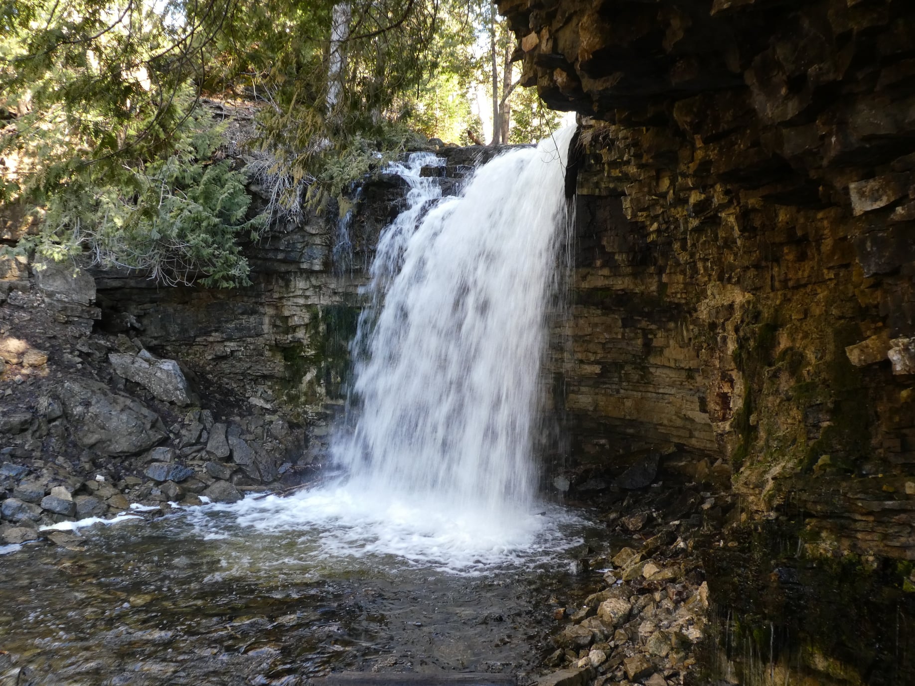
Hilton Falls (reservation required)
https://hikes.brucetrail.org/event/kelso-summit-reservation-required/Sorry, the registration cut-off time for this hike has been reached.Not a member? Click here to join today!Hosting Club: Iroquoia
Category: General Hike
Location (Google Maps): Hilton Falls parking lot at 9:15 am (reservation required)Hike Leader(s): Karen Bergmann Click here to contact Hike Leader(s)
Pace: Medium – 3 to 4 km/hr
Terrain: Moderate – Some hills and/or some poor footing
Distance: 8 kmsDescription
We will explore the trails for a large loop. Reserve your time at conservationhalton.caBlue Mountains End-to-End in 5 - Hike 4
https://hikes.brucetrail.org/event/blue-mountains-end-to-end-in-5-hike-4/Sorry, the registration cut-off time for this hike has been reached.Not a member? Click here to join today!Hike open to BTC Members only.
Hosting Club: Iroquoia, Blue Mountains
Category: General Hike
Location (Google Maps): Parking Lot Petun Conservation AreaHike Leader(s): Pati Greenwood, Jeff Dowsett Click here to contact Hike Leader(s)
Pace: Medium – 3 to 4 km/hr
Terrain: Dependent on Conditions, Strenuous – Hilly with steep climbs and some poor footing
Distance: 13.1 kmDescription
This is an End-to-End hike series to complete the Blue Mountains section of the Bruce Trail in 5 hikes. Join for all or as many hikes as desired – you will need to register for each hike in the series which will take place on the following dates in April: 17, 18, 19, 24 and 25.Since this is a group hike, please consider your fitness level before registering. We will be walking at a pace of 3km – 4km per hour and hikers will need to keep up with the person in front of them for the duration of the hike. The hike series will also involve car shuttles and every hiker is expected to participate as drivers.
Weather conditions in the spring can be changeable, so it’s best to dress in layers and come prepared for varying conditions throughout the day. Hiking boots are required and hiking poles are strongly recommended. Bring plenty of fluids and a snack.
This fourth hike of the series will be 13.1 km long. Plan to arrive at the meeting place by 9:15 a.m. as we will start the car shuffle to the hike starting point at 9:30 a.m. sharp. Further details will be provided to registered hikers a few days prior to the hike.
- 25April 25, 2026

Sydenham E2E in 6
https://hikes.brucetrail.org/event/sydenham-e2e-in-6/Sorry, the registration cut-off time for this hike has been reached.Not a member? Click here to join today!Hike open to BTC Members only.
This is a Multi-Day Hike
You are signing up for the following dates and times:
2026-04-25 at 07:00
2026-04-26 at 07:00
2026-05-02 at 07:00
2026-05-03 at 07:00
2026-05-09 at 07:00
2026-05-10 at 07:00Hosting Club: Iroquoia, Sydenham
Category: Stained Glass Badge End to End Fundraiser Hike
Location (Google Maps): Day 1 – Apr 25,2026 – 27km
Meet at: Bognor Marsh Conservation Area: Enter from County Rd 18 Capacity: 10, Fee ($11.30) Coordinates: 44.538525, -80.782217
Shuttle to: Blantyre BTC Parking Area on East side of Grey Rd 12 directly across from Blantyre sign Capacity: 15, Coordinates: 44.500537,-80.632902Day 2 – Apr 26,2026 – 26km
Meet at: Bayview Escarpment PNR. Off road parking on St. Vincent-Sydenham Townline Capacity: 5, Coordinates: 44.637539, -80.733406
Shuttle to: Bognor Marsh Conservation Area: Enter from County Rd 18 Capacity: 10, Fee ($11.30) Coordinates: 44.538525, -80.782217Day 3 – May 2,2026 – 29.00km
Meet at: Utility Tower Lot, West side of Hwy 6/10 Capacity: 12, Coordinates: 44.556781, -80.925586
Shuttle to: Bayview Escarpment PNR. Off road parking on St. Vincent-Sydenham Townline Capacity: 5, Coordinates: 44.637539, -80.733406Day 4 – May 3,2026 – 29.00km
Meet at: East Linton Rd, roadside parking, access to East Linton Side Trail Capacity: 3, Coordinates: 44.649257, -80.964331
Shuttle to: Utility Tower Lot, West side of Hwy 6/10 Capacity: 12, Coordinates: 44.556781, -80.925586Day 5 – May 9,2026 – 28.00km
Meet at: Roadside parking area on Kemble Rock Rd Capacity: 4, Coordinates: 44.747360, -80.932857
Shuttle to: East Linton Rd, roadside parking, access to East Linton Side Trail Capacity: 3, Coordinates: 44.649257, -80.964331Day 6 – May 10,2026 – 29.00km
Meet at: Bluewater Park, Wiarton, opposite the arena Capacity: 20, Coordinates: 44.742514, -81.135140
Shuttle to: Roadside parking area on Kemble Rock Rd Capacity: 4, Coordinates: 44.747360, -80.932857Hike Leader(s): IgorT Click here to contact Hike Leader(s)
Pace: Brisk – 4 to 5 km/hr, Medium – 3 to 4 km/hr
Terrain: Dependent on Conditions, Moderate – Some hills and/or some poor footing, Slippery and Steep Sections, Slippery Sections Likely, Strenuous – Hilly with steep climbs and some poor footing
Distance: 27 – 29Description
This is a Challenger series of hikes; we will complete the entire 171.6 km of the Sydenham section in 6 hikes. You are registering for all 6 hikes, please review the dates carefully to ensure you are able to participate fully. Registration is limited to 5 persons.- This hike series is intended for experienced distance hikers only. Hikers must be able to sustain the distance and maintain a pace.
- Be very aware of your ability to join this series.
- Expect to be on-trail for 8 – 10 hours;
- There will be mud and wet conditions in many places of course in April and May, especially flooding conditions on Day 2 at Bognor Marsh and probably Day 6 in the Colpoy’s Range Road/Ancient Beach Nature Reserve BTC property area (carrying water shoes is recommended for those sections);
- Meeting time is scheduled for 7:00 am;
- Hikers must carry sufficient hydration, accessible snacks, lunch, first-aid kit, rain gear, extra socks, and possibly protective boot covers (i.e. bags);
- Hikers will be expected to participate in shuttling to and from the hike. Responsibility will be shared equally;
- Any applicable parking fees will be shared within the group.
If you have concerns, or questions please use the Contact Hike Leader form to inquire in advance of registering.
Peninsula BT Makeup Hike (km 156.4 – km 163.1)
https://hikes.brucetrail.org/event/peninsula-bt-makeup-hike-km-156-4-km-163-1/Sorry, the registration cut-off time for this hike has been reached.Not a member? Click here to join today!Hosting Club: Peninsula
Category: Peninsula BT Makeup Hike
Location (Google Maps):Hike Leader(s): Saabir Sohrab Click here to contact Hike Leader(s)
Pace: Medium (3.0 – 4.5 km/h): A comfortable pace for most hikers with steady progress.
Terrain: Difficult: Steep ascents/descents, rocky scrambling, and some rugged escarpment paths., Moderate: Rolling hills, mild slopes and rocky paths.
Distance: ~6.7kmDescription
Little Cove parking lot to Tobermory CairnThis hike is part of the Peninsula BT Makeup Hikes, intended for hikers completing missed sections of the Peninsula Bruce Trail. Each hike requires individual registration.
To hike the entire Peninsula Section, please register for the Full Peninsula End-to-End Series (single registration for all 10 hikes): https://hikes.brucetrail.org/event/peninsula-end2end-in-10-series/2026-05-01/
Hikers may register for all 10 Makeup Hikes if they wish.
Expectations: Expect ~3 hours on the trail, depending on the terrain, weather, and group pace. The hike leader sets the pace, aiming for 3–4 km/h, and may adjust as needed for group ability and trail conditions. Breaks will be taken throughout the day.
For safety, participants must remain between the hike leader and the hike sweep at all times.
Fees:
- Fundraising: This hike is a fundraiser to support the Peninsula Bruce Trail Club’s volunteer-run hike program.
Participant Requirements
- Intermediate/experienced hikers with good fitness
- Proper hiking boots, layered clothing, wet weather gear
- Hiking poles recommended
- Bring: Lunch, snacks, water, bug spray
Transportation & Accommodations
- Car shuttle: Participants rotate as drivers; vehicles must be passenger-ready
- Accommodations: Book early; options include motels, campgrounds, hostels, and B&Bs
Note: Dogs are not permitted.
Bus Hike: 2026 TBTC AGM Hikes and Meeting
https://hikes.brucetrail.org/event/bus-hike-2026-tbtc-agm-hikes-and-meeting/Sorry, the registration cut-off time for this hike has been reached.Not a member? Click here to join today!Trip Information
Departure Time: 08:00
Return to City Time: 17:00
Departure Point: York Mills Bus PickupOptional Items
Hosting Club: Toronto
Category: Bus Hike
Location (Google Maps):Gellert Community Centre, Georgetown
Hike Leader(s): Tom Swales Click here to contact Hike Leader(s)
Distance (km): N/A
Description
The bus will depart from the York Mills departure point to the Georgetown area for a morning of hiking followed by lunch and the 2026 TBTC AGM featuring guest speaker Nicola Ross, author of the Loopes and Lattes series of hiking guides, which often feature the Bruce Trail and Niagara Escarpment, and hundreds of magazine articles. Nicola has written on her multi-day adventures cycling, hiking, on horseback, and paddling.Note: You must register separately for the meeting at: https://torontobrucetrailclub.org/shop/agm2026/
Bus Fare is $20.00 for members and non-members.
The TBTC Hike Leaders are pleased to offer you a choice of three hikes on this bus as listed below. You must register for the hike of your choice through the respective registration page. Please review the hike descriptions carefully to ensure you are signing up for a hike matching your interest and hiking ability. It would be helpful if you could finalize your hike choice before the date to avoid confusion and let us move to the hikes and to the Gellert Centre efficiently.
Car Hikers may register for the hikes (meeting location will be advised) and meet the bus.
(1) Forest Therapy/Shrinin-Yoku Slow Walk: https://hikes.brucetrail.org/event/tbtc-agm-forest-therapy-shinrin-yoku-slow-walk/2026-04-25/ Marijo and Olivier Roy
(2) Exploring Biodiversity Along The Trail : https://hikes.brucetrail.org/event/agm-hike-explore-biodiversity-along-the-trail/2026-04-25/ Janet Patterson and George Lennon
(3) Moderate Level Hike At Silver Creek: https://hikes.brucetrail.org/event/agm-hike-moderate-hike-at-silver-creek/2026-04-25/ Janet McColeman and Tom Swales
Due to the time constraints to fit our hiking in before heading to the Gellert Centre for the meeting the longer distance In Search Of Walking Fern with Monica and hike at Terra Cotta with Lindita will only be available to Car Hikers.
Car Hike: TBTC AGM Terra Cotta
https://hikes.brucetrail.org/event/car-hike-tbtc-agm-terra-cotta/Sorry, the registration cut-off time for this hike has been reached.Not a member? Click here to join today!Hosting Club: Toronto
Category: Car Hike
Location (Google Maps): Terra Cotta before TBTC AGM at the Gellert Centre in GeorgetownHike Leader(s): Lindita Kalo Click here to contact Hike Leader(s)
Pace: Brisk (4-5 km/hr), Moderate (3-4 km/hr)
Terrain: Level 2 (Intermediate – some hills and uneven surfaces, rocks and roots underfoot), Variable
Distance (km): 10 kmDescription
This hike is a loop of Terra Cotta Side Trail and the main Bruce Trail, Please register for the AGM separately at: https://torontobrucetrailclub.org/shop/agm2026/
The hike will be moderate to brisk: 4-5km/hr. We will need to complete the loop and get to AGM by 12:45 latest to sign in for the meeting.
Location: Gellert Community Centre 10241 8th Line, GeorgetownOur guest spaker this year is Nicola Ross, author of the Loopes and Lattes series of hiking guides, which often feature the Bruce Trail and Niagara Escarpment, and hundreds of magazine articles. Nicola has written on her multi-day adventures cycling, hiking, on horseback, and paddling.
This hike will be a “Car Hike” only meaning hikers are responsible for their own transportation to the hike and AGM.
More information will be sent to registered hikers before the hike.
Hike of 2 lakes King city
https://hikes.brucetrail.org/event/car-hike-glasgow-village-uxbridge-6/Sorry, the registration cut-off time for this hike has been reached.Not a member? Click here to join today!Hosting Club: Toronto
Category: Car Hike
Location (Google Maps): Park along Fairfield Dr. or Dufferin Street, Gathering at trail head in Dufferin Street.Hike Leader(s): MOHAMMAD AGHAMIRI Click here to contact Hike Leader(s)
Pace: Moderate (3-4 km/hr)
Terrain: Hilly, Level 2 (Intermediate – some hills and uneven surfaces, rocks and roots underfoot), Variable
Distance (km): 14-15 kmDescription
We will explore Seneca and Mary lakes and visit Eaton Hall .In the middle of hike we visit Pine Farm where you can have coffee,tea and delicious fruit pies.
Some safety procedures during the hike:
1-Hikers must stay between the leader and the sweep.
2-Hikers must advise the leader or the sweep if they wish to leave the group.
3- Hikers must follow the whistle instructions: 1 blast- stay where you are; 2 blasts come to the leader; 3 blasts – come to the leader quickly.
4-Hike leader may request volunteers to stop at trail intersections, they need to help hikers to the direction the group walk and wait till they see the sweep .
5-Hikers have to make sure they can see the persons behind and in front of them.
Please bring lots of water and snacks , hiking poles are recommended
phone number for the day of hike 289 588 6482
Quadzilla 3 series training hikes
https://hikes.brucetrail.org/event/quadzilla-3-series-training-hikes-3/Sorry, the registration cut-off time for this hike has been reached.Not a member? Click here to join today!Hike open to BTC Members only.
Hosting Club: Dufferin Hi-Land
Location (Google Maps): Hockley Road and 5th line parking lot
Hike Leader(s): Tristan Goguen and Pat Foley Click here to contact Hike Leader(s)
Pace: Medium
Terrain: Slippery and Steep Sections
Distance: Approximately 25 KmDescription
This series of hikes is designed to be for those who are familiar with hiking and want to start training for their summer hiking. The hike starts northbound up 5th line on the Hockley Heights side trail – a steep climb then into the woods – out along 15th side road down 3rd line to Dunby Rd and into the Hockley Valley Provincial Nature Reserve on the main trail. Once through the park we continue on the main trail up 2nd line then back along the main trail to the 5th line parking lot. For those not familiar with this series or section of the Caledon Hills… there are hills – plenty of them. At the beginning of April we can expect any of the following: ice, snow, mud and more mud… Come prepared for these conditions. Proper foot wear is a must, hiking poles are beneficial, rain/mud gear maybe necessary. There are no support stops for this hike so be sure to bring enough water, snacks and lunch. We will start out as a group but we fully expect hikers will divide up and go at their own pace. Everyone of course is welcome to stay in the main group with the hike leaders. If you cannot finish this distance you are encouraged not to attempt this hike it is a serious challenge. If you sign up for this hike please be respectful and if you have to drop out do so on line 2 days before the hike. Others maybe waiting for your spot and the hike leaders need to know you will be coming. We will provide a sign out sheet on the hike leader vehicle so you can sign out and note your time. This not only provides the hike leaders a safety check if you are a faster hiker but you can track your progress over the 3 hikes if you choose to do so.Blue Mountains End-to-End in 5 - Hike 5
https://hikes.brucetrail.org/event/blue-mountains-end-to-end-in-5-hike-5/Sorry, the registration cut-off time for this hike has been reached.Not a member? Click here to join today!Hike open to BTC Members only.
Hosting Club: Iroquoia, Blue Mountains
Category: General Hike
Location (Google Maps):Parking Lot Petun Conservation Area
Hike Leader(s): Pati Greenwood, Jeff Dowsett Click here to contact Hike Leader(s)
Pace: Medium – 3 to 4 km/hr
Terrain: Dependent on Conditions, Strenuous – Hilly with steep climbs and some poor footing
Distance: 16.3 kmDescription
This is an End-to-End hike series to complete the Blue Mountains section of the Bruce Trail in 5 hikes. Join for all or as many hikes as desired – you will need to register for each hike in the series which will take place on the following dates in April: 17, 18, 19, 24 and 25.Since this is a group hike, please consider your fitness level before registering. We will be walking at a pace of 3km – 4km per hour and hikers will need to keep up with the person in front of them for the duration of the hike. The hike series will also involve car shuttles and every hiker is expected to participate as drivers.
Weather conditions in the spring can be changeable, so it’s best to dress in layers and come prepared for varying conditions throughout the day. Hiking boots are required and hiking poles are strongly recommended. Bring plenty of fluids and a snack.
This fifth and final hike of the series will be 16.3 km long. Plan to arrive at the meeting place by 8:15 a.m. as we will start the car shuffle to the hike starting point at 8:30 a.m. sharp. Further details will be provided to registered hikers a few days prior to the hike.
RAINBOW HIKE: Devil's Punch Bowl to Red Hill (cancelled; see July 18)
https://hikes.brucetrail.org/event/rainbow-hike-devils-punch-bowl-to-red-hill/Sorry, the registration cut-off time for this hike has been reached.Not a member? Click here to join today!Hosting Club: Iroquoia
Category: Rainbow Hike
Location (Google Maps): Red Hill Valley South Parking Lot, Mud StreetHike Leader(s): Doug O’Neill Click here to contact Hike Leader(s)
Pace: Medium – 3 to 4 km/hr
Terrain: Moderate – Some hills and/or some poor footing
Distance: Approx. 10-11Description
Join this 2SLGBTQIA+ Rainbow hike from Devil’s Punch Bowl to Red Hill Parking lot. PLEASE NOTE: after you’ve completed registration for this hike, click “Contact the Hike Leader” and let us know if (a) you’re a car driver willing to shuttle a few fellow hikers at the start of the hike, or (b) if you need a ride for the shuttle. Read below for details.Note: While the hike begins at Devil’s Punch Bowl, we’ll actually meet at Red Hill Parking Lot. This hike involves a short car shuttle. If you’re arriving without a car, don’t worry—we’ll arrange rides for everyone. We’ll ask a number of drivers (in advance) if they would conisder volunteering for the shuttle.
The Route: We plan to explore Devil’s Punchbowl, a geological treasure formed in the last Ice Age, after which we’ll hike westward along the main trail and a few sidetrails—passing a couple waterfalls-—ending up at Red Hill Parking Lot.
Terrain: Expect a few hills, some paved (unused) roadway, and dirt paths along the Bruce Trail (main trail) overlooking the east branch of Red Hill Creek.
“The Wonders of Devil’s Punchbowl in 10”
Upon arrival at Devil’s Punchbowl, Hike Leader and Geologist Ann Grindall will unravel some of the mysteries of this amazing 37-metre “ribbon waterfall” formation:• Learn how this massive amphitheatre-shaped gorge was carved into the Niagara Escarpment, exposing over 40 million years of geological history
• The visible rock strata: why it looks like a natural “layer cake” of shale, dolostone, sandstone, and limestone
• How it’s two waterfalls, not one—both formed in the last Ice Age
• Ann will be pleased to answer any questions!WHERE TO MEET: We’re meeting at 9 a.m. in the Red Hill South Parking Lot at the corner of Mud Street and Pritchard. We’ll depart at 9:15 a.m. sharp
COMING BY PUBLIC TRANSITt: Take the No. 21 Heritage Green Terminal Bus (which you can catch downtown and up on the mountain) and get off at Mud & Pritchard. You’ll see the parking lot entrance across the street.
Parking: Free at Red Hill South Parking Lot (at Mud & Pritchard), where we’ll meet; but $8.50 per vehicle at Devil’s Punchbowl. Passengers will split the parking costs, about $2 or $3 each (drivers shouldn’t pay).
PLEASE READ: HOW THE CAR SHUTTLE WORKS
Some of you may be unfamiliar with the magic of car shuttles.Three benefits of car shuttles:
A) We minimize the number of cars — thereby reducing our footprint, which is central our Bruce Trail approach
B) It allows non-car owners to join the hike
D) Saves money on the parking lot fees.Morning plan
• All hikerswill meet at Red Hill South Parking Lot (Mud & Pritchard) by 8:45 a.m. (There’s a bus stop at the intersection.)
• We’ll quickly group ourselves into as few vehicles as possible (about 4–5 hikers per car). We’ll sort this out the week before. If you are able to drive hikers for the shuttle, let the Hike Leader know now–see “Contact” button on this page
• A small number of volunteer drivers will shuttle everyone to Devil’s Punch Bowl, where we’ll start hiking
• We ask that you don’t independently drive your own car to Devil’s Punch Bowl unless helping with the shuttle, as you could end up separated from your vehicle at the end of the hike.
• We depart Red Hill promptly at 9:00 a.m. and should arrive at Devil’s Punch Bowl by 9:15 a.m.-ish.
• Start hiking after Ann’s geological talk.At the end of the hike
• Our hike finishes back at Red Hill South
• We’ll ask for one additional volunteer driver to shuttle the morning drivers back to Devil’s Punch Bowl to retrieve their vehicles.
• Everyone else can hop into their cars or grab the bus (a 4-minute walk from the parking lot at Mud & Prichard).Complimentary Bruce Trail Rainbow badges to all participants!å
PLEASE CANCEL your registration if you change your mind: This is especially important if the hike has a waitlist, since your cancellation opens a spot for someone else.
Online
1. Log in to the Bruce Trail hike site with the same account you used to register.
2, Go to “My Hikes” (under your profile menu).
3, You’ll see a list of the hikes you’re registered for.
4. Click “Cancel” beside the hike you want to withdraw from.
5. You should receive a confirmation email showing your spot has been released.If you can’t log in simply use the (above) “Contact the hike leader” link. Similarly, use that link if you have any questions whatsoever about our Rainbow hikes.
AGM Hike: Explore Biodiversity along the Trail
https://hikes.brucetrail.org/event/agm-hike-explore-biodiversity-along-the-trail/Sorry, the registration cut-off time for this hike has been reached.Not a member? Click here to join today!Hosting Club: Toronto
Category: TBTC Special Events
Location (Google Maps): Silver CreekHike Leader(s): Janet Patterson; George Lennon Click here to contact Hike Leader(s)
Pace: Leisurely (2-3 km/hr)
Terrain: VariableDescription
If you want to learn more about the flora and fauna (and even fungi) that flourish along the Bruce Trail, this hike is for you. Our small group will walk at a leisurely pace so that we can stop and observe our surroundings in more detail. This area boasts a variety of habitats for wildlife, including meadows, forests, ponds and streams. Bring your binoculars!Limited to 10 participants.
If you require transportation from Toronto, you must register separately for the bus that will depart at 8:00 AM from, and return to, York Mills TTC station at: https://hikes.brucetrail.org/event/bus-hike-2026-tbtc-agm-hikes-and-meeting/2026-04-25/ ($20 Bus Fare)
If you will be driving to meet us at the trailhead please let us know in the “Additional Information” field of the registration form.
Our guest spaker this year for the AGM is Nicola Ross, author of the Loopes and Lattes series of hiking guides, which often feature the Bruce Trail and Niagara Escarpment, and hundreds of magazine articles. Nicola has written on her multi-day adventures cycling, hiking, on horseback, and paddling.

CANCELLED DUE TO EXCESS RAIN - Woodend to Fireman's and back
https://hikes.brucetrail.org/event/woodend-to-firemans-and-back-2/Sorry, the registration cut-off time for this hike has been reached.Not a member? Click here to join today!Hosting Club: Niagara
Category: Loop
Location (Google Maps): Meet at the entrance to Woodend Conservation Area, Taylor Rd, Niagara-on-the-Lake.Hike Leader(s): Margaret Northfield Click here to contact Hike Leader(s)
Pace: Medium 3- 4 km/hr
Terrain: Moderate: some hills and some poor footing
Distance: 11-12kmDescription
Hike around Woodend Conservation through the Screaming Tunnel to Fireman’s Park and loop back to the cars. Water, light snack and poles recommended.
Car Hike: Walking the Bruce in search of Walking Fern
https://hikes.brucetrail.org/event/car-hike-walking-the-bruce-in-search-of-walking-fern/Sorry, the registration cut-off time for this hike has been reached.Not a member? Click here to join today!Hosting Club: Toronto
Category: Car Hike
Location (Google Maps): We will meet at the Silver Creek Outdoor Education parking lot – coordinates are 43.692615, -79.968433. (Map 13 of the Bruce Trail Reference Guide, Edition 31).Hike Leader(s): Monica Pasquali; Ray Berzins Click here to contact Hike Leader(s)
Pace: Leisurely (2-3 km/hr), Moderate (3-4 km/hr)
Terrain: Hilly, Level 2 (Intermediate – some hills and uneven surfaces, rocks and roots underfoot), Rocky
Distance (km): 8 kmDescription
Join me for a family-friendly trek through Silver Creek Conservation Area before the Toronto Bruce Trail Club’s Annual General Meeting on Saturday, April 25, 2026. We will hike up onto the escarpment via the Irwin Quarry Side Trail, taking in the views over Silver Creek Valley as we walk along the main trail. We will then descend the escarpment in order to do an out-and-back hike of the Walking Fern Side Trail to look for the Toronto Bruce Trail Club’s emblem: the Walking Fern. Next we will turn around and ascend the escarpment using the main trail before descending via the Roberts Side Trail where we will hopefully spot some interesting wetland wildlife as we walk along a beautiful boardwalk that borders a pretty pond.We will be hiking at a leisurely-moderate pace (approximately 3 km/hr) over technical (i.e. rocky) terrain for much of the hike, and the route will see us hiking up and down the escarpment a few times. We will take snack/hydration breaks as needed.
You should bring enough water and food for a 2-3 hour hike, comfortable footwear with good traction, and appropriate clothing for the weather. Looking forward to finding the elusive Walking Fern with you on April 25th – see you then!
Please note: You must register for the TBTC AGM on April 25th by purchasing your ticket here: https://torontobrucetrailclub.org/shop/agm2026/ (Early Bird ticket pricing is $20+tax in February and the price goes up to $25+tax after March 1st. Tickets always sell out so make sure you purchase yours asap!)
Our guest speaker will be Nicola Ross, author of the Loops and Lattes series of hiking guides, which often feature the Bruce Trail and Niagara Escarpment, and hundreds of magazine articles. Nicola has written on her multi-day adventures cycling, hiking, on horseback, and paddling.
The location of the AGM will be the Gellert Centre 10241 Eighth Line, Georgetown, ON L7G 4S5
This hike is a “Car Hike” meaning hikers are responsible for their own transportation to the trailhead and the AGM.
AGM Hike: Moderate Level Hike At Silver Creek
https://hikes.brucetrail.org/event/agm-hike-moderate-hike-at-silver-creek/Sorry, the registration cut-off time for this hike has been reached.Not a member? Click here to join today!Hosting Club: Toronto
Category: TBTC Special Events
Location (Google Maps): Silver CreekHike Leader(s): Tom Swales, Janet McColeman Click here to contact Hike Leader(s)
Pace: Moderate (3-4 km/hr)
Terrain: Hilly, Level 2 (Intermediate – some hills and uneven surfaces, rocks and roots underfoot), Rocky
Distance (km): 7-8 kmDescription
Join us for a moderate level 2+ hike at Silver Creek in the morning before the Toronto Bruce Trail Club AGM. The area is very scenic but expect to be hiking at a moderate pace of 3-4 km/hour over rocky terrain with some hills going up and down the escarpment.Our hike would be a hike, at a minimum of 3km/hour, with photo opportunities. Starting on the main trail and moving over to the Maureen Smith and Bennett Heritage Side Trails to complete the loop with a diversion on 27 Sideroad by Silver Creek Falls.
The bus from York Mills is full.
Registration for the AGM Meeting/Lunch is at: https://torontobrucetrailclub.org/shop/agm2026/
If you wish to drive and meet us at the trailhead please let us know in the “Additional Information” field on the registration form.
The speaker for our AGM will be Nicola Ross, author of the Loopes and Lattes series of hiking guides, which often feature the Bruce Trail and Niagara Escarpment, and hundreds of magazine articles. Nicola has written on her multi-day adventures cycling, hiking, on horseback, and paddling.
The Gellert Centre is located at 10241 8th Line, Georgetown

TBTC AGM - Forest Therapy/Shinrin-yoku Slow Walk
https://hikes.brucetrail.org/event/tbtc-agm-forest-therapy-shinrin-yoku-slow-walk/Sorry, the registration cut-off time for this hike has been reached.Not a member? Click here to join today!Hosting Club: Toronto
Category: TBTC Special Events
Location (Google Maps): Limehouse Conservation Area – Parking is available across from the Limehouse Public School.Hike Leader(s): Marijo Roy Click here to contact Hike Leader(s)
Pace: Leisurely (2-3 km/hr)
Terrain: Level 1 (Easy – mostly on flat, well maintained trails with hard-packed surface)
Distance (km): n/aDescription
Please join us for a Forest Therapy Slow Walk with Certified Forest Therapy Guide and Psychotherapist Nadia Frost. Nadia’s mission is “to provide education and guidance to individuals and groups on the benefits of forest therapy. She strives to create opportunities for everyone to connect with nature and, in doing so, contribute to better mental and physical health for all, while also caring for our natural environment”.After the hike, we will arrive at the Gellert Community Centre (10241 Eighth Line, Georgetown, ON L7G 4S5) by 12:45 pm at the latest for lunch before the AGM starts.
You are encouraged to bring water for the 1.5-hour walk. Note that the forest therapy walk includes a tea ceremony, during which tea and snacks will be served. Make sure to wear comfortable footwear with good traction and appropriate clothing for the weather.
NOTE: The bus will depart at 8:00 AM from the York Mills departure point to the Georgetown area for a morning of hiking, followed by lunch and the 2026 TBTC AGM featuring guest speaker Nicola Ross author of the Loops and Lattes Hiking Guides that often feature the Bruce Trail and trails around the Niagara Escarpment as well as articles on her many adventures by bicycle, walking, paddling, and horseback. This registration is for the Forest Therapy/Shinrin-yoku Slow Walk only.
IMPORTANT:
You must register for the AGM/Lunch separately at https://torontobrucetrailclub.org/shop/agm2026/
Participants intending to ride the bus must register and pay through the AGM Bus Hike registration at: https://hikes.brucetrail.org/event/bus-hike-2026-tbtc-agm-hikes-and-meeting/2026-04-25/If you are planning to drive and meet us at the trailhead, please let us know in the “Additional Information” section of the registration form.
Looking forward to walking with you,
Marijo and Nadia