Hike Schedule
Join us for a hike! Registration required:
All hikes available to BTC members. Some hikes are open to non-members.
TIP: The calendar view displays up to 7 hikes on a day, but often there are more. Click “More events” to see them all.
Categories
- 22March 22, 2026
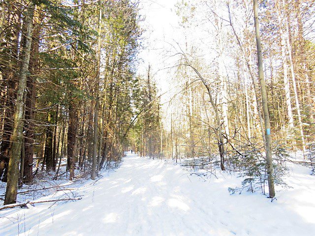
Car Hike: Jefferson Forest (Richmond Hill)
https://hikes.brucetrail.org/event/car-hike-jefferson-forest-richmond-hill-10/Sorry, the registration cut-off time for this hike has been reached.Not a member? Click here to join today!Hosting Club: Toronto
Category: Car Hike
Location (Google Maps):1245 Bethesda Side Rd, Richmond Hill, ON L4E 1A2 ( Bethesda Trail Head Parking lot)
Hike Leader(s): Amir Alemohammad Click here to contact Hike Leader(s)
Pace: Moderate (3-4 km/hr)
Terrain: Flat, Hilly, Level 2 (Intermediate – some hills and uneven surfaces, rocks and roots underfoot)
Distance (km): 10-11 kmDescription
Let’s roll the hills of the Jefferson Forest this winter! Every weekend, we’ll explore the winter wonderland at this beautiful park. Located in the heart of Richmond Hill, it boasts numerous hiking trails. This 3-hour hike can range from 10 to 12 kilometres, depending on the weather conditions. Remember to bring water, snacks, hiking boots, icers, poles, and your camera. Not recommended for beginners. Park in the free Bethesda parking lot and avoid parking along the road. Dress appropriately for the weather. Difficulty Level: 2 (Moderate).Please arrive @8:45AM for start of 9:00AM.
This is a joint hike with the Oak Ridges Trail Association (ORTA).
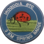
Spring Time Junior Hiker - 3km Hike
https://hikes.brucetrail.org/event/spring-time-junior-hiker-3km-hike/Sorry, the registration cut-off time for this hike has been reached.Not a member? Click here to join today!Hosting Club: Iroquoia
Category: Junior Hiker
Location (Google Maps): Meet and park in the Grimsby Lions Community Pool parking lot at 1 Elm St at the South end of Coronation Park – Park capacity for 30Hike Leader(s): Ruth Moffatt Click here to contact Hike Leader(s)
Pace: Leisurely – 3km/hr or less
Terrain: Dependent on Conditions, Easy – Mostly flat and usually good footing, Moderate – Some hills and/or some poor footing, Slippery Sections Likely
Distance: 4kmDescription
It’s Spring! Please join Ruth and Asia for a Spring Junior Hiker hike. All children must be accompanied by a parent or guardian who must be registered for the hike. The hike will be leisurely but will involve climbing up the hill at a pace suitable for the group. Please bring enough water and snacks needed for a 2 hour hike. You may wish to bring poles if you like and if icey conditions still exist, bring icers.Badges will be available for $7 each for anyone who is under 13 years of age.

Urban Walk: Highland Creek Trail--Waterfront Trail
https://hikes.brucetrail.org/event/urban-walk-highland-creek-trail-waterfront-trail/Sorry, the registration cut-off time for this hike has been reached.Not a member? Click here to join today!Hosting Club: Toronto
Category: Urban Walk
Location (Google Maps): Guildwood GO station, 4105 Kingston Road, Scarborough ONHike Leader(s): Felix Wan, Ted Moriarty Click here to contact Hike Leader(s)
Pace: Moderate (3-4 km/hr)
Terrain: Level 2 (Intermediate – some hills and uneven surfaces, rocks and roots underfoot), Variable
Distance (km): 12Description
On the first Sunday of spring, join us on a walk along scenic Highland Creek in Scarborough and the Waterfront Trail, ending at Rouge Hill GO station. We will enjoy the beautiful Highland Creek valley, naturally-eroded cliffs and forests along the trail banks of the winding river, and Highland Creek and Morningside Parks. With luck, we may see white-tailed deer and red foxes that have been spotted in the area. There will also be several lookout points over Lake Ontario.This hike follows a modified route from Felix’s graduation hike one year ago. Route map: https://onthegomap.com/s/jreh9onn
The terrain is mostly flat and features a mixture of paved paths, dirt trails, and road walking. Depending on weather conditions, parts of the trail may be muddy or snowy/icy. Bring icers/crampons just in case, as well as a lunch/snacks and at least 2L of drinking water.
Travel to the trailhead:
- By TTC: Meet Felix and Ted at Kennedy subway station by 9:15 a.m. to take the route 905 Eglinton East Express bus (bus bay #5 on Platform A, two levels directly above the Line 2 subway, and one level above the concourse level with the collector’s booth). The bus departs Kennedy station at 9:30 a.m. and arrives at Guildwood GO station at 9:51 a.m.
- By GO: Take the Lakeshore East train which departs Union station at 9:20 a.m. and arrives at Guildwood station at 9:48 a.m.
- By car: Free parking is available (first-come, first-served) at Guildwood station. Note that there are two parking lots: the main lot (to the north) and the south lot. We will meet outside the entrance to the station building in the main lot.
Washrooms:
Please use washrooms at Kennedy station (east end of the level above the Line 2 subway, as well as just across the west staircase from/to the Line 5 LRT boarding platform) and Guildwood station before the start of the hike. During the hike, we will take “Bruce Trail-style” bio breaks in the woods, as access to public washrooms will be limited, given the season.
Après-hike:
There will be an optional après-hike stop at The Olde Stone Cottage Pub.
Car Hike: Caledon Rail Trail
https://hikes.brucetrail.org/event/car-hike-caledon-rail-trail-3/Sorry, the registration cut-off time for this hike has been reached.Not a member? Click here to join today!Hosting Club: Toronto
Category: Cancelled
Location (Google Maps): Caledon Rail Trail from Inglewood to Caledon East.Hike Leader(s): Al Brown Click here to contact Hike Leader(s)
Pace: Moderate (3-4 km/hr)
Terrain: Flat, Level 1 (Easy – mostly on flat, well maintained trails with hard-packed surface)
Distance (km): 12 kmDescription
This is a hike for those who have been cooped up all winter and want to get back to hiking. We will meet in Caledon East and car pool to Inglewood to start the hike. We will have a refreshment stop after in local area.The meeting place will be in the parking lot east of the Caledon Town Hall, east of the community centre.
Spring & Migration Monitor Hike
https://hikes.brucetrail.org/event/spring-migration-monitor-hike-9/Sorry, the registration cut-off time for this hike has been reached.Not a member? Click here to join today!Hosting Club: Peninsula
Location (Google Maps): Otter Lk Loop hike: km 106.0 in the 31st Ed Ref manual – by the Cape Chin Mail Boxes, don’t go down the hill.
Hike Leader(s): Tamara Wilson Click here to contact Hike Leader(s)
Pace: Leisurely (2.0 – 3.0 km/h): A relaxed pace with frequent breaks and a focus on enjoyment.
Terrain: Moderate: Rolling hills, mild slopes and rocky paths.
Distance: 6kmDescription
Leaving the Cape Chin N mailbox parking area, we will progress south on the Main Trail to km 104.3 and head right on Cape Chin Meadows ST, crossing Cape Chin Rd N to the Otter Lake ST. We will hike to the birding platform, spending a few minutes to take in any new migration arrivals and harbingers of spring. After a break at the birding platform we will continue along Otter Lake ST to MT and back to the parked cars. Depending on what we see and early spring Trail conditions, this hike could take up to 2 hours. Note: though a short distance, the ground will be rocky and uneven in places. Along the shores of Otter Lake, there could be some mud. Sandhill Cranes can often be heard at Otter Lake by March 1. Will we see them? - 23March 23, 2026
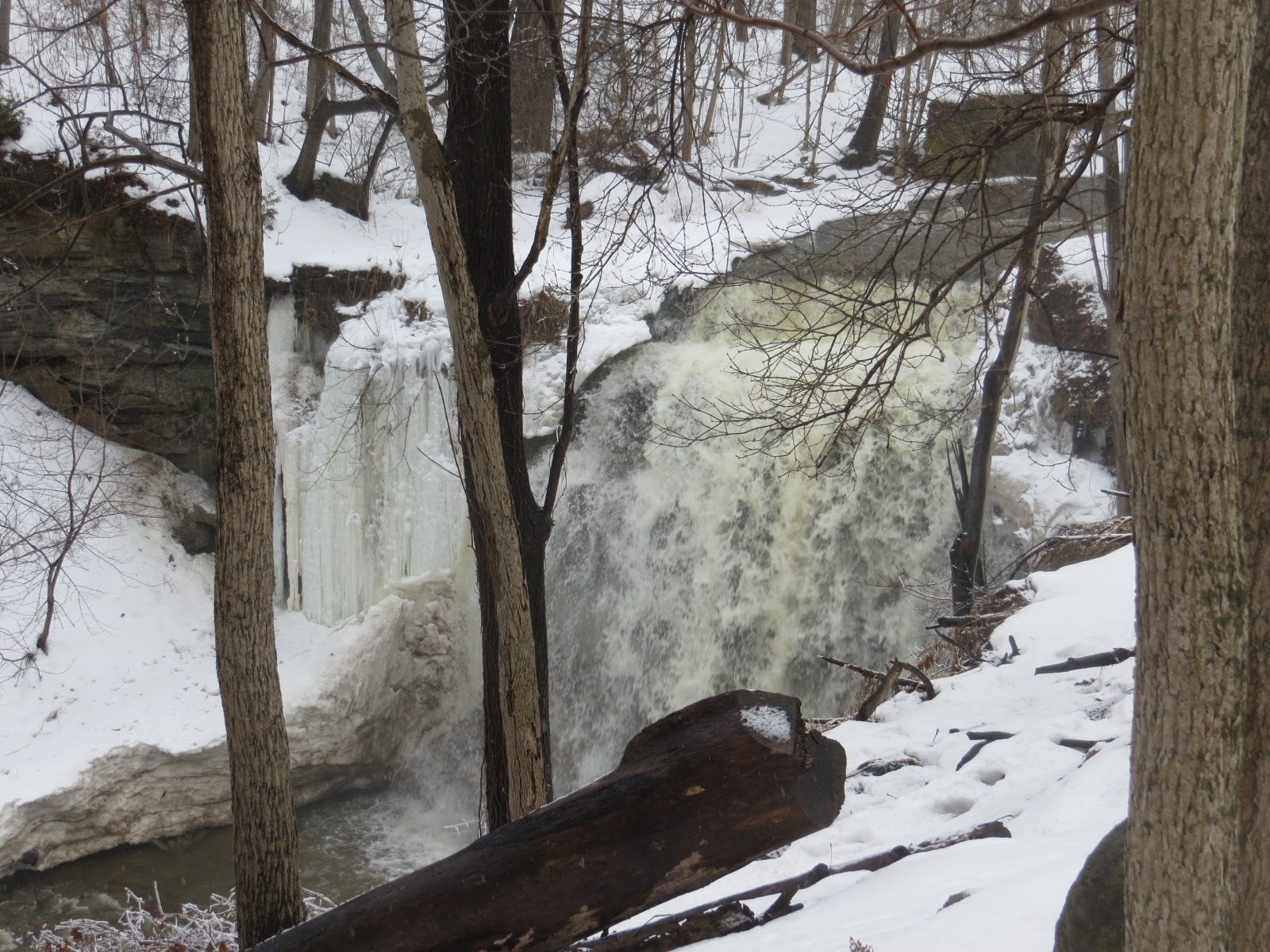
Dundas Valley to Tiffany Falls and Back
https://hikes.brucetrail.org/event/dundas-valley-to-tiffany-falls-and-back/Sorry, the registration cut-off time for this hike has been reached.Not a member? Click here to join today!Hosting Club: Iroquoia
Category: General Hike
Location (Google Maps): Dundas Valley Conservation Area – Main Parking off of Governor’s Road. Parking fee required.Hike Leader(s): Pati Greenwood, Jeff Dowsett Click here to contact Hike Leader(s)
Pace: Medium – 3 to 4 km/hr
Terrain: Moderate – Some hills and/or some poor footing
Distance: 13 kmDescription
This hike will explore the main trail and side trails through the Dundas Valley Conservation Area to Tiffany Falls and back to form a large loop.The trail may still be snow-covered so bring icers and hiking poles. Dress in layers for the weather and bring plenty to drink and a snack.
Please arrive at the meeting place by 8:15 a.m. for an 8:30 a.m. departure. A parking fee will be required at the main gate.
This hike will be dependent on weather conditions.
EASY DOES IT HIKE, Burkout Trail, from Centennial Park, Fenwick
https://hikes.brucetrail.org/event/easy-does-it-hike-burkout-trail-from-centennial-park-fenwick-2/Sorry, the registration cut-off time for this hike has been reached.Not a member? Click here to join today!Hosting Club: Niagara
Category: Leisurely
Location (Google Maps): Centennial Park, Church St., Fenwick, OnHike Leader(s): Diane Marlatt Click here to contact Hike Leader(s)
Pace: Leisurely
Terrain: Easy
Distance: 5-6 KmDescription
- 24March 24, 2026
Tuesday Long Haulers Hike
https://hikes.brucetrail.org/event/tuesday-long-haulers-hike/Sorry, the registration cut-off time for this hike has been reached.Not a member? Click here to join today!Hike open to BTC Members only.
Hosting Club: Niagara
Category: Loop
Location (Google Maps): Decew HouseHike Leader(s): Alan Laver Click here to contact Hike Leader(s)
Pace: Brisk
Terrain: ModerateDescription
This is our regular Tuesday Long Hike. Note the new location which will continue until May due to the muddy conditions in Shorthills. We will hike along the trails which may include Brock, 12 mile creek. Morningstar Mill and/or Bert Lowe side trail. Dress for the weather and bring poles snack and drink9:15 Short hike, NEW LOCATION - Rotary Park, St. Catharines
https://hikes.brucetrail.org/event/915-short-hike-pelham-road-entrance-short-hills-10/Sorry, the registration cut-off time for this hike has been reached.Not a member? Click here to join today!Hike open to BTC Members only.
Hosting Club: Niagara
Category: Loop
Location (Google Maps): Rotary Park, St. CatharinesHike Leader(s): janet davey Click here to contact Hike Leader(s)
Pace: Medium
Terrain: Moderate
Distance: 6 kmsDescription
Hike the trails in and around Rotary Park. Please bring water, hiking poles and icers, as the trails can be icy at times.Mono Centre, Turnbull, Springwater, Third Outlier and Whitetail Refuge Side Trails
https://hikes.brucetrail.org/event/mono-centre-turnbull-springwater-third-outlier-and-whitetail-refuge-side-trails-2/Sorry, the registration cut-off time for this hike has been reached.Not a member? Click here to join today!Hosting Club: Dufferin Hi-Land
Category: Tuesday Hike
Location (Google Maps):Caledon Hills Section, Map 19. Meet at Mono Community Centre hiker parking area.
Hike Leader(s): Inge Eckerich, Les Babbage, Inge Eckerich, Julie Daley, Tony Evangelista Click here to contact Hike Leader(s)
Pace: Leisurely
Terrain: Slippery Sections Likely, Moderate
Distance: 6.0 Km, Short hike 3.5 kmDescription
We will hike the Main Trail to Turnbull Side Trail and Springwater Side Trail. The short hike will return to the parking lot by Main Trail. The longer hike will continue south on Main Trail to the Third Outlier Side Trail, connecting to the Whitetail Refuge Side Trail and returning to parking by way of the Laidlaw Side Trail. Bring water and snacks.Urban Walk: Valley View Park Thornhill
https://hikes.brucetrail.org/event/urban-walk-valley-view-park-thornhill-153/Sorry, the registration cut-off time for this hike has been reached.Not a member? Click here to join today!Hosting Club: Toronto
Location (Google Maps): Parking lot is off Sycamore Drive, East of Bayview , across Starbucks plaza
Bus 91 from Finch East station stops at Sycamore station.Hike Leader(s): Mohammad Aghamiri Click here to contact Hike Leader(s)
Pace: Moderate (3-4 km/hr)
Terrain: Hilly, Level 2 (Intermediate – some hills and uneven surfaces, rocks and roots underfoot), Variable
Distance (km): 6-7 kmDescription
We will explore Valleyview and Maple View parks, and walk along German Mill Creak, in return we stop in Huntington park and have snack under beautiful shed.Although this is considered an “Urban Walk”, you can expect some hills up and down and uneven surfaces with tree roots. Please bring hiking poles, Ice cleats water and snacks.
phone number for the day of hike 289 588 6482
Walk In Nature Series (WINS) - Sydenham Nature Reserve
https://hikes.brucetrail.org/event/walk-in-nature-series-wins-sydenham-nature-reserve/Sorry, the registration cut-off time for this hike has been reached.Not a member? Click here to join today!Hosting Club: Sydenham
Category: General Hike
Location (Google Maps): Click the (Google Maps) link on the left to direct you to parking.
GPS coordinates: 44.5242, -80.9138
Parking lot on Grey Rd 18 located 400 m east of Rockford. If there is too much snow in the lot, park roadside facing Rockford.Or use the Bruce Trail app that links to Google Maps to drive there by clicking on P then Roadside Parking then Get Directions.
Or look in the Bruce Trail Reference guidebook Edition 31, Map 32 near Rockford
Hike Leader(s): Stewart Brown Click here to contact Hike Leader(s)
Pace: Medium: 3 to 4 km/h
Terrain: Moderate: Some hills and/or poor footing, There might be sections with water on the trail., There might be muddy sections., There might be icy and slippery sections.
Distance: 4 kmDescription
The Walk In Nature Series (WINS) consists of 2 hour hikes in the Sydenham section of the Bruce Trail that combine nature appreciation with fitness in a safe and welcoming group environment led by an experienced hike leader. Consider these hikes to be appointments with yourself in nature that promote health and fitness.Greet the fresh air of one of the first days of spring along the Keeling side trail, then turning off the rail trail we enjoy a balloon hike through the forests of the Sydenham Nature Reserve side trail.
Registrants will be sent an email the day before the hike with an update of trail conditions and what to bring and which footwear is best.
- 25March 25, 2026
Queenston Heights loop
https://hikes.brucetrail.org/event/queenston-heights-loop-2/Sorry, the registration cut-off time for this hike has been reached.Not a member? Click here to join today!Hosting Club: Niagara
Category: Loop
Location (Google Maps): Queenston HeightsHike Leader(s): Heather Howkins Click here to contact Hike Leader(s)
Pace: Medium
Terrain: Moderate
Distance: 9kDescription
We will meet at Locust Grove parking lot and hike the trail from the Cairn returning on Alfred’s Trot side trail.Please bring poles and wear appropriate footwear.
Bent Rim 1 and 2 (E2E)
https://hikes.brucetrail.org/event/bent-rim-1-and-2-e2e-3/Sorry, the registration cut-off time for this hike has been reached.Not a member? Click here to join today!Hosting Club: Iroquoia
Category: General Hike
Location (Google Maps): Meet in the parking lot at Hilton Falls Conservation Area. Reservation required.Hike Leader(s): Karen Bergmann Click here to contact Hike Leader(s)
Pace: Medium – 3 to 4 km/hr
Terrain: Moderate – Some hills and/or some poor footing
Distance: 7 kmsDescription
We will meet in the Hilton Falls Parking lot and carpool to 6th Line and hike back along the two Bent Rim trails and the Hilton Falls Side Trail back to the cars. The Bent Rim trails are actually bike trails and have some rather technical (rocky) sections to them, so be prepared for some challenges. Bring icers for your boots.For those leaving their car at Hilton Falls, you will need to reserve your time at conservationhalton.ca
Hike is dependent on weather conditions.
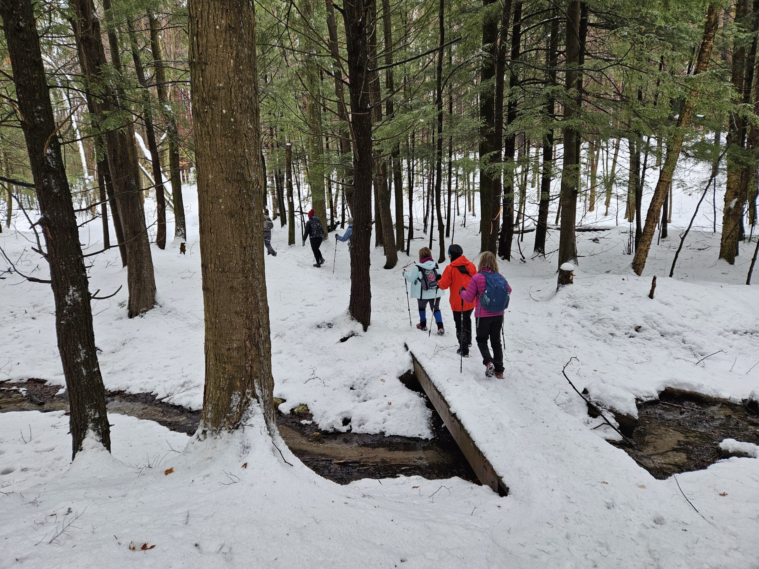
Humpday Hikers - Limehouse North and Conservation Area Trails
https://hikes.brucetrail.org/event/humpday-hikers-limehouse-north-and-conservation-area-trails/Sorry, the registration cut-off time for this hike has been reached.Not a member? Click here to join today!Hike open to BTC Members only.
Hosting Club: Caledon Hills
Category: General
Location (Google Maps): Meet at parking lot across from Limehouse Public School on 22nd Side Rd, near km 21.6 Map 12 Edition 31. From Hwy 401 take Trafalgar Rd. North. At Sideroad 22 turn left and follow 3 km to the village of Limehouse. The parking lot is on the left across from the Public School parking.Hike Leader(s): Jennie Greenfield, Mel Thornley Click here to contact Hike Leader(s)
Pace: Medium – 3 to 4 km/hour
Terrain: Moderate – some hills and/or some poor footing
Distance: 9 – 10 km depending on conditionsDescription
We will hike the main trail north and explore the Todd Bardes, Ridge, and the new Ancient Maple Side Trails, then back to Limehouse. Finishing with a loop in the Conservation area passing the remains of the a restored powder magazine, a lime kiln, and remains of an old mill.Expect the trail to be wet with the spring melt.
Plan is for a couple of stops for hydration and clothing adjustments and a shorter snack break.
Dress in layers, hiking boots required, poles recommended. Keep the icers handy as there could still be snow on the trails depending on the weather over the next few weeks.
Following the hike anyone interested can head to the St. George Pub on the corner of Main and Guelph in Georgetown for a refreshment and bite to eat.
Good Companions - Eastward and Return from Chedoke Golf Course
https://hikes.brucetrail.org/event/good-companions-eastward-and-return-from-chedoke-golf-course-4/Sorry, the registration cut-off time for this hike has been reached.Not a member? Click here to join today!Hosting Club: Iroquoia
Category: Good Companions
Location (Google Maps):Chedoke Golf Course Parking Lot, Hamilton (See map below)
Hike Leader(s): Ted Bossence Click here to contact Hike Leader(s)
Pace: Medium – 3 to 4 km/hr
Terrain: Dependent on Conditions, Moderate – Some hills and/or some poor footing, Slippery Sections Likely
Distance: 7.5 kmDescription
We will head east from the Chedoke Golf Course parking lot along the radial line and then onto the Bruce Trail (with some hills and one steep section) up the escarpment. We will need to cross busy Beckett’s Drive/Queen Street Hill. We will then follow the Bruce Trail to the top of the escarpment and then descending to the city streets and return via the tree lined streets to the radial trail and the golf course parking lot.Bring icers, water . Walk will be cancelled in case of poor weather/driving conditions (please check your email the evening before).
Please arrive for 9:45 and we will start walking at 10:00 am sharp! I will email you on the day before the hike with contact information should you need to cancel after 4:00 pm on that day.
Winter Wednesday Walkers - South of 13A
https://hikes.brucetrail.org/event/winter-wednesday-walkers-south-of-13a-2/Sorry, the registration cut-off time for this hike has been reached.Not a member? Click here to join today!Hosting Club: Beaver Valley
Location (Google Maps): Meet at the east end of Sideroad 13A and park around the circle on the shoulder, km 86.9, Map 27, Edition 31.
Hike Leader(s): Glenda Collings Click here to contact the hike leader.
Pace: Medium
Terrain: Some steep sections
Length of Hike: Approx. 4.5 kmDescription
This is an in and out hike through hardwood forest, lovely in the winter. On winter hikes we may encounter bare ground, light snow, deep snow, or ice. Please bring snowshoes and icers to our Winter Wednesday Walkers outings. Wear appropriate clothing for the weather plus water and a snack.COVID-19 Precautions Before, During and After your Hike
- Each hiker joining a Bruce Trail Club organized hike must perform a self-screening check before hiking.
Find Ontario’s self-assessment tool here: https://covid-19.ontario.ca/self-assessment/ - If you are experiencing COVID-19 symptoms, stay home.
Other Guidelines
- Arrive 15 minutes before the start of the hike.
- Wear sturdy footwear and appropriate attire for the weather and the terrain.
Hiking poles are a good idea in any season, especially if the terrain is rocky or slippery. In winter, snowshoes or icers/crampons are needed when conditions dictate.
Wearing appropriate clothing and footwear prevents injuries and shows consideration for a safe and positive group hiking experience. - Always carry I.D. and your health card.
- Bring sufficient water and snacks (or lunch if indicated). A minimum of 1L of water is recommended on all hikes, and 3L is recommended for long, challenging hikes in the heat of the summer.
- Bring sunscreen and insect repellent (for spring and summer hikes).
- Bring your own first aid kit.
- Please leave dogs at home.
- Each hiker joining a Bruce Trail Club organized hike must perform a self-screening check before hiking.
- 26March 26, 2026

Car Hike: Iroquoia End-to-End in 7: Hike 6
https://hikes.brucetrail.org/event/car-hike-iroquoia-end-to-end-in-7-hike-6/Sorry, the registration cut-off time for this hike has been reached.Not a member? Click here to join today!Hike open to BTC Members only.
Hosting Club: Toronto
Category: Car Hike
Location (Google Maps): Meet at km 81.6 where the trail crosses Guelph Line (GPS 43.388366, -79.854231), south of No. 1 Sideroad. Do not block the farm gate. We’ll shuttle to km 101.6 on Twiss Rd (GPS 43.447743, -79.953436) where we’ll begin our hike.Hike Leader(s): Jacqueline Van Dyke Click here to contact Hike Leader(s)
Pace: Brisk (4-5 km/hr), Moderate (3-4 km/hr)
Terrain: Challenging
Distance (km): 20Description
Please join for one or more of this Iroquoia series to complete the section over 7 hikes. Hikers must register for individual hikes.Expect an average pace of 4 km/hr with snack/lunch breaks. Please arrive early enough so you’re ready for the shuttle to begin promptly at 8:30.
Hikers should be prepared for the season – layered clothing, hiking boots, snowshoes (if we get fresh snowfall), poles, water, snacks/lunch, first aid kit, and icers.
Hikers should be prepared to share their cars for shuttling – to be shared evenly.
If we encounter unsafe hiking or driving conditions, I will cancel/re-schedule the hike the day before. If you are unable to join us on the day of the hike, please text me at 647-231-0946.
9:00 Long Hike, Glen Road Jordan
https://hikes.brucetrail.org/event/900-long-hike-bailey-bridge-parking-lot-jordan-4/Sorry, the registration cut-off time for this hike has been reached.Not a member? Click here to join today!Hosting Club: Niagara
Category: Loop
Location (Google Maps): 3640 Glen Road JordanHike Leader(s): Alan Laver Click here to contact Hike Leader(s)
Pace: Brisk
Terrain: Strenuous
Distance: 10 kmDescription
Hike in and around Ball’s Falls and Jordan. Dress for the weather: bring icers, poles, dress in layersKilbride to Crawford Lake and back 17kms
https://hikes.brucetrail.org/event/kilbride-to-crawford-lake-and-back-17kms/Sorry, the registration cut-off time for this hike has been reached.Not a member? Click here to join today!Hike open to BTC Members only.
Hosting Club: Iroquoia
Category: General Hike
Location (Google Maps): Kilbride ParkHike Leader(s): Lois Corey Click here to contact Hike Leader(s)
Pace: Brisk – 4 to 5 km/hr
Terrain: Moderate – Some hills and/or some poor footing
Distance: 17 kmsDescription
Kilbride to Crawford Lake and Back:This is an out and back hike, no carpooling required. We will hike north from the Kilbride Community Park along Bruce Trail to Crawford Lake, where we will follow the trail along the edge of the Nottasagwa Canyon, with a brief stop at lookout. We will then loop back along side trail to the Crawford Lake Interpretive Centre where we will stop for snacks/lunch break. We will then hike side trail around Crawford Lake, rejoing the main Bruce Trail and retrace our steps back to Kilbride. Rocky terrain, hiking poles highly ecommended, along with icers if snowy/icy conditions are still in effect at that time. Please bring water and snacks/lunch.
If you need to cancel, please use the registered hike cancellation process.
Hiking Around Jordan
https://hikes.brucetrail.org/event/hiking-around-jordan-52/Sorry, the registration cut-off time for this hike has been reached.Not a member? Click here to join today!Hosting Club: Niagara
Location (Google Maps): Sho’arishon Park (Jordan Hollow)
Hike Leader(s): Bill Russell Click here to contact Hike Leader(s)
Pace: Medium
Terrain: Moderate
Distance: 7 kmDescription
Hiking in and around Jordan including Jim Rainforth Trail, Balls Falls and Bailey Bridge alternating every 3 weeks.Urban Walk: Valley View Park Thornhill
https://hikes.brucetrail.org/event/urban-walk-valley-view-park-thornhill-154/Sorry, the registration cut-off time for this hike has been reached.Not a member? Click here to join today!Hosting Club: Toronto
Location (Google Maps): Parking lot is off Sycamore Drive, East of Bayview , across Starbucks plaza
Bus 91 from Finch East station stops at Sycamore station.Hike Leader(s): Mohammad Aghamiri Click here to contact Hike Leader(s)
Pace: Moderate (3-4 km/hr)
Terrain: Hilly, Level 2 (Intermediate – some hills and uneven surfaces, rocks and roots underfoot), Variable
Distance (km): 6-7 kmDescription
We will explore Valleyview and Maple View parks, and walk along German Mill Creak, in return we stop in Huntington park and have snack under beautiful shed.Although this is considered an “Urban Walk”, you can expect some hills up and down and uneven surfaces with tree roots. Please bring hiking poles, Ice cleats water and snacks.
phone number for the day of hike 289 588 6482
- 27March 27, 2026

Car Hike: Iroquoia End-to-End in 7: Hike 7
https://hikes.brucetrail.org/event/car-hike-iroquoia-end-to-end-in-7-hike-7/Sorry, the registration cut-off time for this hike has been reached.Not a member? Click here to join today!Hike open to BTC Members only.
Hosting Club: Toronto
Category: Car Hike
Location (Google Maps): Meet at km 101.6 on Twiss Rd. (GPS 43.447743, -79.953436) north of Derry Rd. We’ll shuttle to the Hilton Falls CA parking lot (GPS 43.505705, -79.961589) and begin our hike from there. If you have a Halton CA pass, please let me know. Non pass holders will share in the cost of the parking.Hike Leader(s): Jacqueline Van Dyke Click here to contact Hike Leader(s)
Pace: Brisk (4-5 km/hr), Moderate (3-4 km/hr)
Terrain: Variable
Distance (km): 20Description
Please join for the last of this Iroquoia series. For those who have completed the main trail of this section, today is badge day. Please bring $10 if you’d like to purchase a badge.Expect an average pace of 4 km/hr with snack/lunch breaks. Please arrive 15 minutes early so you’re ready for the shuttle to begin promptly at 8:30.
Hikers should be prepared for the season – layered clothing, hiking boots, snowshoes (if we get fresh snowfall), poles, water, snacks/lunch, first aid kit, and icers.
Hikers should be prepared to share their cars for shuttling – to be shared evenly.
If we encounter unsafe hiking or driving conditions, I will cancel/re-schedule the hike the day before. If you are unable to join us on the day of the hike, please text me at 647-231-0946.
City View Park to Grindstone Creek and Back
https://hikes.brucetrail.org/event/city-view-park-to-grindstone-creek-and-back/Sorry, the registration cut-off time for this hike has been reached.Not a member? Click here to join today!Hosting Club: Iroquoia
Category: General Hike
Location (Google Maps): City View Park – Parking Lot off of Kerns RoadHike Leader(s): Pati Greenwood, Jeff Dowsett Click here to contact Hike Leader(s)
Pace: Medium – 3 to 4 km/hr
Terrain: Dependent on Conditions, Moderate – Some hills and/or some poor footing, Slippery and Steep Sections
Distance: 14 KMDescription
This hike will explore the main trail and side trails from City View Park to Grindstone Creek and back, There will be a number of steep sections that might be slippery along the way. Bring icers and hiking poles. Dress in layers for the weather conditions. Bring plenty to drink and a snack.Please arrive at the meeting place by 8:15 am for an 8:30 am departure.
The hike will be dependent on weather conditions.
Brisk Fridays - Blantyre to near Walter's Falls
https://hikes.brucetrail.org/event/brisk-fridays-blantyre-to-near-walters-falls-2/Sorry, the registration cut-off time for this hike has been reached.Not a member? Click here to join today!Hosting Club: Sydenham
Category: General Hike
Location (Google Maps): Click the (Google Maps) link on the left to direct you to parking.GPS coordinates: 44.4964, -80.7214
Roadside parking on the Holland-Sydenham Townline Rd. immediately west of Grey Rd 29
Or use the Bruce Trail app that links to Google Maps to drive there by clicking on P then Roadside Parking then Get Directions.
Or look in the Bruce Trail Reference guidebook Edition 31, Map 29 near km 10.0
Hike Leader(s): Stewart Brown Click here to contact Hike Leader(s)
Pace: Brisk: 4 to 5 km/h
Terrain: Strenuous: Hilly with steep climbs and some poor footing., There are crevices or holes which may be hidden by layers of snow. Hike with extreme caution., There might be icy and slippery sections., There might be muddy sections., There might be sections with water on the trail.
Distance: 10 kmDescription
This strenuous hike is mostly in the Rocklyn Creek Management Area, through its pristine snow-laden forests, atop its rocky crags and alongside its spring-fed creek. Our actual pace will be about 3.0 km/h which requires an effort that matches what would be required on a summer hike of a brisk pace of 4-5 km/h. After meeting, we will shuttle to Blantyre and hike back to our vehicles. Be prepared for a good workout as we traverse steep climps and slippery slopes with both exposed and hidden rocks. Registrants will receive an email the day before the hike with an update of trail conditions and what to bring and which footwear to choose. In this area, spring arrives a bit later which means snow on the trail is a strong possibility.
Niagara-on-the-Lake Tour
https://hikes.brucetrail.org/event/niagara-on-the-lake-tour-24/Sorry, the registration cut-off time for this hike has been reached.Not a member? Click here to join today!Hosting Club: Niagara
Category: Urban
Location (Google Maps): Park on King St near Centre St, Niagara-on-the-LakeHike Leader(s): Margaret Northfield Click here to contact Hike Leader(s)
Pace: Medium
Terrain: Easy
Distance: 5-6kmDescription
Each Friday we will explore different neighbourhoods, trails and parkland throughout Historic Niagara-on-the-Lake.Moderate pace with some weeks entirely on sidewalks and roads while others may include a mix of trails and paved pathways. Great way to build up endurance for longer more strenuous hikes.
Prepare for cooler windy conditions on open parkland and along Lake Ontario and Niagara River trails.
Plan to stay for conversation and a warm cup of coffee or tea at Sweets & Swirls, Community Centre, Niagara Stone Road, NOTL
- 28March 28, 2026
Toronto Section - Winter Magic
https://hikes.brucetrail.org/event/toronto-section-winter-magic/Sorry, the registration cut-off time for this hike has been reached.Not a member? Click here to join today!Hosting Club: Iroquoia, Toronto
Category: Good Companions
Location (Google Maps): Meeting Point at parking lot on St. Helena Rd. near its juntion with Regional Rd 25. Note: The far end of this road is posted as “No parking” ( please park on the right side across houses- close to the trail.Hike Leader(s): Corina Seceleanu Click here to contact Hike Leader(s)
Pace: Medium – 3 to 4 km/hr
Terrain: Dependent on Conditions, Moderate – Some hills and/or some poor footing, Slippery Sections Likely
Distance: 22.5kmDescription
Hello Fellow Hikers,Please join me for an unforgettable adventure as we explore a breathtaking stretch of the Toronto section of the Bruce Trail. This exhilarating and rewarding 22.5 km route forms a mostly open loop that highlights the beauty and character of a section that’s especially close to my heart.
Our journey begins (after the car shuttle point ) at Spyside Bruce Trail Pear Tree Park On. 15 Side Road 200 M South of Halton Rd 25 . From here, we’ll head out counterclockwise along a side trail before joining the main trail. Along the way, we’ll pass several notable landmarks within Hilton Falls Conservation Area, including the enchanting Hilton Falls, its serene reservoir, and a number of impressive glacial potholes.
Once we merge onto the main trail, we’ll enjoy approximately 9 km of steady ascent all the way to Helena Road, where our adventure concludes. This stretch of the Escarpment is both rewarding and challenging, offering sweeping vistas toward Milton, Mississauga, and Toronto—views that make every step worthwhile.Expectations: This is a medium with a difficult section (last portion ) hike but we gone tackle in various pace to allow ourself to enjoy and immerse in an endless beauty of this exploration. Expect to be on-trail 6- 7 hours. Breaks will be taken for lunch, snacks, photography, and to appreciate the scenery.
Meeting Time: Please arrive no later than 15 minutes prior to the scheduled time.
Participant Requirements:
- Intermediate/experienced hikers, comfortable with longer distances and some elevation gains.
- Must be physically fit for group hiking, and mentally for an endurance of 22.5 km
- Proper hiking boots, layered clothing, and wet/cold weather gear. Hiking poles and icers recommendated/ must.
- Essentials: Lunch, snacks, water (1.5 2L min) , and your enthusiasm
- Breaks for photography and appreciation wildlife (if lucky, as I was seeing a bald eagle) and bio breaks as well.
We’ll run a short car shuttle from Helena Rd. meeting point to the Bruce Trail Pear Tree Park parking area on 15 Sideroad, about 200 metres southwest of Halton Road 25 where the hike will start . This quick shuttle will make logistics easy and ensure we finish right on time.
Boyd Conservation Park ,Vaughan
https://hikes.brucetrail.org/event/car-hike-german-mills/Sorry, the registration cut-off time for this hike has been reached.Not a member? Click here to join today!Hosting Club: Toronto
Location (Google Maps): Free Parking lot before entrance of park on Islington Ave.
Hike Leader(s): Mohammad Aghamiri Click here to contact Hike Leader(s)
Pace: Moderate (3-4 km/hr)
Terrain: Hilly, Level 2 (Intermediate – some hills and uneven surfaces, rocks and roots underfoot), Variable
Distance (km): 12-14 kmDescription
Let’s hike Boyd conservation park trails through beautiful valleys.Please bring lots of water and snacks ,hiking poles are recommended
phone number for the day of hike 289 588 6482
8:30 Fort 2 Fort Prep
https://hikes.brucetrail.org/event/830-fort-2-fort-prep/Sorry, the registration cut-off time for this hike has been reached.Not a member? Click here to join today!Hosting Club: Niagara
Category: In and Out
Location (Google Maps): Locust Grove Picnic Area, 14888 Niagara River Parkway, QueenstonHike Leader(s): Karen Couch Click here to contact Hike Leader(s)
Pace: Brisk
Terrain: Easy
Distance: 14Description
The Niagara River Recreational trail, which we will follow, is a paved path, with grass on both sides. Walkers/Hikers will go at their own pace and turn around after 90 minutes. At a brisk pace of 4-5 km/hour hikers should reach the Whirlpool Aero Car parking lot (and then retrace their steps).Trail runners or running shoes are recommended. Consider using hiking poles to promote blood flow through your hands and/or to help you establish a consistent rhythm (which can increase your speed). Carry water and snacks as needed.
Note: There may not be any washrooms open along this route. They are available at Queenston Heights Park, across the road from where we will park.
Plan to be ready to leave promptly at 8:30.

Port Wellar Spit
https://hikes.brucetrail.org/event/port-wellar-spit/Sorry, the registration cut-off time for this hike has been reached.Not a member? Click here to join today!Hosting Club: Niagara
Category: Loop
Location (Google Maps): Meet at Happy Rolf’s Animal Farm, 650 Read Rd, St CatharinesHike Leader(s): Margaret Northfield Click here to contact Hike Leader(s)
Pace: Medium
Terrain: Easy
Distance: 8kmDescription
Park at Happy Rolf’s Animal Farm. We will be walking along Lake Ontario to the Port Wellar spit. It will be an out and back hike with a few diverges.Car Hike: Uxbridge-Brock Track
https://hikes.brucetrail.org/event/car-hike-uxbridge-brock-track/Sorry, the registration cut-off time for this hike has been reached.Not a member? Click here to join today!Hosting Club: Toronto
Category: Car Hike
Location (Google Maps): Meet at the Brock Tract parking lot on the east side of Durham 1/Brock Rd., approximately 5 km south of Coppin’s Corners, Uxbridge or 1 km north of Uxbridge Pickering Town Line. 1401 Brock Rd. (Free parking).Hike Leader(s): Amir Alemohammad Click here to contact Hike Leader(s)
Pace: Moderate (3-4 km/hr)
Terrain: Flat, Hilly, Level 2 (Intermediate – some hills and uneven surfaces, rocks and roots underfoot), Variable
Distance (km): 10-12 kmDescription
Join us for a wonderful hike in Uxbridge starting from Brock Track parking lot. We will hike the Brock Track and Wilder Forest among the amazing trails of Uxbridge.Boots and icers mandatory, poles recommended, bring 2 litres of water and dress according to weather conditions. Be prepared for icy/snowy conditions.
Please arrive at 8:45 for a 9:00 start.
Beware, Iphone Maps may take you to the wrong location. Check the location with Google Maps the previous night.
This is a joint hike with Oak Ridges Trail Association (ORTA).
Go Train Hike: Smokey Hollow and Waterdown by GO Train
https://hikes.brucetrail.org/event/go-train-hike-smokey-hollow-and-waterdown-by-go-train/Sorry, the registration cut-off time for this hike has been reached.Not a member? Click here to join today!Hosting Club: Toronto
Category: GO Train Hike
Location (Google Maps): Aldershot GO Station to WaterdownHike Leader(s): Michael Humpage, Felix Wan Click here to contact Hike Leader(s)
Pace: Moderate (3-4 km/hr)
Terrain: Hilly, Level 2 (Intermediate – some hills and uneven surfaces, rocks and roots underfoot), Rocky, Variable
Distance (km): 14 kmDescription
Please meet me under the clock in the Great Hall in Union Station by 8:45 AM. We will take the 9:04 AM (to be confirmed) Lakeshore West train to Aldershot GO arriving at 10:02 AM. We will hike from Aldershot GO station into Waterdown and then return to Aldershot GO station. The hike will be a mix of country roads and trails. For the most part this is an in and an out hike. Part of the hike will be on the Bruce Trail through Grindstone Creek and passing by Smokey Hollow waterfall. There is one steep descent, followed by one very steep climb. Continuing past Smokey Hollow we will hike into Waterdown where hikers can go to the Copper Kettle cafe and purchase food or drink if they wish.Please bring water (2 litres recommended), a lunch, bug spray and sunscreen. At this time of year conditions could be quite muddy so come prepared. Icers, poles and gaiters may be useful.
Registration is limited to 20 spots.
Saturday Shorts: Glen Haffy
https://hikes.brucetrail.org/event/saturday-shorts-glen-haffy-6/Sorry, the registration cut-off time for this hike has been reached.Not a member? Click here to join today!Hosting Club: Caledon Hills
Category: General
Location (Google Maps): Meet at 10 am at the roadside parking on Coolihans Sideroad, km 35.0 Map 17, near where the Trail crosses the road. This is just west of the intersection of Glen Haffy Road and Coolihans Sideroad. It is best to aim for arriving around 9:45, so we can start hiking as close to 10 am as possible. Thanks!Hike Leader(s): Elizabeth Ganong Click here to contact Hike Leader(s)
Pace: Leisurely – 3 km/hour or less
Terrain: Moderate – some hills and/or some poor footing
Distance: Approximately 4 to 5 kmDescription
Looking to get out on a Saturday but not give up your whole day? Saturday Shorts, a hiking series, will get you out in a small group on a short hike. This Saturday’s hike is at Glen Haffy. If the trails are snow-covered, we’ll hike the main Bruce Trail and Glen Haffy’s red loop, which makes a route under 4 km. If trail conditions permit, we may use a slightly longer route, about 5 km. Be prepared for winter conditions by bringing warm gear, poles, and icers. You are encouraged to bring water and a snack. No dogs please. Registrants can expect a reminder/update message one or two days before the hike.