Hike Schedule
Join us for a hike! Registration required:
All hikes available to BTC members. Some hikes are open to non-members.
TIP: The calendar view displays up to 7 hikes on a day, but often there are more. Click “More events” to see them all.
Categories
- 15March 15, 2026
School Bus Hike: Warkworth Maple Syrup Festival Hike
https://hikes.brucetrail.org/event/school-bus-hike-warkworth-maple-syrup-festival-hike/Sorry, the registration cut-off time for this hike has been reached.Not a member? Click here to join today!Trip Information
Departure Time: 08:00
Return to City Time: 19:00
Departure Point: York Mills Bus PickupOptional Items
Entry To Sugar Bush ($5.00)
Visit Town Of Warkworth Only ($.01)Hosting Club: Toronto
Category: Bus Hike
Location (Google Maps): Warkworth, OntarioHike Leader(s): Lisa Ruth Lifshitz, Nijole Mockevicius Click here to contact Hike Leader(s)
Pace: Moderate (3-4 km/hr)
Terrain: Flat, Variable
Distance (km): 8 kmDescription
Please join us on Sunday, March 15th for our Maple Syrup Hike! We will begin by travelling to the village of Warkworth to attend the 38th Annual Warkworth Maple Syrup Festival. At Warkworth we will board a free shuttle bus to Sandy Flat Sugar Bush about 5 km away, where you can enjoy a pancake breakfast, horse and wagon rides, maple taffy in the snow, and take in live musical entertainment. We will then head back downtown and allow some time to visit shops, boutiques and cafés, all bursting with maple themed items. Early in the afternoon we will start hiking along the beautiful Millenium Trail and will likely continue along the Oak Ridges trail (final hiking route to be determined) for a fun relaxing hike. Return back to the City around 6.30 pm. Please note that you must bring cash to attend the Festival and participate in Festival Events. Entry to the Sugar Bush is $5 per person, the pancake breakfast is $15 (children 12 years and under $10), and sleigh rides are $3 per person. See https://warkworthmaplesyrupfestival.ca/ for more details about the Festival.Car Hike: Boyne Valley Provincial Park!
https://hikes.brucetrail.org/event/car-hike-boyne-valley-provincial-park-6/Sorry, the registration cut-off time for this hike has been reached.Not a member? Click here to join today!Hosting Club: Caledon Hills
Category: General
Location (Google Maps): Boyne Valley Provincial Park, Map 20 of the BTC Trail Guide. County Rd. 19 (Prince of Wales Rd.) Parking Area – west of km 15.2 – approximately 80 metres south of the Prince of Wales Side Trail.Hike Leader(s): Dylan “Lana” Hubbard Click here to contact Hike Leader(s)
Pace: Medium – 3 to 4 km/hour
Terrain: Strenuous – hilly with steep climbs and some poor footing
Distance: 17 kmDescription
Join us for an invigorating hike starting from the parking lot on Prince of Wales Rd. We’ll explore the Prince of Wales Side Trail, Primrose Loop Side Trail, main trail, and Boyne Valley Side Trail, looping back via the main trail and Prince of Wales Side Trail. Along the way, we’ll hike up the short side trail to Murphy’s Pinnacle, where you’ll be rewarded with a stunning view of the surrounding landscape – great for Instagram!Bring lunch, plenty of water, and hiking poles if you use them, as the trail is hilly. Dress for the weather. Icers are required.
PACE IS MEDIUM
This hike is a 2SLGBTQIA+ friendly space. Everyone is welcome to join us for this adventure and enjoy the beauty of the trails together.
Car Hike: Jefferson Forest (Richmond Hill)
https://hikes.brucetrail.org/event/car-hike-jefferson-forest-richmond-hill-9/Sorry, the registration cut-off time for this hike has been reached.Not a member? Click here to join today!Hosting Club: Toronto
Category: Car Hike
Location (Google Maps):1245 Bethesda Side Rd, Richmond Hill, ON L4E 1A2 ( Bethesda Trail Head Parking lot)
Hike Leader(s): Amir Alemohammad Click here to contact Hike Leader(s)
Pace: Moderate (3-4 km/hr)
Terrain: Flat, Hilly, Level 2 (Intermediate – some hills and uneven surfaces, rocks and roots underfoot)
Distance (km): 10-11 kmDescription
Let’s roll the hills of the Jefferson Forest this winter! Every weekend, we’ll explore the winter wonderland at this beautiful park. Located in the heart of Richmond Hill, it boasts numerous hiking trails. This 3-hour hike can range from 10 to 12 kilometres, depending on the weather conditions. Remember to bring water, snacks, hiking boots, icers, poles, and your camera. Not recommended for beginners. Park in the free Bethesda parking lot and avoid parking along the road. Dress appropriately for the weather. Difficulty Level: 2 (Moderate).Please arrive @8:45AM for start of 9:00AM.
This is a joint hike with the Oak Ridges Trail Association (ORTA).
Cancelled March 15: Spring & Migration Monitor Hike
https://hikes.brucetrail.org/event/spring-migration-monitor-hike-7/Sorry, the registration cut-off time for this hike has been reached.Not a member? Click here to join today!Hosting Club: Peninsula
Category: Spring Birds and Blooms
Location (Google Maps): Otter Lk loop hike: km 106.0 in the 31st Ed Ref manual – by the Cape Chin Mail Boxes, don’t go down the hill. Special Guest, Lindsay de Malmanche, third generation owner of Miller Lake Family Camp, will share her perspective on local nature, through the lens of someone who has hiked the wilds of New Zealand, and travelled to the Galapagos Islands and the Amazon rainforest.Hike Leader(s): Tamara Wilson Click here to contact Hike Leader(s)
Pace: Leisurely (2.0 – 3.0 km/h): A relaxed pace with frequent breaks and a focus on enjoyment.
Terrain: Moderate: Rolling hills, mild slopes and rocky paths.
Distance: 6kmDescription
Leaving the Cape Chin N mailbox parking area, we will progress south on the Main Trail to km 104.3 and head right on Cape Chin Meadows ST, crossing Cape Chin Rd N to the Otter Lake ST. We will hike to the birding platform, spending a few minutes to take in any new migration arrivals and harbingers of spring. After a break at the birding platform we will continue along Otter Lake ST to MT and back to the parked cars. Depending on what we see and early spring Trail conditions, this hike could take up to 2 hours. Note: though a short distance, the ground will be rocky and uneven in places. Along the shores of Otter Lake, there could be some mud. Sandhill Cranes can often be heard at Otter Lake by March 1. Will we see them? Special Guest, Lindsay de Malmanche, third generation owner of Miller Lake Family Camp, will share her perspective on local nature, through the lens of someone who has hiked the wilds of New Zealand, and travelled to the Galapagos Islands and the Amazon rainforest.Walk In Nature Series (WINS) - Pottawatomi Conservation Area and Jones Falls
https://hikes.brucetrail.org/event/walk-in-nature-series-wins-pottawatomi-conservation-area-and-jones-falls/Sorry, the registration cut-off time for this hike has been reached.Not a member? Click here to join today!Hosting Club: Sydenham
Category: Snowshoe Hike
Location (Google Maps): Click the (Google Maps) link on the left to direct you to parking.GPS coordinates: 44.5608, -80.9907
Park in the Owen Sound Transportion lot located on Hwy 6 just 300 m north of the Springmout traffic lights
Or use the Bruce Trail app that links to Google Maps to drive there by clicking on P then Roadside Parking then Get Directions.
Or look in the Bruce Trail Reference guidebook Edition 31, Map 32 near km 101.8
Hike Leader(s): Stewart Brown Click here to contact Hike Leader(s)
Pace: Medium: 3 to 4 km/h
Terrain: Moderate: Some hills and/or poor footing, Strenuous: Hilly with steep climbs and some poor footing., There might be muddy sections., There are crevices or holes which may be hidden by layers of snow. Hike with extreme caution., There might be icy and slippery sections.
Distance: 4.8 kmDescription
The Walk In Nature Series (WINS) consists of 2 hour hikes in the Sydenham section of the Bruce Trail that combine nature appreciation with fitness in a safe and welcoming group environment led by an experienced hike leader. Consider these hikes to be appointments with yourself in nature that promote health and fitness.On this WINS early spring hike, discover the unique features of nature in the Pottawatomi Conservation Area along the Merle Gunby side trail, the main trail and the Memorial Forest Side Trail that lead us to a wonderful view under Jones Falls.
Registrants will be sent an email the day before the hike with an update of trail conditions and what to bring whether it be snowshoes, icers, boots or all of the above.
- 16March 16, 2026
EASY DOES IT HIKE,Steve Bauer Trail to Chippawa Park and back
https://hikes.brucetrail.org/event/easy-does-it-hikesteve-bauer-trail-to-chippawa-park-and-back-2/Sorry, the registration cut-off time for this hike has been reached.Not a member? Click here to join today!Hosting Club: Niagara
Category: Leisurely
Location (Google Maps): Park at Northtown Plaza (near Dollarama) in Welland, OnHike Leader(s): Diane Marlatt Click here to contact Hike Leader(s)
Pace: Leisurely
Terrain: Easy
Distance: 4.5KmDescription
Merritt Island
https://hikes.brucetrail.org/event/merritt-island/Sorry, the registration cut-off time for this hike has been reached.Not a member? Click here to join today!Hosting Club: Niagara
Category: Loop
Location (Google Maps): Merritt Island WellandHike Leader(s): Heather Howkins Click here to contact Hike Leader(s)
Pace: Medium
Terrain: Easy
Distance: 9.9kDescription
We will hike along the canal and return via Main st crossing. This is a flat, paved trail.Please wear appropriate food wear and bring water.
After the hike we will go to Bridgewater brewery for lunch/drink for those that choose to do so.
- 17March 17, 2026

St. Patrick's Day Hike - Please wear green if you can. Meet time is 8:45am - Ancaster Little League parking lot at 286 Jerseyville Rd Ancaster
https://hikes.brucetrail.org/event/st-patricks-day-hike-please-wear-green-if-you-can-meet-time-is-845am-chedoke-golf-club-parking-lot/Sorry, the registration cut-off time for this hike has been reached.Not a member? Click here to join today!Hosting Club: Iroquoia
Category: Special Event
Location (Google Maps): Ancaster Little League Park 286 Jerseyville Road WestHike Leader(s): Ruth Moffatt Click here to contact Hike Leader(s)
Pace: Medium – 3 to 4 km/hr
Terrain: Dependent on Conditions, Moderate – Some hills and/or some poor footing, Slippery Sections Likely
Distance: Approx 10km through Dundas Valley ConservationDescription
♣ St. Patrick’s Day honours Irish heritage, symbolizing luck, growth and national pride. Wearing something green is traditional so please do, if you like.Please wear your icers as the path could be icy; dress in layers for warmth. Bring enough snacks and water for your needs. Our hike will take us into the DVCA where we will visit the Hermitage and the falls.
An optional lunch afterward at the Trail Cafe 286 Wilson St East, Ancaster. Please let me know through contact on this form so we can make reservation.
Photo: Livingston and Dora by Ruth
9:15 Short Hike, NEW LOCATION! - Rotary Park, St, Catharines
https://hikes.brucetrail.org/event/915-short-hike-pelham-road-entrance-short-hills-provincial-park/Sorry, the registration cut-off time for this hike has been reached.Not a member? Click here to join today!Hike open to BTC Members only.
Hosting Club: Niagara
Category: Loop
Location (Google Maps): Rotary Park, St, CatharinesHike Leader(s): janet davey Click here to contact Hike Leader(s)
Pace: Medium
Terrain: Moderate
Distance: 6 kmsDescription
Hike the trails around Rotary Park in St. Catharines. Please bring water, hiking poles and icers, as the trails can be icy at times.
Cancelled: Island Lake: Wear Your Green Hike
https://hikes.brucetrail.org/event/island-lake-wear-your-green-hike/Sorry, the registration cut-off time for this hike has been reached.Not a member? Click here to join today!Hosting Club: Caledon Hills
Category: General
Location (Google Maps): Meet at P5 – Island Lake Conservation Area – 673173 Hurontario Street, Mono. Please aim to arrive around 9:15 so we can start promptly at 9:30.Hike Leader(s): Elizabeth Ganong Click here to contact Hike Leader(s)
Pace: Medium – 3 to 4 km/hour
Terrain: Moderate – some hills and/or some poor footing
Distance: Approximately 9 kmDescription
Due to expected weather conditions in Orangeville, this hike has been cancelled.This hike will explore the trails at Island Lake. A section of the Vicki Barron Lakeside Trail is now under construction until September 2026, so the modified route follows the Lakeside Trail, includes other conservation trails, and returns to the parking on the Lakeside Trail. Be prepared for winter conditions. Wear layers and boots, bring your poles, and use your icers. You are welcome to wear your green – and have a little festive fun! Bring water and a snack, if desired. There will be a break with washrooms available. No dogs please. Reservations will be made for an optional lunch stop after the hike to continue the festivities. Hike registrants will receive an email with the details.
Urban Walk: Valley View Park Thornhill
https://hikes.brucetrail.org/event/urban-walk-valley-view-park-thornhill-151/Sorry, the registration cut-off time for this hike has been reached.Not a member? Click here to join today!Hosting Club: Toronto
Location (Google Maps): Parking lot is off Sycamore Drive, East of Bayview , across Starbucks plaza
Bus 91 from Finch East station stops at Sycamore station.Hike Leader(s): Mohammad Aghamiri Click here to contact Hike Leader(s)
Pace: Moderate (3-4 km/hr)
Terrain: Hilly, Level 2 (Intermediate – some hills and uneven surfaces, rocks and roots underfoot), Variable
Distance (km): 6-7 kmDescription
We will explore Valleyview and Maple View parks, and walk along German Mill Creak, in return we stop in Huntington park and have snack under beautiful shed.Although this is considered an “Urban Walk”, you can expect some hills up and down and uneven surfaces with tree roots. Please bring hiking poles, Ice cleats water and snacks.
phone number for the day of hike 289 588 6482
Silver Creek- Great Esker Side Trail
https://hikes.brucetrail.org/event/silver-creek-great-esker-side-trail-5/Sorry, the registration cut-off time for this hike has been reached.Not a member? Click here to join today!Hosting Club: Dufferin Hi-Land
Category: Tuesday Hike
Location (Google Maps):Toronto Section, Map 13, Meet at intersection of 8th Line and 27th Sideroad, just north of Km 32.2 at 9.30 am
Hike Leader(s): Inge Eckerich, Les Babbage, Julie Daley, Tony Evangelista Click here to contact Hike Leader(s)
Pace: Leisurely
Terrain: Dependent on Conditions, Moderate
Distance: 6.0 kmDescription
We will hike a loop on the Main trail and Great Esker side trail. Short hike can return at any time. Icers and/or snowshoes may be required. - 18March 18, 2026

Car Hike: Iroquoia End-to-End in 7: Hike 3
https://hikes.brucetrail.org/event/car-hike-iroquoia-end-to-end-in-7-hike-3/Sorry, the registration cut-off time for this hike has been reached.Not a member? Click here to join today!Hike open to BTC Members only.
Hosting Club: Toronto
Category: Car Hike
Location (Google Maps): Meet at roadside parking at the Davidson Blvd ST, km 53.9, (GPS 43.265251, -79.990490) and we’ll shuttle to the Hillcrest Ave. ST, km 37.1, (GPS 43.246437, -79.892130) to begin our hike.Hike Leader(s): Jacqueline Van Dyke Click here to contact Hike Leader(s)
Pace: Brisk (4-5 km/hr), Moderate (3-4 km/hr)
Terrain: Variable
Distance (km): 17Description
Please join for one or more of this Iroquoia series to complete the section over 7 hikes. Hikers must register for individual hikes.Expect an average pace of 4 km/hr with snack/lunch breaks. Please arrive early enough so you’re ready for the shuttle to begin promptly at 8:30.
Hikers should be prepared for the season – layered clothing, hiking boots, snowshoes (if we get fresh snowfall), poles, water, snacks/lunch, first aid kit, and icers.
Hikers should be prepared to share their cars for shuttling – to be shared evenly.
If we encounter unsafe hiking or driving conditions, I will cancel/re-schedule the hike the day before. If you are unable to join us on the day of the hike, please text me at 647-231-0946.
8:30 Merritt Trail Hike Series #3
https://hikes.brucetrail.org/event/830-merritt-trail-hike-series-3-3/Sorry, the registration cut-off time for this hike has been reached.Not a member? Click here to join today!Hosting Club: Niagara
Category: Car Pool
Location (Google Maps): Meet at the Parking Lot at Port Dalhousie Parking Lot and Car pool to Book Depot , 67 Front St North Thorold, 43.128058, -79.202189Hike Leader(s): Sam Rutherford Click here to contact Hike Leader(s)
Pace: Brisk
Terrain: Easy
Distance: 16 kmsDescription
Hike from Thorold on mainly paved trails to Port Dalhousie. Bring snacks and a drink .Earn the Merritt Trail badge for all 3 hikes. Badge Presentation after the hike $10 per badge
Christie Lake
https://hikes.brucetrail.org/event/christie-lake-4/Sorry, the registration cut-off time for this hike has been reached.Not a member? Click here to join today!Hosting Club: Iroquoia
Category: Good Companions
Location (Google Maps):Christie Lake Conservation Area largest parking lot.
Hike Leader(s): Craig Sim Click here to contact Hike Leader(s)
Pace: Medium – 3 to 4 km/hr
Terrain: Moderate – Some hills and/or some poor footing
Distance: 10k (approximate)Description
Drive straight in from entrance, main parking lot to your right turn from stop sign at T junction. Either Hamilton Conservation Area membership or parking fees apply. Loop of lake, as well as across the road upstream, exact route may vary. Wear boots and bring icers. One side of loop flat, other has some moderate hills. Prepare for variable conditions and footing in winter conditions. Dress in layers appropriate to weather. Bring water and snack. Hike leaves at 10am.Winter Wednesday Walkers - North of Grey Road 40
https://hikes.brucetrail.org/event/winter-wednesday-walkers-north-of-grey-road-40/Sorry, the registration cut-off time for this hike has been reached.Not a member? Click here to join today!Hosting Club: Beaver Valley
Location (Google Maps): Meet in the BTC parking lot on the south side of Grey Road 40, where the trail crosses, km 108.4, Map 28, Edition 31.
Hike Leader(s): Glenda Collings Click here to contact the hike leader.
Pace: Medium
Terrain: Moderate
Length of Hike: 7.4 kmDescription
Mike Arkless will lead this hike. Join us for an in and out hike north of Grey Road 40 through lovely winter woods, including the Daphne and Gordon Nicholls Nature Reserve.Urban Walk: Lumiere: The Art Of Light At Trillium Park
https://hikes.brucetrail.org/event/urban-walk-lumiere-the-art-of-light-at-trillium-park-3/Sorry, the registration cut-off time for this hike has been reached.Not a member? Click here to join today!Hosting Club: Toronto
Category: Urban Walk
Location (Google Maps):Meet by the gates at the south end of Trinity Bellwoods Park on Queen Street, north of end of Strachan Avenue, about 8 blocks west of Bathurst Street.
Hike Leader(s): Tom Swales Click here to contact Hike Leader(s)
Pace: Leisurely (2-3 km/hr)
Terrain: Flat, Level 1 (Easy – mostly on flat, well maintained trails with hard-packed surface)
Distance (km): 4 kmDescription
Join me for leisurely evening walk south to Fort York and Trillium Park (east end of former Ontario Place site) to experience the enchantment of Lumière: The Art of Light, a free outdoor light exhibition that will transform Trillium Park into a mesmerizing display of light-based art with 14 unique installations. Cozy up at the Trillium Park fire pit which will be open nightly during March Break (weather permitting) Admission is free. Dress warmly according to the weather. After the art exhibiton we will take the 511 Streetcar to Bathurst Station. - 19March 19, 2026

Car Hike: Iroquoia End-to-End in 7: Hike 4
https://hikes.brucetrail.org/event/car-hike-iroquoia-end-to-end-in-7-hike-4/Sorry, the registration cut-off time for this hike has been reached.Not a member? Click here to join today!Hike open to BTC Members only.
Hosting Club: Toronto
Category: Car Hike
Location (Google Maps): Meet at the entrance to the Davidson Blvd. ST near km 53.9 (GPS 43.265251, -79.990490), and we’ll shuttle to km 67.8 on Snake Rd. (GPS 43.317174, -79.892363) where we’ll begin our hike.Hike Leader(s): Jacqueline Van Dyke Click here to contact Hike Leader(s)
Pace: Brisk (4-5 km/hr), Moderate (3-4 km/hr)
Terrain: Variable
Distance (km): 14Description
Please join for one or more of this Iroquoia series to complete the section over 7 hikes. Hikers must register for individual hikes.Expect an average pace of 4 km/hr with snack/lunch breaks. Please arrive early enough so that you’re ready for the shuttle to begin promptly at 8:30.
Hikers should be prepared for the season – layered clothing, hiking boots, snowshoes (if we get fresh snowfall), poles, water, snacks/lunch, first aid kit, and icers.
Hikers should be prepared to share their cars for shuttling – to be shared evenly.
If we encounter unsafe hiking or driving conditions, I will cancel/re-schedule the hike the day before. If you are unable to join us on the day of the hike, please text me at 647-231-0946.
9:00 Long Hike Change Location Glen Road Jordan
https://hikes.brucetrail.org/event/900-long-hike-bailey-bridge-parking-lot-jordan-6/Sorry, the registration cut-off time for this hike has been reached.Not a member? Click here to join today!Hosting Club: Niagara
Category: Loop
Location (Google Maps): Glen Road JordanHike Leader(s): Alan Laver Click here to contact Hike Leader(s)
Pace: Brisk
Terrain: Strenuous
Distance: 10 kmDescription
Meet in the parking lot at Glen Road, Jordan. Location changed due to floodingDress for the weather, icers and poles may be necessary.
Hiking Around Jordan
https://hikes.brucetrail.org/event/hiking-around-jordan-51/Sorry, the registration cut-off time for this hike has been reached.Not a member? Click here to join today!Hosting Club: Niagara
Location (Google Maps): Sho’arishon Park (Jordan Hollow)
Hike Leader(s): Bill Russell Click here to contact Hike Leader(s)
Pace: Medium
Terrain: Moderate
Distance: 7 kmDescription
Hiking in and around Jordan including Jim Rainforth Trail, Balls Falls and Bailey Bridge alternating every 3 weeks.

Welcoming Spring at Mountsberg Conservation Area with "Maple Town - Sweet Water"
https://hikes.brucetrail.org/event/welcoming-spring-at-mountsberg-conservation-area-with-maple-town-sweet-water/Sorry, the registration cut-off time for this hike has been reached.Not a member? Click here to join today!Hosting Club: Iroquoia, Toronto
Category: Special Event
Location (Google Maps): Conservation Halton – Mountsberg Conservation AreaHike Leader(s): Ruth Moffatt Click here to contact Hike Leader(s)
Pace: Leisurely – 3km/hr or less, Medium – 3 to 4 km/hr
Terrain: Dependent on Conditions, Easy – Mostly flat and usually good footing, Moderate – Some hills and/or some poor footing
Distance: 6.5km plus optional 5.6kmDescription
Mountsberg Conservation Area is part of Conservation Halton. Did you know that as a Bruce Trail member you can get 50% off an annual pass? https://brucetrail.org/member-discounts/Maple syrup production is the gateway to spring and we are here for it.
Please join Toronto Bruce Trail Club – Tom Swales and Iroquoia Bruce Trail Club – Ruth Moffatt as we usher in Spring with hike around Mountsberg Conservation Area. Mountsberg is part of Conservation Halton, so if you have a pass, tickets to this event are discounted. Please follow the link below. Please book your ticket for 9:30am or you might be able to purchase tickets at the gate, if available. We will assemble in the parking area, hike the Pioneer Creek Trail 6.5km, stop for pancakes (extra cost), take in all the festivities and then proceed around the optional Lakeshore Lookout Trail 5.6Km. Tickets can be obtained in advance at the link below.
https://admin.parkpassproject.com/book?inventoryGroup=1554186518&startDate=2026-03-19&inventory=1374091365&carArrivalTime=9.3&reservationType=21&screen=2&selectedDiscountGroup=ch_member&&sid=
Tickets include:
- Learn all about tree tapping, sap collection, syrup making and our amazing Sugar Maples!
- Learn about the history of syrup making
- Explore the Maple Trivia Trail and other Mountsberg trails
- Sample maple sugar and syrup
- Enjoy maple taffy on snow available for purchase on site
- Enjoy fresh pancakes and treats by the fireside (Additional fees apply)
- Sugar Rangers Challenge for kids! Earn your Sugar Rangers certificate by completing fun maple challenges!
- Shop for delicious maple treats at the Country Store in the sugar bush or the Gift Shop in the Discovery Centre
- Visit the Animal Barn, Raptor Trail and Raptor Centre
- Play on the natural playground
- NEW! Meet a Raptor: Stop by the Raptor Centre Flyway to meet one of our Raptor Centre staff and a bird
- Add on a wagon ride, Talons & Tailfeathers, or a maple sugar making workshop (Additional fees apply)
Please check the weather and dress accordingly. Be sure to pack whatever snacks and lunch you would like and plenty of water and/or warm beverage. Bring icers in case the trails are still icy.
Need a ride? A shared ride from Toronto for a few people can be arranged and a shared ride from Niagara can be arranged. Please click the Contact link on this form.
Valley View Park Thornhill 410
https://hikes.brucetrail.org/event/urban-walk-valley-view-park-thornhill-152/Sorry, the registration cut-off time for this hike has been reached.Not a member? Click here to join today!Hosting Club: Toronto
Location (Google Maps): Parking lot is off Sycamore Drive, East of Bayview , across Starbucks plaza
Bus 91 from Finch East station stops at Sycamore station.Hike Leader(s): Mohammad Aghamiri Click here to contact Hike Leader(s)
Pace: Moderate (3-4 km/hr)
Terrain: Hilly, Level 2 (Intermediate – some hills and uneven surfaces, rocks and roots underfoot), Variable
Distance (km): 6-7 kmDescription
We will explore Valleyview and Maple View parks, and walk along German Mill Creak, in return we stop in Huntington park and have snack under beautiful shed.Although this is considered an “Urban Walk”, you can expect some hills up and down and uneven surfaces with tree roots. Please bring hiking poles, Ice cleats water and snacks.
phone number for the day of hike 289 588 6482
- 20March 20, 2026
Caledon End To End Stain-Glass Badge
https://hikes.brucetrail.org/event/caledon-end-to-end-stain-glass-badge/Sorry, the registration cut-off time for this hike has been reached.Not a member? Click here to join today!This is a Multi-Day Hike
You are signing up for the following dates and times:
2026-03-20 at 08:30
2026-03-27 at 08:30
2026-04-03 at 08:30
2026-04-10 at 08:30Hosting Club: Iroquoia, Caledon Hills
Category: Stained Glass Badge End to End Fundraiser Hike
Location (Google Maps): We will be meeting at Escarpment Rd an Willoughby and shuttling back to Boston Mills RdHike Leader(s): Anita Bergsma Click here to contact Hike Leader(s)
Pace: Medium – 3 to 4 km/hr
Terrain: Moderate – Some hills and/or some poor footing, Strenuous – Hilly with steep climbs and some poor footingDescription
Pace: Medium – 3 to 4 km/hr
Terrain: Dependent on Conditions, Moderate – Some hills and/or some poor footing, Strenuous – Hilly with steep climbs and some poor footing
Distance: 72 over 4 days ~ approximately 20km + per day.Itinerary will be emailed to participants upon registration
Description
Overview
Important: Please do not register for this hike unless you can attend all four Fridays. You may only miss one day if necessary.
This series of 4 hikes will complete the Caledon section of the Bruce Trail. The organization, guidance, logistics and stained glass badge are included in your fee. Proceeds support the Caledon Bruce Trail Club, which in turn supports the Bruce Trail Conservancy’s mission to “Preserve a ribbon of wilderness, for everyone, forever.”For this E2E in 4, we will be following the main trail northbound. Please note that you are signing up for the entire series of 4 hikes as a Group Hike. The Caledon in 4 series is geared toward experienced long-distance hikers with the expectation of a 3 to 4 km/ hr. pace maintained over a 20km plus day. The section is approximately 62km, so daily distances will be based on available parking.
Physical Fitness
The hikes will be physical. Please ensure you have completed at least 1 to 2 20 km hikes and/or are a strong hiker who has been on the trails 5+ times this year. No dropout points have been established, and therefore, hikers who must drop out will be responsible for their transportation back to their vehicles. Please note that public transportation back to your car is nonexistent in this section. Please be honest about your hiking abilities. We will hike at a steady pace, but there will be plenty of time to take pictures and enjoy the flora and fauna of this beautiful but challenging section. This particular set of 3 hikes is intended to be Moderate. It is a group hike, so you must be able to keep pace with the person in front of you.
Attire and Daily Hikes.
Hikers will be expected to be wearing proper hiking boots and layered clothing with the expectation of warmer and possibly wet weather. Sufficient food and water for a full day of hiking is required, as well as hiking poles (if you use them), and wet-weather gear is strongly recommended. Bug spray is also suggested. Clothing adjustments and bio-breaks are as needed. Please let the sweep person know, and they will wait for you. A morning break, lunch and afternoon break will be scheduled.
Shuttling
All participants will be expected to take turns either driving to the start or driving the drivers back at the end of the day. Carpooling to our meeting spot with 2 people in the car is generally ok but we would like to minimize and equalize the driving/shuttling as much as possible so it is fair for all participants.
Leave No Trace
Please remember, like all hikes, this is a Leave No Trace hike. Pack out whatever you pack in. Do not toss anything onto or into any sections of the trail. We will also try to leave the trail better than we found it so we will be collecting collectable garbage we might see along the way. Daily volunteers to collect trail trash will be supplied with a bag. Dogs will not be welcome on this hike.
Daily
We meet for each hike at 8:30 am each day. A schedule for meetings and start locations will be sent to each participant in September. We will hike north each day. No Pets or Children.
Hike Cancellations/Rescheduling
The schedule is subject to change due to weather or trail closures.

Car Hike: Iroquoia End-to-End in 7: Hike 5
https://hikes.brucetrail.org/event/car-hike-iroquoia-end-to-end-in-7-hike-5/Sorry, the registration cut-off time for this hike has been reached.Not a member? Click here to join today!Hike open to BTC Members only.
Hosting Club: Toronto
Category: Car Hike
Location (Google Maps): Meet at km 81.6 on Guelph Line (GPS 43.388366, -79.854231). Do not block the farm gate. We’ll shuttle to km 67.8 on Snake Rd. (GPS 43.317174, -79.892363) to begin our hike.Hike Leader(s): Jacqueline Van Dyke Click here to contact Hike Leader(s)
Pace: Brisk (4-5 km/hr)
Terrain: Challenging
Distance (km): 16Description
Please join for one or more of this Iroquoia series to complete the section over 7 hikes. Hikers must register for individual hikes.Expect an average pace of 4 km/hr with snack/lunch breaks. Please arrive early enough so you’re ready for the shuttle to begin promptly at 8:30. The km markings in the 31st Ref. guide do not take into account the reroute on Brant St/Cedar Springs Rd and the actual hike is 16km.
Hikers should be prepared for the season – layered clothing, hiking boots, snowshoes (if we get fresh snowfall), poles, water, snacks/lunch, first aid kit, and icers.
Hikers should be prepared to share their cars for shuttling – to be shared evenly.
If we encounter unsafe hiking or driving conditions, I will cancel/re-schedule the hike the day before. If you are unable to join us on the day of the hike, please text me at 647-231-0946.
9:00 am Niagara-on-the-Lake Tour
https://hikes.brucetrail.org/event/900-am-niagara-on-the-lake-tour-58/Sorry, the registration cut-off time for this hike has been reached.Not a member? Click here to join today!Hosting Club: Niagara
Category: Urban
Location (Google Maps):Veterans Memorial Park, park just outside the park on King Street
Hike Leader(s): Robin Garrett Click here to contact Hike Leader(s)
Pace: Medium
Terrain: Easy
Distance: 6-7 kmDescription
Each Friday we will explore different neighbourhoods, trails and parkland throughout Historic Niagara-on-the-Lake.Moderate pace with some weeks entirely on sidewalks and roads while others may include a mix of trails and paved pathways. Great way to build up endurance for longer more strenuous hikes.
Prepare for cooler windy conditions on open parkland and along Lake Ontario and Niagara River trails.
Plan to stay for conversation and a warm cup of coffee or tea at Sweets & Swirls, Community Centre, Niagara Stone Road, NOTL

CANCELLED - Hilton Falls (reservation required)
https://hikes.brucetrail.org/event/hilton-falls-reservation-required-4/Sorry, the registration cut-off time for this hike has been reached.Not a member? Click here to join today!Hosting Club: Iroquoia
Category: General Hike
Location (Google Maps): Meet in the parking lot at Hilton Falls Conservation Area at 9:15 am.Hike Leader(s): Karen Bergmann Click here to contact Hike Leader(s)
Pace: Medium – 3 to 4 km/hr
Terrain: Moderate – Some hills and/or some poor footing
Distance: 8 kmsDescription
Meeting at 9:15 am in the parking lot, we will hike to the Falls and then around to Bent Rim 1 and back to the cars. Reserve your time at conservationhalton.caBring icers for your boots. Hike is dependent on weather conditions.
- 21March 21, 2026
Dufferin E2E Stained Glass Badge Fundraiser – Multi Day Hike Sat, Mar 21 & Sun, Mar 22, 2026 (Do not confuse this 2 day ETE with the 4 day ETE which is also starting today)
https://hikes.brucetrail.org/event/dufferin-e2e-stained-glass-badge-fundraiser-multi-day-hike-sat-mar-21-sun-mar-22-2026-do-not-confuse-this-2-day-ete-with-the-4-day-ete-which-is-also-starting-today/Sorry, the registration cut-off time for this hike has been reached.Not a member? Click here to join today!This is a Multi-Day Hike
You are signing up for the following dates:
2026-03-21, 2026-03-22Hosting Club: Iroquoia, Dufferin Hi-Land
Category: Stained Glass Badge End to End Fundraiser Hike
Location (Google Maps): Day 1 – Sat, Mar 21,2026 – 28.63km
Meet at: Bruce Trail parking on the 1st Line East (Emergency #716599) Snow plowed in winter. (Capacity 20)
https://maps.app.goo.gl/aV64P4QRZCDmY9hg6
Shuttle to: Mono Cliffs Community Centre, 200m south of Mono Centre (County Rd 8). Park in gravel lot. – https://maps.app.goo.gl/diTkzwJSaHVpQTPb6
We will hike northbound.
Day 2 – Sun, Mar 22,2026 – 25.64km
Meet at: Meet at: Bruce Trail parking on the 1st Line East (Emergency #716599) Snow plowed in winter. (Capacity 20)
https://maps.app.goo.gl/aV64P4QRZCDmY9hg6
Shuttle to: Roadside parking on Mulmur-Nottawasga Townline, 550 metres east of Lavender Hill Rd at the cemetery – https://maps.app.goo.gl/vijVfZpJPNSCjQrj9Please note: There is another Dufferin ETE in 4 starting today. Please do not confuse the two series.
Hike Leader(s): IgorT Click here to contact Hike Leader(s)
Pace: Brisk – 4 to 5 km/hr, Medium – 3 to 4 km/hr
Terrain: Dependent on Conditions, Moderate – Some hills and/or some poor footing, Slippery and Steep Sections, Slippery Sections Likely, Strenuous – Hilly with steep climbs and some poor footing
Distance: Day1-28.63, Day2-25.64Description
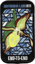
This is a monetized hike with the proceeds going towards the Dufferin Bruce Trail Club – “Preserving a ribbon of wilderness for everyone, forever.” Your badge depicting the yellow lady slipper, the hike logistics, shared shuttle driving and hike guidance are all included in your fee.Please read all details for this hike to ensure it is suitable for you. The pace and terrain are particularly important details.
You must be registered to participate in this group hike. You cannot just show up as there are often people on the waitlist.
This is a multi-day hike – Mar 21 and 22, 2026. We will hike from Mono Center to Lavender in 2 days. Please understand that there is no way to predict the weather conditions. There are many hills in this section of trail and it could still be snow covered making for some difficult hiking. Please know your limit before signing up for this hike. There are no drop outs as this section of trail is often remote; there is no provision to get you back to your car.
Please ensure your car is car shuttle-ready with at least 4 available seatbelts including the driver’s. We will take turns either being the shuttle driver or driving the drivers back to their cars after the hike is over.
Please pack whatever food you will require for a long day hike including lunch and snacks; 2l of water minimum; first aid kit; poles if you use them; and icers. Check the weather and dress accordingly. You may also wish to pack extra socks and rain gear. Remember to dress in layers. Gloves/mitts, scarf / neck gator, a toque and a puffy jacket. Consider snow shoes, depending on conditions.
We will break for a morning clothing adjustment, a 10min break around 10am, 15 min lunch and an afternoon break. Bio-breaks are as you need them – please let the sweep know who will wait for you. This is a 2 day group hike so it is important you keep pace with the person in front of you. We will help each other and wait for one another but please consider your physical ability before signing up for this hike.
The Dufferin stained-glass badge will be presented on the 2nd day. Since it is a group hike, it is intended that everyone who registers be present on both days.
If this two day hike has to be postponed due to inclement weather, all hikers will be notified.
Any questions may be directed through contact on this form.
If you cannot make it, please remove yourself from registration to allow another person who may be on the waitlist to join the hike.School Bus Hike: Caledon Trailway, "Pizza Hike"
https://hikes.brucetrail.org/event/school-bus-hike-caledon-trailway-pizza-hike/Sorry, the registration cut-off time for this hike has been reached.Not a member? Click here to join today!Trip Information
Departure Time: 08:30
Return to City Time: 17:00
Departure Point: York Mills Bus PickupOptional Items
I want pizza! ($.01)
I prefer vegeterian pizza ($.01)Hosting Club: Toronto
Category: Bus Hike
Location (Google Maps):Caledon, Caledon Trailway
Hike Leader(s): Tom Swales, Michael Humpage Click here to contact Hike Leader(s)
Pace: Moderate (3-4 km/hr)
Terrain: Flat, Level 1 (Easy – mostly on flat, well maintained trails with hard-packed surface)
Distance (km): 12 kmDescription
Celebrate the beginning of the spring hiking season with our annual “pizza hike”, a tradition established 24 years ago by Larry Haigh assisted by Ruth Dorey. The hike will be for a distance of 12 km at a moderate pace on mostly flat terrain, with a dropout at 8 km. If the bus is full then free hot pizza will be delivered to us on the trail.If the bus is NOT full then $5.00 will be collected on the bus. If you want to participate in the pizza party please select the option when registering so we know how many pizzas to order. There will be a 30 minute refreshment stop in Caledon East at the Four Corners Bakery. Register early and bring your friends and family along to fill the bus. We should be back at York Mills around 5:00 PM (depending on the Hwy 401 traffic)Car Hike: Dufferin Hi-Land End2End 4/4
https://hikes.brucetrail.org/event/car-hike-dufferin-hi-land-end2end-4-4/Sorry, the registration cut-off time for this hike has been reached.Not a member? Click here to join today!Hosting Club: Toronto, Dufferin Hi-Land
Category: Car Hike
Location (Google Maps):Meet at
Mono Community Center gravel parking lot. GPS N44.026195, W80.071516. west of Km 72.2, Map 19, BTC Map Edition 31
Hike Leader(s): Ross Estrella Click here to contact Hike Leader(s)
Pace: Moderate (3-4 km/hr)
Terrain: Challenging, Hilly, Level 2 (Intermediate – some hills and uneven surfaces, rocks and roots underfoot), Rocky
Distance (km): 9Description
This is DHBTC E2E in 4. E2E hikers are rewarded the club coveted E2E badge upon completion. However, joiners must complete the four series hikes to earn their badge. Missed segment/s must be made up prior to the completion of the last leg to receive your badge. We’ll be on a moderate pace to enjoy, feel and see the stunning landscape and acquaint ourselves with other souls on the group. Day hikes essentials to bring: lunch/snacks, sufficient preferred liquid hydration, sun screen, bug spray, head covering for sun protection, appropriate clothing for the weather, personal medication/s (if any), health card, happy face and your enthusiasm. Hiking shoes and poles are highly recommended. Please note that “Icers” are now to be carry from the on set of Winter to mid-April. Showing up at meet up location for non-compliance will result to be refuse joining the group. Make sure you and your car are shuttle ready as everybody are expected to participate. Cost of badge is 10 dollars for BTC member and 15 dollars for non-members. Please arrive fifteen minutes early for car shuttling.This is a H4H-H4F!!! hike, If this schedule suits you, you’re welcome to join.
Note: To reach the specific parking lot location, use this GPS Coordinates specified in the meet-up location.
Car Hike: Happy Valley King City
https://hikes.brucetrail.org/event/car-hike-happy-valley-king-city-10/Sorry, the registration cut-off time for this hike has been reached.Not a member? Click here to join today!Hosting Club: Toronto
Location (Google Maps): Happy Valley, Oak Ridges Trail 16th Sideroad & Weston Road
Please park along 16th Side road
Hike Leader(s): Mohammad Aghamiri Click here to contact Hike Leader(s)
Pace: Moderate (3-4 km/hr)
Terrain: Hilly, Level 2 (Intermediate – some hills and uneven surfaces, rocks and roots underfoot)
Distance (km): 12-14 kmDescription
Come and join us to view nice scenery and look out of Happy valleyCar Hike: Scotsdale Farm
https://hikes.brucetrail.org/event/car-hike-scotsdale-farm-18/Sorry, the registration cut-off time for this hike has been reached.Not a member? Click here to join today!Hosting Club: Caledon Hills
Category: General
Location (Google Maps): Scotsdale Farm, Map 13. Directions; from Highway 401, head north on Trafalgar Road past Georgetown. Trafalgar briefly merges with Highway 7 for about 3 km before separating to the right at the village of Silver Creek. At the stop light in Silver Creek, continue north on Trafalgar Road for about 1 km to the entrance of Scotsdale Farm on your right. Drive in about half a kilometre to reach the parking area.Hike Leader(s): Dylan “Lana” Hubbard Click here to contact Hike Leader(s)
Pace: Medium – 3 to 4 km/hour
Terrain: Moderate – some hills and/or some poor footing
Distance: 12 kmDescription
Join us for a loop hike along the main Bruce Trail and its scenic side trails, including the stunning Great Esker Side Trail.Please dress appropriately for the weather, bring plenty of water, and pack some snacks. Note that parts of the trail are rocky, so poles AND ICERS are highly recommended.
We are committed to fostering an inclusive and welcoming environment. This hike is an LGBTQ+ safe space, and everyone is encouraged to join us!
9:00 Welcome SPRING: Quarry Rd to Victoria Ave. return
https://hikes.brucetrail.org/event/900-welcome-spring-quarry-rd-to-victoria-ave-return/Sorry, the registration cut-off time for this hike has been reached.Not a member? Click here to join today!Hosting Club: Niagara
Category: In and Out
Location (Google Maps): Meet in the parking area on Quarry Rd. where the trail crosses the road in Beamsville (same as March 14). km 66.7 in BT reference Maps and Trail Guide, Ed. 31Hike Leader(s): Karen Couch Click here to contact Hike Leader(s)
Pace: Brisk
Terrain: Strenuous
Distance: 14-15 kmsDescription
We’ll hike through Cave Springs towards Victoria Ave. in Vineland. After approximately 90 minutes we’ll have a short break before retracing our steps back to our cars. Come prepared for spring conditions.Niagara Parkway
https://hikes.brucetrail.org/event/niagara-parkway/Sorry, the registration cut-off time for this hike has been reached.Not a member? Click here to join today!Hosting Club: Niagara
Category: Loop
Location (Google Maps): Meet at Locust Grove Picnic Area, Niagara Parkway, QueenstonHike Leader(s): Margaret Northfield Click here to contact Hike Leader(s)
Pace: Medium
Terrain: Easy
Distance: 10-11kmDescription
Hike along Niagara Parkway towards Whirlpool and back. We will hike through the Botanical Gardens on the way back.
Black Ash Creek Loop
https://hikes.brucetrail.org/event/black-ash-creek-loop/Sorry, the registration cut-off time for this hike has been reached.Not a member? Click here to join today!Hosting Club: Blue Mountains
Category: Organized Hike
Location (Google Maps): Tim Hortons, First Street , CollingwoodHike Leader(s): David Little Click here to contact Hike Leader(s)
Pace: Medium – 3 to 4 km/hr
Terrain: Easy – Mostly flat and usually good footing
Distance: 9 kmsDescription
We will shuttle to a more southerly part of Black Ash Creek, hiking back to the parking lot at Timmy’s. There will be a snack and hot beverage stop at Timmy’s for those who would like to take part in social time. This hike follows scenic trails and a stop along the waterfront.
Urban Walk – Toronto Urban Badge Hike – 4 of 7
https://hikes.brucetrail.org/event/urban-walk-toronto-urban-badge-hike-4-of-7-2/Sorry, the registration cut-off time for this hike has been reached.Not a member? Click here to join today!Hosting Club: Toronto
Category: Urban Walk
Location (Google Maps): Finch Hydro Corridor WestHike Leader(s): Brian Rideout Click here to contact Hike Leader(s)
Pace: Moderate (3-4 km/hr)
Terrain: Flat
Distance (km): 11.4 kmDescription
Please join me at the north west corner of Finch and Weston by 10 AM. We will hike east along the Finch Hydro Corridor Trail to Bathurst St (N of Finch) (km 30.2 to km 41.6). Here is an online map with km markings of our route for all 7 hikes for the Toronto Urban Badge: https://onthegomap.com/s/c2c1hf3nPlease make sure you bring at least 2 liters of water, a lunch, and icers.
Saturday Shorts - Forks of the Credit
https://hikes.brucetrail.org/event/saturday-shorts-forks-of-the-credit/Sorry, the registration cut-off time for this hike has been reached.Not a member? Click here to join today!Hosting Club: Caledon Hills
Category: Introductory
Location (Google Maps): Meet north of the intersection of Cataract Road and Mississauga Road at the Elora Cataract Trailway Trail Head. Google Coordinates: 43.813120, -80.028656.Directions: From ON-10 head west on Charleston Sideroad/Peel Regional Rd. 24 for 5.5 km. Turn left onto Mississauga Rd. and drive for 1.0 km. Park on west shoulder.
Hike Leader(s): Sandy Green Click here to contact Hike Leader(s)
Pace: Leisurely – 3 km/hour or less
Terrain: Moderate – some hills and/or some poor footing
Distance: 5 kmDescription
Looking to get out on a Saturday without giving up your whole day? This Saturday Short hike will get you out in a small group on a short forest adventure. Dress for chilly temperatures, and depending on the snow and ice conditions, pack icers/crampons. Bring a beverage and snack to keep you fuelled during the hike. The hike promises to be a fun one. Everyone is welcome!
Rainbow/Welcome Hike: Beamers Conservation Area
https://hikes.brucetrail.org/event/rainbow-welcome-hike-beamers-conservation-area/Sorry, the registration cut-off time for this hike has been reached.Not a member? Click here to join today!Hosting Club: Niagara
Category: Loop
Location (Google Maps): Park at Grimsby Lions Community Pool
1 Elm St (south end of Coronation Park)Hike Leader(s): Angela Lytle Click here to contact Hike Leader(s)
Pace: Medium
Terrain: Moderate
Distance: 5 kmDescription
Join the Niagara Bruce Trail Club, Bridges Niagara Immigrant and Refugee Services and PFLAG Niagara for a Rainbow-Welcome Hike at Beamers Conservation Area in Grimsby!What is a Rainbow-Welcome Hike?
These hikes aim to bring 2S-LGBTQIA+ newcomers together with other newcomers and community members, friends and allies to enjoy nature and connect to the land and enjoy nature in all seasons.
It is an intentionally affirming space for people of diverse backgrounds and identities with a focus on 2S-LGBTQIA+ inclusion. Everyone is welcome.
Hike Details
Route: This hike loops from the parking lot at Grimsby Lions Community Pool parking lot in Grimsby along the Bruce Trail into Beamers Conservation area and back.
Terrain: The path goes along the creek and then up a steep set of stairs to get to the conservation area at the top of the escarpment. Once up top the path is fairly even, looping around the conservation area. We will then descend the steps and steep pathway back down. We will adjust the pace to the group but be prepared for some rocky or uneven footing and climbing up and down. We recommend using hiking poles. Wearing good hiking shoes is a must and if there are icy winter conditions on the trail, safety requires icers or micro-spikes. Carry water and dress in layers for changeable weather. The hike goes ahead rain, snow or shine unless there are dangerous weather conditions – the hike leader will contact you if anything changes.
Note: There are no toilets on this route.
***Please arrive by 9:50 to check in with the hike leaders for departure at 10.
Google map link to the parking lot location: https://maps.app.goo.gl/WSXa6B2Zwz4U1Hd46
Kemble Rock in early spring
https://hikes.brucetrail.org/event/kemble-rock-in-early-spring/Sorry, the registration cut-off time for this hike has been reached.Not a member? Click here to join today!Hosting Club: Sydenham
Category: Family Hike
Location (Google Maps): Georgian BluffsHike Leader(s): Danuta Valleau Click here to contact Hike Leader(s)
Pace: Leisurely: 3 km/h or less
Terrain: Moderate: Some hills and/or poor footing
Distance: about 2 kmDescription
We will carpool to hike location from Kemble Arena. Please arrive 15 min before start time of hike. Be prepared for wet conditions and a rocky trail. Bring walking poles if you have them. Our route will be to follow the Nels Maher SIde Trail that meets the main trail to form a loop hike of approximately 2.5 km through a mixed forest.