Hike Schedule
Join us for a hike! Registration required:
All hikes available to BTC members. Some hikes are open to non-members.
TIP: The calendar view displays up to 7 hikes on a day, but often there are more. Click “More events” to see them all.
Categories
- 08March 8, 2026

Sunday at the Marsh - Hendrie Valley and Woodland Cemetery
https://hikes.brucetrail.org/event/sunday-at-the-marsh-hendrie-valley-and-woodland-cemetery-2/Sorry, the registration cut-off time for this hike has been reached.Not a member? Click here to join today!Hosting Club: Iroquoia
Category: General Hike
Location (Google Maps): RBG Centre Parking – across from Easterbrook’s 694 Spring Garden RoadHike Leader(s): Kathrin Koenig Click here to contact Hike Leader(s)
Pace: Medium – 3 to 4 km/hr
Terrain: Dependent on Conditions, Moderate – Some hills and/or some poor footing, Slippery and Steep Sections
Distance: Approx 6 kmDescription
Please be at parking by 8:15 am as the hike will leave promptly at 8:30 am.Depending on the weather, please bring your poles and icers; dress in layers to keep warm. Bring enough water and snacks to suit your needs.
We will start by following the outer road at Woodland Cemetery and pick up Grindstone Marsh Trail at Sunfish Pond. Following Grindstone Marsh Trail into Hendrie Valley, we will loop our way along the North and South Bridle Trail to Cherry Hill Gate and back to the cars. There is a set of stairs, one steep-ish downhill section, and a couple of smaller hills.
Please leave dogs at home.
Easterbrook’s Hot Dog Stand is open all winter for anyone wishing to stop in for a bite to eat.
Please note, the hike might be canceled due to extreme weather, or unsafe trail conditions. A cancellation email will be sent to all registered hikers.
Any questions may be directed through contact on this form.
In the event you are no longer able to attend, please remove yourself from registration by following these steps:
– Sign into your account on the BTC website
– Click on My Hikes under your account
– This will take you to a list of hikes you have registered for
– Scroll down to the appropriate hike and cursor over to the far right hand column under the Action column.
– Click Cancel under the hike you wish to cancelCar Hike: Jefferson Forest (Richmond Hill)
https://hikes.brucetrail.org/event/car-hike-jefferson-forest-richmond-hill-8/Sorry, the registration cut-off time for this hike has been reached.Not a member? Click here to join today!Hosting Club: Toronto
Category: Car Hike
Location (Google Maps):1245 Bethesda Side Rd, Richmond Hill, ON L4E 1A2 ( Bethesda Trail Head Parking lot)
Hike Leader(s): Amir Alemohammad Click here to contact Hike Leader(s)
Pace: Moderate (3-4 km/hr)
Terrain: Flat, Hilly, Level 2 (Intermediate – some hills and uneven surfaces, rocks and roots underfoot)
Distance (km): 10-11Description
Let’s roll the hills of the Jefferson Forest this winter! Every weekend, we’ll explore the winter wonderland at this beautiful park. Located in the heart of Richmond Hill, it boasts numerous hiking trails. This 3-hour hike can range from 10 to 12 kilometres, depending on the weather conditions. Remember to bring water, snacks, hiking boots, icers, poles, and your camera. Not recommended for beginners. Park in the free Bethesda parking lot and avoid parking along the road. Dress appropriately for the weather. Difficulty Level: 2 (Moderate).Please arrive @8:45AM for start of 9:00AM.
This is a joint hike with the Oak Ridges Trail Association (ORTA).
Car Hike: Hike #4 of 5 to earn the Toronto Side Trails Badge!
https://hikes.brucetrail.org/event/car-hike-hike-4-of-5-to-earn-the-toronto-side-trails-badge/Sorry, the registration cut-off time for this hike has been reached.Not a member? Click here to join today!Hosting Club: Toronto
Category: Car Hike
Location (Google Maps): We will meet at the Trafalgar & 401 Commuter Lot (43.571569, -79.831797) and then carpool to the start of the hike.Hike Leader(s): Monica Pasquali Click here to contact Hike Leader(s)
Pace: Leisurely (2-3 km/hr), Moderate (3-4 km/hr)
Terrain: Level 2 (Intermediate – some hills and uneven surfaces, rocks and roots underfoot)
Distance (km): 10.8 kmDescription
This is the fourth in a series of five hikes that will be offered approximately one Sunday per month so that participants can earn the Toronto Side Trails Badge during the winter and early spring. Each out-and-back hike will cover a distance of 8-11 km and be hiked at a leisurely to moderate pace (approximately 3 km/h). Please note that the hikes will be posted separately on the BTC calendar – you will have to register for each hike that you’re interested in joining.For this fourth hike we will explore one long side trail in the Toronto section of the Bruce Trail: the Vanderleck Side Trail.
Please dress appropriately for a winter hike by dressing in layers (wear an inner layer that wicks sweat away from your skin, a middle layer that keeps you warm, and an outer layer that protects you from wind and snow), wearing gloves/mittens and a toque, and wearing warm and comfortable footwear that has good traction in snow/ice (icers placed over your boots work great!). Hiking poles or walking sticks are an asset since they will help keep you balanced if the ground is slippery. As well, make sure you bring enough water and food for a 4 hour hike since we’ll be covering a total distance of 10.8 km over terrain that has some hills and exposed rocks.
Since parking might be limited at the places we’ll be hiking in this hike series, we will meet at the Trafalgar & 401 Commuter Lot (43.571569, -79.831797) and then carpool to the start of each hike. Please be prepared to participate in each carpool by ensuring you have space in your car if you are not already carpooling with others to the Commuter Lot meeting point.
After the hike, interested participants can join me at the Tim Horton’s on Trafalgar Road just a bit south of Highway 401 for some post-hike refreshment.
Looking forward to exploring some of Toronto’s side trails with you!
Urban Walk – Toronto Urban Badge Hike – 3 of 7
https://hikes.brucetrail.org/event/urban-walk-toronto-urban-badge-hike-3-of-7-4/Sorry, the registration cut-off time for this hike has been reached.Not a member? Click here to join today!Hosting Club: Toronto
Category: Urban Walk
Location (Google Maps): Toronto Waterfront TrailHike Leader(s): Brian Rideout Click here to contact Hike Leader(s)
Pace: Moderate (3-4 km/hr)
Terrain: Flat
Distance (km): 10.4 kmDescription
Please join me at the south west corner of Lakeshore Blvd West and Ellis by 10 AM. We will hike east along the Waterfront Trail to the Distillery District (km 8.3 to km 71.4). Here is an online map with km markings of our route for all 7 hikes for the Toronto Urban Badge. https://onthegomap.com/s/c2c1hf3nPlease make sure you bring at least 2 liters of water, a lunch, and icers.

International Women’s Day - Bayfront park to Princess Point
https://hikes.brucetrail.org/event/international-womens-day-bayfront-park-to-princess-point/Sorry, the registration cut-off time for this hike has been reached.Not a member? Click here to join today!Hosting Club: Iroquoia
Category: Special Event
Location (Google Maps): 200 Harbour Front Dr Hamilton Meet by the gazebo. Free parkingHike Leader(s): Muskan Sidana Click here to contact Hike Leader(s)
Pace: Medium – 3 to 4 km/hr
Terrain: Easy – Mostly flat and usually good footing
Distance: 8 KmsDescription
Celebrate International Women’s Day with an easy, social out-and-back urban hike along Hamilton’s waterfront. We will meet at 9:45 a.m. for a 10 am departure. We’ll walk from Bayfront Park to Princess Point on flat, paved paths at a relaxed pace, with time to enjoy the views and good conversation.This walk is open to all who want to mark the day by getting outside together and celebrating women, community and movement.
What to Bring:
• Water, snacks, perhaps a hot beverage.
• Dress in layers.Everyone is invited to join us for a post-hike coffee/tea on James St North.
Email any questions to the Hike Leader – “Click here to contact Hike Leader” on this form.
If you cannot make it, please remove yourself from registration by following these steps:
To cancel your registration, here is a step by step:
– Sign into your account on the BTC website
– Click on My Hikes under your account
– This will take you to a list of hikes you have registered for
– Scroll down to the appropriate hike and cursor over to the far right hand column under the Action column.
– Click Cancel under the hike you wish to cancel
Urban Walk: International Women's Day Hike - all are welcome
https://hikes.brucetrail.org/event/urban-walk-international-womens-day-hike-all-are-welcome/Sorry, the registration cut-off time for this hike has been reached.Not a member? Click here to join today!Hosting Club: Toronto, Beaver Valley
Category: Urban Walk
Location (Google Maps): Meet at Matt Cohen Park on South East corner of Spadina and Bloor across from JCC and Scotia Bank
Toronto Nordheimer Ravine to Cedarvale Ravine through Wychwood park.Hike Leader(s): Marina Wray and Marijo Roy Click here to contact Hike Leader(s)
Pace: Moderate (3-4 km/hr)
Terrain: Flat, Level 2 (Intermediate – some hills and uneven surfaces, rocks and roots underfoot), Other (Refer to Description)
Distance (km): 10 kmDescription
Join Marina on her “graduation hike” to become a certified TBTC Hike Leader. The hike is open to members and non members, to all who want to celebrate IWD and support women, community, nature, and movement. The hike will follow part of the route of Castle Frank Brook, a waterway that once carved a path through midtown Toronto until the 1930’s, when it was buried. We’ll hike some of its stream valleys that now make up part of Toronto’s ravine system.What to expect:
We’ll start our hike from Matt Cohen Park close to Spadina TTC station and head to Roycroft park and the Nordheimer Ravine trail where the CFB flowed. We’ll cross over to Cedarvale Ravine, where the trail offers short glimpses of water from the Brook. On our hike we’ll see signs of spring in the cattail wetlands. We’ll pass a 200 year-old elm tree and hike through Toronto’s historic Wychwood Park and see Taddle Creek pond. The Hike will finish at Bathurst and Dupont streets, a short bus ride or walking distance to Bathurst Subway station. Everyone is welcome to join us for a post hike bite and refreshment at Annex Social on Bathurst Street.
The hike goes ahead rain, snow or shine
What to Bring:
**The pathways in the ravine can be icy so ice traction footwear such as Crampon’s or Yaktrax are mandatory**
•Bring water, and snacks
• Dress in layersThank you
Marina and Marijo

GeoHike - Cave Springs Conservation Area
https://hikes.brucetrail.org/event/geohike-cave-springs-conservation-area-3/Sorry, the registration cut-off time for this hike has been reached.Not a member? Click here to join today!Hosting Club: Niagara
Category: In and Out
Location (Google Maps):Cave Springs Conservation Area, 3949 Cave Spring Rd, Lincoln
Hike Leader(s): Kristin Hanson Click here to contact Hike Leader(s)
Pace: Leisurely
Terrain: Moderate
Distance: 1.7KMDescription
From the parking lot, we will hike along the Ice Cave Trail, the Margaret Reed Side Trail and the main Bruce Trail, stopping to explore and discuss the geology of the Niagara Escarpment, the Beamsville Bench wine region and the physiographic and geologic conditions that make it special. After a short in-and-out hike on the Ice Cave Trail, we will slowly begin an incline up the Margaret Reed side trail as we scale the Niagara Escarpment. We will consider the 450+million years of history we are hiking through as we make our way slowly to the top. We will stop along the way to discuss and rest. Once at the top, the terrain on the Bruce Trail is generally flat but footing may be uneven. It may be icy or wet and slippery. Hiking poles will make the ascent easier and give more stability on uneven footing. We will hike to the site of the very first blaze on the Bruce Trail and admire the views of Lake Ontario and the vineyards of Cave Spring and Malivoire wineries. Winter offers the most unobstructed views of this beautiful area. We will return the way we came.Hikers that are not registered cannot be accommodated on this hike. This hike is open to members and non-members.
- 09March 9, 2026
Tews Falls Loop - NEW DATE - rescheduled from Jan 30
https://hikes.brucetrail.org/event/tews-falls-loop/Sorry, the registration cut-off time for this hike has been reached.Not a member? Click here to join today!Hosting Club: Iroquoia
Category: General Hike
Location (Google Maps): Dundas Driving ParkHike Leader(s): Pati Greenwood, Jeff Dowsett Click here to contact Hike Leader(s)
Pace: Medium – 3 to 4 km/hr
Terrain: Dependent on Conditions, Strenuous – Hilly with steep climbs and some poor footing
Distance: 9 kmDescription
Starting at the Dundas Driving Park, we will make our way to the Tews Falls Side Trail and hike to the Falls and make our way back taking in the Glen Ferguson Side Trail. Along the way, we will take in the Dundas Peak. The hike will be a lengthy and steady climb up all the way to the Falls and, of course, a steady descent all the way back.Wear layered clothing appropriate to winter weather conditions, wear hiking boots, bring icers and hiking poles. Bring water and a snack.
Please arrive at the meeting place by 8:15 a.m. for an 8:30 a.m departure.
EASY DOES IT HIKE, Harold Bradshaw Memorial Park
https://hikes.brucetrail.org/event/easy-does-it-hike-harold-bradshaw-memorial-park-2/Sorry, the registration cut-off time for this hike has been reached.Not a member? Click here to join today!Hosting Club: Niagara
Category: Leisurely
Location (Google Maps): 510 Chantler Rd., Welland OnHike Leader(s): Diane Marlatt Click here to contact Hike Leader(s)
Pace: Leisurely
Terrain: Easy
Distance: 3 kmDescription
We’ll do two laps on the path. Wear waterproof footwear, there may be puddles!
Halton Agreement Forest
https://hikes.brucetrail.org/event/halton-agreement-forest-16/Sorry, the registration cut-off time for this hike has been reached.Not a member? Click here to join today!Hosting Club: Iroquoia
Category: General Hike
Location (Google Maps): Meet at the corner of 10 Side Road and 4th Line at 9:15 am.Hike Leader(s): Karen Bergmann Click here to contact Hike Leader(s)
Pace: Medium – 3 to 4 km/hr
Terrain: Moderate – Some hills and/or some poor footing
Distance: 8 kmsDescription
We will meet at 9:15 am at the corner of 10 SR and 4th Line, just north of Campbellville, off Guelph Line and hike the bike trails around a big loop.Bring icers for your boots. Hike is dependent on weather conditions.
- 10March 10, 2026
Car Hike: Iroquoia Winter E2E 4/6
https://hikes.brucetrail.org/event/car-hike-iroquoia-winter-e2e-4-6-3/Sorry, the registration cut-off time for this hike has been reached.Not a member? Click here to join today!Hike open to BTC Members only.
Hosting Club: Toronto
Category: Car Hike
Location (Google Maps):Km 38.6, Chedoke Civic Golf Club. N 43.246205,W 79.906935
map 8
Hike Leader(s): Smadar Junkin Click here to contact Hike Leader(s)
Pace: Brisk (4-5 km/hr)
Terrain: Challenging, Level 3 (Advanced – steep hills and some scrambling over boulders), Variable
Distance (km): 20 kmDescription
4th hike in the winter E2E series. We will car shuttle to km 58.8, Sydenham Lookout and hike back. Please bring icers, snowshoes and 2 litres of water. Hike date may changed due to bad winter conditions. Come 15 minutes early. Hikers are expected to move at a pace of 4.5 km per hour.Long Haulers Hike New Location
https://hikes.brucetrail.org/event/long-haulers-hike-new-location/Sorry, the registration cut-off time for this hike has been reached.Not a member? Click here to join today!Hosting Club: Niagara
Category: Hike
Location (Google Maps): Decew House ThororoldHike Leader(s): Alan Laver Click here to contact Hike Leader(s)
Pace: Brisk
Terrain: Moderate
Distance: 10k+Description
This is our regular Tuesday Long Hike. Note the new location which will continue until May due to the muddy conditions in Shorthills. We will hike along the trails which may include Brock, 12 mile creek. Morningstar mill and/or Bert Lowe side trail. Dress for the weather and bring poles snack and drink9:15 Short Hike - Short Hills Park, Pelham Rd
https://hikes.brucetrail.org/event/915-short-hike-short-hills-park-pelham-rd-42/Sorry, the registration cut-off time for this hike has been reached.Not a member? Click here to join today!Hike open to BTC Members only.
Hosting Club: Niagara
Category: Hike
Location (Google Maps): Short Hills Provincial Park, Pelham Rd entranceHike Leader(s): Debbie Demizio Click here to contact Hike Leader(s)
Pace: Medium
Terrain: Moderate
Distance: ~ 6kmsDescription
Hike the main and side trails of Short Hills Provincial Park. Please note that there are some steep hills and rocky sections so you should have some hiking experience before joining this hike. Please bring water, hiking poles and icers, as the trails can be icy at times.Urban Walk:: Valley View Park Thornhill
https://hikes.brucetrail.org/event/urban-walk-valley-view-park-thornhill-149/Sorry, the registration cut-off time for this hike has been reached.Not a member? Click here to join today!Hosting Club: Toronto
Location (Google Maps): Parking lot is off Sycamore Drive, East of Bayview , across Starbucks plaza
Bus 91 from Finch East station stops at Sycamore station.Hike Leader(s): Mohammad Aghamiri Click here to contact Hike Leader(s)
Pace: Moderate (3-4 km/hr)
Terrain: Hilly, Level 2 (Intermediate – some hills and uneven surfaces, rocks and roots underfoot), Variable
Distance (km): 6-7 kmDescription
We will explore Valleyview and Maple View parks, and walk along German Mill Creak, in return we stop in Huntington park and have snack under beautiful shed.Although this is considered an “Urban Walk”, you can expect some hills up and down and uneven surfaces with tree roots. Please bring hiking poles, Ice cleats water and snacks.
phone number for the day of hike 289 588 6482
Hockley Valley Nature Reserve
https://hikes.brucetrail.org/event/hockley-valley-nature-reserve-4/Sorry, the registration cut-off time for this hike has been reached.Not a member? Click here to join today!Hosting Club: Dufferin Hi-Land
Category: Tuesday Hike
Location (Google Maps):(Google Maps)Caledon Hills Section, Map 18. Meet at the parking area on 3rd Line EHS about 2 km north of Hockley Rd. for a 9:30 am start.
Hike Leader(s): Tony Evangelista, Inge Eckerich, Julie Daley, Les Babbage Click here to contact Hike Leader(s)
Pace: Leisurely
Terrain: Moderate, Slippery Sections Likely
Distance: Long Hike 7.5 km Short Hike 4 kmDescription
We will explore the Isabel East Side Trail, Main Trail, Cam Snell Side Trail, and Glen Cross Side Trail.The short hike will comprise the Isabel East Side Trail and Main Trail, returning to the parking area by the Glen Cross Side Trail.
Bring water and snacks. Icers may still be needed. Hiking poles are recommended .
Looping through the side trails of Mono Cliffs Provincial Park and Splitrock Narrows
https://hikes.brucetrail.org/event/looping-through-the-side-trails-of-mono-cliffs-provincial-park-and-splitrock-narrows/Sorry, the registration cut-off time for this hike has been reached.Not a member? Click here to join today!Hosting Club: Caledon Hills
Category: Tuesday Hikers
Location (Google Maps): Mono Cliffs Provincial Park.
Meet in the Bruce Trail parking lot on 2nd Line EHS Mono at 09:30Hike Leader(s): Doris Harper Click here to contact Hike Leader(s)
Pace: Medium – 3 to 4 km/hour
Terrain: Moderate – some hills and/or some poor footing
Distance: Approximately 10 kmDescription
From the BTC parking area northeast of km 8.9 0ff of 2nd Line EHS at the beginning of the Splitrock Side Trail, we will hike the Splitrock Narrows, and Ralph Tremills Side Trails. We will connect to the Walter Tovell Side Trail to McCarstons Lake and return, possibly hiking to the Lookout Side Trail.Bring snacks and water or other beverage. Poles and icers optional depending on trail conditions.
First aid kit, rain gear recommended.
The weather report for Tues. March 10th at this time says temperature 15/6 degrees with light rain.
If you need to cancel for any reason please let the hike leader know.
Walk In Nature Series (WINS) - NEW - Harrison Park and area
https://hikes.brucetrail.org/event/walk-in-nature-series-wins-sydenham-forest-east/Sorry, the registration cut-off time for this hike has been reached.Not a member? Click here to join today!Hosting Club: Sydenham
Category: General Hike
Location (Google Maps): Harrison Park main parking lot beside the skating rink and restaurantHike Leader(s): Stewart Brown Click here to contact Hike Leader(s)
Pace: Medium: 3 to 4 km/h
Terrain: Moderate: Some hills and/or poor footing, There might be icy and slippery sections.
Distance: 5 kmDescription
The Walk In Nature Series (WINS) consists of 2 hour hikes in the Sydenham section of the Bruce Trail that combine nature appreciation with fitness in a safe and welcoming group environment led by an experienced hike leader. Consider these hikes to be appointments with yourself in nature that promote health and fitness.Due to difficult, even dangerous, conditions on Bruce Trails in this transition from winter to spring, this hike has been changed to a mostly urban area where footing is safe and secure. Wear hiking boots. NO need for poles, icers nor snowshoes. Starting at Harrison Park we will follow Bruce Trail’s Harrison Park side trail then up 9 bends to the Greenwood Cemetery and return to parking by the Harrison Park Inn where an invitation is open to all for refreshments in the resataurant after the hike.
- 11March 11, 2026
Car Hike: Iroquoia Winter E2E 5/6
https://hikes.brucetrail.org/event/car-hike-iroquoia-winter-e2e-5-6-2/Sorry, the registration cut-off time for this hike has been reached.Not a member? Click here to join today!Hosting Club: Toronto
Category: Car Hike
Location (Google Maps):Chedoke Civic Golf Club. N 43.246205,W 79.906935
map 6, 7
Hike Leader(s): Smadar junkin Click here to contact Hike Leader(s)
Pace: Brisk (4-5 km/hr)
Terrain: Challenging, Level 3 (Advanced – steep hills and some scrambling over boulders), Variable
Distance (km): 18 kmsDescription
This is the 5th hike towards the winter E2E badge. We will car shuttle to km 22.0 Veever Park Side Trail, Green Hill Ave and hike back. Bring icers, snowshoes and two litters of water. Arrive 15 minutes early. Hikers are expected to hike in a pace of 4.5 km per hour.Winter Wednesday Walkers - North from North Street
https://hikes.brucetrail.org/event/winter-wednesday-walkers-north-from-north-street-3/Sorry, the registration cut-off time for this hike has been reached.Not a member? Click here to join today!Hosting Club: Beaver Valley
Location (Google Maps): Meet at the end of North St. in Eugenia, on the shoulder, on the south side, turn cars to face east. (North St. is directly north of The Top O’ The Rock store.) km 56.1, Map 26, Edition 31.
Hike Leader(s): Glenda Collings Click here to contact the hike leader.
Pace: Medium
Terrain: Moderate, Some steep sections
Length of Hike: Approx. 6 kmDescription
We’ll be hiking along the escarpment through forest to the Beaver Valley landmark “The Penstocks” and then returning to our cars. Some great views to be had! On winter hikes we may encounter bare ground, light snow, deep snow, or ice. Please bring snowshoes and icers to our Winter Wednesday Walkers outings. Wear appropriate clothing for the weather plus water and a snack.COVID-19 Precautions Before, During and After your Hike
- Each hiker joining a Bruce Trail Club organized hike must perform a self-screening check before hiking.
Find Ontario’s self-assessment tool here: https://covid-19.ontario.ca/self-assessment/ - If you are experiencing COVID-19 symptoms, stay home.
Other Guidelines
- Arrive 15 minutes before the start of the hike.
- Wear sturdy footwear and appropriate attire for the weather and the terrain.
Hiking poles are a good idea in any season, especially if the terrain is rocky or slippery. In winter, snowshoes or icers/crampons are needed when conditions dictate.
Wearing appropriate clothing and footwear prevents injuries and shows consideration for a safe and positive group hiking experience. - Always carry I.D. and your health card.
- Bring sufficient water and snacks (or lunch if indicated). A minimum of 1L of water is recommended on all hikes, and 3L is recommended for long, challenging hikes in the heat of the summer.
- Bring sunscreen and insect repellent (for spring and summer hikes).
- Bring your own first aid kit.
- Please leave dogs at home.
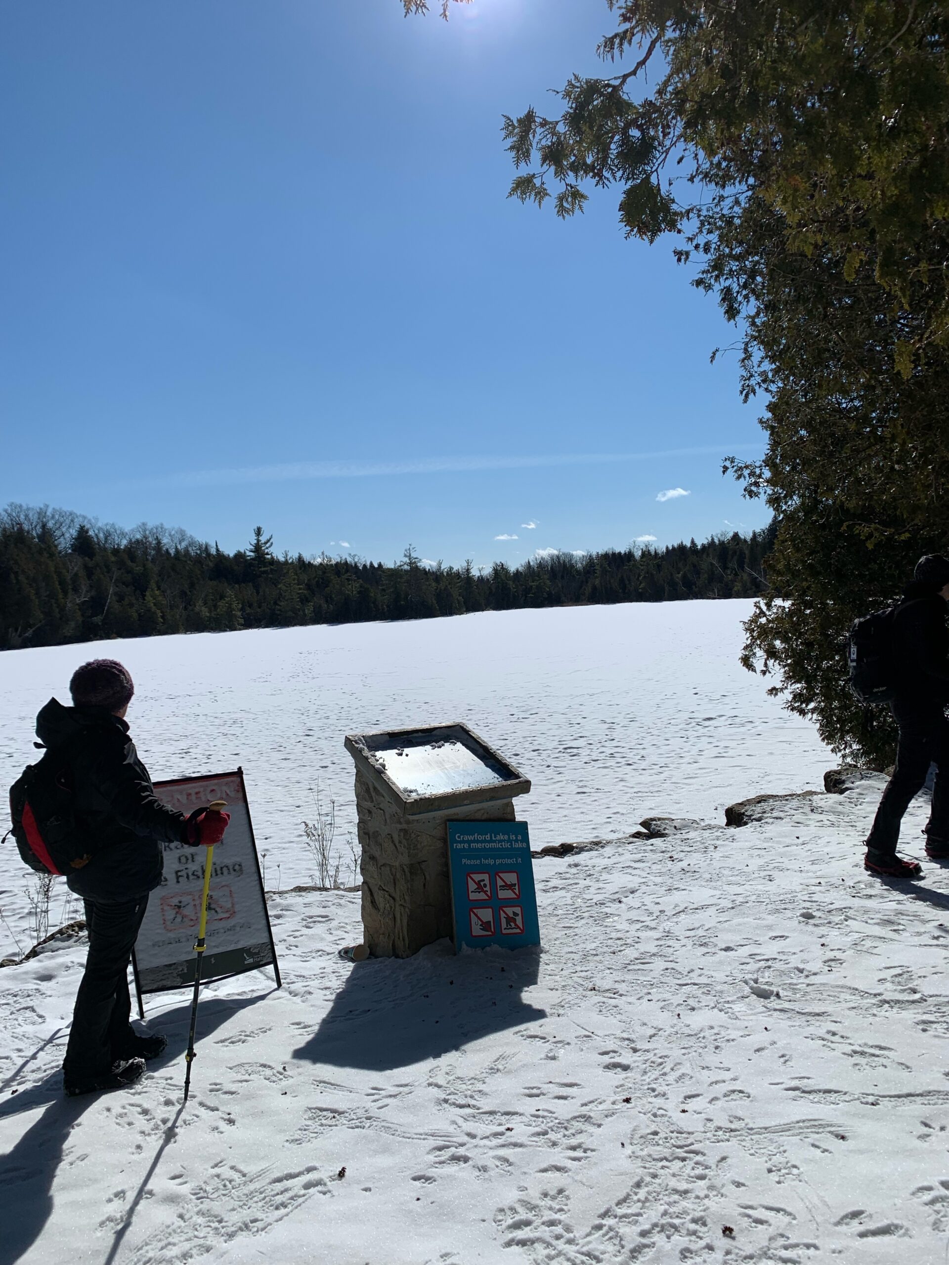
Crawford Lake Ramble
https://hikes.brucetrail.org/event/crawford-lake-ramble/Sorry, the registration cut-off time for this hike has been reached.Not a member? Click here to join today!Hosting Club: Iroquoia
Category: Good Companions
Location (Google Maps): Crawford Lake Conservation Area, 3115 Conservation Rd., MiltonHike Leader(s): Anne Armstrong Click here to contact Hike Leader(s)
Pace: Leisurely – 3km/hr or less
Terrain: Dependent on Conditions, Moderate – Some hills and/or some poor footing
Distance: Approx 7.5 km,Description
An old favourite, I love hiking the trails here. With luck the new boardwalk around the lake will be finished and early Spring will be on its way. We’ll get great views across to Rattlesnake as we hike along the escarpment edge (won’t be a ramble here! ). Who knows. we might even see early returning Turkey Vultures. Bring a snack, water and icers. Poles are useful for the escarpment edge. A reservation is necessary through Halton Conservation Area Parks. I will send out a pre-hike message the day before with my contact information. - Each hiker joining a Bruce Trail Club organized hike must perform a self-screening check before hiking.
- 12March 12, 2026

Car Hike: Iroquoia End-to-End in 7: Hike 1
https://hikes.brucetrail.org/event/car-hike-iroquoia-end-to-end-in-7-hike-1/Sorry, the registration cut-off time for this hike has been reached.Not a member? Click here to join today!Hike open to BTC Members only.
Hosting Club: Toronto
Category: Car Hike
Location (Google Maps): Meet at the Grimsby Pool, 1 Elm St at the south end of Coronation Park (GPS 43.193201, -79.565301). We’ll shuttle to the Oakridge Dr. Access Trail, km 18.2, roadside parking (GPS 43.213943, -79.742417) to begin our hike.Hike Leader(s): Jacqueline Van Dyke Click here to contact Hike Leader(s)
Pace: Brisk (4-5 km/hr), Moderate (3-4 km/hr)
Terrain: Variable
Distance (km): 19Description
Please join for one or more of this Iroquoia series to complete the section over 7 hikes. Hikers must register for individual hikes.Expect an average pace of 4 km/hr with snack/lunch breaks. Please arrive 15 minutes early so you’re ready for the shuttle to begin promptly at 8:30.
Hikers should be prepared for the season – layered clothing, hiking boots, snowshoes (if we get fresh snowfall), poles, water, snacks/lunch, first aid kit, and icers.
Hikers should be prepared to share their cars for shuttling – to be shared evenly.
If we encounter unsafe hiking or driving conditions, I will cancel/re-schedule the hike the day before. If you are unable to join us on the day of the hike, please text me at 647-231-0946.
Car Hike: Iroquoia winter E2E, hike 6/6
https://hikes.brucetrail.org/event/car-hike-iroquoia-winter-e2e-hike-6-6/Sorry, the registration cut-off time for this hike has been reached.Not a member? Click here to join today!Hike open to BTC Members only.
Hosting Club: Toronto
Category: Car Hike
Location (Google Maps):Grimsby Lions Community Pool, Elm street, N 43.193201,W 79.565301
Hike Leader(s): Smadar Junkin Click here to contact Hike Leader(s)
Pace: Brisk (4-5 km/hr)
Terrain: Level 3 (Advanced – steep hills and some scrambling over boulders)
Distance (km): 22 kmDescription
Badge day, treats day. Bring 2 litres of water. Bring icers and snowshoes to be able to hike in any trail conditions. Date of hike may need to be changed due to bad winter weather conditions. Please arrive 15 minutes early. Hikers are expected to walk at a 4.5 km per hour.We will car shuttle to Greenhill Ave Veever Park and hike back.
9:00 Long Hike TEMPORARY START LOCATION: GLEN RD PARKING AREA
https://hikes.brucetrail.org/event/900-long-hike-temporary-start-location-glen-rd-parking-area/Sorry, the registration cut-off time for this hike has been reached.Not a member? Click here to join today!Hosting Club: Niagara
Category: Loop
Location (Google Maps): Bruce Trail parking on Glen Rd, JordanHike Leader(s): Alan Laver Click here to contact Hike Leader(s)
Pace: Brisk
Terrain: Strenuous
Distance: 10 kmDescription
Meet at Bruce Trail parking lot on Glen Rd, Jordan.Bring icers, poles, and dress for the weather.
Hiking Around Jordan
https://hikes.brucetrail.org/event/hiking-around-jordan-50/Sorry, the registration cut-off time for this hike has been reached.Not a member? Click here to join today!Hosting Club: Niagara
Location (Google Maps): Sho’arishon Park (Jordan Hollow)
Hike Leader(s): Bill Russell Click here to contact Hike Leader(s)
Pace: Medium
Terrain: Moderate
Distance: 7 kmDescription
Hiking in and around Jordan including Jim Rainforth Trail, Balls Falls and Bailey Bridge alternating every 3 weeks.Urban Walk: Valley View Park Thornhill
https://hikes.brucetrail.org/event/urban-walk-valley-view-park-thornhill-150/Sorry, the registration cut-off time for this hike has been reached.Not a member? Click here to join today!Hosting Club: Toronto
Location (Google Maps): Parking lot is off Sycamore Drive, East of Bayview , across Starbucks plaza
Bus 91 from Finch East station stops at Sycamore station.Hike Leader(s): Mohammad Aghamiri Click here to contact Hike Leader(s)
Pace: Moderate (3-4 km/hr)
Terrain: Hilly, Level 2 (Intermediate – some hills and uneven surfaces, rocks and roots underfoot), Variable
Distance (km): 6-7 kmDescription
We will explore Valleyview and Maple View parks, and walk along German Mill Creak, in return we stop in Huntington park and have snack under beautiful shed.Although this is considered an “Urban Walk”, you can expect some hills up and down and uneven surfaces with tree roots. Please bring hiking poles, Ice cleats water and snacks.
phone number for the day of hike 289 588 6482
- 13March 13, 2026

Car Hike: Iroquoia End-to-End in 7: Hike 2
https://hikes.brucetrail.org/event/car-hike-iroquoia-end-to-end-in-7-hike-2/Sorry, the registration cut-off time for this hike has been reached.Not a member? Click here to join today!Hike open to BTC Members only.
Hosting Club: Toronto
Category: Car Hike
Location (Google Maps): Meet at the Oakridge Dr. Access Trail, km 18.2 (GPS 43.213943, -79.742417) and we’ll shuttle to the Hillcrest Ave. ST, km 37.1 (GPS 43.246437, -79.892130) to begin our hike.Hike Leader(s): Jacqueline Van Dyke Click here to contact Hike Leader(s)
Pace: Brisk (4-5 km/hr), Moderate (3-4 km/hr)
Terrain: Variable
Distance (km): 19Description
Please join for one or more of this Iroquoia series to complete the section over 7 hikes. Hikers must register for individual hikes.Expect an average pace of 4 km/hr with snack/lunch breaks. Please arrive 15 minutes early so you’re ready for the shuttle to begin promptly at 8:30.
Hikers should be prepared for the season – layered clothing, hiking boots, snowshoes (if we get fresh snowfall), poles, water, snacks/lunch, first aid kit, and icers.
Hikers should be prepared to share their cars for shuttling – to be shared evenly.
If we encounter unsafe hiking or driving conditions, I will cancel/re-schedule the hike the day before. If you are unable to join us on the day of the hike, please text me at 647-231-0946
Niagara-on-the-Lake Tour
https://hikes.brucetrail.org/event/niagara-on-the-lake-tour-23/Sorry, the registration cut-off time for this hike has been reached.Not a member? Click here to join today!Hosting Club: Niagara
Category: Urban
Location (Google Maps): Park on King St near Centre St, Niagara-on-the-LakeHike Leader(s): Margaret Northfield Click here to contact Hike Leader(s)
Pace: Medium
Terrain: Easy
Distance: 5-6kmDescription
Each Friday we will explore different neighbourhoods, trails and parkland throughout Historic Niagara-on-the-Lake.Moderate pace with some weeks entirely on sidewalks and roads while others may include a mix of trails and paved pathways. Great way to build up endurance for longer more strenuous hikes.
Prepare for cooler windy conditions on open parkland and along Lake Ontario and Niagara River trails.
Plan to stay for conversation and a warm cup of coffee or tea at Sweets & Swirls, Community Centre, Niagara Stone Road, NOTL
Brisk Fridays- Kemble Rock Nature Reserve & Maple Cross Ridge
https://hikes.brucetrail.org/event/brisk-fridays-kemble-rock-nature-reserve-maple-cross-ridge/Sorry, the registration cut-off time for this hike has been reached.Not a member? Click here to join today!Hosting Club: Sydenham
Category: Snowshoe Hike
Location (Google Maps): Click the (Google Maps) link on the left to direct you to parking. GPS coordinates: 44.73324, -80.95827. Park at the curve Coles Sideroad and Taylor Sideroad, 1.0 km north of Concession. Found in the Bruce Trail Reference guidebook Edition 31, Map 34 near km 136.9Hike Leader(s): Stewart Brown Click here to contact Hike Leader(s)
Pace: Brisk: 4 to 5 km/h
Terrain: Strenuous: Hilly with steep climbs and some poor footing., There are crevices or holes which may be hidden by layers of snow. Hike with extreme caution., There might be icy and slippery sections., There might be muddy sections., There might be sections with water on the trail.
Distance: 10 kmDescription
This strenuous snowshoe hike passes a wonderful variety of landscapes and ecosystems from wetlands to escarpment ridges. We visit one of Sydenham’s authorized campsites, Birch Camp. Our actual pace will depend on mid-March trail conditions. Regardless, the hike will require an effort that matches what would be required on a summer hike of a brisk pace of 4-5 km/h. Be prepared for a good workout in the snow or mud, or wet or all of these! Registrants will receive an email the day before the hike with an update of trail conditions and what to bring. Ten kilometres at a brisk pace on these trails is no easy feat, but if you’re up to the challenge, you are most welcome!
CANCELLED - Halton Forest to Speyside (E2E)
https://hikes.brucetrail.org/event/halton-forest-to-speyside-e2e-3/Sorry, the registration cut-off time for this hike has been reached.Not a member? Click here to join today!Hosting Club: Iroquoia
Category: General Hike
Location (Google Maps): Meet at the Pear Tree parking lot at Speyside on 15 Side Road at 9:15 am.Hike Leader(s): Karen Bergmann Click here to contact Hike Leader(s)
Pace: Medium – 3 to 4 km/hr
Terrain: Moderate – Some hills and/or some poor footing
Distance: 8 kmsDescription
We will meet at 9:15 in the Pear Tree parking lot on 15 Side Road and carpool to 6th Line at the Halton Agreement Forest and hike back along the Hilton Falls Side Trail, Al Shaw Side Trail and the main trail. This trail has some serious rocks and we cross a couple of creeks. Bring icers for your boots. Hike is dependent on weather conditions. - 14March 14, 2026
School Bus Hike Toronto Section Winter Badge End to End #6 of 6/Friendly Moderate Hike Bruce Trail/Terra Cotta/Caledon Trailway
https://hikes.brucetrail.org/event/school-bus-hike-toronto-section-winter-badge-end-to-end-6-of-6/Sorry, the registration cut-off time for this hike has been reached.Not a member? Click here to join today!Trip Information
Departure Time: 08:30
Return to City Time: 18:00
Departure Point: York Mills Bus PickupOptional Items
Hosting Club: Toronto
Category: Bus Hike
Location (Google Maps):Toronto Section, Terra Cotta – Cheltenham
Hike Leader(s): George Lennon, Tom Swales, Ted Moriarty Click here to contact Hike Leader(s)
Pace: Leisurely (2-3 km/hr)
Terrain: Challenging, Level 2 (Intermediate – some hills and uneven surfaces, rocks and roots underfoot), Variable
Distance (km): 9-11 kmDescription
Come join us for the final bus hike of Winter, 2025-2026. The hike will cover the last 2.5 km of the Toronto section of the Main Bruce Trail and then follow the western section of the Caledon Trailway back to Terra Cotta Conservation Area. For those who have been on the five previous Winter Badge E2E hikes, completing this bus trip will qualify you for the awarding of the badge on this hike. For anyone taking this hike, it will be a moderate hike over the path of a former Canadian National (CN) rail line, originally built in 1877. Since the path is over the old rail bed, it is well-drained and well-surfaced, flat, and straight. However, it goes through woods and meadows, and we are already seeing there spring migratory birds like red-winged blackbirds and flocks of cedar waxwings. A celebration of the ending of the winter bus hikes and social hour will be held in Georgetown after the hike. Any hikers joining us for the very first time on a hike with the club on the Bruce Trail will receive a “My First Hike” badge.Glasgow Village Whitchurch-Stouffville 230
https://hikes.brucetrail.org/event/car-hike-cherry-beach-downtown-4/Sorry, the registration cut-off time for this hike has been reached.Not a member? Click here to join today!Hosting Club: Toronto
Location (Google Maps): Glasgow Trail, Concession Road 2
Park in parking lot at the head of trail
From Highway 404 turn right to Stouffville Rd, till to the end of road and turn left on York Durham line in About 1km turn right to Webb rd. and turn right to Concession Road 2 ,you will see parking lot in 500 meter.
Hike Leader(s): Mohammad Aghamiri Click here to contact Hike Leader(s)
Pace: Moderate (3-4 km/hr)
Terrain: Hilly, Level 2 (Intermediate – some hills and uneven surfaces, rocks and roots underfoot)
Distance (km): 12-14 kmDescription
Please bring at least 2L of water, a snack, sun screen and bug spray.Some safety procedures during the hike:
1-Hikers must stay between the leader and the sweep.
2-Hikers must advise the leader or the sweep if they wish to leave the group.
3- Hikers must follow the whistle instructions: 1 blast- stay where you are; 2 blasts come to the leader; 3 blasts – come to the leader quickly.
4-Hike leader may request volunteers to stop at trail intersections, they need to help hikers to the direction the group walk and wait till they see the sweep .
5-Hikers have to make sure they can see the persons behind and in front of them.
phone number for the day of hike 289 588 6482
Car Hike Dufferin Hi-Land End2End 3/4
https://hikes.brucetrail.org/event/car-hike-dufferin-hi-land-end2end-3-4/Sorry, the registration cut-off time for this hike has been reached.Not a member? Click here to join today!Hosting Club: Toronto, Dufferin Hi-Land
Category: Car Hike
Location (Google Maps): Meet atRoadside Parking – on the north side of 8 Sideroad across from 2nd Line E. GPS N44.139350, W80.100503. Km 22.7, Map 20 Edition 31
Hike Leader(s): Ross Estrella Click here to contact Hike Leader(s)
Pace: Moderate (3-4 km/hr)
Terrain: Challenging, Hilly, Level 2 (Intermediate – some hills and uneven surfaces, rocks and roots underfoot), Rocky
Distance (km): 14Description
This is DHBTC E2E in 4. E2E hikers are rewarded the club coveted E2E badge upon completion. However, joiners must complete the four series hikes to earn their badge. Missed segment/s must be made up prior to the completion of the last leg to receive your badge. We’ll be on a moderate pace to enjoy, feel and see the stunning landscape and acquaint ourselves to the others souls on the group. Day hikes essentials to bring, lunch/snacks, sufficient preferred liquid hydration, sun screen, bug spray, head covering for sun protection, appropriate clothing for the weather, personal medication/s (if any), health card and your happy face and enthusiasm. Hiking shoes and poles are highly recommended. Please note that “Icers” are now mandatory on all hikes from the on set of Winter to mid-April. Showing up at meet up location for non-compliance will result to be refuse joining the group. Make sure you and your car are shuttle ready as everybody are expected to participate. Cost of badge is 10 dollars for BTC member and 15 dollars for non-member. Please arrive fifteen minutes early for car shuttling.This is a H4H-H4F !!! hike. If this schedule suits you, your welcome to join.
Note: to reach the specific parking lot location, use the specified GPS Coordinates at the meet-up location above.

Iroquoia E2E-in-Six / Stained Glass Badge (March 14/15, 21/22, 28/29)
https://hikes.brucetrail.org/event/iroquoia-e2e-in-six/Sorry, the registration cut-off time for this hike has been reached.Not a member? Click here to join today!This is a Multi-Day Hike
You are signing up for the following dates:
2026-03-14, 2026-03-15, 2026-03-21, 2026-03-22, 2026-03-28, 2026-03-29Hosting Club: Iroquoia
Category: Stained Glass Badge Fundraiser – Iroquoia E2E-in-Six
Location (Google Maps): Day 1 – March 14, 2026/ Meet Up: Kilbride School, Panton St, Burlington (Please park in the back) 43.427756, -79.937991 (20 car spots).
Car shuttle to Hilton Falls Conservation Area.4985 Campbellville Rd, Milton 43.505705, -79.961589 (100 car spots)Hike Leader(s): Joe Borges Click here to contact Hike Leader(s)
Pace: Medium – 3 to 4 km/hr
Terrain: Dependent on Conditions, Slippery and Steep Sections, Slippery Sections Likely, Strenuous – Hilly with steep climbs and some poor footing
Distance: 26.68kmDescription
Join us in the Iroquoia End-to-End in 6 starting in March 14, 2026 for 6 hikes. Each hike will be approximately 15-26 kms at a moderate pace.
This is suitable for intermediate to advanced hikers. (No children or pest on this hike)We will be using hiker’s vehicles to shuttle between our start and end point for each hike. As well, there will be costs at some parking location, the cost will be shared.
Please note the longer distances and be physically prepared to hike at a 3-4 km pace. Proper hiking boots is a must! Bring hiking poles, food/snacks, water, hat, layers and rain gear. *Icers/Crampons are recommended.
Arrive at 8:30am at the Meet Up Point for roll call/check in/drive to the starting point. Hike will start at 9 am.
It is important to complete each section within a time frame to consider the shorter days.
Hikers will receive their End-to-End 6 Jefferson Salamander Badge upon completion on the last hike day.
If you must miss a day but can make it up before the last scheduled hike, you will still qualify for this special Jefferson Salamander badge which represents an endangered species sometimes seen in the Iroquoia section. This is a fundraising hike for the Iroquoia Bruce Trail Club. Proceeds go to the mission of protecting this ribbon of wilderness, the Bruce Trail.
All logistics/scheduling/start/stop and parking (shared cost if there is a fee) and a hike leader to guide you, is included.
provided in February, closer to the start date.__________
Day 1 – March 14, 2026/
Meet Up: Kilbride School, Panton St, Burlington (Please park in the back) 43.427756, -79.937991 (20 car spots). Car shuttle to Hilton Falls Conservation Area.4985 Campbellville Rd, Milton 43.505705, -79.961589 (100 car spots) Hiking Distance: 26.68kmDay 2 – March 15, 2026/
Meet Up: City View Park Waterdown (2nd entrance off Kerns Rd. South of Dundas St.) N43.352308, W79.862585 (50 car spots). Car shuttle to Kilbride School, Panton St, Burlington – Please park in the back 43.427756, -79.937991
(20 car spots). Hiking Distance: 22.64kmDay 3 – March 21, 2026/
Meet Up: Davidson Blvd. Dundas N43.265251, W79.990490 (5 car spots). Car shuttle to City View Park Waterdown (2nd entrance off Kerns Rd. South of Dundas St.) N43.352308, W79.862585 (50 car spots). Hiking Distance: 21.94kmDay 4 – March 22, 2026/
Meet Up: Chedoke Golf Club parking lot, Hamilton N43.246205, W79.906935 (40 car spots). Car shuttle to Davidson Blvd. Dundas N43.265251, W79.990490 (5 car spots). Hiking Distance: 15.24kmDay 5 – March 28, 2026/
Meet Up: Glover Mountain Rd. Side Trail roadside parking, Stoney Creek N43.209155, W79.773801 (10 car spots). Car shuttle to Chedoke Golf Club parking lot, Hamilton N43.246205, W79.906935 (40 car spots). Hiking Distance: 17.58kmDay 6 – March 28, 2026/
Meet Up: Grimsby Lions Community Pool 1 Elm St, Grimsby N43.193201, W79.565301 (30 car spots). Car shuttle to Glover Mountain Rd. Side Trail roadside parking, Stoney Creek N43.209155, W79.773801 (10 car spots).
Hiking Distance: 21.33kmThis will be a great challenge and accomplishment, you’ll meet some great people and enjoy our beautiful section of the Bruce Trail. But, remember to have fun!
Introduction to Trail Running – Dundas Valley Conservation Area (RE-SCHEDULED FROM MARCH 7)
https://hikes.brucetrail.org/event/introduction-to-trail-running-dundas-valley-conservation-area/Sorry, the registration cut-off time for this hike has been reached.Not a member? Click here to join today!Hosting Club: Iroquoia
Category: Special Event
Location (Google Maps): 134 Martin Road, Ancaster, ON. Parking beside Ancaster Baseball Matthew Kroll Field (unpaved lot)Hike Leader(s): Kristen Rose Click here to contact Hike Leader(s)
Pace: Fast – 5+ km/hr
Terrain: Dependent on Conditions, Moderate – Some hills and/or some poor footing, Slippery Sections Likely
Distance: 10 kmDescription
*Originally scheduled for March 7; and moved to March 14 due to weather conditions*Are you curious about trail running but not sure how / where to get started?
Come join a guided trail run where you can learn the ropes while taking in the beauty of Dundas Valley in a small group setting.
What to expect:
After a brief warmup, we’ll hit the trails and do an approximately 10 km loop through Dundas Valley Conservation Area, primarily on the Headwaters Trail. This section of trail is used for local trail races and features a hilly section known as “The Three Sisters.”
To accommodate different paces and trail conditions, this will be a hike/run, where we will lightly jog flat and downhill sections and hike uphill sections, with some light instruction provided along the way.
Requirements:
-Registration is required for this event.
-Please wear trail running shoes; road running shoes are not suitable for this trail.
-Bring icers to put on your trail shoes for added traction, as the trail may be slippery at this time of year. Dress in layers for warmth. Bring water and a small snack for your needs.
Recommended:
-Hydration vest or run belt for carrying water and snacks.
Interested in getting informed before hitting the trails? Burlington Runners Club recently announced they will be hosting a “Welcome to the Trails” series, which includes 1-2 interactive sessions covering various topics such as safety, trail etiquette, essential gear and hydration and nutrition tips. Check out @Burlingtonrunnersclub for more details + session dates.
Notes:
- In the event of poor weather or trail conditions, I will need to cancel this event, for safety reasons.
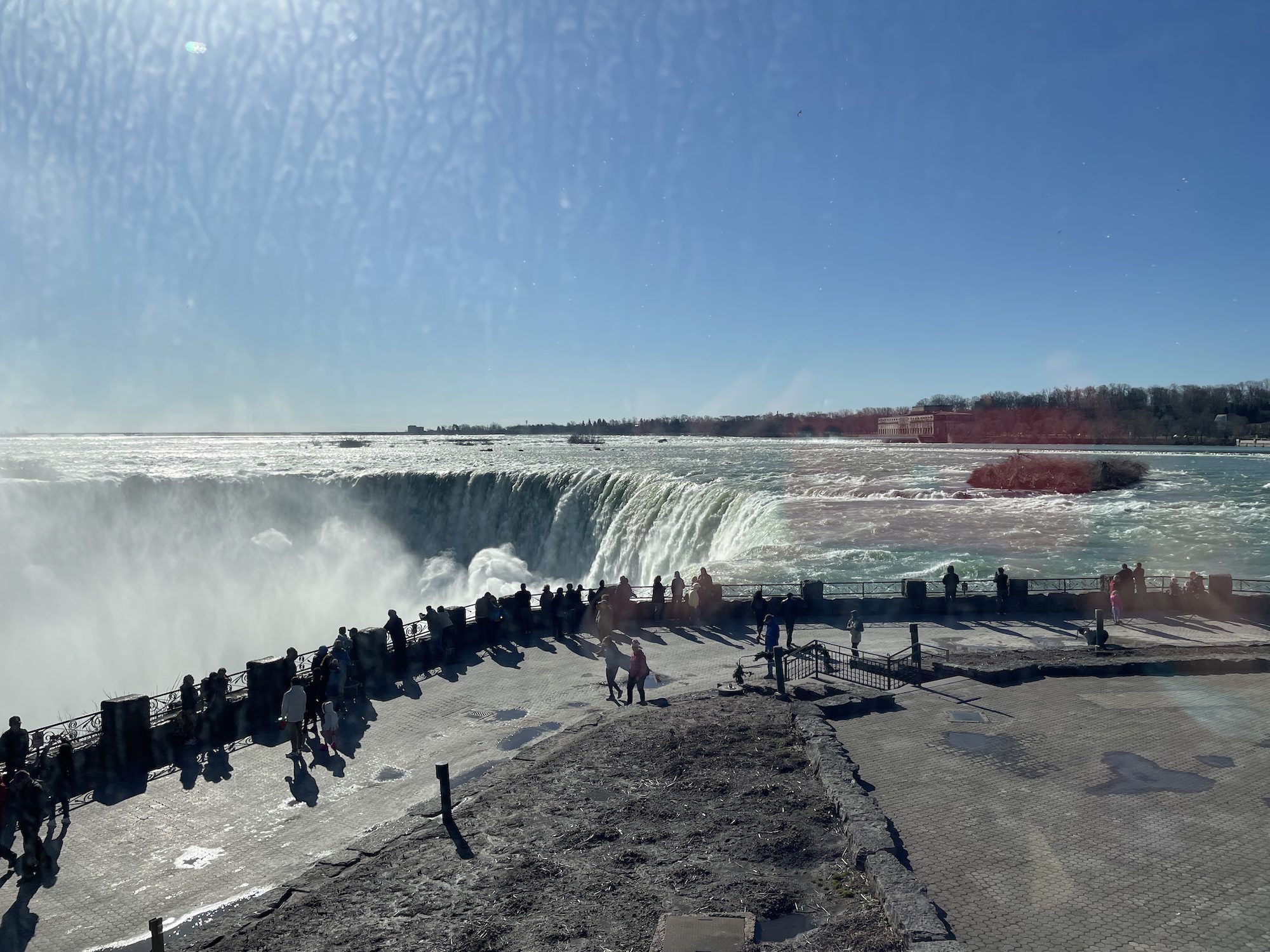
Niagara Falls Loop
https://hikes.brucetrail.org/event/niagara-falls-loop/Sorry, the registration cut-off time for this hike has been reached.Not a member? Click here to join today!Hosting Club: Niagara
Category: Loop
Location (Google Maps): Meet at Floral Showhouse, Niagara River Parkway, Niagara Falls (just south of the Falls)Hike Leader(s): Margaret Northfield Click here to contact Hike Leader(s)
Pace: Medium
Terrain: Easy
Distance: 8-9kmDescription
We will hike through Dufferin Islands, Casino, Victoria Park and under the Rainbow Bridge and of course along by the Falls – something for everyone. Mostly paved walking.Quarry Rd to 30 Rd return
https://hikes.brucetrail.org/event/quarry-rd-to-30-rd-return/Sorry, the registration cut-off time for this hike has been reached.Not a member? Click here to join today!Hosting Club: Niagara
Category: In and Out
Location (Google Maps):Hike Leader(s): Lauren Doig Click here to contact Hike Leader(s)
Pace: Brisk
Terrain: Moderate
Distance: 16 kmDescription
Meet at the parking area on Quarry Rd in Beamsville where the trail crosses the road. We’ll hike to 30 Rd, taking a variety of side trails through Mountainview Conservation Area. We’ll check out 9 Acres Organic Farm, where there recently was a fire in their barn. 😢Then we’ll hike back to our cars. There’s about 4 km road work involved on this hike.

9:30 Explore the Power of Niagara's Black History: Chloe Cooley, Bound and Determined
https://hikes.brucetrail.org/event/930-explore-the-power-of-niagaras-black-history-chloe-cooley-bound-and-determined/Sorry, the registration cut-off time for this hike has been reached.Not a member? Click here to join today!Hosting Club: Niagara
Category: Loop
Location (Google Maps):Queenston Heights Park, Niagara River Parkway, Niagara-on-the-Lake
Hike Leader(s): Karen Couch Click here to contact Hike Leader(s)
Pace: Medium
Terrain: Moderate
Distance: 7-8 kmsDescription
On March 14, 1793, Chloe Cooley, was an enslaved Black woman living in Niagara, who fought for her freedom, and the freedom of thousands like her. On that date, her brave act of resistance led to the enactment of the first piece of legislation to limit enslavement in Great Britain AND the gradual abolition of enslavement in Canada. It also set the stage for the great freedom movement of enslaved African Americans known as the Underground Railroad. We will hike to where her powerful act of bravery is thought to have taken place and is marked with a plaque.This hike will take us along the General Brock Side Trail (GBST) and on then on the Niagara Parkway (NP). The GBST’s terrain is hilly/moderate. After stopping at the plaque, we will partially retrace our steps, then climb a long set of metal stairs to take note of another plaque before returning to our cars.
The terrain may be icy and/or snow covered. Hiking poles and icers are advised, depending on the conditions. The main parking lot will be closed for the winter so park near the washrooms. A parking fee applies.
PLEASE NOTE: This hike counts as 1 of the 3 required hikes towards the Black History badge. If you have completed 3 hikes, and are interested in receiving a badge, please let me know.
For much more information about Chloe Cooley and Ontario’s Black history, open the link below. There are several very interesting videos embedded within the TVO Today 2023 article.
https://www.tvo.org/article/enslavement-is-part-of-our-history-understanding-chloe-cooleys-act-of-resistance

RAINBOW HIKE: Pi Day Rail Trail/Mountain Brow Loop
https://hikes.brucetrail.org/event/rainbow-hike-pi-day-rail-trail-mountain-brow-loop/Sorry, the registration cut-off time for this hike has been reached.Not a member? Click here to join today!Hosting Club: Iroquoia
Category: Rainbow Hike
Location (Google Maps): Meet at the base of the Wentworth stairsHike Leader(s): Shayne Ward Click here to contact Hike Leader(s)
Pace: Medium – 3 to 4 km/hr
Terrain: Dependent on Conditions, Easy – Mostly flat and usually good footing
Distance: 10kmDescription
Join us for a leisurely loop and stellar views through the Hamilton portion of the Bruce Trail and Mountain Brow Blvd/Mountain Park Ave.🌈 This queer-led, all-inclusive 2SLGBTQIA+ hike is designed to provide a safe, welcoming space for 2SGBTQIA+ hikers—including trans, gay, lesbian, bisexual, queer, Two-Spirit, intersex, asexual, allies and friends. Show up, be your authentic self!
Please plan to arrive for 9:45am as we will leave at 10am prompt. We will depart from the base of the Wentworth stairs and walk the paved portion of the trail/Rail Trail to the Margate Stairs (380 stairs, metal with traction and rails). We’ll go up the stairs and take Mountain View/Concession/Mountain Park back to the Wentworth Stairs (498 stairs, metal with traction and rails) and walk down the stairs to end where we started.
Please pack a lunch! Plan for a lunch break at the top of the Margate Stairs. There is a water fountain and benches there we can catch our breath before finishing the brow and Wentworth stairs.
🚗 🚌 This outing is accessible by car or public transit. Parking available on side streets, start of hike is accessible by HSR Bus #05 (Delaware) at Wentworth Ave.
🐾 Dogs are welcome on this hike! For everyone’s safety and enjoyment, pups must be fully trained and kept on a non-retractable leash at all times. Please ensure you pack out all your dog’s waste.
Visit “Dogs on the Bruce Trail” for further information. https://brucetrail.org/dogs-on-the-trail/
What to Bring:
• Water, snacks, and lunch, perhaps a hot beverage.
• Sunscreen, sunglasses, comfortable walking shoes/runners.
• Dress based on weather.Free Bruce Trail Rainbow badges and stickers for all participants!
Questions? Simply click “Contact Hike Leader” on the registration form.Urban Walk: Humber River/Swansea Theatre Hike - CANCELLED
https://hikes.brucetrail.org/event/urban-walk-humber-river-swansea-theatre-hike-3/Sorry, the registration cut-off time for this hike has been reached.Not a member? Click here to join today!Hosting Club: Toronto
Category: Cancelled
Location (Google Maps):Meet by the TTC Stop on the Southeast Corner of Scarlett Road and Eglinton Avenue West. Take the #79 Scarlett Road bus from Runnymede Station to Eglinton or the Eglinton West #32A from Eglinton West Station to Scarlett Road.
Hike Leader(s): Miriam Stevens Click here to contact Hike Leader(s)
Pace: Leisurely (2-3 km/hr)
Terrain: Level 1 (Easy – mostly on flat, well maintained trails with hard-packed surface), Variable
Distance: 10-12 kmDescription
This hike has been CANCELLEDLeisurely hike (3 kms/hour – No Racers Please) suitable for beginners and families.
Hike along the Humber River trail and into the Swansea village at Runnymede road and Bloor street west. The hike will end opposite Runnymede Subway near the Village Playhouse Theatre and local restaurants and pubs. Distance may vary according to the weather and trail conditions and how people feel. Early dropout is possible at Old Mill Subway Station.After the hike you may choose to join us for dinner at around 6 PM at Ali Baba Mediterranean restaurant or at a nearby pub.
We will attend the play “These Shining Lives” at 8 PM at The Bloor West Village Players theatre, 2190 Bloor Street West, Toronto.
Call the Theatre directly at (416) 767 7702 to reserve your ticket, cost $26- $29.00. Please do mention that you’re with the Bruce Trail Conservancy, Toronto Club so they know we are supporting them.Anyone is welcome to join us for the hike only, join us for the theatre performance, or, join us for all three: Hike, Dinner and play. Paid parking is available off Kennedy Avenue north of Bloor Street West (behind the Village Playhouse Theatre building). There is no parking available at the start of the hike.