Hike Schedule
Join us for a hike! Registration required:
All hikes available to BTC members. Some hikes are open to non-members.
TIP: The calendar view displays up to 7 hikes on a day, but often there are more. Click “More events” to see them all.
Categories
- 01March 1, 2026
Car Hike: Jefferson Forest (Richmond Hill)
https://hikes.brucetrail.org/event/car-hike-jefferson-forest-richmond-hill-7/Sorry, the registration cut-off time for this hike has been reached.Not a member? Click here to join today!Hosting Club: Toronto
Location (Google Maps):
1245 Bethesda Side Rd, Richmond Hill, ON L4E 1A2 ( Bethesda Trail Head Parking lot)
Hike Leader(s): Amir Alemohammad Click here to contact Hike Leader(s)
Pace: Moderate (3-4 km/hr)
Terrain: Flat, Level 2 (Intermediate – some hills and uneven surfaces, rocks and roots underfoot), Variable
Distance (km): 10-12Description
Let’s roll the hills of the Jefferson Forest this winter! Every weekend, we’ll explore the winter wonderland at this beautiful park. Located in the heart of Richmond Hill, it boasts numerous hiking trails. This 3-hour hike can range from 10 to 12 kilometres, depending on the weather conditions. Remember to bring water, snacks, hiking boots, icers, poles, and your camera. Not recommended for beginners. Park in the free Bethesda parking lot and avoid parking along the road. Dress appropriately for the weather. Difficulty Level: 2 (Moderate).Please arrive @8:45AM for start of 9:00AM.
This is a joint hike with the Oak Ridges Trail Association (ORTA).

Kilbride to Twiss Rd return
https://hikes.brucetrail.org/event/kilbride-to-twiss-rd-return/Sorry, the registration cut-off time for this hike has been reached.Not a member? Click here to join today!Hosting Club: Iroquoia
Category: General Hike
Location (Google Maps): Meet in the parking lot behind the school in Kilbride at 9:15 amHike Leader(s): Karen Bergmann Click here to contact Hike Leader(s)
Pace: Medium – 3 to 4 km/hr
Terrain: Moderate – Some hills and/or some poor footing
Distance: 6.5 kmsDescription
Meeting in the parking lot behind the Kilbride School at 9:15 am, we will hike along the main trail to Twiss Road and turn around and hike back. There is some technical footing near the Twiss Road end of the trail, but otherwise this is a fairly easy hike. Bring icers for your boots. Hike is dependent on weather conditions.Urban Walk: Sherwood Park/Sunnybrook Park
https://hikes.brucetrail.org/event/urban-walk-sherwood-park-sunnybrook-park-5/Sorry, the registration cut-off time for this hike has been reached.Not a member? Click here to join today!Hosting Club: Toronto
Category: Urban Walk
Location (Google Maps):NE Corner Yonge & Lawrence (by subway exit)
Hike Leader(s): Tom Swales Click here to contact Hike Leader(s)
Pace: Moderate (3-4 km/hr)
Terrain: Level 2 (Intermediate – some hills and uneven surfaces, rocks and roots underfoot), Variable
Distance (km): 12 KMDescription
Join us for a hike through scenic ravines from Yonge & Lawrence to Sunnybrook & Serena Gundy parks to end at Laird Station of TTC Line 5Icers (ice cleats) will be mandatory.

GeoHike - Cave Springs Conservation Area
https://hikes.brucetrail.org/event/geohike-cave-springs-conservation-area-2/Sorry, the registration cut-off time for this hike has been reached.Not a member? Click here to join today!Hike open to BTC Members only.
Hosting Club: Niagara, Iroquoia
Category: In and Out
Location (Google Maps):Cave Springs Conservation Area, 3949 Cave Spring Rd, Lincoln
Hike Leader(s): Kristin Hanson Click here to contact Hike Leader(s)
Pace: Leisurely
Terrain: Moderate
Distance: 1.7KMDescription
From the parking lot, we will hike along the Ice Cave Trail, the Margaret Reed Side Trail and the main Bruce Trail, stopping to explore and discuss the geology of the Niagara Escarpment, the Beamsville Bench wine region and the physiographic and geologic conditions that make it special. After a short in-and-out hike on the Ice Cave Trail, we will slowly begin an incline up the Margaret Reed side trail as we scale the Niagara Escarpment. We will consider the 450+million years of history we are hiking through as we make our way slowly to the top. We will stop along the way to discuss and rest. Once at the top, the terrain on the Bruce Trail is generally flat but footing may be uneven. It may be icy or wet and slippery. Hiking poles will make the ascent easier and give more stability on uneven footing. We will hike to the site of the very first blaze on the Bruce Trail and admire the views of Lake Ontario and the vineyards of Cave Spring and Malivoire wineries. Winter offers the most unobstructed views of this beautiful area. We will return the way we came.Hikers that are not registered cannot be accommodated on this hike. This hike is for members only.

Full Moon Night Hike No.3 (Worm Moon)
https://hikes.brucetrail.org/event/full-worm-moon-iroquoia-btc-night-hike/Sorry, the registration cut-off time for this hike has been reached.Not a member? Click here to join today!Hosting Club: Iroquoia
Category: Moonlight Hikes
Location (Google Maps): We will meet at Dundas Drive Through Park, at 71 Cross St, Dundas. Proceed through the gate and take the road on the right to available parking on the east side of the park. I will have my tailgate up on my dark grey Acura RDX. Please plan to arrive by 6:30 so we can get everyone registered and head outHike Leader(s): Steven White Click here to contact Hike Leader(s)
Pace: Medium – 3 to 4 km/hr
Terrain: Slippery and Steep Sections, Strenuous – Hilly with steep climbs and some poor footing
Distance: 7.5 kmDescription
The Full Worm Moon hike is the third full moon hike of 2026. We meet at the parking area inside Dundas Drive Through Park (71 Cross St Dundas) on the east side of the park. Please plan to arrive by 6:30 to get everyone registered and on our way.We will hike out of the park along Alma St and pick up the main trail/Tews Fall Side Trail, climbing the escarpment, hiking along the top to Dundas Peak – there will many views overlooking Dundas and afford us some good views of the Full Worm Moon. A short pause for pics at the Peak and back down along the Glen Ferguson Side Trail/Tews Fall Side Trail and back to the park and our cars.
Be sure to wear layered clothing, bring water, icers and poles if you use them. The ascent might be icy as this is a popular trail to the Dundas Peak.
Since this the third hike in the series, some hikers will qualify for the Iroquoia Full Moon badge – new for 2026! Cost is $10 for BTC Members and $15 for non-members. Badges can be picked up at this hike if you pre-order and pay through Iroquoia Bruce Trail Club Badges – Iroquoia Bruce Trail Club
Members / Click to Purchase Your Badges
https://www.zeffy.com/en-CA/ticketing/1de4dba1-aca4-44e2-b0b0-d94f1c826c42Non-Members / Click to Purchase Your Badges
https://www.zeffy.com/en-CA/ticketing/93131d23-cc73-44fe-913d-e4938ee174c6 - 02March 2, 2026
Toronto Winter Blues - Hike 6
https://hikes.brucetrail.org/event/toronto-winter-blues-hike-6/Sorry, the registration cut-off time for this hike has been reached.Not a member? Click here to join today!Hosting Club: Iroquoia, Toronto
Category: General Hike
Location (Google Maps): Roadside Parking on Tenth LineHike Leader(s): Pati Greenwood, Jeff Dowsett Click here to contact Hike Leader(s)
Pace: Medium – 3 to 4 km/hr
Terrain: Dependent on Conditions, Moderate – Some hills and/or some poor footing
Distance: 12 kmDescription
This is a series of 6 hikes to explore various side trails in the Toronto Section of the Bruce Trail. Hikers completing all six hikes will be eligible to obtain the Toronto Side Trail Badge. Each hike requires a separate registration. The hikes in this series will take place on January 12, 26, February 2, 9, 23, and March 2. Hikes will be dependent on weather / travel conditions. All hikes will be undertaken at a medium pace.This hike, the final one of the series, will explore the Terra Cotta Side Trail as part of a loop around the Terra Cotta Conservation area.
Dress in layers for the weather, wear appropriate hiking footwear, bring icers and hiking poles. Bring plenty of water or other hydration and a snack.
Please arrive at the meeting place by 8:15 am. We will depart promptly at 8:30 am.
If your plans change and you are unable to join the hike, please cancel your reservation in the My Hikes Section of the BTC website.
EASY DOES IT HIKE, Merrit Island
https://hikes.brucetrail.org/event/easy-does-it-hike-merrit-island/Sorry, the registration cut-off time for this hike has been reached.Not a member? Click here to join today!Hosting Club: Niagara
Category: Leisurely
Location (Google Maps): Park at Merritt Island Parking Lot, 8 Merrit Island, Welland OnHike Leader(s): Diane Marlatt Click here to contact Hike Leader(s)
Pace: Leisurely
Terrain: Easy
Distance: 5 kmDescription
- 03March 3, 2026
9:00 Long Hike Wiley Road Short Hills
https://hikes.brucetrail.org/event/900-long-hike-wiley-road-short-hills-54/Sorry, the registration cut-off time for this hike has been reached.Not a member? Click here to join today!Hosting Club: Niagara
Category: Hike
Location (Google Maps):Short Hills Wiley Road Entrance
Hike Leader(s): Alan Laver Click here to contact Hike Leader(s)
Pace: Brisk
Distance: 10km
Description
Explore Short Hills and the majestic side trails of Scarlett Tanager, Hemlock. Swayze Falls and Terrace. Register for each hikeBring Poles, snack, and dress for the weather
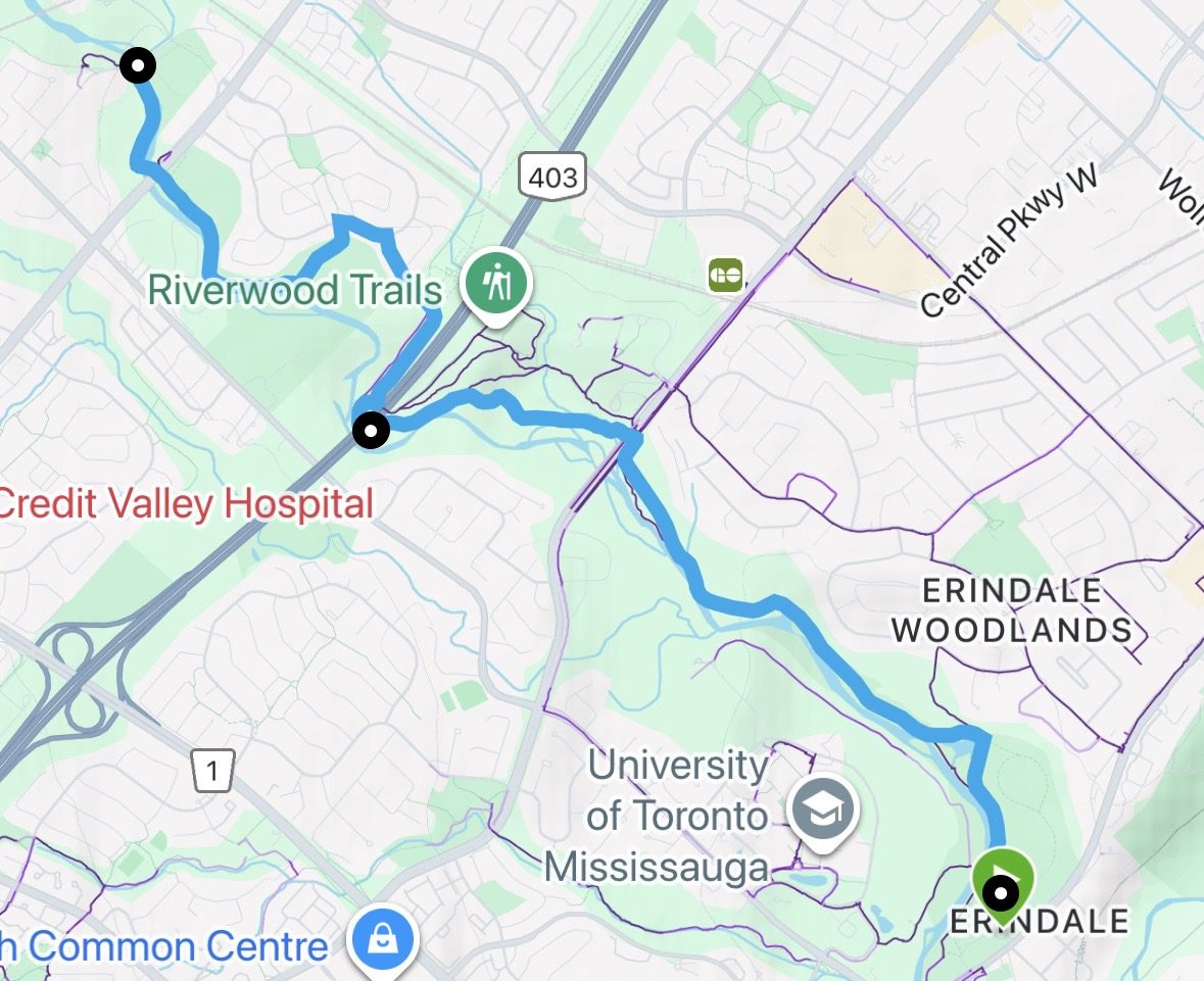
Urban Walk - Mississauga Culham Trail : Erindale Park to Barbertown Park
https://hikes.brucetrail.org/event/urban-walk-mississauga-culham-trail-erindale-park-to-barbertown-park/Sorry, the registration cut-off time for this hike has been reached.Not a member? Click here to join today!Hike open to BTC Members only.
Hosting Club: Iroquoia
Category: General Hike
Location (Google Maps): Meet at Erindale Park. The entrance to Erindale Park is 1695 Dundas Street West, Mississauga, just east of Mississauga Road.Hike Leader(s): Howard Cheng Click here to contact Hike Leader(s)
Pace: Medium – 3 to 4 km/hr
Terrain: Dependent on Conditions
Distance: 13 kmDescription
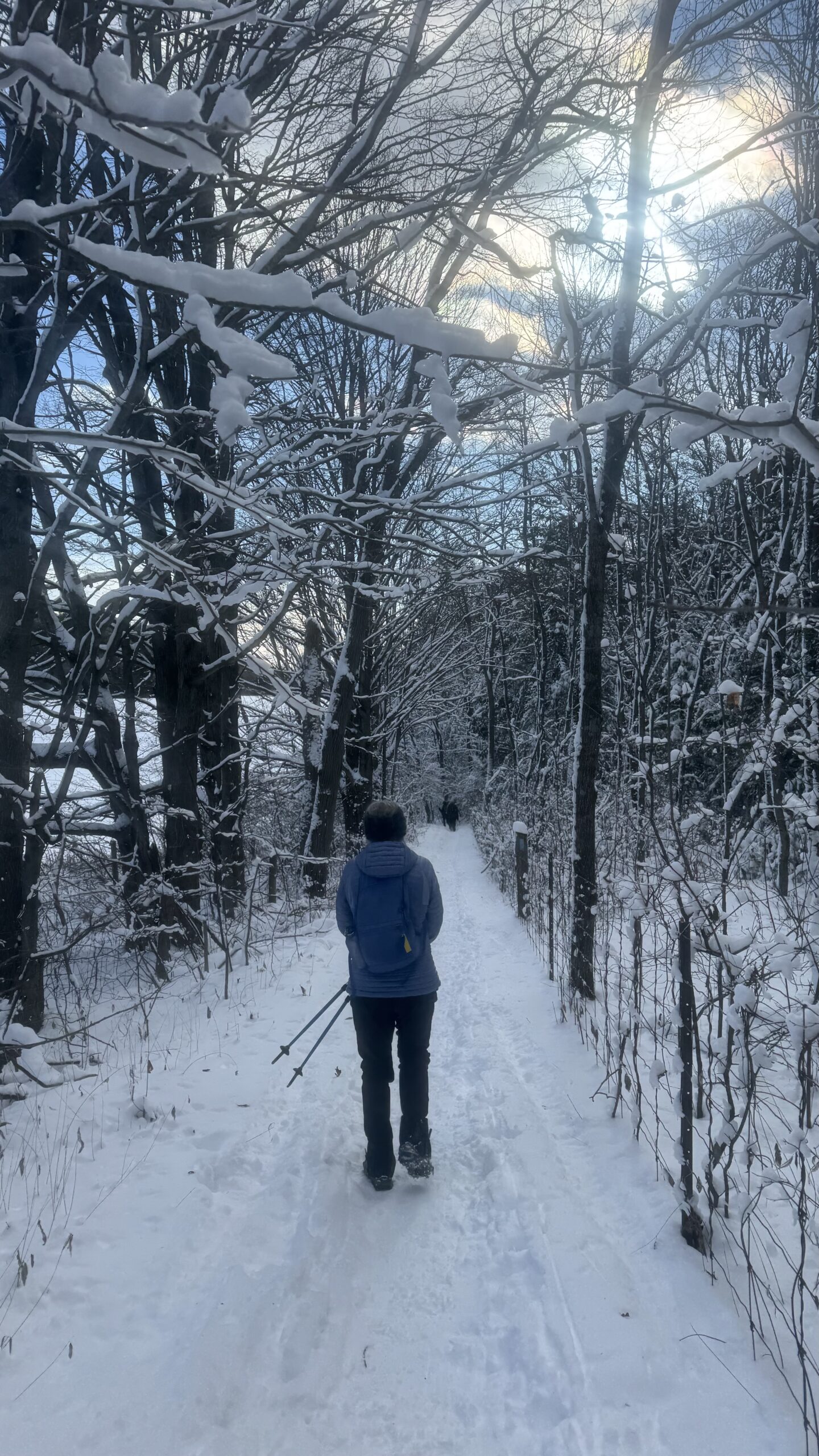
This is leisurely in-out hike.We will walk north on the Culham Trail along the Credit River for around 6.5 km to the Barbertown Park near Barbertown Bridge. We will have a snack break there, and return through the same route to our starting point at Erindale Park. Even on the same trail, in the same park, the walk back offers a different view—the light shifts, details emerge, and familiar scenery feels newly revealed.
The terrain is flat with gentle hills but may have some poor footing, muddy or slippery sections during winter condition. Bring hiking poles, icers, plenty of water or other hydration and a snack.
Public washrooms are only available at Erindale Park, but nature stops will be offered during the hike.
9:15 Short Hike - Short Hills Park, Pelham Rd
https://hikes.brucetrail.org/event/915-short-hike-short-hills-park-pelham-rd-41/Sorry, the registration cut-off time for this hike has been reached.Not a member? Click here to join today!Hosting Club: Niagara
Category: Hike
Location (Google Maps): Short Hills Provincial Park, Pelham Rd entranceHike Leader(s): Debbie Demizio Click here to contact Hike Leader(s)
Pace: Medium
Terrain: Moderate
Distance: ~ 6kmsDescription
Hike the main and side trails of Short Hills Provincial Park. Please note that there are some steep hills and rocky sections so you should have some hiking experience before joining this hike. Please bring water, hiking poles and icers, as the trail can be very icy at times.Palgrave Forest
https://hikes.brucetrail.org/event/palgrave-forest/Sorry, the registration cut-off time for this hike has been reached.Not a member? Click here to join today!Hosting Club: Dufferin Hi-Land
Category: Tuesday Hike
Location (Google Maps): Palgrave Forest and Wildlife Area
Parking lot on west side of Hwy 50, south of Finnerty RdHike Leader(s): Julie Daley, Les Babbage, Tony Evangelista, Inge Eckerich Click here to contact Hike Leader(s)
Pace: Leisurely
Terrain: Dependent on Conditions, Easy
Distance: 6 KmDescription
We will hike through some of the many trails in the Palgrave Forest. Bring snack. Poles and icers recommended . Depending on conditions, snowshoes may be needed.Urban Walk: Valley View Park Thornhill 403
https://hikes.brucetrail.org/event/urban-walk-valley-view-park-thornhill-147/Sorry, the registration cut-off time for this hike has been reached.Not a member? Click here to join today!Hosting Club: Toronto
Location (Google Maps): Parking lot is off Sycamore Drive, East of Bayview , across Starbucks plaza
Bus 91 from Finch East station stops at Sycamore station.Hike Leader(s): Mohammad Aghamiri Click here to contact Hike Leader(s)
Pace: Moderate (3-4 km/hr)
Terrain: Hilly, Level 2 (Intermediate – some hills and uneven surfaces, rocks and roots underfoot), Variable
Distance (km): 6-7 kmDescription
We will explore Valleyview and Maple View parks, and walk along German Mill Creak, in return we stop in Huntington park and have snack under beautiful shed.Although this is considered an “Urban Walk”, you can expect some hills up and down and uneven surfaces with tree roots. Please bring hiking poles, Ice cleats water and snacks.
phone number for the day of hike 289 588 6482
Brontë Creek, Burlington
https://hikes.brucetrail.org/event/bronte-creek-burlington/Sorry, the registration cut-off time for this hike has been reached.Not a member? Click here to join today!Hosting Club: Caledon Hills
Category: Tuesday Hikers
Location (Google Maps): Orchard Park parking lot off Blue Spruce Avenue near Alexander Public School.
From QEW westbound take Burloak Drive north, Blue Spruce Avenue is immediately after bend in the road as Burloak Drive becomes Upper Middle Rd.Hike Leader(s): Mohammad Shafiq Click here to contact Hike Leader(s)
Pace: Medium – 3 to 4 km/hour
Terrain: Moderate – some hills and/or some poor footing
Distance: 8-10 kmDescription
Will hike in Brontë Creek Provincial Park, Brontë Creek Trail, Lookout Ravine Trail, Trillium Trail and other paths along the creek. The trails may be slippery, bring icers, poles are recommended.
Bring your choice of drink and snack.
Dress warmly, in layers.
🌕 Full Moon Hike Series: Part 6 of 7 🌕 Hike along the Shimmering Waters of Georgian Bay (Cape Chin South)
https://hikes.brucetrail.org/event/%f0%9f%8c%95-full-moon-hike-series-part-6-of-7-%f0%9f%8c%95-hike-along-the-shimmering-waters-of-georgian-bay-cape-chin-south/Sorry, the registration cut-off time for this hike has been reached.Not a member? Click here to join today!Hosting Club: Peninsula
Category: Moonlit Hike Series
Location (Google Maps): Cape Chin South Figure 8: Bruce Trail + Cape Chin Side TrailHike Leader(s): Bill Floyd; Shawn Radcliffe; Les McBeth Click here to contact Hike Leader(s)
Pace: Leisurely (2.0 – 3.0 km/h): A relaxed pace with frequent breaks and a focus on enjoyment.
Terrain: Easy: Flat forested sections or lowland trails.
Distance: ~3kmDescription
🌕Full Moon Hike Series: Part 6 of 7 🌕 Hike along the Shimmering Waters of Georgian Bay (Cape Chin South) 🌕Join us for hike six of a seven part Full Moon Hike Series
We will take a 3km figure 8 journey along the main Bruce Trail with a fantastic view of Georgian Bay and the Cape Chin Side Trail amongst the trees.
Date: Tuesday, March 3rd
Hike Time: 6:00 pm
Sunset: 6:12 pm
Moonrise: 6:45 pm
Hike length: 3 km Total
Duration: 2 hours
Location: Cape Chin South. Parking at the end of Carter Rd.
Note: If the main Bruce trail is too icy at Cape Chin South we will move the hike to Lindsay Tract Trails.
Full Moon Hiking Badge Info:
1. Hikers must complete 4 out of 7 hikes (if a hike is cancelled registration counts)
2. Hikers will email the treasurer $10.00 to cover the cost of the badge. Email is treasurer@peninsula.brucetrail.org
-> In the message section indicate Full Moon Badge
-> If you can, take a screenshot of your payment
3. Email Bill Floyd at barriebill@gmail.com indicating:
-> The months you attended the full moon hikes (eg, Oct, Dec, Jan, March)
-> Confirm that you have sent the e-transfer. If you have a screenshot please attach.
-> Include your full address
4. Successful in earning your badge
-> If you attend the Apr 1st hike (and the above are completed) the badge will be handed out
-> You can also bring cash that evening to receive your badge
-> The badge can also be mailed (hence the need for your address)What to bring:
- Illuminate the path with a red light headlamp (if you don’t have one that’s ok as others will)
- Sturdy boots
- Appropriate clothing for the weather conditions (layers are great)
- Hiking poles could be very helpful in winter conditions (but not mandatory)
- something to sit on, snack, water or hot beverage
Don’t miss this opportunity to connect with nature and enjoy the night sky
Full Moon Hiking Series (Jan – Apr)
Saturday, January 3rd – Burnt Loop side trail, overlooking Little Dunks Bay in Bruce Peninsula National Park (posted)
Sunday, February 1st – Snowshoe at Sawmill Nordic Centre in Hepworth (posted)
Tuesday, March 3rd – Cape Chin South (Shores of Georgian Bay) (posted)
Wednesday, April 1st – TBD (posted a month prior to the hike)

7:00 pm Moonlight Night Hike in Niagara-on-the-Lake
https://hikes.brucetrail.org/event/700-pm-moonlight-night-hike-in-niagara-on-the-lake-14/Sorry, the registration cut-off time for this hike has been reached.Not a member? Click here to join today!Hike open to BTC Members only.
Hosting Club: Niagara
Category: Night
Location (Google Maps):Veteran’s Memorial Park, park just outside the park on King St.
Hike Leader(s): Robin Garrett Click here to contact Hike Leader(s)
Pace: Medium
Terrain: Easy
Distance: 6-7 kmDescription
Moonlight Night Hike – Take in the magic of the rising moon over Lake Ontario and the Niagara River. This hike includes a stop to connect with your senses – sights, sounds, smells and the rhythm of your breath. Counts towards your night hike badge (5 night hikes).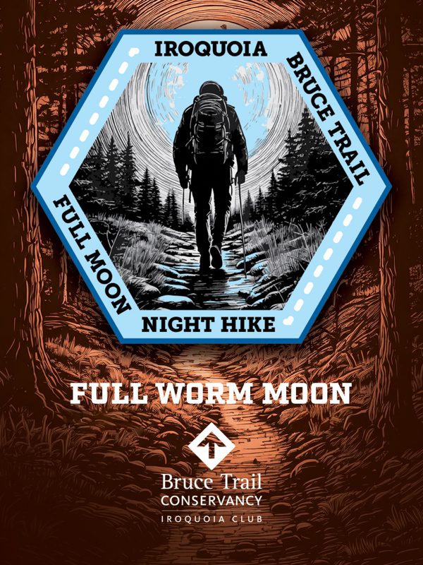
Full Moon Hike - Hendrie After Dark
https://hikes.brucetrail.org/event/full-moon-hike-hendrie-after-dark/Sorry, the registration cut-off time for this hike has been reached.Not a member? Click here to join today!Hosting Club: Iroquoia
Category: Moonlight Hikes
Location (Google Maps):RBG Centre Parking – across from Easterbrook’s 694 Spring Garden Road
Hike Leader(s): Kathrin Koenig Click here to contact Hike Leader(s)
Pace: Medium – 3 to 4 km/hr
Terrain: Dependent on Conditions, Moderate – Some hills and/or some poor footing
Distance: Approx 6 kmDescription
Please be at parking by 7:15 pm as the hike will leave promptly at 7:30 pm.The Full Worm Moon is the third full moon of 2026. Depending on the weather, please bring your poles and icers; dress in layers to keep warm. Bring enough water and snacks to suit your needs. Please remember to bring your headlamp or flashlight. Headlamps with a red or green light setting are the most wildlife friendly, and best for preserving your night vision. Please ensure your device is fully charged/fresh batteries to last the duration of the hike.
We will start by following the outer road at Woodland Cemetery and pick up Grindstone Marsh Trail at Sunfish Pond. Following Grindstone Marsh Trail into Hendrie Valley, we will loop our way along the North and South Bridle Trail to Cherry Hill Gate and back to the cars. There is a set of stairs, one steep-ish downhill section, and a couple of smaller hills.
Please leave dogs at home.
This hike will qualify you for the new Iroquoia Full Moon badge! Complete three leader led-hikes in 2026, and you will qualify. Badges are $10 for BTC members/ $15 for non-members.
Any questions may be directed through “Click here to contact Hike Leader” on this form.
In the event you are no longer able to attend, please remove yourself from registration by following these steps:
– Sign into your account on the BTC website
– Click on My Hikes under your account
– This will take you to a list of hikes you have registered for
– Scroll down to the appropriate hike and cursor over to the far right hand column under the Action column.
– Click Cancel under the hike you wish to cancel - 04March 4, 2026
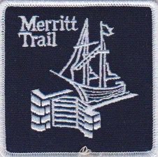
8:30 Merritt Trail Hike Series #1
https://hikes.brucetrail.org/event/830-merritt-trail-hike-series-1-3/Sorry, the registration cut-off time for this hike has been reached.Not a member? Click here to join today!Hosting Club: Niagara
Category: Car Pool
Location (Google Maps): Meet at Merritt Island Building , 8 Merritt Island , Parking Lot Welland. Car Pool to the Smoking Buddha, 265 King Street Port Colborne.Hike Leader(s): Sam Rutherford Click here to contact Hike Leader(s)
Pace: Brisk
Terrain: Easy
Distance: 13 kmsDescription
Hike from Port Colborne to Merritt Island , Welland along the Welland Canal on mainly paved trails. Bring snacks and a drink .Earn the Merritt Trail badge for all 3 hikes.
Car Hike: Iroquoia Winter E2E 1/6
https://hikes.brucetrail.org/event/car-hike-iroquoia-winter-e2e-1-6/Sorry, the registration cut-off time for this hike has been reached.Not a member? Click here to join today!Hike open to BTC Members only.
Hosting Club: Toronto
Category: Car Hike
Location (Google Maps):Twiss rd at #8. N 43.429065,W 79.927324
maps # 10, 11 km 96.8
Hike Leader(s): Smadar Junkin Click here to contact Hike Leader(s)
Pace: Brisk (4-5 km/hr)
Terrain: Challenging, Level 3 (Advanced – steep hills and some scrambling over boulders), Variable
Distance (km): 23.5+Description
First hike of 6 to complete the Iroquoia section for the winter badge. Please register to each day hike separately. We will car shuttle to Hilton Falls and walk back. About 0.5 km extra). Hilton Falls is a paid parking. If anyone has a parking pass please let me know. Everyone is expected to share in the paring cost. Hike is about 23.5 kms, + a walk to Hilton Falls from the 401 bridge. Bring icers, snowshoes and 2litres of water. Date may change due to extreme winter conditions.all hikers are expected to participate in the car shuttles.

Car Hike: Niagara Winter E2E in 5 - #3
https://hikes.brucetrail.org/event/niagara-winter-e2e-in-5-3/Sorry, the registration cut-off time for this hike has been reached.Not a member? Click here to join today!Hike open to BTC Members only.
Hosting Club: Toronto
Category: Car Hike
Location (Google Maps): Rockway Conservation Area, near km 46.3,enter off Pelham Rd just east of Wessel Dr (15), 43.111255,-79.321901. Parking was free in 2025 but we may need to pay now so please be prepared for this. We will shuttle to Decew House Heritage Park, km 29.9, enter from Decew Rd (10), 43.107568,-79.249598Hike Leader(s): Jacqueline Van Dyke Click here to contact Hike Leader(s)
Pace: Brisk (4-5 km/hr), Moderate (3-4 km/hr)
Terrain: Variable
Distance (km): 17kmDescription
Come and join us for one or more of these hikes. The remaining two hikes are March 5 and 6. Hikers must register for individual hikes. Hikes are 14-18 kms and expect an average pace of 4 km/hr with snack/lunch breaks. Please arrive in time to be ready for our 8:30 departure.Hikers should be prepared for the season – layered clothing, hiking boots, icers, snowshoes (if we get fresh snowfall), poles, water, snacks/lunch, first aid kit, and icers.
Hikers should be prepared to share their cars for shuttling – to be shared evenly.
If we encounter unsafe hiking or driving conditions, I will cancel/re-schedule the hike the day before. If you are unable to join us on the day of the hike, please text me at 647-231-0946.

Hilton Falls (reservation required)
https://hikes.brucetrail.org/event/mono-cliffs-provincial-park-6/Sorry, the registration cut-off time for this hike has been reached.Not a member? Click here to join today!Hosting Club: Iroquoia
Category: General Hike
Location (Google Maps): Meet at 8:45 am in the Hilton Falls parking lotHike Leader(s): Karen Bergmann Click here to contact Hike Leader(s)
Pace: Medium – 3 to 4 km/hr
Terrain: Moderate – Some hills and/or some poor footing
Distance: 8 kmsDescription
We will hike a loop around a variety of trails, stopping at the Falls on the way. Reserve your time at conservationhalton.caBring icers for your boots.
Humpday Hikers - CANCELLED HIKE
https://hikes.brucetrail.org/event/humpday-hikers-hockley-valley-provincial-nature-reserve/Sorry, the registration cut-off time for this hike has been reached.Not a member? Click here to join today!Hike open to BTC Members only.
Hosting Club: Caledon Hills
Category: General
Location (Google Maps): Hockley Valley Provincial Nature Reserve side trails. Meeting at parking lot on east side of 3rd Line EHS where access is provided to the Glen Ross Side Trail.Hike Leader(s): Mel Thornley, Jennie Greenfield Click here to contact Hike Leader(s)
Pace: Medium – 3 to 4 km/hour
Terrain: Strenuous – hilly with steep climbs and some poor footing
Distance: 8.5 kmDescription
We’ll be hiking the Glen Cross Side Trail and Isabel East Side Trail, and depending on weather/snow, adding Cam Snell Side Trail.To avoid getting chilled there will be quick stops for clothing adjustments and hydration and a short snack break just over half way through – bring your favorite hiking drink and snacks. Dress in layers, hiking boots and icers / crampons required, poles recommended.
Following the hike anyone interested can enjoy a warm drink and snack at the Hockley General Store.Winter Wednesday Walkers Loree Forest Loop
https://hikes.brucetrail.org/event/winter-wednesday-walkers-loree-forest-loop/Sorry, the registration cut-off time for this hike has been reached.Not a member? Click here to join today!Hosting Club: Beaver Valley
Location (Google Maps): Meet on the shoulder of 21st Sideroad where the road allowance heads up to the trail, east of where the trail comes out at km 8.3, Map 24, Edition 31, paid parking.
Hike Leader(s): Glenda Collings Click here to contact the hike leader.
Pace: Medium
Terrain: Moderate
Length of Hike: Approx. 6 kmDescription
We will be hiking to Loree Forest loop, with views above the ski clubs, mostly flat terrain with one climb up the road allowance to the trail.On winter hikes we may encounter bare ground, light snow, deep snow, or ice. Please bring snowshoes and icers to our Winter Wednesday Walkers outings. Wear appropriate clothing for the weather plus water and a snack.
COVID-19 Precautions Before, During and After your Hike
- Each hiker joining a Bruce Trail Club organized hike must perform a self-screening check before hiking.
Find Ontario’s self-assessment tool here: https://covid-19.ontario.ca/self-assessment/ - If you are experiencing COVID-19 symptoms, stay home.
Other Guidelines
- Arrive 15 minutes before the start of the hike.
- Wear sturdy footwear and appropriate attire for the weather and the terrain.
Hiking poles are a good idea in any season, especially if the terrain is rocky or slippery. In winter, snowshoes or icers/crampons are needed when conditions dictate.
Wearing appropriate clothing and footwear prevents injuries and shows consideration for a safe and positive group hiking experience. - Always carry I.D. and your health card.
- Bring sufficient water and snacks (or lunch if indicated). A minimum of 1L of water is recommended on all hikes, and 3L is recommended for long, challenging hikes in the heat of the summer.
- Bring sunscreen and insect repellent (for spring and summer hikes).
- Bring your own first aid kit.
- Please leave dogs at home.
Hidden and Hendrie Valley Trails
https://hikes.brucetrail.org/event/hidden-and-hendrie-valley-trails/Sorry, the registration cut-off time for this hike has been reached.Not a member? Click here to join today!Hike open to BTC Members only.
Hosting Club: Iroquoia
Category: Good Companions
Location (Google Maps): Meet at the parking lot at 1137 HIDDEN VALLEY ROAD -east side of Road -by the Hidden Valley Park washrooms(NOT the south lot off Lemonville Rd)Hike Leader(s): Kathy Rymal Click here to contact Hike Leader(s)
Pace: Medium – 3 to 4 km/hr
Terrain: Dependent on Conditions, Easy – Mostly flat and usually good footing, Moderate – Some hills and/or some poor footing, Slippery Sections Likely
Distance: 7 kmDescription
We will start in the Hidden Valley and make our way along the Grindstone Creek to the RBG Hendrie Valley Sanctuary.Taking the South Bridle Trail over to the boardwalk overlooking the beautiful marsh and all of its inhabitants we will make our way back along the North Bridle Trail.
It is a lovely walk along the marsh. If you are a birder you might want to bring your binoculars.
Spring like conditions-wet areas-dress for the weather, bring water, hiking poles, icers, snack
Full Moon Evening Hike
https://hikes.brucetrail.org/event/full-moon-evening-hike/Sorry, the registration cut-off time for this hike has been reached.Not a member? Click here to join today!Hosting Club: Sydenham
Category: An evening walk.
Location (Google Maps): Meet in the municipal parking lot by the river on the West side of 1st Ave East between 7th St Est and 8th St East in Owen SoundHike Leader(s): Harriet Nixon Click here to contact Hike Leader(s)
Pace: Medium: 3 to 4 km/h
Terrain: There might be icy and slippery sections.
Distance: Approx 5 kmDescription
Join us for a Full Moon (the Worm Moon) evening hike exploring Sydenham Valley neighbourhoods right in Owen Sound, followed by an opportunity to socialize over refreshments. If conditions are snowy, please wear icers/grippers, as the sidewalks may be icy. There is no need to show up 15 minutes early for this hike, but we will leave promptly at 7:00 pm. - Each hiker joining a Bruce Trail Club organized hike must perform a self-screening check before hiking.
- 05March 5, 2026

Car Hike: Niagara Winter E2E in 5 - #4
https://hikes.brucetrail.org/event/car-hike-niagara-winter-e2e-in-5-4/Sorry, the registration cut-off time for this hike has been reached.Not a member? Click here to join today!Hike open to BTC Members only.
Hosting Club: Toronto
Category: Car Hike
Location (Google Maps): Meet at the parking area off of Cave Springs Rd, access main trail via Margaret Reed Side Trail, near km 64.9, GPS 43.150026,-79.446539. We will shuttle to Rockway CA, enter off Pelham Rd just east of Wessel Dr, near km 46.3, GPS 43.111255,-79.321901. Parking fee at Rockway CA will be shared among passengers and driver does not pay.Hike Leader(s): Jacqueline Van Dyke Click here to contact Hike Leader(s)
Pace: Brisk (4-5 km/hr), Moderate (3-4 km/hr)
Terrain: Variable
Distance (km): 18kmDescription
Join us for one or more of these hikes! Hikers must register for individual hikes. Hikes are 14-18 kms and expect an average pace of 4 km/hr with snack/lunch breaks. Please arrive in time to be ready for our 8:30 departure.Hikers should be prepared for the season – layered clothing, hiking boots, icers, snowshoes (if we get fresh snowfall), poles, water, snacks/lunch, first aid kit, and icers.
Hikers should be prepared to share their cars for shuttling – to be shared evenly.
If we encounter unsafe hiking or driving conditions, I will cancel/re-schedule the hike the day before. If you are unable to join us on the day of the hike, please text me at 647-231-0946.
Car Hike: Iroquoia winter E2E 2/6
https://hikes.brucetrail.org/event/car-hike-iroquoia-winter-e2e-2-6-3/Sorry, the registration cut-off time for this hike has been reached.Not a member? Click here to join today!Hosting Club: Toronto
Category: Car Hike
Location (Google Maps): City View Park, north of km 75.3. Coordinates N 43.352308,W 79.862585 maps 9, 10Hike Leader(s): Smadar Junkin Click here to contact Hike Leader(s)
Pace: Brisk (4-5 km/hr)
Terrain: Challenging, Level 3 (Advanced – steep hills and some scrambling over boulders), Variable
Distance (km): 23.5 kmDescription
2nd hike of the Iroquoia winter E2E. We will car shuttle to Twiss rd and 8 and walk back. Please bring icers, snowshoes and 2 litres of water. Hike date may changed due to bad winter conditions. Be 15 minutes early. Expect to be moving at a pace of 4.5 km per hour.9:00 Long Hike TEMPORARY LOCATION:GLEN ROAD Jordan
https://hikes.brucetrail.org/event/900-long-hike-bailey-bridge-parking-lot-jordan/Sorry, the registration cut-off time for this hike has been reached.Not a member? Click here to join today!Hosting Club: Niagara
Category: Loop
Location (Google Maps): Bruce Trail parking area on Glen RdHike Leader(s): Alan Laver Click here to contact Hike Leader(s)
Pace: Brisk
Terrain: Strenuous
Distance: 10 kmDescription
Hike in and around Ball’s Falls and Jordan.Dress for the weather, poles, icers, layers.
Hiking Around Jordan
https://hikes.brucetrail.org/event/hiking-around-jordan-49/Sorry, the registration cut-off time for this hike has been reached.Not a member? Click here to join today!Hosting Club: Niagara
Category: Hike
Location (Google Maps): Sho’arishon Park (Jordan Hollow)Hike Leader(s): Bill Russell Click here to contact Hike Leader(s)
Pace: Medium
Terrain: Moderate
Distance: 7 kmDescription
Hiking in and around Jordan including Jim Rainforth Trail, Balls Falls and Bailey Bridge alternating every 3 weeks.Urban Walk: Valley View Park Thornhill
https://hikes.brucetrail.org/event/urban-walk-valley-view-park-thornhill-148/Sorry, the registration cut-off time for this hike has been reached.Not a member? Click here to join today!Hosting Club: Toronto
Location (Google Maps): Parking lot is off Sycamore Drive, East of Bayview , across Starbucks plaza
Bus 91 from Finch East station stops at Sycamore station.Hike Leader(s): Mohammad Aghamiri Click here to contact Hike Leader(s)
Pace: Moderate (3-4 km/hr)
Terrain: Hilly, Level 2 (Intermediate – some hills and uneven surfaces, rocks and roots underfoot), Variable
Distance (km): 6-7 kmDescription
We will explore Valleyview and Maple View parks, and walk along German Mill Creak, in return we stop in Huntington park and have snack under beautiful shed.Although this is considered an “Urban Walk”, you can expect some hills up and down and uneven surfaces with tree roots. Please bring hiking poles, Ice cleats water and snacks.
phone number for the day of hike 289 588 6482
Springmount Forest Loop
https://hikes.brucetrail.org/event/springmount-forest-loop/Sorry, the registration cut-off time for this hike has been reached.Not a member? Click here to join today!Hosting Club: Sydenham
Category: Snowshoe Hike
Location (Google Maps): Map 32, just north of km 96.1 at the Springmount Forest parking lotHike Leader(s): Cindy Paczkowski Click here to contact Hike Leader(s)
Pace: Leisurely: 3 km/h or less
Terrain: Easy: Mostly flat and good footing., There are crevices or holes which may be hidden by layers of snow. Hike with extreme caution., There might be icy and slippery sections., There might be sections with water on the trail.
Distance: 5.6 kmDescription
This loop will take us on the red trail in the Springmount Forest. Fairly easy terrain. Be prepared to snowshoe but also bring spikes in case you decide snowshoes aren’t needed for yourself. Bring water and a snack. There are snowmobiles that share some of the trail but only in a few small sections.
- 06March 6, 2026

Car Hike: Niagara Winter E2E in 5 - #5
https://hikes.brucetrail.org/event/car-hike-niagara-winter-e2e-in-5-5/Sorry, the registration cut-off time for this hike has been reached.Not a member? Click here to join today!Hike open to BTC Members only.
Hosting Club: Toronto
Category: Car Hike
Location (Google Maps): Meet at the Grimsby Pool – 1 Elm St. Grimsby, 43.193201, -79.565301. We’ll shuttle to the parking area off of Cave Springs Rd and access the main trail via Margaret Reed Side Trail, near km 64.9, GPS 43.150026,-79.446539 to begin our hike.Hike Leader(s): Jacqueline Van Dyke Click here to contact Hike Leader(s)
Pace: Brisk (4-5 km/hr), Moderate (3-4 km/hr)
Terrain: Variable
Distance (km): 17kmDescription
This is the last hike of this Niagara E2E and therefore, badge day for hikers who have completed the Niagara section. Please have $10 ready if you wish to purchase a Winter E2E badge.Hikers should be prepared for the season – layered clothing, hiking boots, icers, snowshoes (if we get fresh snowfall), poles, water, snacks/lunch, first aid kit, and icers. Please arrive so that you’re ready to leave with our 8:30 shuttle.
Hikers should be prepared to share their cars for shuttling – to be shared evenly.
If we encounter unsafe hiking or driving conditions, I will cancel/re-schedule the hike the day before. If you are unable to join us on the day of the hike, please text me at 647-231-0946.
Iroquoia Winter E2E 3/6
https://hikes.brucetrail.org/event/iroquoia-winter-e2e-3-6-2/Sorry, the registration cut-off time for this hike has been reached.Not a member? Click here to join today!Hike open to BTC Members only.
Hosting Club: Toronto
Category: Car Hike
Location (Google Maps): Same as day 2.Hike Leader(s): Smadar Junkin Click here to contact Hike Leader(s)
Pace: Brisk (4-5 km/hr)
Terrain: Challenging, Level 3 (Advanced – steep hills and some scrambling over boulders), Variable
Distance (km): 16.5 kmsDescription
We will meet at City View Park and shuttle to Sydenham Lookout and walk back. About 16.7 kms. Bring icers, snowshoes, 2 litres of water.
9:00 am Niagara-on-the-Lake Tour
https://hikes.brucetrail.org/event/900-am-niagara-on-the-lake-tour-57/Sorry, the registration cut-off time for this hike has been reached.Not a member? Click here to join today!Hosting Club: Niagara
Category: Urban
Location (Google Maps):Veterans Memorial Park, park just outside the park on King Street
Hike Leader(s): Robin Garrett Click here to contact Hike Leader(s)
Pace: Medium
Terrain: Easy
Distance: 6-7 kmDescription
Each Friday we will explore different neighbourhoods, trails and parkland throughout Historic Niagara-on-the-Lake.Moderate pace with some weeks entirely on sidewalks and roads while others may include a mix of trails and paved pathways. Great way to build up endurance for longer more strenuous hikes.
Prepare for cooler windy conditions on open parkland and along Lake Ontario and Niagara River trails.
Plan to stay for conversation and a warm cup of coffee or tea at Sweets & Swirls, Community Centre, Niagara Stone Road, NOTL
- 07March 7, 2026
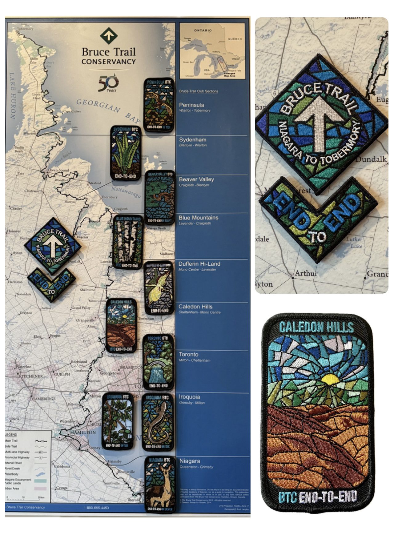
Caledon End to End Fundraiser for the Stained Glass Badge - Mar 7, 8, 14, 15, 2026 - Meet time is 7:45am
https://hikes.brucetrail.org/event/caledon-fundraiser-for-the-stained-glass-badge/Sorry, the registration cut-off time for this hike has been reached.Not a member? Click here to join today!This is a Multi-Day Hike
You are signing up for the following dates:
2026-03-07, 2026-03-08, 2026-03-14, 2026-03-15Hosting Club: Iroquoia, Caledon Hills
Category: Stained Glass Badge End to End Fundraiser Hike
Location (Google Maps): Day 1 – Sat, Mar 7 – Meet at Mono Community Centre, 200m south of Mono Centre (County Road 8). Park in gravel lot. https://maps.app.goo.gl/hW5VcpFWCBhAe5xq7
Shuttle to BT parking lot on the east side of the 5th Line EHS just south of the Hockley Rd https://maps.app.goo.gl/JgGmJD9tjqh1KBGJ7 ~ 21.50kmDay 2 – Sun, Mar 8 – Meet in BT parking lot on the east side of the 5th Line EHS just south of the Hockley Rd https://maps.app.goo.gl/JgGmJD9tjqh1KBGJ7
Shuttle to Roadside parking on Innis Lake Rd north of Finnerty Sideroad https://maps.app.goo.gl/AYqSXpPmFtc4EytN6~ 21kmDay 3 – Sat, Mar 14 – Meet at Roadside parking along the southwest shoulder of the Willoughby Rd and Escarpment Sideroad https://maps.app.goo.gl/sRMCqGTsFX2zWGNeA
Shuttle to Roadside parking on Innis Lake Rd north of Finnerty Sideroad https://maps.app.goo.gl/AYqSXpPmFtc4EytN6 – 15kmDay 4 – Sun, Mar 15 – Meet at Roadside parking at Boston Mills Rd just west of the Mississauga Rd intersection. Note: driveway is private property.
Shuttle southwest shoulder of the Willoughby Rd and Escarpment Sideroad https://maps.app.goo.gl/sRMCqGTsFX2zWGNeA(includes 2.47km of Toronto section) Includes 2.5km of Toronto section – 18.50kmPlease save March 21 for a make-up day in the event of inclement weather.
Hike Leader(s): Ruth Moffatt Click here to contact Hike Leader(s)
Pace: Brisk – 4 to 5 km/hr
Terrain: Dependent on Conditions, Slippery Sections Likely, Strenuous – Hilly with steep climbs and some poor footing
Distance: 72km split over 4 days – daily distance dependent on parking capacitiesDescription
This is a monetized hike with the proceeds going towards the Caledon Bruce Trail Club – “Preserving a ribbon of wilderness for everyone, forever.” Your badge depicting the white-tailed deer, the hike logistics, shared shuttle driving and hike guidance are all included in your fee. Since it is the intention to run a similar hike in all sections this year, why not join the Bruce Trail Conservancy if you are not already a member? Please use my code 67abd1234c568 until the end of 2025 to receive free digital maps as well as all the other great benefits included with membership. https://brucetrail.org/product-category/memberships/Registered participants will receive a WhatsApp invitation (optional) which can be used for photo share.
Please read all details for this hike to ensure it is suitable for you. The pace and terrain are particularly important details.
You must be registered to participate in this group hike. You cannot just show up as there are often people on the waitlist.
This is a multi-day hike – Mar 7/8, 14/15, 2026. Please save March 21 for a make-up day in case there is inclement weather.
Please ensure your car is car shuttle-ready with at least 4 available seatbelts including the driver’s. We will take turns either being the shuttle driver or driving the drivers back to their cars after the hike is over.
Please pack whatever food you will require for a long day hike including lunch and snacks; 2l of water minimum; first aid kit; poles if you use them; and icers. You may also wish to pack extra socks and rain gear. Remember to dress in layers. Gloves/mitts, scarf / neck gator, a toque and a puffy jacket. Consider snow shoes, depending on conditions.
We will break for a morning clothing adjustment, a 10min break around 10am, 15 min lunch and an afternoon break if we are finishing after 2pm. Bio-breaks are as you need them – please let the sweep know who will wait for you. This is a 4 day group hike so it is important you keep pace with the person in front of you. We will help each other and wait for one another but please consider your physical ability before signing up for this hike. There are no drop outs – if you are not able to finish the hike you will need to arrange for transportation back to your car via taxi or Uber at your cost.
The Caledon stained-glass badge will be presented on the last day. If you have to miss one of these hiking days, you may make it up on your own before the last day of the series. Since it is a group hike, it is intended that everyone who registers be present on all days.
Any questions may be directed through contact on this form.
If you cannot make it, please remove yourself from registration.To cancel your registration, here is a step by step:
– Sign into your account on the BTC website
– Click on My Hikes under your account
– This will take you to a list of hikes you have registered for
– Scroll down to the appropriate hike and cursor over to the far right hand column under the Action column.
– Click Cancel under the hike you wish to cancelCar Hike: Bethesda Trail Richmond Hill
https://hikes.brucetrail.org/event/car-hike-bethesda-trail-richmond-hill-40/Sorry, the registration cut-off time for this hike has been reached.Not a member? Click here to join today!Hosting Club: Toronto
Category: Car Hike
Location (Google Maps): Oak Ridges Corridor, Bethesda Trail Head Parking Lot, Bethesda Side Road, Richmond Hill, OntarioHike Leader(s): Mohammad Aghamiri Click here to contact Hike Leader(s)
Pace: Moderate (3-4 km/hr)
Terrain: Hilly, Level 2 (Intermediate – some hills and uneven surfaces, rocks and roots underfoot), Variable
Distance (km): 14-15 kmDescription
Join us to explore the trails of York Regional Forest and the Oak Ridges Corridor at Jefferson Forest and Bond lake,From parking lot we hike thought Jefferson forest and continue to Bond Lake and have snack beside the lake and return to parking around 13 to 13.30
Please bring lots of water and snacks ,hiking poles are recommended
phone number for the day of hike 289 588 6482
School Bus Hike Toronto Section Winter Badge End to End #5 of 6
https://hikes.brucetrail.org/event/school-bus-hike-toronto-section-winter-badge-end-to-end-5-of-6/Sorry, the registration cut-off time for this hike has been reached.Not a member? Click here to join today!Trip Information
Departure Time: 08:30
Return to City Time: 18:00
Departure Point: York Mills Bus PickupOptional Items
Hosting Club: Toronto
Category: Bus Hike
Location (Google Maps):Toronto Section, Silver Creek/Terra Cotta
Hike Leader(s): George Lennon, Janet Patterson Click here to contact Hike Leader(s)
Pace: Leisurely (2-3 km/hr)
Terrain: Challenging, Level 2 (Intermediate – some hills and uneven surfaces, rocks and roots underfoot), Variable
Distance: 10 kmDescription
We will be hiking in winter conditions of ice and snow so these will be slower and shorter hikes than in other seasons. Icers or snowshoes are mandatory, and gaiters and poles recommended. The terrain is not too hilly, but the footing is treacherous in winter with many uneven, rocky sections to navigate. The leaders will let registrants know in advance if snowshoes are feasible for the day. Please bring at least 2L of water, snacks, and your lunch. Any hikers are welcome to join the hikes regardless of whether a person is working towards a badge. Those who complete all 6 hikes will qualify for the Toronto club’s Winter E2E badge. The fee is $10 per badge ($15 for non-members) and will be collected by the hike leader on trip #4. Or you may choose to purchase the special Fundraising End to End badge for $30.This fifth hike in the series will take us through Silver Creek and Terra Cotta Conservation Areas from the Eighth Line side trail to the Terra Cotta parking lot on Winston Churchill Blvd. There will be a refreshment/social stop in Georgetown after the hike before returning to the York Mills Station departure point by 6:00 PM.
Car Hike: Hockley Valley Provincial Nature Reserve
https://hikes.brucetrail.org/event/car-hike-hockley-valley-provincial-nature-reserve-4/Sorry, the registration cut-off time for this hike has been reached.Not a member? Click here to join today!Hosting Club: Caledon Hills
Category: General
Location (Google Maps): WE WILL BE PARKING AT THE NORTHERN PART OF THE PARK ON DUNBY RD. – NOT AT THE MAIN PARKING LOT. Roadside parking on the south side of Dunby Rd. at km 67.8Hike Leader(s): Dylan “Lana” Hubbard Click here to contact Hike Leader(s)
Pace: Medium – 3 to 4 km/hour
Terrain: Strenuous – hilly with steep climbs and some poor footing
Distance: 16 kmDescription
Join us for a 16 km hike through the Nature Reserve, known for being one of the most challenging and hilly sections of the Bruce Trail. Get ready for a workout.We will be hiking at a moderate-fast pace. Please bring plenty of water and snacks. HIKE BEGINS AT 8:30 AM.
We are committed to providing an inclusive and welcoming environment. This hike is an 2SLGBTQIA+ safe space, and everyone is welcome to join us!
Car Hike Dufferin Hi-Land End2End 2/4
https://hikes.brucetrail.org/event/car-hike-dufferin-hi-land-end2end-2-4/Sorry, the registration cut-off time for this hike has been reached.Not a member? Click here to join today!Hosting Club: Toronto, Dufferin Hi-Land
Category: Car Hike
Location (Google Maps):Roadside Parking – on Prince of Wales Rd just off 20 Sideroad. GPS N44.200231, W80.164257. Km 40.7, Map 21, Edition 31
Hike Leader(s): Ross Estrella Click here to contact Hike Leader(s)
Pace: Moderate (3-4 km/hr)
Terrain: Challenging, Hilly, Level 2 (Intermediate – some hills and uneven surfaces, rocks and roots underfoot), Rocky
Distance (km): 18Description
This is DHBTC E2E in 4. E2E hikers are rewarded the club coveted E2E badge upon completion. However, joiners must complete the four series hikes to earn their badge. Missed segment/s must be made up prior to the completion of the last leg to receive their badge. We’ll be on a moderate pace to enjoy, see and feel the stunning landscape and acquaint ourselves with the other souls on the group. Day hikes essentials to bring, lunch/snacks, sufficient preferred liquid hydration, sun screen, bug spray, head covering for sun protection, appropriate clothing for the weather, personal medication/s (if any), health card, happy face and your enthusiasm. Hiking shoes and poles are highly recommended. Please note that “Icers are Mandatory” to carry from the on set of Winter to mid-April. Showing up at meet up location for non-compliance will result to be refuse joining the group. Make sure you and your car are shuttle ready as everybody are expected to participate. Cost of badge is 10 dollars for BTC member and 15 dollars for non-member.Please arrive fifteen minutes early for car shuttling.
This is a H4H-H4F !!! hike. If this schedule suits you, your welcome to join.
Note: To reach the specific parking lot location, use GPS Coordinates, specified in the meet-up location above.
Figure 8 of Merritt Trail, beginning and ending at Sobey's Parking lot.
https://hikes.brucetrail.org/event/figure-8-of-merritt-trail-beginning-and-ending-at-sobeys-parking-lot/Sorry, the registration cut-off time for this hike has been reached.Not a member? Click here to join today!Hosting Club: Niagara
Category: Loop
Location (Google Maps): Sobey’s parking lot at the corner of Glendale Ave and Merritt RdHike Leader(s): Lauren Doig Click here to contact Hike Leader(s)
Pace: Brisk
Terrain: Easy
Distance: 12 kmDescription
Meet in Sobey’s Parking lot near the intersection of Glendale and Merritt St.We will make a figure 8, hiking along the Merritt Trail, around Richart Pierpoint Park, then back towards Sobey’s Parking lot. The top half of the hike will follow the Main trail, then link up with the Merritt Trail and return to Sobey’s Parking lot.
Port Dalhousie Tour
https://hikes.brucetrail.org/event/port-dalhousie-tour/Sorry, the registration cut-off time for this hike has been reached.Not a member? Click here to join today!Hosting Club: Niagara
Category: Loop
Location (Google Maps): Meet in Jaycee Gardens Park, 543 Ontario St, St CatharinesHike Leader(s): Margaret Northfield Click here to contact Hike Leader(s)
Pace: Medium
Terrain: Easy
Distance: 10-11kmDescription
Start and finish in Jaycee Gardens Park. Mostly urban hike with some trails mixed in. Walking the Green Ribbon Trail. Bring water and snack. Wear hiking shoes with good grip, may be some icy spots. May use poles with tips.
CANCELLED - Speyside to Vanderleck ST return
https://hikes.brucetrail.org/event/speyside-to-vanderleck-st-return-5/Sorry, the registration cut-off time for this hike has been reached.Not a member? Click here to join today!Hosting Club: Iroquoia
Category: General Hike
Location (Google Maps): Meet at the Speyside Pear Tree parking lot on 15 Side Road at 9:15 am.Hike Leader(s): Karen Bergmann Click here to contact Hike Leader(s)
Pace: Medium – 3 to 4 km/hr
Terrain: Moderate – Some hills and/or some poor footing
Distance: 8 kmsDescription
Meeting at 9:15 am, we will hike the main trail from Speyside, to the Al Shaw ST, Hilton Falls ST and onto the Vanderleck ST up to 17 Side Road and then return the same way. There are some very technical (rocky) sections on this hike but no major hills. Bring icers for your boots, in case we have snow. Hike is dependent on weather.Soup's On Hike! Quiet Valley
https://hikes.brucetrail.org/event/soups-on-hike-quiet-valley-2/Sorry, the registration cut-off time for this hike has been reached.Not a member? Click here to join today!Hosting Club: Beaver Valley
Location (Google Maps): Meet in the laneway of Norine & Garth’s home, 412 Quiet Valley Road. GPS does not always go to this address properly so here are the details. Quiet Valley Road is south off Epping Road/Sideroad 19. To access Sideroad 19 from the west use Grey Rd. 7 just south of The John Muir/Epping lookout (Quiet Valley Rd will be off Sideroad 19 on your right down the big hill). To access Sideroad 19 from the east use Grey Rd. 13 south of Heathcote (Quiet Valley Road will be off Sideroad 19 on your left before the big hill).
Hike Leader(s): Glenda Collings Click here to contact the hike leader.
Pace: Medium
Terrain: Moderate
Length of Hike: 1.5 to 2 hours, approx. 5 kmDescription
SOUP’S ON! Join us for a lovely snowshoe on the adjoining properties of Norine & Garth and Betty & Mike, where mature forest offers protection from the wind and views of Old Baldy may be seen if it’s a clear day. Afterward we’ll enjoy a warming lunch in Norine & Garth’s home. They will provide the soup, plus coffee & tea and you’ll bring a sandwich, or your choice of accompaniment to go with it. If you’d like to bring goodies to share for dessert, feel free! Folks are welcome to show up just for the lunch, or conversely, just for the hike, or both. If you are there just for lunch, please arrive about 12:00p.m. We may still be on the trail. Depending on the conditions, we may use snowshoes, icers or just boots, so please come prepared. If you have any questions please contact beavervalleytrailactivities@gmail.com. The hike leader will inform the group in the morning on March 7 if weather conditions preclude the hike. Hope to see you there! Please car pool if possible.COVID-19 Precautions for your Hike
- Each hiker joining a Bruce Trail Club organized hike must perform a self-screening check before hiking.
Find Ontario’s self-assessment tool here: https://covid-19.ontario.ca/self-assessment/ - If you are experiencing COVID-19 symptoms, stay home.
Transportation
All hikers are responsible for their own transportation to and from the hike.
Currently, there are no car shuttles on hikes – all hikes must be out-and-back or loop hikes.
Other Guidelines
- Arrive 15 minutes before the start of the hike.
- Wear sturdy footwear and appropriate attire for the weather and the terrain.
Hiking poles are a good idea in any season, especially if the terrain is rocky or slippery. In winter, snowshoes or icers/crampons are needed when conditions dictate.
Wearing appropriate clothing and footwear prevents injuries and shows consideration for a safe and positive group hiking experience. - Always carry I.D. and your health card.
- Bring sufficient water and snacks (or lunch if indicated). A minimum of 1L of water is recommended on all hikes, and 3L is recommended for long, challenging hikes in the heat of the summer.
- Bring sunscreen and insect repellent (for spring and summer hikes).
- Bring your own first aid kit.
- Please leave dogs at home.
Saturday Shorts - Cheltenham
https://hikes.brucetrail.org/event/saturday-shorts/Sorry, the registration cut-off time for this hike has been reached.Not a member? Click here to join today!Hosting Club: Caledon Hills
Category: General
Location (Google Maps): Starting from the Cheltenham Brickyards Trans Canada Trail parking lot on Mississauga Road.Hike Leader(s): Lynn Dobson Click here to contact Hike Leader(s)
Pace: Leisurely – 3 km/hour or less
Terrain: Moderate – some hills and/or some poor footing
Distance: 4.5 KmDescription
This is a loop hike in Cheltenham. We will hike along the Trans Canada Trail, through Cheltenham and back to the Brickyards. A stop at the Cheltenham General Store will be included. - Each hiker joining a Bruce Trail Club organized hike must perform a self-screening check before hiking.