Hike Schedule
Join us for a hike! Registration required:
All hikes available to BTC members. Some hikes are open to non-members.
TIP: The calendar view displays up to 7 hikes on a day, but often there are more. Click “More events” to see them all.
Categories
- 29March 29, 2026

Boots and Books - The Iroquoia Bruce Trail Book Club
https://hikes.brucetrail.org/event/boots-and-books-the-iroquoia-bruce-trail-book-club/Sorry, the registration cut-off time for this hike has been reached.Not a member? Click here to join today!Hosting Club: Iroquoia
Category: Boots and Books – The Iroquoia Bruce Trail Book Club
Location (Google Maps): Chedoke Golf Club Parking lot – Access from Beddoe Dr off Studholme Rd South of AberdeenHike Leader(s): Ruth Moffatt Click here to contact Hike Leader(s)
Pace: Leisurely – 3km/hr or less, Medium – 3 to 4 km/hr
Terrain: Easy – Mostly flat and usually good footing
Distance: Approx 8kmDescription
Welcome to the first Iroquoia Bruce Trail Book Club – “Boots and Books”Book – Remarkably Bright Creatures by Shelby Van Pelt – Please check your local library for available copies of this book.
We will hike from the Chedoke Golf Club parking lot west on the Bruce Trail where most of our hike will be on the Chedoke Radial Trail – about 8km which will take about 2-2.5 hours approximately. Please wear suitable foot wear, dress for the weather and bring poles if you use them and icers as the trail may still be icy depending on how spring arrives. Please bring enough snacks and water suitable for the length of the hike and duration and all the other items you require in your back pack. It is not necessary to bring the book.
The next book will be chosen amongst the group. The next hike will be near the end of April, once a month depending on weather.
The hike is open to everyone whether you have read the book or not but there will be spoilers. It will be open to 10 people to keep it more intimate for discussing the book.
If your plans change, please cancel your registration so that people who are waitlisted may join.
To cancel your registration, here is a step by step:
– Sign into your account on the BTC website
– Click on My Hikes under your account
– This will take you to a list of hikes you have registered for
– Scroll down to the appropriate hike and cursor over to the far right hand column under the Action column.
– Click Cancel under the hike you wish to cancelCar Hike: Jefferson Forest (Richmond Hill)
https://hikes.brucetrail.org/event/car-hike-jefferson-forest-richmond-hill-11/Sorry, the registration cut-off time for this hike has been reached.Not a member? Click here to join today!Hosting Club: Toronto
Category: Car Hike
Location (Google Maps):1245 Bethesda Side Rd, Richmond Hill, ON L4E 1A2 ( Bethesda Trail Head Parking lot)
Hike Leader(s): Amir Alemohammad Click here to contact Hike Leader(s)
Pace: Moderate (3-4 km/hr)
Terrain: Flat, Hilly, Level 2 (Intermediate – some hills and uneven surfaces, rocks and roots underfoot), Variable
Distance (km): 10-11 kmDescription
Let’s roll the hills of the Jefferson Forest this winter! Every weekend, we’ll explore the winter wonderland at this beautiful park. Located in the heart of Richmond Hill, it boasts numerous hiking trails. This 3-hour hike can range from 10 to 12 kilometres, depending on the weather conditions. Remember to bring water, snacks, hiking boots, icers, poles, and your camera. Not recommended for beginners. Park in the free Bethesda parking lot and avoid parking along the road. Dress appropriately for the weather. Difficulty Level: 2 (Moderate).Please arrive @8:45AM for start of 9:00AM.
This is a joint hike with the Oak Ridges Trail Association (ORTA).
Limehouse and Speyside Loops
https://hikes.brucetrail.org/event/limehouse-and-speyside-loops/Sorry, the registration cut-off time for this hike has been reached.Not a member? Click here to join today!Hike open to BTC Members only.
Hosting Club: Dufferin Hi-Land
Category: General Hike
Location (Google Maps): Limehouse Conservation Area: Parking at the baseball diamonds. Access from Fifth Line south of the village of Limehouse. 43.63294746523793 -79.97092185711668Hike Leader(s): Stuart Law Click here to contact Hike Leader(s)
Pace: Medium
Terrain: Moderate, Slippery Sections Likely
Distance: 17 kmsDescription
Join us on the main trail and the Canada Goose Side Trail to Speyside and back from Limehouse. Rocky sections for sure and some road walking. Please bring icers. Please also dress in layers and bring water, a warm drink, a snack, a lunch and a smile. Check the BTC website for what should be in your backpack. Please arrive at 9:00 am to be ready to hike at 9:15 am sharp. Please be honest with yourself about your fitness level. No drop outs. No dogs.
Terra Cotta/Heritage Road loop
https://hikes.brucetrail.org/event/terra-cotta-heritage-road-loop/Sorry, the registration cut-off time for this hike has been reached.Not a member? Click here to join today!Hosting Club: Iroquoia
Category: General Hike
Location (Google Maps): Roadside on Winston Churchill Blvd, just north of Terra Cotta Conservation Area. Meet at 9:15 am, earlier if you can, as parking is limited.Hike Leader(s): Karen Bergmann Click here to contact Hike Leader(s)
Pace: Medium – 3 to 4 km/hr
Terrain: Moderate – Some hills and/or some poor footing
Distance: 8.5 kmsDescription
We will meet at 9:15 am roadside on Winston Churchill Blvd, just north of Terra Cotta. Parking is limited, so try to come closer to 9 am in case there are other cars.Hiking along the main trail, across Heritage Rd and around to the Rockside Side Trail and back on the main trail to the cars. This trail has some easy parts and some challenging rocky parts, so come prepared. There’s a bit of road walking. Bring icers for your boots. Hike is dependent on weather conditions.
Car Hike: Hike #5 of 5 to earn the Toronto Side Trails Badge!
https://hikes.brucetrail.org/event/car-hike-hike-5-of-5-to-earn-the-toronto-side-trails-badge/Sorry, the registration cut-off time for this hike has been reached.Not a member? Click here to join today!Hosting Club: Toronto
Category: Car Hike
Location (Google Maps): We will meet at the Trafalgar & 401 Commuter Lot (43.571569, -79.831797) and then carpool to the start of the hike.Hike Leader(s): Monica Pasquali Click here to contact Hike Leader(s)
Pace: Leisurely (2-3 km/hr), Moderate (3-4 km/hr)
Terrain: Level 2 (Intermediate – some hills and uneven surfaces, rocks and roots underfoot)
Distance (km): 10.98 kmDescription
This is the fifth hike in a series of five hikes that have been offered approximately one Sunday per month so that participants could earn the Toronto Side Trails Badge during the winter and early spring.For this fifth and final hike we will explore three side trails in the Toronto section of the Bruce Trail: the Canada Goose Side Trail, the Brown Benton Side Trail, and the Charles Hildebrandt Side Trail.
Please dress appropriately for an early spring hike by dressing in layers (wear an inner layer that wicks sweat away from your skin, a middle layer that keeps you warm, and an outer layer that protects you from wind, rain, and snow), wearing gloves/mittens and a toque, and wearing warm and comfortable footwear that has good traction in snow/ice/mud (please bring your icers because there may still be ice on the trail even though it’s spring). Hiking poles or walking sticks are an asset since they will help keep you balanced if the ground is slippery. As well, make sure you bring enough water and food for a 4 hour hike since we’ll be covering a total distance of 10.98 km over terrain that has some hills and exposed rocks.
As we have done for the other hikes in this series, we will meet at the Trafalgar & 401 Commuter Lot (43.571569, -79.831797) and then carpool to the start of the hike. Please be prepared to participate in the carpool by ensuring you have space in your car if you are not already carpooling with others to the Commuter Lot meeting point.
After the hike, interested participants can join me at the Tim Horton’s on Trafalgar Road just a bit south of Highway 401 for some post-hike refreshments to celebrate our accomplishment 🙂
Looking forward to exploring some of Toronto’s side trails with you!
Urban Walk - Toronto Urban Badge Hike - 4 of 7
https://hikes.brucetrail.org/event/urban-walk-toronto-urban-badge-hike-4-of-7-3/Sorry, the registration cut-off time for this hike has been reached.Not a member? Click here to join today!Hosting Club: Toronto
Category: Urban Walk
Location (Google Maps): Finch Hydro Corridor WestHike Leader(s): Brian Rideout Click here to contact Hike Leader(s)
Pace: Moderate (3-4 km/hr)
Terrain: Flat
Distance (km): 11.4 kmDescription
Please join me at the north west corner of Finch and Weston by 10 AM. We will hike east along the Finch Hydro Corridor Trail to Bathurst St (N of Finch) (km 30.2 to km 41.6). Here is an online map with km markings of our route for all 7 hikes for the Toronto Urban Badge: https://onthegomap.com/s/c2c1hf3nPlease make sure you bring at least 2 liters of water, a lunch, and icers.
Spring & Migration Monitor Hike
https://hikes.brucetrail.org/event/spring-migration-monitor-hike-11/Sorry, the registration cut-off time for this hike has been reached.Not a member? Click here to join today!Hosting Club: Peninsula
Location (Google Maps): Cottrill Lk Hike: meet at km 180.7 Borchardt Parking Lot. Parking is free this time of year. Special Guest Hiker: retired Air Canada Captain, Cathy Fraser, will give her aerial perspective of human flight migratory routes and how we communicate – sometimes very similarly to our feathered friends!
Hike Leader(s): Tamara Wilson Click here to contact Hike Leader(s)
Pace: Leisurely (2.0 – 3.0 km/h): A relaxed pace with frequent breaks and a focus on enjoyment.
Terrain: Difficult: Steep ascents/descents, rocky scrambling, and some rugged escarpment paths.
Distance: 6kmDescription
Starting on the Borchardt Rd parking lot (km 108.7), we will follow the Minhinnik ST to the Lillie Family parking area on Britain Lk Rd at the Cotrill Lake ST (110.8 km) we will loop around the Cotrill Lk ST spending time on the shores looking for the arrival of water fowl. On the return trip to the cars, we will follow the Main Trail South, looking for grebes, loons and other shoreline birds that frequent Dyers Bay. We will visit the Devil’s Monument viewing platform, and check out the waterfall before heading back to the parking lot along Devil’s Monument ST and the Minhinnik to Borchardt Rd. Throughout our hike, we will keep an eye out for the arrival of spring flowers and other harbingers of spring. This route is quite rocky in places with stairs. The Trail may be wet and muddy around Cotrill Lake. We will be taking stairs down to the viewing platform and the waterfall. Total distance is around 8 km. This hike may take 3 hours to complete. Pack snacks and drinks accordingly. Hike guest, retired Air Canada Captain, Cathy Fraser, will share her aerial perspectives of flight routes over the Peninsula and beyond – yes – often the same routes taken by our feathered friends! Cathy will share perspectives of communications with Air Traffic control and how mankind stays on course while in the air.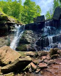
RAINBOW HIKE: Spring Reset Hike on the Chedokee Trail
https://hikes.brucetrail.org/event/rainbow-hike-spring-reset-hike-on-the-chedokee-trail/Sorry, the registration cut-off time for this hike has been reached.Not a member? Click here to join today!Hosting Club: Iroquoia
Category: Rainbow Hike
Location (Google Maps): Hillcrest Loop, bottom of Dundurn Stairs, next to bus stopHike Leader(s): Doug O’Neill Click here to contact Hike Leader(s)
Pace: Leisurely – 3km/hr or less
Terrain: Easy – Mostly flat and usually good footing
Distance: Approx. 7 kmDescription
Shake off winter and get ready for spring hiking with this uber-friendly, all-inclusive 2SLGBTQIA+ Rainbow Hike.This 7-km hike, on established park trails as well as some Bruce Trail side trails, is perfect for anyone getting back into hiking after a winter break—or for those who simply want a relatively easy outing on a Sunday morning. Expect a relaxed jaunt outdoors.
There are no hills.
Dog-friendly.
Meeting time Please arrive by 9:45 a.m. for a 10 a.m. start
Duration: Expect a 2.5 outing, allowing for water/snack breaks.
Where we’ll meet: We’ll start at Hillcrest Loop, at the top of Dundurn Street just below the Dundurn Steps, follow the Chedokee Trail westward for about 3.5 km, and then return to our starting point—perhaps using a different side trail to change things up.This queer-led, all-inclusive hike is designed to provide a safe, welcoming space for 2SLGBTQIA+ hikers—including Two-Spirit, trans, gay, lesbian, bisexual, queer, intersex, and asexual folks, as well as allies and friends. Show up, be your authentic self, and have fun.
Coming by transit? The No 7 Hillcrest Loop bus will drop you off right where we begin the hike.
Parking: street parking, especially side streets off Dundurn.What to Bring:
• Water and energizing snacks.
• Sense of humour always helps 🙂
• Dress in layers.
• Hiking boots or sturdy shoes.
• Packing rain gear is always wise.
• Gaiters are recommended if ground is wet/muddy.Free Bruce Trail Rainbow badges for first-time Rainbow hikers!
Questions? Simply click “Contact Hike Leader” on the registration form.PLEASE DON’T BE A NO-SHOW Plans change. C’est la vie. But you don’t want your hiking group waiting around for you if you’re not coming. Very simple solution: Cancel your Bruce Trail hike registration by logging into the BTC website, go to your “My Hikes” section, find the hike, and click “cancel”; if it’s last minute (under 24 hours), you can also email the Hike Leader directly as a courtesy to the volunteers.
CHBTC Read & Chat Hike #1 "Vanished Beyond the Map"
https://hikes.brucetrail.org/event/chbtc-read-chat-hike-1-vanished-beyond-the-map/Sorry, the registration cut-off time for this hike has been reached.Not a member? Click here to join today!Hosting Club: Caledon Hills
Category: General
Location (Google Maps): Will we meet in the outdoor pavilion behind the Caledon East Centre/Library and read and chat on the Caledon Trail. There is plenty of parking and bathrooms at the centre. Reach out if any questions.Hike Leader(s): GG Click here to contact Hike Leader(s)
Pace: Leisurely – 3 km/hour or less, Medium – 3 to 4 km/hour
Terrain: Easy – mostly flat and usually good footing
Distance: 8 kmDescription
Introducing Read & Chat HikesLove to read? Love to hike? Looking to enjoy both while making friends? We got you covered with Read & Chat hikes!
Our first book will be Adam Shoalts’ “Vanished Beyond the Map”. The hike is open to everyone whether you have read the book or not but there will be spoilers. Adam will be speaking at the CHBTC AGM on April 26th so this is a great opportunity to chat his work ! I’ll also share why the book was picked for inaugural read.
It will be open to 10 people to keep it more intimate for discussing the book. If your plans change, please cancel your registration so that people who are waitlisted may join.
The Caledon Trail is mostly flat but can get muddy. Wear layers, good shoes, bring water and snacks and get ready to chat 🙂 Post hike there will be an optional connect at the Four Corners Bakery on Airport Road for fab treats and beverages.
Happy reading! Reach out if any questions. Cheers

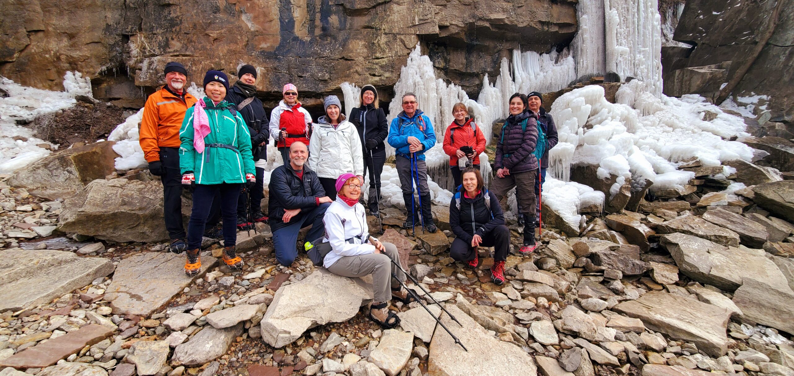
NBTC Diversity & Inclusion Committee Open Meeting & GeoHike (at Cave Spring Winery!)
https://hikes.brucetrail.org/event/nbtc-diversity-inclusion-committee-open-meeting-geohike-at-cave-spring-winery/Sorry, the registration cut-off time for this hike has been reached.Not a member? Click here to join today!Hike open to BTC Members only.
Hosting Club: Niagara
Category: In and Out
Location (Google Maps):Cave Springs Conservation Area, 3949 Cave Spring Rd, Lincoln
Hike Leader(s): Kristin Hanson Click here to contact Hike Leader(s)
Pace: Leisurely
Terrain: Moderate
Distance: 1.7KMDescription
Join the NBTC DEIB (diversity, equity, inclusion and belonging) committee on a hike followed by our quarterly ‘open meeting’ at which we will explore ways to increase the diversity of hikes on our hike schedule to encourage more hikers to join our community!Schedule:
12:45pm: Arrive 15 mins prior to hike at Cave Springs Conservation Area
1:00 pm: Depart on a GeoHike to learn a little about area geology and terroir of the Beamsville Bench wine region. Hike description is below.
2:15pm: After the hike, we will meet at Cave Spring Winery in their nearby vineyard tasting room. Wine, non-alcoholic beverages are available for a fee for those who wish to partake.
2:30pm: They have reserved a room for us to hold our DEIB committee open meeting there. The meeting is expected to wrap up by 4:00pm. Registration includes both the hike and the meeting. For those not wishing to hike, they can convene at Cave Springs vineyard tasting room in Beamsville at 2:15. There is a reservation in the name of Kristin Hanson.
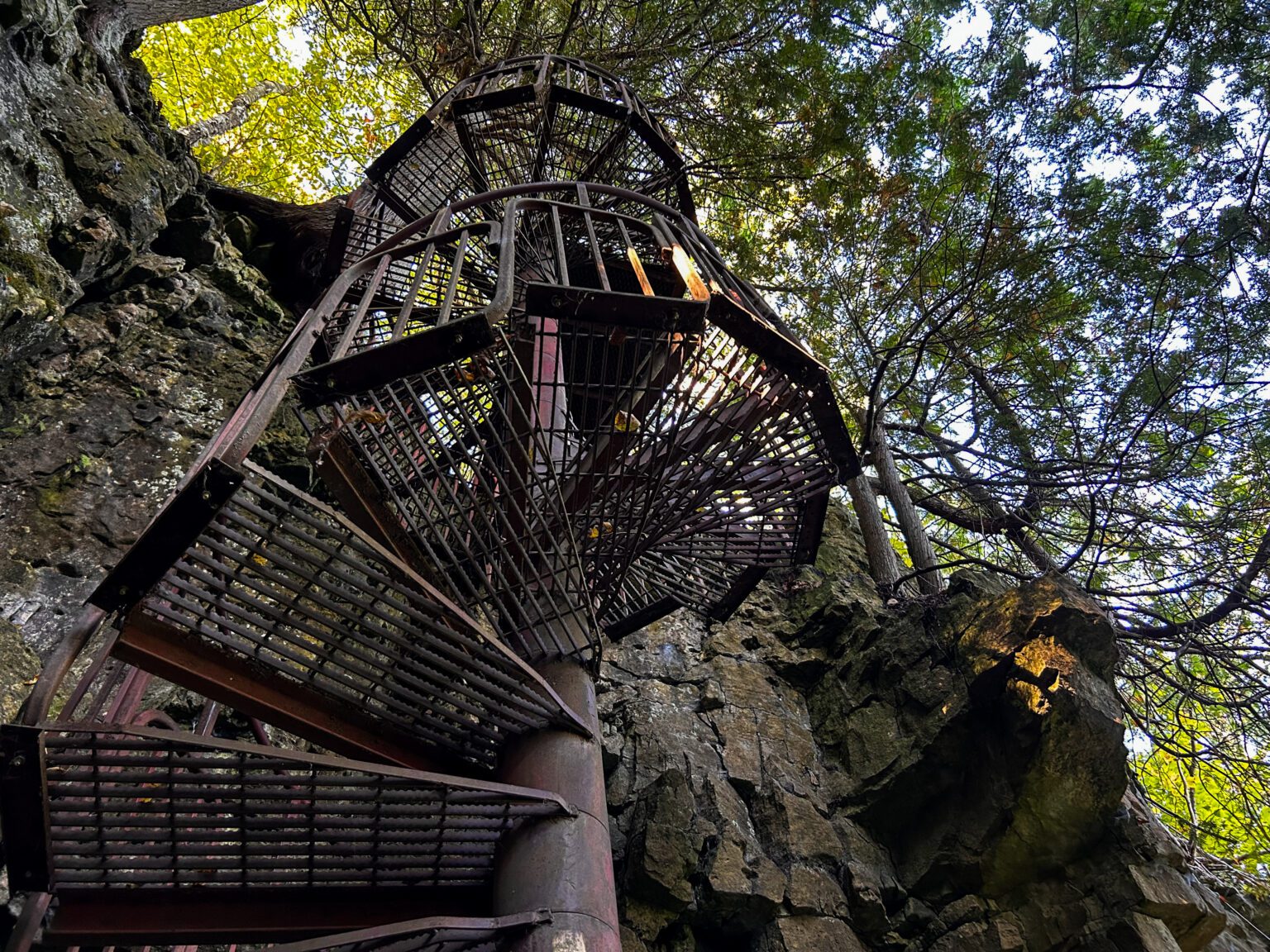
Cave Springs GeoHike: This is a short hike accessible to new hikers. From the Cave Springs Conservation Area parking lot, we will hike along the Ice Cave Trail, the Margaret Reed Side Trail and the main Bruce Trail, stopping to explore and discuss the geology of the Niagara Escarpment, the Beamsville Bench wine region and the physiographic and geologic conditions that make it special. After a short in-and-out hike on the Ice Cave Trail, we will slowly begin an incline up the Margaret Reed side trail as we scale the Niagara Escarpment. We will consider the 450+million years of history we are hiking through as we make our way slowly to the top. We will stop along the way to discuss and rest. Once at the top, the terrain on the Bruce Trail is generally flat but footing may be uneven. It may be icy or wet and slippery. Hiking poles will make the ascent easier and give more stability on uneven footing. We will hike to the site of the very first blaze on the Bruce Trail and admire the views of Lake Ontario and the vineyards of Cave Spring and Malivoire wineries. Winter offers the most unobstructed views of this beautiful area. We will return the way we came.
Walk In Nature Series (WINS) - Bayview Escarpment Nature Reserve
https://hikes.brucetrail.org/event/walk-in-nature-series-wins-bayview-escarpment-nature-reserve/Sorry, the registration cut-off time for this hike has been reached.Not a member? Click here to join today!Hosting Club: Sydenham
Category: General Hike
Location (Google Maps): Click the (Google Maps) link on the left to direct you to parking.GPS coordinates: 44.6375, -80.7334
Offroad parking at the curve in the road of the St. Vincent-Sydenham Townline, 5 km north of Hwy 26.
Or use the Bruce Trail app that links to Google Maps to drive there by clicking on P then Roadside Parking then Get Directions.
Or look in the Bruce Trail Reference guidebook Edition 31, Map 30 at km 52.7
Hike Leader(s): Stewart Brown Click here to contact Hike Leader(s)
Pace: Medium: 3 to 4 km/h
Terrain: Moderate: Some hills and/or poor footing, There might be muddy sections., There might be icy and slippery sections.
Distance: 4.8 kmDescription
The Walk In Nature Series (WINS) consists of 2 hour hikes in the Sydenham section of the Bruce Trail that combine nature appreciation with fitness in a safe and welcoming group environment led by an experienced hike leader. Consider these hikes to be appointments with yourself in nature that promote health and fitness.On this WINS hike, absorb the calm while walking through the mature forests of the Bayview Escarpment Provincial Nature Reserve. Includes a panoramic view from Legacy Ridge side trail over the Sydenham countryside. Registrants will be sent an email the day before the hike with an update of trail conditions and what to bring and the best footwear to choose.
- 30March 30, 2026
EASY DOES IT HIKE Glenridge Quarry Naturilization Site
https://hikes.brucetrail.org/event/easy-does-it-hike-glenridge-quarry-naturilization-site-2/Sorry, the registration cut-off time for this hike has been reached.Not a member? Click here to join today!Hosting Club: Niagara
Category: Leisurely
Location (Google Maps): Park at Glenridge Quarry Naturilization Site parking lotHike Leader(s): Diane Marlatt Click here to contact Hike Leader(s)
Pace: Leisurely
Terrain: Easy
Distance: 3-4 kmDescription
- 31March 31, 2026

Car Hike: Toronto End-to-End in 3 - #1
https://hikes.brucetrail.org/event/car-hike-toronto-end-to-end-in-3-1/Sorry, the registration cut-off time for this hike has been reached.Not a member? Click here to join today!Hike open to BTC Members only.
Hosting Club: Toronto
Category: Car Hike
Location (Google Maps): Meet at km 17.4 on the east side of Fourth Line (GPS 43.615163, -79.975157) where the trail crosses the road. Do not park in front of the junk yard. We’ll shuttle to Hilton Falls CA on Campbellville Rd, GPS 43.505705, -79.961589 to begin our hike.Hike Leader(s): Jacqueline Van Dyke Click here to contact Hike Leader(s)
Pace: Moderate (3-4 km/hr)
Terrain: Rocky, Variable
Distance (km): 18Description
This is the first of three hikes to hike the Toronto section E2E. We will be hiking in early spring conditions (mud, ice, snow) so be prepared for it all. Please bring your icers, gaitors, and poles. Hiking boots/shoes are mandatory. Please bring at least 2L of water, snacks, and your lunch.We will be shuttling to Hilton Falls CA parking, close to Appleby Line, and hiking by the location of the first blaze on the Bruce Trail. Please note, we will need to pay for parking at Hilton Falls. If any hiker has an annual pass, please let me know. Pass holders can do this shuttle and the rest of the hikers are expected to pay the driver $2. If there are no pass holders, hikers will share the cost of the parking.
Long Haulers Hike New Location
https://hikes.brucetrail.org/event/long-haulers-hike-new-location-4/Sorry, the registration cut-off time for this hike has been reached.Not a member? Click here to join today!Hosting Club: Niagara
Location (Google Maps): Decew House Thororold
Pace: Brisk
Terrain: Moderate
: 10k+Description
This is our regular Tuesday Long Hike. Note the new location which will continue until May due to the muddy conditions in Shorthills. We will hike along the trails which may include Brock, 12 mile creek. Morningstar mill and/or Bert Lowe side trail. Dress for the weather and bring poles snack and drink9:15 Short hike, NEW LOCATION! - Rotary Park, St. Catharines
https://hikes.brucetrail.org/event/915-short-hike-pelham-road-entrance-short-hills-11/Sorry, the registration cut-off time for this hike has been reached.Not a member? Click here to join today!Hike open to BTC Members only.
Hosting Club: Niagara
Category: Loop
Location (Google Maps): Rotary Park, St. CatharinesHike Leader(s): janet davey Click here to contact Hike Leader(s)
Pace: Medium
Terrain: Moderate
Distance: 6 kmsDescription
Hike the trails in and around Rotary Park. Please bring water, hiking poles and icers, as the trails can be icy at times.Urban Walk: Valley View Park Thornhill 183
https://hikes.brucetrail.org/event/urban-walk-valley-view-park-thornhill-155/Sorry, the registration cut-off time for this hike has been reached.Not a member? Click here to join today!Hosting Club: Toronto
Location (Google Maps): Parking lot is off Sycamore Drive, East of Bayview , across Starbucks plaza
Bus 91 from Finch East station stops at Sycamore station.Hike Leader(s): Mohammad Aghamiri Click here to contact Hike Leader(s)
Pace: Moderate (3-4 km/hr)
Terrain: Hilly, Level 2 (Intermediate – some hills and uneven surfaces, rocks and roots underfoot), Variable
Distance (km): 6-7 kmDescription
We will explore Valleyview and Maple View parks, and walk along German Mill Creak, in return we stop in Huntington park and have snack under beautiful shed.Although this is considered an “Urban Walk”, you can expect some hills up and down and uneven surfaces with tree roots. Please bring hiking poles, Ice cleats water and snacks.
phone number for the day of hike 289 588 6482
Looping Through the Side Trails of Speyside and Halton Hills
https://hikes.brucetrail.org/event/looping-through-the-side-trails-of-speyside-and-halton-hills/Sorry, the registration cut-off time for this hike has been reached.Not a member? Click here to join today!Hosting Club: Caledon Hills
Category: Tuesday Hikers
Location (Google Maps): Meet at roadside parking on 17 Sideroad, 730 m northeast of Halton Rd. 25, Speyside, south of Limehouse Conservation Area. See map 12 of the Bruce Trail Reference Guide.Hike Leader(s): Doris Harper Click here to contact Hike Leader(s)
Pace: Medium – 3 to 4 km/hour
Terrain: Moderate – some hills and/or some poor footing
Distance: approximately 10 -12 kmDescription
From the parking area on 17 Sideroad, the hike will start heading south on the main trail and then looping back through the main trails and side trails.Hike distance is about 10 -12 km heading north on Canada Goose Side Trail up to 4th line and then return to parking area on 17 Sideroad.
Trail conditions may be muddy and or icy in sections, icers and poles recommended.
Also bring water, snacks, first aid kit.
Please let hike leader know if you need assistance or have questions.
If you need to cancel for any reason please let hiker leader know so we don’t worry about you.
Thank you
Noisy River - North from County Rd 9
https://hikes.brucetrail.org/event/noisy-river-north-from-county-rd-9/Sorry, the registration cut-off time for this hike has been reached.Not a member? Click here to join today!Hosting Club: Dufferin Hi-Land
Category: Tuesday Hike
Location (Google Maps): Meet at Roadside Parking on County Rd 9, East of Hwy 124, where the Main Trail crosses (Km 6.1).Hike Leader(s): Julie Daley, Les Babbage, Tony Evangelista, Inge Eckerich Click here to contact Hike Leader(s)
Pace: Medium
Terrain: Dependent on Conditions, Moderate, Slippery and Steep Sections
Distance: Long Hike 8 km, Short Hike 3 kmDescription
We will hike north along the main trail through farmer’s fields, forests and along a picturesque river bed, ending in a short road hike up to 6/7 Sideroad Nottawasaga. We will stop for a short snack break, and return on the same route southbound. Short hike will turn around at S. Nottawasaga Concession 10 (either at Km 7.6 or 9.3 – Edition 31). Bring snack. Poles and icers are recommended. Snowshoes may be needed.Anyone wishing to carpool, meet at Super Burger (corner of #10 and 89) at 8:45.
- 01April 1, 2026
RESCHEDULED 8:30 Merritt Trail Hike Series #2
https://hikes.brucetrail.org/event/830-merritt-trail-hike-series-2-3/Sorry, the registration cut-off time for this hike has been reached.Not a member? Click here to join today!Hosting Club: Niagara
Category: Car Pool
Location (Google Maps): Meet at the Parking Lot at Book Depot , 67 Front St North Thorold, 43.128058, -79.202189
Carpool to parking lot on Merritt Island, WellandHike Leader(s): Sam Rutherford Click here to contact Hike Leader(s)
Pace: Brisk
Terrain: Easy
Distance: 17 kmsDescription
Hike from Merritt Island , Welland to Thorold along the Welland Canal on mainly paved trails. Bring snacks and a drink .Earn the Merritt Trail badge for all 3 hikes

Car Hike: Toronto End-to-End in 3 - #2
https://hikes.brucetrail.org/event/car-hike-toronto-end-to-end-in-3-2/Sorry, the registration cut-off time for this hike has been reached.Not a member? Click here to join today!Hosting Club: Toronto
Category: Car Hike
Location (Google Maps): Meet again at km 17.4 on the east side of Fourth Line (GPS 43.615163, -79.975157). Please do not park in front of the junk yard. We’ll shuttle to roadside parking on the eastern shoulder of Eighth Line at the southernmost intersection with 27 Sideroad (GPS 43.686276, -79.975578) to begin our hike.Hike Leader(s): Jacqueline Van Dyke Click here to contact Hike Leader(s)
Pace: Moderate (3-4 km/hr)
Terrain: Hilly, Rocky
Distance (km): 17Description
This is the second of three hikes in this series to complete the Toronto E2E. We will be hiking in early spring conditions (mud, ice, snow) so be prepared for it all. Please have your icers, gaitors, and poles at the ready. Hiking boots/shoes are mandatory. We will stop for snacks and lunch so bring 2L of water, snacks, and your lunch.We will be shuttling to our starting point so please be prepared participate in the shuttle.
Today we will be hiking past the “Hole in the Wall” in Limehouse.
Rail Trail and Mountain Brow (with Albion Falls)
https://hikes.brucetrail.org/event/rail-trail-and-mountain-brow-with-albion-falls-2/Sorry, the registration cut-off time for this hike has been reached.Not a member? Click here to join today!Hosting Club: Iroquoia
Category: Good Companions
Location (Google Maps):LIUNA 4 Ice Centre on Mountain Brow Blvd on the east mountain area of Hamilton See map below
Hike Leader(s): Ted Bossence Click here to contact Hike Leader(s)
Pace: Medium – 3 to 4 km/hr
Terrain: Easy – Mostly flat and usually good footing
Distance: 7 kmDescription
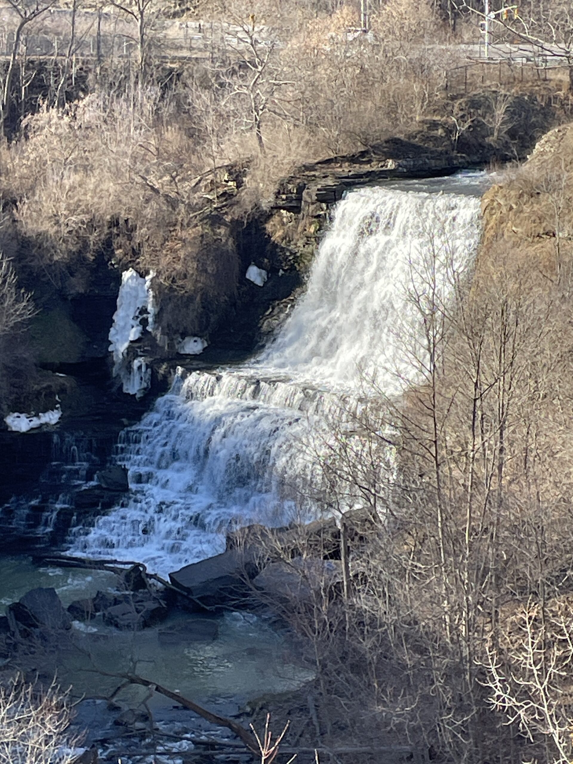
Leaving the parking lot we will join the rail trail going east and visit Albion and Buttermilk Falls following the blue side trail back to the rail trail and on to the Margate stairs (165 stairs) returning by paved paths following the escarpment and rail trail. (Please arrive by 9:45 am as we will be on the trail by 10:00 am sharp. Bring water and a snack. Icers if necessary (hopefully not!). This is an urban hike with almost no cover for a call of nature!If cancelled due to rain (snow?), I will notify you by email the evening prior to the hike. If you cancel after 4:00 pm on the day prior to the hike, use the contact information I will send you by email a day or two before the hike.
Wednesday Walkers - Hilts Falls
https://hikes.brucetrail.org/event/wednesday-walkers-hilts-falls/Sorry, the registration cut-off time for this hike has been reached.Not a member? Click here to join today!Hosting Club: Beaver Valley
Location (Google Maps): Meet in the Johnston’s Sideroad parking area, km 71.7, Map 26, Edition 31.
Hike Leader(s): Glenda Collings Click here to contact the hike leader.
Pace: Medium
Terrain: Moderate, Strenuous, Some steep sections
Length of Hike: Approx. 6Description
This is an out and back hike with a visit to the grandeur of Hilts Waterfall in spring, as well as views over Cuckoo Valley. Wear appropriate clothing for the weather plus water and a snack (possibly icers if there is still some snow on the ground).Please arrive by 9:45 a.m for a 10:00 a.m. start. If you need to cancel please do so online or contact me so we know whether or not to expect you. My cell 519 694 7691.
Full Moon Evening Hike
https://hikes.brucetrail.org/event/full-moon-evening-hike-2/Sorry, the registration cut-off time for this hike has been reached.Not a member? Click here to join today!Hosting Club: Sydenham
Category: An evening walk.
Location (Google Maps): Meet in the municipal parking lot by the river on the West side of 1st Ave East between 7th St East and 8th St East in Owen SoundHike Leader(s): Harriet Nixon Click here to contact Hike Leader(s)
Pace: Brisk: 4 to 5 km/h
Terrain: Moderate: Some hills and/or poor footing
Distance: Approx 5 kmDescription
Join us for a brisk evening hike under the Full Pink Moon exploring Owen Sound paths and neighbourhoods. Following the hike there is an opportunity to socialize over refreshments. There is no need to show up 15 minutes early for this hike, but we will depart promptly at 7:00 pm.
Moonlight Hike
https://hikes.brucetrail.org/event/moonlight-hike-3/Sorry, the registration cut-off time for this hike has been reached.Not a member? Click here to join today!Hosting Club: Iroquoia
Category: Moonlight Hikes
Location (Google Maps): Grimsby Lion’s Club Pool 1 Elm St, GrimsbyHike Leader(s): Ruth Moffatt Click here to contact Hike Leader(s)
Pace: Medium – 3 to 4 km/hr
Terrain: Dependent on Conditions, Strenuous – Hilly with steep climbs and some poor footing
Distance: 5-6kmDescription
Earn your Iroquoia Moonlight badge by hiking 3 Moonlight Hikes with a leader.
Tonight’s sunset is at 7:45pm. We will hike up the escarpment and over to the Hawkwatch area and out to Beamer’s Falls and return around 9:00pm.
If you’ve never hiked at night we are sure you will love the way it heightens all of your senses promising a great sleep afterwards.
Everyone must have a headlamp or a flashlight 🔦. Most phones have torches which could also be used as supplemental light. Please ensure your light device is fully charged/batteries to last about 1.5hours. Dress for the weather and bring enough water to suit your needs as well as all the other things you need for a hike – first aid kit, snack, poles (recommended). This is an arduous climb up the escarpment so be sure to know your physical limit.
This is the first of 3 full moon hikes to be held in Grimsby. After you complete three leader-led hikes, you will qualify for a badge. $10/$15Second hike is May 1
Third hike is May 31
Any questions may be directed through contact on this form.
If you cannot make it, please remove yourself from registration by following these steps:To cancel your registration, here is a step by step:
– Sign into your account on the BTC website
– Click on My Hikes under your account
– This will take you to a list of hikes you have registered for
– Scroll down to the appropriate hike and cursor over to the far right hand column under the Action column.
– Click Cancel under the hike you wish to cancel
Full Moon Night Hike No.4 (Pink Moon)
https://hikes.brucetrail.org/event/full-moon-night-hike-no-4-pink-moon/Sorry, the registration cut-off time for this hike has been reached.Not a member? Click here to join today!Hosting Club: Iroquoia
Category: Moonlight Hikes
Location (Google Maps): Sixteen Hollow Park (Parking Lot), 2140 Westoak Trails Blvd, Oakville ON L6M 3K5Hike Leader(s): Joe Borges Click here to contact Hike Leader(s)
Pace: Medium – 3 to 4 km/hr
Terrain: Dependent on Conditions, Moderate – Some hills and/or some poor footing
Distance: 7.5 kmDescription
Pink Moon Full Moon Hike No. 4Chase the Spring Glow.
For a mid-week hike, we’re taking advantage of the urban Oakville Trails system. Consider it a little BTC community outreach.Step onto the path beneath April’s Pink Moon — the next chapter in our 2026 Full Moon Night Hike Series. As winter fades, this early spring moon lights the budding forest with a soft rose-gold glow. Long known as the Pink Moon, it marks renewal, wildflowers, and the return of warmer evenings. It’s the perfect time to shake off winter’s chill, breathe in the fresh night air, and walk together under the bright rhythm of a new season.
Continue your Full Moon Night Hike Badge Series journey! Join any 3 Full Moon Night Hikes led by an Iroquoia Club Leader in 2026 to qualify and purchase the new badge.
Important Guidelines
- Hike Start Time: 8:00 pm
- Arrive: Please arrive 30 minutes early at the Sixteen Hollow Park / Parking Lot, 2140 Westoak Trails Blvd, Oakville.
- Lighting: Headlamp (recommended) or flashlight with fresh batteries or a full charge.
- Poles & Traction: Poles useful on uneven terrain; icers not required unless late frost conditions.
- Clothing: Dress in layers for mild spring temps and variable terrain.
- Essentials: Bring I.D. and your health card.
- Hydration: Carry at least 1L of water.
- Safety: A small first aid kit is recommended.
- Pets: No dogs permitted on this hike.
See the route on AllTrails:
https://www.alltrails.com/explore/custom-routes/custom-route-388469e?u=m&sh=4wexyxJoin us as we welcome spring under the soft light of the Pink Moon — a night for reflection, renewal, and shared steps toward the season ahead.
- 02April 2, 2026

Car Hike: Toronto End-to-End in 3 - #3
https://hikes.brucetrail.org/event/car-hike-toronto-end-to-end-in-3-3/Sorry, the registration cut-off time for this hike has been reached.Not a member? Click here to join today!Hosting Club: Toronto
Category: Car Hike
Location (Google Maps): Meet at km 48.4, roadside parking at the end of Boston Mills Rd. (GPS 43.750866, -79.951452). Do not park in/on the driveway as it is private property. We’ll be creative with shuttling – doing a short shuttle to km 50.3 at the beginning, then a longer one to roadside parking on the eastern shoulder of Eighth Line at the southernmost intersection with 27 Sideroad (GPS 43.686276, -79.975578).Hike Leader(s): Jacqueline Van Dyke Click here to contact Hike Leader(s)
Pace: Moderate (3-4 km/hr)
Terrain: Rocky, Variable
Distance (km): 16Description
It’s the third of three hikes to complete the Toronto E2E and it’s badge day! Hikers may wish to visit the Spirit Tree after the hike.It’s early spring so mud may abound! Be prepared with poles and gaitors. Hiking boots/shoes are mandatory. We’ll stop for snacks and lunch so bring 2L of water, snacks, and your lunch.
Be prepared to shuttle if you haven’t already had a turn.
9:00 Long Hike, Glen Road Jordan
https://hikes.brucetrail.org/event/900-long-hike-glen-road-jordan/Sorry, the registration cut-off time for this hike has been reached.Not a member? Click here to join today!Hosting Club: Niagara
Category: Loop
Location (Google Maps):3640 Glen Road Jordan
Hike Leader(s): Alan Laver Click here to contact Hike Leader(s)
Pace: Brisk
Terrain: Strenuous
Distance: 10 kmDescription
Hike in and around Ball’s Falls and Jordan. Dress for the weather: bring icers, poles, dress in layersHiking in and around Jordan
https://hikes.brucetrail.org/event/hiking-in-and-around-jordan-14/Sorry, the registration cut-off time for this hike has been reached.Not a member? Click here to join today!Hosting Club: Niagara
Category: Hike
Location (Google Maps): Sho’arishon Park (Jordan Hollow)Hike Leader(s): Bill Russell Click here to contact Hike Leader(s)
Pace: Medium
Terrain: Moderate
Distance: 7 kmDescription
- Hiking in and around Jordan, Jim Rainforth Trail and Balls Falls rotating every 3 weeks.
Urban Walk: Valley View Park Thornhill
https://hikes.brucetrail.org/event/urban-walk-valley-view-park-thornhill-156/Sorry, the registration cut-off time for this hike has been reached.Not a member? Click here to join today!Hosting Club: Toronto
Category: Urban Walk
Location (Google Maps): Parking lot is off Sycamore Drive, East of Bayview , across Starbucks plaza
Bus 91 from Finch East station stops at Sycamore station.Hike Leader(s): MOHAMMAD AGHAMIRI Click here to contact Hike Leader(s)
Pace: Moderate (3-4 km/hr)
Terrain: Hilly, Level 2 (Intermediate – some hills and uneven surfaces, rocks and roots underfoot)
Distance (km): 6-7 kmDescription
We will explore Valleyview and Maple View parks, and walk along German Mill Creak, in return we stop in Huntington park and have snack under beautiful shed.Although this is considered an “Urban Walk”, you can expect some hills up and down and uneven surfaces with tree roots. Please bring hiking poles, Ice cleats water and snacks.
phone number for the day of hike 289 58

CANCELLED - Silver Creek
https://hikes.brucetrail.org/event/silver-creek-3/Sorry, the registration cut-off time for this hike has been reached.Not a member? Click here to join today!Hosting Club: Iroquoia
Category: General Hike
Location (Google Maps): Meet roadside on Fallbrook Trail at 9:15 amHike Leader(s): Karen Bergmann Click here to contact Hike Leader(s)
Pace: Medium – 3 to 4 km/hr
Terrain: Moderate – Some hills and/or some poor footing
Distance: 7 kmsDescription
Meeting roadside on Fallbrook Trail at Silver Creek Conservation Area, we will hike the Roberts Side Trail to the main trail almost to Tenth Line. Turning back along the main trail to the Irwin Quarry Side Trail and to the cars. This hike has some rocky spots and a few hilly bits. Come with icers for your boots in case there is still snow/ice. Hike is dependent on weather conditions. - 03April 3, 2026
Peninsula BT Makeup Hike (km 0.0 – km 15.6)
https://hikes.brucetrail.org/event/peninsula-bt-makeup-hike-km-0-0-km-15-6/Sorry, the registration cut-off time for this hike has been reached.Not a member? Click here to join today!Hosting Club: Peninsula
Category: Peninsula BT Makeup Hike
Location (Google Maps):Hike Leader(s): Margie Gloade and Saabir sohrab Click here to contact Hike Leader(s)
Pace: Medium (3.0 – 4.5 km/h): A comfortable pace for most hikers with steady progress.
Terrain: Difficult: Steep ascents/descents, rocky scrambling, and some rugged escarpment paths., Moderate: Rolling hills, mild slopes and rocky paths.
Distance: ~15.7Description
Wiarton Bluewater Park to Wright’s CresThis hike is part of the Peninsula BT Makeup Hikes, intended for hikers completing missed sections of the Peninsula Bruce Trail. Each hike requires individual registration.
To hike the entire Peninsula Section, please register for the Full Peninsula End-to-End Series (single registration for all 10 hikes): https://hikes.brucetrail.org/event/peninsula-end2end-in-10-series/2026-05-01/
Hikers may register for all 10 Peninsula BT Makeup Hikes if they wish.
Expectations: Expect ~6 hours on the trail, depending on the terrain, weather, and group pace. The hike leader sets the pace, aiming for 3–4 km/h, and may adjust as needed for group ability and trail conditions. Breaks will be taken throughout the day.
For safety, participants must remain between the hike leader and the hike sweep at all times.
Meeting Time: 7:15 AM
Fees:
- Fundraising: This hike is a fundraiser to support the Peninsula Bruce Trail Club’s volunteer-run hike program.
Participant Requirements
- Intermediate/experienced hikers with good fitness
- Proper hiking boots, layered clothing, wet weather gear
- Hiking poles recommended
- Bring: Lunch, snacks, water, bug spray
Transportation & Accommodations
- Car shuttle: Participants rotate as drivers; vehicles must be passenger-ready
- Accommodations: Book early; options include motels, campgrounds, hostels, and B&Bs
Note: Dogs are not permitted.
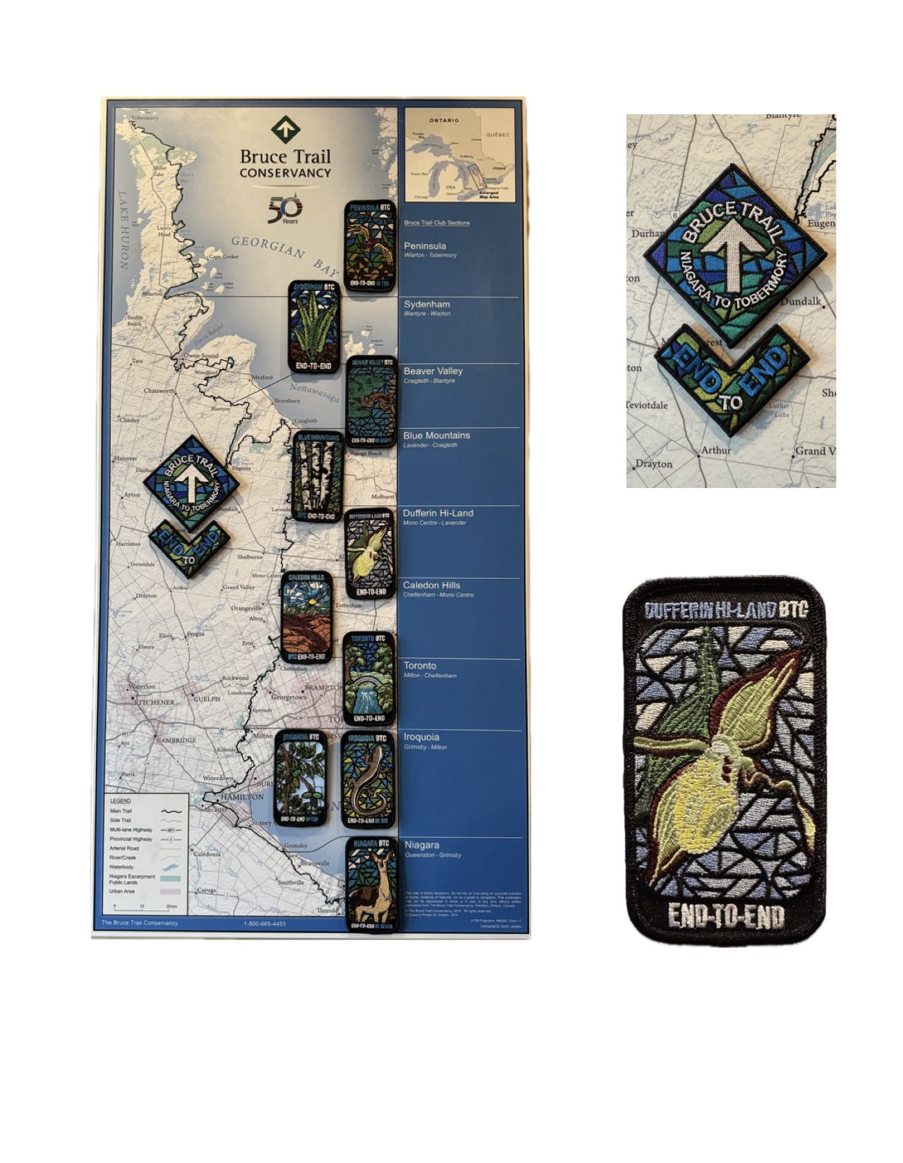
Dufferin End to End for the Stained Glass Badge Fundraiser - Multi Day Hike Series - April 3, 4, 5, 2026 Meet time is 7:45am
https://hikes.brucetrail.org/event/dufferin-end-to-end-for-the-stained-glass-badge-fundraiser-multi-day-hike-series-april-3-4-5-2026/Sorry, the registration cut-off time for this hike has been reached.Not a member? Click here to join today!This is a Multi-Day Hike
You are signing up for the following dates:
2026-04-03, 2026-04-04, 2026-04-05Hosting Club: Iroquoia, Dufferin Hi-Land
Category: Stained Glass Badge End to End Fundraiser Hike
Location (Google Maps): Registered participants will receive a WhatsApp invitation (optional)which can be used for photo share and other pertinent information.Day 1 – Friday April 3- Meet at Mono Cliffs Community Centre, 200m south of Mono Centre (County Rd 8). Park in gravel lot. – https://maps.app.goo.gl/fKzqRtxnVtZjExgG6 –
Shuttle to Roadside parking on 1st Line https://maps.app.goo.gl/edUYBQopt8JnCuSs5 ~ 20km
Day 2 – Saturday April 4 – Meet in BT parking lot located off of 15th Sideroad, 50 m west of the stop sign at the intersection of Prince of Wales and 15th Sideroad. https://maps.app.goo.gl/t3QAFcmmYFWkRzWF6
Shuttle to Roadside parking on 1st Line https://maps.app.goo.gl/edUYBQopt8JnCuSs5 ~ 17.50km
Day 3 – Sunday April 5 – Meet in BT parking lot located off of 15th Sideroad, 50m west of the stop sign at the intersection of Prince of Wales and 15th Sideroad https://maps.app.goo.gl/t3QAFcmmYFWkRzWF6
Shuttle to Roadside parking on Mulmur-Nottawasga Townline, 550 metres east of Lavender Hill Rd at the cemetery. https://maps.app.goo.gl/is6cF8QsmPiAgscj9 ~18kmHike Leader(s): Ruth Moffatt Click here to contact Hike Leader(s)
Pace: Brisk – 4 to 5 km/hr, Medium – 3 to 4 km/hr
Terrain: Dependent on Conditions, Moderate – Some hills and/or some poor footing, Strenuous – Hilly with steep climbs and some poor footing
Distance: Varies – Dufferin section is about 55km according to the BT app spread over three days.Description
Everyone who is registered for this hike series will be invited to join an optional WhatsApp which can be used to share photos and other information.This is a monetized hike with the proceeds going towards the Dufferin Bruce Trail Club – “Preserving a ribbon of wilderness for everyone, forever.” There are no refunds. Your badge depicting the yellow lady slipper, the hike logistics, shared shuttle driving and hike guidance are all included in your fee. Since it is the intention to run a similar hike in all sections this year, why not join the Bruce Trail Conservancy if you are not already a member? Please use my code 67abd1234c568 until the end of 2025 to receive free digital maps as well as all the other great benefits included with membership. https://brucetrail.org/product-category/memberships/
Please read all details for this hike to ensure it is suitable for you. The pace and terrain are particularly important details.
Registered participants will receive a WhatsApp invitation (optional) which can be used for photo share.You must be registered to participate in this group hike. You cannot just show up as there are often people on the waitlist.
This is a multi-day hike – April 3, 4, 5th, 2026.
Please ensure your car is car shuttle-ready with at least 4 available seatbelts including the driver’s. We will take turns either being the shuttle driver or driving the drivers back to their cars after the hike is over.
Please pack whatever food you will require for a long day hike including lunch and snacks; 2l of water minimum; first aid kit; poles if you use them; and icers. You may also wish to pack extra socks and rain gear. Remember to dress in layers. Gloves/mitts, scarf / neck gator, a toque and a puffy jacket. Consider snow shoes, depending on conditions.
We will break for a morning clothing adjustment, a 10min break around 10am, 15 min lunch and an afternoon break if we are finishing after 2pm. Bio-breaks are as you need them – please let the sweep know who will wait for you. This is a 3 day group hike so it is important you keep pace with the person in front of you. We will help each other and wait for one another but please consider your physical ability before signing up for this hike. There are no drop outs – if you are not able to finish the hike you will need to arrange for transportation back to your car via taxi or Uber at your cost. Obtaining either in this section of trail is unlikely so please sign up if you know your limit and can maintain the pace.
The Dufferin stained-glass badge will be presented on the last day. If you have to miss one of these hiking days, you may make it up on your own before the last day of the series. Since it is a group hike, it is intended that everyone who registers be present on all days.
Any questions may be directed through contact on this form.
If you cannot make it, please remove yourself from registration to allow another person who may be on the waitlist to join the hike.To cancel your registration, here is a step by step:
– Sign into your account on the BTC website
– Click on My Hikes under your account
– This will take you to a list of hikes you have registered for
– Scroll down to the appropriate hike and cursor over to the far right hand column under the Action column.
– Click Cancel under the hike you wish to cancelAny questions may be directed through the link on this form.
Refunds: https://brucetrail.org/paid-hike-refund-policy/
Scotsdale Farm Big Loop
https://hikes.brucetrail.org/event/scotsdale-farm-big-loop-2/Sorry, the registration cut-off time for this hike has been reached.Not a member? Click here to join today!Hike open to BTC Members only.
Hosting Club: Dufferin Hi-Land
Category: General Hike
Location (Google Maps): Scotsdale Farm main parking lot east off Trafalgar Road. North of 27 Side Road. See Google Maps link.Hike Leader(s): Stuart Law Click here to contact Hike Leader(s)
Pace: Medium
Terrain: Slippery Sections Likely, Slippery and Steep Sections, Moderate
Distance: 19.6 kmsDescription
Join us on a 19.6 km loop early Spring hike at Scotsdale Farm taking in the Main Trail and lots of Side Trails. Trail will be wet and muddy with some ice. Please bring icers, gaiters, a snack, lunch, a warm drink, 2L of water and a smile. Please be mindful of what should always be in your backpack like a first aid kit, rain gear and an extra pair of socks. Please dress in layers. Please arrive at 8:15 am to be ready to hike at 8:30 sharp. No dogs. No dropouts. This is a challenging hike for experienced hikers. Please be honest with yourself about your fitness level.
9:00 am Niagara-on-the-Lake Tour
https://hikes.brucetrail.org/event/900-am-niagara-on-the-lake-tour-59/Sorry, the registration cut-off time for this hike has been reached.Not a member? Click here to join today!Hosting Club: Niagara
Category: Urban
Location (Google Maps):Veterans Memorial Park, park just outside the park on King Street
Hike Leader(s): Robin Garrett Click here to contact Hike Leader(s)
Pace: Medium
Terrain: Easy
Distance: 6-7 kmDescription
Each Friday we will explore different neighbourhoods, trails and parkland throughout Historic Niagara-on-the-Lake.Moderate pace with some weeks entirely on sidewalks and roads while others may include a mix of trails and paved pathways. Great way to build up endurance for longer more strenuous hikes.
Prepare for cooler windy conditions on open parkland and along Lake Ontario and Niagara River trails.
Plan to stay for conversation and a warm cup of coffee or tea at Sweets & Swirls, Community Centre, Niagara Stone Road, NOTL
- 04April 4, 2026
Peninsula BT Makeup Hike (km 15.6 – km 33.3)
https://hikes.brucetrail.org/event/peninsula-bt-makeup-hike-km-15-6-km-33-3/Sorry, the registration cut-off time for this hike has been reached.Not a member? Click here to join today!Hosting Club: Peninsula
Category: Peninsula BT Makeup Hike
Location (Google Maps):Hike Leader(s): Saabir Sohrab Click here to contact Hike Leader(s)
Pace: Medium (3.0 – 4.5 km/h): A comfortable pace for most hikers with steady progress.
Terrain: Difficult: Steep ascents/descents, rocky scrambling, and some rugged escarpment paths., Moderate: Rolling hills, mild slopes and rocky paths.
Distance: ~17.8Description
Wright’s Crescent to Cape Croker Park GateThis hike is part of the Peninsula BT Makeup Hikes, intended for hikers completing missed sections of the Peninsula Bruce Trail. Each hike requires individual registration.
To hike the entire Peninsula Section, please register for the Full Peninsula End-to-End Series (single registration for all 10 hikes): https://hikes.brucetrail.org/event/peninsula-end2end-in-10-series/2026-05-01/
Hikers may register for all 10 Makeup Hikes if they wish.
Expectations: Expect ~7 hours on the trail, depending on the terrain, weather, and group pace. The hike leader sets the pace, aiming for 3–4 km/h, and may adjust as needed for group ability and trail conditions. Breaks will be taken throughout the day.
For safety, participants must remain between the hike leader and the hike sweep at all times.
Meeting Time: 7:15 AM
Fees:
- Registration fee does Cape Croker Park’s parking fees
- Parking costs will be shared
- Fundraising: This hike is a fundraiser to support the Peninsula Bruce Trail Club’s volunteer-run hike program.
Participant Requirements
- Intermediate/experienced hikers with good fitness
- Proper hiking boots, layered clothing, wet weather gear
- Hiking poles recommended
- Bring: Lunch, snacks, water, bug spray
Transportation & Accommodations
- Car shuttle: Participants rotate as drivers; vehicles must be passenger-ready
- Accommodations: Book early; options include motels, campgrounds, hostels, and B&Bs
Note: Dogs are not permitted.
School Bus Hike: Iroquoia E2E #5 of 8
https://hikes.brucetrail.org/event/bus-hike-iroquoia-e2e-5-of-8/Sorry, the registration cut-off time for this hike has been reached.Not a member? Click here to join today!Trip Information
Departure Time: 08:30
Return to City Time: 18:00
Departure Point: Kipling Departure PointOptional Items
Hiking ($.01)Hosting Club: Toronto
Category: Bus Hike
Location (Google Maps): Dundas, ON to Waterdown, ONHike Leader(s): Tom Swales, David Royle Click here to contact Hike Leader(s)
Pace: Moderate (3-4 km/hr)
Terrain: Hilly, Level 2 (Intermediate – some hills and uneven surfaces, rocks and roots underfoot), Rocky, Variable
Distance (km): 14 kmDescription
We continue our Iroquoia section End-2-End series which we began in the Fall of 2025. Any capable hikers are welcome regardless if completing the End-2-End for one of the badges or not. Hikers can expect rocky portions and hills as the trail goes up and down the Niagara escarpment. The trail may be wet and muddy. We hope to maintain a steady pace of 4 km/hr. We resume whre we left off at Sydenham Lookout in Dundas. After 2,1/2 km we pass Rock Chapel Sanctuary and Borer’s Falls. We descend to Valey Road (4 km). After an asecent we continue along the escarpment to Old Guelph Rd/Hwy 6 (6 km). We continue through the Hwy 6 tunnel through Clappison Woods. and the steep ascent through Smokey Hollow to the Great Falls Lookout Point (12 km) where there will be an optional dropout. We continue another 2 km to King Road (14 km). We will reward our efforts with a refreshment stop in Waterdown, home of the Copper Kettle’s apple fritters. The distance may be modified according to our progress during the day.Car Hike: Bethesda Trail Richmond Hill 233
https://hikes.brucetrail.org/event/car-hike-bethesda-trail-richmond-hill-39/Sorry, the registration cut-off time for this hike has been reached.Not a member? Click here to join today!Hosting Club: Toronto
Location (Google Maps): Oak Ridges Corridor, Bethesda Trail Head Parking Lot, Bethesda Side Road, Richmond Hill, Ontario
Hike Leader(s): Mohammad Aghamiri Click here to contact Hike Leader(s)
Pace: Moderate (3-4 km/hr)
Terrain: Hilly, Level 2 (Intermediate – some hills and uneven surfaces, rocks and roots underfoot), Variable
Distance (km): 14-15 kmDescription
Join us to explore the trails of York Regional Forest and the Oak Ridges Corridor at Jefferson Forest and Bond lake,From parking lot we hike thought Jefferson forest and continue to Bond Lake and have snack beside the lake and return to parking around 13 to 13.30
Please bring lots of water and snacks ,hiking poles are recommended
phone number for the day of hike 289 588 6482
Quadzilla 3 series training hikes
https://hikes.brucetrail.org/event/quadzilla-3-series-training-hikes/Sorry, the registration cut-off time for this hike has been reached.Not a member? Click here to join today!Hike open to BTC Members only.
Hosting Club: Dufferin Hi-Land
Category: Cancelled
Location (Google Maps): Hockley Road and 5th line parking lotHike Leader(s): Tristan Goguen and Pat Foley Click here to contact Hike Leader(s)
Pace: Medium
Terrain: Slippery and Steep Sections
Distance: Approximately 25 KmDescription
This series of hikes is designed to be for those who are familiar with hiking and want to start training for their summer hiking. The hike starts northbound up 5th line on the Hockley Heights side trail – a steep climb then into the woods – out along 15th side road down 3rd line to Dunby Rd and into the Hockley Valley Provincial Nature Reserve on the main trail. Once through the park we continue on the main trail up 2nd line then back along the main trail to the 5th line parking lot. For those not familiar with this series or section of the Caledon Hills… there are hills – plenty of them. At the beginning of April we can expect any of the following: ice, snow, mud and more mud… Come prepared for these conditions. Proper foot wear is a must, hiking poles are beneficial, rain/mud gear maybe necessary. There are no support stops for this hike so be sure to bring enough water, snacks and lunch. We will start out as a group but we fully expect hikers will divide up and go at their own pace. Everyone of course is welcome to stay in the main group with the hike leaders. If you cannot finish this distance you are encouraged not to attempt this hike it is a serious challenge. If you sign up for this hike please be respectful and if you have to drop out do so on line 2 days before the hike. Others maybe waiting for your spot and the hike leaders need to know you will be coming. We will provide a sign out sheet on the hike leader vehicle so you can sign out and note your time. This not only provides the hike leaders a safety check if you are a faster hiker but you can track your progress over the 3 hikes if you choose to do so.
9:00 In & Around Port Weller East on Several Lakefront Trails
https://hikes.brucetrail.org/event/900-in-around-port-weller-east-on-several-lakefront-trails/Sorry, the registration cut-off time for this hike has been reached.Not a member? Click here to join today!Hosting Club: Niagara
Category: Loop
Location (Google Maps):Happy Rolph’s Animal Farm; 650 Read Rd., St Catharines
Hike Leader(s): Karen Couch Click here to contact Hike Leader(s)
Pace: Medium
Terrain: Easy
Distance: 7-8 kmsDescription
Starting at Happy Rolph’s Animal Farm, we will follow the 9/11 Memorial Walkway, then meander our way to trails maintained by the City of St. Catharines through open parkland, along Lake Ontario. We will then loop our way back through Happy Rolph’s. Birders may want to bring their binoculars.Please note: The animal viewing area is only open mid-May to Labour Day.
Niagara Glen Hike
https://hikes.brucetrail.org/event/niagara-glen-hike-7/Sorry, the registration cut-off time for this hike has been reached.Not a member? Click here to join today!Hosting Club: Niagara
Category: Loop
Location (Google Maps):Meet at the Niagara Glen Nature Centre parking lot, 3050 Niagara Parkway, Niagara Falls. This is located between the Whirlpool Golf Course and the Niagara Botanical Gardens, on the river side of the Niagara Parkway. Parking fees may apply.
Hike Leader(s): Dan Wilson Click here to contact Hike Leader(s)
Pace: Medium
Terrain: Strenuous
Distance: 10kmDescription
Hike deep in the Niagara Gorge, along stairways cut into the rock and rugged paths that wind through this pristine pocket of Carolinian Forest. View ancient geological formations and fossils dating back millions of years, while hiking along the turbulent rapids of the Niagara River. This is a strenuous hike and there is a chance hikers could get wet. Bring water, a snack, gaiters, hiking poles and icers, if necessary. Weather conditions at this time of year can change suddenly. Dress in layers. 🙂Car Hike: Caledon Rail Trail
https://hikes.brucetrail.org/event/car-hike-caledon-rail-trail-4/Sorry, the registration cut-off time for this hike has been reached.Not a member? Click here to join today!Hosting Club: Toronto
Category: Car Hike
Location (Google Maps):Caledon Rail Trail from Inglewood to Caledon East.
Hike Leader(s): Al Brown Click here to contact Hike Leader(s)
Pace: Moderate (3-4 km/hr)
Terrain: Flat, Level 1 (Easy – mostly on flat, well maintained trails with hard-packed surface)
Distance (km): 12 kmDescription
This is a hike for those who have been cooped up all winter and want to get back to hiking. We will meet in Caledon East and car pool to Inglewood to start the hike. We will have a refreshment stop after in local area.The meeting place will be in the parking lot west of the Caledon Town Hall, east of the community centre. Go north on Airport Road from King Road to Caledon East. Turn east onto Old Church Road. Proceed about 1 km to the meeting spot on your right.