Hike Schedule
Join us for a hike! Registration required:
All hikes available to BTC members. Some hikes are open to non-members.
TIP: The calendar view displays up to 7 hikes on a day, but often there are more. Click “More events” to see them all.
Categories
- 05April 5, 2026
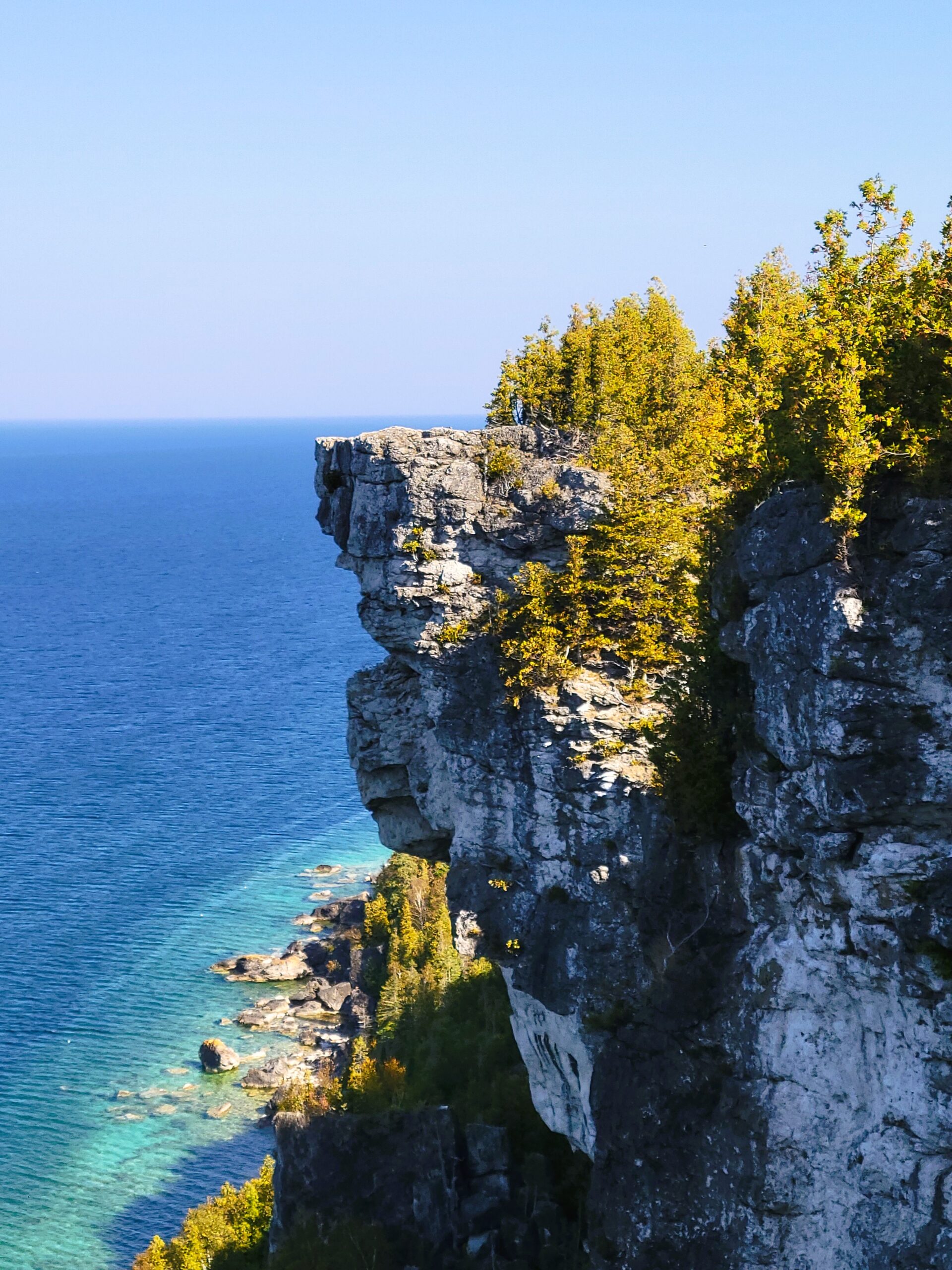
Peninsula BT Makeup Hike (km 33.3 – km 51.9)
https://hikes.brucetrail.org/event/peninsula-bt-makeup-hike-km-33-3-km-51-9/Sorry, the registration cut-off time for this hike has been reached.Not a member? Click here to join today!Hosting Club: Peninsula
Category: Peninsula BT Makeup Hike
Location (Google Maps):Hike Leader(s): Shawn Radcliffe & Saabir Sohrab Click here to contact Hike Leader(s)
Pace: Medium (3.0 – 4.5 km/h): A comfortable pace for most hikers with steady progress.
Terrain: Difficult: Steep ascents/descents, rocky scrambling, and some rugged escarpment paths., Moderate: Rolling hills, mild slopes and rocky paths.
Distance: ~ 18.6Description
Cape Croker Park Gate to Jackson’s Cove Rd.This hike is part of the Peninsula BT Makeup Hikes, intended for hikers completing missed sections of the Peninsula Bruce Trail. Each hike requires individual registration.
To hike the entire Peninsula Section, please register for the Full Peninsula End-to-End Series (single registration for all 10 hikes): https://hikes.brucetrail.org/event/peninsula-end2end-in-10-series/2026-05-01/
Hikers may register for all 10 Makeup Hikes if they wish.
Expectations: Expect ~7 hours on the trail, depending on the terrain, weather, and group pace. The hike leader sets the pace, aiming for 3–4 km/h, and may adjust as needed for group ability and trail conditions. Breaks will be taken throughout the day.
For safety, participants must remain between the hike leader and the hike sweep at all times.
Fees:
- Registration fee does not include Cape Croker park parking fees
- Parking costs will be shared equally among participants.
- Fundraising: This hike is a fundraiser to support the Peninsula Bruce Trail Club’s volunteer-run hike program.
Participant Requirements
- Intermediate/experienced hikers with good fitness
- Proper hiking boots, layered clothing, wet weather gear
- Hiking poles recommended
- Bring: Lunch, snacks, water, bug spray
Transportation & Accommodations
- Car shuttle: Participants rotate as drivers; vehicles must be passenger-ready
- Accommodations: Book early; options include motels, campgrounds, hostels, and B&Bs
Note: Dogs are not permitted.
Hilton Falls Conservation Halton
https://hikes.brucetrail.org/event/hilton-falls-conservation-halton/Sorry, the registration cut-off time for this hike has been reached.Not a member? Click here to join today!Hosting Club: Iroquoia, Toronto
Category: General Hike
Location (Google Maps): Meet at Hilton Falls Conservation Park Parking lot.
Coordinates: 43.505705, -79.961589Hike Leader(s): IgorT Click here to contact Hike Leader(s)
Pace: Brisk – 4 to 5 km/hr, Medium – 3 to 4 km/hr
Terrain: Dependent on Conditions, Moderate – Some hills and/or some poor footing, Slippery and Steep Sections, Slippery Sections Likely
Distance: 16Description
Join me to explore Hilton Falls.park entrance fee 10.50 plus tax per car, reservation required.
https://www.conservationhalton.ca/parks/hilton-falls/
We going to hike thru beautiful forest, enjoy amazing views, 2 waterfalls.
If you wish bring you treats, like marshmallows, hotdogs etc., we going to stop for break at campfire by the falls.
Please read all details for this hike to ensure it is suitable for you. The pace and terrain are particularly important details.
You must be registered to participate in this group hike. You cannot just show up as there are often people on the waitlist.
Please pack whatever food you will require for a long day hike including lunch and snacks; 2l of water minimum; first aid kit; poles if you use them; and icers. You may also wish to pack extra socks and rain gear. Remember to dress in layers. Gloves/mitts, scarf / neck gator, a toque and a puffy jacket. Consider snow shoes, depending on conditions.
We will help each other and wait for one another but please consider your physical ability before signing up for this hike.
There are no drop outs – if you are not able to finish the hike you will need to arrange for transportation back to your car via taxi or Uber at your cost.
Car Hike: 7th line to Airport Rd.
https://hikes.brucetrail.org/event/car-hike-7th-line-to-airport-rd-2/Sorry, the registration cut-off time for this hike has been reached.Not a member? Click here to join today!Hosting Club: Caledon Hills
Category: General
Location (Google Maps): 7th Line Parking Area – km 43.3Hike Leader(s): Lana Hubbard Click here to contact Hike Leader(s)
Pace: Brisk – 4 to 5 km/hour
Terrain: Moderate – some hills and/or some poor footing
Distance: 12 kmDescription
Join me for a quick spring hike as we go from the main parking lot on 7th line to Airport Rd. and back. This will complete a 12 km loop.Pace will be brisk, bring snacks and water. Might need icers.
Terrain isn’t very hilly.
Car Hike: Jefferson Forest (Richmond Hill)
https://hikes.brucetrail.org/event/car-hike-jefferson-forest-richmond-hill-12/Sorry, the registration cut-off time for this hike has been reached.Not a member? Click here to join today!Hosting Club: Toronto
Category: Car Hike
Location (Google Maps):1245 Bethesda Side Rd, Richmond Hill, ON L4E 1A2 ( Bethesda Trail Head Parking lot)
Hike Leader(s): Amir Alemohammad Click here to contact Hike Leader(s)
Pace: Moderate (3-4 km/hr)
Terrain: Flat, Hilly, Level 2 (Intermediate – some hills and uneven surfaces, rocks and roots underfoot)
Distance (km): 10-11 kmDescription
Let’s roll the hills of the Jefferson Forest for s winter like hike in spring. Every weekend, we’ll explore the winter wonderland at this beautiful park. Located in the heart of Richmond Hill, it boasts numerous hiking trails. This 2,5 hour hike can range from 10 to 12 kilometres, depending on the weather conditions. Remember to bring water, snacks, hiking boots, icers, poles, and your camera. Not recommended for beginners. Park in the free Bethesda parking lot and avoid parking along the road. Dress appropriately for the weather. Difficulty Level: 2 (Moderate).Please arrive @8:45AM for start of 9:00AM.
This is a joint hike with the Oak Ridges Trail Association (ORTA).
Spring & Migration Monitor Hike
https://hikes.brucetrail.org/event/spring-migration-monitor-hike-10/Sorry, the registration cut-off time for this hike has been reached.Not a member? Click here to join today!Hosting Club: Peninsula
Location (Google Maps): Cape Chin Meadows hike: 388 Cape Chin Rd N, Driveway, Maple Cross Nature Reserve at Cape Chin. Special Guest: Sheilagh Rose – growing up field naturalist and restoring eastern bluebird populations
Hike Leader(s): Tamara Wilson Click here to contact Hike Leader(s)
Pace: Leisurely (2.0 – 3.0 km/h): A relaxed pace with frequent breaks and a focus on enjoyment.
Terrain: Easy: Flat forested sections or lowland trails.
Distance: 6kmDescription
This Spring & Migration Monitor Hike is an easy, low-impact, out and back stroll along the Cape Chin Drive Way to the Cape Chin Point. This will be a weather dependent hike. We will take a break at Cape Chin to observe the changing shoreline that stretches to the South. We may return to the cars via Cape Chin Meadows depending on conditions. Will the Sandhills have returned to the Cape Chin wetlands (usually return by March 1)? Will we see returning Eastern bluebirds that make the Cape Chin meadows their home (observation is Mar 22)? Bring you binoculars and keen sense of observation. Open to everyone! On Apr 5, special guest will be Sheilagh Rose who will talk about growing up in a family of passionate amateur field naturalists who worked tirelessly on the restoration of the Eastern bluebird population in Oro Medonte. - 06April 6, 2026
Dufferin Seven Rivers Hike Series - Multi Day Hike April 6, 7, 8 and 9th, 2026.
https://hikes.brucetrail.org/event/dufferin-seven-rivers-hike-series-multi-day-hike-april-6-7-8-and-9th-2026/Sorry, the registration cut-off time for this hike has been reached.Not a member? Click here to join today!Hosting Club: Iroquoia, Dufferin Hi-Land
Category: Special Event
Location (Google Maps): April 6th – Pretty River 11.89 km and Mad River 10.9km
April 7th – Noisy River 10.2km and Pine River 10.75km
April 8th – Boyne River 10.41km and Nottawasaga River 13.1km
April 9th – Humber River 11.4kmHike Leader(s): Ruth Moffatt Click here to contact Hike Leader(s)
Pace: Brisk – 4 to 5 km/hr, Medium – 3 to 4 km/hr
Terrain: Dependent on Conditions, Moderate – Some hills and/or some poor footing, Strenuous – Hilly with steep climbs and some poor footing
Distance: Just shy of 80km over 4 daysDescription
This is a small group, multi-day hike. Everyone who is registered for this hike series will be invited to join an optional WhatsApp which can be used to share photos and other information.This is a 4 day hike series to cover the Seven River Series will take us to Blue Mtn Club, Dufferin and Caledon Club. It is limited to a small group. Please prepare for 3.5 long days of hiking. Seven Rivers/3.5 days is two per day plus a short one on the final day. A detailed hike schedule will be sent to all participants. The hikes require driving from One hike to another hike on the same day.
Please pack whatever food you will require for a long day hike including lunch and snacks; 2l of water minimum; first aid kit; poles if you use them; and icers. You may also wish to pack extra socks and rain gear. Remember to dress in layers. Gloves/mitts, scarf / neck gator, a toque and an insulated jacket. Consider lined pants as well. Check the weather forecast before heading out.
We will break briefly in the morning, at lunch and in the afternoon. Bio-breaks are as you need them – please let the sweep know who will wait for you. This is a 4 day group hike so it is important you keep pace with the person in front of you. We will help each other and wait for one another but please consider your physical ability before signing up for this hike series. There are no drop outs – if you are not able to finish the hike you will need to arrange for transportation back to your car and in this area, it would be minimal at best.
The Dufferin Seven Rivers badge will be presented on the last day, hopefully. $10 members and $15 non-members. Since it is a group hike, it is intended that everyone who registers be present on all days.
Any questions may be directed through contact on this form.
If you cannot make it, please remove yourself from registration by following these steps:To cancel your registration, here is a step by step:
– Sign into your account on the BTC website
– Click on My Hikes under your account
– This will take you to a list of hikes you have registered for
– Scroll down to the appropriate hike and cursor over to the far right hand column under the Action column.
– Click Cancel under the hike you wish to cancelRattlesnake Point - Crawford Lake Loop
https://hikes.brucetrail.org/event/rattlesnake-point-crawford-lake-loop-2/Sorry, the registration cut-off time for this hike has been reached.Not a member? Click here to join today!Hosting Club: Iroquoia
Category: General Hike
Location (Google Maps): Rattlesnake Point Conservation Area – Park Registration RequiredHike Leader(s): Pati Greenwood, Jeff Dowsett Click here to contact Hike Leader(s)
Pace: Medium – 3 to 4 km/hr
Terrain: Moderate – Some hills and/or some poor footing, Slippery and Steep Sections
Distance: 15 kmDescription
Starting at Rattlesnake Point Conservation Area, we will hike on the Main Trail and Side Trails to Crawford Lake, around the escarpment edge, down through the Nassagaweya Canyon and back up to our meeting area in the parking lot at Rattlesnake Point. Trail conditions may be wet, muddy, and slippery in spots so wear hiking boots and bring poles.Dress in layers for the weather conditions, bring plenty to drink and a snack.
Please arrive at the meeting place in the main parking lot, by 8:15 am for an 8:30 am departure. Park reservations will be required. They can be obtained online at Halton Conservation Area web-site: https://www.conservationhalton.ca/.
EASY DOES IT HIKE Steve Bauer Trail
https://hikes.brucetrail.org/event/steve-bauer-trail/Sorry, the registration cut-off time for this hike has been reached.Not a member? Click here to join today!Hosting Club: Niagara
Category: Leisurely
Location (Google Maps): 325 Thorold Rd, Welland, On (Park near Dollarama store)Hike Leader(s): Diane Marlatt Click here to contact Hike Leader(s)
Pace: Leisurely
Terrain: Easy
Distance: 6KDescription
- 07April 7, 2026
Long Haulers Hike New Location
https://hikes.brucetrail.org/event/long-haulers-hike-new-location-5/Sorry, the registration cut-off time for this hike has been reached.Not a member? Click here to join today!Hosting Club: Niagara
Location (Google Maps): Decew House Thorold
Hike Leader(s): Alan Laver Click here to contact Hike Leader(s)
Pace: Brisk
Terrain: Moderate
Distance: 10k+Description
This is our regular Tuesday Long Hike. Note the new location which will continue until May due to the muddy conditions in Shorthills. We will hike along the trails which may include Brock, 12 mile creek. Morningstar mill and/or Bert Lowe side trail. Dress for the weather and bring poles snack and drink9:15 Short Hike - Rotary Park
https://hikes.brucetrail.org/event/915-short-hike-rotary-park-5/Sorry, the registration cut-off time for this hike has been reached.Not a member? Click here to join today!Hosting Club: Niagara
Category: Hike
Location (Google Maps): Rotary Park, 376 Regional Rd 69, St. CatharinesHike Leader(s): Debbie Demizio Click here to contact Hike Leader(s)
Pace: Medium
Terrain: Moderate
Distance: ~ 6kmsDescription
Hike the trails around Rotary Park, St. Catharines. Please bring water, hiking poles and appropriate footwear.
Limehouse
https://hikes.brucetrail.org/event/limehouse-3/Sorry, the registration cut-off time for this hike has been reached.Not a member? Click here to join today!Hosting Club: Iroquoia
Category: General Hike
Location (Google Maps): Limehouse Conservation AreaHike Leader(s): Karen Bergmann Click here to contact Hike Leader(s)
Pace: Medium – 3 to 4 km/hr
Terrain: Easy – Mostly flat and usually good footing
Distance: 7 kmsDescription
The main trail was taken off the road north of Limehouse and put through a lovely forest from 6th Line. A fairly easy hike, with rocks and roots but no major hills. We will meet in the parking lot at Limehouse at 9:15 am and carpool to 6th Line, hiking back along the main Bruce Trail into the Conservation Area and passing the iconic stone arch, turning onto the Black Creek Side Trail to the main trail. This is a great hike for beginners and those who are exploring the dynamic of a group hike.Urban Walk: Valley View Park Thornhill
https://hikes.brucetrail.org/event/urban-walk-valley-view-park-thornhill-157/Sorry, the registration cut-off time for this hike has been reached.Not a member? Click here to join today!Hosting Club: Toronto
Location (Google Maps): Parking lot is off Sycamore Drive, East of Bayview , across Starbucks plaza
Bus 91 from Finch East station stops at Sycamore station.Hike Leader(s): MOHAMMAD AGHAMIRI Click here to contact Hike Leader(s)
Pace: Moderate (3-4 km/hr)
Terrain: Hilly, Level 2 (Intermediate – some hills and uneven surfaces, rocks and roots underfoot)
Distance (km): 6-7 kmDescription
We will explore Valleyview and Maple View parks, and walk along German Mill Creak, in return we stop in Huntington park and have snack under beautiful shed.Although this is considered an “Urban Walk”, you can expect some hills up and down and uneven surfaces with tree roots. Please bring hiking poles, Ice cleats water and snacks.
phone number for the day of hike 289 58
Hockley Valley - Dunby Rd/Cam Snell Side Trails
https://hikes.brucetrail.org/event/hockley-valley-dunby-rd-cam-snell-side-trails-5/Sorry, the registration cut-off time for this hike has been reached.Not a member? Click here to join today!Hosting Club: Dufferin Hi-Land
Category: Tuesday Hike
Location (Google Maps):Caledon Hills Section, Hockley Valley, Map 18, Meet at the parking lot on the south side of Dunby Rd, Km 68.0
Hike Leader(s): Tony Evangelista; Inge Eckerich; Julie Daley, Les Babbage Click here to contact Hike Leader(s)
Pace: Leisurely
Terrain: Moderate
Distance: 6.5 km, short hike 4 kmDescription
We will meet at the roadside parking on Dunby Rd and hike south along the Main Trail for 2.5 km. We will then follow the Cam Snell Side Trail loop (2 km), and return on the Main Trail. For those wishing a shorter hike, return to the parking before the Cam Snell Side Trail (4 km). Please come prepared for the weather. Snowshoes or icers may be needed. Hiking poles are recommended. Bring snack and water.Tuesday Trekkers- Grey 40 to Blantyre
https://hikes.brucetrail.org/event/grey-40-to-blantyre/Sorry, the registration cut-off time for this hike has been reached.Not a member? Click here to join today!Hosting Club: Beaver Valley
Location (Google Maps): Meet at the parking lot on the East side of Grey 12, km117.3, Map 28, Ed 31
Hike Leader(s): Kristina Rettie Click here to contact the hike leader.
Pace: Brisk, Medium
Terrain: Moderate, Some rocky footing
Length of Hike: 11.6kmDescription
This is a car shuttle hike. We will meet at Blantyre parking lot and shuttle over to the parking at Grey Rd 40. We will hike the last 11.6km of the Beaver Valley section.(this is a make up hike from a December E2E but anyone is welcome to join)
In this hike we will follow the escarpment edge through bush and open fields. We will pass deep crevices, cultivated fields and hardwood bush. Nearing the end of the hike we will cross over Anthea’s Waterfall.
This time of year we can expect all types of trail conditions. Please be prepared with rain gear, icers and poles for those steep ascents and descents.
Bring water and a snack
Please no dogs
Scotsdale Farm, Map 13
https://hikes.brucetrail.org/event/scotsdale-farm-map-13/Sorry, the registration cut-off time for this hike has been reached.Not a member? Click here to join today!Hosting Club: Caledon Hills
Category: Tuesday Hikers
Location (Google Maps): Scotsdale Farm parking lot.
From Highway 401 go north on Trafalgar Rd. until it merges with Highway 7, turn left on Highway 7, after about 4 km Trafalgar Rd. will branch-out to the right, take Trafalgar Rd., entrance to Scotsdale Farm is on the right after about 1.5 km. An unpaved road leads to the parking.Hike Leader(s): Mohammad Shafiq Click here to contact Hike Leader(s)
Pace: Medium – 3 to 4 km/hour
Terrain: Moderate – some hills and/or some poor footing
Distance: 10-11 kmDescription
Will go on main Bruce Trail and side trails in Scotsdale and Silver Creek Conservation Area, Maureen Smith and parts of Bennett Heritage in a loop.
Bring water, snack.
Poles and gaiters are recommended.
Bug spray may be needed.
Hike leader’s contact # 416-566-0503. - 08April 8, 2026
River and Ruin and loop
https://hikes.brucetrail.org/event/river-and-ruin-and-loop-4/Sorry, the registration cut-off time for this hike has been reached.Not a member? Click here to join today!Hosting Club: Iroquoia
Category: Good Companions
Location (Google Maps):Kilbride Park. Please park behind public school
Hike Leader(s): Jill Parratt Click here to contact Hike Leader(s)
Pace: Medium – 3 to 4 km/hr
Terrain: Moderate – Some hills and/or some poor footing
Distance: 7.5Description
Meet at 9:15 for a 9:30am start.We will hike Kilbride side trail, part of River & Ruin and the loop.
Some good hills so poles are recommended.
If it is too muddy we will change the route.
Lunch afterwards.
Jill Parratt
Wednesday Walkers Bill's Creek - 7A South
https://hikes.brucetrail.org/event/bills-creek-7a-south/Sorry, the registration cut-off time for this hike has been reached.Not a member? Click here to join today!Hosting Club: Beaver Valley
Location (Google Maps): Meet in the Sideroad 7A parking area (top of Talisman), km 82.4, Map 26, Edition 26, 44.387268, W80.557836
Hike Leader(s): Glenda Collings Click here to contact the hike leader.
Pace: Medium
Terrain: Moderate, Some steep sections
Length of Hike: 5 kmDescription
This is an in and back hike during which we’ll see Bill’s Creek, a karst topography creek which emerges from the bottom of the escarpment, fed by water seeping through the rock above. Great to see in the spring runoff. We will also visit an old stone foundation where fossils abound. Bring water and a snack.Please arrive by 9:45 a.m for a 10:00 a.m. start. If you need to cancel please do so online or contact me so we know whether or not to expect you. My cell 519 694 7691.
- 09April 9, 2026
9:00 Long Hike, Glen Road Jordan
https://hikes.brucetrail.org/event/900-long-hike-glen-road-jordan-2/Sorry, the registration cut-off time for this hike has been reached.Not a member? Click here to join today!Hosting Club: Niagara
Location (Google Maps):
3640 Glen Road Jordan
Pace: Brisk
Terrain: Strenuous
: 10 kmDescription
Hike in and around Ball’s Falls and Jordan. Dress for the weather: bring icers, poles, dress in layersHiking in and around Jordan
https://hikes.brucetrail.org/event/hiking-in-and-around-jordan-15/Sorry, the registration cut-off time for this hike has been reached.Not a member? Click here to join today!Hosting Club: Niagara
Location (Google Maps): Sho’arishon Park (Jordan Hollow)
Hike Leader(s): Bill Russell Click here to contact Hike Leader(s)
Pace: Medium
Terrain: Moderate
Distance: 7 kmDescription
Hiking in and around Jordan, Jim Rainforth Trail and Balls Falls rotating every 3 weeks.Urban Walk: Valley View Park Thornhill
https://hikes.brucetrail.org/event/urban-walk-valley-view-park-thornhill-158/Sorry, the registration cut-off time for this hike has been reached.Not a member? Click here to join today!Hosting Club: Toronto
Location (Google Maps): Parking lot is off Sycamore Drive, East of Bayview , across Starbucks plaza
Bus 91 from Finch East station stops at Sycamore station.Hike Leader(s): MOHAMMAD AGHAMIRI Click here to contact Hike Leader(s)
Pace: Moderate (3-4 km/hr)
Terrain: Hilly, Level 2 (Intermediate – some hills and uneven surfaces, rocks and roots underfoot)
Distance (km): 6-7 kmDescription
We will explore Valleyview and Maple View parks, and walk along German Mill Creak, in return we stop in Huntington park and have snack under beautiful shed.Although this is considered an “Urban Walk”, you can expect some hills up and down and uneven surfaces with tree roots. Please bring hiking poles, Ice cleats water and snacks.
phone number for the day of hike 289 58
- 10April 10, 2026
Sydenham in 6 Challenger Series
https://hikes.brucetrail.org/event/sydenham-in-6-challenger-series/Sorry, the registration cut-off time for this hike has been reached.Not a member? Click here to join today!Hike open to BTC Members only.
This is a Multi-Day Hike
You are signing up for the following dates:
2026-04-10, 2026-04-11, 2026-04-12, 2026-04-17, 2026-04-18, 2026-04-19Hosting Club: Sydenham, Peninsula
Category: Peninsula E2E
Location (Google Maps):Hike Leader(s): Margaret O’Dell Click here to contact Hike Leader(s)
Pace: Brisk (4.5 – 5.5 km/h): A faster pace for those seeking a good workout or more distance., Fast (5.5 – 7.0 km/h+): A quick pace maintained by experienced hikers or trail runners.
Terrain: Moderate: Rolling hills, mild slopes and rocky paths.Description
This is a Challenger series of hikes; we will complete the entire 171.6 km of the Sydenham section in 6 hikes. You are registering for all 6 hikes, please review the dates carefully to ensure you are able to participate fully. Registration is limited to 6 persons.- This hike series is intended for experienced distance hikers only. Hikers must be able to sustain the distance and maintain a fast pace.
- If a hiker is unable to keep pace with the group, or finds the distance too challenging, their future hike registrations may be canceled by the hike leader.
- Be very aware of your ability to join this series.
- Hikes will average 4.5 km per hour including breaks, moving pace is 5 km per hour;
- Expect to be on-trail for 6 – 8 hours;
- Meeting time is scheduled for 7:00 am; we will shuttle to the start at 7:15am sharp!;
- Hikers must carry sufficient hydration, accessible snacks, lunch, first-aid kit, rain gear, extra socks, and possibly protective boot covers (i.e. bags);
- Hikers will be expected to participate in shuttling to and from the hike. Responsibility will be shared equally;
- Any applicable parking fees will be shared within the group.
Summary of the itinerary (km based on Bruce Trail Reference – Edition 31):
- Apr 10: Blantyre to Bognor Marsh: 27 km
- Apr 11: Bayview Escarpment to Bognor Marsh: 25.7 km
- Apr 12: Bayview Escarpment to Hwy 6/10 Owen Sound: 29 km
- Apr 17: Hwy 6/10 Owen Sound to East Linton: 29 km
- Apr 18: Kemble Rock Rd to East Linton Side Trail: 27.3 km
- Apr 19: Kemble Rock Rd to Bluewater Beach Park Wiarton: 29.2 km
A detailed schedule will be provided in advance of the series to registered hikers.
If you have concerns, or questions please use the Contact Hike Leader form to inquire in advance of registering.
Peninsula BT Makeup Hike (km 51.9 – km 66.9)
https://hikes.brucetrail.org/event/peninsula-bt-makeup-hike-km-0-0-km-15-6-2/Sorry, the registration cut-off time for this hike has been reached.Not a member? Click here to join today!Hosting Club: Peninsula
Category: Peninsula BT Makeup Hike
Location (Google Maps):Hike Leader(s): Margie Gloade & Saabir Sohrab Click here to contact Hike Leader(s)
Pace: Medium (3.0 – 4.5 km/h): A comfortable pace for most hikers with steady progress.
Terrain: Difficult: Steep ascents/descents, rocky scrambling, and some rugged escarpment paths., Moderate: Rolling hills, mild slopes and rocky paths.
Distance: ~15.1Description
Jackson’s Cove Rd. to Hawthorn ST ParkingThis hike is part of the Peninsula BT Makeup Hikes, intended for hikers completing missed sections of the Peninsula Bruce Trail. Each hike requires individual registration.
To hike the entire Peninsula Section, please register for the Full Peninsula End-to-End Series (single registration for all 10 hikes): https://hikes.brucetrail.org/event/peninsula-end2end-in-10-series/2026-05-01/
Hikers may register for all 10 Makeup Hikes if they wish.
Expectations: Expect ~6 hours on the trail, depending on the terrain, weather, and group pace. The hike leader sets the pace, aiming for 3–4 km/h, and may adjust as needed for group ability and trail conditions. Breaks will be taken throughout the day.
For safety, participants must remain between the hike leader and the hike sweep at all times.
Fees:
- Fundraising: This hike is a fundraiser to support the Peninsula Bruce Trail Club’s volunteer-run hike program.
Participant Requirements
- Intermediate/experienced hikers with good fitness
- Proper hiking boots, layered clothing, wet weather gear
- Hiking poles recommended
- Bring: Lunch, snacks, water, bug spray
Transportation & Accommodations
- Car shuttle: Participants rotate as drivers; vehicles must be passenger-ready
- Accommodations: Book early; options include motels, campgrounds, hostels, and B&Bs
Note: Dogs are not permitted.
CANCELLED - Terra Cotta Loop
https://hikes.brucetrail.org/event/terra-cotta-loop-2/Sorry, the registration cut-off time for this hike has been reached.Not a member? Click here to join today!Hosting Club: Iroquoia
Category: General Hike
Location (Google Maps): Boston Mills Road – Roadside ParkingHike Leader(s): Pati Greenwood, Jeff Dowsett Click here to contact Hike Leader(s)
Pace: Medium – 3 to 4 km/hr
Terrain: Moderate – Some hills and/or some poor footing, Slippery Sections Likely
Distance: 15 kmDescription
Starting from Boston Mills Road, we will take the main trail and side trails to form a large loop through the Terra Cotta Conservation Area. Our route will include some rocky and uneven terrain, which may be wet and slippery. Wear hiking boots and bring poles.Dress in layers for weather conditions, bring plenty to drink and a snack.
Please arrive at the meeting place by 8:15 am for an 8:30 am departure.
9:00 am Niagara-on-the-Lake Tour
https://hikes.brucetrail.org/event/900-am-niagara-on-the-lake-tour-60/Sorry, the registration cut-off time for this hike has been reached.Not a member? Click here to join today!Hosting Club: Niagara
Category: Urban
Location (Google Maps):Veterans Memorial Park, park just outside the park on King Street
Hike Leader(s): Robin Garrett Click here to contact Hike Leader(s)
Pace: Medium
Terrain: Easy
Distance: 6-7 kmDescription
Each Friday we will explore different neighbourhoods, trails and parkland throughout Historic Niagara-on-the-Lake.Moderate pace with some weeks entirely on sidewalks and roads while others may include a mix of trails and paved pathways. Great way to build up endurance for longer more strenuous hikes.
Prepare for cooler windy conditions on open parkland and along Lake Ontario and Niagara River trails.
Plan to stay for conversation and a warm cup of coffee or tea at Sweets & Swirls, Community Centre, Niagara Stone Road, NOTL
Brisk Fridays - East Linton Rd to Dawson Rd
https://hikes.brucetrail.org/event/brisk-fridays-east-linton-rd-to-dawson-rd/Sorry, the registration cut-off time for this hike has been reached.Not a member? Click here to join today!Hosting Club: Sydenham
Category: General Hike
Location (Google Maps): Click the (Google Maps) link on the left to direct you to parking. Or use GPS coordinates: 44.70486, -80.97432 Roadside parking on the shoulder at the end of Dawson Rd, 3.5 km west of Grey Rd 1. On Edition 31, Map 34 of the Bruce Trail Reference, park at the P near km 129.6. Or on the Bruce Trail app, click on the P at the end of Dawson Rd, then click on Get DirectionsHike Leader(s): Stewart Brown Click here to contact Hike Leader(s)
Pace: Medium: 3 to 4 km/h
Terrain: Moderate: Some hills and/or poor footing, There are crevices or holes which may be hidden by layers of snow. Hike with extreme caution., There might be sections with water on the trail.
Distance: 14 kmDescription
Ramble through fossil-laden crevices and travese the escarpment edge on a 14 km brisk-paced hike. After meeting at Dawson Rd parking, we shuttle to the hike start on East Linton Rd.Rucking for Beginners Series
https://hikes.brucetrail.org/event/rucking-for-beginners-series-2/Sorry, the registration cut-off time for this hike has been reached.Not a member? Click here to join today!This is a Multi-Day Hike
You are signing up for the following dates and times:
2026-04-10 at 09:30
2026-04-17 at 09:30
2026-04-24 at 09:30
2026-05-01 at 09:30Hosting Club: Iroquoia
Category: Rucking: Hikes/Walks with Weight
Location (Google Maps):Meet up at 9:30am SHARP at Kilbride Public School (6611 Panton St., North Burlington) in back parking by tennis club (ignore one-way arrows).
Hike Leader(s): Karen Capindale-Smith Click here to contact Hike Leader(s)
Pace: Medium – 3 to 4 km/hr
Terrain: Moderate – Some hills and/or some poor footing, Strenuous – Hilly with steep climbs and some poor footing
Distance: +/- 6 kmDescription
This is a progressive rucking series – starting off slow and building as you are able. I will be starting with a village street route as you learn the subtle skills of rucking and progressing from there to close by main and side hiking trails of the Bruce Trail.Information covered over the 4 weeks will include: the uses of rucking, its health benefits, proper posture and “stability” when rucking, tips on how to safely progress your rucking.
Prerequisite of participants: Please sign up for this fun and encouraging rucking series ONLY IF: 1) YOU CAN MAKE ALL 4 WEEKS OF THE SERIES 2) You have (or can borrow) a backpack with both a hip (padded is recommended) and chest strap. A cover for your pack is optional but recommended for wet conditions; 3) you walk or hike 6km+ regularly (2-3 times a week) and can maintain a moderate pace (3-4km/hr); and, 4) you have NO unresolved joint issues (especially hip, knee, ankle and feet joints).
What to Bring: your backpack ;), water and a snack. Please dress according to the weather (layers are best). Icers may be necessary. Note: wearing a backpack (especially with weight) will keep you warmer than without. I will be contacting you closer to the first week with any other information you may need to know.
This series will run RAIN OR SHINE. Extreme weather will always be a consideration.
This series is back by popular demand! Both the May and November 2025 Series were well attended and interest in a more advanced Series has been expressed. Hope to see you there!
- 11April 11, 2026
Peninsula Sunrise Series: Hope Bay Forest
https://hikes.brucetrail.org/event/peninsula-sunrise-series-hope-bay-forest-2/Sorry, the registration cut-off time for this hike has been reached.Not a member? Click here to join today!Hosting Club: Peninsula
Category: Sunrise Hike
Location (Google Maps): Hope Bay Forest Provincial Nature Reserve, Cathedral Rd. ParkingHike Leader(s): Kathleen Stahlbaum Click here to contact Hike Leader(s)
Pace: Leisurely (2.0 – 3.0 km/h): A relaxed pace with frequent breaks and a focus on enjoyment., Medium (3.0 – 4.5 km/h): A comfortable pace for most hikers with steady progress.
Terrain: Moderate: Rolling hills, mild slopes and rocky paths.
Distance: 7.0 kmDescription
Experience the magic of dawn on the Bruce Trail with the Sunrise Hike Series offered by the Peninsula Bruce Trail Club. Awaken your senses, boost your energy, and immerse yourself in the tranquility of nature as the sun paints the sky with breathtaking hues. As we make our way through scenic forest trails, we’ll pause to witness the first light shimmering on the turquoise waters of Georgian Bay – a sight that will surely leave you in awe!Beyond the beauty, morning light helps regulate your circadian rhythm, elevating your mood, boosting energy levels and improving sleep quality. Whether you’re looking to start your day with a sense of calm, capture stunning sunrise photos, or simply reconnect with nature, these hikes offer a unique and inspiring way to greet the day.
On Saturday April 11th, join us in hiking along the Don Irish Side Trail, Main Trail, and portions of the Jack Poste Side Trail and Hopeness Side Trail through Hope Bay Provincial Forest to experience the sun rising over the Bay from the edge of the Escarpment. We’ll have the joy of taking in the stunning colours of the sky as the first light sparkles on the stunning turquoise waters. This peaceful sunrise hike is the perfect way to connect with nature, capture some incredible photos, and start the day with fresh air and inspiration. Whether you’re a morning person or just love a good adventure, come experience the magic of dawn from one of the best vantage points on the Bruce Peninsula!
Don’t forget to bring a headlamp or flashlight (preferably with a red light setting) as we begin our adventure in the pre-dawn quiet. Join us and discover how a sunrise hike can nourish your mind, body, and spirit – setting the tone for a brighter, more balanced day.
This hike is approximately 7 kms in length. Expect to be on the trail for 2.5-3 hours. Pace will be leisurely with ample time to enjoy the sunrise, take some photographs, and nourish yourself!
How to prepare
- Get a good night’s sleep
- Bring lots of water and a snack (breakfast and/or coffee are recommended if that’s your thing!)
- Bring a headlamp or flashlight (preferably with a red light setting)
- Dress for the weather!
- Wear waterproof hiking boots (there will be mud!)
- Hiking poles are recommended but not necessary
In the event of cloudy/rainy weather, the hike will be held on Sunday, April 12th. Please watch your emails for a confirmation the week of the hike!
Peninsula BT Makeup Hike (km 66.9 – km 81.5)
https://hikes.brucetrail.org/event/peninsula-bt-makeup-hike-km-66-9-km-81-5/Sorry, the registration cut-off time for this hike has been reached.Not a member? Click here to join today!Hosting Club: Peninsula
Category: Peninsula BT Makeup Hike
Location (Google Maps):Hike Leader(s): Saabir Sohrab, Margie Gloade Click here to contact Hike Leader(s)
Pace: Medium (3.0 – 4.5 km/h): A comfortable pace for most hikers with steady progress.
Terrain: Difficult: Steep ascents/descents, rocky scrambling, and some rugged escarpment paths., Moderate: Rolling hills, mild slopes and rocky paths.
Distance: ~14.7Description
Hawthorn ST Parking to McCurdy Drive parking lotThis hike is part of the Peninsula BT Makeup Hikes, intended for hikers completing missed sections of the Peninsula Bruce Trail. Each hike requires individual registration.
To hike the entire Peninsula Section, please register for the Full Peninsula End-to-End Series (single registration for all 10 hikes): https://hikes.brucetrail.org/event/peninsula-end2end-in-10-series/2026-05-01/
Hikers may register for all 10 Makeup Hikes if they wish.
Expectations: Expect ~6 hours on the trail, depending on the terrain, weather, and group pace. The hike leader sets the pace, aiming for 3–4 km/h, and may adjust as needed for group ability and trail conditions. Breaks will be taken throughout the day.
For safety, participants must remain between the hike leader and the hike sweep at all times.
Fees:
- Fundraising: This hike is a fundraiser to support the Peninsula Bruce Trail Club’s volunteer-run hike program.
Participant Requirements
- Intermediate/experienced hikers with good fitness
- Proper hiking boots, layered clothing, wet weather gear
- Hiking poles recommended
- Bring: Lunch, snacks, water, bug spray
Transportation & Accommodations
- Car shuttle: Participants rotate as drivers; vehicles must be passenger-ready
- Accommodations: Book early; options include motels, campgrounds, hostels, and B&Bs
Note: Dogs are not permitted.
Falling Water Badge (final hike of the series) – Cancelled Due To Low Registration
https://hikes.brucetrail.org/event/did-someone-say-badge-two-day-falling-water-badge-school-bus-hike-2/Sorry, the registration cut-off time for this hike has been reached.Not a member? Click here to join today!Hosting Club: Toronto
Category: Cancelled
Location (Google Maps): Beaver Valley Ski ClubHike Leader(s): Marijo Roy; Felix Wan Click here to contact Hike Leader(s)
Pace: Brisk (4-5 km/hr)
Terrain: Challenging, Hilly, Level 3 (Advanced – steep hills and some scrambling over boulders), Variable
Distance (km): 12Description
** Hike postpostponed due to low registration, to be re-scheduled to at later date **Please join us for the last series to earn the Two-Day Falling Water badge. These beautiful hikes will take us on both the east and west sides of the Beaver Valley. The Falling Water section includes some challenging parts, with plenty of ups and downs and several steep sections. Those who complete the entire loop will receive the Two-Day Falling Water Triangle badge. The fee ($10.00 for members; $15.00 for non-members) will be collected on the bus at the start of the hike for those who opt to obtain the badge. This hike is suitable only for experienced, fit hikers.
(BT Map #26) – Today, we’ll hike west on the Valley Crossover Side Trail, then head south to Hogg’s Falls, reaching kilometer 65.2. The total distance will be 12 km.
A late return to Kipling Station is expected.
Reminders:
1. Wear sturdy footwear and appropriate attire for the weather and the terrain (snow might be present).
2. Hiking poles are a good idea in any season, especially when the terrain is rocky or slippery.
3. Always carry I.D. and your health card.
4. Bring lunch, sufficient water, and snacks. A minimum of 2L of water is recommended.
5. Bring your own first aid kit.Looking forward to hiking with you,
Marijo and Felix
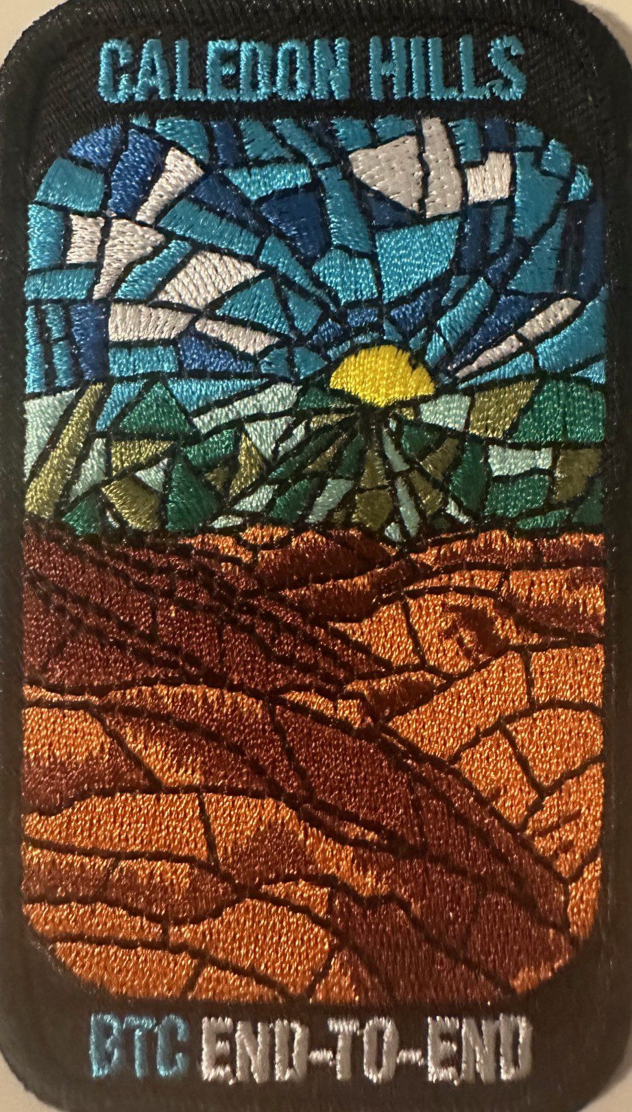
Caledon Hills E2E Stained Glass Badge Hike in 4 Hikes
https://hikes.brucetrail.org/event/caledon-hills-e2e-stained-glass-badge-hike-in-4-hikes-2/Sorry, the registration cut-off time for this hike has been reached.Not a member? Click here to join today!This is a Multi-Day Hike
You are signing up for the following dates:
2026-04-11, 2026-04-12, 2026-04-18, 2026-04-19Hosting Club: Caledon Hills
Category: End-to-End
Location (Google Maps): Meet at the designated roadside parking along the southwest shoulder of the Willoughby Road near Escarpment Sideroad intersection.Hike Leader(s): Lily Li Click here to contact Hike Leader(s)
Pace: Brisk – 4 to 5 km/hour, Medium – 3 to 4 km/hour
Terrain: Moderate – some hills and/or some poor footing
Distance: 18.3 kmDescription
Earn the Cheltenham Badlands Stained Glass/Fundraiser badge, which is part of the collectable Bruce Trail Clubs stained glass-themed fundraiser set. Hike distances range from 17 km to 20 km for the 4-day end to end series.Please dress according to the weather presented that day. Bring snacks, lunch and water (electrolytes) for a long day of hike.
This is a car shuttle hike. Please have your vehicle ready as everyone will be taking a turn either to drive us to the start point of our hike or to get our drivers back at the end of the day.
Quadzilla 3 series training hikes
https://hikes.brucetrail.org/event/quadzilla-3-series-training-hikes-2/Sorry, the registration cut-off time for this hike has been reached.Not a member? Click here to join today!Hike open to BTC Members only.
Hosting Club: Dufferin Hi-Land
Location (Google Maps): Hockley Road and 5th line parking lot
Hike Leader(s): Tristan Goguen and Pat Foley Click here to contact Hike Leader(s)
Pace: Medium
Terrain: Slippery and Steep Sections
Distance: Approximately 25 KmDescription
This series of hikes is designed to be for those who are familiar with hiking and want to start training for their summer hiking. The hike starts northbound up 5th line on the Hockley Heights side trail – a steep climb then into the woods – out along 15th side road down 3rd line to Dunby Rd and into the Hockley Valley Provincial Nature Reserve on the main trail. Once through the park we continue on the main trail up 2nd line then back along the main trail to the 5th line parking lot. For those not familiar with this series or section of the Caledon Hills… there are hills – plenty of them. At the beginning of April we can expect any of the following: ice, snow, mud and more mud… Come prepared for these conditions. Proper foot wear is a must, hiking poles are beneficial, rain/mud gear maybe necessary. There are no support stops for this hike so be sure to bring enough water, snacks and lunch. We will start out as a group but we fully expect hikers will divide up and go at their own pace. Everyone of course is welcome to stay in the main group with the hike leaders. If you cannot finish this distance you are encouraged not to attempt this hike it is a serious challenge. If you sign up for this hike please be respectful and if you have to drop out do so on line 2 days before the hike. Others maybe waiting for your spot and the hike leaders need to know you will be coming. We will provide a sign out sheet on the hike leader vehicle so you can sign out and note your time. This not only provides the hike leaders a safety check if you are a faster hiker but you can track your progress over the 3 hikes if you choose to do so.Rouge National Park Scarborough, ON
https://hikes.brucetrail.org/event/rouge-national-park-scarborough-on/Sorry, the registration cut-off time for this hike has been reached.Not a member? Click here to join today!Hosting Club: Toronto
Category: Car Hike
Location (Google Maps): Free parking in mast trail parking Lot off Kingston RoadHike Leader(s): MOHAMMAD AGHAMIRI Click here to contact Hike Leader(s)
Pace: Moderate (3-4 km/hr)
Terrain: Hilly, Level 2 (Intermediate – some hills and uneven surfaces, rocks and roots underfoot)
Distance (km): 12-14 kmDescription
We will hike Vista trail and part of orchard trail, will enjoy look outs between Rouge river and Little Rouge creek
• Please dress appropriately for the weather.
• We will have short water ,picture and a 15 minute snack break. Everyone is welcome!Please bring lots of water and snacks ,hiking poles are recommended
phone number for the day of hike 289 588 6482

9:00 Lake views of Lincoln
https://hikes.brucetrail.org/event/900-lake-views-of-lincoln/Sorry, the registration cut-off time for this hike has been reached.Not a member? Click here to join today!Hosting Club: Niagara
Category: In and Out
Location (Google Maps):Meet in the parking area on Quarry Rd. where the trail crosses the road in Beamsville (same as March 14). km 66.7 in BT reference Maps and Trail Guide, Ed. 31
Hike Leader(s): Karen Couch Click here to contact Hike Leader(s)
Pace: Brisk
Terrain: Strenuous
Distance: 14-15 kmsDescription
We’ll hike through Cave Springs towards Moyer Rd. in Vineland. After approximately 90 minutes we’ll have a short break before retracing our steps back to our cars. Come prepared for spring conditions.PLEASE NOTE: As an added bonus, for anyone interested, the hike will continue for 2-3 km (towards Kinsmen Park). This will bring the total distance to 20 km and add another 90 minutes to the hike. This is OPTIONAL.
Celebration In Memory of Dennis Chamberlain
https://hikes.brucetrail.org/event/celebration-in-memory-of-dennis-chamberlain/Sorry, the registration cut-off time for this hike has been reached.Not a member? Click here to join today!Hosting Club: Iroquoia
Category: General Hike
Location (Google Maps): Scotsdale FarmHike Leader(s): Steven White Click here to contact Hike Leader(s)
Pace: Medium – 3 to 4 km/hr
Terrain: Moderate – Some hills and/or some poor footing
Distance: 12.6kmDescription
To mark the anniversary of Dennis Chamberlain’s passing in 2025, I am re-tracing Dennis’s first BTC hike and my first hike as hike leader. As fate would have it, Dennis and I struck up an enduring friendship that took us to all paths on the Bruce Trail, and we made many friends with the same crazy passion for hiking, adventure and friendship. All are welcome!We will meet at the Bruce Trail Parking area at Scotsdale Farm, and so a loop hike coving the Bennett Heritage Trail, parts of main Bruce Trail and the Great Esker Side Trail. Total distance, 12.6 km.
I expect we’ll tell many Dennis stories along the way and share some of Dennis’ favourite treats.
Lunch at Kelseys Original Roadhouse, 256 Guelph St, Georgetown afterwards for those interested in joining.
9:00 Millennium Recreational Trail Hike
https://hikes.brucetrail.org/event/900-millennium-recreational-trail-hike-3/Sorry, the registration cut-off time for this hike has been reached.Not a member? Click here to join today!Hike open to BTC Members only.
Hosting Club: Niagara
Category: Urban
Location (Google Maps):Whirlpool Road at hydro canal in Niagara Falls
Hike Leader(s): Suzanne Gourluck Click here to contact Hike Leader(s)
Pace: Medium
Terrain: Easy
Distance: 8 kmDescription
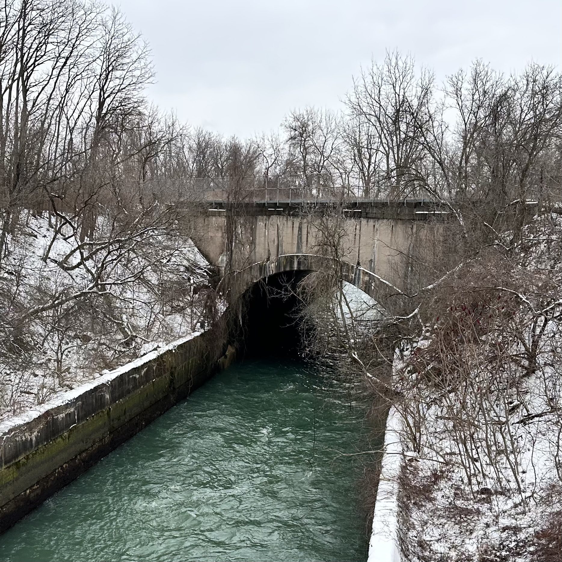
It’s Spring!! Stay mud free and hike along the paved multi-use Millennium Recreational Trail following the Chippawa-Queenston hydro canal in Niagara Falls.
Numbers are limited due to parking constraints. Parking is available either directly before or after passing the canal. Consider carpooling with a friend if possible.
Dress for the weather and bring a snack and water.
Scotsdale Farm Duff Pit loop
https://hikes.brucetrail.org/event/scotsdale-farm-duff-pit-loop-4/Sorry, the registration cut-off time for this hike has been reached.Not a member? Click here to join today!Hosting Club: Iroquoia
Category: General Hike
Location (Google Maps): Meet in the parking lot on 8 Line.Hike Leader(s): Karen Bergmann Click here to contact Hike Leader(s)
Pace: Medium – 3 to 4 km/hr
Terrain: Moderate – Some hills and/or some poor footing
Distance: 9 kmsDescription
There are so many trails here that it’s hard to choose where to go. But this hike will take us down the main trail to the Side Trails of Duff Pit, Reservoir, Trafalgar Rd and Great Esker to the main trail and Maureen Bennett Side Trail and finishing on the Bennett Heritage Trail. Bring icers for your boots.Car Hike: Forks of the Credit
https://hikes.brucetrail.org/event/car-hike-forks-of-the-credit-6/Sorry, the registration cut-off time for this hike has been reached.Not a member? Click here to join today!Hosting Club: Toronto, Caledon Hills
Category: Car Hike
Location (Google Maps): Forks of the Credit Provincial ParkHike Leader(s): Al Brown Click here to contact Hike Leader(s)
Pace: Moderate (3-4 km/hr)
Terrain: Hilly, Level 2 (Intermediate – some hills and uneven surfaces, rocks and roots underfoot)
Distance (km): 12 kmDescription
We will complete a loop hike through the Park, crossing the Credit River above the Cataract Falls. The hike will take us by the the Cataract Falls and along the east bank of the Credit River then north through the main park past glacial features and old homesteads. Trail conditions should be dry.The meeting point is the intersection of Mississauga Road and Cataract Road. Parking is located on both sides of the road. Park in marked areas only.

Urban Walk: Toronto Urban Badge Hike - 5 of 7
https://hikes.brucetrail.org/event/urban-walk-toronto-urban-badge-hike-5-of-7-3/Sorry, the registration cut-off time for this hike has been reached.Not a member? Click here to join today!Hosting Club: Toronto
Category: Urban Walk
Location (Google Maps): Toronto, Ontario, CanadaHike Leader(s): Brian Rideout Click here to contact Hike Leader(s)
Pace: Moderate (3-4 km/hr)
Terrain: Flat
Distance (km): 9.6 kmDescription
Please join me at the north east corner of Bathurst and Finch by 10 AM. We will hike east on the Finch Hydro Corridor Trail and south along East Don Parklands to Sheppard and Leslie (km 41.6 to km 51.2). Here is an online map with km markings of our route for all 7 hikes for the Toronto Urban Badge: https://onthegomap.com/s/c2c1hf3nPlease make sure you bring at least 2 liters of water, a lunch, bug spray and sunscreen.