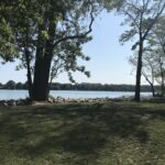
Pace: Brisk: 4 to 5 km/h, Fast: more than 5 km/h Terrain: Strenuous: Hilly with steep climbs and some poor footing., There are crevices or holes which may be hidden by layers of snow. Hike with extreme caution. Distance: 27.4 Km
Description Hike #5 of 6 Dyers Bay to Halfway Log Dump
Peninsula in 6 Challenger Series Complete 162.4 km section from Wiarton to Tobermory in 6 hikes.
You must sign up for EACH hike individually. The series is spread-out over 2 weeks, and 3 weekends. You are not automatically accepted into either series as a whole.
This hike series is intended for experienced distance hikers only. Hikers must demonstrate recent experience completing hikes exceeding 25 km over difficult terrain and at a brisk pace;
If a hiker is unable to keep pace with the group, or finds the distance too challenging, their future hike registrations may be canceled by the hike leader.
Be very aware of your ability to join this series.
Hikes will average 4.5 km per hour including breaks, moving pace is 5 km per hour;
Expect to be on-trail for 7 – 9 hours;
Meeting time is scheduled for 7:00am; arrive no later than 15 minutes prior to the meeting time;
Hikers must carry sufficient hydration, accessible snacks, lunch, first-aid kit, rain gear, extra socks, and possibly protective boot covers (i.e. bags);
Hikers will be expected to participate in shuttling hikers to the start and to drive shuttlers back to their car. Responsibility will be shared equally;
Any applicable parking fees will be shared within the group.
Location (Google Maps): Meet in the Beaver Valley Ski Club Lower parking lot at the far south end of the lot, past the tennis courts (do not park by the private picnic area near the river and bridge).
Pace: Medium Terrain: Moderate, Strenuous, Some steep sections, Some rocky footing Length of Hike: 30.1km You set your own pace, however a medium pace will get the job done in a timely fashion.
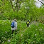
Description Come and test your mettle! This is a 30.1 km loop hike that traverses the beautiful, rugged upper Beaver Valley. It’s a challenging hike during which you’ll experience all that spring has to offer, including cascading creeks and waterfalls. Registrants should have experience with hiking long distances over strenuous terrain.
Registration will be through the Bruce Trail Conservancy Online Calendar and will open at 8:30 a.m. on March 1, 2022. The $30.00 registration fee covers the cost of the online registration fee, check point refreshments and the badge.
Further details of the event will be emailed to participants once registration is received. For more information contact beavervalleytrailactivities@gmail.com
You are signing up for the following dates and times: 2024-06-01 at 07:45 2024-06-02 at 07:45 2024-06-08 at 07:45 2024-06-09 at 07:45 2024-06-15 at 07:45 2024-06-16 at 07:45
Hosting Club: Iroquoia Category: Iroquoia E2E-in-Six Location (Google Maps): Parking capacity is indicated in brackets. June 1 – Meet at Calcium Pits (6) and car shuttle to Hilton Conservation (100) 43.505705, -79.961589 – 19.5km June 2 – Meet at roadside parking on Guelph Line, south of No1 Sideroad – park between the signs and do not block farm gate (10) 43.388366, -79.854231 20km Car shuttle to Calcium Pits as above 20km June 8 – Meet at roadside parking on the north end of Old Guelph Rd providing access to the Old Guelph Side Trail (8) 43.307417, -79.911580 20km Car shuttle to Guelph Line as above June 9 – Meet at roadside parking on the north end of Old Guelph Rd as above. Car shuttle to the end of Filman Rd – Enter where Main St West and Wilson St East intersect. (5) 43.243910, -79.946338 21km June 15 – Meet at roadside parking on Glover Mountain Rd (10) 43.209155, -79.773801 Car shuttle to the end of Filman Rd as above. 23km June 16 – Meet at the Lion’s Club Pool parking lot at 1 Elm St Grimsby (30) 43.193201, -79.565301. Car shuttle to Glover Mountain Rd as above. (22km)
Pace: Medium – 3 to 4 km/hr Terrain: Dependent on Conditions, Moderate – Some hills and/or some poor footing, Strenuous – Hilly with steep climbs and some poor footing Distance: Varies 20-23km per day
Description Hike Description
This is a group hike – please ensure it is suitable for you. There may be times when you have to be patient and or help out. It is aimed toward individuals who can hike and work well together for a common goal under the guidance of a hike leader.
We meet at 7:45am each day for an 8:00am maximum departure. We will leave once everyone has arrived so if everyone has arrived by 7:50am, we will leave early. Please ensure you know where you are meeting. It is a good idea to set your GPS the night before. Please ensure it matches up with the schedule as noted above.
Your fee is non-refundable and non- transferable and goes toward supporting the Iroquoia Bruce Trail Club to provide infrastructure along the trail and in supporting the Bruce Trail Conservancy mission of “Preserving a ribbon of wilderness, for everyone, forever.” Your fee also includes the efforts, expertise and guidance of a volunteer Hike Leader.
Part of your responsibility for this series is to be early/on-time for each hike, participate in the car shuttles and keep pace, while hiking, to the person in front of you. Please ensure your vehicle is car shuttle ready and has a minimum of 4 available seatbelts. Car pooling to the hike meeting place is generally ok for up to two people but if you plan to carpool to each day’s hike with more than two people, please ensure you let the hike leader know. Car shuttling to where we start the hike and driving the driver’s back at the end of the day is meant to be shared equally amongst all participants.
Please make sure you are able to attend each day before signing up for this hike series. If you would like to participate in only some of it, please get the OK from the Hike Leader. The fee is the same regardless.
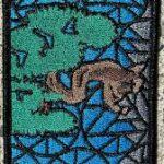
This is a special series of 6 hikes to complete the entire Iroquoia section of the Bruce Trail – the Jefferson Salamander badge is included in your fee. You are allowed to miss and make up one day of the 6 days, on your own.
For this E2E in 6, we will be following the main trail southbound eventually finishing in Grimsby. Please note that you are signing up for the entire series of six hikes as a Group Hike. The Iroquoia in 6 series is geared to experienced long distance hikers with the expectation of a 3 to 4.0 km/ hr. pace maintained over an 20 to 23 km day. No dropout points have been established and therefore hikers who must drop out, will be responsible for their own transportation. Please be honest about your hiking abilities.
Hikers will be expected to be wearing proper hiking boots and layered clothing with the expectation of cool, warm, possibly wet weather. Please check the weather forecast before the start of each day. Sufficient food and water for a full day of hiking is required and hiking poles (if you use them) and wet weather gear is recommended. A 10-15 minute on-trail lunch break will be scheduled. The time will be dependent on weather conditions.
Please note there are no refunds!
This particular set of 6 hikes is intended to be Medium Pace 3-4km per hour. Please be honest about your degree of physical fitness prior to registration.
The fee for this E2E-in-Six does not cover any parking/entry fees for hikers who are not members of the Halton CA and/or Hamilton CA. If the group has enough hikers who are members of the CA, those will be the cars chosen to park in those areas so as to minimize costs but since conservation passes are not free, please consider nominal compensation to the pass holder. At least one hike starts at one CA, so parking fees are unavoidable for non-CA members. If no one has a pass, the costs will be shared equally.
Please remember, like all hikes, this is a Leave No Trace hike. Pack out whatever you pack in. Do not throw anything onto or into any sections of the trail.
Remember, you can only miss one hike to qualify for this special Jefferson Salamander badge. You must still complete the one day distance you have missed. If you miss more than one but still complete the distances on your own, you may apply for the regular club End to End badge. The hiking schedule is outlined above and is subject to change.
If you have any questions about the hike please send your enquiry through this form.
You are signing up for the following dates: 2024-06-01, 2024-06-02, 2024-06-03, 2024-06-04, 2024-06-05, 2024-06-06, 2024-06-07, 2024-06-08, 2024-06-09, 2024-06-10
Pace: Brisk – 4 to 5 km/hr, Medium – 3 to 4 km/hr Terrain: Dependent on Conditions, Moderate – Some hills and/or some poor footing, Strenuous – Hilly with steep climbs and some poor footing Distance: 165km over 10 days ~ Usually less than 20km per day.
Description
Overview
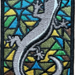
This is a special series of 10 hikes to complete the Peninsula section of the Bruce Trail. The organization, guidance, logistics and the Turkey Vulture stained glass badge is included in your fee which is non-refundable. Proceeds support the Peninsula Bruce Trail Club which in turn supports the Bruce Trail Conservancy mission to “Preserving a ribbon of wilderness, for everyone, forever.” In addition to hiking the main trail, we will be collecting bird songs via the Merlin app for the Peninsula Birder Badge as well as the Fern Badge, Orchid Badge and the new Tree Badge as we see/hear them. If you choose, many other side trails can be done after we finish each day’s hike. This is an option for participants.
For this E2E in 10, we will be following the main trail northbound eventually finishing in Tobermory. Please note that you are signing up for the entire series of 10 hikes as a Group Hike. The Peninsula in 10 series is geared to experienced long distance hikers with the expectation of a 3 to 5.0 km/ hr. pace maintained over a 15km plus day. The section is approximately 165km so daily distances will be based on available parking. No dropout points have been established and therefore hikers who must drop out, will be responsible for their own transportation back to their vehicle. Please note that transportation back to your vehicle is very limited in this section. Please be honest about your hiking abilities. We will hike at a steady pace but there will be plenty of time to take pictures and to enjoy the flora and fauna of this beautiful but challenging section. This particular set of 10 hikes is intended to be Moderate/Brisk. Please be honest about your degree of physical fitness prior to registration. It is a group hike so it is important you are able to keep pace with the person in front of you.
Attire and Daily Hikes.
Hikers will be expected to be wearing proper hiking boots and layered clothing with the expectation of cool and possible wet weather. Sufficient food and water for a full day of hiking is required as well as hiking poles (if you use them), and wet weather gear is strongly recommended. Bug spray is also suggested. Clothing adjustments, bio-breaks are as needed. Please let the sweep person know and they will wait for you. A morning break around 10am and a 10-15 minute on-trail lunch break will be scheduled. An afternoon break will be based on our expected finish time. Depending on weather conditions, these times may vary. Everyone must carry a First Aid kit.
Missing Hikes/Making-up Hikes
A maximum of 3 (of the 10) hikes can be self-completed as a result of scheduling challenges, but it is intended that this badge be earned while hiking as part of a group led by a certified hike leader to qualify for the Turkey Vulture badge. Since this is a car shuttle hike, please ensure your vehicle is car shuttle ready. All participants will be expected to take turns either driving to the start or driving the drivers back at the end of the day. Carpooling to our meeting spot with 2 people in the car is generally ok but we would like to minimize and equalize the driving/shuttling as much as possible so it is fair for all participants. Hikes that are completed on this series may go toward completion of an independent ETE for the regular Peninsula ETE flowerpot badge.
Parking Fees
Some parking locations require paid parking, and hikes that enter Bruce Peninsula National Park. The fee for this E2E-in-10 does not include any parking/entry fees for hikers. These costs, where applicable, will be shared amongst all participants unless you have a parking or park pass.
Leave No Trace
Please remember, like all hikes, this is a Leave No Trace hike. Pack out whatever you pack in. Do not toss anything onto or into any sections of the trail. We will also try to leave the trail better than we found it so we will be collecting collectable garbage we might see along the way. Daily volunteers to collect trail trash will be supplied with a bag. Dogs will not be welcome on this hike.
Accommodations
It is strongly recommended you make reservations for accommodations as soon as you register for the hike. Accommodations can be made anywhere in the Peninsula but I recommend staying in Lion’s Head which is about mid-way of the section. There is a motel, a campground, a hostel, and several B&B’s. Moving from accommodation to accommodation, while in the Peninsula, is doable but generally not recommended. If you would like a roommate, I can share your email with any other registered participants who are also looking for shared accommodations. Please let me know.
Daily
We meet for each hike by at least 7:45am each day. A schedule for meeting and start locations will be sent to each participant in May. We will hike northerly each day. The schedule is subject to change.
Pace: Moderate Terrain: Hilly, Variable Distance: 14-17 km
Description Will explore Toronto part of Rouge park along Rouge river and Little Rouge Creek,
Some safety procedures during the hike:
1-Hikers must stay between the leader and the sweep.
2-Hikers must advise the leader or the sweep if they wish to leave the group.
3- Hikers must follow the whistle instructions: 1 blast- stay where you are; 2 blasts come to the leader; 3 blasts – come to the leader quickly.
4-Hike leader may request volunteers to stop at trail intersections, they need to help hikers to the direction the group walk and wait till they see the sweep .
5-Hikers have to make sure they can see the persons behind and in front of them.
Pace: Moderate Terrain: Variable Distance: 15.6 Km
Description Maps 15-16, km 16.0 – km 31.6 (15.6 km) Starting Point: Roadside Parking – km 16.0 (along the southwest shoulder of the Willoughby Rd and Escarpment Sideroad intersection) (43.831244°N 79.980588°W) Drop-out Point: Roadside Parking – km 26.1 (along Escarpment Sideroad on the north side where the Trail crosses the road) (43.884912°N 79.920313°W) End Point: Roadside Parking – km 31.6 (on Innis Lake Rd, north of Finnerty Sideroad) (43.918917°N 79.909387°W)
Hosting Club: Blue Mountains Category: Register in person the morning of hike. Location (Google Maps): Hike meets in the parking lot behind Tim Hortons on First St. in Collingwood.
Pace: Leisurely – 3 km/hr. or less Terrain: Easy – Mostly flat and usually good footing Distance: 5 km
Description We will start at the Collingwood Museum and then walk south on the rail trail. We will then follow the Pretty River on the dog walkers paths and town trails back to the Museum.
Hosting Club: Niagara Category: In and Out Location (Google Maps): Meet at Kinsmen parking lot at the end of Frost Rd. hike in and back. (east or west)
Hosting Club: Niagara Category: Loop Location (Google Maps): Corner of Niven Road and Lakeshore Road in Niagara-on-the-Lake. Park along Old Lakeshore Road.
Description Explore a lakeshore park, shoreline and cliff top trail in Niagara-on-the-Lake. This beachcombing hike involves uneven ground, clambouring over fallen trees, a pebbly beach, sandy and wet areas. Dress for possible cold wind off the lake and bring poles if needed for stability.
Pace: Leisurely: 3 km/h or less Terrain: Moderate: Some hills and/or poor footing Distance: approx 4 km
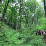
Description We will walk from the roadside to the escarpment edge through mixed forest and tall trees. Then follow the Main Trail south with views over Colpoys Bay, before turning back into the woods again.
I recommend good fitting shoes or hiking boot, bug repellent, sunscreen, sufficient water, and walking poles or walking sticks.
Pace: Brisk: 4 to 5 km/h, Fast: more than 5 km/h Terrain: Strenuous: Hilly with steep climbs and some poor footing., There are crevices or holes which may be hidden by layers of snow. Hike with extreme caution. Distance: 27.4 Km
Description Hike #5 of 6 Dyers Bay to Halfway Log Dump
Peninsula in 6 Challenger Series Complete 162.4 km section from Wiarton to Tobermory in 6 hikes.
You must sign up for EACH hike individually. The series is spread-out over 2 weeks, and 3 weekends. You are not automatically accepted into either series as a whole.
This hike series is intended for experienced distance hikers only. Hikers must demonstrate recent experience completing hikes exceeding 25 km over difficult terrain and at a brisk pace;
If a hiker is unable to keep pace with the group, or finds the distance too challenging, their future hike registrations may be canceled by the hike leader.
Be very aware of your ability to join this series.
Hikes will average 4.5 km per hour including breaks, moving pace is 5 km per hour;
Expect to be on-trail for 7 – 9 hours;
Meeting time is scheduled for 7:00am; arrive no later than 15 minutes prior to the meeting time;
Hikers must carry sufficient hydration, accessible snacks, lunch, first-aid kit, rain gear, extra socks, and possibly protective boot covers (i.e. bags);
Hikers will be expected to participate in shuttling hikers to the start and to drive shuttlers back to their car. Responsibility will be shared equally;
Any applicable parking fees will be shared within the group.
Location (Google Maps): Meet in the Beaver Valley Ski Club Lower parking lot at the far south end of the lot, past the tennis courts (do not park by the private picnic area near the river and bridge).
Pace: Medium Terrain: Moderate, Strenuous, Some steep sections, Some rocky footing Length of Hike: 30.1km You set your own pace, however a medium pace will get the job done in a timely fashion.
Description Come and test your mettle! This is a 30.1 km loop hike that traverses the beautiful, rugged upper Beaver Valley. It’s a challenging hike during which you’ll experience all that spring has to offer, including cascading creeks and waterfalls. Registrants should have experience with hiking long distances over strenuous terrain.
Registration will be through the Bruce Trail Conservancy Online Calendar and will open at 8:30 a.m. on March 1, 2022. The $30.00 registration fee covers the cost of the online registration fee, check point refreshments and the badge.
Further details of the event will be emailed to participants once registration is received. For more information contact beavervalleytrailactivities@gmail.com
You are signing up for the following dates and times: 2024-06-01 at 07:45 2024-06-02 at 07:45 2024-06-08 at 07:45 2024-06-09 at 07:45 2024-06-15 at 07:45 2024-06-16 at 07:45
Hosting Club: Iroquoia Category: Iroquoia E2E-in-Six Location (Google Maps): Parking capacity is indicated in brackets. June 1 – Meet at Calcium Pits (6) and car shuttle to Hilton Conservation (100) 43.505705, -79.961589 – 19.5km June 2 – Meet at roadside parking on Guelph Line, south of No1 Sideroad – park between the signs and do not block farm gate (10) 43.388366, -79.854231 20km Car shuttle to Calcium Pits as above 20km June 8 – Meet at roadside parking on the north end of Old Guelph Rd providing access to the Old Guelph Side Trail (8) 43.307417, -79.911580 20km Car shuttle to Guelph Line as above June 9 – Meet at roadside parking on the north end of Old Guelph Rd as above. Car shuttle to the end of Filman Rd – Enter where Main St West and Wilson St East intersect. (5) 43.243910, -79.946338 21km June 15 – Meet at roadside parking on Glover Mountain Rd (10) 43.209155, -79.773801 Car shuttle to the end of Filman Rd as above. 23km June 16 – Meet at the Lion’s Club Pool parking lot at 1 Elm St Grimsby (30) 43.193201, -79.565301. Car shuttle to Glover Mountain Rd as above. (22km)
Pace: Medium – 3 to 4 km/hr Terrain: Dependent on Conditions, Moderate – Some hills and/or some poor footing, Strenuous – Hilly with steep climbs and some poor footing Distance: Varies 20-23km per day
Description Hike Description
This is a group hike – please ensure it is suitable for you. There may be times when you have to be patient and or help out. It is aimed toward individuals who can hike and work well together for a common goal under the guidance of a hike leader.
We meet at 7:45am each day for an 8:00am maximum departure. We will leave once everyone has arrived so if everyone has arrived by 7:50am, we will leave early. Please ensure you know where you are meeting. It is a good idea to set your GPS the night before. Please ensure it matches up with the schedule as noted above.
Your fee is non-refundable and non- transferable and goes toward supporting the Iroquoia Bruce Trail Club to provide infrastructure along the trail and in supporting the Bruce Trail Conservancy mission of “Preserving a ribbon of wilderness, for everyone, forever.” Your fee also includes the efforts, expertise and guidance of a volunteer Hike Leader.
Part of your responsibility for this series is to be early/on-time for each hike, participate in the car shuttles and keep pace, while hiking, to the person in front of you. Please ensure your vehicle is car shuttle ready and has a minimum of 4 available seatbelts. Car pooling to the hike meeting place is generally ok for up to two people but if you plan to carpool to each day’s hike with more than two people, please ensure you let the hike leader know. Car shuttling to where we start the hike and driving the driver’s back at the end of the day is meant to be shared equally amongst all participants.
Please make sure you are able to attend each day before signing up for this hike series. If you would like to participate in only some of it, please get the OK from the Hike Leader. The fee is the same regardless.
This is a special series of 6 hikes to complete the entire Iroquoia section of the Bruce Trail – the Jefferson Salamander badge is included in your fee. You are allowed to miss and make up one day of the 6 days, on your own.
For this E2E in 6, we will be following the main trail southbound eventually finishing in Grimsby. Please note that you are signing up for the entire series of six hikes as a Group Hike. The Iroquoia in 6 series is geared to experienced long distance hikers with the expectation of a 3 to 4.0 km/ hr. pace maintained over an 20 to 23 km day. No dropout points have been established and therefore hikers who must drop out, will be responsible for their own transportation. Please be honest about your hiking abilities.
Hikers will be expected to be wearing proper hiking boots and layered clothing with the expectation of cool, warm, possibly wet weather. Please check the weather forecast before the start of each day. Sufficient food and water for a full day of hiking is required and hiking poles (if you use them) and wet weather gear is recommended. A 10-15 minute on-trail lunch break will be scheduled. The time will be dependent on weather conditions.
Please note there are no refunds!
This particular set of 6 hikes is intended to be Medium Pace 3-4km per hour. Please be honest about your degree of physical fitness prior to registration.
The fee for this E2E-in-Six does not cover any parking/entry fees for hikers who are not members of the Halton CA and/or Hamilton CA. If the group has enough hikers who are members of the CA, those will be the cars chosen to park in those areas so as to minimize costs but since conservation passes are not free, please consider nominal compensation to the pass holder. At least one hike starts at one CA, so parking fees are unavoidable for non-CA members. If no one has a pass, the costs will be shared equally.
Please remember, like all hikes, this is a Leave No Trace hike. Pack out whatever you pack in. Do not throw anything onto or into any sections of the trail.
Remember, you can only miss one hike to qualify for this special Jefferson Salamander badge. You must still complete the one day distance you have missed. If you miss more than one but still complete the distances on your own, you may apply for the regular club End to End badge. The hiking schedule is outlined above and is subject to change.
If you have any questions about the hike please send your enquiry through this form.
You are signing up for the following dates: 2024-06-01, 2024-06-02, 2024-06-03, 2024-06-04, 2024-06-05, 2024-06-06, 2024-06-07, 2024-06-08, 2024-06-09, 2024-06-10
Pace: Brisk – 4 to 5 km/hr, Medium – 3 to 4 km/hr Terrain: Dependent on Conditions, Moderate – Some hills and/or some poor footing, Strenuous – Hilly with steep climbs and some poor footing Distance: 165km over 10 days ~ Usually less than 20km per day.
Description
Overview
This is a special series of 10 hikes to complete the Peninsula section of the Bruce Trail. The organization, guidance, logistics and the Turkey Vulture stained glass badge is included in your fee which is non-refundable. Proceeds support the Peninsula Bruce Trail Club which in turn supports the Bruce Trail Conservancy mission to “Preserving a ribbon of wilderness, for everyone, forever.” In addition to hiking the main trail, we will be collecting bird songs via the Merlin app for the Peninsula Birder Badge as well as the Fern Badge, Orchid Badge and the new Tree Badge as we see/hear them. If you choose, many other side trails can be done after we finish each day’s hike. This is an option for participants.
For this E2E in 10, we will be following the main trail northbound eventually finishing in Tobermory. Please note that you are signing up for the entire series of 10 hikes as a Group Hike. The Peninsula in 10 series is geared to experienced long distance hikers with the expectation of a 3 to 5.0 km/ hr. pace maintained over a 15km plus day. The section is approximately 165km so daily distances will be based on available parking. No dropout points have been established and therefore hikers who must drop out, will be responsible for their own transportation back to their vehicle. Please note that transportation back to your vehicle is very limited in this section. Please be honest about your hiking abilities. We will hike at a steady pace but there will be plenty of time to take pictures and to enjoy the flora and fauna of this beautiful but challenging section. This particular set of 10 hikes is intended to be Moderate/Brisk. Please be honest about your degree of physical fitness prior to registration. It is a group hike so it is important you are able to keep pace with the person in front of you.
Attire and Daily Hikes.
Hikers will be expected to be wearing proper hiking boots and layered clothing with the expectation of cool and possible wet weather. Sufficient food and water for a full day of hiking is required as well as hiking poles (if you use them), and wet weather gear is strongly recommended. Bug spray is also suggested. Clothing adjustments, bio-breaks are as needed. Please let the sweep person know and they will wait for you. A morning break around 10am and a 10-15 minute on-trail lunch break will be scheduled. An afternoon break will be based on our expected finish time. Depending on weather conditions, these times may vary. Everyone must carry a First Aid kit.
Missing Hikes/Making-up Hikes
A maximum of 3 (of the 10) hikes can be self-completed as a result of scheduling challenges, but it is intended that this badge be earned while hiking as part of a group led by a certified hike leader to qualify for the Turkey Vulture badge. Since this is a car shuttle hike, please ensure your vehicle is car shuttle ready. All participants will be expected to take turns either driving to the start or driving the drivers back at the end of the day. Carpooling to our meeting spot with 2 people in the car is generally ok but we would like to minimize and equalize the driving/shuttling as much as possible so it is fair for all participants. Hikes that are completed on this series may go toward completion of an independent ETE for the regular Peninsula ETE flowerpot badge.
Parking Fees
Some parking locations require paid parking, and hikes that enter Bruce Peninsula National Park. The fee for this E2E-in-10 does not include any parking/entry fees for hikers. These costs, where applicable, will be shared amongst all participants unless you have a parking or park pass.
Leave No Trace
Please remember, like all hikes, this is a Leave No Trace hike. Pack out whatever you pack in. Do not toss anything onto or into any sections of the trail. We will also try to leave the trail better than we found it so we will be collecting collectable garbage we might see along the way. Daily volunteers to collect trail trash will be supplied with a bag. Dogs will not be welcome on this hike.
Accommodations
It is strongly recommended you make reservations for accommodations as soon as you register for the hike. Accommodations can be made anywhere in the Peninsula but I recommend staying in Lion’s Head which is about mid-way of the section. There is a motel, a campground, a hostel, and several B&B’s. Moving from accommodation to accommodation, while in the Peninsula, is doable but generally not recommended. If you would like a roommate, I can share your email with any other registered participants who are also looking for shared accommodations. Please let me know.
Daily
We meet for each hike by at least 7:45am each day. A schedule for meeting and start locations will be sent to each participant in May. We will hike northerly each day. The schedule is subject to change.
Pace: Moderate Terrain: Hilly, Variable Distance: 14-17 km
Description Will explore Toronto part of Rouge park along Rouge river and Little Rouge Creek,
Some safety procedures during the hike:
1-Hikers must stay between the leader and the sweep.
2-Hikers must advise the leader or the sweep if they wish to leave the group.
3- Hikers must follow the whistle instructions: 1 blast- stay where you are; 2 blasts come to the leader; 3 blasts – come to the leader quickly.
4-Hike leader may request volunteers to stop at trail intersections, they need to help hikers to the direction the group walk and wait till they see the sweep .
5-Hikers have to make sure they can see the persons behind and in front of them.
Pace: Moderate Terrain: Variable Distance: 15.6 Km
Description Maps 15-16, km 16.0 – km 31.6 (15.6 km) Starting Point: Roadside Parking – km 16.0 (along the southwest shoulder of the Willoughby Rd and Escarpment Sideroad intersection) (43.831244°N 79.980588°W) Drop-out Point: Roadside Parking – km 26.1 (along Escarpment Sideroad on the north side where the Trail crosses the road) (43.884912°N 79.920313°W) End Point: Roadside Parking – km 31.6 (on Innis Lake Rd, north of Finnerty Sideroad) (43.918917°N 79.909387°W)
Hosting Club: Blue Mountains Category: Register in person the morning of hike. Location (Google Maps): Hike meets in the parking lot behind Tim Hortons on First St. in Collingwood.
Pace: Leisurely – 3 km/hr. or less Terrain: Easy – Mostly flat and usually good footing Distance: 5 km
Description We will start at the Collingwood Museum and then walk south on the rail trail. We will then follow the Pretty River on the dog walkers paths and town trails back to the Museum.
Hosting Club: Niagara Category: In and Out Location (Google Maps): Meet at Kinsmen parking lot at the end of Frost Rd. hike in and back. (east or west)
Hosting Club: Niagara Category: Loop Location (Google Maps): Corner of Niven Road and Lakeshore Road in Niagara-on-the-Lake. Park along Old Lakeshore Road.
Description Explore a lakeshore park, shoreline and cliff top trail in Niagara-on-the-Lake. This beachcombing hike involves uneven ground, clambouring over fallen trees, a pebbly beach, sandy and wet areas. Dress for possible cold wind off the lake and bring poles if needed for stability.
Pace: Leisurely: 3 km/h or less Terrain: Moderate: Some hills and/or poor footing Distance: approx 4 km
Description We will walk from the roadside to the escarpment edge through mixed forest and tall trees. Then follow the Main Trail south with views over Colpoys Bay, before turning back into the woods again.
I recommend good fitting shoes or hiking boot, bug repellent, sunscreen, sufficient water, and walking poles or walking sticks.
Pace: Brisk: 4 to 5 km/h, Fast: more than 5 km/h Terrain: Strenuous: Hilly with steep climbs and some poor footing. Distance: 25.2 Km
Description Hike #6 of 6 Halfway Log Dump to Peninsula Terminus
Peninsula in 6 Challenger Series Complete 162.4 km section from Wiarton to Tobermory in 6 hikes.
You must sign up for EACH hike individually. The series is spread-out over 2 weeks, and 3 weekends. You are not automatically accepted into either series as a whole.
This hike series is intended for experienced distance hikers only. Hikers must demonstrate recent experience completing hikes exceeding 25 km over difficult terrain and at a brisk pace;
If a hiker is unable to keep pace with the group, or finds the distance too challenging, their future hike registrations may be canceled by the hike leader.
Be very aware of your ability to join this series.
Hikes will average 4.5 km per hour including breaks, moving pace is 5 km per hour;
Expect to be on-trail for 7 – 9 hours;
Meeting time is scheduled for 7:00am; arrive no later than 15 minutes prior to the meeting time;
Hikers must carry sufficient hydration, accessible snacks, lunch, first-aid kit, rain gear, extra socks, and possibly protective boot covers (i.e. bags);
Hikers will be expected to participate in shuttling hikers to the start and to drive shuttlers back to their car. Responsibility will be shared equally;
Any applicable parking fees will be shared within the group.
Description Please join me at the south east corner of Overlea Blvd and Don Mills Rd by 10 AM. We will hike south on the Don Trail to the Distillery District (km 62.4 to km 71.4). Here is an online map with km markings of our route for all 7 hikes for the Toronto Urban Badge.
Please make sure you bring at least 2 liters of water, a lunch, bug spray and sunscreen.
Location (Google Maps): Otter Lake Nature Reserve. Bruce Trail Map 39. Meet at the Otter Lake SideTrail entrance on Cape Chin Road North. Roadside Parking. GPS Coordinates 45.113223, -81.3166099. Car pool if possible.
Pace: Leisurely Terrain: Easy, Moderate Distance: ~2 1/2 KM
Description We continue our series of Spring Easy Hikes with respected, local birder – Rod Steinacher – at Otter Lake Nature Reserve. Rod will offer bird identification support and share his knowledge about birds during our avian adventure. Otter Lake Nature Reserve is part of a provincially significant wetland complex comprised of a marsh, thicket swamp, deciduous swamp, fen and Otter Lake itself. This wetland supports a variety of marsh birds, fish, amphibians, and reptiles. Some of the threatened bird species include the Meadowlark, Bob-o-link and Red-headed Woodpecker. This slow-paced hike will be a “walk-stop-listen-watch” hike and will traverse relatively flat, but uneven terrain. Plan on 2 ½ hours. What to bring: Bring a light backpack to carry water, snacks, binoculars, sunscreen, insect repellent and your favourite bird ID resource.
Optional: Camera, lightweight portable stool and nature journal. Download the Merlin and/or Seek app (both free) on your phone. This will be used for ID purposes only -not for calling. What to wear: Sturdy footwear with good tread. The trail may be muddy in places. Wear a hat and sun protective clothing.
Description Hike the main and side trails in Short Hills Provincial Park. Bring hiking boots, water, sunscreen and bug spray. Please check yourself for ticks after the hike.
Description NOTE: THIS HIKE IS EXTREME IN TERMS OF DISTANCE AND PACE. Another Letchworth State Park hike will be hosted in September which will be moderate in pace and distance, thereby appealing to the average interest of this hiking community.
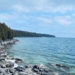
Letchworth State Park, renowned as the “Grand Canyon of the East,” is one of the most scenically magnificent areas in the eastern U.S. The Genesee River roars through the gorge over three major waterfalls between cliffs–as high as 600 feet in some places–surrounded by lush forests.
The plan is to meeting in Fort Erie at 6am and carpool 1.5 hours to Letchworth State Park. At that point we will need to spot cars at either end of the park, taking approximately 1 hour. Hikers must be able to hike 4.5 km/hour to cover 35 km over a 8-8.5 hour period. There is an overall 1820 feet elevation gain along the trail. The Letchworth Trail is a branch of the FLT. For more about FLT (Finger Lakes Trail) https://fingerlakestrail.org/plan-hikes-finger-lakes-trail/about-the-finger-lakes-trail/
Proper documentation for travel to the USA is required. Costs for gas, tolls and park entrance will be shared amongst participants in the vehicle that you will be car pooling in.
Pace: Medium – 3 to 4 km/hr Terrain: Strenuous – Hilly with steep climbs and some poor footing Distance: 7 km
Description This has a short shuttle. We will drive from Collingwood to Lions Head (2 hours) and follow Cty. Rd. 9 to km 67.9 at the junction of the Barrow Bay Side Trail which has now become the white blazed trail after printing Edition 31. We follow this NEW trail to a very steep descent down the Escarpment to the Georgian Bay shore. We then follow a moderately rugged path just inside the tree line for 2km along an unspoiled rocky shoreline. We then head back up via a steep zig zag among huge boulders until we meet a formerly impassable cliff, now conquered by a spectacular wooden staircase built in 2020 by volunteers from the Peninsula BTC. We will take a moment to appreciate the hard work and beautiful views before continuing on an easy peasy walk to our end point. The trail features cliffs, spectacular lookouts, and dense forests. A long drive home but what a spectacular new section of our fabulous footpath to have experienced. Bring snacks, lunch and water. Available parking: S Shore Rd.
Pace: Medium – 3 to 4 km/hr Terrain: Strenuous – Hilly with steep climbs and some poor footing Distance: 8 km
Description From Sanctuary Park we will hike the Spring Creek trail and parts of the Sawmill trail to the Trail Centre. After a break, (washrooms “should” be available at the trail centre) we will walk to the south side of the rail trail and take the Main Loop, Sulphur Creek, local access trails and rail trail back to the parking lot.
Please arrive 10 minutes before the start time. I will be leaving at 9:30 am. Bring water, sunscreen, insect repellant, a first aid kit and a snack. Poles are highly recommended due to the number of hills and some hills may be slippery if it has rained recently. I will cancel the hike in case of rain. Please check your email the evening before the hike in case of a cancellation. If you must cancel after the 3:30pm Tuesday cut-off time I will be sending contact info on the Tuesday.
Pace: Medium Terrain: Moderate Length of Hike: 5.5kms
Description We will meet in the Metcalfe Rock parking lot and then arrange ourselves to shuttle to the Kolapore Parking lot. The hike starts by getting some road walking out of the way. Then it’s a varied walk past pasture/field/meadow, through cedar stands and under deciduous forest canopy to the base of Metcalfe Rock. Please bring water and a snack.
COVID-19 Precautions Before, During and After your Hike
Each hiker joining a Bruce Trail Club organized hike must perform a self-screening check before hiking. Find Ontario’s self-assessment tool here: https://covid-19.ontario.ca/self-assessment/
If you are experiencing COVID-19 symptoms, stay home.
Other Guidelines
Arrive 15 minutes before the start of the hike.
Wear sturdy footwear and appropriate attire for the weather and the terrain. Hiking poles are a good idea in any season, especially if the terrain is rocky or slippery. In winter, snowshoes or icers/crampons are needed when conditions dictate. Wearing appropriate clothing and footwear prevents injuries and shows consideration for a safe and positive group hiking experience.
Always carry I.D. and your health card.
Bring sufficient water and snacks (or lunch if indicated). A minimum of 1L of water is recommended on all hikes, and 3L is recommended for long, challenging hikes in the heat of the summer.
Bring sunscreen and insect repellent (for spring and summer hikes).
From Jordan Hollow Hike the main trail to Upper and Lower Balls Falls, Moyer Road or Louth and Return. You must register for each hike. Bring Poles, sunscreen, bug spray , snack and a drink and dress for the weather
Location (Google Maps): Parking lot at the corner of Bayview Ave, and Sycamore Dr. South of Highway 7 Sycamore Dr. is 2 blocks south of highway 7,parking lot is across plaza of Dollarama and Star box
Hosting Club: Caledon Hills Category: End-to-End Location (Google Maps): Meet at 10th Line parking area south of where the trail crosses the road, km 27.9, Map 25 (Ed. 31). Shuttle to start at 3rd Line.
Pace: Medium – 3 to 4 km/hour Terrain: Moderate – some hills and/or some poor footing, Strenuous – hilly with steep climbs and some poor footing Distance: 39.9 – 27.9 + 0.1 to parking = 11.5 km total
Description This is the seventh hike in the series and will offer views of Georgian Bay, Duncan Crevice Caves, Pinnacle Rock Nature Reserve, Pinnacle Rock, Mill Creek.
Location (Google Maps): Jack Layton Ferry Terminal, near the gates to Wards Island Ferry. Arrive 20 minutes prior to departure to check in with hike leader.
From Union Station take the LRT and get off at the stop Ferry Docks.Walk up to the Ferry Docks on Queens Quay West, street level. at the foot of Bay Street.
Description After a day’s work come and “cool off” on the Toronto Islands free of fumes and traffic. Enjoy the view of the city skyline and Toronto’s beautiful island parkland. Pack a dinner for a sit down picnic. Food is not available for purchase on the Islands early in the season. Also bring a warm jacket and flashlight. Return fare ticket for the ferry approx $10.00 less for seniors. Hikes will take place rain or shine. Toronto Island evening hikes will take place every THURSDAY in MAY and JUNE 2024. Same time and same meeting place. No preregistration is required – just show up at the ferry docks at 5:40 PM and sign with the hike leader.
** As of the publication of the hike entry the start date of the Spring schedule is not available – current departure time to Wards Island is 6:00 PM, check back closer to the date to confirm the time **
** As of the publication of the hike entry the start date of the Spring schedule is not available – current departure time to Wards Island is 6:00 PM, check back closer to the date to confirm the time **
Hosting Club: Peninsula Category: Birding Location (Google Maps): Meet at Colpoy’s Bay Dock Parking Lot located at 209 Bruce County Road 9 @ 8:30 a.m. What3Words location: ///relish.alertness.shunning. We will carpool to the hike start location – a short distance away.
Pace: Leisurely, Medium Terrain: Easy, Moderate Distance: 4 – 4 1/2 KM
Description Meet our feathered friends – the many and varied types of Warblers – at Sturgeon Bay Forest. Justin Johnson and Jacob Kloeze , Nature Conservancy Canada (NCC) Biologists will provide birding interpretation during our morning hike. Sturgeon Bay Forest, a recently acquired Nature Conservancy of Canada property, is located on the east side of the Saugeen Bruce Peninsula, north of Wiarton. While exploring Sturgeon Bay Forest walking through both cedar and upland maple-beech deciduous forests, we may see the following species of warbler including Blackpoll Warbler, Northern Parula, Black-throated Green Warbler, Black-throated Blue Warbler, and Ovenbird. A variety of thrushes such as Veery and Hermit Thrush and other interior forest species including Red-eyed Vireo and Eastern Wood-pewee can also be seen here. No birding experience needed. We will be walking slowly and quietly, stopping as bird activity increases. Be prepared for a 3 – 4 hour hike. This is a small group hike. If the registration list is full, please add your name to the wait list. Birds observed/heard during this guided hike will contribute toward a PBTC Birding Badge.
What to Bring: Light backpack to carry a favourite bird ID book, binoculars, camera, waterbottle, snacks, insect repellent.
Prior to Hike: Optional – Download the Seek or Merlin Bird ID app (free) to your phone -to be used for ID purposes only – not for calling. A lightweight portable stool carried on/in your backpack may be handy.
What to Wear: Hat, sun-protective clothing, sturdy footwear with good tread. May be muddy –optional gators and waterproof hiking boots.
We may encounter some poison ivy during the hike.
Porta-pottie available at Colpoy’s Bay Dock parking area.
Thank you Nature Conservancy Canada for preserving wildlife habitat and stewarding this property.
Description Enjoy the benefits of pausing for a yoga practice as we tour through the trails, parkland and Historic Niagara-on-the-Lake. No mat required. Movement will focus on a flow of standing poses designed especially for hikers. Plan to stay for conversation and a warm cup of coffee or tea at Sweets & Swirls, Community Centre, Niagara Stone Road, NOTL.
Pace: Moderate Terrain: Hilly, Variable Distance: 12 km
Description The fourth and last hike in the series. Badge day. Look at the first hike in the series in the hikes calendar, April 19 to read the hike description.
Hosting Club: Toronto Category: Bus Hike Location (Google Maps): The bus will drop us off in Niagara Falls, Canada and we will hike to and across the Rainbow Bridge to the USA.
Pace: Fast, Moderate Terrain: Hilly, Rocky, Variable Distance: 14 km
Description Join us for an International Hike adventure where we will hike across the Rainbow Bridge to the Niagara State Park and descend into the Niagara Gorge Trails downriver from the Falls. Recommended for experienced hikers as some parts will be more technically challenging and some boulder hopping and a steep staircase will be involved. From the site of the Schoellkopf Power plant we will have good views of the Rainbow Bridge and the Horseshoe Falls. Before returning to the Canadian side will hike a portion of Goat Island for a closeup view of the American Falls. You will need to bring (1) a $1.00 coin for the pedestrian bridge toll to be collected by automated tollgate before exiting Canada and (2) a valid Canadian Passport. The Hike Leaders will verify all hikers have a valid passport as you check in and board the bus. There will be two groups – a moderate pace with Tom and Celia and a faster pace with Smadar and Jacquie. For day travel to the USA emergency medical medical insurance coverage, available for a few dollars, is strongly recommended.
Pace: Moderate Terrain: Hilly, Variable Distance: 14-17 km
Description We will explore Wilder forest and the beautiful scenery of Uxbridge forests.
Some safety procedures during the hike:
1-Hikers must stay between the leader and the sweep.
2-Hikers must advise the leader or the sweep if they wish to leave the group.
3- Hikers must follow the whistle instructions: 1 blast- stay where you are; 2 blasts come to the leader; 3 blasts – come to the leader quickly.
4-Hike leader may request volunteers to stop at trail intersections, they need to help hikers to the direction the group walk and wait till they see the sweep .
5-Hikers have to make sure they can see the persons behind and in front of them.
You are signing up for the following dates and times: 2024-06-08 at 08:30 2024-06-22 at 08:30 2024-07-06 at 08:30 2024-07-13 at 08:30 2024-08-03 at 08:30 2024-08-17 at 08:30
Pace: Medium Terrain: Moderate, Some rocky footing, Some steep sections, Strenuous Length of Hike: Hikes will range between approx. 17 & 21 km
Description Come hike our beautiful Beaver Valley over 6 Saturdays this summer! This series of hikes offers hikers the choice of one of two badges! Choose from the green apple badge ($10 member/$12 non members) or the fundraiser stained glass badge ($30). Payment for badges will be required on the day of the final hike. The medium hike pace will range between 3 to 4 km per hour, with a snack and lunch break. Hikers may request a personal bio break, clothing adjustment, etc. at any time during the hike by notifying the leader or sweep. The hikes range from approx. 17 to 21 km. Please self evaluate your ability to manage the pace and length of these hikes. Life does happen, so hikers will be able to miss 2 hikes and make them up on their own before Aug 17. A full hike schedule, with meet locations, will be sent to all hikers after registration. If you have any questions please use the “Contact hike leader” option on the online schedule.
COVID-19 Precautions Before, During and After your Hike
Each hiker joining a Bruce Trail Club organized hike must perform a self-screening check before hiking. Find Ontario’s self-assessment tool here: https://covid-19.ontario.ca/self-assessment/
If you are experiencing COVID-19 symptoms, stay home.
Other Guidelines
Arrive 15 minutes before the start of the hike.
Wear sturdy footwear and appropriate attire for the weather and the terrain. Hiking poles are a good idea in any season, especially if the terrain is rocky or slippery. In winter, snowshoes or icers/crampons are needed when conditions dictate. Wearing appropriate clothing and footwear prevents injuries and shows consideration for a safe and positive group hiking experience.
Always carry I.D. and your health card.
Bring sufficient water and snacks (or lunch if indicated). A minimum of 1L of water is recommended on all hikes, and 3L is recommended for long, challenging hikes in the heat of the summer.
Bring sunscreen and insect repellent (for spring and summer hikes).
Hosting Club: Caledon Hills Category: End-to-End Location (Google Maps): We will meet at Roadside parking along the southwest shoulder of the Willoughby Rd. and Escarpment Sideroad intersection; km 15.9, Map 15. Shuttle to Spirit Tree Cidery on Boston Mills Road or roadside parking at the turnaround at the north end of Chinguacousy Road – do not block the entrance to private property (km 2.8) (Buddy Key Swap for top of 1.4 km)
Pace: Medium – 3 to 4 km/hour Terrain: Moderate – some hills and/or some poor footing Distance: 15.9 + 1.4 = 17.3 km
Description Do you have plans to complete the full 72.5 kilometres of the Caledon Hills Section? Come join us to hike Caledon Hills to enjoy the lush green foliage, combined with the vertical diversity of trees, plants, and hills! We are celebrating Caledon Hills’ 60th anniversary. Once you complete all 4 hikes, you qualify for 2 badges; Caledon Hills NEW E2E Badge and 60 for the 60th Anniversary Badge. The cost of each badge is $10.00 for BTC members and $15.00 for non-members. Please dress according to the weather presented that day. Bring enough food and water (electrolytes) for a long day of hiking. This is a car shuttle hike. Please have your vehicle passenger ready as everyone will be taking a turn either to start the hike or get drivers back at the end of the day. A detailed schedule for the full series, with dates and meeting locations, will be provided upon registration.
Hosting Club: Niagara Category: Hike Location (Google Maps): Park at McGarr Realty, 5 St. Paul St., St. Catharines. We’ll walk in the area on city streets and local paths.
Pace: Medium – 3 to 4 km/hr Terrain: Easy – Mostly flat and usually good footing
Description Reconnect with Club members and join us on our Picnic Party hikes to celebrate the coming of SUMMER. Both hikes will meet for lunch and cake at km 14.5 to celebrate good times on the trail and kick off the summer/fall schedule! GROUP 1- The Longer hike. Description: We will park on 6/7 Sideroad at km 10.6 and hike to the picnic table at km 16.0 and return. We follow the Transcarioca Friendship Trail for part of this hike along the Bruce Trail. We will meet up with Group #2 at km 16.0 at the picnic table to share some delicious cake. Bring lunch and water. We provide the cake!
Description We will hike south from CR 9 on the main trail, cross the Noisy River and hike to where the trail reaches a short gravel road off of Lavender Hill Rd. Then we will turn around and follow the trail north to our cars. Directions: from CR 89, north on CR 124 to to Grey CR 9, east to roadside parking on the right. This is Seven Rivers (aka Headwaters) series consists of 7 hikes: 3 North and 4 South. Hikers completing all 7 hikes in this series will be eligible to purchase a Seven Rivers Hike Series Badge from Dufferin Hi-Land BTC.
Pace: Leisurely – 3 km/hr. or less Terrain: Easy – Mostly flat and usually good footing Distance: 4 km
Description GROUP 2- The Shorter hike. Description: We will drive to km 14.1 on 9/10 Sideroad and park the cars to begin the hike. We will hike north to km 16 and will meet up with Hike #1 group at the picnic table. After lunch we will retrace our steps back to the cars. Bring lunch and water. We provide the cake!
Hosting Club: Sydenham Category: Geology Hike Location (Google Maps): Meet at the main Book Launch event, at the Woodford Community Centre. Parking is in the field behind the community centre.
Pace: Leisurely: 3 km/h or less Terrain: Moderate: Some hills and/or poor footing Distance: 3km
Description Join Beth Gilhespy for a Walk Through Time at Woodford, as part of her Sydenham geology book launch!
Beth will lead a hike to explore the geology of the Niagara Escarpment at Woodford (it is estimated that this interpretive hike will take upwards of 1.5h).
Hosting Club: Dufferin Hi-Land, Sydenham Category: General Hike Location (Google Maps): BTC parking lot off 6th Concession South (west side of road) north of Sideroad 3, south of Sideroad 6. BTC Map 29. 44.509124, -80.810665. Please arrive at 9:45 am.
Pace: Medium Terrain: Slippery and Steep Sections, Slippery Sections Likely, Strenuous Distance: 19 kms
Description Join us on the third of our 10 Sydenham E2E Series shuttle hikes. Peaceful rural Ontario. Woods. Rocky technical terrain. Very, very wet and muddy at Bognor Marsh. Some road walking. Please bring a garbage bag and a change of footwear for the shuttle (we will be very muddy) and please be prepared to drive fellow hikers before or after the hike. Please bring a smile, 2L of water, a warm drink, sunblock, a snack and a lunch. It’s a touch early for bugs but be ready for them too just in case. Hiking boots mandatory. Poles and gaiters recommended. Please arrive at 9:45 am to be prepared to shuttle at 10:00 am sharp. Please visit the BTC website to see what should be in your back pack including your own first aid kit, an extra pair of socks and plastic bags to wear over your feet inside your boots in case you get a footer.
Description Please join me at the south east corner of Sheppard Ave East and Leslie by 10 AM. We will hike south through several parks to Don Mills (S of Overleigh) (km 51.7 to km 62.4). Here is an online map with km markings of our route for all 7 hikes for the Toronto Urban Badge.
Please make sure you bring at least 2 liters of water, a lunch, bug spray and sunscreen.
Description We will complete the last portion of the Dufferin Hi-Land section passing through stream valleys and rolling farmland. After the hike all are invited to join the hike leaders for refreshments in Creemore.
On completion of the hike badges will be given out to those who completed the entire section and requested them. Badges cost about $10 (price to be confirmed). Speak to the hike leader on hike 3 of 4 if you want a badge.
To get to the meeting place go north on Hwy 10 to Primrose. Continue north on Prince of Wales Rd to River Road. Turn right and go about 5 km to Centre Road. Turn left and go about 8 km to Lavender. Turn right and go about 0.5 km to the cemetery
Description We will complete a loop hike on the mail Bruce Trail and side trails. The route follows old farm lanes and trails mostly under the forest canopy. Terrain conditions vary and include rocky sections and glacial formations. After the hike those interested are invited to meet at the Sheppard’s Crook or a nearby coffee shop in Georgetown for refreshments.
The hike start time is set at 11:00 am to allow hikers the option of visiting the Georgetown farmers market before the hike. The farmers market is located in the centre of old Georgetown and runs from early morning to about noon.
Directions: From the 4o1 go north on Trafalgar Road pasts Georgetown. Trafalgar merges with Hwy 7 for about 3 km then separates to the right at the village of Silver Creek. From the stop light at Silver Creek go north on Trafalgar about 1 km to the entrance of Scotsdale Farm on your right. Drive in to the parking area about half a km.
Pace: Leisurely: 3 km/h or less Terrain: Moderate: Some hills and/or poor footing Distance: 3km
Description Join Beth Gilhespy for a Walk Through Time at Woodford, as part of her Sydenham geology book launch!
Beth will lead a hike to explore the geology of the Niagara Escarpment at Woodford (it is estimated that this interpretive hike will take upwards of 1.5h).
Pace: Brisk: 4 to 5 km/h, Fast: more than 5 km/h Terrain: Strenuous: Hilly with steep climbs and some poor footing. Distance: 22.8 km
Description This series of hikes is a Fundraiser series for the Blue Mountains Bruce Trail Club. All proceeds fund the activities of the Club directly. You are signing up for all 3 hikes, and must be present for all the hikes to receive the special fundraising badge.
Hikers will receive a schedule of the Itinerary for all 3 hikes upon registration. Each Hike is 22-23 Km. The GPS coordinates for Hike on Day #1 are provided here. We will be starting the hike from Maple Lane, at the Blue Mountains Beaver Valley Boundary
This hike series is intended for experienced distance hikers only; hikes will be lead at a brisk to fast pace. Be aware of your ability to join this series.
Hikes will average 4.5 km per hour including breaks, moving pace is 5 km per hour;
Expect to be on-trail for 4-5 hours;
Meeting time is scheduled for 7:00am so that we’re on the trail at the earliest part of the day and avoid the heat in the afternoons;
You must arrive no later than 15 minutes prior to the meeting time to organize shuttle; all participants will be expected to participate in the shuttle;
Any applicable parking fees will be shared within the group.
Hikers must carry sufficient hydration, accessible snacks, small lunch, first-aid kit, rain gear, extra socks, bug spray, etc; Check the weather as you pack your gear;
If you have any questions or concerns, please use the Contact the Hike Leader above.
Hosting Club: Dufferin Hi-Land, Sydenham Category: General Hike Location (Google Maps): Roadside parking along the St. Vincent-Sydenham Townline at the field entrance of the River Kwai Side Trail. (We will not be building a bridge!). 44.624492, 80.730579. Please arrive at 8:45 am to be ready to shuttle at 9:00 am.
Pace: Medium Terrain: Slippery and Steep Sections, Slippery Sections Likely, Strenuous Distance: 16 kms
Description Join us on the fourth of our 10 Sydenham E2E Series shuttle hikes. Peaceful rural Ontario notwithstanding the fact we will take in the new Kaboom Side Trail. Woods. Rocky technical terrain. May have to cross a swollen creek. Please bring a garbage bag and a change of footwear for the shuttle (we will be very muddy) and please be prepared to drive fellow hikers before or after the hike. Please bring a smile, 2L of water, a warm drink, sunblock, a snack and a lunch. It’s a touch early for bugs but be ready for them too just in case. Hiking boots mandatory. Poles and gaiters recommended. Please arrive at 8:45 am to be prepared to shuttle at 9:00 am sharp. Please visit the BTC website to see what should be in your back pack including your own first aid kit, an extra pair of socks and plastic bags to wear over your feet inside your boots in case you get a footer.
Location (Google Maps): Meet in the Johnston’s Side Road BTC parking area, km 71.7, Map 26, Edition 31. Please be there 15 minutes before the hike start time.
Pace: Leisurely Terrain: Moderate, Some steep sections Length of Hike: Approx. 1 1/2 hours
Description Excited about fungi? Join us for an educational hike led by an expert in the field from the The Mycological Society of Toronto. As we walk slowly along the trail, we will be viewing and learning about a variety of mushrooms/fungi. If you are thinking about working towards earning our Mushroom Hunter badge, see https://beavervalleybrucetrail.org/earning-badges/ one of our leaders will take photos, do I.D. and send that info to interested participants, just to keep us moving along. Please be dressed for the weather and bring water.
COVID-19 Precautions Before, During and After your Hike
Each hiker joining a Bruce Trail Club organized hike must perform a self-screening check before hiking. Find Ontario’s self-assessment tool here: https://covid-19.ontario.ca/self-assessment/
If you are experiencing COVID-19 symptoms, stay home.
Other Guidelines
Arrive 15 minutes before the start of the hike.
Wear sturdy footwear and appropriate attire for the weather and the terrain. Hiking poles are a good idea in any season, especially if the terrain is rocky or slippery. In winter, snowshoes or icers/crampons are needed when conditions dictate. Wearing appropriate clothing and footwear prevents injuries and shows consideration for a safe and positive group hiking experience.
Always carry I.D. and your health card.
Bring sufficient water and snacks (or lunch if indicated). A minimum of 1L of water is recommended on all hikes, and 3L is recommended for long, challenging hikes in the heat of the summer.
Bring sunscreen and insect repellent (for spring and summer hikes).
Description Please join me under the clock in the Great Hall of Union Station by 9:05 am. We will take the eastbound Lakeshore train departing 9:20 AM, arriving in Whitby at 10:13 AM. If you prefer to drive, please meet at the north entrance of Whitby Go Station near the washrooms and the ticket counter.
Please check out the GO Transit website and consider purchasing a one day pass for $10. We will hike south to the lake and east to Oshawa along the Waterfront Trail for an estimated distance of 10 km. We will pass through several parks in Whitby and Oshawa along the way.
While in Oshawa we will take Durham Region Transit to the Fox and the Goose pub and to Oshawa GO so please bring your Presto card and / or cash fare. Please bring sun screen, bug spray, a light snack and at least 2 liters of water.
Location (Google Maps): Meet in the Johnston’s Side Road BTC parking area, km 71.7, Map 26, Edition 31. Please be there 15 minutes before the hike start time.
Pace: Leisurely Terrain: Moderate, Some steep sections Length of Hike: Approx. 1 1/2 hours
Description Excited about fungi? Join us for an educational hike led by an expert in the field from the The Mycological Society of Toronto. As we walk slowly along the trail, we will be viewing and learning about a variety of mushrooms/fungi. If you are thinking about working towards earning our Mushroom Hunter badge, see https://beavervalleybrucetrail.org/earning-badges/ one of our leaders will take photos, do I.D. and send that info to interested participants, just to keep us moving along. Please be dressed for the weather and bring water.
COVID-19 Precautions Before, During and After your Hike
Each hiker joining a Bruce Trail Club organized hike must perform a self-screening check before hiking. Find Ontario’s self-assessment tool here: https://covid-19.ontario.ca/self-assessment/
If you are experiencing COVID-19 symptoms, stay home.
Other Guidelines
Arrive 15 minutes before the start of the hike.
Wear sturdy footwear and appropriate attire for the weather and the terrain. Hiking poles are a good idea in any season, especially if the terrain is rocky or slippery. In winter, snowshoes or icers/crampons are needed when conditions dictate. Wearing appropriate clothing and footwear prevents injuries and shows consideration for a safe and positive group hiking experience.
Always carry I.D. and your health card.
Bring sufficient water and snacks (or lunch if indicated). A minimum of 1L of water is recommended on all hikes, and 3L is recommended for long, challenging hikes in the heat of the summer.
Bring sunscreen and insect repellent (for spring and summer hikes).
Pace: Leisurely: 3 km/h or less Terrain: Moderate: Some hills and/or poor footing, Strenuous: Hilly with steep climbs and some poor footing. Distance: 6.4 km
Description We will carpool to do a loop hike of some Silent Valley trails. This is hike 7 in the book Exploring Sydenham. It has a secret to be located.
You are signing up for the following dates and times: 2024-06-10 at 08:00 2024-06-11 at 08:00 2024-06-12 at 08:00 2024-06-13 at 08:00 2024-06-17 at 08:00 2024-06-18 at 08:00 2024-06-19 at 08:00 2024-06-20 at 08:00
Hosting Club: Toronto, Sydenham Category: Car Hike Location (Google Maps): Km 20.7, on the shoulders of 6th Concession S. GPS N44.507399, W80.810098
Hike Leader(s): Jacquie Van Dyke
Pace: Brisk, Moderate Terrain: Hilly, Variable Distance: Distances will be approximately 20-25km per day, spread over 8 hikes, for a total of 175km.
Description This Sydenham Stained Glass E2E Fundraising hike series will be spread over 8 days, covering approximately 175km. The funds paid will be collected by the Toronto Bruce Trail Club and transferred to the Sydenham Club to help with the club’s expenses and the pledge of maintaining “The Ribbon of Wilderness for Everyone Forever.” The registration date of March 3 at 9:00pm is for all 8 group hikes. Participants completing this series will receive the Hart’s Tongue Fern badge (designed by Joe Borges) at the end of the last hike. Life aside from hiking does happen and you may miss 2 hikes but please let the hike leader know ahead of time and make it up before June 20, 2024.
A hike schedule will be sent late-May to all participants. Hikes will range in distance of 20-25km, hiking at an average speed of 3-5km/hour, depending on trail & weather conditions.
Please arrive by 8:00am for each hike to get organized and to be ready to begin the car shuttle at 8:15. All hikers are expected to participate fairly in the car shuttles. No dropout points have been established and therefore hikers who must drop out, will be responsible for their own transportation back to their vehicle. Please note: available transportation back to your vehicle is very limited in this section. It’s going to get warm/hot so please be prepared with enough food to last the hike, a minimum of 2L of hydration, bug repellent, and hiking gear appropriate for the weather/conditions. We’ll have a short morning break and also a lunch break on each hike.
Pace: Medium – 3 to 4 km/hr Terrain: Moderate – Some hills and/or some poor footing Distance: 10 km
Description We will hike through the Dundas Valley Conservation Area on the main Bruce Trail, Conservation trails and BT side trails. Bring water and snacks. Be sure to wear appropriate clothing and footwear.
Park in the main Parking lot located at 650 Governor’s Road. Parking fees will be required. See the Hamilton Conservation Authority for more information: https://conservationhamilton.ca/admissions-fees/
Please arrive at 8:15 am as we will leave promptly at 8:30 am.
Hosting Club: Peninsula Category: Birding Location (Google Maps): Meet at the parking lot at the intersection of Highway 6 and Dyers Bay Road at 8:30 a.m. We will car pool to the Cottrill Lake ST parking area to begin our hike.
Pace: Fast, Leisurely, Medium Terrain: Moderate Distance: ~3 1/2 KM
Description Join Bird Enthusiast – Peter Rasberry – for a Spring Birds and Blooms hike on the Cottrill Lake Side Trail. This should be peak time for both spring wildflowers and bird migration. The hike pace is slow and will be a “walk, stop and talk” type of hike. This provides an opportunity to identify and appreciate all that nature is offering us! The terrain is rocky but relatively flat on Cottrill Lake Side Trail. At the end of Cottrill Lake Side Trail, we will decide as a group, whether we return to our starting point by walking on Britain Lake Road, or hiking the more rugged terrain with lots of “ups and downs” on the Anne and Clayton Roberts Side Trail to the Main Trail. Both options complete the loop at the Cottrill Side Trail parking area. Distance for both options is about the same ~ 3 ½ km. Dress according to the weather. Bring snacks, water, cameras, binoculars, field guides, and insect repellent. Hike finish should be about 11:30 a.m.
Hosting Club: Peninsula Category: Birding Location (Google Maps): Meet at the parking lot at the intersection of Highway 6 and Dyers Bay Road at 8:30 am, and car pool to the Cottrill Lake ST parking area where we begin our hike.
Description Open Registration “Spring Birds and Blooms – Join Bird Enthusiast – Peter Rasberry – for a Spring Birds and Blooms hike on the Cottrill Lake Side Trail. This should be peak time for both spring wildflowers and bird migration. The hike pace is slow and will be a “walk, stop and talk” type of hike. This provides an opportunity to identify and appreciate all that nature is offering us! The terrain is rocky but relatively flat on Cottrill Lake Side Trail. At the end of Cottrill Lake Side Trail, we will decide as a group, whether we return to our starting point by walking on Britain Lake Road, or hiking the more rugged terrain with lots of “ups and downs” on the Anne and Clayton Roberts Side Trail to the Main Trail. Both options complete the loop at the Cottrill Side Trail parking area. Distance for both options is about the same ~ 3 ½ km. Dress according to the weather. Bring snacks, water, cameras, binoculars, field guides, and insect repellent. Hike finish should be about 11:30 a.m. Bruce Trail Reference Guide Edition 31.
Hosting Club: Dufferin Hi-Land Category: Tuesday Hike Location (Google Maps): Caledon Hills, Map 18. Meet at 7th Line BTC parking lot about 1.5 km north of Hwy 9 (near Km 43.3) . Entrance to the lot is just off of Airport Rd on 7th Line, Mono.
Pace: Leisurely Terrain: Moderate Distance: 7 or 3.6 km
Description We will hike the Main Trail south to the Glen Haffy Side Trail, then follow the side trail east as far as the Mono Adjala Townline and back. The shorter hike will turn back at the intersection of the two trails.
Description Hike the main and side trails in Shorthills Provincial Park. Bring hiking boots, water, sunscreen and bug spray. Please help prevent the spread of invasive species by cleaning your boots following the hike. Please check yourself for ticks following the hike.
Hosting Club: Caledon Hills Category: Tuesday Hikers Location (Google Maps): Meet at Winston Churchill Blvd., intersection with Caledon Trailway. Driving direction: North on Highway 410, continue north on Highway 10, left on King Street, right on Winston Churchill Blvd; drive 1 kilometre to roadside parking on either side of the road.
Pace: Medium – 3 to 4 km/hour Terrain: Moderate – some hills and/or some poor footing Distance: 12 km
Description Will hike Terra Cotta Side Trail and main Bruce Trail. Bring water, snack, poles and bug spray. Hike Leaders phone contact for the day of hike: 416-566-0503.
Hosting Club: Blue Mountains Category: Organized Hike Location (Google Maps): Hike meets in the parking lot behind Tim Hortons on First St. in Collingwood.
Pace: Leisurely – 3 km/hr. or less Terrain: Moderate – Some hills and/or some poor footing Distance: 6.5 km
Description Leisurely Option: This is a car shuttle hike. A leisurely version will be offered from Franks Kiln parking (BTC parking lot off Cty. Rd. 91) to 10th line.
Hosting Club: Blue Mountains Category: Register in person the morning of hike. Location (Google Maps): Hike meets in the parking lot behind Tim Hortons on First St. in Collingwood.
Pace: Medium – 3 to 4 km/hr Terrain: Moderate – Some hills and/or some poor footing Distance: 12 km
Description Description: This is a car shuttle hike. We will drive to and leave the cars on Station Street in Glen Huron and drive to km 37.4 (BTC parking lot off Cty.Rd. 91) to begin the hike. The trail winds its way through privately owned forest and farmland eventually coming to a viewing platform south of Cty. Rd. 124. The hike continues down into the valley and at km 30.6 we meet up with the Mad River Side Trail. Following the side trail parallel to the Mad River we continue on to the cars. Bring a snack or lunch and water.
Hosting Club: Sydenham Category: General Hike Location (Google Maps): Meet at roadside parking on Sideroad 22B, just east of Grey Road 7. We will meet by the Blue sign for the Fairmount Loop. Map number 27.
Pace: Brisk: 4 to 5 km/h Terrain: Strenuous: Hilly with steep climbs and some poor footing. Distance: 12 km
Description This is a challenging but very rewarding hike. We start by descending to the floor of the Beaver Valley, enjoying forests and streams along the way. Then comes the steep climb back up, where we are rewarded with spectacular views to the east across the valley and to Blue Mountain. We’ll stop for lunch at the gazebo beside Webwood Falls. The last leg of the hike is the very pretty Fairmount trail which offers sweeping panoramic views of the Beaver Valley. Please bring a lunch and lots of water.
Description Join us for the 2nd tree badge pilot hike to help us establish the requirements for the badge. The tree badge will be the next in a series of conservation badges that include the birder badges, fern badge and orchid badge. This hike will allow you to test the requirements for the badge. The badge requirements are at the end of this hike description. The badge requires the use of the iNaturalist app – if you aren’t already part of the iNaturalist Bruce Trail Conservancy Project, please get the app before the hike, see details here: https://brucetrail.org/what-we-do/#iNaturalist
PBTC volunteer and hike leader Jeannine Krait will lead the hike and share her knowledge of trees on the Peninsula to support hikers as they try out the Tree Badge requirement.
We will meet at the Jackson’s Cove parking lot [44.939536, -81.133319] and hike the main trail to Jackson Cove Side Trail and back on the Jackson Cove Side Trail. If there is time and interest, we may extend the hike along the main trail. Our pace will be slow as we focus on tree identification. Bring a snack and water. Be prepared for variable weather and dress for the conditions on the day of the hike.
Draft Tree Badge Requirements:
There is no time limit for completing the badge requirements. All observations must be from the main trail or sides trails of the Peninsula section or on a PBTC-organized hike.
Photograph, identify and document 25 different tree species along the Peninsula section of the Bruce Trail. Your list must include at least 1 tree in each of the following categories:
Deciduous
Coniferous
Mast Tree– produces food for wildlife or human foragers through periodic booms in seed production. A key characteristic of mast trees is that their seed production becomes synchronized across entire populations of the same species, producing an over-abundance of food in some years (also known as bumper crops, which is a crop that has yielded a usually productive harvest), and greatly reduced production in other years. Many mast foods have great storage value, avoiding rot, or freezing on the trees to provide quality food even when everything is dormant. Mast foods also have a high nutrition content, such as fatty nuts, which helps mammals build up fat stores for winter. Periodic booms (typically once every 2-8 years) of mast production trigger a cascade of ecological effects that affects mammals, birds, insects & even diseases like Lyme. Some common types of mast trees include oak, spruce, walnut, butternut and beech. (Note: the tree does not need to be bearing fruit/nut/seed at the time it is ID’d, so long the species is considered a “mast” species)
Wildlife Tree – standing dead or live tree (also known as snags, den trees or cavity trees) with characteristics that provide valuable habitat for wildlife. Wildlife trees may contain spike, fork or broken tops, cavities, loose bark, large platform limbs and brooms. In Ontario, at least 50 species of birds and mammals rely on snags. Many species of trees make for good snaps, but large conifers such as cedar, fir, larch, and pine, tend to rot more slowly than do deciduous trees such as alder, birch, and cherry. Large deciduous trees such as cottonwoods, big-leaf maples, and oaks can last many years as snags. While alive, large deciduous trees tend to develop cavities in their bulky live and dead branches and trunks.
Invasive Species – could be an invasive tree species (i.e., Scots pine, Buckthorn, Norway Maple) or identification of invasive pathogen (i.e., Emerald Ash Borer, butternut canker, beech bark disease)
Upload photos to iNaturalist.ca and add them to the Bruce Trail Project. New to iNaturalist? When loading pictures on iNaturalist, take clear pictures of and upload as many features of the tree as are available to help with ID – bark, leaves/needles, pinecones or seeds, overall structure of the tree, etc. Tag photos with “PBTC Tree Badge” for easy reference. Not registered for the Bruce Trail Project? Visit https://brucetrail.org/what-we-do/#iNaturalist for details.
For one specimen tree in each of the five categories record the following:
Leaf category: Short needles in opposite pairs or whorls of 3, needles in bundles or 2, 3 or 5, needles in tufts of 10 or more on dwarf shoots or single on long shoots
Mast Tree
Name of fruit/ seed
Wildlife Tree
Wildlife habitat characteristic (spike, fork or broken top, cavity, loose bark, large platform limbs or brooms) and name species that may use habitat
Invasive Species
Common name of tree or pathogen
Once you have accumulated 25 species, and your entries have been verified on iNaturalist, and you have recorded the characteristics of five specimen trees, you may obtain your badge. Instructions for obtaining the badge will be available on the PBTC website at https://www.pbtc.ca/badges after the badge is launched.
Hosting Club: Niagara Category: Loop Location (Google Maps): Meet at Locust grove parking lot and hike the Bruce trail and side trails around Queenston Heights. Bring snacks, water and bug spray.
Location (Google Maps): Meet in the small parking lot of Duncan Crevice Caves Provincial Nature Reserve on the 9th Sideroad near Duncan. km 33.3, map 25, Edition 31
Pace: Medium Terrain: Moderate Length of Hike: 4.4 km
Description This hike takes us along a pleasant flat forest pathway to the impressive Duncan Crevices. There’s a walk along a field and then it’s on to the massive Pinnacle Rock. We then return to our original parking lot. Please bring water.
COVID-19 Precautions Before, During and After your Hike
Each hiker joining a Bruce Trail Club organized hike must perform a self-screening check before hiking. Find Ontario’s self-assessment tool here: https://covid-19.ontario.ca/self-assessment/
If you are experiencing COVID-19 symptoms, stay home.
Other Guidelines
Arrive 15 minutes before the start of the hike.
Wear sturdy footwear and appropriate attire for the weather and the terrain. Hiking poles are a good idea in any season, especially if the terrain is rocky or slippery. In winter, snowshoes or icers/crampons are needed when conditions dictate. Wearing appropriate clothing and footwear prevents injuries and shows consideration for a safe and positive group hiking experience.
Always carry I.D. and your health card.
Bring sufficient water and snacks (or lunch if indicated). A minimum of 1L of water is recommended on all hikes, and 3L is recommended for long, challenging hikes in the heat of the summer.
Bring sunscreen and insect repellent (for spring and summer hikes).
From Jordan Hollow Hike the main trail to Upper and Lower Balls Falls, Moyer Road or Louth and Return. You must register for each hike. Bring Poles, sunscreen, bug spray , snack and a drink and dress for the weather
Hosting Club: Caledon Hills Category: End-to-End Location (Google Maps): Meet at 6th Line parking north of Grey Rd. 119, km 13.7, Map 24 (Ed. 31). Shuttle to start at parking on 10th Line.
Pace: Medium – 3 to 4 km/hour Terrain: Moderate – some hills and/or some poor footing, Strenuous – hilly with steep climbs and some poor footing Distance: 27.9 – 13.7, + 0.1 from parking = 14.3 km total
Description This is the eighth hike in the series. We will encounter Metcalfe Rock, Kolapore Uplands, and the Old Mail Road.
Hosting Club: Caledon Hills Category: Nature Walks Location (Google Maps): Meet at Bruce Trail Parking lot on 5 Sideroad Mono, east of Airport Road, at km 45.4 on the north side of the road where the trail crosses.
Pace: Leisurely – 3 km/hour or less Terrain: Moderate – some hills and/or some poor footing Distance: 3 km
Description This will be a car hike. From our meeting place, we’ll make a short car pool to the Bruce Trail Parking lot on the 7th Line Mono (corner of 7th Line and Airport Road) . We’ll begin by exploring the Humber Heights property and listen and watch for Bluebirds, Meadowlarks, Indigo Buntings, Field Sparrows as well as other grassland species. We’ll then retrace our steps on Humber Heights and follow the main trail through Twin Waters (a new BTC property), Mathilde’s Way and The Gosling Forest and Nature Reserve and finish at the car park on 5 Sideroad. With the exception of a 600 metre walk along the 7th Line, the hike will be entirely on BTC properties – four in all. Bring binoculars, camera, and cell phone. The Merlin App will help identify bird songs.
Location (Google Maps): Jack Layton Ferry Terminal, near the gates to Wards Island Ferry. Arrive 20 minutes prior to departure to check in with hike leader.
From Union Station take the LRT and get off at the stop Ferry Docks.Walk up to the Ferry Docks on Queens Quay West, street level. at the foot of Bay Street.
Description After a day’s work come and “cool off” on the Toronto Islands free of fumes and traffic. Enjoy the view of the city skyline and Toronto’s beautiful island parkland. Pack a dinner for a sit down picnic. Food is not available for purchase on the Islands early in the season. Also bring a warm jacket and flashlight. Return fare ticket for the ferry approx $10.00 less for seniors. Hikes will take place rain or shine. Toronto Island evening hikes will take place every THURSDAY in MAY and JUNE 2024. Same time and same meeting place. No preregistration is required – just show up at the ferry docks at 5:40 PM and sign with the hike leader.
** As of the publication of the hike entry the start date of the Spring schedule is not available – current departure time to Wards Island is 6:00 PM, check back closer to the date to confirm the time **
Description We continue Greg Vincent’s legacy of weekends away. Please join Jeanette Vincent, Brenda and David Royle as we explore the Tip o’ the Bruce, Tobermory in search of orchids and other flowers. Our search will extend to Flowerpot Island (cost approx. $60.00 for the glass bottom ferry and Parks Canada fee). The wildflowers in the Tobermory area at this time of year are wonderful and our slow paced walks will focus on these flowers and the area’s great views. We stay and have our meals at a comfortable hotel overlooking Little Tub Harbour. Approximately 10km/day.
This outing is restricted to those staying with us at the Princess Hotel in Tobermory for the weekend – the hotel fills quickly. You will need a car to access this outing. Please contact the Princess Hotel for a reservation.1-519-592-8282 or info@tobermoryprincesshotel.com and mention Vincent/Royle Excellent Orchid weekend.
Before registering at the hotel please contact Jeanette: vincentjeanette1604@gmail.com | 519-588-5916 For prices and more details.
You are signing up for the following dates and times: 2024-06-14 at 08:30 2024-06-15 at 08:30 2024-06-16 at 08:30 2024-06-17 at 08:30 2024-06-21 at 08:30 2024-06-22 at 08:30 2024-06-23 at 08:30 2024-06-24 at 08:30
Hosting Club: Toronto, Beaver Valley Category: Car Hike Location (Google Maps): Hike 1- Maple Lane, km 67.3 Blue Mountain on map 24. It is also km 0.0 of the BV. Coordinates N 44504973,W 80.331780
Pace: Brisk Terrain: Hilly, Variable Distance: 13.7 km
Description This is a fundraiser hike to keep the pledge of “ ribbon of wilderness for everyone forever “. The funds will be collected by the Toronto Bruce Trail Club and will be transferred to the Beaver Valley Club to help continuing the gear maintenance work that the team of volunteers doing.
this hike will earn you the special stained glass badge of the BV. you will be permitted to miss two of the organized hikes and make them up on your own to get the badge. hike2- meet at km 27.9 parking- a 100 meters south of the main trail across the 10th line coordinates N 44.416209,W 80.443557 we will shuttle to 6th line. Map 25
hike 3- meet at at the same place as hike 2 and shuttle to km 43.5 map 25
hike 4- meet at km 43.6 side road 7B coordinates N 44.395310,W 80.518495 we will shuttle to km 56.1 north street. Map 26
hike 5- meet at km 71.7 Johnston side road parking. Coordinates N 44.315674,W 80.549984 we will shuttle to NorthStreet. hike 6- we will meet at the same place as hike 5 and shuttle to km 86.9 side road 13A map27
hike 7- we will meet at km 86.9 side road 13A coordinates N 44.420867,W 80.562233 we will shuttle to km 99.9. Map 27
hike 8 badge day we will meet at Blantyre km 117,3 and shuttle to km 99.9. Please note that at this time the parking in Blantyre is closed. The resident across the street kindly offered us parking in an area in his property. At this time I’m not sure if the the parking will be open. More information to come at the later date.
after each hike I will be hiking a geology hike to to learn about the geology of the beaver valley and to earn the badge. If you wish to join me, let me know and I’ll send you information closer to the time of the hikes. These will not be official Bruce Trail hikes. If you are interested it might be a good idea to get Beth Gilhespy’s book “Walking Through Time” from. The conservancy office. please bring two litres of water to each hike, bug prevalent and sun screen.
Hosting Club: Niagara Category: Urban Location (Google Maps): Meet on King St near Centre St, at the entrance to Veteran’s Memorial Park, Niagara-on-the-Lake
Description Each Friday we will explore different neighbourhoods, trails and parkland throughout Historic Niagara-on-the-Lake.
Moderate pace with some weeks entirely on sidewalks and roads while others may include a mix of trails and paved pathways. Great way to build up endurance for longer more strenuous hikes.
Prepare for cooler windy conditions on open parkland and along Lake Ontario and Niagara River trails.
Plan to stay for conversation and a warm cup of coffee or tea at Sweets & Swirls, Community Centre, Niagara Stone Road, NOTL
Hosting Club: Dufferin Hi-Land, Sydenham Category: Fundraiser Location (Google Maps): Jun 15: Lavender Cemetery, Mulmur Nottawasaga Townline, Creemore, ON GPS Coordinates: 44.2689881 -80.1573367. Shuttle to Parking area on 1st Line E Jun 16: Mono Community Centre, Mono Centre Road, Mono, ON; GPS Coordinates: 44.0270957 -80.0710983. Shuttle to Parking area on 1st Line E
Pace: Brisk: 4 to 5 km/h, Fast: more than 5 km/h Terrain: Strenuous: Hilly with steep climbs and some poor footing. Distance: Jun 15: 27 km; Jun 16 28.5 km;
Description This series of hikes is a Fundraiser for the Dufferin Hi-Land Bruce Trail Club. All proceeds fund the activities of the Club directly. You are signing up for 2 hikes, and must be present for both to receive the beautiful Stained Glass Lady Slippers End to End badge, included in your registration
We will hike Northbound on Jun 15 from 1st Line E to Lavender Hill for 27.0 km. We will hike Southbound on Jun 16 from 1st Line E to Mono Centre for 28.5 Km. The GPS coordinates are provided for each day’s meeting location. This hike series is intended for experienced distance hikers only; hikes will be lead at a brisk to fast pace. Be aware of your ability to join this series.
Hikes will average 4.5 km per hour including breaks, moving pace is 5 km per hour;
Expect to be on-trail for 6-7 hours;
Meeting time is scheduled for an early start at 7:00am so that we’re on the trail at the earliest part of the day and avoid the heat in the afternoons;
You must arrive no later than 15 minutes prior to the meeting time to organize shuttle; all participants are expected to participate in the shuttle;
Any applicable parking fees will be shared within the group.
Hikers must carry sufficient hydration, accessible snacks, small lunch, first-aid kit, rain gear, extra socks, bug spray, etc; Check the weather as you pack your gear;
If you have any questions or concerns, please use the Contact the Hike Leader above.
Pace: Fast, Moderate Terrain: Hilly Distance: Fast (16 to 18 km), moderate (13 km)
Description Join us for a fun and challenging hike through Nottawasaga Lookout Provincial Nature Reserve and Pretty River Valley Provincial Park. Our efforts will be rewarded with great views and hopefully the forest floor will be dotted with wildflowers. From Osler Bluff and the Petun Side Trail we should have amazing views of Georgian Bay.
We will split into two groups. The moderate group will do about 13 km at a pace of approximately 3 km/hr. The fast group will hike 16 to 18 km at a 4 km/hr pace (including on hills).
Pack lunch, water (about 2 litres), sun protection, rain protection, and bug protection.
Hosting Club: Toronto Category: Car Hike Location (Google Maps): Park along Fairfield Dr. or Dufferin Street. Gather at trail head on Dufferin Street.
Hike Leader(s): Mohammad Aghamiri
Pace: Moderate Terrain: Variable Distance: 14-17 km
Description We will hike in trails around Seneca lake and Mary Lake, pass by Eaton hall and visit Pine farm where you can enjoy coffee, tea, apple pie during our snack time.
Some safety procedures during the hike:
1-Hikers must stay between the leader and the sweep.
2-Hikers must advise the leader or the sweep if they wish to leave the group.
3- Hikers must follow the whistle instructions: 1 blast- stay where you are; 2 blasts come to the leader; 3 blasts – come to the leader quickly.
4-Hike leader may request volunteers to stop at trail intersections, they need to help hikers to the direction the group walk and wait till they see the sweep .
5-Hikers have to make sure they can see the persons behind and in front of them.
Hosting Club: Niagara Category: In and Out Location (Google Maps): Easy Does it Hike, Park at McGarr Realty, 5 St. Paul St., St Catharines. We’ll walk in the area on city streets and local paths.
You are signing up for the following dates and times: 2024-06-15 at 09:00 2024-07-24 at 09:00 2024-08-14 at 09:00 2024-09-07 at 09:00 2024-09-18 at 09:00 2024-09-25 at 09:00 2024-10-02 at 09:00 2024-10-12 at 09:00
Hosting Club: Blue Mountains Category: Register online ONLY Location (Google Maps): Hike meets in the parking lot behind Tim Hortons on First St. in Collingwood.
Pace: Medium – 3 to 4 km/hr Terrain: Moderate – Some hills and/or some poor footing Distance: 7.1 km
Description This badge is earned by hiking each of 8 hikes outlined in Beth Gilhespy’s first Bruce Trail Geology book, Walking Through Time, and then submitting a log which includes the required photo taken during each of the hikes. You can do the hikes with us, on your own, or a combination of both. This is a great opportunity to boost your knowledge of the geology of the Niagara Escarpment. Gather some hiking buddies and become rock hounds! Description: Len Gertier Memorial Loree Forest: Natural Arch at Stop 4 (page 43). Natural arches are created when water pounding against a cliff face exploits crack and crevices, gradually wearing the rock away. Natural arches can become flowerpots if erosion continues. Thousands of years ago, the level of the Great Lakes was significantly higher and lapped up against the promontory of Loree Forest.
Hosting Club: Caledon Hills Category: General Location (Google Maps): Meet at the Bruce Trail Parking Lot on Mono 5 Sideroad on the north side of the road where the Trail crosses. Google GPS Coordinates: 43.974055, -79.984988
Directions: From Airport Road turn east onto 5 Sideroad and drive for 600 metres. The parking lot is on the left hand side.
Pace: Medium – 3 to 4 km/hour Terrain: Moderate – some hills and/or some poor footing Distance: 10 kilometres
Description Hike through six Bruce Trail Conservancy protected natural areas in the south eastern area of Hockley Valley. Bring your choice of hydration and snacks. Sturdy footwear is highly recommended. This hike can be counted towards your 60 for the 60th Connecting People With Nature badge.
Pace: Medium Terrain: Easy, Moderate Distance: ~ 5 KM for entire hike. Or, ~2 KM for the shorter hike.
Description Join local PBTC hike leaders for a guided hike of the nearby Bruce Trail – both main trail and the Burnt Loop Sidetrail. Immerse yourself in the beauty of the cedar forest, as you witness the pretty waterviews of Little Dunks Bay and pretty vistas of Georgian Bay, Flower Pot Island, Bears Rump Island, and Middle Island. You will also pass the Bruce Peninsula National Park Visitor Centre – a must-see – if you are visiting Tobermory for the first time! And, don’t forget the iconic northern Bruce Trail Cairn – where the official opening of the Bruce Trail occurred in 1967. The main trail is wheelchair accessible to the first lookout on the Burnt Loop Access Trail. This hike is suitable for families with children 8 years and older. Here, you may choose to retrace your steps to the village on your own. Or, consider continuing with the hike leaders on the rest of Burnt Loop Sidetrail . If joining the hike for the entire Burnt Loop Sidetrail , be prepared for rocky and rooty terrain which requires good balance. Wear sturdy footwear and sun protective clothing. Bring a backpack to carry your waterbottle and a light snack. If hiking the full hiking route, be prepared for about a 3 hour hike. If hiking to the first lookout and back, this will take approximately 1 hour.
Description Registration is not required for this event. Please feel free to join us with or without registering.
Join us for a hike through Pine River Nature Reserve and learn how to use the iNaturalist App to help the Bruce Trail protect endangered/at-risk species, monitor existing species, identify invasive species that need to be removed, and learn about the plans to enhance and enrich biodiversity.
Interact with the Bruce Trail Conservancy’s Conservation and Ecology specialists, meet some of our new trail ambassadors, and learn more about how the Dufferin Hi-Land Bruce Trail Club is working with the BTC to provide a sustainable and healthy future for generations to come.
Please Note: You will need a mobile device with the iNaturalist App installed and updated in order to take part in this event. You can download the app from the App Store or Google Play Store. More information about the iNaturalist program is available here: https://brucetrail.org/what-we-do/#iNaturalist
Description Please join me at the south east corner of Overlea Blvd and Don Mills Rd by 10 AM. We will hike south on the Don Trail to the Distillery District (km 62.4 to km 71.4). Here is an online map with km markings of our route for all 7 hikes for the Toronto Urban Badge.
Please make sure you bring at least 2 liters of water, a lunch, bug spray and sunscreen.
Hosting Club: Caledon Hills, Dufferin Hi-Land Category: Nature Walks Location (Google Maps): BTC Reference Guide, Ed. 31 – Map 20; departing from the parking area at the dead end of 2nd Line E, (west of main trail km 24.3) Directions: If arriving from the south, take Prince of Wales Rd. north from Primrose 3+ km to 5 Sideroad. Right (east) on 5 Sideroad to 1st Line. Left (north) on 1st Line E. Right (east) on 8 Sideroad. Left (north) on 2nd Line E to dead end where there is ample parking.
Pace: Leisurely – 3 km/hour or less Terrain: Moderate – some hills and/or some poor footing Distance: 6.8 km
Description This is a walk that “fills my heart with joy”. We follow the Oliver Creek west as it tumbles along. Then the views of the Escarpment as the main trail rises. Lunch at a restful nook along Oliver Creek. After lunch, we walk the main trail and the Enchanted Forest Side Trail, observing the forest. Return via the Moss Haven Side Trail with its sensitive natural areas, main trail and Oliver Creek Side Trail. Note: we will observe silence during our walk with plenty of time for conversation before and after the walk and during our lunch break. – after just 10 minutes quietly absorbing nature, the body responds positively. Please bring water and lunch.
Hosting Club: Caledon Hills Category: Introductory Location (Google Maps): Meet at the Bruce Trail Parking Lot on Mono 5 Sideroad on the north side of the road where the Trail crosses. Google GPS Coordinates: 43.974055, -79.984988
Directions: From Airport Road turn east onto 5 Sideroad and drive for 600 metres. The parking lot is on the left hand side.
Pace: Leisurely – 3 km/hour or less Terrain: Moderate – some hills and/or some poor footing Distance: 5.5 kilometres
Description Loop through the Hockleycrest area on main and side trails. Bring your choice of hydration and snacks. Sturdy footwear is highly recommended. This hike can be counted towards your 60 for the 60th Connecting People With Nature badge.
Hosting Club: Sydenham Category: General Hike Location (Google Maps): 11th Concession – north of 83.9 km where the road intersects the Owen Sound Rail Trail (Map # 32).
Pace: Leisurely: 3 km/h or less Terrain: Moderate: Some hills and/or poor footing, There might be muddy sections., There might be sections with water on the trail. Distance: 5+km
Description In and out hike to the giant dolostone blocks where we will have a quick break for snacks. Proper hiking footwear required and a walking stick could be helpful. BTC Map # 32.
Hosting Club: Dufferin Hi-Land Category: General Hike Location (Google Maps): Meet at the Whitetail Refuge parking (NW corner). Arrangements have been made to park at the new refuge for this day only due to limited parking elsewhere. Parking is on Mono Centre Road 800 m south of the intersection with Country Rd. 8. The street address is 754416 Mono Centre Rd. (which may not be accurate). Please arrive 15 minutes early to register and sign waivers if necessary.
Description Registration is required. Please complete waivers online if possible.
We will walk up 2nd Line EHS into Mono Cliffs Park.
Why are there cliffs in the park? Are there any fossils? This leisurely hike will make many stops to look at rocks and talk about the geological history of the area. Don’t forget to bring your camera.
We will use several side trails, mostly the Walter Tovell and South Outlier Trails, to visit the north and south Outlier exposures.
Please wear sturdy footwear as there are hills and stairs. Pack water, snacks and dress for the weather.
Description Registration is not required for this event. Please feel free to join us with or without registering.
Join us for a hike through Pine River Nature Reserve and learn how to use the iNaturalist App to help the Bruce Trail protect endangered/at-risk species, monitor existing species, identify invasive species that need to be removed, and learn about the plans to enhance and enrich biodiversity.
Interact with the Bruce Trail Conservancy’s Conservation and Ecology specialists, meet some of our new trail ambassadors, and learn more about how the Dufferin Hi-Land Bruce Trail Club is working with the BTC to provide a sustainable and healthy future for generations to come.
Please Note: You will need a mobile device with the iNaturalist App installed and updated in order to take part in this event. You can download the app from the App Store or Google Play Store. More information about the iNaturalist program is available here: https://brucetrail.org/what-we-do/#iNaturalist
Hosting Club: Toronto Category: Urban Walk Location (Google Maps):
Lynde Shores Conservation Area – New Parking Lot on Halls Road
Transit riders coming from Toronto can meet Tom Swales at Union Station in the Great Hall at 8.35 am. You will be taking the 8.50 GO Train to Whitby, taking a short bus ride, and will be walking down Halls Rd. to meet the drivers.
Parking Fee at the Conservation Area is $6.00 flat rate for the day
Description We will hike a couple of loops, including the Chickadee Bird Feeder Trail and the Lake Ontario Trail, around the lovely Lynde Shores Conservation Area, 1225 Victoria Street, Whitby. This is a great spot for birds and other wildlife. Optional refreshment stop at the “Oak and Ale Whitby Shores” after the hike.
Terrain and Speed – Flat, 3.5k, with stops for photos, viewing wildlife, or appreciating the beauty (approximately 4 hours)
Please let us know in the “Additional Information” field if you plan to take the GO Train or drive and park at the Lynde Shores Conservation Area.
Pace: Brisk – 4 to 5 km/hr, Medium – 3 to 4 km/hr Terrain: Dependent on Conditions, Moderate – Some hills and/or some poor footing, Strenuous – Hilly with steep climbs and some poor footing Distance: The entire section is about 175km which will be split over 8 days. Approx. 20-25km per day
Description Welcome to Sydenham Bruce Trail Club – This end to end will cover the entire section over 8 days. While the section is approx 175km in length, there are about 50km on road, mostly backroads.
Overview
This is a special series of 8 hikes to complete the Sydenham section of the Bruce Trail. The organization, guidance, logistics and the Hart’s Tongue stained glass badge, designed by Joe Borges is included in your fee which is non-refundable. A little bit about the Hart’s Tongue Fern: https://en.wikipedia.org/wiki/Asplenium_scolopendrium. Proceeds support the Sydenham Bruce Trail Club which in turn supports the Bruce Trail Conservancy mission to “Preserving a ribbon of wilderness, for everyone, forever.” In addition to hiking the main trail, we may hike some of the loops required for the latest book – Exploring Sydenham by Ron Savage. Hiking these loops may occur immediately after the day’s hike or during if it does not take us too far off the main trail. If this is something you wish to participate in, it is suggested you pick up a copy of this book.
For this E2E in 8, we will be following the main trail southbound from Wiarton eventually finishing in Blantyre. Please note that you are signing up for the entire series of 8 hikes as a Group Hike. The Sydenham in 8 ETE is geared to experienced long distance hikers with the expectation of a 3 to 5.0 km/ hr. pace maintained over a 20km plus day. The section is approximately 175km so daily distances will be based on available parking. No dropout points have been established and therefore hikers who must drop out, will be responsible for their own transportation back to their vehicle. Please note that transportation back to your vehicle is very limited in this section. We will hike at a steady pace but there will be plenty of time to take pictures and to enjoy the flora and fauna of this beautiful section. This particular set of 8 hikes is intended to be Moderate/Brisk. Please be honest about your degree of physical fitness and abilities prior to registration. It is a group hike so it is important you are able to keep pace with the person in front of you.
Attire and Daily Hikes.
Hikers will be expected to be wearing proper hiking boots and layered clothing with the expectation of cool or warm and possibly wet weather. Sufficient food and at least 2l of water for a full day of hiking is required as well as hiking poles (if you use them), and wet weather gear is strongly recommended. Bug spray is also suggested. Clothing adjustments, bio-breaks are as needed. Please let the sweep person know and they will wait for you. A morning break around 10am and a 10-15 minute on-trail lunch break will be scheduled. An afternoon break will be based on our expected finish time. Depending on weather conditions, these times may vary. Everyone must carry a First Aid kit.
Missing Hikes/Making-up Hikes
This is a group hike and it is intended that all participants plan to attend each day, however, if you only need a portion of this section of trail, you are welcome to join for the days or section you need. The cost is the same either way. If you intend to participate in the entire 8 days but absolutely must miss one or two days, you may self-complete these days on your own and still qualify for the stained glass badge. Since this is a car shuttle hike, please ensure your vehicle is car shuttle ready. All participants will be expected to take turns either driving to the start or driving the drivers back at the end of the day. Carpooling to our meeting spot with 2 people in the car is generally ok but we would like to minimize and equalize the driving/shuttling as much as possible so it is fair for all participants. Hikes that are completed on this series may go toward completion of an independent ETE for the regular Sydenham ETE badge if you cannot finish all 8 days.
Parking Fees
Some parking locations might require paid parking. The fee for this E2E-in-8 does not include any parking/entry fees for hikers. These costs, where applicable, will be shared amongst all participants unless you have a parking or park pass.
Leave No Trace
Please remember, like all hikes, this is a Leave No Trace hike. Pack out whatever you pack in. Do not toss anything onto or into any sections of the trail. We will also try to leave the trail better than we found it so we will be collecting any trail trash along the way if there is any.
Dogs will not be welcome on this hike.
Accommodations
It is strongly recommended you make reservations for accommodations for this hike if you are participating from out of town. Accommodations can be made anywhere but Owen Sound has many motels to choose from as well as the KOA Campground. It is pretty central to the northern and the southern sections of the Sydenham section of trail. If you would like a roommate, I can share your email with any other registered participants who are also looking for shared accommodations. Please let me know.
Daily
We meet for each hike by at least 7:45am each day. A schedule for meeting and start locations will be sent to each participant in May. We will hike southerly each day. The schedule is subject to change.
Pace: Medium – 3 to 4 km/hr Terrain: Moderate – Some hills and/or some poor footing Distance: 15K
Description This will be a loop hike starting and ending on the Rattlesnake Point Side Trail. We will hike along the main trail as well as the Crawford Lake Side Trail, the Canyon By-Pass Side Trail and the Leach Porter Side Trail to create a loop. Regular breaks, including a lunch break will be provided. Bring a lunch, snacks and plenty of water. Wear appropriate hiking footwear as there are rocky sections along the trail. Parking reservations must be obtained from Conservation Halton. Please arrive at 8:15 am as we will leave promptly at 8:30 am.
Beaver Valley Section, Map 26. Meet at SuperBurger (Intersection of Hwy 10 and 89 in Primrose) at 8:30 am or at Hogg’s Falls parking lot on Lower Valley Rd, north of Flesherton at 9:30 am.
Pace: Leisurely Terrain: Moderate Distance: 7.2 or 2.6 kms
Description We will explore a new loop created by construction of bridges across the Boyne River, joining Main Trail on the east and west banks. After returning to the parking lot, the longer hike will continue around the Uplands Meadow/Upper Beaver Valley Side Trails loop. Bring water, snacks.
Description Hike the main and side trails in Short Hills Provincial Park. Bring hiking boots, water, sunscreen and bug spray. Please check yourself for ticks after the hike.
Hosting Club: Caledon Hills Category: Tuesday Hikers Location (Google Maps): Boyne Valley Provincial Park – Map 20 of the BTC Trail Guide. County Rd. 19 (Prince of Wales Rd. ) Parking Area – west of km 15.2 – approximately 80 metres south of the Prince of Wales side Trail.
Pace: Medium – 3 to 4 km/hour Terrain: Moderate – some hills and/or some poor footing Distance: 12 km
Description Starting from the parking lot on Prince Of Wales Rd., we will hike the Prince of Wales Side Trail, Primrose loop Side Trail, main trail, Boyne Valley Side Trail, and loop back by the main trail, and Prince of Wales Side Trail. Along the way we will also hike up the short side trail to Murphy’s Pinnacle with a 360 degree view of the surrounding landscape.
Bring lunch, water, poles, the trail is hilly, dress for the weather. Tics are prevalent this year, protect yourself accordingly – sunscreen, bug spray, sun hat, long pants recommended.
Pace: Leisurely: 3 km/h or less Terrain: Easy: Mostly flat and good footing. Distance: 3km
Description Join the Sydenham and Peninsula Bruce Trail Clubs for a hike series focusing on fens. Fens are unique coastal wetlands occurring along the escarpment, meadow marshes that have conditions that are favourable for a variety of interesting species including orchids.
This easy hiking series will begin at Oliphant Fen, with a participant carpool to Petrel Point, returning to Oliphant thereafter. Observations count towards the PBTC Orchid Badge.
Come to one of the hikes or several to see how the fens change through the seasons. Carpooling encouraged – contact the hike leader if you are in need of a ride (no guarantees, but attempts will be made to help coordinate). Please plan to arrive 15 minutes in advance of the hike start time.
Please contact Jeannine, the hike leader, if you have any questions or concerns (link on this page).
Location (Google Maps): Meet at the end of Fox Ridge Road where there is official parking, km 39.3 Map 25, Edition 31. We will take a couple vehicles to the start of our hike at Km 37.9 on Fox Ridge Road.
Pace: Medium Terrain: Moderate Length of Hike: 5 km
Description Our hike begins by walking through a hedgerow. Then we walk through a forested area and across some small streams. The Trail opens up to meadow with some views into the Valley. We’ll be experiencing land that was a fairly recent BTC land acquisition. On our return we will be walking along the pleasant Fox Ridge Road.
COVID-19 Precautions Before, During and After your Hike
Each hiker joining a Bruce Trail Club organized hike must perform a self-screening check before hiking. Find Ontario’s self-assessment tool here: https://covid-19.ontario.ca/self-assessment/
If you are experiencing COVID-19 symptoms, stay home.
Other Guidelines
Arrive 15 minutes before the start of the hike.
Wear sturdy footwear and appropriate attire for the weather and the terrain. Hiking poles are a good idea in any season, especially if the terrain is rocky or slippery. In winter, snowshoes or icers/crampons are needed when conditions dictate. Wearing appropriate clothing and footwear prevents injuries and shows consideration for a safe and positive group hiking experience.
Always carry I.D. and your health card.
Bring sufficient water and snacks (or lunch if indicated). A minimum of 1L of water is recommended on all hikes, and 3L is recommended for long, challenging hikes in the heat of the summer.
Bring sunscreen and insect repellent (for spring and summer hikes).
Pace: Leisurely – 3km/hr or less Terrain: Easy – Mostly flat and usually good footing Distance: Approx. 8 km.
Description This area is usually rich in wildflowers and offers excellent views down to Bronte Creek and to the west side of the creek. The trail takes us into Bronte Creek Provincial Park via urban and abandoned farm field trails to the east bank of Bronte Creek. Meet in the playground parking lot on Valleyridge Rd., just south of Highway 5, at 9:45 am. for a 10:00 am. start. Bring water, a snack, sunscreen and insect repellent. I suggest wearing long pants due to the possibility of the presence of ticks. Leader: Anne Armstrong. I will send out a message a couple of days before the hike to give my contact details in the event that you must cancel the morning of the hike.
From Jordan Hollow Hike the main trail to Upper and Lower Balls Falls, Moyer Road or Louth and Return. You must register for each hike. Bring Poles, sunscreen, bug spray , snack and a drink and dress for the weather
Hosting Club: Caledon Hills Category: End-to-End Location (Google Maps): Meet at Maple Lane on the north side, km 0.0 (67.3 of Blue Mountain Section). Shuttle to start at 6th Line.
Pace: Medium – 3 to 4 km/hour Terrain: Moderate – some hills and/or some poor footing Distance: 0.0 – 13.7 = 13.7 km total
Description This is the last hike of the series! The trail will take us through the Loree Forest and to the top of the Blue Mountains and Craigleith Ski Club.
Location (Google Maps): Jack Layton Ferry Terminal, near the gates to Wards Island Ferry. Arrive 20 minutes prior to departure to check in with hike leader.
From Union Station take the LRT and get off at the stop Ferry Docks.Walk up to the Ferry Docks on Queens Quay West, street level. at the foot of Bay Street.
Description After a day’s work come and “cool off” on the Toronto Islands free of fumes and traffic. Enjoy the view of the city skyline and Toronto’s beautiful island parkland. Pack a dinner for a sit down picnic. Food is not available for purchase on the Islands early in the season. Also bring a warm jacket and flashlight. Return fare ticket for the ferry $9.11, $5.86 for seniors. Hikes will take place rain or shine. Toronto Island evening hikes will take place every THURSDAY in MAY and JUNE 2024. Same time and same meeting place. No preregistration is required – just show up at the ferry docks at 5:40 PM and sign with the hike leader.
Pace: Leisurely: 3 km/h or less Terrain: Easy: Mostly flat and good footing. Distance: 3km
Description Join the Sydenham and Peninsula Bruce Trail Clubs for a hike series focusing on fens. Fens are unique coastal wetlands occurring along the escarpment, meadow marshes that have conditions that are favourable for a variety of interesting species including orchids.
This easy hiking series will begin at Oliphant Fen, with a participant carpool to Petrel Point, returning to Oliphant thereafter. Observations count towards the PBTC Orchid Badge.
Come to one of the hikes or several to see how the fens change through the seasons. Carpooling encouraged – contact the hike leader if you are in need of a ride (no guarantees, but attempts will be made to help coordinate). Please plan to arrive 15 minutes in advance of the hike start time.
Please contact Jeannine, the hike leader, if you have any questions or concerns (link on this page).
Description Enjoy the benefits of pausing for a yoga practice as we tour through the trails, parkland and Historic Niagara-on-the-Lake. No mat required. Movement will focus on a flow of standing poses designed especially for hikers. Plan to stay for conversation and a warm cup of coffee or tea at Sweets & Swirls, Community Centre, Niagara Stone Road, NOTL.
Description This is a self-led hike. Hike along the Bruce Trail from Laura Secord’s Homestead in Queenston to Decew House in Thorold. Participants will be transported by bus from check in at Niagara Region office to the start of the hike and will hike at their own pace to the final checkpoint. There will be volunteer drivers available to drive you back to your car once the hike is over. You may be asked to wear a mask in the car.
Bring snacks, water and bug spray. We also recommend sunscreen, basic first aid supplies, spare socks and a cell phone. There will be 3 checkpoints (2 along the trail and one at the end) to replenish water and snacks and anyone wishing to drop out of the hike should do so at a checkpoint. Hikers are responsible for informing club volunteers of their intention to drop out.
You will receive a reminder email two days before the event with further details about the hike.
Pace: Moderate Terrain: Variable Distance: 14-17 km
Description We will hike along Seaton trail and enjoy the lovely sceneries of forest and river at the same time
Some safety procedures during the hike:
1-Hikers must stay between the leader and the sweep.
2-Hikers must advise the leader or the sweep if they wish to leave the group.
3- Hikers must follow the whistle instructions: 1 blast- stay where you are; 2 blasts come to the leader; 3 blasts – come to the leader quickly.
4-Hike leader may request volunteers to stop at trail intersections, they need to help hikers to the direction the group walk and wait till they see the sweep .
5-Hikers have to make sure they can see the persons behind and in front of them.
You are signing up for the following dates and times: 2024-06-22 at 09:00 2024-06-29 at 09:00 2024-08-17 at 09:00 2024-08-31 at 09:00 2024-09-21 at 09:00 2024-10-05 at 09:00
Pace: Medium – 3 to 4 km/hr Terrain: Moderate – Some hills and/or some poor footing, Strenuous – Hilly with steep climbs and some poor footing
Description Hike Description TBD The E2E Stained Glass badge is awarded to registered participants who complete the guided multi-day hikes offered by the club. Participants are required to register online for the series of multi-day hikes, led by a BTC hike leader, in which the entire Blue Mountains section of the trail is completed. This is a paid event requiring payment at time of registration (non-refundable). Up to one hike may be completed individually due to scheduling challenges – more than one missed hike will forfeit ability to earn badge. Ensure you are available for all hikes in the schedule prior to registering. You cannot earn this badge by hiking on your own. Registration is $30 for members and $40 for non-members which helps the Blue Mountains Bruce Trail Club in its efforts to support the Bruce Trail Conservancy’s Mission of “Preserving a ribbon of wilderness, for everyone, forever.”
Hosting Club: Niagara Category: Hike Location (Google Maps): We will meet at Jordan Hollow Park, King St (Hwy 81) across from Boo’s Restaurant 3039 King St, Jordan Station After completing the Ball’s Falls hike, we will drive to Jordan Main Street Parking Lot beside RPM Bakehouse ( 43.1492718 -79.3696930) and complete the walking tour of the town. Hikers have the option to do the next hike from Mountainview Conservation (43.157888 -79.498415) independently or with the leader on the same day.
Pace: Medium Terrain: Moderate Distance: 9-15 km dependent on doing 3rd hike from Mountainview Conservation Area the same day
Description This series of 3 hikes is a joint effort of NBTC and the Lincoln Museum to introduce hikers to the Niagara Benchlands area. We will complete the Ball’s Falls hike first, then move to the town of Jordan and explore the historical homes in town as well as the Museum. Art Lives Here is a community wide festival and art trail that celebrates the vibrant arts and culture offerings of Lincoln on the weekend June 21, 22 & 23. Costumed interpreters will be onsite at the schoolhouse that weekend to add to the fun.
Please refer to the following site for badge requirements: http://niagarabrucetrail.club/wp/wp-content/uploads/2022/12/Niagara-Benchlands-Badge.pdf
It is also recommended to download the following pdf: https://qrco.de/bch3Qi and print the map on page 10 of the PDF
After these 2 sections are completed, hikers will have the option to 1) continue to Mountainview Conservation to complete the third hike with the hike leader or 2) complete this hike independently when convenient. If #2 is the choice, then hikers will need to submit the required information independently to receive the badge.
If completing all 3 hikes, then badges will be available after the third hike. Members $10, Non members $15
Pace: Leisurely – 3km/hr or less Terrain: Easy – Mostly flat and usually good footing Distance: 8 – 9 km.
Description Scotsdale Farm is on of my favourite places to hike. One can follow the main Bruce Trail over some rather challenging trails or relax with some of the many side trail. We will follow the Bennett Side Trail east from the farm house and barn to where it meets 27th Side Road and then return to the farm. Snack/lunch will be beside a pleasant creek. Meet in the main parking lot at 9:45 am. for a 10:00 am. start. Bring water, a snack, sunscreen, insect repellent. Poles might be useful as there is one section with small rocks and tree roots. Depending on our timing I may extend the hike slightly. I will contact you a couple of days before the hike to give you more contact information. Leader: Anne Armstrong
Hosting Club: Toronto Category: TBTC Special Events Location (Google Maps): Terra Cotta Conservation Area. TBTC Volunteers who wish to join the hike please meet at our reserved Picnic Area (Picnic Area #1) for a 10:30 AM departure time. There is no on-line registration for the hike – just meet us at Picnic Area #1 before 10:30 Am where we are having the Volunteer Appreciation Event and sign in.
Description This is a short leisurely to moderate hike for Toronto Bruce Trail Club Volunteers attending our annual Volunteer Appreciation Day Event at Terra Cotta Conservation Area. Before lunch and group activities we will hike the McGregor Spring Trail, Vaughan Trail and Terra Cotta Lane trail in a circular route around Wolf Lake to return to our group picnc site for lunch, activites, and mix and mingle with fellow volunteers and TBTC Board Members.
This hike is part of the TBTC’s Volunteer Appreciation Day Event to thank our dedicated volunteers for their service.
The TBTC hiking program will be paused this day so the board can thank our hike leaders. Our member’s understanding is appreciated.
Pace: Leisurely: 3 km/h or less Terrain: Moderate: Some hills and/or poor footing Distance: 4.5 km
Description We will carpool to do a loop hike of 2 Woodford trails. This will be hikes 8 & 9 in the book Exploring Sydenham. Both trails have a secret to find.
Location (Google Maps): Petrel Point Nature Reserve. Roadside parking at Trail Entrance. Driving Directions: From Highway 6 turn west at the town of Mar on Red Bay Road. Drive along Red Bay Road to its end at Huron road. Drive north on Huron Road roughly three kilometres, then turn left (west) on Petrel Point Road. Petrel Point Road divides the northern and southern halves of the reserve. Please park only on the north side of the road.
Description Explore Nature’s Garden of Wildflowers and Orchids with botanist Barbara Palmer at the Petrel Point Nature Reserve on Monday, June 24th.
This pretty nature reserve managed by Ontario Nature is home to many native wildflowers, orchids, and carnivorous plants. Due to the unique conditions in this Great Lakes Coastal Meadow Marsh, special plants have adapted to live in this environment, and Barbara will discuss why they thrive here. You will also learn about orchid etiquette and the importance of protecting orchids. Orchids observed on this hike, will qualify toward earning the PBTC Orchid Badge.
This “walk-and-talk” hike is a loop hike which meanders through the nature reserve joining a short gravel road section to complete the loop. Walking terrain is flat, mostly boardwalk with some natural, uneven forest hiking trail. Be prepared to walk approximately 2 km. Hike duration will be about 2 – 2 1/2 hours.
Orchids viewed on this hike will contribute toward the PBTC Orchid badge.
Please bring a light back pack with snacks and water. Wear a hat, long-sleeved sun protective clothing, and sturdy hiking boots. Be prepared for flying insects and bring a net hat and insect repellent.
Bring binoculars and/or a camera. If planning to post photos or using your I-Naturalist app, please turn off your location identifiers.
If you have reference sheets or books – bring them along. An excellent local reference is the Orchids of Bruce Grey available through Owen Sound Field Naturalists. You may also want to view the BTC webinar Spring Ephemerals: https://brucetrail.org/events/#webinars .
Note: There are no bathroom facilities at this location.
Thank you to Barbara for sharing her knowledge with us! Thank you to Ontario Nature for protecting this rare ecosystem!
Pace: Brisk Terrain: Some rocky footing, Some steep sections, Strenuous Length of Hike: approx. 30 km
Description Please join me on my birthday for this 1 day independent Falling Water badge! (cost of badge is $10 for members, $12 non-members)
In this challenging loop we will hike the east and west sides of the valley from Beaver Valley Ski Club, connecting them with the Valley Crossover Side Trail.
This hike is for experienced hikers only. You must be able to hike 4-5km per hour for 30km.
This will be a long day and we will stay together as a group.
Bring lots of water (electrolytes) and food
Please no dogs
Please text Kristina @ 519-410-9077 for morning of cancellations
COVID-19 Precautions Before, During and After your Hike
Each hiker joining a Bruce Trail Club organized hike must perform a self-screening check before hiking. Find Ontario’s self-assessment tool here: https://covid-19.ontario.ca/self-assessment/
If you are experiencing COVID-19 symptoms, stay home.
Transportation
It is the Bruce Trail Conservancy’s current policy that car shuttles are allowed. It is at the discrepancy of individual hike leaders to make that decision.
Other Guidelines
Arrive 15 minutes before the start of the hike.
Wear sturdy footwear and appropriate attire for the weather and the terrain. Hiking poles are a good idea in any season, especially if the terrain is rocky or slippery. In winter, snowshoes or icers/crampons are needed when conditions dictate. Wearing appropriate clothing and footwear prevents injuries and shows consideration for a safe and positive group hiking experience.
Always carry I.D. and your health card.
Bring sufficient water and snacks (or lunch if indicated). A minimum of 1L of water is recommended on all hikes, and 3L is recommended for long, challenging hikes in the heat of the summer.
Bring sunscreen and insect repellent (for spring and summer hikes).
Pace: Leisurely Terrain: Moderate, Slippery and Steep Sections Distance: 6.3 km, Short hike: 3 km
Description We will hike a loop consisting of the Main Trail and Boyne Valley Side Trail. The short option will return to parking from the Boyne River bridges by way of Centre Road road allowance. Bring water and snacks.
Description Hike the main and side trails in Shorthills Provincial Park. Bring hiking boots, water, sunscreen and bug spray. Please help prevent the spread of invasive species by cleaning your boots following the hike. Please check yourself for ticks following the hike.
Hosting Club: Caledon Hills Category: Tuesday Hikers Location (Google Maps): Parking at the corner of Creditview Rd. and the Grange Side Road; 16413 Creditview Rd., Belfountain. Bruce Trail Map 14.
Pace: Medium – 3 to 4 km/hour Terrain: Strenuous – hilly with steep climbs and some poor footing Distance: 11 km
Description We will hike DOWN the Devil’s Pulpit side trail with a visit to the Ring Kiln Side Trail. Then we will continue down to the Trimble Side Trail and follow it to Belfountain (including the Crow’s Nest Trail). Return by the same route but this time UP the Devil’s Pulpit.
Hosting Club: Caledon Hills Category: General Location (Google Maps): Roadside parking on Coolihans Sideroad, east of where the trail crosses the road; km 35.0, Map 17.
Pace: Leisurely – 3 km/hour or less Terrain: Moderate – some hills and/or some poor footing Distance: 6 km
Description Join Marilyn and Louise on this 2 hour, 6 km hike which is the 5th in the series of hikes for the new “60 for the 60th Anniversary” badge. We will hike north through Glen Haffy Conservation Area toward Hwy 9 and back. Hike one, a few, or all 10 hikes. Join any hike and make up the rest on your own as long as a record is kept of their hikes to submit on completion to obtain their badge. Participants who complete all 10 hikes will be eligible to purchase the “60 for the 60th” badge. Bring poles, and hydration.
Hosting Club: Blue Mountains Category: Register in person the morning of hike. Location (Google Maps): Hike meets in the parking lot behind Tim Hortons on First St. in Collingwood.
Pace: Medium – 3 to 4 km/hr Terrain: Moderate – Some hills and/or some poor footing Distance: 8.5 km
Description We will start the hike at km 35.0 on The Blue Mountains-Euphrasia townline. The hike meanders through some fields, follows Fox Ridge Rd for a short distance to 39.3. The trail then ascends & descends some lovely, scenic, very rocky sections of the escarpment. We follow the escarpment edge with great views over the Beaver Valley, ending at 43.5 on Sideroad 7B. Bring a snack or lunch and water.
Pace: Medium – 3 to 4 km/hr Terrain: Moderate – Some hills and/or some poor footing Distance: 8k (approximate)
Description Meet at Dundurn Park parking lot, part of lot farthest from Dundurn Castle. We will walk toward Princess Point via stairs, then a bit of trails there. Some flat trail and some easy hills. Good views. Dress in layers adequate for weather, wear hiking boots, bring water and snack. Up to day before hike contact by email.
Description Meet at metal stairs leading to the gorge and hike the river trail returning to metal stairs. Bring water, sun screen and bug spray. paid parking lot
Pace: Medium Terrain: Moderate Length of Hike: 5 km
Description This hike is primarily a there-and-back hike. We will be starting near the iconic Old Baldy. The Trail takes us along the edge of the Escarpment with a number of views across the Valley. We will walk on the main Trail as far as McCluskey’s Rock. After experiencing being “between a rock and a hard place”, we will return on the main Trail and then take the Ken Young side Trail back.
COVID-19 Precautions Before, During and After your Hike
Each hiker joining a Bruce Trail Club organized hike must perform a self-screening check before hiking. Find Ontario’s self-assessment tool here: https://covid-19.ontario.ca/self-assessment/
If you are experiencing COVID-19 symptoms, stay home.
Other Guidelines
Arrive 15 minutes before the start of the hike.
Wear sturdy footwear and appropriate attire for the weather and the terrain. Hiking poles are a good idea in any season, especially if the terrain is rocky or slippery. In winter, snowshoes or icers/crampons are needed when conditions dictate. Wearing appropriate clothing and footwear prevents injuries and shows consideration for a safe and positive group hiking experience.
Always carry I.D. and your health card.
Bring sufficient water and snacks (or lunch if indicated). A minimum of 1L of water is recommended on all hikes, and 3L is recommended for long, challenging hikes in the heat of the summer.
Bring sunscreen and insect repellent (for spring and summer hikes).
From Jordan Hollow Hike the main trail to Upper and Lower Balls Falls, Moyer Road or Louth and Return. You must register for each hike. Bring Poles, sunscreen, bug spray , snack and a drink and dress for the weather
Pace: Medium – 3 to 4 km/hr Terrain: Moderate – Some hills and/or some poor footing Distance: 6-7k (approximate)
Description Note start time. Drive straight in from entrance, main parking lot to your right turn from stop sign at T junction. Either Hamilton Conservation Area membership or parking fees apply. Loop of lake, exact route may vary. Wear boots or strong footwear. One side of loop flat, other has some moderate hills. Prepare for variable conditions and footing if wet conditions, easy in ideal conditions. Dress in layers appropriate to weather. Bring water and snack. Bring swimsuit for optional swim after. Hike leaves at 930am.
Hosting Club: Sydenham Category: General Hike Location (Google Maps): The Owen Sound Galaxy Cinema parking lot. Meet at the tall “Galaxy Centre” sign next to the traffic lights.
Pace: Leisurely: 3 km/h or less Terrain: Easy: Mostly flat and good footing., Moderate: Some hills and/or poor footing Distance: 5.5kms
Description We will start our hike at the corner of Colpoys Range Rd. and Gleason Lake Rd. First we follow the Len Holley Side Trail north to the main trail. There we can enjoy some nice views over Colpoys Bay, follow the escarpment along Skinners Bluff and hike back to our cars on Skinners Woods Side Trail. There are no big hills on this hike, but the trail is rocky, poles are advised. This time of year you might need bug spray. If you choose not to carpool or for any other information, please connect with the hike leader.
Location (Google Maps): Jack Layton Ferry Terminal, near the gates to Wards Island Ferry. Arrive 20 minutes prior to departure to check in with hike leader.
From Union Station take the LRT and get off at the stop Ferry Docks.Walk up to the Ferry Docks on Queens Quay West, street level. at the foot of Bay Street.
Description After a day’s work come and “cool off” on the Toronto Islands free of fumes and traffic. Enjoy the view of the city skyline and Toronto’s beautiful island parkland. Pack a dinner for a sit down picnic. Food is not available for purchase on the Islands early in the season. Also bring a warm jacket and flashlight. Return fare ticket for the ferry $9.11, $5.86 for seniors. Hikes will take place rain or shine. Toronto Island evening hikes will take place every THURSDAY in MAY and JUNE 2024. Same time and same meeting place. No preregistration is required – just show up at the ferry docks at 5:40 PM and sign with the hike leader.
Pace: Medium – 3 to 4 km/hr Terrain: Moderate – Some hills and/or some poor footing Distance: 15 k
Description Starting from the roadside parking, the hike will follow the main trail, the Terra Cotta Side Trail, and the Rockside Side Trail to form a loop. Regular breaks and a lunch stop will be included. Bring snacks, lunch and plenty of water. Insect repellent is also recommended. Please arrive at 8:15 am as we will depart promptly at 8:30 am.
You are signing up for the following dates and times: 2024-06-28 at 08:30 2024-06-29 at 08:30 2024-06-30 at 08:30 2024-07-01 at 08:30 2024-07-05 at 08:30 2024-07-06 at 08:30 2024-07-07 at 08:30 2024-07-08 at 08:30
Hosting Club: Toronto, Sydenham Category: Car Hike Location (Google Maps): Km 20.7, shoulders of 6th concession S. coordinates N 44.507399, 80.810098 map 29
Description Welcome to the Fundraising hike series of the Sydenham. These funds will be collected by the Toronto Bruce Trail Club and will be transferred to the Sydenham Club to help with the club’s expenses and the pledge of maintaining The Ribbon Of Wilderness For Everyone Forever. the hike cost will earn the participants the Stained glass badge of the Hart Tongue Fern. You are registering for all 8 hikes and expected to hike all 8. However, you will be allowed to miss two hikes and make it up on your own.
we will shuttle to km 0.0 and walk back. We will leave no trace of being on the trail and try to leave the trail in better shape then before we get there. hikers will receive an email with the meeting locations for each hike. the pace expectation is 4- 4.5 km per hour. Please arrive 15 minutes early so the shuttle can leave by 8:30. All participants are expected to take part in the shuttles during the 8 hiking days.
Hosting Club: Niagara Category: Urban Location (Google Maps): Park on King St near Centre St, at the entrance to Veteran’s Memorial Park, Niagara-on-the-Lake
Each Friday we will explore different neighbourhoods, trails and parkland throughout Historic Niagara-on-the-Lake.
Moderate pace with some weeks entirely on sidewalks and roads while others may include a mix of trails and paved pathways. Great way to build up endurance for longer more strenuous hikes.
Prepare for cooler windy conditions on open parkland and along Lake Ontario and Niagara River trails.
Plan to stay for conversation and a warm cup of coffee or tea at Sweets & Swirls, Community Centre, Niagara Stone Road, NOTL
Pace: Moderate (3-4 km/hr) Terrain: Variable Distance: 16-18 km
Description Bus departs 10 York Mills Rd at 8:00 AM and Major Mackenzie Dr and HWY 400 Park and Ride at 8:30 AM. If you wish to be picked up at the Major Mackenzie Dr and HWY 400 Park and Ride, type ‘yes’ in the additional information field. Please arrive 15 minutes before departure. The bus waits for no one
This is a fantastic hike to explore Mulmur and the Boyne Valley provincial park. Entering from 10 Sideroad (Road 17) into the main trail (km 30.5, Map 20) we will go south to enter the Boyne Valley on km 20.6. Beautiful side trails, some lookouts and creeks are along the way including Murphy’s Pinnacle Lookout point and Mulmur Lookout side trail. The Boyne valley is always a piece of gem in the Bruce trail. We will end up in the Primrose Bruce Trail parking lot. Drop outs at Km 23.9, 20.6 and First Line E Rd. Please dress according to weather conditions. Boots mandatory poles recommended. Bring at least 4 lit of water, snacks/lunch and be prepared for bugs. Access to the bus is available on the drop out locations. We will have frequent stops to have water and bio breaks and also a 30 min stop for lunch. On the way back we will have a short stop at the nearby local burger shop for refreshments, if there is enough time. We will be back to the York Mills Bus stop by 6:00 pm. We love pets but they are not allowed in this hike.
Hosting Club: Toronto Category: Car Hike Location (Google Maps): Meeting Location: Roadside parking at Limehouse at the intersection of 22 Sideroad and Fifth Line. Please do not block driveway or access to the bridge. GPS N43.636859, W-79.979818. Map 12
Description We will hike the main trail from Limehouse Conservation Area to Speyside Resource Mangement Area. We’ll make this outing a (Hike4Health-Hike4Fun) which allowed us ample time for fun activities and photograhy of the sceneries that catches our eyes along the way. Please bring snacks, lunch and enough water for hydration. Make handy of sunscreen, sun head protection and bug spray as we may be greeted by our friendly mosquitoes. Comfortable/sturdy hiking shoe/boot and poles are strongly recommended. Check weather forecast and dress accordingly. Strongly suggest to bring your personal medication and health ID. Please arrive fifteen minutes early to allow for car shuttling. No drop out allowed.
Pace: Moderate Terrain: Variable Distance: 14-17 km
Description Come and join the group to view nice sceneries and look out of Happy valley
Some safety procedures during the hike:
1-Hikers must stay between the leader and the sweep.
2-Hikers must advise the leader or the sweep if they wish to leave the group.
3- Hikers must follow the whistle instructions: 1 blast- stay where you are; 2 blasts come to the leader; 3 blasts – come to the leader quickly.
4-Hike leader may request volunteers to stop at trail intersections, they need to help hikers to the direction the group walk and wait till they see the sweep .
5-Hikers have to make sure they can see the persons behind and in front of them.
Hosting Club: Niagara Category: Car Pool Location (Google Maps): Meet at Grimsby Lions Community Pool, 1 Elm St., Grimsby N43.193201 W79.565301 Carpool to Quarry Rd km 66.7 N43.142846 W79.458913
Description Hike the entire Niagara section in 5 hikes from Grimsby to Queenston to receive the NEW BADGE! Please bring snacks and plenty of water. Be prepared for the weather. Poles are recommended. Bring $10 for the new badge on the final day if you have completed all 5 hikes.
Hosting Club: Sydenham Category: General Hike Location (Google Maps): Meet in the north-east corner of the parking lot at Home Depot on Highway 26 on the east side of Owen Sound.
Pace: Medium: 3 to 4 km/h Terrain: Strenuous: Hilly with steep climbs and some poor footing., There might be muddy sections., There might be sections with water on the trail. Distance: 10+km
Description We will be doing a loop at Duncan Crevice Caves Provincial Nature Reserve (BTC Map # 25) via the Main Trail and Chuck & Pat Grant Side Trail. Wonderful elevations and scenery including Metcalfe Rock via Metcalfe Crevice Side Trail. Closer to the hike date we can investigate if folks would like to do lunch at (Hearts Tavern) Kimberley – please advise the Hike Leader if you are interested. Please advise the Hike Leader if you would prefer to meet at the trail head vs. Car Pool location.
Hosting Club: Dufferin Hi-Land Category: General Hike Location (Google Maps): Meet at the Snowmobile Parking Lot, 63597 Pretty River Rd north of Duntroon.
Description We will walk 380 meters on Pretty River road to catch the main trail, take it to the John Haigh Side Trail reaching the highest point of the Bruce trail. Then we turn around, retrace our steps and follow Pretty River Side Trail. When it joins the main trail, we will follow it back to Pretty River Road and walk east to the parking lot.
Directions: From CR 124 and HW 89, north on CR 124 to Singhampton, continue east on CR 124 and then north to Sideroad 33 and 34 Nottawasaga. Turn left and look for Snowmobile Parking Lot.
This is Seven Rivers (aka Headwaters) series consists of 7 hikes: 3 North and 4 South. Hikers completing all 7 hikes in this series will be eligible to purchase a Seven Rivers Hike Series Badge from Dufferin Hi-Land BTC.
Pace: Medium – 3 to 4 km/hr Terrain: Strenuous – Hilly with steep climbs and some poor footing Distance: 16 km
Description We will hike a loop including the main trail and BT side trails in the Hockley Valley. Bring lunch and plenty of water. Insect repellent is recommended. Wear sturdy footwear and clothing appropriate to conditions. Please arrive by 8:15 am as we will leave promptly at 8:30AM.
Hosting Club: Toronto, Dufferin Hi-Land Category: Car Hike Location (Google Maps): We will meet at roadside parking on 1st Line E north of Highway 89 – where the Boyne Valley ST heads on the road (Map 20 of the Bruce Trail Reference Guide, Edition 31).
Pace: Leisurely Terrain: Variable Distance: 6.4 km
Description Calling all families with children who love hiking and earning badges!!!
This is the sixth in a series of ten hikes that will be offered throughout 2024 on a roughly monthly basis so that children who are 15 years of age and younger can earn the Dufferin Hi-Land Adventurer Youth Badge and their parents/guardians can earn the Dufferin Hi-Land Side Trails Badge at the same time!!! Details regarding the requirements for each badge can be found here: https://dufferinbrucetrailclub.org/dufferin-bruce-trail-club-badges/ Each of the ten hikes will be a loop hike so no car shuttles will be needed, and each hike will cover a distance of approximately 6-9 km hiked at a leisurely pace (2-3 km/h) so children and adults alike can participate.
This sixth hike will be an early summer hike to explore some side trails within Boyne Valley Provincial Park, specifically the Boyne Valley Side Trail and Murphy’s Pinnacle Side Trail. Please dress appropriately for an early summer hike by dressing in lightweight and breathable clothing, wearing a sunhat, and wearing comfortable footwear that has good traction. It is also advised that you bring sunscreen, bug spray, a light sweater, and suitable rain apparel in case conditions require their use. As well, make sure you bring enough water and food for a 2-3 hour hike since we’ll be covering a total distance of approximately 6.4 km.
Hopefully you’ll be able to join me on Sunday, June 30th! Until then, happy hiking, everyone!
Hosting Club: Toronto Category: Urban Walk Location (Google Maps):
Meet front entrance Civic Garden Centre Pavilion, Toronto Botanical Gardens – Leslie Street & Lawrence Avenue. Take Bus #54 Lawrence or #51 Leslie from Eglinton Station on Line 1
Pace: Moderate Terrain: Variable Distance: 10-12 km
Description We’ll hike a couple of loops through Wilket Creek, Sunnybrook, ET Seton, and Serena Gundy Parks. Those who wish may join us for lunch or coffee at Corks Beer & Wine Bar in Longo’s in Leaside.