
Join us for a hike! Registration required:
All hikes available to BTC members. Some hikes are open to non-members.
TIP: The calendar view displays up to 7 hikes on a day, but often there are more. Click “More events” to see them all.
Toronto Hike Schedule
Toronto Bruce Trail Club Registration Live Dates
Day Winter Coach Program
Registration begins two weeks in advance of the event departure (at 8:00 PM)
Day Bus Hikes
Registration begins two weeks in advance of the event departure (at 8:00 PM) with some exceptions of special event hikes
Day Coach Hikes
Registration begins 7 weeks in advance of the event departure
Day Car Hikes and Urban Hikes
Registration begins two weeks in advance of the event departure
Overnight and Weekend Trips
Registration begins 12 weeks in advance of the event departure
To view all Bruce Trail Conservancy Hikes click here
- 23August 23, 2026
Car Hike: Jefferson Forest/Bond Lake
https://hikes.brucetrail.org/event/car-hike-jefferson-forest-bond-lake-10/Sorry, the registration cut-off time for this hike has been reached.Not a member? Click here to join today!Hosting Club: Toronto
Category: Car Hike
Location (Google Maps):1245 Bethesda Side Rd, Richmond Hill, ON L4E 1A2 ( Bethesda Trail Head Parking lot)
Hike Leader(s): Amir Alemohammad Click here to contact Hike Leader(s)
Pace: Moderate (3-4 km/hr)
Terrain: Flat, Hilly, Level 2 (Intermediate – some hills and uneven surfaces, rocks and roots underfoot), Variable
Distance (km): 14-16KmDescription
Let’s roll the hills of the Jefferson Forest and around the Bond Lake. Every week we hike in Jefferson Forest, located in the heart of Richmond Hill, it boasts numerous hiking trails. This 4 hour hike can range from 14 to 15 kilometres, depending on the weather conditions. Remember to bring water, snacks, hiking boots (mandatory), poles, and your camera. Not recommended for beginners. Park in the free Bethesda parking lot and avoid parking along the road. Dress appropriately for the weather. Difficulty Level: 2 (Moderate).Please arrive @7:45AM for start of 8:00AM.
This is a joint hike with the Oak Ridges Trail Association (ORTA).
what3words:
https://w3w.co/twisting.mailer.awakes
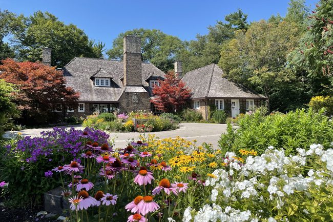
Urban Walk: Riverwood Conservancy Loop
https://hikes.brucetrail.org/event/urban-walk-riverwood-conservancy-loop/Sorry, the registration cut-off time for this hike has been reached.Not a member? Click here to join today!Hosting Club: Toronto
Category: Urban Walk
Location (Google Maps): Toronto transit users meet me outside Islington Subway Station at 8:45, take the tunnel under Islington Ave. to the East side. We will be catching MiWay Bus#26 at 8:59 for a 1 hr journey to our destination, disembarking Burnhamthorpe Road at the Credit Woodlands. Coming directly to the hike, from Burnhamthorpe Road turn onto Riverwood Park Lane and park in the first parking lot on your left. Walk through MacEwan Terrace Garden, turn right past the barn to the Visual Arts Mississauga Building. Wait outside for the Transit group to arrive. Please arrive by 10:00 am. Public washrooms located inside.Hike Leader(s): Andrew Proczek Click here to contact Hike Leader(s)
Pace: Moderate (3-4 km/hr)
Terrain: Level 1 (Easy – mostly on flat, well maintained trails with hard-packed surface), Level 2 (Intermediate – some hills and uneven surfaces, rocks and roots underfoot), Variable
Distance (km): 10-11 kmDescription
Join me for a history loop hike through Riverwood Conservancy and surrounding trails. Before lunch we will loop on the upper Riverwood Trails and after lunch we will tackle the lower trails including the Culham trail along the Credit River.This hike has most of my usual elements: multi surfaces, dirt and packed gravel; some challenging bits; hills, forests and streams; history (3 of Canada’s most impressive Prime Ministers visited or vacationed at Riverwood); and spectacular lookouts. Hiking shoes, long pants and hiking poles are recommended. You can shorten the hike by dropping out at different stages during the hike.
We will take our lunch in the back of Historic Chappell House built in 1919.
The same set public washrooms we will access at the start, just before lunch and at finish of the hike.
Hike Route: https://onthegomap.com/s/ehgoprv9
- 24August 24, 2026No events
- 25August 25, 2026
Urban Walk: Danforth Ravines and Parks
https://hikes.brucetrail.org/event/urban-walk-danforth-ravines-and-parks/Sorry, the registration cut-off time for this hike has been reached.Not a member? Click here to join today!Hosting Club: Toronto
Category: Urban Walk
Location (Google Maps): Danforth Ravines and Parks – Meet in front of Ted Reeve Community Arena at Gerrard Street and Main Street, south of the Main Street Subway Station and the Danforth GO Station. From Main Street station take the Main 64 bus south, or 506 Streetcar to Gerrard.Hike Leader(s): Tom Swales Click here to contact Hike Leader(s)
Pace: Moderate (3-4 km/hr)
Terrain: Variable, Level 2 (Intermediate – some hills and uneven surfaces, rocks and roots underfoot)
Distance (km): 8 kmDescription
Join me for a “shurb”, a short urban walk finishing by lunch time, distance 8-9 km. Alternatively you may join us for lunch or go about your business for the afternoon. We will explore some of the small ravines and parks south of Danforth Avenue on the east side. There will be some moderate climbs and uneven terrain. The hike will finish near Donlands Subway station. Join us for lunch at Square Boy (traditional burgers, souvlaki) or another nearby establishment on the Danforth.Urban Walk: Valley View Park
https://hikes.brucetrail.org/event/car-hike-valley-view-huntington-park-3/Sorry, the registration cut-off time for this hike has been reached.Not a member? Click here to join today!Hosting Club: Toronto
Location (Google Maps): Parking lot is off Sycamore Drive, East of Bayview , across Starbucks plaza
Bus 91 from Finch East station stops at Sycamore station.Hike Leader(s): Mohammad Aghamiri
Pace: Moderate (3-4 km/hr)
Terrain: Hilly, Level 2 (Intermediate – some hills and uneven surfaces, rocks and roots underfoot)
Distance (km): 6-7 kmDescription
We will explore Valleyview and Maple View parks, and walk along German Mills Creek, in return we stop in Huntington park and have snack under beautiful shed.Although this is considered an “Urban Walk”, you can expect some hills up and down and uneven surfaces with tree roots. Please bring hiking poles, water and snacks.
- 26August 26, 2026No events
- 27August 27, 2026
Urban Walk: Valley View Park 225
https://hikes.brucetrail.org/event/car-hike-valley-view-huntington-park-2/Sorry, the registration cut-off time for this hike has been reached.Not a member? Click here to join today!Hosting Club: Toronto
Location (Google Maps): Parking lot is off Sycamore Drive, East of Bayview , across Starbucks plaza
Bus 91 from Finch East station stops at Sycamore station.Hike Leader(s): Mohammad Aghamiri
Pace: Moderate (3-4 km/hr)
Terrain: Hilly, Level 2 (Intermediate – some hills and uneven surfaces, rocks and roots underfoot)
Distance (km): 6-7 kmDescription
We will explore Valleyview and Maple View parks, and walk along German Mill Creak, in return we stop in Huntington park and have snack under beautiful shed.Although this is considered an “Urban Walk”, you can expect some hills up and down and uneven surfaces with tree roots. Please bring hiking poles, water and snacks.
- 28August 28, 2026No events
- 29August 29, 2026
Car Hike: Uxbridge-Brock Track
https://hikes.brucetrail.org/event/car-hike-uxbridge-brock-track-8/Sorry, the registration cut-off time for this hike has been reached.Not a member? Click here to join today!Hosting Club: Toronto
Category: Car Hike
Location (Google Maps):Meet at the Brock Tract parking lot on the east side of Durham 1/Brock Rd., approximately 5 km south of Coppin’s Corners, Uxbridge or 1 km north of Uxbridge Pickering Town Line. 1401 Brock Rd. (Free parking).
Hike Leader(s): Amir Alemohammad Click here to contact Hike Leader(s)
Pace: Moderate (3-4 km/hr)
Terrain: Flat, Hilly, Level 2 (Intermediate – some hills and uneven surfaces, rocks and roots underfoot), Variable
Distance (km): 14-16 kmDescription
Join us for a wonderful hike in Uxbridge starting from Brock Track parking lot. We will hike the Brock Track and Wilder Forest among the amazing trails of Uxbridge.Boots mandatory, poles recommended, bring 2 litres of water and dress according to weather conditions.
Please arrive at 7:45 for a 8:00 start.
Beware, Iphone Maps may take you to the wrong location. Check the location with Google Maps the previous night.
This is a joint hike with Oak Ridges Trail Association (ORTA).
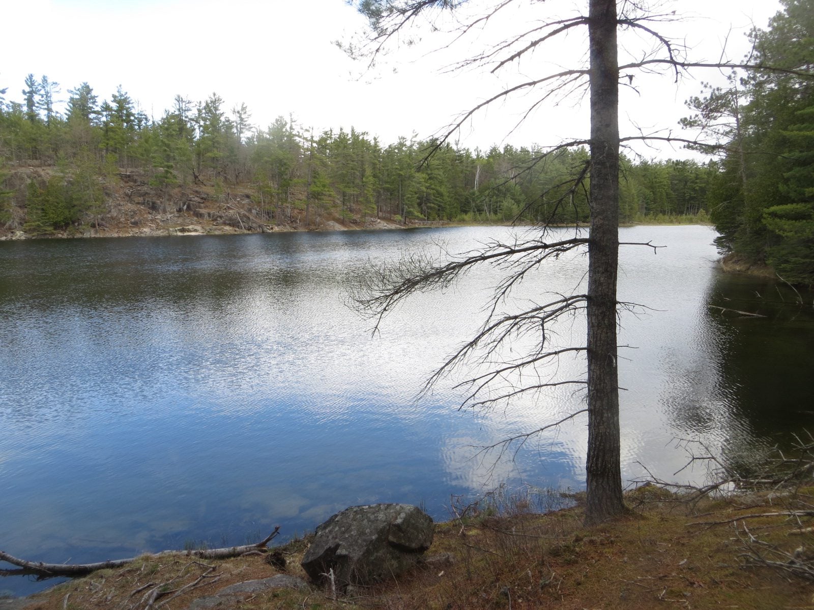
Coach Trip: Petroglyphs Provincial Park
https://hikes.brucetrail.org/event/coach-trip-petroglyphs-provincial-park-2/Sorry, the registration cut-off time for this hike has been reached.Not a member? Click here to join today!Trip Information
Departure Time: 08:00
Return to City Time: 19:00
Departure Point: York Mills Bus PickupTrip Activities
Hiking ($0.01)
Optional ItemsHosting Club: Toronto
Category: Coach Trips
Location (Google Maps): Petroglyphs Provincial ParkHike Leader(s): Robin Crombie, Felix Wan, Brian Rideout, Tom Swales Click here to contact Hike Leader(s)
Pace: Moderate (3-4 km/hr)
Terrain: Hilly, Level 2 (Intermediate – some hills and uneven surfaces, rocks and roots underfoot), Rocky, Variable
Distance (km): 8 or 5.2Description
*Re-scheduled from June*Join us for a visit to Petroglyphs Provincial Park.
Hikers will have the option to join one of two groups.
Group #1 (Robin and Felix):
The day will be divided into two portions. We’ll begin by touring the exhibits and watching a 20-minute video at the Learning Place Visitor Centre to discover the traditions of the Ojibway (Nishnaabe) people, which will be followed by a 45-minute guided tour of the Kinoomaage Waapkong (aka The Teaching Rocks or the Peterborough Petroglyphs), the largest known concentration of Indigenous rock carvings (petroglyphs) in Canada. Afterwards, we will hike along the Nanabush Trail, stopping near Minnow Lake for a lunch break, then continue our hike along the Marsh and West Day Use Trails. The total distance will be approximately 8 km.
Group #2 (Brian and Tom):
After the stop at the Visitor Centre and the tour of the Petroglyphs (see above), we will proceed to the trails to complete a shorter hike of approximately 5.2 km.
The trails are in the heart of the Canadian Shield and are rugged. There are rocks and roots, and some hilly stretches. Bring hiking boots and poles if you have them. Also bring a lunch and snacks, at least 2L of drinking water, rain/sun protection, and insect repellent.
If time permits, we will have a refreshment stop in the town of Lakefield.
Expect a late return to Toronto (approximately 7:00 p.m., traffic conditions permitting).
** The bus fare includes the prorated bus parking permit charge at Petroglyphs Provincial Park and the anticipated fuel surcharge at the time of the trip.
=>>> Please read our Paid Hikes Refund Policy before registering: https://torontobrucetrailclub.org/hikes/no-show-policy”. There will be no refunds for this hike if the registrant cancels or misses the coach on the date of departure for any reason. Registration fees are not transferrable between different hikes nor can unused fares qualify for a tax receipt.
Cherry Beach Down town
https://hikes.brucetrail.org/event/car-hike-glasgow-village-uxbridge-9/Sorry, the registration cut-off time for this hike has been reached.Not a member? Click here to join today!Hosting Club: Toronto
Location (Google Maps): Cherry Beach Parking Lot, at the foot of Cherry Street (Free Parking)
Hike Leader(s): MOHAMMAD AGHAMIRI Click here to contact Hike Leader(s)
Pace: Moderate (3-4 km/hr)
Terrain: Level 1 (Easy – mostly on flat, well maintained trails with hard-packed surface), Variable
Distance (km): 14-15 kmDescription
We will hike along the waterfront trail.At the end of hike you have an option to swimSome safety procedures during the hike:
1-Hikers must stay between the leader and the sweep.
2-Hikers must advise the leader or the sweep if they wish to leave the group.
3- Hikers must follow the whistle instructions: 1 blast- stay where you are; 2 blasts come to the leader; 3 blasts – come to the leader quickly.
4-Hike leader may request volunteers to stop at trail intersections, they need to help hikers to the direction the group walk and wait till they see the sweep .
5-Hikers have to make sure they can see the persons behind and in front of them.
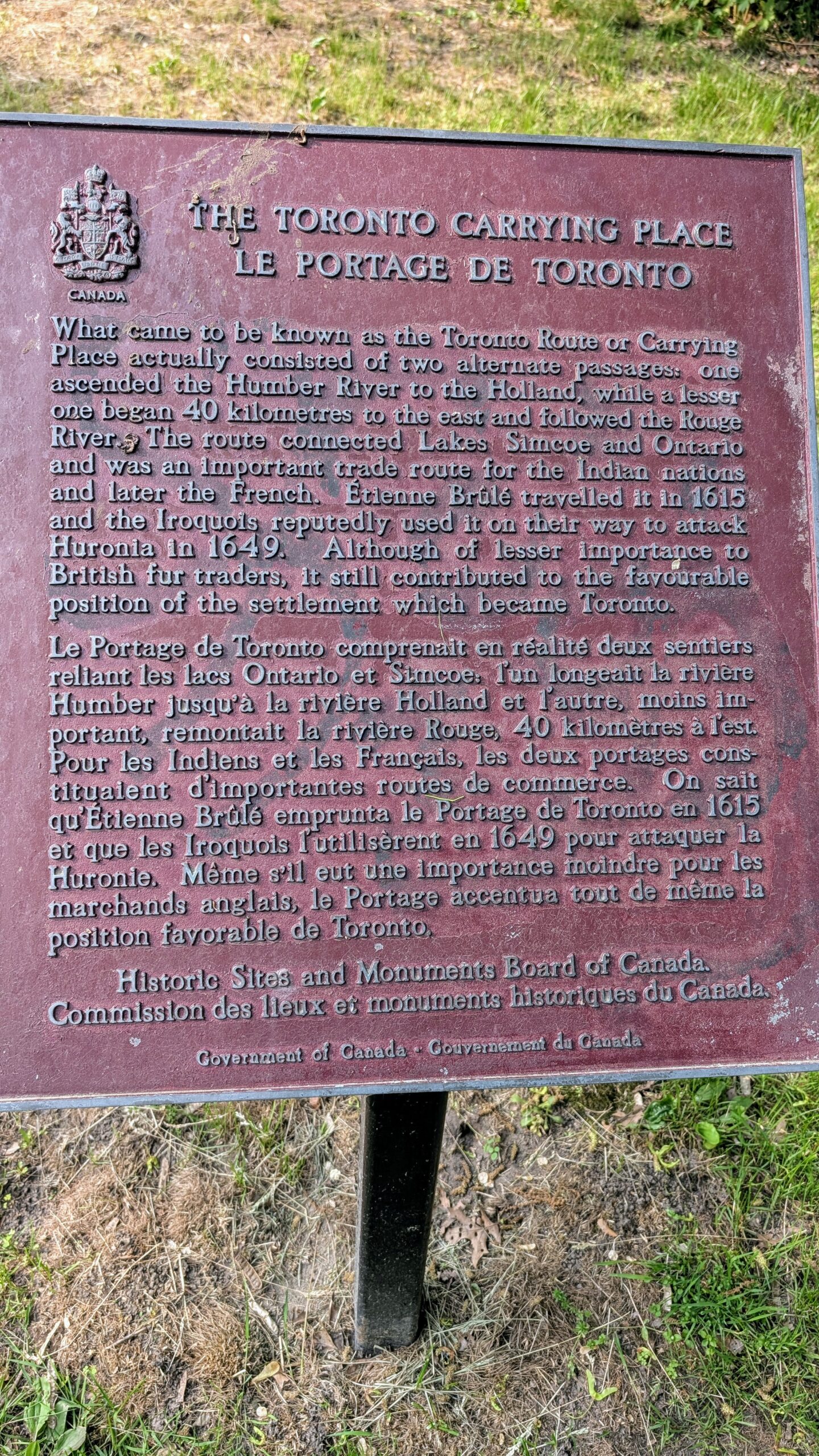
Urban Walk: Humber River Walk
https://hikes.brucetrail.org/event/urban-walk-humber-river-walk/Sorry, the registration cut-off time for this hike has been reached.Not a member? Click here to join today!Hosting Club: Toronto
Category: Urban Walk
Location (Google Maps): Weston – Cruickshank Park, parking lot Lawrence Ave W and Hickory Tree Rd.Hike Leader(s): Janet McColeman Click here to contact Hike Leader(s)
Pace: Moderate (3-4 km/hr)
Terrain: Level 2 (Intermediate – some hills and uneven surfaces, rocks and roots underfoot)
Distance (km): 12kmDescription
A walk down the Humber River & Toronto Carrying Place. We will travel southbound, at a moderate pace, on the Humber River Trail. Starting at 9:00am our walk will include stops at James Gardens, Lambton Woods, Magwood Park, and Baby Point Road. Walk will end at Jane Subway Station. Earlier drop out points along the route. The total length of the walk will be dependent on the weather. Bring water, snacks/lunch, sunscreen, sun hat, and bug/tick spray.Meet in Cruickshank Park by 9:00am Saturday Aug. 29th. There is a small parking lot on the northside of Lawrence Ave West/Hickory Tree Road. The following direct TTC Bus routes pass the park: #89 Weston (from Keele Stn Line 2 or Mount Dennis Line 5), #79 Scarlett Rd (from Runnymede Stn Line 2), and #52 Lawrence West (from Lawrence West Stn Line 1). Weston GO Station is a 10-minute walk from the Park. Sunny weather is in the forecast, a high of 26°C. Join me on a nice sunny day to walk along the Humber River in the heart of Etobicoke.